

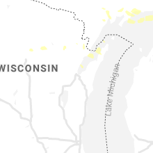
Hail Map for Monday, July 5, 2021

Number of Impacted Households on 7/5/2021
0
Impacted by 1" or Larger Hail
0
Impacted by 1.75" or Larger Hail
0
Impacted by 2.5" or Larger Hail
Square Miles of Populated Area Impacted on 7/5/2021
0
Impacted by 1" or Larger Hail
0
Impacted by 1.75" or Larger Hail
0
Impacted by 2.5" or Larger Hail


Cities Most Affected by Hail Storms of 7/5/2021
| Hail Size | Demographics of Zip Codes Affected | ||||||
|---|---|---|---|---|---|---|---|
| City | Count | Average | Largest | Pop Density | House Value | Income | Age |
| Fort Pierre, SD | 1 | 1.75 | 1.75 | 2 | $85k | $41.6k | 41.8 |
Hail and Wind Damage Spotted on 7/5/2021
Filter by Report Type:Hail ReportsWind Reports
States Impacted
New Mexico, South Dakota, Wyoming, Idaho, Wisconsin, Colorado, North Dakota, Michigan, Iowa, New YorkNew Mexico
| Local Time | Report Details |
|---|---|
| 9:24 AM MDT | Small tree limbs generally less than 1 inch diameter knocked dow in roosevelt county NM, 67.3 miles S of Tucumcari, NM |
South Dakota
| Local Time | Report Details |
|---|---|
| 11:15 AM MDT | Golf Ball sized hail reported near Fort Pierre, SD, 17.5 miles WNW of Pierre, SD |
| 2:45 PM CDT | Mesonet station 285 14w lower brule (sddot in lyman county SD, 31.1 miles SE of Pierre, SD |
| 3:19 PM CDT | Quarter sized hail reported near Chamberlain, SD, 71.4 miles SE of Pierre, SD, most of the hail was pea sized... but some of the stones were as big as quarters. this was accompanied by very heavy rain. |
| 4:16 PM CDT | Mesonet station 201 gann valley (sddot in buffalo county SD, 70.4 miles ESE of Pierre, SD |
| 5:08 PM CDT | Quarter sized hail reported near Freeman, SD, 45 miles WSW of Sioux Falls, SD, some quarter sized hail... but mostly dime sized. very heavy rain estimated at 2 inches so far. wind gusts just before storm were estimated 60+... but nearly calm at mo |
| 5:13 PM MDT | Quarter sized hail reported near Prairie City, SD, 111.7 miles N of Rapid City, SD |
| 5:25 PM MDT | Storm damage reported in meade county SD, 25.7 miles NNW of Rapid City, SD |
| 6:29 PM CDT | Storm damage reported in mccook county SD, 23 miles WNW of Sioux Falls, SD |
| 6:40 PM CDT | Report from mping: 1-inch tree limbs broken; shingles blown of in minnehaha county SD, 5.6 miles W of Sioux Falls, SD |
| 6:54 PM CDT | Storm damage reported in minnehaha county SD, 3 miles W of Sioux Falls, SD |
| 6:56 PM CDT | Trailer tipped over near i-90 mile marker 401 by wind gusts. no injuries reporte in minnehaha county SD, 4.9 miles NNE of Sioux Falls, SD |
| 6:57 PM CDT | Report from mping: 1-inch tree limbs broken; shingles blown of in minnehaha county SD, 1.6 miles ESE of Sioux Falls, SD |
| 6:57 PM CDT | Report from mping: 1-inch tree limbs broken; shingles blown of in minnehaha county SD, 0.7 miles ENE of Sioux Falls, SD |
| 7:11 PM CDT | Report from mping: 1-inch tree limbs broken; shingles blown of in minnehaha county SD, 2.5 miles SSE of Sioux Falls, SD |
| 7:18 PM CDT | Report from mping: 3-inch tree limbs broken; power poles broke in minnehaha county SD, 2.5 miles SSE of Sioux Falls, SD |
| 6:25 PM MDT | Storm damage reported in meade county SD, 36.6 miles NE of Rapid City, SD |
Wyoming
| Local Time | Report Details |
|---|---|
| 5:03 PM MDT | Storm damage reported in custer county SD, 45 miles WSW of Rapid City, SD |
| 5:24 PM MDT | Asos station kriw riverton airpor in fremont county WY, 5.5 miles NW of Riverton, WY |
Idaho
| Local Time | Report Details |
|---|---|
| 5:25 PM MDT | Mesonet station ta in bingham county ID, 34.7 miles WSW of Idaho Falls, ID |
Wisconsin
| Local Time | Report Details |
|---|---|
| 6:43 PM CDT | Downed trees reported. wind gusts measured 40 to 50 mph at wausau downtown airpor in marathon county WI, 48 miles SSW of Rhinelander, WI |
Colorado
| Local Time | Report Details |
|---|---|
| 5:44 PM MDT | Kbk in arapahoe county CO, 12.5 miles E of Denver, CO |
North Dakota
| Local Time | Report Details |
|---|---|
| 5:53 PM MDT | Asos station khei hettinger airpor in adams county ND, 104.6 miles WSW of Bismarck, ND |
Michigan
| Local Time | Report Details |
|---|---|
| 8:35 PM EDT | At least five 12-18 size trees are down on the property due to strong winds. minor damage to one building as one tree fell against i in alcona county MI, 18.9 miles SSE of Alpena, MI |
Iowa
| Local Time | Report Details |
|---|---|
| 7:40 PM CDT | Storm damage reported in lyon county IA, 37.4 miles ESE of Sioux Falls, SD |
| 8:03 PM CDT | Several branches estimated at 6 inches in diameter broken down by wind gust in osceola county IA, 50.1 miles ESE of Sioux Falls, SD |
| 8:05 PM CDT | 6 to 8 inch diameter tree branches broken down by thunderstorm wind gust in osceola county IA, 50.8 miles E of Sioux Falls, SD |
New York
| Local Time | Report Details |
|---|---|
| 9:55 PM EDT | 3 trees down over roa in jefferson county NY, 43.7 miles SSW of Ogdensburg, NY |
| 9:55 PM EDT | Tree down over roadwa in jefferson county NY, 39.8 miles SSW of Ogdensburg, NY |
| 10:43 PM EDT | Quarter sized hail reported near Westmoreland, NY, 38.1 miles E of Syracuse, NY |
| 11:26 PM EDT | Large tree reported down on mulberry street in clinton. time estimated by rada in oneida county NY, 38.9 miles E of Syracuse, NY |
Connect with Interactive Hail Maps