

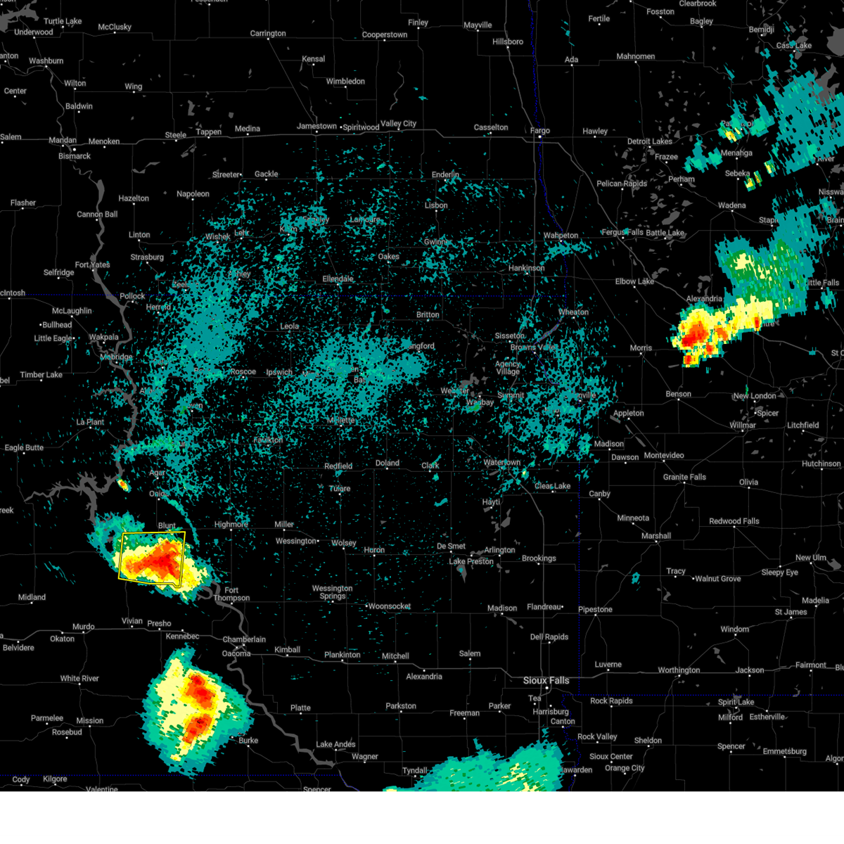
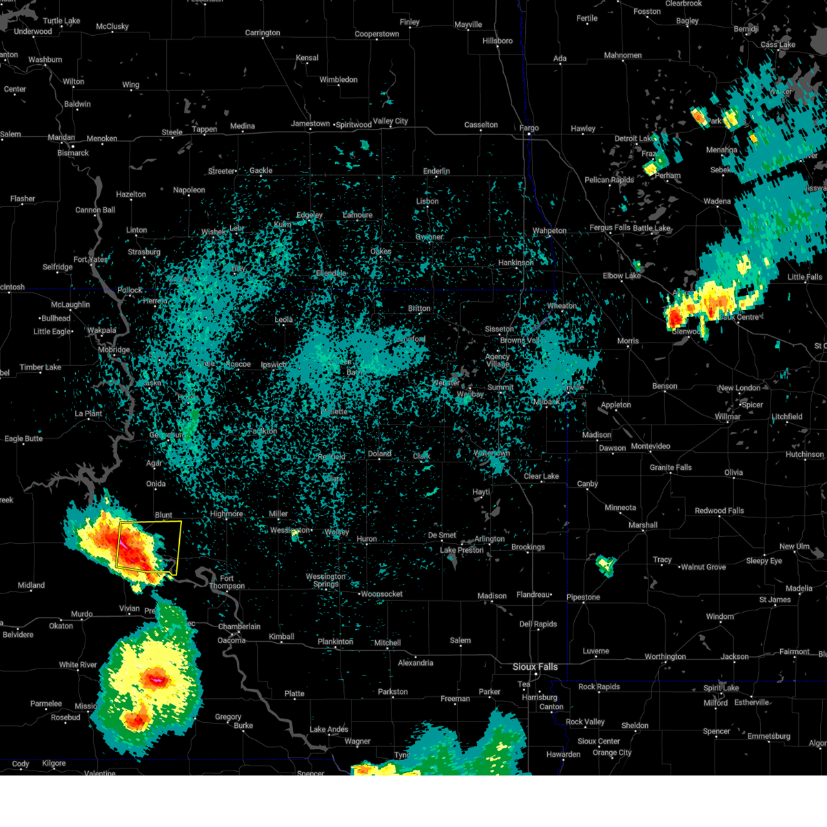
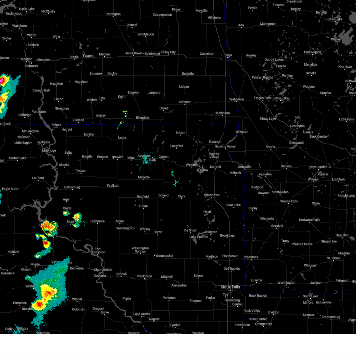
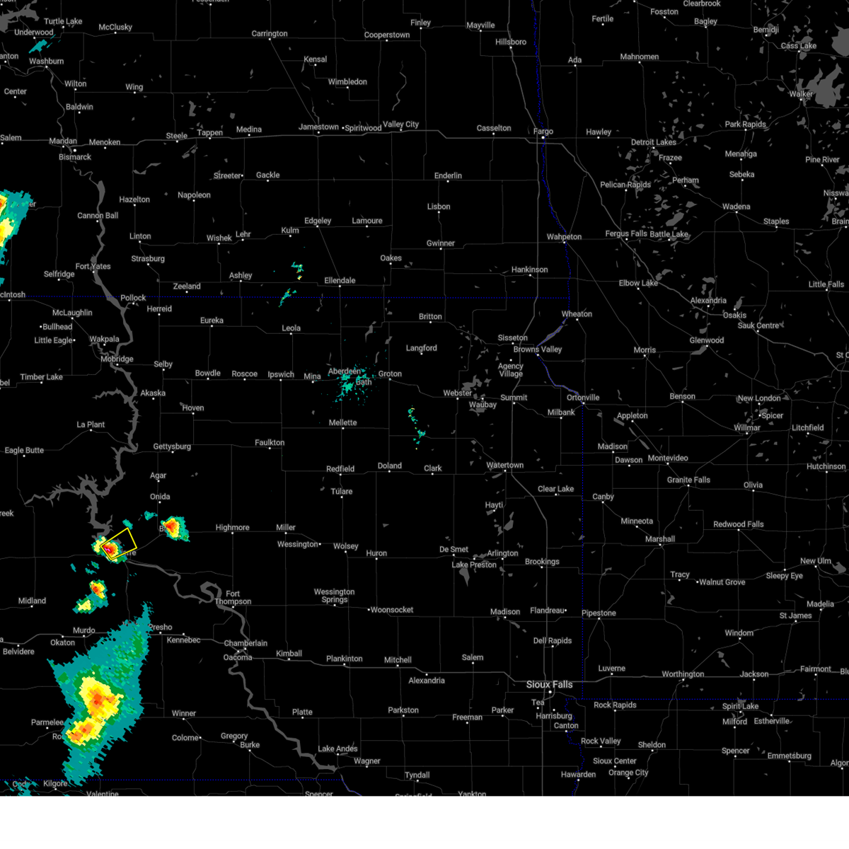
Hail Map for Fort Pierre, SD
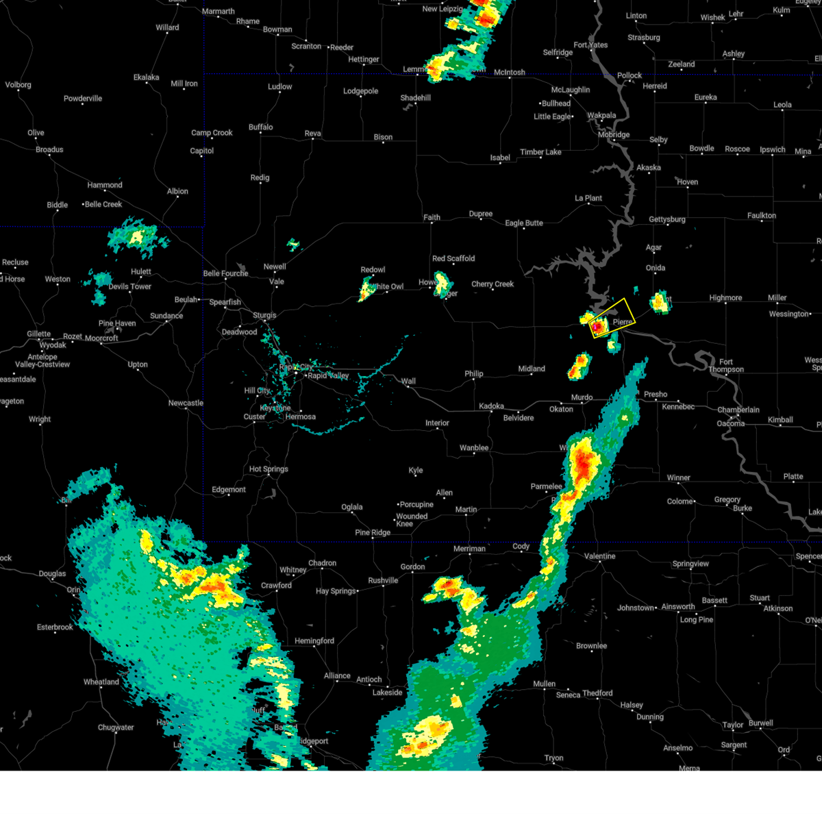
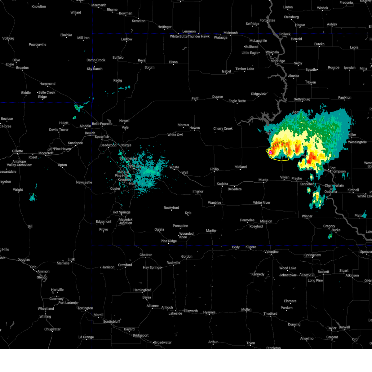
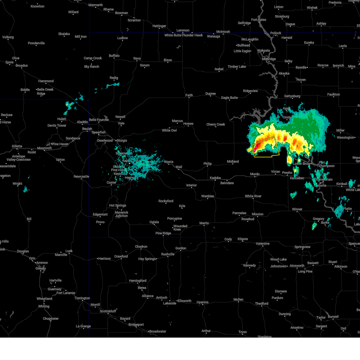
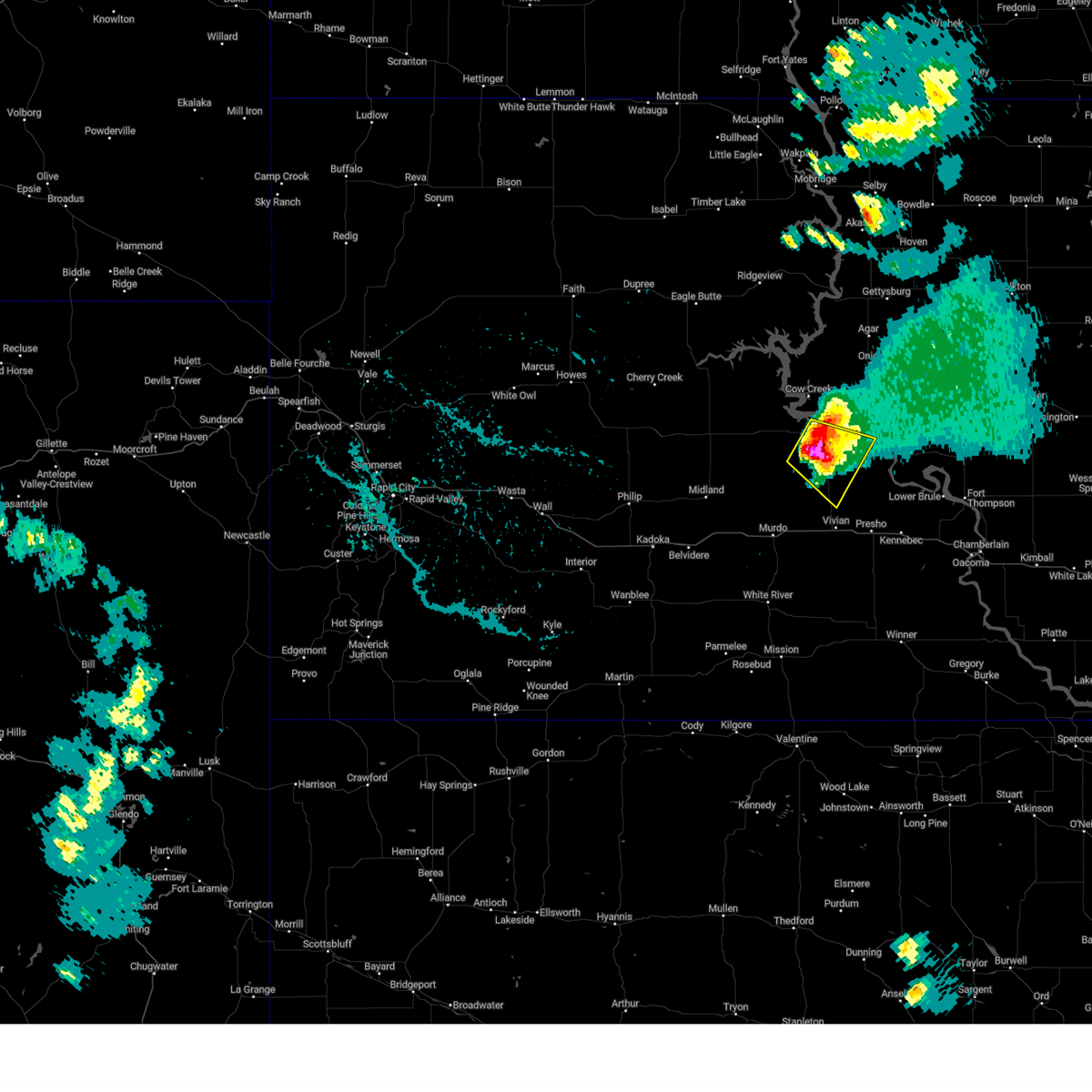
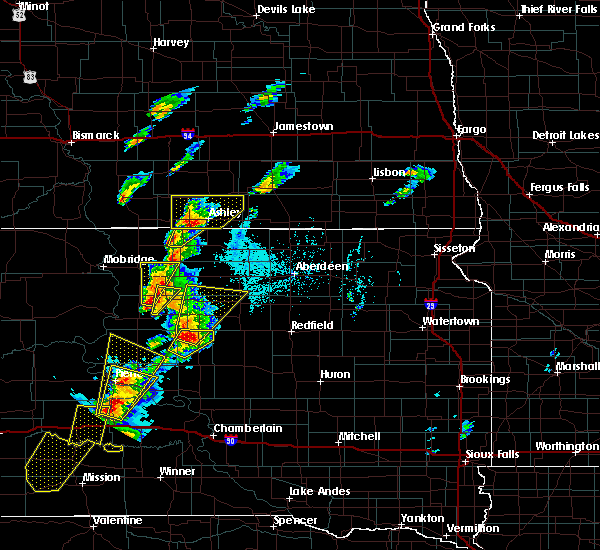
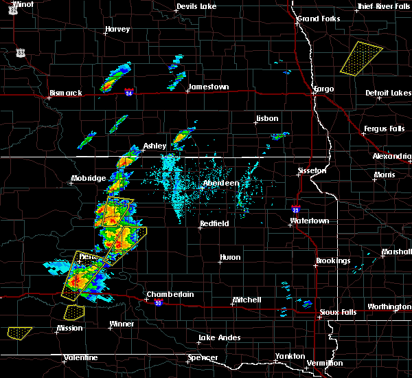
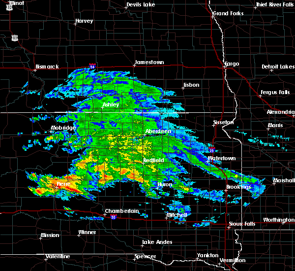
The Fort Pierre, SD area has had 29 reports of on-the-ground hail by trained spotters, and has been under severe weather warnings 11 times during the past 12 months. Doppler radar has detected hail at or near Fort Pierre, SD on 73 occasions, including 8 occasions during the past year.
| Name: | Fort Pierre, SD |
| Where Located: | 1.3 miles W of Pierre, SD |
| Map: | Google Map for Fort Pierre, SD |
| Population: | 2078 |
| Housing Units: | 959 |
| More Info: | Search Google for Fort Pierre, SD |
1
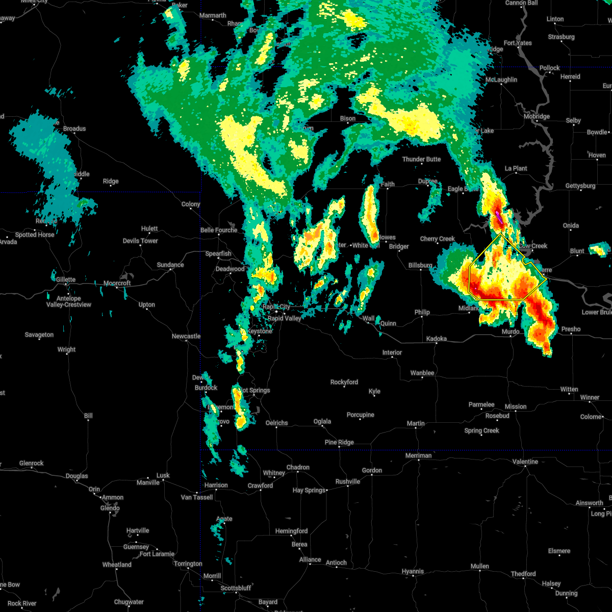
The Top Recent Hail Date for Fort Pierre, SD is Sunday, July 28, 2024 (23rd out of 73)

Hail and Wind Damage Spotted near Fort Pierre, SD
| Date / Time | Report Details |
|---|---|
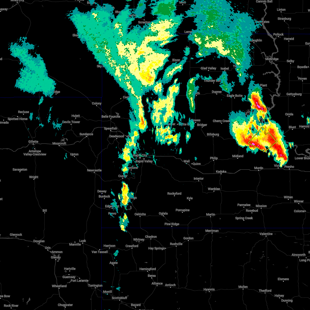
| 8/14/2024 4:19 PM MDT |
 Svrabr the national weather service in aberdeen has issued a * severe thunderstorm warning for, south central stanley county in central south dakota, * until 600 pm cdt. * at 519 pm cdt, a severe thunderstorm was located near wendte, or 15 miles west of fort pierre, moving east at 25 mph (radar indicated). Hazards include 60 mph wind gusts and quarter size hail. Hail damage to vehicles is expected. expect wind damage to roofs, siding, and trees. this severe thunderstorm will be near, wendte around 425 pm mdt. Other locations in the path of this severe thunderstorm include fort pierre. Svrabr the national weather service in aberdeen has issued a * severe thunderstorm warning for, south central stanley county in central south dakota, * until 600 pm cdt. * at 519 pm cdt, a severe thunderstorm was located near wendte, or 15 miles west of fort pierre, moving east at 25 mph (radar indicated). Hazards include 60 mph wind gusts and quarter size hail. Hail damage to vehicles is expected. expect wind damage to roofs, siding, and trees. this severe thunderstorm will be near, wendte around 425 pm mdt. Other locations in the path of this severe thunderstorm include fort pierre.
|
| 7/29/2024 1:25 AM CDT |
 The storm which prompted the warning has weakened below severe limits, and no longer poses an immediate threat to life or property. therefore, the warning will be allowed to expire. The storm which prompted the warning has weakened below severe limits, and no longer poses an immediate threat to life or property. therefore, the warning will be allowed to expire.
|
| 7/29/2024 12:57 AM CDT |
 Svrabr the national weather service in aberdeen has issued a * severe thunderstorm warning for, southeastern stanley county in central south dakota, western hughes county in central south dakota, * until 130 am cdt. * at 1257 am cdt, a severe thunderstorm was located over pierre, moving east at 40 mph (radar indicated). Hazards include 60 mph wind gusts and penny size hail. Expect damage to roofs, siding, and trees. this severe thunderstorm will be near, lake sharpe, rousseau, and canning around 105 am cdt. Other locations in the path of this severe thunderstorm include degrey rec area. Svrabr the national weather service in aberdeen has issued a * severe thunderstorm warning for, southeastern stanley county in central south dakota, western hughes county in central south dakota, * until 130 am cdt. * at 1257 am cdt, a severe thunderstorm was located over pierre, moving east at 40 mph (radar indicated). Hazards include 60 mph wind gusts and penny size hail. Expect damage to roofs, siding, and trees. this severe thunderstorm will be near, lake sharpe, rousseau, and canning around 105 am cdt. Other locations in the path of this severe thunderstorm include degrey rec area.
|
| 7/27/2024 7:07 PM MDT |
 the severe thunderstorm warning has been cancelled and is no longer in effect the severe thunderstorm warning has been cancelled and is no longer in effect
|
| 7/27/2024 6:57 PM MDT |
 At 756 pm cdt, a severe thunderstorm was located over west shore rec area, or near fort pierre, moving northeast at 20 mph (radar indicated). Hazards include 60 mph wind gusts and quarter size hail. Hail damage to vehicles is expected. expect wind damage to roofs, siding, and trees. this severe storm will be near, lake sharpe and overlook rec area around 800 pm cdt. west shore rec area around 700 pm mdt. Other locations in the path of this severe thunderstorm include grey goose. At 756 pm cdt, a severe thunderstorm was located over west shore rec area, or near fort pierre, moving northeast at 20 mph (radar indicated). Hazards include 60 mph wind gusts and quarter size hail. Hail damage to vehicles is expected. expect wind damage to roofs, siding, and trees. this severe storm will be near, lake sharpe and overlook rec area around 800 pm cdt. west shore rec area around 700 pm mdt. Other locations in the path of this severe thunderstorm include grey goose.
|
| 7/27/2024 6:43 PM MDT |
 Svrabr the national weather service in aberdeen has issued a * severe thunderstorm warning for, south central stanley county in central south dakota, northwestern hughes county in central south dakota, * until 830 pm cdt. * at 742 pm cdt, a severe thunderstorm was located 7 miles southwest of west shore rec area, or 8 miles west of fort pierre, moving east at 15 mph (radar indicated). Hazards include 60 mph wind gusts and quarter size hail. Hail damage to vehicles is expected. expect wind damage to roofs, siding, and trees. this severe thunderstorm will be near, fort pierre and west shore rec area around 650 pm mdt. pierre and lake sharpe around 755 pm cdt. overlook rec area around 800 pm cdt. Other locations in the path of this severe thunderstorm include grey goose. Svrabr the national weather service in aberdeen has issued a * severe thunderstorm warning for, south central stanley county in central south dakota, northwestern hughes county in central south dakota, * until 830 pm cdt. * at 742 pm cdt, a severe thunderstorm was located 7 miles southwest of west shore rec area, or 8 miles west of fort pierre, moving east at 15 mph (radar indicated). Hazards include 60 mph wind gusts and quarter size hail. Hail damage to vehicles is expected. expect wind damage to roofs, siding, and trees. this severe thunderstorm will be near, fort pierre and west shore rec area around 650 pm mdt. pierre and lake sharpe around 755 pm cdt. overlook rec area around 800 pm cdt. Other locations in the path of this severe thunderstorm include grey goose.
|
| 7/14/2024 10:35 AM MDT | Damage to grain bins at local agricultural service. time estimated based on radar dat in stanley county SD, 0.2 miles SE of Fort Pierre, SD |
| 7/14/2024 2:20 AM CDT |
 Svrabr the national weather service in aberdeen has issued a * severe thunderstorm warning for, eastern jones county in central south dakota, hand county in central south dakota, sully county in central south dakota, hyde county in central south dakota, southern faulk county in north central south dakota, southern potter county in north central south dakota, southeastern stanley county in central south dakota, hughes county in central south dakota, southern spink county in northeastern south dakota, lyman county in central south dakota, buffalo county in central south dakota, * until 315 am cdt. * at 220 am cdt, severe thunderstorms were located along a line extending from near burkmere to 8 miles east of iona, moving east at 55 mph (radar indicated). Hazards include 70 mph wind gusts. Expect considerable tree damage. damage is likely to mobile homes, roofs, and outbuildings. severe thunderstorms will be near, miller, faulkton, miller dale colony, shelby, orient, ree heights, gann valley, polo, etbauer hill, and sunshine bible academy around 225 am cdt. st. lawrence, miranda, and pleasant valley country church around 230 am cdt. burdette, rockham, devoe, and danforth around 235 am cdt. zell, vayland, and rosehill dam around 240 am cdt. Other locations in the path of these severe thunderstorms include cottonwood lake, redfield, athol, twin lakes, tulare, ashton, spottswood and hitchcock. Svrabr the national weather service in aberdeen has issued a * severe thunderstorm warning for, eastern jones county in central south dakota, hand county in central south dakota, sully county in central south dakota, hyde county in central south dakota, southern faulk county in north central south dakota, southern potter county in north central south dakota, southeastern stanley county in central south dakota, hughes county in central south dakota, southern spink county in northeastern south dakota, lyman county in central south dakota, buffalo county in central south dakota, * until 315 am cdt. * at 220 am cdt, severe thunderstorms were located along a line extending from near burkmere to 8 miles east of iona, moving east at 55 mph (radar indicated). Hazards include 70 mph wind gusts. Expect considerable tree damage. damage is likely to mobile homes, roofs, and outbuildings. severe thunderstorms will be near, miller, faulkton, miller dale colony, shelby, orient, ree heights, gann valley, polo, etbauer hill, and sunshine bible academy around 225 am cdt. st. lawrence, miranda, and pleasant valley country church around 230 am cdt. burdette, rockham, devoe, and danforth around 235 am cdt. zell, vayland, and rosehill dam around 240 am cdt. Other locations in the path of these severe thunderstorms include cottonwood lake, redfield, athol, twin lakes, tulare, ashton, spottswood and hitchcock.
|
| 7/14/2024 1:59 AM CDT | Mesonet station rfps2 vivian 13 in lyman county SD, 17.5 miles NNW of Fort Pierre, SD |
| 7/14/2024 1:50 AM CDT |
 At 148 am cdt/1248 am mdt/, severe thunderstorms were located along a line extending from 8 miles south of lowry to 9 miles south of earling hill, moving east at 50 mph (radar indicated). Hazards include 70 mph wind gusts. Expect considerable tree damage. damage is likely to mobile homes, roofs, and outbuildings. Locations impacted include, kennebec, harrold, lebanon, lake sharpe, joe creek rec area, lyman, west bend rec area, stone lake, byre lake, holabird, lower brule, reliance, seneca, medicine butte, fort thompson, highmore, stephan, onaka, lake francis case, counselor creek boat access area, tailrace rec area, oacoma, dude ranch, brentwood colony, thunderbird colony, burkmere, lees corner, shelby, ree heights, norbeck, crow creek housing and etbauer hill. At 148 am cdt/1248 am mdt/, severe thunderstorms were located along a line extending from 8 miles south of lowry to 9 miles south of earling hill, moving east at 50 mph (radar indicated). Hazards include 70 mph wind gusts. Expect considerable tree damage. damage is likely to mobile homes, roofs, and outbuildings. Locations impacted include, kennebec, harrold, lebanon, lake sharpe, joe creek rec area, lyman, west bend rec area, stone lake, byre lake, holabird, lower brule, reliance, seneca, medicine butte, fort thompson, highmore, stephan, onaka, lake francis case, counselor creek boat access area, tailrace rec area, oacoma, dude ranch, brentwood colony, thunderbird colony, burkmere, lees corner, shelby, ree heights, norbeck, crow creek housing and etbauer hill.
|
| 7/14/2024 1:27 AM CDT |
 Svrabr the national weather service in aberdeen has issued a * severe thunderstorm warning for, jones county in central south dakota, western hand county in central south dakota, sully county in central south dakota, hyde county in central south dakota, western faulk county in north central south dakota, potter county in north central south dakota, stanley county in central south dakota, southeastern dewey county in north central south dakota, hughes county in central south dakota, lyman county in central south dakota, western buffalo county in central south dakota, * until 230 am cdt/130 am mdt/. * at 126 am cdt/1226 am mdt/, severe thunderstorms were located along a line extending from 6 miles south of swan creek rec area to 12 miles south of 5 mile corner, moving east at 50 mph. these are destructive storms (radar indicated). Hazards include 80 mph wind gusts. Flying debris will be dangerous to those caught without shelter. mobile homes will be heavily damaged. expect considerable damage to roofs, windows, and vehicles. extensive tree damage and power outages are likely. severe thunderstorms will be near, onida, presho, agar, lake sharpe, rousseau, gorman, canning, earling hill, sully lake, and 5 mile corner around 130 am cdt. gettysburg, blunt, cedar creek rec area, cottonwood lake near agar, degrey rec area, and fate dam around 135 am cdt. kennebec and byre lake around 140 am cdt. harrold, lebanon, joe creek rec area, and stone lake around 145 am cdt. Other locations in the path of these severe thunderstorms include lyman, west bend rec area, lower brule, reliance, holabird, medicine butte, seneca, onaka, lake francis case, counselor creek boat access area, fort thompson, highmore, stephan, tailrace rec area and dude ranch. Svrabr the national weather service in aberdeen has issued a * severe thunderstorm warning for, jones county in central south dakota, western hand county in central south dakota, sully county in central south dakota, hyde county in central south dakota, western faulk county in north central south dakota, potter county in north central south dakota, stanley county in central south dakota, southeastern dewey county in north central south dakota, hughes county in central south dakota, lyman county in central south dakota, western buffalo county in central south dakota, * until 230 am cdt/130 am mdt/. * at 126 am cdt/1226 am mdt/, severe thunderstorms were located along a line extending from 6 miles south of swan creek rec area to 12 miles south of 5 mile corner, moving east at 50 mph. these are destructive storms (radar indicated). Hazards include 80 mph wind gusts. Flying debris will be dangerous to those caught without shelter. mobile homes will be heavily damaged. expect considerable damage to roofs, windows, and vehicles. extensive tree damage and power outages are likely. severe thunderstorms will be near, onida, presho, agar, lake sharpe, rousseau, gorman, canning, earling hill, sully lake, and 5 mile corner around 130 am cdt. gettysburg, blunt, cedar creek rec area, cottonwood lake near agar, degrey rec area, and fate dam around 135 am cdt. kennebec and byre lake around 140 am cdt. harrold, lebanon, joe creek rec area, and stone lake around 145 am cdt. Other locations in the path of these severe thunderstorms include lyman, west bend rec area, lower brule, reliance, holabird, medicine butte, seneca, onaka, lake francis case, counselor creek boat access area, fort thompson, highmore, stephan, tailrace rec area and dude ranch.
|
| 7/14/2024 12:08 AM MDT | Mesonet station 202 hayes (sddot in stanley county SD, 19.5 miles E of Fort Pierre, SD |
| 7/14/2024 1:00 AM CDT |
 At 100 am cdt, severe thunderstorms were located along a line extending from 6 miles east of sansarc to 8 miles southeast of philip, moving east at 65 mph. these are destructive storms (radar indicated). Hazards include 80 mph wind gusts. Flying debris will be dangerous to those caught without shelter. mobile homes will be heavily damaged. expect considerable damage to roofs, windows, and vehicles. extensive tree damage and power outages are likely. these severe storms will be near, bunker around 1205 am mdt. Other locations in the path of these severe thunderstorms include capa, van metre, wendte, pierre, okaton, lake sharpe, fort pierre, murdo, draper, rousseau, westover, intersection of highway 83 and white river, vivian and degrey rec area. At 100 am cdt, severe thunderstorms were located along a line extending from 6 miles east of sansarc to 8 miles southeast of philip, moving east at 65 mph. these are destructive storms (radar indicated). Hazards include 80 mph wind gusts. Flying debris will be dangerous to those caught without shelter. mobile homes will be heavily damaged. expect considerable damage to roofs, windows, and vehicles. extensive tree damage and power outages are likely. these severe storms will be near, bunker around 1205 am mdt. Other locations in the path of these severe thunderstorms include capa, van metre, wendte, pierre, okaton, lake sharpe, fort pierre, murdo, draper, rousseau, westover, intersection of highway 83 and white river, vivian and degrey rec area.
|
| 7/13/2024 11:54 PM MDT | Mesonet station 202 hayes (sddot in stanley county SD, 19.5 miles E of Fort Pierre, SD |
| 7/14/2024 12:46 AM CDT |
 Svrabr the national weather service in aberdeen has issued a * severe thunderstorm warning for, jones county in central south dakota, southern stanley county in central south dakota, central hughes county in central south dakota, northwestern lyman county in central south dakota, * until 145 am cdt. * at 1246 am cdt, severe thunderstorms were located along a line extending from near sansarc to philip, moving east at 65 mph (radar indicated). Hazards include 70 mph wind gusts. Expect considerable tree damage. damage is likely to mobile homes, roofs, and outbuildings. severe thunderstorms will be near, hayes and brown church around 1150 pm mdt. bunker around 1155 pm mdt. capa around 105 am cdt. Other locations in the path of these severe thunderstorms include van metre, wendte, pierre, okaton, lake sharpe, fort pierre, murdo, draper, westover, rousseau, vivian, intersection of highway 83 and white river and degrey rec area. Svrabr the national weather service in aberdeen has issued a * severe thunderstorm warning for, jones county in central south dakota, southern stanley county in central south dakota, central hughes county in central south dakota, northwestern lyman county in central south dakota, * until 145 am cdt. * at 1246 am cdt, severe thunderstorms were located along a line extending from near sansarc to philip, moving east at 65 mph (radar indicated). Hazards include 70 mph wind gusts. Expect considerable tree damage. damage is likely to mobile homes, roofs, and outbuildings. severe thunderstorms will be near, hayes and brown church around 1150 pm mdt. bunker around 1155 pm mdt. capa around 105 am cdt. Other locations in the path of these severe thunderstorms include van metre, wendte, pierre, okaton, lake sharpe, fort pierre, murdo, draper, westover, rousseau, vivian, intersection of highway 83 and white river and degrey rec area.
|
| 6/28/2024 12:02 AM CDT |
 Svrabr the national weather service in aberdeen has issued a * severe thunderstorm warning for, southern sully county in central south dakota, southwestern hyde county in central south dakota, central stanley county in central south dakota, hughes county in central south dakota, north central lyman county in central south dakota, * until 115 am cdt. * at 1202 am cdt, a severe thunderstorm was located over spring creek rec area, or 13 miles north of fort pierre, moving east at 40 mph (radar indicated). Hazards include 60 mph wind gusts and quarter size hail. Hail damage to vehicles is expected. expect wind damage to roofs, siding, and trees. this severe thunderstorm will be near, spring creek rec area, grey goose, lake sharpe, and overlook rec area around 1205 am cdt. west shore rec area around 1105 pm mdt. pierre around 1220 am cdt. Other locations in the path of this severe thunderstorm include canning. Svrabr the national weather service in aberdeen has issued a * severe thunderstorm warning for, southern sully county in central south dakota, southwestern hyde county in central south dakota, central stanley county in central south dakota, hughes county in central south dakota, north central lyman county in central south dakota, * until 115 am cdt. * at 1202 am cdt, a severe thunderstorm was located over spring creek rec area, or 13 miles north of fort pierre, moving east at 40 mph (radar indicated). Hazards include 60 mph wind gusts and quarter size hail. Hail damage to vehicles is expected. expect wind damage to roofs, siding, and trees. this severe thunderstorm will be near, spring creek rec area, grey goose, lake sharpe, and overlook rec area around 1205 am cdt. west shore rec area around 1105 pm mdt. pierre around 1220 am cdt. Other locations in the path of this severe thunderstorm include canning.
|
| 6/27/2024 11:07 PM CDT |
 Svrabr the national weather service in aberdeen has issued a * severe thunderstorm warning for, sully county in central south dakota, west central hyde county in central south dakota, stanley county in central south dakota, south central dewey county in north central south dakota, hughes county in central south dakota, * until midnight cdt/1100 pm mdt/. * at 1106 pm cdt/1006 pm mdt/, a severe thunderstorm was located near cow creek rec area, or 16 miles north of fort pierre, moving east at 45 mph (radar indicated). Hazards include 60 mph wind gusts and quarter size hail. Hail damage to vehicles is expected. expect wind damage to roofs, siding, and trees. this severe thunderstorm will be near, grey goose around 1110 pm cdt. Other locations in the path of this severe thunderstorm include blunt and harrold. Svrabr the national weather service in aberdeen has issued a * severe thunderstorm warning for, sully county in central south dakota, west central hyde county in central south dakota, stanley county in central south dakota, south central dewey county in north central south dakota, hughes county in central south dakota, * until midnight cdt/1100 pm mdt/. * at 1106 pm cdt/1006 pm mdt/, a severe thunderstorm was located near cow creek rec area, or 16 miles north of fort pierre, moving east at 45 mph (radar indicated). Hazards include 60 mph wind gusts and quarter size hail. Hail damage to vehicles is expected. expect wind damage to roofs, siding, and trees. this severe thunderstorm will be near, grey goose around 1110 pm cdt. Other locations in the path of this severe thunderstorm include blunt and harrold.
|
| 6/27/2024 9:52 PM MDT | Time estimated from rada in stanley county SD, 32.9 miles E of Fort Pierre, SD |
| 6/27/2024 9:50 PM MDT | Mesonet station 202 hayes (sddot in stanley county SD, 19.5 miles E of Fort Pierre, SD |
| 6/27/2024 10:42 AM MDT | Relayed via faceboo in stanley county SD, 32.1 miles E of Fort Pierre, SD |
| 6/15/2024 10:59 PM CDT | Mesonet station rfps2 vivian 13 in lyman county SD, 17.5 miles NNW of Fort Pierre, SD |
| 5/19/2024 6:15 PM MDT | Mesonet station 202 hayes (sddot in stanley county SD, 19.5 miles E of Fort Pierre, SD |
| 9/20/2023 7:55 PM MDT | Golf Ball sized hail reported 32.2 miles E of Fort Pierre, SD |
| 9/7/2023 12:32 PM CDT |
 At 1231 pm cdt, a severe thunderstorm was located 7 miles northeast of wendte, or 8 miles southwest of fort pierre, moving east at 15 mph (radar indicated). Hazards include 60 mph wind gusts and quarter size hail. Hail damage to vehicles is expected. expect wind damage to roofs, siding, and trees. locations impacted include, pierre and fort pierre. hail threat, radar indicated max hail size, 1. 00 in wind threat, radar indicated max wind gust, 60 mph. At 1231 pm cdt, a severe thunderstorm was located 7 miles northeast of wendte, or 8 miles southwest of fort pierre, moving east at 15 mph (radar indicated). Hazards include 60 mph wind gusts and quarter size hail. Hail damage to vehicles is expected. expect wind damage to roofs, siding, and trees. locations impacted include, pierre and fort pierre. hail threat, radar indicated max hail size, 1. 00 in wind threat, radar indicated max wind gust, 60 mph.
|
| 9/7/2023 12:14 PM CDT |
 At 1213 pm cdt, a severe thunderstorm was located over wendte, or 14 miles southwest of fort pierre, moving east at 20 mph (radar indicated). Hazards include 60 mph wind gusts and quarter size hail. Hail damage to vehicles is expected. Expect wind damage to roofs, siding, and trees. At 1213 pm cdt, a severe thunderstorm was located over wendte, or 14 miles southwest of fort pierre, moving east at 20 mph (radar indicated). Hazards include 60 mph wind gusts and quarter size hail. Hail damage to vehicles is expected. Expect wind damage to roofs, siding, and trees.
|
| 9/7/2023 10:32 AM MDT | Half Dollar sized hail reported 26.7 miles E of Fort Pierre, SD |
| 7/26/2023 7:35 PM CDT | Mesonet station rfps2 vivian 13 n. radar estimated tim in lyman county SD, 17.5 miles NNW of Fort Pierre, SD |
| 7/26/2023 7:00 PM CDT | Storm damage reported in stanley county SD, 4.7 miles N of Fort Pierre, SD |
| 7/26/2023 6:58 PM CDT |
 At 656 pm cdt, a severe thunderstorm was located near fort pierre, moving southeast at 20 mph (radar indicated). Hazards include golf ball size hail and 70 mph wind gusts. People and animals outdoors will be injured. expect hail damage to roofs, siding, windows, and vehicles. expect considerable tree damage. wind damage is also likely to mobile homes, roofs, and outbuildings. This severe thunderstorm will be near, pierre around 700 pm cdt. At 656 pm cdt, a severe thunderstorm was located near fort pierre, moving southeast at 20 mph (radar indicated). Hazards include golf ball size hail and 70 mph wind gusts. People and animals outdoors will be injured. expect hail damage to roofs, siding, windows, and vehicles. expect considerable tree damage. wind damage is also likely to mobile homes, roofs, and outbuildings. This severe thunderstorm will be near, pierre around 700 pm cdt.
|
| 7/26/2023 6:56 PM CDT | Half Dollar sized hail reported 0.5 miles NNE of Fort Pierre, SD |
| 7/26/2023 6:48 PM CDT |
 At 647 pm cdt, a severe thunderstorm was located over pierre, moving east at 30 mph (public. golf ball size hail was reported 12 miles northwest of pierre at 614 pm cdt). Hazards include golf ball size hail and 70 mph wind gusts. People and animals outdoors will be injured. expect hail damage to roofs, siding, windows, and vehicles. expect considerable tree damage. wind damage is also likely to mobile homes, roofs, and outbuildings. this severe thunderstorm will remain over mainly rural areas of south central stanley and northwestern hughes counties. thunderstorm damage threat, considerable hail threat, observed max hail size, 1. 75 in wind threat, radar indicated max wind gust, 70 mph. At 647 pm cdt, a severe thunderstorm was located over pierre, moving east at 30 mph (public. golf ball size hail was reported 12 miles northwest of pierre at 614 pm cdt). Hazards include golf ball size hail and 70 mph wind gusts. People and animals outdoors will be injured. expect hail damage to roofs, siding, windows, and vehicles. expect considerable tree damage. wind damage is also likely to mobile homes, roofs, and outbuildings. this severe thunderstorm will remain over mainly rural areas of south central stanley and northwestern hughes counties. thunderstorm damage threat, considerable hail threat, observed max hail size, 1. 75 in wind threat, radar indicated max wind gust, 70 mph.
|
| 7/26/2023 5:14 PM MDT | Golf Ball sized hail reported 11.7 miles ESE of Fort Pierre, SD, hail covering the ground... up to ping pong and golf ball size. estimated 50 to 60 mph winds as well... first form the west and then from the southeast... changing dire |
| 7/26/2023 5:13 PM MDT |
 At 613 pm cdt, a severe thunderstorm was located over chantier creek recreation area, or 13 miles northwest of fort pierre, moving east at 25 mph (radar indicated). Hazards include two inch hail and 70 mph wind gusts. People and animals outdoors will be injured. expect hail damage to roofs, siding, windows, and vehicles. expect considerable tree damage. wind damage is also likely to mobile homes, roofs, and outbuildings. this severe thunderstorm will be near, oahe mission rec area around 620 pm cdt. west shore rec area around 530 pm mdt. other locations in the path of this severe thunderstorm include overlook rec area, fort pierre and pierre. thunderstorm damage threat, considerable hail threat, radar indicated max hail size, 2. 00 in wind threat, radar indicated max wind gust, 70 mph. At 613 pm cdt, a severe thunderstorm was located over chantier creek recreation area, or 13 miles northwest of fort pierre, moving east at 25 mph (radar indicated). Hazards include two inch hail and 70 mph wind gusts. People and animals outdoors will be injured. expect hail damage to roofs, siding, windows, and vehicles. expect considerable tree damage. wind damage is also likely to mobile homes, roofs, and outbuildings. this severe thunderstorm will be near, oahe mission rec area around 620 pm cdt. west shore rec area around 530 pm mdt. other locations in the path of this severe thunderstorm include overlook rec area, fort pierre and pierre. thunderstorm damage threat, considerable hail threat, radar indicated max hail size, 2. 00 in wind threat, radar indicated max wind gust, 70 mph.
|
| 7/18/2023 5:45 PM MDT | Baseball sized hail reported 0.2 miles SE of Fort Pierre, SD, photo submitted via facebook. |
| 7/18/2023 6:24 PM CDT |
 At 624 pm cdt, a severe thunderstorm was located near pierre, moving east at 40 mph (radar indicated). Hazards include two inch hail and 60 mph wind gusts. People and animals outdoors will be injured. expect hail damage to roofs, siding, windows, and vehicles. expect wind damage to roofs, siding, and trees. locations impacted include, rousseau, canning and degrey rec area. thunderstorm damage threat, considerable hail threat, radar indicated max hail size, 2. 00 in wind threat, radar indicated max wind gust, 60 mph. At 624 pm cdt, a severe thunderstorm was located near pierre, moving east at 40 mph (radar indicated). Hazards include two inch hail and 60 mph wind gusts. People and animals outdoors will be injured. expect hail damage to roofs, siding, windows, and vehicles. expect wind damage to roofs, siding, and trees. locations impacted include, rousseau, canning and degrey rec area. thunderstorm damage threat, considerable hail threat, radar indicated max hail size, 2. 00 in wind threat, radar indicated max wind gust, 60 mph.
|
| 7/18/2023 6:08 PM CDT |
 At 608 pm cdt, a severe thunderstorm was located over overlook rec area, or near fort pierre, moving east at 45 mph (radar indicated). Hazards include 60 mph wind gusts and quarter size hail. Hail damage to vehicles is expected. expect wind damage to roofs, siding, and trees. this severe thunderstorm will be near, pierre around 615 pm cdt. other locations in the path of this severe thunderstorm include rousseau, canning and degrey rec area. hail threat, radar indicated max hail size, 1. 00 in wind threat, radar indicated max wind gust, 60 mph. At 608 pm cdt, a severe thunderstorm was located over overlook rec area, or near fort pierre, moving east at 45 mph (radar indicated). Hazards include 60 mph wind gusts and quarter size hail. Hail damage to vehicles is expected. expect wind damage to roofs, siding, and trees. this severe thunderstorm will be near, pierre around 615 pm cdt. other locations in the path of this severe thunderstorm include rousseau, canning and degrey rec area. hail threat, radar indicated max hail size, 1. 00 in wind threat, radar indicated max wind gust, 60 mph.
|
| 7/3/2023 10:50 PM MDT |
 At 1149 pm cdt, a severe thunderstorm was located 8 miles southeast of wendte, or 17 miles southwest of fort pierre, moving north at 15 mph (radar indicated). Hazards include 60 mph wind gusts and quarter size hail. Hail damage to vehicles is expected. Expect wind damage to roofs, siding, and trees. At 1149 pm cdt, a severe thunderstorm was located 8 miles southeast of wendte, or 17 miles southwest of fort pierre, moving north at 15 mph (radar indicated). Hazards include 60 mph wind gusts and quarter size hail. Hail damage to vehicles is expected. Expect wind damage to roofs, siding, and trees.
|
| 8/26/2022 11:54 PM CDT | The severe thunderstorm warning for jones and stanley counties will expire at midnight cdt, the storms which prompted the warning have weakened below severe limits, and no longer pose an immediate threat to life or property. therefore, the warning will be allowed to expire. however gusty winds are still possible with these thunderstorms. |
| 8/26/2022 11:12 PM CDT | At 1112 pm cdt, severe thunderstorms were located along a line extending from 8 miles northeast of kirley to near belvidere, moving east at 55 mph (radar indicated). Hazards include 60 mph wind gusts and penny size hail. Expect damage to roofs, siding, and trees. severe thunderstorms will be near, sansarc around 1020 pm mdt. okaton around 1125 pm cdt. other locations in the path of these severe thunderstorms include murdo, westover and draper. hail threat, radar indicated max hail size, 0. 75 in wind threat, radar indicated max wind gust, 60 mph. |
| 8/5/2022 6:59 PM CDT | Mesonet station rfps2 vivian 13 in lyman county SD, 17.5 miles NNW of Fort Pierre, SD |
| 7/5/2022 11:49 AM CDT |
 At 1148 am cdt/1048 am mdt/, severe thunderstorms were located along a line extending from near harrold to pierre, moving southeast at 50 mph (trained weather spotters. this storm has a history of producing 60 to 70 mph winds in the pierre area). Hazards include 70 mph wind gusts and quarter size hail. Hail damage to vehicles is expected. expect considerable tree damage. wind damage is also likely to mobile homes, roofs, and outbuildings. locations impacted include, pierre, fort pierre, blunt, harrold, grey goose, overlook rec area, west shore rec area, canning and holabird. thunderstorm damage threat, considerable hail threat, radar indicated max hail size, 1. 00 in wind threat, observed max wind gust, 70 mph. At 1148 am cdt/1048 am mdt/, severe thunderstorms were located along a line extending from near harrold to pierre, moving southeast at 50 mph (trained weather spotters. this storm has a history of producing 60 to 70 mph winds in the pierre area). Hazards include 70 mph wind gusts and quarter size hail. Hail damage to vehicles is expected. expect considerable tree damage. wind damage is also likely to mobile homes, roofs, and outbuildings. locations impacted include, pierre, fort pierre, blunt, harrold, grey goose, overlook rec area, west shore rec area, canning and holabird. thunderstorm damage threat, considerable hail threat, radar indicated max hail size, 1. 00 in wind threat, observed max wind gust, 70 mph.
|
| 7/5/2022 11:47 AM CDT |
 At 1145 am cdt/1045 am mdt/, severe thunderstorms were located along a line extending from harrold to near pierre, moving southeast at 50 mph (trained weather spotters. this storm has a history of producing 60 to 70 mph winds in the pierre area). Hazards include 70 mph wind gusts and quarter size hail. Hail damage to vehicles is expected. expect considerable tree damage. wind damage is also likely to mobile homes, roofs, and outbuildings. severe thunderstorms will be near, harrold around 1150 am cdt. holabird around 1155 am cdt. highmore and rousseau around 1200 pm cdt. other locations in the path of these severe thunderstorms include cedar creek rec area and joe creek rec area. thunderstorm damage threat, considerable hail threat, radar indicated max hail size, 1. 00 in wind threat, observed max wind gust, 70 mph. At 1145 am cdt/1045 am mdt/, severe thunderstorms were located along a line extending from harrold to near pierre, moving southeast at 50 mph (trained weather spotters. this storm has a history of producing 60 to 70 mph winds in the pierre area). Hazards include 70 mph wind gusts and quarter size hail. Hail damage to vehicles is expected. expect considerable tree damage. wind damage is also likely to mobile homes, roofs, and outbuildings. severe thunderstorms will be near, harrold around 1150 am cdt. holabird around 1155 am cdt. highmore and rousseau around 1200 pm cdt. other locations in the path of these severe thunderstorms include cedar creek rec area and joe creek rec area. thunderstorm damage threat, considerable hail threat, radar indicated max hail size, 1. 00 in wind threat, observed max wind gust, 70 mph.
|
| 7/5/2022 11:37 AM CDT |
 At 1137 am cdt/1037 am mdt/, severe thunderstorms were located along a line extending from 9 miles northeast of blunt to near west shore rec area, moving southeast at 40 mph (trained weather spotters. at 1115 am cdt, a 60 mph wind gust was reported at the lake oahe dam). Hazards include 70 mph wind gusts and quarter size hail. Hail damage to vehicles is expected. expect considerable tree damage. wind damage is also likely to mobile homes, roofs, and outbuildings. locations impacted include, harrold and holabird. thunderstorm damage threat, considerable hail threat, radar indicated max hail size, 1. 00 in wind threat, observed max wind gust, 70 mph. At 1137 am cdt/1037 am mdt/, severe thunderstorms were located along a line extending from 9 miles northeast of blunt to near west shore rec area, moving southeast at 40 mph (trained weather spotters. at 1115 am cdt, a 60 mph wind gust was reported at the lake oahe dam). Hazards include 70 mph wind gusts and quarter size hail. Hail damage to vehicles is expected. expect considerable tree damage. wind damage is also likely to mobile homes, roofs, and outbuildings. locations impacted include, harrold and holabird. thunderstorm damage threat, considerable hail threat, radar indicated max hail size, 1. 00 in wind threat, observed max wind gust, 70 mph.
|
| 7/5/2022 10:15 AM MDT | Occurred at oahe da in stanley county SD, 5.8 miles SSE of Fort Pierre, SD |
| 7/5/2022 11:12 AM CDT |
 At 1111 am cdt/1011 am mdt/, severe thunderstorms were located along a line extending from near sully lake to 6 miles northwest of okobojo point rec area, moving southeast at 50 mph (radar indicated). Hazards include 70 mph wind gusts and quarter size hail. Hail damage to vehicles is expected. expect considerable tree damage. wind damage is also likely to mobile homes, roofs, and outbuildings. severe thunderstorms will be near, sully lake around 1115 am cdt. onida and oahe mission rec area around 1120 am cdt. grey goose and overlook rec area around 1130 am cdt. southern lake oahe around 1030 am mdt. other locations in the path of these severe thunderstorms include harrold, blunt, canning and holabird. thunderstorm damage threat, considerable hail threat, radar indicated max hail size, 1. 00 in wind threat, radar indicated max wind gust, 70 mph. At 1111 am cdt/1011 am mdt/, severe thunderstorms were located along a line extending from near sully lake to 6 miles northwest of okobojo point rec area, moving southeast at 50 mph (radar indicated). Hazards include 70 mph wind gusts and quarter size hail. Hail damage to vehicles is expected. expect considerable tree damage. wind damage is also likely to mobile homes, roofs, and outbuildings. severe thunderstorms will be near, sully lake around 1115 am cdt. onida and oahe mission rec area around 1120 am cdt. grey goose and overlook rec area around 1130 am cdt. southern lake oahe around 1030 am mdt. other locations in the path of these severe thunderstorms include harrold, blunt, canning and holabird. thunderstorm damage threat, considerable hail threat, radar indicated max hail size, 1. 00 in wind threat, radar indicated max wind gust, 70 mph.
|
| 7/4/2022 12:14 AM CDT | Fort pierre raw in lyman county SD, 17.5 miles NNW of Fort Pierre, SD |
| 7/3/2022 1:04 AM CDT |
 At 104 am cdt/1204 am mdt/, a severe thunderstorm was located near pierre, moving east at 40 mph (radar indicated). Hazards include 60 mph wind gusts. Expect damage to roofs, siding, and trees. this severe thunderstorm will be near, rousseau around 115 am cdt. canning around 120 am cdt. other locations in the path of this severe thunderstorm include degrey rec area and harrold. hail threat, radar indicated max hail size, <. 75 in wind threat, radar indicated max wind gust, 60 mph. At 104 am cdt/1204 am mdt/, a severe thunderstorm was located near pierre, moving east at 40 mph (radar indicated). Hazards include 60 mph wind gusts. Expect damage to roofs, siding, and trees. this severe thunderstorm will be near, rousseau around 115 am cdt. canning around 120 am cdt. other locations in the path of this severe thunderstorm include degrey rec area and harrold. hail threat, radar indicated max hail size, <. 75 in wind threat, radar indicated max wind gust, 60 mph.
|
| 6/24/2022 5:39 PM MDT | Quarter sized hail reported 30.6 miles SE of Fort Pierre, SD, a few quarters... mostly smaller and covering the ground. |
| 6/20/2022 7:33 PM CDT |
 At 733 pm cdt/633 pm mdt/, a severe thunderstorm was located near pierre, moving northeast at 55 mph (trained weather spotters). Hazards include 80 mph wind gusts. Flying debris will be dangerous to those caught without shelter. mobile homes will be heavily damaged. expect considerable damage to roofs, windows, and vehicles. extensive tree damage and power outages are likely. this severe thunderstorm will be near, canning around 740 pm cdt. blunt around 750 pm cdt. Other locations in the path of this severe thunderstorm include harrold and holabird. At 733 pm cdt/633 pm mdt/, a severe thunderstorm was located near pierre, moving northeast at 55 mph (trained weather spotters). Hazards include 80 mph wind gusts. Flying debris will be dangerous to those caught without shelter. mobile homes will be heavily damaged. expect considerable damage to roofs, windows, and vehicles. extensive tree damage and power outages are likely. this severe thunderstorm will be near, canning around 740 pm cdt. blunt around 750 pm cdt. Other locations in the path of this severe thunderstorm include harrold and holabird.
|
| 6/20/2022 7:32 PM CDT | Storm damage reported in stanley county SD, 0.5 miles NNE of Fort Pierre, SD |
| 6/20/2022 6:30 PM MDT |
 At 729 pm cdt/629 pm mdt/, a severe thunderstorm was located over fort pierre, moving northeast at 50 mph (trained weather spotters). Hazards include 80 mph wind gusts and quarter size hail. Flying debris will be dangerous to those caught without shelter. mobile homes will be heavily damaged. expect considerable damage to roofs, windows, and vehicles. extensive tree damage and power outages are likely. Locations impacted include, pierre, fort pierre, grey goose, spring creek rec area, oahe mission rec area, wendte, chantier creek recreation area, overlook rec area, okobojo point rec area, cow creek rec area and west shore rec area. At 729 pm cdt/629 pm mdt/, a severe thunderstorm was located over fort pierre, moving northeast at 50 mph (trained weather spotters). Hazards include 80 mph wind gusts and quarter size hail. Flying debris will be dangerous to those caught without shelter. mobile homes will be heavily damaged. expect considerable damage to roofs, windows, and vehicles. extensive tree damage and power outages are likely. Locations impacted include, pierre, fort pierre, grey goose, spring creek rec area, oahe mission rec area, wendte, chantier creek recreation area, overlook rec area, okobojo point rec area, cow creek rec area and west shore rec area.
|
| 6/20/2022 6:25 PM MDT | Mesonet station 202 hayes (sddot in stanley county SD, 19.5 miles E of Fort Pierre, SD |
| 6/20/2022 6:21 PM MDT | Mesonet station 202 hayes (sddot in stanley county SD, 19.5 miles E of Fort Pierre, SD |
| 6/20/2022 6:21 PM MDT |
 At 720 pm cdt/620 pm mdt/, a severe thunderstorm was located 7 miles west of fort pierre, moving northeast at 45 mph. this is a destructive storm for the pierre area (trained weather spotters). Hazards include 80 mph wind gusts and quarter size hail. Flying debris will be dangerous to those caught without shelter. mobile homes will be heavily damaged. expect considerable damage to roofs, windows, and vehicles. extensive tree damage and power outages are likely. Locations impacted include, pierre, fort pierre, west shore rec area, overlook rec area, grey goose and southern lake oahe. At 720 pm cdt/620 pm mdt/, a severe thunderstorm was located 7 miles west of fort pierre, moving northeast at 45 mph. this is a destructive storm for the pierre area (trained weather spotters). Hazards include 80 mph wind gusts and quarter size hail. Flying debris will be dangerous to those caught without shelter. mobile homes will be heavily damaged. expect considerable damage to roofs, windows, and vehicles. extensive tree damage and power outages are likely. Locations impacted include, pierre, fort pierre, west shore rec area, overlook rec area, grey goose and southern lake oahe.
|
| 6/20/2022 6:03 PM MDT |
 At 703 pm cdt/603 pm mdt/, a severe thunderstorm was located near van metre, or 21 miles west of fort pierre, moving northeast at 50 mph (radar indicated). Hazards include 80 mph wind gusts and quarter size hail. Flying debris will be dangerous to those caught without shelter. mobile homes will be heavily damaged. expect considerable damage to roofs, windows, and vehicles. extensive tree damage and power outages are likely. this severe thunderstorm will be near, wendte around 610 pm mdt. Other locations in the path of this severe thunderstorm include pierre, fort pierre, west shore rec area, overlook rec area and southern lake oahe. At 703 pm cdt/603 pm mdt/, a severe thunderstorm was located near van metre, or 21 miles west of fort pierre, moving northeast at 50 mph (radar indicated). Hazards include 80 mph wind gusts and quarter size hail. Flying debris will be dangerous to those caught without shelter. mobile homes will be heavily damaged. expect considerable damage to roofs, windows, and vehicles. extensive tree damage and power outages are likely. this severe thunderstorm will be near, wendte around 610 pm mdt. Other locations in the path of this severe thunderstorm include pierre, fort pierre, west shore rec area, overlook rec area and southern lake oahe.
|
| 6/14/2022 2:18 AM CDT |
 At 218 am cdt/118 am mdt/, a severe thunderstorm was located near pierre, moving northeast at 45 mph (radar indicated). Hazards include 70 mph wind gusts and ping pong ball size hail. People and animals outdoors will be injured. expect hail damage to roofs, siding, windows, and vehicles. expect considerable tree damage. wind damage is also likely to mobile homes, roofs, and outbuildings. locations impacted include, canning and blunt. thunderstorm damage threat, considerable hail threat, radar indicated max hail size, 1. 50 in wind threat, radar indicated max wind gust, 70 mph. At 218 am cdt/118 am mdt/, a severe thunderstorm was located near pierre, moving northeast at 45 mph (radar indicated). Hazards include 70 mph wind gusts and ping pong ball size hail. People and animals outdoors will be injured. expect hail damage to roofs, siding, windows, and vehicles. expect considerable tree damage. wind damage is also likely to mobile homes, roofs, and outbuildings. locations impacted include, canning and blunt. thunderstorm damage threat, considerable hail threat, radar indicated max hail size, 1. 50 in wind threat, radar indicated max wind gust, 70 mph.
|
| 6/14/2022 1:15 AM MDT |
 At 215 am cdt/115 am mdt/, severe thunderstorms were located along a line extending from 7 miles northeast of sansarc to 8 miles southwest of fort pierre, moving northeast at 55 mph (radar indicated). Hazards include 60 mph wind gusts and nickel size hail. Expect damage to roofs, siding, and trees. locations impacted include, fort pierre, wendte and chantier creek recreation area. hail threat, radar indicated max hail size, 0. 88 in wind threat, radar indicated max wind gust, 60 mph. At 215 am cdt/115 am mdt/, severe thunderstorms were located along a line extending from 7 miles northeast of sansarc to 8 miles southwest of fort pierre, moving northeast at 55 mph (radar indicated). Hazards include 60 mph wind gusts and nickel size hail. Expect damage to roofs, siding, and trees. locations impacted include, fort pierre, wendte and chantier creek recreation area. hail threat, radar indicated max hail size, 0. 88 in wind threat, radar indicated max wind gust, 60 mph.
|
| 6/14/2022 1:06 AM MDT |
 At 206 am cdt/106 am mdt/, severe thunderstorms were located along a line extending from near sansarc to near wendte, moving northeast at 55 mph (radar indicated). Hazards include golf ball size hail and 70 mph wind gusts. People and animals outdoors will be injured. expect hail damage to roofs, siding, windows, and vehicles. expect considerable tree damage. wind damage is also likely to mobile homes, roofs, and outbuildings. locations impacted include, fort pierre and southern lake oahe. thunderstorm damage threat, considerable hail threat, radar indicated max hail size, 1. 75 in wind threat, radar indicated max wind gust, 70 mph. At 206 am cdt/106 am mdt/, severe thunderstorms were located along a line extending from near sansarc to near wendte, moving northeast at 55 mph (radar indicated). Hazards include golf ball size hail and 70 mph wind gusts. People and animals outdoors will be injured. expect hail damage to roofs, siding, windows, and vehicles. expect considerable tree damage. wind damage is also likely to mobile homes, roofs, and outbuildings. locations impacted include, fort pierre and southern lake oahe. thunderstorm damage threat, considerable hail threat, radar indicated max hail size, 1. 75 in wind threat, radar indicated max wind gust, 70 mph.
|
| 6/14/2022 1:57 AM CDT |
 At 157 am cdt/1257 am mdt/, a severe thunderstorm was located 11 miles east of wendte, or 13 miles south of fort pierre, moving northeast at 45 mph (radar indicated). Hazards include 70 mph wind gusts and ping pong ball size hail. People and animals outdoors will be injured. expect hail damage to roofs, siding, windows, and vehicles. expect considerable tree damage. wind damage is also likely to mobile homes, roofs, and outbuildings. this severe thunderstorm will be near, pierre around 215 am cdt. fort pierre around 115 am mdt. other locations in the path of this severe thunderstorm include canning and blunt. thunderstorm damage threat, considerable hail threat, radar indicated max hail size, 1. 50 in wind threat, radar indicated max wind gust, 70 mph. At 157 am cdt/1257 am mdt/, a severe thunderstorm was located 11 miles east of wendte, or 13 miles south of fort pierre, moving northeast at 45 mph (radar indicated). Hazards include 70 mph wind gusts and ping pong ball size hail. People and animals outdoors will be injured. expect hail damage to roofs, siding, windows, and vehicles. expect considerable tree damage. wind damage is also likely to mobile homes, roofs, and outbuildings. this severe thunderstorm will be near, pierre around 215 am cdt. fort pierre around 115 am mdt. other locations in the path of this severe thunderstorm include canning and blunt. thunderstorm damage threat, considerable hail threat, radar indicated max hail size, 1. 50 in wind threat, radar indicated max wind gust, 70 mph.
|
| 6/14/2022 12:43 AM MDT |
 At 143 am cdt/1243 am mdt/, severe thunderstorms were located along a line extending from near ottumwa to near okaton, moving northeast at 55 mph. these are destructive storms (radar indicated). Hazards include 80 mph wind gusts and tennis ball size hail. Flying debris will be dangerous to those caught without shelter. mobile homes will be heavily damaged. expect considerable damage to roofs, windows, and vehicles. extensive tree damage and power outages are likely. severe thunderstorms will be near, van metre around 155 am cdt. brown church around 1255 am mdt. hayes around 100 am mdt. other locations in the path of these severe thunderstorms include sansarc, wendte, fort pierre and southern lake oahe. thunderstorm damage threat, destructive hail threat, observed max hail size, 2. 50 in wind threat, observed max wind gust, 80 mph. At 143 am cdt/1243 am mdt/, severe thunderstorms were located along a line extending from near ottumwa to near okaton, moving northeast at 55 mph. these are destructive storms (radar indicated). Hazards include 80 mph wind gusts and tennis ball size hail. Flying debris will be dangerous to those caught without shelter. mobile homes will be heavily damaged. expect considerable damage to roofs, windows, and vehicles. extensive tree damage and power outages are likely. severe thunderstorms will be near, van metre around 155 am cdt. brown church around 1255 am mdt. hayes around 100 am mdt. other locations in the path of these severe thunderstorms include sansarc, wendte, fort pierre and southern lake oahe. thunderstorm damage threat, destructive hail threat, observed max hail size, 2. 50 in wind threat, observed max wind gust, 80 mph.
|
| 6/12/2022 10:56 PM MDT | Report from mping: 1-inch tree limbs broken; shingles blown of in stanley county SD, 4.4 miles S of Fort Pierre, SD |
| 8/26/2021 11:49 PM MDT | Mesonet station 202 hayes (sddot in stanley county SD, 19.5 miles E of Fort Pierre, SD |
| 8/19/2021 6:05 PM MDT | Mesonet station 202 hayes (sddot in stanley county SD, 19.5 miles E of Fort Pierre, SD |
| 8/14/2021 5:57 PM MDT | Quarter sized hail reported 9.1 miles E of Fort Pierre, SD |
| 8/6/2021 10:47 PM CDT | Radar estimated tim in lyman county SD, 17.5 miles NNW of Fort Pierre, SD |
| 7/25/2021 5:37 PM CDT |
 At 537 pm cdt/437 pm mdt/, a severe thunderstorm was located over fort pierre, moving east at 20 mph (radar indicated). Hazards include 60 mph wind gusts and quarter size hail. Hail damage to vehicles is expected. expect wind damage to roofs, siding, and trees. This severe thunderstorm will be near, pierre around 540 pm cdt. At 537 pm cdt/437 pm mdt/, a severe thunderstorm was located over fort pierre, moving east at 20 mph (radar indicated). Hazards include 60 mph wind gusts and quarter size hail. Hail damage to vehicles is expected. expect wind damage to roofs, siding, and trees. This severe thunderstorm will be near, pierre around 540 pm cdt.
|
| 7/5/2021 11:15 AM MDT | Golf Ball sized hail reported 16.4 miles ESE of Fort Pierre, SD |
| 8/27/2020 11:57 PM CDT | The severe thunderstorm warning for southeastern sully, northwestern hyde, southeastern stanley, hughes and northwestern lyman counties will expire at midnight cdt/1100 pm mdt/, the storm which prompted the warning has moved out of the area. therefore, the warning will be allowed to expire. however gusty winds are still possible with this thunderstorm. a severe thunderstorm watch remains in effect until 200 am cdt/100 am mdt/ for central south dakota. a severe thunderstorm watch also remains in effect until 500 am cdt/400 am mdt/ for central south dakota. |
| 8/27/2020 11:46 PM CDT | At 1145 pm cdt/1045 pm mdt/, a severe thunderstorm was located near canning, or 21 miles east of pierre, moving east at 70 mph (public). Hazards include 70 mph wind gusts and penny size hail. Expect considerable tree damage. damage is likely to mobile homes, roofs, and outbuildings. Locations impacted include, pierre, fort pierre, onida, blunt, harrold, grey goose, cedar creek rec area, fate dam, rousseau, joe creek rec area, canning, sully lake, overlook rec area, lake sharpe, byre lake, degrey rec area and west bend rec area. |
| 8/27/2020 10:31 PM MDT |
 At 1129 pm cdt/1029 pm mdt/, a severe thunderstorm was located over pierre, moving east at 70 mph. this is a very dangerous storm (public. at 1100 pm cdt, 97 mph winds were reported 2 miles east northeast of bunker. additional winds greater than 70 mph were reported near hayes). Hazards include 80 mph wind gusts and penny size hail. Flying debris will be dangerous to those caught without shelter. mobile homes will be heavily damaged. expect considerable damage to roofs, windows, and vehicles. extensive tree damage and power outages are likely. Locations impacted include, pierre, fort pierre, onida, presho, blunt, kennebec, vivian, harrold, draper, cedar creek rec area, fate dam, spring creek rec area, van metre, lake sharpe, west shore rec area, degrey rec area, west bend rec area, grey goose, rousseau and mission ridge. At 1129 pm cdt/1029 pm mdt/, a severe thunderstorm was located over pierre, moving east at 70 mph. this is a very dangerous storm (public. at 1100 pm cdt, 97 mph winds were reported 2 miles east northeast of bunker. additional winds greater than 70 mph were reported near hayes). Hazards include 80 mph wind gusts and penny size hail. Flying debris will be dangerous to those caught without shelter. mobile homes will be heavily damaged. expect considerable damage to roofs, windows, and vehicles. extensive tree damage and power outages are likely. Locations impacted include, pierre, fort pierre, onida, presho, blunt, kennebec, vivian, harrold, draper, cedar creek rec area, fate dam, spring creek rec area, van metre, lake sharpe, west shore rec area, degrey rec area, west bend rec area, grey goose, rousseau and mission ridge.
|
| 8/27/2020 10:30 PM MDT | Trees down. approximate location and tim in stanley county SD, 5.1 miles S of Fort Pierre, SD |
| 8/27/2020 10:14 PM MDT | Mesonet station 202 hayes (sddot in stanley county SD, 19.5 miles E of Fort Pierre, SD |
| 8/27/2020 10:12 PM MDT |
 At 1112 pm cdt/1012 pm mdt/, a severe thunderstorm was located 7 miles southwest of chantier creek recreation area, or 15 miles west of fort pierre, moving east at 70 mph. this is a very dangerous storm (radar indicated). Hazards include 80 mph wind gusts and quarter size hail. Flying debris will be dangerous to those caught without shelter. mobile homes will be heavily damaged. expect considerable damage to roofs, windows, and vehicles. Extensive tree damage and power outages are likely. At 1112 pm cdt/1012 pm mdt/, a severe thunderstorm was located 7 miles southwest of chantier creek recreation area, or 15 miles west of fort pierre, moving east at 70 mph. this is a very dangerous storm (radar indicated). Hazards include 80 mph wind gusts and quarter size hail. Flying debris will be dangerous to those caught without shelter. mobile homes will be heavily damaged. expect considerable damage to roofs, windows, and vehicles. Extensive tree damage and power outages are likely.
|
| 8/27/2020 10:09 PM MDT | Personal weather statio in stanley county SD, 24.6 miles E of Fort Pierre, SD |
| 8/27/2020 10:00 PM MDT | Personal weather station. radar estimated time and approximate locatio in stanley county SD, 34.8 miles ENE of Fort Pierre, SD |
| 8/26/2020 3:45 PM MDT | Ping Pong Ball sized hail reported 28.7 miles ESE of Fort Pierre, SD, time estimated. |
| 8/7/2020 1:50 AM CDT |
 The severe thunderstorm warning for southwestern sully, eastern stanley, southeastern dewey and northwestern hughes counties will expire at 200 am cdt/100 am mdt/, the storm which prompted the warning has weakened below severe limits, and no longer poses an immediate threat to life or property. therefore, the warning will be allowed to expire. however gusty winds and heavy rain are still possible with this thunderstorm. The severe thunderstorm warning for southwestern sully, eastern stanley, southeastern dewey and northwestern hughes counties will expire at 200 am cdt/100 am mdt/, the storm which prompted the warning has weakened below severe limits, and no longer poses an immediate threat to life or property. therefore, the warning will be allowed to expire. however gusty winds and heavy rain are still possible with this thunderstorm.
|
| 8/7/2020 1:34 AM CDT |
 At 134 am cdt/1234 am mdt/, a severe thunderstorm was located 7 miles east of grey goose, or 12 miles northeast of pierre, moving east at 40 mph (radar indicated). Hazards include 60 mph wind gusts. Expect damage to roofs, siding, and trees. Locations impacted include, pierre, fort pierre, onida, blunt, grey goose, bush`s landing, rousseau, spring creek rec area, little bend rec area, oahe mission rec area, canning, wendte, chantier creek recreation area, sully lake, okobojo point rec area, overlook rec area, cow creek rec area and west shore rec area. At 134 am cdt/1234 am mdt/, a severe thunderstorm was located 7 miles east of grey goose, or 12 miles northeast of pierre, moving east at 40 mph (radar indicated). Hazards include 60 mph wind gusts. Expect damage to roofs, siding, and trees. Locations impacted include, pierre, fort pierre, onida, blunt, grey goose, bush`s landing, rousseau, spring creek rec area, little bend rec area, oahe mission rec area, canning, wendte, chantier creek recreation area, sully lake, okobojo point rec area, overlook rec area, cow creek rec area and west shore rec area.
|
| 8/7/2020 1:10 AM CDT |
 At 110 am cdt/1210 am mdt/, a severe thunderstorm was located over southern lake oahe, or 13 miles northwest of fort pierre, moving east at 40 mph (radar indicated). Hazards include 60 mph wind gusts. expect damage to roofs, siding, and trees At 110 am cdt/1210 am mdt/, a severe thunderstorm was located over southern lake oahe, or 13 miles northwest of fort pierre, moving east at 40 mph (radar indicated). Hazards include 60 mph wind gusts. expect damage to roofs, siding, and trees
|
| 8/6/2020 11:54 PM MDT | Storm damage reported in stanley county SD, 20 miles E of Fort Pierre, SD |
| 7/31/2020 7:25 PM CDT |
 At 724 pm cdt/624 pm mdt/, severe thunderstorms were located along a line extending from 8 miles east of canning to near okaton, moving southeast at 40 mph (trained weather spotters. at 7 pm cdt a 68 mph wind gust was reported at the pierre airport). Hazards include 70 mph wind gusts. Expect considerable tree damage. Damage is likely to mobile homes, roofs, and outbuildings. At 724 pm cdt/624 pm mdt/, severe thunderstorms were located along a line extending from 8 miles east of canning to near okaton, moving southeast at 40 mph (trained weather spotters. at 7 pm cdt a 68 mph wind gust was reported at the pierre airport). Hazards include 70 mph wind gusts. Expect considerable tree damage. Damage is likely to mobile homes, roofs, and outbuildings.
|
| 7/10/2020 2:14 AM MDT |
 At 314 am cdt/214 am mdt/, a severe thunderstorm was located 9 miles east of hayes, or 22 miles west of fort pierre, moving east at 45 mph (radar indicated). Hazards include 60 mph wind gusts and quarter size hail. Hail damage to vehicles is expected. expect wind damage to roofs, siding, and trees. this severe storm will be near, chantier creek recreation area around 230 am mdt. oahe mission rec area around 235 am mdt. west shore rec area around 240 am mdt. Pierre, fort pierre, overlook rec area and southern lake oahe around 245 am mdt. At 314 am cdt/214 am mdt/, a severe thunderstorm was located 9 miles east of hayes, or 22 miles west of fort pierre, moving east at 45 mph (radar indicated). Hazards include 60 mph wind gusts and quarter size hail. Hail damage to vehicles is expected. expect wind damage to roofs, siding, and trees. this severe storm will be near, chantier creek recreation area around 230 am mdt. oahe mission rec area around 235 am mdt. west shore rec area around 240 am mdt. Pierre, fort pierre, overlook rec area and southern lake oahe around 245 am mdt.
|
| 7/10/2020 1:48 AM MDT |
 At 248 am cdt/148 am mdt/, a severe thunderstorm was located near brown church, or 33 miles northeast of philip, moving east at 50 mph (radar indicated). Hazards include 60 mph wind gusts and quarter size hail. Hail damage to vehicles is expected. expect wind damage to roofs, siding, and trees. this severe thunderstorm will be near, brown church and sansarc around 155 am mdt. hayes around 200 am mdt. chantier creek recreation area around 220 am mdt. oahe mission rec area around 225 am mdt. west shore rec area around 230 am mdt. Pierre, fort pierre, overlook rec area, southern lake oahe and grey goose around 335 am cdt. At 248 am cdt/148 am mdt/, a severe thunderstorm was located near brown church, or 33 miles northeast of philip, moving east at 50 mph (radar indicated). Hazards include 60 mph wind gusts and quarter size hail. Hail damage to vehicles is expected. expect wind damage to roofs, siding, and trees. this severe thunderstorm will be near, brown church and sansarc around 155 am mdt. hayes around 200 am mdt. chantier creek recreation area around 220 am mdt. oahe mission rec area around 225 am mdt. west shore rec area around 230 am mdt. Pierre, fort pierre, overlook rec area, southern lake oahe and grey goose around 335 am cdt.
|
| 7/7/2020 10:48 PM CDT |
 At 1048 pm cdt/948 pm mdt/, a severe thunderstorm was located over southern lake oahe, or 13 miles northwest of fort pierre, moving northeast at 45 mph (radar indicated). Hazards include 60 mph wind gusts and quarter size hail. Hail damage to vehicles is expected. expect wind damage to roofs, siding, and trees. this severe thunderstorm will be near, spring creek rec area, cow creek rec area, okobojo point rec area, southern lake oahe and overlook rec area around 1055 pm cdt. grey goose around 1100 pm cdt. sully lake around 1120 pm cdt. Onida around 1130 pm cdt. At 1048 pm cdt/948 pm mdt/, a severe thunderstorm was located over southern lake oahe, or 13 miles northwest of fort pierre, moving northeast at 45 mph (radar indicated). Hazards include 60 mph wind gusts and quarter size hail. Hail damage to vehicles is expected. expect wind damage to roofs, siding, and trees. this severe thunderstorm will be near, spring creek rec area, cow creek rec area, okobojo point rec area, southern lake oahe and overlook rec area around 1055 pm cdt. grey goose around 1100 pm cdt. sully lake around 1120 pm cdt. Onida around 1130 pm cdt.
|
| 7/6/2020 11:24 PM CDT |
 At 1123 pm cdt/1023 pm mdt/, severe thunderstorms were located along a line extending from 8 miles northeast of blunt to 7 miles southwest of rousseau, moving east at 55 mph (radar indicated). Hazards include 60 mph wind gusts and penny size hail. Expect damage to roofs, siding, and trees. these severe storms will be near, harrold around 1130 pm cdt. degrey rec area around 1135 pm cdt. holabird and cedar creek rec area around 1140 pm cdt. joe creek rec area around 1145 pm cdt. highmore and west bend rec area around 1150 pm cdt. lower brule around 1155 pm cdt. stephan around 1200 am cdt. Lake sharpe around 1205 am cdt. At 1123 pm cdt/1023 pm mdt/, severe thunderstorms were located along a line extending from 8 miles northeast of blunt to 7 miles southwest of rousseau, moving east at 55 mph (radar indicated). Hazards include 60 mph wind gusts and penny size hail. Expect damage to roofs, siding, and trees. these severe storms will be near, harrold around 1130 pm cdt. degrey rec area around 1135 pm cdt. holabird and cedar creek rec area around 1140 pm cdt. joe creek rec area around 1145 pm cdt. highmore and west bend rec area around 1150 pm cdt. lower brule around 1155 pm cdt. stephan around 1200 am cdt. Lake sharpe around 1205 am cdt.
|
| 7/6/2020 11:13 PM CDT |
 At 1112 pm cdt/1012 pm mdt/, severe thunderstorms were located along a line extending from 6 miles north of blunt to 8 miles south of pierre, moving east at 55 mph (radar indicated). Hazards include 60 mph wind gusts and penny size hail. Expect damage to roofs, siding, and trees. severe thunderstorms will be near, blunt around 1120 pm cdt. harrold around 1125 pm cdt. degrey rec area around 1130 pm cdt. holabird and cedar creek rec area around 1135 pm cdt. joe creek rec area around 1140 pm cdt. highmore and west bend rec area around 1145 pm cdt. lower brule around 1155 pm cdt. Lake sharpe around 1200 am cdt. At 1112 pm cdt/1012 pm mdt/, severe thunderstorms were located along a line extending from 6 miles north of blunt to 8 miles south of pierre, moving east at 55 mph (radar indicated). Hazards include 60 mph wind gusts and penny size hail. Expect damage to roofs, siding, and trees. severe thunderstorms will be near, blunt around 1120 pm cdt. harrold around 1125 pm cdt. degrey rec area around 1130 pm cdt. holabird and cedar creek rec area around 1135 pm cdt. joe creek rec area around 1140 pm cdt. highmore and west bend rec area around 1145 pm cdt. lower brule around 1155 pm cdt. Lake sharpe around 1200 am cdt.
|
| 7/2/2020 9:16 PM CDT |
 At 916 pm cdt/816 pm mdt/, a severe thunderstorm was located 7 miles southwest of fort pierre, moving east at 40 mph (radar indicated). Hazards include 60 mph wind gusts and quarter size hail. Hail damage to vehicles is expected. expect wind damage to roofs, siding, and trees. This severe thunderstorm will be near, cedar creek rec area around 1000 pm cdt. At 916 pm cdt/816 pm mdt/, a severe thunderstorm was located 7 miles southwest of fort pierre, moving east at 40 mph (radar indicated). Hazards include 60 mph wind gusts and quarter size hail. Hail damage to vehicles is expected. expect wind damage to roofs, siding, and trees. This severe thunderstorm will be near, cedar creek rec area around 1000 pm cdt.
|
| 6/21/2020 3:30 PM MDT | Quarter sized hail reported 17 miles ENE of Fort Pierre, SD |
| 6/7/2020 11:29 PM CDT |
 At 1128 pm cdt/1028 pm mdt/, a severe thunderstorm was located 7 miles south of fort pierre, moving northeast at 55 mph (radar indicated). Hazards include quarter size hail. damage to vehicles is expected At 1128 pm cdt/1028 pm mdt/, a severe thunderstorm was located 7 miles south of fort pierre, moving northeast at 55 mph (radar indicated). Hazards include quarter size hail. damage to vehicles is expected
|
| 6/7/2020 7:23 PM MDT | Ping Pong Ball sized hail reported 34.8 miles ENE of Fort Pierre, SD |
| 6/7/2020 6:14 PM CDT |
 At 613 pm cdt/513 pm mdt/, a severe thunderstorm was located 13 miles north of vivian, or 17 miles south of fort pierre, moving north at 65 mph (radar indicated). Hazards include ping pong ball size hail and 60 mph wind gusts. People and animals outdoors will be injured. expect hail damage to roofs, siding, windows, and vehicles. Expect wind damage to roofs, siding, and trees. At 613 pm cdt/513 pm mdt/, a severe thunderstorm was located 13 miles north of vivian, or 17 miles south of fort pierre, moving north at 65 mph (radar indicated). Hazards include ping pong ball size hail and 60 mph wind gusts. People and animals outdoors will be injured. expect hail damage to roofs, siding, windows, and vehicles. Expect wind damage to roofs, siding, and trees.
|
| 6/7/2020 6:12 PM CDT | Storm damage reported in lyman county SD, 17.6 miles NNW of Fort Pierre, SD |
| 6/7/2020 5:55 PM CDT |
 At 555 pm cdt/455 pm mdt/, a severe thunderstorm was located 12 miles south of pierre, moving north at 60 mph (radar indicated). Hazards include ping pong ball size hail and 60 mph wind gusts. People and animals outdoors will be injured. expect hail damage to roofs, siding, windows, and vehicles. expect wind damage to roofs, siding, and trees. Locations impacted include, pierre, fort pierre, grey goose, rousseau and canning. At 555 pm cdt/455 pm mdt/, a severe thunderstorm was located 12 miles south of pierre, moving north at 60 mph (radar indicated). Hazards include ping pong ball size hail and 60 mph wind gusts. People and animals outdoors will be injured. expect hail damage to roofs, siding, windows, and vehicles. expect wind damage to roofs, siding, and trees. Locations impacted include, pierre, fort pierre, grey goose, rousseau and canning.
|
| 6/7/2020 5:37 PM CDT |
 At 537 pm cdt/437 pm mdt/, a severe thunderstorm was located near vivian, or 15 miles east of murdo, moving north at 60 mph (radar indicated). Hazards include ping pong ball size hail and 60 mph wind gusts. People and animals outdoors will be injured. expect hail damage to roofs, siding, windows, and vehicles. Expect wind damage to roofs, siding, and trees. At 537 pm cdt/437 pm mdt/, a severe thunderstorm was located near vivian, or 15 miles east of murdo, moving north at 60 mph (radar indicated). Hazards include ping pong ball size hail and 60 mph wind gusts. People and animals outdoors will be injured. expect hail damage to roofs, siding, windows, and vehicles. Expect wind damage to roofs, siding, and trees.
|
| 6/6/2020 10:38 PM CDT |
 The severe thunderstorm warning for sully, southwestern hyde, southwestern potter, central stanley, hughes, lyman and western buffalo counties will expire at 1045 pm cdt/945 pm mdt/, the storms which prompted the warning have weakened below severe limits, and no longer pose an immediate threat to life or property. therefore, the warning will be allowed to expire. however gusty winds are still possible with these thunderstorms. a severe thunderstorm watch remains in effect until 100 am cdt/midnight mdt/ for central and north central south dakota. a severe thunderstorm watch also remains in effect until 400 am cdt/300 am mdt/ for central south dakota. The severe thunderstorm warning for sully, southwestern hyde, southwestern potter, central stanley, hughes, lyman and western buffalo counties will expire at 1045 pm cdt/945 pm mdt/, the storms which prompted the warning have weakened below severe limits, and no longer pose an immediate threat to life or property. therefore, the warning will be allowed to expire. however gusty winds are still possible with these thunderstorms. a severe thunderstorm watch remains in effect until 100 am cdt/midnight mdt/ for central and north central south dakota. a severe thunderstorm watch also remains in effect until 400 am cdt/300 am mdt/ for central south dakota.
|
| 6/6/2020 10:23 PM CDT |
 At 1022 pm cdt/922 pm mdt/, severe thunderstorms were located along a line extending from 7 miles southwest of sully lake to near degrey rec area to near joe creek rec area to 8 miles southeast of earling hills, moving northeast at 70 mph (radar indicated). Hazards include 60 mph wind gusts and penny size hail. Expect damage to roofs, siding, and trees. Locations impacted include, pierre, fort pierre, lower brule, onida, presho, fort thompson, lyman, oacoma, blunt, kennebec, reliance, vivian, harrold, iona, agar, cedar creek rec area, fate dam, bush`s landing, spring creek rec area and little bend rec area. At 1022 pm cdt/922 pm mdt/, severe thunderstorms were located along a line extending from 7 miles southwest of sully lake to near degrey rec area to near joe creek rec area to 8 miles southeast of earling hills, moving northeast at 70 mph (radar indicated). Hazards include 60 mph wind gusts and penny size hail. Expect damage to roofs, siding, and trees. Locations impacted include, pierre, fort pierre, lower brule, onida, presho, fort thompson, lyman, oacoma, blunt, kennebec, reliance, vivian, harrold, iona, agar, cedar creek rec area, fate dam, bush`s landing, spring creek rec area and little bend rec area.
|
| 6/6/2020 10:20 PM CDT | Mesonet station rfps2 vivian 13 in lyman county SD, 17.5 miles NNW of Fort Pierre, SD |
| 6/6/2020 9:59 PM CDT |
 The national weather service in aberdeen has issued a * severe thunderstorm warning for. northeastern jones county in central south dakota. sully county in central south dakota. southwestern hyde county in central south dakota. Southwestern potter county in north central south dakota. The national weather service in aberdeen has issued a * severe thunderstorm warning for. northeastern jones county in central south dakota. sully county in central south dakota. southwestern hyde county in central south dakota. Southwestern potter county in north central south dakota.
|
| 6/6/2020 9:52 PM CDT |
 At 951 pm cdt/851 pm mdt/, severe thunderstorms were located along a line extending from near hayes to 7 miles northwest of draper to near okreek, moving east at 65 mph (trained weather spotters). Hazards include 70 mph wind gusts and nickel size hail. Expect considerable tree damage. damage is likely to mobile homes, roofs, and outbuildings. Locations impacted include, fort pierre, murdo, vivian, draper, okaton, westover, mission ridge, brown church, hayes, wendte, chantier creek recreation area, sansarc, capa, 5 mile corner, van metre, bunker and west shore rec area. At 951 pm cdt/851 pm mdt/, severe thunderstorms were located along a line extending from near hayes to 7 miles northwest of draper to near okreek, moving east at 65 mph (trained weather spotters). Hazards include 70 mph wind gusts and nickel size hail. Expect considerable tree damage. damage is likely to mobile homes, roofs, and outbuildings. Locations impacted include, fort pierre, murdo, vivian, draper, okaton, westover, mission ridge, brown church, hayes, wendte, chantier creek recreation area, sansarc, capa, 5 mile corner, van metre, bunker and west shore rec area.
|
| 6/6/2020 9:21 PM CDT |
 At 921 pm cdt/821 pm mdt/, severe thunderstorms were located along a line extending from near nowlin to 9 miles north of cedar butte to near lakeview, moving northeast at 65 mph (trained weather spotters). Hazards include 70 mph wind gusts and nickel size hail. Expect considerable tree damage. Damage is likely to mobile homes, roofs, and outbuildings. At 921 pm cdt/821 pm mdt/, severe thunderstorms were located along a line extending from near nowlin to 9 miles north of cedar butte to near lakeview, moving northeast at 65 mph (trained weather spotters). Hazards include 70 mph wind gusts and nickel size hail. Expect considerable tree damage. Damage is likely to mobile homes, roofs, and outbuildings.
|
| 8/15/2019 3:52 PM CDT | Raws. radar estimated tim in lyman county SD, 17.5 miles NNW of Fort Pierre, SD |
| 8/15/2019 3:47 PM CDT | Roof blown off calving shed. small hail. winds estimated 60-70 mph. time estimate in stanley county SD, 13.1 miles N of Fort Pierre, SD |
| 8/9/2019 4:00 PM CDT |
 The national weather service in aberdeen has issued a * severe thunderstorm warning for. southeastern stanley county in central south dakota. west central hughes county in central south dakota. until 430 pm cdt/330 pm mdt/. At 359 pm cdt/259 pm mdt/, a severe thunderstorm was located over. The national weather service in aberdeen has issued a * severe thunderstorm warning for. southeastern stanley county in central south dakota. west central hughes county in central south dakota. until 430 pm cdt/330 pm mdt/. At 359 pm cdt/259 pm mdt/, a severe thunderstorm was located over.
|
| 8/9/2019 3:33 PM CDT |
 At 332 pm cdt/232 pm mdt/, a severe thunderstorm was located over overlook rec area, or near fort pierre, moving east at 15 mph (radar indicated). Hazards include 60 mph wind gusts and quarter size hail. Hail damage to vehicles is expected. Expect wind damage to roofs, siding, and trees. At 332 pm cdt/232 pm mdt/, a severe thunderstorm was located over overlook rec area, or near fort pierre, moving east at 15 mph (radar indicated). Hazards include 60 mph wind gusts and quarter size hail. Hail damage to vehicles is expected. Expect wind damage to roofs, siding, and trees.
|
| 7/17/2019 10:52 PM CDT |
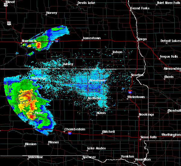 At 1052 pm cdt/952 pm mdt/, a severe thunderstorm was located over fort pierre, moving east at 35 mph (radar indicated). Hazards include 60 mph wind gusts and quarter size hail. Hail damage to vehicles is expected. Expect wind damage to roofs, siding, and trees. At 1052 pm cdt/952 pm mdt/, a severe thunderstorm was located over fort pierre, moving east at 35 mph (radar indicated). Hazards include 60 mph wind gusts and quarter size hail. Hail damage to vehicles is expected. Expect wind damage to roofs, siding, and trees.
|
| 7/5/2019 1:28 AM CDT |
 At 128 am cdt/1228 am mdt/, a severe thunderstorm was located near pierre, moving northeast at 40 mph (radar indicated). Hazards include 60 mph wind gusts. expect damage to roofs, siding, and trees At 128 am cdt/1228 am mdt/, a severe thunderstorm was located near pierre, moving northeast at 40 mph (radar indicated). Hazards include 60 mph wind gusts. expect damage to roofs, siding, and trees
|
| 7/5/2019 12:08 AM MDT |
 At 106 am cdt/1206 am mdt/, a severe thunderstorm was located 8 miles south of fort pierre, moving east at 60 mph (trained weather spotters). Hazards include 70 mph wind gusts. Expect considerable tree damage. damage is likely to mobile homes, roofs, and outbuildings. Locations impacted include, pierre, fort pierre, draper, grey goose, rousseau, spring creek rec area, oahe mission rec area, canning, wendte, chantier creek recreation area, okobojo point rec area, overlook rec area, van metre, cow creek rec area, west shore rec area and lake sharpe. At 106 am cdt/1206 am mdt/, a severe thunderstorm was located 8 miles south of fort pierre, moving east at 60 mph (trained weather spotters). Hazards include 70 mph wind gusts. Expect considerable tree damage. damage is likely to mobile homes, roofs, and outbuildings. Locations impacted include, pierre, fort pierre, draper, grey goose, rousseau, spring creek rec area, oahe mission rec area, canning, wendte, chantier creek recreation area, okobojo point rec area, overlook rec area, van metre, cow creek rec area, west shore rec area and lake sharpe.
|
| 7/5/2019 12:44 AM CDT |
 The national weather service in aberdeen has issued a * severe thunderstorm warning for. jones county in central south dakota. southwestern sully county in central south dakota. stanley county in central south dakota. Northwestern hughes county in central south dakota. The national weather service in aberdeen has issued a * severe thunderstorm warning for. jones county in central south dakota. southwestern sully county in central south dakota. stanley county in central south dakota. Northwestern hughes county in central south dakota.
|
| 7/4/2019 11:37 PM MDT | Storm damage reported in stanley county SD, 25 miles E of Fort Pierre, SD |
| 8/27/2018 5:27 PM MDT |
 At 627 pm cdt/527 pm mdt/, a severe thunderstorm was located near ottumwa, or 26 miles northeast of philip, moving east at 50 mph (radar indicated). Hazards include golf ball size hail and 60 mph wind gusts. People and animals outdoors will be injured. expect hail damage to roofs, siding, windows, and vehicles. Expect wind damage to roofs, siding, and trees. At 627 pm cdt/527 pm mdt/, a severe thunderstorm was located near ottumwa, or 26 miles northeast of philip, moving east at 50 mph (radar indicated). Hazards include golf ball size hail and 60 mph wind gusts. People and animals outdoors will be injured. expect hail damage to roofs, siding, windows, and vehicles. Expect wind damage to roofs, siding, and trees.
|
| 8/26/2018 7:39 PM CDT |
 At 738 pm cdt/638 pm mdt/, a severe thunderstorm was located over southern lake oahe, or 7 miles northwest of fort pierre, moving east at 40 mph (radar indicated). Hazards include 70 mph wind gusts and ping pong ball size hail. People and animals outdoors will be injured. expect hail damage to roofs, siding, windows, and vehicles. expect considerable tree damage. Wind damage is also likely to mobile homes, roofs, and outbuildings. At 738 pm cdt/638 pm mdt/, a severe thunderstorm was located over southern lake oahe, or 7 miles northwest of fort pierre, moving east at 40 mph (radar indicated). Hazards include 70 mph wind gusts and ping pong ball size hail. People and animals outdoors will be injured. expect hail damage to roofs, siding, windows, and vehicles. expect considerable tree damage. Wind damage is also likely to mobile homes, roofs, and outbuildings.
|
| 8/23/2018 7:35 PM CDT | Radar estimated tim in lyman county SD, 17.6 miles NNW of Fort Pierre, SD |
| 8/4/2018 10:15 PM CDT |
 At 1013 pm cdt, a severe thunderstorm was located near pierre, moving southeast at 30 mph (trained weather spotters. at 1007 pm, a 67 mph wind gust was measured in pierre). Hazards include 60 mph wind gusts and half dollar size hail. Hail damage to vehicles is expected. expect wind damage to roofs, siding, and trees. Locations impacted include, pierre, fort pierre, rousseau, canning, degrey rec area and lake sharpe. At 1013 pm cdt, a severe thunderstorm was located near pierre, moving southeast at 30 mph (trained weather spotters. at 1007 pm, a 67 mph wind gust was measured in pierre). Hazards include 60 mph wind gusts and half dollar size hail. Hail damage to vehicles is expected. expect wind damage to roofs, siding, and trees. Locations impacted include, pierre, fort pierre, rousseau, canning, degrey rec area and lake sharpe.
|
| 8/4/2018 10:00 PM CDT |
 At 959 pm cdt/859 pm mdt/, a severe thunderstorm was located over pierre, moving southeast at 35 mph (radar indicated). Hazards include 60 mph wind gusts and half dollar size hail. Hail damage to vehicles is expected. Expect wind damage to roofs, siding, and trees. At 959 pm cdt/859 pm mdt/, a severe thunderstorm was located over pierre, moving southeast at 35 mph (radar indicated). Hazards include 60 mph wind gusts and half dollar size hail. Hail damage to vehicles is expected. Expect wind damage to roofs, siding, and trees.
|
| 8/4/2018 8:49 PM MDT |
 At 949 pm cdt/849 pm mdt/, a severe thunderstorm was located over overlook rec area, or near fort pierre, moving east at 40 mph (radar indicated). Hazards include ping pong ball size hail and 60 mph wind gusts. People and animals outdoors will be injured. expect hail damage to roofs, siding, windows, and vehicles. expect wind damage to roofs, siding, and trees. Locations impacted include, pierre, fort pierre, grey goose, overlook rec area, west shore rec area, oahe mission rec area and chantier creek recreation area. At 949 pm cdt/849 pm mdt/, a severe thunderstorm was located over overlook rec area, or near fort pierre, moving east at 40 mph (radar indicated). Hazards include ping pong ball size hail and 60 mph wind gusts. People and animals outdoors will be injured. expect hail damage to roofs, siding, windows, and vehicles. expect wind damage to roofs, siding, and trees. Locations impacted include, pierre, fort pierre, grey goose, overlook rec area, west shore rec area, oahe mission rec area and chantier creek recreation area.
|
| 8/4/2018 9:37 PM CDT |
 At 937 pm cdt/837 pm mdt/, a severe thunderstorm was located over oahe mission rec area, or 10 miles northwest of fort pierre, moving southeast at 40 mph (radar indicated). Hazards include 60 mph wind gusts and quarter size hail. Hail damage to vehicles is expected. Expect wind damage to roofs, siding, and trees. At 937 pm cdt/837 pm mdt/, a severe thunderstorm was located over oahe mission rec area, or 10 miles northwest of fort pierre, moving southeast at 40 mph (radar indicated). Hazards include 60 mph wind gusts and quarter size hail. Hail damage to vehicles is expected. Expect wind damage to roofs, siding, and trees.
|
| 7/18/2018 5:33 PM CDT |
 At 533 pm cdt, a severe thunderstorm was located near pierre, moving east at 25 mph (radar indicated). Hazards include 60 mph wind gusts and quarter size hail. Hail damage to vehicles is expected. Expect wind damage to roofs, siding, and trees. At 533 pm cdt, a severe thunderstorm was located near pierre, moving east at 25 mph (radar indicated). Hazards include 60 mph wind gusts and quarter size hail. Hail damage to vehicles is expected. Expect wind damage to roofs, siding, and trees.
|
| 6/29/2018 7:54 PM MDT | Hen Egg sized hail reported 33.5 miles SE of Fort Pierre, SD, weather station reported a wind gust of 69 mph. |
| 6/29/2018 7:32 PM MDT | Ping Pong Ball sized hail reported 36 miles SE of Fort Pierre, SD |
| 6/27/2018 6:16 AM CDT |
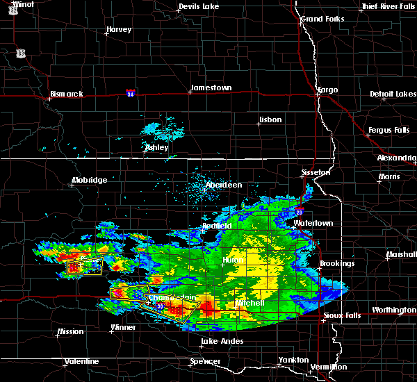 At 616 am cdt/516 am mdt/, a severe thunderstorm was located near pierre, moving east at 35 mph (radar indicated). Hazards include 60 mph wind gusts and quarter size hail. Hail damage to vehicles is expected. Expect wind damage to roofs, siding, and trees. At 616 am cdt/516 am mdt/, a severe thunderstorm was located near pierre, moving east at 35 mph (radar indicated). Hazards include 60 mph wind gusts and quarter size hail. Hail damage to vehicles is expected. Expect wind damage to roofs, siding, and trees.
|
| 6/27/2018 3:52 AM CDT |
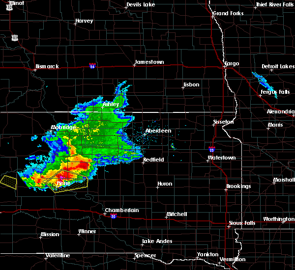 At 351 am cdt/251 am mdt/, a severe thunderstorm was located 7 miles east of grey goose, or 10 miles northeast of pierre, moving southeast at 50 mph (radar indicated). Hazards include two inch hail and 60 mph wind gusts. People and animals outdoors will be injured. expect hail damage to roofs, siding, windows, and vehicles. expect wind damage to roofs, siding, and trees. Locations impacted include, pierre, fort pierre, blunt, harrold, grey goose, overlook rec area, rousseau, west shore rec area, canning and sully lake. At 351 am cdt/251 am mdt/, a severe thunderstorm was located 7 miles east of grey goose, or 10 miles northeast of pierre, moving southeast at 50 mph (radar indicated). Hazards include two inch hail and 60 mph wind gusts. People and animals outdoors will be injured. expect hail damage to roofs, siding, windows, and vehicles. expect wind damage to roofs, siding, and trees. Locations impacted include, pierre, fort pierre, blunt, harrold, grey goose, overlook rec area, rousseau, west shore rec area, canning and sully lake.
|
| 6/27/2018 3:38 AM CDT |
 At 338 am cdt/238 am mdt/, a severe thunderstorm was located near cow creek rec area, or 16 miles north of pierre, moving southeast at 40 mph (radar indicated). Hazards include golf ball size hail and 60 mph wind gusts. People and animals outdoors will be injured. expect hail damage to roofs, siding, windows, and vehicles. expect wind damage to roofs, siding, and trees. Locations impacted include, pierre, fort pierre, blunt, harrold, grey goose, rousseau, spring creek rec area, oahe mission rec area, canning, sully lake, okobojo point rec area, overlook rec area, cow creek rec area and west shore rec area. At 338 am cdt/238 am mdt/, a severe thunderstorm was located near cow creek rec area, or 16 miles north of pierre, moving southeast at 40 mph (radar indicated). Hazards include golf ball size hail and 60 mph wind gusts. People and animals outdoors will be injured. expect hail damage to roofs, siding, windows, and vehicles. expect wind damage to roofs, siding, and trees. Locations impacted include, pierre, fort pierre, blunt, harrold, grey goose, rousseau, spring creek rec area, oahe mission rec area, canning, sully lake, okobojo point rec area, overlook rec area, cow creek rec area and west shore rec area.
|
| 6/27/2018 3:28 AM CDT |
 At 327 am cdt/227 am mdt/, a severe thunderstorm was located near okobojo point rec area, or 18 miles north of fort pierre, moving southeast at 50 mph (radar indicated). Hazards include ping pong ball size hail and 60 mph wind gusts. People and animals outdoors will be injured. expect hail damage to roofs, siding, windows, and vehicles. Expect wind damage to roofs, siding, and trees. At 327 am cdt/227 am mdt/, a severe thunderstorm was located near okobojo point rec area, or 18 miles north of fort pierre, moving southeast at 50 mph (radar indicated). Hazards include ping pong ball size hail and 60 mph wind gusts. People and animals outdoors will be injured. expect hail damage to roofs, siding, windows, and vehicles. Expect wind damage to roofs, siding, and trees.
|
| 5/17/2018 9:55 PM CDT |
 At 955 pm cdt/855 pm mdt/, severe thunderstorms were located along a line extending from oahe mission rec area to 6 miles east of draper, moving east at 35 mph (radar indicated. at 920 pm cdt, winds of 61 mph were reported in pierre). Hazards include 60 mph wind gusts and nickel size hail. expect damage to roofs, siding, and trees At 955 pm cdt/855 pm mdt/, severe thunderstorms were located along a line extending from oahe mission rec area to 6 miles east of draper, moving east at 35 mph (radar indicated. at 920 pm cdt, winds of 61 mph were reported in pierre). Hazards include 60 mph wind gusts and nickel size hail. expect damage to roofs, siding, and trees
|
| 8/21/2017 9:30 AM CDT | Quarter sized hail reported 15.9 miles NW of Fort Pierre, SD, pea to quarter size hail. |
| 8/21/2017 9:20 AM CDT | Ping Pong Ball sized hail reported 20.2 miles NW of Fort Pierre, SD |
| 8/21/2017 8:58 AM CDT | Golf Ball sized hail reported 0.5 miles NNE of Fort Pierre, SD |
| 8/21/2017 8:55 AM CDT |
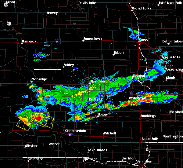 At 854 am cdt, a severe thunderstorm was located near rousseau, or 10 miles southeast of pierre, moving east at 35 mph (radar indicated). Hazards include two inch hail and 60 mph wind gusts. People and animals outdoors will be injured. expect hail damage to roofs, siding, windows, and vehicles. Expect wind damage to roofs, siding, and trees. At 854 am cdt, a severe thunderstorm was located near rousseau, or 10 miles southeast of pierre, moving east at 35 mph (radar indicated). Hazards include two inch hail and 60 mph wind gusts. People and animals outdoors will be injured. expect hail damage to roofs, siding, windows, and vehicles. Expect wind damage to roofs, siding, and trees.
|
| 8/21/2017 8:36 AM CDT |
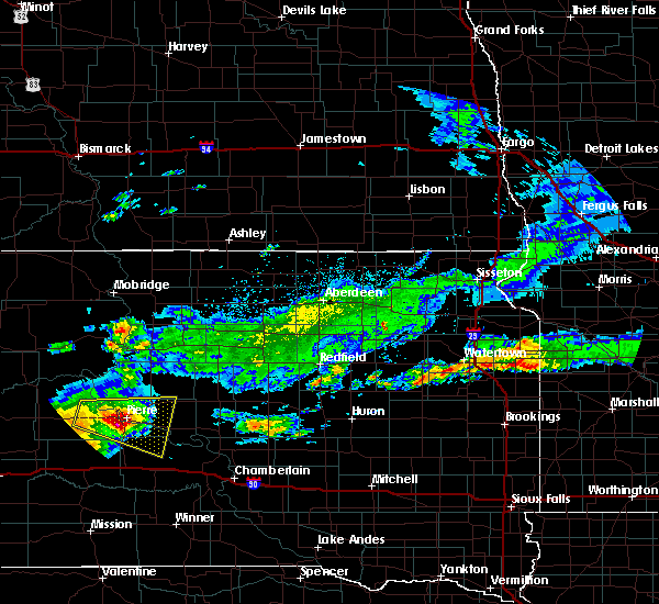 At 835 am cdt/735 am mdt/, a severe thunderstorm was located over fort pierre, moving east at 40 mph (radar indicated). Hazards include golf ball size hail and 60 mph wind gusts. People and animals outdoors will be injured. expect hail damage to roofs, siding, windows, and vehicles. expect wind damage to roofs, siding, and trees. Locations impacted include, pierre, fort pierre, blunt, grey goose, overlook rec area, rousseau, west shore rec area, oahe mission rec area, canning, degrey rec area and lake sharpe. At 835 am cdt/735 am mdt/, a severe thunderstorm was located over fort pierre, moving east at 40 mph (radar indicated). Hazards include golf ball size hail and 60 mph wind gusts. People and animals outdoors will be injured. expect hail damage to roofs, siding, windows, and vehicles. expect wind damage to roofs, siding, and trees. Locations impacted include, pierre, fort pierre, blunt, grey goose, overlook rec area, rousseau, west shore rec area, oahe mission rec area, canning, degrey rec area and lake sharpe.
|
| 8/21/2017 8:14 AM CDT |
 At 813 am cdt/713 am mdt/, a severe thunderstorm was located 7 miles south of chantier creek recreation area, or 12 miles west of fort pierre, moving east at 35 mph (radar indicated). Hazards include golf ball size hail and 60 mph wind gusts. People and animals outdoors will be injured. expect hail damage to roofs, siding, windows, and vehicles. expect wind damage to roofs, siding, and trees. Locations impacted include, pierre, fort pierre, blunt, grey goose, rousseau, spring creek rec area, oahe mission rec area, canning, chantier creek recreation area, overlook rec area, west shore rec area, degrey rec area and lake sharpe. At 813 am cdt/713 am mdt/, a severe thunderstorm was located 7 miles south of chantier creek recreation area, or 12 miles west of fort pierre, moving east at 35 mph (radar indicated). Hazards include golf ball size hail and 60 mph wind gusts. People and animals outdoors will be injured. expect hail damage to roofs, siding, windows, and vehicles. expect wind damage to roofs, siding, and trees. Locations impacted include, pierre, fort pierre, blunt, grey goose, rousseau, spring creek rec area, oahe mission rec area, canning, chantier creek recreation area, overlook rec area, west shore rec area, degrey rec area and lake sharpe.
|
| 8/21/2017 6:54 AM MDT |
 At 753 am cdt/653 am mdt/, a severe thunderstorm was located near chantier creek recreation area, or 16 miles west of fort pierre, moving east at 35 mph (radar indicated). Hazards include 60 mph wind gusts and half dollar size hail. Hail damage to vehicles is expected. Expect wind damage to roofs, siding, and trees. At 753 am cdt/653 am mdt/, a severe thunderstorm was located near chantier creek recreation area, or 16 miles west of fort pierre, moving east at 35 mph (radar indicated). Hazards include 60 mph wind gusts and half dollar size hail. Hail damage to vehicles is expected. Expect wind damage to roofs, siding, and trees.
|
| 7/17/2017 5:38 PM CDT | Storm damage reported in lyman county SD, 17.6 miles NNW of Fort Pierre, SD |
| 7/5/2017 9:20 PM CDT | Time estimated by rada in lyman county SD, 17.5 miles NNW of Fort Pierre, SD |
| 7/5/2017 9:12 PM CDT |
 At 909 pm cdt/809 pm mdt/, a severe thunderstorm was located 9 miles south of pierre, moving southeast at 45 mph (radar indicated. at 849 pm, 62 mph winds was reported pierre). Hazards include 60 mph wind gusts and penny size hail. Expect damage to roofs, siding, and trees. Locations impacted include, pierre, fort pierre, vivian, cedar creek rec area, rousseau, 5 mile corner, lake sharpe, joe creek rec area, canning and degrey rec area. At 909 pm cdt/809 pm mdt/, a severe thunderstorm was located 9 miles south of pierre, moving southeast at 45 mph (radar indicated. at 849 pm, 62 mph winds was reported pierre). Hazards include 60 mph wind gusts and penny size hail. Expect damage to roofs, siding, and trees. Locations impacted include, pierre, fort pierre, vivian, cedar creek rec area, rousseau, 5 mile corner, lake sharpe, joe creek rec area, canning and degrey rec area.
|
| 7/5/2017 8:57 PM CDT |
 The national weather service in aberdeen has issued a * severe thunderstorm warning for. northeastern jones county in central south dakota. southeastern stanley county in central south dakota. central hughes county in central south dakota. Northwestern lyman county in central south dakota. The national weather service in aberdeen has issued a * severe thunderstorm warning for. northeastern jones county in central south dakota. southeastern stanley county in central south dakota. central hughes county in central south dakota. Northwestern lyman county in central south dakota.
|
| 7/5/2017 7:41 PM MDT |
 At 839 pm cdt/739 pm mdt/, a severe thunderstorm was located over west shore rec area moving southeast at 35 mph (public). Hazards include 70 mph wind gusts. Expect considerable tree damage. damage is likely to mobile homes, roofs, and outbuildings. Locations impacted include, pierre, fort pierre, grey goose, spring creek rec area, hayes, oahe mission rec area, wendte, chantier creek recreation area, overlook rec area, okobojo point rec area, cow creek rec area and west shore rec area. At 839 pm cdt/739 pm mdt/, a severe thunderstorm was located over west shore rec area moving southeast at 35 mph (public). Hazards include 70 mph wind gusts. Expect considerable tree damage. damage is likely to mobile homes, roofs, and outbuildings. Locations impacted include, pierre, fort pierre, grey goose, spring creek rec area, hayes, oahe mission rec area, wendte, chantier creek recreation area, overlook rec area, okobojo point rec area, cow creek rec area and west shore rec area.
|
| 7/5/2017 7:20 PM MDT |
 The national weather service in aberdeen has issued a * severe thunderstorm warning for. southwestern sully county in central south dakota. stanley county in central south dakota. southeastern dewey county in north central south dakota. Northwestern hughes county in central south dakota. The national weather service in aberdeen has issued a * severe thunderstorm warning for. southwestern sully county in central south dakota. stanley county in central south dakota. southeastern dewey county in north central south dakota. Northwestern hughes county in central south dakota.
|
| 6/22/2017 5:10 AM CDT |
 At 510 am cdt/410 am mdt/, a severe thunderstorm was located over west shore rec area, or near fort pierre, moving east at 55 mph (radar indicated). Hazards include 60 mph wind gusts and quarter size hail. Hail damage to vehicles is expected. expect wind damage to roofs, siding, and trees. this severe thunderstorm will be near, pierre around 515 am cdt. Canning and rousseau around 530 am cdt. At 510 am cdt/410 am mdt/, a severe thunderstorm was located over west shore rec area, or near fort pierre, moving east at 55 mph (radar indicated). Hazards include 60 mph wind gusts and quarter size hail. Hail damage to vehicles is expected. expect wind damage to roofs, siding, and trees. this severe thunderstorm will be near, pierre around 515 am cdt. Canning and rousseau around 530 am cdt.
|
| 6/22/2017 3:02 AM CDT |
 The national weather service in aberdeen has issued a * severe thunderstorm warning for. southeastern stanley county in central south dakota. hughes county in central south dakota. Until 345 am cdt/245 am mdt/ * at 302 am cdt/202 am mdt/, a severe thunderstorm was located over. The national weather service in aberdeen has issued a * severe thunderstorm warning for. southeastern stanley county in central south dakota. hughes county in central south dakota. Until 345 am cdt/245 am mdt/ * at 302 am cdt/202 am mdt/, a severe thunderstorm was located over.
|
| 6/13/2017 4:29 PM CDT |
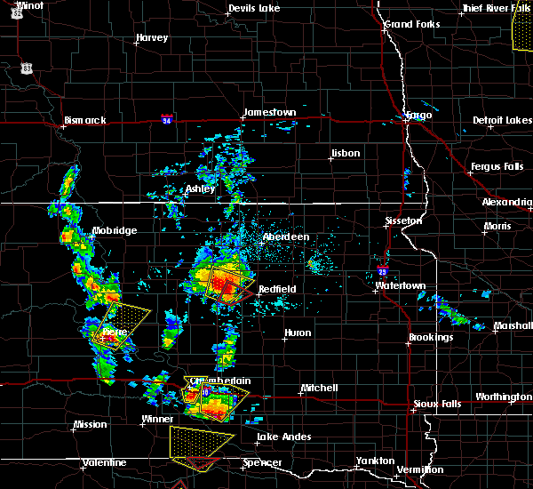 At 429 pm cdt/329 pm mdt/, a severe thunderstorm was located near pierre, moving northeast at 55 mph (radar indicated). Hazards include 60 mph wind gusts and quarter size hail. Hail damage to vehicles is expected. Expect wind damage to roofs, siding, and trees. At 429 pm cdt/329 pm mdt/, a severe thunderstorm was located near pierre, moving northeast at 55 mph (radar indicated). Hazards include 60 mph wind gusts and quarter size hail. Hail damage to vehicles is expected. Expect wind damage to roofs, siding, and trees.
|
| 6/13/2017 1:22 AM CDT |
 At 122 am cdt/1222 am mdt/, a severe thunderstorm was located near grey goose, or 7 miles north of pierre, moving northeast at 45 mph (radar indicated). Hazards include 70 mph wind gusts and penny size hail. Expect considerable tree damage. Damage is likely to mobile homes, roofs, and outbuildings. At 122 am cdt/1222 am mdt/, a severe thunderstorm was located near grey goose, or 7 miles north of pierre, moving northeast at 45 mph (radar indicated). Hazards include 70 mph wind gusts and penny size hail. Expect considerable tree damage. Damage is likely to mobile homes, roofs, and outbuildings.
|
| 9/4/2016 6:06 PM CDT |
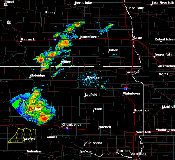 At 606 pm cdt/506 pm mdt/, a severe thunderstorm was located over grey goose, or 9 miles north of fort pierre, moving north at 30 mph (radar indicated). Hazards include ping pong ball size hail and 60 mph wind gusts. People and animals outdoors will be injured. expect hail damage to roofs, siding, windows, and vehicles. expect wind damage to roofs, siding, and trees. This severe storm will be near, southern lake oahe around 610 pm cdt. At 606 pm cdt/506 pm mdt/, a severe thunderstorm was located over grey goose, or 9 miles north of fort pierre, moving north at 30 mph (radar indicated). Hazards include ping pong ball size hail and 60 mph wind gusts. People and animals outdoors will be injured. expect hail damage to roofs, siding, windows, and vehicles. expect wind damage to roofs, siding, and trees. This severe storm will be near, southern lake oahe around 610 pm cdt.
|
| 9/4/2016 6:04 PM CDT |
 At 604 pm cdt/504 pm mdt/, a severe thunderstorm was located over southern lake oahe, or 8 miles northwest of fort pierre, moving north at 30 mph (radar indicated). Hazards include ping pong ball size hail and 60 mph wind gusts. People and animals outdoors will be injured. expect hail damage to roofs, siding, windows, and vehicles. expect wind damage to roofs, siding, and trees. this severe storm will be near, southern lake oahe around 610 pm cdt. spring creek rec area, cow creek rec area and okobojo point rec area around 615 pm cdt. Bush`s landing around 640 pm cdt. At 604 pm cdt/504 pm mdt/, a severe thunderstorm was located over southern lake oahe, or 8 miles northwest of fort pierre, moving north at 30 mph (radar indicated). Hazards include ping pong ball size hail and 60 mph wind gusts. People and animals outdoors will be injured. expect hail damage to roofs, siding, windows, and vehicles. expect wind damage to roofs, siding, and trees. this severe storm will be near, southern lake oahe around 610 pm cdt. spring creek rec area, cow creek rec area and okobojo point rec area around 615 pm cdt. Bush`s landing around 640 pm cdt.
|
| 9/4/2016 5:01 PM MDT | Quarter sized hail reported 4 miles ESE of Fort Pierre, SD, hail of various sizes including quarter sized. |
| 9/4/2016 6:00 PM CDT |
 At 559 pm cdt/459 pm mdt/, a severe thunderstorm was located over southern lake oahe, or 7 miles northwest of fort pierre, moving north at 30 mph (radar indicated). Hazards include ping pong ball size hail and 60 mph wind gusts. People and animals outdoors will be injured. expect hail damage to roofs, siding, windows, and vehicles. expect wind damage to roofs, siding, and trees. this severe thunderstorm will be near, southern lake oahe around 605 pm cdt. cow creek rec area, spring creek rec area and okobojo point rec area around 610 pm cdt. Bush`s landing around 630 pm cdt. At 559 pm cdt/459 pm mdt/, a severe thunderstorm was located over southern lake oahe, or 7 miles northwest of fort pierre, moving north at 30 mph (radar indicated). Hazards include ping pong ball size hail and 60 mph wind gusts. People and animals outdoors will be injured. expect hail damage to roofs, siding, windows, and vehicles. expect wind damage to roofs, siding, and trees. this severe thunderstorm will be near, southern lake oahe around 605 pm cdt. cow creek rec area, spring creek rec area and okobojo point rec area around 610 pm cdt. Bush`s landing around 630 pm cdt.
|
| 9/4/2016 5:51 PM CDT |
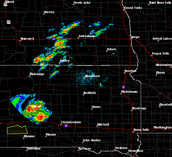 At 550 pm cdt/450 pm mdt/, a severe thunderstorm was located over fort pierre, moving north at 25 mph (radar indicated). Hazards include 60 mph wind gusts and half dollar size hail. Hail damage to vehicles is expected. expect wind damage to roofs, siding, and trees. this severe storm will be near, overlook rec area, southern lake oahe and west shore rec area around 600 pm cdt. Grey goose around 610 pm cdt. At 550 pm cdt/450 pm mdt/, a severe thunderstorm was located over fort pierre, moving north at 25 mph (radar indicated). Hazards include 60 mph wind gusts and half dollar size hail. Hail damage to vehicles is expected. expect wind damage to roofs, siding, and trees. this severe storm will be near, overlook rec area, southern lake oahe and west shore rec area around 600 pm cdt. Grey goose around 610 pm cdt.
|
| 9/4/2016 5:27 PM CDT |
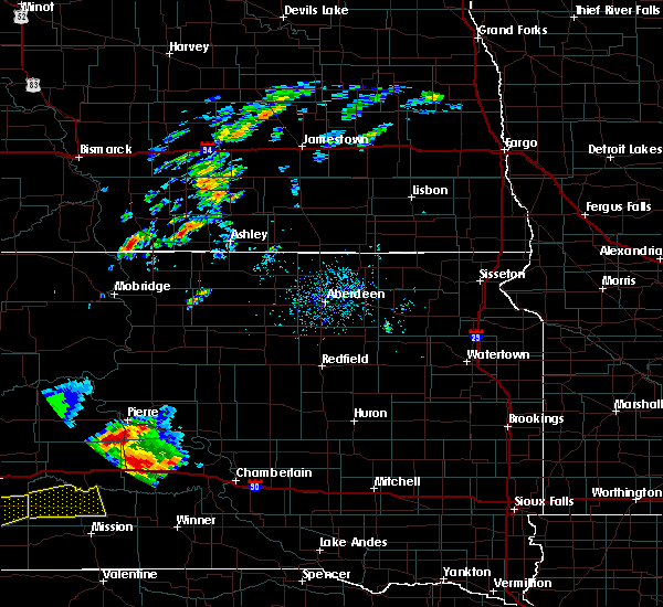 At 527 pm cdt/427 pm mdt/, a severe thunderstorm was located 9 miles south of fort pierre, moving north at 30 mph (radar indicated). Hazards include 60 mph wind gusts and half dollar size hail. Hail damage to vehicles is expected. expect wind damage to roofs, siding, and trees. this severe thunderstorm will be near, pierre and fort pierre around 550 pm cdt. west shore rec area around 555 pm cdt. overlook rec area and southern lake oahe around 600 pm cdt. Grey goose around 610 pm cdt. At 527 pm cdt/427 pm mdt/, a severe thunderstorm was located 9 miles south of fort pierre, moving north at 30 mph (radar indicated). Hazards include 60 mph wind gusts and half dollar size hail. Hail damage to vehicles is expected. expect wind damage to roofs, siding, and trees. this severe thunderstorm will be near, pierre and fort pierre around 550 pm cdt. west shore rec area around 555 pm cdt. overlook rec area and southern lake oahe around 600 pm cdt. Grey goose around 610 pm cdt.
|
| 8/14/2016 7:58 PM MDT |
 At 858 pm cdt/758 pm mdt/, a severe thunderstorm was located over chantier creek recreation area, or 13 miles northwest of fort pierre, moving southeast at 30 mph (radar indicated). Hazards include 60 mph wind gusts and quarter size hail. Hail damage to vehicles is expected. expect wind damage to roofs, siding, and trees. this severe thunderstorm will be near, oahe mission rec area around 805 pm mdt. west shore rec area, overlook rec area and southern lake oahe around 815 pm mdt. Pierre and fort pierre around 825 pm mdt. At 858 pm cdt/758 pm mdt/, a severe thunderstorm was located over chantier creek recreation area, or 13 miles northwest of fort pierre, moving southeast at 30 mph (radar indicated). Hazards include 60 mph wind gusts and quarter size hail. Hail damage to vehicles is expected. expect wind damage to roofs, siding, and trees. this severe thunderstorm will be near, oahe mission rec area around 805 pm mdt. west shore rec area, overlook rec area and southern lake oahe around 815 pm mdt. Pierre and fort pierre around 825 pm mdt.
|
| 8/11/2016 5:40 PM MDT | Pea hai in stanley county SD, 19.8 miles ENE of Fort Pierre, SD |
| 8/10/2016 9:02 PM CDT |
 At 901 pm cdt/801 pm mdt/, a severe thunderstorm was located 7 miles southwest of fort pierre, moving northeast at 40 mph (radar indicated). Hazards include 60 mph wind gusts and quarter size hail. Hail damage to vehicles is expected. expect wind damage to roofs, siding, and trees. this severe thunderstorm will be near, pierre and fort pierre around 910 pm cdt. canning around 925 pm cdt. Blunt around 935 pm cdt. At 901 pm cdt/801 pm mdt/, a severe thunderstorm was located 7 miles southwest of fort pierre, moving northeast at 40 mph (radar indicated). Hazards include 60 mph wind gusts and quarter size hail. Hail damage to vehicles is expected. expect wind damage to roofs, siding, and trees. this severe thunderstorm will be near, pierre and fort pierre around 910 pm cdt. canning around 925 pm cdt. Blunt around 935 pm cdt.
|
| 8/10/2016 8:40 PM CDT |
 The severe thunderstorm warning for southeastern stanley, northern hughes, northeastern jones and northwestern lyman counties will expire at 845 pm cdt/745 pm mdt/, the storm which prompted the warning has weakened below severe limits, and no longer pose an immediate threat to life or property. therefore, the warning will be allowed to expire. a severe thunderstorm watch remains in effect until 200 am cdt/100 am mdt/ for central south dakota. The severe thunderstorm warning for southeastern stanley, northern hughes, northeastern jones and northwestern lyman counties will expire at 845 pm cdt/745 pm mdt/, the storm which prompted the warning has weakened below severe limits, and no longer pose an immediate threat to life or property. therefore, the warning will be allowed to expire. a severe thunderstorm watch remains in effect until 200 am cdt/100 am mdt/ for central south dakota.
|
| 8/10/2016 8:10 PM CDT |
 At 810 pm cdt/710 pm mdt/, a severe thunderstorm was located over rousseau, or 12 miles east of pierre, moving northeast at 45 mph (radar indicated). Hazards include 60 mph wind gusts and quarter size hail. Hail damage to vehicles is expected. expect wind damage to roofs, siding, and trees. this severe thunderstorm will be near, degrey rec area around 815 pm cdt. Canning around 820 pm cdt. At 810 pm cdt/710 pm mdt/, a severe thunderstorm was located over rousseau, or 12 miles east of pierre, moving northeast at 45 mph (radar indicated). Hazards include 60 mph wind gusts and quarter size hail. Hail damage to vehicles is expected. expect wind damage to roofs, siding, and trees. this severe thunderstorm will be near, degrey rec area around 815 pm cdt. Canning around 820 pm cdt.
|
| 8/10/2016 6:11 PM MDT |
 At 710 pm cdt/610 pm mdt/, a severe thunderstorm was located near wendte, or 13 miles southwest of fort pierre, moving northeast at 25 mph (radar indicated). Hazards include 60 mph wind gusts and quarter size hail. Hail damage to vehicles is expected. expect wind damage to roofs, siding, and trees. this severe thunderstorm will be near, pierre and fort pierre around 745 pm cdt. Overlook rec area around 750 pm cdt. At 710 pm cdt/610 pm mdt/, a severe thunderstorm was located near wendte, or 13 miles southwest of fort pierre, moving northeast at 25 mph (radar indicated). Hazards include 60 mph wind gusts and quarter size hail. Hail damage to vehicles is expected. expect wind damage to roofs, siding, and trees. this severe thunderstorm will be near, pierre and fort pierre around 745 pm cdt. Overlook rec area around 750 pm cdt.
|
| 8/8/2016 9:54 PM MDT |
 The severe thunderstorm warning for southwestern sully, southwestern stanley, northwestern hughes, eastern jones and northwestern lyman counties will expire at 1100 pm cdt/1000 pm mdt/, the storm which prompted the warning has weakened below severe limits, and has exited the warned area. therefore, the warning will be allowed to expire. however gusty winds are still possible with this thunderstorm. The severe thunderstorm warning for southwestern sully, southwestern stanley, northwestern hughes, eastern jones and northwestern lyman counties will expire at 1100 pm cdt/1000 pm mdt/, the storm which prompted the warning has weakened below severe limits, and has exited the warned area. therefore, the warning will be allowed to expire. however gusty winds are still possible with this thunderstorm.
|
| 8/8/2016 9:38 PM MDT |
 At 1037 pm cdt/937 pm mdt/, a severe thunderstorm was located near west shore rec area, or near fort pierre, moving east at 40 mph (trained weather spotters). Hazards include 60 mph wind gusts and nickel size hail. Expect damage to roofs. siding. and trees. this severe storm will be near, west shore rec area around 940 pm mdt. pierre, fort pierre, overlook rec area and southern lake oahe around 945 pm mdt. Grey goose around 1050 pm cdt. At 1037 pm cdt/937 pm mdt/, a severe thunderstorm was located near west shore rec area, or near fort pierre, moving east at 40 mph (trained weather spotters). Hazards include 60 mph wind gusts and nickel size hail. Expect damage to roofs. siding. and trees. this severe storm will be near, west shore rec area around 940 pm mdt. pierre, fort pierre, overlook rec area and southern lake oahe around 945 pm mdt. Grey goose around 1050 pm cdt.
|
| 8/8/2016 9:29 PM MDT | Peak wind gust at hayes rwi in stanley county SD, 19.5 miles E of Fort Pierre, SD |
| 8/8/2016 9:24 PM MDT | Hayes rwi in stanley county SD, 19.5 miles E of Fort Pierre, SD |
| 8/8/2016 10:14 PM CDT |
 At 1014 pm cdt/914 pm mdt/, a severe thunderstorm was located 9 miles northwest of wendte, or 21 miles west of fort pierre, moving east at 45 mph (radar indicated). Hazards include 60 mph wind gusts and nickel size hail. Expect damage to roofs. siding. and trees. this severe thunderstorm will be near, chantier creek recreation area around 930 pm mdt. oahe mission rec area around 935 pm mdt. fort pierre and west shore rec area around 940 pm mdt. pierre, overlook rec area and southern lake oahe around 1045 pm cdt. Grey goose around 1050 pm cdt. At 1014 pm cdt/914 pm mdt/, a severe thunderstorm was located 9 miles northwest of wendte, or 21 miles west of fort pierre, moving east at 45 mph (radar indicated). Hazards include 60 mph wind gusts and nickel size hail. Expect damage to roofs. siding. and trees. this severe thunderstorm will be near, chantier creek recreation area around 930 pm mdt. oahe mission rec area around 935 pm mdt. fort pierre and west shore rec area around 940 pm mdt. pierre, overlook rec area and southern lake oahe around 1045 pm cdt. Grey goose around 1050 pm cdt.
|
| 8/3/2016 8:59 PM CDT |
 At 858 pm cdt/758 pm mdt/, a severe thunderstorm was located near vivian, or 15 miles northwest of presho, moving east at 40 mph (radar indicated). Hazards include 60 mph wind gusts. Expect damage to roofs. siding. and trees. this severe thunderstorm will be near, fate dam around 920 pm cdt. cedar creek rec area around 930 pm cdt. Joe creek rec area around 940 pm cdt. At 858 pm cdt/758 pm mdt/, a severe thunderstorm was located near vivian, or 15 miles northwest of presho, moving east at 40 mph (radar indicated). Hazards include 60 mph wind gusts. Expect damage to roofs. siding. and trees. this severe thunderstorm will be near, fate dam around 920 pm cdt. cedar creek rec area around 930 pm cdt. Joe creek rec area around 940 pm cdt.
|
| 8/3/2016 7:50 PM MDT | Hayes rwi in stanley county SD, 19.5 miles E of Fort Pierre, SD |
| 8/3/2016 8:44 PM CDT |
 At 844 pm cdt/744 pm mdt/, severe thunderstorms were located along a line extending from 8 miles west of fort pierre to draper, moving east at 50 mph (radar indicated). Hazards include 70 mph wind gusts and penny size hail. Expect considerable tree damage. damage is likely to mobile homes, roofs, and outbuildings. These severe storms will be near, fort pierre around 855 pm cdt. At 844 pm cdt/744 pm mdt/, severe thunderstorms were located along a line extending from 8 miles west of fort pierre to draper, moving east at 50 mph (radar indicated). Hazards include 70 mph wind gusts and penny size hail. Expect considerable tree damage. damage is likely to mobile homes, roofs, and outbuildings. These severe storms will be near, fort pierre around 855 pm cdt.
|
| 8/3/2016 8:25 PM CDT |
 At 825 pm cdt/725 pm mdt/, severe thunderstorms were located along a line extending from 9 miles north of van metre to near okaton, moving east at 50 mph. these are very dangerous storms (radar indicated). Hazards include 80 mph wind gusts and penny size hail. Flying debris will be dangerous to those caught without shelter. mobile homes will be heavily damaged. expect considerable damage to roofs, windows, and vehicles. extensive tree damage and power outages are likely. these severe storms will be near, murdo around 830 pm cdt. wendte around 835 pm cdt. draper around 845 pm cdt. Fort pierre around 855 pm cdt. At 825 pm cdt/725 pm mdt/, severe thunderstorms were located along a line extending from 9 miles north of van metre to near okaton, moving east at 50 mph. these are very dangerous storms (radar indicated). Hazards include 80 mph wind gusts and penny size hail. Flying debris will be dangerous to those caught without shelter. mobile homes will be heavily damaged. expect considerable damage to roofs, windows, and vehicles. extensive tree damage and power outages are likely. these severe storms will be near, murdo around 830 pm cdt. wendte around 835 pm cdt. draper around 845 pm cdt. Fort pierre around 855 pm cdt.
|
| 8/3/2016 7:23 PM MDT |
 At 823 pm cdt/723 pm mdt/, a severe thunderstorm was located near hayes, or 27 miles west of fort pierre, moving east at 55 mph (radar indicated). Hazards include 60 mph wind gusts. Expect damage to roofs. siding. and trees. this severe thunderstorm will be near, chantier creek recreation area around 740 pm mdt. west shore rec area and oahe mission rec area around 850 pm cdt. Pierre, fort pierre, southern lake oahe, overlook rec area and grey goose around 855 pm cdt. At 823 pm cdt/723 pm mdt/, a severe thunderstorm was located near hayes, or 27 miles west of fort pierre, moving east at 55 mph (radar indicated). Hazards include 60 mph wind gusts. Expect damage to roofs. siding. and trees. this severe thunderstorm will be near, chantier creek recreation area around 740 pm mdt. west shore rec area and oahe mission rec area around 850 pm cdt. Pierre, fort pierre, southern lake oahe, overlook rec area and grey goose around 855 pm cdt.
|
| 8/3/2016 8:10 PM CDT |
 At 810 pm cdt/710 pm mdt/, severe thunderstorms were located along a line extending from bunker to 9 miles west of okaton, moving east at 50 mph (radar indicated). Hazards include 70 mph wind gusts and penny size hail. Expect considerable tree damage. damage is likely to mobile homes, roofs, and outbuildings. severe thunderstorms will be near, okaton around 820 pm cdt. murdo around 830 pm cdt. wendte around 835 pm cdt. draper around 840 pm cdt. Fort pierre around 855 pm cdt. At 810 pm cdt/710 pm mdt/, severe thunderstorms were located along a line extending from bunker to 9 miles west of okaton, moving east at 50 mph (radar indicated). Hazards include 70 mph wind gusts and penny size hail. Expect considerable tree damage. damage is likely to mobile homes, roofs, and outbuildings. severe thunderstorms will be near, okaton around 820 pm cdt. murdo around 830 pm cdt. wendte around 835 pm cdt. draper around 840 pm cdt. Fort pierre around 855 pm cdt.
|
| 7/30/2016 10:18 PM CDT |
 At 1016 pm cdt/916 pm mdt/, severe thunderstorms were located along a line extending from 7 miles southeast of pierre to 11 miles southwest of rousseau to 9 miles south of fort pierre to 7 miles east of wendte, moving south at 15 mph (radar indicated). Hazards include ping pong ball size hail and 60 mph wind gusts. People and animals outdoors will be injured. expect hail damage to roofs, siding, windows, and vehicles. expect wind damage to roofs, siding, and trees. These severe storms will be near, wendte around 1030 pm cdt. At 1016 pm cdt/916 pm mdt/, severe thunderstorms were located along a line extending from 7 miles southeast of pierre to 11 miles southwest of rousseau to 9 miles south of fort pierre to 7 miles east of wendte, moving south at 15 mph (radar indicated). Hazards include ping pong ball size hail and 60 mph wind gusts. People and animals outdoors will be injured. expect hail damage to roofs, siding, windows, and vehicles. expect wind damage to roofs, siding, and trees. These severe storms will be near, wendte around 1030 pm cdt.
|
| 7/30/2016 10:06 PM CDT |
 At 1006 pm cdt/906 pm mdt/, severe thunderstorms were located along a line extending from near rousseau to near pierre to 7 miles south of fort pierre to 7 miles east of wendte, moving south at 15 mph (radar indicated). Hazards include 60 mph wind gusts and quarter size hail. Hail damage to vehicles is expected. expect wind damage to roofs, siding, and trees. These severe storms will be near, rousseau around 1025 pm cdt. At 1006 pm cdt/906 pm mdt/, severe thunderstorms were located along a line extending from near rousseau to near pierre to 7 miles south of fort pierre to 7 miles east of wendte, moving south at 15 mph (radar indicated). Hazards include 60 mph wind gusts and quarter size hail. Hail damage to vehicles is expected. expect wind damage to roofs, siding, and trees. These severe storms will be near, rousseau around 1025 pm cdt.
|
| 7/30/2016 9:45 PM CDT |
 At 944 pm cdt/844 pm mdt/, severe thunderstorms were located along a line extending from 7 miles west of canning to near pierre to near fort pierre to 6 miles north of wendte, moving south at 10 mph (radar indicated. at 940 pm cdt...a 59 mph wind gust was measured at the pierre airport). Hazards include 60 mph wind gusts and quarter size hail. Hail damage to vehicles is expected. expect wind damage to roofs, siding, and trees. these severe storms will be near, canning around 1010 pm cdt. wendte around 1020 pm cdt. Rousseau around 1040 pm cdt. At 944 pm cdt/844 pm mdt/, severe thunderstorms were located along a line extending from 7 miles west of canning to near pierre to near fort pierre to 6 miles north of wendte, moving south at 10 mph (radar indicated. at 940 pm cdt...a 59 mph wind gust was measured at the pierre airport). Hazards include 60 mph wind gusts and quarter size hail. Hail damage to vehicles is expected. expect wind damage to roofs, siding, and trees. these severe storms will be near, canning around 1010 pm cdt. wendte around 1020 pm cdt. Rousseau around 1040 pm cdt.
|
| 7/30/2016 9:27 PM CDT |
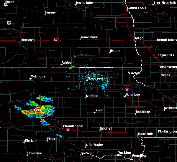 At 927 pm cdt/827 pm mdt/, severe thunderstorms were located along a line extending from 7 miles northwest of canning to near pierre to near fort pierre to 7 miles north of wendte, moving southeast at 10 mph (radar indicated). Hazards include 70 mph wind gusts and half dollar size hail. Hail damage to vehicles is expected. expect considerable tree damage. wind damage is also likely to mobile homes, roofs, and outbuildings. severe thunderstorms will be near, fort pierre around 830 pm mdt. pierre around 945 pm cdt. canning around 1025 pm cdt. Rousseau around 1045 pm cdt. At 927 pm cdt/827 pm mdt/, severe thunderstorms were located along a line extending from 7 miles northwest of canning to near pierre to near fort pierre to 7 miles north of wendte, moving southeast at 10 mph (radar indicated). Hazards include 70 mph wind gusts and half dollar size hail. Hail damage to vehicles is expected. expect considerable tree damage. wind damage is also likely to mobile homes, roofs, and outbuildings. severe thunderstorms will be near, fort pierre around 830 pm mdt. pierre around 945 pm cdt. canning around 1025 pm cdt. Rousseau around 1045 pm cdt.
|
| 7/16/2016 9:08 PM CDT | Quarter sized hail reported 0.5 miles NNE of Fort Pierre, SD, . |
| 7/16/2016 9:03 PM CDT |
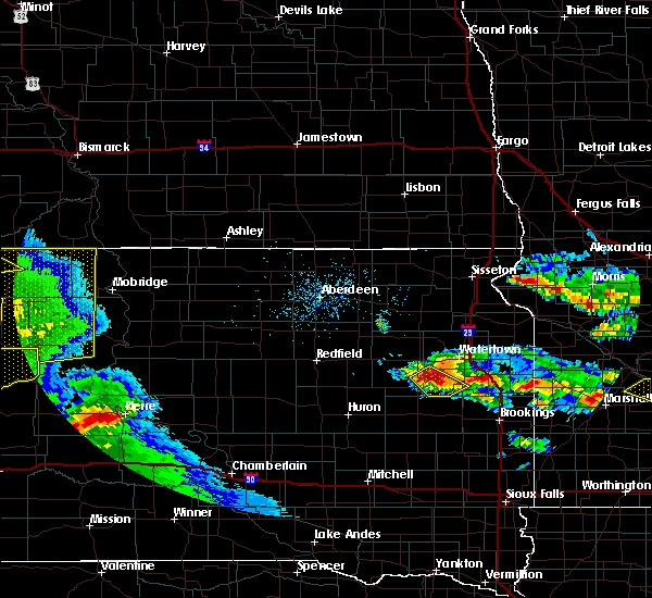 At 903 pm cdt/803 pm mdt/, a severe thunderstorm was located near pierre, moving east at 45 mph (radar indicated). Hazards include 60 mph wind gusts and quarter size hail. Hail damage to vehicles is expected. expect wind damage to roofs, siding, and trees. this severe thunderstorm will be near, canning around 910 pm cdt. Blunt around 915 pm cdt. At 903 pm cdt/803 pm mdt/, a severe thunderstorm was located near pierre, moving east at 45 mph (radar indicated). Hazards include 60 mph wind gusts and quarter size hail. Hail damage to vehicles is expected. expect wind damage to roofs, siding, and trees. this severe thunderstorm will be near, canning around 910 pm cdt. Blunt around 915 pm cdt.
|
| 7/6/2016 8:15 PM CDT | Mesonet station vivian 12 n /rfps2 in lyman county SD, 17.5 miles NNW of Fort Pierre, SD |
| 7/6/2016 7:42 PM CDT |
 At 741 pm cdt/641 pm mdt/, severe thunderstorms were located along a line extending from 8 miles south of lake oahe to sully lake to 7 miles west of blunt to near fort pierre, moving east at 55 mph (radar indicated. at 740 pm cdt...a funnel cloud was spotted 7 miles west of agar). Hazards include 70 mph wind gusts. Expect considerable tree damage. damage is likely to mobile homes, roofs, and outbuildings. severe thunderstorms will be near, sully lake around 745 pm cdt. onida, blunt, agar and sutton bay rec area around 750 pm cdt. cottonwood lake near agar around 755 pm cdt. harrold and rousseau around 800 pm cdt. gorman and canning around 805 pm cdt. holabird around 810 pm cdt. gettysburg around 815 pm cdt. highmore around 820 pm cdt. A tornado watch remains in effect until 1000 pm cdt/900 pm mdt/ for north central south dakota. At 741 pm cdt/641 pm mdt/, severe thunderstorms were located along a line extending from 8 miles south of lake oahe to sully lake to 7 miles west of blunt to near fort pierre, moving east at 55 mph (radar indicated. at 740 pm cdt...a funnel cloud was spotted 7 miles west of agar). Hazards include 70 mph wind gusts. Expect considerable tree damage. damage is likely to mobile homes, roofs, and outbuildings. severe thunderstorms will be near, sully lake around 745 pm cdt. onida, blunt, agar and sutton bay rec area around 750 pm cdt. cottonwood lake near agar around 755 pm cdt. harrold and rousseau around 800 pm cdt. gorman and canning around 805 pm cdt. holabird around 810 pm cdt. gettysburg around 815 pm cdt. highmore around 820 pm cdt. A tornado watch remains in effect until 1000 pm cdt/900 pm mdt/ for north central south dakota.
|
| 7/6/2016 5:57 PM MDT |
 At 656 pm cdt/556 pm mdt/, severe thunderstorms were located along a line extending from 10 miles southwest of ridgeview to near chantier creek recreation area to near bunker, moving east at 55 mph (a weather station recorded 69 mph winds at foster bay in stanley county at 646 pm cdt). Hazards include 70 mph wind gusts and quarter size hail. Hail damage to vehicles is expected. expect considerable tree damage. wind damage is also likely to mobile homes, roofs, and outbuildings. severe thunderstorms will be near, chantier creek recreation area around 600 pm mdt. oahe mission rec area, west shore rec area, spring creek rec area, cow creek rec area and okobojo point rec area around 610 pm mdt. pierre, fort pierre, southern lake oahe, overlook rec area and grey goose around 615 pm mdt. wendte around 720 pm cdt. sutton bay rec area around 725 pm cdt. blunt and canning around 735 pm cdt. agar and gorman around 740 pm cdt. A tornado watch remains in effect until 1000 pm cdt/900 pm mdt/ for north central south dakota. At 656 pm cdt/556 pm mdt/, severe thunderstorms were located along a line extending from 10 miles southwest of ridgeview to near chantier creek recreation area to near bunker, moving east at 55 mph (a weather station recorded 69 mph winds at foster bay in stanley county at 646 pm cdt). Hazards include 70 mph wind gusts and quarter size hail. Hail damage to vehicles is expected. expect considerable tree damage. wind damage is also likely to mobile homes, roofs, and outbuildings. severe thunderstorms will be near, chantier creek recreation area around 600 pm mdt. oahe mission rec area, west shore rec area, spring creek rec area, cow creek rec area and okobojo point rec area around 610 pm mdt. pierre, fort pierre, southern lake oahe, overlook rec area and grey goose around 615 pm mdt. wendte around 720 pm cdt. sutton bay rec area around 725 pm cdt. blunt and canning around 735 pm cdt. agar and gorman around 740 pm cdt. A tornado watch remains in effect until 1000 pm cdt/900 pm mdt/ for north central south dakota.
|
| 6/29/2016 5:55 PM MDT | Spotter reports 77mph peak gust on davis statio in stanley county SD, 34.1 miles E of Fort Pierre, SD |
| 6/22/2016 3:30 AM CDT |
 At 329 am cdt/229 am mdt/, a severe thunderstorm was located near pierre, moving southeast at 35 mph. another severe storm was located near rousseau (radar indicated). Hazards include two inch hail and 60 mph wind gusts. People and animals outdoors will be injured. expect hail damage to roofs, siding, windows, and vehicles. expect wind damage to roofs, siding, and trees. this severe storm will be near, cedar creek rec area around 405 am cdt. Joe creek rec area around 415 am cdt. At 329 am cdt/229 am mdt/, a severe thunderstorm was located near pierre, moving southeast at 35 mph. another severe storm was located near rousseau (radar indicated). Hazards include two inch hail and 60 mph wind gusts. People and animals outdoors will be injured. expect hail damage to roofs, siding, windows, and vehicles. expect wind damage to roofs, siding, and trees. this severe storm will be near, cedar creek rec area around 405 am cdt. Joe creek rec area around 415 am cdt.
|
| 6/22/2016 3:18 AM CDT |
 At 317 am cdt/217 am mdt/, a severe thunderstorm was located near rousseau, or 9 miles southeast of pierre, moving east at 30 mph (radar indicated). Hazards include ping pong ball size hail and 60 mph wind gusts. People and animals outdoors will be injured. expect hail damage to roofs, siding, windows, and vehicles. expect wind damage to roofs, siding, and trees. this severe thunderstorm will be near, rousseau around 330 am cdt. degrey rec area around 345 am cdt. cedar creek rec area around 350 am cdt. joe creek rec area around 400 am cdt. West bend rec area around 410 am cdt. At 317 am cdt/217 am mdt/, a severe thunderstorm was located near rousseau, or 9 miles southeast of pierre, moving east at 30 mph (radar indicated). Hazards include ping pong ball size hail and 60 mph wind gusts. People and animals outdoors will be injured. expect hail damage to roofs, siding, windows, and vehicles. expect wind damage to roofs, siding, and trees. this severe thunderstorm will be near, rousseau around 330 am cdt. degrey rec area around 345 am cdt. cedar creek rec area around 350 am cdt. joe creek rec area around 400 am cdt. West bend rec area around 410 am cdt.
|
| 6/22/2016 2:10 AM MDT |
 At 310 am cdt/210 am mdt/, severe thunderstorms were located along a line extending from near pierre to 6 miles west of fort pierre, moving east at 35 mph (radar indicated). Hazards include 60 mph wind gusts and quarter size hail. Hail damage to vehicles is expected. expect wind damage to roofs, siding, and trees. These severe storms will be near, canning and rousseau around 325 am cdt. At 310 am cdt/210 am mdt/, severe thunderstorms were located along a line extending from near pierre to 6 miles west of fort pierre, moving east at 35 mph (radar indicated). Hazards include 60 mph wind gusts and quarter size hail. Hail damage to vehicles is expected. expect wind damage to roofs, siding, and trees. These severe storms will be near, canning and rousseau around 325 am cdt.
|
| 6/22/2016 1:55 AM MDT |
 At 254 am cdt/154 am mdt/, severe thunderstorms were located along a line extending from near overlook rec area to 7 miles southwest of chantier creek recreation area, moving east at 55 mph (radar indicated). Hazards include 70 mph wind gusts and half dollar size hail. Hail damage to vehicles is expected. expect considerable tree damage. wind damage is also likely to mobile homes, roofs, and outbuildings. these severe storms will be near, pierre, fort pierre and overlook rec area around 200 am mdt. Rousseau and canning around 315 am cdt. At 254 am cdt/154 am mdt/, severe thunderstorms were located along a line extending from near overlook rec area to 7 miles southwest of chantier creek recreation area, moving east at 55 mph (radar indicated). Hazards include 70 mph wind gusts and half dollar size hail. Hail damage to vehicles is expected. expect considerable tree damage. wind damage is also likely to mobile homes, roofs, and outbuildings. these severe storms will be near, pierre, fort pierre and overlook rec area around 200 am mdt. Rousseau and canning around 315 am cdt.
|
| 6/22/2016 1:39 AM MDT |
 At 239 am cdt/139 am mdt/, severe thunderstorms were located along a line extending from chantier creek recreation area to near sansarc, moving southeast at 30 mph (radar indicated). Hazards include golf ball size hail and 70 mph wind gusts. People and animals outdoors will be injured. expect hail damage to roofs, siding, windows, and vehicles. expect considerable tree damage. wind damage is also likely to mobile homes, roofs, and outbuildings. these severe storms will be near, chantier creek recreation area and spring creek rec area around 145 am mdt. oahe mission rec area around 150 am mdt. west shore rec area around 155 am mdt. overlook rec area and southern lake oahe around 200 am mdt. pierre and fort pierre around 210 am mdt. wendte around 225 am mdt. Rousseau around 330 am cdt. At 239 am cdt/139 am mdt/, severe thunderstorms were located along a line extending from chantier creek recreation area to near sansarc, moving southeast at 30 mph (radar indicated). Hazards include golf ball size hail and 70 mph wind gusts. People and animals outdoors will be injured. expect hail damage to roofs, siding, windows, and vehicles. expect considerable tree damage. wind damage is also likely to mobile homes, roofs, and outbuildings. these severe storms will be near, chantier creek recreation area and spring creek rec area around 145 am mdt. oahe mission rec area around 150 am mdt. west shore rec area around 155 am mdt. overlook rec area and southern lake oahe around 200 am mdt. pierre and fort pierre around 210 am mdt. wendte around 225 am mdt. Rousseau around 330 am cdt.
|
| 6/22/2016 1:28 AM MDT |
 At 228 am cdt/128 am mdt/, severe thunderstorms were located along a line extending from near chantier creek recreation area to sansarc, moving east at 40 mph (radar indicated). Hazards include 70 mph wind gusts and half dollar size hail. Hail damage to vehicles is expected. expect considerable tree damage. wind damage is also likely to mobile homes, roofs, and outbuildings. severe thunderstorms will be near, chantier creek recreation area and okobojo point rec area around 135 am mdt. oahe mission rec area, spring creek rec area and cow creek rec area around 140 am mdt. west shore rec area around 145 am mdt. fort pierre, overlook rec area, southern lake oahe and grey goose around 150 am mdt. pierre around 155 am mdt. Rousseau and canning around 315 am cdt. At 228 am cdt/128 am mdt/, severe thunderstorms were located along a line extending from near chantier creek recreation area to sansarc, moving east at 40 mph (radar indicated). Hazards include 70 mph wind gusts and half dollar size hail. Hail damage to vehicles is expected. expect considerable tree damage. wind damage is also likely to mobile homes, roofs, and outbuildings. severe thunderstorms will be near, chantier creek recreation area and okobojo point rec area around 135 am mdt. oahe mission rec area, spring creek rec area and cow creek rec area around 140 am mdt. west shore rec area around 145 am mdt. fort pierre, overlook rec area, southern lake oahe and grey goose around 150 am mdt. pierre around 155 am mdt. Rousseau and canning around 315 am cdt.
|
| 6/21/2016 11:38 PM MDT |
 At 1238 am cdt/1138 pm mdt/, a severe thunderstorm was located over southern lake oahe, or 12 miles northwest of fort pierre, moving east at 35 mph (radar indicated). Hazards include 60 mph wind gusts and nickel size hail. Expect damage to roofs. siding. and trees. This severe storm will be near, grey goose and overlook rec area around 1250 am cdt. At 1238 am cdt/1138 pm mdt/, a severe thunderstorm was located over southern lake oahe, or 12 miles northwest of fort pierre, moving east at 35 mph (radar indicated). Hazards include 60 mph wind gusts and nickel size hail. Expect damage to roofs. siding. and trees. This severe storm will be near, grey goose and overlook rec area around 1250 am cdt.
|
| 6/22/2016 12:17 AM CDT |
 At 1216 am cdt/1116 pm mdt/, a severe thunderstorm was located near chantier creek recreation area, or 20 miles northwest of fort pierre, moving east at 35 mph (radar indicated). Hazards include 70 mph wind gusts and ping pong ball size hail. People and animals outdoors will be injured. expect hail damage to roofs, siding, windows, and vehicles. expect considerable tree damage. wind damage is also likely to mobile homes, roofs, and outbuildings. this severe thunderstorm will be near, chantier creek recreation area around 1130 pm mdt. oahe mission rec area, cow creek rec area and okobojo point rec area around 1235 am cdt. west shore rec area and spring creek rec area around 1240 am cdt. southern lake oahe and overlook rec area around 1245 am cdt. Pierre, fort pierre and grey goose around 1250 am cdt. At 1216 am cdt/1116 pm mdt/, a severe thunderstorm was located near chantier creek recreation area, or 20 miles northwest of fort pierre, moving east at 35 mph (radar indicated). Hazards include 70 mph wind gusts and ping pong ball size hail. People and animals outdoors will be injured. expect hail damage to roofs, siding, windows, and vehicles. expect considerable tree damage. wind damage is also likely to mobile homes, roofs, and outbuildings. this severe thunderstorm will be near, chantier creek recreation area around 1130 pm mdt. oahe mission rec area, cow creek rec area and okobojo point rec area around 1235 am cdt. west shore rec area and spring creek rec area around 1240 am cdt. southern lake oahe and overlook rec area around 1245 am cdt. Pierre, fort pierre and grey goose around 1250 am cdt.
|
| 6/2/2016 7:28 PM MDT | Peak wind gust at hayes rwi in stanley county SD, 19.5 miles E of Fort Pierre, SD |
| 5/30/2016 5:41 PM MDT | The severe thunderstorm warning for southwestern stanley and western hughes counties will expire at 645 pm cdt/545 pm mdt/, the storm which prompted the warning has weakened below severe limits, and have exited the warned area. therefore the warning will be allowed to expire. a severe thunderstorm watch remains in effect until 1000 pm cdt/900 pm mdt/ for central south dakota. |
| 5/30/2016 5:13 PM MDT |
 At 612 pm cdt/512 pm mdt/, a severe thunderstorm was located near wendte, or 18 miles southwest of fort pierre, moving northeast at 40 mph (radar indicated). Hazards include quarter size hail. Damage to vehicles is expected. this severe thunderstorm will be near, fort pierre around 540 pm mdt. Southern lake oahe around 645 pm cdt. At 612 pm cdt/512 pm mdt/, a severe thunderstorm was located near wendte, or 18 miles southwest of fort pierre, moving northeast at 40 mph (radar indicated). Hazards include quarter size hail. Damage to vehicles is expected. this severe thunderstorm will be near, fort pierre around 540 pm mdt. Southern lake oahe around 645 pm cdt.
|
| 5/25/2016 5:28 PM CDT | The severe thunderstorm warning for south central sully, eastern stanley and northwestern hughes counties will expire at 530 pm cdt/430 pm mdt/, the storm which prompted the warning has weakened below severe limits, and have exited the warned area. therefore the warning will be allowed to expire. |
| 5/25/2016 5:02 PM CDT |
 At 502 pm cdt/402 pm mdt/, a severe thunderstorm was located over overlook rec area, or 7 miles north of pierre, moving northeast at 40 mph (radar indicated). Hazards include 60 mph wind gusts and half dollar size hail. Hail damage to vehicles is expected. expect wind damage to roofs, siding, and trees. this severe storm will be near, southern lake oahe around 505 pm cdt. Blunt around 530 pm cdt. At 502 pm cdt/402 pm mdt/, a severe thunderstorm was located over overlook rec area, or 7 miles north of pierre, moving northeast at 40 mph (radar indicated). Hazards include 60 mph wind gusts and half dollar size hail. Hail damage to vehicles is expected. expect wind damage to roofs, siding, and trees. this severe storm will be near, southern lake oahe around 505 pm cdt. Blunt around 530 pm cdt.
|
| 5/25/2016 5:00 PM CDT | Quarter sized hail reported 12.1 miles NW of Fort Pierre, SD |
| 5/25/2016 4:52 PM CDT |
 At 451 pm cdt/351 pm mdt/, a severe thunderstorm was located near pierre, moving east at 45 mph. this is a very dangerous storm (radar indicated). Hazards include baseball size hail and 60 mph wind gusts. People and animals outdoors will be severely injured. expect shattered windows, extensive damage to roofs, siding, and vehicles. this severe storm will be near, rousseau around 505 pm cdt. canning around 510 pm cdt. Degrey rec area around 515 pm cdt. At 451 pm cdt/351 pm mdt/, a severe thunderstorm was located near pierre, moving east at 45 mph. this is a very dangerous storm (radar indicated). Hazards include baseball size hail and 60 mph wind gusts. People and animals outdoors will be severely injured. expect shattered windows, extensive damage to roofs, siding, and vehicles. this severe storm will be near, rousseau around 505 pm cdt. canning around 510 pm cdt. Degrey rec area around 515 pm cdt.
|
| 5/25/2016 4:46 PM CDT |
 At 446 pm cdt/346 pm mdt/, a severe thunderstorm was located over southern lake oahe, or 9 miles northwest of fort pierre, moving northeast at 40 mph (radar indicated). Hazards include 60 mph wind gusts and half dollar size hail. Hail damage to vehicles is expected. expect wind damage to roofs, siding, and trees. this severe thunderstorm will be near, fort pierre, west shore rec area, southern lake oahe, overlook rec area, spring creek rec area, cow creek rec area and okobojo point rec area around 455 pm cdt. grey goose around 505 pm cdt. Blunt around 530 pm cdt. At 446 pm cdt/346 pm mdt/, a severe thunderstorm was located over southern lake oahe, or 9 miles northwest of fort pierre, moving northeast at 40 mph (radar indicated). Hazards include 60 mph wind gusts and half dollar size hail. Hail damage to vehicles is expected. expect wind damage to roofs, siding, and trees. this severe thunderstorm will be near, fort pierre, west shore rec area, southern lake oahe, overlook rec area, spring creek rec area, cow creek rec area and okobojo point rec area around 455 pm cdt. grey goose around 505 pm cdt. Blunt around 530 pm cdt.
|
| 5/25/2016 4:37 PM CDT |
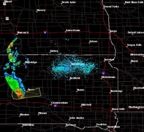 At 437 pm cdt/337 pm mdt/, a severe thunderstorm was located 8 miles east of wendte, or 10 miles southwest of fort pierre, moving east at 45 mph. this is a very dangerous storm (radar indicated). Hazards include baseball size hail and 60 mph wind gusts. People and animals outdoors will be severely injured. expect shattered windows, extensive damage to roofs, siding, and vehicles. this severe thunderstorm will be near, pierre and fort pierre around 450 pm cdt. rousseau around 505 pm cdt. canning around 510 pm cdt. Degrey rec area around 515 pm cdt. At 437 pm cdt/337 pm mdt/, a severe thunderstorm was located 8 miles east of wendte, or 10 miles southwest of fort pierre, moving east at 45 mph. this is a very dangerous storm (radar indicated). Hazards include baseball size hail and 60 mph wind gusts. People and animals outdoors will be severely injured. expect shattered windows, extensive damage to roofs, siding, and vehicles. this severe thunderstorm will be near, pierre and fort pierre around 450 pm cdt. rousseau around 505 pm cdt. canning around 510 pm cdt. Degrey rec area around 515 pm cdt.
|
| 5/25/2016 3:06 PM MDT | Quarter sized hail reported 30.7 miles ENE of Fort Pierre, SD |
| 5/24/2016 10:20 PM CDT | Gust recorded on 1059pm observation. event time estimated by rada in lyman county SD, 17.6 miles NNW of Fort Pierre, SD |
| 9/7/2015 6:39 PM CDT |
 At 638 pm cdt /538 pm mdt/, a severe thunderstorm was located over pierre, moving northeast at 35 mph (trained weather spotters). Hazards include golf ball size hail and 60 mph wind gusts. People and animals outdoors will be injured. expect hail damage to roofs, siding, windows and vehicles. expect wind damage to roofs, siding and trees. This severe storm will be near, southern lake oahe around 645 pm cdt. At 638 pm cdt /538 pm mdt/, a severe thunderstorm was located over pierre, moving northeast at 35 mph (trained weather spotters). Hazards include golf ball size hail and 60 mph wind gusts. People and animals outdoors will be injured. expect hail damage to roofs, siding, windows and vehicles. expect wind damage to roofs, siding and trees. This severe storm will be near, southern lake oahe around 645 pm cdt.
|
| 9/7/2015 6:38 PM CDT | Golf Ball sized hail reported 0.5 miles NNE of Fort Pierre, SD |
| 9/7/2015 6:36 PM CDT | Hen Egg sized hail reported 0.5 miles NNE of Fort Pierre, SD |
| 9/7/2015 5:16 PM MDT |
 At 616 pm cdt /516 pm mdt/, a severe thunderstorm was located near wendte, or 9 miles southwest of fort pierre, moving northeast at 45 mph (radar indicated). Hazards include 60 mph wind gusts and quarter size hail. Hail damage to vehicles is expected. expect wind damage to roofs, siding and trees. this severe thunderstorm will be near, pierre, fort pierre and west shore rec area around 530 pm mdt. overlook rec area and southern lake oahe around 635 pm cdt. Grey goose around 640 pm cdt. At 616 pm cdt /516 pm mdt/, a severe thunderstorm was located near wendte, or 9 miles southwest of fort pierre, moving northeast at 45 mph (radar indicated). Hazards include 60 mph wind gusts and quarter size hail. Hail damage to vehicles is expected. expect wind damage to roofs, siding and trees. this severe thunderstorm will be near, pierre, fort pierre and west shore rec area around 530 pm mdt. overlook rec area and southern lake oahe around 635 pm cdt. Grey goose around 640 pm cdt.
|
| 8/8/2015 5:34 PM MDT | Quarter sized hail reported 19.7 miles ESE of Fort Pierre, SD |
| 7/27/2015 10:15 PM CDT |
 At 1014 pm cdt /914 pm mdt/, severe thunderstorms were located along a line extending from lake oahe to westover, moving east at 50 mph (radar indicated). Hazards include 70 mph wind gusts. Expect considerable tree damage. damage is likely to mobile homes, roofs and outbuildings. severe thunderstorms will be near, westover around 920 pm mdt. mission ridge around 925 pm mdt. little bend rec area around 935 pm mdt. bush`s landing around 1045 pm cdt. Earling hills around 1050 pm cdt. At 1014 pm cdt /914 pm mdt/, severe thunderstorms were located along a line extending from lake oahe to westover, moving east at 50 mph (radar indicated). Hazards include 70 mph wind gusts. Expect considerable tree damage. damage is likely to mobile homes, roofs and outbuildings. severe thunderstorms will be near, westover around 920 pm mdt. mission ridge around 925 pm mdt. little bend rec area around 935 pm mdt. bush`s landing around 1045 pm cdt. Earling hills around 1050 pm cdt.
|
| 6/22/2015 1:46 AM MDT |
 At 246 am cdt /146 am mdt/, a severe thunderstorm was located over fort pierre, moving east at 60 mph. this is a very dangerous storm (radar indicated). Hazards include 80 mph wind gusts and quarter size hail. Flying debris will be dangerous to those caught without shelter. mobile homes will be heavily damaged. expect considerable damage to roofs, windows and vehicles. extensive tree damage and power outages are likely. This severe storm will be near, canning and rousseau around 300 am cdt. At 246 am cdt /146 am mdt/, a severe thunderstorm was located over fort pierre, moving east at 60 mph. this is a very dangerous storm (radar indicated). Hazards include 80 mph wind gusts and quarter size hail. Flying debris will be dangerous to those caught without shelter. mobile homes will be heavily damaged. expect considerable damage to roofs, windows and vehicles. extensive tree damage and power outages are likely. This severe storm will be near, canning and rousseau around 300 am cdt.
|
| 6/22/2015 1:20 AM MDT |
 At 220 am cdt /120 am mdt/, a severe thunderstorm was located over hayes, or 30 miles west of fort pierre, moving east at 65 mph (radar indicated). Hazards include 70 mph wind gusts. Expect considerable tree damage. damage is likely to mobile homes, roofs and outbuildings. this severe thunderstorm will be near, chantler creek recreation area around 135 am mdt. oahe mission rec area around 140 am mdt. pierre, fort pierre, overlook rec area, southern lake oahe, west shore rec area and grey goose around 145 am mdt. Blunt, canning and rousseau around 300 am cdt. At 220 am cdt /120 am mdt/, a severe thunderstorm was located over hayes, or 30 miles west of fort pierre, moving east at 65 mph (radar indicated). Hazards include 70 mph wind gusts. Expect considerable tree damage. damage is likely to mobile homes, roofs and outbuildings. this severe thunderstorm will be near, chantler creek recreation area around 135 am mdt. oahe mission rec area around 140 am mdt. pierre, fort pierre, overlook rec area, southern lake oahe, west shore rec area and grey goose around 145 am mdt. Blunt, canning and rousseau around 300 am cdt.
|
| 6/19/2015 11:11 PM MDT |
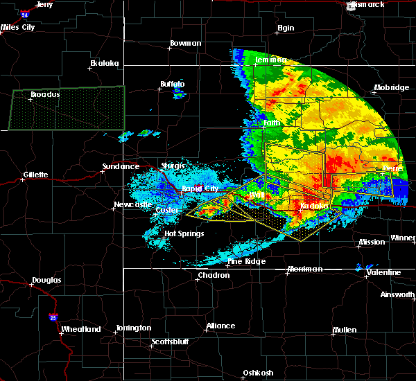 At 1211 am cdt /1111 pm mdt/, a severe thunderstorm was located 7 miles northwest of van metre, or 25 miles northwest of murdo, moving east at 50 mph (radar indicated). Hazards include 70 mph wind gusts and quarter size hail. Hail damage to vehicles is expected. expect considerable tree damage. wind damage is also likely to mobile homes, roofs and outbuildings. this severe thunderstorm will be near, van metre around 1120 pm mdt. Wendte around 1125 pm mdt. At 1211 am cdt /1111 pm mdt/, a severe thunderstorm was located 7 miles northwest of van metre, or 25 miles northwest of murdo, moving east at 50 mph (radar indicated). Hazards include 70 mph wind gusts and quarter size hail. Hail damage to vehicles is expected. expect considerable tree damage. wind damage is also likely to mobile homes, roofs and outbuildings. this severe thunderstorm will be near, van metre around 1120 pm mdt. Wendte around 1125 pm mdt.
|
| 6/14/2015 6:41 AM CDT |
 At 640 am cdt /540 am mdt/, a severe thunderstorm was located near wendte, or 10 miles southwest of fort pierre, moving northeast at 40 mph (radar indicated). Hazards include 60 mph wind gusts and quarter size hail. Hail damage to vehicles is expected. expect wind damage to roofs, siding and trees. this severe storm will be near, west shore rec area around 555 am mdt. Pierre, fort pierre, overlook rec area and southern lake oahe around 700 am cdt. At 640 am cdt /540 am mdt/, a severe thunderstorm was located near wendte, or 10 miles southwest of fort pierre, moving northeast at 40 mph (radar indicated). Hazards include 60 mph wind gusts and quarter size hail. Hail damage to vehicles is expected. expect wind damage to roofs, siding and trees. this severe storm will be near, west shore rec area around 555 am mdt. Pierre, fort pierre, overlook rec area and southern lake oahe around 700 am cdt.
|
| 6/14/2015 5:18 AM MDT |
 At 616 am cdt /516 am mdt/, a severe thunderstorm was located near sansarc, or 29 miles west of fort pierre, moving east at 60 mph (radar indicated). Hazards include 60 mph wind gusts and nickel size hail. Expect damage to roofs. siding and trees. this severe thunderstorm will be near, chantler creek recreation area around 535 am mdt. oahe mission rec area, spring creek rec area, cow creek rec area, west shore rec area and okobojo point rec area around 640 am cdt. Grey goose, southern lake oahe and overlook rec area around 645 am cdt. At 616 am cdt /516 am mdt/, a severe thunderstorm was located near sansarc, or 29 miles west of fort pierre, moving east at 60 mph (radar indicated). Hazards include 60 mph wind gusts and nickel size hail. Expect damage to roofs. siding and trees. this severe thunderstorm will be near, chantler creek recreation area around 535 am mdt. oahe mission rec area, spring creek rec area, cow creek rec area, west shore rec area and okobojo point rec area around 640 am cdt. Grey goose, southern lake oahe and overlook rec area around 645 am cdt.
|
| 6/17/2013 10:05 PM MDT | A combination of hail... size unknown... and winds shredded a corn field. farmer reported still seeing hail in the ditches this mornin in stanley county SD, 0.9 miles S of Fort Pierre, SD |
| 5/18/2013 5:53 PM MDT | Half Dollar sized hail reported 24.8 miles SE of Fort Pierre, SD, several half dollar sized hail stones with quarter sized hail covering the ground |
| 5/18/2013 5:41 PM MDT | Quarter sized hail reported 22.4 miles SE of Fort Pierre, SD, quarter sized hail with 1.70 inches of rainfall |
| 5/18/2013 5:25 PM MDT | Quarter sized hail reported 22 miles ESE of Fort Pierre, SD, quarter sized hail reported a few miles northwest of chantler creek rec area. torrential rain |
| 5/17/2013 7:51 PM MDT | Trained spotter reported 61 mph wind gust measured with anemometer in stanley county SD, 6.5 miles SSE of Fort Pierre, SD |
| 6/9/2012 10:54 PM MDT | Quarter sized hail reported 25.4 miles E of Fort Pierre, SD |
| 6/9/2012 10:54 PM MDT | Hen Egg sized hail reported 28.5 miles E of Fort Pierre, SD |
| 1/1/0001 12:00 AM | Storm damage reported in stanley county SD, 9.5 miles N of Fort Pierre, SD |
| 1/1/0001 12:00 AM | Measured at vivian rwis in stanley county SD, 9.5 miles N of Fort Pierre, SD |
| 1/1/0001 12:00 AM | Storm damage reported in stanley county SD, 12.1 miles E of Fort Pierre, SD |
| 1/1/0001 12:00 AM | Quarter sized hail reported 30.2 miles SE of Fort Pierre, SD |
Hail Maps for Fort Pierre, SD
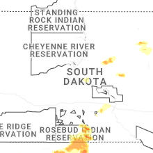
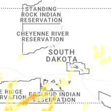


Connect with Interactive Hail Maps