

Hail Map for Saturday, July 6, 2019

Number of Impacted Households on 7/6/2019
0
Impacted by 1" or Larger Hail
0
Impacted by 1.75" or Larger Hail
0
Impacted by 2.5" or Larger Hail
Square Miles of Populated Area Impacted on 7/6/2019
0
Impacted by 1" or Larger Hail
0
Impacted by 1.75" or Larger Hail
0
Impacted by 2.5" or Larger Hail


Cities Most Affected by Hail Storms of 7/6/2019
| Hail Size | Demographics of Zip Codes Affected | ||||||
|---|---|---|---|---|---|---|---|
| City | Count | Average | Largest | Pop Density | House Value | Income | Age |
| Clearmont, WY | 1 | 2.75 | 2.75 | 0 | $65k | $35.2k | 43.8 |
| Laramie, WY | 1 | 1.75 | 1.75 | 66 | $120k | $25.8k | 25.5 |
Hail and Wind Damage Spotted on 7/6/2019
Filter by Report Type:Hail ReportsWind Reports
States Impacted
Vermont, North Carolina, Pennsylvania, Maine, New York, New Jersey, New Hampshire, Oklahoma, Illinois, Connecticut, West Virginia, Massachusetts, Alabama, Ohio, Virginia, Indiana, Tennessee, Montana, Maryland, District of Columbia, Wyoming, Texas, NebraskaVermont
| Local Time | Report Details |
|---|---|
| 1:04 PM EDT | Spotter reported trees down at the intersection of river road and power plant road between north duxbury and waterbur in washington county VT, 21.5 miles ESE of Burlington, VT |
| 1:16 PM EDT | State police reports tree down on telephone wires at kenneth ward swimming hole on rt 100b in washington county VT, 27.6 miles ESE of Burlington, VT |
| 2:55 PM EDT | Vermont state police reports multiple trees down along route 140 in middletown spring in rutland county VT, 62 miles NE of Schenectady, NY |
North Carolina
| Local Time | Report Details |
|---|---|
| 1:35 PM EDT | Tree down near haystack rd and luffman rd intersection. time estimated from rada in surry county NC, 74.9 miles E of Bristol, TN |
| 1:40 PM EDT | Tree down on cedar creek dr near us 2 in surry county NC, 74.3 miles N of Charlotte, NC |
| 1:45 PM EDT | Reports of several trees down in the jonesville area. time estimate from rada in yadkin county NC, 69.5 miles N of Charlotte, NC |
| 3:30 PM EDT | 911 call center reported trees and power lines down on hart rd at everett rd. time estimated from rada in transylvania county NC, 29 miles N of Greenville, SC |
Pennsylvania
| Local Time | Report Details |
|---|---|
| 1:38 PM EDT | Trees and wires down in warren county PA, 69.6 miles S of Buffalo, NY |
| 1:40 PM EDT | Trees and wires down in warren county PA, 67.8 miles S of Buffalo, NY |
| 2:31 PM EDT | Tree onto a house on mt jackson rd in lawrence county PA, 42.6 miles NNW of Pittsburgh, PA |
| 3:00 PM EDT | Trees down in clearfield county PA, 52.2 miles WNW of State College, PA |
| 3:10 PM EDT | Trees down in union township in clearfield county PA, 46.3 miles WNW of State College, PA |
| 3:11 PM EDT | Trees down in beaver county PA, 33.9 miles NW of Pittsburgh, PA |
| 3:15 PM EDT | Trees down near pa-949 in cherry tree flats in elk county PA, 62.8 miles NW of State College, PA |
| 3:20 PM EDT | Trees down in beaver county PA, 29.5 miles NW of Pittsburgh, PA |
| 3:20 PM EDT | Power lines down in beaver county PA, 26.8 miles NNW of Pittsburgh, PA |
| 3:20 PM EDT | Trees down in pine township in clearfield county PA, 40.2 miles WNW of State College, PA |
| 3:24 PM EDT | Trees down blcoking the road in beaver county PA, 19.5 miles NNW of Pittsburgh, PA |
| 3:55 PM EDT | Tree down on vehicle in clinton county PA, 37.5 miles N of State College, PA |
| 4:12 PM EDT | Trees down in westmoreland county PA, 15.9 miles NE of Pittsburgh, PA |
| 4:16 PM EDT | Trees down in allegheny county PA, 13.7 miles ENE of Pittsburgh, PA |
| 4:16 PM EDT | Trees down in westmoreland county PA, 19 miles E of Pittsburgh, PA |
| 4:25 PM EDT | Tree on wires in centre county PA, 8.1 miles N of State College, PA |
| 4:29 PM EDT | Trees down in hopewell twp in beaver county PA, 17.2 miles WNW of Pittsburgh, PA |
| 4:30 PM EDT | Tree down in centre county PA, 9.3 miles NNE of State College, PA |
| 4:32 PM EDT | Wires down in penn township and greensburg. time estimated from rada in westmoreland county PA, 22.9 miles ESE of Pittsburgh, PA |
| 4:37 PM EDT | Trees and wires down on reed road in rush township in northumberland county PA, 59.5 miles SW of Scranton, PA |
| 4:39 PM EDT | Trees down on state route 981 in westmoreland county PA, 28.9 miles E of Pittsburgh, PA |
| 4:48 PM EDT | Large branches down in allegheny county PA, 7.3 miles SSW of Pittsburgh, PA |
| 5:00 PM EDT | Trees down in westmoreland county PA, 37.6 miles ESE of Pittsburgh, PA |
| 5:01 PM EDT | Trees down in westmoreland county PA, 42.3 miles ESE of Pittsburgh, PA |
| 5:11 PM EDT | Trees down in westmoreland county PA, 19.8 miles SE of Pittsburgh, PA |
| 5:20 PM EDT | Trees and wires down on roxbury ave in cambria county PA, 57.3 miles E of Pittsburgh, PA |
| 5:20 PM EDT | Trees down in westmoreland county PA, 22.7 miles SSE of Pittsburgh, PA |
| 5:25 PM EDT | Multiple trees down at intersection of rt 202 and 413. time estimated from rada in bucks county PA, 61.6 miles WSW of Brooklyn, NY |
| 5:37 PM EDT | Trees and wires down on reed road in rush township in northumberland county PA, 59.5 miles SW of Scranton, PA |
| 5:55 PM EDT | Trees and wires dow in schuylkill county PA, 68.4 miles SW of Scranton, PA |
| 6:19 PM EDT | Trees down in north londonderry township in lebanon county PA, 71 miles N of Baltimore, MD |
| 6:25 PM EDT | Multiple trees down in middle paxton township in dauphin county PA, 57 miles ESE of State College, PA |
| 6:25 PM EDT | Multiple trees down in susquehanna township in dauphin county PA, 64 miles ESE of State College, PA |
| 6:25 PM EDT | Tree down in dauphin county PA, 67.8 miles N of Baltimore, MD |
| 6:35 PM EDT | Multiple trees down in derry township in dauphin county PA, 68.3 miles N of Baltimore, MD |
| 6:48 PM EDT | Wires down along green acre road in warwick townshi in lancaster county PA, 60.6 miles NNE of Baltimore, MD |
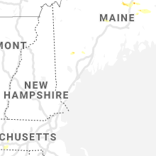
Maine
| Local Time | Report Details |
|---|---|
| 1:40 PM EDT | Tree across roadway near intersection of transalpine and collins point r in penobscot county ME, 37.6 miles NNE of Bangor, ME |
| 1:40 PM EDT | Wires down on stanhope r in penobscot county ME, 37.2 miles NNE of Bangor, ME |
| 1:55 PM EDT | Wires down on cottage r in penobscot county ME, 60.1 miles N of Bangor, ME |
| 2:06 PM EDT | Wires and trees down in millinocket. reported by penobscot county sherif in penobscot county ME, 59.3 miles N of Bangor, ME |
| 2:30 PM EDT | Trees and wires down. reported by penobscot county sherif in penobscot county ME, 41.3 miles NNE of Bangor, ME |
| 2:32 PM EDT | Large tree down on us 1. the tree was large enough to completely block the roa in aroostook county ME, 44.2 miles S of Caribou, ME |
| 2:40 PM EDT | Wires down on mcgreggor r in penobscot county ME, 38 miles NNE of Bangor, ME |
| 2:48 PM EDT | Trees down on route 1 four miles south of danfort in washington county ME, 71.1 miles NE of Bangor, ME |
| 3:38 PM EDT | Trees and wires down on paris and oxford roads in oxford county ME, 38.1 miles NNW of Portland, ME |
| 3:48 PM EDT | Trees down on river rd in androscoggin county ME, 44.8 miles N of Portland, ME |
| 4:05 PM EDT | Trees and wires down on hallowell rd in litchfield in kennebec county ME, 35.5 miles NNE of Portland, ME |
| 4:14 PM EDT | Wires and trees dow in penobscot county ME, 6.9 miles W of Bangor, ME |
| 4:44 PM EDT | Trees and wires dow in york county ME, 28.8 miles WSW of Portland, ME |
New York
| Local Time | Report Details |
|---|---|
| 1:57 PM EDT | Trees down on road in columbia county NY, 30.3 miles SSE of Schenectady, NY |
| 2:46 PM EDT | Metal shed destroyed at lowes and blown into walmart in greenpor in columbia county NY, 38 miles SSE of Schenectady, NY |
| 3:40 PM EDT | Trees down on creekslocks rd and schoolhouse lan in ulster county NY, 66.7 miles S of Schenectady, NY |
| 4:18 PM EDT | Numerous trees and wires down in the villag in dutchess county NY, 52 miles S of Schenectady, NY |
| 4:20 PM EDT | Tree down north of east kerley rd in dutchess county NY, 53.5 miles S of Schenectady, NY |
| 4:40 PM EDT | One tree down south of catskill on route 9 in greene county NY, 42.3 miles S of Schenectady, NY |
| 4:40 PM EDT | Metal shed destroyed at lowes and blown into walmart in greenpor in columbia county NY, 38 miles SSE of Schenectady, NY |
New Jersey
| Local Time | Report Details |
|---|---|
| 2:07 PM EDT | Vehicle overturned at gaither dr. and fellowship rd. natural gas leaks and some building damage. time estimated from rada in burlington county NJ, 72.9 miles SW of Brooklyn, NY |
New Hampshire
| Local Time | Report Details |
|---|---|
| 2:08 PM EDT | Trees over road in stark in coos county NH, 86.7 miles NW of Portland, ME |
| 3:48 PM EDT | Tree down on riverside dr in grafton county NH, 68.9 miles W of Portland, ME |
| 3:55 PM EDT | Tree down on mason rd in carroll county NH, 58.4 miles W of Portland, ME |
Oklahoma
| Local Time | Report Details |
|---|---|
| 1:49 PM CDT | Storm damage reported in okfuskee county OK, 51.7 miles SSW of Tulsa, OK |
Illinois
| Local Time | Report Details |
|---|---|
| 1:55 PM CDT | 12 diameter branch broken off of tre in kankakee county IL, 42.5 miles S of Chicago, IL |
| 4:55 PM CDT | One large tree and several large branches downed as reported to county dispatc in livingston county IL, 51.9 miles ENE of Peoria, IL |
| 5:00 PM CDT | One downed wooden utility pole near e 1200 north roa in livingston county IL, 50.9 miles E of Peoria, IL |
| 5:18 PM CDT | Measured by an anemometer on vehicl in livingston county IL, 54.6 miles E of Peoria, IL |
Connecticut
| Local Time | Report Details |
|---|---|
| 3:19 PM EDT | Tree limb down at the intersection of farms road and riverbank roa in fairfield county CT, 35.9 miles NE of Brooklyn, NY |
| 3:22 PM EDT | Tree down on frogtown road between welles lane and frogtown lan in fairfield county CT, 39.8 miles NE of Brooklyn, NY |
| 3:25 PM EDT | Tree limb down at the intersection of high ridge road and hickory roa in fairfield county CT, 39.1 miles NE of Brooklyn, NY |
| 4:25 PM EDT | Trees down on route 6 in litchfield county CT, 66.6 miles SSE of Schenectady, NY |
| 5:00 PM EDT | Telephone pole down and wires on burr mtn r in litchfield county CT, 78.3 miles SE of Schenectady, NY |
West Virginia
| Local Time | Report Details |
|---|---|
| 3:48 PM EDT | Trees down in hancock county WV, 34.1 miles WNW of Pittsburgh, PA |
| 4:04 PM EDT | Several trees down in hancock county WV, 32.8 miles W of Pittsburgh, PA |
| 7:03 PM EDT | Tree reported down on the 4000 block of hammonds mill roa in berkeley county WV, 73.6 miles WNW of Baltimore, MD |
| 7:41 PM EDT | Tree down along jacobs run roa in harrison county WV, 46.1 miles WNW of Elkins, WV |
| 7:58 PM EDT | Tree down along indian run roa in harrison county WV, 42.9 miles NW of Elkins, WV |
| 8:33 PM EDT | Flooded structure along reno stree in harrison county WV, 35.8 miles NW of Elkins, WV |
Massachusetts
| Local Time | Report Details |
|---|---|
| 3:51 PM EDT | Tree down on lennon street in worcester county MA, 60 miles NNW of Providence, RI |
| 4:45 PM EDT | Tree down on power lines on three rivers road blocking road in hampden county MA, 52.2 miles WNW of Providence, RI |
| 4:50 PM EDT | Tree on wires on padre road in worcester county MA, 50.4 miles NW of Providence, RI |
| 5:00 PM EDT | Tree down on wires on south street in hampshire county MA, 59.4 miles WNW of Providence, RI |
| 5:06 PM EDT | About 60 trees down in downtown longmeadow... along and just east of route 5... with a few trees down on houses. most likely a wet microburst with approximately 70 mph in hampden county MA, 61.7 miles WNW of Providence, RI |
| 5:10 PM EDT | Tree down on car on hooper street in worcester county MA, 37 miles NNW of Providence, RI |
| 5:14 PM EDT | Tree down on wires near the power plant on red bridge road in hampden county MA, 57.3 miles WNW of Providence, RI |
| 5:14 PM EDT | Wires down on route 20 in hampden county MA, 57.3 miles WNW of Providence, RI |
| 5:15 PM EDT | Multiple trees down on route 5 at bliss street. road closed and impassabl in hampden county MA, 61.7 miles WNW of Providence, RI |
| 5:20 PM EDT | Tree down on hampden road in hampden county MA, 59.6 miles WNW of Providence, RI |
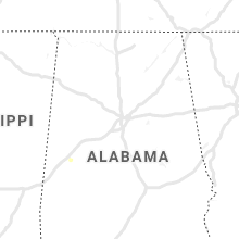
Alabama
| Local Time | Report Details |
|---|---|
| 2:53 PM CDT | Two trees were blown down near the intersection of al highway 20 and the natchez trace. winds estimated at 50 mp in lauderdale county AL, 12.9 miles NW of Florence, AL |
| 3:22 PM CDT | One tree blown down near the intersection of lauderdale crs 219 and 106. delayed repor in lauderdale county AL, 12.5 miles NW of Florence, AL |
| 4:55 PM CDT | Tree blown down on home (no injuries). winds estimated at 50 mph. delayed repor in colbert county AL, 12.6 miles ESE of Florence, AL |
| 5:11 PM CDT | Tree blown down across road. winds estimated at 50 mph. delayed repor in colbert county AL, 3.1 miles SSW of Florence, AL |
| 5:20 PM CDT | Tree blown down across road. winds estimated at 50 mph. delayed repor in colbert county AL, 4.3 miles SW of Florence, AL |
| 5:35 PM CDT | Tree blown down across road. winds estimated at 50 mph. delayed repor in colbert county AL, 5.4 miles E of Florence, AL |
| 5:42 PM CDT | Tree blown down across road. winds estimated at 50 mph. delayed repor in colbert county AL, 12.6 miles SW of Florence, AL |
| 5:48 PM CDT | Tree blown down at stanfields steakhouse. winds estimated at 50 mph. delayed repor in colbert county AL, 8.3 miles E of Florence, AL |
Ohio
| Local Time | Report Details |
|---|---|
| 4:03 PM EDT | Trees down on state route 213 in jefferson county OH, 38.5 miles WNW of Pittsburgh, PA |
| 5:20 PM EDT | Trees down in belmont county OH, 47.2 miles WSW of Pittsburgh, PA |
| 5:24 PM EDT | Power pole down in belmont county OH, 49.2 miles SW of Pittsburgh, PA |
| 6:19 PM EDT | Trees and power lines reported down near beaver run rd se and blacks rd s in licking county OH, 26.7 miles E of Columbus, OH |
| 6:45 PM EDT | Trees and power lines reported down across pleasant chapel rd se located north of blue jay rd s in licking county OH, 37 miles E of Columbus, OH |
Virginia
| Local Time | Report Details |
|---|---|
| 4:34 PM EDT | Tree down in the 7000 block of singers glen road blocking one lane of traffic in rockingham county VA, 56.1 miles ESE of Elkins, WV |
| 4:43 PM EDT | Tree down on powerlines in the 300 block of west duck street in warren county VA, 88.1 miles E of Elkins, WV |
| 6:20 PM EDT | Tree down on marcum farm court near intersection with evergreen mills roa in loudoun county VA, 55.1 miles WSW of Baltimore, MD |
| 6:45 PM EDT | Storm damage reported in loudoun county VA, 47 miles WSW of Baltimore, MD |
| 6:46 PM EDT | Tree down over forest ridge rd and crestview d in fairfax county VA, 47.3 miles WSW of Baltimore, MD |
| 7:10 PM EDT | Tree down blocking right lane of southbound george washington parkway in arlington county VA, 37 miles SW of Baltimore, MD |
| 9:50 PM EDT | Tree reported down by 911 call center. timing estimated by rada in rockbridge county VA, 41.4 miles NE of Roanoke, VA |
| 9:56 PM EDT | 911 call center reported tree down on wesley chapel rd. timing estimated by rada in rockbridge county VA, 43.1 miles NE of Roanoke, VA |
| 10:43 PM EDT | Tree down at intersection of matohe and peters hollow roa in amherst county VA, 48.4 miles ENE of Roanoke, VA |
Indiana
| Local Time | Report Details |
|---|---|
| 4:40 PM EDT | Several 2-6 inch diameter branches downe in white county IN, 80.8 miles NNW of Indianapolis, IN |
Tennessee
| Local Time | Report Details |
|---|---|
| 3:58 PM CDT | Several twitter reports and photos showed scattered trees down in franklin. one tree fell onto a vehicl in williamson county TN, 16.8 miles SSW of Nashville, TN |
Montana
| Local Time | Report Details |
|---|---|
| 4:00 PM MDT | Quarter sized hail reported near Fishtail, MT, 63.7 miles WSW of Billings, MT |
| 4:45 PM MDT | Quarter sized hail reported near Roscoe, MT, 56.8 miles WSW of Billings, MT |
| 5:05 PM MDT | Quarter sized hail reported near Red Lodge, MT, 55.1 miles SW of Billings, MT, hail lasted from 4:50pm to 5:05pm. |
| 6:10 PM MDT | Spotter provided picture of sizable tree limb snapped by thunderstorm wind gusts at corner of 29th st. north and central ave. time estimated via rada in cascade county MT, 2.2 miles E of Great Falls, MT |
| 6:19 PM MDT | Half Dollar sized hail reported near White Sulphur Springs, MT, 60.5 miles N of Bozeman, MT, meagher county des coordinator reported quarter to half dollar-size hail. |
| 6:30 PM MDT | Ping Pong Ball sized hail reported near White Sulphur Springs, MT, 60.5 miles N of Bozeman, MT, spotter provided picture. hail was at least quarter-size. some stones looked to be as big as ping pong balls. |
| 8:27 PM MDT | Quarter sized hail reported near Hamilton, MT, 41.7 miles S of Missoula, MT, report came through social media. |
| 8:36 PM MDT | Quarter sized hail reported near Corvallis, MT, 36.5 miles S of Missoula, MT, report came through social media. |
| 9:54 PM MDT | Quarter sized hail reported near Havre, MT, 7.4 miles E of Havre, MT, spotter reported quarter-size hail and minor flooding on us-2 near mile marker 390. |
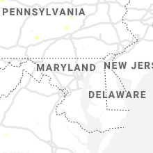
Maryland
| Local Time | Report Details |
|---|---|
| 7:20 PM EDT | Tree down on the 23500 block of peachtree roa in montgomery county MD, 38.8 miles W of Baltimore, MD |
| 7:20 PM EDT | Tree down on the 700 block of smallwood roa in montgomery county MD, 33.1 miles WSW of Baltimore, MD |
| 7:22 PM EDT | Large tree down in the 7100 block of edgevale street in montgomery county MD, 32.7 miles SW of Baltimore, MD |
| 7:25 PM EDT | Tree down on the 500 block of monroe stree in montgomery county MD, 32.4 miles WSW of Baltimore, MD |
| 7:25 PM EDT | Tree down on the 13000 block of newcomer roa in washington county MD, 64.1 miles WNW of Baltimore, MD |
| 7:25 PM EDT | Tree down on the 13000 block of newcomer roa in washington county MD, 58.7 miles WNW of Baltimore, MD |
| 7:38 PM EDT | Multiple reports of trees and wires down in hyattsvill in prince georges county MD, 29.2 miles SW of Baltimore, MD |
| 8:12 PM EDT | Tree report down on the 1600 block of thurston roa in frederick county MD, 40.2 miles W of Baltimore, MD |
| 8:14 PM EDT | Trees and wires down in upper marlbor in prince georges county MD, 33.5 miles SSW of Baltimore, MD |
District of Columbia
| Local Time | Report Details |
|---|---|
| 7:25 PM EDT | Tree down blocking the road at 16th and columbia nw in district of columb county DC, 34 miles SW of Baltimore, MD |
| 7:35 PM EDT | Numerous trees down throughout the district of columbia... including some on cars and houses. two lanes on interstate 295 blocked by downed tree in district of columb county DC, 34.3 miles SW of Baltimore, MD |
| 7:39 PM EDT | Storm damage reported in district of columb county DC, 36.1 miles SW of Baltimore, MD |
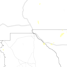
Wyoming
| Local Time | Report Details |
|---|---|
| 5:45 PM MDT | Upr mesonet station rkriv in albany county WY, 35 miles NW of Laramie, WY |
| 6:50 PM MDT | Half Dollar sized hail reported near Laramie, WY, 1.3 miles SE of Laramie, WY, cocorahs observer wy-ab-5. |
| 6:53 PM MDT | Quarter sized hail reported near Laramie, WY, 1.7 miles WSW of Laramie, WY, quarter size hail covering the road at the corner of scherer and riverside in west laramie. |
| 6:57 PM MDT | Half Dollar sized hail reported near Laramie, WY, 1.6 miles E of Laramie, WY, public reported damage to windshield of car from half dollar size hail in laramie. photo shared on twitter. |
| 6:58 PM MDT | Golf Ball sized hail reported near Laramie, WY, 1.4 miles NNE of Laramie, WY |
| 6:59 PM MDT | Quarter sized hail reported near Laramie, WY, 2 miles NE of Laramie, WY, received photo via facebook. |
| 7:07 PM MDT | Quarter sized hail reported near Laramie, WY, 1.3 miles SE of Laramie, WY |
| 7:28 PM MDT | Quarter sized hail reported near Arvada, WY, 37.5 miles WNW of Gillette, WY, nickel to quarter size hail lasted 2 minutes |
| 7:30 PM MDT | Estimating winds from report. public reported winds so strong there was roaring... could not get the front door open... and could barely stan in platte county WY, 50.1 miles NE of Laramie, WY |
| 8:35 PM MDT | Baseball sized hail reported near Clearmont, WY, 58.5 miles NW of Gillette, WY, broke skylights. |
| 9:04 PM MDT | Storm damage reported in laramie county WY, 38 miles SW of Scottsbluff, NE |
Texas
| Local Time | Report Details |
|---|---|
| 6:46 PM CDT | Orla gas plant in culberson county TX, 106.6 miles NNW of Alpine, TX |
| 9:10 PM CDT | Storm damage reported in cochran county TX, 45.7 miles WSW of Lubbock, TX |
Nebraska
| Local Time | Report Details |
|---|---|
| 8:51 PM MDT | Large trees dow in scotts bluff county NE, 7.6 miles W of Scottsbluff, NE |
| 9:01 PM MDT | Multiple large tree branches down. spotter estimates gusts likely neared 70 mp in scotts bluff county NE, 2.9 miles S of Scottsbluff, NE |
| 9:01 PM MDT | Whole tree uprooted in gering. reported by law enforcemen in scotts bluff county NE, 2.9 miles S of Scottsbluff, NE |
| 9:14 PM MDT | Measured using davis system. duration of thunderstorm winds 8 minute in scotts bluff county NE, 1.3 miles ENE of Scottsbluff, NE |
| 9:16 PM MDT | Corrects previous tstm wnd gst report from 1 e scottsbluff. measured using davis system. duration of thunderstorm winds 10 minute in scotts bluff county NE, 1.3 miles ENE of Scottsbluff, NE |
| 9:24 PM MDT | Asos station kbff scottsbluff airport. duration five minute in scotts bluff county NE, 4.3 miles E of Scottsbluff, NE |
| 9:25 PM MDT | Building blown into middle of south mitchell road just north of hwy 9 in scotts bluff county NE, 7.6 miles W of Scottsbluff, NE |
| 9:33 PM MDT | Building blown into middle of south mitchell road just north of hwy 9 in scotts bluff county NE, 7.6 miles W of Scottsbluff, NE |
| 10:58 PM MDT | Storm damage reported in garden county NE, 65.2 miles E of Scottsbluff, NE |
| 11:02 PM MDT | Davis weather statio in keith county NE, 47.6 miles W of North Platte, NE |
Connect with Interactive Hail Maps