

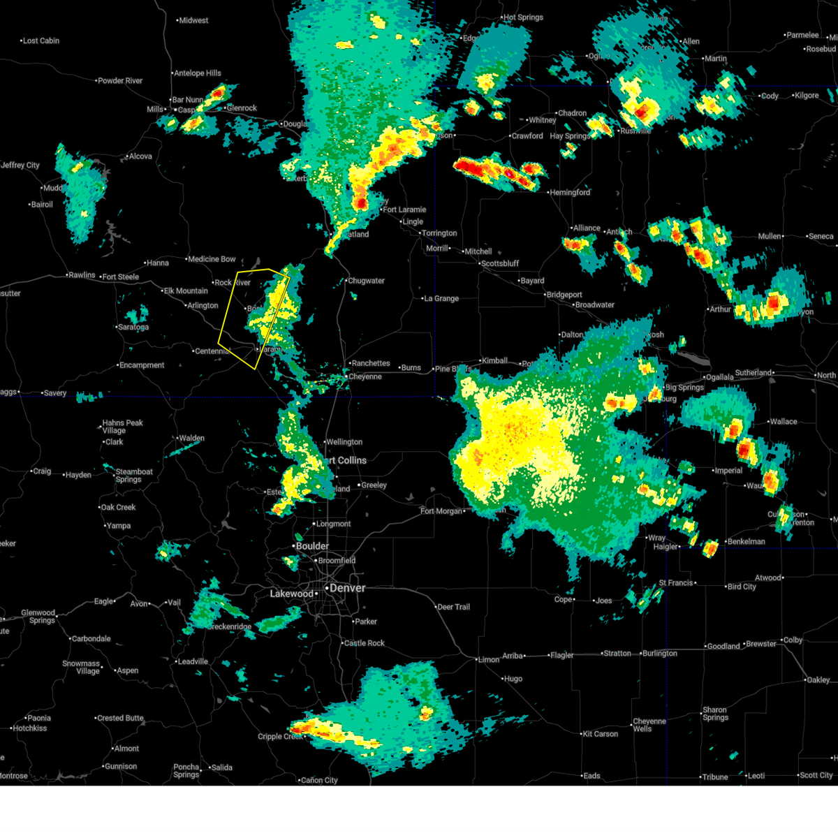
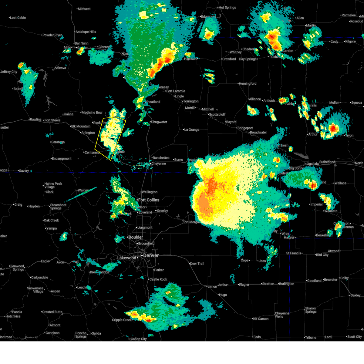
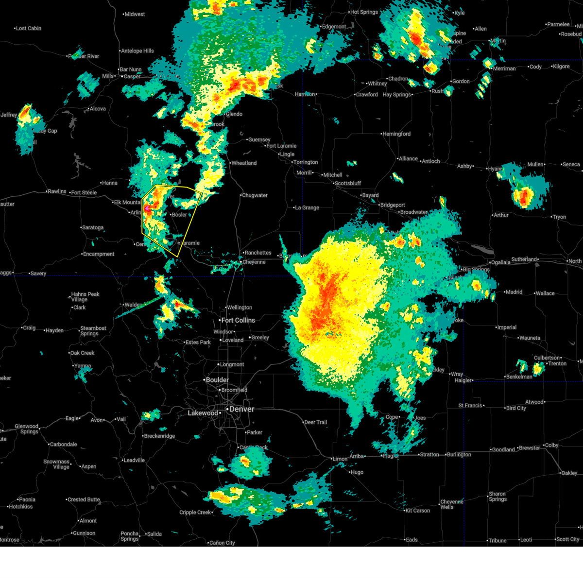
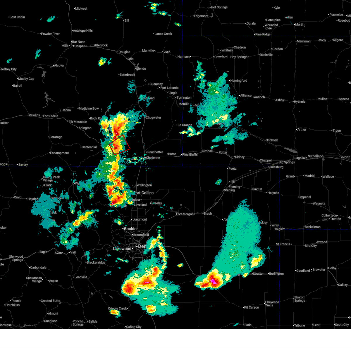
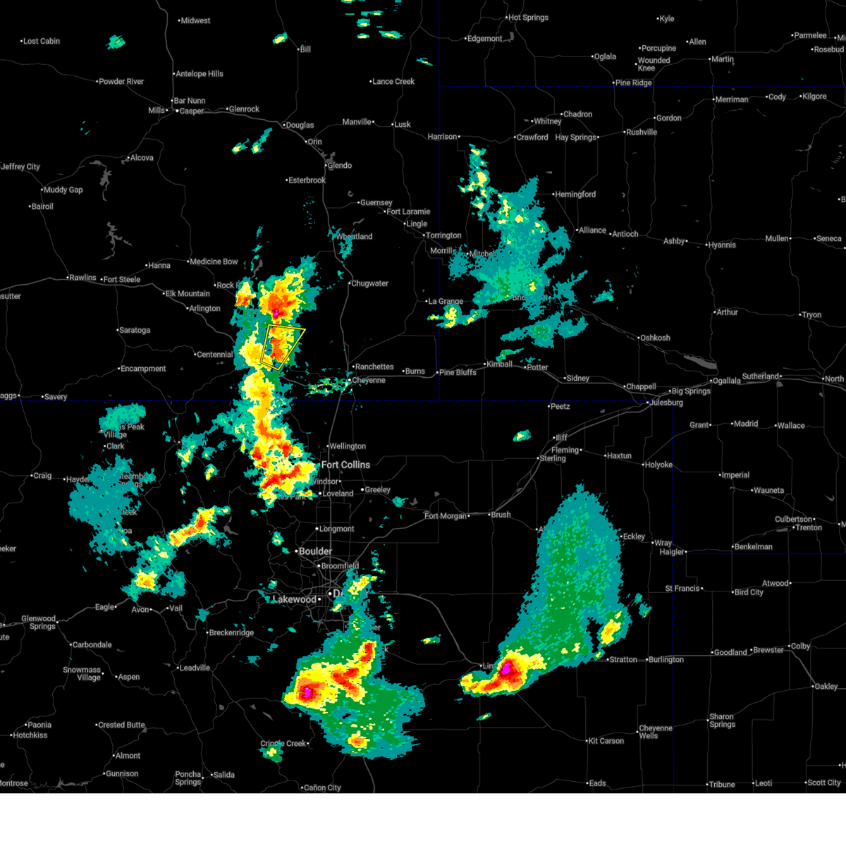
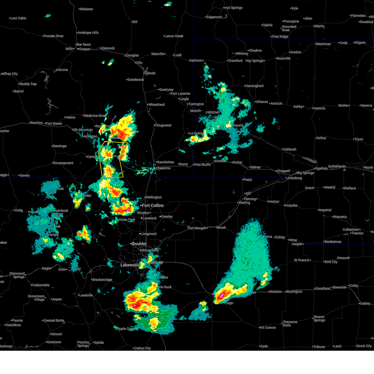
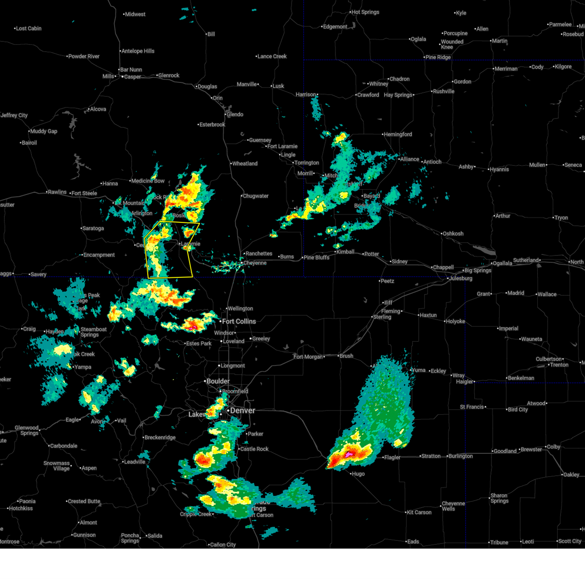
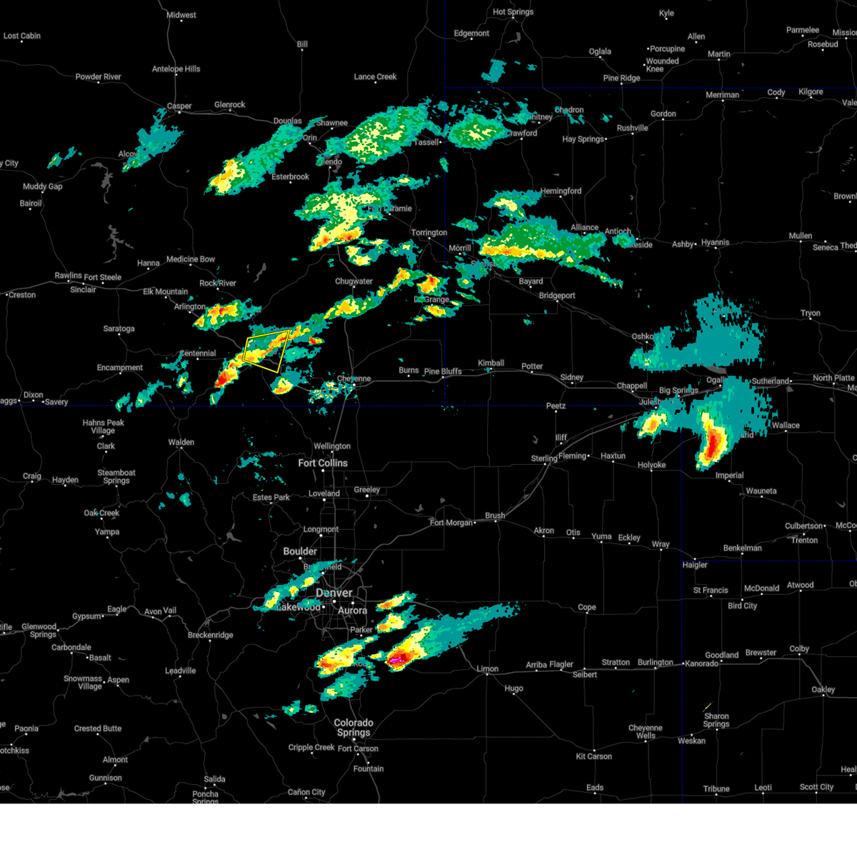
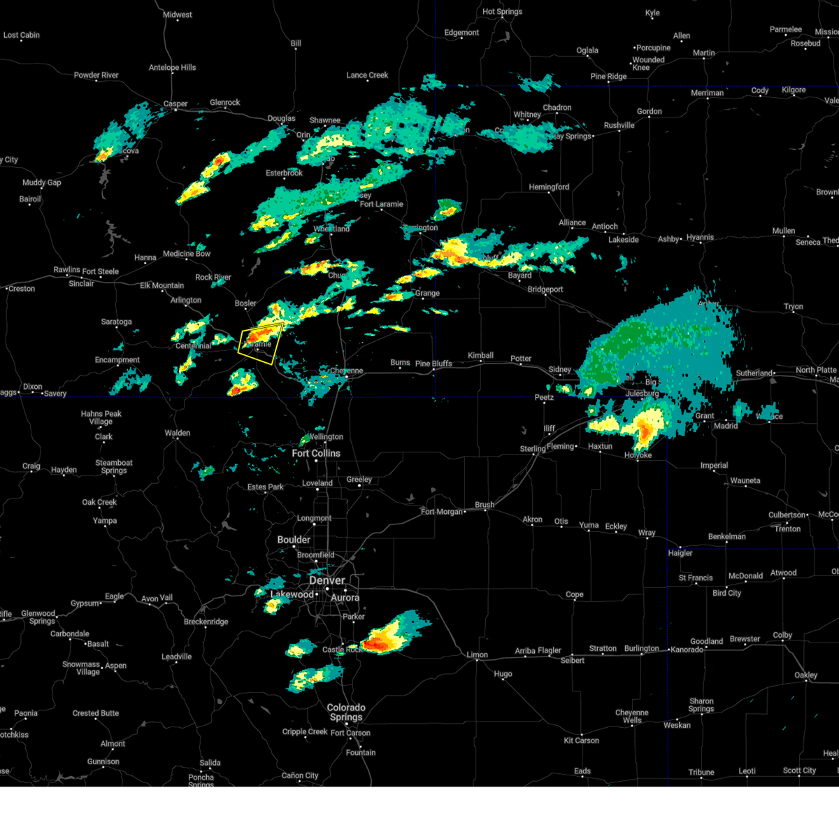
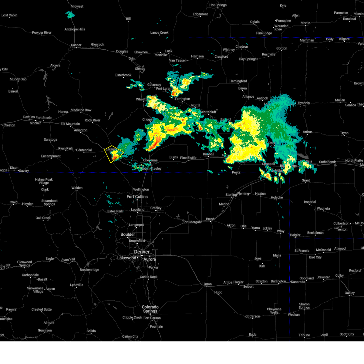
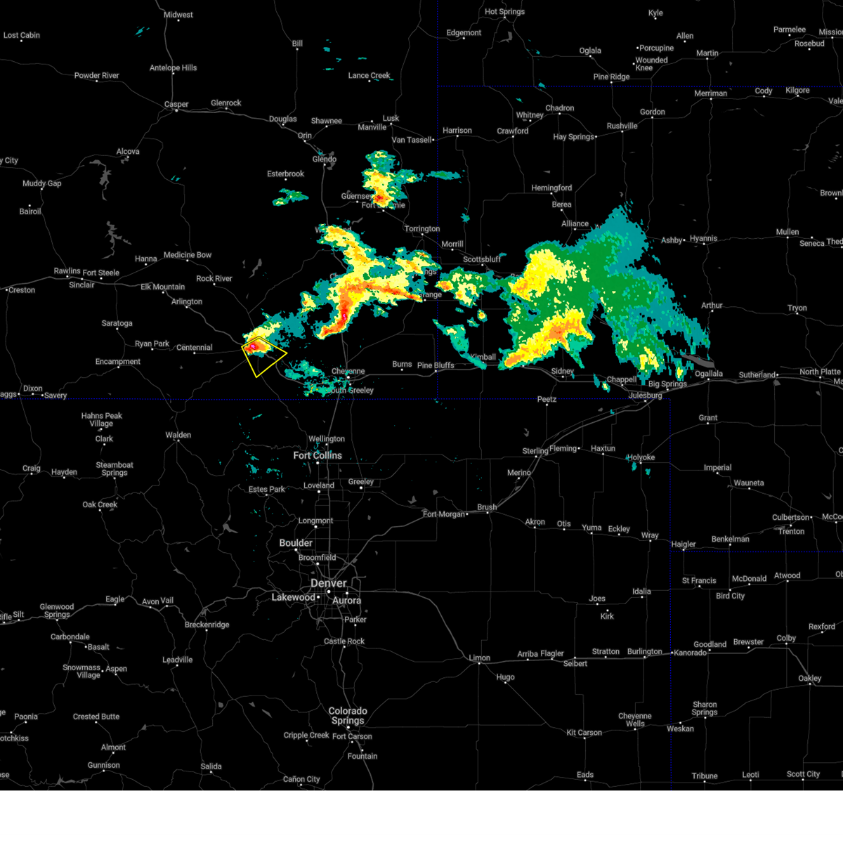
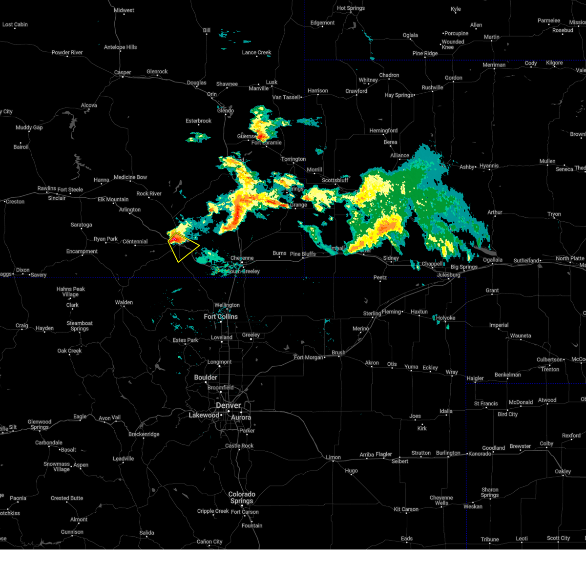
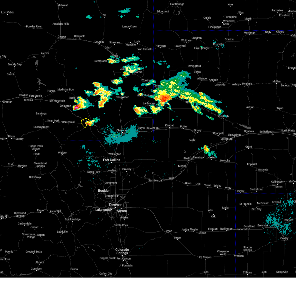
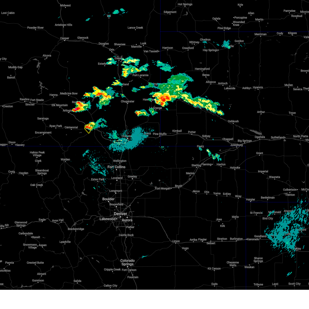
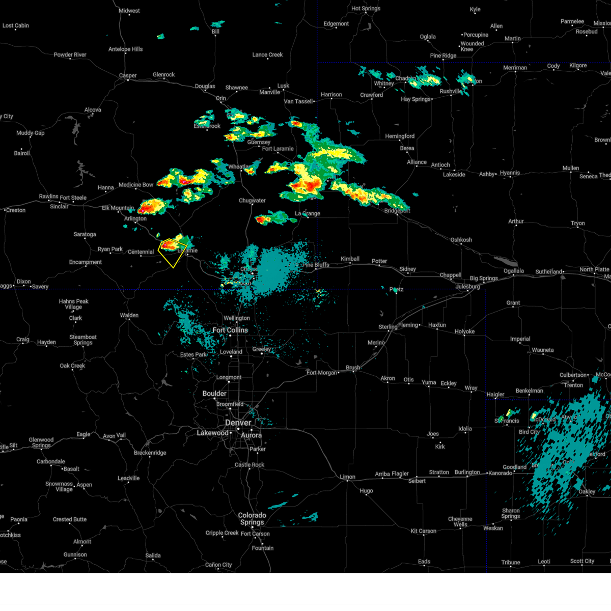
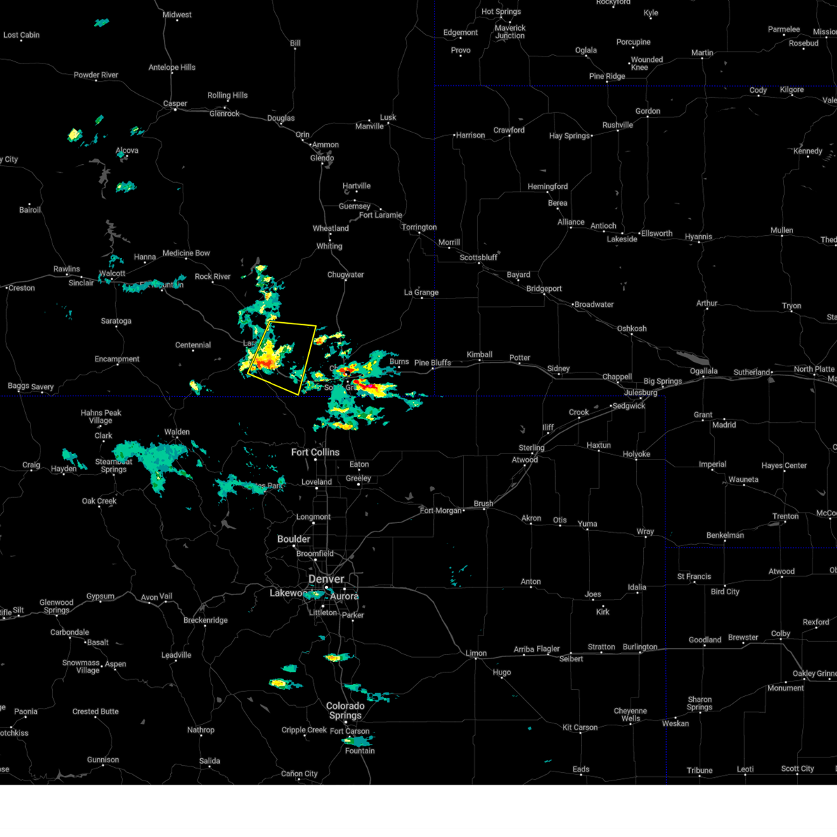
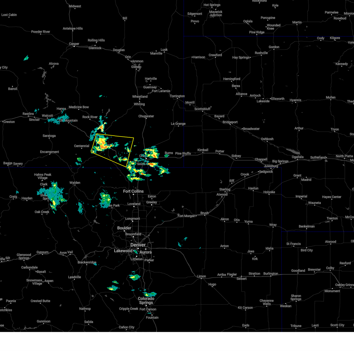
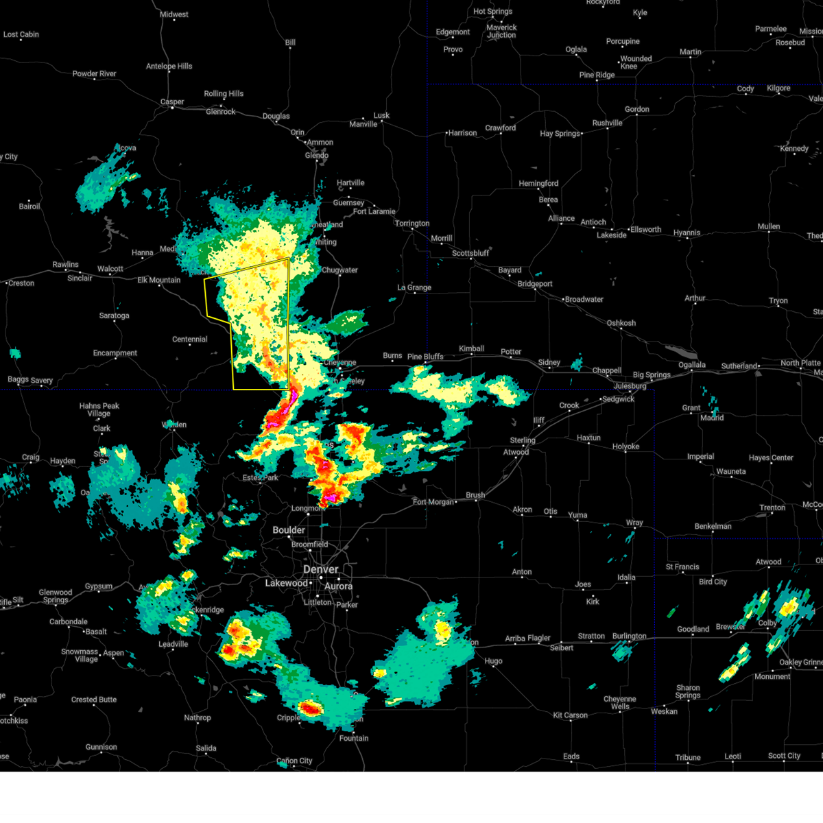
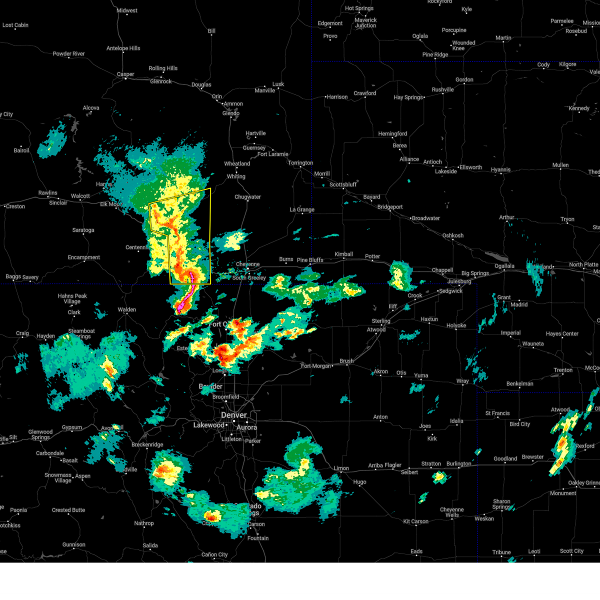
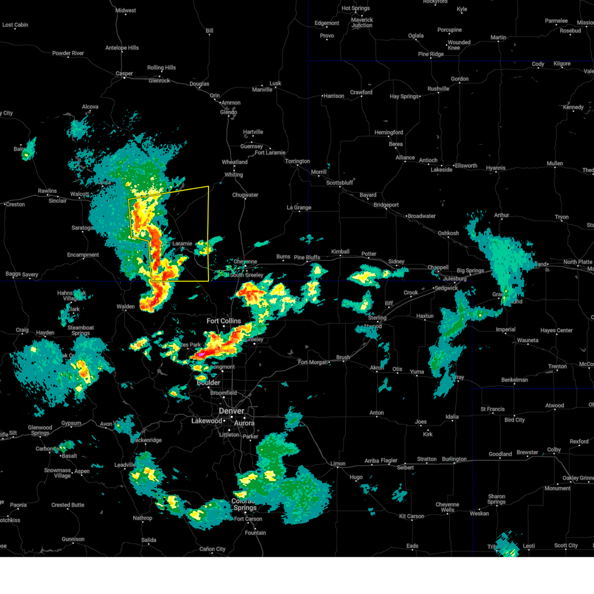
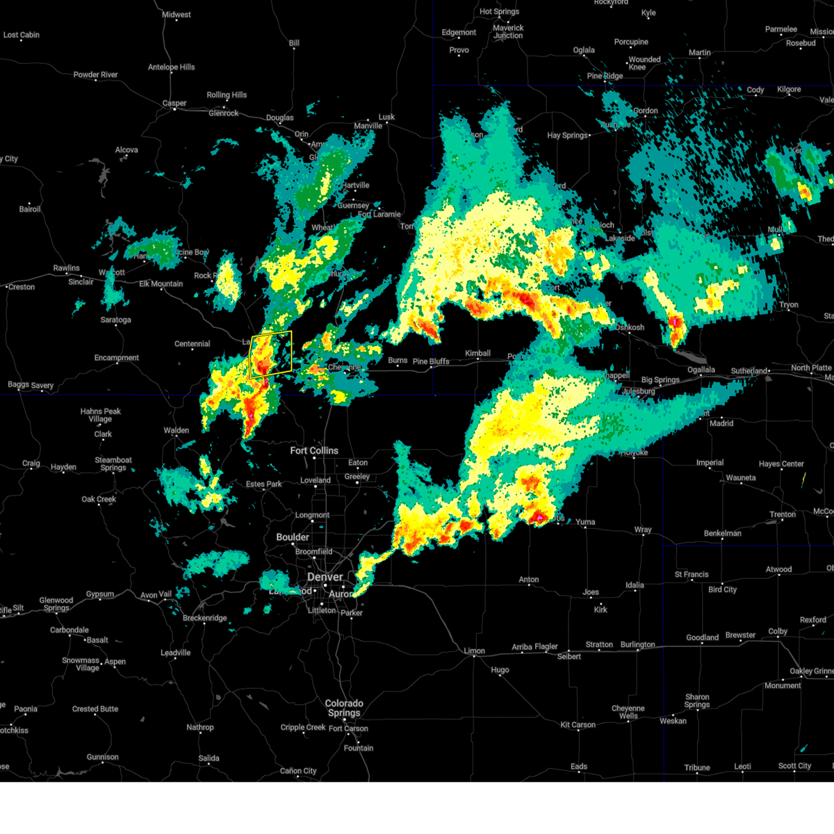
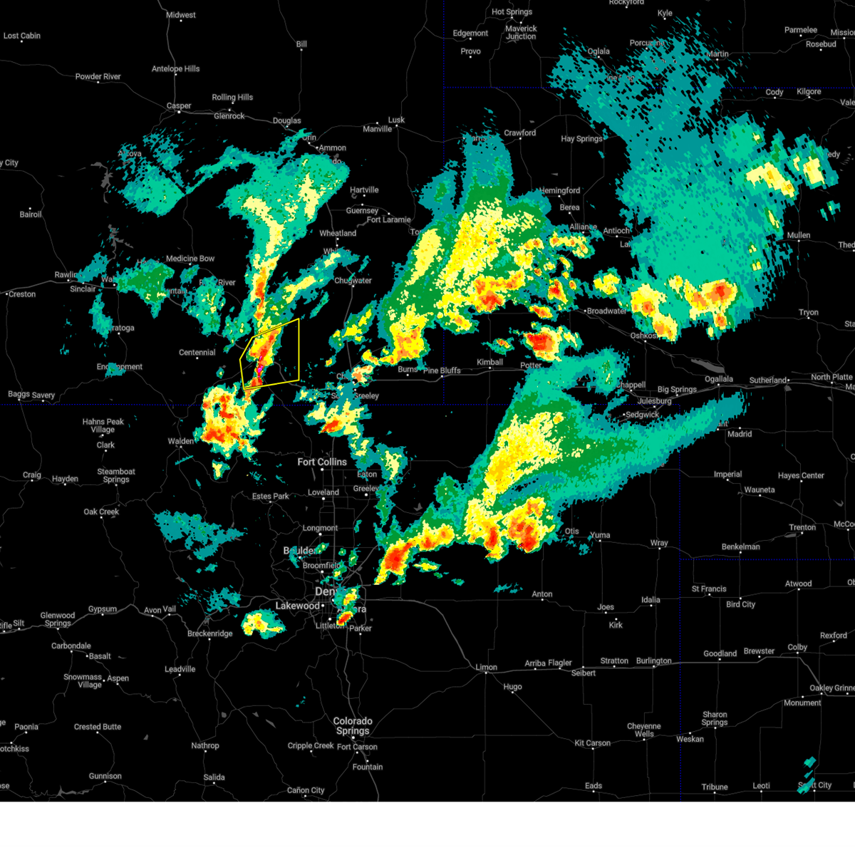
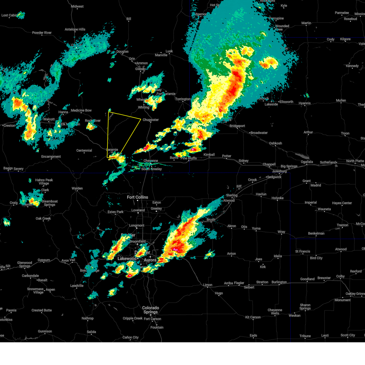
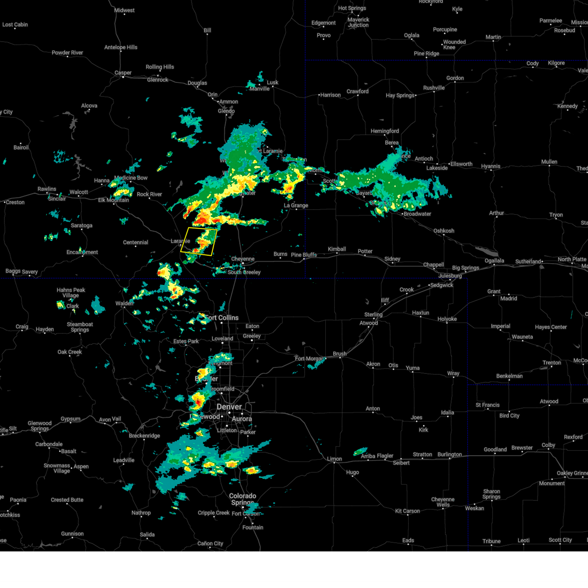
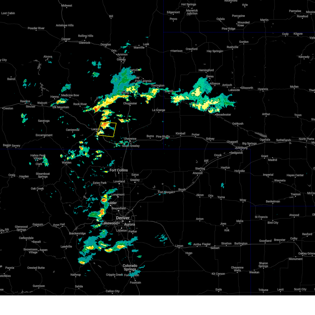
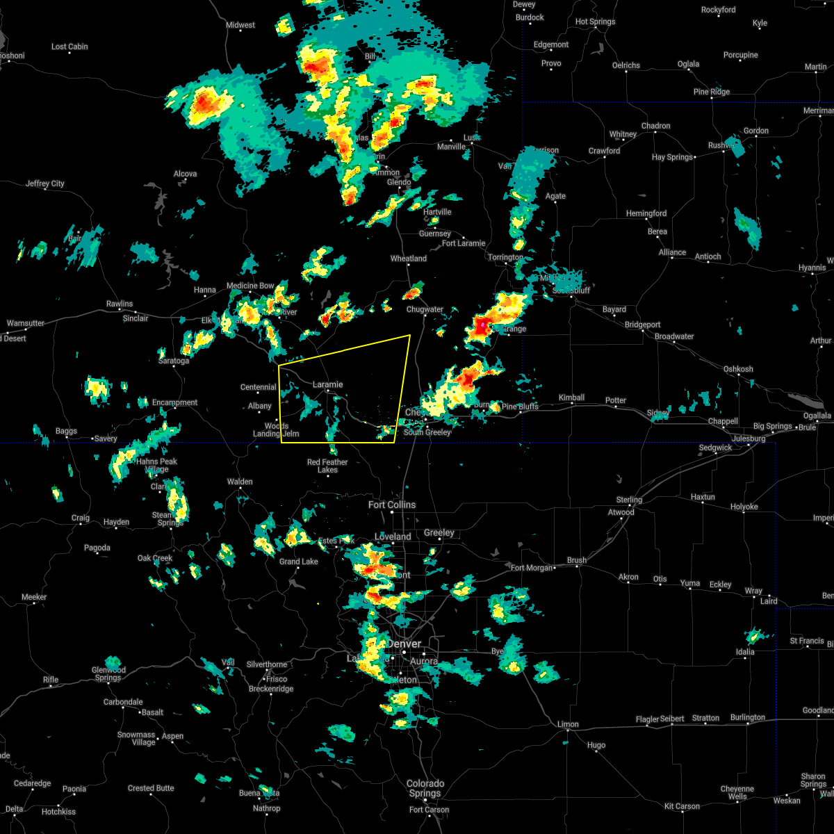
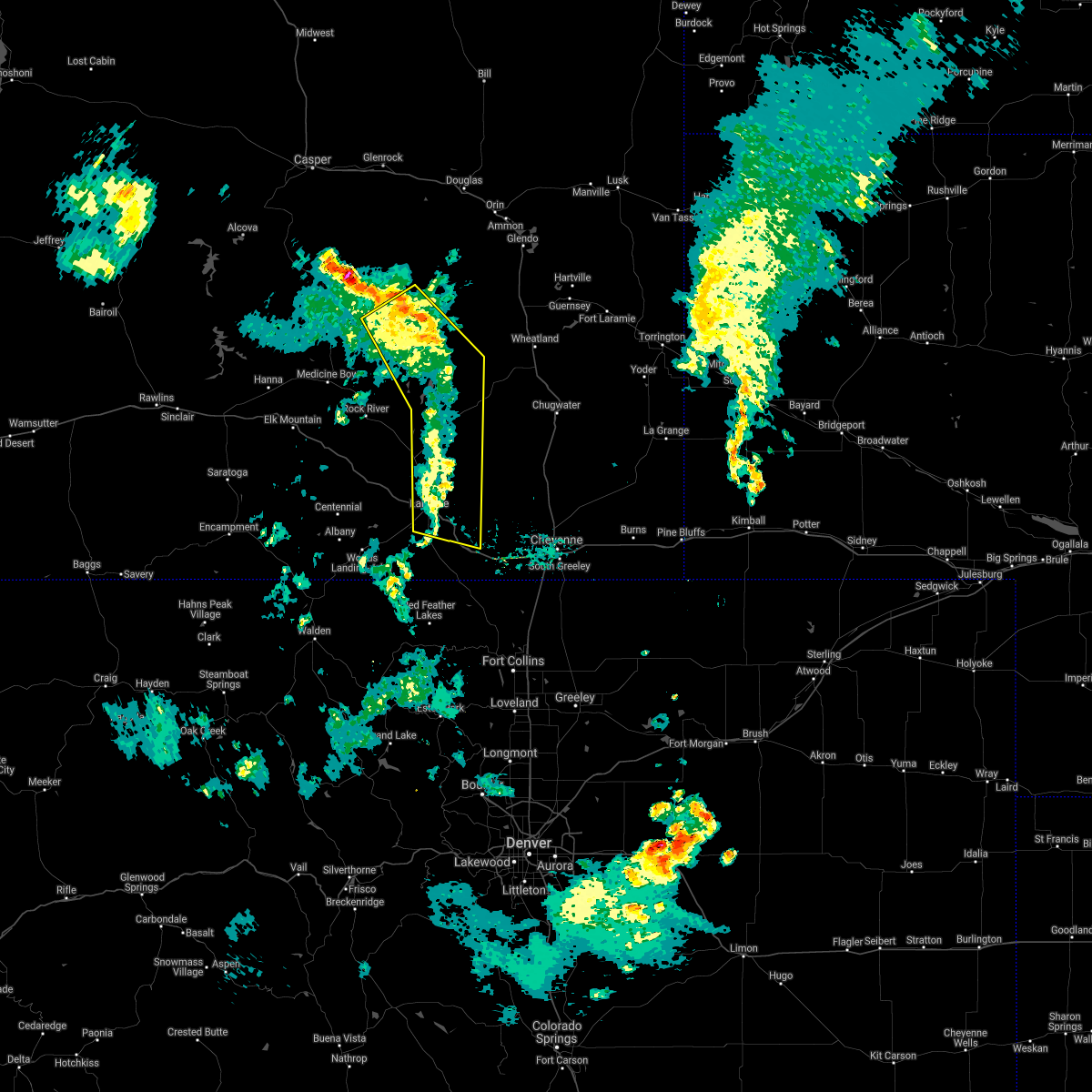
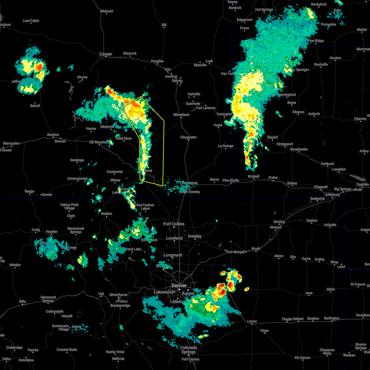
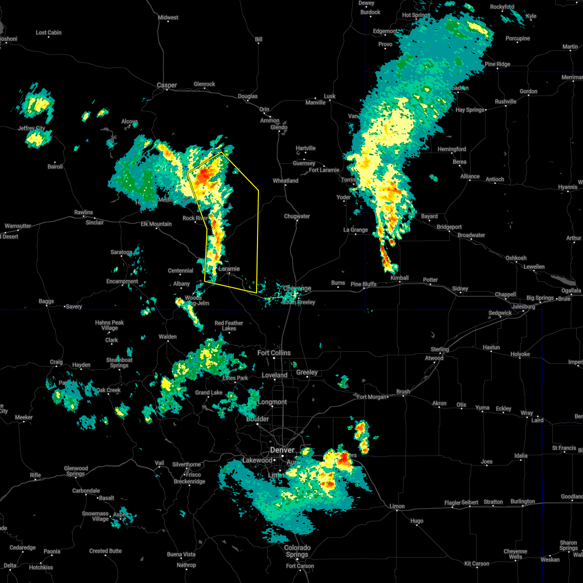
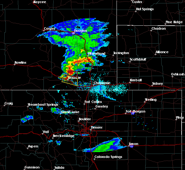
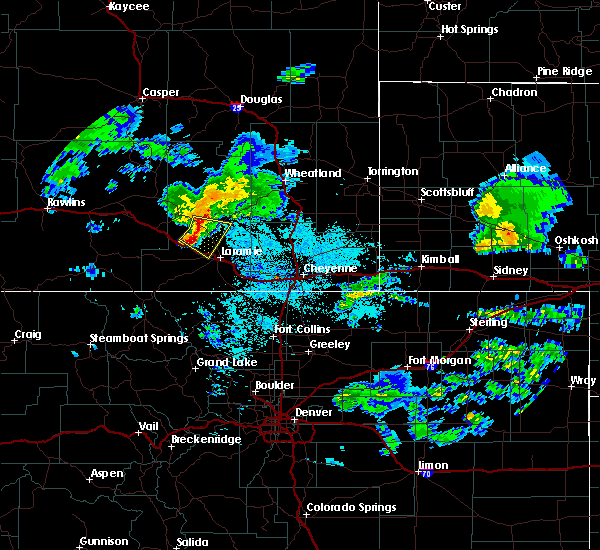
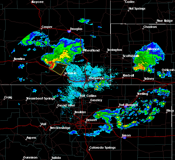
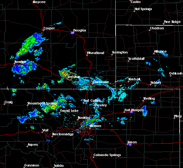
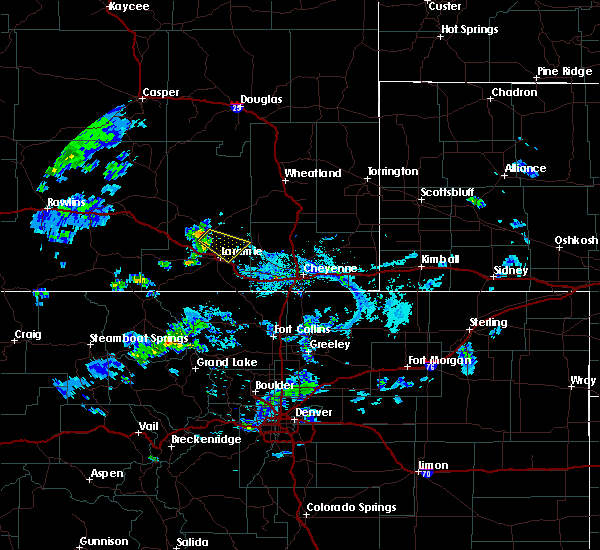
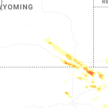
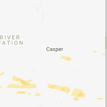
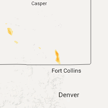
Hail Map for Laramie, WY
The Laramie, WY area has had 34 reports of on-the-ground hail by trained spotters, and has been under severe weather warnings 16 times during the past 12 months. Doppler radar has detected hail at or near Laramie, WY on 33 occasions, including 3 occasions during the past year.
| Name: | Laramie, WY |
| Where Located: | 1 miles WSW of Laramie, WY |
| Map: | Google Map for Laramie, WY |
| Population: | 30816 |
| Housing Units: | 14307 |
| More Info: | Search Google for Laramie, WY |
2
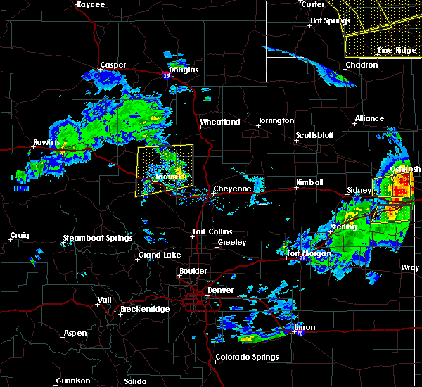
The Top Recent Hail Date for Laramie, WY is Wednesday, August 7, 2024 (4th out of 33)

Hail and Wind Damage Spotted near Laramie, WY
| Date / Time | Report Details |
|---|---|
| 7/11/2025 4:10 PM MDT | Ping Pong Ball sized hail reported 19.8 miles NW of Laramie, WY, public report of accumulating dime size hail along interstate 80. hail about 1 to 3 inches deep in some areas. a few estimated ping pong ball sized hailstones mixed in |
| 6/17/2025 5:25 PM MDT |
 The storms which prompted the warning have moved out of the area. therefore, the warning will be allowed to expire. a severe thunderstorm watch remains in effect until 700 pm mdt for southeastern wyoming. The storms which prompted the warning have moved out of the area. therefore, the warning will be allowed to expire. a severe thunderstorm watch remains in effect until 700 pm mdt for southeastern wyoming.
|
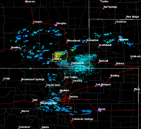
| 6/17/2025 5:06 PM MDT |
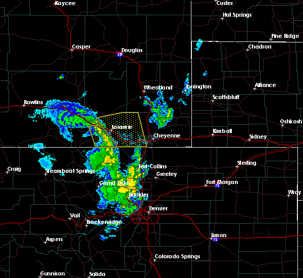
 At 506 pm mdt, severe thunderstorms were located along a line extending from 11 miles southeast of wheatland reservoir number 3 to 8 miles northwest of laramie regional airport, moving east at 35 mph (radar indicated). Hazards include 60 mph wind gusts. Expect damage to roofs, siding, and trees. Locations impacted include, laramie, west laramie, antelope buttes, nine mile, rogers canyon, bosler, university of wyoming war memorial stadium, sybille canyon, baldy peak, laramie regional airport, paddocks, pope springs, and albany county fairgrounds. At 506 pm mdt, severe thunderstorms were located along a line extending from 11 miles southeast of wheatland reservoir number 3 to 8 miles northwest of laramie regional airport, moving east at 35 mph (radar indicated). Hazards include 60 mph wind gusts. Expect damage to roofs, siding, and trees. Locations impacted include, laramie, west laramie, antelope buttes, nine mile, rogers canyon, bosler, university of wyoming war memorial stadium, sybille canyon, baldy peak, laramie regional airport, paddocks, pope springs, and albany county fairgrounds.
|
| 6/17/2025 4:39 PM MDT |
 Svrcys the national weather service in cheyenne has issued a * severe thunderstorm warning for, central albany county in southeastern wyoming, * until 530 pm mdt. * at 439 pm mdt, severe thunderstorms were located along a line extending from 8 miles southwest of wheatland reservoir number 3 to 10 miles northeast of north fork campground, moving southeast at 30 mph (radar indicated). Hazards include 60 mph wind gusts and penny size hail. expect damage to roofs, siding, and trees Svrcys the national weather service in cheyenne has issued a * severe thunderstorm warning for, central albany county in southeastern wyoming, * until 530 pm mdt. * at 439 pm mdt, severe thunderstorms were located along a line extending from 8 miles southwest of wheatland reservoir number 3 to 10 miles northeast of north fork campground, moving southeast at 30 mph (radar indicated). Hazards include 60 mph wind gusts and penny size hail. expect damage to roofs, siding, and trees
|
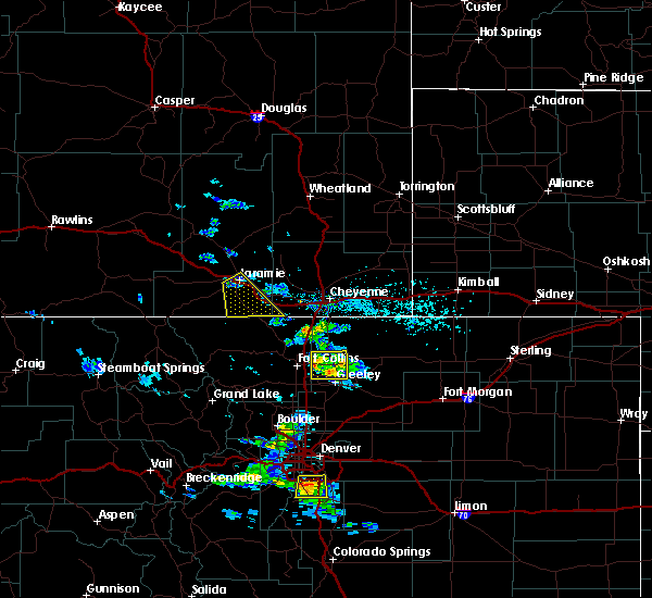
| 6/17/2025 12:30 PM MDT |
 Torcys the national weather service in cheyenne has issued a * tornado warning for, southeastern albany county in southeastern wyoming, west central laramie county in southeastern wyoming, * until 100 pm mdt. * at 1230 pm mdt, a confirmed tornado was located near yellow pine campground, or 8 miles east of laramie, moving northeast at 15 mph (weather spotters confirmed tornado). Hazards include damaging tornado and ping pong ball size hail. Flying debris will be dangerous to those caught without shelter. mobile homes will be damaged or destroyed. damage to roofs, windows, and vehicles will occur. tree damage is likely. This tornadic thunderstorm will remain over mainly rural areas of southeastern albany and west central laramie counties. Torcys the national weather service in cheyenne has issued a * tornado warning for, southeastern albany county in southeastern wyoming, west central laramie county in southeastern wyoming, * until 100 pm mdt. * at 1230 pm mdt, a confirmed tornado was located near yellow pine campground, or 8 miles east of laramie, moving northeast at 15 mph (weather spotters confirmed tornado). Hazards include damaging tornado and ping pong ball size hail. Flying debris will be dangerous to those caught without shelter. mobile homes will be damaged or destroyed. damage to roofs, windows, and vehicles will occur. tree damage is likely. This tornadic thunderstorm will remain over mainly rural areas of southeastern albany and west central laramie counties.
|
| 6/17/2025 12:20 PM MDT |
 At 1220 pm mdt, a severe thunderstorm was located near tie city campground, or near laramie, and is nearly stationary (radar indicated). Hazards include 60 mph wind gusts and quarter size hail. Hail damage to vehicles is expected. expect wind damage to roofs, siding, and trees. Locations impacted include, laramie, rogers canyon, tie city campground, yellow pine campground, and pope springs. At 1220 pm mdt, a severe thunderstorm was located near tie city campground, or near laramie, and is nearly stationary (radar indicated). Hazards include 60 mph wind gusts and quarter size hail. Hail damage to vehicles is expected. expect wind damage to roofs, siding, and trees. Locations impacted include, laramie, rogers canyon, tie city campground, yellow pine campground, and pope springs.
|
| 6/17/2025 12:15 PM MDT | Hen Egg sized hail reported 7.8 miles W of Laramie, WY, photos of hail next to measuring tape. location estimated based on radar. |
| 6/17/2025 12:13 PM MDT | Quarter sized hail reported 4.2 miles WNW of Laramie, WY, accumulating quarter sized hail on the east side of laramie. report received via facebook. |
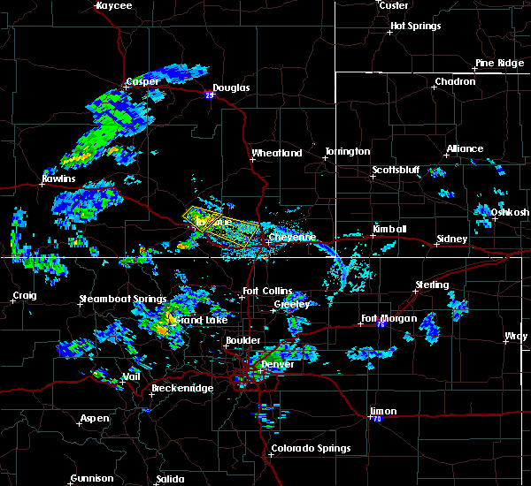
| 6/17/2025 12:08 PM MDT |
 At 1207 pm mdt, severe thunderstorms were located along a line extending from 6 miles south of bosler to near laramie regional airport to near boulder ridge, moving east at 25 mph (radar indicated). Hazards include 60 mph wind gusts and quarter size hail. Hail damage to vehicles is expected. expect wind damage to roofs, siding, and trees. Locations impacted include, laramie, west laramie, antelope buttes, nine mile, rogers canyon, boulder ridge, tie siding, harmony, university of wyoming war memorial stadium, pumpkin vine, twin buttes lake, laramie regional airport, the buttes, hutton lake, wild horse ranch, paddocks, pope springs, and albany county fairgrounds. At 1207 pm mdt, severe thunderstorms were located along a line extending from 6 miles south of bosler to near laramie regional airport to near boulder ridge, moving east at 25 mph (radar indicated). Hazards include 60 mph wind gusts and quarter size hail. Hail damage to vehicles is expected. expect wind damage to roofs, siding, and trees. Locations impacted include, laramie, west laramie, antelope buttes, nine mile, rogers canyon, boulder ridge, tie siding, harmony, university of wyoming war memorial stadium, pumpkin vine, twin buttes lake, laramie regional airport, the buttes, hutton lake, wild horse ranch, paddocks, pope springs, and albany county fairgrounds.
|
| 6/17/2025 12:02 PM MDT |
 Svrcys the national weather service in cheyenne has issued a * severe thunderstorm warning for, southeastern albany county in southeastern wyoming, northwestern laramie county in southeastern wyoming, * until 1245 pm mdt. * at 1201 pm mdt, a severe thunderstorm was located near university of wyoming war memorial stadium, or near laramie, and is nearly stationary (radar indicated). Hazards include golf ball size hail and 60 mph wind gusts. People and animals outdoors will be injured. expect hail damage to roofs, siding, windows, and vehicles. Expect wind damage to roofs, siding, and trees. Svrcys the national weather service in cheyenne has issued a * severe thunderstorm warning for, southeastern albany county in southeastern wyoming, northwestern laramie county in southeastern wyoming, * until 1245 pm mdt. * at 1201 pm mdt, a severe thunderstorm was located near university of wyoming war memorial stadium, or near laramie, and is nearly stationary (radar indicated). Hazards include golf ball size hail and 60 mph wind gusts. People and animals outdoors will be injured. expect hail damage to roofs, siding, windows, and vehicles. Expect wind damage to roofs, siding, and trees.
|
| 6/17/2025 11:44 AM MDT |
 Svrcys the national weather service in cheyenne has issued a * severe thunderstorm warning for, southeastern albany county in southeastern wyoming, * until 1230 pm mdt. * at 1143 am mdt, severe thunderstorms were located along a line extending from 8 miles southwest of bosler to near wild horse ranch to 8 miles southeast of woods landing-jelm, moving east at 20 mph (radar indicated). Hazards include 60 mph wind gusts and nickel size hail. expect damage to roofs, siding, and trees Svrcys the national weather service in cheyenne has issued a * severe thunderstorm warning for, southeastern albany county in southeastern wyoming, * until 1230 pm mdt. * at 1143 am mdt, severe thunderstorms were located along a line extending from 8 miles southwest of bosler to near wild horse ranch to 8 miles southeast of woods landing-jelm, moving east at 20 mph (radar indicated). Hazards include 60 mph wind gusts and nickel size hail. expect damage to roofs, siding, and trees
|
| 5/24/2025 2:30 PM MDT |
 the severe thunderstorm warning has been cancelled and is no longer in effect the severe thunderstorm warning has been cancelled and is no longer in effect
|
| 5/24/2025 1:53 PM MDT |
 Svrcys the national weather service in cheyenne has issued a * severe thunderstorm warning for, southeastern albany county in southeastern wyoming, * until 245 pm mdt. * at 152 pm mdt, a severe thunderstorm was located over laramie regional airport, or near laramie, moving east at 10 mph (radar indicated). Hazards include 60 mph wind gusts and quarter size hail. Hail damage to vehicles is expected. Expect wind damage to roofs, siding, and trees. Svrcys the national weather service in cheyenne has issued a * severe thunderstorm warning for, southeastern albany county in southeastern wyoming, * until 245 pm mdt. * at 152 pm mdt, a severe thunderstorm was located over laramie regional airport, or near laramie, moving east at 10 mph (radar indicated). Hazards include 60 mph wind gusts and quarter size hail. Hail damage to vehicles is expected. Expect wind damage to roofs, siding, and trees.
|
| 8/25/2024 1:02 PM MDT | Mesonet station kvdw vedauwoo (wydot in albany county WY, 14.9 miles NW of Laramie, WY |
| 8/25/2024 1:02 PM MDT | Mesonet station wy28 3.9 nw vedauwoo (wydot in albany county WY, 11.9 miles NW of Laramie, WY |
| 8/25/2024 1:00 PM MDT | Mesonet station pc236 pilot hil in albany county WY, 8.2 miles W of Laramie, WY |
| 8/10/2024 1:12 PM MDT | Mesonet station kvdw vedauwoo (wydot in albany county WY, 14.9 miles NW of Laramie, WY |
| 8/10/2024 1:02 PM MDT | Mesonet station kvdw vedauwoo (wydot in albany county WY, 14.9 miles NW of Laramie, WY |
| 8/8/2024 1:55 AM MDT |
 The storm which prompted the warning has weakened below severe limits, and has exited the warned area. therefore, the warning will be allowed to expire. however, small hail is still possible with this thunderstorm. The storm which prompted the warning has weakened below severe limits, and has exited the warned area. therefore, the warning will be allowed to expire. however, small hail is still possible with this thunderstorm.
|
| 8/8/2024 1:35 AM MDT |
 At 133 am mdt, a severe thunderstorm was located over west laramie, or over laramie, moving southeast at 20 mph. the laramie airport asos station reported a wind gust of 61 mph at 129 am mdt (laramie airport weather station reported). Hazards include 60 mph wind gusts and quarter size hail. Hail damage to vehicles is expected. expect wind damage to roofs, siding, and trees. Locations impacted include, laramie, west laramie, antelope buttes, rogers canyon, tie city campground, university of wyoming war memorial stadium, laramie regional airport, the buttes, paddocks, pope springs, and albany county fairgrounds. At 133 am mdt, a severe thunderstorm was located over west laramie, or over laramie, moving southeast at 20 mph. the laramie airport asos station reported a wind gust of 61 mph at 129 am mdt (laramie airport weather station reported). Hazards include 60 mph wind gusts and quarter size hail. Hail damage to vehicles is expected. expect wind damage to roofs, siding, and trees. Locations impacted include, laramie, west laramie, antelope buttes, rogers canyon, tie city campground, university of wyoming war memorial stadium, laramie regional airport, the buttes, paddocks, pope springs, and albany county fairgrounds.
|
| 8/8/2024 1:34 AM MDT | Asos station klar laramie airport - la in albany county WY, 3.3 miles ESE of Laramie, WY |
| 8/8/2024 1:26 AM MDT |
 Svrcys the national weather service in cheyenne has issued a * severe thunderstorm warning for, southeastern albany county in southeastern wyoming, * until 200 am mdt. * at 126 am mdt, a severe thunderstorm was located over laramie regional airport, or near laramie, moving southeast at 20 mph (radar indicated). Hazards include quarter size hail. damage to vehicles is expected Svrcys the national weather service in cheyenne has issued a * severe thunderstorm warning for, southeastern albany county in southeastern wyoming, * until 200 am mdt. * at 126 am mdt, a severe thunderstorm was located over laramie regional airport, or near laramie, moving southeast at 20 mph (radar indicated). Hazards include quarter size hail. damage to vehicles is expected
|
| 8/8/2024 12:25 AM MDT |
 The storm which prompted the warning has weakened below severe limits, and has exited the warned area. therefore, the warning will be allowed to expire. however, small hail is still possible with this thunderstorm. The storm which prompted the warning has weakened below severe limits, and has exited the warned area. therefore, the warning will be allowed to expire. however, small hail is still possible with this thunderstorm.
|
| 8/8/2024 12:20 AM MDT | Quarter sized hail reported 6.9 miles E of Laramie, WY, delayed report of quarter sized hail 8 miles w of laramie along wy130. time estimated based on radar. |
| 8/8/2024 12:06 AM MDT |
 At 1206 am mdt, a severe thunderstorm was located near laramie regional airport, or 10 miles west of laramie, moving southeast at 15 mph (radar indicated). Hazards include quarter size hail. Damage to vehicles is expected. Locations impacted include, nine mile and laramie regional airport. At 1206 am mdt, a severe thunderstorm was located near laramie regional airport, or 10 miles west of laramie, moving southeast at 15 mph (radar indicated). Hazards include quarter size hail. Damage to vehicles is expected. Locations impacted include, nine mile and laramie regional airport.
|
| 8/7/2024 11:47 PM MDT |
 Svrcys the national weather service in cheyenne has issued a * severe thunderstorm warning for, south central albany county in southeastern wyoming, * until 1230 am mdt. * at 1147 pm mdt, a severe thunderstorm was located 9 miles northeast of wild horse ranch, or 14 miles west of laramie, moving southeast at 15 mph (radar indicated). Hazards include quarter size hail. damage to vehicles is expected Svrcys the national weather service in cheyenne has issued a * severe thunderstorm warning for, south central albany county in southeastern wyoming, * until 1230 am mdt. * at 1147 pm mdt, a severe thunderstorm was located 9 miles northeast of wild horse ranch, or 14 miles west of laramie, moving southeast at 15 mph (radar indicated). Hazards include quarter size hail. damage to vehicles is expected
|
| 8/7/2023 1:06 PM MDT | Mesonet station kvdw vedauwoo (wydot in albany county WY, 14.9 miles NW of Laramie, WY |
| 8/7/2023 1:03 PM MDT |
 At 103 pm mdt, a severe thunderstorm was located over vedauwoo campground, or 14 miles southeast of laramie, moving southeast at 35 mph (radar indicated). Hazards include 60 mph wind gusts. Expect damage to roofs, siding, and trees. locations impacted include, laramie, tie city campground, vedauwoo, university of wyoming war memorial stadium, crystal lake reservoir, crystal lake campground, vedauwoo campground, buford, north crow campground, granite springs reservoir, granite springs campground, horse creek, the buttes and yellow pine campground. this includes interstate 80 in wyoming between mile markers 314 and 340. hail threat, radar indicated max hail size, <. 75 in wind threat, radar indicated max wind gust, 60 mph. At 103 pm mdt, a severe thunderstorm was located over vedauwoo campground, or 14 miles southeast of laramie, moving southeast at 35 mph (radar indicated). Hazards include 60 mph wind gusts. Expect damage to roofs, siding, and trees. locations impacted include, laramie, tie city campground, vedauwoo, university of wyoming war memorial stadium, crystal lake reservoir, crystal lake campground, vedauwoo campground, buford, north crow campground, granite springs reservoir, granite springs campground, horse creek, the buttes and yellow pine campground. this includes interstate 80 in wyoming between mile markers 314 and 340. hail threat, radar indicated max hail size, <. 75 in wind threat, radar indicated max wind gust, 60 mph.
|
| 8/7/2023 12:41 PM MDT |
 At 1241 pm mdt, a severe thunderstorm was located over laramie, moving east at 30 mph (radar indicated). Hazards include 60 mph wind gusts. expect damage to roofs, siding, and trees At 1241 pm mdt, a severe thunderstorm was located over laramie, moving east at 30 mph (radar indicated). Hazards include 60 mph wind gusts. expect damage to roofs, siding, and trees
|
| 8/7/2023 12:32 PM MDT | Mesonet station wy27 14.5 sw bosler (wydot in albany county WY, 12.7 miles ESE of Laramie, WY |
| 7/26/2023 5:58 PM MDT |
 The severe thunderstorm warning for east central carbon, central albany and southwestern converse counties will expire at 600 pm mdt, the storms which prompted the warning have weakened below severe limits, and have exited the warned area. therefore, the warning will be allowed to expire. The severe thunderstorm warning for east central carbon, central albany and southwestern converse counties will expire at 600 pm mdt, the storms which prompted the warning have weakened below severe limits, and have exited the warned area. therefore, the warning will be allowed to expire.
|
| 7/26/2023 5:24 PM MDT |
 At 520 pm mdt, outflow wind gusts from severe thunderstorms were located along a line extending from 14 miles north of rolling hills to near boxelder to 6 miles southwest of garrett to 10 miles north of lake hattie reservoir, moving east at 25 mph (severe wind gusts reported east of casper and along i-80 west of laramie). Hazards include 60 mph wind gusts. expect damage to roofs, siding, and trees At 520 pm mdt, outflow wind gusts from severe thunderstorms were located along a line extending from 14 miles north of rolling hills to near boxelder to 6 miles southwest of garrett to 10 miles north of lake hattie reservoir, moving east at 25 mph (severe wind gusts reported east of casper and along i-80 west of laramie). Hazards include 60 mph wind gusts. expect damage to roofs, siding, and trees
|
| 7/4/2023 6:12 PM MDT |
 The severe thunderstorm warning for southeastern albany county will expire at 615 pm mdt, the storms which prompted the warning have weakened below severe limits, and no longer pose an immediate threat to life or property. therefore, the warning will be allowed to expire. a severe thunderstorm watch remains in effect until 1100 pm mdt for southeastern wyoming. to report severe weather, contact your nearest law enforcement agency. they will relay your report to the national weather service cheyenne. The severe thunderstorm warning for southeastern albany county will expire at 615 pm mdt, the storms which prompted the warning have weakened below severe limits, and no longer pose an immediate threat to life or property. therefore, the warning will be allowed to expire. a severe thunderstorm watch remains in effect until 1100 pm mdt for southeastern wyoming. to report severe weather, contact your nearest law enforcement agency. they will relay your report to the national weather service cheyenne.
|
| 7/4/2023 5:58 PM MDT |
 At 557 pm mdt, severe thunderstorms were located along a line extending from near rock river to near bosler to 8 miles southwest of baldy peak to near pumpkin vine, moving east at 40 mph (radar indicated). Hazards include 70 mph wind gusts and quarter size hail. Hail damage to vehicles is expected. expect considerable tree damage. wind damage is also likely to mobile homes, roofs, and outbuildings. locations impacted include, laramie, rock river, tie city campground, bosler, vedauwoo, tie siding, university of wyoming war memorial stadium, pumpkin vine, vedauwoo campground, buford, north crow campground, baldy peak, the buttes, hutton lake and yellow pine campground. This includes interstate 80 in wyoming between mile markers 301 and 337. At 557 pm mdt, severe thunderstorms were located along a line extending from near rock river to near bosler to 8 miles southwest of baldy peak to near pumpkin vine, moving east at 40 mph (radar indicated). Hazards include 70 mph wind gusts and quarter size hail. Hail damage to vehicles is expected. expect considerable tree damage. wind damage is also likely to mobile homes, roofs, and outbuildings. locations impacted include, laramie, rock river, tie city campground, bosler, vedauwoo, tie siding, university of wyoming war memorial stadium, pumpkin vine, vedauwoo campground, buford, north crow campground, baldy peak, the buttes, hutton lake and yellow pine campground. This includes interstate 80 in wyoming between mile markers 301 and 337.
|
| 7/4/2023 5:35 PM MDT |
 At 535 pm mdt, severe thunderstorms were located along a line extending from near rock river to 15 miles east of arlington to 10 miles southwest of bosler to 7 miles south of hutton lake, moving northeast at 40 mph (radar indicated). Hazards include 70 mph wind gusts and quarter size hail. Hail damage to vehicles is expected. expect considerable tree damage. wind damage is also likely to mobile homes, roofs, and outbuildings. locations impacted include, laramie, rock river, tie city campground, bosler, vedauwoo, tie siding, university of wyoming war memorial stadium, pumpkin vine, vedauwoo campground, buford, north crow campground, baldy peak, lake hattie reservoir, the buttes, hutton lake, arlington, yellow pine campground and woods landing-jelm. This includes interstate 80 in wyoming between mile markers 271 and 337. At 535 pm mdt, severe thunderstorms were located along a line extending from near rock river to 15 miles east of arlington to 10 miles southwest of bosler to 7 miles south of hutton lake, moving northeast at 40 mph (radar indicated). Hazards include 70 mph wind gusts and quarter size hail. Hail damage to vehicles is expected. expect considerable tree damage. wind damage is also likely to mobile homes, roofs, and outbuildings. locations impacted include, laramie, rock river, tie city campground, bosler, vedauwoo, tie siding, university of wyoming war memorial stadium, pumpkin vine, vedauwoo campground, buford, north crow campground, baldy peak, lake hattie reservoir, the buttes, hutton lake, arlington, yellow pine campground and woods landing-jelm. This includes interstate 80 in wyoming between mile markers 271 and 337.
|
| 7/4/2023 5:25 PM MDT |
 At 525 pm mdt, severe thunderstorms were located along a line extending from 9 miles north of arlington to 9 miles south of rock river to 12 miles north of lake hattie reservoir to 9 miles south of hutton lake, moving northeast at 40 mph (radar indicated). Hazards include 70 mph wind gusts and quarter size hail. Hail damage to vehicles is expected. expect considerable tree damage. Wind damage is also likely to mobile homes, roofs, and outbuildings. At 525 pm mdt, severe thunderstorms were located along a line extending from 9 miles north of arlington to 9 miles south of rock river to 12 miles north of lake hattie reservoir to 9 miles south of hutton lake, moving northeast at 40 mph (radar indicated). Hazards include 70 mph wind gusts and quarter size hail. Hail damage to vehicles is expected. expect considerable tree damage. Wind damage is also likely to mobile homes, roofs, and outbuildings.
|
| 6/29/2023 8:53 PM MDT |
 At 852 pm mdt, severe thunderstorms were located along a line extending from near university of wyoming war memorial stadium to near tie city campground to pumpkin vine, moving northeast at 20 mph (public). Hazards include quarter size hail. Damage to vehicles is expected. locations impacted include, laramie, tie city campground, vedauwoo, university of wyoming war memorial stadium, the buttes, vedauwoo campground, yellow pine campground and north crow campground. this includes interstate 80 in wyoming between mile markers 309 and 330. hail threat, radar indicated max hail size, 1. 00 in wind threat, radar indicated max wind gust, <50 mph. At 852 pm mdt, severe thunderstorms were located along a line extending from near university of wyoming war memorial stadium to near tie city campground to pumpkin vine, moving northeast at 20 mph (public). Hazards include quarter size hail. Damage to vehicles is expected. locations impacted include, laramie, tie city campground, vedauwoo, university of wyoming war memorial stadium, the buttes, vedauwoo campground, yellow pine campground and north crow campground. this includes interstate 80 in wyoming between mile markers 309 and 330. hail threat, radar indicated max hail size, 1. 00 in wind threat, radar indicated max wind gust, <50 mph.
|
| 6/29/2023 8:50 PM MDT | Half Dollar sized hail reported 5.4 miles NNE of Laramie, WY |
| 6/29/2023 8:27 PM MDT |
 At 827 pm mdt, severe thunderstorms were located along a line extending from 7 miles north of university of wyoming war memorial stadium to laramie to the buttes, moving northeast at 15 mph (public). Hazards include half dollar size hail. damage to vehicles is expected At 827 pm mdt, severe thunderstorms were located along a line extending from 7 miles north of university of wyoming war memorial stadium to laramie to the buttes, moving northeast at 15 mph (public). Hazards include half dollar size hail. damage to vehicles is expected
|
| 6/29/2023 6:20 PM MDT | Half Dollar sized hail reported 1.7 miles WSW of Laramie, WY, quarter to half dollar sized hail at university of wyoming campus. |
| 6/29/2023 6:16 PM MDT | Quarter sized hail reported 1.5 miles W of Laramie, WY, received image via twitter showing measured hail 1.00 inches in diameter. |
| 6/29/2023 6:10 PM MDT | Golf Ball sized hail reported 1.8 miles SSW of Laramie, WY, received video and text report via twitter of golfball sized hail at the intersection of 4th and reynolds. |
| 6/29/2023 6:06 PM MDT | Quarter sized hail reported 2 miles WNW of Laramie, WY, trained spotter reported hail 1 inch in diameter via phone call. hail and rain continuing. |
| 6/29/2023 6:05 PM MDT |
 At 605 pm mdt, a severe thunderstorm was located over university of wyoming war memorial stadium, or over laramie, moving north at 40 mph (radar indicated). Hazards include 60 mph wind gusts and quarter size hail. Hail damage to vehicles is expected. expect wind damage to roofs, siding, and trees. this severe thunderstorm will be near, baldy peak around 630 pm mdt. this includes interstate 80 in wyoming between mile markers 306 and 321. hail threat, radar indicated max hail size, 1. 00 in wind threat, radar indicated max wind gust, 60 mph. At 605 pm mdt, a severe thunderstorm was located over university of wyoming war memorial stadium, or over laramie, moving north at 40 mph (radar indicated). Hazards include 60 mph wind gusts and quarter size hail. Hail damage to vehicles is expected. expect wind damage to roofs, siding, and trees. this severe thunderstorm will be near, baldy peak around 630 pm mdt. this includes interstate 80 in wyoming between mile markers 306 and 321. hail threat, radar indicated max hail size, 1. 00 in wind threat, radar indicated max wind gust, 60 mph.
|
| 5/18/2023 12:07 PM MDT |
 The severe thunderstorm warning for southeastern albany and west central laramie counties will expire at 1215 pm mdt, the storm which prompted the warning has weakened below severe limits, and no longer poses an immediate threat to life or property. therefore, the warning will be allowed to expire. The severe thunderstorm warning for southeastern albany and west central laramie counties will expire at 1215 pm mdt, the storm which prompted the warning has weakened below severe limits, and no longer poses an immediate threat to life or property. therefore, the warning will be allowed to expire.
|
| 5/18/2023 11:36 AM MDT |
 At 1136 am mdt, a severe thunderstorm was located 10 miles northeast of university of wyoming war memorial stadium, or 11 miles northeast of laramie, moving east at 20 mph (radar indicated). Hazards include 60 mph wind gusts and quarter size hail. Hail damage to vehicles is expected. Expect wind damage to roofs, siding, and trees. At 1136 am mdt, a severe thunderstorm was located 10 miles northeast of university of wyoming war memorial stadium, or 11 miles northeast of laramie, moving east at 20 mph (radar indicated). Hazards include 60 mph wind gusts and quarter size hail. Hail damage to vehicles is expected. Expect wind damage to roofs, siding, and trees.
|
| 9/16/2021 5:06 PM MDT | Mesonet station wy26 12.6 ne centennial (wydot) occurring between 458 and 506 p in albany county WY, 20.5 miles ESE of Laramie, WY |
| 8/6/2021 3:35 PM MDT |
 At 334 pm mdt, severe thunderstorms were located along a line extending from near baldy peak to near pumpkin vine, moving east at 45 mph (radar indicated). Hazards include 70 mph wind gusts. Expect considerable tree damage. damage is likely to mobile homes, roofs, and outbuildings. locations impacted include, laramie, tie city campground, vedauwoo, federal, tie siding, university of wyoming war memorial stadium, crystal lake reservoir, pumpkin vine, crystal lake campground, vedauwoo campground, buford, granite springs reservoir, north crow campground, iron mountain, granite springs campground, horse creek, the buttes and yellow pine campground. this includes interstate 80 in wyoming between mile markers 307 and 349. thunderstorm damage threat, considerable hail threat, radar indicated max hail size, <. 75 in wind threat, radar indicated max wind gust, 70 mph. At 334 pm mdt, severe thunderstorms were located along a line extending from near baldy peak to near pumpkin vine, moving east at 45 mph (radar indicated). Hazards include 70 mph wind gusts. Expect considerable tree damage. damage is likely to mobile homes, roofs, and outbuildings. locations impacted include, laramie, tie city campground, vedauwoo, federal, tie siding, university of wyoming war memorial stadium, crystal lake reservoir, pumpkin vine, crystal lake campground, vedauwoo campground, buford, granite springs reservoir, north crow campground, iron mountain, granite springs campground, horse creek, the buttes and yellow pine campground. this includes interstate 80 in wyoming between mile markers 307 and 349. thunderstorm damage threat, considerable hail threat, radar indicated max hail size, <. 75 in wind threat, radar indicated max wind gust, 70 mph.
|
| 8/6/2021 3:20 PM MDT | Asos station klar laramie airport - la in albany county WY, 3.3 miles ESE of Laramie, WY |
| 8/6/2021 3:18 PM MDT |
 At 316 pm mdt, a line of severe thunderstorms were located near hutton lake, moving east at 45 mph. this is a destructive storm for laramie (radar indicated). Hazards include 80 mph wind gusts. Flying debris will be dangerous to those caught without shelter. mobile homes will be heavily damaged. expect considerable damage to roofs, windows, and vehicles. extensive tree damage and power outages are likely. this severe thunderstorm will remain over mainly rural areas of southeastern albany and western laramie counties. this includes interstate 80 in wyoming between mile markers 288 and 349. thunderstorm damage threat, destructive hail threat, radar indicated max hail size, <. 75 in wind threat, radar indicated max wind gust, 80 mph. At 316 pm mdt, a line of severe thunderstorms were located near hutton lake, moving east at 45 mph. this is a destructive storm for laramie (radar indicated). Hazards include 80 mph wind gusts. Flying debris will be dangerous to those caught without shelter. mobile homes will be heavily damaged. expect considerable damage to roofs, windows, and vehicles. extensive tree damage and power outages are likely. this severe thunderstorm will remain over mainly rural areas of southeastern albany and western laramie counties. this includes interstate 80 in wyoming between mile markers 288 and 349. thunderstorm damage threat, destructive hail threat, radar indicated max hail size, <. 75 in wind threat, radar indicated max wind gust, 80 mph.
|
| 8/6/2021 3:09 PM MDT | Asos station klar laramie airport - la in albany county WY, 3.3 miles ESE of Laramie, WY |
| 8/6/2021 3:06 PM MDT | Mesonet station wy26 12.6 ne centennial (wydot in albany county WY, 20.5 miles ESE of Laramie, WY |
| 7/5/2021 6:55 PM MDT |
 The severe thunderstorm warning for eastern albany county will expire at 700 pm mdt, the storms which prompted the warning have weakened below severe limits, and no longer pose an immediate threat to life or property. therefore, the warning will be allowed to expire. however gusty winds are still possible with these thunderstorms. to report severe weather, contact your nearest law enforcement agency. they will relay your report to the national weather service cheyenne. The severe thunderstorm warning for eastern albany county will expire at 700 pm mdt, the storms which prompted the warning have weakened below severe limits, and no longer pose an immediate threat to life or property. therefore, the warning will be allowed to expire. however gusty winds are still possible with these thunderstorms. to report severe weather, contact your nearest law enforcement agency. they will relay your report to the national weather service cheyenne.
|
| 7/5/2021 6:49 PM MDT |
 At 649 pm mdt, severe thunderstorms were located along a line extending from near garrett to 11 miles east of wheatland reservoir 3 to 11 miles north of baldy peak to laramie, moving east at 30 mph (radar indicated). Hazards include 60 mph wind gusts. Expect damage to roofs, siding, and trees. locations impacted include, laramie, tie city campground, north crow campground, bosler, baldy peak, university of wyoming war memorial stadium, garrett, wheatland reservoir 3 and yellow pine campground. This includes interstate 80 in wyoming between mile markers 306 and 328. At 649 pm mdt, severe thunderstorms were located along a line extending from near garrett to 11 miles east of wheatland reservoir 3 to 11 miles north of baldy peak to laramie, moving east at 30 mph (radar indicated). Hazards include 60 mph wind gusts. Expect damage to roofs, siding, and trees. locations impacted include, laramie, tie city campground, north crow campground, bosler, baldy peak, university of wyoming war memorial stadium, garrett, wheatland reservoir 3 and yellow pine campground. This includes interstate 80 in wyoming between mile markers 306 and 328.
|
| 7/5/2021 6:32 PM MDT |
 At 632 pm mdt, severe thunderstorms were located along a line extending from 11 miles west of garrett to near wheatland reservoir 3 to 8 miles northeast of bosler to 7 miles west of laramie, moving east at 30 mph (radar indicated). Hazards include 60 mph wind gusts. Expect damage to roofs, siding, and trees. locations impacted include, laramie, tie city campground, north crow campground, bosler, baldy peak, university of wyoming war memorial stadium, garrett, wheatland reservoir 3, vedauwoo campground and yellow pine campground. This includes interstate 80 in wyoming between mile markers 296 and 329. At 632 pm mdt, severe thunderstorms were located along a line extending from 11 miles west of garrett to near wheatland reservoir 3 to 8 miles northeast of bosler to 7 miles west of laramie, moving east at 30 mph (radar indicated). Hazards include 60 mph wind gusts. Expect damage to roofs, siding, and trees. locations impacted include, laramie, tie city campground, north crow campground, bosler, baldy peak, university of wyoming war memorial stadium, garrett, wheatland reservoir 3, vedauwoo campground and yellow pine campground. This includes interstate 80 in wyoming between mile markers 296 and 329.
|
| 7/5/2021 6:12 PM MDT |
 At 612 pm mdt, severe thunderstorms were located along a line extending from 10 miles east of battle mountain to near wheatland reservoir 3 to 6 miles northwest of bosler to 7 miles north of lake hattie reservoir, moving east at 30 mph (radar indicated). Hazards include 60 mph wind gusts. expect damage to roofs, siding, and trees At 612 pm mdt, severe thunderstorms were located along a line extending from 10 miles east of battle mountain to near wheatland reservoir 3 to 6 miles northwest of bosler to 7 miles north of lake hattie reservoir, moving east at 30 mph (radar indicated). Hazards include 60 mph wind gusts. expect damage to roofs, siding, and trees
|
| 8/1/2020 5:12 PM MDT | Quarter sized hail reported 3 miles WSW of Laramie, WY |
| 7/21/2020 4:35 PM MDT | Ping Pong Ball sized hail reported 15.3 miles NW of Laramie, WY, via facebook. |
| 7/21/2020 3:30 PM MDT | Quarter sized hail reported 22.3 miles NW of Laramie, WY, hail covered interstate 80. time based on radar. |
| 7/13/2020 4:04 PM MDT | Corrects previous tstm wnd gst report from 3 ne pumpkin vine. dalew in albany county WY, 18.5 miles NNW of Laramie, WY |
| 7/13/2020 3:53 PM MDT | Asos station klar laramie airport - la in albany county WY, 3.3 miles ESE of Laramie, WY |
| 7/13/2020 3:52 PM MDT | Mesonet station wy36 2.4 nw buford (wydot in albany county WY, 18.6 miles NW of Laramie, WY |
| 7/13/2020 3:52 PM MDT | Mesonet station kvdw vedauwoo (wydot in albany county WY, 14.9 miles NW of Laramie, WY |
| 7/13/2020 3:41 PM MDT |
 At 340 pm mdt, severe thunderstorms were located along a line extending from near bosler to 10 miles north of red feather lakes, moving northeast at 45 mph (radar indicated). Hazards include 70 mph wind gusts and penny size hail. Expect considerable tree damage. Damage is likely to mobile homes, roofs, and outbuildings. At 340 pm mdt, severe thunderstorms were located along a line extending from near bosler to 10 miles north of red feather lakes, moving northeast at 45 mph (radar indicated). Hazards include 70 mph wind gusts and penny size hail. Expect considerable tree damage. Damage is likely to mobile homes, roofs, and outbuildings.
|
| 7/13/2020 3:30 PM MDT | Mesonet station fw4449 larami in albany county WY, 16.2 miles NE of Laramie, WY |
| 7/13/2020 3:16 PM MDT |
 At 316 pm mdt, severe thunderstorms were located along a line extending from near rock river to 8 miles northeast of north fork campground to near lake owen, moving east at 45 mph (radar indicated). Hazards include 60 mph wind gusts. expect damage to roofs, siding, and trees At 316 pm mdt, severe thunderstorms were located along a line extending from near rock river to 8 miles northeast of north fork campground to near lake owen, moving east at 45 mph (radar indicated). Hazards include 60 mph wind gusts. expect damage to roofs, siding, and trees
|
| 6/3/2020 5:42 PM MDT | Klar measured a wind gust of 64 knots at the laramie airpor in albany county WY, 3.3 miles ESE of Laramie, WY |
| 6/3/2020 2:53 PM MDT | Corrects previous non-tstm wnd gst report from 4 w laramie. asos station klar laramie airport - la in albany county WY, 3.3 miles ESE of Laramie, WY |
| 4/23/2020 4:53 PM MDT | Storm damage reported in albany county WY, 1.5 miles W of Laramie, WY |
| 8/16/2019 5:11 PM MDT | Mesonet station wy37 1 ese buford - buford east - bf in albany county WY, 21.4 miles NW of Laramie, WY |
| 8/16/2019 4:02 PM MDT | Measured using a vantage pro 2 davis weather sensor sighted 30 feet above groun in albany county WY, 6.5 miles NNW of Laramie, WY |
| 8/16/2019 4:00 PM MDT | Lone tree wydot mesonet observation in albany county WY, 18.6 miles NW of Laramie, WY |
| 7/6/2019 7:13 PM MDT |
 At 712 pm mdt, a severe thunderstorm was located near tie city campground, or near laramie, moving southeast at 25 mph (radar indicated. this storm has a history of producing hail larger than quarters). Hazards include 60 mph wind gusts and half dollar size hail. Hail damage to vehicles is expected. Expect wind damage to roofs, siding, and trees. At 712 pm mdt, a severe thunderstorm was located near tie city campground, or near laramie, moving southeast at 25 mph (radar indicated. this storm has a history of producing hail larger than quarters). Hazards include 60 mph wind gusts and half dollar size hail. Hail damage to vehicles is expected. Expect wind damage to roofs, siding, and trees.
|
| 7/6/2019 7:07 PM MDT | Quarter sized hail reported 2 miles WNW of Laramie, WY |
| 7/6/2019 6:59 PM MDT | Quarter sized hail reported 3 miles WSW of Laramie, WY, received photo via facebook. |
| 7/6/2019 6:58 PM MDT | Golf Ball sized hail reported 2.2 miles SW of Laramie, WY |
| 7/6/2019 6:57 PM MDT | Half Dollar sized hail reported 2.5 miles W of Laramie, WY, public reported damage to windshield of car from half dollar size hail in laramie. photo shared on twitter. |
| 7/6/2019 6:56 PM MDT |
 At 656 pm mdt, a severe thunderstorm was located over university of wyoming war memorial stadium, or over laramie, moving east at 25 mph (trained weather spotters. quarter sized hail was reported in laramie at 655 pm mdt). Hazards include 60 mph wind gusts and quarter size hail. Hail damage to vehicles is expected. expect wind damage to roofs, siding, and trees. locations impacted include, laramie, tie city campground, north crow campground, yellow pine campground and university of wyoming war memorial stadium. This includes interstate 80 in wyoming between mile markers 308 and 326. At 656 pm mdt, a severe thunderstorm was located over university of wyoming war memorial stadium, or over laramie, moving east at 25 mph (trained weather spotters. quarter sized hail was reported in laramie at 655 pm mdt). Hazards include 60 mph wind gusts and quarter size hail. Hail damage to vehicles is expected. expect wind damage to roofs, siding, and trees. locations impacted include, laramie, tie city campground, north crow campground, yellow pine campground and university of wyoming war memorial stadium. This includes interstate 80 in wyoming between mile markers 308 and 326.
|
| 7/6/2019 6:53 PM MDT | Quarter sized hail reported 0.8 miles NE of Laramie, WY, quarter size hail covering the road at the corner of scherer and riverside in west laramie. |
| 7/6/2019 6:50 PM MDT | Half Dollar sized hail reported 2 miles WNW of Laramie, WY, cocorahs observer wy-ab-5. |
| 7/6/2019 6:48 PM MDT |
 At 648 pm mdt, a severe thunderstorm was located near laramie, moving east at 30 mph (radar indicated). Hazards include 60 mph wind gusts and quarter size hail. Hail damage to vehicles is expected. Expect wind damage to roofs, siding, and trees. At 648 pm mdt, a severe thunderstorm was located near laramie, moving east at 30 mph (radar indicated). Hazards include 60 mph wind gusts and quarter size hail. Hail damage to vehicles is expected. Expect wind damage to roofs, siding, and trees.
|
| 6/17/2019 12:40 AM MDT |
 The severe thunderstorm warning for southeastern albany county will expire at 1245 am mdt, the storm which prompted the warning has weakened below severe limits. therefore, the warning will be allowed to expire. strong winds may redevelop with this storm. stay alert for additional warnings and advisories. The severe thunderstorm warning for southeastern albany county will expire at 1245 am mdt, the storm which prompted the warning has weakened below severe limits. therefore, the warning will be allowed to expire. strong winds may redevelop with this storm. stay alert for additional warnings and advisories.
|
| 6/17/2019 12:26 AM MDT |
 At 1226 am mdt, a severe thunderstorm was located 9 miles south of rock river, or 26 miles northwest of laramie, moving southeast at 20 mph (radar indicated). Hazards include 60 mph wind gusts and nickel size hail. Expect damage to roofs, siding, and trees. locations impacted include, bosler. This includes interstate 80 in wyoming between mile markers 303 and 307. At 1226 am mdt, a severe thunderstorm was located 9 miles south of rock river, or 26 miles northwest of laramie, moving southeast at 20 mph (radar indicated). Hazards include 60 mph wind gusts and nickel size hail. Expect damage to roofs, siding, and trees. locations impacted include, bosler. This includes interstate 80 in wyoming between mile markers 303 and 307.
|
| 6/16/2019 11:58 PM MDT |
 At 1158 pm mdt, a severe thunderstorm was located 9 miles southeast of rock river, or 26 miles northwest of laramie, moving southeast at 35 mph (radar indicated). Hazards include 60 mph wind gusts and quarter size hail. Hail damage to vehicles is expected. Expect wind damage to roofs, siding, and trees. At 1158 pm mdt, a severe thunderstorm was located 9 miles southeast of rock river, or 26 miles northwest of laramie, moving southeast at 35 mph (radar indicated). Hazards include 60 mph wind gusts and quarter size hail. Hail damage to vehicles is expected. Expect wind damage to roofs, siding, and trees.
|
| 10/4/2018 1:57 PM MDT | Storm damage reported in albany county WY, 15.3 miles NW of Laramie, WY |
| 10/4/2018 1:55 PM MDT | Wind gust measured at summit east wydot sensor in albany county WY, 15.4 miles NNW of Laramie, WY |
| 10/4/2018 1:37 PM MDT |
 At 136 pm mdt, severe thunderstorms were located along a line extending from 9 miles north of lake hattie reservoir to 11 miles southwest of tie siding, moving east at 40 mph (radar indicated). Hazards include 60 mph wind gusts. Expect damage to roofs, siding, and trees. severe thunderstorms will be near, tie siding around 150 pm mdt. pumpkin vine around 155 pm mdt. vedauwoo around 200 pm mdt. vedauwoo campground around 205 pm mdt. buford around 210 pm mdt. crystal lake campground, crystal lake reservoir, baldy peak, granite springs reservoir and granite springs campground around 215 pm mdt. iron mountain around 230 pm mdt. this includes the following highways, interstate 25 in wyoming near mile marker 1. Interstate 80 in wyoming between mile markers 305 and 355. At 136 pm mdt, severe thunderstorms were located along a line extending from 9 miles north of lake hattie reservoir to 11 miles southwest of tie siding, moving east at 40 mph (radar indicated). Hazards include 60 mph wind gusts. Expect damage to roofs, siding, and trees. severe thunderstorms will be near, tie siding around 150 pm mdt. pumpkin vine around 155 pm mdt. vedauwoo around 200 pm mdt. vedauwoo campground around 205 pm mdt. buford around 210 pm mdt. crystal lake campground, crystal lake reservoir, baldy peak, granite springs reservoir and granite springs campground around 215 pm mdt. iron mountain around 230 pm mdt. this includes the following highways, interstate 25 in wyoming near mile marker 1. Interstate 80 in wyoming between mile markers 305 and 355.
|
| 10/4/2018 1:34 PM MDT |
 At 133 pm mdt, severe thunderstorms were located along a line extending from near lake hattie reservoir to 10 miles northeast of four corners, moving east at 60 mph (radar indicated. at 120 pm mdt, a trained weather spotter 18 miles southwest of laramie, reported a 58 mph wind gust). Hazards include 60 mph wind gusts. Expect damage to roofs, siding, and trees. these severe thunderstorms will remain over mainly rural areas of south central albany county. This includes interstate 80 in wyoming between mile markers 297 and 304. At 133 pm mdt, severe thunderstorms were located along a line extending from near lake hattie reservoir to 10 miles northeast of four corners, moving east at 60 mph (radar indicated. at 120 pm mdt, a trained weather spotter 18 miles southwest of laramie, reported a 58 mph wind gust). Hazards include 60 mph wind gusts. Expect damage to roofs, siding, and trees. these severe thunderstorms will remain over mainly rural areas of south central albany county. This includes interstate 80 in wyoming between mile markers 297 and 304.
|
| 10/4/2018 1:20 PM MDT | Storm damage reported in albany county WY, 16.8 miles NE of Laramie, WY |
| 10/4/2018 1:05 PM MDT |
 At 104 pm mdt, severe thunderstorms were located along a line extending from near illinois creek campground to 8 miles west of glendevey, moving northeast at 60 mph (radar indicated). Hazards include 60 mph wind gusts. Expect damage to roofs, siding, and trees. severe thunderstorms will be near, rob roy reservoir, rob roy campground, miller lake campground and evans creek campground around 110 pm mdt. albany, lake owen and lake owen campground around 115 pm mdt. centennial, libby creek campground and woods landing-jelm around 120 pm mdt. lake hattie reservoir around 125 pm mdt. the buttes around 145 pm mdt. This includes interstate 80 in wyoming between mile markers 297 and 304. At 104 pm mdt, severe thunderstorms were located along a line extending from near illinois creek campground to 8 miles west of glendevey, moving northeast at 60 mph (radar indicated). Hazards include 60 mph wind gusts. Expect damage to roofs, siding, and trees. severe thunderstorms will be near, rob roy reservoir, rob roy campground, miller lake campground and evans creek campground around 110 pm mdt. albany, lake owen and lake owen campground around 115 pm mdt. centennial, libby creek campground and woods landing-jelm around 120 pm mdt. lake hattie reservoir around 125 pm mdt. the buttes around 145 pm mdt. This includes interstate 80 in wyoming between mile markers 297 and 304.
|
| 8/5/2018 11:52 AM MDT |
 At 1152 am mdt, a severe thunderstorm was located 7 miles south of rock river, or 29 miles northwest of laramie, moving east at 45 mph (department of highways observations). Hazards include 70 mph wind gusts and quarter size hail. Hail damage to vehicles is expected. expect considerable tree damage. Wind damage is also likely to mobile homes, roofs, and outbuildings. At 1152 am mdt, a severe thunderstorm was located 7 miles south of rock river, or 29 miles northwest of laramie, moving east at 45 mph (department of highways observations). Hazards include 70 mph wind gusts and quarter size hail. Hail damage to vehicles is expected. expect considerable tree damage. Wind damage is also likely to mobile homes, roofs, and outbuildings.
|
| 7/29/2018 5:52 PM MDT | Golf Ball sized hail reported 11.6 miles N of Laramie, WY |
| 7/29/2018 5:42 PM MDT |
 At 542 pm mdt, a severe thunderstorm was located near hutton lake, or 7 miles southwest of laramie, moving southeast at 40 mph (radar indicated). Hazards include tennis ball size hail and 70 mph wind gusts. People and animals outdoors will be injured. expect hail damage to roofs, siding, windows, and vehicles. expect considerable tree damage. wind damage is also likely to mobile homes, roofs, and outbuildings. locations impacted include, laramie, tie city campground, vedauwoo, tie siding, university of wyoming war memorial stadium, pumpkin vine, the buttes, vedauwoo campground, buford, hutton lake and yellow pine campground. this includes interstate 80 in wyoming between mile markers 300 and 336. A tornado watch remains in effect until 900 pm mdt for southeastern wyoming. At 542 pm mdt, a severe thunderstorm was located near hutton lake, or 7 miles southwest of laramie, moving southeast at 40 mph (radar indicated). Hazards include tennis ball size hail and 70 mph wind gusts. People and animals outdoors will be injured. expect hail damage to roofs, siding, windows, and vehicles. expect considerable tree damage. wind damage is also likely to mobile homes, roofs, and outbuildings. locations impacted include, laramie, tie city campground, vedauwoo, tie siding, university of wyoming war memorial stadium, pumpkin vine, the buttes, vedauwoo campground, buford, hutton lake and yellow pine campground. this includes interstate 80 in wyoming between mile markers 300 and 336. A tornado watch remains in effect until 900 pm mdt for southeastern wyoming.
|
| 7/29/2018 5:29 PM MDT |
 At 529 pm mdt, a severe thunderstorm was located 10 miles northeast of lake hattie reservoir, or 10 miles west of laramie, moving southeast at 50 mph (radar indicated). Hazards include golf ball size hail and 60 mph wind gusts. People and animals outdoors will be injured. expect hail damage to roofs, siding, windows, and vehicles. Expect wind damage to roofs, siding, and trees. At 529 pm mdt, a severe thunderstorm was located 10 miles northeast of lake hattie reservoir, or 10 miles west of laramie, moving southeast at 50 mph (radar indicated). Hazards include golf ball size hail and 60 mph wind gusts. People and animals outdoors will be injured. expect hail damage to roofs, siding, windows, and vehicles. Expect wind damage to roofs, siding, and trees.
|
| 6/6/2018 5:58 PM MDT |
 At 558 pm mdt, a confirmed tornado was located 7 miles southwest of baldy peak, or 9 miles north of laramie, moving southeast at 10 mph (emergency management confirmed tornado). Hazards include damaging tornado and half dollar size hail. Flying debris will be dangerous to those caught without shelter. mobile homes will be damaged or destroyed. damage to roofs, windows, and vehicles will occur. tree damage is likely. This tornado will be near, laramie around 615 pm mdt. At 558 pm mdt, a confirmed tornado was located 7 miles southwest of baldy peak, or 9 miles north of laramie, moving southeast at 10 mph (emergency management confirmed tornado). Hazards include damaging tornado and half dollar size hail. Flying debris will be dangerous to those caught without shelter. mobile homes will be damaged or destroyed. damage to roofs, windows, and vehicles will occur. tree damage is likely. This tornado will be near, laramie around 615 pm mdt.
|
| 6/6/2018 5:43 PM MDT |
 The national weather service in cheyenne has issued a * tornado warning for. southeastern albany county in southeastern wyoming. Until 615 pm mdt * at 543 pm mdt, a confirmed tornado was located 9 miles south of bosler, or 10 miles north of laramie, moving southeast at 10 mph. The national weather service in cheyenne has issued a * tornado warning for. southeastern albany county in southeastern wyoming. Until 615 pm mdt * at 543 pm mdt, a confirmed tornado was located 9 miles south of bosler, or 10 miles north of laramie, moving southeast at 10 mph.
|
| 5/27/2018 3:16 PM MDT | Golf Ball sized hail reported 10.6 miles NW of Laramie, WY, large hail caused damage to cars and trailers in the pole mtn area. |
| 5/27/2018 2:35 PM MDT | Tennis Ball sized hail reported 15.3 miles NW of Laramie, WY, reported via social media |
| 5/27/2018 2:31 PM MDT | Quarter sized hail reported 9.1 miles WNW of Laramie, WY, near exit 323 along interstate 80 |
| 5/27/2018 2:17 PM MDT | Golf Ball sized hail reported 16.2 miles NW of Laramie, WY, golf ball sized hail reported from a storm chaser west of buford. |
| 6/27/2017 11:56 AM MDT |
 At 556 pm mdt, a severe thunderstorm was located near horse creek, or 23 miles northwest of cheyenne, moving east at 40 mph (radar indicated). Hazards include 70 mph wind gusts. Expect considerable tree damage. damage is likely to mobile homes, roofs, and outbuildings. this severe thunderstorm will remain over mainly rural areas of southeastern albany, northwestern laramie and southwestern platte counties. This includes interstate 80 in wyoming between mile markers 315 and 326. At 556 pm mdt, a severe thunderstorm was located near horse creek, or 23 miles northwest of cheyenne, moving east at 40 mph (radar indicated). Hazards include 70 mph wind gusts. Expect considerable tree damage. damage is likely to mobile homes, roofs, and outbuildings. this severe thunderstorm will remain over mainly rural areas of southeastern albany, northwestern laramie and southwestern platte counties. This includes interstate 80 in wyoming between mile markers 315 and 326.
|
| 6/27/2017 11:40 AM MDT |
 At 539 pm mdt, a severe thunderstorm was located near horse creek, or 15 miles east of laramie, moving east at 40 mph (radar indicated. at 522 pm mdt...a peak wind gust to 90 mph was reported at the laramie airport). Hazards include 70 mph wind gusts. Expect considerable tree damage. damage is likely to mobile homes, roofs, and outbuildings. this severe thunderstorm will be near, horse creek around 550 pm mdt. This includes interstate 80 in wyoming between mile markers 299 and 326. At 539 pm mdt, a severe thunderstorm was located near horse creek, or 15 miles east of laramie, moving east at 40 mph (radar indicated. at 522 pm mdt...a peak wind gust to 90 mph was reported at the laramie airport). Hazards include 70 mph wind gusts. Expect considerable tree damage. damage is likely to mobile homes, roofs, and outbuildings. this severe thunderstorm will be near, horse creek around 550 pm mdt. This includes interstate 80 in wyoming between mile markers 299 and 326.
|
| 7/17/2016 2:11 PM MDT |
 At 210 pm mdt, a severe thunderstorm was located near baldy peak, or 14 miles northeast of laramie, moving east at 25 mph (radar indicated). Hazards include 60 mph wind gusts and penny size hail. Expect damage to roofs. siding. and trees. this severe thunderstorm will be near, iron mountain and horse creek around 235 pm mdt. This includes interstate 80 in wyoming near mile marker 317. At 210 pm mdt, a severe thunderstorm was located near baldy peak, or 14 miles northeast of laramie, moving east at 25 mph (radar indicated). Hazards include 60 mph wind gusts and penny size hail. Expect damage to roofs. siding. and trees. this severe thunderstorm will be near, iron mountain and horse creek around 235 pm mdt. This includes interstate 80 in wyoming near mile marker 317.
|
| 7/17/2016 2:05 PM MDT | Storm damage reported in albany county WY, 1.5 miles W of Laramie, WY |
| 6/24/2016 4:36 PM MDT | Sustained wind 30 mp in albany county WY, 1.5 miles W of Laramie, WY |
| 6/6/2016 4:55 PM MDT | Quarter sized hail reported 2.2 miles SW of Laramie, WY |
| 6/6/2016 4:51 PM MDT |
 The severe thunderstorm warning for southeastern albany and southwestern laramie counties will expire at 500 pm mdt, the storm which prompted the warning has weakened below severe limits, and no longer pose an immediate threat to life or property. therefore the warning will be allowed to expire. however heavy rain is still possible with this thunderstorm. to report severe weather, contact your nearest law enforcement agency. they will relay your report to the national weather service cheyenne. The severe thunderstorm warning for southeastern albany and southwestern laramie counties will expire at 500 pm mdt, the storm which prompted the warning has weakened below severe limits, and no longer pose an immediate threat to life or property. therefore the warning will be allowed to expire. however heavy rain is still possible with this thunderstorm. to report severe weather, contact your nearest law enforcement agency. they will relay your report to the national weather service cheyenne.
|
| 6/6/2016 4:33 PM MDT |
 At 433 pm mdt, a severe thunderstorm was located near laramie, moving south at 20 mph (radar indicated). Hazards include quarter size hail. Damage to vehicles is expected. locations impacted include, laramie, the buttes, vedauwoo campground, pumpkin vine, vedauwoo, tie siding, buford, tie city campground and university of wyoming war memorial stadium. This includes interstate 80 in wyoming between mile markers 309 and 335. At 433 pm mdt, a severe thunderstorm was located near laramie, moving south at 20 mph (radar indicated). Hazards include quarter size hail. Damage to vehicles is expected. locations impacted include, laramie, the buttes, vedauwoo campground, pumpkin vine, vedauwoo, tie siding, buford, tie city campground and university of wyoming war memorial stadium. This includes interstate 80 in wyoming between mile markers 309 and 335.
|
| 6/6/2016 4:24 PM MDT |
 At 424 pm mdt, a severe thunderstorm was located near tie city campground, or near laramie, moving south at 20 mph (radar indicated). Hazards include quarter size hail. damage to vehicles is expected At 424 pm mdt, a severe thunderstorm was located near tie city campground, or near laramie, moving south at 20 mph (radar indicated). Hazards include quarter size hail. damage to vehicles is expected
|
| 1/29/2016 6:55 AM MST | Sustained wind 43 mph. dale ws upr sit in albany county WY, 18.8 miles NNW of Laramie, WY |
| 11/18/2015 10:47 AM MST | Storm damage reported in albany county WY, 1.5 miles W of Laramie, WY |
| 9/29/2015 4:14 PM MDT |
 At 414 pm mdt, a severe thunderstorm was located near yellow pine campground, or 11 miles east of laramie, moving southeast at 35 mph (radar indicated). Hazards include 60 mph wind gusts and dime size hail. Expect damage to roofs. Siding and trees. At 414 pm mdt, a severe thunderstorm was located near yellow pine campground, or 11 miles east of laramie, moving southeast at 35 mph (radar indicated). Hazards include 60 mph wind gusts and dime size hail. Expect damage to roofs. Siding and trees.
|
| 7/3/2015 5:36 PM MDT | Baseball sized hail reported 20.2 miles NW of Laramie, WY, windshield of automobile severely damaged. |
| 7/2/2015 4:25 PM MDT | Ping Pong Ball sized hail reported 4 miles WNW of Laramie, WY |
| 7/2/2015 4:24 PM MDT | Half Dollar sized hail reported 3.1 miles W of Laramie, WY |
| 7/2/2015 4:13 PM MDT |
 At 413 pm mdt, a severe thunderstorm was located near university of wyoming war memorial stadium, or near laramie, moving south at 25 mph (radar indicated). Hazards include half dollar size hail and 60 mph wind gusts. Hail damage to vehicles is expected. Expect wind damage to roofs, siding and trees. At 413 pm mdt, a severe thunderstorm was located near university of wyoming war memorial stadium, or near laramie, moving south at 25 mph (radar indicated). Hazards include half dollar size hail and 60 mph wind gusts. Hail damage to vehicles is expected. Expect wind damage to roofs, siding and trees.
|
| 6/30/2015 5:50 PM MDT |
 The severe thunderstorm warning for southeastern albany county will expire at 600 pm mdt, the storm which prompted the warning has moved out of the area. therefore the warning will be allowed to expire. The severe thunderstorm warning for southeastern albany county will expire at 600 pm mdt, the storm which prompted the warning has moved out of the area. therefore the warning will be allowed to expire.
|
| 6/30/2015 5:33 PM MDT |
 At 532 pm mdt, a severe thunderstorm was located 7 miles southwest of baldy peak, or 9 miles north of laramie, moving southeast at 35 mph (radar indicated). Hazards include 60 mph wind gusts. Expect damage to roofs. Siding and trees. At 532 pm mdt, a severe thunderstorm was located 7 miles southwest of baldy peak, or 9 miles north of laramie, moving southeast at 35 mph (radar indicated). Hazards include 60 mph wind gusts. Expect damage to roofs. Siding and trees.
|
| 6/30/2015 5:24 PM MDT |
 At 523 pm mdt, a severe thunderstorm was located near bosler, or 13 miles north of laramie, moving southeast at 35 mph (radar indicated). Hazards include 60 mph wind gusts. Expect damage to roofs. Siding and trees. At 523 pm mdt, a severe thunderstorm was located near bosler, or 13 miles north of laramie, moving southeast at 35 mph (radar indicated). Hazards include 60 mph wind gusts. Expect damage to roofs. Siding and trees.
|
| 8/25/2014 3:05 PM MDT | Quarter sized hail reported 1.5 miles W of Laramie, WY |
| 6/24/2014 8:47 PM MDT | Quarter sized hail reported 22.7 miles NW of Laramie, WY, quarter size hail along highway 287 just north of the colorado state line. |
| 8/8/2013 3:15 PM MDT | Quarter sized hail reported 1.5 miles W of Laramie, WY, the hail ranged from dime size to quarter size. |
| 8/1/2013 6:37 PM MDT | Quarter sized hail reported 33.1 miles E of Laramie, WY |
| 6/30/2013 5:25 PM MDT | Quarter sized hail reported 1.5 miles W of Laramie, WY, lots of small marble to nickel hail with a few as big as quarters. |
| 6/30/2013 5:22 PM MDT | Quarter sized hail reported 4.2 miles WNW of Laramie, WY, a few quarter sized stones near exit 316 on east side of laramie. |
| 6/17/2013 1:30 PM MDT | Ping Pong Ball sized hail reported 0.8 miles NE of Laramie, WY |
| 1/1/0001 12:00 AM | Storm damage reported in albany county WY, 1.5 miles W of Laramie, WY |
| 1/1/0001 12:00 AM | Storm damage reported in albany county WY, 1.5 miles W of Laramie, WY |
Hail Maps for Laramie, WY


Connect with Interactive Hail Maps