

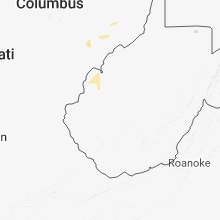
Hail Map for Sunday, June 17, 2018

Number of Impacted Households on 6/17/2018
0
Impacted by 1" or Larger Hail
0
Impacted by 1.75" or Larger Hail
0
Impacted by 2.5" or Larger Hail
Square Miles of Populated Area Impacted on 6/17/2018
0
Impacted by 1" or Larger Hail
0
Impacted by 1.75" or Larger Hail
0
Impacted by 2.5" or Larger Hail


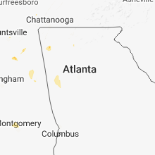


Cities Most Affected by Hail Storms of 6/17/2018
| Hail Size | Demographics of Zip Codes Affected | ||||||
|---|---|---|---|---|---|---|---|
| City | Count | Average | Largest | Pop Density | House Value | Income | Age |
| Keystone, NE | 1 | 1.75 | 1.75 | 1 | $48k | $24.6k | 50.0 |
| Niobrara, NE | 1 | 1.75 | 1.75 | 4 | $40k | $21.0k | 38.8 |
Hail and Wind Damage Spotted on 6/17/2018
Filter by Report Type:Hail ReportsWind Reports
States Impacted
Minnesota, Ohio, Georgia, North Carolina, Idaho, Tennessee, Wisconsin, Colorado, Nebraska, Iowa, South Carolina, Florida, Alabama, Michigan, West VirginiaMinnesota
| Local Time | Report Details |
|---|---|
| 12:30 PM CDT | Half Dollar sized hail reported near Palisade, MN, 70.2 miles W of Duluth, MN |
| 12:38 PM CDT | Tree down on a power line and a tree down on u.s. highway 10. time estimate in morrison county MN, 86.6 miles S of Bemidji, MN |
| 12:50 PM CDT | Trees down along highway 65 sporadically from libby to mcgregor. time estimated from rada in aitkin county MN, 57.6 miles W of Duluth, MN |
| 2:10 PM CDT | 100 foot roof on barn ripped off. several large trees dow in aitkin county MN, 52.8 miles WSW of Duluth, MN |
Ohio
| Local Time | Report Details |
|---|---|
| 1:54 PM EDT | Trees down on township rd 28 in coshocton county OH, 61.1 miles ENE of Columbus, OH |
| 3:06 PM EDT | Trees down on the eastern side of zanesvill in muskingum county OH, 52.7 miles E of Columbus, OH |
| 4:07 PM EDT | Storm damage reported in noble county OH, 76.9 miles E of Columbus, OH |
| 4:20 PM EDT | Tree down along state route 7 in noble county OH, 76.7 miles E of Columbus, OH |
| 4:50 PM EDT | Trees down along dale road and county road in morgan county OH, 70.1 miles ESE of Columbus, OH |
| 5:50 PM EDT | Trees down along dale road and county road in morgan county OH, 70.1 miles ESE of Columbus, OH |
Georgia
| Local Time | Report Details |
|---|---|
| 2:40 PM EDT | Road lights fell at the intersection of hwy 515 & hwy 5 in pickens county GA, 49.9 miles N of Atlanta, GA |
| 2:55 PM EDT | Tree down on ellijay rd... in north pickens co in pickens county GA, 55.1 miles N of Atlanta, GA |
| 3:00 PM EDT | One tree was blown down along hwy 382 near sunlight d in gilmer county GA, 52.4 miles ESE of Chattanooga, TN |
| 5:20 PM EDT | Straight line winds blew down 3-4 large trees in a 25 ft swath on goodwin dr north of summervill in chattooga county GA, 37 miles S of Chattanooga, TN |
| 5:20 PM EDT | Reports from multiple sources of ~50 trees down in the summerville... pennville... and trion areas. downed trees and powerlines are causing widespread power outages in in chattooga county GA, 36.3 miles S of Chattanooga, TN |
| 5:45 PM EDT | Multiple reports of damage in fort oglethorpe... specifically near gilbert stephenson park where several trees are down and a few power poles are snappe in catoosa county GA, 7.5 miles SSE of Chattanooga, TN |
North Carolina
| Local Time | Report Details |
|---|---|
| 2:53 PM EDT | A few trees were blown down. time estimated by rada in madison county NC, 58.8 miles SSW of Bristol, TN |
| 4:45 PM EDT | A portion of a roof was peeled back on a home in the 700 block of sedgewood roa in johnston county NC, 22.8 miles SSE of Raleigh, NC |
| 5:15 PM EDT | Trees/power lines dow in greene county NC, 54.4 miles ESE of Raleigh, NC |
| 5:15 PM EDT | Trees/power lines dow in greene county NC, 57.4 miles ESE of Raleigh, NC |
| 5:41 PM EDT | Three trees were reported down along o b j road near timothy roa in sampson county NC, 37.7 miles SSE of Raleigh, NC |
Idaho
| Local Time | Report Details |
|---|---|
| 1:26 PM MDT | Half Dollar sized hail reported near Saint Anthony, ID, 34.7 miles NNE of Idaho Falls, ID, quarter to half dollar size hail in wilford covering the ground. reported to east idaho news via facebook. |
Tennessee
| Local Time | Report Details |
|---|---|
| 2:45 PM CDT | Twitter photo showed a large tree split on franklin road south of concord road. time estimated via rada in williamson county TN, 13.2 miles S of Nashville, TN |
| 2:50 PM CDT | Facebook report of small tree limbs scattered around from win in robertson county TN, 23.6 miles NNW of Nashville, TN |
| 3:10 PM CDT | Several twitter photos of large tree limbs down including one on a car near old hickory blvd and nolensville roa in davidson county TN, 9 miles SSE of Nashville, TN |
| 3:15 PM CDT | Report of a large tree down south of concord off franklin road. time estimated via rada in williamson county TN, 11.6 miles S of Nashville, TN |
| 3:31 PM CDT | Quarter sized hail reported near Franklin, TN, 16.8 miles SSW of Nashville, TN, picture of quarter size hail in franklin. |
| 3:35 PM CDT | Twitter picture of tree limb down (possible on a car) near old hickory blvd and nolensville roa in williamson county TN, 11.6 miles S of Nashville, TN |
| 3:45 PM CDT | A two and a half inch diamater tree down blocking berry chapel road near lynwood way. also tree down at lynwood way near franklin road in the lynwood downs subdivisio in williamson county TN, 16.8 miles SSW of Nashville, TN |
| 3:45 PM CDT | A two and a half inch diamater tree down blocking berry chapel road near lynwood way. also tree down at lynwood way near franklin road in the lynwood downs subdivisio in williamson county TN, 16.8 miles SSW of Nashville, TN |
| 4:05 PM CDT | A tree fell on two cars on hayden drive and a fallen tree limb knocked down power lines on cahal avenue in davidson county TN, 4.1 miles ENE of Nashville, TN |
| 4:05 PM CDT | Several trees and power lines reportedly down in the rosebank area of east nashville in davidson county TN, 2.8 miles ENE of Nashville, TN |
| 4:08 PM CDT | Several trees and power lines down in the sunset view neighborhood near opry mills mall in davidson county TN, 5.9 miles ENE of Nashville, TN |
| 4:28 PM CDT | Reports of several trees down across gallati in sumner county TN, 23.5 miles NE of Nashville, TN |
| 7:05 PM EDT | Quarter sized hail reported near Oakdale, TN, 35.9 miles W of Knoxville, TN, dime to quarter size hail reported in oakdale. |
| 7:37 PM CDT | Talked to dispatch and got reports of numerous trees down across perry county. time estimated via rada in perry county TN, 52.5 miles SE of Mc Kenzie, TN |
Wisconsin
| Local Time | Report Details |
|---|---|
| 2:54 PM CDT | Quarter sized hail reported near Foxboro, WI, 27 miles S of Duluth, MN |
| 3:20 PM CDT | Tree downed in solon springs on south beach avenue. time estimated by rada in douglas county WI, 32.6 miles SSE of Duluth, MN |
| 4:01 PM CDT | Storm damage reported in chippewa county WI, 74 miles N of La Crosse, WI |
| 4:01 PM CDT | Storm damage reported in chippewa county WI, 74 miles N of La Crosse, WI |
| 4:36 PM CDT | Wimi radio's facebook page has quite a few pictures of shredded trees along highway c in/near carey... w in iron county WI, 64.3 miles NW of Rhinelander, WI |
| 4:45 PM CDT | Awos station rcx... tony a in rusk county WI, 77.7 miles W of Rhinelander, WI |
| 5:03 PM CDT | Report relayed via mping. power poles broke in iron county WI, 49.8 miles NW of Rhinelander, WI |
| 5:26 PM CDT | Trees snapped. time estimated from radar. report via social media photo in clark county WI, 73.6 miles NNE of La Crosse, WI |
| 5:37 PM CDT | Delayed report. trees and power lines down. time estimated from rada in taylor county WI, 44.2 miles WSW of Rhinelander, WI |
| 6:05 PM CDT | Multiple reports of trees and power lines down throughout buffalo count in buffalo county WI, 48 miles NW of La Crosse, WI |
| 6:08 PM CDT | Trees down in vilas county WI, 37.1 miles NNE of Rhinelander, WI |
| 6:08 PM CDT | Trees down on power lines in vilas county WI, 33.2 miles NNE of Rhinelander, WI |
| 6:15 PM CDT | Awos station rnh... new richmond a in st. croix county WI, 37.4 miles ENE of Minneapolis, MN |
| 6:20 PM CDT | Few trees and power lines dow in barron county WI, 85.5 miles ENE of Minneapolis, MN |
| 6:22 PM CDT | Trees down. time estimated from rada in trempealeau county WI, 54.1 miles NNW of La Crosse, WI |
| 6:35 PM CDT | Power lines blown down across strom r in rusk county WI, 86.7 miles W of Rhinelander, WI |
| 6:45 PM CDT | Storms destroyed bird pens just north of argonne. time estimated. report via social medi in forest county WI, 25.8 miles E of Rhinelander, WI |
| 7:16 PM CDT | Delayed report. several trees down... including one on power lines. time estimated from rada in clark county WI, 64.9 miles NNE of La Crosse, WI |
| 7:26 PM CDT | Small branches down in marathon county WI, 74 miles SW of Rhinelander, WI |
| 7:29 PM CDT | 3" tree limb down and atv being pushed in yard. e60 mp in clark county WI, 61.6 miles NNE of La Crosse, WI |
| 7:30 PM CDT | Small branches dow in clark county WI, 76.7 miles NE of La Crosse, WI |
| 7:30 PM CDT | Several trees down... one covering a road. delayed report via social media. time approximat in langlade county WI, 45.8 miles SE of Rhinelander, WI |
| 7:36 PM CDT | Storm damage reported in clark county WI, 76.7 miles NE of La Crosse, WI |
| 7:50 PM CDT | Large outdoor event tent damaged and the main 3 inch diameter tent poles were snapped in half. time approximat in marathon county WI, 51.6 miles S of Rhinelander, WI |
| 8:05 PM CDT | Storm damage reported in portage county WI, 67.6 miles SSW of Rhinelander, WI |
| 8:41 PM CDT | 30 trees down. county d and in shawano county WI, 52.9 miles WNW of Green Bay, WI |
| 8:48 PM CDT | A few trees down in shawano county WI, 53.4 miles WNW of Green Bay, WI |
Colorado
| Local Time | Report Details |
|---|---|
| 1:57 PM MDT | Quarter sized hail reported near Sedgwick, CO, 60.1 miles NNE of Yuma, CO |
| 2:10 PM MDT | Power poles blown down in the julesburg vicinity. power knocked out in the region. crop damage reported west of julesburg. winds estimated at 60 to 70 mp in sedgwick county CO, 64.5 miles NNE of Yuma, CO |
| 4:02 PM MDT | Storm damage reported in arapahoe county CO, 51.4 miles E of Denver, CO |
| 4:02 PM MDT | Quarter sized hail reported near Deer Trail, CO, 50.9 miles E of Denver, CO |
| 5:03 PM MDT | Half Dollar sized hail reported near Akron, CO, 29.1 miles WSW of Yuma, CO, numerous shattered windows and damage to the house siding. tree stripped of leaves and crops knocked over flat. winds estimated at 50 to 60 mph with the hail. |
| 5:13 PM MDT | Quarter sized hail reported near Akron, CO, 24.2 miles SW of Yuma, CO |
Nebraska
| Local Time | Report Details |
|---|---|
| 2:35 PM MDT | Camper flipped along i-80 near mm 92 in deuel county NE, 67.7 miles NNE of Yuma, CO |
| 2:54 PM MDT | Shingles blown off roof... 1 inch tree limbs broken in deuel county NE, 68.4 miles W of North Platte, NE |
| 2:54 PM MDT | Shingles blown off roof... 1 inch tree limbs broken in deuel county NE, 68.4 miles W of North Platte, NE |
| 2:56 PM MDT | Power lines down... 3 in limbs down... souce mping in deuel county NE, 68.2 miles W of North Platte, NE |
| 3:00 PM MDT | Power lines down in keith county NE, 65.1 miles W of North Platte, NE |
| 3:25 PM MDT | Storm damage reported in keith county NE, 48.4 miles W of North Platte, NE |
| 3:25 PM MDT | Golf Ball sized hail reported near Keystone, NE, 47.3 miles W of North Platte, NE, hail ranging from nickel to golf ball size |
| 3:25 PM MDT | Storm damage reported in keith county NE, 47.3 miles W of North Platte, NE |
| 5:14 PM CDT | Reports of windows taken out... door frame blown out... and shed blown off foundation. ag equipment blown moved large distances and roof removed from outbuilding. possi in mcpherson county NE, 33.8 miles NW of North Platte, NE |
| 5:16 PM CDT | 2 inch diameter tree branches down. time estimated from rada in mcpherson county NE, 33.8 miles NW of North Platte, NE |
| 6:32 PM CDT | Half Dollar sized hail reported near Anselmo, NE, 70.7 miles NE of North Platte, NE, hail ranging from pea to half dollar size hail. report relayed from emergency management. |
| 7:45 PM CDT | Golf Ball sized hail reported near Niobrara, NE, 41.6 miles ENE of Oneill, NE, significant damage to siding on house and roof shingle damage. hail covering ground. |
| 8:28 PM CDT | Dime size hai in cedar county NE, 63.5 miles ENE of Oneill, NE |
Iowa
| Local Time | Report Details |
|---|---|
| 3:59 PM CDT | A semi and camper blown off i-29 near mile marker 72. event time based off rada in pottawattamie county IA, 16.6 miles N of Omaha, NE |
| 5:00 PM CDT | Large tree limb broken. time estimated from rada in crawford county IA, 44 miles S of Storm Lake, IA |
| 5:02 PM CDT | Rwis sit in crawford county IA, 50.7 miles S of Storm Lake, IA |
| 6:09 PM CDT | Tree branches approx. 5 inches diameter dow in calhoun county IA, 33.7 miles ESE of Storm Lake, IA |
South Carolina
| Local Time | Report Details |
|---|---|
| 5:00 PM EDT | Tree down on alice farr driv in greenville county SC, 9 miles ENE of Greenville, SC |
| 5:05 PM EDT | Tree down blocking 630 block of sulphur springs roa in greenville county SC, 9.5 miles ENE of Greenville, SC |
| 5:05 PM EDT | Tree down on apartment building at stratford villa apartment in greenville county SC, 8.7 miles ENE of Greenville, SC |
| 5:50 PM EDT | A few trees down in the midway road area. time estimated based on radar. location is a mile or less from highway 17 in pickens county SC, 11 miles NW of Greenville, SC |
Florida
| Local Time | Report Details |
|---|---|
| 5:15 PM EDT | Large sycamore tree down near the west oaks mall in orange county FL, 7.5 miles W of Orlando, FL |
| 5:20 PM EDT | Two reports via social media of large trees down in windermere and a wooden fence blown over. time estimated from rada in orange county FL, 9.6 miles WSW of Orlando, FL |
| 6:16 PM EDT | Reports of trees falling on power lines near westport high school from high wind gust in marion county FL, 67.6 miles NW of Orlando, FL |
Alabama
| Local Time | Report Details |
|---|---|
| 4:25 PM CDT | West jefferson fire department is responding to a tree down on flat top rd at lacy r in jefferson county AL, 17.5 miles WNW of Birmingham, AL |
| 6:20 PM CDT | Trees down due to winds estimated 40-50 mp in calhoun county AL, 62.8 miles ENE of Birmingham, AL |
| 6:21 PM CDT | Power line down due to estimated 40-50 mph wind in calhoun county AL, 57.2 miles ENE of Birmingham, AL |
| 6:27 PM CDT | Trees down due to estimated 40-50 mph wind in calhoun county AL, 59.2 miles ENE of Birmingham, AL |
| 6:40 PM CDT | Trees reported down with power outages. estimated 40-50 mp wind in calhoun county AL, 59.4 miles E of Birmingham, AL |
Michigan
| Local Time | Report Details |
|---|---|
| 4:58 PM CDT | Numerous trees & power lines down in the ironwood area via public safety radi in gogebic county MI, 66.4 miles NNW of Rhinelander, WI |
| 5:00 PM CDT | Trees down along pioneer rd via public safety radi in gogebic county MI, 64.6 miles NNW of Rhinelander, WI |
| 5:04 PM CDT | Numerous trees & power lines reported down via public safety radi in gogebic county MI, 66.4 miles NNW of Rhinelander, WI |
| 5:24 PM CDT | Multiple trees down on us-2 near marenisco via public safety radi in gogebic county MI, 53.1 miles NNW of Rhinelander, WI |
West Virginia
| Local Time | Report Details |
|---|---|
| 7:00 PM EDT | Trees and power lines down along scott depot roa in putnam county WV, 16.5 miles WNW of Charleston, WV |
| 7:10 PM EDT | Several trees down reported in saint alban in kanawha county WV, 11.3 miles WNW of Charleston, WV |
| 7:16 PM EDT | Numerous trees down reported in the dunbar are in kanawha county WV, 5.7 miles WNW of Charleston, WV |
| 7:19 PM EDT | Large tree down across carver street near institute in kanawha county WV, 6.7 miles WNW of Charleston, WV |
| 7:20 PM EDT | Numerous trees down reported in the dunbar are in kanawha county WV, 5.7 miles WNW of Charleston, WV |
| 7:20 PM EDT | Several trees down reported in saint alban in kanawha county WV, 11.3 miles WNW of Charleston, WV |
| 7:30 PM EDT | Trees down across jones street in charleston... blocking the roa in kanawha county WV, 4.4 miles W of Charleston, WV |
| 7:40 PM EDT | Tree down blocking one lane of loudon heights road in charleston in kanawha county WV, 1.7 miles SE of Charleston, WV |
Connect with Interactive Hail Maps