

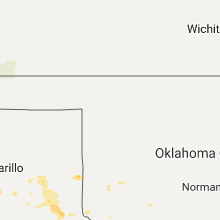
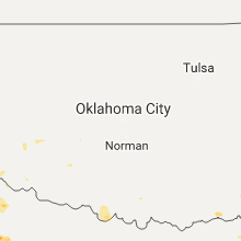
Hail Map for Friday, June 23, 2017

Number of Impacted Households on 6/23/2017
0
Impacted by 1" or Larger Hail
0
Impacted by 1.75" or Larger Hail
0
Impacted by 2.5" or Larger Hail
Square Miles of Populated Area Impacted on 6/23/2017
0
Impacted by 1" or Larger Hail
0
Impacted by 1.75" or Larger Hail
0
Impacted by 2.5" or Larger Hail


Cities Most Affected by Hail Storms of 6/23/2017
| Hail Size | Demographics of Zip Codes Affected | ||||||
|---|---|---|---|---|---|---|---|
| City | Count | Average | Largest | Pop Density | House Value | Income | Age |
| Lovington, NM | 1 | 1.75 | 1.75 | 18 | $49k | $28.5k | 31.1 |
| Las Vegas, NM | 1 | 1.75 | 1.75 | 11 | $89k | $25.9k | 38.7 |
| Canyon, TX | 1 | 1.75 | 1.75 | 49 | $91k | $35.7k | 29.2 |
Hail and Wind Damage Spotted on 6/23/2017
Filter by Report Type:Hail ReportsWind Reports
States Impacted
Louisiana, Ohio, Mississippi, Missouri, Massachusetts, Alabama, Arkansas, Pennsylvania, Oklahoma, New Mexico, West Virginia, Texas, Georgia, Kentucky, Maryland, Tennessee, South Carolina, North Carolina, New JerseyLouisiana
| Local Time | Report Details |
|---|---|
| 8:35 AM CDT | Several trees down. power lines dow in claiborne county LA, 54 miles W of Bastrop, LA |
| 10:20 AM CDT | Several pine trees down. high water over road in claiborne county LA, 54 miles W of Bastrop, LA |
| 11:02 AM CDT | Numerous trees down. power lines dow in union county LA, 39.1 miles WNW of Bastrop, LA |
Ohio
| Local Time | Report Details |
|---|---|
| 12:01 PM EDT | Multiple trees down... including one large tree snapped at the base. also roof damage to a house. time estimated from rada in stark county OH, 44.5 miles SSE of Cleveland, OH |
| 2:57 PM EDT | Tree down on opossum hollow roa in hocking county OH, 35.7 miles SE of Columbus, OH |
| 3:09 PM EDT | Tree down on carbon hill r in hocking county OH, 52.9 miles SE of Columbus, OH |
| 6:42 PM EDT | Tree down along lewis drive. time estimated from radar in gallia county OH, 44.3 miles NW of Charleston, WV |
Mississippi
| Local Time | Report Details |
|---|---|
| 11:08 AM CDT | Power lines downed along lakehill d in warren county MS, 40.4 miles W of Jackson, MS |
| 11:15 AM CDT | Tree down in the 3500 block of warriors trail. estimated winds 50 mp in warren county MS, 33.5 miles W of Jackson, MS |
| 11:25 AM CDT | Power lines downed by large limbs along kings highway near old canton rd. estimated 45 mph win in hinds county MS, 2.9 miles NNE of Jackson, MS |
| 12:15 PM CDT | Power line down on hatley roa in monroe county MS, 40.9 miles NNE of Starkville, MS |
| 12:23 PM CDT | Tree downed along witherspoon rd near town creek campgroun in clay county MS, 20.1 miles ENE of Starkville, MS |
| 2:23 PM CDT | Tree downed along n lakeland dr. wind estimated 40-50 mp in lauderdale county MS, 76.3 miles S of Starkville, MS |
| 3:06 PM CDT | Tree downed on dr brock r in lauderdale county MS, 80 miles S of Starkville, MS |
| 3:08 PM CDT | Trees downed along cr 14 in clarke county MS, 80.8 miles W of Camden, AL |
| 3:12 PM CDT | Tree downed on us 11 near souinlovie cree in clarke county MS, 77.8 miles ESE of Jackson, MS |
| 3:17 PM CDT | Tree downed on florence church rd. estimated 40-50 mph win in jones county MS, 77.1 miles ESE of Jackson, MS |
Missouri
| Local Time | Report Details |
|---|---|
| 12:25 PM CDT | Several large limbs downed by squal in greene county MO, 3.9 miles NNE of Springfield, MO |
| 12:26 PM CDT | Gusts continued for more than 20 minute in greene county MO, 5.8 miles WNW of Springfield, MO |
| 12:29 PM CDT | Three large tress down at 811 bellview road about 4 to 5 feet at the base... near the downtown airpor in greene county MO, 2.4 miles ENE of Springfield, MO |
| 12:30 PM CDT | A large tree was reported down on power lines near the intersection of battlefield road and jefferson avenu in greene county MO, 3.4 miles S of Springfield, MO |
| 12:36 PM CDT | Large limbs around 3 inches in diameter downe in greene county MO, 6.3 miles SSW of Springfield, MO |
| 12:38 PM CDT | Storm damage reported in greene county MO, 2.6 miles ESE of Springfield, MO |
| 12:39 PM CDT | Storm damage reported in greene county MO, 7.8 miles ESE of Springfield, MO |
| 12:42 PM CDT | Two large limbs reported down near the intersection of fairway and walnut stree in christian county MO, 11 miles S of Springfield, MO |
| 12:45 PM CDT | Limbs 2 inches in diameter downed by squal in greene county MO, 3.1 miles SSW of Springfield, MO |
| 1:02 PM CDT | Several large limbs reported dow in taney county MO, 40.8 miles S of Springfield, MO |
| 1:10 PM CDT | Several reports of large trees dow in stone county MO, 44.7 miles SSW of Springfield, MO |
| 1:20 PM CDT | Tree dow in taney county MO, 41.2 miles SSE of Springfield, MO |
| 1:25 PM CDT | Large tree reported down on a car near 3rd street and and pacific stree in taney county MO, 39.4 miles S of Springfield, MO |
| 2:10 PM CDT | Tree down over county e near moody. had to call modot for chainsaws for it to be remove in howell county MO, 80.3 miles SSW of Salem, MO |
Massachusetts
| Local Time | Report Details |
|---|---|
| 1:31 PM EDT | Large tree limb down blocking most of a roadway in middlesex county MA, 27.9 miles NNW of Providence, RI |
| 1:43 PM EDT | Tree limb down on power lines at croydon and edgewater streets in middlesex county MA, 33.6 miles N of Providence, RI |
| 1:43 PM EDT | Tree down at worcester street at lyndon. tree and wires down at merriam at bacon stree in middlesex county MA, 31.6 miles N of Providence, RI |
| 1:45 PM EDT | Tree down on clearwater street blocking road in middlesex county MA, 36.4 miles NNE of Providence, RI |
| 1:45 PM EDT | Tree down across a driveway and a second tree and utility pole down in front of a hom in norfolk county MA, 30.2 miles NNE of Providence, RI |
| 1:45 PM EDT | Tree down blocking crescent stree in norfolk county MA, 33.5 miles N of Providence, RI |
| 1:50 PM EDT | Tree branch down blocking road in norfolk county MA, 32.7 miles NNE of Providence, RI |
| 2:01 PM EDT | Wires down on bedford street in middlesex county MA, 44.2 miles NNE of Providence, RI |
| 2:07 PM EDT | Tree and wires down on elisa by windsor street. tree and wires down on prospect at high stree in middlesex county MA, 47.8 miles NNE of Providence, RI |
| 2:09 PM EDT | Tree down on a house in middlesex county MA, 44.2 miles NNE of Providence, RI |
| 2:09 PM EDT | Tree down on a car on high street in middlesex county MA, 47.8 miles NNE of Providence, RI |
| 2:11 PM EDT | Tree donw across road on park avenue in middlesex county MA, 45.3 miles NNE of Providence, RI |
| 2:12 PM EDT | Manhole cover lifted off the roadway at waltham and merritt street in middlesex county MA, 44.2 miles NNE of Providence, RI |
| 2:12 PM EDT | Large branches and wires down on sturgis street in middlesex county MA, 47.8 miles NNE of Providence, RI |
| 2:13 PM EDT | Tree branch down on waltham stree in middlesex county MA, 44.2 miles NNE of Providence, RI |
| 2:13 PM EDT | Tree branch down on waltham stree in middlesex county MA, 44.2 miles NNE of Providence, RI |
| 2:13 PM EDT | Tree down on bradley road in middlesex county MA, 44 miles NNE of Providence, RI |
| 2:13 PM EDT | Trees and power lines down on hillview roa in middlesex county MA, 54.4 miles NNE of Providence, RI |
| 2:15 PM EDT | Large tree down on house on temple stree in middlesex county MA, 51.8 miles NNE of Providence, RI |
| 2:18 PM EDT | Tree down on river street in essex county MA, 59.4 miles NNE of Providence, RI |
| 2:18 PM EDT | Tree and wires down in roadway on fern avenue in middlesex county MA, 52.3 miles NNE of Providence, RI |
| 2:18 PM EDT | Tree down across the road on haverhill street in middlesex county MA, 54.4 miles NNE of Providence, RI |
| 2:20 PM EDT | Large 8 inch branch down on salem stree in essex county MA, 59.4 miles NNE of Providence, RI |
| 2:25 PM EDT | Tree limb down on power lines on shawsheen road near west middle schoo in essex county MA, 59.4 miles NNE of Providence, RI |
| 2:33 PM EDT | Power lines down on orchard lane in essex county MA, 53 miles NNE of Providence, RI |
| 2:34 PM EDT | Tree down blocking route 133 in essex county MA, 62.3 miles NNE of Providence, RI |
| 2:35 PM EDT | Power lines down on mill road. large limb down on wires on boren lan in essex county MA, 62.3 miles NNE of Providence, RI |
| 2:35 PM EDT | Power lines down on mill road. large limb down on wires on boren lan in essex county MA, 62.3 miles NNE of Providence, RI |
| 2:35 PM EDT | Multiple trees and wires dow in essex county MA, 66.3 miles NNE of Providence, RI |
| 2:37 PM EDT | Tree branch down on power lines on westland terrace. tree down blocking one lane of lincoln avenu in essex county MA, 68 miles NNE of Providence, RI |
| 2:48 PM EDT | Tree down on wires on line stree in essex county MA, 66.8 miles SSW of Portland, ME |
| 2:48 PM EDT | Tree down on high road just south of river front marines in essex county MA, 70.2 miles SSW of Portland, ME |
Alabama
| Local Time | Report Details |
|---|---|
| 12:45 PM CDT | Ema reported a tree down across cr 70 south of us 72 in rogersvill in lauderdale county AL, 21.9 miles E of Florence, AL |
| 12:50 PM CDT | Trees down near hwy 17 at vernon post office. time estimated by rada in lamar county AL, 45.3 miles ENE of Starkville, MS |
| 1:06 PM CDT | Trees down near mount willing church. time estimated by rada in fayette county AL, 59.9 miles ENE of Starkville, MS |
| 1:09 PM CDT | Ema reported a tree down across the eastbound lanes of us 72 near brooks high schoo in lauderdale county AL, 11.3 miles ENE of Florence, AL |
| 1:18 PM CDT | Trees down at stowe loop and county road 35. time estimated by rada in fayette county AL, 56.2 miles W of Birmingham, AL |
| 1:27 PM CDT | Ema reported a tree down at ne markate ave & river road in muscle shoal in colbert county AL, 3.4 miles ESE of Florence, AL |
| 1:28 PM CDT | Ema reported a large tree down across stewart rd... north of nuclear plant rd in tanne in limestone county AL, 40.5 miles E of Florence, AL |
| 1:28 PM CDT | Trees down at sherwood place and dime road in haleyville. time estimated by rada in winston county AL, 37.4 miles S of Florence, AL |
| 1:30 PM CDT | Multiple trees and power lines down in lynn. time estimated by rada in winston county AL, 52.2 miles S of Florence, AL |
| 1:42 PM CDT | Multiple trees and power lines down in double springs. time estimated by rada in winston county AL, 47.5 miles SSE of Florence, AL |
| 2:14 PM CDT | Ema reported power lines down across lakeview dr in rogersvill in lauderdale county AL, 22.5 miles E of Florence, AL |
| 2:27 PM CDT | Media reported a trampoline had been lodged into a tree in danvill in morgan county AL, 42.9 miles SE of Florence, AL |
| 2:40 PM CDT | Multiple trees down across birmingham metro area. estimated winds 35-45mph. time estimated by rada in jefferson county AL, 0.7 miles E of Birmingham, AL |
| 2:40 PM CDT | Small trees down on 15th street rd in hueytown. winds estimated 35-45mph. time estimated by rada in jefferson county AL, 13.6 miles WSW of Birmingham, AL |
| 2:50 PM CDT | Trees down on 3rd ave. south. winds 35-40mp in jefferson county AL, 0.7 miles S of Birmingham, AL |
| 2:50 PM CDT | Trees down near avenue b. winds estimated at 35-40mp in jefferson county AL, 5.2 miles W of Birmingham, AL |
| 2:50 PM CDT | Trees down near westfield rd. and northwood dr. winds estimated 35-40mp in jefferson county AL, 7.2 miles NE of Birmingham, AL |
| 2:50 PM CDT | Trees down along ishkooda-wenonah rd. winds estimated 35-40 mp in jefferson county AL, 6.3 miles SW of Birmingham, AL |
| 2:50 PM CDT | Trees down at 90th st. n and zion city rd. winds 35-40mp in jefferson county AL, 6.2 miles NE of Birmingham, AL |
| 2:50 PM CDT | Trees down 13th street and avenue h. winds estimated 35-40mp in jefferson county AL, 4.5 miles W of Birmingham, AL |
| 2:55 PM CDT | Trees and power lines down near courthouse squar in st. clair county AL, 39.1 miles NE of Birmingham, AL |
| 3:00 PM CDT | Trees down along eldorado drive. winds estimated 35-40mp in jefferson county AL, 9.8 miles NE of Birmingham, AL |
| 3:01 PM CDT | Law enforcement reported a tree down at oakwood rd and research park blv in madison county AL, 57.2 miles E of Florence, AL |
| 3:16 PM CDT | Fire department reported trees down at 329 landess cir in trian in madison county AL, 53.7 miles ESE of Florence, AL |
| 3:16 PM CDT | Fire department reported trees down at newson rd/westdale ct in huntsvill in madison county AL, 60.5 miles E of Florence, AL |
| 3:16 PM CDT | Fire department reported trees down at 235 williams cir in huntsvill in madison county AL, 54.2 miles E of Florence, AL |
| 3:17 PM CDT | Fire department reported a pole and power lines down on a fence at brown st in huntsvill in madison county AL, 61.4 miles E of Florence, AL |
| 3:32 PM CDT | Trees down neat cr 71 at cr 19. time estimated by rada in cherokee county AL, 68.1 miles SSW of Chattanooga, TN |
| 3:35 PM CDT | Trees down across cr 44. time estimate in cherokee county AL, 62.9 miles SSW of Chattanooga, TN |
| 3:35 PM CDT | Multiple trees down with many snapped at the to in etowah county AL, 60.5 miles NE of Birmingham, AL |
| 3:35 PM CDT | Tree down on residence on cr 531. time estimate in cherokee county AL, 64.1 miles SSW of Chattanooga, TN |
| 3:35 PM CDT | Trees down on houses. boat house damaged. time estimated by rada in etowah county AL, 60.9 miles NE of Birmingham, AL |
| 3:35 PM CDT | Tree down on residence. cr 71 and cr 55. time estimate in cherokee county AL, 68.3 miles SSW of Chattanooga, TN |
| 3:35 PM CDT | Trees across road and power lines down at cr 31 and cr 2 in cherokee county AL, 62.9 miles SSW of Chattanooga, TN |
| 3:35 PM CDT | Multiple trees down and houses with roof damage in area of cr 71 and cr38. time estimated by rada in cherokee county AL, 68.9 miles SSW of Chattanooga, TN |
| 3:36 PM CDT | Trees and power lines down county road 22 at cr 53 in cherokee county AL, 64.1 miles SSW of Chattanooga, TN |
| 3:36 PM CDT | Trees down across cr 124. time estimated by rada in cherokee county AL, 65.4 miles SSW of Chattanooga, TN |
| 3:44 PM CDT | Fire department reported tree down across carroll rd south of harvest r in madison county AL, 51.6 miles E of Florence, AL |
| 3:48 PM CDT | Fire department reported tree down on toll gate rd in huntsvill in madison county AL, 63.6 miles E of Florence, AL |
| 3:55 PM CDT | Trees down on greesport rd and cochran springs rd in big oak communit in calhoun county AL, 51 miles ENE of Birmingham, AL |
| 4:00 PM CDT | Trees and power lines down on oak grove rd in big oak community. time estimate in calhoun county AL, 56.6 miles ENE of Birmingham, AL |
| 4:11 PM CDT | Fire department reported tree down on road at macon circle in huntsvill in madison county AL, 64 miles E of Florence, AL |
| 4:15 PM CDT | Trees down along hwy 9 near kings gap mountain rd. time estimated - winds 35-40 mph estimate in calhoun county AL, 70.1 miles ENE of Birmingham, AL |
| 6:05 PM CDT | Trees and power lines down along sr 63 near hackneyville. winds estimated 40-45 mp in tallapoosa county AL, 40.7 miles NW of Auburn, AL |
| 6:20 PM CDT | Trees and power lines down along horseshoe bend road at horseshoe bend park. winds estimated 40-45 mp in tallapoosa county AL, 29.5 miles NNW of Auburn, AL |
| 6:20 PM CDT | Trees and power lines down near veasey road. winds estimated 40-45 mp in tallapoosa county AL, 32.7 miles NNW of Auburn, AL |
Arkansas
| Local Time | Report Details |
|---|---|
| 2:08 PM CDT | Numerous trees down north of summi in marion county AR, 72.8 miles SSE of Springfield, MO |
| 2:15 PM CDT | Some metal roofing material was removed from a hom in baxter county AR, 78 miles SE of Springfield, MO |
| 2:25 PM CDT | Numerous trees down and power outages across mountain hom in baxter county AR, 78.1 miles SE of Springfield, MO |
| 2:42 PM CDT | Trees blown down in calico roc in izard county AR, 95.6 miles N of Little Rock, AR |
| 2:50 PM CDT | Trees down and shingles blown off a roo in izard county AR, 100.1 miles SSW of Salem, MO |
| 3:05 PM CDT | Numerous trees down and a sign blown off at the sonic in mountain vie in stone county AR, 77.8 miles N of Little Rock, AR |
| 3:52 PM CDT | Partial structural damage to factory. trees and power lines dow in randolph county AR, 92.4 miles NNW of Memphis, TN |
| 3:52 PM CDT | Tree down on house. time is radar estimate in lawrence county AR, 97.6 miles S of Salem, MO |
| 3:52 PM CDT | Numerous trees were reported down in newar in independence county AR, 80.8 miles NE of Little Rock, AR |
| 3:54 PM CDT | Large tree down near first baptist church on n. thomasville roa in clay county AR, 71.8 miles SW of Cape Girardeau, MO |
| 3:54 PM CDT | Large tree down near first baptist church on n. thomasville roa in randolph county AR, 93.9 miles NNW of Memphis, TN |
| 3:54 PM CDT | Large tree down near first baptist church on n. thomasville roa in clay county AR, 71 miles SW of Cape Girardeau, MO |
| 4:07 PM CDT | Large tree down near the lawrence county seed company. time is radar estimate in lawrence county AR, 80.7 miles NW of Memphis, TN |
| 4:10 PM CDT | Many trees and powerlines down across lawrence county. also a report of a tree down blocking the railroa in lawrence county AR, 80.7 miles NW of Memphis, TN |
| 4:15 PM CDT | Large tree down near the lawrence county seed compan in lawrence county AR, 80.7 miles NW of Memphis, TN |
| 4:20 PM CDT | A large grain bin was toppled and destroyed. time is radar estimate in lawrence county AR, 77.3 miles NW of Memphis, TN |
| 4:48 PM CDT | Trees down in south jonesbor in craighead county AR, 58.1 miles NW of Memphis, TN |
| 4:53 PM CDT | Large tree down in the community of maple grove. time is radar estimate in poinsett county AR, 44.4 miles NW of Memphis, TN |
| 5:00 PM CDT | A tree was blown over near lorance driv in saline county AR, 12.6 miles SSW of Little Rock, AR |
| 5:05 PM CDT | Large tree blown down in the hillcrest are in pulaski county AR, 2.7 miles WNW of Little Rock, AR |
| 5:25 PM CDT | Large tree blown dow in saline county AR, 22.2 miles SW of Little Rock, AR |
| 5:40 PM CDT | A tree was blown ove in garland county AR, 52 miles NE of Nashville, AR |
| 5:45 PM CDT | Several trees blown over around the count in hot spring county AR, 40.6 miles SW of Little Rock, AR |
| 6:05 PM CDT | *** 1 fatal *** a tree was blown over onto a car in jefferson county AR, 36 miles SSE of Little Rock, AR |
| 8:10 PM CDT | Multiple trees downed around ashley county by strong outflow winds. winds estimated 40-50 mph based on surrounding observation in ashley county AR, 32.9 miles NNE of Bastrop, LA |
Pennsylvania
| Local Time | Report Details |
|---|---|
| 3:11 PM EDT | Trees down in washington county PA, 21.4 miles SW of Pittsburgh, PA |
| 3:20 PM EDT | Multiple trees down and structural collapse in amwell twp in washington county PA, 22.1 miles SSW of Pittsburgh, PA |
| 3:22 PM EDT | Garage and two houses damaged in washington county PA, 24.9 miles SSW of Pittsburgh, PA |
| 3:38 PM EDT | Several trees down in westmoreland county PA, 20.8 miles SE of Pittsburgh, PA |
| 3:41 PM EDT | Several trees down in westmoreland county PA, 21 miles SSE of Pittsburgh, PA |
| 3:44 PM EDT | Trees down in washington county PA, 16.9 miles SSE of Pittsburgh, PA |
| 3:51 PM EDT | Several trees down in westmoreland county PA, 25.1 miles SE of Pittsburgh, PA |
| 3:51 PM EDT | Several trees down in westmoreland county PA, 24.7 miles SE of Pittsburgh, PA |
| 3:51 PM EDT | Trees down in fayette county PA, 26.8 miles SSE of Pittsburgh, PA |
| 3:56 PM EDT | Five trees down in hempfield twp in westmoreland county PA, 25.9 miles SE of Pittsburgh, PA |
| 3:56 PM EDT | Five trees down in hempfield twp in westmoreland county PA, 23.4 miles SE of Pittsburgh, PA |
| 3:58 PM EDT | Several trees down in fayette county PA, 29.6 miles SE of Pittsburgh, PA |
| 4:03 PM EDT | Several trees down in westmoreland county PA, 31.8 miles SE of Pittsburgh, PA |
| 4:04 PM EDT | Several trees down in westmoreland county PA, 31.3 miles SE of Pittsburgh, PA |
| 4:14 PM EDT | Several trees down in fayette county PA, 31 miles SSE of Pittsburgh, PA |
| 4:14 PM EDT | Trees down in fayette county PA, 40.9 miles S of Pittsburgh, PA |
| 4:22 PM EDT | Trees down in westmoreland county PA, 43.2 miles ESE of Pittsburgh, PA |
| 4:35 PM EDT | Trees down in westmoreland county PA, 37.5 miles ESE of Pittsburgh, PA |
| 5:00 PM EDT | Trees and wires down in greene county PA, 46.9 miles SSW of Pittsburgh, PA |
| 5:14 PM EDT | Several trees down in greene county PA, 48.3 miles SSW of Pittsburgh, PA |
| 5:18 PM EDT | Several trees down in greene county PA, 48.6 miles SSW of Pittsburgh, PA |
| 5:24 PM EDT | Several trees down in greene county PA, 47.7 miles S of Pittsburgh, PA |
| 5:27 PM EDT | Tree reported down at the tumblebrook golf cours in lehigh county PA, 61.3 miles SSE of Scranton, PA |
| 5:34 PM EDT | Tree down on wellington roa in berks county PA, 76.1 miles SSW of Scranton, PA |
| 5:45 PM EDT | Trees down in fayette county PA, 35.5 miles SSE of Pittsburgh, PA |
| 5:58 PM EDT | A tree blocked traffic on a local roa in berks county PA, 78.1 miles NNE of Baltimore, MD |
| 6:16 PM EDT | Trees and wires reported down in bucks county PA, 64.8 miles SSE of Scranton, PA |
| 6:41 PM EDT | Trees and wires reported dow in bucks county PA, 70.6 miles WSW of Brooklyn, NY |
Oklahoma
| Local Time | Report Details |
|---|---|
| 2:46 PM CDT | Quarter sized hail reported near Ardmore, OK, 62.6 miles WSW of Atoka, OK, i-35 and holiday drive |
New Mexico
| Local Time | Report Details |
|---|---|
| 2:45 PM MDT | Golf Ball sized hail reported near Lovington, NM, 75.4 miles ESE of Roswell, NM |
| 2:45 PM MDT | Storm damage reported in lea county NM, 75.4 miles ESE of Roswell, NM |
| 2:50 PM MDT | Horse barn blown into a solar panel array at new mexico junior college. time estimated from rada in lea county NM, 76.1 miles NW of Odessa, TX |
| 2:50 PM MDT | Storm damage reported in lea county NM, 74.9 miles NW of Odessa, TX |
| 2:52 PM MDT | Storm damage reported in lea county NM, 81.5 miles NW of Odessa, TX |
| 2:55 PM MDT | Storm damage reported in lea county NM, 75.4 miles NW of Odessa, TX |
| 3:00 PM MDT | Windows blown out at khob radio on n bensing road. power poles down along n bender blv in lea county NM, 76.1 miles NW of Odessa, TX |
| 3:05 PM MDT | Storm damage reported in lea county NM, 76 miles NW of Odessa, TX |
| 3:10 PM MDT | Large section of roof blown off of albertsons store on north grimes in lea county NM, 76.1 miles NW of Odessa, TX |
| 3:30 PM MDT | Half Dollar sized hail reported near Las Vegas, NM, 58.3 miles S of Taos, NM |
| 3:32 PM MDT | Golf Ball sized hail reported near Las Vegas, NM, 56.1 miles S of Taos, NM |
West Virginia
| Local Time | Report Details |
|---|---|
| 5:08 PM EDT | Trees down in monongalia county WV, 57.8 miles SSW of Pittsburgh, PA |
| 5:15 PM EDT | Trees snapped and some uproote in monongalia county WV, 55.2 miles SSW of Pittsburgh, PA |
| 6:04 PM EDT | Trees down in monongalia county WV, 51.5 miles N of Elkins, WV |
| 6:05 PM EDT | Trees down along i-68 in preston county WV, 51.9 miles NNE of Elkins, WV |
| 6:11 PM EDT | Power lines down at the intersection of 16th and race street in parkersburg in wood county WV, 64 miles N of Charleston, WV |
| 6:24 PM EDT | Public reported trees down along milhoan ridge road. time estimated from radar in jackson county WV, 50.1 miles N of Charleston, WV |
| 6:30 PM EDT | Power lines down in the 300 block of point drive in parkersburg in wood county WV, 64 miles N of Charleston, WV |
| 7:09 PM EDT | Tree down along century road in jackson county WV, 40.5 miles NNW of Charleston, WV |
| 7:23 PM EDT | High water in the 500 block of 36th street in parkersburg in wood county WV, 64 miles N of Charleston, WV |
| 8:00 PM EDT | Reports of power lines down along halls run road in salem. time estimated from radar in harrison county WV, 46.1 miles WNW of Elkins, WV |
| 8:18 PM EDT | Numerous reports of trees and power lines down over a 6 to 7 mile damage swath west of the town of clarksburg. much of the damage is along jarvisville road. a barn is d in harrison county WV, 40.3 miles NW of Elkins, WV |
| 8:42 PM EDT | Power lines down along sycamore street in clarksburg. time estimated radar in harrison county WV, 35.8 miles NW of Elkins, WV |
| 8:53 PM EDT | Trees down on hemlock road near wolf pen in wyoming county WV, 56.6 miles S of Charleston, WV |
| 10:35 PM EDT | Tree down along route 3 in rock creek in boone county WV, 20.7 miles SSE of Charleston, WV |
| 11:05 PM EDT | Two separate trees down on route 52 and a mudslide on mill creek south of fort ga in wayne county WV, 54.1 miles WSW of Charleston, WV |
| 12:02 AM EDT | Tree down in nellis in boone county WV, 14.9 miles SSW of Charleston, WV |
Texas
| Local Time | Report Details |
|---|---|
| 4:25 PM CDT | Power pole down and tree limbs in road on hwy 83 in stonewall county TX, 51.1 miles NNW of Abilene, TX |
| 4:51 PM CDT | Storm damage reported in culberson county TX, 99.1 miles E of El Paso, TX |
| 4:55 PM CDT | Fisher county sheriffs office has reported 5 power poles down on fm 540 and 1 power pole down on hwy 9 in fisher county TX, 40.3 miles NW of Abilene, TX |
| 5:00 PM CDT | Power poles blown down in mitchell county TX, 56.1 miles W of Abilene, TX |
| 5:25 PM CDT | Storm damage reported in andrews county TX, 33.4 miles NNW of Odessa, TX |
| 5:35 PM CDT | Power lines reported down in loraine. time estimated from rada in mitchell county TX, 56.7 miles W of Abilene, TX |
| 5:35 PM CDT | At midland airpark on north loop 250 in midland county TX, 20.2 miles ENE of Odessa, TX |
| 5:43 PM CDT | Train derailment occurred near mile marker 214 west of loraine in mitchell county TX, 57.8 miles W of Abilene, TX |
| 5:45 PM CDT | Moderate tree and roof damage reported. time estimated from rada in mitchell county TX, 65.5 miles W of Abilene, TX |
| 5:50 PM CDT | Quarter sized hail reported near Midland, TX, 20.2 miles ENE of Odessa, TX |
| 5:52 PM CDT | Storm damage reported in midland county TX, 12.5 miles ENE of Odessa, TX |
| 5:52 PM CDT | Storm damage reported in midland county TX, 12.5 miles ENE of Odessa, TX |
| 5:55 PM CDT | Nickel size hail also reported in midland county TX, 17.7 miles NE of Odessa, TX |
| 5:59 PM CDT | Nolan county sheriffs office has reported that an 18 wheeler has overturned on i-20. several other drivers who witnessed the accident said it resulted from strong wind in nolan county TX, 24.6 miles W of Abilene, TX |
| 6:10 PM CDT | Nolan county sheriffs office has reported 60 mph wind gusts along the nolan and taylor county line. the report came from an officer located along i-20 1 mile nw of tren in taylor county TX, 23.5 miles W of Abilene, TX |
| 6:30 PM CDT | Storm damage reported in dawson county TX, 61 miles S of Lubbock, TX |
| 6:56 PM CDT | Kjst asos recorded a 78 mph wind gust at mathis field in san angelo in tom green county TX, 82.7 miles SSW of Abilene, TX |
| 7:03 PM CDT | Power outages reported in pecos in reeves county TX, 72.9 miles WSW of Odessa, TX |
| 7:14 PM CDT | Stripes convenience store clerk reported 60 mph winds in bront in coke county TX, 50.6 miles SW of Abilene, TX |
| 7:35 PM CDT | Storm damage reported in glasscock county TX, 47.5 miles ESE of Odessa, TX |
| 7:50 PM CDT | Nws employee aaron woodward reported that traffic railroad crossing arms were snapped in san angelo along knickerbocker roa in tom green county TX, 80.5 miles SSW of Abilene, TX |
| 7:54 PM CDT | Kjst asos recorded a 78 mph wind gust at mathis field in san angel in tom green county TX, 82.7 miles SSW of Abilene, TX |
| 8:00 PM CDT | Trained spotter reported a 65 mph wind gust in grape cree in tom green county TX, 76.4 miles SW of Abilene, TX |
| 8:29 PM CDT | Storm damage reported in reagan county TX, 70.1 miles SE of Odessa, TX |
| 8:50 PM CDT | Klst facebook thread reported building collapse at 3700 blk of north bryant. people were reportedly trapped insid in tom green county TX, 80.5 miles SSW of Abilene, TX |
| 9:09 PM CDT | Off of us 277... numerous mobile homes lost their roofs and shingle in tom green county TX, 79.2 miles SW of Abilene, TX |
| 9:13 PM CDT | On junius street in san angelo... a power pole was snapped in the alle in tom green county TX, 80.5 miles SSW of Abilene, TX |
| 9:18 PM CDT | Trained spotter reported a 65 mph wind gust in grape cree in tom green county TX, 76.4 miles SW of Abilene, TX |
| 9:47 PM CDT | Klst facebook thread reported building collapse at 3700 blk of north bryant. people were reportedly trapped insid in tom green county TX, 80.5 miles SSW of Abilene, TX |
| 9:57 PM CDT | Tree down on south columbia stree in red river county TX, 73 miles WSW of Nashville, AR |
| 1:43 AM CDT | Half Dollar sized hail reported near Canyon, TX, 16.4 miles SSW of Amarillo, TX, quarter to half dollar size hail in canyon |
| 1:44 AM CDT | Half Dollar sized hail reported near Canyon, TX, 16.4 miles SSW of Amarillo, TX, quarter size hail and slightly larger falling in canyon. |
| 1:45 AM CDT | Half Dollar sized hail reported near Canyon, TX, 15.9 miles SSW of Amarillo, TX |
| 1:46 AM CDT | Golf Ball sized hail reported near Canyon, TX, 15.7 miles SSW of Amarillo, TX |
| 1:47 AM CDT | Ping Pong Ball sized hail reported near Canyon, TX, 16.8 miles SSW of Amarillo, TX |
| 2:02 AM CDT | Quarter sized hail reported near Canyon, TX, 16.4 miles SSW of Amarillo, TX |
| 2:08 AM CDT | Large trees snapped and uprooted 7 miles se of tyler... t in smith county TX, 70.7 miles NNW of Lufkin, TX |
Georgia
| Local Time | Report Details |
|---|---|
| 5:30 PM EDT | A tree was reported down blocking the southbound lane of highway 100 at norton roa in chattooga county GA, 41.2 miles S of Chattanooga, TN |
| 5:30 PM EDT | A tree was reported down near the intersection of highway 20 west and highway 100 sout in floyd county GA, 53.8 miles S of Chattanooga, TN |
| 5:30 PM EDT | A tree was reported down near the intersection of highway 20 and old river road near the boat ram in floyd county GA, 55 miles S of Chattanooga, TN |
| 5:48 PM EDT | A tree was reported down near the intersection of lyons bridge road southwest and booger hollow roa in floyd county GA, 55.1 miles WNW of Atlanta, GA |
| 5:48 PM EDT | A power line was reported down on wilson avenu in floyd county GA, 55.3 miles S of Chattanooga, TN |
| 5:48 PM EDT | A tree was reported down near the intersection of booger hollow road and miller mountain roa in floyd county GA, 55.3 miles WNW of Atlanta, GA |
| 5:54 PM EDT | A tree was reported down near the intersection of ridveview drive and old rockmart roa in floyd county GA, 52.4 miles NW of Atlanta, GA |
| 5:54 PM EDT | A tree was reported down near the 4500 block of old dalton roa in floyd county GA, 45.3 miles SSE of Chattanooga, TN |
| 5:54 PM EDT | A tree was reported down on grant road off of highway 15 in floyd county GA, 43.2 miles SSE of Chattanooga, TN |
| 5:54 PM EDT | A tree was reported down near the intersection of donahoo road southeast and reeceburg road southeas in floyd county GA, 52.6 miles WNW of Atlanta, GA |
| 6:18 PM EDT | A tree was reported down on treat mountain road between culp lake road and diamond roa in polk county GA, 58.9 miles WNW of Atlanta, GA |
| 6:24 PM EDT | A tree was reported down blocking both lanes at white road and mt olive church lan in cherokee county GA, 35.9 miles NNW of Atlanta, GA |
| 6:30 PM EDT | A tree was reported down near the intersection of highway 27 and harpers creek roa in haralson county GA, 48.5 miles W of Atlanta, GA |
| 6:30 PM EDT | A tree was reported down near the intersection of 10 oaks road and highway 2 in haralson county GA, 49.2 miles WNW of Atlanta, GA |
| 6:30 PM EDT | A tree was reported down near the intersection of mormon church road and highway 2 in haralson county GA, 47.5 miles W of Atlanta, GA |
| 6:36 PM EDT | A tree was reported down on jule peek avenu in polk county GA, 53.3 miles WNW of Atlanta, GA |
| 6:42 PM EDT | A tree was reported down in the roadway near the intersection of lake arrowhead drive and indian ridge wa in cherokee county GA, 39.9 miles NNW of Atlanta, GA |
| 6:42 PM EDT | A tree was reported down near the intersection of puckett road and fincher roa in cherokee county GA, 41.6 miles N of Atlanta, GA |
| 6:42 PM EDT | A tree was reported down near the intersection of pittman lane and dixon roa in cherokee county GA, 41.9 miles N of Atlanta, GA |
| 6:42 PM EDT | A tree was reported down near the intersection of pittman lane and dixon roa in cherokee county GA, 41.9 miles N of Atlanta, GA |
| 6:42 PM EDT | A tree was reported down on reinhardt college parkway right before salacoa roa in cherokee county GA, 42.2 miles NNW of Atlanta, GA |
| 7:06 PM EDT | A tree was reported down on state road 52 in dawson county GA, 57.6 miles N of Atlanta, GA |
| 7:10 PM EDT | A tree was reported down on power lines near the intersection of old cartersville road and dallas acworth highway. multiple reports of power outages in this are in paulding county GA, 27.2 miles WNW of Atlanta, GA |
| 7:30 PM EDT | A tree was reported down at 105 east main stree in cherokee county GA, 25.3 miles NNW of Atlanta, GA |
| 7:36 PM EDT | A tree was reported down near the intersection of univeter road and stover roa in cherokee county GA, 30.8 miles N of Atlanta, GA |
| 7:36 PM EDT | A tree was reported down on power lines near the intersection of old cartersville road and dallas acworth highway. multiple reports of power outages in this are in paulding county GA, 27.2 miles WNW of Atlanta, GA |
| 7:42 PM EDT | A tree was reported on power lines near the intersection of riverlake drive and highway 14 in cherokee county GA, 25.6 miles N of Atlanta, GA |
| 7:42 PM EDT | Power lines were reported down in the roadway near the intersection of big springs road and highway 14 in cherokee county GA, 27.7 miles N of Atlanta, GA |
| 7:48 PM EDT | A tree was reported down near the intersection of stilesboro road and paul samuel roa in cobb county GA, 22.9 miles NW of Atlanta, GA |
| 7:54 PM EDT | A tree was reported down on hyde roa in forsyth county GA, 34.3 miles NNE of Atlanta, GA |
| 8:00 PM EDT | A tree was reported down near the intersection of castleberry road and bethelview roa in forsyth county GA, 31.3 miles NNE of Atlanta, GA |
| 8:00 PM EDT | A tree was reported down near the intersection of fowler road and fowler hill roa in forsyth county GA, 28.5 miles NNE of Atlanta, GA |
| 8:06 PM EDT | A tree was reported down near the intersection of lipham road and straylott roa in heard county GA, 46.3 miles NNE of Auburn, AL |
| 8:06 PM EDT | A tree was reported down near the intersection of dahlonega highway and punch hammond roa in forsyth county GA, 38.2 miles NNE of Atlanta, GA |
| 8:10 PM EDT | A tree was reported down near the intersection of franklin parkway and old field roa in heard county GA, 51.3 miles SW of Atlanta, GA |
| 8:12 PM EDT | A tree was reported down near the intersection of highway 219 near the heard/troup county borde in heard county GA, 45 miles NNE of Auburn, AL |
| 8:20 PM EDT | A tree was reported down on minardi driv in heard county GA, 48.5 miles SW of Atlanta, GA |
| 8:24 PM EDT | A tree was reported down near the intersection of oakfield court and twin oaks lan in hall county GA, 53.6 miles NNE of Atlanta, GA |
| 8:30 PM EDT | A tree was reported down near the intersection of oak street and walnut stree in hall county GA, 44.3 miles NE of Atlanta, GA |
| 8:30 PM EDT | A tree was reported down near the intersection of buckhorn road and mt vernon roa in hall county GA, 54.3 miles NE of Atlanta, GA |
| 8:30 PM EDT | A tree was reported down on oak stree in hall county GA, 43.8 miles NE of Atlanta, GA |
| 8:36 PM EDT | A tree was reported down near the intersection of highway 29 south and reese stree in coweta county GA, 35.2 miles SW of Atlanta, GA |
| 8:48 PM EDT | A tree was reported down near the intersection of antioch road and glenn roa in banks county GA, 59.8 miles NE of Atlanta, GA |
| 9:06 PM EDT | Power lines were reported down near the intersection of westbridge road and old ford roa in fayette county GA, 15.2 miles SSW of Atlanta, GA |
| 9:06 PM EDT | A tree was reported down near the intersection of kenwood road and thorton lan in fayette county GA, 17 miles SSW of Atlanta, GA |
| 9:06 PM EDT | Power lines were reported down on lyle driv in clayton county GA, 13.8 miles S of Atlanta, GA |
| 9:13 PM EDT | Power lines were reported down near the intersection of martha drive and brian lan in clayton county GA, 11.1 miles S of Atlanta, GA |
Kentucky
| Local Time | Report Details |
|---|---|
| 5:37 PM EDT | Roof blown off the old state highway service garag in larue county KY, 30.9 miles S of Louisville, KY |
| 5:54 PM EDT | Tree snapped in the balltown are in nelson county KY, 19.9 miles SE of Louisville, KY |
| 5:55 PM EDT | Multiple trees down in the southern part of nelson count in nelson county KY, 21.8 miles SSE of Louisville, KY |
| 6:00 PM EDT | Stringtown road impassable due to downed tree in marion county KY, 29 miles SSE of Louisville, KY |
| 6:00 PM EDT | Trees down and parts of highway 527 are impassable due to debris. damage to a building in st. franci in marion county KY, 29.8 miles SSE of Louisville, KY |
| 6:01 PM EDT | Lewis mattingly road impassable due to downed tree in marion county KY, 30.7 miles SSE of Louisville, KY |
| 6:08 PM EDT | Tree on a house on st. rose roa in marion county KY, 34 miles SE of Louisville, KY |
| 6:15 PM EDT | Trees dow in marion county KY, 29.6 miles SE of Louisville, KY |
| 6:15 PM EDT | Kentucky mesonet sit in marion county KY, 31.1 miles SE of Louisville, KY |
| 6:20 PM EDT | Trees down across horan lan in marion county KY, 36.4 miles SE of Louisville, KY |
| 6:25 PM EDT | Multiple trees down countywid in washington county KY, 33.2 miles SE of Louisville, KY |
| 6:35 PM EDT | Trees dow in anderson county KY, 44.7 miles E of Louisville, KY |
| 6:55 PM EDT | Multiple trees down out in mercer county southwest of harrodsburg. corrected for tim in mercer county KY, 47.3 miles ESE of Louisville, KY |
| 7:10 PM EDT | Multiple trees down out in mercer county southwest of harrodsbur in mercer county KY, 47.3 miles ESE of Louisville, KY |
| 7:40 PM EDT | Power pole and several large trees dow in jessamine county KY, 41.6 miles WNW of Irvine, KY |
| 7:45 PM EDT | Multiple trees down over the northern part of the county. a large tree was downed on a storage building and power lines on chenault lane road on herrington lake. power in garrard county KY, 37.1 miles W of Irvine, KY |
| 8:05 PM EDT | Numerous trees down countywid in madison county KY, 17.6 miles WNW of Irvine, KY |
| 8:38 PM EDT | Trees down blocking cobhill roa in estill county KY, 8 miles E of Irvine, KY |
| 8:55 PM EDT | Trees down on quillens chapel road and sandy ridge roa in wolfe county KY, 23.4 miles E of Irvine, KY |
| 9:00 PM EDT | Trees down blocking us 460w near murphy fork roa in morgan county KY, 34.9 miles ENE of Irvine, KY |
| 9:00 PM EDT | Tree fell on a car on whitestone roa in wolfe county KY, 24.4 miles E of Irvine, KY |
| 9:15 PM EDT | Trees down blocking the mountain parkway and also blocking hwy 191 at bethel chapel roa in wolfe county KY, 35.1 miles E of Irvine, KY |
| 9:18 PM EDT | Trees down blocking hwy 3 in breathitt county KY, 36.1 miles ESE of Irvine, KY |
| 9:25 PM EDT | Trees down on us 460 in magoffin county KY, 45.5 miles E of Irvine, KY |
| 9:26 PM EDT | Tree down along dube road just south of lost creek in breathitt county KY, 38.8 miles ESE of Irvine, KY |
| 9:50 PM EDT | Trees down on hwy in magoffin county KY, 56 miles E of Irvine, KY |
| 10:05 PM EDT | Multiple trees down in the community of tram. time estimated by rada in floyd county KY, 71.3 miles NNW of Bristol, TN |
| 10:47 PM EDT | Tree down along ky 3 near ky 1 in lawrence county KY, 57.4 miles WSW of Charleston, WV |
Maryland
| Local Time | Report Details |
|---|---|
| 6:38 PM EDT | Trees down in garrett county MD, 55.9 miles NNE of Elkins, WV |
| 7:08 PM EDT | Trees down in garrett county MD, 72.4 miles NE of Elkins, WV |
| 9:40 PM EDT | Multiple trees down at 4797 bittenger r in garrett county MD, 49.6 miles NE of Elkins, WV |
Tennessee
| Local Time | Report Details |
|---|---|
| 6:10 PM CDT | Large tree down across sycamore view rd north of raleigh-lagrange rd in shelby county TN, 10.5 miles ENE of Memphis, TN |
South Carolina
| Local Time | Report Details |
|---|---|
| 9:45 PM EDT | Numerous trees down and power outages in westminster on old seneca rd and richland rd. time estimated from rada in oconee county SC, 27.4 miles WSW of Greenville, SC |
North Carolina
| Local Time | Report Details |
|---|---|
| 2:00 AM EDT | One tree was reported down along pisgah covered bridge road... near king mountain roa in randolph county NC, 55.7 miles ENE of Charlotte, NC |
New Jersey
| Local Time | Report Details |
|---|---|
| 6:23 AM EDT | Trees down inclulding one onto a hous in camden county NJ, 81.4 miles SW of Brooklyn, NY |
Connect with Interactive Hail Maps