

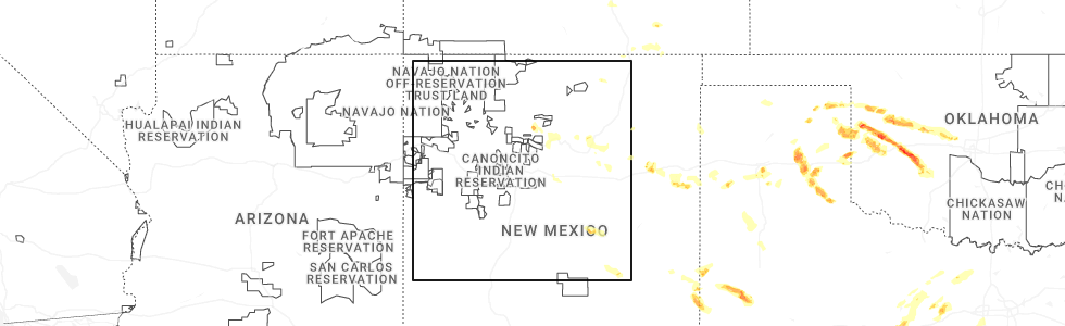
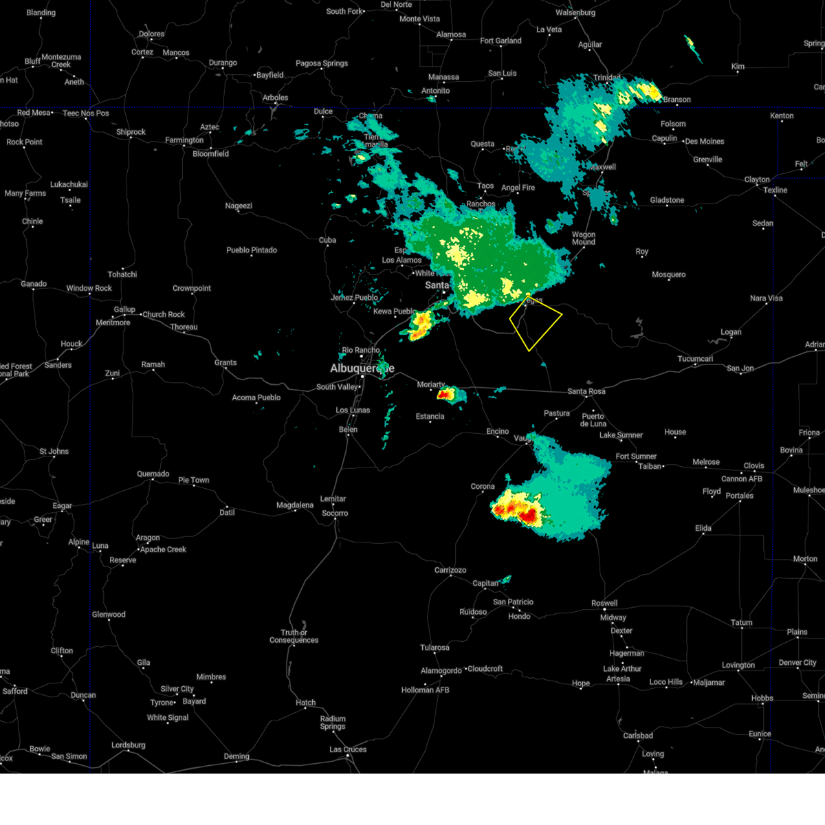
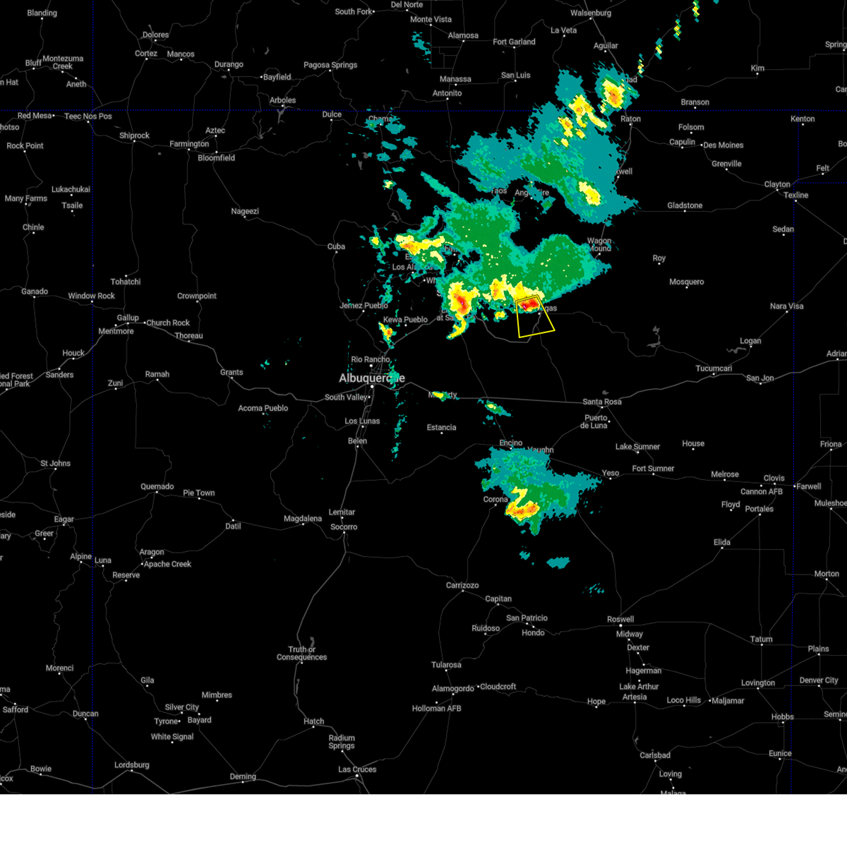
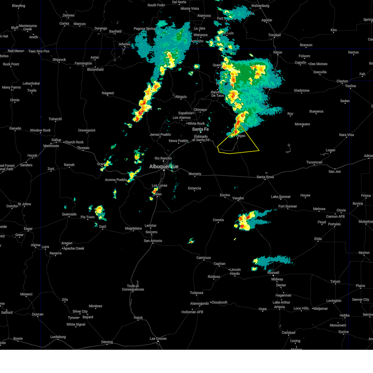
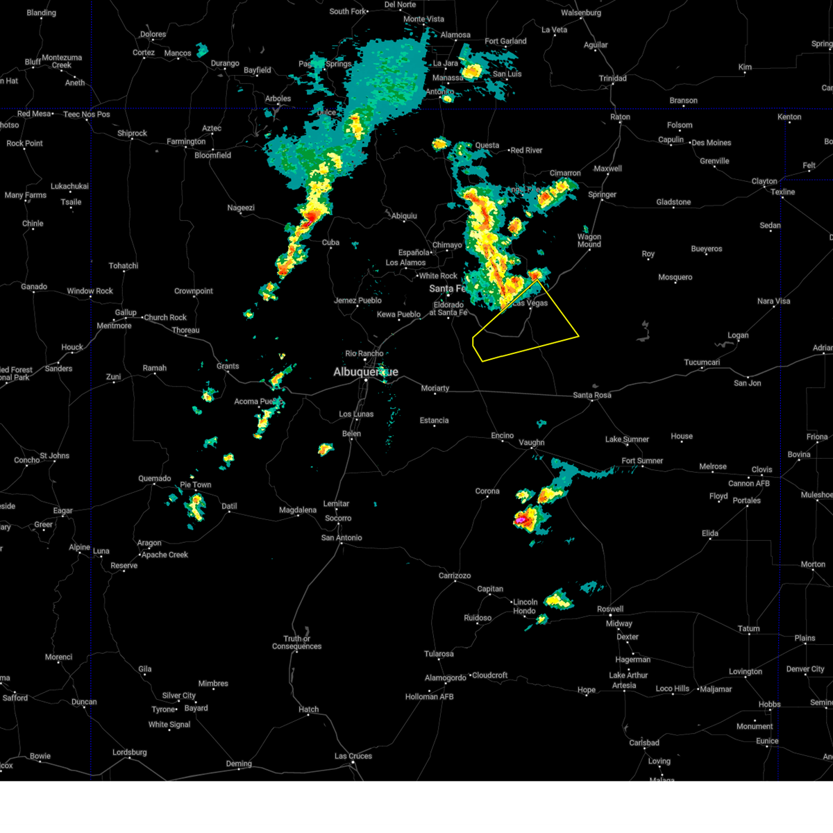
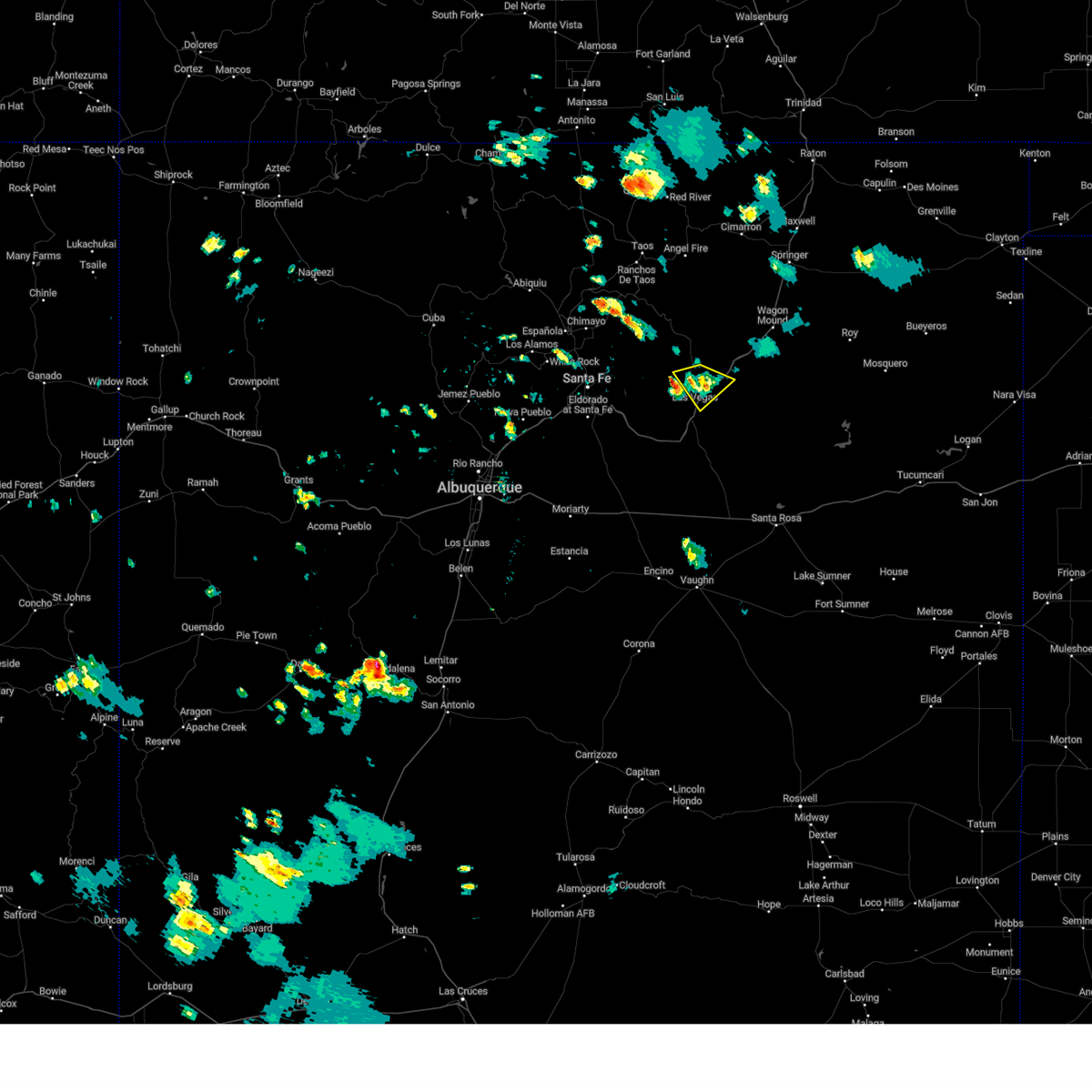
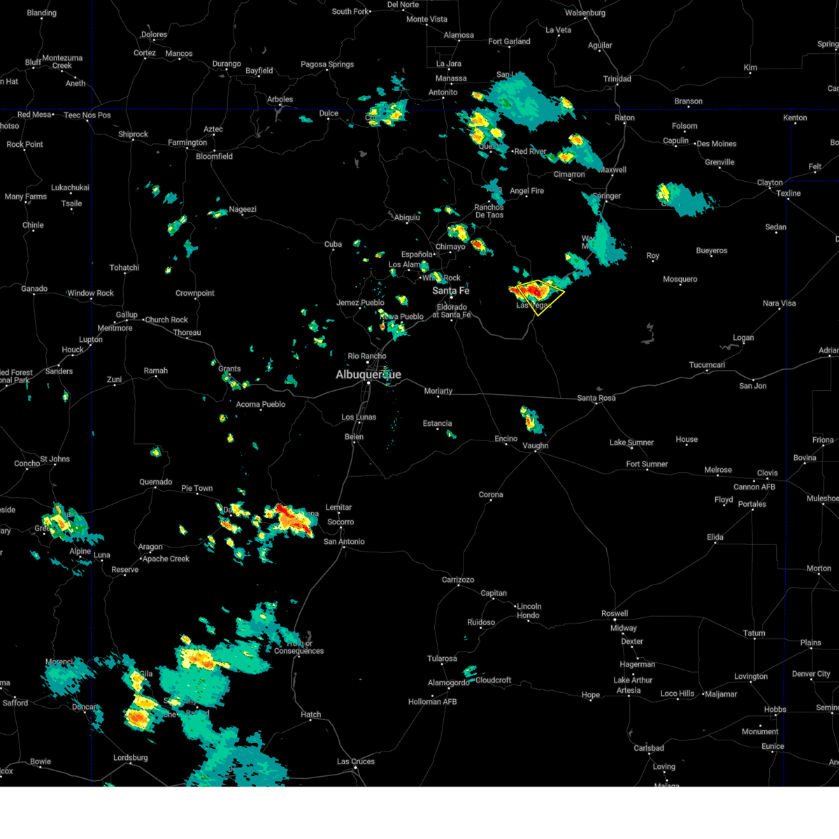
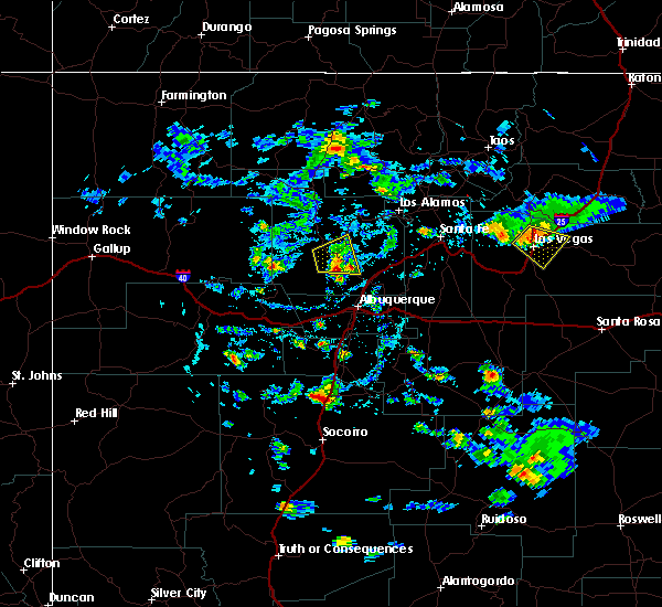
Hail Map for Las Vegas, NM
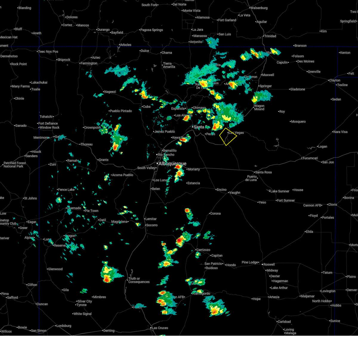
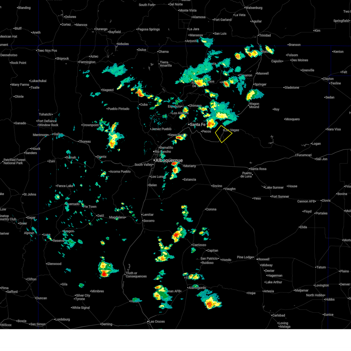
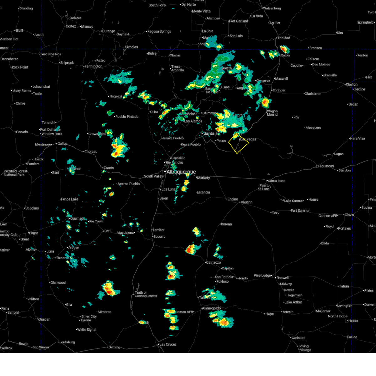
The Las Vegas, NM area has had 46 reports of on-the-ground hail by trained spotters, and has been under severe weather warnings 15 times during the past 12 months. Doppler radar has detected hail at or near Las Vegas, NM on 54 occasions, including 3 occasions during the past year.
| Name: | Las Vegas, NM |
| Where Located: | 59.3 miles SSE of Taos, NM |
| Map: | Google Map for Las Vegas, NM |
| Population: | 13753 |
| Housing Units: | 6609 |
| More Info: | Search Google for Las Vegas, NM |
2
The Top Recent Hail Date for Las Vegas, NM is Monday, May 26, 2025 (9th out of 54)
Hail and Wind Damage Spotted near Las Vegas, NM
| Date / Time | Report Details |
|---|---|
| 7/6/2025 2:18 PM MDT |
 the severe thunderstorm warning has been cancelled and is no longer in effect the severe thunderstorm warning has been cancelled and is no longer in effect
|
| 7/6/2025 2:10 PM MDT |
 At 210 pm mdt, a severe thunderstorm was located near romeroville, or near las vegas, moving southeast at 10 mph (radar indicated). Hazards include 60 mph wind gusts and small hail. Expect damage to roofs, siding, and trees. locations impacted include, las vegas, romeroville, tecolote, storrie lake state park, montezuma, ojitos frios and los montoyas. this includes the following highways, state road 518 between mile markers 1 and 2. state road 283 between mile markers 1 and 7. interstate 25 between mile markers 333 and 348. state road 65 between mile markers 1 and 4. State road 104 between mile markers 1 and 4. At 210 pm mdt, a severe thunderstorm was located near romeroville, or near las vegas, moving southeast at 10 mph (radar indicated). Hazards include 60 mph wind gusts and small hail. Expect damage to roofs, siding, and trees. locations impacted include, las vegas, romeroville, tecolote, storrie lake state park, montezuma, ojitos frios and los montoyas. this includes the following highways, state road 518 between mile markers 1 and 2. state road 283 between mile markers 1 and 7. interstate 25 between mile markers 333 and 348. state road 65 between mile markers 1 and 4. State road 104 between mile markers 1 and 4.
|
| 7/6/2025 1:57 PM MDT |
 Svrabq the national weather service in albuquerque has issued a * severe thunderstorm warning for, west central san miguel county in northeastern new mexico, * until 245 pm mdt. * at 157 pm mdt, a severe thunderstorm was located 5 miles south of montezuma, or near las vegas, moving southeast at 10 mph (radar indicated). Hazards include 60 mph wind gusts and quarter size hail. Hail damage to vehicles is expected. Expect wind damage to roofs, siding, and trees. Svrabq the national weather service in albuquerque has issued a * severe thunderstorm warning for, west central san miguel county in northeastern new mexico, * until 245 pm mdt. * at 157 pm mdt, a severe thunderstorm was located 5 miles south of montezuma, or near las vegas, moving southeast at 10 mph (radar indicated). Hazards include 60 mph wind gusts and quarter size hail. Hail damage to vehicles is expected. Expect wind damage to roofs, siding, and trees.
|
| 6/27/2025 1:24 PM MDT | Asos station klvs las vegas muni airpor in san miguel county NM, 6.3 miles WSW of Las Vegas, NM |
| 5/26/2025 3:29 PM MDT | Quarter sized hail reported 4.6 miles NNE of Las Vegas, NM, dime to quarter size hail. |
| 5/26/2025 3:26 PM MDT |
 Svrabq the national weather service in albuquerque has issued a * severe thunderstorm warning for, west central san miguel county in northeastern new mexico, * until 415 pm mdt. * at 326 pm mdt, a severe thunderstorm was located over romeroville, or near las vegas, moving southeast at 15 mph (radar indicated). Hazards include 60 mph wind gusts and quarter size hail. Hail damage to vehicles is expected. Expect wind damage to roofs, siding, and trees. Svrabq the national weather service in albuquerque has issued a * severe thunderstorm warning for, west central san miguel county in northeastern new mexico, * until 415 pm mdt. * at 326 pm mdt, a severe thunderstorm was located over romeroville, or near las vegas, moving southeast at 15 mph (radar indicated). Hazards include 60 mph wind gusts and quarter size hail. Hail damage to vehicles is expected. Expect wind damage to roofs, siding, and trees.
|
| 5/26/2025 3:00 PM MDT | At 300 pm mdt, a severe thunderstorm was located near montezuma, or near las vegas, moving southeast at 10 mph (radar indicated). Hazards include 60 mph wind gusts and half dollar size hail. Hail damage to vehicles is expected. expect wind damage to roofs, siding, and trees. locations impacted include, las vegas, romeroville, montezuma, storrie lake state park, ojitos frios, san geronimo, san pablo and mineral hill. this includes the following highways, state road 518 between mile markers 1 and 6. state road 283 between mile markers 1 and 12. interstate 25 between mile markers 337 and 349. state road 65 between mile markers 1 and 10. State road 104 between mile markers 1 and 2. |
| 5/26/2025 2:45 PM MDT |
 Svrabq the national weather service in albuquerque has issued a * severe thunderstorm warning for, northwestern san miguel county in northeastern new mexico, * until 330 pm mdt. * at 245 pm mdt, a severe thunderstorm was located near montezuma, or near las vegas, moving south at 10 mph (radar indicated). Hazards include 60 mph wind gusts and half dollar size hail. Hail damage to vehicles is expected. Expect wind damage to roofs, siding, and trees. Svrabq the national weather service in albuquerque has issued a * severe thunderstorm warning for, northwestern san miguel county in northeastern new mexico, * until 330 pm mdt. * at 245 pm mdt, a severe thunderstorm was located near montezuma, or near las vegas, moving south at 10 mph (radar indicated). Hazards include 60 mph wind gusts and half dollar size hail. Hail damage to vehicles is expected. Expect wind damage to roofs, siding, and trees.
|
| 9/17/2024 1:38 PM MDT |
 At 138 pm mdt, a severe thunderstorm was located over romeroville, or 7 miles southwest of las vegas, moving northeast at 35 mph (radar indicated). Hazards include 60 mph wind gusts and quarter size hail. Hail damage to vehicles is expected. expect wind damage to roofs, siding, and trees. locations impacted include, las vegas, tecolote, storrie lake state park, ribera, romeroville, montezuma, chapelle, san geronimo, north san ysidro, and mineral hill. this includes the following highways, interstate 25 between mile markers 314 and 357. state road 104 between mile markers 1 and 13. state road 65 between mile markers 1 and 9. state road 283 between mile markers 1 and 12. State road 518 between mile markers 1 and 9. At 138 pm mdt, a severe thunderstorm was located over romeroville, or 7 miles southwest of las vegas, moving northeast at 35 mph (radar indicated). Hazards include 60 mph wind gusts and quarter size hail. Hail damage to vehicles is expected. expect wind damage to roofs, siding, and trees. locations impacted include, las vegas, tecolote, storrie lake state park, ribera, romeroville, montezuma, chapelle, san geronimo, north san ysidro, and mineral hill. this includes the following highways, interstate 25 between mile markers 314 and 357. state road 104 between mile markers 1 and 13. state road 65 between mile markers 1 and 9. state road 283 between mile markers 1 and 12. State road 518 between mile markers 1 and 9.
|
| 9/17/2024 1:04 PM MDT |
 Svrabq the national weather service in albuquerque has issued a * severe thunderstorm warning for, northwestern san miguel county in northeastern new mexico, * until 200 pm mdt. * at 103 pm mdt, a severe thunderstorm was located 10 miles west of ribera, or 28 miles southwest of las vegas, moving northeast at 35 mph (radar indicated). Hazards include 60 mph wind gusts and quarter size hail. Hail damage to vehicles is expected. Expect wind damage to roofs, siding, and trees. Svrabq the national weather service in albuquerque has issued a * severe thunderstorm warning for, northwestern san miguel county in northeastern new mexico, * until 200 pm mdt. * at 103 pm mdt, a severe thunderstorm was located 10 miles west of ribera, or 28 miles southwest of las vegas, moving northeast at 35 mph (radar indicated). Hazards include 60 mph wind gusts and quarter size hail. Hail damage to vehicles is expected. Expect wind damage to roofs, siding, and trees.
|
| 7/27/2024 5:14 PM MDT |
 The storm that prompted the warning has weakened below severe limits, and no longer poses an immediate threat to life or property. therefore, the warning will be allowed to expire. however, small to medium-sized hail and gusty winds up to 50 mph are still likely with this thunderstorm. The storm that prompted the warning has weakened below severe limits, and no longer poses an immediate threat to life or property. therefore, the warning will be allowed to expire. however, small to medium-sized hail and gusty winds up to 50 mph are still likely with this thunderstorm.
|
| 7/27/2024 5:00 PM MDT |
 the severe thunderstorm warning has been cancelled and is no longer in effect the severe thunderstorm warning has been cancelled and is no longer in effect
|
| 7/27/2024 5:00 PM MDT |
 At 459 pm mdt, a severe thunderstorm was located near storrie lake state park, or 7 miles north of las vegas, moving southeast at 20 mph (radar indicated). Hazards include 60 mph wind gusts and half dollar size hail. Hail damage to vehicles is expected. expect wind damage to roofs, siding, and trees. locations impacted include, las vegas, storrie lake state park, and sapello. this includes the following highways, interstate 25 between mile markers 346 and 362. state road 104 between mile markers 1 and 3. state road 94 near mile marker 1. state road 266 between mile markers 0 and 6. State road 518 between mile markers 1 and 13. At 459 pm mdt, a severe thunderstorm was located near storrie lake state park, or 7 miles north of las vegas, moving southeast at 20 mph (radar indicated). Hazards include 60 mph wind gusts and half dollar size hail. Hail damage to vehicles is expected. expect wind damage to roofs, siding, and trees. locations impacted include, las vegas, storrie lake state park, and sapello. this includes the following highways, interstate 25 between mile markers 346 and 362. state road 104 between mile markers 1 and 3. state road 94 near mile marker 1. state road 266 between mile markers 0 and 6. State road 518 between mile markers 1 and 13.
|
| 7/27/2024 4:36 PM MDT |
 Svrabq the national weather service in albuquerque has issued a * severe thunderstorm warning for, northwestern san miguel county in northeastern new mexico, south central mora county in northeastern new mexico, * until 515 pm mdt. * at 435 pm mdt, a severe thunderstorm was located over sapello, or 13 miles south of mora, moving southeast at 20 mph (radar indicated). Hazards include 60 mph wind gusts and half dollar size hail. Hail damage to vehicles is expected. Expect wind damage to roofs, siding, and trees. Svrabq the national weather service in albuquerque has issued a * severe thunderstorm warning for, northwestern san miguel county in northeastern new mexico, south central mora county in northeastern new mexico, * until 515 pm mdt. * at 435 pm mdt, a severe thunderstorm was located over sapello, or 13 miles south of mora, moving southeast at 20 mph (radar indicated). Hazards include 60 mph wind gusts and half dollar size hail. Hail damage to vehicles is expected. Expect wind damage to roofs, siding, and trees.
|
| 7/18/2024 4:58 PM MDT |
 The storm which prompted the warning has weakened below severe limits, and no longer poses an immediate threat to life or property. therefore, the warning will be allowed to expire. however, this storm may restrengthen. nickel size hail, wind gusts up to 55 mph, very heavy rain and flash flooding are still possible with this thunderstorm. The storm which prompted the warning has weakened below severe limits, and no longer poses an immediate threat to life or property. therefore, the warning will be allowed to expire. however, this storm may restrengthen. nickel size hail, wind gusts up to 55 mph, very heavy rain and flash flooding are still possible with this thunderstorm.
|
| 7/18/2024 4:44 PM MDT |
 At 442 pm mdt, a severe thunderstorm was located 7 miles northwest of tecolote, or 11 miles southwest of las vegas, moving south at 15 mph (radar indicated). Hazards include 60 mph wind gusts and half dollar size hail. Hail damage to vehicles is expected. expect wind damage to roofs, siding, and trees. locations impacted include, las vegas, romeroville, montezuma, tecolote, el porvenir, storrie lake state park, ojitos frios, san geronimo, mineral hill, and san pablo. this includes the following highways, interstate 25 between mile markers 332 and 343. state road 65 between mile markers 1 and 14. state road 283 between mile markers 1 and 12, and near mile marker 14. State road 518 between mile markers 1 and 3. At 442 pm mdt, a severe thunderstorm was located 7 miles northwest of tecolote, or 11 miles southwest of las vegas, moving south at 15 mph (radar indicated). Hazards include 60 mph wind gusts and half dollar size hail. Hail damage to vehicles is expected. expect wind damage to roofs, siding, and trees. locations impacted include, las vegas, romeroville, montezuma, tecolote, el porvenir, storrie lake state park, ojitos frios, san geronimo, mineral hill, and san pablo. this includes the following highways, interstate 25 between mile markers 332 and 343. state road 65 between mile markers 1 and 14. state road 283 between mile markers 1 and 12, and near mile marker 14. State road 518 between mile markers 1 and 3.
|
| 7/18/2024 4:03 PM MDT |
 Svrabq the national weather service in albuquerque has issued a * severe thunderstorm warning for, northwestern san miguel county in northeastern new mexico, * until 500 pm mdt. * at 403 pm mdt, a severe thunderstorm was located over el porvenir, or 8 miles northwest of las vegas, moving south at 20 mph (radar indicated). Hazards include 60 mph wind gusts and quarter size hail. Hail damage to vehicles is expected. Expect wind damage to roofs, siding, and trees. Svrabq the national weather service in albuquerque has issued a * severe thunderstorm warning for, northwestern san miguel county in northeastern new mexico, * until 500 pm mdt. * at 403 pm mdt, a severe thunderstorm was located over el porvenir, or 8 miles northwest of las vegas, moving south at 20 mph (radar indicated). Hazards include 60 mph wind gusts and quarter size hail. Hail damage to vehicles is expected. Expect wind damage to roofs, siding, and trees.
|
| 7/5/2024 4:42 PM MDT |
 the severe thunderstorm warning has been cancelled and is no longer in effect the severe thunderstorm warning has been cancelled and is no longer in effect
|
| 7/5/2024 4:30 PM MDT |
 At 429 pm mdt, a severe thunderstorm was located 10 miles east of las vegas, moving south at 20 mph (radar indicated). Hazards include ping pong ball size hail and 60 mph wind gusts. People and animals outdoors will be injured. expect hail damage to roofs, siding, windows, and vehicles. expect wind damage to roofs, siding, and trees. locations impacted include, las vegas. this includes the following highways, state road 104 between mile markers 1 and 20. state road 65 near mile marker 1. state road 283 between mile markers 1 and 2. State road 518 between mile markers 1 and 5. At 429 pm mdt, a severe thunderstorm was located 10 miles east of las vegas, moving south at 20 mph (radar indicated). Hazards include ping pong ball size hail and 60 mph wind gusts. People and animals outdoors will be injured. expect hail damage to roofs, siding, windows, and vehicles. expect wind damage to roofs, siding, and trees. locations impacted include, las vegas. this includes the following highways, state road 104 between mile markers 1 and 20. state road 65 near mile marker 1. state road 283 between mile markers 1 and 2. State road 518 between mile markers 1 and 5.
|
| 7/5/2024 4:30 PM MDT |
 the severe thunderstorm warning has been cancelled and is no longer in effect the severe thunderstorm warning has been cancelled and is no longer in effect
|
| 7/5/2024 4:15 PM MDT |
 Svrabq the national weather service in albuquerque has issued a * severe thunderstorm warning for, northwestern san miguel county in northeastern new mexico, south central mora county in northeastern new mexico, * until 515 pm mdt. * at 415 pm mdt, a severe thunderstorm was located near las vegas, moving south at 20 mph (radar indicated). Hazards include 70 mph wind gusts and ping pong ball size hail. People and animals outdoors will be injured. expect hail damage to roofs, siding, windows, and vehicles. expect considerable tree damage. Wind damage is also likely to mobile homes, roofs, and outbuildings. Svrabq the national weather service in albuquerque has issued a * severe thunderstorm warning for, northwestern san miguel county in northeastern new mexico, south central mora county in northeastern new mexico, * until 515 pm mdt. * at 415 pm mdt, a severe thunderstorm was located near las vegas, moving south at 20 mph (radar indicated). Hazards include 70 mph wind gusts and ping pong ball size hail. People and animals outdoors will be injured. expect hail damage to roofs, siding, windows, and vehicles. expect considerable tree damage. Wind damage is also likely to mobile homes, roofs, and outbuildings.
|
| 7/5/2024 3:56 PM MDT |
 At 355 pm mdt, a severe thunderstorm was located 7 miles west of watrous, or 12 miles northeast of las vegas, moving south at 15 mph. trained weather spotters have reported rotation with this storm (radar indicated). Hazards include 60 mph wind gusts and quarter size hail. Hail damage to vehicles is expected. expect wind damage to roofs, siding, and trees. locations impacted include, las vegas, watrous, storrie lake state park, valmora, montezuma, and golondrinas. this includes the following highways, state road 104 between mile markers 1 and 27. state road 65 between mile markers 1 and 4. state road 283 between mile markers 1 and 5. State road 518 between mile markers 1 and 10. At 355 pm mdt, a severe thunderstorm was located 7 miles west of watrous, or 12 miles northeast of las vegas, moving south at 15 mph. trained weather spotters have reported rotation with this storm (radar indicated). Hazards include 60 mph wind gusts and quarter size hail. Hail damage to vehicles is expected. expect wind damage to roofs, siding, and trees. locations impacted include, las vegas, watrous, storrie lake state park, valmora, montezuma, and golondrinas. this includes the following highways, state road 104 between mile markers 1 and 27. state road 65 between mile markers 1 and 4. state road 283 between mile markers 1 and 5. State road 518 between mile markers 1 and 10.
|
| 7/5/2024 3:30 PM MDT |
 Svrabq the national weather service in albuquerque has issued a * severe thunderstorm warning for, northwestern san miguel county in northeastern new mexico, south central mora county in northeastern new mexico, * until 430 pm mdt. * at 330 pm mdt, a severe thunderstorm was located 8 miles southeast of la cueva, or 13 miles southeast of mora, moving south at 15 mph (radar indicated). Hazards include ping pong ball size hail and 60 mph wind gusts. People and animals outdoors will be injured. expect hail damage to roofs, siding, windows, and vehicles. Expect wind damage to roofs, siding, and trees. Svrabq the national weather service in albuquerque has issued a * severe thunderstorm warning for, northwestern san miguel county in northeastern new mexico, south central mora county in northeastern new mexico, * until 430 pm mdt. * at 330 pm mdt, a severe thunderstorm was located 8 miles southeast of la cueva, or 13 miles southeast of mora, moving south at 15 mph (radar indicated). Hazards include ping pong ball size hail and 60 mph wind gusts. People and animals outdoors will be injured. expect hail damage to roofs, siding, windows, and vehicles. Expect wind damage to roofs, siding, and trees.
|
| 6/19/2024 6:03 PM MDT | Quarter sized hail reported 13.7 miles SW of Las Vegas, NM, report from mping: quarter (1.00 in.). |
| 5/31/2024 3:01 PM MDT |
 the severe thunderstorm warning has been cancelled and is no longer in effect the severe thunderstorm warning has been cancelled and is no longer in effect
|
| 5/31/2024 2:38 PM MDT |
 Svrabq the national weather service in albuquerque has issued a * severe thunderstorm warning for, southwestern san miguel county in northeastern new mexico, * until 345 pm mdt. * at 238 pm mdt, a severe thunderstorm was located near romeroville, or near las vegas, moving east at 15 mph (radar indicated). Hazards include 60 mph wind gusts and quarter size hail. Hail damage to vehicles is expected. Expect wind damage to roofs, siding, and trees. Svrabq the national weather service in albuquerque has issued a * severe thunderstorm warning for, southwestern san miguel county in northeastern new mexico, * until 345 pm mdt. * at 238 pm mdt, a severe thunderstorm was located near romeroville, or near las vegas, moving east at 15 mph (radar indicated). Hazards include 60 mph wind gusts and quarter size hail. Hail damage to vehicles is expected. Expect wind damage to roofs, siding, and trees.
|
| 5/11/2024 4:07 PM MDT |
 Svrabq the national weather service in albuquerque has issued a * severe thunderstorm warning for, west central san miguel county in northeastern new mexico, * until 500 pm mdt. * at 406 pm mdt, a severe thunderstorm was located over tecolote, or 10 miles south of las vegas, moving east at 30 mph (radar indicated). Hazards include 60 mph wind gusts and quarter size hail. Hail damage to vehicles is expected. Expect wind damage to roofs, siding, and trees. Svrabq the national weather service in albuquerque has issued a * severe thunderstorm warning for, west central san miguel county in northeastern new mexico, * until 500 pm mdt. * at 406 pm mdt, a severe thunderstorm was located over tecolote, or 10 miles south of las vegas, moving east at 30 mph (radar indicated). Hazards include 60 mph wind gusts and quarter size hail. Hail damage to vehicles is expected. Expect wind damage to roofs, siding, and trees.
|
| 10/2/2023 1:54 PM MDT |
 At 153 pm mdt, a severe thunderstorm was located 7 miles east of storrie lake state park, or 8 miles northeast of las vegas, moving northeast at 30 mph (radar indicated). Hazards include 60 mph wind gusts and quarter size hail. Hail damage to vehicles is expected. expect wind damage to roofs, siding, and trees. locations impacted include, las vegas, watrous, and storrie lake state park. the emergency manager reported quarter size hail with this storm over northeast las vegas around 147 pm mdt. this includes the following highways, interstate 25 between mile markers 347 and 367. state road 104 between mile markers 2 and 7. state road 518 between mile markers 1 and 7. hail threat, observed max hail size, 1. 00 in wind threat, radar indicated max wind gust, 60 mph. At 153 pm mdt, a severe thunderstorm was located 7 miles east of storrie lake state park, or 8 miles northeast of las vegas, moving northeast at 30 mph (radar indicated). Hazards include 60 mph wind gusts and quarter size hail. Hail damage to vehicles is expected. expect wind damage to roofs, siding, and trees. locations impacted include, las vegas, watrous, and storrie lake state park. the emergency manager reported quarter size hail with this storm over northeast las vegas around 147 pm mdt. this includes the following highways, interstate 25 between mile markers 347 and 367. state road 104 between mile markers 2 and 7. state road 518 between mile markers 1 and 7. hail threat, observed max hail size, 1. 00 in wind threat, radar indicated max wind gust, 60 mph.
|
| 10/2/2023 1:50 PM MDT | Quarter sized hail reported 2.5 miles SSW of Las Vegas, NM, copious amounts of nickel to quarter sized hail required nmdot snow plows to be dispatched along interstate 25. |
| 10/2/2023 1:37 PM MDT | Quarter sized hail reported 0.2 miles W of Las Vegas, NM, lots of nickel to quarter sized hail that accumulated to about 3 inches deep in some areas. |
| 10/2/2023 1:35 PM MDT |
 At 135 pm mdt, a severe thunderstorm was located over las vegas, moving northeast at 35 mph (radar indicated). Hazards include 60 mph wind gusts and quarter size hail. Hail damage to vehicles is expected. expect wind damage to roofs, siding, and trees. locations impacted include, las vegas, storrie lake state park, sapello, romeroville, montezuma, el porvenir, watrous, manuelitas, san geronimo, and mineral hill. this includes the following highways, interstate 25 between mile markers 336 and 367. state road 104 between mile markers 1 and 7. state road 65 between mile markers 1 and 12. state road 94 between mile markers 1 and 4. state road 266 between mile markers 0 and 4. state road 283 between mile markers 1 and 12. state road 518 between mile markers 1 and 20. hail threat, radar indicated max hail size, 1. 00 in wind threat, radar indicated max wind gust, 60 mph. At 135 pm mdt, a severe thunderstorm was located over las vegas, moving northeast at 35 mph (radar indicated). Hazards include 60 mph wind gusts and quarter size hail. Hail damage to vehicles is expected. expect wind damage to roofs, siding, and trees. locations impacted include, las vegas, storrie lake state park, sapello, romeroville, montezuma, el porvenir, watrous, manuelitas, san geronimo, and mineral hill. this includes the following highways, interstate 25 between mile markers 336 and 367. state road 104 between mile markers 1 and 7. state road 65 between mile markers 1 and 12. state road 94 between mile markers 1 and 4. state road 266 between mile markers 0 and 4. state road 283 between mile markers 1 and 12. state road 518 between mile markers 1 and 20. hail threat, radar indicated max hail size, 1. 00 in wind threat, radar indicated max wind gust, 60 mph.
|
| 10/2/2023 1:23 PM MDT |
 At 122 pm mdt, a severe thunderstorm was located near tecolote, or 11 miles southwest of las vegas, moving northeast at 35 mph (radar indicated). Hazards include 60 mph wind gusts and quarter size hail. Hail damage to vehicles is expected. Expect wind damage to roofs, siding, and trees. At 122 pm mdt, a severe thunderstorm was located near tecolote, or 11 miles southwest of las vegas, moving northeast at 35 mph (radar indicated). Hazards include 60 mph wind gusts and quarter size hail. Hail damage to vehicles is expected. Expect wind damage to roofs, siding, and trees.
|
| 7/21/2023 4:37 PM MDT | Quarter sized hail reported 1.1 miles NE of Las Vegas, NM |
| 7/21/2023 4:35 PM MDT |
 At 435 pm mdt, a severe thunderstorm was located over romeroville, or near las vegas, moving south at 20 mph (radar indicated). Hazards include 60 mph wind gusts and half dollar size hail. Hail damage to vehicles is expected. Expect wind damage to roofs, siding, and trees. At 435 pm mdt, a severe thunderstorm was located over romeroville, or near las vegas, moving south at 20 mph (radar indicated). Hazards include 60 mph wind gusts and half dollar size hail. Hail damage to vehicles is expected. Expect wind damage to roofs, siding, and trees.
|
| 7/21/2023 4:26 PM MDT |
 The severe thunderstorm warning for northwestern san miguel county will expire at 430 pm mdt, the storm which prompted the warning has weakened below severe limits, and no longer poses an immediate threat to life or property. therefore, the warning will be allowed to expire. however small hail is still possible with this thunderstorm. a severe thunderstorm watch remains in effect until 900 pm mdt for northeastern new mexico. The severe thunderstorm warning for northwestern san miguel county will expire at 430 pm mdt, the storm which prompted the warning has weakened below severe limits, and no longer poses an immediate threat to life or property. therefore, the warning will be allowed to expire. however small hail is still possible with this thunderstorm. a severe thunderstorm watch remains in effect until 900 pm mdt for northeastern new mexico.
|
| 7/21/2023 4:09 PM MDT |
 At 409 pm mdt, a severe thunderstorm was located over montezuma, or near las vegas, moving southeast at 25 mph (radar indicated). Hazards include ping pong ball size hail and 60 mph wind gusts. People and animals outdoors will be injured. expect hail damage to roofs, siding, windows, and vehicles. expect wind damage to roofs, siding, and trees. locations impacted include, las vegas, romeroville, montezuma, el porvenir, storrie lake state park, sapello, san agustin, los montoyas and gallinas. this includes the following highways, interstate 25 between mile markers 338 and 354. state road 104 between mile markers 1 and 11. state road 65 between mile markers 1 and 14. state road 94 near mile marker 1. state road 266 between mile markers 1 and 5. state road 283 between mile markers 1 and 6. state road 518 between mile markers 1 and 12. hail threat, radar indicated max hail size, 1. 50 in wind threat, radar indicated max wind gust, 60 mph. At 409 pm mdt, a severe thunderstorm was located over montezuma, or near las vegas, moving southeast at 25 mph (radar indicated). Hazards include ping pong ball size hail and 60 mph wind gusts. People and animals outdoors will be injured. expect hail damage to roofs, siding, windows, and vehicles. expect wind damage to roofs, siding, and trees. locations impacted include, las vegas, romeroville, montezuma, el porvenir, storrie lake state park, sapello, san agustin, los montoyas and gallinas. this includes the following highways, interstate 25 between mile markers 338 and 354. state road 104 between mile markers 1 and 11. state road 65 between mile markers 1 and 14. state road 94 near mile marker 1. state road 266 between mile markers 1 and 5. state road 283 between mile markers 1 and 6. state road 518 between mile markers 1 and 12. hail threat, radar indicated max hail size, 1. 50 in wind threat, radar indicated max wind gust, 60 mph.
|
| 7/21/2023 3:52 PM MDT |
 At 352 pm mdt, a severe thunderstorm was located near el porvenir, or 11 miles northwest of las vegas, moving southeast at 25 mph (radar indicated). Hazards include two inch hail and 70 mph wind gusts. People and animals outdoors will be injured. expect hail damage to roofs, siding, windows, and vehicles. expect considerable tree damage. Wind damage is also likely to mobile homes, roofs, and outbuildings. At 352 pm mdt, a severe thunderstorm was located near el porvenir, or 11 miles northwest of las vegas, moving southeast at 25 mph (radar indicated). Hazards include two inch hail and 70 mph wind gusts. People and animals outdoors will be injured. expect hail damage to roofs, siding, windows, and vehicles. expect considerable tree damage. Wind damage is also likely to mobile homes, roofs, and outbuildings.
|
| 6/6/2023 6:55 PM MDT |
 At 654 pm mdt, a severe thunderstorm was located near tecolote, or 11 miles south of las vegas, moving southeast at 15 mph (radar indicated). Hazards include 60 mph wind gusts and half dollar size hail. Hail damage to vehicles is expected. Expect wind damage to roofs, siding, and trees. At 654 pm mdt, a severe thunderstorm was located near tecolote, or 11 miles south of las vegas, moving southeast at 15 mph (radar indicated). Hazards include 60 mph wind gusts and half dollar size hail. Hail damage to vehicles is expected. Expect wind damage to roofs, siding, and trees.
|
| 6/6/2023 5:41 PM MDT |
 At 540 pm mdt, a severe thunderstorm was located over el porvenir, or 8 miles northwest of las vegas, moving south at 15 mph (radar indicated). Hazards include 60 mph wind gusts and quarter size hail. Hail damage to vehicles is expected. expect wind damage to roofs, siding, and trees. locations impacted include, las vegas, montezuma, el porvenir, storrie lake state park, sapello, manuelitas, gallinas and romeroville. this includes the following highways, interstate 25 near mile marker 340, and between mile markers 342 and 350. state road 104 between mile markers 1 and 2. state road 65 between mile markers 1 and 14. state road 94 between mile markers 1 and 4. state road 266 between mile markers 0 and 6. state road 283 between mile markers 1 and 7. state road 518 between mile markers 1 and 13. hail threat, observed max hail size, 1. 00 in wind threat, radar indicated max wind gust, 60 mph. At 540 pm mdt, a severe thunderstorm was located over el porvenir, or 8 miles northwest of las vegas, moving south at 15 mph (radar indicated). Hazards include 60 mph wind gusts and quarter size hail. Hail damage to vehicles is expected. expect wind damage to roofs, siding, and trees. locations impacted include, las vegas, montezuma, el porvenir, storrie lake state park, sapello, manuelitas, gallinas and romeroville. this includes the following highways, interstate 25 near mile marker 340, and between mile markers 342 and 350. state road 104 between mile markers 1 and 2. state road 65 between mile markers 1 and 14. state road 94 between mile markers 1 and 4. state road 266 between mile markers 0 and 6. state road 283 between mile markers 1 and 7. state road 518 between mile markers 1 and 13. hail threat, observed max hail size, 1. 00 in wind threat, radar indicated max wind gust, 60 mph.
|
| 6/6/2023 5:36 PM MDT | Quarter sized hail reported 10 miles E of Las Vegas, NM, observed by mineral hill fire department. |
| 6/6/2023 5:13 PM MDT |
 At 511 pm mdt, a severe thunderstorm was located near sapello, or 8 miles north of las vegas, moving southeast at 15 mph (radar indicated). Hazards include 60 mph wind gusts and quarter size hail. Hail damage to vehicles is expected. Expect wind damage to roofs, siding, and trees. At 511 pm mdt, a severe thunderstorm was located near sapello, or 8 miles north of las vegas, moving southeast at 15 mph (radar indicated). Hazards include 60 mph wind gusts and quarter size hail. Hail damage to vehicles is expected. Expect wind damage to roofs, siding, and trees.
|
| 6/6/2023 4:40 PM MDT | Quarter sized hail reported 12.6 miles S of Las Vegas, NM, new mexico forest and watershed institute. |
| 6/6/2023 4:30 PM MDT | Ping Pong Ball sized hail reported 11.8 miles S of Las Vegas, NM |
| 6/3/2023 7:01 PM MDT | Quarter sized hail reported 12.9 miles E of Las Vegas, NM, report from mping: quarter (1.00 in.). |
| 6/24/2021 5:05 PM MDT | Klvs aso in san miguel county NM, 6.3 miles SW of Las Vegas, NM |
| 6/22/2021 1:01 PM MDT | Klvs aso in san miguel county NM, 6.3 miles SW of Las Vegas, NM |
| 6/12/2021 5:20 PM MDT |
 At 520 pm mdt, a severe thunderstorm was located 9 miles east of las vegas, moving southeast at 20 mph (trained weather spotters). Hazards include two inch hail and 70 mph wind gusts. People and animals outdoors will be injured. expect hail damage to roofs, siding, windows, and vehicles. expect considerable tree damage. wind damage is also likely to mobile homes, roofs, and outbuildings. locations impacted include, las vegas. this includes the following highways, interstate 25 between mile markers 356 and 358. State road 104 between mile markers 1 and 19. At 520 pm mdt, a severe thunderstorm was located 9 miles east of las vegas, moving southeast at 20 mph (trained weather spotters). Hazards include two inch hail and 70 mph wind gusts. People and animals outdoors will be injured. expect hail damage to roofs, siding, windows, and vehicles. expect considerable tree damage. wind damage is also likely to mobile homes, roofs, and outbuildings. locations impacted include, las vegas. this includes the following highways, interstate 25 between mile markers 356 and 358. State road 104 between mile markers 1 and 19.
|
| 6/12/2021 5:19 PM MDT | Tennis Ball sized hail reported 12.1 miles W of Las Vegas, NM |
| 6/12/2021 5:18 PM MDT | Hen Egg sized hail reported 12.6 miles W of Las Vegas, NM |
| 6/12/2021 5:18 PM MDT | Tea Cup sized hail reported 10.4 miles W of Las Vegas, NM |
| 6/12/2021 5:16 PM MDT | Tennis Ball sized hail reported 5.3 miles W of Las Vegas, NM |
| 6/12/2021 5:14 PM MDT | Golf Ball sized hail reported 8.7 miles W of Las Vegas, NM |
| 6/12/2021 5:12 PM MDT | Quarter sized hail reported 6.3 miles SSW of Las Vegas, NM |
| 6/12/2021 4:59 PM MDT |
 At 458 pm mdt, a severe thunderstorm was located near storrie lake state park, or 7 miles northeast of las vegas, moving southeast at 10 mph (public). Hazards include golf ball size hail and 60 mph wind gusts. People and animals outdoors will be injured. expect hail damage to roofs, siding, windows, and vehicles. Expect wind damage to roofs, siding, and trees. At 458 pm mdt, a severe thunderstorm was located near storrie lake state park, or 7 miles northeast of las vegas, moving southeast at 10 mph (public). Hazards include golf ball size hail and 60 mph wind gusts. People and animals outdoors will be injured. expect hail damage to roofs, siding, windows, and vehicles. Expect wind damage to roofs, siding, and trees.
|
| 6/12/2021 4:42 PM MDT |
 At 442 pm mdt, a severe thunderstorm was located over storrie lake state park, or near las vegas, moving south at 10 mph (public). Hazards include golf ball size hail and 60 mph wind gusts. People and animals outdoors will be injured. expect hail damage to roofs, siding, windows, and vehicles. expect wind damage to roofs, siding, and trees. locations impacted include, las vegas, storrie lake state park and montezuma. this includes the following highways, interstate 25 between mile markers 342 and 361. State road 104 between mile markers 1 and 7. At 442 pm mdt, a severe thunderstorm was located over storrie lake state park, or near las vegas, moving south at 10 mph (public). Hazards include golf ball size hail and 60 mph wind gusts. People and animals outdoors will be injured. expect hail damage to roofs, siding, windows, and vehicles. expect wind damage to roofs, siding, and trees. locations impacted include, las vegas, storrie lake state park and montezuma. this includes the following highways, interstate 25 between mile markers 342 and 361. State road 104 between mile markers 1 and 7.
|
| 6/12/2021 4:37 PM MDT | Golf Ball sized hail reported 11.8 miles S of Las Vegas, NM |
| 6/12/2021 4:27 PM MDT |
 At 426 pm mdt, a severe thunderstorm was located near sapello, or 8 miles north of las vegas, moving south at 10 mph (radar indicated). Hazards include ping pong ball size hail and 60 mph wind gusts. People and animals outdoors will be injured. expect hail damage to roofs, siding, windows, and vehicles. expect wind damage to roofs, siding, and trees. locations impacted include, las vegas, storrie lake state park, sapello and montezuma. this includes the following highways, interstate 25 between mile markers 342 and 361. State road 104 between mile markers 1 and 7. At 426 pm mdt, a severe thunderstorm was located near sapello, or 8 miles north of las vegas, moving south at 10 mph (radar indicated). Hazards include ping pong ball size hail and 60 mph wind gusts. People and animals outdoors will be injured. expect hail damage to roofs, siding, windows, and vehicles. expect wind damage to roofs, siding, and trees. locations impacted include, las vegas, storrie lake state park, sapello and montezuma. this includes the following highways, interstate 25 between mile markers 342 and 361. State road 104 between mile markers 1 and 7.
|
| 6/12/2021 3:52 PM MDT |
 At 352 pm mdt, a severe thunderstorm was located over sapello, or 13 miles south of mora, moving south at 10 mph (radar indicated). Hazards include ping pong ball size hail and 60 mph wind gusts. People and animals outdoors will be injured. expect hail damage to roofs, siding, windows, and vehicles. Expect wind damage to roofs, siding, and trees. At 352 pm mdt, a severe thunderstorm was located over sapello, or 13 miles south of mora, moving south at 10 mph (radar indicated). Hazards include ping pong ball size hail and 60 mph wind gusts. People and animals outdoors will be injured. expect hail damage to roofs, siding, windows, and vehicles. Expect wind damage to roofs, siding, and trees.
|
| 6/1/2021 3:05 PM MDT |
 The severe thunderstorm warning for north central san miguel county will expire at 315 pm mdt, the storm which prompted the warning has weakened below severe limits, and no longer poses an immediate threat to life or property. therefore, the warning will be allowed to expire. however small hail, gusty winds and heavy rain are still possible with this thunderstorm. The severe thunderstorm warning for north central san miguel county will expire at 315 pm mdt, the storm which prompted the warning has weakened below severe limits, and no longer poses an immediate threat to life or property. therefore, the warning will be allowed to expire. however small hail, gusty winds and heavy rain are still possible with this thunderstorm.
|
| 6/1/2021 2:51 PM MDT |
 At 251 pm mdt, a severe thunderstorm was located near las vegas, moving south at 15 mph (radar indicated). Hazards include 60 mph wind gusts and quarter size hail. Hail damage to vehicles is expected. expect wind damage to roofs, siding, and trees. locations impacted include, las vegas, los montoyas and san agustin. this includes the following highways, interstate 25 between mile markers 350 and 354. State road 104 between mile markers 1 and 12. At 251 pm mdt, a severe thunderstorm was located near las vegas, moving south at 15 mph (radar indicated). Hazards include 60 mph wind gusts and quarter size hail. Hail damage to vehicles is expected. expect wind damage to roofs, siding, and trees. locations impacted include, las vegas, los montoyas and san agustin. this includes the following highways, interstate 25 between mile markers 350 and 354. State road 104 between mile markers 1 and 12.
|
| 6/1/2021 2:33 PM MDT |
 At 233 pm mdt, a severe thunderstorm was located near storrie lake state park, or 7 miles northeast of las vegas, moving south at 15 mph (radar indicated). Hazards include 60 mph wind gusts and quarter size hail. Hail damage to vehicles is expected. Expect wind damage to roofs, siding, and trees. At 233 pm mdt, a severe thunderstorm was located near storrie lake state park, or 7 miles northeast of las vegas, moving south at 15 mph (radar indicated). Hazards include 60 mph wind gusts and quarter size hail. Hail damage to vehicles is expected. Expect wind damage to roofs, siding, and trees.
|
| 5/17/2021 4:23 PM MDT |
 The severe thunderstorm warning for northwestern san miguel and southeastern mora counties will expire at 430 pm mdt, the storms which prompted the warning have weakened below severe limits, and no longer pose an immediate threat to life or property. therefore, the warning will be allowed to expire. a severe thunderstorm watch remains in effect until 1000 pm mdt for northeastern new mexico. remember, a severe thunderstorm warning remains in effect for eastern san miguel county until 5 pm mdt. The severe thunderstorm warning for northwestern san miguel and southeastern mora counties will expire at 430 pm mdt, the storms which prompted the warning have weakened below severe limits, and no longer pose an immediate threat to life or property. therefore, the warning will be allowed to expire. a severe thunderstorm watch remains in effect until 1000 pm mdt for northeastern new mexico. remember, a severe thunderstorm warning remains in effect for eastern san miguel county until 5 pm mdt.
|
| 5/17/2021 4:12 PM MDT |
 At 412 pm mdt, severe thunderstorms were located along a line extending from la cueva to 6 miles southeast of trujillo, moving northeast at 30 mph (radar indicated). Hazards include 60 mph wind gusts and nickel size hail. Expect damage to roofs, siding, and trees. locations impacted include, valmora, maes, watrous, storrie lake state park, trujillo, trementina and shoemaker. this includes the following highways, interstate 25 between mile markers 349 and 382. State road 104 between mile markers 3 and 46. At 412 pm mdt, severe thunderstorms were located along a line extending from la cueva to 6 miles southeast of trujillo, moving northeast at 30 mph (radar indicated). Hazards include 60 mph wind gusts and nickel size hail. Expect damage to roofs, siding, and trees. locations impacted include, valmora, maes, watrous, storrie lake state park, trujillo, trementina and shoemaker. this includes the following highways, interstate 25 between mile markers 349 and 382. State road 104 between mile markers 3 and 46.
|
| 5/17/2021 3:44 PM MDT |
 At 344 pm mdt, severe thunderstorms were located along a line extending from near tierra monte to 10 miles south of trujillo, moving northeast at 35 mph (radar indicated). Hazards include 60 mph wind gusts and nickel size hail. expect damage to roofs, siding, and trees At 344 pm mdt, severe thunderstorms were located along a line extending from near tierra monte to 10 miles south of trujillo, moving northeast at 35 mph (radar indicated). Hazards include 60 mph wind gusts and nickel size hail. expect damage to roofs, siding, and trees
|
| 5/17/2021 3:37 PM MDT | Klvs aso in san miguel county NM, 6.3 miles SW of Las Vegas, NM |
| 8/5/2020 4:14 PM MDT |
 At 413 pm mdt, a severe thunderstorm was located near el porvenir, or 8 miles northwest of las vegas, moving northeast at 10 mph (radar indicated). Hazards include 60 mph wind gusts and quarter size hail. Hail damage to vehicles is expected. expect wind damage to roofs, siding, and trees. locations impacted include, las vegas, montezuma, el porvenir, storrie lake state park, sapello, manuelitas and gallinas. this includes the following highways, interstate 25 between mile markers 346 and 357. State road 104 between mile markers 1 and 7. At 413 pm mdt, a severe thunderstorm was located near el porvenir, or 8 miles northwest of las vegas, moving northeast at 10 mph (radar indicated). Hazards include 60 mph wind gusts and quarter size hail. Hail damage to vehicles is expected. expect wind damage to roofs, siding, and trees. locations impacted include, las vegas, montezuma, el porvenir, storrie lake state park, sapello, manuelitas and gallinas. this includes the following highways, interstate 25 between mile markers 346 and 357. State road 104 between mile markers 1 and 7.
|
| 8/5/2020 4:00 PM MDT |
 At 359 pm mdt, a severe thunderstorm was located near el porvenir, or 7 miles northwest of las vegas, moving east at 5 mph (radar indicated). Hazards include 60 mph wind gusts and half dollar size hail. Hail damage to vehicles is expected. Expect wind damage to roofs, siding, and trees. At 359 pm mdt, a severe thunderstorm was located near el porvenir, or 7 miles northwest of las vegas, moving east at 5 mph (radar indicated). Hazards include 60 mph wind gusts and half dollar size hail. Hail damage to vehicles is expected. Expect wind damage to roofs, siding, and trees.
|
| 8/3/2020 3:59 PM MDT |
 At 359 pm mdt, a severe thunderstorm was located near sapello, or 11 miles south of mora, moving south at 15 mph (radar indicated). Hazards include ping pong ball size hail and 60 mph wind gusts. People and animals outdoors will be injured. expect hail damage to roofs, siding, windows, and vehicles. Expect wind damage to roofs, siding, and trees. At 359 pm mdt, a severe thunderstorm was located near sapello, or 11 miles south of mora, moving south at 15 mph (radar indicated). Hazards include ping pong ball size hail and 60 mph wind gusts. People and animals outdoors will be injured. expect hail damage to roofs, siding, windows, and vehicles. Expect wind damage to roofs, siding, and trees.
|
| 7/31/2020 2:59 PM MDT |
 At 258 pm mdt, a severe thunderstorm was located over tecolote, or 9 miles southwest of las vegas, moving southwest at 10 mph (radar indicated). Hazards include ping pong ball size hail and 60 mph wind gusts. People and animals outdoors will be injured. expect hail damage to roofs, siding, windows, and vehicles. Expect wind damage to roofs, siding, and trees. At 258 pm mdt, a severe thunderstorm was located over tecolote, or 9 miles southwest of las vegas, moving southwest at 10 mph (radar indicated). Hazards include ping pong ball size hail and 60 mph wind gusts. People and animals outdoors will be injured. expect hail damage to roofs, siding, windows, and vehicles. Expect wind damage to roofs, siding, and trees.
|
| 7/31/2020 2:55 PM MDT | Quarter sized hail reported 8.9 miles ENE of Las Vegas, NM |
| 7/31/2020 2:42 PM MDT |
 At 241 pm mdt, a severe thunderstorm was located near las vegas, moving southwest at 10 mph (radar indicated). Hazards include 60 mph wind gusts and half dollar size hail. Hail damage to vehicles is expected. expect wind damage to roofs, siding, and trees. locations impacted include, las vegas, romeroville, tecolote, san agustin, ojitos frios, san geronimo, los montoyas and san pablo. this includes the following highways, interstate 25 between mile markers 332 and 347. State road 104 between mile markers 1 and 7. At 241 pm mdt, a severe thunderstorm was located near las vegas, moving southwest at 10 mph (radar indicated). Hazards include 60 mph wind gusts and half dollar size hail. Hail damage to vehicles is expected. expect wind damage to roofs, siding, and trees. locations impacted include, las vegas, romeroville, tecolote, san agustin, ojitos frios, san geronimo, los montoyas and san pablo. this includes the following highways, interstate 25 between mile markers 332 and 347. State road 104 between mile markers 1 and 7.
|
| 7/31/2020 2:30 PM MDT | Quarter sized hail reported 1.4 miles N of Las Vegas, NM |
| 7/31/2020 2:22 PM MDT |
 At 222 pm mdt, a severe thunderstorm was located over las vegas, moving southwest at 10 mph (radar indicated). Hazards include two inch hail and 60 mph wind gusts. People and animals outdoors will be injured. expect hail damage to roofs, siding, windows, and vehicles. expect wind damage to roofs, siding, and trees. locations impacted include, las vegas, romeroville, montezuma, tecolote, storrie lake state park, san agustin, ojitos frios, san geronimo, los montoyas and san pablo. this includes the following highways, interstate 25 between mile markers 332 and 351. State road 104 between mile markers 1 and 7. At 222 pm mdt, a severe thunderstorm was located over las vegas, moving southwest at 10 mph (radar indicated). Hazards include two inch hail and 60 mph wind gusts. People and animals outdoors will be injured. expect hail damage to roofs, siding, windows, and vehicles. expect wind damage to roofs, siding, and trees. locations impacted include, las vegas, romeroville, montezuma, tecolote, storrie lake state park, san agustin, ojitos frios, san geronimo, los montoyas and san pablo. this includes the following highways, interstate 25 between mile markers 332 and 351. State road 104 between mile markers 1 and 7.
|
| 7/31/2020 2:20 PM MDT | Golf Ball sized hail reported 0.2 miles W of Las Vegas, NM |
| 7/31/2020 2:20 PM MDT |
 At 220 pm mdt, a severe thunderstorm was located over las vegas, moving southwest at 10 mph (radar indicated). Hazards include 60 mph wind gusts and quarter size hail. Hail damage to vehicles is expected. Expect wind damage to roofs, siding, and trees. At 220 pm mdt, a severe thunderstorm was located over las vegas, moving southwest at 10 mph (radar indicated). Hazards include 60 mph wind gusts and quarter size hail. Hail damage to vehicles is expected. Expect wind damage to roofs, siding, and trees.
|
| 6/23/2020 2:15 PM MDT |
 At 215 pm mdt, a severe thunderstorm was located near tecolote, or 9 miles southwest of las vegas, moving southeast at 20 mph (radar indicated). Hazards include ping pong ball size hail and 60 mph wind gusts. People and animals outdoors will be injured. expect hail damage to roofs, siding, windows, and vehicles. Expect wind damage to roofs, siding, and trees. At 215 pm mdt, a severe thunderstorm was located near tecolote, or 9 miles southwest of las vegas, moving southeast at 20 mph (radar indicated). Hazards include ping pong ball size hail and 60 mph wind gusts. People and animals outdoors will be injured. expect hail damage to roofs, siding, windows, and vehicles. Expect wind damage to roofs, siding, and trees.
|
| 6/23/2020 2:13 PM MDT | Quarter sized hail reported 8.9 miles ENE of Las Vegas, NM, quarter size hail lasted for 30 minutes from 213pm to 243pm. |
| 6/23/2020 2:10 PM MDT | Ping Pong Ball sized hail reported 8.7 miles ENE of Las Vegas, NM, sustained hail damage to deck and plastic picnic table. |
| 6/17/2019 4:59 PM MDT | Storm damage reported in san miguel county NM, 19.8 miles NNW of Las Vegas, NM |
| 6/17/2019 4:45 PM MDT |
 At 444 pm mdt, severe thunderstorms were located along a line extending from 6 miles north of upper colonias to near villanueva state park, moving northeast at 25 mph (radar indicated). Hazards include 60 mph wind gusts and quarter size hail. Hail damage to vehicles is expected. Expect wind damage to roofs, siding, and trees. At 444 pm mdt, severe thunderstorms were located along a line extending from 6 miles north of upper colonias to near villanueva state park, moving northeast at 25 mph (radar indicated). Hazards include 60 mph wind gusts and quarter size hail. Hail damage to vehicles is expected. Expect wind damage to roofs, siding, and trees.
|
| 6/17/2019 2:52 PM MDT |
 The severe thunderstorm warning for northwestern san miguel and south central mora counties will expire at 300 pm mdt, the storm which prompted the warning has weakened below severe limits, and no longer poses an immediate threat to life or property. therefore the warning will be allowed to expire. a severe thunderstorm watch remains in effect until 900 pm mdt for northeastern new mexico. The severe thunderstorm warning for northwestern san miguel and south central mora counties will expire at 300 pm mdt, the storm which prompted the warning has weakened below severe limits, and no longer poses an immediate threat to life or property. therefore the warning will be allowed to expire. a severe thunderstorm watch remains in effect until 900 pm mdt for northeastern new mexico.
|
| 6/17/2019 2:07 PM MDT |
 At 207 pm mdt, a severe thunderstorm was located over tierra monte, or 10 miles south of mora, moving southeast at 10 mph (radar indicated). Hazards include 60 mph wind gusts and half dollar size hail. Hail damage to vehicles is expected. Expect wind damage to roofs, siding, and trees. At 207 pm mdt, a severe thunderstorm was located over tierra monte, or 10 miles south of mora, moving southeast at 10 mph (radar indicated). Hazards include 60 mph wind gusts and half dollar size hail. Hail damage to vehicles is expected. Expect wind damage to roofs, siding, and trees.
|
| 8/13/2018 4:17 PM MDT |
 At 417 pm mdt, a severe thunderstorm was located near tecolote, or 9 miles southwest of las vegas, moving south at 15 mph (radar indicated). Hazards include 60 mph wind gusts and quarter size hail. Hail damage to vehicles is expected. Expect wind damage to roofs, siding, and trees. At 417 pm mdt, a severe thunderstorm was located near tecolote, or 9 miles southwest of las vegas, moving south at 15 mph (radar indicated). Hazards include 60 mph wind gusts and quarter size hail. Hail damage to vehicles is expected. Expect wind damage to roofs, siding, and trees.
|
| 8/8/2018 6:38 PM MDT |
 At 637 pm mdt, a severe thunderstorm was located 9 miles east of las vegas, moving south at 20 mph (radar indicated). Hazards include 60 mph wind gusts and quarter size hail. Hail damage to vehicles is expected. expect wind damage to roofs, siding, and trees. locations impacted include, las vegas, storrie lake state park, romeroville, montezuma, tecolote and san agustin. This includes interstate 25 between mile markers 336 and 363. At 637 pm mdt, a severe thunderstorm was located 9 miles east of las vegas, moving south at 20 mph (radar indicated). Hazards include 60 mph wind gusts and quarter size hail. Hail damage to vehicles is expected. expect wind damage to roofs, siding, and trees. locations impacted include, las vegas, storrie lake state park, romeroville, montezuma, tecolote and san agustin. This includes interstate 25 between mile markers 336 and 363.
|
| 8/8/2018 6:18 PM MDT |
 At 617 pm mdt, a severe thunderstorm was located near watrous, or 12 miles northeast of las vegas, moving south at 20 mph (radar indicated). Hazards include golf ball size hail and 60 mph wind gusts. People and animals outdoors will be injured. expect hail damage to roofs, siding, windows, and vehicles. Expect wind damage to roofs, siding, and trees. At 617 pm mdt, a severe thunderstorm was located near watrous, or 12 miles northeast of las vegas, moving south at 20 mph (radar indicated). Hazards include golf ball size hail and 60 mph wind gusts. People and animals outdoors will be injured. expect hail damage to roofs, siding, windows, and vehicles. Expect wind damage to roofs, siding, and trees.
|
| 8/1/2018 1:34 PM MDT |
 At 134 pm mdt, a severe thunderstorm was located over el porvenir, or 12 miles northwest of las vegas, moving southeast at 10 mph (radar indicated). Hazards include 60 mph wind gusts and quarter size hail. Hail damage to vehicles is expected. expect wind damage to roofs, siding, and trees. locations impacted include, las vegas, montezuma, el porvenir, storrie lake state park, san geronimo, mineral hill and gallinas. This includes interstate 25 between mile markers 351 and 352. At 134 pm mdt, a severe thunderstorm was located over el porvenir, or 12 miles northwest of las vegas, moving southeast at 10 mph (radar indicated). Hazards include 60 mph wind gusts and quarter size hail. Hail damage to vehicles is expected. expect wind damage to roofs, siding, and trees. locations impacted include, las vegas, montezuma, el porvenir, storrie lake state park, san geronimo, mineral hill and gallinas. This includes interstate 25 between mile markers 351 and 352.
|
| 8/1/2018 1:24 PM MDT | Quarter sized hail reported 10.3 miles SE of Las Vegas, NM |
| 8/1/2018 1:14 PM MDT |
 At 114 pm mdt, a severe thunderstorm was located near el porvenir, or 13 miles northwest of las vegas, moving southeast at 10 mph (radar indicated). Hazards include 60 mph wind gusts and half dollar size hail. Hail damage to vehicles is expected. Expect wind damage to roofs, siding, and trees. At 114 pm mdt, a severe thunderstorm was located near el porvenir, or 13 miles northwest of las vegas, moving southeast at 10 mph (radar indicated). Hazards include 60 mph wind gusts and half dollar size hail. Hail damage to vehicles is expected. Expect wind damage to roofs, siding, and trees.
|
| 7/31/2018 7:20 PM MDT | Quarter sized hail reported 12.5 miles ESE of Las Vegas, NM |
| 7/31/2018 5:53 PM MDT |
 At 553 pm mdt, a severe thunderstorm was located over la cueva, or near mora, moving south at 20 mph (radar indicated). Hazards include 60 mph wind gusts and quarter size hail. Hail damage to vehicles is expected. Expect wind damage to roofs, siding, and trees. At 553 pm mdt, a severe thunderstorm was located over la cueva, or near mora, moving south at 20 mph (radar indicated). Hazards include 60 mph wind gusts and quarter size hail. Hail damage to vehicles is expected. Expect wind damage to roofs, siding, and trees.
|
| 7/25/2018 3:52 PM MDT |
 The severe thunderstorm warning for northwestern san miguel county will expire at 400 pm mdt, the storm that prompted the warning has weakened below severe limits, and no longer poses an immediate threat to life or property. therefore the warning will be allowed to expire. however small hail, gusty winds and heavy rain are still possible with this thunderstorm. The severe thunderstorm warning for northwestern san miguel county will expire at 400 pm mdt, the storm that prompted the warning has weakened below severe limits, and no longer poses an immediate threat to life or property. therefore the warning will be allowed to expire. however small hail, gusty winds and heavy rain are still possible with this thunderstorm.
|
| 7/25/2018 3:36 PM MDT |
 At 335 pm mdt, a severe thunderstorm was located over sapello, or 10 miles north of las vegas, moving south at 15 mph (radar indicated). Hazards include 60 mph wind gusts and nickel size hail. Expect damage to roofs, siding, and trees. locations impacted include, las vegas, montezuma, el porvenir, storrie lake state park, sapello, manuelitas, mineral hill and gallinas. This includes interstate 25 between mile markers 345 and 354. At 335 pm mdt, a severe thunderstorm was located over sapello, or 10 miles north of las vegas, moving south at 15 mph (radar indicated). Hazards include 60 mph wind gusts and nickel size hail. Expect damage to roofs, siding, and trees. locations impacted include, las vegas, montezuma, el porvenir, storrie lake state park, sapello, manuelitas, mineral hill and gallinas. This includes interstate 25 between mile markers 345 and 354.
|
| 7/25/2018 3:13 PM MDT |
 At 312 pm mdt, a severe thunderstorm was located near tierra monte, or 10 miles south of mora, moving south at 20 mph (radar indicated). Hazards include 60 mph wind gusts and quarter size hail. Hail damage to vehicles is expected. Expect wind damage to roofs, siding, and trees. At 312 pm mdt, a severe thunderstorm was located near tierra monte, or 10 miles south of mora, moving south at 20 mph (radar indicated). Hazards include 60 mph wind gusts and quarter size hail. Hail damage to vehicles is expected. Expect wind damage to roofs, siding, and trees.
|
| 7/23/2018 7:38 PM MDT | Klvs aso in san miguel county NM, 6.3 miles SW of Las Vegas, NM |
| 5/23/2018 5:58 PM MDT |
 The national weather service in albuquerque has issued a * severe thunderstorm warning for. western san miguel county in northeastern new mexico. until 700 pm mdt. At 558 pm mdt, a severe thunderstorm was located 9 miles southeast of tecolote, or 18 miles south of las vegas, moving northeast at 15. The national weather service in albuquerque has issued a * severe thunderstorm warning for. western san miguel county in northeastern new mexico. until 700 pm mdt. At 558 pm mdt, a severe thunderstorm was located 9 miles southeast of tecolote, or 18 miles south of las vegas, moving northeast at 15.
|
| 4/28/2018 4:12 PM MDT | Klvs aso in san miguel county NM, 6.3 miles SW of Las Vegas, NM |
| 10/4/2017 7:14 PM MDT |
 At 714 pm mdt, severe thunderstorms were located along a line extending from rowe to 9 miles southeast of lamy, moving east at 25 mph (radar indicated). Hazards include 60 mph wind gusts and quarter size hail. Hail damage to vehicles is expected. Expect wind damage to roofs, siding, and trees. At 714 pm mdt, severe thunderstorms were located along a line extending from rowe to 9 miles southeast of lamy, moving east at 25 mph (radar indicated). Hazards include 60 mph wind gusts and quarter size hail. Hail damage to vehicles is expected. Expect wind damage to roofs, siding, and trees.
|
| 9/14/2017 9:00 PM MDT | Klvs aso in san miguel county NM, 6.3 miles SW of Las Vegas, NM |
| 8/9/2017 8:00 PM MDT | Golf Ball sized hail reported 44.2 miles W of Las Vegas, NM |
| 8/9/2017 6:54 PM MDT | Baseball sized hail reported 44.2 miles W of Las Vegas, NM |
| 8/9/2017 4:00 PM MDT |
 At 400 pm mdt, a severe thunderstorm was located over romeroville, or near las vegas, moving south at 25 mph (radar indicated. at 350 pm golf ball sized hail was reported las vegas). Hazards include golf ball size hail and 60 mph wind gusts. People and animals outdoors will be injured. expect hail damage to roofs, siding, windows, and vehicles. Expect wind damage to roofs, siding, and trees. At 400 pm mdt, a severe thunderstorm was located over romeroville, or near las vegas, moving south at 25 mph (radar indicated. at 350 pm golf ball sized hail was reported las vegas). Hazards include golf ball size hail and 60 mph wind gusts. People and animals outdoors will be injured. expect hail damage to roofs, siding, windows, and vehicles. Expect wind damage to roofs, siding, and trees.
|
| 8/9/2017 3:50 PM MDT | Golf Ball sized hail reported 0.2 miles W of Las Vegas, NM |
| 8/9/2017 3:50 PM MDT | Baseball sized hail reported 0.2 miles W of Las Vegas, NM, report from new mexico highlands university. |
| 8/9/2017 3:45 PM MDT | Golf Ball sized hail reported 4.6 miles NW of Las Vegas, NM |
| 8/9/2017 3:38 PM MDT |
 At 337 pm mdt, a severe thunderstorm capable of producing a tornado was located over las vegas, moving east at 25 mph (radar indicated rotation). Hazards include tornado and quarter size hail. Flying debris will be dangerous to those caught without shelter. mobile homes will be damaged or destroyed. damage to roofs, windows, and vehicles will occur. tree damage is likely. this tornadic thunderstorm will impact las vegas and then move into mainly rural areas of northwestern san miguel county. This includes interstate 25 between mile markers 340 and 355. At 337 pm mdt, a severe thunderstorm capable of producing a tornado was located over las vegas, moving east at 25 mph (radar indicated rotation). Hazards include tornado and quarter size hail. Flying debris will be dangerous to those caught without shelter. mobile homes will be damaged or destroyed. damage to roofs, windows, and vehicles will occur. tree damage is likely. this tornadic thunderstorm will impact las vegas and then move into mainly rural areas of northwestern san miguel county. This includes interstate 25 between mile markers 340 and 355.
|
| 8/8/2017 4:12 PM MDT | Quarter sized hail reported 2.1 miles N of Las Vegas, NM, nmdot patrol yard. |
| 8/8/2017 4:04 PM MDT |
 At 404 pm mdt, a severe thunderstorm was located over romeroville, or near las vegas, moving southeast at 10 mph (radar indicated). Hazards include 60 mph wind gusts and quarter size hail. Hail damage to vehicles is expected. Expect wind damage to roofs, siding, and trees. At 404 pm mdt, a severe thunderstorm was located over romeroville, or near las vegas, moving southeast at 10 mph (radar indicated). Hazards include 60 mph wind gusts and quarter size hail. Hail damage to vehicles is expected. Expect wind damage to roofs, siding, and trees.
|
| 7/1/2017 5:54 PM MDT |
 At 554 pm mdt, a severe thunderstorm was located near ribera, or 15 miles southwest of las vegas, moving east at 10 mph (radar indicated). Hazards include 60 mph wind gusts and quarter size hail. Hail damage to vehicles is expected. expect wind damage to roofs, siding, and trees. locations impacted include, tecolote, ribera, chapelle, sena, south san ysidro, ojitos frios, north san ysidro and san pablo. This includes interstate 25 between mile markers 315 and 338. At 554 pm mdt, a severe thunderstorm was located near ribera, or 15 miles southwest of las vegas, moving east at 10 mph (radar indicated). Hazards include 60 mph wind gusts and quarter size hail. Hail damage to vehicles is expected. expect wind damage to roofs, siding, and trees. locations impacted include, tecolote, ribera, chapelle, sena, south san ysidro, ojitos frios, north san ysidro and san pablo. This includes interstate 25 between mile markers 315 and 338.
|
| 7/1/2017 5:37 PM MDT |
 At 537 pm mdt, a severe thunderstorm was located near ribera, or 19 miles southwest of las vegas, moving east at 5 mph (radar indicated). Hazards include 60 mph wind gusts and quarter size hail. Hail damage to vehicles is expected. Expect wind damage to roofs, siding, and trees. At 537 pm mdt, a severe thunderstorm was located near ribera, or 19 miles southwest of las vegas, moving east at 5 mph (radar indicated). Hazards include 60 mph wind gusts and quarter size hail. Hail damage to vehicles is expected. Expect wind damage to roofs, siding, and trees.
|
| 7/1/2017 4:58 PM MDT |
 At 458 pm mdt, a severe thunderstorm was located over las vegas, moving southeast at 10 mph (radar indicated). Hazards include golf ball size hail and 60 mph wind gusts. People and animals outdoors will be injured. expect hail damage to roofs, siding, windows, and vehicles. expect wind damage to roofs, siding, and trees. locations impacted include, las vegas, storrie lake state park and san agustin. This includes interstate 25 between mile markers 342 and 356. At 458 pm mdt, a severe thunderstorm was located over las vegas, moving southeast at 10 mph (radar indicated). Hazards include golf ball size hail and 60 mph wind gusts. People and animals outdoors will be injured. expect hail damage to roofs, siding, windows, and vehicles. expect wind damage to roofs, siding, and trees. locations impacted include, las vegas, storrie lake state park and san agustin. This includes interstate 25 between mile markers 342 and 356.
|
| 7/1/2017 4:43 PM MDT |
 At 443 pm mdt, a severe thunderstorm was located over storrie lake state park, or near las vegas, moving southeast at 10 mph (radar indicated). Hazards include 60 mph wind gusts and half dollar size hail. Hail damage to vehicles is expected. Expect wind damage to roofs, siding, and trees. At 443 pm mdt, a severe thunderstorm was located over storrie lake state park, or near las vegas, moving southeast at 10 mph (radar indicated). Hazards include 60 mph wind gusts and half dollar size hail. Hail damage to vehicles is expected. Expect wind damage to roofs, siding, and trees.
|
| 7/1/2017 4:40 PM MDT | Quarter sized hail reported 4.2 miles SSE of Las Vegas, NM |
| 7/1/2017 4:30 PM MDT |
 At 429 pm mdt, a severe thunderstorm was located near sapello, or 8 miles north of las vegas, moving east at 10 mph (radar indicated). Hazards include 60 mph wind gusts and half dollar size hail. Hail damage to vehicles is expected. expect wind damage to roofs, siding, and trees. locations impacted include, las vegas, el porvenir, storrie lake state park, sapello, montezuma and gallinas. This includes interstate 25 between mile markers 343 and 357. At 429 pm mdt, a severe thunderstorm was located near sapello, or 8 miles north of las vegas, moving east at 10 mph (radar indicated). Hazards include 60 mph wind gusts and half dollar size hail. Hail damage to vehicles is expected. expect wind damage to roofs, siding, and trees. locations impacted include, las vegas, el porvenir, storrie lake state park, sapello, montezuma and gallinas. This includes interstate 25 between mile markers 343 and 357.
|
| 7/1/2017 4:00 PM MDT | Quarter sized hail reported 13.7 miles SSE of Las Vegas, NM, tree damage |
| 7/1/2017 4:00 PM MDT | Ping Pong Ball sized hail reported 13.7 miles SSE of Las Vegas, NM, hail report in san ignacio |
| 7/1/2017 3:58 PM MDT |
 At 357 pm mdt, a severe thunderstorm was located near sapello, or 11 miles northwest of las vegas, moving east at 10 mph (radar indicated). Hazards include 60 mph wind gusts and quarter size hail. Hail damage to vehicles is expected. Expect wind damage to roofs, siding, and trees. At 357 pm mdt, a severe thunderstorm was located near sapello, or 11 miles northwest of las vegas, moving east at 10 mph (radar indicated). Hazards include 60 mph wind gusts and quarter size hail. Hail damage to vehicles is expected. Expect wind damage to roofs, siding, and trees.
|
| 6/30/2017 2:45 PM MDT |
 At 245 pm mdt, a severe thunderstorm was located near las vegas, moving southeast at 15 mph (radar indicated). Hazards include 60 mph wind gusts and quarter size hail. Hail damage to vehicles is expected. Expect wind damage to roofs, siding, and trees. At 245 pm mdt, a severe thunderstorm was located near las vegas, moving southeast at 15 mph (radar indicated). Hazards include 60 mph wind gusts and quarter size hail. Hail damage to vehicles is expected. Expect wind damage to roofs, siding, and trees.
|
| 6/30/2017 2:19 PM MDT |
 At 218 pm mdt, a severe thunderstorm was located near storrie lake state park, or near las vegas, moving southeast at 25 mph (radar indicated). Hazards include 60 mph wind gusts and quarter size hail. Hail damage to vehicles is expected. expect wind damage to roofs, siding, and trees. locations impacted include, las vegas, storrie lake state park, sapello and montezuma. This includes interstate 25 between mile markers 346 and 363. At 218 pm mdt, a severe thunderstorm was located near storrie lake state park, or near las vegas, moving southeast at 25 mph (radar indicated). Hazards include 60 mph wind gusts and quarter size hail. Hail damage to vehicles is expected. expect wind damage to roofs, siding, and trees. locations impacted include, las vegas, storrie lake state park, sapello and montezuma. This includes interstate 25 between mile markers 346 and 363.
|
| 6/30/2017 1:56 PM MDT |
 At 155 pm mdt, a severe thunderstorm was located near el porvenir, or 9 miles northwest of las vegas, moving east at 15 mph (radar indicated). Hazards include 60 mph wind gusts and quarter size hail. Hail damage to vehicles is expected. Expect wind damage to roofs, siding, and trees. At 155 pm mdt, a severe thunderstorm was located near el porvenir, or 9 miles northwest of las vegas, moving east at 15 mph (radar indicated). Hazards include 60 mph wind gusts and quarter size hail. Hail damage to vehicles is expected. Expect wind damage to roofs, siding, and trees.
|
| 6/30/2017 7:56 AM MDT |
 At 155 pm mdt, a severe thunderstorm was located near el porvenir, or 9 miles northwest of las vegas, moving east at 15 mph (radar indicated). Hazards include 60 mph wind gusts and quarter size hail. Hail damage to vehicles is expected. Expect wind damage to roofs, siding, and trees. At 155 pm mdt, a severe thunderstorm was located near el porvenir, or 9 miles northwest of las vegas, moving east at 15 mph (radar indicated). Hazards include 60 mph wind gusts and quarter size hail. Hail damage to vehicles is expected. Expect wind damage to roofs, siding, and trees.
|
| 6/25/2017 4:26 PM MDT | Golf Ball sized hail reported 0.2 miles W of Las Vegas, NM |
| 6/25/2017 4:25 PM MDT |
 At 424 pm mdt, a severe thunderstorm was located over las vegas, moving southeast at 40 mph (radar indicated). Hazards include golf ball size hail and 60 mph wind gusts. People and animals outdoors will be injured. expect hail damage to roofs, siding, windows, and vehicles. Expect wind damage to roofs, siding, and trees. At 424 pm mdt, a severe thunderstorm was located over las vegas, moving southeast at 40 mph (radar indicated). Hazards include golf ball size hail and 60 mph wind gusts. People and animals outdoors will be injured. expect hail damage to roofs, siding, windows, and vehicles. Expect wind damage to roofs, siding, and trees.
|
| 6/25/2017 3:51 PM MDT |
 The severe thunderstorm warning for northwestern san miguel and south central mora counties will expire at 400 pm mdt, the storm which prompted the warning has weakened below severe limits, and no longer pose an immediate threat to life or property. therefore the warning will be allowed to expire. however small hail, gusty winds and heavy rain are still possible with this thunderstorm. a severe thunderstorm watch remains in effect until 1000 pm mdt for northeastern new mexico. The severe thunderstorm warning for northwestern san miguel and south central mora counties will expire at 400 pm mdt, the storm which prompted the warning has weakened below severe limits, and no longer pose an immediate threat to life or property. therefore the warning will be allowed to expire. however small hail, gusty winds and heavy rain are still possible with this thunderstorm. a severe thunderstorm watch remains in effect until 1000 pm mdt for northeastern new mexico.
|
| 6/25/2017 3:39 PM MDT |
 At 339 pm mdt, a severe thunderstorm was located near storrie lake state park, or 7 miles northeast of las vegas, moving southeast at 15 mph (trained weather spotters). Hazards include golf ball size hail and 60 mph wind gusts. People and animals outdoors will be injured. expect hail damage to roofs, siding, windows, and vehicles. expect wind damage to roofs, siding, and trees. locations impacted include, las vegas, storrie lake state park, sapello and montezuma. This includes interstate 25 between mile markers 344 and 364. At 339 pm mdt, a severe thunderstorm was located near storrie lake state park, or 7 miles northeast of las vegas, moving southeast at 15 mph (trained weather spotters). Hazards include golf ball size hail and 60 mph wind gusts. People and animals outdoors will be injured. expect hail damage to roofs, siding, windows, and vehicles. expect wind damage to roofs, siding, and trees. locations impacted include, las vegas, storrie lake state park, sapello and montezuma. This includes interstate 25 between mile markers 344 and 364.
|
| 6/25/2017 3:18 PM MDT | Golf Ball sized hail reported 11.8 miles S of Las Vegas, NM |
| 6/25/2017 3:17 PM MDT |
 At 316 pm mdt, a severe thunderstorm was located over sapello, or 10 miles north of las vegas, moving southeast at 15 mph (radar indicated). Hazards include ping pong ball size hail and 60 mph wind gusts. People and animals outdoors will be injured. expect hail damage to roofs, siding, windows, and vehicles. Expect wind damage to roofs, siding, and trees. At 316 pm mdt, a severe thunderstorm was located over sapello, or 10 miles north of las vegas, moving southeast at 15 mph (radar indicated). Hazards include ping pong ball size hail and 60 mph wind gusts. People and animals outdoors will be injured. expect hail damage to roofs, siding, windows, and vehicles. Expect wind damage to roofs, siding, and trees.
|
| 6/23/2017 3:34 PM MDT |
 At 333 pm mdt, a severe thunderstorm was located 8 miles west of romeroville, or 9 miles west of las vegas, moving southeast at 10 mph (trained weather spotters). Hazards include golf ball size hail and 60 mph wind gusts. People and animals outdoors will be injured. expect hail damage to roofs, siding, windows, and vehicles. Expect wind damage to roofs, siding, and trees. At 333 pm mdt, a severe thunderstorm was located 8 miles west of romeroville, or 9 miles west of las vegas, moving southeast at 10 mph (trained weather spotters). Hazards include golf ball size hail and 60 mph wind gusts. People and animals outdoors will be injured. expect hail damage to roofs, siding, windows, and vehicles. Expect wind damage to roofs, siding, and trees.
|
| 6/23/2017 3:32 PM MDT | Golf Ball sized hail reported 9.9 miles E of Las Vegas, NM |
| 6/23/2017 3:30 PM MDT | Half Dollar sized hail reported 9.5 miles E of Las Vegas, NM |
| 6/20/2017 6:57 PM MDT |
 At 657 pm mdt, severe thunderstorms were located along a line extending from near la cueva to near trujillo, moving southwest at 20 mph (radar indicated). Hazards include 60 mph wind gusts and half dollar size hail. Hail damage to vehicles is expected. Expect wind damage to roofs, siding, and trees. At 657 pm mdt, severe thunderstorms were located along a line extending from near la cueva to near trujillo, moving southwest at 20 mph (radar indicated). Hazards include 60 mph wind gusts and half dollar size hail. Hail damage to vehicles is expected. Expect wind damage to roofs, siding, and trees.
|
| 5/9/2017 2:35 PM MDT |
 At 234 pm mdt, a severe thunderstorm was located near ribera, or 14 miles southwest of las vegas, moving northwest at 35 mph (radar indicated). Hazards include 60 mph wind gusts and quarter size hail. Hail damage to vehicles is expected. expect wind damage to roofs, siding, and trees. locations impacted include, las vegas, romeroville, los montoyas and san agustin. this includes interstate 25 between mile markers 339 and 344. A tornado watch remains in effect until 1000 pm mdt for northeastern new mexico. At 234 pm mdt, a severe thunderstorm was located near ribera, or 14 miles southwest of las vegas, moving northwest at 35 mph (radar indicated). Hazards include 60 mph wind gusts and quarter size hail. Hail damage to vehicles is expected. expect wind damage to roofs, siding, and trees. locations impacted include, las vegas, romeroville, los montoyas and san agustin. this includes interstate 25 between mile markers 339 and 344. A tornado watch remains in effect until 1000 pm mdt for northeastern new mexico.
|
| 5/9/2017 2:30 PM MDT | Golf Ball sized hail reported 16.7 miles NNW of Las Vegas, NM |
| 5/9/2017 1:57 PM MDT |
 At 156 pm mdt, a severe thunderstorm was located near anton chico, or 28 miles south of las vegas, moving north at 35 mph (radar indicated). Hazards include 60 mph wind gusts and quarter size hail. Hail damage to vehicles is expected. Expect wind damage to roofs, siding, and trees. At 156 pm mdt, a severe thunderstorm was located near anton chico, or 28 miles south of las vegas, moving north at 35 mph (radar indicated). Hazards include 60 mph wind gusts and quarter size hail. Hail damage to vehicles is expected. Expect wind damage to roofs, siding, and trees.
|
| 5/8/2017 5:42 PM MDT | Quarter sized hail reported 44.2 miles W of Las Vegas, NM |
| 11/27/2016 8:18 AM MST | Klvs aso in san miguel county NM, 6.3 miles SW of Las Vegas, NM |
| 9/17/2016 5:05 AM MDT |
 The severe thunderstorm warning for west central san miguel county will expire at 515 am mdt, the storm which prompted the warning has weakened below severe limits, and no longer pose an immediate threat to life or property. therefore the warning will be allowed to expire. however small hail and heavy rain are still possible with this thunderstorm. The severe thunderstorm warning for west central san miguel county will expire at 515 am mdt, the storm which prompted the warning has weakened below severe limits, and no longer pose an immediate threat to life or property. therefore the warning will be allowed to expire. however small hail and heavy rain are still possible with this thunderstorm.
|
| 9/17/2016 4:47 AM MDT |
 At 446 am mdt, a severe thunderstorm was located near romeroville, moving east at 25 mph. at 437 am mdt, quarter size hail covered the ground at romeroville along interstate 25 (public). Hazards include quarter size hail. Damage to vehicles is expected. locations impacted include, las vegas, romeroville, tecolote, san agustin and los montoyas. This includes interstate 25 between mile markers 334 and 345. At 446 am mdt, a severe thunderstorm was located near romeroville, moving east at 25 mph. at 437 am mdt, quarter size hail covered the ground at romeroville along interstate 25 (public). Hazards include quarter size hail. Damage to vehicles is expected. locations impacted include, las vegas, romeroville, tecolote, san agustin and los montoyas. This includes interstate 25 between mile markers 334 and 345.
|
| 9/17/2016 4:37 AM MDT | Quarter sized hail reported 5.6 miles N of Las Vegas, NM, hail covering ground at giant fuel station on i-25. |
| 9/17/2016 4:29 AM MDT |
 At 428 am mdt, a severe thunderstorm was located near romeroville, or 7 miles southwest of las vegas, moving east- southeast at 15 mph (radar indicated). Hazards include quarter size hail. damage to vehicles is expected At 428 am mdt, a severe thunderstorm was located near romeroville, or 7 miles southwest of las vegas, moving east- southeast at 15 mph (radar indicated). Hazards include quarter size hail. damage to vehicles is expected
|
| 8/6/2016 7:33 PM MDT | Klvs aso in san miguel county NM, 6.3 miles SW of Las Vegas, NM |
| 7/15/2016 1:39 PM MDT |
 The severe thunderstorm warning for northwestern san miguel county will expire at 145 pm mdt, the storm which prompted the warning has weakened below severe limits, and no longer pose an immediate threat to life or property. therefore the warning will be allowed to expire. however small hail and heavy rain are still possible with this thunderstorm. The severe thunderstorm warning for northwestern san miguel county will expire at 145 pm mdt, the storm which prompted the warning has weakened below severe limits, and no longer pose an immediate threat to life or property. therefore the warning will be allowed to expire. however small hail and heavy rain are still possible with this thunderstorm.
|
| 7/15/2016 1:19 PM MDT |
 At 119 pm mdt, a severe thunderstorm was located over storrie lake state park, or near las vegas, moving southeast at 20 mph (radar indicated). Hazards include 60 mph wind gusts and quarter size hail. Hail damage to vehicles is expected. expect wind damage to roofs, siding, and trees. locations impacted include, las vegas, storrie lake state park and montezuma. This includes interstate 25 between mile markers 342 and 354. At 119 pm mdt, a severe thunderstorm was located over storrie lake state park, or near las vegas, moving southeast at 20 mph (radar indicated). Hazards include 60 mph wind gusts and quarter size hail. Hail damage to vehicles is expected. expect wind damage to roofs, siding, and trees. locations impacted include, las vegas, storrie lake state park and montezuma. This includes interstate 25 between mile markers 342 and 354.
|
| 7/15/2016 12:58 PM MDT |
 At 1257 pm mdt, a severe thunderstorm was located near sapello, or 10 miles northwest of las vegas, moving southeast at 5 mph (radar indicated). Hazards include 60 mph wind gusts and quarter size hail. Hail damage to vehicles is expected. Expect wind damage to roofs, siding, and trees. At 1257 pm mdt, a severe thunderstorm was located near sapello, or 10 miles northwest of las vegas, moving southeast at 5 mph (radar indicated). Hazards include 60 mph wind gusts and quarter size hail. Hail damage to vehicles is expected. Expect wind damage to roofs, siding, and trees.
|
| 7/15/2016 2:45 AM MDT |
 At 245 am mdt, a severe thunderstorm was located 7 miles northeast of storrie lake state park, or 8 miles northeast of las vegas, moving south at 15 mph (radar indicated). Hazards include 60 mph wind gusts and quarter size hail. Hail damage to vehicles is expected. Expect wind damage to roofs, siding, and trees. At 245 am mdt, a severe thunderstorm was located 7 miles northeast of storrie lake state park, or 8 miles northeast of las vegas, moving south at 15 mph (radar indicated). Hazards include 60 mph wind gusts and quarter size hail. Hail damage to vehicles is expected. Expect wind damage to roofs, siding, and trees.
|
| 7/15/2016 1:35 AM MDT |
 The severe thunderstorm warning for west central san miguel county will expire at 145 am mdt, the storm which prompted the warning has weakened below severe limits, and no longer pose an immediate threat to life or property. therefore the warning will be allowed to expire. The severe thunderstorm warning for west central san miguel county will expire at 145 am mdt, the storm which prompted the warning has weakened below severe limits, and no longer pose an immediate threat to life or property. therefore the warning will be allowed to expire.
|
| 7/15/2016 1:12 AM MDT |
 At 112 am mdt, a severe thunderstorm was located over romeroville, or near las vegas, moving southeast at 15 mph (radar indicated). Hazards include 60 mph wind gusts and quarter size hail. Hail damage to vehicles is expected. expect wind damage to roofs, siding, and trees. this severe thunderstorm will be near, romeroville around 115 am mdt. tecolote around 125 am mdt. san agustin and los montoyas around 145 am mdt. This includes interstate 25 between mile markers 335 and 349. At 112 am mdt, a severe thunderstorm was located over romeroville, or near las vegas, moving southeast at 15 mph (radar indicated). Hazards include 60 mph wind gusts and quarter size hail. Hail damage to vehicles is expected. expect wind damage to roofs, siding, and trees. this severe thunderstorm will be near, romeroville around 115 am mdt. tecolote around 125 am mdt. san agustin and los montoyas around 145 am mdt. This includes interstate 25 between mile markers 335 and 349.
|
| 6/23/2016 3:23 PM MDT | Quarter sized hail reported 5.6 miles N of Las Vegas, NM, mostly nickel size hail but occasionally quarter size. |
| 5/15/2016 6:14 PM MDT |
 At 613 pm mdt, a severe thunderstorm was located over upper colonias, or 18 miles west of las vegas, moving east at 35 mph (radar indicated). Hazards include quarter size hail. damage to vehicles is expected At 613 pm mdt, a severe thunderstorm was located over upper colonias, or 18 miles west of las vegas, moving east at 35 mph (radar indicated). Hazards include quarter size hail. damage to vehicles is expected
|
| 5/15/2016 6:09 PM MDT |
 At 609 pm mdt, a severe thunderstorm was located near storrie lake state park, or 6 miles northeast of las vegas, moving east at 30 mph (radar indicated). Hazards include 60 mph wind gusts and quarter size hail. Hail damage to vehicles is expected. expect wind damage to roofs, siding and trees. this severe storm will be near, watrous around 630 pm mdt. other locations affected include the following location storrie lake state park. This includes interstate 25 between mile markers 343 and 369. At 609 pm mdt, a severe thunderstorm was located near storrie lake state park, or 6 miles northeast of las vegas, moving east at 30 mph (radar indicated). Hazards include 60 mph wind gusts and quarter size hail. Hail damage to vehicles is expected. expect wind damage to roofs, siding and trees. this severe storm will be near, watrous around 630 pm mdt. other locations affected include the following location storrie lake state park. This includes interstate 25 between mile markers 343 and 369.
|
| 5/15/2016 5:44 PM MDT |
 At 543 pm mdt, a severe thunderstorm was located near montezuma, or 6 miles west of las vegas, moving east at 25 mph (radar indicated). Hazards include quarter size hail and 60 mph wind gusts. Hail damage to vehicles is expected. expect wind damage to roofs, siding and trees. this severe thunderstorm will be near, montezuma around 550 pm mdt. las vegas and storrie lake state park around 555 pm mdt. watrous around 630 pm mdt. This includes interstate 25 between mile markers 339 and 369. At 543 pm mdt, a severe thunderstorm was located near montezuma, or 6 miles west of las vegas, moving east at 25 mph (radar indicated). Hazards include quarter size hail and 60 mph wind gusts. Hail damage to vehicles is expected. expect wind damage to roofs, siding and trees. this severe thunderstorm will be near, montezuma around 550 pm mdt. las vegas and storrie lake state park around 555 pm mdt. watrous around 630 pm mdt. This includes interstate 25 between mile markers 339 and 369.
|
| 5/15/2016 4:55 PM MDT |
 The severe thunderstorm warning for northwestern san miguel county will expire at 500 pm mdt, the storm which prompted the warning has weakened below severe limits, and no longer pose an immediate threat to life or property. therefore the warning will be allowed to expire. however small hail and gusty winds are still possible with this thunderstorm. The severe thunderstorm warning for northwestern san miguel county will expire at 500 pm mdt, the storm which prompted the warning has weakened below severe limits, and no longer pose an immediate threat to life or property. therefore the warning will be allowed to expire. however small hail and gusty winds are still possible with this thunderstorm.
|
| 5/15/2016 4:36 PM MDT |
 At 436 pm mdt, a severe thunderstorm was located over montezuma, or near las vegas, moving northeast at 20 mph (radar indicated). Hazards include 60 mph wind gusts and quarter size hail. Hail damage to vehicles is expected. expect wind damage to roofs, siding and trees. this severe storm will be near, sapello around 450 pm mdt. other locations affected include the following location storrie lake state park. This includes interstate 25 between mile markers 344 and 357. At 436 pm mdt, a severe thunderstorm was located over montezuma, or near las vegas, moving northeast at 20 mph (radar indicated). Hazards include 60 mph wind gusts and quarter size hail. Hail damage to vehicles is expected. expect wind damage to roofs, siding and trees. this severe storm will be near, sapello around 450 pm mdt. other locations affected include the following location storrie lake state park. This includes interstate 25 between mile markers 344 and 357.
|
| 5/15/2016 4:22 PM MDT |
 At 421 pm mdt, a severe thunderstorm was located near el porvenir, or 7 miles west of las vegas, moving northeast at 20 mph (radar indicated). Hazards include half dollar size hail and 60 mph wind gusts. Hail damage to vehicles is expected. expect wind damage to roofs, siding and trees. this severe thunderstorm will be near, gallinas around 425 pm mdt. montezuma around 435 pm mdt. las vegas and storrie lake state park around 440 pm mdt. sapello around 450 pm mdt. This includes interstate 25 between mile markers 344 and 357. At 421 pm mdt, a severe thunderstorm was located near el porvenir, or 7 miles west of las vegas, moving northeast at 20 mph (radar indicated). Hazards include half dollar size hail and 60 mph wind gusts. Hail damage to vehicles is expected. expect wind damage to roofs, siding and trees. this severe thunderstorm will be near, gallinas around 425 pm mdt. montezuma around 435 pm mdt. las vegas and storrie lake state park around 440 pm mdt. sapello around 450 pm mdt. This includes interstate 25 between mile markers 344 and 357.
|
| 8/17/2015 3:48 PM MDT |
 At 348 pm mdt, severe thunderstorms were located along a line extending from near maes to near las vegas, moving south at 30 mph (radar indicated). Hazards include 60 mph wind gusts and quarter size hail. Hail damage to vehicles is expected. expect wind damage to roofs, siding and trees. locations impacted include, las vegas, romeroville, valmora, montezuma, maes, watrous, storrie lake state park, trujillo, san agustin and shoemaker. other locations affected include the following locations las vegas national wildlife refuge, mcallister lake wildlife area, and storrie lake state park. This includes interstate 25 between mile markers 337 and 379. At 348 pm mdt, severe thunderstorms were located along a line extending from near maes to near las vegas, moving south at 30 mph (radar indicated). Hazards include 60 mph wind gusts and quarter size hail. Hail damage to vehicles is expected. expect wind damage to roofs, siding and trees. locations impacted include, las vegas, romeroville, valmora, montezuma, maes, watrous, storrie lake state park, trujillo, san agustin and shoemaker. other locations affected include the following locations las vegas national wildlife refuge, mcallister lake wildlife area, and storrie lake state park. This includes interstate 25 between mile markers 337 and 379.
|
| 8/17/2015 3:13 PM MDT |
 At 312 pm mdt, severe thunderstorms were located along a line extending from 10 miles south of wagon mound to near sapello, moving south at 30 mph (radar indicated). Hazards include ping pong size hail and 60 mph wind gusts. People and animals outdoors will be injured. expect hail damage to roofs, siding, windows and vehicles. Expect wind damage to roofs, siding and trees. At 312 pm mdt, severe thunderstorms were located along a line extending from 10 miles south of wagon mound to near sapello, moving south at 30 mph (radar indicated). Hazards include ping pong size hail and 60 mph wind gusts. People and animals outdoors will be injured. expect hail damage to roofs, siding, windows and vehicles. Expect wind damage to roofs, siding and trees.
|
| 7/31/2014 4:45 PM MDT | Quarter sized hail reported 9 miles ENE of Las Vegas, NM |
| 7/2/2013 2:00 PM MDT | Quarter sized hail reported 1.4 miles N of Las Vegas, NM, san miguel sheriff disptach reported quarter size hail. |
| 8/19/2012 4:43 PM MDT | Quarter sized hail reported 1 miles NW of Las Vegas, NM |
| 1/1/0001 12:00 AM | Golf Ball sized hail reported 16.7 miles NNW of Las Vegas, NM |
| 1/1/0001 12:00 AM | Golf Ball sized hail reported 16.7 miles NNW of Las Vegas, NM |
| 1/1/0001 12:00 AM | Quarter sized hail reported 4.1 miles N of Las Vegas, NM, along interstate 25. hail was two to three inches deep. several cars off the road. |
Hail Maps for Las Vegas, NM


Connect with Interactive Hail Maps