

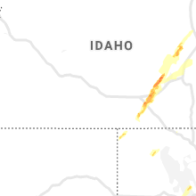
Hail Map for Thursday, June 6, 2019

Number of Impacted Households on 6/6/2019
0
Impacted by 1" or Larger Hail
0
Impacted by 1.75" or Larger Hail
0
Impacted by 2.5" or Larger Hail
Square Miles of Populated Area Impacted on 6/6/2019
0
Impacted by 1" or Larger Hail
0
Impacted by 1.75" or Larger Hail
0
Impacted by 2.5" or Larger Hail


Cities Most Affected by Hail Storms of 6/6/2019
| Hail Size | Demographics of Zip Codes Affected | ||||||
|---|---|---|---|---|---|---|---|
| City | Count | Average | Largest | Pop Density | House Value | Income | Age |
| Beeville, TX | 1 | 2.00 | 2.00 | 46 | $49k | $28.8k | 34.8 |
| West Point, TX | 1 | 1.75 | 1.75 | 19 | $72k | $41.3k | 39.6 |
| Moulton, TX | 1 | 1.75 | 1.75 | 12 | $48k | $28.2k | 48.2 |
| Smithville, TX | 1 | 1.75 | 1.75 | 47 | $82k | $37.2k | 43.9 |
Hail and Wind Damage Spotted on 6/6/2019
Filter by Report Type:Hail ReportsWind Reports
States Impacted
Louisiana, Illinois, Virginia, Texas, Nevada, Montana, Utah, Florida, Idaho, MississippiLouisiana
| Local Time | Report Details |
|---|---|
| 8:10 AM CDT | Trees down on roadways at smittys road... hypolite miller road... and bourque road in acadia county LA, 16.5 miles NW of Lafayette, LA |
| 8:20 AM CDT | Damage to building and multiple cars overturned. photo of cars overturned on social media. possible tornad in east baton rouge county LA, 56 miles ENE of Lafayette, LA |
| 8:25 AM CDT | Tree down on house on 4200 block of sarasota d in east baton rouge county LA, 61.6 miles ENE of Lafayette, LA |
| 8:30 AM CDT | Roof and structural damage on woodddale blvd near florida blvd. in baton roug in east baton rouge county LA, 59.7 miles ENE of Lafayette, LA |
| 8:30 AM CDT | Damage to building and cars flipped at 8585 picardy in baton rouge. time estimate in east baton rouge county LA, 55.3 miles ENE of Lafayette, LA |
| 8:30 AM CDT | Several homes with storm damage off brillock ave. in comite hills west subdivisio in east baton rouge county LA, 61.1 miles ENE of Lafayette, LA |
| 9:15 AM CDT | Public reported trees and power lines down from a possible tornad in livingston county LA, 57.3 miles NW of New Orleans, LA |
Illinois
| Local Time | Report Details |
|---|---|
| 2:45 PM CDT | Tree down on a house southern part of town between 17th st and 18th st. time and location estimated. public report from faceboo in hancock county IL, 20.7 miles E of Kahoka, MO |
Virginia
| Local Time | Report Details |
|---|---|
| 3:52 PM EDT | Trees and power lines down between horse pasture and ridgewa in henry county VA, 47 miles S of Roanoke, VA |
Texas
| Local Time | Report Details |
|---|---|
| 3:31 PM CDT | Quarter sized hail reported near Austin, TX, 50.3 miles S of Killeen, TX, parmer at dessau. |
| 3:50 PM CDT | Multiple trees and power poles blown down in bulverde. time estimated with rada in comal county TX, 21.9 miles N of San Antonio, TX |
| 3:55 PM CDT | Tree that was blown down was blocking one lane of us28 in bexar county TX, 20.6 miles N of San Antonio, TX |
| 4:01 PM CDT | Quarter sized hail reported near Bulverde, TX, 22.8 miles N of San Antonio, TX |
| 4:03 PM CDT | There was sign and tree damage at a store off county road 304. nickel size hail also reported at this locatio in bastrop county TX, 77 miles SSE of Killeen, TX |
| 4:20 PM CDT | Golf Ball sized hail reported near Smithville, TX, 83.4 miles SSE of Killeen, TX, a gas station in smithville reported quarter to golf ball size hail fell at that location. |
| 4:35 PM CDT | Golf Ball sized hail reported near West Point, TX, 91.4 miles SSE of Killeen, TX, public reports quarter to golf ball size hail along highway 71 in west point. |
| 4:55 PM CDT | The county emergency manager reports multiple trees down in the city of la grang in fayette county TX, 91.3 miles W of Houston, TX |
| 5:00 PM CDT | Large oak trees blown dow in fayette county TX, 93.5 miles W of Houston, TX |
| 5:14 PM CDT | 3 inch tree limbs blown down and power poles damage in bexar county TX, 12.4 miles NNE of San Antonio, TX |
| 5:20 PM CDT | Colorado co. sheriff's office reports trees down at wanlut st & travis st in columbu in colorado county TX, 70.4 miles W of Houston, TX |
| 5:27 PM CDT | Local emergency management reports overturned semi and travel trailer on interstate 10 westbound at alleyton... multiple trees down... moblie home blown ove in colorado county TX, 67.4 miles W of Houston, TX |
| 5:27 PM CDT | Spotter reports overturned semi and travel trailer on interstate 10 westbound at alleyto in colorado county TX, 67.4 miles W of Houston, TX |
| 5:36 PM CDT | Golf Ball sized hail reported near Moulton, TX, 86.7 miles E of San Antonio, TX |
| 5:42 PM CDT | Trees and power lines blown down in cost. time of event estimated with rada in gonzales county TX, 58.8 miles E of San Antonio, TX |
| 5:48 PM CDT | Quarter sized hail reported near San Antonio, TX, 3.5 miles NNW of San Antonio, TX, media relayed report of quarter sized hail in los angeles heights. time of event estimated with radar. |
| 5:49 PM CDT | Tree blown down on king william street. time of event estimated with rada in bexar county TX, 0.4 miles SE of San Antonio, TX |
| 5:54 PM CDT | Billboard sign blown down at i-10 and n laredo s in bexar county TX, 1.4 miles NW of San Antonio, TX |
| 5:57 PM CDT | Quarter sized hail reported near San Antonio, TX, 4.1 miles NNE of San Antonio, TX |
| 5:57 PM CDT | Quarter sized hail reported near San Antonio, TX, 4.5 miles N of San Antonio, TX, quarter sized hail measured at san pedro and basse. |
| 5:59 PM CDT | Quarter sized hail reported near San Antonio, TX, 0.4 miles SW of San Antonio, TX, quarter sized hail in downtown san antonio. |
| 6:02 PM CDT | Quarter sized hail reported near San Antonio, TX, 1.4 miles NE of San Antonio, TX, quarter sized hail on n st. marys street just south of ih35. |
| 6:03 PM CDT | Trees and powerlines blown down in nixon. time of event estimated with rada in gonzales county TX, 45.6 miles ESE of San Antonio, TX |
| 6:04 PM CDT | Houses damaged... east bernard at hwy 60 in wharton county TX, 44.5 miles WSW of Houston, TX |
| 6:10 PM CDT | 4 inch diameter tree limbs broke in jim wells county TX, 34.7 miles WNW of Corpus Christi, TX |
| 6:13 PM CDT | Fort bend co. sherrif's office reports roof damage to hom in fort bend county TX, 37.8 miles WSW of Houston, TX |
| 6:22 PM CDT | Quarter sized hail reported near Berclair, TX, 49.1 miles N of Corpus Christi, TX, report from the berclair country store |
| 6:30 PM CDT | Fort bend co. sheriff's office reported trees down on power lines near intersection of n karaugh dr and winner foster r in fort bend county TX, 30 miles WSW of Houston, TX |
| 6:35 PM CDT | Fort bend co. sheriff's office reported power lines down on fm297 in fort bend county TX, 29.5 miles SW of Houston, TX |
| 6:41 PM CDT | Trees blown down on sh95 between shiner and yoakum. time of event estimated with rada in lavaca county TX, 80.6 miles E of San Antonio, TX |
| 6:41 PM CDT | Power poles down and a trailer flipped just east of intersection of highways 44 and 359 on the east...northeast side of alice in jim wells county TX, 39 miles W of Corpus Christi, TX |
| 6:45 PM CDT | Hen Egg sized hail reported near Beeville, TX, 41.6 miles N of Corpus Christi, TX |
| 7:02 PM CDT | Power poles down and trampoline blown way up into a tree on the west side of tow in refugio county TX, 36.2 miles NNE of Corpus Christi, TX |
| 7:08 PM CDT | Quarter sized hail reported near Tuleta, TX, 58.5 miles NNW of Corpus Christi, TX, spotter reported quarter sized hail fell for over 20 minutes. |
| 7:29 PM CDT | Quarter sized hail reported near Kingsville, TX, 34.2 miles SW of Corpus Christi, TX, near texas am kingsville campus |
| 7:29 PM CDT | Near texas am kingsville campus in kleberg county TX, 34.2 miles SW of Corpus Christi, TX |
| 7:34 PM CDT | Kingsville naval air station measured a gust to 67 knot in kleberg county TX, 32.2 miles SW of Corpus Christi, TX |
| 7:43 PM CDT | Structural damage to some homes on northwest side of kingsville...such as shingles missing and porches remove in kleberg county TX, 34.2 miles SW of Corpus Christi, TX |
| 8:00 PM CDT | Wind gust was measured at san juis pass tcoon sit in gmz335 county TX, 48.4 miles SSE of Houston, TX |
Nevada
| Local Time | Report Details |
|---|---|
| 2:20 PM PDT | Ely asos elevation 6262 feet... had a thunderstorm wind gust from the southwes in white pine county NV, 4.2 miles NE of Ely, NV |
| 3:23 PM PDT | Tonopah asos elevation at 5395 ft. thunderstorm cell moved in from the s in nye county NV, 144.3 miles WSW of Ely, NV |
| 3:25 PM PDT | Storm damage reported in nye county NV, 144.6 miles SW of Ely, NV |
| 6:50 PM PDT | N7nnv coal mine canyon. elevation 5550 fee in elko county NV, 17.5 miles NE of Elko, NV |
Montana
| Local Time | Report Details |
|---|---|
| 3:25 PM MDT | Corrects previous non-tstm wnd gst report from 4 s white sulphur springs. mesonet station k7s6 white sulphur springs airpor in meagher county MT, 57 miles N of Bozeman, MT |
| 4:53 PM MDT | Storm damage reported in park county MT, 28.3 miles E of Bozeman, MT |
| 7:30 PM MDT | Storm damage reported in park county MT, 21.1 miles E of Bozeman, MT |
| 7:42 PM MDT | Storm damage reported in phillips county MT, 42.2 miles WSW of Glasgow, MT |
| 8:30 PM MDT | Storm damage reported in valley county MT, 19.1 miles NW of Glasgow, MT |
| 10:35 PM MDT | Wind gust at poplar raws in roosevelt county MT, 67 miles W of Williston, ND |
Utah
| Local Time | Report Details |
|---|---|
| 4:00 PM MDT | Clifton flat - clfu1 raws... time estimated via radar in tooele county UT, 80.4 miles NE of Ely, NV |
| 4:10 PM MDT | A wind gust to 72 mph was observed at the lakeside mountain mesonet sit in box elder county UT, 56.4 miles WNW of Salt Lake City, UT |
| 4:20 PM MDT | Gunnison island - gni 4242 ft in box elder county UT, 63.8 miles NW of Salt Lake City, UT |
| 4:20 PM MDT | Arrowhead summit - snd 8250 ft in utah county UT, 31.1 miles SSE of Salt Lake City, UT |
| 4:22 PM MDT | Truck blown over on i-80 near mp 85. report from udo in tooele county UT, 31 miles W of Salt Lake City, UT |
| 4:53 PM MDT | Lake point i-80 ut9 4248 ft - updated time based on radar in tooele county UT, 20.1 miles WSW of Salt Lake City, UT |
| 4:55 PM MDT | Fremont island - miller hill - freut in weber county UT, 35.5 miles NW of Salt Lake City, UT |
| 5:00 PM MDT | Lake point i-80 ut9 4248 ft in tooele county UT, 20.1 miles WSW of Salt Lake City, UT |
| 5:00 PM MDT | Storm damage reported in tooele county UT, 80.2 miles SW of Salt Lake City, UT |
| 5:25 PM MDT | Lofty peak lake lofty 11186 feet - updated time based on radar in summit county UT, 52.4 miles E of Salt Lake City, UT |
| 5:28 PM MDT | Windy peak wdypk 10662 ft - updated time based on radar in summit county UT, 45.9 miles E of Salt Lake City, UT |
| 5:41 PM MDT | Trees down on road. time estimated from rada in cache county UT, 67 miles N of Salt Lake City, UT |
| 5:52 PM MDT | Tree down on power poles. tree on fire. time estimated from rada in cache county UT, 82.8 miles N of Salt Lake City, UT |
| 6:00 PM MDT | I-80 mp 78 ut31 4213 ft in tooele county UT, 38.4 miles W of Salt Lake City, UT |
| 6:00 PM MDT | Windy peak wdypk 10662 ft in summit county UT, 45.9 miles E of Salt Lake City, UT |
| 6:00 PM MDT | Lofty peak lake lofty 11186 feet in summit county UT, 52.4 miles E of Salt Lake City, UT |
| 6:05 PM MDT | Storm damage reported in tooele county UT, 57.5 miles SW of Salt Lake City, UT |
| 6:15 PM MDT | Storm damage reported in cache county UT, 82.5 miles NNE of Salt Lake City, UT |
Florida
| Local Time | Report Details |
|---|---|
| 6:18 PM EDT | Large oak tree down on manchester drive in the wingate estates subdivision. time estimated by rada in brevard county FL, 42.2 miles ESE of Orlando, FL |
Idaho
| Local Time | Report Details |
|---|---|
| 4:45 PM MDT | Mesonet station itd95 hwy 20/2 in butte county ID, 42.6 miles W of Idaho Falls, ID |
| 4:55 PM MDT | Trained spotter reported about 30 downed power lines in the vicinity of w65n and n115w roads in the kettle butte area. nearby mesonet site located roughly 3 miles wsw r in bonneville county ID, 11.7 miles WNW of Idaho Falls, ID |
| 5:30 PM MDT | Mesonet station sug sugar cit in madison county ID, 32 miles NNE of Idaho Falls, ID |
| 5:40 PM MDT | Multiple trees reported down across st. anthony. one tree reported as across a powerline and rocky mountain power has been advised. time estimated based on rada in fremont county ID, 38.1 miles NNE of Idaho Falls, ID |
| 5:45 PM MDT | Fall river... id. itdd3 (itd) elev: 5106 f in fremont county ID, 44 miles NE of Idaho Falls, ID |
| 5:45 PM MDT | Measured at the ashton agrimet site late thursday afternoo in fremont county ID, 46.9 miles NE of Idaho Falls, ID |
| 6:30 PM MDT | Storm damage reported in bear lake county ID, 87 miles SSE of Idaho Falls, ID |
| 6:36 PM MDT | Mesonet station itd37 rocky point hwy 3 in bear lake county ID, 99.5 miles SSE of Idaho Falls, ID |
Mississippi
| Local Time | Report Details |
|---|---|
| 3:56 AM CDT | Trees and power lines down at the intersection of prentiss and capitol street in hinds county MS, 1.9 miles WNW of Jackson, MS |
Connect with Interactive Hail Maps