

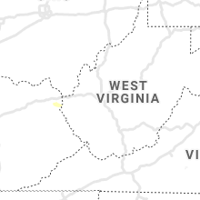
Hail Map for Saturday, May 16, 2020

Number of Impacted Households on 5/16/2020
0
Impacted by 1" or Larger Hail
0
Impacted by 1.75" or Larger Hail
0
Impacted by 2.5" or Larger Hail
Square Miles of Populated Area Impacted on 5/16/2020
0
Impacted by 1" or Larger Hail
0
Impacted by 1.75" or Larger Hail
0
Impacted by 2.5" or Larger Hail


Cities Most Affected by Hail Storms of 5/16/2020
| Hail Size | Demographics of Zip Codes Affected | ||||||
|---|---|---|---|---|---|---|---|
| City | Count | Average | Largest | Pop Density | House Value | Income | Age |
Hail and Wind Damage Spotted on 5/16/2020
Filter by Report Type:Hail ReportsWind Reports
Texas
| Local Time | Report Details |
|---|---|
| 9:05 AM CDT | Storm damage reported in cameron county TX, 20.4 miles NNE of Brownsville, TX |
| 9:12 AM CDT | Tcoon station realitos peninsula (rlit2) measured 68 kt wind gust at 9:12 am cdt. additional gust of 55 kt wind gust reported at 9:06 am cd in cameron county TX, 28.2 miles NNE of Brownsville, TX |
| 9:12 AM CDT | Tcoon station realitos peninsula (rlit2) measured 68 kt wind gust at 9:12 am cdt. additional gust of 55 kt wind gust reported at 9:06 am cd in cameron county TX, 27.9 miles NNE of Brownsville, TX |
| 12:32 PM CDT | Damage to a nursing home roof/trees and other buildings along hwy 31 in malakoff. possible brief tornado pending survey. time estimated from rada in henderson county TX, 61.3 miles SE of Dallas, TX |
| 1:47 PM CDT | Minor damage to homes and power lines. multiple trees down near vzcr 2718 and 2719. possible brief tornado pending survey. time estimated by radar and so report in van zandt county TX, 49.3 miles ESE of Dallas, TX |
| 1:48 PM CDT | Significant damage to one home along kaufman cr 4007 just inside kaufman county line. significant tree/power line damage in this area. possible brief tornado based on c in kaufman county TX, 48.8 miles ESE of Dallas, TX |
Illinois
| Local Time | Report Details |
|---|---|
| 2:45 PM CDT | A spotter called in and stated that a friends house has roof suffered wind damage. time estimated by rada in greene county IL, 61.3 miles N of Saint Louis, MO |
| 3:15 PM CDT | 60 mph wind gust damaged a sign in frankli in morgan county IL, 68.9 miles N of Saint Louis, MO |
Kentucky
| Local Time | Report Details |
|---|---|
| 5:52 PM EDT | Off duty meteorologist reported damage to several large trees and off duty nws meteorologist estimated wind gust of 50 mp in spencer county KY, 18.2 miles ENE of Louisville, KY |
Arkansas
| Local Time | Report Details |
|---|---|
| 5:38 PM CDT | Numerous trees were down on county road 104 west of highway 355. a car was flipped over. a boat was thrown into a pasture. possible tornad in columbia county AR, 46.3 miles SE of Nashville, AR |
| 5:42 PM CDT | Nevada county emergency manager reports damage across hwy 355 near the nevada and columbia county border due to possible tornad in columbia county AR, 45.2 miles SE of Nashville, AR |
| 5:42 PM CDT | Nevada county emergency manager reports damage across hwy 355 near the nevada and columbia county border due to possible tornad in columbia county AR, 45.2 miles SE of Nashville, AR |
| 5:46 PM CDT | Trees across lr3 in little river county AR, 21.3 miles SSW of Nashville, AR |
| 5:56 PM CDT | Emergency manager reports numerous trees down in bodcaw due to possible tornad in nevada county AR, 36.7 miles SE of Nashville, AR |
| 7:29 PM CDT | Trees were reported downed on/near highway 8... west-northwest of arkadelphi in clark county AR, 38.8 miles ENE of Nashville, AR |
| 7:49 PM CDT | Trees were reported down on highway 27... south of mount id in montgomery county AR, 38.7 miles NNE of Nashville, AR |
| 9:47 PM CDT | Trees were reported down on highway 27... south of mount id in montgomery county AR, 38.7 miles NNE of Nashville, AR |
Florida
| Local Time | Report Details |
|---|---|
| 6:40 PM EDT | ...delayed report...a thunderstorm produced a strong microburst measured by the sunrise weatherstem mesonet... 1343w. site is elevated 6 feet above ground leve in broward county FL, 30.5 miles N of Miami, FL |
Indiana
| Local Time | Report Details |
|---|---|
| 6:45 PM CDT | Report of a tree down on in-14 in perry county IN, 47.3 miles E of Evansville, IN |
New Mexico
| Local Time | Report Details |
|---|---|
| 5:53 PM MDT | Quarter sized hail reported near Maxwell, NM, 56.3 miles E of Taos, NM |
| 6:02 PM MDT | Quarter sized hail reported near Springer, NM, 58 miles E of Taos, NM |
| 8:14 PM MDT | Half Dollar sized hail reported near Roy, NM, 61.8 miles NW of Tucumcari, NM |
Virginia
| Local Time | Report Details |
|---|---|
| 9:12 PM EDT | Quarter sized hail reported near Rice, VA, 38.7 miles WSW of Richmond, VA, public reported quarter size hail near the dollar general in rice. |
Connect with Interactive Hail Maps