

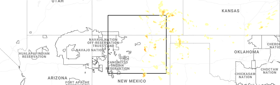
Hail Map for Maxwell, NM
The Maxwell, NM area has had 13 reports of on-the-ground hail by trained spotters, and has been under severe weather warnings 24 times during the past 12 months. Doppler radar has detected hail at or near Maxwell, NM on 74 occasions, including 7 occasions during the past year.
| Name: | Maxwell, NM |
| Where Located: | 58.1 miles E of Taos, NM |
| Map: | Google Map for Maxwell, NM |
| Population: | 254 |
| Housing Units: | 159 |
| More Info: | Search Google for Maxwell, NM |
1
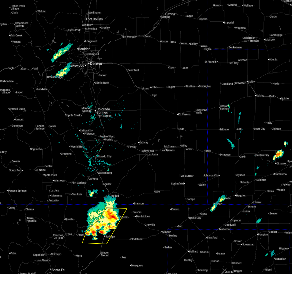
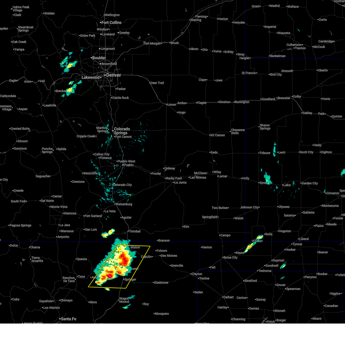
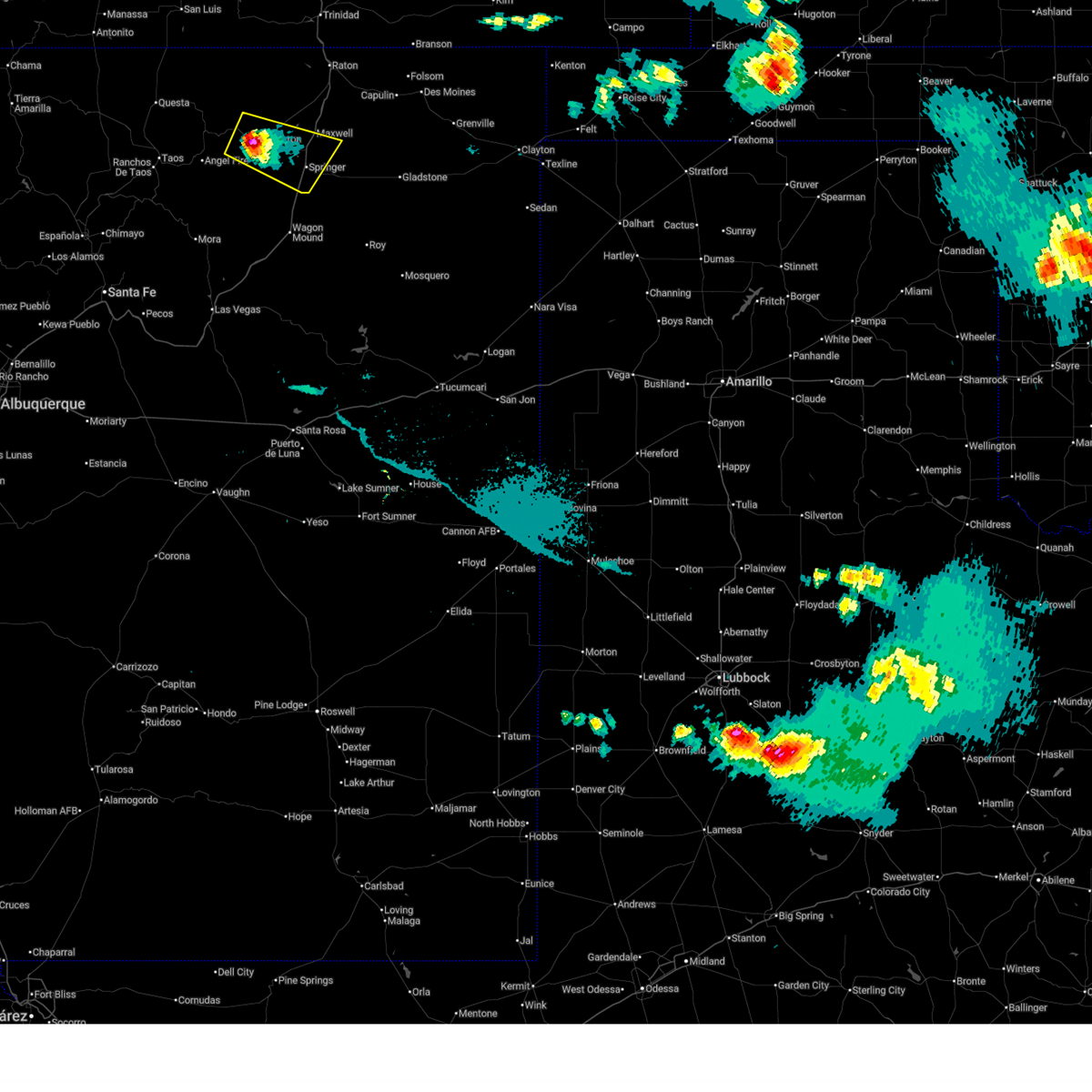
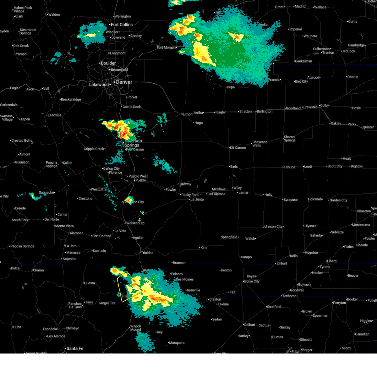
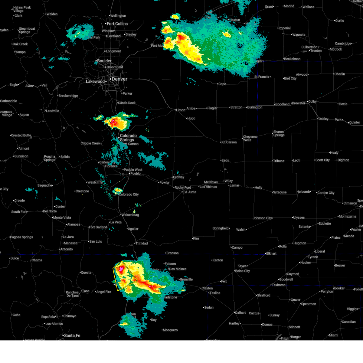
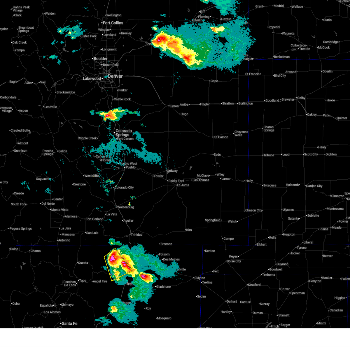
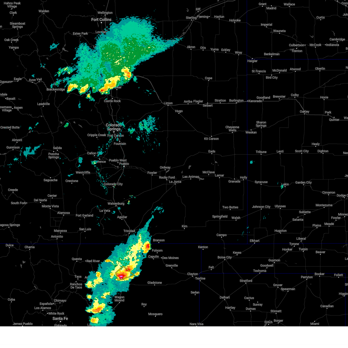
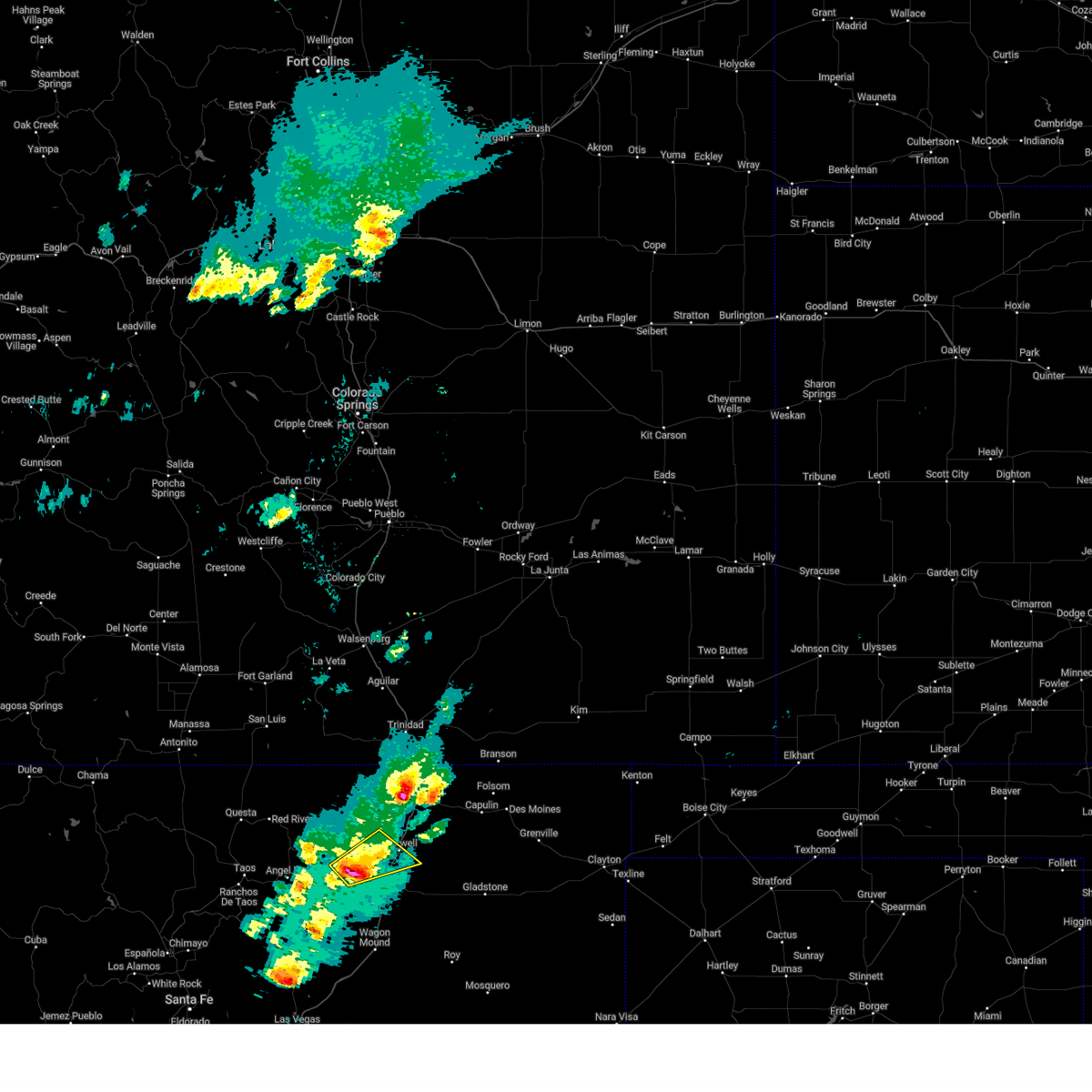
The Top Recent Hail Date for Maxwell, NM is Friday, July 11, 2025 (15th out of 74)
Hail and Wind Damage Spotted near Maxwell, NM
| Date / Time | Report Details |
|---|---|
| 7/11/2025 5:42 PM MDT |
 the severe thunderstorm warning has been cancelled and is no longer in effect the severe thunderstorm warning has been cancelled and is no longer in effect
|
| 7/11/2025 5:23 PM MDT |
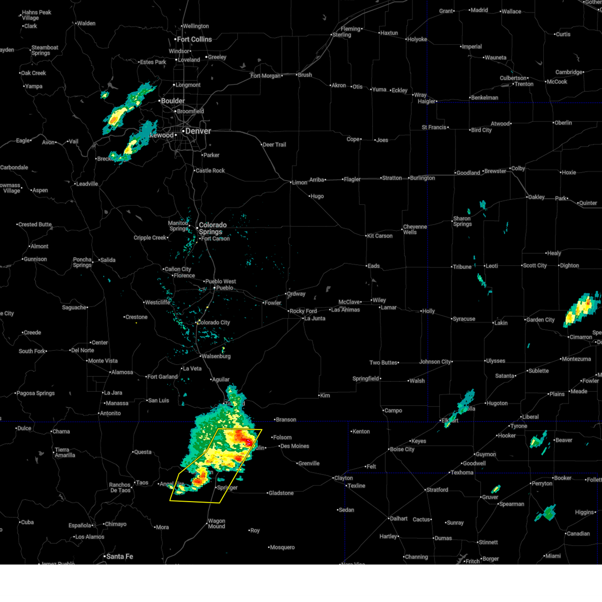
 At 523 pm mdt, a severe thunderstorm was located near maxwell, or 15 miles north of springer, moving northeast at 10 mph (radar indicated). Hazards include 60 mph wind gusts and quarter size hail. Hail damage to vehicles is expected. expect wind damage to roofs, siding, and trees. locations impacted include, maxwell and raton crews airport. this includes the following highways, highway 64 between mile markers 320 and 341. Interstate 25 between mile markers 421 and 442. At 523 pm mdt, a severe thunderstorm was located near maxwell, or 15 miles north of springer, moving northeast at 10 mph (radar indicated). Hazards include 60 mph wind gusts and quarter size hail. Hail damage to vehicles is expected. expect wind damage to roofs, siding, and trees. locations impacted include, maxwell and raton crews airport. this includes the following highways, highway 64 between mile markers 320 and 341. Interstate 25 between mile markers 421 and 442.
|
| 7/11/2025 5:10 PM MDT |
 Svrabq the national weather service in albuquerque has issued a * severe thunderstorm warning for, central colfax county in northeastern new mexico, * until 600 pm mdt. * at 510 pm mdt, a severe thunderstorm was located near maxwell, or 15 miles north of springer, moving northeast at 10 mph (radar indicated). Hazards include golf ball size hail and 60 mph wind gusts. People and animals outdoors will be injured. expect hail damage to roofs, siding, windows, and vehicles. Expect wind damage to roofs, siding, and trees. Svrabq the national weather service in albuquerque has issued a * severe thunderstorm warning for, central colfax county in northeastern new mexico, * until 600 pm mdt. * at 510 pm mdt, a severe thunderstorm was located near maxwell, or 15 miles north of springer, moving northeast at 10 mph (radar indicated). Hazards include golf ball size hail and 60 mph wind gusts. People and animals outdoors will be injured. expect hail damage to roofs, siding, windows, and vehicles. Expect wind damage to roofs, siding, and trees.
|
| 6/23/2025 3:28 PM MDT |
 The storms which prompted the warning have weakened below severe limits, and no longer pose an immediate threat to life or property. therefore, the warning will be allowed to expire. however, small hail and gusty winds are still possible with these thunderstorms. to report any severe weather that occurred at your location, contact the national weather service office in albuquerque at 1.888.386.7637. The storms which prompted the warning have weakened below severe limits, and no longer pose an immediate threat to life or property. therefore, the warning will be allowed to expire. however, small hail and gusty winds are still possible with these thunderstorms. to report any severe weather that occurred at your location, contact the national weather service office in albuquerque at 1.888.386.7637.
|
| 6/23/2025 3:08 PM MDT |
 At 308 pm mdt, severe thunderstorms were located along a line from near raton crews airport to 9 miles north of ocate, moving east at 15 mph (at 247 pm mdt the raton crews airport recorded a thunderstorm wind gust of 62 mph). Hazards include 60 mph wind gusts and small hail. Expect damage to roofs, siding, and trees. locations impacted include, raton, springer, cimarron, maxwell, raton crews airport, philmont scout ranch, miami and rayado. this includes the following highways, highway 64 between mile markers 305 and 367. Interstate 25 between mile markers 403 and 455. At 308 pm mdt, severe thunderstorms were located along a line from near raton crews airport to 9 miles north of ocate, moving east at 15 mph (at 247 pm mdt the raton crews airport recorded a thunderstorm wind gust of 62 mph). Hazards include 60 mph wind gusts and small hail. Expect damage to roofs, siding, and trees. locations impacted include, raton, springer, cimarron, maxwell, raton crews airport, philmont scout ranch, miami and rayado. this includes the following highways, highway 64 between mile markers 305 and 367. Interstate 25 between mile markers 403 and 455.
|
| 6/23/2025 2:41 PM MDT |
 Svrabq the national weather service in albuquerque has issued a * severe thunderstorm warning for, central colfax county in northeastern new mexico, north central mora county in northeastern new mexico, * until 330 pm mdt. * at 241 pm mdt, severe thunderstorms were located along a line from near raton crews airport to 8 miles east of black lake, moving east at 15 mph (radar indicated). Hazards include 60 mph wind gusts and quarter size hail. Hail damage to vehicles is expected. Expect wind damage to roofs, siding, and trees. Svrabq the national weather service in albuquerque has issued a * severe thunderstorm warning for, central colfax county in northeastern new mexico, north central mora county in northeastern new mexico, * until 330 pm mdt. * at 241 pm mdt, severe thunderstorms were located along a line from near raton crews airport to 8 miles east of black lake, moving east at 15 mph (radar indicated). Hazards include 60 mph wind gusts and quarter size hail. Hail damage to vehicles is expected. Expect wind damage to roofs, siding, and trees.
|
| 6/17/2025 8:22 PM MDT | At 822 pm mdt, a severe thunderstorm was located 11 miles southeast of cimarron, or 10 miles west of springer, moving southeast at 25 mph (radar indicated). Hazards include 60 mph wind gusts and half dollar size hail. Hail damage to vehicles is expected. expect wind damage to roofs, siding, and trees. locations impacted include, springer, cimarron, maxwell, miami and rayado. this includes the following highways, highway 64 between mile markers 312 and 319. Interstate 25 between mile markers 404 and 425. |
| 6/17/2025 8:16 PM MDT |
 At 816 pm mdt, a severe thunderstorm was located 9 miles southeast of cimarron, or 12 miles west of springer, moving southeast at 30 mph (radar indicated). Hazards include ping pong ball size hail and 60 mph wind gusts. People and animals outdoors will be injured. expect hail damage to roofs, siding, windows, and vehicles. expect wind damage to roofs, siding, and trees. locations impacted include, springer, cimarron, maxwell, philmont scout ranch, miami and rayado. this includes the following highways, highway 64 between mile markers 307 and 319. interstate 25 between mile markers 404 and 425. This includes the following recreation areas, philmont scout ranch. At 816 pm mdt, a severe thunderstorm was located 9 miles southeast of cimarron, or 12 miles west of springer, moving southeast at 30 mph (radar indicated). Hazards include ping pong ball size hail and 60 mph wind gusts. People and animals outdoors will be injured. expect hail damage to roofs, siding, windows, and vehicles. expect wind damage to roofs, siding, and trees. locations impacted include, springer, cimarron, maxwell, philmont scout ranch, miami and rayado. this includes the following highways, highway 64 between mile markers 307 and 319. interstate 25 between mile markers 404 and 425. This includes the following recreation areas, philmont scout ranch.
|
| 6/17/2025 8:05 PM MDT |
 At 805 pm mdt, a severe thunderstorm was located near cimarron, or 16 miles northwest of springer, moving southeast at 30 mph (radar indicated). Hazards include golf ball size hail and 60 mph wind gusts. People and animals outdoors will be injured. expect hail damage to roofs, siding, windows, and vehicles. expect wind damage to roofs, siding, and trees. locations impacted include, springer, cimarron, maxwell, philmont scout ranch, miami and rayado. this includes the following highways, highway 64 between mile markers 300 and 320. interstate 25 between mile markers 404 and 426. This includes the following recreation areas, philmont scout ranch. At 805 pm mdt, a severe thunderstorm was located near cimarron, or 16 miles northwest of springer, moving southeast at 30 mph (radar indicated). Hazards include golf ball size hail and 60 mph wind gusts. People and animals outdoors will be injured. expect hail damage to roofs, siding, windows, and vehicles. expect wind damage to roofs, siding, and trees. locations impacted include, springer, cimarron, maxwell, philmont scout ranch, miami and rayado. this includes the following highways, highway 64 between mile markers 300 and 320. interstate 25 between mile markers 404 and 426. This includes the following recreation areas, philmont scout ranch.
|
| 6/17/2025 7:59 PM MDT |
 Svrabq the national weather service in albuquerque has issued a * severe thunderstorm warning for, southwestern colfax county in northeastern new mexico, * until 845 pm mdt. * at 759 pm mdt, a severe thunderstorm was located over philmont scout ranch, or 20 miles northwest of springer, moving southeast at 30 mph (radar indicated). Hazards include 60 mph wind gusts and quarter size hail. Hail damage to vehicles is expected. Expect wind damage to roofs, siding, and trees. Svrabq the national weather service in albuquerque has issued a * severe thunderstorm warning for, southwestern colfax county in northeastern new mexico, * until 845 pm mdt. * at 759 pm mdt, a severe thunderstorm was located over philmont scout ranch, or 20 miles northwest of springer, moving southeast at 30 mph (radar indicated). Hazards include 60 mph wind gusts and quarter size hail. Hail damage to vehicles is expected. Expect wind damage to roofs, siding, and trees.
|
| 6/15/2025 6:08 PM MDT |
 The storm which prompted the warning has weakened below severe limits, and no longer poses an immediate threat to life or property. therefore, the warning will be allowed to expire. however, gusty winds and heavy rain are still possible with this thunderstorm. a severe thunderstorm watch remains in effect until 1100 pm mdt sunday for a portion of northeast new mexico. The storm which prompted the warning has weakened below severe limits, and no longer poses an immediate threat to life or property. therefore, the warning will be allowed to expire. however, gusty winds and heavy rain are still possible with this thunderstorm. a severe thunderstorm watch remains in effect until 1100 pm mdt sunday for a portion of northeast new mexico.
|
| 6/15/2025 5:49 PM MDT |
 At 549 pm mdt, a severe thunderstorm was located 14 miles west of raton crews airport, or 21 miles southwest of raton, moving southeast at 20 mph (radar indicated). Hazards include ping pong ball size hail and 60 mph wind gusts. People and animals outdoors will be injured. expect hail damage to roofs, siding, windows, and vehicles. expect wind damage to roofs, siding, and trees. locations impacted include, maxwell. this includes the following highways, highway 64 between mile markers 312 and 332. Interstate 25 between mile markers 426 and 432. At 549 pm mdt, a severe thunderstorm was located 14 miles west of raton crews airport, or 21 miles southwest of raton, moving southeast at 20 mph (radar indicated). Hazards include ping pong ball size hail and 60 mph wind gusts. People and animals outdoors will be injured. expect hail damage to roofs, siding, windows, and vehicles. expect wind damage to roofs, siding, and trees. locations impacted include, maxwell. this includes the following highways, highway 64 between mile markers 312 and 332. Interstate 25 between mile markers 426 and 432.
|
| 6/15/2025 5:40 PM MDT |
 At 540 pm mdt, a severe thunderstorm was located 16 miles north of cimarron, or 24 miles southwest of raton, moving southeast at 20 mph (radar indicated). Hazards include tennis ball size hail and 60 mph wind gusts. People and animals outdoors will be injured. expect hail damage to roofs, siding, windows, and vehicles. expect wind damage to roofs, siding, and trees. locations impacted include, cimarron and maxwell. this includes the following highways, highway 64 between mile markers 309 and 332. Interstate 25 between mile markers 426 and 432. At 540 pm mdt, a severe thunderstorm was located 16 miles north of cimarron, or 24 miles southwest of raton, moving southeast at 20 mph (radar indicated). Hazards include tennis ball size hail and 60 mph wind gusts. People and animals outdoors will be injured. expect hail damage to roofs, siding, windows, and vehicles. expect wind damage to roofs, siding, and trees. locations impacted include, cimarron and maxwell. this includes the following highways, highway 64 between mile markers 309 and 332. Interstate 25 between mile markers 426 and 432.
|
| 6/15/2025 5:33 PM MDT |
 At 533 pm mdt, a severe thunderstorm was located 16 miles north of cimarron, or 26 miles southwest of raton, moving south at 25 mph (radar indicated). Hazards include ping pong ball size hail and 60 mph wind gusts. People and animals outdoors will be injured. expect hail damage to roofs, siding, windows, and vehicles. expect wind damage to roofs, siding, and trees. locations impacted include, cimarron and maxwell. this includes the following highways, highway 64 between mile markers 309 and 332. Interstate 25 between mile markers 426 and 432. At 533 pm mdt, a severe thunderstorm was located 16 miles north of cimarron, or 26 miles southwest of raton, moving south at 25 mph (radar indicated). Hazards include ping pong ball size hail and 60 mph wind gusts. People and animals outdoors will be injured. expect hail damage to roofs, siding, windows, and vehicles. expect wind damage to roofs, siding, and trees. locations impacted include, cimarron and maxwell. this includes the following highways, highway 64 between mile markers 309 and 332. Interstate 25 between mile markers 426 and 432.
|
| 6/15/2025 5:26 PM MDT |
 Svrabq the national weather service in albuquerque has issued a * severe thunderstorm warning for, central colfax county in northeastern new mexico, * until 615 pm mdt. * at 526 pm mdt, a severe thunderstorm was located 18 miles north of cimarron, or 26 miles west of raton, moving south at 25 mph (radar indicated). Hazards include 60 mph wind gusts and quarter size hail. Hail damage to vehicles is expected. Expect wind damage to roofs, siding, and trees. Svrabq the national weather service in albuquerque has issued a * severe thunderstorm warning for, central colfax county in northeastern new mexico, * until 615 pm mdt. * at 526 pm mdt, a severe thunderstorm was located 18 miles north of cimarron, or 26 miles west of raton, moving south at 25 mph (radar indicated). Hazards include 60 mph wind gusts and quarter size hail. Hail damage to vehicles is expected. Expect wind damage to roofs, siding, and trees.
|
| 6/7/2025 8:17 PM MDT |
 Svrabq the national weather service in albuquerque has issued a * severe thunderstorm warning for, southeastern colfax county in northeastern new mexico, * until 900 pm mdt. * at 817 pm mdt, a severe thunderstorm was located over maxwell, or 12 miles north of springer, moving southeast at 30 mph (radar indicated). Hazards include 60 mph wind gusts and quarter size hail. Hail damage to vehicles is expected. Expect wind damage to roofs, siding, and trees. Svrabq the national weather service in albuquerque has issued a * severe thunderstorm warning for, southeastern colfax county in northeastern new mexico, * until 900 pm mdt. * at 817 pm mdt, a severe thunderstorm was located over maxwell, or 12 miles north of springer, moving southeast at 30 mph (radar indicated). Hazards include 60 mph wind gusts and quarter size hail. Hail damage to vehicles is expected. Expect wind damage to roofs, siding, and trees.
|
| 6/7/2025 7:53 PM MDT |
 At 753 pm mdt, a severe thunderstorm was located 7 miles southwest of raton crews airport, or 18 miles south of raton, moving southeast at 20 mph (radar indicated). Hazards include 60 mph wind gusts and quarter size hail. Hail damage to vehicles is expected. expect wind damage to roofs, siding, and trees. locations impacted include, maxwell and raton crews airport. this includes the following highways, highway 64 between mile markers 322 and 344. Interstate 25 between mile markers 424 and 447. At 753 pm mdt, a severe thunderstorm was located 7 miles southwest of raton crews airport, or 18 miles south of raton, moving southeast at 20 mph (radar indicated). Hazards include 60 mph wind gusts and quarter size hail. Hail damage to vehicles is expected. expect wind damage to roofs, siding, and trees. locations impacted include, maxwell and raton crews airport. this includes the following highways, highway 64 between mile markers 322 and 344. Interstate 25 between mile markers 424 and 447.
|
| 6/7/2025 7:24 PM MDT |
 Svrabq the national weather service in albuquerque has issued a * severe thunderstorm warning for, central colfax county in northeastern new mexico, * until 800 pm mdt. * at 724 pm mdt, a severe thunderstorm was located 13 miles west of raton crews airport, or 20 miles southwest of raton, moving southeast at 20 mph (radar indicated). Hazards include 60 mph wind gusts and quarter size hail. Hail damage to vehicles is expected. Expect wind damage to roofs, siding, and trees. Svrabq the national weather service in albuquerque has issued a * severe thunderstorm warning for, central colfax county in northeastern new mexico, * until 800 pm mdt. * at 724 pm mdt, a severe thunderstorm was located 13 miles west of raton crews airport, or 20 miles southwest of raton, moving southeast at 20 mph (radar indicated). Hazards include 60 mph wind gusts and quarter size hail. Hail damage to vehicles is expected. Expect wind damage to roofs, siding, and trees.
|
| 5/25/2025 4:26 PM MDT |
 The severe thunderstorm warning that was previously in effect has been reissued for colfax county and is in effect until 515 pm mdt. please refer to that bulletin for the latest severe weather information. The severe thunderstorm warning that was previously in effect has been reissued for colfax county and is in effect until 515 pm mdt. please refer to that bulletin for the latest severe weather information.
|
| 5/25/2025 4:26 PM MDT |
 Svrabq the national weather service in albuquerque has issued a * severe thunderstorm warning for, southeastern colfax county in northeastern new mexico, * until 515 pm mdt. * at 426 pm mdt, a severe thunderstorm was located 6 miles south of maxwell, or 7 miles northeast of springer, moving east at 20 mph (radar indicated). Hazards include two inch hail and 60 mph wind gusts. People and animals outdoors will be injured. expect hail damage to roofs, siding, windows, and vehicles. Expect wind damage to roofs, siding, and trees. Svrabq the national weather service in albuquerque has issued a * severe thunderstorm warning for, southeastern colfax county in northeastern new mexico, * until 515 pm mdt. * at 426 pm mdt, a severe thunderstorm was located 6 miles south of maxwell, or 7 miles northeast of springer, moving east at 20 mph (radar indicated). Hazards include two inch hail and 60 mph wind gusts. People and animals outdoors will be injured. expect hail damage to roofs, siding, windows, and vehicles. Expect wind damage to roofs, siding, and trees.
|
| 5/25/2025 4:14 PM MDT |
 At 414 pm mdt, a severe thunderstorm was located 7 miles north of springer, moving east at 20 mph (radar indicated). Hazards include 60 mph wind gusts and half dollar size hail. Hail damage to vehicles is expected. expect wind damage to roofs, siding, and trees. locations impacted include, maxwell. This includes interstate 25 between mile markers 417 and 427. At 414 pm mdt, a severe thunderstorm was located 7 miles north of springer, moving east at 20 mph (radar indicated). Hazards include 60 mph wind gusts and half dollar size hail. Hail damage to vehicles is expected. expect wind damage to roofs, siding, and trees. locations impacted include, maxwell. This includes interstate 25 between mile markers 417 and 427.
|
| 5/25/2025 4:05 PM MDT | At 405 pm mdt, a severe thunderstorm was located 8 miles northwest of springer, moving east at 20 mph (radar indicated). Hazards include 60 mph wind gusts and quarter size hail. Hail damage to vehicles is expected. expect wind damage to roofs, siding, and trees. locations impacted include, maxwell. this includes the following highways, highway 64 between mile markers 315 and 326. Interstate 25 between mile markers 417 and 427. |
| 5/25/2025 3:43 PM MDT |
 Svrabq the national weather service in albuquerque has issued a * severe thunderstorm warning for, south central colfax county in northeastern new mexico, * until 430 pm mdt. * at 343 pm mdt, a severe thunderstorm was located 7 miles southeast of cimarron, or 14 miles west of springer, moving east at 20 mph (radar indicated). Hazards include 60 mph wind gusts and quarter size hail. Hail damage to vehicles is expected. Expect wind damage to roofs, siding, and trees. Svrabq the national weather service in albuquerque has issued a * severe thunderstorm warning for, south central colfax county in northeastern new mexico, * until 430 pm mdt. * at 343 pm mdt, a severe thunderstorm was located 7 miles southeast of cimarron, or 14 miles west of springer, moving east at 20 mph (radar indicated). Hazards include 60 mph wind gusts and quarter size hail. Hail damage to vehicles is expected. Expect wind damage to roofs, siding, and trees.
|
| 9/17/2024 1:22 PM MDT |
 Svrabq the national weather service in albuquerque has issued a * severe thunderstorm warning for, central colfax county in northeastern new mexico, * until 200 pm mdt. * at 121 pm mdt, a severe thunderstorm was located near cimarron, or 20 miles northwest of springer, moving northeast at 45 mph (radar indicated). Hazards include 60 mph wind gusts. expect damage to roofs, siding, and trees Svrabq the national weather service in albuquerque has issued a * severe thunderstorm warning for, central colfax county in northeastern new mexico, * until 200 pm mdt. * at 121 pm mdt, a severe thunderstorm was located near cimarron, or 20 miles northwest of springer, moving northeast at 45 mph (radar indicated). Hazards include 60 mph wind gusts. expect damage to roofs, siding, and trees
|
| 7/7/2024 7:49 PM MDT |
 the severe thunderstorm warning has been cancelled and is no longer in effect the severe thunderstorm warning has been cancelled and is no longer in effect
|
| 7/7/2024 7:13 PM MDT |
 At 713 pm mdt, a severe thunderstorm was located near cimarron, or 16 miles northwest of springer, moving southeast at 15 mph (radar indicated). Hazards include 60 mph wind gusts and quarter size hail. Hail damage to vehicles is expected. expect wind damage to roofs, siding, and trees. locations impacted include, cimarron, maxwell, philmont scout ranch, and miami. this includes the following highways, interstate 25 between mile markers 416 and 428. Highway 64 between mile markers 301 and 324. At 713 pm mdt, a severe thunderstorm was located near cimarron, or 16 miles northwest of springer, moving southeast at 15 mph (radar indicated). Hazards include 60 mph wind gusts and quarter size hail. Hail damage to vehicles is expected. expect wind damage to roofs, siding, and trees. locations impacted include, cimarron, maxwell, philmont scout ranch, and miami. this includes the following highways, interstate 25 between mile markers 416 and 428. Highway 64 between mile markers 301 and 324.
|
| 7/7/2024 7:07 PM MDT |
 Svrabq the national weather service in albuquerque has issued a * severe thunderstorm warning for, central colfax county in northeastern new mexico, * until 800 pm mdt. * at 706 pm mdt, severe thunderstorms were located along a line extending from raton crews airport to near cimarron, moving southeast at 15 mph (radar indicated). Hazards include 60 mph wind gusts and quarter size hail. Hail damage to vehicles is expected. Expect wind damage to roofs, siding, and trees. Svrabq the national weather service in albuquerque has issued a * severe thunderstorm warning for, central colfax county in northeastern new mexico, * until 800 pm mdt. * at 706 pm mdt, severe thunderstorms were located along a line extending from raton crews airport to near cimarron, moving southeast at 15 mph (radar indicated). Hazards include 60 mph wind gusts and quarter size hail. Hail damage to vehicles is expected. Expect wind damage to roofs, siding, and trees.
|
| 7/20/2023 4:15 PM MDT |
 At 415 pm mdt, a severe thunderstorm was located near maxwell, or 16 miles north of springer, moving east at 10 mph (radar indicated). Hazards include 60 mph wind gusts and quarter size hail. Hail damage to vehicles is expected. Expect wind damage to roofs, siding, and trees. At 415 pm mdt, a severe thunderstorm was located near maxwell, or 16 miles north of springer, moving east at 10 mph (radar indicated). Hazards include 60 mph wind gusts and quarter size hail. Hail damage to vehicles is expected. Expect wind damage to roofs, siding, and trees.
|
| 7/20/2023 4:01 PM MDT |
 At 400 pm mdt, a severe thunderstorm was located near raton crews airport, or 14 miles southwest of raton, moving east at 10 mph (radar indicated). Hazards include 60 mph wind gusts and quarter size hail. Hail damage to vehicles is expected. expect wind damage to roofs, siding, and trees. locations impacted include, maxwell and raton crews airport. this includes the following highways, interstate 25 between mile markers 424 and 445. highway 64 between mile markers 321 and 342, and between mile markers 360 and 362. hail threat, radar indicated max hail size, 1. 00 in wind threat, radar indicated max wind gust, 60 mph. At 400 pm mdt, a severe thunderstorm was located near raton crews airport, or 14 miles southwest of raton, moving east at 10 mph (radar indicated). Hazards include 60 mph wind gusts and quarter size hail. Hail damage to vehicles is expected. expect wind damage to roofs, siding, and trees. locations impacted include, maxwell and raton crews airport. this includes the following highways, interstate 25 between mile markers 424 and 445. highway 64 between mile markers 321 and 342, and between mile markers 360 and 362. hail threat, radar indicated max hail size, 1. 00 in wind threat, radar indicated max wind gust, 60 mph.
|
| 7/20/2023 3:48 PM MDT |
 At 347 pm mdt, a severe thunderstorm was located near raton crews airport, or 15 miles southwest of raton, moving east at 20 mph (radar indicated). Hazards include 60 mph wind gusts and quarter size hail. Hail damage to vehicles is expected. Expect wind damage to roofs, siding, and trees. At 347 pm mdt, a severe thunderstorm was located near raton crews airport, or 15 miles southwest of raton, moving east at 20 mph (radar indicated). Hazards include 60 mph wind gusts and quarter size hail. Hail damage to vehicles is expected. Expect wind damage to roofs, siding, and trees.
|
| 7/15/2023 6:21 PM MDT |
 At 621 pm mdt, a severe thunderstorm was located over raton crews airport, or 10 miles south of raton, moving southeast at 20 mph (radar indicated). Hazards include 60 mph wind gusts and quarter size hail. Hail damage to vehicles is expected. expect wind damage to roofs, siding, and trees. locations impacted include, maxwell and raton crews airport. this includes the following highways, interstate 25 between mile markers 423 and 448. highway 64 between mile markers 329 and 344, and between mile markers 357 and 374. hail threat, radar indicated max hail size, 1. 00 in wind threat, radar indicated max wind gust, 60 mph. At 621 pm mdt, a severe thunderstorm was located over raton crews airport, or 10 miles south of raton, moving southeast at 20 mph (radar indicated). Hazards include 60 mph wind gusts and quarter size hail. Hail damage to vehicles is expected. expect wind damage to roofs, siding, and trees. locations impacted include, maxwell and raton crews airport. this includes the following highways, interstate 25 between mile markers 423 and 448. highway 64 between mile markers 329 and 344, and between mile markers 357 and 374. hail threat, radar indicated max hail size, 1. 00 in wind threat, radar indicated max wind gust, 60 mph.
|
| 7/15/2023 5:55 PM MDT |
 At 555 pm mdt, a severe thunderstorm was located near raton crews airport, or 10 miles southwest of raton, moving southeast at 20 mph (radar indicated). Hazards include golf ball size hail and 60 mph wind gusts. People and animals outdoors will be injured. expect hail damage to roofs, siding, windows, and vehicles. Expect wind damage to roofs, siding, and trees. At 555 pm mdt, a severe thunderstorm was located near raton crews airport, or 10 miles southwest of raton, moving southeast at 20 mph (radar indicated). Hazards include golf ball size hail and 60 mph wind gusts. People and animals outdoors will be injured. expect hail damage to roofs, siding, windows, and vehicles. Expect wind damage to roofs, siding, and trees.
|
| 7/14/2023 9:54 PM MDT |
 At 954 pm mdt, a severe thunderstorm was located near cimarron, or 14 miles northwest of springer, moving southeast at 20 mph (radar indicated). Hazards include 60 mph wind gusts and quarter size hail. Hail damage to vehicles is expected. expect wind damage to roofs, siding, and trees. locations impacted include, springer, cimarron, maxwell, philmont scout ranch and miami. this includes the following highways, interstate 25 between mile markers 406 and 434. highway 64 between mile markers 303 and 330. hail threat, radar indicated max hail size, 1. 00 in wind threat, radar indicated max wind gust, 60 mph. At 954 pm mdt, a severe thunderstorm was located near cimarron, or 14 miles northwest of springer, moving southeast at 20 mph (radar indicated). Hazards include 60 mph wind gusts and quarter size hail. Hail damage to vehicles is expected. expect wind damage to roofs, siding, and trees. locations impacted include, springer, cimarron, maxwell, philmont scout ranch and miami. this includes the following highways, interstate 25 between mile markers 406 and 434. highway 64 between mile markers 303 and 330. hail threat, radar indicated max hail size, 1. 00 in wind threat, radar indicated max wind gust, 60 mph.
|
| 7/14/2023 9:34 PM MDT |
 At 934 pm mdt, a severe thunderstorm was located over cimarron, or 21 miles northwest of springer, moving southeast at 25 mph (radar indicated). Hazards include 60 mph wind gusts and quarter size hail. Hail damage to vehicles is expected. Expect wind damage to roofs, siding, and trees. At 934 pm mdt, a severe thunderstorm was located over cimarron, or 21 miles northwest of springer, moving southeast at 25 mph (radar indicated). Hazards include 60 mph wind gusts and quarter size hail. Hail damage to vehicles is expected. Expect wind damage to roofs, siding, and trees.
|
| 7/14/2023 8:14 PM MDT |
 At 814 pm mdt, a severe thunderstorm was located 7 miles southwest of raton crews airport, or 17 miles southwest of raton, moving east at 15 mph (radar indicated). Hazards include 60 mph wind gusts and quarter size hail. Hail damage to vehicles is expected. Expect wind damage to roofs, siding, and trees. At 814 pm mdt, a severe thunderstorm was located 7 miles southwest of raton crews airport, or 17 miles southwest of raton, moving east at 15 mph (radar indicated). Hazards include 60 mph wind gusts and quarter size hail. Hail damage to vehicles is expected. Expect wind damage to roofs, siding, and trees.
|
| 7/14/2023 8:04 PM MDT | Quarter sized hail reported 5.1 miles ESE of Maxwell, NM |
| 7/14/2023 7:54 PM MDT |
 At 753 pm mdt, a severe thunderstorm was located 10 miles northwest of maxwell, or 19 miles north of springer, moving southeast at 15 mph (radar indicated). Hazards include 60 mph wind gusts and quarter size hail. Hail damage to vehicles is expected. expect wind damage to roofs, siding, and trees. locations impacted include, maxwell and raton crews airport. this includes the following highways, interstate 25 between mile markers 422 and 442. highway 64 between mile markers 318 and 340. hail threat, radar indicated max hail size, 1. 00 in wind threat, radar indicated max wind gust, 60 mph. At 753 pm mdt, a severe thunderstorm was located 10 miles northwest of maxwell, or 19 miles north of springer, moving southeast at 15 mph (radar indicated). Hazards include 60 mph wind gusts and quarter size hail. Hail damage to vehicles is expected. expect wind damage to roofs, siding, and trees. locations impacted include, maxwell and raton crews airport. this includes the following highways, interstate 25 between mile markers 422 and 442. highway 64 between mile markers 318 and 340. hail threat, radar indicated max hail size, 1. 00 in wind threat, radar indicated max wind gust, 60 mph.
|
| 7/14/2023 7:52 PM MDT | Golf Ball sized hail reported 11 miles ESE of Maxwell, NM |
| 7/14/2023 7:24 PM MDT |
 At 724 pm mdt, a severe thunderstorm was located 14 miles northeast of cimarron, or 23 miles southwest of raton, moving east at 30 mph (radar indicated). Hazards include 60 mph wind gusts and half dollar size hail. Hail damage to vehicles is expected. Expect wind damage to roofs, siding, and trees. At 724 pm mdt, a severe thunderstorm was located 14 miles northeast of cimarron, or 23 miles southwest of raton, moving east at 30 mph (radar indicated). Hazards include 60 mph wind gusts and half dollar size hail. Hail damage to vehicles is expected. Expect wind damage to roofs, siding, and trees.
|
| 7/13/2023 11:05 PM MDT |
 At 1105 pm mdt, severe thunderstorms were located along a line extending from 13 miles southwest of capulin to 6 miles northwest of springer, moving south at 25 mph (radar indicated). Hazards include golf ball size hail and 60 mph wind gusts. People and animals outdoors will be injured. expect hail damage to roofs, siding, windows, and vehicles. expect wind damage to roofs, siding, and trees. locations impacted include, springer, maxwell and raton crews airport. this includes the following highways, interstate 25 between mile markers 413 and 444. highway 64 between mile markers 321 and 341, and between mile markers 361 and 364. thunderstorm damage threat, considerable hail threat, radar indicated max hail size, 1. 75 in wind threat, radar indicated max wind gust, 60 mph. At 1105 pm mdt, severe thunderstorms were located along a line extending from 13 miles southwest of capulin to 6 miles northwest of springer, moving south at 25 mph (radar indicated). Hazards include golf ball size hail and 60 mph wind gusts. People and animals outdoors will be injured. expect hail damage to roofs, siding, windows, and vehicles. expect wind damage to roofs, siding, and trees. locations impacted include, springer, maxwell and raton crews airport. this includes the following highways, interstate 25 between mile markers 413 and 444. highway 64 between mile markers 321 and 341, and between mile markers 361 and 364. thunderstorm damage threat, considerable hail threat, radar indicated max hail size, 1. 75 in wind threat, radar indicated max wind gust, 60 mph.
|
| 7/13/2023 10:49 PM MDT |
 At 1049 pm mdt, severe thunderstorms were located along a line extending from 10 miles southwest of capulin to 7 miles west of maxwell, moving southeast at 15 mph (radar indicated). Hazards include 60 mph wind gusts and quarter size hail. Hail damage to vehicles is expected. expect wind damage to roofs, siding, and trees. locations impacted include, springer, maxwell and raton crews airport. this includes the following highways, interstate 25 between mile markers 413 and 444. highway 64 between mile markers 321 and 341, and between mile markers 361 and 364. hail threat, radar indicated max hail size, 1. 00 in wind threat, radar indicated max wind gust, 60 mph. At 1049 pm mdt, severe thunderstorms were located along a line extending from 10 miles southwest of capulin to 7 miles west of maxwell, moving southeast at 15 mph (radar indicated). Hazards include 60 mph wind gusts and quarter size hail. Hail damage to vehicles is expected. expect wind damage to roofs, siding, and trees. locations impacted include, springer, maxwell and raton crews airport. this includes the following highways, interstate 25 between mile markers 413 and 444. highway 64 between mile markers 321 and 341, and between mile markers 361 and 364. hail threat, radar indicated max hail size, 1. 00 in wind threat, radar indicated max wind gust, 60 mph.
|
| 7/13/2023 10:27 PM MDT |
 At 1027 pm mdt, a severe thunderstorm was located 7 miles southeast of raton crews airport, or 17 miles south of raton, moving southeast at 25 mph (radar indicated). Hazards include 70 mph wind gusts and ping pong ball size hail. People and animals outdoors will be injured. expect hail damage to roofs, siding, windows, and vehicles. expect considerable tree damage. wind damage is also likely to mobile homes, roofs, and outbuildings. locations impacted include, raton, springer, maxwell and raton crews airport. this includes the following highways, interstate 25 between mile markers 412 and 450. highway 64 between mile markers 321 and 344, and between mile markers 352 and 364. thunderstorm damage threat, considerable hail threat, radar indicated max hail size, 1. 50 in wind threat, radar indicated max wind gust, 70 mph. At 1027 pm mdt, a severe thunderstorm was located 7 miles southeast of raton crews airport, or 17 miles south of raton, moving southeast at 25 mph (radar indicated). Hazards include 70 mph wind gusts and ping pong ball size hail. People and animals outdoors will be injured. expect hail damage to roofs, siding, windows, and vehicles. expect considerable tree damage. wind damage is also likely to mobile homes, roofs, and outbuildings. locations impacted include, raton, springer, maxwell and raton crews airport. this includes the following highways, interstate 25 between mile markers 412 and 450. highway 64 between mile markers 321 and 344, and between mile markers 352 and 364. thunderstorm damage threat, considerable hail threat, radar indicated max hail size, 1. 50 in wind threat, radar indicated max wind gust, 70 mph.
|
| 7/13/2023 10:14 PM MDT |
 At 1014 pm mdt, a severe thunderstorm was located near raton crews airport, or 14 miles south of raton, moving south at 25 mph (radar indicated). Hazards include golf ball size hail and 60 mph wind gusts. People and animals outdoors will be injured. expect hail damage to roofs, siding, windows, and vehicles. Expect wind damage to roofs, siding, and trees. At 1014 pm mdt, a severe thunderstorm was located near raton crews airport, or 14 miles south of raton, moving south at 25 mph (radar indicated). Hazards include golf ball size hail and 60 mph wind gusts. People and animals outdoors will be injured. expect hail damage to roofs, siding, windows, and vehicles. Expect wind damage to roofs, siding, and trees.
|
| 6/30/2023 3:26 PM MDT |
 At 326 pm mdt, a severe thunderstorm was located over maxwell, or 11 miles northeast of springer, moving east at 15 mph (radar indicated). Hazards include 60 mph wind gusts and quarter size hail. Hail damage to vehicles is expected. expect wind damage to roofs, siding, and trees. locations impacted include, maxwell and raton crews airport. this includes the following highways, interstate 25 between mile markers 419 and 445. highway 64 between mile markers 333 and 340. hail threat, radar indicated max hail size, 1. 00 in wind threat, radar indicated max wind gust, 60 mph. At 326 pm mdt, a severe thunderstorm was located over maxwell, or 11 miles northeast of springer, moving east at 15 mph (radar indicated). Hazards include 60 mph wind gusts and quarter size hail. Hail damage to vehicles is expected. expect wind damage to roofs, siding, and trees. locations impacted include, maxwell and raton crews airport. this includes the following highways, interstate 25 between mile markers 419 and 445. highway 64 between mile markers 333 and 340. hail threat, radar indicated max hail size, 1. 00 in wind threat, radar indicated max wind gust, 60 mph.
|
| 6/30/2023 3:04 PM MDT |
 At 304 pm mdt, a severe thunderstorm was located near maxwell, or 12 miles north of springer, moving northeast at 15 mph (radar indicated). Hazards include 60 mph wind gusts and quarter size hail. Hail damage to vehicles is expected. Expect wind damage to roofs, siding, and trees. At 304 pm mdt, a severe thunderstorm was located near maxwell, or 12 miles north of springer, moving northeast at 15 mph (radar indicated). Hazards include 60 mph wind gusts and quarter size hail. Hail damage to vehicles is expected. Expect wind damage to roofs, siding, and trees.
|
| 6/23/2023 1:30 AM MDT |
 At 130 am mdt, a severe thunderstorm was located over maxwell, or 11 miles north of springer, moving northeast at 30 mph (radar indicated). Hazards include 60 mph wind gusts and half dollar size hail. Hail damage to vehicles is expected. expect wind damage to roofs, siding, and trees. locations impacted include, maxwell and raton crews airport. this includes the following highways, interstate 25 between mile markers 416 and 444. highway 64 near mile marker 322, and between mile markers 326 and 340. hail threat, radar indicated max hail size, 1. 25 in wind threat, radar indicated max wind gust, 60 mph. At 130 am mdt, a severe thunderstorm was located over maxwell, or 11 miles north of springer, moving northeast at 30 mph (radar indicated). Hazards include 60 mph wind gusts and half dollar size hail. Hail damage to vehicles is expected. expect wind damage to roofs, siding, and trees. locations impacted include, maxwell and raton crews airport. this includes the following highways, interstate 25 between mile markers 416 and 444. highway 64 near mile marker 322, and between mile markers 326 and 340. hail threat, radar indicated max hail size, 1. 25 in wind threat, radar indicated max wind gust, 60 mph.
|
| 6/23/2023 1:05 AM MDT |
 At 104 am mdt, a severe thunderstorm was located near springer, moving northeast at 45 mph (radar indicated). Hazards include 60 mph wind gusts and half dollar size hail. Hail damage to vehicles is expected. expect wind damage to roofs, siding, and trees. locations impacted include, springer, maxwell and raton crews airport. this includes the following highways, interstate 25 between mile markers 405 and 444. highway 64 between mile markers 315 and 318, near mile marker 320, near mile marker 322, and between mile markers 326 and 340. hail threat, radar indicated max hail size, 1. 25 in wind threat, radar indicated max wind gust, 60 mph. At 104 am mdt, a severe thunderstorm was located near springer, moving northeast at 45 mph (radar indicated). Hazards include 60 mph wind gusts and half dollar size hail. Hail damage to vehicles is expected. expect wind damage to roofs, siding, and trees. locations impacted include, springer, maxwell and raton crews airport. this includes the following highways, interstate 25 between mile markers 405 and 444. highway 64 between mile markers 315 and 318, near mile marker 320, near mile marker 322, and between mile markers 326 and 340. hail threat, radar indicated max hail size, 1. 25 in wind threat, radar indicated max wind gust, 60 mph.
|
| 6/23/2023 12:50 AM MDT |
 At 1250 am mdt, a severe thunderstorm was located 8 miles southeast of philmont scout ranch, or 12 miles west of springer, moving northeast at 35 mph (radar indicated). Hazards include 60 mph wind gusts and half dollar size hail. Hail damage to vehicles is expected. Expect wind damage to roofs, siding, and trees. At 1250 am mdt, a severe thunderstorm was located 8 miles southeast of philmont scout ranch, or 12 miles west of springer, moving northeast at 35 mph (radar indicated). Hazards include 60 mph wind gusts and half dollar size hail. Hail damage to vehicles is expected. Expect wind damage to roofs, siding, and trees.
|
| 6/22/2023 5:21 PM MDT |
 At 521 pm mdt, a severe thunderstorm was located over maxwell, or 10 miles north of springer, moving east at 15 mph (radar indicated). Hazards include two inch hail and 60 mph wind gusts. People and animals outdoors will be injured. expect hail damage to roofs, siding, windows, and vehicles. expect wind damage to roofs, siding, and trees. locations impacted include, maxwell. this includes interstate 25 between mile markers 417 and 437. thunderstorm damage threat, considerable hail threat, radar indicated max hail size, 2. 00 in wind threat, radar indicated max wind gust, 60 mph. At 521 pm mdt, a severe thunderstorm was located over maxwell, or 10 miles north of springer, moving east at 15 mph (radar indicated). Hazards include two inch hail and 60 mph wind gusts. People and animals outdoors will be injured. expect hail damage to roofs, siding, windows, and vehicles. expect wind damage to roofs, siding, and trees. locations impacted include, maxwell. this includes interstate 25 between mile markers 417 and 437. thunderstorm damage threat, considerable hail threat, radar indicated max hail size, 2. 00 in wind threat, radar indicated max wind gust, 60 mph.
|
| 6/22/2023 5:06 PM MDT |
 At 506 pm mdt, a severe thunderstorm was located near maxwell, or 9 miles north of springer, moving east at 15 mph (radar indicated). Hazards include golf ball size hail and 60 mph wind gusts. People and animals outdoors will be injured. expect hail damage to roofs, siding, windows, and vehicles. expect wind damage to roofs, siding, and trees. locations impacted include, maxwell. this includes the following highways, interstate 25 between mile markers 417 and 437. highway 64 between mile markers 311 and 322. thunderstorm damage threat, considerable hail threat, radar indicated max hail size, 1. 75 in wind threat, radar indicated max wind gust, 60 mph. At 506 pm mdt, a severe thunderstorm was located near maxwell, or 9 miles north of springer, moving east at 15 mph (radar indicated). Hazards include golf ball size hail and 60 mph wind gusts. People and animals outdoors will be injured. expect hail damage to roofs, siding, windows, and vehicles. expect wind damage to roofs, siding, and trees. locations impacted include, maxwell. this includes the following highways, interstate 25 between mile markers 417 and 437. highway 64 between mile markers 311 and 322. thunderstorm damage threat, considerable hail threat, radar indicated max hail size, 1. 75 in wind threat, radar indicated max wind gust, 60 mph.
|
| 6/22/2023 4:44 PM MDT |
 At 443 pm mdt, a severe thunderstorm was located 8 miles southwest of maxwell, or 9 miles northwest of springer, moving east at 15 mph (radar indicated). Hazards include 60 mph wind gusts and half dollar size hail. Hail damage to vehicles is expected. Expect wind damage to roofs, siding, and trees. At 443 pm mdt, a severe thunderstorm was located 8 miles southwest of maxwell, or 9 miles northwest of springer, moving east at 15 mph (radar indicated). Hazards include 60 mph wind gusts and half dollar size hail. Hail damage to vehicles is expected. Expect wind damage to roofs, siding, and trees.
|
| 6/22/2023 4:19 PM MDT |
 At 419 pm mdt, a severe thunderstorm was located 8 miles west of maxwell, or 11 miles northwest of springer, moving east at 15 mph (radar indicated). Hazards include 60 mph wind gusts and half dollar size hail. Hail damage to vehicles is expected. expect wind damage to roofs, siding, and trees. locations impacted include, maxwell. this includes the following highways, interstate 25 between mile markers 417 and 434. highway 64 between mile markers 317 and 322. hail threat, radar indicated max hail size, 1. 25 in wind threat, radar indicated max wind gust, 60 mph. At 419 pm mdt, a severe thunderstorm was located 8 miles west of maxwell, or 11 miles northwest of springer, moving east at 15 mph (radar indicated). Hazards include 60 mph wind gusts and half dollar size hail. Hail damage to vehicles is expected. expect wind damage to roofs, siding, and trees. locations impacted include, maxwell. this includes the following highways, interstate 25 between mile markers 417 and 434. highway 64 between mile markers 317 and 322. hail threat, radar indicated max hail size, 1. 25 in wind threat, radar indicated max wind gust, 60 mph.
|
| 6/22/2023 3:59 PM MDT |
 At 358 pm mdt, a severe thunderstorm was located 7 miles east of cimarron, or 14 miles northwest of springer, moving east at 15 mph (radar indicated). Hazards include 60 mph wind gusts and half dollar size hail. Hail damage to vehicles is expected. Expect wind damage to roofs, siding, and trees. At 358 pm mdt, a severe thunderstorm was located 7 miles east of cimarron, or 14 miles northwest of springer, moving east at 15 mph (radar indicated). Hazards include 60 mph wind gusts and half dollar size hail. Hail damage to vehicles is expected. Expect wind damage to roofs, siding, and trees.
|
| 6/22/2023 3:17 PM MDT |
 At 316 pm mdt, a severe thunderstorm was located over maxwell, or 11 miles north of springer, moving northeast at 35 mph (radar indicated). Hazards include 60 mph wind gusts and half dollar size hail. Hail damage to vehicles is expected. Expect wind damage to roofs, siding, and trees. At 316 pm mdt, a severe thunderstorm was located over maxwell, or 11 miles north of springer, moving northeast at 35 mph (radar indicated). Hazards include 60 mph wind gusts and half dollar size hail. Hail damage to vehicles is expected. Expect wind damage to roofs, siding, and trees.
|
| 6/12/2023 1:25 PM MDT |
 At 125 pm mdt, a severe thunderstorm was located near maxwell, or 16 miles northeast of springer, moving east at 20 mph (radar indicated). Hazards include ping pong ball size hail and 60 mph wind gusts. People and animals outdoors will be injured. expect hail damage to roofs, siding, windows, and vehicles. expect wind damage to roofs, siding, and trees. locations impacted include, maxwell and raton crews airport. this includes the following highways, interstate 25 between mile markers 423 and 445. highway 64 between mile markers 331 and 342. hail threat, radar indicated max hail size, 1. 50 in wind threat, radar indicated max wind gust, 60 mph. At 125 pm mdt, a severe thunderstorm was located near maxwell, or 16 miles northeast of springer, moving east at 20 mph (radar indicated). Hazards include ping pong ball size hail and 60 mph wind gusts. People and animals outdoors will be injured. expect hail damage to roofs, siding, windows, and vehicles. expect wind damage to roofs, siding, and trees. locations impacted include, maxwell and raton crews airport. this includes the following highways, interstate 25 between mile markers 423 and 445. highway 64 between mile markers 331 and 342. hail threat, radar indicated max hail size, 1. 50 in wind threat, radar indicated max wind gust, 60 mph.
|
| 6/12/2023 1:10 PM MDT | Half Dollar sized hail reported 0.5 miles E of Maxwell, NM |
| 6/12/2023 1:00 PM MDT |
 At 100 pm mdt, a severe thunderstorm was located near maxwell, or 15 miles north of springer, moving east at 20 mph (radar indicated). Hazards include ping pong ball size hail and 60 mph wind gusts. People and animals outdoors will be injured. expect hail damage to roofs, siding, windows, and vehicles. Expect wind damage to roofs, siding, and trees. At 100 pm mdt, a severe thunderstorm was located near maxwell, or 15 miles north of springer, moving east at 20 mph (radar indicated). Hazards include ping pong ball size hail and 60 mph wind gusts. People and animals outdoors will be injured. expect hail damage to roofs, siding, windows, and vehicles. Expect wind damage to roofs, siding, and trees.
|
| 6/12/2023 12:56 PM MDT |
 The severe thunderstorm warning for central colfax county will expire at 100 pm mdt, the storm which prompted the warning has weakened below severe limits, and no longer poses an immediate threat to life or property. therefore, the warning will be allowed to expire. however small hail, gusty winds and heavy rain are still possible with this thunderstorm. a severe thunderstorm watch remains in effect until 700 pm mdt for northeastern new mexico. The severe thunderstorm warning for central colfax county will expire at 100 pm mdt, the storm which prompted the warning has weakened below severe limits, and no longer poses an immediate threat to life or property. therefore, the warning will be allowed to expire. however small hail, gusty winds and heavy rain are still possible with this thunderstorm. a severe thunderstorm watch remains in effect until 700 pm mdt for northeastern new mexico.
|
| 6/12/2023 12:30 PM MDT |
 At 1230 pm mdt, a severe thunderstorm was located 9 miles east of cimarron, or 16 miles northwest of springer, moving east at 15 mph (radar indicated). Hazards include half dollar size hail. damage to vehicles is expected At 1230 pm mdt, a severe thunderstorm was located 9 miles east of cimarron, or 16 miles northwest of springer, moving east at 15 mph (radar indicated). Hazards include half dollar size hail. damage to vehicles is expected
|
| 6/12/2023 12:36 AM MDT |
 At 1236 am mdt, a severe thunderstorm was located 9 miles southeast of maxwell, or 12 miles northeast of springer, moving east at 25 mph (radar indicated). Hazards include ping pong ball size hail and 60 mph wind gusts. People and animals outdoors will be injured. expect hail damage to roofs, siding, windows, and vehicles. Expect wind damage to roofs, siding, and trees. At 1236 am mdt, a severe thunderstorm was located 9 miles southeast of maxwell, or 12 miles northeast of springer, moving east at 25 mph (radar indicated). Hazards include ping pong ball size hail and 60 mph wind gusts. People and animals outdoors will be injured. expect hail damage to roofs, siding, windows, and vehicles. Expect wind damage to roofs, siding, and trees.
|
| 6/12/2023 12:13 AM MDT |
 At 1212 am mdt, a severe thunderstorm was located near maxwell, or 7 miles north of springer, moving northeast at 20 mph (radar indicated). Hazards include 60 mph wind gusts and half dollar size hail. Hail damage to vehicles is expected. expect wind damage to roofs, siding, and trees. locations impacted include, springer, maxwell, raton crews airport and miami. this includes the following highways, interstate 25 between mile markers 412 and 438. highway 64 between mile markers 315 and 337. hail threat, radar indicated max hail size, 1. 25 in wind threat, radar indicated max wind gust, 60 mph. At 1212 am mdt, a severe thunderstorm was located near maxwell, or 7 miles north of springer, moving northeast at 20 mph (radar indicated). Hazards include 60 mph wind gusts and half dollar size hail. Hail damage to vehicles is expected. expect wind damage to roofs, siding, and trees. locations impacted include, springer, maxwell, raton crews airport and miami. this includes the following highways, interstate 25 between mile markers 412 and 438. highway 64 between mile markers 315 and 337. hail threat, radar indicated max hail size, 1. 25 in wind threat, radar indicated max wind gust, 60 mph.
|
| 6/11/2023 11:24 PM MDT |
 At 1124 pm mdt, a severe thunderstorm was located near philmont scout ranch, or 15 miles west of springer, moving northeast at 25 mph (radar indicated). Hazards include 60 mph wind gusts and half dollar size hail. Hail damage to vehicles is expected. Expect wind damage to roofs, siding, and trees. At 1124 pm mdt, a severe thunderstorm was located near philmont scout ranch, or 15 miles west of springer, moving northeast at 25 mph (radar indicated). Hazards include 60 mph wind gusts and half dollar size hail. Hail damage to vehicles is expected. Expect wind damage to roofs, siding, and trees.
|
| 6/11/2023 9:46 PM MDT |
 At 945 pm mdt, a severe thunderstorm was located over springer, moving east at 25 mph (radar indicated). Hazards include two inch hail and 60 mph wind gusts. People and animals outdoors will be injured. expect hail damage to roofs, siding, windows, and vehicles. expect wind damage to roofs, siding, and trees. locations impacted include, springer, maxwell and miami. this includes interstate 25 between mile markers 398 and 435. thunderstorm damage threat, considerable hail threat, radar indicated max hail size, 2. 00 in wind threat, radar indicated max wind gust, 60 mph. At 945 pm mdt, a severe thunderstorm was located over springer, moving east at 25 mph (radar indicated). Hazards include two inch hail and 60 mph wind gusts. People and animals outdoors will be injured. expect hail damage to roofs, siding, windows, and vehicles. expect wind damage to roofs, siding, and trees. locations impacted include, springer, maxwell and miami. this includes interstate 25 between mile markers 398 and 435. thunderstorm damage threat, considerable hail threat, radar indicated max hail size, 2. 00 in wind threat, radar indicated max wind gust, 60 mph.
|
| 6/11/2023 9:23 PM MDT |
 At 923 pm mdt, a severe thunderstorm was located 10 miles southwest of springer, moving east at 25 mph (radar indicated). Hazards include 60 mph wind gusts and half dollar size hail. Hail damage to vehicles is expected. Expect wind damage to roofs, siding, and trees. At 923 pm mdt, a severe thunderstorm was located 10 miles southwest of springer, moving east at 25 mph (radar indicated). Hazards include 60 mph wind gusts and half dollar size hail. Hail damage to vehicles is expected. Expect wind damage to roofs, siding, and trees.
|
| 6/11/2023 5:06 PM MDT |
 At 505 pm mdt, a severe thunderstorm was located near raton crews airport, or 17 miles south of raton, moving east at 20 mph (radar indicated). Hazards include 60 mph wind gusts and quarter size hail. Hail damage to vehicles is expected. Expect wind damage to roofs, siding, and trees. At 505 pm mdt, a severe thunderstorm was located near raton crews airport, or 17 miles south of raton, moving east at 20 mph (radar indicated). Hazards include 60 mph wind gusts and quarter size hail. Hail damage to vehicles is expected. Expect wind damage to roofs, siding, and trees.
|
| 5/27/2023 8:33 PM MDT |
 At 833 pm mdt, a severe thunderstorm was located 8 miles southwest of springer, moving east at 15 mph (radar indicated). Hazards include 60 mph wind gusts and quarter size hail. Hail damage to vehicles is expected. Expect wind damage to roofs, siding, and trees. At 833 pm mdt, a severe thunderstorm was located 8 miles southwest of springer, moving east at 15 mph (radar indicated). Hazards include 60 mph wind gusts and quarter size hail. Hail damage to vehicles is expected. Expect wind damage to roofs, siding, and trees.
|
| 5/24/2023 3:11 PM MDT |
 The severe thunderstorm warning for northwestern union and northeastern colfax counties will expire at 315 pm mdt, the storm which prompted the warning has moved out of the area. therefore, the warning will be allowed to expire. however small hail is still possible with this thunderstorm. a severe thunderstorm watch remains in effect until 900 pm mdt for northeastern new mexico. The severe thunderstorm warning for northwestern union and northeastern colfax counties will expire at 315 pm mdt, the storm which prompted the warning has moved out of the area. therefore, the warning will be allowed to expire. however small hail is still possible with this thunderstorm. a severe thunderstorm watch remains in effect until 900 pm mdt for northeastern new mexico.
|
| 5/24/2023 2:49 PM MDT |
 At 248 pm mdt, a severe thunderstorm was located 10 miles southeast of raton, moving northeast at 30 mph (radar indicated). Hazards include 60 mph wind gusts and half dollar size hail. Hail damage to vehicles is expected. expect wind damage to roofs, siding, and trees. locations impacted include, raton, maxwell, folsom, sugarite, raton crews airport and capulin. this includes the following highways, interstate 25 between mile markers 424 and 453. highway 64 between mile markers 324 and 379. hail threat, radar indicated max hail size, 1. 25 in wind threat, radar indicated max wind gust, 60 mph. At 248 pm mdt, a severe thunderstorm was located 10 miles southeast of raton, moving northeast at 30 mph (radar indicated). Hazards include 60 mph wind gusts and half dollar size hail. Hail damage to vehicles is expected. expect wind damage to roofs, siding, and trees. locations impacted include, raton, maxwell, folsom, sugarite, raton crews airport and capulin. this includes the following highways, interstate 25 between mile markers 424 and 453. highway 64 between mile markers 324 and 379. hail threat, radar indicated max hail size, 1. 25 in wind threat, radar indicated max wind gust, 60 mph.
|
| 5/24/2023 2:29 PM MDT |
 At 228 pm mdt, a severe thunderstorm was located near raton crews airport, or 15 miles south of raton, moving northeast at 30 mph (radar indicated). Hazards include golf ball size hail and 60 mph wind gusts. People and animals outdoors will be injured. expect hail damage to roofs, siding, windows, and vehicles. Expect wind damage to roofs, siding, and trees. At 228 pm mdt, a severe thunderstorm was located near raton crews airport, or 15 miles south of raton, moving northeast at 30 mph (radar indicated). Hazards include golf ball size hail and 60 mph wind gusts. People and animals outdoors will be injured. expect hail damage to roofs, siding, windows, and vehicles. Expect wind damage to roofs, siding, and trees.
|
| 7/11/2022 4:11 PM MDT |
 At 411 pm mdt, a severe thunderstorm was located near springer, and is nearly stationary (radar indicated). Hazards include ping pong ball size hail and 60 mph wind gusts. People and animals outdoors will be injured. expect hail damage to roofs, siding, windows, and vehicles. expect wind damage to roofs, siding, and trees. locations impacted include, springer and maxwell. this includes interstate 25 between mile markers 411 and 431. hail threat, radar indicated max hail size, 1. 50 in wind threat, radar indicated max wind gust, 60 mph. At 411 pm mdt, a severe thunderstorm was located near springer, and is nearly stationary (radar indicated). Hazards include ping pong ball size hail and 60 mph wind gusts. People and animals outdoors will be injured. expect hail damage to roofs, siding, windows, and vehicles. expect wind damage to roofs, siding, and trees. locations impacted include, springer and maxwell. this includes interstate 25 between mile markers 411 and 431. hail threat, radar indicated max hail size, 1. 50 in wind threat, radar indicated max wind gust, 60 mph.
|
| 7/11/2022 4:03 PM MDT |
 At 403 pm mdt, a severe thunderstorm was located near springer, moving northwest at 10 mph (radar indicated). Hazards include 60 mph wind gusts and quarter size hail. Hail damage to vehicles is expected. Expect wind damage to roofs, siding, and trees. At 403 pm mdt, a severe thunderstorm was located near springer, moving northwest at 10 mph (radar indicated). Hazards include 60 mph wind gusts and quarter size hail. Hail damage to vehicles is expected. Expect wind damage to roofs, siding, and trees.
|
| 8/4/2021 4:30 PM MDT | Quarter sized hail reported 7.7 miles SE of Maxwell, NM |
| 7/15/2021 6:06 PM MDT | Golf Ball sized hail reported 11 miles ESE of Maxwell, NM |
| 7/10/2021 9:09 PM MDT |
 At 908 pm mdt, a severe thunderstorm was located near maxwell, or 8 miles northeast of springer, moving southeast at 25 mph (radar indicated). Hazards include 60 mph wind gusts and quarter size hail. Hail damage to vehicles is expected. Expect wind damage to roofs, siding, and trees. At 908 pm mdt, a severe thunderstorm was located near maxwell, or 8 miles northeast of springer, moving southeast at 25 mph (radar indicated). Hazards include 60 mph wind gusts and quarter size hail. Hail damage to vehicles is expected. Expect wind damage to roofs, siding, and trees.
|
| 5/28/2021 2:15 PM MDT |
 At 215 pm mdt, a severe thunderstorm was located over maxwell, or 11 miles north of springer, moving east at 10 mph (radar indicated). Hazards include 60 mph wind gusts and quarter size hail. Hail damage to vehicles is expected. expect wind damage to roofs, siding, and trees. locations impacted include, maxwell. This includes interstate 25 between mile markers 416 and 430. At 215 pm mdt, a severe thunderstorm was located over maxwell, or 11 miles north of springer, moving east at 10 mph (radar indicated). Hazards include 60 mph wind gusts and quarter size hail. Hail damage to vehicles is expected. expect wind damage to roofs, siding, and trees. locations impacted include, maxwell. This includes interstate 25 between mile markers 416 and 430.
|
| 5/28/2021 2:05 PM MDT |
 At 205 pm mdt, a severe thunderstorm was located over maxwell, or 11 miles north of springer, moving east at 10 mph (radar indicated). Hazards include 60 mph wind gusts and quarter size hail. Hail damage to vehicles is expected. Expect wind damage to roofs, siding, and trees. At 205 pm mdt, a severe thunderstorm was located over maxwell, or 11 miles north of springer, moving east at 10 mph (radar indicated). Hazards include 60 mph wind gusts and quarter size hail. Hail damage to vehicles is expected. Expect wind damage to roofs, siding, and trees.
|
| 7/11/2020 3:47 PM MDT |
 At 346 pm mdt, a severe thunderstorm was located near springer, moving northeast at 10 mph (radar indicated). Hazards include 60 mph wind gusts and quarter size hail. Hail damage to vehicles is expected. Expect wind damage to roofs, siding, and trees. At 346 pm mdt, a severe thunderstorm was located near springer, moving northeast at 10 mph (radar indicated). Hazards include 60 mph wind gusts and quarter size hail. Hail damage to vehicles is expected. Expect wind damage to roofs, siding, and trees.
|
| 6/22/2020 3:12 PM MDT |
 At 311 pm mdt, a severe thunderstorm was located 10 miles west of raton crews airport, or 17 miles southwest of raton, moving southeast at 15 mph (radar indicated). Hazards include 60 mph wind gusts and quarter size hail. Hail damage to vehicles is expected. Expect wind damage to roofs, siding, and trees. At 311 pm mdt, a severe thunderstorm was located 10 miles west of raton crews airport, or 17 miles southwest of raton, moving southeast at 15 mph (radar indicated). Hazards include 60 mph wind gusts and quarter size hail. Hail damage to vehicles is expected. Expect wind damage to roofs, siding, and trees.
|
| 5/16/2020 5:53 PM MDT | Quarter sized hail reported 3.1 miles NNE of Maxwell, NM |
| 6/2/2019 4:23 PM MDT |
 At 423 pm mdt, a severe thunderstorm was located near maxwell, or 14 miles north of springer, moving northeast at 15 mph (radar indicated). Hazards include 60 mph wind gusts and quarter size hail. Hail damage to vehicles is expected. expect wind damage to roofs, siding, and trees. locations impacted include, maxwell. This includes interstate 25 between mile markers 416 and 441. At 423 pm mdt, a severe thunderstorm was located near maxwell, or 14 miles north of springer, moving northeast at 15 mph (radar indicated). Hazards include 60 mph wind gusts and quarter size hail. Hail damage to vehicles is expected. expect wind damage to roofs, siding, and trees. locations impacted include, maxwell. This includes interstate 25 between mile markers 416 and 441.
|
| 6/2/2019 3:58 PM MDT |
 At 357 pm mdt, a severe thunderstorm was located over maxwell, or 10 miles north of springer, moving east at 25 mph (radar indicated). Hazards include 60 mph wind gusts and quarter size hail. Hail damage to vehicles is expected. Expect wind damage to roofs, siding, and trees. At 357 pm mdt, a severe thunderstorm was located over maxwell, or 10 miles north of springer, moving east at 25 mph (radar indicated). Hazards include 60 mph wind gusts and quarter size hail. Hail damage to vehicles is expected. Expect wind damage to roofs, siding, and trees.
|
| 9/9/2018 2:18 PM MDT |
 At 217 pm mdt, a severe thunderstorm was located 7 miles northeast of maxwell, or 17 miles northeast of springer, moving southeast at 15 mph. a severe thunderstorm was also located 23 miles east of maxwell as was moving southeast around 15 mph (radar indicated). Hazards include 60 mph wind gusts and quarter size hail. Hail damage to vehicles is expected. expect wind damage to roofs, siding, and trees. locations impacted include, maxwell. This includes interstate 25 between mile markers 426 and 432. At 217 pm mdt, a severe thunderstorm was located 7 miles northeast of maxwell, or 17 miles northeast of springer, moving southeast at 15 mph. a severe thunderstorm was also located 23 miles east of maxwell as was moving southeast around 15 mph (radar indicated). Hazards include 60 mph wind gusts and quarter size hail. Hail damage to vehicles is expected. expect wind damage to roofs, siding, and trees. locations impacted include, maxwell. This includes interstate 25 between mile markers 426 and 432.
|
| 9/9/2018 1:55 PM MDT |
 At 155 pm mdt, a severe thunderstorm was located near maxwell, or 18 miles south of raton, moving southeast at 15 mph (radar indicated). Hazards include 60 mph wind gusts and quarter size hail. Hail damage to vehicles is expected. Expect wind damage to roofs, siding, and trees. At 155 pm mdt, a severe thunderstorm was located near maxwell, or 18 miles south of raton, moving southeast at 15 mph (radar indicated). Hazards include 60 mph wind gusts and quarter size hail. Hail damage to vehicles is expected. Expect wind damage to roofs, siding, and trees.
|
| 8/18/2018 3:54 PM MDT |
 The severe thunderstorm warning for southeastern colfax county will expire at 400 pm mdt, the storm which prompted the warning has weakened below severe limits, and no longer poses an immediate threat to life or property. therefore the warning will be allowed to expire. however small hail and heavy rain are still possible with this thunderstorm. a severe thunderstorm watch remains in effect until 800 pm mdt for northeastern new mexico. The severe thunderstorm warning for southeastern colfax county will expire at 400 pm mdt, the storm which prompted the warning has weakened below severe limits, and no longer poses an immediate threat to life or property. therefore the warning will be allowed to expire. however small hail and heavy rain are still possible with this thunderstorm. a severe thunderstorm watch remains in effect until 800 pm mdt for northeastern new mexico.
|
| 8/18/2018 3:37 PM MDT |
 The severe thunderstorm warning for central colfax county will expire at 345 pm mdt, the storm which prompted the warning has weakened below severe limits, and no longer poses an immediate threat to life or property. therefore the warning will be allowed to expire. a severe thunderstorm watch remains in effect until 800 pm mdt for northeastern new mexico. The severe thunderstorm warning for central colfax county will expire at 345 pm mdt, the storm which prompted the warning has weakened below severe limits, and no longer poses an immediate threat to life or property. therefore the warning will be allowed to expire. a severe thunderstorm watch remains in effect until 800 pm mdt for northeastern new mexico.
|
| 8/18/2018 3:26 PM MDT |
 At 325 pm mdt, a severe thunderstorm was located near maxwell, or 18 miles north of springer, moving southeast at 15 mph (radar indicated). Hazards include 60 mph wind gusts and quarter size hail. Hail damage to vehicles is expected. expect wind damage to roofs, siding, and trees. locations impacted include, maxwell and raton crews airport. This includes interstate 25 between mile markers 425 and 440. At 325 pm mdt, a severe thunderstorm was located near maxwell, or 18 miles north of springer, moving southeast at 15 mph (radar indicated). Hazards include 60 mph wind gusts and quarter size hail. Hail damage to vehicles is expected. expect wind damage to roofs, siding, and trees. locations impacted include, maxwell and raton crews airport. This includes interstate 25 between mile markers 425 and 440.
|
| 8/18/2018 3:24 PM MDT |
 At 311 pm mdt, a severe thunderstorm was located 9 miles northwest of maxwell, or 17 miles north of springer, moving southeast at 25 mph (radar indicated). Hazards include 60 mph wind gusts and quarter size hail. Hail damage to vehicles is expected. Expect wind damage to roofs, siding, and trees. At 311 pm mdt, a severe thunderstorm was located 9 miles northwest of maxwell, or 17 miles north of springer, moving southeast at 25 mph (radar indicated). Hazards include 60 mph wind gusts and quarter size hail. Hail damage to vehicles is expected. Expect wind damage to roofs, siding, and trees.
|
| 8/18/2018 3:12 PM MDT | Storm damage reported in colfax county NM, 11 miles ESE of Maxwell, NM |
| 8/18/2018 3:12 PM MDT |
 At 311 pm mdt, a severe thunderstorm was located 9 miles northwest of maxwell, or 17 miles north of springer, moving southeast at 25 mph (radar indicated). Hazards include 60 mph wind gusts and quarter size hail. Hail damage to vehicles is expected. Expect wind damage to roofs, siding, and trees. At 311 pm mdt, a severe thunderstorm was located 9 miles northwest of maxwell, or 17 miles north of springer, moving southeast at 25 mph (radar indicated). Hazards include 60 mph wind gusts and quarter size hail. Hail damage to vehicles is expected. Expect wind damage to roofs, siding, and trees.
|
| 8/18/2018 2:58 PM MDT |
 At 258 pm mdt, a severe thunderstorm was located near raton crews airport, or 16 miles south of raton, moving southeast at 15 mph (radar indicated). Hazards include 60 mph wind gusts and quarter size hail. Hail damage to vehicles is expected. Expect wind damage to roofs, siding, and trees. At 258 pm mdt, a severe thunderstorm was located near raton crews airport, or 16 miles south of raton, moving southeast at 15 mph (radar indicated). Hazards include 60 mph wind gusts and quarter size hail. Hail damage to vehicles is expected. Expect wind damage to roofs, siding, and trees.
|
| 8/14/2018 10:19 PM MDT |
 At 1018 pm mdt, a severe thunderstorm was located 9 miles east of maxwell, or 19 miles northeast of springer, moving southeast at 20 mph (radar indicated). Hazards include 60 mph wind gusts and penny size hail. Expect damage to roofs, siding, and trees. locations impacted include, springer, maxwell and raton crews airport. This includes interstate 25 between mile markers 412 and 444. At 1018 pm mdt, a severe thunderstorm was located 9 miles east of maxwell, or 19 miles northeast of springer, moving southeast at 20 mph (radar indicated). Hazards include 60 mph wind gusts and penny size hail. Expect damage to roofs, siding, and trees. locations impacted include, springer, maxwell and raton crews airport. This includes interstate 25 between mile markers 412 and 444.
|
| 8/14/2018 10:05 PM MDT |
 At 1004 pm mdt, severe thunderstorms were located along a line extending from 13 miles east of raton crews airport to near maxwell to 8 miles northeast of cimarron, moving southeast at 30 mph (radar indicated). Hazards include 60 mph wind gusts and quarter size hail. Hail damage to vehicles is expected. expect wind damage to roofs, siding, and trees. locations impacted include, springer, maxwell and raton crews airport. This includes interstate 25 between mile markers 411 and 447. At 1004 pm mdt, severe thunderstorms were located along a line extending from 13 miles east of raton crews airport to near maxwell to 8 miles northeast of cimarron, moving southeast at 30 mph (radar indicated). Hazards include 60 mph wind gusts and quarter size hail. Hail damage to vehicles is expected. expect wind damage to roofs, siding, and trees. locations impacted include, springer, maxwell and raton crews airport. This includes interstate 25 between mile markers 411 and 447.
|
| 8/14/2018 9:45 PM MDT |
 At 945 pm mdt, severe thunderstorms were located along a line extending from near raton crews airport to 8 miles west of maxwell, moving southeast at 25 mph (radar indicated). Hazards include 60 mph wind gusts and quarter size hail. Hail damage to vehicles is expected. Expect wind damage to roofs, siding, and trees. At 945 pm mdt, severe thunderstorms were located along a line extending from near raton crews airport to 8 miles west of maxwell, moving southeast at 25 mph (radar indicated). Hazards include 60 mph wind gusts and quarter size hail. Hail damage to vehicles is expected. Expect wind damage to roofs, siding, and trees.
|
| 8/9/2018 3:35 PM MDT | Quarter sized hail reported 10.3 miles SE of Maxwell, NM |
| 8/7/2018 8:44 PM MDT |
 At 843 pm mdt, a severe thunderstorm was located near maxwell, or 7 miles north of springer, moving southeast at 20 mph (radar indicated). Hazards include 60 mph wind gusts and quarter size hail. Hail damage to vehicles is expected. expect wind damage to roofs, siding, and trees. locations impacted include, springer and maxwell. This includes interstate 25 between mile markers 413 and 428. At 843 pm mdt, a severe thunderstorm was located near maxwell, or 7 miles north of springer, moving southeast at 20 mph (radar indicated). Hazards include 60 mph wind gusts and quarter size hail. Hail damage to vehicles is expected. expect wind damage to roofs, siding, and trees. locations impacted include, springer and maxwell. This includes interstate 25 between mile markers 413 and 428.
|
| 8/7/2018 8:25 PM MDT | Golf Ball sized hail reported 5.8 miles ESE of Maxwell, NM, hail covering the ground. |
| 8/7/2018 8:15 PM MDT | Half Dollar sized hail reported 11 miles ESE of Maxwell, NM, roof damage reported. |
| 8/7/2018 8:15 PM MDT |
 At 814 pm mdt, a severe thunderstorm was located 8 miles northwest of maxwell, or 16 miles north of springer, moving southeast at 15 mph (radar indicated). Hazards include 60 mph wind gusts and half dollar size hail. Hail damage to vehicles is expected. Expect wind damage to roofs, siding, and trees. At 814 pm mdt, a severe thunderstorm was located 8 miles northwest of maxwell, or 16 miles north of springer, moving southeast at 15 mph (radar indicated). Hazards include 60 mph wind gusts and half dollar size hail. Hail damage to vehicles is expected. Expect wind damage to roofs, siding, and trees.
|
| 6/7/2017 5:06 PM MDT |
 The severe thunderstorm warning for southeastern colfax county will expire at 515 pm mdt, the storm which prompted the warning has weakened below severe limits, and no longer pose an immediate threat to life or property. therefore the warning will be allowed to expire. The severe thunderstorm warning for southeastern colfax county will expire at 515 pm mdt, the storm which prompted the warning has weakened below severe limits, and no longer pose an immediate threat to life or property. therefore the warning will be allowed to expire.
|
| 6/7/2017 4:55 PM MDT |
 At 453 pm mdt, a severe thunderstorm was located near springer, moving southeast at 25 mph (trained weather spotters reported significant accumulations of hail). Hazards include 60 mph wind gusts and quarter size hail. Hail damage to vehicles is expected. expect wind damage to roofs, siding, and trees. locations impacted include, springer and maxwell. This includes interstate 25 between mile markers 405 and 427. At 453 pm mdt, a severe thunderstorm was located near springer, moving southeast at 25 mph (trained weather spotters reported significant accumulations of hail). Hazards include 60 mph wind gusts and quarter size hail. Hail damage to vehicles is expected. expect wind damage to roofs, siding, and trees. locations impacted include, springer and maxwell. This includes interstate 25 between mile markers 405 and 427.
|
| 6/7/2017 4:33 PM MDT |
 At 433 pm mdt, a severe thunderstorm was located 8 miles west of maxwell, or 13 miles northwest of springer, moving southeast at 25 mph (radar indicated). Hazards include 60 mph wind gusts and quarter size hail. Hail damage to vehicles is expected. Expect wind damage to roofs, siding, and trees. At 433 pm mdt, a severe thunderstorm was located 8 miles west of maxwell, or 13 miles northwest of springer, moving southeast at 25 mph (radar indicated). Hazards include 60 mph wind gusts and quarter size hail. Hail damage to vehicles is expected. Expect wind damage to roofs, siding, and trees.
|
| 5/9/2017 4:47 PM MDT |
 At 447 pm mdt, a severe thunderstorm was located 9 miles east of springer, moving north at 35 mph (radar indicated). Hazards include 70 mph wind gusts and half dollar size hail. Hail damage to vehicles is expected. expect considerable tree damage. Wind damage is also likely to mobile homes, roofs, and outbuildings. At 447 pm mdt, a severe thunderstorm was located 9 miles east of springer, moving north at 35 mph (radar indicated). Hazards include 70 mph wind gusts and half dollar size hail. Hail damage to vehicles is expected. expect considerable tree damage. Wind damage is also likely to mobile homes, roofs, and outbuildings.
|
| 6/5/2016 5:22 PM MDT |
 The severe thunderstorm warning for southeastern colfax county will expire at 530 pm mdt, the storm which prompted the warning has weakened below severe limits, and no longer pose an immediate threat to life or property. therefore the warning will be allowed to expire. however small. The severe thunderstorm warning for southeastern colfax county will expire at 530 pm mdt, the storm which prompted the warning has weakened below severe limits, and no longer pose an immediate threat to life or property. therefore the warning will be allowed to expire. however small.
|
| 6/5/2016 5:07 PM MDT |
 At 507 pm mdt, a severe thunderstorm was located 6 miles southeast of maxwell, or 11 miles northeast of springer, moving east at 10 mph (radar indicated). Hazards include 60 mph wind gusts and quarter size hail. Hail damage to vehicles is expected. expect wind damage to roofs, siding, and trees. locations impacted include, maxwell. other locations affected include the following location maxwell national wildlife refuge. This includes interstate 25 between mile markers 422 and 428. At 507 pm mdt, a severe thunderstorm was located 6 miles southeast of maxwell, or 11 miles northeast of springer, moving east at 10 mph (radar indicated). Hazards include 60 mph wind gusts and quarter size hail. Hail damage to vehicles is expected. expect wind damage to roofs, siding, and trees. locations impacted include, maxwell. other locations affected include the following location maxwell national wildlife refuge. This includes interstate 25 between mile markers 422 and 428.
|
| 6/5/2016 4:49 PM MDT |
 At 448 pm mdt, a severe thunderstorm was located over maxwell, or 12 miles north of springer, moving east at 10 mph (radar indicated). Hazards include quarter size hail and 60 mph wind gusts. Hail damage to vehicles is expected. Expect wind damage to roofs, siding, and trees. At 448 pm mdt, a severe thunderstorm was located over maxwell, or 12 miles north of springer, moving east at 10 mph (radar indicated). Hazards include quarter size hail and 60 mph wind gusts. Hail damage to vehicles is expected. Expect wind damage to roofs, siding, and trees.
|
| 8/14/2015 4:34 PM MDT |
 At 433 pm mdt, a severe thunderstorm was located over maxwell, or 12 miles north of springer, and is nearly stationary (radar indicated). Hazards include 60 mph wind gusts and quarter size hail. Hail damage to vehicles is expected. expect wind damage to roofs, siding and trees. locations impacted include, maxwell. other locations affected include maxwell national wildlife refuge. This includes interstate 25 between mile markers 423 and 430. At 433 pm mdt, a severe thunderstorm was located over maxwell, or 12 miles north of springer, and is nearly stationary (radar indicated). Hazards include 60 mph wind gusts and quarter size hail. Hail damage to vehicles is expected. expect wind damage to roofs, siding and trees. locations impacted include, maxwell. other locations affected include maxwell national wildlife refuge. This includes interstate 25 between mile markers 423 and 430.
|
| 8/14/2015 4:20 PM MDT |
 At 420 pm mdt, a severe thunderstorm was located over maxwell, or 13 miles north of springer, moving southeast at 5 mph (radar indicated). Hazards include quarter size hail and 60 mph wind gusts. Hail damage to vehicles is expected. Expect wind damage to roofs, siding and trees. At 420 pm mdt, a severe thunderstorm was located over maxwell, or 13 miles north of springer, moving southeast at 5 mph (radar indicated). Hazards include quarter size hail and 60 mph wind gusts. Hail damage to vehicles is expected. Expect wind damage to roofs, siding and trees.
|
| 6/22/2015 6:24 PM MDT | Four 35 ft power poles and one 60 ft transmission tower blown down from wet microburst along state road 50 in colfax county NM, 2.2 miles ESE of Maxwell, NM |
| 6/7/2015 2:11 PM MDT | The severe thunderstorm warning for southeastern colfax county will expire at 215 pm mdt, the storm which prompted the warning has weakened below severe limits, and no longer pose an immediate threat to life or property. therefore the warning will be allowed to expire. however small. |
| 6/7/2015 1:49 PM MDT | At 149 pm mdt, a severe thunderstorm was located near maxwell, or 7 miles north of springer, moving east at 30 mph (radar indicated). Hazards include 60 mph wind gusts and quarter size hail. Hail damage to vehicles is expected. expect wind damage to roofs, siding and trees. locations impacted include, springer, maxwell and abbott. This includes interstate 25 between mile markers 412 and 428. |
| 6/7/2015 1:29 PM MDT | At 128 pm mdt, a severe thunderstorm was located 9 miles northwest of springer, moving east at 35 mph (radar indicated). Hazards include half dollar size hail and 60 mph wind gusts. Hail damage to vehicles is expected. Expect wind damage to roofs, siding and trees. |
| 6/5/2015 2:58 PM MDT | Quarter sized hail reported 3.8 miles E of Maxwell, NM |
| 6/5/2015 2:24 PM MDT | At 223 pm mdt, a severe thunderstorm was located near maxwell, or 13 miles north of springer, moving northeast at 30 mph (radar indicated). Hazards include quarter size hail and 60 mph wind gusts. Hail damage to vehicles is expected. Expect wind damage to roofs, siding and trees. |
| 9/4/2014 2:15 PM MDT | Storm damage reported in colfax county NM, 3.4 miles SE of Maxwell, NM |
| 6/6/2014 3:07 PM MDT | Hen Egg sized hail reported 0.1 miles WSW of Maxwell, NM, 2 inch hail in maxwell resulted in broken windows and car damage. |
| 6/6/2014 3:00 PM MDT | Golf Ball sized hail reported 3.4 miles SE of Maxwell, NM |
| 5/31/2012 8:43 PM MDT | Ping Pong Ball sized hail reported 0.1 miles WSW of Maxwell, NM, accumulated over 10 miles of i-25 |
Hail Maps for Maxwell, NM
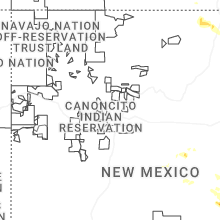
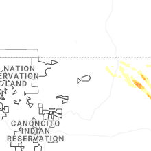

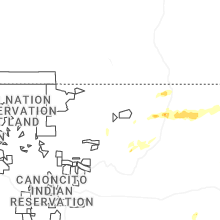
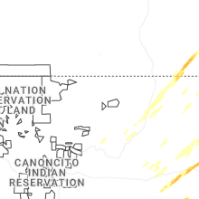


Connect with Interactive Hail Maps