

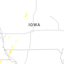
Hail Map for Tuesday, May 21, 2019

Number of Impacted Households on 5/21/2019
0
Impacted by 1" or Larger Hail
0
Impacted by 1.75" or Larger Hail
0
Impacted by 2.5" or Larger Hail
Square Miles of Populated Area Impacted on 5/21/2019
0
Impacted by 1" or Larger Hail
0
Impacted by 1.75" or Larger Hail
0
Impacted by 2.5" or Larger Hail


Cities Most Affected by Hail Storms of 5/21/2019
| Hail Size | Demographics of Zip Codes Affected | ||||||
|---|---|---|---|---|---|---|---|
| City | Count | Average | Largest | Pop Density | House Value | Income | Age |
Hail and Wind Damage Spotted on 5/21/2019
Filter by Report Type:Hail ReportsWind Reports
Oklahoma
| Local Time | Report Details |
|---|---|
| 7:05 AM CDT | Quarter sized hail reported near Claremore, OK, 23.6 miles ENE of Tulsa, OK, spotter reports 1 inch hail north of claremore near highway 88 and 420 rd. |
| 7:10 AM CDT | Quarter sized hail reported near Claremore, OK, 31 miles NE of Tulsa, OK |
Arkansas
| Local Time | Report Details |
|---|---|
| 12:23 PM CDT | Tree down across hwy 76e in acor in polk county AR, 51.8 miles NNW of Nashville, AR |
| 1:24 PM CDT | Tree on a house in blue mountai in logan county AR, 43.4 miles ESE of Fort Smith, AR |
| 1:39 PM CDT | Power lines down in scranto in logan county AR, 49.8 miles E of Fort Smith, AR |
| 1:49 PM CDT | Trees down in belleveille in yell county AR, 57 miles ESE of Fort Smith, AR |
| 1:55 PM CDT | 10 trees down at the highway 27 fishing villag in montgomery county AR, 54.5 miles NNE of Nashville, AR |
| 2:13 PM CDT | Trees down in chickala in yell county AR, 63.7 miles WNW of Little Rock, AR |
| 2:15 PM CDT | Tree down in gaithe in boone county AR, 74 miles S of Springfield, MO |
| 2:20 PM CDT | Trees down on power lines on skyline d in pope county AR, 60.8 miles NW of Little Rock, AR |
| 2:39 PM CDT | Tree on a house on hwy 123 and a second tree on hwy 123 across the roa in newton county AR, 79.2 miles SSE of Springfield, MO |
| 2:42 PM CDT | Damage to trees and home in pope county AR, 50.8 miles NW of Little Rock, AR |
| 2:42 PM CDT | *** 1 inj *** nws survey crews determined thunderstorm wind damage was caused by a microburst near atkins... ar. one serious injury was reported. wind gusts were estima in pope county AR, 51.5 miles NW of Little Rock, AR |
| 3:29 PM CDT | Powerline down on yellowjacket l in van buren county AR, 58.2 miles N of Little Rock, AR |
| 3:29 PM CDT | Trees down on plant church r in van buren county AR, 67 miles N of Little Rock, AR |
| 3:30 PM CDT | Trees and power lines down on hwy 5 north near mountain hom in baxter county AR, 78.4 miles SE of Springfield, MO |
Missouri
| Local Time | Report Details |
|---|---|
| 12:49 PM CDT | 12 inch diameter tree down and 10 inch diameter tree uprooted on orr s in greene county MO, 7.8 miles WSW of Springfield, MO |
| 12:57 PM CDT | Top of tree snapped off in rountree neighborhood of springfield. picture via social medi in greene county MO, 1.3 miles ESE of Springfield, MO |
| 1:06 PM CDT | Property and tree damage by fellows lake. time based on rada in greene county MO, 10 miles NNE of Springfield, MO |
| 1:10 PM CDT | Pictures of 3 inch diameter tree branches broken on orchard road in fair grov in greene county MO, 14.7 miles NNE of Springfield, MO |
| 2:25 PM CDT | Power lines down at oak and 3rd in ozark mo. time based on radar estimat in christian county MO, 14 miles SSE of Springfield, MO |
| 2:40 PM CDT | 15 inch tree in road way on hwy 12 in greene county MO, 12.2 miles NE of Springfield, MO |
| 3:34 PM CDT | 3 large trees down over aa in gainesville near country road 30 in ozark county MO, 64.4 miles SE of Springfield, MO |
| 3:40 PM CDT | Corrects previous tstm wnd dmg report from hardenville. lots of damage in hardenville. town and country building front of the store blown dow in ozark county MO, 66.5 miles SE of Springfield, MO |
| 3:40 PM CDT | Corrects previous tstm wnd dmg report from hardenville. lots of damage in hardenville. town and country building front of the store blown dow in ozark county MO, 66.5 miles SE of Springfield, MO |
| 3:40 PM CDT | Corrects previous tstm wnd dmg report from hardenville. lots of damage in hardenville. town and country building front of the store blown dow in ozark county MO, 66.5 miles SE of Springfield, MO |
| 4:04 PM CDT | Multiple reports of powerlines down throughout the county. time based on rada in pulaski county MO, 38.8 miles WNW of Salem, MO |
| 4:09 PM CDT | Two trees down on cc highway 13 miles out of west plains... m in howell county MO, 68.1 miles SSW of Salem, MO |
| 4:15 PM CDT | Trees down on power lines just west of timberland pallet... 10 miles west of west plains mo on 160 highwa in howell county MO, 67 miles SSW of Salem, MO |
| 4:16 PM CDT | 911 reporting tree on a structure on 11587 co road 6690 across from e highway... west plains m in howell county MO, 73.3 miles SSW of Salem, MO |
| 4:36 PM CDT | Storm damage from this evening in northwest dent county about 1 mile south of lecoma. numerous trees uprooted or shredded and windows blown out of neighbors house. no i in dent county MO, 13.6 miles NW of Salem, MO |
| 4:38 PM CDT | Storm damage reported in callaway county MO, 22.6 miles SE of Columbia, MO |
| 4:42 PM CDT | Asos reports gust of 50.0 knots from sw. 58 mp in maries county MO, 36.3 miles NNW of Salem, MO |
| 4:56 PM CDT | Many limbs over highway j in northern callaway county. time estimated from rada in callaway county MO, 11 miles E of Columbia, MO |
| 4:56 PM CDT | Corrects previous tstm wnd dmg report from 7 sse murry. many limbs over highway jj in northern callaway county southeast of auxvasse. time estimated from rada in callaway county MO, 25.6 miles E of Columbia, MO |
| 4:58 PM CDT | Small tree snapped. time estimated from rada in crawford county MO, 13 miles NNE of Salem, MO |
| 5:04 PM CDT | Tree down into hous in callaway county MO, 21.9 miles ESE of Columbia, MO |
| 5:07 PM CDT | Equipment shed destroye in callaway county MO, 29.4 miles E of Columbia, MO |
| 5:07 PM CDT | Small tree snapped. time estimated from rada in crawford county MO, 30.1 miles NNE of Salem, MO |
| 5:27 PM CDT | Small tree snapped. time estimated from rada in crawford county MO, 38.7 miles NNE of Salem, MO |
| 6:00 PM CDT | Tree limbs and power lines down. time estimated from rada in franklin county MO, 35.9 miles W of Saint Louis, MO |
| 6:32 PM CDT | Quarter sized hail reported near Saint Peters, MO, 25.3 miles WNW of Saint Louis, MO |
| 7:02 PM CDT | Pah i have a late report of a house damaged on 10932 u.s. 160 harviell mo which is .09 mile west of u.s. 67. covered rear deck that was picked up and thrown aprox. 100 in butler county MO, 70.7 miles SW of Cape Girardeau, MO |
| 7:15 PM CDT | Storm damage reported in st. louis county MO, 10.1 miles WSW of Saint Louis, MO |
| 8:49 PM CDT | Funnel cloud seen from northeast side of jackson... m in cape girardeau county MO, 8 miles NW of Cape Girardeau, MO |
Kansas
| Local Time | Report Details |
|---|---|
| 3:18 PM CDT | Quarter sized hail reported near Sterling, KS, 60.6 miles WNW of Wichita, KS |
| 3:35 PM CDT | Half Dollar sized hail reported near Gypsum, KS, 59 miles N of Wichita, KS, via social media. |
| 3:35 PM CDT | Quarter sized hail reported near Canton, KS, 55.6 miles N of Wichita, KS, via social media. |
| 3:54 PM CDT | Quarter sized hail reported near Geneseo, KS, 66.5 miles NW of Wichita, KS, also measured a 50mph wind gust |
| 3:55 PM CDT | Quarter sized hail reported near Gypsum, KS, 53.9 miles SW of Manhattan, KS |
| 4:34 PM CDT | Quarter sized hail reported near Enterprise, KS, 35.4 miles WSW of Manhattan, KS |
| 4:44 PM CDT | Quarter sized hail reported near Hays, KS, 0.4 miles W of Hays, KS |
| 4:55 PM CDT | 10 in. diameter tree limb down... across the roa in reno county KS, 50.4 miles NW of Wichita, KS |
| 5:00 PM CDT | Quarter sized hail reported near Pratt, KS, 75.4 miles W of Wichita, KS |
| 5:03 PM CDT | Quarter sized hail reported near Junction City, KS, 24.2 miles WSW of Manhattan, KS, couldnt see the tornado but had quarter size hail. |
| 5:09 PM CDT | Ping Pong Ball sized hail reported near Salina, KS, 62 miles WSW of Manhattan, KS, hail covered the ground on i-135... 1 mile south of i-70. |
| 5:50 PM CDT | Quarter sized hail reported near Russell, KS, 29.6 miles E of Hays, KS, delayed report. time estimated from radar. |
| 6:08 PM CDT | Quarter sized hail reported near Bennington, KS, 56.2 miles W of Manhattan, KS, hail up to the size of quarters. |
| 6:08 PM CDT | Quarter sized hail reported near Leonardville, KS, 20.7 miles NW of Manhattan, KS, dime to quarter size hail. |
Illinois
| Local Time | Report Details |
|---|---|
| 7:01 PM CDT | Power lines down. time estimated from rada in monroe county IL, 11.7 miles S of Saint Louis, MO |
| 7:21 PM CDT | Trees on two houses house along wilshire driv in st. clair county IL, 9.4 miles ESE of Saint Louis, MO |
| 8:18 PM CDT | Multiple trees down... 4-6 inches in diameter. time estimated from rada in clinton county IL, 36.8 miles E of Saint Louis, MO |
| 10:19 PM CDT | 2.5 miles se of anna at the intersection of hwy 51 and 630 in union county IL, 20.4 miles ENE of Cape Girardeau, MO |
Nebraska
| Local Time | Report Details |
|---|---|
| 8:03 PM CDT | Quarter sized hail reported near Auburn, NE, 62.3 miles S of Omaha, NE |
Iowa
| Local Time | Report Details |
|---|---|
| 1:05 AM CDT | Cass county emergency management reported several outbuildings damaged and power poles down along glendale road about 1/2 mile east of highway 148 southeast of anita. d in cass county IA, 60 miles W of Des Moines, IA |
Connect with Interactive Hail Maps