

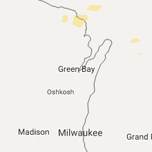
Hail Map for Monday, October 17, 2016

Number of Impacted Households on 10/17/2016
0
Impacted by 1" or Larger Hail
0
Impacted by 1.75" or Larger Hail
0
Impacted by 2.5" or Larger Hail
Square Miles of Populated Area Impacted on 10/17/2016
0
Impacted by 1" or Larger Hail
0
Impacted by 1.75" or Larger Hail
0
Impacted by 2.5" or Larger Hail


Cities Most Affected by Hail Storms of 10/17/2016
| Hail Size | Demographics of Zip Codes Affected | ||||||
|---|---|---|---|---|---|---|---|
| City | Count | Average | Largest | Pop Density | House Value | Income | Age |
| Glennie, MI | 2 | 1.88 | 2.00 | 14 | $66k | $26.8k | 56.8 |
Hail and Wind Damage Spotted on 10/17/2016
Filter by Report Type:Hail ReportsWind Reports
Michigan
| Local Time | Report Details |
|---|---|
| 8:00 AM EDT | Quarter sized hail reported near Lake Ann, MI, 11.2 miles W of Traverse City, MI, . |
| 8:12 AM EDT | Multiple trees and power lines down. time estimated by rada in emmet county MI, 58.9 miles SSW of Sault Sainte Marie, MI |
| 8:24 AM EDT | Ping Pong Ball sized hail reported near East Jordan, MI, 36.5 miles NE of Traverse City, MI, . |
| 10:31 AM EDT | Golf Ball sized hail reported near Glennie, MI, 38.1 miles SSW of Alpena, MI, . |
| 10:31 AM EDT | Hen Egg sized hail reported near Glennie, MI, 36.5 miles SSW of Alpena, MI, delayed report. time estimated via radar. |
Wisconsin
| Local Time | Report Details |
|---|---|
| 6:43 PM CDT | Reports of trees and power lines down in rhinelander towards eagle river. time estimated via radar in oneida county WI, 0.6 miles S of Rhinelander, WI |
New York
| Local Time | Report Details |
|---|---|
| 7:57 PM EDT | Tree blocking roadwa in oswego county NY, 24.2 miles N of Syracuse, NY |
| 7:59 PM EDT | Tree blocking roadway near intersection of barber road and eldred roa in oswego county NY, 30.9 miles N of Syracuse, NY |
| 8:03 PM EDT | Tree blocking roadway near intersection of state route 13 and lake wood roa in oswego county NY, 31.2 miles NNE of Syracuse, NY |
Connect with Interactive Hail Maps