

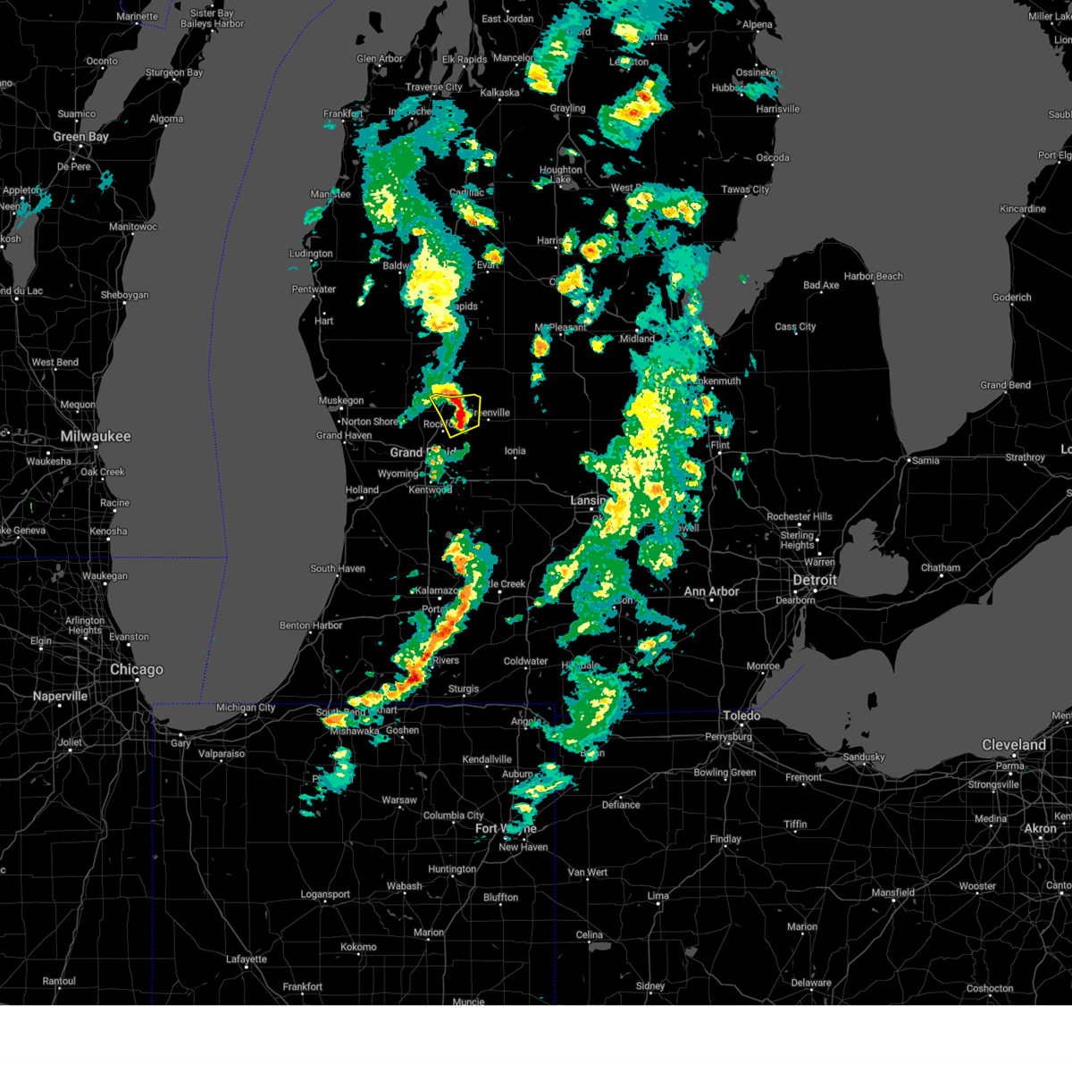
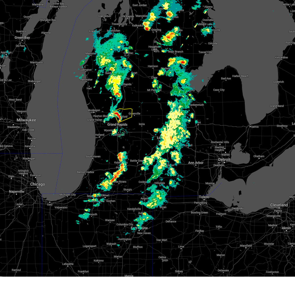
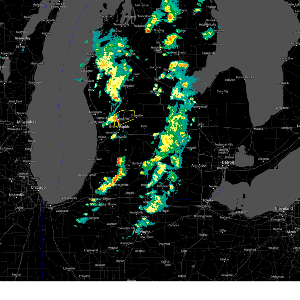
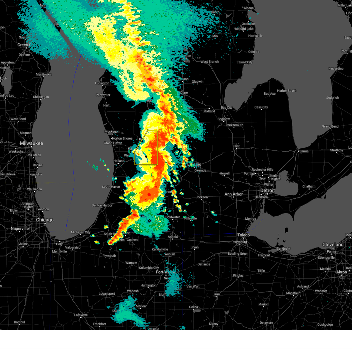
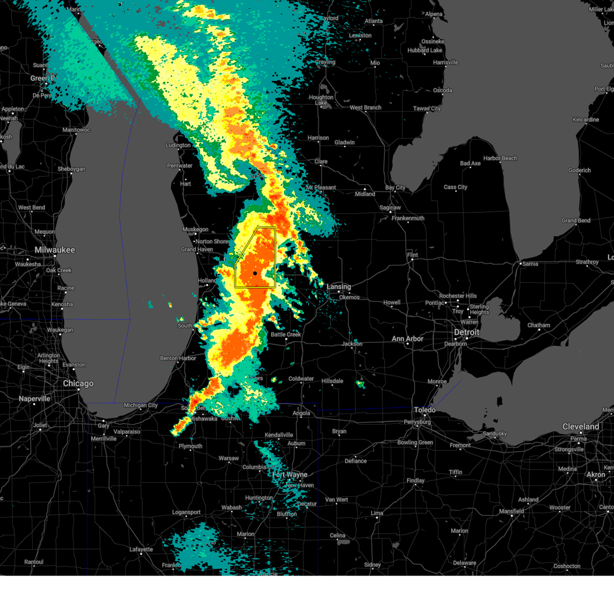
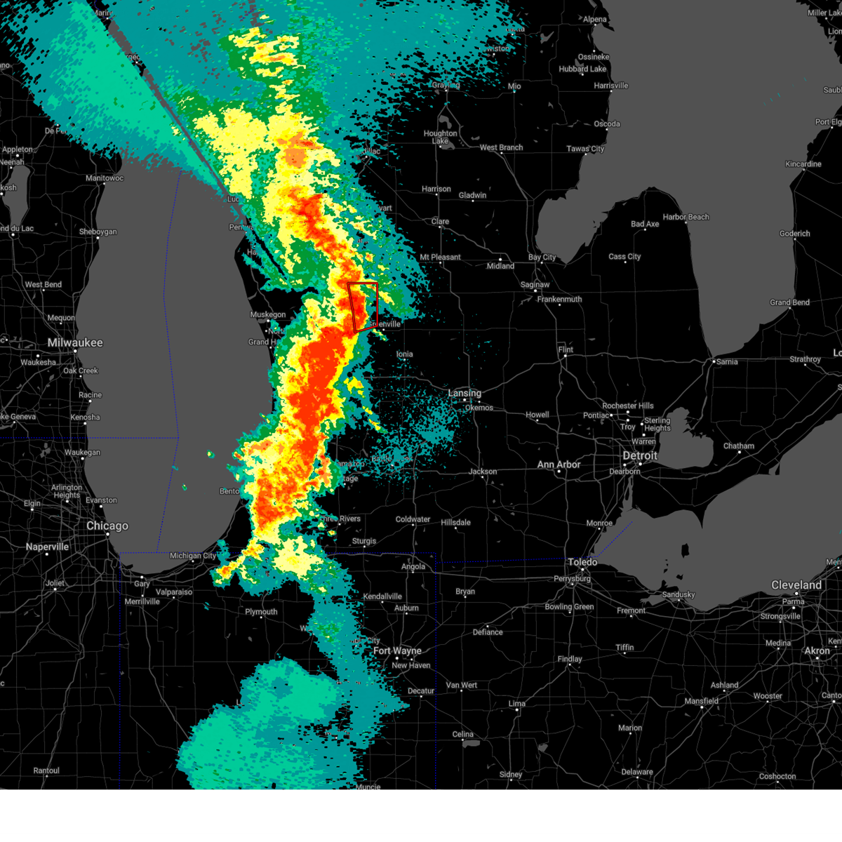
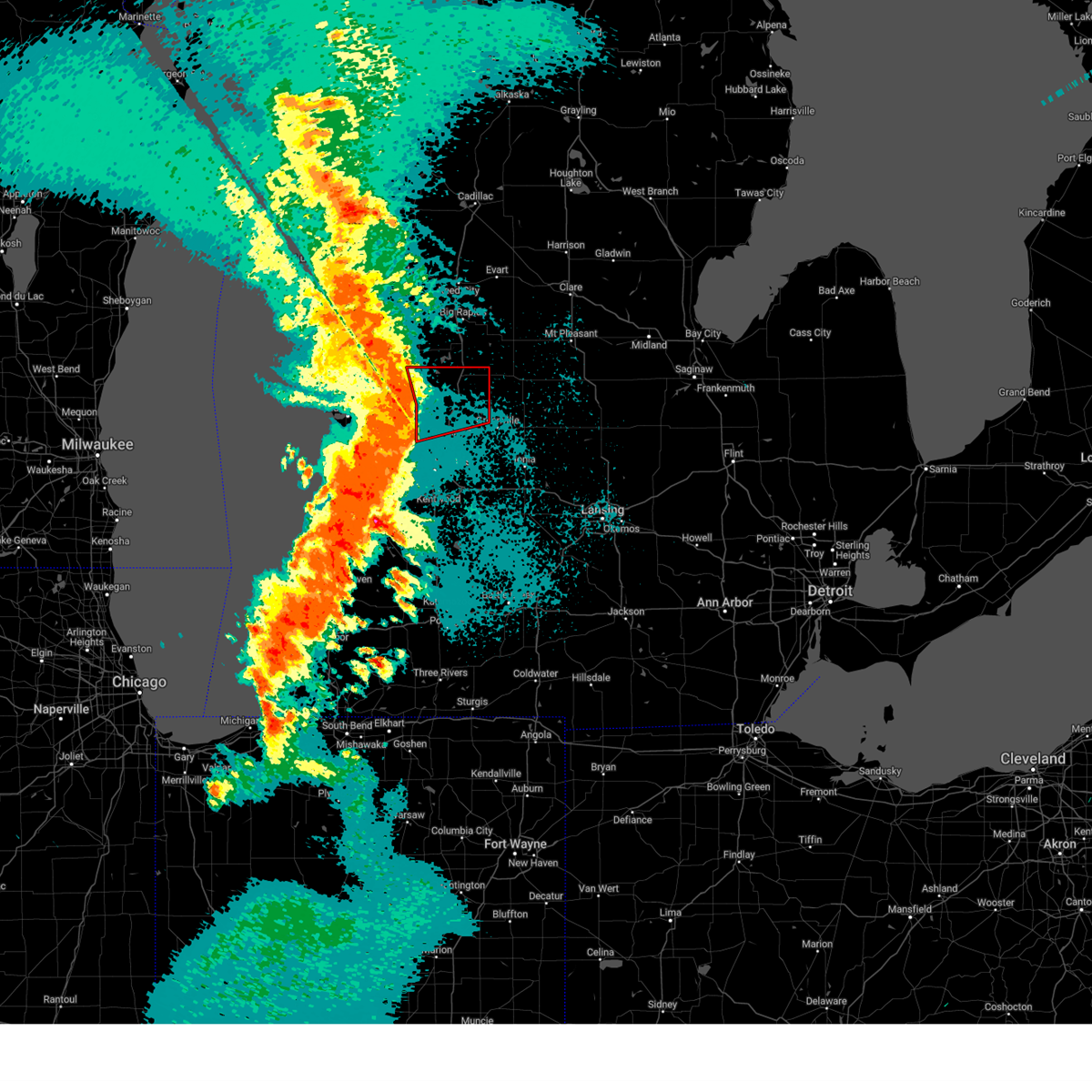
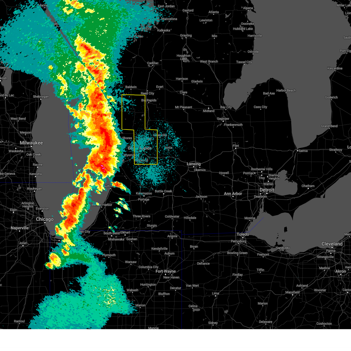
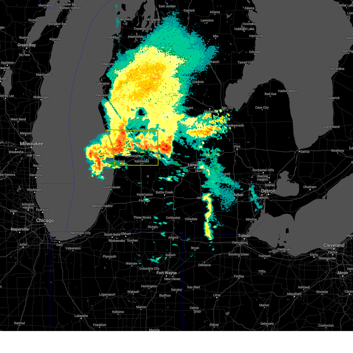
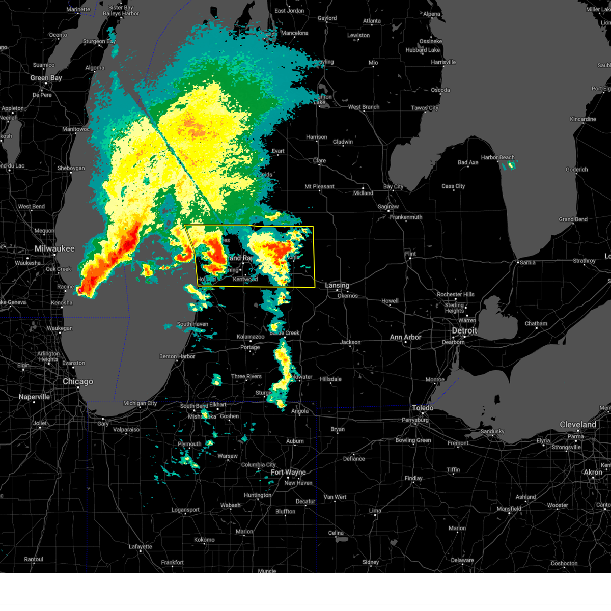
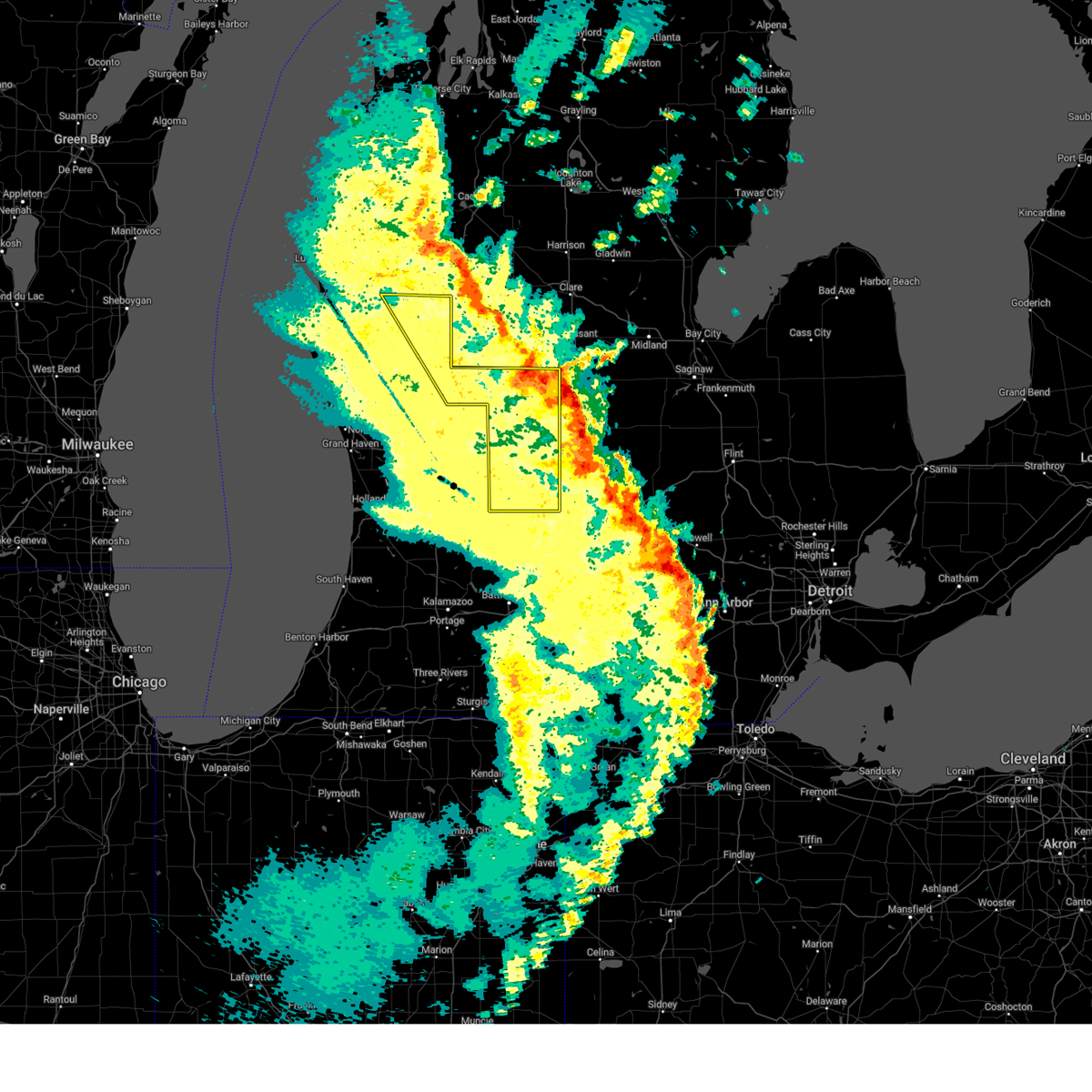
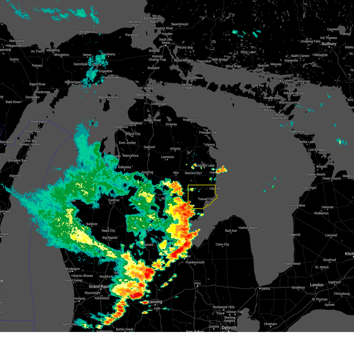
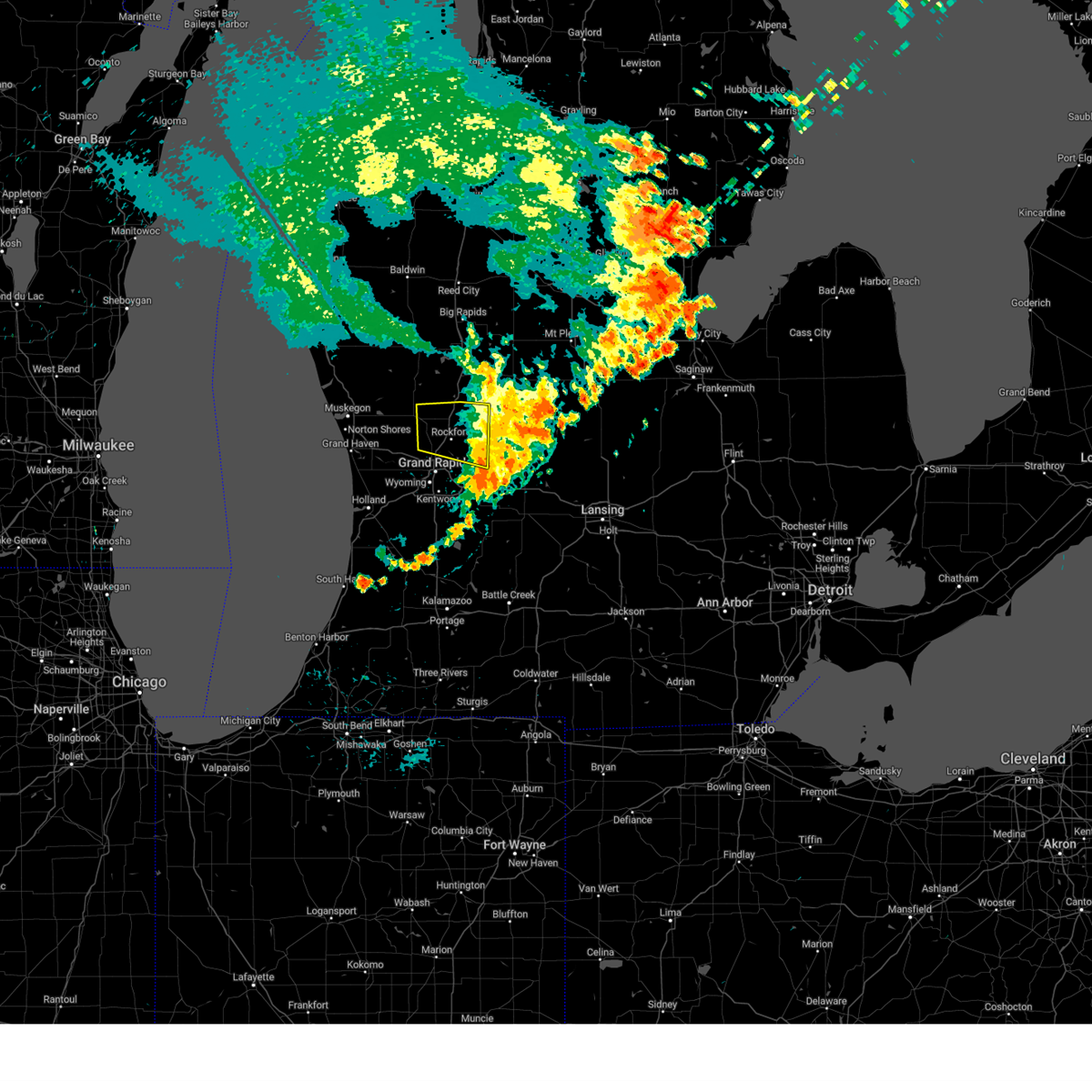
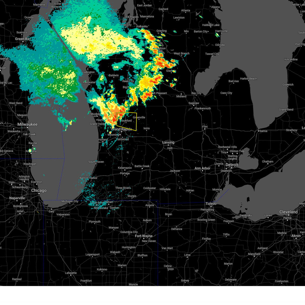
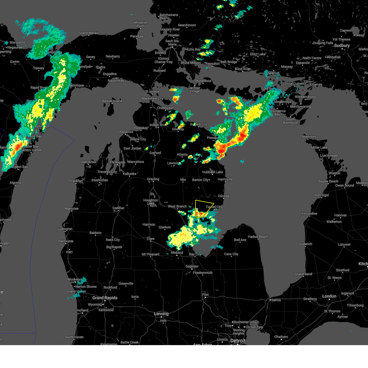
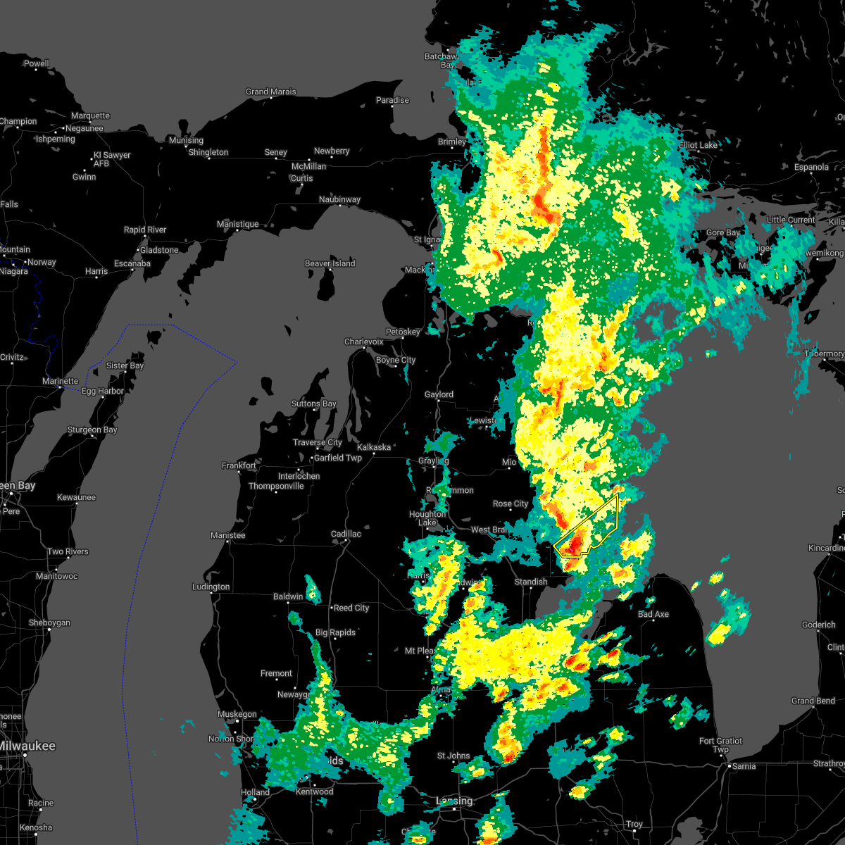
Hail Map for Sand Lake, MI
The Sand Lake, MI area has had 7 reports of on-the-ground hail by trained spotters, and has been under severe weather warnings 44 times during the past 12 months. Doppler radar has detected hail at or near Sand Lake, MI on 55 occasions, including 4 occasions during the past year.
| Name: | Sand Lake, MI |
| Where Located: | 51.6 miles SSW of Alpena, MI |
| Map: | Google Map for Sand Lake, MI |
| Population: | 1412 |
| Housing Units: | 1772 |
| More Info: | Search Google for Sand Lake, MI |
3
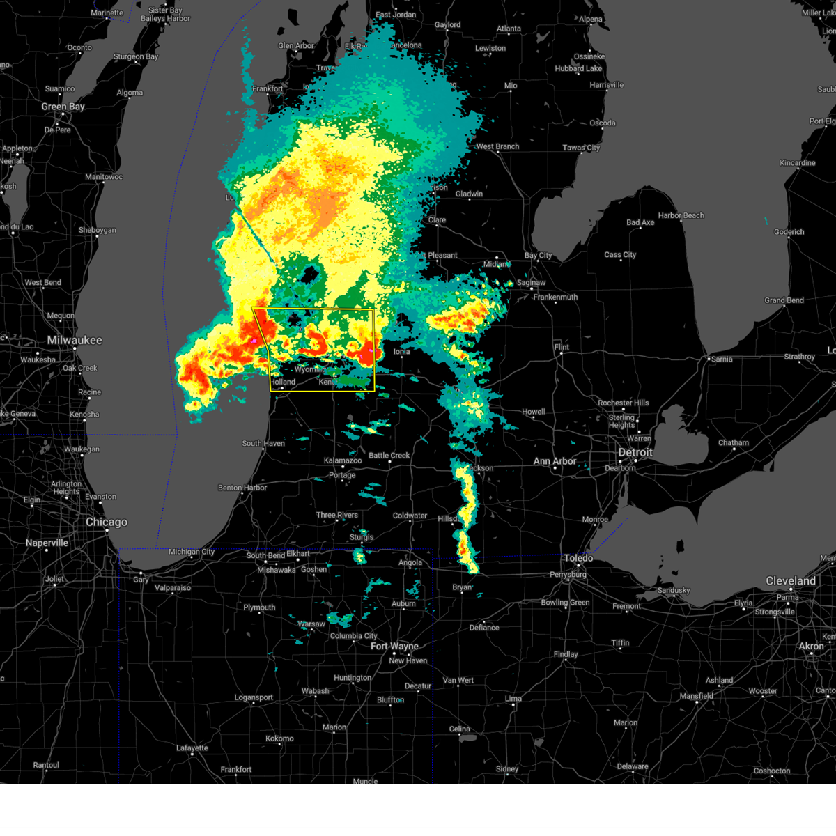
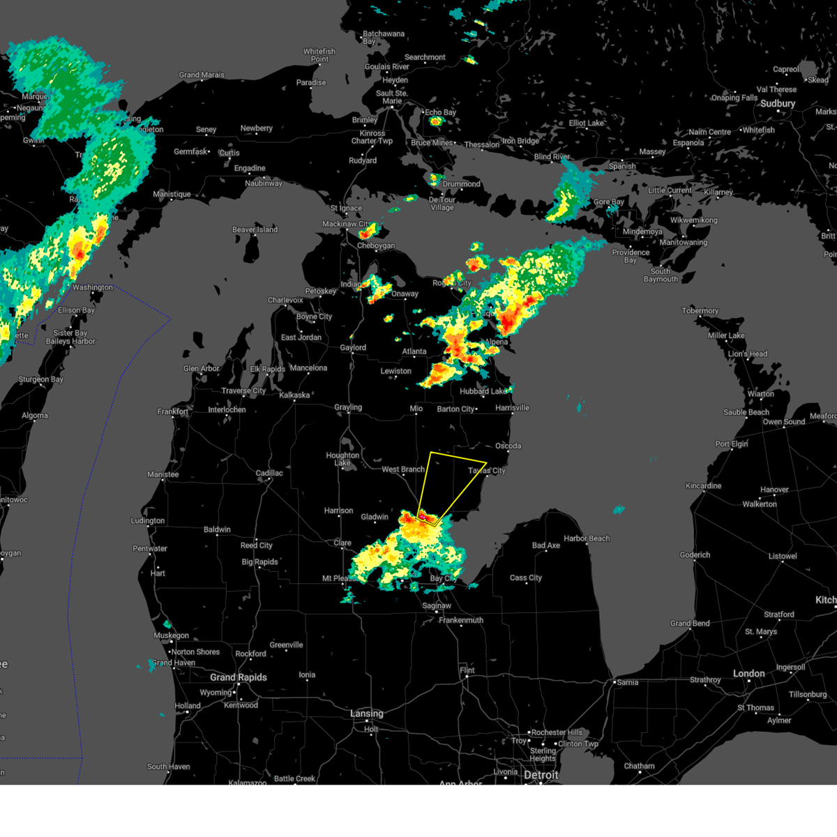
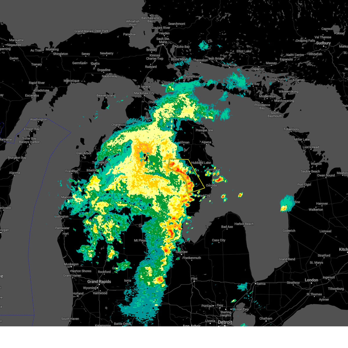
The Top Recent Hail Date for Sand Lake, MI is Friday, July 5, 2024 (4th out of 55)

Hail and Wind Damage Spotted near Sand Lake, MI
| Date / Time | Report Details |
|---|---|
| 6/9/2025 5:07 PM EDT |
 At 506 pm edt, a severe thunderstorm was located 8 miles south of howard city, or 11 miles northwest of greenville, moving northeast at 55 mph (radar indicated). Hazards include 60 mph wind gusts and quarter size hail. Hail damage to vehicles is expected. expect wind damage to roofs, siding, and trees. Locations impacted include, cedar springs, sand lake, lincoln lake,. At 506 pm edt, a severe thunderstorm was located 8 miles south of howard city, or 11 miles northwest of greenville, moving northeast at 55 mph (radar indicated). Hazards include 60 mph wind gusts and quarter size hail. Hail damage to vehicles is expected. expect wind damage to roofs, siding, and trees. Locations impacted include, cedar springs, sand lake, lincoln lake,.
|
| 6/9/2025 5:00 PM EDT |
 At 459 pm edt, a severe thunderstorm was located near sparta, or 16 miles north of grand rapids, moving northeast at 50 mph (radar indicated). Hazards include 60 mph wind gusts and quarter size hail. Hail damage to vehicles is expected. expect wind damage to roofs, siding, and trees. Locations impacted include, rockford, sparta, cedar springs, kent city, sand lake, belmont, lincoln lake, northview,. At 459 pm edt, a severe thunderstorm was located near sparta, or 16 miles north of grand rapids, moving northeast at 50 mph (radar indicated). Hazards include 60 mph wind gusts and quarter size hail. Hail damage to vehicles is expected. expect wind damage to roofs, siding, and trees. Locations impacted include, rockford, sparta, cedar springs, kent city, sand lake, belmont, lincoln lake, northview,.
|
| 6/9/2025 4:51 PM EDT |
 Svrgrr the national weather service in grand rapids has issued a * severe thunderstorm warning for, northern kent county in southwestern michigan, * until 530 pm edt. * at 451 pm edt, a severe thunderstorm was located over sparta, or 13 miles north of grand rapids, moving northeast at 50 mph (radar indicated). Hazards include 60 mph wind gusts and quarter size hail. Hail damage to vehicles is expected. Expect wind damage to roofs, siding, and trees. Svrgrr the national weather service in grand rapids has issued a * severe thunderstorm warning for, northern kent county in southwestern michigan, * until 530 pm edt. * at 451 pm edt, a severe thunderstorm was located over sparta, or 13 miles north of grand rapids, moving northeast at 50 mph (radar indicated). Hazards include 60 mph wind gusts and quarter size hail. Hail damage to vehicles is expected. Expect wind damage to roofs, siding, and trees.
|
| 5/16/2025 11:07 PM EDT | the severe thunderstorm warning has been cancelled and is no longer in effect |
| 5/16/2025 10:23 PM EDT | Svrapx the national weather service in gaylord has issued a * severe thunderstorm warning for, southwestern alcona county in northern michigan, ogemaw county in northern michigan, southern oscoda county in northern michigan, iosco county in northern michigan, * until 1130 pm edt. * at 1023 pm edt, severe thunderstorms were located along a line extending from near st. helen to 6 miles west of whittemore to near national city, moving north at 50 mph (radar indicated). Hazards include 60 mph wind gusts and quarter size hail. Hail damage to vehicles is expected. expect wind damage to roofs, siding, and trees. severe thunderstorms will be near, rose township, rifle river state park, clear lake, plainfield township, rose city, lupton, long lake, and hale around 1030 pm edt. south branch around 1035 pm edt. luzerne, glennie, mack lake, and curtisville around 1040 pm edt. mio around 1045 pm edt. Other locations impacted by these severe thunderstorms include wilber, foster township, sid town, and prescott. |
| 5/15/2025 11:08 PM EDT |
 The storms which prompted the warning have moved out of the area. therefore, the warning will be allowed to expire. however, gusty winds and lightning are still possible with these thunderstorms. a tornado watch remains in effect until 300 am edt for south central, central and southwestern michigan. The storms which prompted the warning have moved out of the area. therefore, the warning will be allowed to expire. however, gusty winds and lightning are still possible with these thunderstorms. a tornado watch remains in effect until 300 am edt for south central, central and southwestern michigan.
|
| 5/15/2025 10:55 PM EDT |
 the severe thunderstorm warning has been cancelled and is no longer in effect the severe thunderstorm warning has been cancelled and is no longer in effect
|
| 5/15/2025 10:55 PM EDT |
 At 1054 pm edt, severe thunderstorms were located along a line extending from 7 miles west of greenville to near caledonia, moving east at 25 mph. also, a tornado warning remains in effect for southern kent county (radar indicated). Hazards include 60 mph wind gusts. Expect damage to roofs, siding, and trees. locations impacted include, grand rapids, wyoming, kentwood, walker, grandville, east grand rapids, rockford, lowell, caledonia, gerald r. Ford inter, ada, grattan, cedar springs, sand lake, cutlerville, belmont, alto, alaska, cannonsburg, cascade,. At 1054 pm edt, severe thunderstorms were located along a line extending from 7 miles west of greenville to near caledonia, moving east at 25 mph. also, a tornado warning remains in effect for southern kent county (radar indicated). Hazards include 60 mph wind gusts. Expect damage to roofs, siding, and trees. locations impacted include, grand rapids, wyoming, kentwood, walker, grandville, east grand rapids, rockford, lowell, caledonia, gerald r. Ford inter, ada, grattan, cedar springs, sand lake, cutlerville, belmont, alto, alaska, cannonsburg, cascade,.
|
| 5/15/2025 10:34 PM EDT |
 At 1033 pm edt, a severe squall line capable of producing both tornadoes and extensive straight line wind damage was located along a line extending from near morley to 8 miles south of howard city, moving east at 50 mph (radar indicated rotation). Hazards include tornado. Flying debris will be dangerous to those caught without shelter. mobile homes will be damaged or destroyed. damage to roofs, windows, and vehicles will occur. tree damage is likely. These tornadic storms will remain over northeastern kent and northwestern montcalm counties, including the following locations, sand lake, coral, amble, pierson, trufant, indian lake, and lincoln lake. At 1033 pm edt, a severe squall line capable of producing both tornadoes and extensive straight line wind damage was located along a line extending from near morley to 8 miles south of howard city, moving east at 50 mph (radar indicated rotation). Hazards include tornado. Flying debris will be dangerous to those caught without shelter. mobile homes will be damaged or destroyed. damage to roofs, windows, and vehicles will occur. tree damage is likely. These tornadic storms will remain over northeastern kent and northwestern montcalm counties, including the following locations, sand lake, coral, amble, pierson, trufant, indian lake, and lincoln lake.
|
| 5/15/2025 10:34 PM EDT |
 the tornado warning has been cancelled and is no longer in effect the tornado warning has been cancelled and is no longer in effect
|
| 5/15/2025 10:12 PM EDT |
 Torgrr the national weather service in grand rapids has issued a * tornado warning for, northern kent county in southwestern michigan, southeastern newaygo county in west central michigan, northwestern montcalm county in central michigan, * until 1045 pm edt. * at 1012 pm edt, severe thunderstorms capable of producing both tornadoes and extensive straight line wind damage were located along a line extending from newaygo to near sparta, moving east at 50 mph (radar indicated rotation). Hazards include tornado. Flying debris will be dangerous to those caught without shelter. mobile homes will be damaged or destroyed. damage to roofs, windows, and vehicles will occur. tree damage is likely. these dangerous storms will be near, newaygo and sparta around 1015 pm edt. Howard city around 1025 pm edt. Torgrr the national weather service in grand rapids has issued a * tornado warning for, northern kent county in southwestern michigan, southeastern newaygo county in west central michigan, northwestern montcalm county in central michigan, * until 1045 pm edt. * at 1012 pm edt, severe thunderstorms capable of producing both tornadoes and extensive straight line wind damage were located along a line extending from newaygo to near sparta, moving east at 50 mph (radar indicated rotation). Hazards include tornado. Flying debris will be dangerous to those caught without shelter. mobile homes will be damaged or destroyed. damage to roofs, windows, and vehicles will occur. tree damage is likely. these dangerous storms will be near, newaygo and sparta around 1015 pm edt. Howard city around 1025 pm edt.
|
| 5/15/2025 9:52 PM EDT |
 Svrgrr the national weather service in grand rapids has issued a * severe thunderstorm warning for, kent county in southwestern michigan, newaygo county in west central michigan, * until 1115 pm edt. * at 951 pm edt, severe thunderstorms were located along a line extending from near shelby to 6 miles west of coopersville to 5 miles west of holland sp, moving east at 65 mph. these are destructive storms for kent and newaygo counties (radar indicated). Hazards include 80 mph wind gusts and penny size hail. Flying debris will be dangerous to those caught without shelter. mobile homes will be heavily damaged. expect considerable damage to roofs, windows, and vehicles. Extensive tree damage and power outages are likely. Svrgrr the national weather service in grand rapids has issued a * severe thunderstorm warning for, kent county in southwestern michigan, newaygo county in west central michigan, * until 1115 pm edt. * at 951 pm edt, severe thunderstorms were located along a line extending from near shelby to 6 miles west of coopersville to 5 miles west of holland sp, moving east at 65 mph. these are destructive storms for kent and newaygo counties (radar indicated). Hazards include 80 mph wind gusts and penny size hail. Flying debris will be dangerous to those caught without shelter. mobile homes will be heavily damaged. expect considerable damage to roofs, windows, and vehicles. Extensive tree damage and power outages are likely.
|
| 4/18/2025 11:04 AM EDT |
 At 1101 am edt, strong to severe thunderstorms were located along a line extending from 6 miles southwest of greenville to near saranac to near freeport, moving east at 65 mph. this line will continue to weaken as it moves further inland (radar indicated). Hazards include 60 mph wind gusts. Expect damage to roofs, siding, and trees. Locations impacted include, port sheldon, cutlerville, wyoming, belmont, grandville, fruitport, muskegon heights, grattan, alto, marne, dutton, borculo, sparta, muskegon sp, coopersville, comstock park, walker, hudsonville, slocum, casnovia,. At 1101 am edt, strong to severe thunderstorms were located along a line extending from 6 miles southwest of greenville to near saranac to near freeport, moving east at 65 mph. this line will continue to weaken as it moves further inland (radar indicated). Hazards include 60 mph wind gusts. Expect damage to roofs, siding, and trees. Locations impacted include, port sheldon, cutlerville, wyoming, belmont, grandville, fruitport, muskegon heights, grattan, alto, marne, dutton, borculo, sparta, muskegon sp, coopersville, comstock park, walker, hudsonville, slocum, casnovia,.
|
| 4/18/2025 10:48 AM EDT |
 At 1047 am edt, severe thunderstorms were located along a line extending from near rockford to 7 miles northeast of east grand rapids to near caledonia, moving east at 65 mph. a line of strong possibly severe storms will be moving onshore along a line from muskegon to holland by 11 am moving to the east at 65 mph (radar indicated). Hazards include 60 mph wind gusts and quarter size hail. Hail damage to vehicles is expected. expect wind damage to roofs, siding, and trees. Locations impacted include, port sheldon, cutlerville, wyoming, belmont, grandville, fruitport, muskegon heights, grattan, alto, marne, dutton, borculo, sparta, muskegon sp, coopersville, comstock park, walker, hudsonville, slocum, casnovia,. At 1047 am edt, severe thunderstorms were located along a line extending from near rockford to 7 miles northeast of east grand rapids to near caledonia, moving east at 65 mph. a line of strong possibly severe storms will be moving onshore along a line from muskegon to holland by 11 am moving to the east at 65 mph (radar indicated). Hazards include 60 mph wind gusts and quarter size hail. Hail damage to vehicles is expected. expect wind damage to roofs, siding, and trees. Locations impacted include, port sheldon, cutlerville, wyoming, belmont, grandville, fruitport, muskegon heights, grattan, alto, marne, dutton, borculo, sparta, muskegon sp, coopersville, comstock park, walker, hudsonville, slocum, casnovia,.
|
| 4/18/2025 10:48 AM EDT |
 the severe thunderstorm warning has been cancelled and is no longer in effect the severe thunderstorm warning has been cancelled and is no longer in effect
|
| 4/18/2025 10:43 AM EDT |
 the severe thunderstorm warning has been cancelled and is no longer in effect the severe thunderstorm warning has been cancelled and is no longer in effect
|
| 4/18/2025 10:43 AM EDT |
 At 1037 am edt, strong thunderstorms were located along a line extending from near sparta to near grand rapids to near wyoming, moving east at 65 mph. a line of strong possibly severe storms will be moving onshore along a line from muskegon to holland by 11 am moving to the east at 65 mph (radar indicated). Hazards include 60 mph wind gusts and quarter size hail. Hail damage to vehicles is expected. expect wind damage to roofs, siding, and trees. Locations impacted include, port sheldon, cutlerville, wyoming, belmont, grandville, fruitport, muskegon heights, grattan, alto, marne, dutton, borculo, sparta, muskegon sp, coopersville, comstock park, walker, hudsonville, slocum, casnovia,. At 1037 am edt, strong thunderstorms were located along a line extending from near sparta to near grand rapids to near wyoming, moving east at 65 mph. a line of strong possibly severe storms will be moving onshore along a line from muskegon to holland by 11 am moving to the east at 65 mph (radar indicated). Hazards include 60 mph wind gusts and quarter size hail. Hail damage to vehicles is expected. expect wind damage to roofs, siding, and trees. Locations impacted include, port sheldon, cutlerville, wyoming, belmont, grandville, fruitport, muskegon heights, grattan, alto, marne, dutton, borculo, sparta, muskegon sp, coopersville, comstock park, walker, hudsonville, slocum, casnovia,.
|
| 4/18/2025 10:21 AM EDT |
 the severe thunderstorm warning has been cancelled and is no longer in effect the severe thunderstorm warning has been cancelled and is no longer in effect
|
| 4/18/2025 10:21 AM EDT |
 At 1019 am edt, severe thunderstorms were located along a line extending from near fruitport to near allendale to near zeeland, moving east at 65 mph. this is a second area of thunderstorms that was following strong but non severe thunderstorms currently over the ionia area that are also moving east (radar indicated). Hazards include 60 mph wind gusts and quarter size hail. Hail damage to vehicles is expected. expect wind damage to roofs, siding, and trees. Locations impacted include, port sheldon, clarksville, belmont, muskegon heights, alto, orleans, marne, dutton, comstock park, hudsonville, sheridan, belding, sullivan, rockford, ionia, murray lake, fenwick, north muskegon, portland, conklin,. At 1019 am edt, severe thunderstorms were located along a line extending from near fruitport to near allendale to near zeeland, moving east at 65 mph. this is a second area of thunderstorms that was following strong but non severe thunderstorms currently over the ionia area that are also moving east (radar indicated). Hazards include 60 mph wind gusts and quarter size hail. Hail damage to vehicles is expected. expect wind damage to roofs, siding, and trees. Locations impacted include, port sheldon, clarksville, belmont, muskegon heights, alto, orleans, marne, dutton, comstock park, hudsonville, sheridan, belding, sullivan, rockford, ionia, murray lake, fenwick, north muskegon, portland, conklin,.
|
| 4/18/2025 10:08 AM EDT |
 At 1005 am edt, severe thunderstorms were located along a line extending from near fruitport to near beechwood, moving east at 55 mph. this is a second area of thunderstorms that was following strong but non severe thunderstorms currently over the grand rapids area that were also moving east (radar indicated). Hazards include 60 mph wind gusts and quarter size hail. Hail damage to vehicles is expected. expect wind damage to roofs, siding, and trees. Locations impacted include, port sheldon, clarksville, reeman, cedar lake, stanton, belmont, lakewood club, muskegon heights, dalton, alto, wyman, orleans, whitehall, marne, dutton, brunswick, holton, comstock park, hudsonville, sheridan,. At 1005 am edt, severe thunderstorms were located along a line extending from near fruitport to near beechwood, moving east at 55 mph. this is a second area of thunderstorms that was following strong but non severe thunderstorms currently over the grand rapids area that were also moving east (radar indicated). Hazards include 60 mph wind gusts and quarter size hail. Hail damage to vehicles is expected. expect wind damage to roofs, siding, and trees. Locations impacted include, port sheldon, clarksville, reeman, cedar lake, stanton, belmont, lakewood club, muskegon heights, dalton, alto, wyman, orleans, whitehall, marne, dutton, brunswick, holton, comstock park, hudsonville, sheridan,.
|
| 4/18/2025 9:48 AM EDT |
 Svrgrr the national weather service in grand rapids has issued a * severe thunderstorm warning for, kent county in southwestern michigan, ottawa county in southwestern michigan, southern newaygo county in west central michigan, ionia county in south central michigan, muskegon county in west central michigan, northwestern eaton county in south central michigan, southeastern oceana county in west central michigan, montcalm county in central michigan, * until 1115 am edt. * at 947 am edt, severe thunderstorms were located along a line extending from near fruitport to 5 miles southwest of allendale to near zeeland, moving east at 65 mph (radar indicated). Hazards include 60 mph wind gusts and quarter size hail. Hail damage to vehicles is expected. Expect wind damage to roofs, siding, and trees. Svrgrr the national weather service in grand rapids has issued a * severe thunderstorm warning for, kent county in southwestern michigan, ottawa county in southwestern michigan, southern newaygo county in west central michigan, ionia county in south central michigan, muskegon county in west central michigan, northwestern eaton county in south central michigan, southeastern oceana county in west central michigan, montcalm county in central michigan, * until 1115 am edt. * at 947 am edt, severe thunderstorms were located along a line extending from near fruitport to 5 miles southwest of allendale to near zeeland, moving east at 65 mph (radar indicated). Hazards include 60 mph wind gusts and quarter size hail. Hail damage to vehicles is expected. Expect wind damage to roofs, siding, and trees.
|
| 3/30/2025 6:39 PM EDT |
 The storms which prompted the warning are moving out of the area. therefore, the warning will be allowed to expire. a severe thunderstorm watch remains in effect until 900 pm edt for south central, central and southwestern michigan. The storms which prompted the warning are moving out of the area. therefore, the warning will be allowed to expire. a severe thunderstorm watch remains in effect until 900 pm edt for south central, central and southwestern michigan.
|
| 3/30/2025 6:29 PM EDT | The storms which prompted the warning have moved out of the area. therefore, the warning will be allowed to expire. a severe thunderstorm watch remains in effect until 900 pm edt for south central, central and southwestern michigan. |
| 3/30/2025 6:19 PM EDT | At 618 pm edt, severe thunderstorms were located along a line extending from 10 miles southeast of baldwin to 7 miles east of greenville to 6 miles south of ionia, moving northeast at 75 mph. these are destructive storms for western and southern michigan (radar indicated). Hazards include 80 mph wind gusts and penny size hail. Flying debris will be dangerous to those caught without shelter. mobile homes will be heavily damaged. expect considerable damage to roofs, windows, and vehicles. extensive tree damage and power outages are likely. Locations impacted include, clarksville, cedar lake, stanton, vestaburg, wyman, orleans, langston, hawkins, lakeview, greenville, six lakes, pierson, woodville, sidney, sheridan, howard city, belding, carson city, bitely, ionia,. |
| 3/30/2025 6:15 PM EDT | At 614 pm edt, severe thunderstorms were located along a line extending from 8 miles northwest of greenville to 5 miles southeast of lake odessa to 10 miles southwest of leslie, moving northeast at 60 mph. these are destructive storms for western and southern michigan (radar indicated). Hazards include 80 mph wind gusts and penny size hail. Flying debris will be dangerous to those caught without shelter. mobile homes will be heavily damaged. expect considerable damage to roofs, windows, and vehicles. extensive tree damage and power outages are likely. Locations impacted include, hastings, nashville, duck lake, woodland, grattan, woodbury, marengo, lowell, freeport, murray lake, alto, albion, cannonsburg, lincoln lake, sand lake, cedar springs,. |
| 3/30/2025 6:12 PM EDT | At 611 pm edt, tornado producing storms were located along a line extending from 5 miles east of newaygo to near greenville, moving northeast at 50 mph (radar confirmed tornado just east of newaygo). Hazards include damaging tornado. Flying debris will be dangerous to those caught without shelter. mobile homes will be damaged or destroyed. damage to roofs, windows, and vehicles will occur. tree damage is likely. these tornadic storms will be near, greenville and howard city around 615 pm edt. Other locations in the path of these tornadic storms include lakeview and edmore. |
| 3/30/2025 6:02 PM EDT | Torgrr the national weather service in grand rapids has issued a * tornado warning for, northeastern kent county in southwestern michigan, southeastern newaygo county in west central michigan, central montcalm county in central michigan, * until 630 pm edt. * at 602 pm edt, severe thunderstorms capable of producing both tornadoes and extensive straight line wind damage were located along a line extending from 5 miles southeast of grant to near rockford, moving northeast at 55 mph (radar indicated rotation). Hazards include tornado. Flying debris will be dangerous to those caught without shelter. mobile homes will be damaged or destroyed. damage to roofs, windows, and vehicles will occur. tree damage is likely. these dangerous storms will be near, howard city around 610 pm edt. Other locations in the path of these tornadic storms include lakeview. |
| 3/30/2025 6:02 PM EDT | At 601 pm edt, severe thunderstorms were located along a line extending from near hesperia to near freeport, moving east at 60 mph. these are destructive storms for western michigan (at 5:50 pm 80 mph winds were observed at grand rapids asos). Hazards include 80 mph wind gusts and penny size hail. Flying debris will be dangerous to those caught without shelter. mobile homes will be heavily damaged. expect considerable damage to roofs, windows, and vehicles. extensive tree damage and power outages are likely. Locations impacted include, clarksville, reeman, cedar lake, stanton, vestaburg, wyman, newaygo, orleans, langston, hawkins, lakeview, greenville, six lakes, pierson, woodville, sidney, sheridan, howard city, belding, carson city,. |
| 3/30/2025 5:56 PM EDT | At 554 pm edt, severe thunderstorms were located along a line extending from near sparta to 7 miles southwest of hastings to near marshall, moving northeast at 60 mph. these are destructive storms for southwest michigan (at 5:50 pm grand rapids asos reported 80 mph winds). Hazards include 80 mph wind gusts and penny size hail. Flying debris will be dangerous to those caught without shelter. mobile homes will be heavily damaged. expect considerable damage to roofs, windows, and vehicles. extensive tree damage and power outages are likely. Locations impacted include, cutlerville, wyoming, battle creek, belmont, grandville, duck lake, yankee springs, hickory corners, grattan, alto, brownlee park, dutton, sparta, banfield, comstock park, walker, marshall, nashville, athens, tekonsha,. |
| 3/30/2025 5:48 PM EDT | Svrgrr the national weather service in grand rapids has issued a * severe thunderstorm warning for, newaygo county in west central michigan, ionia county in south central michigan, montcalm county in central michigan, * until 645 pm edt. * at 547 pm edt, severe thunderstorms were located along a line extending from 6 miles northeast of hart to near middleville, moving northeast at 85 mph (radar indicated). Hazards include 70 mph wind gusts and penny size hail. Expect considerable tree damage. Damage is likely to mobile homes, roofs, and outbuildings. |
| 3/30/2025 5:48 PM EDT | At 547 pm edt, severe thunderstorms were located along a line extending from 6 miles southwest of sparta to 5 miles east of martin to near burlington, moving northeast at 60 mph (radar indicated). Hazards include 70 mph wind gusts and penny size hail. Expect considerable tree damage. damage is likely to mobile homes, roofs, and outbuildings. Locations impacted include, cutlerville, wyoming, battle creek, belmont, grandville, duck lake, yankee springs, hickory corners, grattan, alto, brownlee park, dutton, sparta, banfield, comstock park, walker, marshall, nashville, athens, tekonsha,. |
| 3/30/2025 5:24 PM EDT | Svrgrr the national weather service in grand rapids has issued a * severe thunderstorm warning for, calhoun county in south central michigan, kent county in southwestern michigan, barry county in southwestern michigan, * until 630 pm edt. * at 523 pm edt, severe thunderstorms were located along a line extending from near beechwood to near schoolcraft, moving northeast at 65 mph (radar indicated). Hazards include 70 mph wind gusts and penny size hail. Expect considerable tree damage. Damage is likely to mobile homes, roofs, and outbuildings. |
| 8/27/2024 4:14 PM EDT |
 Svrapx the national weather service in gaylord has issued a * severe thunderstorm warning for, iosco county in northern michigan, * until 515 pm edt. * at 414 pm edt, severe thunderstorms were located along a line extending from near rose township to near national city to 9 miles east of pinconning, moving east at 40 mph (radar indicated). Hazards include 60 mph wind gusts and quarter size hail. Hail damage to vehicles is expected. expect wind damage to roofs, siding, and trees. severe thunderstorms will be near, tawas city, long lake, plainfield township, hale, and national city around 420 pm edt. east tawas around 425 pm edt. tawas point state park around 430 pm edt. au sable around 445 pm edt. oscoda and wurtsmith airfield around 450 pm edt. Other locations impacted by these severe thunderstorms include wilber and sid town. Svrapx the national weather service in gaylord has issued a * severe thunderstorm warning for, iosco county in northern michigan, * until 515 pm edt. * at 414 pm edt, severe thunderstorms were located along a line extending from near rose township to near national city to 9 miles east of pinconning, moving east at 40 mph (radar indicated). Hazards include 60 mph wind gusts and quarter size hail. Hail damage to vehicles is expected. expect wind damage to roofs, siding, and trees. severe thunderstorms will be near, tawas city, long lake, plainfield township, hale, and national city around 420 pm edt. east tawas around 425 pm edt. tawas point state park around 430 pm edt. au sable around 445 pm edt. oscoda and wurtsmith airfield around 450 pm edt. Other locations impacted by these severe thunderstorms include wilber and sid town.
|
| 8/27/2024 3:59 PM EDT |
 The storm which prompted the warning has exited the warned area. therefore, the warning will be allowed to expire. a severe thunderstorm watch remains in effect until 800 pm edt for central, southwestern and west central michigan. The storm which prompted the warning has exited the warned area. therefore, the warning will be allowed to expire. a severe thunderstorm watch remains in effect until 800 pm edt for central, southwestern and west central michigan.
|
| 8/27/2024 3:18 PM EDT |
 Svrgrr the national weather service in grand rapids has issued a * severe thunderstorm warning for, northern kent county in southwestern michigan, * until 400 pm edt. * at 318 pm edt, a severe thunderstorm was located near kent city and sparta, or 14 miles north of grand rapids, moving east at 50 mph (radar indicated). Hazards include 60 mph wind gusts. expect damage to roofs, siding, and trees Svrgrr the national weather service in grand rapids has issued a * severe thunderstorm warning for, northern kent county in southwestern michigan, * until 400 pm edt. * at 318 pm edt, a severe thunderstorm was located near kent city and sparta, or 14 miles north of grand rapids, moving east at 50 mph (radar indicated). Hazards include 60 mph wind gusts. expect damage to roofs, siding, and trees
|
| 7/8/2024 8:36 PM EDT |
 the severe thunderstorm warning has been cancelled and is no longer in effect the severe thunderstorm warning has been cancelled and is no longer in effect
|
| 7/8/2024 8:27 PM EDT |
 At 826 pm edt, a severe thunderstorm was located over whittemore, or 11 miles northwest of au gres, moving northeast at 35 mph (radar indicated). Hazards include 60 mph wind gusts and quarter size hail. Hail damage to vehicles is expected. expect wind damage to roofs, siding, and trees. this severe storm will be near, whittemore and national city around 830 pm edt. Plainfield township around 835 pm edt. At 826 pm edt, a severe thunderstorm was located over whittemore, or 11 miles northwest of au gres, moving northeast at 35 mph (radar indicated). Hazards include 60 mph wind gusts and quarter size hail. Hail damage to vehicles is expected. expect wind damage to roofs, siding, and trees. this severe storm will be near, whittemore and national city around 830 pm edt. Plainfield township around 835 pm edt.
|
| 7/8/2024 8:27 PM EDT |
 the severe thunderstorm warning has been cancelled and is no longer in effect the severe thunderstorm warning has been cancelled and is no longer in effect
|
| 7/8/2024 8:19 PM EDT |
 At 817 pm edt, a severe thunderstorm was located over maple ridge, or 9 miles northeast of sterling, moving northeast at 35 mph (radar indicated). Hazards include 60 mph wind gusts and quarter size hail. Hail damage to vehicles is expected. expect wind damage to roofs, siding, and trees. this severe storm will be near, whittemore, turner, and national city around 825 pm edt. plainfield township around 840 pm edt. Other locations impacted by this severe thunderstorm include prescott. At 817 pm edt, a severe thunderstorm was located over maple ridge, or 9 miles northeast of sterling, moving northeast at 35 mph (radar indicated). Hazards include 60 mph wind gusts and quarter size hail. Hail damage to vehicles is expected. expect wind damage to roofs, siding, and trees. this severe storm will be near, whittemore, turner, and national city around 825 pm edt. plainfield township around 840 pm edt. Other locations impacted by this severe thunderstorm include prescott.
|
| 7/8/2024 8:00 PM EDT |
 Svrapx the national weather service in gaylord has issued a * severe thunderstorm warning for, western arenac county in northern michigan, southeastern ogemaw county in northern michigan, southwestern iosco county in northern michigan, * until 900 pm edt. * at 759 pm edt, a severe thunderstorm was located over sterling, moving northeast at 35 mph (radar indicated). Hazards include 60 mph wind gusts and quarter size hail. Hail damage to vehicles is expected. expect wind damage to roofs, siding, and trees. this severe thunderstorm will be near, sterling, maple ridge, omer, and skidway lake around 805 pm edt. twining around 820 pm edt. whittemore and turner around 825 pm edt. hale around 840 pm edt. Other locations impacted by this severe thunderstorm include prescott. Svrapx the national weather service in gaylord has issued a * severe thunderstorm warning for, western arenac county in northern michigan, southeastern ogemaw county in northern michigan, southwestern iosco county in northern michigan, * until 900 pm edt. * at 759 pm edt, a severe thunderstorm was located over sterling, moving northeast at 35 mph (radar indicated). Hazards include 60 mph wind gusts and quarter size hail. Hail damage to vehicles is expected. expect wind damage to roofs, siding, and trees. this severe thunderstorm will be near, sterling, maple ridge, omer, and skidway lake around 805 pm edt. twining around 820 pm edt. whittemore and turner around 825 pm edt. hale around 840 pm edt. Other locations impacted by this severe thunderstorm include prescott.
|
| 7/5/2024 2:46 PM EDT |
 At 246 pm edt, a severe thunderstorm was located near national city, or 9 miles west of tawas city, moving northeast at 25 mph (radar indicated). Hazards include 60 mph wind gusts and quarter size hail. Hail damage to vehicles is expected. expect wind damage to roofs, siding, and trees. This severe storm will be near, tawas city and plainfield township around 250 pm edt. At 246 pm edt, a severe thunderstorm was located near national city, or 9 miles west of tawas city, moving northeast at 25 mph (radar indicated). Hazards include 60 mph wind gusts and quarter size hail. Hail damage to vehicles is expected. expect wind damage to roofs, siding, and trees. This severe storm will be near, tawas city and plainfield township around 250 pm edt.
|
| 7/5/2024 2:31 PM EDT |
 At 230 pm edt, a severe thunderstorm was located over whittemore, or 15 miles northwest of au gres, moving east at 20 mph (radar indicated). Hazards include 60 mph wind gusts and quarter size hail. Hail damage to vehicles is expected. expect wind damage to roofs, siding, and trees. this severe storm will be near, whittemore and national city around 235 pm edt. plainfield township around 240 pm edt. Tawas city around 250 pm edt. At 230 pm edt, a severe thunderstorm was located over whittemore, or 15 miles northwest of au gres, moving east at 20 mph (radar indicated). Hazards include 60 mph wind gusts and quarter size hail. Hail damage to vehicles is expected. expect wind damage to roofs, siding, and trees. this severe storm will be near, whittemore and national city around 235 pm edt. plainfield township around 240 pm edt. Tawas city around 250 pm edt.
|
| 7/5/2024 2:31 PM EDT |
 the severe thunderstorm warning has been cancelled and is no longer in effect the severe thunderstorm warning has been cancelled and is no longer in effect
|
| 7/5/2024 2:18 PM EDT |
 Svrapx the national weather service in gaylord has issued a * severe thunderstorm warning for, southeastern ogemaw county in northern michigan, southwestern iosco county in northern michigan, * until 300 pm edt. * at 218 pm edt, a severe thunderstorm was located near whittemore, or 12 miles northeast of alger, moving northeast at 25 mph (radar indicated). Hazards include quarter size hail. Damage to vehicles is expected. this severe thunderstorm will be near, whittemore and national city around 225 pm edt. plainfield township around 235 pm edt. Other locations impacted by this severe thunderstorm include prescott. Svrapx the national weather service in gaylord has issued a * severe thunderstorm warning for, southeastern ogemaw county in northern michigan, southwestern iosco county in northern michigan, * until 300 pm edt. * at 218 pm edt, a severe thunderstorm was located near whittemore, or 12 miles northeast of alger, moving northeast at 25 mph (radar indicated). Hazards include quarter size hail. Damage to vehicles is expected. this severe thunderstorm will be near, whittemore and national city around 225 pm edt. plainfield township around 235 pm edt. Other locations impacted by this severe thunderstorm include prescott.
|
| 5/20/2024 9:31 PM EDT |
 At 931 pm edt, severe thunderstorms were located along a line extending from near fairview to near curtisville to 6 miles north of plainfield township, moving northeast at 40 mph (radar indicated. trained spotters also reported 40 to 50 mph wind gusts one quarter mile south of valley road in oscoda county around 910 pm edt). Hazards include 60 mph wind gusts. Expect damage to roofs, siding, and trees. these severe storms will be near, glennie, comins, and curran around 935 pm edt. Other locations impacted by these severe thunderstorms include milen township, mitchell township, and sid town. At 931 pm edt, severe thunderstorms were located along a line extending from near fairview to near curtisville to 6 miles north of plainfield township, moving northeast at 40 mph (radar indicated. trained spotters also reported 40 to 50 mph wind gusts one quarter mile south of valley road in oscoda county around 910 pm edt). Hazards include 60 mph wind gusts. Expect damage to roofs, siding, and trees. these severe storms will be near, glennie, comins, and curran around 935 pm edt. Other locations impacted by these severe thunderstorms include milen township, mitchell township, and sid town.
|
| 5/20/2024 9:31 PM EDT |
 the severe thunderstorm warning has been cancelled and is no longer in effect the severe thunderstorm warning has been cancelled and is no longer in effect
|
| 5/20/2024 9:21 PM EDT |
 At 920 pm edt, severe thunderstorms were located along a line extending from mio to near curtisville to near hale, moving northeast at 55 mph (radar indicated. trained spotters also reported 40 to 50 mph wind gusts one quarter mile south of valley road in oscoda county around 910 pm edt). Hazards include 60 mph wind gusts. Expect damage to roofs, siding, and trees. these severe storms will be near, glennie, comins, mckinley, fairview, and curtisville around 925 pm edt. curran around 930 pm edt. Other locations impacted by these severe thunderstorms include milen township, mitchell township, and sid town. At 920 pm edt, severe thunderstorms were located along a line extending from mio to near curtisville to near hale, moving northeast at 55 mph (radar indicated. trained spotters also reported 40 to 50 mph wind gusts one quarter mile south of valley road in oscoda county around 910 pm edt). Hazards include 60 mph wind gusts. Expect damage to roofs, siding, and trees. these severe storms will be near, glennie, comins, mckinley, fairview, and curtisville around 925 pm edt. curran around 930 pm edt. Other locations impacted by these severe thunderstorms include milen township, mitchell township, and sid town.
|
| 5/20/2024 9:02 PM EDT |
 Svrapx the national weather service in gaylord has issued a * severe thunderstorm warning for, western alcona county in northern michigan, northeastern ogemaw county in northern michigan, oscoda county in northern michigan, northwestern iosco county in northern michigan, * until 945 pm edt. * at 902 pm edt, severe thunderstorms were located along a line extending from near luzerne to near rose township to near selkirk, moving northeast at 40 mph (radar indicated). Hazards include 60 mph wind gusts. Expect damage to roofs, siding, and trees. severe thunderstorms will be near, mio, rose city, luzerne, rose township, mack lake, rifle river state park, lupton, and red oak around 905 pm edt. south branch and fairview around 915 pm edt. comins, mckinley, and curtisville around 920 pm edt. curran around 930 pm edt. Other locations impacted by these severe thunderstorms include milen township, mitchell township, and sid town. Svrapx the national weather service in gaylord has issued a * severe thunderstorm warning for, western alcona county in northern michigan, northeastern ogemaw county in northern michigan, oscoda county in northern michigan, northwestern iosco county in northern michigan, * until 945 pm edt. * at 902 pm edt, severe thunderstorms were located along a line extending from near luzerne to near rose township to near selkirk, moving northeast at 40 mph (radar indicated). Hazards include 60 mph wind gusts. Expect damage to roofs, siding, and trees. severe thunderstorms will be near, mio, rose city, luzerne, rose township, mack lake, rifle river state park, lupton, and red oak around 905 pm edt. south branch and fairview around 915 pm edt. comins, mckinley, and curtisville around 920 pm edt. curran around 930 pm edt. Other locations impacted by these severe thunderstorms include milen township, mitchell township, and sid town.
|
| 5/20/2024 7:15 PM EDT |
 The storms which prompted the warning have moved out of the area. therefore, the warning has been allowed to expire. a severe thunderstorm watch remains in effect until 1000 pm edt for south central, central, southwestern and west central michigan. The storms which prompted the warning have moved out of the area. therefore, the warning has been allowed to expire. a severe thunderstorm watch remains in effect until 1000 pm edt for south central, central, southwestern and west central michigan.
|
| 5/20/2024 6:50 PM EDT |
 At 649 pm edt, severe thunderstorms were located along a line extending from 9 miles southwest of howard city to rockford, moving east at 30 mph (radar indicated). Hazards include 60 mph wind gusts. Expect damage to roofs, siding, and trees. Locations impacted include, rockford, sparta, cedar springs, kent city, sand lake, casnovia, lincoln lake,. At 649 pm edt, severe thunderstorms were located along a line extending from 9 miles southwest of howard city to rockford, moving east at 30 mph (radar indicated). Hazards include 60 mph wind gusts. Expect damage to roofs, siding, and trees. Locations impacted include, rockford, sparta, cedar springs, kent city, sand lake, casnovia, lincoln lake,.
|
| 5/20/2024 6:50 PM EDT |
 the severe thunderstorm warning has been cancelled and is no longer in effect the severe thunderstorm warning has been cancelled and is no longer in effect
|
| 5/20/2024 6:20 PM EDT |
 Svrgrr the national weather service in grand rapids has issued a * severe thunderstorm warning for, kent county in southwestern michigan, eastern ottawa county in southwestern michigan, southeastern muskegon county in west central michigan, * until 715 pm edt. * at 620 pm edt, severe thunderstorms were located along a line extending from 5 miles west of grant to near hudsonville, moving northeast at 50 mph (radar indicated). Hazards include 60 mph wind gusts. expect damage to roofs, siding, and trees Svrgrr the national weather service in grand rapids has issued a * severe thunderstorm warning for, kent county in southwestern michigan, eastern ottawa county in southwestern michigan, southeastern muskegon county in west central michigan, * until 715 pm edt. * at 620 pm edt, severe thunderstorms were located along a line extending from 5 miles west of grant to near hudsonville, moving northeast at 50 mph (radar indicated). Hazards include 60 mph wind gusts. expect damage to roofs, siding, and trees
|
| 4/17/2024 1:03 PM EDT |
 the severe thunderstorm warning has been cancelled and is no longer in effect the severe thunderstorm warning has been cancelled and is no longer in effect
|
| 4/17/2024 12:27 PM EDT |
 At 1227 pm edt, severe thunderstorms were located along a line extending from 5 miles north of sparta to 6 miles south of wyoming, moving northeast at 30 mph (radar indicated). Hazards include 60 mph wind gusts. Expect damage to roofs, siding, and trees. these severe storms will be near, grand rapids, wyoming, kentwood, walker, east grand rapids, rockford, sparta, and gerald r. ford international airport around 1230 pm edt. Other locations impacted by these severe thunderstorms include dutton, cutlerville, belmont, comstock park, kent city, northview, casnovia, grattan, murray lake, and alaska. At 1227 pm edt, severe thunderstorms were located along a line extending from 5 miles north of sparta to 6 miles south of wyoming, moving northeast at 30 mph (radar indicated). Hazards include 60 mph wind gusts. Expect damage to roofs, siding, and trees. these severe storms will be near, grand rapids, wyoming, kentwood, walker, east grand rapids, rockford, sparta, and gerald r. ford international airport around 1230 pm edt. Other locations impacted by these severe thunderstorms include dutton, cutlerville, belmont, comstock park, kent city, northview, casnovia, grattan, murray lake, and alaska.
|
| 4/17/2024 12:27 PM EDT |
 the severe thunderstorm warning has been cancelled and is no longer in effect the severe thunderstorm warning has been cancelled and is no longer in effect
|
| 4/17/2024 11:49 AM EDT |
 Svrgrr the national weather service in grand rapids has issued a * severe thunderstorm warning for, kent county in southwestern michigan, ottawa county in southwestern michigan, * until 115 pm edt. * at 1149 am edt, severe thunderstorms were located along a line extending from near zeeland to 5 miles northeast of fennville, moving northeast at 25 mph (radar indicated). Hazards include 60 mph wind gusts. Expect damage to roofs, siding, and trees. severe thunderstorms will be near, holland, zeeland, and allendale around 1155 am edt. hudsonville around 1200 pm edt. jenison around 1205 pm edt. walker around 1215 pm edt. wyoming, grandville, and coopersville around 1220 pm edt. grand rapids around 1225 pm edt. sparta around 1240 pm edt. kentwood around 1245 pm edt. Other locations impacted by these severe thunderstorms include cutlerville, conklin, crockery lake, lamont, wright, belmont, drenthe, kent city, grattan, and olive center. Svrgrr the national weather service in grand rapids has issued a * severe thunderstorm warning for, kent county in southwestern michigan, ottawa county in southwestern michigan, * until 115 pm edt. * at 1149 am edt, severe thunderstorms were located along a line extending from near zeeland to 5 miles northeast of fennville, moving northeast at 25 mph (radar indicated). Hazards include 60 mph wind gusts. Expect damage to roofs, siding, and trees. severe thunderstorms will be near, holland, zeeland, and allendale around 1155 am edt. hudsonville around 1200 pm edt. jenison around 1205 pm edt. walker around 1215 pm edt. wyoming, grandville, and coopersville around 1220 pm edt. grand rapids around 1225 pm edt. sparta around 1240 pm edt. kentwood around 1245 pm edt. Other locations impacted by these severe thunderstorms include cutlerville, conklin, crockery lake, lamont, wright, belmont, drenthe, kent city, grattan, and olive center.
|
| 11/6/2023 9:48 AM EST | Quarter sized hail reported 1.6 miles E of Sand Lake, MI |
| 11/6/2023 9:40 AM EST | Ping Pong Ball sized hail reported 0.8 miles SE of Sand Lake, MI |
| 11/6/2023 9:23 AM EST |
 At 922 am est, severe thunderstorms were located along a line extending from 7 miles east of white cloud to near grant, moving east at 55 mph (radar indicated). Hazards include 60 mph wind gusts and quarter size hail. Hail damage to vehicles is expected. Expect wind damage to roofs, siding, and trees. At 922 am est, severe thunderstorms were located along a line extending from 7 miles east of white cloud to near grant, moving east at 55 mph (radar indicated). Hazards include 60 mph wind gusts and quarter size hail. Hail damage to vehicles is expected. Expect wind damage to roofs, siding, and trees.
|
| 8/24/2023 8:28 PM EDT |
 At 827 pm edt, a severe thunderstorm was located near greenville, moving east at 25 mph (radar indicated). Hazards include 60 mph wind gusts and quarter size hail. Hail damage to vehicles is expected. expect wind damage to roofs, siding, and trees. Locations impacted include, cedar springs, sand lake,. At 827 pm edt, a severe thunderstorm was located near greenville, moving east at 25 mph (radar indicated). Hazards include 60 mph wind gusts and quarter size hail. Hail damage to vehicles is expected. expect wind damage to roofs, siding, and trees. Locations impacted include, cedar springs, sand lake,.
|
| 8/24/2023 8:08 PM EDT |
 At 807 pm edt, a severe thunderstorm was located 7 miles northeast of rockford, or 11 miles west of greenville, moving southeast at 40 mph (radar indicated). Hazards include 60 mph wind gusts and quarter size hail. Hail damage to vehicles is expected. expect wind damage to roofs, siding, and trees. Locations impacted include, cedar springs, sand lake, pierson, trufant, coral,. At 807 pm edt, a severe thunderstorm was located 7 miles northeast of rockford, or 11 miles west of greenville, moving southeast at 40 mph (radar indicated). Hazards include 60 mph wind gusts and quarter size hail. Hail damage to vehicles is expected. expect wind damage to roofs, siding, and trees. Locations impacted include, cedar springs, sand lake, pierson, trufant, coral,.
|
| 8/24/2023 7:53 PM EDT |
 At 752 pm edt, a severe thunderstorm was located near grant, or 8 miles southeast of newaygo, moving southeast at 25 mph (radar indicated). Hazards include 60 mph wind gusts and quarter size hail. Hail damage to vehicles is expected. expect wind damage to roofs, siding, and trees. Locations impacted include, howard city, grant, cedar springs, sand lake, pierson, coral, amble, trufant,. At 752 pm edt, a severe thunderstorm was located near grant, or 8 miles southeast of newaygo, moving southeast at 25 mph (radar indicated). Hazards include 60 mph wind gusts and quarter size hail. Hail damage to vehicles is expected. expect wind damage to roofs, siding, and trees. Locations impacted include, howard city, grant, cedar springs, sand lake, pierson, coral, amble, trufant,.
|
| 8/24/2023 7:40 PM EDT |
 At 739 pm edt, a severe thunderstorm was located over grant, or near newaygo, moving east at 25 mph (radar indicated). Hazards include 60 mph wind gusts and quarter size hail. Hail damage to vehicles is expected. Expect wind damage to roofs, siding, and trees. At 739 pm edt, a severe thunderstorm was located over grant, or near newaygo, moving east at 25 mph (radar indicated). Hazards include 60 mph wind gusts and quarter size hail. Hail damage to vehicles is expected. Expect wind damage to roofs, siding, and trees.
|
| 6/29/2023 7:35 PM EDT |
 At 734 pm edt, severe thunderstorms were located along a line extending from near stanton to 9 miles northeast of rockford to 6 miles east of grant, moving southeast at 20 mph (trained weather spotters. at 725 pm, 65 mph wind gust was reported near 19 mile and shaner roads). Hazards include 60 mph wind gusts and quarter size hail. Hail damage to vehicles is expected. expect wind damage to roofs, siding, and trees. locations impacted include, rockford, sparta, cedar springs, kent city, sand lake, casnovia, paul c miller-sparta, wells airport, hail threat, radar indicated max hail size, 1. 00 in wind threat, radar indicated max wind gust, 60 mph. At 734 pm edt, severe thunderstorms were located along a line extending from near stanton to 9 miles northeast of rockford to 6 miles east of grant, moving southeast at 20 mph (trained weather spotters. at 725 pm, 65 mph wind gust was reported near 19 mile and shaner roads). Hazards include 60 mph wind gusts and quarter size hail. Hail damage to vehicles is expected. expect wind damage to roofs, siding, and trees. locations impacted include, rockford, sparta, cedar springs, kent city, sand lake, casnovia, paul c miller-sparta, wells airport, hail threat, radar indicated max hail size, 1. 00 in wind threat, radar indicated max wind gust, 60 mph.
|
| 6/29/2023 7:20 PM EDT | Several small to medium branches dow in newaygo county MI, 5.3 miles ESE of Sand Lake, MI |
| 6/29/2023 7:11 PM EDT |
 At 710 pm edt, a severe thunderstorm was located 8 miles east of grant, or 8 miles southeast of newaygo, moving southeast at 20 mph (radar indicated). Hazards include golf ball size hail and 60 mph wind gusts. People and animals outdoors will be injured. expect hail damage to roofs, siding, windows, and vehicles. Expect wind damage to roofs, siding, and trees. At 710 pm edt, a severe thunderstorm was located 8 miles east of grant, or 8 miles southeast of newaygo, moving southeast at 20 mph (radar indicated). Hazards include golf ball size hail and 60 mph wind gusts. People and animals outdoors will be injured. expect hail damage to roofs, siding, windows, and vehicles. Expect wind damage to roofs, siding, and trees.
|
| 6/25/2023 5:06 PM EDT |
 At 505 pm edt, a severe thunderstorm was located near lakeview, or 13 miles northwest of stanton, moving northeast at 50 mph (radar indicated). Hazards include 60 mph wind gusts. Expect damage to roofs, siding, and trees. locations impacted include, greenville, stanton, howard city, edmore, lakeview, sidney, sand lake, mcbride, pierson, langston, westville, gowen, cedar lake, entrican, six lakes, amble, trufant, turk lake, coral, wyman, hail threat, radar indicated max hail size, <. 75 in wind threat, radar indicated max wind gust, 60 mph. At 505 pm edt, a severe thunderstorm was located near lakeview, or 13 miles northwest of stanton, moving northeast at 50 mph (radar indicated). Hazards include 60 mph wind gusts. Expect damage to roofs, siding, and trees. locations impacted include, greenville, stanton, howard city, edmore, lakeview, sidney, sand lake, mcbride, pierson, langston, westville, gowen, cedar lake, entrican, six lakes, amble, trufant, turk lake, coral, wyman, hail threat, radar indicated max hail size, <. 75 in wind threat, radar indicated max wind gust, 60 mph.
|
| 6/25/2023 4:47 PM EDT |
 At 446 pm edt, a severe thunderstorm was located 8 miles west of greenville, moving northeast at 40 mph (radar indicated). Hazards include 60 mph wind gusts. expect damage to roofs, siding, and trees At 446 pm edt, a severe thunderstorm was located 8 miles west of greenville, moving northeast at 40 mph (radar indicated). Hazards include 60 mph wind gusts. expect damage to roofs, siding, and trees
|
| 4/20/2023 8:38 PM EDT |
 At 838 pm edt, severe thunderstorms were located along a line extending from near shelby to near grand haven to near saugatuck, moving northeast at 25 mph (radar indicated). Hazards include 60 mph wind gusts and penny size hail. expect damage to roofs, siding, and trees At 838 pm edt, severe thunderstorms were located along a line extending from near shelby to near grand haven to near saugatuck, moving northeast at 25 mph (radar indicated). Hazards include 60 mph wind gusts and penny size hail. expect damage to roofs, siding, and trees
|
| 4/5/2023 9:54 AM EDT |
 At 954 am edt, a severe thunderstorm was located 9 miles west of wayland, or 10 miles north of allegan, moving northeast at 55 mph (radar indicated). Hazards include 60 mph wind gusts. expect damage to roofs, siding, and trees At 954 am edt, a severe thunderstorm was located 9 miles west of wayland, or 10 miles north of allegan, moving northeast at 55 mph (radar indicated). Hazards include 60 mph wind gusts. expect damage to roofs, siding, and trees
|
| 9/21/2022 8:58 AM EDT |
 At 857 am edt, severe thunderstorms were located along a line extending from plainfield township to pinconning, moving east at 50 mph (radar indicated). Hazards include quarter size hail. Damage to vehicles is expected. locations impacted include, east tawas, tawas city, standish, au gres, sterling, au sable, maple ridge, whittemore, omer, twining, turner, tawas point state park, plainfield township, national city, hale, skidway lake, wilber and prescott. hail threat, radar indicated max hail size, 1. 00 in wind threat, radar indicated max wind gust, <50 mph. At 857 am edt, severe thunderstorms were located along a line extending from plainfield township to pinconning, moving east at 50 mph (radar indicated). Hazards include quarter size hail. Damage to vehicles is expected. locations impacted include, east tawas, tawas city, standish, au gres, sterling, au sable, maple ridge, whittemore, omer, twining, turner, tawas point state park, plainfield township, national city, hale, skidway lake, wilber and prescott. hail threat, radar indicated max hail size, 1. 00 in wind threat, radar indicated max wind gust, <50 mph.
|
| 9/21/2022 8:53 AM EDT | Half Dollar sized hail reported 0.4 miles WNW of Sand Lake, MI, report from mping: half dollar (1.25 in.). |
| 9/21/2022 8:51 AM EDT |
 At 849 am edt, a severe thunderstorm was located 8 miles south of howard city, or 14 miles northwest of greenville, moving southeast at 40 mph (trained weather spotters. golf-ball sized hail was reported near us-131 in far northern kent county). Hazards include golf ball size hail and 60 mph wind gusts. People and animals outdoors will be injured. expect hail damage to roofs, siding, windows, and vehicles. expect wind damage to roofs, siding, and trees. locations impacted include, greenville, howard city, cedar springs, sidney, sand lake, pierson, langston, gowen, trufant, turk lake, coral, greenville municipal, kings corner, thunderstorm damage threat, considerable hail threat, observed max hail size, 1. 75 in wind threat, radar indicated max wind gust, 60 mph. At 849 am edt, a severe thunderstorm was located 8 miles south of howard city, or 14 miles northwest of greenville, moving southeast at 40 mph (trained weather spotters. golf-ball sized hail was reported near us-131 in far northern kent county). Hazards include golf ball size hail and 60 mph wind gusts. People and animals outdoors will be injured. expect hail damage to roofs, siding, windows, and vehicles. expect wind damage to roofs, siding, and trees. locations impacted include, greenville, howard city, cedar springs, sidney, sand lake, pierson, langston, gowen, trufant, turk lake, coral, greenville municipal, kings corner, thunderstorm damage threat, considerable hail threat, observed max hail size, 1. 75 in wind threat, radar indicated max wind gust, 60 mph.
|
| 9/21/2022 8:47 AM EDT | Golf Ball sized hail reported 1.1 miles E of Sand Lake, MI |
| 9/21/2022 8:45 AM EDT | Quarter sized hail reported 4.1 miles E of Sand Lake, MI, 1 inch hail measured around 845 am near 22 mile road and simmons ave. |
| 9/21/2022 8:35 AM EDT |
 At 834 am edt, a severe thunderstorm was located over skidway lake, or near alger, moving east at 50 mph (radar indicated). Hazards include quarter size hail. damage to vehicles is expected At 834 am edt, a severe thunderstorm was located over skidway lake, or near alger, moving east at 50 mph (radar indicated). Hazards include quarter size hail. damage to vehicles is expected
|
| 9/21/2022 8:30 AM EDT |
 At 829 am edt, a severe thunderstorm was located near grant, or near newaygo, moving southeast at 45 mph (radar indicated). Hazards include ping pong ball size hail and 60 mph wind gusts. People and animals outdoors will be injured. expect hail damage to roofs, siding, windows, and vehicles. Expect wind damage to roofs, siding, and trees. At 829 am edt, a severe thunderstorm was located near grant, or near newaygo, moving southeast at 45 mph (radar indicated). Hazards include ping pong ball size hail and 60 mph wind gusts. People and animals outdoors will be injured. expect hail damage to roofs, siding, windows, and vehicles. Expect wind damage to roofs, siding, and trees.
|
| 8/29/2022 4:13 PM EDT |
 The severe thunderstorm warning for northeastern allegan, kent and northwestern barry counties will expire at 415 pm edt, the severe thunderstorm which prompted the warning has moved out of the warned area. therefore, the warning will be allowed to expire. a severe thunderstorm watch remains in effect until 800 pm edt for south central and southwestern michigan. The severe thunderstorm warning for northeastern allegan, kent and northwestern barry counties will expire at 415 pm edt, the severe thunderstorm which prompted the warning has moved out of the warned area. therefore, the warning will be allowed to expire. a severe thunderstorm watch remains in effect until 800 pm edt for south central and southwestern michigan.
|
| 8/29/2022 3:58 PM EDT |
 At 357 pm edt, a severe thunderstorm was located near saranac, or 10 miles southwest of ionia, moving east at 50 mph (radar indicated. this storm has a history of producing damaging winds and power outages). Hazards include 70 mph wind gusts and quarter size hail. Expect considerable tree damage. wind damage is also likely to mobile homes, roofs, and outbuildings. locations impacted include, grand rapids, hastings, wyoming, kentwood, walker, grandville, east grand rapids, rockford, sparta, wayland, lowell, middleville, caledonia, freeport, gerald r. ford inter, ada, dorr, grattan, cedar springs, irving, thunderstorm damage threat, considerable hail threat, radar indicated max hail size, 1. 00 in wind threat, observed max wind gust, 70 mph. At 357 pm edt, a severe thunderstorm was located near saranac, or 10 miles southwest of ionia, moving east at 50 mph (radar indicated. this storm has a history of producing damaging winds and power outages). Hazards include 70 mph wind gusts and quarter size hail. Expect considerable tree damage. wind damage is also likely to mobile homes, roofs, and outbuildings. locations impacted include, grand rapids, hastings, wyoming, kentwood, walker, grandville, east grand rapids, rockford, sparta, wayland, lowell, middleville, caledonia, freeport, gerald r. ford inter, ada, dorr, grattan, cedar springs, irving, thunderstorm damage threat, considerable hail threat, radar indicated max hail size, 1. 00 in wind threat, observed max wind gust, 70 mph.
|
| 8/29/2022 3:17 PM EDT | At 316 pm edt, a severe thunderstorm was located over hudsonville, or 12 miles northeast of holland, moving east at 45 mph (observed wind gusts. at 3:08 pm, the west michigan regional airport in holland had a gust to 66 mph). Hazards include 70 mph wind gusts and quarter size hail. Hail damage to vehicles is expected. expect considerable tree damage. Wind damage is also likely to mobile homes, roofs, and outbuildings. |
| 8/28/2022 7:26 PM EDT | At 726 pm edt, a severe thunderstorm was located over whittemore, or 14 miles west of tawas city, moving northeast at 30 mph (radar indicated). Hazards include 60 mph wind gusts and quarter size hail. Hail damage to vehicles is expected. expect wind damage to roofs, siding, and trees. locations impacted include, east tawas, tawas city, au sable, maple ridge, whittemore, hale, plainfield township, national city, skidway lake, wilber, prescott and sid town. hail threat, radar indicated max hail size, 1. 00 in wind threat, radar indicated max wind gust, 60 mph. |
| 8/28/2022 7:12 PM EDT | At 711 pm edt, a severe thunderstorm was located near maple ridge, or 11 miles northeast of alger, moving northeast at 30 mph (radar indicated). Hazards include 60 mph wind gusts and quarter size hail. Hail damage to vehicles is expected. Expect wind damage to roofs, siding, and trees. |
| 8/3/2022 12:07 PM EDT |
 At 1207 pm edt, a severe thunderstorm was located near mikado, or 10 miles northwest of oscoda, moving east at 65 mph (radar indicated. this storm has a history of producing tree and powerline damage). Hazards include 60 mph wind gusts and quarter size hail. Hail damage to vehicles is expected. expect wind damage to roofs, siding, and trees. locations impacted include, oscoda, east tawas, tawas city, harrisville, au sable, glennie, south branch, mikado, whittemore, lincoln, tawas point state park, curran, plainfield township, national city, black river, wurtsmith airfield, barton city, curtisville, hale and harrisville state park. hail threat, radar indicated max hail size, 1. 00 in wind threat, observed max wind gust, 60 mph. At 1207 pm edt, a severe thunderstorm was located near mikado, or 10 miles northwest of oscoda, moving east at 65 mph (radar indicated. this storm has a history of producing tree and powerline damage). Hazards include 60 mph wind gusts and quarter size hail. Hail damage to vehicles is expected. expect wind damage to roofs, siding, and trees. locations impacted include, oscoda, east tawas, tawas city, harrisville, au sable, glennie, south branch, mikado, whittemore, lincoln, tawas point state park, curran, plainfield township, national city, black river, wurtsmith airfield, barton city, curtisville, hale and harrisville state park. hail threat, radar indicated max hail size, 1. 00 in wind threat, observed max wind gust, 60 mph.
|
| 8/3/2022 11:56 AM EDT |
 At 1155 am edt, a severe thunderstorm was located near glennie, moving east at 70 mph (radar indicated. this storm has a history of producing tree and powerline damage). Hazards include 60 mph wind gusts and quarter size hail. Hail damage to vehicles is expected. expect wind damage to roofs, siding, and trees. locations impacted include, oscoda, au sable, mikado, wurtsmith airfield and harrisville state park. hail threat, radar indicated max hail size, 1. 00 in wind threat, observed max wind gust, 60 mph. At 1155 am edt, a severe thunderstorm was located near glennie, moving east at 70 mph (radar indicated. this storm has a history of producing tree and powerline damage). Hazards include 60 mph wind gusts and quarter size hail. Hail damage to vehicles is expected. expect wind damage to roofs, siding, and trees. locations impacted include, oscoda, au sable, mikado, wurtsmith airfield and harrisville state park. hail threat, radar indicated max hail size, 1. 00 in wind threat, observed max wind gust, 60 mph.
|
| 8/3/2022 11:41 AM EDT |
 At 1140 am edt, a severe thunderstorm was located over rose city, or 12 miles northeast of west branch, moving east at 60 mph (radar indicated. this storm has a history of producing tree and powerline damage across wexford and missaukee counties). Hazards include 60 mph wind gusts. Expect damage to roofs, siding, and trees. this severe thunderstorm will be near, long lake, south branch, hale and curtisville around 1150 am edt. glennie around 1200 pm edt. other locations in the path of this severe thunderstorm include au sable, mikado, wurtsmith airfield, oscoda and harrisville state park. hail threat, radar indicated max hail size, <. 75 in wind threat, observed max wind gust, 60 mph. At 1140 am edt, a severe thunderstorm was located over rose city, or 12 miles northeast of west branch, moving east at 60 mph (radar indicated. this storm has a history of producing tree and powerline damage across wexford and missaukee counties). Hazards include 60 mph wind gusts. Expect damage to roofs, siding, and trees. this severe thunderstorm will be near, long lake, south branch, hale and curtisville around 1150 am edt. glennie around 1200 pm edt. other locations in the path of this severe thunderstorm include au sable, mikado, wurtsmith airfield, oscoda and harrisville state park. hail threat, radar indicated max hail size, <. 75 in wind threat, observed max wind gust, 60 mph.
|
| 7/23/2022 10:43 PM EDT |
 The severe thunderstorm warning for kent county will expire at 1045 pm edt, the storms which prompted the warning have moved out of the area. therefore, the warning will be allowed to expire. however, gusty winds to 35 mph are still possible with these thunderstorms through 1115 pm. a severe thunderstorm watch remains in effect until midnight edt for south central, central and southwestern michigan. The severe thunderstorm warning for kent county will expire at 1045 pm edt, the storms which prompted the warning have moved out of the area. therefore, the warning will be allowed to expire. however, gusty winds to 35 mph are still possible with these thunderstorms through 1115 pm. a severe thunderstorm watch remains in effect until midnight edt for south central, central and southwestern michigan.
|
| 7/23/2022 10:03 PM EDT |
 At 1003 pm edt, severe thunderstorms were located along a line extending from near sparta to near grand rapids to 5 miles southeast of hudsonville, moving east at 50 mph (radar indicated). Hazards include 70 mph wind gusts and penny size hail. Expect considerable tree damage. damage is likely to mobile homes, roofs, and outbuildings. Locations impacted include, grand rapids, lowell, wyoming, kentwood, walker, grandville, east grand rapids, rockford, sparta, caledonia, ada, grattan, cedar springs, kent city, sand lake, casnovia, cutlerville, belmont, alto, alaska,. At 1003 pm edt, severe thunderstorms were located along a line extending from near sparta to near grand rapids to 5 miles southeast of hudsonville, moving east at 50 mph (radar indicated). Hazards include 70 mph wind gusts and penny size hail. Expect considerable tree damage. damage is likely to mobile homes, roofs, and outbuildings. Locations impacted include, grand rapids, lowell, wyoming, kentwood, walker, grandville, east grand rapids, rockford, sparta, caledonia, ada, grattan, cedar springs, kent city, sand lake, casnovia, cutlerville, belmont, alto, alaska,.
|
| 7/23/2022 9:53 PM EDT |
 At 952 pm edt, severe thunderstorms were located along a line extending from 5 miles northeast of ravenna to 5 miles southeast of coopersville to near hudsonville, moving east at 50 mph (radar indicated). Hazards include 70 mph wind gusts and penny size hail. Expect considerable tree damage. damage is likely to mobile homes, roofs, and outbuildings. locations impacted include, grand rapids, lowell, wyoming, kentwood, walker, grandville, east grand rapids, rockford, sparta, caledonia, ada, grattan, cedar springs, kent city, sand lake, casnovia, cutlerville, belmont, alto, alaska, thunderstorm damage threat, considerable hail threat, radar indicated max hail size, 0. 75 in wind threat, radar indicated max wind gust, 70 mph. At 952 pm edt, severe thunderstorms were located along a line extending from 5 miles northeast of ravenna to 5 miles southeast of coopersville to near hudsonville, moving east at 50 mph (radar indicated). Hazards include 70 mph wind gusts and penny size hail. Expect considerable tree damage. damage is likely to mobile homes, roofs, and outbuildings. locations impacted include, grand rapids, lowell, wyoming, kentwood, walker, grandville, east grand rapids, rockford, sparta, caledonia, ada, grattan, cedar springs, kent city, sand lake, casnovia, cutlerville, belmont, alto, alaska, thunderstorm damage threat, considerable hail threat, radar indicated max hail size, 0. 75 in wind threat, radar indicated max wind gust, 70 mph.
|
| 7/23/2022 9:43 PM EDT |
 At 942 pm edt, severe thunderstorms were located along a line extending from near ravenna to 5 miles southwest of allendale, moving east at 45 mph (radar indicated. at 55 mph was reported at 934 pm on the north muskegon pier). Hazards include 60 mph wind gusts and penny size hail. Expect damage to roofs, siding, and trees. Power outages have been reported with this line of storms in muskegon county. At 942 pm edt, severe thunderstorms were located along a line extending from near ravenna to 5 miles southwest of allendale, moving east at 45 mph (radar indicated. at 55 mph was reported at 934 pm on the north muskegon pier). Hazards include 60 mph wind gusts and penny size hail. Expect damage to roofs, siding, and trees. Power outages have been reported with this line of storms in muskegon county.
|
| 4/24/2022 5:09 PM EDT |
 At 508 pm edt, a severe thunderstorm was located near national city, or near tawas city, moving northeast at 50 mph (radar indicated). Hazards include 60 mph wind gusts and penny size hail. Expect damage to roofs, siding, and trees. this severe thunderstorm will be near, tawas city around 515 pm edt. east tawas and tawas point state park around 520 pm edt. other locations in the path of this severe thunderstorm include au sable and oscoda. hail threat, radar indicated max hail size, 0. 75 in wind threat, radar indicated max wind gust, 60 mph. At 508 pm edt, a severe thunderstorm was located near national city, or near tawas city, moving northeast at 50 mph (radar indicated). Hazards include 60 mph wind gusts and penny size hail. Expect damage to roofs, siding, and trees. this severe thunderstorm will be near, tawas city around 515 pm edt. east tawas and tawas point state park around 520 pm edt. other locations in the path of this severe thunderstorm include au sable and oscoda. hail threat, radar indicated max hail size, 0. 75 in wind threat, radar indicated max wind gust, 60 mph.
|
| 12/11/2021 9:55 AM EST | Report from mping: 3-inch tree limbs broken; power poles broke in montcalm county MI, 1.7 miles ESE of Sand Lake, MI |
| 10/11/2021 9:12 PM EDT | Photo of downed utility pole at 22 mile rd ne & whitefish rd...relayed via social media. time estimated from rada in montcalm county MI, 1.7 miles ESE of Sand Lake, MI |
| 9/7/2021 2:40 PM EDT |
 At 240 pm edt, a severe thunderstorm was located 6 miles northwest of sparta, or 13 miles south of newaygo, moving east at 55 mph (radar indicated). Hazards include 60 mph wind gusts and quarter size hail. Hail damage to vehicles is expected. Expect wind damage to roofs, siding, and trees. At 240 pm edt, a severe thunderstorm was located 6 miles northwest of sparta, or 13 miles south of newaygo, moving east at 55 mph (radar indicated). Hazards include 60 mph wind gusts and quarter size hail. Hail damage to vehicles is expected. Expect wind damage to roofs, siding, and trees.
|
| 9/7/2021 2:12 PM EDT |
 At 212 pm edt, a severe thunderstorm was located near hale, or 14 miles west of tawas city, moving east at 50 mph (radar indicated). Hazards include 60 mph wind gusts and quarter size hail. Hail damage to vehicles is expected. expect wind damage to roofs, siding, and trees. locations impacted include, oscoda, east tawas, tawas city, au sable, whittemore, hale, tawas point state park, plainfield township, wurtsmith airfield, national city, wilber and sid town. hail threat, radar indicated max hail size, 1. 00 in wind threat, radar indicated max wind gust, 60 mph. At 212 pm edt, a severe thunderstorm was located near hale, or 14 miles west of tawas city, moving east at 50 mph (radar indicated). Hazards include 60 mph wind gusts and quarter size hail. Hail damage to vehicles is expected. expect wind damage to roofs, siding, and trees. locations impacted include, oscoda, east tawas, tawas city, au sable, whittemore, hale, tawas point state park, plainfield township, wurtsmith airfield, national city, wilber and sid town. hail threat, radar indicated max hail size, 1. 00 in wind threat, radar indicated max wind gust, 60 mph.
|
| 9/7/2021 2:01 PM EDT |
 At 201 pm edt, a severe thunderstorm was located near selkirk, or 12 miles east of west branch, moving east at 50 mph (radar indicated). Hazards include 60 mph wind gusts and quarter size hail. Hail damage to vehicles is expected. expect wind damage to roofs, siding, and trees. locations impacted include, long lake, whittemore, hale, national city, plainfield township, tawas city, east tawas, tawas point state park, oscoda, au sable and wurtsmith airfield. hail threat, radar indicated max hail size, 1. 00 in wind threat, radar indicated max wind gust, 60 mph. At 201 pm edt, a severe thunderstorm was located near selkirk, or 12 miles east of west branch, moving east at 50 mph (radar indicated). Hazards include 60 mph wind gusts and quarter size hail. Hail damage to vehicles is expected. expect wind damage to roofs, siding, and trees. locations impacted include, long lake, whittemore, hale, national city, plainfield township, tawas city, east tawas, tawas point state park, oscoda, au sable and wurtsmith airfield. hail threat, radar indicated max hail size, 1. 00 in wind threat, radar indicated max wind gust, 60 mph.
|
| 9/7/2021 1:47 PM EDT |
 At 147 pm edt, a severe thunderstorm was located over west branch, moving east at 50 mph (radar indicated). Hazards include 60 mph wind gusts and quarter size hail. Hail damage to vehicles is expected. expect wind damage to roofs, siding, and trees. this severe thunderstorm will be near, rose city, selkirk and skidway lake around 155 pm edt. rifle river state park around 200 pm edt. other locations in the path of this severe thunderstorm include long lake, whittemore, hale, plainfield township, national city, tawas city, east tawas, tawas point state park, oscoda, au sable and wurtsmith airfield. hail threat, radar indicated max hail size, 1. 00 in wind threat, radar indicated max wind gust, 60 mph. At 147 pm edt, a severe thunderstorm was located over west branch, moving east at 50 mph (radar indicated). Hazards include 60 mph wind gusts and quarter size hail. Hail damage to vehicles is expected. expect wind damage to roofs, siding, and trees. this severe thunderstorm will be near, rose city, selkirk and skidway lake around 155 pm edt. rifle river state park around 200 pm edt. other locations in the path of this severe thunderstorm include long lake, whittemore, hale, plainfield township, national city, tawas city, east tawas, tawas point state park, oscoda, au sable and wurtsmith airfield. hail threat, radar indicated max hail size, 1. 00 in wind threat, radar indicated max wind gust, 60 mph.
|
| 9/7/2021 12:08 PM EDT |
 At 1208 pm edt, a severe thunderstorm was located over rifle river state park, or 15 miles northeast of west branch, moving east at 45 mph (radar indicated). Hazards include 60 mph wind gusts and quarter size hail. Hail damage to vehicles is expected. expect wind damage to roofs, siding, and trees. this severe thunderstorm will be near, long lake around 1215 pm edt. hale around 1220 pm edt. plainfield township around 1225 pm edt. other locations in the path of this severe thunderstorm include mikado, wurtsmith airfield, oscoda and au sable. hail threat, radar indicated max hail size, 1. 00 in wind threat, radar indicated max wind gust, 60 mph. At 1208 pm edt, a severe thunderstorm was located over rifle river state park, or 15 miles northeast of west branch, moving east at 45 mph (radar indicated). Hazards include 60 mph wind gusts and quarter size hail. Hail damage to vehicles is expected. expect wind damage to roofs, siding, and trees. this severe thunderstorm will be near, long lake around 1215 pm edt. hale around 1220 pm edt. plainfield township around 1225 pm edt. other locations in the path of this severe thunderstorm include mikado, wurtsmith airfield, oscoda and au sable. hail threat, radar indicated max hail size, 1. 00 in wind threat, radar indicated max wind gust, 60 mph.
|
| 9/7/2021 12:03 PM EDT |
 At 1203 pm edt, severe thunderstorms were located along a line extending from near curtisville to near south branch, moving northeast at 55 mph (radar indicated). Hazards include 60 mph wind gusts and quarter size hail. Hail damage to vehicles is expected. expect wind damage to roofs, siding, and trees. locations impacted include, south branch, hale, selkirk, plainfield township, lupton, rifle river state park and curtisville. hail threat, radar indicated max hail size, 1. 00 in wind threat, radar indicated max wind gust, 60 mph. At 1203 pm edt, severe thunderstorms were located along a line extending from near curtisville to near south branch, moving northeast at 55 mph (radar indicated). Hazards include 60 mph wind gusts and quarter size hail. Hail damage to vehicles is expected. expect wind damage to roofs, siding, and trees. locations impacted include, south branch, hale, selkirk, plainfield township, lupton, rifle river state park and curtisville. hail threat, radar indicated max hail size, 1. 00 in wind threat, radar indicated max wind gust, 60 mph.
|
| 9/7/2021 11:53 AM EDT |
 At 1153 am edt, severe thunderstorms were located along a line extending from rose township to near rifle river state park, moving east at 60 mph (radar indicated). Hazards include 60 mph wind gusts and quarter size hail. Hail damage to vehicles is expected. expect wind damage to roofs, siding, and trees. locations impacted include, south branch, rose city, hale, rose township, selkirk, plainfield township, lupton, rifle river state park and curtisville. hail threat, radar indicated max hail size, 1. 00 in wind threat, radar indicated max wind gust, 60 mph. At 1153 am edt, severe thunderstorms were located along a line extending from rose township to near rifle river state park, moving east at 60 mph (radar indicated). Hazards include 60 mph wind gusts and quarter size hail. Hail damage to vehicles is expected. expect wind damage to roofs, siding, and trees. locations impacted include, south branch, rose city, hale, rose township, selkirk, plainfield township, lupton, rifle river state park and curtisville. hail threat, radar indicated max hail size, 1. 00 in wind threat, radar indicated max wind gust, 60 mph.
|
| 9/7/2021 11:40 AM EDT |
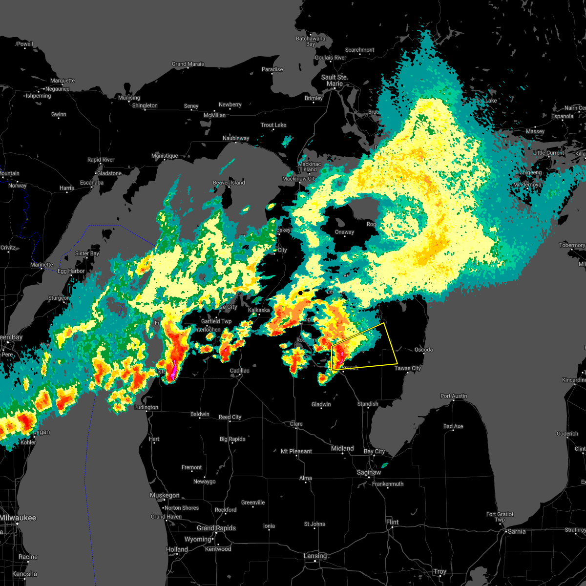 At 1140 am edt, severe thunderstorms were located along a line extending from near clear lake to near west branch, moving east at 45 mph (radar indicated). Hazards include 60 mph wind gusts and quarter size hail. Hail damage to vehicles is expected. expect wind damage to roofs, siding, and trees. locations impacted include, rose city, rose township, mack lake, selkirk, rifle river state park, lupton, long lake, south branch, curtisville, hale and plainfield township. hail threat, radar indicated max hail size, 1. 00 in wind threat, radar indicated max wind gust, 60 mph. At 1140 am edt, severe thunderstorms were located along a line extending from near clear lake to near west branch, moving east at 45 mph (radar indicated). Hazards include 60 mph wind gusts and quarter size hail. Hail damage to vehicles is expected. expect wind damage to roofs, siding, and trees. locations impacted include, rose city, rose township, mack lake, selkirk, rifle river state park, lupton, long lake, south branch, curtisville, hale and plainfield township. hail threat, radar indicated max hail size, 1. 00 in wind threat, radar indicated max wind gust, 60 mph.
|
| 9/7/2021 11:30 AM EDT |
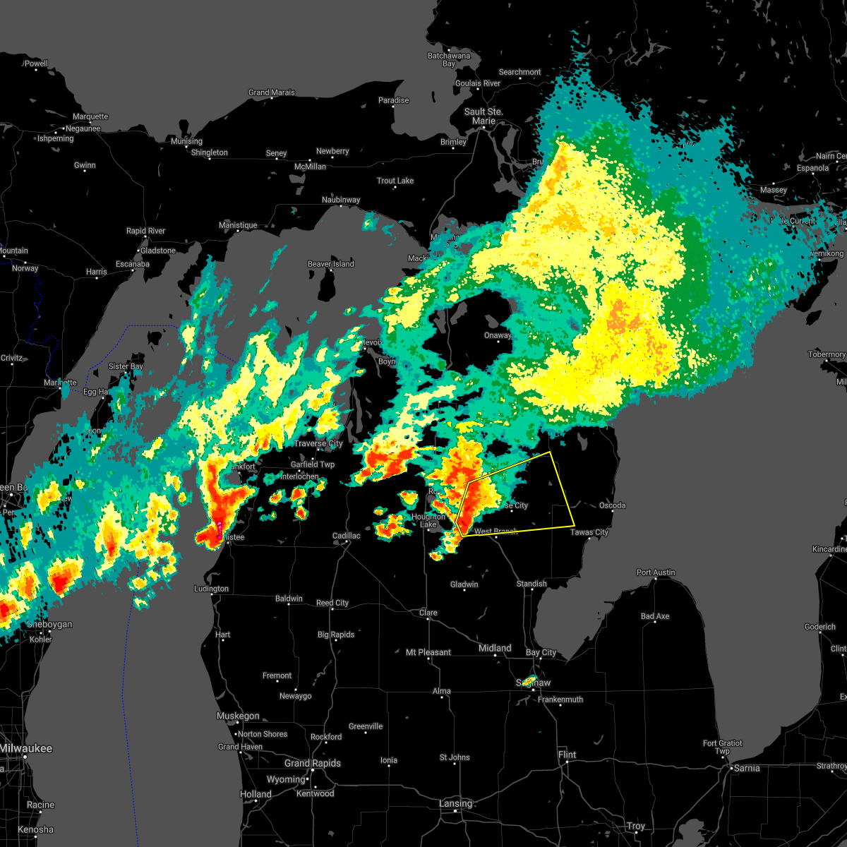 At 1130 am edt, severe thunderstorms were located along a line extending from south branch township to near lake st. helen, moving east at 55 mph (radar indicated). Hazards include 60 mph wind gusts and quarter size hail. Hail damage to vehicles is expected. expect wind damage to roofs, siding, and trees. severe thunderstorms will be near, luzerne around 1140 am edt. clear lake around 1145 am edt. mio, rose city, mack lake and selkirk around 1150 am edt. other locations in the path of these severe thunderstorms include lupton, rose township, rifle river state park, mckinley, long lake, south branch and curtisville. hail threat, radar indicated max hail size, 1. 00 in wind threat, radar indicated max wind gust, 60 mph. At 1130 am edt, severe thunderstorms were located along a line extending from south branch township to near lake st. helen, moving east at 55 mph (radar indicated). Hazards include 60 mph wind gusts and quarter size hail. Hail damage to vehicles is expected. expect wind damage to roofs, siding, and trees. severe thunderstorms will be near, luzerne around 1140 am edt. clear lake around 1145 am edt. mio, rose city, mack lake and selkirk around 1150 am edt. other locations in the path of these severe thunderstorms include lupton, rose township, rifle river state park, mckinley, long lake, south branch and curtisville. hail threat, radar indicated max hail size, 1. 00 in wind threat, radar indicated max wind gust, 60 mph.
|
| 8/28/2021 5:23 PM EDT |
 At 523 pm edt, severe thunderstorms were located along a line extending from near mikado to near wurtsmith airfield to tawas city, moving east at 35 mph (radar indicated). Hazards include 60 mph wind gusts and nickel size hail. Expect damage to roofs, siding, and trees. locations impacted include, oscoda, east tawas, tawas city, harrisville, au sable, mikado, harrisville state park, wurtsmith airfield, tawas point state park and wilber. hail threat, radar indicated max hail size, 0. 88 in wind threat, radar indicated max wind gust, 60 mph. At 523 pm edt, severe thunderstorms were located along a line extending from near mikado to near wurtsmith airfield to tawas city, moving east at 35 mph (radar indicated). Hazards include 60 mph wind gusts and nickel size hail. Expect damage to roofs, siding, and trees. locations impacted include, oscoda, east tawas, tawas city, harrisville, au sable, mikado, harrisville state park, wurtsmith airfield, tawas point state park and wilber. hail threat, radar indicated max hail size, 0. 88 in wind threat, radar indicated max wind gust, 60 mph.
|
| 8/28/2021 5:09 PM EDT |
 At 509 pm edt, severe thunderstorms were located along a line extending from 6 miles south of barton city to near plainfield township to near national city, moving east at 35 mph (radar indicated). Hazards include 60 mph wind gusts and quarter size hail. Hail damage to vehicles is expected. expect wind damage to roofs, siding, and trees. locations impacted include, tawas city, mikado, oscoda, east tawas, au sable, tawas point state park, wurtsmith airfield, harrisville and harrisville state park. hail threat, radar indicated max hail size, 1. 00 in wind threat, radar indicated max wind gust, 60 mph. At 509 pm edt, severe thunderstorms were located along a line extending from 6 miles south of barton city to near plainfield township to near national city, moving east at 35 mph (radar indicated). Hazards include 60 mph wind gusts and quarter size hail. Hail damage to vehicles is expected. expect wind damage to roofs, siding, and trees. locations impacted include, tawas city, mikado, oscoda, east tawas, au sable, tawas point state park, wurtsmith airfield, harrisville and harrisville state park. hail threat, radar indicated max hail size, 1. 00 in wind threat, radar indicated max wind gust, 60 mph.
|
| 8/28/2021 5:01 PM EDT | Iosco county dispatch reports trees down near sand lak in iosco county MI, 0.9 miles N of Sand Lake, MI |
| 8/28/2021 4:52 PM EDT |
 At 452 pm edt, severe thunderstorms were located along a line extending from glennie to near whittemore, moving east at 35 mph (radar indicated). Hazards include 60 mph wind gusts and quarter size hail. Hail damage to vehicles is expected. expect wind damage to roofs, siding, and trees. severe thunderstorms will be near, glennie around 500 pm edt. plainfield township around 510 pm edt. other locations in the path of these severe thunderstorms include mikado, tawas city, east tawas, harrisville, tawas point state park and harrisville state park. hail threat, radar indicated max hail size, 1. 00 in wind threat, radar indicated max wind gust, 60 mph. At 452 pm edt, severe thunderstorms were located along a line extending from glennie to near whittemore, moving east at 35 mph (radar indicated). Hazards include 60 mph wind gusts and quarter size hail. Hail damage to vehicles is expected. expect wind damage to roofs, siding, and trees. severe thunderstorms will be near, glennie around 500 pm edt. plainfield township around 510 pm edt. other locations in the path of these severe thunderstorms include mikado, tawas city, east tawas, harrisville, tawas point state park and harrisville state park. hail threat, radar indicated max hail size, 1. 00 in wind threat, radar indicated max wind gust, 60 mph.
|
| 8/24/2021 5:36 PM EDT |
 At 536 pm edt, a severe thunderstorm was located near greenville, moving southeast at 30 mph (radar indicated). Hazards include 60 mph wind gusts. Expect damage to roofs, siding, and trees. locations impacted include, greenville, stanton, rockford, howard city, lakeview, cedar springs, sidney, sheridan, sand lake, pierson, langston, westville, gowen, entrican, amble, six lakes, trufant, turk lake, coral, fenwick, hail threat, radar indicated max hail size, <. 75 in wind threat, radar indicated max wind gust, 60 mph. At 536 pm edt, a severe thunderstorm was located near greenville, moving southeast at 30 mph (radar indicated). Hazards include 60 mph wind gusts. Expect damage to roofs, siding, and trees. locations impacted include, greenville, stanton, rockford, howard city, lakeview, cedar springs, sidney, sheridan, sand lake, pierson, langston, westville, gowen, entrican, amble, six lakes, trufant, turk lake, coral, fenwick, hail threat, radar indicated max hail size, <. 75 in wind threat, radar indicated max wind gust, 60 mph.
|
| 8/24/2021 5:10 PM EDT |
 At 510 pm edt, severe thunderstorms were located along a line extending from 8 miles southwest of mitchell state park to 7 miles southwest of howard city, moving east at 5 mph (radar indicated). Hazards include 60 mph wind gusts. expect damage to roofs, siding, and trees At 510 pm edt, severe thunderstorms were located along a line extending from 8 miles southwest of mitchell state park to 7 miles southwest of howard city, moving east at 5 mph (radar indicated). Hazards include 60 mph wind gusts. expect damage to roofs, siding, and trees
|
| 8/11/2021 1:02 AM EDT |
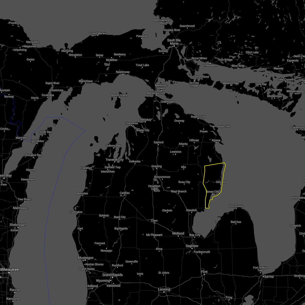 At 101 am edt, severe thunderstorms were located along a line extending from near barton city to near plainfield township to 8 miles northeast of au gres, moving east at 50 mph (radar indicated). Hazards include 60 mph wind gusts. Expect damage to roofs, siding, and trees. locations impacted include, oscoda, east tawas, tawas city, harrisville, au sable, mikado, lincoln, tawas point state park, harrisville state park, wurtsmith airfield, barton city, wilber and sid town. hail threat, radar indicated max hail size, <. 75 in wind threat, radar indicated max wind gust, 60 mph. At 101 am edt, severe thunderstorms were located along a line extending from near barton city to near plainfield township to 8 miles northeast of au gres, moving east at 50 mph (radar indicated). Hazards include 60 mph wind gusts. Expect damage to roofs, siding, and trees. locations impacted include, oscoda, east tawas, tawas city, harrisville, au sable, mikado, lincoln, tawas point state park, harrisville state park, wurtsmith airfield, barton city, wilber and sid town. hail threat, radar indicated max hail size, <. 75 in wind threat, radar indicated max wind gust, 60 mph.
|
| 8/11/2021 12:48 AM EDT |
 At 1247 am edt, severe thunderstorms were located along a line extending from near glennie to near hale to twining, moving east at 45 mph (radar indicated). Hazards include 60 mph wind gusts and penny size hail. Expect damage to roofs, siding, and trees. locations impacted include, glennie, long lake, national city, au gres, plainfield township, barton city, tawas city, east tawas, mikado, tawas point state park, lincoln, wurtsmith airfield, oscoda, harrisville, au sable and harrisville state park. hail threat, radar indicated max hail size, 0. 75 in wind threat, radar indicated max wind gust, 60 mph. At 1247 am edt, severe thunderstorms were located along a line extending from near glennie to near hale to twining, moving east at 45 mph (radar indicated). Hazards include 60 mph wind gusts and penny size hail. Expect damage to roofs, siding, and trees. locations impacted include, glennie, long lake, national city, au gres, plainfield township, barton city, tawas city, east tawas, mikado, tawas point state park, lincoln, wurtsmith airfield, oscoda, harrisville, au sable and harrisville state park. hail threat, radar indicated max hail size, 0. 75 in wind threat, radar indicated max wind gust, 60 mph.
|
| 8/11/2021 12:28 AM EDT |
 At 1227 am edt, severe thunderstorms were located along a line extending from near mckinley to selkirk to 7 miles south of rhodes, moving east at 50 mph (radar indicated). Hazards include 60 mph wind gusts and penny size hail. Expect damage to roofs, siding, and trees. severe thunderstorms will be near, mckinley, curtisville and rifle river state park around 1235 am edt. long lake around 1240 am edt. glennie, whittemore and hale around 1245 am edt. other locations in the path of these severe thunderstorms include plainfield township, barton city, national city, tawas city, mikado, lincoln, east tawas, tawas point state park, harrisville, harrisville state park, wurtsmith airfield, oscoda and au sable. hail threat, radar indicated max hail size, 0. 75 in wind threat, radar indicated max wind gust, 60 mph. At 1227 am edt, severe thunderstorms were located along a line extending from near mckinley to selkirk to 7 miles south of rhodes, moving east at 50 mph (radar indicated). Hazards include 60 mph wind gusts and penny size hail. Expect damage to roofs, siding, and trees. severe thunderstorms will be near, mckinley, curtisville and rifle river state park around 1235 am edt. long lake around 1240 am edt. glennie, whittemore and hale around 1245 am edt. other locations in the path of these severe thunderstorms include plainfield township, barton city, national city, tawas city, mikado, lincoln, east tawas, tawas point state park, harrisville, harrisville state park, wurtsmith airfield, oscoda and au sable. hail threat, radar indicated max hail size, 0. 75 in wind threat, radar indicated max wind gust, 60 mph.
|
| 8/10/2021 10:02 PM EDT |
 At 1002 pm edt, severe thunderstorms were located along a line extending from 6 miles west of manistee to near fruitport to near fennville to near coloma, moving east at 55 mph (radar indicated). Hazards include 60 mph wind gusts. expect damage to roofs, siding, and trees At 1002 pm edt, severe thunderstorms were located along a line extending from 6 miles west of manistee to near fruitport to near fennville to near coloma, moving east at 55 mph (radar indicated). Hazards include 60 mph wind gusts. expect damage to roofs, siding, and trees
|
| 7/6/2021 9:23 PM EDT | Report from mping: 1-inch tree limbs broken; shingles blown of in montcalm county MI, 1.7 miles ESE of Sand Lake, MI |
| 8/28/2020 10:12 PM EDT |
 At 1012 pm edt, a severe thunderstorm was located near greenville, moving east at 35 mph (radar indicated). Hazards include 60 mph wind gusts and penny size hail. Expect damage to roofs, siding, and trees. Locations impacted include, greenville, stanton, howard city, lakeview, cedar springs, sidney, sheridan, sand lake, pierson, langston, westville, gowen, entrican, six lakes, trufant, turk lake, coral, fenwick,. At 1012 pm edt, a severe thunderstorm was located near greenville, moving east at 35 mph (radar indicated). Hazards include 60 mph wind gusts and penny size hail. Expect damage to roofs, siding, and trees. Locations impacted include, greenville, stanton, howard city, lakeview, cedar springs, sidney, sheridan, sand lake, pierson, langston, westville, gowen, entrican, six lakes, trufant, turk lake, coral, fenwick,.
|
| 8/28/2020 9:24 PM EDT |
 At 923 pm edt, a severe thunderstorm was located near grant, or 11 miles south of newaygo, moving east at 40 mph (radar indicated). Hazards include 60 mph wind gusts and penny size hail. expect damage to roofs, siding, and trees At 923 pm edt, a severe thunderstorm was located near grant, or 11 miles south of newaygo, moving east at 40 mph (radar indicated). Hazards include 60 mph wind gusts and penny size hail. expect damage to roofs, siding, and trees
|
| 8/21/2020 6:29 PM EDT |
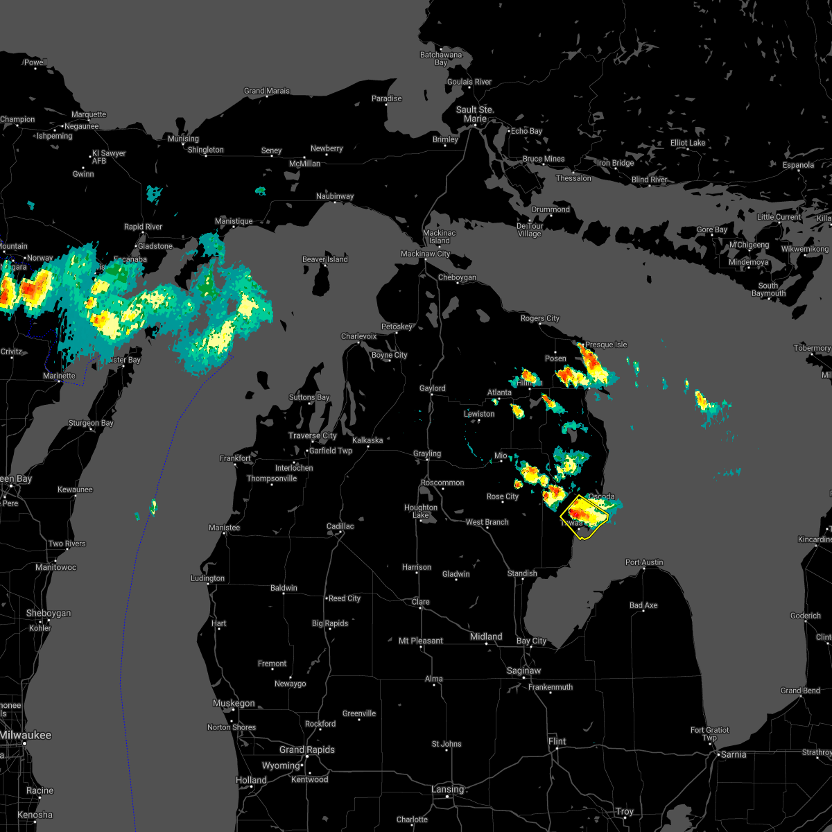 At 628 pm edt, a severe thunderstorm was located near east tawas, moving southeast at 20 mph (radar indicated). Hazards include 60 mph wind gusts and quarter size hail. hail damage to vehicles is possible At 628 pm edt, a severe thunderstorm was located near east tawas, moving southeast at 20 mph (radar indicated). Hazards include 60 mph wind gusts and quarter size hail. hail damage to vehicles is possible
|
| 7/19/2020 8:02 AM EDT |
 At 801 am edt, a severe thunderstorm was located 8 miles northeast of au gres, moving southeast at 45 mph (radar indicated). Hazards include 60 mph wind gusts. Expect damage to roofs, siding, and trees. Locations impacted include, east tawas, tawas city, au gres, maple ridge, whittemore, twining, turner, skidway lake, tawas point state park, plainfield township, national city and prescott. At 801 am edt, a severe thunderstorm was located 8 miles northeast of au gres, moving southeast at 45 mph (radar indicated). Hazards include 60 mph wind gusts. Expect damage to roofs, siding, and trees. Locations impacted include, east tawas, tawas city, au gres, maple ridge, whittemore, twining, turner, skidway lake, tawas point state park, plainfield township, national city and prescott.
|
| 7/19/2020 7:33 AM EDT |
 At 732 am edt, a severe thunderstorm was located near rifle river state park, or 15 miles east of west branch, moving southeast at 45 mph (radar indicated). Hazards include 60 mph wind gusts. expect damage to roofs, siding, and trees At 732 am edt, a severe thunderstorm was located near rifle river state park, or 15 miles east of west branch, moving southeast at 45 mph (radar indicated). Hazards include 60 mph wind gusts. expect damage to roofs, siding, and trees
|
| 6/10/2020 2:41 PM EDT |
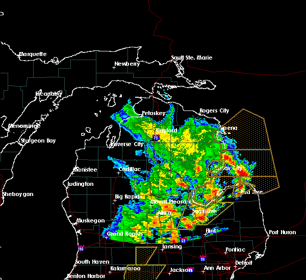 The severe thunderstorm warning for northeastern iosco county will expire at 245 pm edt, the storm which prompted the warning has moved out of the area. therefore, the warning will be allowed to expire. a severe thunderstorm watch remains in effect until 800 pm edt for northern michigan. The severe thunderstorm warning for northeastern iosco county will expire at 245 pm edt, the storm which prompted the warning has moved out of the area. therefore, the warning will be allowed to expire. a severe thunderstorm watch remains in effect until 800 pm edt for northern michigan.
|
| 6/10/2020 2:27 PM EDT |
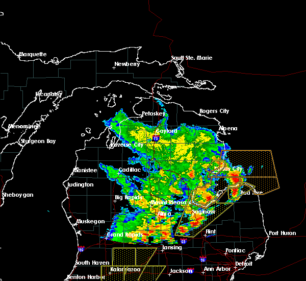 At 226 pm edt, a severe thunderstorm was located over wurtsmith airfield, or near oscoda, moving northeast at 50 mph (law enforcement). Hazards include 60 mph wind gusts. Expect damage to roofs, siding, and trees. Locations impacted include, oscoda, east tawas, tawas city, au sable, tawas point state park, wurtsmith airfield and wilber. At 226 pm edt, a severe thunderstorm was located over wurtsmith airfield, or near oscoda, moving northeast at 50 mph (law enforcement). Hazards include 60 mph wind gusts. Expect damage to roofs, siding, and trees. Locations impacted include, oscoda, east tawas, tawas city, au sable, tawas point state park, wurtsmith airfield and wilber.
|
| 6/10/2020 2:16 PM EDT |
 At 214 pm edt, a severe thunderstorm was located near east tawas, moving northeast at 60 mph (law enforcement). Hazards include 60 mph wind gusts. expect damage to roofs, siding, and trees At 214 pm edt, a severe thunderstorm was located near east tawas, moving northeast at 60 mph (law enforcement). Hazards include 60 mph wind gusts. expect damage to roofs, siding, and trees
|
| 6/10/2020 2:00 PM EDT |
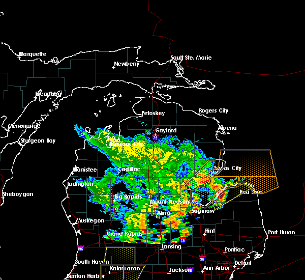 At 158 pm edt, a severe thunderstorm was located near national city, or near tawas city, moving northeast at 50 mph (law enforcement). Hazards include 60 mph wind gusts. Expect damage to roofs, siding, and trees. Locations impacted include, oscoda, east tawas, tawas city, standish, au gres, sterling, au sable, maple ridge, whittemore, omer, twining, turner, tawas point state park, plainfield township, national city, wurtsmith airfield, wilber and sid town. At 158 pm edt, a severe thunderstorm was located near national city, or near tawas city, moving northeast at 50 mph (law enforcement). Hazards include 60 mph wind gusts. Expect damage to roofs, siding, and trees. Locations impacted include, oscoda, east tawas, tawas city, standish, au gres, sterling, au sable, maple ridge, whittemore, omer, twining, turner, tawas point state park, plainfield township, national city, wurtsmith airfield, wilber and sid town.
|
| 6/10/2020 1:44 PM EDT |
 At 144 pm edt, doppler radar indicated a severe thunderstorm capable of producing damaging winds in excess of 60 mph. this storm was located over omer, or near standish, and moving northeast at 75 mph. At 144 pm edt, doppler radar indicated a severe thunderstorm capable of producing damaging winds in excess of 60 mph. this storm was located over omer, or near standish, and moving northeast at 75 mph.
|
| 6/10/2020 11:57 AM EDT |
 At 1156 am edt, severe thunderstorms were located along a line extending from 6 miles east of spring lake to jenison to 7 miles northwest of wayland, moving northeast at 60 mph (radar indicated). Hazards include 70 mph wind gusts. Expect damage to roofs, siding, and trees. Locations impacted include, grand rapids, lowell, wyoming, kentwood, walker, grandville, east grand rapids, rockford, sparta, caledonia, ada, grattan, cedar springs, kent city, sand lake, casnovia, cutlerville, belmont, alto, alaska,. At 1156 am edt, severe thunderstorms were located along a line extending from 6 miles east of spring lake to jenison to 7 miles northwest of wayland, moving northeast at 60 mph (radar indicated). Hazards include 70 mph wind gusts. Expect damage to roofs, siding, and trees. Locations impacted include, grand rapids, lowell, wyoming, kentwood, walker, grandville, east grand rapids, rockford, sparta, caledonia, ada, grattan, cedar springs, kent city, sand lake, casnovia, cutlerville, belmont, alto, alaska,.
|
| 6/10/2020 11:29 AM EDT |
 At 1128 am edt, a severe thunderstorm was located over saugatuck, or 10 miles southwest of holland, moving northeast at 60 mph (radar indicated). Hazards include 60 mph wind gusts and penny size hail. expect damage to roofs, siding, and trees At 1128 am edt, a severe thunderstorm was located over saugatuck, or 10 miles southwest of holland, moving northeast at 60 mph (radar indicated). Hazards include 60 mph wind gusts and penny size hail. expect damage to roofs, siding, and trees
|
| 6/3/2020 1:27 AM EDT |
 The severe thunderstorm warning for kent, ionia, southern osceola, mecosta and montcalm counties will expire at 130 am edt, the storms which prompted the warning have weakened below severe limits, and no longer pose an immediate threat to life or property. therefore, the warning will be allowed to expire. however gusty winds are still possible with these thunderstorms through 200 am. a severe thunderstorm watch remains in effect until 400 am edt for central, south central, southwestern and west central michigan. The severe thunderstorm warning for kent, ionia, southern osceola, mecosta and montcalm counties will expire at 130 am edt, the storms which prompted the warning have weakened below severe limits, and no longer pose an immediate threat to life or property. therefore, the warning will be allowed to expire. however gusty winds are still possible with these thunderstorms through 200 am. a severe thunderstorm watch remains in effect until 400 am edt for central, south central, southwestern and west central michigan.
|
| 6/3/2020 12:58 AM EDT |
 At 1255 am edt, severe thunderstorms were located along a line extending from 5 miles northwest of barryton to near belding, moving east at 35 mph (radar indicated). Hazards include 60 mph wind gusts. Expect damage to roofs, siding, and trees. Locations impacted include, grand rapids, ionia, big rapids, greenville, belding, portland, lowell, evart, stanton, wyoming, kentwood, walker, east grand rapids, rockford, sparta, reed city, lake odessa, howard city, caledonia, saranac,. At 1255 am edt, severe thunderstorms were located along a line extending from 5 miles northwest of barryton to near belding, moving east at 35 mph (radar indicated). Hazards include 60 mph wind gusts. Expect damage to roofs, siding, and trees. Locations impacted include, grand rapids, ionia, big rapids, greenville, belding, portland, lowell, evart, stanton, wyoming, kentwood, walker, east grand rapids, rockford, sparta, reed city, lake odessa, howard city, caledonia, saranac,.
|
| 6/3/2020 12:26 AM EDT |
 At 1225 am edt, severe thunderstorms were located along a line extending from near reed city to near walker, moving east at 50 mph (radar indicated). Hazards include 60 mph wind gusts. expect damage to roofs, siding, and trees At 1225 am edt, severe thunderstorms were located along a line extending from near reed city to near walker, moving east at 50 mph (radar indicated). Hazards include 60 mph wind gusts. expect damage to roofs, siding, and trees
|
| 4/7/2020 8:12 PM EDT |
 At 812 pm edt, severe thunderstorms were located along a line extending from near sparta to near walker to near caledonia, moving east at 20 mph (radar indicated). Hazards include 60 mph wind gusts and quarter size hail. Hail damage to vehicles is expected. Expect wind damage to roofs, siding, and trees. At 812 pm edt, severe thunderstorms were located along a line extending from near sparta to near walker to near caledonia, moving east at 20 mph (radar indicated). Hazards include 60 mph wind gusts and quarter size hail. Hail damage to vehicles is expected. Expect wind damage to roofs, siding, and trees.
|
| 9/11/2019 6:59 PM EDT |
 At 658 pm edt, a severe thunderstorm was located 7 miles northwest of carson city, or 8 miles east of stanton, moving east at 30 mph. a second severe thunderstorm was located near sand lake, moving east at 30 mph. both storms are capable of producing quarter size hail and 60 mph wind gusts (radar indicated). Hazards include 60 mph wind gusts and quarter size hail. Hail damage to vehicles is expected. Expect wind damage to roofs, siding, and trees. At 658 pm edt, a severe thunderstorm was located 7 miles northwest of carson city, or 8 miles east of stanton, moving east at 30 mph. a second severe thunderstorm was located near sand lake, moving east at 30 mph. both storms are capable of producing quarter size hail and 60 mph wind gusts (radar indicated). Hazards include 60 mph wind gusts and quarter size hail. Hail damage to vehicles is expected. Expect wind damage to roofs, siding, and trees.
|
| 8/29/2019 7:49 PM EDT |
 At 746 pm edt, a severe thunderstorm was located 6 miles west of greenville, moving east at 40 mph. this storm remains capable of producing damaging gusts around 60 mph in the vicinity of rockford, but it is less intense than before. another storm over eastern montcalm county north of crystal shows decreasing chances for producing a tornado, but should still be monitored (radar indicated). Hazards include 60 mph wind gusts and penny size hail. Expect damage to roofs, siding, and trees. Locations impacted include, greenville, stanton, carson city, cedar springs, crystal, sidney, kent city, sheridan, sand lake, langston, gowen, trufant, turk lake, fenwick, butternut, kings corner,. At 746 pm edt, a severe thunderstorm was located 6 miles west of greenville, moving east at 40 mph. this storm remains capable of producing damaging gusts around 60 mph in the vicinity of rockford, but it is less intense than before. another storm over eastern montcalm county north of crystal shows decreasing chances for producing a tornado, but should still be monitored (radar indicated). Hazards include 60 mph wind gusts and penny size hail. Expect damage to roofs, siding, and trees. Locations impacted include, greenville, stanton, carson city, cedar springs, crystal, sidney, kent city, sheridan, sand lake, langston, gowen, trufant, turk lake, fenwick, butternut, kings corner,.
|
| 8/29/2019 7:39 PM EDT |
 At 735 pm edt, a severe thunderstorm was located near rockford, or 13 miles west of greenville, moving east at 50 mph. damaging gusts over 60 mph are quite probable with this storm. another storm near stanton has some potential to produce a brief tornado, but the overall probability is slightly less than before (radar indicated). Hazards include 60 mph wind gusts and penny size hail. Expect damage to roofs, siding, and trees. Locations impacted include, greenville, stanton, carson city, cedar springs, crystal, sidney, kent city, sheridan, sand lake, casnovia, mcbride, pierson, langston, gowen, westville, entrican, trufant, turk lake, fenwick, butternut,. At 735 pm edt, a severe thunderstorm was located near rockford, or 13 miles west of greenville, moving east at 50 mph. damaging gusts over 60 mph are quite probable with this storm. another storm near stanton has some potential to produce a brief tornado, but the overall probability is slightly less than before (radar indicated). Hazards include 60 mph wind gusts and penny size hail. Expect damage to roofs, siding, and trees. Locations impacted include, greenville, stanton, carson city, cedar springs, crystal, sidney, kent city, sheridan, sand lake, casnovia, mcbride, pierson, langston, gowen, westville, entrican, trufant, turk lake, fenwick, butternut,.
|
| 8/29/2019 7:26 PM EDT |
 At 723 pm edt, a severe thunderstorm was located near sparta, or 14 miles southeast of newaygo, moving east at 35 mph. this storm is capable of damaging wind gusts. another storm over montcalm county has some potential to produce a brief tornado west of stanton. this storm is also moving east around 35 mph (radar indicated). Hazards include 60 mph wind gusts and penny size hail. Expect damage to roofs, siding, and trees. Locations impacted include, greenville, stanton, carson city, cedar springs, crystal, sidney, kent city, sheridan, sand lake, casnovia, mcbride, pierson, langston, gowen, westville, entrican, trufant, turk lake, fenwick, butternut,. At 723 pm edt, a severe thunderstorm was located near sparta, or 14 miles southeast of newaygo, moving east at 35 mph. this storm is capable of damaging wind gusts. another storm over montcalm county has some potential to produce a brief tornado west of stanton. this storm is also moving east around 35 mph (radar indicated). Hazards include 60 mph wind gusts and penny size hail. Expect damage to roofs, siding, and trees. Locations impacted include, greenville, stanton, carson city, cedar springs, crystal, sidney, kent city, sheridan, sand lake, casnovia, mcbride, pierson, langston, gowen, westville, entrican, trufant, turk lake, fenwick, butternut,.
|
| 8/29/2019 7:16 PM EDT |
 At 715 pm edt, severe thunderstorms were located along a line extending from 9 miles south of lakeview to southeast of grant, moving east-southeast at 40 mph (radar indicated). Hazards include 60 mph wind gusts and penny size hail. expect damage to roofs, siding, and trees At 715 pm edt, severe thunderstorms were located along a line extending from 9 miles south of lakeview to southeast of grant, moving east-southeast at 40 mph (radar indicated). Hazards include 60 mph wind gusts and penny size hail. expect damage to roofs, siding, and trees
|
| 7/27/2019 3:41 PM EDT |
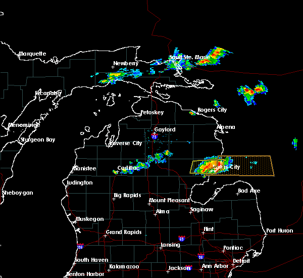 The severe thunderstorm warning for east central ogemaw and iosco counties will expire at 345 pm edt, the storm which prompted the warning has weakened below severe limits, and is exiting the warned area. therefore, the warning will be allowed to expire. however heavy rain is still possible with this thunderstorm. The severe thunderstorm warning for east central ogemaw and iosco counties will expire at 345 pm edt, the storm which prompted the warning has weakened below severe limits, and is exiting the warned area. therefore, the warning will be allowed to expire. however heavy rain is still possible with this thunderstorm.
|
| 7/27/2019 3:21 PM EDT | Corrects previous tstm wnd dmg report from national city. trees and limbs dow in iosco county MI, 7.4 miles NNE of Sand Lake, MI |
| 7/27/2019 3:21 PM EDT |
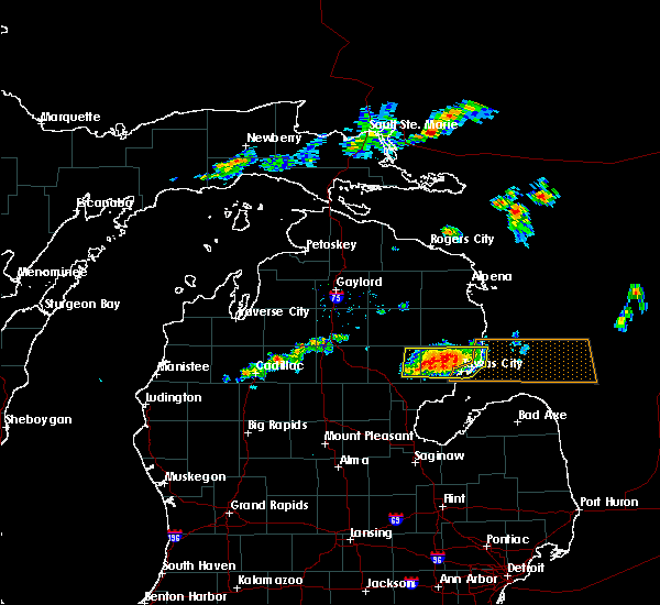 At 253 pm edt, a severe thunderstorm was located near rifle river state park, or 12 miles northeast of west branch, moving east at 35 mph (law enforcement reported trees down over power lines 2 miles east of st. helen). Hazards include 60 mph wind gusts and quarter size hail. Hail damage to vehicles is expected. expect wind damage to roofs, siding, and trees. Locations impacted include, oscoda, east tawas, tawas city, au sable, south branch, whittemore, tawas point state park, plainfield township, rifle river state park, national city, hale, lupton, wurtsmith airfield, wilber and sid town. At 253 pm edt, a severe thunderstorm was located near rifle river state park, or 12 miles northeast of west branch, moving east at 35 mph (law enforcement reported trees down over power lines 2 miles east of st. helen). Hazards include 60 mph wind gusts and quarter size hail. Hail damage to vehicles is expected. expect wind damage to roofs, siding, and trees. Locations impacted include, oscoda, east tawas, tawas city, au sable, south branch, whittemore, tawas point state park, plainfield township, rifle river state park, national city, hale, lupton, wurtsmith airfield, wilber and sid town.
|
| 7/27/2019 3:15 PM EDT | Power lines down. time estimated via rada in iosco county MI, 0.3 miles NW of Sand Lake, MI |
| 7/27/2019 3:06 PM EDT | *** 1 inj *** trees down on vehicle in hale. 1 injury reporte in iosco county MI, 7.1 miles ESE of Sand Lake, MI |
| 7/27/2019 3:00 PM EDT | Trees and limbs dow in iosco county MI, 7.4 miles NNE of Sand Lake, MI |
| 7/27/2019 2:54 PM EDT |
 At 253 pm edt, a severe thunderstorm was located near rifle river state park, or 12 miles northeast of west branch, moving east at 35 mph (law enforcement reported trees down over power lines 2 miles east of st. helen). Hazards include 60 mph wind gusts and quarter size hail. Hail damage to vehicles is expected. expect wind damage to roofs, siding, and trees. Locations impacted include, oscoda, east tawas, tawas city, au sable, south branch, whittemore, tawas point state park, plainfield township, rifle river state park, national city, hale, lupton, wurtsmith airfield, wilber and sid town. At 253 pm edt, a severe thunderstorm was located near rifle river state park, or 12 miles northeast of west branch, moving east at 35 mph (law enforcement reported trees down over power lines 2 miles east of st. helen). Hazards include 60 mph wind gusts and quarter size hail. Hail damage to vehicles is expected. expect wind damage to roofs, siding, and trees. Locations impacted include, oscoda, east tawas, tawas city, au sable, south branch, whittemore, tawas point state park, plainfield township, rifle river state park, national city, hale, lupton, wurtsmith airfield, wilber and sid town.
|
| 7/27/2019 2:48 PM EDT |
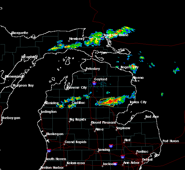 At 247 pm edt, a severe thunderstorm was located over selkirk, or 9 miles northeast of west branch, moving east at 35 mph (radar indicated). Hazards include 60 mph wind gusts and quarter size hail. Hail damage to vehicles is expected. Expect wind damage to roofs, siding, and trees. At 247 pm edt, a severe thunderstorm was located over selkirk, or 9 miles northeast of west branch, moving east at 35 mph (radar indicated). Hazards include 60 mph wind gusts and quarter size hail. Hail damage to vehicles is expected. Expect wind damage to roofs, siding, and trees.
|
| 7/20/2019 5:04 PM EDT |
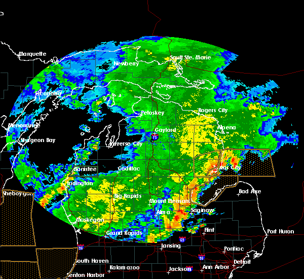 At 504 pm edt, severe thunderstorms were located along a line extending from 8 miles west of wurtsmith airfield to tawas point state park to near au gres, moving east at 45 mph (radar indicated). Hazards include 60 mph wind gusts. Expect damage to roofs, siding, and trees. Locations impacted include, east tawas, tawas city, whittemore, tawas point state park, plainfield township, wurtsmith airfield, national city, wilber and sid town. At 504 pm edt, severe thunderstorms were located along a line extending from 8 miles west of wurtsmith airfield to tawas point state park to near au gres, moving east at 45 mph (radar indicated). Hazards include 60 mph wind gusts. Expect damage to roofs, siding, and trees. Locations impacted include, east tawas, tawas city, whittemore, tawas point state park, plainfield township, wurtsmith airfield, national city, wilber and sid town.
|
| 7/20/2019 4:52 PM EDT |
 At 450 pm edt, doppler radar indicated a line of severe thunderstorms located along a line extending from near curtisville to near national city to omer, moving east at 50 mph (radar indicated). Hazards include 60 mph wind gusts. Expect damage to roofs, siding, and trees. Locations impacted include, east tawas, tawas city, glennie, south branch, mikado, whittemore, lincoln, tawas point state park, plainfield township, national city, hale, wurtsmith airfield, wilber and sid town. At 450 pm edt, doppler radar indicated a line of severe thunderstorms located along a line extending from near curtisville to near national city to omer, moving east at 50 mph (radar indicated). Hazards include 60 mph wind gusts. Expect damage to roofs, siding, and trees. Locations impacted include, east tawas, tawas city, glennie, south branch, mikado, whittemore, lincoln, tawas point state park, plainfield township, national city, hale, wurtsmith airfield, wilber and sid town.
|
| 7/20/2019 4:31 PM EDT |
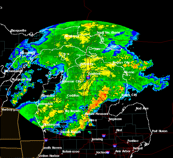 At 431 pm edt, doppler radar indicated a line of severe thunderstorms capable of producing damaging winds in excess of 60 mph. these storms were located along a line extending from mckinley to near skidway lake to near alger, and moving east at 35 mph. At 431 pm edt, doppler radar indicated a line of severe thunderstorms capable of producing damaging winds in excess of 60 mph. these storms were located along a line extending from mckinley to near skidway lake to near alger, and moving east at 35 mph.
|
| 7/20/2019 1:24 AM EDT |
 At 122 am edt, severe thunderstorms were located along a line extending from 8 miles southwest of howard city to near ferrysburg, moving southeast at 55 mph. these storms produced a wind gust to 64 mph at the airport in muskegon (radar indicated). Hazards include 60 mph wind gusts and penny size hail. expect damage to roofs, siding, and trees At 122 am edt, severe thunderstorms were located along a line extending from 8 miles southwest of howard city to near ferrysburg, moving southeast at 55 mph. these storms produced a wind gust to 64 mph at the airport in muskegon (radar indicated). Hazards include 60 mph wind gusts and penny size hail. expect damage to roofs, siding, and trees
|
| 7/2/2019 7:24 PM EDT |
 At 713 pm edt, severe thunderstorms were located along a line extending from near rockford to near northview to near east grand rapids, moving east at 40 mph (radar indicated). Hazards include 60 mph wind gusts. Expect damage to roofs, siding, and trees. Locations impacted include, grand rapids, lowell, wyoming, kentwood, walker, east grand rapids, rockford, sparta, caledonia, forest hills, northview, grandville, ada, grattan, cedar springs, kent city, sand lake, casnovia, cutlerville, belmont,. At 713 pm edt, severe thunderstorms were located along a line extending from near rockford to near northview to near east grand rapids, moving east at 40 mph (radar indicated). Hazards include 60 mph wind gusts. Expect damage to roofs, siding, and trees. Locations impacted include, grand rapids, lowell, wyoming, kentwood, walker, east grand rapids, rockford, sparta, caledonia, forest hills, northview, grandville, ada, grattan, cedar springs, kent city, sand lake, casnovia, cutlerville, belmont,.
|
| 7/2/2019 7:14 PM EDT |
 At 713 pm edt, severe thunderstorms were located along a line extending from near rockford to near northview to near east grand rapids, moving east at 40 mph (radar indicated). Hazards include 60 mph wind gusts. Expect damage to roofs, siding, and trees. Locations impacted include, grand rapids, lowell, wyoming, kentwood, walker, east grand rapids, rockford, sparta, caledonia, forest hills, northview, grandville, ada, grattan, cedar springs, kent city, sand lake, casnovia, cutlerville, belmont,. At 713 pm edt, severe thunderstorms were located along a line extending from near rockford to near northview to near east grand rapids, moving east at 40 mph (radar indicated). Hazards include 60 mph wind gusts. Expect damage to roofs, siding, and trees. Locations impacted include, grand rapids, lowell, wyoming, kentwood, walker, east grand rapids, rockford, sparta, caledonia, forest hills, northview, grandville, ada, grattan, cedar springs, kent city, sand lake, casnovia, cutlerville, belmont,.
|
| 7/2/2019 6:50 PM EDT |
 At 650 pm edt, a severe thunderstorm was located near walker, or 6 miles northwest of grand rapids, moving east at 45 mph (radar indicated). Hazards include 60 mph wind gusts. Expect damage to roofs, siding, and trees. Locations impacted include, grand rapids, lowell, wyoming, kentwood, walker, east grand rapids, rockford, sparta, caledonia, forest hills, northview, grandville, ada, grattan, cedar springs, kent city, sand lake, casnovia, cutlerville, belmont,. At 650 pm edt, a severe thunderstorm was located near walker, or 6 miles northwest of grand rapids, moving east at 45 mph (radar indicated). Hazards include 60 mph wind gusts. Expect damage to roofs, siding, and trees. Locations impacted include, grand rapids, lowell, wyoming, kentwood, walker, east grand rapids, rockford, sparta, caledonia, forest hills, northview, grandville, ada, grattan, cedar springs, kent city, sand lake, casnovia, cutlerville, belmont,.
|
| 7/2/2019 6:27 PM EDT |
 At 626 pm edt, a severe thunderstorm was located near fruitport, or 6 miles east of grand haven, moving east at 45 mph (mesonet. at 624 pm, a 63 mph wind gust was measured at rosy mound park). Hazards include 60 mph wind gusts. expect damage to roofs, siding, and trees At 626 pm edt, a severe thunderstorm was located near fruitport, or 6 miles east of grand haven, moving east at 45 mph (mesonet. at 624 pm, a 63 mph wind gust was measured at rosy mound park). Hazards include 60 mph wind gusts. expect damage to roofs, siding, and trees
|
| 8/28/2018 9:03 PM EDT |
 At 903 pm edt, severe thunderstorms were located along a line extending from south branch to near omer, moving east at 55 mph (radar indicated). Hazards include 60 mph wind gusts. Expect damage to roofs, siding, and trees. Locations impacted include, alger, east tawas, west branch, tawas city, au gres, sterling, glennie, south branch, maple ridge, mikado, rose city, whittemore, omer, twining, turner, skidway lake, plainfield township, rifle river state park, national city and lupton. At 903 pm edt, severe thunderstorms were located along a line extending from south branch to near omer, moving east at 55 mph (radar indicated). Hazards include 60 mph wind gusts. Expect damage to roofs, siding, and trees. Locations impacted include, alger, east tawas, west branch, tawas city, au gres, sterling, glennie, south branch, maple ridge, mikado, rose city, whittemore, omer, twining, turner, skidway lake, plainfield township, rifle river state park, national city and lupton.
|
| 8/28/2018 8:44 PM EDT |
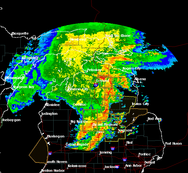 At 843 pm edt, severe thunderstorms were located along a line extending from near mack lake to near bowmanville, moving east at 65 mph (radar indicated). Hazards include 60 mph wind gusts. Expect damage to roofs, siding, and trees. locations impacted include, alger, east tawas, west branch, tawas city, au gres, sterling, st. Helen, glennie, south branch, maple ridge, mikado, rose city, whittemore, omer, twining, turner, skidway lake, hockaday, plainfield township and rifle river state park. At 843 pm edt, severe thunderstorms were located along a line extending from near mack lake to near bowmanville, moving east at 65 mph (radar indicated). Hazards include 60 mph wind gusts. Expect damage to roofs, siding, and trees. locations impacted include, alger, east tawas, west branch, tawas city, au gres, sterling, st. Helen, glennie, south branch, maple ridge, mikado, rose city, whittemore, omer, twining, turner, skidway lake, hockaday, plainfield township and rifle river state park.
|
| 8/28/2018 8:29 PM EDT |
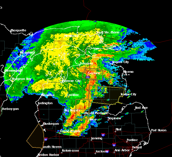 At 828 pm edt, severe thunderstorms were located along a line extending from near south branch township to near skeels, moving east at 65 mph (radar indicated). Hazards include 60 mph wind gusts. expect damage to roofs, siding, and trees At 828 pm edt, severe thunderstorms were located along a line extending from near south branch township to near skeels, moving east at 65 mph (radar indicated). Hazards include 60 mph wind gusts. expect damage to roofs, siding, and trees
|
| 8/26/2018 10:18 PM EDT |
 At 1017 pm edt, a severe thunderstorm was located near coopersville, or 14 miles northwest of grand rapids, moving east at 35 mph (radar indicated). Hazards include 60 mph wind gusts. Expect damage to roofs, siding, and trees. this severe thunderstorm will be near, kent city around 1020 pm edt. sparta around 1025 pm edt. walker around 1030 pm edt. cedar springs and comstock park around 1035 pm edt. rockford, northview and belmont around 1040 pm edt. forest hills around 1045 pm edt. cannonsburg around 1050 pm edt. Grattan around 1055 pm edt. At 1017 pm edt, a severe thunderstorm was located near coopersville, or 14 miles northwest of grand rapids, moving east at 35 mph (radar indicated). Hazards include 60 mph wind gusts. Expect damage to roofs, siding, and trees. this severe thunderstorm will be near, kent city around 1020 pm edt. sparta around 1025 pm edt. walker around 1030 pm edt. cedar springs and comstock park around 1035 pm edt. rockford, northview and belmont around 1040 pm edt. forest hills around 1045 pm edt. cannonsburg around 1050 pm edt. Grattan around 1055 pm edt.
|
| 7/13/2018 11:15 PM EDT |
 At 1115 pm edt, a severe thunderstorm was located near tawas city, moving east at 45 mph (radar indicated). Hazards include 60 mph wind gusts. Expect damage to roofs, siding, and trees. Locations impacted include, oscoda, east tawas, tawas city, au sable, whittemore, twining, turner, plainfield township, national city and wilber. At 1115 pm edt, a severe thunderstorm was located near tawas city, moving east at 45 mph (radar indicated). Hazards include 60 mph wind gusts. Expect damage to roofs, siding, and trees. Locations impacted include, oscoda, east tawas, tawas city, au sable, whittemore, twining, turner, plainfield township, national city and wilber.
|
| 7/13/2018 11:04 PM EDT |
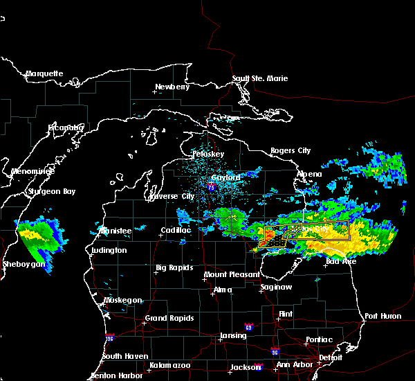 At 1103 pm edt, a severe thunderstorm was located over whittemore, or 13 miles west of tawas city, moving east at 50 mph (radar indicated). Hazards include 60 mph wind gusts. expect damage to roofs, siding, and trees At 1103 pm edt, a severe thunderstorm was located over whittemore, or 13 miles west of tawas city, moving east at 50 mph (radar indicated). Hazards include 60 mph wind gusts. expect damage to roofs, siding, and trees
|
| 7/13/2018 5:38 PM EDT |
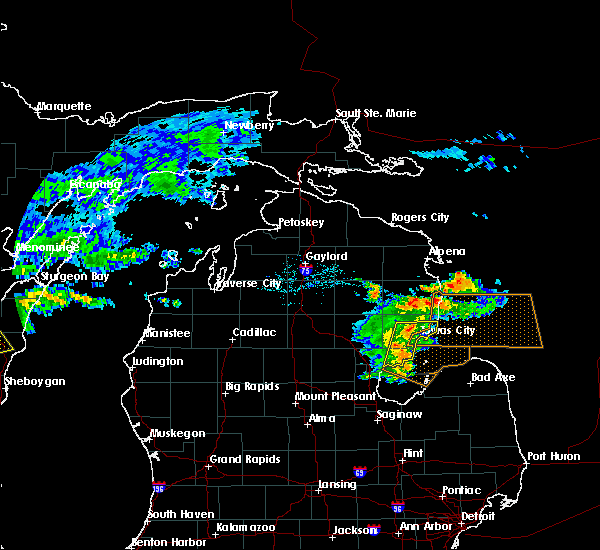 At 538 pm edt, a severe thunderstorm was located over national city, or 10 miles north of au gres, moving east at 25 mph (radar indicated). Hazards include 60 mph wind gusts. Expect damage to roofs, siding, and trees. Locations impacted include, oscoda, east tawas, tawas city, au gres, au sable, whittemore, omer, twining, turner, tawas point state park, plainfield township, national city and wilber. At 538 pm edt, a severe thunderstorm was located over national city, or 10 miles north of au gres, moving east at 25 mph (radar indicated). Hazards include 60 mph wind gusts. Expect damage to roofs, siding, and trees. Locations impacted include, oscoda, east tawas, tawas city, au gres, au sable, whittemore, omer, twining, turner, tawas point state park, plainfield township, national city and wilber.
|
| 7/13/2018 5:15 PM EDT |
 At 514 pm edt, a severe thunderstorm was located near maple ridge, or 10 miles northeast of alger, moving east at 45 mph (radar indicated). Hazards include 60 mph wind gusts. expect damage to roofs, siding, and trees At 514 pm edt, a severe thunderstorm was located near maple ridge, or 10 miles northeast of alger, moving east at 45 mph (radar indicated). Hazards include 60 mph wind gusts. expect damage to roofs, siding, and trees
|
| 7/1/2018 8:36 PM EDT |
 At 835 pm edt, severe thunderstorms were located along a line extending from 8 miles east of grant to 9 miles east of sparta to near rockford, moving northeast at 35 mph (radar indicated). Hazards include 60 mph wind gusts and quarter size hail. Hail damage to vehicles is expected. Expect wind damage to roofs, siding, and trees. At 835 pm edt, severe thunderstorms were located along a line extending from 8 miles east of grant to 9 miles east of sparta to near rockford, moving northeast at 35 mph (radar indicated). Hazards include 60 mph wind gusts and quarter size hail. Hail damage to vehicles is expected. Expect wind damage to roofs, siding, and trees.
|
| 7/1/2018 8:22 PM EDT |
 At 822 pm edt, severe thunderstorms were located along a line extending from near sparta to near grand rapids, moving east at 40 mph (radar indicated). Hazards include 60 mph wind gusts. expect damage to roofs, siding, and trees At 822 pm edt, severe thunderstorms were located along a line extending from near sparta to near grand rapids, moving east at 40 mph (radar indicated). Hazards include 60 mph wind gusts. expect damage to roofs, siding, and trees
|
| 5/27/2018 4:14 PM EDT |
 At 413 pm edt, a severe thunderstorm was located over omer, moving southeast at 25 mph (radar indicated). Hazards include ping pong ball size hail and 60 mph wind gusts. People and animals outdoors will be injured. expect hail damage to roofs, siding, windows, and vehicles. expect wind damage to roofs, siding, and trees. Locations impacted include, tawas city, au gres, sterling, maple ridge, whittemore, omer, twining, turner and national city. At 413 pm edt, a severe thunderstorm was located over omer, moving southeast at 25 mph (radar indicated). Hazards include ping pong ball size hail and 60 mph wind gusts. People and animals outdoors will be injured. expect hail damage to roofs, siding, windows, and vehicles. expect wind damage to roofs, siding, and trees. Locations impacted include, tawas city, au gres, sterling, maple ridge, whittemore, omer, twining, turner and national city.
|
| 5/27/2018 4:12 PM EDT |
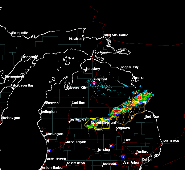 At 411 pm edt, severe thunderstorms were located along a line extending from 10 miles northeast of oscoda to near tawas city, moving southeast at 25 mph (radar indicated). Hazards include 60 mph wind gusts and quarter size hail. Hail damage to vehicles is expected. expect wind damage to roofs, siding, and trees. Locations impacted include, oscoda, east tawas, tawas city, au sable, wurtsmith airfield and wilber. At 411 pm edt, severe thunderstorms were located along a line extending from 10 miles northeast of oscoda to near tawas city, moving southeast at 25 mph (radar indicated). Hazards include 60 mph wind gusts and quarter size hail. Hail damage to vehicles is expected. expect wind damage to roofs, siding, and trees. Locations impacted include, oscoda, east tawas, tawas city, au sable, wurtsmith airfield and wilber.
|
| 5/27/2018 3:59 PM EDT |
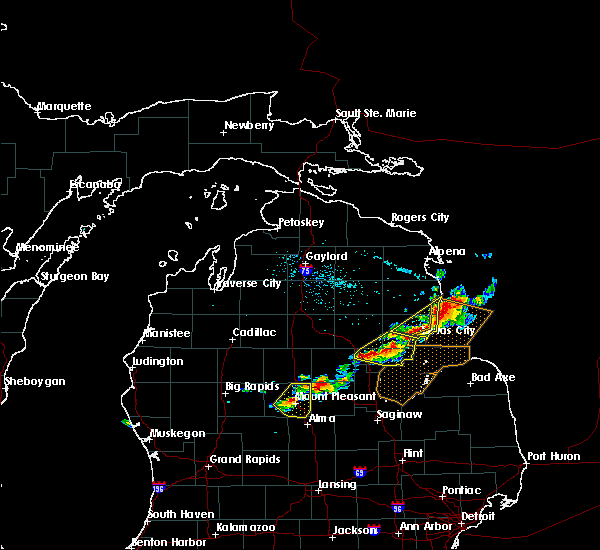 A severe thunderstorm warning remains in effect until 430 pm edt for arenac. southeastern ogemaw and southwestern iosco counties. at 358 pm edt, a severe thunderstorm was located over turner, or 9 miles north of au gres, moving east at 20 mph. hazard. 60 mph wind gusts and half dollar size hail. source. Radar indicated. A severe thunderstorm warning remains in effect until 430 pm edt for arenac. southeastern ogemaw and southwestern iosco counties. at 358 pm edt, a severe thunderstorm was located over turner, or 9 miles north of au gres, moving east at 20 mph. hazard. 60 mph wind gusts and half dollar size hail. source. Radar indicated.
|
| 5/27/2018 3:57 PM EDT |
 At 357 pm edt, severe thunderstorms were located along a line extending from 7 miles east of harrisville state park to near tawas city, moving east at 25 mph (radar indicated). Hazards include 60 mph wind gusts and quarter size hail. Hail damage to vehicles is expected. expect wind damage to roofs, siding, and trees. Locations impacted include, oscoda, east tawas, tawas city, harrisville, au sable, mikado, plainfield township, wurtsmith airfield, wilber and sid town. At 357 pm edt, severe thunderstorms were located along a line extending from 7 miles east of harrisville state park to near tawas city, moving east at 25 mph (radar indicated). Hazards include 60 mph wind gusts and quarter size hail. Hail damage to vehicles is expected. expect wind damage to roofs, siding, and trees. Locations impacted include, oscoda, east tawas, tawas city, harrisville, au sable, mikado, plainfield township, wurtsmith airfield, wilber and sid town.
|
| 5/27/2018 3:48 PM EDT |
 At 348 pm edt, a severe thunderstorm was located near whittemore, or 11 miles northwest of au gres, moving east at 20 mph (radar indicated). Hazards include 60 mph wind gusts and half dollar size hail. Hail damage to vehicles is expected. expect wind damage to roofs, siding, and trees. Locations impacted include, alger, tawas city, au gres, sterling, maple ridge, whittemore, omer, twining, turner, skidway lake, national city and prescott. At 348 pm edt, a severe thunderstorm was located near whittemore, or 11 miles northwest of au gres, moving east at 20 mph (radar indicated). Hazards include 60 mph wind gusts and half dollar size hail. Hail damage to vehicles is expected. expect wind damage to roofs, siding, and trees. Locations impacted include, alger, tawas city, au gres, sterling, maple ridge, whittemore, omer, twining, turner, skidway lake, national city and prescott.
|
| 5/27/2018 3:47 PM EDT |
 At 346 pm edt, severe thunderstorms were located along a line extending from 6 miles east of harrisville state park to 6 miles east of plainfield township, moving east at 25 mph (radar indicated). Hazards include 60 mph wind gusts and half dollar size hail. Hail damage to vehicles is expected. Expect wind damage to roofs, siding, and trees. At 346 pm edt, severe thunderstorms were located along a line extending from 6 miles east of harrisville state park to 6 miles east of plainfield township, moving east at 25 mph (radar indicated). Hazards include 60 mph wind gusts and half dollar size hail. Hail damage to vehicles is expected. Expect wind damage to roofs, siding, and trees.
|
| 5/27/2018 3:42 PM EDT |
 At 342 pm edt, a severe thunderstorm was located near maple ridge, or 12 miles northeast of alger, moving east at 30 mph (radar indicated). Hazards include 60 mph wind gusts and half dollar size hail. Hail damage to vehicles is expected. expect wind damage to roofs, siding, and trees. Locations impacted include, alger, tawas city, au gres, sterling, maple ridge, whittemore, omer, twining, turner, skidway lake, national city, selkirk, bowmanville and prescott. At 342 pm edt, a severe thunderstorm was located near maple ridge, or 12 miles northeast of alger, moving east at 30 mph (radar indicated). Hazards include 60 mph wind gusts and half dollar size hail. Hail damage to vehicles is expected. expect wind damage to roofs, siding, and trees. Locations impacted include, alger, tawas city, au gres, sterling, maple ridge, whittemore, omer, twining, turner, skidway lake, national city, selkirk, bowmanville and prescott.
|
| 5/27/2018 3:31 PM EDT |
 At 331 pm edt, a severe thunderstorm was located over skidway lake, or 9 miles northeast of alger, moving east at 20 mph (radar indicated). Hazards include ping pong ball size hail and 60 mph wind gusts. People and animals outdoors will be injured. expect hail damage to roofs, siding, windows, and vehicles. Expect wind damage to roofs, siding, and trees. At 331 pm edt, a severe thunderstorm was located over skidway lake, or 9 miles northeast of alger, moving east at 20 mph (radar indicated). Hazards include ping pong ball size hail and 60 mph wind gusts. People and animals outdoors will be injured. expect hail damage to roofs, siding, windows, and vehicles. Expect wind damage to roofs, siding, and trees.
|
| 5/9/2018 9:03 PM EDT |
 At 902 pm edt, severe thunderstorms were located along a line extending from near morley to 7 miles south of lakeview to near rockford, moving northeast at 50 mph (radar indicated). Hazards include 60 mph wind gusts and penny size hail. Expect damage to roofs, siding, and trees. Locations impacted include, grand rapids, greenville, newaygo, walker, rockford, sparta, howard city, lakeview, morley, mecosta, barryton, canadian lakes, northview, jenison, cedar springs, croton, sidney, wright, kent city, sand lake,. At 902 pm edt, severe thunderstorms were located along a line extending from near morley to 7 miles south of lakeview to near rockford, moving northeast at 50 mph (radar indicated). Hazards include 60 mph wind gusts and penny size hail. Expect damage to roofs, siding, and trees. Locations impacted include, grand rapids, greenville, newaygo, walker, rockford, sparta, howard city, lakeview, morley, mecosta, barryton, canadian lakes, northview, jenison, cedar springs, croton, sidney, wright, kent city, sand lake,.
|
| 5/9/2018 8:31 PM EDT |
 At 829 pm edt, severe thunderstorms were located along a line extending from near grant to 5 miles north of zeeland, moving northeast at 50 mph (radar indicated). Hazards include 60 mph wind gusts and quarter size hail. Hail damage to vehicles is expected. Expect wind damage to roofs, siding, and trees. At 829 pm edt, severe thunderstorms were located along a line extending from near grant to 5 miles north of zeeland, moving northeast at 50 mph (radar indicated). Hazards include 60 mph wind gusts and quarter size hail. Hail damage to vehicles is expected. Expect wind damage to roofs, siding, and trees.
|
| 7/6/2017 7:21 PM EDT |
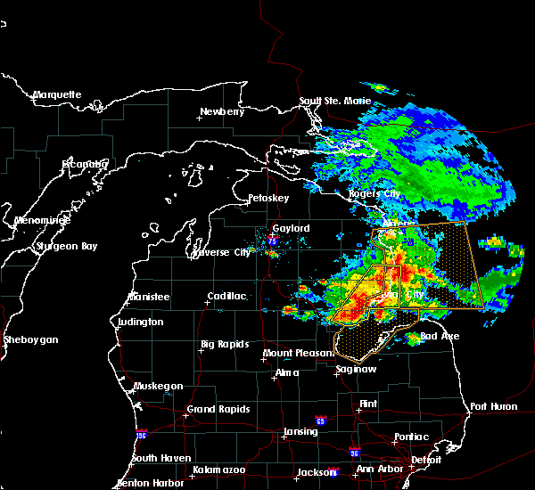 A severe thunderstorm warning remains in effect until 745 pm edt for southeastern alcona. northeastern arenac and iosco counties. at 720 pm edt, severe thunderstorms were located along a line extending from near mikado to 6 miles east of turner, moving east at 35 mph. hazard. 70 mph wind gusts and quarter size hail. A severe thunderstorm warning remains in effect until 745 pm edt for southeastern alcona. northeastern arenac and iosco counties. at 720 pm edt, severe thunderstorms were located along a line extending from near mikado to 6 miles east of turner, moving east at 35 mph. hazard. 70 mph wind gusts and quarter size hail.
|
| 7/6/2017 6:51 PM EDT |
 At 651 pm edt, severe thunderstorms were located along a line extending from near curran to near skidway lake, moving east at 35 mph (radar indicated). Hazards include 70 mph wind gusts and quarter size hail. Hail damage to vehicles is expected. expect considerable tree damage. Wind damage is also likely to mobile homes, roofs, and outbuildings. At 651 pm edt, severe thunderstorms were located along a line extending from near curran to near skidway lake, moving east at 35 mph (radar indicated). Hazards include 70 mph wind gusts and quarter size hail. Hail damage to vehicles is expected. expect considerable tree damage. Wind damage is also likely to mobile homes, roofs, and outbuildings.
|
| 10/17/2016 10:31 AM EDT | Golf Ball sized hail reported 14.3 miles S of Sand Lake, MI, . |
| 10/17/2016 10:31 AM EDT | Hen Egg sized hail reported 16.4 miles S of Sand Lake, MI, delayed report. time estimated via radar. |
| 9/21/2016 9:22 AM EDT |
 At 921 am edt, a severe thunderstorm was located over east grand rapids, moving east at 35 mph (radar indicated). Hazards include 60 mph wind gusts and quarter size hail. Hail damage to vehicles is expected. expect wind damage to roofs, siding, and trees. Locations impacted include, grand rapids, wyoming, kentwood, walker, east grand rapids, rockford, sparta, northview, forest hills, grandville, cedar springs, kent city, sand lake, casnovia, comstock park, belmont, cutlerville,. At 921 am edt, a severe thunderstorm was located over east grand rapids, moving east at 35 mph (radar indicated). Hazards include 60 mph wind gusts and quarter size hail. Hail damage to vehicles is expected. expect wind damage to roofs, siding, and trees. Locations impacted include, grand rapids, wyoming, kentwood, walker, east grand rapids, rockford, sparta, northview, forest hills, grandville, cedar springs, kent city, sand lake, casnovia, comstock park, belmont, cutlerville,.
|
| 9/21/2016 9:09 AM EDT |
 At 909 am edt, a severe thunderstorm was located over walker, moving east at 35 mph (radar indicated). Hazards include 60 mph wind gusts and quarter size hail. Hail damage to vehicles is expected. expect wind damage to roofs, siding, and trees. Locations impacted include, grand rapids, wyoming, kentwood, walker, east grand rapids, hudsonville, rockford, zeeland, coopersville, sparta, jenison, northview, forest hills, grandville, cedar springs, wright, kent city, sand lake, casnovia, belmont,. At 909 am edt, a severe thunderstorm was located over walker, moving east at 35 mph (radar indicated). Hazards include 60 mph wind gusts and quarter size hail. Hail damage to vehicles is expected. expect wind damage to roofs, siding, and trees. Locations impacted include, grand rapids, wyoming, kentwood, walker, east grand rapids, hudsonville, rockford, zeeland, coopersville, sparta, jenison, northview, forest hills, grandville, cedar springs, wright, kent city, sand lake, casnovia, belmont,.
|
| 9/21/2016 8:52 AM EDT |
 At 850 am edt, a severe thunderstorm was located near hudsonville, moving east at 35 mph. another severe storm was located over southeastern muskegon county just west of ravenna (radar indicated). Hazards include 60 mph wind gusts and quarter size hail. Hail damage to vehicles is expected. Expect wind damage to roofs, siding, and trees. At 850 am edt, a severe thunderstorm was located near hudsonville, moving east at 35 mph. another severe storm was located over southeastern muskegon county just west of ravenna (radar indicated). Hazards include 60 mph wind gusts and quarter size hail. Hail damage to vehicles is expected. Expect wind damage to roofs, siding, and trees.
|
| 9/10/2016 4:24 PM EDT |
 The severe thunderstorm warning for alcona, oscoda, iosco and northeastern ogemaw counties will expire at 430 pm edt, the line of showers producing gusty winds which prompted the warning have weakened moved out of the area. therefore, the warning will be allowed to expire. The severe thunderstorm warning for alcona, oscoda, iosco and northeastern ogemaw counties will expire at 430 pm edt, the line of showers producing gusty winds which prompted the warning have weakened moved out of the area. therefore, the warning will be allowed to expire.
|
| 9/10/2016 3:37 PM EDT |
 At 335 pm edt, a line of showers with embedded thunder was producing severe winds along a line extending from near red oak to near rifle river state park, moving northeast at 45 mph (radar indicated). Hazards include 60 mph wind gusts. Expect damage to roofs. siding. And trees. At 335 pm edt, a line of showers with embedded thunder was producing severe winds along a line extending from near red oak to near rifle river state park, moving northeast at 45 mph (radar indicated). Hazards include 60 mph wind gusts. Expect damage to roofs. siding. And trees.
|
| 7/8/2016 3:35 PM EDT |
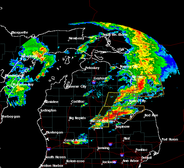 At 334 pm edt, severe thunderstorms were located along a line extending from near glennie to near south branch to 6 miles east of selkirk, moving east at 30 mph (radar indicated). Hazards include 60 mph wind gusts and quarter size hail. Hail damage to vehicles is expected. expect wind damage to roofs, siding, and trees. Locations impacted include, oscoda, east tawas, tawas city, au sable, glennie, south branch, mikado, whittemore, curtisville, rifle river state park, skidway lake, plainfield township, tawas point state park, wurtsmith airfield, hale, national city, wilber, prescott and sid town. At 334 pm edt, severe thunderstorms were located along a line extending from near glennie to near south branch to 6 miles east of selkirk, moving east at 30 mph (radar indicated). Hazards include 60 mph wind gusts and quarter size hail. Hail damage to vehicles is expected. expect wind damage to roofs, siding, and trees. Locations impacted include, oscoda, east tawas, tawas city, au sable, glennie, south branch, mikado, whittemore, curtisville, rifle river state park, skidway lake, plainfield township, tawas point state park, wurtsmith airfield, hale, national city, wilber, prescott and sid town.
|
| 7/8/2016 3:12 PM EDT |
 At 312 pm edt, severe thunderstorms were located along a line extending from near mckinley to rifle river state park to near west branch, moving east at 50 mph (radar indicated). Hazards include 60 mph wind gusts and quarter size hail. Hail damage to vehicles is expected. expect wind damage to roofs, siding, and trees. Locations impacted include, oscoda, east tawas, west branch, tawas city, au sable, glennie, mio, south branch, mikado, rose city, whittemore, curtisville, rifle river state park, skidway lake, plainfield township, rose township, lupton, mack lake, tawas point state park and wurtsmith airfield. At 312 pm edt, severe thunderstorms were located along a line extending from near mckinley to rifle river state park to near west branch, moving east at 50 mph (radar indicated). Hazards include 60 mph wind gusts and quarter size hail. Hail damage to vehicles is expected. expect wind damage to roofs, siding, and trees. Locations impacted include, oscoda, east tawas, west branch, tawas city, au sable, glennie, mio, south branch, mikado, rose city, whittemore, curtisville, rifle river state park, skidway lake, plainfield township, rose township, lupton, mack lake, tawas point state park and wurtsmith airfield.
|
| 7/8/2016 2:45 PM EDT |
 At 244 pm edt, a severe thunderstorm was located over clear lake, or 7 miles north of west branch, moving east at 40 mph (radar indicated). Hazards include 60 mph wind gusts and quarter size hail. Hail damage to vehicles is expected. Expect wind damage to roofs, siding, and trees. At 244 pm edt, a severe thunderstorm was located over clear lake, or 7 miles north of west branch, moving east at 40 mph (radar indicated). Hazards include 60 mph wind gusts and quarter size hail. Hail damage to vehicles is expected. Expect wind damage to roofs, siding, and trees.
|
| 5/26/2016 5:56 PM EDT | The severe thunderstorm warning for eastern alcona and northeastern iosco counties will expire at 600 pm edt, the storm which prompted the warning has weakened below severe limits, and no longer poses an immediate threat to life or property. therefore, the warning will be allowed to expire. however heavy rain is still possible with this thunderstorm. |
| 5/26/2016 5:42 PM EDT |
 At 542 pm edt, a severe thunderstorm was located near mikado, or 7 miles north of oscoda, moving east at 40 mph (radar indicated). Hazards include 60 mph wind gusts and quarter size hail. Hail damage to vehicles is expected. expect wind damage to roofs, siding, and trees. Locations impacted include, oscoda, harrisville, au sable, mikado, lincoln, lost lake woods, wurtsmith airfield, black river, barton city, harrisville state park, negwegon state park, plainfield township and sid town. At 542 pm edt, a severe thunderstorm was located near mikado, or 7 miles north of oscoda, moving east at 40 mph (radar indicated). Hazards include 60 mph wind gusts and quarter size hail. Hail damage to vehicles is expected. expect wind damage to roofs, siding, and trees. Locations impacted include, oscoda, harrisville, au sable, mikado, lincoln, lost lake woods, wurtsmith airfield, black river, barton city, harrisville state park, negwegon state park, plainfield township and sid town.
|
| 5/26/2016 5:17 PM EDT |
 At 516 pm edt, a severe thunderstorm was located near hale, or 7 miles south of glennie, moving east at 40 mph (radar indicated). Hazards include 60 mph wind gusts and quarter size hail. Hail damage to vehicles is expected. Expect wind damage to roofs, siding, and trees. At 516 pm edt, a severe thunderstorm was located near hale, or 7 miles south of glennie, moving east at 40 mph (radar indicated). Hazards include 60 mph wind gusts and quarter size hail. Hail damage to vehicles is expected. Expect wind damage to roofs, siding, and trees.
|
| 8/2/2015 8:05 PM EDT |
 At 805 pm edt, severe thunderstorms were located along a line extending from 23 miles southwest of montague to near newaygo, moving southeast at 45 mph (radar indicated). Hazards include 60 mph wind gusts. Expect damage to roofs. Siding and trees. At 805 pm edt, severe thunderstorms were located along a line extending from 23 miles southwest of montague to near newaygo, moving southeast at 45 mph (radar indicated). Hazards include 60 mph wind gusts. Expect damage to roofs. Siding and trees.
|
| 8/2/2015 6:51 PM EDT |
 The severe thunderstorm warning for iosco, alcona and arenac counties will expire at 700 pm edt, the storms which prompted the warning have moved out of the area. therefore the warning will be allowed to expire. however gusty winds are still possible with these thunderstorms. a severe thunderstorm watch remains in effect until 1100 pm edt for northern michigan. The severe thunderstorm warning for iosco, alcona and arenac counties will expire at 700 pm edt, the storms which prompted the warning have moved out of the area. therefore the warning will be allowed to expire. however gusty winds are still possible with these thunderstorms. a severe thunderstorm watch remains in effect until 1100 pm edt for northern michigan.
|
| 8/2/2015 6:36 PM EDT |
 At 635 pm edt, severe thunderstorms were located along a line extending from near lincoln to 7 miles south of tawas point state park to 8 miles northeast of pinconning, and are nearly stationary (radar indicated). Hazards include 70 mph wind gusts and quarter size hail. Hail damage to vehicles is expected. expect considerable tree damage. wind damage is also likely to mobile homes, roofs and outbuildings. Locations impacted include, alger, oscoda, east tawas, tawas city, standish, au gres, sterling, harrisville, au sable, glennie, maple ridge, mikado, whittemore, lincoln, omer, twining, turner, curtisville, black river and plainfield township. At 635 pm edt, severe thunderstorms were located along a line extending from near lincoln to 7 miles south of tawas point state park to 8 miles northeast of pinconning, and are nearly stationary (radar indicated). Hazards include 70 mph wind gusts and quarter size hail. Hail damage to vehicles is expected. expect considerable tree damage. wind damage is also likely to mobile homes, roofs and outbuildings. Locations impacted include, alger, oscoda, east tawas, tawas city, standish, au gres, sterling, harrisville, au sable, glennie, maple ridge, mikado, whittemore, lincoln, omer, twining, turner, curtisville, black river and plainfield township.
|
| 8/2/2015 6:17 PM EDT |
 At 617 pm edt, severe thunderstorms were located along a line extending from near lincoln to 7 miles south of tawas point state park to 7 miles northeast of pinconning, moving east at 70 mph (radar indicated). Hazards include 70 mph wind gusts and quarter size hail. Hail damage to vehicles is expected. expect considerable tree damage. wind damage is also likely to mobile homes, roofs and outbuildings. Locations impacted include, alger, oscoda, east tawas, tawas city, standish, au gres, sterling, harrisville, au sable, glennie, maple ridge, mikado, whittemore, lincoln, omer, twining, turner, curtisville, black river and plainfield township. At 617 pm edt, severe thunderstorms were located along a line extending from near lincoln to 7 miles south of tawas point state park to 7 miles northeast of pinconning, moving east at 70 mph (radar indicated). Hazards include 70 mph wind gusts and quarter size hail. Hail damage to vehicles is expected. expect considerable tree damage. wind damage is also likely to mobile homes, roofs and outbuildings. Locations impacted include, alger, oscoda, east tawas, tawas city, standish, au gres, sterling, harrisville, au sable, glennie, maple ridge, mikado, whittemore, lincoln, omer, twining, turner, curtisville, black river and plainfield township.
|
| 8/2/2015 5:56 PM EDT |
 At 554 pm edt, severe thunderstorms were located along a line extending from 7 miles southeast of lockwood lake to near whittemore to near wooden shoe village, moving east at 70 mph (radar indicated. widespread tree damage in ogemaw county). Hazards include 70 mph wind gusts and quarter size hail. Hail damage to vehicles is expected. expect considerable tree damage. Wind damage is also likely to mobile homes, roofs and outbuildings. At 554 pm edt, severe thunderstorms were located along a line extending from 7 miles southeast of lockwood lake to near whittemore to near wooden shoe village, moving east at 70 mph (radar indicated. widespread tree damage in ogemaw county). Hazards include 70 mph wind gusts and quarter size hail. Hail damage to vehicles is expected. expect considerable tree damage. Wind damage is also likely to mobile homes, roofs and outbuildings.
|
| 8/2/2015 5:27 PM EDT |
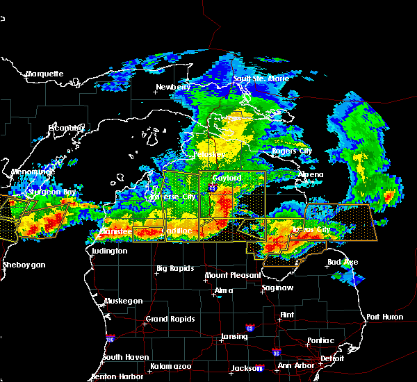 At 527 pm edt, severe thunderstorms were located along a line extending from near wurtsmith airfield to near standish, moving east at 40 mph (radar indicated). Hazards include 60 mph wind gusts and quarter size hail. Hail damage to vehicles is expected. expect wind damage to roofs, siding and trees. Locations impacted include, oscoda, east tawas, tawas city, standish, au gres, au sable, maple ridge, whittemore, omer, twining, turner, plainfield township, tawas point state park, wurtsmith airfield, national city, wilber and sid town. At 527 pm edt, severe thunderstorms were located along a line extending from near wurtsmith airfield to near standish, moving east at 40 mph (radar indicated). Hazards include 60 mph wind gusts and quarter size hail. Hail damage to vehicles is expected. expect wind damage to roofs, siding and trees. Locations impacted include, oscoda, east tawas, tawas city, standish, au gres, au sable, maple ridge, whittemore, omer, twining, turner, plainfield township, tawas point state park, wurtsmith airfield, national city, wilber and sid town.
|
| 8/2/2015 5:00 PM EDT |
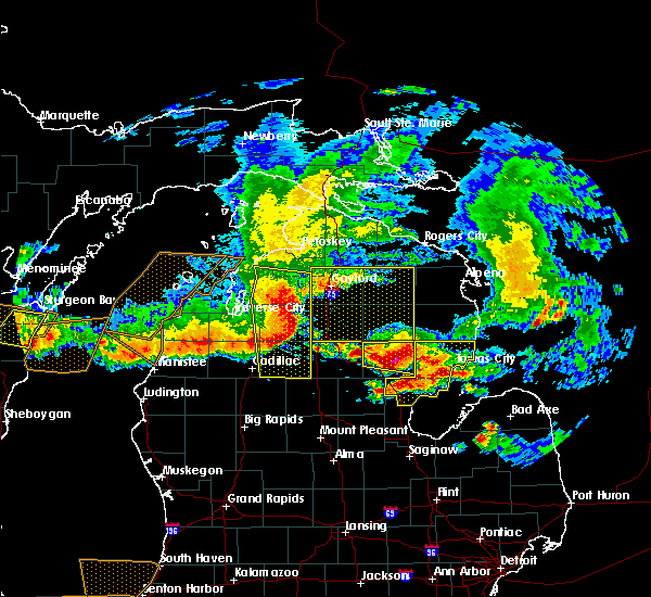 At 459 pm edt, severe thunderstorms were located along a line extending from 7 miles east of plainfield township to bentley, moving southeast at 35 mph (radar indicated). Hazards include 60 mph wind gusts and quarter size hail. Hail damage to vehicles is expected. Expect wind damage to roofs, siding and trees. At 459 pm edt, severe thunderstorms were located along a line extending from 7 miles east of plainfield township to bentley, moving southeast at 35 mph (radar indicated). Hazards include 60 mph wind gusts and quarter size hail. Hail damage to vehicles is expected. Expect wind damage to roofs, siding and trees.
|
| 8/2/2015 1:53 PM EDT |
 At 153 pm edt, a severe thunderstorm was located near glennie, moving east at 35 mph (radar indicated). Hazards include 60 mph wind gusts and quarter size hail. Hail damage to vehicles is expected. expect wind damage to roofs, siding and trees. Locations impacted include, oscoda, harrisville, au sable, mikado, wurtsmith airfield, plainfield township, wilber and sid town. At 153 pm edt, a severe thunderstorm was located near glennie, moving east at 35 mph (radar indicated). Hazards include 60 mph wind gusts and quarter size hail. Hail damage to vehicles is expected. expect wind damage to roofs, siding and trees. Locations impacted include, oscoda, harrisville, au sable, mikado, wurtsmith airfield, plainfield township, wilber and sid town.
|
| 8/2/2015 1:43 PM EDT |
 At 143 pm edt, severe thunderstorms were located along a line extending from 6 miles northeast of hale to near edenville, moving east at 25 mph (radar indicated). Hazards include 60 mph wind gusts and quarter size hail. Hail damage to vehicles is expected. Expect wind damage to roofs, siding and trees. At 143 pm edt, severe thunderstorms were located along a line extending from 6 miles northeast of hale to near edenville, moving east at 25 mph (radar indicated). Hazards include 60 mph wind gusts and quarter size hail. Hail damage to vehicles is expected. Expect wind damage to roofs, siding and trees.
|
| 8/2/2015 1:36 PM EDT |
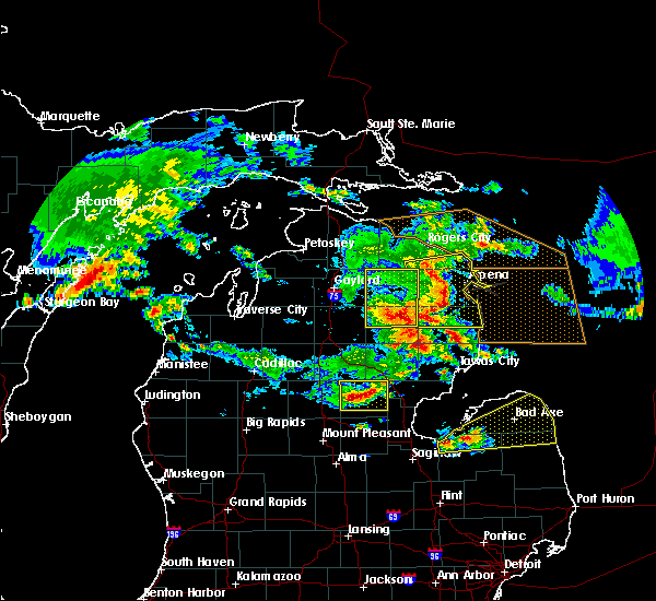 At 135 pm edt, a severe thunderstorm was located near south branch, or 7 miles southwest of glennie, moving east at 35 mph (radar indicated). Hazards include 60 mph wind gusts and quarter size hail. Hail damage to vehicles is expected. Expect wind damage to roofs, siding and trees. At 135 pm edt, a severe thunderstorm was located near south branch, or 7 miles southwest of glennie, moving east at 35 mph (radar indicated). Hazards include 60 mph wind gusts and quarter size hail. Hail damage to vehicles is expected. Expect wind damage to roofs, siding and trees.
|
| 6/8/2015 5:47 PM EDT | At 546 pm edt, severe thunderstorms were located along a line extending from 8 miles southwest of wurtsmith airfield to near turner, moving east at 30 mph (radar indicated). Hazards include quarter size hail. Damage to vehicles is expected. Locations impacted include, oscoda, east tawas, tawas city, au sable, whittemore, national city and wilber. |
| 6/8/2015 5:28 PM EDT | At 528 pm edt, severe thunderstorms were located along a line extending from near plainfield township to whittemore to near skidway lake, moving east at 35 mph (radar indicated). Hazards include quarter size hail. Damage to vehicles is expected. Locations impacted include, oscoda, east tawas, tawas city, au sable, whittemore, national city, skidway lake, plainfield township, wurtsmith airfield, hale, wilber, prescott and sid town. |
| 6/8/2015 5:15 PM EDT | At 515 pm edt, severe thunderstorms were located along a line extending from south branch to near hale to near rifle river state park to near west branch, moving east at 35 mph (radar indicated). Hazards include quarter size hail. damage to vehicles is expected |
| 6/8/2015 5:02 PM EDT | At 501 pm edt, severe thunderstorms were located along a line extending from south branch to near selkirk to near west branch, moving east at 30 mph (radar indicated). Hazards include quarter size hail. Damage to vehicles is expected. Locations impacted include, west branch, south branch, rose city, plainfield township, rifle river state park, selkirk, lupton, hale and sid town. |
| 6/8/2015 4:51 PM EDT | At 450 pm edt, severe thunderstorms were located along a line extending from near lupton to near rose city to near west branch, moving east at 30 mph (radar indicated). Hazards include quarter size hail. damage to vehicles is expected |
| 7/27/2014 2:15 PM EDT | Trees down in glennie in alcona county MI, 16.4 miles S of Sand Lake, MI |
| 4/12/2014 4:31 PM EDT | A trailer and log cabin have lost their roof while a barn suffered heavy damage. power lines and several trees have also been reported down in the are in kent county MI, 2.1 miles E of Sand Lake, MI |
| 11/17/2013 5:11 PM EST | Trees dow in iosco county MI, 7.1 miles ESE of Sand Lake, MI |
| 5/20/2013 5:10 PM EDT | Numerous trees and wires dow in alcona county MI, 16.4 miles S of Sand Lake, MI |
| 7/31/2012 1:07 AM EDT | Tree reported down at 22 mile rd and trenton on the kent and newaygo county line. this tree down report was the first of many across kent county as reported by the kent in kent county MI, 5.1 miles E of Sand Lake, MI |
| 5/28/2012 11:30 PM EDT | Numerous large oak trees upr in iosco county MI, 11 miles S of Sand Lake, MI |
| 1/1/0001 12:00 AM | Storm damage reported in iosco county MI, 6.6 miles SSE of Sand Lake, MI |
Hail Maps for Sand Lake, MI


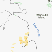


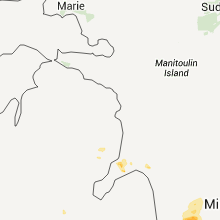


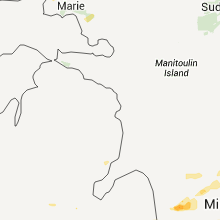


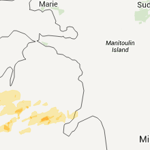

Connect with Interactive Hail Maps