

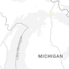
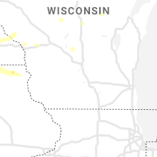
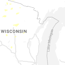
Hail Map for Friday, September 2, 2022

Number of Impacted Households on 9/2/2022
0
Impacted by 1" or Larger Hail
0
Impacted by 1.75" or Larger Hail
0
Impacted by 2.5" or Larger Hail
Square Miles of Populated Area Impacted on 9/2/2022
0
Impacted by 1" or Larger Hail
0
Impacted by 1.75" or Larger Hail
0
Impacted by 2.5" or Larger Hail


Cities Most Affected by Hail Storms of 9/2/2022
| Hail Size | Demographics of Zip Codes Affected | ||||||
|---|---|---|---|---|---|---|---|
| City | Count | Average | Largest | Pop Density | House Value | Income | Age |
Hail and Wind Damage Spotted on 9/2/2022
Filter by Report Type:Hail ReportsWind Reports
Florida
| Local Time | Report Details |
|---|---|
| 2:17 PM EDT | Broadcast media reported wind damage to mobile homes in the vicinity of 53rd and chateau lane west. this damage appears to have been caused by a downburst. time estimat in manatee county FL, 3.9 miles S of Bradenton, FL |
| 2:18 PM EDT | Manatee co emergency management relayed that damage in a mobile home community occurred this afternoon during a thunderstorm. while a downburst did occur with this stor in manatee county FL, 3.9 miles S of Bradenton, FL |
Michigan
| Local Time | Report Details |
|---|---|
| 5:50 PM EDT | 70 mph gust measured at buoy 45025 at lower entrance of portage cana in lsz246 county MI, 55.2 miles WNW of Marquette, MI |
Nebraska
| Local Time | Report Details |
|---|---|
| 4:58 PM CDT | Quarter sized hail reported near Bartley, NE, 68 miles NE of Colby, KS, trained spotter report of quarter size hail. |
Wisconsin
| Local Time | Report Details |
|---|---|
| 5:35 PM CDT | Quarter sized hail reported near Winter, WI, 80.8 miles SE of Duluth, MN, estimated up to 1 inch size hail. trained spotter report sent via mping. |
| 6:05 PM CDT | Ping Pong Ball sized hail reported near Glenwood City, WI, 49.6 miles ENE of Minneapolis, MN |
Kansas
| Local Time | Report Details |
|---|---|
| 5:58 PM CDT | Estimated wind gusts of 50-70 mp in decatur county KS, 44.8 miles ENE of Colby, KS |
| 6:00 PM CDT | 66mph wind gust measured at k-383 (ksdot)... lasted for 5 minute in decatur county KS, 42.8 miles ENE of Colby, KS |
| 6:36 PM CDT | Approximately a foot in diameter tree limb was blown down from a cottonwood. in addition two small tents were damag in graham county KS, 50.1 miles E of Colby, KS |
| 6:44 PM CDT | Storm damage reported in graham county KS, 47.6 miles NW of Hays, KS |
| 8:38 PM CDT | Storm damage reported in finney county KS, 8.8 miles ENE of Garden City, KS |
| 8:46 PM CDT | Report from mping: trees uprooted or snapped; roof blown of in finney county KS, 5 miles WNW of Garden City, KS |
| 10:33 PM CDT | Mesonet station ur350 4.4 ne hayne (upr in seward county KS, 56.9 miles S of Garden City, KS |
Arizona
| Local Time | Report Details |
|---|---|
| 4:05 PM MST | Delayed report...communications tower knocked down by the wind and over roadway shared via social medi in mohave county AZ, 52.4 miles N of Lake Havasu City, AZ |
| 4:20 PM MST | Report of power outages and power poles down due to thunderstorm related wind gusts in new kingman-butle in mohave county AZ, 58.9 miles NNE of Lake Havasu City, AZ |
| 4:55 PM MST | Called spotter and had 55 mph sustained on the hill east of the 17 with at least a 62 mph gust via weather station she has access to. damage to smaller billboard sign a in yavapai county AZ, 43.7 miles N of Phoenix, AZ |
| 5:11 PM MST | Time of report updated based on time of tractor trailer incident on i-17. sunset point raws showed 12g72 mph at 5:53 p.m. went back to radar and highest reflectivity at in yavapai county AZ, 51.3 miles N of Phoenix, AZ |
| 5:45 PM MST | Storm damage reported in pinal county AZ, 37.4 miles E of Phoenix, AZ |
| 5:53 PM MST | Sunset point raws showed 12g72 mph at 5:53 p.m. went back to radar and highest reflectivity at the surface was around 5:16 p. in yavapai county AZ, 51.3 miles N of Phoenix, AZ |
| 5:55 PM MST | Trained spotter estimated around 60 mph winds with minor tree damag in pinal county AZ, 33.1 miles ESE of Phoenix, AZ |
| 6:10 PM MST | Social media picture of a large uprooted tre in maricopa county AZ, 30.5 miles ESE of Phoenix, AZ |
| 6:12 PM MST | Quarter sized hail reported near Queen Creek, AZ, 31.1 miles ESE of Phoenix, AZ |
| 6:15 PM MST | 68 mph gust measured at the stanton raws. time estimated from rada in yavapai county AZ, 61.8 miles NW of Phoenix, AZ |
| 6:25 PM MST | Quarter sized hail reported near Wickenburg, AZ, 56.9 miles NW of Phoenix, AZ, lsr from phoenix spotter maa010 showing 1 1/8 inch hail with a picture included. big hail spike on radar was at 6:09 p.m. |
| 6:59 PM MST | Corrects previous tstm wnd dmg report from 12 sse congress. spotter c190 tweeted there was a couple miles... maybe more... of downed power lines starting about 3.5 mile in yavapai county AZ, 55.6 miles NW of Phoenix, AZ |
| 8:44 PM MST | Yuma proving ground station measured a 66 mph wind gus in yuma county AZ, 55.8 miles NNE of Yuma, AZ |
Colorado
| Local Time | Report Details |
|---|---|
| 5:08 PM MDT | Asos station kals alamosa airpor in alamosa county CO, 72.1 miles NNW of Taos, NM |
Connect with Interactive Hail Maps