

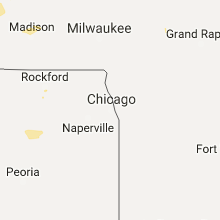
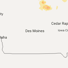
Hail Map for Wednesday, September 21, 2016

Number of Impacted Households on 9/21/2016
0
Impacted by 1" or Larger Hail
0
Impacted by 1.75" or Larger Hail
0
Impacted by 2.5" or Larger Hail
Square Miles of Populated Area Impacted on 9/21/2016
0
Impacted by 1" or Larger Hail
0
Impacted by 1.75" or Larger Hail
0
Impacted by 2.5" or Larger Hail


Cities Most Affected by Hail Storms of 9/21/2016
| Hail Size | Demographics of Zip Codes Affected | ||||||
|---|---|---|---|---|---|---|---|
| City | Count | Average | Largest | Pop Density | House Value | Income | Age |
Hail and Wind Damage Spotted on 9/21/2016
Filter by Report Type:Hail ReportsWind Reports
Wisconsin
| Local Time | Report Details |
|---|---|
| 12:40 PM CDT | Half Dollar sized hail reported near Trempealeau, WI, 16.5 miles NW of La Crosse, WI, lasted about 10 minutes |
| 12:45 PM CDT | Quarter sized hail reported near Bloomer, WI, 87.3 miles E of Minneapolis, MN, nickel to quarter. time estimated. reported via social media. |
| 1:10 PM CDT | Half Dollar sized hail reported near Jim Falls, WI, 85.4 miles N of La Crosse, WI, reported via social media image showing hail slightly larger than quarters. |
| 3:45 PM CDT | Half Dollar sized hail reported near Boyceville, WI, 60.1 miles E of Minneapolis, MN, . |
| 5:10 PM CDT | Quarter sized hail reported near De Forest, WI, 12.4 miles N of Madison, WI, relayed via twitter. |
| 5:28 PM CDT | Quarter sized hail reported near Colfax, WI, 75.2 miles E of Minneapolis, MN, . |
| 5:30 PM CDT | Near hwy 27 and solie r in eau claire county WI, 62.2 miles N of La Crosse, WI |
Illinois
| Local Time | Report Details |
|---|---|
| 12:45 PM CDT | Trees down...1 foot diameter and estimated gusts to 60 mph with shingles off roof. no rain at time...was with storm overflow passage from storm to nort in knox county IL, 45.9 miles WNW of Peoria, IL |
Iowa
| Local Time | Report Details |
|---|---|
| 3:29 PM CDT | Quarter sized hail reported near Rockwell, IA, 12.2 miles SSE of Mason City, IA, . |
| 3:55 PM CDT | 3 inch tree branches down and quarter size hail. in cerro gordo county IA, 7.2 miles SSE of Mason City, IA |
| 4:13 PM CDT | Storm damage reported in floyd county IA, 9.8 miles E of Mason City, IA |
| 4:25 PM CDT | 2 foot diameter tree down on house. relayed by charles city f in floyd county IA, 9.7 miles E of Mason City, IA |
| 5:06 PM CDT | Ping Pong Ball sized hail reported near Rockford, IA, 14 miles ESE of Mason City, IA, report via social media. |
| 5:10 PM CDT | Trees down 2w of rockford as well as in nora springs. winds estimated 60-70 mp in floyd county IA, 12.6 miles ESE of Mason City, IA |
| 5:33 PM CDT | Storm damage reported in floyd county IA, 18.4 miles SE of Mason City, IA |
| 5:50 PM CDT | 2 to 3 foot diameter trees dow in floyd county IA, 22 miles SE of Mason City, IA |
| 5:50 PM CDT | Tree limbs down approximately 3 inches in diamete in cerro gordo county IA, 1.2 miles S of Mason City, IA |
| 6:00 PM CDT | Half Dollar sized hail reported near Plymouth, IA, 8.4 miles NE of Mason City, IA, hail lasted for around 10 minutes. started out as pea size and gradually got bigger. winds estimated around 20 mph. . |
| 6:17 PM CDT | Large tree downed... estimated 1 foot or more in diameter. report via social media. in cerro gordo county IA, 6.6 miles E of Mason City, IA |
| 6:20 PM CDT | 2 to 3 machine sheds destroyed. relayed by charles city fd from marble rock fd in floyd county IA, 22.8 miles SE of Mason City, IA |
| 6:38 PM CDT | Observed tree damage in storm chaser live video stream. multiple large tree limbs dow in butler county IA, 27.7 miles SE of Mason City, IA |
| 6:40 PM CDT | Trees down on roofs and power lines. extent of damage unknown. time estimated from rada in butler county IA, 26.5 miles SE of Mason City, IA |
| 6:45 PM CDT | Widespread tree damage throughout town. several trees on houses. in butler county IA, 26.5 miles SE of Mason City, IA |
| 7:11 PM CDT | Quarter sized hail reported near Greene, IA, 26.5 miles SE of Mason City, IA, report via social media. |
| 7:44 PM CDT | Storm damage reported in floyd county IA, 19.9 miles SE of Mason City, IA |
| 7:44 PM CDT | Storm damage reported in floyd county IA, 21.6 miles SE of Mason City, IA |
| 7:49 PM CDT | Quarter sized hail reported near Greene, IA, 26.1 miles SE of Mason City, IA, . |
Minnesota
| Local Time | Report Details |
|---|---|
| 4:25 PM CDT | Quarter sized hail reported near Saint Paul, MN, 9.3 miles NE of Minneapolis, MN, via social media. |
| 4:30 PM CDT | Quarter sized hail reported near Saint Paul, MN, 11.9 miles NE of Minneapolis, MN, . |
| 7:07 PM CDT | Quarter sized hail reported near Rockford, MN, 25.4 miles WNW of Minneapolis, MN, heavy rain 0.70 rain in one hour. |
| 7:19 PM CDT | Quarter sized hail reported near Rockford, MN, 24.5 miles WNW of Minneapolis, MN, . |
| 9:00 PM CDT | 30 foot high...28 inch diameter tree down. reported at hwy 100 and 70th... edina... m in hennepin county MN, 8 miles SSW of Minneapolis, MN |
| 11:14 PM CDT | Storm damage reported in freeborn county MN, 37.8 miles NNW of Mason City, IA |
Utah
| Local Time | Report Details |
|---|---|
| 8:30 PM MDT | Promontory point mesonet sit in box elder county UT, 88.3 miles NNW of Salt Lake City, UT |
| 9:51 PM MDT | Logan asos in cache county UT, 71.1 miles N of Salt Lake City, UT |
Connect with Interactive Hail Maps