

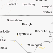
Hail Map for Saturday, September 29, 2012

Number of Impacted Households on 9/29/2012
0
Impacted by 1" or Larger Hail
0
Impacted by 1.75" or Larger Hail
0
Impacted by 2.5" or Larger Hail
Square Miles of Populated Area Impacted on 9/29/2012
0
Impacted by 1" or Larger Hail
0
Impacted by 1.75" or Larger Hail
0
Impacted by 2.5" or Larger Hail


Cities Most Affected by Hail Storms of 9/29/2012
| Hail Size | Demographics of Zip Codes Affected | ||||||
|---|---|---|---|---|---|---|---|
| City | Count | Average | Largest | Pop Density | House Value | Income | Age |
Hail and Wind Damage Spotted on 9/29/2012
Filter by Report Type:Hail ReportsWind Reports
South Carolina
| Local Time | Report Details |
|---|---|
| 5:05 PM EDT | Tree down at smyly road off of mt carmel road. time estimated from rada in colleton county SC, 46.2 miles WSW of Charleston, SC |
| 5:15 PM EDT | Several trees down on highway 18 reported by county ema in cherokee county SC, 48.7 miles WSW of Charlotte, NC |
| 7:14 PM EDT | Highway patrol reported trees down on sc 200 at the catawba river dam in lancaster county SC, 43 miles S of Charlotte, NC |
| 7:35 PM EDT | Quarter sized hail reported near Tillman, SC, 31.1 miles N of Savannah, GA, quarter size hail. time estimated from radar. |
| 7:40 PM EDT | Tree down blocking both lanes of b and c landing roa in jasper county SC, 26.2 miles N of Savannah, GA |
| 7:55 PM EDT | Tree down on bees creek road blocking both lane in jasper county SC, 28.3 miles NNE of Savannah, GA |
Texas
| Local Time | Report Details |
|---|---|
| 5:45 PM CDT | Damage to railroad arm guard... boat flipped off trailer... several trees down... carport and metal skirting around home damaged in lavaca county TX, 80.5 miles E of San Antonio, TX |
Connect with Interactive Hail Maps