

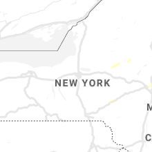
Hail Map for Wednesday, September 4, 2019

Number of Impacted Households on 9/4/2019
0
Impacted by 1" or Larger Hail
0
Impacted by 1.75" or Larger Hail
0
Impacted by 2.5" or Larger Hail
Square Miles of Populated Area Impacted on 9/4/2019
0
Impacted by 1" or Larger Hail
0
Impacted by 1.75" or Larger Hail
0
Impacted by 2.5" or Larger Hail


Cities Most Affected by Hail Storms of 9/4/2019
| Hail Size | Demographics of Zip Codes Affected | ||||||
|---|---|---|---|---|---|---|---|
| City | Count | Average | Largest | Pop Density | House Value | Income | Age |
Hail and Wind Damage Spotted on 9/4/2019
Filter by Report Type:Hail ReportsWind Reports
States Impacted
New York, Vermont, Massachusetts, California, Connecticut, New Jersey, Arizona, North Dakota, MinnesotaNew York
| Local Time | Report Details |
|---|---|
| 12:15 PM EDT | Tree down near hoosic st and lee av in rensselaer county NY, 15.1 miles ESE of Schenectady, NY |
| 1:23 PM EDT | 6 trees down at the interection of cook rd. and eastern av in saratoga county NY, 11.8 miles NNW of Schenectady, NY |
| 4:10 PM EDT | Large tree limb reported down on van sicklen street south of avenue t in kings county NY, 6.5 miles S of Brooklyn, NY |
| 4:15 PM EDT | Large tree limbs reported down on van sicklen street north of avenue in kings county NY, 7.3 miles SSE of Brooklyn, NY |
| 4:15 PM EDT | Tree fell onto a car at gravesend neck road and west stree in kings county NY, 6.5 miles S of Brooklyn, NY |
| 4:15 PM EDT | Trees and wires dow in dutchess county NY, 63.8 miles SSE of Schenectady, NY |
Vermont
| Local Time | Report Details |
|---|---|
| 1:29 PM EDT | Quarter sized hail reported near , , 73.9 miles NE of Schenectady, NY, quarter sized hail reported at okemo mountain lodge |
Massachusetts
| Local Time | Report Details |
|---|---|
| 3:28 PM EDT | Multiple power lines down on pond road in franklin county MA, 53.5 miles E of Schenectady, NY |
| 3:30 PM EDT | Trees and wires dow in berkshire county MA, 47.2 miles E of Schenectady, NY |
| 3:43 PM EDT | Trees and wires dow in berkshire county MA, 50.6 miles SSE of Schenectady, NY |
| 4:15 PM EDT | Tree and power lines down on west gill road in franklin county MA, 74.2 miles E of Schenectady, NY |
| 6:45 PM EDT | Trees and wires own on grant street in middlesex county MA, 40.1 miles NNE of Providence, RI |
| 6:46 PM EDT | Tree and wires down on pequosette road in middlesex county MA, 41.7 miles NNE of Providence, RI |
| 6:48 PM EDT | Tree and wires down spencer ave in middlesex county MA, 44 miles NNE of Providence, RI |
| 6:50 PM EDT | Tree down into a house on hamlet street. tree down on quincy street. tree and wires down on sunnyside ave in middlesex county MA, 43.1 miles NNE of Providence, RI |
California
| Local Time | Report Details |
|---|---|
| 1:30 PM PDT | Sdge sunrise highwa in san diego county CA, 38.5 miles E of San Diego, CA |
| 1:35 PM PDT | Tree down on roadway near pine blvd and cedar lan in san diego county CA, 37.5 miles ENE of San Diego, CA |
| 3:04 PM PDT | Wind gust to 42 mph. power out in wildcat canyo in san diego county CA, 21.2 miles NE of San Diego, CA |
Connecticut
| Local Time | Report Details |
|---|---|
| 5:10 PM EDT | Power lines down south road at phoenix ave in hartford county CT, 60.6 miles W of Providence, RI |
| 5:31 PM EDT | Quarter sized hail reported near Ellington, CT, 54.8 miles W of Providence, RI, crystal lake village |
| 5:35 PM EDT | Tree and wires down on high street and tracy drive in tolland county CT, 55.1 miles W of Providence, RI |
| 5:35 PM EDT | Quarter sized hail reported near Tolland, CT, 49.5 miles W of Providence, RI |
| 5:44 PM EDT | Quarter sized hail reported near Willington, CT, 44.4 miles W of Providence, RI |
| 5:54 PM EDT | Tree branches and wires down on plains road in tolland county CT, 43.3 miles W of Providence, RI |
| 5:54 PM EDT | Tree and wires down on rte 32 in tolland county CT, 43.3 miles W of Providence, RI |
| 6:06 PM EDT | A large tree limb reported down on south broad street near south broad terrace in new haven county CT, 75.5 miles WSW of Providence, RI |
New Jersey
| Local Time | Report Details |
|---|---|
| 8:08 PM EDT | Some trees down on the south side of beachwood. time estimated from rada in ocean county NJ, 55.9 miles SSW of Brooklyn, NY |
| 8:14 PM EDT | A few trees down. time estimated from rada in ocean county NJ, 56.1 miles S of Brooklyn, NY |
| 8:53 PM EDT | Many trees down with some into homes in the cedar brook section of winslow township. time estimated from rada in camden county NJ, 82.6 miles SW of Brooklyn, NY |
Arizona
| Local Time | Report Details |
|---|---|
| 6:11 PM MST | Semi-truck overturned at the mohawk i-8 eastbound rest area as reported by yuma county dispatc in yuma county AZ, 52.8 miles E of Yuma, AZ |
| 6:20 PM MST | ***delayed report...power lines down on s avenue 40 e between e county 5th and 6th street north of tacna. time estimated by yuma county sheriff dispatch and rada in yuma county AZ, 39.6 miles E of Yuma, AZ |
| 8:30 PM MST | Corrects previous tstm wnd gst report from 9 se topock to edit the source of report. gust measured at khii airpor in mohave county AZ, 14.9 miles N of Lake Havasu City, AZ |
North Dakota
| Local Time | Report Details |
|---|---|
| 2:00 AM CDT | Quarter sized hail reported near Cavalier, ND, 74.1 miles NE of Devils Lake, ND, broadcast media relayed via social media photo from near cavalier. time estimated from radar. |
Minnesota
| Local Time | Report Details |
|---|---|
| 3:40 AM CDT | Corrects previous tstm wnd dmg report (time) from 1 ne erskine. multiple reports of trees and power lines down. roof damage to a building... also reports of a grain car in polk county MN, 54.1 miles WNW of Bemidji, MN |
| 3:48 AM CDT | Corrects previous tstm wnd dmg report (time) from mcintosh. reports of downed trees and power line in polk county MN, 48.6 miles WNW of Bemidji, MN |
| 4:02 AM CDT | Storm damage reported in polk county MN, 41.4 miles W of Bemidji, MN |
| 4:12 AM CDT | Multiple reports of trees and power lines down. roof damage to a building... also reports of a grain cart toppled onto the train track in polk county MN, 54.1 miles WNW of Bemidji, MN |
| 4:18 AM CDT | Reports of downed trees and power line in polk county MN, 48.6 miles WNW of Bemidji, MN |
Connect with Interactive Hail Maps