

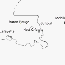
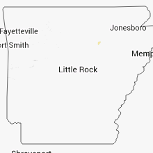
Hail Map for Friday, September 5, 2014

Number of Impacted Households on 9/5/2014
0
Impacted by 1" or Larger Hail
0
Impacted by 1.75" or Larger Hail
0
Impacted by 2.5" or Larger Hail
Square Miles of Populated Area Impacted on 9/5/2014
0
Impacted by 1" or Larger Hail
0
Impacted by 1.75" or Larger Hail
0
Impacted by 2.5" or Larger Hail


Cities Most Affected by Hail Storms of 9/5/2014
| Hail Size | Demographics of Zip Codes Affected | ||||||
|---|---|---|---|---|---|---|---|
| City | Count | Average | Largest | Pop Density | House Value | Income | Age |
| Sturgis, MI | 1 | 2.00 | 2.00 | 241 | $87k | $39.8k | 36.8 |
Hail and Wind Damage Spotted on 9/5/2014
Filter by Report Type:Hail ReportsWind Reports
States Impacted
Florida, Illinois, Arkansas, Alabama, Michigan, Missouri, Indiana, Texas, Ohio, KansasFlorida
| Local Time | Report Details |
|---|---|
| 2:44 PM EDT | A weatherflow station near the intersections of sr-434 and sr-436 in altamonte springs recorded a 58 mph wind gust out of the northwes in seminole county FL, 8.6 miles NNW of Orlando, FL |
Illinois
| Local Time | Report Details |
|---|---|
| 2:00 PM CDT | Est wind gusts 55-60 mph. also pea size hail. minor flooding on lincoln hw in de kalb county IL, 57.7 miles W of Chicago, IL |
| 2:25 PM CDT | Numerous trees dow in kane county IL, 40.5 miles WNW of Chicago, IL |
| 2:30 PM CDT | Medium to large branches down. near intersection of state st. and s. elgin blv in kane county IL, 35.3 miles WNW of Chicago, IL |
| 2:30 PM CDT | 1 mile ne of elgin. trees uprooted and snapped. 2 to 3 ft diameter trees on homes and cars. roads impassable. delayed repor in kane county IL, 35.5 miles WNW of Chicago, IL |
| 2:40 PM CDT | Several periods with gusts of 60+ mph. large tree branches down. power outage in cook county IL, 29.3 miles WNW of Chicago, IL |
| 2:42 PM CDT | Estimated gusts 50 to 60 mph with small tree branches dow in cook county IL, 27.8 miles WNW of Chicago, IL |
| 2:44 PM CDT | Est wind gusts 50 to 65 mph along with pea size hai in cook county IL, 28.8 miles WNW of Chicago, IL |
| 2:45 PM CDT | Storm damage reported in cook county IL, 26.4 miles WNW of Chicago, IL |
| 2:45 PM CDT | Large trees downed. estimated winds of at least 70 mp in cook county IL, 26.1 miles NW of Chicago, IL |
| 2:45 PM CDT | A wooden frame building under construction was collapsed by thunderstorm winds near the intersection of barrington rd and schaumburg r in cook county IL, 28.5 miles WNW of Chicago, IL |
| 2:48 PM CDT | Large tree down blocking butterfield road north of il route 176 in lake county IL, 32.4 miles NNW of Chicago, IL |
| 2:50 PM CDT | Storm damage reported in cook county IL, 19.8 miles NNW of Chicago, IL |
| 2:50 PM CDT | Trees and large branches down blocking street. near uclid st and camp mcdonald r in cook county IL, 21 miles NW of Chicago, IL |
| 2:50 PM CDT | Corner of palatine rd and webster. large tree limbs and branches down. several branches down throughout neighborhoo in cook county IL, 26.1 miles NW of Chicago, IL |
| 2:55 PM CDT | Tree limbs down 15 to 20 ft in length. numerous fences down. est wind gusts to 58 mph. delayed repor in cook county IL, 19.8 miles NNW of Chicago, IL |
| 2:55 PM CDT | Storm damage reported in cook county IL, 22.5 miles NW of Chicago, IL |
| 2:55 PM CDT | Wind gust at oakton community colleg in cook county IL, 17.1 miles NW of Chicago, IL |
| 2:55 PM CDT | Est 65 to 70 mph gust lasting 6 minute in lake county IL, 24.3 miles NNW of Chicago, IL |
| 2:55 PM CDT | Near harlem and devon in cook county IL, 12.2 miles NW of Chicago, IL |
| 2:55 PM CDT | Storm damage reported in cook county IL, 13.6 miles NW of Chicago, IL |
| 3:00 PM CDT | Light pole and multiple trees and branches down. received via twitte in cook county IL, 19.8 miles NNW of Chicago, IL |
| 4:42 PM CDT | Trees and powerlines blown down in cass county IL, 64.7 miles SW of Peoria, IL |
| 4:44 PM CDT | Large tree limbs down greater than 2 inch diamete in lake county IL, 26.3 miles NW of Chicago, IL |
| 4:45 PM CDT | Large tree limbs blown dow in cass county IL, 61.8 miles SW of Peoria, IL |
| 4:55 PM CDT | Roof damaged at schoo in cass county IL, 60.8 miles SSW of Peoria, IL |
| 4:55 PM CDT | Machine shed destroyed in cass county IL, 60.3 miles SW of Peoria, IL |
| 5:10 PM CDT | Storm damage reported in cass county IL, 59.7 miles SSW of Peoria, IL |
| 5:15 PM CDT | Near the cass/menard county line in cass county IL, 52.5 miles SSW of Peoria, IL |
| 5:25 PM CDT | Large tree limb down south of ill route 123 and 97 junction in menard county IL, 49.1 miles SSW of Peoria, IL |
| 5:30 PM CDT | Tree blown across the winchester/glasgow blackto in scott county IL, 70 miles NNW of Saint Louis, MO |
| 5:33 PM CDT | Power lines down on a house in tow in menard county IL, 51 miles S of Peoria, IL |
| 5:50 PM CDT | Elkart fire dept estimated wind in logan county IL, 46.7 miles S of Peoria, IL |
| 7:00 PM CDT | 12 to 15 inch diameter tree branches were blown down on the southeast side of hoopesto in vermilion county IL, 77.8 miles NNE of Mattoon, IL |
| 8:30 PM CDT | 5 inch diameter branch blown down. estimated 60 mph wind gust in clinton county IL, 36.8 miles E of Saint Louis, MO |
Arkansas
| Local Time | Report Details |
|---|---|
| 2:25 PM CDT | Boat docks on hurricane lake were damage in saline county AR, 16.4 miles WSW of Little Rock, AR |
| 2:32 PM CDT | Building materials in a construction area were thrown around...causing damage to a motel and vehicles in the parking lot of the motel. this occurred near oaklawn par in garland county AR, 47.4 miles WSW of Little Rock, AR |
Alabama
| Local Time | Report Details |
|---|---|
| 2:55 PM CDT | 8 inch diamater tree limbs were knocked down by thunderstorm winds between highway 72 and capshaw along old railroad bed roa in madison county AL, 50.4 miles E of Florence, AL |
Michigan
| Local Time | Report Details |
|---|---|
| 4:05 PM EDT | Wires down west of akron in tuscola county MI, 39.2 miles N of Flint, MI |
| 4:15 PM EDT | 8 inch diameter branches down on south main st in huron county MI, 60.3 miles NNE of Flint, MI |
| 4:27 PM EDT | Large tree down on mckenzie between bad axe rd and barrie rd. corrected tim in huron county MI, 63.1 miles NNE of Flint, MI |
| 4:28 PM EDT | Measured at huron county memorial airport /kbax/ in huron county MI, 64.5 miles NNE of Flint, MI |
| 4:28 PM EDT | Several large limbs down along with a few trees. report via faceboo in huron county MI, 58.9 miles NNE of Flint, MI |
| 4:39 PM EDT | Multiple trees down in sanilac county MI, 53.4 miles NE of Flint, MI |
| 4:54 PM EDT | Multiple trees down in sanilac county MI, 51.6 miles ENE of Flint, MI |
| 5:05 PM EDT | Reports of trees down in the area. some reports up to 4 in diamete in berrien county MI, 63 miles ENE of Chicago, IL |
| 5:18 PM EDT | Multiple trees down in sanilac county MI, 64.2 miles ENE of Flint, MI |
| 5:18 PM EDT | Time estimated from radar in van buren county MI, 50.5 miles SSW of Grand Rapids, MI |
| 5:30 PM EDT | Tree down on a car with a person trapped. multiple trees down in the area. time estimated by rada in van buren county MI, 46.8 miles S of Grand Rapids, MI |
| 5:33 PM EDT | Two trees down in lapeer county MI, 23.9 miles ENE of Flint, MI |
| 5:35 PM EDT | 2 foot diameter tree limb down at norway lake rd and scholtz rd in lapeer county MI, 21.3 miles ENE of Flint, MI |
| 5:35 PM EDT | Multiple trees down in lapeer county MI, 15.4 miles NE of Flint, MI |
| 5:40 PM EDT | Power pole down on a truck. time estimated by rada in van buren county MI, 55.7 miles S of Grand Rapids, MI |
| 5:48 PM EDT | Hen Egg sized hail reported near Sturgis, MI, 52.7 miles NNW of Fort Wayne, IN, public tweeted picutre of estimated 2 inch diameter hail. |
| 5:48 PM EDT | Quarter sized hail reported near Sturgis, MI, 52.7 miles NNW of Fort Wayne, IN |
| 5:52 PM EDT | Quarter sized hail reported near Sturgis, MI, 52.7 miles NNW of Fort Wayne, IN |
| 5:55 PM EDT | 1 foot diameter tree snapped in sanilac county MI, 47 miles ENE of Flint, MI |
| 5:55 PM EDT | At least 8 reports of trees down blocking roadways in se kent county including several trees down in alaska in kent county MI, 13 miles SE of Grand Rapids, MI |
| 5:58 PM EDT | Damage to a barn in sanilac county MI, 48.1 miles ENE of Flint, MI |
| 6:03 PM EDT | Several healthy trees down. up to 2 feet in diamete in kalamazoo county MI, 45.1 miles S of Grand Rapids, MI |
| 6:05 PM EDT | Tree branches and a few larger healthy limbs down in kalamazoo county MI, 46.2 miles SSE of Grand Rapids, MI |
| 6:05 PM EDT | Dozens of trees down in fort custer state park. time estimated from rada in kalamazoo county MI, 47.5 miles SSE of Grand Rapids, MI |
| 6:06 PM EDT | Tree branches snapped in springfiel in calhoun county MI, 50 miles SSE of Grand Rapids, MI |
| 6:07 PM EDT | Asos station w k kellogg airport /btl/ in calhoun county MI, 50.1 miles SSE of Grand Rapids, MI |
| 6:10 PM EDT | Trees down at kellogg community college. time estimated by rada in calhoun county MI, 50.6 miles SSE of Grand Rapids, MI |
| 6:13 PM EDT | Tree down and blocking roa in branch county MI, 54.2 miles N of Fort Wayne, IN |
| 6:14 PM EDT | Multiple trees dow in kalamazoo county MI, 47.2 miles SSE of Grand Rapids, MI |
| 6:15 PM EDT | Trees and wires down in bedford twp. also trees down in emmett tw in calhoun county MI, 45.1 miles SSE of Grand Rapids, MI |
| 6:16 PM EDT | 3-4 tree branches snappe in ionia county MI, 22.5 miles ESE of Grand Rapids, MI |
| 6:28 PM EDT | Several large branches down and power is out on w main st and n 9th st. on the west side of kalamazoo in kalamazoo county MI, 46 miles S of Grand Rapids, MI |
| 6:30 PM EDT | Tree snapped on capital ave just south of cascade drive in battle creek in calhoun county MI, 53.1 miles SSE of Grand Rapids, MI |
| 6:31 PM EDT | 6 inch trees down with power out in area at torrey and north rds in genesee county MI, 14.7 miles S of Flint, MI |
| 6:43 PM EDT | Several large trees down in the pine lake are in eaton county MI, 52.5 miles SE of Grand Rapids, MI |
| 6:50 PM EDT | Tree down on us 12 in the village of alle in hillsdale county MI, 63.4 miles NNE of Fort Wayne, IN |
| 6:50 PM EDT | Power lines reported dow in hillsdale county MI, 68.8 miles NNE of Fort Wayne, IN |
| 6:51 PM EDT | 1 foot diameter tree broke off halfway at groveland and dixie hwy near holly in oakland county MI, 11.1 miles SSE of Flint, MI |
| 6:51 PM EDT | Barn destroyed along bellevue hwy in eaton rapids in eaton county MI, 62.6 miles SE of Grand Rapids, MI |
| 6:53 PM EDT | A few trees on houses in eaton rapids. a family fare sign is gone. widespread tree damage and power is out in the downtown are in eaton county MI, 60 miles SW of Flint, MI |
| 6:53 PM EDT | Benches flipped and canopies blown over in downtown park in oakland county MI, 16.7 miles SE of Flint, MI |
| 6:57 PM EDT | Tree down over the road at waverly and holt roads in ingham county MI, 53 miles WSW of Flint, MI |
| 6:59 PM EDT | Power pole down in ingham county MI, 59.4 miles SW of Flint, MI |
| 7:10 PM EDT | 1 foot diameter tree down at coon lake and county farm rds in marion twp in livingston county MI, 35.6 miles SSW of Flint, MI |
| 7:10 PM EDT | A couple of trees down in oakland county MI, 23.1 miles SE of Flint, MI |
| 7:15 PM EDT | Storm damage reported in livingston county MI, 41 miles SSW of Flint, MI |
| 7:15 PM EDT | 15 inch diameter tree snapped off. roof damage to roof under constructio in washtenaw county MI, 47.4 miles SSW of Flint, MI |
| 7:19 PM EDT | 1 foot diameter trees down blocking road in livingston county MI, 30.9 miles SW of Flint, MI |
| 7:20 PM EDT | Storm damage reported in washtenaw county MI, 62.9 miles SSW of Flint, MI |
| 7:20 PM EDT | Storm damage reported in cass county MI, 71.4 miles NW of Fort Wayne, IN |
| 7:27 PM EDT | 2 to 3 inch diameter branches down. also pea size hai in washtenaw county MI, 62.1 miles SSW of Flint, MI |
| 7:27 PM EDT | 6 inch diameter trees down blocking zeeb road north of territorial in washtenaw county MI, 43.6 miles S of Flint, MI |
| 7:28 PM EDT | 1 foot diameter tree down and causing traffic to be diverted on us-127 just south of w barnes roa in ingham county MI, 51.2 miles SW of Flint, MI |
| 7:30 PM EDT | Multiple trees and power lines down in lapeer county MI, 30.7 miles E of Flint, MI |
| 7:31 PM EDT | Bent tree in half in lenawee county MI, 70.3 miles S of Flint, MI |
| 7:32 PM EDT | Tree and roof damage. relayed from washtenaw county em in washtenaw county MI, 57.5 miles S of Flint, MI |
| 7:34 PM EDT | Two 10 inch diameter trees down...one on a vehicle. relayed by washtenaw county em in washtenaw county MI, 48.2 miles SSW of Flint, MI |
| 7:38 PM EDT | Numerous 2 inch diameter branches down in washtenaw county MI, 57.5 miles S of Flint, MI |
| 7:39 PM EDT | Multiple trees down and shingles removed from roof at austin south of michigan ave in washtenaw county MI, 59 miles S of Flint, MI |
| 7:39 PM EDT | Numerous trees and wires down in genesee county MI, 16.9 miles SSW of Flint, MI |
| 7:39 PM EDT | 1 foot limb down at moon and bemis rds in washtenaw county MI, 58.1 miles S of Flint, MI |
| 7:44 PM EDT | Measured at whittaker and judd rd in washtenaw county MI, 60.3 miles S of Flint, MI |
| 7:47 PM EDT | At bunton and textile. small limbs down in washtenaw county MI, 56.3 miles S of Flint, MI |
| 7:48 PM EDT | Multiple 1 foot diameter trees and 6 to 8 inch diameter branches down at 5 mile and merriman in wayne county MI, 45.5 miles SSE of Flint, MI |
| 7:48 PM EDT | Multiple 1 foot diameter trees and 6 to 8 inch diameter branches down at 5 mile and merriman in wayne county MI, 45.5 miles SSE of Flint, MI |
| 7:49 PM EDT | Also 0.5 diameter hail in washtenaw county MI, 56.8 miles S of Flint, MI |
| 7:53 PM EDT | Multiple trees down in monroe county MI, 67.3 miles SSE of Flint, MI |
| 7:55 PM EDT | Large tree limbs down around wayne and cherry hill road in wayne county MI, 50.7 miles SSE of Flint, MI |
| 7:56 PM EDT | 5 inch diameter tree branch down blocking a lane at saginaw and cook road in genesee county MI, 8.8 miles SSE of Flint, MI |
| 7:57 PM EDT | Measured at detroit metro airport /kdtw/ in wayne county MI, 56.9 miles SSE of Flint, MI |
| 7:58 PM EDT | 4 to 6 inch diameter branches and power poles down in genesee county MI, 7.7 miles SSE of Flint, MI |
| 7:58 PM EDT | Grand blank fire dept reports trees down and partial collapse of house on crest knoll drive in genesee county MI, 8.3 miles SSE of Flint, MI |
| 8:00 PM EDT | Trees and limbs down in nottingham forest subdivision in beverly hills. one tree was a 30 ft tall blue spruce. time estimated from rada in oakland county MI, 41.3 miles SE of Flint, MI |
| 8:01 PM EDT | Powerlines down at telegraph and wick in taylor in wayne county MI, 57.3 miles SSE of Flint, MI |
| 8:03 PM EDT | 10 inch diameter tree snapped...multiple large limbs down in genesee county MI, 10.9 miles SE of Flint, MI |
| 8:03 PM EDT | 1.5 foot diameter tree down in genesee county MI, 9.3 miles ESE of Flint, MI |
| 8:03 PM EDT | Multiple large tree limbs dow in wayne county MI, 56.6 miles SSE of Flint, MI |
| 8:06 PM EDT | 18 inch diameter tree dow in oakland county MI, 43.2 miles SE of Flint, MI |
| 8:06 PM EDT | 4 inch diameter branch down at 13 mile and main in royal oak in oakland county MI, 43.8 miles SE of Flint, MI |
| 8:06 PM EDT | Tree fell on car in lapeer county MI, 15.1 miles ESE of Flint, MI |
| 8:08 PM EDT | Wires down at wadhams and frith in kimball twp in st. clair county MI, 57.7 miles E of Flint, MI |
| 8:09 PM EDT | Event tent fell over and injured 5 peopl in wayne county MI, 51.1 miles SSE of Flint, MI |
| 8:10 PM EDT | 3 inch diameter branches down in macomb county MI, 38.5 miles ESE of Flint, MI |
| 8:10 PM EDT | Number of trees down and two large tents destroyed...one is now on a roo in macomb county MI, 52.5 miles SE of Flint, MI |
| 8:10 PM EDT | Small branches down in oakland county MI, 46.2 miles SE of Flint, MI |
| 8:10 PM EDT | At joy road and evergreen in detroit in wayne county MI, 50.3 miles SSE of Flint, MI |
| 8:12 PM EDT | Measured at detroit city airport /kdet/ in wayne county MI, 54.2 miles SE of Flint, MI |
| 8:13 PM EDT | Large limbs down near 11 mile and hoover in macomb county MI, 49.7 miles SE of Flint, MI |
| 8:14 PM EDT | Measured at konz airport in wayne county MI, 66.7 miles SSE of Flint, MI |
| 8:15 PM EDT | Large limbs down in wayne county MI, 66.4 miles SSE of Flint, MI |
| 8:18 PM EDT | Trees...large limbs...and wires down at i-94 and moross in detroit in wayne county MI, 56.1 miles SE of Flint, MI |
| 8:25 PM EDT | Via facebook in wayne county MI, 45.1 miles SSE of Flint, MI |
Missouri
| Local Time | Report Details |
|---|---|
| 3:51 PM CDT | Tree over the roadway blocking one lane of traffic on highway 28 and highway pp in pulaski county MO, 35.4 miles WNW of Salem, MO |
| 4:15 PM CDT | Large tree snapped. picture on social medi in camden county MO, 62.1 miles WNW of Salem, MO |
| 5:01 PM CDT | Public reporting 50 to 60 mph winds near northwest 800 road...half way between appleton city and johnson city in st. clair county MO, 71.9 miles NNW of Springfield, MO |
| 5:40 PM CDT | Co-op observer estimated 60 mph wind gusts south of warsaw in benton county MO, 69.2 miles N of Springfield, MO |
| 5:53 PM CDT | County 911 reports trees down in warsa in benton county MO, 71.3 miles N of Springfield, MO |
| 6:15 PM CDT | Large tree limb blown down on south side of tow in gasconade county MO, 52.3 miles ESE of Columbia, MO |
| 6:19 PM CDT | Large tree limb blown down on south side of tow in gasconade county MO, 52.3 miles ESE of Columbia, MO |
| 7:00 PM CDT | Tree damage reported from west to south of festus. tree on a house in the sunset pointe mobile home park. time estimated from rada in jefferson county MO, 31.2 miles SSW of Saint Louis, MO |
| 7:30 PM CDT | A few trees blown down...unknown size at this tim in st. louis county MO, 14.5 miles SSW of Saint Louis, MO |
| 7:33 PM CDT | A couple of trees down...size unknown. at intersection of hawthorne blvd and milton blv in st. louis city county MO, 2.1 miles SW of Saint Louis, MO |
| 8:35 PM CDT | Small tree limbs blown dow in washington county MO, 43.3 miles ENE of Salem, MO |
Indiana
| Local Time | Report Details |
|---|---|
| 5:40 PM EDT | Quarter sized hail reported near Bourbon, IN, 55.4 miles WNW of Fort Wayne, IN |
| 5:42 PM EDT | Ping Pong Ball sized hail reported near Peru, IN, 54.3 miles WSW of Fort Wayne, IN, hail ranged from pea to 1 diameter before rapid change to 1.5 diameter. |
| 5:42 PM EDT | Ping Pong Ball sized hail reported near Monticello, IN, 82.8 miles SSE of Chicago, IL, hail ranged from pea to 1 diameter before rapid change to 1.5 diameter. |
| 5:50 PM EDT | Quarter sized hail reported near Etna Green, IN, 51.5 miles WNW of Fort Wayne, IN |
| 6:08 PM EDT | Trees reported down between 750 and 800 w on old us 30 in kosciusko county IN, 48.2 miles WNW of Fort Wayne, IN |
| 6:08 PM EDT | Trees down at 1050 north and 350 eas in kosciusko county IN, 41.6 miles WNW of Fort Wayne, IN |
| 6:08 PM EDT | Large tree limbs dow in kosciusko county IN, 42.7 miles WNW of Fort Wayne, IN |
| 6:10 PM EDT | Several reports of trees downed in the are in white county IN, 80.2 miles SSE of Chicago, IL |
| 6:20 PM EDT | Quarter sized hail reported near Lagrange, IN, 42.4 miles NNW of Fort Wayne, IN, public sent picture of measured hail. |
| 6:26 PM EDT | Trees and tree limbs down. no structural damage reported so fa in noble county IN, 37.3 miles NW of Fort Wayne, IN |
| 7:15 PM EDT | 2 ft diameter tree down. took powerlines down with i in steuben county IN, 45.2 miles N of Fort Wayne, IN |
| 7:24 PM EDT | Reported at angola high school. hail lasted for 3 minute in steuben county IN, 38.6 miles N of Fort Wayne, IN |
| 7:24 PM EDT | Quarter sized hail reported near Angola, IN, 38.6 miles N of Fort Wayne, IN, reported at angola high school. hail lasted for 3 minutes. |
| 8:12 PM EDT | 50 to 60 mph wind gusts and several 4 to 5 inch diameter tree limbs down in cass county IN, 74.8 miles W of Fort Wayne, IN |
| 9:45 PM EDT | Fifteen utility poles down with wires across mobile homes. winds recorded at 33 mph just south of scene. time estimate in madison county IN, 37.2 miles NNE of Indianapolis, IN |
Texas
| Local Time | Report Details |
|---|---|
| 5:50 PM CDT | Traveler on hwy 304 reported large oak trees blown down and sheet metal debris by roadway in caldwell county TX, 66.3 miles ENE of San Antonio, TX |
Ohio
| Local Time | Report Details |
|---|---|
| 7:40 PM EDT | Trees down on powerline in williams county OH, 51.1 miles NNE of Fort Wayne, IN |
| 7:50 PM EDT | Report of downed branches on powerline in williams county OH, 49.7 miles NE of Fort Wayne, IN |
Kansas
| Local Time | Report Details |
|---|---|
| 6:51 PM CDT | Local tv station measured a 62 mph wind gus in cherokee county KS, 50.2 miles SE of Chanute, KS |
| 6:55 PM CDT | Broadcast media reported 60 mph wind gusts that lasted approximately 10 minute in cherokee county KS, 50.2 miles SE of Chanute, KS |
Connect with Interactive Hail Maps