

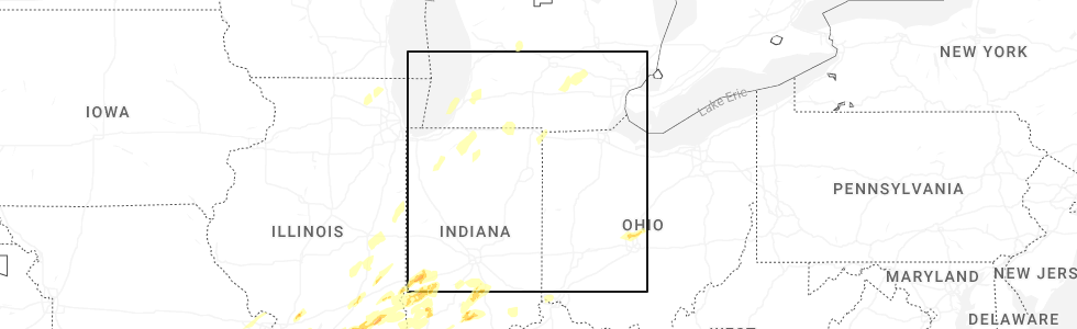
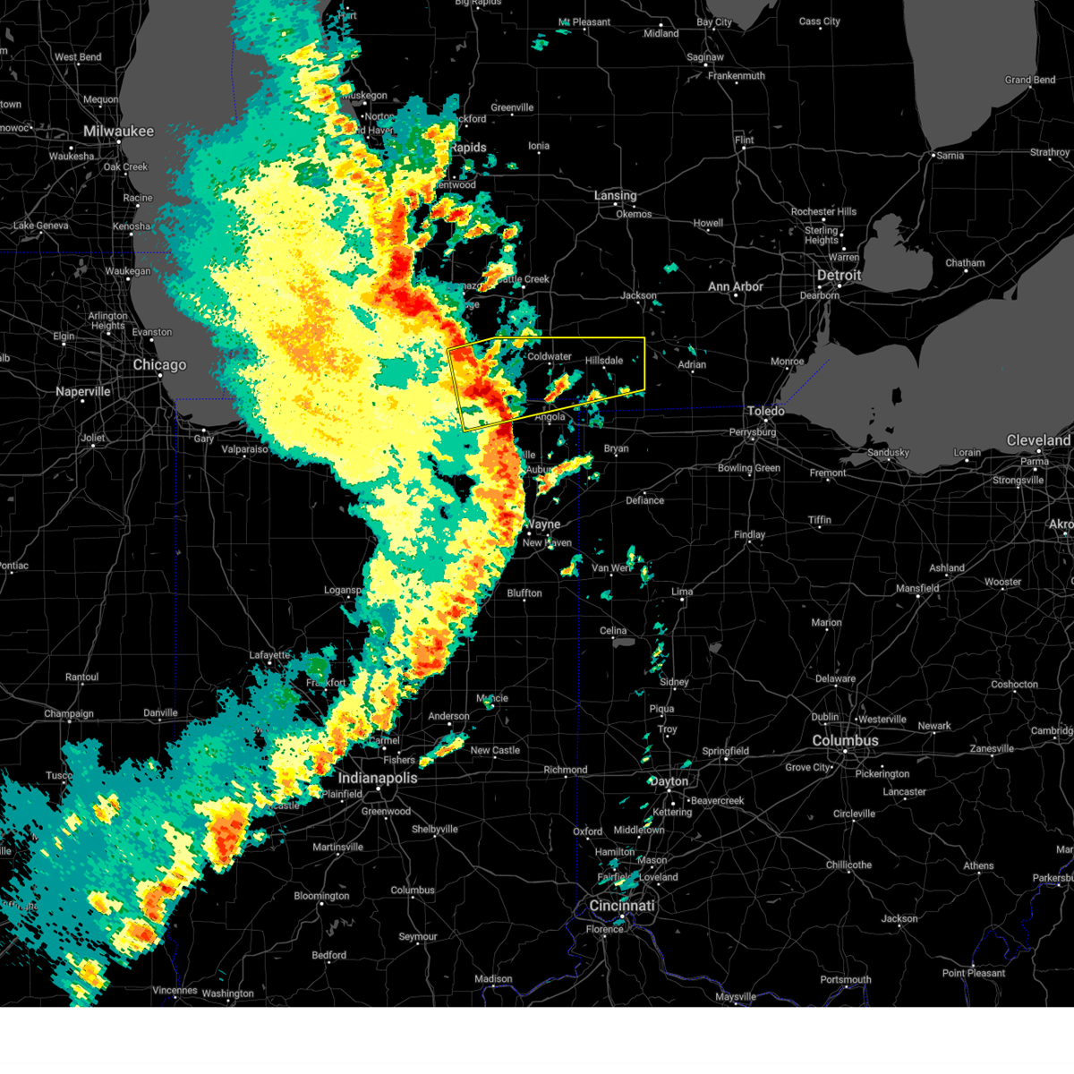
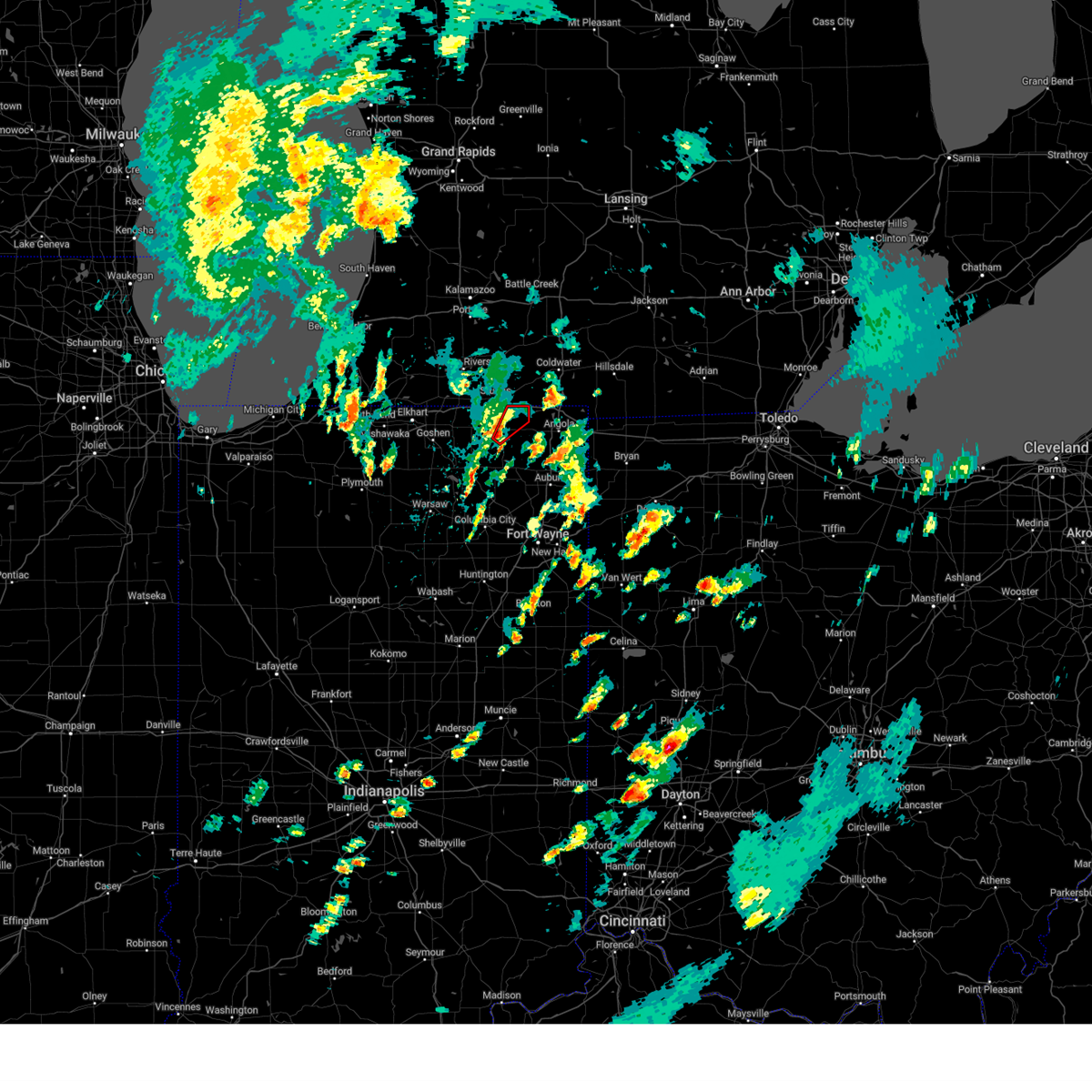
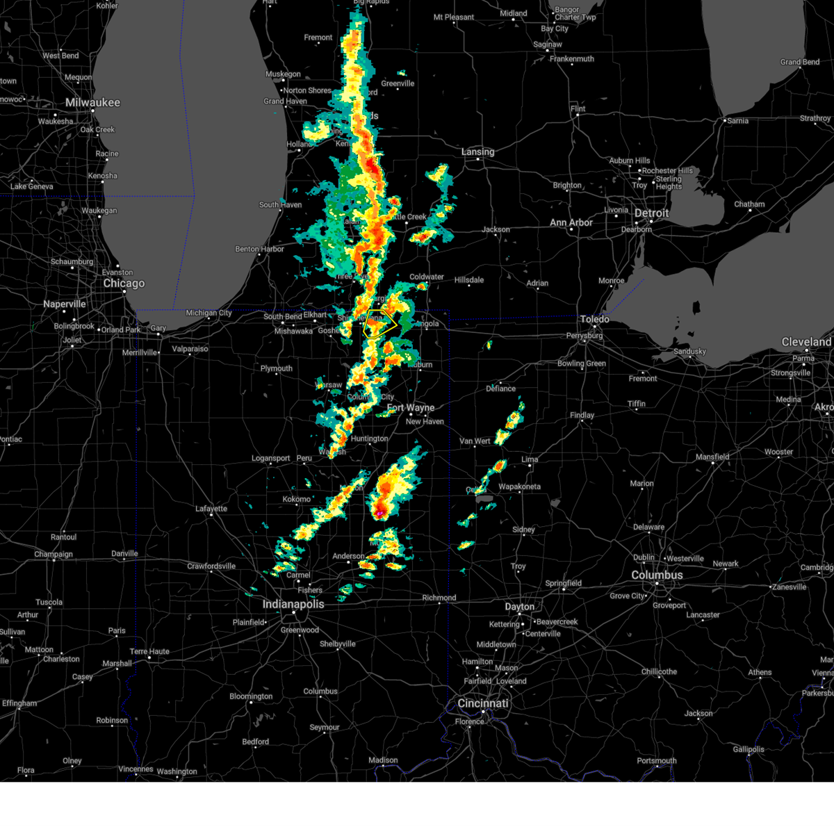
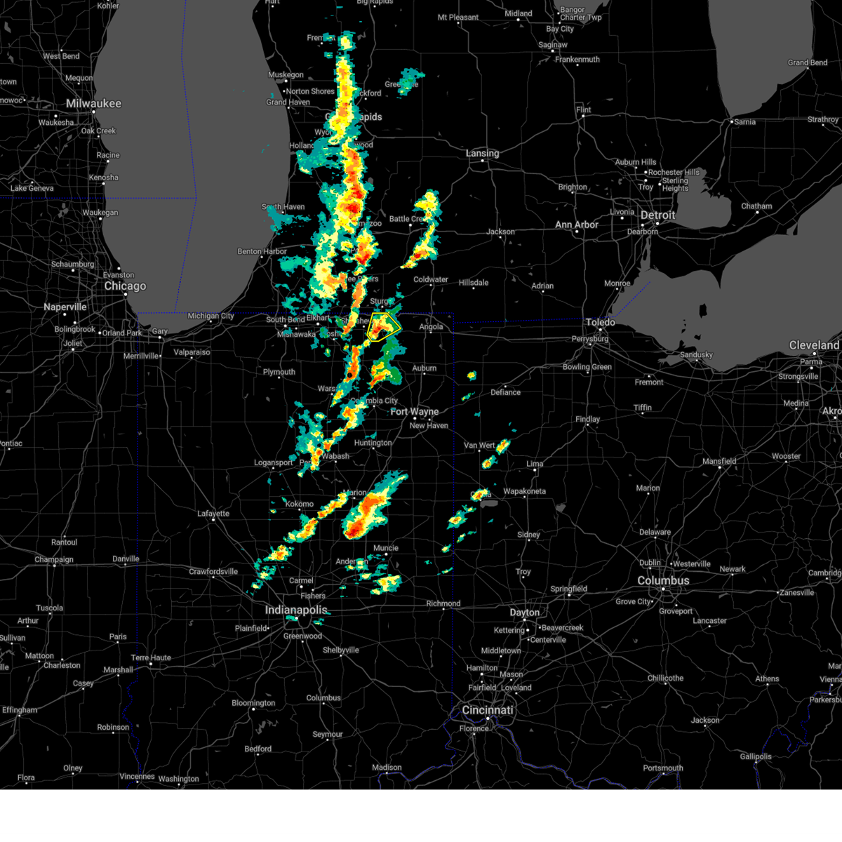
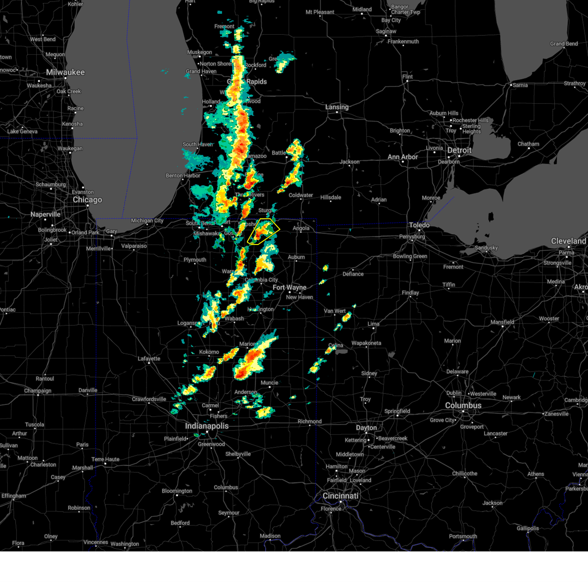
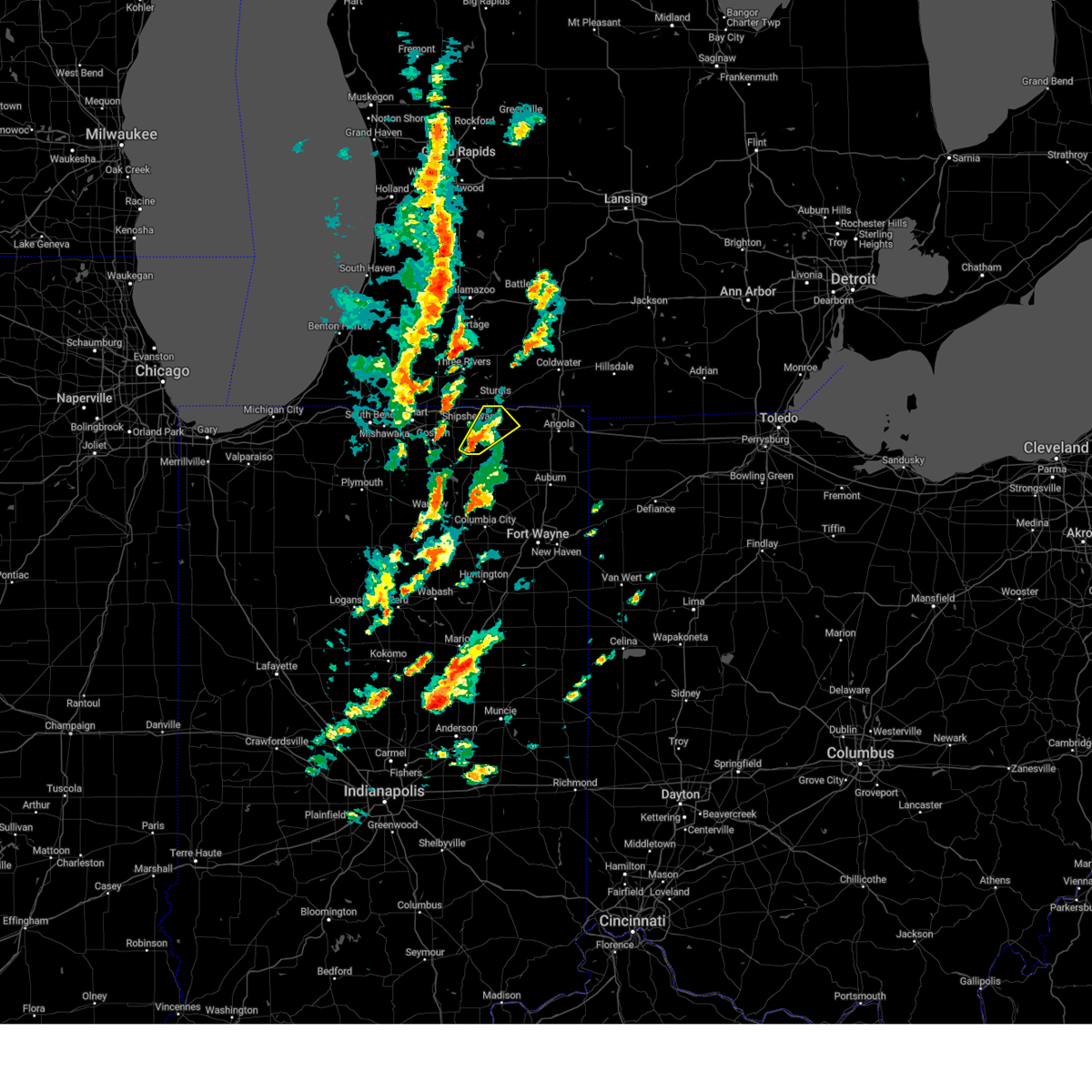
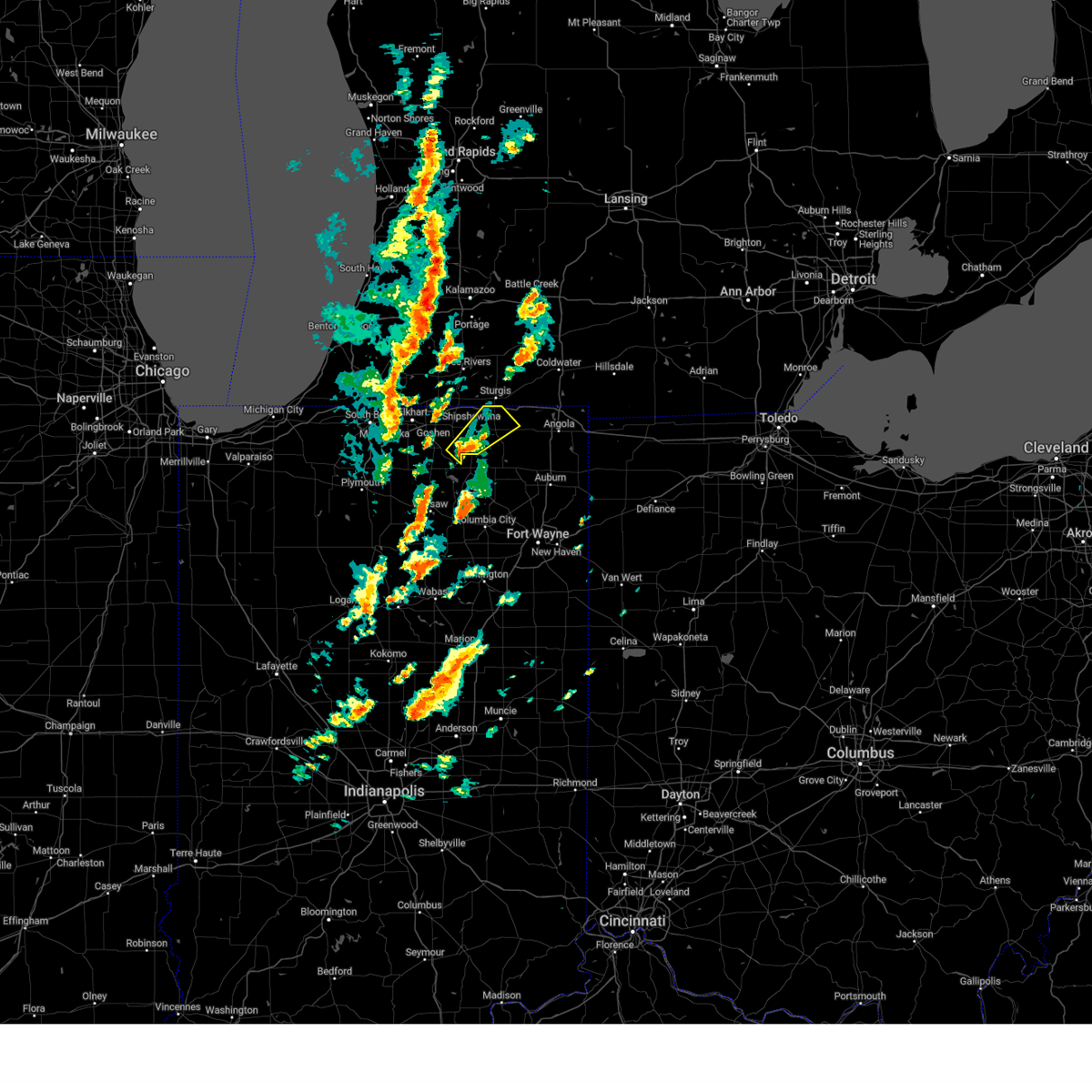
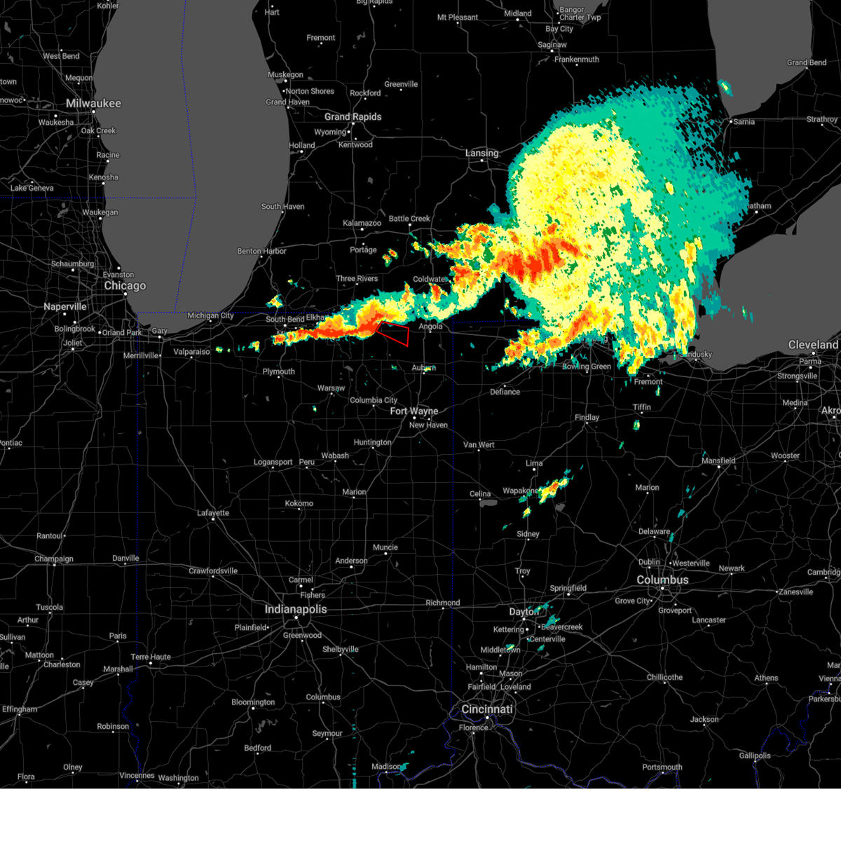
Hail Map for Lagrange, IN
The Lagrange, IN area has had 3 reports of on-the-ground hail by trained spotters, and has been under severe weather warnings 20 times during the past 12 months. Doppler radar has detected hail at or near Lagrange, IN on 48 occasions, including 5 occasions during the past year.
| Name: | Lagrange, IN |
| Where Located: | 42.8 miles NNW of Fort Wayne, IN |
| Map: | Google Map for Lagrange, IN |
| Population: | 2625 |
| Housing Units: | 1221 |
| More Info: | Search Google for Lagrange, IN |
1
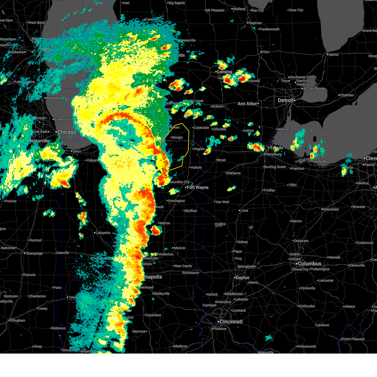
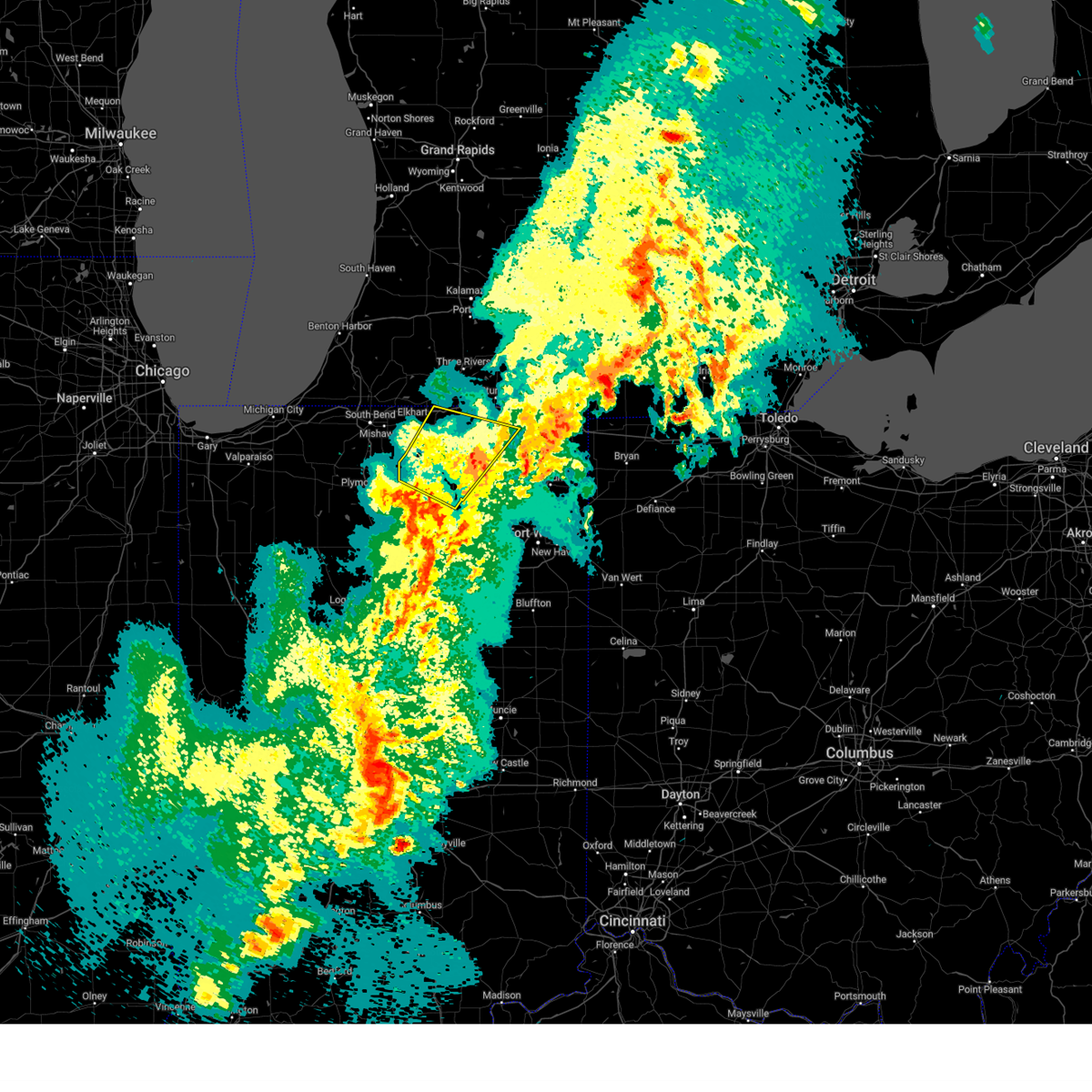
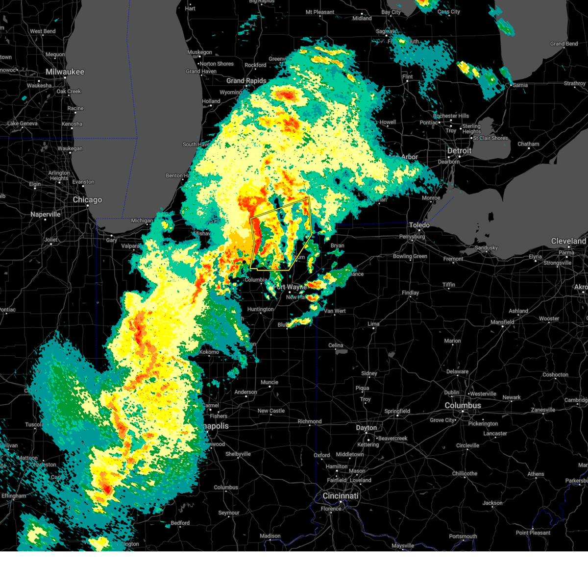
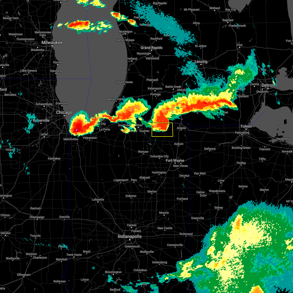
The Top Recent Hail Date for Lagrange, IN is Sunday, March 30, 2025 (11th out of 48)
Hail and Wind Damage Spotted near Lagrange, IN
| Date / Time | Report Details |
|---|---|
| 6/18/2025 5:14 PM EDT | Tree down across state rd in lagrange county IN, 7.2 miles W of Lagrange, IN |
| 6/18/2025 5:01 PM EDT |
 Svriwx the national weather service in northern indiana has issued a * severe thunderstorm warning for, western steuben county in northeastern indiana, eastern noble county in northeastern indiana, lagrange county in northeastern indiana, southeastern st. joseph county in southwestern michigan, southwestern branch county in southwestern michigan, * until 530 pm edt. * at 501 pm edt, severe thunderstorms were located along a line extending from near middlebury to near rome city to near albion, moving northeast at 60 mph (radar indicated). Hazards include 60 mph wind gusts. expect damage to roofs, siding, and trees Svriwx the national weather service in northern indiana has issued a * severe thunderstorm warning for, western steuben county in northeastern indiana, eastern noble county in northeastern indiana, lagrange county in northeastern indiana, southeastern st. joseph county in southwestern michigan, southwestern branch county in southwestern michigan, * until 530 pm edt. * at 501 pm edt, severe thunderstorms were located along a line extending from near middlebury to near rome city to near albion, moving northeast at 60 mph (radar indicated). Hazards include 60 mph wind gusts. expect damage to roofs, siding, and trees
|
| 6/18/2025 4:26 PM EDT | Svriwx the national weather service in northern indiana has issued a * severe thunderstorm warning for, southern elkhart county in north central indiana, noble county in northeastern indiana, whitley county in northeastern indiana, kosciusko county in north central indiana, southern lagrange county in northeastern indiana, * until 500 pm edt. * at 425 pm edt, severe thunderstorms were located along a line extending from near nappanee to warsaw to near north manchester, moving northeast at 65 mph (radar indicated). Hazards include 70 mph wind gusts. Expect considerable tree damage. Damage is likely to mobile homes, roofs, and outbuildings. |
| 4/2/2025 9:43 PM EDT | the severe thunderstorm warning has been cancelled and is no longer in effect |
| 4/2/2025 9:27 PM EDT |
 Svriwx the national weather service in northern indiana has issued a * severe thunderstorm warning for, elkhart county in north central indiana, northwestern noble county in northeastern indiana, northern kosciusko county in north central indiana, southern lagrange county in northeastern indiana, * until 1015 pm edt. * at 927 pm edt, severe thunderstorms were located along a line extending from winona lake to near bremen, moving northeast at 65 mph (radar indicated). Hazards include 60 mph wind gusts. expect damage to roofs, siding, and trees Svriwx the national weather service in northern indiana has issued a * severe thunderstorm warning for, elkhart county in north central indiana, northwestern noble county in northeastern indiana, northern kosciusko county in north central indiana, southern lagrange county in northeastern indiana, * until 1015 pm edt. * at 927 pm edt, severe thunderstorms were located along a line extending from winona lake to near bremen, moving northeast at 65 mph (radar indicated). Hazards include 60 mph wind gusts. expect damage to roofs, siding, and trees
|
| 4/2/2025 8:38 PM EDT |
 the severe thunderstorm warning has been cancelled and is no longer in effect the severe thunderstorm warning has been cancelled and is no longer in effect
|
| 4/2/2025 8:38 PM EDT |
 At 837 pm edt, severe thunderstorms were located along a line extending from near centreville to near topeka to near north webster, moving east at 60 mph (radar indicated). Hazards include 70 mph wind gusts and quarter size hail. Hail damage to vehicles is expected. expect considerable tree damage. wind damage is also likely to mobile homes, roofs, and outbuildings. locations impacted include, topeka, angola, fairfield center, waterloo, sturgis, laotto, big long lake, kinderhook, salem center, helmer, swan, howe, plato, coldwater lake, sedan, mongo, lisbon, hudson, orland, and altona. this includes the following highways, interstate 69 in indiana between mile markers 329 and 357. interstate 69 in michigan between mile markers 1 and 12. Interstate 80 in indiana between mile markers 111 and 151. At 837 pm edt, severe thunderstorms were located along a line extending from near centreville to near topeka to near north webster, moving east at 60 mph (radar indicated). Hazards include 70 mph wind gusts and quarter size hail. Hail damage to vehicles is expected. expect considerable tree damage. wind damage is also likely to mobile homes, roofs, and outbuildings. locations impacted include, topeka, angola, fairfield center, waterloo, sturgis, laotto, big long lake, kinderhook, salem center, helmer, swan, howe, plato, coldwater lake, sedan, mongo, lisbon, hudson, orland, and altona. this includes the following highways, interstate 69 in indiana between mile markers 329 and 357. interstate 69 in michigan between mile markers 1 and 12. Interstate 80 in indiana between mile markers 111 and 151.
|
| 4/2/2025 8:15 PM EDT | Svriwx the national weather service in northern indiana has issued a * severe thunderstorm warning for, steuben county in northeastern indiana, eastern elkhart county in north central indiana, noble county in northeastern indiana, northern whitley county in northeastern indiana, western de kalb county in northeastern indiana, northeastern kosciusko county in north central indiana, lagrange county in northeastern indiana, southeastern st. joseph county in southwestern michigan, southern branch county in southwestern michigan, * until 930 pm edt. * at 814 pm edt, severe thunderstorms were located along a line extending from near simonton lake to 6 miles southeast of nappanee to near mentone, moving east at 60 mph (radar indicated). Hazards include 70 mph wind gusts and quarter size hail. Hail damage to vehicles is expected. expect considerable tree damage. Wind damage is also likely to mobile homes, roofs, and outbuildings. |
| 3/30/2025 5:21 PM EDT |
 The storms which prompted the warning have moved out of the area. therefore, the warning will be allowed to expire. however, gusty winds are still possible with these thunderstorms. a tornado watch remains in effect until 800 pm edt for central, north central and northeastern indiana. remember, a severe thunderstorm warning still remains in effect for whitley, huntington, and allen counties until 6 pm edt. The storms which prompted the warning have moved out of the area. therefore, the warning will be allowed to expire. however, gusty winds are still possible with these thunderstorms. a tornado watch remains in effect until 800 pm edt for central, north central and northeastern indiana. remember, a severe thunderstorm warning still remains in effect for whitley, huntington, and allen counties until 6 pm edt.
|
| 3/30/2025 5:20 PM EDT |
 Svriwx the national weather service in northern indiana has issued a * severe thunderstorm warning for, northern steuben county in northeastern indiana, northern lagrange county in northeastern indiana, st. joseph county in southwestern michigan, branch county in southwestern michigan, hillsdale county in southeastern michigan, * until 615 pm edt. * at 520 pm edt, severe thunderstorms were located along a line extending from three rivers to near white pigeon, moving east at 75 mph (radar indicated). Hazards include 60 mph wind gusts and nickel size hail. expect damage to roofs, siding, and trees Svriwx the national weather service in northern indiana has issued a * severe thunderstorm warning for, northern steuben county in northeastern indiana, northern lagrange county in northeastern indiana, st. joseph county in southwestern michigan, branch county in southwestern michigan, hillsdale county in southeastern michigan, * until 615 pm edt. * at 520 pm edt, severe thunderstorms were located along a line extending from three rivers to near white pigeon, moving east at 75 mph (radar indicated). Hazards include 60 mph wind gusts and nickel size hail. expect damage to roofs, siding, and trees
|
| 3/30/2025 5:12 PM EDT | At 511 pm edt, severe thunderstorms were located along a line extending from near middlebury to near andrews, moving east at 65 mph. damage was reported in etna green around 5 pm, including trees and powerlines down (public). Hazards include 70 mph wind gusts and nickel size hail. Expect considerable tree damage. damage is likely to mobile homes, roofs, and outbuildings. locations impacted include, mcnatts, topeka, honeyville, landess, blue lake, la fontaine, tri-lakes, buckeye, larwill, lake wawasee, bippus, luther, bowerstown, south whitley, servia, coesse, goose lake, knapp lake, jalapa, and loon lake. This includes interstate 69 in indiana between mile markers 266 and 293. |
| 3/30/2025 5:12 PM EDT | the severe thunderstorm warning has been cancelled and is no longer in effect |
| 3/30/2025 5:05 PM EDT |
 Svriwx the national weather service in northern indiana has issued a * severe thunderstorm warning for, southeastern elkhart county in north central indiana, wabash county in north central indiana, noble county in northeastern indiana, northern grant county in central indiana, whitley county in northeastern indiana, huntington county in northeastern indiana, eastern kosciusko county in north central indiana, southern lagrange county in northeastern indiana, steuben county in northeastern indiana, allen county in northeastern indiana, de kalb county in northeastern indiana, wells county in northeastern indiana, northern adams county in northeastern indiana, * until 600 pm edt. * at 504 pm edt, severe thunderstorms were located along a line extending from millersburg to 6 miles northwest of van buren, moving east at 115 mph (radar indicated). Hazards include 70 mph wind gusts and quarter size hail. Hail damage to vehicles is expected. expect considerable tree damage. Wind damage is also likely to mobile homes, roofs, and outbuildings. Svriwx the national weather service in northern indiana has issued a * severe thunderstorm warning for, southeastern elkhart county in north central indiana, wabash county in north central indiana, noble county in northeastern indiana, northern grant county in central indiana, whitley county in northeastern indiana, huntington county in northeastern indiana, eastern kosciusko county in north central indiana, southern lagrange county in northeastern indiana, steuben county in northeastern indiana, allen county in northeastern indiana, de kalb county in northeastern indiana, wells county in northeastern indiana, northern adams county in northeastern indiana, * until 600 pm edt. * at 504 pm edt, severe thunderstorms were located along a line extending from millersburg to 6 miles northwest of van buren, moving east at 115 mph (radar indicated). Hazards include 70 mph wind gusts and quarter size hail. Hail damage to vehicles is expected. expect considerable tree damage. Wind damage is also likely to mobile homes, roofs, and outbuildings.
|
| 3/30/2025 4:50 PM EDT | the severe thunderstorm warning has been cancelled and is no longer in effect |
| 3/30/2025 4:50 PM EDT | At 450 pm edt, severe thunderstorms were located along a line extending from near nappanee to near peru, moving northeast at 65 mph (radar indicated). Hazards include 70 mph wind gusts and nickel size hail. Expect considerable tree damage. damage is likely to mobile homes, roofs, and outbuildings. locations impacted include, mcnatts, honeyville, atwood, la fontaine, macy, tri-lakes, locke, syracuse, bippus, luther, nead, bowerstown, little chapman lake, warsaw, james lake, goose lake, knapp lake, jalapa, new paris, and loon lake. This includes interstate 69 in indiana between mile markers 266 and 293. |
| 3/30/2025 4:33 PM EDT |
 Svriwx the national weather service in northern indiana has issued a * severe thunderstorm warning for, southern elkhart county in north central indiana, wabash county in north central indiana, noble county in northeastern indiana, northern grant county in central indiana, whitley county in northeastern indiana, huntington county in northeastern indiana, kosciusko county in north central indiana, cass county in north central indiana, southwestern lagrange county in northeastern indiana, fulton county in north central indiana, western wells county in northeastern indiana, miami county in north central indiana, marshall county in north central indiana, * until 530 pm edt. * at 433 pm edt, severe thunderstorms were located along a line extending from plymouth to near walton, moving northeast at 65 mph (radar indicated). Hazards include 70 mph wind gusts and nickel size hail. Expect considerable tree damage. Damage is likely to mobile homes, roofs, and outbuildings. Svriwx the national weather service in northern indiana has issued a * severe thunderstorm warning for, southern elkhart county in north central indiana, wabash county in north central indiana, noble county in northeastern indiana, northern grant county in central indiana, whitley county in northeastern indiana, huntington county in northeastern indiana, kosciusko county in north central indiana, cass county in north central indiana, southwestern lagrange county in northeastern indiana, fulton county in north central indiana, western wells county in northeastern indiana, miami county in north central indiana, marshall county in north central indiana, * until 530 pm edt. * at 433 pm edt, severe thunderstorms were located along a line extending from plymouth to near walton, moving northeast at 65 mph (radar indicated). Hazards include 70 mph wind gusts and nickel size hail. Expect considerable tree damage. Damage is likely to mobile homes, roofs, and outbuildings.
|
| 9/24/2024 4:58 PM EDT |
 Toriwx the national weather service in northern indiana has issued a * tornado warning for, eastern lagrange county in northeastern indiana, * until 530 pm edt. * at 458 pm edt, a severe thunderstorm capable of producing a tornado was located near lagrange, moving northeast at 20 mph. this storm has a history of producing brief tornadoes (radar indicated rotation). Hazards include tornado. Flying debris will be dangerous to those caught without shelter. mobile homes will be damaged or destroyed. damage to roofs, windows, and vehicles will occur. tree damage is likely. this dangerous storm will be near, lagrange around 505 pm edt. other locations impacted by this tornadic thunderstorm include brighton, mongo, and plato. This includes interstate 80 in indiana between mile markers 125 and 132. Toriwx the national weather service in northern indiana has issued a * tornado warning for, eastern lagrange county in northeastern indiana, * until 530 pm edt. * at 458 pm edt, a severe thunderstorm capable of producing a tornado was located near lagrange, moving northeast at 20 mph. this storm has a history of producing brief tornadoes (radar indicated rotation). Hazards include tornado. Flying debris will be dangerous to those caught without shelter. mobile homes will be damaged or destroyed. damage to roofs, windows, and vehicles will occur. tree damage is likely. this dangerous storm will be near, lagrange around 505 pm edt. other locations impacted by this tornadic thunderstorm include brighton, mongo, and plato. This includes interstate 80 in indiana between mile markers 125 and 132.
|
| 7/16/2024 12:42 AM EDT |
 At 1242 am edt, severe thunderstorms were located along a line extending from near white pigeon to 6 miles north of topeka to 6 miles south of ligonier to near pierceton, moving northeast at 55 mph (radar indicated). Hazards include 60 mph wind gusts. Expect damage to roofs, siding, and trees. these severe storms will be near, sturgis, lagrange, tri-lakes, albion, and topeka around 1245 am edt. rome city around 1250 am edt. kendallville around 1255 am edt. other locations impacted by these severe thunderstorms include brimfield, honeyville, brushy prairie, merriam, lorane, blue lake, big lake, klinger lake, raber, and big long lake. This includes interstate 80 in indiana between mile markers 111 and 132. At 1242 am edt, severe thunderstorms were located along a line extending from near white pigeon to 6 miles north of topeka to 6 miles south of ligonier to near pierceton, moving northeast at 55 mph (radar indicated). Hazards include 60 mph wind gusts. Expect damage to roofs, siding, and trees. these severe storms will be near, sturgis, lagrange, tri-lakes, albion, and topeka around 1245 am edt. rome city around 1250 am edt. kendallville around 1255 am edt. other locations impacted by these severe thunderstorms include brimfield, honeyville, brushy prairie, merriam, lorane, blue lake, big lake, klinger lake, raber, and big long lake. This includes interstate 80 in indiana between mile markers 111 and 132.
|
| 7/16/2024 12:42 AM EDT |
 the severe thunderstorm warning has been cancelled and is no longer in effect the severe thunderstorm warning has been cancelled and is no longer in effect
|
| 7/16/2024 12:35 AM EDT |
 At 1234 am edt, severe thunderstorms were located along a line extending from near middlebury to near millersburg to north webster to pierceton, moving northeast at 55 mph (radar indicated). Hazards include 70 mph wind gusts. Expect considerable tree damage. damage is likely to mobile homes, roofs, and outbuildings. these severe storms will be near, ligonier, white pigeon, and topeka around 1240 am edt. sturgis, lagrange, tri-lakes, albion, and rome city around 1245 am edt. kendallville around 1255 am edt. other locations impacted by these severe thunderstorms include honeyville, blue lake, klinger lake, larwill, big long lake, lake wawasee, howe, plato, little chapman lake, and mongo. This includes interstate 80 in indiana between mile markers 97 and 132. At 1234 am edt, severe thunderstorms were located along a line extending from near middlebury to near millersburg to north webster to pierceton, moving northeast at 55 mph (radar indicated). Hazards include 70 mph wind gusts. Expect considerable tree damage. damage is likely to mobile homes, roofs, and outbuildings. these severe storms will be near, ligonier, white pigeon, and topeka around 1240 am edt. sturgis, lagrange, tri-lakes, albion, and rome city around 1245 am edt. kendallville around 1255 am edt. other locations impacted by these severe thunderstorms include honeyville, blue lake, klinger lake, larwill, big long lake, lake wawasee, howe, plato, little chapman lake, and mongo. This includes interstate 80 in indiana between mile markers 97 and 132.
|
| 7/16/2024 12:13 AM EDT |
 Svriwx the national weather service in northern indiana has issued a * severe thunderstorm warning for, eastern elkhart county in north central indiana, noble county in northeastern indiana, whitley county in northeastern indiana, kosciusko county in north central indiana, lagrange county in northeastern indiana, southern st. joseph county in southwestern michigan, southwestern branch county in southwestern michigan, * until 100 am edt. * at 1212 am edt, severe thunderstorms were located along a line extending from near osceola to near nappanee to near mentone to near akron, moving northeast at 55 mph (radar indicated). Hazards include 70 mph wind gusts. Expect considerable tree damage. damage is likely to mobile homes, roofs, and outbuildings. severe thunderstorms will be near, goshen, warsaw, winona lake, dunlap, milford, and new paris around 1220 am edt. syracuse, middlebury, bristol, north webster, and millersburg around 1225 am edt. pierceton around 1230 am edt. ligonier, white pigeon, and topeka around 1235 am edt. sturgis, lagrange, tri-lakes, albion, and rome city around 1245 am edt. other locations impacted by these severe thunderstorms include honeyville, blue lake, klinger lake, larwill, big long lake, lake wawasee, howe, plato, little chapman lake, and mongo. This includes interstate 80 in indiana between mile markers 97 and 132. Svriwx the national weather service in northern indiana has issued a * severe thunderstorm warning for, eastern elkhart county in north central indiana, noble county in northeastern indiana, whitley county in northeastern indiana, kosciusko county in north central indiana, lagrange county in northeastern indiana, southern st. joseph county in southwestern michigan, southwestern branch county in southwestern michigan, * until 100 am edt. * at 1212 am edt, severe thunderstorms were located along a line extending from near osceola to near nappanee to near mentone to near akron, moving northeast at 55 mph (radar indicated). Hazards include 70 mph wind gusts. Expect considerable tree damage. damage is likely to mobile homes, roofs, and outbuildings. severe thunderstorms will be near, goshen, warsaw, winona lake, dunlap, milford, and new paris around 1220 am edt. syracuse, middlebury, bristol, north webster, and millersburg around 1225 am edt. pierceton around 1230 am edt. ligonier, white pigeon, and topeka around 1235 am edt. sturgis, lagrange, tri-lakes, albion, and rome city around 1245 am edt. other locations impacted by these severe thunderstorms include honeyville, blue lake, klinger lake, larwill, big long lake, lake wawasee, howe, plato, little chapman lake, and mongo. This includes interstate 80 in indiana between mile markers 97 and 132.
|
| 6/25/2024 9:15 AM EDT | Few trees and large limbs down along with power lines down in lagrange county. approx 350-400 customers without power. time estimated by rada in lagrange county IN, 0.5 miles N of Lagrange, IN |
| 4/17/2024 12:42 PM EDT |
 The storm which prompted the warning has moved out of the area. therefore, the warning will be allowed to expire. a severe thunderstorm watch remains in effect until 700 pm edt for southwestern michigan. The storm which prompted the warning has moved out of the area. therefore, the warning will be allowed to expire. a severe thunderstorm watch remains in effect until 700 pm edt for southwestern michigan.
|
| 4/17/2024 12:24 PM EDT |
 At 1223 pm edt, a severe thunderstorm was located over lagrange, moving northeast at 40 mph (radar indicated). Hazards include 60 mph wind gusts and quarter size hail. Hail damage to vehicles is expected. expect wind damage to roofs, siding, and trees. locations impacted include, lagrange, plato, ontario, howe, and emma. This includes interstate 80 in indiana between mile markers 117 and 123. At 1223 pm edt, a severe thunderstorm was located over lagrange, moving northeast at 40 mph (radar indicated). Hazards include 60 mph wind gusts and quarter size hail. Hail damage to vehicles is expected. expect wind damage to roofs, siding, and trees. locations impacted include, lagrange, plato, ontario, howe, and emma. This includes interstate 80 in indiana between mile markers 117 and 123.
|
| 4/17/2024 12:18 PM EDT |
 The severe thunderstorm which prompted the warning has moved out of the warned area. therefore, the warning has been cancelled. a tornado watch remains in effect until 700 pm edt for northeastern indiana. a severe thunderstorm watch remains in effect until 700 pm edt for southwestern michigan. The severe thunderstorm which prompted the warning has moved out of the warned area. therefore, the warning has been cancelled. a tornado watch remains in effect until 700 pm edt for northeastern indiana. a severe thunderstorm watch remains in effect until 700 pm edt for southwestern michigan.
|
| 4/17/2024 12:18 PM EDT |
 At 1217 pm edt, a severe thunderstorm was located near topeka, or near lagrange, moving northeast at 40 mph (radar indicated). Hazards include 60 mph wind gusts and quarter size hail. Hail damage to vehicles is expected. expect wind damage to roofs, siding, and trees. locations impacted include, lagrange, topeka, honeyville, howe, plato, ontario, and emma. This includes interstate 80 in indiana between mile markers 117 and 123. At 1217 pm edt, a severe thunderstorm was located near topeka, or near lagrange, moving northeast at 40 mph (radar indicated). Hazards include 60 mph wind gusts and quarter size hail. Hail damage to vehicles is expected. expect wind damage to roofs, siding, and trees. locations impacted include, lagrange, topeka, honeyville, howe, plato, ontario, and emma. This includes interstate 80 in indiana between mile markers 117 and 123.
|
| 4/17/2024 12:14 PM EDT |
 the severe thunderstorm warning has been cancelled and is no longer in effect the severe thunderstorm warning has been cancelled and is no longer in effect
|
| 4/17/2024 12:14 PM EDT |
 At 1214 pm edt, a severe thunderstorm was located near topeka, or 7 miles southwest of lagrange, moving northeast at 40 mph (radar indicated). Hazards include 60 mph wind gusts. Expect damage to roofs, siding, and trees. locations impacted include, lagrange, topeka, honeyville, howe, plato, ontario, and emma. This includes interstate 80 in indiana between mile markers 117 and 123. At 1214 pm edt, a severe thunderstorm was located near topeka, or 7 miles southwest of lagrange, moving northeast at 40 mph (radar indicated). Hazards include 60 mph wind gusts. Expect damage to roofs, siding, and trees. locations impacted include, lagrange, topeka, honeyville, howe, plato, ontario, and emma. This includes interstate 80 in indiana between mile markers 117 and 123.
|
| 4/17/2024 12:08 PM EDT |
 Svriwx the national weather service in northern indiana has issued a * severe thunderstorm warning for, east central elkhart county in north central indiana, central lagrange county in northeastern indiana, * until 1245 pm edt. * at 1207 pm edt, a severe thunderstorm was located near topeka, or near ligonier, moving northeast at 40 mph (radar indicated). Hazards include 60 mph wind gusts. expect damage to roofs, siding, and trees Svriwx the national weather service in northern indiana has issued a * severe thunderstorm warning for, east central elkhart county in north central indiana, central lagrange county in northeastern indiana, * until 1245 pm edt. * at 1207 pm edt, a severe thunderstorm was located near topeka, or near ligonier, moving northeast at 40 mph (radar indicated). Hazards include 60 mph wind gusts. expect damage to roofs, siding, and trees
|
| 7/29/2023 2:42 AM EDT |
 The severe thunderstorm warning for southwestern steuben, northwestern allen, noble, northern whitley, western de kalb and southern lagrange counties will expire at 245 am edt, the storms which prompted the warning have moved out of the area. therefore, the warning will be allowed to expire. a severe thunderstorm watch remains in effect until 500 am edt for north central and northeastern indiana. The severe thunderstorm warning for southwestern steuben, northwestern allen, noble, northern whitley, western de kalb and southern lagrange counties will expire at 245 am edt, the storms which prompted the warning have moved out of the area. therefore, the warning will be allowed to expire. a severe thunderstorm watch remains in effect until 500 am edt for north central and northeastern indiana.
|
| 7/29/2023 2:03 AM EDT |
 At 203 am edt, severe thunderstorms were located along a line extending from near middlebury to near syracuse to near winona lake, moving east at 55 mph (radar indicated). Hazards include 60 mph wind gusts. expect damage to roofs, siding, and trees At 203 am edt, severe thunderstorms were located along a line extending from near middlebury to near syracuse to near winona lake, moving east at 55 mph (radar indicated). Hazards include 60 mph wind gusts. expect damage to roofs, siding, and trees
|
| 7/26/2023 9:42 PM EDT |
 The severe thunderstorm warning for east central elkhart, northern noble and western lagrange counties will expire at 945 pm edt, the storms which prompted the warning has weakened below severe limits, and no longer poses an immediate threat to life or property. therefore, the warning will be allowed to expire. however, gusty winds and heavy rain are still possible with this lines of thunderstorms. a severe thunderstorm watch remains in effect until midnight edt for north central and northeastern indiana. The severe thunderstorm warning for east central elkhart, northern noble and western lagrange counties will expire at 945 pm edt, the storms which prompted the warning has weakened below severe limits, and no longer poses an immediate threat to life or property. therefore, the warning will be allowed to expire. however, gusty winds and heavy rain are still possible with this lines of thunderstorms. a severe thunderstorm watch remains in effect until midnight edt for north central and northeastern indiana.
|
| 7/26/2023 9:40 PM EDT | Emergency manager reports multiple trees dow in lagrange county IN, 0.5 miles N of Lagrange, IN |
| 7/26/2023 9:20 PM EDT |
 At 920 pm edt, a severe thunderstorm capable of producing a tornado was located over lagrange, moving southeast at 30 mph (radar indicated rotation). Hazards include tornado. Flying debris will be dangerous to those caught without shelter. mobile homes will be damaged or destroyed. damage to roofs, windows, and vehicles will occur. tree damage is likely. this dangerous storm will be near, lagrange around 925 pm edt. Other locations impacted by this tornadic thunderstorm include brushy prairie, plato, elmira, stroh, indianola, and big long lake. At 920 pm edt, a severe thunderstorm capable of producing a tornado was located over lagrange, moving southeast at 30 mph (radar indicated rotation). Hazards include tornado. Flying debris will be dangerous to those caught without shelter. mobile homes will be damaged or destroyed. damage to roofs, windows, and vehicles will occur. tree damage is likely. this dangerous storm will be near, lagrange around 925 pm edt. Other locations impacted by this tornadic thunderstorm include brushy prairie, plato, elmira, stroh, indianola, and big long lake.
|
| 7/26/2023 9:12 PM EDT |
 At 912 pm edt, a severe thunderstorm was located near lagrange, moving southeast at 30 mph (radar indicated). Hazards include 60 mph wind gusts. Expect damage to roofs, siding, and trees. this severe thunderstorm will be near, lagrange around 915 pm edt. rome city around 930 pm edt. Other locations impacted by this severe thunderstorm include wolcottville, brimfield, honeyville, eddy, adams lake, oliver lake, woodruff, emma, shipshewana, and cosperville. At 912 pm edt, a severe thunderstorm was located near lagrange, moving southeast at 30 mph (radar indicated). Hazards include 60 mph wind gusts. Expect damage to roofs, siding, and trees. this severe thunderstorm will be near, lagrange around 915 pm edt. rome city around 930 pm edt. Other locations impacted by this severe thunderstorm include wolcottville, brimfield, honeyville, eddy, adams lake, oliver lake, woodruff, emma, shipshewana, and cosperville.
|
| 7/20/2023 2:48 PM EDT |
 At 247 pm edt, a severe thunderstorm was located over constantine, or near three rivers, moving southeast at 25 mph (radar indicated). Hazards include two inch hail and 60 mph wind gusts. People and animals outdoors will be injured. expect hail damage to roofs, siding, windows, and vehicles. Expect wind damage to roofs, siding, and trees. At 247 pm edt, a severe thunderstorm was located over constantine, or near three rivers, moving southeast at 25 mph (radar indicated). Hazards include two inch hail and 60 mph wind gusts. People and animals outdoors will be injured. expect hail damage to roofs, siding, windows, and vehicles. Expect wind damage to roofs, siding, and trees.
|
| 6/25/2023 4:00 PM EDT | Multiple trees with snapped limbs 6 to 12 inches in diameter in rome city. photos from twitter. time estimated from rada in lagrange county IN, 9.3 miles W of Lagrange, IN |
| 6/25/2023 3:49 PM EDT |
 At 349 pm edt, severe thunderstorms were located along a line extending from near topeka to near albion to 6 miles southeast of north webster, moving east at 45 mph (radar indicated). Hazards include 70 mph wind gusts and quarter size hail. Hail damage to vehicles is expected. expect considerable tree damage. wind damage is also likely to mobile homes, roofs, and outbuildings. severe thunderstorms will be near, albion and rome city around 355 pm edt. kendallville and lagrange around 400 pm edt. avilla and churubusco around 405 pm edt. auburn around 415 pm edt. huntertown and waterloo around 420 pm edt. angola and garrett around 425 pm edt. butler, hamilton and grabill around 430 pm edt. st. joe around 435 pm edt. other locations impacted by these severe thunderstorms include honeyville, alvarado, fairfield center, saint johns, blue lake, hamilton lake, laotto, moore, big long lake and salem center. this includes the following highways, interstate 69 in indiana between mile markers 318 and 352. Interstate 80 in indiana between mile markers 150 and 156. At 349 pm edt, severe thunderstorms were located along a line extending from near topeka to near albion to 6 miles southeast of north webster, moving east at 45 mph (radar indicated). Hazards include 70 mph wind gusts and quarter size hail. Hail damage to vehicles is expected. expect considerable tree damage. wind damage is also likely to mobile homes, roofs, and outbuildings. severe thunderstorms will be near, albion and rome city around 355 pm edt. kendallville and lagrange around 400 pm edt. avilla and churubusco around 405 pm edt. auburn around 415 pm edt. huntertown and waterloo around 420 pm edt. angola and garrett around 425 pm edt. butler, hamilton and grabill around 430 pm edt. st. joe around 435 pm edt. other locations impacted by these severe thunderstorms include honeyville, alvarado, fairfield center, saint johns, blue lake, hamilton lake, laotto, moore, big long lake and salem center. this includes the following highways, interstate 69 in indiana between mile markers 318 and 352. Interstate 80 in indiana between mile markers 150 and 156.
|
| 6/25/2023 3:23 PM EDT |
 At 322 pm edt, severe thunderstorms were located along a line extending from near dunlap to near nappanee to 8 miles northeast of bourbon, moving east at 40 mph. these are destructive storms for southern elkhart and northern kosciusko county (radar indicated). Hazards include 80 mph wind gusts and quarter size hail. Flying debris will be dangerous to those caught without shelter. mobile homes will be heavily damaged. expect considerable damage to roofs, windows, and vehicles. Extensive tree damage and power outages are likely. At 322 pm edt, severe thunderstorms were located along a line extending from near dunlap to near nappanee to 8 miles northeast of bourbon, moving east at 40 mph. these are destructive storms for southern elkhart and northern kosciusko county (radar indicated). Hazards include 80 mph wind gusts and quarter size hail. Flying debris will be dangerous to those caught without shelter. mobile homes will be heavily damaged. expect considerable damage to roofs, windows, and vehicles. Extensive tree damage and power outages are likely.
|
| 3/3/2023 7:33 PM EST | 8 inch white pine tree snapped and struck a house. thundersnow at the tim in lagrange county IN, 1.5 miles W of Lagrange, IN |
| 8/29/2022 4:45 PM EDT | 3 inch branch down on power line on 1000w. time estimated via rada in steuben county IN, 12.5 miles WNW of Lagrange, IN |
| 8/29/2022 4:27 PM EDT |
 At 427 pm edt, severe thunderstorms were located along a line extending from near union city to near rome city, moving east at 60 mph (radar indicated). Hazards include 60 mph wind gusts. Expect damage to roofs, siding, and trees. locations impacted include, sturgis, coldwater, kendallville, angola, lagrange, bronson, fremont, quincy, union city, hamilton, rome city, colon, topeka, ray, girard, kinderhook, fawn river, batavia, leonidas and california. this includes the following highways, interstate 69 in indiana between mile markers 335 and 357. interstate 69 in michigan between mile markers 1 and 21. interstate 80 in indiana between mile markers 119 and 156. interstate 80 in ohio near mile marker 0. hail threat, radar indicated max hail size, <. 75 in wind threat, radar indicated max wind gust, 60 mph. At 427 pm edt, severe thunderstorms were located along a line extending from near union city to near rome city, moving east at 60 mph (radar indicated). Hazards include 60 mph wind gusts. Expect damage to roofs, siding, and trees. locations impacted include, sturgis, coldwater, kendallville, angola, lagrange, bronson, fremont, quincy, union city, hamilton, rome city, colon, topeka, ray, girard, kinderhook, fawn river, batavia, leonidas and california. this includes the following highways, interstate 69 in indiana between mile markers 335 and 357. interstate 69 in michigan between mile markers 1 and 21. interstate 80 in indiana between mile markers 119 and 156. interstate 80 in ohio near mile marker 0. hail threat, radar indicated max hail size, <. 75 in wind threat, radar indicated max wind gust, 60 mph.
|
| 8/29/2022 4:20 PM EDT | Storm damage reported in lagrange county IN, 1.1 miles WNW of Lagrange, IN |
| 8/29/2022 4:07 PM EDT |
 At 407 pm edt, severe thunderstorms were located along a line extending from 6 miles north of centreville to millersburg, moving east at 55 mph (radar indicated). Hazards include 60 mph wind gusts. expect damage to roofs, siding, and trees At 407 pm edt, severe thunderstorms were located along a line extending from 6 miles north of centreville to millersburg, moving east at 55 mph (radar indicated). Hazards include 60 mph wind gusts. expect damage to roofs, siding, and trees
|
| 7/23/2022 7:38 AM EDT |
 At 737 am edt, severe thunderstorms were located along a line extending from near middlebury to near millersburg to near syracuse, moving east at 50 mph (radar indicated). Hazards include 70 mph wind gusts. Expect considerable tree damage. damage is likely to mobile homes, roofs, and outbuildings. locations impacted include, elkhart, goshen, nappanee, ligonier, syracuse, lagrange, dunlap, middlebury, wakarusa, topeka, millersburg, new paris, benton, locke, shipshewana, honeyville, southwest, foraker, eddy and oliver lake. thunderstorm damage threat, considerable hail threat, radar indicated max hail size, <. 75 in wind threat, radar indicated max wind gust, 70 mph. At 737 am edt, severe thunderstorms were located along a line extending from near middlebury to near millersburg to near syracuse, moving east at 50 mph (radar indicated). Hazards include 70 mph wind gusts. Expect considerable tree damage. damage is likely to mobile homes, roofs, and outbuildings. locations impacted include, elkhart, goshen, nappanee, ligonier, syracuse, lagrange, dunlap, middlebury, wakarusa, topeka, millersburg, new paris, benton, locke, shipshewana, honeyville, southwest, foraker, eddy and oliver lake. thunderstorm damage threat, considerable hail threat, radar indicated max hail size, <. 75 in wind threat, radar indicated max wind gust, 70 mph.
|
| 7/23/2022 7:19 AM EDT |
 At 719 am edt, severe thunderstorms were located along a line extending from 7 miles southeast of cassopolis to near dunlap to near nappanee, moving east at 50 mph (radar indicated). Hazards include 70 mph wind gusts and penny size hail. Expect considerable tree damage. damage is likely to mobile homes, roofs, and outbuildings. locations impacted include, elkhart, mishawaka, goshen, nappanee, bremen, ligonier, syracuse, lagrange, simonton lake, granger, dunlap, middlebury, osceola, wakarusa, bristol, topeka, millersburg, new paris, benton and locke. this includes interstate 80 in indiana between mile markers 80 and 108, between mile markers 110 and 111, and between mile markers 114 and 117. thunderstorm damage threat, considerable hail threat, radar indicated max hail size, 0. 75 in wind threat, radar indicated max wind gust, 70 mph. At 719 am edt, severe thunderstorms were located along a line extending from 7 miles southeast of cassopolis to near dunlap to near nappanee, moving east at 50 mph (radar indicated). Hazards include 70 mph wind gusts and penny size hail. Expect considerable tree damage. damage is likely to mobile homes, roofs, and outbuildings. locations impacted include, elkhart, mishawaka, goshen, nappanee, bremen, ligonier, syracuse, lagrange, simonton lake, granger, dunlap, middlebury, osceola, wakarusa, bristol, topeka, millersburg, new paris, benton and locke. this includes interstate 80 in indiana between mile markers 80 and 108, between mile markers 110 and 111, and between mile markers 114 and 117. thunderstorm damage threat, considerable hail threat, radar indicated max hail size, 0. 75 in wind threat, radar indicated max wind gust, 70 mph.
|
| 7/23/2022 7:05 AM EDT |
 At 705 am edt, severe thunderstorms were located along a line extending from near edwardsburg to near osceola to near bremen, moving east at 50 mph (radar indicated). Hazards include 70 mph wind gusts and penny size hail. Expect considerable tree damage. damage is likely to mobile homes, roofs, and outbuildings. locations impacted include, south bend, elkhart, mishawaka, goshen, niles, sturgis, nappanee, bremen, ligonier, georgetown, syracuse, lagrange, gulivoire park, granger, dunlap, simonton lake, middlebury, osceola, constantine and wakarusa. this includes interstate 80 in indiana between mile markers 72 and 121. thunderstorm damage threat, considerable hail threat, radar indicated max hail size, 0. 75 in wind threat, radar indicated max wind gust, 70 mph. At 705 am edt, severe thunderstorms were located along a line extending from near edwardsburg to near osceola to near bremen, moving east at 50 mph (radar indicated). Hazards include 70 mph wind gusts and penny size hail. Expect considerable tree damage. damage is likely to mobile homes, roofs, and outbuildings. locations impacted include, south bend, elkhart, mishawaka, goshen, niles, sturgis, nappanee, bremen, ligonier, georgetown, syracuse, lagrange, gulivoire park, granger, dunlap, simonton lake, middlebury, osceola, constantine and wakarusa. this includes interstate 80 in indiana between mile markers 72 and 121. thunderstorm damage threat, considerable hail threat, radar indicated max hail size, 0. 75 in wind threat, radar indicated max wind gust, 70 mph.
|
| 7/23/2022 6:57 AM EDT |
 At 657 am edt, severe thunderstorms were located along a line extending from near edwardsburg to near osceola to near bremen, moving east at 50 mph (radar indicated). Hazards include 60 mph wind gusts and penny size hail. expect damage to roofs, siding, and trees At 657 am edt, severe thunderstorms were located along a line extending from near edwardsburg to near osceola to near bremen, moving east at 50 mph (radar indicated). Hazards include 60 mph wind gusts and penny size hail. expect damage to roofs, siding, and trees
|
| 7/5/2022 6:59 PM EDT |
 At 659 pm edt, a severe thunderstorm was located near millersburg, or 7 miles east of goshen, moving east at 20 mph (radar indicated). Hazards include 60 mph wind gusts and penny size hail. expect damage to roofs, siding, and trees At 659 pm edt, a severe thunderstorm was located near millersburg, or 7 miles east of goshen, moving east at 20 mph (radar indicated). Hazards include 60 mph wind gusts and penny size hail. expect damage to roofs, siding, and trees
|
| 6/13/2022 8:43 PM EDT |
 At 843 pm edt, a severe thunderstorm was located over lagrange, moving southeast at 40 mph (radar indicated). Hazards include golf ball size hail and 70 mph wind gusts. People and animals outdoors will be injured. expect hail damage to roofs, siding, windows, and vehicles. expect considerable tree damage. wind damage is also likely to mobile homes, roofs, and outbuildings. locations impacted include, lagrange, topeka, scott, wolcottville, shipshewana, honeyville, stroh, brighton, mongo, indianola, brushy prairie, woodruff, elmira, big long lake, eddy, adams lake, oliver lake, howe, plato and ontario. This includes interstate 80 in indiana between mile markers 109 and 132. At 843 pm edt, a severe thunderstorm was located over lagrange, moving southeast at 40 mph (radar indicated). Hazards include golf ball size hail and 70 mph wind gusts. People and animals outdoors will be injured. expect hail damage to roofs, siding, windows, and vehicles. expect considerable tree damage. wind damage is also likely to mobile homes, roofs, and outbuildings. locations impacted include, lagrange, topeka, scott, wolcottville, shipshewana, honeyville, stroh, brighton, mongo, indianola, brushy prairie, woodruff, elmira, big long lake, eddy, adams lake, oliver lake, howe, plato and ontario. This includes interstate 80 in indiana between mile markers 109 and 132.
|
| 8/10/2021 11:23 PM EDT |
 The severe thunderstorm warning for elkhart, northwestern noble, southeastern st. joseph, lagrange, eastern cass and st. joseph counties will expire at 1130 pm edt, the storms which prompted the warning have weakened below severe limits, and no longer pose an immediate threat to life or property. therefore, the warning will be allowed to expire. a severe thunderstorm watch remains in effect until 300 am edt for north central and northeastern indiana, and southwestern michigan. The severe thunderstorm warning for elkhart, northwestern noble, southeastern st. joseph, lagrange, eastern cass and st. joseph counties will expire at 1130 pm edt, the storms which prompted the warning have weakened below severe limits, and no longer pose an immediate threat to life or property. therefore, the warning will be allowed to expire. a severe thunderstorm watch remains in effect until 300 am edt for north central and northeastern indiana, and southwestern michigan.
|
| 8/10/2021 10:45 PM EDT |
 At 1044 pm edt, severe thunderstorms were located along a line extending from near marcellus to elkhart to near bremen, moving northeast at 50 mph (radar indicated). Hazards include 70 mph wind gusts and penny size hail. Expect considerable tree damage. Damage is likely to mobile homes, roofs, and outbuildings. At 1044 pm edt, severe thunderstorms were located along a line extending from near marcellus to elkhart to near bremen, moving northeast at 50 mph (radar indicated). Hazards include 70 mph wind gusts and penny size hail. Expect considerable tree damage. Damage is likely to mobile homes, roofs, and outbuildings.
|
| 8/10/2021 10:42 PM EDT |
 At 1041 pm edt, severe thunderstorms were located along a line extending from near cassopolis to near south bend to koontz lake, moving east at 70 mph (radar indicated). Hazards include 60 mph wind gusts and penny size hail. expect damage to roofs, siding, and trees At 1041 pm edt, severe thunderstorms were located along a line extending from near cassopolis to near south bend to koontz lake, moving east at 70 mph (radar indicated). Hazards include 60 mph wind gusts and penny size hail. expect damage to roofs, siding, and trees
|
| 8/10/2021 2:57 AM EDT |
 At 257 am edt, severe thunderstorms were located along a line extending from 10 miles southeast of sturgis to near lagrange to near topeka, moving southeast at 25 mph (radar indicated). Hazards include 60 mph wind gusts. Expect damage to roofs, siding, and trees. locations impacted include, kendallville, lagrange, rome city, topeka, wolcottville, honeyville, stroh, indianola, woodruff, elmira, big long lake, eddy, adams lake, oliver lake, plato and emma. hail threat, radar indicated max hail size, <. 75 in wind threat, radar indicated max wind gust, 60 mph. At 257 am edt, severe thunderstorms were located along a line extending from 10 miles southeast of sturgis to near lagrange to near topeka, moving southeast at 25 mph (radar indicated). Hazards include 60 mph wind gusts. Expect damage to roofs, siding, and trees. locations impacted include, kendallville, lagrange, rome city, topeka, wolcottville, honeyville, stroh, indianola, woodruff, elmira, big long lake, eddy, adams lake, oliver lake, plato and emma. hail threat, radar indicated max hail size, <. 75 in wind threat, radar indicated max wind gust, 60 mph.
|
| 8/10/2021 2:50 AM EDT |
 At 249 am edt, severe thunderstorms were located along a line extending from near lagrange to 10 miles northwest of rome city to topeka, moving southeast at 25 mph (radar indicated). Hazards include 60 mph wind gusts. expect damage to roofs, siding, and trees At 249 am edt, severe thunderstorms were located along a line extending from near lagrange to 10 miles northwest of rome city to topeka, moving southeast at 25 mph (radar indicated). Hazards include 60 mph wind gusts. expect damage to roofs, siding, and trees
|
| 8/6/2021 9:06 PM EDT |
 The severe thunderstorm warning for noble and southern lagrange counties will expire at 915 pm edt, the storms which prompted the warning have weakened below severe limits, and no longer pose an immediate threat to life or property. therefore, the warning will be allowed to expire. The severe thunderstorm warning for noble and southern lagrange counties will expire at 915 pm edt, the storms which prompted the warning have weakened below severe limits, and no longer pose an immediate threat to life or property. therefore, the warning will be allowed to expire.
|
| 8/6/2021 8:54 PM EDT |
 At 853 pm edt, severe thunderstorms were located along a line extending from near topeka to rome city to near north webster, moving east at 35 mph (radar indicated). Hazards include 60 mph wind gusts. Expect damage to roofs, siding, and trees. locations impacted include, kendallville, ligonier, avilla, albion, rome city, topeka, swan, wolcottville, cromwell, brimfield, brushy prairie, big long lake, plato, bear lake, green center, indianola, lisbon, wilmot, woodruff and knapp lake. hail threat, radar indicated max hail size, <. 75 in wind threat, radar indicated max wind gust, 60 mph. At 853 pm edt, severe thunderstorms were located along a line extending from near topeka to rome city to near north webster, moving east at 35 mph (radar indicated). Hazards include 60 mph wind gusts. Expect damage to roofs, siding, and trees. locations impacted include, kendallville, ligonier, avilla, albion, rome city, topeka, swan, wolcottville, cromwell, brimfield, brushy prairie, big long lake, plato, bear lake, green center, indianola, lisbon, wilmot, woodruff and knapp lake. hail threat, radar indicated max hail size, <. 75 in wind threat, radar indicated max wind gust, 60 mph.
|
| 6/20/2021 7:53 PM EDT |
 The severe thunderstorm warning for southeastern elkhart, northern noble, lagrange and southeastern st. joseph counties will expire at 800 pm edt, the storms which prompted the warning have weakened below severe limits, and have exited the warned area. therefore, the warning will be allowed to expire. however heavy rain is still possible with these thunderstorms. a severe thunderstorm watch remains in effect until 100 am edt for north central and northeastern indiana, and southwestern michigan. The severe thunderstorm warning for southeastern elkhart, northern noble, lagrange and southeastern st. joseph counties will expire at 800 pm edt, the storms which prompted the warning have weakened below severe limits, and have exited the warned area. therefore, the warning will be allowed to expire. however heavy rain is still possible with these thunderstorms. a severe thunderstorm watch remains in effect until 100 am edt for north central and northeastern indiana, and southwestern michigan.
|
| 6/20/2021 7:47 PM EDT |
 At 746 pm edt, severe thunderstorms were located along a line extending from centreville to 6 miles southwest of sturgis to 7 miles east of middlebury, moving northeast at 40 mph (radar indicated). Hazards include 60 mph wind gusts and penny size hail. Expect damage to roofs, siding, and trees. Locations impacted include, sturgis, kendallville, ligonier, syracuse, lagrange, rome city, colon, topeka, millersburg, scott, fawn river, wolcottville, burr oak, shipshewana, brimfield, honeyville, brushy prairie, klinger lake, big long lake and howe. At 746 pm edt, severe thunderstorms were located along a line extending from centreville to 6 miles southwest of sturgis to 7 miles east of middlebury, moving northeast at 40 mph (radar indicated). Hazards include 60 mph wind gusts and penny size hail. Expect damage to roofs, siding, and trees. Locations impacted include, sturgis, kendallville, ligonier, syracuse, lagrange, rome city, colon, topeka, millersburg, scott, fawn river, wolcottville, burr oak, shipshewana, brimfield, honeyville, brushy prairie, klinger lake, big long lake and howe.
|
| 6/20/2021 7:38 PM EDT |
 At 737 pm edt, severe thunderstorms were located along a line extending from near constantine to 6 miles east of middlebury to near millersburg, moving northeast at 40 mph (radar indicated). Hazards include 60 mph wind gusts and quarter size hail. Hail damage to vehicles is expected. expect wind damage to roofs, siding, and trees. Locations impacted include, sturgis, kendallville, ligonier, syracuse, lagrange, middlebury, constantine, white pigeon, rome city, colon, topeka, millersburg, benton, scott, fawn river, wolcottville, burr oak, shipshewana, brimfield and honeyville. At 737 pm edt, severe thunderstorms were located along a line extending from near constantine to 6 miles east of middlebury to near millersburg, moving northeast at 40 mph (radar indicated). Hazards include 60 mph wind gusts and quarter size hail. Hail damage to vehicles is expected. expect wind damage to roofs, siding, and trees. Locations impacted include, sturgis, kendallville, ligonier, syracuse, lagrange, middlebury, constantine, white pigeon, rome city, colon, topeka, millersburg, benton, scott, fawn river, wolcottville, burr oak, shipshewana, brimfield and honeyville.
|
| 6/20/2021 7:19 PM EDT |
 At 719 pm edt, severe thunderstorms were located along a line extending from near bristol to near goshen to new paris, moving northeast at 40 mph (public reported wind damage and golf ball sized hail in the greater mishawaka area). Hazards include 60 mph wind gusts and quarter size hail. Hail damage to vehicles is expected. Expect wind damage to roofs, siding, and trees. At 719 pm edt, severe thunderstorms were located along a line extending from near bristol to near goshen to new paris, moving northeast at 40 mph (public reported wind damage and golf ball sized hail in the greater mishawaka area). Hazards include 60 mph wind gusts and quarter size hail. Hail damage to vehicles is expected. Expect wind damage to roofs, siding, and trees.
|
| 8/10/2020 7:18 PM EDT |
 At 717 pm edt, severe thunderstorms were located along a line extending from near colon to 6 miles northwest of lagrange to ligonier to near tri-lakes, moving east at 45 mph (trained weather spotters have reported several trees and branches down). Hazards include 70 mph wind gusts and penny size hail. Expect considerable tree damage. damage is likely to mobile homes, roofs, and outbuildings. these severe storms will be near, sturgis, lagrange, albion and colon around 725 pm edt. rome city around 730 pm edt. Other locations impacted by these severe thunderstorms include honeyville, nottawa, klinger lake, fishers lake, larwill, leonidas, corey lake, lake wawasee, howe and james lake. At 717 pm edt, severe thunderstorms were located along a line extending from near colon to 6 miles northwest of lagrange to ligonier to near tri-lakes, moving east at 45 mph (trained weather spotters have reported several trees and branches down). Hazards include 70 mph wind gusts and penny size hail. Expect considerable tree damage. damage is likely to mobile homes, roofs, and outbuildings. these severe storms will be near, sturgis, lagrange, albion and colon around 725 pm edt. rome city around 730 pm edt. Other locations impacted by these severe thunderstorms include honeyville, nottawa, klinger lake, fishers lake, larwill, leonidas, corey lake, lake wawasee, howe and james lake.
|
| 8/10/2020 7:07 PM EDT |
 At 706 pm edt, severe thunderstorms were located along a line extending from near three rivers to middlebury to near syracuse to near pierceton, moving east at 45 mph (trained weather spotters have reported several trees and branches down across the area). Hazards include 70 mph wind gusts and penny size hail. Expect considerable tree damage. damage is likely to mobile homes, roofs, and outbuildings. these severe storms will be near, three rivers and centreville around 710 pm edt. ligonier and topeka around 715 pm edt. columbia city and tri-lakes around 720 pm edt. sturgis, lagrange, albion and colon around 725 pm edt. rome city around 730 pm edt. Other locations impacted by these severe thunderstorms include vandalia, honeyville, nottawa, klinger lake, donnell lake, fishers lake, larwill, leonidas, corey lake and lake wawasee. At 706 pm edt, severe thunderstorms were located along a line extending from near three rivers to middlebury to near syracuse to near pierceton, moving east at 45 mph (trained weather spotters have reported several trees and branches down across the area). Hazards include 70 mph wind gusts and penny size hail. Expect considerable tree damage. damage is likely to mobile homes, roofs, and outbuildings. these severe storms will be near, three rivers and centreville around 710 pm edt. ligonier and topeka around 715 pm edt. columbia city and tri-lakes around 720 pm edt. sturgis, lagrange, albion and colon around 725 pm edt. rome city around 730 pm edt. Other locations impacted by these severe thunderstorms include vandalia, honeyville, nottawa, klinger lake, donnell lake, fishers lake, larwill, leonidas, corey lake and lake wawasee.
|
| 8/10/2020 6:47 PM EDT |
 At 647 pm edt, severe thunderstorms were located along a line extending from near marcellus to elkhart to nappanee to near warsaw, moving east at 45 mph. these are very dangerous storms (radar indicated). Hazards include 80 mph wind gusts and quarter size hail. Flying debris will be dangerous to those caught without shelter. mobile homes will be heavily damaged. expect considerable damage to roofs, windows, and vehicles. extensive tree damage and power outages are likely. these severe storms will be near, marcellus around 650 pm edt. warsaw, winona lake, bristol and milford around 655 pm edt. goshen, three rivers and new paris around 700 pm edt. syracuse, middlebury, north webster, pierceton and millersburg around 705 pm edt. centreville around 710 pm edt. columbia city, ligonier and topeka around 715 pm edt. tri-lakes around 720 pm edt. sturgis, lagrange, albion and colon around 725 pm edt. Other locations impacted by these severe thunderstorms include honeyville, nottawa, atwood, juno lake, fishers lake, diamond lake, corey lake, howe, locke and wakelee. At 647 pm edt, severe thunderstorms were located along a line extending from near marcellus to elkhart to nappanee to near warsaw, moving east at 45 mph. these are very dangerous storms (radar indicated). Hazards include 80 mph wind gusts and quarter size hail. Flying debris will be dangerous to those caught without shelter. mobile homes will be heavily damaged. expect considerable damage to roofs, windows, and vehicles. extensive tree damage and power outages are likely. these severe storms will be near, marcellus around 650 pm edt. warsaw, winona lake, bristol and milford around 655 pm edt. goshen, three rivers and new paris around 700 pm edt. syracuse, middlebury, north webster, pierceton and millersburg around 705 pm edt. centreville around 710 pm edt. columbia city, ligonier and topeka around 715 pm edt. tri-lakes around 720 pm edt. sturgis, lagrange, albion and colon around 725 pm edt. Other locations impacted by these severe thunderstorms include honeyville, nottawa, atwood, juno lake, fishers lake, diamond lake, corey lake, howe, locke and wakelee.
|
| 8/10/2020 6:24 PM EDT |
 At 623 pm edt, severe thunderstorms were located along a line extending from near dowagiac to near south bend to near plymouth to argos, moving east at 45 mph. these are very dangerous storms (radar indicated). Hazards include 80 mph wind gusts and quarter size hail. Flying debris will be dangerous to those caught without shelter. mobile homes will be heavily damaged. expect considerable damage to roofs, windows, and vehicles. extensive tree damage and power outages are likely. severe thunderstorms will be near, mishawaka and dowagiac around 630 pm edt. bremen, granger, bourbon and cassopolis around 635 pm edt. osceola and mentone around 640 pm edt. elkhart, simonton lake, wakarusa and marcellus around 645 pm edt. nappanee and dunlap around 650 pm edt. warsaw, winona lake, bristol, milford and new paris around 655 pm edt. goshen, three rivers, syracuse and pierceton around 700 pm edt. middlebury, centreville, north webster and millersburg around 705 pm edt. This includes interstate 80 in indiana between mile markers 73 and 124. At 623 pm edt, severe thunderstorms were located along a line extending from near dowagiac to near south bend to near plymouth to argos, moving east at 45 mph. these are very dangerous storms (radar indicated). Hazards include 80 mph wind gusts and quarter size hail. Flying debris will be dangerous to those caught without shelter. mobile homes will be heavily damaged. expect considerable damage to roofs, windows, and vehicles. extensive tree damage and power outages are likely. severe thunderstorms will be near, mishawaka and dowagiac around 630 pm edt. bremen, granger, bourbon and cassopolis around 635 pm edt. osceola and mentone around 640 pm edt. elkhart, simonton lake, wakarusa and marcellus around 645 pm edt. nappanee and dunlap around 650 pm edt. warsaw, winona lake, bristol, milford and new paris around 655 pm edt. goshen, three rivers, syracuse and pierceton around 700 pm edt. middlebury, centreville, north webster and millersburg around 705 pm edt. This includes interstate 80 in indiana between mile markers 73 and 124.
|
| 6/26/2020 10:14 PM EDT |
 At 1014 pm edt, severe thunderstorms were located along a line extending from near bristol to near lakeville, moving east at 50 mph (radar indicated). Hazards include 70 mph wind gusts. Expect considerable tree damage. damage is likely to mobile homes, roofs, and outbuildings. severe thunderstorms will be near, dunlap and bristol around 1020 pm edt. middlebury around 1025 pm edt. wakarusa and millersburg around 1030 pm edt. nappanee and topeka around 1035 pm edt. milford around 1040 pm edt. syracuse around 1045 pm edt. rome city around 1050 pm edt. Other locations impacted by these severe thunderstorms include honeyville, woodland, big long lake, foraker, lake wawasee, gravelton, locke, waterford mills, wyatt and wolcottville. At 1014 pm edt, severe thunderstorms were located along a line extending from near bristol to near lakeville, moving east at 50 mph (radar indicated). Hazards include 70 mph wind gusts. Expect considerable tree damage. damage is likely to mobile homes, roofs, and outbuildings. severe thunderstorms will be near, dunlap and bristol around 1020 pm edt. middlebury around 1025 pm edt. wakarusa and millersburg around 1030 pm edt. nappanee and topeka around 1035 pm edt. milford around 1040 pm edt. syracuse around 1045 pm edt. rome city around 1050 pm edt. Other locations impacted by these severe thunderstorms include honeyville, woodland, big long lake, foraker, lake wawasee, gravelton, locke, waterford mills, wyatt and wolcottville.
|
| 6/10/2020 2:06 PM EDT |
 At 205 pm edt, severe thunderstorms were located along a line extending from near colon to 6 miles northeast of lagrange to near south whitley, moving northeast at 75 mph. these are very dangerous storms (radar indicated). Hazards include 80 mph wind gusts and quarter size hail. Flying debris will be dangerous to those caught without shelter. mobile homes will be heavily damaged. expect considerable damage to roofs, windows, and vehicles. extensive tree damage and power outages are likely. these severe storms will be near, colon around 210 pm edt. bronson around 215 pm edt. tri-lakes around 220 pm edt. coldwater and albion around 225 pm edt. kendallville and rome city around 235 pm edt. Other locations impacted by these severe thunderstorms include nottawa, girard, blue lake, larwill, big long lake, leonidas, howe, plato, matteson lake and hodunk. At 205 pm edt, severe thunderstorms were located along a line extending from near colon to 6 miles northeast of lagrange to near south whitley, moving northeast at 75 mph. these are very dangerous storms (radar indicated). Hazards include 80 mph wind gusts and quarter size hail. Flying debris will be dangerous to those caught without shelter. mobile homes will be heavily damaged. expect considerable damage to roofs, windows, and vehicles. extensive tree damage and power outages are likely. these severe storms will be near, colon around 210 pm edt. bronson around 215 pm edt. tri-lakes around 220 pm edt. coldwater and albion around 225 pm edt. kendallville and rome city around 235 pm edt. Other locations impacted by these severe thunderstorms include nottawa, girard, blue lake, larwill, big long lake, leonidas, howe, plato, matteson lake and hodunk.
|
| 6/10/2020 2:00 PM EDT | 2 semis blown over on us-2 in lagrange county IN, 2.6 miles WNW of Lagrange, IN |
| 6/10/2020 2:00 PM EDT | Estimated 12 inch diameter trees dow in lagrange county IN, 4.6 miles W of Lagrange, IN |
| 6/10/2020 2:00 PM EDT | Numerous trees and limbs dow in lagrange county IN, 0.5 miles N of Lagrange, IN |
| 6/10/2020 1:50 PM EDT |
 At 149 pm edt, severe thunderstorms were located along a line extending from near centreville to near north webster, moving northeast at 50 mph. these are very dangerous storms (radar indicated). Hazards include 80 mph wind gusts and quarter size hail. Flying debris will be dangerous to those caught without shelter. mobile homes will be heavily damaged. expect considerable damage to roofs, windows, and vehicles. extensive tree damage and power outages are likely. these severe storms will be near, centreville around 155 pm edt. ligonier around 205 pm edt. topeka and millersburg around 210 pm edt. lagrange around 225 pm edt. sturgis around 235 pm edt. bronson and colon around 245 pm edt. Other locations impacted by these severe thunderstorms include honeyville, nottawa, girard, liberty mills, blue lake, klinger lake, fishers lake, larwill, big long lake and leonidas. At 149 pm edt, severe thunderstorms were located along a line extending from near centreville to near north webster, moving northeast at 50 mph. these are very dangerous storms (radar indicated). Hazards include 80 mph wind gusts and quarter size hail. Flying debris will be dangerous to those caught without shelter. mobile homes will be heavily damaged. expect considerable damage to roofs, windows, and vehicles. extensive tree damage and power outages are likely. these severe storms will be near, centreville around 155 pm edt. ligonier around 205 pm edt. topeka and millersburg around 210 pm edt. lagrange around 225 pm edt. sturgis around 235 pm edt. bronson and colon around 245 pm edt. Other locations impacted by these severe thunderstorms include honeyville, nottawa, girard, liberty mills, blue lake, klinger lake, fishers lake, larwill, big long lake and leonidas.
|
| 6/10/2020 1:41 PM EDT |
 At 140 pm edt, severe thunderstorms were located along a line extending from constantine to near pierceton, moving northeast at 50 mph (radar indicated). Hazards include 70 mph wind gusts and quarter size hail. Hail damage to vehicles is expected. expect considerable tree damage. wind damage is also likely to mobile homes, roofs, and outbuildings. severe thunderstorms will be near, centreville around 150 pm edt. ligonier and millersburg around 205 pm edt. topeka around 210 pm edt. lagrange around 225 pm edt. sturgis around 230 pm edt. other locations impacted by these severe thunderstorms include honeyville, nottawa, girard, liberty mills, blue lake, klinger lake, fishers lake, larwill, big long lake and leonidas. this includes the following highways, interstate 69 in michigan between mile markers 20 and 21. Interstate 80 in indiana between mile markers 110 and 137. At 140 pm edt, severe thunderstorms were located along a line extending from constantine to near pierceton, moving northeast at 50 mph (radar indicated). Hazards include 70 mph wind gusts and quarter size hail. Hail damage to vehicles is expected. expect considerable tree damage. wind damage is also likely to mobile homes, roofs, and outbuildings. severe thunderstorms will be near, centreville around 150 pm edt. ligonier and millersburg around 205 pm edt. topeka around 210 pm edt. lagrange around 225 pm edt. sturgis around 230 pm edt. other locations impacted by these severe thunderstorms include honeyville, nottawa, girard, liberty mills, blue lake, klinger lake, fishers lake, larwill, big long lake and leonidas. this includes the following highways, interstate 69 in michigan between mile markers 20 and 21. Interstate 80 in indiana between mile markers 110 and 137.
|
| 6/9/2020 7:43 PM EDT |
 At 743 pm edt, severe thunderstorms were located along a line extending from near topeka to near lagrange to rome city, moving north at 50 mph (radar indicated). Hazards include 60 mph wind gusts. Expect damage to roofs, siding, and trees. severe thunderstorms will be near, lagrange around 750 pm edt. sturgis around 800 pm edt. other locations impacted by these severe thunderstorms include wolcottville, honeyville, brighton, mongo, indianola, brushy prairie, orland, burr oak, woodruff and klinger lake. This includes interstate 80 in indiana between mile markers 111 and 136. At 743 pm edt, severe thunderstorms were located along a line extending from near topeka to near lagrange to rome city, moving north at 50 mph (radar indicated). Hazards include 60 mph wind gusts. Expect damage to roofs, siding, and trees. severe thunderstorms will be near, lagrange around 750 pm edt. sturgis around 800 pm edt. other locations impacted by these severe thunderstorms include wolcottville, honeyville, brighton, mongo, indianola, brushy prairie, orland, burr oak, woodruff and klinger lake. This includes interstate 80 in indiana between mile markers 111 and 136.
|
| 5/15/2020 12:24 AM EDT |
 At 1222 am edt, a severe thunderstorm was located over rome city, or 7 miles northwest of kendallville, moving east at 35 mph (radar indicated. at 1147 pm, quarter size hail was reported 2 nw tippecanoe lake). Hazards include 60 mph wind gusts and nickel size hail. Expect damage to roofs, siding, and trees. Locations impacted include, kendallville, lagrange, albion, rome city, topeka, wolcottville, brimfield, eddy, adams lake, oliver lake, woodruff and cosperville. At 1222 am edt, a severe thunderstorm was located over rome city, or 7 miles northwest of kendallville, moving east at 35 mph (radar indicated. at 1147 pm, quarter size hail was reported 2 nw tippecanoe lake). Hazards include 60 mph wind gusts and nickel size hail. Expect damage to roofs, siding, and trees. Locations impacted include, kendallville, lagrange, albion, rome city, topeka, wolcottville, brimfield, eddy, adams lake, oliver lake, woodruff and cosperville.
|
| 5/15/2020 12:07 AM EDT |
 At 1206 am edt, a severe thunderstorm was located over ligonier, moving northeast at 40 mph (radar indicated). Hazards include 60 mph wind gusts and quarter size hail. Hail damage to vehicles is expected. expect wind damage to roofs, siding, and trees. Locations impacted include, kendallville, ligonier, lagrange, albion, rome city, topeka, wolcottville, cromwell, brimfield, lisbon, woodruff, kimmel, eddy, adams lake, oliver lake, emma and cosperville. At 1206 am edt, a severe thunderstorm was located over ligonier, moving northeast at 40 mph (radar indicated). Hazards include 60 mph wind gusts and quarter size hail. Hail damage to vehicles is expected. expect wind damage to roofs, siding, and trees. Locations impacted include, kendallville, ligonier, lagrange, albion, rome city, topeka, wolcottville, cromwell, brimfield, lisbon, woodruff, kimmel, eddy, adams lake, oliver lake, emma and cosperville.
|
| 5/14/2020 11:53 PM EDT |
 At 1153 pm edt, a severe thunderstorm was located over north webster, or near syracuse, moving northeast at 35 mph (radar indicated). Hazards include 60 mph wind gusts and quarter size hail. Hail damage to vehicles is expected. Expect wind damage to roofs, siding, and trees. At 1153 pm edt, a severe thunderstorm was located over north webster, or near syracuse, moving northeast at 35 mph (radar indicated). Hazards include 60 mph wind gusts and quarter size hail. Hail damage to vehicles is expected. Expect wind damage to roofs, siding, and trees.
|
| 4/7/2020 10:45 PM EDT |
 At 1045 pm edt, severe thunderstorms were located along a line extending from 6 miles northeast of lagrange to topeka, moving east at 45 mph (radar indicated). Hazards include 60 mph wind gusts and quarter size hail. Hail damage to vehicles is expected. Expect wind damage to roofs, siding, and trees. At 1045 pm edt, severe thunderstorms were located along a line extending from 6 miles northeast of lagrange to topeka, moving east at 45 mph (radar indicated). Hazards include 60 mph wind gusts and quarter size hail. Hail damage to vehicles is expected. Expect wind damage to roofs, siding, and trees.
|
| 9/27/2019 11:37 PM EDT |
 The severe thunderstorm warning for western steuben, eastern lagrange and southern branch counties will expire at 1145 pm edt, the storms which prompted the warning have weakened below severe limits, and have exited the warned area. therefore, the warning will be allowed to expire. however gusty winds of 40 to 50 mph and heavy rain are still possible with these thunderstorms. The severe thunderstorm warning for western steuben, eastern lagrange and southern branch counties will expire at 1145 pm edt, the storms which prompted the warning have weakened below severe limits, and have exited the warned area. therefore, the warning will be allowed to expire. however gusty winds of 40 to 50 mph and heavy rain are still possible with these thunderstorms.
|
| 9/27/2019 11:21 PM EDT |
 At 1120 pm edt, severe thunderstorms were located along a line extending from near bronson to 9 miles east of lagrange to near rome city, moving east at 50 mph (radar indicated). Hazards include 60 mph wind gusts. Expect damage to roofs, siding, and trees. Locations impacted include, angola, lagrange, fremont, kinderhook, california, wolcottville, gilead, orland, flint, lake gauge, nevada mills, brushy prairie, golden lake, big long lake, salem center, plato, lake of the woods, coldwater lake, big turkey lake and stroh. At 1120 pm edt, severe thunderstorms were located along a line extending from near bronson to 9 miles east of lagrange to near rome city, moving east at 50 mph (radar indicated). Hazards include 60 mph wind gusts. Expect damage to roofs, siding, and trees. Locations impacted include, angola, lagrange, fremont, kinderhook, california, wolcottville, gilead, orland, flint, lake gauge, nevada mills, brushy prairie, golden lake, big long lake, salem center, plato, lake of the woods, coldwater lake, big turkey lake and stroh.
|
| 9/27/2019 11:05 PM EDT |
 At 1105 pm edt, severe thunderstorms were located along a line extending from 6 miles southwest of sturgis to near lagrange to near topeka, moving east at 45 mph (radar indicated). Hazards include 60 mph wind gusts. expect damage to roofs, siding, and trees At 1105 pm edt, severe thunderstorms were located along a line extending from 6 miles southwest of sturgis to near lagrange to near topeka, moving east at 45 mph (radar indicated). Hazards include 60 mph wind gusts. expect damage to roofs, siding, and trees
|
| 9/12/2019 6:30 PM EDT |
 At 630 pm edt, a severe thunderstorm was located near millersburg, or 7 miles east of goshen, moving northeast at 30 mph (radar indicated). Hazards include 60 mph wind gusts and nickel size hail. expect damage to roofs, siding, and trees At 630 pm edt, a severe thunderstorm was located near millersburg, or 7 miles east of goshen, moving northeast at 30 mph (radar indicated). Hazards include 60 mph wind gusts and nickel size hail. expect damage to roofs, siding, and trees
|
| 8/14/2019 5:15 PM EDT | Storm damage reported in steuben county IN, 12.5 miles WNW of Lagrange, IN |
| 8/14/2019 4:45 PM EDT | Trees and power lines down in the are in lagrange county IN, 5.6 miles NNW of Lagrange, IN |
| 6/25/2019 8:37 PM EDT |
 The severe thunderstorm warning for northeastern elkhart, western lagrange and southeastern st. joseph counties will expire at 845 pm edt, the storm which prompted the warning has weakened below severe limits, and no longer poses an immediate threat to life or property. therefore, the warning will be allowed to expire. a severe thunderstorm watch remains in effect until 1000 pm edt for north central and northeastern indiana, and southwestern michigan. The severe thunderstorm warning for northeastern elkhart, western lagrange and southeastern st. joseph counties will expire at 845 pm edt, the storm which prompted the warning has weakened below severe limits, and no longer poses an immediate threat to life or property. therefore, the warning will be allowed to expire. a severe thunderstorm watch remains in effect until 1000 pm edt for north central and northeastern indiana, and southwestern michigan.
|
| 6/25/2019 8:21 PM EDT |
 At 821 pm edt, a severe thunderstorm was located 7 miles southeast of white pigeon, or 8 miles northwest of lagrange, moving east at 40 mph (radar indicated). Hazards include 60 mph wind gusts. Expect damage to roofs, siding, and trees. Locations impacted include, sturgis, lagrange, middlebury, white pigeon, scott, fawn river, shipshewana, brighton, howe, klinger lake, ontario and emma. At 821 pm edt, a severe thunderstorm was located 7 miles southeast of white pigeon, or 8 miles northwest of lagrange, moving east at 40 mph (radar indicated). Hazards include 60 mph wind gusts. Expect damage to roofs, siding, and trees. Locations impacted include, sturgis, lagrange, middlebury, white pigeon, scott, fawn river, shipshewana, brighton, howe, klinger lake, ontario and emma.
|
| 6/25/2019 8:07 PM EDT |
 At 806 pm edt, a severe thunderstorm was located near bristol, or 11 miles east of simonton lake, moving east at 40 mph (radar indicated). Hazards include 60 mph wind gusts. expect damage to roofs, siding, and trees At 806 pm edt, a severe thunderstorm was located near bristol, or 11 miles east of simonton lake, moving east at 40 mph (radar indicated). Hazards include 60 mph wind gusts. expect damage to roofs, siding, and trees
|
| 6/1/2019 5:59 PM EDT |
 At 559 pm edt, a severe thunderstorm was located 8 miles east of lagrange, moving east at 25 mph (radar indicated). Hazards include 60 mph wind gusts and quarter size hail. Hail damage to vehicles is expected. expect wind damage to roofs, siding, and trees. Locations impacted include, lagrange, topeka, wolcottville, hudson, stroh, flint, mongo, indianola, lake gauge, brushy prairie, woodruff, elmira, big long lake, salem center, eddy, helmer, adams lake, oliver lake, plato and emma. At 559 pm edt, a severe thunderstorm was located 8 miles east of lagrange, moving east at 25 mph (radar indicated). Hazards include 60 mph wind gusts and quarter size hail. Hail damage to vehicles is expected. expect wind damage to roofs, siding, and trees. Locations impacted include, lagrange, topeka, wolcottville, hudson, stroh, flint, mongo, indianola, lake gauge, brushy prairie, woodruff, elmira, big long lake, salem center, eddy, helmer, adams lake, oliver lake, plato and emma.
|
| 6/1/2019 5:41 PM EDT | Quarter sized hail reported 1.2 miles ENE of Lagrange, IN |
| 6/1/2019 5:39 PM EDT |
 At 538 pm edt, a severe thunderstorm was located over lagrange, moving east at 25 mph (radar indicated). Hazards include 60 mph wind gusts and quarter size hail. Hail damage to vehicles is expected. Expect wind damage to roofs, siding, and trees. At 538 pm edt, a severe thunderstorm was located over lagrange, moving east at 25 mph (radar indicated). Hazards include 60 mph wind gusts and quarter size hail. Hail damage to vehicles is expected. Expect wind damage to roofs, siding, and trees.
|
| 6/1/2019 5:28 PM EDT |
 At 526 pm edt, a severe thunderstorm was located near middlebury, or 9 miles west of lagrange, moving east at 30 mph (radar indicated). Hazards include 60 mph wind gusts and half dollar size hail. Hail damage to vehicles is expected. expect wind damage to roofs, siding, and trees. Locations impacted include, elkhart, goshen, lagrange, dunlap, middlebury, wakarusa, bristol, topeka, scott, shipshewana, honeyville, southwest, oliver lake, waterford mills and emma. At 526 pm edt, a severe thunderstorm was located near middlebury, or 9 miles west of lagrange, moving east at 30 mph (radar indicated). Hazards include 60 mph wind gusts and half dollar size hail. Hail damage to vehicles is expected. expect wind damage to roofs, siding, and trees. Locations impacted include, elkhart, goshen, lagrange, dunlap, middlebury, wakarusa, bristol, topeka, scott, shipshewana, honeyville, southwest, oliver lake, waterford mills and emma.
|
| 6/1/2019 5:06 PM EDT |
 At 506 pm edt, a severe thunderstorm was located near goshen, moving east at 30 mph (radar indicated). Hazards include 60 mph wind gusts and half dollar size hail. Hail damage to vehicles is expected. Expect wind damage to roofs, siding, and trees. At 506 pm edt, a severe thunderstorm was located near goshen, moving east at 30 mph (radar indicated). Hazards include 60 mph wind gusts and half dollar size hail. Hail damage to vehicles is expected. Expect wind damage to roofs, siding, and trees.
|
| 5/23/2019 5:07 AM EDT |
 The severe thunderstorm warning for eastern elkhart, western noble, northeastern kosciusko and lagrange counties will expire at 515 am edt, the storms which prompted the warning have moved out of the area. therefore, the warning will be allowed to expire. a severe thunderstorm watch remains in effect until 1000 am edt for north central and northeastern indiana. The severe thunderstorm warning for eastern elkhart, western noble, northeastern kosciusko and lagrange counties will expire at 515 am edt, the storms which prompted the warning have moved out of the area. therefore, the warning will be allowed to expire. a severe thunderstorm watch remains in effect until 1000 am edt for north central and northeastern indiana.
|
| 5/23/2019 4:53 AM EDT |
 At 452 am edt, severe thunderstorms were located along a line extending from near white pigeon to near middlebury to near north webster, moving east at 50 mph (radar indicated). Hazards include 70 mph wind gusts. Expect considerable tree damage. damage is likely to mobile homes, roofs, and outbuildings. Locations impacted include, ligonier, syracuse, lagrange, middlebury, albion, rome city, topeka, north webster, millersburg, scott, wolcottville, shipshewana, cromwell, brimfield, honeyville, merriam, big lake, lake wawasee, howe and bear lake. At 452 am edt, severe thunderstorms were located along a line extending from near white pigeon to near middlebury to near north webster, moving east at 50 mph (radar indicated). Hazards include 70 mph wind gusts. Expect considerable tree damage. damage is likely to mobile homes, roofs, and outbuildings. Locations impacted include, ligonier, syracuse, lagrange, middlebury, albion, rome city, topeka, north webster, millersburg, scott, wolcottville, shipshewana, cromwell, brimfield, honeyville, merriam, big lake, lake wawasee, howe and bear lake.
|
| 5/23/2019 4:48 AM EDT |
 At 447 am edt, severe thunderstorms were located along a line extending from 6 miles southeast of white pigeon to 6 miles west of tri-lakes to near north manchester, moving east at 65 mph (radar indicated). Hazards include 70 mph wind gusts. Expect considerable tree damage. Damage is likely to mobile homes, roofs, and outbuildings. At 447 am edt, severe thunderstorms were located along a line extending from 6 miles southeast of white pigeon to 6 miles west of tri-lakes to near north manchester, moving east at 65 mph (radar indicated). Hazards include 70 mph wind gusts. Expect considerable tree damage. Damage is likely to mobile homes, roofs, and outbuildings.
|
| 5/23/2019 4:40 AM EDT |
 At 440 am edt, severe thunderstorms were located along a line extending from near bristol to goshen to 6 miles southwest of milford, moving east at 50 mph (radar indicated). Hazards include 60 mph wind gusts. Expect damage to roofs, siding, and trees. Locations impacted include, elkhart, goshen, nappanee, ligonier, syracuse, lagrange, dunlap, simonton lake, middlebury, albion, wakarusa, bristol, milford, rome city, topeka, north webster, millersburg, new paris, benton and locke. At 440 am edt, severe thunderstorms were located along a line extending from near bristol to goshen to 6 miles southwest of milford, moving east at 50 mph (radar indicated). Hazards include 60 mph wind gusts. Expect damage to roofs, siding, and trees. Locations impacted include, elkhart, goshen, nappanee, ligonier, syracuse, lagrange, dunlap, simonton lake, middlebury, albion, wakarusa, bristol, milford, rome city, topeka, north webster, millersburg, new paris, benton and locke.
|
| 5/23/2019 4:25 AM EDT |
 At 424 am edt, severe thunderstorms were located along a line extending from granger to 6 miles northwest of wakarusa to near bremen, moving east at 55 mph (radar indicated). Hazards include 60 mph wind gusts. expect damage to roofs, siding, and trees At 424 am edt, severe thunderstorms were located along a line extending from granger to 6 miles northwest of wakarusa to near bremen, moving east at 55 mph (radar indicated). Hazards include 60 mph wind gusts. expect damage to roofs, siding, and trees
|
| 5/19/2019 6:48 PM EDT |
 At 648 pm edt, a severe thunderstorm was located near lagrange, moving east at 30 mph (radar indicated). Hazards include 60 mph wind gusts. Expect damage to roofs, siding, and trees. Locations impacted include, sturgis, lagrange, fawn river, burr oak, brighton, mongo, howe and ontario. At 648 pm edt, a severe thunderstorm was located near lagrange, moving east at 30 mph (radar indicated). Hazards include 60 mph wind gusts. Expect damage to roofs, siding, and trees. Locations impacted include, sturgis, lagrange, fawn river, burr oak, brighton, mongo, howe and ontario.
|
| 5/19/2019 6:37 PM EDT |
 At 637 pm edt, a severe thunderstorm was located near lagrange, moving east at 30 mph (radar indicated). Hazards include 60 mph wind gusts. Expect damage to roofs, siding, and trees. Locations impacted include, sturgis, lagrange, scott, fawn river, burr oak, shipshewana, brighton, mongo, howe, brushy prairie, plato and ontario. At 637 pm edt, a severe thunderstorm was located near lagrange, moving east at 30 mph (radar indicated). Hazards include 60 mph wind gusts. Expect damage to roofs, siding, and trees. Locations impacted include, sturgis, lagrange, scott, fawn river, burr oak, shipshewana, brighton, mongo, howe, brushy prairie, plato and ontario.
|
| 5/19/2019 6:32 PM EDT |
 At 632 pm edt, a severe thunderstorm was located 7 miles east of middlebury, or 8 miles west of lagrange, moving east at 30 mph (radar indicated). Hazards include 60 mph wind gusts. expect damage to roofs, siding, and trees At 632 pm edt, a severe thunderstorm was located 7 miles east of middlebury, or 8 miles west of lagrange, moving east at 30 mph (radar indicated). Hazards include 60 mph wind gusts. expect damage to roofs, siding, and trees
|
| 5/19/2019 6:32 PM EDT |
 The national weather service in northern indiana has issued a * severe thunderstorm warning for. northern lagrange county in northeastern indiana. southeastern st. joseph county in southwestern michigan. until 715 pm edt. At 632 pm edt, a severe thunderstorm was located 7 miles east of. The national weather service in northern indiana has issued a * severe thunderstorm warning for. northern lagrange county in northeastern indiana. southeastern st. joseph county in southwestern michigan. until 715 pm edt. At 632 pm edt, a severe thunderstorm was located 7 miles east of.
|
| 5/30/2018 5:10 PM EDT | Tree downed in the area of 1800 n on 075 e. no information on the size or health of the tre in lagrange county IN, 1.6 miles SSW of Lagrange, IN |
| 5/2/2018 8:48 PM EDT |
 At 847 pm edt, a severe thunderstorm was located near lagrange, moving east at 40 mph (radar indicated). Hazards include 70 mph wind gusts. Expect considerable tree damage. Damage is likely to mobile homes, roofs, and outbuildings. At 847 pm edt, a severe thunderstorm was located near lagrange, moving east at 40 mph (radar indicated). Hazards include 70 mph wind gusts. Expect considerable tree damage. Damage is likely to mobile homes, roofs, and outbuildings.
|
| 5/2/2018 8:40 PM EDT |
 At 839 pm edt, a severe thunderstorm was located 7 miles west of angola, moving east at 70 mph (law enforcement. reports of trees and power lines down have been reported with this line of storms in the south bend and mishawaka area as they moved through). Hazards include 70 mph wind gusts. Expect considerable tree damage. damage is likely to mobile homes, roofs, and outbuildings. Locations impacted include, sturgis, lagrange, middlebury, topeka, scott, wolcottville, shipshewana, honeyville, stroh, brighton, indianola, brushy prairie, woodruff, elmira, big long lake, eddy, adams lake, oliver lake, howe and plato. At 839 pm edt, a severe thunderstorm was located 7 miles west of angola, moving east at 70 mph (law enforcement. reports of trees and power lines down have been reported with this line of storms in the south bend and mishawaka area as they moved through). Hazards include 70 mph wind gusts. Expect considerable tree damage. damage is likely to mobile homes, roofs, and outbuildings. Locations impacted include, sturgis, lagrange, middlebury, topeka, scott, wolcottville, shipshewana, honeyville, stroh, brighton, indianola, brushy prairie, woodruff, elmira, big long lake, eddy, adams lake, oliver lake, howe and plato.
|
| 5/2/2018 8:17 PM EDT |
 At 815 pm edt, a severe thunderstorm was located near middlebury, or 9 miles east of goshen, moving east at 70 mph (at 815 pm edt the public reported dime sized hail in elkhart). Hazards include 70 mph wind gusts and quarter size hail. Hail damage to vehicles is expected. expect considerable tree damage. wind damage is also likely to mobile homes, roofs, and outbuildings. Locations impacted include, south bend, elkhart, mishawaka, goshen, sturgis, lagrange, wakarusa, and shipshewana. At 815 pm edt, a severe thunderstorm was located near middlebury, or 9 miles east of goshen, moving east at 70 mph (at 815 pm edt the public reported dime sized hail in elkhart). Hazards include 70 mph wind gusts and quarter size hail. Hail damage to vehicles is expected. expect considerable tree damage. wind damage is also likely to mobile homes, roofs, and outbuildings. Locations impacted include, south bend, elkhart, mishawaka, goshen, sturgis, lagrange, wakarusa, and shipshewana.
|
| 5/2/2018 8:00 PM EDT |
 The national weather service in northern indiana has issued a * severe thunderstorm warning for. elkhart county in north central indiana. northern noble county in northeastern indiana. eastern st. joseph county in north central indiana. Lagrange county in northeastern indiana. The national weather service in northern indiana has issued a * severe thunderstorm warning for. elkhart county in north central indiana. northern noble county in northeastern indiana. eastern st. joseph county in north central indiana. Lagrange county in northeastern indiana.
|
| 7/7/2017 5:16 AM EDT |
 At 515 am edt, severe thunderstorms were located along a line extending from 7 miles north of fremont to near millersburg, moving southeast at 45 mph (radar indicated). Hazards include 60 mph wind gusts and penny size hail. Expect damage to roofs, siding, and trees. Locations impacted include, angola, ligonier, lagrange, fremont, rome city, topeka, ray, kinderhook, california, wolcottville, gilead, camden, orland, montgomery, clear lake, york, brimfield, honeyville, flint and nevada mills. At 515 am edt, severe thunderstorms were located along a line extending from 7 miles north of fremont to near millersburg, moving southeast at 45 mph (radar indicated). Hazards include 60 mph wind gusts and penny size hail. Expect damage to roofs, siding, and trees. Locations impacted include, angola, ligonier, lagrange, fremont, rome city, topeka, ray, kinderhook, california, wolcottville, gilead, camden, orland, montgomery, clear lake, york, brimfield, honeyville, flint and nevada mills.
|
| 7/7/2017 5:06 AM EDT |
 At 504 am edt, severe thunderstorms were located along a line extending from near coldwater to near milford, moving southeast at 40 mph (radar indicated). Hazards include 60 mph wind gusts and penny size hail. Expect damage to roofs, siding, and trees. Locations impacted include, goshen, sturgis, coldwater, kendallville, angola, ligonier, syracuse, lagrange, middlebury, albion, bronson, fremont, wakarusa, rome city, topeka, millersburg, new paris, benton and ray. At 504 am edt, severe thunderstorms were located along a line extending from near coldwater to near milford, moving southeast at 40 mph (radar indicated). Hazards include 60 mph wind gusts and penny size hail. Expect damage to roofs, siding, and trees. Locations impacted include, goshen, sturgis, coldwater, kendallville, angola, ligonier, syracuse, lagrange, middlebury, albion, bronson, fremont, wakarusa, rome city, topeka, millersburg, new paris, benton and ray.
|
| 7/7/2017 4:46 AM EDT |
 At 446 am edt, severe thunderstorms were located along a line extending from near union city to near wakarusa, moving southeast at 40 mph (radar indicated). Hazards include 60 mph wind gusts and quarter size hail. Hail damage to vehicles is expected. Expect wind damage to roofs, siding, and trees. At 446 am edt, severe thunderstorms were located along a line extending from near union city to near wakarusa, moving southeast at 40 mph (radar indicated). Hazards include 60 mph wind gusts and quarter size hail. Hail damage to vehicles is expected. Expect wind damage to roofs, siding, and trees.
|
| 6/13/2017 3:22 PM EDT |
 The severe thunderstorm warning for northwestern lagrange and south central st. joseph counties will expire at 330 pm edt, a new severe thunderstorm warning has been issued covering portions of lagrange county as the storm continues to drift slowly east. they threat for severe has ended for the moment across st joseph county. stay alert for additional storms. The severe thunderstorm warning for northwestern lagrange and south central st. joseph counties will expire at 330 pm edt, a new severe thunderstorm warning has been issued covering portions of lagrange county as the storm continues to drift slowly east. they threat for severe has ended for the moment across st joseph county. stay alert for additional storms.
|
| 6/13/2017 3:22 PM EDT |
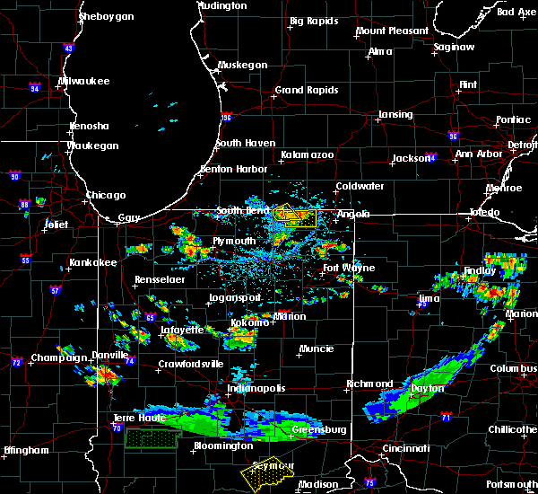 The severe thunderstorm warning for northwestern lagrange and south central st. joseph counties will expire at 330 pm edt, a new severe thunderstorm warning has been issued covering portions of lagrange county as the storm continues to drift slowly east. they threat for severe has ended for the moment across st joseph county. stay alert for additional storms. The severe thunderstorm warning for northwestern lagrange and south central st. joseph counties will expire at 330 pm edt, a new severe thunderstorm warning has been issued covering portions of lagrange county as the storm continues to drift slowly east. they threat for severe has ended for the moment across st joseph county. stay alert for additional storms.
|
| 6/13/2017 3:20 PM EDT |
 At 319 pm edt, a severe thunderstorm was located over lagrange, moving east at 15 mph (radar indicated). Hazards include 60 mph wind gusts and quarter size hail. Hail damage to vehicles is expected. Expect wind damage to roofs, siding, and trees. At 319 pm edt, a severe thunderstorm was located over lagrange, moving east at 15 mph (radar indicated). Hazards include 60 mph wind gusts and quarter size hail. Hail damage to vehicles is expected. Expect wind damage to roofs, siding, and trees.
|
| 6/13/2017 2:59 PM EDT |
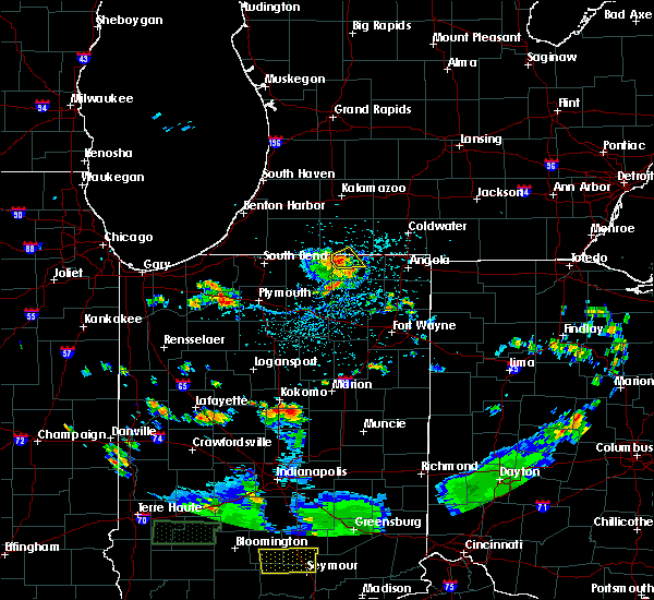 At 258 pm edt, a severe thunderstorm was located near middlebury, or 10 miles northwest of lagrange, moving northeast at 20 mph (radar indicated). Hazards include 60 mph wind gusts and quarter size hail. Hail damage to vehicles is expected. Expect wind damage to roofs, siding, and trees. At 258 pm edt, a severe thunderstorm was located near middlebury, or 10 miles northwest of lagrange, moving northeast at 20 mph (radar indicated). Hazards include 60 mph wind gusts and quarter size hail. Hail damage to vehicles is expected. Expect wind damage to roofs, siding, and trees.
|
| 3/1/2017 2:06 AM EST |
 At 206 am est, severe thunderstorms were located along a line extending from near sturgis to near north webster to near akron, moving east at 55 mph (radar indicated). Hazards include 70 mph wind gusts and nickel size hail. Expect considerable tree damage. Damage is likely to mobile homes, roofs, and outbuildings. At 206 am est, severe thunderstorms were located along a line extending from near sturgis to near north webster to near akron, moving east at 55 mph (radar indicated). Hazards include 70 mph wind gusts and nickel size hail. Expect considerable tree damage. Damage is likely to mobile homes, roofs, and outbuildings.
|
| 3/1/2017 1:48 AM EST |
 At 148 am est, severe thunderstorms were located along a line extending from near white pigeon to milford to 6 miles east of bourbon, moving east at 70 mph (radar indicated). Hazards include 60 mph wind gusts and quarter size hail. Hail damage to vehicles is expected. expect wind damage to roofs, siding, and trees. locations impacted include, elkhart, goshen, warsaw, plymouth, nappanee, bremen, ligonier, syracuse, lagrange, dunlap, simonton lake, middlebury, osceola, albion, bourbon, wakarusa, bristol, milford, rome city and topeka. this includes interstate 80 in indiana between mile markers 91 and 132. A tornado watch remains in effect until 700 am est for north central and northeastern indiana. At 148 am est, severe thunderstorms were located along a line extending from near white pigeon to milford to 6 miles east of bourbon, moving east at 70 mph (radar indicated). Hazards include 60 mph wind gusts and quarter size hail. Hail damage to vehicles is expected. expect wind damage to roofs, siding, and trees. locations impacted include, elkhart, goshen, warsaw, plymouth, nappanee, bremen, ligonier, syracuse, lagrange, dunlap, simonton lake, middlebury, osceola, albion, bourbon, wakarusa, bristol, milford, rome city and topeka. this includes interstate 80 in indiana between mile markers 91 and 132. A tornado watch remains in effect until 700 am est for north central and northeastern indiana.
|
| 3/1/2017 1:30 AM EST |
 At 130 am est, severe thunderstorms were located along a line extending from near elkhart to near lakeville to plymouth, moving east at 60 mph (radar indicated). Hazards include 60 mph wind gusts and nickel size hail. expect damage to roofs, siding, and trees At 130 am est, severe thunderstorms were located along a line extending from near elkhart to near lakeville to plymouth, moving east at 60 mph (radar indicated). Hazards include 60 mph wind gusts and nickel size hail. expect damage to roofs, siding, and trees
|
| 2/28/2017 10:46 PM EST |
 At 1046 pm est, a severe thunderstorm capable of producing a tornado was located near lagrange, moving east at 55 mph (radar indicated rotation). Hazards include tornado and half dollar size hail. Flying debris will be dangerous to those caught without shelter. mobile homes will be damaged or destroyed. damage to roofs, windows, and vehicles will occur. tree damage is likely. this tornadic thunderstorm will remain over mainly rural areas of northeastern lagrange county, including the following locations: plato, brighton, ontario and howe. This includes interstate 80 in indiana between mile markers 123 and 127. At 1046 pm est, a severe thunderstorm capable of producing a tornado was located near lagrange, moving east at 55 mph (radar indicated rotation). Hazards include tornado and half dollar size hail. Flying debris will be dangerous to those caught without shelter. mobile homes will be damaged or destroyed. damage to roofs, windows, and vehicles will occur. tree damage is likely. this tornadic thunderstorm will remain over mainly rural areas of northeastern lagrange county, including the following locations: plato, brighton, ontario and howe. This includes interstate 80 in indiana between mile markers 123 and 127.
|
| 2/28/2017 10:38 PM EST |
 At 1038 pm est, a severe thunderstorm capable of producing a tornado was located near lagrange, moving east at 45 mph (radar indicated rotation). Hazards include tornado and half dollar size hail. Flying debris will be dangerous to those caught without shelter. mobile homes will be damaged or destroyed. damage to roofs, windows, and vehicles will occur. tree damage is likely. this dangerous storm will be near, lagrange around 1045 pm est. other locations impacted by this tornadic thunderstorm include plato, brighton, emma, shipshewana, ontario and howe. This includes interstate 80 in indiana between mile markers 123 and 127. At 1038 pm est, a severe thunderstorm capable of producing a tornado was located near lagrange, moving east at 45 mph (radar indicated rotation). Hazards include tornado and half dollar size hail. Flying debris will be dangerous to those caught without shelter. mobile homes will be damaged or destroyed. damage to roofs, windows, and vehicles will occur. tree damage is likely. this dangerous storm will be near, lagrange around 1045 pm est. other locations impacted by this tornadic thunderstorm include plato, brighton, emma, shipshewana, ontario and howe. This includes interstate 80 in indiana between mile markers 123 and 127.
|
| 2/28/2017 10:29 PM EST |
 At 1029 pm est, a severe thunderstorm capable of producing a tornado was located over middlebury, or 9 miles northeast of goshen, moving east at 45 mph (radar indicated rotation). Hazards include tornado and half dollar size hail. Flying debris will be dangerous to those caught without shelter. mobile homes will be damaged or destroyed. damage to roofs, windows, and vehicles will occur. tree damage is likely. this dangerous storm will be near, lagrange around 1045 pm est. Other locations impacted by this tornadic thunderstorm include plato, brighton, emma, shipshewana, ontario and howe. At 1029 pm est, a severe thunderstorm capable of producing a tornado was located over middlebury, or 9 miles northeast of goshen, moving east at 45 mph (radar indicated rotation). Hazards include tornado and half dollar size hail. Flying debris will be dangerous to those caught without shelter. mobile homes will be damaged or destroyed. damage to roofs, windows, and vehicles will occur. tree damage is likely. this dangerous storm will be near, lagrange around 1045 pm est. Other locations impacted by this tornadic thunderstorm include plato, brighton, emma, shipshewana, ontario and howe.
|
| 11/18/2016 5:48 PM EST |
 At 548 pm est, severe thunderstorms were located along a line extending from new paris to near syracuse to near north manchester, moving northeast at 70 mph (radar indicated). Hazards include 60 mph wind gusts. Expect damage to roofs. siding. and trees. severe thunderstorms will be near, columbia city, ligonier and topeka around 600 pm est. tri-lakes and rome city around 605 pm est. lagrange and churubusco around 610 pm est. kendallville and albion around 615 pm est. Other locations impacted by these severe thunderstorms include washington center, adams lake, brighton, oliver lake, big lake, honeyville, raber, lorane, merriam and brimfield. At 548 pm est, severe thunderstorms were located along a line extending from new paris to near syracuse to near north manchester, moving northeast at 70 mph (radar indicated). Hazards include 60 mph wind gusts. Expect damage to roofs. siding. and trees. severe thunderstorms will be near, columbia city, ligonier and topeka around 600 pm est. tri-lakes and rome city around 605 pm est. lagrange and churubusco around 610 pm est. kendallville and albion around 615 pm est. Other locations impacted by these severe thunderstorms include washington center, adams lake, brighton, oliver lake, big lake, honeyville, raber, lorane, merriam and brimfield.
|
| 7/21/2016 3:21 PM EDT |
 The severe thunderstorm warning for elkhart, northern lagrange and south central st. joseph counties will expire at 330 pm edt, the storms which prompted the warning have weakened. therefore the warning will be allowed to expire. The severe thunderstorm warning for elkhart, northern lagrange and south central st. joseph counties will expire at 330 pm edt, the storms which prompted the warning have weakened. therefore the warning will be allowed to expire.
|
| 7/21/2016 3:02 PM EDT |
 At 301 pm edt, severe thunderstorms were located along a line extending from sturgis to near new paris, moving southeast at 35 mph (radar indicated). Hazards include 60 mph wind gusts. Expect damage to roofs. siding and trees. locations impacted include, elkhart, goshen, sturgis, lagrange, dunlap, middlebury, millersburg, new paris, benton, scott, shipshewana, howe, emma, brighton, honeyville, ontario, klinger lake and waterford mills. This includes interstate 80 in indiana between mile markers 107 and 128. At 301 pm edt, severe thunderstorms were located along a line extending from sturgis to near new paris, moving southeast at 35 mph (radar indicated). Hazards include 60 mph wind gusts. Expect damage to roofs. siding and trees. locations impacted include, elkhart, goshen, sturgis, lagrange, dunlap, middlebury, millersburg, new paris, benton, scott, shipshewana, howe, emma, brighton, honeyville, ontario, klinger lake and waterford mills. This includes interstate 80 in indiana between mile markers 107 and 128.
|
| 7/21/2016 2:42 PM EDT |
 At 242 pm edt, severe thunderstorms were located along a line extending from constantine to elkhart, moving southeast at 30 mph (radar indicated). Hazards include 60 mph wind gusts and penny size hail. Expect damage to roofs. Siding and trees. At 242 pm edt, severe thunderstorms were located along a line extending from constantine to elkhart, moving southeast at 30 mph (radar indicated). Hazards include 60 mph wind gusts and penny size hail. Expect damage to roofs. Siding and trees.
|
| 7/12/2016 6:45 PM EDT | Maple tree trunk downed-approx. 6" in diameter. reported that it appeared rotted where it spli in lagrange county IN, 1 miles W of Lagrange, IN |
| 3/24/2016 3:55 PM EDT |
 At 354 pm edt, a line of showers producing wind damage were located along a line extending from near schoolcraft to near white pigeon to near millersburg, moving east at 45 mph (radar indicated). Hazards include 60 mph wind gusts. Expect damage to roofs. Siding and trees. At 354 pm edt, a line of showers producing wind damage were located along a line extending from near schoolcraft to near white pigeon to near millersburg, moving east at 45 mph (radar indicated). Hazards include 60 mph wind gusts. Expect damage to roofs. Siding and trees.
|
| 8/3/2015 12:36 AM EDT |
 At 1236 am edt, severe thunderstorms were located along a line extending from near lagrange to near rome city to near millersburg, moving southeast at 60 mph (radar indicated). Hazards include 60 mph wind gusts and quarter size hail. Hail damage to vehicles is expected. expect wind damage to roofs, siding and trees. locations impacted include, elkhart, goshen, lagrange, simonton lake, dunlap, middlebury, bristol, topeka, millersburg, scott, wolcottville, shipshewana, emma, mongo, eddy, elmira, ontario, plato, howe and indianola. This includes interstate 80 in indiana between mile markers 88 and 131. At 1236 am edt, severe thunderstorms were located along a line extending from near lagrange to near rome city to near millersburg, moving southeast at 60 mph (radar indicated). Hazards include 60 mph wind gusts and quarter size hail. Hail damage to vehicles is expected. expect wind damage to roofs, siding and trees. locations impacted include, elkhart, goshen, lagrange, simonton lake, dunlap, middlebury, bristol, topeka, millersburg, scott, wolcottville, shipshewana, emma, mongo, eddy, elmira, ontario, plato, howe and indianola. This includes interstate 80 in indiana between mile markers 88 and 131.
|
| 8/3/2015 12:10 AM EDT |
 At 1209 am edt, severe thunderstorms were located along a line extending from 8 miles south of marcellus to bristol to near osceola, moving southeast at 65 mph (radar indicated). Hazards include 60 mph wind gusts and quarter size hail. Hail damage to vehicles is expected. Expect wind damage to roofs, siding and trees. At 1209 am edt, severe thunderstorms were located along a line extending from 8 miles south of marcellus to bristol to near osceola, moving southeast at 65 mph (radar indicated). Hazards include 60 mph wind gusts and quarter size hail. Hail damage to vehicles is expected. Expect wind damage to roofs, siding and trees.
|
| 7/18/2015 8:10 PM EDT |
 At 806 pm edt, severe thunderstorms were located along a line extending from near homer to 8 miles west of angola, moving east at 40 mph (trained spotters. at 805 pm edt...trained spotters reported numerous trees down in and near coldwater). Hazards include 60 mph wind gusts. Expect damage to roofs. siding and trees. locations impacted include, coldwater, angola, hillsdale, lagrange, bronson, hudson, jonesville, fremont, quincy, union city, pioneer, litchfield, reading, holiday city, long lake, jerome, somerset, columbia, ray and cambria. this includes the following highways, interstate 69 in indiana between mile markers 346 and 357. interstate 69 in michigan between mile markers 1 and 21. interstate 80 in indiana between mile markers 124 and 156. interstate 80 in ohio between mile markers 0 and 15. A tornado watch remains in effect until midnight edt for northeastern indiana, southern michigan and northwestern ohio. At 806 pm edt, severe thunderstorms were located along a line extending from near homer to 8 miles west of angola, moving east at 40 mph (trained spotters. at 805 pm edt...trained spotters reported numerous trees down in and near coldwater). Hazards include 60 mph wind gusts. Expect damage to roofs. siding and trees. locations impacted include, coldwater, angola, hillsdale, lagrange, bronson, hudson, jonesville, fremont, quincy, union city, pioneer, litchfield, reading, holiday city, long lake, jerome, somerset, columbia, ray and cambria. this includes the following highways, interstate 69 in indiana between mile markers 346 and 357. interstate 69 in michigan between mile markers 1 and 21. interstate 80 in indiana between mile markers 124 and 156. interstate 80 in ohio between mile markers 0 and 15. A tornado watch remains in effect until midnight edt for northeastern indiana, southern michigan and northwestern ohio.
|
| 7/18/2015 7:57 PM EDT |
 At 756 pm edt, severe thunderstorms were located along a line extending from near burlington to 7 miles east of lagrange, moving east at 40 mph (radar indicated). Hazards include 60 mph wind gusts. Expect damage to roofs. Siding and trees. At 756 pm edt, severe thunderstorms were located along a line extending from near burlington to 7 miles east of lagrange, moving east at 40 mph (radar indicated). Hazards include 60 mph wind gusts. Expect damage to roofs. Siding and trees.
|
| 7/13/2015 9:28 AM EDT |
 At 927 am edt, a severe thunderstorm was located near middlebury, or 9 miles northeast of goshen, moving east southeast at 45 mph (radar indicated). Hazards include 60 mph wind gusts. Expect damage to roofs. siding and trees. this severe thunderstorm will be near, topeka around 940 am edt. lagrange around 945 am edt. rome city around 950 am edt. kendallville around 1000 am edt. Other locations impacted by this severe thunderstorm include brushy prairie, emma, shipshewana, eddy, big long lake, elmira, plato, big turkey lake, honeyville and indianola. At 927 am edt, a severe thunderstorm was located near middlebury, or 9 miles northeast of goshen, moving east southeast at 45 mph (radar indicated). Hazards include 60 mph wind gusts. Expect damage to roofs. siding and trees. this severe thunderstorm will be near, topeka around 940 am edt. lagrange around 945 am edt. rome city around 950 am edt. kendallville around 1000 am edt. Other locations impacted by this severe thunderstorm include brushy prairie, emma, shipshewana, eddy, big long lake, elmira, plato, big turkey lake, honeyville and indianola.
|
| 6/25/2015 6:07 PM EDT |
 The severe thunderstorm warning for central lagrange county will expire at 615 pm edt, the storm which prompted the warning has moved out of the area. therefore the warning will be allowed to expire. a severe thunderstorm warning remains in effect for southeastern lagrange county until 630 pm edt. any reports of tree, power line or structure damage across central or southeastern lagrange county would be appreciated. to report severe weather, contact your nearest law enforcement agency. they will relay your report to the national weather service northern indiana. The severe thunderstorm warning for central lagrange county will expire at 615 pm edt, the storm which prompted the warning has moved out of the area. therefore the warning will be allowed to expire. a severe thunderstorm warning remains in effect for southeastern lagrange county until 630 pm edt. any reports of tree, power line or structure damage across central or southeastern lagrange county would be appreciated. to report severe weather, contact your nearest law enforcement agency. they will relay your report to the national weather service northern indiana.
|
| 6/25/2015 5:41 PM EDT |
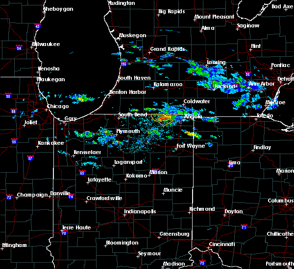 At 540 pm edt, a severe thunderstorm was located over lagrange, moving southeast at 20 mph (trained weather spotters. at 525 pm edt...trained spotters reported tree limbs up to 6 inches in diameter down west of howe). Hazards include 60 mph wind gusts and quarter size hail. Hail damage to vehicles is expected. expect wind damage to roofs, siding and trees. Locations impacted include, lagrange, wolcottville, brushy prairie, adams lake, oliver lake, woodruff, ontario and plato. At 540 pm edt, a severe thunderstorm was located over lagrange, moving southeast at 20 mph (trained weather spotters. at 525 pm edt...trained spotters reported tree limbs up to 6 inches in diameter down west of howe). Hazards include 60 mph wind gusts and quarter size hail. Hail damage to vehicles is expected. expect wind damage to roofs, siding and trees. Locations impacted include, lagrange, wolcottville, brushy prairie, adams lake, oliver lake, woodruff, ontario and plato.
|
| 6/25/2015 5:24 PM EDT |
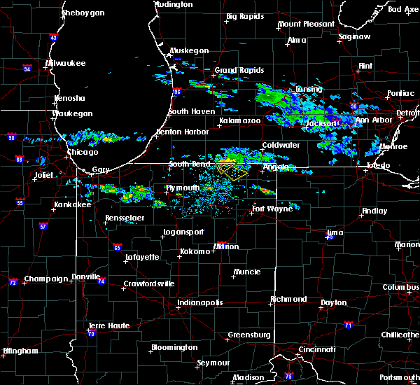 At 524 pm edt, a severe thunderstorm was located near lagrange, moving southeast at 20 mph (radar indicated). Hazards include 60 mph wind gusts and quarter size hail. Hail damage to vehicles is expected. Expect wind damage to roofs, siding and trees. At 524 pm edt, a severe thunderstorm was located near lagrange, moving southeast at 20 mph (radar indicated). Hazards include 60 mph wind gusts and quarter size hail. Hail damage to vehicles is expected. Expect wind damage to roofs, siding and trees.
|
| 6/11/2015 5:56 PM EDT |
 At 555 pm edt, a severe thunderstorm was located 7 miles west of lagrange, moving east at 35 mph (radar indicated). Hazards include 60 mph wind gusts and quarter size hail. Hail damage to vehicles is expected. expect wind damage to roofs, siding and trees. this severe storm will be near, lagrange around 605 pm edt. other locations impacted by this severe thunderstorm include emma, howe, honeyville, brighton, scott, shipshewana, oliver lake, woodruff, ontario and plato. This includes interstate 80 in indiana between mile markers 109 and 127. At 555 pm edt, a severe thunderstorm was located 7 miles west of lagrange, moving east at 35 mph (radar indicated). Hazards include 60 mph wind gusts and quarter size hail. Hail damage to vehicles is expected. expect wind damage to roofs, siding and trees. this severe storm will be near, lagrange around 605 pm edt. other locations impacted by this severe thunderstorm include emma, howe, honeyville, brighton, scott, shipshewana, oliver lake, woodruff, ontario and plato. This includes interstate 80 in indiana between mile markers 109 and 127.
|
| 6/11/2015 5:40 PM EDT |
 At 540 pm edt, a severe thunderstorm was located over middlebury, or 7 miles northeast of goshen, moving east at 35 mph (radar indicated). Hazards include 60 mph wind gusts and quarter size hail. Hail damage to vehicles is expected. expect wind damage to roofs, siding and trees. this severe thunderstorm will be near, lagrange around 610 pm edt. other locations impacted by this severe thunderstorm include howe, emma, brighton, honeyville, scott, shipshewana, oliver lake, woodruff, ontario and plato. This includes interstate 80 in indiana between mile markers 100 and 127. At 540 pm edt, a severe thunderstorm was located over middlebury, or 7 miles northeast of goshen, moving east at 35 mph (radar indicated). Hazards include 60 mph wind gusts and quarter size hail. Hail damage to vehicles is expected. expect wind damage to roofs, siding and trees. this severe thunderstorm will be near, lagrange around 610 pm edt. other locations impacted by this severe thunderstorm include howe, emma, brighton, honeyville, scott, shipshewana, oliver lake, woodruff, ontario and plato. This includes interstate 80 in indiana between mile markers 100 and 127.
|
| 5/30/2015 4:39 PM EDT | The severe thunderstorm warning for northwestern noble, southwestern lagrange and southeastern elkhart counties will expire at 445 pm edt/345 pm cdt/, the storm which prompted the warning has weakened below severe limits, and no longer poses an immediate threat to life or property. however, gusty winds and heavy rain are still possible with additional thunderstorms. |
| 5/30/2015 4:28 PM EDT | At 424 pm edt, a severe thunderstorm was located from near ligonier to millersburg, and moving northeast at 30 mph (radar indicated). Hazards include 60 mph wind gusts and nickel size hail. Expect damage to roofs. siding and trees. Locations impacted include, lagrange, topeka, honeyville, eddy, emma and oliver lake. |
| 5/30/2015 4:08 PM EDT | At 406 pm edt, a severe thunderstorm was located near north webster, and moving northeast at 40 mph (radar indicated). Hazards include quarter size hail and 60 mph wind gusts. Hail damage to vehicles is expected. Expect wind damage to roofs, siding and trees. |
| 5/8/2015 6:10 PM EDT | At 608 pm edt, severe thunderstorms were located along a line extending from 5 miles west of rome city to albion, and moving northeast at 20 mph (radar indicated). Hazards include 60 mph wind gusts and penny size hail. Expect damage to roofs. siding and trees. severe thunderstorms will be near, rome city around 620 pm edt. lagrange and kendallville around 630 pm edt. other locations in the warning include eddy, lisbon, oliver lake, wolcottville, adams lake, woodruff, plato, indianola and big long lake. 0. 75in. |
| 5/8/2015 5:49 PM EDT | At 547 pm edt, severe thunderstorms were located along a line extending from ligonier to 6 miles north of tri-lakes, and moving northeast at 20 mph (radar indicated). Hazards include 60 mph wind gusts and penny size hail. Expect damage to roofs. siding and trees. severe thunderstorms will be near, albion around 600 pm edt. topeka around 605 pm edt. rome city around 620 pm edt. lagrange and kendallville around 630 pm edt. other locations in the warning include green center, cosperville, brimfield, eddy, lisbon, oliver lake, wolcottville, adams lake, woodruff and plato. 0. 75in. |
| 9/5/2014 6:20 PM EDT | Quarter sized hail reported 0.5 miles N of Lagrange, IN, public sent picture of measured hail. |
| 8/19/2014 3:59 PM EDT | Trees down on e 175 n in lagrange county IN, 4.3 miles WSW of Lagrange, IN |
| 6/18/2014 3:20 PM EDT | Several reports of large limbs down on roads across count in lagrange county IN, 0.5 miles N of Lagrange, IN |
| 6/18/2014 3:18 PM EDT | Utility lines down at 600 east and 100 sout in lagrange county IN, 6.2 miles W of Lagrange, IN |
| 7/17/2012 8:35 PM EDT | Several trees downed and power outages countywide relayed by media in lagrange county IN, 0.5 miles N of Lagrange, IN |
| 7/17/2012 8:34 PM EDT | Tree down and landed on suv in west side of downtown lagrange in lagrange county IN, 0.5 miles N of Lagrange, IN |
| 7/17/2012 8:23 PM EDT | Powerline down at 1290n and 300e in lagrange county IN, 0.5 miles N of Lagrange, IN |
| 7/6/2012 6:44 PM EDT | Downburst winds caused extensive damage to a 1 square mile area along and to the southeast of sr9 and cr 400n. multiple tree limbs were reported down...power lines were in lagrange county IN, 2.9 miles S of Lagrange, IN |
| 7/6/2012 6:35 PM EDT | Downburst winds caused extensive damage to a 1 square mile area along and to the southeast of sr9 and cr 400n. multiple tree limbs were reported down...power lines were in lagrange county IN, 2.9 miles S of Lagrange, IN |
| 1/1/0001 12:00 AM | Trees and power lines down throughout the county in lagrange county IN, 0.5 miles N of Lagrange, IN |
| 1/1/0001 12:00 AM | Hen Egg sized hail reported 0.5 miles N of Lagrange, IN |
Hail Maps for Lagrange, IN
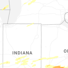
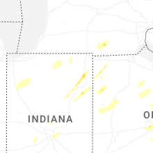
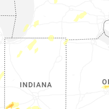


Connect with Interactive Hail Maps