

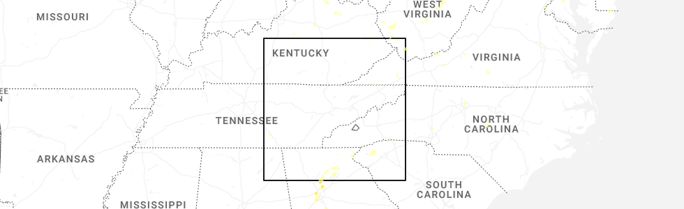
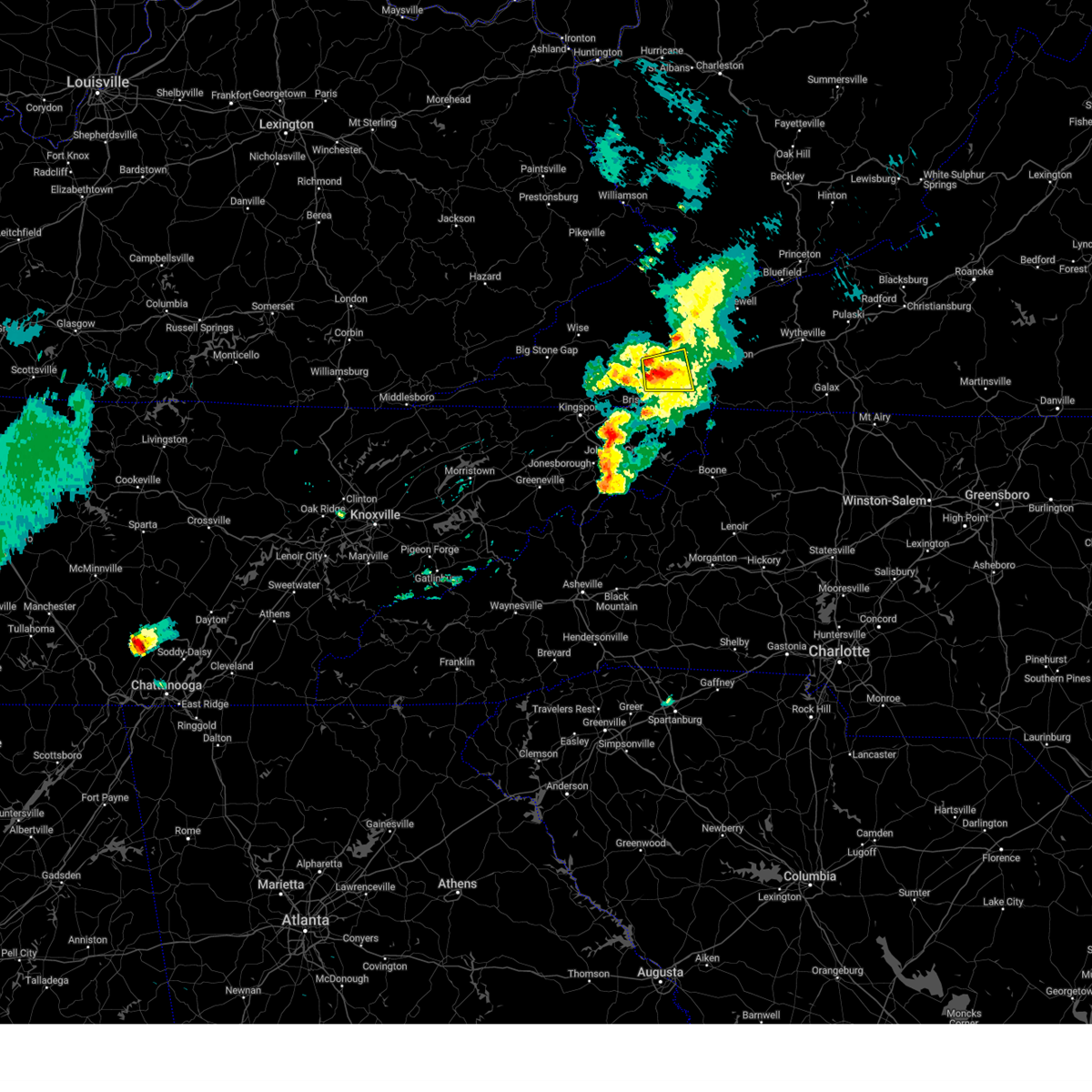
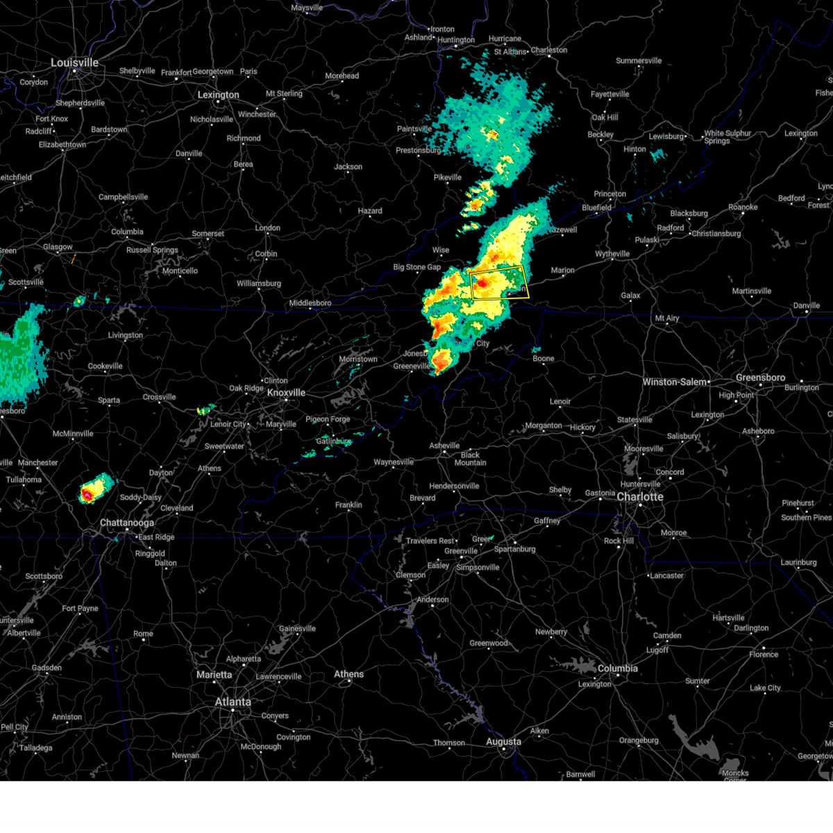
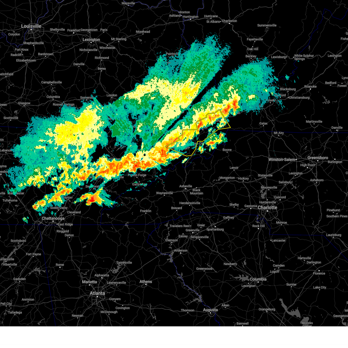
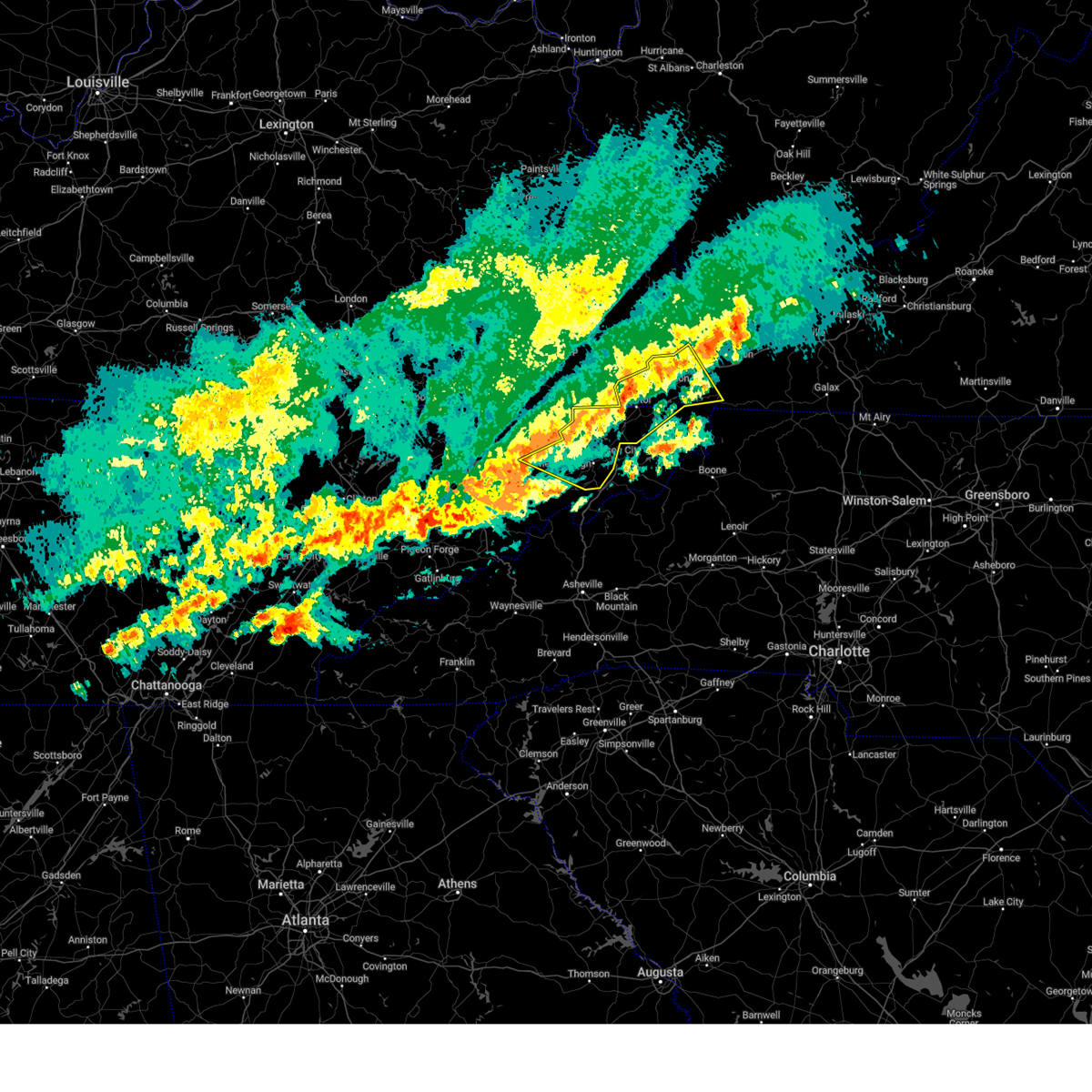
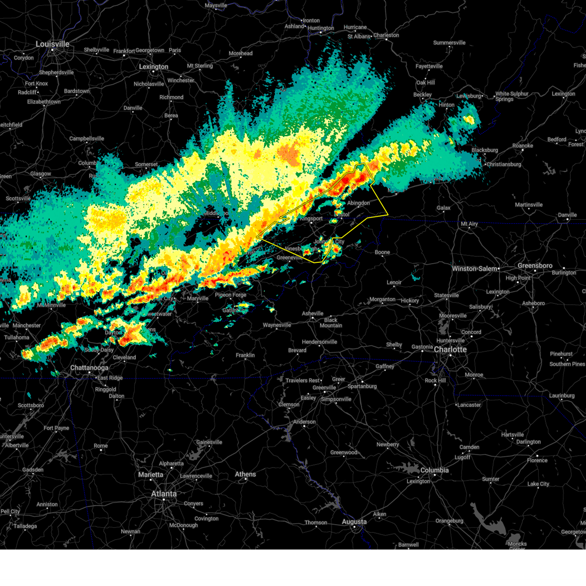
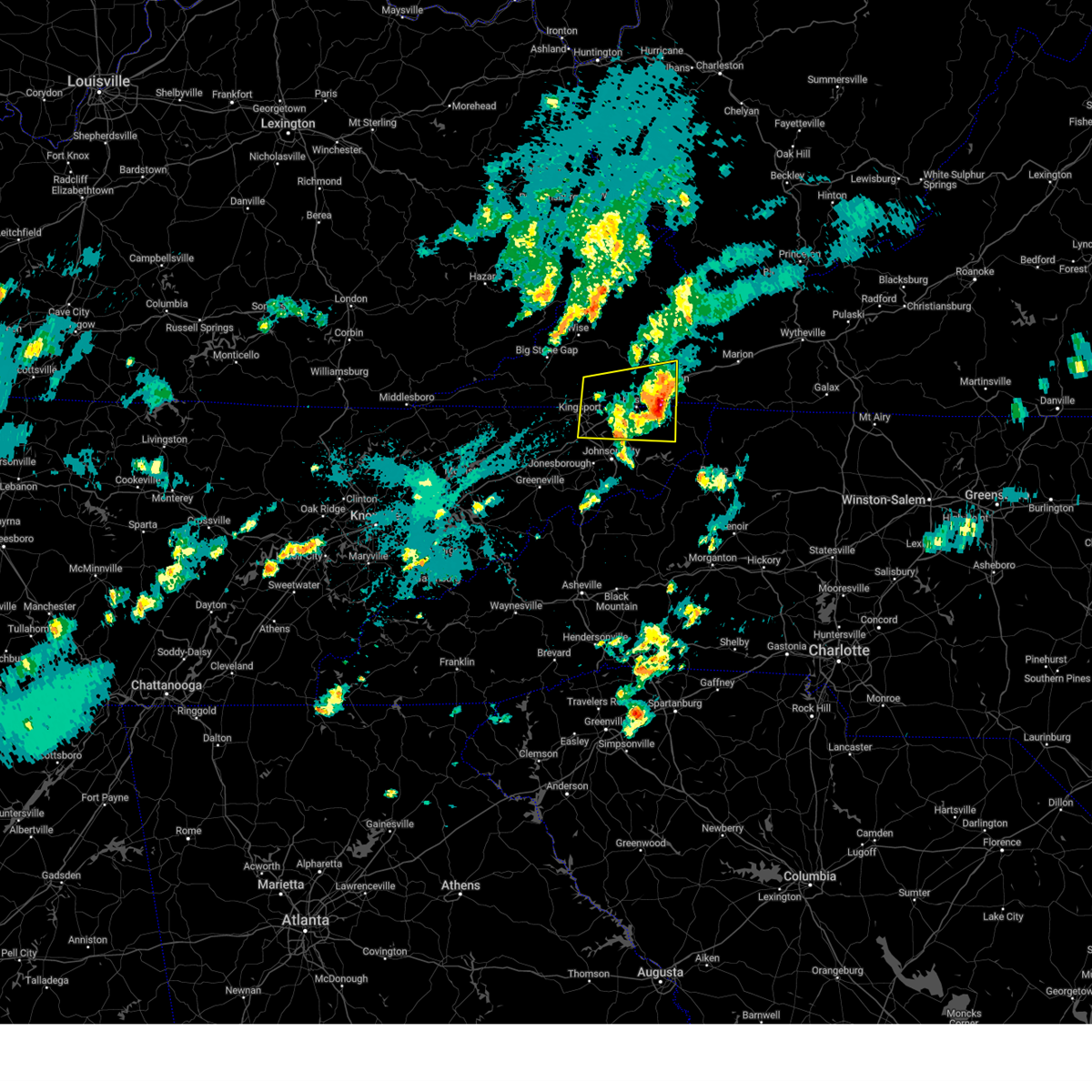
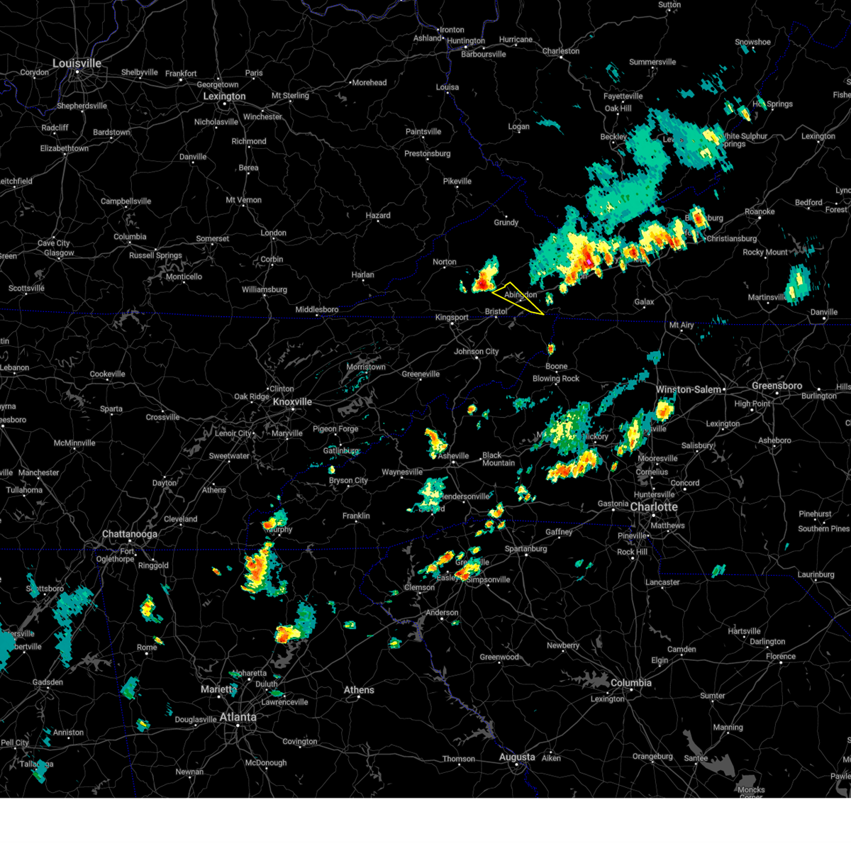
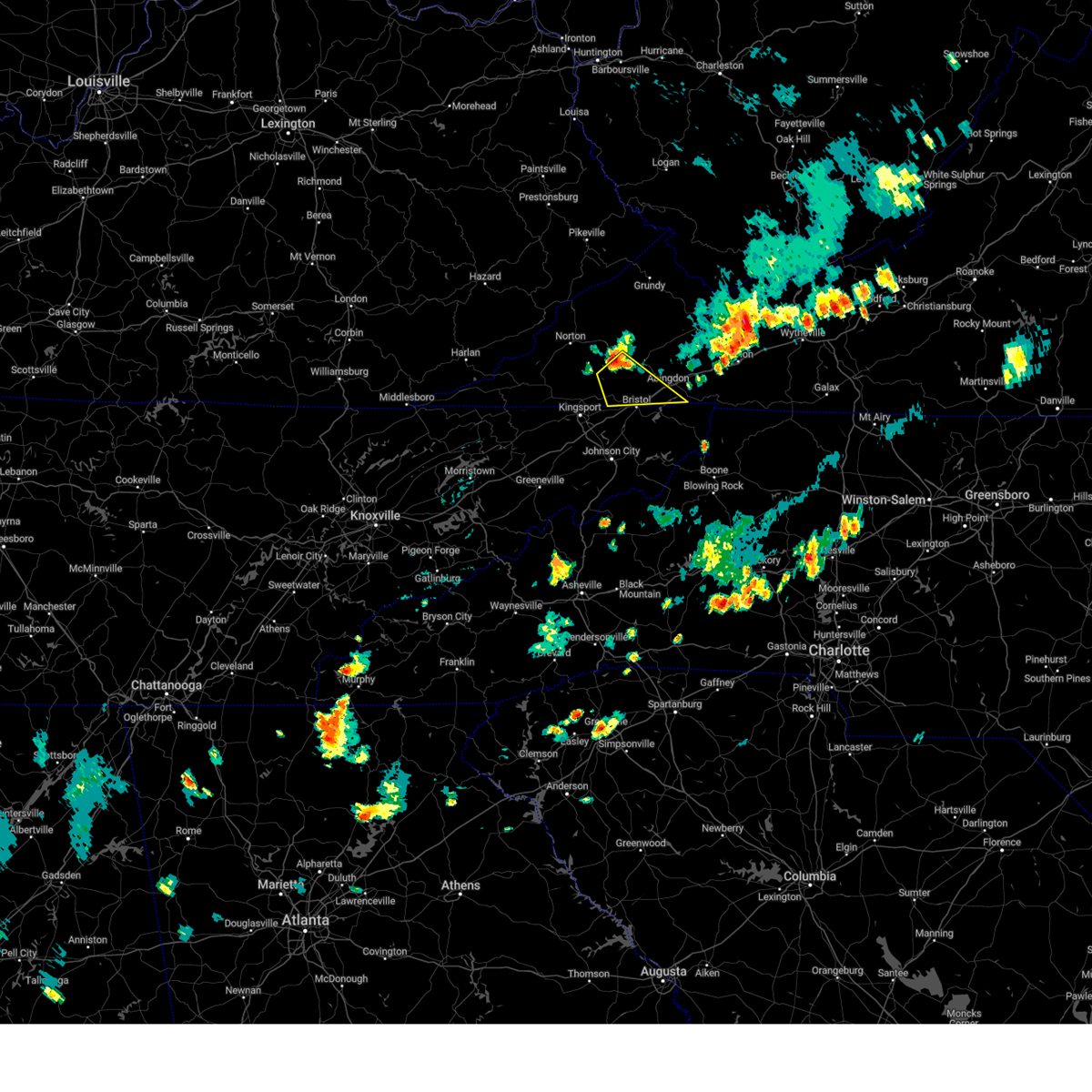
Hail Map for Abingdon, VA
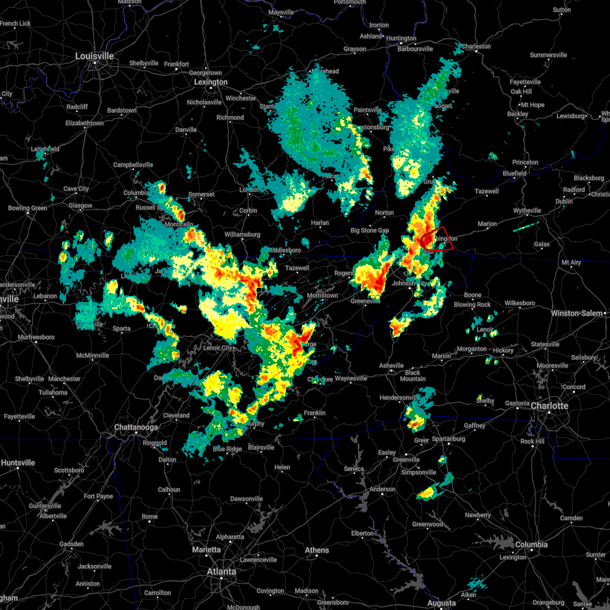
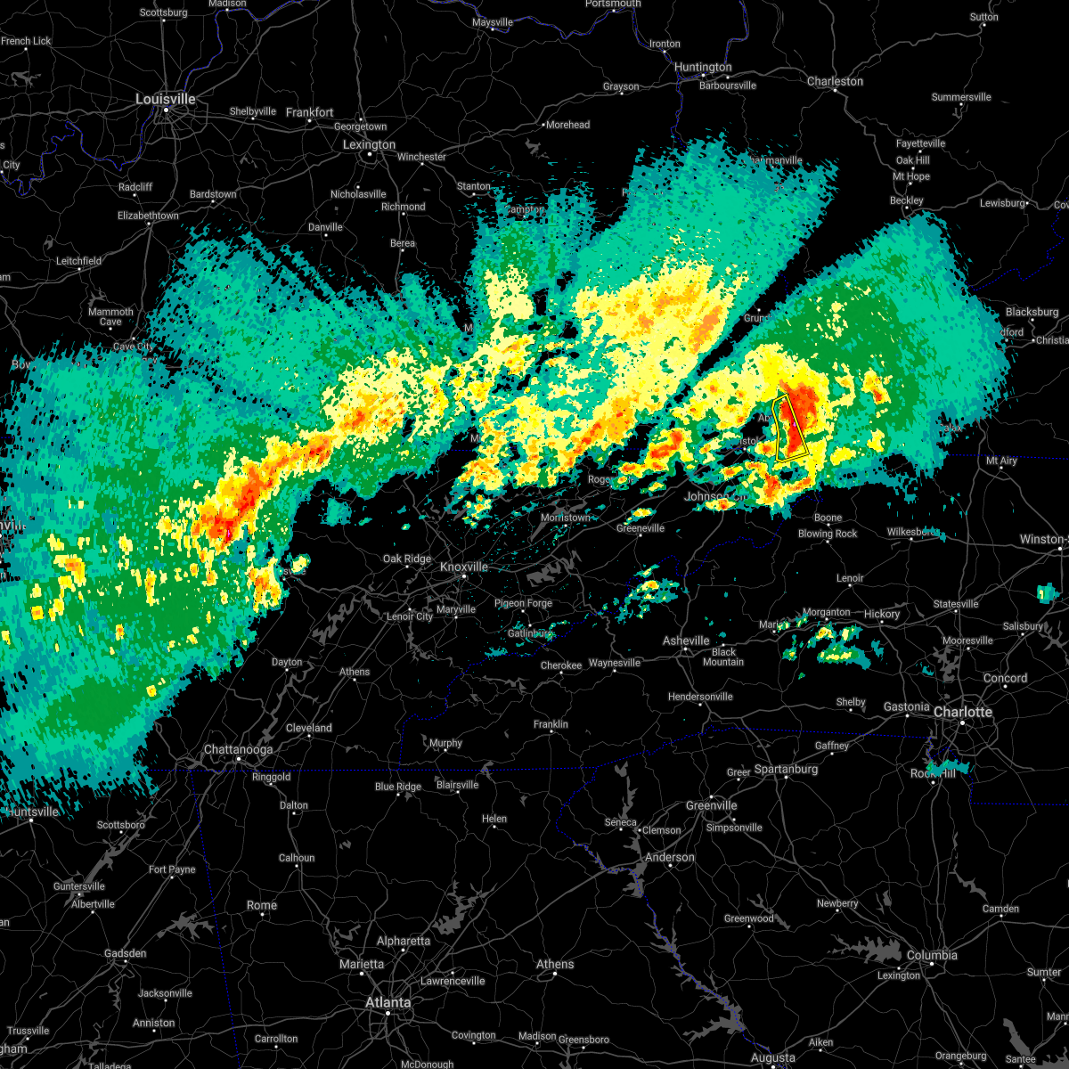
The Abingdon, VA area has had 5 reports of on-the-ground hail by trained spotters, and has been under severe weather warnings 16 times during the past 12 months. Doppler radar has detected hail at or near Abingdon, VA on 29 occasions, including 1 occasion during the past year.
| Name: | Abingdon, VA |
| Where Located: | 15.9 miles ENE of Bristol, TN |
| Map: | Google Map for Abingdon, VA |
| Population: | 8191 |
| Housing Units: | 4271 |
| More Info: | Search Google for Abingdon, VA |
0
The Top Recent Hail Date for Abingdon, VA is Thursday, June 26, 2025 (28th out of 29)
Hail and Wind Damage Spotted near Abingdon, VA
| Date / Time | Report Details |
|---|---|
| 6/26/2025 1:58 PM EDT |
 Svrmrx the national weather service in morristown has issued a * severe thunderstorm warning for, central washington county in southwestern virginia, * until 245 pm edt. * at 158 pm edt, a severe thunderstorm was located 9 miles north of abingdon, moving southwest at 10 mph (radar indicated). Hazards include 60 mph wind gusts. expect damage to roofs, siding, and trees Svrmrx the national weather service in morristown has issued a * severe thunderstorm warning for, central washington county in southwestern virginia, * until 245 pm edt. * at 158 pm edt, a severe thunderstorm was located 9 miles north of abingdon, moving southwest at 10 mph (radar indicated). Hazards include 60 mph wind gusts. expect damage to roofs, siding, and trees
|
| 6/17/2025 10:22 PM EDT | At 1021 pm edt, severe thunderstorms were located along a line extending from trammel to 9 miles northeast of lebanon to near saltville, moving northeast at 30 mph (radar indicated). Hazards include 60 mph wind gusts. Expect damage to roofs, siding, and trees. locations impacted include, abingdon, lebanon, cleveland va, honaker, dye, lindell, rosedale, and emory-meadowview. This includes interstate 81 in virginia between mile markers 22 and 23. |
| 6/17/2025 10:22 PM EDT | the severe thunderstorm warning has been cancelled and is no longer in effect |
| 6/17/2025 10:07 PM EDT |
 At 1006 pm edt, severe thunderstorms were located along a line extending from near wise to 6 miles west of allison gap, moving northeast at 40 mph (radar indicated). Hazards include 60 mph wind gusts and penny size hail. Expect damage to roofs, siding, and trees. locations impacted include, abingdon, norton, lebanon, wise, cleveland va, coeburn, honaker, st. paul, dungannon, and rosedale. This includes interstate 81 in virginia between mile markers 22 and 23. At 1006 pm edt, severe thunderstorms were located along a line extending from near wise to 6 miles west of allison gap, moving northeast at 40 mph (radar indicated). Hazards include 60 mph wind gusts and penny size hail. Expect damage to roofs, siding, and trees. locations impacted include, abingdon, norton, lebanon, wise, cleveland va, coeburn, honaker, st. paul, dungannon, and rosedale. This includes interstate 81 in virginia between mile markers 22 and 23.
|
| 6/17/2025 9:47 PM EDT |
 Svrmrx the national weather service in morristown has issued a * severe thunderstorm warning for, russell county in southwestern virginia, the city of norton in southwestern virginia, northeastern scott county in southwestern virginia, central washington county in southwestern virginia, southeastern wise county in southwestern virginia, * until 1045 pm edt. * at 947 pm edt, severe thunderstorms were located along a line extending from 6 miles southeast of big stone gap to near abingdon, moving northeast at 40 mph (radar indicated). Hazards include 60 mph wind gusts and quarter size hail. Hail damage to vehicles is expected. Expect wind damage to roofs, siding, and trees. Svrmrx the national weather service in morristown has issued a * severe thunderstorm warning for, russell county in southwestern virginia, the city of norton in southwestern virginia, northeastern scott county in southwestern virginia, central washington county in southwestern virginia, southeastern wise county in southwestern virginia, * until 1045 pm edt. * at 947 pm edt, severe thunderstorms were located along a line extending from 6 miles southeast of big stone gap to near abingdon, moving northeast at 40 mph (radar indicated). Hazards include 60 mph wind gusts and quarter size hail. Hail damage to vehicles is expected. Expect wind damage to roofs, siding, and trees.
|
| 5/20/2025 6:07 PM EDT | The storm which prompted the warning has weakened below severe limits, and no longer poses an immediate threat to life or property. therefore, the warning will be allowed to expire. however, small hail, gusty winds and heavy rain are still possible with this thunderstorm. a tornado watch remains in effect until 800 pm edt for southwestern virginia. |
| 5/20/2025 6:00 PM EDT | Trees down and reports of hail. hail size unknow in washington county VA, 2.2 miles ESE of Abingdon, VA |
| 5/20/2025 5:53 PM EDT |
 At 553 pm edt, a severe thunderstorm was located near abingdon, moving east at 30 mph (radar indicated). Hazards include 60 mph wind gusts and penny size hail. Expect damage to roofs, siding, and trees. locations impacted include, abingdon, lindell, holston, and emory-meadowview. This includes interstate 81 in virginia between mile markers 14 and 26. At 553 pm edt, a severe thunderstorm was located near abingdon, moving east at 30 mph (radar indicated). Hazards include 60 mph wind gusts and penny size hail. Expect damage to roofs, siding, and trees. locations impacted include, abingdon, lindell, holston, and emory-meadowview. This includes interstate 81 in virginia between mile markers 14 and 26.
|
| 5/20/2025 5:33 PM EDT |
 Svrmrx the national weather service in morristown has issued a * severe thunderstorm warning for, southern russell county in southwestern virginia, central washington county in southwestern virginia, * until 615 pm edt. * at 533 pm edt, a severe thunderstorm was located 10 miles north of bristol va, moving east at 30 mph (radar indicated). Hazards include 60 mph wind gusts and penny size hail. expect damage to roofs, siding, and trees Svrmrx the national weather service in morristown has issued a * severe thunderstorm warning for, southern russell county in southwestern virginia, central washington county in southwestern virginia, * until 615 pm edt. * at 533 pm edt, a severe thunderstorm was located 10 miles north of bristol va, moving east at 30 mph (radar indicated). Hazards include 60 mph wind gusts and penny size hail. expect damage to roofs, siding, and trees
|
| 5/17/2025 3:04 AM EDT | Several trees dow in washington county VA, 5.4 miles E of Abingdon, VA |
| 5/17/2025 2:59 AM EDT |
 At 258 am edt, severe thunderstorms were located along a line extending from near cedar bluff to 6 miles east of lebanon to 9 miles northwest of walnut hill to near rogersville, moving southeast at 45 mph (emergency dispatch reports trees down across the warned area). Hazards include 60 mph wind gusts and penny size hail. Expect damage to roofs, siding, and trees. locations impacted include, leesburg, chucky, damascus, limestone, spurgeon, south holston dam, sullivan gardens, bristol tn, jonesborough, and johnson city. this includes the following highways, interstate 26 in tennessee between mile markers 1 and 23. interstate 81 in tennessee between mile markers 32 and 75. Interstate 81 in virginia between mile markers 1 and 32. At 258 am edt, severe thunderstorms were located along a line extending from near cedar bluff to 6 miles east of lebanon to 9 miles northwest of walnut hill to near rogersville, moving southeast at 45 mph (emergency dispatch reports trees down across the warned area). Hazards include 60 mph wind gusts and penny size hail. Expect damage to roofs, siding, and trees. locations impacted include, leesburg, chucky, damascus, limestone, spurgeon, south holston dam, sullivan gardens, bristol tn, jonesborough, and johnson city. this includes the following highways, interstate 26 in tennessee between mile markers 1 and 23. interstate 81 in tennessee between mile markers 32 and 75. Interstate 81 in virginia between mile markers 1 and 32.
|
| 5/17/2025 2:59 AM EDT |
 the severe thunderstorm warning has been cancelled and is no longer in effect the severe thunderstorm warning has been cancelled and is no longer in effect
|
| 5/17/2025 2:29 AM EDT |
 Svrmrx the national weather service in morristown has issued a * severe thunderstorm warning for, sullivan county in east tennessee, hawkins county in east tennessee, washington county in east tennessee, northeastern greene county in east tennessee, north central johnson county in east tennessee, northwestern carter county in east tennessee, russell county in southwestern virginia, the city of bristol in southwestern virginia, scott county in southwestern virginia, washington county in southwestern virginia, * until 330 am edt. * at 229 am edt, severe thunderstorms were located along a line extending from 7 miles southeast of grundy to near trammel to 8 miles southeast of big stone gap to sneedville, moving southeast at 40 mph (radar indicated). Hazards include 60 mph wind gusts and penny size hail. expect damage to roofs, siding, and trees Svrmrx the national weather service in morristown has issued a * severe thunderstorm warning for, sullivan county in east tennessee, hawkins county in east tennessee, washington county in east tennessee, northeastern greene county in east tennessee, north central johnson county in east tennessee, northwestern carter county in east tennessee, russell county in southwestern virginia, the city of bristol in southwestern virginia, scott county in southwestern virginia, washington county in southwestern virginia, * until 330 am edt. * at 229 am edt, severe thunderstorms were located along a line extending from 7 miles southeast of grundy to near trammel to 8 miles southeast of big stone gap to sneedville, moving southeast at 40 mph (radar indicated). Hazards include 60 mph wind gusts and penny size hail. expect damage to roofs, siding, and trees
|
| 9/24/2024 8:37 PM EDT |
 The storm which prompted the warning has weakened below severe limits, and has exited the warned area. therefore, the warning will be allowed to expire. however, gusty winds and heavy rain are still possible with this thunderstorm. The storm which prompted the warning has weakened below severe limits, and has exited the warned area. therefore, the warning will be allowed to expire. however, gusty winds and heavy rain are still possible with this thunderstorm.
|
| 9/24/2024 7:42 PM EDT |
 Svrmrx the national weather service in morristown has issued a * severe thunderstorm warning for, sullivan county in east tennessee, north central washington county in east tennessee, northwestern johnson county in east tennessee, northeastern carter county in east tennessee, southwestern russell county in southwestern virginia, the city of bristol in southwestern virginia, southeastern scott county in southwestern virginia, southwestern washington county in southwestern virginia, * until 845 pm edt. * at 742 pm edt, a severe thunderstorm was located near weber city, or 8 miles northeast of kingsport, moving east at 30 mph (radar indicated). Hazards include 60 mph wind gusts and quarter size hail. Hail damage to vehicles is expected. Expect wind damage to roofs, siding, and trees. Svrmrx the national weather service in morristown has issued a * severe thunderstorm warning for, sullivan county in east tennessee, north central washington county in east tennessee, northwestern johnson county in east tennessee, northeastern carter county in east tennessee, southwestern russell county in southwestern virginia, the city of bristol in southwestern virginia, southeastern scott county in southwestern virginia, southwestern washington county in southwestern virginia, * until 845 pm edt. * at 742 pm edt, a severe thunderstorm was located near weber city, or 8 miles northeast of kingsport, moving east at 30 mph (radar indicated). Hazards include 60 mph wind gusts and quarter size hail. Hail damage to vehicles is expected. Expect wind damage to roofs, siding, and trees.
|
| 8/2/2024 1:58 PM EDT |
 The storm which prompted the warning has moved out of the area. therefore, the warning will be allowed to expire. however, heavy rain is still possible with this thunderstorm. The storm which prompted the warning has moved out of the area. therefore, the warning will be allowed to expire. however, heavy rain is still possible with this thunderstorm.
|
| 8/2/2024 1:39 PM EDT |
 At 139 pm edt, a severe thunderstorm was located 7 miles east of abingdon, moving east at 30 mph (radar indicated). Hazards include 60 mph wind gusts. Expect damage to roofs, siding, and trees. locations impacted include, abingdon, glade spring, damascus, emory-meadow view, and konnarock. This includes interstate 81 in virginia between mile markers 20 and 34. At 139 pm edt, a severe thunderstorm was located 7 miles east of abingdon, moving east at 30 mph (radar indicated). Hazards include 60 mph wind gusts. Expect damage to roofs, siding, and trees. locations impacted include, abingdon, glade spring, damascus, emory-meadow view, and konnarock. This includes interstate 81 in virginia between mile markers 20 and 34.
|
| 8/2/2024 1:26 PM EDT |
 Svrmrx the national weather service in morristown has issued a * severe thunderstorm warning for, southeastern washington county in southwestern virginia, * until 200 pm edt. * at 126 pm edt, a severe thunderstorm was located over abingdon, moving east at 30 mph (radar indicated). Hazards include 60 mph wind gusts. expect damage to roofs, siding, and trees Svrmrx the national weather service in morristown has issued a * severe thunderstorm warning for, southeastern washington county in southwestern virginia, * until 200 pm edt. * at 126 pm edt, a severe thunderstorm was located over abingdon, moving east at 30 mph (radar indicated). Hazards include 60 mph wind gusts. expect damage to roofs, siding, and trees
|
| 5/26/2024 4:40 PM EDT | Trained spotter reported three trees down across neighborhoo in washington county VA, 3.2 miles NE of Abingdon, VA |
| 5/26/2024 4:25 PM EDT | 911 dispatch reported extensive reports of downed trees and powerlines. time estimated by rada in washington county VA, 5.4 miles WSW of Abingdon, VA |
| 5/26/2024 4:18 PM EDT |
 At 417 pm edt, a severe thunderstorm was located near abingdon, moving east at 50 mph (radar indicated). Hazards include 60 mph wind gusts. Expect damage to roofs, siding, and trees. locations impacted include, bristol va, abingdon, lebanon, glade spring, honaker, damascus, emory-meadow view, rosedale, dye, and lindell. This includes interstate 81 in virginia between mile markers 1 and 34. At 417 pm edt, a severe thunderstorm was located near abingdon, moving east at 50 mph (radar indicated). Hazards include 60 mph wind gusts. Expect damage to roofs, siding, and trees. locations impacted include, bristol va, abingdon, lebanon, glade spring, honaker, damascus, emory-meadow view, rosedale, dye, and lindell. This includes interstate 81 in virginia between mile markers 1 and 34.
|
| 5/26/2024 4:18 PM EDT |
 the severe thunderstorm warning has been cancelled and is no longer in effect the severe thunderstorm warning has been cancelled and is no longer in effect
|
| 5/26/2024 3:47 PM EDT |
 Svrmrx the national weather service in morristown has issued a * severe thunderstorm warning for, russell county in southwestern virginia, the city of bristol in southwestern virginia, southeastern scott county in southwestern virginia, washington county in southwestern virginia, * until 445 pm edt. * at 347 pm edt, a severe thunderstorm was located 15 miles northeast of weber city, or 15 miles northeast of gate city, moving east at 50 mph (radar indicated). Hazards include 60 mph wind gusts. expect damage to roofs, siding, and trees Svrmrx the national weather service in morristown has issued a * severe thunderstorm warning for, russell county in southwestern virginia, the city of bristol in southwestern virginia, southeastern scott county in southwestern virginia, washington county in southwestern virginia, * until 445 pm edt. * at 347 pm edt, a severe thunderstorm was located 15 miles northeast of weber city, or 15 miles northeast of gate city, moving east at 50 mph (radar indicated). Hazards include 60 mph wind gusts. expect damage to roofs, siding, and trees
|
| 2/28/2024 1:08 PM EST |
 At 107 pm est, severe thunderstorms were located along a line extending from near walnut hill to 6 miles east of russellville, moving east at 40 mph (radar indicated). Hazards include 60 mph wind gusts. Expect damage to roofs, siding, and trees. locations impacted include, johnson city, kingsport, bristol tn, bristol va, greeneville, abingdon, rogersville, jonesborough, surgoinsville, and weber city. this includes the following highways, interstate 26 in tennessee between mile markers 1 and 21. interstate 81 in tennessee between mile markers 21 and 75. Interstate 81 in virginia between mile markers 1 and 22. At 107 pm est, severe thunderstorms were located along a line extending from near walnut hill to 6 miles east of russellville, moving east at 40 mph (radar indicated). Hazards include 60 mph wind gusts. Expect damage to roofs, siding, and trees. locations impacted include, johnson city, kingsport, bristol tn, bristol va, greeneville, abingdon, rogersville, jonesborough, surgoinsville, and weber city. this includes the following highways, interstate 26 in tennessee between mile markers 1 and 21. interstate 81 in tennessee between mile markers 21 and 75. Interstate 81 in virginia between mile markers 1 and 22.
|
| 2/28/2024 12:39 PM EST |
 Svrmrx the national weather service in morristown has issued a * severe thunderstorm warning for, sullivan county in east tennessee, hawkins county in east tennessee, northern washington county in east tennessee, central hancock county in east tennessee, northern greene county in east tennessee, northeastern grainger county in east tennessee, west central carter county in east tennessee, northeastern hamblen county in east tennessee, southern russell county in southwestern virginia, the city of bristol in southwestern virginia, southeastern scott county in southwestern virginia, southwestern washington county in southwestern virginia, * until 130 pm est. * at 1238 pm est, severe thunderstorms were located along a line extending from 6 miles northwest of kingsport to near rutledge, moving east at 40 mph (radar indicated). Hazards include 60 mph wind gusts. expect damage to roofs, siding, and trees Svrmrx the national weather service in morristown has issued a * severe thunderstorm warning for, sullivan county in east tennessee, hawkins county in east tennessee, northern washington county in east tennessee, central hancock county in east tennessee, northern greene county in east tennessee, northeastern grainger county in east tennessee, west central carter county in east tennessee, northeastern hamblen county in east tennessee, southern russell county in southwestern virginia, the city of bristol in southwestern virginia, southeastern scott county in southwestern virginia, southwestern washington county in southwestern virginia, * until 130 pm est. * at 1238 pm est, severe thunderstorms were located along a line extending from 6 miles northwest of kingsport to near rutledge, moving east at 40 mph (radar indicated). Hazards include 60 mph wind gusts. expect damage to roofs, siding, and trees
|
| 9/7/2023 5:30 PM EDT |
 At 529 pm edt, a severe thunderstorm was located near quarry, or 7 miles southwest of saltville, moving northeast at 15 mph (radar indicated). Hazards include 60 mph wind gusts and quarter size hail. Hail damage to vehicles is expected. expect wind damage to roofs, siding, and trees. locations impacted include, abingdon, glade spring, lindell, and emory-meadow view. this includes interstate 81 in virginia between mile markers 14 and 34. hail threat, radar indicated max hail size, 1. 00 in wind threat, radar indicated max wind gust, 60 mph. At 529 pm edt, a severe thunderstorm was located near quarry, or 7 miles southwest of saltville, moving northeast at 15 mph (radar indicated). Hazards include 60 mph wind gusts and quarter size hail. Hail damage to vehicles is expected. expect wind damage to roofs, siding, and trees. locations impacted include, abingdon, glade spring, lindell, and emory-meadow view. this includes interstate 81 in virginia between mile markers 14 and 34. hail threat, radar indicated max hail size, 1. 00 in wind threat, radar indicated max wind gust, 60 mph.
|
| 9/7/2023 4:49 PM EDT |
 At 448 pm edt, a severe thunderstorm was located 9 miles south of abingdon, moving northeast at 15 mph (radar indicated). Hazards include 60 mph wind gusts and quarter size hail. Hail damage to vehicles is expected. Expect wind damage to roofs, siding, and trees. At 448 pm edt, a severe thunderstorm was located 9 miles south of abingdon, moving northeast at 15 mph (radar indicated). Hazards include 60 mph wind gusts and quarter size hail. Hail damage to vehicles is expected. Expect wind damage to roofs, siding, and trees.
|
| 8/7/2023 3:15 PM EDT | Multiple reports of trees down across county. reported tree down across roadway off of whites mill roa in washington county VA, 2.3 miles S of Abingdon, VA |
| 7/29/2023 5:36 PM EDT |
 At 534 pm edt, a severe thunderstorm was located 8 miles north of mountain city, moving southeast at 35 mph (radar indicated). Hazards include 60 mph wind gusts and quarter size hail. Hail damage to vehicles is expected. expect wind damage to roofs, siding, and trees. locations impacted include, bristol tn, abingdon, mountain city, bluff city, glade spring, damascus, morril`s cave, laurel bloomery, shady valley and south holston dam. this includes interstate 81 in virginia between mile markers 18 and 21, and between mile markers 23 and 33. hail threat, radar indicated max hail size, 1. 00 in wind threat, radar indicated max wind gust, 60 mph. At 534 pm edt, a severe thunderstorm was located 8 miles north of mountain city, moving southeast at 35 mph (radar indicated). Hazards include 60 mph wind gusts and quarter size hail. Hail damage to vehicles is expected. expect wind damage to roofs, siding, and trees. locations impacted include, bristol tn, abingdon, mountain city, bluff city, glade spring, damascus, morril`s cave, laurel bloomery, shady valley and south holston dam. this includes interstate 81 in virginia between mile markers 18 and 21, and between mile markers 23 and 33. hail threat, radar indicated max hail size, 1. 00 in wind threat, radar indicated max wind gust, 60 mph.
|
| 7/29/2023 5:17 PM EDT |
 At 515 pm edt, a severe thunderstorm was located near lebanon, moving east at 20 mph (radar indicated). Hazards include 60 mph wind gusts and quarter size hail. Hail damage to vehicles is expected. expect wind damage to roofs, siding, and trees. locations impacted include, johnson city, kingsport, bristol tn, bristol va, abingdon, lebanon, mountain city, gate city, weber city and spurgeon. this includes the following highways, interstate 26 in tennessee between mile markers 1 and 17. interstate 81 in tennessee between mile markers 40 and 75. interstate 81 in virginia between mile markers 1 and 34. hail threat, radar indicated max hail size, 1. 00 in wind threat, radar indicated max wind gust, 60 mph. At 515 pm edt, a severe thunderstorm was located near lebanon, moving east at 20 mph (radar indicated). Hazards include 60 mph wind gusts and quarter size hail. Hail damage to vehicles is expected. expect wind damage to roofs, siding, and trees. locations impacted include, johnson city, kingsport, bristol tn, bristol va, abingdon, lebanon, mountain city, gate city, weber city and spurgeon. this includes the following highways, interstate 26 in tennessee between mile markers 1 and 17. interstate 81 in tennessee between mile markers 40 and 75. interstate 81 in virginia between mile markers 1 and 34. hail threat, radar indicated max hail size, 1. 00 in wind threat, radar indicated max wind gust, 60 mph.
|
| 7/29/2023 5:15 PM EDT | Numerous reports of trees and powerlines down across washington county. time estimated from rada in washington county VA, 0.9 miles S of Abingdon, VA |
| 7/29/2023 4:53 PM EDT |
 At 452 pm edt, a severe thunderstorm was located near lebanon, moving east at 20 mph (radar indicated). Hazards include 60 mph wind gusts and quarter size hail. Hail damage to vehicles is expected. Expect wind damage to roofs, siding, and trees. At 452 pm edt, a severe thunderstorm was located near lebanon, moving east at 20 mph (radar indicated). Hazards include 60 mph wind gusts and quarter size hail. Hail damage to vehicles is expected. Expect wind damage to roofs, siding, and trees.
|
| 7/28/2023 5:27 PM EDT |
 At 527 pm edt, a severe thunderstorm was located 8 miles southwest of lebanon, moving southeast at 15 mph (radar indicated). Hazards include 60 mph wind gusts and penny size hail. Expect damage to roofs, siding, and trees. locations impacted include, abingdon and holston. this includes interstate 81 in virginia between mile markers 14 and 20. hail threat, radar indicated max hail size, 0. 75 in wind threat, radar indicated max wind gust, 60 mph. At 527 pm edt, a severe thunderstorm was located 8 miles southwest of lebanon, moving southeast at 15 mph (radar indicated). Hazards include 60 mph wind gusts and penny size hail. Expect damage to roofs, siding, and trees. locations impacted include, abingdon and holston. this includes interstate 81 in virginia between mile markers 14 and 20. hail threat, radar indicated max hail size, 0. 75 in wind threat, radar indicated max wind gust, 60 mph.
|
| 7/28/2023 5:19 PM EDT |
 At 518 pm edt, a severe thunderstorm was located 14 miles southwest of cleveland va, or 14 miles northwest of bristol va, moving southeast at 15 mph (radar indicated). Hazards include 60 mph wind gusts and penny size hail. expect damage to roofs, siding, and trees At 518 pm edt, a severe thunderstorm was located 14 miles southwest of cleveland va, or 14 miles northwest of bristol va, moving southeast at 15 mph (radar indicated). Hazards include 60 mph wind gusts and penny size hail. expect damage to roofs, siding, and trees
|
| 7/28/2023 4:42 PM EDT |
 At 442 pm edt, severe thunderstorms were located along a line extending from near allison gap to 7 miles southwest of lebanon, moving southeast at 15 mph (radar indicated). Hazards include 60 mph wind gusts and penny size hail. expect damage to roofs, siding, and trees At 442 pm edt, severe thunderstorms were located along a line extending from near allison gap to 7 miles southwest of lebanon, moving southeast at 15 mph (radar indicated). Hazards include 60 mph wind gusts and penny size hail. expect damage to roofs, siding, and trees
|
| 5/16/2023 6:56 PM EDT |
 The severe thunderstorm warning for northeastern sullivan, northern johnson and eastern washington counties and the eastern city of bristol will expire at 700 pm edt, the storm which prompted the warning has moved out of the area. therefore, the warning will be allowed to expire. a severe thunderstorm watch remains in effect until 800 pm edt for east tennessee, and southwestern virginia. a severe thunderstorm watch also remains in effect until 1000 pm edt for east tennessee. to report severe weather, contact your nearest law enforcement agency. they will relay your report to the national weather service morristown. The severe thunderstorm warning for northeastern sullivan, northern johnson and eastern washington counties and the eastern city of bristol will expire at 700 pm edt, the storm which prompted the warning has moved out of the area. therefore, the warning will be allowed to expire. a severe thunderstorm watch remains in effect until 800 pm edt for east tennessee, and southwestern virginia. a severe thunderstorm watch also remains in effect until 1000 pm edt for east tennessee. to report severe weather, contact your nearest law enforcement agency. they will relay your report to the national weather service morristown.
|
| 5/16/2023 6:34 PM EDT |
 At 634 pm edt, a severe thunderstorm was located 9 miles southeast of abingdon, moving east at 50 mph (radar indicated). Hazards include 60 mph wind gusts. Expect damage to roofs, siding, and trees. locations impacted include, bristol tn, bristol va, abingdon, mountain city, glade spring, damascus, laurel bloomery, emory-meadow view, shady valley and south holston dam. This includes interstate 81 in virginia between mile markers 9 and 34. At 634 pm edt, a severe thunderstorm was located 9 miles southeast of abingdon, moving east at 50 mph (radar indicated). Hazards include 60 mph wind gusts. Expect damage to roofs, siding, and trees. locations impacted include, bristol tn, bristol va, abingdon, mountain city, glade spring, damascus, laurel bloomery, emory-meadow view, shady valley and south holston dam. This includes interstate 81 in virginia between mile markers 9 and 34.
|
| 5/16/2023 6:03 PM EDT |
 At 603 pm edt, a severe thunderstorm was located 8 miles northwest of bristol va, moving east at 55 mph (radar indicated). Hazards include 60 mph wind gusts. expect damage to roofs, siding, and trees At 603 pm edt, a severe thunderstorm was located 8 miles northwest of bristol va, moving east at 55 mph (radar indicated). Hazards include 60 mph wind gusts. expect damage to roofs, siding, and trees
|
| 3/25/2023 5:15 AM EDT |
 At 515 am edt, severe thunderstorms were located along a line extending from bristol va to 7 miles south of banner hill, moving east at 65 mph (radar indicated). Hazards include 60 mph wind gusts. expect damage to roofs, siding, and trees At 515 am edt, severe thunderstorms were located along a line extending from bristol va to 7 miles south of banner hill, moving east at 65 mph (radar indicated). Hazards include 60 mph wind gusts. expect damage to roofs, siding, and trees
|
| 3/3/2023 4:37 PM EST |
 At 436 pm est, a severe thunderstorm was located 7 miles west of walnut hill, or 8 miles east of kingsport, moving northeast at 70 mph (radar indicated). Hazards include 60 mph wind gusts. expect damage to roofs, siding, and trees At 436 pm est, a severe thunderstorm was located 7 miles west of walnut hill, or 8 miles east of kingsport, moving northeast at 70 mph (radar indicated). Hazards include 60 mph wind gusts. expect damage to roofs, siding, and trees
|
| 1/12/2023 2:57 PM EST |
 The severe thunderstorm warning for northeastern sullivan, johnson, eastern carter and southeastern washington counties will expire at 300 pm est, the storms which prompted the warning have moved out of the area. therefore, the warning will be allowed to expire. however gusty winds are still possible with these thunderstorms. The severe thunderstorm warning for northeastern sullivan, johnson, eastern carter and southeastern washington counties will expire at 300 pm est, the storms which prompted the warning have moved out of the area. therefore, the warning will be allowed to expire. however gusty winds are still possible with these thunderstorms.
|
| 1/12/2023 2:42 PM EST |
 At 242 pm est, severe thunderstorms were located along a line extending from 6 miles east of bristol va to 6 miles west of peoria to near elk park, moving east at 55 mph (radar indicated). Hazards include 60 mph wind gusts. Expect damage to roofs, siding, and trees. locations impacted include, abingdon, mountain city, glade spring, damascus, doeville, neva, laurel bloomery, emory-meadow view, harr and elk mills. This includes interstate 81 in virginia between mile markers 12 and 33. At 242 pm est, severe thunderstorms were located along a line extending from 6 miles east of bristol va to 6 miles west of peoria to near elk park, moving east at 55 mph (radar indicated). Hazards include 60 mph wind gusts. Expect damage to roofs, siding, and trees. locations impacted include, abingdon, mountain city, glade spring, damascus, doeville, neva, laurel bloomery, emory-meadow view, harr and elk mills. This includes interstate 81 in virginia between mile markers 12 and 33.
|
| 1/12/2023 2:35 PM EST | Widespread trees down across the county via multiple different report in washington county VA, 1 miles E of Abingdon, VA |
| 1/12/2023 2:24 PM EST |
 At 224 pm est, severe thunderstorms were located along a line extending from walnut hill to near hampton to 8 miles northwest of bakersville, moving east at 55 mph (radar indicated). Hazards include 70 mph wind gusts. Expect considerable tree damage. damage is likely to mobile homes, roofs, and outbuildings. locations impacted include, johnson city, bristol tn, bristol va, elizabethton, abingdon, mountain city, central, pine crest, walnut hill and hampton. this includes the following highways, interstate 26 in tennessee between mile markers 25 and 28. interstate 81 in tennessee between mile markers 68 and 75. Interstate 81 in virginia between mile markers 1 and 33. At 224 pm est, severe thunderstorms were located along a line extending from walnut hill to near hampton to 8 miles northwest of bakersville, moving east at 55 mph (radar indicated). Hazards include 70 mph wind gusts. Expect considerable tree damage. damage is likely to mobile homes, roofs, and outbuildings. locations impacted include, johnson city, bristol tn, bristol va, elizabethton, abingdon, mountain city, central, pine crest, walnut hill and hampton. this includes the following highways, interstate 26 in tennessee between mile markers 25 and 28. interstate 81 in tennessee between mile markers 68 and 75. Interstate 81 in virginia between mile markers 1 and 33.
|
| 1/12/2023 2:07 PM EST |
 At 207 pm est, severe thunderstorms were located along a line extending from colonial heights to near erwin to 6 miles southwest of banner hill, moving east at 55 mph (radar indicated). Hazards include 70 mph wind gusts. Expect considerable tree damage. Damage is likely to mobile homes, roofs, and outbuildings. At 207 pm est, severe thunderstorms were located along a line extending from colonial heights to near erwin to 6 miles southwest of banner hill, moving east at 55 mph (radar indicated). Hazards include 70 mph wind gusts. Expect considerable tree damage. Damage is likely to mobile homes, roofs, and outbuildings.
|
| 8/5/2022 5:33 PM EDT |
 At 532 pm edt, severe thunderstorms were located along a line extending from near abingdon to bristol va to kingsport, moving north at 15 mph (radar indicated). Hazards include 60 mph wind gusts and nickel size hail. Expect damage to roofs, siding, and trees. locations impacted include, kingsport, bristol tn, bristol va, abingdon, lebanon, gate city, weber city, colonial heights, walnut hill and church hill. this includes the following highways, interstate 26 in tennessee between mile markers 1 and 7. interstate 81 in tennessee between mile markers 59 and 75. interstate 81 in virginia between mile markers 1 and 25. hail threat, radar indicated max hail size, 0. 88 in wind threat, radar indicated max wind gust, 60 mph. At 532 pm edt, severe thunderstorms were located along a line extending from near abingdon to bristol va to kingsport, moving north at 15 mph (radar indicated). Hazards include 60 mph wind gusts and nickel size hail. Expect damage to roofs, siding, and trees. locations impacted include, kingsport, bristol tn, bristol va, abingdon, lebanon, gate city, weber city, colonial heights, walnut hill and church hill. this includes the following highways, interstate 26 in tennessee between mile markers 1 and 7. interstate 81 in tennessee between mile markers 59 and 75. interstate 81 in virginia between mile markers 1 and 25. hail threat, radar indicated max hail size, 0. 88 in wind threat, radar indicated max wind gust, 60 mph.
|
| 8/5/2022 5:09 PM EDT |
 At 508 pm edt, severe thunderstorms were located along a line extending from 6 miles east of bristol va to near bristol tn to 7 miles southwest of colonial heights, moving north at 15 mph (radar indicated). Hazards include 60 mph wind gusts and nickel size hail. expect damage to roofs, siding, and trees At 508 pm edt, severe thunderstorms were located along a line extending from 6 miles east of bristol va to near bristol tn to 7 miles southwest of colonial heights, moving north at 15 mph (radar indicated). Hazards include 60 mph wind gusts and nickel size hail. expect damage to roofs, siding, and trees
|
| 7/18/2022 6:15 PM EDT |
 At 612 pm edt, a severe thunderstorm was located 7 miles southeast of abingdon, moving east at 25 mph (radar indicated. at 605 pm, local law enforcement reported several trees down across sullivan county, tn and washington county, va). Hazards include 60 mph wind gusts. Expect damage to roofs, siding, and trees. locations impacted include, abingdon, glade spring, damascus, lindell, holston, emory-meadow view and konnarock. this includes interstate 81 in virginia between mile markers 12 and 34. hail threat, radar indicated max hail size, <. 75 in wind threat, radar indicated max wind gust, 60 mph. At 612 pm edt, a severe thunderstorm was located 7 miles southeast of abingdon, moving east at 25 mph (radar indicated. at 605 pm, local law enforcement reported several trees down across sullivan county, tn and washington county, va). Hazards include 60 mph wind gusts. Expect damage to roofs, siding, and trees. locations impacted include, abingdon, glade spring, damascus, lindell, holston, emory-meadow view and konnarock. this includes interstate 81 in virginia between mile markers 12 and 34. hail threat, radar indicated max hail size, <. 75 in wind threat, radar indicated max wind gust, 60 mph.
|
| 7/18/2022 5:31 PM EDT |
 At 530 pm edt, a severe thunderstorm was located near bristol va, moving northeast at 25 mph (radar indicated). Hazards include 60 mph wind gusts. expect damage to roofs, siding, and trees At 530 pm edt, a severe thunderstorm was located near bristol va, moving northeast at 25 mph (radar indicated). Hazards include 60 mph wind gusts. expect damage to roofs, siding, and trees
|
| 6/2/2022 3:28 PM EDT |
 The severe thunderstorm warning for northeastern washington county will expire at 330 pm edt, the storm which prompted the warning has weakened below severe limits, and no longer poses an immediate threat to life or property. therefore, the warning will be allowed to expire. however gusty winds are still possible with this thunderstorm. The severe thunderstorm warning for northeastern washington county will expire at 330 pm edt, the storm which prompted the warning has weakened below severe limits, and no longer poses an immediate threat to life or property. therefore, the warning will be allowed to expire. however gusty winds are still possible with this thunderstorm.
|
| 6/2/2022 3:04 PM EDT |
 At 304 pm edt, a severe thunderstorm was located near quarry, or 7 miles southwest of saltville, moving east at 25 mph (radar indicated). Hazards include 60 mph wind gusts and penny size hail. expect damage to roofs, siding, and trees At 304 pm edt, a severe thunderstorm was located near quarry, or 7 miles southwest of saltville, moving east at 25 mph (radar indicated). Hazards include 60 mph wind gusts and penny size hail. expect damage to roofs, siding, and trees
|
| 5/6/2022 7:12 PM EDT | A few trees dow in washington county VA, 8.3 miles ESE of Abingdon, VA |
| 5/6/2022 6:56 PM EDT |
 At 655 pm edt, severe thunderstorms were located along a line extending from 11 miles southwest of cleveland va to near abingdon to 12 miles east of bristol va, moving northeast at 45 mph. this line of storms has a history of producing damaging winds (radar indicated). Hazards include 60 mph wind gusts. expect damage to roofs, siding, and trees At 655 pm edt, severe thunderstorms were located along a line extending from 11 miles southwest of cleveland va to near abingdon to 12 miles east of bristol va, moving northeast at 45 mph. this line of storms has a history of producing damaging winds (radar indicated). Hazards include 60 mph wind gusts. expect damage to roofs, siding, and trees
|
| 5/6/2022 6:40 PM EDT |
 At 640 pm edt, severe thunderstorms were located along a line extending from 10 miles northeast of gate city to 8 miles north of walnut hill to 6 miles southeast of bristol va, moving northeast at 60 mph (radar indicated). Hazards include 60 mph wind gusts and penny size hail. Expect damage to roofs, siding, and trees. locations impacted include, kingsport, bristol tn, bristol va, abingdon, lebanon, gate city, weber city, cleveland va, walnut hill and coeburn. this includes the following highways, interstate 81 in tennessee between mile markers 66 and 75. interstate 81 in virginia between mile markers 1 and 24. hail threat, radar indicated max hail size, 0. 75 in wind threat, radar indicated max wind gust, 60 mph. At 640 pm edt, severe thunderstorms were located along a line extending from 10 miles northeast of gate city to 8 miles north of walnut hill to 6 miles southeast of bristol va, moving northeast at 60 mph (radar indicated). Hazards include 60 mph wind gusts and penny size hail. Expect damage to roofs, siding, and trees. locations impacted include, kingsport, bristol tn, bristol va, abingdon, lebanon, gate city, weber city, cleveland va, walnut hill and coeburn. this includes the following highways, interstate 81 in tennessee between mile markers 66 and 75. interstate 81 in virginia between mile markers 1 and 24. hail threat, radar indicated max hail size, 0. 75 in wind threat, radar indicated max wind gust, 60 mph.
|
| 5/6/2022 6:14 PM EDT |
 At 613 pm edt, severe thunderstorms were located along a line extending from near jonesville to 8 miles southwest of gate city to gray, moving northeast at 45 mph. this line of storm has a history of producing damaging winds (radar indicated). Hazards include 60 mph wind gusts and quarter size hail. Hail damage to vehicles is expected. Expect wind damage to roofs, siding, and trees. At 613 pm edt, severe thunderstorms were located along a line extending from near jonesville to 8 miles southwest of gate city to gray, moving northeast at 45 mph. this line of storm has a history of producing damaging winds (radar indicated). Hazards include 60 mph wind gusts and quarter size hail. Hail damage to vehicles is expected. Expect wind damage to roofs, siding, and trees.
|
| 5/6/2022 5:03 PM EDT |
 At 503 pm edt, a severe thunderstorm capable of producing a tornado was located over abingdon, moving east at 35 mph (radar indicated rotation). Hazards include tornado and quarter size hail. Flying debris will be dangerous to those caught without shelter. mobile homes will be damaged or destroyed. damage to roofs, windows, and vehicles will occur. tree damage is likely. this tornadic thunderstorm will remain over mainly rural areas of eastern washington county, including the following locations, lindell, emory-meadow view and glade spring. This includes interstate 81 in virginia between mile markers 20 and 34. At 503 pm edt, a severe thunderstorm capable of producing a tornado was located over abingdon, moving east at 35 mph (radar indicated rotation). Hazards include tornado and quarter size hail. Flying debris will be dangerous to those caught without shelter. mobile homes will be damaged or destroyed. damage to roofs, windows, and vehicles will occur. tree damage is likely. this tornadic thunderstorm will remain over mainly rural areas of eastern washington county, including the following locations, lindell, emory-meadow view and glade spring. This includes interstate 81 in virginia between mile markers 20 and 34.
|
| 5/6/2022 4:51 PM EDT |
 At 450 pm edt, a severe thunderstorm capable of producing a tornado was located near bristol va, moving east at 30 mph (radar indicated rotation). Hazards include tornado and quarter size hail. Flying debris will be dangerous to those caught without shelter. mobile homes will be damaged or destroyed. damage to roofs, windows, and vehicles will occur. tree damage is likely. this dangerous storm will be near, abingdon around 505 pm edt. other locations impacted by this tornadic thunderstorm include hilander park and holston. This includes interstate 81 in virginia between mile markers 9 and 20. At 450 pm edt, a severe thunderstorm capable of producing a tornado was located near bristol va, moving east at 30 mph (radar indicated rotation). Hazards include tornado and quarter size hail. Flying debris will be dangerous to those caught without shelter. mobile homes will be damaged or destroyed. damage to roofs, windows, and vehicles will occur. tree damage is likely. this dangerous storm will be near, abingdon around 505 pm edt. other locations impacted by this tornadic thunderstorm include hilander park and holston. This includes interstate 81 in virginia between mile markers 9 and 20.
|
| 5/6/2022 4:36 PM EDT |
 At 435 pm edt, a severe thunderstorm capable of producing a tornado was located near bristol va, moving east at 30 mph (radar indicated rotation). Hazards include tornado and quarter size hail. Flying debris will be dangerous to those caught without shelter. mobile homes will be damaged or destroyed. damage to roofs, windows, and vehicles will occur. tree damage is likely. this dangerous storm will be near, bristol va around 450 pm edt. abingdon around 510 pm edt. other locations impacted by this tornadic thunderstorm include hilander park, benhams and holston. This includes interstate 81 in virginia between mile markers 1 and 20. At 435 pm edt, a severe thunderstorm capable of producing a tornado was located near bristol va, moving east at 30 mph (radar indicated rotation). Hazards include tornado and quarter size hail. Flying debris will be dangerous to those caught without shelter. mobile homes will be damaged or destroyed. damage to roofs, windows, and vehicles will occur. tree damage is likely. this dangerous storm will be near, bristol va around 450 pm edt. abingdon around 510 pm edt. other locations impacted by this tornadic thunderstorm include hilander park, benhams and holston. This includes interstate 81 in virginia between mile markers 1 and 20.
|
| 5/6/2022 4:31 PM EDT |
 At 431 pm edt, a severe thunderstorm was located 8 miles north of walnut hill, or 8 miles northwest of bristol va, moving northeast at 35 mph (radar indicated). Hazards include 60 mph wind gusts and quarter size hail. Hail damage to vehicles is expected. Expect wind damage to roofs, siding, and trees. At 431 pm edt, a severe thunderstorm was located 8 miles north of walnut hill, or 8 miles northwest of bristol va, moving northeast at 35 mph (radar indicated). Hazards include 60 mph wind gusts and quarter size hail. Hail damage to vehicles is expected. Expect wind damage to roofs, siding, and trees.
|
| 6/7/2021 4:28 PM EDT |
 At 427 pm edt, severe thunderstorms were located along a line extending from 7 miles south of trammel to near abingdon, moving northeast at 30 mph (radar indicated). Hazards include 60 mph wind gusts. Expect damage to roofs, siding, and trees. locations impacted include, bristol va, abingdon, lebanon, cleveland va, glade spring, honaker, st. paul, emory-meadow view, rosedale and dye. This includes interstate 81 in virginia between mile markers 9 and 34. At 427 pm edt, severe thunderstorms were located along a line extending from 7 miles south of trammel to near abingdon, moving northeast at 30 mph (radar indicated). Hazards include 60 mph wind gusts. Expect damage to roofs, siding, and trees. locations impacted include, bristol va, abingdon, lebanon, cleveland va, glade spring, honaker, st. paul, emory-meadow view, rosedale and dye. This includes interstate 81 in virginia between mile markers 9 and 34.
|
| 6/7/2021 3:59 PM EDT |
 At 358 pm edt, severe thunderstorms were located along a line extending from 11 miles northeast of gate city to 11 miles southeast of bristol tn, moving northeast at 30 mph (radar indicated). Hazards include 60 mph wind gusts. expect damage to roofs, siding, and trees At 358 pm edt, severe thunderstorms were located along a line extending from 11 miles northeast of gate city to 11 miles southeast of bristol tn, moving northeast at 30 mph (radar indicated). Hazards include 60 mph wind gusts. expect damage to roofs, siding, and trees
|
| 6/7/2021 3:59 PM EDT |
 The national weather service in morristown has issued a * severe thunderstorm warning for. eastern sullivan county in east tennessee. northwestern johnson county in east tennessee. northeastern carter county in east tennessee. Russell county in southwestern virginia. The national weather service in morristown has issued a * severe thunderstorm warning for. eastern sullivan county in east tennessee. northwestern johnson county in east tennessee. northeastern carter county in east tennessee. Russell county in southwestern virginia.
|
| 3/28/2021 2:49 AM EDT |
 At 249 am edt, a severe thunderstorm was located 7 miles southwest of chilhowie, moving east at 55 mph (radar indicated). Hazards include 60 mph wind gusts and quarter size hail. Hail damage to vehicles is expected. expect wind damage to roofs, siding, and trees. locations impacted include, abingdon and emory-meadow view. This includes interstate 81 in virginia between mile markers 17 and 23. At 249 am edt, a severe thunderstorm was located 7 miles southwest of chilhowie, moving east at 55 mph (radar indicated). Hazards include 60 mph wind gusts and quarter size hail. Hail damage to vehicles is expected. expect wind damage to roofs, siding, and trees. locations impacted include, abingdon and emory-meadow view. This includes interstate 81 in virginia between mile markers 17 and 23.
|
| 3/28/2021 2:45 AM EDT | Quarter sized hail reported 1.1 miles SW of Abingdon, VA |
| 3/28/2021 2:38 AM EDT |
 At 237 am edt, a severe thunderstorm was located over abingdon, moving east at 55 mph (radar indicated). Hazards include 60 mph wind gusts and quarter size hail. Hail damage to vehicles is expected. expect wind damage to roofs, siding, and trees. locations impacted include, bristol tn, bristol va, abingdon, holston, hilander park, harr and emory-meadow view. This includes interstate 81 in virginia between mile markers 6 and 23. At 237 am edt, a severe thunderstorm was located over abingdon, moving east at 55 mph (radar indicated). Hazards include 60 mph wind gusts and quarter size hail. Hail damage to vehicles is expected. expect wind damage to roofs, siding, and trees. locations impacted include, bristol tn, bristol va, abingdon, holston, hilander park, harr and emory-meadow view. This includes interstate 81 in virginia between mile markers 6 and 23.
|
| 3/28/2021 2:18 AM EDT |
 At 218 am edt, a severe thunderstorm was located over walnut hill, or near bristol tn, moving east at 55 mph (radar indicated). Hazards include 60 mph wind gusts and half dollar size hail. Hail damage to vehicles is expected. Expect wind damage to roofs, siding, and trees. At 218 am edt, a severe thunderstorm was located over walnut hill, or near bristol tn, moving east at 55 mph (radar indicated). Hazards include 60 mph wind gusts and half dollar size hail. Hail damage to vehicles is expected. Expect wind damage to roofs, siding, and trees.
|
| 3/27/2021 9:08 PM EDT |
 The severe thunderstorm warning for northeastern sullivan and southwestern washington counties and the city of bristol will expire at 915 pm edt, the storm which prompted the warning has weakened below severe limits, and no longer poses an immediate threat to life or property. therefore, the warning will be allowed to expire. however gusty winds are still possible with this thunderstorm. The severe thunderstorm warning for northeastern sullivan and southwestern washington counties and the city of bristol will expire at 915 pm edt, the storm which prompted the warning has weakened below severe limits, and no longer poses an immediate threat to life or property. therefore, the warning will be allowed to expire. however gusty winds are still possible with this thunderstorm.
|
| 3/27/2021 9:00 PM EDT |
 At 900 pm edt, a severe thunderstorm was located near bristol va, moving east at 55 mph (radar indicated). Hazards include 60 mph wind gusts and penny size hail. Expect damage to roofs, siding, and trees. locations impacted include, bristol tn, bristol va, abingdon, hilander park and harr. This includes interstate 81 in virginia between mile markers 2 and 18. At 900 pm edt, a severe thunderstorm was located near bristol va, moving east at 55 mph (radar indicated). Hazards include 60 mph wind gusts and penny size hail. Expect damage to roofs, siding, and trees. locations impacted include, bristol tn, bristol va, abingdon, hilander park and harr. This includes interstate 81 in virginia between mile markers 2 and 18.
|
| 3/27/2021 8:48 PM EDT |
 At 847 pm edt, a severe thunderstorm was located near walnut hill, or near bristol tn, moving east at 55 mph (radar indicated). Hazards include 60 mph wind gusts and quarter size hail. Hail damage to vehicles is expected. expect wind damage to roofs, siding, and trees. locations impacted include, bristol tn, bristol va, abingdon, walnut hill, south holston dam, hilander park, benhams, harr, blountville and emory-meadow view. this includes the following highways, interstate 81 in tennessee between mile markers 67 and 75. Interstate 81 in virginia between mile markers 1 and 22. At 847 pm edt, a severe thunderstorm was located near walnut hill, or near bristol tn, moving east at 55 mph (radar indicated). Hazards include 60 mph wind gusts and quarter size hail. Hail damage to vehicles is expected. expect wind damage to roofs, siding, and trees. locations impacted include, bristol tn, bristol va, abingdon, walnut hill, south holston dam, hilander park, benhams, harr, blountville and emory-meadow view. this includes the following highways, interstate 81 in tennessee between mile markers 67 and 75. Interstate 81 in virginia between mile markers 1 and 22.
|
| 3/27/2021 8:31 PM EDT |
 At 830 pm edt, a severe thunderstorm was located over weber city, or over gate city, moving east at 55 mph (radar indicated). Hazards include 60 mph wind gusts and quarter size hail. Hail damage to vehicles is expected. Expect wind damage to roofs, siding, and trees. At 830 pm edt, a severe thunderstorm was located over weber city, or over gate city, moving east at 55 mph (radar indicated). Hazards include 60 mph wind gusts and quarter size hail. Hail damage to vehicles is expected. Expect wind damage to roofs, siding, and trees.
|
| 3/27/2021 1:43 PM EDT |
 The severe thunderstorm warning for eastern sullivan, johnson, carter, eastern russell and washington counties and the eastern city of bristol will expire at 145 pm edt, the storms which prompted the warning have moved out of the area. therefore, the warning will be allowed to expire. The severe thunderstorm warning for eastern sullivan, johnson, carter, eastern russell and washington counties and the eastern city of bristol will expire at 145 pm edt, the storms which prompted the warning have moved out of the area. therefore, the warning will be allowed to expire.
|
| 3/27/2021 1:25 PM EDT |
 At 125 pm edt, severe thunderstorms were located along a line extending from near davenport to near elk park, moving east at 35 mph (radar indicated). Hazards include 60 mph wind gusts and penny size hail. Expect damage to roofs, siding, and trees. locations impacted include, bristol tn, bristol va, elizabethton, abingdon, lebanon, mountain city, hampton, glade spring, honaker and damascus. This includes interstate 81 in virginia between mile markers 6 and 34. At 125 pm edt, severe thunderstorms were located along a line extending from near davenport to near elk park, moving east at 35 mph (radar indicated). Hazards include 60 mph wind gusts and penny size hail. Expect damage to roofs, siding, and trees. locations impacted include, bristol tn, bristol va, elizabethton, abingdon, lebanon, mountain city, hampton, glade spring, honaker and damascus. This includes interstate 81 in virginia between mile markers 6 and 34.
|
| 3/27/2021 1:01 PM EDT |
 At 101 pm edt, severe thunderstorms were located along a line extending from near trammel to 6 miles east of erwin, moving east at 35 mph (radar indicated). Hazards include 60 mph wind gusts and penny size hail. expect damage to roofs, siding, and trees At 101 pm edt, severe thunderstorms were located along a line extending from near trammel to 6 miles east of erwin, moving east at 35 mph (radar indicated). Hazards include 60 mph wind gusts and penny size hail. expect damage to roofs, siding, and trees
|
| 3/27/2021 1:01 PM EDT |
 The national weather service in morristown has issued a * severe thunderstorm warning for. sullivan county in east tennessee. northeastern washington county in east tennessee. northeastern unicoi county in east tennessee. Johnson county in east tennessee. The national weather service in morristown has issued a * severe thunderstorm warning for. sullivan county in east tennessee. northeastern washington county in east tennessee. northeastern unicoi county in east tennessee. Johnson county in east tennessee.
|
| 3/27/2021 11:43 AM EDT |
 At 1143 am edt, a severe thunderstorm was located near abingdon, moving northeast at 45 mph (radar indicated). Hazards include quarter size hail. damage to vehicles is expected At 1143 am edt, a severe thunderstorm was located near abingdon, moving northeast at 45 mph (radar indicated). Hazards include quarter size hail. damage to vehicles is expected
|
| 3/27/2021 11:07 AM EDT |
 At 1107 am edt, a severe thunderstorm was located near kingsport, moving east at 45 mph (radar indicated). Hazards include quarter size hail. damage to vehicles is expected At 1107 am edt, a severe thunderstorm was located near kingsport, moving east at 45 mph (radar indicated). Hazards include quarter size hail. damage to vehicles is expected
|
| 8/28/2020 7:20 PM EDT |
 At 720 pm edt, a severe thunderstorm was located near abingdon, moving northeast at 20 mph (radar indicated). Hazards include 60 mph wind gusts and quarter size hail. Hail damage to vehicles is expected. Expect wind damage to roofs, siding, and trees. At 720 pm edt, a severe thunderstorm was located near abingdon, moving northeast at 20 mph (radar indicated). Hazards include 60 mph wind gusts and quarter size hail. Hail damage to vehicles is expected. Expect wind damage to roofs, siding, and trees.
|
| 8/28/2020 7:10 PM EDT | Trees reported down along green springs r in washington county VA, 1.9 miles N of Abingdon, VA |
| 7/24/2020 6:12 PM EDT |
 At 612 pm edt, severe thunderstorms were located along a line extending from 6 miles north of bristol va to 6 miles south of big stone gap, moving south at 5 mph (radar indicated). Hazards include 60 mph wind gusts. expect damage to roofs, siding, and trees At 612 pm edt, severe thunderstorms were located along a line extending from 6 miles north of bristol va to 6 miles south of big stone gap, moving south at 5 mph (radar indicated). Hazards include 60 mph wind gusts. expect damage to roofs, siding, and trees
|
| 7/24/2020 6:01 PM EDT |
 At 601 pm edt, severe thunderstorms were located along a line extending from 6 miles west of saltville to 8 miles north of bristol va to 7 miles southeast of big stone gap, moving southeast at 20 mph (radar indicated). Hazards include 60 mph wind gusts. Expect damage to roofs, siding, and trees. locations impacted include, bristol va, abingdon, gate city, weber city, mount carmel, glade spring, nickelsville, dungannon, emory-meadow view and lindell. This includes interstate 81 in virginia between mile markers 13 and 34. At 601 pm edt, severe thunderstorms were located along a line extending from 6 miles west of saltville to 8 miles north of bristol va to 7 miles southeast of big stone gap, moving southeast at 20 mph (radar indicated). Hazards include 60 mph wind gusts. Expect damage to roofs, siding, and trees. locations impacted include, bristol va, abingdon, gate city, weber city, mount carmel, glade spring, nickelsville, dungannon, emory-meadow view and lindell. This includes interstate 81 in virginia between mile markers 13 and 34.
|
| 7/24/2020 5:36 PM EDT |
 At 536 pm edt, severe thunderstorms were located along a line extending from 8 miles east of lebanon to 7 miles north of gate city, moving southeast at 15 mph (radar indicated). Hazards include 60 mph wind gusts and penny size hail. Expect damage to roofs, siding, and trees. locations impacted include, bristol va, abingdon, lebanon, gate city, big stone gap, weber city, cleveland va, mount carmel, glade spring and st. paul. This includes interstate 81 in virginia between mile markers 13 and 34. At 536 pm edt, severe thunderstorms were located along a line extending from 8 miles east of lebanon to 7 miles north of gate city, moving southeast at 15 mph (radar indicated). Hazards include 60 mph wind gusts and penny size hail. Expect damage to roofs, siding, and trees. locations impacted include, bristol va, abingdon, lebanon, gate city, big stone gap, weber city, cleveland va, mount carmel, glade spring and st. paul. This includes interstate 81 in virginia between mile markers 13 and 34.
|
| 7/24/2020 5:16 PM EDT |
 At 516 pm edt, severe thunderstorms were located along a line extending from 8 miles northeast of lebanon to 7 miles southeast of big stone gap, moving southeast at 15 mph (radar indicated). Hazards include 60 mph wind gusts and penny size hail. expect damage to roofs, siding, and trees At 516 pm edt, severe thunderstorms were located along a line extending from 8 miles northeast of lebanon to 7 miles southeast of big stone gap, moving southeast at 15 mph (radar indicated). Hazards include 60 mph wind gusts and penny size hail. expect damage to roofs, siding, and trees
|
| 4/8/2020 6:36 PM EDT |
 At 635 pm edt, a severe thunderstorm was located 9 miles northwest of whitetop, moving southeast at 25 mph (radar indicated). Hazards include 60 mph wind gusts and nickel size hail. Expect damage to roofs, siding, and trees. locations impacted include, abingdon, glade spring, damascus, lindell, emory-meadow view and konnarock. This includes interstate 81 in virginia between mile markers 13 and 34. At 635 pm edt, a severe thunderstorm was located 9 miles northwest of whitetop, moving southeast at 25 mph (radar indicated). Hazards include 60 mph wind gusts and nickel size hail. Expect damage to roofs, siding, and trees. locations impacted include, abingdon, glade spring, damascus, lindell, emory-meadow view and konnarock. This includes interstate 81 in virginia between mile markers 13 and 34.
|
| 4/8/2020 6:30 PM EDT | Two trees dow in washington county VA, 2.2 miles WNW of Abingdon, VA |
| 4/8/2020 6:21 PM EDT |
 At 621 pm edt, a severe thunderstorm was located 7 miles southwest of chilhowie, moving southeast at 35 mph (radar indicated). Hazards include 60 mph wind gusts and quarter size hail. Hail damage to vehicles is expected. Expect wind damage to roofs, siding, and trees. At 621 pm edt, a severe thunderstorm was located 7 miles southwest of chilhowie, moving southeast at 35 mph (radar indicated). Hazards include 60 mph wind gusts and quarter size hail. Hail damage to vehicles is expected. Expect wind damage to roofs, siding, and trees.
|
| 3/29/2020 7:35 AM EDT |
 The severe thunderstorm warning for eastern sullivan, johnson, carter and washington counties and the city of bristol will expire at 745 am edt, the storms which prompted the warning have weakened below severe limits, and no longer pose an immediate threat to life or property. therefore, the warning will be allowed to expire. however gusty winds are still possible with these thunderstorms. The severe thunderstorm warning for eastern sullivan, johnson, carter and washington counties and the city of bristol will expire at 745 am edt, the storms which prompted the warning have weakened below severe limits, and no longer pose an immediate threat to life or property. therefore, the warning will be allowed to expire. however gusty winds are still possible with these thunderstorms.
|
| 3/29/2020 7:26 AM EDT |
 At 726 am edt, severe thunderstorms were located along a line extending from 6 miles west of abingdon to 10 miles east of bristol tn to near hampton, moving east at 70 mph (radar indicated). Hazards include 60 mph wind gusts. Expect damage to roofs, siding, and trees. locations impacted include, bristol tn, bristol va, elizabethton, abingdon, mountain city, walnut hill, hampton, bluff city, glade spring and damascus. this includes the following highways, interstate 81 in tennessee between mile markers 73 and 75. Interstate 81 in virginia between mile markers 1 and 34. At 726 am edt, severe thunderstorms were located along a line extending from 6 miles west of abingdon to 10 miles east of bristol tn to near hampton, moving east at 70 mph (radar indicated). Hazards include 60 mph wind gusts. Expect damage to roofs, siding, and trees. locations impacted include, bristol tn, bristol va, elizabethton, abingdon, mountain city, walnut hill, hampton, bluff city, glade spring and damascus. this includes the following highways, interstate 81 in tennessee between mile markers 73 and 75. Interstate 81 in virginia between mile markers 1 and 34.
|
| 3/29/2020 7:06 AM EDT |
 At 705 am edt, severe thunderstorms were located along a line extending from near weber city to oak grove to near erwin, moving east at 75 mph (radar indicated). Hazards include 60 mph wind gusts. expect damage to roofs, siding, and trees At 705 am edt, severe thunderstorms were located along a line extending from near weber city to oak grove to near erwin, moving east at 75 mph (radar indicated). Hazards include 60 mph wind gusts. expect damage to roofs, siding, and trees
|
| 1/11/2020 7:51 PM EST |
 The severe thunderstorm warning for northeastern sullivan, johnson, eastern carter, eastern russell and washington counties and the east central city of bristol will expire at 800 pm est, the storms which prompted the warning have moved out of the warned area. therefore, the warning will be allowed to expire. The severe thunderstorm warning for northeastern sullivan, johnson, eastern carter, eastern russell and washington counties and the east central city of bristol will expire at 800 pm est, the storms which prompted the warning have moved out of the warned area. therefore, the warning will be allowed to expire.
|
| 1/11/2020 7:16 PM EST |
 At 715 pm est, severe thunderstorms were located along a line extending from near cleveland va to near elk park, moving east at 65 mph (radar indicated). Hazards include 70 mph wind gusts. Expect considerable tree damage. Damage is likely to mobile homes, roofs, and outbuildings. At 715 pm est, severe thunderstorms were located along a line extending from near cleveland va to near elk park, moving east at 65 mph (radar indicated). Hazards include 70 mph wind gusts. Expect considerable tree damage. Damage is likely to mobile homes, roofs, and outbuildings.
|
| 1/11/2020 7:08 PM EST |
 At 708 pm est, a severe thunderstorm was located 8 miles northwest of bristol va, moving east at 65 mph (radar indicated). Hazards include 70 mph wind gusts. Expect considerable tree damage. damage is likely to mobile homes, roofs, and outbuildings. locations impacted include, norton, lebanon, wise, cleveland va, coeburn, pound, st. Paul, nickelsville, dungannon and pardee. At 708 pm est, a severe thunderstorm was located 8 miles northwest of bristol va, moving east at 65 mph (radar indicated). Hazards include 70 mph wind gusts. Expect considerable tree damage. damage is likely to mobile homes, roofs, and outbuildings. locations impacted include, norton, lebanon, wise, cleveland va, coeburn, pound, st. Paul, nickelsville, dungannon and pardee.
|
| 1/11/2020 6:48 PM EST |
 At 648 pm est, a severe thunderstorm was located near gate city, moving east at 65 mph (radar indicated). Hazards include 70 mph wind gusts. Expect considerable tree damage. Damage is likely to mobile homes, roofs, and outbuildings. At 648 pm est, a severe thunderstorm was located near gate city, moving east at 65 mph (radar indicated). Hazards include 70 mph wind gusts. Expect considerable tree damage. Damage is likely to mobile homes, roofs, and outbuildings.
|
| 8/20/2019 5:42 PM EDT |
 The severe thunderstorm warning for southwestern washington county and the eastern city of bristol will expire at 545 pm edt, the storm which prompted the warning has weakened below severe limits, and no longer poses an immediate threat to life or property. therefore, the warning will be allowed to expire. however small hail, gusty winds and heavy rain are still possible with this thunderstorm. The severe thunderstorm warning for southwestern washington county and the eastern city of bristol will expire at 545 pm edt, the storm which prompted the warning has weakened below severe limits, and no longer poses an immediate threat to life or property. therefore, the warning will be allowed to expire. however small hail, gusty winds and heavy rain are still possible with this thunderstorm.
|
| 8/20/2019 5:27 PM EDT |
 At 505 pm edt, a severe thunderstorm was located near abingdon, moving west at 10 mph (radar indicated). Hazards include 60 mph wind gusts and quarter size hail. Hail damage to vehicles is expected. Expect wind damage to roofs, siding, and trees. At 505 pm edt, a severe thunderstorm was located near abingdon, moving west at 10 mph (radar indicated). Hazards include 60 mph wind gusts and quarter size hail. Hail damage to vehicles is expected. Expect wind damage to roofs, siding, and trees.
|
| 8/20/2019 5:26 PM EDT | Quarter sized hail reported 4.2 miles ENE of Abingdon, VA |
| 8/20/2019 5:20 PM EDT |
 A severe thunderstorm warning remains in effect until 545 pm edt for northeastern sullivan and southwestern washington counties and the eastern city of bristol. at 519 pm edt, a severe thunderstorm was located near abingdon, moving west at 10 mph. hazard. 60 mph wind gusts and quarter size hail. A severe thunderstorm warning remains in effect until 545 pm edt for northeastern sullivan and southwestern washington counties and the eastern city of bristol. at 519 pm edt, a severe thunderstorm was located near abingdon, moving west at 10 mph. hazard. 60 mph wind gusts and quarter size hail.
|
| 8/20/2019 5:06 PM EDT |
 At 505 pm edt, a severe thunderstorm was located near abingdon, moving west at 10 mph (radar indicated). Hazards include 60 mph wind gusts and quarter size hail. Hail damage to vehicles is expected. Expect wind damage to roofs, siding, and trees. At 505 pm edt, a severe thunderstorm was located near abingdon, moving west at 10 mph (radar indicated). Hazards include 60 mph wind gusts and quarter size hail. Hail damage to vehicles is expected. Expect wind damage to roofs, siding, and trees.
|
| 8/13/2019 1:43 PM EDT |
 At 143 pm edt, a severe thunderstorm was located near bristol va, moving southeast at 25 mph (radar indicated). Hazards include 60 mph wind gusts and quarter size hail. Hail damage to vehicles is expected. Expect wind damage to roofs, siding, and trees. At 143 pm edt, a severe thunderstorm was located near bristol va, moving southeast at 25 mph (radar indicated). Hazards include 60 mph wind gusts and quarter size hail. Hail damage to vehicles is expected. Expect wind damage to roofs, siding, and trees.
|
| 8/13/2019 1:24 PM EDT |
 The severe thunderstorm warning for southern russell and central washington counties will expire at 130 pm edt, the storm which prompted the warning has weakened below severe limits, and no longer poses an immediate threat to life or property. therefore, the warning will be allowed to expire. however gusty winds and heavy rain are still possible with this thunderstorm. a severe thunderstorm watch remains in effect until 700 pm edt for southwestern virginia. to report severe weather, contact your nearest law enforcement agency. they will relay your report to the national weather service morristown. The severe thunderstorm warning for southern russell and central washington counties will expire at 130 pm edt, the storm which prompted the warning has weakened below severe limits, and no longer poses an immediate threat to life or property. therefore, the warning will be allowed to expire. however gusty winds and heavy rain are still possible with this thunderstorm. a severe thunderstorm watch remains in effect until 700 pm edt for southwestern virginia. to report severe weather, contact your nearest law enforcement agency. they will relay your report to the national weather service morristown.
|
| 8/13/2019 1:14 PM EDT |
 At 113 pm edt, a severe thunderstorm was located near abingdon, moving southeast at 15 mph (radar indicated). Hazards include 60 mph wind gusts and quarter size hail. Hail damage to vehicles is expected. expect wind damage to roofs, siding, and trees. Locations impacted include, bristol va, abingdon, hansonville, lindell, holston and emory-meadow view. At 113 pm edt, a severe thunderstorm was located near abingdon, moving southeast at 15 mph (radar indicated). Hazards include 60 mph wind gusts and quarter size hail. Hail damage to vehicles is expected. expect wind damage to roofs, siding, and trees. Locations impacted include, bristol va, abingdon, hansonville, lindell, holston and emory-meadow view.
|
| 8/13/2019 12:51 PM EDT |
 At 1251 pm edt, a severe thunderstorm was located near lebanon, moving southeast at 20 mph (radar indicated). Hazards include 60 mph wind gusts and quarter size hail. Hail damage to vehicles is expected. expect wind damage to roofs, siding, and trees. Locations impacted include, bristol va, abingdon, lebanon, lindell, holston, hansonville and emory-meadow view. At 1251 pm edt, a severe thunderstorm was located near lebanon, moving southeast at 20 mph (radar indicated). Hazards include 60 mph wind gusts and quarter size hail. Hail damage to vehicles is expected. expect wind damage to roofs, siding, and trees. Locations impacted include, bristol va, abingdon, lebanon, lindell, holston, hansonville and emory-meadow view.
|
| 8/13/2019 12:32 PM EDT |
 At 1231 pm edt, a severe thunderstorm was located over cleveland va, or near lebanon, moving southeast at 20 mph (radar indicated). Hazards include 60 mph wind gusts and quarter size hail. Hail damage to vehicles is expected. Expect wind damage to roofs, siding, and trees. At 1231 pm edt, a severe thunderstorm was located over cleveland va, or near lebanon, moving southeast at 20 mph (radar indicated). Hazards include 60 mph wind gusts and quarter size hail. Hail damage to vehicles is expected. Expect wind damage to roofs, siding, and trees.
|
| 6/22/2019 1:53 AM EDT |
 At 152 am edt, severe thunderstorms were located along a line extending from near lebanon to near ashland, moving east at 45 mph (radar indicated). Hazards include 60 mph wind gusts. Expect damage to roofs, siding, and trees. Locations impacted include, abingdon, lebanon, mountain city, cleveland va, glade spring, honaker, damascus, laurel bloomery, emory-meadow view, rosedale, shady valley, lindell, holston, harr and konnarock. At 152 am edt, severe thunderstorms were located along a line extending from near lebanon to near ashland, moving east at 45 mph (radar indicated). Hazards include 60 mph wind gusts. Expect damage to roofs, siding, and trees. Locations impacted include, abingdon, lebanon, mountain city, cleveland va, glade spring, honaker, damascus, laurel bloomery, emory-meadow view, rosedale, shady valley, lindell, holston, harr and konnarock.
|
| 6/22/2019 1:38 AM EDT |
 At 137 am edt, severe thunderstorms were located along a line extending from 6 miles southwest of cleveland va to near reese, moving northeast at 45 mph (radar indicated). Hazards include 60 mph wind gusts. Expect damage to roofs, siding, and trees. Locations impacted include, bristol tn, bristol va, abingdon, lebanon, mountain city, cleveland va, walnut hill, glade spring, honaker, damascus, laurel bloomery, emory-meadow view, rosedale, shady valley, south holston dam, collingwood, doeville, hansonville, konnarock and neva. At 137 am edt, severe thunderstorms were located along a line extending from 6 miles southwest of cleveland va to near reese, moving northeast at 45 mph (radar indicated). Hazards include 60 mph wind gusts. Expect damage to roofs, siding, and trees. Locations impacted include, bristol tn, bristol va, abingdon, lebanon, mountain city, cleveland va, walnut hill, glade spring, honaker, damascus, laurel bloomery, emory-meadow view, rosedale, shady valley, south holston dam, collingwood, doeville, hansonville, konnarock and neva.
|
| 6/22/2019 1:08 AM EDT |
 At 108 am edt, severe thunderstorms were located along a line extending from 11 miles northeast of gate city to near erwin, moving east at 50 mph (radar indicated). Hazards include 60 mph wind gusts. expect damage to roofs, siding, and trees At 108 am edt, severe thunderstorms were located along a line extending from 11 miles northeast of gate city to near erwin, moving east at 50 mph (radar indicated). Hazards include 60 mph wind gusts. expect damage to roofs, siding, and trees
|
| 5/29/2019 5:06 PM EDT |
 The severe thunderstorm warning for central russell and central washington counties will expire at 515 pm edt, the storm which prompted the warning has weakened below severe limits, and no longer poses an immediate threat to life or property. therefore, the warning will be allowed to expire. however gusty winds of 40 mph are still possible with this thunderstorm. The severe thunderstorm warning for central russell and central washington counties will expire at 515 pm edt, the storm which prompted the warning has weakened below severe limits, and no longer poses an immediate threat to life or property. therefore, the warning will be allowed to expire. however gusty winds of 40 mph are still possible with this thunderstorm.
|
| 5/29/2019 4:55 PM EDT |
 At 455 pm edt, a severe thunderstorm was located near lebanon, moving east at 45 mph (radar indicated). Hazards include 60 mph wind gusts and quarter size hail. Hail damage to vehicles is expected. expect wind damage to roofs, siding, and trees. locations impacted include, abingdon, lebanon, cleveland va, glade spring, st. Paul, lindell, castlewood, holston, hansonville, emory-meadow view and rosedale. At 455 pm edt, a severe thunderstorm was located near lebanon, moving east at 45 mph (radar indicated). Hazards include 60 mph wind gusts and quarter size hail. Hail damage to vehicles is expected. expect wind damage to roofs, siding, and trees. locations impacted include, abingdon, lebanon, cleveland va, glade spring, st. Paul, lindell, castlewood, holston, hansonville, emory-meadow view and rosedale.
|
| 5/29/2019 4:37 PM EDT |
 At 436 pm edt, a severe thunderstorm was located 7 miles southwest of trammel, or 13 miles east of wise, moving east at 45 mph (radar indicated). Hazards include 60 mph wind gusts and quarter size hail. Hail damage to vehicles is expected. Expect wind damage to roofs, siding, and trees. At 436 pm edt, a severe thunderstorm was located 7 miles southwest of trammel, or 13 miles east of wise, moving east at 45 mph (radar indicated). Hazards include 60 mph wind gusts and quarter size hail. Hail damage to vehicles is expected. Expect wind damage to roofs, siding, and trees.
|
| 9/9/2018 8:13 PM EDT |
 At 812 pm edt, severe thunderstorms were located along a line extending from near trammel to 7 miles southwest of quarry, moving northeast at 40 mph (radar indicated). Hazards include 60 mph wind gusts and penny size hail. Expect damage to roofs, siding, and trees. locations impacted include, abingdon, lebanon, cleveland va, glade spring, honaker, st. Paul, dye, lindell, emory-meadow view, rosedale and castlewood. At 812 pm edt, severe thunderstorms were located along a line extending from near trammel to 7 miles southwest of quarry, moving northeast at 40 mph (radar indicated). Hazards include 60 mph wind gusts and penny size hail. Expect damage to roofs, siding, and trees. locations impacted include, abingdon, lebanon, cleveland va, glade spring, honaker, st. Paul, dye, lindell, emory-meadow view, rosedale and castlewood.
|
| 9/9/2018 7:51 PM EDT |
 At 751 pm edt, severe thunderstorms were located along a line extending from 10 miles southeast of wise to near abingdon, moving northeast at 40 mph (radar indicated). Hazards include 60 mph wind gusts and penny size hail. Expect damage to roofs, siding, and trees. locations impacted include, bristol va, abingdon, lebanon, cleveland va, glade spring, honaker, st. Paul, damascus, nickelsville, dungannon, emory-meadow view, rosedale, dye, lindell, collingwood, castlewood, holston, hansonville, hilander park and benhams. At 751 pm edt, severe thunderstorms were located along a line extending from 10 miles southeast of wise to near abingdon, moving northeast at 40 mph (radar indicated). Hazards include 60 mph wind gusts and penny size hail. Expect damage to roofs, siding, and trees. locations impacted include, bristol va, abingdon, lebanon, cleveland va, glade spring, honaker, st. Paul, damascus, nickelsville, dungannon, emory-meadow view, rosedale, dye, lindell, collingwood, castlewood, holston, hansonville, hilander park and benhams.
|
| 9/9/2018 7:33 PM EDT |
 At 732 pm edt, severe thunderstorms were located along a line extending from 8 miles south of norton to bristol tn, moving northeast at 40 mph (radar indicated). Hazards include 60 mph wind gusts and penny size hail. Expect damage to roofs, siding, and trees. locations impacted include, kingsport, bristol tn, bristol va, abingdon, lebanon, gate city, cleveland va, walnut hill, bluff city, glade spring, honaker, st. Paul, damascus, nickelsville, dungannon, laurel bloomery, emory-meadow view, rosedale, shady valley and south holston dam. At 732 pm edt, severe thunderstorms were located along a line extending from 8 miles south of norton to bristol tn, moving northeast at 40 mph (radar indicated). Hazards include 60 mph wind gusts and penny size hail. Expect damage to roofs, siding, and trees. locations impacted include, kingsport, bristol tn, bristol va, abingdon, lebanon, gate city, cleveland va, walnut hill, bluff city, glade spring, honaker, st. Paul, damascus, nickelsville, dungannon, laurel bloomery, emory-meadow view, rosedale, shady valley and south holston dam.
|
| 9/9/2018 7:12 PM EDT |
 At 712 pm edt, severe thunderstorms were located along a line extending from 12 miles north of surgoinsville to near oak grove, moving northeast at 40 mph (radar indicated). Hazards include 60 mph wind gusts and penny size hail. expect damage to roofs, siding, and trees At 712 pm edt, severe thunderstorms were located along a line extending from 12 miles north of surgoinsville to near oak grove, moving northeast at 40 mph (radar indicated). Hazards include 60 mph wind gusts and penny size hail. expect damage to roofs, siding, and trees
|
| 7/20/2018 10:10 PM EDT |
 The national weather service in morristown has issued a * severe thunderstorm warning for. sullivan county in east tennessee. washington county in east tennessee. jefferson county in east tennessee. Cocke county in east tennessee. The national weather service in morristown has issued a * severe thunderstorm warning for. sullivan county in east tennessee. washington county in east tennessee. jefferson county in east tennessee. Cocke county in east tennessee.
|
| 7/20/2018 10:10 PM EDT |
 At 1009 pm edt, severe thunderstorms were located along a line extending from 7 miles northeast of gate city to near kingsport to 10 miles southwest of colonial heights to 9 miles north of greeneville to near russellville to 6 miles northeast of jefferson city, moving southeast at 55 mph (radar indicated). Hazards include 60 mph wind gusts and penny size hail. expect damage to roofs, siding, and trees At 1009 pm edt, severe thunderstorms were located along a line extending from 7 miles northeast of gate city to near kingsport to 10 miles southwest of colonial heights to 9 miles north of greeneville to near russellville to 6 miles northeast of jefferson city, moving southeast at 55 mph (radar indicated). Hazards include 60 mph wind gusts and penny size hail. expect damage to roofs, siding, and trees
|
| 6/26/2018 11:37 AM EDT |
 At 1136 am edt, severe thunderstorms were located along a line extending from near trammel to 10 miles southeast of wise to 6 miles southeast of norton, moving southeast at 40 mph (radar indicated). Hazards include 60 mph wind gusts. expect damage to roofs, siding, and trees At 1136 am edt, severe thunderstorms were located along a line extending from near trammel to 10 miles southeast of wise to 6 miles southeast of norton, moving southeast at 40 mph (radar indicated). Hazards include 60 mph wind gusts. expect damage to roofs, siding, and trees
|
| 6/25/2018 4:13 PM EDT |
 At 413 pm edt, severe thunderstorms were located along a line extending from near marion to 9 miles west of mountain city, moving southeast at 35 mph (radar indicated). Hazards include 60 mph wind gusts and penny size hail. Expect damage to roofs, siding, and trees. Locations impacted include, abingdon, mountain city, glade spring, damascus, south holston dam, laurel bloomery, emory-meadow view, harr, shady valley and konnarock. At 413 pm edt, severe thunderstorms were located along a line extending from near marion to 9 miles west of mountain city, moving southeast at 35 mph (radar indicated). Hazards include 60 mph wind gusts and penny size hail. Expect damage to roofs, siding, and trees. Locations impacted include, abingdon, mountain city, glade spring, damascus, south holston dam, laurel bloomery, emory-meadow view, harr, shady valley and konnarock.
|
| 6/25/2018 4:00 PM EDT | A few trees were reported down 5 miles northwest of emor in washington county VA, 8.5 miles SSW of Abingdon, VA |
| 6/25/2018 3:53 PM EDT |
 At 353 pm edt, severe thunderstorms were located along a line extending from near richlands to near bristol tn, moving east at 30 mph (radar indicated). Hazards include 60 mph wind gusts and penny size hail. expect damage to roofs, siding, and trees At 353 pm edt, severe thunderstorms were located along a line extending from near richlands to near bristol tn, moving east at 30 mph (radar indicated). Hazards include 60 mph wind gusts and penny size hail. expect damage to roofs, siding, and trees
|
| 5/10/2018 7:15 PM EDT | Quarter sized hail reported 3.9 miles NW of Abingdon, VA, dime to quarter size hail reported near the washington county... va and sullivan county... tn line. |
| 5/10/2018 6:48 PM EDT |
 At 648 pm edt, a severe thunderstorm was located near abingdon, moving southeast at 30 mph (radar indicated). Hazards include 60 mph wind gusts and quarter size hail. Hail damage to vehicles is expected. Expect wind damage to roofs, siding, and trees. At 648 pm edt, a severe thunderstorm was located near abingdon, moving southeast at 30 mph (radar indicated). Hazards include 60 mph wind gusts and quarter size hail. Hail damage to vehicles is expected. Expect wind damage to roofs, siding, and trees.
|
| 5/10/2018 6:48 PM EDT |
 The national weather service in morristown has issued a * severe thunderstorm warning for. northeastern sullivan county in east tennessee. northern johnson county in east tennessee. the northeastern city of bristol in southwestern virginia. Southeastern washington county in southwestern virginia. The national weather service in morristown has issued a * severe thunderstorm warning for. northeastern sullivan county in east tennessee. northern johnson county in east tennessee. the northeastern city of bristol in southwestern virginia. Southeastern washington county in southwestern virginia.
|
| 11/18/2017 10:16 PM EST |
 At 1016 pm est, severe thunderstorms were located along a line extending from near bristol va to near bristol tn to midway, moving east at 60 mph (radar indicated). Hazards include 60 mph wind gusts. expect damage to roofs, siding, and trees At 1016 pm est, severe thunderstorms were located along a line extending from near bristol va to near bristol tn to midway, moving east at 60 mph (radar indicated). Hazards include 60 mph wind gusts. expect damage to roofs, siding, and trees
|
| 5/24/2017 2:21 PM EDT |
 At 221 pm edt, severe thunderstorms were located along a line extending from 6 miles north of lebanon to 7 miles west of saltville to 7 miles southwest of quarry to 9 miles southeast of abingdon, moving northeast at 45 mph (radar indicated). Hazards include 60 mph wind gusts. Expect damage to roofs, siding, and trees. Locations impacted include, abingdon, lebanon, glade spring, honaker, damascus, lindell, dye, emory-meadow view, rosedale and konnarock. At 221 pm edt, severe thunderstorms were located along a line extending from 6 miles north of lebanon to 7 miles west of saltville to 7 miles southwest of quarry to 9 miles southeast of abingdon, moving northeast at 45 mph (radar indicated). Hazards include 60 mph wind gusts. Expect damage to roofs, siding, and trees. Locations impacted include, abingdon, lebanon, glade spring, honaker, damascus, lindell, dye, emory-meadow view, rosedale and konnarock.
|
| 5/24/2017 2:13 PM EDT |
 At 213 pm edt, severe thunderstorms were located along a line extending from near lebanon to near abingdon to 8 miles northwest of mountain city, moving northeast at 55 mph (radar indicated). Hazards include 60 mph wind gusts. Expect damage to roofs, siding, and trees. Locations impacted include, abingdon, lebanon, cleveland va, glade spring, honaker, damascus, emory-meadow view, rosedale, lindell, dye, holston, hansonville, hilander park, harr and konnarock. At 213 pm edt, severe thunderstorms were located along a line extending from near lebanon to near abingdon to 8 miles northwest of mountain city, moving northeast at 55 mph (radar indicated). Hazards include 60 mph wind gusts. Expect damage to roofs, siding, and trees. Locations impacted include, abingdon, lebanon, cleveland va, glade spring, honaker, damascus, emory-meadow view, rosedale, lindell, dye, holston, hansonville, hilander park, harr and konnarock.
|
| 5/24/2017 2:10 PM EDT | Over a dozen trees down across the city of abingdon including a large tree down on a house on summerwood driv in washington county VA, 0.2 miles SW of Abingdon, VA |
| 5/24/2017 1:39 PM EDT |
 At 139 pm edt, severe thunderstorms were located along a line extending from 6 miles north of surgoinsville to 10 miles west of gray to 8 miles west of jonesborough to 11 miles southeast of tusculum, moving northeast at 45 mph (radar indicated). Hazards include 60 mph wind gusts. expect damage to roofs, siding, and trees At 139 pm edt, severe thunderstorms were located along a line extending from 6 miles north of surgoinsville to 10 miles west of gray to 8 miles west of jonesborough to 11 miles southeast of tusculum, moving northeast at 45 mph (radar indicated). Hazards include 60 mph wind gusts. expect damage to roofs, siding, and trees
|
| 3/1/2017 12:24 PM EST | A few trees reported down in abingdo in washington county VA, 0.2 miles SW of Abingdon, VA |
| 3/1/2017 12:21 PM EST |
 At 1220 pm est, severe thunderstorms were located along a line extending from chilhowie to near bristol tn, moving east at 55 mph (radar indicated). Hazards include 60 mph wind gusts and penny size hail. expect damage to roofs, siding, and trees At 1220 pm est, severe thunderstorms were located along a line extending from chilhowie to near bristol tn, moving east at 55 mph (radar indicated). Hazards include 60 mph wind gusts and penny size hail. expect damage to roofs, siding, and trees
|
| 3/1/2017 12:03 PM EST |
 At 1202 pm est, severe thunderstorms were located along a line extending from near lebanon to 6 miles northeast of surgoinsville, moving southeast at 25 mph (radar indicated). Hazards include 60 mph wind gusts and penny size hail. Expect damage to roofs, siding, and trees. locations impacted include, kingsport, bristol tn, bristol va, abingdon, rogersville, lebanon, gate city, surgoinsville, weber city, cleveland va, walnut hill, church hill, mount carmel, coeburn, glade spring, honaker, st. Paul, damascus, nickelsville and dungannon. At 1202 pm est, severe thunderstorms were located along a line extending from near lebanon to 6 miles northeast of surgoinsville, moving southeast at 25 mph (radar indicated). Hazards include 60 mph wind gusts and penny size hail. Expect damage to roofs, siding, and trees. locations impacted include, kingsport, bristol tn, bristol va, abingdon, rogersville, lebanon, gate city, surgoinsville, weber city, cleveland va, walnut hill, church hill, mount carmel, coeburn, glade spring, honaker, st. Paul, damascus, nickelsville and dungannon.
|
| 3/1/2017 11:10 AM EST |
 At 1109 am est, severe thunderstorms were located along a line extending from 8 miles east of wise to near jonesville, moving southeast at 50 mph (radar indicated). Hazards include 60 mph wind gusts and penny size hail. expect damage to roofs, siding, and trees At 1109 am est, severe thunderstorms were located along a line extending from 8 miles east of wise to near jonesville, moving southeast at 50 mph (radar indicated). Hazards include 60 mph wind gusts and penny size hail. expect damage to roofs, siding, and trees
|
| 11/30/2016 11:00 AM EST | Several trees dow in washington county VA, 2.9 miles S of Abingdon, VA |
| 11/30/2016 10:40 AM EST |
 At 1039 am est, a severe thunderstorm was located 7 miles south of lebanon, moving northeast at 45 mph (radar indicated). Hazards include 60 mph wind gusts and quarter size hail. Hail damage to vehicles is expected. Expect wind damage to roofs, siding, and trees. At 1039 am est, a severe thunderstorm was located 7 miles south of lebanon, moving northeast at 45 mph (radar indicated). Hazards include 60 mph wind gusts and quarter size hail. Hail damage to vehicles is expected. Expect wind damage to roofs, siding, and trees.
|
| 11/30/2016 7:28 AM EST |
 At 728 am est, severe thunderstorms were located along a line extending from 6 miles west of allison gap to 6 miles south of abingdon to 11 miles west of mountain city, moving east at 60 mph (radar indicated). Hazards include 60 mph wind gusts. Expect damage to roofs. siding. and trees. Locations impacted include, abingdon, mountain city, glade spring, damascus, harr, sadie, laurel bloomery, doeville, rosedale, lindell, emory-meadow view, neva and shady valley. At 728 am est, severe thunderstorms were located along a line extending from 6 miles west of allison gap to 6 miles south of abingdon to 11 miles west of mountain city, moving east at 60 mph (radar indicated). Hazards include 60 mph wind gusts. Expect damage to roofs. siding. and trees. Locations impacted include, abingdon, mountain city, glade spring, damascus, harr, sadie, laurel bloomery, doeville, rosedale, lindell, emory-meadow view, neva and shady valley.
|
| 11/30/2016 7:02 AM EST |
 At 701 am est, severe thunderstorms were located along a line extending from 9 miles southwest of cleveland va to 6 miles west of walnut hill to near midway, moving east at 55 mph (radar indicated). Hazards include 60 mph wind gusts. Expect damage to roofs. siding. and trees. Locations impacted include, johnson city, kingsport, bristol tn, bristol va, elizabethton, abingdon, lebanon, mountain city, jonesborough, cleveland va, central, walnut hill, oak grove, spurgeon, hampton, gray, pine crest, midway, colonial heights and bluff city. At 701 am est, severe thunderstorms were located along a line extending from 9 miles southwest of cleveland va to 6 miles west of walnut hill to near midway, moving east at 55 mph (radar indicated). Hazards include 60 mph wind gusts. Expect damage to roofs. siding. and trees. Locations impacted include, johnson city, kingsport, bristol tn, bristol va, elizabethton, abingdon, lebanon, mountain city, jonesborough, cleveland va, central, walnut hill, oak grove, spurgeon, hampton, gray, pine crest, midway, colonial heights and bluff city.
|
| 11/30/2016 6:47 AM EST |
 At 646 am est, severe thunderstorms were located along a line extending from 11 miles southeast of norton to near kingsport to near tusculum, moving east at 50 mph (radar indicated). Hazards include 60 mph wind gusts. Expect damage to roofs. siding. And trees. At 646 am est, severe thunderstorms were located along a line extending from 11 miles southeast of norton to near kingsport to near tusculum, moving east at 50 mph (radar indicated). Hazards include 60 mph wind gusts. Expect damage to roofs. siding. And trees.
|
| 11/30/2016 5:09 AM EST |
 At 509 am est, a severe thunderstorm was located near bristol tn, moving east at 50 mph (radar indicated). Hazards include 60 mph wind gusts and penny size hail. Expect damage to roofs. siding. and trees. Locations impacted include, bristol tn, bristol va, elizabethton, abingdon, mountain city, walnut hill, bluff city, damascus, watauga, hunter, hilander park, sadie, harr, south holston dam, laurel bloomery, doeville, emory-meadow view, morril`s cave, neva and shady valley. At 509 am est, a severe thunderstorm was located near bristol tn, moving east at 50 mph (radar indicated). Hazards include 60 mph wind gusts and penny size hail. Expect damage to roofs. siding. and trees. Locations impacted include, bristol tn, bristol va, elizabethton, abingdon, mountain city, walnut hill, bluff city, damascus, watauga, hunter, hilander park, sadie, harr, south holston dam, laurel bloomery, doeville, emory-meadow view, morril`s cave, neva and shady valley.
|
| 11/30/2016 4:51 AM EST |
 At 451 am est, a severe thunderstorm was located over oak grove, or near johnson city, moving east at 50 mph (radar indicated). Hazards include 60 mph wind gusts and quarter size hail. Hail damage to vehicles is expected. Expect wind damage to roofs, siding, and trees. At 451 am est, a severe thunderstorm was located over oak grove, or near johnson city, moving east at 50 mph (radar indicated). Hazards include 60 mph wind gusts and quarter size hail. Hail damage to vehicles is expected. Expect wind damage to roofs, siding, and trees.
|
| 8/15/2016 3:49 PM EDT |
 At 349 pm edt, severe thunderstorms were located along a line extending from near big black mountain to near bristol tn, moving northeast at 25 mph (radar indicated). Hazards include 60 mph wind gusts and nickel size hail. Expect damage to roofs. siding. and trees. locations impacted include, bristol tn, bristol va, abingdon, norton, lebanon, wise, big stone gap, cleveland va, walnut hill, coeburn, appalachia, bluff city, glade spring, pound, st. Paul, damascus, nickelsville, dungannon, south holston dam and pardee. At 349 pm edt, severe thunderstorms were located along a line extending from near big black mountain to near bristol tn, moving northeast at 25 mph (radar indicated). Hazards include 60 mph wind gusts and nickel size hail. Expect damage to roofs. siding. and trees. locations impacted include, bristol tn, bristol va, abingdon, norton, lebanon, wise, big stone gap, cleveland va, walnut hill, coeburn, appalachia, bluff city, glade spring, pound, st. Paul, damascus, nickelsville, dungannon, south holston dam and pardee.
|
| 8/15/2016 3:23 PM EDT |
 At 323 pm edt, severe thunderstorms were located along a line extending from holmes mill to 6 miles south of walnut hill, moving northeast at 25 mph (radar indicated). Hazards include 60 mph wind gusts and nickel size hail. Expect damage to roofs. siding. And trees. At 323 pm edt, severe thunderstorms were located along a line extending from holmes mill to 6 miles south of walnut hill, moving northeast at 25 mph (radar indicated). Hazards include 60 mph wind gusts and nickel size hail. Expect damage to roofs. siding. And trees.
|
| 7/27/2016 7:00 PM EDT | Trees down on green springs road near south holston lak in washington county VA, 2.6 miles N of Abingdon, VA |
| 7/4/2016 9:07 PM EDT |
 At 907 pm edt, severe thunderstorms were located along a line extending from 7 miles north of abingdon to 10 miles southeast of bristol va, moving east at 45 mph (radar indicated). Hazards include 60 mph wind gusts and penny size hail. Expect damage to roofs. siding. And trees. At 907 pm edt, severe thunderstorms were located along a line extending from 7 miles north of abingdon to 10 miles southeast of bristol va, moving east at 45 mph (radar indicated). Hazards include 60 mph wind gusts and penny size hail. Expect damage to roofs. siding. And trees.
|
| 7/4/2016 9:00 PM EDT | Fifteen to twenty trees down and numerous power outages reported county-wid in washington county VA, 0.2 miles SW of Abingdon, VA |
| 7/4/2016 8:58 PM EDT |
 At 858 pm edt, severe thunderstorms were located along a line extending from 7 miles south of lebanon to near bristol va to bristol tn, moving east at 45 mph (radar indicated). Hazards include 60 mph wind gusts. Expect damage to roofs. siding. and trees. Locations impacted include, bristol tn, bristol va, abingdon, walnut hill, hilander park, harr, south holston dam and holston. At 858 pm edt, severe thunderstorms were located along a line extending from 7 miles south of lebanon to near bristol va to bristol tn, moving east at 45 mph (radar indicated). Hazards include 60 mph wind gusts. Expect damage to roofs. siding. and trees. Locations impacted include, bristol tn, bristol va, abingdon, walnut hill, hilander park, harr, south holston dam and holston.
|
| 7/4/2016 8:43 PM EDT |
 At 842 pm edt, severe thunderstorms were located along a line extending from 12 miles northwest of bristol va to near walnut hill to 8 miles northeast of spurgeon, moving east at 45 mph (radar indicated). Hazards include 60 mph wind gusts. Expect damage to roofs. siding. and trees. Locations impacted include, kingsport, bristol tn, bristol va, abingdon, walnut hill, benhams, harr, hilander park, south holston dam, holston, collingwood, blountville and hansonville. At 842 pm edt, severe thunderstorms were located along a line extending from 12 miles northwest of bristol va to near walnut hill to 8 miles northeast of spurgeon, moving east at 45 mph (radar indicated). Hazards include 60 mph wind gusts. Expect damage to roofs. siding. and trees. Locations impacted include, kingsport, bristol tn, bristol va, abingdon, walnut hill, benhams, harr, hilander park, south holston dam, holston, collingwood, blountville and hansonville.
|
| 7/4/2016 8:26 PM EDT |
 At 826 pm edt, severe thunderstorms were located along a line extending from 9 miles northeast of gate city to near weber city to kingsport, moving east at 40 mph (radar indicated). Hazards include 60 mph wind gusts. Expect damage to roofs. siding. And trees. At 826 pm edt, severe thunderstorms were located along a line extending from 9 miles northeast of gate city to near weber city to kingsport, moving east at 40 mph (radar indicated). Hazards include 60 mph wind gusts. Expect damage to roofs. siding. And trees.
|
| 6/23/2016 10:00 PM EDT |
 At 1000 pm edt, a severe thunderstorm was located near mountain city, moving southeast at 25 mph (radar indicated). Hazards include 60 mph wind gusts and quarter size hail. Hail damage to vehicles is expected. expect wind damage to roofs, siding, and trees. Locations impacted include, bristol tn, bristol va, abingdon, mountain city, walnut hill, glade spring, damascus, trade, sadie, south holston dam, elk mills, shady valley, hunter, benhams, harr, hilander park, laurel bloomery, doeville, holston and konnarock. At 1000 pm edt, a severe thunderstorm was located near mountain city, moving southeast at 25 mph (radar indicated). Hazards include 60 mph wind gusts and quarter size hail. Hail damage to vehicles is expected. expect wind damage to roofs, siding, and trees. Locations impacted include, bristol tn, bristol va, abingdon, mountain city, walnut hill, glade spring, damascus, trade, sadie, south holston dam, elk mills, shady valley, hunter, benhams, harr, hilander park, laurel bloomery, doeville, holston and konnarock.
|
| 6/23/2016 9:22 PM EDT |
 At 921 pm edt, a severe thunderstorm was located near bristol va, moving southeast at 30 mph (radar indicated). Hazards include 60 mph wind gusts and quarter size hail. Hail damage to vehicles is expected. Expect wind damage to roofs, siding, and trees. At 921 pm edt, a severe thunderstorm was located near bristol va, moving southeast at 30 mph (radar indicated). Hazards include 60 mph wind gusts and quarter size hail. Hail damage to vehicles is expected. Expect wind damage to roofs, siding, and trees.
|
| 6/23/2016 8:50 PM EDT | Multiple trees down countywide ranging from around 850 pm to around 10 pm in washington county VA, 0.2 miles SW of Abingdon, VA |
| 6/23/2016 8:46 PM EDT |
 At 845 pm edt, a severe thunderstorm was located 8 miles east of abingdon, moving southeast at 35 mph (radar indicated). Hazards include 60 mph wind gusts and quarter size hail. Hail damage to vehicles is expected. expect wind damage to roofs, siding, and trees. locations impacted include, bristol tn, bristol va, abingdon, lebanon, cleveland va, glade spring, honaker, st. Paul, damascus, hilander park, harr, holston, konnarock, rosedale, castlewood, dye, lindell, emory-meadow view and hansonville. At 845 pm edt, a severe thunderstorm was located 8 miles east of abingdon, moving southeast at 35 mph (radar indicated). Hazards include 60 mph wind gusts and quarter size hail. Hail damage to vehicles is expected. expect wind damage to roofs, siding, and trees. locations impacted include, bristol tn, bristol va, abingdon, lebanon, cleveland va, glade spring, honaker, st. Paul, damascus, hilander park, harr, holston, konnarock, rosedale, castlewood, dye, lindell, emory-meadow view and hansonville.
|
| 6/23/2016 8:11 PM EDT |
 At 811 pm edt, a severe thunderstorm was located near cleveland va, or 7 miles south of davenport, moving southeast at 35 mph (radar indicated). Hazards include 60 mph wind gusts and quarter size hail. Hail damage to vehicles is expected. Expect wind damage to roofs, siding, and trees. At 811 pm edt, a severe thunderstorm was located near cleveland va, or 7 miles south of davenport, moving southeast at 35 mph (radar indicated). Hazards include 60 mph wind gusts and quarter size hail. Hail damage to vehicles is expected. Expect wind damage to roofs, siding, and trees.
|
| 6/22/2016 3:26 PM EDT |
 At 325 pm edt, a severe thunderstorm was located 8 miles southeast of abingdon, moving southeast at 25 mph (radar indicated). Hazards include 60 mph wind gusts and quarter size hail. Hail damage to vehicles is expected. expect wind damage to roofs, siding, and trees. Locations impacted include, abingdon, glade spring, lindell, emory-meadow view, hilander park and harr. At 325 pm edt, a severe thunderstorm was located 8 miles southeast of abingdon, moving southeast at 25 mph (radar indicated). Hazards include 60 mph wind gusts and quarter size hail. Hail damage to vehicles is expected. expect wind damage to roofs, siding, and trees. Locations impacted include, abingdon, glade spring, lindell, emory-meadow view, hilander park and harr.
|
| 6/22/2016 3:23 PM EDT |
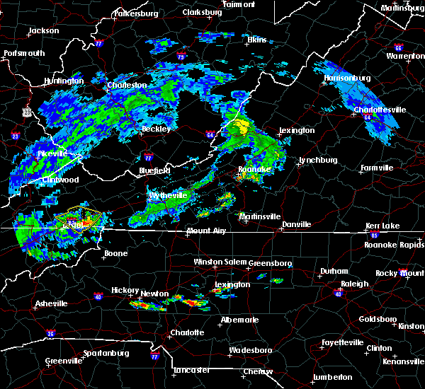 At 322 pm edt, a severe thunderstorm was located near abingdon, moving southeast at 25 mph (radar indicated). Hazards include 60 mph wind gusts and quarter size hail. Hail damage to vehicles is expected. Expect wind damage to roofs, siding, and trees. At 322 pm edt, a severe thunderstorm was located near abingdon, moving southeast at 25 mph (radar indicated). Hazards include 60 mph wind gusts and quarter size hail. Hail damage to vehicles is expected. Expect wind damage to roofs, siding, and trees.
|
| 6/22/2016 3:10 PM EDT | Quarter sized hail reported 0.2 miles SW of Abingdon, VA, report from post office employee |
| 6/22/2016 2:56 PM EDT |
 At 255 pm edt, a severe thunderstorm was located near abingdon, moving southeast at 30 mph (radar indicated). Hazards include 60 mph wind gusts and penny size hail. Expect damage to roofs. siding. and trees. Locations impacted include, bristol va, abingdon, glade spring, hilander park, harr, lindell, holston and emory-meadow view. At 255 pm edt, a severe thunderstorm was located near abingdon, moving southeast at 30 mph (radar indicated). Hazards include 60 mph wind gusts and penny size hail. Expect damage to roofs. siding. and trees. Locations impacted include, bristol va, abingdon, glade spring, hilander park, harr, lindell, holston and emory-meadow view.
|
| 6/22/2016 2:40 PM EDT |
 At 239 pm edt, a severe thunderstorm was located 7 miles southwest of lebanon, moving southeast at 25 mph (radar indicated). Hazards include 60 mph wind gusts and penny size hail. Expect damage to roofs. siding. And trees. At 239 pm edt, a severe thunderstorm was located 7 miles southwest of lebanon, moving southeast at 25 mph (radar indicated). Hazards include 60 mph wind gusts and penny size hail. Expect damage to roofs. siding. And trees.
|
| 6/17/2016 12:26 AM EDT |
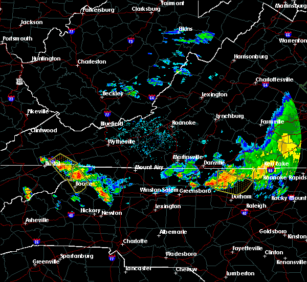 At 1225 am edt, a severe thunderstorm was located 7 miles northwest of mountain city, moving southeast at 30 mph (radar indicated). Hazards include 60 mph wind gusts and penny size hail. Expect damage to roofs. siding. and trees. Locations impacted include, abingdon, mountain city, damascus, trade, hilander park, harr, laurel bloomery, neva, shady valley and emory-meadow view. At 1225 am edt, a severe thunderstorm was located 7 miles northwest of mountain city, moving southeast at 30 mph (radar indicated). Hazards include 60 mph wind gusts and penny size hail. Expect damage to roofs. siding. and trees. Locations impacted include, abingdon, mountain city, damascus, trade, hilander park, harr, laurel bloomery, neva, shady valley and emory-meadow view.
|
| 6/17/2016 12:14 AM EDT |
 At 1214 am edt, a severe thunderstorm was located near mountain city, moving southeast at 30 mph (radar indicated). Hazards include 60 mph wind gusts and quarter size hail. Hail damage to vehicles is expected. expect wind damage to roofs, siding, and trees. Locations impacted include, abingdon, mountain city, damascus, trade, hilander park, harr, laurel bloomery, neva, shady valley and emory-meadow view. At 1214 am edt, a severe thunderstorm was located near mountain city, moving southeast at 30 mph (radar indicated). Hazards include 60 mph wind gusts and quarter size hail. Hail damage to vehicles is expected. expect wind damage to roofs, siding, and trees. Locations impacted include, abingdon, mountain city, damascus, trade, hilander park, harr, laurel bloomery, neva, shady valley and emory-meadow view.
|
| 6/17/2016 12:14 AM EDT |
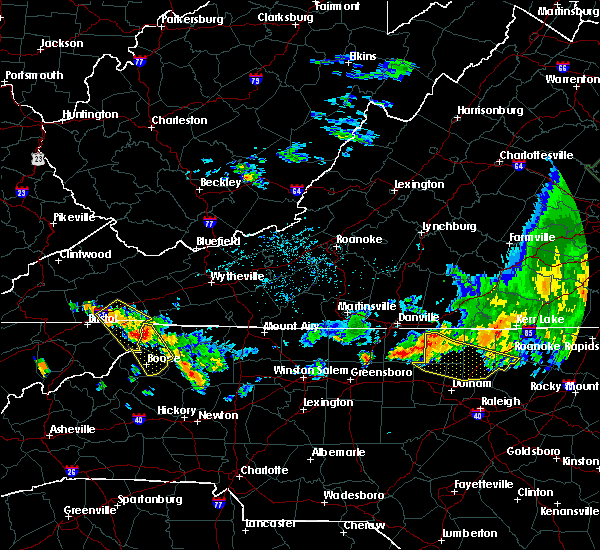 At 1214 am edt, a severe thunderstorm was located near mountain city, moving southeast at 30 mph (radar indicated). Hazards include 60 mph wind gusts and quarter size hail. Hail damage to vehicles is expected. expect wind damage to roofs, siding, and trees. Locations impacted include, abingdon, mountain city, damascus, trade, hilander park, harr, laurel bloomery, neva, shady valley and emory-meadow view. At 1214 am edt, a severe thunderstorm was located near mountain city, moving southeast at 30 mph (radar indicated). Hazards include 60 mph wind gusts and quarter size hail. Hail damage to vehicles is expected. expect wind damage to roofs, siding, and trees. Locations impacted include, abingdon, mountain city, damascus, trade, hilander park, harr, laurel bloomery, neva, shady valley and emory-meadow view.
|
| 6/16/2016 11:59 PM EDT |
 At 1158 pm edt, a severe thunderstorm was located 8 miles southeast of abingdon, moving southeast at 30 mph (radar indicated). Hazards include 60 mph wind gusts and quarter size hail. Hail damage to vehicles is expected. Expect wind damage to roofs, siding, and trees. At 1158 pm edt, a severe thunderstorm was located 8 miles southeast of abingdon, moving southeast at 30 mph (radar indicated). Hazards include 60 mph wind gusts and quarter size hail. Hail damage to vehicles is expected. Expect wind damage to roofs, siding, and trees.
|
| 6/16/2016 11:59 PM EDT |
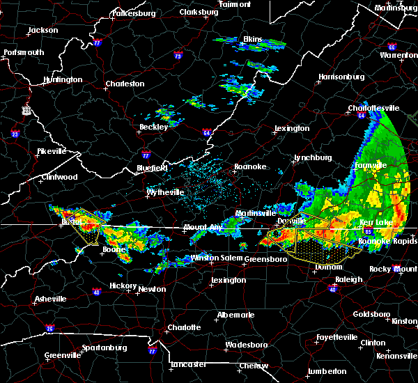 At 1158 pm edt, a severe thunderstorm was located 8 miles southeast of abingdon, moving southeast at 30 mph (radar indicated). Hazards include 60 mph wind gusts and quarter size hail. Hail damage to vehicles is expected. Expect wind damage to roofs, siding, and trees. At 1158 pm edt, a severe thunderstorm was located 8 miles southeast of abingdon, moving southeast at 30 mph (radar indicated). Hazards include 60 mph wind gusts and quarter size hail. Hail damage to vehicles is expected. Expect wind damage to roofs, siding, and trees.
|
| 5/12/2016 6:41 PM EDT |
 At 640 pm edt, severe thunderstorms were located along a line extending from 19 miles northeast of cleveland to 6 miles southeast of lebanon, moving northeast at 35 mph (radar indicated). Hazards include 60 mph wind gusts and penny size hail. Expect damage to roofs. siding. and trees. Locations impacted include, abingdon, glade spring, honaker, dye, lindell, rosedale and emory-meadow view. At 640 pm edt, severe thunderstorms were located along a line extending from 19 miles northeast of cleveland to 6 miles southeast of lebanon, moving northeast at 35 mph (radar indicated). Hazards include 60 mph wind gusts and penny size hail. Expect damage to roofs. siding. and trees. Locations impacted include, abingdon, glade spring, honaker, dye, lindell, rosedale and emory-meadow view.
|
| 5/12/2016 6:40 PM EDT | Trees down near the city of abingdon... v in washington county VA, 0.2 miles SW of Abingdon, VA |
| 5/12/2016 6:25 PM EDT |
 At 624 pm edt, severe thunderstorms were located along a line extending from 11 miles northeast of cleveland to near bristol, moving northeast at 35 mph (radar indicated). Hazards include 60 mph wind gusts and penny size hail. Expect damage to roofs. siding. And trees. At 624 pm edt, severe thunderstorms were located along a line extending from 11 miles northeast of cleveland to near bristol, moving northeast at 35 mph (radar indicated). Hazards include 60 mph wind gusts and penny size hail. Expect damage to roofs. siding. And trees.
|
| 5/12/2016 6:15 PM EDT |
 At 615 pm edt, a severe thunderstorm was located near bristol, or near abingdon, moving northeast at 30 mph (radar indicated). Hazards include 60 mph wind gusts and quarter size hail. Hail damage to vehicles is expected. expect wind damage to roofs, siding, and trees. Locations impacted include, abingdon, bristol va, bristol tn, bristol, walnut hill, benhams, south holston dam, hilander park and harr. At 615 pm edt, a severe thunderstorm was located near bristol, or near abingdon, moving northeast at 30 mph (radar indicated). Hazards include 60 mph wind gusts and quarter size hail. Hail damage to vehicles is expected. expect wind damage to roofs, siding, and trees. Locations impacted include, abingdon, bristol va, bristol tn, bristol, walnut hill, benhams, south holston dam, hilander park and harr.
|
| 5/12/2016 5:50 PM EDT |
 At 550 pm edt, a severe thunderstorm was located near oak grove, or 10 miles east of kingsport, moving northeast at 30 mph (radar indicated). Hazards include 60 mph wind gusts and quarter size hail. Hail damage to vehicles is expected. Expect wind damage to roofs, siding, and trees. At 550 pm edt, a severe thunderstorm was located near oak grove, or 10 miles east of kingsport, moving northeast at 30 mph (radar indicated). Hazards include 60 mph wind gusts and quarter size hail. Hail damage to vehicles is expected. Expect wind damage to roofs, siding, and trees.
|
| 3/14/2016 4:16 PM EDT | Quarter sized hail reported 2.2 miles WNW of Abingdon, VA, pea to quarter size reported. |
| 3/14/2016 3:54 PM EDT |
 At 353 pm edt, a severe thunderstorm was located over abingdon, moving northeast at 35 mph (radar indicated). Hazards include 60 mph wind gusts and quarter size hail. Hail damage to vehicles is expected. expect wind damage to roofs, siding, and trees. Locations impacted include, abingdon, bristol va, bristol, glade spring, damascus, lindell, benhams, shady valley, holston, south holston dam, hilander park, konnarock, harr and emory-meadow view. At 353 pm edt, a severe thunderstorm was located over abingdon, moving northeast at 35 mph (radar indicated). Hazards include 60 mph wind gusts and quarter size hail. Hail damage to vehicles is expected. expect wind damage to roofs, siding, and trees. Locations impacted include, abingdon, bristol va, bristol, glade spring, damascus, lindell, benhams, shady valley, holston, south holston dam, hilander park, konnarock, harr and emory-meadow view.
|
| 3/14/2016 3:37 PM EDT |
 At 337 pm edt, a severe thunderstorm was located over bristol tn, moving northeast at 25 mph (radar indicated). Hazards include 60 mph wind gusts and quarter size hail. Hail damage to vehicles is expected. Expect wind damage to roofs, siding, and trees. At 337 pm edt, a severe thunderstorm was located over bristol tn, moving northeast at 25 mph (radar indicated). Hazards include 60 mph wind gusts and quarter size hail. Hail damage to vehicles is expected. Expect wind damage to roofs, siding, and trees.
|
| 7/13/2015 6:35 PM EDT |
 A severe thunderstorm warning remains in effect until 700 pm edt for washington. southeastern scott counties and the city of bristol. at 634 pm edt. severe thunderstorms were located along a line extending from 32 miles northeast of abingdon to near kingsport. Moving east at 60 mph. A severe thunderstorm warning remains in effect until 700 pm edt for washington. southeastern scott counties and the city of bristol. at 634 pm edt. severe thunderstorms were located along a line extending from 32 miles northeast of abingdon to near kingsport. Moving east at 60 mph.
|
| 7/13/2015 6:20 PM EDT |
 A severe thunderstorm warning remains in effect until 700 pm edt for washington. central russell. southeastern scott counties and the city of bristol. at 620 pm edt. severe thunderstorms were located along a line extending from 23 miles east of lebanon to 7 miles southwest of gate city. Moving east at 60 mph. A severe thunderstorm warning remains in effect until 700 pm edt for washington. central russell. southeastern scott counties and the city of bristol. at 620 pm edt. severe thunderstorms were located along a line extending from 23 miles east of lebanon to 7 miles southwest of gate city. Moving east at 60 mph.
|
| 7/13/2015 6:03 PM EDT |
 At 601 pm edt, severe thunderstorms were located along a line extending from 12 miles northeast of lebanon to 8 miles southeast of jonesville, moving east at 50 mph (radar indicated). Hazards include 60 mph wind gusts and quarter size hail. Hail damage to vehicles is possible. Expect wind damage to roofs, siding and trees. At 601 pm edt, severe thunderstorms were located along a line extending from 12 miles northeast of lebanon to 8 miles southeast of jonesville, moving east at 50 mph (radar indicated). Hazards include 60 mph wind gusts and quarter size hail. Hail damage to vehicles is possible. Expect wind damage to roofs, siding and trees.
|
| 6/23/2015 8:52 PM EDT |
 At 852 pm edt, a severe thunderstorm was located near allison gap, or near saltville, moving southeast at 20 mph (radar indicated). Hazards include 60 mph wind gusts and quarter size hail. Hail damage to vehicles is expected. Expect wind damage to roofs, siding and trees. At 852 pm edt, a severe thunderstorm was located near allison gap, or near saltville, moving southeast at 20 mph (radar indicated). Hazards include 60 mph wind gusts and quarter size hail. Hail damage to vehicles is expected. Expect wind damage to roofs, siding and trees.
|
| 6/8/2015 6:17 PM EDT | At 616 pm edt, severe thunderstorms were located along a line extending from near raven to near bristol va, moving east at 35 mph (radar indicated). Hazards include 60 mph wind gusts and nickel size hail. Expect damage to roofs. siding and trees. Locations impacted include, bristol va, abingdon, lebanon, glade spring, honaker, damascus, benhams, hilander park, holston, konnarock, rosedale, dye, lindell, emory-meadow view and hansonville. |
| 6/8/2015 5:45 PM EDT | At 544 pm edt, severe thunderstorms were located along a line extending from near trammel to 6 miles east of weber city, moving east at 30 mph (radar indicated). Hazards include 60 mph wind gusts and nickel size hail. Expect damage to roofs. Siding and trees. |
| 4/25/2015 9:33 PM EDT | At 932 pm edt, a severe thunderstorm was located near lebanon, moving southeast at 25 mph (radar indicated). Hazards include half dollar size hail and 60 mph wind gusts. Hail damage to vehicles is expected. Expect wind damage to roofs, siding and trees. |
| 4/25/2015 9:25 PM EDT | At 925 pm edt, a severe thunderstorm was located near lebanon, moving east at 30 mph (radar indicated). Hazards include golf ball size hail and 60 mph wind gusts. People and animals outdoors will be injured. expect hail damage to roofs, siding, windows and vehicles. expect wind damage to roofs, siding and trees. locations impacted include, abingdon, lebanon, holston, lindell and rosedale. 1. 75in. |
| 4/25/2015 9:12 PM EDT | At 912 pm edt, a severe thunderstorm was located over cleveland, or near lebanon, moving southeast at 30 mph (radar indicated). Hazards include golf ball size hail and 60 mph wind gusts. People and animals outdoors will be injured. expect hail damage to roofs, siding, windows and vehicles. expect wind damage to roofs, siding and trees. locations impacted include, abingdon, lebanon, cleveland, honaker, st. paul, holston, castlewood, lindell, hansonville and rosedale. 1. 75in. |
| 4/25/2015 8:57 PM EDT | At 857 pm edt, a severe thunderstorm was located near cleveland, or 11 miles northwest of lebanon, moving southeast at 35 mph (trained weather spotters). Hazards include quarter size hail and 60 mph wind gusts. Hail damage to vehicles is expected. Expect wind damage to roofs, siding and trees. |
| 4/19/2015 11:33 PM EDT | At 1132 pm edt, severe thunderstorms were located along a line extending from 11 miles northeast of cleveland to 9 miles north of abingdon to 8 miles north of mountain city, moving northeast at 55 mph (radar indicated). Hazards include 60 mph wind gusts. Expect damage to roofs. siding and trees. locations impacted include, abingdon, lebanon, mountain city, bristol tn, bristol va, bristol, cleveland, walnut hill, bluff city, glade spring, honaker, st. paul, damascus, lindell, hansonville, laurel bloomery, holston, castlewood, collingwood and rosedale. 75in. |
| 4/19/2015 11:33 PM EDT | At 1132 pm edt, severe thunderstorms were located along a line extending from 11 miles northeast of cleveland to 9 miles north of abingdon to 8 miles north of mountain city, moving northeast at 55 mph (radar indicated). Hazards include 60 mph wind gusts. Expect damage to roofs. siding and trees. locations impacted include, abingdon, lebanon, mountain city, bristol tn, bristol va, bristol, cleveland, walnut hill, bluff city, glade spring, honaker, st. paul, damascus, lindell, hansonville, laurel bloomery, holston, castlewood, collingwood and rosedale. 75in. |
| 4/19/2015 11:11 PM EDT | At 1110 pm edt, severe thunderstorms were located along a line extending from 8 miles west of cleveland to 9 miles northwest of bristol va to near bristol, moving northeast at 55 mph (radar indicated). Hazards include 60 mph wind gusts. Expect damage to roofs. Siding and trees. |
| 4/19/2015 11:11 PM EDT | At 1110 pm edt, severe thunderstorms were located along a line extending from 8 miles west of cleveland to 9 miles northwest of bristol va to near bristol, moving northeast at 55 mph (radar indicated). Hazards include 60 mph wind gusts. Expect damage to roofs. Siding and trees. |
| 6/19/2014 6:40 PM EDT | One tree down and a set of powerlines on good hope r in washington county VA, 3.9 miles NW of Abingdon, VA |
| 6/19/2014 1:45 PM EDT | *** 1 fatal *** a pedestrian was struck by a falling tree in the 100 block of west main street. the victim was a 56 year old male. at the time of the event...peak wind in washington county VA, 0.2 miles SW of Abingdon, VA |
| 7/25/2012 2:30 AM EDT | Tree down on a trailer home...reported by dispatc in washington county VA, 0.2 miles SW of Abingdon, VA |
| 7/5/2012 3:00 PM EDT | Several trees dow in washington county VA, 0.2 miles SW of Abingdon, VA |
| 1/1/0001 12:00 AM | One tree down on majestic driv in washington county VA, 0.2 miles SW of Abingdon, VA |
| 1/1/0001 12:00 AM | Numerous trees...power poles and powerlines down countywide. many trees...power poles and powerlines are down across and blocking roadways. reported by dispatc in washington county VA, 0.2 miles SW of Abingdon, VA |
| 1/1/0001 12:00 AM | Numerous trees dow in washington county VA, 0.2 miles SW of Abingdon, VA |
| 1/1/0001 12:00 AM | Hwy 11 machine shed was blown over and hit cars...reported by dispatc in washington county VA, 0.2 miles SW of Abingdon, VA |
Hail Maps for Abingdon, VA
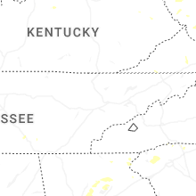


Connect with Interactive Hail Maps