

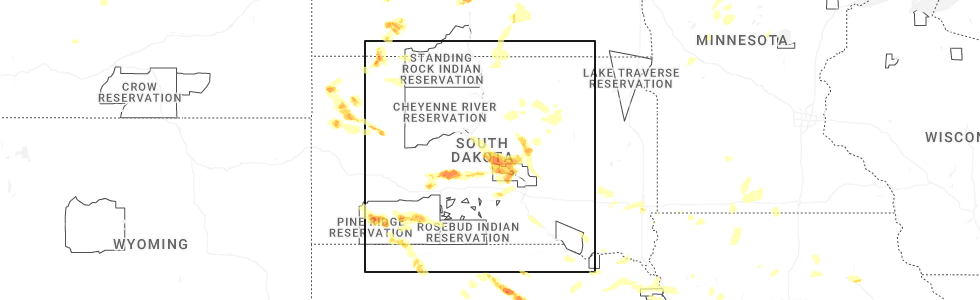
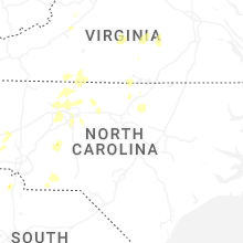
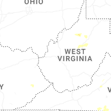
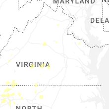
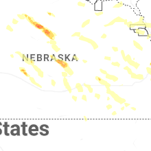
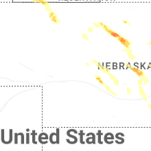
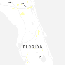
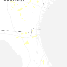
Hail Map for Wednesday, July 9, 2025
Number of Impacted Households on 7/9/2025
0
Impacted by 1" or Larger Hail
0
Impacted by 1.75" or Larger Hail
0
Impacted by 2.5" or Larger Hail
Square Miles of Populated Area Impacted on 7/9/2025
0
Impacted by 1" or Larger Hail
0
Impacted by 1.75" or Larger Hail
0
Impacted by 2.5" or Larger Hail
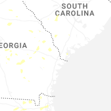
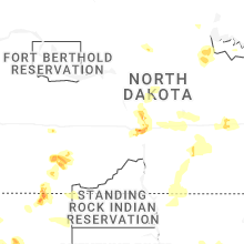
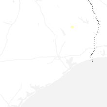
Cities Most Affected by Hail Storms of 7/9/2025
| Hail Size | Demographics of Zip Codes Affected | ||||||
|---|---|---|---|---|---|---|---|
| City | Count | Average | Largest | Pop Density | House Value | Income | Age |
| Bismarck, ND | 2 | 1.75 | 1.75 | 1135 | $100k | $41.5k | 38.3 |
| Hettinger, ND | 1 | 2.50 | 2.50 | 2 | $42k | $29.8k | 49.3 |
| Baldwin, ND | 1 | 1.75 | 1.75 | 4 | $74k | $45.2k | 44.2 |
| Mott, ND | 1 | 1.75 | 1.75 | 2 | $29k | $28.8k | 51.1 |
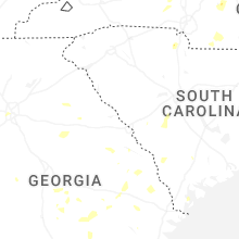
Hail and Wind Damage Spotted on 7/9/2025
Filter by Report Type:Hail ReportsWind Reports
States Impacted
North Carolina, West Virginia, Virginia, South Dakota, Michigan, Pennsylvania, Ohio, South Carolina, North Dakota, Florida, Tennessee, Maryland, District of Columbia, Wyoming, Idaho, Montana, New Jersey, NebraskaNorth Carolina
| Local Time | Report Details |
|---|---|
| 8:04 AM EDT | Tree down on power equipment near hanks stree in chatham county NC, 30.5 miles W of Raleigh, NC |
| 2:07 PM EDT | Trees down along highway 16. road blocke in wilkes county NC, 54.9 miles ESE of Bristol, TN |
| 2:43 PM EDT | Quarter sized hail reported near Millers Creek, NC, 58.5 miles ESE of Bristol, TN |
| 2:54 PM EDT | Tree down on brown mountain beach roa in caldwell county NC, 53 miles SSE of Bristol, TN |
| 2:59 PM EDT | Thunderstorm winds blew down one tree near the intersection of traphill road and traphill union roa in wilkes county NC, 70.9 miles ESE of Bristol, TN |
| 3:10 PM EDT | Thunderstorm winds blew down one tree near the intersection of thurmond road and zephyr mountain park roa in wilkes county NC, 75.4 miles ESE of Bristol, TN |
| 3:17 PM EDT | Thunderstorm winds blew down one tree near the intersection of grassy fork road and beaver roa in wilkes county NC, 73.8 miles ESE of Bristol, TN |
| 3:17 PM EDT | Tree down near kincaid southwest circle and southwest boulevar in caldwell county NC, 58.9 miles NW of Charlotte, NC |
| 3:43 PM EDT | Thunderstorm winds blew down one tree near the intersection of interstate 77 and us route 21 bypas in surry county NC, 71.5 miles N of Charlotte, NC |
| 4:05 PM EDT | Thunderstorm winds blew down multiple trees near the intersection of roberts rock road and lime rock roa in yadkin county NC, 73.2 miles N of Charlotte, NC |
| 4:54 PM EDT | Thunderstorm winds blew down one tree along the 2600 block of whitaker roa in yadkin county NC, 64.9 miles N of Charlotte, NC |
| 4:58 PM EDT | Tree down near lanes creek r in union county NC, 34.2 miles SE of Charlotte, NC |
| 5:07 PM EDT | Tree down near landsford road and white store roa in union county NC, 35.9 miles SE of Charlotte, NC |
| 5:11 PM EDT | Tree down near belews creek r in guilford county NC, 71.3 miles S of Roanoke, VA |
| 5:11 PM EDT | Multiple trees down on witty r in guilford county NC, 70.7 miles S of Roanoke, VA |
| 5:18 PM EDT | Trees down in peachland... n in anson county NC, 35.9 miles ESE of Charlotte, NC |
| 5:21 PM EDT | Trees down in wadesbor in anson county NC, 46.3 miles ESE of Charlotte, NC |
| 5:24 PM EDT | Tree down on bethal church r in forsyth county NC, 75.5 miles S of Roanoke, VA |
| 5:25 PM EDT | Several power poles broke in rockingham county NC, 60.2 miles S of Roanoke, VA |
| 5:27 PM EDT | Trees down with damage to power poles near the courthous in rockingham county NC, 60.8 miles S of Roanoke, VA |
| 5:35 PM EDT | Trees down across the roadwa in iredell county NC, 56.6 miles N of Charlotte, NC |
| 5:56 PM EDT | Tree down on tuckertown r in davidson county NC, 42.1 miles ENE of Charlotte, NC |
| 6:04 PM EDT | Tree down on power equipmen in forsyth county NC, 75.3 miles NNE of Charlotte, NC |
| 6:08 PM EDT | Tree on house and car off jackson hill rd... dento in davidson county NC, 46.4 miles ENE of Charlotte, NC |
| 6:12 PM EDT | Tree down on power equipmen in forsyth county NC, 75.3 miles NNE of Charlotte, NC |
| 6:18 PM EDT | Tree down on shiptontown r in davidson county NC, 46.9 miles NE of Charlotte, NC |
| 6:20 PM EDT | Tree down on airport roa in rowan county NC, 33.7 miles NNE of Charlotte, NC |
| 6:28 PM EDT | Trees down on powerline in montgomery county NC, 47.4 miles E of Charlotte, NC |
| 6:37 PM EDT | Tree down near henderson grove church road and jacob bost roa in rowan county NC, 35.1 miles NNE of Charlotte, NC |
| 6:37 PM EDT | Tree down on power equipmen in forsyth county NC, 71.8 miles NE of Charlotte, NC |
| 6:42 PM EDT | Tree down near commonwealth rd & walker mill rd in sophia... n in randolph county NC, 67.9 miles W of Raleigh, NC |
| 6:43 PM EDT | Tree down on riverbend roa in catawba county NC, 42.7 miles NNW of Charlotte, NC |
| 6:45 PM EDT | Tree down on us highway 70 eas in catawba county NC, 37.1 miles NNW of Charlotte, NC |
| 6:46 PM EDT | Tree down on power equipmen in moore county NC, 65.7 miles SW of Raleigh, NC |
| 6:46 PM EDT | Tree in road way on buffalo ford rd & grantville l in randolph county NC, 60 miles W of Raleigh, NC |
| 6:48 PM EDT | Power lines down near i-40 and stamey farm roa in iredell county NC, 39.3 miles NNW of Charlotte, NC |
| 6:51 PM EDT | Tree down on emmanuel church roa in catawba county NC, 38.5 miles NNW of Charlotte, NC |
| 6:53 PM EDT | Tree blocking the road at smith farm road and highway 9 in alexander county NC, 45.4 miles NNW of Charlotte, NC |
| 6:54 PM EDT | Trees down on power equipmen in montgomery county NC, 61.2 miles E of Charlotte, NC |
| 7:00 PM EDT | Trees down on braxton driv in iredell county NC, 33.6 miles NNW of Charlotte, NC |
| 7:15 PM EDT | Power line down on 5th avenue southwes in catawba county NC, 46 miles NW of Charlotte, NC |
| 7:20 PM EDT | Tree down on lineberger roa in catawba county NC, 25.1 miles NNW of Charlotte, NC |
| 7:22 PM EDT | Tree down blocking both lane in randolph county NC, 53.9 miles WSW of Raleigh, NC |
| 7:45 PM EDT | 911 center reports several trees down around siler cit in chatham county NC, 46.2 miles W of Raleigh, NC |
| 7:57 PM EDT | Tree down at hwy 902 and the rocky river bridge. radar estimated tim in chatham county NC, 37 miles W of Raleigh, NC |
| 7:58 PM EDT | Multiple trees and power lines down across central lincoln count in lincoln county NC, 28.9 miles NW of Charlotte, NC |
| 8:03 PM EDT | Corrects previous tstm wnd dmg report from pittsboro. tree down on power equipment near hanks driv in chatham county NC, 30.5 miles W of Raleigh, NC |
| 8:04 PM EDT | Corrects previous tstm wnd dmg report from pittsboro. tree down on power equipment near hanks stree in chatham county NC, 30.5 miles W of Raleigh, NC |
| 8:15 PM EDT | Tree down at old chapel hill rd and mohawk trail... resulting in power outage in durham county NC, 21.1 miles WNW of Raleigh, NC |
| 8:16 PM EDT | Tree down at chapel hill rd and pinecrest rd... resulting in power outage in durham county NC, 21.4 miles NW of Raleigh, NC |
| 8:18 PM EDT | Tree down at old us 421 and foust rd. radar estimated tim in chatham county NC, 45 miles W of Raleigh, NC |
| 8:57 PM EDT | Tree down at western blvd near nazareth st... resulting in power outage in wake county NC, 1.6 miles WSW of Raleigh, NC |
| 9:00 PM EDT | Tree down on power equipment near glasscock stree in wake county NC, 1.9 miles E of Raleigh, NC |
| 10:13 PM EDT | Tree down at roanoke ave and harriet s in halifax county NC, 70.7 miles NE of Raleigh, NC |
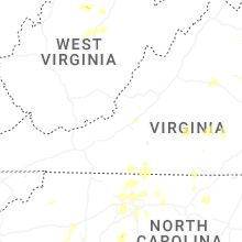
West Virginia
| Local Time | Report Details |
|---|---|
| 12:10 PM EDT | Tree down across oil ridge rd near cairo rd. time estimated via rada in ritchie county WV, 64.5 miles NNE of Charleston, WV |
| 1:01 PM EDT | Downed trees near smoke camp road resulted in local power outages. time estimated from rada in lewis county WV, 41.5 miles WNW of Elkins, WV |
| 1:40 PM EDT | Time estimated from rada in boone county WV, 13.5 miles SSW of Charleston, WV |
Virginia
| Local Time | Report Details |
|---|---|
| 12:38 PM EDT | Thunderstorm winds blew down one tree near the intersection of elk horn road and vista ridge driv in carroll county VA, 63 miles SW of Roanoke, VA |
| 12:59 PM EDT | Thunderstorm winds blew multiple power lines down near the intersection of 29th street and avenham avenu in city of roanoke county VA, 2.4 miles SSW of Roanoke, VA |
| 1:24 PM EDT | Thunderstorm winds blew down multiple trees along illinois avenu in city of salem county VA, 6.2 miles WNW of Roanoke, VA |
| 1:37 PM EDT | Thunderstorm winds blew down one tree near the 3800 block of roanoke road just north of the intersection with ashley wa in botetourt county VA, 11.8 miles N of Roanoke, VA |
| 1:40 PM EDT | Thunderstorm winds blew down one tree along the 200 block of rader barn roa in botetourt county VA, 13.5 miles NNE of Roanoke, VA |
| 1:48 PM EDT | Tree down near mountain breeze lan in carroll county VA, 60.4 miles SW of Roanoke, VA |
| 1:50 PM EDT | Thunderstorm winds blew down one tree near the 3200 block of oak ridge roa in botetourt county VA, 16.1 miles NNE of Roanoke, VA |
| 1:56 PM EDT | Thunderstorm winds blew down a power line that caused a transformer to stop workin in franklin county VA, 24.5 miles S of Roanoke, VA |
| 2:00 PM EDT | Tree down near wards gap roa in carroll county VA, 60.4 miles SW of Roanoke, VA |
| 2:24 PM EDT | Thunderstorm winds blew down one tree along power dam road near the bridge crossing over route 22 in franklin county VA, 19.1 miles SSE of Roanoke, VA |
| 2:34 PM EDT | Thunderstorm winds blew down one tree near the intersection of route 43 and route 22 in bedford county VA, 23.6 miles ENE of Roanoke, VA |
| 2:40 PM EDT | Tree down near intersection of cedar springs and asbury church roa in wythe county VA, 54.6 miles ENE of Bristol, TN |
| 3:04 PM EDT | Tree down on the 1200 block of stuarts draft highway near walnut hills roa in augusta county VA, 70.2 miles NE of Roanoke, VA |
| 3:11 PM EDT | Siding blown off of buildin in bedford county VA, 37.3 miles ENE of Roanoke, VA |
| 3:32 PM EDT | Tree down near intersection of ivanhoe road and painters hill roa in wythe county VA, 63.6 miles WSW of Roanoke, VA |
| 3:36 PM EDT | Tree down on stagebridge road at wild cherry lan in nelson county VA, 68.8 miles WNW of Richmond, VA |
| 3:45 PM EDT | Multiple reports of trees down on paynes mill rd. time estimated by rada in fluvanna county VA, 47.5 miles NW of Richmond, VA |
| 3:50 PM EDT | Tree down on adial roa in nelson county VA, 70.4 miles WNW of Richmond, VA |
| 3:52 PM EDT | Thunderstorm winds blew down one tree near the intersection of oak level road and edgewood driv in henry county VA, 36.7 miles S of Roanoke, VA |
| 4:00 PM EDT | Tree down near colonial highwa in campbell county VA, 40.8 miles E of Roanoke, VA |
| 4:05 PM EDT | Thunderstorm winds blew down one tree on to the 100 block of anstey roa in campbell county VA, 41.9 miles E of Roanoke, VA |
| 4:17 PM EDT | Tree down across the 7000 block of courthouse road (rt. 208). time estimated by rada in louisa county VA, 39.7 miles NNW of Richmond, VA |
| 4:22 PM EDT | Tree down on eagle mountain driv in nelson county VA, 64.6 miles WNW of Richmond, VA |
| 4:24 PM EDT | Thunderstorm winds blew down one tree on to koehler roa in henry county VA, 39.4 miles S of Roanoke, VA |
| 4:24 PM EDT | Thunderstorm winds blew down one tree along the 1900 block of stultz roa in henry county VA, 39.5 miles S of Roanoke, VA |
| 4:29 PM EDT | Thunderstorm winds blew down one tree near the intersection of machinery drive and business route 5 in henry county VA, 42.9 miles S of Roanoke, VA |
| 4:30 PM EDT | Tree down... blocking one lane of old mtn r in pittsylvania county VA, 27 miles SE of Roanoke, VA |
| 4:31 PM EDT | Two trees reported down in stanley on us-340 and keystone roa in page county VA, 76.4 miles ESE of Elkins, WV |
| 4:37 PM EDT | Large tree down near intersection of zachary taylor hwy and grasty ln in orange county VA, 48.6 miles NNW of Richmond, VA |
| 4:40 PM EDT | Tree down. traffic light ou in henry county VA, 40.6 miles S of Roanoke, VA |
| 4:46 PM EDT | Tree down in the 100 block of lakeview d in spotsylvania county VA, 45.4 miles NNW of Richmond, VA |
| 4:48 PM EDT | Thunderstorm winds blew down one tree on route 58 bypass and route 220 just north of the joseph martin highway exi in henry county VA, 44.3 miles S of Roanoke, VA |
| 4:50 PM EDT | Tree down across power lines and blocking highway... along fishers farm road and oxford driv in henry county VA, 44.4 miles S of Roanoke, VA |
| 4:50 PM EDT | Tree down on power line. near entrance to rich acres schoo in henry county VA, 43.7 miles S of Roanoke, VA |
| 4:50 PM EDT | Tree fell on house. came through into kitchen and bathroo in henry county VA, 43.7 miles S of Roanoke, VA |
| 4:50 PM EDT | A tree fell along three chopt r in goochland county VA, 34.1 miles NW of Richmond, VA |
| 4:55 PM EDT | Tree fell on top of a house and came through roof...visible inside of hous in henry county VA, 43.1 miles S of Roanoke, VA |
| 4:56 PM EDT | Tree down... blocking 1 lane of william f stone hw in henry county VA, 44.6 miles S of Roanoke, VA |
| 4:56 PM EDT | Tree fell on power lin in pittsylvania county VA, 33.3 miles SE of Roanoke, VA |
| 5:00 PM EDT | Tree across roa in henry county VA, 42.9 miles S of Roanoke, VA |
| 5:00 PM EDT | Tree down resulting in power outage in pittsylvania county VA, 41 miles ESE of Roanoke, VA |
| 5:00 PM EDT | Tree across power lin in pittsylvania county VA, 39.5 miles ESE of Roanoke, VA |
| 5:01 PM EDT | Tree down. blocking most of roa in pittsylvania county VA, 40.7 miles SSE of Roanoke, VA |
| 5:07 PM EDT | Tree down at the intersection of post oak rd. and curtis l in spotsylvania county VA, 46 miles N of Richmond, VA |
| 5:09 PM EDT | Thunderstorm winds blew down one tree along the 2600 block of promise land roa in appomattox county VA, 60.1 miles E of Roanoke, VA |
| 5:10 PM EDT | Thunderstorm winds blew down one tree near the intersection of central church road and warren lan in appomattox county VA, 60.1 miles E of Roanoke, VA |
| 5:10 PM EDT | Tree on power lin in pittsylvania county VA, 38.1 miles SSE of Roanoke, VA |
| 5:10 PM EDT | Multiple trees and large branches down at 6975 courthouse... va. this is at the spotsylvania high schoo in spotsylvania county VA, 45.3 miles N of Richmond, VA |
| 5:12 PM EDT | Tree down at the intersection of oak mill rd. and clifton l in fauquier county VA, 70.8 miles N of Richmond, VA |
| 5:15 PM EDT | Tree limb across power line. power is ou in buckingham county VA, 52.7 miles WNW of Richmond, VA |
| 5:17 PM EDT | Tree down across powerlin in pittsylvania county VA, 38.8 miles SE of Roanoke, VA |
| 5:19 PM EDT | Tree across roa in pittsylvania county VA, 41.5 miles SE of Roanoke, VA |
| 5:22 PM EDT | Thunderstorm winds blew down one tree along the 2200 block of red house roa in appomattox county VA, 62.4 miles E of Roanoke, VA |
| 5:24 PM EDT | Thunderstorm winds blew down one tree near the intersection of route 460 and hixburg roa in appomattox county VA, 61.9 miles WSW of Richmond, VA |
| 5:25 PM EDT | Multiple trees down near old church rd and slate run ln in prince william county VA, 64.2 miles SW of Baltimore, MD |
| 5:26 PM EDT | Tree down at the intersection of howard trail. and river r in spotsylvania county VA, 55.6 miles N of Richmond, VA |
| 5:27 PM EDT | Thunderstorm winds blew down one tree on bear creek roa in charlotte county VA, 64.1 miles E of Roanoke, VA |
| 5:30 PM EDT | Tree down at the intersection of sillamon rd. and backwell mills r in fauquier county VA, 66.7 miles N of Richmond, VA |
| 5:32 PM EDT | Tree down on worsham rd. radar estimated tim in prince edward county VA, 47.3 miles WSW of Richmond, VA |
| 5:34 PM EDT | Thunderstorm winds blew down one tree along the 6700 block of axton roa in henry county VA, 49.9 miles SSE of Roanoke, VA |
| 5:37 PM EDT | Thunderstorm winds blew down one tree near the intersection of rolling hill road and price roa in charlotte county VA, 62.9 miles WSW of Richmond, VA |
| 5:40 PM EDT | Tree down on bragg street. radar estimated tim in cumberland county VA, 42.8 miles WSW of Richmond, VA |
| 5:42 PM EDT | Reported by publi in pittsylvania county VA, 48.6 miles SE of Roanoke, VA |
| 5:42 PM EDT | Tree down at delaney rd and minnieville rd in prince william county VA, 60 miles SW of Baltimore, MD |
| 5:42 PM EDT | Thunderstorm winds blew down one tree near the intersection of old curdsville road and bishop creek road and buckingham springs roa in buckingham county VA, 45.9 miles W of Richmond, VA |
| 5:49 PM EDT | Tree down. blocking both lanes near intersection of halifax and coleman mountain r in pittsylvania county VA, 47.5 miles SE of Roanoke, VA |
| 5:49 PM EDT | Numerous trees down across the city of staffor in stafford county VA, 64.7 miles NNE of Richmond, VA |
| 5:52 PM EDT | Tree on power lin in city of danville county VA, 51.5 miles SSE of Roanoke, VA |
| 5:53 PM EDT | Trees onto powerlines at 15034 alabama ave in prince william county VA, 58 miles SW of Baltimore, MD |
| 5:53 PM EDT | Reports of a few trees down in clifto in fairfax county VA, 48 miles SW of Baltimore, MD |
| 6:00 PM EDT | Tree dow in pittsylvania county VA, 49.3 miles SSE of Roanoke, VA |
| 6:00 PM EDT | Tree down... completely blocking roa in pittsylvania county VA, 53.1 miles SE of Roanoke, VA |
| 6:10 PM EDT | Tree fell onto house. power lines also dow in pittsylvania county VA, 55.2 miles SE of Roanoke, VA |
| 6:10 PM EDT | A tree fell along ballsville r in powhatan county VA, 23.4 miles WNW of Richmond, VA |
| 6:14 PM EDT | A tree fell down at the intersection of clementown rd and old buckingham r in powhatan county VA, 24.7 miles W of Richmond, VA |
| 6:14 PM EDT | A tree fell down along clement town r in powhatan county VA, 24.8 miles W of Richmond, VA |
| 6:15 PM EDT | Reports of a few trees down in mount verno in fairfax county VA, 47.7 miles SW of Baltimore, MD |
| 6:15 PM EDT | Tree fell on power lin in pittsylvania county VA, 53.4 miles SE of Roanoke, VA |
| 6:17 PM EDT | Tree down near indiantown rd and kings hwy in king george county VA, 58.8 miles NNE of Richmond, VA |
| 6:19 PM EDT | Tree down on car along melon roa in halifax county VA, 60.5 miles SE of Roanoke, VA |
| 6:21 PM EDT | Thunderstorm winds blew down one tree along the 1200 block of barnesville highwa in charlotte county VA, 68.7 miles SW of Richmond, VA |
| 6:21 PM EDT | Thunderstorm winds blew down one tree near the 300 block of union cemetery roa in charlotte county VA, 61.7 miles WSW of Richmond, VA |
| 6:21 PM EDT | Thunderstorm winds blew down one tree near the 300 block of welsh tract roa in charlotte county VA, 61.3 miles WSW of Richmond, VA |
| 6:24 PM EDT | Thunderstorm winds blew down one tree along green rock hills lan in charlotte county VA, 60.8 miles WSW of Richmond, VA |
| 6:26 PM EDT | Tree down at the intersection of duke st and cambridge rd... blocking one lan in city of alexandria county VA, 41.7 miles SW of Baltimore, MD |
| 6:26 PM EDT | Tree down in the 4800 block of arlington blv in arlington county VA, 39.9 miles SW of Baltimore, MD |
| 6:27 PM EDT | Tree down at intersection of russell road and w myrtle street... blocking both lane in city of alexandria county VA, 41.4 miles SW of Baltimore, MD |
| 6:27 PM EDT | Tree down in the 200 block of n payne street... blocking both lane in city of alexandria county VA, 40.7 miles SW of Baltimore, MD |
| 6:27 PM EDT | Tree down at mathias point rd and bundock rd in king george county VA, 67.8 miles SSW of Baltimore, MD |
| 6:30 PM EDT | Tree damage reported on meade rd. radar estimated tim in amelia county VA, 17.4 miles WSW of Richmond, VA |
| 6:30 PM EDT | A tree fell down at the intersection of three bridge rd and maidens r in powhatan county VA, 16.5 miles WNW of Richmond, VA |
| 6:31 PM EDT | Tree damage was reported on saint james rd. radar estimated tim in amelia county VA, 28.4 miles WSW of Richmond, VA |
| 6:34 PM EDT | Power line down in crewe with power outages. time estimated from rada in nottoway county VA, 34.6 miles SW of Richmond, VA |
| 6:35 PM EDT | A tree fell at the intersection of liberty fork rd and beverly run r in caroline county VA, 46 miles NE of Richmond, VA |
| 6:35 PM EDT | A tree fell across liberty fork r in caroline county VA, 45.4 miles NE of Richmond, VA |
| 6:36 PM EDT | A tree fell down along dykeland r in amelia county VA, 16.1 miles WSW of Richmond, VA |
| 6:36 PM EDT | A tree fell down along river road wes in goochland county VA, 17 miles NW of Richmond, VA |
| 6:36 PM EDT | Tree reported down at the 2800 block of bible rd. time estimated from rada in nottoway county VA, 31.8 miles SW of Richmond, VA |
| 6:50 PM EDT | Tree reported down at the intersection of lewiston plank rd. and old school house rd. time estimated from rada in nottoway county VA, 41.6 miles SW of Richmond, VA |
| 6:55 PM EDT | A tree fell along hermitage r in henrico county VA, 12 miles NE of Richmond, VA |
| 7:08 PM EDT | A tree fell on a house on chayton ln. no injuries were reported. radar estimated tim in chesterfield county VA, 11.8 miles SE of Richmond, VA |
| 7:10 PM EDT | A tree fell down across namozine r in amelia county VA, 19.8 miles SSW of Richmond, VA |
| 7:10 PM EDT | A tree fell down at the intersection of club commons rd and old wyndham d in henrico county VA, 13.7 miles N of Richmond, VA |
| 7:13 PM EDT | A tree fell along king william r in city of richmond county VA, 8.9 miles E of Richmond, VA |
| 7:18 PM EDT | Tree down near the intersection of tidewater trail and berry hill road. radar estimated tim in essex county VA, 50.4 miles ENE of Richmond, VA |
| 7:20 PM EDT | Reports of multiple trees down near the intersection of yorkers swamp rd. and colnbrook rd. radar estimated tim in essex county VA, 52.2 miles ENE of Richmond, VA |
| 7:23 PM EDT | Tree reported down at the intersection of oak row rd. and rosehill drive. radar estimated tim in richmond county VA, 57.5 miles NE of Richmond, VA |
| 8:02 PM EDT | Multiple trees were reported down on wakema rd. radar estimated tim in king william county VA, 40.3 miles ENE of Richmond, VA |
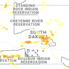
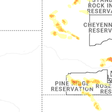
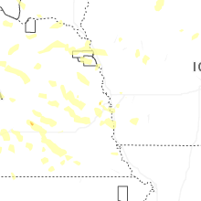
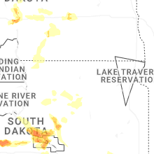
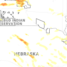
South Dakota
| Local Time | Report Details |
|---|---|
| 11:50 AM CDT | Report of car blown off road north of henry. additional report of debris on roads in henry from winds a couple mins earlie in codington county SD, 62.9 miles SE of Aberdeen, SD |
| 3:00 PM MDT | Ping Pong Ball sized hail reported near Newell, SD, 81.5 miles N of Rapid City, SD |
| 3:24 PM MDT | Storm damage reported in meade county SD, 66.7 miles NNE of Rapid City, SD |
| 3:34 PM MDT | Storm damage reported in meade county SD, 66.7 miles NNE of Rapid City, SD |
| 3:40 PM MDT | Storm damage reported in meade county SD, 62.6 miles NNE of Rapid City, SD |
| 3:59 PM MDT | Storm damage reported in bennett county SD, 80.4 miles WNW of Valentine, NE |
| 4:09 PM MDT | Storm damage reported in perkins county SD, 94.1 miles NNE of Rapid City, SD |
| 4:12 PM MDT | Storm damage reported in oglala lakota county SD, 70.3 miles SE of Rapid City, SD |
| 4:24 PM MDT | Storm damage reported in meade county SD, 88.7 miles NE of Rapid City, SD |
| 4:25 PM MDT | Storm damage reported in perkins county SD, 94.2 miles NE of Rapid City, SD |
| 4:30 PM MDT | Storm damage reported in bennett county SD, 60.3 miles WNW of Valentine, NE |
| 4:50 PM MDT | Storm damage reported in bennett county SD, 59.6 miles WNW of Valentine, NE |
| 5:13 PM MDT | Personal weather statio in dewey county SD, 63.5 miles NW of Pierre, SD |
| 5:26 PM MDT | Storm damage reported in bennett county SD, 47 miles NW of Valentine, NE |
| 6:28 PM CDT | Storm damage reported in todd county SD, 43.2 miles NW of Valentine, NE |
| 5:30 PM MDT | Mesonet station tims2 timber lake (sd mesonet in dewey county SD, 81.2 miles NNW of Pierre, SD |
| 5:39 PM MDT | Mesonet station 178 trail city (sddot in corson county SD, 79.3 miles NNW of Pierre, SD |
| 6:50 PM CDT | Storm damage reported in mellette county SD, 48.5 miles NW of Valentine, NE |
| 6:00 PM MDT | Sdsu mesonet site 1 wnw of laplan in dewey county SD, 56.2 miles NNW of Pierre, SD |
| 7:10 PM CDT | Storm damage reported in todd county SD, 15.8 miles N of Valentine, NE |
| 7:16 PM CDT | Storm damage reported in walworth county SD, 80.9 miles N of Pierre, SD |
| 7:22 PM CDT | Storm damage reported in todd county SD, 15.8 miles N of Valentine, NE |
| 7:30 PM CDT | Mesonet station 157 forest city (sddot in potter county SD, 44.4 miles N of Pierre, SD |
| 7:30 PM CDT | Mesonet station 209 lowry (sddot in walworth county SD, 66.5 miles NNE of Pierre, SD |
| 7:30 PM CDT | Mesonet station 212 agar (sddot in potter county SD, 39 miles NNE of Pierre, SD |
| 7:34 PM CDT | Storm damage reported in walworth county SD, 75.5 miles W of Aberdeen, SD |
| 7:35 PM CDT | Mesonet station lrms2 lowry 2s (sd mesonet in walworth county SD, 65.5 miles NNE of Pierre, SD |
| 7:35 PM CDT | Mesonet station 212 agar (sddot in potter county SD, 39 miles NNE of Pierre, SD |
| 7:40 PM CDT | Storm damage reported in tripp county SD, 43.1 miles NE of Valentine, NE |
| 7:45 PM CDT | Storm damage reported in tripp county SD, 43.1 miles NE of Valentine, NE |
| 7:45 PM CDT | Mesonet station onms2 onida 13wsw (sd mesonet in sully county SD, 19.5 miles N of Pierre, SD |
| 6:50 PM MDT | Quarter sized hail reported near Kadoka, SD, 63.5 miles WSW of Pierre, SD |
| 7:50 PM CDT | Corrects previous high sust winds report from 2 n herreid. mesonet station 50 herreid (sddot in campbell county SD, 73 miles SSE of Bismarck, ND |
| 7:53 PM CDT | Corrects previous high sust winds report from 1 e pierre regional airport. asos station kpir pierre muni a in hughes county SD, 3.6 miles ENE of Pierre, SD |
| 6:55 PM MDT | Storm damage reported in haakon county SD, 41.5 miles WSW of Pierre, SD |
| 8:18 PM CDT | Mesonet station 19 harrold (sddot in hughes county SD, 33.1 miles ENE of Pierre, SD |
| 8:22 PM CDT | Mesonet station 215 polo 17 w jct sd47/sd26 (sddot in hyde county SD, 52.7 miles ENE of Pierre, SD |
| 8:35 PM CDT | Mesonet station pims2 pierre 17e (sd mesonet in hughes county SD, 17.4 miles E of Pierre, SD |
| 8:40 PM CDT | Mesonet station hmms2 highmore 23n (sd mesonet in hyde county SD, 57.4 miles NE of Pierre, SD |
| 9:00 PM CDT | Mesonet station lbms2 lower brule 2wnw (sd mesonet in lyman county SD, 41.8 miles ESE of Pierre, SD |
| 9:07 PM CDT | Mesonet station 154 sd rwis platte-winner bridg in charles mix county SD, 68.7 miles NNW of Oneill, NE |
| 9:10 PM CDT | Personal weather statio in charles mix county SD, 60.3 miles NNW of Oneill, NE |
| 9:17 PM CDT | Mesonet station 183 macs corner (sddot in hyde county SD, 45.7 miles E of Pierre, SD |
| 9:42 PM CDT | Mesonet station 201 gann valley (sddot in buffalo county SD, 70.4 miles ESE of Pierre, SD |
| 10:10 PM CDT | Mesonet station wgms2 wessington 3w (sd mesonet in hand county SD, 70.3 miles S of Aberdeen, SD |
| 10:31 PM CDT | Mesonet station 164 sd rwis wolse in beadle county SD, 69 miles S of Aberdeen, SD |
| 10:32 PM CDT | Personal weather statio in beadle county SD, 78.4 miles S of Aberdeen, SD |
| 10:34 PM CDT | Asos station khon huron regional airpor in beadle county SD, 74.9 miles S of Aberdeen, SD |
| 10:46 PM CDT | Mesonet station 26 sd rwis trip in hutchinson county SD, 63.5 miles NNE of Oneill, NE |
| 11:24 PM CDT | Personal weather statio in kingsbury county SD, 65.2 miles NNW of Sioux Falls, SD |
| 12:15 AM CDT | Quarter sized hail reported near Canistota, SD, 22.3 miles W of Sioux Falls, SD, report from mping: quarter (1.00 in.). |
| 12:42 AM CDT | Quarter sized hail reported near Sioux Falls, SD, 5.6 miles W of Sioux Falls, SD, report from mping: quarter (1.00 in.). |
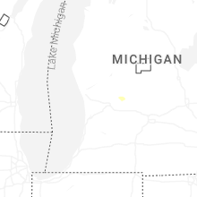
Michigan
| Local Time | Report Details |
|---|---|
| 2:54 PM EDT | Report and photos of some powerlines down... a large tree branch down... and metal roof of a partially enclosed outbuilding blown of in tuscola county MI, 30.3 miles N of Flint, MI |
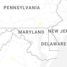
Pennsylvania
| Local Time | Report Details |
|---|---|
| 4:12 PM EDT | Roof blown off a structure and multiple trees dow in lancaster county PA, 47.7 miles N of Baltimore, MD |
| 5:59 PM EDT | Wires down blocking the roadway at lake roa in york county PA, 40.9 miles N of Baltimore, MD |
| 6:02 PM EDT | Trees and wires down on blue ridge drive and oak ridge driv in lancaster county PA, 51.7 miles NNE of Baltimore, MD |
| 6:10 PM EDT | Pa-741 is closed at the intersection of new danville pike and marticville road due to down trees and wires making the road impassabl in lancaster county PA, 50.7 miles NNE of Baltimore, MD |
| 6:20 PM EDT | Corrects previous flash flood report to tstorm wind damage report from 1 ese willow street. trees and wires down at beaver valley pike and penn grant roa in lancaster county PA, 51.3 miles NNE of Baltimore, MD |
| 6:34 PM EDT | Tree down over the roadway at cross roads av in york county PA, 35.9 miles N of Baltimore, MD |
| 6:36 PM EDT | Tree down over the roadway at century farms roa in york county PA, 37.4 miles N of Baltimore, MD |
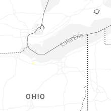
Ohio
| Local Time | Report Details |
|---|---|
| 4:28 PM EDT | A couple of trees had large limbs split off of them... downing several power lines in the area along with one power pol in clermont county OH, 13.7 miles E of Cincinnati, OH |
| 4:29 PM EDT | A hardwood tree had a large limb split along the trunk... falling onto a home with minor damage. additionally... several other trees had limbs broken off at the same pr in clermont county OH, 14.3 miles E of Cincinnati, OH |
| 4:30 PM EDT | A large tree limb split along the trunk of a tree and fell onto a parked vehicle... causing damage to the vehicl in clermont county OH, 13.7 miles E of Cincinnati, OH |
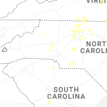
South Carolina
| Local Time | Report Details |
|---|---|
| 4:53 PM EDT | Aiken dispatch reported trees down on nantuckett rd in salle in aiken county SC, 44.2 miles ENE of Augusta, GA |
| 5:05 PM EDT | Scdps website reported a tree in roadway on sharpes hill road near the intersection of victor road. time estimated by rada in lexington county SC, 52.2 miles ENE of Augusta, GA |
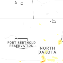
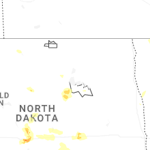
North Dakota
| Local Time | Report Details |
|---|---|
| 2:58 PM MDT | Tennis Ball sized hail reported near Hettinger, ND, 104.5 miles WSW of Bismarck, ND, pictures sent via social media. dents also reported on cars. |
| 3:30 PM MDT | Golf Ball sized hail reported near Mott, ND, 84.2 miles WSW of Bismarck, ND, broadcast media relayed report with pictures. time estimated by radar. |
| 4:58 PM MDT | Quarter sized hail reported near New Leipzig, ND, 60.6 miles WSW of Bismarck, ND, broadcast media relayed report with picture. time estimated based off radar. |
| 6:47 PM CDT | Half Dollar sized hail reported near Wilton, ND, 22.6 miles NNE of Bismarck, ND, social media report. picture with measurement. |
| 7:17 PM CDT | Half Dollar sized hail reported near Bismarck, ND, 3.8 miles E of Bismarck, ND, relayed by nws employee. lasted 10 minutes. |
| 7:23 PM CDT | Half Dollar sized hail reported near Bismarck, ND, 2.6 miles NNW of Bismarck, ND |
| 7:25 PM CDT | Golf Ball sized hail reported near Bismarck, ND, 6.3 miles ENE of Bismarck, ND, delayed report. time estimated based off radar. |
| 7:30 PM CDT | Golf Ball sized hail reported near Bismarck, ND, 6.1 miles E of Bismarck, ND, delayed report. |
| 7:30 PM CDT | Golf Ball sized hail reported near Baldwin, ND, 20.3 miles NNE of Bismarck, ND, social media report. hail started at 7:10pm as pea size and eventually grew to golf ball size. lasted 40 minutes. |
| 7:36 PM CDT | Ping Pong Ball sized hail reported near Baldwin, ND, 15.9 miles NNE of Bismarck, ND, social media report and photo of hail up to ping pong ball size. started at 719 pm with the largest stones at 736 pm. |
| 8:37 PM CDT | Ndawn mesone in kidder county ND, 62.9 miles E of Bismarck, ND |
| 8:42 PM CDT | Updated ndawn observatio in kidder county ND, 62.9 miles E of Bismarck, ND |
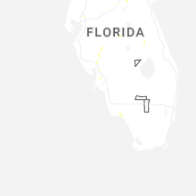
Florida
| Local Time | Report Details |
|---|---|
| 5:04 PM EDT | Asos station korl orland in orange county FL, 3 miles ENE of Orlando, FL |
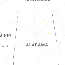
Tennessee
| Local Time | Report Details |
|---|---|
| 6:30 PM EDT | Sporadic trees down around bristol. additional photos on social medi in sullivan county TN, 1.2 miles E of Bristol, TN |
Maryland
| Local Time | Report Details |
|---|---|
| 6:35 PM EDT | Two trees down on columbia park roa in charles county MD, 52.7 miles SSW of Baltimore, MD |
| 6:49 PM EDT | Prince georges dpw reports over 20 calls for trees down across northern portion of the count in prince georges county MD, 29.2 miles SW of Baltimore, MD |
| 7:03 PM EDT | Prince georges dpw reports over 20 calls for trees down across northern portion of the count in prince georges county MD, 25.6 miles SW of Baltimore, MD |
| 7:05 PM EDT | Three trees reported down on mt harmony road near old paris road and grantham driv in calvert county MD, 40.7 miles S of Baltimore, MD |
| 7:12 PM EDT | Tree down on christiana parran road at chapman lan in calvert county MD, 45 miles S of Baltimore, MD |
| 7:27 PM EDT | Storm damage reported in anz541 county MD, 44.7 miles SSE of Baltimore, MD |
| 7:30 PM EDT | Personal weather station: kmdsteve76 gusted to 59.3 mp in queen anne's county MD, 32.4 miles SSE of Baltimore, MD |
| 7:42 PM EDT | Trees down in saint michaels. time estimated from rada in talbot county MD, 40.4 miles SSE of Baltimore, MD |
| 7:53 PM EDT | Two trees down between park hall and lexington par in st. marys county MD, 73.7 miles S of Baltimore, MD |
| 8:25 PM EDT | Tree down on roadway in kennedyville. time estimated from rada in kent county MD, 32.7 miles E of Baltimore, MD |
| 8:40 PM EDT | A powerline was knocked dow in somerset county MD, 34.9 miles WSW of Ocean City, MD |
District of Columbia
| Local Time | Report Details |
|---|---|
| 6:35 PM EDT | Over 30 calls for trees down across the district of columbia with the storms this evenin in district of columb county DC, 35 miles SW of Baltimore, MD |
Wyoming
| Local Time | Report Details |
|---|---|
| 4:54 PM MDT | Asos station krks rock springs airpor in sweetwater county WY, 8 miles E of Rock Springs, WY |
| 5:32 PM MDT | Mesonet station kctd wamsutter 10.5 e (wydot in sweetwater county WY, 75.3 miles E of Rock Springs, WY |
| 8:30 PM MDT | Wind gust recorded at fort bridger wy awo in uinta county WY, 62.9 miles WSW of Rock Springs, WY |
| 9:24 PM MDT | Wind gust recorded at i80/us189 - first divide mesonet sit in uinta county WY, 67.3 miles ENE of Salt Lake City, UT |
| 10:38 PM MDT | Asos station krks rock springs airpor in sweetwater county WY, 8 miles E of Rock Springs, WY |
Idaho
| Local Time | Report Details |
|---|---|
| 6:30 PM MDT | Station 032i in elmore county ID, 27.1 miles SE of Boise, ID |
| 7:25 PM MDT | Station idarng2 rg1 in ada county ID, 29.3 miles SSE of Boise, ID |
| 7:45 PM MDT | Station itde in canyon county ID, 18.9 miles W of Boise, ID |
| 7:57 PM MDT | Station idarng3_d in elmore county ID, 35.7 miles SSE of Boise, ID |
Montana
| Local Time | Report Details |
|---|---|
| 6:59 PM MDT | Mesonet station lbhm8 little bighor in big horn county MT, 53.7 miles ESE of Billings, MT |
| 7:15 PM MDT | Mesonet station mtspk spokane creek us-287 mp 55. in jefferson county MT, 69.3 miles SSW of Great Falls, MT |
| 7:30 PM MDT | Mesonet station mtcwd coalwood mt-59 mp 55. in powder river county MT, 48.4 miles SSE of Miles City, MT |
| 10:45 PM MDT | Savage mt-dot statio in richland county MT, 60.6 miles SW of Williston, ND |
New Jersey
| Local Time | Report Details |
|---|---|
| 10:06 PM EDT | 50 kt gust at nos gauge at cape may lewes ferry termina in cape may county NJ, 44.3 miles N of Ocean City, MD |
Nebraska
| Local Time | Report Details |
|---|---|
| 11:53 PM CDT | Asos station kgri grand island airpor in hall county NE, 3.3 miles NNE of Grand Island, NE |
Connect with Interactive Hail Maps