

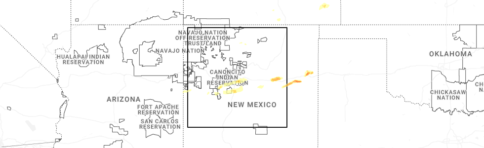
Hail Map for Abiquiu, NM
The Abiquiu, NM area has had 0 reports of on-the-ground hail by trained spotters, and has been under severe weather warnings 0 times during the past 12 months. Doppler radar has detected hail at or near Abiquiu, NM on 9 occasions, including 1 occasion during the past year.
| Name: | Abiquiu, NM |
| Where Located: | 44 miles WSW of Taos, NM |
| Map: | Google Map for Abiquiu, NM |
| Population: | 231 |
| Housing Units: | 126 |
| More Info: | Search Google for Abiquiu, NM |
0
The Top Recent Hail Date for Abiquiu, NM is Wednesday, June 4, 2025 (4th out of 9)
Hail and Wind Damage Spotted near Abiquiu, NM
| Date / Time | Report Details |
|---|---|
| 5/22/2021 3:59 PM MDT |
 At 359 pm mdt, a severe thunderstorm was located near espanola, moving north at 25 mph (radar indicated). Hazards include 60 mph wind gusts and half dollar size hail. Hail damage to vehicles is expected. expect wind damage to roofs, siding, and trees. locations impacted include, espanola, santa clara pueblo, embudo, abiquiu, santa cruz, velarde, chili, alcalde, chamita and lyden. This includes highway 285 between mile markers 337 and 350. At 359 pm mdt, a severe thunderstorm was located near espanola, moving north at 25 mph (radar indicated). Hazards include 60 mph wind gusts and half dollar size hail. Hail damage to vehicles is expected. expect wind damage to roofs, siding, and trees. locations impacted include, espanola, santa clara pueblo, embudo, abiquiu, santa cruz, velarde, chili, alcalde, chamita and lyden. This includes highway 285 between mile markers 337 and 350.
|
| 5/22/2021 3:34 PM MDT |
 At 334 pm mdt, a severe thunderstorm was located near white rock, or near los alamos, moving north at 20 mph (radar indicated). Hazards include 60 mph wind gusts and half dollar size hail. Hail damage to vehicles is expected. Expect wind damage to roofs, siding, and trees. At 334 pm mdt, a severe thunderstorm was located near white rock, or near los alamos, moving north at 20 mph (radar indicated). Hazards include 60 mph wind gusts and half dollar size hail. Hail damage to vehicles is expected. Expect wind damage to roofs, siding, and trees.
|
| 6/17/2019 2:17 PM MDT |
 At 216 pm mdt, a severe thunderstorm was located 9 miles northwest of los alamos, moving northeast at 10 mph (radar indicated). Hazards include 60 mph wind gusts and half dollar size hail. Hail damage to vehicles is expected. Expect wind damage to roofs, siding, and trees. At 216 pm mdt, a severe thunderstorm was located 9 miles northwest of los alamos, moving northeast at 10 mph (radar indicated). Hazards include 60 mph wind gusts and half dollar size hail. Hail damage to vehicles is expected. Expect wind damage to roofs, siding, and trees.
|
| 7/31/2018 5:48 PM MDT |
 At 547 pm mdt, a severe thunderstorm was located near canones in rio arriba county, or 18 miles northwest of los alamos, moving south at 35 mph (radar indicated). Hazards include ping pong ball size hail and 60 mph wind gusts. People and animals outdoors will be injured. expect hail damage to roofs, siding, windows, and vehicles. Expect wind damage to roofs, siding, and trees. At 547 pm mdt, a severe thunderstorm was located near canones in rio arriba county, or 18 miles northwest of los alamos, moving south at 35 mph (radar indicated). Hazards include ping pong ball size hail and 60 mph wind gusts. People and animals outdoors will be injured. expect hail damage to roofs, siding, windows, and vehicles. Expect wind damage to roofs, siding, and trees.
|
| 5/21/2018 3:44 PM MDT |
 At 344 pm mdt, severe thunderstorms were located along a line extending from 7 miles southwest of los alamos to 8 miles southeast of white rock, moving northeast at 45 mph (radar indicated). Hazards include 60 mph wind gusts and quarter size hail. Hail damage to vehicles is expected. Expect wind damage to roofs, siding, and trees. At 344 pm mdt, severe thunderstorms were located along a line extending from 7 miles southwest of los alamos to 8 miles southeast of white rock, moving northeast at 45 mph (radar indicated). Hazards include 60 mph wind gusts and quarter size hail. Hail damage to vehicles is expected. Expect wind damage to roofs, siding, and trees.
|
| 5/15/2016 2:45 PM MDT |
 At 245 pm mdt, a severe thunderstorm was located 9 miles northwest of los alamos, moving east at 25 mph (radar indicated). Hazards include 60 mph wind gusts and quarter size hail. Hail damage to vehicles is expected. expect wind damage to roofs, siding and trees. locations impacted include, los alamos and abiquiu. Other locations affected include the following location pajarito mountain ski area. At 245 pm mdt, a severe thunderstorm was located 9 miles northwest of los alamos, moving east at 25 mph (radar indicated). Hazards include 60 mph wind gusts and quarter size hail. Hail damage to vehicles is expected. expect wind damage to roofs, siding and trees. locations impacted include, los alamos and abiquiu. Other locations affected include the following location pajarito mountain ski area.
|
| 5/15/2016 2:29 PM MDT |
 At 228 pm mdt, a severe thunderstorm was located 10 miles northeast of fenton lake state park, or 14 miles west of los alamos, moving northeast at 20 mph (radar indicated). Hazards include quarter size hail and 60 mph wind gusts. Hail damage to vehicles is expected. expect wind damage to roofs, siding and trees. This severe thunderstorm will remain over mainly rural areas of northwestern los alamos, south central rio arriba and northeastern sandoval counties including new mexico state highway 4 near the valles caldera. At 228 pm mdt, a severe thunderstorm was located 10 miles northeast of fenton lake state park, or 14 miles west of los alamos, moving northeast at 20 mph (radar indicated). Hazards include quarter size hail and 60 mph wind gusts. Hail damage to vehicles is expected. expect wind damage to roofs, siding and trees. This severe thunderstorm will remain over mainly rural areas of northwestern los alamos, south central rio arriba and northeastern sandoval counties including new mexico state highway 4 near the valles caldera.
|
Hail Maps for Abiquiu, NM


Connect with Interactive Hail Maps