

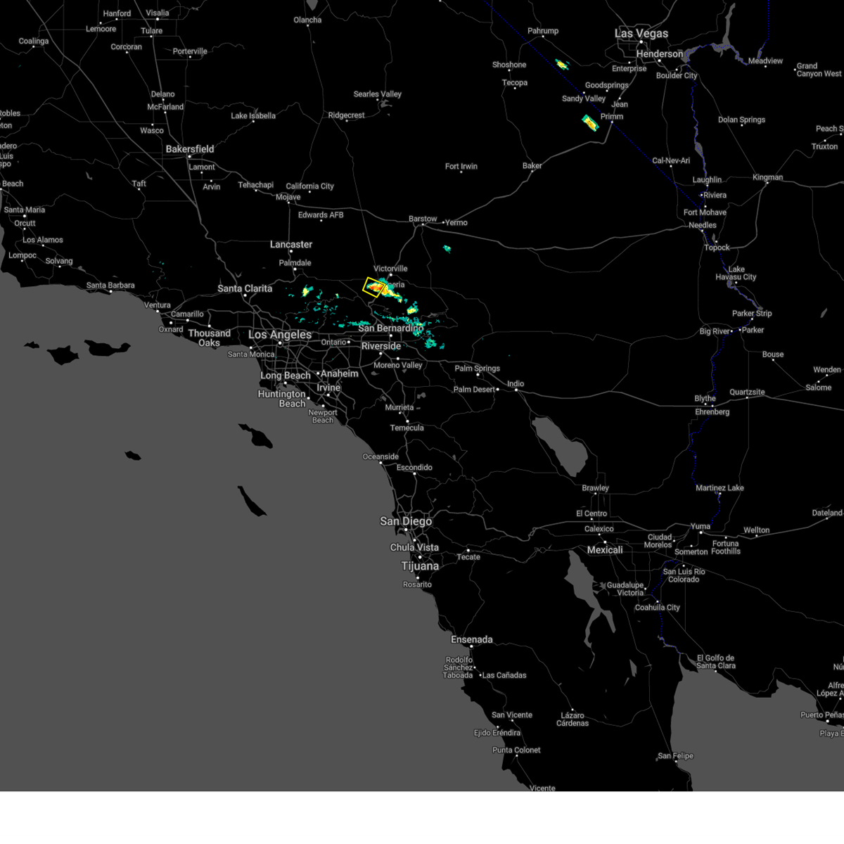
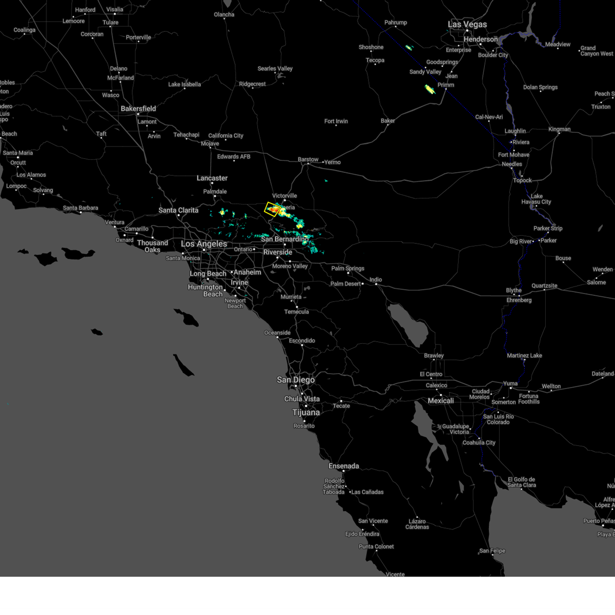
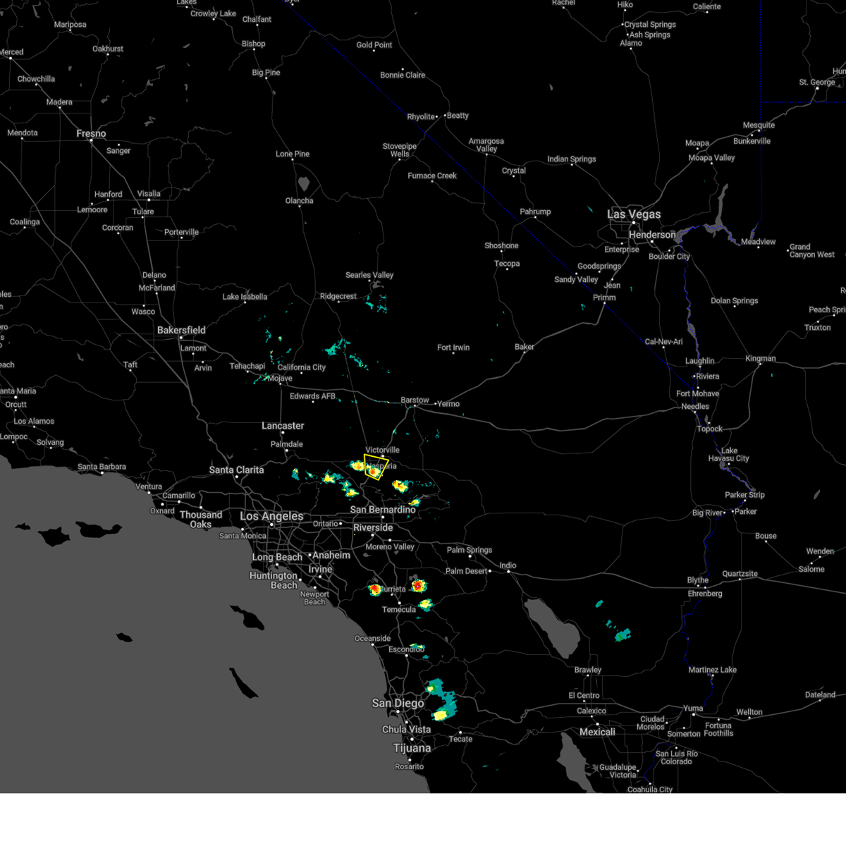
Hail Map for Adelanto, CA
The Adelanto, CA area has had 0 reports of on-the-ground hail by trained spotters, and has been under severe weather warnings 5 times during the past 12 months. Doppler radar has detected hail at or near Adelanto, CA on 10 occasions, including 1 occasion during the past year.
| Name: | Adelanto, CA |
| Where Located: | 59.3 miles NE of Los Angeles, CA |
| Map: | Google Map for Adelanto, CA |
| Population: | 31765 |
| Housing Units: | 9086 |
| More Info: | Search Google for Adelanto, CA |
0
The Top Recent Hail Date for Adelanto, CA is Sunday, September 8, 2024 (10th out of 10)

Hail and Wind Damage Spotted near Adelanto, CA
| Date / Time | Report Details |
|---|---|
| 9/8/2024 1:46 PM PDT |
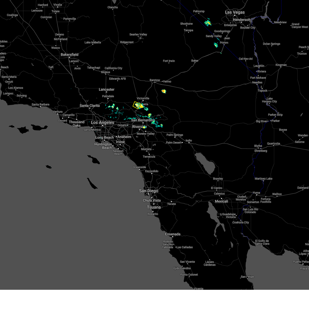 At 146 pm pdt, a severe thunderstorm was located near victorville, and is nearly stationary (radar indicated). Hazards include 60 mph wind gusts and nickel size hail. Expect damage to roofs, siding, and trees. Locations impacted include, victorville, hesperia, adelanto, and phelan. At 146 pm pdt, a severe thunderstorm was located near victorville, and is nearly stationary (radar indicated). Hazards include 60 mph wind gusts and nickel size hail. Expect damage to roofs, siding, and trees. Locations impacted include, victorville, hesperia, adelanto, and phelan.
|
| 9/8/2024 1:33 PM PDT |
 the severe thunderstorm warning has been cancelled and is no longer in effect the severe thunderstorm warning has been cancelled and is no longer in effect
|
| 9/8/2024 1:27 PM PDT |
 Svrsgx the national weather service in san diego has issued a * severe thunderstorm warning for, san bernardino county in southern california, * until 230 pm pdt. * at 126 pm pdt, a severe thunderstorm was located 7 miles southwest of victorville, and is nearly stationary (radar indicated). Hazards include 60 mph wind gusts and half dollar size hail. Hail damage to vehicles is expected. Expect wind damage to roofs, siding, and trees. Svrsgx the national weather service in san diego has issued a * severe thunderstorm warning for, san bernardino county in southern california, * until 230 pm pdt. * at 126 pm pdt, a severe thunderstorm was located 7 miles southwest of victorville, and is nearly stationary (radar indicated). Hazards include 60 mph wind gusts and half dollar size hail. Hail damage to vehicles is expected. Expect wind damage to roofs, siding, and trees.
|
| 9/8/2024 1:27 PM PDT |
 Svrsgx the national weather service in san diego has issued a * severe thunderstorm warning for, san bernardino county in southern california, * until 230 pm pdt. * at 127 pm pdt, a severe thunderstorm was located 7 miles southwest of victorville, and is nearly stationary (radar indicated). Hazards include 60 mph wind gusts and half dollar size hail. Hail damage to vehicles is expected. Expect wind damage to roofs, siding, and trees. Svrsgx the national weather service in san diego has issued a * severe thunderstorm warning for, san bernardino county in southern california, * until 230 pm pdt. * at 127 pm pdt, a severe thunderstorm was located 7 miles southwest of victorville, and is nearly stationary (radar indicated). Hazards include 60 mph wind gusts and half dollar size hail. Hail damage to vehicles is expected. Expect wind damage to roofs, siding, and trees.
|
| 9/8/2024 1:09 PM PDT |
 Svrsgx the national weather service in san diego has issued a * severe thunderstorm warning for, san bernardino county in southern california, * until 200 pm pdt. * at 109 pm pdt, a severe thunderstorm was located near hesperia, and is nearly stationary (radar indicated). Hazards include 60 mph wind gusts and quarter size hail. Hail damage to vehicles is expected. Expect wind damage to roofs, siding, and trees. Svrsgx the national weather service in san diego has issued a * severe thunderstorm warning for, san bernardino county in southern california, * until 200 pm pdt. * at 109 pm pdt, a severe thunderstorm was located near hesperia, and is nearly stationary (radar indicated). Hazards include 60 mph wind gusts and quarter size hail. Hail damage to vehicles is expected. Expect wind damage to roofs, siding, and trees.
|
| 5/20/2023 6:56 PM PDT |
 The severe thunderstorm warning for san bernardino county will expire at 700 pm pdt, the storm which prompted the warning has weakened below severe limits, and no longer poses an immediate threat to life or property. therefore, the warning will be allowed to expire. The severe thunderstorm warning for san bernardino county will expire at 700 pm pdt, the storm which prompted the warning has weakened below severe limits, and no longer poses an immediate threat to life or property. therefore, the warning will be allowed to expire.
|
| 5/20/2023 6:32 PM PDT |
 At 630 pm pdt, a severe thunderstorm was located near el mirage, or 11 miles northwest of victorville, moving north at 10 mph (radar indicated). Hazards include 60 mph wind gusts and nickel size hail. Expect damage to roofs, siding, and trees. locations impacted include, i-15 between victorville and barstow, adelanto, el mirage, pinon hills, phelan, mountain view acres, helendale, and oro grande. hail threat, radar indicated max hail size, 0. 88 in wind threat, radar indicated max wind gust, 60 mph. At 630 pm pdt, a severe thunderstorm was located near el mirage, or 11 miles northwest of victorville, moving north at 10 mph (radar indicated). Hazards include 60 mph wind gusts and nickel size hail. Expect damage to roofs, siding, and trees. locations impacted include, i-15 between victorville and barstow, adelanto, el mirage, pinon hills, phelan, mountain view acres, helendale, and oro grande. hail threat, radar indicated max hail size, 0. 88 in wind threat, radar indicated max wind gust, 60 mph.
|
| 5/20/2023 6:05 PM PDT |
 At 605 pm pdt, a severe thunderstorm was located over adelanto, or 7 miles northwest of victorville, moving north at 5 mph (radar indicated). Hazards include 60 mph wind gusts and nickel size hail. expect damage to roofs, siding, and trees At 605 pm pdt, a severe thunderstorm was located over adelanto, or 7 miles northwest of victorville, moving north at 5 mph (radar indicated). Hazards include 60 mph wind gusts and nickel size hail. expect damage to roofs, siding, and trees
|
| 10/15/2022 8:58 PM PDT |
 At 858 pm pdt, a severe thunderstorm was located over southwestern rancho cucamonga, or near ontario, moving southwest at 50 mph (radar indicated). Hazards include 60 mph wind gusts and penny size hail. Expect damage to roofs, siding, and trees. locations impacted include, san bernardino, victorville, rialto, hesperia, apple valley, i-15 through the cajon pass, lake arrowhead, adelanto, hwy 138 between i-15 and hwy 2 and hwy 173 between lake arrowhead and hesperia. hail threat, radar indicated max hail size, 0. 75 in wind threat, radar indicated max wind gust, 60 mph. At 858 pm pdt, a severe thunderstorm was located over southwestern rancho cucamonga, or near ontario, moving southwest at 50 mph (radar indicated). Hazards include 60 mph wind gusts and penny size hail. Expect damage to roofs, siding, and trees. locations impacted include, san bernardino, victorville, rialto, hesperia, apple valley, i-15 through the cajon pass, lake arrowhead, adelanto, hwy 138 between i-15 and hwy 2 and hwy 173 between lake arrowhead and hesperia. hail threat, radar indicated max hail size, 0. 75 in wind threat, radar indicated max wind gust, 60 mph.
|
| 10/15/2022 8:18 PM PDT |
 At 816 pm pdt, a severe thunderstorm was located near apple valley, moving southwest at 50 mph (radar indicated). Hazards include 60 mph wind gusts and penny size hail. expect damage to roofs, siding, and trees At 816 pm pdt, a severe thunderstorm was located near apple valley, moving southwest at 50 mph (radar indicated). Hazards include 60 mph wind gusts and penny size hail. expect damage to roofs, siding, and trees
|
| 9/4/2022 3:54 PM PDT |
 At 354 pm pdt, a severe thunderstorm was located 8 miles northeast of adelanto, or 9 miles west of i-15 between victorville and barstow, moving west at 20 mph (radar indicated). Hazards include 60 mph wind gusts and quarter size hail. Hail damage to vehicles is expected. expect wind damage to roofs, siding, and trees. locations impacted include, victorville, adelanto, helendale and oro grande. hail threat, radar indicated max hail size, 1. 00 in wind threat, radar indicated max wind gust, 60 mph. At 354 pm pdt, a severe thunderstorm was located 8 miles northeast of adelanto, or 9 miles west of i-15 between victorville and barstow, moving west at 20 mph (radar indicated). Hazards include 60 mph wind gusts and quarter size hail. Hail damage to vehicles is expected. expect wind damage to roofs, siding, and trees. locations impacted include, victorville, adelanto, helendale and oro grande. hail threat, radar indicated max hail size, 1. 00 in wind threat, radar indicated max wind gust, 60 mph.
|
| 9/4/2022 3:34 PM PDT |
 At 334 pm pdt, a severe thunderstorm was located near i-15 between victorville and barstow, moving west at 20 mph (radar indicated). Hazards include 60 mph wind gusts and quarter size hail. Hail damage to vehicles is expected. Expect wind damage to roofs, siding, and trees. At 334 pm pdt, a severe thunderstorm was located near i-15 between victorville and barstow, moving west at 20 mph (radar indicated). Hazards include 60 mph wind gusts and quarter size hail. Hail damage to vehicles is expected. Expect wind damage to roofs, siding, and trees.
|
| 5/11/2019 2:24 PM PDT |
 The severe thunderstorm warning for san bernardino county will expire at 230 pm pdt, the severe thunderstorm which prompted the warning has weakened. therefore, the warning will be allowed to expire. however, thunderstorms continue to impact the high desert with threat of heavy downpours, frequent lightning, and small hail. The severe thunderstorm warning for san bernardino county will expire at 230 pm pdt, the severe thunderstorm which prompted the warning has weakened. therefore, the warning will be allowed to expire. however, thunderstorms continue to impact the high desert with threat of heavy downpours, frequent lightning, and small hail.
|
| 5/11/2019 2:12 PM PDT |
 At 210 pm pdt, a cluster of thunderstorms were located between hesperia and wrightwood, moving southwest at 30 mph (trained weather spotters reported nickel size hail with this storm). Hazards include 60 mph wind gusts and quarter size hail. Hail damage to vehicles is expected. expect wind damage to roofs, siding, and trees. Locations impacted include, victorville, hesperia, apple valley, wrightwood, hwy 2 between phelan and wrightwood, i-15 through the cajon pass, adelanto, hwy 138 between i-15 and hwy 2, pinon hills and phelan. At 210 pm pdt, a cluster of thunderstorms were located between hesperia and wrightwood, moving southwest at 30 mph (trained weather spotters reported nickel size hail with this storm). Hazards include 60 mph wind gusts and quarter size hail. Hail damage to vehicles is expected. expect wind damage to roofs, siding, and trees. Locations impacted include, victorville, hesperia, apple valley, wrightwood, hwy 2 between phelan and wrightwood, i-15 through the cajon pass, adelanto, hwy 138 between i-15 and hwy 2, pinon hills and phelan.
|
| 5/11/2019 1:44 PM PDT |
 At 143 pm pdt, a severe thunderstorm was located over apple valley, moving southwest at 30 mph (radar indicated). Hazards include 60 mph wind gusts and quarter size hail. Hail damage to vehicles is expected. Expect wind damage to roofs, siding, and trees. At 143 pm pdt, a severe thunderstorm was located over apple valley, moving southwest at 30 mph (radar indicated). Hazards include 60 mph wind gusts and quarter size hail. Hail damage to vehicles is expected. Expect wind damage to roofs, siding, and trees.
|
| 8/16/2018 3:09 PM PDT |
 The national weather service in san diego has issued a * severe thunderstorm warning for. san bernardino county in southern california. Until 415 pm pdt * at 307 pm pdt, a severe thunderstorm was located near wrightwood and was nearly stationary. The national weather service in san diego has issued a * severe thunderstorm warning for. san bernardino county in southern california. Until 415 pm pdt * at 307 pm pdt, a severe thunderstorm was located near wrightwood and was nearly stationary.
|
| 7/19/2018 1:42 PM PDT |
 At 142 pm pdt, a severe thunderstorm was located 7 miles north of hwy 173 between lake arrowhead and hesperia, or 8 miles east of hesperia, moving northwest at 15 mph (radar indicated). Hazards include 60 mph wind gusts and penny size hail. expect damage to roofs, siding, and trees At 142 pm pdt, a severe thunderstorm was located 7 miles north of hwy 173 between lake arrowhead and hesperia, or 8 miles east of hesperia, moving northwest at 15 mph (radar indicated). Hazards include 60 mph wind gusts and penny size hail. expect damage to roofs, siding, and trees
|
| 7/1/2016 5:40 PM PDT |
 At 534 pm pdt, doppler radar continued to indicated a severe thunderstorm capable of producing damaging winds in excess of 60 mph. this storm was located near helendale, moving northeast at 15 mph toward interstate 15. locations impacted include, i-15 between victorville and barstow, hwy 247 between lucerne valley and barstow, and helendale. At 534 pm pdt, doppler radar continued to indicated a severe thunderstorm capable of producing damaging winds in excess of 60 mph. this storm was located near helendale, moving northeast at 15 mph toward interstate 15. locations impacted include, i-15 between victorville and barstow, hwy 247 between lucerne valley and barstow, and helendale.
|
| 7/1/2016 5:09 PM PDT |
 At 507 pm pdt, doppler radar indicated a severe thunderstorm capable of producing quarter size hail and damaging winds in excess of 60 mph. this storm was located near i-15 between victorville and barstow, and nearly stationary. At 507 pm pdt, doppler radar indicated a severe thunderstorm capable of producing quarter size hail and damaging winds in excess of 60 mph. this storm was located near i-15 between victorville and barstow, and nearly stationary.
|
| 7/29/2015 5:34 PM PDT |
 At 533 pm pdt, doppler radar indicated a severe thunderstorm capable of producing damaging winds in excess of 60 mph. this storm was located over adelanto, or near victorville. this storm was nearly stationary. penny size hail may also accompany the damaging winds. At 533 pm pdt, doppler radar indicated a severe thunderstorm capable of producing damaging winds in excess of 60 mph. this storm was located over adelanto, or near victorville. this storm was nearly stationary. penny size hail may also accompany the damaging winds.
|
Hail Maps for Adelanto, CA


Connect with Interactive Hail Maps