

Hail Map for Akron, NY
The Akron, NY area has had 0 reports of on-the-ground hail by trained spotters, and has been under severe weather warnings 30 times during the past 12 months. Doppler radar has detected hail at or near Akron, NY on 11 occasions, including 1 occasion during the past year.
| Name: | Akron, NY |
| Where Located: | 21.3 miles ENE of Buffalo, NY |
| Map: | Google Map for Akron, NY |
| Population: | 2868 |
| Housing Units: | 1382 |
| More Info: | Search Google for Akron, NY |
0
The Top Recent Hail Date for Akron, NY is Monday, August 5, 2024 (11th out of 11)

Hail and Wind Damage Spotted near Akron, NY
| Date / Time | Report Details |
|---|---|
| 5/16/2025 6:16 AM EDT |
 The storms which prompted the warning have moved out of the area. therefore, the warning has been allowed to expire. to report severe weather, contact your nearest law enforcement agency. they will relay your report to the national weather service buffalo. The storms which prompted the warning have moved out of the area. therefore, the warning has been allowed to expire. to report severe weather, contact your nearest law enforcement agency. they will relay your report to the national weather service buffalo.
|
| 5/16/2025 5:53 AM EDT |
 At 552 am edt, severe thunderstorms were located along a line extending from 6 miles northeast of newfane to near wales center, moving east at 35 mph (radar indicated). Hazards include 60 mph wind gusts and quarter size hail. Hail damage to vehicles is expected. expect wind damage to roofs, siding, and trees. locations impacted include, akron, alexander, waterport, ridgeway, alabama, clarence, pembroke, corfu, gasport, and medina. This includes interstate 90 near exit 48a. At 552 am edt, severe thunderstorms were located along a line extending from 6 miles northeast of newfane to near wales center, moving east at 35 mph (radar indicated). Hazards include 60 mph wind gusts and quarter size hail. Hail damage to vehicles is expected. expect wind damage to roofs, siding, and trees. locations impacted include, akron, alexander, waterport, ridgeway, alabama, clarence, pembroke, corfu, gasport, and medina. This includes interstate 90 near exit 48a.
|
| 5/16/2025 5:03 AM EDT |
 Svrbuf the national weather service in buffalo has issued a * severe thunderstorm warning for, northwestern wyoming county in western new york, erie county in western new york, niagara county in western new york, western orleans county in western new york, western genesee county in western new york, * until 615 am edt. * at 502 am edt, severe thunderstorms were located along a line extending from 11 miles northwest of fort niagara state park to 7 miles north of derby, moving northeast at 35 mph (radar indicated). Hazards include 60 mph wind gusts and quarter size hail. Hail damage to vehicles is expected. Expect wind damage to roofs, siding, and trees. Svrbuf the national weather service in buffalo has issued a * severe thunderstorm warning for, northwestern wyoming county in western new york, erie county in western new york, niagara county in western new york, western orleans county in western new york, western genesee county in western new york, * until 615 am edt. * at 502 am edt, severe thunderstorms were located along a line extending from 11 miles northwest of fort niagara state park to 7 miles north of derby, moving northeast at 35 mph (radar indicated). Hazards include 60 mph wind gusts and quarter size hail. Hail damage to vehicles is expected. Expect wind damage to roofs, siding, and trees.
|
| 5/1/2025 7:06 PM EDT | The storms which prompted the warning have weakened below severe limits, and no longer pose an immediate threat to life or property. therefore, the warning will be allowed to expire. however, gusty winds are still possible with these thunderstorms. |
| 5/1/2025 6:54 PM EDT | At 653 pm edt, severe thunderstorms were located along a line extending from 6 miles east of pendleton to near colden, moving east at 35 mph (radar indicated). Hazards include 60 mph wind gusts. Expect damage to roofs, siding, and trees. Locations impacted include, akron, alden, clarence center, cowlesville, lancaster, marilla, wales center, clarence, elma center, and west falls. |
| 5/1/2025 6:24 PM EDT | Svrbuf the national weather service in buffalo has issued a * severe thunderstorm warning for, northwestern wyoming county in western new york, erie county in western new york, * until 715 pm edt. * at 624 pm edt, severe thunderstorms were located along a line extending from 14 miles southwest of grand island to near angola on the lake, moving northeast at 55 mph (radar indicated). Hazards include 60 mph wind gusts. expect damage to roofs, siding, and trees |
| 4/21/2025 5:53 PM EDT |
 Svrbuf the national weather service in buffalo has issued a * severe thunderstorm warning for, northwestern wyoming county in western new york, northeastern erie county in western new york, southeastern niagara county in western new york, orleans county in western new york, genesee county in western new york, * until 700 pm edt. * at 552 pm edt, severe thunderstorms were located along a line extending from near pendleton to near woodlawn beach state park, moving east at 30 mph (radar indicated). Hazards include 60 mph wind gusts and penny size hail. expect damage to roofs, siding, and trees Svrbuf the national weather service in buffalo has issued a * severe thunderstorm warning for, northwestern wyoming county in western new york, northeastern erie county in western new york, southeastern niagara county in western new york, orleans county in western new york, genesee county in western new york, * until 700 pm edt. * at 552 pm edt, severe thunderstorms were located along a line extending from near pendleton to near woodlawn beach state park, moving east at 30 mph (radar indicated). Hazards include 60 mph wind gusts and penny size hail. expect damage to roofs, siding, and trees
|
| 4/19/2025 11:24 AM EDT |
 At 1124 am edt, a severe thunderstorm was located over orchard park, or near west seneca, moving northeast at 60 mph (radar indicated). Hazards include 60 mph wind gusts. Expect damage to roofs, siding, and trees. locations impacted include, eden, hamburg, depew, colden, pembroke, corfu, woodlawn beach state park, lackawanna, south wales, and orchard park. This includes interstate 90 near exit 48a, and between exits 52a and 57a. At 1124 am edt, a severe thunderstorm was located over orchard park, or near west seneca, moving northeast at 60 mph (radar indicated). Hazards include 60 mph wind gusts. Expect damage to roofs, siding, and trees. locations impacted include, eden, hamburg, depew, colden, pembroke, corfu, woodlawn beach state park, lackawanna, south wales, and orchard park. This includes interstate 90 near exit 48a, and between exits 52a and 57a.
|
| 4/19/2025 11:24 AM EDT |
 the severe thunderstorm warning has been cancelled and is no longer in effect the severe thunderstorm warning has been cancelled and is no longer in effect
|
| 4/19/2025 11:07 AM EDT |
 Svrbuf the national weather service in buffalo has issued a * severe thunderstorm warning for, northwestern wyoming county in western new york, erie county in western new york, northeastern chautauqua county in western new york, western genesee county in western new york, * until 1145 am edt. * at 1106 am edt, a severe thunderstorm was located over evans, or 11 miles west of hamburg, moving northeast at 70 mph (radar indicated). Hazards include 60 mph wind gusts. expect damage to roofs, siding, and trees Svrbuf the national weather service in buffalo has issued a * severe thunderstorm warning for, northwestern wyoming county in western new york, erie county in western new york, northeastern chautauqua county in western new york, western genesee county in western new york, * until 1145 am edt. * at 1106 am edt, a severe thunderstorm was located over evans, or 11 miles west of hamburg, moving northeast at 70 mph (radar indicated). Hazards include 60 mph wind gusts. expect damage to roofs, siding, and trees
|
| 3/16/2025 2:50 PM EDT |
 At 249 pm edt, severe thunderstorms were located along a line extending from 21 miles north of newfane to lockport to lackawanna, moving northeast at 60 mph (radar indicated). Hazards include 60 mph wind gusts and quarter size hail. Hail damage to vehicles is expected. expect wind damage to roofs, siding, and trees. locations impacted include, angola, clarence center, fort niagara state park, bliss, depew, colden, newfane, pembroke, woodlawn beach state park, and lewiston. This includes interstate 90 between exits 48 and 57a. At 249 pm edt, severe thunderstorms were located along a line extending from 21 miles north of newfane to lockport to lackawanna, moving northeast at 60 mph (radar indicated). Hazards include 60 mph wind gusts and quarter size hail. Hail damage to vehicles is expected. expect wind damage to roofs, siding, and trees. locations impacted include, angola, clarence center, fort niagara state park, bliss, depew, colden, newfane, pembroke, woodlawn beach state park, and lewiston. This includes interstate 90 between exits 48 and 57a.
|
| 3/16/2025 2:19 PM EDT |
 Svrbuf the national weather service in buffalo has issued a * severe thunderstorm warning for, wyoming county in western new york, erie county in western new york, niagara county in western new york, orleans county in western new york, genesee county in western new york, * until 315 pm edt. * at 218 pm edt, severe thunderstorms were located along a line extending from 9 miles northwest of fort niagara state park to 8 miles southwest of grand island to 6 miles northwest of silver creek, moving northeast at 65 mph (radar indicated). Hazards include 60 mph wind gusts and quarter size hail. Hail damage to vehicles is expected. Expect wind damage to roofs, siding, and trees. Svrbuf the national weather service in buffalo has issued a * severe thunderstorm warning for, wyoming county in western new york, erie county in western new york, niagara county in western new york, orleans county in western new york, genesee county in western new york, * until 315 pm edt. * at 218 pm edt, severe thunderstorms were located along a line extending from 9 miles northwest of fort niagara state park to 8 miles southwest of grand island to 6 miles northwest of silver creek, moving northeast at 65 mph (radar indicated). Hazards include 60 mph wind gusts and quarter size hail. Hail damage to vehicles is expected. Expect wind damage to roofs, siding, and trees.
|
| 8/17/2024 3:58 PM EDT |
 The storm which prompted the warning has weakened below severe limits, and no longer poses an immediate threat to life or property. therefore, the warning will be allowed to expire. however, gusty winds are still possible with this thunderstorm. The storm which prompted the warning has weakened below severe limits, and no longer poses an immediate threat to life or property. therefore, the warning will be allowed to expire. however, gusty winds are still possible with this thunderstorm.
|
| 8/17/2024 3:42 PM EDT |
 At 341 pm edt, a severe thunderstorm was located just west of darien lakes state park, moving northeast at 30 mph (trained weather spotters). Hazards include 60 mph wind gusts and penny size hail. Expect damage to roofs, siding, and trees. locations impacted include, batavia, darien lakes state park, pembroke, bennington, akron, alden, attica, oakfield, wales center, and corfu. This includes interstate 90 near exit 48a. At 341 pm edt, a severe thunderstorm was located just west of darien lakes state park, moving northeast at 30 mph (trained weather spotters). Hazards include 60 mph wind gusts and penny size hail. Expect damage to roofs, siding, and trees. locations impacted include, batavia, darien lakes state park, pembroke, bennington, akron, alden, attica, oakfield, wales center, and corfu. This includes interstate 90 near exit 48a.
|
| 8/17/2024 3:15 PM EDT |
 Svrbuf the national weather service in buffalo has issued a * severe thunderstorm warning for, northwestern wyoming county in western new york, east central erie county in western new york, western genesee county in western new york, * until 400 pm edt. * at 314 pm edt, a severe thunderstorm was located over elma center, or near east aurora, moving northeast at 30 mph (trained weather spotters). Hazards include 60 mph wind gusts and quarter size hail. Hail damage to vehicles is expected. Expect wind damage to roofs, siding, and trees. Svrbuf the national weather service in buffalo has issued a * severe thunderstorm warning for, northwestern wyoming county in western new york, east central erie county in western new york, western genesee county in western new york, * until 400 pm edt. * at 314 pm edt, a severe thunderstorm was located over elma center, or near east aurora, moving northeast at 30 mph (trained weather spotters). Hazards include 60 mph wind gusts and quarter size hail. Hail damage to vehicles is expected. Expect wind damage to roofs, siding, and trees.
|
| 8/5/2024 4:44 PM EDT |
 Svrbuf the national weather service in buffalo has issued a * severe thunderstorm warning for, northern wyoming county in western new york, northeastern erie county in western new york, southern genesee county in western new york, * until 545 pm edt. * at 444 pm edt, a severe thunderstorm was located over darien lakes state park, moving east at 25 mph (radar indicated). Hazards include 60 mph wind gusts and quarter size hail. Hail damage to vehicles is expected. Expect wind damage to roofs, siding, and trees. Svrbuf the national weather service in buffalo has issued a * severe thunderstorm warning for, northern wyoming county in western new york, northeastern erie county in western new york, southern genesee county in western new york, * until 545 pm edt. * at 444 pm edt, a severe thunderstorm was located over darien lakes state park, moving east at 25 mph (radar indicated). Hazards include 60 mph wind gusts and quarter size hail. Hail damage to vehicles is expected. Expect wind damage to roofs, siding, and trees.
|
| 8/5/2024 4:00 PM EDT |
 The storm which prompted the warning has weakened below severe limits, and no longer poses an immediate threat to life or property. therefore, the warning has been allowed to expire. a severe thunderstorm watch remains in effect until 800 pm edt for western new york. The storm which prompted the warning has weakened below severe limits, and no longer poses an immediate threat to life or property. therefore, the warning has been allowed to expire. a severe thunderstorm watch remains in effect until 800 pm edt for western new york.
|
| 8/5/2024 3:32 PM EDT |
 At 330 pm edt, a severe thunderstorm was located near williamsville, moving east at 40 mph (radar indicated). Hazards include 60 mph wind gusts and quarter size hail. Hail damage to vehicles is expected. expect wind damage to roofs, siding, and trees. locations impacted include, buffalo, cheektowaga, west seneca, north tonawanda, clarence, lackawanna, kenmore, depew, tonawanda, and amherst. This includes interstate 90 between exits 48a and 55. At 330 pm edt, a severe thunderstorm was located near williamsville, moving east at 40 mph (radar indicated). Hazards include 60 mph wind gusts and quarter size hail. Hail damage to vehicles is expected. expect wind damage to roofs, siding, and trees. locations impacted include, buffalo, cheektowaga, west seneca, north tonawanda, clarence, lackawanna, kenmore, depew, tonawanda, and amherst. This includes interstate 90 between exits 48a and 55.
|
| 8/5/2024 3:00 PM EDT |
 Svrbuf the national weather service in buffalo has issued a * severe thunderstorm warning for, northwestern wyoming county in western new york, northeastern erie county in western new york, southwestern niagara county in western new york, western genesee county in western new york, * until 400 pm edt. * at 300 pm edt, a severe thunderstorm was located over grand island, or near tonawanda, moving east at 40 mph (radar indicated). Hazards include 60 mph wind gusts and quarter size hail. Hail damage to vehicles is expected. Expect wind damage to roofs, siding, and trees. Svrbuf the national weather service in buffalo has issued a * severe thunderstorm warning for, northwestern wyoming county in western new york, northeastern erie county in western new york, southwestern niagara county in western new york, western genesee county in western new york, * until 400 pm edt. * at 300 pm edt, a severe thunderstorm was located over grand island, or near tonawanda, moving east at 40 mph (radar indicated). Hazards include 60 mph wind gusts and quarter size hail. Hail damage to vehicles is expected. Expect wind damage to roofs, siding, and trees.
|
| 8/5/2024 11:58 AM EDT |
 At 1157 am edt, a severe thunderstorm was located over akron, or near clarence, moving east at 25 mph (radar indicated). Hazards include 60 mph wind gusts and penny size hail. Expect damage to roofs, siding, and trees. locations impacted include, clarence, batavia, darien lakes state park, pembroke, akron, oakfield, alabama, corfu, elba, and east pembroke. This includes interstate 90 between exits 48 and 48a. At 1157 am edt, a severe thunderstorm was located over akron, or near clarence, moving east at 25 mph (radar indicated). Hazards include 60 mph wind gusts and penny size hail. Expect damage to roofs, siding, and trees. locations impacted include, clarence, batavia, darien lakes state park, pembroke, akron, oakfield, alabama, corfu, elba, and east pembroke. This includes interstate 90 between exits 48 and 48a.
|
| 8/5/2024 11:43 AM EDT |
 Svrbuf the national weather service in buffalo has issued a * severe thunderstorm warning for, northeastern erie county in western new york, southeastern niagara county in western new york, south central orleans county in western new york, western genesee county in western new york, * until 1245 pm edt. * at 1143 am edt, a severe thunderstorm was located over clarence, moving east at 25 mph (radar indicated). Hazards include 60 mph wind gusts and quarter size hail. Hail damage to vehicles is expected. Expect wind damage to roofs, siding, and trees. Svrbuf the national weather service in buffalo has issued a * severe thunderstorm warning for, northeastern erie county in western new york, southeastern niagara county in western new york, south central orleans county in western new york, western genesee county in western new york, * until 1245 pm edt. * at 1143 am edt, a severe thunderstorm was located over clarence, moving east at 25 mph (radar indicated). Hazards include 60 mph wind gusts and quarter size hail. Hail damage to vehicles is expected. Expect wind damage to roofs, siding, and trees.
|
| 7/15/2024 3:35 PM EDT |
 the severe thunderstorm warning has been cancelled and is no longer in effect the severe thunderstorm warning has been cancelled and is no longer in effect
|
| 7/15/2024 3:08 PM EDT |
 Svrbuf the national weather service in buffalo has issued a * severe thunderstorm warning for, northeastern erie county in western new york, southeastern niagara county in western new york, orleans county in western new york, northwestern genesee county in western new york, northwestern monroe county in western new york, * until 415 pm edt. * at 308 pm edt, a severe thunderstorm was located over akron, or near clarence, moving northeast at 45 mph (radar indicated). Hazards include 60 mph wind gusts. expect damage to roofs, siding, and trees Svrbuf the national weather service in buffalo has issued a * severe thunderstorm warning for, northeastern erie county in western new york, southeastern niagara county in western new york, orleans county in western new york, northwestern genesee county in western new york, northwestern monroe county in western new york, * until 415 pm edt. * at 308 pm edt, a severe thunderstorm was located over akron, or near clarence, moving northeast at 45 mph (radar indicated). Hazards include 60 mph wind gusts. expect damage to roofs, siding, and trees
|
| 7/15/2024 2:44 PM EDT |
 At 244 pm edt, a severe thunderstorm was located over williamsville, moving east at 30 mph (radar indicated). Hazards include 60 mph wind gusts and quarter size hail. Hail damage to vehicles is expected. expect wind damage to roofs, siding, and trees. locations impacted include, buffalo, cheektowaga, west seneca, north tonawanda, clarence, lockport, lackawanna, kenmore, depew, and tonawanda. This includes interstate 90 between exits 48a and 55. At 244 pm edt, a severe thunderstorm was located over williamsville, moving east at 30 mph (radar indicated). Hazards include 60 mph wind gusts and quarter size hail. Hail damage to vehicles is expected. expect wind damage to roofs, siding, and trees. locations impacted include, buffalo, cheektowaga, west seneca, north tonawanda, clarence, lockport, lackawanna, kenmore, depew, and tonawanda. This includes interstate 90 between exits 48a and 55.
|
| 7/15/2024 2:22 PM EDT |
 Svrbuf the national weather service in buffalo has issued a * severe thunderstorm warning for, northeastern erie county in western new york, niagara county in western new york, western orleans county in western new york, northwestern genesee county in western new york, * until 315 pm edt. * at 222 pm edt, a severe thunderstorm was located near grand island, or near tonawanda, moving northeast at 35 mph (radar indicated). Hazards include 60 mph wind gusts and quarter size hail. Hail damage to vehicles is expected. Expect wind damage to roofs, siding, and trees. Svrbuf the national weather service in buffalo has issued a * severe thunderstorm warning for, northeastern erie county in western new york, niagara county in western new york, western orleans county in western new york, northwestern genesee county in western new york, * until 315 pm edt. * at 222 pm edt, a severe thunderstorm was located near grand island, or near tonawanda, moving northeast at 35 mph (radar indicated). Hazards include 60 mph wind gusts and quarter size hail. Hail damage to vehicles is expected. Expect wind damage to roofs, siding, and trees.
|
| 7/15/2024 1:55 PM EDT |
 The storm which prompted the warning has weakened below severe limits, and no longer poses an immediate threat to life or property. therefore, the warning will be allowed to expire. a severe thunderstorm watch remains in effect until 700 pm edt for western new york. The storm which prompted the warning has weakened below severe limits, and no longer poses an immediate threat to life or property. therefore, the warning will be allowed to expire. a severe thunderstorm watch remains in effect until 700 pm edt for western new york.
|
| 7/15/2024 1:29 PM EDT |
 At 129 pm edt, a severe thunderstorm was located near williamsville, moving northeast at 50 mph. this storm has a history of producing quarter sized hail (radar indicated). Hazards include 60 mph wind gusts and quarter size hail. Hail damage to vehicles is expected. expect wind damage to roofs, siding, and trees. locations impacted include, buffalo, cheektowaga, north tonawanda, clarence, lockport, kenmore, depew, amherst, tonawanda, and lancaster. This includes interstate 90 between exits 49 and 52. At 129 pm edt, a severe thunderstorm was located near williamsville, moving northeast at 50 mph. this storm has a history of producing quarter sized hail (radar indicated). Hazards include 60 mph wind gusts and quarter size hail. Hail damage to vehicles is expected. expect wind damage to roofs, siding, and trees. locations impacted include, buffalo, cheektowaga, north tonawanda, clarence, lockport, kenmore, depew, amherst, tonawanda, and lancaster. This includes interstate 90 between exits 49 and 52.
|
| 7/15/2024 1:12 PM EDT |
 Svrbuf the national weather service in buffalo has issued a * severe thunderstorm warning for, northeastern erie county in western new york, southeastern niagara county in western new york, * until 200 pm edt. * at 112 pm edt, a severe thunderstorm was located near erie basin marina, or near kenmore, moving northeast at 50 mph (radar indicated). Hazards include 60 mph wind gusts and penny size hail. expect damage to roofs, siding, and trees Svrbuf the national weather service in buffalo has issued a * severe thunderstorm warning for, northeastern erie county in western new york, southeastern niagara county in western new york, * until 200 pm edt. * at 112 pm edt, a severe thunderstorm was located near erie basin marina, or near kenmore, moving northeast at 50 mph (radar indicated). Hazards include 60 mph wind gusts and penny size hail. expect damage to roofs, siding, and trees
|
| 7/10/2024 1:37 PM EDT |
 the severe thunderstorm warning has been cancelled and is no longer in effect the severe thunderstorm warning has been cancelled and is no longer in effect
|
| 7/10/2024 1:06 PM EDT |
 Svrbuf the national weather service in buffalo has issued a * severe thunderstorm warning for, northeastern erie county in western new york, southwestern niagara county in western new york, * until 200 pm edt. * at 106 pm edt, a severe thunderstorm was located over depew, moving north at 30 mph (radar indicated). Hazards include 60 mph wind gusts. expect damage to roofs, siding, and trees Svrbuf the national weather service in buffalo has issued a * severe thunderstorm warning for, northeastern erie county in western new york, southwestern niagara county in western new york, * until 200 pm edt. * at 106 pm edt, a severe thunderstorm was located over depew, moving north at 30 mph (radar indicated). Hazards include 60 mph wind gusts. expect damage to roofs, siding, and trees
|
| 5/22/2024 2:52 PM EDT |
 The storms which prompted the warning have weakened below severe limits, and no longer pose an immediate threat to life or property. therefore, the warning will be allowed to expire. however, gusty winds and heavy rain are still possible with these thunderstorms. The storms which prompted the warning have weakened below severe limits, and no longer pose an immediate threat to life or property. therefore, the warning will be allowed to expire. however, gusty winds and heavy rain are still possible with these thunderstorms.
|
| 5/22/2024 2:45 PM EDT |
 At 245 pm edt, a cluser of severe thunderstorms was located near clarence, moving northeast at 25 mph (radar indicated). Hazards include 60 mph wind gusts. Expect damage to roofs, siding, and trees. locations impacted include, cheektowaga, clarence, depew, amherst, lancaster, williamsville, darien lakes state park, pembroke, bennington, and akron. This includes interstate 90 between exits 48a and 50a. At 245 pm edt, a cluser of severe thunderstorms was located near clarence, moving northeast at 25 mph (radar indicated). Hazards include 60 mph wind gusts. Expect damage to roofs, siding, and trees. locations impacted include, cheektowaga, clarence, depew, amherst, lancaster, williamsville, darien lakes state park, pembroke, bennington, and akron. This includes interstate 90 between exits 48a and 50a.
|
| 5/22/2024 2:30 PM EDT |
 At 229 pm edt, a cluster of severe thunderstorms. was located over alden, or near darien lakes state park, moving northeast at 30 mph (radar indicated). Hazards include 60 mph wind gusts and quarter size hail. Hail damage to vehicles is expected. expect wind damage to roofs, siding, and trees. locations impacted include, buffalo, cheektowaga, west seneca, clarence, lackawanna, depew, amherst, lancaster, east aurora, and williamsville. This includes interstate 90 between exits 48a and 56. At 229 pm edt, a cluster of severe thunderstorms. was located over alden, or near darien lakes state park, moving northeast at 30 mph (radar indicated). Hazards include 60 mph wind gusts and quarter size hail. Hail damage to vehicles is expected. expect wind damage to roofs, siding, and trees. locations impacted include, buffalo, cheektowaga, west seneca, clarence, lackawanna, depew, amherst, lancaster, east aurora, and williamsville. This includes interstate 90 between exits 48a and 56.
|
| 5/22/2024 2:14 PM EDT |
 At 214 pm edt, a cluser of severe thunderstorms was located over elma center, or near east aurora, moving northeast at 30 mph (radar indicated). Hazards include 60 mph wind gusts and quarter size hail. Hail damage to vehicles is expected. expect wind damage to roofs, siding, and trees. locations impacted include, buffalo, cheektowaga, west seneca, clarence, lackawanna, depew, amherst, lancaster, hamburg, and east aurora. This includes interstate 90 between exits 48a and 57. At 214 pm edt, a cluser of severe thunderstorms was located over elma center, or near east aurora, moving northeast at 30 mph (radar indicated). Hazards include 60 mph wind gusts and quarter size hail. Hail damage to vehicles is expected. expect wind damage to roofs, siding, and trees. locations impacted include, buffalo, cheektowaga, west seneca, clarence, lackawanna, depew, amherst, lancaster, hamburg, and east aurora. This includes interstate 90 between exits 48a and 57.
|
| 5/22/2024 1:56 PM EDT |
 Svrbuf the national weather service in buffalo has issued a * severe thunderstorm warning for, northwestern wyoming county in western new york, northeastern erie county in western new york, southeastern niagara county in western new york, southwestern orleans county in western new york, western genesee county in western new york, * until 300 pm edt. * at 156 pm edt, a severe thunderstorm was located over orchard park, or near hamburg, moving northeast at 35 mph (radar indicated). Hazards include 60 mph wind gusts and quarter size hail. Hail damage to vehicles is expected. Expect wind damage to roofs, siding, and trees. Svrbuf the national weather service in buffalo has issued a * severe thunderstorm warning for, northwestern wyoming county in western new york, northeastern erie county in western new york, southeastern niagara county in western new york, southwestern orleans county in western new york, western genesee county in western new york, * until 300 pm edt. * at 156 pm edt, a severe thunderstorm was located over orchard park, or near hamburg, moving northeast at 35 mph (radar indicated). Hazards include 60 mph wind gusts and quarter size hail. Hail damage to vehicles is expected. Expect wind damage to roofs, siding, and trees.
|
| 8/10/2023 3:11 PM EDT |
 The severe thunderstorm warning for northeastern erie county will expire at 315 pm edt, the storm which prompted the warning has moved out of the area. therefore, the warning will be allowed to expire. however, gusty winds and heavy rain are still possible with this thunderstorm. The severe thunderstorm warning for northeastern erie county will expire at 315 pm edt, the storm which prompted the warning has moved out of the area. therefore, the warning will be allowed to expire. however, gusty winds and heavy rain are still possible with this thunderstorm.
|
| 8/10/2023 2:54 PM EDT |
 At 253 pm edt, a severe thunderstorm was located near amherst, moving southeast at 20 mph (radar indicated). Hazards include 60 mph wind gusts. Expect damage to roofs, siding, and trees. locations impacted include, buffalo, cheektowaga, north tonawanda, clarence, kenmore, depew, amherst, tonawanda, lancaster, and williamsville. this includes interstate 90 between exits 49 and 52. hail threat, radar indicated max hail size, <. 75 in wind threat, radar indicated max wind gust, 60 mph. At 253 pm edt, a severe thunderstorm was located near amherst, moving southeast at 20 mph (radar indicated). Hazards include 60 mph wind gusts. Expect damage to roofs, siding, and trees. locations impacted include, buffalo, cheektowaga, north tonawanda, clarence, kenmore, depew, amherst, tonawanda, lancaster, and williamsville. this includes interstate 90 between exits 49 and 52. hail threat, radar indicated max hail size, <. 75 in wind threat, radar indicated max wind gust, 60 mph.
|
| 8/10/2023 2:30 PM EDT |
 At 230 pm edt, a severe thunderstorm was located over north tonawanda, moving east at 30 mph (radar indicated). Hazards include 60 mph wind gusts and quarter size hail. Hail damage to vehicles is expected. expect wind damage to roofs, siding, and trees. locations impacted include, buffalo, cheektowaga, north tonawanda, clarence, lockport, kenmore, depew, amherst, tonawanda, and lancaster. this includes interstate 90 between exits 49 and 52. hail threat, radar indicated max hail size, 1. 00 in wind threat, radar indicated max wind gust, 60 mph. At 230 pm edt, a severe thunderstorm was located over north tonawanda, moving east at 30 mph (radar indicated). Hazards include 60 mph wind gusts and quarter size hail. Hail damage to vehicles is expected. expect wind damage to roofs, siding, and trees. locations impacted include, buffalo, cheektowaga, north tonawanda, clarence, lockport, kenmore, depew, amherst, tonawanda, and lancaster. this includes interstate 90 between exits 49 and 52. hail threat, radar indicated max hail size, 1. 00 in wind threat, radar indicated max wind gust, 60 mph.
|
| 8/10/2023 2:12 PM EDT |
 At 212 pm edt, a severe thunderstorm was located over niagara falls, moving southeast at 20 mph (radar indicated). Hazards include 60 mph wind gusts and nickel size hail. expect damage to roofs, siding, and trees At 212 pm edt, a severe thunderstorm was located over niagara falls, moving southeast at 20 mph (radar indicated). Hazards include 60 mph wind gusts and nickel size hail. expect damage to roofs, siding, and trees
|
| 7/26/2023 8:27 PM EDT |
 The severe thunderstorm warning for cattaraugus, erie and niagara counties will expire at 830 pm edt, the storms which prompted the warning have weakened below severe limits, and no longer pose an immediate threat to life or property. therefore, the warning will be allowed to expire. however, gusty winds are still possible with these thunderstorms. The severe thunderstorm warning for cattaraugus, erie and niagara counties will expire at 830 pm edt, the storms which prompted the warning have weakened below severe limits, and no longer pose an immediate threat to life or property. therefore, the warning will be allowed to expire. however, gusty winds are still possible with these thunderstorms.
|
| 7/26/2023 8:12 PM EDT |
 At 808 pm edt, severe thunderstorms were located along a line extending from 7 miles north of fort niagara state park to near orchard park to near frewsburg, moving east at 50 mph (radar indicated). Hazards include 60 mph wind gusts. Expect damage to roofs, siding, and trees. locations impacted include, buffalo, cheektowaga, niagara falls, west seneca, north tonawanda, clarence, lockport, lackawanna, kenmore, and depew, and lockport, niagara falls, springville, little valley, and salamanca. this includes the following highways, interstate 90 between exits 49 and 57a. interstate 86 between exits 15 and 24. hail threat, radar indicated max hail size, <. 75 in wind threat, radar indicated max wind gust, 60 mph. At 808 pm edt, severe thunderstorms were located along a line extending from 7 miles north of fort niagara state park to near orchard park to near frewsburg, moving east at 50 mph (radar indicated). Hazards include 60 mph wind gusts. Expect damage to roofs, siding, and trees. locations impacted include, buffalo, cheektowaga, niagara falls, west seneca, north tonawanda, clarence, lockport, lackawanna, kenmore, and depew, and lockport, niagara falls, springville, little valley, and salamanca. this includes the following highways, interstate 90 between exits 49 and 57a. interstate 86 between exits 15 and 24. hail threat, radar indicated max hail size, <. 75 in wind threat, radar indicated max wind gust, 60 mph.
|
| 7/26/2023 7:41 PM EDT |
 At 739 pm edt, severe thunderstorms were located along a line extending from 20 miles west of fort niagara state park to 11 miles northwest of angola on the lake to 6 miles northeast of lottsville, moving east at 50 mph (radar indicated). Hazards include 60 mph wind gusts. expect damage to roofs, siding, and trees At 739 pm edt, severe thunderstorms were located along a line extending from 20 miles west of fort niagara state park to 11 miles northwest of angola on the lake to 6 miles northeast of lottsville, moving east at 50 mph (radar indicated). Hazards include 60 mph wind gusts. expect damage to roofs, siding, and trees
|
| 7/20/2023 8:07 PM EDT |
 At 806 pm edt, severe thunderstorms were located along a line extending from near hamburg to near allegany state park, moving east at 45 mph (radar indicated). Hazards include 60 mph wind gusts. expect damage to trees and power lines At 806 pm edt, severe thunderstorms were located along a line extending from near hamburg to near allegany state park, moving east at 45 mph (radar indicated). Hazards include 60 mph wind gusts. expect damage to trees and power lines
|
| 4/16/2023 8:41 PM EDT |
 At 841 pm edt, a severe thunderstorm was located near middleport, or 7 miles west of medina, moving northeast at 40 mph (radar indicated). Hazards include 60 mph wind gusts. Expect damage to trees and power lines. locations impacted include, lockport, medina, darien lakes state park, newfane, pembroke, akron, alden, middleport, ridgeway and shelby. this includes interstate 90 near exit 48a. hail threat, radar indicated max hail size, <. 75 in wind threat, radar indicated max wind gust, 60 mph. At 841 pm edt, a severe thunderstorm was located near middleport, or 7 miles west of medina, moving northeast at 40 mph (radar indicated). Hazards include 60 mph wind gusts. Expect damage to trees and power lines. locations impacted include, lockport, medina, darien lakes state park, newfane, pembroke, akron, alden, middleport, ridgeway and shelby. this includes interstate 90 near exit 48a. hail threat, radar indicated max hail size, <. 75 in wind threat, radar indicated max wind gust, 60 mph.
|
| 4/16/2023 8:35 PM EDT |
 At 834 pm edt, severe thunderstorms were located along a line extending from near lockport to 6 miles northeast of akron to darien lakes state park, moving northeast at 50 mph (radar indicated). Hazards include 60 mph wind gusts. expect damage to trees and power lines At 834 pm edt, severe thunderstorms were located along a line extending from near lockport to 6 miles northeast of akron to darien lakes state park, moving northeast at 50 mph (radar indicated). Hazards include 60 mph wind gusts. expect damage to trees and power lines
|
| 4/16/2023 8:09 PM EDT |
 At 808 pm edt, severe thunderstorms were located along a line extending from near grand island to near williamsville to near orchard park, moving east at 40 mph (radar indicated). Hazards include 60 mph wind gusts. expect damage to trees and power lines At 808 pm edt, severe thunderstorms were located along a line extending from near grand island to near williamsville to near orchard park, moving east at 40 mph (radar indicated). Hazards include 60 mph wind gusts. expect damage to trees and power lines
|
| 4/1/2023 3:21 PM EDT |
 At 320 pm edt, a severe thunderstorm was located near oakfield, or 7 miles north of batavia, moving east at 55 mph (radar indicated). Hazards include 60 mph wind gusts. Expect damage to trees and power lines. locations impacted include, clarence, batavia, olean, east aurora, salamanca, allegany state park, darien lakes state park, letchworth state park, elma and marilla. this includes the following highways, interstate 90 between exits 47 and 48a. interstate 86 between exits 20 and 28. hail threat, radar indicated max hail size, <. 75 in wind threat, radar indicated max wind gust, 60 mph. At 320 pm edt, a severe thunderstorm was located near oakfield, or 7 miles north of batavia, moving east at 55 mph (radar indicated). Hazards include 60 mph wind gusts. Expect damage to trees and power lines. locations impacted include, clarence, batavia, olean, east aurora, salamanca, allegany state park, darien lakes state park, letchworth state park, elma and marilla. this includes the following highways, interstate 90 between exits 47 and 48a. interstate 86 between exits 20 and 28. hail threat, radar indicated max hail size, <. 75 in wind threat, radar indicated max wind gust, 60 mph.
|
| 4/1/2023 2:26 PM EDT |
 At 225 pm edt, a severe thunderstorm was located 9 miles northwest of derby, or 12 miles west of lackawanna, moving northeast at 55 mph (radar indicated). Hazards include 60 mph wind gusts and penny size hail. expect damage to trees and power lines At 225 pm edt, a severe thunderstorm was located 9 miles northwest of derby, or 12 miles west of lackawanna, moving northeast at 55 mph (radar indicated). Hazards include 60 mph wind gusts and penny size hail. expect damage to trees and power lines
|
| 8/17/2022 5:13 PM EDT |
 At 512 pm edt, a severe thunderstorm was located over pembroke, or near darien lakes state park, moving southwest at 10 mph (radar indicated). Hazards include 60 mph wind gusts and quarter size hail. Minor damage to vehicles is possible. expect wind damage to trees and power lines. locations impacted include, darien lakes state park, pembroke, akron, alden and corfu. this includes interstate 90 near exit 48a. hail threat, radar indicated max hail size, 1. 00 in wind threat, radar indicated max wind gust, 60 mph. At 512 pm edt, a severe thunderstorm was located over pembroke, or near darien lakes state park, moving southwest at 10 mph (radar indicated). Hazards include 60 mph wind gusts and quarter size hail. Minor damage to vehicles is possible. expect wind damage to trees and power lines. locations impacted include, darien lakes state park, pembroke, akron, alden and corfu. this includes interstate 90 near exit 48a. hail threat, radar indicated max hail size, 1. 00 in wind threat, radar indicated max wind gust, 60 mph.
|
| 8/17/2022 5:00 PM EDT |
 At 500 pm edt, a severe thunderstorm was located over pembroke, or near darien lakes state park, moving southwest at 10 mph (radar indicated). Hazards include 60 mph wind gusts and quarter size hail. Minor damage to vehicles is possible. Expect wind damage to trees and power lines. At 500 pm edt, a severe thunderstorm was located over pembroke, or near darien lakes state park, moving southwest at 10 mph (radar indicated). Hazards include 60 mph wind gusts and quarter size hail. Minor damage to vehicles is possible. Expect wind damage to trees and power lines.
|
| 8/8/2022 8:10 PM EDT |
 The severe thunderstorm warning for northwestern wyoming, northeastern erie and western genesee counties will expire at 815 pm edt, the storm which prompted the warning has weakened below severe limits, and no longer poses an immediate threat to life or property. therefore, the warning will be allowed to expire. remember, a different severe thunderstorm warning still remains in effect for far southern portions of erie county until 900 pm edt. The severe thunderstorm warning for northwestern wyoming, northeastern erie and western genesee counties will expire at 815 pm edt, the storm which prompted the warning has weakened below severe limits, and no longer poses an immediate threat to life or property. therefore, the warning will be allowed to expire. remember, a different severe thunderstorm warning still remains in effect for far southern portions of erie county until 900 pm edt.
|
| 8/8/2022 7:57 PM EDT |
 At 756 pm edt, a severe thunderstorm was located near clarence, moving east at 45 mph (radar indicated). Hazards include 60 mph wind gusts. Expect damage to trees and power lines. locations impacted include, cheektowaga, west seneca, clarence, depew, amherst, lancaster, east aurora, williamsville, darien lakes state park and elma. this includes interstate 90 between exits 48a and 52a. hail threat, radar indicated max hail size, <. 75 in wind threat, radar indicated max wind gust, 60 mph. At 756 pm edt, a severe thunderstorm was located near clarence, moving east at 45 mph (radar indicated). Hazards include 60 mph wind gusts. Expect damage to trees and power lines. locations impacted include, cheektowaga, west seneca, clarence, depew, amherst, lancaster, east aurora, williamsville, darien lakes state park and elma. this includes interstate 90 between exits 48a and 52a. hail threat, radar indicated max hail size, <. 75 in wind threat, radar indicated max wind gust, 60 mph.
|
| 8/8/2022 7:26 PM EDT |
 At 725 pm edt, a severe thunderstorm was located 8 miles west of erie basin marina, or 10 miles west of buffalo, moving east at 45 mph (radar indicated). Hazards include 60 mph wind gusts. expect damage to trees and power lines At 725 pm edt, a severe thunderstorm was located 8 miles west of erie basin marina, or 10 miles west of buffalo, moving east at 45 mph (radar indicated). Hazards include 60 mph wind gusts. expect damage to trees and power lines
|
| 7/25/2022 12:17 AM EDT |
 At 1217 am edt, a severe thunderstorm was located over west seneca, moving northeast at 55 mph (radar indicated). Hazards include 60 mph wind gusts. expect damage to trees and power lines At 1217 am edt, a severe thunderstorm was located over west seneca, moving northeast at 55 mph (radar indicated). Hazards include 60 mph wind gusts. expect damage to trees and power lines
|
| 7/21/2022 12:28 AM EDT |
 The severe thunderstorm warning for northeastern erie and southeastern niagara counties will expire at 1230 am edt, the storm which prompted the warning has weakened below severe limits, and has exited the warned area. therefore, the warning will be allowed to expire. The severe thunderstorm warning for northeastern erie and southeastern niagara counties will expire at 1230 am edt, the storm which prompted the warning has weakened below severe limits, and has exited the warned area. therefore, the warning will be allowed to expire.
|
| 7/21/2022 12:15 AM EDT |
 At 1215 am edt, a severe thunderstorm was located over clarence, moving northeast at 40 mph (radar indicated). Hazards include 60 mph wind gusts. Expect damage to trees and power lines. locations impacted include, clarence, depew, lancaster, akron, wolcottsville and clarence center. hail threat, radar indicated max hail size, <. 75 in wind threat, radar indicated max wind gust, 60 mph. At 1215 am edt, a severe thunderstorm was located over clarence, moving northeast at 40 mph (radar indicated). Hazards include 60 mph wind gusts. Expect damage to trees and power lines. locations impacted include, clarence, depew, lancaster, akron, wolcottsville and clarence center. hail threat, radar indicated max hail size, <. 75 in wind threat, radar indicated max wind gust, 60 mph.
|
| 7/20/2022 11:52 PM EDT |
 At 1152 pm edt, a severe thunderstorm was located over kenmore, moving northeast at 35 mph (radar indicated). Hazards include 60 mph wind gusts. expect damage to trees and power lines At 1152 pm edt, a severe thunderstorm was located over kenmore, moving northeast at 35 mph (radar indicated). Hazards include 60 mph wind gusts. expect damage to trees and power lines
|
| 4/25/2022 6:34 PM EDT |
 At 633 pm edt, severe thunderstorms were located along a line extending from middleport to 6 miles southeast of wales center, moving northeast at 55 mph (radar indicated). Hazards include 60 mph wind gusts. expect damage to trees and power lines At 633 pm edt, severe thunderstorms were located along a line extending from middleport to 6 miles southeast of wales center, moving northeast at 55 mph (radar indicated). Hazards include 60 mph wind gusts. expect damage to trees and power lines
|
| 10/15/2021 6:15 PM EDT |
 At 614 pm edt, a severe thunderstorm was located over darien lakes state park, moving east at 30 mph (radar indicated). Hazards include 60 mph wind gusts and quarter size hail. Minor damage to vehicles is possible. Expect wind damage to trees and power lines. At 614 pm edt, a severe thunderstorm was located over darien lakes state park, moving east at 30 mph (radar indicated). Hazards include 60 mph wind gusts and quarter size hail. Minor damage to vehicles is possible. Expect wind damage to trees and power lines.
|
| 9/13/2021 1:07 AM EDT |
 The severe thunderstorm warning for northern wyoming, northeastern erie and genesee counties will expire at 115 am edt, the storms which prompted the warning have weakened below severe limits, and no longer pose an immediate threat to life or property. therefore, the warning will be allowed to expire. however heavy rain will still occur with these thunderstorms, especially over genesee county. a severe thunderstorm watch remains in effect until 200 am edt for western new york. The severe thunderstorm warning for northern wyoming, northeastern erie and genesee counties will expire at 115 am edt, the storms which prompted the warning have weakened below severe limits, and no longer pose an immediate threat to life or property. therefore, the warning will be allowed to expire. however heavy rain will still occur with these thunderstorms, especially over genesee county. a severe thunderstorm watch remains in effect until 200 am edt for western new york.
|
| 9/13/2021 12:45 AM EDT |
 At 1245 am edt, severe thunderstorms were located along a line extending from near middleport to near pembroke to near bennington, moving east at 60 mph (radar indicated). Hazards include 60 mph wind gusts. Expect damage to trees and power lines. locations impacted include, west seneca, clarence, batavia, depew, lancaster, east aurora, darien lakes state park, elma, marilla and le roy. this includes interstate 90 between exits 48a and 47. hail threat, radar indicated max hail size, <. 75 in wind threat, radar indicated max wind gust, 60 mph. At 1245 am edt, severe thunderstorms were located along a line extending from near middleport to near pembroke to near bennington, moving east at 60 mph (radar indicated). Hazards include 60 mph wind gusts. Expect damage to trees and power lines. locations impacted include, west seneca, clarence, batavia, depew, lancaster, east aurora, darien lakes state park, elma, marilla and le roy. this includes interstate 90 between exits 48a and 47. hail threat, radar indicated max hail size, <. 75 in wind threat, radar indicated max wind gust, 60 mph.
|
| 9/13/2021 12:09 AM EDT |
 At 1207 am edt, severe thunderstorms were located along a line extending from near grand island to near erie basin marina to near eden, moving east at 60 mph (radar indicated). Hazards include 60 mph wind gusts. expect damage to trees and power lines At 1207 am edt, severe thunderstorms were located along a line extending from near grand island to near erie basin marina to near eden, moving east at 60 mph (radar indicated). Hazards include 60 mph wind gusts. expect damage to trees and power lines
|
| 9/12/2021 11:23 PM EDT |
 At 1122 pm edt, severe thunderstorms were located along a line extending from 34 miles northwest of dunkirk to 22 miles northwest of westfield to 15 miles north of northwest harborcreek, moving east at 70 mph (radar indicated). Hazards include 70 mph wind gusts. Expect considerable tree damage. damage is likely to mobile homes, roofs, and outbuildings. locations impacted include, buffalo, cheektowaga, west seneca, jamestown, clarence, lackawanna, kenmore, depew, amherst and tonawanda. this includes the following highways, interstate 90 between exits 61 and 49. Interstate 86 between exits 4 and 21. At 1122 pm edt, severe thunderstorms were located along a line extending from 34 miles northwest of dunkirk to 22 miles northwest of westfield to 15 miles north of northwest harborcreek, moving east at 70 mph (radar indicated). Hazards include 70 mph wind gusts. Expect considerable tree damage. damage is likely to mobile homes, roofs, and outbuildings. locations impacted include, buffalo, cheektowaga, west seneca, jamestown, clarence, lackawanna, kenmore, depew, amherst and tonawanda. this includes the following highways, interstate 90 between exits 61 and 49. Interstate 86 between exits 4 and 21.
|
| 9/12/2021 11:00 PM EDT |
 At 1100 pm edt, severe thunderstorms were located along a line extending from 38 miles northwest of erie to 32 miles northwest of girard, moving east at 65 mph (radar indicated). Hazards include 70 mph wind gusts. Expect considerable tree damage. Damage is likely to mobile homes, roofs, and outbuildings. At 1100 pm edt, severe thunderstorms were located along a line extending from 38 miles northwest of erie to 32 miles northwest of girard, moving east at 65 mph (radar indicated). Hazards include 70 mph wind gusts. Expect considerable tree damage. Damage is likely to mobile homes, roofs, and outbuildings.
|
| 8/11/2021 7:40 AM EDT |
 The severe thunderstorm warning for western wyoming, eastern erie and southwestern genesee counties will expire at 745 am edt, the storm which prompted the warning has moved out of the area. therefore, the warning will be allowed to expire. The severe thunderstorm warning for western wyoming, eastern erie and southwestern genesee counties will expire at 745 am edt, the storm which prompted the warning has moved out of the area. therefore, the warning will be allowed to expire.
|
| 8/11/2021 7:17 AM EDT |
 At 717 am edt, a severe thunderstorm was located over billington heights, or over east aurora, moving northeast at 25 mph (radar indicated). Hazards include 60 mph wind gusts. Expect damage to trees and power lines. locations impacted include, buffalo, cheektowaga, west seneca, clarence, lackawanna, depew, lancaster, hamburg, east aurora and williamsville. this includes interstate 90 between exits 57 and 49. hail threat, radar indicated max hail size, <. 75 in wind threat, radar indicated max wind gust, 60 mph. At 717 am edt, a severe thunderstorm was located over billington heights, or over east aurora, moving northeast at 25 mph (radar indicated). Hazards include 60 mph wind gusts. Expect damage to trees and power lines. locations impacted include, buffalo, cheektowaga, west seneca, clarence, lackawanna, depew, lancaster, hamburg, east aurora and williamsville. this includes interstate 90 between exits 57 and 49. hail threat, radar indicated max hail size, <. 75 in wind threat, radar indicated max wind gust, 60 mph.
|
| 8/11/2021 6:40 AM EDT |
 At 640 am edt, a severe thunderstorm was located over derby, or 7 miles southwest of hamburg, moving northeast at 50 mph (radar indicated). Hazards include 60 mph wind gusts. expect damage to trees and power lines At 640 am edt, a severe thunderstorm was located over derby, or 7 miles southwest of hamburg, moving northeast at 50 mph (radar indicated). Hazards include 60 mph wind gusts. expect damage to trees and power lines
|
| 7/20/2021 7:05 PM EDT |
 At 704 pm edt, a severe thunderstorm was located over clarence, moving southeast at 15 mph (radar indicated). Hazards include 60 mph wind gusts. Expect damage to roofs, siding, and trees. locations impacted include, buffalo, cheektowaga, west seneca, clarence, depew, amherst, tonawanda, lancaster, williamsville and elma. This includes interstate 90 between exits 52a and 49. At 704 pm edt, a severe thunderstorm was located over clarence, moving southeast at 15 mph (radar indicated). Hazards include 60 mph wind gusts. Expect damage to roofs, siding, and trees. locations impacted include, buffalo, cheektowaga, west seneca, clarence, depew, amherst, tonawanda, lancaster, williamsville and elma. This includes interstate 90 between exits 52a and 49.
|
| 7/20/2021 6:37 PM EDT |
 At 637 pm edt, a severe thunderstorm was located over amherst, moving southeast at 15 mph (radar indicated). Hazards include 60 mph wind gusts and quarter size hail. Minor damage to vehicles is possible. Expect wind damage to roofs, siding, and trees. At 637 pm edt, a severe thunderstorm was located over amherst, moving southeast at 15 mph (radar indicated). Hazards include 60 mph wind gusts and quarter size hail. Minor damage to vehicles is possible. Expect wind damage to roofs, siding, and trees.
|
| 7/20/2021 6:02 PM EDT |
 At 601 pm edt, a severe thunderstorm was located near lockport, moving east at 20 mph (radar indicated). Hazards include 60 mph wind gusts and half dollar size hail. Minor damage to vehicles is possible. expect wind damage to roofs, siding, and trees. locations impacted include, buffalo, cheektowaga, north tonawanda, clarence, lockport, kenmore, depew, tonawanda, amherst and medina. This includes interstate 90 between exits 51 and 48a. At 601 pm edt, a severe thunderstorm was located near lockport, moving east at 20 mph (radar indicated). Hazards include 60 mph wind gusts and half dollar size hail. Minor damage to vehicles is possible. expect wind damage to roofs, siding, and trees. locations impacted include, buffalo, cheektowaga, north tonawanda, clarence, lockport, kenmore, depew, tonawanda, amherst and medina. This includes interstate 90 between exits 51 and 48a.
|
| 7/20/2021 5:30 PM EDT |
 At 529 pm edt, a severe thunderstorm was located over lewiston, or near niagara falls, moving east at 20 mph (radar indicated). Hazards include 60 mph wind gusts and quarter size hail. Minor damage to vehicles is possible. Expect wind damage to roofs, siding, and trees. At 529 pm edt, a severe thunderstorm was located over lewiston, or near niagara falls, moving east at 20 mph (radar indicated). Hazards include 60 mph wind gusts and quarter size hail. Minor damage to vehicles is possible. Expect wind damage to roofs, siding, and trees.
|
| 7/20/2021 4:57 PM EDT |
 At 456 pm edt, a severe thunderstorm was located near lockport, moving east at 15 mph (radar indicated). Hazards include 60 mph wind gusts and quarter size hail. Minor damage to vehicles is possible. expect wind damage to roofs, siding, and trees. Locations impacted include, lockport, newfane, pendleton, pembroke, akron, middleport, sanborn, cambria center, pendleton center and ransomville. At 456 pm edt, a severe thunderstorm was located near lockport, moving east at 15 mph (radar indicated). Hazards include 60 mph wind gusts and quarter size hail. Minor damage to vehicles is possible. expect wind damage to roofs, siding, and trees. Locations impacted include, lockport, newfane, pendleton, pembroke, akron, middleport, sanborn, cambria center, pendleton center and ransomville.
|
| 7/20/2021 4:23 PM EDT |
 At 423 pm edt, a severe thunderstorm was located near lockport, moving east at 15 mph (radar indicated). Hazards include 60 mph wind gusts and quarter size hail. Minor damage to vehicles is possible. Expect wind damage to roofs, siding, and trees. At 423 pm edt, a severe thunderstorm was located near lockport, moving east at 15 mph (radar indicated). Hazards include 60 mph wind gusts and quarter size hail. Minor damage to vehicles is possible. Expect wind damage to roofs, siding, and trees.
|
| 7/13/2021 6:46 PM EDT |
 At 645 pm edt, a severe thunderstorm was located over lockport, moving northeast at 45 mph (radar indicated). Hazards include 60 mph wind gusts. Expect damage to roofs, siding, and trees. locations impacted include, buffalo, cheektowaga, north tonawanda, clarence, lockport, kenmore, depew, tonawanda, amherst and lancaster. This includes interstate 90 between exits 51 and 49. At 645 pm edt, a severe thunderstorm was located over lockport, moving northeast at 45 mph (radar indicated). Hazards include 60 mph wind gusts. Expect damage to roofs, siding, and trees. locations impacted include, buffalo, cheektowaga, north tonawanda, clarence, lockport, kenmore, depew, tonawanda, amherst and lancaster. This includes interstate 90 between exits 51 and 49.
|
| 7/13/2021 6:19 PM EDT |
 At 618 pm edt, a severe thunderstorm was located near erie basin marina, or near kenmore, moving northeast at 45 mph (radar indicated). Hazards include 60 mph wind gusts. expect damage to roofs, siding, and trees At 618 pm edt, a severe thunderstorm was located near erie basin marina, or near kenmore, moving northeast at 45 mph (radar indicated). Hazards include 60 mph wind gusts. expect damage to roofs, siding, and trees
|
| 7/8/2021 4:18 PM EDT |
 At 417 pm edt, a severe thunderstorm was located near clarence, moving east at 30 mph (radar indicated). Hazards include 60 mph wind gusts. Expect damage to roofs, siding, and trees. Locations impacted include, clarence, lancaster, elma, marilla, akron, alden, elma center, wolcottsville and clarence center. At 417 pm edt, a severe thunderstorm was located near clarence, moving east at 30 mph (radar indicated). Hazards include 60 mph wind gusts. Expect damage to roofs, siding, and trees. Locations impacted include, clarence, lancaster, elma, marilla, akron, alden, elma center, wolcottsville and clarence center.
|
| 7/8/2021 4:13 PM EDT | Trees down reported by local media in newstea in erie county NY, 1.2 miles ESE of Akron, NY |
| 7/8/2021 4:13 PM EDT | Multiple downed tree in erie county NY, 3.7 miles S of Akron, NY |
| 7/8/2021 4:13 PM EDT |
 At 412 pm edt, a severe thunderstorm was located near akron, or 8 miles northeast of clarence, moving east at 35 mph (radar indicated). Hazards include 70 mph wind gusts. Expect considerable tree damage. Damage is likely to mobile homes, roofs, and outbuildings. At 412 pm edt, a severe thunderstorm was located near akron, or 8 miles northeast of clarence, moving east at 35 mph (radar indicated). Hazards include 70 mph wind gusts. Expect considerable tree damage. Damage is likely to mobile homes, roofs, and outbuildings.
|
| 7/8/2021 4:08 PM EDT |
 At 408 pm edt, a severe thunderstorm was located over clarence, moving east at 35 mph (radar indicated). Hazards include 70 mph wind gusts and penny size hail. Expect considerable tree damage. damage is likely to mobile homes, roofs, and outbuildings. locations impacted include, buffalo, cheektowaga, west seneca, clarence, lockport, depew, amherst, tonawanda, lancaster and williamsville. This includes interstate 90 between exits 53 and 49. At 408 pm edt, a severe thunderstorm was located over clarence, moving east at 35 mph (radar indicated). Hazards include 70 mph wind gusts and penny size hail. Expect considerable tree damage. damage is likely to mobile homes, roofs, and outbuildings. locations impacted include, buffalo, cheektowaga, west seneca, clarence, lockport, depew, amherst, tonawanda, lancaster and williamsville. This includes interstate 90 between exits 53 and 49.
|
| 7/8/2021 3:50 PM EDT |
 At 349 pm edt, a severe thunderstorm was located over kenmore, moving east at 30 mph (radar indicated). Hazards include 70 mph wind gusts and half dollar size hail. Minor damage to vehicles is possible. expect considerable tree damage. wind damage is also likely to mobile homes, roofs, and outbuildings. locations impacted include, buffalo, cheektowaga, west seneca, north tonawanda, clarence, lockport, kenmore, depew, tonawanda and amherst. This includes interstate 90 between exits 53 and 49. At 349 pm edt, a severe thunderstorm was located over kenmore, moving east at 30 mph (radar indicated). Hazards include 70 mph wind gusts and half dollar size hail. Minor damage to vehicles is possible. expect considerable tree damage. wind damage is also likely to mobile homes, roofs, and outbuildings. locations impacted include, buffalo, cheektowaga, west seneca, north tonawanda, clarence, lockport, kenmore, depew, tonawanda and amherst. This includes interstate 90 between exits 53 and 49.
|
| 7/8/2021 3:41 PM EDT |
 At 341 pm edt, a severe thunderstorm was located near tonawanda, moving east at 30 mph (radar indicated). Hazards include 60 mph wind gusts and penny size hail. expect damage to roofs, siding, and trees At 341 pm edt, a severe thunderstorm was located near tonawanda, moving east at 30 mph (radar indicated). Hazards include 60 mph wind gusts and penny size hail. expect damage to roofs, siding, and trees
|
| 6/21/2021 2:51 PM EDT |
 The severe thunderstorm warning for eastern erie county will expire at 300 pm edt, the storms which prompted the warning have moved out of the area. therefore, the warning will be allowed to expire. however gusty winds and heavy rain are still possible with these thunderstorms. a severe thunderstorm watch remains in effect until 800 pm edt for western new york. remember, a severe thunderstorm warning still remains in effect for far eastern erie county until 330 pm. The severe thunderstorm warning for eastern erie county will expire at 300 pm edt, the storms which prompted the warning have moved out of the area. therefore, the warning will be allowed to expire. however gusty winds and heavy rain are still possible with these thunderstorms. a severe thunderstorm watch remains in effect until 800 pm edt for western new york. remember, a severe thunderstorm warning still remains in effect for far eastern erie county until 330 pm.
|
| 6/21/2021 2:46 PM EDT |
 At 246 pm edt, severe thunderstorms were located along a line extending from near akron to marilla, moving northeast at 60 mph (radar indicated). Hazards include 60 mph wind gusts and penny size hail. Expect damage to roofs, siding, and trees. Locations impacted include, west seneca, clarence, lancaster, east aurora, elma, boston, marilla, colden, orchard park and akron. At 246 pm edt, severe thunderstorms were located along a line extending from near akron to marilla, moving northeast at 60 mph (radar indicated). Hazards include 60 mph wind gusts and penny size hail. Expect damage to roofs, siding, and trees. Locations impacted include, west seneca, clarence, lancaster, east aurora, elma, boston, marilla, colden, orchard park and akron.
|
| 6/21/2021 2:44 PM EDT |
 At 244 pm edt, a severe thunderstorm was located over alden, or near darien lakes state park, moving east at 50 mph (radar indicated). Hazards include 60 mph wind gusts and penny size hail. expect damage to roofs, siding, and trees At 244 pm edt, a severe thunderstorm was located over alden, or near darien lakes state park, moving east at 50 mph (radar indicated). Hazards include 60 mph wind gusts and penny size hail. expect damage to roofs, siding, and trees
|
| 6/21/2021 2:18 PM EDT |
 At 217 pm edt, severe thunderstorms were located along a line extending from near erie basin marina to angola, moving northeast at 60 mph.0 (radar indicated). Hazards include 60 mph wind gusts and penny size hail. expect damage to roofs, siding, and trees At 217 pm edt, severe thunderstorms were located along a line extending from near erie basin marina to angola, moving northeast at 60 mph.0 (radar indicated). Hazards include 60 mph wind gusts and penny size hail. expect damage to roofs, siding, and trees
|
| 3/26/2021 7:48 AM EDT |
 At 748 am edt, severe thunderstorms were located along a line extending from near pendleton to depew, moving east at 70 mph (radar indicated). Hazards include 60 mph wind gusts. Expect damage to roofs, siding, and trees. locations impacted include, cheektowaga, west seneca, clarence, lockport, depew, amherst, lancaster, williamsville, elma and pendleton. This includes interstate 90 between exits 50a and 49. At 748 am edt, severe thunderstorms were located along a line extending from near pendleton to depew, moving east at 70 mph (radar indicated). Hazards include 60 mph wind gusts. Expect damage to roofs, siding, and trees. locations impacted include, cheektowaga, west seneca, clarence, lockport, depew, amherst, lancaster, williamsville, elma and pendleton. This includes interstate 90 between exits 50a and 49.
|
| 3/26/2021 7:47 AM EDT |
 At 746 am edt, severe thunderstorms were located along a line extending from near lockport to lancaster, moving northeast at 65 mph (radar indicated). Hazards include 60 mph wind gusts. expect damage to roofs, siding, and trees At 746 am edt, severe thunderstorms were located along a line extending from near lockport to lancaster, moving northeast at 65 mph (radar indicated). Hazards include 60 mph wind gusts. expect damage to roofs, siding, and trees
|
| 3/26/2021 7:34 AM EDT |
 At 733 am edt, severe thunderstorms were located along a line extending from tonawanda to woodlawn beach state park, moving northeast at 70 mph (radar indicated). Hazards include 60 mph wind gusts. Expect damage to roofs, siding, and trees. locations impacted include, buffalo, cheektowaga, niagara falls, west seneca, north tonawanda, clarence, lockport, lackawanna, hamburg, kenmore and depew. This includes interstate 90 between exits 57 and 49. At 733 am edt, severe thunderstorms were located along a line extending from tonawanda to woodlawn beach state park, moving northeast at 70 mph (radar indicated). Hazards include 60 mph wind gusts. Expect damage to roofs, siding, and trees. locations impacted include, buffalo, cheektowaga, niagara falls, west seneca, north tonawanda, clarence, lockport, lackawanna, hamburg, kenmore and depew. This includes interstate 90 between exits 57 and 49.
|
| 3/26/2021 7:15 AM EDT |
 At 714 am edt, severe thunderstorms were located along a line extending from 13 miles southwest of grand island to 8 miles northwest of silver creek, moving northeast at 70 mph (radar indicated). Hazards include 60 mph wind gusts. expect damage to roofs, siding, and trees At 714 am edt, severe thunderstorms were located along a line extending from 13 miles southwest of grand island to 8 miles northwest of silver creek, moving northeast at 70 mph (radar indicated). Hazards include 60 mph wind gusts. expect damage to roofs, siding, and trees
|
| 11/15/2020 3:44 PM EST |
 At 342 pm est, severe thunderstorms were located along a line extending from 8 miles west of waterport to 10 miles east of frewsburg, moving east at 65 mph (radar indicated). Hazards include 70 mph wind gusts. Expect considerable tree damage. damage is likely to mobile homes, roofs, and outbuildings. locations impacted include, medina, lyndonville, albion, corfu, oakfield, batavia, alden, east aurora, holland, attica, warsaw, springville, little valley, ellicottville, and randolph. this includes the following highways, interstate 90 between exits 48a and 47. Interstate 86 between exits 14 and 28. At 342 pm est, severe thunderstorms were located along a line extending from 8 miles west of waterport to 10 miles east of frewsburg, moving east at 65 mph (radar indicated). Hazards include 70 mph wind gusts. Expect considerable tree damage. damage is likely to mobile homes, roofs, and outbuildings. locations impacted include, medina, lyndonville, albion, corfu, oakfield, batavia, alden, east aurora, holland, attica, warsaw, springville, little valley, ellicottville, and randolph. this includes the following highways, interstate 90 between exits 48a and 47. Interstate 86 between exits 14 and 28.
|
| 11/15/2020 3:24 PM EST |
 At 323 pm est, severe thunderstorms were located along a line extending from 6 miles west of newfane to 6 miles south of jamestown west, moving east at 65 mph (radar indicated). Hazards include 70 mph wind gusts. Expect considerable tree damage. Damage is likely to mobile homes, roofs, and outbuildings. At 323 pm est, severe thunderstorms were located along a line extending from 6 miles west of newfane to 6 miles south of jamestown west, moving east at 65 mph (radar indicated). Hazards include 70 mph wind gusts. Expect considerable tree damage. Damage is likely to mobile homes, roofs, and outbuildings.
|
| 11/15/2020 3:08 PM EST |
 At 306 pm est, severe thunderstorms were located along a line extending from near lewiston to mayville, moving northeast at 60 mph (radar indicated). Hazards include 70 mph wind gusts. Expect considerable tree damage. damage is likely to mobile homes, roofs, and outbuildings. locations impacted include, niagara falls, lewiston, youngstown, buffalo, cheektowaga, niagara falls, west seneca, north tonawanda, jamestown, clarence, lockport, lackawanna, kenmore, ripley, westfield, dunkirk, and silver creek. this includes the following highways, interstate 90 between exits 61 and 49. Interstate 86 between exits 4 and 16. At 306 pm est, severe thunderstorms were located along a line extending from near lewiston to mayville, moving northeast at 60 mph (radar indicated). Hazards include 70 mph wind gusts. Expect considerable tree damage. damage is likely to mobile homes, roofs, and outbuildings. locations impacted include, niagara falls, lewiston, youngstown, buffalo, cheektowaga, niagara falls, west seneca, north tonawanda, jamestown, clarence, lockport, lackawanna, kenmore, ripley, westfield, dunkirk, and silver creek. this includes the following highways, interstate 90 between exits 61 and 49. Interstate 86 between exits 4 and 16.
|
| 11/15/2020 2:39 PM EST |
 At 237 pm est, severe thunderstorms were located along a line extending from 31 miles west of niagara falls to 10 miles west of ripley, moving east at 60 mph (radar indicated). Hazards include 70 mph wind gusts. Expect considerable tree damage. Damage is likely to mobile homes, roofs, and outbuildings. At 237 pm est, severe thunderstorms were located along a line extending from 31 miles west of niagara falls to 10 miles west of ripley, moving east at 60 mph (radar indicated). Hazards include 70 mph wind gusts. Expect considerable tree damage. Damage is likely to mobile homes, roofs, and outbuildings.
|
| 8/27/2020 4:54 PM EDT |
 The severe thunderstorm warning for northwestern wyoming, northeastern erie and western genesee counties will expire at 500 pm edt, the storm which prompted the warning has weakened below severe limits, and has exited the warned area. therefore, the warning will be allowed to expire. a severe thunderstorm watch remains in effect until 800 pm edt for western new york. The severe thunderstorm warning for northwestern wyoming, northeastern erie and western genesee counties will expire at 500 pm edt, the storm which prompted the warning has weakened below severe limits, and has exited the warned area. therefore, the warning will be allowed to expire. a severe thunderstorm watch remains in effect until 800 pm edt for western new york.
|
| 8/27/2020 4:35 PM EDT |
 At 435 pm edt, a severe thunderstorm was located near alden, or near lancaster, moving east at 50 mph (radar indicated). Hazards include 60 mph wind gusts. Expect damage to roofs, siding, and trees. locations impacted include, buffalo, cheektowaga, west seneca, clarence, lackawanna, depew, amherst, lancaster, east aurora and williamsville. This includes interstate 90 between exits 56 and 48a. At 435 pm edt, a severe thunderstorm was located near alden, or near lancaster, moving east at 50 mph (radar indicated). Hazards include 60 mph wind gusts. Expect damage to roofs, siding, and trees. locations impacted include, buffalo, cheektowaga, west seneca, clarence, lackawanna, depew, amherst, lancaster, east aurora and williamsville. This includes interstate 90 between exits 56 and 48a.
|
| 8/27/2020 4:12 PM EDT |
 At 412 pm edt, a severe thunderstorm was located over erie basin marina, or near buffalo, moving east at 50 mph (radar indicated). Hazards include 60 mph wind gusts and quarter size hail. Minor damage to vehicles is possible. Expect wind damage to roofs, siding, and trees. At 412 pm edt, a severe thunderstorm was located over erie basin marina, or near buffalo, moving east at 50 mph (radar indicated). Hazards include 60 mph wind gusts and quarter size hail. Minor damage to vehicles is possible. Expect wind damage to roofs, siding, and trees.
|
| 8/27/2020 3:16 PM EDT |
 At 315 pm edt, a severe thunderstorm was located near clarence, moving southeast at 35 mph (radar indicated). Hazards include 60 mph wind gusts and quarter size hail. Minor damage to vehicles is possible. Expect wind damage to roofs, siding, and trees. At 315 pm edt, a severe thunderstorm was located near clarence, moving southeast at 35 mph (radar indicated). Hazards include 60 mph wind gusts and quarter size hail. Minor damage to vehicles is possible. Expect wind damage to roofs, siding, and trees.
|
| 8/27/2020 2:55 PM EDT |
 At 255 pm edt, a severe thunderstorm was located over pembroke, or 8 miles north of darien lakes state park, moving east at 35 mph (radar indicated). Hazards include 60 mph wind gusts and quarter size hail. Minor damage to vehicles is possible. Expect wind damage to roofs, siding, and trees. At 255 pm edt, a severe thunderstorm was located over pembroke, or 8 miles north of darien lakes state park, moving east at 35 mph (radar indicated). Hazards include 60 mph wind gusts and quarter size hail. Minor damage to vehicles is possible. Expect wind damage to roofs, siding, and trees.
|
| 8/25/2020 2:54 AM EDT |
 The severe thunderstorm warning for northeastern erie and niagara counties will expire at 300 am edt, the storm which prompted the warning has weakened below severe limits, and continues to exit the warned area. therefore, the warning will be allowed to expire. to report severe weather, contact your nearest law enforcement agency. they will relay your report to the national weather service buffalo. The severe thunderstorm warning for northeastern erie and niagara counties will expire at 300 am edt, the storm which prompted the warning has weakened below severe limits, and continues to exit the warned area. therefore, the warning will be allowed to expire. to report severe weather, contact your nearest law enforcement agency. they will relay your report to the national weather service buffalo.
|
| 8/25/2020 1:59 AM EDT |
 The national weather service in buffalo has issued a * severe thunderstorm warning for. northeastern erie county in western new york. niagara county in western new york. until 300 am edt. At 158 am edt, a severe thunderstorm was located near niagara. The national weather service in buffalo has issued a * severe thunderstorm warning for. northeastern erie county in western new york. niagara county in western new york. until 300 am edt. At 158 am edt, a severe thunderstorm was located near niagara.
|
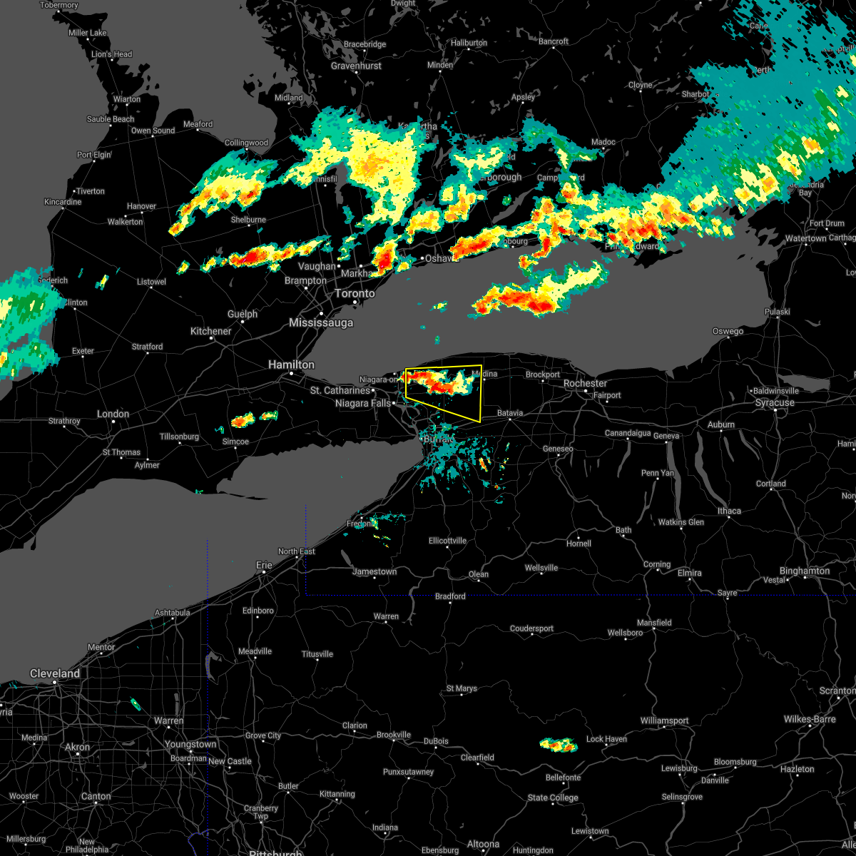
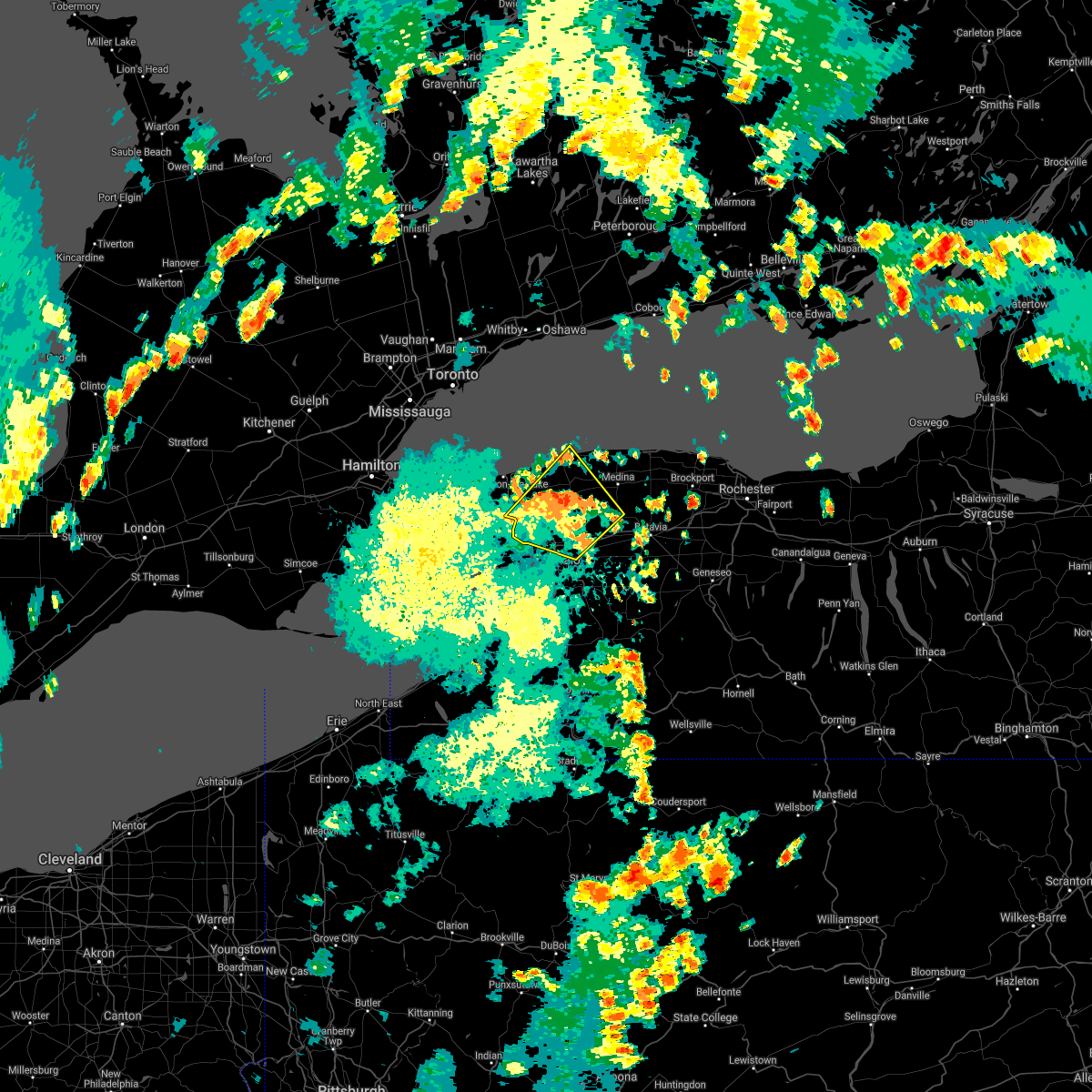
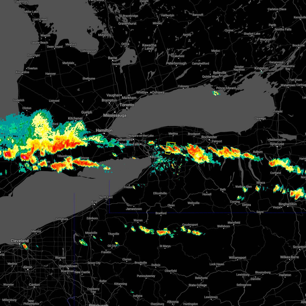
| 7/11/2020 2:18 PM EDT |
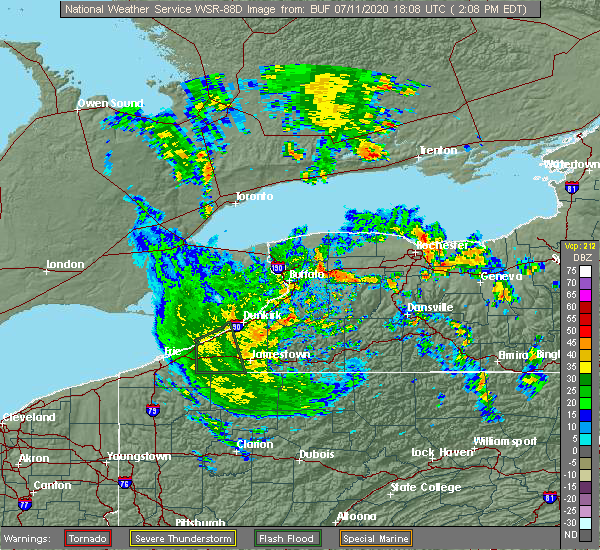 At 218 pm edt, a severe thunderstorm was located over pembroke, or near darien lakes state park, moving northeast at 5 mph (radar indicated). Hazards include 60 mph wind gusts. expect damage to roofs, siding, and trees At 218 pm edt, a severe thunderstorm was located over pembroke, or near darien lakes state park, moving northeast at 5 mph (radar indicated). Hazards include 60 mph wind gusts. expect damage to roofs, siding, and trees
|
| 6/23/2020 4:15 PM EDT |
 The severe thunderstorm warning for northern erie and niagara counties has expired, the storm which prompted the warning has weakened below severe limits, and no longer poses an immediate threat to life or property. therefore, the warning has been allowed to expire. however gusty winds and heavy rain are still possible with this thunderstorm. The severe thunderstorm warning for northern erie and niagara counties has expired, the storm which prompted the warning has weakened below severe limits, and no longer poses an immediate threat to life or property. therefore, the warning has been allowed to expire. however gusty winds and heavy rain are still possible with this thunderstorm.
|
| 6/23/2020 3:50 PM EDT |
 At 349 pm edt, a severe thunderstorm was located over tonawanda, moving northeast at 40 mph (radar indicated). Hazards include 60 mph wind gusts and quarter size hail. Minor damage to vehicles is possible. expect wind damage to roofs, siding, and trees. locations impacted include, buffalo, cheektowaga, niagara falls, west seneca, north tonawanda, clarence, lockport, lackawanna, kenmore and depew. This includes interstate 90 between exits 57 and 49. At 349 pm edt, a severe thunderstorm was located over tonawanda, moving northeast at 40 mph (radar indicated). Hazards include 60 mph wind gusts and quarter size hail. Minor damage to vehicles is possible. expect wind damage to roofs, siding, and trees. locations impacted include, buffalo, cheektowaga, niagara falls, west seneca, north tonawanda, clarence, lockport, lackawanna, kenmore and depew. This includes interstate 90 between exits 57 and 49.
|
| 6/23/2020 3:20 PM EDT |
 At 320 pm edt, a severe thunderstorm was located 11 miles northwest of angola on the lake, or 17 miles west of buffalo, moving northeast at 40 mph (radar indicated). Hazards include 60 mph wind gusts and quarter size hail. Minor damage to vehicles is possible. Expect wind damage to roofs, siding, and trees. At 320 pm edt, a severe thunderstorm was located 11 miles northwest of angola on the lake, or 17 miles west of buffalo, moving northeast at 40 mph (radar indicated). Hazards include 60 mph wind gusts and quarter size hail. Minor damage to vehicles is possible. Expect wind damage to roofs, siding, and trees.
|
| 6/10/2020 11:22 PM EDT |
 At 1122 pm edt, a severe thunderstorm was located over depew, moving east at 50 mph (radar indicated). Hazards include 60 mph wind gusts. Expect damage to roofs, siding, and trees. locations impacted include, buffalo, cheektowaga, niagara falls, west seneca, north tonawanda, clarence, lockport, lackawanna, batavia and kenmore. This includes interstate 90 between exits 56 and 48. At 1122 pm edt, a severe thunderstorm was located over depew, moving east at 50 mph (radar indicated). Hazards include 60 mph wind gusts. Expect damage to roofs, siding, and trees. locations impacted include, buffalo, cheektowaga, niagara falls, west seneca, north tonawanda, clarence, lockport, lackawanna, batavia and kenmore. This includes interstate 90 between exits 56 and 48.
|
| 6/10/2020 11:08 PM EDT | Trees dow in erie county NY, 0.7 miles ESE of Akron, NY |
| 6/10/2020 10:49 PM EDT |
 At 1048 pm edt, a severe thunderstorm was located over niagara falls, moving northeast at 50 mph (radar indicated). Hazards include 60 mph wind gusts. expect damage to roofs, siding, and trees At 1048 pm edt, a severe thunderstorm was located over niagara falls, moving northeast at 50 mph (radar indicated). Hazards include 60 mph wind gusts. expect damage to roofs, siding, and trees
|
| 6/2/2020 10:53 PM EDT |
 At 1053 pm edt, a severe thunderstorm was located near north tonawanda, moving southeast at 55 mph (radar indicated). Hazards include 60 mph wind gusts and half dollar size hail. Minor damage to vehicles is possible. expect wind damage to roofs, siding, and trees. Locations impacted include, buffalo, niagara falls, north tonawanda, lockport, kenmore, amherst, tonawanda, williamsville, grand island and newfane. At 1053 pm edt, a severe thunderstorm was located near north tonawanda, moving southeast at 55 mph (radar indicated). Hazards include 60 mph wind gusts and half dollar size hail. Minor damage to vehicles is possible. expect wind damage to roofs, siding, and trees. Locations impacted include, buffalo, niagara falls, north tonawanda, lockport, kenmore, amherst, tonawanda, williamsville, grand island and newfane.
|
| 6/2/2020 10:42 PM EDT |
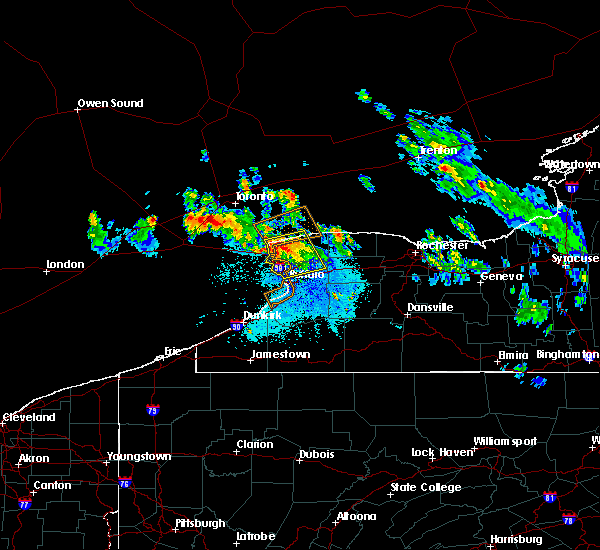 At 1041 pm edt, a severe thunderstorm was located over sanborn, moving southeast at 55 mph (radar indicated). Hazards include 60 mph wind gusts and half dollar size hail. Minor damage to vehicles is possible. expect wind damage to roofs, siding, and trees. Locations impacted include, buffalo, niagara falls, north tonawanda, lockport, kenmore, tonawanda, amherst, williamsville, grand island and newfane. At 1041 pm edt, a severe thunderstorm was located over sanborn, moving southeast at 55 mph (radar indicated). Hazards include 60 mph wind gusts and half dollar size hail. Minor damage to vehicles is possible. expect wind damage to roofs, siding, and trees. Locations impacted include, buffalo, niagara falls, north tonawanda, lockport, kenmore, tonawanda, amherst, williamsville, grand island and newfane.
|
| 6/2/2020 10:13 PM EDT |
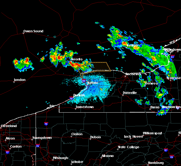 At 1012 pm edt, a severe thunderstorm was located 14 miles north of fort niagara state park and moving southeast at 60 mph (radar indicated). Hazards include 60 mph wind gusts and half dollar size hail. Minor damage to vehicles is possible. Expect wind damage to roofs, siding, and trees. At 1012 pm edt, a severe thunderstorm was located 14 miles north of fort niagara state park and moving southeast at 60 mph (radar indicated). Hazards include 60 mph wind gusts and half dollar size hail. Minor damage to vehicles is possible. Expect wind damage to roofs, siding, and trees.
|
| 5/29/2020 5:14 PM EDT |
 At 513 pm edt, a severe thunderstorm was located over lancaster and moving northeast at 30 mph (radar indicated). Hazards include 60 mph wind gusts. Expect damage to roofs, siding, and trees. locations impacted include, cheektowaga, clarence, depew, amherst, lancaster, east aurora, williamsville, elma, marilla and akron. This includes interstate 90 near exit 49. At 513 pm edt, a severe thunderstorm was located over lancaster and moving northeast at 30 mph (radar indicated). Hazards include 60 mph wind gusts. Expect damage to roofs, siding, and trees. locations impacted include, cheektowaga, clarence, depew, amherst, lancaster, east aurora, williamsville, elma, marilla and akron. This includes interstate 90 near exit 49.
|
| 5/29/2020 4:51 PM EDT |
 At 451 pm edt, a severe thunderstorm was located over blasdell, or over lackawanna, moving northeast at 30 mph (radar indicated). Hazards include 60 mph wind gusts. expect damage to roofs, siding, and trees At 451 pm edt, a severe thunderstorm was located over blasdell, or over lackawanna, moving northeast at 30 mph (radar indicated). Hazards include 60 mph wind gusts. expect damage to roofs, siding, and trees
|
| 5/29/2020 1:06 PM EDT |
 At 106 pm edt, a severe thunderstorm was located over alden, or near darien lakes state park, moving northeast at 35 mph (radar indicated). Hazards include 60 mph wind gusts. Expect damage to roofs, siding, and trees. locations impacted include, clarence, batavia, darien lakes state park, le roy, pembroke, bennington, akron, alden, attica and stafford. This includes interstate 90 between exits 48a and 48. At 106 pm edt, a severe thunderstorm was located over alden, or near darien lakes state park, moving northeast at 35 mph (radar indicated). Hazards include 60 mph wind gusts. Expect damage to roofs, siding, and trees. locations impacted include, clarence, batavia, darien lakes state park, le roy, pembroke, bennington, akron, alden, attica and stafford. This includes interstate 90 between exits 48a and 48.
|
| 5/29/2020 12:44 PM EDT |
 At 1244 pm edt, a severe thunderstorm was located near orchard park, or near west seneca, moving northeast at 35 mph (radar indicated). Hazards include 60 mph wind gusts and penny size hail. expect damage to roofs, siding, and trees At 1244 pm edt, a severe thunderstorm was located near orchard park, or near west seneca, moving northeast at 35 mph (radar indicated). Hazards include 60 mph wind gusts and penny size hail. expect damage to roofs, siding, and trees
|
| 3/29/2020 2:30 PM EDT |
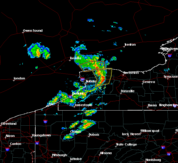 At 229 pm edt, severe thunderstorms were located along a line extending from 11 miles northeast of newfane to near pembroke, moving northeast at 55 mph (radar indicated). Hazards include 60 mph wind gusts and nickel size hail. Expect damage to roofs, siding, and trees. locations impacted include, batavia, medina, albion, darien lakes state park, pembroke, bennington, akron, alden, attica and byron. This includes interstate 90 between exits 48a and 48. At 229 pm edt, severe thunderstorms were located along a line extending from 11 miles northeast of newfane to near pembroke, moving northeast at 55 mph (radar indicated). Hazards include 60 mph wind gusts and nickel size hail. Expect damage to roofs, siding, and trees. locations impacted include, batavia, medina, albion, darien lakes state park, pembroke, bennington, akron, alden, attica and byron. This includes interstate 90 between exits 48a and 48.
|
| 3/29/2020 2:24 PM EDT | Multiple large trees dow in genesee county NY, 3 miles NW of Akron, NY |
| 3/29/2020 2:03 PM EDT |
 At 202 pm edt, severe thunderstorms were located along a line extending from near sanborn to west seneca, moving northeast at 55 mph (radar indicated). Hazards include 60 mph wind gusts and nickel size hail. expect damage to roofs, siding, and trees At 202 pm edt, severe thunderstorms were located along a line extending from near sanborn to west seneca, moving northeast at 55 mph (radar indicated). Hazards include 60 mph wind gusts and nickel size hail. expect damage to roofs, siding, and trees
|
| 10/1/2019 5:19 PM EDT |
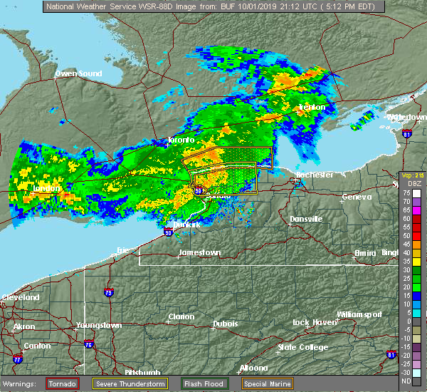 At 518 pm edt, a severe thunderstorm was located over lockport, moving east at 55 mph (radar indicated). Hazards include 60 mph wind gusts. Expect damage to roofs, siding, and trees. locations impacted include, niagara falls, north tonawanda, clarence, lockport, batavia, kenmore, tonawanda, amherst, medina and albion. This includes interstate 90 between exits 48a and 48. At 518 pm edt, a severe thunderstorm was located over lockport, moving east at 55 mph (radar indicated). Hazards include 60 mph wind gusts. Expect damage to roofs, siding, and trees. locations impacted include, niagara falls, north tonawanda, clarence, lockport, batavia, kenmore, tonawanda, amherst, medina and albion. This includes interstate 90 between exits 48a and 48.
|
| 10/1/2019 4:45 PM EDT |
 At 444 pm edt, a severe thunderstorm was located 13 miles west of niagara falls, moving east at 65 mph (radar indicated). Hazards include 60 mph wind gusts. expect damage to roofs, siding, and trees At 444 pm edt, a severe thunderstorm was located 13 miles west of niagara falls, moving east at 65 mph (radar indicated). Hazards include 60 mph wind gusts. expect damage to roofs, siding, and trees
|
| 8/16/2019 5:13 PM EDT |
 The national weather service in buffalo has issued a * severe thunderstorm warning for. northeastern erie county in western new york. east central niagara county in western new york. western orleans county in western new york. Northwestern genesee county in western new york. The national weather service in buffalo has issued a * severe thunderstorm warning for. northeastern erie county in western new york. east central niagara county in western new york. western orleans county in western new york. Northwestern genesee county in western new york.
|
| 8/8/2019 11:16 AM EDT |
 At 1116 am edt, severe thunderstorms were located along a line extending from near clarence to west seneca, moving east at 30 mph (radar indicated). Hazards include 60 mph wind gusts. Expect damage to roofs, siding, and trees. locations impacted include, buffalo, cheektowaga, west seneca, north tonawanda, clarence, lackawanna, kenmore, depew, amherst and tonawanda. This includes interstate 90 between exits 55 and 49. At 1116 am edt, severe thunderstorms were located along a line extending from near clarence to west seneca, moving east at 30 mph (radar indicated). Hazards include 60 mph wind gusts. Expect damage to roofs, siding, and trees. locations impacted include, buffalo, cheektowaga, west seneca, north tonawanda, clarence, lackawanna, kenmore, depew, amherst and tonawanda. This includes interstate 90 between exits 55 and 49.
|
| 8/8/2019 11:15 AM EDT |
 At 1115 am edt, severe thunderstorms were located along a line extending from 7 miles northeast of newfane to near alden, moving northeast at 35 mph (radar indicated). Hazards include 60 mph wind gusts. expect damage to roofs, siding, and trees At 1115 am edt, severe thunderstorms were located along a line extending from 7 miles northeast of newfane to near alden, moving northeast at 35 mph (radar indicated). Hazards include 60 mph wind gusts. expect damage to roofs, siding, and trees
|
| 8/8/2019 10:48 AM EDT |
 At 1048 am edt, a severe thunderstorm was located over kenmore, moving east at 35 mph (radar indicated). Hazards include 60 mph wind gusts. expect damage to roofs, siding, and trees At 1048 am edt, a severe thunderstorm was located over kenmore, moving east at 35 mph (radar indicated). Hazards include 60 mph wind gusts. expect damage to roofs, siding, and trees
|
| 5/25/2019 7:03 PM EDT | Trees down in genesee county NY, 4.2 miles SW of Akron, NY |
| 5/25/2019 7:00 PM EDT | Trees and wires down in newstead in erie county NY, 2.7 miles E of Akron, NY |
| 5/25/2019 6:45 PM EDT |
 At 645 pm edt, severe thunderstorms were located along a line extending from near grand island to 17 miles northwest of angola on the lake, moving east at 45 mph (radar indicated). Hazards include 70 mph wind gusts. Expect considerable tree damage. Damage is likely to mobile homes, roofs, and outbuildings. At 645 pm edt, severe thunderstorms were located along a line extending from near grand island to 17 miles northwest of angola on the lake, moving east at 45 mph (radar indicated). Hazards include 70 mph wind gusts. Expect considerable tree damage. Damage is likely to mobile homes, roofs, and outbuildings.
|
| 5/23/2019 10:31 AM EDT |
 At 1030 am edt, severe thunderstorms were located along a line extending from lewiston to 8 miles west of ashford hollow, moving east at 55 mph (radar indicated). Hazards include 60 mph wind gusts and quarter size hail. Minor damage to vehicles is possible. expect wind damage to roofs, siding, and trees. locations impacted include, buffalo, cheektowaga, niagara falls, west seneca, north tonawanda, clarence, lockport, lackawanna, kenmore, depew, springville, angola, boston, cattaraugus, ashford hollow. this includes the following highways, interstate 90 between exits 57a and 49. Interstate 86 between exits 15 and 25. At 1030 am edt, severe thunderstorms were located along a line extending from lewiston to 8 miles west of ashford hollow, moving east at 55 mph (radar indicated). Hazards include 60 mph wind gusts and quarter size hail. Minor damage to vehicles is possible. expect wind damage to roofs, siding, and trees. locations impacted include, buffalo, cheektowaga, niagara falls, west seneca, north tonawanda, clarence, lockport, lackawanna, kenmore, depew, springville, angola, boston, cattaraugus, ashford hollow. this includes the following highways, interstate 90 between exits 57a and 49. Interstate 86 between exits 15 and 25.
|
| 5/23/2019 9:54 AM EDT |
 At 953 am edt, severe thunderstorms were located along a line extending from 27 miles west of niagara falls to near panama, moving east at 60 mph (radar indicated). Hazards include 60 mph wind gusts and nickel size hail. expect damage to roofs, siding, and trees At 953 am edt, severe thunderstorms were located along a line extending from 27 miles west of niagara falls to near panama, moving east at 60 mph (radar indicated). Hazards include 60 mph wind gusts and nickel size hail. expect damage to roofs, siding, and trees
|
| 9/21/2018 5:55 PM EDT |
 At 554 pm edt, a severe thunderstorm was located over oakfield, or 7 miles northwest of batavia, moving east at 70 mph (radar indicated). Hazards include 60 mph wind gusts. Expect damage to roofs, siding, and trees. Locations impacted include, buffalo, cheektowaga, west seneca, clarence, batavia, depew, lancaster, darien lakes state park, elma and pembroke. At 554 pm edt, a severe thunderstorm was located over oakfield, or 7 miles northwest of batavia, moving east at 70 mph (radar indicated). Hazards include 60 mph wind gusts. Expect damage to roofs, siding, and trees. Locations impacted include, buffalo, cheektowaga, west seneca, clarence, batavia, depew, lancaster, darien lakes state park, elma and pembroke.
|
| 9/21/2018 5:27 PM EDT |
 At 527 pm edt, a severe thunderstorm was located over erie basin marina, or over buffalo, moving east at 70 mph (radar indicated). Hazards include 60 mph wind gusts. expect damage to roofs, siding, and trees At 527 pm edt, a severe thunderstorm was located over erie basin marina, or over buffalo, moving east at 70 mph (radar indicated). Hazards include 60 mph wind gusts. expect damage to roofs, siding, and trees
|
| 9/3/2018 3:06 PM EDT |
 At 306 pm edt, a severe thunderstorm was located over pendleton, or near amherst, moving east at 30 mph (radar indicated). Hazards include 60 mph wind gusts. Expect damage to roofs, siding, and trees. Locations impacted include, cheektowaga, north tonawanda, clarence, amherst, tonawanda, williamsville, grand island and pendleton. At 306 pm edt, a severe thunderstorm was located over pendleton, or near amherst, moving east at 30 mph (radar indicated). Hazards include 60 mph wind gusts. Expect damage to roofs, siding, and trees. Locations impacted include, cheektowaga, north tonawanda, clarence, amherst, tonawanda, williamsville, grand island and pendleton.
|
| 9/3/2018 2:52 PM EDT |
 At 251 pm edt, a severe thunderstorm was located near sanborn, or near north tonawanda, moving east at 30 mph (radar indicated). Hazards include 60 mph wind gusts. expect damage to roofs, siding, and trees At 251 pm edt, a severe thunderstorm was located near sanborn, or near north tonawanda, moving east at 30 mph (radar indicated). Hazards include 60 mph wind gusts. expect damage to roofs, siding, and trees
|
| 6/13/2018 4:45 PM EDT |
 At 445 pm edt, a severe thunderstorm was located over west seneca, moving east at 55 mph (radar indicated). Hazards include 60 mph wind gusts. Expect damage to roofs, siding, and trees. Locations impacted include, buffalo, cheektowaga, west seneca, clarence, lackawanna, depew, amherst and tonawanda. At 445 pm edt, a severe thunderstorm was located over west seneca, moving east at 55 mph (radar indicated). Hazards include 60 mph wind gusts. Expect damage to roofs, siding, and trees. Locations impacted include, buffalo, cheektowaga, west seneca, clarence, lackawanna, depew, amherst and tonawanda.
|
| 6/13/2018 4:26 PM EDT |
 At 425 pm edt, a severe thunderstorm was located 7 miles west of erie basin marina, or 10 miles west of buffalo, moving east at 60 mph (radar indicated). Hazards include 60 mph wind gusts. expect damage to roofs, siding, and trees At 425 pm edt, a severe thunderstorm was located 7 miles west of erie basin marina, or 10 miles west of buffalo, moving east at 60 mph (radar indicated). Hazards include 60 mph wind gusts. expect damage to roofs, siding, and trees
|
| 10/15/2017 3:56 PM EDT |
 At 356 pm edt, severe thunderstorms were located along a line extending from near lakeside beach state park to north collins to 8 miles south of fredonia, moving southeast at 45 mph (radar indicated). Hazards include 60 mph wind gusts. expect wind damage to trees and power lines At 356 pm edt, severe thunderstorms were located along a line extending from near lakeside beach state park to north collins to 8 miles south of fredonia, moving southeast at 45 mph (radar indicated). Hazards include 60 mph wind gusts. expect wind damage to trees and power lines
|
| 10/15/2017 3:53 PM EDT |
 At 352 pm edt, a severe thunderstorm was located over williamsville, moving east at 40 mph (radar indicated). Hazards include 60 mph wind gusts. Expect wind damage to trees and power lines. locations impacted include, buffalo, cheektowaga, west seneca, clarence, lackawanna, depew, amherst and tonawanda. This includes interstate 90 between exits 54 and 48a. At 352 pm edt, a severe thunderstorm was located over williamsville, moving east at 40 mph (radar indicated). Hazards include 60 mph wind gusts. Expect wind damage to trees and power lines. locations impacted include, buffalo, cheektowaga, west seneca, clarence, lackawanna, depew, amherst and tonawanda. This includes interstate 90 between exits 54 and 48a.
|
| 10/15/2017 3:37 PM EDT |
 The national weather service in buffalo has issued a * severe thunderstorm warning for. northeastern erie county in western new york. southeastern niagara county in western new york. western genesee county in western new york. Until 400 pm edt. The national weather service in buffalo has issued a * severe thunderstorm warning for. northeastern erie county in western new york. southeastern niagara county in western new york. western genesee county in western new york. Until 400 pm edt.
|
| 9/4/2017 10:24 PM EDT |
 At 1024 pm edt, a severe thunderstorm was located over clarence, moving east at 60 mph (radar indicated). Hazards include 60 mph wind gusts. expect wind damage to trees and power lines At 1024 pm edt, a severe thunderstorm was located over clarence, moving east at 60 mph (radar indicated). Hazards include 60 mph wind gusts. expect wind damage to trees and power lines
|
| 8/22/2017 7:13 PM EDT |
 At 713 pm edt, a severe thunderstorm was located over clarence, moving east at 40 mph (radar indicated). Hazards include 60 mph wind gusts. expect wind damage to trees and power lines At 713 pm edt, a severe thunderstorm was located over clarence, moving east at 40 mph (radar indicated). Hazards include 60 mph wind gusts. expect wind damage to trees and power lines
|
| 8/22/2017 6:54 PM EDT |
 At 654 pm edt, a severe thunderstorm was located over kenmore, moving east at 40 mph (radar indicated). Hazards include 60 mph wind gusts. Expect wind damage to trees and power lines. locations impacted include, buffalo, cheektowaga, west seneca, north tonawanda, clarence, lackawanna, kenmore and depew. This includes interstate 90 between exits 56 and 49. At 654 pm edt, a severe thunderstorm was located over kenmore, moving east at 40 mph (radar indicated). Hazards include 60 mph wind gusts. Expect wind damage to trees and power lines. locations impacted include, buffalo, cheektowaga, west seneca, north tonawanda, clarence, lackawanna, kenmore and depew. This includes interstate 90 between exits 56 and 49.
|
| 8/22/2017 6:28 PM EDT |
 At 628 pm edt, a severe thunderstorm was located 9 miles southwest of niagara falls, moving east at 40 mph (radar indicated). Hazards include 60 mph wind gusts. expect wind damage to trees and power lines At 628 pm edt, a severe thunderstorm was located 9 miles southwest of niagara falls, moving east at 40 mph (radar indicated). Hazards include 60 mph wind gusts. expect wind damage to trees and power lines
|
| 8/4/2017 5:37 PM EDT |
 The severe thunderstorm warning for northeastern erie, southern niagara and northwestern genesee counties will expire at 545 pm edt, the storm which prompted the warning has moved out of the area. therefore the warning will be allowed to expire. a severe thunderstorm watch remains in effect until 900 pm edt for western new york. The severe thunderstorm warning for northeastern erie, southern niagara and northwestern genesee counties will expire at 545 pm edt, the storm which prompted the warning has moved out of the area. therefore the warning will be allowed to expire. a severe thunderstorm watch remains in effect until 900 pm edt for western new york.
|
| 8/4/2017 5:23 PM EDT |
 At 523 pm edt, a severe thunderstorm was located near pendleton, or near clarence, moving northeast at 60 mph (radar indicated). Hazards include 60 mph wind gusts. Expect wind damage to trees and power lines. locations impacted include, buffalo, cheektowaga, north tonawanda, clarence, lockport, kenmore, amherst and tonawanda. This includes interstate 90 between exits 50 and 49. At 523 pm edt, a severe thunderstorm was located near pendleton, or near clarence, moving northeast at 60 mph (radar indicated). Hazards include 60 mph wind gusts. Expect wind damage to trees and power lines. locations impacted include, buffalo, cheektowaga, north tonawanda, clarence, lockport, kenmore, amherst and tonawanda. This includes interstate 90 between exits 50 and 49.
|
| 8/4/2017 5:00 PM EDT |
 At 459 pm edt, a severe thunderstorm was located over blasdell, or over lackawanna, moving northeast at 50 mph (radar indicated). Hazards include 60 mph wind gusts. expect wind damage to trees and power lines At 459 pm edt, a severe thunderstorm was located over blasdell, or over lackawanna, moving northeast at 50 mph (radar indicated). Hazards include 60 mph wind gusts. expect wind damage to trees and power lines
|
| 8/4/2017 2:11 PM EDT |
 At 210 pm edt, a severe thunderstorm was located near alden, or near clarence, moving northeast at 35 mph (radar indicated). Hazards include 60 mph wind gusts and penny size hail. Expect wind damage to trees and power lines. locations impacted include, clarence, depew, lancaster, darien lakes state park, marilla, pembroke, bennington and akron. This includes interstate 90 near exit 48a. At 210 pm edt, a severe thunderstorm was located near alden, or near clarence, moving northeast at 35 mph (radar indicated). Hazards include 60 mph wind gusts and penny size hail. Expect wind damage to trees and power lines. locations impacted include, clarence, depew, lancaster, darien lakes state park, marilla, pembroke, bennington and akron. This includes interstate 90 near exit 48a.
|
| 8/4/2017 1:57 PM EDT |
 At 157 pm edt, a severe thunderstorm was located over elma, or near west seneca, moving northeast at 45 mph (radar indicated). Hazards include 60 mph wind gusts and penny size hail. Expect wind damage to trees and power lines. locations impacted include, buffalo, cheektowaga, west seneca, clarence, lackawanna, depew, lancaster and east aurora. This includes interstate 90 between exits 55 and 54, and near exit 48a. At 157 pm edt, a severe thunderstorm was located over elma, or near west seneca, moving northeast at 45 mph (radar indicated). Hazards include 60 mph wind gusts and penny size hail. Expect wind damage to trees and power lines. locations impacted include, buffalo, cheektowaga, west seneca, clarence, lackawanna, depew, lancaster and east aurora. This includes interstate 90 between exits 55 and 54, and near exit 48a.
|
| 8/4/2017 1:41 PM EDT |
 At 141 pm edt, a severe thunderstorm was located over hamburg, moving northeast at 45 mph (radar indicated). Hazards include 60 mph wind gusts and penny size hail. expect wind damage to trees and power lines At 141 pm edt, a severe thunderstorm was located over hamburg, moving northeast at 45 mph (radar indicated). Hazards include 60 mph wind gusts and penny size hail. expect wind damage to trees and power lines
|
| 8/4/2017 1:27 PM EDT |
 The severe thunderstorm warning for northeastern erie county will expire at 130 pm edt. the severe thunderstorm which prompted the warning has moved out of the warned area. therefore, the warning will be allowed to expire. however heavy rain is still possible with this thunderstorm. A severe thunderstorm watch remains in effect until 900 pm edt for. The severe thunderstorm warning for northeastern erie county will expire at 130 pm edt. the severe thunderstorm which prompted the warning has moved out of the warned area. therefore, the warning will be allowed to expire. however heavy rain is still possible with this thunderstorm. A severe thunderstorm watch remains in effect until 900 pm edt for.
|
| 8/4/2017 12:51 PM EDT |
 At 1251 pm edt, a severe thunderstorm was located over depew, moving northeast at 35 mph (radar indicated). Hazards include 60 mph wind gusts and quarter size hail. Minor damage to vehicles is possible. expect wind damage to trees and power lines. locations impacted include, buffalo, cheektowaga, west seneca, clarence, lackawanna, depew, amherst and lancaster. This includes interstate 90 between exits 55 and 49. At 1251 pm edt, a severe thunderstorm was located over depew, moving northeast at 35 mph (radar indicated). Hazards include 60 mph wind gusts and quarter size hail. Minor damage to vehicles is possible. expect wind damage to trees and power lines. locations impacted include, buffalo, cheektowaga, west seneca, clarence, lackawanna, depew, amherst and lancaster. This includes interstate 90 between exits 55 and 49.
|
| 8/4/2017 12:27 PM EDT |
 At 1226 pm edt, a severe thunderstorm was located near small boat harbor, or 7 miles west of lackawanna, moving northeast at 35 mph (radar indicated). Hazards include 60 mph wind gusts and quarter size hail. Minor damage to vehicles is possible. Expect wind damage to trees and power lines. At 1226 pm edt, a severe thunderstorm was located near small boat harbor, or 7 miles west of lackawanna, moving northeast at 35 mph (radar indicated). Hazards include 60 mph wind gusts and quarter size hail. Minor damage to vehicles is possible. Expect wind damage to trees and power lines.
|
| 7/20/2017 12:31 PM EDT |
 At 1230 pm edt, a severe thunderstorm was located over blasdell, or over lackawanna, moving east at 30 mph (radar indicated). Hazards include 60 mph wind gusts and penny size hail. expect wind damage to trees and power lines At 1230 pm edt, a severe thunderstorm was located over blasdell, or over lackawanna, moving east at 30 mph (radar indicated). Hazards include 60 mph wind gusts and penny size hail. expect wind damage to trees and power lines
|
| 7/20/2017 12:21 PM EDT |
 At 1221 pm edt, a severe thunderstorm was located near albion, moving east at 45 mph (radar indicated). Hazards include 60 mph wind gusts. expect wind damage to trees and power lines At 1221 pm edt, a severe thunderstorm was located near albion, moving east at 45 mph (radar indicated). Hazards include 60 mph wind gusts. expect wind damage to trees and power lines
|
| 7/8/2017 1:49 AM EDT |
 At 148 am edt, a severe thunderstorm was located over pembroke, or near darien lakes state park, moving east at 35 mph (radar indicated). Hazards include 60 mph wind gusts and quarter size hail. Minor damage to vehicles is possible. Expect wind damage to trees and power lines. At 148 am edt, a severe thunderstorm was located over pembroke, or near darien lakes state park, moving east at 35 mph (radar indicated). Hazards include 60 mph wind gusts and quarter size hail. Minor damage to vehicles is possible. Expect wind damage to trees and power lines.
|
| 5/1/2017 4:11 PM EDT |
 At 409 pm edt, severe thunderstorms were located along a line extending from near middleport to near oakfield to near chaffee, moving northeast at 50 mph (radar indicated). Hazards include 70 mph wind gusts. Expect considerable tree damage. damage is likely to mobile homes, roofs, and outbuildings. although not an immediate threat, this storm is capable of producing a tornado. locations impacted include, batavia, medina, albion, darien lakes state park, newfane, le roy, pembroke and warsaw. this includes interstate 90 between exits 48a and 48. A tornado watch remains in effect until 1000 pm edt for western new york. At 409 pm edt, severe thunderstorms were located along a line extending from near middleport to near oakfield to near chaffee, moving northeast at 50 mph (radar indicated). Hazards include 70 mph wind gusts. Expect considerable tree damage. damage is likely to mobile homes, roofs, and outbuildings. although not an immediate threat, this storm is capable of producing a tornado. locations impacted include, batavia, medina, albion, darien lakes state park, newfane, le roy, pembroke and warsaw. this includes interstate 90 between exits 48a and 48. A tornado watch remains in effect until 1000 pm edt for western new york.
|
| 5/1/2017 3:47 PM EDT |
 At 347 pm edt, severe thunderstorms were located along a line extending from lockport to near alden to springville, moving northeast at 60 mph (radar indicated). Hazards include 70 mph wind gusts. Expect considerable tree damage. Damage is likely to mobile homes, roofs, and outbuildings. At 347 pm edt, severe thunderstorms were located along a line extending from lockport to near alden to springville, moving northeast at 60 mph (radar indicated). Hazards include 70 mph wind gusts. Expect considerable tree damage. Damage is likely to mobile homes, roofs, and outbuildings.
|
| 5/1/2017 3:33 PM EDT |
 At 332 pm edt, severe thunderstorms were located along a line extending from 15 miles north of newfane to small boat harbor, moving northeast at 55 mph (radar indicated). Hazards include 70 mph wind gusts. Expect considerable tree damage. damage is likely to mobile homes, roofs, and outbuildings. locations impacted include, buffalo, cheektowaga, niagara falls, west seneca, north tonawanda, clarence, lockport and lackawanna. this includes interstate 90 between exits 57 and 49. A tornado watch remains in effect until 1000 pm edt for western new york. At 332 pm edt, severe thunderstorms were located along a line extending from 15 miles north of newfane to small boat harbor, moving northeast at 55 mph (radar indicated). Hazards include 70 mph wind gusts. Expect considerable tree damage. damage is likely to mobile homes, roofs, and outbuildings. locations impacted include, buffalo, cheektowaga, niagara falls, west seneca, north tonawanda, clarence, lockport and lackawanna. this includes interstate 90 between exits 57 and 49. A tornado watch remains in effect until 1000 pm edt for western new york.
|
| 5/1/2017 3:00 PM EDT |
 At 300 pm edt, severe thunderstorms were located along a line extending from 6 miles west of fort niagara state park to near dunkirk, moving northeast at 55 mph (radar indicated). Hazards include 60 mph wind gusts. expect damage to roofs, siding, and trees At 300 pm edt, severe thunderstorms were located along a line extending from 6 miles west of fort niagara state park to near dunkirk, moving northeast at 55 mph (radar indicated). Hazards include 60 mph wind gusts. expect damage to roofs, siding, and trees
|
| 9/17/2016 6:13 PM EDT |
 At 613 pm edt, a severe thunderstorm was located over pembroke, or 7 miles north of darien lakes state park, moving east at 55 mph (radar indicated). Hazards include 60 mph wind gusts. Expect damage to roofs. siding. And trees. At 613 pm edt, a severe thunderstorm was located over pembroke, or 7 miles north of darien lakes state park, moving east at 55 mph (radar indicated). Hazards include 60 mph wind gusts. Expect damage to roofs. siding. And trees.
|
| 9/10/2016 7:40 PM EDT |
 The severe thunderstorm warning for northern erie and southeastern niagara counties will expire at 745 pm edt, the storm which prompted the warning has moved out of the area. therefore, the warning will be allowed to expire. however gusty winds and heavy rain are still possible with this thunderstorm. a severe thunderstorm watch remains in effect until 1000 pm edt for western new york. The severe thunderstorm warning for northern erie and southeastern niagara counties will expire at 745 pm edt, the storm which prompted the warning has moved out of the area. therefore, the warning will be allowed to expire. however gusty winds and heavy rain are still possible with this thunderstorm. a severe thunderstorm watch remains in effect until 1000 pm edt for western new york.
|
| 9/10/2016 7:37 PM EDT | Trees dow in erie county NY, 0.3 miles SSE of Akron, NY |
| 9/10/2016 7:34 PM EDT | Trees dow in erie county NY, 1.2 miles ESE of Akron, NY |
| 9/10/2016 7:26 PM EDT |
 At 725 pm edt, a severe thunderstorm was located over clarence, moving northeast at 50 mph (radar indicated). Hazards include 60 mph wind gusts and penny size hail. Expect damage to roofs. siding. And trees. At 725 pm edt, a severe thunderstorm was located over clarence, moving northeast at 50 mph (radar indicated). Hazards include 60 mph wind gusts and penny size hail. Expect damage to roofs. siding. And trees.
|
| 9/10/2016 7:21 PM EDT |
 At 721 pm edt, a severe thunderstorm was located over lancaster, moving northeast at 50 mph (radar indicated). Hazards include 60 mph wind gusts and penny size hail. Expect damage to roofs. siding. and trees. locations impacted include, buffalo, cheektowaga, west seneca, north tonawanda, clarence, lackawanna, kenmore and depew. This includes interstate 90 between exits 57 and 49. At 721 pm edt, a severe thunderstorm was located over lancaster, moving northeast at 50 mph (radar indicated). Hazards include 60 mph wind gusts and penny size hail. Expect damage to roofs. siding. and trees. locations impacted include, buffalo, cheektowaga, west seneca, north tonawanda, clarence, lackawanna, kenmore and depew. This includes interstate 90 between exits 57 and 49.
|
| 9/10/2016 7:03 PM EDT |
 At 703 pm edt, a severe thunderstorm was located 9 miles west of lackawanna, moving northeast at 55 mph (radar indicated). Hazards include 60 mph wind gusts and penny size hail. Expect damage to roofs. siding. and trees. locations impacted include, buffalo, cheektowaga, west seneca, north tonawanda, clarence, lackawanna, kenmore and depew. This includes interstate 90 between exits 57 and 49. At 703 pm edt, a severe thunderstorm was located 9 miles west of lackawanna, moving northeast at 55 mph (radar indicated). Hazards include 60 mph wind gusts and penny size hail. Expect damage to roofs. siding. and trees. locations impacted include, buffalo, cheektowaga, west seneca, north tonawanda, clarence, lackawanna, kenmore and depew. This includes interstate 90 between exits 57 and 49.
|
| 9/10/2016 6:41 PM EDT |
 At 641 pm edt, a severe thunderstorm was located 12 miles north of dunkirk, moving northeast at 45 mph (radar indicated). Hazards include 60 mph wind gusts. Expect damage to roofs. siding. And trees. At 641 pm edt, a severe thunderstorm was located 12 miles north of dunkirk, moving northeast at 45 mph (radar indicated). Hazards include 60 mph wind gusts. Expect damage to roofs. siding. And trees.
|
| 8/28/2016 4:22 PM EDT |
 At 420 pm edt, severe thunderstorms were located along a line extending from medina to near akron, moving east at 35 mph (radar indicated). Hazards include 60 mph wind gusts and penny size hail. Expect damage to roofs. siding. and trees. Locations impacted include, medina, albion, akron, middleport, oakfield, shelby, alabama and elba. At 420 pm edt, severe thunderstorms were located along a line extending from medina to near akron, moving east at 35 mph (radar indicated). Hazards include 60 mph wind gusts and penny size hail. Expect damage to roofs. siding. and trees. Locations impacted include, medina, albion, akron, middleport, oakfield, shelby, alabama and elba.
|
| 8/28/2016 3:56 PM EDT |
 At 355 pm edt, severe thunderstorms were located along a line extending from near lockport to near pendleton, moving east at 40 mph (radar indicated). Hazards include 60 mph wind gusts and nickel size hail. Expect damage to roofs. siding. And trees. At 355 pm edt, severe thunderstorms were located along a line extending from near lockport to near pendleton, moving east at 40 mph (radar indicated). Hazards include 60 mph wind gusts and nickel size hail. Expect damage to roofs. siding. And trees.
|
| 6/20/2016 9:52 PM EDT |
 At 950 pm edt, a severe thunderstorm was located near clarence, moving east at 55 mph (radar indicated). Hazards include 60 mph wind gusts and quarter size hail. Hail damage to vehicles is expected. expect wind damage to roofs, siding, and trees. Locations impacted include, buffalo, cheektowaga, west seneca, clarence, lackawanna, batavia, kenmore and depew. At 950 pm edt, a severe thunderstorm was located near clarence, moving east at 55 mph (radar indicated). Hazards include 60 mph wind gusts and quarter size hail. Hail damage to vehicles is expected. expect wind damage to roofs, siding, and trees. Locations impacted include, buffalo, cheektowaga, west seneca, clarence, lackawanna, batavia, kenmore and depew.
|
| 6/20/2016 9:30 PM EDT |
 At 929 pm edt, a severe thunderstorm was located over kenmore, moving east at 55 mph (radar indicated). Hazards include 60 mph wind gusts and quarter size hail. Hail damage to vehicles is expected. Expect wind damage to roofs, siding, and trees. At 929 pm edt, a severe thunderstorm was located over kenmore, moving east at 55 mph (radar indicated). Hazards include 60 mph wind gusts and quarter size hail. Hail damage to vehicles is expected. Expect wind damage to roofs, siding, and trees.
|
| 8/10/2015 5:53 PM EDT |
 The severe thunderstorm warning for southwestern genesee, east central erie and northwestern wyoming counties will expire at 600 pm edt, the storm which prompted the warning has weakened below severe limits and exited the warned area. therefore the warning will be allowed to expire. The severe thunderstorm warning for southwestern genesee, east central erie and northwestern wyoming counties will expire at 600 pm edt, the storm which prompted the warning has weakened below severe limits and exited the warned area. therefore the warning will be allowed to expire.
|
| 8/10/2015 5:38 PM EDT |
 At 537 pm edt, doppler radar indicated a severe thunderstorm capable of producing quarter size hail and damaging winds in excess of 60 mph. this storm was located over wales center, or near east aurora, moving northeast at 30 mph. locations impacted include, darien lakes state park, marilla, pembroke, bennington, akron, alden, attica and varysburg. At 537 pm edt, doppler radar indicated a severe thunderstorm capable of producing quarter size hail and damaging winds in excess of 60 mph. this storm was located over wales center, or near east aurora, moving northeast at 30 mph. locations impacted include, darien lakes state park, marilla, pembroke, bennington, akron, alden, attica and varysburg.
|
| 8/10/2015 5:17 PM EDT |
 At 517 pm edt, doppler radar indicated a severe thunderstorm capable of producing quarter size hail and damaging winds in excess of 60 mph. this storm was located near east concord, or 10 miles south of east aurora, and moving northeast at 30 mph. At 517 pm edt, doppler radar indicated a severe thunderstorm capable of producing quarter size hail and damaging winds in excess of 60 mph. this storm was located near east concord, or 10 miles south of east aurora, and moving northeast at 30 mph.
|
| 6/12/2015 3:45 PM EDT |
 At 344 pm edt, doppler radar indicated a line of severe thunderstorms capable of producing quarter size hail and damaging winds in excess of 60 mph. these storms were located along a line extending from near lockport to near cheektowaga, moving east at 45 mph. locations impacted include, buffalo, cheektowaga, west seneca, north tonawanda, clarence, lackawanna, kenmore and depew. At 344 pm edt, doppler radar indicated a line of severe thunderstorms capable of producing quarter size hail and damaging winds in excess of 60 mph. these storms were located along a line extending from near lockport to near cheektowaga, moving east at 45 mph. locations impacted include, buffalo, cheektowaga, west seneca, north tonawanda, clarence, lackawanna, kenmore and depew.
|
| 6/12/2015 3:20 PM EDT |
 At 319 pm edt, doppler radar indicated a line of severe thunderstorms capable of producing quarter size hail and damaging winds in excess of 60 mph. these storms were located along a line extending from near niagara falls to 7 miles west of erie basin marina, and moving east at 50 mph. At 319 pm edt, doppler radar indicated a line of severe thunderstorms capable of producing quarter size hail and damaging winds in excess of 60 mph. these storms were located along a line extending from near niagara falls to 7 miles west of erie basin marina, and moving east at 50 mph.
|
| 5/11/2015 10:10 PM EDT | Tree and wires down maple r in genesee county NY, 3 miles NW of Akron, NY |
| 5/11/2015 9:57 PM EDT | At 956 pm edt, doppler radar indicated a severe thunderstorm capable of producing damaging winds in excess of 60 mph. this storm was located over alden, or near clarence, and moving northeast at 45 mph. |
| 4/20/2015 4:41 PM EDT | At 438 pm edt, national weather service doppler radar continued to indicate a severe thunderstorm capable of producing damaging winds in excess of 60 mph. this storm was located near barre center, or 8 miles south of albion, moving northeast at 50 mph. some locations in the warning include, fancher, morton, hamlin beach,. |
| 4/20/2015 4:10 PM EDT | At 408 pm edt, national weather service doppler radar indicated a severe thunderstorm capable of producing damaging winds in excess of 60 mph. this storm was located near alden, or 9 miles east of lancaster, and moving northeast at 50 mph. * some locations in the warning include, akron, oakfield, albion, kendall, hamlin beach,. |
| 9/8/2012 10:25 AM EDT | Trees down in genesee county NY, 5 miles W of Akron, NY |
| 1/1/0001 12:00 AM | Trees and powerlines down in genesee county NY, 3.1 miles WNW of Akron, NY |
Hail Maps for Akron, NY


Connect with Interactive Hail Maps