

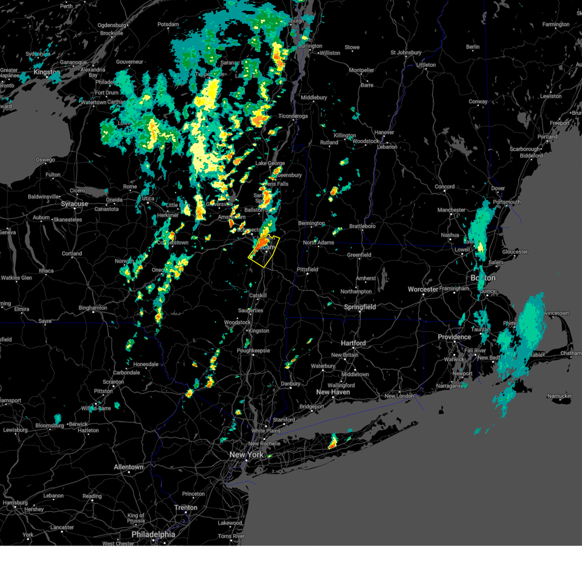
Hail Map for Albany, NY
The Albany, NY area has had 17 reports of on-the-ground hail by trained spotters, and has been under severe weather warnings 14 times during the past 12 months. Doppler radar has detected hail at or near Albany, NY on 50 occasions, including 1 occasion during the past year.
| Name: | Albany, NY |
| Where Located: | 12.7 miles SSE of Schenectady, NY |
| Map: | Google Map for Albany, NY |
| Population: | 97856 |
| Housing Units: | 46362 |
| More Info: | Search Google for Albany, NY |
1
The Top Recent Hail Date for Albany, NY is Tuesday, July 16, 2024 (9th out of 50)

Hail and Wind Damage Spotted near Albany, NY
| Date / Time | Report Details |
|---|---|
| 7/1/2025 3:38 PM EDT |
 At 336 pm edt, a severe thunderstorm was located over pattersonville-rotterdam junction, or near scotia, moving east at 35 mph (radar indicated). Hazards include 60 mph wind gusts and penny size hail. Expect damage to roofs, siding, and trees. Locations impacted include, albany, schenectady, clifton park, rotterdam, amsterdam, colonie, scotia, guilderland, glenville, niskayuna, duanesburg, voorheesville, altamont, hagaman, fort johnson, delanson, rotterdam junction, east glenville, burnt hills, and tribes hill. At 336 pm edt, a severe thunderstorm was located over pattersonville-rotterdam junction, or near scotia, moving east at 35 mph (radar indicated). Hazards include 60 mph wind gusts and penny size hail. Expect damage to roofs, siding, and trees. Locations impacted include, albany, schenectady, clifton park, rotterdam, amsterdam, colonie, scotia, guilderland, glenville, niskayuna, duanesburg, voorheesville, altamont, hagaman, fort johnson, delanson, rotterdam junction, east glenville, burnt hills, and tribes hill.
|
| 7/1/2025 3:10 PM EDT |
 Svraly the national weather service in albany has issued a * severe thunderstorm warning for, schenectady county in east central new york, northern albany county in east central new york, southeastern fulton county in eastern new york, southern saratoga county in east central new york, northeastern schoharie county in east central new york, montgomery county in eastern new york, * until 415 pm edt. * at 309 pm edt, a severe thunderstorm was located near fonda, moving east at 35 mph (radar indicated). Hazards include 60 mph wind gusts and penny size hail. expect damage to roofs, siding, and trees Svraly the national weather service in albany has issued a * severe thunderstorm warning for, schenectady county in east central new york, northern albany county in east central new york, southeastern fulton county in eastern new york, southern saratoga county in east central new york, northeastern schoharie county in east central new york, montgomery county in eastern new york, * until 415 pm edt. * at 309 pm edt, a severe thunderstorm was located near fonda, moving east at 35 mph (radar indicated). Hazards include 60 mph wind gusts and penny size hail. expect damage to roofs, siding, and trees
|
| 5/17/2025 5:52 PM EDT |
 Svraly the national weather service in albany has issued a * severe thunderstorm warning for, northeastern berkshire county in western massachusetts, northeastern albany county in east central new york, southeastern saratoga county in east central new york, southern washington county in east central new york, rensselaer county in east central new york, bennington county in southern vermont, * until 700 pm edt. * at 552 pm edt, severe thunderstorms were located along a line extending from near saratoga springs to colonie, moving east at 35 mph (radar indicated). Hazards include 60 mph wind gusts and quarter size hail. Hail damage to vehicles is expected. Expect wind damage to roofs, siding, and trees. Svraly the national weather service in albany has issued a * severe thunderstorm warning for, northeastern berkshire county in western massachusetts, northeastern albany county in east central new york, southeastern saratoga county in east central new york, southern washington county in east central new york, rensselaer county in east central new york, bennington county in southern vermont, * until 700 pm edt. * at 552 pm edt, severe thunderstorms were located along a line extending from near saratoga springs to colonie, moving east at 35 mph (radar indicated). Hazards include 60 mph wind gusts and quarter size hail. Hail damage to vehicles is expected. Expect wind damage to roofs, siding, and trees.
|
| 8/19/2024 1:39 PM EDT |
 The storms which prompted the warning have weakened below severe limits, and no longer pose an immediate threat to life or property. therefore, the warning will be allowed to expire. however, gusty winds and heavy rain are still possible with these thunderstorms. The storms which prompted the warning have weakened below severe limits, and no longer pose an immediate threat to life or property. therefore, the warning will be allowed to expire. however, gusty winds and heavy rain are still possible with these thunderstorms.
|
| 8/19/2024 1:11 PM EDT |
 Svraly the national weather service in albany has issued a * severe thunderstorm warning for, northeastern albany county in east central new york, west central rensselaer county in east central new york, * until 145 pm edt. * at 111 pm edt, severe thunderstorms were located along a line extending from near clifton park to near guilderland to near feura bush, moving southeast at 5 mph (radar indicated). Hazards include 60 mph wind gusts. expect damage to roofs, siding, and trees Svraly the national weather service in albany has issued a * severe thunderstorm warning for, northeastern albany county in east central new york, west central rensselaer county in east central new york, * until 145 pm edt. * at 111 pm edt, severe thunderstorms were located along a line extending from near clifton park to near guilderland to near feura bush, moving southeast at 5 mph (radar indicated). Hazards include 60 mph wind gusts. expect damage to roofs, siding, and trees
|
| 8/14/2024 4:07 PM EDT |
 the severe thunderstorm warning has been cancelled and is no longer in effect the severe thunderstorm warning has been cancelled and is no longer in effect
|
| 8/14/2024 3:47 PM EDT |
 Svraly the national weather service in albany has issued a * severe thunderstorm warning for, eastern schenectady county in east central new york, northeastern albany county in east central new york, south central saratoga county in east central new york, * until 445 pm edt. * at 347 pm edt, a severe thunderstorm was located over schenectady, moving south at 25 mph (radar indicated). Hazards include 60 mph wind gusts and quarter size hail. Hail damage to vehicles is expected. Expect wind damage to roofs, siding, and trees. Svraly the national weather service in albany has issued a * severe thunderstorm warning for, eastern schenectady county in east central new york, northeastern albany county in east central new york, south central saratoga county in east central new york, * until 445 pm edt. * at 347 pm edt, a severe thunderstorm was located over schenectady, moving south at 25 mph (radar indicated). Hazards include 60 mph wind gusts and quarter size hail. Hail damage to vehicles is expected. Expect wind damage to roofs, siding, and trees.
|
| 7/17/2024 1:15 PM EDT |
 The storms which prompted the warning have weakened below severe limits, and no longer pose an immediate threat to life or property. therefore, the warning has been allowed to expire. however, gusty winds are still expected with these thunderstorms. a severe thunderstorm watch remains in effect until 800 pm edt for western massachusetts, east central new york, and southern vermont. The storms which prompted the warning have weakened below severe limits, and no longer pose an immediate threat to life or property. therefore, the warning has been allowed to expire. however, gusty winds are still expected with these thunderstorms. a severe thunderstorm watch remains in effect until 800 pm edt for western massachusetts, east central new york, and southern vermont.
|
| 7/17/2024 12:47 PM EDT |
 Svraly the national weather service in albany has issued a * severe thunderstorm warning for, east central schenectady county in east central new york, northeastern albany county in east central new york, southeastern saratoga county in east central new york, southern washington county in east central new york, northern rensselaer county in east central new york, southwestern bennington county in southern vermont, * until 115 pm edt. * at 1246 pm edt, severe thunderstorms were located along a line extending from near greenwich to waterford to colonie, moving east at 25 mph (radar indicated). Hazards include 60 mph wind gusts. expect damage to roofs, siding, and trees Svraly the national weather service in albany has issued a * severe thunderstorm warning for, east central schenectady county in east central new york, northeastern albany county in east central new york, southeastern saratoga county in east central new york, southern washington county in east central new york, northern rensselaer county in east central new york, southwestern bennington county in southern vermont, * until 115 pm edt. * at 1246 pm edt, severe thunderstorms were located along a line extending from near greenwich to waterford to colonie, moving east at 25 mph (radar indicated). Hazards include 60 mph wind gusts. expect damage to roofs, siding, and trees
|
| 7/16/2024 5:47 PM EDT |
 At 547 pm edt, severe thunderstorms were located along a line extending from near mechanicville to wyantskill, moving east at 35 mph (radar indicated). Hazards include 70 mph wind gusts. Expect considerable tree damage. damage is likely to mobile homes, roofs, and outbuildings. Locations impacted include, albany, troy, clifton park, cohoes, watervliet, rensselaer, colonie, mechanicville, hoosick falls, delmar, latham, guilderland, menands, green island, grafton, waterford, berlin, loudonville, west sand lake, and averill park. At 547 pm edt, severe thunderstorms were located along a line extending from near mechanicville to wyantskill, moving east at 35 mph (radar indicated). Hazards include 70 mph wind gusts. Expect considerable tree damage. damage is likely to mobile homes, roofs, and outbuildings. Locations impacted include, albany, troy, clifton park, cohoes, watervliet, rensselaer, colonie, mechanicville, hoosick falls, delmar, latham, guilderland, menands, green island, grafton, waterford, berlin, loudonville, west sand lake, and averill park.
|
| 7/16/2024 5:46 PM EDT |
 the severe thunderstorm warning has been cancelled and is no longer in effect the severe thunderstorm warning has been cancelled and is no longer in effect
|
| 7/16/2024 5:46 PM EDT |
 At 546 pm edt, severe thunderstorms were located along a line extending from wyantskill to near castleton-on-hudson to 8 miles west of coxsackie, moving east at 70 mph (radar indicated). Hazards include 70 mph wind gusts. Expect considerable tree damage. damage is likely to mobile homes, roofs, and outbuildings. Locations impacted include, albany, troy, east greenbush, cohoes, watervliet, rensselaer, colonie, nassau, delmar, latham, menands, new baltimore, ravena, stephentown, green island, grafton, berlin, castleton-on-hudson, loudonville, and west sand lake. At 546 pm edt, severe thunderstorms were located along a line extending from wyantskill to near castleton-on-hudson to 8 miles west of coxsackie, moving east at 70 mph (radar indicated). Hazards include 70 mph wind gusts. Expect considerable tree damage. damage is likely to mobile homes, roofs, and outbuildings. Locations impacted include, albany, troy, east greenbush, cohoes, watervliet, rensselaer, colonie, nassau, delmar, latham, menands, new baltimore, ravena, stephentown, green island, grafton, berlin, castleton-on-hudson, loudonville, and west sand lake.
|
| 7/16/2024 5:35 PM EDT | Tree down on vly roa in albany county NY, 1.6 miles W of Albany, NY |
| 7/16/2024 5:35 PM EDT | Multiple large trees down across vly road between watervilet-shaker road and chris driv in albany county NY, 6 miles SSE of Albany, NY |
| 7/16/2024 5:26 PM EDT | Svraly the national weather service in albany has issued a * severe thunderstorm warning for, north central columbia county in east central new york, albany county in east central new york, northern greene county in east central new york, southeastern schoharie county in east central new york, southern rensselaer county in east central new york, * until 615 pm edt. * at 526 pm edt, severe thunderstorms were located along a line extending from berne to near preston hollow to near gilboa, moving east at 55 mph (radar indicated). Hazards include 60 mph wind gusts. expect damage to roofs, siding, and trees |
| 7/16/2024 5:08 PM EDT |
 Svraly the national weather service in albany has issued a * severe thunderstorm warning for, schenectady county in east central new york, northern albany county in east central new york, southeastern saratoga county in east central new york, rensselaer county in east central new york, * until 600 pm edt. * at 508 pm edt, severe thunderstorms were located along a line extending from near glenville to near altamont, moving east at 35 mph (radar indicated). Hazards include 60 mph wind gusts. expect damage to roofs, siding, and trees Svraly the national weather service in albany has issued a * severe thunderstorm warning for, schenectady county in east central new york, northern albany county in east central new york, southeastern saratoga county in east central new york, rensselaer county in east central new york, * until 600 pm edt. * at 508 pm edt, severe thunderstorms were located along a line extending from near glenville to near altamont, moving east at 35 mph (radar indicated). Hazards include 60 mph wind gusts. expect damage to roofs, siding, and trees
|
| 6/21/2024 3:13 PM EDT |
 The storms which prompted the warning have weakened below severe limits, and have exited the warned area. therefore, the warning will be allowed to expire. however, gusty winds and heavy rain are still possible with these thunderstorms. The storms which prompted the warning have weakened below severe limits, and have exited the warned area. therefore, the warning will be allowed to expire. however, gusty winds and heavy rain are still possible with these thunderstorms.
|
| 6/21/2024 3:02 PM EDT |
 At 302 pm edt, severe thunderstorms were located along a line extending from near waterford to near latham to near rotterdam, moving southeast at 25 mph (radar indicated). Hazards include 60 mph wind gusts and penny size hail. Expect damage to roofs, siding, and trees. Locations impacted include, albany, schenectady, troy, rotterdam, cohoes, colonie, latham, guilderland, green island, waterford, halfmoon, lansingburgh, shakers, melrose, carman, newtown, boght corners, pleasantdale, maywood, and grays corners. At 302 pm edt, severe thunderstorms were located along a line extending from near waterford to near latham to near rotterdam, moving southeast at 25 mph (radar indicated). Hazards include 60 mph wind gusts and penny size hail. Expect damage to roofs, siding, and trees. Locations impacted include, albany, schenectady, troy, rotterdam, cohoes, colonie, latham, guilderland, green island, waterford, halfmoon, lansingburgh, shakers, melrose, carman, newtown, boght corners, pleasantdale, maywood, and grays corners.
|
| 6/21/2024 2:43 PM EDT |
 At 242 pm edt, severe thunderstorms were located along a line extending from round lake to alplaus to scotia, moving southeast at 30 mph (radar indicated). Hazards include 60 mph wind gusts and penny size hail. Expect damage to roofs, siding, and trees. Locations impacted include, albany, schenectady, troy, clifton park, rotterdam, cohoes, colonie, scotia, latham, guilderland, niskayuna, green island, waterford, round lake, country knolls, alplaus, east glenville, burnt hills, pattersonville-rotterdam junction, and halfmoon. At 242 pm edt, severe thunderstorms were located along a line extending from round lake to alplaus to scotia, moving southeast at 30 mph (radar indicated). Hazards include 60 mph wind gusts and penny size hail. Expect damage to roofs, siding, and trees. Locations impacted include, albany, schenectady, troy, clifton park, rotterdam, cohoes, colonie, scotia, latham, guilderland, niskayuna, green island, waterford, round lake, country knolls, alplaus, east glenville, burnt hills, pattersonville-rotterdam junction, and halfmoon.
|
| 6/21/2024 2:43 PM EDT |
 the severe thunderstorm warning has been cancelled and is no longer in effect the severe thunderstorm warning has been cancelled and is no longer in effect
|
| 6/21/2024 2:24 PM EDT |
 Svraly the national weather service in albany has issued a * severe thunderstorm warning for, eastern schenectady county in east central new york, northeastern albany county in east central new york, southern saratoga county in east central new york, east central montgomery county in eastern new york, northwestern rensselaer county in east central new york, * until 315 pm edt. * at 223 pm edt, severe thunderstorms were located along a line extending from near ballston spa to near galway to near glenville, moving southeast at 25 mph (radar indicated). Hazards include 60 mph wind gusts and penny size hail. expect damage to roofs, siding, and trees Svraly the national weather service in albany has issued a * severe thunderstorm warning for, eastern schenectady county in east central new york, northeastern albany county in east central new york, southern saratoga county in east central new york, east central montgomery county in eastern new york, northwestern rensselaer county in east central new york, * until 315 pm edt. * at 223 pm edt, severe thunderstorms were located along a line extending from near ballston spa to near galway to near glenville, moving southeast at 25 mph (radar indicated). Hazards include 60 mph wind gusts and penny size hail. expect damage to roofs, siding, and trees
|
| 6/20/2024 6:19 PM EDT |
 At 619 pm edt, a severe thunderstorm was located over castleton-on-hudson, or over east greenbush, moving east at 15 mph (radar indicated). Hazards include 60 mph wind gusts. Expect damage to roofs, siding, and trees. Locations impacted include, albany, east greenbush, rensselaer, nassau, ravena, castleton-on-hudson, west sand lake, selkirk, coeymans, coeymans hollow, brookview, van hoesen station, spawn hollow, beckers corners, south schodack, shivers corners, mallorys corners, best, luther, and couse. At 619 pm edt, a severe thunderstorm was located over castleton-on-hudson, or over east greenbush, moving east at 15 mph (radar indicated). Hazards include 60 mph wind gusts. Expect damage to roofs, siding, and trees. Locations impacted include, albany, east greenbush, rensselaer, nassau, ravena, castleton-on-hudson, west sand lake, selkirk, coeymans, coeymans hollow, brookview, van hoesen station, spawn hollow, beckers corners, south schodack, shivers corners, mallorys corners, best, luther, and couse.
|
| 6/20/2024 6:08 PM EDT | Trees down on river rd. time estimated from rada in albany county NY, 5.2 miles NNW of Albany, NY |
| 6/20/2024 6:04 PM EDT |
 Svraly the national weather service in albany has issued a * severe thunderstorm warning for, north central columbia county in east central new york, southeastern albany county in east central new york, southwestern rensselaer county in east central new york, * until 630 pm edt. * at 604 pm edt, a severe thunderstorm was located over selkirk, or near delmar, moving east at 20 mph (radar indicated). Hazards include 60 mph wind gusts. expect damage to roofs, siding, and trees Svraly the national weather service in albany has issued a * severe thunderstorm warning for, north central columbia county in east central new york, southeastern albany county in east central new york, southwestern rensselaer county in east central new york, * until 630 pm edt. * at 604 pm edt, a severe thunderstorm was located over selkirk, or near delmar, moving east at 20 mph (radar indicated). Hazards include 60 mph wind gusts. expect damage to roofs, siding, and trees
|
| 6/20/2024 5:37 PM EDT | Several trees and tree limbs down in downtown albany. time estimated from rada in albany county NY, 3.1 miles W of Albany, NY |
| 6/20/2024 5:36 PM EDT | Large tree limbs down on south main ave between myrtle ave and park av in albany county NY, 1.1 miles WSW of Albany, NY |
| 6/20/2024 5:36 PM EDT | Large tree down on bertha st. time estimated from rada in albany county NY, 1.9 miles NW of Albany, NY |
| 6/20/2024 5:36 PM EDT |
 Svraly the national weather service in albany has issued a * severe thunderstorm warning for, east central albany county in east central new york, southwestern rensselaer county in east central new york, * until 615 pm edt. * at 535 pm edt, a severe thunderstorm was located over rensselaer, moving east at 20 mph (radar indicated). Hazards include 60 mph wind gusts and quarter size hail. Hail damage to vehicles is expected. Expect wind damage to roofs, siding, and trees. Svraly the national weather service in albany has issued a * severe thunderstorm warning for, east central albany county in east central new york, southwestern rensselaer county in east central new york, * until 615 pm edt. * at 535 pm edt, a severe thunderstorm was located over rensselaer, moving east at 20 mph (radar indicated). Hazards include 60 mph wind gusts and quarter size hail. Hail damage to vehicles is expected. Expect wind damage to roofs, siding, and trees.
|
| 9/8/2023 7:13 PM EDT |
 The severe thunderstorm warning for east central albany and central rensselaer counties will expire at 715 pm edt, the storm which prompted the warning has weakened below severe limits, and no longer poses an immediate threat to life or property. therefore, the warning will be allowed to expire. however heavy rain is still possible with this thunderstorm. a severe thunderstorm watch remains in effect until 1100 pm edt for east central new york. The severe thunderstorm warning for east central albany and central rensselaer counties will expire at 715 pm edt, the storm which prompted the warning has weakened below severe limits, and no longer poses an immediate threat to life or property. therefore, the warning will be allowed to expire. however heavy rain is still possible with this thunderstorm. a severe thunderstorm watch remains in effect until 1100 pm edt for east central new york.
|
| 9/8/2023 6:58 PM EDT |
 At 658 pm edt, a severe thunderstorm was located over wyantskill, or near watervliet, moving northeast at 15 mph (radar indicated). Hazards include 60 mph wind gusts and quarter size hail. Hail damage to vehicles is expected. expect wind damage to roofs, siding, and trees. locations impacted include, albany, troy, east greenbush, watervliet, rensselaer, delmar, menands, green island, grafton, castleton-on-hudson, west sand lake, center brunswick, wyantskill, averill park, selkirk, wynantskill, north greenbush, brunswick, sand lake and pittstown. hail threat, radar indicated max hail size, 1. 00 in wind threat, radar indicated max wind gust, 60 mph. At 658 pm edt, a severe thunderstorm was located over wyantskill, or near watervliet, moving northeast at 15 mph (radar indicated). Hazards include 60 mph wind gusts and quarter size hail. Hail damage to vehicles is expected. expect wind damage to roofs, siding, and trees. locations impacted include, albany, troy, east greenbush, watervliet, rensselaer, delmar, menands, green island, grafton, castleton-on-hudson, west sand lake, center brunswick, wyantskill, averill park, selkirk, wynantskill, north greenbush, brunswick, sand lake and pittstown. hail threat, radar indicated max hail size, 1. 00 in wind threat, radar indicated max wind gust, 60 mph.
|
| 9/8/2023 6:10 PM EDT |
 At 609 pm edt, a severe thunderstorm was located over castleton-on-hudson, or near east greenbush, moving northeast at 30 mph (radar indicated). Hazards include 60 mph wind gusts and quarter size hail. Hail damage to vehicles is expected. Expect wind damage to roofs, siding, and trees. At 609 pm edt, a severe thunderstorm was located over castleton-on-hudson, or near east greenbush, moving northeast at 30 mph (radar indicated). Hazards include 60 mph wind gusts and quarter size hail. Hail damage to vehicles is expected. Expect wind damage to roofs, siding, and trees.
|
| 9/8/2023 3:06 PM EDT |
 At 306 pm edt, a severe thunderstorm was located over guilderland, or near colonie, moving northeast at 20 mph (radar indicated). Hazards include 60 mph wind gusts and quarter size hail. Hail damage to vehicles is expected. Expect wind damage to roofs, siding, and trees. At 306 pm edt, a severe thunderstorm was located over guilderland, or near colonie, moving northeast at 20 mph (radar indicated). Hazards include 60 mph wind gusts and quarter size hail. Hail damage to vehicles is expected. Expect wind damage to roofs, siding, and trees.
|
| 9/7/2023 8:59 PM EDT |
 At 859 pm edt, a severe thunderstorm was located over new ashford, or 9 miles southwest of north adams, moving northeast at 50 mph (radar indicated). Hazards include 60 mph wind gusts and quarter size hail. Hail damage to vehicles is expected. Expect wind damage to roofs, siding, and trees. At 859 pm edt, a severe thunderstorm was located over new ashford, or 9 miles southwest of north adams, moving northeast at 50 mph (radar indicated). Hazards include 60 mph wind gusts and quarter size hail. Hail damage to vehicles is expected. Expect wind damage to roofs, siding, and trees.
|
| 9/7/2023 8:45 PM EDT | Tree down on davis av in albany county NY, 1 miles S of Albany, NY |
| 9/7/2023 8:38 PM EDT |
 At 838 pm edt, a severe thunderstorm was located over latham, moving northeast at 55 mph (radar indicated). Hazards include 60 mph wind gusts and quarter size hail. Hail damage to vehicles is expected. Expect wind damage to roofs, siding, and trees. At 838 pm edt, a severe thunderstorm was located over latham, moving northeast at 55 mph (radar indicated). Hazards include 60 mph wind gusts and quarter size hail. Hail damage to vehicles is expected. Expect wind damage to roofs, siding, and trees.
|
| 9/7/2023 5:11 PM EDT |
 At 510 pm edt, a severe thunderstorm was located near guilderland, or near rotterdam, moving northeast at 20 mph (radar indicated). Hazards include 60 mph wind gusts and quarter size hail. Hail damage to vehicles is expected. expect wind damage to roofs, siding, and trees. this severe thunderstorm will be near, albany and rotterdam around 520 pm edt. colonie around 525 pm edt. schenectady, scotia and east glenville around 530 pm edt. niskayuna around 535 pm edt. alplaus around 540 pm edt. clifton park around 550 pm edt. other locations impacted by this severe thunderstorm include shakers, groom corners, glenridge, carman, aqueduct, ballston lake, elnora, maywood, dunnsville and grays corners. please report hail size, damaging winds and reports of trees down to the national weather service by email at alb. stormreport@noaa. gov, on facebook at www. facebook. com/nwsalbany or twitter @nwsalbany hail threat, radar indicated max hail size, 1. 00 in wind threat, radar indicated max wind gust, 60 mph. At 510 pm edt, a severe thunderstorm was located near guilderland, or near rotterdam, moving northeast at 20 mph (radar indicated). Hazards include 60 mph wind gusts and quarter size hail. Hail damage to vehicles is expected. expect wind damage to roofs, siding, and trees. this severe thunderstorm will be near, albany and rotterdam around 520 pm edt. colonie around 525 pm edt. schenectady, scotia and east glenville around 530 pm edt. niskayuna around 535 pm edt. alplaus around 540 pm edt. clifton park around 550 pm edt. other locations impacted by this severe thunderstorm include shakers, groom corners, glenridge, carman, aqueduct, ballston lake, elnora, maywood, dunnsville and grays corners. please report hail size, damaging winds and reports of trees down to the national weather service by email at alb. stormreport@noaa. gov, on facebook at www. facebook. com/nwsalbany or twitter @nwsalbany hail threat, radar indicated max hail size, 1. 00 in wind threat, radar indicated max wind gust, 60 mph.
|
| 7/27/2023 1:29 PM EDT |
 At 129 pm edt, a severe thunderstorm was located over loudonville, or over latham, moving east at 30 mph (radar indicated). Hazards include 60 mph wind gusts and penny size hail. expect damage to roofs, siding, and trees At 129 pm edt, a severe thunderstorm was located over loudonville, or over latham, moving east at 30 mph (radar indicated). Hazards include 60 mph wind gusts and penny size hail. expect damage to roofs, siding, and trees
|
| 7/13/2023 6:54 PM EDT |
 At 654 pm edt, severe thunderstorms were located along a line extending from near ira to mechanicville to near gilboa, moving east at 40 mph (radar indicated). Hazards include 70 mph wind gusts and quarter size hail. Hail damage to vehicles is expected. expect considerable tree damage. Wind damage is also likely to mobile homes, roofs, and outbuildings. At 654 pm edt, severe thunderstorms were located along a line extending from near ira to mechanicville to near gilboa, moving east at 40 mph (radar indicated). Hazards include 70 mph wind gusts and quarter size hail. Hail damage to vehicles is expected. expect considerable tree damage. Wind damage is also likely to mobile homes, roofs, and outbuildings.
|
| 7/13/2023 5:03 PM EDT |
 At 502 pm edt, a severe thunderstorm was located over berne, or 12 miles southwest of rotterdam, moving north at 30 mph (radar indicated). Hazards include 60 mph wind gusts and quarter size hail. Hail damage to vehicles is expected. Expect wind damage to roofs, siding, and trees. At 502 pm edt, a severe thunderstorm was located over berne, or 12 miles southwest of rotterdam, moving north at 30 mph (radar indicated). Hazards include 60 mph wind gusts and quarter size hail. Hail damage to vehicles is expected. Expect wind damage to roofs, siding, and trees.
|
| 7/9/2023 3:35 PM EDT | A few small trees and tree limbs reported down near washington park and the intersection of madison ave and new scotland av in albany county NY, 2.1 miles WNW of Albany, NY |
| 7/9/2023 3:18 PM EDT | Meteorololgist reports multiple trees and wires down across albany... including on n lake ave and 3rd av in albany county NY, 2.1 miles W of Albany, NY |
| 7/9/2023 3:15 PM EDT |
 At 315 pm edt, a severe thunderstorm was located over albany, moving northwest at 15 mph (radar indicated). Hazards include 60 mph wind gusts and penny size hail. expect damage to roofs, siding, and trees At 315 pm edt, a severe thunderstorm was located over albany, moving northwest at 15 mph (radar indicated). Hazards include 60 mph wind gusts and penny size hail. expect damage to roofs, siding, and trees
|
| 7/4/2023 8:12 PM EDT | Wires donw on a shed on 5 velina drive in guilderland in albany county NY, 3.9 miles SE of Albany, NY |
| 6/6/2023 3:25 PM EDT |
 At 324 pm edt, a severe thunderstorm was located over mechanicville, moving south at 25 mph (radar indicated). Hazards include quarter size hail. damage to vehicles is expected At 324 pm edt, a severe thunderstorm was located over mechanicville, moving south at 25 mph (radar indicated). Hazards include quarter size hail. damage to vehicles is expected
|
| 9/26/2022 3:02 PM EDT |
 At 302 pm edt, a severe thunderstorm was located over feura bush, or near delmar, moving east at 35 mph (radar indicated). Hazards include 60 mph wind gusts and penny size hail. expect damage to roofs, siding, and trees At 302 pm edt, a severe thunderstorm was located over feura bush, or near delmar, moving east at 35 mph (radar indicated). Hazards include 60 mph wind gusts and penny size hail. expect damage to roofs, siding, and trees
|
| 9/13/2022 3:01 PM EDT |
 At 301 pm edt, a severe thunderstorm was located near center brunswick, or 7 miles southeast of mechanicville, moving northeast at 25 mph (radar indicated). Hazards include 60 mph wind gusts and quarter size hail. Hail damage to vehicles is expected. expect wind damage to roofs, siding, and trees. locations impacted include, albany, troy, cohoes, watervliet, rensselaer, colonie, mechanicville, hoosick falls, delmar, latham, guilderland, menands, green island, waterford, loudonville, center brunswick, wyantskill, feura bush, wynantskill and halfmoon. hail threat, radar indicated max hail size, 1. 00 in wind threat, radar indicated max wind gust, 60 mph. At 301 pm edt, a severe thunderstorm was located near center brunswick, or 7 miles southeast of mechanicville, moving northeast at 25 mph (radar indicated). Hazards include 60 mph wind gusts and quarter size hail. Hail damage to vehicles is expected. expect wind damage to roofs, siding, and trees. locations impacted include, albany, troy, cohoes, watervliet, rensselaer, colonie, mechanicville, hoosick falls, delmar, latham, guilderland, menands, green island, waterford, loudonville, center brunswick, wyantskill, feura bush, wynantskill and halfmoon. hail threat, radar indicated max hail size, 1. 00 in wind threat, radar indicated max wind gust, 60 mph.
|
| 9/13/2022 2:42 PM EDT |
 At 242 pm edt, a severe thunderstorm was located near latham, moving northeast at 20 mph (radar indicated). Hazards include 60 mph wind gusts and quarter size hail. Hail damage to vehicles is expected. Expect wind damage to roofs, siding, and trees. At 242 pm edt, a severe thunderstorm was located near latham, moving northeast at 20 mph (radar indicated). Hazards include 60 mph wind gusts and quarter size hail. Hail damage to vehicles is expected. Expect wind damage to roofs, siding, and trees.
|
| 8/26/2022 1:02 PM EDT | The national weather service in albany has issued a * severe thunderstorm warning for. northwestern berkshire county in western massachusetts. northeastern columbia county in east central new york. southeastern albany county in east central new york. Northeastern greene county in east central new york. |
| 8/26/2022 1:02 PM EDT | At 102 pm edt, a severe thunderstorm was located over selkirk, or 7 miles south of delmar, moving east at 40 mph (radar indicated). Hazards include 60 mph wind gusts and nickel size hail. expect damage to roofs, siding, and trees |
| 8/17/2022 5:15 PM EDT | Large tree snapped on green st between ferry and rensselaer ave. radar time estimate in albany county NY, 3.3 miles WNW of Albany, NY |
| 8/17/2022 5:10 PM EDT |
 At 509 pm edt, a severe thunderstorm was located over menands, or over watervliet, moving south at 20 mph (radar indicated). Hazards include 60 mph wind gusts and quarter size hail. Hail damage to vehicles is expected. Expect wind damage to roofs, siding, and trees. At 509 pm edt, a severe thunderstorm was located over menands, or over watervliet, moving south at 20 mph (radar indicated). Hazards include 60 mph wind gusts and quarter size hail. Hail damage to vehicles is expected. Expect wind damage to roofs, siding, and trees.
|
| 8/4/2022 5:58 PM EDT |
 The severe thunderstorm warning for central schenectady and central albany counties will expire at 600 pm edt, the storm which prompted the warning has weakened below severe limits, and has exited the warned area. therefore, the warning will be allowed to expire. The severe thunderstorm warning for central schenectady and central albany counties will expire at 600 pm edt, the storm which prompted the warning has weakened below severe limits, and has exited the warned area. therefore, the warning will be allowed to expire.
|
| 8/4/2022 5:40 PM EDT |
 At 539 pm edt, a severe thunderstorm was located over altamont, or near rotterdam, moving northeast at 25 mph (radar indicated). Hazards include 60 mph wind gusts and penny size hail. Expect damage to roofs, siding, and trees. locations impacted include, schenectady, rotterdam, scotia, guilderland, duanesburg, voorheesville, altamont, rotterdam junction, pattersonville-rotterdam junction, new scotland, knox, princetown, clarksville, duane, east berne, harding crossing, gifford, schonowe, bramans corners and helderberg. hail threat, radar indicated max hail size, 0. 75 in wind threat, radar indicated max wind gust, 60 mph. At 539 pm edt, a severe thunderstorm was located over altamont, or near rotterdam, moving northeast at 25 mph (radar indicated). Hazards include 60 mph wind gusts and penny size hail. Expect damage to roofs, siding, and trees. locations impacted include, schenectady, rotterdam, scotia, guilderland, duanesburg, voorheesville, altamont, rotterdam junction, pattersonville-rotterdam junction, new scotland, knox, princetown, clarksville, duane, east berne, harding crossing, gifford, schonowe, bramans corners and helderberg. hail threat, radar indicated max hail size, 0. 75 in wind threat, radar indicated max wind gust, 60 mph.
|
| 8/4/2022 4:59 PM EDT |
 At 459 pm edt, a severe thunderstorm was located over middleburgh, or 8 miles southeast of cobleskill, moving northeast at 25 mph (radar indicated). Hazards include 60 mph wind gusts and penny size hail. expect damage to roofs, siding, and trees At 459 pm edt, a severe thunderstorm was located over middleburgh, or 8 miles southeast of cobleskill, moving northeast at 25 mph (radar indicated). Hazards include 60 mph wind gusts and penny size hail. expect damage to roofs, siding, and trees
|
| 8/4/2022 4:38 PM EDT | Large tree down on hartman road in the city of albany. time estimate in albany county NY, 1.1 miles ENE of Albany, NY |
| 8/4/2022 4:27 PM EDT |
 At 427 pm edt, a severe thunderstorm was located over delmar, moving east at 25 mph (radar indicated). Hazards include 60 mph wind gusts and quarter size hail. Hail damage to vehicles is expected. Expect wind damage to roofs, siding, and trees. At 427 pm edt, a severe thunderstorm was located over delmar, moving east at 25 mph (radar indicated). Hazards include 60 mph wind gusts and quarter size hail. Hail damage to vehicles is expected. Expect wind damage to roofs, siding, and trees.
|
| 7/28/2022 5:24 PM EDT |
 At 524 pm edt, a severe thunderstorm was located over castleton-on-hudson, or near east greenbush, moving east at 30 mph (radar indicated). Hazards include 60 mph wind gusts and penny size hail. expect damage to roofs, siding, and trees At 524 pm edt, a severe thunderstorm was located over castleton-on-hudson, or near east greenbush, moving east at 30 mph (radar indicated). Hazards include 60 mph wind gusts and penny size hail. expect damage to roofs, siding, and trees
|
| 7/24/2022 7:14 PM EDT |
 At 714 pm edt, severe thunderstorms were located along a line extending from near latham to near castleton-on-hudson to 6 miles west of athens, moving east at 50 mph (radar indicated). Hazards include 60 mph wind gusts. expect damage to roofs, siding, and trees At 714 pm edt, severe thunderstorms were located along a line extending from near latham to near castleton-on-hudson to 6 miles west of athens, moving east at 50 mph (radar indicated). Hazards include 60 mph wind gusts. expect damage to roofs, siding, and trees
|
| 7/24/2022 7:13 PM EDT | Multiple trees down across albany county per 911 dispatc in albany county NY, 1.6 miles W of Albany, NY |
| 7/24/2022 7:06 PM EDT |
 At 705 pm edt, severe thunderstorms were located along a line extending from rotterdam to 6 miles southwest of voorheesville to near westerlo, moving east at 40 mph (radar indicated. at 7:00 pm, the voorheesville mesonet site reported a wind gust to 40 mph). Hazards include 60 mph wind gusts. Expect damage to roofs, siding, and trees. locations impacted include, albany, schenectady, troy, rotterdam, east greenbush, cohoes, watervliet, rensselaer, colonie, nassau, delmar, latham, guilderland, duanesburg, menands, new baltimore, westerlo, ravena, berne and voorheesville. hail threat, radar indicated max hail size, <. 75 in wind threat, observed max wind gust, 60 mph. At 705 pm edt, severe thunderstorms were located along a line extending from rotterdam to 6 miles southwest of voorheesville to near westerlo, moving east at 40 mph (radar indicated. at 7:00 pm, the voorheesville mesonet site reported a wind gust to 40 mph). Hazards include 60 mph wind gusts. Expect damage to roofs, siding, and trees. locations impacted include, albany, schenectady, troy, rotterdam, east greenbush, cohoes, watervliet, rensselaer, colonie, nassau, delmar, latham, guilderland, duanesburg, menands, new baltimore, westerlo, ravena, berne and voorheesville. hail threat, radar indicated max hail size, <. 75 in wind threat, observed max wind gust, 60 mph.
|
| 7/24/2022 6:48 PM EDT |
 At 647 pm edt, severe thunderstorms were located along a line extending from near altamont to near berne to near preston hollow, moving east at 40 mph (radar indicated. at 6:45 pm, a 40 mph wind gust was reported at the mesonet site in medusa, new york). Hazards include 60 mph wind gusts. Expect damage to roofs, siding, and trees. locations impacted include, albany, schenectady, troy, rotterdam, east greenbush, cohoes, watervliet, rensselaer, colonie, nassau, delmar, latham, guilderland, duanesburg, menands, new baltimore, westerlo, ravena, berne and voorheesville. hail threat, radar indicated max hail size, <. 75 in wind threat, observed max wind gust, 60 mph. At 647 pm edt, severe thunderstorms were located along a line extending from near altamont to near berne to near preston hollow, moving east at 40 mph (radar indicated. at 6:45 pm, a 40 mph wind gust was reported at the mesonet site in medusa, new york). Hazards include 60 mph wind gusts. Expect damage to roofs, siding, and trees. locations impacted include, albany, schenectady, troy, rotterdam, east greenbush, cohoes, watervliet, rensselaer, colonie, nassau, delmar, latham, guilderland, duanesburg, menands, new baltimore, westerlo, ravena, berne and voorheesville. hail threat, radar indicated max hail size, <. 75 in wind threat, observed max wind gust, 60 mph.
|
| 7/24/2022 6:38 PM EDT |
 At 638 pm edt, severe thunderstorms were located along a line extending from duanesburg to near berne to near preston hollow, moving east at 40 mph (radar indicated). Hazards include 60 mph wind gusts. expect damage to roofs, siding, and trees At 638 pm edt, severe thunderstorms were located along a line extending from duanesburg to near berne to near preston hollow, moving east at 40 mph (radar indicated). Hazards include 60 mph wind gusts. expect damage to roofs, siding, and trees
|
| 5/22/2022 6:23 PM EDT |
 The severe thunderstorm warning for east central albany and southwestern rensselaer counties will expire at 630 pm edt, the storm which prompted the warning has weakened below severe limits, and no longer poses an immediate threat to life or property. therefore, the warning will be allowed to expire. however heavy rain is still possible with this thunderstorm. a severe thunderstorm watch remains in effect until 1000 pm edt for east central new york. The severe thunderstorm warning for east central albany and southwestern rensselaer counties will expire at 630 pm edt, the storm which prompted the warning has weakened below severe limits, and no longer poses an immediate threat to life or property. therefore, the warning will be allowed to expire. however heavy rain is still possible with this thunderstorm. a severe thunderstorm watch remains in effect until 1000 pm edt for east central new york.
|
| 5/22/2022 5:52 PM EDT |
 At 552 pm edt, a severe thunderstorm was located over delmar, moving east at 15 mph (radar indicated). Hazards include 60 mph wind gusts and quarter size hail. Hail damage to vehicles is expected. expect wind damage to roofs, siding, and trees. locations impacted include, albany, east greenbush, rensselaer, delmar, menands, wyantskill, averill park, west sand lake, wynantskill, north greenbush, sand lake, poestenkill, totem lodge, east schodack, bleecker stadium, brookview, normansville, eastmor, karlsfeld and millers corners. hail threat, radar indicated max hail size, 1. 00 in wind threat, radar indicated max wind gust, 60 mph. At 552 pm edt, a severe thunderstorm was located over delmar, moving east at 15 mph (radar indicated). Hazards include 60 mph wind gusts and quarter size hail. Hail damage to vehicles is expected. expect wind damage to roofs, siding, and trees. locations impacted include, albany, east greenbush, rensselaer, delmar, menands, wyantskill, averill park, west sand lake, wynantskill, north greenbush, sand lake, poestenkill, totem lodge, east schodack, bleecker stadium, brookview, normansville, eastmor, karlsfeld and millers corners. hail threat, radar indicated max hail size, 1. 00 in wind threat, radar indicated max wind gust, 60 mph.
|
| 5/22/2022 5:45 PM EDT | Tree down in bethlehem on the delmar bypas in albany county NY, 3.2 miles N of Albany, NY |
| 5/22/2022 5:40 PM EDT | Large tree limb down with localized street floodin in albany county NY, 2.7 miles NNE of Albany, NY |
| 5/22/2022 5:33 PM EDT |
 At 533 pm edt, a severe thunderstorm was located over feura bush, or near delmar, moving east at 20 mph (radar indicated). Hazards include 60 mph wind gusts and quarter size hail. Hail damage to vehicles is expected. Expect wind damage to roofs, siding, and trees. At 533 pm edt, a severe thunderstorm was located over feura bush, or near delmar, moving east at 20 mph (radar indicated). Hazards include 60 mph wind gusts and quarter size hail. Hail damage to vehicles is expected. Expect wind damage to roofs, siding, and trees.
|
| 5/16/2022 4:46 PM EDT |
 At 446 pm edt, severe thunderstorms were located along a line extending from near fort edward to cohoes, moving northeast at 25 mph (radar indicated). Hazards include 60 mph wind gusts. expect damage to roofs, siding, and trees At 446 pm edt, severe thunderstorms were located along a line extending from near fort edward to cohoes, moving northeast at 25 mph (radar indicated). Hazards include 60 mph wind gusts. expect damage to roofs, siding, and trees
|
| 5/16/2022 4:45 PM EDT |
 At 444 pm edt, severe thunderstorms were located along a line extending from near mechanicville to near grafton to austerlitz to chester, moving east at 50 mph (radar indicated). Hazards include 60 mph wind gusts and quarter size hail. Hail damage to vehicles is expected. expect wind damage to roofs, siding, and trees. locations impacted include, troy, clifton park, east greenbush, watervliet, rensselaer, hudson, mechanicville, saugerties, nassau, claverack, ballston spa, menands, livingston, green island, waterford, clermont, valatie, castleton-on-hudson, philmont and kinderhook. hail threat, radar indicated max hail size, 1. 00 in wind threat, radar indicated max wind gust, 60 mph. At 444 pm edt, severe thunderstorms were located along a line extending from near mechanicville to near grafton to austerlitz to chester, moving east at 50 mph (radar indicated). Hazards include 60 mph wind gusts and quarter size hail. Hail damage to vehicles is expected. expect wind damage to roofs, siding, and trees. locations impacted include, troy, clifton park, east greenbush, watervliet, rensselaer, hudson, mechanicville, saugerties, nassau, claverack, ballston spa, menands, livingston, green island, waterford, clermont, valatie, castleton-on-hudson, philmont and kinderhook. hail threat, radar indicated max hail size, 1. 00 in wind threat, radar indicated max wind gust, 60 mph.
|
| 5/16/2022 4:12 PM EDT |
 At 412 pm edt, severe thunderstorms were located along a line extending from near duanesburg to near feura bush to milton to near sheffield, moving northeast at 50 mph (radar indicated). Hazards include 60 mph wind gusts and quarter size hail. Hail damage to vehicles is expected. Expect wind damage to roofs, siding, and trees. At 412 pm edt, severe thunderstorms were located along a line extending from near duanesburg to near feura bush to milton to near sheffield, moving northeast at 50 mph (radar indicated). Hazards include 60 mph wind gusts and quarter size hail. Hail damage to vehicles is expected. Expect wind damage to roofs, siding, and trees.
|
| 5/15/2022 3:55 PM EDT | Large tree limbs and wires dow in albany county NY, 3.2 miles NW of Albany, NY |
| 5/15/2022 3:48 PM EDT | One tree down on park place av in albany county NY, 2.8 miles WNW of Albany, NY |
| 5/15/2022 3:31 PM EDT |
 At 331 pm edt, severe thunderstorms were located along a line extending from clifton park to schenectady to altamont, moving southeast at 35 mph (radar indicated). Hazards include 60 mph wind gusts. expect damage to roofs, siding, and trees At 331 pm edt, severe thunderstorms were located along a line extending from clifton park to schenectady to altamont, moving southeast at 35 mph (radar indicated). Hazards include 60 mph wind gusts. expect damage to roofs, siding, and trees
|
| 3/7/2022 8:50 PM EST |
 The severe thunderstorm warning for eastern albany and greene counties will expire at 900 pm est, the storms which prompted the warning have moved out of the area. therefore, the warning will be allowed to expire. however gusty winds are still expected for the next few hours. a severe thunderstorm watch remains in effect until 1100 pm est for east central new york. The severe thunderstorm warning for eastern albany and greene counties will expire at 900 pm est, the storms which prompted the warning have moved out of the area. therefore, the warning will be allowed to expire. however gusty winds are still expected for the next few hours. a severe thunderstorm watch remains in effect until 1100 pm est for east central new york.
|
| 3/7/2022 8:32 PM EST |
 At 832 pm est, severe thunderstorms were located along a line extending from near east greenbush to near ravena to near hunter, moving east at 65 mph (radar indicated). Hazards include 60 mph wind gusts. Expect damage to roofs, siding, and trees. these severe storms will be near, delmar, menands, new baltimore, ravena, coxsackie, selkirk and loudonville around 835 pm est. catskill and athens around 850 pm est. other locations impacted by these severe thunderstorms include coeymans hollow, shakers, bleecker stadium, maplecrest, spawn hollow, tannersville, beckers corners, round top, result and earlton. hail threat, radar indicated max hail size, <. 75 in wind threat, radar indicated max wind gust, 60 mph. At 832 pm est, severe thunderstorms were located along a line extending from near east greenbush to near ravena to near hunter, moving east at 65 mph (radar indicated). Hazards include 60 mph wind gusts. Expect damage to roofs, siding, and trees. these severe storms will be near, delmar, menands, new baltimore, ravena, coxsackie, selkirk and loudonville around 835 pm est. catskill and athens around 850 pm est. other locations impacted by these severe thunderstorms include coeymans hollow, shakers, bleecker stadium, maplecrest, spawn hollow, tannersville, beckers corners, round top, result and earlton. hail threat, radar indicated max hail size, <. 75 in wind threat, radar indicated max wind gust, 60 mph.
|
| 3/7/2022 8:30 PM EST |
 At 829 pm est, severe thunderstorms were located along a line extending from wyantskill to ravena, moving east at 70 mph (radar indicated). Hazards include 60 mph wind gusts. Expect damage to roofs, siding, and trees. severe thunderstorms will be near, west sand lake and averill park around 835 pm est. nassau and grafton around 840 pm est. stephentown and berlin around 845 pm est. williamstown, pownal and hancock around 850 pm est. north adams, adams and new ashford around 855 pm est. cheshire, stamford and florida around 900 pm est. monroe, readsboro and savoy around 905 pm est. other locations impacted by these severe thunderstorms include brookview, van hoesen station, albia, north hancock, readsboro falls, cheshire harbor, millers corners, south schodack, zylonite and best. please report hail size, damaging winds and reports of trees down to the national weather service by email at alb. stormreport@noaa. gov, on facebook at www. facebook. com/nwsalbany or twitter @nwsalbany hail threat, radar indicated max hail size, <. 75 in wind threat, radar indicated max wind gust, 60 mph. At 829 pm est, severe thunderstorms were located along a line extending from wyantskill to ravena, moving east at 70 mph (radar indicated). Hazards include 60 mph wind gusts. Expect damage to roofs, siding, and trees. severe thunderstorms will be near, west sand lake and averill park around 835 pm est. nassau and grafton around 840 pm est. stephentown and berlin around 845 pm est. williamstown, pownal and hancock around 850 pm est. north adams, adams and new ashford around 855 pm est. cheshire, stamford and florida around 900 pm est. monroe, readsboro and savoy around 905 pm est. other locations impacted by these severe thunderstorms include brookview, van hoesen station, albia, north hancock, readsboro falls, cheshire harbor, millers corners, south schodack, zylonite and best. please report hail size, damaging winds and reports of trees down to the national weather service by email at alb. stormreport@noaa. gov, on facebook at www. facebook. com/nwsalbany or twitter @nwsalbany hail threat, radar indicated max hail size, <. 75 in wind threat, radar indicated max wind gust, 60 mph.
|
| 3/7/2022 8:07 PM EST |
 At 807 pm est, severe thunderstorms were located along a line extending from near altamont to near livingstonville to near margaretville, moving east at 65 mph (radar indicated). Hazards include 60 mph wind gusts. Expect damage to roofs, siding, and trees. severe thunderstorms will be near, duanesburg, altamont, windham, delanson and livingstonville around 810 pm est. schenectady, rotterdam, guilderland, voorheesville, preston hollow and preston-potter hollow around 815 pm est. albany, colonie, delmar and westerlo around 820 pm est. cohoes, watervliet, latham, menands, green island, loudonville and lanesville around 825 pm est. hunter, ravena and coxsackie around 830 pm est. new baltimore, north-south lake campground and selkirk around 835 pm est. catskill around 845 pm est. athens around 850 pm est. other locations impacted by these severe thunderstorms include shakers, west settlement, bleecker stadium, clarksville, east berne, shoefelt corners, north lexington, west berne, huntersland and dormansville. please report hail size, damaging winds and reports of trees down to the national weather service by email at alb. stormreport@noaa. gov, on facebook at www. facebook. com/nwsalbany or twitter @nwsalbany hail threat, radar indicated max hail size, <. 75 in wind threat, radar indicated max wind gust, 60 mph. At 807 pm est, severe thunderstorms were located along a line extending from near altamont to near livingstonville to near margaretville, moving east at 65 mph (radar indicated). Hazards include 60 mph wind gusts. Expect damage to roofs, siding, and trees. severe thunderstorms will be near, duanesburg, altamont, windham, delanson and livingstonville around 810 pm est. schenectady, rotterdam, guilderland, voorheesville, preston hollow and preston-potter hollow around 815 pm est. albany, colonie, delmar and westerlo around 820 pm est. cohoes, watervliet, latham, menands, green island, loudonville and lanesville around 825 pm est. hunter, ravena and coxsackie around 830 pm est. new baltimore, north-south lake campground and selkirk around 835 pm est. catskill around 845 pm est. athens around 850 pm est. other locations impacted by these severe thunderstorms include shakers, west settlement, bleecker stadium, clarksville, east berne, shoefelt corners, north lexington, west berne, huntersland and dormansville. please report hail size, damaging winds and reports of trees down to the national weather service by email at alb. stormreport@noaa. gov, on facebook at www. facebook. com/nwsalbany or twitter @nwsalbany hail threat, radar indicated max hail size, <. 75 in wind threat, radar indicated max wind gust, 60 mph.
|
| 12/11/2021 8:38 PM EST |
 At 837 pm est, showers with very strong winds were moving across the area along a line from fort edward to near middleburgh, moving east at 55 mph (radar indicated). Hazards include 60 mph wind gusts. expect damage to roofs, siding, and trees At 837 pm est, showers with very strong winds were moving across the area along a line from fort edward to near middleburgh, moving east at 55 mph (radar indicated). Hazards include 60 mph wind gusts. expect damage to roofs, siding, and trees
|
| 9/8/2021 7:55 PM EDT |
 At 754 pm edt, a severe thunderstorm was located over loudonville, or over colonie, moving northeast at 25 mph (radar indicated). Hazards include 70 mph wind gusts and penny size hail. Expect considerable tree damage. damage is likely to mobile homes, roofs, and outbuildings. locations impacted include, troy, east greenbush, cohoes, watervliet, rensselaer, latham, menands, green island, waterford, wyantskill, averill park, loudonville, west sand lake, wynantskill, north greenbush, sand lake, poestenkill, south troy, lansingburgh and albia. thunderstorm damage threat, considerable hail threat, radar indicated max hail size, 0. 75 in wind threat, radar indicated max wind gust, 70 mph. At 754 pm edt, a severe thunderstorm was located over loudonville, or over colonie, moving northeast at 25 mph (radar indicated). Hazards include 70 mph wind gusts and penny size hail. Expect considerable tree damage. damage is likely to mobile homes, roofs, and outbuildings. locations impacted include, troy, east greenbush, cohoes, watervliet, rensselaer, latham, menands, green island, waterford, wyantskill, averill park, loudonville, west sand lake, wynantskill, north greenbush, sand lake, poestenkill, south troy, lansingburgh and albia. thunderstorm damage threat, considerable hail threat, radar indicated max hail size, 0. 75 in wind threat, radar indicated max wind gust, 70 mph.
|
| 9/8/2021 7:51 PM EDT |
 At 751 pm edt, a severe thunderstorm was located over wyantskill, or over troy, moving northeast at 25 mph (radar indicated). Hazards include 70 mph wind gusts and nickel size hail. Expect considerable tree damage. Damage is likely to mobile homes, roofs, and outbuildings. At 751 pm edt, a severe thunderstorm was located over wyantskill, or over troy, moving northeast at 25 mph (radar indicated). Hazards include 70 mph wind gusts and nickel size hail. Expect considerable tree damage. Damage is likely to mobile homes, roofs, and outbuildings.
|
| 9/8/2021 7:40 PM EDT | Large tree limb down in albany county NY, 5.1 miles S of Albany, NY |
| 9/8/2021 7:35 PM EDT | Wires down on johnston road between ashford drive and ildra lane in albany county NY, 3 miles ESE of Albany, NY |
| 9/8/2021 7:35 PM EDT | Downed tree blocking roa in albany county NY, 3.5 miles NNE of Albany, NY |
| 9/8/2021 7:35 PM EDT | Large tree limb down on soc ring road in albany county NY, 1.6 miles S of Albany, NY |
| 9/8/2021 7:25 PM EDT |
 At 725 pm edt, a severe thunderstorm was located near voorheesville, or 7 miles west of delmar, moving northeast at 25 mph (radar indicated). Hazards include 60 mph wind gusts and quarter size hail. Hail damage to vehicles is expected. Expect wind damage to roofs, siding, and trees. At 725 pm edt, a severe thunderstorm was located near voorheesville, or 7 miles west of delmar, moving northeast at 25 mph (radar indicated). Hazards include 60 mph wind gusts and quarter size hail. Hail damage to vehicles is expected. Expect wind damage to roofs, siding, and trees.
|
| 8/13/2021 7:43 PM EDT |
 At 743 pm edt, a severe thunderstorm was located over castleton-on-hudson, or near east greenbush, moving east at 30 mph (radar indicated). Hazards include 60 mph wind gusts and quarter size hail. Hail damage to vehicles is expected. expect wind damage to roofs, siding, and trees. locations impacted include, albany, east greenbush, rensselaer, delmar, menands, ravena, castleton-on-hudson, west sand lake, wyantskill, averill park, feura bush, selkirk, wynantskill, north greenbush, sand lake, coeymans, poestenkill, coeymans hollow, bleecker stadium and brookview. hail threat, radar indicated max hail size, 1. 00 in wind threat, radar indicated max wind gust, 60 mph. At 743 pm edt, a severe thunderstorm was located over castleton-on-hudson, or near east greenbush, moving east at 30 mph (radar indicated). Hazards include 60 mph wind gusts and quarter size hail. Hail damage to vehicles is expected. expect wind damage to roofs, siding, and trees. locations impacted include, albany, east greenbush, rensselaer, delmar, menands, ravena, castleton-on-hudson, west sand lake, wyantskill, averill park, feura bush, selkirk, wynantskill, north greenbush, sand lake, coeymans, poestenkill, coeymans hollow, bleecker stadium and brookview. hail threat, radar indicated max hail size, 1. 00 in wind threat, radar indicated max wind gust, 60 mph.
|
| 8/13/2021 7:28 PM EDT |
 At 728 pm edt, severe thunderstorms were located along a line extending from loudonville to near westerlo, moving east at 15 mph (radar indicated). Hazards include 60 mph wind gusts and quarter size hail. Hail damage to vehicles is expected. Expect wind damage to roofs, siding, and trees. At 728 pm edt, severe thunderstorms were located along a line extending from loudonville to near westerlo, moving east at 15 mph (radar indicated). Hazards include 60 mph wind gusts and quarter size hail. Hail damage to vehicles is expected. Expect wind damage to roofs, siding, and trees.
|
| 8/13/2021 7:26 PM EDT | Trees and wires dow in albany county NY, 2 miles ENE of Albany, NY |
| 8/13/2021 7:21 PM EDT | Tree blocking roa in albany county NY, 2.7 miles ESE of Albany, NY |
| 8/13/2021 7:21 PM EDT | Tree down on dutch quad at university of alban in albany county NY, 2.5 miles SSE of Albany, NY |
| 8/13/2021 7:16 PM EDT |
 At 716 pm edt, a severe thunderstorm was located over albany, moving northeast at 20 mph (radar indicated). Hazards include 60 mph wind gusts and quarter size hail. Hail damage to vehicles is expected. expect wind damage to roofs, siding, and trees. locations impacted include, albany, cohoes, watervliet, colonie, latham, delmar, guilderland, menands, voorheesville, green island, feura bush, loudonville, new scotland, clarksville, shakers, bleecker stadium, slingerlands, meadowdale, normansville and south albany. hail threat, radar indicated max hail size, 1. 00 in wind threat, radar indicated max wind gust, 60 mph. At 716 pm edt, a severe thunderstorm was located over albany, moving northeast at 20 mph (radar indicated). Hazards include 60 mph wind gusts and quarter size hail. Hail damage to vehicles is expected. expect wind damage to roofs, siding, and trees. locations impacted include, albany, cohoes, watervliet, colonie, latham, delmar, guilderland, menands, voorheesville, green island, feura bush, loudonville, new scotland, clarksville, shakers, bleecker stadium, slingerlands, meadowdale, normansville and south albany. hail threat, radar indicated max hail size, 1. 00 in wind threat, radar indicated max wind gust, 60 mph.
|
| 8/13/2021 6:45 PM EDT |
 At 645 pm edt, a severe thunderstorm was located near voorheesville, or near delmar, moving east at 10 mph (radar indicated). Hazards include 60 mph wind gusts and quarter size hail. Hail damage to vehicles is expected. Expect wind damage to roofs, siding, and trees. At 645 pm edt, a severe thunderstorm was located near voorheesville, or near delmar, moving east at 10 mph (radar indicated). Hazards include 60 mph wind gusts and quarter size hail. Hail damage to vehicles is expected. Expect wind damage to roofs, siding, and trees.
|
| 8/12/2021 3:12 PM EDT |
 At 312 pm edt, a severe thunderstorm was located over east greenbush, moving east at 55 mph (radar indicated). Hazards include 60 mph wind gusts and penny size hail. expect damage to roofs, siding, and trees At 312 pm edt, a severe thunderstorm was located over east greenbush, moving east at 55 mph (radar indicated). Hazards include 60 mph wind gusts and penny size hail. expect damage to roofs, siding, and trees
|
| 8/12/2021 2:57 PM EDT |
 At 257 pm edt, a severe thunderstorm was located over center brunswick, or near troy, moving east at 30 mph (radar indicated). Hazards include 60 mph wind gusts and penny size hail. Expect damage to roofs, siding, and trees. Locations impacted include, albany, troy, clifton park, cohoes, watervliet, rensselaer, colonie, mechanicville, hoosick falls, delmar, latham, menands, green island, grafton, waterford, berlin, loudonville, west sand lake, averill park and center brunswick. At 257 pm edt, a severe thunderstorm was located over center brunswick, or near troy, moving east at 30 mph (radar indicated). Hazards include 60 mph wind gusts and penny size hail. Expect damage to roofs, siding, and trees. Locations impacted include, albany, troy, clifton park, cohoes, watervliet, rensselaer, colonie, mechanicville, hoosick falls, delmar, latham, menands, green island, grafton, waterford, berlin, loudonville, west sand lake, averill park and center brunswick.
|
| 8/12/2021 2:49 PM EDT | Roue 9 has all lanes closed between osborne road and spring street road due to downed wires in albany county NY, 4.5 miles SW of Albany, NY |
| 8/12/2021 2:42 PM EDT |
 At 241 pm edt, a severe thunderstorm was located over latham, moving east at 30 mph (radar indicated). Hazards include 60 mph wind gusts and penny size hail. expect damage to roofs, siding, and trees At 241 pm edt, a severe thunderstorm was located over latham, moving east at 30 mph (radar indicated). Hazards include 60 mph wind gusts and penny size hail. expect damage to roofs, siding, and trees
|
| 8/12/2021 2:37 PM EDT |
 At 237 pm edt, a severe thunderstorm was located over colonie, moving east at 20 mph (radar indicated). Hazards include 60 mph wind gusts and quarter size hail. Hail damage to vehicles is expected. expect wind damage to roofs, siding, and trees. this severe storm will be near, colonie around 240 pm edt. albany around 245 pm edt. loudonville around 250 pm edt. clifton park and latham around 255 pm edt. watervliet and menands around 300 pm edt. cohoes, green island and waterford around 305 pm edt. troy around 310 pm edt. other locations impacted by this severe thunderstorm include shakers, bleecker stadium, groom corners, meadowdale, glenridge, carman, west albany, aqueduct, newtown and boght corners. hail threat, radar indicated max hail size, 1. 00 in wind threat, radar indicated max wind gust, 60 mph. At 237 pm edt, a severe thunderstorm was located over colonie, moving east at 20 mph (radar indicated). Hazards include 60 mph wind gusts and quarter size hail. Hail damage to vehicles is expected. expect wind damage to roofs, siding, and trees. this severe storm will be near, colonie around 240 pm edt. albany around 245 pm edt. loudonville around 250 pm edt. clifton park and latham around 255 pm edt. watervliet and menands around 300 pm edt. cohoes, green island and waterford around 305 pm edt. troy around 310 pm edt. other locations impacted by this severe thunderstorm include shakers, bleecker stadium, groom corners, meadowdale, glenridge, carman, west albany, aqueduct, newtown and boght corners. hail threat, radar indicated max hail size, 1. 00 in wind threat, radar indicated max wind gust, 60 mph.
|
| 8/12/2021 2:22 PM EDT |
 At 221 pm edt, severe thunderstorms were located along a line extending from country knolls to near berne, moving east at 30 mph (radar indicated). Hazards include 60 mph wind gusts and quarter size hail. Hail damage to vehicles is expected. expect wind damage to roofs, siding, and trees. these severe storms will be near, clifton park, round lake, country knolls, burnt hills and alplaus around 225 pm edt. mechanicville around 230 pm edt. duanesburg around 235 pm edt. altamont around 240 pm edt. rotterdam and voorheesville around 250 pm edt. guilderland around 255 pm edt. albany and colonie around 300 pm edt. latham and loudonville around 305 pm edt. other locations impacted by these severe thunderstorms include shakers, bleecker stadium, glenridge, harding crossing, gifford, willow glen, coons, garrison manor, knox and quaker street. hail threat, radar indicated max hail size, 1. 00 in wind threat, radar indicated max wind gust, 60 mph. At 221 pm edt, severe thunderstorms were located along a line extending from country knolls to near berne, moving east at 30 mph (radar indicated). Hazards include 60 mph wind gusts and quarter size hail. Hail damage to vehicles is expected. expect wind damage to roofs, siding, and trees. these severe storms will be near, clifton park, round lake, country knolls, burnt hills and alplaus around 225 pm edt. mechanicville around 230 pm edt. duanesburg around 235 pm edt. altamont around 240 pm edt. rotterdam and voorheesville around 250 pm edt. guilderland around 255 pm edt. albany and colonie around 300 pm edt. latham and loudonville around 305 pm edt. other locations impacted by these severe thunderstorms include shakers, bleecker stadium, glenridge, harding crossing, gifford, willow glen, coons, garrison manor, knox and quaker street. hail threat, radar indicated max hail size, 1. 00 in wind threat, radar indicated max wind gust, 60 mph.
|
| 8/12/2021 1:51 PM EDT |
 At 151 pm edt, severe thunderstorms were located along a line extending from near pattersonville-rotterdam junction to cobleskill, moving east at 35 mph (radar indicated). Hazards include 60 mph wind gusts and quarter size hail. Hail damage to vehicles is expected. expect wind damage to roofs, siding, and trees. severe thunderstorms will be near, pattersonville-rotterdam junction around 155 pm edt. rotterdam junction around 200 pm edt. scotia, niskayuna, alplaus and east glenville around 210 pm edt. burnt hills around 215 pm edt. clifton park, delanson and country knolls around 220 pm edt. round lake around 225 pm edt. mechanicville and duanesburg around 230 pm edt. altamont around 235 pm edt. other locations impacted by these severe thunderstorms include shakers, bleecker stadium, glenridge, hoffmans, rockwell corners, harding crossing, willow glen, garrison manor, quaker street and princetown. please report hail size, damaging winds and reports of trees down to the national weather service by email at alb. stormreport@noaa. gov, on facebook at www. facebook. com/nwsalbany or twitter @nwsalbany hail threat, radar indicated max hail size, 1. 00 in wind threat, radar indicated max wind gust, 60 mph. At 151 pm edt, severe thunderstorms were located along a line extending from near pattersonville-rotterdam junction to cobleskill, moving east at 35 mph (radar indicated). Hazards include 60 mph wind gusts and quarter size hail. Hail damage to vehicles is expected. expect wind damage to roofs, siding, and trees. severe thunderstorms will be near, pattersonville-rotterdam junction around 155 pm edt. rotterdam junction around 200 pm edt. scotia, niskayuna, alplaus and east glenville around 210 pm edt. burnt hills around 215 pm edt. clifton park, delanson and country knolls around 220 pm edt. round lake around 225 pm edt. mechanicville and duanesburg around 230 pm edt. altamont around 235 pm edt. other locations impacted by these severe thunderstorms include shakers, bleecker stadium, glenridge, hoffmans, rockwell corners, harding crossing, willow glen, garrison manor, quaker street and princetown. please report hail size, damaging winds and reports of trees down to the national weather service by email at alb. stormreport@noaa. gov, on facebook at www. facebook. com/nwsalbany or twitter @nwsalbany hail threat, radar indicated max hail size, 1. 00 in wind threat, radar indicated max wind gust, 60 mph.
|
| 7/29/2021 8:03 PM EDT |
 At 802 pm edt, a severe thunderstorm was located over schenectady, moving east at 45 mph (radar indicated). Hazards include 60 mph wind gusts. expect damage to roofs, siding, and trees At 802 pm edt, a severe thunderstorm was located over schenectady, moving east at 45 mph (radar indicated). Hazards include 60 mph wind gusts. expect damage to roofs, siding, and trees
|
| 7/14/2021 3:09 PM EDT |
 At 308 pm edt, a severe thunderstorm was located over troy, moving east at 20 mph (radar indicated). Hazards include 60 mph wind gusts and nickel size hail. expect damage to roofs, siding, and trees At 308 pm edt, a severe thunderstorm was located over troy, moving east at 20 mph (radar indicated). Hazards include 60 mph wind gusts and nickel size hail. expect damage to roofs, siding, and trees
|
| 7/14/2021 3:09 PM EDT |
 The national weather service in albany has issued a * severe thunderstorm warning for. north central berkshire county in western massachusetts. northeastern albany county in east central new york. central rensselaer county in east central new york. Southwestern bennington county in southern vermont. The national weather service in albany has issued a * severe thunderstorm warning for. north central berkshire county in western massachusetts. northeastern albany county in east central new york. central rensselaer county in east central new york. Southwestern bennington county in southern vermont.
|
| 7/7/2021 6:25 PM EDT |
 At 625 pm edt, a severe thunderstorm was located over castleton-on-hudson, or over east greenbush, moving east at 30 mph (radar indicated). Hazards include 60 mph wind gusts and penny size hail. Expect damage to roofs, siding, and trees. Locations impacted include, albany, east greenbush, rensselaer, nassau, ravena, stephentown, berlin, castleton-on-hudson, west sand lake, averill park, selkirk, sand lake, coeymans, east nassau, brookview, van hoesen station, west stephentown, jacks corners, beckers corners and millers corners. At 625 pm edt, a severe thunderstorm was located over castleton-on-hudson, or over east greenbush, moving east at 30 mph (radar indicated). Hazards include 60 mph wind gusts and penny size hail. Expect damage to roofs, siding, and trees. Locations impacted include, albany, east greenbush, rensselaer, nassau, ravena, stephentown, berlin, castleton-on-hudson, west sand lake, averill park, selkirk, sand lake, coeymans, east nassau, brookview, van hoesen station, west stephentown, jacks corners, beckers corners and millers corners.
|
| 7/7/2021 6:06 PM EDT |
 At 606 pm edt, a severe thunderstorm was located over feura bush, or near delmar, moving east at 30 mph (radar indicated). Hazards include 60 mph wind gusts and penny size hail. expect damage to roofs, siding, and trees At 606 pm edt, a severe thunderstorm was located over feura bush, or near delmar, moving east at 30 mph (radar indicated). Hazards include 60 mph wind gusts and penny size hail. expect damage to roofs, siding, and trees
|
| 7/6/2021 3:23 PM EDT |
 At 323 pm edt, a severe thunderstorm was located near berne, or 14 miles west of delmar, moving east at 30 mph (radar indicated). Hazards include 60 mph wind gusts. expect damage to roofs, siding, and trees At 323 pm edt, a severe thunderstorm was located near berne, or 14 miles west of delmar, moving east at 30 mph (radar indicated). Hazards include 60 mph wind gusts. expect damage to roofs, siding, and trees
|
| 6/29/2021 7:45 PM EDT |
 At 745 pm edt, severe thunderstorms were located along a line extending from east greenbush to near new baltimore to 7 miles east of preston hollow, moving east at 15 mph (radar indicated). Hazards include 60 mph wind gusts and penny size hail. expect damage to roofs, siding, and trees At 745 pm edt, severe thunderstorms were located along a line extending from east greenbush to near new baltimore to 7 miles east of preston hollow, moving east at 15 mph (radar indicated). Hazards include 60 mph wind gusts and penny size hail. expect damage to roofs, siding, and trees
|
| 6/29/2021 7:13 PM EDT |
 At 712 pm edt, a severe thunderstorm was located near berne, or 12 miles west of delmar, moving east at 30 mph (radar indicated). Hazards include 60 mph wind gusts and penny size hail. Expect damage to roofs, siding, and trees. Locations impacted include, albany, cohoes, watervliet, colonie, latham, delmar, guilderland, menands, westerlo, berne, voorheesville, green island, altamont, loudonville, feura bush, selkirk, new scotland, knox, clarksville and shakers. At 712 pm edt, a severe thunderstorm was located near berne, or 12 miles west of delmar, moving east at 30 mph (radar indicated). Hazards include 60 mph wind gusts and penny size hail. Expect damage to roofs, siding, and trees. Locations impacted include, albany, cohoes, watervliet, colonie, latham, delmar, guilderland, menands, westerlo, berne, voorheesville, green island, altamont, loudonville, feura bush, selkirk, new scotland, knox, clarksville and shakers.
|
| 6/29/2021 6:53 PM EDT |
 At 653 pm edt, a severe thunderstorm was located over schoharie, or 11 miles east of cobleskill, moving east at 35 mph (radar indicated). Hazards include 60 mph wind gusts and quarter size hail. Hail damage to vehicles is expected. Expect wind damage to roofs, siding, and trees. At 653 pm edt, a severe thunderstorm was located over schoharie, or 11 miles east of cobleskill, moving east at 35 mph (radar indicated). Hazards include 60 mph wind gusts and quarter size hail. Hail damage to vehicles is expected. Expect wind damage to roofs, siding, and trees.
|
| 6/21/2021 9:44 PM EDT |
 At 943 pm edt, severe thunderstorms were located along a line extending from round lake to mechanicville to menands, moving northeast at 35 mph (radar indicated). Hazards include 60 mph wind gusts. expect damage to roofs, siding, and trees At 943 pm edt, severe thunderstorms were located along a line extending from round lake to mechanicville to menands, moving northeast at 35 mph (radar indicated). Hazards include 60 mph wind gusts. expect damage to roofs, siding, and trees
|
| 6/21/2021 9:04 PM EDT |
 At 904 pm edt, a severe thunderstorm was located near berne, or 11 miles southwest of rotterdam, moving northeast at 40 mph (radar indicated). Hazards include 60 mph wind gusts. Expect damage to roofs, siding, and trees. Locations impacted include, albany, schenectady, rotterdam, colonie, delmar, guilderland, niskayuna, duanesburg, westerlo, berne, voorheesville, altamont, delanson, preston-potter hollow, feura bush, preston hollow, new scotland, knox, princetown and rensselaerville. At 904 pm edt, a severe thunderstorm was located near berne, or 11 miles southwest of rotterdam, moving northeast at 40 mph (radar indicated). Hazards include 60 mph wind gusts. Expect damage to roofs, siding, and trees. Locations impacted include, albany, schenectady, rotterdam, colonie, delmar, guilderland, niskayuna, duanesburg, westerlo, berne, voorheesville, altamont, delanson, preston-potter hollow, feura bush, preston hollow, new scotland, knox, princetown and rensselaerville.
|
| 6/21/2021 8:49 PM EDT |
 At 849 pm edt, a severe thunderstorm was located near middleburgh, or 13 miles southeast of cobleskill, moving northeast at 55 mph (radar indicated). Hazards include 60 mph wind gusts. expect damage to roofs, siding, and trees At 849 pm edt, a severe thunderstorm was located near middleburgh, or 13 miles southeast of cobleskill, moving northeast at 55 mph (radar indicated). Hazards include 60 mph wind gusts. expect damage to roofs, siding, and trees
|
| 6/14/2021 5:52 PM EDT |
 The severe thunderstorm warning for southern albany, northern greene and southeastern schoharie counties will expire at 600 pm edt, the storm which prompted the warning has weakened below severe limits, and no longer poses an immediate threat to life or property. therefore, the warning will be allowed to expire. The severe thunderstorm warning for southern albany, northern greene and southeastern schoharie counties will expire at 600 pm edt, the storm which prompted the warning has weakened below severe limits, and no longer poses an immediate threat to life or property. therefore, the warning will be allowed to expire.
|
| 6/14/2021 5:02 PM EDT |
 At 501 pm edt, a severe thunderstorm was located over roxbury, or 17 miles west of hunter, moving east at 35 mph (radar indicated). Hazards include 60 mph wind gusts and quarter size hail. Hail damage to vehicles is expected. Expect wind damage to roofs, siding, and trees. At 501 pm edt, a severe thunderstorm was located over roxbury, or 17 miles west of hunter, moving east at 35 mph (radar indicated). Hazards include 60 mph wind gusts and quarter size hail. Hail damage to vehicles is expected. Expect wind damage to roofs, siding, and trees.
|
| 6/14/2021 11:29 AM EDT |
 At 1128 am edt, a severe thunderstorm was located over delanson, or 12 miles west of rotterdam, moving east at 20 mph (radar indicated). Hazards include 60 mph wind gusts and quarter size hail. Hail damage to vehicles is expected. expect wind damage to roofs, siding, and trees. Locations impacted include, schenectady, rotterdam, scotia, guilderland, glenville, duanesburg, altamont, delanson, rotterdam junction, pattersonville-rotterdam junction, knox, princetown, esperance, duane, hoffmans, rockwell corners, harding crossing, gifford, quaker street and schonowe. At 1128 am edt, a severe thunderstorm was located over delanson, or 12 miles west of rotterdam, moving east at 20 mph (radar indicated). Hazards include 60 mph wind gusts and quarter size hail. Hail damage to vehicles is expected. expect wind damage to roofs, siding, and trees. Locations impacted include, schenectady, rotterdam, scotia, guilderland, glenville, duanesburg, altamont, delanson, rotterdam junction, pattersonville-rotterdam junction, knox, princetown, esperance, duane, hoffmans, rockwell corners, harding crossing, gifford, quaker street and schonowe.
|
| 6/14/2021 11:12 AM EDT |
 At 1111 am edt, a severe thunderstorm was located over central bridge, or 9 miles northeast of cobleskill, moving east at 20 mph (radar indicated). Hazards include 60 mph wind gusts and quarter size hail. Hail damage to vehicles is expected. Expect wind damage to roofs, siding, and trees. At 1111 am edt, a severe thunderstorm was located over central bridge, or 9 miles northeast of cobleskill, moving east at 20 mph (radar indicated). Hazards include 60 mph wind gusts and quarter size hail. Hail damage to vehicles is expected. Expect wind damage to roofs, siding, and trees.
|
| 10/7/2020 4:09 PM EDT |
 At 408 pm edt, a severe thunderstorm was located near pownal, or near bennington, moving east at 70 mph. this is a very dangerous storm (radar indicated). Hazards include 80 mph wind gusts and nickel size hail. Flying debris will be dangerous to those caught without shelter. mobile homes will be heavily damaged. expect considerable damage to roofs, windows, and vehicles. extensive tree damage and power outages are likely. Locations impacted include, albany, troy, pittsfield, bennington, kingston, east greenbush, cohoes, north adams, brattleboro, watervliet, rensselaer, colonie, great barrington, new paltz, hudson, ellenville, catskill, saugerties, hoosick falls and bellows falls. At 408 pm edt, a severe thunderstorm was located near pownal, or near bennington, moving east at 70 mph. this is a very dangerous storm (radar indicated). Hazards include 80 mph wind gusts and nickel size hail. Flying debris will be dangerous to those caught without shelter. mobile homes will be heavily damaged. expect considerable damage to roofs, windows, and vehicles. extensive tree damage and power outages are likely. Locations impacted include, albany, troy, pittsfield, bennington, kingston, east greenbush, cohoes, north adams, brattleboro, watervliet, rensselaer, colonie, great barrington, new paltz, hudson, ellenville, catskill, saugerties, hoosick falls and bellows falls.
|
| 10/7/2020 4:06 PM EDT | Large tree down near crossgates mall in albany county NY, 3.1 miles SE of Albany, NY |
| 10/7/2020 4:04 PM EDT | Large tree down on a house in albany county NY, 1.1 miles SSW of Albany, NY |
| 10/7/2020 4:01 PM EDT | Downed trees on the ualbany campus in albany county NY, 1.9 miles SSE of Albany, NY |
| 10/7/2020 4:00 PM EDT | Mutiple trees down near the intersection of new scotland avenue and hartman road in albany county NY, 1.1 miles ENE of Albany, NY |
| 10/7/2020 3:58 PM EDT | Tree down on a car. windshield broke in albany county NY, 0.3 miles S of Albany, NY |
| 10/7/2020 3:56 PM EDT |
 At 356 pm edt, severe thunderstorms were located along a line extending from near pawlet to center brunswick to near davenport, moving southeast at 80 mph (radar indicated). Hazards include 70 mph wind gusts. Expect considerable tree damage. Damage is likely to mobile homes, roofs, and outbuildings. At 356 pm edt, severe thunderstorms were located along a line extending from near pawlet to center brunswick to near davenport, moving southeast at 80 mph (radar indicated). Hazards include 70 mph wind gusts. Expect considerable tree damage. Damage is likely to mobile homes, roofs, and outbuildings.
|
| 10/7/2020 3:54 PM EDT | Multiple trees down on fences near brick lane in colonie in albany county NY, 4.5 miles SSE of Albany, NY |
| 10/7/2020 3:48 PM EDT |
 At 347 pm edt, severe thunderstorms were located along a line extending from near dorset to 7 miles southwest of cambridge to middleburgh, moving east at 60 mph (radar indicated). Hazards include 70 mph wind gusts. Expect considerable tree damage. damage is likely to mobile homes, roofs, and outbuildings. Locations impacted include, albany, schenectady, troy, bennington, clifton park, rotterdam, saratoga springs, amsterdam, east greenbush, cohoes, north adams, watervliet, rensselaer, colonie, scotia, hudson falls, mechanicville, cobleskill, hoosick falls and bellows falls. At 347 pm edt, severe thunderstorms were located along a line extending from near dorset to 7 miles southwest of cambridge to middleburgh, moving east at 60 mph (radar indicated). Hazards include 70 mph wind gusts. Expect considerable tree damage. damage is likely to mobile homes, roofs, and outbuildings. Locations impacted include, albany, schenectady, troy, bennington, clifton park, rotterdam, saratoga springs, amsterdam, east greenbush, cohoes, north adams, watervliet, rensselaer, colonie, scotia, hudson falls, mechanicville, cobleskill, hoosick falls and bellows falls.
|
| 10/7/2020 3:43 PM EDT |
 At 342 pm edt, severe thunderstorms were located along a line extending from near dorset to 6 miles northeast of mechanicville to near middleburgh, moving east southeast at 60 mph (radar indicated). Hazards include 60 mph wind gusts. Expect damage to roofs, siding, and trees. Locations impacted include, albany, schenectady, troy, bennington, clifton park, rotterdam, saratoga springs, amsterdam, east greenbush, cohoes, north adams, watervliet, rensselaer, colonie, scotia, hudson falls, mechanicville, cobleskill, hoosick falls and bellows falls. At 342 pm edt, severe thunderstorms were located along a line extending from near dorset to 6 miles northeast of mechanicville to near middleburgh, moving east southeast at 60 mph (radar indicated). Hazards include 60 mph wind gusts. Expect damage to roofs, siding, and trees. Locations impacted include, albany, schenectady, troy, bennington, clifton park, rotterdam, saratoga springs, amsterdam, east greenbush, cohoes, north adams, watervliet, rensselaer, colonie, scotia, hudson falls, mechanicville, cobleskill, hoosick falls and bellows falls.
|
| 10/7/2020 3:21 PM EDT |
 At 320 pm edt, severe thunderstorms were located along a line extending from near lake george village to near broadalbin to cooperstown, moving east at 60 mph (radar indicated). Hazards include 70 mph wind gusts. Expect considerable tree damage. Damage is likely to mobile homes, roofs, and outbuildings. At 320 pm edt, severe thunderstorms were located along a line extending from near lake george village to near broadalbin to cooperstown, moving east at 60 mph (radar indicated). Hazards include 70 mph wind gusts. Expect considerable tree damage. Damage is likely to mobile homes, roofs, and outbuildings.
|
| 8/29/2020 6:48 PM EDT |
 At 648 pm edt, a severe thunderstorm was located near rotterdam junction, or near scotia, moving east at 40 mph (radar indicated). Hazards include 60 mph wind gusts. expect damage to roofs, siding, and trees At 648 pm edt, a severe thunderstorm was located near rotterdam junction, or near scotia, moving east at 40 mph (radar indicated). Hazards include 60 mph wind gusts. expect damage to roofs, siding, and trees
|
| 8/24/2020 8:50 PM EDT | Trees down along river road to the albany city lin in albany county NY, 3.8 miles NNW of Albany, NY |
| 8/24/2020 8:47 PM EDT |
 At 847 pm edt, a severe thunderstorm was located over rensselaer, moving east at 35 mph (radar indicated). Hazards include 60 mph wind gusts and quarter size hail. Hail damage to vehicles is expected. Expect wind damage to roofs, siding, and trees. At 847 pm edt, a severe thunderstorm was located over rensselaer, moving east at 35 mph (radar indicated). Hazards include 60 mph wind gusts and quarter size hail. Hail damage to vehicles is expected. Expect wind damage to roofs, siding, and trees.
|
| 8/23/2020 2:48 PM EDT | Ping Pong Ball sized hail reported 4.7 miles NNW of Albany, NY, 0.5 to 1.5 inch hail reported |
| 8/23/2020 2:46 PM EDT |
 At 246 pm edt, a severe thunderstorm was located near castleton-on-hudson, or near east greenbush, and is nearly stationary (radar indicated). Hazards include 60 mph wind gusts and half dollar size hail. Hail damage to vehicles is expected. expect wind damage to roofs, siding, and trees. Locations impacted include, east greenbush, rensselaer, nassau, delmar, castleton-on-hudson, averill park, west sand lake, selkirk, feura bush, east schodack, brookview, van hoesen station, south albany, selkirk yards, beckers corners, east greenbush station, south schodack, meyers corners, cedar hill and houcks corners. At 246 pm edt, a severe thunderstorm was located near castleton-on-hudson, or near east greenbush, and is nearly stationary (radar indicated). Hazards include 60 mph wind gusts and half dollar size hail. Hail damage to vehicles is expected. expect wind damage to roofs, siding, and trees. Locations impacted include, east greenbush, rensselaer, nassau, delmar, castleton-on-hudson, averill park, west sand lake, selkirk, feura bush, east schodack, brookview, van hoesen station, south albany, selkirk yards, beckers corners, east greenbush station, south schodack, meyers corners, cedar hill and houcks corners.
|
| 8/23/2020 2:43 PM EDT | Quarter sized hail reported 3.8 miles NNW of Albany, NY |
| 8/23/2020 2:42 PM EDT | Quarter sized hail reported 4 miles NNE of Albany, NY, quarter size hail on elm ave. and feura bush rd. |
| 8/23/2020 2:39 PM EDT |
 At 239 pm edt, a severe thunderstorm was located near selkirk, or near delmar, and is nearly stationary (radar indicated). Hazards include 60 mph wind gusts and penny size hail. expect damage to roofs, siding, and trees At 239 pm edt, a severe thunderstorm was located near selkirk, or near delmar, and is nearly stationary (radar indicated). Hazards include 60 mph wind gusts and penny size hail. expect damage to roofs, siding, and trees
|
| 8/10/2020 5:04 PM EDT |
 At 504 pm edt, a severe thunderstorm was located near guilderland, or near rotterdam, moving east at 20 mph (radar indicated). Hazards include 60 mph wind gusts and quarter size hail. Hail damage to vehicles is expected. Expect wind damage to roofs, siding, and trees. At 504 pm edt, a severe thunderstorm was located near guilderland, or near rotterdam, moving east at 20 mph (radar indicated). Hazards include 60 mph wind gusts and quarter size hail. Hail damage to vehicles is expected. Expect wind damage to roofs, siding, and trees.
|
| 8/4/2020 1:56 PM EDT |
 At 156 pm edt, a severe thunderstorm capable of producing a tornado was located over castleton-on-hudson, or near east greenbush, moving northwest at 45 mph (radar indicated rotation). Hazards include tornado. Flying debris will be dangerous to those caught without shelter. mobile homes will be damaged or destroyed. damage to roofs, windows, and vehicles will occur. tree damage is likely. this dangerous storm will be near, rensselaer around 205 pm edt. albany around 210 pm edt. Other locations impacted by this tornadic thunderstorm include brookview, van hoesen station, south albany, selkirk yards, spawn hollow, beckers corners, east greenbush station, bethlehem heights, south schodack and meyers corners. At 156 pm edt, a severe thunderstorm capable of producing a tornado was located over castleton-on-hudson, or near east greenbush, moving northwest at 45 mph (radar indicated rotation). Hazards include tornado. Flying debris will be dangerous to those caught without shelter. mobile homes will be damaged or destroyed. damage to roofs, windows, and vehicles will occur. tree damage is likely. this dangerous storm will be near, rensselaer around 205 pm edt. albany around 210 pm edt. Other locations impacted by this tornadic thunderstorm include brookview, van hoesen station, south albany, selkirk yards, spawn hollow, beckers corners, east greenbush station, bethlehem heights, south schodack and meyers corners.
|
| 8/4/2020 1:38 PM EDT |
 At 137 pm edt, a severe thunderstorm capable of producing a tornado was located over chatham, moving northwest at 45 mph (radar indicated rotation). Hazards include tornado. Flying debris will be dangerous to those caught without shelter. mobile homes will be damaged or destroyed. damage to roofs, windows, and vehicles will occur. tree damage is likely. this dangerous storm will be near, kinderhook around 145 pm edt. nassau around 150 pm edt. ravena and castleton-on-hudson around 155 pm edt. east greenbush and selkirk around 200 pm edt. rensselaer around 205 pm edt. albany around 210 pm edt. other locations impacted by this tornadic thunderstorm include brookview, chatham center, van hoesen station, south albany, selkirk yards, spawn hollow, beckers corners, rayville, red rock and malden bridge. please report hail size, damaging winds and reports of trees down to the national weather service by email at alb. stormreport@noaa. gov, on facebook at www. facebook. Com/nwsalbany or twitter @nwsalbany. At 137 pm edt, a severe thunderstorm capable of producing a tornado was located over chatham, moving northwest at 45 mph (radar indicated rotation). Hazards include tornado. Flying debris will be dangerous to those caught without shelter. mobile homes will be damaged or destroyed. damage to roofs, windows, and vehicles will occur. tree damage is likely. this dangerous storm will be near, kinderhook around 145 pm edt. nassau around 150 pm edt. ravena and castleton-on-hudson around 155 pm edt. east greenbush and selkirk around 200 pm edt. rensselaer around 205 pm edt. albany around 210 pm edt. other locations impacted by this tornadic thunderstorm include brookview, chatham center, van hoesen station, south albany, selkirk yards, spawn hollow, beckers corners, rayville, red rock and malden bridge. please report hail size, damaging winds and reports of trees down to the national weather service by email at alb. stormreport@noaa. gov, on facebook at www. facebook. Com/nwsalbany or twitter @nwsalbany.
|
| 7/23/2020 4:01 PM EDT |
 The national weather service in albany has issued a * severe thunderstorm warning for. east central albany county in east central new york. southern rensselaer county in east central new york. until 445 pm edt. At 401 pm edt, a severe thunderstorm was located over west sand. The national weather service in albany has issued a * severe thunderstorm warning for. east central albany county in east central new york. southern rensselaer county in east central new york. until 445 pm edt. At 401 pm edt, a severe thunderstorm was located over west sand.
|
| 7/23/2020 3:22 PM EDT |
 At 322 pm edt, a severe thunderstorm was located over voorheesville, or 7 miles west of delmar, moving southeast at 30 mph (radar indicated). Hazards include 60 mph wind gusts. Expect damage to roofs, siding, and trees. Locations impacted include, albany, guilderland, voorheesville, altamont, new scotland, clarksville, east berne, meadowdale, bensons corners, fullers, thompsons lake, parkers corners, guilderland center, thatcher state park, reidsville, westmere, bramans corners, dunnsville, new salem and wolf hill. At 322 pm edt, a severe thunderstorm was located over voorheesville, or 7 miles west of delmar, moving southeast at 30 mph (radar indicated). Hazards include 60 mph wind gusts. Expect damage to roofs, siding, and trees. Locations impacted include, albany, guilderland, voorheesville, altamont, new scotland, clarksville, east berne, meadowdale, bensons corners, fullers, thompsons lake, parkers corners, guilderland center, thatcher state park, reidsville, westmere, bramans corners, dunnsville, new salem and wolf hill.
|
| 7/23/2020 3:13 PM EDT |
 At 312 pm edt, a severe thunderstorm was located over altamont, or 7 miles southwest of rotterdam, moving southeast at 30 mph (radar indicated). Hazards include 60 mph wind gusts. Expect damage to roofs, siding, and trees. Locations impacted include, albany, guilderland, duanesburg, berne, voorheesville, altamont, new scotland, knox, princetown, clarksville, east berne, meadowdale, gifford, reidsville, bramans corners, dunnsville, new salem, helderberg, hartmans corners and fort hunter. At 312 pm edt, a severe thunderstorm was located over altamont, or 7 miles southwest of rotterdam, moving southeast at 30 mph (radar indicated). Hazards include 60 mph wind gusts. Expect damage to roofs, siding, and trees. Locations impacted include, albany, guilderland, duanesburg, berne, voorheesville, altamont, new scotland, knox, princetown, clarksville, east berne, meadowdale, gifford, reidsville, bramans corners, dunnsville, new salem, helderberg, hartmans corners and fort hunter.
|
| 7/23/2020 3:09 PM EDT |
 At 301 pm edt, a severe thunderstorm was located over duanesburg, or 9 miles southwest of rotterdam, moving southeast at 30 mph (radar indicated). Hazards include 60 mph wind gusts. Expect damage to roofs, siding, and trees. Locations impacted include, albany, guilderland, duanesburg, berne, voorheesville, altamont, delanson, new scotland, knox, princetown, clarksville, esperance, duane, east berne, meadowdale, gifford, quaker street, mariaville, reidsville and rynex corners. At 301 pm edt, a severe thunderstorm was located over duanesburg, or 9 miles southwest of rotterdam, moving southeast at 30 mph (radar indicated). Hazards include 60 mph wind gusts. Expect damage to roofs, siding, and trees. Locations impacted include, albany, guilderland, duanesburg, berne, voorheesville, altamont, delanson, new scotland, knox, princetown, clarksville, esperance, duane, east berne, meadowdale, gifford, quaker street, mariaville, reidsville and rynex corners.
|
| 7/23/2020 3:01 PM EDT |
 At 301 pm edt, a severe thunderstorm was located over duanesburg, or 9 miles southwest of rotterdam, moving southeast at 30 mph (radar indicated). Hazards include 60 mph wind gusts. Expect damage to roofs, siding, and trees. Locations impacted include, albany, guilderland, duanesburg, berne, voorheesville, altamont, delanson, new scotland, knox, princetown, clarksville, esperance, duane, east berne, meadowdale, gifford, quaker street, mariaville, reidsville and rynex corners. At 301 pm edt, a severe thunderstorm was located over duanesburg, or 9 miles southwest of rotterdam, moving southeast at 30 mph (radar indicated). Hazards include 60 mph wind gusts. Expect damage to roofs, siding, and trees. Locations impacted include, albany, guilderland, duanesburg, berne, voorheesville, altamont, delanson, new scotland, knox, princetown, clarksville, esperance, duane, east berne, meadowdale, gifford, quaker street, mariaville, reidsville and rynex corners.
|
| 7/23/2020 2:53 PM EDT |
 At 253 pm edt, a severe thunderstorm was located over delanson, or 12 miles west of rotterdam, moving southeast at 30 mph (radar indicated). Hazards include 60 mph wind gusts. expect damage to roofs, siding, and trees At 253 pm edt, a severe thunderstorm was located over delanson, or 12 miles west of rotterdam, moving southeast at 30 mph (radar indicated). Hazards include 60 mph wind gusts. expect damage to roofs, siding, and trees
|
| 7/14/2020 2:44 PM EDT |
 At 244 pm edt, a severe thunderstorm was located over latham, moving southeast at 25 mph (radar indicated). Hazards include 60 mph wind gusts and quarter size hail. Hail damage to vehicles is expected. expect wind damage to roofs, siding, and trees. Locations impacted include, albany, troy, clifton park, cohoes, watervliet, rensselaer, colonie, latham, delmar, menands, green island, waterford, loudonville, center brunswick, wyantskill, wynantskill, west sand lake, halfmoon, north greenbush and poestenkill. At 244 pm edt, a severe thunderstorm was located over latham, moving southeast at 25 mph (radar indicated). Hazards include 60 mph wind gusts and quarter size hail. Hail damage to vehicles is expected. expect wind damage to roofs, siding, and trees. Locations impacted include, albany, troy, clifton park, cohoes, watervliet, rensselaer, colonie, latham, delmar, menands, green island, waterford, loudonville, center brunswick, wyantskill, wynantskill, west sand lake, halfmoon, north greenbush and poestenkill.
|
| 7/14/2020 2:34 PM EDT |
 At 233 pm edt, a severe thunderstorm was located over clifton park, moving southeast at 25 mph (radar indicated with confirmed reports of wind damage in the clifton park area via county dispatchers). Hazards include 60 mph wind gusts and quarter size hail. Hail damage to vehicles is expected. Expect wind damage to roofs, siding, and trees. At 233 pm edt, a severe thunderstorm was located over clifton park, moving southeast at 25 mph (radar indicated with confirmed reports of wind damage in the clifton park area via county dispatchers). Hazards include 60 mph wind gusts and quarter size hail. Hail damage to vehicles is expected. Expect wind damage to roofs, siding, and trees.
|
| 7/2/2020 6:05 PM EDT |
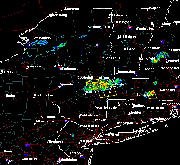 At 605 pm edt, a severe thunderstorm was located over selkirk, or near delmar, moving south at 25 mph (radar indicated). Hazards include 60 mph wind gusts. Expect damage to roofs, siding, and trees. Locations impacted include, albany, east greenbush, rensselaer, delmar, feura bush, new scotland, clarksville, slingerlands, normansville, south albany, selkirk yards, spawn hollow, beckers corners, east greenbush station, reidsville, meyers corners, houcks corners, new salem, hampton manor and mallorys corners. At 605 pm edt, a severe thunderstorm was located over selkirk, or near delmar, moving south at 25 mph (radar indicated). Hazards include 60 mph wind gusts. Expect damage to roofs, siding, and trees. Locations impacted include, albany, east greenbush, rensselaer, delmar, feura bush, new scotland, clarksville, slingerlands, normansville, south albany, selkirk yards, spawn hollow, beckers corners, east greenbush station, reidsville, meyers corners, houcks corners, new salem, hampton manor and mallorys corners.
|
| 7/2/2020 5:57 PM EDT |
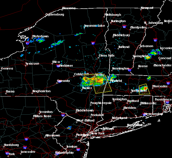 At 545 pm edt, a severe thunderstorm was located over guilderland, or near delmar, moving south at 25 mph (radar indicated). Hazards include 60 mph wind gusts. Expect damage to roofs, siding, and trees. Locations impacted include, albany, east greenbush, rensselaer, colonie, delmar, guilderland, voorheesville, altamont, loudonville, feura bush, new scotland, clarksville, shakers, bleecker stadium, spawn hollow, beckers corners, karlsfeld, houcks corners, mallorys corners and couse. At 545 pm edt, a severe thunderstorm was located over guilderland, or near delmar, moving south at 25 mph (radar indicated). Hazards include 60 mph wind gusts. Expect damage to roofs, siding, and trees. Locations impacted include, albany, east greenbush, rensselaer, colonie, delmar, guilderland, voorheesville, altamont, loudonville, feura bush, new scotland, clarksville, shakers, bleecker stadium, spawn hollow, beckers corners, karlsfeld, houcks corners, mallorys corners and couse.
|
| 7/2/2020 5:52 PM EDT |
 At 551 pm edt, a severe thunderstorm was located near averill park, or near nassau, moving southeast at 30 mph (radar indicated). Hazards include 60 mph wind gusts and penny size hail. Expect damage to roofs, siding, and trees. Locations impacted include, troy, cohoes, watervliet, rensselaer, latham, menands, green island, wyantskill, averill park, loudonville, west sand lake, center brunswick, wynantskill, north greenbush, brunswick, sand lake, poestenkill, south troy, east poestenkill and albia. At 551 pm edt, a severe thunderstorm was located near averill park, or near nassau, moving southeast at 30 mph (radar indicated). Hazards include 60 mph wind gusts and penny size hail. Expect damage to roofs, siding, and trees. Locations impacted include, troy, cohoes, watervliet, rensselaer, latham, menands, green island, wyantskill, averill park, loudonville, west sand lake, center brunswick, wynantskill, north greenbush, brunswick, sand lake, poestenkill, south troy, east poestenkill and albia.
|
| 7/2/2020 5:45 PM EDT |
 At 545 pm edt, a severe thunderstorm was located over guilderland, or near delmar, moving south at 25 mph (radar indicated). Hazards include 60 mph wind gusts. Expect damage to roofs, siding, and trees. Locations impacted include, albany, east greenbush, rensselaer, colonie, delmar, guilderland, voorheesville, altamont, loudonville, feura bush, new scotland, clarksville, shakers, bleecker stadium, spawn hollow, beckers corners, karlsfeld, houcks corners, mallorys corners and couse. At 545 pm edt, a severe thunderstorm was located over guilderland, or near delmar, moving south at 25 mph (radar indicated). Hazards include 60 mph wind gusts. Expect damage to roofs, siding, and trees. Locations impacted include, albany, east greenbush, rensselaer, colonie, delmar, guilderland, voorheesville, altamont, loudonville, feura bush, new scotland, clarksville, shakers, bleecker stadium, spawn hollow, beckers corners, karlsfeld, houcks corners, mallorys corners and couse.
|
| 7/2/2020 5:44 PM EDT |
 At 544 pm edt, a severe thunderstorm was located over averill park, or 8 miles east of east greenbush, moving southeast at 30 mph (radar indicated). Hazards include 60 mph wind gusts and penny size hail. Expect damage to roofs, siding, and trees. Locations impacted include, troy, cohoes, watervliet, rensselaer, latham, menands, green island, grafton, waterford, west sand lake, center brunswick, wyantskill, averill park, wynantskill, halfmoon, north greenbush, brunswick, sand lake, pittstown and poestenkill. At 544 pm edt, a severe thunderstorm was located over averill park, or 8 miles east of east greenbush, moving southeast at 30 mph (radar indicated). Hazards include 60 mph wind gusts and penny size hail. Expect damage to roofs, siding, and trees. Locations impacted include, troy, cohoes, watervliet, rensselaer, latham, menands, green island, grafton, waterford, west sand lake, center brunswick, wyantskill, averill park, wynantskill, halfmoon, north greenbush, brunswick, sand lake, pittstown and poestenkill.
|
| 7/2/2020 5:31 PM EDT |
 At 531 pm edt, a severe thunderstorm was located near colonie, moving south at 25 mph (radar indicated). Hazards include 60 mph wind gusts. expect damage to roofs, siding, and trees At 531 pm edt, a severe thunderstorm was located near colonie, moving south at 25 mph (radar indicated). Hazards include 60 mph wind gusts. expect damage to roofs, siding, and trees
|
| 7/2/2020 5:09 PM EDT |
 At 509 pm edt, a severe thunderstorm was located over mechanicville, moving southeast at 30 mph (radar indicated). Hazards include 60 mph wind gusts and penny size hail. expect damage to roofs, siding, and trees At 509 pm edt, a severe thunderstorm was located over mechanicville, moving southeast at 30 mph (radar indicated). Hazards include 60 mph wind gusts and penny size hail. expect damage to roofs, siding, and trees
|
| 6/5/2020 4:11 PM EDT |
 The severe thunderstorm warning for northeastern albany and southwestern rensselaer counties will expire at 415 pm edt, the storm which prompted the warning has weakened below severe limits, and no longer poses an immediate threat to life or property. therefore, the warning will be allowed to expire. however small hail and gusty winds are still possible with this thunderstorm. The severe thunderstorm warning for northeastern albany and southwestern rensselaer counties will expire at 415 pm edt, the storm which prompted the warning has weakened below severe limits, and no longer poses an immediate threat to life or property. therefore, the warning will be allowed to expire. however small hail and gusty winds are still possible with this thunderstorm.
|
| 6/5/2020 3:58 PM EDT | Wires down. part of tree leaning on hom in albany county NY, 3.5 miles NE of Albany, NY |
| 6/5/2020 3:43 PM EDT |
 At 342 pm edt, a severe thunderstorm was located over guilderland, or near delmar, moving east at 20 mph (radar indicated). Hazards include 60 mph wind gusts and quarter size hail. Hail damage to vehicles is expected. expect wind damage to roofs, siding, and trees. this severe storm will be near, albany around 350 pm edt. delmar and loudonville around 355 pm edt. watervliet, rensselaer and menands around 405 pm edt. castleton-on-hudson around 410 pm edt. east greenbush and wyantskill around 415 pm edt. west sand lake around 425 pm edt. Other locations impacted by this severe thunderstorm include south troy, east schodack, shakers, bleecker stadium, brookview, slingerlands, meadowdale, normansville, albia and west albany. At 342 pm edt, a severe thunderstorm was located over guilderland, or near delmar, moving east at 20 mph (radar indicated). Hazards include 60 mph wind gusts and quarter size hail. Hail damage to vehicles is expected. expect wind damage to roofs, siding, and trees. this severe storm will be near, albany around 350 pm edt. delmar and loudonville around 355 pm edt. watervliet, rensselaer and menands around 405 pm edt. castleton-on-hudson around 410 pm edt. east greenbush and wyantskill around 415 pm edt. west sand lake around 425 pm edt. Other locations impacted by this severe thunderstorm include south troy, east schodack, shakers, bleecker stadium, brookview, slingerlands, meadowdale, normansville, albia and west albany.
|
| 6/5/2020 3:18 PM EDT |
 At 318 pm edt, a severe thunderstorm was located over altamont, or near rotterdam, moving east at 20 mph (radar indicated). Hazards include 60 mph wind gusts and quarter size hail. Hail damage to vehicles is expected. Expect wind damage to roofs, siding, and trees. At 318 pm edt, a severe thunderstorm was located over altamont, or near rotterdam, moving east at 20 mph (radar indicated). Hazards include 60 mph wind gusts and quarter size hail. Hail damage to vehicles is expected. Expect wind damage to roofs, siding, and trees.
|
| 5/29/2020 3:35 PM EDT |
 At 335 pm edt, a severe thunderstorm was located over rensselaer, moving northeast at 30 mph (radar indicated). Hazards include 60 mph wind gusts. expect damage to roofs, siding, and trees At 335 pm edt, a severe thunderstorm was located over rensselaer, moving northeast at 30 mph (radar indicated). Hazards include 60 mph wind gusts. expect damage to roofs, siding, and trees
|
| 5/15/2020 6:48 PM EDT | Route 32 at elsmere ave closed due to downed poles and trees in albany county NY, 3.2 miles N of Albany, NY |
| 5/15/2020 6:38 PM EDT | Tree down in albany county NY, 0.3 miles S of Albany, NY |
| 5/15/2020 6:36 PM EDT | Tree down blocking elsemere avenue at fernbank avenue in albany county NY, 3.2 miles N of Albany, NY |
| 5/15/2020 6:30 PM EDT | Wind ripped siding off a garage on osborne road in albany county NY, 3.4 miles SSW of Albany, NY |
| 5/15/2020 6:22 PM EDT |
 At 622 pm edt, severe thunderstorms were located along a line extending from near mechanicville to near westerlo, moving east at 60 mph (radar indicated). Hazards include 60 mph wind gusts and penny size hail. expect damage to roofs, siding, and trees At 622 pm edt, severe thunderstorms were located along a line extending from near mechanicville to near westerlo, moving east at 60 mph (radar indicated). Hazards include 60 mph wind gusts and penny size hail. expect damage to roofs, siding, and trees
|
| 11/1/2019 12:24 AM EDT |
 At 1223 am edt, a severe thunderstorm was located near savoy, or 10 miles south of north adams, moving east at 65 mph (radar indicated). Hazards include 60 mph wind gusts. Expect damage to roofs, siding, and trees. Locations impacted include, albany, troy, east greenbush, watervliet, rensselaer, hudson, catskill, chatham, nassau, claverack, menands, livingston, copake, new baltimore, ravena, stephentown, coxsackie, green island, new lebanon and grafton. At 1223 am edt, a severe thunderstorm was located near savoy, or 10 miles south of north adams, moving east at 65 mph (radar indicated). Hazards include 60 mph wind gusts. Expect damage to roofs, siding, and trees. Locations impacted include, albany, troy, east greenbush, watervliet, rensselaer, hudson, catskill, chatham, nassau, claverack, menands, livingston, copake, new baltimore, ravena, stephentown, coxsackie, green island, new lebanon and grafton.
|
| 10/31/2019 11:54 PM EDT |
 At 1153 pm edt, a severe thunderstorm was located over kinderhook, or near chatham, moving east at 60 mph (radar indicated). Hazards include 60 mph wind gusts. expect damage to roofs, siding, and trees At 1153 pm edt, a severe thunderstorm was located over kinderhook, or near chatham, moving east at 60 mph (radar indicated). Hazards include 60 mph wind gusts. expect damage to roofs, siding, and trees
|
| 9/4/2019 2:01 PM EDT |
 At 201 pm edt, a severe thunderstorm was located near colonie, moving east at 40 mph (radar indicated). Hazards include 60 mph wind gusts and nickel size hail. expect damage to roofs, siding, and trees At 201 pm edt, a severe thunderstorm was located near colonie, moving east at 40 mph (radar indicated). Hazards include 60 mph wind gusts and nickel size hail. expect damage to roofs, siding, and trees
|
| 9/4/2019 12:14 PM EDT |
 At 1214 pm edt, a severe thunderstorm was located over center brunswick, or over troy, moving east at 50 mph (radar indicated). Hazards include 60 mph wind gusts and quarter size hail. Hail damage to vehicles is expected. Expect wind damage to roofs, siding, and trees. At 1214 pm edt, a severe thunderstorm was located over center brunswick, or over troy, moving east at 50 mph (radar indicated). Hazards include 60 mph wind gusts and quarter size hail. Hail damage to vehicles is expected. Expect wind damage to roofs, siding, and trees.
|
| 8/21/2019 5:05 PM EDT |
 The national weather service in albany has issued a * severe thunderstorm warning for. northeastern columbia county in east central new york. southern albany county in east central new york. northeastern greene county in east central new york. Southwestern rensselaer county in east central new york. The national weather service in albany has issued a * severe thunderstorm warning for. northeastern columbia county in east central new york. southern albany county in east central new york. northeastern greene county in east central new york. Southwestern rensselaer county in east central new york.
|
| 8/21/2019 4:32 PM EDT |
 At 432 pm edt, a severe thunderstorm was located over latham, moving east at 20 mph (radar indicated). Hazards include 60 mph wind gusts and quarter size hail. Hail damage to vehicles is expected. Expect wind damage to roofs, siding, and trees. At 432 pm edt, a severe thunderstorm was located over latham, moving east at 20 mph (radar indicated). Hazards include 60 mph wind gusts and quarter size hail. Hail damage to vehicles is expected. Expect wind damage to roofs, siding, and trees.
|
| 8/18/2019 7:52 PM EDT |
 The national weather service in albany has issued a * severe thunderstorm warning for. northeastern columbia county in east central new york. east central albany county in east central new york. rensselaer county in east central new york. Until 845 pm edt. The national weather service in albany has issued a * severe thunderstorm warning for. northeastern columbia county in east central new york. east central albany county in east central new york. rensselaer county in east central new york. Until 845 pm edt.
|
| 8/18/2019 7:19 PM EDT |
 At 718 pm edt, severe thunderstorms were located along a line extending from near westerlo to near north-south lake campground to hurley, moving northeast at 25 mph (radar indicated). Hazards include 60 mph wind gusts. expect damage to roofs, siding, and trees At 718 pm edt, severe thunderstorms were located along a line extending from near westerlo to near north-south lake campground to hurley, moving northeast at 25 mph (radar indicated). Hazards include 60 mph wind gusts. expect damage to roofs, siding, and trees
|
| 8/18/2019 7:05 PM EDT |
 The national weather service in albany has issued a * severe thunderstorm warning for. southeastern schenectady county in east central new york. albany county in east central new york. northern greene county in east central new york. Southeastern saratoga county in east central new york. The national weather service in albany has issued a * severe thunderstorm warning for. southeastern schenectady county in east central new york. albany county in east central new york. northern greene county in east central new york. Southeastern saratoga county in east central new york.
|
| 8/17/2019 5:34 PM EDT |
 At 534 pm edt, severe thunderstorms were located along a line extending from 6 miles south of fort edward to colonie, moving east at 40 mph (law enforcement has reported multiple areas of trees and wires down). Hazards include 60 mph wind gusts and quarter size hail. Hail damage to vehicles is expected. Expect wind damage to roofs, siding, and trees. At 534 pm edt, severe thunderstorms were located along a line extending from 6 miles south of fort edward to colonie, moving east at 40 mph (law enforcement has reported multiple areas of trees and wires down). Hazards include 60 mph wind gusts and quarter size hail. Hail damage to vehicles is expected. Expect wind damage to roofs, siding, and trees.
|
| 8/17/2019 5:05 PM EDT |
 At 505 pm edt, a severe thunderstorm was located near schoharie, or 12 miles east of cobleskill, moving east at 50 mph (radar indicated). Hazards include 60 mph wind gusts. expect damage to roofs, siding, and trees At 505 pm edt, a severe thunderstorm was located near schoharie, or 12 miles east of cobleskill, moving east at 50 mph (radar indicated). Hazards include 60 mph wind gusts. expect damage to roofs, siding, and trees
|
| 8/17/2019 4:47 PM EDT |
 At 446 pm edt, a severe thunderstorm was located 7 miles northwest of delanson, or 9 miles southwest of amsterdam, moving east at 45 mph (radar indicated). Hazards include 60 mph wind gusts. Expect damage to roofs, siding, and trees. this severe thunderstorm will be near, delanson around 455 pm edt. duanesburg, rotterdam junction and pattersonville-rotterdam junction around 500 pm edt. rotterdam, scotia and altamont around 505 pm edt. schenectady, niskayuna, east glenville and alplaus around 510 pm edt. clifton park, colonie and guilderland around 515 pm edt. Albany around 520 pm edt. At 446 pm edt, a severe thunderstorm was located 7 miles northwest of delanson, or 9 miles southwest of amsterdam, moving east at 45 mph (radar indicated). Hazards include 60 mph wind gusts. Expect damage to roofs, siding, and trees. this severe thunderstorm will be near, delanson around 455 pm edt. duanesburg, rotterdam junction and pattersonville-rotterdam junction around 500 pm edt. rotterdam, scotia and altamont around 505 pm edt. schenectady, niskayuna, east glenville and alplaus around 510 pm edt. clifton park, colonie and guilderland around 515 pm edt. Albany around 520 pm edt.
|
| 8/16/2019 6:12 PM EDT | Large tree uprooted in albany county NY, 5.5 miles WSW of Albany, NY |
| 8/16/2019 6:12 PM EDT | Many trees snapped in half and sheared off at the top... some trees uprooted... some powerlines down... some street signs bent in half and pulled out of groun in albany county NY, 5.2 miles WSW of Albany, NY |
| 8/16/2019 6:08 PM EDT | Tree down blocking n. pearl st and lindbergh av in albany county NY, 4.7 miles WSW of Albany, NY |
| 8/16/2019 6:05 PM EDT | Transformer blew... knocking power lines down. power lines caught fire on ground and burned wten studio sig in albany county NY, 3.2 miles WSW of Albany, NY |
| 8/16/2019 6:02 PM EDT | Large tree uprooted and crushed car in albany county NY, 2.1 miles W of Albany, NY |
| 8/16/2019 6:01 PM EDT | Large branches downed on myrtle avenue in albany county NY, 1.1 miles WSW of Albany, NY |
| 8/16/2019 6:01 PM EDT |
 At 601 pm edt, a severe thunderstorm was located over albany, moving east at 20 mph (radar indicated). Hazards include 60 mph wind gusts and penny size hail. expect damage to roofs, siding, and trees At 601 pm edt, a severe thunderstorm was located over albany, moving east at 20 mph (radar indicated). Hazards include 60 mph wind gusts and penny size hail. expect damage to roofs, siding, and trees
|
| 8/16/2019 6:00 PM EDT | Multiple trees and wires down. some trees on cars and home in albany county NY, 1.1 miles WSW of Albany, NY |
| 8/16/2019 5:56 PM EDT | Large limbs down on wires on new scotland avenue in albany county NY, 0.3 miles S of Albany, NY |
| 8/16/2019 5:56 PM EDT | Trees snapped... damage to multiple houses and cars in albany county NY, 1.1 miles WSW of Albany, NY |
| 8/16/2019 5:54 PM EDT | Downed tree and numerous limbs and branches also downed on hartman road in albany in albany county NY, 1.1 miles ENE of Albany, NY |
| 8/16/2019 5:41 PM EDT |
 The national weather service in albany has issued a * severe thunderstorm warning for. east central albany county in east central new york. southwestern rensselaer county in east central new york. until 645 pm edt. At 541 pm edt, a severe thunderstorm was located over. The national weather service in albany has issued a * severe thunderstorm warning for. east central albany county in east central new york. southwestern rensselaer county in east central new york. until 645 pm edt. At 541 pm edt, a severe thunderstorm was located over.
|
| 8/8/2019 5:36 PM EDT |
 At 536 pm edt, severe thunderstorms were located along a line extending from near ballston spa to near mechanicville to troy, moving east at 50 mph (radar indicated). Hazards include 60 mph wind gusts and quarter size hail. Hail damage to vehicles is expected. Expect wind damage to roofs, siding, and trees. At 536 pm edt, severe thunderstorms were located along a line extending from near ballston spa to near mechanicville to troy, moving east at 50 mph (radar indicated). Hazards include 60 mph wind gusts and quarter size hail. Hail damage to vehicles is expected. Expect wind damage to roofs, siding, and trees.
|
| 8/8/2019 5:33 PM EDT |
 At 533 pm edt, severe thunderstorms were located along a line extending from near wynantskill to nassau to clermont, moving east at 50 mph (trained weather spotters). Hazards include 60 mph wind gusts. expect damage to roofs, siding, and trees At 533 pm edt, severe thunderstorms were located along a line extending from near wynantskill to nassau to clermont, moving east at 50 mph (trained weather spotters). Hazards include 60 mph wind gusts. expect damage to roofs, siding, and trees
|
| 8/7/2019 2:15 PM EDT |
 At 214 pm edt, a severe thunderstorm was located over troy, moving northeast at 25 mph (radar indicated). Hazards include 60 mph wind gusts and quarter size hail. Hail damage to vehicles is expected. Expect wind damage to roofs, siding, and trees. At 214 pm edt, a severe thunderstorm was located over troy, moving northeast at 25 mph (radar indicated). Hazards include 60 mph wind gusts and quarter size hail. Hail damage to vehicles is expected. Expect wind damage to roofs, siding, and trees.
|
| 8/7/2019 2:00 PM EDT | Tree down blocking the shoulder and right lane of interstate 787 in albany county NY, 4.9 miles WSW of Albany, NY |
| 8/7/2019 2:00 PM EDT |
 At 200 pm edt, a severe thunderstorm was located over menands, or over watervliet, moving northeast at 15 mph (radar indicated). Hazards include 60 mph wind gusts and quarter size hail. Hail damage to vehicles is expected. expect wind damage to roofs, siding, and trees. Locations impacted include, albany, troy, cohoes, watervliet, rensselaer, colonie, latham, menands, green island, waterford, wyantskill, loudonville, center brunswick, wynantskill, north greenbush, brunswick, poestenkill, south troy, lansingburgh and shakers. At 200 pm edt, a severe thunderstorm was located over menands, or over watervliet, moving northeast at 15 mph (radar indicated). Hazards include 60 mph wind gusts and quarter size hail. Hail damage to vehicles is expected. expect wind damage to roofs, siding, and trees. Locations impacted include, albany, troy, cohoes, watervliet, rensselaer, colonie, latham, menands, green island, waterford, wyantskill, loudonville, center brunswick, wynantskill, north greenbush, brunswick, poestenkill, south troy, lansingburgh and shakers.
|
| 8/7/2019 1:56 PM EDT | Tree down on water street near columbia street in downtown albany in albany county NY, 3.1 miles W of Albany, NY |
| 8/7/2019 1:45 PM EDT |
 At 144 pm edt, a severe thunderstorm was located over albany, moving northeast at 20 mph (radar indicated). Hazards include 60 mph wind gusts and quarter size hail. Hail damage to vehicles is expected. Expect wind damage to roofs, siding, and trees. At 144 pm edt, a severe thunderstorm was located over albany, moving northeast at 20 mph (radar indicated). Hazards include 60 mph wind gusts and quarter size hail. Hail damage to vehicles is expected. Expect wind damage to roofs, siding, and trees.
|
| 8/3/2019 1:37 PM EDT |
 At 137 pm edt, a severe thunderstorm was located over west sand lake, or near east greenbush, moving east at 15 mph (radar indicated). Hazards include 60 mph wind gusts and nickel size hail. Expect damage to roofs, siding, and trees. Locations impacted include, albany, east greenbush, rensselaer, nassau, delmar, averill park, west sand lake, new scotland, sand lake, totem lodge, east schodack, slingerlands, jacks corners, millers corners, glass lake, east greenbush station, denault corners, meyers corners, houcks corners and shivers corners. At 137 pm edt, a severe thunderstorm was located over west sand lake, or near east greenbush, moving east at 15 mph (radar indicated). Hazards include 60 mph wind gusts and nickel size hail. Expect damage to roofs, siding, and trees. Locations impacted include, albany, east greenbush, rensselaer, nassau, delmar, averill park, west sand lake, new scotland, sand lake, totem lodge, east schodack, slingerlands, jacks corners, millers corners, glass lake, east greenbush station, denault corners, meyers corners, houcks corners and shivers corners.
|
| 8/3/2019 1:07 PM EDT | Wires dow in albany county NY, 2.3 miles ENE of Albany, NY |
| 8/3/2019 12:57 PM EDT |
 At 1256 pm edt, a severe thunderstorm was located over delmar, moving east at 15 mph (radar indicated). Hazards include 60 mph wind gusts and nickel size hail. expect damage to roofs, siding, and trees At 1256 pm edt, a severe thunderstorm was located over delmar, moving east at 15 mph (radar indicated). Hazards include 60 mph wind gusts and nickel size hail. expect damage to roofs, siding, and trees
|
| 7/30/2019 6:57 PM EDT |
 At 656 pm edt, a severe thunderstorm was located over rotterdam, moving northeast at 35 mph (radar indicated). Hazards include 60 mph wind gusts. expect damage to roofs, siding, and trees At 656 pm edt, a severe thunderstorm was located over rotterdam, moving northeast at 35 mph (radar indicated). Hazards include 60 mph wind gusts. expect damage to roofs, siding, and trees
|
| 7/29/2019 8:47 PM EDT |
 At 847 pm edt, severe thunderstorms were located along a line extending from near glenville to colonie, moving northeast at 15 mph (radar indicated). Hazards include 60 mph wind gusts and nickel size hail. Expect damage to roofs, siding, and trees. Locations impacted include, schenectady, clifton park, rotterdam, colonie, scotia, niskayuna, round lake, country knolls, rotterdam junction, alplaus, east glenville, burnt hills, pattersonville-rotterdam junction, charlton, shakers, glenridge, hoffmans, harding crossing, garrison manor and aqueduct. At 847 pm edt, severe thunderstorms were located along a line extending from near glenville to colonie, moving northeast at 15 mph (radar indicated). Hazards include 60 mph wind gusts and nickel size hail. Expect damage to roofs, siding, and trees. Locations impacted include, schenectady, clifton park, rotterdam, colonie, scotia, niskayuna, round lake, country knolls, rotterdam junction, alplaus, east glenville, burnt hills, pattersonville-rotterdam junction, charlton, shakers, glenridge, hoffmans, harding crossing, garrison manor and aqueduct.
|
| 7/29/2019 8:37 PM EDT |
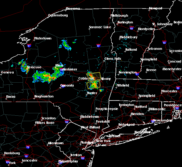 The severe thunderstorm warning for albany county will expire at 845 pm edt, the storm which prompted the warning has weakened below severe limits, and no longer poses an immediate threat to life or property. therefore, the warning will be allowed to expire. however gusty winds and heavy rain are still possible with this thunderstorm. remember, a severe thunderstorm warning still remains in effect for northeastern albany county until 930 pm. The severe thunderstorm warning for albany county will expire at 845 pm edt, the storm which prompted the warning has weakened below severe limits, and no longer poses an immediate threat to life or property. therefore, the warning will be allowed to expire. however gusty winds and heavy rain are still possible with this thunderstorm. remember, a severe thunderstorm warning still remains in effect for northeastern albany county until 930 pm.
|
| 7/29/2019 8:28 PM EDT |
 At 828 pm edt, a severe thunderstorm was located near altamont, or near rotterdam, moving east at 10 mph (radar indicated). Hazards include 60 mph wind gusts and nickel size hail. expect damage to roofs, siding, and trees At 828 pm edt, a severe thunderstorm was located near altamont, or near rotterdam, moving east at 10 mph (radar indicated). Hazards include 60 mph wind gusts and nickel size hail. expect damage to roofs, siding, and trees
|
| 7/29/2019 8:13 PM EDT |
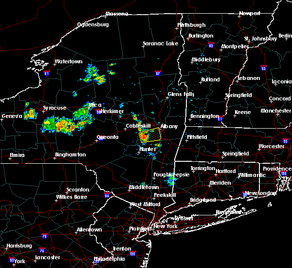 At 812 pm edt, a severe thunderstorm was located over feura bush, or near delmar, moving east at 25 mph (radar indicated). Hazards include 60 mph wind gusts. Expect damage to roofs, siding, and trees. Locations impacted include, albany, colonie, delmar, guilderland, westerlo, ravena, berne, voorheesville, feura bush, selkirk, new scotland, coeymans, rensselaerville, clarksville, coeymans hollow, east berne, shoefelt corners, spawn hollow, dormansville and beckers corners. At 812 pm edt, a severe thunderstorm was located over feura bush, or near delmar, moving east at 25 mph (radar indicated). Hazards include 60 mph wind gusts. Expect damage to roofs, siding, and trees. Locations impacted include, albany, colonie, delmar, guilderland, westerlo, ravena, berne, voorheesville, feura bush, selkirk, new scotland, coeymans, rensselaerville, clarksville, coeymans hollow, east berne, shoefelt corners, spawn hollow, dormansville and beckers corners.
|
| 7/29/2019 7:56 PM EDT |
 At 755 pm edt, a severe thunderstorm was located near westerlo, or 14 miles west of delmar, moving east at 20 mph (radar indicated). Hazards include 60 mph wind gusts and quarter size hail. Hail damage to vehicles is expected. Expect wind damage to roofs, siding, and trees. At 755 pm edt, a severe thunderstorm was located near westerlo, or 14 miles west of delmar, moving east at 20 mph (radar indicated). Hazards include 60 mph wind gusts and quarter size hail. Hail damage to vehicles is expected. Expect wind damage to roofs, siding, and trees.
|
| 7/20/2019 8:24 PM EDT |
 At 823 pm edt, a severe thunderstorm was located over duanesburg, or 9 miles west of rotterdam, moving southeast at 30 mph (radar indicated). Hazards include 60 mph wind gusts. expect damage to roofs, siding, and trees At 823 pm edt, a severe thunderstorm was located over duanesburg, or 9 miles west of rotterdam, moving southeast at 30 mph (radar indicated). Hazards include 60 mph wind gusts. expect damage to roofs, siding, and trees
|
| 7/6/2019 3:50 PM EDT |
 At 349 pm edt, a severe thunderstorm was located over colonie, moving east at 30 mph (radar indicated). Hazards include 60 mph wind gusts. expect damage to roofs, siding, and trees At 349 pm edt, a severe thunderstorm was located over colonie, moving east at 30 mph (radar indicated). Hazards include 60 mph wind gusts. expect damage to roofs, siding, and trees
|
| 5/23/2019 10:07 PM EDT |
 The severe thunderstorm warning for schenectady, northeastern albany, southeastern saratoga and southeastern montgomery counties will expire at 1015 pm edt, the severe thunderstorm which prompted the warning has moved out of the warned area. therefore, the warning will be allowed to expire. The severe thunderstorm warning for schenectady, northeastern albany, southeastern saratoga and southeastern montgomery counties will expire at 1015 pm edt, the severe thunderstorm which prompted the warning has moved out of the warned area. therefore, the warning will be allowed to expire.
|
| 5/23/2019 9:55 PM EDT | Multiple trees down with one large across monroe avenu in albany county NY, 1.4 miles SE of Albany, NY |
| 5/23/2019 9:37 PM EDT |
 At 936 pm edt, a severe thunderstorm was located over rotterdam junction, or near scotia, moving east at 40 mph (radar indicated). Hazards include 60 mph wind gusts. Expect damage to roofs, siding, and trees. Locations impacted include, albany, schenectady, clifton park, rotterdam, cohoes, watervliet, colonie, scotia, mechanicville, latham, niskayuna, duanesburg, menands, round lake, delanson, loudonville, rotterdam junction, east glenville, burnt hills and country knolls. At 936 pm edt, a severe thunderstorm was located over rotterdam junction, or near scotia, moving east at 40 mph (radar indicated). Hazards include 60 mph wind gusts. Expect damage to roofs, siding, and trees. Locations impacted include, albany, schenectady, clifton park, rotterdam, cohoes, watervliet, colonie, scotia, mechanicville, latham, niskayuna, duanesburg, menands, round lake, delanson, loudonville, rotterdam junction, east glenville, burnt hills and country knolls.
|
| 5/23/2019 9:12 PM EDT |
 At 911 pm edt, a severe thunderstorm was located over fonda, moving east at 40 mph (radar indicated). Hazards include 60 mph wind gusts. expect damage to roofs, siding, and trees At 911 pm edt, a severe thunderstorm was located over fonda, moving east at 40 mph (radar indicated). Hazards include 60 mph wind gusts. expect damage to roofs, siding, and trees
|
| 5/19/2019 6:20 PM EDT |
 At 619 pm edt, a severe thunderstorm was located over windham, or 8 miles northwest of hunter, moving northeast at 25 mph (radar indicated). Hazards include 60 mph wind gusts and quarter size hail. Hail damage to vehicles is expected. Expect wind damage to roofs, siding, and trees. At 619 pm edt, a severe thunderstorm was located over windham, or 8 miles northwest of hunter, moving northeast at 25 mph (radar indicated). Hazards include 60 mph wind gusts and quarter size hail. Hail damage to vehicles is expected. Expect wind damage to roofs, siding, and trees.
|
| 4/9/2019 2:17 PM EDT |
 At 216 pm edt, a severe thunderstorm was located over central bridge, or 9 miles northeast of cobleskill, moving east at 50 mph (radar indicated). Hazards include 60 mph wind gusts and nickel size hail. expect damage to roofs, siding, and trees At 216 pm edt, a severe thunderstorm was located over central bridge, or 9 miles northeast of cobleskill, moving east at 50 mph (radar indicated). Hazards include 60 mph wind gusts and nickel size hail. expect damage to roofs, siding, and trees
|
| 8/17/2018 6:52 PM EDT |
 At 650 pm edt, severe thunderstorms were located along a line extending from ballston spa to near country knolls to near guilderland to 6 miles southeast of westerlo to near windham, moving east at 40 mph (radar indicated). Hazards include 60 mph wind gusts and quarter size hail. Hail damage to vehicles is expected. expect wind damage to roofs, siding, and trees. these severe storms will be near, albany, clifton park, colonie, delmar, guilderland, milton, ballston spa, round lake, north ballston spa and country knolls around 655 pm edt. saratoga springs, rensselaer, mechanicville, latham, menands, new baltimore, ravena, loudonville and selkirk around 700 pm edt. cohoes, watervliet, green island, waterford, castleton-on-hudson and wyantskill around 705 pm edt. troy, center brunswick, west sand lake and averill park around 710 pm edt. East greenbush, nassau, coxsackie, grafton, cambridge and greenwich around 715 pm edt. At 650 pm edt, severe thunderstorms were located along a line extending from ballston spa to near country knolls to near guilderland to 6 miles southeast of westerlo to near windham, moving east at 40 mph (radar indicated). Hazards include 60 mph wind gusts and quarter size hail. Hail damage to vehicles is expected. expect wind damage to roofs, siding, and trees. these severe storms will be near, albany, clifton park, colonie, delmar, guilderland, milton, ballston spa, round lake, north ballston spa and country knolls around 655 pm edt. saratoga springs, rensselaer, mechanicville, latham, menands, new baltimore, ravena, loudonville and selkirk around 700 pm edt. cohoes, watervliet, green island, waterford, castleton-on-hudson and wyantskill around 705 pm edt. troy, center brunswick, west sand lake and averill park around 710 pm edt. East greenbush, nassau, coxsackie, grafton, cambridge and greenwich around 715 pm edt.
|
| 8/17/2018 6:22 PM EDT |
 At 621 pm edt, severe thunderstorms were located along a line extending from near amsterdam to near duanesburg to near berne to near preston-potter hollow to near fleischmanns, moving east at 40 mph (radar indicated). Hazards include 60 mph wind gusts and quarter size hail. Hail damage to vehicles is expected. expect wind damage to roofs, siding, and trees. severe thunderstorms will be near, amsterdam, duanesburg, berne, delanson and pattersonville-rotterdam junction around 625 pm edt. rotterdam, glenville and rotterdam junction around 630 pm edt. schenectady, scotia, niskayuna, altamont, alplaus and east glenville around 635 pm edt. westerlo, voorheesville, burnt hills and feura bush around 640 pm edt. clifton park, guilderland, ballston spa, north ballston spa and country knolls around 645 pm edt. albany, colonie, delmar, milton and round lake around 650 pm edt. saratoga springs, rensselaer, mechanicville, latham, new baltimore, ravena and loudonville around 655 pm edt. Cohoes, watervliet, menands, green island, selkirk and wyantskill around 700 pm edt. At 621 pm edt, severe thunderstorms were located along a line extending from near amsterdam to near duanesburg to near berne to near preston-potter hollow to near fleischmanns, moving east at 40 mph (radar indicated). Hazards include 60 mph wind gusts and quarter size hail. Hail damage to vehicles is expected. expect wind damage to roofs, siding, and trees. severe thunderstorms will be near, amsterdam, duanesburg, berne, delanson and pattersonville-rotterdam junction around 625 pm edt. rotterdam, glenville and rotterdam junction around 630 pm edt. schenectady, scotia, niskayuna, altamont, alplaus and east glenville around 635 pm edt. westerlo, voorheesville, burnt hills and feura bush around 640 pm edt. clifton park, guilderland, ballston spa, north ballston spa and country knolls around 645 pm edt. albany, colonie, delmar, milton and round lake around 650 pm edt. saratoga springs, rensselaer, mechanicville, latham, new baltimore, ravena and loudonville around 655 pm edt. Cohoes, watervliet, menands, green island, selkirk and wyantskill around 700 pm edt.
|
| 8/7/2018 3:12 PM EDT |
 At 312 pm edt, a severe thunderstorm was located near averill park, or 10 miles east of troy, moving east at 30 mph (radar indicated). Hazards include 60 mph wind gusts and quarter size hail. Hail damage to vehicles is expected. expect wind damage to roofs, siding, and trees. this severe storm will be near, grafton around 315 pm edt. berlin around 325 pm edt. Other locations impacted by this severe thunderstorm include south troy, lansingburgh, shakers, bleecker stadium, east poestenkill, quackenkill, albia, sycaway, west albany and eastmor. At 312 pm edt, a severe thunderstorm was located near averill park, or 10 miles east of troy, moving east at 30 mph (radar indicated). Hazards include 60 mph wind gusts and quarter size hail. Hail damage to vehicles is expected. expect wind damage to roofs, siding, and trees. this severe storm will be near, grafton around 315 pm edt. berlin around 325 pm edt. Other locations impacted by this severe thunderstorm include south troy, lansingburgh, shakers, bleecker stadium, east poestenkill, quackenkill, albia, sycaway, west albany and eastmor.
|
| 8/7/2018 3:01 PM EDT | Tree on a hous in albany county NY, 1.9 miles NW of Albany, NY |
| 8/7/2018 3:00 PM EDT |
 At 300 pm edt, a severe thunderstorm was located over east greenbush, moving east at 20 mph (radar indicated). Hazards include 60 mph wind gusts and quarter size hail. Hail damage to vehicles is expected. expect wind damage to roofs, siding, and trees. this severe thunderstorm will be near, nassau and west sand lake around 320 pm edt. averill park around 330 pm edt. stephentown around 350 pm edt. Other locations impacted by this severe thunderstorm include brookview, van hoesen station, west stephentown, jacks corners, spawn hollow, beckers corners, millers corners, south schodack, denault corners and houcks corners. At 300 pm edt, a severe thunderstorm was located over east greenbush, moving east at 20 mph (radar indicated). Hazards include 60 mph wind gusts and quarter size hail. Hail damage to vehicles is expected. expect wind damage to roofs, siding, and trees. this severe thunderstorm will be near, nassau and west sand lake around 320 pm edt. averill park around 330 pm edt. stephentown around 350 pm edt. Other locations impacted by this severe thunderstorm include brookview, van hoesen station, west stephentown, jacks corners, spawn hollow, beckers corners, millers corners, south schodack, denault corners and houcks corners.
|
| 8/7/2018 2:45 PM EDT |
 At 245 pm edt, a severe thunderstorm was located over colonie, moving east at 35 mph (radar indicated). Hazards include 60 mph wind gusts and quarter size hail. Hail damage to vehicles is expected. expect wind damage to roofs, siding, and trees. this severe thunderstorm will be near, latham around 250 pm edt. cohoes, watervliet, rensselaer, menands, green island and waterford around 255 pm edt. troy and wynantskill around 300 pm edt. center brunswick and west sand lake around 305 pm edt. averill park around 310 pm edt. grafton around 320 pm edt. berlin around 325 pm edt. Other locations impacted by this severe thunderstorm include south troy, lansingburgh, shakers, bleecker stadium, east poestenkill, quackenkill, albia, sycaway, west albany and eastmor. At 245 pm edt, a severe thunderstorm was located over colonie, moving east at 35 mph (radar indicated). Hazards include 60 mph wind gusts and quarter size hail. Hail damage to vehicles is expected. expect wind damage to roofs, siding, and trees. this severe thunderstorm will be near, latham around 250 pm edt. cohoes, watervliet, rensselaer, menands, green island and waterford around 255 pm edt. troy and wynantskill around 300 pm edt. center brunswick and west sand lake around 305 pm edt. averill park around 310 pm edt. grafton around 320 pm edt. berlin around 325 pm edt. Other locations impacted by this severe thunderstorm include south troy, lansingburgh, shakers, bleecker stadium, east poestenkill, quackenkill, albia, sycaway, west albany and eastmor.
|
| 8/4/2018 6:35 PM EDT |
 At 635 pm edt, severe thunderstorms were located along a line extending from guilderland to near berlin, moving southeast at 30 mph (radar indicated). Hazards include 60 mph wind gusts. Expect damage to roofs, siding, and trees. severe thunderstorms will be near, berlin around 640 pm edt. east greenbush, hancock and new ashford around 650 pm edt. castleton-on-hudson and selkirk around 655 pm edt. ravena and cheshire around 700 pm edt. nassau and new baltimore around 705 pm edt. pittsfield around 710 pm edt. coxsackie, valatie and kinderhook around 715 pm edt. chatham around 725 pm edt. Other locations impacted by these severe thunderstorms include bleecker stadium, brookview, van hoesen station, north hancock, cheshire harbor, beckers corners, otter hook, harlemville, south schodack and houcks corners. At 635 pm edt, severe thunderstorms were located along a line extending from guilderland to near berlin, moving southeast at 30 mph (radar indicated). Hazards include 60 mph wind gusts. Expect damage to roofs, siding, and trees. severe thunderstorms will be near, berlin around 640 pm edt. east greenbush, hancock and new ashford around 650 pm edt. castleton-on-hudson and selkirk around 655 pm edt. ravena and cheshire around 700 pm edt. nassau and new baltimore around 705 pm edt. pittsfield around 710 pm edt. coxsackie, valatie and kinderhook around 715 pm edt. chatham around 725 pm edt. Other locations impacted by these severe thunderstorms include bleecker stadium, brookview, van hoesen station, north hancock, cheshire harbor, beckers corners, otter hook, harlemville, south schodack and houcks corners.
|
| 8/3/2018 2:05 PM EDT |
 A severe thunderstorm warning remains in effect until 230 pm edt for northeastern columbia and southern rensselaer counties. at 205 pm edt, a severe thunderstorm was located near nassau, moving northeast at 35 mph. hazard. 60 mph wind gusts and quarter size hail. source. Radar indicated. A severe thunderstorm warning remains in effect until 230 pm edt for northeastern columbia and southern rensselaer counties. at 205 pm edt, a severe thunderstorm was located near nassau, moving northeast at 35 mph. hazard. 60 mph wind gusts and quarter size hail. source. Radar indicated.
|
| 8/3/2018 1:32 PM EDT |
 At 132 pm edt, a severe thunderstorm was located near westerlo, or 14 miles southwest of delmar, moving northeast at 25 mph (radar indicated). Hazards include 60 mph wind gusts and quarter size hail. Hail damage to vehicles is expected. expect wind damage to roofs, siding, and trees. this severe thunderstorm will be near, new baltimore and feura bush around 150 pm edt. ravena and selkirk around 155 pm edt. valatie around 200 pm edt. castleton-on-hudson around 205 pm edt. east greenbush and nassau around 215 pm edt. stephentown, averill park and west sand lake around 230 pm edt. Other locations impacted by this severe thunderstorm include brookview, van hoesen station, dormansville, beckers corners, millers corners, rayville, otter hook, riders mills, climax and south schodack. At 132 pm edt, a severe thunderstorm was located near westerlo, or 14 miles southwest of delmar, moving northeast at 25 mph (radar indicated). Hazards include 60 mph wind gusts and quarter size hail. Hail damage to vehicles is expected. expect wind damage to roofs, siding, and trees. this severe thunderstorm will be near, new baltimore and feura bush around 150 pm edt. ravena and selkirk around 155 pm edt. valatie around 200 pm edt. castleton-on-hudson around 205 pm edt. east greenbush and nassau around 215 pm edt. stephentown, averill park and west sand lake around 230 pm edt. Other locations impacted by this severe thunderstorm include brookview, van hoesen station, dormansville, beckers corners, millers corners, rayville, otter hook, riders mills, climax and south schodack.
|
| 8/3/2018 1:25 PM EDT |
 At 124 pm edt, a severe thunderstorm was located over averill park, or 7 miles southeast of troy, moving northeast at 25 mph (trained weather spotters. 1 inch hail and trees down were reported in glenmont). Hazards include 60 mph wind gusts and quarter size hail. Hail damage to vehicles is expected. expect wind damage to roofs, siding, and trees. this severe storm will be near, grafton and berlin around 145 pm edt. Other locations impacted by this severe thunderstorm include south troy, petersburg junction, albia, west stephentown, millers corners, taborton, barberville, center berlin, tamarack and petersburg. At 124 pm edt, a severe thunderstorm was located over averill park, or 7 miles southeast of troy, moving northeast at 25 mph (trained weather spotters. 1 inch hail and trees down were reported in glenmont). Hazards include 60 mph wind gusts and quarter size hail. Hail damage to vehicles is expected. expect wind damage to roofs, siding, and trees. this severe storm will be near, grafton and berlin around 145 pm edt. Other locations impacted by this severe thunderstorm include south troy, petersburg junction, albia, west stephentown, millers corners, taborton, barberville, center berlin, tamarack and petersburg.
|
| 8/3/2018 1:06 PM EDT | Quarter sized hail reported 4.4 miles NNW of Albany, NY, numerous trees and wires down. water over 6" deep in roadways. water covering half of tires on vehicles. |
| 8/3/2018 1:06 PM EDT | Numerous trees and wires down. water over 6" deep in roadways. water covering half of tires on vehicle in albany county NY, 4.4 miles NNW of Albany, NY |
| 8/3/2018 12:56 PM EDT |
 At 1256 pm edt, a severe thunderstorm was located over selkirk, or near delmar, moving northeast at 25 mph (radar indicated). Hazards include 60 mph wind gusts and quarter size hail. Hail damage to vehicles is expected. expect wind damage to roofs, siding, and trees. this severe thunderstorm will be near, castleton-on-hudson around 100 pm edt. albany around 105 pm edt. east greenbush, rensselaer and loudonville around 115 pm edt. watervliet and menands around 120 pm edt. west sand lake and wyantskill around 125 pm edt. averill park and center brunswick around 130 pm edt. grafton and berlin around 150 pm edt. Other locations impacted by this severe thunderstorm include south troy, bleecker stadium, brookview, petersburg junction, van hoesen station, albia, west stephentown, spawn hollow, beckers corners and karlsfeld. At 1256 pm edt, a severe thunderstorm was located over selkirk, or near delmar, moving northeast at 25 mph (radar indicated). Hazards include 60 mph wind gusts and quarter size hail. Hail damage to vehicles is expected. expect wind damage to roofs, siding, and trees. this severe thunderstorm will be near, castleton-on-hudson around 100 pm edt. albany around 105 pm edt. east greenbush, rensselaer and loudonville around 115 pm edt. watervliet and menands around 120 pm edt. west sand lake and wyantskill around 125 pm edt. averill park and center brunswick around 130 pm edt. grafton and berlin around 150 pm edt. Other locations impacted by this severe thunderstorm include south troy, bleecker stadium, brookview, petersburg junction, van hoesen station, albia, west stephentown, spawn hollow, beckers corners and karlsfeld.
|
| 7/27/2018 2:30 PM EDT | Numerous reports of tree limbs and power lines down throught the city of alban in albany county NY, 1.6 miles W of Albany, NY |
| 7/27/2018 2:28 PM EDT | Tree down blocking a lane of route 9 at aspinwall road in albany county NY, 3.9 miles SW of Albany, NY |
| 7/27/2018 2:26 PM EDT | Several tree limbs down at manning blvd/linden intersectio in albany county NY, 1.6 miles W of Albany, NY |
| 7/27/2018 2:25 PM EDT | Large tree limbs down at colonial and wester in albany county NY, 1.6 miles W of Albany, NY |
| 7/27/2018 2:15 PM EDT | Large tree limbs dow in albany county NY, 4.3 miles SSW of Albany, NY |
| 7/27/2018 2:03 PM EDT |
 At 203 pm edt, a severe thunderstorm was located over delmar, moving northeast at 30 mph (radar indicated). Hazards include 60 mph wind gusts and quarter size hail. Hail damage to vehicles is expected. expect wind damage to roofs, siding, and trees. this severe thunderstorm will be near, albany and colonie around 210 pm edt. east greenbush, rensselaer and loudonville around 215 pm edt. latham and menands around 220 pm edt. cohoes, watervliet, green island, wynantskill and west sand lake around 225 pm edt. troy, waterford and center brunswick around 230 pm edt. Other locations impacted by this severe thunderstorm include south troy, shakers, bleecker stadium, schaghticoke hill, albia, spawn hollow, beckers corners, karlsfeld, schaghticoke and barberville. At 203 pm edt, a severe thunderstorm was located over delmar, moving northeast at 30 mph (radar indicated). Hazards include 60 mph wind gusts and quarter size hail. Hail damage to vehicles is expected. expect wind damage to roofs, siding, and trees. this severe thunderstorm will be near, albany and colonie around 210 pm edt. east greenbush, rensselaer and loudonville around 215 pm edt. latham and menands around 220 pm edt. cohoes, watervliet, green island, wynantskill and west sand lake around 225 pm edt. troy, waterford and center brunswick around 230 pm edt. Other locations impacted by this severe thunderstorm include south troy, shakers, bleecker stadium, schaghticoke hill, albia, spawn hollow, beckers corners, karlsfeld, schaghticoke and barberville.
|
| 7/27/2018 1:41 PM EDT | Half Dollar sized hail reported 4.5 miles SSE of Albany, NY |
| 7/27/2018 1:41 PM EDT | Wires down in albany county NY, 2.2 miles SE of Albany, NY |
| 7/27/2018 1:35 PM EDT | Wires down in albany county NY, 6 miles WSW of Albany, NY |
| 7/27/2018 1:35 PM EDT | Half Dollar sized hail reported 4.5 miles SSE of Albany, NY |
| 7/27/2018 1:30 PM EDT | Ping Pong Ball sized hail reported 4.5 miles SSE of Albany, NY |
| 7/27/2018 1:30 PM EDT |
 At 129 pm edt, a severe thunderstorm was located near clifton park, moving northeast at 30 mph. anothr thunderstorm is near loudonville (radar indicated). Hazards include golf ball size hail and 60 mph wind gusts. People and animals outdoors will be injured. expect hail damage to roofs, siding, windows, and vehicles. expect wind damage to roofs, siding, and trees. this severe storm will be near, center brunswick around 135 pm edt. mechanicville around 140 pm edt. Other locations impacted by this severe thunderstorm include shakers, bleecker stadium, glenridge, albia, johnsonville, harding crossing, willow glen, wayville, woodruff heights and elnora. At 129 pm edt, a severe thunderstorm was located near clifton park, moving northeast at 30 mph. anothr thunderstorm is near loudonville (radar indicated). Hazards include golf ball size hail and 60 mph wind gusts. People and animals outdoors will be injured. expect hail damage to roofs, siding, windows, and vehicles. expect wind damage to roofs, siding, and trees. this severe storm will be near, center brunswick around 135 pm edt. mechanicville around 140 pm edt. Other locations impacted by this severe thunderstorm include shakers, bleecker stadium, glenridge, albia, johnsonville, harding crossing, willow glen, wayville, woodruff heights and elnora.
|
| 7/27/2018 1:00 PM EDT |
 At 1259 pm edt, a severe thunderstorm was located over altamont, or near rotterdam, moving northeast at 30 mph (radar indicated). Hazards include 60 mph wind gusts and quarter size hail. Hail damage to vehicles is expected. expect wind damage to roofs, siding, and trees. this severe thunderstorm will be near, rotterdam and guilderland around 110 pm edt. albany, schenectady, colonie, scotia and east glenville around 115 pm edt. niskayuna, alplaus and loudonville around 120 pm edt. clifton park, watervliet and latham around 125 pm edt. cohoes, green island and country knolls around 130 pm edt. troy, waterford and round lake around 135 pm edt. mechanicville around 140 pm edt. Other locations impacted by this severe thunderstorm include shakers, bleecker stadium, clarksville, glenridge, albia, johnsonville, harding crossing, willow glen, wayville and princetown. At 1259 pm edt, a severe thunderstorm was located over altamont, or near rotterdam, moving northeast at 30 mph (radar indicated). Hazards include 60 mph wind gusts and quarter size hail. Hail damage to vehicles is expected. expect wind damage to roofs, siding, and trees. this severe thunderstorm will be near, rotterdam and guilderland around 110 pm edt. albany, schenectady, colonie, scotia and east glenville around 115 pm edt. niskayuna, alplaus and loudonville around 120 pm edt. clifton park, watervliet and latham around 125 pm edt. cohoes, green island and country knolls around 130 pm edt. troy, waterford and round lake around 135 pm edt. mechanicville around 140 pm edt. Other locations impacted by this severe thunderstorm include shakers, bleecker stadium, clarksville, glenridge, albia, johnsonville, harding crossing, willow glen, wayville and princetown.
|
| 7/10/2018 4:49 PM EDT | Multiple trees down in albany county NY, 1.5 miles ENE of Albany, NY |
| 7/10/2018 4:49 PM EDT | Multiple trees down at intersection of new scotland rd and hartman rd in albany county NY, 1.1 miles ENE of Albany, NY |
| 7/10/2018 4:44 PM EDT | Tree down on zorn road in guilderland in albany county NY, 3 miles ESE of Albany, NY |
| 7/10/2018 4:37 PM EDT |
 At 436 pm edt, a severe thunderstorm was located over rotterdam, moving east at 30 mph (radar indicated). Hazards include 60 mph wind gusts and quarter size hail. Hail damage to vehicles is expected. expect wind damage to roofs, siding, and trees. this severe storm will be near, colonie and guilderland around 445 pm edt. albany and delmar around 450 pm edt. latham and loudonville around 455 pm edt. cohoes, watervliet, rensselaer, menands, green island and waterford around 500 pm edt. troy, east greenbush and wynantskill around 505 pm edt. Center brunswick and west sand lake around 510 pm edt. At 436 pm edt, a severe thunderstorm was located over rotterdam, moving east at 30 mph (radar indicated). Hazards include 60 mph wind gusts and quarter size hail. Hail damage to vehicles is expected. expect wind damage to roofs, siding, and trees. this severe storm will be near, colonie and guilderland around 445 pm edt. albany and delmar around 450 pm edt. latham and loudonville around 455 pm edt. cohoes, watervliet, rensselaer, menands, green island and waterford around 500 pm edt. troy, east greenbush and wynantskill around 505 pm edt. Center brunswick and west sand lake around 510 pm edt.
|
| 7/10/2018 4:09 PM EDT |
 At 409 pm edt, a severe thunderstorm was located near delanson, or 12 miles south of amsterdam, moving east at 35 mph (radar indicated). Hazards include 60 mph wind gusts and quarter size hail. Hail damage to vehicles is expected. expect wind damage to roofs, siding, and trees. this severe thunderstorm will be near, duanesburg around 420 pm edt. altamont around 430 pm edt. rotterdam, scotia and east glenville around 435 pm edt. schenectady, niskayuna and voorheesville around 440 pm edt. colonie and guilderland around 445 pm edt. albany and delmar around 450 pm edt. latham and loudonville around 455 pm edt. Troy, east greenbush, cohoes, watervliet, rensselaer, menands, green island and waterford around 500 pm edt. At 409 pm edt, a severe thunderstorm was located near delanson, or 12 miles south of amsterdam, moving east at 35 mph (radar indicated). Hazards include 60 mph wind gusts and quarter size hail. Hail damage to vehicles is expected. expect wind damage to roofs, siding, and trees. this severe thunderstorm will be near, duanesburg around 420 pm edt. altamont around 430 pm edt. rotterdam, scotia and east glenville around 435 pm edt. schenectady, niskayuna and voorheesville around 440 pm edt. colonie and guilderland around 445 pm edt. albany and delmar around 450 pm edt. latham and loudonville around 455 pm edt. Troy, east greenbush, cohoes, watervliet, rensselaer, menands, green island and waterford around 500 pm edt.
|
| 5/10/2018 5:03 PM EDT |
 At 503 pm edt, a severe thunderstorm was located over berne, or 15 miles east of cobleskill, moving east at 40 mph (radar indicated). Hazards include 60 mph wind gusts. Expect damage to roofs, siding, and trees. this severe thunderstorm will be near, westerlo and altamont around 515 pm edt. voorheesville around 520 pm edt. guilderland and feura bush around 525 pm edt. albany, delmar and ravena around 530 pm edt. selkirk around 535 pm edt. Other locations impacted by this severe thunderstorm include bleecker stadium, clarksville, east berne, shoefelt corners, west berne, spawn hollow, dormansville, beckers corners, karlsfeld and knox. At 503 pm edt, a severe thunderstorm was located over berne, or 15 miles east of cobleskill, moving east at 40 mph (radar indicated). Hazards include 60 mph wind gusts. Expect damage to roofs, siding, and trees. this severe thunderstorm will be near, westerlo and altamont around 515 pm edt. voorheesville around 520 pm edt. guilderland and feura bush around 525 pm edt. albany, delmar and ravena around 530 pm edt. selkirk around 535 pm edt. Other locations impacted by this severe thunderstorm include bleecker stadium, clarksville, east berne, shoefelt corners, west berne, spawn hollow, dormansville, beckers corners, karlsfeld and knox.
|
| 5/4/2018 8:37 PM EDT |
 At 835 pm edt, severe thunderstorms were located along a line extending from near guilderland to near feura bush to near windham, moving east at 45 mph (radar indicated). Hazards include 60 mph wind gusts. Expect damage to roofs, siding, and trees. these storms have a history of producing wind damage. trees and wires are reported down in clifton park, guilderland, rotterdam and schenectady. these severe storms will be near, albany, delmar and feura bush around 840 pm edt. east greenbush, rensselaer, menands, new baltimore, ravena, castleton-on-hudson and selkirk around 845 pm edt. kinderhook and wynantskill around 850 pm edt. nassau, valatie, west sand lake and averill park around 855 pm edt. chatham and coxsackie around 900 pm edt. stephentown around 905 pm edt. Other locations impacted by these severe thunderstorms include bleecker stadium, clarksville, east berne, brookview, shoefelt corners, van hoesen station, west berne, dormansville, beckers corners and millers corners. At 835 pm edt, severe thunderstorms were located along a line extending from near guilderland to near feura bush to near windham, moving east at 45 mph (radar indicated). Hazards include 60 mph wind gusts. Expect damage to roofs, siding, and trees. these storms have a history of producing wind damage. trees and wires are reported down in clifton park, guilderland, rotterdam and schenectady. these severe storms will be near, albany, delmar and feura bush around 840 pm edt. east greenbush, rensselaer, menands, new baltimore, ravena, castleton-on-hudson and selkirk around 845 pm edt. kinderhook and wynantskill around 850 pm edt. nassau, valatie, west sand lake and averill park around 855 pm edt. chatham and coxsackie around 900 pm edt. stephentown around 905 pm edt. Other locations impacted by these severe thunderstorms include bleecker stadium, clarksville, east berne, brookview, shoefelt corners, van hoesen station, west berne, dormansville, beckers corners and millers corners.
|
| 5/4/2018 8:27 PM EDT | Trees dow in albany county NY, 5.1 miles SE of Albany, NY |
| 5/4/2018 8:27 PM EDT | Trees dow in albany county NY, 5.1 miles SSE of Albany, NY |
| 5/4/2018 8:25 PM EDT |
 At 823 pm edt, a severe thunderstorm was located over waterford, or over cohoes, moving east at 60 mph (radar indicated). Hazards include 60 mph wind gusts. Expect damage to roofs, siding, and trees. this severe storm will be near, grafton around 835 pm edt. hoosick falls and berlin around 840 pm edt. reports from schenectady county indicate downed trees and power lines at many locations throughout the county. other locations impacted by this severe thunderstorm include shakers, bleecker stadium, glenridge, hoffmans, albia, johnsonville, harding crossing, willow glen, young corners and garrison manor. A tornado watch remains in effect until 1000 pm edt for east central new york. At 823 pm edt, a severe thunderstorm was located over waterford, or over cohoes, moving east at 60 mph (radar indicated). Hazards include 60 mph wind gusts. Expect damage to roofs, siding, and trees. this severe storm will be near, grafton around 835 pm edt. hoosick falls and berlin around 840 pm edt. reports from schenectady county indicate downed trees and power lines at many locations throughout the county. other locations impacted by this severe thunderstorm include shakers, bleecker stadium, glenridge, hoffmans, albia, johnsonville, harding crossing, willow glen, young corners and garrison manor. A tornado watch remains in effect until 1000 pm edt for east central new york.
|
| 5/4/2018 8:19 PM EDT |
 At 818 pm edt, severe thunderstorms were located along a line extending from near altamont to near berne to near gilboa, moving east at 50 mph (radar indicated). Hazards include 60 mph wind gusts. Expect damage to roofs, siding, and trees. severe thunderstorms will be near, westerlo and voorheesville around 830 pm edt. albany, delmar, feura bush, preston hollow and preston-potter hollow around 835 pm edt. rensselaer, ravena and selkirk around 840 pm edt. east greenbush, menands, new baltimore, castleton-on-hudson and wynantskill around 845 pm edt. valatie, kinderhook and west sand lake around 850 pm edt. nassau and averill park around 855 pm edt. chatham, stephentown and coxsackie around 900 pm edt. Other locations impacted by these severe thunderstorms include bleecker stadium, clarksville, east berne, brookview, shoefelt corners, van hoesen station, west berne, dormansville, beckers corners and millers corners. At 818 pm edt, severe thunderstorms were located along a line extending from near altamont to near berne to near gilboa, moving east at 50 mph (radar indicated). Hazards include 60 mph wind gusts. Expect damage to roofs, siding, and trees. severe thunderstorms will be near, westerlo and voorheesville around 830 pm edt. albany, delmar, feura bush, preston hollow and preston-potter hollow around 835 pm edt. rensselaer, ravena and selkirk around 840 pm edt. east greenbush, menands, new baltimore, castleton-on-hudson and wynantskill around 845 pm edt. valatie, kinderhook and west sand lake around 850 pm edt. nassau and averill park around 855 pm edt. chatham, stephentown and coxsackie around 900 pm edt. Other locations impacted by these severe thunderstorms include bleecker stadium, clarksville, east berne, brookview, shoefelt corners, van hoesen station, west berne, dormansville, beckers corners and millers corners.
|
| 5/4/2018 8:00 PM EDT |
 At 759 pm edt, a severe thunderstorm was located near duanesburg, or 8 miles south of amsterdam, moving east at 60 mph (radar indicated). Hazards include 60 mph wind gusts. Expect damage to roofs, siding, and trees. this severe thunderstorm will be near, altamont and rotterdam junction around 805 pm edt. rotterdam, scotia, east glenville and burnt hills around 810 pm edt. schenectady, clifton park, colonie, guilderland, niskayuna and alplaus around 815 pm edt. albany, cohoes, latham and loudonville around 820 pm edt. troy, watervliet, menands, green island, waterford and wynantskill around 825 pm edt. center brunswick around 830 pm edt. grafton around 835 pm edt. hoosick falls and berlin around 840 pm edt. other locations impacted by this severe thunderstorm include shakers, bleecker stadium, glenridge, hoffmans, albia, johnsonville, harding crossing, willow glen, young corners and garrison manor. A tornado watch remains in effect until 1000 pm edt for east central new york. At 759 pm edt, a severe thunderstorm was located near duanesburg, or 8 miles south of amsterdam, moving east at 60 mph (radar indicated). Hazards include 60 mph wind gusts. Expect damage to roofs, siding, and trees. this severe thunderstorm will be near, altamont and rotterdam junction around 805 pm edt. rotterdam, scotia, east glenville and burnt hills around 810 pm edt. schenectady, clifton park, colonie, guilderland, niskayuna and alplaus around 815 pm edt. albany, cohoes, latham and loudonville around 820 pm edt. troy, watervliet, menands, green island, waterford and wynantskill around 825 pm edt. center brunswick around 830 pm edt. grafton around 835 pm edt. hoosick falls and berlin around 840 pm edt. other locations impacted by this severe thunderstorm include shakers, bleecker stadium, glenridge, hoffmans, albia, johnsonville, harding crossing, willow glen, young corners and garrison manor. A tornado watch remains in effect until 1000 pm edt for east central new york.
|
| 10/24/2017 3:15 PM EDT |
 At 314 pm edt, severe thunderstorms were located along a line extending from 6 miles southeast of corinth to waterford, moving north at 70 mph (radar indicated). Hazards include 60 mph wind gusts. Expect damage to trees, and power lines. Locations impacted include, troy, clifton park, saratoga springs, cohoes, glens falls, watervliet, rensselaer, hudson falls, mechanicville, hoosick falls, nassau, milton, menands, fort edward, stephentown, green island, grafton, waterford, berlin and cambridge. At 314 pm edt, severe thunderstorms were located along a line extending from 6 miles southeast of corinth to waterford, moving north at 70 mph (radar indicated). Hazards include 60 mph wind gusts. Expect damage to trees, and power lines. Locations impacted include, troy, clifton park, saratoga springs, cohoes, glens falls, watervliet, rensselaer, hudson falls, mechanicville, hoosick falls, nassau, milton, menands, fort edward, stephentown, green island, grafton, waterford, berlin and cambridge.
|
| 10/24/2017 2:58 PM EDT | Tree down at back of ny state museu in albany county NY, 2.6 miles W of Albany, NY |
| 10/24/2017 2:54 PM EDT |
 At 254 pm edt, severe thunderstorms were located along a line extending from near cohoes to near coxsackie, moving north at 45 mph (radar indicated). Hazards include 60 mph wind gusts. Expect damage to trees, and power lines. severe thunderstorms will be near, clifton park around 300 pm edt. mechanicville, round lake and country knolls around 305 pm edt. ravena around 310 pm edt. castleton-on-hudson, selkirk and feura bush around 315 pm edt. east greenbush, delmar and greenwich around 325 pm edt. albany, rensselaer, colonie, menands, loudonville, wyantskill and west sand lake around 330 pm edt. watervliet, latham and green island around 335 pm edt. troy, cohoes, glens falls, fort edward, waterford and center brunswick around 340 pm edt. Other locations impacted by these severe thunderstorms include parkis mills, deans corners, shakers, bleecker stadium, brookview, glenridge, van hoesen station, grangerville, northumberland and beckers corners. At 254 pm edt, severe thunderstorms were located along a line extending from near cohoes to near coxsackie, moving north at 45 mph (radar indicated). Hazards include 60 mph wind gusts. Expect damage to trees, and power lines. severe thunderstorms will be near, clifton park around 300 pm edt. mechanicville, round lake and country knolls around 305 pm edt. ravena around 310 pm edt. castleton-on-hudson, selkirk and feura bush around 315 pm edt. east greenbush, delmar and greenwich around 325 pm edt. albany, rensselaer, colonie, menands, loudonville, wyantskill and west sand lake around 330 pm edt. watervliet, latham and green island around 335 pm edt. troy, cohoes, glens falls, fort edward, waterford and center brunswick around 340 pm edt. Other locations impacted by these severe thunderstorms include parkis mills, deans corners, shakers, bleecker stadium, brookview, glenridge, van hoesen station, grangerville, northumberland and beckers corners.
|
| 10/24/2017 2:16 PM EDT |
 At 216 pm edt, a severe thunderstorm was located 8 miles northwest of catskill, moving northeast at 45 mph (radar indicated). Hazards include 60 mph wind gusts. Expect damage to trees, and power lines. this severe thunderstorm will be near, coxsackie around 225 pm edt. new baltimore and ravena around 235 pm edt. selkirk and feura bush around 240 pm edt. castleton-on-hudson around 245 pm edt. east greenbush and delmar around 250 pm edt. albany, rensselaer and west sand lake around 255 pm edt. Other locations impacted by this severe thunderstorm include bleecker stadium, clarksville, brookview, van hoesen station, dormansville, beckers corners, millers corners, otter hook, kiskatom and climax. At 216 pm edt, a severe thunderstorm was located 8 miles northwest of catskill, moving northeast at 45 mph (radar indicated). Hazards include 60 mph wind gusts. Expect damage to trees, and power lines. this severe thunderstorm will be near, coxsackie around 225 pm edt. new baltimore and ravena around 235 pm edt. selkirk and feura bush around 240 pm edt. castleton-on-hudson around 245 pm edt. east greenbush and delmar around 250 pm edt. albany, rensselaer and west sand lake around 255 pm edt. Other locations impacted by this severe thunderstorm include bleecker stadium, clarksville, brookview, van hoesen station, dormansville, beckers corners, millers corners, otter hook, kiskatom and climax.
|
| 9/7/2017 7:22 PM EDT |
 The severe thunderstorm warning for north central berkshire, northeastern albany, southeastern saratoga, southern washington, rensselaer and southwestern bennington counties will expire at 730 pm edt, the storms which prompted the warning have weakened below severe limits, and no longer pose an immediate threat to life or property. therefore the warning will be allowed to expire. however gusty winds and heavy rain are still possible with these thunderstorms. The severe thunderstorm warning for north central berkshire, northeastern albany, southeastern saratoga, southern washington, rensselaer and southwestern bennington counties will expire at 730 pm edt, the storms which prompted the warning have weakened below severe limits, and no longer pose an immediate threat to life or property. therefore the warning will be allowed to expire. however gusty winds and heavy rain are still possible with these thunderstorms.
|
| 9/7/2017 6:56 PM EDT |
 At 655 pm edt, severe thunderstorms were located along a line extending from 6 miles south of greenwich to rensselaer, moving east at 25 mph (radar indicated). Hazards include 60 mph wind gusts and quarter size hail. Minor damage to vehicles is possible. expect wind damage to trees, and power lines. severe thunderstorms will be near, wyantskill around 705 pm edt. cambridge around 710 pm edt. west sand lake around 715 pm edt. averill park around 720 pm edt. hoosick falls around 725 pm edt. bennington, shaftsbury and stephentown around 730 pm edt. Other locations impacted by these severe thunderstorms include bleecker stadium, albia, north hancock, johnsonville, south shaftsbury, millers corners, hoosick, hidden valley, best and east pittstown. At 655 pm edt, severe thunderstorms were located along a line extending from 6 miles south of greenwich to rensselaer, moving east at 25 mph (radar indicated). Hazards include 60 mph wind gusts and quarter size hail. Minor damage to vehicles is possible. expect wind damage to trees, and power lines. severe thunderstorms will be near, wyantskill around 705 pm edt. cambridge around 710 pm edt. west sand lake around 715 pm edt. averill park around 720 pm edt. hoosick falls around 725 pm edt. bennington, shaftsbury and stephentown around 730 pm edt. Other locations impacted by these severe thunderstorms include bleecker stadium, albia, north hancock, johnsonville, south shaftsbury, millers corners, hoosick, hidden valley, best and east pittstown.
|
| 8/12/2017 6:48 PM EDT |
 At 648 pm edt, a severe thunderstorm was located near delmar, moving east at 30 mph (radar indicated). Hazards include 60 mph wind gusts and quarter size hail. Minor damage to vehicles is possible. expect wind damage to trees, and power lines. this severe thunderstorm will be near, east greenbush around 655 pm edt. wyantskill around 700 pm edt. nassau around 705 pm edt. averill park and west sand lake around 710 pm edt. stephentown around 725 pm edt. berlin around 730 pm edt. Other locations impacted by this severe thunderstorm include totem lodge, east schodack, brookview, garfield, east poestenkill, north stephentown, van hoesen station, west stephentown, jacks corners and hoag corners. At 648 pm edt, a severe thunderstorm was located near delmar, moving east at 30 mph (radar indicated). Hazards include 60 mph wind gusts and quarter size hail. Minor damage to vehicles is possible. expect wind damage to trees, and power lines. this severe thunderstorm will be near, east greenbush around 655 pm edt. wyantskill around 700 pm edt. nassau around 705 pm edt. averill park and west sand lake around 710 pm edt. stephentown around 725 pm edt. berlin around 730 pm edt. Other locations impacted by this severe thunderstorm include totem lodge, east schodack, brookview, garfield, east poestenkill, north stephentown, van hoesen station, west stephentown, jacks corners and hoag corners.
|
| 8/12/2017 6:45 PM EDT | Trees down in albany county NY, 2.7 miles NNE of Albany, NY |
| 8/12/2017 6:38 PM EDT |
 At 638 pm edt, a severe thunderstorm was located over delmar, moving east at 35 mph (radar indicated). Hazards include 60 mph wind gusts and quarter size hail. Minor damage to vehicles is possible. expect wind damage to trees, and power lines. Locations impacted include, albany, schenectady, troy, clifton park, rotterdam, cohoes, watervliet, rensselaer, colonie, scotia, mechanicville, delmar, latham, guilderland, niskayuna, duanesburg, menands, westerlo, ravena and berne. At 638 pm edt, a severe thunderstorm was located over delmar, moving east at 35 mph (radar indicated). Hazards include 60 mph wind gusts and quarter size hail. Minor damage to vehicles is possible. expect wind damage to trees, and power lines. Locations impacted include, albany, schenectady, troy, clifton park, rotterdam, cohoes, watervliet, rensselaer, colonie, scotia, mechanicville, delmar, latham, guilderland, niskayuna, duanesburg, menands, westerlo, ravena and berne.
|
| 8/12/2017 6:03 PM EDT |
 At 603 pm edt, a severe thunderstorm was located near berne, or 14 miles southwest of rotterdam, moving east at 40 mph (trained weather spotters). Hazards include 60 mph wind gusts and quarter size hail. Minor damage to vehicles is possible. expect wind damage to trees, and power lines. this severe thunderstorm will be near, altamont around 615 pm edt. voorheesville around 620 pm edt. albany, rotterdam and guilderland around 625 pm edt. schenectady, colonie, delmar and niskayuna around 630 pm edt. clifton park and loudonville around 635 pm edt. cohoes, watervliet, rensselaer, latham and menands around 640 pm edt. troy, green island and waterford around 645 pm edt. Other locations impacted by this severe thunderstorm include shakers, bleecker stadium, clarksville, east berne, shoefelt corners, glenridge, hoffmans, west berne, harding crossing and willow glen. At 603 pm edt, a severe thunderstorm was located near berne, or 14 miles southwest of rotterdam, moving east at 40 mph (trained weather spotters). Hazards include 60 mph wind gusts and quarter size hail. Minor damage to vehicles is possible. expect wind damage to trees, and power lines. this severe thunderstorm will be near, altamont around 615 pm edt. voorheesville around 620 pm edt. albany, rotterdam and guilderland around 625 pm edt. schenectady, colonie, delmar and niskayuna around 630 pm edt. clifton park and loudonville around 635 pm edt. cohoes, watervliet, rensselaer, latham and menands around 640 pm edt. troy, green island and waterford around 645 pm edt. Other locations impacted by this severe thunderstorm include shakers, bleecker stadium, clarksville, east berne, shoefelt corners, glenridge, hoffmans, west berne, harding crossing and willow glen.
|
| 7/8/2017 2:36 PM EDT |
 The national weather service in albany has issued a * severe thunderstorm warning for. southern schenectady county in east central new york. northwestern albany county in east central new york. northeastern schoharie county in east central new york. Until 315 pm edt. The national weather service in albany has issued a * severe thunderstorm warning for. southern schenectady county in east central new york. northwestern albany county in east central new york. northeastern schoharie county in east central new york. Until 315 pm edt.
|
| 7/8/2017 11:28 AM EDT |
 The severe thunderstorm warning for eastern schenectady, northern albany, southeastern saratoga, southern washington and rensselaer counties will expire at 1130 am edt, the storms which prompted the warning have weakened below severe limits, and no longer pose an immediate threat to life or property. therefore the warning will be allowed to expire. however heavy rain is still possible with these thunderstorms. to report severe weather, contact your nearest law enforcement agency. they will relay your report to the national weather service albany. The severe thunderstorm warning for eastern schenectady, northern albany, southeastern saratoga, southern washington and rensselaer counties will expire at 1130 am edt, the storms which prompted the warning have weakened below severe limits, and no longer pose an immediate threat to life or property. therefore the warning will be allowed to expire. however heavy rain is still possible with these thunderstorms. to report severe weather, contact your nearest law enforcement agency. they will relay your report to the national weather service albany.
|
| 7/8/2017 11:09 AM EDT | Tree limbs blocking roadway in albany county NY, 5.5 miles SE of Albany, NY |
| 7/8/2017 11:06 AM EDT |
 At 1105 am edt, severe thunderstorms were located along a line extending from near country knolls to near colonie to near voorheesville, moving east at 40 mph (radar indicated). Hazards include 60 mph wind gusts and quarter size hail. Minor damage to vehicles is possible. expect wind damage to trees, and power lines. these severe storms will be near, mechanicville, round lake and country knolls around 1110 am edt. troy, cohoes, green island and waterford around 1115 am edt. loudonville and center brunswick around 1120 am edt. east greenbush, watervliet, rensselaer, latham and menands around 1125 am edt. Hoosick falls, grafton, cambridge, wynantskill, west sand lake and averill park around 1130 am edt. At 1105 am edt, severe thunderstorms were located along a line extending from near country knolls to near colonie to near voorheesville, moving east at 40 mph (radar indicated). Hazards include 60 mph wind gusts and quarter size hail. Minor damage to vehicles is possible. expect wind damage to trees, and power lines. these severe storms will be near, mechanicville, round lake and country knolls around 1110 am edt. troy, cohoes, green island and waterford around 1115 am edt. loudonville and center brunswick around 1120 am edt. east greenbush, watervliet, rensselaer, latham and menands around 1125 am edt. Hoosick falls, grafton, cambridge, wynantskill, west sand lake and averill park around 1130 am edt.
|
| 7/8/2017 10:37 AM EDT |
 At 1036 am edt, severe thunderstorms were located along a line extending from near pattersonville-rotterdam junction to delanson to near schoharie, moving east at 40 mph (radar indicated). Hazards include 60 mph wind gusts and quarter size hail. Minor damage to vehicles is possible. expect wind damage to trees, and power lines. severe thunderstorms will be near, rotterdam junction and pattersonville-rotterdam junction around 1040 am edt. duanesburg around 1045 am edt. schenectady, scotia, niskayuna and berne around 1050 am edt. rotterdam, east glenville, alplaus and burnt hills around 1055 am edt. clifton park, altamont and country knolls around 1100 am edt. voorheesville and round lake around 1105 am edt. albany, cohoes, mechanicville, latham and guilderland around 1110 am edt. Troy, colonie, delmar, green island and waterford around 1115 am edt. At 1036 am edt, severe thunderstorms were located along a line extending from near pattersonville-rotterdam junction to delanson to near schoharie, moving east at 40 mph (radar indicated). Hazards include 60 mph wind gusts and quarter size hail. Minor damage to vehicles is possible. expect wind damage to trees, and power lines. severe thunderstorms will be near, rotterdam junction and pattersonville-rotterdam junction around 1040 am edt. duanesburg around 1045 am edt. schenectady, scotia, niskayuna and berne around 1050 am edt. rotterdam, east glenville, alplaus and burnt hills around 1055 am edt. clifton park, altamont and country knolls around 1100 am edt. voorheesville and round lake around 1105 am edt. albany, cohoes, mechanicville, latham and guilderland around 1110 am edt. Troy, colonie, delmar, green island and waterford around 1115 am edt.
|
| 6/25/2017 6:32 PM EDT | Downed tree and wire in albany county NY, 2.7 miles NNE of Albany, NY |
| 6/19/2017 1:22 PM EDT |
 At 122 pm edt, a severe thunderstorm was located over nassau, moving east at 25 mph (radar indicated). Hazards include 60 mph wind gusts and quarter size hail. Minor damage to vehicles is possible. expect wind damage to trees, and power lines. this severe thunderstorm will be near, nassau around 125 pm edt. stephentown and new lebanon around 150 pm edt. hancock around 205 pm edt. cheshire and new ashford around 215 pm edt. Other locations impacted by this severe thunderstorm include greylock, soldiers memorial field, west stephentown, jacks corners, north hancock, cheshire harbor, arnoldville, millers corners, rayville and riders mills. At 122 pm edt, a severe thunderstorm was located over nassau, moving east at 25 mph (radar indicated). Hazards include 60 mph wind gusts and quarter size hail. Minor damage to vehicles is possible. expect wind damage to trees, and power lines. this severe thunderstorm will be near, nassau around 125 pm edt. stephentown and new lebanon around 150 pm edt. hancock around 205 pm edt. cheshire and new ashford around 215 pm edt. Other locations impacted by this severe thunderstorm include greylock, soldiers memorial field, west stephentown, jacks corners, north hancock, cheshire harbor, arnoldville, millers corners, rayville and riders mills.
|
| 6/19/2017 12:53 PM EDT |
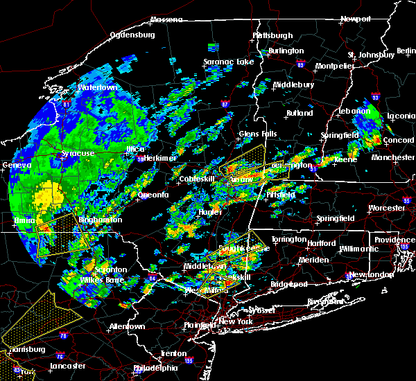 The national weather service in albany has issued a * severe thunderstorm warning for. northeastern albany county in east central new york. northern rensselaer county in east central new york. southern bennington county in southern vermont. Until 200 pm edt. The national weather service in albany has issued a * severe thunderstorm warning for. northeastern albany county in east central new york. northern rensselaer county in east central new york. southern bennington county in southern vermont. Until 200 pm edt.
|
| 6/19/2017 12:53 PM EDT |
 At 1253 pm edt, a severe thunderstorm was located over green island, or over troy, moving east at 40 mph (radar indicated). Hazards include 60 mph wind gusts and penny size hail. Expect damage to trees, and power lines. this severe thunderstorm will be near, grafton around 110 pm edt. hoosick falls around 120 pm edt. pownal around 125 pm edt. bennington around 135 pm edt. Other locations impacted by this severe thunderstorm include south troy, paper mill village, sodom, petersburg junction, albia, readsboro falls, south shaftsbury, barberville, pleasantdale and tamarack. At 1253 pm edt, a severe thunderstorm was located over green island, or over troy, moving east at 40 mph (radar indicated). Hazards include 60 mph wind gusts and penny size hail. Expect damage to trees, and power lines. this severe thunderstorm will be near, grafton around 110 pm edt. hoosick falls around 120 pm edt. pownal around 125 pm edt. bennington around 135 pm edt. Other locations impacted by this severe thunderstorm include south troy, paper mill village, sodom, petersburg junction, albia, readsboro falls, south shaftsbury, barberville, pleasantdale and tamarack.
|
| 5/31/2017 4:43 PM EDT |
 At 442 pm edt, a severe thunderstorm was located near ravena, or 13 miles south of delmar, moving east at 30 mph (radar indicated). Hazards include ping pong ball size hail and 60 mph wind gusts. People and animals outdoors will be injured. expect hail damage to roofs, siding, windows, and vehicles. expect wind damage to roofs, siding, and trees. this severe storm will be near, new baltimore, ravena and selkirk around 455 pm edt. valatie, castleton-on-hudson and kinderhook around 505 pm edt. nassau around 515 pm edt. Stephentown and new lebanon around 530 pm edt. At 442 pm edt, a severe thunderstorm was located near ravena, or 13 miles south of delmar, moving east at 30 mph (radar indicated). Hazards include ping pong ball size hail and 60 mph wind gusts. People and animals outdoors will be injured. expect hail damage to roofs, siding, windows, and vehicles. expect wind damage to roofs, siding, and trees. this severe storm will be near, new baltimore, ravena and selkirk around 455 pm edt. valatie, castleton-on-hudson and kinderhook around 505 pm edt. nassau around 515 pm edt. Stephentown and new lebanon around 530 pm edt.
|
| 5/31/2017 4:40 PM EDT |
 At 439 pm edt, a severe thunderstorm was located over waterford, or over cohoes, moving east at 40 mph (radar indicated). Hazards include 60 mph wind gusts and quarter size hail. Hail damage to vehicles is expected. expect wind damage to roofs, siding, and trees. this severe storm will be near, grafton around 455 pm edt. hoosick falls around 500 pm edt. Other locations impacted by this severe thunderstorm include deans corners, shakers, albia, johnsonville, willow glen, wayville, elnora, halls corner, grays corners and mannings cove. At 439 pm edt, a severe thunderstorm was located over waterford, or over cohoes, moving east at 40 mph (radar indicated). Hazards include 60 mph wind gusts and quarter size hail. Hail damage to vehicles is expected. expect wind damage to roofs, siding, and trees. this severe storm will be near, grafton around 455 pm edt. hoosick falls around 500 pm edt. Other locations impacted by this severe thunderstorm include deans corners, shakers, albia, johnsonville, willow glen, wayville, elnora, halls corner, grays corners and mannings cove.
|
| 5/31/2017 4:36 PM EDT | Tree down on cherry tree road in albany county NY, 4 miles SW of Albany, NY |
| 5/31/2017 4:35 PM EDT | Tree down on osborne road in albany county NY, 4.3 miles SSW of Albany, NY |
| 5/31/2017 4:34 PM EDT | Tree down on princess lane in albany county NY, 4.3 miles SW of Albany, NY |
| 5/31/2017 4:25 PM EDT |
 At 424 pm edt, a severe thunderstorm was located near westerlo, or 16 miles southwest of delmar, moving east at 35 mph (radar indicated). Hazards include 60 mph wind gusts and quarter size hail. Hail damage to vehicles is expected. expect wind damage to roofs, siding, and trees. this severe thunderstorm will be near, new baltimore, ravena and feura bush around 445 pm edt. delmar and selkirk around 450 pm edt. castleton-on-hudson around 455 pm edt. east greenbush around 500 pm edt. nassau around 505 pm edt. west sand lake around 510 pm edt. averill park around 515 pm edt. Stephentown around 520 pm edt. At 424 pm edt, a severe thunderstorm was located near westerlo, or 16 miles southwest of delmar, moving east at 35 mph (radar indicated). Hazards include 60 mph wind gusts and quarter size hail. Hail damage to vehicles is expected. expect wind damage to roofs, siding, and trees. this severe thunderstorm will be near, new baltimore, ravena and feura bush around 445 pm edt. delmar and selkirk around 450 pm edt. castleton-on-hudson around 455 pm edt. east greenbush around 500 pm edt. nassau around 505 pm edt. west sand lake around 510 pm edt. averill park around 515 pm edt. Stephentown around 520 pm edt.
|
| 5/31/2017 4:22 PM EDT | Tree down on albany street in albany county NY, 5.7 miles SSE of Albany, NY |
| 5/31/2017 4:22 PM EDT | Tree down at the intersection of east old state road and kings road in albany county NY, 5.6 miles SE of Albany, NY |
| 5/31/2017 4:20 PM EDT | Trees and wires down in albany county NY, 5.5 miles SSE of Albany, NY |
| 5/31/2017 4:18 PM EDT |
 At 418 pm edt, a severe thunderstorm was located over schenectady, moving east at 40 mph (radar indicated). Hazards include ping pong ball size hail and 60 mph wind gusts. People and animals outdoors will be injured. expect hail damage to roofs, siding, windows, and vehicles. expect wind damage to roofs, siding, and trees. this severe storm will be near, albany and clifton park around 425 pm edt. latham and loudonville around 430 pm edt. troy, cohoes, watervliet, mechanicville, menands, green island and waterford around 435 pm edt. center brunswick around 440 pm edt. grafton around 455 pm edt. hoosick falls around 500 pm edt. Other locations impacted by this severe thunderstorm include parkis mills, deans corners, shakers, glenridge, albia, johnsonville, harding crossing, west milton, willow glen and garrison manor. At 418 pm edt, a severe thunderstorm was located over schenectady, moving east at 40 mph (radar indicated). Hazards include ping pong ball size hail and 60 mph wind gusts. People and animals outdoors will be injured. expect hail damage to roofs, siding, windows, and vehicles. expect wind damage to roofs, siding, and trees. this severe storm will be near, albany and clifton park around 425 pm edt. latham and loudonville around 430 pm edt. troy, cohoes, watervliet, mechanicville, menands, green island and waterford around 435 pm edt. center brunswick around 440 pm edt. grafton around 455 pm edt. hoosick falls around 500 pm edt. Other locations impacted by this severe thunderstorm include parkis mills, deans corners, shakers, glenridge, albia, johnsonville, harding crossing, west milton, willow glen and garrison manor.
|
| 5/31/2017 4:15 PM EDT | Trees and wires down in albany county NY, 5.5 miles SSE of Albany, NY |
| 5/31/2017 4:06 PM EDT |
 At 405 pm edt, a severe thunderstorm was located near rotterdam, moving east at 40 mph (radar indicated). Hazards include 60 mph wind gusts and quarter size hail. Hail damage to vehicles is expected. expect wind damage to roofs, siding, and trees. this severe thunderstorm will be near, albany, schenectady, rotterdam, scotia, niskayuna and alplaus around 415 pm edt. colonie, east glenville and burnt hills around 420 pm edt. clifton park and loudonville around 425 pm edt. cohoes, watervliet, latham and menands around 430 pm edt. troy, mechanicville, green island and waterford around 435 pm edt. center brunswick around 440 pm edt. grafton around 455 pm edt. Hoosick falls around 500 pm edt. At 405 pm edt, a severe thunderstorm was located near rotterdam, moving east at 40 mph (radar indicated). Hazards include 60 mph wind gusts and quarter size hail. Hail damage to vehicles is expected. expect wind damage to roofs, siding, and trees. this severe thunderstorm will be near, albany, schenectady, rotterdam, scotia, niskayuna and alplaus around 415 pm edt. colonie, east glenville and burnt hills around 420 pm edt. clifton park and loudonville around 425 pm edt. cohoes, watervliet, latham and menands around 430 pm edt. troy, mechanicville, green island and waterford around 435 pm edt. center brunswick around 440 pm edt. grafton around 455 pm edt. Hoosick falls around 500 pm edt.
|
| 5/18/2017 7:45 PM EDT |
 At 744 pm edt, severe thunderstorms were located along a line extending from ballston spa to niskayuna to near breakabeen, moving east at 45 mph (radar indicated). Hazards include 60 mph wind gusts and quarter size hail. Hail damage to vehicles is expected. expect wind damage to roofs, siding, and trees. severe thunderstorms will be near, albany, schenectady, clifton park, rotterdam, colonie, guilderland, niskayuna, ballston spa, round lake and country knolls around 750 pm edt. cohoes, watervliet, mechanicville, latham, menands and loudonville around 755 pm edt. troy, berne, green island, waterford and wynantskill around 800 pm edt. center brunswick around 805 pm edt. grafton, cambridge and feura bush around 815 pm edt. hoosick falls, delmar, berlin and selkirk around 820 pm edt. castleton-on-hudson around 825 pm edt. east greenbush around 830 pm edt. Other locations impacted by these severe thunderstorms include deans corners, shakers, bleecker stadium, east berne, brookview, glenridge, hoffmans, van hoesen station, west berne and huntersland. At 744 pm edt, severe thunderstorms were located along a line extending from ballston spa to niskayuna to near breakabeen, moving east at 45 mph (radar indicated). Hazards include 60 mph wind gusts and quarter size hail. Hail damage to vehicles is expected. expect wind damage to roofs, siding, and trees. severe thunderstorms will be near, albany, schenectady, clifton park, rotterdam, colonie, guilderland, niskayuna, ballston spa, round lake and country knolls around 750 pm edt. cohoes, watervliet, mechanicville, latham, menands and loudonville around 755 pm edt. troy, berne, green island, waterford and wynantskill around 800 pm edt. center brunswick around 805 pm edt. grafton, cambridge and feura bush around 815 pm edt. hoosick falls, delmar, berlin and selkirk around 820 pm edt. castleton-on-hudson around 825 pm edt. east greenbush around 830 pm edt. Other locations impacted by these severe thunderstorms include deans corners, shakers, bleecker stadium, east berne, brookview, glenridge, hoffmans, van hoesen station, west berne and huntersland.
|
| 5/1/2017 9:55 PM EDT |
 At 955 pm edt, severe thunderstorms were located along a line extending from near fort edward to 7 miles southwest of cambridge to troy to near ravena, moving northeast at 40 mph (radar indicated). Hazards include 60 mph wind gusts. Expect damage to roofs, siding, and trees. severe thunderstorms will be near, cambridge around 1005 pm edt. salem and grafton around 1010 pm edt. east greenbush and nassau around 1015 pm edt. hoosick falls around 1020 pm edt. stephentown around 1030 pm edt. berlin around 1040 pm edt. Other locations impacted by these severe thunderstorms include brookview, van hoesen station, albia, johnsonville, millers corners, middle falls, south schodack, hoosick, best and luther. At 955 pm edt, severe thunderstorms were located along a line extending from near fort edward to 7 miles southwest of cambridge to troy to near ravena, moving northeast at 40 mph (radar indicated). Hazards include 60 mph wind gusts. Expect damage to roofs, siding, and trees. severe thunderstorms will be near, cambridge around 1005 pm edt. salem and grafton around 1010 pm edt. east greenbush and nassau around 1015 pm edt. hoosick falls around 1020 pm edt. stephentown around 1030 pm edt. berlin around 1040 pm edt. Other locations impacted by these severe thunderstorms include brookview, van hoesen station, albia, johnsonville, millers corners, middle falls, south schodack, hoosick, best and luther.
|
| 5/1/2017 9:25 PM EDT |
 At 925 pm edt, severe thunderstorms were located along a line extending from near galway to duanesburg to near windham to hortonville, moving east at 65 mph (radar indicated). Hazards include 70 mph wind gusts. Expect considerable tree damage. Damage is likely to mobile homes, roofs, and outbuildings. At 925 pm edt, severe thunderstorms were located along a line extending from near galway to duanesburg to near windham to hortonville, moving east at 65 mph (radar indicated). Hazards include 70 mph wind gusts. Expect considerable tree damage. Damage is likely to mobile homes, roofs, and outbuildings.
|
| 3/8/2017 2:41 PM EST |
 The severe thunderstorm warning for eastern schenectady. columbia. albany. eastern greene. saratoga. southern washington and rensselaer counties will expire at 245 pm est. the storms which prompted the warning have moved out of the warned area. Therefore, the warning will be allowed to expire. The severe thunderstorm warning for eastern schenectady. columbia. albany. eastern greene. saratoga. southern washington and rensselaer counties will expire at 245 pm est. the storms which prompted the warning have moved out of the warned area. Therefore, the warning will be allowed to expire.
|
| 3/8/2017 2:18 PM EST | Tree down in albany county NY, 3.9 miles SW of Albany, NY |
| 3/8/2017 2:11 PM EST |
 At 211 pm est, severe thunderstorms were located along a line extending from near fort edward to catskill, moving east at 50 mph (radar indicated). Hazards include 60 mph wind gusts. Expect damage to roofs, siding, and trees. these severe storms will be near, fort edward around 215 pm est. philmont around 225 pm est. chatham and salem around 230 pm est. Austerlitz around 235 pm est. At 211 pm est, severe thunderstorms were located along a line extending from near fort edward to catskill, moving east at 50 mph (radar indicated). Hazards include 60 mph wind gusts. Expect damage to roofs, siding, and trees. these severe storms will be near, fort edward around 215 pm est. philmont around 225 pm est. chatham and salem around 230 pm est. Austerlitz around 235 pm est.
|
| 3/8/2017 2:07 PM EST | Downed tree in albany county NY, 2.7 miles NNE of Albany, NY |
| 3/8/2017 2:02 PM EST | Tree down at intersection of lorna lane and nicolla avenue in albany county NY, 4.7 miles SSW of Albany, NY |
| 3/8/2017 2:02 PM EST | Tree down in albany county NY, 3.9 miles SW of Albany, NY |
| 3/8/2017 1:45 PM EST |
 At 145 pm est, severe thunderstorms were located along a line extending from edinburg to near hunter, moving east at 55 mph (radar indicated). Hazards include 60 mph wind gusts. Expect damage to roofs, siding, and trees. severe thunderstorms will be near, corinth around 200 pm est. saratoga springs and catskill around 205 pm est. hudson, claverack, livingston, athens, claverack-red mills and lorenz park around 210 pm est. fort edward and philmont around 215 pm est. austerlitz around 225 pm est. salem around 230 pm est. Other locations impacted by these severe thunderstorms include deans corners, charleston, bleecker stadium, glenridge, hoffmans, west berne, huntersland, wayville, broome center and wiley corners. At 145 pm est, severe thunderstorms were located along a line extending from edinburg to near hunter, moving east at 55 mph (radar indicated). Hazards include 60 mph wind gusts. Expect damage to roofs, siding, and trees. severe thunderstorms will be near, corinth around 200 pm est. saratoga springs and catskill around 205 pm est. hudson, claverack, livingston, athens, claverack-red mills and lorenz park around 210 pm est. fort edward and philmont around 215 pm est. austerlitz around 225 pm est. salem around 230 pm est. Other locations impacted by these severe thunderstorms include deans corners, charleston, bleecker stadium, glenridge, hoffmans, west berne, huntersland, wayville, broome center and wiley corners.
|
| 2/25/2017 5:52 PM EST | Downed tree in front of crossgates mal in albany county NY, 3.1 miles SE of Albany, NY |
| 2/25/2017 5:40 PM EST | Downed tree at intersection of western ave and manning blv in albany county NY, 2 miles SSW of Albany, NY |
| 2/25/2017 5:40 PM EST | Downed tree in albany county NY, 4.2 miles ESE of Albany, NY |
| 2/25/2017 5:35 PM EST | Downed tre in albany county NY, 5.1 miles SSW of Albany, NY |
| 2/25/2017 5:15 PM EST | Downed tre in albany county NY, 5.1 miles SSW of Albany, NY |
| 9/11/2016 7:26 AM EDT |
 At 726 am edt, severe thunderstorms were located along a line extending from near selkirk to near athens to lake katrine, moving east at 35 mph (radar indicated). Hazards include 60 mph wind gusts. Expect damage to roofs. siding. and trees. severe thunderstorms will be near, athens around 730 am edt. east greenbush, hudson, red hook and lorenz park around 735 am edt. claverack and claverack-red mills around 740 am edt. nassau, valatie, philmont and kinderhook around 745 am edt. pine plains around 755 am edt. copake and stephentown around 800 am edt. great barrington, new lebanon and housatonic around 810 am edt. lenox and sheffield around 820 am edt. Other locations impacted by these severe thunderstorms include cheviot, elizaville, lenox house country shops, fitchs wharf, dunham hollow, mount ross, mellenville, callanans corners, mahkeenac heights and ancramdale. At 726 am edt, severe thunderstorms were located along a line extending from near selkirk to near athens to lake katrine, moving east at 35 mph (radar indicated). Hazards include 60 mph wind gusts. Expect damage to roofs. siding. and trees. severe thunderstorms will be near, athens around 730 am edt. east greenbush, hudson, red hook and lorenz park around 735 am edt. claverack and claverack-red mills around 740 am edt. nassau, valatie, philmont and kinderhook around 745 am edt. pine plains around 755 am edt. copake and stephentown around 800 am edt. great barrington, new lebanon and housatonic around 810 am edt. lenox and sheffield around 820 am edt. Other locations impacted by these severe thunderstorms include cheviot, elizaville, lenox house country shops, fitchs wharf, dunham hollow, mount ross, mellenville, callanans corners, mahkeenac heights and ancramdale.
|
| 8/13/2016 8:44 PM EDT |
 At 843 pm edt, a severe thunderstorm was located over averill park, or near nassau, moving northeast at 45 mph (radar indicated). Hazards include 60 mph wind gusts and quarter size hail. Hail damage to vehicles is expected. expect wind damage to roofs, siding, and trees. this severe thunderstorm will be near, stephentown around 850 pm edt. berlin around 900 pm edt. new ashford around 905 pm edt. williamstown and pownal around 910 pm edt. north adams, adams, stamford and florida around 915 pm edt. other locations impacted by this severe thunderstorm include denault corners, braeside, lanesborough, dunham hollow, maple grove, east renfrew, brunswick center, braytonville, totem lodge and savoy center. this includes the following highways, interstate 90 between mile markers 8 and 5a, and between mile markers 8 and 6-5a. interstate 87 near mile marker 6, near mile marker 2 , near mile marker 4, and between mile markers 2-4 and 4-5. Interstate 787 between mile markers 2 and 8-7. At 843 pm edt, a severe thunderstorm was located over averill park, or near nassau, moving northeast at 45 mph (radar indicated). Hazards include 60 mph wind gusts and quarter size hail. Hail damage to vehicles is expected. expect wind damage to roofs, siding, and trees. this severe thunderstorm will be near, stephentown around 850 pm edt. berlin around 900 pm edt. new ashford around 905 pm edt. williamstown and pownal around 910 pm edt. north adams, adams, stamford and florida around 915 pm edt. other locations impacted by this severe thunderstorm include denault corners, braeside, lanesborough, dunham hollow, maple grove, east renfrew, brunswick center, braytonville, totem lodge and savoy center. this includes the following highways, interstate 90 between mile markers 8 and 5a, and between mile markers 8 and 6-5a. interstate 87 near mile marker 6, near mile marker 2 , near mile marker 4, and between mile markers 2-4 and 4-5. Interstate 787 between mile markers 2 and 8-7.
|
| 8/12/2016 4:16 PM EDT | Trees down on willett street in albany county NY, 2.1 miles W of Albany, NY |
| 8/12/2016 4:07 PM EDT |
 At 405 pm edt, severe thunderstorms were located along a line extending from delmar to near westerlo, moving southeast at 35 mph (radar indicated). Hazards include 60 mph wind gusts. Expect damage to roofs. siding. and trees. Locations impacted include, albany, east greenbush, rensselaer, colonie, hudson, nassau, delmar, guilderland, menands, new baltimore, westerlo, ravena, stephentown, coxsackie, voorheesville, valatie, altamont, athens, castleton-on-hudson and kinderhook. At 405 pm edt, severe thunderstorms were located along a line extending from delmar to near westerlo, moving southeast at 35 mph (radar indicated). Hazards include 60 mph wind gusts. Expect damage to roofs. siding. and trees. Locations impacted include, albany, east greenbush, rensselaer, colonie, hudson, nassau, delmar, guilderland, menands, new baltimore, westerlo, ravena, stephentown, coxsackie, voorheesville, valatie, altamont, athens, castleton-on-hudson and kinderhook.
|
| 8/12/2016 3:26 PM EDT |
 At 325 pm edt, severe thunderstorms were located along a line extending from 6 miles northwest of delanson to near cobleskill, moving southeast at 35 mph (radar indicated). Hazards include 60 mph wind gusts. Expect damage to roofs. siding. And trees. At 325 pm edt, severe thunderstorms were located along a line extending from 6 miles northwest of delanson to near cobleskill, moving southeast at 35 mph (radar indicated). Hazards include 60 mph wind gusts. Expect damage to roofs. siding. And trees.
|
| 7/23/2016 7:00 PM EDT | A tree down in road at krumkill rd and salem ct in albany county NY, 3 miles E of Albany, NY |
| 7/18/2016 1:00 PM EDT |
 At 100 pm edt, a severe thunderstorm was located over west sand lake, or near troy, moving east at 60 mph (radar indicated). Hazards include 60 mph wind gusts. Expect damage to roofs. siding. and trees. Locations impacted include, albany, troy, cohoes, watervliet, colonie, latham, delmar, guilderland, menands, westerlo, ravena, berne, voorheesville, green island, altamont, middleburgh, schoharie, feura bush, loudonville and preston-potter hollow. At 100 pm edt, a severe thunderstorm was located over west sand lake, or near troy, moving east at 60 mph (radar indicated). Hazards include 60 mph wind gusts. Expect damage to roofs. siding. and trees. Locations impacted include, albany, troy, cohoes, watervliet, colonie, latham, delmar, guilderland, menands, westerlo, ravena, berne, voorheesville, green island, altamont, middleburgh, schoharie, feura bush, loudonville and preston-potter hollow.
|
| 7/18/2016 12:28 PM EDT |
 At 1227 pm edt, a severe thunderstorm was located near livingstonville, or 17 miles southeast of cobleskill, moving east at 55 mph (radar indicated). Hazards include 60 mph wind gusts. Expect damage to roofs. siding. And trees. At 1227 pm edt, a severe thunderstorm was located near livingstonville, or 17 miles southeast of cobleskill, moving east at 55 mph (radar indicated). Hazards include 60 mph wind gusts. Expect damage to roofs. siding. And trees.
|
| 9/3/2015 3:50 PM EDT |
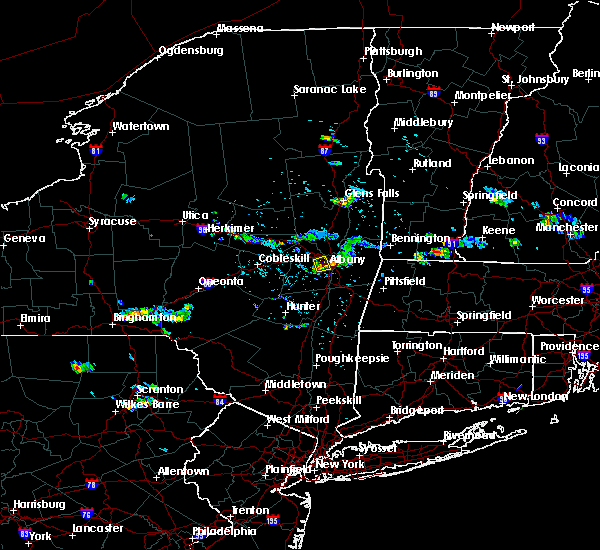 At 349 pm edt, a severe thunderstorm was located over albany, moving south at 15 mph (radar indicated). Hazards include 60 mph wind gusts and penny size hail. Expect damage to roofs. siding and trees. this severe thunderstorm will be near, albany around 355 pm edt. delmar around 405 pm edt. Other locations impacted by this severe thunderstorm include westmere, north bethlehem, roessleville, karlsfeld, mckownville and slingerlands. At 349 pm edt, a severe thunderstorm was located over albany, moving south at 15 mph (radar indicated). Hazards include 60 mph wind gusts and penny size hail. Expect damage to roofs. siding and trees. this severe thunderstorm will be near, albany around 355 pm edt. delmar around 405 pm edt. Other locations impacted by this severe thunderstorm include westmere, north bethlehem, roessleville, karlsfeld, mckownville and slingerlands.
|
| 9/3/2015 3:40 PM EDT | 2 trees down on the corner of fuller rd and central ave in albany county NY, 3.6 miles SSE of Albany, NY |
| 9/3/2015 3:38 PM EDT | Tree down on house on ahl ave in albany county NY, 3 miles S of Albany, NY |
| 9/3/2015 3:38 PM EDT | Tree down on house on van buren ave in albany county NY, 3 miles S of Albany, NY |
| 9/3/2015 3:33 PM EDT |
 At 333 pm edt, a severe thunderstorm was located over colonie, moving south at 15 mph (radar indicated). Hazards include 60 mph wind gusts and quarter size hail. Hail damage to vehicles is expected. expect wind damage to roofs, siding and trees. this severe thunderstorm will be near, albany and guilderland around 340 pm edt. delmar around 400 pm edt. Other locations impacted by this severe thunderstorm include hartmans corners, shakers, lisha kill, roessleville, maywood, karlsfeld, mckownville, westmere, karner and north bethlehem. At 333 pm edt, a severe thunderstorm was located over colonie, moving south at 15 mph (radar indicated). Hazards include 60 mph wind gusts and quarter size hail. Hail damage to vehicles is expected. expect wind damage to roofs, siding and trees. this severe thunderstorm will be near, albany and guilderland around 340 pm edt. delmar around 400 pm edt. Other locations impacted by this severe thunderstorm include hartmans corners, shakers, lisha kill, roessleville, maywood, karlsfeld, mckownville, westmere, karner and north bethlehem.
|
| 8/4/2015 12:20 PM EDT |
 At 1220 pm edt, a severe thunderstorm was located over ravena, or 7 miles southwest of east greenbush, moving east at 50 mph (radar indicated). Hazards include 60 mph wind gusts and quarter size hail. Hail damage to vehicles is expected. expect wind damage to roofs, siding and trees. this severe thunderstorm will be near, east greenbush and valatie around 1225 pm edt. nassau around 1230 pm edt. stephentown around 1240 pm edt. new lebanon around 1245 pm edt. Other locations impacted by this severe thunderstorm include east chatham, riders, denault corners, braeside, new lebanon center, dunham hollow, callanans corners, coeymans hollow, houcks corners and mallorys corners. At 1220 pm edt, a severe thunderstorm was located over ravena, or 7 miles southwest of east greenbush, moving east at 50 mph (radar indicated). Hazards include 60 mph wind gusts and quarter size hail. Hail damage to vehicles is expected. expect wind damage to roofs, siding and trees. this severe thunderstorm will be near, east greenbush and valatie around 1225 pm edt. nassau around 1230 pm edt. stephentown around 1240 pm edt. new lebanon around 1245 pm edt. Other locations impacted by this severe thunderstorm include east chatham, riders, denault corners, braeside, new lebanon center, dunham hollow, callanans corners, coeymans hollow, houcks corners and mallorys corners.
|
| 8/3/2015 3:31 PM EDT |
 At 331 pm edt, a severe thunderstorm was located near center brunswick, or 7 miles northeast of troy, moving northeast at 25 mph (radar indicated). Hazards include 60 mph wind gusts and quarter size hail. Hail damage to vehicles is expected. expect wind damage to roofs, siding and trees. this severe thunderstorm will be near, grafton around 340 pm edt. hoosick falls around 400 pm edt. Other locations impacted by this severe thunderstorm include east hoosick, petersburg junction, lincolnville, millertown, petersburg, speigletown, eagle mills, babcock lake, schaghticoke hill and north hoosick. At 331 pm edt, a severe thunderstorm was located near center brunswick, or 7 miles northeast of troy, moving northeast at 25 mph (radar indicated). Hazards include 60 mph wind gusts and quarter size hail. Hail damage to vehicles is expected. expect wind damage to roofs, siding and trees. this severe thunderstorm will be near, grafton around 340 pm edt. hoosick falls around 400 pm edt. Other locations impacted by this severe thunderstorm include east hoosick, petersburg junction, lincolnville, millertown, petersburg, speigletown, eagle mills, babcock lake, schaghticoke hill and north hoosick.
|
| 8/3/2015 2:27 PM EDT |
 At 227 pm edt, a severe thunderstorm was located near berne, or 13 miles east of cobleskill, moving northeast at 30 mph (radar indicated). Hazards include 60 mph wind gusts. Expect damage to roofs. siding and trees. this severe thunderstorm will be near, berne around 235 pm edt. delanson around 245 pm edt. duanesburg and altamont around 250 pm edt. voorheesville around 255 pm edt. guilderland around 300 pm edt. albany, rotterdam and rotterdam junction around 305 pm edt. colonie and scotia around 310 pm edt. schenectady, niskayuna, east glenville and alplaus around 315 pm edt. Other locations impacted by this severe thunderstorm include fullers, rectors, stoodley corners, gallupville, huntersland, duane mansion, east township, glenville center, hawversville and mohawk view. At 227 pm edt, a severe thunderstorm was located near berne, or 13 miles east of cobleskill, moving northeast at 30 mph (radar indicated). Hazards include 60 mph wind gusts. Expect damage to roofs. siding and trees. this severe thunderstorm will be near, berne around 235 pm edt. delanson around 245 pm edt. duanesburg and altamont around 250 pm edt. voorheesville around 255 pm edt. guilderland around 300 pm edt. albany, rotterdam and rotterdam junction around 305 pm edt. colonie and scotia around 310 pm edt. schenectady, niskayuna, east glenville and alplaus around 315 pm edt. Other locations impacted by this severe thunderstorm include fullers, rectors, stoodley corners, gallupville, huntersland, duane mansion, east township, glenville center, hawversville and mohawk view.
|
| 7/19/2015 5:57 PM EDT |
 At 557 pm edt, a severe thunderstorm was located over grafton, or 9 miles southwest of hoosick falls, moving east at 20 mph (trained weather spotters). Hazards include 70 mph wind gusts and quarter size hail. Hail damage to vehicles is expected. expect considerable tree damage. wind damage is also likely to mobile homes, roofs and outbuildings. this severe storm will be near, berlin around 605 pm edt. hoosick falls around 615 pm edt. Other locations impacted by this severe thunderstorm include east hoosick, petersburg junction, fullers, mckownville, lincolnville, petersburg, speigletown, eagle mills, babcock lake and schaghticoke hill. At 557 pm edt, a severe thunderstorm was located over grafton, or 9 miles southwest of hoosick falls, moving east at 20 mph (trained weather spotters). Hazards include 70 mph wind gusts and quarter size hail. Hail damage to vehicles is expected. expect considerable tree damage. wind damage is also likely to mobile homes, roofs and outbuildings. this severe storm will be near, berlin around 605 pm edt. hoosick falls around 615 pm edt. Other locations impacted by this severe thunderstorm include east hoosick, petersburg junction, fullers, mckownville, lincolnville, petersburg, speigletown, eagle mills, babcock lake and schaghticoke hill.
|
| 7/19/2015 5:40 PM EDT |
 At 539 pm edt, a severe thunderstorm was located over center brunswick, or near troy, moving east at 20 mph (trained weather spotters). Hazards include 60 mph wind gusts and quarter size hail. Hail damage to vehicles is expected. expect wind damage to roofs, siding and trees. this severe storm will be near, grafton around 600 pm edt. berlin around 605 pm edt. hoosick falls around 615 pm edt. Other locations impacted by this severe thunderstorm include east hoosick, petersburg junction, fullers, mckownville, lincolnville, petersburg, speigletown, eagle mills, babcock lake and schaghticoke hill. At 539 pm edt, a severe thunderstorm was located over center brunswick, or near troy, moving east at 20 mph (trained weather spotters). Hazards include 60 mph wind gusts and quarter size hail. Hail damage to vehicles is expected. expect wind damage to roofs, siding and trees. this severe storm will be near, grafton around 600 pm edt. berlin around 605 pm edt. hoosick falls around 615 pm edt. Other locations impacted by this severe thunderstorm include east hoosick, petersburg junction, fullers, mckownville, lincolnville, petersburg, speigletown, eagle mills, babcock lake and schaghticoke hill.
|
| 7/19/2015 5:26 PM EDT |
 At 526 pm edt, a severe thunderstorm was located over waterford, or over cohoes, moving east at 20 mph (radar indicated). Hazards include 60 mph wind gusts and quarter size hail. Hail damage to vehicles is expected. expect wind damage to roofs, siding and trees. this severe thunderstorm will be near, center brunswick around 535 pm edt. grafton around 600 pm edt. berlin around 610 pm edt. hoosick falls around 615 pm edt. Other locations impacted by this severe thunderstorm include east hoosick, petersburg junction, fullers, mckownville, lincolnville, petersburg, speigletown, eagle mills, babcock lake and schaghticoke hill. At 526 pm edt, a severe thunderstorm was located over waterford, or over cohoes, moving east at 20 mph (radar indicated). Hazards include 60 mph wind gusts and quarter size hail. Hail damage to vehicles is expected. expect wind damage to roofs, siding and trees. this severe thunderstorm will be near, center brunswick around 535 pm edt. grafton around 600 pm edt. berlin around 610 pm edt. hoosick falls around 615 pm edt. Other locations impacted by this severe thunderstorm include east hoosick, petersburg junction, fullers, mckownville, lincolnville, petersburg, speigletown, eagle mills, babcock lake and schaghticoke hill.
|
| 7/19/2015 4:46 PM EDT |
 At 446 pm edt, a severe thunderstorm was located over castleton-on-hudson, or near nassau, moving southeast at 15 mph (radar indicated). Hazards include 60 mph wind gusts and quarter size hail. Hail damage to vehicles is expected. expect wind damage to roofs, siding and trees. this severe thunderstorm will be near, nassau, valatie and kinderhook around 505 pm edt. chatham around 530 pm edt. Other locations impacted by this severe thunderstorm include east chatham, riders, braeside, new lebanon center, coeymans hollow, mallorys corners, beckers corners, bethlehem center, aquetuck and niverville. At 446 pm edt, a severe thunderstorm was located over castleton-on-hudson, or near nassau, moving southeast at 15 mph (radar indicated). Hazards include 60 mph wind gusts and quarter size hail. Hail damage to vehicles is expected. expect wind damage to roofs, siding and trees. this severe thunderstorm will be near, nassau, valatie and kinderhook around 505 pm edt. chatham around 530 pm edt. Other locations impacted by this severe thunderstorm include east chatham, riders, braeside, new lebanon center, coeymans hollow, mallorys corners, beckers corners, bethlehem center, aquetuck and niverville.
|
| 7/19/2015 4:40 PM EDT |
 At 439 pm edt, a severe thunderstorm was located near east greenbush, moving east at 15 mph (radar indicated). Hazards include 60 mph wind gusts and quarter size hail. Hail damage to vehicles is expected. expect wind damage to roofs, siding and trees. this severe storm will be near, nassau around 455 pm edt. west sand lake around 500 pm edt. Other locations impacted by this severe thunderstorm include coeymans, jacks corners, braeside, bethlehem heights, couse, selkirk yards, schodack center, callanans corners, coeymans hollow and best. At 439 pm edt, a severe thunderstorm was located near east greenbush, moving east at 15 mph (radar indicated). Hazards include 60 mph wind gusts and quarter size hail. Hail damage to vehicles is expected. expect wind damage to roofs, siding and trees. this severe storm will be near, nassau around 455 pm edt. west sand lake around 500 pm edt. Other locations impacted by this severe thunderstorm include coeymans, jacks corners, braeside, bethlehem heights, couse, selkirk yards, schodack center, callanans corners, coeymans hollow and best.
|
| 7/19/2015 4:36 PM EDT | 1 tree dow in albany county NY, 4 miles NNW of Albany, NY |
| 7/19/2015 4:28 PM EDT |
 At 428 pm edt, a severe thunderstorm was located over castleton-on-hudson, or near east greenbush, and is nearly stationary (radar indicated). Hazards include 60 mph wind gusts and quarter size hail. Hail damage to vehicles is expected. expect wind damage to roofs, siding and trees. this severe storm will be near, east greenbush around 440 pm edt. nassau around 455 pm edt. west sand lake around 500 pm edt. Other locations impacted by this severe thunderstorm include coeymans, kenwood, normansville, jacks corners, braeside, snyders corner, bethlehem heights, couse, selkirk yards and schodack center. At 428 pm edt, a severe thunderstorm was located over castleton-on-hudson, or near east greenbush, and is nearly stationary (radar indicated). Hazards include 60 mph wind gusts and quarter size hail. Hail damage to vehicles is expected. expect wind damage to roofs, siding and trees. this severe storm will be near, east greenbush around 440 pm edt. nassau around 455 pm edt. west sand lake around 500 pm edt. Other locations impacted by this severe thunderstorm include coeymans, kenwood, normansville, jacks corners, braeside, snyders corner, bethlehem heights, couse, selkirk yards and schodack center.
|
| 7/19/2015 4:24 PM EDT |
 At 423 pm edt, a severe thunderstorm was located over castleton-on-hudson, or near east greenbush, moving east at 15 mph (radar indicated). Hazards include 60 mph wind gusts and penny size hail. Expect damage to roofs. siding and trees. this severe thunderstorm will be near, rensselaer around 435 pm edt. east greenbush around 440 pm edt. nassau around 455 pm edt. west sand lake around 500 pm edt. Other locations impacted by this severe thunderstorm include coeymans, kenwood, normansville, jacks corners, braeside, snyders corner, bethlehem heights, couse, selkirk yards and schodack center. At 423 pm edt, a severe thunderstorm was located over castleton-on-hudson, or near east greenbush, moving east at 15 mph (radar indicated). Hazards include 60 mph wind gusts and penny size hail. Expect damage to roofs. siding and trees. this severe thunderstorm will be near, rensselaer around 435 pm edt. east greenbush around 440 pm edt. nassau around 455 pm edt. west sand lake around 500 pm edt. Other locations impacted by this severe thunderstorm include coeymans, kenwood, normansville, jacks corners, braeside, snyders corner, bethlehem heights, couse, selkirk yards and schodack center.
|
| 6/23/2015 9:39 AM EDT |
 At 938 am edt, severe thunderstorms were located along a line extending from near westerlo to near west hurley, moving east at 40 mph (radar indicated). Hazards include 60 mph wind gusts. Expect damage to roofs. siding and trees. these severe storms will be near, saugerties, lake katrine, saugerties south and feura bush around 945 am edt. Other locations impacted by these severe thunderstorms include maplecrest, south westerlo, edgewood, lambs corner, lakes mills bridge, halihan hill, oak hill, blue mountain, hensonville and fitchs wharf. At 938 am edt, severe thunderstorms were located along a line extending from near westerlo to near west hurley, moving east at 40 mph (radar indicated). Hazards include 60 mph wind gusts. Expect damage to roofs. siding and trees. these severe storms will be near, saugerties, lake katrine, saugerties south and feura bush around 945 am edt. Other locations impacted by these severe thunderstorms include maplecrest, south westerlo, edgewood, lambs corner, lakes mills bridge, halihan hill, oak hill, blue mountain, hensonville and fitchs wharf.
|
| 6/23/2015 9:22 AM EDT |
 At 920 am edt, severe thunderstorms were located along a line extending from near breakabeen to near west shokan, moving east at 40 mph (radar indicated). Hazards include 60 mph wind gusts. Expect damage to roofs. siding and trees. severe thunderstorms will be near, livingstonville around 925 am edt. kenneth l wilson campground, olivebridge, preston-potter hollow and preston hollow around 930 am edt. woodstock, berne and west hurley around 935 am edt. saugerties, westerlo, lake katrine, saugerties south and feura bush around 945 am edt. Other locations impacted by these severe thunderstorms include maplecrest, south westerlo, edgewood, lakes mills bridge, oak hill, shandaken, huntersland, fitchs wharf, brooksburg and hawversville. At 920 am edt, severe thunderstorms were located along a line extending from near breakabeen to near west shokan, moving east at 40 mph (radar indicated). Hazards include 60 mph wind gusts. Expect damage to roofs. siding and trees. severe thunderstorms will be near, livingstonville around 925 am edt. kenneth l wilson campground, olivebridge, preston-potter hollow and preston hollow around 930 am edt. woodstock, berne and west hurley around 935 am edt. saugerties, westerlo, lake katrine, saugerties south and feura bush around 945 am edt. Other locations impacted by these severe thunderstorms include maplecrest, south westerlo, edgewood, lakes mills bridge, oak hill, shandaken, huntersland, fitchs wharf, brooksburg and hawversville.
|
| 6/12/2015 9:33 PM EDT |
 At 932 pm edt, severe thunderstorms were located along a line extending from near delmar to near athens to near lanesville, moving east at 45 mph (radar indicated). Hazards include 60 mph wind gusts and penny size hail. Expect damage to roofs. siding and trees. these severe storms will be near, rensselaer, catskill, delmar, ravena, coxsackie, castleton-on-hudson and selkirk around 935 pm edt. east greenbush, hudson, athens, lorenz park and claverack-red mills around 940 pm edt. nassau and claverack around 945 pm edt. saugerties, chatham and philmont around 950 pm edt. saugerties south around 955 pm edt. livingston and clermont around 1000 pm edt. other locations impacted by these severe thunderstorms include maplecrest, edgewood, east chatham, riders, cheviot, denault corners, lakes mills bridge, braeside, shandaken and blue mountain. A tornado watch remains in effect until 1100 pm edt for east central new york. At 932 pm edt, severe thunderstorms were located along a line extending from near delmar to near athens to near lanesville, moving east at 45 mph (radar indicated). Hazards include 60 mph wind gusts and penny size hail. Expect damage to roofs. siding and trees. these severe storms will be near, rensselaer, catskill, delmar, ravena, coxsackie, castleton-on-hudson and selkirk around 935 pm edt. east greenbush, hudson, athens, lorenz park and claverack-red mills around 940 pm edt. nassau and claverack around 945 pm edt. saugerties, chatham and philmont around 950 pm edt. saugerties south around 955 pm edt. livingston and clermont around 1000 pm edt. other locations impacted by these severe thunderstorms include maplecrest, edgewood, east chatham, riders, cheviot, denault corners, lakes mills bridge, braeside, shandaken and blue mountain. A tornado watch remains in effect until 1100 pm edt for east central new york.
|
| 6/12/2015 8:56 PM EDT |
 At 856 pm edt, severe thunderstorms were located along a line extending from schoharie to near gilboa to near arkville, moving east at 40 mph (radar indicated). Hazards include 60 mph wind gusts and penny size hail. Expect damage to roofs. siding and trees. severe thunderstorms will be near, middleburgh around 900 pm edt. berne, windham, preston hollow and preston-potter hollow around 910 pm edt. westerlo around 920 pm edt. voorheesville and lanesville around 925 pm edt. hunter and feura bush around 930 pm edt. delmar, ravena and selkirk around 935 pm edt. rensselaer, woodstock, coxsackie, castleton-on-hudson and north-south lake campground around 940 pm edt. east greenbush, hudson, catskill and athens around 945 pm edt. other locations impacted by these severe thunderstorms include maplecrest, south westerlo, edgewood, cheviot, denault corners, lakes mills bridge, oak hill, shandaken, huntersland and fitchs wharf. A tornado watch remains in effect until 1100 pm edt for east central new york. At 856 pm edt, severe thunderstorms were located along a line extending from schoharie to near gilboa to near arkville, moving east at 40 mph (radar indicated). Hazards include 60 mph wind gusts and penny size hail. Expect damage to roofs. siding and trees. severe thunderstorms will be near, middleburgh around 900 pm edt. berne, windham, preston hollow and preston-potter hollow around 910 pm edt. westerlo around 920 pm edt. voorheesville and lanesville around 925 pm edt. hunter and feura bush around 930 pm edt. delmar, ravena and selkirk around 935 pm edt. rensselaer, woodstock, coxsackie, castleton-on-hudson and north-south lake campground around 940 pm edt. east greenbush, hudson, catskill and athens around 945 pm edt. other locations impacted by these severe thunderstorms include maplecrest, south westerlo, edgewood, cheviot, denault corners, lakes mills bridge, oak hill, shandaken, huntersland and fitchs wharf. A tornado watch remains in effect until 1100 pm edt for east central new york.
|
| 6/12/2015 8:16 PM EDT |
 At 815 pm edt, a severe thunderstorm was located over altamont, or near rotterdam, moving east at 30 mph (radar indicated). Hazards include 60 mph wind gusts. Expect damage to roofs. siding and trees. this severe thunderstorm will be near, scotia around 825 pm edt. albany, schenectady, rotterdam, niskayuna and voorheesville around 830 pm edt. colonie and guilderland around 835 pm edt. delmar around 840 pm edt. latham and loudonville around 845 pm edt. cohoes, watervliet, rensselaer, menands, green island and waterford around 850 pm edt. troy and wynantskill around 855 pm edt. center brunswick and west sand lake around 900 pm edt. other locations impacted by this severe thunderstorm include fullers, mckownville, lincolnville, speigletown, duane mansion, east township, eagle mills, mohawk view, lisha kill and meadowdale. A tornado watch remains in effect until 1100 pm edt for east central new york. At 815 pm edt, a severe thunderstorm was located over altamont, or near rotterdam, moving east at 30 mph (radar indicated). Hazards include 60 mph wind gusts. Expect damage to roofs. siding and trees. this severe thunderstorm will be near, scotia around 825 pm edt. albany, schenectady, rotterdam, niskayuna and voorheesville around 830 pm edt. colonie and guilderland around 835 pm edt. delmar around 840 pm edt. latham and loudonville around 845 pm edt. cohoes, watervliet, rensselaer, menands, green island and waterford around 850 pm edt. troy and wynantskill around 855 pm edt. center brunswick and west sand lake around 900 pm edt. other locations impacted by this severe thunderstorm include fullers, mckownville, lincolnville, speigletown, duane mansion, east township, eagle mills, mohawk view, lisha kill and meadowdale. A tornado watch remains in effect until 1100 pm edt for east central new york.
|
| 6/12/2015 7:56 PM EDT |
 At 755 pm edt, a severe thunderstorm was located over rotterdam junction, or over scotia, moving east at 20 mph (radar indicated). Hazards include 60 mph wind gusts and penny size hail. Expect damage to roofs. siding and trees. this severe storm will be near, scotia around 800 pm edt. schenectady around 805 pm edt. rotterdam, niskayuna, east glenville and alplaus around 810 pm edt. clifton park around 815 pm edt. other locations impacted by this severe thunderstorm include fullers, lincolnville, duane mansion, mohawk view, lisha kill, grooms corners, brunswick center, knox, carman and west hill. A tornado watch remains in effect until 1100 pm edt for eastern new york. At 755 pm edt, a severe thunderstorm was located over rotterdam junction, or over scotia, moving east at 20 mph (radar indicated). Hazards include 60 mph wind gusts and penny size hail. Expect damage to roofs. siding and trees. this severe storm will be near, scotia around 800 pm edt. schenectady around 805 pm edt. rotterdam, niskayuna, east glenville and alplaus around 810 pm edt. clifton park around 815 pm edt. other locations impacted by this severe thunderstorm include fullers, lincolnville, duane mansion, mohawk view, lisha kill, grooms corners, brunswick center, knox, carman and west hill. A tornado watch remains in effect until 1100 pm edt for eastern new york.
|
| 6/12/2015 7:44 PM EDT |
 At 744 pm edt, a severe thunderstorm was located over cohoes, moving east at 35 mph (radar indicated). Hazards include 60 mph wind gusts and penny size hail. Expect damage to roofs. siding and trees. this severe storm will be near, wynantskill around 750 pm edt. center brunswick around 755 pm edt. other locations impacted by this severe thunderstorm include fullers, lincolnville, duane mansion, mohawk view, lisha kill, groom corners, brunswick center, knox, carman and west hill. A tornado watch remains in effect until 1100 pm edt for eastern new york. At 744 pm edt, a severe thunderstorm was located over cohoes, moving east at 35 mph (radar indicated). Hazards include 60 mph wind gusts and penny size hail. Expect damage to roofs. siding and trees. this severe storm will be near, wynantskill around 750 pm edt. center brunswick around 755 pm edt. other locations impacted by this severe thunderstorm include fullers, lincolnville, duane mansion, mohawk view, lisha kill, groom corners, brunswick center, knox, carman and west hill. A tornado watch remains in effect until 1100 pm edt for eastern new york.
|
| 6/12/2015 7:17 PM EDT |
 At 717 pm edt, a severe thunderstorm was located near duanesburg, or near rotterdam, moving east at 25 mph (radar indicated). Hazards include 60 mph wind gusts and quarter size hail. Hail damage to vehicles is expected. expect wind damage to roofs, siding and trees. this severe thunderstorm will be near, scotia around 730 pm edt. schenectady, rotterdam, niskayuna, alplaus and east glenville around 735 pm edt. albany and voorheesville around 740 pm edt. clifton park, colonie and guilderland around 745 pm edt. delmar and loudonville around 755 pm edt. cohoes and latham around 800 pm edt. troy, watervliet, rensselaer, menands, green island and waterford around 805 pm edt. east greenbush and wynantskill around 810 pm edt. other locations impacted by this severe thunderstorm include fullers, lincolnville, duane mansion, mohawk view, lisha kill, groom corners, brunswick center, knox, carman and west hill. A tornado watch remains in effect until 1100 pm edt for eastern new york. At 717 pm edt, a severe thunderstorm was located near duanesburg, or near rotterdam, moving east at 25 mph (radar indicated). Hazards include 60 mph wind gusts and quarter size hail. Hail damage to vehicles is expected. expect wind damage to roofs, siding and trees. this severe thunderstorm will be near, scotia around 730 pm edt. schenectady, rotterdam, niskayuna, alplaus and east glenville around 735 pm edt. albany and voorheesville around 740 pm edt. clifton park, colonie and guilderland around 745 pm edt. delmar and loudonville around 755 pm edt. cohoes and latham around 800 pm edt. troy, watervliet, rensselaer, menands, green island and waterford around 805 pm edt. east greenbush and wynantskill around 810 pm edt. other locations impacted by this severe thunderstorm include fullers, lincolnville, duane mansion, mohawk view, lisha kill, groom corners, brunswick center, knox, carman and west hill. A tornado watch remains in effect until 1100 pm edt for eastern new york.
|
| 6/9/2015 2:55 PM EDT | Multiple large tree limbs down in the central square downtown albany area in albany county NY, 1.6 miles W of Albany, NY |
| 6/9/2015 2:53 PM EDT | Trees down in albany county NY, 2.9 miles NNE of Albany, NY |
| 6/9/2015 2:50 PM EDT |
 At 249 pm edt, severe thunderstorms were located along a line extending from cohoes to near kinderhook, moving northeast at 40 mph (radar indicated). Hazards include 70 mph wind gusts and quarter size hail. Hail damage to vehicles is expected. expect considerable tree damage. wind damage is also likely to mobile homes, roofs and outbuildings. severe thunderstorms will be near, troy, cohoes, watervliet, latham, green island, waterford and center brunswick around 255 pm edt. stephentown and averill park around 315 pm edt. hancock around 325 pm edt. berlin and new ashford around 330 pm edt. williamstown and pownal around 340 pm edt. Other locations impacted by these severe thunderstorms include fullers, denault corners, lenox house country shops, fitchs wharf, dunham hollow, lisha kill, callanans corners, coltsville, beckers corners and east poestenkill. At 249 pm edt, severe thunderstorms were located along a line extending from cohoes to near kinderhook, moving northeast at 40 mph (radar indicated). Hazards include 70 mph wind gusts and quarter size hail. Hail damage to vehicles is expected. expect considerable tree damage. wind damage is also likely to mobile homes, roofs and outbuildings. severe thunderstorms will be near, troy, cohoes, watervliet, latham, green island, waterford and center brunswick around 255 pm edt. stephentown and averill park around 315 pm edt. hancock around 325 pm edt. berlin and new ashford around 330 pm edt. williamstown and pownal around 340 pm edt. Other locations impacted by these severe thunderstorms include fullers, denault corners, lenox house country shops, fitchs wharf, dunham hollow, lisha kill, callanans corners, coltsville, beckers corners and east poestenkill.
|
| 6/9/2015 2:45 PM EDT | Numerous trees down feura bush rd and flint dr in albany county NY, 4.7 miles NNE of Albany, NY |
| 8/5/2014 6:00 PM EDT | Quarter sized hail reported 0.6 miles WSW of Albany, NY |
| 8/5/2014 6:00 PM EDT | Numerous trees and wires down throughout the city. time estimated by radar in albany county NY, 1.6 miles W of Albany, NY |
| 8/5/2014 5:57 PM EDT | Quarter sized hail reported 0.3 miles S of Albany, NY, time estimated by radar |
| 8/5/2014 5:57 PM EDT | Trees down on lenox and euclid avenue. time estimated by radar in albany county NY, 0.3 miles S of Albany, NY |
| 7/9/2014 6:34 PM EDT | Tree down on longview rd in albany county NY, 2.7 miles NNE of Albany, NY |
| 7/9/2014 6:34 PM EDT | Quarter sized hail reported 4.7 miles WSW of Albany, NY |
| 7/9/2014 6:24 PM EDT | Quarter sized hail reported 1.6 miles W of Albany, NY |
| 7/3/2014 6:45 PM EDT | 1 tree down on fleetwood ave in albany county NY, 1.6 miles W of Albany, NY |
| 6/3/2014 4:42 PM EDT | Tree limbs and wires down berkshire blvd and colonial ave in albany county NY, 1.6 miles W of Albany, NY |
| 5/30/2014 6:15 PM EDT | Wires dow in albany county NY, 2.7 miles NNE of Albany, NY |
| 5/30/2014 6:10 PM EDT | Tree on house on mccormick rd in albany county NY, 3.1 miles NE of Albany, NY |
| 10/7/2013 3:15 PM EDT | Trees and wires down. pole snappe in albany county NY, 4 miles NNW of Albany, NY |
| 10/7/2013 3:15 PM EDT | Tree on house on kenwood avenue in albany county NY, 2.7 miles NNE of Albany, NY |
| 10/7/2013 3:15 PM EDT | Tree on house on hartman road in albany county NY, 4.4 miles NNW of Albany, NY |
| 10/7/2013 3:15 PM EDT | Trees down mccarty ave... second ave and south dove street in albany county NY, 2.4 miles WNW of Albany, NY |
| 9/11/2013 6:22 PM EDT | Tree down - kenwood ave in albany county NY, 2.7 miles NNE of Albany, NY |
| 6/24/2013 6:10 PM EDT | Large tree limbs down in albany county NY, 1.6 miles W of Albany, NY |
| 6/17/2013 3:15 PM EDT | Police report tres and wires down throughout city in albany county NY, 1.6 miles W of Albany, NY |
| 6/17/2013 3:05 PM EDT | Police report tres and wires down throughout city in albany county NY, 1.6 miles W of Albany, NY |
| 5/29/2013 7:15 PM EDT | Storm damage reported in albany county NY, 4.4 miles NNW of Albany, NY |
| 7/23/2012 11:15 PM EDT | Tree down blocking road in albany county NY, 1.6 miles W of Albany, NY |
| 5/29/2012 5:10 PM EDT | Multiple trees down in albany county NY, 3.2 miles WSW of Albany, NY |
| 1/1/0001 12:00 AM | Tree limbs down in albany county NY, 1.6 miles W of Albany, NY |
| 1/1/0001 12:00 AM | Ping Pong Ball sized hail reported 1.5 miles NW of Albany, NY |
| 1/1/0001 12:00 AM | Ping Pong Ball sized hail reported 1.6 miles WNW of Albany, NY |
| 1/1/0001 12:00 AM | Quarter sized hail reported 1.6 miles W of Albany, NY |
| 1/1/0001 12:00 AM | Quarter sized hail reported 2.5 miles SSE of Albany, NY, nws office |
| 1/1/0001 12:00 AM | Quarter sized hail reported 2.6 miles W of Albany, NY |
| 1/1/0001 12:00 AM | Quarter sized hail reported 1.1 miles WNW of Albany, NY |
Hail Maps for Albany, NY


Connect with Interactive Hail Maps