

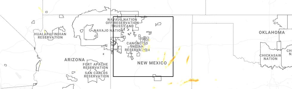
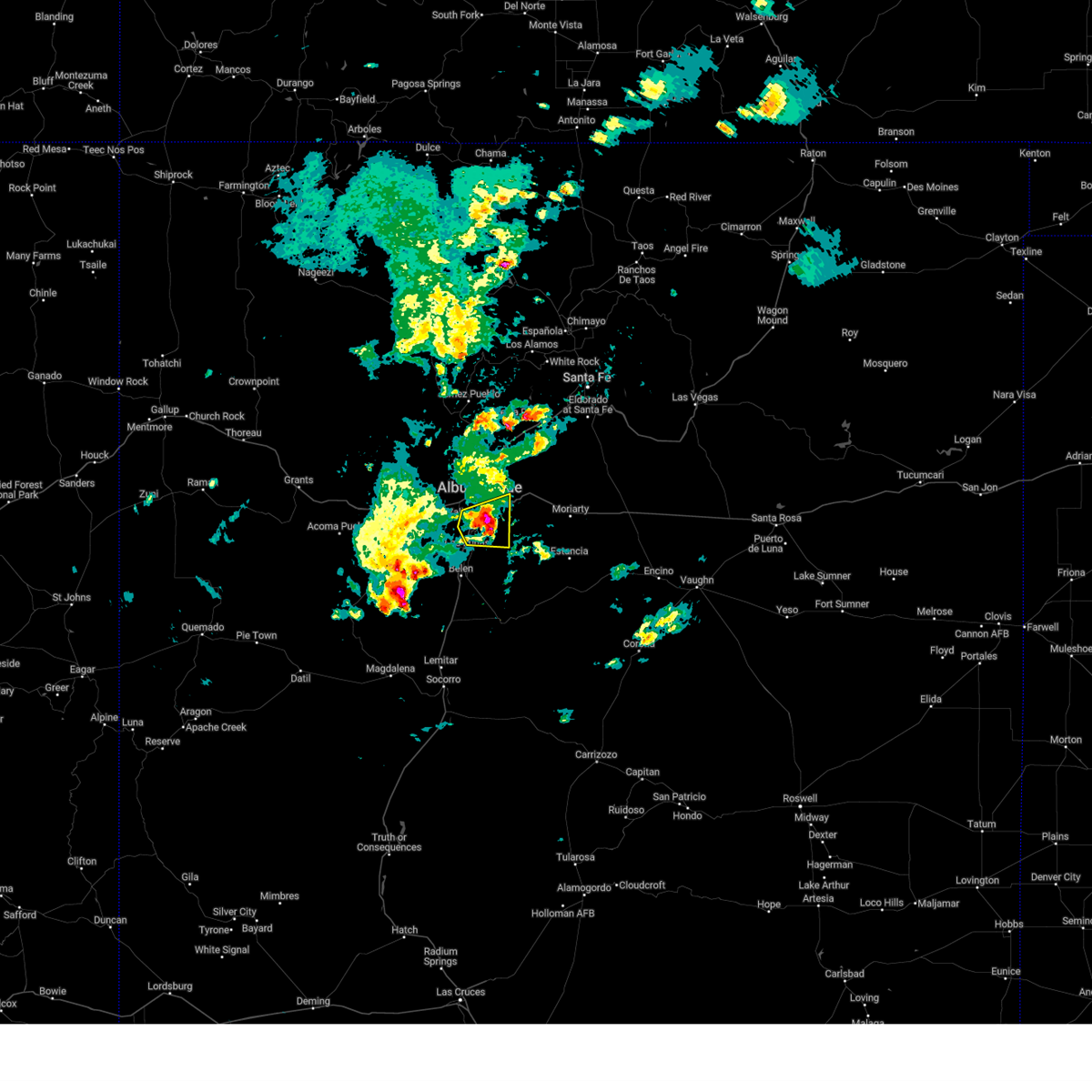
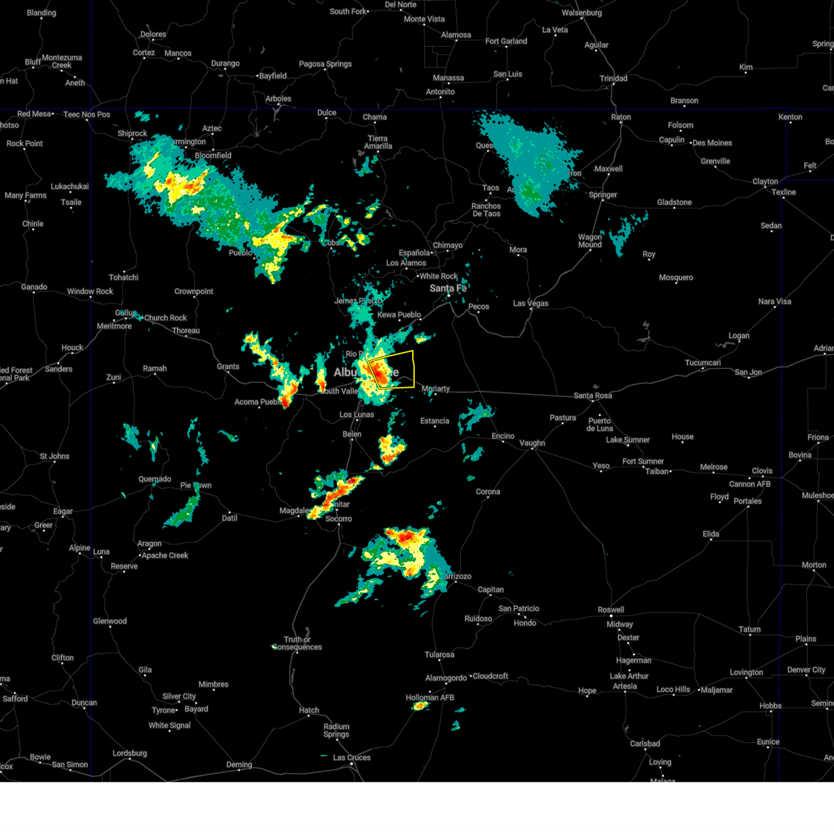
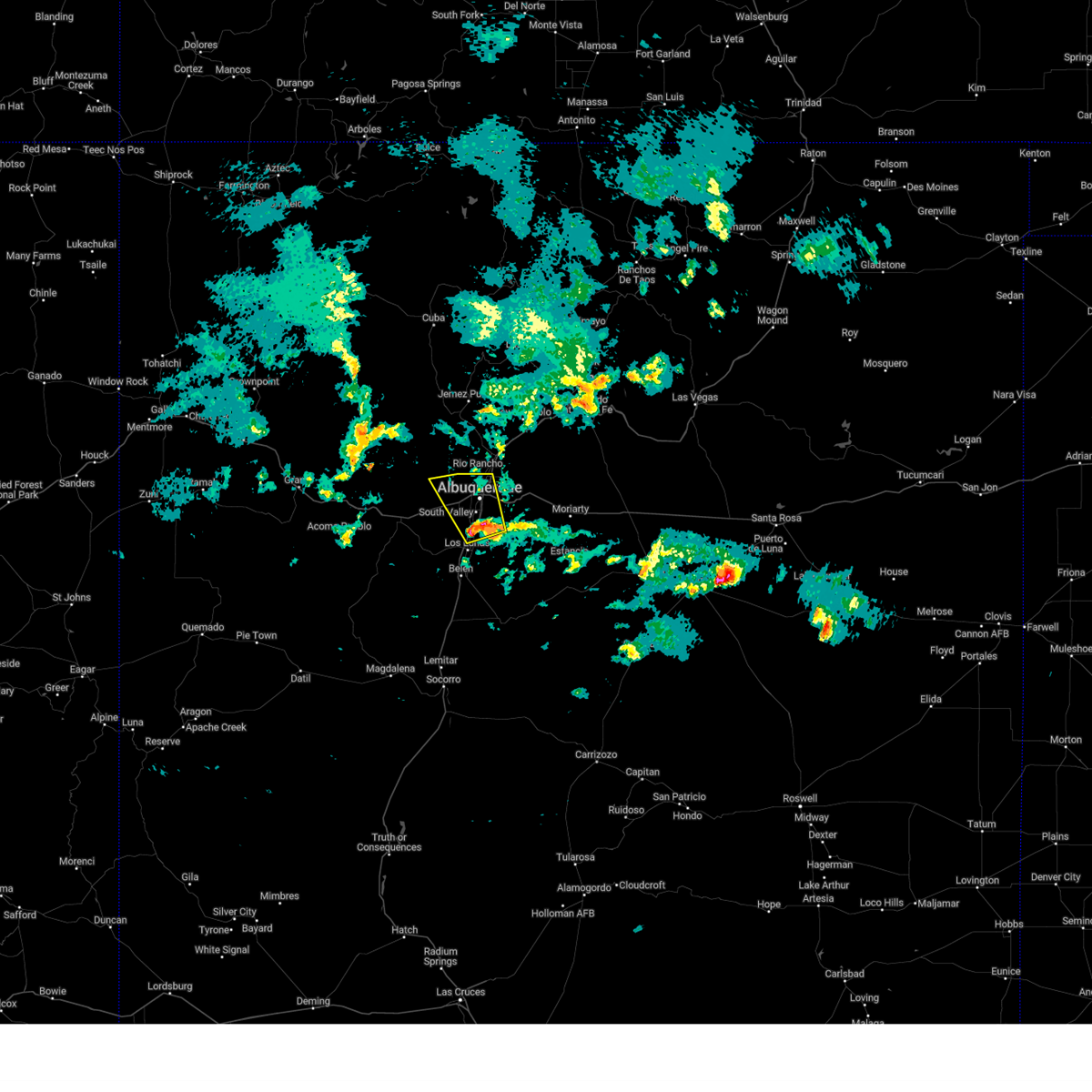
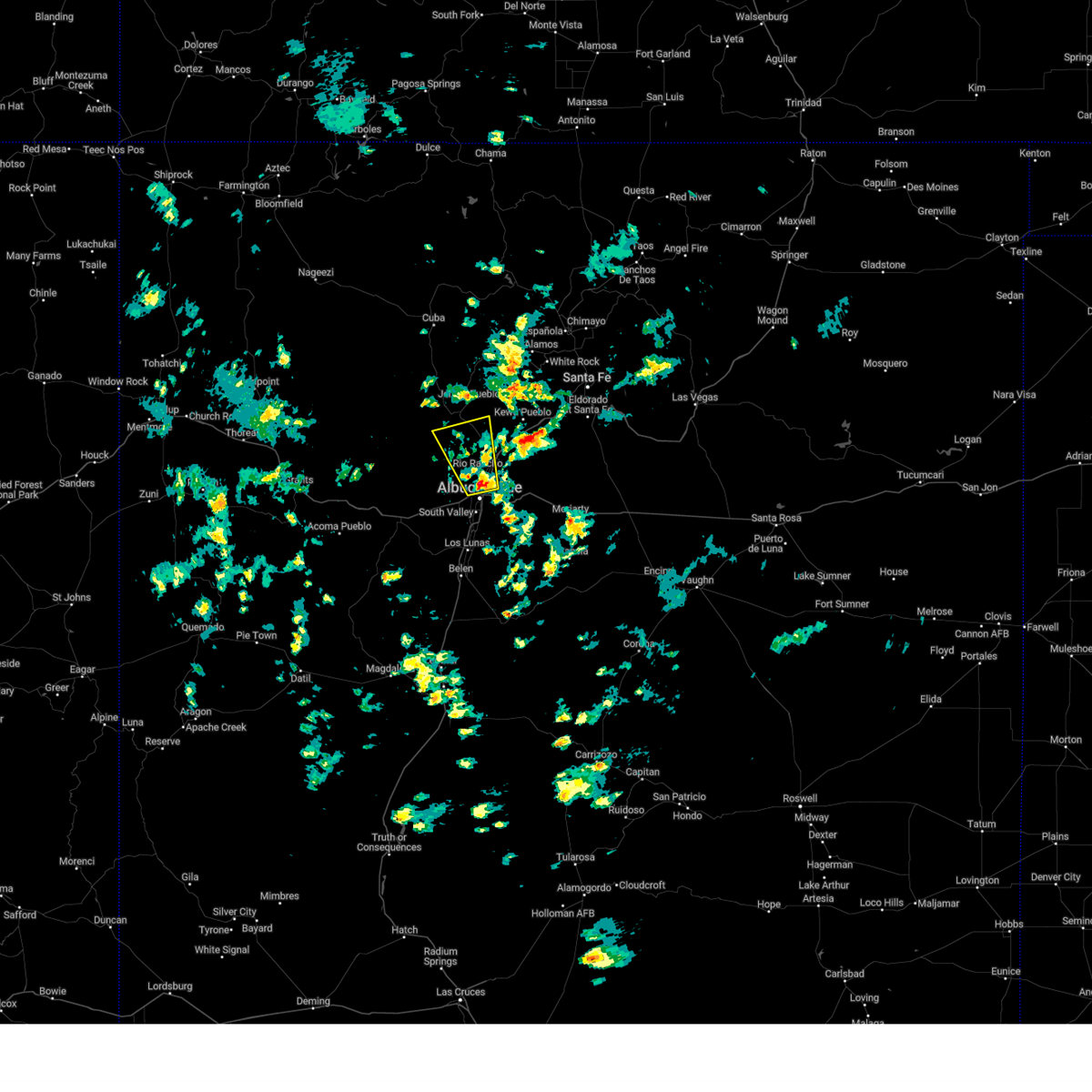
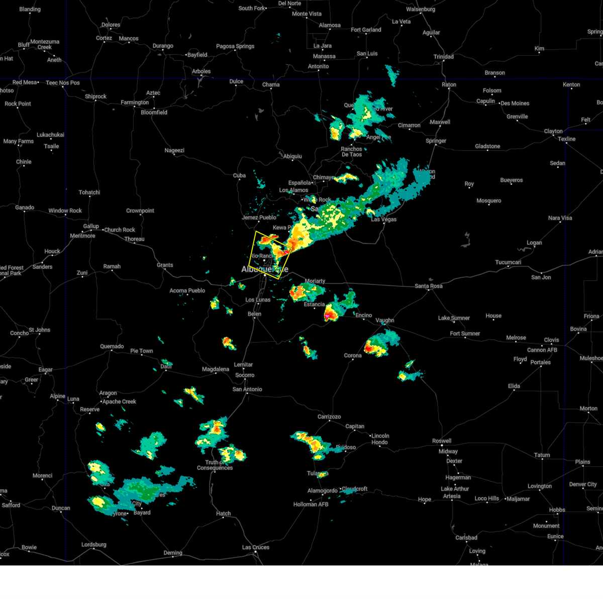
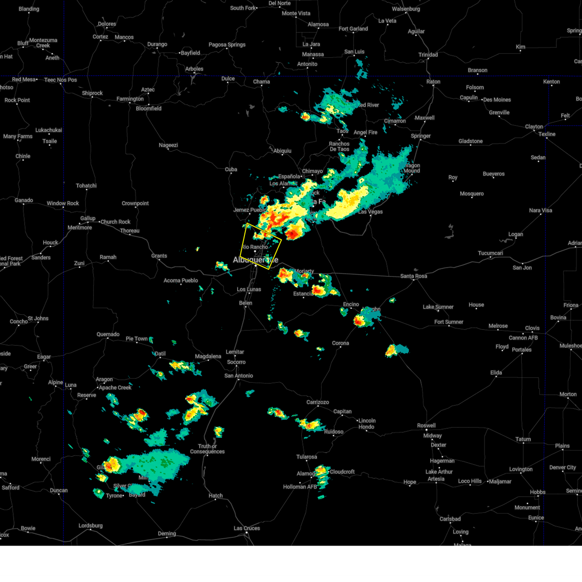
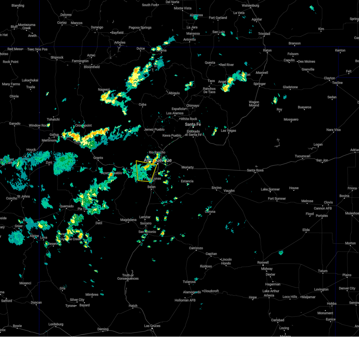
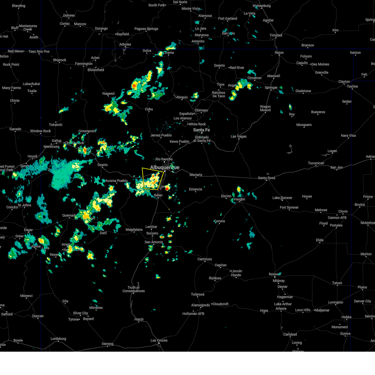
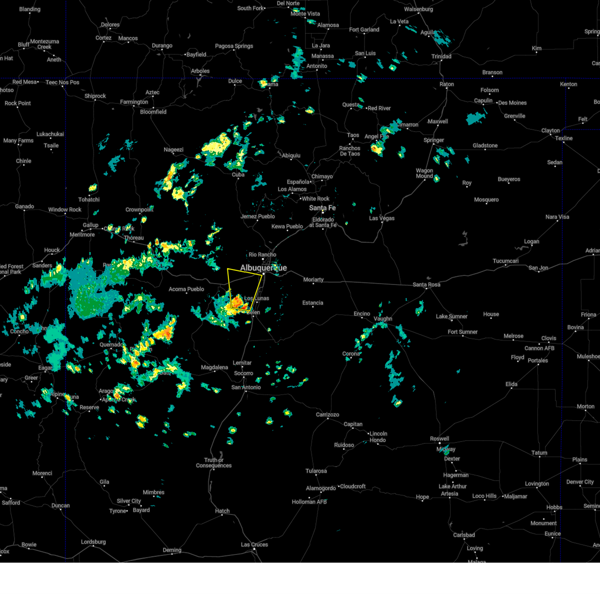
Hail Map for Albuquerque, NM
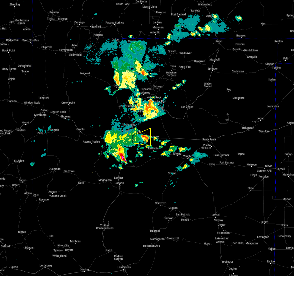
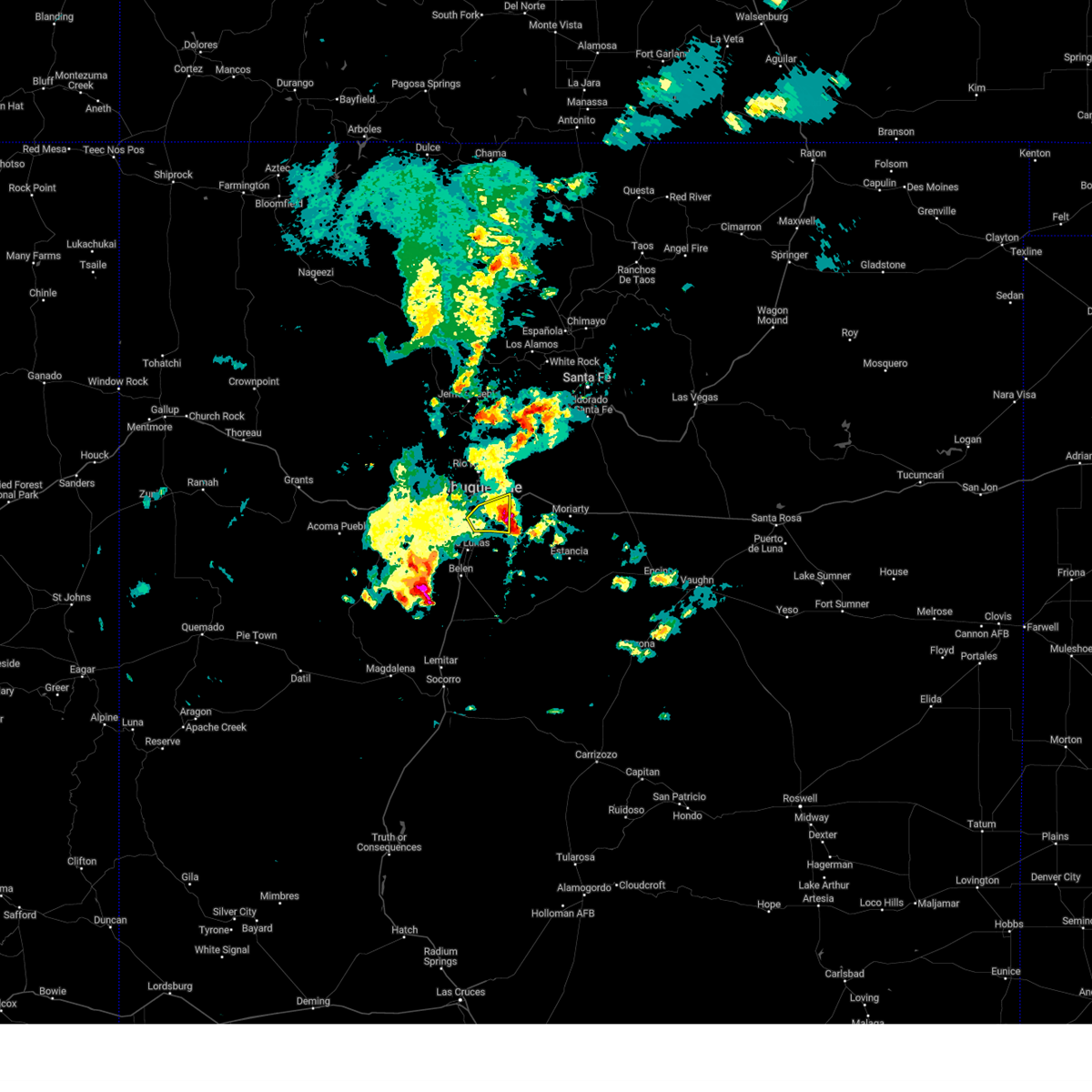
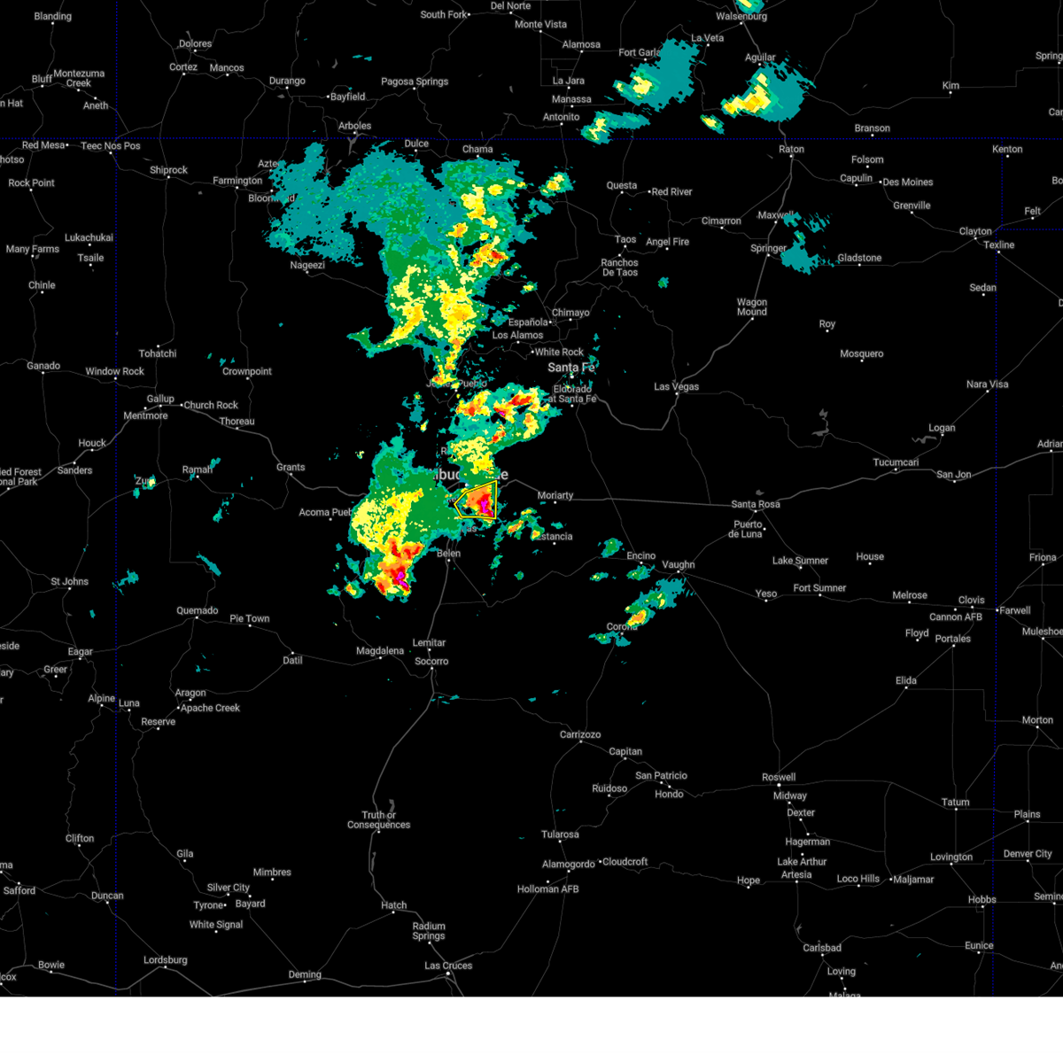
The Albuquerque, NM area has had 24 reports of on-the-ground hail by trained spotters, and has been under severe weather warnings 32 times during the past 12 months. Doppler radar has detected hail at or near Albuquerque, NM on 65 occasions, including 6 occasions during the past year.
| Name: | Albuquerque, NM |
| Where Located: | 2.2 miles NNW of Albuquerque, NM |
| Map: | Google Map for Albuquerque, NM |
| Population: | 545852 |
| Housing Units: | 239166 |
| More Info: | Search Google for Albuquerque, NM |
2
The Top Recent Hail Date for Albuquerque, NM is Sunday, May 4, 2025 (8th out of 65)
Hail and Wind Damage Spotted near Albuquerque, NM
| Date / Time | Report Details |
|---|---|
| 6/9/2025 4:50 PM MDT | Large broken tree limbs in roosevelt park from strong wind in bernalillo county NM, 3 miles NW of Albuquerque, NM |
| 6/4/2025 4:18 PM MDT |
 the severe thunderstorm warning has been cancelled and is no longer in effect the severe thunderstorm warning has been cancelled and is no longer in effect
|
| 6/4/2025 3:58 PM MDT |
 The storm which prompted the warning has moved out of the area. therefore, the warning will be allowed to expire. however, small hail, gusty winds, and heavy rain are still possible with this thunderstorm. The storm which prompted the warning has moved out of the area. therefore, the warning will be allowed to expire. however, small hail, gusty winds, and heavy rain are still possible with this thunderstorm.
|
| 6/4/2025 3:53 PM MDT |
 At 353 pm mdt, a severe thunderstorm was located 11 miles northeast of meadow lake, or 13 miles southeast of albuquerque, moving east at 20 mph (radar indicated). Hazards include 60 mph wind gusts and quarter size hail. Hail damage to vehicles is expected. expect wind damage to roofs, siding, and trees. locations impacted include, southeastern albuquerque, south valley and carnuel. this includes the following highways, interstate 40 between mile markers 165 and 170. Interstate 25 between mile markers 213 and 222. At 353 pm mdt, a severe thunderstorm was located 11 miles northeast of meadow lake, or 13 miles southeast of albuquerque, moving east at 20 mph (radar indicated). Hazards include 60 mph wind gusts and quarter size hail. Hail damage to vehicles is expected. expect wind damage to roofs, siding, and trees. locations impacted include, southeastern albuquerque, south valley and carnuel. this includes the following highways, interstate 40 between mile markers 165 and 170. Interstate 25 between mile markers 213 and 222.
|
| 6/4/2025 3:53 PM MDT |
 the severe thunderstorm warning has been cancelled and is no longer in effect the severe thunderstorm warning has been cancelled and is no longer in effect
|
| 6/4/2025 3:50 PM MDT |
 Svrabq the national weather service in albuquerque has issued a * severe thunderstorm warning for, bernalillo county in central new mexico, northwestern torrance county in central new mexico, southwestern santa fe county in north central new mexico, * until 430 pm mdt. * at 350 pm mdt, a severe thunderstorm was located 9 miles southwest of tijeras, or 14 miles southeast of albuquerque, moving east at 30 mph (radar indicated). Hazards include 60 mph wind gusts and quarter size hail. Hail damage to vehicles is expected. Expect wind damage to roofs, siding, and trees. Svrabq the national weather service in albuquerque has issued a * severe thunderstorm warning for, bernalillo county in central new mexico, northwestern torrance county in central new mexico, southwestern santa fe county in north central new mexico, * until 430 pm mdt. * at 350 pm mdt, a severe thunderstorm was located 9 miles southwest of tijeras, or 14 miles southeast of albuquerque, moving east at 30 mph (radar indicated). Hazards include 60 mph wind gusts and quarter size hail. Hail damage to vehicles is expected. Expect wind damage to roofs, siding, and trees.
|
| 6/4/2025 3:40 PM MDT |
 At 340 pm mdt, a severe thunderstorm was located 7 miles east of isleta pueblo, or 12 miles south of albuquerque, moving east at 20 mph (radar indicated). Hazards include 60 mph wind gusts and quarter size hail. Hail damage to vehicles is expected. expect wind damage to roofs, siding, and trees. locations impacted include, southeastern albuquerque, los lunas, bosque farms, isleta pueblo, south valley, peralta and carnuel. this includes the following highways, interstate 40 between mile markers 165 and 170. Interstate 25 between mile markers 206 and 222. At 340 pm mdt, a severe thunderstorm was located 7 miles east of isleta pueblo, or 12 miles south of albuquerque, moving east at 20 mph (radar indicated). Hazards include 60 mph wind gusts and quarter size hail. Hail damage to vehicles is expected. expect wind damage to roofs, siding, and trees. locations impacted include, southeastern albuquerque, los lunas, bosque farms, isleta pueblo, south valley, peralta and carnuel. this includes the following highways, interstate 40 between mile markers 165 and 170. Interstate 25 between mile markers 206 and 222.
|
| 6/4/2025 3:35 PM MDT | Quarter sized hail reported 12.1 miles N of Albuquerque, NM |
| 6/4/2025 3:22 PM MDT |
 Svrabq the national weather service in albuquerque has issued a * severe thunderstorm warning for, bernalillo county in central new mexico, northeastern valencia county in central new mexico, * until 400 pm mdt. * at 322 pm mdt, a severe thunderstorm was located near isleta pueblo, or 9 miles northeast of los lunas, moving east at 20 mph (radar indicated). Hazards include 60 mph wind gusts and quarter size hail. Hail damage to vehicles is expected. Expect wind damage to roofs, siding, and trees. Svrabq the national weather service in albuquerque has issued a * severe thunderstorm warning for, bernalillo county in central new mexico, northeastern valencia county in central new mexico, * until 400 pm mdt. * at 322 pm mdt, a severe thunderstorm was located near isleta pueblo, or 9 miles northeast of los lunas, moving east at 20 mph (radar indicated). Hazards include 60 mph wind gusts and quarter size hail. Hail damage to vehicles is expected. Expect wind damage to roofs, siding, and trees.
|
| 6/4/2025 2:49 PM MDT |
 Svrabq the national weather service in albuquerque has issued a * severe thunderstorm warning for, bernalillo county in central new mexico, north central valencia county in central new mexico, * until 315 pm mdt. * at 249 pm mdt, a severe thunderstorm was located 9 miles northwest of los lunas, moving northeast at 25 mph (radar indicated). Hazards include 60 mph wind gusts and quarter size hail. Hail damage to vehicles is expected. Expect wind damage to roofs, siding, and trees. Svrabq the national weather service in albuquerque has issued a * severe thunderstorm warning for, bernalillo county in central new mexico, north central valencia county in central new mexico, * until 315 pm mdt. * at 249 pm mdt, a severe thunderstorm was located 9 miles northwest of los lunas, moving northeast at 25 mph (radar indicated). Hazards include 60 mph wind gusts and quarter size hail. Hail damage to vehicles is expected. Expect wind damage to roofs, siding, and trees.
|
| 6/2/2025 3:20 PM MDT |
 the severe thunderstorm warning has been cancelled and is no longer in effect the severe thunderstorm warning has been cancelled and is no longer in effect
|
| 6/2/2025 3:11 PM MDT |
 At 311 pm mdt, a severe thunderstorm was located near sandia heights, or 9 miles east of albuquerque, moving east at 30 mph (radar indicated). Hazards include 60 mph wind gusts and small hail. Expect damage to roofs, siding, and trees. locations impacted include, northeastern albuquerque, corrales, edgewood, tijeras, sandia park, cedar crest, sandia heights, sedillo, north valley and canoncito in bernalillo county. this includes the following highways, interstate 40 between mile markers 164 and 183. Interstate 25 between mile markers 230 and 236. At 311 pm mdt, a severe thunderstorm was located near sandia heights, or 9 miles east of albuquerque, moving east at 30 mph (radar indicated). Hazards include 60 mph wind gusts and small hail. Expect damage to roofs, siding, and trees. locations impacted include, northeastern albuquerque, corrales, edgewood, tijeras, sandia park, cedar crest, sandia heights, sedillo, north valley and canoncito in bernalillo county. this includes the following highways, interstate 40 between mile markers 164 and 183. Interstate 25 between mile markers 230 and 236.
|
| 6/2/2025 2:48 PM MDT |
 Svrabq the national weather service in albuquerque has issued a * severe thunderstorm warning for, bernalillo county in central new mexico, southeastern sandoval county in north central new mexico, * until 330 pm mdt. * at 248 pm mdt, a severe thunderstorm was located over albuquerque, moving east at 35 mph (radar indicated). Hazards include 60 mph wind gusts and quarter size hail. Hail damage to vehicles is expected. Expect wind damage to roofs, siding, and trees. Svrabq the national weather service in albuquerque has issued a * severe thunderstorm warning for, bernalillo county in central new mexico, southeastern sandoval county in north central new mexico, * until 330 pm mdt. * at 248 pm mdt, a severe thunderstorm was located over albuquerque, moving east at 35 mph (radar indicated). Hazards include 60 mph wind gusts and quarter size hail. Hail damage to vehicles is expected. Expect wind damage to roofs, siding, and trees.
|
| 5/4/2025 6:17 PM MDT |
 the severe thunderstorm warning has been cancelled and is no longer in effect the severe thunderstorm warning has been cancelled and is no longer in effect
|
| 5/4/2025 6:08 PM MDT |
 At 608 pm mdt, a severe thunderstorm was located near paradise hills, or 6 miles northwest of albuquerque, moving north at 30 mph (radar indicated). Hazards include 60 mph wind gusts and small hail. Expect damage to roofs, siding, and trees. locations impacted include, albuquerque, rio rancho, corrales, los ranchos de albuquerque, paradise hills, north valley, south valley and alameda. this includes the following highways, interstate 40 between mile markers 148 and 165. Interstate 25 between mile markers 223 and 232. At 608 pm mdt, a severe thunderstorm was located near paradise hills, or 6 miles northwest of albuquerque, moving north at 30 mph (radar indicated). Hazards include 60 mph wind gusts and small hail. Expect damage to roofs, siding, and trees. locations impacted include, albuquerque, rio rancho, corrales, los ranchos de albuquerque, paradise hills, north valley, south valley and alameda. this includes the following highways, interstate 40 between mile markers 148 and 165. Interstate 25 between mile markers 223 and 232.
|
| 5/4/2025 6:00 PM MDT |
 At 600 pm mdt, a severe thunderstorm was located near albuquerque, moving north at 30 mph (radar indicated). Hazards include 60 mph wind gusts and quarter size hail. Hail damage to vehicles is expected. expect wind damage to roofs, siding, and trees. locations impacted include, albuquerque, rio rancho, corrales, los ranchos de albuquerque, south valley, paradise hills, north valley and alameda. this includes the following highways, interstate 40 between mile markers 145 and 165. Interstate 25 between mile markers 217 and 232. At 600 pm mdt, a severe thunderstorm was located near albuquerque, moving north at 30 mph (radar indicated). Hazards include 60 mph wind gusts and quarter size hail. Hail damage to vehicles is expected. expect wind damage to roofs, siding, and trees. locations impacted include, albuquerque, rio rancho, corrales, los ranchos de albuquerque, south valley, paradise hills, north valley and alameda. this includes the following highways, interstate 40 between mile markers 145 and 165. Interstate 25 between mile markers 217 and 232.
|
| 5/4/2025 6:00 PM MDT |
 the severe thunderstorm warning has been cancelled and is no longer in effect the severe thunderstorm warning has been cancelled and is no longer in effect
|
| 5/4/2025 5:43 PM MDT |
 Svrabq the national weather service in albuquerque has issued a * severe thunderstorm warning for, bernalillo county in central new mexico, north central valencia county in central new mexico, * until 630 pm mdt. * at 543 pm mdt, a severe thunderstorm was located near south valley, or 10 miles south of albuquerque, moving north at 30 mph (radar indicated). Hazards include 60 mph wind gusts and quarter size hail. Hail damage to vehicles is expected. Expect wind damage to roofs, siding, and trees. Svrabq the national weather service in albuquerque has issued a * severe thunderstorm warning for, bernalillo county in central new mexico, north central valencia county in central new mexico, * until 630 pm mdt. * at 543 pm mdt, a severe thunderstorm was located near south valley, or 10 miles south of albuquerque, moving north at 30 mph (radar indicated). Hazards include 60 mph wind gusts and quarter size hail. Hail damage to vehicles is expected. Expect wind damage to roofs, siding, and trees.
|
| 5/4/2025 2:14 PM MDT | Quarter sized hail reported 2.6 miles E of Albuquerque, NM |
| 5/4/2025 2:09 PM MDT |
 Svrabq the national weather service in albuquerque has issued a * severe thunderstorm warning for, bernalillo county in central new mexico, south central sandoval county in north central new mexico, * until 300 pm mdt. * at 209 pm mdt, a severe thunderstorm was located over los ranchos de albuquerque, or 5 miles north of albuquerque, moving north at 30 mph (radar indicated). Hazards include 60 mph wind gusts and quarter size hail. Hail damage to vehicles is expected. Expect wind damage to roofs, siding, and trees. Svrabq the national weather service in albuquerque has issued a * severe thunderstorm warning for, bernalillo county in central new mexico, south central sandoval county in north central new mexico, * until 300 pm mdt. * at 209 pm mdt, a severe thunderstorm was located over los ranchos de albuquerque, or 5 miles north of albuquerque, moving north at 30 mph (radar indicated). Hazards include 60 mph wind gusts and quarter size hail. Hail damage to vehicles is expected. Expect wind damage to roofs, siding, and trees.
|
| 5/2/2025 4:28 PM MDT | Svrabq the national weather service in albuquerque has issued a * severe thunderstorm warning for, bernalillo county in central new mexico, northwestern valencia county in central new mexico, east central cibola county in west central new mexico, * until 515 pm mdt. * at 428 pm mdt, severe thunderstorms were located along a line from near laguna pueblo to 15 miles west of south valley, moving southeast at 10 mph (radar indicated). Hazards include 60 mph wind gusts and significant accumulations of small hail. expect damage to roofs, siding, and trees |
| 9/5/2024 5:39 PM MDT |
 the severe thunderstorm warning has been cancelled and is no longer in effect the severe thunderstorm warning has been cancelled and is no longer in effect
|
| 9/5/2024 5:31 PM MDT |
 At 531 pm mdt, severe thunderstorms were located along a line extending from 6 miles west of northern meadows to sandia heights, moving southwest at 20 mph (public). Hazards include 60 mph wind gusts. Expect damage to roofs, siding, and trees. locations impacted include, northern albuquerque, rio rancho, bernalillo, corrales, los ranchos de albuquerque, enchanted hills, mariposa, cabezon, coronado state monument, and vista hills. this includes the following highways, interstate 40 between mile markers 159 and 168. interstate 25 between mile markers 228 and 249. Highway 550 between mile markers 1 and 20. At 531 pm mdt, severe thunderstorms were located along a line extending from 6 miles west of northern meadows to sandia heights, moving southwest at 20 mph (public). Hazards include 60 mph wind gusts. Expect damage to roofs, siding, and trees. locations impacted include, northern albuquerque, rio rancho, bernalillo, corrales, los ranchos de albuquerque, enchanted hills, mariposa, cabezon, coronado state monument, and vista hills. this includes the following highways, interstate 40 between mile markers 159 and 168. interstate 25 between mile markers 228 and 249. Highway 550 between mile markers 1 and 20.
|
| 9/5/2024 5:09 PM MDT |
 Svrabq the national weather service in albuquerque has issued a * severe thunderstorm warning for, southeastern sandoval county in north central new mexico, bernalillo county in central new mexico, * until 615 pm mdt. * at 509 pm mdt, severe thunderstorms were located along a line extending from near mariposa to 7 miles southeast of santa ana pueblo, moving southwest at 15 mph (public). Hazards include 60 mph wind gusts. expect damage to roofs, siding, and trees Svrabq the national weather service in albuquerque has issued a * severe thunderstorm warning for, southeastern sandoval county in north central new mexico, bernalillo county in central new mexico, * until 615 pm mdt. * at 509 pm mdt, severe thunderstorms were located along a line extending from near mariposa to 7 miles southeast of santa ana pueblo, moving southwest at 15 mph (public). Hazards include 60 mph wind gusts. expect damage to roofs, siding, and trees
|
| 8/24/2024 4:52 PM MDT | Asos station kabq albuquerque intl sunpor in bernalillo county NM, 5.1 miles NNW of Albuquerque, NM |
| 8/22/2024 4:41 PM MDT |
 The storm which prompted the warning has weakened below severe limits, and no longer poses an immediate threat to life or property. therefore, the warning will be allowed to expire. however, gusty winds and heavy rain are still possible with this thunderstorm. The storm which prompted the warning has weakened below severe limits, and no longer poses an immediate threat to life or property. therefore, the warning will be allowed to expire. however, gusty winds and heavy rain are still possible with this thunderstorm.
|
| 8/22/2024 4:20 PM MDT |
 At 420 pm mdt, a severe thunderstorm was located 12 miles southwest of paradise hills, or 14 miles west of albuquerque, moving north at 35 mph (radar indicated). Hazards include 60 mph wind gusts. Expect damage to roofs, siding, and trees. locations impacted include, albuquerque, los lunas, and south valley. This includes interstate 40 between mile markers 133 and 152. At 420 pm mdt, a severe thunderstorm was located 12 miles southwest of paradise hills, or 14 miles west of albuquerque, moving north at 35 mph (radar indicated). Hazards include 60 mph wind gusts. Expect damage to roofs, siding, and trees. locations impacted include, albuquerque, los lunas, and south valley. This includes interstate 40 between mile markers 133 and 152.
|
| 8/22/2024 4:03 PM MDT |
 Svrabq the national weather service in albuquerque has issued a * severe thunderstorm warning for, northwestern valencia county in central new mexico, bernalillo county in central new mexico, * until 445 pm mdt. * at 401 pm mdt, a severe thunderstorm was located 13 miles west of isleta pueblo, or 14 miles northwest of los lunas, moving north at 35 mph (radar indicated). Hazards include 60 mph wind gusts. expect damage to roofs, siding, and trees Svrabq the national weather service in albuquerque has issued a * severe thunderstorm warning for, northwestern valencia county in central new mexico, bernalillo county in central new mexico, * until 445 pm mdt. * at 401 pm mdt, a severe thunderstorm was located 13 miles west of isleta pueblo, or 14 miles northwest of los lunas, moving north at 35 mph (radar indicated). Hazards include 60 mph wind gusts. expect damage to roofs, siding, and trees
|
| 7/21/2024 8:27 PM MDT |
 The storm which prompted the warning has weakened below severe limits, and no longer poses an immediate threat to life or property. therefore, the warning will be allowed to expire. however, gusty winds and heavy rain are still possible with this thunderstorm. The storm which prompted the warning has weakened below severe limits, and no longer poses an immediate threat to life or property. therefore, the warning will be allowed to expire. however, gusty winds and heavy rain are still possible with this thunderstorm.
|
| 7/21/2024 7:57 PM MDT |
 The storm which prompted the warning has moved out of the area. therefore, the warning will be allowed to expire. however, gusty winds and heavy rain are still possible with this thunderstorm. to report severe weather, contact your local law enforcement and the national weather service in albuquerque. The storm which prompted the warning has moved out of the area. therefore, the warning will be allowed to expire. however, gusty winds and heavy rain are still possible with this thunderstorm. to report severe weather, contact your local law enforcement and the national weather service in albuquerque.
|
| 7/21/2024 7:42 PM MDT |
 Svrabq the national weather service in albuquerque has issued a * severe thunderstorm warning for, valencia county in central new mexico, bernalillo county in central new mexico, * until 830 pm mdt. * at 742 pm mdt, a severe thunderstorm was located near isleta pueblo, or 10 miles north of los lunas, moving south at 30 mph (radar indicated). Hazards include 60 mph wind gusts. expect damage to roofs, siding, and trees Svrabq the national weather service in albuquerque has issued a * severe thunderstorm warning for, valencia county in central new mexico, bernalillo county in central new mexico, * until 830 pm mdt. * at 742 pm mdt, a severe thunderstorm was located near isleta pueblo, or 10 miles north of los lunas, moving south at 30 mph (radar indicated). Hazards include 60 mph wind gusts. expect damage to roofs, siding, and trees
|
| 7/21/2024 7:20 PM MDT |
 At 720 pm mdt, a severe thunderstorm was located 7 miles southwest of paradise hills, or 7 miles west of albuquerque, moving southeast at 30 mph (radar indicated). Hazards include 60 mph wind gusts and penny size hail. Expect damage to roofs, siding, and trees. locations impacted include, albuquerque, rio rancho, los lunas, corrales, los ranchos de albuquerque, bosque farms, cabezon, vista hills, sandia pueblo, and isleta pueblo. this includes the following highways, interstate 40 between mile markers 139 and 166. Interstate 25 between mile markers 204 and 238. At 720 pm mdt, a severe thunderstorm was located 7 miles southwest of paradise hills, or 7 miles west of albuquerque, moving southeast at 30 mph (radar indicated). Hazards include 60 mph wind gusts and penny size hail. Expect damage to roofs, siding, and trees. locations impacted include, albuquerque, rio rancho, los lunas, corrales, los ranchos de albuquerque, bosque farms, cabezon, vista hills, sandia pueblo, and isleta pueblo. this includes the following highways, interstate 40 between mile markers 139 and 166. Interstate 25 between mile markers 204 and 238.
|
| 7/21/2024 6:57 PM MDT |
 Svrabq the national weather service in albuquerque has issued a * severe thunderstorm warning for, north central valencia county in central new mexico, south central sandoval county in north central new mexico, bernalillo county in central new mexico, * until 800 pm mdt. * at 657 pm mdt, a severe thunderstorm was located 9 miles west of northern meadows, or 11 miles west of rio rancho, moving southeast at 30 mph (radar indicated). Hazards include 60 mph wind gusts and penny size hail. expect damage to roofs, siding, and trees Svrabq the national weather service in albuquerque has issued a * severe thunderstorm warning for, north central valencia county in central new mexico, south central sandoval county in north central new mexico, bernalillo county in central new mexico, * until 800 pm mdt. * at 657 pm mdt, a severe thunderstorm was located 9 miles west of northern meadows, or 11 miles west of rio rancho, moving southeast at 30 mph (radar indicated). Hazards include 60 mph wind gusts and penny size hail. expect damage to roofs, siding, and trees
|
| 7/21/2024 6:30 PM MDT |
 At 629 pm mdt, severe thunderstorms were located along a line extending from 10 miles northwest of jemez pueblo to near torreon to 8 miles southeast of marquez, moving southeast at 40 mph (radar indicated). Hazards include 60 mph wind gusts. Expect damage to roofs, siding, and trees. locations impacted include, northwestern albuquerque, rio rancho, san ysidro, mesita, northern meadows, mariposa, zia pueblo, rio rancho city center, jemez pueblo, and tohajiilee. this includes the following highways, interstate 40 between mile markers 116 and 146. Highway 550 between mile markers 5 and 45. At 629 pm mdt, severe thunderstorms were located along a line extending from 10 miles northwest of jemez pueblo to near torreon to 8 miles southeast of marquez, moving southeast at 40 mph (radar indicated). Hazards include 60 mph wind gusts. Expect damage to roofs, siding, and trees. locations impacted include, northwestern albuquerque, rio rancho, san ysidro, mesita, northern meadows, mariposa, zia pueblo, rio rancho city center, jemez pueblo, and tohajiilee. this includes the following highways, interstate 40 between mile markers 116 and 146. Highway 550 between mile markers 5 and 45.
|
| 7/21/2024 6:30 PM MDT |
 the severe thunderstorm warning has been cancelled and is no longer in effect the severe thunderstorm warning has been cancelled and is no longer in effect
|
| 7/21/2024 6:12 PM MDT |
 Svrabq the national weather service in albuquerque has issued a * severe thunderstorm warning for, northeastern cibola county in west central new mexico, east central mckinley county in west central new mexico, northwestern valencia county in central new mexico, south central sandoval county in north central new mexico, bernalillo county in central new mexico, * until 700 pm mdt. * at 612 pm mdt, severe thunderstorms were located along a line extending from 12 miles southwest of fenton lake state park to 9 miles northwest of torreon to marquez, moving south at 45 mph (radar indicated). Hazards include 60 mph wind gusts. expect damage to roofs, siding, and trees Svrabq the national weather service in albuquerque has issued a * severe thunderstorm warning for, northeastern cibola county in west central new mexico, east central mckinley county in west central new mexico, northwestern valencia county in central new mexico, south central sandoval county in north central new mexico, bernalillo county in central new mexico, * until 700 pm mdt. * at 612 pm mdt, severe thunderstorms were located along a line extending from 12 miles southwest of fenton lake state park to 9 miles northwest of torreon to marquez, moving south at 45 mph (radar indicated). Hazards include 60 mph wind gusts. expect damage to roofs, siding, and trees
|
| 6/29/2024 9:32 PM MDT |
 The warning has been allowed to expire. however, heavy rain and flash flooding is still possible with this thunderstorm. The warning has been allowed to expire. however, heavy rain and flash flooding is still possible with this thunderstorm.
|
| 6/29/2024 9:32 PM MDT |
 The warning has been allowed to expire. however, heavy rain and flash flooding is still possible with this thunderstorm. The warning has been allowed to expire. however, heavy rain and flash flooding is still possible with this thunderstorm.
|
| 6/29/2024 9:31 PM MDT |
 The warning has been allowed to expire. however, heavy rain and flash flooding is still possible with this thunderstorm. The warning has been allowed to expire. however, heavy rain and flash flooding is still possible with this thunderstorm.
|
| 6/29/2024 9:05 PM MDT | Report from mping: 3-inch tree limbs broken; power poles broke in bernalillo county NM, 5.7 miles SW of Albuquerque, NM |
| 6/29/2024 9:05 PM MDT |
 At 904 pm mdt, a severe thunderstorm was located over eastern albuquerque, moving northeast at 15 mph (radar indicated). Hazards include 60 mph wind gusts and penny size hail. Expect damage to roofs, siding, and trees. Locations impacted include, eastern albuquerque, bernalillo, tijeras, cedar crest, sandia heights, sandia pueblo, sandia park, carnuel, san antonito, and canoncito in bernalillo county. At 904 pm mdt, a severe thunderstorm was located over eastern albuquerque, moving northeast at 15 mph (radar indicated). Hazards include 60 mph wind gusts and penny size hail. Expect damage to roofs, siding, and trees. Locations impacted include, eastern albuquerque, bernalillo, tijeras, cedar crest, sandia heights, sandia pueblo, sandia park, carnuel, san antonito, and canoncito in bernalillo county.
|
| 6/29/2024 9:00 PM MDT |
 Svrabq the national weather service in albuquerque has issued a * severe thunderstorm warning for, southeastern sandoval county in north central new mexico, bernalillo county in central new mexico, * until 930 pm mdt. * at 859 pm mdt, a severe thunderstorm was located over southern rio rancho, moving north at 15 mph (radar indicated). Hazards include 60 mph wind gusts and penny size hail. expect damage to roofs, siding, and trees Svrabq the national weather service in albuquerque has issued a * severe thunderstorm warning for, southeastern sandoval county in north central new mexico, bernalillo county in central new mexico, * until 930 pm mdt. * at 859 pm mdt, a severe thunderstorm was located over southern rio rancho, moving north at 15 mph (radar indicated). Hazards include 60 mph wind gusts and penny size hail. expect damage to roofs, siding, and trees
|
| 6/29/2024 8:37 PM MDT |
 At 836 pm mdt, a severe thunderstorm was located over northwestern albuquerque, moving north at 15 mph (national weather service forecast office at the sunport). Hazards include 70 mph wind gusts and quarter size hail. Hail damage to vehicles is expected. expect considerable tree damage. wind damage is also likely to mobile homes, roofs, and outbuildings. Locations impacted include, albuquerque, southwestern rio rancho, corrales, los ranchos de albuquerque, paradise hills, south valley, cabezon, north valley, rio rancho intel area, and alameda. At 836 pm mdt, a severe thunderstorm was located over northwestern albuquerque, moving north at 15 mph (national weather service forecast office at the sunport). Hazards include 70 mph wind gusts and quarter size hail. Hail damage to vehicles is expected. expect considerable tree damage. wind damage is also likely to mobile homes, roofs, and outbuildings. Locations impacted include, albuquerque, southwestern rio rancho, corrales, los ranchos de albuquerque, paradise hills, south valley, cabezon, north valley, rio rancho intel area, and alameda.
|
| 6/29/2024 8:31 PM MDT | Asos station kabq albuquerque intl sunpor in bernalillo county NM, 5.1 miles NNW of Albuquerque, NM |
| 6/29/2024 8:30 PM MDT | Storm damage reported in bernalillo county NM, 7.9 miles SW of Albuquerque, NM |
| 6/29/2024 8:26 PM MDT |
 Svrabq the national weather service in albuquerque has issued a * severe thunderstorm warning for, southern sandoval county in north central new mexico, bernalillo county in central new mexico, * until 930 pm mdt. * at 826 pm mdt, a severe thunderstorm was located over southeastern albuquerque, moving northeast at 15 mph (radar indicated). Hazards include 60 mph wind gusts and penny size hail. expect damage to roofs, siding, and trees Svrabq the national weather service in albuquerque has issued a * severe thunderstorm warning for, southern sandoval county in north central new mexico, bernalillo county in central new mexico, * until 930 pm mdt. * at 826 pm mdt, a severe thunderstorm was located over southeastern albuquerque, moving northeast at 15 mph (radar indicated). Hazards include 60 mph wind gusts and penny size hail. expect damage to roofs, siding, and trees
|
| 6/29/2024 8:06 PM MDT |
 Svrabq the national weather service in albuquerque has issued a * severe thunderstorm warning for, southern sandoval county in north central new mexico, bernalillo county in central new mexico, * until 900 pm mdt. * at 805 pm mdt, a severe thunderstorm was located over southwestern albuquerque, moving north at 15 mph (radar indicated). Hazards include 60 mph wind gusts and quarter size hail. Hail damage to vehicles is expected. Expect wind damage to roofs, siding, and trees. Svrabq the national weather service in albuquerque has issued a * severe thunderstorm warning for, southern sandoval county in north central new mexico, bernalillo county in central new mexico, * until 900 pm mdt. * at 805 pm mdt, a severe thunderstorm was located over southwestern albuquerque, moving north at 15 mph (radar indicated). Hazards include 60 mph wind gusts and quarter size hail. Hail damage to vehicles is expected. Expect wind damage to roofs, siding, and trees.
|
| 6/14/2024 6:27 PM MDT |
 The storm which prompted the warning has weakened below severe limits, and no longer poses an immediate threat to life or property. therefore, the warning will be allowed to expire. however, gusty winds are still possible with this thunderstorm. The storm which prompted the warning has weakened below severe limits, and no longer poses an immediate threat to life or property. therefore, the warning will be allowed to expire. however, gusty winds are still possible with this thunderstorm.
|
| 6/14/2024 6:02 PM MDT |
 At 559 pm mdt, a severe thunderstorm was located over san felipe pueblo, or 10 miles northeast of bernalillo, moving northeast at 35 mph. additional thunderstorms are moving into the albuquerque metro area from the southwest with a risk of more severe wind gusts (radar indicated). Hazards include 60 mph wind gusts. Expect damage to roofs, siding, and trees. Locations impacted include, albuquerque, rio rancho, bernalillo, corrales, los ranchos de albuquerque, tijeras, mariposa, san felipe pueblo, coronado state monument, and vista hills. At 559 pm mdt, a severe thunderstorm was located over san felipe pueblo, or 10 miles northeast of bernalillo, moving northeast at 35 mph. additional thunderstorms are moving into the albuquerque metro area from the southwest with a risk of more severe wind gusts (radar indicated). Hazards include 60 mph wind gusts. Expect damage to roofs, siding, and trees. Locations impacted include, albuquerque, rio rancho, bernalillo, corrales, los ranchos de albuquerque, tijeras, mariposa, san felipe pueblo, coronado state monument, and vista hills.
|
| 6/14/2024 5:27 PM MDT | Corrects previous non-tstm wnd gst report from 4 ne south valley. asos station kabq albuquerque intl sunpor in bernalillo county NM, 5.1 miles NNW of Albuquerque, NM |
| 6/14/2024 5:24 PM MDT |
 Svrabq the national weather service in albuquerque has issued a * severe thunderstorm warning for, southeastern sandoval county in north central new mexico, bernalillo county in central new mexico, * until 630 pm mdt. * at 524 pm mdt, a severe thunderstorm was located over northern albuquerque, moving east at 55 mph (radar indicated). Hazards include 60 mph wind gusts. expect damage to roofs, siding, and trees Svrabq the national weather service in albuquerque has issued a * severe thunderstorm warning for, southeastern sandoval county in north central new mexico, bernalillo county in central new mexico, * until 630 pm mdt. * at 524 pm mdt, a severe thunderstorm was located over northern albuquerque, moving east at 55 mph (radar indicated). Hazards include 60 mph wind gusts. expect damage to roofs, siding, and trees
|
| 6/7/2024 4:10 PM MDT | Asos station kabq albuquerque intl sunpor in bernalillo county NM, 5.1 miles NNW of Albuquerque, NM |
| 6/7/2024 4:10 PM MDT | Storm damage reported in bernalillo county NM, 5.4 miles NW of Albuquerque, NM |
| 9/18/2023 4:50 PM MDT | Quarter sized hail reported 0.5 miles SSW of Albuquerque, NM |
| 9/18/2023 4:34 PM MDT | Quarter sized hail reported 0.5 miles SSW of Albuquerque, NM, corrects previous hail report from 2 ese rio grande nature center. |
| 9/18/2023 4:15 PM MDT |
 At 414 pm mdt, a severe thunderstorm was located over northeastern albuquerque, moving east at 25 mph (radar indicated). Hazards include 60 mph wind gusts and quarter size hail. Hail damage to vehicles is expected. expect wind damage to roofs, siding, and trees. locations impacted include, albuquerque, los ranchos de albuquerque, tijeras, cedar crest, sedillo, sandia heights, north valley, sandia park, alameda, and san antonito. this includes the following highways, interstate 40 between mile markers 157 and 167, and between mile markers 173 and 182. interstate 25 between mile markers 223 and 234. hail threat, radar indicated max hail size, 1. 00 in wind threat, radar indicated max wind gust, 60 mph. At 414 pm mdt, a severe thunderstorm was located over northeastern albuquerque, moving east at 25 mph (radar indicated). Hazards include 60 mph wind gusts and quarter size hail. Hail damage to vehicles is expected. expect wind damage to roofs, siding, and trees. locations impacted include, albuquerque, los ranchos de albuquerque, tijeras, cedar crest, sedillo, sandia heights, north valley, sandia park, alameda, and san antonito. this includes the following highways, interstate 40 between mile markers 157 and 167, and between mile markers 173 and 182. interstate 25 between mile markers 223 and 234. hail threat, radar indicated max hail size, 1. 00 in wind threat, radar indicated max wind gust, 60 mph.
|
| 9/18/2023 4:08 PM MDT | Quarter sized hail reported 0.5 miles SSW of Albuquerque, NM, 12th and candelaria; dime to quarter size hail. |
| 9/18/2023 4:07 PM MDT | Quarter sized hail reported 1.4 miles SE of Albuquerque, NM, candelaria and camino caballete. |
| 9/18/2023 4:01 PM MDT |
 At 401 pm mdt, a severe thunderstorm was located over northwestern albuquerque, moving east at 25 mph (radar indicated). Hazards include 60 mph wind gusts and quarter size hail. Hail damage to vehicles is expected. Expect wind damage to roofs, siding, and trees. At 401 pm mdt, a severe thunderstorm was located over northwestern albuquerque, moving east at 25 mph (radar indicated). Hazards include 60 mph wind gusts and quarter size hail. Hail damage to vehicles is expected. Expect wind damage to roofs, siding, and trees.
|
| 5/31/2023 6:12 PM MDT | Asos station kabq albuquerque intl sunport. thunderstorm outflow producing a gap wind through the sandia/manzano mountain in bernalillo county NM, 5.1 miles NNW of Albuquerque, NM |
| 5/21/2023 2:00 PM MDT |
 At 159 pm mdt, a severe thunderstorm was located over central albuquerque, moving southeast at 15 mph (radar indicated). Hazards include 60 mph wind gusts and quarter size hail. Hail damage to vehicles is expected. expect wind damage to roofs, siding, and trees. locations impacted include, albuquerque, bosque farms, isleta pueblo, south valley and north valley. this includes the following highways, interstate 40 between mile markers 157 and 166. interstate 25 between mile markers 212 and 230. hail threat, radar indicated max hail size, 1. 00 in wind threat, radar indicated max wind gust, 60 mph. At 159 pm mdt, a severe thunderstorm was located over central albuquerque, moving southeast at 15 mph (radar indicated). Hazards include 60 mph wind gusts and quarter size hail. Hail damage to vehicles is expected. expect wind damage to roofs, siding, and trees. locations impacted include, albuquerque, bosque farms, isleta pueblo, south valley and north valley. this includes the following highways, interstate 40 between mile markers 157 and 166. interstate 25 between mile markers 212 and 230. hail threat, radar indicated max hail size, 1. 00 in wind threat, radar indicated max wind gust, 60 mph.
|
| 5/21/2023 1:50 PM MDT | Quarter sized hail reported 2.8 miles ENE of Albuquerque, NM |
| 5/21/2023 1:46 PM MDT |
 At 146 pm mdt, a severe thunderstorm was located over northeastern albuquerque, moving southeast at 15 mph (radar indicated). Hazards include 60 mph wind gusts and quarter size hail. Hail damage to vehicles is expected. Expect wind damage to roofs, siding, and trees. At 146 pm mdt, a severe thunderstorm was located over northeastern albuquerque, moving southeast at 15 mph (radar indicated). Hazards include 60 mph wind gusts and quarter size hail. Hail damage to vehicles is expected. Expect wind damage to roofs, siding, and trees.
|
| 7/9/2022 7:25 PM MDT | Asos station kabq albuquerque intl sunpor in bernalillo county NM, 5.1 miles NNW of Albuquerque, NM |
| 8/29/2021 10:48 PM MDT | Kabq asos measured 66 mph wind gust (57 knots in bernalillo county NM, 5.9 miles NNW of Albuquerque, NM |
| 8/15/2021 7:22 PM MDT |
 At 720 pm mdt, an outflow boundary racing southward from strong thunderstorms were located along a line extending from about 6 miles north of sandia park to near sandia pueblo to rio rancho to 10 miles west of northern meadows, moving south to souteast at 40 mph (radar indicated). Hazards include 60 mph wind gusts. expect damage to roofs, siding, and trees At 720 pm mdt, an outflow boundary racing southward from strong thunderstorms were located along a line extending from about 6 miles north of sandia park to near sandia pueblo to rio rancho to 10 miles west of northern meadows, moving south to souteast at 40 mph (radar indicated). Hazards include 60 mph wind gusts. expect damage to roofs, siding, and trees
|
| 7/23/2021 3:30 PM MDT | Large tree limb downed at fruit ave and luna blvd in bernalillo county NM, 1.7 miles N of Albuquerque, NM |
| 5/31/2021 2:12 PM MDT |
 At 212 pm mdt, severe thunderstorms were located along a line extending from rio rancho to near south valley, moving northeast at 10 mph (radar indicated). Hazards include 60 mph wind gusts and half dollar size hail. Hail damage to vehicles is expected. expect wind damage to roofs, siding, and trees. locations impacted include, albuquerque, los lunas, los ranchos de albuquerque, bosque farms, peralta, south valley, north valley, isleta pueblo and alameda. this includes the following highways, interstate 40 between mile markers 150 and 168. Interstate 25 between mile markers 204 and 235. At 212 pm mdt, severe thunderstorms were located along a line extending from rio rancho to near south valley, moving northeast at 10 mph (radar indicated). Hazards include 60 mph wind gusts and half dollar size hail. Hail damage to vehicles is expected. expect wind damage to roofs, siding, and trees. locations impacted include, albuquerque, los lunas, los ranchos de albuquerque, bosque farms, peralta, south valley, north valley, isleta pueblo and alameda. this includes the following highways, interstate 40 between mile markers 150 and 168. Interstate 25 between mile markers 204 and 235.
|
| 5/31/2021 2:09 PM MDT |
 At 155 pm mdt, weather spotters reported nickle sized hail in rio rancho. doppler radar also indicated severe thunderstorms were located along a line extending from near mariposa to paradise hills, and are moving slowly to the east-northeast (radar indicated). Hazards include 60 mph wind gusts and quarter size hail. Hail damage to vehicles is expected. expect wind damage to roofs, siding, and trees. locations impacted include, northern albuquerque, rio rancho, corrales, bernalillo, enchanted hills, mariposa, cabezon, coronado state monument, vista hills and sandia pueblo. this includes the following highways, interstate 25 between mile markers 236 and 243. Highway 550 between mile markers 1 and 14. At 155 pm mdt, weather spotters reported nickle sized hail in rio rancho. doppler radar also indicated severe thunderstorms were located along a line extending from near mariposa to paradise hills, and are moving slowly to the east-northeast (radar indicated). Hazards include 60 mph wind gusts and quarter size hail. Hail damage to vehicles is expected. expect wind damage to roofs, siding, and trees. locations impacted include, northern albuquerque, rio rancho, corrales, bernalillo, enchanted hills, mariposa, cabezon, coronado state monument, vista hills and sandia pueblo. this includes the following highways, interstate 25 between mile markers 236 and 243. Highway 550 between mile markers 1 and 14.
|
| 5/31/2021 2:08 PM MDT | Quarter sized hail reported 5.9 miles S of Albuquerque, NM, coors bypass blvd nw and coors blvd nw |
| 5/31/2021 1:56 PM MDT |
 At 155 pm mdt, severe thunderstorms were located along a line extending from rio rancho to near south valley, moving northeast at 10 mph (radar indicated). Hazards include 60 mph wind gusts and quarter size hail. Hail damage to vehicles is expected. Expect wind damage to roofs, siding, and trees. At 155 pm mdt, severe thunderstorms were located along a line extending from rio rancho to near south valley, moving northeast at 10 mph (radar indicated). Hazards include 60 mph wind gusts and quarter size hail. Hail damage to vehicles is expected. Expect wind damage to roofs, siding, and trees.
|
| 5/31/2021 1:38 PM MDT |
 At 138 pm mdt, severe thunderstorms were located along a line extending from near mariposa to albuquerque, moving northeast at 10 mph (radar indicated). Hazards include 60 mph wind gusts and half dollar size hail. Hail damage to vehicles is expected. Expect wind damage to roofs, siding, and trees. At 138 pm mdt, severe thunderstorms were located along a line extending from near mariposa to albuquerque, moving northeast at 10 mph (radar indicated). Hazards include 60 mph wind gusts and half dollar size hail. Hail damage to vehicles is expected. Expect wind damage to roofs, siding, and trees.
|
| 5/7/2021 2:10 PM MDT |
 The severe thunderstorm warning for southern sandoval and bernalillo counties will expire at 215 pm mdt, the storm which prompted the warning has weakened below severe limits, and has exited the warned area. therefore, the warning will be allowed to expire. however gusty winds are still possible with this thunderstorm. The severe thunderstorm warning for southern sandoval and bernalillo counties will expire at 215 pm mdt, the storm which prompted the warning has weakened below severe limits, and has exited the warned area. therefore, the warning will be allowed to expire. however gusty winds are still possible with this thunderstorm.
|
| 5/7/2021 1:56 PM MDT |
 At 156 pm mdt, a severe thunderstorm was located near south valley, or near albuquerque, moving east at 25 mph (radar indicated). Hazards include 60 mph wind gusts and quarter size hail. Hail damage to vehicles is expected. expect wind damage to roofs, siding, and trees. locations impacted include, albuquerque, southwestern rio rancho, los ranchos de albuquerque, paradise hills, south valley, cabezon and north valley. this includes the following highways, interstate 40 between mile markers 137 and 162. Interstate 25 between mile markers 212 and 228. At 156 pm mdt, a severe thunderstorm was located near south valley, or near albuquerque, moving east at 25 mph (radar indicated). Hazards include 60 mph wind gusts and quarter size hail. Hail damage to vehicles is expected. expect wind damage to roofs, siding, and trees. locations impacted include, albuquerque, southwestern rio rancho, los ranchos de albuquerque, paradise hills, south valley, cabezon and north valley. this includes the following highways, interstate 40 between mile markers 137 and 162. Interstate 25 between mile markers 212 and 228.
|
| 5/7/2021 1:23 PM MDT |
 The national weather service in albuquerque has issued a * severe thunderstorm warning for. southern sandoval county in north central new mexico. bernalillo county in central new mexico. until 215 pm mdt. At 123 pm mdt, a severe thunderstorm was located 14 miles west of. The national weather service in albuquerque has issued a * severe thunderstorm warning for. southern sandoval county in north central new mexico. bernalillo county in central new mexico. until 215 pm mdt. At 123 pm mdt, a severe thunderstorm was located 14 miles west of.
|
| 2/13/2021 6:15 PM MST |
 At 614 pm mst, severe thunderstorms with snow and hail were located along a line extending from san felipe pueblo to albuquerque, moving east at 35 mph (public). Hazards include 60 mph wind gusts. Expect damage to roofs, siding, and trees. locations impacted include, albuquerque, rio rancho, corrales, bernalillo, los ranchos de albuquerque, santo domingo pueblo, tijeras, mariposa, san felipe pueblo and coronado state monument. this includes the following highways, interstate 40 between mile markers 151 and 168, and between mile markers 173 and 178. interstate 25 between mile markers 223 and 258. Highway 550 between mile markers 1 and 18. At 614 pm mst, severe thunderstorms with snow and hail were located along a line extending from san felipe pueblo to albuquerque, moving east at 35 mph (public). Hazards include 60 mph wind gusts. Expect damage to roofs, siding, and trees. locations impacted include, albuquerque, rio rancho, corrales, bernalillo, los ranchos de albuquerque, santo domingo pueblo, tijeras, mariposa, san felipe pueblo and coronado state monument. this includes the following highways, interstate 40 between mile markers 151 and 168, and between mile markers 173 and 178. interstate 25 between mile markers 223 and 258. Highway 550 between mile markers 1 and 18.
|
| 2/13/2021 6:00 PM MST |
 At 600 pm mst, severe thunderstorms were located along a line extending from 6 miles west of san felipe pueblo to albuquerque, moving northeast at 45 mph (radar indicated). Hazards include 60 mph wind gusts. expect damage to roofs, siding, and trees At 600 pm mst, severe thunderstorms were located along a line extending from 6 miles west of san felipe pueblo to albuquerque, moving northeast at 45 mph (radar indicated). Hazards include 60 mph wind gusts. expect damage to roofs, siding, and trees
|
| 2/13/2021 5:50 PM MST | Storm damage reported in bernalillo county NM, 5.3 miles SE of Albuquerque, NM |
| 8/28/2020 6:27 PM MDT |
 At 626 pm mdt, a severe thunderstorm was located over northwestern rio rancho, moving east at 20 mph. the primary hazard will be localized strong and gusty winds (radar indicated). Hazards include 60 mph wind gusts. Expect damage to roofs, siding, and trees. locations impacted include, albuquerque, rio rancho, corrales, bernalillo, los ranchos de albuquerque, enchanted hills, mariposa, cabezon, coronado state monument and vista hills. this includes the following highways, interstate 40 between mile markers 148 and 162. interstate 25 between mile markers 224 and 244. Highway 550 between mile markers 1 and 7. At 626 pm mdt, a severe thunderstorm was located over northwestern rio rancho, moving east at 20 mph. the primary hazard will be localized strong and gusty winds (radar indicated). Hazards include 60 mph wind gusts. Expect damage to roofs, siding, and trees. locations impacted include, albuquerque, rio rancho, corrales, bernalillo, los ranchos de albuquerque, enchanted hills, mariposa, cabezon, coronado state monument and vista hills. this includes the following highways, interstate 40 between mile markers 148 and 162. interstate 25 between mile markers 224 and 244. Highway 550 between mile markers 1 and 7.
|
| 8/28/2020 6:09 PM MDT |
 At 608 pm mdt, a severe thunderstorm was located 15 miles west of northern meadows, or 17 miles west of rio rancho, moving east at 15 mph (radar indicated). Hazards include 60 mph wind gusts. expect damage to roofs, siding, and trees At 608 pm mdt, a severe thunderstorm was located 15 miles west of northern meadows, or 17 miles west of rio rancho, moving east at 15 mph (radar indicated). Hazards include 60 mph wind gusts. expect damage to roofs, siding, and trees
|
| 8/12/2020 6:30 PM MDT | Kabq aso in bernalillo county NM, 5.7 miles NNW of Albuquerque, NM |
| 8/3/2020 6:58 PM MDT |
 At 658 pm mdt, a severe thunderstorm was located near sandia pueblo, or near bernalillo, moving southeast at 5 mph (radar indicated). Hazards include 60 mph wind gusts and quarter size hail. Hail damage to vehicles is expected. Expect wind damage to roofs, siding, and trees. At 658 pm mdt, a severe thunderstorm was located near sandia pueblo, or near bernalillo, moving southeast at 5 mph (radar indicated). Hazards include 60 mph wind gusts and quarter size hail. Hail damage to vehicles is expected. Expect wind damage to roofs, siding, and trees.
|
| 8/3/2020 6:24 PM MDT |
 At 624 pm mdt, a severe thunderstorm was located over northeastern albuquerque, moving southeast at 20 mph (radar indicated). Hazards include 60 mph wind gusts and quarter size hail. Hail damage to vehicles is expected. expect wind damage to roofs, siding, and trees. locations impacted include, albuquerque, corrales, los ranchos de albuquerque, sandia heights, north valley, sandia park, alameda, carnuel, cedar crest and south valley. this includes the following highways, interstate 40 between mile markers 157 and 170. Interstate 25 between mile markers 221 and 235. At 624 pm mdt, a severe thunderstorm was located over northeastern albuquerque, moving southeast at 20 mph (radar indicated). Hazards include 60 mph wind gusts and quarter size hail. Hail damage to vehicles is expected. expect wind damage to roofs, siding, and trees. locations impacted include, albuquerque, corrales, los ranchos de albuquerque, sandia heights, north valley, sandia park, alameda, carnuel, cedar crest and south valley. this includes the following highways, interstate 40 between mile markers 157 and 170. Interstate 25 between mile markers 221 and 235.
|
| 8/3/2020 6:12 PM MDT |
 At 612 pm mdt, a severe thunderstorm was located over northern albuquerque, moving southeast at 20 mph (radar indicated). Hazards include 60 mph wind gusts and quarter size hail. Hail damage to vehicles is expected. Expect wind damage to roofs, siding, and trees. At 612 pm mdt, a severe thunderstorm was located over northern albuquerque, moving southeast at 20 mph (radar indicated). Hazards include 60 mph wind gusts and quarter size hail. Hail damage to vehicles is expected. Expect wind damage to roofs, siding, and trees.
|
| 8/2/2020 4:05 PM MDT |
 At 405 pm mdt, a severe thunderstorm was located near mariposa, or 10 miles northwest of bernalillo, moving southeast at 20 mph (radar indicated). Hazards include 60 mph wind gusts and quarter size hail. Hail damage to vehicles is expected. Expect wind damage to roofs, siding, and trees. At 405 pm mdt, a severe thunderstorm was located near mariposa, or 10 miles northwest of bernalillo, moving southeast at 20 mph (radar indicated). Hazards include 60 mph wind gusts and quarter size hail. Hail damage to vehicles is expected. Expect wind damage to roofs, siding, and trees.
|
| 7/31/2020 7:17 PM MDT |
 At 716 pm mdt, a severe thunderstorm was located over rio communities, or near belen, moving south at 30 mph (radar indicated). Hazards include 60 mph wind gusts. Expect damage to roofs, siding, and trees. locations impacted include, southern albuquerque, valencia, los lunas, belen, bosque farms, peralta, mountainair, rio communities north, abo and jarales. this includes the following highways, interstate 40 between mile markers 122 and 141, and near mile marker 170. interstate 25 between mile markers 164 and 222. Highway 60 between mile markers 166 and 198, and between mile markers 201 and 206. At 716 pm mdt, a severe thunderstorm was located over rio communities, or near belen, moving south at 30 mph (radar indicated). Hazards include 60 mph wind gusts. Expect damage to roofs, siding, and trees. locations impacted include, southern albuquerque, valencia, los lunas, belen, bosque farms, peralta, mountainair, rio communities north, abo and jarales. this includes the following highways, interstate 40 between mile markers 122 and 141, and near mile marker 170. interstate 25 between mile markers 164 and 222. Highway 60 between mile markers 166 and 198, and between mile markers 201 and 206.
|
| 7/31/2020 6:43 PM MDT |
 At 642 pm mdt, a severe thunderstorm was located over bosque farms, or near los lunas, moving south at 45 mph. a 64 mph wind gust has already been reported at the albuquerque sunport (radar indicated). Hazards include 70 mph wind gusts. Expect considerable tree damage. Damage is likely to mobile homes, roofs, and outbuildings. At 642 pm mdt, a severe thunderstorm was located over bosque farms, or near los lunas, moving south at 45 mph. a 64 mph wind gust has already been reported at the albuquerque sunport (radar indicated). Hazards include 70 mph wind gusts. Expect considerable tree damage. Damage is likely to mobile homes, roofs, and outbuildings.
|
| 7/31/2020 6:35 PM MDT | Kabq aso in bernalillo county NM, 5.7 miles NNW of Albuquerque, NM |
| 7/31/2020 6:30 PM MDT | Large pine tree toppled near nakomis drive and other branches snapped off trees in the are in bernalillo county NM, 10.3 miles WNW of Albuquerque, NM |
| 7/31/2020 6:20 PM MDT |
 At 619 pm mdt, a severe thunderstorm was located over northeastern albuquerque, moving south at 35 mph (radar indicated). Hazards include 70 mph wind gusts. Expect considerable tree damage. damage is likely to mobile homes, roofs, and outbuildings. locations impacted include, albuquerque, rio rancho, valencia, los lunas, corrales, bernalillo, los ranchos de albuquerque, bosque farms, edgewood and peralta. this includes the following highways, interstate 40 between mile markers 143 and 193. interstate 25 between mile markers 201 and 253. Highway 550 between mile markers 1 and 10. At 619 pm mdt, a severe thunderstorm was located over northeastern albuquerque, moving south at 35 mph (radar indicated). Hazards include 70 mph wind gusts. Expect considerable tree damage. damage is likely to mobile homes, roofs, and outbuildings. locations impacted include, albuquerque, rio rancho, valencia, los lunas, corrales, bernalillo, los ranchos de albuquerque, bosque farms, edgewood and peralta. this includes the following highways, interstate 40 between mile markers 143 and 193. interstate 25 between mile markers 201 and 253. Highway 550 between mile markers 1 and 10.
|
| 7/31/2020 5:57 PM MDT |
 At 556 pm mdt, a severe thunderstorm was located over bernalillo, moving south at 40 mph (radar indicated). Hazards include 70 mph wind gusts. Expect considerable tree damage. Damage is likely to mobile homes, roofs, and outbuildings. At 556 pm mdt, a severe thunderstorm was located over bernalillo, moving south at 40 mph (radar indicated). Hazards include 70 mph wind gusts. Expect considerable tree damage. Damage is likely to mobile homes, roofs, and outbuildings.
|
| 7/26/2020 3:26 PM MDT |
 The severe thunderstorm warning for northeastern valencia and bernalillo counties will expire at 330 pm mdt, the storm which prompted the warning has weakened below severe limits, and no longer poses an immediate threat to life or property. therefore, the warning will be allowed to expire. however heavy rain is still possible with this thunderstorm. The severe thunderstorm warning for northeastern valencia and bernalillo counties will expire at 330 pm mdt, the storm which prompted the warning has weakened below severe limits, and no longer poses an immediate threat to life or property. therefore, the warning will be allowed to expire. however heavy rain is still possible with this thunderstorm.
|
| 7/26/2020 3:17 PM MDT |
 At 317 pm mdt, a severe thunderstorm was located near south valley, or 11 miles southwest of albuquerque, moving northeast at 20 mph (radar indicated). Hazards include 60 mph wind gusts and quarter size hail. Hail damage to vehicles is expected. expect wind damage to roofs, siding, and trees. locations impacted include, albuquerque, valencia, los lunas, corrales, los ranchos de albuquerque, bosque farms, peralta, isleta pueblo, paradise hills and south valley. this includes the following highways, interstate 40 between mile markers 139 and 165. Interstate 25 between mile markers 200 and 234. At 317 pm mdt, a severe thunderstorm was located near south valley, or 11 miles southwest of albuquerque, moving northeast at 20 mph (radar indicated). Hazards include 60 mph wind gusts and quarter size hail. Hail damage to vehicles is expected. expect wind damage to roofs, siding, and trees. locations impacted include, albuquerque, valencia, los lunas, corrales, los ranchos de albuquerque, bosque farms, peralta, isleta pueblo, paradise hills and south valley. this includes the following highways, interstate 40 between mile markers 139 and 165. Interstate 25 between mile markers 200 and 234.
|
| 7/26/2020 2:59 PM MDT |
 The national weather service in albuquerque has issued a * severe thunderstorm warning for. northeastern valencia county in central new mexico. bernalillo county in central new mexico. until 330 pm mdt. At 259 pm mdt, a severe thunderstorm was located near south. The national weather service in albuquerque has issued a * severe thunderstorm warning for. northeastern valencia county in central new mexico. bernalillo county in central new mexico. until 330 pm mdt. At 259 pm mdt, a severe thunderstorm was located near south.
|
| 7/26/2020 2:38 PM MDT |
 At 237 pm mdt, a severe thunderstorm was located 14 miles west of south valley, or 17 miles west of albuquerque, moving northeast at 30 mph. another severe storm was located 10 miles west southwest of albuquerque and was moving slowly north at 10 miles per hour (radar indicated). Hazards include 60 mph wind gusts and quarter size hail. Hail damage to vehicles is expected. expect wind damage to roofs, siding, and trees. locations impacted include, northwestern albuquerque, tohajiilee and south valley. this includes the following highways, interstate 40 between mile markers 126 and 154. Interstate 25 between mile markers 212 and 214. At 237 pm mdt, a severe thunderstorm was located 14 miles west of south valley, or 17 miles west of albuquerque, moving northeast at 30 mph. another severe storm was located 10 miles west southwest of albuquerque and was moving slowly north at 10 miles per hour (radar indicated). Hazards include 60 mph wind gusts and quarter size hail. Hail damage to vehicles is expected. expect wind damage to roofs, siding, and trees. locations impacted include, northwestern albuquerque, tohajiilee and south valley. this includes the following highways, interstate 40 between mile markers 126 and 154. Interstate 25 between mile markers 212 and 214.
|
| 7/26/2020 2:18 PM MDT |
 At 217 pm mdt, a severe thunderstorm was located 16 miles southeast of mesita, or 19 miles west of los lunas, moving northeast at 35 mph (radar indicated). Hazards include 60 mph wind gusts. expect damage to roofs, siding, and trees At 217 pm mdt, a severe thunderstorm was located 16 miles southeast of mesita, or 19 miles west of los lunas, moving northeast at 35 mph (radar indicated). Hazards include 60 mph wind gusts. expect damage to roofs, siding, and trees
|
| 7/13/2020 4:27 PM MDT |
 The severe thunderstorm warning for south central sandoval and bernalillo counties will expire at 430 pm mdt, the storm which prompted the warning has weakened below severe limits, and no longer poses an immediate threat to life or property. therefore the warning will be allowed to expire. however gusty winds are still possible with this thunderstorm. The severe thunderstorm warning for south central sandoval and bernalillo counties will expire at 430 pm mdt, the storm which prompted the warning has weakened below severe limits, and no longer poses an immediate threat to life or property. therefore the warning will be allowed to expire. however gusty winds are still possible with this thunderstorm.
|
| 7/13/2020 4:20 PM MDT | 30 foot tall live tree uprooted at academy and wyomin in bernalillo county NM, 6.2 miles SW of Albuquerque, NM |
| 7/13/2020 4:02 PM MDT |
 At 401 pm mdt, a severe thunderstorm was located 7 miles west of paradise hills, or 10 miles southwest of rio rancho, moving northeast at 30 mph (automated surface observing equipment). Hazards include 60 mph wind gusts. Expect damage to roofs, siding, and trees. locations impacted include, albuquerque, rio rancho, corrales, los ranchos de albuquerque, enchanted hills, mariposa, cabezon, vista hills, sandia pueblo and rio rancho city center. this includes the following highways, interstate 40 between mile markers 136 and 167. interstate 25 between mile markers 217 and 237. Highway 550 between mile markers 6 and 14. At 401 pm mdt, a severe thunderstorm was located 7 miles west of paradise hills, or 10 miles southwest of rio rancho, moving northeast at 30 mph (automated surface observing equipment). Hazards include 60 mph wind gusts. Expect damage to roofs, siding, and trees. locations impacted include, albuquerque, rio rancho, corrales, los ranchos de albuquerque, enchanted hills, mariposa, cabezon, vista hills, sandia pueblo and rio rancho city center. this includes the following highways, interstate 40 between mile markers 136 and 167. interstate 25 between mile markers 217 and 237. Highway 550 between mile markers 6 and 14.
|
| 7/13/2020 3:59 PM MDT | Kabq aso in bernalillo county NM, 5.7 miles NNW of Albuquerque, NM |
| 7/13/2020 3:39 PM MDT |
 The national weather service in albuquerque has issued a * severe thunderstorm warning for. eastern cibola county in west central new mexico. northwestern valencia county in central new mexico. south central sandoval county in north central new mexico. Bernalillo county in central new mexico. The national weather service in albuquerque has issued a * severe thunderstorm warning for. eastern cibola county in west central new mexico. northwestern valencia county in central new mexico. south central sandoval county in north central new mexico. Bernalillo county in central new mexico.
|
| 6/23/2020 3:34 PM MDT |
 At 334 pm mdt, a severe thunderstorm was located over eastern rio rancho, moving southeast at 20 mph (radar indicated). Hazards include 60 mph wind gusts and quarter size hail. Hail damage to vehicles is expected. Expect wind damage to roofs, siding, and trees. At 334 pm mdt, a severe thunderstorm was located over eastern rio rancho, moving southeast at 20 mph (radar indicated). Hazards include 60 mph wind gusts and quarter size hail. Hail damage to vehicles is expected. Expect wind damage to roofs, siding, and trees.
|
| 8/27/2019 5:23 PM MDT |
 The severe thunderstorm warning for bernalillo county will expire at 530 pm mdt, the storm which prompted the warning has weakened below severe limits, and no longer poses an immediate threat to life or property. therefore the warning will be allowed to expire. The severe thunderstorm warning for bernalillo county will expire at 530 pm mdt, the storm which prompted the warning has weakened below severe limits, and no longer poses an immediate threat to life or property. therefore the warning will be allowed to expire.
|
| 8/27/2019 5:07 PM MDT |
 At 454 pm mdt, a severe thunderstorm was located over los ranchos de albuquerque, or over albuquerque, moving south at 10 mph (trained weather spotters). Hazards include 60 mph wind gusts and penny size hail. Expect damage to roofs, siding, and trees. locations impacted include, albuquerque, corrales, los ranchos de albuquerque, north valley, alameda and south valley. this includes the following highways, interstate 40 between mile markers 154 and 166. Interstate 25 between mile markers 222 and 234. At 454 pm mdt, a severe thunderstorm was located over los ranchos de albuquerque, or over albuquerque, moving south at 10 mph (trained weather spotters). Hazards include 60 mph wind gusts and penny size hail. Expect damage to roofs, siding, and trees. locations impacted include, albuquerque, corrales, los ranchos de albuquerque, north valley, alameda and south valley. this includes the following highways, interstate 40 between mile markers 154 and 166. Interstate 25 between mile markers 222 and 234.
|
| 8/27/2019 4:55 PM MDT |
 At 454 pm mdt, a severe thunderstorm was located over los ranchos de albuquerque, or over albuquerque, moving south at 10 mph (trained weather spotters). Hazards include 60 mph wind gusts and penny size hail. Expect damage to roofs, siding, and trees. locations impacted include, albuquerque, corrales, los ranchos de albuquerque, north valley, alameda and south valley. this includes the following highways, interstate 40 between mile markers 154 and 166. Interstate 25 between mile markers 222 and 234. At 454 pm mdt, a severe thunderstorm was located over los ranchos de albuquerque, or over albuquerque, moving south at 10 mph (trained weather spotters). Hazards include 60 mph wind gusts and penny size hail. Expect damage to roofs, siding, and trees. locations impacted include, albuquerque, corrales, los ranchos de albuquerque, north valley, alameda and south valley. this includes the following highways, interstate 40 between mile markers 154 and 166. Interstate 25 between mile markers 222 and 234.
|
| 8/27/2019 4:35 PM MDT |
 At 434 pm mdt, a severe thunderstorm was located over northern albuquerque, moving south at 10 mph (trained weather spotters). Hazards include 60 mph wind gusts and quarter size hail. Hail damage to vehicles is expected. Expect wind damage to roofs, siding, and trees. At 434 pm mdt, a severe thunderstorm was located over northern albuquerque, moving south at 10 mph (trained weather spotters). Hazards include 60 mph wind gusts and quarter size hail. Hail damage to vehicles is expected. Expect wind damage to roofs, siding, and trees.
|
| 6/3/2019 3:23 PM MDT |
 The national weather service in albuquerque has issued a * severe thunderstorm warning for. north central valencia county in central new mexico. bernalillo county in central new mexico. until 415 pm mdt. At 322 pm mdt, a severe thunderstorm was located near isleta. The national weather service in albuquerque has issued a * severe thunderstorm warning for. north central valencia county in central new mexico. bernalillo county in central new mexico. until 415 pm mdt. At 322 pm mdt, a severe thunderstorm was located near isleta.
|
| 6/2/2019 3:51 PM MDT |
 At 351 pm mdt, a severe thunderstorm was located over los lunas, moving northeast at 20 mph (radar indicated). Hazards include 60 mph wind gusts and quarter size hail. Hail damage to vehicles is expected. Expect wind damage to roofs, siding, and trees. At 351 pm mdt, a severe thunderstorm was located over los lunas, moving northeast at 20 mph (radar indicated). Hazards include 60 mph wind gusts and quarter size hail. Hail damage to vehicles is expected. Expect wind damage to roofs, siding, and trees.
|
| 5/26/2019 3:48 PM MDT |
 At 347 pm mdt, a severe thunderstorm was located over northeastern albuquerque, moving northeast at 45 mph (automated gages and trained weather spotters). Hazards include 60 mph wind gusts. Expect damage to roofs, siding, and trees. locations impacted include, albuquerque, los ranchos de albuquerque, tijeras, south valley, north valley, alameda, carnuel and cedar crest. this includes the following highways, interstate 40 between mile markers 157 and 174. Interstate 25 between mile markers 216 and 235. At 347 pm mdt, a severe thunderstorm was located over northeastern albuquerque, moving northeast at 45 mph (automated gages and trained weather spotters). Hazards include 60 mph wind gusts. Expect damage to roofs, siding, and trees. locations impacted include, albuquerque, los ranchos de albuquerque, tijeras, south valley, north valley, alameda, carnuel and cedar crest. this includes the following highways, interstate 40 between mile markers 157 and 174. Interstate 25 between mile markers 216 and 235.
|
| 5/26/2019 3:45 PM MDT | Large branch down on silver and 12th in bernalillo county NM, 1.7 miles N of Albuquerque, NM |
| 5/26/2019 3:40 PM MDT | Kabq aso in bernalillo county NM, 5.7 miles NNW of Albuquerque, NM |
| 5/26/2019 3:40 PM MDT |
 At 340 pm mdt, a severe thunderstorm was located near south valley, or near albuquerque, moving northeast at 45 mph (radar indicated). Hazards include 60 mph wind gusts. expect damage to roofs, siding, and trees At 340 pm mdt, a severe thunderstorm was located near south valley, or near albuquerque, moving northeast at 45 mph (radar indicated). Hazards include 60 mph wind gusts. expect damage to roofs, siding, and trees
|
| 5/26/2019 3:15 PM MDT | Cerro colorado landfill in bernalillo county NM, 14.2 miles ENE of Albuquerque, NM |
| 5/7/2019 6:00 PM MDT | Kabq aso in bernalillo county NM, 5.7 miles NNW of Albuquerque, NM |
| 8/31/2018 6:51 PM MDT | Kabq aso in bernalillo county NM, 5.7 miles NNW of Albuquerque, NM |
| 8/22/2018 5:57 PM MDT |
 At 541 pm mdt, an outflow boundary associated with severe thunderstorms was located along a line extending from rio rancho to albuquerque to 10 miles northeast of meadow lake, moving northeast at 40 mph. this outflow boundary has already produced peak wind gusts of 55 mph at the double eagle ii airport (radar indicated). Hazards include 60 mph wind gusts. Expect damage to roofs, siding, and trees. very poor visibility due to blowing dust is expected. locations impacted include, albuquerque, rio rancho, los lunas, corrales, bernalillo, los ranchos de albuquerque, bosque farms, peralta, tijeras and coronado state monument. this includes the following highways, interstate 40 between mile markers 145 and 176. Interstate 25 between mile markers 204 and 244. At 541 pm mdt, an outflow boundary associated with severe thunderstorms was located along a line extending from rio rancho to albuquerque to 10 miles northeast of meadow lake, moving northeast at 40 mph. this outflow boundary has already produced peak wind gusts of 55 mph at the double eagle ii airport (radar indicated). Hazards include 60 mph wind gusts. Expect damage to roofs, siding, and trees. very poor visibility due to blowing dust is expected. locations impacted include, albuquerque, rio rancho, los lunas, corrales, bernalillo, los ranchos de albuquerque, bosque farms, peralta, tijeras and coronado state monument. this includes the following highways, interstate 40 between mile markers 145 and 176. Interstate 25 between mile markers 204 and 244.
|
| 8/22/2018 5:43 PM MDT |
 At 541 pm mdt, an outflow boundary associated with severe thunderstorms was located along a line extending from rio rancho to albuquerque to 10 miles northeast of meadow lake, moving northeast at 40 mph. this outflow boundary has already produced peak wind gusts of 55 mph at the double eagle ii airport (radar indicated). Hazards include 60 mph wind gusts. Expect damage to roofs, siding, and trees. very poor visibility due to blowing dust is expected. locations impacted include, albuquerque, rio rancho, los lunas, corrales, bernalillo, los ranchos de albuquerque, bosque farms, peralta, tijeras and coronado state monument. this includes the following highways, interstate 40 between mile markers 145 and 176. Interstate 25 between mile markers 204 and 244. At 541 pm mdt, an outflow boundary associated with severe thunderstorms was located along a line extending from rio rancho to albuquerque to 10 miles northeast of meadow lake, moving northeast at 40 mph. this outflow boundary has already produced peak wind gusts of 55 mph at the double eagle ii airport (radar indicated). Hazards include 60 mph wind gusts. Expect damage to roofs, siding, and trees. very poor visibility due to blowing dust is expected. locations impacted include, albuquerque, rio rancho, los lunas, corrales, bernalillo, los ranchos de albuquerque, bosque farms, peralta, tijeras and coronado state monument. this includes the following highways, interstate 40 between mile markers 145 and 176. Interstate 25 between mile markers 204 and 244.
|
| 8/22/2018 5:29 PM MDT |
 At 528 pm mdt, an outflow boundary from severe thunderstorms was located along a line extending from 6 miles west of cabezon to albuquerque to near bosque farms, moving northeast at 35 mph (radar indicated). Hazards include 60 mph wind gusts. Expect damage to roofs, siding, and trees. Very poor visibility from blowing dust is also expected. At 528 pm mdt, an outflow boundary from severe thunderstorms was located along a line extending from 6 miles west of cabezon to albuquerque to near bosque farms, moving northeast at 35 mph (radar indicated). Hazards include 60 mph wind gusts. Expect damage to roofs, siding, and trees. Very poor visibility from blowing dust is also expected.
|
| 7/31/2018 8:46 PM MDT |
 At 845 pm mdt, a severe thunderstorm was located over northern albuquerque, moving south at 35 mph (radar indicated). Hazards include 60 mph wind gusts and quarter size hail. Hail damage to vehicles is expected. Expect wind damage to roofs, siding, and trees. At 845 pm mdt, a severe thunderstorm was located over northern albuquerque, moving south at 35 mph (radar indicated). Hazards include 60 mph wind gusts and quarter size hail. Hail damage to vehicles is expected. Expect wind damage to roofs, siding, and trees.
|
| 7/31/2018 8:27 PM MDT |
 At 759 pm mdt, a severe thunderstorm was located over zia pueblo, or 17 miles north of rio rancho, moving south at 35 mph (radar indicated). Hazards include ping pong ball size hail and 60 mph wind gusts. People and animals outdoors will be injured. expect hail damage to roofs, siding, windows, and vehicles. Expect wind damage to roofs, siding, and trees. At 759 pm mdt, a severe thunderstorm was located over zia pueblo, or 17 miles north of rio rancho, moving south at 35 mph (radar indicated). Hazards include ping pong ball size hail and 60 mph wind gusts. People and animals outdoors will be injured. expect hail damage to roofs, siding, windows, and vehicles. Expect wind damage to roofs, siding, and trees.
|
| 7/31/2018 8:00 PM MDT |
 The national weather service in albuquerque has issued a * severe thunderstorm warning for. south central sandoval county in north central new mexico. bernalillo county in central new mexico. until 845 pm mdt. At 759 pm mdt, a severe thunderstorm was located over zia pueblo,. The national weather service in albuquerque has issued a * severe thunderstorm warning for. south central sandoval county in north central new mexico. bernalillo county in central new mexico. until 845 pm mdt. At 759 pm mdt, a severe thunderstorm was located over zia pueblo,.
|
| 7/30/2018 8:45 PM MDT | Quarter sized hail reported 4.5 miles WNW of Albuquerque, NM, lomas and carlisle |
| 7/30/2018 8:45 PM MDT |
 At 844 pm mdt, a severe thunderstorm was located 8 miles east of isleta pueblo, or 12 miles south of albuquerque, moving south at 30 mph (radar indicated). Hazards include 60 mph wind gusts and quarter size hail. Hail damage to vehicles is expected. expect wind damage to roofs, siding, and trees. locations impacted include, albuquerque, los lunas, los ranchos de albuquerque, bosque farms, peralta, south valley, isleta pueblo, carnuel and north valley. this includes the following highways, interstate 40 between mile markers 157 and 169. Interstate 25 between mile markers 210 and 232. At 844 pm mdt, a severe thunderstorm was located 8 miles east of isleta pueblo, or 12 miles south of albuquerque, moving south at 30 mph (radar indicated). Hazards include 60 mph wind gusts and quarter size hail. Hail damage to vehicles is expected. expect wind damage to roofs, siding, and trees. locations impacted include, albuquerque, los lunas, los ranchos de albuquerque, bosque farms, peralta, south valley, isleta pueblo, carnuel and north valley. this includes the following highways, interstate 40 between mile markers 157 and 169. Interstate 25 between mile markers 210 and 232.
|
| 7/30/2018 8:32 PM MDT | Quarter sized hail reported 5.2 miles NW of Albuquerque, NM, vassar and santa clara se |
| 7/30/2018 8:29 PM MDT | Half Dollar sized hail reported 3.8 miles WNW of Albuquerque, NM, carlisle and lomas |
| 7/30/2018 8:20 PM MDT | Half Dollar sized hail reported 3.5 miles WNW of Albuquerque, NM, constitution and girard. |
| 7/30/2018 8:20 PM MDT | Quarter sized hail reported 4.3 miles WNW of Albuquerque, NM, indian school and san mateo. |
| 7/30/2018 8:20 PM MDT |
 At 820 pm mdt, a severe thunderstorm was located over northeastern albuquerque, moving south at 15 mph (radar indicated). Hazards include 60 mph wind gusts and quarter size hail. Hail damage to vehicles is expected. Expect wind damage to roofs, siding, and trees. At 820 pm mdt, a severe thunderstorm was located over northeastern albuquerque, moving south at 15 mph (radar indicated). Hazards include 60 mph wind gusts and quarter size hail. Hail damage to vehicles is expected. Expect wind damage to roofs, siding, and trees.
|
| 7/30/2018 8:13 PM MDT |
 At 812 pm mdt, a severe thunderstorm was located over northeastern albuquerque, moving south at 20 mph (radar indicated). Hazards include 60 mph wind gusts and quarter size hail. Hail damage to vehicles is expected. expect wind damage to roofs, siding, and trees. locations impacted include, northern albuquerque, corrales, los ranchos de albuquerque, paradise hills, north valley and alameda. this includes the following highways, interstate 40 between mile markers 152 and 160. Interstate 25 between mile markers 228 and 235. At 812 pm mdt, a severe thunderstorm was located over northeastern albuquerque, moving south at 20 mph (radar indicated). Hazards include 60 mph wind gusts and quarter size hail. Hail damage to vehicles is expected. expect wind damage to roofs, siding, and trees. locations impacted include, northern albuquerque, corrales, los ranchos de albuquerque, paradise hills, north valley and alameda. this includes the following highways, interstate 40 between mile markers 152 and 160. Interstate 25 between mile markers 228 and 235.
|
| 7/30/2018 7:43 PM MDT |
 At 743 pm mdt, a severe thunderstorm was located 10 miles east of isleta pueblo, or 13 miles southeast of albuquerque, moving south at 15 mph (radar indicated). Hazards include 60 mph wind gusts and quarter size hail. Hail damage to vehicles is expected. expect wind damage to roofs, siding, and trees. locations impacted include, southern albuquerque and south valley. This includes interstate 25 between mile markers 214 and 217. At 743 pm mdt, a severe thunderstorm was located 10 miles east of isleta pueblo, or 13 miles southeast of albuquerque, moving south at 15 mph (radar indicated). Hazards include 60 mph wind gusts and quarter size hail. Hail damage to vehicles is expected. expect wind damage to roofs, siding, and trees. locations impacted include, southern albuquerque and south valley. This includes interstate 25 between mile markers 214 and 217.
|
| 7/30/2018 7:42 PM MDT |
 At 741 pm mdt, a severe thunderstorm was located over rio rancho, moving south at 15 mph (radar indicated). Hazards include 60 mph wind gusts and quarter size hail. Hail damage to vehicles is expected. Expect wind damage to roofs, siding, and trees. At 741 pm mdt, a severe thunderstorm was located over rio rancho, moving south at 15 mph (radar indicated). Hazards include 60 mph wind gusts and quarter size hail. Hail damage to vehicles is expected. Expect wind damage to roofs, siding, and trees.
|
| 7/30/2018 7:29 PM MDT |
 At 728 pm mdt, a severe thunderstorm was located 8 miles east of south valley, or 8 miles southeast of albuquerque, moving south at 15 mph (radar indicated). Hazards include 60 mph wind gusts and quarter size hail. Hail damage to vehicles is expected. expect wind damage to roofs, siding, and trees. locations impacted include, southeastern albuquerque, carnuel and south valley. this includes the following highways, interstate 40 between mile markers 164 and 172. Interstate 25 between mile markers 213 and 221. At 728 pm mdt, a severe thunderstorm was located 8 miles east of south valley, or 8 miles southeast of albuquerque, moving south at 15 mph (radar indicated). Hazards include 60 mph wind gusts and quarter size hail. Hail damage to vehicles is expected. expect wind damage to roofs, siding, and trees. locations impacted include, southeastern albuquerque, carnuel and south valley. this includes the following highways, interstate 40 between mile markers 164 and 172. Interstate 25 between mile markers 213 and 221.
|
| 7/30/2018 7:16 PM MDT |
 At 715 pm mdt, a severe thunderstorm was located over eastern albuquerque, moving southwest at 15 mph (radar indicated). Hazards include 60 mph wind gusts and quarter size hail. Hail damage to vehicles is expected. Expect wind damage to roofs, siding, and trees. At 715 pm mdt, a severe thunderstorm was located over eastern albuquerque, moving southwest at 15 mph (radar indicated). Hazards include 60 mph wind gusts and quarter size hail. Hail damage to vehicles is expected. Expect wind damage to roofs, siding, and trees.
|
| 7/30/2018 6:58 PM MDT |
 At 658 pm mdt, a severe thunderstorm was located near sandia heights, or 8 miles southeast of bernalillo, moving southeast at 15 mph (radar indicated). Hazards include 60 mph wind gusts and quarter size hail. Hail damage to vehicles is expected. expect wind damage to roofs, siding, and trees. locations impacted include, eastern albuquerque, sandia heights, sandia park, san antonito, canoncito in bernalillo county, cedar crest and carnuel. This includes interstate 40 near mile marker 168. At 658 pm mdt, a severe thunderstorm was located near sandia heights, or 8 miles southeast of bernalillo, moving southeast at 15 mph (radar indicated). Hazards include 60 mph wind gusts and quarter size hail. Hail damage to vehicles is expected. expect wind damage to roofs, siding, and trees. locations impacted include, eastern albuquerque, sandia heights, sandia park, san antonito, canoncito in bernalillo county, cedar crest and carnuel. This includes interstate 40 near mile marker 168.
|
| 7/30/2018 6:46 PM MDT |
 At 645 pm mdt, a severe thunderstorm was located near sandia heights, or near bernalillo, moving southeast at 20 mph (radar indicated). Hazards include 60 mph wind gusts and quarter size hail. Hail damage to vehicles is expected. expect wind damage to roofs, siding, and trees. locations impacted include, eastern albuquerque, bernalillo, sandia heights, sandia park, san antonito, canoncito in bernalillo county, cedar crest and carnuel. This includes the following highways, interstate 25 between mile markers 239 and 241. At 645 pm mdt, a severe thunderstorm was located near sandia heights, or near bernalillo, moving southeast at 20 mph (radar indicated). Hazards include 60 mph wind gusts and quarter size hail. Hail damage to vehicles is expected. expect wind damage to roofs, siding, and trees. locations impacted include, eastern albuquerque, bernalillo, sandia heights, sandia park, san antonito, canoncito in bernalillo county, cedar crest and carnuel. This includes the following highways, interstate 25 between mile markers 239 and 241.
|
| 7/30/2018 6:25 PM MDT |
 At 625 pm mdt, a severe thunderstorm was located over santa ana pueblo, or over bernalillo, moving southeast at 15 mph (radar indicated). Hazards include 60 mph wind gusts and quarter size hail. Hail damage to vehicles is expected. Expect wind damage to roofs, siding, and trees. At 625 pm mdt, a severe thunderstorm was located over santa ana pueblo, or over bernalillo, moving southeast at 15 mph (radar indicated). Hazards include 60 mph wind gusts and quarter size hail. Hail damage to vehicles is expected. Expect wind damage to roofs, siding, and trees.
|
| 7/27/2018 8:00 PM MDT | Quarter sized hail reported 6.3 miles NE of Albuquerque, NM |
| 7/26/2018 7:25 PM MDT |
 The severe thunderstorm warning for bernalillo county will expire at 730 pm mdt, the storm which prompted the warning has weakened below severe limits, and no longer poses an immediate threat to life or property. therefore the warning will be allowed to expire. however small hail is still possible with this thunderstorm. The severe thunderstorm warning for bernalillo county will expire at 730 pm mdt, the storm which prompted the warning has weakened below severe limits, and no longer poses an immediate threat to life or property. therefore the warning will be allowed to expire. however small hail is still possible with this thunderstorm.
|
| 7/26/2018 7:08 PM MDT |
 At 708 pm mdt, a severe thunderstorm was located 13 miles southwest of paradise hills, or 16 miles west of albuquerque, moving northeast at 30 mph (radar indicated). Hazards include 60 mph wind gusts and quarter size hail. Hail damage to vehicles is expected. Expect wind damage to roofs, siding, and trees. At 708 pm mdt, a severe thunderstorm was located 13 miles southwest of paradise hills, or 16 miles west of albuquerque, moving northeast at 30 mph (radar indicated). Hazards include 60 mph wind gusts and quarter size hail. Hail damage to vehicles is expected. Expect wind damage to roofs, siding, and trees.
|
| 7/8/2018 10:35 PM MDT |
 At 1034 pm mdt, severe thunderstorms were located along a line extending from 9 miles west of northern meadows to rio rancho, moving south at 20 mph (radar indicated). Hazards include 60 mph wind gusts. expect damage to roofs, siding, and trees At 1034 pm mdt, severe thunderstorms were located along a line extending from 9 miles west of northern meadows to rio rancho, moving south at 20 mph (radar indicated). Hazards include 60 mph wind gusts. expect damage to roofs, siding, and trees
|
| 6/3/2018 2:57 PM MDT |
 A severe thunderstorm warning remains in effect until 330 pm mdt for valencia. north central socorro and bernalillo counties. at 256 pm mdt, severe thunderstorms were located along a line extending from albuquerque to near los lunas to 20 miles northwest of bernardo, moving northeast at 30 mph. hazard. 60 mph wind gusts and quarter size hail. A severe thunderstorm warning remains in effect until 330 pm mdt for valencia. north central socorro and bernalillo counties. at 256 pm mdt, severe thunderstorms were located along a line extending from albuquerque to near los lunas to 20 miles northwest of bernardo, moving northeast at 30 mph. hazard. 60 mph wind gusts and quarter size hail.
|
| 6/3/2018 2:34 PM MDT |
 At 233 pm mdt, severe thunderstorms were located along a line extending from 17 miles southeast of marquez to 11 miles west of los chaves to 25 miles west of bernardo, moving northeast at 30 mph (radar indicated). Hazards include 60 mph wind gusts and quarter size hail. Hail damage to vehicles is expected. Expect wind damage to roofs, siding, and trees. At 233 pm mdt, severe thunderstorms were located along a line extending from 17 miles southeast of marquez to 11 miles west of los chaves to 25 miles west of bernardo, moving northeast at 30 mph (radar indicated). Hazards include 60 mph wind gusts and quarter size hail. Hail damage to vehicles is expected. Expect wind damage to roofs, siding, and trees.
|
| 5/21/2018 2:44 PM MDT |
 At 243 pm mdt, severe thunderstorms were located along a line extending from 12 miles northeast of marquez to sandia park, moving north at 35 mph (radar indicated). Hazards include 60 mph wind gusts and quarter size hail. Hail damage to vehicles is expected. Expect wind damage to roofs, siding, and trees. At 243 pm mdt, severe thunderstorms were located along a line extending from 12 miles northeast of marquez to sandia park, moving north at 35 mph (radar indicated). Hazards include 60 mph wind gusts and quarter size hail. Hail damage to vehicles is expected. Expect wind damage to roofs, siding, and trees.
|
| 5/21/2018 2:42 PM MDT | Quarter sized hail reported 8 miles WNW of Albuquerque, NM, menaul and juan tabo |
| 5/21/2018 2:30 PM MDT |
 At 229 pm mdt, severe thunderstorms were located along a line extending from 12 miles west of south valley to near isleta pueblo, moving northeast at 15 mph (radar indicated). Hazards include 60 mph wind gusts. Expect damage to roofs, siding, and trees. locations impacted include, albuquerque, southwestern rio rancho, corrales, los ranchos de albuquerque, tijeras, cabezon, isleta pueblo, paradise hills, south valley and north valley. this includes the following highways, interstate 40 between mile markers 134 and 174. Interstate 25 between mile markers 209 and 233. At 229 pm mdt, severe thunderstorms were located along a line extending from 12 miles west of south valley to near isleta pueblo, moving northeast at 15 mph (radar indicated). Hazards include 60 mph wind gusts. Expect damage to roofs, siding, and trees. locations impacted include, albuquerque, southwestern rio rancho, corrales, los ranchos de albuquerque, tijeras, cabezon, isleta pueblo, paradise hills, south valley and north valley. this includes the following highways, interstate 40 between mile markers 134 and 174. Interstate 25 between mile markers 209 and 233.
|
| 5/21/2018 2:06 PM MDT |
 At 206 pm mdt, severe thunderstorms were located along a line extending from 15 miles west of isleta pueblo to los chaves, moving northeast at 30 mph (radar indicated). Hazards include 60 mph wind gusts and nickel size hail. expect damage to roofs, siding, and trees At 206 pm mdt, severe thunderstorms were located along a line extending from 15 miles west of isleta pueblo to los chaves, moving northeast at 30 mph (radar indicated). Hazards include 60 mph wind gusts and nickel size hail. expect damage to roofs, siding, and trees
|
| 4/28/2018 5:23 PM MDT |
 The severe thunderstorm warning for southeastern sandoval and bernalillo counties will expire at 530 pm mdt, the thunderstorm outflow boundary which prompted the warning has moved out of the area. therefore the warning will be allowed to expire. however gusty winds may continue through 6 pm. The severe thunderstorm warning for southeastern sandoval and bernalillo counties will expire at 530 pm mdt, the thunderstorm outflow boundary which prompted the warning has moved out of the area. therefore the warning will be allowed to expire. however gusty winds may continue through 6 pm.
|
| 4/28/2018 5:10 PM MDT | 4-5 inch diameter tree limb down near alameda and ellison in bernalillo county NM, 6.6 miles S of Albuquerque, NM |
| 4/28/2018 5:09 PM MDT |
 At 506 pm mdt, the thunderstorm outflow boundary continues to move northeast at 25 mph across northeast albuquerque. high winds continue across all of the metro area behind the boundary with blowing dust limiting visibility to 3 miles or less (radar indicated). Hazards include 60 mph wind gusts. Expect damage to roofs, siding, and trees. locations impacted include, albuquerque, southern rio rancho, corrales, bernalillo, los ranchos de albuquerque, tijeras, cedar crest, cabezon, coronado state monument and vista hills. this includes the following highways, interstate 40 between mile markers 146 and 177. Interstate 25 between mile markers 217 and 246. At 506 pm mdt, the thunderstorm outflow boundary continues to move northeast at 25 mph across northeast albuquerque. high winds continue across all of the metro area behind the boundary with blowing dust limiting visibility to 3 miles or less (radar indicated). Hazards include 60 mph wind gusts. Expect damage to roofs, siding, and trees. locations impacted include, albuquerque, southern rio rancho, corrales, bernalillo, los ranchos de albuquerque, tijeras, cedar crest, cabezon, coronado state monument and vista hills. this includes the following highways, interstate 40 between mile markers 146 and 177. Interstate 25 between mile markers 217 and 246.
|
| 4/28/2018 5:00 PM MDT | Roof partially peeled off hotel in bernalillo county NM, 4.9 miles E of Albuquerque, NM |
| 4/28/2018 4:47 PM MDT |
 At 446 pm mdt, a severe thunderstorm with little or no rain was located over northwestern albuquerque, moving northeast at 25 mph (radar indicated). Hazards include 60 mph wind gusts. expect damage to roofs, siding, and trees At 446 pm mdt, a severe thunderstorm with little or no rain was located over northwestern albuquerque, moving northeast at 25 mph (radar indicated). Hazards include 60 mph wind gusts. expect damage to roofs, siding, and trees
|
| 10/4/2017 4:46 PM MDT |
 At 445 pm mdt, severe thunderstorms were located along a line extending from near northern meadows to 10 miles west of paradise hills, moving east at 20 mph (radar indicated). Hazards include 60 mph wind gusts and quarter size hail. Hail damage to vehicles is expected. expect wind damage to roofs, siding, and trees. Locations impacted include, northwestern albuquerque, rio rancho, northern meadows, enchanted hills and rio rancho city center. At 445 pm mdt, severe thunderstorms were located along a line extending from near northern meadows to 10 miles west of paradise hills, moving east at 20 mph (radar indicated). Hazards include 60 mph wind gusts and quarter size hail. Hail damage to vehicles is expected. expect wind damage to roofs, siding, and trees. Locations impacted include, northwestern albuquerque, rio rancho, northern meadows, enchanted hills and rio rancho city center.
|
| 10/4/2017 4:27 PM MDT |
 At 425 pm mdt, severe thunderstorms were located along a line extending from 9 miles west of northern meadows to 16 miles west of paradise hills, moving east at 25 mph (radar indicated). Hazards include 70 mph wind gusts and half dollar size hail. Hail damage to vehicles is expected. expect considerable tree damage. wind damage is also likely to mobile homes, roofs, and outbuildings. Locations impacted include, northwestern albuquerque, rio rancho, northern meadows, rio rancho city center and enchanted hills. At 425 pm mdt, severe thunderstorms were located along a line extending from 9 miles west of northern meadows to 16 miles west of paradise hills, moving east at 25 mph (radar indicated). Hazards include 70 mph wind gusts and half dollar size hail. Hail damage to vehicles is expected. expect considerable tree damage. wind damage is also likely to mobile homes, roofs, and outbuildings. Locations impacted include, northwestern albuquerque, rio rancho, northern meadows, rio rancho city center and enchanted hills.
|
| 10/4/2017 4:14 PM MDT |
 At 413 pm mdt, severe thunderstorms were located along a line extending from 14 miles east of marquez to 10 miles east of cebolletita, moving east at 15 mph (radar indicated). Hazards include 70 mph wind gusts and quarter size hail. Hail damage to vehicles is expected. expect considerable tree damage. Wind damage is also likely to mobile homes, roofs, and outbuildings. At 413 pm mdt, severe thunderstorms were located along a line extending from 14 miles east of marquez to 10 miles east of cebolletita, moving east at 15 mph (radar indicated). Hazards include 70 mph wind gusts and quarter size hail. Hail damage to vehicles is expected. expect considerable tree damage. Wind damage is also likely to mobile homes, roofs, and outbuildings.
|
| 9/30/2017 5:53 PM MDT |
 At 553 pm mdt, a severe thunderstorm was located over sandia pueblo, or near bernalillo, moving east-southeast at 30 mph (radar indicated). Hazards include 60 mph wind gusts and quarter size hail. Hail damage to vehicles is expected. Expect wind damage to roofs, siding, and trees. At 553 pm mdt, a severe thunderstorm was located over sandia pueblo, or near bernalillo, moving east-southeast at 30 mph (radar indicated). Hazards include 60 mph wind gusts and quarter size hail. Hail damage to vehicles is expected. Expect wind damage to roofs, siding, and trees.
|
| 9/30/2017 3:50 PM MDT |
 At 350 pm mdt, a severe thunderstorm was located 7 miles west of south valley, or 12 miles southwest of albuquerque, moving east at 20 mph (radar indicated). Hazards include 60 mph wind gusts and half dollar size hail. Hail damage to vehicles is expected. expect wind damage to roofs, siding, and trees. locations impacted include, albuquerque, los ranchos de albuquerque, paradise hills, south valley, isleta pueblo and north valley. this includes the following highways, interstate 40 between mile markers 137 and 159. Interstate 25 between mile markers 210 and 225. At 350 pm mdt, a severe thunderstorm was located 7 miles west of south valley, or 12 miles southwest of albuquerque, moving east at 20 mph (radar indicated). Hazards include 60 mph wind gusts and half dollar size hail. Hail damage to vehicles is expected. expect wind damage to roofs, siding, and trees. locations impacted include, albuquerque, los ranchos de albuquerque, paradise hills, south valley, isleta pueblo and north valley. this includes the following highways, interstate 40 between mile markers 137 and 159. Interstate 25 between mile markers 210 and 225.
|
| 9/30/2017 3:31 PM MDT |
 At 331 pm mdt, a severe thunderstorm was located 13 miles west of south valley, or 16 miles northwest of los lunas, moving east at 20 mph (radar indicated). Hazards include 60 mph wind gusts and half dollar size hail. Hail damage to vehicles is expected. Expect wind damage to roofs, siding, and trees. At 331 pm mdt, a severe thunderstorm was located 13 miles west of south valley, or 16 miles northwest of los lunas, moving east at 20 mph (radar indicated). Hazards include 60 mph wind gusts and half dollar size hail. Hail damage to vehicles is expected. Expect wind damage to roofs, siding, and trees.
|
| 8/29/2017 5:34 PM MDT | Kabq aso in bernalillo county NM, 5.7 miles NNW of Albuquerque, NM |
| 8/3/2017 4:45 PM MDT | Montano and rio grande in bernalillo county NM, 2.5 miles S of Albuquerque, NM |
| 6/26/2017 6:38 PM MDT | Kabq aso in bernalillo county NM, 5.7 miles NNW of Albuquerque, NM |
| 6/26/2017 6:30 PM MDT | Kabq aso in bernalillo county NM, 5.7 miles NNW of Albuquerque, NM |
| 6/26/2017 6:52 AM MDT | Paseo and golf cours in bernalillo county NM, 5.9 miles SSE of Albuquerque, NM |
| 6/25/2017 4:20 PM MDT |
 At 403 pm mdt, a severe thunderstorm was located 17 miles east of mesita, or 18 miles northwest of los lunas, moving east at 25 mph (radar indicated). Hazards include 60 mph wind gusts and half dollar size hail. Hail damage to vehicles is expected. Expect wind damage to roofs, siding, and trees. At 403 pm mdt, a severe thunderstorm was located 17 miles east of mesita, or 18 miles northwest of los lunas, moving east at 25 mph (radar indicated). Hazards include 60 mph wind gusts and half dollar size hail. Hail damage to vehicles is expected. Expect wind damage to roofs, siding, and trees.
|
| 6/25/2017 4:03 PM MDT |
 The national weather service in albuquerque has issued a * severe thunderstorm warning for. northwestern valencia county in central new mexico. bernalillo county in central new mexico. until 430 pm mdt. At 403 pm mdt, a severe thunderstorm was located 17 miles east of. The national weather service in albuquerque has issued a * severe thunderstorm warning for. northwestern valencia county in central new mexico. bernalillo county in central new mexico. until 430 pm mdt. At 403 pm mdt, a severe thunderstorm was located 17 miles east of.
|
| 6/6/2017 2:24 PM MDT |
 At 223 pm mdt, a severe thunderstorm was located near mariposa, or 8 miles northwest of bernalillo, moving southeast at 25 mph (radar indicated). Hazards include 60 mph wind gusts and quarter size hail. Hail damage to vehicles is expected. Expect wind damage to roofs, siding, and trees. At 223 pm mdt, a severe thunderstorm was located near mariposa, or 8 miles northwest of bernalillo, moving southeast at 25 mph (radar indicated). Hazards include 60 mph wind gusts and quarter size hail. Hail damage to vehicles is expected. Expect wind damage to roofs, siding, and trees.
|
| 5/9/2017 5:28 PM MDT |
 At 528 pm mdt, a severe thunderstorm was located 8 miles southwest of paradise hills, or 9 miles west of albuquerque, moving north at 55 mph (radar indicated). Hazards include 70 mph wind gusts. Expect considerable tree damage. damage is likely to mobile homes, roofs, and outbuildings. locations impacted include, albuquerque, rio rancho, los ranchos de albuquerque, paradise hills, northern meadows, mariposa, south valley, cabezon, rio rancho intel area and rio rancho city center. This includes interstate 40 between mile markers 145 and 157. At 528 pm mdt, a severe thunderstorm was located 8 miles southwest of paradise hills, or 9 miles west of albuquerque, moving north at 55 mph (radar indicated). Hazards include 70 mph wind gusts. Expect considerable tree damage. damage is likely to mobile homes, roofs, and outbuildings. locations impacted include, albuquerque, rio rancho, los ranchos de albuquerque, paradise hills, northern meadows, mariposa, south valley, cabezon, rio rancho intel area and rio rancho city center. This includes interstate 40 between mile markers 145 and 157.
|
| 5/9/2017 5:15 PM MDT |
 At 515 pm mdt, a severe thunderstorm was located near south valley, or 11 miles north of los lunas, moving north at 55 mph (radar indicated). Hazards include 70 mph wind gusts. Expect considerable tree damage. Damage is likely to mobile homes, roofs, and outbuildings. At 515 pm mdt, a severe thunderstorm was located near south valley, or 11 miles north of los lunas, moving north at 55 mph (radar indicated). Hazards include 70 mph wind gusts. Expect considerable tree damage. Damage is likely to mobile homes, roofs, and outbuildings.
|
| 5/9/2017 5:14 PM MDT | Kabq aso in bernalillo county NM, 5.7 miles NNW of Albuquerque, NM |
| 11/5/2016 8:39 PM MDT |
 At 838 pm mdt, a severe thunderstorm was located 15 miles west of south valley, or 18 miles northwest of los lunas, moving east at 15 mph (radar indicated). Hazards include quarter size hail. Damage to vehicles is expected. locations impacted include, northwestern albuquerque and south valley. this includes interstate 40 between mile markers 135 and 152. Accumulations of hail have been reported along i-40 with this storm. At 838 pm mdt, a severe thunderstorm was located 15 miles west of south valley, or 18 miles northwest of los lunas, moving east at 15 mph (radar indicated). Hazards include quarter size hail. Damage to vehicles is expected. locations impacted include, northwestern albuquerque and south valley. this includes interstate 40 between mile markers 135 and 152. Accumulations of hail have been reported along i-40 with this storm.
|
| 11/5/2016 8:14 PM MDT |
 At 814 pm mdt, a severe thunderstorm was located 16 miles east of mesita, or 20 miles east of laguna pueblo, moving east at 15 mph (radar indicated). Hazards include quarter size hail. damage to vehicles is expected At 814 pm mdt, a severe thunderstorm was located 16 miles east of mesita, or 20 miles east of laguna pueblo, moving east at 15 mph (radar indicated). Hazards include quarter size hail. damage to vehicles is expected
|
| 11/5/2016 5:55 PM MDT |
 The severe thunderstorm warning for north central bernalillo and southeastern sandoval counties will expire at 600 pm mdt, the storm which prompted the warning has weakened below severe limits, and no longer pose an immediate threat to life or property. therefore the warning will be allowed to expire. The severe thunderstorm warning for north central bernalillo and southeastern sandoval counties will expire at 600 pm mdt, the storm which prompted the warning has weakened below severe limits, and no longer pose an immediate threat to life or property. therefore the warning will be allowed to expire.
|
| 11/5/2016 5:39 PM MDT |
 At 536 pm mdt, a severe thunderstorm was located near sandia heights, or 7 miles northeast of albuquerque, moving north at 20 mph (radar indicated). Hazards include quarter size hail. Damage to vehicles is expected. Locations impacted include, northeastern albuquerque, sandia heights, and sandia pueblo. At 536 pm mdt, a severe thunderstorm was located near sandia heights, or 7 miles northeast of albuquerque, moving north at 20 mph (radar indicated). Hazards include quarter size hail. Damage to vehicles is expected. Locations impacted include, northeastern albuquerque, sandia heights, and sandia pueblo.
|
| 11/5/2016 5:31 PM MDT | Quarter sized hail reported 8.8 miles SW of Albuquerque, NM, paseo del norte and barstow ne |
| 11/5/2016 5:26 PM MDT | Quarter sized hail reported 6.2 miles WSW of Albuquerque, NM, montgomery and wyoming |
| 11/5/2016 5:24 PM MDT |
 At 523 pm mdt, a severe thunderstorm was located over northeastern albuquerque, moving north at 30 mph (radar indicated). Hazards include half dollar size hail. damage to vehicles is expected At 523 pm mdt, a severe thunderstorm was located over northeastern albuquerque, moving north at 30 mph (radar indicated). Hazards include half dollar size hail. damage to vehicles is expected
|
| 11/5/2016 5:22 PM MDT | Quarter sized hail reported 5.9 miles W of Albuquerque, NM, louisiana and indian school |
| 10/9/2016 6:26 PM MDT |
 The severe thunderstorm warning for southwestern bernalillo county will expire at 630 pm mdt, the storm which prompted the warning has weakened below severe limits, and have exited the warned area. therefore the warning will be allowed to expire. however small hail and heavy rain are still possible with this thunderstorm. to report severe weather, contact your nearest law enforcement agency. they will relay your report to the national weather service albuquerque. The severe thunderstorm warning for southwestern bernalillo county will expire at 630 pm mdt, the storm which prompted the warning has weakened below severe limits, and have exited the warned area. therefore the warning will be allowed to expire. however small hail and heavy rain are still possible with this thunderstorm. to report severe weather, contact your nearest law enforcement agency. they will relay your report to the national weather service albuquerque.
|
| 10/9/2016 5:59 PM MDT |
 At 559 pm mdt, a severe thunderstorm was located 14 miles west of south valley, or 18 miles northwest of los lunas, moving southeast at 20 mph toward the route 66 casino and hotel (radar indicated). Hazards include 60 mph wind gusts and quarter size hail. Hail damage to vehicles is expected. expect wind damage to roofs, siding, and trees. this severe thunderstorm will remain over mainly rural areas of southwestern bernalillo county. This includes interstate 40 between mile markers 137 and 149. At 559 pm mdt, a severe thunderstorm was located 14 miles west of south valley, or 18 miles northwest of los lunas, moving southeast at 20 mph toward the route 66 casino and hotel (radar indicated). Hazards include 60 mph wind gusts and quarter size hail. Hail damage to vehicles is expected. expect wind damage to roofs, siding, and trees. this severe thunderstorm will remain over mainly rural areas of southwestern bernalillo county. This includes interstate 40 between mile markers 137 and 149.
|
| 10/9/2016 5:44 PM MDT |
 At 544 pm mdt, a severe thunderstorm was located 17 miles east of mesita, or 20 miles east of laguna pueblo, moving southeast at 15 mph (radar indicated). Hazards include 60 mph wind gusts and quarter size hail. Hail damage to vehicles is expected. Expect wind damage to roofs, siding, and trees. At 544 pm mdt, a severe thunderstorm was located 17 miles east of mesita, or 20 miles east of laguna pueblo, moving southeast at 15 mph (radar indicated). Hazards include 60 mph wind gusts and quarter size hail. Hail damage to vehicles is expected. Expect wind damage to roofs, siding, and trees.
|
| 10/9/2016 4:49 PM MDT |
 At 449 pm mdt, a severe thunderstorm was located 9 miles northwest of south valley, or 11 miles west of albuquerque, moving east at 20 mph (radar indicated). Hazards include 60 mph wind gusts and quarter size hail. Hail damage to vehicles is expected. expect wind damage to roofs, siding, and trees. locations impacted include, albuquerque, south valley and pajarito. this includes the following highways, interstate 40 between mile markers 144 and 161. Interstate 25 between mile markers 223 and 225. At 449 pm mdt, a severe thunderstorm was located 9 miles northwest of south valley, or 11 miles west of albuquerque, moving east at 20 mph (radar indicated). Hazards include 60 mph wind gusts and quarter size hail. Hail damage to vehicles is expected. expect wind damage to roofs, siding, and trees. locations impacted include, albuquerque, south valley and pajarito. this includes the following highways, interstate 40 between mile markers 144 and 161. Interstate 25 between mile markers 223 and 225.
|
| 10/9/2016 4:28 PM MDT |
 At 428 pm mdt, a severe thunderstorm was located 13 miles southwest of ventana ranch, or 18 miles west of albuquerque, moving east at 25 mph (radar indicated). Hazards include 60 mph wind gusts and quarter size hail. Hail damage to vehicles is expected. Expect wind damage to roofs, siding, and trees. At 428 pm mdt, a severe thunderstorm was located 13 miles southwest of ventana ranch, or 18 miles west of albuquerque, moving east at 25 mph (radar indicated). Hazards include 60 mph wind gusts and quarter size hail. Hail damage to vehicles is expected. Expect wind damage to roofs, siding, and trees.
|
| 10/9/2016 4:08 PM MDT |
 At 407 pm mdt, a severe thunderstorm was located 16 miles west of ventana ranch, or 21 miles east of laguna pueblo, moving east at 20 mph (radar indicated). Hazards include 60 mph wind gusts and quarter size hail. Hail damage to vehicles is expected. expect wind damage to roofs, siding, and trees. locations impacted include, tohajiilee. This includes interstate 40 between mile markers 139 and 148. At 407 pm mdt, a severe thunderstorm was located 16 miles west of ventana ranch, or 21 miles east of laguna pueblo, moving east at 20 mph (radar indicated). Hazards include 60 mph wind gusts and quarter size hail. Hail damage to vehicles is expected. expect wind damage to roofs, siding, and trees. locations impacted include, tohajiilee. This includes interstate 40 between mile markers 139 and 148.
|
| 10/9/2016 3:48 PM MDT |
 At 348 pm mdt, a severe thunderstorm was located 15 miles northeast of mesita, or 17 miles northeast of laguna pueblo, moving east at 20 mph (radar indicated). Hazards include 60 mph wind gusts and quarter size hail. Hail damage to vehicles is expected. Expect wind damage to roofs, siding, and trees. At 348 pm mdt, a severe thunderstorm was located 15 miles northeast of mesita, or 17 miles northeast of laguna pueblo, moving east at 20 mph (radar indicated). Hazards include 60 mph wind gusts and quarter size hail. Hail damage to vehicles is expected. Expect wind damage to roofs, siding, and trees.
|
| 9/29/2016 5:50 PM MDT |
 At 550 pm mdt, severe thunderstorms were located along a line extending from albuquerque to 9 miles east of south valley, moving northeast at 40 mph (radar indicated). Hazards include 60 mph wind gusts. Expect damage to roofs. siding. And trees. At 550 pm mdt, severe thunderstorms were located along a line extending from albuquerque to 9 miles east of south valley, moving northeast at 40 mph (radar indicated). Hazards include 60 mph wind gusts. Expect damage to roofs. siding. And trees.
|
| 6/6/2016 7:00 PM MDT | I-40 and juan tabo. partially torn roof off a roller skating rin in bernalillo county NM, 9 miles WNW of Albuquerque, NM |
| 6/1/2016 7:41 PM MDT | The severe thunderstorm warning for central bernalillo county will expire at 745 pm mdt, the storms which prompted the warning have weakened below severe limits, therefore the warning will be allowed to expire. however small hail, .gusty winds and heavy rain are still likely with these thunderstorms. |
| 6/1/2016 7:20 PM MDT |
 At 719 pm mdt, severe thunderstorms were located along a line extending from tijeras to albuquerque, moving south at 15 mph (radar indicated). Hazards include 60 mph wind gusts and dime to quarter size hail. Expect damage to roofs. siding. and trees. locations impacted include, albuquerque, southwestern rio rancho, corrales, los ranchos de albuquerque, tijeras, taylor ranch, paradise hills, ventana ranch, sandia heights and south valley. other locations affected include the following locations sandia peak ski area, cole spring picnic area, la cueva picnic area, rio grande nature center, and petroglyph national monument. this includes the following highways, interstate 40 between mile markers 150 and 177. Interstate 25 between mile markers 217 and 235. At 719 pm mdt, severe thunderstorms were located along a line extending from tijeras to albuquerque, moving south at 15 mph (radar indicated). Hazards include 60 mph wind gusts and dime to quarter size hail. Expect damage to roofs. siding. and trees. locations impacted include, albuquerque, southwestern rio rancho, corrales, los ranchos de albuquerque, tijeras, taylor ranch, paradise hills, ventana ranch, sandia heights and south valley. other locations affected include the following locations sandia peak ski area, cole spring picnic area, la cueva picnic area, rio grande nature center, and petroglyph national monument. this includes the following highways, interstate 40 between mile markers 150 and 177. Interstate 25 between mile markers 217 and 235.
|
| 6/1/2016 7:03 PM MDT |
 At 702 pm mdt, a severe thunderstorm was located over eastern albuquerque, moving south at 15 mph (radar indicated). Hazards include 60 mph wind gusts and dime to penny size hail. Expect damage to roofs. siding. And trees. At 702 pm mdt, a severe thunderstorm was located over eastern albuquerque, moving south at 15 mph (radar indicated). Hazards include 60 mph wind gusts and dime to penny size hail. Expect damage to roofs. siding. And trees.
|
| 6/1/2016 6:56 PM MDT | The severe thunderstorm warning for northeastern bernalillo and southeastern sandoval counties will expire at 700 pm mdt, the storm which prompted the warning has weakened below severe limits, therefore the warning will be allowed to expire. however small hail, .gusty winds and heavy rain are still likely with this thunderstorm. |
| 6/1/2016 6:38 PM MDT |
 At 638 pm mdt, a severe thunderstorm was located over corrales, or near rio rancho, moving south at 20 mph (public). Hazards include 60 mph wind gusts. Expect damage to roofs. siding. and trees. locations impacted include, northeastern albuquerque, rio rancho, bernalillo, corrales, los ranchos de albuquerque, san felipe pueblo, taylor ranch, paradise hills, coronado state monument and cabezon. other locations affected include the following locations sandia peak ski area, jemez canyon reservoir, cole spring picnic area, juan tabo picnic area, la cueva picnic area, and coronado state monument. This includes interstate 25 between mile markers 229 and 253. At 638 pm mdt, a severe thunderstorm was located over corrales, or near rio rancho, moving south at 20 mph (public). Hazards include 60 mph wind gusts. Expect damage to roofs. siding. and trees. locations impacted include, northeastern albuquerque, rio rancho, bernalillo, corrales, los ranchos de albuquerque, san felipe pueblo, taylor ranch, paradise hills, coronado state monument and cabezon. other locations affected include the following locations sandia peak ski area, jemez canyon reservoir, cole spring picnic area, juan tabo picnic area, la cueva picnic area, and coronado state monument. This includes interstate 25 between mile markers 229 and 253.
|
| 6/1/2016 6:25 PM MDT |
 At 624 pm mdt, a severe thunderstorm was located over sandia pueblo, or near bernalillo, moving south at 20 mph (radar indicated). Hazards include 60 mph wind gusts and dime to penny size hail. Expect damage to roofs. siding. And trees. At 624 pm mdt, a severe thunderstorm was located over sandia pueblo, or near bernalillo, moving south at 20 mph (radar indicated). Hazards include 60 mph wind gusts and dime to penny size hail. Expect damage to roofs. siding. And trees.
|
| 10/20/2015 2:40 PM MDT |
 At 240 pm mdt, a severe thunderstorm was located over los ranchos de albuquerque, or near albuquerque, moving north at 20 mph (radar indicated). Hazards include 60 mph wind gusts and quarter size hail. Hail damage to vehicles is expected. expect wind damage to roofs, siding and trees. this severe storm will be near, paradise hills around 245 pm mdt. north valley around 255 pm mdt. corrales around 300 pm mdt. other locations impacted by this severe thunderstorm include alameda. other locations affected include rio grande nature center and petroglyph national monument. This includes interstate 25 between mile markers 228 and 229, and between mile markers 232 and 235. At 240 pm mdt, a severe thunderstorm was located over los ranchos de albuquerque, or near albuquerque, moving north at 20 mph (radar indicated). Hazards include 60 mph wind gusts and quarter size hail. Hail damage to vehicles is expected. expect wind damage to roofs, siding and trees. this severe storm will be near, paradise hills around 245 pm mdt. north valley around 255 pm mdt. corrales around 300 pm mdt. other locations impacted by this severe thunderstorm include alameda. other locations affected include rio grande nature center and petroglyph national monument. This includes interstate 25 between mile markers 228 and 229, and between mile markers 232 and 235.
|
| 10/20/2015 2:28 PM MDT |
 At 227 pm mdt, a severe thunderstorm was located over western albuquerque, moving north at 20 mph (radar indicated). Hazards include quarter size hail and 60 mph wind gusts. Hail damage to vehicles is expected. expect wind damage to roofs, siding and trees. this severe thunderstorm will be near, albuquerque around 235 pm mdt. taylor ranch around 240 pm mdt. paradise hills and ventana ranch around 245 pm mdt. los ranchos de albuquerque around 250 pm mdt. north valley around 255 pm mdt. corrales around 300 pm mdt. other locations impacted by this severe thunderstorm include alameda. this includes the following highways, interstate 40 between mile markers 152 and 162. Interstate 25 between mile markers 222 and 235. At 227 pm mdt, a severe thunderstorm was located over western albuquerque, moving north at 20 mph (radar indicated). Hazards include quarter size hail and 60 mph wind gusts. Hail damage to vehicles is expected. expect wind damage to roofs, siding and trees. this severe thunderstorm will be near, albuquerque around 235 pm mdt. taylor ranch around 240 pm mdt. paradise hills and ventana ranch around 245 pm mdt. los ranchos de albuquerque around 250 pm mdt. north valley around 255 pm mdt. corrales around 300 pm mdt. other locations impacted by this severe thunderstorm include alameda. this includes the following highways, interstate 40 between mile markers 152 and 162. Interstate 25 between mile markers 222 and 235.
|
| 10/20/2015 2:00 PM MDT |
 At 159 pm mdt, a severe thunderstorm was located 11 miles northwest of isleta pueblo, or 13 miles northwest of los lunas, moving north at 20 mph (radar indicated). Hazards include half dollar size hail and 60 mph wind gusts. Hail damage to vehicles is expected. Expect wind damage to roofs, siding and trees. At 159 pm mdt, a severe thunderstorm was located 11 miles northwest of isleta pueblo, or 13 miles northwest of los lunas, moving north at 20 mph (radar indicated). Hazards include half dollar size hail and 60 mph wind gusts. Hail damage to vehicles is expected. Expect wind damage to roofs, siding and trees.
|
| 10/6/2015 1:57 PM MDT | The severe thunderstorm warning for western bernalillo and northern valencia counties will expire at 200 pm mdt, the storm which prompted the warning has weakened below severe limits, and no longer poses an immediate threat to life or property. therefore the warning will be allowed to expire. however heavy rain is still possible with this thunderstorm. |
| 10/6/2015 1:46 PM MDT |
 At 146 pm mdt, a severe thunderstorm was located 15 miles southwest of ventana ranch, or 19 miles west of albuquerque, moving northeast at 10 mph (radar indicated). Hazards include 60 mph wind gusts and quarter size hail. Hail damage to vehicles is expected. expect wind damage to roofs, siding and trees. locations impacted include, northwestern albuquerque and rio grande nature center. other locations affected include rio grande nature center and petroglyph national monument. This includes interstate 40 between mile markers 132 and 153. At 146 pm mdt, a severe thunderstorm was located 15 miles southwest of ventana ranch, or 19 miles west of albuquerque, moving northeast at 10 mph (radar indicated). Hazards include 60 mph wind gusts and quarter size hail. Hail damage to vehicles is expected. expect wind damage to roofs, siding and trees. locations impacted include, northwestern albuquerque and rio grande nature center. other locations affected include rio grande nature center and petroglyph national monument. This includes interstate 40 between mile markers 132 and 153.
|
| 10/6/2015 1:30 PM MDT |
 At 129 pm mdt, a severe thunderstorm was located 17 miles east of mesita, or 20 miles east of laguna pueblo, moving northeast at 20 mph (radar indicated). Hazards include 60 mph wind gusts and quarter size hail. Hail damage to vehicles is expected. expect wind damage to roofs, siding and trees. locations impacted include, northwestern albuquerque and rio grande nature center. other locations affected include rio grande nature center and petroglyph national monument. This includes interstate 40 between mile markers 132 and 153. At 129 pm mdt, a severe thunderstorm was located 17 miles east of mesita, or 20 miles east of laguna pueblo, moving northeast at 20 mph (radar indicated). Hazards include 60 mph wind gusts and quarter size hail. Hail damage to vehicles is expected. expect wind damage to roofs, siding and trees. locations impacted include, northwestern albuquerque and rio grande nature center. other locations affected include rio grande nature center and petroglyph national monument. This includes interstate 40 between mile markers 132 and 153.
|
| 10/6/2015 1:14 PM MDT |
 At 113 pm mdt, a severe thunderstorm was located 13 miles east of mesita, or 17 miles southeast of laguna pueblo, moving northeast at 20 mph (radar indicated). Hazards include quarter size hail and 60 mph wind gusts. Hail damage to vehicles is expected. Expect wind damage to roofs, siding and trees. At 113 pm mdt, a severe thunderstorm was located 13 miles east of mesita, or 17 miles southeast of laguna pueblo, moving northeast at 20 mph (radar indicated). Hazards include quarter size hail and 60 mph wind gusts. Hail damage to vehicles is expected. Expect wind damage to roofs, siding and trees.
|
| 9/22/2015 5:45 PM MDT | General bradley and phoenix ave ne in bernalillo county NM, 2.1 miles ESE of Albuquerque, NM |
| 9/22/2015 3:30 PM MDT | Claremont and graceland in bernalillo county NM, 0.5 miles SSW of Albuquerque, NM |
| 8/8/2015 5:23 PM MDT |
 The severe thunderstorm warning for south central sandoval and north central bernalillo counties will expire at 530 pm mdt, the storm which prompted the warning has weakened below severe limits, and no longer pose an immediate threat to life or property. therefore the warning will be allowed to expire. however heavy rain is still possible with this thunderstorm. The severe thunderstorm warning for south central sandoval and north central bernalillo counties will expire at 530 pm mdt, the storm which prompted the warning has weakened below severe limits, and no longer pose an immediate threat to life or property. therefore the warning will be allowed to expire. however heavy rain is still possible with this thunderstorm.
|
| 8/8/2015 5:01 PM MDT |
 At 501 pm mdt, a severe thunderstorm was located over sandia pueblo, or near bernalillo, moving northeast at 20 mph (trained weather spotters). Hazards include 60 mph wind gusts. Expect damage to roofs. siding and trees. locations impacted include, northeastern albuquerque, rio rancho, bernalillo, corrales, los ranchos de albuquerque, paradise hills, taylor ranch, ventana ranch, cabezon and sandia heights. other locations affected include juan tabo picnic area and la cueva picnic area. This includes interstate 25 between mile markers 228 and 240. At 501 pm mdt, a severe thunderstorm was located over sandia pueblo, or near bernalillo, moving northeast at 20 mph (trained weather spotters). Hazards include 60 mph wind gusts. Expect damage to roofs. siding and trees. locations impacted include, northeastern albuquerque, rio rancho, bernalillo, corrales, los ranchos de albuquerque, paradise hills, taylor ranch, ventana ranch, cabezon and sandia heights. other locations affected include juan tabo picnic area and la cueva picnic area. This includes interstate 25 between mile markers 228 and 240.
|
| 8/8/2015 4:41 PM MDT |
 At 439 pm mdt, a severe thunderstorm was located over west albuquerque, moving northeast at 25 mph (trained weather spotters). Hazards include 60 mph wind gusts with blowing dust and penny size hail. Expect damage to roofs. Siding and trees. At 439 pm mdt, a severe thunderstorm was located over west albuquerque, moving northeast at 25 mph (trained weather spotters). Hazards include 60 mph wind gusts with blowing dust and penny size hail. Expect damage to roofs. Siding and trees.
|
| 7/8/2015 4:00 PM MDT | Quarter sized hail reported 13.4 miles N of Albuquerque, NM |
| 7/8/2015 2:55 PM MDT |
 The severe thunderstorm warning for western bernalillo county will expire at 300 pm mdt, the storm which prompted the warning has weakened below severe limits, and no longer pose an immediate threat to life or property. therefore the warning will be allowed to expire. however gusty winds and heavy rain are still possible with this thunderstorm. The severe thunderstorm warning for western bernalillo county will expire at 300 pm mdt, the storm which prompted the warning has weakened below severe limits, and no longer pose an immediate threat to life or property. therefore the warning will be allowed to expire. however gusty winds and heavy rain are still possible with this thunderstorm.
|
| 7/8/2015 2:49 PM MDT |
 At 248 pm mdt, a severe thunderstorm was located 17 miles northeast of mesita, or 19 miles east of laguna pueblo, moving east at 15 mph (radar indicated). Hazards include 60 mph wind gusts and half dollar size hail. Hail damage to vehicles is expected. expect wind damage to roofs, siding and trees. locations impacted include, tohajiilee. This includes interstate 40 between mile markers 133 and 140. At 248 pm mdt, a severe thunderstorm was located 17 miles northeast of mesita, or 19 miles east of laguna pueblo, moving east at 15 mph (radar indicated). Hazards include 60 mph wind gusts and half dollar size hail. Hail damage to vehicles is expected. expect wind damage to roofs, siding and trees. locations impacted include, tohajiilee. This includes interstate 40 between mile markers 133 and 140.
|
| 7/8/2015 2:17 PM MDT |
 At 216 pm mdt, a severe thunderstorm was located 12 miles northeast of mesita, or 13 miles northeast of laguna pueblo, moving east at 15 mph (radar indicated). Hazards include half dollar size hail and 60 mph wind gusts. Hail damage to vehicles is expected. Expect wind damage to roofs, siding and trees. At 216 pm mdt, a severe thunderstorm was located 12 miles northeast of mesita, or 13 miles northeast of laguna pueblo, moving east at 15 mph (radar indicated). Hazards include half dollar size hail and 60 mph wind gusts. Hail damage to vehicles is expected. Expect wind damage to roofs, siding and trees.
|
| 7/7/2015 3:42 PM MDT |
 At 341 pm mdt, severe thunderstorms were located along a line extending from rio rancho to 5 miles west of ventana ranch to 14 miles west of taylor ranch, moving southeast at 25 mph (radar indicated). Hazards include 60 mph wind gusts. Expect damage to roofs. Siding and trees. At 341 pm mdt, severe thunderstorms were located along a line extending from rio rancho to 5 miles west of ventana ranch to 14 miles west of taylor ranch, moving southeast at 25 mph (radar indicated). Hazards include 60 mph wind gusts. Expect damage to roofs. Siding and trees.
|
| 6/13/2015 2:09 PM MDT |
 The national weather service in albuquerque has issued a * severe thunderstorm warning for. western bernalillo county in central new mexico. north central valencia county in central new mexico. until 300 pm mdt * at 208 pm mdt. Severe thunderstorms were located along a line. The national weather service in albuquerque has issued a * severe thunderstorm warning for. western bernalillo county in central new mexico. north central valencia county in central new mexico. until 300 pm mdt * at 208 pm mdt. Severe thunderstorms were located along a line.
|
| 10/12/2014 2:46 PM MDT | Kabq aso in bernalillo county NM, 5.7 miles NNW of Albuquerque, NM |
| 9/29/2014 2:10 PM MDT | Rio grande arts and festival tent destroye in bernalillo county NM, 4.5 miles WNW of Albuquerque, NM |
| 9/29/2014 2:06 PM MDT | Kabq aso in bernalillo county NM, 5.7 miles NNW of Albuquerque, NM |
| 7/16/2014 7:03 PM MDT | Quarter sized hail reported 1 miles ESE of Albuquerque, NM, rio grande and interstate 40 |
| 7/13/2014 2:21 PM MDT | Kabq aso in bernalillo county NM, 5.7 miles NNW of Albuquerque, NM |
| 5/23/2014 3:06 PM MDT | Kabq aso in bernalillo county NM, 5.7 miles NNW of Albuquerque, NM |
| 7/26/2013 9:15 PM MDT | I25s big i to gibson in bernalillo county NM, 2.5 miles W of Albuquerque, NM |
| 7/26/2013 8:58 PM MDT | I25 at rio bravo thru gibson in bernalillo county NM, 6.3 miles NNW of Albuquerque, NM |
| 7/26/2013 8:34 PM MDT | I25 and avenida cesar chavez in bernalillo county NM, 3.9 miles NW of Albuquerque, NM |
| 7/26/2013 8:34 PM MDT | I25 and gibso in bernalillo county NM, 4.5 miles NW of Albuquerque, NM |
| 7/26/2013 8:30 PM MDT | Several large trees down in the area around randolph and yale in bernalillo county NM, 5.1 miles NNW of Albuquerque, NM |
| 7/26/2013 8:10 PM MDT | Several large trees down in the area around randolph and yal in bernalillo county NM, 5.1 miles NNW of Albuquerque, NM |
| 7/26/2013 8:00 PM MDT | Several large tree limbs down in summit park neighborhood in bernalillo county NM, 3.8 miles WNW of Albuquerque, NM |
| 7/26/2013 7:53 PM MDT | I-40 raw in bernalillo county NM, 1.7 miles ENE of Albuquerque, NM |
| 7/26/2013 7:45 PM MDT | Zoo in bernalillo county NM, 1.7 miles N of Albuquerque, NM |
| 7/26/2013 7:40 PM MDT | Isotopes park in bernalillo county NM, 3.9 miles NW of Albuquerque, NM |
| 7/26/2013 7:40 PM MDT | Isotopes park in bernalillo county NM, 3.9 miles NW of Albuquerque, NM |
| 7/26/2013 7:36 PM MDT | Kabq aso in bernalillo county NM, 5.7 miles NNW of Albuquerque, NM |
| 7/26/2013 7:30 PM MDT | Trees snapped and uprooted at indian school and university in bernalillo county NM, 2.7 miles WNW of Albuquerque, NM |
| 7/26/2013 7:30 PM MDT | Trees snapped and uprooted at wilson park in bernalillo county NM, 5.8 miles WNW of Albuquerque, NM |
| 7/26/2013 7:20 PM MDT | Matthew and rio grand in bernalillo county NM, 0.5 miles SE of Albuquerque, NM |
| 7/26/2013 7:20 PM MDT | Large tree limbs down at matthew and rio grand in bernalillo county NM, 0.5 miles SE of Albuquerque, NM |
| 7/19/2013 4:30 PM MDT | Quarter sized hail reported 7.1 miles W of Albuquerque, NM, montgomery and moon. |
| 7/19/2013 4:30 PM MDT | Powerlines down in a couple areas from juan tabo and candelaria to wyoming and lomas in bernalillo county NM, 7.2 miles WNW of Albuquerque, NM |
| 7/19/2013 4:04 PM MDT | Quarter sized hail reported 7.1 miles W of Albuquerque, NM, montgomery and moon. |
| 7/19/2013 4:00 PM MDT | Quarter sized hail reported 7.3 miles WSW of Albuquerque, NM, spain and eubank. |
| 7/14/2013 6:37 PM MDT | Kaeg awo in bernalillo county NM, 7.6 miles ESE of Albuquerque, NM |
| 1/1/0001 12:00 AM | Kabq aso in bernalillo county NM, 5.7 miles NNW of Albuquerque, NM |
| 1/1/0001 12:00 AM | Quarter sized hail reported 8.8 miles SW of Albuquerque, NM |
Hail Maps for Albuquerque, NM

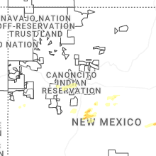
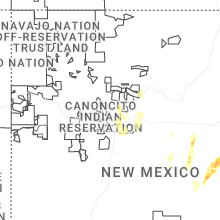


Connect with Interactive Hail Maps