

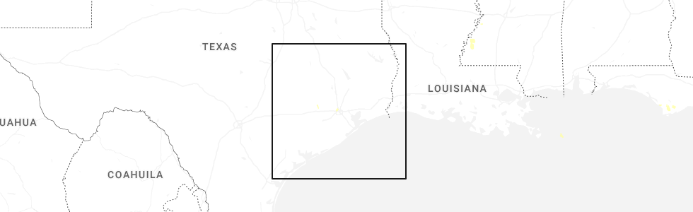
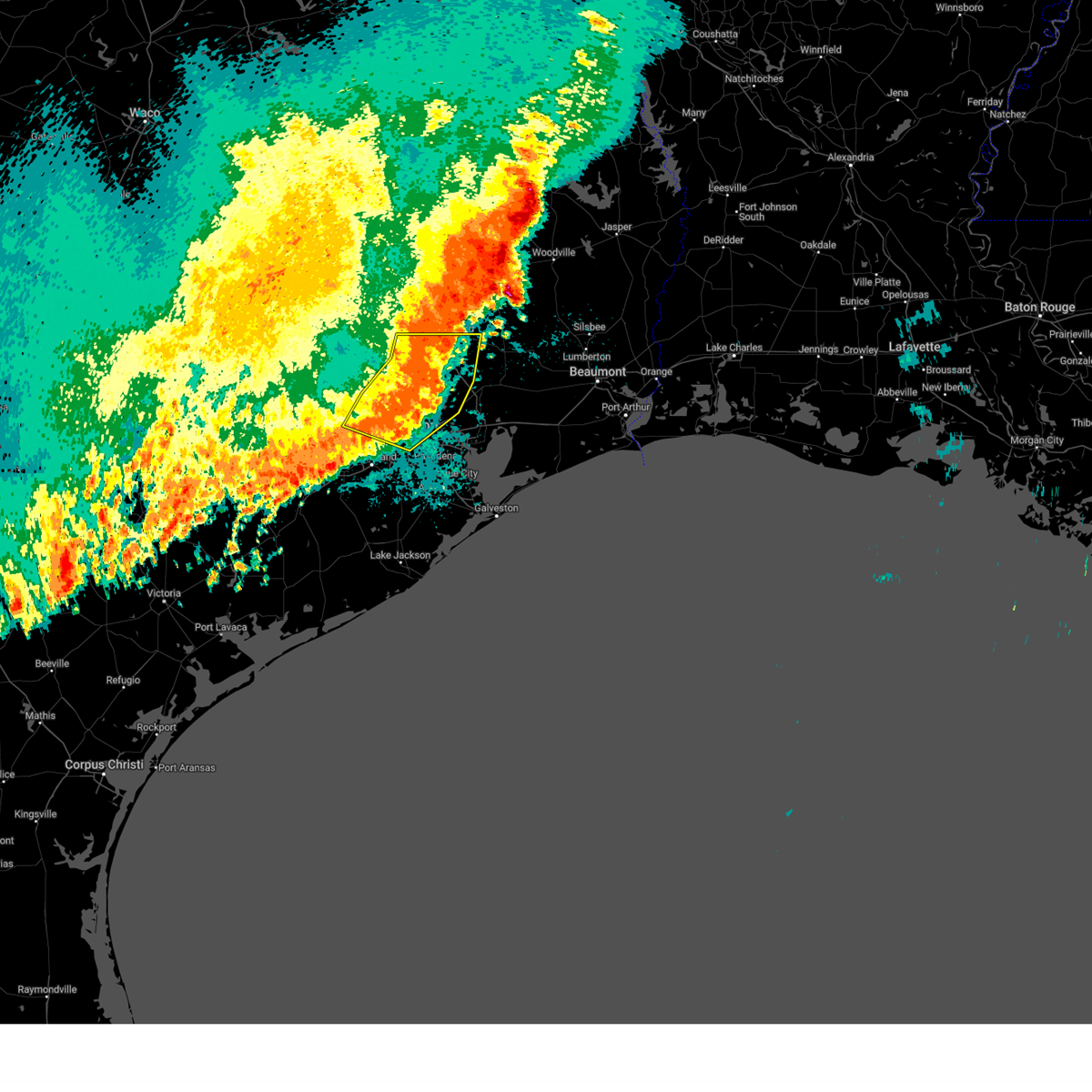
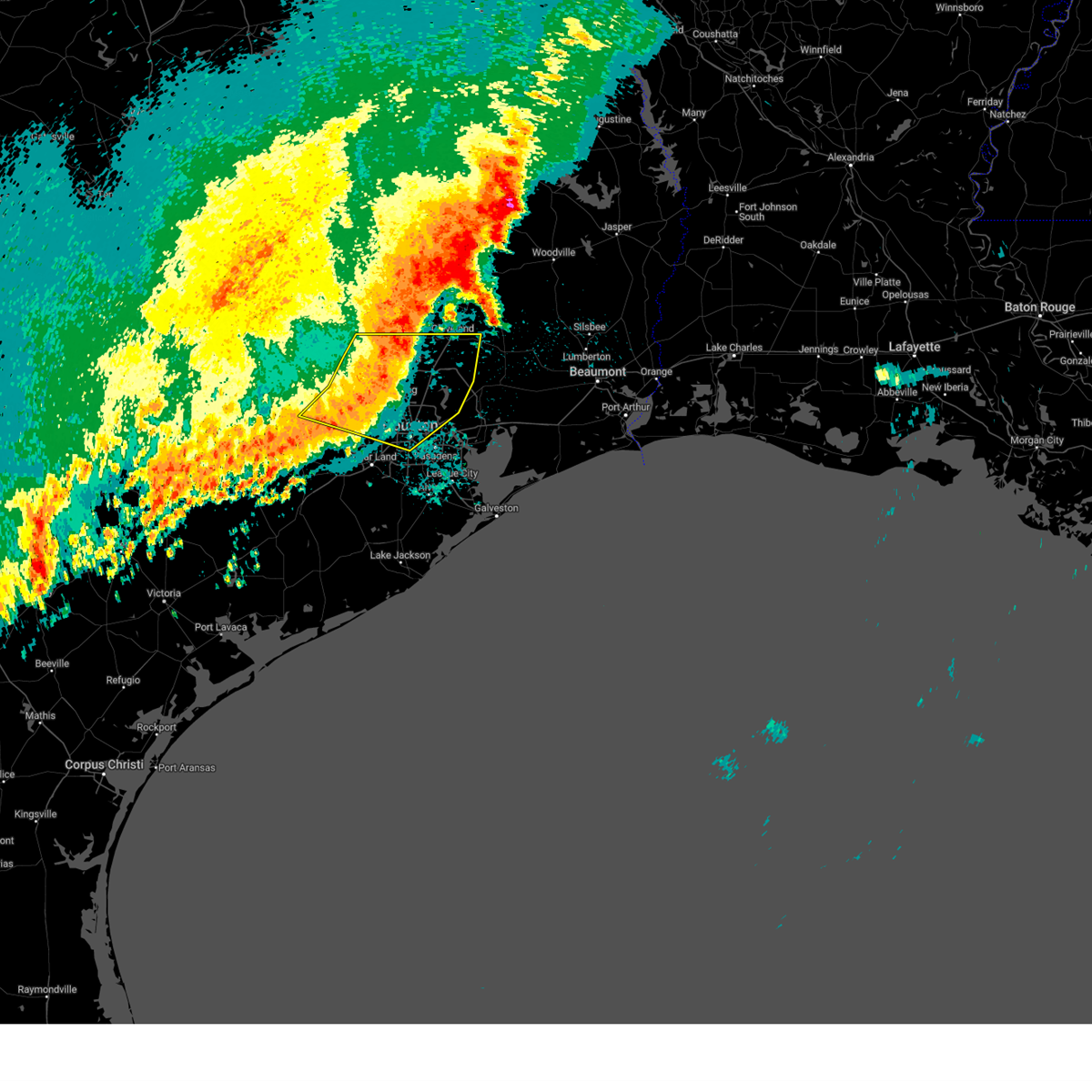
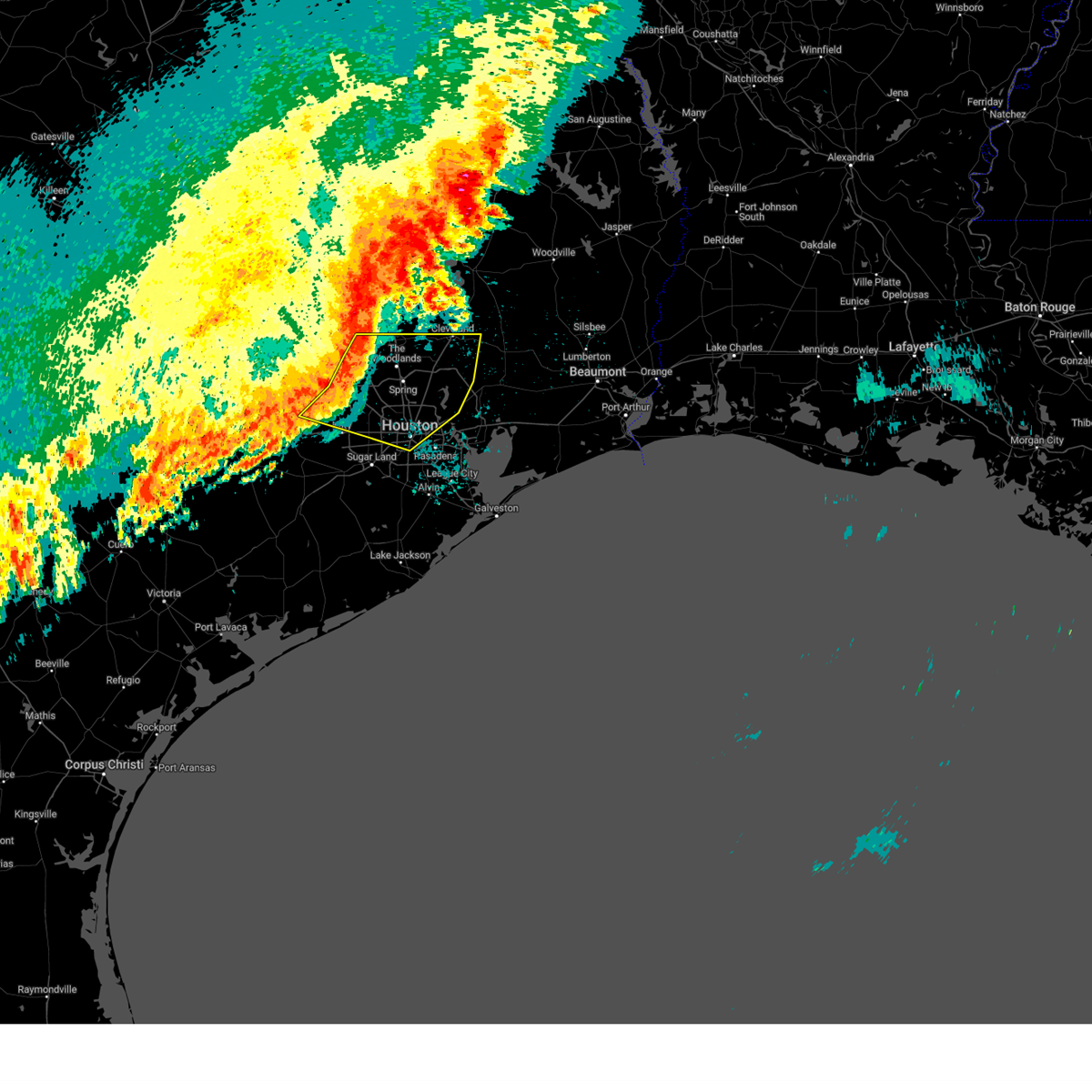
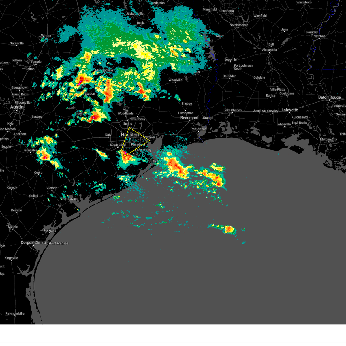
Hail Map for Aldine, TX
The Aldine, TX area has had 0 reports of on-the-ground hail by trained spotters, and has been under severe weather warnings 9 times during the past 12 months. Doppler radar has detected hail at or near Aldine, TX on 67 occasions, including 4 occasions during the past year.
| Name: | Aldine, TX |
| Where Located: | 10 miles N of Houston, TX |
| Map: | Google Map for Aldine, TX |
| Population: | 15869 |
| Housing Units: | 4458 |
| More Info: | Search Google for Aldine, TX |
0
The Top Recent Hail Date for Aldine, TX is Thursday, June 26, 2025 (53rd out of 67)
Hail and Wind Damage Spotted near Aldine, TX
| Date / Time | Report Details |
|---|---|
| 6/13/2025 7:50 PM CDT |
 the severe thunderstorm warning has been cancelled and is no longer in effect the severe thunderstorm warning has been cancelled and is no longer in effect
|
| 6/13/2025 7:30 PM CDT |
 Svrhgx the national weather service in league city has issued a * severe thunderstorm warning for, south central montgomery county in southeastern texas, north central harris county in southeastern texas, * until 815 pm cdt. * at 730 pm cdt, a severe thunderstorm was located near tomball, moving east at 20 mph (radar indicated). Hazards include 60 mph wind gusts and penny size hail. expect damage to roofs, siding, and trees Svrhgx the national weather service in league city has issued a * severe thunderstorm warning for, south central montgomery county in southeastern texas, north central harris county in southeastern texas, * until 815 pm cdt. * at 730 pm cdt, a severe thunderstorm was located near tomball, moving east at 20 mph (radar indicated). Hazards include 60 mph wind gusts and penny size hail. expect damage to roofs, siding, and trees
|
| 5/27/2025 12:45 AM CDT |
 Svrhgx the national weather service in league city has issued a * severe thunderstorm warning for, northwestern galveston county in southeastern texas, eastern fort bend county in southeastern texas, southeastern montgomery county in southeastern texas, southeastern san jacinto county in southeastern texas, northwestern chambers county in southeastern texas, north central brazoria county in southeastern texas, liberty county in southeastern texas, southeastern polk county in southeastern texas, eastern harris county in southeastern texas, * until 145 am cdt. * at 1244 am cdt, severe thunderstorms were located along a line extending from near chester to near splendora to memorial park to east bernard, moving east at 25 mph. stronger segments within the line have a history of producing 45 to 67 mph wind gusts (radar indicated). Hazards include 60 mph wind gusts. expect damage to roofs, siding, and trees Svrhgx the national weather service in league city has issued a * severe thunderstorm warning for, northwestern galveston county in southeastern texas, eastern fort bend county in southeastern texas, southeastern montgomery county in southeastern texas, southeastern san jacinto county in southeastern texas, northwestern chambers county in southeastern texas, north central brazoria county in southeastern texas, liberty county in southeastern texas, southeastern polk county in southeastern texas, eastern harris county in southeastern texas, * until 145 am cdt. * at 1244 am cdt, severe thunderstorms were located along a line extending from near chester to near splendora to memorial park to east bernard, moving east at 25 mph. stronger segments within the line have a history of producing 45 to 67 mph wind gusts (radar indicated). Hazards include 60 mph wind gusts. expect damage to roofs, siding, and trees
|
| 5/27/2025 12:31 AM CDT |
 the severe thunderstorm warning has been cancelled and is no longer in effect the severe thunderstorm warning has been cancelled and is no longer in effect
|
| 5/27/2025 12:31 AM CDT |
 At 1231 am cdt, severe thunderstorms were located along a line extending from near cut and shoot to porter heights to near greater greenspoint to near westbranch, moving east at 45 mph (radar indicated). Hazards include 60 mph wind gusts. Expect damage to roofs, siding, and trees. Locations impacted include, conroe, bellaire, humble, west university place, katy, tomball, jacinto city, cleveland, jersey village, hunters creek village, bunker hill village, piney point village, downtown houston, greenway / upper kirby area, kingwood, spring branch north, second ward, the woodlands, greater greenspoint, and spring. At 1231 am cdt, severe thunderstorms were located along a line extending from near cut and shoot to porter heights to near greater greenspoint to near westbranch, moving east at 45 mph (radar indicated). Hazards include 60 mph wind gusts. Expect damage to roofs, siding, and trees. Locations impacted include, conroe, bellaire, humble, west university place, katy, tomball, jacinto city, cleveland, jersey village, hunters creek village, bunker hill village, piney point village, downtown houston, greenway / upper kirby area, kingwood, spring branch north, second ward, the woodlands, greater greenspoint, and spring.
|
| 5/27/2025 12:11 AM CDT |
 At 1210 am cdt, severe thunderstorms were located along a line extending from near lake conroe dam to 6 miles east of pinehurst to near cypress to 7 miles northeast of pattison, moving east at 40 mph. houston hooks airport received a gust to 67 mph at 1202 am (radar indicated). Hazards include 70 mph wind gusts. Expect considerable tree damage. damage is likely to mobile homes, roofs, and outbuildings. Locations impacted include, conroe, bellaire, humble, west university place, katy, tomball, jacinto city, cleveland, jersey village, hunters creek village, bunker hill village, piney point village, pinehurst, downtown houston, greenway / upper kirby area, kingwood, spring branch north, second ward, the woodlands, and greater greenspoint. At 1210 am cdt, severe thunderstorms were located along a line extending from near lake conroe dam to 6 miles east of pinehurst to near cypress to 7 miles northeast of pattison, moving east at 40 mph. houston hooks airport received a gust to 67 mph at 1202 am (radar indicated). Hazards include 70 mph wind gusts. Expect considerable tree damage. damage is likely to mobile homes, roofs, and outbuildings. Locations impacted include, conroe, bellaire, humble, west university place, katy, tomball, jacinto city, cleveland, jersey village, hunters creek village, bunker hill village, piney point village, pinehurst, downtown houston, greenway / upper kirby area, kingwood, spring branch north, second ward, the woodlands, and greater greenspoint.
|
| 5/26/2025 11:46 PM CDT |
 Svrhgx the national weather service in league city has issued a * severe thunderstorm warning for, eastern austin county in southeastern texas, montgomery county in southeastern texas, south central san jacinto county in southeastern texas, southwestern liberty county in southeastern texas, southern waller county in southeastern texas, harris county in southeastern texas, * until 1245 am cdt. * at 1146 pm cdt, severe thunderstorms were located along a line extending from near montgomery to magnolia to hockley to 7 miles northwest of pattison, moving east at 40 mph (radar indicated). Hazards include 60 mph wind gusts. expect damage to roofs, siding, and trees Svrhgx the national weather service in league city has issued a * severe thunderstorm warning for, eastern austin county in southeastern texas, montgomery county in southeastern texas, south central san jacinto county in southeastern texas, southwestern liberty county in southeastern texas, southern waller county in southeastern texas, harris county in southeastern texas, * until 1245 am cdt. * at 1146 pm cdt, severe thunderstorms were located along a line extending from near montgomery to magnolia to hockley to 7 miles northwest of pattison, moving east at 40 mph (radar indicated). Hazards include 60 mph wind gusts. expect damage to roofs, siding, and trees
|
| 5/5/2025 5:19 PM CDT | the severe thunderstorm warning has been cancelled and is no longer in effect |
| 5/5/2025 4:56 PM CDT |
 Svrhgx the national weather service in league city has issued a * severe thunderstorm warning for, east central fort bend county in southeastern texas, northern brazoria county in southeastern texas, southeastern harris county in southeastern texas, * until 530 pm cdt. * at 455 pm cdt, a severe thunderstorm was located over fresno, moving northeast at 50 mph (radar indicated). Hazards include quarter size hail. damage to vehicles is expected Svrhgx the national weather service in league city has issued a * severe thunderstorm warning for, east central fort bend county in southeastern texas, northern brazoria county in southeastern texas, southeastern harris county in southeastern texas, * until 530 pm cdt. * at 455 pm cdt, a severe thunderstorm was located over fresno, moving northeast at 50 mph (radar indicated). Hazards include quarter size hail. damage to vehicles is expected
|
| 5/31/2024 7:00 AM CDT | At 658 am cdt, severe thunderstorms were located along a line extending from near plum grove to near fairchilds, moving southeast at 45 mph (radar indicated). Hazards include 60 mph wind gusts and nickel size hail. Expect damage to roofs, siding, and trees. Locations impacted include, pasadena, pearland, sugar land, missouri city, eastern conroe, deer park, rosenberg, stafford, south houston, bellaire, humble, west university place, richmond, galena park, jacinto city, cleveland, northwestern manvel, hunters creek village, bunker hill village, and piney point village. |
| 5/31/2024 6:46 AM CDT |
 Svrhgx the national weather service in league city has issued a * severe thunderstorm warning for, fort bend county in southeastern texas, eastern montgomery county in southeastern texas, southwestern san jacinto county in southeastern texas, northwestern brazoria county in southeastern texas, northwestern liberty county in southeastern texas, southeastern walker county in southeastern texas, central harris county in southeastern texas, * until 715 am cdt. * at 645 am cdt, severe thunderstorms were located along a line extending from near splendora to near beasley, moving southeast at around 45 mph (radar indicated). Hazards include 60 mph wind gusts and penny size hail. expect damage to roofs, siding, and trees Svrhgx the national weather service in league city has issued a * severe thunderstorm warning for, fort bend county in southeastern texas, eastern montgomery county in southeastern texas, southwestern san jacinto county in southeastern texas, northwestern brazoria county in southeastern texas, northwestern liberty county in southeastern texas, southeastern walker county in southeastern texas, central harris county in southeastern texas, * until 715 am cdt. * at 645 am cdt, severe thunderstorms were located along a line extending from near splendora to near beasley, moving southeast at around 45 mph (radar indicated). Hazards include 60 mph wind gusts and penny size hail. expect damage to roofs, siding, and trees
|
| 5/31/2024 6:22 AM CDT |
 Svrhgx the national weather service in league city has issued a * severe thunderstorm warning for, central trinity county in southeastern texas, east central colorado county in southeastern texas, northeastern wharton county in southeastern texas, southeastern austin county in southeastern texas, northwestern fort bend county in southeastern texas, central montgomery county in southeastern texas, western san jacinto county in southeastern texas, east central houston county in southeastern texas, southeastern waller county in southeastern texas, west central polk county in southeastern texas, southeastern walker county in southeastern texas, central harris county in southeastern texas, * until 645 am cdt. * at 621 am cdt, severe thunderstorms were located along a line extending from near point blank to near eagle lake, moving southeast at around 50 mph (radar indicated). Hazards include 60 mph wind gusts and penny size hail. expect damage to roofs, siding, and trees Svrhgx the national weather service in league city has issued a * severe thunderstorm warning for, central trinity county in southeastern texas, east central colorado county in southeastern texas, northeastern wharton county in southeastern texas, southeastern austin county in southeastern texas, northwestern fort bend county in southeastern texas, central montgomery county in southeastern texas, western san jacinto county in southeastern texas, east central houston county in southeastern texas, southeastern waller county in southeastern texas, west central polk county in southeastern texas, southeastern walker county in southeastern texas, central harris county in southeastern texas, * until 645 am cdt. * at 621 am cdt, severe thunderstorms were located along a line extending from near point blank to near eagle lake, moving southeast at around 50 mph (radar indicated). Hazards include 60 mph wind gusts and penny size hail. expect damage to roofs, siding, and trees
|
| 5/29/2024 5:26 PM CDT |
 The storm which prompted the warning has weakened below severe limits, and no longer poses an immediate threat to life or property. therefore, the warning will be allowed to expire. however, small hail and gusty winds are still possible with this thunderstorm. The storm which prompted the warning has weakened below severe limits, and no longer poses an immediate threat to life or property. therefore, the warning will be allowed to expire. however, small hail and gusty winds are still possible with this thunderstorm.
|
| 5/29/2024 5:16 PM CDT |
 At 515 pm cdt, a severe thunderstorm was located over greater greenspoint, moving northeast at 25 mph (broadcast media). Hazards include ping pong ball size hail and 60 mph wind gusts. People and animals outdoors will be injured. expect hail damage to roofs, siding, windows, and vehicles. expect wind damage to roofs, siding, and trees. Locations impacted include, humble, tomball, jersey village, aldine, northside / northline, kingwood, the woodlands, greater greenspoint, spring, oak ridge north, shenandoah, bush intercontinental airport, the woodlands pavillion, chateau woods, willowbrook, hidden valley, acres home, hooks airport, hurricane harbor splashtown, and porter heights. At 515 pm cdt, a severe thunderstorm was located over greater greenspoint, moving northeast at 25 mph (broadcast media). Hazards include ping pong ball size hail and 60 mph wind gusts. People and animals outdoors will be injured. expect hail damage to roofs, siding, windows, and vehicles. expect wind damage to roofs, siding, and trees. Locations impacted include, humble, tomball, jersey village, aldine, northside / northline, kingwood, the woodlands, greater greenspoint, spring, oak ridge north, shenandoah, bush intercontinental airport, the woodlands pavillion, chateau woods, willowbrook, hidden valley, acres home, hooks airport, hurricane harbor splashtown, and porter heights.
|
| 5/29/2024 5:02 PM CDT |
 Svrhgx the national weather service in league city has issued a * severe thunderstorm warning for, south central montgomery county in southeastern texas, north central harris county in southeastern texas, * until 530 pm cdt. * at 501 pm cdt, a severe thunderstorm was located over hidden valley, or near greater greenspoint, moving northeast at 25 mph (radar indicated). Hazards include 60 mph wind gusts and quarter size hail. Hail damage to vehicles is expected. Expect wind damage to roofs, siding, and trees. Svrhgx the national weather service in league city has issued a * severe thunderstorm warning for, south central montgomery county in southeastern texas, north central harris county in southeastern texas, * until 530 pm cdt. * at 501 pm cdt, a severe thunderstorm was located over hidden valley, or near greater greenspoint, moving northeast at 25 mph (radar indicated). Hazards include 60 mph wind gusts and quarter size hail. Hail damage to vehicles is expected. Expect wind damage to roofs, siding, and trees.
|
| 5/28/2024 1:22 PM CDT |
 At 122 pm cdt, severe thunderstorms were located along a line extending from 7 miles north of hardin to east little york / homestead to westchase, moving southeast at 50 mph (radar indicated). Hazards include 70 mph wind gusts and quarter size hail. Hail damage to vehicles is expected. expect considerable tree damage. wind damage is also likely to mobile homes, roofs, and outbuildings. Locations impacted include, pasadena, pearland, league city, northeastern sugar land, baytown, missouri city, texas city, friendswood, la porte, deer park, alvin, dickinson, stafford, south houston, bellaire, humble, west university place, la marque, santa fe, and seabrook. At 122 pm cdt, severe thunderstorms were located along a line extending from 7 miles north of hardin to east little york / homestead to westchase, moving southeast at 50 mph (radar indicated). Hazards include 70 mph wind gusts and quarter size hail. Hail damage to vehicles is expected. expect considerable tree damage. wind damage is also likely to mobile homes, roofs, and outbuildings. Locations impacted include, pasadena, pearland, league city, northeastern sugar land, baytown, missouri city, texas city, friendswood, la porte, deer park, alvin, dickinson, stafford, south houston, bellaire, humble, west university place, la marque, santa fe, and seabrook.
|
| 5/28/2024 1:14 PM CDT |
 Svrhgx the national weather service in league city has issued a * severe thunderstorm warning for, northwestern galveston county in southeastern texas, northeastern fort bend county in southeastern texas, northeastern brazoria county in southeastern texas, chambers county in southeastern texas, liberty county in southeastern texas, eastern harris county in southeastern texas, * until 200 pm cdt. * at 114 pm cdt, severe thunderstorms were located along a line extending from 11 miles north of dayton lakes to aldine to near addicks park ten, moving southeast at 50 mph (radar indicated). Hazards include 60 mph wind gusts and quarter size hail. Hail damage to vehicles is expected. Expect wind damage to roofs, siding, and trees. Svrhgx the national weather service in league city has issued a * severe thunderstorm warning for, northwestern galveston county in southeastern texas, northeastern fort bend county in southeastern texas, northeastern brazoria county in southeastern texas, chambers county in southeastern texas, liberty county in southeastern texas, eastern harris county in southeastern texas, * until 200 pm cdt. * at 114 pm cdt, severe thunderstorms were located along a line extending from 11 miles north of dayton lakes to aldine to near addicks park ten, moving southeast at 50 mph (radar indicated). Hazards include 60 mph wind gusts and quarter size hail. Hail damage to vehicles is expected. Expect wind damage to roofs, siding, and trees.
|
| 5/28/2024 12:35 PM CDT |
 Svrhgx the national weather service in league city has issued a * severe thunderstorm warning for, southern montgomery county in southeastern texas, southern san jacinto county in southeastern texas, northwestern liberty county in southeastern texas, south central polk county in southeastern texas, northern harris county in southeastern texas, * until 130 pm cdt. * at 1234 pm cdt, severe thunderstorms were located along a line extending from near west livingston to 8 miles east of new waverly to near montgomery, moving south at 25 mph (radar indicated). Hazards include 60 mph wind gusts and quarter size hail. Hail damage to vehicles is expected. Expect wind damage to roofs, siding, and trees. Svrhgx the national weather service in league city has issued a * severe thunderstorm warning for, southern montgomery county in southeastern texas, southern san jacinto county in southeastern texas, northwestern liberty county in southeastern texas, south central polk county in southeastern texas, northern harris county in southeastern texas, * until 130 pm cdt. * at 1234 pm cdt, severe thunderstorms were located along a line extending from near west livingston to 8 miles east of new waverly to near montgomery, moving south at 25 mph (radar indicated). Hazards include 60 mph wind gusts and quarter size hail. Hail damage to vehicles is expected. Expect wind damage to roofs, siding, and trees.
|
| 5/16/2024 6:41 PM CDT |
 At 640 pm cdt, severe thunderstorms were located along a line extending from near porter heights to spring to east little york / homestead to independence heights to mid west, moving east at 45 mph. these are destructive storms (radar indicated). Hazards include 80 mph wind gusts. Flying debris will be dangerous to those caught without shelter. mobile homes will be heavily damaged. expect considerable damage to roofs, windows, and vehicles. extensive tree damage and power outages are likely. Locations impacted include, northwestern pasadena, south houston, bellaire, humble, west university place, galena park, jacinto city, hunters creek village, cloverleaf, downtown houston, greenway / upper kirby area, kingwood, second ward, greater greenspoint, spring, greater heights, neartown / montrose, barrett, memorial park, and fourth ward. At 640 pm cdt, severe thunderstorms were located along a line extending from near porter heights to spring to east little york / homestead to independence heights to mid west, moving east at 45 mph. these are destructive storms (radar indicated). Hazards include 80 mph wind gusts. Flying debris will be dangerous to those caught without shelter. mobile homes will be heavily damaged. expect considerable damage to roofs, windows, and vehicles. extensive tree damage and power outages are likely. Locations impacted include, northwestern pasadena, south houston, bellaire, humble, west university place, galena park, jacinto city, hunters creek village, cloverleaf, downtown houston, greenway / upper kirby area, kingwood, second ward, greater greenspoint, spring, greater heights, neartown / montrose, barrett, memorial park, and fourth ward.
|
| 5/16/2024 6:41 PM CDT |
 the severe thunderstorm warning has been cancelled and is no longer in effect the severe thunderstorm warning has been cancelled and is no longer in effect
|
| 5/16/2024 6:16 PM CDT |
 Svrhgx the national weather service in league city has issued a * severe thunderstorm warning for, northern fort bend county in southeastern texas, southeastern montgomery county in southeastern texas, harris county in southeastern texas, * until 700 pm cdt. * at 615 pm cdt, severe thunderstorms were located along a line extending from near pinehurst to near cypress to near addicks park ten to near eldridge / west oaks to near cinco ranch, moving east at 45 mph. these are destructive storms for the houston metro area (radar indicated). Hazards include 80 mph wind gusts. Flying debris will be dangerous to those caught without shelter. mobile homes will be heavily damaged. expect considerable damage to roofs, windows, and vehicles. Extensive tree damage and power outages are likely. Svrhgx the national weather service in league city has issued a * severe thunderstorm warning for, northern fort bend county in southeastern texas, southeastern montgomery county in southeastern texas, harris county in southeastern texas, * until 700 pm cdt. * at 615 pm cdt, severe thunderstorms were located along a line extending from near pinehurst to near cypress to near addicks park ten to near eldridge / west oaks to near cinco ranch, moving east at 45 mph. these are destructive storms for the houston metro area (radar indicated). Hazards include 80 mph wind gusts. Flying debris will be dangerous to those caught without shelter. mobile homes will be heavily damaged. expect considerable damage to roofs, windows, and vehicles. Extensive tree damage and power outages are likely.
|
| 5/13/2024 2:33 PM CDT |
 At 233 pm cdt, a severe thunderstorm was located over kingwood, moving northeast at 45 mph (radar indicated). Hazards include 60 mph wind gusts. Expect damage to roofs, siding, and trees. Locations impacted include, humble, kingwood, aldine, spring, crosby, roman forest, plum grove, bush intercontinental airport, atascocita, houston gardens, east houston, lake houston dam, lake houston, east little york / homestead, settegast, eastex / jensen area, and porter. At 233 pm cdt, a severe thunderstorm was located over kingwood, moving northeast at 45 mph (radar indicated). Hazards include 60 mph wind gusts. Expect damage to roofs, siding, and trees. Locations impacted include, humble, kingwood, aldine, spring, crosby, roman forest, plum grove, bush intercontinental airport, atascocita, houston gardens, east houston, lake houston dam, lake houston, east little york / homestead, settegast, eastex / jensen area, and porter.
|
| 5/13/2024 2:22 PM CDT |
 Svrhgx the national weather service in league city has issued a * severe thunderstorm warning for, southeastern montgomery county in southeastern texas, southwestern liberty county in southeastern texas, northeastern harris county in southeastern texas, * until 245 pm cdt. * at 221 pm cdt, a severe thunderstorm was located over southwestern bush intercontinental airport, or near aldine, moving northeast at 45 mph (radar indicated). Hazards include 60 mph wind gusts. expect damage to roofs, siding, and trees Svrhgx the national weather service in league city has issued a * severe thunderstorm warning for, southeastern montgomery county in southeastern texas, southwestern liberty county in southeastern texas, northeastern harris county in southeastern texas, * until 245 pm cdt. * at 221 pm cdt, a severe thunderstorm was located over southwestern bush intercontinental airport, or near aldine, moving northeast at 45 mph (radar indicated). Hazards include 60 mph wind gusts. expect damage to roofs, siding, and trees
|
| 5/2/2024 11:37 AM CDT |
 The storms which prompted the warning have weakened below severe limits, and no longer pose an immediate threat to life or property. therefore, the warning will be allowed to expire. however, gusty winds of up to 40 mph are still possible with these thunderstorms. The storms which prompted the warning have weakened below severe limits, and no longer pose an immediate threat to life or property. therefore, the warning will be allowed to expire. however, gusty winds of up to 40 mph are still possible with these thunderstorms.
|
| 5/2/2024 11:00 AM CDT |
 Svrhgx the national weather service in league city has issued a * severe thunderstorm warning for, east central fort bend county in southeastern texas, northeastern brazoria county in southeastern texas, southeastern harris county in southeastern texas, * until 1145 am cdt. * at 1059 am cdt, severe thunderstorms were located along a line extending from hidden valley to hilshire village to briar forest, moving southeast at 35 mph (radar indicated). Hazards include 60 mph wind gusts. expect damage to roofs, siding, and trees Svrhgx the national weather service in league city has issued a * severe thunderstorm warning for, east central fort bend county in southeastern texas, northeastern brazoria county in southeastern texas, southeastern harris county in southeastern texas, * until 1145 am cdt. * at 1059 am cdt, severe thunderstorms were located along a line extending from hidden valley to hilshire village to briar forest, moving southeast at 35 mph (radar indicated). Hazards include 60 mph wind gusts. expect damage to roofs, siding, and trees
|
| 5/2/2024 10:45 AM CDT |
 Svrhgx the national weather service in league city has issued a * severe thunderstorm warning for, central harris county in southeastern texas, * until 1100 am cdt. * at 1045 am cdt, severe thunderstorms were located along a line extending from near willowbrook to jersey village to near addicks park ten, moving southeast at 35 mph (radar indicated). Hazards include 60 mph wind gusts. expect damage to roofs, siding, and trees Svrhgx the national weather service in league city has issued a * severe thunderstorm warning for, central harris county in southeastern texas, * until 1100 am cdt. * at 1045 am cdt, severe thunderstorms were located along a line extending from near willowbrook to jersey village to near addicks park ten, moving southeast at 35 mph (radar indicated). Hazards include 60 mph wind gusts. expect damage to roofs, siding, and trees
|
| 4/10/2024 4:02 AM CDT |
 the severe thunderstorm warning has been cancelled and is no longer in effect the severe thunderstorm warning has been cancelled and is no longer in effect
|
| 4/10/2024 3:41 AM CDT |
 Svrhgx the national weather service in league city has issued a * severe thunderstorm warning for, northeastern fort bend county in southeastern texas, montgomery county in southeastern texas, southern san jacinto county in southeastern texas, northwestern chambers county in southeastern texas, western liberty county in southeastern texas, south central polk county in southeastern texas, harris county in southeastern texas, * until 430 am cdt. * at 341 am cdt, severe thunderstorms were located along a line extending from near cut and shoot to humble to central southwest, moving northeast at 35 mph (radar indicated). Hazards include 60 mph wind gusts. expect damage to roofs, siding, and trees Svrhgx the national weather service in league city has issued a * severe thunderstorm warning for, northeastern fort bend county in southeastern texas, montgomery county in southeastern texas, southern san jacinto county in southeastern texas, northwestern chambers county in southeastern texas, western liberty county in southeastern texas, south central polk county in southeastern texas, harris county in southeastern texas, * until 430 am cdt. * at 341 am cdt, severe thunderstorms were located along a line extending from near cut and shoot to humble to central southwest, moving northeast at 35 mph (radar indicated). Hazards include 60 mph wind gusts. expect damage to roofs, siding, and trees
|
| 3/21/2024 6:58 PM CDT |
 Svrhgx the national weather service in league city has issued a * severe thunderstorm warning for, east central harris county in southeastern texas, * until 730 pm cdt. * at 658 pm cdt, a severe thunderstorm was located over east little york / homestead, or near aldine, moving east at 25 mph (radar indicated). Hazards include quarter size hail. damage to vehicles is expected Svrhgx the national weather service in league city has issued a * severe thunderstorm warning for, east central harris county in southeastern texas, * until 730 pm cdt. * at 658 pm cdt, a severe thunderstorm was located over east little york / homestead, or near aldine, moving east at 25 mph (radar indicated). Hazards include quarter size hail. damage to vehicles is expected
|
| 3/21/2024 6:44 PM CDT |
 At 643 pm cdt, a severe thunderstorm was located over aldine, moving east at 30 mph (radar indicated. at 6:30 pm cdt, half dollar size hail was reported near jersey village). Hazards include half dollar size hail. Damage to vehicles is expected. Locations impacted include, humble, aldine, northside / northline, greater greenspoint, northern greater heights, near northside houston, kingwood, spring, bush intercontinental airport, eastex / jensen area, central northwest, hunterwood, hidden valley, acres home, independence heights, settegast, houston gardens, east houston, east little york / homestead, and greater inwood. At 643 pm cdt, a severe thunderstorm was located over aldine, moving east at 30 mph (radar indicated. at 6:30 pm cdt, half dollar size hail was reported near jersey village). Hazards include half dollar size hail. Damage to vehicles is expected. Locations impacted include, humble, aldine, northside / northline, greater greenspoint, northern greater heights, near northside houston, kingwood, spring, bush intercontinental airport, eastex / jensen area, central northwest, hunterwood, hidden valley, acres home, independence heights, settegast, houston gardens, east houston, east little york / homestead, and greater inwood.
|
| 3/21/2024 6:25 PM CDT |
 Svrhgx the national weather service in league city has issued a * severe thunderstorm warning for, southeastern montgomery county in southeastern texas, central harris county in southeastern texas, * until 700 pm cdt. * at 625 pm cdt, a severe thunderstorm was located over jersey village, moving east at 30 mph (radar indicated). Hazards include half dollar size hail. damage to vehicles is expected Svrhgx the national weather service in league city has issued a * severe thunderstorm warning for, southeastern montgomery county in southeastern texas, central harris county in southeastern texas, * until 700 pm cdt. * at 625 pm cdt, a severe thunderstorm was located over jersey village, moving east at 30 mph (radar indicated). Hazards include half dollar size hail. damage to vehicles is expected
|
| 1/8/2024 4:18 PM CST |
 At 418 pm cst, a severe thunderstorm was located over southern addicks park ten, moving east at 50 mph (radar indicated). Hazards include 60 mph wind gusts. expect damage to roofs, siding, and trees At 418 pm cst, a severe thunderstorm was located over southern addicks park ten, moving east at 50 mph (radar indicated). Hazards include 60 mph wind gusts. expect damage to roofs, siding, and trees
|
| 9/26/2023 7:58 PM CDT |
 The severe thunderstorm warning for south central montgomery and northeastern harris counties will expire at 800 pm cdt, the storm which prompted the warning has weakened below severe limits, and no longer poses an immediate threat to life or property. therefore, the warning will be allowed to expire. however, gusty winds are still possible with this thunderstorm. The severe thunderstorm warning for south central montgomery and northeastern harris counties will expire at 800 pm cdt, the storm which prompted the warning has weakened below severe limits, and no longer poses an immediate threat to life or property. therefore, the warning will be allowed to expire. however, gusty winds are still possible with this thunderstorm.
|
| 9/26/2023 7:35 PM CDT |
 At 734 pm cdt, a severe thunderstorm was located over humble, moving west at 25 mph (radar indicated). Hazards include 60 mph wind gusts. expect damage to roofs, siding, and trees At 734 pm cdt, a severe thunderstorm was located over humble, moving west at 25 mph (radar indicated). Hazards include 60 mph wind gusts. expect damage to roofs, siding, and trees
|
| 9/15/2023 3:29 PM CDT |
 At 329 pm cdt, a severe thunderstorm was located near humble, moving east at 20 mph (radar indicated). Hazards include 60 mph wind gusts and penny size hail. expect damage to roofs, siding, and trees At 329 pm cdt, a severe thunderstorm was located near humble, moving east at 20 mph (radar indicated). Hazards include 60 mph wind gusts and penny size hail. expect damage to roofs, siding, and trees
|
| 9/14/2023 2:31 PM CDT |
 At 230 pm cdt, a severe thunderstorm was located over southeastern bush intercontinental airport, or near humble, moving southeast at 15 mph (radar indicated). Hazards include 60 mph wind gusts and half dollar size hail or larger. Hail damage to vehicles is expected. expect wind damage to roofs, siding, and trees. Locations impacted include, humble, greater greenspoint, aldine, cloverleaf, kingwood, spring, channelview, bush intercontinental airport, settegast, atascocita, northshore, east houston, lake houston dam, lake houston, hunterwood, sheldon, el dorado / oates prairie, east little york / homestead, houston gardens, and northern houston ship channel. At 230 pm cdt, a severe thunderstorm was located over southeastern bush intercontinental airport, or near humble, moving southeast at 15 mph (radar indicated). Hazards include 60 mph wind gusts and half dollar size hail or larger. Hail damage to vehicles is expected. expect wind damage to roofs, siding, and trees. Locations impacted include, humble, greater greenspoint, aldine, cloverleaf, kingwood, spring, channelview, bush intercontinental airport, settegast, atascocita, northshore, east houston, lake houston dam, lake houston, hunterwood, sheldon, el dorado / oates prairie, east little york / homestead, houston gardens, and northern houston ship channel.
|
| 9/14/2023 2:20 PM CDT |
 At 219 pm cdt, a severe thunderstorm was located over southwestern bush intercontinental airport, or near aldine, moving southeast at 15 mph (radar indicated). Hazards include 60 mph wind gusts and quarter size hail. Hail damage to vehicles is expected. Expect wind damage to roofs, siding, and trees. At 219 pm cdt, a severe thunderstorm was located over southwestern bush intercontinental airport, or near aldine, moving southeast at 15 mph (radar indicated). Hazards include 60 mph wind gusts and quarter size hail. Hail damage to vehicles is expected. Expect wind damage to roofs, siding, and trees.
|
| 8/24/2023 6:28 PM CDT |
 At 628 pm cdt, a severe thunderstorm was located near aldine, and is nearly stationary (radar indicated). Hazards include 60 mph wind gusts. expect damage to roofs, siding, and trees At 628 pm cdt, a severe thunderstorm was located near aldine, and is nearly stationary (radar indicated). Hazards include 60 mph wind gusts. expect damage to roofs, siding, and trees
|
| 6/21/2023 8:52 PM CDT |
 At 851 pm cdt, severe thunderstorms were located along a line extending from near kingwood to simonton, moving southeast at 50 mph. wind gusts of 60 to 70 mph are possible with these storms (radar indicated). Hazards include 70 mph wind gusts and nickel size hail. Expect considerable tree damage. damage is likely to mobile homes, roofs, and outbuildings. locations impacted include, bellaire, humble, katy, tomball, jersey village, sealy, hempstead, prairie view, brookshire, hunters creek village, bunker hill village, piney point village, pinehurst, downtown houston, greenway / upper kirby area, kingwood, spring branch north, the woodlands, greater greenspoint and spring. thunderstorm damage threat, considerable hail threat, radar indicated max hail size, 0. 88 in wind threat, radar indicated max wind gust, 70 mph. At 851 pm cdt, severe thunderstorms were located along a line extending from near kingwood to simonton, moving southeast at 50 mph. wind gusts of 60 to 70 mph are possible with these storms (radar indicated). Hazards include 70 mph wind gusts and nickel size hail. Expect considerable tree damage. damage is likely to mobile homes, roofs, and outbuildings. locations impacted include, bellaire, humble, katy, tomball, jersey village, sealy, hempstead, prairie view, brookshire, hunters creek village, bunker hill village, piney point village, pinehurst, downtown houston, greenway / upper kirby area, kingwood, spring branch north, the woodlands, greater greenspoint and spring. thunderstorm damage threat, considerable hail threat, radar indicated max hail size, 0. 88 in wind threat, radar indicated max wind gust, 70 mph.
|
| 6/21/2023 8:35 PM CDT |
 At 834 pm cdt, severe thunderstorms were located along a line extending from near splendora to san felipe, moving southeast at 55 mph (radar indicated). Hazards include 60 mph wind gusts and nickel size hail. expect damage to roofs, siding, and trees At 834 pm cdt, severe thunderstorms were located along a line extending from near splendora to san felipe, moving southeast at 55 mph (radar indicated). Hazards include 60 mph wind gusts and nickel size hail. expect damage to roofs, siding, and trees
|
| 6/10/2023 9:37 PM CDT |
 At 936 pm cdt, severe thunderstorms were located along a line extending from 6 miles northwest of hamshire to 9 miles east of old river-winfree to liberty to 6 miles southwest of dayton to kingwood, moving southeast at 35 mph (radar indicated). Hazards include 60 mph wind gusts. Expect damage to roofs, siding, and trees. locations impacted include, northern baytown, humble, liberty, dayton, beach city, aldine, northside / northline, kingwood, greater greenspoint, spring, highlands, barrett, channelview, crosby, mont belvieu, anahuac, old river-winfree, ames, daisetta and hardin. hail threat, radar indicated max hail size, <. 75 in wind threat, radar indicated max wind gust, 60 mph. At 936 pm cdt, severe thunderstorms were located along a line extending from 6 miles northwest of hamshire to 9 miles east of old river-winfree to liberty to 6 miles southwest of dayton to kingwood, moving southeast at 35 mph (radar indicated). Hazards include 60 mph wind gusts. Expect damage to roofs, siding, and trees. locations impacted include, northern baytown, humble, liberty, dayton, beach city, aldine, northside / northline, kingwood, greater greenspoint, spring, highlands, barrett, channelview, crosby, mont belvieu, anahuac, old river-winfree, ames, daisetta and hardin. hail threat, radar indicated max hail size, <. 75 in wind threat, radar indicated max wind gust, 60 mph.
|
| 6/10/2023 8:56 PM CDT |
 At 856 pm cdt, severe thunderstorms were located along a line extending from near batson to near dayton lakes to 8 miles southeast of cleveland to near splendora to cut and shoot, moving southeast at 35 mph (radar indicated). Hazards include 60 mph wind gusts. expect damage to roofs, siding, and trees At 856 pm cdt, severe thunderstorms were located along a line extending from near batson to near dayton lakes to 8 miles southeast of cleveland to near splendora to cut and shoot, moving southeast at 35 mph (radar indicated). Hazards include 60 mph wind gusts. expect damage to roofs, siding, and trees
|
| 6/8/2023 6:15 PM CDT |
 At 615 pm cdt, a severe thunderstorm was located over san jacinto state park, or over channelview, moving southeast at 45 mph (emergency management). Hazards include 70 mph wind gusts and quarter size hail. Hail damage to vehicles is expected. expect considerable tree damage. wind damage is also likely to mobile homes, roofs, and outbuildings. locations impacted include, pasadena, northeastern league city, northwestern baytown, la porte, deer park, south houston, bellaire, humble, west university place, seabrook, galena park, jacinto city, kemah, cloverleaf, downtown houston, greenway / upper kirby area, second ward, greater heights, south belt / ellington and neartown / montrose. thunderstorm damage threat, considerable hail threat, radar indicated max hail size, 1. 00 in wind threat, radar indicated max wind gust, 70 mph. At 615 pm cdt, a severe thunderstorm was located over san jacinto state park, or over channelview, moving southeast at 45 mph (emergency management). Hazards include 70 mph wind gusts and quarter size hail. Hail damage to vehicles is expected. expect considerable tree damage. wind damage is also likely to mobile homes, roofs, and outbuildings. locations impacted include, pasadena, northeastern league city, northwestern baytown, la porte, deer park, south houston, bellaire, humble, west university place, seabrook, galena park, jacinto city, kemah, cloverleaf, downtown houston, greenway / upper kirby area, second ward, greater heights, south belt / ellington and neartown / montrose. thunderstorm damage threat, considerable hail threat, radar indicated max hail size, 1. 00 in wind threat, radar indicated max wind gust, 70 mph.
|
| 6/8/2023 6:08 PM CDT |
 The severe thunderstorm warning for central harris county will expire at 615 pm cdt, the storm which prompted the warning has moved out of the area. therefore, the warning will be allowed to expire. a severe thunderstorm warning remains in effect for portions of southern and eastern harris county. The severe thunderstorm warning for central harris county will expire at 615 pm cdt, the storm which prompted the warning has moved out of the area. therefore, the warning will be allowed to expire. a severe thunderstorm warning remains in effect for portions of southern and eastern harris county.
|
| 6/8/2023 5:58 PM CDT |
 At 558 pm cdt, a severe thunderstorm was located over east little york / homestead, or near northside / northline, moving southeast at 45 mph (emergency management). Hazards include 70 mph wind gusts and penny size hail. Expect considerable tree damage. Damage is likely to mobile homes, roofs, and outbuildings. At 558 pm cdt, a severe thunderstorm was located over east little york / homestead, or near northside / northline, moving southeast at 45 mph (emergency management). Hazards include 70 mph wind gusts and penny size hail. Expect considerable tree damage. Damage is likely to mobile homes, roofs, and outbuildings.
|
| 6/8/2023 5:54 PM CDT |
 At 553 pm cdt, a severe thunderstorm was located over greater inwood, or near jersey village, moving southeast at 25 mph (radar indicated). Hazards include 70 mph wind gusts and quarter size hail. Hail damage to vehicles is expected. expect considerable tree damage. wind damage is also likely to mobile homes, roofs, and outbuildings. locations impacted include, bellaire, west university place, jersey village, hunters creek village, bunker hill village, piney point village, near northside houston, aldine, memorial park, northside / northline, greenway / upper kirby area, spring branch north, greater greenspoint, spring branch west, greater heights, spring valley, afton oaks / river oaks area, neartown / montrose, northeastern addicks park ten and hedwig village. thunderstorm damage threat, considerable hail threat, radar indicated max hail size, 1. 00 in wind threat, radar indicated max wind gust, 70 mph. At 553 pm cdt, a severe thunderstorm was located over greater inwood, or near jersey village, moving southeast at 25 mph (radar indicated). Hazards include 70 mph wind gusts and quarter size hail. Hail damage to vehicles is expected. expect considerable tree damage. wind damage is also likely to mobile homes, roofs, and outbuildings. locations impacted include, bellaire, west university place, jersey village, hunters creek village, bunker hill village, piney point village, near northside houston, aldine, memorial park, northside / northline, greenway / upper kirby area, spring branch north, greater greenspoint, spring branch west, greater heights, spring valley, afton oaks / river oaks area, neartown / montrose, northeastern addicks park ten and hedwig village. thunderstorm damage threat, considerable hail threat, radar indicated max hail size, 1. 00 in wind threat, radar indicated max wind gust, 70 mph.
|
| 6/8/2023 5:34 PM CDT |
 At 533 pm cdt, a severe thunderstorm was located near cypress, or near jersey village, moving southeast at 25 mph (radar indicated). Hazards include 60 mph wind gusts and quarter size hail. Hail damage to vehicles is expected. Expect wind damage to roofs, siding, and trees. At 533 pm cdt, a severe thunderstorm was located near cypress, or near jersey village, moving southeast at 25 mph (radar indicated). Hazards include 60 mph wind gusts and quarter size hail. Hail damage to vehicles is expected. Expect wind damage to roofs, siding, and trees.
|
| 6/4/2023 1:47 AM CDT |
 At 146 am cdt, severe thunderstorms were located along a line extending from bush intercontinental airport to downtown houston to near arcola, moving east at 25 mph (radar indicated). Hazards include 60 mph wind gusts and quarter size hail. Hail damage to vehicles is expected. expect wind damage to roofs, siding, and trees. Locations impacted include, pasadena, pearland, southeastern sugar land, northwestern baytown, missouri city, deer park, stafford, south houston, bellaire, humble, west university place, galena park, jacinto city, manvel, hunters creek village, piney point village, cloverleaf, downtown houston, greenway / upper kirby area and kingwood. At 146 am cdt, severe thunderstorms were located along a line extending from bush intercontinental airport to downtown houston to near arcola, moving east at 25 mph (radar indicated). Hazards include 60 mph wind gusts and quarter size hail. Hail damage to vehicles is expected. expect wind damage to roofs, siding, and trees. Locations impacted include, pasadena, pearland, southeastern sugar land, northwestern baytown, missouri city, deer park, stafford, south houston, bellaire, humble, west university place, galena park, jacinto city, manvel, hunters creek village, piney point village, cloverleaf, downtown houston, greenway / upper kirby area and kingwood.
|
| 6/4/2023 1:26 AM CDT |
 At 125 am cdt, severe thunderstorms were located along a line extending from near splashtown to memorial park to fairchilds, moving east at 25 mph (radar indicated). Hazards include 60 mph wind gusts and quarter size hail. Hail damage to vehicles is expected. expect wind damage to roofs, siding, and trees. Locations impacted include, pasadena, pearland, sugar land, northwestern baytown, missouri city, deer park, eastern rosenberg, stafford, south houston, bellaire, humble, west university place, richmond, galena park, tomball, jacinto city, jersey village, manvel, hunters creek village and bunker hill village. At 125 am cdt, severe thunderstorms were located along a line extending from near splashtown to memorial park to fairchilds, moving east at 25 mph (radar indicated). Hazards include 60 mph wind gusts and quarter size hail. Hail damage to vehicles is expected. expect wind damage to roofs, siding, and trees. Locations impacted include, pasadena, pearland, sugar land, northwestern baytown, missouri city, deer park, eastern rosenberg, stafford, south houston, bellaire, humble, west university place, richmond, galena park, tomball, jacinto city, jersey village, manvel, hunters creek village and bunker hill village.
|
| 6/4/2023 1:12 AM CDT |
 At 111 am cdt, severe thunderstorms were located along a line extending from near hooks airport to greater uptown to near needville, moving east at 25 mph (radar indicated). Hazards include 60 mph wind gusts and quarter size hail. Hail damage to vehicles is expected. Expect wind damage to roofs, siding, and trees. At 111 am cdt, severe thunderstorms were located along a line extending from near hooks airport to greater uptown to near needville, moving east at 25 mph (radar indicated). Hazards include 60 mph wind gusts and quarter size hail. Hail damage to vehicles is expected. Expect wind damage to roofs, siding, and trees.
|
| 5/8/2023 6:55 PM CDT |
 At 655 pm cdt, a severe thunderstorm was located near humble, moving southeast at 20 mph (radar indicated). Hazards include 60 mph wind gusts and quarter size hail. Hail damage to vehicles is expected. Expect wind damage to roofs, siding, and trees. At 655 pm cdt, a severe thunderstorm was located near humble, moving southeast at 20 mph (radar indicated). Hazards include 60 mph wind gusts and quarter size hail. Hail damage to vehicles is expected. Expect wind damage to roofs, siding, and trees.
|
| 4/20/2023 11:21 PM CDT |
 At 1121 pm cdt, a severe thunderstorm was located over spring, moving east at 35 mph (radar indicated). Hazards include 60 mph wind gusts and quarter size hail. Hail damage to vehicles is expected. Expect wind damage to roofs, siding, and trees. At 1121 pm cdt, a severe thunderstorm was located over spring, moving east at 35 mph (radar indicated). Hazards include 60 mph wind gusts and quarter size hail. Hail damage to vehicles is expected. Expect wind damage to roofs, siding, and trees.
|
| 4/20/2023 8:14 PM CDT |
 At 813 pm cdt, severe thunderstorms were located along a line extending from 10 miles south of camp creek lake to 8 miles northeast of wixon valley to near kurten to 6 miles east of kyle field to near college station to near snook to 9 miles northeast of somerville, moving east at 30 mph (radar indicated). Hazards include 60 mph wind gusts and quarter size hail. Hail damage to vehicles is expected. Expect wind damage to roofs, siding, and trees. At 813 pm cdt, severe thunderstorms were located along a line extending from 10 miles south of camp creek lake to 8 miles northeast of wixon valley to near kurten to 6 miles east of kyle field to near college station to near snook to 9 miles northeast of somerville, moving east at 30 mph (radar indicated). Hazards include 60 mph wind gusts and quarter size hail. Hail damage to vehicles is expected. Expect wind damage to roofs, siding, and trees.
|
| 4/5/2023 6:50 PM CDT |
 The severe thunderstorm warning for south central montgomery and north central harris counties will expire at 700 pm cdt, the storm which prompted the warning has weakened below severe limits, and no longer poses an immediate threat to life or property. therefore, the warning will be allowed to expire. however small hail is still possible with this thunderstorm. The severe thunderstorm warning for south central montgomery and north central harris counties will expire at 700 pm cdt, the storm which prompted the warning has weakened below severe limits, and no longer poses an immediate threat to life or property. therefore, the warning will be allowed to expire. however small hail is still possible with this thunderstorm.
|
| 4/5/2023 6:35 PM CDT |
 At 635 pm cdt, a severe thunderstorm was located over greater inwood, or near jersey village, moving northeast at 40 mph (radar indicated). Hazards include half dollar size hail. damage to vehicles is expected At 635 pm cdt, a severe thunderstorm was located over greater inwood, or near jersey village, moving northeast at 40 mph (radar indicated). Hazards include half dollar size hail. damage to vehicles is expected
|
| 1/24/2023 12:54 PM CST |
 At 1253 pm cst, a severe thunderstorm was located near aldine, moving northeast at 45 mph (radar indicated). Hazards include 60 mph wind gusts. expect damage to roofs, siding, and trees At 1253 pm cst, a severe thunderstorm was located near aldine, moving northeast at 45 mph (radar indicated). Hazards include 60 mph wind gusts. expect damage to roofs, siding, and trees
|
| 8/18/2022 5:02 PM CDT |
 At 502 pm cdt, a severe thunderstorm was located over greater greenspoint, moving southeast at 25 mph (radar indicated). Hazards include 60 mph wind gusts. expect damage to roofs, siding, and trees At 502 pm cdt, a severe thunderstorm was located over greater greenspoint, moving southeast at 25 mph (radar indicated). Hazards include 60 mph wind gusts. expect damage to roofs, siding, and trees
|
| 8/10/2022 7:00 PM CDT |
 At 659 pm cdt, severe thunderstorms were located along a line extending from near cypress to near east little york / homestead, moving southwest at 30 mph (radar indicated). Hazards include 60 mph wind gusts. Expect damage to roofs, siding, and trees. locations impacted include, jersey village, aldine, northside / northline, greater greenspoint, cloverleaf, near northside houston, eastex / jensen area, central northwest, fairbanks / northwest crossing, willowbrook, hunterwood, el dorado / oates prairie, hidden valley, acres home, independence heights, settegast, houston gardens, east houston, cypress and greater inwood. hail threat, radar indicated max hail size, <. 75 in wind threat, radar indicated max wind gust, 60 mph. At 659 pm cdt, severe thunderstorms were located along a line extending from near cypress to near east little york / homestead, moving southwest at 30 mph (radar indicated). Hazards include 60 mph wind gusts. Expect damage to roofs, siding, and trees. locations impacted include, jersey village, aldine, northside / northline, greater greenspoint, cloverleaf, near northside houston, eastex / jensen area, central northwest, fairbanks / northwest crossing, willowbrook, hunterwood, el dorado / oates prairie, hidden valley, acres home, independence heights, settegast, houston gardens, east houston, cypress and greater inwood. hail threat, radar indicated max hail size, <. 75 in wind threat, radar indicated max wind gust, 60 mph.
|
| 8/10/2022 6:40 PM CDT |
 At 639 pm cdt, severe thunderstorms were located along a line extending from near hooks airport to atascocita, moving southwest at 30 mph (radar indicated). Hazards include 60 mph wind gusts. expect damage to roofs, siding, and trees At 639 pm cdt, severe thunderstorms were located along a line extending from near hooks airport to atascocita, moving southwest at 30 mph (radar indicated). Hazards include 60 mph wind gusts. expect damage to roofs, siding, and trees
|
| 5/24/2022 10:40 AM CDT |
 At 1040 am cdt, severe thunderstorms were located along a line extending from baytown to near deer park to pasadena to pearland, moving north at 30 mph (radar indicated). Hazards include 60 mph wind gusts. expect damage to roofs, siding, and trees At 1040 am cdt, severe thunderstorms were located along a line extending from baytown to near deer park to pasadena to pearland, moving north at 30 mph (radar indicated). Hazards include 60 mph wind gusts. expect damage to roofs, siding, and trees
|
| 3/30/2022 9:53 AM CDT |
 At 952 am cdt, a severe thunderstorm was located over hidden valley, or over greater greenspoint, moving southeast at 35 mph (radar indicated). Hazards include 60 mph wind gusts. expect damage to roofs, siding, and trees At 952 am cdt, a severe thunderstorm was located over hidden valley, or over greater greenspoint, moving southeast at 35 mph (radar indicated). Hazards include 60 mph wind gusts. expect damage to roofs, siding, and trees
|
| 3/22/2022 6:53 AM CDT |
 The severe thunderstorm warning for central fort bend, south central montgomery, northern brazoria and central harris counties will expire at 700 am cdt, the storms which prompted the warning have moved out of the area. therefore, the warning will be allowed to expire. however heavy rain is still possible with these thunderstorms. a tornado watch remains in effect until 800 am cdt for southeastern texas. to report severe weather, contact your nearest law enforcement agency. they will relay your report to the national weather service league city. The severe thunderstorm warning for central fort bend, south central montgomery, northern brazoria and central harris counties will expire at 700 am cdt, the storms which prompted the warning have moved out of the area. therefore, the warning will be allowed to expire. however heavy rain is still possible with these thunderstorms. a tornado watch remains in effect until 800 am cdt for southeastern texas. to report severe weather, contact your nearest law enforcement agency. they will relay your report to the national weather service league city.
|
| 3/22/2022 6:25 AM CDT |
 At 624 am cdt, severe thunderstorms were located along a line extending from tomball to addicks park ten to rosenberg, moving northeast at 40 mph (radar indicated). Hazards include 70 mph wind gusts. Expect considerable tree damage. damage is likely to mobile homes, roofs, and outbuildings. locations impacted include, northwestern pearland, sugar land, missouri city, eastern rosenberg, stafford, south houston, bellaire, humble, west university place, katy, richmond, galena park, tomball, jacinto city, jersey village, hunters creek village, bunker hill village, piney point village, downtown houston and greenway / upper kirby area. thunderstorm damage threat, considerable hail threat, radar indicated max hail size, <. 75 in wind threat, radar indicated max wind gust, 70 mph. At 624 am cdt, severe thunderstorms were located along a line extending from tomball to addicks park ten to rosenberg, moving northeast at 40 mph (radar indicated). Hazards include 70 mph wind gusts. Expect considerable tree damage. damage is likely to mobile homes, roofs, and outbuildings. locations impacted include, northwestern pearland, sugar land, missouri city, eastern rosenberg, stafford, south houston, bellaire, humble, west university place, katy, richmond, galena park, tomball, jacinto city, jersey village, hunters creek village, bunker hill village, piney point village, downtown houston and greenway / upper kirby area. thunderstorm damage threat, considerable hail threat, radar indicated max hail size, <. 75 in wind threat, radar indicated max wind gust, 70 mph.
|
| 3/22/2022 5:57 AM CDT |
 At 556 am cdt, severe thunderstorms were located along a line extending from near hockley to near fulshear to near kendleton, moving northeast at 40 mph (radar indicated). Hazards include 60 mph wind gusts. expect damage to roofs, siding, and trees At 556 am cdt, severe thunderstorms were located along a line extending from near hockley to near fulshear to near kendleton, moving northeast at 40 mph (radar indicated). Hazards include 60 mph wind gusts. expect damage to roofs, siding, and trees
|
| 1/9/2022 12:16 AM CST |
 At 1215 am cst, severe thunderstorms were located along a line extending from greater greenspoint to west of bunker hill, moving northeast at 20 mph. there is still some rotation associated with these storms we are monitoring (radar indicated). Hazards include 60 mph wind gusts. expect damage to roofs, siding, and trees At 1215 am cst, severe thunderstorms were located along a line extending from greater greenspoint to west of bunker hill, moving northeast at 20 mph. there is still some rotation associated with these storms we are monitoring (radar indicated). Hazards include 60 mph wind gusts. expect damage to roofs, siding, and trees
|
| 1/8/2022 11:57 PM CST |
 At 1156 pm cst, a severe thunderstorm capable of producing a tornado was located just north of interstate 10 near hedwig village, moving northeast at 20 mph (radar indicated rotation). Hazards include tornado. Flying debris will be dangerous to those caught without shelter. mobile homes will be damaged or destroyed. damage to roofs, windows, and vehicles will occur. tree damage is likely. this dangerous storm will be near, spring valley around 1200 am cst. hilshire village, spring branch central, spring branch east, greater uptown, fairbanks / northwest crossing and carverdale around 1205 am cst. northwestern memorial park and langwood around 1210 am cst. central northwest and lazybrook / timbergrove around 1215 am cst. greater heights and greater inwood around 1220 am cst. northside / northline, acres home and independence heights around 1225 am cst. aldine, near northside houston, greater greenspoint, hidden valley, eastex / jensen area, east little york / homestead and houston gardens around 1230 am cst. Other locations impacted by this tornadic thunderstorm include memorial. At 1156 pm cst, a severe thunderstorm capable of producing a tornado was located just north of interstate 10 near hedwig village, moving northeast at 20 mph (radar indicated rotation). Hazards include tornado. Flying debris will be dangerous to those caught without shelter. mobile homes will be damaged or destroyed. damage to roofs, windows, and vehicles will occur. tree damage is likely. this dangerous storm will be near, spring valley around 1200 am cst. hilshire village, spring branch central, spring branch east, greater uptown, fairbanks / northwest crossing and carverdale around 1205 am cst. northwestern memorial park and langwood around 1210 am cst. central northwest and lazybrook / timbergrove around 1215 am cst. greater heights and greater inwood around 1220 am cst. northside / northline, acres home and independence heights around 1225 am cst. aldine, near northside houston, greater greenspoint, hidden valley, eastex / jensen area, east little york / homestead and houston gardens around 1230 am cst. Other locations impacted by this tornadic thunderstorm include memorial.
|
| 1/8/2022 11:44 PM CST |
 At 1143 pm cst, a severe thunderstorm capable of producing a tornado was located over spring branch west, moving northeast at 20 mph (radar indicated rotation). Hazards include tornado. Flying debris will be dangerous to those caught without shelter. mobile homes will be damaged or destroyed. damage to roofs, windows, and vehicles will occur. tree damage is likely. this dangerous storm will be near, spring branch north around 1150 pm cst. jersey village, hunters creek village, spring valley, hilshire village, spring branch central, westbranch, carverdale and greater uptown around 1155 pm cst. northwestern memorial park, langwood, spring branch east, fairbanks / northwest crossing and lazybrook / timbergrove around 1200 am cst. central northwest around 1205 am cst. greater heights, greater inwood and independence heights around 1210 am cst. northside / northline, aldine, greater greenspoint, near northside houston, hidden valley, acres home and eastex / jensen area around 1215 am cst. Other locations impacted by this tornadic thunderstorm include memorial and addicks. At 1143 pm cst, a severe thunderstorm capable of producing a tornado was located over spring branch west, moving northeast at 20 mph (radar indicated rotation). Hazards include tornado. Flying debris will be dangerous to those caught without shelter. mobile homes will be damaged or destroyed. damage to roofs, windows, and vehicles will occur. tree damage is likely. this dangerous storm will be near, spring branch north around 1150 pm cst. jersey village, hunters creek village, spring valley, hilshire village, spring branch central, westbranch, carverdale and greater uptown around 1155 pm cst. northwestern memorial park, langwood, spring branch east, fairbanks / northwest crossing and lazybrook / timbergrove around 1200 am cst. central northwest around 1205 am cst. greater heights, greater inwood and independence heights around 1210 am cst. northside / northline, aldine, greater greenspoint, near northside houston, hidden valley, acres home and eastex / jensen area around 1215 am cst. Other locations impacted by this tornadic thunderstorm include memorial and addicks.
|
| 1/8/2022 11:20 PM CST |
 At 1119 pm cst, two severe thunderstorms capable of producing a tornado were noted on radar. the first was near mission bend. the other was located about 4 miles south of hooks airport. both were moving northeast at 35 mph (radar indicated rotation). Hazards include tornado. Flying debris will be dangerous to those caught without shelter. mobile homes will be damaged or destroyed. damage to roofs, windows, and vehicles will occur. tree damage is likely. this dangerous storm will be near, eldridge / west oaks, westchase and alief around 1130 pm cst. piney point village, briar forest and mid west around 1135 pm cst. hunters creek village, bunker hill village, spring branch west, spring branch north, spring valley, addicks park ten, hedwig village and hilshire village around 1140 pm cst. jersey village, northwestern northside / northline, fairbanks / northwest crossing, westbranch, carverdale, langwood, spring branch east, spring branch central, central northwest and greater inwood around 1145 pm cst. Other locations impacted by this tornadic thunderstorm include memorial and addicks. At 1119 pm cst, two severe thunderstorms capable of producing a tornado were noted on radar. the first was near mission bend. the other was located about 4 miles south of hooks airport. both were moving northeast at 35 mph (radar indicated rotation). Hazards include tornado. Flying debris will be dangerous to those caught without shelter. mobile homes will be damaged or destroyed. damage to roofs, windows, and vehicles will occur. tree damage is likely. this dangerous storm will be near, eldridge / west oaks, westchase and alief around 1130 pm cst. piney point village, briar forest and mid west around 1135 pm cst. hunters creek village, bunker hill village, spring branch west, spring branch north, spring valley, addicks park ten, hedwig village and hilshire village around 1140 pm cst. jersey village, northwestern northside / northline, fairbanks / northwest crossing, westbranch, carverdale, langwood, spring branch east, spring branch central, central northwest and greater inwood around 1145 pm cst. Other locations impacted by this tornadic thunderstorm include memorial and addicks.
|
| 1/8/2022 3:50 PM CST |
 At 350 pm cst, a severe thunderstorm capable of producing a tornado was located over aldine, moving northeast at 30 mph (radar indicated rotation). Hazards include tornado. Flying debris will be dangerous to those caught without shelter. mobile homes will be damaged or destroyed. damage to roofs, windows, and vehicles will occur. tree damage is likely. this dangerous storm will be near, bush intercontinental airport around 400 pm cst. humble around 405 pm cst. kingwood and porter heights around 420 pm cst. Other locations impacted by this tornadic thunderstorm include porter. At 350 pm cst, a severe thunderstorm capable of producing a tornado was located over aldine, moving northeast at 30 mph (radar indicated rotation). Hazards include tornado. Flying debris will be dangerous to those caught without shelter. mobile homes will be damaged or destroyed. damage to roofs, windows, and vehicles will occur. tree damage is likely. this dangerous storm will be near, bush intercontinental airport around 400 pm cst. humble around 405 pm cst. kingwood and porter heights around 420 pm cst. Other locations impacted by this tornadic thunderstorm include porter.
|
| 1/8/2022 3:34 PM CST |
 At 334 pm cst, a severe thunderstorm was located over southern acres home, or near northside / northline, moving northeast at 25.. mph (radar indicated). Hazards include 60 mph wind gusts. expect damage to roofs, siding, and trees At 334 pm cst, a severe thunderstorm was located over southern acres home, or near northside / northline, moving northeast at 25.. mph (radar indicated). Hazards include 60 mph wind gusts. expect damage to roofs, siding, and trees
|
| 12/18/2021 11:41 AM CST |
 At 1140 am cst, a severe thunderstorm was located over langwood, or near spring branch north, moving southeast at 30 mph (radar indicated). Hazards include 60 mph wind gusts. expect damage to roofs, siding, and trees At 1140 am cst, a severe thunderstorm was located over langwood, or near spring branch north, moving southeast at 30 mph (radar indicated). Hazards include 60 mph wind gusts. expect damage to roofs, siding, and trees
|
| 10/27/2021 8:55 AM CDT |
 At 855 am cdt, a severe thunderstorm capable of producing a tornado was located over east little york / homestead, or near aldine, moving east at 30 mph (radar indicated rotation). Hazards include tornado. Flying debris will be dangerous to those caught without shelter. mobile homes will be damaged or destroyed. damage to roofs, windows, and vehicles will occur. tree damage is likely. this dangerous storm will be near, east houston around 905 am cdt. lake houston dam, sheldon and southern atascocita around 920 am cdt. Barrett and crosby around 930 am cdt. At 855 am cdt, a severe thunderstorm capable of producing a tornado was located over east little york / homestead, or near aldine, moving east at 30 mph (radar indicated rotation). Hazards include tornado. Flying debris will be dangerous to those caught without shelter. mobile homes will be damaged or destroyed. damage to roofs, windows, and vehicles will occur. tree damage is likely. this dangerous storm will be near, east houston around 905 am cdt. lake houston dam, sheldon and southern atascocita around 920 am cdt. Barrett and crosby around 930 am cdt.
|
| 10/27/2021 8:40 AM CDT |
 The tornado warning for central harris county will expire at 845 am cdt, the storm which prompted the warning has weakened below severe limits, and no longer appears capable of producing a tornado. therefore, the warning will be allowed to expire. however gusty winds are still possible with this thunderstorm. a tornado watch remains in effect until 400 pm cdt for southeastern texas. The tornado warning for central harris county will expire at 845 am cdt, the storm which prompted the warning has weakened below severe limits, and no longer appears capable of producing a tornado. therefore, the warning will be allowed to expire. however gusty winds are still possible with this thunderstorm. a tornado watch remains in effect until 400 pm cdt for southeastern texas.
|
| 10/27/2021 8:38 AM CDT |
 At 837 am cdt, a severe thunderstorm was located over greater inwood, or near spring branch north, moving east at 40 mph (radar indicated). Hazards include 60 mph wind gusts. expect damage to roofs, siding, and trees At 837 am cdt, a severe thunderstorm was located over greater inwood, or near spring branch north, moving east at 40 mph (radar indicated). Hazards include 60 mph wind gusts. expect damage to roofs, siding, and trees
|
| 10/27/2021 8:30 AM CDT |
 At 829 am cdt, a severe thunderstorm capable of producing a tornado was located over jersey village, moving east at 40 mph (radar indicated rotation). Hazards include tornado. Flying debris will be dangerous to those caught without shelter. mobile homes will be damaged or destroyed. damage to roofs, windows, and vehicles will occur. tree damage is likely. this dangerous storm will be near, greater inwood, langwood and spring branch east around 835 am cdt. greater greenspoint, central northwest and lazybrook / timbergrove around 840 am cdt. northside / northline, acres home, independence heights and hidden valley around 845 am cdt. near northside houston, aldine, northern greater heights and eastex / jensen area around 850 am cdt. greater fifth ward, houston gardens, settegast, east little york / homestead, kashmere gardens and denver harbor / port houston around 855 am cdt. East houston around 900 am cdt. At 829 am cdt, a severe thunderstorm capable of producing a tornado was located over jersey village, moving east at 40 mph (radar indicated rotation). Hazards include tornado. Flying debris will be dangerous to those caught without shelter. mobile homes will be damaged or destroyed. damage to roofs, windows, and vehicles will occur. tree damage is likely. this dangerous storm will be near, greater inwood, langwood and spring branch east around 835 am cdt. greater greenspoint, central northwest and lazybrook / timbergrove around 840 am cdt. northside / northline, acres home, independence heights and hidden valley around 845 am cdt. near northside houston, aldine, northern greater heights and eastex / jensen area around 850 am cdt. greater fifth ward, houston gardens, settegast, east little york / homestead, kashmere gardens and denver harbor / port houston around 855 am cdt. East houston around 900 am cdt.
|
| 10/27/2021 8:16 AM CDT |
 At 815 am cdt, a severe thunderstorm capable of producing a tornado was located near cypress, or 7 miles northwest of addicks park ten, moving east at 40 mph (radar indicated rotation). Hazards include tornado. Flying debris will be dangerous to those caught without shelter. mobile homes will be damaged or destroyed. damage to roofs, windows, and vehicles will occur. tree damage is likely. this dangerous storm will be near, jersey village and northeastern addicks park ten around 825 am cdt. spring branch west, carverdale, fairbanks / northwest crossing, westbranch and willowbrook around 830 am cdt. spring branch north, spring valley, greater inwood, spring branch east and spring branch central around 835 am cdt. hunters creek village, greater greenspoint, hilshire village, central northwest, langwood, lazybrook / timbergrove and greater uptown around 840 am cdt. northside / northline, aldine, near northside houston, greater heights, memorial park, downtown houston, neartown / montrose, afton oaks / river oaks area, fourth ward and greater fifth ward around 845 am cdt. Other locations impacted by this tornadic thunderstorm include discovery green, compass stadium and minute maid park. At 815 am cdt, a severe thunderstorm capable of producing a tornado was located near cypress, or 7 miles northwest of addicks park ten, moving east at 40 mph (radar indicated rotation). Hazards include tornado. Flying debris will be dangerous to those caught without shelter. mobile homes will be damaged or destroyed. damage to roofs, windows, and vehicles will occur. tree damage is likely. this dangerous storm will be near, jersey village and northeastern addicks park ten around 825 am cdt. spring branch west, carverdale, fairbanks / northwest crossing, westbranch and willowbrook around 830 am cdt. spring branch north, spring valley, greater inwood, spring branch east and spring branch central around 835 am cdt. hunters creek village, greater greenspoint, hilshire village, central northwest, langwood, lazybrook / timbergrove and greater uptown around 840 am cdt. northside / northline, aldine, near northside houston, greater heights, memorial park, downtown houston, neartown / montrose, afton oaks / river oaks area, fourth ward and greater fifth ward around 845 am cdt. Other locations impacted by this tornadic thunderstorm include discovery green, compass stadium and minute maid park.
|
| 9/29/2021 4:22 AM CDT |
 At 422 am cdt, severe thunderstorms were located along a line extending from bush intercontinental airport to south belt / ellington, moving east at 25 mph (radar indicated). Hazards include 60 mph wind gusts. expect damage to roofs, siding, and trees At 422 am cdt, severe thunderstorms were located along a line extending from bush intercontinental airport to south belt / ellington, moving east at 25 mph (radar indicated). Hazards include 60 mph wind gusts. expect damage to roofs, siding, and trees
|
| 6/15/2021 5:57 PM CDT |
 At 557 pm cdt, a severe thunderstorm was located over central northwest, or over greater heights, moving southeast at 10 mph (radar indicated). Hazards include 60 mph wind gusts and penny size hail. expect damage to roofs, siding, and trees At 557 pm cdt, a severe thunderstorm was located over central northwest, or over greater heights, moving southeast at 10 mph (radar indicated). Hazards include 60 mph wind gusts and penny size hail. expect damage to roofs, siding, and trees
|
| 5/18/2021 10:08 PM CDT |
 At 1008 pm cdt, a severe thunderstorm capable of producing a tornado was located over greater inwood, or near spring branch north, moving east at 30 mph (radar indicated rotation). Hazards include tornado and quarter size hail. Flying debris will be dangerous to those caught without shelter. mobile homes will be damaged or destroyed. damage to roofs, windows, and vehicles will occur. tree damage is likely. Locations impacted include, greater greenspoint, aldine, northern greater heights, northside / northline, near northside houston, spring branch east, eastex / jensen area, central northwest, langwood, willowbrook, hidden valley, acres home, independence heights, greater inwood, lazybrook / timbergrove, fairbanks / northwest crossing, kashmere gardens and southern bush intercontinental airport. At 1008 pm cdt, a severe thunderstorm capable of producing a tornado was located over greater inwood, or near spring branch north, moving east at 30 mph (radar indicated rotation). Hazards include tornado and quarter size hail. Flying debris will be dangerous to those caught without shelter. mobile homes will be damaged or destroyed. damage to roofs, windows, and vehicles will occur. tree damage is likely. Locations impacted include, greater greenspoint, aldine, northern greater heights, northside / northline, near northside houston, spring branch east, eastex / jensen area, central northwest, langwood, willowbrook, hidden valley, acres home, independence heights, greater inwood, lazybrook / timbergrove, fairbanks / northwest crossing, kashmere gardens and southern bush intercontinental airport.
|
| 5/18/2021 9:56 PM CDT |
 At 955 pm cdt, a severe thunderstorm capable of producing a tornado was located over westbranch, or near jersey village, moving east at 30 mph (radar indicated rotation). Hazards include tornado and quarter size hail. Flying debris will be dangerous to those caught without shelter. mobile homes will be damaged or destroyed. damage to roofs, windows, and vehicles will occur. tree damage is likely. Locations impacted include, jersey village, aldine, northside / northline, spring branch north, greater greenspoint, spring branch west, northern greater heights, addicks park ten, spring valley, near northside houston, hilshire village, spring branch east, eastex / jensen area, spring branch central, central northwest, fairbanks / northwest crossing, langwood, willowbrook, hidden valley and acres home. At 955 pm cdt, a severe thunderstorm capable of producing a tornado was located over westbranch, or near jersey village, moving east at 30 mph (radar indicated rotation). Hazards include tornado and quarter size hail. Flying debris will be dangerous to those caught without shelter. mobile homes will be damaged or destroyed. damage to roofs, windows, and vehicles will occur. tree damage is likely. Locations impacted include, jersey village, aldine, northside / northline, spring branch north, greater greenspoint, spring branch west, northern greater heights, addicks park ten, spring valley, near northside houston, hilshire village, spring branch east, eastex / jensen area, spring branch central, central northwest, fairbanks / northwest crossing, langwood, willowbrook, hidden valley and acres home.
|
| 5/18/2021 9:44 PM CDT |
 At 943 pm cdt, a severe thunderstorm capable of producing a tornado was located near addicks park ten, moving east at 30 mph (radar indicated rotation). Hazards include tornado and quarter size hail. Flying debris will be dangerous to those caught without shelter. mobile homes will be damaged or destroyed. damage to roofs, windows, and vehicles will occur. Tree damage is likely. At 943 pm cdt, a severe thunderstorm capable of producing a tornado was located near addicks park ten, moving east at 30 mph (radar indicated rotation). Hazards include tornado and quarter size hail. Flying debris will be dangerous to those caught without shelter. mobile homes will be damaged or destroyed. damage to roofs, windows, and vehicles will occur. Tree damage is likely.
|
| 3/17/2021 11:41 AM CDT |
 The severe thunderstorm warning for northeastern fort bend, southeastern montgomery, northwestern chambers, southwestern liberty and central harris counties will expire at 1145 am cdt, the storm which prompted the warning has weakened below severe limits, and no longer poses an immediate threat to life or property. therefore, the warning will be allowed to expire. however, small hail and gusty winds are still possible with this thunderstorm. The severe thunderstorm warning for northeastern fort bend, southeastern montgomery, northwestern chambers, southwestern liberty and central harris counties will expire at 1145 am cdt, the storm which prompted the warning has weakened below severe limits, and no longer poses an immediate threat to life or property. therefore, the warning will be allowed to expire. however, small hail and gusty winds are still possible with this thunderstorm.
|
| 3/17/2021 11:11 AM CDT |
 At 1110 am cdt, a severe thunderstorm was located over afton oaks / river oaks area, moving northeast at 50 mph (radar indicated). Hazards include quarter size hail. damage to vehicles is expected At 1110 am cdt, a severe thunderstorm was located over afton oaks / river oaks area, moving northeast at 50 mph (radar indicated). Hazards include quarter size hail. damage to vehicles is expected
|
| 10/23/2020 2:25 PM CDT |
 At 222 pm cdt, thunderstorms along a cold front have produced a outflow producing winds up to 60 mph. this boundary was located along a line extending from atascocita to hidden valley to near westbranch to katy, moving south at 30 mph (radar indicated). Hazards include 60 mph wind gusts. expect damage to roofs, siding, and trees At 222 pm cdt, thunderstorms along a cold front have produced a outflow producing winds up to 60 mph. this boundary was located along a line extending from atascocita to hidden valley to near westbranch to katy, moving south at 30 mph (radar indicated). Hazards include 60 mph wind gusts. expect damage to roofs, siding, and trees
|
| 5/27/2020 4:28 PM CDT |
 At 428 pm cdt, severe thunderstorms were located along a line extending from near nome to liberty to 6 miles northwest of dayton to near woodbranch to near the woodlands to near tomball to near jersey village to near katy to near brookshire to 9 miles north of eagle lake, moving southeast at 20 mph (radar indicated). Hazards include 60 mph wind gusts. expect damage to roofs, siding, and trees At 428 pm cdt, severe thunderstorms were located along a line extending from near nome to liberty to 6 miles northwest of dayton to near woodbranch to near the woodlands to near tomball to near jersey village to near katy to near brookshire to 9 miles north of eagle lake, moving southeast at 20 mph (radar indicated). Hazards include 60 mph wind gusts. expect damage to roofs, siding, and trees
|
| 5/27/2020 4:06 PM CDT |
 At 406 pm cdt, severe thunderstorms were located along a line extending from splendora to woodloch to 6 miles northwest of the woodlands to stagecoach, moving southeast at 20 mph (radar indicated). Hazards include 60 mph wind gusts and quarter size hail. Hail damage to vehicles is expected. Expect wind damage to roofs, siding, and trees. At 406 pm cdt, severe thunderstorms were located along a line extending from splendora to woodloch to 6 miles northwest of the woodlands to stagecoach, moving southeast at 20 mph (radar indicated). Hazards include 60 mph wind gusts and quarter size hail. Hail damage to vehicles is expected. Expect wind damage to roofs, siding, and trees.
|
| 4/29/2020 5:03 AM CDT |
 At 502 am cdt, severe thunderstorms were located along a line extending from 6 miles southwest of nome to highlands to greater heights to 6 miles north of pattison to near lake somerville state park & trailway, moving south at 40 mph (radar indicated. this storm has produced several observations at airports of gusts over 45 mph and reports of small hail). Hazards include 60 mph wind gusts and penny size hail. Expect damage to trees. Locations impacted include, northwestern pasadena, northern baytown, deer park, bellaire, humble, west university place, katy, galena park, jacinto city, liberty, jersey village, dayton, hempstead, prairie view, hunters creek village, bunker hill village, piney point village, cloverleaf, downtown houston and greenway / upper kirby area. At 502 am cdt, severe thunderstorms were located along a line extending from 6 miles southwest of nome to highlands to greater heights to 6 miles north of pattison to near lake somerville state park & trailway, moving south at 40 mph (radar indicated. this storm has produced several observations at airports of gusts over 45 mph and reports of small hail). Hazards include 60 mph wind gusts and penny size hail. Expect damage to trees. Locations impacted include, northwestern pasadena, northern baytown, deer park, bellaire, humble, west university place, katy, galena park, jacinto city, liberty, jersey village, dayton, hempstead, prairie view, hunters creek village, bunker hill village, piney point village, cloverleaf, downtown houston and greenway / upper kirby area.
|
| 4/29/2020 4:55 AM CDT |
 At 455 am cdt, severe thunderstorms were located along a line extending from near nome to barrett to northside / northline to 7 miles south of waller to near lake somerville state park & trailway, moving south at 40 mph (radar indicated). Hazards include 60 mph wind gusts and penny size hail. Expect damage to roofs, siding, and trees. Locations impacted include, northwestern pasadena, northern baytown, deer park, bellaire, humble, west university place, katy, galena park, tomball, jacinto city, liberty, jersey village, dayton, hempstead, prairie view, hunters creek village, bunker hill village, piney point village, pinehurst and cloverleaf. At 455 am cdt, severe thunderstorms were located along a line extending from near nome to barrett to northside / northline to 7 miles south of waller to near lake somerville state park & trailway, moving south at 40 mph (radar indicated). Hazards include 60 mph wind gusts and penny size hail. Expect damage to roofs, siding, and trees. Locations impacted include, northwestern pasadena, northern baytown, deer park, bellaire, humble, west university place, katy, galena park, tomball, jacinto city, liberty, jersey village, dayton, hempstead, prairie view, hunters creek village, bunker hill village, piney point village, pinehurst and cloverleaf.
|
| 4/29/2020 4:11 AM CDT |
 At 410 am cdt, severe thunderstorms were located along a line extending from near honey island to near splendora to near woodloch to near navasota to 9 miles north of caldwell, moving south at 40 mph (radar indicated). Hazards include 60 mph wind gusts and quarter size hail. Hail damage to vehicles is expected. Expect wind damage to roofs, siding, and trees. At 410 am cdt, severe thunderstorms were located along a line extending from near honey island to near splendora to near woodloch to near navasota to 9 miles north of caldwell, moving south at 40 mph (radar indicated). Hazards include 60 mph wind gusts and quarter size hail. Hail damage to vehicles is expected. Expect wind damage to roofs, siding, and trees.
|
| 4/24/2020 9:57 PM CDT |
 At 956 pm cdt, a severe thunderstorm was located over tomball, moving southeast at 40 mph (radar indicated). Hazards include 60 mph wind gusts and quarter size hail. Hail damage to vehicles is expected. Expect wind damage to roofs, siding, and trees. At 956 pm cdt, a severe thunderstorm was located over tomball, moving southeast at 40 mph (radar indicated). Hazards include 60 mph wind gusts and quarter size hail. Hail damage to vehicles is expected. Expect wind damage to roofs, siding, and trees.
|
| 4/19/2020 10:15 AM CDT |
 At 1014 am cdt, a severe thunderstorm was located over humble, moving northeast at 45 mph (radar indicated). Hazards include ping pong ball size hail. People and animals outdoors will be injured. expect damage to roofs, siding, windows, and vehicles. Locations impacted include, humble, southwestern liberty, dayton, greater greenspoint, aldine, kingwood, spring, roman forest, woodbranch, plum grove, kenefick, bush intercontinental airport, atascocita, lake houston dam, lake houston, porter heights, east little york / homestead, new caney and porter. At 1014 am cdt, a severe thunderstorm was located over humble, moving northeast at 45 mph (radar indicated). Hazards include ping pong ball size hail. People and animals outdoors will be injured. expect damage to roofs, siding, windows, and vehicles. Locations impacted include, humble, southwestern liberty, dayton, greater greenspoint, aldine, kingwood, spring, roman forest, woodbranch, plum grove, kenefick, bush intercontinental airport, atascocita, lake houston dam, lake houston, porter heights, east little york / homestead, new caney and porter.
|
| 4/19/2020 10:01 AM CDT |
 At 1000 am cdt, severe thunderstorms were located along a line extending from near crosby to willowbrook, moving east at 35 mph. the storms have had a history of producing golf ball sized hail (radar indicated). Hazards include ping pong ball size hail. People and animals outdoors will be injured. expect damage to roofs, siding, windows, and vehicles. Locations impacted include, humble, liberty, jersey village, dayton, northside / northline, kingwood, spring branch north, greater greenspoint, spring, barrett, aldine, addicks park ten, near northside houston, northern greater heights, spring branch west, cloverleaf, channelview, crosby, patton village and roman forest. At 1000 am cdt, severe thunderstorms were located along a line extending from near crosby to willowbrook, moving east at 35 mph. the storms have had a history of producing golf ball sized hail (radar indicated). Hazards include ping pong ball size hail. People and animals outdoors will be injured. expect damage to roofs, siding, windows, and vehicles. Locations impacted include, humble, liberty, jersey village, dayton, northside / northline, kingwood, spring branch north, greater greenspoint, spring, barrett, aldine, addicks park ten, near northside houston, northern greater heights, spring branch west, cloverleaf, channelview, crosby, patton village and roman forest.
|
| 4/19/2020 9:44 AM CDT |
 At 943 am cdt, a cluster of severe thunderstorms were located along a line extending from sheldon to near cypress, moving east at 35 mph. these storms have had a history of producing golf ball sized hail (radar indicated). Hazards include ping pong ball size hail. People and animals outdoors will be injured. Expect damage to roofs, siding, windows, and vehicles. At 943 am cdt, a cluster of severe thunderstorms were located along a line extending from sheldon to near cypress, moving east at 35 mph. these storms have had a history of producing golf ball sized hail (radar indicated). Hazards include ping pong ball size hail. People and animals outdoors will be injured. Expect damage to roofs, siding, windows, and vehicles.
|
| 4/19/2020 9:27 AM CDT |
 At 927 am cdt, a severe thunderstorm was located near katy, moving northeast at 40 mph (radar indicated). Hazards include half dollar size hail. Damage to vehicles is expected. Locations impacted include, bellaire, katy, galena park, jacinto city, jersey village, hunters creek village, bunker hill village, piney point village, midtown houston, downtown houston, northside / northline, greenway / upper kirby area, spring branch north, second ward, greater greenspoint, greater heights, mission bend, neartown / montrose, near northside houston and greater fifth ward. At 927 am cdt, a severe thunderstorm was located near katy, moving northeast at 40 mph (radar indicated). Hazards include half dollar size hail. Damage to vehicles is expected. Locations impacted include, bellaire, katy, galena park, jacinto city, jersey village, hunters creek village, bunker hill village, piney point village, midtown houston, downtown houston, northside / northline, greenway / upper kirby area, spring branch north, second ward, greater greenspoint, greater heights, mission bend, neartown / montrose, near northside houston and greater fifth ward.
|
| 4/19/2020 9:26 AM CDT |
 At 924 am cdt, a cluster of severe thunderstorm was located over northside / northline, moving east at 45 mph (radar indicated). Hazards include quarter size hail. Damage to vehicles is expected. Locations impacted include, humble, galena park, jacinto city, jersey village, hunters creek village, bunker hill village, piney point village, midtown houston, cloverleaf, downtown houston, northside / northline, spring branch north, second ward, greater greenspoint, greater heights, highlands, neartown / montrose, barrett, near northside houston and greater fifth ward. At 924 am cdt, a cluster of severe thunderstorm was located over northside / northline, moving east at 45 mph (radar indicated). Hazards include quarter size hail. Damage to vehicles is expected. Locations impacted include, humble, galena park, jacinto city, jersey village, hunters creek village, bunker hill village, piney point village, midtown houston, cloverleaf, downtown houston, northside / northline, spring branch north, second ward, greater greenspoint, greater heights, highlands, neartown / montrose, barrett, near northside houston and greater fifth ward.
|
| 4/19/2020 9:08 AM CDT |
 At 908 am cdt, a severe thunderstorm was located over brookshire, moving east at 50 mph (radar indicated). Hazards include quarter size hail. damage to vehicles is expected At 908 am cdt, a severe thunderstorm was located over brookshire, moving east at 50 mph (radar indicated). Hazards include quarter size hail. damage to vehicles is expected
|
| 4/19/2020 9:02 AM CDT |
 At 901 am cdt, a severe thunderstorm was located over southeastern addicks park ten, moving east at 40 mph (radar indicated). Hazards include quarter size hail. damage to vehicles is expected At 901 am cdt, a severe thunderstorm was located over southeastern addicks park ten, moving east at 40 mph (radar indicated). Hazards include quarter size hail. damage to vehicles is expected
|
| 4/18/2020 3:54 PM CDT |
 At 354 pm cdt, a severe thunderstorm was located over jersey village, moving east at 35 mph (radar indicated). Hazards include 60 mph wind gusts and quarter size hail. Hail damage to vehicles is expected. Expect wind damage to roofs, siding, and trees. At 354 pm cdt, a severe thunderstorm was located over jersey village, moving east at 35 mph (radar indicated). Hazards include 60 mph wind gusts and quarter size hail. Hail damage to vehicles is expected. Expect wind damage to roofs, siding, and trees.
|
| 4/9/2020 6:23 PM CDT |
 At 622 pm cdt, severe thunderstorms were located along a line extending from 6 miles southeast of roman forest to near crosby to kashmere gardens, moving east at 25 mph (radar indicated). Hazards include 60 mph wind gusts and quarter size hail. Hail damage to vehicles is expected. Expect wind damage to roofs, siding, and trees. At 622 pm cdt, severe thunderstorms were located along a line extending from 6 miles southeast of roman forest to near crosby to kashmere gardens, moving east at 25 mph (radar indicated). Hazards include 60 mph wind gusts and quarter size hail. Hail damage to vehicles is expected. Expect wind damage to roofs, siding, and trees.
|
| 1/11/2020 12:13 AM CST |
 At 1213 am cst, severe thunderstorms were located along a line extending from near corrigan to goodrich to near cleveland to near roman forest to near east little york / homestead, moving east at 40 mph (multiple public reports of wind damage). Hazards include 60 mph wind gusts. Expect damage to roofs, siding, and trees. Locations impacted include, humble, cleveland, livingston, hunters creek village, bunker hill village, piney point village, northside / northline, kingwood, greater greenspoint, greater heights, barrett, near northside houston, aldine, memorial park, spring valley, greater fifth ward, spring, cloverleaf, channelview and spring branch west. At 1213 am cst, severe thunderstorms were located along a line extending from near corrigan to goodrich to near cleveland to near roman forest to near east little york / homestead, moving east at 40 mph (multiple public reports of wind damage). Hazards include 60 mph wind gusts. Expect damage to roofs, siding, and trees. Locations impacted include, humble, cleveland, livingston, hunters creek village, bunker hill village, piney point village, northside / northline, kingwood, greater greenspoint, greater heights, barrett, near northside houston, aldine, memorial park, spring valley, greater fifth ward, spring, cloverleaf, channelview and spring branch west.
|
| 1/10/2020 11:52 PM CST |
 At 1152 pm cst, severe thunderstorms were located along a line extending from 8 miles northeast of onalaska to near coldspring to 7 miles east of cut and shoot to near spring to central northwest, moving east at 40 mph (radar indicated). Hazards include 60 mph wind gusts. expect damage to roofs, siding, and trees At 1152 pm cst, severe thunderstorms were located along a line extending from 8 miles northeast of onalaska to near coldspring to 7 miles east of cut and shoot to near spring to central northwest, moving east at 40 mph (radar indicated). Hazards include 60 mph wind gusts. expect damage to roofs, siding, and trees
|
| 8/28/2019 5:19 PM CDT |
 At 518 pm cdt, a severe thunderstorm was located over southeastern memorial park, moving southeast at 20 mph (radar indicated). Hazards include 60 mph wind gusts and quarter size hail. Hail damage to vehicles is expected. Expect wind damage to roofs, siding, and trees. At 518 pm cdt, a severe thunderstorm was located over southeastern memorial park, moving southeast at 20 mph (radar indicated). Hazards include 60 mph wind gusts and quarter size hail. Hail damage to vehicles is expected. Expect wind damage to roofs, siding, and trees.
|
| 6/28/2019 5:18 PM CDT |
 At 518 pm cdt, a severe thunderstorm was located over hooks airport, or near tomball, moving northwest at 20 mph (radar indicated). Hazards include quarter size hail. damage to vehicles is expected At 518 pm cdt, a severe thunderstorm was located over hooks airport, or near tomball, moving northwest at 20 mph (radar indicated). Hazards include quarter size hail. damage to vehicles is expected
|
| 5/9/2019 8:56 PM CDT |
 At 856 pm cdt, a severe thunderstorm was located over northwestern northside / northline, moving northeast at 10 mph (radar indicated). Hazards include golf ball size hail and 60 mph wind gusts. People and animals outdoors will be injured. expect hail damage to roofs, siding, windows, and vehicles. Expect wind damage to roofs, siding, and trees. At 856 pm cdt, a severe thunderstorm was located over northwestern northside / northline, moving northeast at 10 mph (radar indicated). Hazards include golf ball size hail and 60 mph wind gusts. People and animals outdoors will be injured. expect hail damage to roofs, siding, windows, and vehicles. Expect wind damage to roofs, siding, and trees.
|
| 5/9/2019 8:28 PM CDT |
 At 826 pm cdt, a severe thunderstorm was located 5 miles northeast of spring valley, moving northeast at 25 mph (radar indicated). Hazards include golf ball size hail. People and animals outdoors will be injured. Expect damage to roofs, siding, windows, and vehicles. At 826 pm cdt, a severe thunderstorm was located 5 miles northeast of spring valley, moving northeast at 25 mph (radar indicated). Hazards include golf ball size hail. People and animals outdoors will be injured. Expect damage to roofs, siding, windows, and vehicles.
|
| 5/9/2019 7:54 PM CDT |
 At 753 pm cdt, a severe thunderstorm was located over eastern addicks park ten, moving northeast at 20 mph (radar indicated). Hazards include golf ball size hail. People and animals outdoors will be injured. Expect damage to roofs, siding, windows, and vehicles. At 753 pm cdt, a severe thunderstorm was located over eastern addicks park ten, moving northeast at 20 mph (radar indicated). Hazards include golf ball size hail. People and animals outdoors will be injured. Expect damage to roofs, siding, windows, and vehicles.
|
| 4/13/2019 3:13 PM CDT |
 At 312 pm cdt, a severe thunderstorm was located over greater inwood, or near greater greenspoint, moving northeast at 70 mph. this warning replaces severe thunderstorm warning 49 (public and trained spotters). Hazards include 60 mph wind gusts and quarter size hail. this storm has a history of producing large hail. Hail damage to vehicles is expected. Expect wind damage to roofs, siding, and trees. At 312 pm cdt, a severe thunderstorm was located over greater inwood, or near greater greenspoint, moving northeast at 70 mph. this warning replaces severe thunderstorm warning 49 (public and trained spotters). Hazards include 60 mph wind gusts and quarter size hail. this storm has a history of producing large hail. Hail damage to vehicles is expected. Expect wind damage to roofs, siding, and trees.
|
| 4/7/2019 1:27 PM CDT |
 At 126 pm cdt, severe thunderstorms were located along a line extending from near huntsville to anahuac, moving northeast at 55 mph. some of the storms show weak rotation and funnel clouds could be possible. weak tornadoes could form with little to no warning (radar indicated). Hazards include 60 mph wind gusts and pea size hail. Expect damage to roofs, siding, and trees. Locations impacted include, pasadena, northeastern league city, baytown, conroe, galveston causeway, galveston island west end, texas city, huntsville, la porte, deer park, dickinson, humble, la marque, seabrook, galena park, jacinto city, webster, liberty, cleveland and dayton. At 126 pm cdt, severe thunderstorms were located along a line extending from near huntsville to anahuac, moving northeast at 55 mph. some of the storms show weak rotation and funnel clouds could be possible. weak tornadoes could form with little to no warning (radar indicated). Hazards include 60 mph wind gusts and pea size hail. Expect damage to roofs, siding, and trees. Locations impacted include, pasadena, northeastern league city, baytown, conroe, galveston causeway, galveston island west end, texas city, huntsville, la porte, deer park, dickinson, humble, la marque, seabrook, galena park, jacinto city, webster, liberty, cleveland and dayton.
|
| 4/7/2019 12:58 PM CDT |
 At 1258 pm cdt, severe thunderstorms were located along a line extending from 6 miles northwest of montgomery to 6 miles east of texas city, moving north at 45 mph. pea size hail has been reported with these storms. some of the storms show weak rotation and funnel clouds could be possible. weak tornadoes could form with little to no warning (radar indicated). Hazards include 60 mph wind gusts and penny size hail. expect damage to roofs, siding, and trees At 1258 pm cdt, severe thunderstorms were located along a line extending from 6 miles northwest of montgomery to 6 miles east of texas city, moving north at 45 mph. pea size hail has been reported with these storms. some of the storms show weak rotation and funnel clouds could be possible. weak tornadoes could form with little to no warning (radar indicated). Hazards include 60 mph wind gusts and penny size hail. expect damage to roofs, siding, and trees
|
| 4/7/2019 12:51 PM CDT |
 At 1250 pm cdt, severe thunderstorms were located along a line extending from near lake conroe dam to near deer park, moving northeast at 50 mph. pea size hail has been reported with these storms. some of the storms show weak rotation and funnel clouds could be possible. weak tornadoes could form with little to no warning (radar indicated). Hazards include 60 mph wind gusts and penny size hail. Expect damage to roofs, siding, and trees. Locations impacted include, pasadena, pearland, league city, western baytown, missouri city, conroe, galveston island west end, galveston causeway, texas city, friendswood, la porte, deer park, alvin, dickinson, stafford, south houston, bellaire, humble, west university place and la marque. At 1250 pm cdt, severe thunderstorms were located along a line extending from near lake conroe dam to near deer park, moving northeast at 50 mph. pea size hail has been reported with these storms. some of the storms show weak rotation and funnel clouds could be possible. weak tornadoes could form with little to no warning (radar indicated). Hazards include 60 mph wind gusts and penny size hail. Expect damage to roofs, siding, and trees. Locations impacted include, pasadena, pearland, league city, western baytown, missouri city, conroe, galveston island west end, galveston causeway, texas city, friendswood, la porte, deer park, alvin, dickinson, stafford, south houston, bellaire, humble, west university place and la marque.
|
| 4/7/2019 12:35 PM CDT |
 At 1235 pm cdt, severe thunderstorms were located along a line extending from pinehurst to friendswood, moving northeast at 50 mph. pea size hail has been reported with these storms. some of the storms show weak rotation and funnel clouds could be possible. weak tornadoes could form with little to no warning (radar indicated). Hazards include 60 mph wind gusts and penny size hail. expect damage to roofs, siding, and trees At 1235 pm cdt, severe thunderstorms were located along a line extending from pinehurst to friendswood, moving northeast at 50 mph. pea size hail has been reported with these storms. some of the storms show weak rotation and funnel clouds could be possible. weak tornadoes could form with little to no warning (radar indicated). Hazards include 60 mph wind gusts and penny size hail. expect damage to roofs, siding, and trees
|
| 4/7/2019 12:04 PM CDT |
 At 1204 pm cdt, severe thunderstorms were located along a line extending from 6 miles northwest of katy to near danbury, moving northeast at 55 mph (radar indicated). Hazards include 60 mph wind gusts. expect damage to roofs, siding, and trees At 1204 pm cdt, severe thunderstorms were located along a line extending from 6 miles northwest of katy to near danbury, moving northeast at 55 mph (radar indicated). Hazards include 60 mph wind gusts. expect damage to roofs, siding, and trees
|
| 12/27/2018 4:39 AM CST |
 At 439 am cst, a severe thunderstorm was located over aldine, moving east at 40 mph (radar indicated). Hazards include 60 mph wind gusts. expect damage to roofs, siding, and trees At 439 am cst, a severe thunderstorm was located over aldine, moving east at 40 mph (radar indicated). Hazards include 60 mph wind gusts. expect damage to roofs, siding, and trees
|
| 12/27/2018 4:32 AM CST |
 At 431 am cst, a severe thunderstorm capable of producing a tornado was located over greater greenspoint, moving northeast at 55 mph (radar indicated rotation). Hazards include tornado. Flying debris will be dangerous to those caught without shelter. mobile homes will be damaged or destroyed. damage to roofs, windows, and vehicles will occur. tree damage is likely. this dangerous storm will be near, spring and bush intercontinental airport around 435 am cst. humble around 440 am cst. kingwood around 445 am cst. Other locations impacted by this tornadic thunderstorm include porter and new caney. At 431 am cst, a severe thunderstorm capable of producing a tornado was located over greater greenspoint, moving northeast at 55 mph (radar indicated rotation). Hazards include tornado. Flying debris will be dangerous to those caught without shelter. mobile homes will be damaged or destroyed. damage to roofs, windows, and vehicles will occur. tree damage is likely. this dangerous storm will be near, spring and bush intercontinental airport around 435 am cst. humble around 440 am cst. kingwood around 445 am cst. Other locations impacted by this tornadic thunderstorm include porter and new caney.
|
| 10/31/2018 8:54 PM CDT |
 The tornado warning for central harris county will expire at 900 pm cdt, the storm which prompted the warning has weakened below severe limits, and no longer appears capable of producing a tornado. therefore, the warning will be allowed to expire. however gusty winds and heavy rain are still possible with this thunderstorm. a tornado watch remains in effect until 1000 pm cdt for southeastern texas. The tornado warning for central harris county will expire at 900 pm cdt, the storm which prompted the warning has weakened below severe limits, and no longer appears capable of producing a tornado. therefore, the warning will be allowed to expire. however gusty winds and heavy rain are still possible with this thunderstorm. a tornado watch remains in effect until 1000 pm cdt for southeastern texas.
|
| 10/31/2018 8:43 PM CDT |
 At 843 pm cdt, a severe thunderstorm capable of producing a tornado was located over langwood, or near spring valley, moving northeast at 35 mph (radar indicated rotation). Hazards include tornado. Flying debris will be dangerous to those caught without shelter. mobile homes will be damaged or destroyed. damage to roofs, windows, and vehicles will occur. tree damage is likely. this dangerous storm will be near, northwestern northside / northline and hidden valley around 855 pm cdt. Aldine, greater greenspoint and southwestern bush intercontinental airport around 900 pm cdt. At 843 pm cdt, a severe thunderstorm capable of producing a tornado was located over langwood, or near spring valley, moving northeast at 35 mph (radar indicated rotation). Hazards include tornado. Flying debris will be dangerous to those caught without shelter. mobile homes will be damaged or destroyed. damage to roofs, windows, and vehicles will occur. tree damage is likely. this dangerous storm will be near, northwestern northside / northline and hidden valley around 855 pm cdt. Aldine, greater greenspoint and southwestern bush intercontinental airport around 900 pm cdt.
|
| 5/26/2018 8:35 PM CDT |
 At 834 pm cdt, a severe thunderstorm was located over greater greenspoint, moving southwest at 30 mph (radar indicated). Hazards include quarter size hail and wind gusts around 50 mph. Damage to vehicles is expected. Locations impacted include, humble, greater greenspoint, aldine, northside / northline, greater fifth ward, near northside houston, kingwood, spring, bush intercontinental airport, eastex / jensen area, atascocita, houston gardens, hidden valley, kashmere gardens, east little york / homestead, northeastern acres home, east houston and lake houston. At 834 pm cdt, a severe thunderstorm was located over greater greenspoint, moving southwest at 30 mph (radar indicated). Hazards include quarter size hail and wind gusts around 50 mph. Damage to vehicles is expected. Locations impacted include, humble, greater greenspoint, aldine, northside / northline, greater fifth ward, near northside houston, kingwood, spring, bush intercontinental airport, eastex / jensen area, atascocita, houston gardens, hidden valley, kashmere gardens, east little york / homestead, northeastern acres home, east houston and lake houston.
|
| 5/26/2018 8:13 PM CDT |
 The national weather service in league city has issued a * severe thunderstorm warning for. southeastern montgomery county in southeastern texas. northeastern harris county in southeastern texas. until 900 pm cdt. At 812 pm cdt, a severe thunderstorm was located over humble,. The national weather service in league city has issued a * severe thunderstorm warning for. southeastern montgomery county in southeastern texas. northeastern harris county in southeastern texas. until 900 pm cdt. At 812 pm cdt, a severe thunderstorm was located over humble,.
|
| 3/28/2018 5:30 PM CDT |
 At 530 pm cdt, a severe thunderstorm capable of producing a tornado was located over greater greenspoint, moving east at 30 mph (radar indicated rotation). Hazards include tornado. Flying debris will be dangerous to those caught without shelter. mobile homes will be damaged or destroyed. damage to roofs, windows, and vehicles will occur. tree damage is likely. This dangerous storm will be near, northwestern bush intercontinental airport around 540 pm cdt. At 530 pm cdt, a severe thunderstorm capable of producing a tornado was located over greater greenspoint, moving east at 30 mph (radar indicated rotation). Hazards include tornado. Flying debris will be dangerous to those caught without shelter. mobile homes will be damaged or destroyed. damage to roofs, windows, and vehicles will occur. tree damage is likely. This dangerous storm will be near, northwestern bush intercontinental airport around 540 pm cdt.
|
| 8/27/2017 10:55 AM CDT |
 The tornado warning for central harris county will expire at 1100 am cdt, the storm which prompted the warning has weakened below severe limits, and no longer appears capable of producing a tornado. therefore the warning will be allowed to expire. a tornado watch remains in effect until 100 pm cdt for southeastern texas. The tornado warning for central harris county will expire at 1100 am cdt, the storm which prompted the warning has weakened below severe limits, and no longer appears capable of producing a tornado. therefore the warning will be allowed to expire. a tornado watch remains in effect until 100 pm cdt for southeastern texas.
|
| 8/27/2017 10:40 AM CDT |
 At 1039 am cdt, a severe thunderstorm capable of producing a tornado was located over southeastern acres home, or over northside / northline, moving north at 25 mph (radar indicated rotation). Hazards include tornado. Flying debris will be dangerous to those caught without shelter. mobile homes will be damaged or destroyed. damage to roofs, windows, and vehicles will occur. Tree damage is likely. At 1039 am cdt, a severe thunderstorm capable of producing a tornado was located over southeastern acres home, or over northside / northline, moving north at 25 mph (radar indicated rotation). Hazards include tornado. Flying debris will be dangerous to those caught without shelter. mobile homes will be damaged or destroyed. damage to roofs, windows, and vehicles will occur. Tree damage is likely.
|
| 7/22/2017 6:10 PM CDT |
 The severe thunderstorm warning for central harris county will expire at 615 pm cdt, the storm which prompted the warning has weakened below severe limits, and no longer poses an immediate threat to life or property. therefore the warning will be allowed to expire. however gusty winds are still possible with this thunderstorm. The severe thunderstorm warning for central harris county will expire at 615 pm cdt, the storm which prompted the warning has weakened below severe limits, and no longer poses an immediate threat to life or property. therefore the warning will be allowed to expire. however gusty winds are still possible with this thunderstorm.
|
| 7/22/2017 5:44 PM CDT |
 At 543 pm cdt, a severe thunderstorm was located near willowbrook, or near greater greenspoint, moving southwest at 10 mph (radar indicated). Hazards include 60 mph wind gusts. expect damage to roofs, siding, and trees At 543 pm cdt, a severe thunderstorm was located near willowbrook, or near greater greenspoint, moving southwest at 10 mph (radar indicated). Hazards include 60 mph wind gusts. expect damage to roofs, siding, and trees
|
| 7/9/2017 8:16 PM CDT |
 At 815 pm cdt, a severe thunderstorm was located over willowbrook, or near greater greenspoint, moving east at 20 mph (radar indicated). Hazards include 60 mph wind gusts. expect damage to roofs, siding, and trees At 815 pm cdt, a severe thunderstorm was located over willowbrook, or near greater greenspoint, moving east at 20 mph (radar indicated). Hazards include 60 mph wind gusts. expect damage to roofs, siding, and trees
|
| 3/29/2017 10:56 AM CDT |
 The tornado warning for central harris county will expire at 1100 am cdt, the storm which prompted the warning has weakened below severe limits, and no longer appears capable of producing a tornado. therefore the warning will be allowed to expire. however gusty winds are still possible with this thunderstorm. no confirmation has been received that a tornado occurred. please relay any reports if storm damage or tornado sightings to local law enforcement and nws. The tornado warning for central harris county will expire at 1100 am cdt, the storm which prompted the warning has weakened below severe limits, and no longer appears capable of producing a tornado. therefore the warning will be allowed to expire. however gusty winds are still possible with this thunderstorm. no confirmation has been received that a tornado occurred. please relay any reports if storm damage or tornado sightings to local law enforcement and nws.
|
| 3/29/2017 10:45 AM CDT |
 At 1044 am cdt, a severe thunderstorm capable of producing a tornado was located over greenway / upper kirby area, moving northeast at 25 mph (radar indicated rotation). Hazards include tornado. Flying debris will be dangerous to those caught without shelter. mobile homes will be damaged or destroyed. damage to roofs, windows, and vehicles will occur. tree damage is likely. Locations impacted include, northwestern pasadena, bellaire, west university place, galena park, jacinto city, midtown houston, downtown houston, northside / northline, greenway / upper kirby area, second ward, greater heights, neartown / montrose, greater eastwood, near northside houston, greater fifth ward, memorial park, greater third ward, fourth ward, university place and astrodome area. At 1044 am cdt, a severe thunderstorm capable of producing a tornado was located over greenway / upper kirby area, moving northeast at 25 mph (radar indicated rotation). Hazards include tornado. Flying debris will be dangerous to those caught without shelter. mobile homes will be damaged or destroyed. damage to roofs, windows, and vehicles will occur. tree damage is likely. Locations impacted include, northwestern pasadena, bellaire, west university place, galena park, jacinto city, midtown houston, downtown houston, northside / northline, greenway / upper kirby area, second ward, greater heights, neartown / montrose, greater eastwood, near northside houston, greater fifth ward, memorial park, greater third ward, fourth ward, university place and astrodome area.
|
| 3/29/2017 10:29 AM CDT |
 At 1029 am cdt, a severe thunderstorm capable of producing a tornado was located over braeburn, or near bellaire, moving northeast at 25 mph (radar indicated rotation). Hazards include tornado. Flying debris will be dangerous to those caught without shelter. mobile homes will be damaged or destroyed. damage to roofs, windows, and vehicles will occur. Tree damage is likely. At 1029 am cdt, a severe thunderstorm capable of producing a tornado was located over braeburn, or near bellaire, moving northeast at 25 mph (radar indicated rotation). Hazards include tornado. Flying debris will be dangerous to those caught without shelter. mobile homes will be damaged or destroyed. damage to roofs, windows, and vehicles will occur. Tree damage is likely.
|
| 3/24/2017 10:36 PM CDT |
 At 1036 pm cdt, a severe thunderstorm was located near splashtown, or near spring, moving northeast at 30 mph (radar indicated). Hazards include 60 mph wind gusts and quarter size hail. Hail damage to vehicles is expected. expect wind damage to roofs, siding, and trees. locations impacted include, humble, jersey village, aldine, greater greenspoint, spring, eastern addicks park ten, spring branch north, northern northside / northline, kingwood, spring branch west, bush intercontinental airport, fairbanks / northwest crossing, willowbrook, hidden valley, acres home, atascocita, westbranch, splashtown, greater inwood and carverdale. A tornado watch remains in effect until midnight cdt for southeastern texas. At 1036 pm cdt, a severe thunderstorm was located near splashtown, or near spring, moving northeast at 30 mph (radar indicated). Hazards include 60 mph wind gusts and quarter size hail. Hail damage to vehicles is expected. expect wind damage to roofs, siding, and trees. locations impacted include, humble, jersey village, aldine, greater greenspoint, spring, eastern addicks park ten, spring branch north, northern northside / northline, kingwood, spring branch west, bush intercontinental airport, fairbanks / northwest crossing, willowbrook, hidden valley, acres home, atascocita, westbranch, splashtown, greater inwood and carverdale. A tornado watch remains in effect until midnight cdt for southeastern texas.
|
| 3/24/2017 10:04 PM CDT |
 At 1003 pm cdt, a severe thunderstorm was located near jersey village, moving northeast at 30 mph (radar indicated). Hazards include 60 mph wind gusts and quarter size hail. Hail damage to vehicles is expected. Expect wind damage to roofs, siding, and trees. At 1003 pm cdt, a severe thunderstorm was located near jersey village, moving northeast at 30 mph (radar indicated). Hazards include 60 mph wind gusts and quarter size hail. Hail damage to vehicles is expected. Expect wind damage to roofs, siding, and trees.
|
| 2/20/2017 6:20 AM CST |
 At 619 am cst, severe thunderstorms were located along a line extending from conroe to aldine, moving northeast at 55 mph (radar indicated). Hazards include 60 mph wind gusts. Expect damage to roofs, siding, and trees. Locations impacted include, conroe, humble, tomball, jersey village, willis, hunters creek village, bunker hill village, piney point village, pinehurst, kingwood, spring branch north, the woodlands, greater greenspoint, spring, aldine, spring branch west, eastern addicks park ten, spring valley, northern northside / northline and oak ridge north. At 619 am cst, severe thunderstorms were located along a line extending from conroe to aldine, moving northeast at 55 mph (radar indicated). Hazards include 60 mph wind gusts. Expect damage to roofs, siding, and trees. Locations impacted include, conroe, humble, tomball, jersey village, willis, hunters creek village, bunker hill village, piney point village, pinehurst, kingwood, spring branch north, the woodlands, greater greenspoint, spring, aldine, spring branch west, eastern addicks park ten, spring valley, northern northside / northline and oak ridge north.
|
| 2/20/2017 5:48 AM CST |
 At 547 am cst, severe thunderstorms were located along a line extending from waller to pecan grove, moving northeast at 50 mph (radar indicated). Hazards include 60 mph wind gusts. expect damage to roofs, siding, and trees At 547 am cst, severe thunderstorms were located along a line extending from waller to pecan grove, moving northeast at 50 mph (radar indicated). Hazards include 60 mph wind gusts. expect damage to roofs, siding, and trees
|
| 2/14/2017 8:16 AM CST |
 At 816 am cst, severe thunderstorms were located along a line extending from 8 miles southwest of huntsville state park to 7 miles southwest of lake conroe dam to 6 miles southwest of cypress to near cumings, moving east at 25 mph (radar indicated). Hazards include 60 mph wind gusts. expect damage to roofs, siding, and trees At 816 am cst, severe thunderstorms were located along a line extending from 8 miles southwest of huntsville state park to 7 miles southwest of lake conroe dam to 6 miles southwest of cypress to near cumings, moving east at 25 mph (radar indicated). Hazards include 60 mph wind gusts. expect damage to roofs, siding, and trees
|
| 1/2/2017 8:44 AM CST |
 At 844 am cst, severe thunderstorms were located along a line extending from 7 miles west of warren to near roman forest to thompsons, moving east at 40 mph (radar indicated). Hazards include 60 mph wind gusts and up to penny size hail. expect damage to roofs, siding, and trees At 844 am cst, severe thunderstorms were located along a line extending from 7 miles west of warren to near roman forest to thompsons, moving east at 40 mph (radar indicated). Hazards include 60 mph wind gusts and up to penny size hail. expect damage to roofs, siding, and trees
|
| 1/2/2017 7:45 AM CST |
 At 745 am cst, severe thunderstorms were located along a line extending from near apple springs to 6 miles north of hockley to weston lakes, moving east at 35 mph (radar indicated). Hazards include 60 mph wind gusts and penny size hail. expect damage to roofs, siding, and trees At 745 am cst, severe thunderstorms were located along a line extending from near apple springs to 6 miles north of hockley to weston lakes, moving east at 35 mph (radar indicated). Hazards include 60 mph wind gusts and penny size hail. expect damage to roofs, siding, and trees
|
| 1/2/2017 5:55 AM CST |
 At 554 am cst, a severe thunderstorm was located near splashtown, or near spring, moving northeast at 40 mph (radar indicated). Hazards include 60 mph wind gusts and quarter size hail. Hail damage to vehicles is expected. Expect wind damage to roofs, siding, and trees. At 554 am cst, a severe thunderstorm was located near splashtown, or near spring, moving northeast at 40 mph (radar indicated). Hazards include 60 mph wind gusts and quarter size hail. Hail damage to vehicles is expected. Expect wind damage to roofs, siding, and trees.
|
| 1/2/2017 5:25 AM CST |
 At 524 am cst, a severe thunderstorm was located near addicks park ten, moving northeast at 55 mph (radar indicated). Hazards include 60 mph wind gusts and quarter size hail. Hail damage to vehicles is expected. Expect wind damage to roofs, siding, and trees. At 524 am cst, a severe thunderstorm was located near addicks park ten, moving northeast at 55 mph (radar indicated). Hazards include 60 mph wind gusts and quarter size hail. Hail damage to vehicles is expected. Expect wind damage to roofs, siding, and trees.
|
| 9/9/2016 2:00 PM CDT |
 At 200 pm cdt, a severe thunderstorm was located over north houston, or near greenspoint, moving northwest at 25 mph (radar indicated). Hazards include 60 mph wind gusts. Expect damage to roofs. siding. and trees. Locations impacted include, bellaire, jersey village, hunters creek village, piney point village, spring valley, spring, northside / northline, afton oaks / river oaks area, aldine, greater greenspoint, spring branch north, memorial park, greater heights, near northside houston, greenway / upper kirby area, fourth ward, neartown / montrose, greater fifth ward, downtown houston and spring branch west. At 200 pm cdt, a severe thunderstorm was located over north houston, or near greenspoint, moving northwest at 25 mph (radar indicated). Hazards include 60 mph wind gusts. Expect damage to roofs. siding. and trees. Locations impacted include, bellaire, jersey village, hunters creek village, piney point village, spring valley, spring, northside / northline, afton oaks / river oaks area, aldine, greater greenspoint, spring branch north, memorial park, greater heights, near northside houston, greenway / upper kirby area, fourth ward, neartown / montrose, greater fifth ward, downtown houston and spring branch west.
|
| 9/9/2016 1:44 PM CDT |
 The national weather service in league city has issued a * severe thunderstorm warning for. west central harris county in southeastern texas. until 215 pm cdt. at 143 pm cdt. a severe thunderstorm was located over downtown houston. Moving northwest at 25 mph. The national weather service in league city has issued a * severe thunderstorm warning for. west central harris county in southeastern texas. until 215 pm cdt. at 143 pm cdt. a severe thunderstorm was located over downtown houston. Moving northwest at 25 mph.
|
| 6/18/2016 6:46 PM CDT |
 At 643 pm cdt, numerous strong to severe thunderstorms were located along a line extending from chateau woods to anahuac, including the ship channel and surrounding eastern harris county communities, moving southwest at 5 to 10 mph (radar indicated). Hazards include 60 mph wind gusts and quarter size hail. Hail damage to vehicles is expected. expect wind damage to roofs, siding, and trees. Locations impacted include, pasadena, northeastern league city, baytown, texas city, la porte, deer park, dickinson, south houston, humble, seabrook, galena park, jacinto city, webster, beach city, kemah, clear lake, barrett, greater fifth ward, second ward and near northside houston. At 643 pm cdt, numerous strong to severe thunderstorms were located along a line extending from chateau woods to anahuac, including the ship channel and surrounding eastern harris county communities, moving southwest at 5 to 10 mph (radar indicated). Hazards include 60 mph wind gusts and quarter size hail. Hail damage to vehicles is expected. expect wind damage to roofs, siding, and trees. Locations impacted include, pasadena, northeastern league city, baytown, texas city, la porte, deer park, dickinson, south houston, humble, seabrook, galena park, jacinto city, webster, beach city, kemah, clear lake, barrett, greater fifth ward, second ward and near northside houston.
|
| 6/18/2016 6:21 PM CDT |
 At 619 pm cdt, severe thunderstorms were located along a line extending from near woodloch to anahuac, moving southwest at 15 mph. northeastern storm outflow boundaries will collide with sea breeze gust fronts, allowing strong to severe thunderstorms to develop within the warned area (radar indicated). Hazards include 60 mph wind gusts and half dollar size hail. Hail damage to vehicles is expected. Expect wind damage to roofs, siding, and trees. At 619 pm cdt, severe thunderstorms were located along a line extending from near woodloch to anahuac, moving southwest at 15 mph. northeastern storm outflow boundaries will collide with sea breeze gust fronts, allowing strong to severe thunderstorms to develop within the warned area (radar indicated). Hazards include 60 mph wind gusts and half dollar size hail. Hail damage to vehicles is expected. Expect wind damage to roofs, siding, and trees.
|
| 5/27/2016 5:09 AM CDT | The severe thunderstorm warning for west central liberty, southeastern montgomery and northern harris counties will expire at 515 am cdt, the storms which prompted the warning have weakened below severe limits, and no longer pose an immediate threat to life or property. therefore the warning will be allowed to expire. however gusty winds of 30 to 40 mph are still possible with these thunderstorms. a severe thunderstorm watch remains in effect until 1000 am cdt for southeastern texas. |
| 5/27/2016 4:54 AM CDT |
 At 453 am cdt, severe thunderstorms were located along a line extending from near splendora to kingwood to near addicks park ten, moving east at 45 mph (radar indicated). Hazards include 60 mph wind gusts. Expect damage to roofs. siding. and trees. Locations impacted include, humble, tomball, jersey village, spring, kingwood, the woodlands, aldine, greater greenspoint, northern northside / northline, northern addicks park ten, oak ridge north, shenandoah, splendora, patton village, roman forest, woodbranch, plum grove, stagecoach, woodloch and cypress. At 453 am cdt, severe thunderstorms were located along a line extending from near splendora to kingwood to near addicks park ten, moving east at 45 mph (radar indicated). Hazards include 60 mph wind gusts. Expect damage to roofs. siding. and trees. Locations impacted include, humble, tomball, jersey village, spring, kingwood, the woodlands, aldine, greater greenspoint, northern northside / northline, northern addicks park ten, oak ridge north, shenandoah, splendora, patton village, roman forest, woodbranch, plum grove, stagecoach, woodloch and cypress.
|
| 5/27/2016 4:42 AM CDT |
 At 441 am cdt, severe thunderstorms were located along a line extending from willis to near chateau woods to near katy, moving east at 50 mph (radar indicated). Hazards include 60 mph wind gusts. Expect damage to roofs. siding. and trees. Locations impacted include, conroe, humble, katy, tomball, cleveland, jersey village, willis, pinehurst, greater greenspoint, spring, kingwood, northside / northline, the woodlands, aldine, northern addicks park ten, hockley, oak ridge north, panorama village, shenandoah and splendora. At 441 am cdt, severe thunderstorms were located along a line extending from willis to near chateau woods to near katy, moving east at 50 mph (radar indicated). Hazards include 60 mph wind gusts. Expect damage to roofs. siding. and trees. Locations impacted include, conroe, humble, katy, tomball, cleveland, jersey village, willis, pinehurst, greater greenspoint, spring, kingwood, northside / northline, the woodlands, aldine, northern addicks park ten, hockley, oak ridge north, panorama village, shenandoah and splendora.
|
| 5/27/2016 4:24 AM CDT |
 At 423 am cdt, severe thunderstorms were located along a line extending from near montgomery to near tomball to near brookshire, moving east at 40 mph (radar indicated). Hazards include 60 mph wind gusts. Expect damage to roofs. siding. and trees. Locations impacted include, conroe, humble, katy, tomball, cleveland, jersey village, willis, prairie view, pinehurst, greater greenspoint, addicks park ten, spring, kingwood, northside / northline, the woodlands, aldine, spring branch north, spring branch west, northern greater heights and near northside houston. At 423 am cdt, severe thunderstorms were located along a line extending from near montgomery to near tomball to near brookshire, moving east at 40 mph (radar indicated). Hazards include 60 mph wind gusts. Expect damage to roofs. siding. and trees. Locations impacted include, conroe, humble, katy, tomball, cleveland, jersey village, willis, prairie view, pinehurst, greater greenspoint, addicks park ten, spring, kingwood, northside / northline, the woodlands, aldine, spring branch north, spring branch west, northern greater heights and near northside houston.
|
| 5/27/2016 4:08 AM CDT |
 At 408 am cdt, severe thunderstorms were located along a line extending from 8 miles north of todd mission to 6 miles west of stagecoach to pattison, moving east at 40 mph (radar indicated). Hazards include 60 mph wind gusts and penny size hail. Expect damage to roofs. siding. And trees. At 408 am cdt, severe thunderstorms were located along a line extending from 8 miles north of todd mission to 6 miles west of stagecoach to pattison, moving east at 40 mph (radar indicated). Hazards include 60 mph wind gusts and penny size hail. Expect damage to roofs. siding. And trees.
|
| 5/12/2016 7:59 PM CDT |
 At 759 pm cdt, a severe thunderstorm was located over greater inwood, or near jersey village, moving northeast at 25 mph (radar indicated). Hazards include 60 mph wind gusts and quarter size hail. Hail damage to vehicles is expected. Expect wind damage to roofs, siding, and trees. At 759 pm cdt, a severe thunderstorm was located over greater inwood, or near jersey village, moving northeast at 25 mph (radar indicated). Hazards include 60 mph wind gusts and quarter size hail. Hail damage to vehicles is expected. Expect wind damage to roofs, siding, and trees.
|
| 4/30/2016 8:23 AM CDT |
 At 822 am cdt, severe thunderstorms were located along a line extending from near north cleveland to atascocita, moving east at 40 mph (radar indicated). Hazards include 60 mph wind gusts. Expect damage to roofs. siding. and trees. trees can topple in lesser winds due to recently saturated grounds. Locations impacted include, humble, cleveland, kingwood, aldine, spring, shepherd, splendora, patton village, roman forest, woodbranch, plum grove, goodrich, north cleveland, bush intercontinental airport, atascocita, lake houston, porter heights, porter and new caney. At 822 am cdt, severe thunderstorms were located along a line extending from near north cleveland to atascocita, moving east at 40 mph (radar indicated). Hazards include 60 mph wind gusts. Expect damage to roofs. siding. and trees. trees can topple in lesser winds due to recently saturated grounds. Locations impacted include, humble, cleveland, kingwood, aldine, spring, shepherd, splendora, patton village, roman forest, woodbranch, plum grove, goodrich, north cleveland, bush intercontinental airport, atascocita, lake houston, porter heights, porter and new caney.
|
| 4/30/2016 8:00 AM CDT |
 At 759 am cdt, severe thunderstorms were located along a line extending from near cut and shoot to near greater greenspoint, moving east at 40 mph (radar indicated). Hazards include 60 mph wind gusts. Expect damage to roofs. siding. and trees. Trees can topple under lesser winds due to saturated grounds. At 759 am cdt, severe thunderstorms were located along a line extending from near cut and shoot to near greater greenspoint, moving east at 40 mph (radar indicated). Hazards include 60 mph wind gusts. Expect damage to roofs. siding. and trees. Trees can topple under lesser winds due to saturated grounds.
|
| 4/30/2016 7:44 AM CDT |
 At 742 am cdt, severe thunderstorms were located along a line extending from 12 miles west of trinity to near new waverly to lake conroe dam, moving northeast at 40 mph (radar indicated). Hazards include 60 mph wind gusts and penny size hail. Expect damage to roofs. siding. and trees. trees will topple under lower wind speeds due to the recently saturated grounds. Locations impacted include, conroe, huntsville, humble, tomball, jersey village, willis, pinehurst, greater greenspoint, spring, kingwood, the woodlands, aldine, northwestern northside / northline, oak ridge north, panorama village, shenandoah, splendora, patton village, roman forest and magnolia. At 742 am cdt, severe thunderstorms were located along a line extending from 12 miles west of trinity to near new waverly to lake conroe dam, moving northeast at 40 mph (radar indicated). Hazards include 60 mph wind gusts and penny size hail. Expect damage to roofs. siding. and trees. trees will topple under lower wind speeds due to the recently saturated grounds. Locations impacted include, conroe, huntsville, humble, tomball, jersey village, willis, pinehurst, greater greenspoint, spring, kingwood, the woodlands, aldine, northwestern northside / northline, oak ridge north, panorama village, shenandoah, splendora, patton village, roman forest and magnolia.
|
| 4/30/2016 7:13 AM CDT |
 At 711 am cdt, severe thunderstorms were located along a line extending from 6 miles south of bedias to 7 miles west of todd mission to waller, moving northeast at 40 mph (radar indicated winds in excess of 55 knots just off the surface with these storms). Hazards include 60 mph wind gusts and penny size hail. Expect damage to roofs. siding. and trees. Toppled trees. At 711 am cdt, severe thunderstorms were located along a line extending from 6 miles south of bedias to 7 miles west of todd mission to waller, moving northeast at 40 mph (radar indicated winds in excess of 55 knots just off the surface with these storms). Hazards include 60 mph wind gusts and penny size hail. Expect damage to roofs. siding. and trees. Toppled trees.
|
| 4/27/2016 4:46 AM CDT |
 At 446 am cdt, a severe thunderstorm capable of producing a tornado was located over splashtown, or near spring, moving east at 60 mph (radar indicated rotation). Hazards include tornado. Flying debris will be dangerous to those caught without shelter. mobile homes will be damaged or destroyed. damage to roofs, windows, and vehicles will occur. tree damage is likely. Locations impacted include, humble, tomball, aldine, spring, greater greenspoint, kingwood, the woodlands, oak ridge north, bush intercontinental airport, east little york / homestead, splashtown, hooks airport, the woodlands pavillion, east houston, northwestern atascocita and lake houston. At 446 am cdt, a severe thunderstorm capable of producing a tornado was located over splashtown, or near spring, moving east at 60 mph (radar indicated rotation). Hazards include tornado. Flying debris will be dangerous to those caught without shelter. mobile homes will be damaged or destroyed. damage to roofs, windows, and vehicles will occur. tree damage is likely. Locations impacted include, humble, tomball, aldine, spring, greater greenspoint, kingwood, the woodlands, oak ridge north, bush intercontinental airport, east little york / homestead, splashtown, hooks airport, the woodlands pavillion, east houston, northwestern atascocita and lake houston.
|
| 4/27/2016 4:36 AM CDT |
 At 435 am cdt, a severe thunderstorm capable of producing a tornado was located over tomball, moving southeast at 60 mph (radar indicated rotation). Hazards include tornado. Flying debris will be dangerous to those caught without shelter. mobile homes will be damaged or destroyed. damage to roofs, windows, and vehicles will occur. Tree damage is likely. At 435 am cdt, a severe thunderstorm capable of producing a tornado was located over tomball, moving southeast at 60 mph (radar indicated rotation). Hazards include tornado. Flying debris will be dangerous to those caught without shelter. mobile homes will be damaged or destroyed. damage to roofs, windows, and vehicles will occur. Tree damage is likely.
|
| 4/27/2016 4:25 AM CDT |
 At 425 am cdt, severe thunderstorms were located along a line extending from near huntsville state park to near todd mission to 8 miles east of columbus, moving northeast at 145 mph (radar indicated). Hazards include 60 mph wind gusts and nickel size hail. Expect damage to roofs. siding. And trees. At 425 am cdt, severe thunderstorms were located along a line extending from near huntsville state park to near todd mission to 8 miles east of columbus, moving northeast at 145 mph (radar indicated). Hazards include 60 mph wind gusts and nickel size hail. Expect damage to roofs. siding. And trees.
|
| 4/18/2016 4:52 AM CDT |
 At 451 am cdt, a severe thunderstorm capable of producing a tornado was located over east little york / homestead, or near northside / northline, moving east at 20 mph (radar indicated rotation). Hazards include tornado. Flying debris will be dangerous to those caught without shelter. mobile homes will be damaged or destroyed. damage to roofs, windows, and vehicles will occur. Tree damage is likely. At 451 am cdt, a severe thunderstorm capable of producing a tornado was located over east little york / homestead, or near northside / northline, moving east at 20 mph (radar indicated rotation). Hazards include tornado. Flying debris will be dangerous to those caught without shelter. mobile homes will be damaged or destroyed. damage to roofs, windows, and vehicles will occur. Tree damage is likely.
|
| 4/18/2016 3:38 AM CDT |
 At 338 am cdt, severe thunderstorms capable of producing both tornadoes and extensive straight line wind damage were located near willowbrook, or near greater greenspoint, moving east at 20 mph (radar indicated rotation). Hazards include tornado. Flying debris will be dangerous to those caught without shelter. mobile homes will be damaged or destroyed. damage to roofs, windows, and vehicles will occur. Tree damage is likely. At 338 am cdt, severe thunderstorms capable of producing both tornadoes and extensive straight line wind damage were located near willowbrook, or near greater greenspoint, moving east at 20 mph (radar indicated rotation). Hazards include tornado. Flying debris will be dangerous to those caught without shelter. mobile homes will be damaged or destroyed. damage to roofs, windows, and vehicles will occur. Tree damage is likely.
|
| 4/18/2016 12:07 AM CDT |
 At 1207 am cdt, a severe thunderstorm capable of producing a tornado was located near splashtown, or near spring, moving east at 20 mph (radar indicated rotation). Hazards include tornado. Flying debris will be dangerous to those caught without shelter. mobile homes will be damaged or destroyed. damage to roofs, windows, and vehicles will occur. Tree damage is likely. At 1207 am cdt, a severe thunderstorm capable of producing a tornado was located near splashtown, or near spring, moving east at 20 mph (radar indicated rotation). Hazards include tornado. Flying debris will be dangerous to those caught without shelter. mobile homes will be damaged or destroyed. damage to roofs, windows, and vehicles will occur. Tree damage is likely.
|
| 4/13/2016 1:33 AM CDT |
 At 133 am cdt, severe thunderstorms were located along a line extending from 7 miles east of hockley to near cypress to westbranch to sugar land to pleak, moving east at 60 mph (radar indicated). Hazards include 60 mph wind gusts and quarter size hail. Hail damage to vehicles is expected. expect wind damage to roofs, siding, and trees. Locations impacted include, sugar land, missouri city, rosenberg, stafford, bellaire, west university place, richmond, tomball, jersey village, hunters creek village, bunker hill village, piney point village, astrodome area, spring valley, fourth ward, town west, pecan grove, first colony, spring branch west and neartown / montrose. At 133 am cdt, severe thunderstorms were located along a line extending from 7 miles east of hockley to near cypress to westbranch to sugar land to pleak, moving east at 60 mph (radar indicated). Hazards include 60 mph wind gusts and quarter size hail. Hail damage to vehicles is expected. expect wind damage to roofs, siding, and trees. Locations impacted include, sugar land, missouri city, rosenberg, stafford, bellaire, west university place, richmond, tomball, jersey village, hunters creek village, bunker hill village, piney point village, astrodome area, spring valley, fourth ward, town west, pecan grove, first colony, spring branch west and neartown / montrose.
|
| 4/13/2016 12:59 AM CDT |
 At 1259 am cdt, severe thunderstorms were located along a line extending from 8 miles southwest of pine island to 7 miles northwest of pattison to brookshire to near orchard to 10 miles northwest of wharton, moving east at 60 mph (radar indicated). Hazards include 60 mph wind gusts and quarter size hail. Hail damage to vehicles is expected. Expect wind damage to roofs, siding, and trees. At 1259 am cdt, severe thunderstorms were located along a line extending from 8 miles southwest of pine island to 7 miles northwest of pattison to brookshire to near orchard to 10 miles northwest of wharton, moving east at 60 mph (radar indicated). Hazards include 60 mph wind gusts and quarter size hail. Hail damage to vehicles is expected. Expect wind damage to roofs, siding, and trees.
|
| 3/18/2016 5:36 PM CDT |
 At 535 pm cdt, severe thunderstorms were located over east houston, or near jacinto city, and over downtown houston moving northeast at 10 mph (radar indicated). Hazards include 60 mph wind gusts and quarter size hail. Hail damage to vehicles is expected. Expect wind damage to roofs, siding, and trees. At 535 pm cdt, severe thunderstorms were located over east houston, or near jacinto city, and over downtown houston moving northeast at 10 mph (radar indicated). Hazards include 60 mph wind gusts and quarter size hail. Hail damage to vehicles is expected. Expect wind damage to roofs, siding, and trees.
|
| 1/8/2016 7:36 PM CST |
 At 734 pm cst, the strongest core of a severe thunderstorm was located directly over downtown houston, moving northeast at 30 mph. quarter size hail is currently falling in this storm (radar indicated). Hazards include quarter size hail. Damage to vehicles is expected. Locations impacted include, pasadena, northern pearland, deer park, south houston, bellaire, humble, west university place, galena park, jacinto city, hunters creek village, bunker hill village, piney point village, astrodome area, spring valley, greater fifth ward, spring branch west, neartown / montrose, second ward, greater hobby area and near northside houston. At 734 pm cst, the strongest core of a severe thunderstorm was located directly over downtown houston, moving northeast at 30 mph. quarter size hail is currently falling in this storm (radar indicated). Hazards include quarter size hail. Damage to vehicles is expected. Locations impacted include, pasadena, northern pearland, deer park, south houston, bellaire, humble, west university place, galena park, jacinto city, hunters creek village, bunker hill village, piney point village, astrodome area, spring valley, greater fifth ward, spring branch west, neartown / montrose, second ward, greater hobby area and near northside houston.
|
| 1/8/2016 7:10 PM CST |
 At 710 pm cst, a severe thunderstorm was located over sharpstown, or near bellaire, moving northeast at 35 mph (radar indicated). Hazards include quarter size hail. damage to vehicles is expected At 710 pm cst, a severe thunderstorm was located over sharpstown, or near bellaire, moving northeast at 35 mph (radar indicated). Hazards include quarter size hail. damage to vehicles is expected
|
| 1/8/2016 5:06 PM CST |
 At 506 pm cst, a severe thunderstorm was located near central near fresno, moving northeast at 40 mph (radar indicated). Hazards include quarter size hail. damage to vehicles is expected At 506 pm cst, a severe thunderstorm was located near central near fresno, moving northeast at 40 mph (radar indicated). Hazards include quarter size hail. damage to vehicles is expected
|
| 8/25/2015 12:48 PM CDT |
 At 1248 pm cdt, doppler radar indicated a line of severe thunderstorms capable of producing damaging winds in excess of 60 mph. these storms were located along a line extending from near dayton to near splashtown, and moving south at 35 mph. At 1248 pm cdt, doppler radar indicated a line of severe thunderstorms capable of producing damaging winds in excess of 60 mph. these storms were located along a line extending from near dayton to near splashtown, and moving south at 35 mph.
|
| 5/27/2015 5:28 AM CDT | At 527 am cdt, doppler radar indicated a line of severe thunderstorms capable of producing damaging winds in excess of 60 mph. these storms were located along a line extending from near sour lake to near waller. these storms were nearly stationary. locations impacted include, northwestern pasadena, baytown, deer park, bellaire, humble, west university place, katy, galena park, tomball, jacinto city, liberty, jersey village, dayton, sealy, brookshire, hunters creek village, bunker hill village, piney point village, beach city and astrodome area. |
| 5/27/2015 5:21 AM CDT | At 520 am cdt, doppler radar indicated a line of severe thunderstorms capable of producing damaging winds in excess of 60 mph. these storms were located along a line extending from sour lake to near waller, and moving south at 25 mph. frequent lightning and torrential rainfall is also occurring with this line. |
| 5/25/2015 10:18 PM CDT | At 1017 pm cdt, doppler radar indicated a severe thunderstorm capable of producing damaging winds in excess of 60 mph. this storm was located over cloverleaf, moving east at 25 mph. locations impacted include, pasadena, pearland, sugar land, missouri city, northern friendswood, deer park, stafford, south houston, bellaire, humble, west university place, katy, northwestern seabrook, galena park, jacinto city, jersey village, hunters creek village, bunker hill village, piney point village and astrodome area. a tornado watch remains in effect until 1100 pm cdt for southeastern texas. a tornado watch also remains in effect until 200 am cdt for southeastern texas. |
| 5/25/2015 9:41 PM CDT | At 941 pm cdt, doppler radar indicated a severe thunderstorm capable of producing quarter size hail and damaging winds in excess of 60 mph. this storm was located over lazybrook / timbergrove, or over memorial park, and moving east at 25 mph. |
| 5/25/2015 9:13 PM CDT | At 913 pm cdt, doppler radar indicated a severe thunderstorm capable of producing half dollar size hail and damaging winds in excess of 60 mph. this storm was located over sharpstown, or near bellaire, and moving northeast at 25 mph. |
| 5/25/2015 8:41 PM CDT | At 840 pm cdt, doppler radar indicated a severe thunderstorm capable of producing quarter size hail and damaging winds in excess of 60 mph. this storm was located near waller, or near prairie view, and moving east at 40 mph. |
| 5/24/2015 6:31 AM CDT | At 631 am cdt, doppler radar indicated a severe thunderstorm capable of producing a tornado. this dangerous storm was located over sharpstown, or near piney point village, and moving north at 40 mph. |
| 5/24/2015 6:08 AM CDT | At 608 am cdt, doppler radar indicated a line of severe thunderstorms capable of producing damaging winds in excess of 60 mph. these storms were located along a line extending from near thompsons to near bonney to 6 miles south of danbury to near quintana to 20 miles south of surfside beach, and moving northeast at 50 mph. |
| 4/27/2015 4:16 AM CDT | At 415 am cdt, doppler radar indicated a line of severe thunderstorms capable of producing damaging winds in excess of 60 mph. these storms were located along a line extending from 9 miles northeast of anderson to near magnolia to near pattison, moving east at 50 mph. locations impacted include, conroe, katy, tomball, jersey village, navasota, sealy, hempstead, willis, prairie view, brookshire, hunters creek village, bunker hill village, piney point village, pinehurst, spring valley, spring branch west, greater greenspoint, addicks park ten, spring and the woodlands. a tornado watch remains in effect until 900 am cdt for southeastern texas. |
| 4/27/2015 3:52 AM CDT | At 352 am cdt, doppler radar indicated a line of severe thunderstorms capable of producing damaging winds in excess of 60 mph. these storms were located along a line extending from near snook to 9 miles east of brenham to 7 miles east of columbus, and moving east at 55 mph. they have a history of producing wind damage. |
| 4/25/2015 7:41 AM CDT | The severe thunderstorm warning for southwestern liberty, northeastern harris, southeastern montgomery and northwestern chambers counties will expire at 745 am cdt, the storms which prompted the warning have weakened below severe limits, and no longer poses an immediate threat to life or property. therefore the warning will be allowed to expire. however gusty winds are still possible with these thunderstorms. |
| 4/25/2015 7:30 AM CDT | At 729 am cdt, doppler radar indicated a line of severe thunderstorms capable of producing destructive winds in excess of 70 mph. these storms were located along a line extending from oak ridge north to near aldine, moving east at 60 mph. locations impacted include, humble, tomball, southwestern liberty, jersey village, dayton, barrett, spring branch west, greater greenspoint, greater heights, near northside houston, spring, channelview, kingwood, northside / northline, the woodlands, aldine, highlands, spring branch north, cloverleaf and spring valley. |
| 4/25/2015 7:11 AM CDT | At 710 am cdt, a trained weather spotters reported destructive wind gusts of 69 mph in katy at franz road and highway 99. these storms were located along a line extending from near stagecoach to near addicks park ten, moving east at 55 mph. locations impacted include, southeastern conroe, humble, katy, tomball, jacinto city, southwestern liberty, jersey village, dayton, hunters creek village, piney point village, pinehurst, spring valley, barrett, greater fifth ward, spring branch west, greater greenspoint, addicks park ten, greater heights, near northside houston and spring. |
| 4/25/2015 7:05 AM CDT | At 705 am cdt, doppler radar indicated a line of severe thunderstorms capable of producing destructive winds in excess of 70 mph. these storms were located along a line extending from near hockley to near addicks park ten, and moving east at 55 mph. |
| 4/19/2015 7:35 PM CDT | At 732 pm cdt, doppler radar indicated a line of severe thunderstorms capable of producing quarter size hail along the interstate 10 corridor moving southeast 25 mph. these storms have a history of producing penny to golfball size hail. locations impacted include, northwestern pasadena, northern missouri city, south houston, bellaire, humble, west university place, katy, galena park, jacinto city, jersey village, hunters creek village, bunker hill village, piney point village, astrodome area, spring valley, barrett, greater fifth ward, spring branch west, neartown / montrose and second ward. |
| 4/19/2015 6:58 PM CDT | The national weather service in league city has issued a * severe thunderstorm warning for. harris county in southeastern texas. until 745 pm cdt * at 654 pm cdt. Doppler radar indicated several clusters of strong to severe thunderstorms across northern and western harris county. |
Hail Maps for Aldine, TX
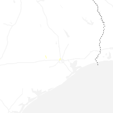
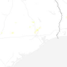
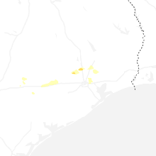


Connect with Interactive Hail Maps