

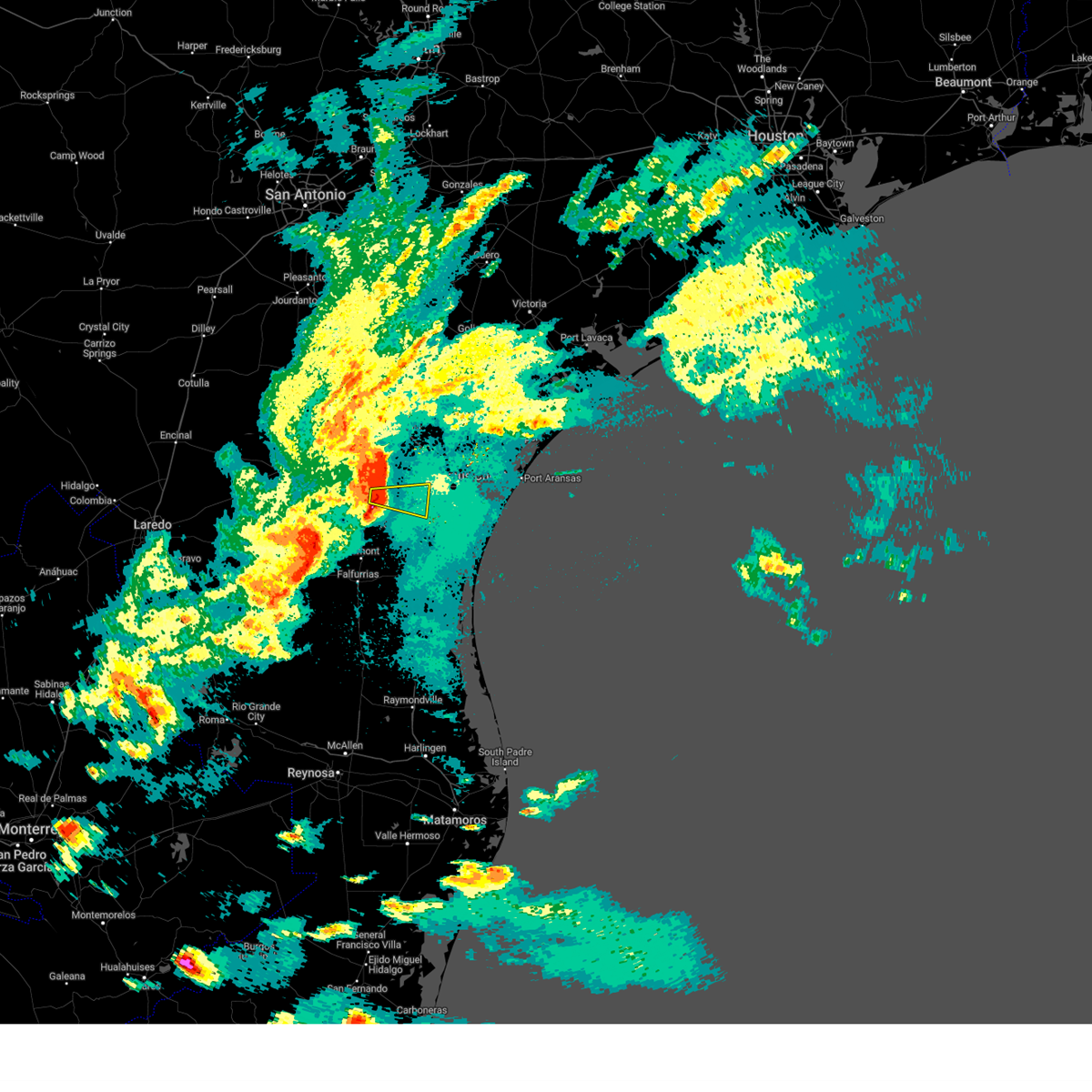
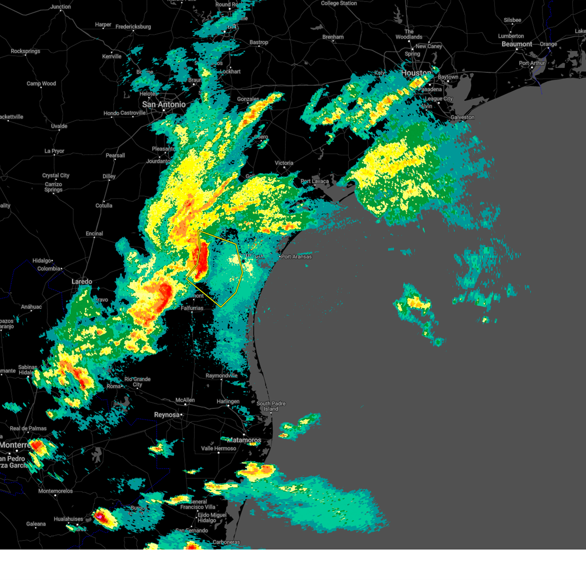
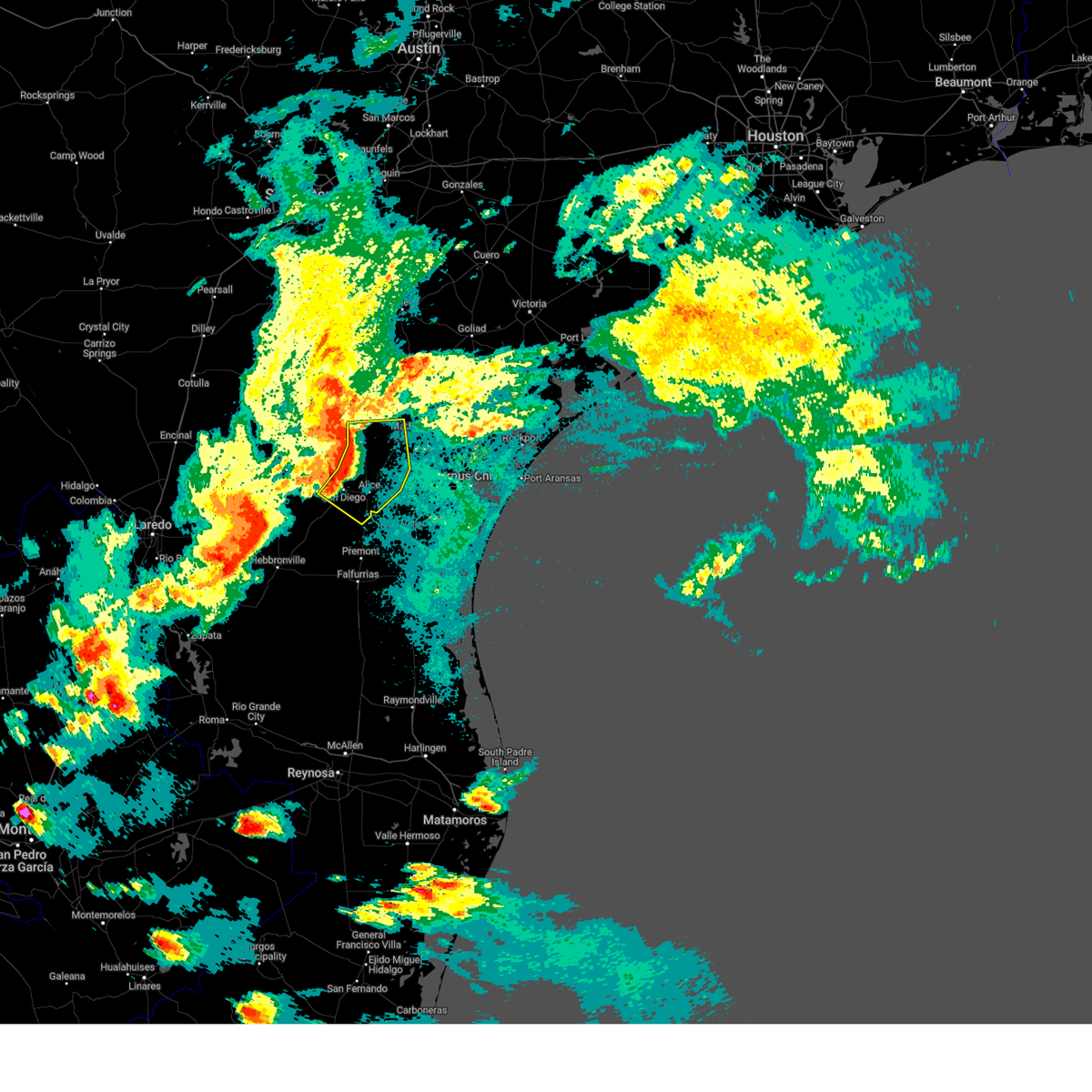
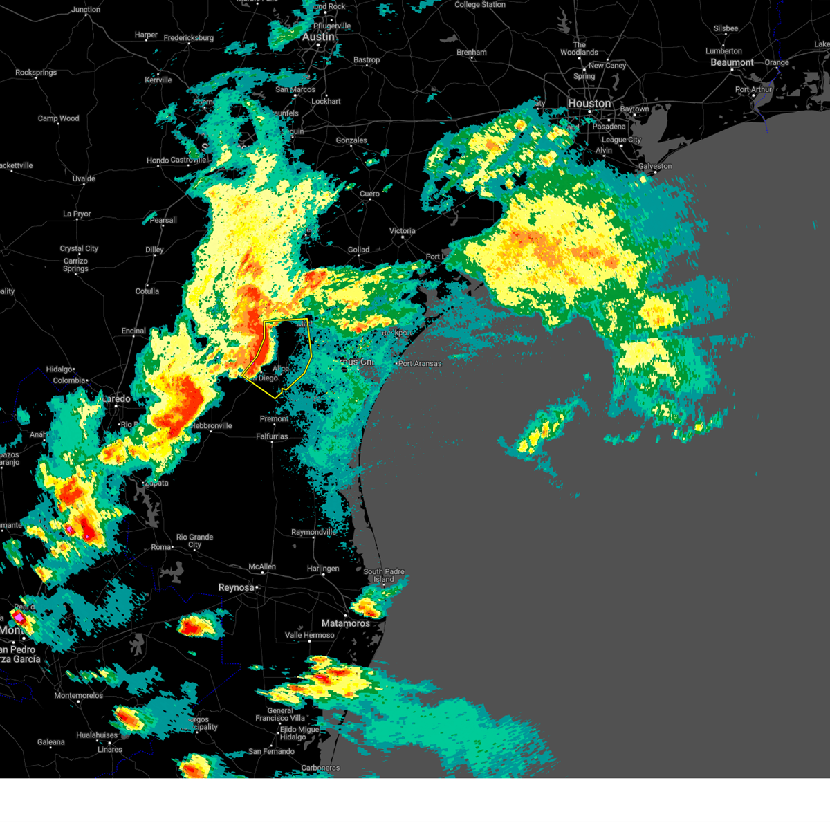
Hail Map for Alice, TX
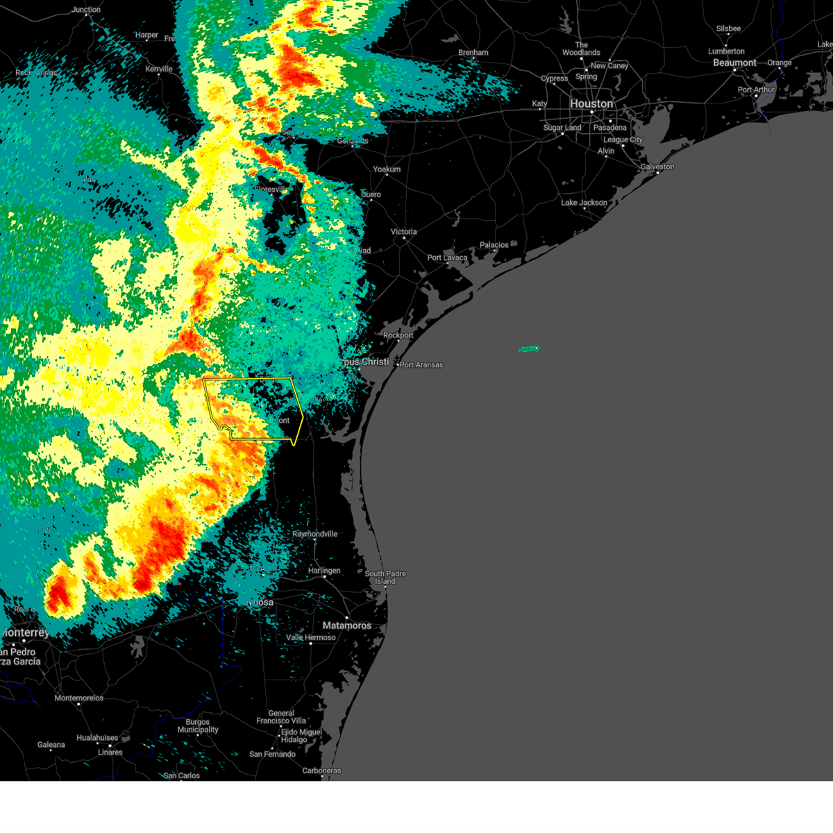
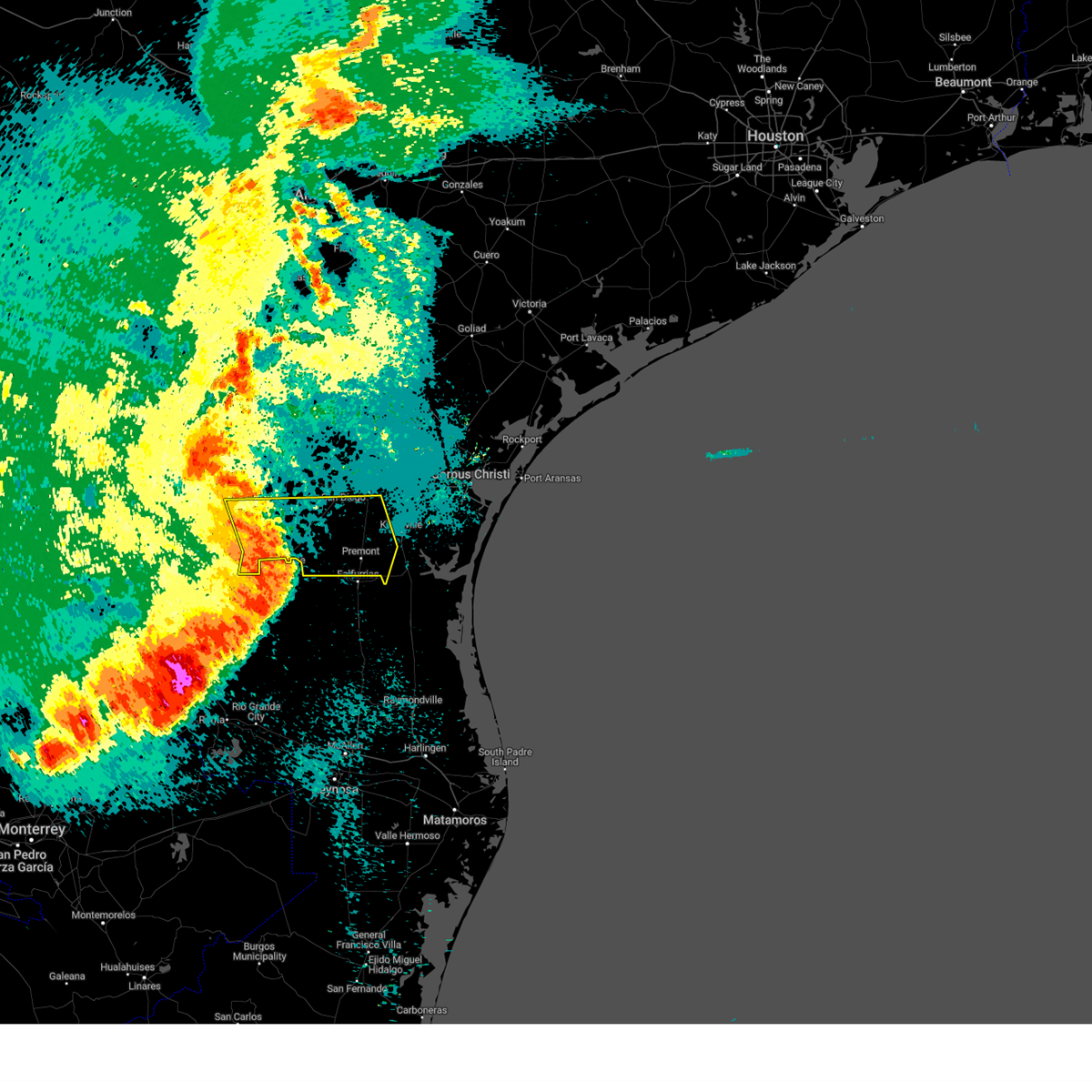
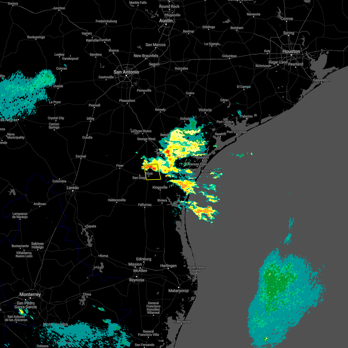
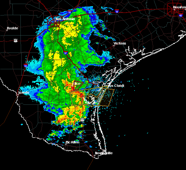
The Alice, TX area has had 4 reports of on-the-ground hail by trained spotters, and has been under severe weather warnings 5 times during the past 12 months. Doppler radar has detected hail at or near Alice, TX on 33 occasions, including 1 occasion during the past year.
| Name: | Alice, TX |
| Where Located: | 40.6 miles W of Corpus Christi, TX |
| Map: | Google Map for Alice, TX |
| Population: | 19104 |
| Housing Units: | 7313 |
| More Info: | Search Google for Alice, TX |
2
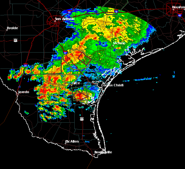
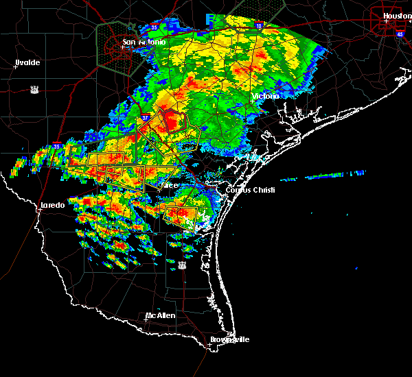
The Top Recent Hail Date for Alice, TX is Thursday, May 8, 2025 (9th out of 33)

Hail and Wind Damage Spotted near Alice, TX
| Date / Time | Report Details |
|---|---|
| 5/8/2025 9:29 PM CDT |
 Svrcrp the national weather service in corpus christi has issued a * severe thunderstorm warning for, southwestern nueces county in south central texas, central jim wells county in south central texas, * until 1000 pm cdt. * at 928 pm cdt, a severe thunderstorm was located near alice, moving east at 40 mph. winds observed near 90 mph. this is a destructive storm for east of alice to western nueces county (radar indicated. wind observed from kali of winds near 90 mph). Hazards include 90 mph wind gusts and half dollar size hail. You are in a life-threatening situation. flying debris may be deadly to those caught without shelter. mobile homes will be heavily damaged or destroyed. homes and businesses will have substantial roof and window damage. Expect extensive tree damage and power outages. Svrcrp the national weather service in corpus christi has issued a * severe thunderstorm warning for, southwestern nueces county in south central texas, central jim wells county in south central texas, * until 1000 pm cdt. * at 928 pm cdt, a severe thunderstorm was located near alice, moving east at 40 mph. winds observed near 90 mph. this is a destructive storm for east of alice to western nueces county (radar indicated. wind observed from kali of winds near 90 mph). Hazards include 90 mph wind gusts and half dollar size hail. You are in a life-threatening situation. flying debris may be deadly to those caught without shelter. mobile homes will be heavily damaged or destroyed. homes and businesses will have substantial roof and window damage. Expect extensive tree damage and power outages.
|
| 5/8/2025 9:25 PM CDT |
 Svrcrp the national weather service in corpus christi has issued a * severe thunderstorm warning for, nueces county in south central texas, southwestern san patricio county in south central texas, northern jim wells county in south central texas, southeastern live oak county in south central texas, western kleberg county in south central texas, * until 1015 pm cdt. * at 924 pm cdt, severe thunderstorms were located along a line extending from near westdale to alfred-south la paloma to near ben bolt to near palito blanco, moving southeast at 35 mph (radar indicated. wind observed by kali). Hazards include 70 mph wind gusts and quarter size hail. Hail damage to vehicles is expected. expect considerable tree damage. Wind damage is also likely to mobile homes, roofs, and outbuildings. Svrcrp the national weather service in corpus christi has issued a * severe thunderstorm warning for, nueces county in south central texas, southwestern san patricio county in south central texas, northern jim wells county in south central texas, southeastern live oak county in south central texas, western kleberg county in south central texas, * until 1015 pm cdt. * at 924 pm cdt, severe thunderstorms were located along a line extending from near westdale to alfred-south la paloma to near ben bolt to near palito blanco, moving southeast at 35 mph (radar indicated. wind observed by kali). Hazards include 70 mph wind gusts and quarter size hail. Hail damage to vehicles is expected. expect considerable tree damage. Wind damage is also likely to mobile homes, roofs, and outbuildings.
|
| 5/8/2025 9:17 PM CDT | Also reported pea-sized hai in jim wells county TX, 1.1 miles NNE of Alice, TX |
| 5/8/2025 9:17 PM CDT | Report of two tractor trailers flipped over on hwy 281 and fm 155 in jim wells county TX, 3 miles ENE of Alice, TX |
| 5/8/2025 9:17 PM CDT | Asos station kali alice- pk wind time report differs from the actual passage of strong winds... so time on this report is estimated on rada in jim wells county TX, 3.3 miles WNW of Alice, TX |
| 5/8/2025 9:17 PM CDT | Reports of downed power lines and trees throughout the city of alic in jim wells county TX, 1 miles ENE of Alice, TX |
| 5/8/2025 9:17 PM CDT | Reports received through em of a barn demolished on fm 155 in jim wells county TX, 2.4 miles ENE of Alice, TX |
| 5/8/2025 9:14 PM CDT | Two to three ft diameter tree blown over and possibly hit with lightnin in jim wells county TX, 3.4 miles E of Alice, TX |
| 5/8/2025 9:10 PM CDT |
 the severe thunderstorm warning has been cancelled and is no longer in effect the severe thunderstorm warning has been cancelled and is no longer in effect
|
| 5/8/2025 9:10 PM CDT |
 At 909 pm cdt, severe thunderstorms were located along a line extending from 6 miles west of lagarto to near westdale to near alice to near san diego, moving southeast at 30 mph (radar indicated). Hazards include 60 mph wind gusts and nickel size hail. Expect damage to roofs, siding, and trees. locations impacted include, alice, mathis, san diego, orange grove, lake city, midway, lagarto, alfred-south la paloma, westdale, ben bolt, sandia, tecalote, annarose, argenta, alice acres, alfred, agua dulce, lakeside, lake corpus christi, and pernitas point. this includes the following highways, interstate 37 between mile markers 38 and 41. Us highway 281 between mile markers 644 and 684. At 909 pm cdt, severe thunderstorms were located along a line extending from 6 miles west of lagarto to near westdale to near alice to near san diego, moving southeast at 30 mph (radar indicated). Hazards include 60 mph wind gusts and nickel size hail. Expect damage to roofs, siding, and trees. locations impacted include, alice, mathis, san diego, orange grove, lake city, midway, lagarto, alfred-south la paloma, westdale, ben bolt, sandia, tecalote, annarose, argenta, alice acres, alfred, agua dulce, lakeside, lake corpus christi, and pernitas point. this includes the following highways, interstate 37 between mile markers 38 and 41. Us highway 281 between mile markers 644 and 684.
|
| 5/8/2025 8:37 PM CDT | Svrcrp the national weather service in corpus christi has issued a * severe thunderstorm warning for, northeastern duval county in south central texas, northwestern nueces county in south central texas, northwestern san patricio county in south central texas, southeastern mcmullen county in south central texas, jim wells county in south central texas, southern live oak county in south central texas, * until 930 pm cdt. * at 836 pm cdt, severe thunderstorms were located along a line extending from 9 miles north of clegg to near rancho de la parita to near rosita, moving east at 25 mph (radar indicated). Hazards include 60 mph wind gusts and nickel size hail. expect damage to roofs, siding, and trees |
| 6/20/2024 12:34 AM CDT |
 At 1234 am cdt, a severe thunderstorm capable of producing a tornado was located over alice acres, or over alice, moving west at 35 mph (radar indicated rotation). Hazards include tornado. Flying debris will be dangerous to those caught without shelter. mobile homes will be damaged or destroyed. damage to roofs, windows, and vehicles will occur. tree damage is likely. locations impacted include, alice and alice acres. This includes us highway 281 between mile markers 672 and 676. At 1234 am cdt, a severe thunderstorm capable of producing a tornado was located over alice acres, or over alice, moving west at 35 mph (radar indicated rotation). Hazards include tornado. Flying debris will be dangerous to those caught without shelter. mobile homes will be damaged or destroyed. damage to roofs, windows, and vehicles will occur. tree damage is likely. locations impacted include, alice and alice acres. This includes us highway 281 between mile markers 672 and 676.
|
| 6/20/2024 12:25 AM CDT |
 Torcrp the national weather service in corpus christi has issued a * tornado warning for, west central jim wells county in south central texas, * until 1245 am cdt. * at 1225 am cdt, a severe thunderstorm capable of producing a tornado was located near alice, moving west at 35 mph (radar indicated rotation). Hazards include tornado. Flying debris will be dangerous to those caught without shelter. mobile homes will be damaged or destroyed. damage to roofs, windows, and vehicles will occur. Tree damage is likely. Torcrp the national weather service in corpus christi has issued a * tornado warning for, west central jim wells county in south central texas, * until 1245 am cdt. * at 1225 am cdt, a severe thunderstorm capable of producing a tornado was located near alice, moving west at 35 mph (radar indicated rotation). Hazards include tornado. Flying debris will be dangerous to those caught without shelter. mobile homes will be damaged or destroyed. damage to roofs, windows, and vehicles will occur. Tree damage is likely.
|
| 5/28/2024 11:28 PM CDT |
 the severe thunderstorm warning has been cancelled and is no longer in effect the severe thunderstorm warning has been cancelled and is no longer in effect
|
| 5/28/2024 11:28 PM CDT |
 At 1126 pm cdt, severe thunderstorms were located along a line extending from near rosita to rios to 11 miles west of falfurrias junior high school, moving east at 40 mph (radar indicated). Hazards include 60 mph wind gusts. Expect damage to roofs, siding, and trees. these severe storms will be near, san jose and rios around 1130 pm cdt. premont, palito blanco, and la gloria around 1135 pm cdt. ben bolt and alice acres around 1150 pm cdt. alice around 1155 pm cdt. This includes us highway 281 between mile markers 676 and 708. At 1126 pm cdt, severe thunderstorms were located along a line extending from near rosita to rios to 11 miles west of falfurrias junior high school, moving east at 40 mph (radar indicated). Hazards include 60 mph wind gusts. Expect damage to roofs, siding, and trees. these severe storms will be near, san jose and rios around 1130 pm cdt. premont, palito blanco, and la gloria around 1135 pm cdt. ben bolt and alice acres around 1150 pm cdt. alice around 1155 pm cdt. This includes us highway 281 between mile markers 676 and 708.
|
| 5/28/2024 10:53 PM CDT |
 Svrcrp the national weather service in corpus christi has issued a * severe thunderstorm warning for, southern duval county in south central texas, southeastern webb county in south central texas, southwestern jim wells county in south central texas, western kleberg county in south central texas, * until 1145 pm cdt. * at 1052 pm cdt, severe thunderstorms were located along a line extending from 16 miles west of freer to near realitos to 7 miles southeast of south fork estates, moving east at 40 mph (radar indicated). Hazards include 60 mph wind gusts. Expect damage to roofs, siding, and trees. severe thunderstorms will be near, realitos around 1100 pm cdt. ramirez around 1105 pm cdt. concepcion around 1110 pm cdt. benavides around 1115 pm cdt. cruz calle and rios around 1120 pm cdt. san jose around 1125 pm cdt. premont around 1130 pm cdt. la gloria around 1135 pm cdt. this includes the following highways, us highway 281 between mile markers 676 and 708. Us highway 59 near mile marker 796. Svrcrp the national weather service in corpus christi has issued a * severe thunderstorm warning for, southern duval county in south central texas, southeastern webb county in south central texas, southwestern jim wells county in south central texas, western kleberg county in south central texas, * until 1145 pm cdt. * at 1052 pm cdt, severe thunderstorms were located along a line extending from 16 miles west of freer to near realitos to 7 miles southeast of south fork estates, moving east at 40 mph (radar indicated). Hazards include 60 mph wind gusts. Expect damage to roofs, siding, and trees. severe thunderstorms will be near, realitos around 1100 pm cdt. ramirez around 1105 pm cdt. concepcion around 1110 pm cdt. benavides around 1115 pm cdt. cruz calle and rios around 1120 pm cdt. san jose around 1125 pm cdt. premont around 1130 pm cdt. la gloria around 1135 pm cdt. this includes the following highways, us highway 281 between mile markers 676 and 708. Us highway 59 near mile marker 796.
|
| 5/5/2024 5:16 PM CDT |
 the severe thunderstorm warning has been cancelled and is no longer in effect the severe thunderstorm warning has been cancelled and is no longer in effect
|
| 5/5/2024 5:16 PM CDT |
 At 515 pm cdt, severe thunderstorms were located along a line extending from near rancho de la parita to 6 miles northwest of san diego to 13 miles west of benavides, moving east at 35 mph (radar indicated). Hazards include 60 mph wind gusts and quarter size hail. Hail damage to vehicles is expected. expect wind damage to roofs, siding, and trees. locations impacted include, alice, san diego, freer, benavides, seven sisters, san jose, ben bolt, palito blanco, tecalote, realitos, annarose, rancho de la parita, alice acres, rosita, and lake alice. this includes the following highways, us highway 281 between mile markers 660 and 682. Us highway 59 between mile markers 746 and 772. At 515 pm cdt, severe thunderstorms were located along a line extending from near rancho de la parita to 6 miles northwest of san diego to 13 miles west of benavides, moving east at 35 mph (radar indicated). Hazards include 60 mph wind gusts and quarter size hail. Hail damage to vehicles is expected. expect wind damage to roofs, siding, and trees. locations impacted include, alice, san diego, freer, benavides, seven sisters, san jose, ben bolt, palito blanco, tecalote, realitos, annarose, rancho de la parita, alice acres, rosita, and lake alice. this includes the following highways, us highway 281 between mile markers 660 and 682. Us highway 59 between mile markers 746 and 772.
|
| 5/5/2024 4:58 PM CDT |
 Svrcrp the national weather service in corpus christi has issued a * severe thunderstorm warning for, duval county in south central texas, east central webb county in south central texas, southeastern mcmullen county in south central texas, northwestern jim wells county in south central texas, southwestern live oak county in south central texas, * until 545 pm cdt. * at 457 pm cdt, severe thunderstorms were located along a line extending from 8 miles southwest of clegg to near rosita to 15 miles north of bruni, moving east at 35 mph (radar indicated). Hazards include 60 mph wind gusts and quarter size hail. Hail damage to vehicles is expected. Expect wind damage to roofs, siding, and trees. Svrcrp the national weather service in corpus christi has issued a * severe thunderstorm warning for, duval county in south central texas, east central webb county in south central texas, southeastern mcmullen county in south central texas, northwestern jim wells county in south central texas, southwestern live oak county in south central texas, * until 545 pm cdt. * at 457 pm cdt, severe thunderstorms were located along a line extending from 8 miles southwest of clegg to near rosita to 15 miles north of bruni, moving east at 35 mph (radar indicated). Hazards include 60 mph wind gusts and quarter size hail. Hail damage to vehicles is expected. Expect wind damage to roofs, siding, and trees.
|
| 5/9/2023 8:08 PM CDT |
 At 807 pm cdt, a severe thunderstorm was located over ben bolt, or 7 miles south of alice, moving southeast at 20 mph (radar indicated). Hazards include 60 mph wind gusts and quarter size hail. Hail damage to vehicles is expected. Expect wind damage to roofs, siding, and trees. At 807 pm cdt, a severe thunderstorm was located over ben bolt, or 7 miles south of alice, moving southeast at 20 mph (radar indicated). Hazards include 60 mph wind gusts and quarter size hail. Hail damage to vehicles is expected. Expect wind damage to roofs, siding, and trees.
|
| 4/23/2023 10:01 AM CDT | Asos station kali alic in jim wells county TX, 3.3 miles WNW of Alice, TX |
| 7/1/2022 6:32 PM CDT |
 At 632 pm cdt, severe thunderstorms were located along a line extending from near banquete to near bishop to ricardo, moving east at 20 mph (radar indicated). Hazards include 60 mph wind gusts. expect damage to roofs, siding, and trees At 632 pm cdt, severe thunderstorms were located along a line extending from near banquete to near bishop to ricardo, moving east at 20 mph (radar indicated). Hazards include 60 mph wind gusts. expect damage to roofs, siding, and trees
|
| 7/1/2022 6:16 PM CDT |
 At 616 pm cdt, severe thunderstorms were located along a line extending from banquete to near bishop to near ricardo, moving east at 30 mph (radar indicated). Hazards include 60 mph wind gusts and penny size hail. Expect damage to roofs, siding, and trees. locations impacted include, kingsville, alice, robstown, driscoll, bishop, ben bolt, palito blanco, alice acres, banquete, kingsville naval air station, agua dulce and petronila. this includes the following highways, us highway 281 between mile markers 676 and 696. us highway 77 between mile markers 672 and 698. hail threat, radar indicated max hail size, 0. 75 in wind threat, radar indicated max wind gust, 60 mph. At 616 pm cdt, severe thunderstorms were located along a line extending from banquete to near bishop to near ricardo, moving east at 30 mph (radar indicated). Hazards include 60 mph wind gusts and penny size hail. Expect damage to roofs, siding, and trees. locations impacted include, kingsville, alice, robstown, driscoll, bishop, ben bolt, palito blanco, alice acres, banquete, kingsville naval air station, agua dulce and petronila. this includes the following highways, us highway 281 between mile markers 676 and 696. us highway 77 between mile markers 672 and 698. hail threat, radar indicated max hail size, 0. 75 in wind threat, radar indicated max wind gust, 60 mph.
|
| 7/1/2022 5:59 PM CDT |
 At 559 pm cdt, severe thunderstorms were located along a line extending from 6 miles south of alfred to near bishop to near ricardo, moving east at 30 mph (radar indicated). Hazards include 60 mph wind gusts and penny size hail. expect damage to roofs, siding, and trees At 559 pm cdt, severe thunderstorms were located along a line extending from 6 miles south of alfred to near bishop to near ricardo, moving east at 30 mph (radar indicated). Hazards include 60 mph wind gusts and penny size hail. expect damage to roofs, siding, and trees
|
| 4/25/2022 6:24 PM CDT |
 At 623 pm cdt, a severe thunderstorm was located near alice, moving south at 15 mph (radar indicated). Hazards include 60 mph wind gusts and quarter size hail. Hail damage to vehicles is expected. expect wind damage to roofs, siding, and trees. locations impacted include, alice, ben bolt, alice acres, palito blanco and lake alice. this includes us highway 281 between mile markers 672 and 682. hail threat, radar indicated max hail size, 1. 00 in wind threat, radar indicated max wind gust, 60 mph. At 623 pm cdt, a severe thunderstorm was located near alice, moving south at 15 mph (radar indicated). Hazards include 60 mph wind gusts and quarter size hail. Hail damage to vehicles is expected. expect wind damage to roofs, siding, and trees. locations impacted include, alice, ben bolt, alice acres, palito blanco and lake alice. this includes us highway 281 between mile markers 672 and 682. hail threat, radar indicated max hail size, 1. 00 in wind threat, radar indicated max wind gust, 60 mph.
|
| 4/25/2022 6:14 PM CDT | 59 mph wind gust measured by pw in jim wells county TX, 7.9 miles NE of Alice, TX |
| 4/25/2022 6:10 PM CDT | Picture of back patio roof blown off. time estimated by rada in jim wells county TX, 4 miles E of Alice, TX |
| 4/25/2022 6:10 PM CDT | Picture report of large tree branch broken. also reported 3.5 inches of rai in jim wells county TX, 2.4 miles ENE of Alice, TX |
| 4/25/2022 6:10 PM CDT | Corrects previous tstm wnd dmg report from 2 wsw alice. picture report of large tree branch broken. damage time estimated by radar. also reported 3.5 inches of rai in jim wells county TX, 2.4 miles ENE of Alice, TX |
| 4/25/2022 5:58 PM CDT |
 At 557 pm cdt, a severe thunderstorm was located near alice, moving south at 15 mph (radar indicated). Hazards include 60 mph wind gusts and half dollar size hail. Hail damage to vehicles is expected. Expect wind damage to roofs, siding, and trees. At 557 pm cdt, a severe thunderstorm was located near alice, moving south at 15 mph (radar indicated). Hazards include 60 mph wind gusts and half dollar size hail. Hail damage to vehicles is expected. Expect wind damage to roofs, siding, and trees.
|
| 4/25/2022 5:46 PM CDT |
 At 546 pm cdt, a severe thunderstorm was located over tecalote, or 8 miles north of alice, moving south at 10 mph (radar indicated). Hazards include 60 mph wind gusts and half dollar size hail. Hail damage to vehicles is expected. expect wind damage to roofs, siding, and trees. locations impacted include, alice, san diego, orange grove, tecalote, rancho de la parita, alfred-south la paloma, alfred, westdale and lake alice. this includes us highway 281 between mile markers 656 and 672. hail threat, radar indicated max hail size, 1. 25 in wind threat, radar indicated max wind gust, 60 mph. At 546 pm cdt, a severe thunderstorm was located over tecalote, or 8 miles north of alice, moving south at 10 mph (radar indicated). Hazards include 60 mph wind gusts and half dollar size hail. Hail damage to vehicles is expected. expect wind damage to roofs, siding, and trees. locations impacted include, alice, san diego, orange grove, tecalote, rancho de la parita, alfred-south la paloma, alfred, westdale and lake alice. this includes us highway 281 between mile markers 656 and 672. hail threat, radar indicated max hail size, 1. 25 in wind threat, radar indicated max wind gust, 60 mph.
|
| 4/25/2022 5:41 PM CDT |
 At 541 pm cdt, a severe thunderstorm was located over tecalote, or 8 miles north of alice, moving south at 15 mph (radar indicated). Hazards include 60 mph wind gusts and quarter size hail. Hail damage to vehicles is expected. expect wind damage to roofs, siding, and trees. locations impacted include, alice, san diego, orange grove, tecalote, rancho de la parita, alfred-south la paloma, alfred, westdale and lake alice. this includes us highway 281 between mile markers 656 and 672. hail threat, radar indicated max hail size, 1. 00 in wind threat, radar indicated max wind gust, 60 mph. At 541 pm cdt, a severe thunderstorm was located over tecalote, or 8 miles north of alice, moving south at 15 mph (radar indicated). Hazards include 60 mph wind gusts and quarter size hail. Hail damage to vehicles is expected. expect wind damage to roofs, siding, and trees. locations impacted include, alice, san diego, orange grove, tecalote, rancho de la parita, alfred-south la paloma, alfred, westdale and lake alice. this includes us highway 281 between mile markers 656 and 672. hail threat, radar indicated max hail size, 1. 00 in wind threat, radar indicated max wind gust, 60 mph.
|
| 4/25/2022 5:22 PM CDT |
 At 521 pm cdt, a severe thunderstorm was located near tecalote, or 13 miles north of alice, moving south at 10 mph (radar indicated). Hazards include 60 mph wind gusts and quarter size hail. Hail damage to vehicles is expected. Expect wind damage to roofs, siding, and trees. At 521 pm cdt, a severe thunderstorm was located near tecalote, or 13 miles north of alice, moving south at 10 mph (radar indicated). Hazards include 60 mph wind gusts and quarter size hail. Hail damage to vehicles is expected. Expect wind damage to roofs, siding, and trees.
|
| 6/14/2021 7:50 PM CDT |
 At 750 pm cdt, a severe thunderstorm was located over banquete, or 9 miles west of robstown, moving southwest at 10 mph (radar indicated). Hazards include 60 mph wind gusts and nickel size hail. expect damage to roofs, siding, and trees At 750 pm cdt, a severe thunderstorm was located over banquete, or 9 miles west of robstown, moving southwest at 10 mph (radar indicated). Hazards include 60 mph wind gusts and nickel size hail. expect damage to roofs, siding, and trees
|
| 5/18/2021 2:06 AM CDT |
 At 206 am cdt, severe thunderstorms were located along a line extending from near midway to near bluntzer to 6 miles east of driscoll, moving northeast at 50 mph (radar indicated). Hazards include 70 mph wind gusts and penny size hail. Expect considerable tree damage. damage is likely to mobile homes, roofs, and outbuildings. these severe storms will be near, sandia around 215 am cdt. other locations impacted by these severe thunderstorms include pernitas point, agua dulce and lake alice. this includes the following highways, us highway 281 between mile markers 656 and 678. Us highway 77 between mile markers 674 and 682. At 206 am cdt, severe thunderstorms were located along a line extending from near midway to near bluntzer to 6 miles east of driscoll, moving northeast at 50 mph (radar indicated). Hazards include 70 mph wind gusts and penny size hail. Expect considerable tree damage. damage is likely to mobile homes, roofs, and outbuildings. these severe storms will be near, sandia around 215 am cdt. other locations impacted by these severe thunderstorms include pernitas point, agua dulce and lake alice. this includes the following highways, us highway 281 between mile markers 656 and 678. Us highway 77 between mile markers 674 and 682.
|
| 5/18/2021 2:00 AM CDT | Report of wind damaged home... storage unit behind home is gone... and downed powerline in jim wells county TX, 0.5 miles NW of Alice, TX |
| 5/18/2021 1:49 AM CDT | Numerous power poles down near 665 in alice. wind damage to roof in jim wells county TX, 1 miles WSW of Alice, TX |
| 5/18/2021 1:45 AM CDT | Numerous areas of damage including power poles down and damage to home in the rancho alegre are in jim wells county TX, 1.9 miles NE of Alice, TX |
| 5/18/2021 1:43 AM CDT |
 At 143 am cdt, severe thunderstorms were located along a line extending from near tecalote to kingsville naval air station to riviera beach, moving east at 50 mph (radar indicated). Hazards include 70 mph wind gusts and penny size hail. Expect considerable tree damage. damage is likely to mobile homes, roofs, and outbuildings. severe thunderstorms will be near, riviera beach around 150 am cdt. alfred-south la paloma around 200 am cdt. banquete around 210 am cdt. other locations impacted by these severe thunderstorms include loyola beach, pernitas point, agua dulce, lake alice and petronila. this includes the following highways, us highway 281 between mile markers 656 and 708. Us highway 77 between mile markers 674 and 708. At 143 am cdt, severe thunderstorms were located along a line extending from near tecalote to kingsville naval air station to riviera beach, moving east at 50 mph (radar indicated). Hazards include 70 mph wind gusts and penny size hail. Expect considerable tree damage. damage is likely to mobile homes, roofs, and outbuildings. severe thunderstorms will be near, riviera beach around 150 am cdt. alfred-south la paloma around 200 am cdt. banquete around 210 am cdt. other locations impacted by these severe thunderstorms include loyola beach, pernitas point, agua dulce, lake alice and petronila. this includes the following highways, us highway 281 between mile markers 656 and 708. Us highway 77 between mile markers 674 and 708.
|
| 5/18/2021 1:35 AM CDT | Spotter noticed gas station cover over the pumps was movin in jim wells county TX, 8.9 miles E of Alice, TX |
| 5/18/2021 1:21 AM CDT |
 At 121 am cdt, severe thunderstorms were located along a line extending from 6 miles southwest of san diego to 7 miles northeast of premont to 7 miles west of sarita, moving east at 45 mph (radar indicated). Hazards include 60 mph wind gusts and nickel size hail. Expect damage to roofs, siding, and trees. these severe storms will be near, riviera around 130 am cdt. kingsville and ricardo around 135 am cdt. alice acres and ben bolt around 140 am cdt. alice around 145 am cdt. other locations impacted by these severe thunderstorms include lake alice. this includes the following highways, us highway 281 between mile markers 670 and 708. Us highway 77 between mile markers 696 and 708. At 121 am cdt, severe thunderstorms were located along a line extending from 6 miles southwest of san diego to 7 miles northeast of premont to 7 miles west of sarita, moving east at 45 mph (radar indicated). Hazards include 60 mph wind gusts and nickel size hail. Expect damage to roofs, siding, and trees. these severe storms will be near, riviera around 130 am cdt. kingsville and ricardo around 135 am cdt. alice acres and ben bolt around 140 am cdt. alice around 145 am cdt. other locations impacted by these severe thunderstorms include lake alice. this includes the following highways, us highway 281 between mile markers 670 and 708. Us highway 77 between mile markers 696 and 708.
|
| 5/18/2021 1:12 AM CDT | Carport blown into hous in duval county TX, 21 miles ENE of Alice, TX |
| 5/18/2021 12:57 AM CDT |
 The national weather service in corpus christi has issued a * severe thunderstorm warning for. southeastern duval county in south central texas. southwestern jim wells county in south central texas. western kleberg county in south central texas. Until 145 am cdt. The national weather service in corpus christi has issued a * severe thunderstorm warning for. southeastern duval county in south central texas. southwestern jim wells county in south central texas. western kleberg county in south central texas. Until 145 am cdt.
|
| 5/15/2021 8:28 PM CDT |
 At 827 pm cdt, a severe thunderstorm was located over alfred, or 8 miles north of alice, moving south at 10 mph (radar indicated). Hazards include 60 mph wind gusts and half dollar size hail. Hail damage to vehicles is expected. expect wind damage to roofs, siding, and trees. locations impacted include, alice, orange grove, tecalote, alfred-south la paloma, alice acres, alfred, agua dulce and lake alice. This includes us highway 281 between mile markers 662 and 676. At 827 pm cdt, a severe thunderstorm was located over alfred, or 8 miles north of alice, moving south at 10 mph (radar indicated). Hazards include 60 mph wind gusts and half dollar size hail. Hail damage to vehicles is expected. expect wind damage to roofs, siding, and trees. locations impacted include, alice, orange grove, tecalote, alfred-south la paloma, alice acres, alfred, agua dulce and lake alice. This includes us highway 281 between mile markers 662 and 676.
|
| 5/15/2021 8:10 PM CDT |
 At 809 pm cdt, a severe thunderstorm was located near alfred, or 9 miles north of alice, moving southeast at 20 mph (radar indicated). Hazards include 60 mph wind gusts and half dollar size hail. Hail damage to vehicles is expected. Expect wind damage to roofs, siding, and trees. At 809 pm cdt, a severe thunderstorm was located near alfred, or 9 miles north of alice, moving southeast at 20 mph (radar indicated). Hazards include 60 mph wind gusts and half dollar size hail. Hail damage to vehicles is expected. Expect wind damage to roofs, siding, and trees.
|
| 5/11/2021 10:23 PM CDT |
 At 1022 pm cdt, a severe thunderstorm was located near bishop, or near kingsville, moving east at 20 mph (radar indicated). Hazards include 60 mph wind gusts and quarter size hail. Hail damage to vehicles is expected. expect wind damage to roofs, siding, and trees. this severe storm will be near, kingsville around 1030 pm cdt. other locations impacted by this severe thunderstorm include agua dulce and lake alice. This includes us highway 281 between mile markers 670 and 688. At 1022 pm cdt, a severe thunderstorm was located near bishop, or near kingsville, moving east at 20 mph (radar indicated). Hazards include 60 mph wind gusts and quarter size hail. Hail damage to vehicles is expected. expect wind damage to roofs, siding, and trees. this severe storm will be near, kingsville around 1030 pm cdt. other locations impacted by this severe thunderstorm include agua dulce and lake alice. This includes us highway 281 between mile markers 670 and 688.
|
| 5/11/2021 9:38 PM CDT |
 At 937 pm cdt, a severe thunderstorm was located over alice acres, or near alice, moving east at 20 mph (radar indicated). Hazards include 60 mph wind gusts and quarter size hail. Hail damage to vehicles is expected. expect wind damage to roofs, siding, and trees. this severe thunderstorm will be near, ben bolt around 945 pm cdt. kingsville around 1030 pm cdt. other locations impacted by this severe thunderstorm include agua dulce and lake alice. This includes us highway 281 between mile markers 670 and 688. At 937 pm cdt, a severe thunderstorm was located over alice acres, or near alice, moving east at 20 mph (radar indicated). Hazards include 60 mph wind gusts and quarter size hail. Hail damage to vehicles is expected. expect wind damage to roofs, siding, and trees. this severe thunderstorm will be near, ben bolt around 945 pm cdt. kingsville around 1030 pm cdt. other locations impacted by this severe thunderstorm include agua dulce and lake alice. This includes us highway 281 between mile markers 670 and 688.
|
| 5/11/2021 9:08 PM CDT |
 At 908 pm cdt, a severe thunderstorm was located over westdale, or 14 miles southwest of mathis, moving east at 20 mph (radar indicated). Hazards include 60 mph wind gusts and quarter size hail. Hail damage to vehicles is expected. expect wind damage to roofs, siding, and trees. locations impacted include, alice, robstown, mathis, san diego, driscoll, orange grove, lake city, san patricio, midway, edroy, banquete, sandia, west sinton, tecalote, annarose, rancho de la parita, alfred-south la paloma, bluntzer, westdale and alice acres. this includes the following highways, interstate 37 between mile markers 21 and 35. us highway 281 between mile markers 648 and 678. Us highway 77 between mile markers 678 and 682. At 908 pm cdt, a severe thunderstorm was located over westdale, or 14 miles southwest of mathis, moving east at 20 mph (radar indicated). Hazards include 60 mph wind gusts and quarter size hail. Hail damage to vehicles is expected. expect wind damage to roofs, siding, and trees. locations impacted include, alice, robstown, mathis, san diego, driscoll, orange grove, lake city, san patricio, midway, edroy, banquete, sandia, west sinton, tecalote, annarose, rancho de la parita, alfred-south la paloma, bluntzer, westdale and alice acres. this includes the following highways, interstate 37 between mile markers 21 and 35. us highway 281 between mile markers 648 and 678. Us highway 77 between mile markers 678 and 682.
|
| 5/11/2021 8:52 PM CDT |
 At 851 pm cdt, a severe thunderstorm was located over midway, or 16 miles north of alice, moving east at 20 mph (radar indicated). Hazards include 60 mph wind gusts and quarter size hail. Hail damage to vehicles is expected. Expect wind damage to roofs, siding, and trees. At 851 pm cdt, a severe thunderstorm was located over midway, or 16 miles north of alice, moving east at 20 mph (radar indicated). Hazards include 60 mph wind gusts and quarter size hail. Hail damage to vehicles is expected. Expect wind damage to roofs, siding, and trees.
|
| 5/11/2021 8:19 PM CDT |
 At 819 pm cdt, a severe thunderstorm was located over rancho de la parita, or 18 miles north of san diego, moving southeast at 15 mph (radar indicated). Hazards include 60 mph wind gusts and quarter size hail. Hail damage to vehicles is expected. Expect wind damage to roofs, siding, and trees. At 819 pm cdt, a severe thunderstorm was located over rancho de la parita, or 18 miles north of san diego, moving southeast at 15 mph (radar indicated). Hazards include 60 mph wind gusts and quarter size hail. Hail damage to vehicles is expected. Expect wind damage to roofs, siding, and trees.
|
| 8/20/2020 6:44 PM CDT |
 At 643 pm cdt, a severe thunderstorm was located over palito blanco, or 12 miles south of san diego, moving southeast at 25 mph (radar indicated). Hazards include 60 mph wind gusts and quarter size hail. Hail damage to vehicles is expected. Expect wind damage to roofs, siding, and trees. At 643 pm cdt, a severe thunderstorm was located over palito blanco, or 12 miles south of san diego, moving southeast at 25 mph (radar indicated). Hazards include 60 mph wind gusts and quarter size hail. Hail damage to vehicles is expected. Expect wind damage to roofs, siding, and trees.
|
| 8/20/2020 6:30 PM CDT |
 At 630 pm cdt, a severe thunderstorm was located over palito blanco, or 9 miles south of san diego, moving southeast at 25 mph (radar indicated). Hazards include 60 mph wind gusts and quarter size hail. Hail damage to vehicles is expected. expect wind damage to roofs, siding, and trees. Locations impacted include, san diego, benavides, ben bolt, palito blanco, alice acres, rios, san jose and rosita. At 630 pm cdt, a severe thunderstorm was located over palito blanco, or 9 miles south of san diego, moving southeast at 25 mph (radar indicated). Hazards include 60 mph wind gusts and quarter size hail. Hail damage to vehicles is expected. expect wind damage to roofs, siding, and trees. Locations impacted include, san diego, benavides, ben bolt, palito blanco, alice acres, rios, san jose and rosita.
|
| 8/20/2020 6:15 PM CDT |
 At 614 pm cdt, a severe thunderstorm was located near san diego, moving southeast at 25 mph (radar indicated). Hazards include 60 mph wind gusts and quarter size hail. Hail damage to vehicles is expected. Expect wind damage to roofs, siding, and trees. At 614 pm cdt, a severe thunderstorm was located near san diego, moving southeast at 25 mph (radar indicated). Hazards include 60 mph wind gusts and quarter size hail. Hail damage to vehicles is expected. Expect wind damage to roofs, siding, and trees.
|
| 8/18/2020 7:02 PM CDT |
 At 702 pm cdt, severe thunderstorms were located along a line extending from 7 miles east of ben bolt to near driscoll, moving southwest at 10 mph (radar indicated). Hazards include 60 mph wind gusts and quarter size hail. Hail damage to vehicles is expected. expect wind damage to roofs, siding, and trees. Locations impacted include, kingsville, alice, robstown, driscoll, bishop, ben bolt, kingsville naval air station, alice acres and petronila. At 702 pm cdt, severe thunderstorms were located along a line extending from 7 miles east of ben bolt to near driscoll, moving southwest at 10 mph (radar indicated). Hazards include 60 mph wind gusts and quarter size hail. Hail damage to vehicles is expected. expect wind damage to roofs, siding, and trees. Locations impacted include, kingsville, alice, robstown, driscoll, bishop, ben bolt, kingsville naval air station, alice acres and petronila.
|
| 8/18/2020 6:26 PM CDT |
 At 626 pm cdt, severe thunderstorms were located along a line extending from 9 miles southwest of banquete to near driscoll, moving southwest at 10 mph (radar indicated). Hazards include 60 mph wind gusts and quarter size hail. Hail damage to vehicles is expected. Expect wind damage to roofs, siding, and trees. At 626 pm cdt, severe thunderstorms were located along a line extending from 9 miles southwest of banquete to near driscoll, moving southwest at 10 mph (radar indicated). Hazards include 60 mph wind gusts and quarter size hail. Hail damage to vehicles is expected. Expect wind damage to roofs, siding, and trees.
|
| 8/2/2020 8:37 PM CDT |
 At 836 pm cdt, severe thunderstorms were located along a line extending from near rosita to near alice acres to near alice, moving south at 15 mph (radar indicated). Hazards include 60 mph wind gusts and quarter size hail. Hail damage to vehicles is expected. expect wind damage to roofs, siding, and trees. Locations impacted include, alice, san diego, alfred-south la paloma, alice acres, alfred and lake alice. At 836 pm cdt, severe thunderstorms were located along a line extending from near rosita to near alice acres to near alice, moving south at 15 mph (radar indicated). Hazards include 60 mph wind gusts and quarter size hail. Hail damage to vehicles is expected. expect wind damage to roofs, siding, and trees. Locations impacted include, alice, san diego, alfred-south la paloma, alice acres, alfred and lake alice.
|
| 8/2/2020 8:15 PM CDT |
 At 815 pm cdt, severe thunderstorms were located along a line extending from near rosita to near alice to 6 miles south of alfred, moving south at 15 mph (radar indicated). Hazards include 60 mph wind gusts and quarter size hail. Hail damage to vehicles is expected. Expect wind damage to roofs, siding, and trees. At 815 pm cdt, severe thunderstorms were located along a line extending from near rosita to near alice to 6 miles south of alfred, moving south at 15 mph (radar indicated). Hazards include 60 mph wind gusts and quarter size hail. Hail damage to vehicles is expected. Expect wind damage to roofs, siding, and trees.
|
| 8/2/2020 7:49 PM CDT |
 At 749 pm cdt, a severe thunderstorm was located near tecalote, or 8 miles northeast of san diego, moving southwest at 30 mph (radar indicated). Hazards include 60 mph wind gusts and quarter size hail. Hail damage to vehicles is expected. Expect wind damage to roofs, siding, and trees. At 749 pm cdt, a severe thunderstorm was located near tecalote, or 8 miles northeast of san diego, moving southwest at 30 mph (radar indicated). Hazards include 60 mph wind gusts and quarter size hail. Hail damage to vehicles is expected. Expect wind damage to roofs, siding, and trees.
|
| 5/16/2020 1:22 AM CDT |
 At 121 am cdt, severe thunderstorms were located along a line extending from near westdale to near benavides, moving east at 50 mph (radar indicated). Hazards include 60 mph wind gusts and penny size hail. Expect damage to roofs, siding, and trees. Locations impacted include, alice, mathis, san diego, benavides, orange grove, lake city, san patricio, midway, tynan, san jose, sandia, west sinton, tecalote, annarose, argenta, rancho de la parita, rosita, lagarto, alfred-south la paloma and bluntzer. At 121 am cdt, severe thunderstorms were located along a line extending from near westdale to near benavides, moving east at 50 mph (radar indicated). Hazards include 60 mph wind gusts and penny size hail. Expect damage to roofs, siding, and trees. Locations impacted include, alice, mathis, san diego, benavides, orange grove, lake city, san patricio, midway, tynan, san jose, sandia, west sinton, tecalote, annarose, argenta, rancho de la parita, rosita, lagarto, alfred-south la paloma and bluntzer.
|
| 5/16/2020 12:54 AM CDT |
 At 1254 am cdt, severe thunderstorms were located along a line extending from 9 miles east of seven sisters to 7 miles northeast of bruni, moving east at 50 mph (radar indicated). Hazards include 60 mph wind gusts and penny size hail. expect damage to roofs, siding, and trees At 1254 am cdt, severe thunderstorms were located along a line extending from 9 miles east of seven sisters to 7 miles northeast of bruni, moving east at 50 mph (radar indicated). Hazards include 60 mph wind gusts and penny size hail. expect damage to roofs, siding, and trees
|
| 7/3/2019 7:52 PM CDT |
 At 751 pm cdt, a severe thunderstorm was located over alfred, or 9 miles north of alice, moving southeast at 30 mph (radar indicated). Hazards include 60 mph wind gusts and quarter size hail. Hail damage to vehicles is expected. expect wind damage to roofs, siding, and trees. Locations impacted include, alice, san diego, orange grove, lake city, midway, lagarto, alfred-south la paloma, westdale, tecalote, annarose, rancho de la parita, alice acres, alfred, sandia, lake corpus christi, pernitas point and lake alice. At 751 pm cdt, a severe thunderstorm was located over alfred, or 9 miles north of alice, moving southeast at 30 mph (radar indicated). Hazards include 60 mph wind gusts and quarter size hail. Hail damage to vehicles is expected. expect wind damage to roofs, siding, and trees. Locations impacted include, alice, san diego, orange grove, lake city, midway, lagarto, alfred-south la paloma, westdale, tecalote, annarose, rancho de la parita, alice acres, alfred, sandia, lake corpus christi, pernitas point and lake alice.
|
| 7/3/2019 7:24 PM CDT |
 At 723 pm cdt, a severe thunderstorm was located over rancho de la parita, or 17 miles north of san diego, moving southeast at 30 mph (radar indicated). Hazards include 60 mph wind gusts and quarter size hail. Hail damage to vehicles is expected. Expect wind damage to roofs, siding, and trees. At 723 pm cdt, a severe thunderstorm was located over rancho de la parita, or 17 miles north of san diego, moving southeast at 30 mph (radar indicated). Hazards include 60 mph wind gusts and quarter size hail. Hail damage to vehicles is expected. Expect wind damage to roofs, siding, and trees.
|
| 6/6/2019 7:06 PM CDT |
 At 705 pm cdt, a severe thunderstorm was located near driscoll, moving east at 35 mph (radar indicated). Hazards include 60 mph wind gusts and half dollar size hail. Hail damage to vehicles is expected. expect wind damage to roofs, siding, and trees. Locations impacted include, kingsville, alice, robstown, driscoll, bishop, ben bolt, alice acres, agua dulce, petronila and lake alice. At 705 pm cdt, a severe thunderstorm was located near driscoll, moving east at 35 mph (radar indicated). Hazards include 60 mph wind gusts and half dollar size hail. Hail damage to vehicles is expected. expect wind damage to roofs, siding, and trees. Locations impacted include, kingsville, alice, robstown, driscoll, bishop, ben bolt, alice acres, agua dulce, petronila and lake alice.
|
| 6/6/2019 6:44 PM CDT |
 At 643 pm cdt, a severe thunderstorm was located 8 miles west of driscoll, moving east at 35 mph (radar indicated). Hazards include 60 mph wind gusts and half dollar size hail. Hail damage to vehicles is expected. Expect wind damage to roofs, siding, and trees. At 643 pm cdt, a severe thunderstorm was located 8 miles west of driscoll, moving east at 35 mph (radar indicated). Hazards include 60 mph wind gusts and half dollar size hail. Hail damage to vehicles is expected. Expect wind damage to roofs, siding, and trees.
|
| 6/6/2019 6:41 PM CDT | Power poles down and a trailer flipped just east of intersection of highways 44 and 359 on the east...northeast side of alice in jim wells county TX, 1.8 miles WSW of Alice, TX |
| 6/6/2019 6:26 PM CDT |
 At 625 pm cdt, a severe thunderstorm was located near alfred-south la paloma, or 13 miles northeast of alice, moving east at 35 mph (radar indicated). Hazards include 70 mph wind gusts and quarter size hail. Hail damage to vehicles is expected. expect considerable tree damage. Wind damage is also likely to mobile homes, roofs, and outbuildings. At 625 pm cdt, a severe thunderstorm was located near alfred-south la paloma, or 13 miles northeast of alice, moving east at 35 mph (radar indicated). Hazards include 70 mph wind gusts and quarter size hail. Hail damage to vehicles is expected. expect considerable tree damage. Wind damage is also likely to mobile homes, roofs, and outbuildings.
|
| 5/6/2019 12:16 PM CDT |
 At 1216 pm cdt, severe thunderstorms were located along a line extending from 6 miles south of banquete to near driscoll to 10 miles east of kingsville naval air station, moving northeast at 40 mph (radar indicated). Hazards include 60 mph wind gusts and penny size hail. expect damage to roofs, siding, and trees At 1216 pm cdt, severe thunderstorms were located along a line extending from 6 miles south of banquete to near driscoll to 10 miles east of kingsville naval air station, moving northeast at 40 mph (radar indicated). Hazards include 60 mph wind gusts and penny size hail. expect damage to roofs, siding, and trees
|
| 5/6/2019 12:07 PM CDT |
 At 1206 pm cdt, a severe thunderstorm capable of producing a tornado was located 8 miles southeast of alice, moving north at 35 mph (radar indicated rotation). Hazards include tornado. Flying debris will be dangerous to those caught without shelter. mobile homes will be damaged or destroyed. damage to roofs, windows, and vehicles will occur. tree damage is likely. this dangerous storm will be near, alfred-south la paloma and alfred around 1230 pm cdt. Other locations impacted by this tornadic thunderstorm include agua dulce. At 1206 pm cdt, a severe thunderstorm capable of producing a tornado was located 8 miles southeast of alice, moving north at 35 mph (radar indicated rotation). Hazards include tornado. Flying debris will be dangerous to those caught without shelter. mobile homes will be damaged or destroyed. damage to roofs, windows, and vehicles will occur. tree damage is likely. this dangerous storm will be near, alfred-south la paloma and alfred around 1230 pm cdt. Other locations impacted by this tornadic thunderstorm include agua dulce.
|
| 5/3/2019 9:25 AM CDT |
 The severe thunderstorm warning for nueces, san patricio and northeastern jim wells counties will expire at 930 am cdt, the storm which prompted the warning has weakened below severe limits, and no longer poses an immediate threat to life or property. therefore, the warning will be allowed to expire. however gusty winds are still possible. a severe thunderstorm watch remains in effect until 100 pm cdt for south central texas. The severe thunderstorm warning for nueces, san patricio and northeastern jim wells counties will expire at 930 am cdt, the storm which prompted the warning has weakened below severe limits, and no longer poses an immediate threat to life or property. therefore, the warning will be allowed to expire. however gusty winds are still possible. a severe thunderstorm watch remains in effect until 100 pm cdt for south central texas.
|
| 5/3/2019 9:14 AM CDT |
 At 914 am cdt, a severe thunderstorm was located 7 miles northwest of corpus christi north beach, or 7 miles southwest of taft, moving northeast at 40 mph (radar indicated). Hazards include 60 mph wind gusts. Expect damage to roofs, siding, and trees. locations impacted include, corpus christi, portland, robstown, sinton, mathis, port aransas, taft, driscoll, corpus christi international airport, ingleside, aransas pass, bishop, odem, gregory, orange grove, st. Paul, ingleside on the bay, san patricio, christus spohn hospital south and corpus christi north beach. At 914 am cdt, a severe thunderstorm was located 7 miles northwest of corpus christi north beach, or 7 miles southwest of taft, moving northeast at 40 mph (radar indicated). Hazards include 60 mph wind gusts. Expect damage to roofs, siding, and trees. locations impacted include, corpus christi, portland, robstown, sinton, mathis, port aransas, taft, driscoll, corpus christi international airport, ingleside, aransas pass, bishop, odem, gregory, orange grove, st. Paul, ingleside on the bay, san patricio, christus spohn hospital south and corpus christi north beach.
|
| 5/3/2019 9:02 AM CDT |
 At 902 am cdt, a severe thunderstorm was located over annaville, or near robstown, moving northeast at 40 mph (radar indicated). Hazards include 70 mph wind gusts. Expect considerable tree damage. damage is likely to mobile homes, roofs, and outbuildings. locations impacted include, corpus christi, kingsville, alice, portland, robstown, sinton, mathis, port aransas, taft, driscoll, corpus christi international airport, skidmore, ingleside, aransas pass, bishop, odem, gregory, orange grove, st. Paul and ingleside on the bay. At 902 am cdt, a severe thunderstorm was located over annaville, or near robstown, moving northeast at 40 mph (radar indicated). Hazards include 70 mph wind gusts. Expect considerable tree damage. damage is likely to mobile homes, roofs, and outbuildings. locations impacted include, corpus christi, kingsville, alice, portland, robstown, sinton, mathis, port aransas, taft, driscoll, corpus christi international airport, skidmore, ingleside, aransas pass, bishop, odem, gregory, orange grove, st. Paul and ingleside on the bay.
|
| 5/3/2019 8:26 AM CDT |
 At 825 am cdt, a severe thunderstorm was located 8 miles southeast of alice, moving northeast at 40 mph. this is a very dangerous storm (radar indicated). Hazards include 80 mph wind gusts. Flying debris will be dangerous to those caught without shelter. mobile homes will be heavily damaged. expect considerable damage to roofs, windows, and vehicles. Extensive tree damage and power outages are likely. At 825 am cdt, a severe thunderstorm was located 8 miles southeast of alice, moving northeast at 40 mph. this is a very dangerous storm (radar indicated). Hazards include 80 mph wind gusts. Flying debris will be dangerous to those caught without shelter. mobile homes will be heavily damaged. expect considerable damage to roofs, windows, and vehicles. Extensive tree damage and power outages are likely.
|
| 5/3/2019 8:20 AM CDT |
 At 820 am cdt, a severe thunderstorm was located over alice acres, or over alice, moving eastnortheast at 40 mph. this is a very dangerous storm (radar indicated). Hazards include 80 mph wind gusts. Flying debris will be dangerous to those caught without shelter. mobile homes will be heavily damaged. expect considerable damage to roofs, windows, and vehicles. extensive tree damage and power outages are likely. Locations impacted include, kingsville, alice, san diego, benavides, midway, alfred-south la paloma, san jose, ben bolt, concepcion, palito blanco, tecalote, cruz calle, alice acres, alfred, rios, rosita, westdale, agua dulce and lake alice. At 820 am cdt, a severe thunderstorm was located over alice acres, or over alice, moving eastnortheast at 40 mph. this is a very dangerous storm (radar indicated). Hazards include 80 mph wind gusts. Flying debris will be dangerous to those caught without shelter. mobile homes will be heavily damaged. expect considerable damage to roofs, windows, and vehicles. extensive tree damage and power outages are likely. Locations impacted include, kingsville, alice, san diego, benavides, midway, alfred-south la paloma, san jose, ben bolt, concepcion, palito blanco, tecalote, cruz calle, alice acres, alfred, rios, rosita, westdale, agua dulce and lake alice.
|
| 5/3/2019 8:13 AM CDT |
 At 812 am cdt, a severe thunderstorm was located over alice acres, or near alice, moving eastnortheast at 40 mph. this is a very dangerous storm (radar indicated). Hazards include 80 mph wind gusts and quarter size hail. Flying debris will be dangerous to those caught without shelter. mobile homes will be heavily damaged. expect considerable damage to roofs, windows, and vehicles. extensive tree damage and power outages are likely. Locations impacted include, kingsville, alice, san diego, benavides, midway, alfred-south la paloma, ramirez, san jose, ben bolt, concepcion, palito blanco, tecalote, realitos, cruz calle, alice acres, alfred, rios, rosita, westdale and agua dulce. At 812 am cdt, a severe thunderstorm was located over alice acres, or near alice, moving eastnortheast at 40 mph. this is a very dangerous storm (radar indicated). Hazards include 80 mph wind gusts and quarter size hail. Flying debris will be dangerous to those caught without shelter. mobile homes will be heavily damaged. expect considerable damage to roofs, windows, and vehicles. extensive tree damage and power outages are likely. Locations impacted include, kingsville, alice, san diego, benavides, midway, alfred-south la paloma, ramirez, san jose, ben bolt, concepcion, palito blanco, tecalote, realitos, cruz calle, alice acres, alfred, rios, rosita, westdale and agua dulce.
|
| 5/3/2019 7:41 AM CDT |
 At 741 am cdt, a severe thunderstorm was located over benavides, moving eastnortheast at 40 mph. this is a very dangerous storm (radar indicated). Hazards include 80 mph wind gusts and quarter size hail. Flying debris will be dangerous to those caught without shelter. mobile homes will be heavily damaged. expect considerable damage to roofs, windows, and vehicles. Extensive tree damage and power outages are likely. At 741 am cdt, a severe thunderstorm was located over benavides, moving eastnortheast at 40 mph. this is a very dangerous storm (radar indicated). Hazards include 80 mph wind gusts and quarter size hail. Flying debris will be dangerous to those caught without shelter. mobile homes will be heavily damaged. expect considerable damage to roofs, windows, and vehicles. Extensive tree damage and power outages are likely.
|
| 4/24/2019 7:02 PM CDT |
 At 701 pm cdt, a severe thunderstorm was located near alfred-south la paloma, or 9 miles northeast of alice, moving east at 35 mph (radar indicated). Hazards include 60 mph wind gusts and quarter size hail. Hail damage to vehicles is expected. expect wind damage to roofs, siding, and trees. Locations impacted include, alice, robstown, alfred-south la paloma, alfred, bluntzer, banquete, agua dulce, north san pedro and lake alice. At 701 pm cdt, a severe thunderstorm was located near alfred-south la paloma, or 9 miles northeast of alice, moving east at 35 mph (radar indicated). Hazards include 60 mph wind gusts and quarter size hail. Hail damage to vehicles is expected. expect wind damage to roofs, siding, and trees. Locations impacted include, alice, robstown, alfred-south la paloma, alfred, bluntzer, banquete, agua dulce, north san pedro and lake alice.
|
| 4/24/2019 6:49 PM CDT |
 At 648 pm cdt, a severe thunderstorm was located near alice, moving east at 35 mph (radar indicated). Hazards include 60 mph wind gusts and nickel size hail. expect damage to roofs, siding, and trees At 648 pm cdt, a severe thunderstorm was located near alice, moving east at 35 mph (radar indicated). Hazards include 60 mph wind gusts and nickel size hail. expect damage to roofs, siding, and trees
|
| 4/7/2019 7:14 AM CDT |
 At 713 am cdt, severe thunderstorms were located along a line extending from argenta to 6 miles east of alice to premont, moving east at 40 mph (radar indicated). Hazards include 70 mph wind gusts and quarter size hail. Hail damage to vehicles is expected. expect considerable tree damage. wind damage is also likely to mobile homes, roofs, and outbuildings. Locations impacted include, kingsville, alice, robstown, mathis, san diego, premont, george west, driscoll, skidmore, bishop, orange grove, lake city, san patricio, midway, edroy, river creek acres, banquete, tynan, san jose and sandia. At 713 am cdt, severe thunderstorms were located along a line extending from argenta to 6 miles east of alice to premont, moving east at 40 mph (radar indicated). Hazards include 70 mph wind gusts and quarter size hail. Hail damage to vehicles is expected. expect considerable tree damage. wind damage is also likely to mobile homes, roofs, and outbuildings. Locations impacted include, kingsville, alice, robstown, mathis, san diego, premont, george west, driscoll, skidmore, bishop, orange grove, lake city, san patricio, midway, edroy, river creek acres, banquete, tynan, san jose and sandia.
|
| 4/7/2019 6:51 AM CDT |
 At 650 am cdt, severe thunderstorms were located along a line extending from near river creek acres to near tecalote to rios, moving east at 45 mph (radar indicated). Hazards include 60 mph wind gusts and nickel size hail. expect damage to roofs, siding, and trees At 650 am cdt, severe thunderstorms were located along a line extending from near river creek acres to near tecalote to rios, moving east at 45 mph (radar indicated). Hazards include 60 mph wind gusts and nickel size hail. expect damage to roofs, siding, and trees
|
| 9/7/2018 2:30 PM CDT | Storm damage reported in jim wells county TX, 1.9 miles NW of Alice, TX |
| 5/4/2018 4:34 PM CDT |
 At 433 pm cdt, a severe thunderstorm was located near san diego, moving east at 15 mph (radar indicated). Hazards include 60 mph wind gusts and penny size hail. expect damage to roofs, siding, and trees At 433 pm cdt, a severe thunderstorm was located near san diego, moving east at 15 mph (radar indicated). Hazards include 60 mph wind gusts and penny size hail. expect damage to roofs, siding, and trees
|
| 4/14/2018 2:09 AM CDT |
 At 208 am cdt, severe thunderstorms were located along a line extending from edroy to near ben bolt, moving southeast at 50 mph (radar indicated). Hazards include 60 mph wind gusts. Expect damage to roofs, siding, and trees. Locations impacted include, corpus christi, kingsville, alice, portland, robstown, mathis, port aransas, driscoll, corpus christi international airport, ingleside, aransas pass, bishop, odem, gregory, orange grove, ingleside on the bay, san patricio, christus spohn hospital south, corpus christi north beach and bay area medical center. At 208 am cdt, severe thunderstorms were located along a line extending from edroy to near ben bolt, moving southeast at 50 mph (radar indicated). Hazards include 60 mph wind gusts. Expect damage to roofs, siding, and trees. Locations impacted include, corpus christi, kingsville, alice, portland, robstown, mathis, port aransas, driscoll, corpus christi international airport, ingleside, aransas pass, bishop, odem, gregory, orange grove, ingleside on the bay, san patricio, christus spohn hospital south, corpus christi north beach and bay area medical center.
|
| 4/14/2018 1:58 AM CDT |
 At 157 am cdt, severe thunderstorms were located along a line extending from near west sinton to near alice acres, moving southeast at 50 mph (radar indicated). Hazards include 60 mph wind gusts. expect damage to roofs, siding, and trees At 157 am cdt, severe thunderstorms were located along a line extending from near west sinton to near alice acres, moving southeast at 50 mph (radar indicated). Hazards include 60 mph wind gusts. expect damage to roofs, siding, and trees
|
| 3/29/2018 12:33 AM CDT |
 At 1232 am cdt, severe thunderstorms were located along a line extending from near weesatche to near west sinton to near alice acres, moving east at 45 mph (radar indicated). Hazards include 70 mph wind gusts and penny size hail. Expect considerable tree damage. damage is likely to mobile homes, roofs, and outbuildings. Locations impacted include, corpus christi, victoria, alice, portland, beeville, robstown, sinton, mathis, san diego, taft, refugio, george west, goliad, woodsboro, driscoll, mcfaddin, corpus christi international airport, skidmore, guadalupe and fannin. At 1232 am cdt, severe thunderstorms were located along a line extending from near weesatche to near west sinton to near alice acres, moving east at 45 mph (radar indicated). Hazards include 70 mph wind gusts and penny size hail. Expect considerable tree damage. damage is likely to mobile homes, roofs, and outbuildings. Locations impacted include, corpus christi, victoria, alice, portland, beeville, robstown, sinton, mathis, san diego, taft, refugio, george west, goliad, woodsboro, driscoll, mcfaddin, corpus christi international airport, skidmore, guadalupe and fannin.
|
| 3/29/2018 12:14 AM CDT |
 At 1213 am cdt, severe thunderstorms were located along a line extending from near charco to near sandia to near benavides, moving east at 45 mph (radar indicated). Hazards include 70 mph wind gusts. Expect considerable tree damage. Damage is likely to mobile homes, roofs, and outbuildings. At 1213 am cdt, severe thunderstorms were located along a line extending from near charco to near sandia to near benavides, moving east at 45 mph (radar indicated). Hazards include 70 mph wind gusts. Expect considerable tree damage. Damage is likely to mobile homes, roofs, and outbuildings.
|
| 3/28/2018 11:59 PM CDT |
 At 1159 pm cdt, a severe thunderstorm was located 9 miles northeast of rosita, or 11 miles northwest of san diego, moving east at 45 mph (radar indicated). Hazards include 70 mph wind gusts. Expect considerable tree damage. damage is likely to mobile homes, roofs, and outbuildings. Locations impacted include, alice, san diego, orange grove, midway, seven sisters, alfred-south la paloma, westdale, sandia, tecalote, rancho de la parita, alice acres, alfred, rosita, pernitas point and lake alice. At 1159 pm cdt, a severe thunderstorm was located 9 miles northeast of rosita, or 11 miles northwest of san diego, moving east at 45 mph (radar indicated). Hazards include 70 mph wind gusts. Expect considerable tree damage. damage is likely to mobile homes, roofs, and outbuildings. Locations impacted include, alice, san diego, orange grove, midway, seven sisters, alfred-south la paloma, westdale, sandia, tecalote, rancho de la parita, alice acres, alfred, rosita, pernitas point and lake alice.
|
| 3/28/2018 11:47 PM CDT |
 At 1147 pm cdt, a severe thunderstorm was located 7 miles northwest of rosita, or 8 miles east of freer, moving east at 45 mph (radar indicated). Hazards include 60 mph wind gusts and quarter size hail. Hail damage to vehicles is expected. Expect wind damage to roofs, siding, and trees. At 1147 pm cdt, a severe thunderstorm was located 7 miles northwest of rosita, or 8 miles east of freer, moving east at 45 mph (radar indicated). Hazards include 60 mph wind gusts and quarter size hail. Hail damage to vehicles is expected. Expect wind damage to roofs, siding, and trees.
|
| 3/28/2018 9:48 PM CDT |
 At 947 pm cdt, a severe thunderstorm was located near alice, moving north at 40 mph (radar indicated). Hazards include quarter size hail. Damage to vehicles is expected. Locations impacted include, alice, alfred-south la paloma, alice acres, tecalote, alfred and lake alice. At 947 pm cdt, a severe thunderstorm was located near alice, moving north at 40 mph (radar indicated). Hazards include quarter size hail. Damage to vehicles is expected. Locations impacted include, alice, alfred-south la paloma, alice acres, tecalote, alfred and lake alice.
|
| 3/28/2018 9:47 PM CDT | Quarter sized hail reported 0.4 miles SE of Alice, TX, pictures of quarter size hail submitted via social media |
| 3/28/2018 9:23 PM CDT |
 The national weather service in corpus christi has issued a * severe thunderstorm warning for. northwestern jim wells county in south central texas. Until 1015 pm cdt * at 923 pm cdt, a severe thunderstorm was located over palito blanco, or 12 miles southwest of alice, moving north at 40 mph. The national weather service in corpus christi has issued a * severe thunderstorm warning for. northwestern jim wells county in south central texas. Until 1015 pm cdt * at 923 pm cdt, a severe thunderstorm was located over palito blanco, or 12 miles southwest of alice, moving north at 40 mph.
|
| 5/29/2017 2:44 AM CDT |
 At 243 am cdt, a severe thunderstorm was located near edroy, or 8 miles north of robstown, moving northeast at 50 mph (radar indicated). Hazards include 70 mph wind gusts. Expect considerable tree damage. damage is likely to mobile homes, roofs, and outbuildings. Locations impacted include, kingsville, alice, robstown, driscoll, bishop, riviera beach, ricardo, alfred-south la paloma, bluntzer, banquete, ben bolt, riviera, tecalote, alice acres, alfred, kingsville naval air station, agua dulce, petronila, loyola beach and north san pedro. At 243 am cdt, a severe thunderstorm was located near edroy, or 8 miles north of robstown, moving northeast at 50 mph (radar indicated). Hazards include 70 mph wind gusts. Expect considerable tree damage. damage is likely to mobile homes, roofs, and outbuildings. Locations impacted include, kingsville, alice, robstown, driscoll, bishop, riviera beach, ricardo, alfred-south la paloma, bluntzer, banquete, ben bolt, riviera, tecalote, alice acres, alfred, kingsville naval air station, agua dulce, petronila, loyola beach and north san pedro.
|
| 5/29/2017 2:24 AM CDT | Additional severe wind gust measured at kali in jim wells county TX, 1.9 miles NW of Alice, TX |
| 5/29/2017 2:19 AM CDT |
 At 218 am cdt, a severe thunderstorm was located near alfred, or near alice, moving northeast at 50 mph (radar indicated). Hazards include 70 mph wind gusts. Expect considerable tree damage. Damage is likely to mobile homes, roofs, and outbuildings. At 218 am cdt, a severe thunderstorm was located near alfred, or near alice, moving northeast at 50 mph (radar indicated). Hazards include 70 mph wind gusts. Expect considerable tree damage. Damage is likely to mobile homes, roofs, and outbuildings.
|
| 5/29/2017 2:12 AM CDT | Measured by kali asos in jim wells county TX, 1.9 miles NW of Alice, TX |
| 5/29/2017 1:58 AM CDT |
 At 157 am cdt, a severe thunderstorm was located near palito blanco, or 7 miles south of san diego, moving northeast at 20 mph (radar indicated). Hazards include 60 mph wind gusts and penny size hail. Expect damage to roofs, siding, and trees. Locations impacted include, alice, san diego, premont, benavides, san jose, ben bolt, concepcion, realitos, palito blanco, la gloria, cruz calle, alice acres, rios and lake alice. At 157 am cdt, a severe thunderstorm was located near palito blanco, or 7 miles south of san diego, moving northeast at 20 mph (radar indicated). Hazards include 60 mph wind gusts and penny size hail. Expect damage to roofs, siding, and trees. Locations impacted include, alice, san diego, premont, benavides, san jose, ben bolt, concepcion, realitos, palito blanco, la gloria, cruz calle, alice acres, rios and lake alice.
|
| 5/29/2017 1:23 AM CDT |
 At 122 am cdt, a severe thunderstorm was located near san jose, or 9 miles southeast of benavides, moving northeast at 20 mph (radar indicated). Hazards include 70 mph wind gusts and penny size hail. Expect considerable tree damage. Damage is likely to mobile homes, roofs, and outbuildings. At 122 am cdt, a severe thunderstorm was located near san jose, or 9 miles southeast of benavides, moving northeast at 20 mph (radar indicated). Hazards include 70 mph wind gusts and penny size hail. Expect considerable tree damage. Damage is likely to mobile homes, roofs, and outbuildings.
|
| 4/17/2017 4:30 AM CDT |
 At 430 am cdt, severe thunderstorms were located along a line extending from near alfred to la gloria, moving east at 50 mph (radar indicated). Hazards include 60 mph wind gusts and penny size hail. Expect damage to roofs, siding, and trees. Locations impacted include, kingsville, alice, san diego, premont, benavides, bishop, ricardo, alfred-south la paloma, ramirez, bluntzer, banquete, san jose, ben bolt, concepcion, tecalote, palito blanco, la gloria, cruz calle, alice acres and alfred. At 430 am cdt, severe thunderstorms were located along a line extending from near alfred to la gloria, moving east at 50 mph (radar indicated). Hazards include 60 mph wind gusts and penny size hail. Expect damage to roofs, siding, and trees. Locations impacted include, kingsville, alice, san diego, premont, benavides, bishop, ricardo, alfred-south la paloma, ramirez, bluntzer, banquete, san jose, ben bolt, concepcion, tecalote, palito blanco, la gloria, cruz calle, alice acres and alfred.
|
| 4/17/2017 4:01 AM CDT |
 At 400 am cdt, severe thunderstorms were located along a line extending from 8 miles southeast of seven sisters to 7 miles west of ramirez, moving east at 50 mph (radar indicated). Hazards include 60 mph wind gusts and penny size hail. expect damage to roofs, siding, and trees At 400 am cdt, severe thunderstorms were located along a line extending from 8 miles southeast of seven sisters to 7 miles west of ramirez, moving east at 50 mph (radar indicated). Hazards include 60 mph wind gusts and penny size hail. expect damage to roofs, siding, and trees
|
| 5/31/2016 6:33 PM CDT |
 At 633 pm cdt, a severe thunderstorm was located near tecalote, or 12 miles northeast of san diego, moving east at 20 mph (radar indicated). Hazards include 60 mph wind gusts and quarter size hail. Hail damage to vehicles is expected. expect wind damage to roofs, siding, and trees. Locations impacted include, alice, orange grove, midway, alfred, rancho de la parita, sandia, westdale, tecalote and lake alice. At 633 pm cdt, a severe thunderstorm was located near tecalote, or 12 miles northeast of san diego, moving east at 20 mph (radar indicated). Hazards include 60 mph wind gusts and quarter size hail. Hail damage to vehicles is expected. expect wind damage to roofs, siding, and trees. Locations impacted include, alice, orange grove, midway, alfred, rancho de la parita, sandia, westdale, tecalote and lake alice.
|
| 5/31/2016 6:15 PM CDT |
 At 615 pm cdt, a severe thunderstorm was located near rancho de la parita, or 13 miles north of san diego, moving east at 20 mph (radar indicated). Hazards include 60 mph wind gusts and quarter size hail. Hail damage to vehicles is expected. Expect wind damage to roofs, siding, and trees. At 615 pm cdt, a severe thunderstorm was located near rancho de la parita, or 13 miles north of san diego, moving east at 20 mph (radar indicated). Hazards include 60 mph wind gusts and quarter size hail. Hail damage to vehicles is expected. Expect wind damage to roofs, siding, and trees.
|
| 5/31/2016 4:55 PM CDT |
 At 455 pm cdt, a severe thunderstorm was located 7 miles west of driscoll, moving east at 15 mph (radar indicated). Hazards include 60 mph wind gusts and quarter size hail. Hail damage to vehicles is expected. expect wind damage to roofs, siding, and trees. Locations impacted include, alice, driscoll, banquete and agua dulce. At 455 pm cdt, a severe thunderstorm was located 7 miles west of driscoll, moving east at 15 mph (radar indicated). Hazards include 60 mph wind gusts and quarter size hail. Hail damage to vehicles is expected. expect wind damage to roofs, siding, and trees. Locations impacted include, alice, driscoll, banquete and agua dulce.
|
| 5/31/2016 4:29 PM CDT |
 At 428 pm cdt, a severe thunderstorm was located 8 miles east of ben bolt, or 8 miles southeast of alice, moving east at 15 mph (radar indicated). Hazards include 60 mph wind gusts and quarter size hail. Hail damage to vehicles is expected. Expect wind damage to roofs, siding, and trees. At 428 pm cdt, a severe thunderstorm was located 8 miles east of ben bolt, or 8 miles southeast of alice, moving east at 15 mph (radar indicated). Hazards include 60 mph wind gusts and quarter size hail. Hail damage to vehicles is expected. Expect wind damage to roofs, siding, and trees.
|
| 4/18/2016 5:05 PM CDT |
 At 505 pm cdt, a severe thunderstorm was located near alice, moving east at 20 mph (radar indicated). Hazards include quarter size hail. damage to vehicles is expected At 505 pm cdt, a severe thunderstorm was located near alice, moving east at 20 mph (radar indicated). Hazards include quarter size hail. damage to vehicles is expected
|
| 3/19/2016 12:39 AM CDT |
 The severe thunderstorm warning for western nueces, jim wells and western kleberg counties will expire at 1245 am cdt, the storms which prompted the warning have moved out of the area. therefore the warning will be allowed to expire. a severe thunderstorm watch remains in effect until 400 am cdt for central texas. The severe thunderstorm warning for western nueces, jim wells and western kleberg counties will expire at 1245 am cdt, the storms which prompted the warning have moved out of the area. therefore the warning will be allowed to expire. a severe thunderstorm watch remains in effect until 400 am cdt for central texas.
|
| 3/19/2016 12:14 AM CDT |
 At 1213 am cdt, severe thunderstorms were located along a line extending from 9 miles east of alice to near kingsville to 9 miles east of premont, moving southeast at 45 mph. these storms have produced wind gusts of 64 mph in alice (radar indicated). Hazards include 60 mph wind gusts and nickel size hail. Expect damage to roofs. siding. And trees. At 1213 am cdt, severe thunderstorms were located along a line extending from 9 miles east of alice to near kingsville to 9 miles east of premont, moving southeast at 45 mph. these storms have produced wind gusts of 64 mph in alice (radar indicated). Hazards include 60 mph wind gusts and nickel size hail. Expect damage to roofs. siding. And trees.
|
| 3/19/2016 12:03 AM CDT | Storm damage reported in jim wells county TX, 0.4 miles SE of Alice, TX |
| 3/19/2016 12:01 AM CDT | Trees down in alice along cecilia street in jim wells county TX, 0.4 miles SE of Alice, TX |
| 3/18/2016 11:45 PM CDT | 18-wheeler flipped along hwy 281 and fm 1930 in jim wells county TX, 3.2 miles N of Alice, TX |
| 3/18/2016 11:37 PM CDT |
 At 1137 pm cdt, severe thunderstorms were located along a line extending from near rosita to near san jose to near ramirez, moving southeast at 45 mph (radar indicated). Hazards include 60 to 70 mph wind gusts and quarter size hail. Hail damage to vehicles is expected. expect considerable tree damage. Wind damage is also likely to mobile homes, roofs, and outbuildings. At 1137 pm cdt, severe thunderstorms were located along a line extending from near rosita to near san jose to near ramirez, moving southeast at 45 mph (radar indicated). Hazards include 60 to 70 mph wind gusts and quarter size hail. Hail damage to vehicles is expected. expect considerable tree damage. Wind damage is also likely to mobile homes, roofs, and outbuildings.
|
| 10/24/2015 12:55 PM CDT |
 At 1252 pm cdt, severe thunderstorms were located along a line extending from near alfred to near aguilares, moving south at 25 mph (trained weather spotters). Hazards include 60 mph wind gusts. Expect damage to roofs. Siding and trees. At 1252 pm cdt, severe thunderstorms were located along a line extending from near alfred to near aguilares, moving south at 25 mph (trained weather spotters). Hazards include 60 mph wind gusts. Expect damage to roofs. Siding and trees.
|
| 10/24/2015 12:19 PM CDT |
 At 1217 pm cdt, severe thunderstorms were located along a line extending from near tecalote to 11 miles north of ranchitos las lomas, moving south at 30 mph (law enforcement. at 1215 pm law enforcement reported trees down within the city of freer). Hazards include 60 mph wind gusts. Expect damage to roofs. Siding and trees. At 1217 pm cdt, severe thunderstorms were located along a line extending from near tecalote to 11 miles north of ranchitos las lomas, moving south at 30 mph (law enforcement. at 1215 pm law enforcement reported trees down within the city of freer). Hazards include 60 mph wind gusts. Expect damage to roofs. Siding and trees.
|
| 6/17/2015 5:45 PM CDT |
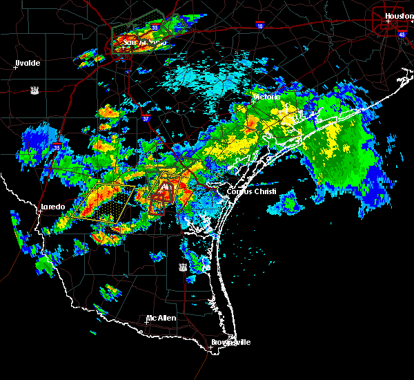 At 544 pm cdt, doppler radar indicated a severe thunderstorm capable of producing a tornado. this dangerous storm was located near 10 miles northeast alice, or just south of alfred, moving south at 15 mph. locations impacted include, alice and lake alice. At 544 pm cdt, doppler radar indicated a severe thunderstorm capable of producing a tornado. this dangerous storm was located near 10 miles northeast alice, or just south of alfred, moving south at 15 mph. locations impacted include, alice and lake alice.
|
| 6/17/2015 5:39 PM CDT |
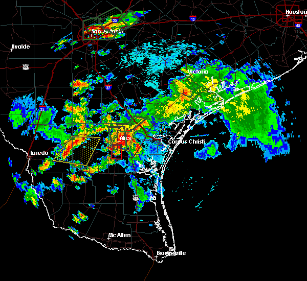 At 538 pm cdt, doppler radar indicated a severe thunderstorm capable of producing a tornado. this dangerous storm was located 10 miles northeast of alice, and moving southwest at 15 mph. At 538 pm cdt, doppler radar indicated a severe thunderstorm capable of producing a tornado. this dangerous storm was located 10 miles northeast of alice, and moving southwest at 15 mph.
|
| 6/17/2015 5:28 PM CDT |
 At 527 pm cdt, doppler radar indicated a severe thunderstorm capable of producing a tornado. this dangerous storm was located just west of ben bolt, or 7 miles south of alice, and moving south at 15 mph. At 527 pm cdt, doppler radar indicated a severe thunderstorm capable of producing a tornado. this dangerous storm was located just west of ben bolt, or 7 miles south of alice, and moving south at 15 mph.
|
| 6/17/2015 5:19 PM CDT |
 At 518 pm cdt, doppler radar indicated a severe thunderstorm capable of producing damaging winds in excess of 60 mph. this storm was located over alfred, or 10 miles northeast of alice, and moving southwest at 15 mph. nickel size hail may also accompany the damaging winds. At 518 pm cdt, doppler radar indicated a severe thunderstorm capable of producing damaging winds in excess of 60 mph. this storm was located over alfred, or 10 miles northeast of alice, and moving southwest at 15 mph. nickel size hail may also accompany the damaging winds.
|
| 5/24/2015 12:14 AM CDT | At 1213 am cdt, doppler radar indicated a line of severe thunderstorms capable of producing damaging winds in excess of 60 mph. these storms were located along a line extending from 14 miles southwest of seven sisters to near freer to near benavides to near ramirez, moving northeast at 30 mph. locations impacted include, alice, san diego, freer, premont, benavides, rancho de la parita, seven sisters, tecalote, cruz calle, la gloria, concepcion, palito blanco, rosita, rios, san jose and ben bolt. a tornado watch remains in effect until 300 am cdt for south central texas. |
| 5/23/2015 11:47 PM CDT | At 1146 pm cdt, doppler radar indicated a line of severe thunderstorms capable of producing damaging winds in excess of 60 mph. these storms were located along a line extending from 20 miles northeast of oilton to 13 miles southwest of freer to 7 miles northwest of realitos to near hebbronville high school, and moving northeast at 45 mph. |
| 5/15/2015 11:34 AM CDT | At 1134 am cdt, doppler radar indicated a severe thunderstorm capable of producing damaging winds in excess of 60 mph. this storm was located near tecalote, or 10 miles northeast of san diego, and moving east at 50 mph. |
| 4/22/2015 12:46 PM CDT | At 1246 pm cdt, doppler radar indicated a severe thunderstorm capable of producing half dollar size hail and damaging winds in excess of 60 mph. this storm was located over banquete, or 10 miles northwest of driscoll. this storm was moving east-southeast at 45 mph. locations impacted include, corpus christi, alice, robstown, odem, orange grove, san patricio, calallen, edroy, banquete, bluntzer, west sinton, annaville, clarkwood, alfred, sandia, agua dulce, north san pedro and tuloso. a tornado watch remains in effect until 500 pm cdt for south texas. |
| 4/22/2015 12:27 PM CDT | At 1226 pm cdt, doppler radar indicated a severe thunderstorm capable of producing half dollar size hail and damaging winds in excess of 60 mph. this storm was located near alfred, or near alice, and moving east at 50 mph. |
| 4/22/2015 12:18 PM CDT | At 1218 pm cdt, doppler radar indicated a severe thunderstorm capable of producing large damaging hail up to golf ball size and damaging winds in excess of 60 mph. this storm was located over tecalote, or 8 miles northwest of alice, moving east at 35 mph. locations impacted include, orange grove, midway, westdale, tecalote, alfred and rancho de la parita. a tornado watch remains in effect until 500 pm cdt for south texas. |
| 4/22/2015 12:00 PM CDT | At 1159 am cdt, doppler radar indicated a severe thunderstorm capable of producing half dollar size hail. this storm was located 8 miles southwest of rancho de la parita, or 12 miles north of san diego, and moving east at 35 mph. |
| 4/17/2015 8:40 PM CDT | A tornado warning remains in effect until 900 pm cdt for northwestern jim wells county. at 838 pm cdt. storm chaser reported a tornado just east of the city of alice. this tornadic storm was located just east of alice along highway 44. moving east-southeast at 20 mph. The alice international airport asos reported 62 mph wind gust at. |
| 4/17/2015 8:39 PM CDT | Storm damage reported in jim wells county TX, 0.4 miles SE of Alice, TX |
| 4/17/2015 8:34 PM CDT | A tornado warning remains in effect until 900 pm cdt for northwestern jim wells county. at 834 pm cdt. trained weather spotters reported a funnel cloud just north of the wal-mart in alice. a tornado may develop at any time. this dangerous storm was located over alice. Moving to the east-southeast at 20 mph. |
| 4/17/2015 8:27 PM CDT | The national weather service in corpus christi has issued a * tornado warning for. central jim wells county in south central texas. until 900 pm cdt * at 825 pm cdt. doppler radar indicated a severe thunderstorm capable of producing a tornado. This dangerous storm was located. |
| 4/17/2015 8:11 PM CDT | A tornado warning remains in effect until 830 pm cdt for northwestern jim wells and east central duval counties. at 809 pm cdt. doppler radar indicated a severe thunderstorm capable of producing a tornado. this dangerous storm was located 5 miles north-northeast of near san diego. moving east at 25 mph. in addition. Golf ball to baseball sized hail will occur with. |
| 4/17/2015 8:00 PM CDT | The national weather service in corpus christi has issued a * tornado warning for. northwestern jim wells county in south central texas. east central duval county in south central texas. until 830 pm cdt * at 758 pm cdt. Doppler radar indicated a severe thunderstorm. |
| 4/12/2015 11:18 PM CDT | The national weather service in corpus christi has issued a * severe thunderstorm warning for. nueces county in south central texas. central san patricio county in south central texas. southwestern aransas county in south central texas. Northern jim wells county in south central texas. |
| 4/12/2015 10:58 PM CDT | A severe thunderstorm warning remains in effect until 1115 pm cdt for western nueces. jim wells. western kleberg and eastern duval counties. at 1057 pm cdt. doppler radar indicated a line of severe thunderstorms capable of producing quarter size hail and damaging winds in excess of 60 mph. These storms were located along a line. |
| 4/12/2015 10:30 PM CDT | The national weather service in corpus christi has issued a * severe thunderstorm warning for. western nueces county in south central texas. jim wells county in south central texas. western kleberg county in south central texas. Eastern duval county in south central texas. |
| 5/27/2014 6:38 PM CDT | Alice international airport asos measured a gust to 50 knot in jim wells county TX, 1.9 miles NW of Alice, TX |
| 5/27/2014 6:38 PM CDT | Half Dollar sized hail reported 0.4 miles SE of Alice, TX, quarter to half dollar sized hail on the south side of alice. power is out on the south side of alice also. |
| 5/27/2014 6:37 PM CDT | Large trees blown down in the central part of alic in jim wells county TX, 0.4 miles SE of Alice, TX |
| 5/27/2014 6:33 PM CDT | Baseball sized hail reported 0.4 miles SE of Alice, TX, baseball size hail in the center of the town of alice. |
| 3/31/2013 8:17 PM CDT | Baseball sized hail reported 0.4 miles SE of Alice, TX, baseball size hail reported by fire chief just north of alice. |
| 1/1/0001 12:00 AM | Storm damage reported in jim wells county TX, 0.4 miles SE of Alice, TX |
| 1/1/0001 12:00 AM | Storm damage reported in jim wells county TX, 0.4 miles SE of Alice, TX |
Hail Maps for Alice, TX


Connect with Interactive Hail Maps