

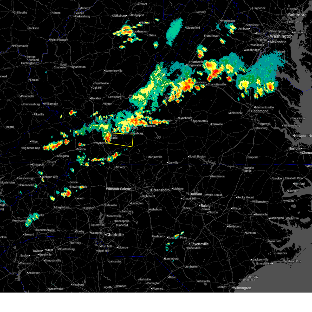
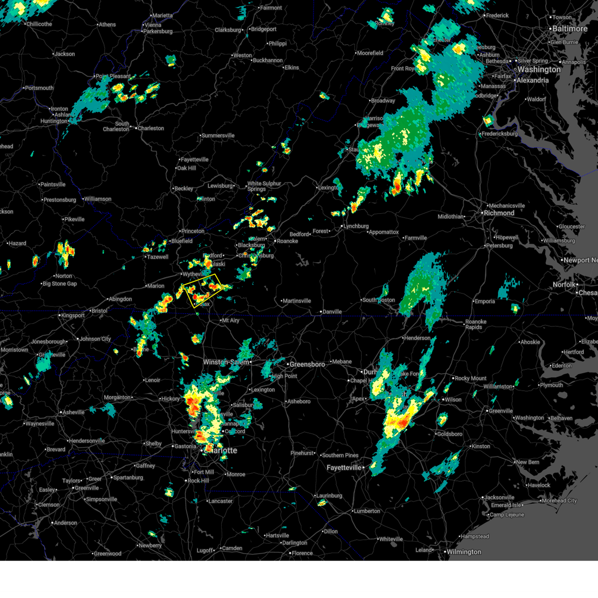
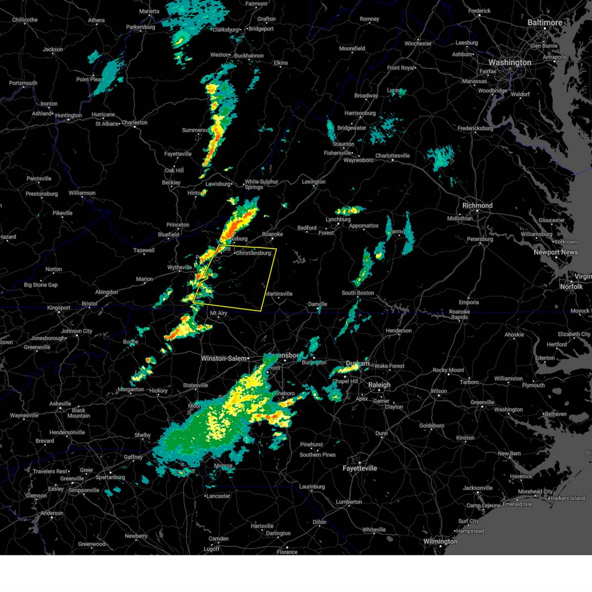
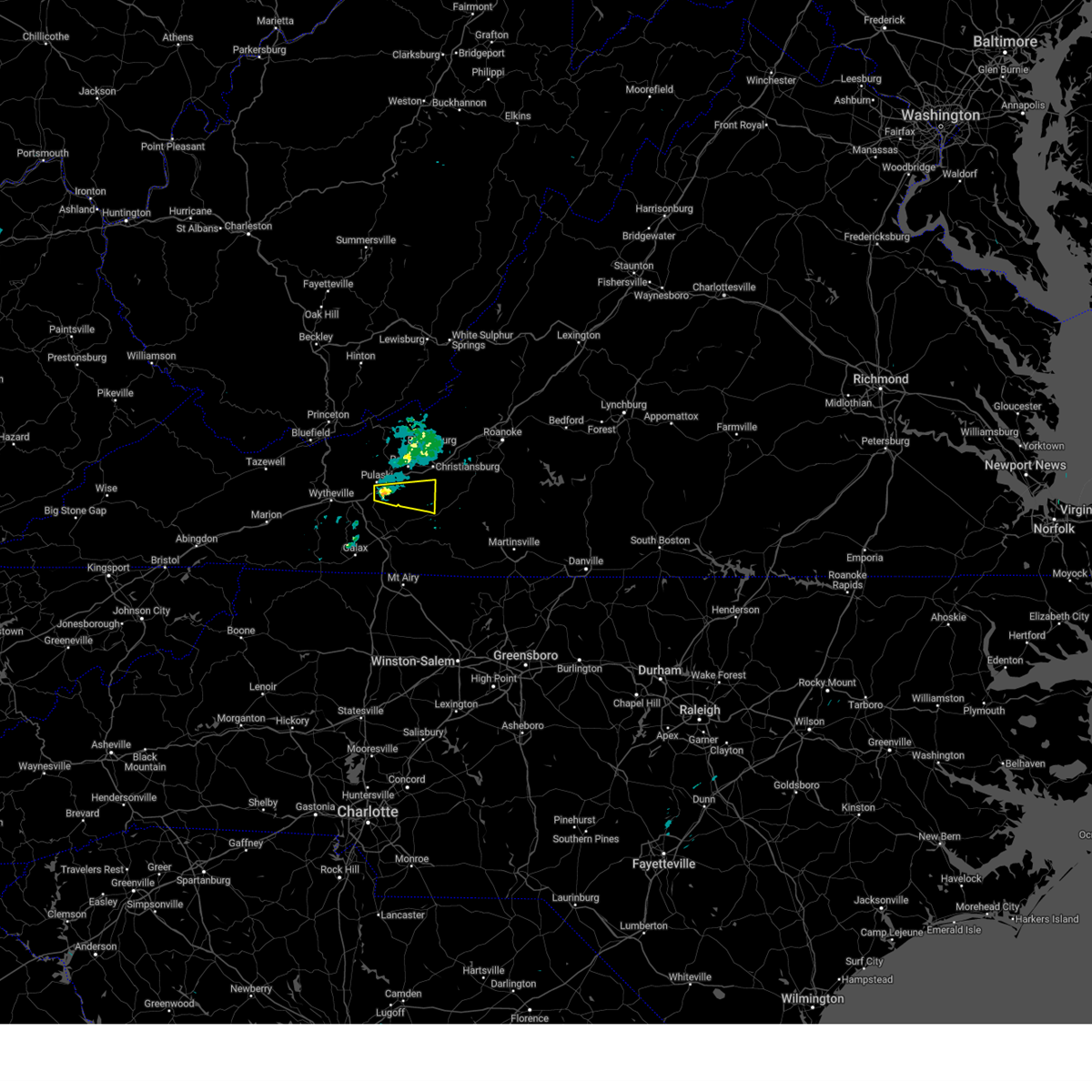
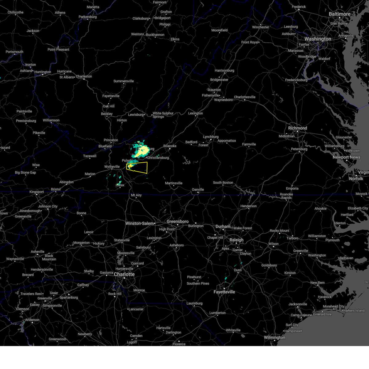
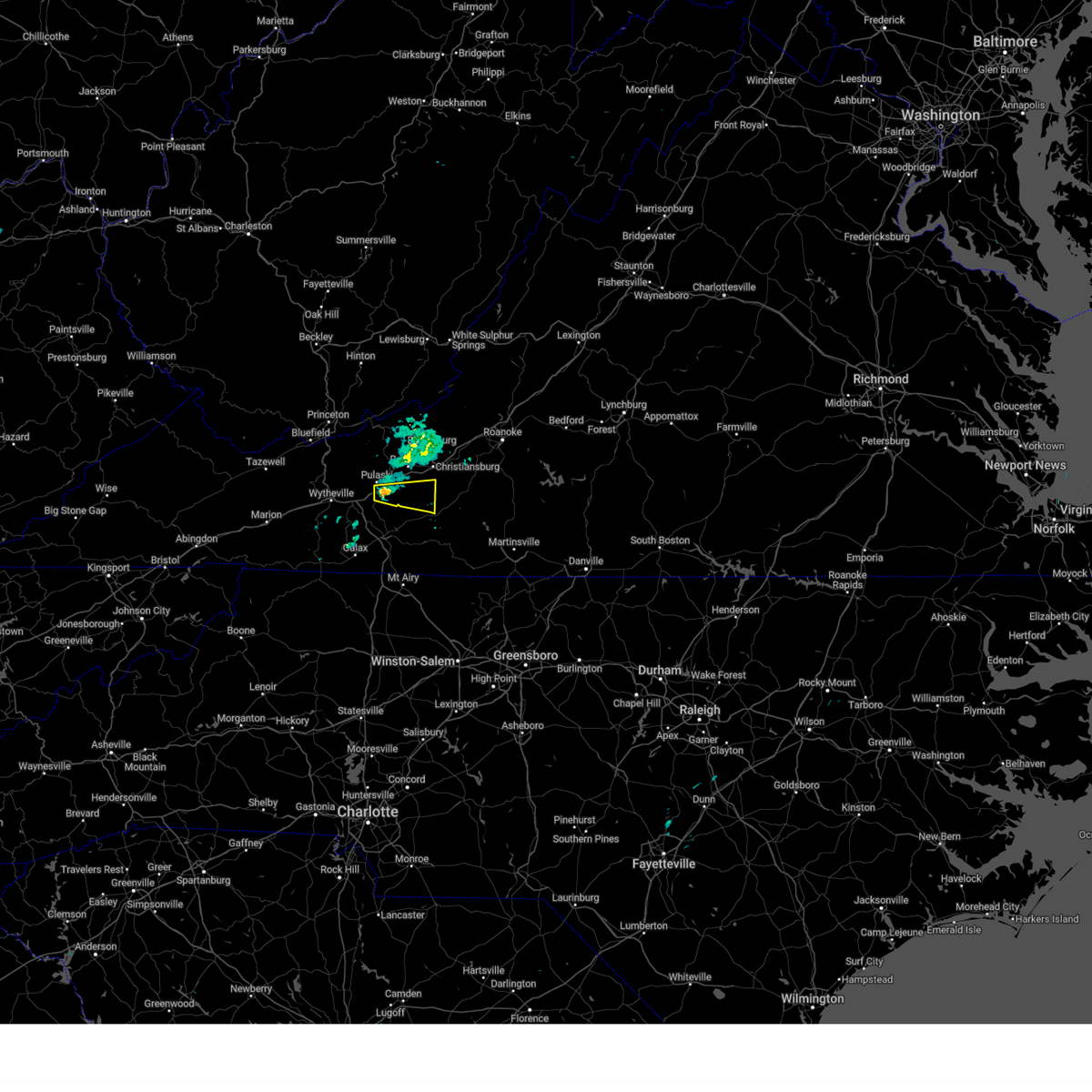
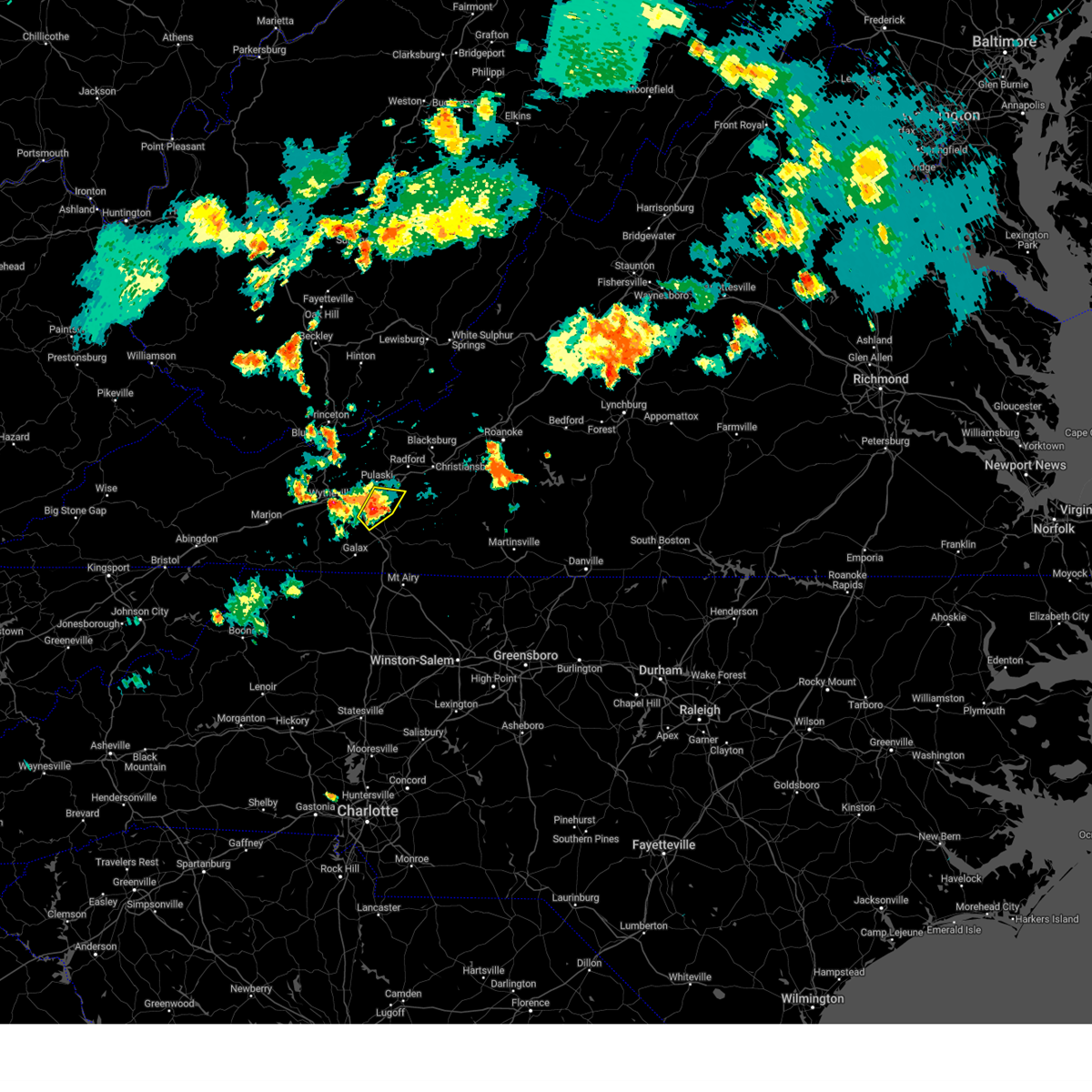
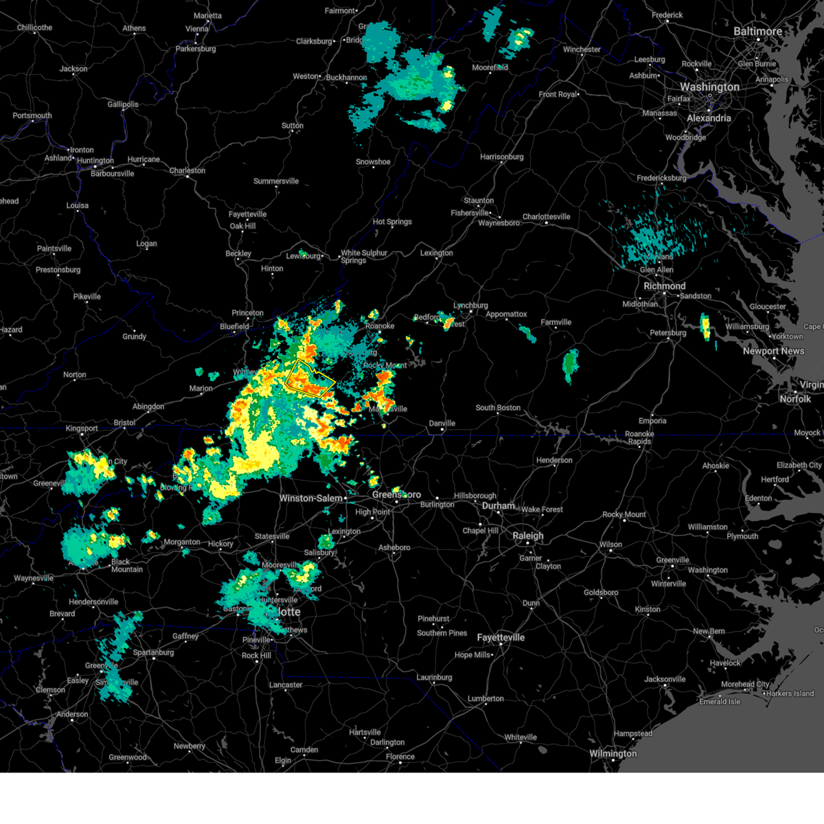
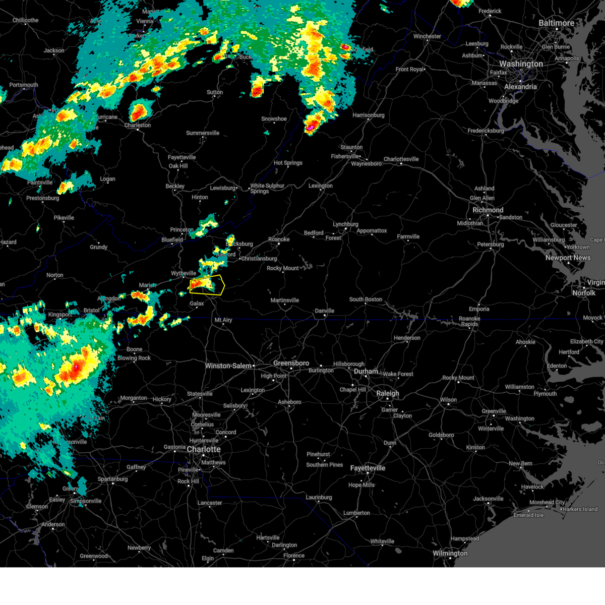
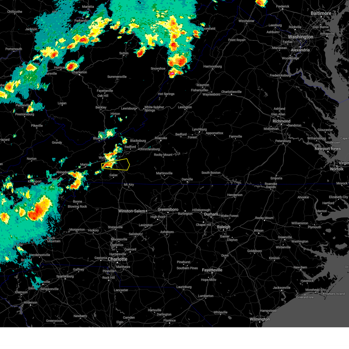
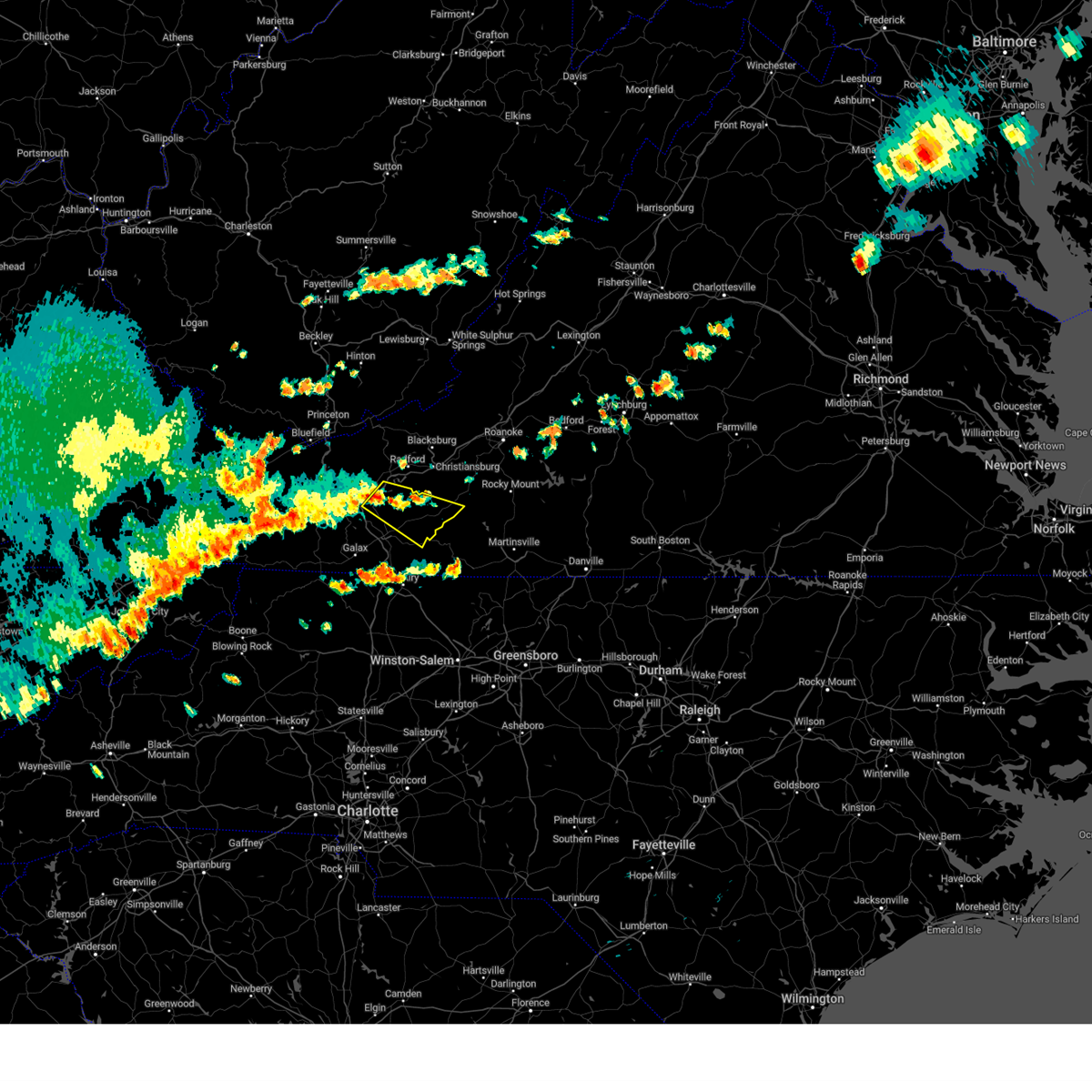
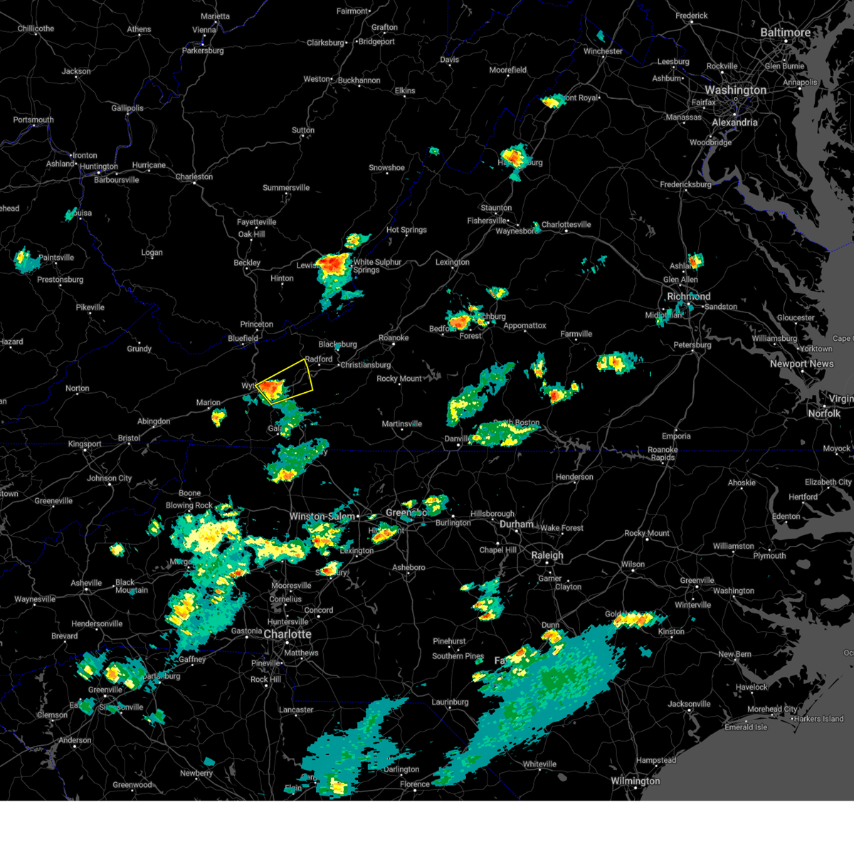
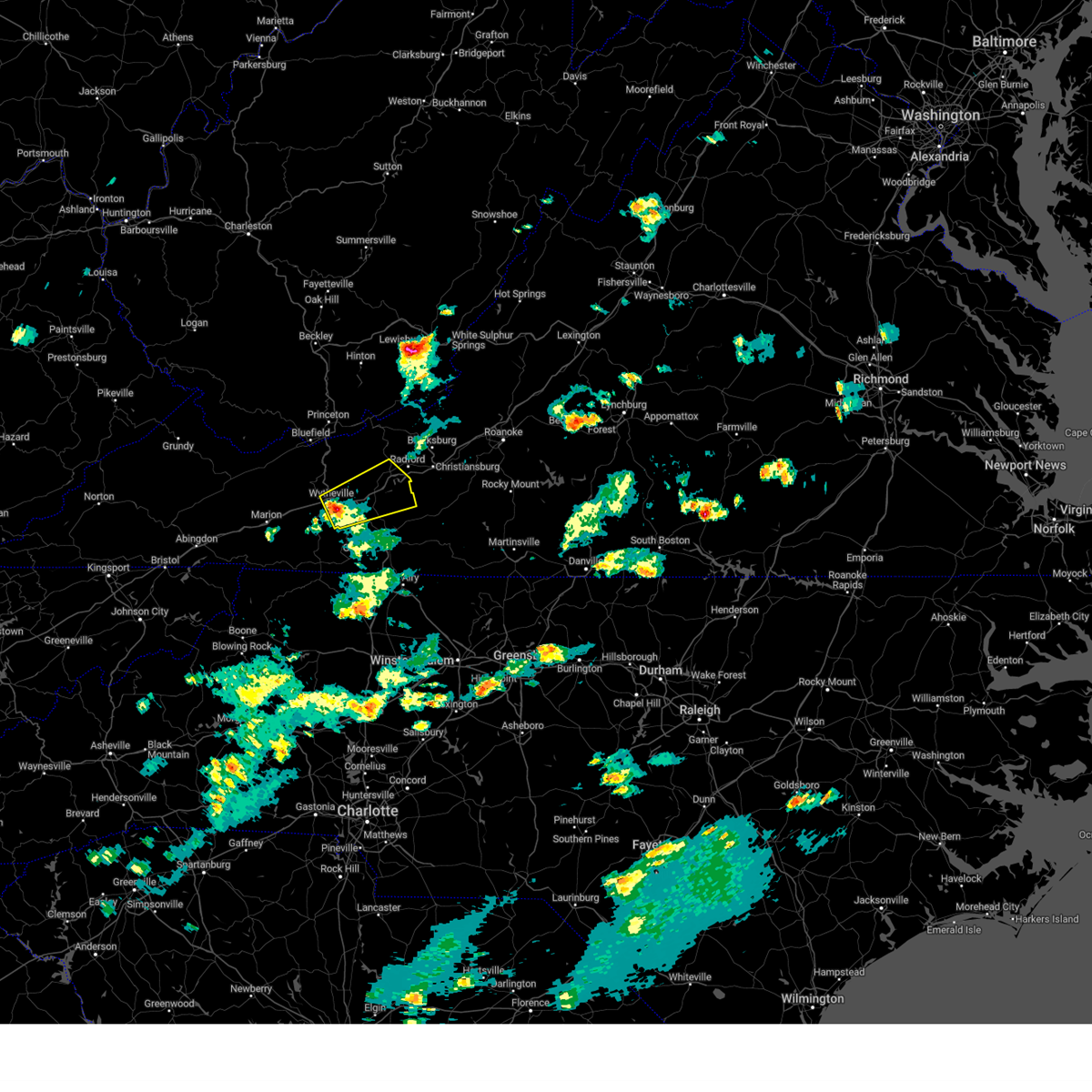
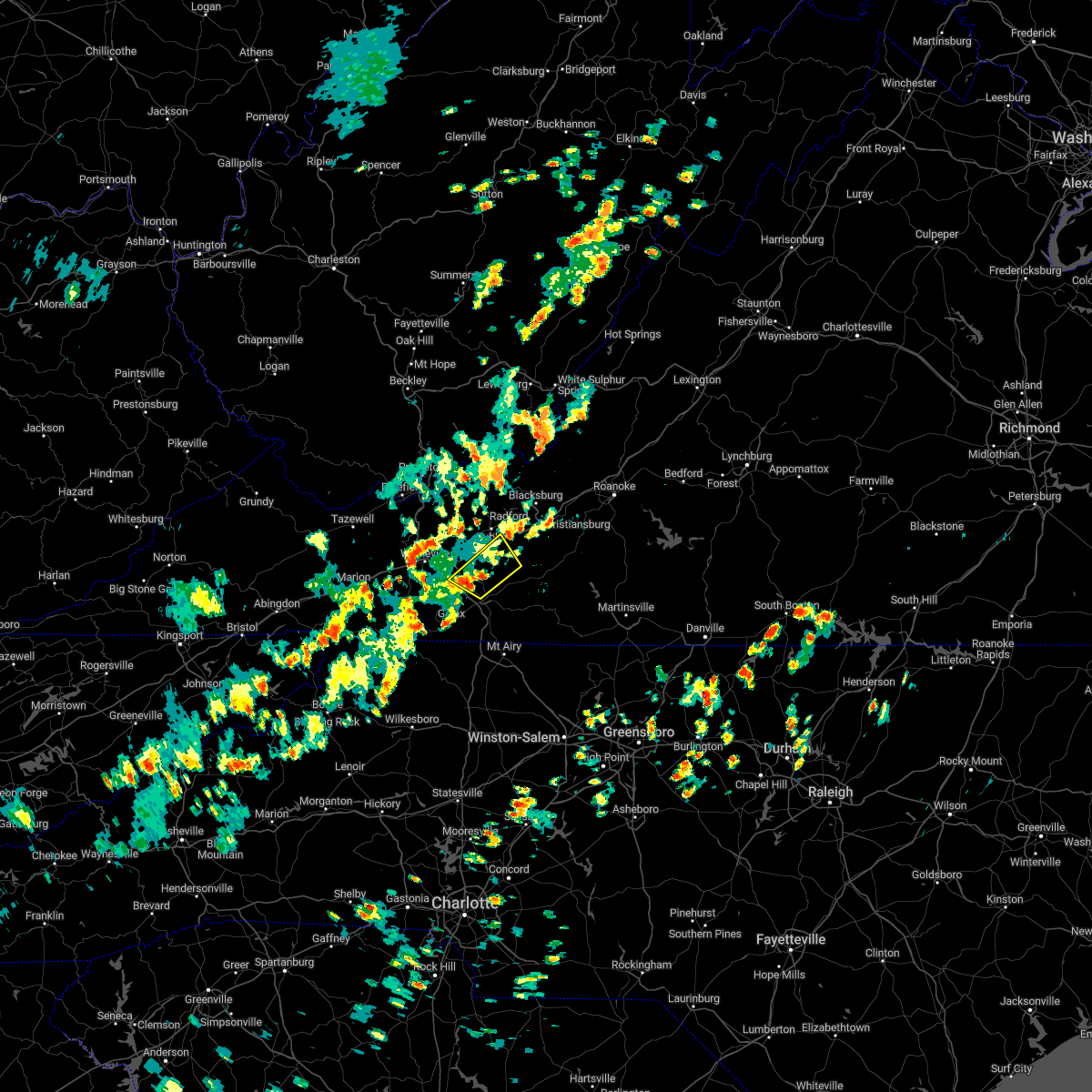
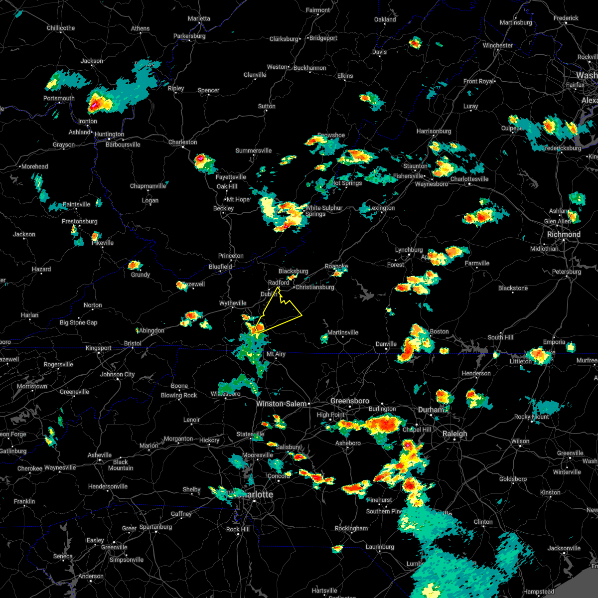
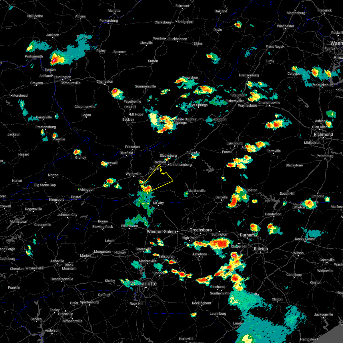
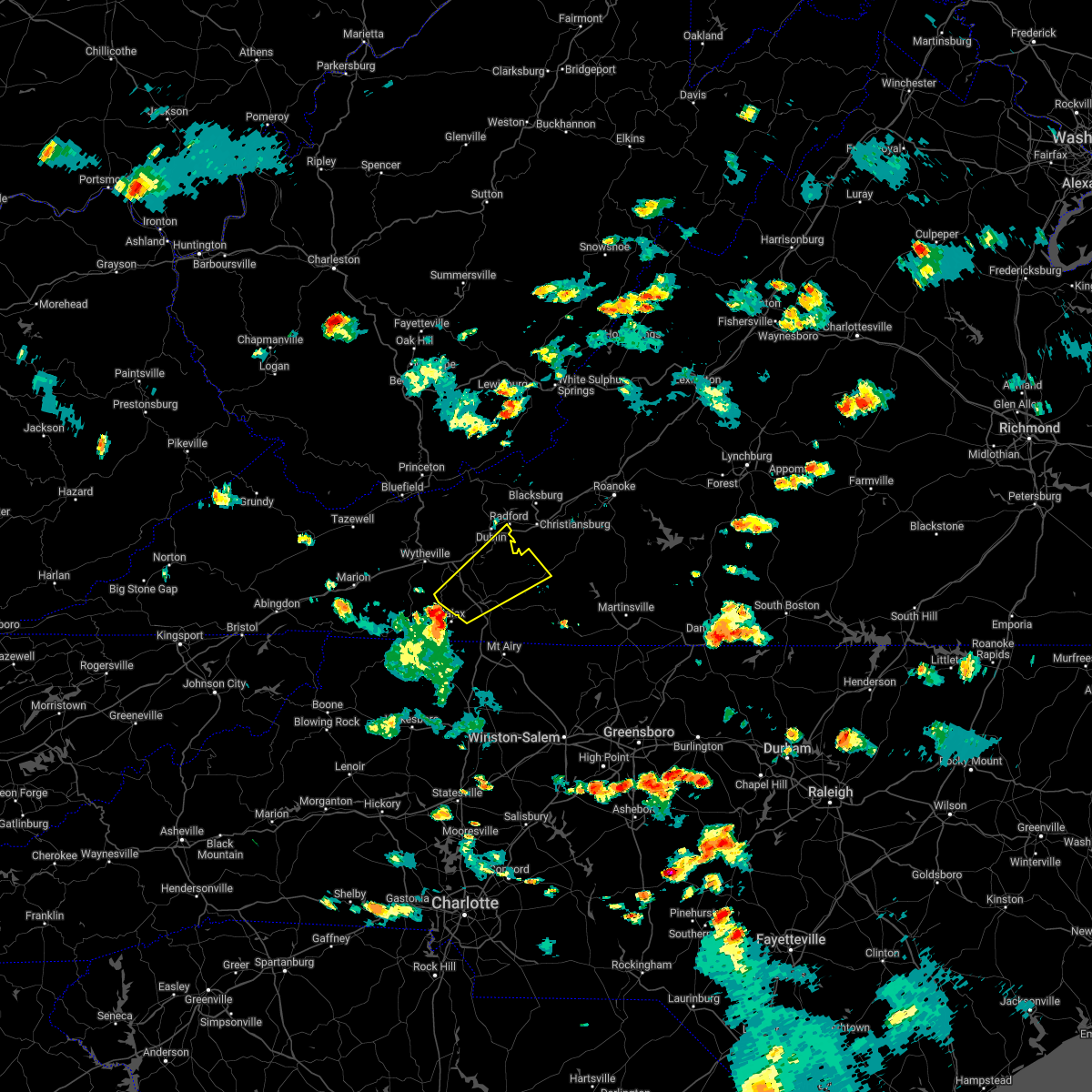
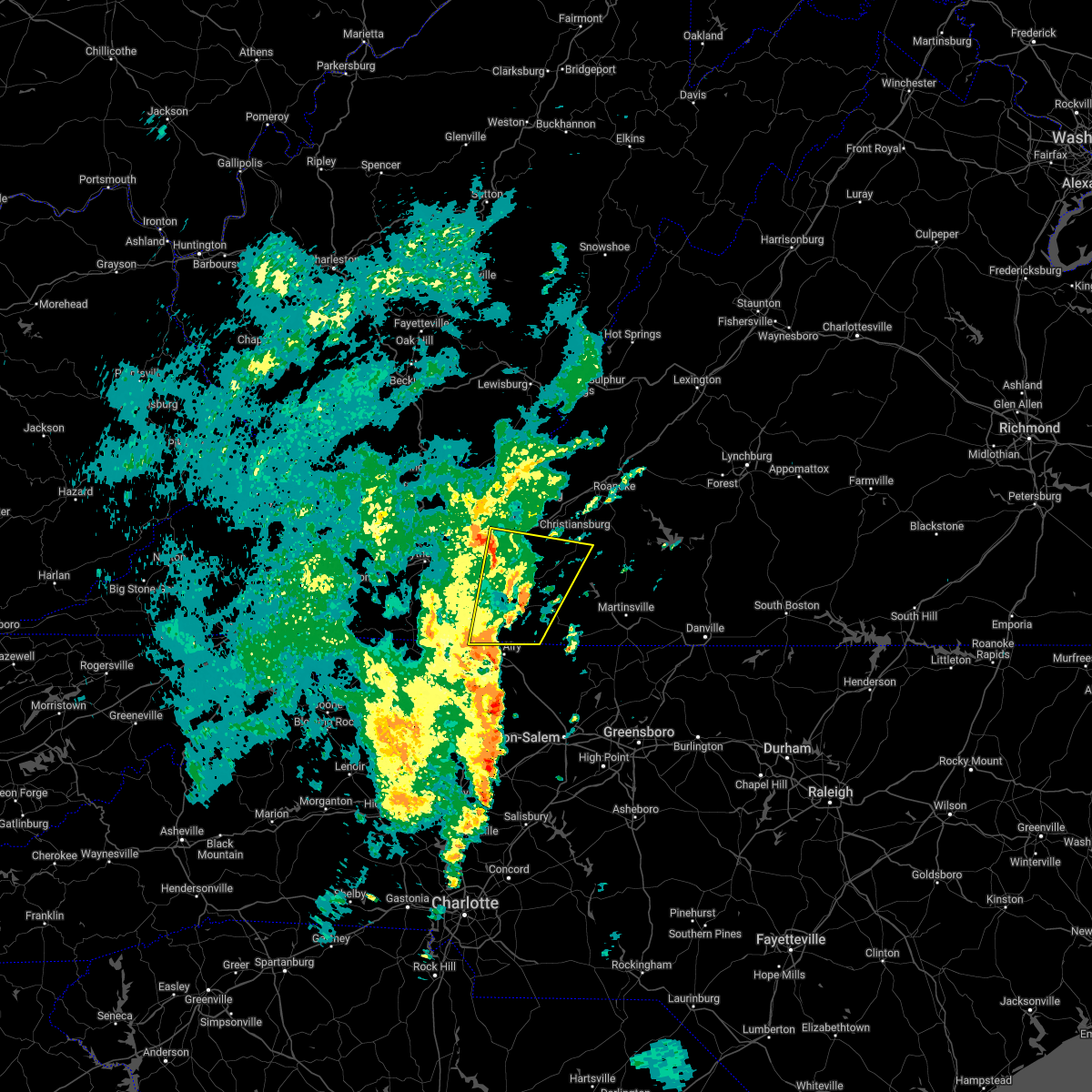
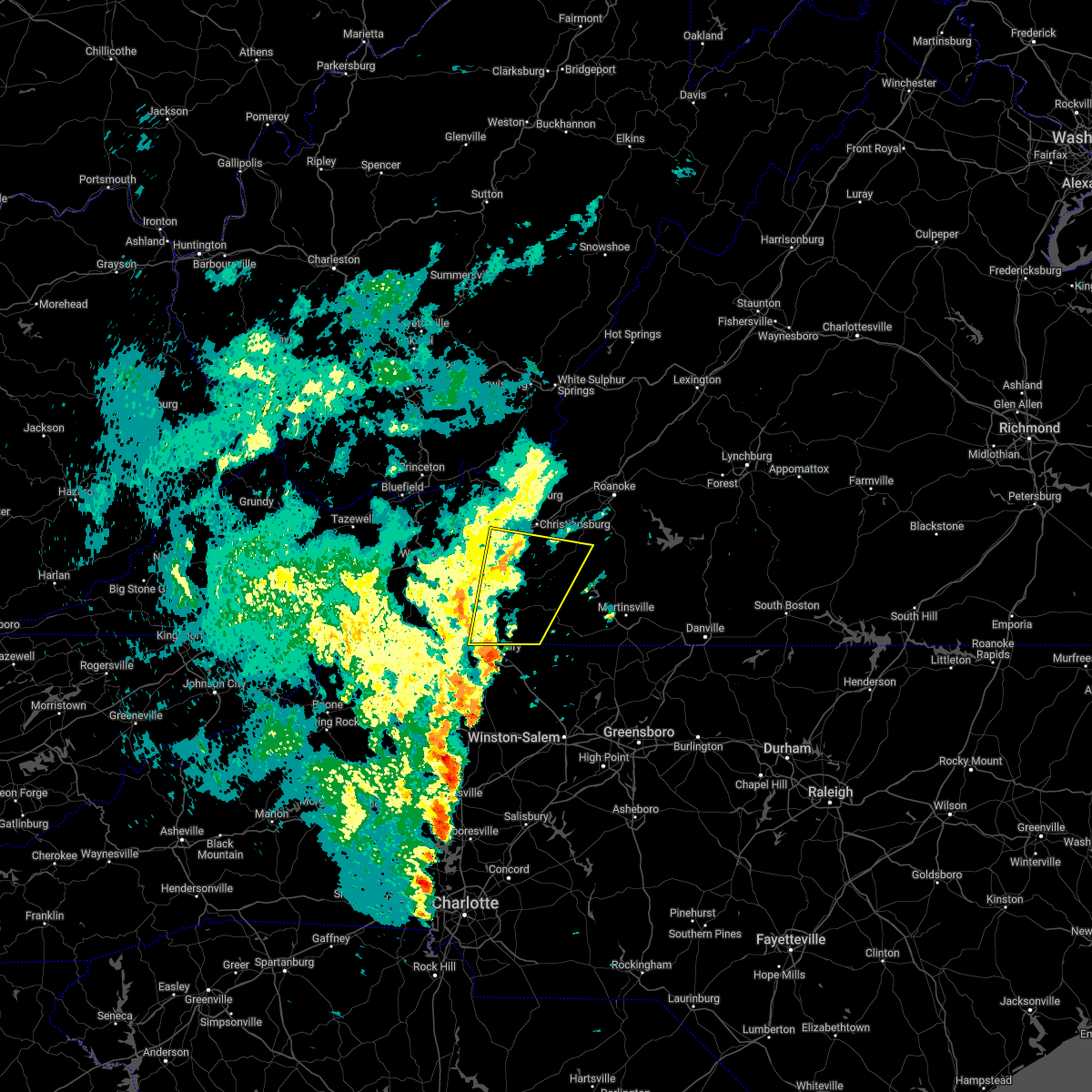
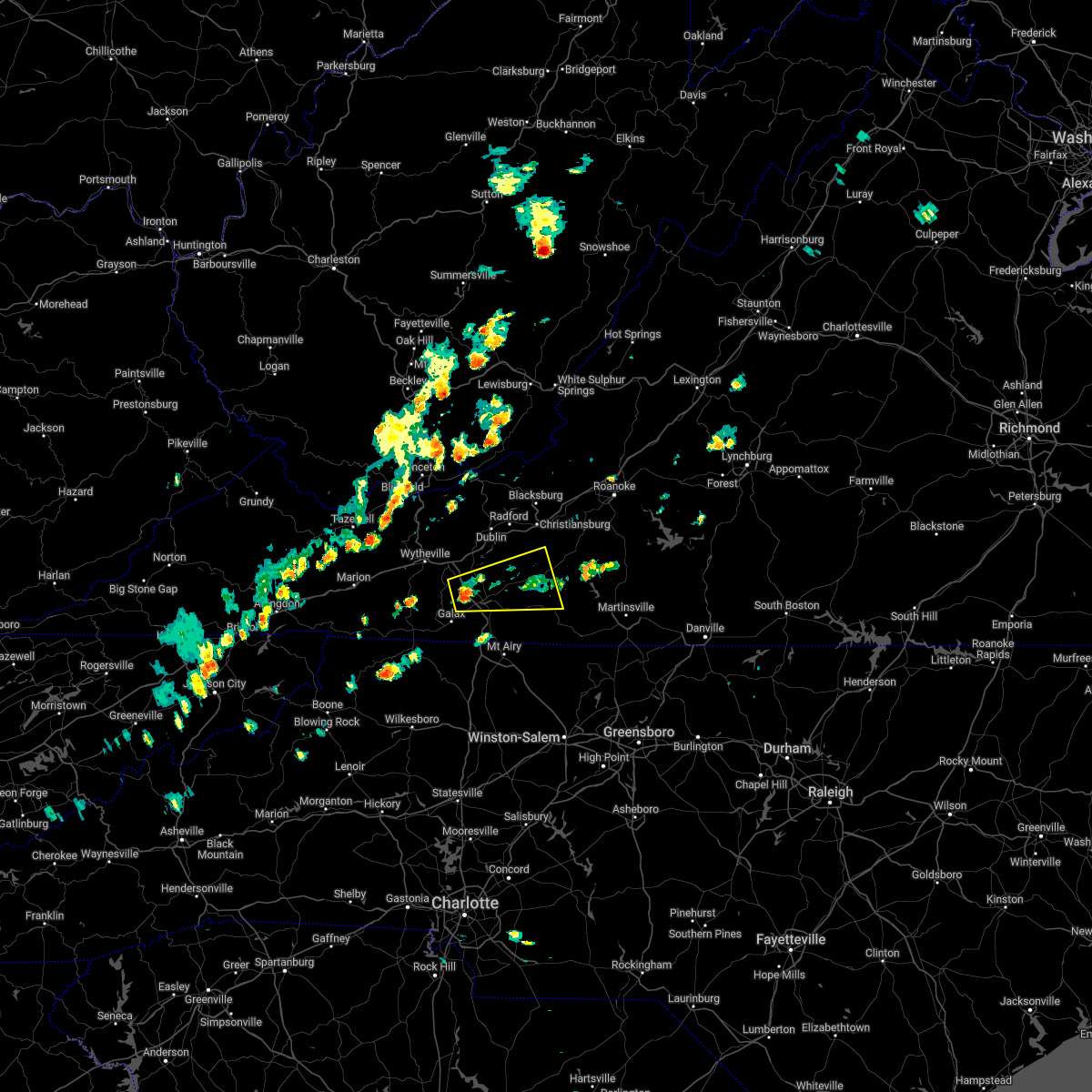
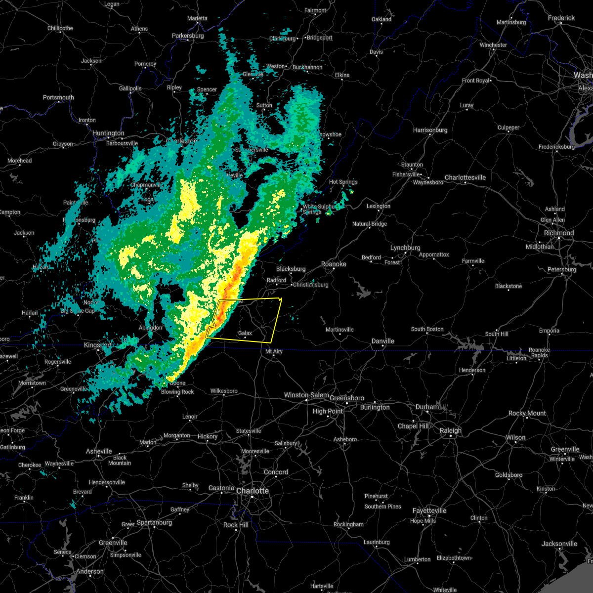
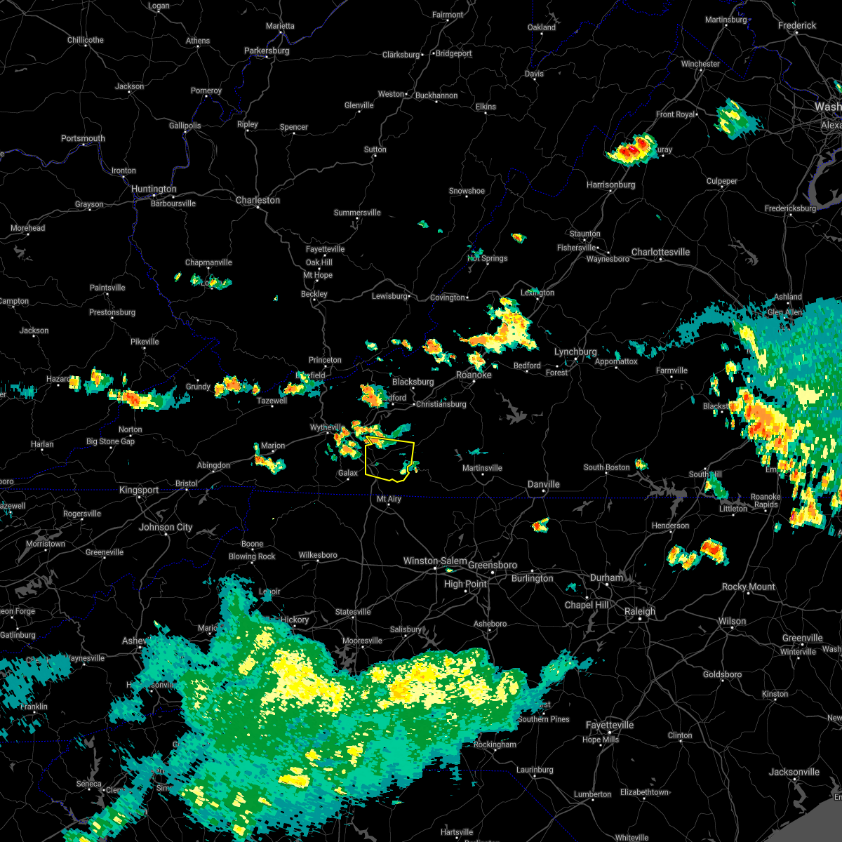
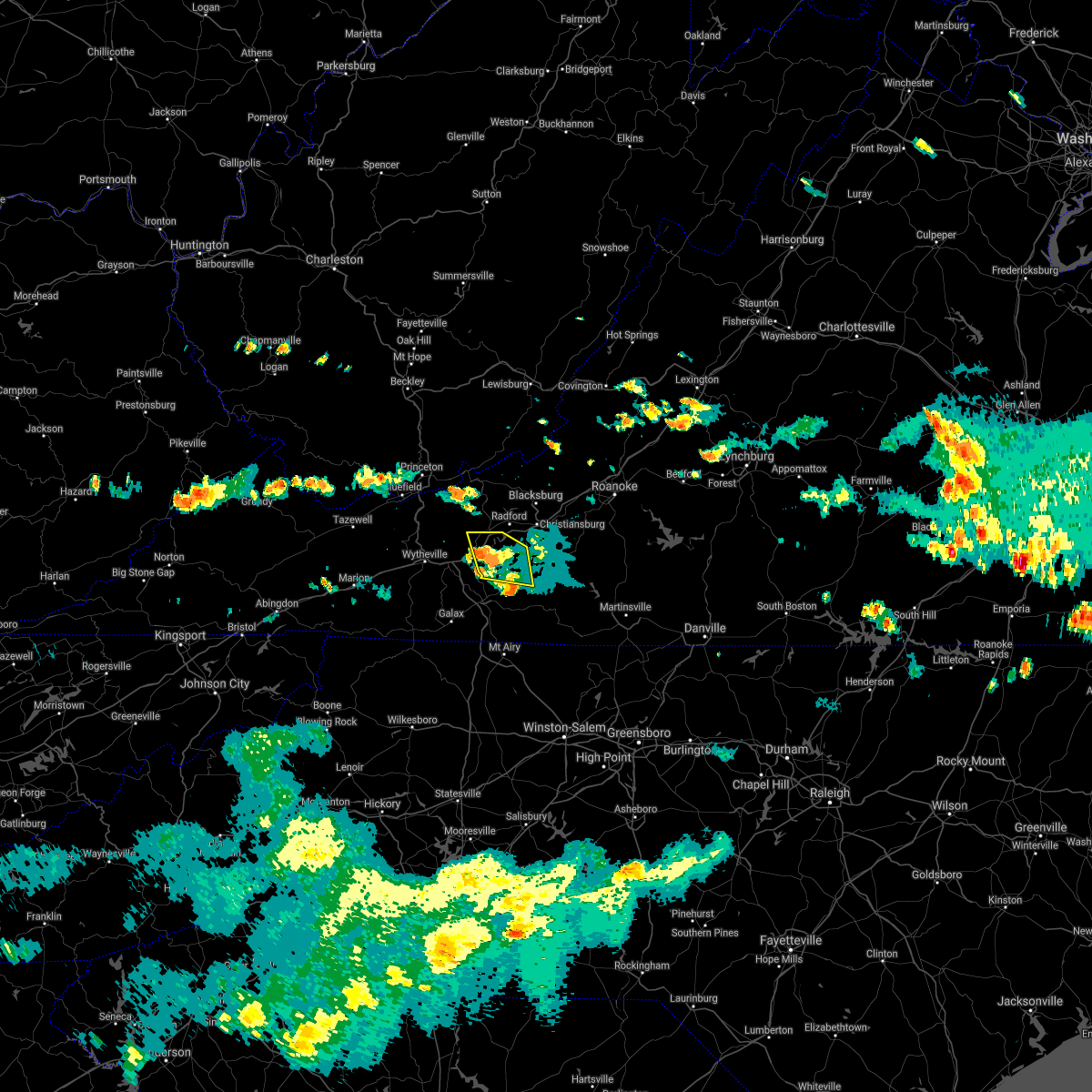
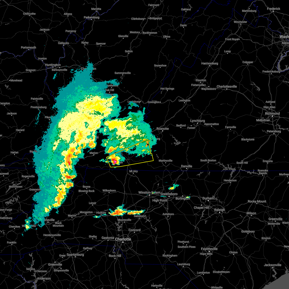
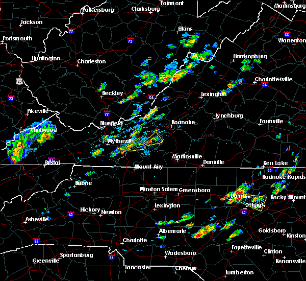
Hail Map for Allisonia, VA
The Allisonia, VA area has had 2 reports of on-the-ground hail by trained spotters, and has been under severe weather warnings 3 times during the past 12 months. Doppler radar has detected hail at or near Allisonia, VA on 39 occasions, including 1 occasion during the past year.
| Name: | Allisonia, VA |
| Where Located: | 48.8 miles WSW of Roanoke, VA |
| Map: | Google Map for Allisonia, VA |
| Population: | 117 |
| Housing Units: | 107 |
| More Info: | Search Google for Allisonia, VA |
0
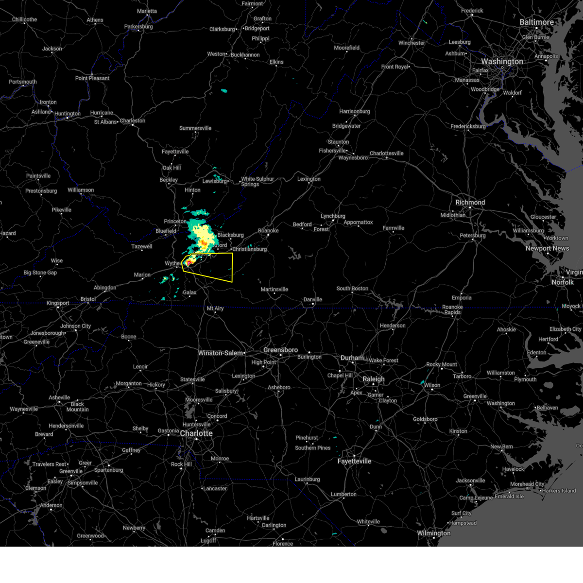
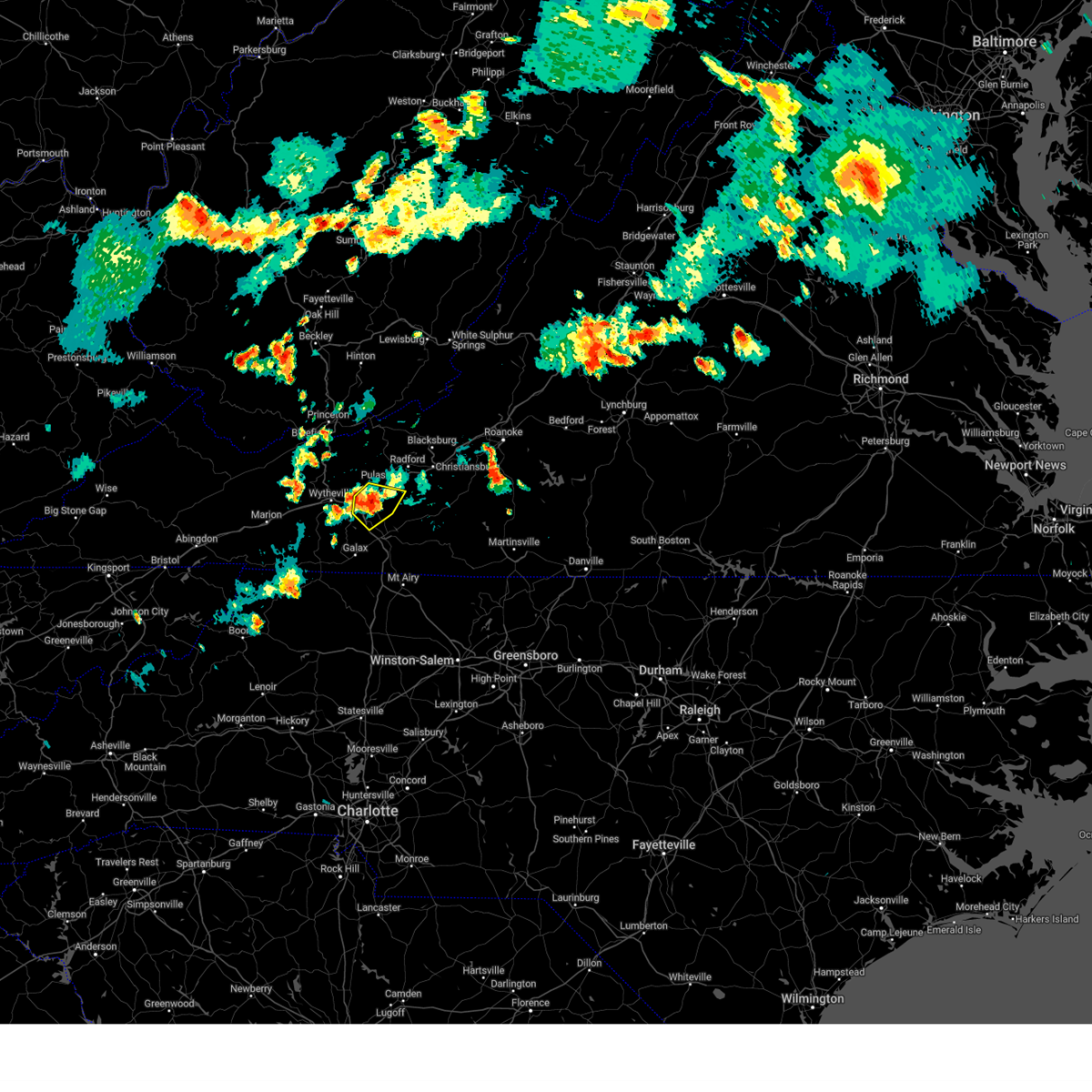
The Top Recent Hail Date for Allisonia, VA is Friday, June 12, 2026 (39th out of 39)

Hail and Wind Damage Spotted near Allisonia, VA
| Date / Time | Report Details |
|---|---|
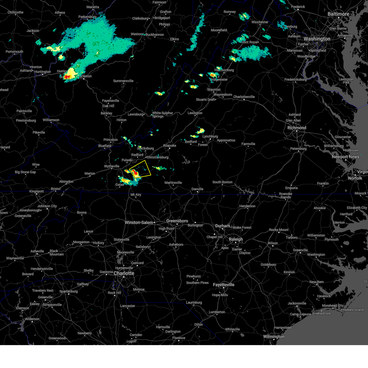
| 6/12/2026 6:18 PM EDT |
 Svrrnk the national weather service in blacksburg has issued a * severe thunderstorm warning for, central pulaski county in southwestern virginia, the city of radford in southwestern virginia, central floyd county in southwestern virginia, southern montgomery county in southwestern virginia, * until 715 pm edt. * at 618 pm edt, a severe thunderstorm was located over pulaski, moving east at 25 mph (radar indicated). Hazards include 60 mph wind gusts and quarter size hail. Hail damage to vehicles is expected. Expect wind damage to roofs, siding, and trees. Svrrnk the national weather service in blacksburg has issued a * severe thunderstorm warning for, central pulaski county in southwestern virginia, the city of radford in southwestern virginia, central floyd county in southwestern virginia, southern montgomery county in southwestern virginia, * until 715 pm edt. * at 618 pm edt, a severe thunderstorm was located over pulaski, moving east at 25 mph (radar indicated). Hazards include 60 mph wind gusts and quarter size hail. Hail damage to vehicles is expected. Expect wind damage to roofs, siding, and trees.
|
| 9/4/2025 2:15 PM EDT |
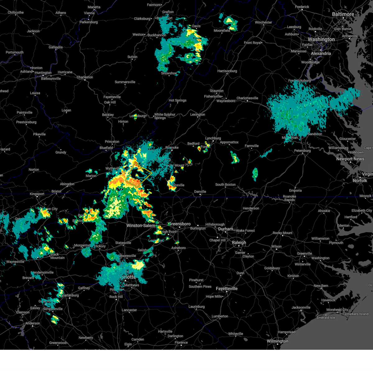
 Svrrnk the national weather service in blacksburg has issued a * severe thunderstorm warning for, southern roanoke county in west central virginia, pulaski county in southwestern virginia, the city of radford in southwestern virginia, floyd county in southwestern virginia, east central wythe county in southwestern virginia, northeastern carroll county in southwestern virginia, western franklin county in west central virginia, southern montgomery county in southwestern virginia, * until 315 pm edt. * at 215 pm edt, a severe thunderstorm was located over claytor lake state park, or near dublin, moving east at 35 mph (radar indicated). Hazards include 60 mph wind gusts. expect damage to roofs, siding, and trees Svrrnk the national weather service in blacksburg has issued a * severe thunderstorm warning for, southern roanoke county in west central virginia, pulaski county in southwestern virginia, the city of radford in southwestern virginia, floyd county in southwestern virginia, east central wythe county in southwestern virginia, northeastern carroll county in southwestern virginia, western franklin county in west central virginia, southern montgomery county in southwestern virginia, * until 315 pm edt. * at 215 pm edt, a severe thunderstorm was located over claytor lake state park, or near dublin, moving east at 35 mph (radar indicated). Hazards include 60 mph wind gusts. expect damage to roofs, siding, and trees
|
| 7/29/2025 7:08 PM EDT |
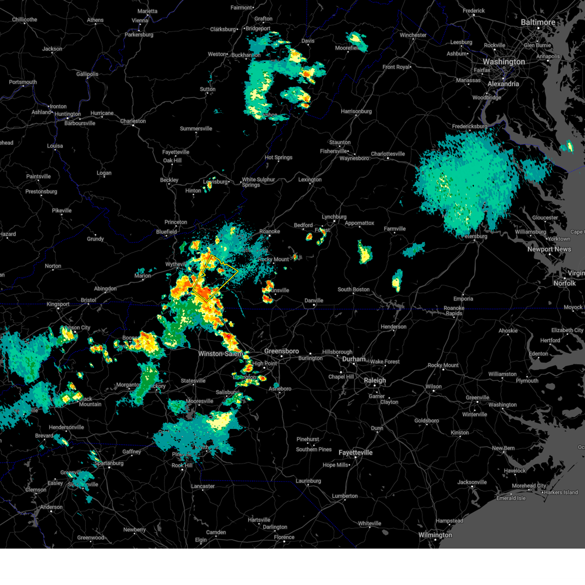
 Svrrnk the national weather service in blacksburg has issued a * severe thunderstorm warning for, southeastern pulaski county in southwestern virginia, west central floyd county in southwestern virginia, southeastern wythe county in southwestern virginia, northern carroll county in southwestern virginia, northeastern grayson county in southwestern virginia, * until 815 pm edt. * at 707 pm edt, severe thunderstorms were located along a line extending from near copper valley to near spring valley, moving south at 5 mph (radar indicated). Hazards include 60 mph wind gusts. expect damage to roofs, siding, and trees Svrrnk the national weather service in blacksburg has issued a * severe thunderstorm warning for, southeastern pulaski county in southwestern virginia, west central floyd county in southwestern virginia, southeastern wythe county in southwestern virginia, northern carroll county in southwestern virginia, northeastern grayson county in southwestern virginia, * until 815 pm edt. * at 707 pm edt, severe thunderstorms were located along a line extending from near copper valley to near spring valley, moving south at 5 mph (radar indicated). Hazards include 60 mph wind gusts. expect damage to roofs, siding, and trees
|
| 6/28/2025 6:54 PM EDT |
 The storm which prompted the warning has weakened below severe limits, and no longer poses an immediate threat to life or property. therefore, the warning will be allowed to expire. however, gusty winds, pea size hail, and heavy rain are still possible with this thunderstorm. The storm which prompted the warning has weakened below severe limits, and no longer poses an immediate threat to life or property. therefore, the warning will be allowed to expire. however, gusty winds, pea size hail, and heavy rain are still possible with this thunderstorm.
|
| 6/28/2025 6:37 PM EDT |
 Svrrnk the national weather service in blacksburg has issued a * severe thunderstorm warning for, central pulaski county in southwestern virginia, * until 730 pm edt. * at 636 pm edt, a severe thunderstorm was located over dublin, moving southeast at 5 mph. other strong storms were located between dublin and pulaski (radar indicated). Hazards include 60 mph wind gusts and quarter size hail. Hail damage to vehicles is expected. Expect wind damage to roofs, siding, and trees. Svrrnk the national weather service in blacksburg has issued a * severe thunderstorm warning for, central pulaski county in southwestern virginia, * until 730 pm edt. * at 636 pm edt, a severe thunderstorm was located over dublin, moving southeast at 5 mph. other strong storms were located between dublin and pulaski (radar indicated). Hazards include 60 mph wind gusts and quarter size hail. Hail damage to vehicles is expected. Expect wind damage to roofs, siding, and trees.
|
| 6/28/2025 6:35 PM EDT | One tree down in barren spring in wythe county VA, 4.9 miles ENE of Allisonia, VA |
| 6/28/2025 6:35 PM EDT |
 the severe thunderstorm warning has been cancelled and is no longer in effect the severe thunderstorm warning has been cancelled and is no longer in effect
|
| 6/28/2025 6:35 PM EDT |
 At 634 pm edt, a severe thunderstorm was located over byllesby, or near fries, moving northwest at 15 mph (radar indicated). Hazards include 60 mph wind gusts and quarter size hail. Hail damage to vehicles is expected. expect wind damage to roofs, siding, and trees. Locations impacted include, galax, hillsville, allisonia, patterson, dugspur, byllesby, and ivanhoe. At 634 pm edt, a severe thunderstorm was located over byllesby, or near fries, moving northwest at 15 mph (radar indicated). Hazards include 60 mph wind gusts and quarter size hail. Hail damage to vehicles is expected. expect wind damage to roofs, siding, and trees. Locations impacted include, galax, hillsville, allisonia, patterson, dugspur, byllesby, and ivanhoe.
|
| 6/28/2025 6:20 PM EDT |
 Svrrnk the national weather service in blacksburg has issued a * severe thunderstorm warning for, south central pulaski county in southwestern virginia, southeastern wythe county in southwestern virginia, central carroll county in southwestern virginia, the city of galax in southwestern virginia, northeastern grayson county in southwestern virginia, * until 700 pm edt. * at 620 pm edt, a severe thunderstorm was located over fries, moving northwest at 15 mph (radar indicated). Hazards include 60 mph wind gusts. expect damage to roofs, siding, and trees Svrrnk the national weather service in blacksburg has issued a * severe thunderstorm warning for, south central pulaski county in southwestern virginia, southeastern wythe county in southwestern virginia, central carroll county in southwestern virginia, the city of galax in southwestern virginia, northeastern grayson county in southwestern virginia, * until 700 pm edt. * at 620 pm edt, a severe thunderstorm was located over fries, moving northwest at 15 mph (radar indicated). Hazards include 60 mph wind gusts. expect damage to roofs, siding, and trees
|
| 5/30/2025 3:05 PM EDT |
 Svrrnk the national weather service in blacksburg has issued a * severe thunderstorm warning for, southern roanoke county in west central virginia, eastern pulaski county in southwestern virginia, the city of radford in southwestern virginia, floyd county in southwestern virginia, carroll county in southwestern virginia, west central henry county in south central virginia, the northeastern city of galax in southwestern virginia, patrick county in southwestern virginia, western franklin county in west central virginia, southern montgomery county in southwestern virginia, * until 400 pm edt. * at 305 pm edt, severe thunderstorms were located along a line extending from merrimac to claytor lake state park to near allisonia to woodlawn, moving east at 35 mph (radar indicated). Hazards include 60 mph wind gusts. expect damage to roofs, siding, and trees Svrrnk the national weather service in blacksburg has issued a * severe thunderstorm warning for, southern roanoke county in west central virginia, eastern pulaski county in southwestern virginia, the city of radford in southwestern virginia, floyd county in southwestern virginia, carroll county in southwestern virginia, west central henry county in south central virginia, the northeastern city of galax in southwestern virginia, patrick county in southwestern virginia, western franklin county in west central virginia, southern montgomery county in southwestern virginia, * until 400 pm edt. * at 305 pm edt, severe thunderstorms were located along a line extending from merrimac to claytor lake state park to near allisonia to woodlawn, moving east at 35 mph (radar indicated). Hazards include 60 mph wind gusts. expect damage to roofs, siding, and trees
|
| 5/8/2025 1:29 PM EDT |
 the severe thunderstorm warning has been cancelled and is no longer in effect the severe thunderstorm warning has been cancelled and is no longer in effect
|
| 5/8/2025 1:24 PM EDT |
 the severe thunderstorm warning has been cancelled and is no longer in effect the severe thunderstorm warning has been cancelled and is no longer in effect
|
| 5/8/2025 1:24 PM EDT |
 At 124 pm edt, a severe thunderstorm was located over draper, or near allisonia, moving east at 35 mph (radar indicated). Hazards include 60 mph wind gusts and quarter size hail. Hail damage to vehicles is expected. expect wind damage to roofs, siding, and trees. Locations impacted include, indian valley, allisonia, alum ridge, copper valley, and draper. At 124 pm edt, a severe thunderstorm was located over draper, or near allisonia, moving east at 35 mph (radar indicated). Hazards include 60 mph wind gusts and quarter size hail. Hail damage to vehicles is expected. expect wind damage to roofs, siding, and trees. Locations impacted include, indian valley, allisonia, alum ridge, copper valley, and draper.
|
| 5/8/2025 1:03 PM EDT |
 the severe thunderstorm warning has been cancelled and is no longer in effect the severe thunderstorm warning has been cancelled and is no longer in effect
|
| 5/8/2025 1:03 PM EDT |
 At 102 pm edt, a severe thunderstorm was located over max meadows, moving east at 35 mph (radar indicated). Hazards include 60 mph wind gusts and quarter size hail. Hail damage to vehicles is expected. expect wind damage to roofs, siding, and trees. Locations impacted include, pulaski, dublin, indian valley, max meadows, patterson, willis, and allisonia. At 102 pm edt, a severe thunderstorm was located over max meadows, moving east at 35 mph (radar indicated). Hazards include 60 mph wind gusts and quarter size hail. Hail damage to vehicles is expected. expect wind damage to roofs, siding, and trees. Locations impacted include, pulaski, dublin, indian valley, max meadows, patterson, willis, and allisonia.
|
| 5/8/2025 12:50 PM EDT |
 Svrrnk the national weather service in blacksburg has issued a * severe thunderstorm warning for, southern pulaski county in southwestern virginia, southwestern floyd county in southwestern virginia, southeastern bland county in southwestern virginia, northeastern wythe county in southwestern virginia, northeastern carroll county in southwestern virginia, southwestern montgomery county in southwestern virginia, * until 145 pm edt. * at 1250 pm edt, a severe thunderstorm was located near wytheville, moving east at 35 mph (radar indicated). Hazards include 60 mph wind gusts and quarter size hail. Hail damage to vehicles is expected. Expect wind damage to roofs, siding, and trees. Svrrnk the national weather service in blacksburg has issued a * severe thunderstorm warning for, southern pulaski county in southwestern virginia, southwestern floyd county in southwestern virginia, southeastern bland county in southwestern virginia, northeastern wythe county in southwestern virginia, northeastern carroll county in southwestern virginia, southwestern montgomery county in southwestern virginia, * until 145 pm edt. * at 1250 pm edt, a severe thunderstorm was located near wytheville, moving east at 35 mph (radar indicated). Hazards include 60 mph wind gusts and quarter size hail. Hail damage to vehicles is expected. Expect wind damage to roofs, siding, and trees.
|
| 3/16/2025 4:17 PM EDT |
 Svrrnk the national weather service in blacksburg has issued a * severe thunderstorm warning for, pulaski county in southwestern virginia, southeastern giles county in southwestern virginia, the city of radford in southwestern virginia, northeastern wythe county in southwestern virginia, northwestern montgomery county in southwestern virginia, * until 500 pm edt. * at 417 pm edt, a severe thunderstorm was located over draper, or near pulaski, moving northeast at 50 mph (radar indicated). Hazards include 60 mph wind gusts. expect damage to roofs, siding, and trees Svrrnk the national weather service in blacksburg has issued a * severe thunderstorm warning for, pulaski county in southwestern virginia, southeastern giles county in southwestern virginia, the city of radford in southwestern virginia, northeastern wythe county in southwestern virginia, northwestern montgomery county in southwestern virginia, * until 500 pm edt. * at 417 pm edt, a severe thunderstorm was located over draper, or near pulaski, moving northeast at 50 mph (radar indicated). Hazards include 60 mph wind gusts. expect damage to roofs, siding, and trees
|
| 9/24/2024 5:21 PM EDT |
 Svrrnk the national weather service in blacksburg has issued a * severe thunderstorm warning for, southeastern pulaski county in southwestern virginia, the city of radford in southwestern virginia, northwestern floyd county in southwestern virginia, southern montgomery county in southwestern virginia, * until 615 pm edt. * at 521 pm edt, a severe thunderstorm was located over claytor lake state park, or near dublin, moving northeast at 25 mph (radar indicated). Hazards include 60 mph wind gusts and quarter size hail. Hail damage to vehicles is expected. Expect wind damage to roofs, siding, and trees. Svrrnk the national weather service in blacksburg has issued a * severe thunderstorm warning for, southeastern pulaski county in southwestern virginia, the city of radford in southwestern virginia, northwestern floyd county in southwestern virginia, southern montgomery county in southwestern virginia, * until 615 pm edt. * at 521 pm edt, a severe thunderstorm was located over claytor lake state park, or near dublin, moving northeast at 25 mph (radar indicated). Hazards include 60 mph wind gusts and quarter size hail. Hail damage to vehicles is expected. Expect wind damage to roofs, siding, and trees.
|
| 8/29/2024 8:05 PM EDT |
 The storm which prompted the warning has weakened below severe limits, and no longer poses an immediate threat to life or property. therefore, the warning will be allowed to expire. The storm which prompted the warning has weakened below severe limits, and no longer poses an immediate threat to life or property. therefore, the warning will be allowed to expire.
|
| 8/29/2024 7:41 PM EDT |
 At 741 pm edt, a severe thunderstorm was located over allisonia, and is nearly stationary (radar indicated). Hazards include 60 mph wind gusts and quarter size hail. Hail damage to vehicles is expected. expect wind damage to roofs, siding, and trees. Locations impacted include, patterson, allisonia, sylvatus, draper, and grahams forge. At 741 pm edt, a severe thunderstorm was located over allisonia, and is nearly stationary (radar indicated). Hazards include 60 mph wind gusts and quarter size hail. Hail damage to vehicles is expected. expect wind damage to roofs, siding, and trees. Locations impacted include, patterson, allisonia, sylvatus, draper, and grahams forge.
|
| 8/29/2024 7:21 PM EDT |
 Svrrnk the national weather service in blacksburg has issued a * severe thunderstorm warning for, southern pulaski county in southwestern virginia, east central wythe county in southwestern virginia, north central carroll county in southwestern virginia, * until 815 pm edt. * at 721 pm edt, a severe thunderstorm was located near patterson, and is nearly stationary (radar indicated). Hazards include 60 mph wind gusts and quarter size hail. Hail damage to vehicles is expected. Expect wind damage to roofs, siding, and trees. Svrrnk the national weather service in blacksburg has issued a * severe thunderstorm warning for, southern pulaski county in southwestern virginia, east central wythe county in southwestern virginia, north central carroll county in southwestern virginia, * until 815 pm edt. * at 721 pm edt, a severe thunderstorm was located near patterson, and is nearly stationary (radar indicated). Hazards include 60 mph wind gusts and quarter size hail. Hail damage to vehicles is expected. Expect wind damage to roofs, siding, and trees.
|
| 5/26/2024 5:57 PM EDT |
 The storms which prompted the warning have moved out of the area. therefore, the warning will be allowed to expire. a severe thunderstorm watch remains in effect until 900 pm edt for northwestern north carolina, southwestern and west central virginia, and southeastern west virginia. The storms which prompted the warning have moved out of the area. therefore, the warning will be allowed to expire. a severe thunderstorm watch remains in effect until 900 pm edt for northwestern north carolina, southwestern and west central virginia, and southeastern west virginia.
|
| 5/26/2024 5:35 PM EDT |
 Svrrnk the national weather service in blacksburg has issued a * severe thunderstorm warning for, pulaski county in southwestern virginia, giles county in southwestern virginia, craig county in southwestern virginia, the city of radford in southwestern virginia, the city of salem in west central virginia, floyd county in southwestern virginia, northeastern carroll county in southwestern virginia, southwestern botetourt county in west central virginia, roanoke county in west central virginia, the city of roanoke in west central virginia, east central wythe county in southwestern virginia, western franklin county in west central virginia, montgomery county in southwestern virginia, * until 630 pm edt. * at 534 pm edt, severe thunderstorms were located along a line extending from pearisburg to near dublin to near ennice, moving east at 50 mph (radar indicated). Hazards include 70 mph wind gusts and quarter size hail. Hail damage to vehicles is expected. expect considerable tree damage. Wind damage is also likely to mobile homes, roofs, and outbuildings. Svrrnk the national weather service in blacksburg has issued a * severe thunderstorm warning for, pulaski county in southwestern virginia, giles county in southwestern virginia, craig county in southwestern virginia, the city of radford in southwestern virginia, the city of salem in west central virginia, floyd county in southwestern virginia, northeastern carroll county in southwestern virginia, southwestern botetourt county in west central virginia, roanoke county in west central virginia, the city of roanoke in west central virginia, east central wythe county in southwestern virginia, western franklin county in west central virginia, montgomery county in southwestern virginia, * until 630 pm edt. * at 534 pm edt, severe thunderstorms were located along a line extending from pearisburg to near dublin to near ennice, moving east at 50 mph (radar indicated). Hazards include 70 mph wind gusts and quarter size hail. Hail damage to vehicles is expected. expect considerable tree damage. Wind damage is also likely to mobile homes, roofs, and outbuildings.
|
| 5/26/2024 5:25 PM EDT |
 the severe thunderstorm warning has been cancelled and is no longer in effect the severe thunderstorm warning has been cancelled and is no longer in effect
|
| 5/26/2024 5:25 PM EDT |
 At 523 pm edt, severe thunderstorms were located along a line extending from near indian mills to thessalia to gunton park to near baywood, moving east at 55 mph (law enforcement. numerous trees have been blown down with this storm). Hazards include 70 mph wind gusts and quarter size hail. Hail damage to vehicles is expected. expect considerable tree damage. wind damage is also likely to mobile homes, roofs, and outbuildings. Locations impacted include, pulaski, wytheville, galax, bland, princeton, pearisburg, and hillsville. At 523 pm edt, severe thunderstorms were located along a line extending from near indian mills to thessalia to gunton park to near baywood, moving east at 55 mph (law enforcement. numerous trees have been blown down with this storm). Hazards include 70 mph wind gusts and quarter size hail. Hail damage to vehicles is expected. expect considerable tree damage. wind damage is also likely to mobile homes, roofs, and outbuildings. Locations impacted include, pulaski, wytheville, galax, bland, princeton, pearisburg, and hillsville.
|
| 5/26/2024 5:08 PM EDT |
 At 507 pm edt, severe thunderstorms were located along a line extending from near camp creek state park to rocky gap to near wytheville to independence, moving east at 55 mph (radar indicated). Hazards include 70 mph wind gusts and quarter size hail. Hail damage to vehicles is expected. expect considerable tree damage. wind damage is also likely to mobile homes, roofs, and outbuildings. locations impacted include, bluefield, pulaski, wytheville, galax, bland, princeton, and pearisburg. This includes the following location mercer county airport. At 507 pm edt, severe thunderstorms were located along a line extending from near camp creek state park to rocky gap to near wytheville to independence, moving east at 55 mph (radar indicated). Hazards include 70 mph wind gusts and quarter size hail. Hail damage to vehicles is expected. expect considerable tree damage. wind damage is also likely to mobile homes, roofs, and outbuildings. locations impacted include, bluefield, pulaski, wytheville, galax, bland, princeton, and pearisburg. This includes the following location mercer county airport.
|
| 5/26/2024 4:46 PM EDT |
 Svrrnk the national weather service in blacksburg has issued a * severe thunderstorm warning for, pulaski county in southwestern virginia, giles county in southwestern virginia, east central smyth county in southwestern virginia, northeastern tazewell county in southwestern virginia, bland county in southwestern virginia, wythe county in southwestern virginia, western carroll county in southwestern virginia, the city of galax in southwestern virginia, grayson county in southwestern virginia, summers county in southeastern west virginia, mercer county in southeastern west virginia, western monroe county in southeastern west virginia, * until 600 pm edt. * at 444 pm edt, severe thunderstorms were located along a line extending from near northfork to near tiptop to nebo to rugby, moving east at 55 mph (radar indicated). Hazards include 60 mph wind gusts and quarter size hail. Hail damage to vehicles is expected. Expect wind damage to roofs, siding, and trees. Svrrnk the national weather service in blacksburg has issued a * severe thunderstorm warning for, pulaski county in southwestern virginia, giles county in southwestern virginia, east central smyth county in southwestern virginia, northeastern tazewell county in southwestern virginia, bland county in southwestern virginia, wythe county in southwestern virginia, western carroll county in southwestern virginia, the city of galax in southwestern virginia, grayson county in southwestern virginia, summers county in southeastern west virginia, mercer county in southeastern west virginia, western monroe county in southeastern west virginia, * until 600 pm edt. * at 444 pm edt, severe thunderstorms were located along a line extending from near northfork to near tiptop to nebo to rugby, moving east at 55 mph (radar indicated). Hazards include 60 mph wind gusts and quarter size hail. Hail damage to vehicles is expected. Expect wind damage to roofs, siding, and trees.
|
| 5/22/2024 3:11 PM EDT |
 At 310 pm edt, a severe thunderstorm was located over indian valley, moving northeast at 20 mph (radar indicated). Hazards include 60 mph wind gusts and half dollar size hail. Hail damage to vehicles is expected. expect wind damage to roofs, siding, and trees. Locations impacted include, indian valley, willis, allisonia, dugspur, alum ridge, and copper valley. At 310 pm edt, a severe thunderstorm was located over indian valley, moving northeast at 20 mph (radar indicated). Hazards include 60 mph wind gusts and half dollar size hail. Hail damage to vehicles is expected. expect wind damage to roofs, siding, and trees. Locations impacted include, indian valley, willis, allisonia, dugspur, alum ridge, and copper valley.
|
| 5/22/2024 3:11 PM EDT |
 the severe thunderstorm warning has been cancelled and is no longer in effect the severe thunderstorm warning has been cancelled and is no longer in effect
|
| 5/22/2024 2:52 PM EDT |
 Svrrnk the national weather service in blacksburg has issued a * severe thunderstorm warning for, southeastern pulaski county in southwestern virginia, southwestern floyd county in southwestern virginia, eastern wythe county in southwestern virginia, northeastern carroll county in southwestern virginia, south central montgomery county in southwestern virginia, * until 400 pm edt. * at 252 pm edt, a severe thunderstorm was located near sylvatus, or near patterson, moving east at 15 mph (radar indicated). Hazards include 60 mph wind gusts and quarter size hail. Hail damage to vehicles is expected. Expect wind damage to roofs, siding, and trees. Svrrnk the national weather service in blacksburg has issued a * severe thunderstorm warning for, southeastern pulaski county in southwestern virginia, southwestern floyd county in southwestern virginia, eastern wythe county in southwestern virginia, northeastern carroll county in southwestern virginia, south central montgomery county in southwestern virginia, * until 400 pm edt. * at 252 pm edt, a severe thunderstorm was located near sylvatus, or near patterson, moving east at 15 mph (radar indicated). Hazards include 60 mph wind gusts and quarter size hail. Hail damage to vehicles is expected. Expect wind damage to roofs, siding, and trees.
|
| 9/7/2023 10:39 PM EDT |
 At 1039 pm edt, a severe thunderstorm was located over indian valley, moving northeast at 20 mph (radar indicated). Hazards include 60 mph wind gusts. Expect damage to roofs, siding, and trees. locations impacted include, indian valley, willis, allisonia, alum ridge, claytor lake state park, and copper valley. hail threat, radar indicated max hail size, <. 75 in wind threat, radar indicated max wind gust, 60 mph. At 1039 pm edt, a severe thunderstorm was located over indian valley, moving northeast at 20 mph (radar indicated). Hazards include 60 mph wind gusts. Expect damage to roofs, siding, and trees. locations impacted include, indian valley, willis, allisonia, alum ridge, claytor lake state park, and copper valley. hail threat, radar indicated max hail size, <. 75 in wind threat, radar indicated max wind gust, 60 mph.
|
| 9/7/2023 10:12 PM EDT |
 At 1012 pm edt, a severe thunderstorm was located over dugspur, or 7 miles northeast of hillsville, moving northeast at 20 mph (radar indicated). Hazards include 60 mph wind gusts. Expect damage to roofs, siding, and trees. locations impacted include, hillsville, indian valley, willis, allisonia, dugspur, claytor lake state park, and sylvatus. hail threat, radar indicated max hail size, <. 75 in wind threat, radar indicated max wind gust, 60 mph. At 1012 pm edt, a severe thunderstorm was located over dugspur, or 7 miles northeast of hillsville, moving northeast at 20 mph (radar indicated). Hazards include 60 mph wind gusts. Expect damage to roofs, siding, and trees. locations impacted include, hillsville, indian valley, willis, allisonia, dugspur, claytor lake state park, and sylvatus. hail threat, radar indicated max hail size, <. 75 in wind threat, radar indicated max wind gust, 60 mph.
|
| 9/7/2023 9:55 PM EDT |
 At 955 pm edt, a severe thunderstorm was located over hillsville, moving northeast at 20 mph (radar indicated). Hazards include 60 mph wind gusts and quarter size hail. Hail damage to vehicles is expected. Expect wind damage to roofs, siding, and trees. At 955 pm edt, a severe thunderstorm was located over hillsville, moving northeast at 20 mph (radar indicated). Hazards include 60 mph wind gusts and quarter size hail. Hail damage to vehicles is expected. Expect wind damage to roofs, siding, and trees.
|
| 8/7/2023 3:07 PM EDT |
 At 306 pm edt, a severe thunderstorm was located over sylvatus, or near patterson, moving east at 45 mph (radar indicated). Hazards include 60 mph wind gusts and quarter size hail. Hail damage to vehicles is expected. expect wind damage to roofs, siding, and trees. locations impacted include, patterson, allisonia, grahams forge, sylvatus, and dugspur. hail threat, radar indicated max hail size, 1. 00 in wind threat, radar indicated max wind gust, 60 mph. At 306 pm edt, a severe thunderstorm was located over sylvatus, or near patterson, moving east at 45 mph (radar indicated). Hazards include 60 mph wind gusts and quarter size hail. Hail damage to vehicles is expected. expect wind damage to roofs, siding, and trees. locations impacted include, patterson, allisonia, grahams forge, sylvatus, and dugspur. hail threat, radar indicated max hail size, 1. 00 in wind threat, radar indicated max wind gust, 60 mph.
|
| 8/7/2023 2:54 PM EDT |
 At 254 pm edt, a severe thunderstorm was located near ivanhoe, or near patterson, moving east at 40 mph (radar indicated). Hazards include 60 mph wind gusts and quarter size hail. Hail damage to vehicles is expected. expect wind damage to roofs, siding, and trees. locations impacted include, allisonia, patterson, grahams forge, ivanhoe, coleman store, sylvatus, and dugspur. hail threat, radar indicated max hail size, 1. 00 in wind threat, radar indicated max wind gust, 60 mph. At 254 pm edt, a severe thunderstorm was located near ivanhoe, or near patterson, moving east at 40 mph (radar indicated). Hazards include 60 mph wind gusts and quarter size hail. Hail damage to vehicles is expected. expect wind damage to roofs, siding, and trees. locations impacted include, allisonia, patterson, grahams forge, ivanhoe, coleman store, sylvatus, and dugspur. hail threat, radar indicated max hail size, 1. 00 in wind threat, radar indicated max wind gust, 60 mph.
|
| 8/7/2023 2:39 PM EDT |
 At 238 pm edt, a severe thunderstorm was located over cripple creek, or near speedwell, moving east at 45 mph (radar indicated). Hazards include 60 mph wind gusts and quarter size hail. Hail damage to vehicles is expected. Expect wind damage to roofs, siding, and trees. At 238 pm edt, a severe thunderstorm was located over cripple creek, or near speedwell, moving east at 45 mph (radar indicated). Hazards include 60 mph wind gusts and quarter size hail. Hail damage to vehicles is expected. Expect wind damage to roofs, siding, and trees.
|
| 7/29/2023 5:27 PM EDT |
 At 527 pm edt, a severe thunderstorm was located over allisonia, moving southeast at 30 mph (radar indicated). Hazards include 60 mph wind gusts. expect damage to roofs, siding, and trees At 527 pm edt, a severe thunderstorm was located over allisonia, moving southeast at 30 mph (radar indicated). Hazards include 60 mph wind gusts. expect damage to roofs, siding, and trees
|
| 7/28/2023 5:41 PM EDT |
 At 541 pm edt, severe thunderstorms were located along a line extending from near catawba to pilot to near grahams forge to near sugar grove, moving southeast at 25 mph (radar indicated). Hazards include 60 mph wind gusts. Expect damage to roofs, siding, and trees. locations impacted include, blacksburg, salem, christiansburg, radford, pulaski, wytheville, and marion. this includes the following location virginia tech. hail threat, radar indicated max hail size, <. 75 in wind threat, radar indicated max wind gust, 60 mph. At 541 pm edt, severe thunderstorms were located along a line extending from near catawba to pilot to near grahams forge to near sugar grove, moving southeast at 25 mph (radar indicated). Hazards include 60 mph wind gusts. Expect damage to roofs, siding, and trees. locations impacted include, blacksburg, salem, christiansburg, radford, pulaski, wytheville, and marion. this includes the following location virginia tech. hail threat, radar indicated max hail size, <. 75 in wind threat, radar indicated max wind gust, 60 mph.
|
| 7/28/2023 5:20 PM EDT |
 At 520 pm edt, severe thunderstorms were located along a line extending from sinking creek to radford to near wytheville to marion, moving southeast at 35 mph (radar indicated). Hazards include 60 mph wind gusts. Expect damage to roofs, siding, and trees. locations impacted include, blacksburg, salem, christiansburg, radford, pulaski, wytheville, and bland. this includes the following location virginia tech. hail threat, radar indicated max hail size, <. 75 in wind threat, radar indicated max wind gust, 60 mph. At 520 pm edt, severe thunderstorms were located along a line extending from sinking creek to radford to near wytheville to marion, moving southeast at 35 mph (radar indicated). Hazards include 60 mph wind gusts. Expect damage to roofs, siding, and trees. locations impacted include, blacksburg, salem, christiansburg, radford, pulaski, wytheville, and bland. this includes the following location virginia tech. hail threat, radar indicated max hail size, <. 75 in wind threat, radar indicated max wind gust, 60 mph.
|
| 7/28/2023 4:51 PM EDT |
 At 451 pm edt, severe thunderstorms were located along a line extending from wolfcreek to near narrows to suiter to near broadford, moving southeast at 45 mph (radar indicated). Hazards include 60 mph wind gusts. expect damage to roofs, siding, and trees At 451 pm edt, severe thunderstorms were located along a line extending from wolfcreek to near narrows to suiter to near broadford, moving southeast at 45 mph (radar indicated). Hazards include 60 mph wind gusts. expect damage to roofs, siding, and trees
|
| 7/23/2023 7:55 PM EDT |
 At 755 pm edt, a severe thunderstorm was located near max meadows, moving northeast at 25 mph (radar indicated). Hazards include 60 mph wind gusts and quarter size hail. Hail damage to vehicles is expected. expect wind damage to roofs, siding, and trees. locations impacted include, pulaski, wytheville, dublin, max meadows, allisonia, fort chiswell, and draper. hail threat, radar indicated max hail size, 1. 00 in wind threat, radar indicated max wind gust, 60 mph. At 755 pm edt, a severe thunderstorm was located near max meadows, moving northeast at 25 mph (radar indicated). Hazards include 60 mph wind gusts and quarter size hail. Hail damage to vehicles is expected. expect wind damage to roofs, siding, and trees. locations impacted include, pulaski, wytheville, dublin, max meadows, allisonia, fort chiswell, and draper. hail threat, radar indicated max hail size, 1. 00 in wind threat, radar indicated max wind gust, 60 mph.
|
| 7/23/2023 7:35 PM EDT |
 At 735 pm edt, a severe thunderstorm was located near coleman store, or near wytheville, moving northeast at 25 mph (radar indicated). Hazards include 60 mph wind gusts and quarter size hail. Hail damage to vehicles is expected. Expect wind damage to roofs, siding, and trees. At 735 pm edt, a severe thunderstorm was located near coleman store, or near wytheville, moving northeast at 25 mph (radar indicated). Hazards include 60 mph wind gusts and quarter size hail. Hail damage to vehicles is expected. Expect wind damage to roofs, siding, and trees.
|
| 5/16/2023 7:10 PM EDT |
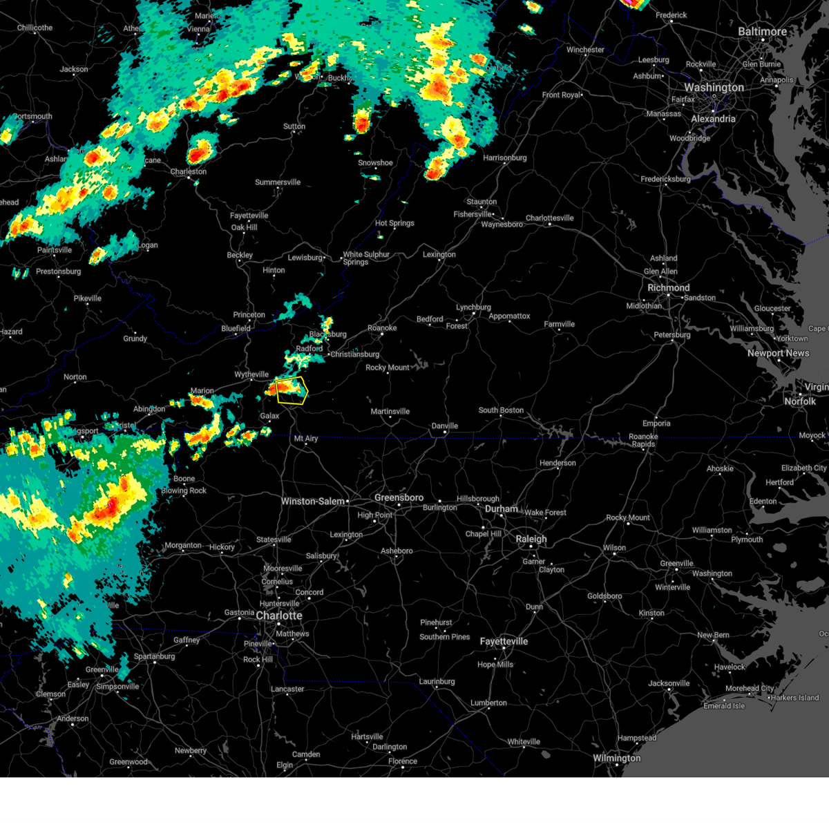
 At 710 pm edt, severe thunderstorms were located along a line extending from near crockett springs to fries, moving east at 55 mph (radar indicated). Hazards include 60 mph wind gusts. expect damage to roofs, siding, and trees At 710 pm edt, severe thunderstorms were located along a line extending from near crockett springs to fries, moving east at 55 mph (radar indicated). Hazards include 60 mph wind gusts. expect damage to roofs, siding, and trees
|
| 5/16/2023 5:12 PM EDT |
 At 512 pm edt, a severe thunderstorm was located near allisonia, moving east at 40 mph (radar indicated). Hazards include 60 mph wind gusts and quarter size hail. Hail damage to vehicles is expected. Expect wind damage to roofs, siding, and trees. At 512 pm edt, a severe thunderstorm was located near allisonia, moving east at 40 mph (radar indicated). Hazards include 60 mph wind gusts and quarter size hail. Hail damage to vehicles is expected. Expect wind damage to roofs, siding, and trees.
|
| 3/3/2023 6:33 PM EST |
 At 632 pm est, a severe thunderstorm was located near gunton park, or near pulaski, moving northeast at 70 mph (radar indicated). Hazards include 60 mph wind gusts. Expect damage to roofs, siding, and trees. locations impacted include, pulaski, dublin, poplar hill, long spur, mechanicsburg, claytor lake state park, and thessalia. hail threat, radar indicated max hail size, <. 75 in wind threat, radar indicated max wind gust, 60 mph. At 632 pm est, a severe thunderstorm was located near gunton park, or near pulaski, moving northeast at 70 mph (radar indicated). Hazards include 60 mph wind gusts. Expect damage to roofs, siding, and trees. locations impacted include, pulaski, dublin, poplar hill, long spur, mechanicsburg, claytor lake state park, and thessalia. hail threat, radar indicated max hail size, <. 75 in wind threat, radar indicated max wind gust, 60 mph.
|
| 3/3/2023 6:28 PM EST |
 At 628 pm est, a severe thunderstorm was located over max meadows, moving northeast at 70 mph (radar indicated). Hazards include 60 mph wind gusts. expect damage to roofs, siding, and trees At 628 pm est, a severe thunderstorm was located over max meadows, moving northeast at 70 mph (radar indicated). Hazards include 60 mph wind gusts. expect damage to roofs, siding, and trees
|
| 8/15/2022 5:53 PM EDT |
 The severe thunderstorm warning for pulaski, west central floyd, east central bland, northeastern wythe and northeastern carroll counties will expire at 600 pm edt, the storm which prompted the warning has weakened below severe limits, and no longer poses an immediate threat to life or property. therefore, the warning will be allowed to expire. The severe thunderstorm warning for pulaski, west central floyd, east central bland, northeastern wythe and northeastern carroll counties will expire at 600 pm edt, the storm which prompted the warning has weakened below severe limits, and no longer poses an immediate threat to life or property. therefore, the warning will be allowed to expire.
|
| 8/15/2022 5:13 PM EDT |
 At 513 pm edt, a severe thunderstorm was located over max meadows, moving east at 25 mph (radar indicated). Hazards include 60 mph wind gusts and quarter size hail. Hail damage to vehicles is expected. expect wind damage to roofs, siding, and trees. locations impacted include, pulaski, wytheville, dublin, max meadows, patterson, allisonia, and indian valley. hail threat, radar indicated max hail size, 1. 00 in wind threat, radar indicated max wind gust, 60 mph. At 513 pm edt, a severe thunderstorm was located over max meadows, moving east at 25 mph (radar indicated). Hazards include 60 mph wind gusts and quarter size hail. Hail damage to vehicles is expected. expect wind damage to roofs, siding, and trees. locations impacted include, pulaski, wytheville, dublin, max meadows, patterson, allisonia, and indian valley. hail threat, radar indicated max hail size, 1. 00 in wind threat, radar indicated max wind gust, 60 mph.
|
| 8/15/2022 4:57 PM EDT |
 At 457 pm edt, a severe thunderstorm was located over wytheville, moving east at 25 mph (radar indicated). Hazards include 60 mph wind gusts and quarter size hail. Hail damage to vehicles is expected. Expect wind damage to roofs, siding, and trees. At 457 pm edt, a severe thunderstorm was located over wytheville, moving east at 25 mph (radar indicated). Hazards include 60 mph wind gusts and quarter size hail. Hail damage to vehicles is expected. Expect wind damage to roofs, siding, and trees.
|
| 8/6/2022 1:51 PM EDT |
 At 151 pm edt, a severe thunderstorm was located near indian valley, moving northeast at 20 mph (radar indicated). Hazards include 60 mph wind gusts. Expect damage to roofs, siding, and trees. locations impacted include, indian valley, and claytor lake state park. hail threat, radar indicated max hail size, <. 75 in wind threat, radar indicated max wind gust, 60 mph. At 151 pm edt, a severe thunderstorm was located near indian valley, moving northeast at 20 mph (radar indicated). Hazards include 60 mph wind gusts. Expect damage to roofs, siding, and trees. locations impacted include, indian valley, and claytor lake state park. hail threat, radar indicated max hail size, <. 75 in wind threat, radar indicated max wind gust, 60 mph.
|
| 8/6/2022 1:36 PM EDT |
 At 135 pm edt, a severe thunderstorm was located over sylvatus, or near patterson, moving northeast at 15 mph (radar indicated). Hazards include 60 mph wind gusts. expect damage to roofs, siding, and trees At 135 pm edt, a severe thunderstorm was located over sylvatus, or near patterson, moving northeast at 15 mph (radar indicated). Hazards include 60 mph wind gusts. expect damage to roofs, siding, and trees
|
| 7/12/2022 8:01 PM EDT |
 At 800 pm edt, severe thunderstorms were located along a line extending from near nace to walton, moving southeast at 30 mph (radar indicated). Hazards include 60 mph wind gusts and quarter size hail. Hail damage to vehicles is expected. expect wind damage to roofs, siding, and trees. locations impacted include, roanoke, blacksburg, salem, christiansburg, radford, pulaski, and vinton. hail threat, radar indicated max hail size, 1. 00 in wind threat, radar indicated max wind gust, 60 mph. At 800 pm edt, severe thunderstorms were located along a line extending from near nace to walton, moving southeast at 30 mph (radar indicated). Hazards include 60 mph wind gusts and quarter size hail. Hail damage to vehicles is expected. expect wind damage to roofs, siding, and trees. locations impacted include, roanoke, blacksburg, salem, christiansburg, radford, pulaski, and vinton. hail threat, radar indicated max hail size, 1. 00 in wind threat, radar indicated max wind gust, 60 mph.
|
| 7/12/2022 7:29 PM EDT |
 At 729 pm edt, severe thunderstorms were located along a line extending from eagle rock to oakvale, moving southeast at 20 mph (radar indicated). Hazards include 60 mph wind gusts and quarter size hail. Hail damage to vehicles is expected. Expect wind damage to roofs, siding, and trees. At 729 pm edt, severe thunderstorms were located along a line extending from eagle rock to oakvale, moving southeast at 20 mph (radar indicated). Hazards include 60 mph wind gusts and quarter size hail. Hail damage to vehicles is expected. Expect wind damage to roofs, siding, and trees.
|
| 6/17/2022 4:21 PM EDT |
 At 420 pm edt, severe thunderstorms were located along a line extending from near dublin to marion, moving east at 70 mph (radar indicated). Hazards include 60 mph wind gusts. Expect damage to roofs, siding, and trees. locations impacted include, pulaski, wytheville, bland, marion, saltville, rural retreat, and ceres. hail threat, radar indicated max hail size, <. 75 in wind threat, radar indicated max wind gust, 60 mph. At 420 pm edt, severe thunderstorms were located along a line extending from near dublin to marion, moving east at 70 mph (radar indicated). Hazards include 60 mph wind gusts. Expect damage to roofs, siding, and trees. locations impacted include, pulaski, wytheville, bland, marion, saltville, rural retreat, and ceres. hail threat, radar indicated max hail size, <. 75 in wind threat, radar indicated max wind gust, 60 mph.
|
| 6/17/2022 4:00 PM EDT |
 At 400 pm edt, severe thunderstorms were located along a line extending from merrimac to near pulaski, moving southeast at 50 mph (radar indicated). Hazards include 60 mph wind gusts. expect damage to roofs, siding, and trees At 400 pm edt, severe thunderstorms were located along a line extending from merrimac to near pulaski, moving southeast at 50 mph (radar indicated). Hazards include 60 mph wind gusts. expect damage to roofs, siding, and trees
|
| 6/17/2022 3:32 PM EDT |
 At 331 pm edt, severe thunderstorms were located along a line extending from near mechanicsburg to near nebo, moving east at 70 mph (radar indicated). Hazards include 60 mph wind gusts and quarter size hail. Hail damage to vehicles is expected. Expect wind damage to roofs, siding, and trees. At 331 pm edt, severe thunderstorms were located along a line extending from near mechanicsburg to near nebo, moving east at 70 mph (radar indicated). Hazards include 60 mph wind gusts and quarter size hail. Hail damage to vehicles is expected. Expect wind damage to roofs, siding, and trees.
|
| 6/17/2022 1:23 AM EDT |
 At 122 am edt, a severe thunderstorm was located near white gate, or 10 miles west of poplar hill, moving southeast at 25 mph (radar indicated). Hazards include 60 mph wind gusts and quarter size hail. Hail damage to vehicles is expected. Expect wind damage to roofs, siding, and trees. At 122 am edt, a severe thunderstorm was located near white gate, or 10 miles west of poplar hill, moving southeast at 25 mph (radar indicated). Hazards include 60 mph wind gusts and quarter size hail. Hail damage to vehicles is expected. Expect wind damage to roofs, siding, and trees.
|
| 6/8/2022 6:26 PM EDT |
 The severe thunderstorm warning for southeastern pulaski, west central floyd and northeastern carroll counties and the southwestern city of radford will expire at 630 pm edt, the severe thunderstorm which prompted the warning has weakened. therefore, the warning will be allowed to expire. however gusty winds are still possible with this thunderstorm. The severe thunderstorm warning for southeastern pulaski, west central floyd and northeastern carroll counties and the southwestern city of radford will expire at 630 pm edt, the severe thunderstorm which prompted the warning has weakened. therefore, the warning will be allowed to expire. however gusty winds are still possible with this thunderstorm.
|
| 6/8/2022 6:08 PM EDT |
 At 607 pm edt, a severe thunderstorm was located near dugspur, or near hillsville, moving northeast at 35 mph (radar indicated). Hazards include 60 mph wind gusts and penny size hail. Expect damage to roofs, siding, and trees. locations impacted include, radford, hillsville, indian valley, willis, allisonia, dugspur, and claytor dam. hail threat, radar indicated max hail size, 0. 75 in wind threat, radar indicated max wind gust, 60 mph. At 607 pm edt, a severe thunderstorm was located near dugspur, or near hillsville, moving northeast at 35 mph (radar indicated). Hazards include 60 mph wind gusts and penny size hail. Expect damage to roofs, siding, and trees. locations impacted include, radford, hillsville, indian valley, willis, allisonia, dugspur, and claytor dam. hail threat, radar indicated max hail size, 0. 75 in wind threat, radar indicated max wind gust, 60 mph.
|
| 6/8/2022 5:58 PM EDT |
 At 558 pm edt, a severe thunderstorm was located over hillsville, moving northeast at 25 mph (radar indicated). Hazards include 60 mph wind gusts and penny size hail. Expect damage to roofs, siding, and trees. locations impacted include, radford, hillsville, indian valley, patterson, willis, allisonia, and dugspur. hail threat, radar indicated max hail size, 0. 75 in wind threat, radar indicated max wind gust, 60 mph. At 558 pm edt, a severe thunderstorm was located over hillsville, moving northeast at 25 mph (radar indicated). Hazards include 60 mph wind gusts and penny size hail. Expect damage to roofs, siding, and trees. locations impacted include, radford, hillsville, indian valley, patterson, willis, allisonia, and dugspur. hail threat, radar indicated max hail size, 0. 75 in wind threat, radar indicated max wind gust, 60 mph.
|
| 6/8/2022 5:36 PM EDT |
 At 535 pm edt, severe thunderstorms were located along a line extending from near fries to galax, moving northeast at 35 mph (radar indicated). Hazards include 60 mph wind gusts. expect damage to roofs, siding, and trees At 535 pm edt, severe thunderstorms were located along a line extending from near fries to galax, moving northeast at 35 mph (radar indicated). Hazards include 60 mph wind gusts. expect damage to roofs, siding, and trees
|
| 5/26/2022 8:53 PM EDT |
 At 852 pm edt, a severe thunderstorm was located near willis, moving north at 35 mph (radar indicated). Hazards include 60 mph wind gusts and penny size hail. Expect damage to roofs, siding, and trees. Locations impacted include, hillsville, dublin, floyd, pilot, indian valley, fancy gap, and ararat. At 852 pm edt, a severe thunderstorm was located near willis, moving north at 35 mph (radar indicated). Hazards include 60 mph wind gusts and penny size hail. Expect damage to roofs, siding, and trees. Locations impacted include, hillsville, dublin, floyd, pilot, indian valley, fancy gap, and ararat.
|
| 5/26/2022 8:11 PM EDT |
 At 810 pm edt, a severe thunderstorm was located over toast, or near mount airy, moving northeast at 30 mph (radar indicated). Hazards include 60 mph wind gusts. expect damage to roofs, siding, and trees At 810 pm edt, a severe thunderstorm was located over toast, or near mount airy, moving northeast at 30 mph (radar indicated). Hazards include 60 mph wind gusts. expect damage to roofs, siding, and trees
|
| 5/22/2022 2:16 PM EDT |
 At 216 pm edt, a severe thunderstorm was located near sylvatus, or near hillsville, moving east at 20 mph (radar indicated). Hazards include 60 mph wind gusts and quarter size hail. Hail damage to vehicles is expected. Expect wind damage to roofs, siding, and trees. At 216 pm edt, a severe thunderstorm was located near sylvatus, or near hillsville, moving east at 20 mph (radar indicated). Hazards include 60 mph wind gusts and quarter size hail. Hail damage to vehicles is expected. Expect wind damage to roofs, siding, and trees.
|
| 5/6/2022 7:14 PM EDT |
 At 713 pm edt, a severe thunderstorm was located over draper, or near pulaski, moving east at 30 mph (radar indicated). Hazards include 60 mph wind gusts and quarter size hail. Hail damage to vehicles is expected. expect wind damage to roofs, siding, and trees. locations impacted include, radford, pulaski, dublin, claytor dam, mc coy, claytor lake state park, and draper. hail threat, radar indicated max hail size, 1. 00 in wind threat, radar indicated max wind gust, 60 mph. At 713 pm edt, a severe thunderstorm was located over draper, or near pulaski, moving east at 30 mph (radar indicated). Hazards include 60 mph wind gusts and quarter size hail. Hail damage to vehicles is expected. expect wind damage to roofs, siding, and trees. locations impacted include, radford, pulaski, dublin, claytor dam, mc coy, claytor lake state park, and draper. hail threat, radar indicated max hail size, 1. 00 in wind threat, radar indicated max wind gust, 60 mph.
|
| 5/6/2022 6:55 PM EDT |
 At 653 pm edt, a severe thunderstorm was located near max meadows and grahams forge, moving east at 30 mph (radar indicated). Hazards include 60 mph wind gusts and quarter size hail. Hail damage to vehicles is expected. Expect wind damage to roofs, siding, and trees. At 653 pm edt, a severe thunderstorm was located near max meadows and grahams forge, moving east at 30 mph (radar indicated). Hazards include 60 mph wind gusts and quarter size hail. Hail damage to vehicles is expected. Expect wind damage to roofs, siding, and trees.
|
| 12/11/2021 1:35 PM EST |
 The severe thunderstorm warning for southern pulaski, west central floyd, southeastern wythe, carroll and northeastern grayson counties and the city of galax will expire at 145 pm est, the storms which prompted the warning have weakened below severe limits, and no longer pose an immediate threat to life or property. therefore, the warning will be allowed to expire. The severe thunderstorm warning for southern pulaski, west central floyd, southeastern wythe, carroll and northeastern grayson counties and the city of galax will expire at 145 pm est, the storms which prompted the warning have weakened below severe limits, and no longer pose an immediate threat to life or property. therefore, the warning will be allowed to expire.
|
| 12/11/2021 1:15 PM EST |
 At 114 pm est, severe storms were located along a line extending from gunton park to ivanhoe, moving east at 45 mph (radar indicated). Hazards include 60 mph wind gusts. Expect damage to roofs, siding, and trees. locations impacted include, galax, hillsville, fries, indian valley, fancy gap, max meadows, and patterson. hail threat, radar indicated max hail size, <. 75 in wind threat, radar indicated max wind gust, 60 mph. At 114 pm est, severe storms were located along a line extending from gunton park to ivanhoe, moving east at 45 mph (radar indicated). Hazards include 60 mph wind gusts. Expect damage to roofs, siding, and trees. locations impacted include, galax, hillsville, fries, indian valley, fancy gap, max meadows, and patterson. hail threat, radar indicated max hail size, <. 75 in wind threat, radar indicated max wind gust, 60 mph.
|
| 12/11/2021 12:54 PM EST |
 At 1253 pm est, a severe storm was located over speedwell, moving east at 45 mph (radar indicated). Hazards include 60 mph wind gusts. expect damage to roofs, siding, and trees At 1253 pm est, a severe storm was located over speedwell, moving east at 45 mph (radar indicated). Hazards include 60 mph wind gusts. expect damage to roofs, siding, and trees
|
| 8/10/2021 12:43 PM EDT |
 At 1243 pm edt, a severe thunderstorm was located near draper, or near pulaski, moving southeast at 15 mph (radar indicated). Hazards include 60 mph wind gusts. expect damage to roofs, siding, and trees At 1243 pm edt, a severe thunderstorm was located near draper, or near pulaski, moving southeast at 15 mph (radar indicated). Hazards include 60 mph wind gusts. expect damage to roofs, siding, and trees
|
| 7/26/2021 6:39 PM EDT |
 The severe thunderstorm warning for south central pulaski, southwestern floyd and northeastern carroll counties will expire at 645 pm edt, the storm which prompted the warning has weakened below severe limits, and no longer poses an immediate threat to life or property. therefore, the warning will be allowed to expire. a severe thunderstorm watch remains in effect until 800 pm edt for north central north carolina, and south central, southwestern and west central virginia. when it is safe to do so, please send your reports of hail of any size, as well as reports of any wind damage, including downed trees or large limbs, to the national weather service by calling toll free at 1, 8 6 6, 2 1 5, 4 3 2 4. reports and pictures can also be shared on the national weather service blacksburg facebook page and on twitter. The severe thunderstorm warning for south central pulaski, southwestern floyd and northeastern carroll counties will expire at 645 pm edt, the storm which prompted the warning has weakened below severe limits, and no longer poses an immediate threat to life or property. therefore, the warning will be allowed to expire. a severe thunderstorm watch remains in effect until 800 pm edt for north central north carolina, and south central, southwestern and west central virginia. when it is safe to do so, please send your reports of hail of any size, as well as reports of any wind damage, including downed trees or large limbs, to the national weather service by calling toll free at 1, 8 6 6, 2 1 5, 4 3 2 4. reports and pictures can also be shared on the national weather service blacksburg facebook page and on twitter.
|
| 7/26/2021 6:08 PM EDT |
 At 608 pm edt, severe thunderstorms were located along a line extending from near allisonia to near rocky knob summit, moving southeast at 15 mph (radar indicated). Hazards include 60 mph wind gusts. Expect damage to roofs, siding, and trees. Locations impacted include, pulaski, dublin, indian valley, willis, allisonia, claytor dam, and claytor lake state park. At 608 pm edt, severe thunderstorms were located along a line extending from near allisonia to near rocky knob summit, moving southeast at 15 mph (radar indicated). Hazards include 60 mph wind gusts. Expect damage to roofs, siding, and trees. Locations impacted include, pulaski, dublin, indian valley, willis, allisonia, claytor dam, and claytor lake state park.
|
| 7/26/2021 5:50 PM EDT |
 At 548 pm edt, a severe thunderstorm was located near indian valley, moving south at 15 mph (radar indicated). Hazards include 70 mph wind gusts. Expect considerable tree damage. Damage is likely to mobile homes, roofs, and outbuildings. At 548 pm edt, a severe thunderstorm was located near indian valley, moving south at 15 mph (radar indicated). Hazards include 70 mph wind gusts. Expect considerable tree damage. Damage is likely to mobile homes, roofs, and outbuildings.
|
| 7/26/2021 5:36 PM EDT |
 At 531 pm edt, severe thunderstorms were located along a line extending from pulaski to copper valley, moving southeast at 15 mph (radar indicated). Hazards include 70 mph wind gusts and half dollar size hail. Hail damage to vehicles is expected. expect considerable tree damage. wind damage is also likely to mobile homes, roofs, and outbuildings. Locations impacted include, pulaski, dublin, indian valley, willis, allisonia, claytor dam, and claytor lake state park. At 531 pm edt, severe thunderstorms were located along a line extending from pulaski to copper valley, moving southeast at 15 mph (radar indicated). Hazards include 70 mph wind gusts and half dollar size hail. Hail damage to vehicles is expected. expect considerable tree damage. wind damage is also likely to mobile homes, roofs, and outbuildings. Locations impacted include, pulaski, dublin, indian valley, willis, allisonia, claytor dam, and claytor lake state park.
|
| 7/26/2021 5:25 PM EDT |
 At 525 pm edt, severe thunderstorms were located along a line extending from draper to near alum ridge, moving southeast at 15 mph (radar indicated). Hazards include 70 mph wind gusts and half dollar size hail. Hail damage to vehicles is expected. expect considerable tree damage. wind damage is also likely to mobile homes, roofs, and outbuildings. Locations impacted include, pulaski, dublin, indian valley, willis, allisonia, claytor dam, and claytor lake state park. At 525 pm edt, severe thunderstorms were located along a line extending from draper to near alum ridge, moving southeast at 15 mph (radar indicated). Hazards include 70 mph wind gusts and half dollar size hail. Hail damage to vehicles is expected. expect considerable tree damage. wind damage is also likely to mobile homes, roofs, and outbuildings. Locations impacted include, pulaski, dublin, indian valley, willis, allisonia, claytor dam, and claytor lake state park.
|
| 7/26/2021 5:10 PM EDT |
 At 510 pm edt, severe thunderstorms were located along a line extending from pulaski to near copper valley, moving southeast at 15 mph (radar indicated). Hazards include 60 mph wind gusts. expect damage to roofs, siding, and trees At 510 pm edt, severe thunderstorms were located along a line extending from pulaski to near copper valley, moving southeast at 15 mph (radar indicated). Hazards include 60 mph wind gusts. expect damage to roofs, siding, and trees
|
| 6/13/2021 9:06 PM EDT |
 At 903 pm edt, severe thunderstorms were located along a line extending from salem to near pulaski to riner, moving south at 35 to 40 mph (radar indicated). Hazards include 60 mph wind gusts. Expect damage to roofs, siding, and trees. locations impacted include, blacksburg, christiansburg, radford, pulaski, dublin, pilot, and shawsville. This includes the following location virginia tech. At 903 pm edt, severe thunderstorms were located along a line extending from salem to near pulaski to riner, moving south at 35 to 40 mph (radar indicated). Hazards include 60 mph wind gusts. Expect damage to roofs, siding, and trees. locations impacted include, blacksburg, christiansburg, radford, pulaski, dublin, pilot, and shawsville. This includes the following location virginia tech.
|
| 6/13/2021 8:47 PM EDT |
 At 844 pm edt, severe thunderstorms were located along a line extending from near princeton west virginia to near blacksburg virginia, moving south at 35 to 40 mph (radar indicated). Hazards include 60 mph wind gusts. Expect damage to trees and powerlines. locations impacted include, blacksburg, christiansburg, radford, bluefield, pulaski, princeton, and pearisburg. This includes the following locations virginia tech and mercer county airport. At 844 pm edt, severe thunderstorms were located along a line extending from near princeton west virginia to near blacksburg virginia, moving south at 35 to 40 mph (radar indicated). Hazards include 60 mph wind gusts. Expect damage to trees and powerlines. locations impacted include, blacksburg, christiansburg, radford, bluefield, pulaski, princeton, and pearisburg. This includes the following locations virginia tech and mercer county airport.
|
| 6/13/2021 8:17 PM EDT |
 At 816 pm edt, severe thunderstorms were located along a line extending from jordan mines to zenith to spanishburg, moving south at 35 mph (radar indicated). Hazards include 60 mph wind gusts and quarter size hail. Hail damage to vehicles is possible. Expect wind damage to trees and powerlines. At 816 pm edt, severe thunderstorms were located along a line extending from jordan mines to zenith to spanishburg, moving south at 35 mph (radar indicated). Hazards include 60 mph wind gusts and quarter size hail. Hail damage to vehicles is possible. Expect wind damage to trees and powerlines.
|
| 5/4/2021 1:41 PM EDT |
 At 141 pm edt, a severe thunderstorm was located near claytor lake state park, or near allisonia, moving northeast at 25 mph (radar indicated). Hazards include 60 mph wind gusts. expect damage to roofs, siding, and trees At 141 pm edt, a severe thunderstorm was located near claytor lake state park, or near allisonia, moving northeast at 25 mph (radar indicated). Hazards include 60 mph wind gusts. expect damage to roofs, siding, and trees
|
| 3/27/2021 2:56 PM EDT |
 At 256 pm edt, severe thunderstorms were located along a line extending from near pilot to ararat to near buck shoals, moving east at 50 mph (radar indicated). Hazards include 60 mph wind gusts. expect damage to roofs, siding, and trees At 256 pm edt, severe thunderstorms were located along a line extending from near pilot to ararat to near buck shoals, moving east at 50 mph (radar indicated). Hazards include 60 mph wind gusts. expect damage to roofs, siding, and trees
|
| 3/27/2021 2:30 PM EDT |
 At 230 pm edt, severe thunderstorms were located along a line extending from near kimberling to near baywood to near elkville, moving east at 45 mph (radar indicated). Hazards include 60 mph wind gusts. Expect damage to roofs, siding, and trees. Locations impacted include, pulaski, wytheville, galax, north wilkesboro, wilkesboro, hillsville, and dublin. At 230 pm edt, severe thunderstorms were located along a line extending from near kimberling to near baywood to near elkville, moving east at 45 mph (radar indicated). Hazards include 60 mph wind gusts. Expect damage to roofs, siding, and trees. Locations impacted include, pulaski, wytheville, galax, north wilkesboro, wilkesboro, hillsville, and dublin.
|
| 3/27/2021 2:21 PM EDT |
 At 220 pm edt, severe thunderstorms were located along a line extending from bland to independence to near elkville, moving east at 45 mph (radar indicated). Hazards include 60 mph wind gusts. Expect damage to roofs, siding, and trees. Locations impacted include, pulaski, wytheville, galax, bland, north wilkesboro, wilkesboro, and hillsville. At 220 pm edt, severe thunderstorms were located along a line extending from bland to independence to near elkville, moving east at 45 mph (radar indicated). Hazards include 60 mph wind gusts. Expect damage to roofs, siding, and trees. Locations impacted include, pulaski, wytheville, galax, bland, north wilkesboro, wilkesboro, and hillsville.
|
| 3/27/2021 2:06 PM EDT |
 At 205 pm edt, severe thunderstorms were located along a line extending from near ceres to mouth of wilson to 8 miles northwest of lenoir, moving east at 45 mph (radar indicated). Hazards include 60 mph wind gusts. expect damage to roofs, siding, and trees At 205 pm edt, severe thunderstorms were located along a line extending from near ceres to mouth of wilson to 8 miles northwest of lenoir, moving east at 45 mph (radar indicated). Hazards include 60 mph wind gusts. expect damage to roofs, siding, and trees
|
| 3/27/2021 1:11 PM EDT |
 At 111 pm edt, a severe thunderstorm was located over spring valley, or near fries, moving east at 50 mph (radar indicated). Hazards include quarter size hail. damage to vehicles is expected At 111 pm edt, a severe thunderstorm was located over spring valley, or near fries, moving east at 50 mph (radar indicated). Hazards include quarter size hail. damage to vehicles is expected
|
| 8/6/2020 2:38 PM EDT |
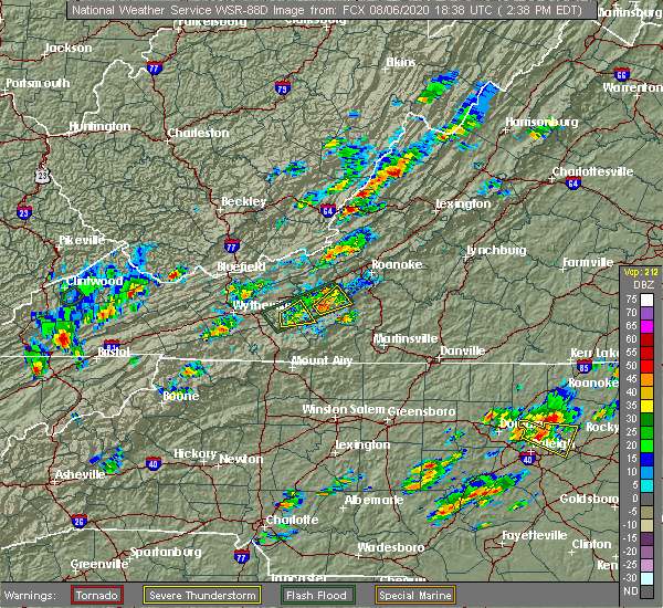 The severe thunderstorm warning for southeastern pulaski, west central floyd, northeastern carroll and southwestern montgomery counties will expire at 245 pm edt, the storm which prompted the warning has weakened below severe limits, and no longer poses an immediate threat to life or property. therefore, the warning will be allowed to expire. however heavy rain is still possible with this thunderstorm. when it is safe to do so, please send your reports of hail of any size, as well as reports of any wind damage, including downed trees or large limbs, to the national weather service by calling toll free at 1, 8 6 6, 2 1 5, 4 3 2 4. reports and pictures can also be shared on the national weather service blacksburg facebook page and on twitter. The severe thunderstorm warning for southeastern pulaski, west central floyd, northeastern carroll and southwestern montgomery counties will expire at 245 pm edt, the storm which prompted the warning has weakened below severe limits, and no longer poses an immediate threat to life or property. therefore, the warning will be allowed to expire. however heavy rain is still possible with this thunderstorm. when it is safe to do so, please send your reports of hail of any size, as well as reports of any wind damage, including downed trees or large limbs, to the national weather service by calling toll free at 1, 8 6 6, 2 1 5, 4 3 2 4. reports and pictures can also be shared on the national weather service blacksburg facebook page and on twitter.
|
| 8/6/2020 2:32 PM EDT |
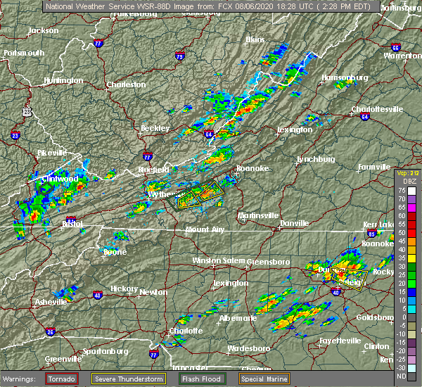 At 232 pm edt, a severe thunderstorm was located near indian valley, moving northeast at 15 mph (radar indicated). Hazards include 60 mph wind gusts and quarter size hail. Hail damage to vehicles is expected. expect wind damage to roofs, siding, and trees. Locations impacted include, indian valley, copper valley, and alum ridge. At 232 pm edt, a severe thunderstorm was located near indian valley, moving northeast at 15 mph (radar indicated). Hazards include 60 mph wind gusts and quarter size hail. Hail damage to vehicles is expected. expect wind damage to roofs, siding, and trees. Locations impacted include, indian valley, copper valley, and alum ridge.
|
| 8/6/2020 2:22 PM EDT |
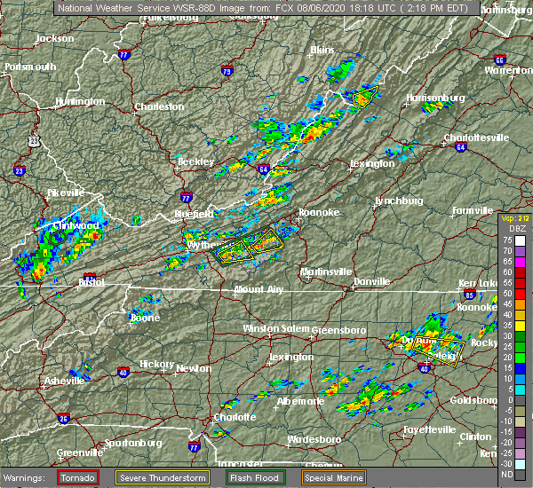 At 222 pm edt, a severe thunderstorm was located near allisonia, moving east at 20 mph (radar indicated). Hazards include 60 mph wind gusts and quarter size hail. Hail damage to vehicles is expected. expect wind damage to roofs, siding, and trees. Locations impacted include, indian valley, allisonia, alum ridge, and copper valley. At 222 pm edt, a severe thunderstorm was located near allisonia, moving east at 20 mph (radar indicated). Hazards include 60 mph wind gusts and quarter size hail. Hail damage to vehicles is expected. expect wind damage to roofs, siding, and trees. Locations impacted include, indian valley, allisonia, alum ridge, and copper valley.
|
| 8/6/2020 2:02 PM EDT |
 At 202 pm edt, a severe thunderstorm was located near allisonia, moving northeast at 15 mph (radar indicated). Hazards include 60 mph wind gusts and quarter size hail. Hail damage to vehicles is expected. Expect wind damage to roofs, siding, and trees. At 202 pm edt, a severe thunderstorm was located near allisonia, moving northeast at 15 mph (radar indicated). Hazards include 60 mph wind gusts and quarter size hail. Hail damage to vehicles is expected. Expect wind damage to roofs, siding, and trees.
|
| 8/6/2020 1:36 PM EDT |
 The severe thunderstorm warning for southwestern pulaski, southeastern wythe and northwestern carroll counties will expire at 145 pm edt, the storm which prompted the warning has weakened below severe limits, and no longer poses an immediate threat to life or property. therefore, the warning will be allowed to expire. however gusty winds and heavy rain are still possible with this thunderstorm. when it is safe to do so, please send your reports of hail of any size, as well as reports of any wind damage, including downed trees or large limbs, to the national weather service by calling toll free at 1, 8 6 6, 2 1 5, 4 3 2 4. reports and pictures can also be shared on the national weather service blacksburg facebook page and on twitter. The severe thunderstorm warning for southwestern pulaski, southeastern wythe and northwestern carroll counties will expire at 145 pm edt, the storm which prompted the warning has weakened below severe limits, and no longer poses an immediate threat to life or property. therefore, the warning will be allowed to expire. however gusty winds and heavy rain are still possible with this thunderstorm. when it is safe to do so, please send your reports of hail of any size, as well as reports of any wind damage, including downed trees or large limbs, to the national weather service by calling toll free at 1, 8 6 6, 2 1 5, 4 3 2 4. reports and pictures can also be shared on the national weather service blacksburg facebook page and on twitter.
|
| 8/6/2020 1:26 PM EDT |
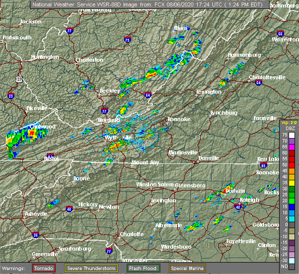 At 124 pm edt, a severe thunderstorm was located near ivanhoe, or near patterson, moving east at 10 mph. around 105 pm, a trained weather spotter near ivanhoe reported quarter size hail with this storm (trained weather spotters). Hazards include 60 mph wind gusts and quarter size hail. Hail damage to vehicles is expected. expect wind damage to roofs, siding, and trees. Locations impacted include, patterson, allisonia, byllesby, grahams forge, ivanhoe, coleman store, and sylvatus. At 124 pm edt, a severe thunderstorm was located near ivanhoe, or near patterson, moving east at 10 mph. around 105 pm, a trained weather spotter near ivanhoe reported quarter size hail with this storm (trained weather spotters). Hazards include 60 mph wind gusts and quarter size hail. Hail damage to vehicles is expected. expect wind damage to roofs, siding, and trees. Locations impacted include, patterson, allisonia, byllesby, grahams forge, ivanhoe, coleman store, and sylvatus.
|
| 8/6/2020 1:02 PM EDT |
 At 101 pm edt, a severe thunderstorm was located over ivanhoe, or 8 miles south of max meadows, moving east at 10 mph (radar indicated). Hazards include 60 mph wind gusts and quarter size hail. Hail damage to vehicles is expected. Expect wind damage to roofs, siding, and trees. At 101 pm edt, a severe thunderstorm was located over ivanhoe, or 8 miles south of max meadows, moving east at 10 mph (radar indicated). Hazards include 60 mph wind gusts and quarter size hail. Hail damage to vehicles is expected. Expect wind damage to roofs, siding, and trees.
|
| 7/19/2020 4:28 PM EDT |
 At 428 pm edt, a severe thunderstorm was located near claytor lake state park, or near dublin, moving east at 15 mph (radar indicated). Hazards include 60 mph wind gusts. Expect damage to roofs, siding, and trees. Locations impacted include, blacksburg, christiansburg, radford, pulaski, dublin, indian valley, and pilot. At 428 pm edt, a severe thunderstorm was located near claytor lake state park, or near dublin, moving east at 15 mph (radar indicated). Hazards include 60 mph wind gusts. Expect damage to roofs, siding, and trees. Locations impacted include, blacksburg, christiansburg, radford, pulaski, dublin, indian valley, and pilot.
|
| 7/19/2020 4:05 PM EDT |
 At 404 pm edt, a severe thunderstorm was located over pulaski, moving east at 20 mph (radar indicated). Hazards include 60 mph wind gusts. expect damage to roofs, siding, and trees At 404 pm edt, a severe thunderstorm was located over pulaski, moving east at 20 mph (radar indicated). Hazards include 60 mph wind gusts. expect damage to roofs, siding, and trees
|
| 6/21/2020 1:31 PM EDT |
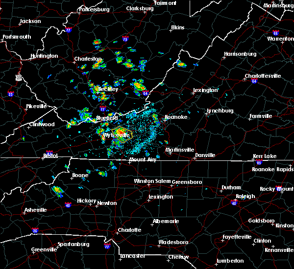 At 130 pm edt, a severe thunderstorm was located near claytor lake state park, or near pulaski, moving southeast at 15 mph (radar indicated). Hazards include 60 mph wind gusts and quarter size hail. Hail damage to vehicles is possible. expect wind damage to roofs, siding, and trees. Locations impacted include, pulaski, dublin, allisonia, claytor dam, claytor lake state park, draper, and graysontown. At 130 pm edt, a severe thunderstorm was located near claytor lake state park, or near pulaski, moving southeast at 15 mph (radar indicated). Hazards include 60 mph wind gusts and quarter size hail. Hail damage to vehicles is possible. expect wind damage to roofs, siding, and trees. Locations impacted include, pulaski, dublin, allisonia, claytor dam, claytor lake state park, draper, and graysontown.
|
| 6/21/2020 1:13 PM EDT |
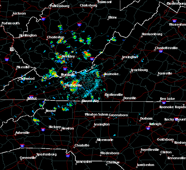 At 111 pm edt, a severe thunderstorm was located over pulaski, moving south at 10 mph (radar indicated). Hazards include 60 mph wind gusts and quarter size hail. Hail damage to vehicles is possible. Expect wind damage to roofs, siding, and trees. At 111 pm edt, a severe thunderstorm was located over pulaski, moving south at 10 mph (radar indicated). Hazards include 60 mph wind gusts and quarter size hail. Hail damage to vehicles is possible. Expect wind damage to roofs, siding, and trees.
|
| 4/8/2020 5:07 PM EDT |
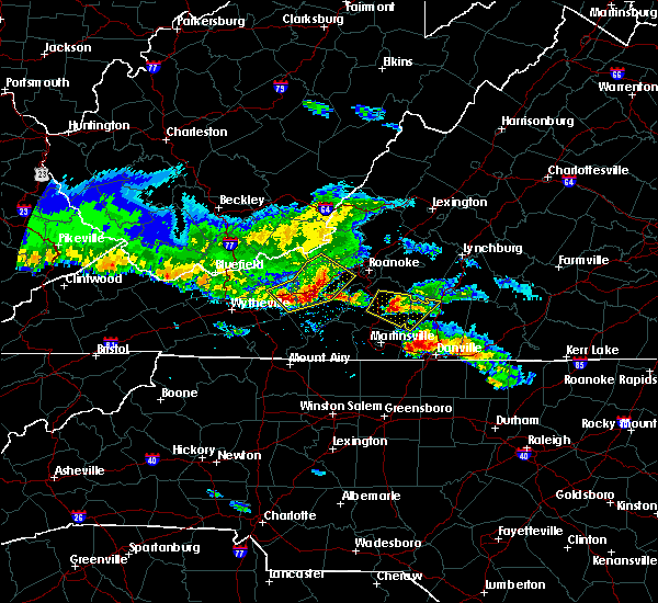 At 506 pm edt, severe thunderstorms were located along a line extending from near shawsville to near pilot to draper, moving southeast at 55 mph (radar indicated). Hazards include 60 mph wind gusts and quarter size hail. Hail damage to vehicles is expected. Expect wind damage to roofs, siding, and trees. At 506 pm edt, severe thunderstorms were located along a line extending from near shawsville to near pilot to draper, moving southeast at 55 mph (radar indicated). Hazards include 60 mph wind gusts and quarter size hail. Hail damage to vehicles is expected. Expect wind damage to roofs, siding, and trees.
|
| 1/11/2020 9:47 PM EST |
 At 946 pm est, severe thunderstorms were located along a line extending from near merrimac to near huntsville, moving northeast at 60 mph (radar indicated). Hazards include 70 mph wind gusts. Expect considerable tree damage. damage is likely to mobile homes, roofs, and outbuildings. Locations impacted include, mount airy, elkin, fairview, flat rock, yadkinville, hillsville, and jonesville. At 946 pm est, severe thunderstorms were located along a line extending from near merrimac to near huntsville, moving northeast at 60 mph (radar indicated). Hazards include 70 mph wind gusts. Expect considerable tree damage. damage is likely to mobile homes, roofs, and outbuildings. Locations impacted include, mount airy, elkin, fairview, flat rock, yadkinville, hillsville, and jonesville.
|
| 1/11/2020 9:32 PM EST |
 At 930 pm est, severe thunderstorms were located along a line extending from near eggleston to near boonville, moving northeast at 75 mph (radar indicated). Hazards include 70 mph wind gusts. Expect considerable tree damage. damage is likely to mobile homes, roofs, and outbuildings. Locations impacted include, mount airy, galax, elkin, fairview, flat rock, yadkinville, and hillsville. At 930 pm est, severe thunderstorms were located along a line extending from near eggleston to near boonville, moving northeast at 75 mph (radar indicated). Hazards include 70 mph wind gusts. Expect considerable tree damage. damage is likely to mobile homes, roofs, and outbuildings. Locations impacted include, mount airy, galax, elkin, fairview, flat rock, yadkinville, and hillsville.
|
| 1/11/2020 9:07 PM EST |
 At 907 pm est, severe thunderstorms were located along a line extending from max meadows to near stony point, moving northeast at 75 mph (radar indicated). Hazards include 70 mph wind gusts. Expect considerable tree damage. Damage is likely to mobile homes, roofs, and outbuildings. At 907 pm est, severe thunderstorms were located along a line extending from max meadows to near stony point, moving northeast at 75 mph (radar indicated). Hazards include 70 mph wind gusts. Expect considerable tree damage. Damage is likely to mobile homes, roofs, and outbuildings.
|
| 10/31/2019 5:21 PM EDT |
 At 429 pm edt, a severe thunderstorm was located over claytor lake state park, or near dublin, moving northeast at 60 mph (radar indicated). Hazards include 60 mph wind gusts. expect damage to roofs, siding, and trees At 429 pm edt, a severe thunderstorm was located over claytor lake state park, or near dublin, moving northeast at 60 mph (radar indicated). Hazards include 60 mph wind gusts. expect damage to roofs, siding, and trees
|
| 10/31/2019 4:30 PM EDT |
 At 429 pm edt, a severe thunderstorm was located over claytor lake state park, or near dublin, moving northeast at 60 mph (radar indicated). Hazards include 60 mph wind gusts. expect damage to roofs, siding, and trees At 429 pm edt, a severe thunderstorm was located over claytor lake state park, or near dublin, moving northeast at 60 mph (radar indicated). Hazards include 60 mph wind gusts. expect damage to roofs, siding, and trees
|
| 9/28/2019 3:41 PM EDT |
 At 340 pm edt, severe thunderstorms were located along a line extending from allisonia to draper, and are nearly stationary (radar indicated). Hazards include 60 mph wind gusts and quarter size hail. Hail damage to vehicles is expected. expect wind damage to roofs, siding, and trees. Locations impacted include, allisonia, and draper. At 340 pm edt, severe thunderstorms were located along a line extending from allisonia to draper, and are nearly stationary (radar indicated). Hazards include 60 mph wind gusts and quarter size hail. Hail damage to vehicles is expected. expect wind damage to roofs, siding, and trees. Locations impacted include, allisonia, and draper.
|
| 9/28/2019 3:15 PM EDT |
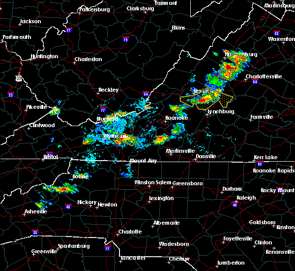 At 314 pm edt, a severe thunderstorm was located over draper, moving southeast at 5 mph (radar indicated). Hazards include 60 mph wind gusts and quarter size hail. Hail damage to vehicles is expected. Expect wind damage to roofs, siding, and trees. At 314 pm edt, a severe thunderstorm was located over draper, moving southeast at 5 mph (radar indicated). Hazards include 60 mph wind gusts and quarter size hail. Hail damage to vehicles is expected. Expect wind damage to roofs, siding, and trees.
|
| 9/28/2019 2:25 PM EDT |
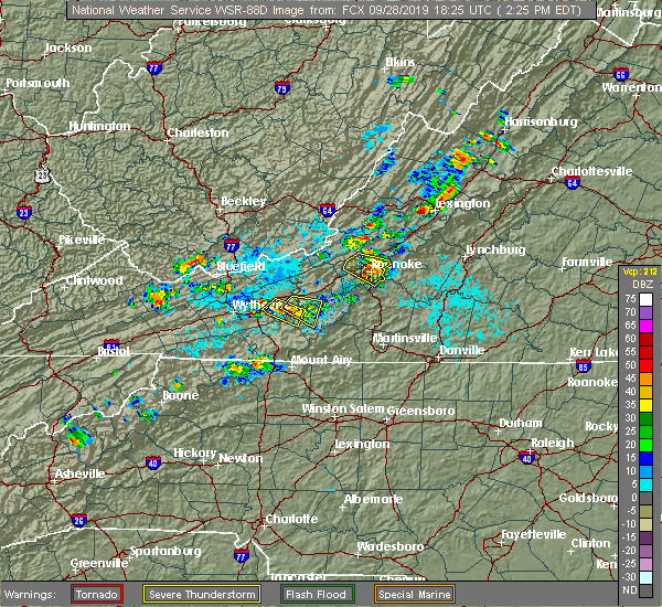 At 224 pm edt, a severe thunderstorm was located near allisonia, moving southeast at 5 mph (radar indicated). Hazards include 60 mph wind gusts and quarter size hail. Hail damage to vehicles is expected. Expect wind damage to roofs, siding, and trees. At 224 pm edt, a severe thunderstorm was located near allisonia, moving southeast at 5 mph (radar indicated). Hazards include 60 mph wind gusts and quarter size hail. Hail damage to vehicles is expected. Expect wind damage to roofs, siding, and trees.
|
| 9/14/2019 6:27 PM EDT |
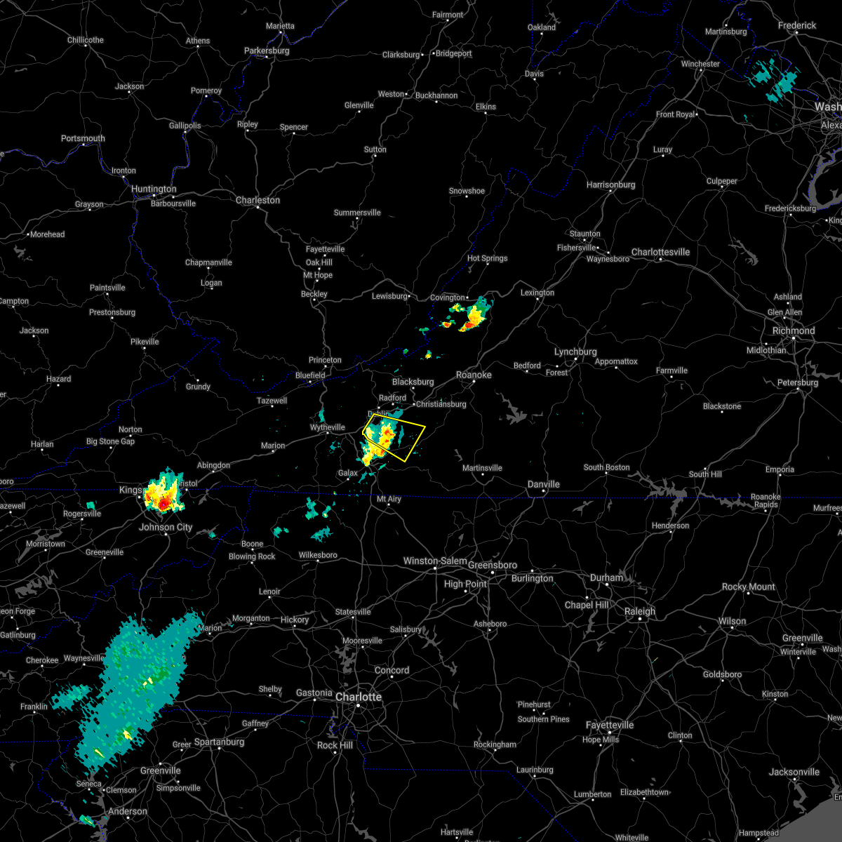 The severe thunderstorm warning for southeastern pulaski, southwestern floyd, northeastern carroll and southwestern montgomery counties will expire at 630 pm edt, the storm which prompted the warning has weakened below severe limits, and no longer poses an immediate threat to life or property. therefore, the warning will be allowed to expire. however heavy rain is still possible with this thunderstorm. when it is safe to do so, please send your reports of hail of any size, as well as reports of any wind damage, including downed trees or large limbs, to the national weather service by calling toll free at 1, 8 6 6, 2 1 5, 4 3 2 4. reports and pictures can also be shared on the national weather service blacksburg facebook page and on twitter. remember, a severe thunderstorm warning still remains in effect for southwestern floyd and eastern carroll counties until 700 pm edt. The severe thunderstorm warning for southeastern pulaski, southwestern floyd, northeastern carroll and southwestern montgomery counties will expire at 630 pm edt, the storm which prompted the warning has weakened below severe limits, and no longer poses an immediate threat to life or property. therefore, the warning will be allowed to expire. however heavy rain is still possible with this thunderstorm. when it is safe to do so, please send your reports of hail of any size, as well as reports of any wind damage, including downed trees or large limbs, to the national weather service by calling toll free at 1, 8 6 6, 2 1 5, 4 3 2 4. reports and pictures can also be shared on the national weather service blacksburg facebook page and on twitter. remember, a severe thunderstorm warning still remains in effect for southwestern floyd and eastern carroll counties until 700 pm edt.
|
| 9/14/2019 6:00 PM EDT |
 At 559 pm edt, a severe thunderstorm was located over allisonia, moving southeast at 25 mph (radar indicated). Hazards include 60 mph wind gusts and quarter size hail. Hail damage to vehicles is expected. expect wind damage to roofs, siding, and trees. Locations impacted include, pulaski, indian valley, willis, allisonia, and claytor lake state park. At 559 pm edt, a severe thunderstorm was located over allisonia, moving southeast at 25 mph (radar indicated). Hazards include 60 mph wind gusts and quarter size hail. Hail damage to vehicles is expected. expect wind damage to roofs, siding, and trees. Locations impacted include, pulaski, indian valley, willis, allisonia, and claytor lake state park.
|
| 9/14/2019 5:57 PM EDT |
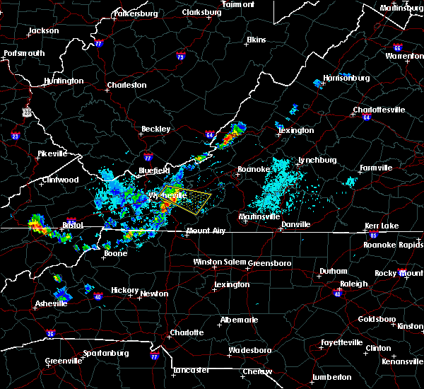 At 557 pm edt, severe thunderstorms were located along a line extending from allisonia to near byllesby, moving southeast at 20 mph (radar indicated). Hazards include 60 mph wind gusts and quarter size hail. Hail damage to vehicles is expected. Expect wind damage to roofs, siding, and trees. At 557 pm edt, severe thunderstorms were located along a line extending from allisonia to near byllesby, moving southeast at 20 mph (radar indicated). Hazards include 60 mph wind gusts and quarter size hail. Hail damage to vehicles is expected. Expect wind damage to roofs, siding, and trees.
|
| 9/14/2019 5:37 PM EDT |
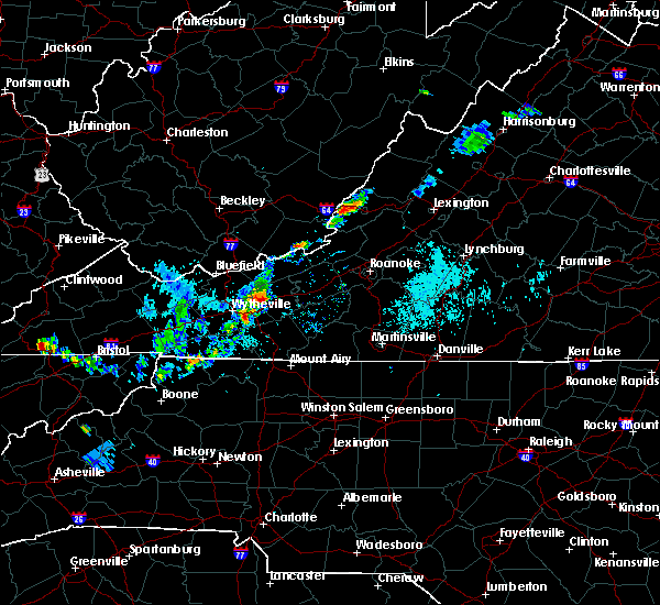 At 537 pm edt, a severe thunderstorm was located over pulaski, moving east at 30 mph (radar indicated). Hazards include 60 mph wind gusts and quarter size hail. Hail damage to vehicles is expected. Expect wind damage to roofs, siding, and trees. At 537 pm edt, a severe thunderstorm was located over pulaski, moving east at 30 mph (radar indicated). Hazards include 60 mph wind gusts and quarter size hail. Hail damage to vehicles is expected. Expect wind damage to roofs, siding, and trees.
|
| 8/22/2019 1:12 PM EDT |
 At 111 pm edt, severe thunderstorms were located along a line extending from near newport to pulaski, moving southeast at 20 mph (radar indicated). Hazards include 60 mph wind gusts. expect damage to roofs, siding, and trees At 111 pm edt, severe thunderstorms were located along a line extending from near newport to pulaski, moving southeast at 20 mph (radar indicated). Hazards include 60 mph wind gusts. expect damage to roofs, siding, and trees
|
| 8/9/2019 8:31 PM EDT |
 At 831 pm edt, a severe thunderstorm was located near allisonia, moving southeast at 30 mph (radar indicated). Hazards include 60 mph wind gusts. Expect damage to roofs, siding, and trees. Locations impacted include, pulaski, indian valley, willis, allisonia, and dugspur. At 831 pm edt, a severe thunderstorm was located near allisonia, moving southeast at 30 mph (radar indicated). Hazards include 60 mph wind gusts. Expect damage to roofs, siding, and trees. Locations impacted include, pulaski, indian valley, willis, allisonia, and dugspur.
|
| 8/9/2019 8:29 PM EDT |
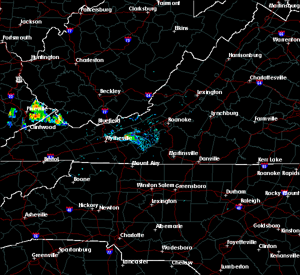 At 806 pm edt, a severe thunderstorm was located near dublin, moving southeast at 30 mph (radar indicated). Hazards include 60 mph wind gusts and quarter size hail. Hail damage to vehicles is expected. Expect wind damage to roofs, siding, and trees. At 806 pm edt, a severe thunderstorm was located near dublin, moving southeast at 30 mph (radar indicated). Hazards include 60 mph wind gusts and quarter size hail. Hail damage to vehicles is expected. Expect wind damage to roofs, siding, and trees.
|
| 8/9/2019 8:07 PM EDT |
 At 806 pm edt, a severe thunderstorm was located near dublin, moving southeast at 30 mph (radar indicated). Hazards include 60 mph wind gusts and quarter size hail. Hail damage to vehicles is expected. Expect wind damage to roofs, siding, and trees. At 806 pm edt, a severe thunderstorm was located near dublin, moving southeast at 30 mph (radar indicated). Hazards include 60 mph wind gusts and quarter size hail. Hail damage to vehicles is expected. Expect wind damage to roofs, siding, and trees.
|
| 8/1/2019 5:07 PM EDT |
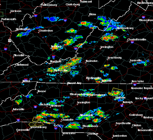 The severe thunderstorm warning for southeastern pulaski and southwestern montgomery counties will expire at 515 pm edt, the storm which prompted the warning has weakened below severe limits, and no longer poses an immediate threat to life or property. therefore, the warning will be allowed to expire. however heavy rain is still possible with this thunderstorm. when it is safe to do so, please send your reports of hail of any size, as well as reports of any wind damage, including downed trees or large limbs, to the national weather service by calling toll free at 1, 8 6 6, 2 1 5, 4 3 2 4. reports and pictures can also be shared on the national weather service blacksburg facebook page and on twitter. The severe thunderstorm warning for southeastern pulaski and southwestern montgomery counties will expire at 515 pm edt, the storm which prompted the warning has weakened below severe limits, and no longer poses an immediate threat to life or property. therefore, the warning will be allowed to expire. however heavy rain is still possible with this thunderstorm. when it is safe to do so, please send your reports of hail of any size, as well as reports of any wind damage, including downed trees or large limbs, to the national weather service by calling toll free at 1, 8 6 6, 2 1 5, 4 3 2 4. reports and pictures can also be shared on the national weather service blacksburg facebook page and on twitter.
|
| 8/1/2019 5:03 PM EDT |
 At 503 pm edt, a severe thunderstorm was located near draper, and is nearly stationary (radar indicated). Hazards include 60 mph wind gusts. Expect damage to roofs, siding, and trees. Locations impacted include, pulaski, graysontown, claytor dam, childress, and claytor lake state park. At 503 pm edt, a severe thunderstorm was located near draper, and is nearly stationary (radar indicated). Hazards include 60 mph wind gusts. Expect damage to roofs, siding, and trees. Locations impacted include, pulaski, graysontown, claytor dam, childress, and claytor lake state park.
|
| 8/1/2019 4:38 PM EDT |
 At 437 pm edt, a severe thunderstorm was located over claytor lake state park, moving east at 5 mph (radar indicated). Hazards include 60 mph wind gusts. Expect damage to roofs, siding, and trees. Locations impacted include, christiansburg, pulaski, indian valley, allisonia, and claytor dam. At 437 pm edt, a severe thunderstorm was located over claytor lake state park, moving east at 5 mph (radar indicated). Hazards include 60 mph wind gusts. Expect damage to roofs, siding, and trees. Locations impacted include, christiansburg, pulaski, indian valley, allisonia, and claytor dam.
|
| 8/1/2019 4:18 PM EDT |
 At 418 pm edt, a severe thunderstorm was located near claytor lake state park, moving east at 10 mph (radar indicated). Hazards include 60 mph wind gusts and quarter size hail. Hail damage to vehicles is expected. Expect wind damage to roofs, siding, and trees. At 418 pm edt, a severe thunderstorm was located near claytor lake state park, moving east at 10 mph (radar indicated). Hazards include 60 mph wind gusts and quarter size hail. Hail damage to vehicles is expected. Expect wind damage to roofs, siding, and trees.
|
| 7/22/2019 3:28 PM EDT |
 At 327 pm edt, severe thunderstorms were located along a line extending from near galax to graysontown, moving southeast at 20 mph (radar indicated). Hazards include 60 mph wind gusts. expect damage to roofs, siding, and trees At 327 pm edt, severe thunderstorms were located along a line extending from near galax to graysontown, moving southeast at 20 mph (radar indicated). Hazards include 60 mph wind gusts. expect damage to roofs, siding, and trees
|
| 5/29/2019 5:35 PM EDT |
 At 534 pm edt, severe thunderstorms were located along a line extending from near blacksburg to near ivanhoe to near bridle creek, moving east at 45 mph (radar indicated). Hazards include 60 mph wind gusts and quarter size hail. Hail damage to vehicles is expected. Expect wind damage to roofs, siding, and trees. At 534 pm edt, severe thunderstorms were located along a line extending from near blacksburg to near ivanhoe to near bridle creek, moving east at 45 mph (radar indicated). Hazards include 60 mph wind gusts and quarter size hail. Hail damage to vehicles is expected. Expect wind damage to roofs, siding, and trees.
|
| 5/26/2019 10:13 PM EDT |
 At 1012 pm edt, severe thunderstorms were located along a line extending from laurel branch to near maggie to fairlawn to near byllesby, moving east at 60 mph (radar indicated). Hazards include 60 mph wind gusts. expect damage to roofs, siding, and trees At 1012 pm edt, severe thunderstorms were located along a line extending from laurel branch to near maggie to fairlawn to near byllesby, moving east at 60 mph (radar indicated). Hazards include 60 mph wind gusts. expect damage to roofs, siding, and trees
|
| 5/26/2019 9:58 PM EDT |
 At 956 pm edt, severe thunderstorms were located along a line extending from near bluestone dam to near lindside to near white gate to near crockett, moving east at 60 mph. this storm has a history of producing wind damage. trees have been reported down across tazewell and mercer counties (law enforcement). Hazards include 60 mph wind gusts. Expect damage to roofs, siding, and trees. Locations impacted include, radford, pulaski, wytheville, pearisburg, and dublin. At 956 pm edt, severe thunderstorms were located along a line extending from near bluestone dam to near lindside to near white gate to near crockett, moving east at 60 mph. this storm has a history of producing wind damage. trees have been reported down across tazewell and mercer counties (law enforcement). Hazards include 60 mph wind gusts. Expect damage to roofs, siding, and trees. Locations impacted include, radford, pulaski, wytheville, pearisburg, and dublin.
|
| 5/26/2019 9:40 PM EDT |
 At 939 pm edt, severe thunderstorms were located along a line extending from near flat top to near rocky gap to near atkins, moving east at 55 mph (radar indicated). Hazards include 60 mph wind gusts. expect damage to roofs, siding, and trees At 939 pm edt, severe thunderstorms were located along a line extending from near flat top to near rocky gap to near atkins, moving east at 55 mph (radar indicated). Hazards include 60 mph wind gusts. expect damage to roofs, siding, and trees
|
| 5/3/2019 4:59 PM EDT |
 At 458 pm edt, a severe thunderstorm was located over sylvatus, moving northeast at 30 mph (radar indicated). Hazards include 60 mph wind gusts and quarter size hail. Hail damage to vehicles is expected. Expect wind damage to roofs, siding, and trees. At 458 pm edt, a severe thunderstorm was located over sylvatus, moving northeast at 30 mph (radar indicated). Hazards include 60 mph wind gusts and quarter size hail. Hail damage to vehicles is expected. Expect wind damage to roofs, siding, and trees.
|
| 4/19/2019 5:50 PM EDT |
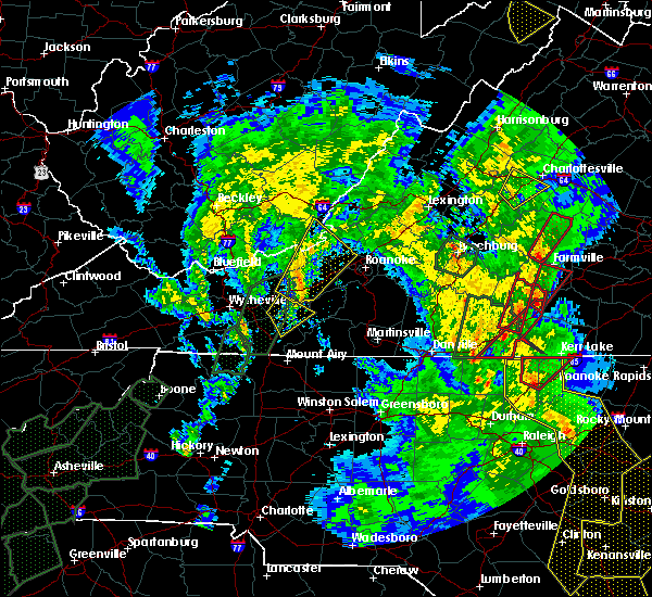 The severe thunderstorm warning for southeastern pulaski, west central floyd and northeastern carroll counties will expire at 600 pm edt, the storms which prompted the warning have moved out of the area. therefore, the warning will be allowed to expire. a tornado watch remains in effect until 800 pm edt for north central and northwestern north carolina, and south central, southwestern and west central virginia. when it is safe to do so, please send your reports of hail of any size, as well as reports of any wind damage, including downed trees or large limbs, to the national weather service by calling toll free at 1, 8 6 6, 2 1 5, 4 3 2 4. reports and pictures can also be shared on the national weather service blacksburg facebook page and on twitter. The severe thunderstorm warning for southeastern pulaski, west central floyd and northeastern carroll counties will expire at 600 pm edt, the storms which prompted the warning have moved out of the area. therefore, the warning will be allowed to expire. a tornado watch remains in effect until 800 pm edt for north central and northwestern north carolina, and south central, southwestern and west central virginia. when it is safe to do so, please send your reports of hail of any size, as well as reports of any wind damage, including downed trees or large limbs, to the national weather service by calling toll free at 1, 8 6 6, 2 1 5, 4 3 2 4. reports and pictures can also be shared on the national weather service blacksburg facebook page and on twitter.
|
| 4/19/2019 5:20 PM EDT |
 At 519 pm edt, severe thunderstorms were located along a line extending from near draper to near dugspur, moving north at 60 mph (radar indicated). Hazards include 60 mph wind gusts. Expect damage to roofs, siding, and trees. locations impacted include, indian valley, willis, allisonia, dugspur, and claytor lake state park. A tornado watch remains in effect until 800 pm edt for north central and northwestern north carolina, and south central, southwestern and west central virginia. At 519 pm edt, severe thunderstorms were located along a line extending from near draper to near dugspur, moving north at 60 mph (radar indicated). Hazards include 60 mph wind gusts. Expect damage to roofs, siding, and trees. locations impacted include, indian valley, willis, allisonia, dugspur, and claytor lake state park. A tornado watch remains in effect until 800 pm edt for north central and northwestern north carolina, and south central, southwestern and west central virginia.
|
| 4/19/2019 4:58 PM EDT |
 At 457 pm edt, severe thunderstorms were located along a line extending from woodlawn to near bottom, moving north at 50 mph (radar indicated). Hazards include 60 mph wind gusts. expect damage to roofs, siding, and trees At 457 pm edt, severe thunderstorms were located along a line extending from woodlawn to near bottom, moving north at 50 mph (radar indicated). Hazards include 60 mph wind gusts. expect damage to roofs, siding, and trees
|
| 4/19/2019 2:07 PM EDT |
 The severe thunderstorm warning for southern pulaski, east central wythe and central carroll counties will expire at 215 pm edt, the storm which prompted the warning has weakened below severe limits, and no longer poses an immediate threat to life or property. therefore, the warning will be allowed to expire. a tornado watch remains in effect until 500 pm edt for north central and northwestern north carolina, and southwestern and west central virginia. when it is safe to do so, please send your reports of hail of any size, as well as reports of any wind damage, including downed trees or large limbs, to the national weather service by calling toll free at 1, 8 6 6, 2 1 5, 4 3 2 4. reports and pictures can also be shared on the national weather service blacksburg facebook page and on twitter. The severe thunderstorm warning for southern pulaski, east central wythe and central carroll counties will expire at 215 pm edt, the storm which prompted the warning has weakened below severe limits, and no longer poses an immediate threat to life or property. therefore, the warning will be allowed to expire. a tornado watch remains in effect until 500 pm edt for north central and northwestern north carolina, and southwestern and west central virginia. when it is safe to do so, please send your reports of hail of any size, as well as reports of any wind damage, including downed trees or large limbs, to the national weather service by calling toll free at 1, 8 6 6, 2 1 5, 4 3 2 4. reports and pictures can also be shared on the national weather service blacksburg facebook page and on twitter.
|
| 4/19/2019 1:49 PM EDT |
 At 148 pm edt, a severe thunderstorm was located over woodlawn, moving northeast at 50 mph (radar indicated). Hazards include 60 mph wind gusts and quarter size hail. Hail damage to vehicles is expected. expect wind damage to roofs, siding, and trees. locations impacted include, hillsville, allisonia, patterson, fancy gap, and draper. A tornado watch remains in effect until 500 pm edt for north central and northwestern north carolina, and southwestern and west central virginia. At 148 pm edt, a severe thunderstorm was located over woodlawn, moving northeast at 50 mph (radar indicated). Hazards include 60 mph wind gusts and quarter size hail. Hail damage to vehicles is expected. expect wind damage to roofs, siding, and trees. locations impacted include, hillsville, allisonia, patterson, fancy gap, and draper. A tornado watch remains in effect until 500 pm edt for north central and northwestern north carolina, and southwestern and west central virginia.
|
| 4/19/2019 1:13 PM EDT |
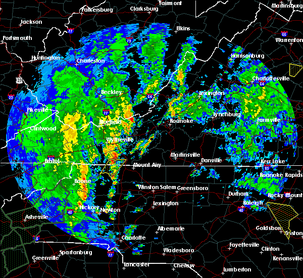 At 113 pm edt, a severe thunderstorm was located near galax, moving north at 45 mph (radar indicated). Hazards include 60 mph wind gusts and quarter size hail. Hail damage to vehicles is expected. Expect wind damage to roofs, siding, and trees. At 113 pm edt, a severe thunderstorm was located near galax, moving north at 45 mph (radar indicated). Hazards include 60 mph wind gusts and quarter size hail. Hail damage to vehicles is expected. Expect wind damage to roofs, siding, and trees.
|
| 4/14/2019 10:46 PM EDT |
 At 1045 pm edt, severe thunderstorms were located along a line extending from near glace to sylvatus, moving east at 35 mph (radar indicated). Hazards include 60 mph wind gusts. Expect damage to roofs, siding, and trees. locations impacted include, blacksburg, christiansburg, radford, pulaski, and pearisburg. this includes the following location virginia tech. A tornado watch remains in effect until 500 am edt for northwestern north carolina, and south central, southwestern and west central virginia. At 1045 pm edt, severe thunderstorms were located along a line extending from near glace to sylvatus, moving east at 35 mph (radar indicated). Hazards include 60 mph wind gusts. Expect damage to roofs, siding, and trees. locations impacted include, blacksburg, christiansburg, radford, pulaski, and pearisburg. this includes the following location virginia tech. A tornado watch remains in effect until 500 am edt for northwestern north carolina, and south central, southwestern and west central virginia.
|
| 4/14/2019 10:27 PM EDT |
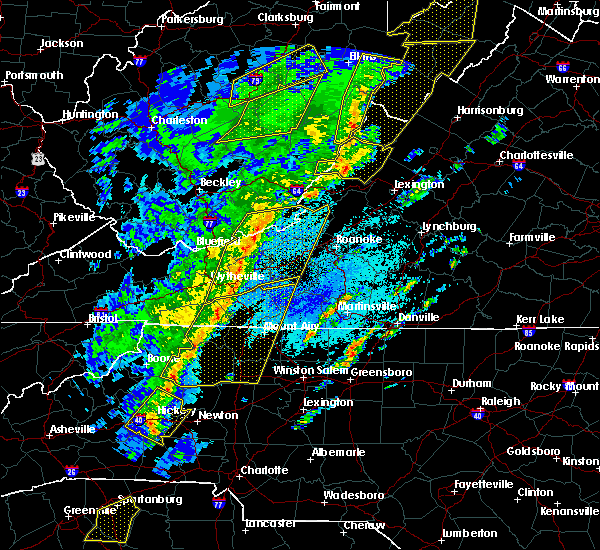 At 1026 pm edt, severe thunderstorms were located along a line extending from near union to byllesby, moving northeast at 50 mph (radar indicated). Hazards include 60 mph wind gusts. expect damage to roofs, siding, and trees At 1026 pm edt, severe thunderstorms were located along a line extending from near union to byllesby, moving northeast at 50 mph (radar indicated). Hazards include 60 mph wind gusts. expect damage to roofs, siding, and trees
|
| 4/8/2019 3:09 PM EDT |
 At 308 pm edt, severe thunderstorms were located along a line extending from prices fork to near ivanhoe, moving east at 20 mph (radar indicated). Hazards include 60 mph wind gusts and quarter size hail. Hail damage to vehicles is expected. expect wind damage to roofs, siding, and trees. locations impacted include, blacksburg, christiansburg, radford, pulaski, and dublin. This includes the following location virginia tech. At 308 pm edt, severe thunderstorms were located along a line extending from prices fork to near ivanhoe, moving east at 20 mph (radar indicated). Hazards include 60 mph wind gusts and quarter size hail. Hail damage to vehicles is expected. expect wind damage to roofs, siding, and trees. locations impacted include, blacksburg, christiansburg, radford, pulaski, and dublin. This includes the following location virginia tech.
|
| 4/8/2019 2:46 PM EDT |
 At 245 pm edt, severe thunderstorms were located along a line extending from near parrott to near cripple creek, moving east at 20 mph (radar indicated). Hazards include 60 mph wind gusts and quarter size hail. Hail damage to vehicles is expected. Expect wind damage to roofs, siding, and trees. At 245 pm edt, severe thunderstorms were located along a line extending from near parrott to near cripple creek, moving east at 20 mph (radar indicated). Hazards include 60 mph wind gusts and quarter size hail. Hail damage to vehicles is expected. Expect wind damage to roofs, siding, and trees.
|
| 8/31/2018 3:24 PM EDT | Tree down near baron springs post office in wythe county VA, 4.9 miles ENE of Allisonia, VA |
| 8/31/2018 3:24 PM EDT | Tree down near baron springs post office in wythe county VA, 4.9 miles ENE of Allisonia, VA |
| 8/8/2018 3:05 PM EDT |
 At 304 pm edt, severe thunderstorms were located along a line extending from near childress to near graysontown to allisonia, moving east at 25 mph (radar indicated). Hazards include 60 mph wind gusts and quarter size hail. Hail damage to vehicles is expected. Expect wind damage to roofs, siding, and trees. At 304 pm edt, severe thunderstorms were located along a line extending from near childress to near graysontown to allisonia, moving east at 25 mph (radar indicated). Hazards include 60 mph wind gusts and quarter size hail. Hail damage to vehicles is expected. Expect wind damage to roofs, siding, and trees.
|
| 8/8/2018 2:55 PM EDT |
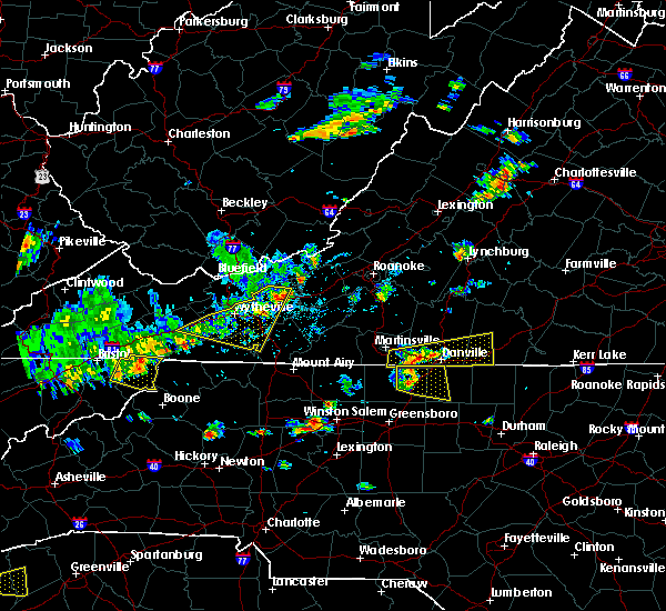 The severe thunderstorm warning for central pulaski, east central smyth, wythe, northwestern carroll and northeastern grayson counties will expire at 300 pm edt, the storms which prompted the warning will weaken below severe limits, and no longer pose an immediate threat to life or property by 3 pm. therefore, the warning will be allowed to expire. however gusty winds are still possible with these thunderstorms. when it is safe to do so, please send your reports of hail of any size, as well as reports of any wind damage, including downed trees or large limbs, to the national weather service by calling toll free at 1, 8 6 6, 2 1 5, 4 3 2 4. reports and pictures can also be shared on the national weather service blacksburg facebook page and on twitter. The severe thunderstorm warning for central pulaski, east central smyth, wythe, northwestern carroll and northeastern grayson counties will expire at 300 pm edt, the storms which prompted the warning will weaken below severe limits, and no longer pose an immediate threat to life or property by 3 pm. therefore, the warning will be allowed to expire. however gusty winds are still possible with these thunderstorms. when it is safe to do so, please send your reports of hail of any size, as well as reports of any wind damage, including downed trees or large limbs, to the national weather service by calling toll free at 1, 8 6 6, 2 1 5, 4 3 2 4. reports and pictures can also be shared on the national weather service blacksburg facebook page and on twitter.
|
| 8/8/2018 2:38 PM EDT |
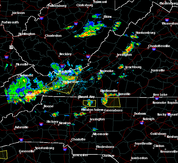 At 237 pm edt, severe thunderstorms were located along a line extending from near pulaski to wytheville to sugar grove moving east at 30 mph (radar indicated). Hazards include 60 mph wind gusts. Expect damage to roofs, siding, and trees. Locations impacted include, pulaski, wytheville, galax, marion, and dublin. At 237 pm edt, severe thunderstorms were located along a line extending from near pulaski to wytheville to sugar grove moving east at 30 mph (radar indicated). Hazards include 60 mph wind gusts. Expect damage to roofs, siding, and trees. Locations impacted include, pulaski, wytheville, galax, marion, and dublin.
|
| 8/8/2018 2:11 PM EDT |
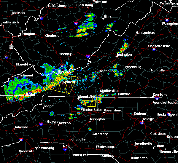 At 210 pm edt, severe thunderstorms were located along a line extending from near bland to near rural retreat to near mount rogers national recreation area, moving southeast at 30 mph (radar indicated). Hazards include 60 mph wind gusts and quarter size hail. Hail damage to vehicles is expected. expect wind damage to roofs, siding, and trees. Locations impacted include, pulaski, wytheville, galax, bland, and marion. At 210 pm edt, severe thunderstorms were located along a line extending from near bland to near rural retreat to near mount rogers national recreation area, moving southeast at 30 mph (radar indicated). Hazards include 60 mph wind gusts and quarter size hail. Hail damage to vehicles is expected. expect wind damage to roofs, siding, and trees. Locations impacted include, pulaski, wytheville, galax, bland, and marion.
|
| 8/8/2018 1:53 PM EDT |
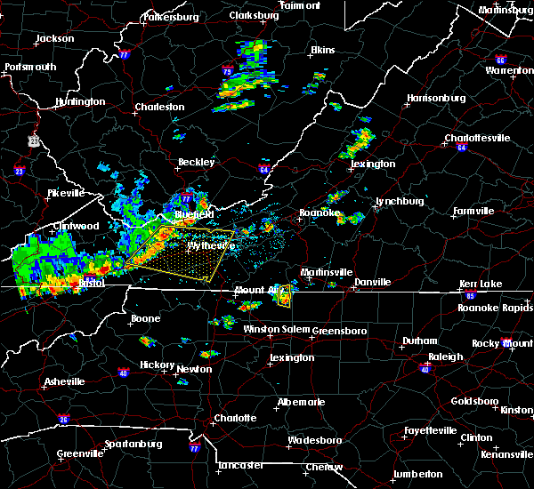 At 153 pm edt, a severe thunderstorm was located over nebo, moving east at 35 mph (radar indicated). Hazards include 60 mph wind gusts and quarter size hail. Hail damage to vehicles is expected. Expect wind damage to roofs, siding, and trees. At 153 pm edt, a severe thunderstorm was located over nebo, moving east at 35 mph (radar indicated). Hazards include 60 mph wind gusts and quarter size hail. Hail damage to vehicles is expected. Expect wind damage to roofs, siding, and trees.
|
| 7/6/2018 12:45 PM EDT |
 At 1245 pm edt, a severe thunderstorm was located over sylvatus, moving southeast at 20 mph (radar indicated). Hazards include 60 mph wind gusts and quarter size hail. Hail damage to vehicles is expected. expect wind damage to roofs, siding, and trees. Locations impacted include, hillsville, allisonia, patterson, dugspur, and grahams forge. At 1245 pm edt, a severe thunderstorm was located over sylvatus, moving southeast at 20 mph (radar indicated). Hazards include 60 mph wind gusts and quarter size hail. Hail damage to vehicles is expected. expect wind damage to roofs, siding, and trees. Locations impacted include, hillsville, allisonia, patterson, dugspur, and grahams forge.
|
| 7/6/2018 12:25 PM EDT |
 At 1224 pm edt, a severe thunderstorm was located over grahams forge, moving southeast at 20 mph (radar indicated). Hazards include 60 mph wind gusts and quarter size hail. Hail damage to vehicles is expected. Expect wind damage to roofs, siding, and trees. At 1224 pm edt, a severe thunderstorm was located over grahams forge, moving southeast at 20 mph (radar indicated). Hazards include 60 mph wind gusts and quarter size hail. Hail damage to vehicles is expected. Expect wind damage to roofs, siding, and trees.
|
| 4/15/2018 3:35 PM EDT |
 At 335 pm edt, a severe thunderstorm was located over kimballton, moving north at 55 mph (radar indicated). Hazards include 60 mph wind gusts and quarter size hail. Hail damage to vehicles is expected. expect wind damage to roofs, siding, and trees. locations impacted include, radford, pulaski, hillsville, dublin, and fancy gap. a tornado watch remains in effect until 700 pm edt for northwestern north carolina, and southwestern virginia. A tornado watch also remains in effect until 1100 pm edt for north central north carolina, and southwestern and west central virginia. At 335 pm edt, a severe thunderstorm was located over kimballton, moving north at 55 mph (radar indicated). Hazards include 60 mph wind gusts and quarter size hail. Hail damage to vehicles is expected. expect wind damage to roofs, siding, and trees. locations impacted include, radford, pulaski, hillsville, dublin, and fancy gap. a tornado watch remains in effect until 700 pm edt for northwestern north carolina, and southwestern virginia. A tornado watch also remains in effect until 1100 pm edt for north central north carolina, and southwestern and west central virginia.
|
| 4/15/2018 3:08 PM EDT |
 A severe thunderstorm warning remains in effect until 345 pm edt for pulaski. east central bland. carroll and northeastern wythe counties and the city of radford. At 307 pm edt, a severe thunderstorm was located over gunton park, moving north at 55 mph. A severe thunderstorm warning remains in effect until 345 pm edt for pulaski. east central bland. carroll and northeastern wythe counties and the city of radford. At 307 pm edt, a severe thunderstorm was located over gunton park, moving north at 55 mph.
|
| 4/15/2018 2:53 PM EDT |
 At 252 pm edt, a severe thunderstorm was located over ivanhoe, moving north at 55 mph (radar indicated). Hazards include 60 mph wind gusts and quarter size hail. Hail damage to vehicles is expected. expect wind damage to roofs, siding, and trees. locations impacted include, radford, pulaski, wytheville, galax, and bland. A tornado watch remains in effect until 700 pm edt for northwestern north carolina, and southwestern virginia. At 252 pm edt, a severe thunderstorm was located over ivanhoe, moving north at 55 mph (radar indicated). Hazards include 60 mph wind gusts and quarter size hail. Hail damage to vehicles is expected. expect wind damage to roofs, siding, and trees. locations impacted include, radford, pulaski, wytheville, galax, and bland. A tornado watch remains in effect until 700 pm edt for northwestern north carolina, and southwestern virginia.
|
| 4/15/2018 2:41 PM EDT |
 At 240 pm edt, a severe thunderstorm was located over fries, moving north at 55 mph (radar indicated). Hazards include 60 mph wind gusts and quarter size hail. Hail damage to vehicles is expected. Expect wind damage to roofs, siding, and trees. At 240 pm edt, a severe thunderstorm was located over fries, moving north at 55 mph (radar indicated). Hazards include 60 mph wind gusts and quarter size hail. Hail damage to vehicles is expected. Expect wind damage to roofs, siding, and trees.
|
| 10/23/2017 7:06 PM EDT |
 The severe thunderstorm warning for pulaski, southwestern giles, central floyd, east central bland, northeastern wythe and southwestern montgomery counties and the city of radford will expire at 715 pm edt, the storm which prompted the warning has weakened below severe limits, and has exited the warned area. therefore, the warning will be allowed to expire. a tornado watch remains in effect until 900 pm edt for north central north carolina. a tornado watch also remains in effect until 200 am edt for south central, southwestern and west central virginia. when it is safe to do so, please send your reports of hail of any size, as well as reports of any wind damage, including downed trees or large limbs, to the national weather service by calling toll free at 1, 8 6 6, 2 1 5, 4 3 2 4. reports and pictures can also be shared on the national weather service blacksburg facebook page and on twitter. The severe thunderstorm warning for pulaski, southwestern giles, central floyd, east central bland, northeastern wythe and southwestern montgomery counties and the city of radford will expire at 715 pm edt, the storm which prompted the warning has weakened below severe limits, and has exited the warned area. therefore, the warning will be allowed to expire. a tornado watch remains in effect until 900 pm edt for north central north carolina. a tornado watch also remains in effect until 200 am edt for south central, southwestern and west central virginia. when it is safe to do so, please send your reports of hail of any size, as well as reports of any wind damage, including downed trees or large limbs, to the national weather service by calling toll free at 1, 8 6 6, 2 1 5, 4 3 2 4. reports and pictures can also be shared on the national weather service blacksburg facebook page and on twitter.
|
| 10/23/2017 6:52 PM EDT |
 At 651 pm edt, a severe thunderstorm was located over claytor dam, moving northeast at 45 mph (radar indicated). Hazards include 60 mph wind gusts and quarter size hail. Hail damage to vehicles is expected. expect wind damage to roofs, siding, and trees. locations impacted include, radford, pulaski, dublin, floyd, and indian valley. a tornado watch remains in effect until 900 pm edt for north central and northwestern north carolina. A tornado watch also remains in effect until 200 am edt for south central, southwestern and west central virginia. At 651 pm edt, a severe thunderstorm was located over claytor dam, moving northeast at 45 mph (radar indicated). Hazards include 60 mph wind gusts and quarter size hail. Hail damage to vehicles is expected. expect wind damage to roofs, siding, and trees. locations impacted include, radford, pulaski, dublin, floyd, and indian valley. a tornado watch remains in effect until 900 pm edt for north central and northwestern north carolina. A tornado watch also remains in effect until 200 am edt for south central, southwestern and west central virginia.
|
| 10/23/2017 6:16 PM EDT |
 At 615 pm edt, a severe thunderstorm was located near sylvatus, moving northeast at 20 mph (radar indicated). Hazards include 60 mph wind gusts and quarter size hail. Hail damage to vehicles is expected. Expect wind damage to roofs, siding, and trees. At 615 pm edt, a severe thunderstorm was located near sylvatus, moving northeast at 20 mph (radar indicated). Hazards include 60 mph wind gusts and quarter size hail. Hail damage to vehicles is expected. Expect wind damage to roofs, siding, and trees.
|
| 7/18/2017 5:21 PM EDT |
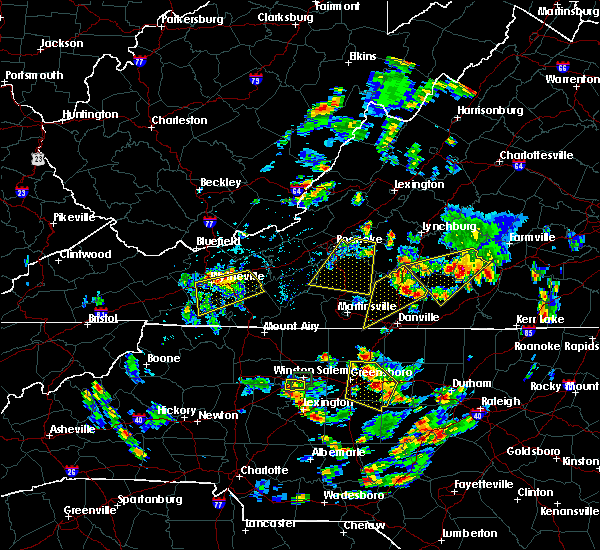 At 454 pm edt, a severe thunderstorm was located over max meadows, moving west at 15 mph (radar indicated). Hazards include 60 mph wind gusts and quarter size hail. Hail damage to vehicles is expected. expect wind damage to roofs, siding, and trees. Locations impacted include, pulaski, wytheville, max meadows, patterson, and speedwell. At 454 pm edt, a severe thunderstorm was located over max meadows, moving west at 15 mph (radar indicated). Hazards include 60 mph wind gusts and quarter size hail. Hail damage to vehicles is expected. expect wind damage to roofs, siding, and trees. Locations impacted include, pulaski, wytheville, max meadows, patterson, and speedwell.
|
| 7/18/2017 4:55 PM EDT |
 At 454 pm edt, a severe thunderstorm was located over max meadows, moving west at 15 mph (radar indicated). Hazards include 60 mph wind gusts and quarter size hail. Hail damage to vehicles is expected. expect wind damage to roofs, siding, and trees. Locations impacted include, pulaski, wytheville, max meadows, patterson, and speedwell. At 454 pm edt, a severe thunderstorm was located over max meadows, moving west at 15 mph (radar indicated). Hazards include 60 mph wind gusts and quarter size hail. Hail damage to vehicles is expected. expect wind damage to roofs, siding, and trees. Locations impacted include, pulaski, wytheville, max meadows, patterson, and speedwell.
|
| 7/18/2017 4:33 PM EDT |
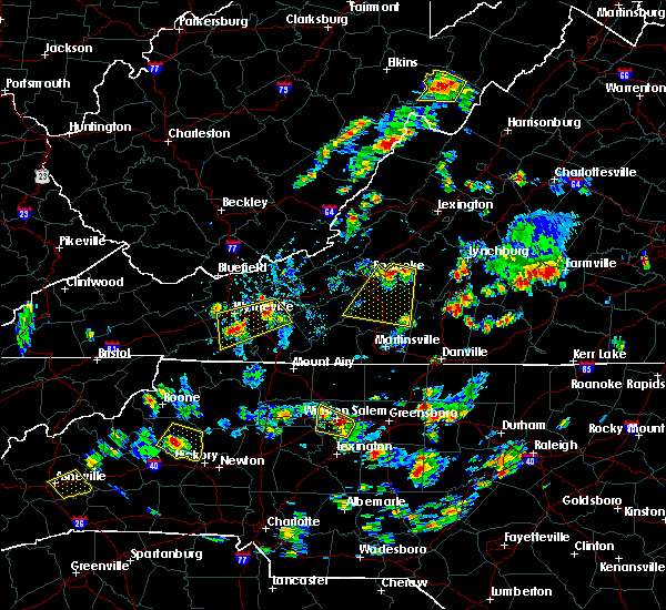 At 433 pm edt, a severe thunderstorm was located over grahams forge, moving west at 15 mph (radar indicated). Hazards include 60 mph wind gusts and quarter size hail. Hail damage to vehicles is expected. Expect wind damage to roofs, siding, and trees. At 433 pm edt, a severe thunderstorm was located over grahams forge, moving west at 15 mph (radar indicated). Hazards include 60 mph wind gusts and quarter size hail. Hail damage to vehicles is expected. Expect wind damage to roofs, siding, and trees.
|
| 3/1/2017 12:21 PM EST |
 The severe thunderstorm warning for pulaski, central smyth and wythe counties and the city of radford will expire at 1230 pm est, the storms which prompted the warning have weakened below severe limits, and have exited the warned area. therefore the warning will be allowed to expire. however heavy rain will continue as additional storms impact these areas moving in from the southwest. a severe thunderstorm watch remains in effect until 500 pm est for northwestern north carolina, southwestern and west central virginia, and southeastern west virginia. when it is safe to do so, please send your reports of hail of any size, as well as reports of any wind damage, including downed trees or large limbs, to the national weather service by calling toll free at 1, 8 6 6, 2 1 5, 4 3 2 4. reports and pictures can also be shared on the national weather service blacksburg facebook page and on twitter. The severe thunderstorm warning for pulaski, central smyth and wythe counties and the city of radford will expire at 1230 pm est, the storms which prompted the warning have weakened below severe limits, and have exited the warned area. therefore the warning will be allowed to expire. however heavy rain will continue as additional storms impact these areas moving in from the southwest. a severe thunderstorm watch remains in effect until 500 pm est for northwestern north carolina, southwestern and west central virginia, and southeastern west virginia. when it is safe to do so, please send your reports of hail of any size, as well as reports of any wind damage, including downed trees or large limbs, to the national weather service by calling toll free at 1, 8 6 6, 2 1 5, 4 3 2 4. reports and pictures can also be shared on the national weather service blacksburg facebook page and on twitter.
|
| 3/1/2017 12:04 PM EST |
 At 1204 pm est, severe thunderstorms were located along a line extending from near pulaski to near crockett to near thomas bridge, moving east at 70 mph (radar indicated). Hazards include 60 mph wind gusts. Expect damage to roofs, siding, and trees. Locations impacted include, radford, pulaski, wytheville, marion, and chilhowie. At 1204 pm est, severe thunderstorms were located along a line extending from near pulaski to near crockett to near thomas bridge, moving east at 70 mph (radar indicated). Hazards include 60 mph wind gusts. Expect damage to roofs, siding, and trees. Locations impacted include, radford, pulaski, wytheville, marion, and chilhowie.
|
| 3/1/2017 11:46 AM EST |
 At 1145 am est, severe thunderstorms were located along a line extending from near bland to nebo to quarry, moving southeast at 15 mph (radar indicated). Hazards include 60 mph wind gusts. Expect damage to roofs, siding, and trees. Locations impacted include, radford, pulaski, wytheville, marion, and chilhowie. At 1145 am est, severe thunderstorms were located along a line extending from near bland to nebo to quarry, moving southeast at 15 mph (radar indicated). Hazards include 60 mph wind gusts. Expect damage to roofs, siding, and trees. Locations impacted include, radford, pulaski, wytheville, marion, and chilhowie.
|
| 3/1/2017 11:30 AM EST |
 At 1130 am est, severe thunderstorms were located along a line extending from bland to nebo to near saltville, moving southeast at 15 mph (radar indicated). Hazards include 60 mph wind gusts. expect damage to roofs, siding, and trees At 1130 am est, severe thunderstorms were located along a line extending from bland to nebo to near saltville, moving southeast at 15 mph (radar indicated). Hazards include 60 mph wind gusts. expect damage to roofs, siding, and trees
|
| 9/29/2016 2:45 PM EDT |
 At 245 pm edt, a severe thunderstorm was located over dugspur, moving northeast at 15 mph (radar indicated). Hazards include quarter size hail. Damage to vehicles is expected. Locations impacted include, hillsville, dublin, indian valley, gladesboro, and graysontown. At 245 pm edt, a severe thunderstorm was located over dugspur, moving northeast at 15 mph (radar indicated). Hazards include quarter size hail. Damage to vehicles is expected. Locations impacted include, hillsville, dublin, indian valley, gladesboro, and graysontown.
|
| 9/29/2016 2:39 PM EDT |
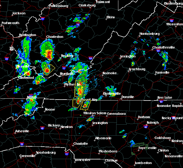 At 238 pm edt, a severe thunderstorm was located near hillsville, moving north at 15 mph (radar indicated). Hazards include quarter size hail. Damage to vehicles is expected. Locations impacted include, pulaski, hillsville, dublin, allisonia, and fancy gap. At 238 pm edt, a severe thunderstorm was located near hillsville, moving north at 15 mph (radar indicated). Hazards include quarter size hail. Damage to vehicles is expected. Locations impacted include, pulaski, hillsville, dublin, allisonia, and fancy gap.
|
| 9/29/2016 2:18 PM EDT |
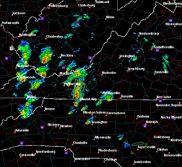 The national weather service in blacksburg has issued a * severe thunderstorm warning for. southeastern pulaski county in southwestern virginia. southwestern floyd county in southwestern virginia. carroll county in southwestern virginia. Until 315 pm edt. The national weather service in blacksburg has issued a * severe thunderstorm warning for. southeastern pulaski county in southwestern virginia. southwestern floyd county in southwestern virginia. carroll county in southwestern virginia. Until 315 pm edt.
|
| 9/29/2016 2:18 PM EDT |
 At 217 pm edt, severe thunderstorms were located between fancy gap and hillsville, moving north at 15 mph (radar indicated). Hazards include quarter size hail. damage to vehicles is expected At 217 pm edt, severe thunderstorms were located between fancy gap and hillsville, moving north at 15 mph (radar indicated). Hazards include quarter size hail. damage to vehicles is expected
|
| 7/4/2016 10:28 PM EDT |
 At 1027 pm edt, severe thunderstorms were located along a line extending from dublin to near byllesby, moving southeast at 25 mph (radar indicated). Hazards include 60 mph wind gusts. Expect damage to roofs. siding. And trees. At 1027 pm edt, severe thunderstorms were located along a line extending from dublin to near byllesby, moving southeast at 25 mph (radar indicated). Hazards include 60 mph wind gusts. Expect damage to roofs. siding. And trees.
|
| 7/4/2016 9:41 PM EDT |
 The severe thunderstorm warning for pulaski. eastern giles. northeastern wythe and east central bland counties will expire at 945 pm edt. the storms which prompted the warning have weakened below severe limits. and have exited the warned area. therefore the warning will be allowed to expire. However gusty winds and heavy rain are still. The severe thunderstorm warning for pulaski. eastern giles. northeastern wythe and east central bland counties will expire at 945 pm edt. the storms which prompted the warning have weakened below severe limits. and have exited the warned area. therefore the warning will be allowed to expire. However gusty winds and heavy rain are still.
|
| 7/4/2016 9:39 PM EDT |
 At 939 pm edt, severe thunderstorms were located along a line extending from near mc coy to near claytor lake state park to near woodlawn, moving southeast at 45 mph (radar indicated). Hazards include 60 mph wind gusts. Expect damage to roofs. siding. and trees. Locations impacted include, pulaski, dublin, pembroke, poplar hill, and allisonia. At 939 pm edt, severe thunderstorms were located along a line extending from near mc coy to near claytor lake state park to near woodlawn, moving southeast at 45 mph (radar indicated). Hazards include 60 mph wind gusts. Expect damage to roofs. siding. and trees. Locations impacted include, pulaski, dublin, pembroke, poplar hill, and allisonia.
|
| 7/4/2016 9:04 PM EDT |
 At 902 pm edt, severe thunderstorms were located along a line extending from near athens through rocky gap to near favonia, moving southeast at 45 mph (radar indicated). Hazards include 60 mph wind gusts. Expect wind damage to roofs. siding. and trees. claytor lake is in the path of this storm. Do not get caught out on the water. At 902 pm edt, severe thunderstorms were located along a line extending from near athens through rocky gap to near favonia, moving southeast at 45 mph (radar indicated). Hazards include 60 mph wind gusts. Expect wind damage to roofs. siding. and trees. claytor lake is in the path of this storm. Do not get caught out on the water.
|
| 6/23/2016 9:29 PM EDT |
 At 929 pm edt, severe thunderstorms were located along a line extending from gunton park to mouth of wilson to bristol va, moving southeast at 55 mph (radar indicated). Hazards include 60 mph wind gusts. Expect damage to roofs. siding. And trees. At 929 pm edt, severe thunderstorms were located along a line extending from gunton park to mouth of wilson to bristol va, moving southeast at 55 mph (radar indicated). Hazards include 60 mph wind gusts. Expect damage to roofs. siding. And trees.
|
| 6/23/2016 8:48 PM EDT |
 At 848 pm edt, severe thunderstorms were located along a line extending from near christiansburg to copper valley to near max meadows, moving east at 65 mph (radar indicated). Hazards include 60 mph wind gusts. Expect damage to roofs. siding. and trees. Locations impacted include, christiansburg, radford, pulaski, wytheville, and bland. At 848 pm edt, severe thunderstorms were located along a line extending from near christiansburg to copper valley to near max meadows, moving east at 65 mph (radar indicated). Hazards include 60 mph wind gusts. Expect damage to roofs. siding. and trees. Locations impacted include, christiansburg, radford, pulaski, wytheville, and bland.
|
| 6/23/2016 8:35 PM EDT |
 At 834 pm edt, severe thunderstorms were located along a line extending from near fairlawn to draper to near favonia, moving southeast at 45 mph (radar indicated). Hazards include 60 mph wind gusts. Expect damage to roofs. siding. and trees. Locations impacted include, blacksburg, christiansburg, radford, pulaski, and wytheville. At 834 pm edt, severe thunderstorms were located along a line extending from near fairlawn to draper to near favonia, moving southeast at 45 mph (radar indicated). Hazards include 60 mph wind gusts. Expect damage to roofs. siding. and trees. Locations impacted include, blacksburg, christiansburg, radford, pulaski, and wytheville.
|
| 6/23/2016 8:12 PM EDT |
 At 812 pm edt, severe thunderstorms were located along a line extending from narrows to mechanicsburg to gratton, moving southeast at 45 mph (radar indicated). Hazards include 60 mph wind gusts. Expect damage to roofs. siding. And trees. At 812 pm edt, severe thunderstorms were located along a line extending from narrows to mechanicsburg to gratton, moving southeast at 45 mph (radar indicated). Hazards include 60 mph wind gusts. Expect damage to roofs. siding. And trees.
|
| 6/16/2016 10:23 PM EDT |
 The severe thunderstorm warning for southeastern pulaski, southeastern roanoke, franklin, floyd and south central montgomery counties will expire at 1030 pm edt, the storms which prompted the warning have weakened below severe limits, and have exited the warned area. therefore the warning will be allowed to expire. however gusty winds and heavy rain are still possible with these thunderstorms. when it is safe to do so, please send your reports of hail of any size, as well as any reports of wind damage, including downed trees or large limbs, to the national weather service by calling toll free at 1, 8 6 6, 2 1 5, 4 3 2 4. reports and pictures can also be shared on the national weather service blacksburg facebook page and on twitter. The severe thunderstorm warning for southeastern pulaski, southeastern roanoke, franklin, floyd and south central montgomery counties will expire at 1030 pm edt, the storms which prompted the warning have weakened below severe limits, and have exited the warned area. therefore the warning will be allowed to expire. however gusty winds and heavy rain are still possible with these thunderstorms. when it is safe to do so, please send your reports of hail of any size, as well as any reports of wind damage, including downed trees or large limbs, to the national weather service by calling toll free at 1, 8 6 6, 2 1 5, 4 3 2 4. reports and pictures can also be shared on the national weather service blacksburg facebook page and on twitter.
|
| 6/16/2016 10:13 PM EDT |
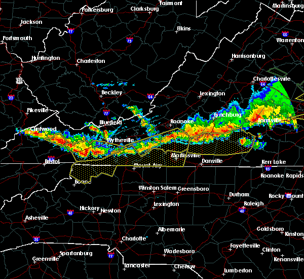 At 1012 pm edt, severe thunderstorms were located along a line extending from north shore to near callaway to near floyd, moving southeast at 40 mph (radar indicated). Hazards include 60 mph wind gusts and nickel size hail. Expect damage to roofs. siding. and trees. Locations impacted include, rocky mount, floyd, boones mill, willis, and penhook. At 1012 pm edt, severe thunderstorms were located along a line extending from north shore to near callaway to near floyd, moving southeast at 40 mph (radar indicated). Hazards include 60 mph wind gusts and nickel size hail. Expect damage to roofs. siding. and trees. Locations impacted include, rocky mount, floyd, boones mill, willis, and penhook.
|
| 6/16/2016 9:48 PM EDT |
 At 948 pm edt, severe thunderstorms were located along a line extending from near vinton to near bent mountain to near childress, moving southeast at 40 mph (radar indicated). Hazards include 60 mph wind gusts and quarter size hail. Hail damage to vehicles is expected. Expect wind damage to roofs, siding, and trees. At 948 pm edt, severe thunderstorms were located along a line extending from near vinton to near bent mountain to near childress, moving southeast at 40 mph (radar indicated). Hazards include 60 mph wind gusts and quarter size hail. Hail damage to vehicles is expected. Expect wind damage to roofs, siding, and trees.
|
| 7/13/2015 7:19 PM EDT |
 At 718 pm edt, severe thunderstorms were located along a line extending from near prices fork to near allisonia, moving east at 65 mph (radar indicated). Hazards include 60 mph wind gusts and quarter size hail. Hail damage to vehicles is expected. expect wind damage to roofs, siding and trees. Locations impacted include, pulaski, dublin, allisonia, fairlawn, and graysontown. At 718 pm edt, severe thunderstorms were located along a line extending from near prices fork to near allisonia, moving east at 65 mph (radar indicated). Hazards include 60 mph wind gusts and quarter size hail. Hail damage to vehicles is expected. expect wind damage to roofs, siding and trees. Locations impacted include, pulaski, dublin, allisonia, fairlawn, and graysontown.
|
| 7/13/2015 7:13 PM EDT | 911 call center reports 1 tree down along panther creek road near the community of dougspou in carroll county VA, 6.8 miles NW of Allisonia, VA |
| 7/13/2015 6:32 PM EDT |
 At 630 pm edt, severe thunderstorms were located along a line extending from suiter to near chilhowie, moving southeast at 60 mph (radar indicated). Hazards include 60 mph wind gusts and quarter size hail. Hail damage to vehicles is expected. Expect wind damage to roofs, siding and trees. At 630 pm edt, severe thunderstorms were located along a line extending from suiter to near chilhowie, moving southeast at 60 mph (radar indicated). Hazards include 60 mph wind gusts and quarter size hail. Hail damage to vehicles is expected. Expect wind damage to roofs, siding and trees.
|
| 6/8/2015 4:35 PM EDT |
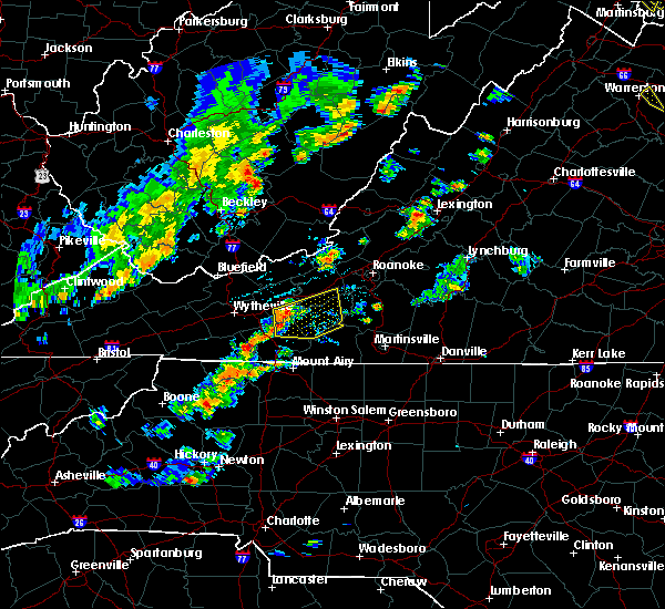 At 434 pm edt, a severe thunderstorm was located near dugspur, moving east at 30 mph (radar indicated). Hazards include 60 mph wind gusts. Expect damage to roofs. Siding and trees. At 434 pm edt, a severe thunderstorm was located near dugspur, moving east at 30 mph (radar indicated). Hazards include 60 mph wind gusts. Expect damage to roofs. Siding and trees.
|
| 7/2/2012 12:15 AM EDT | Several trees blocking little reed island rd in wythe county VA, 3.8 miles ENE of Allisonia, VA |
| 7/2/2012 12:15 AM EDT | Tree blocking little reed island rd in wythe county VA, 3.8 miles ENE of Allisonia, VA |
| 6/30/2012 9:10 PM EDT | Tree down on power line on castleton rd in wythe county VA, 7.2 miles NE of Allisonia, VA |
| 5/3/2012 5:30 PM EDT | Quarter sized hail reported 5.2 miles ENE of Allisonia, VA, nickel to quarter hail. |
| 5/3/2012 4:30 PM EDT | Quarter sized hail reported 5.2 miles ENE of Allisonia, VA, nickel to quarter hail. |
Hail Maps for Allisonia, VA
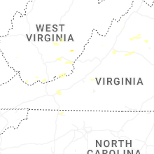
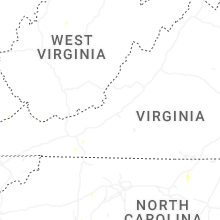


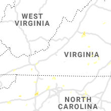


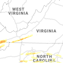


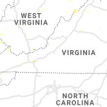


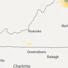
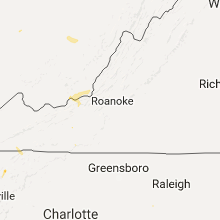


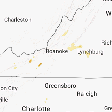


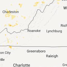


Connect with Interactive Hail Maps