

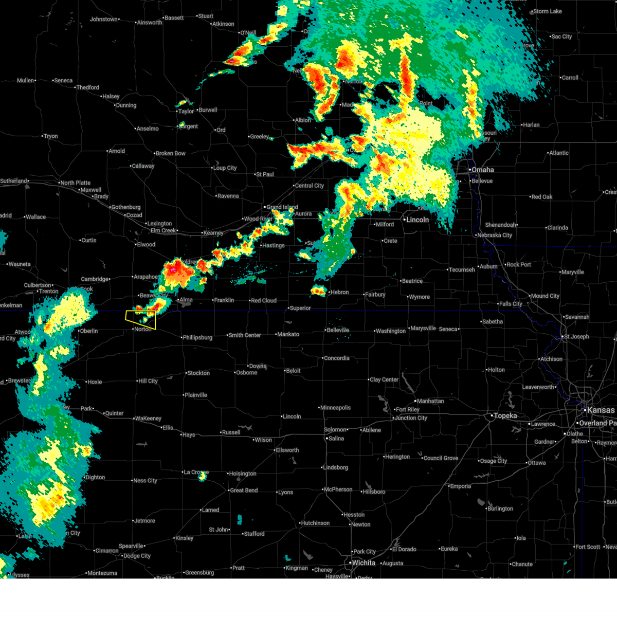
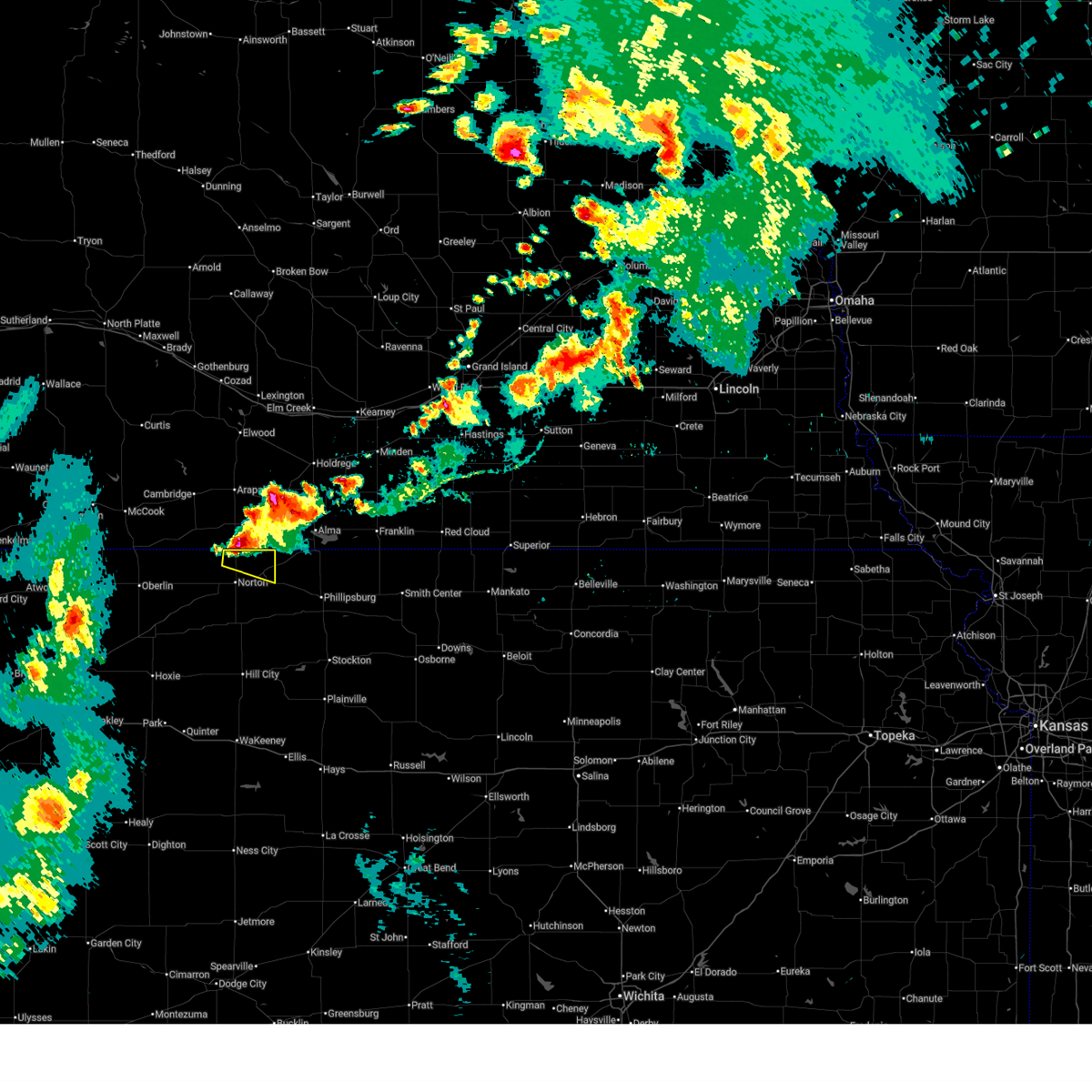
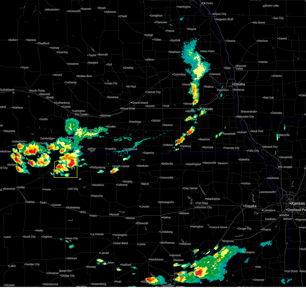
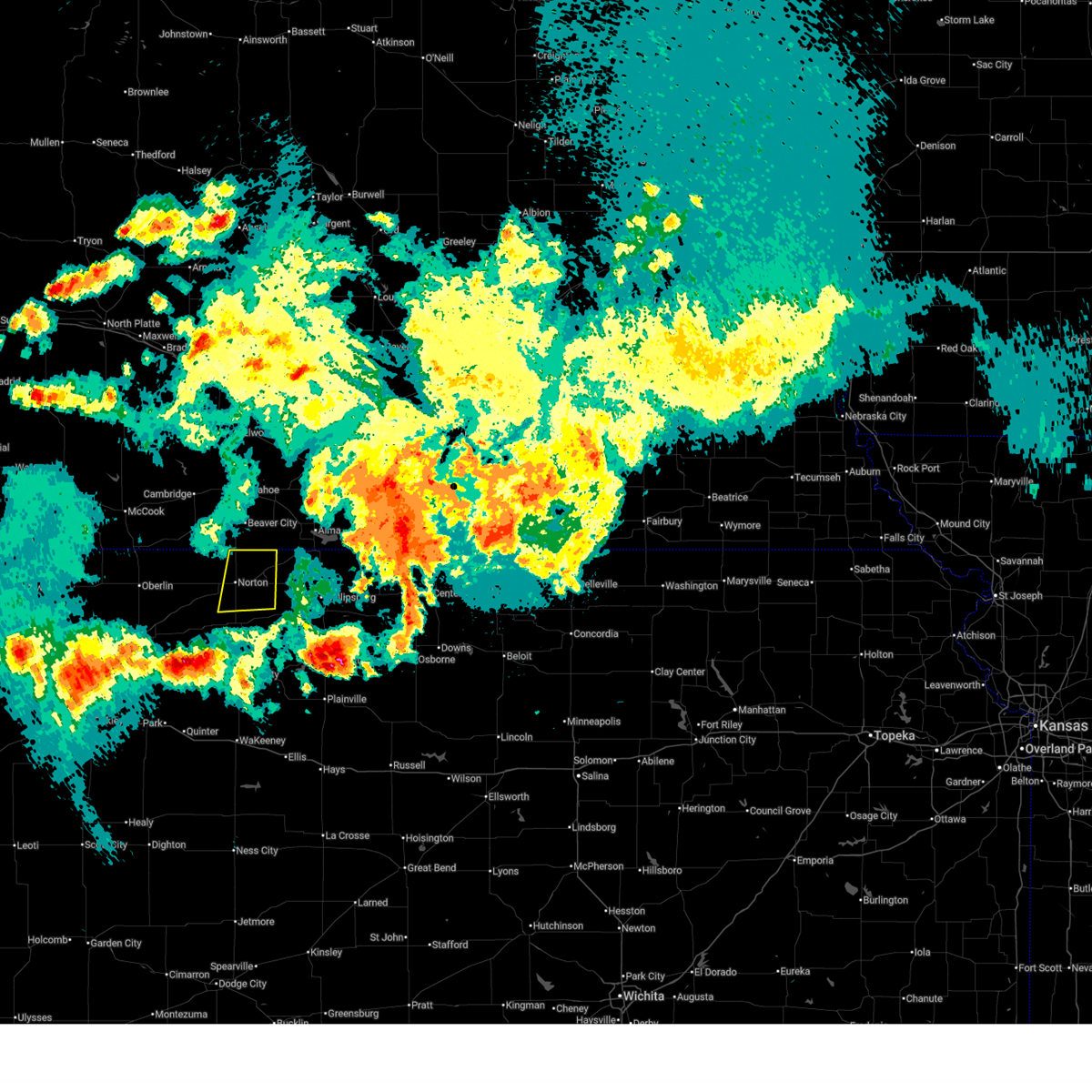
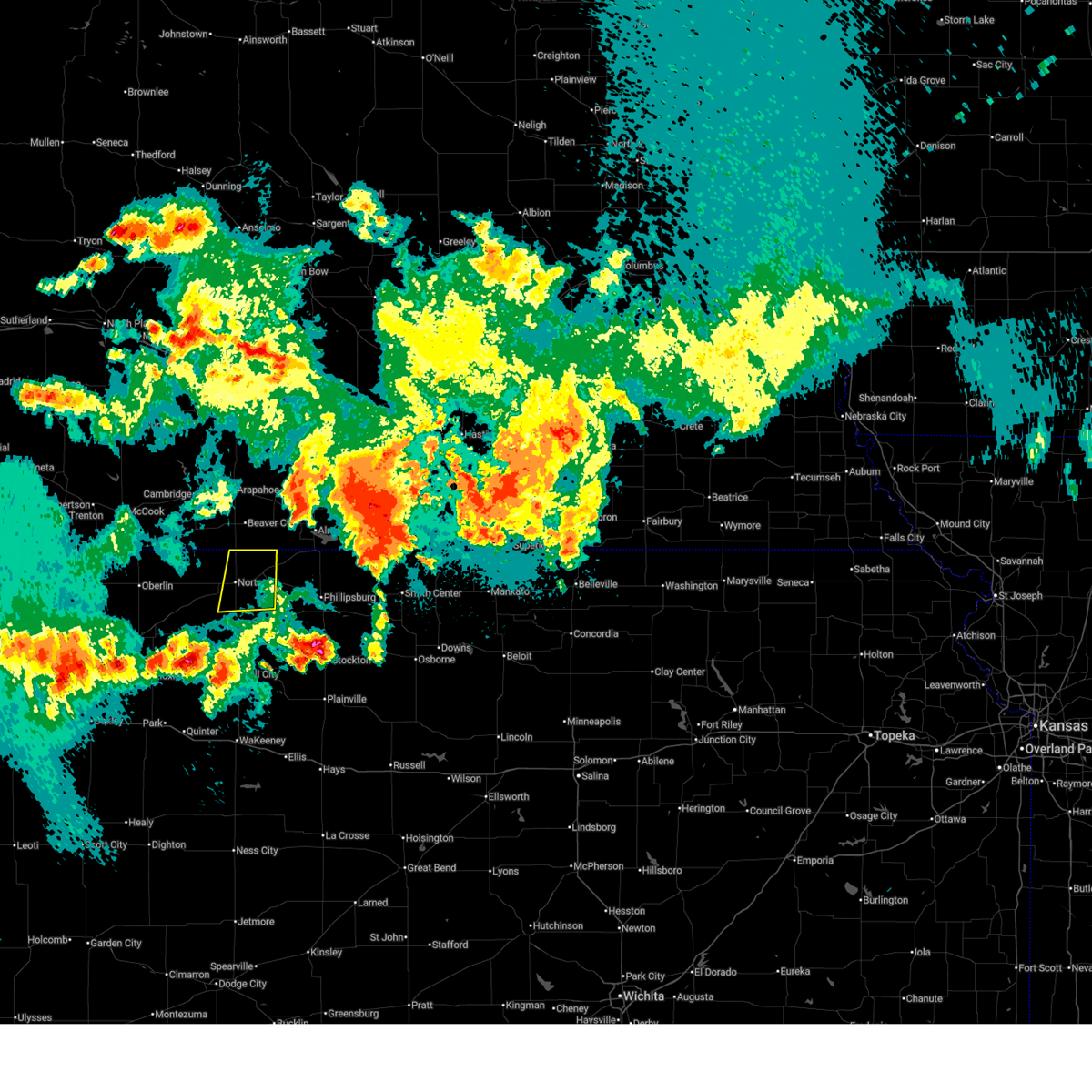
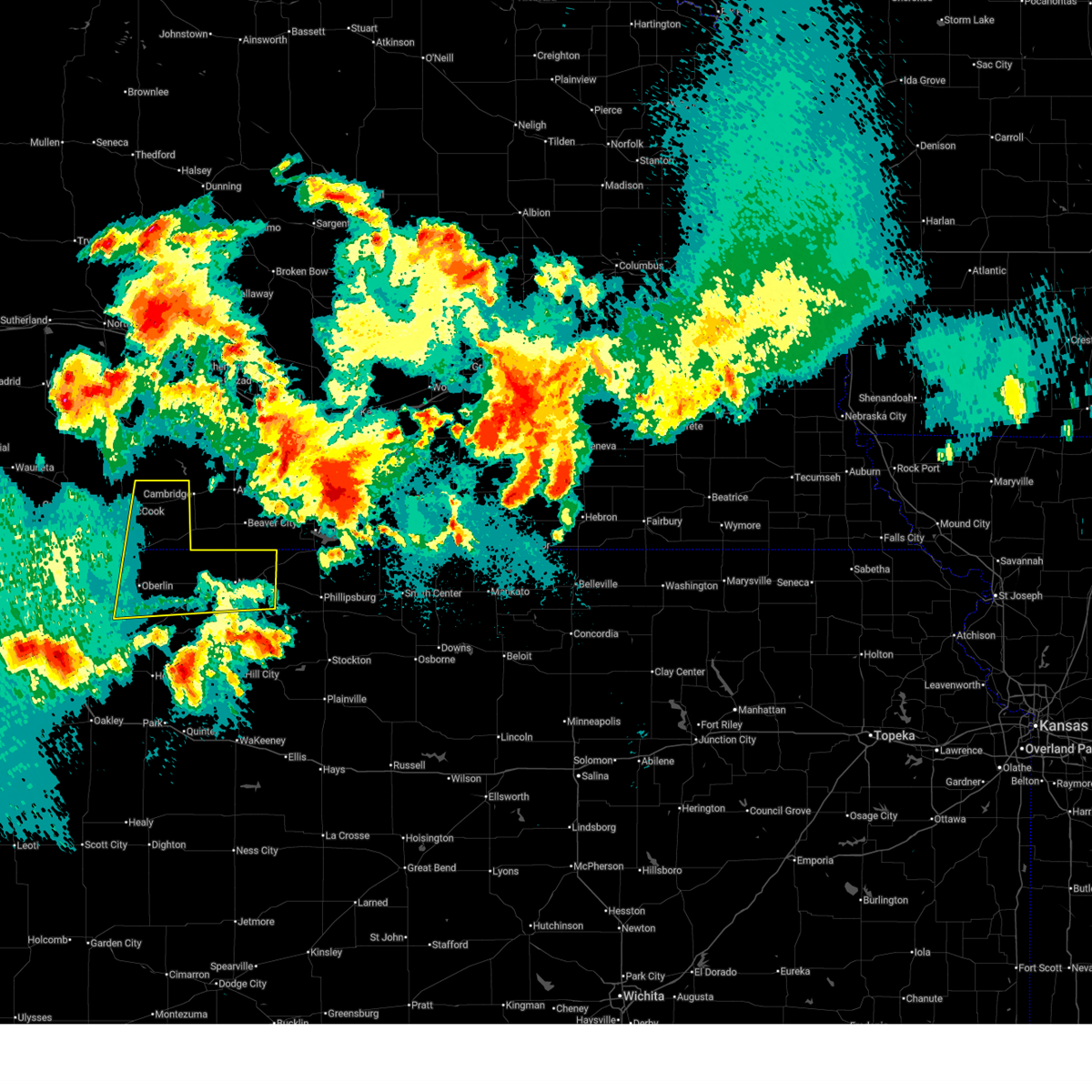
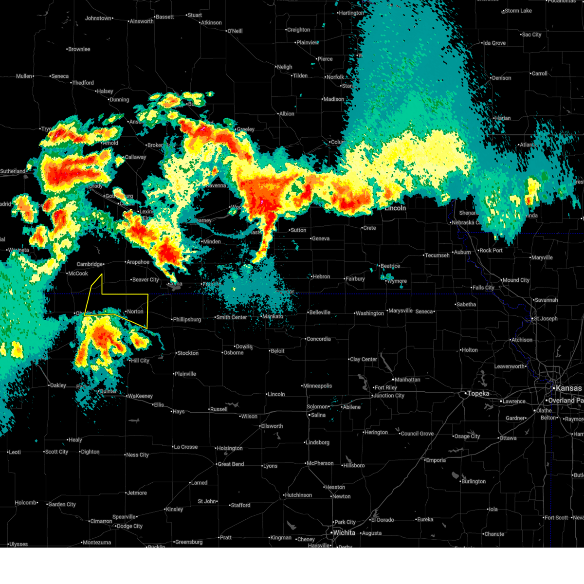
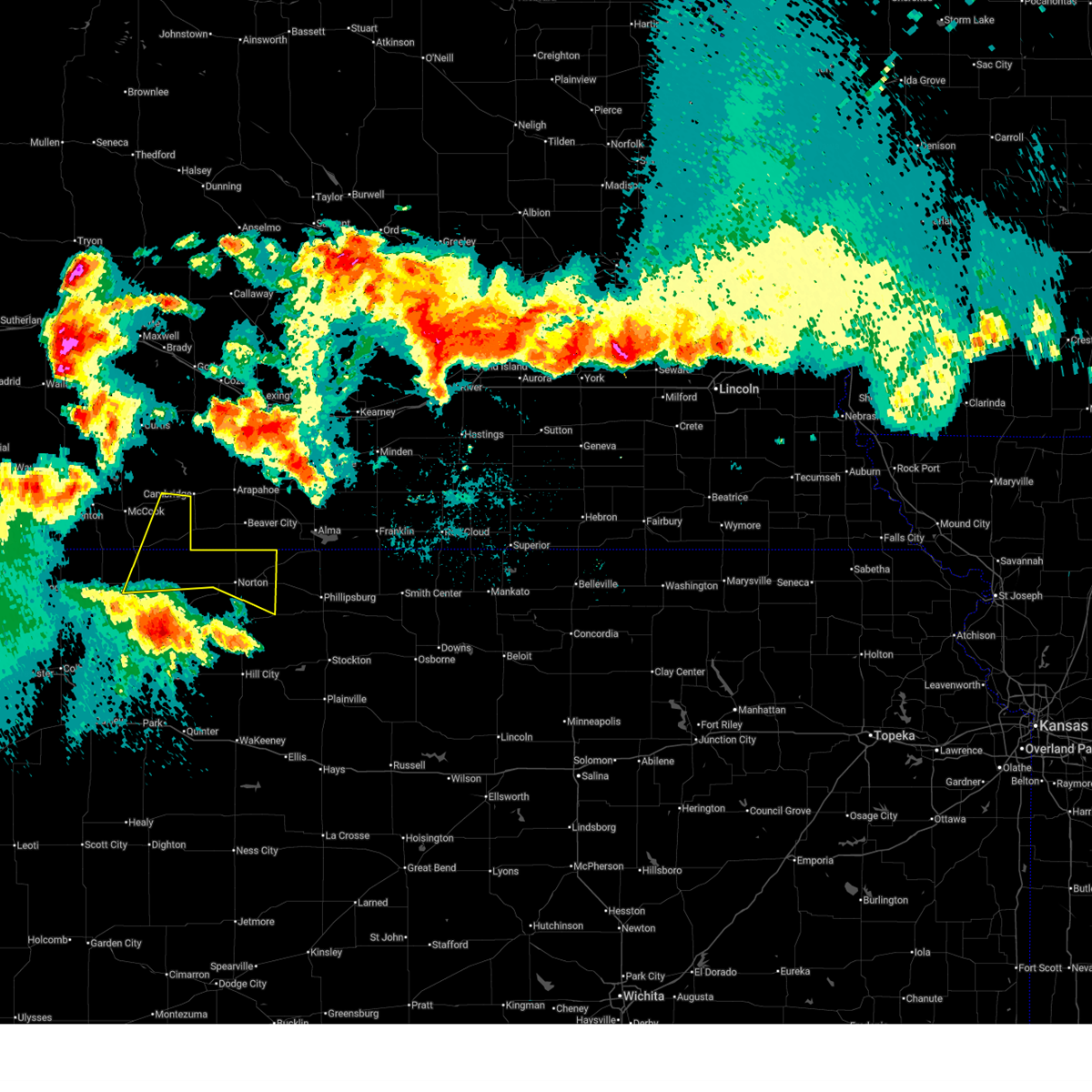
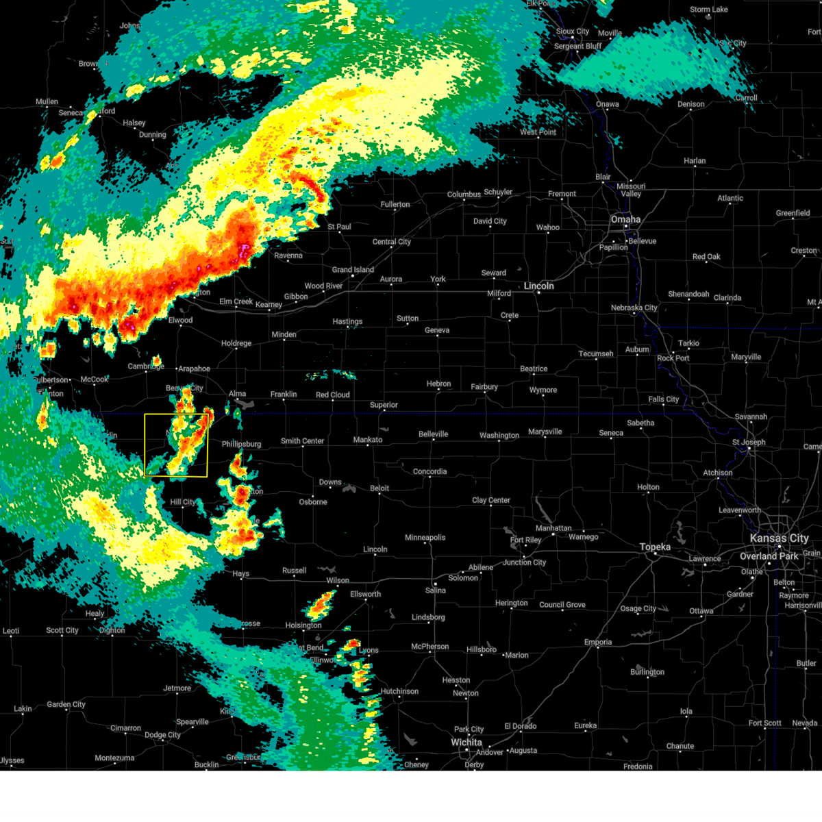
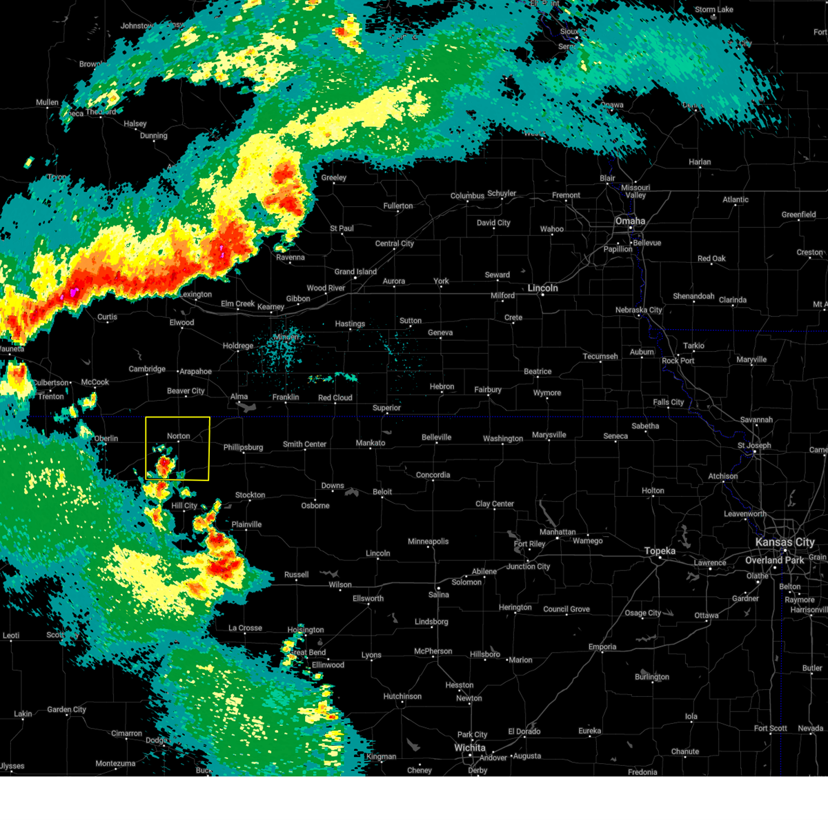
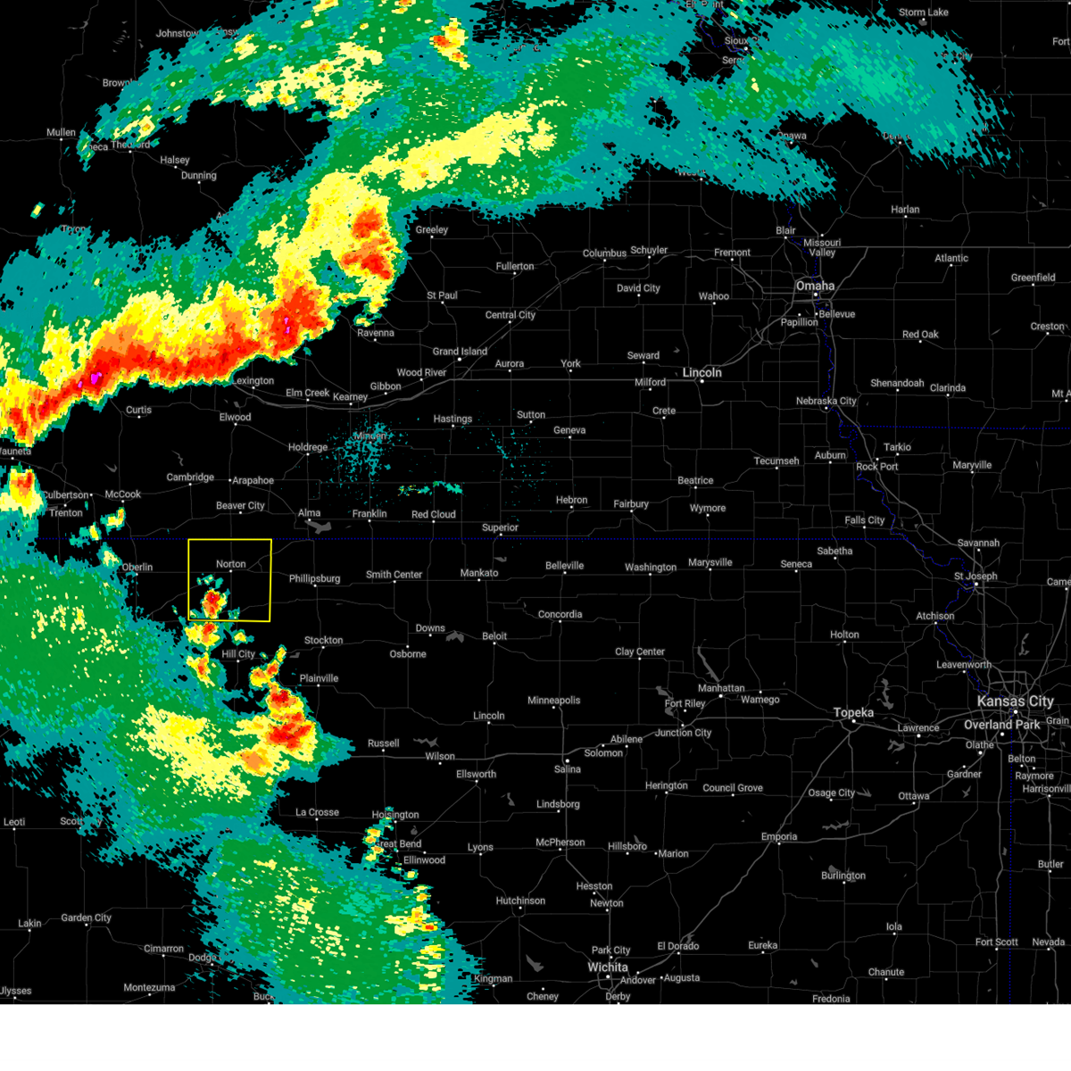
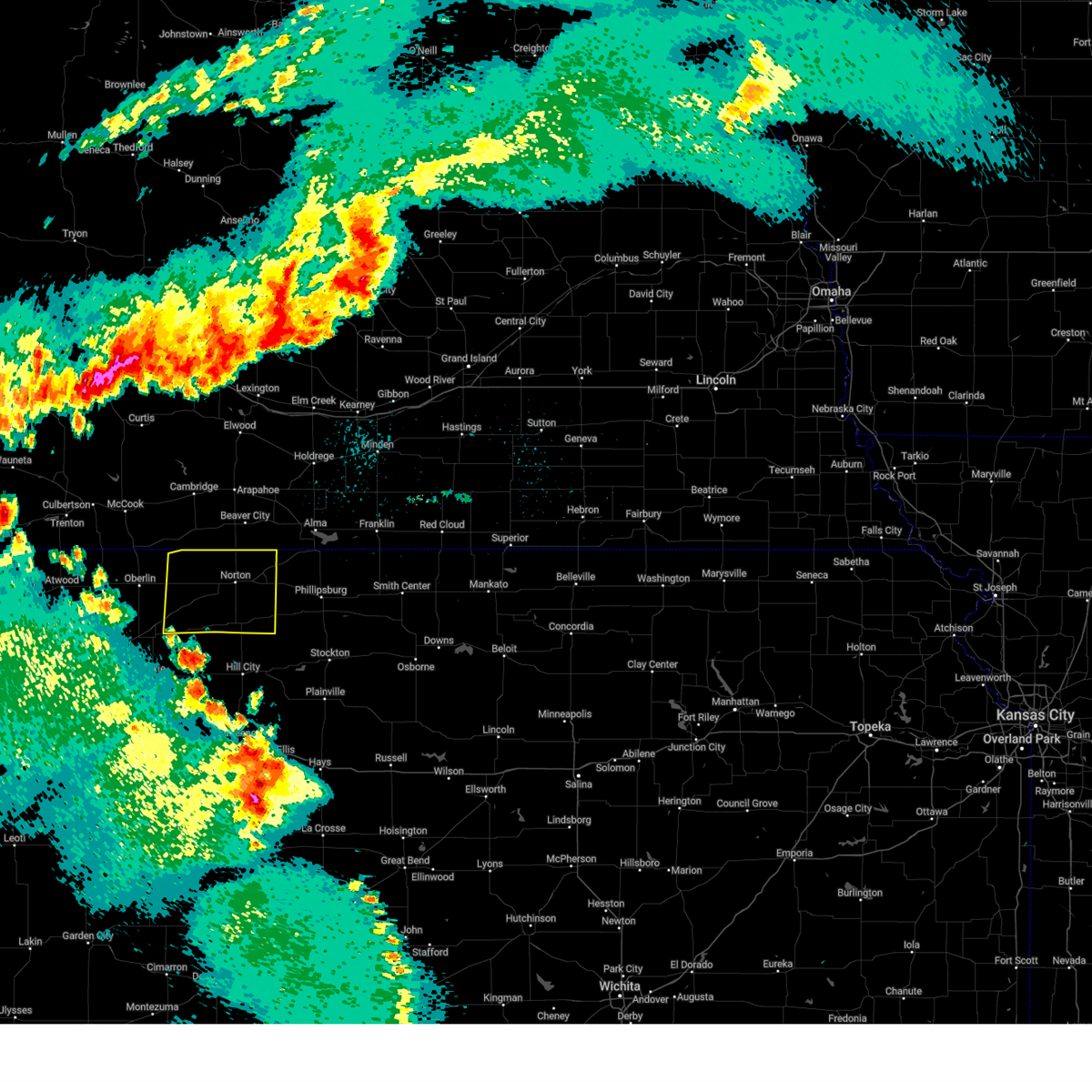
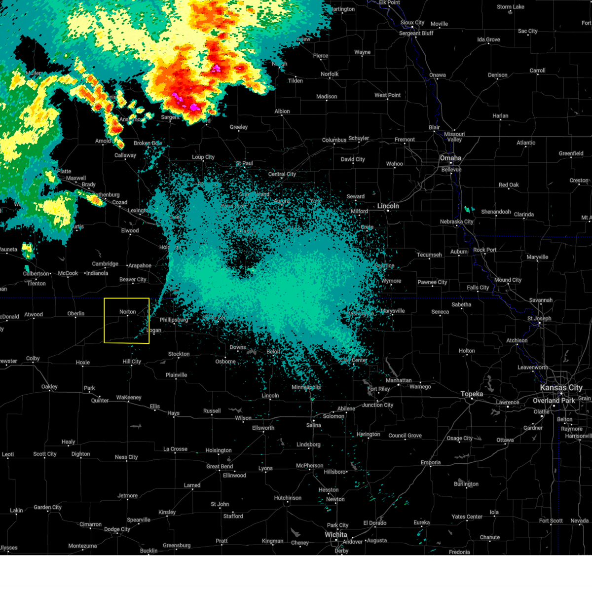
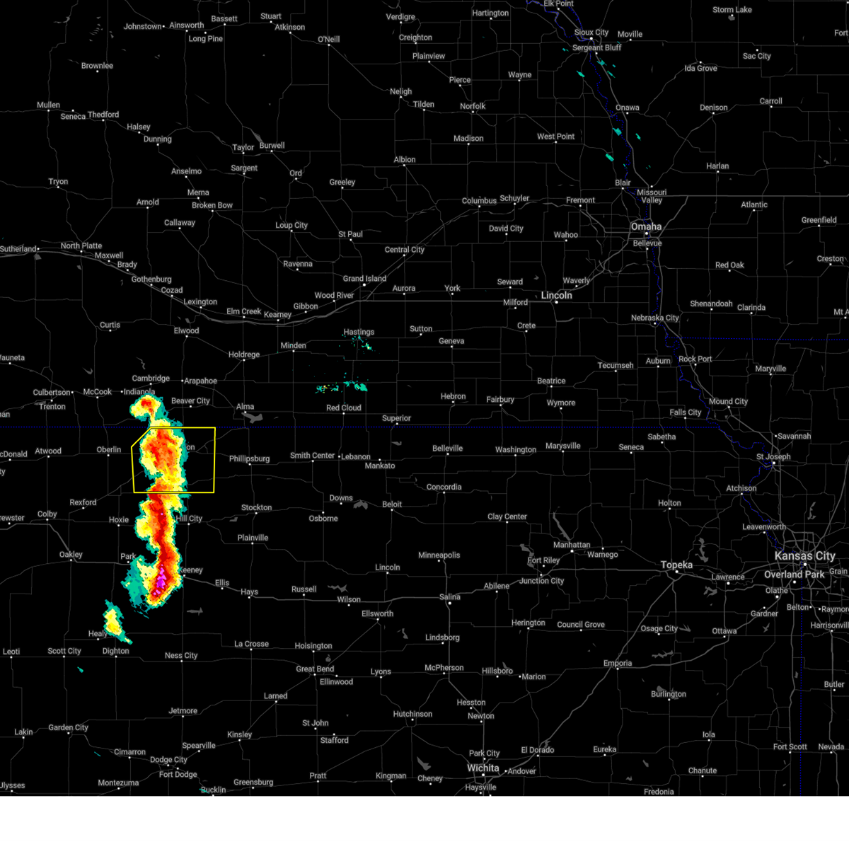
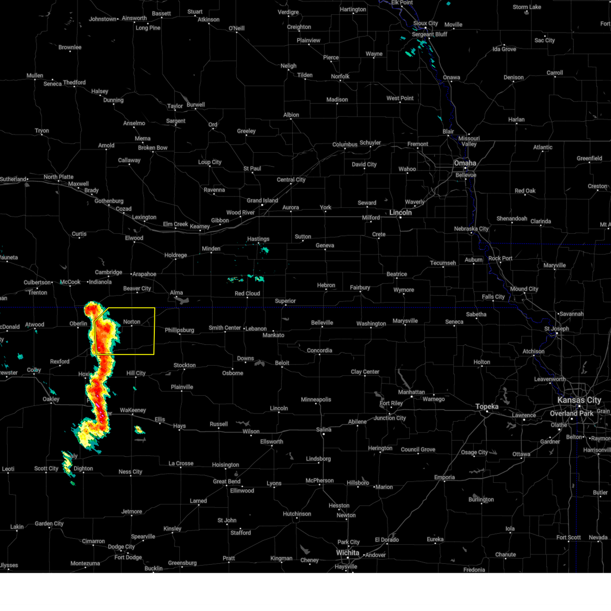
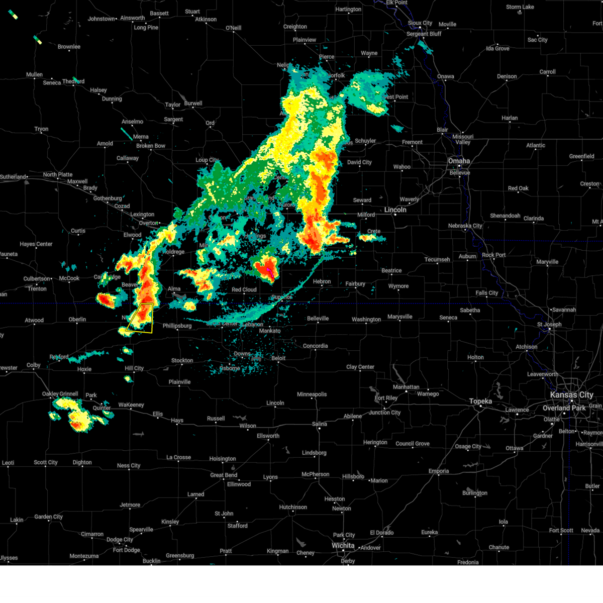
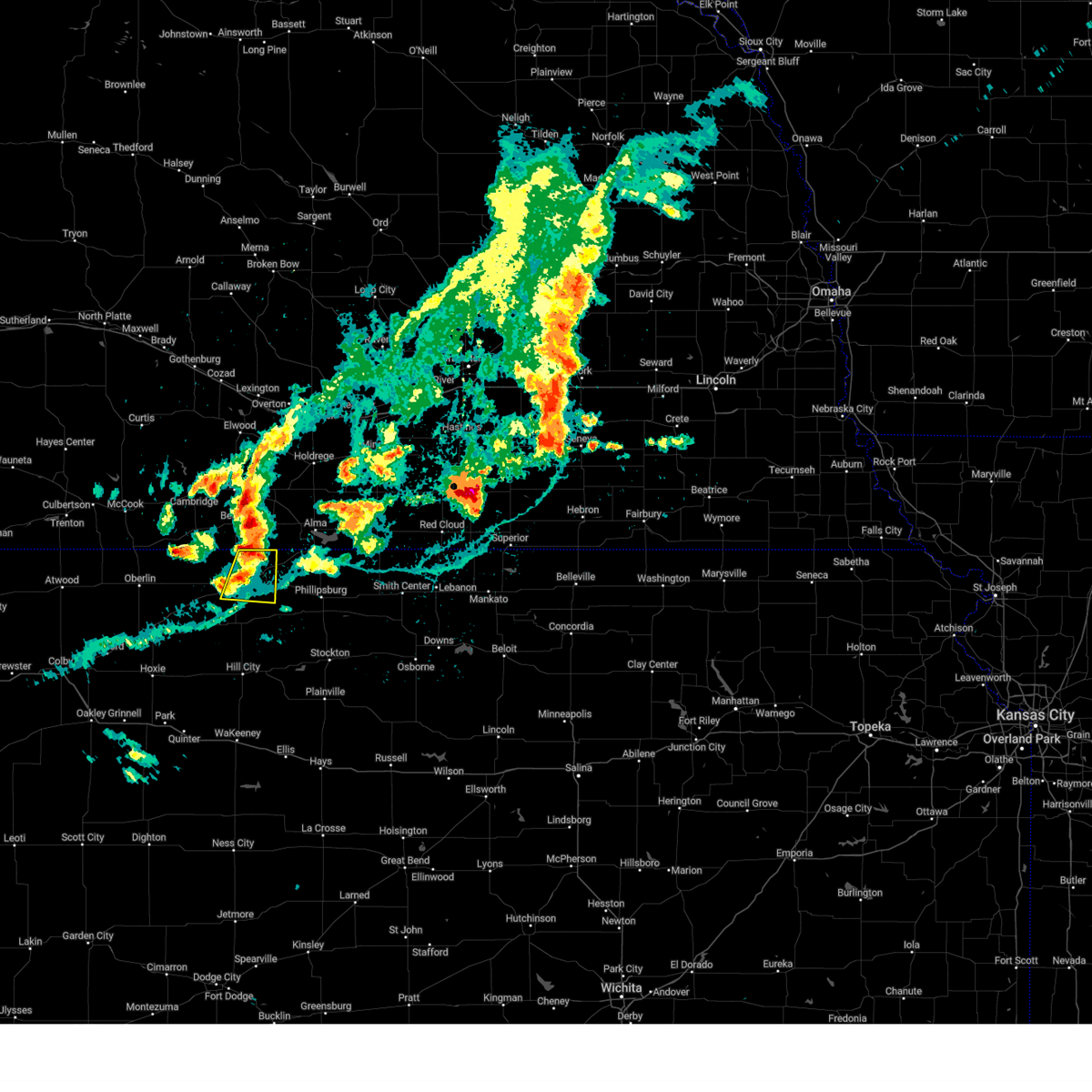
Hail Map for Almena, KS
The Almena, KS area has had 18 reports of on-the-ground hail by trained spotters, and has been under severe weather warnings 35 times during the past 12 months. Doppler radar has detected hail at or near Almena, KS on 102 occasions, including 9 occasions during the past year.
| Name: | Almena, KS |
| Where Located: | 73.2 miles NNW of Hays, KS |
| Map: | Google Map for Almena, KS |
| Population: | 408 |
| Housing Units: | 217 |
| More Info: | Search Google for Almena, KS |
1
The Top Recent Hail Date for Almena, KS is Wednesday, July 31, 2024 (11th out of 102)

Hail and Wind Damage Spotted near Almena, KS
| Date / Time | Report Details |
|---|---|
| 7/10/2025 8:23 PM CDT |
 the severe thunderstorm warning has been cancelled and is no longer in effect the severe thunderstorm warning has been cancelled and is no longer in effect
|
| 7/10/2025 8:06 PM CDT |
 At 806 pm cdt, a severe thunderstorm was located 9 miles northwest of almena, or 11 miles north of norton, moving east at 10 mph (radar indicated). Hazards include 60 mph wind gusts and quarter size hail. Hail damage to vehicles is expected. expect wind damage to roofs, siding, and trees. Locations impacted include, almena. At 806 pm cdt, a severe thunderstorm was located 9 miles northwest of almena, or 11 miles north of norton, moving east at 10 mph (radar indicated). Hazards include 60 mph wind gusts and quarter size hail. Hail damage to vehicles is expected. expect wind damage to roofs, siding, and trees. Locations impacted include, almena.
|
| 7/10/2025 7:52 PM CDT |
 Svrgld the national weather service in goodland has issued a * severe thunderstorm warning for, northeastern norton county in northwestern kansas, * until 900 pm cdt. * at 752 pm cdt, a severe thunderstorm was located 8 miles south of beaver city, or 12 miles north of norton, moving east at 10 mph (radar indicated). Hazards include ping pong ball size hail and 60 mph wind gusts. People and animals outdoors will be injured. expect hail damage to roofs, siding, windows, and vehicles. expect wind damage to roofs, siding, and trees. This severe thunderstorm will remain over mainly rural areas of northeastern norton county. Svrgld the national weather service in goodland has issued a * severe thunderstorm warning for, northeastern norton county in northwestern kansas, * until 900 pm cdt. * at 752 pm cdt, a severe thunderstorm was located 8 miles south of beaver city, or 12 miles north of norton, moving east at 10 mph (radar indicated). Hazards include ping pong ball size hail and 60 mph wind gusts. People and animals outdoors will be injured. expect hail damage to roofs, siding, windows, and vehicles. expect wind damage to roofs, siding, and trees. This severe thunderstorm will remain over mainly rural areas of northeastern norton county.
|
| 7/6/2025 4:48 PM CDT | Tea Cup sized hail reported 7.4 miles NNE of Almena, KS, trained spotter reports hail up to 3 inches. damage to north facing windows. |
| 7/6/2025 4:36 PM CDT |
 At 436 pm cdt, a severe thunderstorm was located 4 miles south of almena, or 9 miles east of norton, moving southeast at 20 mph. a second severe storm is located to the south of reagon movoing south (radar indicated). Hazards include two inch hail and 60 mph wind gusts. People and animals outdoors will be injured. expect hail damage to roofs, siding, windows, and vehicles. expect wind damage to roofs, siding, and trees. Locations impacted include, norton, almena, lenora, edmond, new almelo, densmore, and reager. At 436 pm cdt, a severe thunderstorm was located 4 miles south of almena, or 9 miles east of norton, moving southeast at 20 mph. a second severe storm is located to the south of reagon movoing south (radar indicated). Hazards include two inch hail and 60 mph wind gusts. People and animals outdoors will be injured. expect hail damage to roofs, siding, windows, and vehicles. expect wind damage to roofs, siding, and trees. Locations impacted include, norton, almena, lenora, edmond, new almelo, densmore, and reager.
|
| 7/6/2025 4:32 PM CDT | Svrgld the national weather service in goodland has issued a * severe thunderstorm warning for, norton county in northwestern kansas, * until 515 pm cdt. * at 432 pm cdt, a severe thunderstorm was located near almena, or 8 miles east of norton, moving southeast at 20 mph (radar indicated). Hazards include 60 mph wind gusts and half dollar size hail. Hail damage to vehicles is expected. expect wind damage to roofs, siding, and trees. This severe thunderstorm will remain over mainly rural areas of norton county, including the following locations, densmore, reager, new almelo, and calvert. |
| 6/16/2025 11:36 PM CDT |
 The storms which prompted the warning have weakened below severe limits, and no longer pose an immediate threat to life or property. therefore, the warning will be allowed to expire. however, gusty winds are still possible with these thunderstorms. a severe thunderstorm watch remains in effect until 200 am cdt for northwestern kansas. The storms which prompted the warning have weakened below severe limits, and no longer pose an immediate threat to life or property. therefore, the warning will be allowed to expire. however, gusty winds are still possible with these thunderstorms. a severe thunderstorm watch remains in effect until 200 am cdt for northwestern kansas.
|
| 6/16/2025 11:14 PM CDT |
 At 1114 pm cdt, severe thunderstorms were located along a line extending from near almena to 6 miles southwest of prairie view to 7 miles east of edmond, moving east at 30 mph (radar indicated). Hazards include 60 mph wind gusts. Expect damage to roofs, siding, and trees. These severe thunderstorms will remain over mainly rural areas of northeastern norton county, including the following locations, calvert. At 1114 pm cdt, severe thunderstorms were located along a line extending from near almena to 6 miles southwest of prairie view to 7 miles east of edmond, moving east at 30 mph (radar indicated). Hazards include 60 mph wind gusts. Expect damage to roofs, siding, and trees. These severe thunderstorms will remain over mainly rural areas of northeastern norton county, including the following locations, calvert.
|
| 6/16/2025 11:14 PM CDT |
 the severe thunderstorm warning has been cancelled and is no longer in effect the severe thunderstorm warning has been cancelled and is no longer in effect
|
| 6/16/2025 10:48 PM CDT |
 Svrgld the national weather service in goodland has issued a * severe thunderstorm warning for, norton county in northwestern kansas, decatur county in northwestern kansas, red willow county in southwestern nebraska, * until 1145 pm cdt. * at 1048 pm cdt, severe thunderstorms were located along a line extending from 7 miles south of oberlin to 7 miles east of norcatur to near prairie view, moving northeast at 25 mph (radar indicated). Hazards include 60 mph wind gusts. Expect damage to roofs, siding, and trees. Severe thunderstorms will be near, norton, oberlin, almena, and norcatur around 1055 pm cdt. Svrgld the national weather service in goodland has issued a * severe thunderstorm warning for, norton county in northwestern kansas, decatur county in northwestern kansas, red willow county in southwestern nebraska, * until 1145 pm cdt. * at 1048 pm cdt, severe thunderstorms were located along a line extending from 7 miles south of oberlin to 7 miles east of norcatur to near prairie view, moving northeast at 25 mph (radar indicated). Hazards include 60 mph wind gusts. Expect damage to roofs, siding, and trees. Severe thunderstorms will be near, norton, oberlin, almena, and norcatur around 1055 pm cdt.
|
| 6/16/2025 10:35 PM CDT |
 At 1034 pm cdt, severe thunderstorms were located along a line extending from 9 miles south of danbury to 5 miles northeast of norton to 5 miles north of speed, moving east-northeast at 35 mph (radar indicated). Hazards include 60 mph wind gusts. Expect damage to roofs, siding, and trees. Locations impacted include, norton and almena. At 1034 pm cdt, severe thunderstorms were located along a line extending from 9 miles south of danbury to 5 miles northeast of norton to 5 miles north of speed, moving east-northeast at 35 mph (radar indicated). Hazards include 60 mph wind gusts. Expect damage to roofs, siding, and trees. Locations impacted include, norton and almena.
|
| 6/16/2025 10:09 PM CDT |
 Svrgld the national weather service in goodland has issued a * severe thunderstorm warning for, northern norton county in northwestern kansas, northern decatur county in northwestern kansas, eastern red willow county in southwestern nebraska, * until 1045 pm cdt. * at 1008 pm cdt, severe thunderstorms were located along a line extending from 4 miles northeast of oberlin to 3 miles northwest of norton to 4 miles north of logan, moving northeast at 45 mph (automated weather stations. a 63 mph wind gust was recorded at oberlin at 955 pm cdt). Hazards include 60 mph wind gusts and quarter size hail. Hail damage to vehicles is expected. expect wind damage to roofs, siding, and trees. severe thunderstorms will be near, almena around 1015 pm cdt. Danbury and lebanon around 1020 pm cdt. Svrgld the national weather service in goodland has issued a * severe thunderstorm warning for, northern norton county in northwestern kansas, northern decatur county in northwestern kansas, eastern red willow county in southwestern nebraska, * until 1045 pm cdt. * at 1008 pm cdt, severe thunderstorms were located along a line extending from 4 miles northeast of oberlin to 3 miles northwest of norton to 4 miles north of logan, moving northeast at 45 mph (automated weather stations. a 63 mph wind gust was recorded at oberlin at 955 pm cdt). Hazards include 60 mph wind gusts and quarter size hail. Hail damage to vehicles is expected. expect wind damage to roofs, siding, and trees. severe thunderstorms will be near, almena around 1015 pm cdt. Danbury and lebanon around 1020 pm cdt.
|
| 6/2/2025 9:25 PM CDT |
 The storm which prompted the warning has moved out of the area. therefore, the warning will be allowed to expire. a severe thunderstorm watch remains in effect until 1000 pm cdt for northwestern kansas. The storm which prompted the warning has moved out of the area. therefore, the warning will be allowed to expire. a severe thunderstorm watch remains in effect until 1000 pm cdt for northwestern kansas.
|
| 6/2/2025 8:53 PM CDT |
 At 853 pm cdt, a severe thunderstorm was located 7 miles north of lenora, or 9 miles southwest of norton, moving northeast at 25 mph (radar indicated). Hazards include 60 mph wind gusts and quarter size hail. Hail damage to vehicles is expected. expect wind damage to roofs, siding, and trees. this severe storm will be near, norton around 905 pm cdt. almena around 925 pm cdt. Other locations impacted by this severe thunderstorm include densmore, reager, new almelo, and calvert. At 853 pm cdt, a severe thunderstorm was located 7 miles north of lenora, or 9 miles southwest of norton, moving northeast at 25 mph (radar indicated). Hazards include 60 mph wind gusts and quarter size hail. Hail damage to vehicles is expected. expect wind damage to roofs, siding, and trees. this severe storm will be near, norton around 905 pm cdt. almena around 925 pm cdt. Other locations impacted by this severe thunderstorm include densmore, reager, new almelo, and calvert.
|
| 6/2/2025 8:53 PM CDT |
 the severe thunderstorm warning has been cancelled and is no longer in effect the severe thunderstorm warning has been cancelled and is no longer in effect
|
| 6/2/2025 8:36 PM CDT |
 Svrgld the national weather service in goodland has issued a * severe thunderstorm warning for, norton county in northwestern kansas, eastern decatur county in northwestern kansas, * until 930 pm cdt. * at 835 pm cdt, a severe thunderstorm was located 6 miles east of clayton, or 12 miles southwest of norton, moving northeast at 40 mph (public. 60 mph winds were reported in hoxie). Hazards include 60 mph wind gusts. Expect damage to roofs, siding, and trees. This severe thunderstorm will be near, norton around 850 pm cdt. Svrgld the national weather service in goodland has issued a * severe thunderstorm warning for, norton county in northwestern kansas, eastern decatur county in northwestern kansas, * until 930 pm cdt. * at 835 pm cdt, a severe thunderstorm was located 6 miles east of clayton, or 12 miles southwest of norton, moving northeast at 40 mph (public. 60 mph winds were reported in hoxie). Hazards include 60 mph wind gusts. Expect damage to roofs, siding, and trees. This severe thunderstorm will be near, norton around 850 pm cdt.
|
| 5/18/2025 8:30 PM CDT | At 829 pm cdt, a severe thunderstorm was located 4 miles west of edmond, or 14 miles south of norton, moving northeast at 35 mph (public report of 1 inch hail 10 miles north-northwest of morland). Hazards include 60 mph wind gusts and half dollar size hail. Hail damage to vehicles is expected. expect wind damage to roofs, siding, and trees. this severe storm will be near, edmond around 835 pm cdt. Other locations impacted by this severe thunderstorm include densmore and calvert. |
| 5/18/2025 8:15 PM CDT | At 814 pm cdt, a severe thunderstorm was located 5 miles southwest of lenora, or 15 miles northwest of hill city, moving northeast at 35 mph (public report of 1 inch hail 10 miles north-northwest of morland). Hazards include ping pong ball size hail and 60 mph wind gusts. People and animals outdoors will be injured. expect hail damage to roofs, siding, windows, and vehicles. expect wind damage to roofs, siding, and trees. this severe storm will be near, lenora around 820 pm cdt. edmond around 835 pm cdt. almena around 900 pm cdt. Other locations impacted by this severe thunderstorm include densmore, new almelo, and calvert. |
| 5/18/2025 8:10 PM CDT | Svrgld the national weather service in goodland has issued a * severe thunderstorm warning for, norton county in northwestern kansas, northwestern graham county in northwestern kansas, * until 930 pm cdt. * at 809 pm cdt, a severe thunderstorm was located 8 miles southwest of lenora, or 15 miles northwest of hill city, moving northeast at 35 mph (radar indicated). Hazards include ping pong ball size hail and 60 mph wind gusts. People and animals outdoors will be injured. expect hail damage to roofs, siding, windows, and vehicles. expect wind damage to roofs, siding, and trees. this severe thunderstorm will be near, lenora around 815 pm cdt. Other locations in the path of this severe thunderstorm include edmond and almena. |
| 5/14/2025 10:21 PM CDT |
 The storms which prompted the warning have moved out of the area. therefore, the warning will be allowed to expire. however, gusty winds are still possible with these thunderstorms and a high wind warning is now in effect. The storms which prompted the warning have moved out of the area. therefore, the warning will be allowed to expire. however, gusty winds are still possible with these thunderstorms and a high wind warning is now in effect.
|
| 5/14/2025 9:58 PM CDT |
 the severe thunderstorm warning has been cancelled and is no longer in effect the severe thunderstorm warning has been cancelled and is no longer in effect
|
| 5/14/2025 9:58 PM CDT |
 At 958 pm cdt, severe thunderstorms were located along a line extending from 6 miles north of wilsonville to 8 miles west of norton to 8 miles north of morland, moving east at 45 mph (radar indicated). Hazards include 70 mph wind gusts. Expect considerable tree damage. damage is likely to mobile homes, roofs, and outbuildings. these severe storms will be near, norton and lenora around 1005 pm cdt. edmond around 1010 pm cdt. almena around 1015 pm cdt. Other locations impacted by these severe thunderstorms include densmore, reager, new almelo, and calvert. At 958 pm cdt, severe thunderstorms were located along a line extending from 6 miles north of wilsonville to 8 miles west of norton to 8 miles north of morland, moving east at 45 mph (radar indicated). Hazards include 70 mph wind gusts. Expect considerable tree damage. damage is likely to mobile homes, roofs, and outbuildings. these severe storms will be near, norton and lenora around 1005 pm cdt. edmond around 1010 pm cdt. almena around 1015 pm cdt. Other locations impacted by these severe thunderstorms include densmore, reager, new almelo, and calvert.
|
| 5/14/2025 9:26 PM CDT |
 Svrgld the national weather service in goodland has issued a * severe thunderstorm warning for, norton county in northwestern kansas, decatur county in northwestern kansas, red willow county in southwestern nebraska, * until 1030 pm cdt. * at 923 pm cdt, severe thunderstorms were located along a line extending from 5 miles northeast of mccook to near oberlin to selden, moving east at 55 mph. winds are occurring well in advance of any storms as an outflow boundary rapidly moves across the area (public). Hazards include 70 mph wind gusts. Expect considerable tree damage. damage is likely to mobile homes, roofs, and outbuildings. severe thunderstorms will be near, indianola, danbury, and dresden around 930 pm cdt. bartley, jennings, and lebanon around 935 pm cdt. norcatur and clayton around 940 pm cdt. lenora around 950 pm cdt. norton around 955 pm cdt. edmond around 1000 pm cdt. almena around 1005 pm cdt. Other locations impacted by these severe thunderstorms include leoville, new almelo, densmore, cedar bluffs, kanona, reager, and calvert. Svrgld the national weather service in goodland has issued a * severe thunderstorm warning for, norton county in northwestern kansas, decatur county in northwestern kansas, red willow county in southwestern nebraska, * until 1030 pm cdt. * at 923 pm cdt, severe thunderstorms were located along a line extending from 5 miles northeast of mccook to near oberlin to selden, moving east at 55 mph. winds are occurring well in advance of any storms as an outflow boundary rapidly moves across the area (public). Hazards include 70 mph wind gusts. Expect considerable tree damage. damage is likely to mobile homes, roofs, and outbuildings. severe thunderstorms will be near, indianola, danbury, and dresden around 930 pm cdt. bartley, jennings, and lebanon around 935 pm cdt. norcatur and clayton around 940 pm cdt. lenora around 950 pm cdt. norton around 955 pm cdt. edmond around 1000 pm cdt. almena around 1005 pm cdt. Other locations impacted by these severe thunderstorms include leoville, new almelo, densmore, cedar bluffs, kanona, reager, and calvert.
|
| 9/16/2024 7:37 PM CDT |
 the severe thunderstorm warning has been cancelled and is no longer in effect the severe thunderstorm warning has been cancelled and is no longer in effect
|
| 9/16/2024 7:13 PM CDT |
 Svrgld the national weather service in goodland has issued a * severe thunderstorm warning for, norton county in northwestern kansas, southeastern decatur county in northwestern kansas, * until 800 pm cdt. * at 712 pm cdt, a severe thunderstorm was located near norcatur, or 13 miles west of norton, moving northeast at 40 mph (radar indicated). Hazards include 60 mph wind gusts. Expect damage to roofs, siding, and trees. This severe thunderstorm will remain over mainly rural areas of norton and southeastern decatur counties, including the following locations, densmore, reager, new almelo, and calvert. Svrgld the national weather service in goodland has issued a * severe thunderstorm warning for, norton county in northwestern kansas, southeastern decatur county in northwestern kansas, * until 800 pm cdt. * at 712 pm cdt, a severe thunderstorm was located near norcatur, or 13 miles west of norton, moving northeast at 40 mph (radar indicated). Hazards include 60 mph wind gusts. Expect damage to roofs, siding, and trees. This severe thunderstorm will remain over mainly rural areas of norton and southeastern decatur counties, including the following locations, densmore, reager, new almelo, and calvert.
|
| 7/31/2024 4:19 PM CDT | the severe thunderstorm warning has been cancelled and is no longer in effect |
| 7/31/2024 4:01 PM CDT |
 At 400 pm cdt, severe thunderstorms were located along a line extending from 3 miles east of edison to 8 miles southwest of stamford to near almena, moving northeast at 25 mph (trained weather spotters. at 356 pm cdt, quarter sized hail and estimated 50 mph wind gusts were reported in almena). Hazards include 60 mph wind gusts and quarter size hail. Hail damage to vehicles is expected. expect wind damage to roofs, siding, and trees. these severe storms will be near, almena around 405 pm cdt. Other locations impacted by these severe thunderstorms include calvert. At 400 pm cdt, severe thunderstorms were located along a line extending from 3 miles east of edison to 8 miles southwest of stamford to near almena, moving northeast at 25 mph (trained weather spotters. at 356 pm cdt, quarter sized hail and estimated 50 mph wind gusts were reported in almena). Hazards include 60 mph wind gusts and quarter size hail. Hail damage to vehicles is expected. expect wind damage to roofs, siding, and trees. these severe storms will be near, almena around 405 pm cdt. Other locations impacted by these severe thunderstorms include calvert.
|
| 7/31/2024 3:56 PM CDT | Quarter sized hail reported 0.1 miles ENE of Almena, KS, spotter estimated quarter sized hail ongoing at time of the report. |
| 7/31/2024 3:47 PM CDT |
 Svrgld the national weather service in goodland has issued a * severe thunderstorm warning for, northeastern norton county in northwestern kansas, * until 430 pm cdt. * at 347 pm cdt, severe thunderstorms were located along a line extending from near edison to 8 miles north of almena to 3 miles northeast of norton, moving northeast at 25 mph (radar indicated). Hazards include 60 mph wind gusts and quarter size hail. Hail damage to vehicles is expected. expect wind damage to roofs, siding, and trees. severe thunderstorms will be near, almena around 350 pm cdt. Other locations impacted by these severe thunderstorms include calvert. Svrgld the national weather service in goodland has issued a * severe thunderstorm warning for, northeastern norton county in northwestern kansas, * until 430 pm cdt. * at 347 pm cdt, severe thunderstorms were located along a line extending from near edison to 8 miles north of almena to 3 miles northeast of norton, moving northeast at 25 mph (radar indicated). Hazards include 60 mph wind gusts and quarter size hail. Hail damage to vehicles is expected. expect wind damage to roofs, siding, and trees. severe thunderstorms will be near, almena around 350 pm cdt. Other locations impacted by these severe thunderstorms include calvert.
|
| 7/19/2024 4:40 PM CDT |
 At 439 pm cdt, a severe thunderstorm was located near norton, moving southeast at 25 mph (automated weather station 4 miles southwest of norton measured 60 mph winds). Hazards include 60 mph wind gusts. Expect damage to roofs, siding, and trees. this severe storm will be near, edmond around 500 pm cdt. Other locations impacted by this severe thunderstorm include densmore, reager, new almelo, and calvert. At 439 pm cdt, a severe thunderstorm was located near norton, moving southeast at 25 mph (automated weather station 4 miles southwest of norton measured 60 mph winds). Hazards include 60 mph wind gusts. Expect damage to roofs, siding, and trees. this severe storm will be near, edmond around 500 pm cdt. Other locations impacted by this severe thunderstorm include densmore, reager, new almelo, and calvert.
|
| 7/19/2024 4:22 PM CDT |
 At 422 pm cdt, a severe thunderstorm was located 5 miles northwest of norton, moving southeast at 45 mph (radar indicated). Hazards include 60 mph wind gusts. Expect damage to roofs, siding, and trees. this severe storm will be near, norton around 430 pm cdt. edmond around 445 pm cdt. Other locations impacted by this severe thunderstorm include densmore, reager, new almelo, and calvert. At 422 pm cdt, a severe thunderstorm was located 5 miles northwest of norton, moving southeast at 45 mph (radar indicated). Hazards include 60 mph wind gusts. Expect damage to roofs, siding, and trees. this severe storm will be near, norton around 430 pm cdt. edmond around 445 pm cdt. Other locations impacted by this severe thunderstorm include densmore, reager, new almelo, and calvert.
|
| 7/19/2024 4:10 PM CDT |
 Svrgld the national weather service in goodland has issued a * severe thunderstorm warning for, norton county in northwestern kansas, * until 515 pm cdt. * at 410 pm cdt, a severe thunderstorm was located 8 miles southeast of wilsonville, or 13 miles northwest of norton, moving southeast at 35 mph (radar indicated). Hazards include 60 mph wind gusts. Expect damage to roofs, siding, and trees. This severe thunderstorm will be near, norton around 425 pm cdt. Svrgld the national weather service in goodland has issued a * severe thunderstorm warning for, norton county in northwestern kansas, * until 515 pm cdt. * at 410 pm cdt, a severe thunderstorm was located 8 miles southeast of wilsonville, or 13 miles northwest of norton, moving southeast at 35 mph (radar indicated). Hazards include 60 mph wind gusts. Expect damage to roofs, siding, and trees. This severe thunderstorm will be near, norton around 425 pm cdt.
|
| 7/16/2024 5:09 PM CDT |
 The storm which prompted the warning has moved out of the area. therefore, the warning will be allowed to expire. remember, a severe thunderstorm warning still remains in effect for central and southeastern norton county. The storm which prompted the warning has moved out of the area. therefore, the warning will be allowed to expire. remember, a severe thunderstorm warning still remains in effect for central and southeastern norton county.
|
| 7/16/2024 4:57 PM CDT |
 At 455 pm cdt, a severe thunderstorm was located 4 miles west of almena, or 5 miles northeast of norton, moving southeast at 20 mph (at 4:46 pm ct, the norton airport reported a 62 mph wind gust. pea to dime sized hail was also reported 8 nne of norton). Hazards include 70 mph wind gusts and quarter size hail. Hail damage to vehicles is expected. expect considerable tree damage. wind damage is also likely to mobile homes, roofs, and outbuildings. Locations impacted include, norton, almena, and calvert. At 455 pm cdt, a severe thunderstorm was located 4 miles west of almena, or 5 miles northeast of norton, moving southeast at 20 mph (at 4:46 pm ct, the norton airport reported a 62 mph wind gust. pea to dime sized hail was also reported 8 nne of norton). Hazards include 70 mph wind gusts and quarter size hail. Hail damage to vehicles is expected. expect considerable tree damage. wind damage is also likely to mobile homes, roofs, and outbuildings. Locations impacted include, norton, almena, and calvert.
|
| 7/16/2024 4:55 PM CDT | Social media report of winds around 60 mph or greater in the town of almena. time estimated from rada in norton county KS, 0.1 miles ENE of Almena, KS |
| 7/16/2024 4:48 PM CDT |
 At 447 pm cdt, a severe thunderstorm was located 6 miles west of almena, or 6 miles northeast of norton, moving southeast at 20 mph (at 4:46 pm ct, the norton airport reported a 62 mph wind gust). Hazards include 70 mph wind gusts and half dollar size hail. Hail damage to vehicles is expected. expect considerable tree damage. wind damage is also likely to mobile homes, roofs, and outbuildings. Locations impacted include, norton, almena, and calvert. At 447 pm cdt, a severe thunderstorm was located 6 miles west of almena, or 6 miles northeast of norton, moving southeast at 20 mph (at 4:46 pm ct, the norton airport reported a 62 mph wind gust). Hazards include 70 mph wind gusts and half dollar size hail. Hail damage to vehicles is expected. expect considerable tree damage. wind damage is also likely to mobile homes, roofs, and outbuildings. Locations impacted include, norton, almena, and calvert.
|
| 7/16/2024 4:42 PM CDT |
 At 441 pm cdt, a severe thunderstorm was located 7 miles north of norton, moving southeast at 20 mph (radar indicated). Hazards include 70 mph wind gusts and half dollar size hail. Hail damage to vehicles is expected. expect considerable tree damage. wind damage is also likely to mobile homes, roofs, and outbuildings. Locations impacted include, norton, almena, and calvert. At 441 pm cdt, a severe thunderstorm was located 7 miles north of norton, moving southeast at 20 mph (radar indicated). Hazards include 70 mph wind gusts and half dollar size hail. Hail damage to vehicles is expected. expect considerable tree damage. wind damage is also likely to mobile homes, roofs, and outbuildings. Locations impacted include, norton, almena, and calvert.
|
| 7/16/2024 4:33 PM CDT |
 Svrgld the national weather service in goodland has issued a * severe thunderstorm warning for, northeastern norton county in northwestern kansas, * until 515 pm cdt. * at 433 pm cdt, a severe thunderstorm was located 10 miles south of beaver city, or 10 miles north of norton, moving southeast at 20 mph (radar indicated). Hazards include 60 mph wind gusts and quarter size hail. Hail damage to vehicles is expected. Expect wind damage to roofs, siding, and trees. Svrgld the national weather service in goodland has issued a * severe thunderstorm warning for, northeastern norton county in northwestern kansas, * until 515 pm cdt. * at 433 pm cdt, a severe thunderstorm was located 10 miles south of beaver city, or 10 miles north of norton, moving southeast at 20 mph (radar indicated). Hazards include 60 mph wind gusts and quarter size hail. Hail damage to vehicles is expected. Expect wind damage to roofs, siding, and trees.
|
| 6/18/2024 5:35 PM CDT |
 The storm which prompted the warning has moved out of the area. therefore, the warning will be allowed to expire. however, heavy rain is still possible with this thunderstorm. The storm which prompted the warning has moved out of the area. therefore, the warning will be allowed to expire. however, heavy rain is still possible with this thunderstorm.
|
| 6/18/2024 5:25 PM CDT |
 At 525 pm cdt, a severe thunderstorm was located 4 miles southwest of prairie view, or 12 miles east of norton, moving north at 30 mph (radar indicated). Hazards include 60 mph wind gusts and half dollar size hail. Hail damage to vehicles is expected. expect wind damage to roofs, siding, and trees. Locations impacted include, almena. At 525 pm cdt, a severe thunderstorm was located 4 miles southwest of prairie view, or 12 miles east of norton, moving north at 30 mph (radar indicated). Hazards include 60 mph wind gusts and half dollar size hail. Hail damage to vehicles is expected. expect wind damage to roofs, siding, and trees. Locations impacted include, almena.
|
| 6/18/2024 5:17 PM CDT |
 At 516 pm cdt, a severe thunderstorm was located 7 miles southwest of prairie view, or 13 miles southeast of norton, moving north at 45 mph (radar indicated). Hazards include golf ball size hail and 60 mph wind gusts. People and animals outdoors will be injured. expect hail damage to roofs, siding, windows, and vehicles. expect wind damage to roofs, siding, and trees. Locations impacted include, almena. At 516 pm cdt, a severe thunderstorm was located 7 miles southwest of prairie view, or 13 miles southeast of norton, moving north at 45 mph (radar indicated). Hazards include golf ball size hail and 60 mph wind gusts. People and animals outdoors will be injured. expect hail damage to roofs, siding, windows, and vehicles. expect wind damage to roofs, siding, and trees. Locations impacted include, almena.
|
| 6/18/2024 5:06 PM CDT |
 Svrgld the national weather service in goodland has issued a * severe thunderstorm warning for, eastern norton county in northwestern kansas, * until 545 pm cdt. * at 506 pm cdt, a severe thunderstorm was located 6 miles east of edmond, or 16 miles southeast of norton, moving north at 35 mph (radar indicated). Hazards include golf ball size hail and 60 mph wind gusts. People and animals outdoors will be injured. expect hail damage to roofs, siding, windows, and vehicles. expect wind damage to roofs, siding, and trees. This severe thunderstorm will remain over mainly rural areas of eastern norton county. Svrgld the national weather service in goodland has issued a * severe thunderstorm warning for, eastern norton county in northwestern kansas, * until 545 pm cdt. * at 506 pm cdt, a severe thunderstorm was located 6 miles east of edmond, or 16 miles southeast of norton, moving north at 35 mph (radar indicated). Hazards include golf ball size hail and 60 mph wind gusts. People and animals outdoors will be injured. expect hail damage to roofs, siding, windows, and vehicles. expect wind damage to roofs, siding, and trees. This severe thunderstorm will remain over mainly rural areas of eastern norton county.
|
| 6/7/2024 7:11 PM CDT |
 At 711 pm cdt, severe thunderstorms were located along a line extending from 9 miles southeast of beaver city to 8 miles southeast of edmond, moving east at 35 mph (public). Hazards include tennis ball size hail and 60 mph wind gusts. People and animals outdoors will be injured. expect hail damage to roofs, siding, windows, and vehicles. expect wind damage to roofs, siding, and trees. these severe storms will be near, almena around 715 pm cdt. Other locations impacted by these severe thunderstorms include densmore, reager, new almelo, and calvert. At 711 pm cdt, severe thunderstorms were located along a line extending from 9 miles southeast of beaver city to 8 miles southeast of edmond, moving east at 35 mph (public). Hazards include tennis ball size hail and 60 mph wind gusts. People and animals outdoors will be injured. expect hail damage to roofs, siding, windows, and vehicles. expect wind damage to roofs, siding, and trees. these severe storms will be near, almena around 715 pm cdt. Other locations impacted by these severe thunderstorms include densmore, reager, new almelo, and calvert.
|
| 6/7/2024 7:02 PM CDT |
 At 702 pm cdt, severe thunderstorms were located along a line extending from 7 miles south of beaver city to 7 miles south of edmond, moving east at 35 mph (public). Hazards include tennis ball size hail and 60 mph wind gusts. People and animals outdoors will be injured. expect hail damage to roofs, siding, windows, and vehicles. expect wind damage to roofs, siding, and trees. these severe storms will be near, almena around 705 pm cdt. Other locations impacted by these severe thunderstorms include densmore, reager, new almelo, and calvert. At 702 pm cdt, severe thunderstorms were located along a line extending from 7 miles south of beaver city to 7 miles south of edmond, moving east at 35 mph (public). Hazards include tennis ball size hail and 60 mph wind gusts. People and animals outdoors will be injured. expect hail damage to roofs, siding, windows, and vehicles. expect wind damage to roofs, siding, and trees. these severe storms will be near, almena around 705 pm cdt. Other locations impacted by these severe thunderstorms include densmore, reager, new almelo, and calvert.
|
| 6/7/2024 6:47 PM CDT |
 the severe thunderstorm warning has been cancelled and is no longer in effect the severe thunderstorm warning has been cancelled and is no longer in effect
|
| 6/7/2024 6:47 PM CDT |
 At 646 pm cdt, severe thunderstorms were located along a line extending from 7 miles south of hendley to 6 miles south of lenora, moving east at 35 mph (public). Hazards include tennis ball size hail and 60 mph wind gusts. People and animals outdoors will be injured. expect hail damage to roofs, siding, windows, and vehicles. expect wind damage to roofs, siding, and trees. these severe storms will be near, norton and edmond around 650 pm cdt. almena around 705 pm cdt. Other locations impacted by these severe thunderstorms include densmore, reager, new almelo, and calvert. At 646 pm cdt, severe thunderstorms were located along a line extending from 7 miles south of hendley to 6 miles south of lenora, moving east at 35 mph (public). Hazards include tennis ball size hail and 60 mph wind gusts. People and animals outdoors will be injured. expect hail damage to roofs, siding, windows, and vehicles. expect wind damage to roofs, siding, and trees. these severe storms will be near, norton and edmond around 650 pm cdt. almena around 705 pm cdt. Other locations impacted by these severe thunderstorms include densmore, reager, new almelo, and calvert.
|
| 6/7/2024 6:25 PM CDT |
 Svrgld the national weather service in goodland has issued a * severe thunderstorm warning for, norton county in northwestern kansas, northeastern sheridan county in northwestern kansas, eastern decatur county in northwestern kansas, northern graham county in northwestern kansas, southeastern red willow county in southwestern nebraska, * until 730 pm cdt. * at 624 pm cdt, severe thunderstorms were located along a line extending from 4 miles southeast of lebanon to 11 miles southwest of lenora, moving east at 35 mph (public reports of ping pong to tennis ball sized hail with these storms near dresden). Hazards include tennis ball size hail and 60 mph wind gusts. People and animals outdoors will be injured. expect hail damage to roofs, siding, windows, and vehicles. expect wind damage to roofs, siding, and trees. severe thunderstorms will be near, lenora around 635 pm cdt. Other locations in the path of these severe thunderstorms include norton, edmond and almena. Svrgld the national weather service in goodland has issued a * severe thunderstorm warning for, norton county in northwestern kansas, northeastern sheridan county in northwestern kansas, eastern decatur county in northwestern kansas, northern graham county in northwestern kansas, southeastern red willow county in southwestern nebraska, * until 730 pm cdt. * at 624 pm cdt, severe thunderstorms were located along a line extending from 4 miles southeast of lebanon to 11 miles southwest of lenora, moving east at 35 mph (public reports of ping pong to tennis ball sized hail with these storms near dresden). Hazards include tennis ball size hail and 60 mph wind gusts. People and animals outdoors will be injured. expect hail damage to roofs, siding, windows, and vehicles. expect wind damage to roofs, siding, and trees. severe thunderstorms will be near, lenora around 635 pm cdt. Other locations in the path of these severe thunderstorms include norton, edmond and almena.
|
| 6/2/2024 9:41 PM CDT |
 the severe thunderstorm warning has been cancelled and is no longer in effect the severe thunderstorm warning has been cancelled and is no longer in effect
|
| 6/2/2024 9:33 PM CDT |
 the severe thunderstorm warning has been cancelled and is no longer in effect the severe thunderstorm warning has been cancelled and is no longer in effect
|
| 6/2/2024 9:33 PM CDT |
 At 932 pm cdt, severe thunderstorms were located along a line extending from 8 miles south of woodruff to 7 miles south of edmond to 9 miles southeast of hoxie, moving east at 40 mph (radar indicated). Hazards include 60 mph wind gusts and nickel size hail. Expect damage to roofs, siding, and trees. these severe storms will be near, hill city and morland around 940 pm cdt. bogue around 955 pm cdt. other locations impacted by these severe thunderstorms include leoville, new almelo, seguin, studley, densmore, angelus, and penokee. This includes interstate 70 in kansas between mile markers 83 and 113. At 932 pm cdt, severe thunderstorms were located along a line extending from 8 miles south of woodruff to 7 miles south of edmond to 9 miles southeast of hoxie, moving east at 40 mph (radar indicated). Hazards include 60 mph wind gusts and nickel size hail. Expect damage to roofs, siding, and trees. these severe storms will be near, hill city and morland around 940 pm cdt. bogue around 955 pm cdt. other locations impacted by these severe thunderstorms include leoville, new almelo, seguin, studley, densmore, angelus, and penokee. This includes interstate 70 in kansas between mile markers 83 and 113.
|
| 6/2/2024 9:14 PM CDT |
 Svrgld the national weather service in goodland has issued a * severe thunderstorm warning for, northeastern thomas county in northwestern kansas, norton county in northwestern kansas, sheridan county in northwestern kansas, southeastern rawlins county in northwestern kansas, decatur county in northwestern kansas, eastern gove county in west central kansas, graham county in northwestern kansas, * until 1000 pm cdt. * at 913 pm cdt, severe thunderstorms were located along a line extending from 3 miles southeast of almena to 6 miles south of lenora to 9 miles southwest of hoxie, moving southeast at 40 mph (mesonet. at 0908 pm cdt, a 58 mph wind gust was reported near new almelo). Hazards include 60 mph wind gusts and quarter size hail. Hail damage to vehicles is expected. expect wind damage to roofs, siding, and trees. severe thunderstorms will be near, morland and edmond around 920 pm cdt. hill city and park around 925 pm cdt. quinter and bogue around 935 pm cdt. other locations impacted by these severe thunderstorms include new almelo, halford, seguin, studley, kanona, reager, and calvert. This includes interstate 70 in kansas between mile markers 83 and 113. Svrgld the national weather service in goodland has issued a * severe thunderstorm warning for, northeastern thomas county in northwestern kansas, norton county in northwestern kansas, sheridan county in northwestern kansas, southeastern rawlins county in northwestern kansas, decatur county in northwestern kansas, eastern gove county in west central kansas, graham county in northwestern kansas, * until 1000 pm cdt. * at 913 pm cdt, severe thunderstorms were located along a line extending from 3 miles southeast of almena to 6 miles south of lenora to 9 miles southwest of hoxie, moving southeast at 40 mph (mesonet. at 0908 pm cdt, a 58 mph wind gust was reported near new almelo). Hazards include 60 mph wind gusts and quarter size hail. Hail damage to vehicles is expected. expect wind damage to roofs, siding, and trees. severe thunderstorms will be near, morland and edmond around 920 pm cdt. hill city and park around 925 pm cdt. quinter and bogue around 935 pm cdt. other locations impacted by these severe thunderstorms include new almelo, halford, seguin, studley, kanona, reager, and calvert. This includes interstate 70 in kansas between mile markers 83 and 113.
|
| 5/23/2024 11:24 PM CDT |
 The storms which prompted the warning have weakened below severe limits, and have exited the warned area. therefore, the warning will be allowed to expire. however, gusty winds and heavy rain are still possible with these thunderstorms. a severe thunderstorm watch remains in effect until 400 am cdt for northwestern kansas. The storms which prompted the warning have weakened below severe limits, and have exited the warned area. therefore, the warning will be allowed to expire. however, gusty winds and heavy rain are still possible with these thunderstorms. a severe thunderstorm watch remains in effect until 400 am cdt for northwestern kansas.
|
| 5/23/2024 11:14 PM CDT |
 the severe thunderstorm warning has been cancelled and is no longer in effect the severe thunderstorm warning has been cancelled and is no longer in effect
|
| 5/23/2024 11:14 PM CDT |
 At 1114 pm cdt, severe thunderstorms were located along a line extending from 6 miles north of almena to 3 miles southeast of norton to 7 miles west of lenora, moving east at 50 mph (radar indicated). Hazards include 60 mph wind gusts. Expect damage to roofs, siding, and trees. these severe storms will be near, almena and lenora around 1120 pm cdt. edmond around 1125 pm cdt. Other locations impacted by these severe thunderstorms include densmore, reager, new almelo, and calvert. At 1114 pm cdt, severe thunderstorms were located along a line extending from 6 miles north of almena to 3 miles southeast of norton to 7 miles west of lenora, moving east at 50 mph (radar indicated). Hazards include 60 mph wind gusts. Expect damage to roofs, siding, and trees. these severe storms will be near, almena and lenora around 1120 pm cdt. edmond around 1125 pm cdt. Other locations impacted by these severe thunderstorms include densmore, reager, new almelo, and calvert.
|
| 5/23/2024 10:55 PM CDT |
 Svrgld the national weather service in goodland has issued a * severe thunderstorm warning for, norton county in northwestern kansas, southeastern decatur county in northwestern kansas, * until 1130 pm cdt. * at 1055 pm cdt, severe thunderstorms were located along a line extending from 10 miles north of norton to 6 miles east of norcatur to 3 miles southeast of dresden, moving east at 50 mph (radar indicated). Hazards include 60 mph wind gusts and penny size hail. Expect damage to roofs, siding, and trees. severe thunderstorms will be near, norton and clayton around 1100 pm cdt. almena around 1105 pm cdt. lenora around 1110 pm cdt. Other locations in the path of these severe thunderstorms include edmond. Svrgld the national weather service in goodland has issued a * severe thunderstorm warning for, norton county in northwestern kansas, southeastern decatur county in northwestern kansas, * until 1130 pm cdt. * at 1055 pm cdt, severe thunderstorms were located along a line extending from 10 miles north of norton to 6 miles east of norcatur to 3 miles southeast of dresden, moving east at 50 mph (radar indicated). Hazards include 60 mph wind gusts and penny size hail. Expect damage to roofs, siding, and trees. severe thunderstorms will be near, norton and clayton around 1100 pm cdt. almena around 1105 pm cdt. lenora around 1110 pm cdt. Other locations in the path of these severe thunderstorms include edmond.
|
| 5/6/2024 12:45 PM CDT |
 At 1244 pm cdt, severe thunderstorms were located along a line extending from 7 miles south of almena to 3 miles northwest of bogue to 4 miles northwest of trego center, moving east at 30 mph (radar indicated). Hazards include ping pong ball size hail and 60 mph wind gusts. People and animals outdoors will be injured. expect hail damage to roofs, siding, windows, and vehicles. expect wind damage to roofs, siding, and trees. these severe storms will be near, bogue and nicodemus around 1250 pm cdt. Other locations impacted by these severe thunderstorms include densmore, penokee, and calvert. At 1244 pm cdt, severe thunderstorms were located along a line extending from 7 miles south of almena to 3 miles northwest of bogue to 4 miles northwest of trego center, moving east at 30 mph (radar indicated). Hazards include ping pong ball size hail and 60 mph wind gusts. People and animals outdoors will be injured. expect hail damage to roofs, siding, windows, and vehicles. expect wind damage to roofs, siding, and trees. these severe storms will be near, bogue and nicodemus around 1250 pm cdt. Other locations impacted by these severe thunderstorms include densmore, penokee, and calvert.
|
| 5/6/2024 12:44 PM CDT |
 The storm which prompted the warning has moved out of the area. therefore, the warning will be allowed to expire. however, gusty winds and heavy rain are still possible with this thunderstorm. a tornado watch remains in effect until 700 pm cdt for northwestern kansas. to report severe weather, contact your nearest law enforcement agency. they will relay your report to the national weather service goodland. The storm which prompted the warning has moved out of the area. therefore, the warning will be allowed to expire. however, gusty winds and heavy rain are still possible with this thunderstorm. a tornado watch remains in effect until 700 pm cdt for northwestern kansas. to report severe weather, contact your nearest law enforcement agency. they will relay your report to the national weather service goodland.
|
| 5/6/2024 12:35 PM CDT |
 At 1234 pm cdt, a severe thunderstorm was located 6 miles southeast of beaver city, or 16 miles northeast of norton, moving east at 50 mph (radar indicated). Hazards include 60 mph wind gusts and half dollar size hail. Hail damage to vehicles is expected. expect wind damage to roofs, siding, and trees. Locations impacted include, norton, almena, and calvert. At 1234 pm cdt, a severe thunderstorm was located 6 miles southeast of beaver city, or 16 miles northeast of norton, moving east at 50 mph (radar indicated). Hazards include 60 mph wind gusts and half dollar size hail. Hail damage to vehicles is expected. expect wind damage to roofs, siding, and trees. Locations impacted include, norton, almena, and calvert.
|
| 5/6/2024 12:32 PM CDT |
 Svrgld the national weather service in goodland has issued a * severe thunderstorm warning for, southeastern norton county in northwestern kansas, graham county in northwestern kansas, * until 100 pm cdt. * at 1232 pm cdt, severe thunderstorms were located along a line extending from 4 miles south of norton to near hill city to 8 miles south of voda, moving east at 30 mph (radar indicated). Hazards include 60 mph wind gusts and half dollar size hail. Hail damage to vehicles is expected. expect wind damage to roofs, siding, and trees. Severe thunderstorms will be near, bogue around 1240 pm cdt. Svrgld the national weather service in goodland has issued a * severe thunderstorm warning for, southeastern norton county in northwestern kansas, graham county in northwestern kansas, * until 100 pm cdt. * at 1232 pm cdt, severe thunderstorms were located along a line extending from 4 miles south of norton to near hill city to 8 miles south of voda, moving east at 30 mph (radar indicated). Hazards include 60 mph wind gusts and half dollar size hail. Hail damage to vehicles is expected. expect wind damage to roofs, siding, and trees. Severe thunderstorms will be near, bogue around 1240 pm cdt.
|
| 5/6/2024 12:24 PM CDT |
 At 1224 pm cdt, a severe thunderstorm was located 10 miles north of norton, moving northeast at 35 mph (radar indicated). Hazards include 60 mph wind gusts and half dollar size hail. Hail damage to vehicles is expected. expect wind damage to roofs, siding, and trees. Locations impacted include, norton, almena, and calvert. At 1224 pm cdt, a severe thunderstorm was located 10 miles north of norton, moving northeast at 35 mph (radar indicated). Hazards include 60 mph wind gusts and half dollar size hail. Hail damage to vehicles is expected. expect wind damage to roofs, siding, and trees. Locations impacted include, norton, almena, and calvert.
|
| 5/6/2024 12:04 PM CDT |
 At 1204 pm cdt, a severe thunderstorm was located 8 miles west of norton, moving northeast at 65 mph (radar indicated). Hazards include 60 mph wind gusts and half dollar size hail. Hail damage to vehicles is expected. expect wind damage to roofs, siding, and trees. This severe thunderstorm will remain over mainly rural areas of northern norton county, including the following locations, reager and calvert. At 1204 pm cdt, a severe thunderstorm was located 8 miles west of norton, moving northeast at 65 mph (radar indicated). Hazards include 60 mph wind gusts and half dollar size hail. Hail damage to vehicles is expected. expect wind damage to roofs, siding, and trees. This severe thunderstorm will remain over mainly rural areas of northern norton county, including the following locations, reager and calvert.
|
| 5/6/2024 12:04 PM CDT |
 the severe thunderstorm warning has been cancelled and is no longer in effect the severe thunderstorm warning has been cancelled and is no longer in effect
|
| 5/6/2024 11:41 AM CDT |
 Svrgld the national weather service in goodland has issued a * severe thunderstorm warning for, northern norton county in northwestern kansas, northeastern decatur county in northwestern kansas, * until 1245 pm cdt. * at 1141 am cdt, a severe thunderstorm was located near clayton, or 17 miles east of oberlin, moving northeast at 50 mph (radar indicated). Hazards include 60 mph wind gusts and half dollar size hail. Hail damage to vehicles is expected. expect wind damage to roofs, siding, and trees. This severe thunderstorm will be near, norcatur and clayton around 1145 am cdt. Svrgld the national weather service in goodland has issued a * severe thunderstorm warning for, northern norton county in northwestern kansas, northeastern decatur county in northwestern kansas, * until 1245 pm cdt. * at 1141 am cdt, a severe thunderstorm was located near clayton, or 17 miles east of oberlin, moving northeast at 50 mph (radar indicated). Hazards include 60 mph wind gusts and half dollar size hail. Hail damage to vehicles is expected. expect wind damage to roofs, siding, and trees. This severe thunderstorm will be near, norcatur and clayton around 1145 am cdt.
|
| 5/3/2024 10:12 PM CDT |
 The storms which prompted the warning have moved out of the area. therefore, the warning will be allowed to expire. however, gusty winds are still possible with these thunderstorms. a severe thunderstorm watch remains in effect until midnight cdt for northwestern kansas. to report severe weather, contact your nearest law enforcement agency. they will relay your report to the national weather service goodland. The storms which prompted the warning have moved out of the area. therefore, the warning will be allowed to expire. however, gusty winds are still possible with these thunderstorms. a severe thunderstorm watch remains in effect until midnight cdt for northwestern kansas. to report severe weather, contact your nearest law enforcement agency. they will relay your report to the national weather service goodland.
|
| 5/3/2024 9:44 PM CDT |
 the severe thunderstorm warning has been cancelled and is no longer in effect the severe thunderstorm warning has been cancelled and is no longer in effect
|
| 5/3/2024 9:44 PM CDT |
 At 944 pm cdt, severe thunderstorms were located along a line extending from near almena to 7 miles south of lenora to 9 miles southeast of hoxie, moving east at 25 mph (radar indicated). Hazards include 60 mph wind gusts and penny size hail. Expect damage to roofs, siding, and trees. these severe storms will be near, morland and edmond around 950 pm cdt. hill city around 1005 pm cdt. bogue around 1020 pm cdt. nicodemus around 1025 pm cdt. Other locations impacted by these severe thunderstorms include new almelo, studley, densmore, penokee, reager, saint peter, and calvert. At 944 pm cdt, severe thunderstorms were located along a line extending from near almena to 7 miles south of lenora to 9 miles southeast of hoxie, moving east at 25 mph (radar indicated). Hazards include 60 mph wind gusts and penny size hail. Expect damage to roofs, siding, and trees. these severe storms will be near, morland and edmond around 950 pm cdt. hill city around 1005 pm cdt. bogue around 1020 pm cdt. nicodemus around 1025 pm cdt. Other locations impacted by these severe thunderstorms include new almelo, studley, densmore, penokee, reager, saint peter, and calvert.
|
| 5/3/2024 9:29 PM CDT |
 At 929 pm cdt, severe thunderstorms were located along a line extending from 5 miles southwest of orleans to near edmond to 5 miles northwest of morland, moving east at 60 mph (radar indicated). Hazards include 60 mph wind gusts and quarter size hail. Hail damage to vehicles is expected. expect wind damage to roofs, siding, and trees. these severe storms will be near, edmond around 935 pm cdt. hill city around 940 pm cdt. bogue around 950 pm cdt. nicodemus around 955 pm cdt. Other locations impacted by these severe thunderstorms include leoville, new almelo, studley, densmore, penokee, reager, and saint peter. At 929 pm cdt, severe thunderstorms were located along a line extending from 5 miles southwest of orleans to near edmond to 5 miles northwest of morland, moving east at 60 mph (radar indicated). Hazards include 60 mph wind gusts and quarter size hail. Hail damage to vehicles is expected. expect wind damage to roofs, siding, and trees. these severe storms will be near, edmond around 935 pm cdt. hill city around 940 pm cdt. bogue around 950 pm cdt. nicodemus around 955 pm cdt. Other locations impacted by these severe thunderstorms include leoville, new almelo, studley, densmore, penokee, reager, and saint peter.
|
| 5/3/2024 9:08 PM CDT |
 Svrgld the national weather service in goodland has issued a * severe thunderstorm warning for, norton county in northwestern kansas, sheridan county in northwestern kansas, decatur county in northwestern kansas, graham county in northwestern kansas, * until 1015 pm cdt. * at 908 pm cdt, severe thunderstorms were located along a line extending from 8 miles south of beaver city to 8 miles southeast of jennings to near hoxie, moving east at 60 mph (radar indicated). Hazards include 60 mph wind gusts and quarter size hail. Hail damage to vehicles is expected. expect wind damage to roofs, siding, and trees. severe thunderstorms will be near, norton and lenora around 915 pm cdt. almena around 920 pm cdt. Edmond around 925 pm cdt. Svrgld the national weather service in goodland has issued a * severe thunderstorm warning for, norton county in northwestern kansas, sheridan county in northwestern kansas, decatur county in northwestern kansas, graham county in northwestern kansas, * until 1015 pm cdt. * at 908 pm cdt, severe thunderstorms were located along a line extending from 8 miles south of beaver city to 8 miles southeast of jennings to near hoxie, moving east at 60 mph (radar indicated). Hazards include 60 mph wind gusts and quarter size hail. Hail damage to vehicles is expected. expect wind damage to roofs, siding, and trees. severe thunderstorms will be near, norton and lenora around 915 pm cdt. almena around 920 pm cdt. Edmond around 925 pm cdt.
|
| 5/1/2024 11:56 PM CDT |
 The storms which prompted the warning have weakened below severe limits, and have exited the warned area. therefore, the warning will be allowed to expire. however, small hail, gusty winds and heavy rain are still possible with these thunderstorms. a severe thunderstorm watch remains in effect until 600 am cdt for northwestern kansas. to report severe weather, contact your nearest law enforcement agency. they will relay your report to the national weather service goodland. The storms which prompted the warning have weakened below severe limits, and have exited the warned area. therefore, the warning will be allowed to expire. however, small hail, gusty winds and heavy rain are still possible with these thunderstorms. a severe thunderstorm watch remains in effect until 600 am cdt for northwestern kansas. to report severe weather, contact your nearest law enforcement agency. they will relay your report to the national weather service goodland.
|
| 5/1/2024 11:16 PM CDT |
 Svrgld the national weather service in goodland has issued a * severe thunderstorm warning for, eastern norton county in northwestern kansas, eastern graham county in northwestern kansas, * until midnight cdt. * at 1115 pm cdt, severe thunderstorms were located along a line extending from 7 miles east of norcatur to 5 miles southeast of edmond to 10 miles northeast of voda, moving east at 45 mph (radar indicated). Hazards include 70 mph wind gusts and quarter size hail. Hail damage to vehicles is expected. expect considerable tree damage. wind damage is also likely to mobile homes, roofs, and outbuildings. severe thunderstorms will be near, bogue around 1120 pm cdt. nicodemus around 1125 pm cdt. Almena around 1135 pm cdt. Svrgld the national weather service in goodland has issued a * severe thunderstorm warning for, eastern norton county in northwestern kansas, eastern graham county in northwestern kansas, * until midnight cdt. * at 1115 pm cdt, severe thunderstorms were located along a line extending from 7 miles east of norcatur to 5 miles southeast of edmond to 10 miles northeast of voda, moving east at 45 mph (radar indicated). Hazards include 70 mph wind gusts and quarter size hail. Hail damage to vehicles is expected. expect considerable tree damage. wind damage is also likely to mobile homes, roofs, and outbuildings. severe thunderstorms will be near, bogue around 1120 pm cdt. nicodemus around 1125 pm cdt. Almena around 1135 pm cdt.
|
| 4/25/2024 10:26 PM CDT |
 The storm which prompted the warning has moved out of the area. therefore, the warning will be allowed to expire. a severe thunderstorm watch remains in effect until 200 am cdt for northwestern kansas. to report severe weather, contact your nearest law enforcement agency. they will relay your report to the national weather service goodland. The storm which prompted the warning has moved out of the area. therefore, the warning will be allowed to expire. a severe thunderstorm watch remains in effect until 200 am cdt for northwestern kansas. to report severe weather, contact your nearest law enforcement agency. they will relay your report to the national weather service goodland.
|
| 4/25/2024 9:59 PM CDT |
 At 959 pm cdt, a severe thunderstorm was located 5 miles southeast of norton, moving north at 40 mph (radar indicated). Hazards include 60 mph wind gusts and half dollar size hail. Hail damage to vehicles is expected. expect wind damage to roofs, siding, and trees. Locations impacted include, norton, almena, edmond, densmore, and calvert. At 959 pm cdt, a severe thunderstorm was located 5 miles southeast of norton, moving north at 40 mph (radar indicated). Hazards include 60 mph wind gusts and half dollar size hail. Hail damage to vehicles is expected. expect wind damage to roofs, siding, and trees. Locations impacted include, norton, almena, edmond, densmore, and calvert.
|
| 4/25/2024 9:59 PM CDT |
 the severe thunderstorm warning has been cancelled and is no longer in effect the severe thunderstorm warning has been cancelled and is no longer in effect
|
| 4/25/2024 9:45 PM CDT |
 Svrgld the national weather service in goodland has issued a * severe thunderstorm warning for, norton county in northwestern kansas, northeastern graham county in northwestern kansas, * until 1030 pm cdt. * at 945 pm cdt, a severe thunderstorm was located near edmond, or 12 miles south of norton, moving north at 40 mph (radar indicated). Hazards include 60 mph wind gusts and half dollar size hail. Hail damage to vehicles is expected. Expect wind damage to roofs, siding, and trees. Svrgld the national weather service in goodland has issued a * severe thunderstorm warning for, norton county in northwestern kansas, northeastern graham county in northwestern kansas, * until 1030 pm cdt. * at 945 pm cdt, a severe thunderstorm was located near edmond, or 12 miles south of norton, moving north at 40 mph (radar indicated). Hazards include 60 mph wind gusts and half dollar size hail. Hail damage to vehicles is expected. Expect wind damage to roofs, siding, and trees.
|
| 4/25/2024 9:28 PM CDT |
 At 927 pm cdt, a severe thunderstorm was located 6 miles east of clayton, or 9 miles southwest of norton, moving north at 45 mph (radar indicated). Hazards include golf ball size hail and 60 mph wind gusts. People and animals outdoors will be injured. expect hail damage to roofs, siding, windows, and vehicles. expect wind damage to roofs, siding, and trees. Locations impacted include, norton, almena, lenora, edmond, new almelo, densmore, and reager. At 927 pm cdt, a severe thunderstorm was located 6 miles east of clayton, or 9 miles southwest of norton, moving north at 45 mph (radar indicated). Hazards include golf ball size hail and 60 mph wind gusts. People and animals outdoors will be injured. expect hail damage to roofs, siding, windows, and vehicles. expect wind damage to roofs, siding, and trees. Locations impacted include, norton, almena, lenora, edmond, new almelo, densmore, and reager.
|
| 4/25/2024 9:28 PM CDT |
 the severe thunderstorm warning has been cancelled and is no longer in effect the severe thunderstorm warning has been cancelled and is no longer in effect
|
| 4/25/2024 9:00 PM CDT |
 At 900 pm cdt, a severe thunderstorm was located 10 miles northwest of morland, or 15 miles northeast of hoxie, moving northeast at 35 mph (public reported golf ball size hail in morland). Hazards include two inch hail and 60 mph wind gusts. People and animals outdoors will be injured. expect hail damage to roofs, siding, windows, and vehicles. expect wind damage to roofs, siding, and trees. Locations impacted include, norton, almena, lenora, norcatur, jennings, clayton, and edmond. At 900 pm cdt, a severe thunderstorm was located 10 miles northwest of morland, or 15 miles northeast of hoxie, moving northeast at 35 mph (public reported golf ball size hail in morland). Hazards include two inch hail and 60 mph wind gusts. People and animals outdoors will be injured. expect hail damage to roofs, siding, windows, and vehicles. expect wind damage to roofs, siding, and trees. Locations impacted include, norton, almena, lenora, norcatur, jennings, clayton, and edmond.
|
| 4/25/2024 8:49 PM CDT |
 Svrgld the national weather service in goodland has issued a * severe thunderstorm warning for, norton county in northwestern kansas, northeastern sheridan county in northwestern kansas, southeastern decatur county in northwestern kansas, northern graham county in northwestern kansas, * until 945 pm cdt. * at 848 pm cdt, a severe thunderstorm was located 10 miles northeast of hoxie, moving north at 45 mph (public). Hazards include ping pong ball size hail and 60 mph wind gusts. People and animals outdoors will be injured. expect hail damage to roofs, siding, windows, and vehicles. Expect wind damage to roofs, siding, and trees. Svrgld the national weather service in goodland has issued a * severe thunderstorm warning for, norton county in northwestern kansas, northeastern sheridan county in northwestern kansas, southeastern decatur county in northwestern kansas, northern graham county in northwestern kansas, * until 945 pm cdt. * at 848 pm cdt, a severe thunderstorm was located 10 miles northeast of hoxie, moving north at 45 mph (public). Hazards include ping pong ball size hail and 60 mph wind gusts. People and animals outdoors will be injured. expect hail damage to roofs, siding, windows, and vehicles. Expect wind damage to roofs, siding, and trees.
|
| 4/25/2024 8:04 PM CDT |
 Svrgld the national weather service in goodland has issued a * severe thunderstorm warning for, norton county in northwestern kansas, northeastern sheridan county in northwestern kansas, southeastern decatur county in northwestern kansas, northwestern graham county in northwestern kansas, * until 830 pm cdt. * at 804 pm cdt, a severe thunderstorm was located 11 miles south of jennings, or 16 miles northeast of hoxie, moving north at 70 mph (radar indicated). Hazards include 60 mph wind gusts and quarter size hail. Hail damage to vehicles is expected. expect wind damage to roofs, siding, and trees. This severe thunderstorm will be near, clayton around 815 pm cdt. Svrgld the national weather service in goodland has issued a * severe thunderstorm warning for, norton county in northwestern kansas, northeastern sheridan county in northwestern kansas, southeastern decatur county in northwestern kansas, northwestern graham county in northwestern kansas, * until 830 pm cdt. * at 804 pm cdt, a severe thunderstorm was located 11 miles south of jennings, or 16 miles northeast of hoxie, moving north at 70 mph (radar indicated). Hazards include 60 mph wind gusts and quarter size hail. Hail damage to vehicles is expected. expect wind damage to roofs, siding, and trees. This severe thunderstorm will be near, clayton around 815 pm cdt.
|
| 4/16/2024 12:44 AM CDT |
 The storm which prompted the warning has moved out of the area. therefore, the warning will be allowed to expire. however, gusty winds are still possible with this thunderstorm. a tornado watch remains in effect until 300 am cdt for northwestern kansas. The storm which prompted the warning has moved out of the area. therefore, the warning will be allowed to expire. however, gusty winds are still possible with this thunderstorm. a tornado watch remains in effect until 300 am cdt for northwestern kansas.
|
| 4/16/2024 12:35 AM CDT |
 At 1234 am cdt, a severe thunderstorm was located 5 miles north of almena, or 11 miles northeast of norton, moving north at 50 mph (automated weather stations near norton have reported gusts of 59 mph). Hazards include 60 mph wind gusts and quarter size hail. Hail damage to vehicles is expected. expect wind damage to roofs, siding, and trees. This severe thunderstorm will remain over mainly rural areas of northeastern norton county. At 1234 am cdt, a severe thunderstorm was located 5 miles north of almena, or 11 miles northeast of norton, moving north at 50 mph (automated weather stations near norton have reported gusts of 59 mph). Hazards include 60 mph wind gusts and quarter size hail. Hail damage to vehicles is expected. expect wind damage to roofs, siding, and trees. This severe thunderstorm will remain over mainly rural areas of northeastern norton county.
|
| 4/16/2024 12:26 AM CDT |
 At 1225 am cdt, a severe thunderstorm was located 4 miles southwest of almena, or 5 miles east of norton, moving north at 50 mph (automated weather station south of norton reported a 59 mph gust at 12:23 am ct). Hazards include 60 mph wind gusts and quarter size hail. Hail damage to vehicles is expected. expect wind damage to roofs, siding, and trees. this severe storm will be near, almena around 1230 am cdt. Other locations impacted by this severe thunderstorm include calvert. At 1225 am cdt, a severe thunderstorm was located 4 miles southwest of almena, or 5 miles east of norton, moving north at 50 mph (automated weather station south of norton reported a 59 mph gust at 12:23 am ct). Hazards include 60 mph wind gusts and quarter size hail. Hail damage to vehicles is expected. expect wind damage to roofs, siding, and trees. this severe storm will be near, almena around 1230 am cdt. Other locations impacted by this severe thunderstorm include calvert.
|
| 4/16/2024 12:21 AM CDT |
 Svrgld the national weather service in goodland has issued a * severe thunderstorm warning for, northeastern norton county in northwestern kansas, * until 1245 am cdt. * at 1221 am cdt, a severe thunderstorm was located 4 miles east of norton, moving north at 50 mph (radar indicated). Hazards include 60 mph wind gusts and quarter size hail. Hail damage to vehicles is expected. expect wind damage to roofs, siding, and trees. This severe thunderstorm will be near, almena around 1225 am cdt. Svrgld the national weather service in goodland has issued a * severe thunderstorm warning for, northeastern norton county in northwestern kansas, * until 1245 am cdt. * at 1221 am cdt, a severe thunderstorm was located 4 miles east of norton, moving north at 50 mph (radar indicated). Hazards include 60 mph wind gusts and quarter size hail. Hail damage to vehicles is expected. expect wind damage to roofs, siding, and trees. This severe thunderstorm will be near, almena around 1225 am cdt.
|
| 3/24/2024 6:30 PM CDT |
 The storm which prompted the warning has moved out of the area. therefore, the warning has been allowed to expire. however, gusty winds and heavy rain are still possible with this thunderstorm. to report severe weather, contact your nearest law enforcement agency. they will relay your report to the national weather service goodland. The storm which prompted the warning has moved out of the area. therefore, the warning has been allowed to expire. however, gusty winds and heavy rain are still possible with this thunderstorm. to report severe weather, contact your nearest law enforcement agency. they will relay your report to the national weather service goodland.
|
| 3/24/2024 6:17 PM CDT |
 At 617 pm cdt, a severe thunderstorm was located 6 miles northwest of almena, or 10 miles northeast of norton, moving northeast at 10 mph (radar indicated). Hazards include 60 mph wind gusts and half dollar size hail. Hail damage to vehicles is expected. expect wind damage to roofs, siding, and trees. Locations impacted include, almena. At 617 pm cdt, a severe thunderstorm was located 6 miles northwest of almena, or 10 miles northeast of norton, moving northeast at 10 mph (radar indicated). Hazards include 60 mph wind gusts and half dollar size hail. Hail damage to vehicles is expected. expect wind damage to roofs, siding, and trees. Locations impacted include, almena.
|
| 3/24/2024 6:00 PM CDT |
 Svrgld the national weather service in goodland has issued a * severe thunderstorm warning for, northeastern norton county in northwestern kansas, * until 630 pm cdt. * at 600 pm cdt, a severe thunderstorm was located 6 miles northwest of almena, or 8 miles northeast of norton, moving northeast at 20 mph (radar indicated). Hazards include 60 mph wind gusts and half dollar size hail. Hail damage to vehicles is expected. expect wind damage to roofs, siding, and trees. This severe thunderstorm will remain over mainly rural areas of northeastern norton county. Svrgld the national weather service in goodland has issued a * severe thunderstorm warning for, northeastern norton county in northwestern kansas, * until 630 pm cdt. * at 600 pm cdt, a severe thunderstorm was located 6 miles northwest of almena, or 8 miles northeast of norton, moving northeast at 20 mph (radar indicated). Hazards include 60 mph wind gusts and half dollar size hail. Hail damage to vehicles is expected. expect wind damage to roofs, siding, and trees. This severe thunderstorm will remain over mainly rural areas of northeastern norton county.
|
| 10/3/2023 4:52 PM CDT |
 At 451 pm cdt, a severe thunderstorm was located 6 miles south of beaver city, or 14 miles north of norton, moving northeast at 35 mph (public. reports of 2 inch hail in norton). Hazards include two inch hail and 70 mph wind gusts. People and animals outdoors will be injured. expect hail damage to roofs, siding, windows, and vehicles. expect considerable tree damage. wind damage is also likely to mobile homes, roofs, and outbuildings. Locations impacted include, almena and calvert. At 451 pm cdt, a severe thunderstorm was located 6 miles south of beaver city, or 14 miles north of norton, moving northeast at 35 mph (public. reports of 2 inch hail in norton). Hazards include two inch hail and 70 mph wind gusts. People and animals outdoors will be injured. expect hail damage to roofs, siding, windows, and vehicles. expect considerable tree damage. wind damage is also likely to mobile homes, roofs, and outbuildings. Locations impacted include, almena and calvert.
|
| 10/3/2023 4:40 PM CDT |
 At 439 pm cdt, a severe thunderstorm was located 8 miles north of norton, moving northeast at 35 mph (public. numerous reports of two inch hail west of norton). Hazards include two inch hail and 70 mph wind gusts. People and animals outdoors will be injured. expect hail damage to roofs, siding, windows, and vehicles. expect considerable tree damage. wind damage is also likely to mobile homes, roofs, and outbuildings. Locations impacted include, norton, almena, norcatur, clayton, reager, and calvert. At 439 pm cdt, a severe thunderstorm was located 8 miles north of norton, moving northeast at 35 mph (public. numerous reports of two inch hail west of norton). Hazards include two inch hail and 70 mph wind gusts. People and animals outdoors will be injured. expect hail damage to roofs, siding, windows, and vehicles. expect considerable tree damage. wind damage is also likely to mobile homes, roofs, and outbuildings. Locations impacted include, norton, almena, norcatur, clayton, reager, and calvert.
|
| 10/3/2023 4:29 PM CDT |
 At 428 pm cdt, a severe thunderstorm was located 5 miles northwest of norton, moving northeast at 35 mph (public reported two inch hail south norton). Hazards include two inch hail and 70 mph wind gusts. People and animals outdoors will be injured. expect hail damage to roofs, siding, windows, and vehicles. expect considerable tree damage. wind damage is also likely to mobile homes, roofs, and outbuildings. Locations impacted include, norton, almena, norcatur, clayton, reager, and calvert. At 428 pm cdt, a severe thunderstorm was located 5 miles northwest of norton, moving northeast at 35 mph (public reported two inch hail south norton). Hazards include two inch hail and 70 mph wind gusts. People and animals outdoors will be injured. expect hail damage to roofs, siding, windows, and vehicles. expect considerable tree damage. wind damage is also likely to mobile homes, roofs, and outbuildings. Locations impacted include, norton, almena, norcatur, clayton, reager, and calvert.
|
| 10/3/2023 4:25 PM CDT | Half Dollar sized hail reported 7.4 miles NNE of Almena, KS, trained spotter reports hail mostly pea to dime size with largest up to 1.25 inch. time estimated. |
| 10/3/2023 4:23 PM CDT |
 At 422 pm cdt, a severe thunderstorm was located 7 miles west of norton, moving northeast at 35 mph (mesonet. a personal weather station near norcatur reported a 65 mph wind gust). Hazards include 70 mph wind gusts and quarter size hail. Hail damage to vehicles is expected. expect considerable tree damage. wind damage is also likely to mobile homes, roofs, and outbuildings. Locations impacted include, norton, almena, norcatur, clayton, reager, and calvert. At 422 pm cdt, a severe thunderstorm was located 7 miles west of norton, moving northeast at 35 mph (mesonet. a personal weather station near norcatur reported a 65 mph wind gust). Hazards include 70 mph wind gusts and quarter size hail. Hail damage to vehicles is expected. expect considerable tree damage. wind damage is also likely to mobile homes, roofs, and outbuildings. Locations impacted include, norton, almena, norcatur, clayton, reager, and calvert.
|
| 10/3/2023 4:08 PM CDT |
 At 408 pm cdt, a severe thunderstorm was located near clayton, or 13 miles southwest of norton, moving northeast at 35 mph (radar indicated). Hazards include 60 mph wind gusts and quarter size hail. Hail damage to vehicles is expected. expect wind damage to roofs, siding, and trees. This severe thunderstorm will remain over mainly rural areas of norton and east central decatur counties, including the following locations, reager and calvert. At 408 pm cdt, a severe thunderstorm was located near clayton, or 13 miles southwest of norton, moving northeast at 35 mph (radar indicated). Hazards include 60 mph wind gusts and quarter size hail. Hail damage to vehicles is expected. expect wind damage to roofs, siding, and trees. This severe thunderstorm will remain over mainly rural areas of norton and east central decatur counties, including the following locations, reager and calvert.
|
| 9/21/2023 9:47 PM CDT |
 At 947 pm cdt, a severe thunderstorm was located over norton, moving east at 20 mph (radar indicated). Hazards include 60 mph wind gusts and half dollar size hail. Hail damage to vehicles is expected. expect wind damage to roofs, siding, and trees. this severe thunderstorm will remain over mainly rural areas of northern norton county, including the following locations, reager and calvert. hail threat, radar indicated max hail size, 1. 25 in wind threat, radar indicated max wind gust, 60 mph. At 947 pm cdt, a severe thunderstorm was located over norton, moving east at 20 mph (radar indicated). Hazards include 60 mph wind gusts and half dollar size hail. Hail damage to vehicles is expected. expect wind damage to roofs, siding, and trees. this severe thunderstorm will remain over mainly rural areas of northern norton county, including the following locations, reager and calvert. hail threat, radar indicated max hail size, 1. 25 in wind threat, radar indicated max wind gust, 60 mph.
|
| 9/21/2023 9:13 PM CDT |
 At 913 pm cdt, a severe thunderstorm was located 6 miles northwest of norton, moving southeast at 10 mph (radar indicated). Hazards include 60 mph wind gusts and half dollar size hail. Hail damage to vehicles is expected. expect wind damage to roofs, siding, and trees. this severe thunderstorm will be near, norton around 925 pm cdt. hail threat, radar indicated max hail size, 1. 25 in wind threat, radar indicated max wind gust, 60 mph. At 913 pm cdt, a severe thunderstorm was located 6 miles northwest of norton, moving southeast at 10 mph (radar indicated). Hazards include 60 mph wind gusts and half dollar size hail. Hail damage to vehicles is expected. expect wind damage to roofs, siding, and trees. this severe thunderstorm will be near, norton around 925 pm cdt. hail threat, radar indicated max hail size, 1. 25 in wind threat, radar indicated max wind gust, 60 mph.
|
| 9/21/2023 8:52 PM CDT |
 At 851 pm cdt, a confirmed tornado was located 7 miles northwest of norton, moving east at 15 mph (weather spotters confirmed tornado). Hazards include damaging tornado. Flying debris will be dangerous to those caught without shelter. mobile homes will be damaged or destroyed. damage to roofs, windows, and vehicles will occur. tree damage is likely. The tornado will be near, norton around 900 pm cdt. At 851 pm cdt, a confirmed tornado was located 7 miles northwest of norton, moving east at 15 mph (weather spotters confirmed tornado). Hazards include damaging tornado. Flying debris will be dangerous to those caught without shelter. mobile homes will be damaged or destroyed. damage to roofs, windows, and vehicles will occur. tree damage is likely. The tornado will be near, norton around 900 pm cdt.
|
| 8/25/2023 7:24 PM CDT |
 The severe thunderstorm warning for northeastern norton county will expire at 730 pm cdt, the storm which prompted the warning has moved out of the area. therefore, the warning will be allowed to expire. however gusty winds and heavy rain are still possible with this thunderstorm. to report severe weather, contact your nearest law enforcement agency. they will relay your report to the national weather service goodland. The severe thunderstorm warning for northeastern norton county will expire at 730 pm cdt, the storm which prompted the warning has moved out of the area. therefore, the warning will be allowed to expire. however gusty winds and heavy rain are still possible with this thunderstorm. to report severe weather, contact your nearest law enforcement agency. they will relay your report to the national weather service goodland.
|
| 8/25/2023 7:09 PM CDT |
 At 708 pm cdt, a severe thunderstorm was located near alma, or 23 miles north of phillipsburg, moving east at 35 mph (radar indicated). Hazards include 70 mph wind gusts and quarter size hail. Hail damage to vehicles is expected. expect considerable tree damage. wind damage is also likely to mobile homes, roofs, and outbuildings. this severe thunderstorm will remain over mainly rural areas of northeastern norton county, including the following locations, calvert. thunderstorm damage threat, considerable hail threat, radar indicated max hail size, 1. 00 in wind threat, radar indicated max wind gust, 70 mph. At 708 pm cdt, a severe thunderstorm was located near alma, or 23 miles north of phillipsburg, moving east at 35 mph (radar indicated). Hazards include 70 mph wind gusts and quarter size hail. Hail damage to vehicles is expected. expect considerable tree damage. wind damage is also likely to mobile homes, roofs, and outbuildings. this severe thunderstorm will remain over mainly rural areas of northeastern norton county, including the following locations, calvert. thunderstorm damage threat, considerable hail threat, radar indicated max hail size, 1. 00 in wind threat, radar indicated max wind gust, 70 mph.
|
| 8/25/2023 6:28 PM CDT |
 At 627 pm cdt, a severe thunderstorm was located 8 miles northwest of almena, or 8 miles north of norton, moving east at 35 mph (mesonet. the norton airport reported a 60 mph wind gust). Hazards include 70 mph wind gusts and quarter size hail. Hail damage to vehicles is expected. expect considerable tree damage. wind damage is also likely to mobile homes, roofs, and outbuildings. this severe thunderstorm will be near, almena around 635 pm cdt. thunderstorm damage threat, considerable hail threat, radar indicated max hail size, 1. 00 in wind threat, radar indicated max wind gust, 70 mph. At 627 pm cdt, a severe thunderstorm was located 8 miles northwest of almena, or 8 miles north of norton, moving east at 35 mph (mesonet. the norton airport reported a 60 mph wind gust). Hazards include 70 mph wind gusts and quarter size hail. Hail damage to vehicles is expected. expect considerable tree damage. wind damage is also likely to mobile homes, roofs, and outbuildings. this severe thunderstorm will be near, almena around 635 pm cdt. thunderstorm damage threat, considerable hail threat, radar indicated max hail size, 1. 00 in wind threat, radar indicated max wind gust, 70 mph.
|
| 8/25/2023 6:20 PM CDT |
 At 620 pm cdt, a severe thunderstorm was located over almena, or 10 miles east of norton, moving east at 55 mph (mesonet... numnerous 60 to 70 mph wind gusts have been recorded with this storm). Hazards include 70 mph wind gusts and quarter size hail. Hail damage to vehicles is expected. expect considerable tree damage. wind damage is also likely to mobile homes, roofs, and outbuildings. locations impacted include, norton, almena, norcatur, clayton, reager and calvert. thunderstorm damage threat, considerable hail threat, radar indicated max hail size, 1. 00 in wind threat, radar indicated max wind gust, 70 mph. At 620 pm cdt, a severe thunderstorm was located over almena, or 10 miles east of norton, moving east at 55 mph (mesonet... numnerous 60 to 70 mph wind gusts have been recorded with this storm). Hazards include 70 mph wind gusts and quarter size hail. Hail damage to vehicles is expected. expect considerable tree damage. wind damage is also likely to mobile homes, roofs, and outbuildings. locations impacted include, norton, almena, norcatur, clayton, reager and calvert. thunderstorm damage threat, considerable hail threat, radar indicated max hail size, 1. 00 in wind threat, radar indicated max wind gust, 70 mph.
|
| 8/25/2023 6:08 PM CDT |
 At 607 pm cdt, a severe thunderstorm was located over norton, moving east at 55 mph (mesonet. an automated weather station reported a 70 mph wind gust near prarie dog state park). Hazards include 70 mph wind gusts and quarter size hail. Hail damage to vehicles is expected. expect considerable tree damage. wind damage is also likely to mobile homes, roofs, and outbuildings. locations impacted include, norton, almena, norcatur, clayton, reager and calvert. thunderstorm damage threat, considerable hail threat, radar indicated max hail size, 1. 00 in wind threat, radar indicated max wind gust, 70 mph. At 607 pm cdt, a severe thunderstorm was located over norton, moving east at 55 mph (mesonet. an automated weather station reported a 70 mph wind gust near prarie dog state park). Hazards include 70 mph wind gusts and quarter size hail. Hail damage to vehicles is expected. expect considerable tree damage. wind damage is also likely to mobile homes, roofs, and outbuildings. locations impacted include, norton, almena, norcatur, clayton, reager and calvert. thunderstorm damage threat, considerable hail threat, radar indicated max hail size, 1. 00 in wind threat, radar indicated max wind gust, 70 mph.
|
| 8/25/2023 6:02 PM CDT |
 At 602 pm cdt, a severe thunderstorm was located 6 miles southwest of norton, moving east at 40 mph (radar indicated). Hazards include 60 mph wind gusts and quarter size hail. Hail damage to vehicles is expected. expect wind damage to roofs, siding, and trees. locations impacted include, norton, almena, norcatur, clayton, reager and calvert. hail threat, radar indicated max hail size, 1. 00 in wind threat, radar indicated max wind gust, 60 mph. At 602 pm cdt, a severe thunderstorm was located 6 miles southwest of norton, moving east at 40 mph (radar indicated). Hazards include 60 mph wind gusts and quarter size hail. Hail damage to vehicles is expected. expect wind damage to roofs, siding, and trees. locations impacted include, norton, almena, norcatur, clayton, reager and calvert. hail threat, radar indicated max hail size, 1. 00 in wind threat, radar indicated max wind gust, 60 mph.
|
| 8/25/2023 5:24 PM CDT |
 At 524 pm cdt, a severe thunderstorm was located near norcatur, or 14 miles east of oberlin, moving east at 55 mph (radar indicated). Hazards include 60 mph wind gusts and quarter size hail. Hail damage to vehicles is expected. Expect wind damage to roofs, siding, and trees. At 524 pm cdt, a severe thunderstorm was located near norcatur, or 14 miles east of oberlin, moving east at 55 mph (radar indicated). Hazards include 60 mph wind gusts and quarter size hail. Hail damage to vehicles is expected. Expect wind damage to roofs, siding, and trees.
|
| 8/10/2023 6:25 PM CDT | Quarter sized hail reported 5 miles SW of Almena, KS, reported via social media. hail lasted a duration of 5 minutes. |
| 8/5/2023 8:00 PM CDT | Golf Ball sized hail reported 0.6 miles E of Almena, KS, *** 1 inj *** golf ball sized hail caused damage to a camper... siding... and broke several windows in vehicles and the house. one person was hit in the head by hail an |
| 8/5/2023 7:48 PM CDT |
 At 748 pm cdt, a severe thunderstorm was located near almena, or 12 miles northeast of norton, moving northeast at 25 mph (radar indicated). Hazards include 60 mph wind gusts and half dollar size hail. Hail damage to vehicles is expected. expect wind damage to roofs, siding, and trees. locations impacted include, norton, almena, edmond, densmore and calvert. hail threat, radar indicated max hail size, 1. 25 in wind threat, radar indicated max wind gust, 60 mph. At 748 pm cdt, a severe thunderstorm was located near almena, or 12 miles northeast of norton, moving northeast at 25 mph (radar indicated). Hazards include 60 mph wind gusts and half dollar size hail. Hail damage to vehicles is expected. expect wind damage to roofs, siding, and trees. locations impacted include, norton, almena, edmond, densmore and calvert. hail threat, radar indicated max hail size, 1. 25 in wind threat, radar indicated max wind gust, 60 mph.
|
| 8/5/2023 7:44 PM CDT | Hen Egg sized hail reported 0.1 miles ENE of Almena, KS, delayed report... spotter reported hail that was just below tennis ball in size. time estimated from radar. |
| 8/5/2023 7:44 PM CDT | Report from a trained spotter of 6 to 8 inch tree limbs down. the spotter and another spotter also reported whole trees down across town in almena. some house and vehic in norton county KS, 0.1 miles ENE of Almena, KS |
| 8/5/2023 7:31 PM CDT |
 At 731 pm cdt, a severe thunderstorm was located near norton, moving northeast at 15 mph (radar indicated). Hazards include ping pong ball size hail and 60 mph wind gusts. People and animals outdoors will be injured. expect hail damage to roofs, siding, windows, and vehicles. Expect wind damage to roofs, siding, and trees. At 731 pm cdt, a severe thunderstorm was located near norton, moving northeast at 15 mph (radar indicated). Hazards include ping pong ball size hail and 60 mph wind gusts. People and animals outdoors will be injured. expect hail damage to roofs, siding, windows, and vehicles. Expect wind damage to roofs, siding, and trees.
|
| 7/22/2023 9:53 PM CDT |
 At 953 pm cdt, a severe thunderstorm was located 8 miles east of clayton, or 9 miles southwest of norton, moving south at 30 mph (public reported quarter size hail in norton). Hazards include 60 mph wind gusts and quarter size hail. Hail damage to vehicles is expected. expect wind damage to roofs, siding, and trees. locations impacted include, norton, almena, lenora, clayton, edmond, new almelo and densmore. hail threat, radar indicated max hail size, 1. 00 in wind threat, radar indicated max wind gust, 60 mph. At 953 pm cdt, a severe thunderstorm was located 8 miles east of clayton, or 9 miles southwest of norton, moving south at 30 mph (public reported quarter size hail in norton). Hazards include 60 mph wind gusts and quarter size hail. Hail damage to vehicles is expected. expect wind damage to roofs, siding, and trees. locations impacted include, norton, almena, lenora, clayton, edmond, new almelo and densmore. hail threat, radar indicated max hail size, 1. 00 in wind threat, radar indicated max wind gust, 60 mph.
|
| 7/22/2023 9:50 PM CDT |
 At 950 pm cdt, a severe thunderstorm was located 8 miles east of clayton, or 8 miles southwest of norton, moving south at 30 mph (radar indicated). Hazards include 60 mph wind gusts and quarter size hail. Hail damage to vehicles is expected. expect wind damage to roofs, siding, and trees. locations impacted include, norton, almena, lenora, clayton, edmond, new almelo and densmore. hail threat, radar indicated max hail size, 1. 00 in wind threat, radar indicated max wind gust, 60 mph. At 950 pm cdt, a severe thunderstorm was located 8 miles east of clayton, or 8 miles southwest of norton, moving south at 30 mph (radar indicated). Hazards include 60 mph wind gusts and quarter size hail. Hail damage to vehicles is expected. expect wind damage to roofs, siding, and trees. locations impacted include, norton, almena, lenora, clayton, edmond, new almelo and densmore. hail threat, radar indicated max hail size, 1. 00 in wind threat, radar indicated max wind gust, 60 mph.
|
| 7/22/2023 9:37 PM CDT |
 At 937 pm cdt, a severe thunderstorm was located 7 miles west of norton, moving south at 30 mph (radar indicated). Hazards include 60 mph wind gusts and quarter size hail. Hail damage to vehicles is expected. Expect wind damage to roofs, siding, and trees. At 937 pm cdt, a severe thunderstorm was located 7 miles west of norton, moving south at 30 mph (radar indicated). Hazards include 60 mph wind gusts and quarter size hail. Hail damage to vehicles is expected. Expect wind damage to roofs, siding, and trees.
|
| 7/22/2023 4:07 PM CDT |
 At 406 pm cdt, a severe thunderstorm was located 5 miles southeast of norton, moving south at 25 mph (public reported quarter size hail in norton). Hazards include ping pong ball size hail and 60 mph wind gusts. accumulating hail may accompany this storm. People and animals outdoors will be injured. expect hail damage to roofs, siding, windows, and vehicles. expect wind damage to roofs, siding, and trees. locations impacted include, edmond and hill city. hail threat, radar indicated max hail size, 1. 50 in wind threat, radar indicated max wind gust, 60 mph. At 406 pm cdt, a severe thunderstorm was located 5 miles southeast of norton, moving south at 25 mph (public reported quarter size hail in norton). Hazards include ping pong ball size hail and 60 mph wind gusts. accumulating hail may accompany this storm. People and animals outdoors will be injured. expect hail damage to roofs, siding, windows, and vehicles. expect wind damage to roofs, siding, and trees. locations impacted include, edmond and hill city. hail threat, radar indicated max hail size, 1. 50 in wind threat, radar indicated max wind gust, 60 mph.
|
| 7/22/2023 3:57 PM CDT |
 At 356 pm cdt, a severe thunderstorm was located near norton, moving south at 35 mph (radar indicated). Hazards include ping pong ball size hail and 60 mph wind gusts. People and animals outdoors will be injured. expect hail damage to roofs, siding, windows, and vehicles. expect wind damage to roofs, siding, and trees. this severe thunderstorm will be near, edmond around 415 pm cdt. other locations in the path of this severe thunderstorm include hill city. hail threat, radar indicated max hail size, 1. 50 in wind threat, radar indicated max wind gust, 60 mph. At 356 pm cdt, a severe thunderstorm was located near norton, moving south at 35 mph (radar indicated). Hazards include ping pong ball size hail and 60 mph wind gusts. People and animals outdoors will be injured. expect hail damage to roofs, siding, windows, and vehicles. expect wind damage to roofs, siding, and trees. this severe thunderstorm will be near, edmond around 415 pm cdt. other locations in the path of this severe thunderstorm include hill city. hail threat, radar indicated max hail size, 1. 50 in wind threat, radar indicated max wind gust, 60 mph.
|
| 7/22/2023 3:53 PM CDT |
 At 353 pm cdt, a severe thunderstorm was located near norton, moving south at 35 mph (trained weather spotters have reported quarter to half dollar size hail with this storm north of norton). Hazards include ping pong ball size hail and 60 mph wind gusts. People and animals outdoors will be injured. expect hail damage to roofs, siding, windows, and vehicles. expect wind damage to roofs, siding, and trees. locations impacted include, norton, almena and calvert. hail threat, radar indicated max hail size, 1. 50 in wind threat, radar indicated max wind gust, 60 mph. At 353 pm cdt, a severe thunderstorm was located near norton, moving south at 35 mph (trained weather spotters have reported quarter to half dollar size hail with this storm north of norton). Hazards include ping pong ball size hail and 60 mph wind gusts. People and animals outdoors will be injured. expect hail damage to roofs, siding, windows, and vehicles. expect wind damage to roofs, siding, and trees. locations impacted include, norton, almena and calvert. hail threat, radar indicated max hail size, 1. 50 in wind threat, radar indicated max wind gust, 60 mph.
|
| 7/22/2023 3:40 PM CDT |
 At 339 pm cdt, a severe thunderstorm was located 7 miles north of norton, moving southeast at 20 mph (trained weather spotters reported half dollar size hail 6 miles north of norton). Hazards include golf ball size hail and 60 mph wind gusts. accumulating hail may be possible with this storm. People and animals outdoors will be injured. expect hail damage to roofs, siding, windows, and vehicles. expect wind damage to roofs, siding, and trees. locations impacted include, norton, almena and calvert. thunderstorm damage threat, considerable hail threat, radar indicated max hail size, 1. 75 in wind threat, radar indicated max wind gust, 60 mph. At 339 pm cdt, a severe thunderstorm was located 7 miles north of norton, moving southeast at 20 mph (trained weather spotters reported half dollar size hail 6 miles north of norton). Hazards include golf ball size hail and 60 mph wind gusts. accumulating hail may be possible with this storm. People and animals outdoors will be injured. expect hail damage to roofs, siding, windows, and vehicles. expect wind damage to roofs, siding, and trees. locations impacted include, norton, almena and calvert. thunderstorm damage threat, considerable hail threat, radar indicated max hail size, 1. 75 in wind threat, radar indicated max wind gust, 60 mph.
|
| 7/22/2023 3:20 PM CDT |
 At 320 pm cdt, a severe thunderstorm was located 4 miles south of beaver city, or 17 miles north of norton, moving south at 35 mph (radar indicated). Hazards include golf ball size hail and 60 mph wind gusts. People and animals outdoors will be injured. expect hail damage to roofs, siding, windows, and vehicles. Expect wind damage to roofs, siding, and trees. At 320 pm cdt, a severe thunderstorm was located 4 miles south of beaver city, or 17 miles north of norton, moving south at 35 mph (radar indicated). Hazards include golf ball size hail and 60 mph wind gusts. People and animals outdoors will be injured. expect hail damage to roofs, siding, windows, and vehicles. Expect wind damage to roofs, siding, and trees.
|
| 7/14/2023 11:58 AM CDT |
 The severe thunderstorm warning for northern norton county will expire at noon cdt, the storm which prompted the warning has moved out of the area. therefore, the warning will be allowed to expire. however gusty winds and heavy rain are still possible with this thunderstorm. a severe thunderstorm watch remains in effect until 300 pm cdt for northwestern kansas. to report severe weather, contact your nearest law enforcement agency. they will relay your report to the national weather service goodland. The severe thunderstorm warning for northern norton county will expire at noon cdt, the storm which prompted the warning has moved out of the area. therefore, the warning will be allowed to expire. however gusty winds and heavy rain are still possible with this thunderstorm. a severe thunderstorm watch remains in effect until 300 pm cdt for northwestern kansas. to report severe weather, contact your nearest law enforcement agency. they will relay your report to the national weather service goodland.
|
| 7/14/2023 11:43 AM CDT |
 At 1142 am cdt, a severe thunderstorm was located near almena, or 12 miles east of norton, moving southeast at 30 mph. an additonal storm located was located over norcatur moving into western norton county (radar indicated). Hazards include 60 mph wind gusts and quarter size hail. Hail damage to vehicles is expected. expect wind damage to roofs, siding, and trees. locations impacted include, norton, almena, norcatur, reager and calvert. hail threat, radar indicated max hail size, 1. 00 in wind threat, radar indicated max wind gust, 60 mph. At 1142 am cdt, a severe thunderstorm was located near almena, or 12 miles east of norton, moving southeast at 30 mph. an additonal storm located was located over norcatur moving into western norton county (radar indicated). Hazards include 60 mph wind gusts and quarter size hail. Hail damage to vehicles is expected. expect wind damage to roofs, siding, and trees. locations impacted include, norton, almena, norcatur, reager and calvert. hail threat, radar indicated max hail size, 1. 00 in wind threat, radar indicated max wind gust, 60 mph.
|
| 7/14/2023 11:35 AM CDT | Quarter sized hail reported 0.1 miles ENE of Almena, KS, facebook report of marble to quarter size hail. timing estimated by radar. |
| 7/14/2023 11:35 AM CDT | Delayed report on social media of estimated 60 to 70 mph wind gusts with storm passage. time estimated from rada in norton county KS, 5 miles SW of Almena, KS |
| 7/14/2023 11:24 AM CDT |
 At 1123 am cdt, a severe thunderstorm was located 5 miles northwest of almena, or 9 miles northeast of norton, moving southeast at 50 mph. an additional storm was locarted over danbury and moving into western norton county (radar indicated). Hazards include 70 mph wind gusts and ping pong ball size hail. People and animals outdoors will be injured. expect hail damage to roofs, siding, windows, and vehicles. expect considerable tree damage. wind damage is also likely to mobile homes, roofs, and outbuildings. locations impacted include, norton, almena, norcatur, reager and calvert. thunderstorm damage threat, considerable hail threat, radar indicated max hail size, 1. 50 in wind threat, radar indicated max wind gust, 70 mph. At 1123 am cdt, a severe thunderstorm was located 5 miles northwest of almena, or 9 miles northeast of norton, moving southeast at 50 mph. an additional storm was locarted over danbury and moving into western norton county (radar indicated). Hazards include 70 mph wind gusts and ping pong ball size hail. People and animals outdoors will be injured. expect hail damage to roofs, siding, windows, and vehicles. expect considerable tree damage. wind damage is also likely to mobile homes, roofs, and outbuildings. locations impacted include, norton, almena, norcatur, reager and calvert. thunderstorm damage threat, considerable hail threat, radar indicated max hail size, 1. 50 in wind threat, radar indicated max wind gust, 70 mph.
|
| 7/14/2023 11:04 AM CDT |
 At 1103 am cdt, a severe thunderstorm was located 7 miles southeast of hendley, or 14 miles north of norton, moving southeast at 45 mph (radar indicated. nickel size hail and 60 mph winds were reported in wilsonville). Hazards include 60 mph wind gusts and half dollar size hail. Hail damage to vehicles is expected. expect wind damage to roofs, siding, and trees. locations impacted include, norton, almena, norcatur, reager and calvert. hail threat, radar indicated max hail size, 1. 25 in wind threat, radar indicated max wind gust, 60 mph. At 1103 am cdt, a severe thunderstorm was located 7 miles southeast of hendley, or 14 miles north of norton, moving southeast at 45 mph (radar indicated. nickel size hail and 60 mph winds were reported in wilsonville). Hazards include 60 mph wind gusts and half dollar size hail. Hail damage to vehicles is expected. expect wind damage to roofs, siding, and trees. locations impacted include, norton, almena, norcatur, reager and calvert. hail threat, radar indicated max hail size, 1. 25 in wind threat, radar indicated max wind gust, 60 mph.
|
| 7/14/2023 10:55 AM CDT |
 At 1054 am cdt, a severe thunderstorm was located near hendley, or 18 miles north of norton, moving southeast at 45 mph. another intensiftying storm was located south of mccook moving southeast (radar indicated). Hazards include 60 mph wind gusts and half dollar size hail. Hail damage to vehicles is expected. Expect wind damage to roofs, siding, and trees. At 1054 am cdt, a severe thunderstorm was located near hendley, or 18 miles north of norton, moving southeast at 45 mph. another intensiftying storm was located south of mccook moving southeast (radar indicated). Hazards include 60 mph wind gusts and half dollar size hail. Hail damage to vehicles is expected. Expect wind damage to roofs, siding, and trees.
|
| 7/4/2023 8:00 PM CDT | Storm damage reported in norton county KS, 4.8 miles S of Almena, KS |
| 7/4/2023 7:42 PM CDT | Corrects previous tstm wnd gst report from almena. estimated 50-60 mph wind gusts at location reported causing rain to fall sideways briefly. time is radar estimate in norton county KS, 0.1 miles ENE of Almena, KS |
| 7/4/2023 7:42 PM CDT |
 At 742 pm cdt, a severe thunderstorm was located near almena, or 7 miles northeast of norton, moving northeast at 15 mph (radar indicated). Hazards include 70 mph wind gusts and quarter size hail. Hail damage to vehicles is expected. expect considerable tree damage. wind damage is also likely to mobile homes, roofs, and outbuildings. this severe thunderstorm will be near, almena around 750 pm cdt. thunderstorm damage threat, considerable hail threat, radar indicated max hail size, 1. 00 in wind threat, radar indicated max wind gust, 70 mph. At 742 pm cdt, a severe thunderstorm was located near almena, or 7 miles northeast of norton, moving northeast at 15 mph (radar indicated). Hazards include 70 mph wind gusts and quarter size hail. Hail damage to vehicles is expected. expect considerable tree damage. wind damage is also likely to mobile homes, roofs, and outbuildings. this severe thunderstorm will be near, almena around 750 pm cdt. thunderstorm damage threat, considerable hail threat, radar indicated max hail size, 1. 00 in wind threat, radar indicated max wind gust, 70 mph.
|
| 7/4/2023 6:58 PM CDT |
 At 658 pm cdt, a severe thunderstorm was located 7 miles north of lenora, or 9 miles southwest of norton, moving northeast at 20 mph (radar indicated). Hazards include golf ball size hail and 70 mph wind gusts. People and animals outdoors will be injured. expect hail damage to roofs, siding, windows, and vehicles. expect considerable tree damage. Wind damage is also likely to mobile homes, roofs, and outbuildings. At 658 pm cdt, a severe thunderstorm was located 7 miles north of lenora, or 9 miles southwest of norton, moving northeast at 20 mph (radar indicated). Hazards include golf ball size hail and 70 mph wind gusts. People and animals outdoors will be injured. expect hail damage to roofs, siding, windows, and vehicles. expect considerable tree damage. Wind damage is also likely to mobile homes, roofs, and outbuildings.
|
| 6/30/2023 7:57 PM CDT |
 The severe thunderstorm warning for northeastern norton county will expire at 800 pm cdt, the storm which prompted the warning has weakened below severe limits, and has exited the warned area. therefore, the warning will be allowed to expire. a severe thunderstorm watch remains in effect until 800 pm cdt for northwestern kansas. to report severe weather, contact your nearest law enforcement agency. they will relay your report to the national weather service goodland. The severe thunderstorm warning for northeastern norton county will expire at 800 pm cdt, the storm which prompted the warning has weakened below severe limits, and has exited the warned area. therefore, the warning will be allowed to expire. a severe thunderstorm watch remains in effect until 800 pm cdt for northwestern kansas. to report severe weather, contact your nearest law enforcement agency. they will relay your report to the national weather service goodland.
|
| 6/30/2023 7:28 PM CDT |
 At 728 pm cdt, a severe thunderstorm was located 5 miles southwest of almena, or 7 miles east of norton, moving east at 25 mph (radar indicated). Hazards include 60 mph wind gusts and quarter size hail. Hail damage to vehicles is expected. expect wind damage to roofs, siding, and trees. this severe thunderstorm will remain over mainly rural areas of northeastern norton county, including the following locations, calvert. hail threat, radar indicated max hail size, 1. 00 in wind threat, radar indicated max wind gust, 60 mph. At 728 pm cdt, a severe thunderstorm was located 5 miles southwest of almena, or 7 miles east of norton, moving east at 25 mph (radar indicated). Hazards include 60 mph wind gusts and quarter size hail. Hail damage to vehicles is expected. expect wind damage to roofs, siding, and trees. this severe thunderstorm will remain over mainly rural areas of northeastern norton county, including the following locations, calvert. hail threat, radar indicated max hail size, 1. 00 in wind threat, radar indicated max wind gust, 60 mph.
|
| 6/30/2023 7:18 PM CDT |
 At 716 pm cdt, a severe thunderstorm was located 7 miles southwest of prairie view, or 10 miles east of norton, moving east at 45 mph. an additional severe storm was located near hill city (mesonet. multiple reports of 60-75 mph wind gusts across the warned area). Hazards include 70 mph wind gusts and half dollar size hail. Hail damage to vehicles is expected. expect considerable tree damage. wind damage is also likely to mobile homes, roofs, and outbuildings. this severe thunderstorm will remain over mainly rural areas of eastern norton and eastern graham counties, including the following locations, densmore and calvert. thunderstorm damage threat, considerable hail threat, radar indicated max hail size, 1. 25 in wind threat, radar indicated max wind gust, 70 mph. At 716 pm cdt, a severe thunderstorm was located 7 miles southwest of prairie view, or 10 miles east of norton, moving east at 45 mph. an additional severe storm was located near hill city (mesonet. multiple reports of 60-75 mph wind gusts across the warned area). Hazards include 70 mph wind gusts and half dollar size hail. Hail damage to vehicles is expected. expect considerable tree damage. wind damage is also likely to mobile homes, roofs, and outbuildings. this severe thunderstorm will remain over mainly rural areas of eastern norton and eastern graham counties, including the following locations, densmore and calvert. thunderstorm damage threat, considerable hail threat, radar indicated max hail size, 1. 25 in wind threat, radar indicated max wind gust, 70 mph.
|
| 6/30/2023 6:25 PM CDT |
 At 624 pm cdt, a severe thunderstorm was located near morland, or 12 miles west of hill city, moving east at 55 mph (radar indicated). Hazards include 60 mph wind gusts and half dollar size hail. Hail damage to vehicles is expected. expect wind damage to roofs, siding, and trees. this severe thunderstorm will be near, hill city around 640 pm cdt. other locations in the path of this severe thunderstorm include bogue. hail threat, radar indicated max hail size, 1. 25 in wind threat, radar indicated max wind gust, 60 mph. At 624 pm cdt, a severe thunderstorm was located near morland, or 12 miles west of hill city, moving east at 55 mph (radar indicated). Hazards include 60 mph wind gusts and half dollar size hail. Hail damage to vehicles is expected. expect wind damage to roofs, siding, and trees. this severe thunderstorm will be near, hill city around 640 pm cdt. other locations in the path of this severe thunderstorm include bogue. hail threat, radar indicated max hail size, 1. 25 in wind threat, radar indicated max wind gust, 60 mph.
|
| 6/29/2023 4:37 AM CDT |
 At 437 am cdt, a severe thunderstorm was located 6 miles southwest of prairie view, or 11 miles east of norton, moving east at 45 mph (radar indicated). Hazards include 60 mph wind gusts and quarter size hail. Hail damage to vehicles is expected. expect wind damage to roofs, siding, and trees. this severe thunderstorm will remain over mainly rural areas of northeastern norton county, including the following locations, calvert. hail threat, radar indicated max hail size, 1. 00 in wind threat, radar indicated max wind gust, 60 mph. At 437 am cdt, a severe thunderstorm was located 6 miles southwest of prairie view, or 11 miles east of norton, moving east at 45 mph (radar indicated). Hazards include 60 mph wind gusts and quarter size hail. Hail damage to vehicles is expected. expect wind damage to roofs, siding, and trees. this severe thunderstorm will remain over mainly rural areas of northeastern norton county, including the following locations, calvert. hail threat, radar indicated max hail size, 1. 00 in wind threat, radar indicated max wind gust, 60 mph.
|
| 6/29/2023 4:16 AM CDT |
 At 416 am cdt, a severe thunderstorm was located 5 miles west of norton, moving east at 45 mph (radar indicated). Hazards include 60 mph wind gusts and quarter size hail. Hail damage to vehicles is expected. expect wind damage to roofs, siding, and trees. this severe thunderstorm will be near, norton around 425 am cdt. almena around 435 am cdt. hail threat, radar indicated max hail size, 1. 00 in wind threat, radar indicated max wind gust, 60 mph. At 416 am cdt, a severe thunderstorm was located 5 miles west of norton, moving east at 45 mph (radar indicated). Hazards include 60 mph wind gusts and quarter size hail. Hail damage to vehicles is expected. expect wind damage to roofs, siding, and trees. this severe thunderstorm will be near, norton around 425 am cdt. almena around 435 am cdt. hail threat, radar indicated max hail size, 1. 00 in wind threat, radar indicated max wind gust, 60 mph.
|
| 6/29/2023 3:55 AM CDT |
 The severe thunderstorm warning for northeastern norton county will expire at 400 am cdt, the storm which prompted the warning has moved east into phillips county. as a result, the warning for norton county will be allowed to expire. The severe thunderstorm warning for northeastern norton county will expire at 400 am cdt, the storm which prompted the warning has moved east into phillips county. as a result, the warning for norton county will be allowed to expire.
|
| 6/29/2023 3:48 AM CDT |
 At 348 am cdt, a severe thunderstorm was located 4 miles east of almena, or 14 miles east of norton, moving east at 35 mph (radar indicated). Hazards include 60 mph wind gusts and quarter size hail. Hail damage to vehicles is expected. expect wind damage to roofs, siding, and trees. locations impacted include, almena and calvert. hail threat, radar indicated max hail size, 1. 00 in wind threat, radar indicated max wind gust, 60 mph. At 348 am cdt, a severe thunderstorm was located 4 miles east of almena, or 14 miles east of norton, moving east at 35 mph (radar indicated). Hazards include 60 mph wind gusts and quarter size hail. Hail damage to vehicles is expected. expect wind damage to roofs, siding, and trees. locations impacted include, almena and calvert. hail threat, radar indicated max hail size, 1. 00 in wind threat, radar indicated max wind gust, 60 mph.
|
| 6/29/2023 3:44 AM CDT |
 At 344 am cdt, a severe thunderstorm was located over almena, or 10 miles northeast of norton, moving east at 30 mph (radar indicated). Hazards include 60 mph wind gusts and quarter size hail. Hail damage to vehicles is expected. expect wind damage to roofs, siding, and trees. locations impacted include, norton, almena and calvert. hail threat, radar indicated max hail size, 1. 00 in wind threat, radar indicated max wind gust, 60 mph. At 344 am cdt, a severe thunderstorm was located over almena, or 10 miles northeast of norton, moving east at 30 mph (radar indicated). Hazards include 60 mph wind gusts and quarter size hail. Hail damage to vehicles is expected. expect wind damage to roofs, siding, and trees. locations impacted include, norton, almena and calvert. hail threat, radar indicated max hail size, 1. 00 in wind threat, radar indicated max wind gust, 60 mph.
|
| 6/29/2023 3:38 AM CDT |
 At 338 am cdt, a severe thunderstorm was located 4 miles west of almena, or 6 miles northeast of norton, moving east at 35 mph (radar indicated). Hazards include ping pong ball size hail and 60 mph wind gusts. People and animals outdoors will be injured. expect hail damage to roofs, siding, windows, and vehicles. expect wind damage to roofs, siding, and trees. locations impacted include, norton, almena and calvert. hail threat, radar indicated max hail size, 1. 50 in wind threat, radar indicated max wind gust, 60 mph. At 338 am cdt, a severe thunderstorm was located 4 miles west of almena, or 6 miles northeast of norton, moving east at 35 mph (radar indicated). Hazards include ping pong ball size hail and 60 mph wind gusts. People and animals outdoors will be injured. expect hail damage to roofs, siding, windows, and vehicles. expect wind damage to roofs, siding, and trees. locations impacted include, norton, almena and calvert. hail threat, radar indicated max hail size, 1. 50 in wind threat, radar indicated max wind gust, 60 mph.
|
| 6/29/2023 3:26 AM CDT |
 At 325 am cdt, a severe thunderstorm was located near norton, moving east at 45 mph (radar indicated). Hazards include golf ball size hail and 60 mph wind gusts. People and animals outdoors will be injured. expect hail damage to roofs, siding, windows, and vehicles. expect wind damage to roofs, siding, and trees. locations impacted include, norton, almena, norcatur, clayton, reager and calvert. thunderstorm damage threat, considerable hail threat, radar indicated max hail size, 1. 75 in wind threat, radar indicated max wind gust, 60 mph. At 325 am cdt, a severe thunderstorm was located near norton, moving east at 45 mph (radar indicated). Hazards include golf ball size hail and 60 mph wind gusts. People and animals outdoors will be injured. expect hail damage to roofs, siding, windows, and vehicles. expect wind damage to roofs, siding, and trees. locations impacted include, norton, almena, norcatur, clayton, reager and calvert. thunderstorm damage threat, considerable hail threat, radar indicated max hail size, 1. 75 in wind threat, radar indicated max wind gust, 60 mph.
|
| 6/29/2023 3:16 AM CDT |
 At 315 am cdt, a severe thunderstorm was located 6 miles northeast of norcatur, or 12 miles northwest of norton, moving east at 30 mph (radar indicated). Hazards include golf ball size hail and 60 mph wind gusts. People and animals outdoors will be injured. expect hail damage to roofs, siding, windows, and vehicles. expect wind damage to roofs, siding, and trees. locations impacted include, norton, almena, norcatur, clayton, reager and calvert. thunderstorm damage threat, considerable hail threat, radar indicated max hail size, 1. 75 in wind threat, radar indicated max wind gust, 60 mph. At 315 am cdt, a severe thunderstorm was located 6 miles northeast of norcatur, or 12 miles northwest of norton, moving east at 30 mph (radar indicated). Hazards include golf ball size hail and 60 mph wind gusts. People and animals outdoors will be injured. expect hail damage to roofs, siding, windows, and vehicles. expect wind damage to roofs, siding, and trees. locations impacted include, norton, almena, norcatur, clayton, reager and calvert. thunderstorm damage threat, considerable hail threat, radar indicated max hail size, 1. 75 in wind threat, radar indicated max wind gust, 60 mph.
|
| 6/29/2023 3:10 AM CDT |
 At 310 am cdt, a severe thunderstorm was located 4 miles north of norcatur, or 17 miles west of norton, moving east at 35 mph (radar indicated). Hazards include golf ball size hail and 60 mph wind gusts. People and animals outdoors will be injured. expect hail damage to roofs, siding, windows, and vehicles. expect wind damage to roofs, siding, and trees. locations impacted include, norton, almena, norcatur, clayton, kanona, reager and calvert. thunderstorm damage threat, considerable hail threat, radar indicated max hail size, 1. 75 in wind threat, radar indicated max wind gust, 60 mph. At 310 am cdt, a severe thunderstorm was located 4 miles north of norcatur, or 17 miles west of norton, moving east at 35 mph (radar indicated). Hazards include golf ball size hail and 60 mph wind gusts. People and animals outdoors will be injured. expect hail damage to roofs, siding, windows, and vehicles. expect wind damage to roofs, siding, and trees. locations impacted include, norton, almena, norcatur, clayton, kanona, reager and calvert. thunderstorm damage threat, considerable hail threat, radar indicated max hail size, 1. 75 in wind threat, radar indicated max wind gust, 60 mph.
|
| 6/29/2023 3:01 AM CDT |
 At 301 am cdt, a severe thunderstorm was located 7 miles south of danbury, or 10 miles northeast of oberlin, moving east at 30 mph (radar indicated). Hazards include golf ball size hail and 70 mph wind gusts. People and animals outdoors will be injured. expect hail damage to roofs, siding, windows, and vehicles. expect considerable tree damage. wind damage is also likely to mobile homes, roofs, and outbuildings. locations impacted include, norton, oberlin, almena, norcatur, clayton, cedar bluffs and kanona. thunderstorm damage threat, considerable hail threat, radar indicated max hail size, 1. 75 in wind threat, radar indicated max wind gust, 70 mph. At 301 am cdt, a severe thunderstorm was located 7 miles south of danbury, or 10 miles northeast of oberlin, moving east at 30 mph (radar indicated). Hazards include golf ball size hail and 70 mph wind gusts. People and animals outdoors will be injured. expect hail damage to roofs, siding, windows, and vehicles. expect considerable tree damage. wind damage is also likely to mobile homes, roofs, and outbuildings. locations impacted include, norton, oberlin, almena, norcatur, clayton, cedar bluffs and kanona. thunderstorm damage threat, considerable hail threat, radar indicated max hail size, 1. 75 in wind threat, radar indicated max wind gust, 70 mph.
|
| 6/29/2023 2:45 AM CDT |
 At 244 am cdt, a severe thunderstorm was located 8 miles north of oberlin, moving east at 30 mph (radar indicated). Hazards include golf ball size hail and 70 mph wind gusts. People and animals outdoors will be injured. expect hail damage to roofs, siding, windows, and vehicles. expect considerable tree damage. Wind damage is also likely to mobile homes, roofs, and outbuildings. At 244 am cdt, a severe thunderstorm was located 8 miles north of oberlin, moving east at 30 mph (radar indicated). Hazards include golf ball size hail and 70 mph wind gusts. People and animals outdoors will be injured. expect hail damage to roofs, siding, windows, and vehicles. expect considerable tree damage. Wind damage is also likely to mobile homes, roofs, and outbuildings.
|
| 5/28/2023 7:29 PM CDT |
 At 728 pm cdt, a severe thunderstorm was located 5 miles northwest of norton, moving east at 15 mph (radar indicated). Hazards include ping pong ball size hail and 60 mph wind gusts. People and animals outdoors will be injured. expect hail damage to roofs, siding, windows, and vehicles. expect wind damage to roofs, siding, and trees. locations impacted include, norton, almena, norcatur, clayton, reager and calvert. hail threat, radar indicated max hail size, 1. 50 in wind threat, radar indicated max wind gust, 60 mph. At 728 pm cdt, a severe thunderstorm was located 5 miles northwest of norton, moving east at 15 mph (radar indicated). Hazards include ping pong ball size hail and 60 mph wind gusts. People and animals outdoors will be injured. expect hail damage to roofs, siding, windows, and vehicles. expect wind damage to roofs, siding, and trees. locations impacted include, norton, almena, norcatur, clayton, reager and calvert. hail threat, radar indicated max hail size, 1. 50 in wind threat, radar indicated max wind gust, 60 mph.
|
| 5/28/2023 7:06 PM CDT |
 At 705 pm cdt, a severe thunderstorm was located 7 miles east of norcatur, or 9 miles west of norton, moving east at 15 mph (radar indicated). Hazards include 60 mph wind gusts and half dollar size hail. Hail damage to vehicles is expected. Expect wind damage to roofs, siding, and trees. At 705 pm cdt, a severe thunderstorm was located 7 miles east of norcatur, or 9 miles west of norton, moving east at 15 mph (radar indicated). Hazards include 60 mph wind gusts and half dollar size hail. Hail damage to vehicles is expected. Expect wind damage to roofs, siding, and trees.
|
| 5/11/2023 6:09 PM CDT |
 At 608 pm cdt, severe thunderstorms capable of producing both tornadoes and extensive straight line wind damage were located 8 miles southwest of prairie view, or 12 miles southeast of norton, moving northwest at 20 mph (radar indicated rotation). Hazards include tornado. Flying debris will be dangerous to those caught without shelter. mobile homes will be damaged or destroyed. damage to roofs, windows, and vehicles will occur. tree damage is likely. these dangerous storms will be near, almena around 640 pm cdt. norton around 645 pm cdt. Other locations impacted by this tornadic thunderstorm include calvert. At 608 pm cdt, severe thunderstorms capable of producing both tornadoes and extensive straight line wind damage were located 8 miles southwest of prairie view, or 12 miles southeast of norton, moving northwest at 20 mph (radar indicated rotation). Hazards include tornado. Flying debris will be dangerous to those caught without shelter. mobile homes will be damaged or destroyed. damage to roofs, windows, and vehicles will occur. tree damage is likely. these dangerous storms will be near, almena around 640 pm cdt. norton around 645 pm cdt. Other locations impacted by this tornadic thunderstorm include calvert.
|
| 5/9/2023 9:33 AM CDT |
 At 932 am cdt, a severe thunderstorm was located 4 miles south of jennings, or 19 miles southeast of oberlin, moving east at 15 mph (public reported a 60 mph wind gust near norton at 9:20am ct). Hazards include ping pong ball size hail and 60 mph wind gusts. People and animals outdoors will be injured. expect hail damage to roofs, siding, windows, and vehicles. expect wind damage to roofs, siding, and trees. locations impacted include, norton, almena, lenora, selden, norcatur, jennings and clayton. hail threat, radar indicated max hail size, 1. 50 in wind threat, radar indicated max wind gust, 60 mph. At 932 am cdt, a severe thunderstorm was located 4 miles south of jennings, or 19 miles southeast of oberlin, moving east at 15 mph (public reported a 60 mph wind gust near norton at 9:20am ct). Hazards include ping pong ball size hail and 60 mph wind gusts. People and animals outdoors will be injured. expect hail damage to roofs, siding, windows, and vehicles. expect wind damage to roofs, siding, and trees. locations impacted include, norton, almena, lenora, selden, norcatur, jennings and clayton. hail threat, radar indicated max hail size, 1. 50 in wind threat, radar indicated max wind gust, 60 mph.
|
| 5/9/2023 9:16 AM CDT |
 At 916 am cdt, a severe thunderstorm was located over dresden, or 15 miles southeast of oberlin, moving southeast at 40 mph (radar indicated). Hazards include ping pong ball size hail and 60 mph wind gusts. People and animals outdoors will be injured. expect hail damage to roofs, siding, windows, and vehicles. expect wind damage to roofs, siding, and trees. locations impacted include, norton, almena, lenora, selden, norcatur, jennings and clayton. hail threat, radar indicated max hail size, 1. 50 in wind threat, radar indicated max wind gust, 60 mph. At 916 am cdt, a severe thunderstorm was located over dresden, or 15 miles southeast of oberlin, moving southeast at 40 mph (radar indicated). Hazards include ping pong ball size hail and 60 mph wind gusts. People and animals outdoors will be injured. expect hail damage to roofs, siding, windows, and vehicles. expect wind damage to roofs, siding, and trees. locations impacted include, norton, almena, lenora, selden, norcatur, jennings and clayton. hail threat, radar indicated max hail size, 1. 50 in wind threat, radar indicated max wind gust, 60 mph.
|
| 5/9/2023 8:50 AM CDT |
 At 849 am cdt, a severe thunderstorm was located 6 miles southeast of oberlin, moving east at 15 mph (public reported golf ball size hail in oberlin). Hazards include golf ball size hail and 60 mph wind gusts. People and animals outdoors will be injured. expect hail damage to roofs, siding, windows, and vehicles. expect wind damage to roofs, siding, and trees. locations impacted include, norton, almena, lenora, selden, norcatur, jennings and clayton. thunderstorm damage threat, considerable hail threat, radar indicated max hail size, 1. 75 in wind threat, radar indicated max wind gust, 60 mph. At 849 am cdt, a severe thunderstorm was located 6 miles southeast of oberlin, moving east at 15 mph (public reported golf ball size hail in oberlin). Hazards include golf ball size hail and 60 mph wind gusts. People and animals outdoors will be injured. expect hail damage to roofs, siding, windows, and vehicles. expect wind damage to roofs, siding, and trees. locations impacted include, norton, almena, lenora, selden, norcatur, jennings and clayton. thunderstorm damage threat, considerable hail threat, radar indicated max hail size, 1. 75 in wind threat, radar indicated max wind gust, 60 mph.
|
| 5/9/2023 8:44 AM CDT |
 At 843 am cdt, a a large area of severe thunderstorms was located 4 miles southeast of oberlin, moving east at 15 mph (radar indicated). Hazards include golf ball size hail and 60 mph wind gusts. People and animals outdoors will be injured. expect hail damage to roofs, siding, windows, and vehicles. Expect wind damage to roofs, siding, and trees. At 843 am cdt, a a large area of severe thunderstorms was located 4 miles southeast of oberlin, moving east at 15 mph (radar indicated). Hazards include golf ball size hail and 60 mph wind gusts. People and animals outdoors will be injured. expect hail damage to roofs, siding, windows, and vehicles. Expect wind damage to roofs, siding, and trees.
|
| 5/7/2023 6:57 PM CDT |
 At 656 pm cdt, a severe thunderstorm was located 7 miles southeast of edmond, or 12 miles north of hill city, moving east at 45 mph (radar indicated). Hazards include golf ball size hail and 60 mph wind gusts. People and animals outdoors will be injured. expect hail damage to roofs, siding, windows, and vehicles. expect wind damage to roofs, siding, and trees. locations impacted include, norton, hill city, almena, lenora, morland, bogue and nicodemus. thunderstorm damage threat, considerable hail threat, radar indicated max hail size, 1. 75 in wind threat, radar indicated max wind gust, 60 mph. At 656 pm cdt, a severe thunderstorm was located 7 miles southeast of edmond, or 12 miles north of hill city, moving east at 45 mph (radar indicated). Hazards include golf ball size hail and 60 mph wind gusts. People and animals outdoors will be injured. expect hail damage to roofs, siding, windows, and vehicles. expect wind damage to roofs, siding, and trees. locations impacted include, norton, hill city, almena, lenora, morland, bogue and nicodemus. thunderstorm damage threat, considerable hail threat, radar indicated max hail size, 1. 75 in wind threat, radar indicated max wind gust, 60 mph.
|
| 5/7/2023 6:39 PM CDT |
 At 639 pm cdt, a severe thunderstorm was located 4 miles south of lenora, or 14 miles northwest of hill city, moving east at 45 mph (radar indicated). Hazards include two inch hail and 70 mph wind gusts. People and animals outdoors will be injured. expect hail damage to roofs, siding, windows, and vehicles. expect considerable tree damage. wind damage is also likely to mobile homes, roofs, and outbuildings. locations impacted include, edmond. thunderstorm damage threat, considerable hail threat, radar indicated max hail size, 2. 00 in wind threat, radar indicated max wind gust, 70 mph. At 639 pm cdt, a severe thunderstorm was located 4 miles south of lenora, or 14 miles northwest of hill city, moving east at 45 mph (radar indicated). Hazards include two inch hail and 70 mph wind gusts. People and animals outdoors will be injured. expect hail damage to roofs, siding, windows, and vehicles. expect considerable tree damage. wind damage is also likely to mobile homes, roofs, and outbuildings. locations impacted include, edmond. thunderstorm damage threat, considerable hail threat, radar indicated max hail size, 2. 00 in wind threat, radar indicated max wind gust, 70 mph.
|
| 5/7/2023 6:21 PM CDT |
 At 620 pm cdt, a severe thunderstorm was located 8 miles south of jennings, or 17 miles northeast of hoxie, moving east at 45 mph (radar indicated). Hazards include 70 mph wind gusts and ping pong ball size hail. People and animals outdoors will be injured. expect hail damage to roofs, siding, windows, and vehicles. expect considerable tree damage. wind damage is also likely to mobile homes, roofs, and outbuildings. this severe thunderstorm will be near, lenora around 640 pm cdt. other locations in the path of this severe thunderstorm include edmond. thunderstorm damage threat, considerable hail threat, radar indicated max hail size, 1. 50 in wind threat, radar indicated max wind gust, 70 mph. At 620 pm cdt, a severe thunderstorm was located 8 miles south of jennings, or 17 miles northeast of hoxie, moving east at 45 mph (radar indicated). Hazards include 70 mph wind gusts and ping pong ball size hail. People and animals outdoors will be injured. expect hail damage to roofs, siding, windows, and vehicles. expect considerable tree damage. wind damage is also likely to mobile homes, roofs, and outbuildings. this severe thunderstorm will be near, lenora around 640 pm cdt. other locations in the path of this severe thunderstorm include edmond. thunderstorm damage threat, considerable hail threat, radar indicated max hail size, 1. 50 in wind threat, radar indicated max wind gust, 70 mph.
|
| 7/3/2022 8:10 PM CDT |
 At 810 pm cdt, severe thunderstorms were located along a line extending from 6 miles south of beaver city to 5 miles north of norton to 9 miles east of clayton, moving northeast at 30 mph (radar indicated). Hazards include 70 mph wind gusts and nickel size hail. Expect considerable tree damage. damage is likely to mobile homes, roofs, and outbuildings. these severe storms will be near, almena around 845 pm cdt. other locations impacted by these severe thunderstorms include calvert. thunderstorm damage threat, considerable hail threat, radar indicated max hail size, 0. 88 in wind threat, radar indicated max wind gust, 70 mph. At 810 pm cdt, severe thunderstorms were located along a line extending from 6 miles south of beaver city to 5 miles north of norton to 9 miles east of clayton, moving northeast at 30 mph (radar indicated). Hazards include 70 mph wind gusts and nickel size hail. Expect considerable tree damage. damage is likely to mobile homes, roofs, and outbuildings. these severe storms will be near, almena around 845 pm cdt. other locations impacted by these severe thunderstorms include calvert. thunderstorm damage threat, considerable hail threat, radar indicated max hail size, 0. 88 in wind threat, radar indicated max wind gust, 70 mph.
|
| 7/3/2022 7:57 PM CDT |
 At 756 pm cdt, severe thunderstorms were located along a line extending from 9 miles south of hendley to 3 miles northwest of norton to near clayton, moving northeast at 45 mph (radar indicated). Hazards include 70 mph wind gusts and nickel size hail. Expect considerable tree damage. damage is likely to mobile homes, roofs, and outbuildings. severe thunderstorms will be near, norton around 815 pm cdt. almena around 830 pm cdt. other locations impacted by these severe thunderstorms include reager and calvert. thunderstorm damage threat, considerable hail threat, radar indicated max hail size, 0. 88 in wind threat, radar indicated max wind gust, 70 mph. At 756 pm cdt, severe thunderstorms were located along a line extending from 9 miles south of hendley to 3 miles northwest of norton to near clayton, moving northeast at 45 mph (radar indicated). Hazards include 70 mph wind gusts and nickel size hail. Expect considerable tree damage. damage is likely to mobile homes, roofs, and outbuildings. severe thunderstorms will be near, norton around 815 pm cdt. almena around 830 pm cdt. other locations impacted by these severe thunderstorms include reager and calvert. thunderstorm damage threat, considerable hail threat, radar indicated max hail size, 0. 88 in wind threat, radar indicated max wind gust, 70 mph.
|
| 6/7/2022 9:45 PM CDT |
 At 945 pm cdt, severe thunderstorms were located along a line extending from 6 miles southeast of long island to 7 miles northeast of lenora, moving southeast at 40 mph (radar indicated). Hazards include 60 mph wind gusts and quarter size hail. Hail damage to vehicles is expected. expect wind damage to roofs, siding, and trees. locations impacted include, norton, almena, densmore and calvert. hail threat, radar indicated max hail size, 1. 00 in wind threat, radar indicated max wind gust, 60 mph. At 945 pm cdt, severe thunderstorms were located along a line extending from 6 miles southeast of long island to 7 miles northeast of lenora, moving southeast at 40 mph (radar indicated). Hazards include 60 mph wind gusts and quarter size hail. Hail damage to vehicles is expected. expect wind damage to roofs, siding, and trees. locations impacted include, norton, almena, densmore and calvert. hail threat, radar indicated max hail size, 1. 00 in wind threat, radar indicated max wind gust, 60 mph.
|
| 6/7/2022 9:31 PM CDT |
 At 931 pm cdt, severe thunderstorms were located along a line extending from long island to 7 miles southwest of norton, moving southeast at 45 mph (trained weather spotters. at 930 pm cdt...a 56 mph wind gust was reported in almena). Hazards include 60 mph wind gusts and quarter size hail. Hail damage to vehicles is expected. expect wind damage to roofs, siding, and trees. these severe thunderstorms will remain over mainly rural areas of norton and northeastern decatur counties, including the following locations, reager, densmore and calvert. hail threat, radar indicated max hail size, 1. 00 in wind threat, observed max wind gust, 60 mph. At 931 pm cdt, severe thunderstorms were located along a line extending from long island to 7 miles southwest of norton, moving southeast at 45 mph (trained weather spotters. at 930 pm cdt...a 56 mph wind gust was reported in almena). Hazards include 60 mph wind gusts and quarter size hail. Hail damage to vehicles is expected. expect wind damage to roofs, siding, and trees. these severe thunderstorms will remain over mainly rural areas of norton and northeastern decatur counties, including the following locations, reager, densmore and calvert. hail threat, radar indicated max hail size, 1. 00 in wind threat, observed max wind gust, 60 mph.
|
| 6/7/2022 9:15 PM CDT |
 At 915 pm cdt, severe thunderstorms were located along a line extending from 7 miles south of hollinger to near norcatur, moving southeast at 50 mph (radar indicated). Hazards include 60 mph wind gusts and quarter size hail. Hail damage to vehicles is expected. expect wind damage to roofs, siding, and trees. severe thunderstorms will be near, almena around 925 pm cdt. hail threat, radar indicated max hail size, 1. 00 in wind threat, radar indicated max wind gust, 60 mph. At 915 pm cdt, severe thunderstorms were located along a line extending from 7 miles south of hollinger to near norcatur, moving southeast at 50 mph (radar indicated). Hazards include 60 mph wind gusts and quarter size hail. Hail damage to vehicles is expected. expect wind damage to roofs, siding, and trees. severe thunderstorms will be near, almena around 925 pm cdt. hail threat, radar indicated max hail size, 1. 00 in wind threat, radar indicated max wind gust, 60 mph.
|
| 5/14/2022 4:08 PM CDT |
 The severe thunderstorm warning for northeastern norton county will expire at 415 pm cdt, the storm which prompted the warning has moved out of the area. therefore, the warning will be allowed to expire. The severe thunderstorm warning for northeastern norton county will expire at 415 pm cdt, the storm which prompted the warning has moved out of the area. therefore, the warning will be allowed to expire.
|
| 5/14/2022 3:58 PM CDT |
 At 358 pm cdt, a severe thunderstorm was located 7 miles south of almena, or 10 miles east of norton, moving east at 20 mph (radar indicated). Hazards include 60 mph wind gusts and quarter size hail. Hail damage to vehicles is expected. expect wind damage to roofs, siding, and trees. this severe thunderstorm will remain over mainly rural areas of northeastern norton county, including the following locations, calvert. hail threat, radar indicated max hail size, 1. 00 in wind threat, radar indicated max wind gust, 60 mph. At 358 pm cdt, a severe thunderstorm was located 7 miles south of almena, or 10 miles east of norton, moving east at 20 mph (radar indicated). Hazards include 60 mph wind gusts and quarter size hail. Hail damage to vehicles is expected. expect wind damage to roofs, siding, and trees. this severe thunderstorm will remain over mainly rural areas of northeastern norton county, including the following locations, calvert. hail threat, radar indicated max hail size, 1. 00 in wind threat, radar indicated max wind gust, 60 mph.
|
| 5/14/2022 3:45 PM CDT |
 At 345 pm cdt, a severe thunderstorm was located 6 miles southeast of norton, moving east at 20 mph (radar indicated). Hazards include 60 mph wind gusts and half dollar size hail. Hail damage to vehicles is expected. expect wind damage to roofs, siding, and trees. this severe thunderstorm will remain over mainly rural areas of northeastern norton county, including the following locations, calvert. hail threat, radar indicated max hail size, 1. 25 in wind threat, radar indicated max wind gust, 60 mph. At 345 pm cdt, a severe thunderstorm was located 6 miles southeast of norton, moving east at 20 mph (radar indicated). Hazards include 60 mph wind gusts and half dollar size hail. Hail damage to vehicles is expected. expect wind damage to roofs, siding, and trees. this severe thunderstorm will remain over mainly rural areas of northeastern norton county, including the following locations, calvert. hail threat, radar indicated max hail size, 1. 25 in wind threat, radar indicated max wind gust, 60 mph.
|
| 5/14/2022 3:31 PM CDT |
 At 331 pm cdt, a severe thunderstorm was located near norton, moving east at 20 mph (radar indicated). Hazards include 60 mph wind gusts and half dollar size hail. Hail damage to vehicles is expected. expect wind damage to roofs, siding, and trees. locations impacted include, almena. hail threat, radar indicated max hail size, 1. 25 in wind threat, radar indicated max wind gust, 60 mph. At 331 pm cdt, a severe thunderstorm was located near norton, moving east at 20 mph (radar indicated). Hazards include 60 mph wind gusts and half dollar size hail. Hail damage to vehicles is expected. expect wind damage to roofs, siding, and trees. locations impacted include, almena. hail threat, radar indicated max hail size, 1. 25 in wind threat, radar indicated max wind gust, 60 mph.
|
| 5/14/2022 3:21 PM CDT |
 At 321 pm cdt, a severe thunderstorm was located 4 miles southwest of norton, moving east at 15 mph (radar indicated). Hazards include 60 mph wind gusts and half dollar size hail. Hail damage to vehicles is expected. expect wind damage to roofs, siding, and trees. this severe thunderstorm will be near, norton around 335 pm cdt. other locations in the path of this severe thunderstorm include almena. hail threat, radar indicated max hail size, 1. 25 in wind threat, radar indicated max wind gust, 60 mph. At 321 pm cdt, a severe thunderstorm was located 4 miles southwest of norton, moving east at 15 mph (radar indicated). Hazards include 60 mph wind gusts and half dollar size hail. Hail damage to vehicles is expected. expect wind damage to roofs, siding, and trees. this severe thunderstorm will be near, norton around 335 pm cdt. other locations in the path of this severe thunderstorm include almena. hail threat, radar indicated max hail size, 1. 25 in wind threat, radar indicated max wind gust, 60 mph.
|
| 4/23/2022 2:09 AM CDT |
 At 209 am cdt, severe thunderstorms were located along a line extending from 8 miles southwest of norton to 3 miles south of morland to 7 miles north of pendennis, moving east at 50 mph (radar indicated). Hazards include 70 mph wind gusts and quarter size hail. Hail damage to vehicles is expected. expect considerable tree damage. wind damage is also likely to mobile homes, roofs, and outbuildings. locations impacted include, norton, edmond, hill city and bogue. This includes interstate 70 in kansas between mile markers 96 and 112. At 209 am cdt, severe thunderstorms were located along a line extending from 8 miles southwest of norton to 3 miles south of morland to 7 miles north of pendennis, moving east at 50 mph (radar indicated). Hazards include 70 mph wind gusts and quarter size hail. Hail damage to vehicles is expected. expect considerable tree damage. wind damage is also likely to mobile homes, roofs, and outbuildings. locations impacted include, norton, edmond, hill city and bogue. This includes interstate 70 in kansas between mile markers 96 and 112.
|
| 4/23/2022 1:41 AM CDT |
 At 141 am cdt, severe thunderstorms were located along a line extending from 3 miles northeast of jennings to 6 miles southeast of hoxie to 9 miles north of healy, moving east at 70 mph (radar indicated). Hazards include 70 mph wind gusts and quarter size hail. Hail damage to vehicles is expected. expect considerable tree damage. wind damage is also likely to mobile homes, roofs, and outbuildings. severe thunderstorms will be near, norcatur, jennings and clayton around 145 am cdt. lenora and morland around 155 am cdt. edmond around 200 am cdt. This includes interstate 70 in kansas between mile markers 89 and 112. At 141 am cdt, severe thunderstorms were located along a line extending from 3 miles northeast of jennings to 6 miles southeast of hoxie to 9 miles north of healy, moving east at 70 mph (radar indicated). Hazards include 70 mph wind gusts and quarter size hail. Hail damage to vehicles is expected. expect considerable tree damage. wind damage is also likely to mobile homes, roofs, and outbuildings. severe thunderstorms will be near, norcatur, jennings and clayton around 145 am cdt. lenora and morland around 155 am cdt. edmond around 200 am cdt. This includes interstate 70 in kansas between mile markers 89 and 112.
|
| 10/26/2021 9:18 PM CDT |
 At 918 pm cdt, severe thunderstorms were located along a line extending from 3 miles south of long island to 3 miles northeast of logan to 4 miles south of webster state park, moving north at 60 mph (weather instrument at hill city airport). Hazards include 70 mph wind gusts and nickel size hail. Expect considerable tree damage. damage is likely to mobile homes, roofs, and outbuildings. locations impacted include, hill city, almena, bogue, densmore and calvert. a tornado watch remains in effect until 100 am cdt for northwestern kansas in graham and norton counties. thunderstorm damage threat, considerable hail threat, radar indicated max hail size, 0. 88 in wind threat, observed max wind gust, 70 mph. At 918 pm cdt, severe thunderstorms were located along a line extending from 3 miles south of long island to 3 miles northeast of logan to 4 miles south of webster state park, moving north at 60 mph (weather instrument at hill city airport). Hazards include 70 mph wind gusts and nickel size hail. Expect considerable tree damage. damage is likely to mobile homes, roofs, and outbuildings. locations impacted include, hill city, almena, bogue, densmore and calvert. a tornado watch remains in effect until 100 am cdt for northwestern kansas in graham and norton counties. thunderstorm damage threat, considerable hail threat, radar indicated max hail size, 0. 88 in wind threat, observed max wind gust, 70 mph.
|
| 10/26/2021 9:02 PM CDT |
 At 901 pm cdt, severe thunderstorms were located along a line extending from 6 miles southwest of stamford to near logan to 3 miles southeast of palco, moving east at 65 mph (weather instrument at hill city airport). Hazards include 70 mph wind gusts and quarter size hail. Hail damage to vehicles is expected. expect considerable tree damage. wind damage is also likely to mobile homes, roofs, and outbuildings. locations impacted include, norton, hill city, almena, bogue, edmond, densmore and penokee. a tornado watch remains in effect until 100 am cdt for northwestern kansas in graham and norton counties. thunderstorm damage threat, considerable hail threat, radar indicated max hail size, 1. 00 in wind threat, observed max wind gust, 70 mph. At 901 pm cdt, severe thunderstorms were located along a line extending from 6 miles southwest of stamford to near logan to 3 miles southeast of palco, moving east at 65 mph (weather instrument at hill city airport). Hazards include 70 mph wind gusts and quarter size hail. Hail damage to vehicles is expected. expect considerable tree damage. wind damage is also likely to mobile homes, roofs, and outbuildings. locations impacted include, norton, hill city, almena, bogue, edmond, densmore and penokee. a tornado watch remains in effect until 100 am cdt for northwestern kansas in graham and norton counties. thunderstorm damage threat, considerable hail threat, radar indicated max hail size, 1. 00 in wind threat, observed max wind gust, 70 mph.
|
| 10/26/2021 8:52 PM CDT |
 At 851 pm cdt, severe thunderstorms were located along a line extending from 7 miles south of beaver city to 3 miles southeast of edmond to 8 miles southwest of palco, moving east at 65 mph (weather instrument at hill city airport). Hazards include 70 mph wind gusts and quarter size hail. Hail damage to vehicles is expected. expect considerable tree damage. wind damage is also likely to mobile homes, roofs, and outbuildings. locations impacted include, norton, hill city, almena, lenora, morland, bogue and edmond. a tornado watch remains in effect until 100 am cdt for northwestern kansas in graham and norton counties. thunderstorm damage threat, considerable hail threat, radar indicated max hail size, 1. 00 in wind threat, observed max wind gust, 70 mph. At 851 pm cdt, severe thunderstorms were located along a line extending from 7 miles south of beaver city to 3 miles southeast of edmond to 8 miles southwest of palco, moving east at 65 mph (weather instrument at hill city airport). Hazards include 70 mph wind gusts and quarter size hail. Hail damage to vehicles is expected. expect considerable tree damage. wind damage is also likely to mobile homes, roofs, and outbuildings. locations impacted include, norton, hill city, almena, lenora, morland, bogue and edmond. a tornado watch remains in effect until 100 am cdt for northwestern kansas in graham and norton counties. thunderstorm damage threat, considerable hail threat, radar indicated max hail size, 1. 00 in wind threat, observed max wind gust, 70 mph.
|
| 10/26/2021 8:46 PM CDT |
 At 846 pm cdt, severe thunderstorms were located along a line extending from 9 miles south of hendley to 3 miles southwest of edmond to 10 miles northeast of wakeeney, moving east at 65 mph (radar indicated). Hazards include 70 mph wind gusts. Expect considerable tree damage. damage is likely to mobile homes, roofs, and outbuildings. these severe thunderstorms will remain over mainly rural areas of norton and graham counties, including the following locations, densmore, penokee, saint peter, reager, new almelo and calvert. thunderstorm damage threat, considerable hail threat, radar indicated max hail size, <. 75 in wind threat, radar indicated max wind gust, 70 mph. At 846 pm cdt, severe thunderstorms were located along a line extending from 9 miles south of hendley to 3 miles southwest of edmond to 10 miles northeast of wakeeney, moving east at 65 mph (radar indicated). Hazards include 70 mph wind gusts. Expect considerable tree damage. damage is likely to mobile homes, roofs, and outbuildings. these severe thunderstorms will remain over mainly rural areas of norton and graham counties, including the following locations, densmore, penokee, saint peter, reager, new almelo and calvert. thunderstorm damage threat, considerable hail threat, radar indicated max hail size, <. 75 in wind threat, radar indicated max wind gust, 70 mph.
|
| 8/22/2021 7:36 PM CDT |
 The severe thunderstorm warning for northeastern norton county will expire at 745 pm cdt, the storm which prompted the warning has weakened below severe limits, and has exited the warned area. therefore, the warning will be allowed to expire. however small hail is still possible with this thunderstorm. a severe thunderstorm watch remains in effect until 1000 pm cdt for northwestern kansas. The severe thunderstorm warning for northeastern norton county will expire at 745 pm cdt, the storm which prompted the warning has weakened below severe limits, and has exited the warned area. therefore, the warning will be allowed to expire. however small hail is still possible with this thunderstorm. a severe thunderstorm watch remains in effect until 1000 pm cdt for northwestern kansas.
|
| 8/22/2021 7:16 PM CDT |
 At 716 pm cdt, a severe thunderstorm was located 4 miles northwest of almena, or 11 miles northeast of norton, moving northeast at 25 mph (radar indicated). Hazards include 60 mph wind gusts and half dollar size hail. Hail damage to vehicles is expected. expect wind damage to roofs, siding, and trees. this severe thunderstorm will remain over mainly rural areas of northeastern norton county. hail threat, radar indicated max hail size, 1. 25 in wind threat, radar indicated max wind gust, 60 mph. At 716 pm cdt, a severe thunderstorm was located 4 miles northwest of almena, or 11 miles northeast of norton, moving northeast at 25 mph (radar indicated). Hazards include 60 mph wind gusts and half dollar size hail. Hail damage to vehicles is expected. expect wind damage to roofs, siding, and trees. this severe thunderstorm will remain over mainly rural areas of northeastern norton county. hail threat, radar indicated max hail size, 1. 25 in wind threat, radar indicated max wind gust, 60 mph.
|
| 7/10/2021 2:43 AM CDT |
 At 242 am cdt, a severe thunderstorm was located 5 miles southeast of norton, moving southeast at 30 mph (norton awos gusting to 67 mph). Hazards include 70 mph wind gusts and penny size hail. Expect considerable tree damage. damage is likely to mobile homes, roofs, and outbuildings. Locations impacted include, norton, almena, edmond, densmore, reager and calvert. At 242 am cdt, a severe thunderstorm was located 5 miles southeast of norton, moving southeast at 30 mph (norton awos gusting to 67 mph). Hazards include 70 mph wind gusts and penny size hail. Expect considerable tree damage. damage is likely to mobile homes, roofs, and outbuildings. Locations impacted include, norton, almena, edmond, densmore, reager and calvert.
|
| 7/10/2021 2:35 AM CDT |
 At 234 am cdt, a severe thunderstorm was located over norton, moving southeast at 30 mph (norton awos gusting to 67 mph). Hazards include 70 mph wind gusts and penny size hail. Expect considerable tree damage. damage is likely to mobile homes, roofs, and outbuildings. This severe thunderstorm will remain over mainly rural areas of norton county, including the following locations, reager, densmore and calvert. At 234 am cdt, a severe thunderstorm was located over norton, moving southeast at 30 mph (norton awos gusting to 67 mph). Hazards include 70 mph wind gusts and penny size hail. Expect considerable tree damage. damage is likely to mobile homes, roofs, and outbuildings. This severe thunderstorm will remain over mainly rural areas of norton county, including the following locations, reager, densmore and calvert.
|
| 6/19/2021 10:04 PM CDT |
 At 1004 pm cdt, a severe thunderstorm was located 5 miles north of almena, or 14 miles northeast of norton, moving northeast at 35 mph (radar indicated). Hazards include 60 mph wind gusts and penny size hail. Expect damage to roofs, siding, and trees. This severe thunderstorm will remain over mainly rural areas of northeastern norton county, including the following locations, calvert. At 1004 pm cdt, a severe thunderstorm was located 5 miles north of almena, or 14 miles northeast of norton, moving northeast at 35 mph (radar indicated). Hazards include 60 mph wind gusts and penny size hail. Expect damage to roofs, siding, and trees. This severe thunderstorm will remain over mainly rural areas of northeastern norton county, including the following locations, calvert.
|
| 6/19/2021 9:39 PM CDT |
 At 938 pm cdt, severe thunderstorms were located along a line extending from 4 miles southwest of medicine creek reservoir state recreation area to 9 miles south of wilsonville to near lenora, moving east at 35 mph (radar indicated). Hazards include 70 mph wind gusts and quarter size hail. Hail damage to vehicles is expected. expect considerable tree damage. wind damage is also likely to mobile homes, roofs, and outbuildings. Locations impacted include, mccook, norton, oberlin, indianola, almena, bartley and lenora. At 938 pm cdt, severe thunderstorms were located along a line extending from 4 miles southwest of medicine creek reservoir state recreation area to 9 miles south of wilsonville to near lenora, moving east at 35 mph (radar indicated). Hazards include 70 mph wind gusts and quarter size hail. Hail damage to vehicles is expected. expect considerable tree damage. wind damage is also likely to mobile homes, roofs, and outbuildings. Locations impacted include, mccook, norton, oberlin, indianola, almena, bartley and lenora.
|
| 6/19/2021 9:09 PM CDT |
 At 909 pm cdt, severe thunderstorms were located along a line extending from 9 miles north of mccook to 5 miles south of danbury to 4 miles southeast of dresden, moving east at 35 mph (radar indicated). Hazards include 70 mph wind gusts. Expect considerable tree damage. damage is likely to mobile homes, roofs, and outbuildings. Locations impacted include, jennings, lebanon, indianola, bartley, lenora, edmond and almena. At 909 pm cdt, severe thunderstorms were located along a line extending from 9 miles north of mccook to 5 miles south of danbury to 4 miles southeast of dresden, moving east at 35 mph (radar indicated). Hazards include 70 mph wind gusts. Expect considerable tree damage. damage is likely to mobile homes, roofs, and outbuildings. Locations impacted include, jennings, lebanon, indianola, bartley, lenora, edmond and almena.
|
| 6/19/2021 8:54 PM CDT |
 At 853 pm cdt, severe thunderstorms were located along a line extending from 7 miles northeast of culbertson to 8 miles north of oberlin to 3 miles northeast of selden, moving east at 35 mph (radar indicated). Hazards include 60 mph wind gusts. Expect damage to roofs, siding, and trees. severe thunderstorms will be near, mccook, danbury and dresden around 905 pm cdt. Other locations in the path of these severe thunderstorms include jennings, lebanon, indianola, bartley, lenora, edmond and almena. At 853 pm cdt, severe thunderstorms were located along a line extending from 7 miles northeast of culbertson to 8 miles north of oberlin to 3 miles northeast of selden, moving east at 35 mph (radar indicated). Hazards include 60 mph wind gusts. Expect damage to roofs, siding, and trees. severe thunderstorms will be near, mccook, danbury and dresden around 905 pm cdt. Other locations in the path of these severe thunderstorms include jennings, lebanon, indianola, bartley, lenora, edmond and almena.
|
| 5/26/2021 9:08 PM CDT |
 The severe thunderstorm warning for eastern norton county will expire at 915 pm cdt, the storm which prompted the warning has weakened below severe limits, and no longer poses an immediate threat to life or property. therefore, the warning will be allowed to expire. a tornado watch remains in effect until 200 am cdt for northwestern kansas. The severe thunderstorm warning for eastern norton county will expire at 915 pm cdt, the storm which prompted the warning has weakened below severe limits, and no longer poses an immediate threat to life or property. therefore, the warning will be allowed to expire. a tornado watch remains in effect until 200 am cdt for northwestern kansas.
|
| 5/26/2021 8:46 PM CDT |
 At 845 pm cdt, a severe thunderstorm was located 5 miles northwest of edmond, or 9 miles south of norton, moving northeast at 30 mph (radar indicated). Hazards include 60 mph wind gusts and quarter size hail. Hail damage to vehicles is expected. expect wind damage to roofs, siding, and trees. locations impacted include, norton and almena. A tornado watch remains in effect until 200 am cdt for northwestern kansas. At 845 pm cdt, a severe thunderstorm was located 5 miles northwest of edmond, or 9 miles south of norton, moving northeast at 30 mph (radar indicated). Hazards include 60 mph wind gusts and quarter size hail. Hail damage to vehicles is expected. expect wind damage to roofs, siding, and trees. locations impacted include, norton and almena. A tornado watch remains in effect until 200 am cdt for northwestern kansas.
|
| 5/26/2021 8:24 PM CDT |
 The national weather service in goodland has issued a * severe thunderstorm warning for. norton county in northwestern kansas. until 915 pm cdt. At 824 pm cdt, a severe thunderstorm was located 4 miles southwest of norton, moving northeast at 25 mph. The national weather service in goodland has issued a * severe thunderstorm warning for. norton county in northwestern kansas. until 915 pm cdt. At 824 pm cdt, a severe thunderstorm was located 4 miles southwest of norton, moving northeast at 25 mph.
|
| 5/14/2021 1:19 AM CDT |
 The national weather service in goodland has issued a * severe thunderstorm warning for. norton county in northwestern kansas. graham county in northwestern kansas. until 230 am cdt. At 118 am cdt, a severe thunderstorm was located over norton,. The national weather service in goodland has issued a * severe thunderstorm warning for. norton county in northwestern kansas. graham county in northwestern kansas. until 230 am cdt. At 118 am cdt, a severe thunderstorm was located over norton,.
|
| 5/2/2021 9:07 PM CDT |
 At 906 pm cdt, severe thunderstorms were located along a line extending from 5 miles north of almena to 4 miles southeast of edmond, moving east at 15 mph (radar indicated). Hazards include 60 mph wind gusts. Expect damage to roofs, siding, and trees. Locations impacted include, almena. At 906 pm cdt, severe thunderstorms were located along a line extending from 5 miles north of almena to 4 miles southeast of edmond, moving east at 15 mph (radar indicated). Hazards include 60 mph wind gusts. Expect damage to roofs, siding, and trees. Locations impacted include, almena.
|
| 5/2/2021 8:49 PM CDT | Delayed report via weather underground. mesonet station kksalmen2 reported 58 mph wind gus in norton county KS, 0.5 miles W of Almena, KS |
| 5/2/2021 8:43 PM CDT |
 At 842 pm cdt, severe thunderstorms were located along a line extending from 9 miles northwest of almena to 5 miles southwest of edmond, moving east at 15 mph. these are very dangerous storms (weather instruments). Hazards include 80 mph wind gusts. Flying debris will be dangerous to those caught without shelter. mobile homes will be heavily damaged. expect considerable damage to roofs, windows, and vehicles. extensive tree damage and power outages are likely. severe thunderstorms will be near, edmond around 855 pm cdt. Other locations in the path of these severe thunderstorms include almena. At 842 pm cdt, severe thunderstorms were located along a line extending from 9 miles northwest of almena to 5 miles southwest of edmond, moving east at 15 mph. these are very dangerous storms (weather instruments). Hazards include 80 mph wind gusts. Flying debris will be dangerous to those caught without shelter. mobile homes will be heavily damaged. expect considerable damage to roofs, windows, and vehicles. extensive tree damage and power outages are likely. severe thunderstorms will be near, edmond around 855 pm cdt. Other locations in the path of these severe thunderstorms include almena.
|
| 5/2/2021 8:23 PM CDT |
 At 823 pm cdt, severe thunderstorms were located along a line extending from 10 miles south of hendley to near lenora, moving east at 15 mph (radar indicated). Hazards include 60 mph wind gusts and quarter size hail. Hail damage to vehicles is expected. expect wind damage to roofs, siding, and trees. Locations impacted include, norton, almena, lenora, norcatur, clayton, edmond and new almelo. At 823 pm cdt, severe thunderstorms were located along a line extending from 10 miles south of hendley to near lenora, moving east at 15 mph (radar indicated). Hazards include 60 mph wind gusts and quarter size hail. Hail damage to vehicles is expected. expect wind damage to roofs, siding, and trees. Locations impacted include, norton, almena, lenora, norcatur, clayton, edmond and new almelo.
|
| 5/2/2021 8:01 PM CDT |
 At 751 pm cdt, severe thunderstorms were located along a line extending from 3 miles south of lebanon to 4 miles southwest of dresden, moving east at 45 mph (weather instrument). Hazards include 55 mph wind gusts. Expect damage to roofs, siding, and trees. Locations impacted include, norton, oberlin, almena, lenora, norcatur, jennings and clayton. At 751 pm cdt, severe thunderstorms were located along a line extending from 3 miles south of lebanon to 4 miles southwest of dresden, moving east at 45 mph (weather instrument). Hazards include 55 mph wind gusts. Expect damage to roofs, siding, and trees. Locations impacted include, norton, oberlin, almena, lenora, norcatur, jennings and clayton.
|
| 5/2/2021 7:52 PM CDT |
 At 751 pm cdt, severe thunderstorms were located along a line extending from 3 miles south of lebanon to 4 miles southwest of dresden, moving east at 45 mph (weather instrument). Hazards include 55 mph wind gusts. Expect damage to roofs, siding, and trees. Locations impacted include, norton, oberlin, almena, lenora, norcatur, jennings and clayton. At 751 pm cdt, severe thunderstorms were located along a line extending from 3 miles south of lebanon to 4 miles southwest of dresden, moving east at 45 mph (weather instrument). Hazards include 55 mph wind gusts. Expect damage to roofs, siding, and trees. Locations impacted include, norton, oberlin, almena, lenora, norcatur, jennings and clayton.
|
| 5/2/2021 7:33 PM CDT |
 At 732 pm cdt, severe thunderstorms were located along a line extending from 7 miles west of danbury to 8 miles north of rexford, moving east at 50 mph (mesonet at oberlin). Hazards include 70 mph wind gusts. Expect considerable tree damage. Damage is likely to mobile homes, roofs, and outbuildings. At 732 pm cdt, severe thunderstorms were located along a line extending from 7 miles west of danbury to 8 miles north of rexford, moving east at 50 mph (mesonet at oberlin). Hazards include 70 mph wind gusts. Expect considerable tree damage. Damage is likely to mobile homes, roofs, and outbuildings.
|
| 8/16/2020 6:43 PM CDT |
 At 540 pm mdt/640 pm cdt/, severe thunderstorms were located along a line extending from 8 miles south of yuma to 10 miles north of bonny reservoir to 14 miles north of goodland to 9 miles north of brewster to 6 miles southeast of rexford to 6 miles northwest of hill city, moving south at 20 to 30 mph. the strongest storm within the line was progressing southward from cheyenne county, kansas into sherman county, kansas (these storms have a history of producing quarter to golf ball size hail and wind gusts up to 65 mph). Hazards include quarter to golf ball size hail and 70 mph wind gusts. People and animals outdoors will be injured. expect hail damage to roofs, siding, windows, and vehicles. expect considerable tree damage. wind damage is also likely to mobile homes, roofs, and outbuildings. locations impacted include, colby, goodland, burlington, yuma, norton, wray and oberlin. this includes the following highways, interstate 70 in kansas between mile markers 0 and 74. interstate 70 in colorado between mile markers 391 and 450. Highway 385 between mile markers 170 and 269. At 540 pm mdt/640 pm cdt/, severe thunderstorms were located along a line extending from 8 miles south of yuma to 10 miles north of bonny reservoir to 14 miles north of goodland to 9 miles north of brewster to 6 miles southeast of rexford to 6 miles northwest of hill city, moving south at 20 to 30 mph. the strongest storm within the line was progressing southward from cheyenne county, kansas into sherman county, kansas (these storms have a history of producing quarter to golf ball size hail and wind gusts up to 65 mph). Hazards include quarter to golf ball size hail and 70 mph wind gusts. People and animals outdoors will be injured. expect hail damage to roofs, siding, windows, and vehicles. expect considerable tree damage. wind damage is also likely to mobile homes, roofs, and outbuildings. locations impacted include, colby, goodland, burlington, yuma, norton, wray and oberlin. this includes the following highways, interstate 70 in kansas between mile markers 0 and 74. interstate 70 in colorado between mile markers 391 and 450. Highway 385 between mile markers 170 and 269.
|
| 8/16/2020 6:28 PM CDT |
 At 523 pm mdt/623 pm cdt/, severe thunderstorms were located along a line extending from 8 miles southwest of eckley to 12 miles south of bird city to 9 miles southeast of lenora, moving south at 25 mph. the strongest storm within the line was located in southern cheyenne county kansas, moving southward into sherman county, kansas (these storms have a history of producing quarter to golf ball size hail and wind gusts up to 65 mph). Hazards include quarter to golf ball size hail and 70 mph wind gusts. People and animals outdoors will be injured. expect hail damage to roofs, siding, windows, and vehicles. expect considerable tree damage. wind damage is also likely to mobile homes, roofs, and outbuildings. locations impacted include, colby, goodland, burlington, yuma, norton, wray and oberlin. this includes the following highways, interstate 70 in kansas between mile markers 0 and 74. interstate 70 in colorado between mile markers 391 and 450. Highway 385 between mile markers 170 and 269. At 523 pm mdt/623 pm cdt/, severe thunderstorms were located along a line extending from 8 miles southwest of eckley to 12 miles south of bird city to 9 miles southeast of lenora, moving south at 25 mph. the strongest storm within the line was located in southern cheyenne county kansas, moving southward into sherman county, kansas (these storms have a history of producing quarter to golf ball size hail and wind gusts up to 65 mph). Hazards include quarter to golf ball size hail and 70 mph wind gusts. People and animals outdoors will be injured. expect hail damage to roofs, siding, windows, and vehicles. expect considerable tree damage. wind damage is also likely to mobile homes, roofs, and outbuildings. locations impacted include, colby, goodland, burlington, yuma, norton, wray and oberlin. this includes the following highways, interstate 70 in kansas between mile markers 0 and 74. interstate 70 in colorado between mile markers 391 and 450. Highway 385 between mile markers 170 and 269.
|
| 8/16/2020 6:11 PM CDT |
 At 507 pm mdt/607 pm cdt/, severe thunderstorms were located along a line extending from 7 miles southeast of yuma to 11 miles south of bird city to 3 miles southwest of edmond, moving south at 15 mph. the strongest storm within the line was located in central cheyenne county, kansas moving south toward sherman county, kansas (these storms have a history of producing quarter to golf ball size hail and wind gusts up to 65 mph). Hazards include quarter to golf ball size hail and 70 mph wind gusts. People and animals outdoors will be injured. expect hail damage to roofs, siding, windows, and vehicles. expect considerable tree damage. wind damage is also likely to mobile homes, roofs, and outbuildings. locations impacted include, colby, goodland, burlington, yuma, norton, wray and oberlin. this includes the following highways, interstate 70 in kansas between mile markers 0 and 74. interstate 70 in colorado between mile markers 391 and 450. Highway 385 between mile markers 170 and 269. At 507 pm mdt/607 pm cdt/, severe thunderstorms were located along a line extending from 7 miles southeast of yuma to 11 miles south of bird city to 3 miles southwest of edmond, moving south at 15 mph. the strongest storm within the line was located in central cheyenne county, kansas moving south toward sherman county, kansas (these storms have a history of producing quarter to golf ball size hail and wind gusts up to 65 mph). Hazards include quarter to golf ball size hail and 70 mph wind gusts. People and animals outdoors will be injured. expect hail damage to roofs, siding, windows, and vehicles. expect considerable tree damage. wind damage is also likely to mobile homes, roofs, and outbuildings. locations impacted include, colby, goodland, burlington, yuma, norton, wray and oberlin. this includes the following highways, interstate 70 in kansas between mile markers 0 and 74. interstate 70 in colorado between mile markers 391 and 450. Highway 385 between mile markers 170 and 269.
|
| 8/16/2020 5:54 PM CDT |
 At 453 pm mdt/553 pm cdt/, severe thunderstorms were located along a line extending from 9 miles east of bonny reservoir to 6 miles west of logan, moving south at 15 mph (radar indicated). Hazards include two inch hail and 70 mph wind gusts. People and animals outdoors will be injured. expect hail damage to roofs, siding, windows, and vehicles. expect considerable tree damage. Wind damage is also likely to mobile homes, roofs, and outbuildings. At 453 pm mdt/553 pm cdt/, severe thunderstorms were located along a line extending from 9 miles east of bonny reservoir to 6 miles west of logan, moving south at 15 mph (radar indicated). Hazards include two inch hail and 70 mph wind gusts. People and animals outdoors will be injured. expect hail damage to roofs, siding, windows, and vehicles. expect considerable tree damage. Wind damage is also likely to mobile homes, roofs, and outbuildings.
|
| 8/16/2020 5:22 PM CDT |
 At 421 pm mdt/521 pm cdt/, severe thunderstorms were located along a line extending from 7 miles south of hendley to 3 miles northwest of haigler, moving south at 5 mph (spotters have reported hail 1 to 2 inches in size). Hazards include two inch hail and 70 mph wind gusts. People and animals outdoors will be injured. expect hail damage to roofs, siding, windows, and vehicles. expect considerable tree damage. wind damage is also likely to mobile homes, roofs, and outbuildings. locations impacted include, mccook, norton, oberlin, st. Francis, atwood, benkelman and trenton. At 421 pm mdt/521 pm cdt/, severe thunderstorms were located along a line extending from 7 miles south of hendley to 3 miles northwest of haigler, moving south at 5 mph (spotters have reported hail 1 to 2 inches in size). Hazards include two inch hail and 70 mph wind gusts. People and animals outdoors will be injured. expect hail damage to roofs, siding, windows, and vehicles. expect considerable tree damage. wind damage is also likely to mobile homes, roofs, and outbuildings. locations impacted include, mccook, norton, oberlin, st. Francis, atwood, benkelman and trenton.
|
| 8/16/2020 5:04 PM CDT |
 At 404 pm mdt/504 pm cdt/, severe thunderstorms were located along a line extending from 5 miles south of hendley to 4 miles northwest of haigler, moving south at 5 mph (radar indicated). Hazards include two inch hail and 70 mph wind gusts. People and animals outdoors will be injured. expect hail damage to roofs, siding, windows, and vehicles. expect considerable tree damage. Wind damage is also likely to mobile homes, roofs, and outbuildings. At 404 pm mdt/504 pm cdt/, severe thunderstorms were located along a line extending from 5 miles south of hendley to 4 miles northwest of haigler, moving south at 5 mph (radar indicated). Hazards include two inch hail and 70 mph wind gusts. People and animals outdoors will be injured. expect hail damage to roofs, siding, windows, and vehicles. expect considerable tree damage. Wind damage is also likely to mobile homes, roofs, and outbuildings.
|
| 7/29/2020 8:27 PM CDT |
 At 826 pm cdt, a severe thunderstorm was located 7 miles northwest of edmond, or 8 miles south of norton, moving southeast at 30 mph (radar indicated). Hazards include 60 mph wind gusts. Expect damage to roofs, siding, and trees. Locations impacted include, norton, almena, lenora, edmond, densmore and calvert. At 826 pm cdt, a severe thunderstorm was located 7 miles northwest of edmond, or 8 miles south of norton, moving southeast at 30 mph (radar indicated). Hazards include 60 mph wind gusts. Expect damage to roofs, siding, and trees. Locations impacted include, norton, almena, lenora, edmond, densmore and calvert.
|
| 7/29/2020 8:11 PM CDT |
 At 810 pm cdt, a severe thunderstorm was located 6 miles southeast of norton, moving southeast at 30 mph (radar indicated. at 804 pm cdt a wind gust of 64 mph was measured at the norton airport). Hazards include 70 mph wind gusts. Expect considerable tree damage. damage is likely to mobile homes, roofs, and outbuildings. Locations impacted include, norton, almena, lenora, edmond, densmore and calvert. At 810 pm cdt, a severe thunderstorm was located 6 miles southeast of norton, moving southeast at 30 mph (radar indicated. at 804 pm cdt a wind gust of 64 mph was measured at the norton airport). Hazards include 70 mph wind gusts. Expect considerable tree damage. damage is likely to mobile homes, roofs, and outbuildings. Locations impacted include, norton, almena, lenora, edmond, densmore and calvert.
|
| 7/29/2020 8:04 PM CDT |
 At 804 pm cdt, a severe thunderstorm was located near norton, moving southeast at 30 mph (radar indicated). Hazards include 70 mph wind gusts. Expect considerable tree damage. Damage is likely to mobile homes, roofs, and outbuildings. At 804 pm cdt, a severe thunderstorm was located near norton, moving southeast at 30 mph (radar indicated). Hazards include 70 mph wind gusts. Expect considerable tree damage. Damage is likely to mobile homes, roofs, and outbuildings.
|
| 7/29/2020 5:58 PM CDT |
 At 558 pm cdt, a severe thunderstorm was located 8 miles north of norton, moving east at 20 mph (radar indicated). Hazards include 60 mph wind gusts and quarter size hail. Hail damage to vehicles is expected. expect wind damage to roofs, siding, and trees. Locations impacted include, norton, almena and calvert. At 558 pm cdt, a severe thunderstorm was located 8 miles north of norton, moving east at 20 mph (radar indicated). Hazards include 60 mph wind gusts and quarter size hail. Hail damage to vehicles is expected. expect wind damage to roofs, siding, and trees. Locations impacted include, norton, almena and calvert.
|
| 7/29/2020 5:51 PM CDT |
 At 551 pm cdt, a severe thunderstorm was located 9 miles north of norton, moving east at 20 mph (radar indicated). Hazards include 60 mph wind gusts and quarter size hail. Hail damage to vehicles is expected. Expect wind damage to roofs, siding, and trees. At 551 pm cdt, a severe thunderstorm was located 9 miles north of norton, moving east at 20 mph (radar indicated). Hazards include 60 mph wind gusts and quarter size hail. Hail damage to vehicles is expected. Expect wind damage to roofs, siding, and trees.
|
| 7/13/2020 11:31 PM CDT |
 At 1131 pm cdt, severe thunderstorms were located along a line extending from 3 miles southwest of beaver city to 7 miles southwest of norton, moving east at 35 mph (radar indicated). Hazards include 70 mph wind gusts and quarter size hail. Hail damage to vehicles is expected. expect considerable tree damage. wind damage is also likely to mobile homes, roofs, and outbuildings. Locations impacted include, norton, almena, lenora, norcatur, clayton, edmond and new almelo. At 1131 pm cdt, severe thunderstorms were located along a line extending from 3 miles southwest of beaver city to 7 miles southwest of norton, moving east at 35 mph (radar indicated). Hazards include 70 mph wind gusts and quarter size hail. Hail damage to vehicles is expected. expect considerable tree damage. wind damage is also likely to mobile homes, roofs, and outbuildings. Locations impacted include, norton, almena, lenora, norcatur, clayton, edmond and new almelo.
|
| 7/13/2020 11:07 PM CDT |
 At 1107 pm cdt, severe thunderstorms were located along a line extending from near wilsonville to 7 miles west of norcatur, moving east at 40 mph (radar indicated). Hazards include 70 mph wind gusts and quarter size hail. Hail damage to vehicles is expected. expect considerable tree damage. Wind damage is also likely to mobile homes, roofs, and outbuildings. At 1107 pm cdt, severe thunderstorms were located along a line extending from near wilsonville to 7 miles west of norcatur, moving east at 40 mph (radar indicated). Hazards include 70 mph wind gusts and quarter size hail. Hail damage to vehicles is expected. expect considerable tree damage. Wind damage is also likely to mobile homes, roofs, and outbuildings.
|
| 7/8/2020 11:15 PM CDT |
 At 1114 pm cdt, a severe thunderstorm was located near almena, or 8 miles northeast of norton, moving east at 25 mph (radar indicated). Hazards include 60 mph wind gusts. expect damage to roofs, siding, and trees At 1114 pm cdt, a severe thunderstorm was located near almena, or 8 miles northeast of norton, moving east at 25 mph (radar indicated). Hazards include 60 mph wind gusts. expect damage to roofs, siding, and trees
|
| 7/8/2020 10:48 PM CDT |
 At 1047 pm cdt, severe thunderstorms were located along a line extending from 4 miles east of woodruff to near long island to 6 miles west of norton to 4 miles east of oberlin, moving southeast at 40 mph (radar indicated). Hazards include 60 mph wind gusts. Expect damage to roofs, siding, and trees. Locations impacted include, norton, oberlin, almena, bartley, lenora, norcatur and danbury. At 1047 pm cdt, severe thunderstorms were located along a line extending from 4 miles east of woodruff to near long island to 6 miles west of norton to 4 miles east of oberlin, moving southeast at 40 mph (radar indicated). Hazards include 60 mph wind gusts. Expect damage to roofs, siding, and trees. Locations impacted include, norton, oberlin, almena, bartley, lenora, norcatur and danbury.
|
| 7/8/2020 10:33 PM CDT |
 At 1031 pm cdt, severe thunderstorms were located along a line extending from 3 miles southwest of orleans to 7 miles north of almena to 6 miles north of norcatur to 7 miles southeast of herndon, moving southeast at 40 mph (radar indicated. at 10:23 cdt, a 63 mph wind gust was reported at mccook, nebraska). Hazards include 60 mph wind gusts. Expect damage to roofs, siding, and trees. Locations impacted include, mccook, norton, oberlin, indianola, almena, bartley and lenora. At 1031 pm cdt, severe thunderstorms were located along a line extending from 3 miles southwest of orleans to 7 miles north of almena to 6 miles north of norcatur to 7 miles southeast of herndon, moving southeast at 40 mph (radar indicated. at 10:23 cdt, a 63 mph wind gust was reported at mccook, nebraska). Hazards include 60 mph wind gusts. Expect damage to roofs, siding, and trees. Locations impacted include, mccook, norton, oberlin, indianola, almena, bartley and lenora.
|
| 7/8/2020 10:11 PM CDT |
 At 1011 pm cdt, severe thunderstorms were located along a line extending from 4 miles southeast of edison to near hendley to 4 miles southwest of lebanon to near herndon, moving southeast at 35 mph (radar indicated). Hazards include 60 mph wind gusts. expect damage to roofs, siding, and trees At 1011 pm cdt, severe thunderstorms were located along a line extending from 4 miles southeast of edison to near hendley to 4 miles southwest of lebanon to near herndon, moving southeast at 35 mph (radar indicated). Hazards include 60 mph wind gusts. expect damage to roofs, siding, and trees
|
| 7/2/2020 8:53 PM CDT |
 At 827 pm cdt, severe thunderstorms were located along a line extending from almena to bogue, moving northeast at 45 mph (trained weather spotters). Hazards include 70 mph wind gusts and penny size hail. Expect considerable tree damage. Damage is likely to mobile homes, roofs, and outbuildings. At 827 pm cdt, severe thunderstorms were located along a line extending from almena to bogue, moving northeast at 45 mph (trained weather spotters). Hazards include 70 mph wind gusts and penny size hail. Expect considerable tree damage. Damage is likely to mobile homes, roofs, and outbuildings.
|
| 7/2/2020 8:27 PM CDT |
 At 827 pm cdt, severe thunderstorms were located along a line extending from almena to bogue, moving northeast at 45 mph (trained weather spotters). Hazards include 70 mph wind gusts and penny size hail. Expect considerable tree damage. Damage is likely to mobile homes, roofs, and outbuildings. At 827 pm cdt, severe thunderstorms were located along a line extending from almena to bogue, moving northeast at 45 mph (trained weather spotters). Hazards include 70 mph wind gusts and penny size hail. Expect considerable tree damage. Damage is likely to mobile homes, roofs, and outbuildings.
|
| 7/2/2020 8:06 PM CDT |
 At 806 pm cdt, severe thunderstorms were located along a line extending from almena to 4 miles west of bogue, moving east at 50 mph. these are very dangerous storms (trained weather spotters). Hazards include 90 mph wind gusts and quarter size hail. You are in a life-threatening situation. flying debris may be deadly to those caught without shelter. mobile homes will be heavily damaged or destroyed. homes and businesses will have substantial roof and window damage. expect extensive tree damage and power outages. Locations impacted include, norton, hill city, almena, lenora, morland, bogue and clayton. At 806 pm cdt, severe thunderstorms were located along a line extending from almena to 4 miles west of bogue, moving east at 50 mph. these are very dangerous storms (trained weather spotters). Hazards include 90 mph wind gusts and quarter size hail. You are in a life-threatening situation. flying debris may be deadly to those caught without shelter. mobile homes will be heavily damaged or destroyed. homes and businesses will have substantial roof and window damage. expect extensive tree damage and power outages. Locations impacted include, norton, hill city, almena, lenora, morland, bogue and clayton.
|
| 7/2/2020 8:00 PM CDT |
 At 800 pm cdt, severe thunderstorms were located along a line extending from 5 miles west of almena to hill city, moving east at 50 mph (trained weather spotters). Hazards include 70 mph wind gusts and quarter size hail. Hail damage to vehicles is expected. expect considerable tree damage. wind damage is also likely to mobile homes, roofs, and outbuildings. Locations impacted include, norton, hill city, almena, lenora, morland, bogue and clayton. At 800 pm cdt, severe thunderstorms were located along a line extending from 5 miles west of almena to hill city, moving east at 50 mph (trained weather spotters). Hazards include 70 mph wind gusts and quarter size hail. Hail damage to vehicles is expected. expect considerable tree damage. wind damage is also likely to mobile homes, roofs, and outbuildings. Locations impacted include, norton, hill city, almena, lenora, morland, bogue and clayton.
|
| 7/2/2020 7:24 PM CDT |
 At 724 pm cdt, severe thunderstorms were located along a line extending from oberlin to 7 miles west of hoxie, moving east at 40 mph (radar indicated). Hazards include 70 mph wind gusts and quarter size hail. Hail damage to vehicles is expected. expect considerable tree damage. Wind damage is also likely to mobile homes, roofs, and outbuildings. At 724 pm cdt, severe thunderstorms were located along a line extending from oberlin to 7 miles west of hoxie, moving east at 40 mph (radar indicated). Hazards include 70 mph wind gusts and quarter size hail. Hail damage to vehicles is expected. expect considerable tree damage. Wind damage is also likely to mobile homes, roofs, and outbuildings.
|
| 6/22/2020 7:51 PM CDT |
 The severe thunderstorm warning for northeastern norton county will expire at 800 pm cdt, the storm which prompted the warning has moved out of the area. therefore, the warning will be allowed to expire. to report severe weather, contact your nearest law enforcement agency. they will relay your report to the national weather service goodland. The severe thunderstorm warning for northeastern norton county will expire at 800 pm cdt, the storm which prompted the warning has moved out of the area. therefore, the warning will be allowed to expire. to report severe weather, contact your nearest law enforcement agency. they will relay your report to the national weather service goodland.
|
| 6/22/2020 7:26 PM CDT |
 At 725 pm cdt, a severe thunderstorm was located near almena, or 10 miles east of norton, moving southeast at 35 mph (public. at 724 pm cdt a personal weather station near almena reported a wind gust of 62 mph). Hazards include 60 mph wind gusts. expect damage to roofs, siding, and trees At 725 pm cdt, a severe thunderstorm was located near almena, or 10 miles east of norton, moving southeast at 35 mph (public. at 724 pm cdt a personal weather station near almena reported a wind gust of 62 mph). Hazards include 60 mph wind gusts. expect damage to roofs, siding, and trees
|
| 6/22/2020 7:24 PM CDT | Storm damage reported in norton county KS, 0.5 miles W of Almena, KS |
| 6/21/2020 4:43 PM CDT |
 At 443 pm cdt, a severe thunderstorm was located over almena, or 10 miles east of norton, moving northeast at 25 mph (radar indicated). Hazards include quarter size hail. Damage to vehicles is expected. Locations impacted include, norton, almena and calvert. At 443 pm cdt, a severe thunderstorm was located over almena, or 10 miles east of norton, moving northeast at 25 mph (radar indicated). Hazards include quarter size hail. Damage to vehicles is expected. Locations impacted include, norton, almena and calvert.
|
| 6/21/2020 4:15 PM CDT |
 At 415 pm cdt, a severe thunderstorm was located 4 miles southeast of norton, moving northeast at 10 mph (radar indicated). Hazards include 60 mph wind gusts and quarter size hail. Hail damage to vehicles is expected. expect wind damage to roofs, siding, and trees. Locations impacted include, norton, almena, lenora, edmond, new almelo, densmore and reager. At 415 pm cdt, a severe thunderstorm was located 4 miles southeast of norton, moving northeast at 10 mph (radar indicated). Hazards include 60 mph wind gusts and quarter size hail. Hail damage to vehicles is expected. expect wind damage to roofs, siding, and trees. Locations impacted include, norton, almena, lenora, edmond, new almelo, densmore and reager.
|
| 6/21/2020 4:03 PM CDT |
 At 403 pm cdt, a severe thunderstorm was located 6 miles southeast of norton, moving northeast at 15 mph (radar indicated). Hazards include 60 mph wind gusts and half dollar size hail. Hail damage to vehicles is expected. Expect wind damage to roofs, siding, and trees. At 403 pm cdt, a severe thunderstorm was located 6 miles southeast of norton, moving northeast at 15 mph (radar indicated). Hazards include 60 mph wind gusts and half dollar size hail. Hail damage to vehicles is expected. Expect wind damage to roofs, siding, and trees.
|
| 6/20/2020 7:53 PM CDT |
 The severe thunderstorm warning for northeastern norton county will expire at 800 pm cdt, the storm which prompted the warning has moved out of the area. therefore, the warning will be allowed to expire. The severe thunderstorm warning for northeastern norton county will expire at 800 pm cdt, the storm which prompted the warning has moved out of the area. therefore, the warning will be allowed to expire.
|
| 6/20/2020 7:42 PM CDT |
 At 742 pm cdt, a severe thunderstorm was located 7 miles northwest of almena, or 7 miles northeast of norton, moving east at 35 mph (radar indicated). Hazards include 60 mph wind gusts and quarter size hail. Hail damage to vehicles is expected. expect wind damage to roofs, siding, and trees. Locations impacted include, almena. At 742 pm cdt, a severe thunderstorm was located 7 miles northwest of almena, or 7 miles northeast of norton, moving east at 35 mph (radar indicated). Hazards include 60 mph wind gusts and quarter size hail. Hail damage to vehicles is expected. expect wind damage to roofs, siding, and trees. Locations impacted include, almena.
|
| 6/20/2020 7:28 PM CDT |
 At 728 pm cdt, a severe thunderstorm was located 9 miles south of hendley, or 12 miles northwest of norton, moving east at 20 mph (radar indicated). Hazards include 60 mph wind gusts and quarter size hail. Hail damage to vehicles is expected. expect wind damage to roofs, siding, and trees. Locations impacted include, almena. At 728 pm cdt, a severe thunderstorm was located 9 miles south of hendley, or 12 miles northwest of norton, moving east at 20 mph (radar indicated). Hazards include 60 mph wind gusts and quarter size hail. Hail damage to vehicles is expected. expect wind damage to roofs, siding, and trees. Locations impacted include, almena.
|
| 6/20/2020 7:17 PM CDT |
 At 717 pm cdt, a severe thunderstorm was located 10 miles south of hendley, or 11 miles northwest of norton, moving east at 20 mph (radar indicated). Hazards include ping pong ball size hail and 60 mph wind gusts. People and animals outdoors will be injured. expect hail damage to roofs, siding, windows, and vehicles. expect wind damage to roofs, siding, and trees. Locations impacted include, almena. At 717 pm cdt, a severe thunderstorm was located 10 miles south of hendley, or 11 miles northwest of norton, moving east at 20 mph (radar indicated). Hazards include ping pong ball size hail and 60 mph wind gusts. People and animals outdoors will be injured. expect hail damage to roofs, siding, windows, and vehicles. expect wind damage to roofs, siding, and trees. Locations impacted include, almena.
|
| 6/20/2020 7:05 PM CDT |
 At 705 pm cdt, a severe thunderstorm was located 6 miles south of wilsonville, or 15 miles northwest of norton, moving east at 15 mph (radar indicated). Hazards include two inch hail and 60 mph wind gusts. People and animals outdoors will be injured. expect hail damage to roofs, siding, windows, and vehicles. Expect wind damage to roofs, siding, and trees. At 705 pm cdt, a severe thunderstorm was located 6 miles south of wilsonville, or 15 miles northwest of norton, moving east at 15 mph (radar indicated). Hazards include two inch hail and 60 mph wind gusts. People and animals outdoors will be injured. expect hail damage to roofs, siding, windows, and vehicles. Expect wind damage to roofs, siding, and trees.
|
| 6/4/2020 9:06 PM CDT |
 At 905 pm cdt, severe thunderstorms were located along a line extending from 8 miles north of almena to 4 miles southeast of edmond to 8 miles north of wakeeney, moving east at 30 mph (automated observing equipment at the hill city airport reported a 67 mph wind gust). Hazards include 70 mph wind gusts. Expect considerable tree damage. damage is likely to mobile homes, roofs, and outbuildings. Locations impacted include, norton, hill city, almena, lenora, morland, bogue and edmond. At 905 pm cdt, severe thunderstorms were located along a line extending from 8 miles north of almena to 4 miles southeast of edmond to 8 miles north of wakeeney, moving east at 30 mph (automated observing equipment at the hill city airport reported a 67 mph wind gust). Hazards include 70 mph wind gusts. Expect considerable tree damage. damage is likely to mobile homes, roofs, and outbuildings. Locations impacted include, norton, hill city, almena, lenora, morland, bogue and edmond.
|
| 6/4/2020 8:40 PM CDT |
 At 839 pm cdt, severe thunderstorms were located along a line extending from 9 miles south of hendley to near lenora to 7 miles north of collyer, moving east at 30 mph (radar indicated). Hazards include 60 mph wind gusts and penny size hail. expect damage to roofs, siding, and trees At 839 pm cdt, severe thunderstorms were located along a line extending from 9 miles south of hendley to near lenora to 7 miles north of collyer, moving east at 30 mph (radar indicated). Hazards include 60 mph wind gusts and penny size hail. expect damage to roofs, siding, and trees
|
| 6/4/2020 8:24 PM CDT |
 At 823 pm cdt, severe thunderstorms were located along a line extending from near wilsonville to 6 miles west of norton to 10 miles northwest of edmond to 4 miles southwest of lenora, moving east at 40 mph (trained weather spotters reported 60-70 mph wind in jennings. radar estimated hail over one inch across southern decatur county). Hazards include 70 mph wind gusts and half dollar size hail. Hail damage to vehicles is expected. expect considerable tree damage. wind damage is also likely to mobile homes, roofs, and outbuildings. Locations impacted include, norton, oberlin, almena, lenora, norcatur, danbury and jennings. At 823 pm cdt, severe thunderstorms were located along a line extending from near wilsonville to 6 miles west of norton to 10 miles northwest of edmond to 4 miles southwest of lenora, moving east at 40 mph (trained weather spotters reported 60-70 mph wind in jennings. radar estimated hail over one inch across southern decatur county). Hazards include 70 mph wind gusts and half dollar size hail. Hail damage to vehicles is expected. expect considerable tree damage. wind damage is also likely to mobile homes, roofs, and outbuildings. Locations impacted include, norton, oberlin, almena, lenora, norcatur, danbury and jennings.
|
| 6/4/2020 8:10 PM CDT |
 At 809 pm cdt, severe thunderstorms were located along a line extending from 3 miles northwest of lebanon to near norcatur to near clayton to 8 miles southeast of jennings, moving east at 40 mph (trained weather spotters reported blowing dust and tree limb damage). Hazards include 60 mph wind gusts. expect damage to roofs, siding, and trees At 809 pm cdt, severe thunderstorms were located along a line extending from 3 miles northwest of lebanon to near norcatur to near clayton to 8 miles southeast of jennings, moving east at 40 mph (trained weather spotters reported blowing dust and tree limb damage). Hazards include 60 mph wind gusts. expect damage to roofs, siding, and trees
|
| 8/11/2019 11:59 PM CDT |
 At 1159 pm cdt, severe thunderstorms were located along a line extending from near danbury to near grainfield, moving east at 10 mph (radar indicated). Hazards include 60 mph wind gusts and quarter size hail. Hail damage to vehicles is expected. expect wind damage to roofs, siding, and trees. Locations impacted include, norton, hill city, almena, lenora, morland, norcatur and bogue. At 1159 pm cdt, severe thunderstorms were located along a line extending from near danbury to near grainfield, moving east at 10 mph (radar indicated). Hazards include 60 mph wind gusts and quarter size hail. Hail damage to vehicles is expected. expect wind damage to roofs, siding, and trees. Locations impacted include, norton, hill city, almena, lenora, morland, norcatur and bogue.
|
| 8/11/2019 11:29 PM CDT |
 At 1129 pm cdt, severe thunderstorms were located along a line extending from 6 miles west of danbury to near grainfield, moving east at 10 mph (radar indicated). Hazards include 60 mph wind gusts and quarter size hail. Hail damage to vehicles is expected. Expect wind damage to roofs, siding, and trees. At 1129 pm cdt, severe thunderstorms were located along a line extending from 6 miles west of danbury to near grainfield, moving east at 10 mph (radar indicated). Hazards include 60 mph wind gusts and quarter size hail. Hail damage to vehicles is expected. Expect wind damage to roofs, siding, and trees.
|
| 8/11/2019 10:03 PM CDT |
 At 1002 pm cdt, severe thunderstorms were located along a line extending from 5 miles north of danbury to 4 miles northeast of gove, moving east at 25 mph (radar indicated). Hazards include 70 mph wind gusts and quarter size hail. Hail damage to vehicles is expected. expect considerable tree damage. Wind damage is also likely to mobile homes, roofs, and outbuildings. At 1002 pm cdt, severe thunderstorms were located along a line extending from 5 miles north of danbury to 4 miles northeast of gove, moving east at 25 mph (radar indicated). Hazards include 70 mph wind gusts and quarter size hail. Hail damage to vehicles is expected. expect considerable tree damage. Wind damage is also likely to mobile homes, roofs, and outbuildings.
|
| 8/11/2019 12:22 AM CDT |
 At 1221 am cdt, severe thunderstorms were located along a line extending from 7 miles southeast of lebanon to 7 miles northeast of wakeeney, moving east at 40 mph (radar indicated). Hazards include 60 mph wind gusts and penny size hail. Expect damage to roofs, siding, and trees. Locations impacted include, norton, oberlin, hill city, almena, lenora, morland and norcatur. At 1221 am cdt, severe thunderstorms were located along a line extending from 7 miles southeast of lebanon to 7 miles northeast of wakeeney, moving east at 40 mph (radar indicated). Hazards include 60 mph wind gusts and penny size hail. Expect damage to roofs, siding, and trees. Locations impacted include, norton, oberlin, hill city, almena, lenora, morland and norcatur.
|
| 8/11/2019 12:06 AM CDT |
 At 1206 am cdt, severe thunderstorms were located along a line extending from 4 miles south of lebanon to 3 miles northwest of wakeeney, moving east at 45 mph (radar indicated). Hazards include 60 mph wind gusts and quarter size hail. Hail damage to vehicles is expected. Expect wind damage to roofs, siding, and trees. At 1206 am cdt, severe thunderstorms were located along a line extending from 4 miles south of lebanon to 3 miles northwest of wakeeney, moving east at 45 mph (radar indicated). Hazards include 60 mph wind gusts and quarter size hail. Hail damage to vehicles is expected. Expect wind damage to roofs, siding, and trees.
|
| 7/8/2019 11:55 PM CDT |
 The severe thunderstorm warning for northern norton county will expire at midnight cdt, the storm which prompted the warning has moved out of the area. therefore, the warning will be allowed to expire. however gusty winds are still possible with this thunderstorm. The severe thunderstorm warning for northern norton county will expire at midnight cdt, the storm which prompted the warning has moved out of the area. therefore, the warning will be allowed to expire. however gusty winds are still possible with this thunderstorm.
|
| 7/8/2019 11:29 PM CDT |
 At 1127 pm cdt, a severe thunderstorm was located over norton, moving east at 40 mph (radar indicated. at 1125 pm cdt...a 56 mph wind gust was reported at the norton municipal airport). Hazards include 60 mph wind gusts. expect damage to roofs, siding, and trees At 1127 pm cdt, a severe thunderstorm was located over norton, moving east at 40 mph (radar indicated. at 1125 pm cdt...a 56 mph wind gust was reported at the norton municipal airport). Hazards include 60 mph wind gusts. expect damage to roofs, siding, and trees
|
| 6/21/2019 12:02 AM CDT |
 At 1202 am cdt, a severe thunderstorm was located 4 miles southeast of norton, moving east at 35 mph (radar indicated). Hazards include 60 mph wind gusts. Expect damage to roofs, siding, and trees. Locations impacted include, norton, almena, edmond, densmore and calvert. At 1202 am cdt, a severe thunderstorm was located 4 miles southeast of norton, moving east at 35 mph (radar indicated). Hazards include 60 mph wind gusts. Expect damage to roofs, siding, and trees. Locations impacted include, norton, almena, edmond, densmore and calvert.
|
| 6/20/2019 11:40 PM CDT |
 At 1140 pm cdt, a severe thunderstorm was located 4 miles southeast of almena, or 11 miles east of norton, moving east at 50 mph. this is a very dangerous storm (radar indicated). Hazards include 80 mph wind gusts. Flying debris will be dangerous to those caught without shelter. mobile homes will be heavily damaged. expect considerable damage to roofs, windows, and vehicles. Extensive tree damage and power outages are likely. At 1140 pm cdt, a severe thunderstorm was located 4 miles southeast of almena, or 11 miles east of norton, moving east at 50 mph. this is a very dangerous storm (radar indicated). Hazards include 80 mph wind gusts. Flying debris will be dangerous to those caught without shelter. mobile homes will be heavily damaged. expect considerable damage to roofs, windows, and vehicles. Extensive tree damage and power outages are likely.
|
| 6/3/2019 11:27 PM CDT |
 The severe thunderstorm warning for norton and graham counties will expire at 1130 pm cdt, the storms which prompted the warning have weakened below severe limits, and no longer pose an immediate threat to life or property. therefore, the warning will be allowed to expire. The severe thunderstorm warning for norton and graham counties will expire at 1130 pm cdt, the storms which prompted the warning have weakened below severe limits, and no longer pose an immediate threat to life or property. therefore, the warning will be allowed to expire.
|
| 6/3/2019 11:16 PM CDT |
 At 1115 pm cdt, severe thunderstorms were located along a line extending from 4 miles west of long island to 10 miles south of hill city, moving east at 35 mph (radar indicated). Hazards include 60 mph wind gusts and penny size hail. Expect damage to roofs, siding, and trees. Locations impacted include, norton, hill city, almena, lenora, morland, bogue and edmond. At 1115 pm cdt, severe thunderstorms were located along a line extending from 4 miles west of long island to 10 miles south of hill city, moving east at 35 mph (radar indicated). Hazards include 60 mph wind gusts and penny size hail. Expect damage to roofs, siding, and trees. Locations impacted include, norton, hill city, almena, lenora, morland, bogue and edmond.
|
| 6/3/2019 10:58 PM CDT |
 At 1058 pm cdt, severe thunderstorms were located along a line extending from 4 miles northwest of almena to 7 miles southeast of morland, moving east at 40 mph (radar indicated). Hazards include 60 mph wind gusts and half dollar size hail. Hail damage to vehicles is expected. expect wind damage to roofs, siding, and trees. Locations impacted include, norton, hill city, almena, lenora, morland, norcatur and bogue. At 1058 pm cdt, severe thunderstorms were located along a line extending from 4 miles northwest of almena to 7 miles southeast of morland, moving east at 40 mph (radar indicated). Hazards include 60 mph wind gusts and half dollar size hail. Hail damage to vehicles is expected. expect wind damage to roofs, siding, and trees. Locations impacted include, norton, hill city, almena, lenora, morland, norcatur and bogue.
|
| 6/3/2019 10:41 PM CDT |
 At 1041 pm cdt, severe thunderstorms were located along a line extending from 8 miles northeast of norcatur to 8 miles northeast of park, moving east at 35 mph (radar indicated). Hazards include 60 mph wind gusts and penny size hail. expect damage to roofs, siding, and trees At 1041 pm cdt, severe thunderstorms were located along a line extending from 8 miles northeast of norcatur to 8 miles northeast of park, moving east at 35 mph (radar indicated). Hazards include 60 mph wind gusts and penny size hail. expect damage to roofs, siding, and trees
|
| 5/26/2019 6:18 PM CDT |
 At 618 pm cdt, a severe thunderstorm was located 5 miles west of almena, or 7 miles northeast of norton, moving northeast at 50 mph (radar indicated). Hazards include quarter size hail. Damage to vehicles is expected. locations impacted include, norton, almena and calvert. A tornado watch remains in effect until 1000 pm cdt for northwestern kansas. At 618 pm cdt, a severe thunderstorm was located 5 miles west of almena, or 7 miles northeast of norton, moving northeast at 50 mph (radar indicated). Hazards include quarter size hail. Damage to vehicles is expected. locations impacted include, norton, almena and calvert. A tornado watch remains in effect until 1000 pm cdt for northwestern kansas.
|
| 5/26/2019 6:11 PM CDT |
 At 610 pm cdt, a severe thunderstorm was located near norton, moving northeast at 40 mph (radar indicated). Hazards include 60 mph wind gusts and nickel size hail. Expect damage to roofs, siding, and trees. locations impacted include, norton, almena, reager and calvert. A tornado watch remains in effect until 1000 pm cdt for northwestern kansas. At 610 pm cdt, a severe thunderstorm was located near norton, moving northeast at 40 mph (radar indicated). Hazards include 60 mph wind gusts and nickel size hail. Expect damage to roofs, siding, and trees. locations impacted include, norton, almena, reager and calvert. A tornado watch remains in effect until 1000 pm cdt for northwestern kansas.
|
| 5/26/2019 6:04 PM CDT |
 At 604 pm cdt, a severe thunderstorm was located near norton, moving northeast at 45 mph (radar indicated). Hazards include 60 mph wind gusts and nickel size hail. Expect damage to roofs, siding, and trees. locations impacted include, norton, almena, norcatur, clayton, reager and calvert. A tornado watch remains in effect until 1000 pm cdt for northwestern kansas. At 604 pm cdt, a severe thunderstorm was located near norton, moving northeast at 45 mph (radar indicated). Hazards include 60 mph wind gusts and nickel size hail. Expect damage to roofs, siding, and trees. locations impacted include, norton, almena, norcatur, clayton, reager and calvert. A tornado watch remains in effect until 1000 pm cdt for northwestern kansas.
|
| 5/26/2019 5:51 PM CDT |
 At 550 pm cdt, a severe thunderstorm was located 6 miles east of clayton, or 12 miles southwest of norton, moving northeast at 45 mph (radar indicated). Hazards include 70 mph wind gusts and quarter size hail. Hail damage to vehicles is expected. expect considerable tree damage. wind damage is also likely to mobile homes, roofs, and outbuildings. locations impacted include, norton, almena, lenora, norcatur, clayton, edmond and new almelo. A tornado watch remains in effect until 1000 pm cdt for northwestern kansas. At 550 pm cdt, a severe thunderstorm was located 6 miles east of clayton, or 12 miles southwest of norton, moving northeast at 45 mph (radar indicated). Hazards include 70 mph wind gusts and quarter size hail. Hail damage to vehicles is expected. expect considerable tree damage. wind damage is also likely to mobile homes, roofs, and outbuildings. locations impacted include, norton, almena, lenora, norcatur, clayton, edmond and new almelo. A tornado watch remains in effect until 1000 pm cdt for northwestern kansas.
|
| 5/26/2019 5:32 PM CDT |
 At 532 pm cdt, a severe thunderstorm was located 5 miles south of jennings, or 18 miles northeast of hoxie, moving northeast at 45 mph (radar indicated). Hazards include 70 mph wind gusts and quarter size hail. Hail damage to vehicles is expected. expect considerable tree damage. Wind damage is also likely to mobile homes, roofs, and outbuildings. At 532 pm cdt, a severe thunderstorm was located 5 miles south of jennings, or 18 miles northeast of hoxie, moving northeast at 45 mph (radar indicated). Hazards include 70 mph wind gusts and quarter size hail. Hail damage to vehicles is expected. expect considerable tree damage. Wind damage is also likely to mobile homes, roofs, and outbuildings.
|
| 5/23/2019 6:00 PM CDT | Quarter sized hail reported 7.2 miles SE of Almena, KS, up to quarter sized hail reported. time approximated from radar. |
| 5/23/2019 5:49 PM CDT |
 At 548 pm cdt, a severe thunderstorm was located 5 miles east of norton, moving north at 60 mph. a trained spotter reported up to golf ball sized hail with this storm around 540 pm cdt southeast of norton, kansas (trained weather spotters). Hazards include golf ball size hail and 60 mph wind gusts. People and animals outdoors will be injured. expect hail damage to roofs, siding, windows, and vehicles. Expect wind damage to roofs, siding, and trees. At 548 pm cdt, a severe thunderstorm was located 5 miles east of norton, moving north at 60 mph. a trained spotter reported up to golf ball sized hail with this storm around 540 pm cdt southeast of norton, kansas (trained weather spotters). Hazards include golf ball size hail and 60 mph wind gusts. People and animals outdoors will be injured. expect hail damage to roofs, siding, windows, and vehicles. Expect wind damage to roofs, siding, and trees.
|
| 4/10/2019 9:36 PM CDT |
 At 935 pm cdt, a severe thunderstorm was located 6 miles southeast of edmond, or 16 miles northeast of hill city, moving north at 60 mph (radar indicated). Hazards include 60 mph wind gusts and quarter size hail. Hail damage to vehicles is expected. Expect wind damage to roofs, siding, and trees. At 935 pm cdt, a severe thunderstorm was located 6 miles southeast of edmond, or 16 miles northeast of hill city, moving north at 60 mph (radar indicated). Hazards include 60 mph wind gusts and quarter size hail. Hail damage to vehicles is expected. Expect wind damage to roofs, siding, and trees.
|
| 7/29/2018 11:26 PM CDT |
 The severe thunderstorm warning for eastern norton county will expire at 1130 pm cdt, the storm which prompted the warning has weakened below severe limits, and has exited the warned area. therefore, the warning will be allowed to expire. however heavy rain is still possible with this thunderstorm. The severe thunderstorm warning for eastern norton county will expire at 1130 pm cdt, the storm which prompted the warning has weakened below severe limits, and has exited the warned area. therefore, the warning will be allowed to expire. however heavy rain is still possible with this thunderstorm.
|
| 7/29/2018 10:51 PM CDT |
 At 1051 pm cdt, a severe thunderstorm was located 4 miles west of long island, or 16 miles northeast of norton, moving southeast at 35 mph (radar indicated). Hazards include 70 mph wind gusts and quarter size hail. Hail damage to vehicles is expected. expect considerable tree damage. Wind damage is also likely to mobile homes, roofs, and outbuildings. At 1051 pm cdt, a severe thunderstorm was located 4 miles west of long island, or 16 miles northeast of norton, moving southeast at 35 mph (radar indicated). Hazards include 70 mph wind gusts and quarter size hail. Hail damage to vehicles is expected. expect considerable tree damage. Wind damage is also likely to mobile homes, roofs, and outbuildings.
|
| 7/28/2018 11:12 PM CDT |
 At 1112 pm cdt, a severe thunderstorm was located 4 miles east of clayton, or 11 miles southwest of norton, moving southeast at 20 mph (radar indicated). Hazards include 70 mph wind gusts and quarter size hail. Hail damage to vehicles is expected. expect considerable tree damage. Wind damage is also likely to mobile homes, roofs, and outbuildings. At 1112 pm cdt, a severe thunderstorm was located 4 miles east of clayton, or 11 miles southwest of norton, moving southeast at 20 mph (radar indicated). Hazards include 70 mph wind gusts and quarter size hail. Hail damage to vehicles is expected. expect considerable tree damage. Wind damage is also likely to mobile homes, roofs, and outbuildings.
|
| 6/30/2018 10:38 PM CDT |
 At 943 pm cdt, a severe thunderstorm was located 5 miles south of clayton, or 19 miles southwest of norton, moving northeast at 50 mph (radar indicated). Hazards include 60 mph wind gusts. expect damage to roofs, siding, and trees At 943 pm cdt, a severe thunderstorm was located 5 miles south of clayton, or 19 miles southwest of norton, moving northeast at 50 mph (radar indicated). Hazards include 60 mph wind gusts. expect damage to roofs, siding, and trees
|
| 6/30/2018 9:44 PM CDT |
 The national weather service in goodland has issued a * severe thunderstorm warning for. norton county in northwestern kansas. until 1045 pm cdt. At 943 pm cdt, a severe thunderstorm was located 5 miles south of clayton, or 19 miles southwest of norton, moving northeast at 50. The national weather service in goodland has issued a * severe thunderstorm warning for. norton county in northwestern kansas. until 1045 pm cdt. At 943 pm cdt, a severe thunderstorm was located 5 miles south of clayton, or 19 miles southwest of norton, moving northeast at 50.
|
| 6/24/2018 8:41 PM CDT |
 The severe thunderstorm warning for norton and graham counties will expire at 845 pm cdt, the storms which prompted the warning have weakened. therefore, the warning will be allowed to expire. however gusty winds and heavy rain are still possible with these thunderstorms. The severe thunderstorm warning for norton and graham counties will expire at 845 pm cdt, the storms which prompted the warning have weakened. therefore, the warning will be allowed to expire. however gusty winds and heavy rain are still possible with these thunderstorms.
|
| 6/24/2018 8:24 PM CDT |
 At 824 pm cdt, severe thunderstorms were located along a line extending from long island to 3 miles southwest of bogue to 4 miles northeast of ransom, moving east at 55 mph (radar indicated). Hazards include 60 mph wind gusts. Expect damage to roofs, siding, and trees. Locations impacted include, norton, hill city, almena, lenora, morland, bogue and edmond. At 824 pm cdt, severe thunderstorms were located along a line extending from long island to 3 miles southwest of bogue to 4 miles northeast of ransom, moving east at 55 mph (radar indicated). Hazards include 60 mph wind gusts. Expect damage to roofs, siding, and trees. Locations impacted include, norton, hill city, almena, lenora, morland, bogue and edmond.
|
| 6/24/2018 8:15 PM CDT |
 At 814 pm cdt, severe thunderstorms were located along a line extending from 4 miles north of almena to 4 miles southwest of hill city to 3 miles north of arnold, moving east at 55 mph (radar indicated). Hazards include 60 mph wind gusts. Expect damage to roofs, siding, and trees. locations impacted include, norton, hill city, quinter, almena, lenora, morland and norcatur. This includes interstate 70 in kansas between mile markers 102 and 112. At 814 pm cdt, severe thunderstorms were located along a line extending from 4 miles north of almena to 4 miles southwest of hill city to 3 miles north of arnold, moving east at 55 mph (radar indicated). Hazards include 60 mph wind gusts. Expect damage to roofs, siding, and trees. locations impacted include, norton, hill city, quinter, almena, lenora, morland and norcatur. This includes interstate 70 in kansas between mile markers 102 and 112.
|
| 6/24/2018 7:53 PM CDT |
 At 753 pm cdt, severe thunderstorms were located along a line extending from 10 miles north of norton to near morland to 5 miles northeast of pendennis, moving east at 35 mph (radar indicated). Hazards include 70 mph wind gusts. Expect considerable tree damage. Damage is likely to mobile homes, roofs, and outbuildings. At 753 pm cdt, severe thunderstorms were located along a line extending from 10 miles north of norton to near morland to 5 miles northeast of pendennis, moving east at 35 mph (radar indicated). Hazards include 70 mph wind gusts. Expect considerable tree damage. Damage is likely to mobile homes, roofs, and outbuildings.
|
| 6/24/2018 7:40 PM CDT |
 At 739 pm cdt, severe thunderstorms were located along a line extending from 5 miles northeast of norcatur to 9 miles east of hoxie to 4 miles east of gove, moving east at 35 mph (radar indicated). Hazards include 70 mph wind gusts. Expect considerable tree damage. damage is likely to mobile homes, roofs, and outbuildings. locations impacted include, norton, hill city, hoxie, quinter, grainfield, grinnell and gove. This includes interstate 70 in kansas between mile markers 85 and 113. At 739 pm cdt, severe thunderstorms were located along a line extending from 5 miles northeast of norcatur to 9 miles east of hoxie to 4 miles east of gove, moving east at 35 mph (radar indicated). Hazards include 70 mph wind gusts. Expect considerable tree damage. damage is likely to mobile homes, roofs, and outbuildings. locations impacted include, norton, hill city, hoxie, quinter, grainfield, grinnell and gove. This includes interstate 70 in kansas between mile markers 85 and 113.
|
| 6/24/2018 7:25 PM CDT |
 At 725 pm cdt, severe thunderstorms were located along a line extending from 6 miles northwest of norcatur to near hoxie to 4 miles west of gove, moving east at 35 mph (radar indicated). Hazards include 70 mph wind gusts and quarter size hail. Hail damage to vehicles is expected. expect considerable tree damage. wind damage is also likely to mobile homes, roofs, and outbuildings. locations impacted include, norton, oakley, oberlin, hill city, hoxie, quinter and grainfield. This includes interstate 70 in kansas between mile markers 73 and 113. At 725 pm cdt, severe thunderstorms were located along a line extending from 6 miles northwest of norcatur to near hoxie to 4 miles west of gove, moving east at 35 mph (radar indicated). Hazards include 70 mph wind gusts and quarter size hail. Hail damage to vehicles is expected. expect considerable tree damage. wind damage is also likely to mobile homes, roofs, and outbuildings. locations impacted include, norton, oakley, oberlin, hill city, hoxie, quinter and grainfield. This includes interstate 70 in kansas between mile markers 73 and 113.
|
| 6/24/2018 7:12 PM CDT |
 At 711 pm cdt, severe thunderstorms were located along a line extending from 6 miles north of oberlin to near menlo to 10 miles south of oakley, moving east at 45 mph (radar indicated). Hazards include 70 mph wind gusts and quarter size hail. Hail damage to vehicles is expected. expect considerable tree damage. wind damage is also likely to mobile homes, roofs, and outbuildings. locations impacted include, norton, oakley, oberlin, hill city, hoxie, quinter and grainfield. This includes interstate 70 in kansas between mile markers 73 and 113. At 711 pm cdt, severe thunderstorms were located along a line extending from 6 miles north of oberlin to near menlo to 10 miles south of oakley, moving east at 45 mph (radar indicated). Hazards include 70 mph wind gusts and quarter size hail. Hail damage to vehicles is expected. expect considerable tree damage. wind damage is also likely to mobile homes, roofs, and outbuildings. locations impacted include, norton, oakley, oberlin, hill city, hoxie, quinter and grainfield. This includes interstate 70 in kansas between mile markers 73 and 113.
|
| 6/24/2018 7:00 PM CDT |
 At 659 pm cdt, severe thunderstorms were located along a line extending from 6 miles north of oberlin to near menlo to 9 miles south of oakley, moving east at 50 mph (radar indicated). Hazards include 60 mph wind gusts and quarter size hail. Hail damage to vehicles is expected. Expect wind damage to roofs, siding, and trees. At 659 pm cdt, severe thunderstorms were located along a line extending from 6 miles north of oberlin to near menlo to 9 miles south of oakley, moving east at 50 mph (radar indicated). Hazards include 60 mph wind gusts and quarter size hail. Hail damage to vehicles is expected. Expect wind damage to roofs, siding, and trees.
|
| 3/23/2018 7:53 PM CDT |
 At 752 pm cdt, a severe thunderstorm was located 8 miles southeast of norton, moving east at 65 mph (radar indicated). Hazards include 60 mph wind gusts and quarter size hail. Hail damage to vehicles is expected. Expect wind damage to roofs, siding, and trees. At 752 pm cdt, a severe thunderstorm was located 8 miles southeast of norton, moving east at 65 mph (radar indicated). Hazards include 60 mph wind gusts and quarter size hail. Hail damage to vehicles is expected. Expect wind damage to roofs, siding, and trees.
|
| 10/1/2017 10:13 PM CDT |
 The severe thunderstorm warning for norton, sheridan, southeastern decatur and northwestern graham counties will expire at 1015 pm cdt, the storms which prompted the warning have weakened below severe limits, and no longer pose an immediate threat to life or property. therefore the warning will be allowed to expire. however gusty winds and heavy rain are still possible with these thunderstorms. a tornado watch remains in effect until 1100 pm cdt for northwestern and west central kansas. The severe thunderstorm warning for norton, sheridan, southeastern decatur and northwestern graham counties will expire at 1015 pm cdt, the storms which prompted the warning have weakened below severe limits, and no longer pose an immediate threat to life or property. therefore the warning will be allowed to expire. however gusty winds and heavy rain are still possible with these thunderstorms. a tornado watch remains in effect until 1100 pm cdt for northwestern and west central kansas.
|
| 10/1/2017 9:57 PM CDT |
 A severe thunderstorm warning remains in effect until 1015 pm cdt for norton. sheridan. southeastern decatur and northwestern graham counties. At 956 pm cdt, severe thunderstorms were located along a line extending from near norton to 11 miles northeast of hoxie to 6 miles east of menlo, moving east at 35 mph. A severe thunderstorm warning remains in effect until 1015 pm cdt for norton. sheridan. southeastern decatur and northwestern graham counties. At 956 pm cdt, severe thunderstorms were located along a line extending from near norton to 11 miles northeast of hoxie to 6 miles east of menlo, moving east at 35 mph.
|
| 10/1/2017 9:36 PM CDT |
 At 935 pm cdt, severe thunderstorms were located along a line extending from near norcatur to 4 miles southeast of selden to 5 miles southwest of menlo, moving east at 40 mph (radar indicated). Hazards include 60 mph wind gusts and half dollar size hail. Hail damage to vehicles is expected. Expect wind damage to roofs, siding, and trees. At 935 pm cdt, severe thunderstorms were located along a line extending from near norcatur to 4 miles southeast of selden to 5 miles southwest of menlo, moving east at 40 mph (radar indicated). Hazards include 60 mph wind gusts and half dollar size hail. Hail damage to vehicles is expected. Expect wind damage to roofs, siding, and trees.
|
| 8/9/2017 6:35 PM CDT |
 At 635 pm cdt, a severe thunderstorm was located 5 miles southwest of prairie view, or 13 miles east of norton, moving southeast at 25 mph (radar indicated). Hazards include 70 mph wind gusts and ping pong ball size hail. People and animals outdoors will be injured. expect hail damage to roofs, siding, windows, and vehicles. expect considerable tree damage. wind damage is also likely to mobile homes, roofs, and outbuildings. Locations impacted include, almena and calvert. At 635 pm cdt, a severe thunderstorm was located 5 miles southwest of prairie view, or 13 miles east of norton, moving southeast at 25 mph (radar indicated). Hazards include 70 mph wind gusts and ping pong ball size hail. People and animals outdoors will be injured. expect hail damage to roofs, siding, windows, and vehicles. expect considerable tree damage. wind damage is also likely to mobile homes, roofs, and outbuildings. Locations impacted include, almena and calvert.
|
| 8/9/2017 6:19 PM CDT |
 At 618 pm cdt, a severe thunderstorm was located near almena, or 7 miles east of norton, moving south at 25 mph (radar indicated). Hazards include 70 mph wind gusts and quarter size hail. Hail damage to vehicles is expected. expect considerable tree damage. Wind damage is also likely to mobile homes, roofs, and outbuildings. At 618 pm cdt, a severe thunderstorm was located near almena, or 7 miles east of norton, moving south at 25 mph (radar indicated). Hazards include 70 mph wind gusts and quarter size hail. Hail damage to vehicles is expected. expect considerable tree damage. Wind damage is also likely to mobile homes, roofs, and outbuildings.
|
| 8/5/2017 3:03 AM CDT |
 At 302 am cdt, a severe thunderstorm was located over almena, or 8 miles east of norton, moving northeast at 20 mph (radar indicated). Hazards include 60 mph wind gusts and half dollar size hail. Hail damage to vehicles is expected. expect wind damage to roofs, siding, and trees. Locations impacted include, almena. At 302 am cdt, a severe thunderstorm was located over almena, or 8 miles east of norton, moving northeast at 20 mph (radar indicated). Hazards include 60 mph wind gusts and half dollar size hail. Hail damage to vehicles is expected. expect wind damage to roofs, siding, and trees. Locations impacted include, almena.
|
| 8/5/2017 2:50 AM CDT |
 At 250 am cdt, a severe thunderstorm was located 4 miles east of norton, moving northeast at 20 mph (radar indicated). Hazards include 60 mph wind gusts and half dollar size hail. Hail damage to vehicles is expected. expect wind damage to roofs, siding, and trees. Locations impacted include, norton, almena and calvert. At 250 am cdt, a severe thunderstorm was located 4 miles east of norton, moving northeast at 20 mph (radar indicated). Hazards include 60 mph wind gusts and half dollar size hail. Hail damage to vehicles is expected. expect wind damage to roofs, siding, and trees. Locations impacted include, norton, almena and calvert.
|
| 8/5/2017 2:41 AM CDT |
 At 241 am cdt, a severe thunderstorm was located over norton, moving northeast at 20 mph (radar indicated). Hazards include 60 mph wind gusts and half dollar size hail. Hail damage to vehicles is expected. Expect wind damage to roofs, siding, and trees. At 241 am cdt, a severe thunderstorm was located over norton, moving northeast at 20 mph (radar indicated). Hazards include 60 mph wind gusts and half dollar size hail. Hail damage to vehicles is expected. Expect wind damage to roofs, siding, and trees.
|
| 7/2/2017 11:31 PM CDT |
 At 1127 pm cdt, severe thunderstorms were located along a line extending from 7 miles southeast of woodruff to 8 miles south of hill city to 4 miles northwest of grainfield, moving southeast at 35 mph (radar indicated. at 1059 pm cdt, the automated station at norton reported a 64 mph gust). Hazards include 70 mph wind gusts and quarter size hail. Hail damage to vehicles is expected. expect considerable tree damage. wind damage is also likely to mobile homes, roofs, and outbuildings. locations impacted include, norton, hill city, hoxie, quinter, grainfield, gove and almena. This includes interstate 70 in kansas between mile markers 90 and 113. At 1127 pm cdt, severe thunderstorms were located along a line extending from 7 miles southeast of woodruff to 8 miles south of hill city to 4 miles northwest of grainfield, moving southeast at 35 mph (radar indicated. at 1059 pm cdt, the automated station at norton reported a 64 mph gust). Hazards include 70 mph wind gusts and quarter size hail. Hail damage to vehicles is expected. expect considerable tree damage. wind damage is also likely to mobile homes, roofs, and outbuildings. locations impacted include, norton, hill city, hoxie, quinter, grainfield, gove and almena. This includes interstate 70 in kansas between mile markers 90 and 113.
|
| 7/2/2017 11:00 PM CDT |
 At 1100 pm cdt, severe thunderstorms were located along a line extending from near long island to 7 miles northwest of hill city to 4 miles west of hoxie, moving east at 35 mph (radar indicated). Hazards include 70 mph wind gusts and quarter size hail. Hail damage to vehicles is expected. expect considerable tree damage. Wind damage is also likely to mobile homes, roofs, and outbuildings. At 1100 pm cdt, severe thunderstorms were located along a line extending from near long island to 7 miles northwest of hill city to 4 miles west of hoxie, moving east at 35 mph (radar indicated). Hazards include 70 mph wind gusts and quarter size hail. Hail damage to vehicles is expected. expect considerable tree damage. Wind damage is also likely to mobile homes, roofs, and outbuildings.
|
| 7/2/2017 10:47 PM CDT |
 At 1046 pm cdt, severe thunderstorms were located along a line extending from near long island to 6 miles south of lenora to 7 miles east of menlo, moving southeast at 45 mph. these are very dangerous storms (radar indicated). Hazards include 80 mph wind gusts and quarter size hail. Flying debris will be dangerous to those caught without shelter. mobile homes will be heavily damaged. expect considerable damage to roofs, windows, and vehicles. extensive tree damage and power outages are likely. Locations impacted include, norton, oberlin, hill city, hoxie, almena, lenora and rexford. At 1046 pm cdt, severe thunderstorms were located along a line extending from near long island to 6 miles south of lenora to 7 miles east of menlo, moving southeast at 45 mph. these are very dangerous storms (radar indicated). Hazards include 80 mph wind gusts and quarter size hail. Flying debris will be dangerous to those caught without shelter. mobile homes will be heavily damaged. expect considerable damage to roofs, windows, and vehicles. extensive tree damage and power outages are likely. Locations impacted include, norton, oberlin, hill city, hoxie, almena, lenora and rexford.
|
| 7/2/2017 9:58 PM CDT |
 At 957 pm cdt, severe thunderstorms were located along a line extending from near beaver city to 7 miles south of danbury to near ludell, moving southeast at 45 mph. these are very dangerous storms (radar indicated). Hazards include 80 mph wind gusts and quarter size hail. Flying debris will be dangerous to those caught without shelter. mobile homes will be heavily damaged. expect considerable damage to roofs, windows, and vehicles. Extensive tree damage and power outages are likely. At 957 pm cdt, severe thunderstorms were located along a line extending from near beaver city to 7 miles south of danbury to near ludell, moving southeast at 45 mph. these are very dangerous storms (radar indicated). Hazards include 80 mph wind gusts and quarter size hail. Flying debris will be dangerous to those caught without shelter. mobile homes will be heavily damaged. expect considerable damage to roofs, windows, and vehicles. Extensive tree damage and power outages are likely.
|
| 6/28/2017 11:05 PM CDT |
 At 404 am cdt, a severe thunderstorm was located 4 miles southeast of edmond, or 14 miles north of hill city, moving north at 35 mph (radar indicated). Hazards include ping pong ball size hail and 60 mph wind gusts. People and animals outdoors will be injured. expect hail damage to roofs, siding, windows, and vehicles. Expect wind damage to roofs, siding, and trees. At 404 am cdt, a severe thunderstorm was located 4 miles southeast of edmond, or 14 miles north of hill city, moving north at 35 mph (radar indicated). Hazards include ping pong ball size hail and 60 mph wind gusts. People and animals outdoors will be injured. expect hail damage to roofs, siding, windows, and vehicles. Expect wind damage to roofs, siding, and trees.
|
| 5/15/2017 9:05 PM CDT |
 At 905 pm cdt, severe thunderstorms were located along a line extending from 10 miles northeast of norton to near almena to 7 miles southwest of prairie view, moving east at 45 mph (radar indicated). Hazards include 60 mph wind gusts and quarter size hail. Hail damage to vehicles is expected. expect wind damage to roofs, siding, and trees. Locations impacted include, almena and calvert. At 905 pm cdt, severe thunderstorms were located along a line extending from 10 miles northeast of norton to near almena to 7 miles southwest of prairie view, moving east at 45 mph (radar indicated). Hazards include 60 mph wind gusts and quarter size hail. Hail damage to vehicles is expected. expect wind damage to roofs, siding, and trees. Locations impacted include, almena and calvert.
|
| 5/15/2017 8:46 PM CDT |
 At 846 pm cdt, severe thunderstorms were located along a line extending from 8 miles northeast of norcatur to 4 miles west of norton to 7 miles north of lenora, moving northeast at 40 mph (radar indicated). Hazards include 60 mph wind gusts and quarter size hail. Hail damage to vehicles is expected. Expect wind damage to roofs, siding, and trees. At 846 pm cdt, severe thunderstorms were located along a line extending from 8 miles northeast of norcatur to 4 miles west of norton to 7 miles north of lenora, moving northeast at 40 mph (radar indicated). Hazards include 60 mph wind gusts and quarter size hail. Hail damage to vehicles is expected. Expect wind damage to roofs, siding, and trees.
|
| 3/23/2017 9:05 PM CDT |
 The severe thunderstorm warning for eastern norton county will expire at 915 pm cdt, the storm which prompted the warning has weakened below severe limits, and no longer pose an immediate threat to life or property. therefore the warning will be allowed to expire. however gusty winds and heavy rain are still possible with this thunderstorm. The severe thunderstorm warning for eastern norton county will expire at 915 pm cdt, the storm which prompted the warning has weakened below severe limits, and no longer pose an immediate threat to life or property. therefore the warning will be allowed to expire. however gusty winds and heavy rain are still possible with this thunderstorm.
|
| 3/23/2017 9:00 PM CDT |
 At 900 pm cdt, a severe thunderstorm was located 4 miles southeast of almena, or 12 miles east of norton, moving northeast at 55 mph (radar indicated). Hazards include 60 mph wind gusts. Expect damage to roofs, siding, and trees. Locations impacted include, norton, almena and calvert. At 900 pm cdt, a severe thunderstorm was located 4 miles southeast of almena, or 12 miles east of norton, moving northeast at 55 mph (radar indicated). Hazards include 60 mph wind gusts. Expect damage to roofs, siding, and trees. Locations impacted include, norton, almena and calvert.
|
| 3/23/2017 8:48 PM CDT |
 At 846 pm cdt, a severe thunderstorm was located 7 miles north of edmond, or 7 miles southeast of norton, moving northeast at 55 mph (radar indicated. at 844 pm cdt 61 mph winds were measured at the norton airport). Hazards include 60 mph wind gusts. Expect damage to roofs, siding, and trees. Locations impacted include, norton, almena, edmond, densmore and calvert. At 846 pm cdt, a severe thunderstorm was located 7 miles north of edmond, or 7 miles southeast of norton, moving northeast at 55 mph (radar indicated. at 844 pm cdt 61 mph winds were measured at the norton airport). Hazards include 60 mph wind gusts. Expect damage to roofs, siding, and trees. Locations impacted include, norton, almena, edmond, densmore and calvert.
|
| 3/23/2017 8:43 PM CDT |
 At 843 pm cdt, a severe thunderstorm was located 6 miles northwest of edmond, or 9 miles south of norton, moving northeast at 50 mph (radar indicated). Hazards include 60 mph wind gusts. expect damage to roofs, siding, and trees At 843 pm cdt, a severe thunderstorm was located 6 miles northwest of edmond, or 9 miles south of norton, moving northeast at 50 mph (radar indicated). Hazards include 60 mph wind gusts. expect damage to roofs, siding, and trees
|
| 7/31/2016 1:42 AM CDT |
 The severe thunderstorm warning for northeastern norton county will expire at 145 am cdt, the storm which prompted the warning has moved out of the area. therefore the warning will be allowed to expire. The severe thunderstorm warning for northeastern norton county will expire at 145 am cdt, the storm which prompted the warning has moved out of the area. therefore the warning will be allowed to expire.
|
| 7/31/2016 1:13 AM CDT |
 At 112 am cdt, a severe thunderstorm was located 4 miles north of almena, or 14 miles northeast of norton, moving northeast at 15 mph (radar indicated). Hazards include 60 mph wind gusts and half dollar size hail. Hail damage to vehicles is expected. Expect wind damage to roofs, siding, and trees. At 112 am cdt, a severe thunderstorm was located 4 miles north of almena, or 14 miles northeast of norton, moving northeast at 15 mph (radar indicated). Hazards include 60 mph wind gusts and half dollar size hail. Hail damage to vehicles is expected. Expect wind damage to roofs, siding, and trees.
|
| 7/31/2016 1:00 AM CDT | Half Dollar sized hail reported 4.4 miles SSE of Almena, KS, hail for past 15 minutes ending at time of event. pea to half dollar size. wind ranging from no wind up to estimated 60 mph. |
| 7/31/2016 12:50 AM CDT |
 At 1250 am cdt, a severe thunderstorm was located near almena, or 13 miles northeast of norton, moving east at 5 mph. this is a very dangerous storm (law enforcement). Hazards include three inch hail and 60 mph wind gusts. People and animals outdoors will be severely injured. expect shattered windows, extensive damage to roofs, siding, and vehicles. Locations impacted include, almena. At 1250 am cdt, a severe thunderstorm was located near almena, or 13 miles northeast of norton, moving east at 5 mph. this is a very dangerous storm (law enforcement). Hazards include three inch hail and 60 mph wind gusts. People and animals outdoors will be severely injured. expect shattered windows, extensive damage to roofs, siding, and vehicles. Locations impacted include, almena.
|
| 7/31/2016 12:41 AM CDT |
 At 1241 am cdt, a severe thunderstorm was located near almena, or 12 miles northeast of norton, moving east at 5 mph (law enforcement). Hazards include tennis ball size hail and 60 mph wind gusts. People and animals outdoors will be injured. expect hail damage to roofs, siding, windows, and vehicles. Expect wind damage to roofs, siding, and trees. At 1241 am cdt, a severe thunderstorm was located near almena, or 12 miles northeast of norton, moving east at 5 mph (law enforcement). Hazards include tennis ball size hail and 60 mph wind gusts. People and animals outdoors will be injured. expect hail damage to roofs, siding, windows, and vehicles. Expect wind damage to roofs, siding, and trees.
|
| 7/31/2016 12:29 AM CDT | Golf Ball sized hail reported 1.3 miles S of Almena, KS |
| 7/31/2016 12:23 AM CDT |
 At 1223 am cdt, a severe thunderstorm was located near almena, or 12 miles east of norton, moving east at 15 mph (radar indicated). Hazards include ping pong ball size hail and 60 mph wind gusts. People and animals outdoors will be injured. expect hail damage to roofs, siding, windows, and vehicles. expect wind damage to roofs, siding, and trees. Locations impacted include, almena and calvert. At 1223 am cdt, a severe thunderstorm was located near almena, or 12 miles east of norton, moving east at 15 mph (radar indicated). Hazards include ping pong ball size hail and 60 mph wind gusts. People and animals outdoors will be injured. expect hail damage to roofs, siding, windows, and vehicles. expect wind damage to roofs, siding, and trees. Locations impacted include, almena and calvert.
|
| 7/31/2016 12:12 AM CDT |
 At 1211 am cdt, a severe thunderstorm was located over almena, or 8 miles east of norton, moving east at 15 mph (radar indicated). Hazards include 60 mph wind gusts and quarter size hail. Hail damage to vehicles is expected. Expect wind damage to roofs, siding, and trees. At 1211 am cdt, a severe thunderstorm was located over almena, or 8 miles east of norton, moving east at 15 mph (radar indicated). Hazards include 60 mph wind gusts and quarter size hail. Hail damage to vehicles is expected. Expect wind damage to roofs, siding, and trees.
|
| 7/28/2016 4:26 PM CDT |
 The severe thunderstorm warning for northeastern graham and norton counties will expire at 430 pm cdt, the storms which prompted the warning have moved out of the area. therefore the warning will be allowed to expire. however gusty winds and heavy rain are still possible with these thunderstorms. a severe thunderstorm watch remains in effect until 1100 pm cdt for northwestern kansas. to report severe weather, contact your nearest law enforcement agency. they will relay your report to the national weather service goodland. The severe thunderstorm warning for northeastern graham and norton counties will expire at 430 pm cdt, the storms which prompted the warning have moved out of the area. therefore the warning will be allowed to expire. however gusty winds and heavy rain are still possible with these thunderstorms. a severe thunderstorm watch remains in effect until 1100 pm cdt for northwestern kansas. to report severe weather, contact your nearest law enforcement agency. they will relay your report to the national weather service goodland.
|
| 7/28/2016 4:19 PM CDT |
 At 418 pm cdt, severe thunderstorms were located along a line extending from 6 miles south of stamford to 3 miles west of prairie view to 5 miles southwest of edmond, moving east at 55 mph (radar indicated. at 406 pm cdt...58 mph winds were measured at the norton airport). Hazards include 60 mph wind gusts and quarter size hail. Hail damage to vehicles is expected. expect wind damage to roofs, siding, and trees. Locations impacted include, norton, almena, lenora, edmond, calvert and densmore. At 418 pm cdt, severe thunderstorms were located along a line extending from 6 miles south of stamford to 3 miles west of prairie view to 5 miles southwest of edmond, moving east at 55 mph (radar indicated. at 406 pm cdt...58 mph winds were measured at the norton airport). Hazards include 60 mph wind gusts and quarter size hail. Hail damage to vehicles is expected. expect wind damage to roofs, siding, and trees. Locations impacted include, norton, almena, lenora, edmond, calvert and densmore.
|
| 7/28/2016 4:09 PM CDT |
 At 409 pm cdt, severe thunderstorms were located along a line extending from 7 miles southeast of beaver city to 4 miles east of norton to 4 miles southwest of lenora, moving east at 55 mph (radar indicated. at 406 pm cdt...58 mph winds were measured at the norton airport). Hazards include 60 mph wind gusts and quarter size hail. Hail damage to vehicles is expected. expect wind damage to roofs, siding, and trees. Locations impacted include, norton, almena, lenora, edmond, calvert, densmore and reager. At 409 pm cdt, severe thunderstorms were located along a line extending from 7 miles southeast of beaver city to 4 miles east of norton to 4 miles southwest of lenora, moving east at 55 mph (radar indicated. at 406 pm cdt...58 mph winds were measured at the norton airport). Hazards include 60 mph wind gusts and quarter size hail. Hail damage to vehicles is expected. expect wind damage to roofs, siding, and trees. Locations impacted include, norton, almena, lenora, edmond, calvert, densmore and reager.
|
| 7/28/2016 4:06 PM CDT |
 At 406 pm cdt, severe thunderstorms were located along a line extending from 6 miles southeast of beaver city to 3 miles east of norton to near lenora, moving east at 60 mph (radar indicated). Hazards include 60 mph wind gusts and quarter size hail. Hail damage to vehicles is expected. expect wind damage to roofs, siding, and trees. Locations impacted include, norton, almena, lenora, edmond, calvert, densmore and reager. At 406 pm cdt, severe thunderstorms were located along a line extending from 6 miles southeast of beaver city to 3 miles east of norton to near lenora, moving east at 60 mph (radar indicated). Hazards include 60 mph wind gusts and quarter size hail. Hail damage to vehicles is expected. expect wind damage to roofs, siding, and trees. Locations impacted include, norton, almena, lenora, edmond, calvert, densmore and reager.
|
| 7/28/2016 3:51 PM CDT |
 At 351 pm cdt, severe thunderstorms were located along a line extending from near holbrook to 9 miles northeast of norcatur to near jennings, moving east at 50 mph (radar indicated). Hazards include 60 mph wind gusts and penny size hail. Expect damage to roofs. siding. And trees. At 351 pm cdt, severe thunderstorms were located along a line extending from near holbrook to 9 miles northeast of norcatur to near jennings, moving east at 50 mph (radar indicated). Hazards include 60 mph wind gusts and penny size hail. Expect damage to roofs. siding. And trees.
|
| 7/17/2016 3:08 AM CDT |
 The severe thunderstorm warning for northeastern norton county will expire at 315 am cdt, the storm which prompted the warning has moved out of the area. therefore the warning will be allowed to expire. The severe thunderstorm warning for northeastern norton county will expire at 315 am cdt, the storm which prompted the warning has moved out of the area. therefore the warning will be allowed to expire.
|
| 7/17/2016 3:01 AM CDT |
 At 300 am cdt, a severe thunderstorm was located near almena, or 12 miles east of norton, moving east at 10 mph (radar indicated). Hazards include quarter size hail. Damage to vehicles is expected. Locations impacted include, almena. At 300 am cdt, a severe thunderstorm was located near almena, or 12 miles east of norton, moving east at 10 mph (radar indicated). Hazards include quarter size hail. Damage to vehicles is expected. Locations impacted include, almena.
|
| 7/17/2016 2:47 AM CDT |
 At 247 am cdt, a severe thunderstorm was located near almena, or 13 miles northeast of norton, moving east at 25 mph (radar indicated). Hazards include 60 mph wind gusts and quarter size hail. Hail damage to vehicles is expected. expect wind damage to roofs, siding, and trees. Locations impacted include, almena. At 247 am cdt, a severe thunderstorm was located near almena, or 13 miles northeast of norton, moving east at 25 mph (radar indicated). Hazards include 60 mph wind gusts and quarter size hail. Hail damage to vehicles is expected. expect wind damage to roofs, siding, and trees. Locations impacted include, almena.
|
| 7/17/2016 2:36 AM CDT |
 At 236 am cdt, a severe thunderstorm was located 4 miles west of almena, or 6 miles northeast of norton, moving east at 20 mph (radar indicated). Hazards include 60 mph wind gusts and quarter size hail. Hail damage to vehicles is expected. expect wind damage to roofs, siding, and trees. Locations impacted include, almena. At 236 am cdt, a severe thunderstorm was located 4 miles west of almena, or 6 miles northeast of norton, moving east at 20 mph (radar indicated). Hazards include 60 mph wind gusts and quarter size hail. Hail damage to vehicles is expected. expect wind damage to roofs, siding, and trees. Locations impacted include, almena.
|
| 7/17/2016 2:26 AM CDT |
 At 226 am cdt, a severe thunderstorm was located 9 miles northwest of almena, or 10 miles north of norton, moving east at 25 mph (radar indicated). Hazards include 60 mph wind gusts and quarter size hail. Hail damage to vehicles is expected. expect wind damage to roofs, siding, and trees. Locations impacted include, norton and almena. At 226 am cdt, a severe thunderstorm was located 9 miles northwest of almena, or 10 miles north of norton, moving east at 25 mph (radar indicated). Hazards include 60 mph wind gusts and quarter size hail. Hail damage to vehicles is expected. expect wind damage to roofs, siding, and trees. Locations impacted include, norton and almena.
|
| 7/17/2016 2:18 AM CDT |
 At 218 am cdt, a severe thunderstorm was located 10 miles north of norton, moving east at 10 mph (radar indicated). Hazards include 60 mph wind gusts and quarter size hail. Hail damage to vehicles is expected. expect wind damage to roofs, siding, and trees. Locations impacted include, norton and almena. At 218 am cdt, a severe thunderstorm was located 10 miles north of norton, moving east at 10 mph (radar indicated). Hazards include 60 mph wind gusts and quarter size hail. Hail damage to vehicles is expected. expect wind damage to roofs, siding, and trees. Locations impacted include, norton and almena.
|
| 7/17/2016 2:12 AM CDT |
 At 212 am cdt, a severe thunderstorm was located 10 miles north of norton, moving east at 10 mph (radar indicated). Hazards include 60 mph wind gusts and quarter size hail. Hail damage to vehicles is expected. Expect wind damage to roofs, siding, and trees. At 212 am cdt, a severe thunderstorm was located 10 miles north of norton, moving east at 10 mph (radar indicated). Hazards include 60 mph wind gusts and quarter size hail. Hail damage to vehicles is expected. Expect wind damage to roofs, siding, and trees.
|
| 7/13/2016 5:47 AM CDT |
 At 547 am cdt, a severe thunderstorm was located 5 miles northeast of norton, moving east at 55 mph (radar indicated). Hazards include 60 mph wind gusts. Expect damage to roofs. siding. and trees. Locations impacted include, norton, almena, norcatur, clayton, calvert and reager. At 547 am cdt, a severe thunderstorm was located 5 miles northeast of norton, moving east at 55 mph (radar indicated). Hazards include 60 mph wind gusts. Expect damage to roofs. siding. and trees. Locations impacted include, norton, almena, norcatur, clayton, calvert and reager.
|
| 7/13/2016 5:34 AM CDT |
 At 534 am cdt, a severe thunderstorm was located 7 miles west of norton, moving east at 55 mph (radar indicated). Hazards include 65 mph wind gusts. Expect damage to roofs. siding. And trees. At 534 am cdt, a severe thunderstorm was located 7 miles west of norton, moving east at 55 mph (radar indicated). Hazards include 65 mph wind gusts. Expect damage to roofs. siding. And trees.
|
| 5/26/2016 10:10 PM CDT |
 The severe thunderstorm warning for graham, eastern decatur and norton counties will expire at 1015 pm cdt, the storms which prompted the warning have weakened below severe limits, and no longer pose an immediate threat to life or property. therefore the warning will be allowed to expire. however heavy rain and gusty winds of up to 50 mph are still possible with these thunderstorms. The severe thunderstorm warning for graham, eastern decatur and norton counties will expire at 1015 pm cdt, the storms which prompted the warning have weakened below severe limits, and no longer pose an immediate threat to life or property. therefore the warning will be allowed to expire. however heavy rain and gusty winds of up to 50 mph are still possible with these thunderstorms.
|
| 5/26/2016 9:27 PM CDT |
 At 927 pm cdt, severe thunderstorms were located along a line extending from 8 miles southeast of danbury to near lenora to near morland, moving east at 45 mph (radar indicated). Hazards include 60 mph wind gusts. Expect damage to roofs. siding. And trees. At 927 pm cdt, severe thunderstorms were located along a line extending from 8 miles southeast of danbury to near lenora to near morland, moving east at 45 mph (radar indicated). Hazards include 60 mph wind gusts. Expect damage to roofs. siding. And trees.
|
| 5/26/2016 8:39 PM CDT |
 At 838 pm cdt, severe thunderstorms were located along a line extending from 8 miles east of oberlin to near park, moving northeast at 30 mph (radar indicated). Hazards include 70 mph wind gusts. Expect considerable tree damage. Damage is likely to mobile homes, roofs, and outbuildings. At 838 pm cdt, severe thunderstorms were located along a line extending from 8 miles east of oberlin to near park, moving northeast at 30 mph (radar indicated). Hazards include 70 mph wind gusts. Expect considerable tree damage. Damage is likely to mobile homes, roofs, and outbuildings.
|
| 5/10/2016 6:20 PM CDT | Estimated gusts of 50-60 mph. no damage reporte in norton county KS, 7.4 miles NNE of Almena, KS |
| 5/7/2016 8:57 PM CDT |
 At 856 pm cdt, a severe thunderstorm was located 12 miles south of jennings, or 16 miles northeast of hoxie, moving northeast at 55 mph (trained weather spotters. at 856 pm cdt...quarter size hail was reported 7 miles north of tasco). Hazards include ping pong ball size hail and 60 mph wind gusts. People and animals outdoors will be injured. expect hail damage to roofs, siding, windows, and vehicles. Expect wind damage to roofs, siding, and trees. At 856 pm cdt, a severe thunderstorm was located 12 miles south of jennings, or 16 miles northeast of hoxie, moving northeast at 55 mph (trained weather spotters. at 856 pm cdt...quarter size hail was reported 7 miles north of tasco). Hazards include ping pong ball size hail and 60 mph wind gusts. People and animals outdoors will be injured. expect hail damage to roofs, siding, windows, and vehicles. Expect wind damage to roofs, siding, and trees.
|
| 11/16/2015 7:39 PM CST |
 The tornado warning for northeastern norton county will expire at 745 pm cst, the storm which prompted the warning has moved out of the area. therefore the warning will be allowed to expire. however small hail and gusty winds are still possible with this thunderstorm. a tornado watch remains in effect until 1000 pm cst for northwestern kansas. The tornado warning for northeastern norton county will expire at 745 pm cst, the storm which prompted the warning has moved out of the area. therefore the warning will be allowed to expire. however small hail and gusty winds are still possible with this thunderstorm. a tornado watch remains in effect until 1000 pm cst for northwestern kansas.
|
| 11/16/2015 7:23 PM CST |
 At 723 pm cst, a severe thunderstorm capable of producing a tornado was located near almena, or 10 miles northeast of norton, moving northeast at 40 mph (radar indicated rotation). Hazards include tornado and half dollar size hail. Flying debris will be dangerous to those caught without shelter. mobile homes will be damaged or destroyed. damage to roofs, windows and vehicles will occur. tree damage is likely. Locations impacted include, almena. At 723 pm cst, a severe thunderstorm capable of producing a tornado was located near almena, or 10 miles northeast of norton, moving northeast at 40 mph (radar indicated rotation). Hazards include tornado and half dollar size hail. Flying debris will be dangerous to those caught without shelter. mobile homes will be damaged or destroyed. damage to roofs, windows and vehicles will occur. tree damage is likely. Locations impacted include, almena.
|
| 11/16/2015 7:11 PM CST |
 At 711 pm cst, a severe thunderstorm capable of producing a tornado was located 4 miles east of norton, moving northeast at 40 mph (radar indicated rotation). Hazards include tornado and ping pong ball size hail. Flying debris will be dangerous to those caught without shelter. mobile homes will be damaged or destroyed. damage to roofs, windows and vehicles will occur. Tree damage is likely. At 711 pm cst, a severe thunderstorm capable of producing a tornado was located 4 miles east of norton, moving northeast at 40 mph (radar indicated rotation). Hazards include tornado and ping pong ball size hail. Flying debris will be dangerous to those caught without shelter. mobile homes will be damaged or destroyed. damage to roofs, windows and vehicles will occur. Tree damage is likely.
|
| 9/10/2015 6:37 PM CDT |
 The severe thunderstorm warning for northeastern norton county will expire at 645 pm cdt, the storm which prompted the warning has moved out of the area. therefore the warning will be allowed to expire. remember, a severe thunderstorm warning still remains in effect for south central norton county. a severe thunderstorm watch remains in effect until 1000 pm cdt for northwestern kansas. The severe thunderstorm warning for northeastern norton county will expire at 645 pm cdt, the storm which prompted the warning has moved out of the area. therefore the warning will be allowed to expire. remember, a severe thunderstorm warning still remains in effect for south central norton county. a severe thunderstorm watch remains in effect until 1000 pm cdt for northwestern kansas.
|
| 9/10/2015 6:21 PM CDT |
 At 621 pm cdt, a severe thunderstorm was located 4 miles southeast of almena, or 11 miles east of norton, moving southeast at 50 mph. this is a very dangerous storm (trained weather spotters). Hazards include baseball size hail and 60 mph wind gusts. People and animals outdoors will be severely injured. expect shattered windows, extensive damage to roofs, siding and vehicles. Locations impacted include, almena and calvert. At 621 pm cdt, a severe thunderstorm was located 4 miles southeast of almena, or 11 miles east of norton, moving southeast at 50 mph. this is a very dangerous storm (trained weather spotters). Hazards include baseball size hail and 60 mph wind gusts. People and animals outdoors will be severely injured. expect shattered windows, extensive damage to roofs, siding and vehicles. Locations impacted include, almena and calvert.
|
| 9/10/2015 6:18 PM CDT | Baseball sized hail reported 0.1 miles ENE of Almena, KS, baseball size hail lasted for about 5 minutes before decreasing to nickel size hail at time of call. |
| 9/10/2015 6:18 PM CDT |
 At 618 pm cdt, a severe thunderstorm was located near almena, or 10 miles east of norton, moving southeast at 40 mph (trained weather spotters). Hazards include ping pong ball size hail and 60 mph wind gusts. People and animals outdoors will be injured. expect hail damage to roofs, siding, windows and vehicles. expect wind damage to roofs, siding and trees. Locations impacted include, almena and calvert. At 618 pm cdt, a severe thunderstorm was located near almena, or 10 miles east of norton, moving southeast at 40 mph (trained weather spotters). Hazards include ping pong ball size hail and 60 mph wind gusts. People and animals outdoors will be injured. expect hail damage to roofs, siding, windows and vehicles. expect wind damage to roofs, siding and trees. Locations impacted include, almena and calvert.
|
| 9/10/2015 6:15 PM CDT | Ping Pong Ball sized hail reported 2.1 miles SSE of Almena, KS |
| 9/10/2015 6:05 PM CDT |
 At 605 pm cdt, a severe thunderstorm was located 6 miles northwest of almena, or 10 miles northeast of norton, moving southeast at 40 mph (radar indicated). Hazards include two inch hail and 60 mph wind gusts. People and animals outdoors will be injured. expect hail damage to roofs, siding, windows and vehicles. expect wind damage to roofs, siding and trees. Locations impacted include, norton, almena and calvert. At 605 pm cdt, a severe thunderstorm was located 6 miles northwest of almena, or 10 miles northeast of norton, moving southeast at 40 mph (radar indicated). Hazards include two inch hail and 60 mph wind gusts. People and animals outdoors will be injured. expect hail damage to roofs, siding, windows and vehicles. expect wind damage to roofs, siding and trees. Locations impacted include, norton, almena and calvert.
|
| 9/10/2015 5:58 PM CDT |
 At 557 pm cdt, a severe thunderstorm was located 7 miles south of beaver city, or 14 miles north of norton, moving southeast at 40 mph (radar indicated). Hazards include two inch hail. People and animals outdoors will be injured. expect damage to roofs, siding, windows and vehicles. Locations impacted include, norton, almena and calvert. At 557 pm cdt, a severe thunderstorm was located 7 miles south of beaver city, or 14 miles north of norton, moving southeast at 40 mph (radar indicated). Hazards include two inch hail. People and animals outdoors will be injured. expect damage to roofs, siding, windows and vehicles. Locations impacted include, norton, almena and calvert.
|
| 9/10/2015 5:52 PM CDT |
 At 551 pm cdt, a severe thunderstorm was located 4 miles south of beaver city, or 17 miles north of norton, moving southeast at 40 mph (trained weather spotters). Hazards include tennis ball size hail. People and animals outdoors will be injured. Expect damage to roofs, siding, windows and vehicles. At 551 pm cdt, a severe thunderstorm was located 4 miles south of beaver city, or 17 miles north of norton, moving southeast at 40 mph (trained weather spotters). Hazards include tennis ball size hail. People and animals outdoors will be injured. Expect damage to roofs, siding, windows and vehicles.
|
| 9/10/2015 4:27 PM CDT |
 At 427 pm cdt, a severe thunderstorm was located 4 miles west of prairie view, or 12 miles east of norton, moving southeast at 30 mph (radar indicated). Hazards include 70 mph wind gusts and ping pong ball size hail. People and animals outdoors will be injured. expect hail damage to roofs, siding, windows and vehicles. expect considerable tree damage. wind damage is also likely to mobile homes, roofs and outbuildings. Locations impacted include, almena and calvert. At 427 pm cdt, a severe thunderstorm was located 4 miles west of prairie view, or 12 miles east of norton, moving southeast at 30 mph (radar indicated). Hazards include 70 mph wind gusts and ping pong ball size hail. People and animals outdoors will be injured. expect hail damage to roofs, siding, windows and vehicles. expect considerable tree damage. wind damage is also likely to mobile homes, roofs and outbuildings. Locations impacted include, almena and calvert.
|
| 9/10/2015 4:20 PM CDT | Ping Pong Ball sized hail reported 0.1 miles ENE of Almena, KS, hail up to the size of ping pong. info passed through a spotter. |
| 9/10/2015 4:17 PM CDT |
 At 417 pm cdt, a severe thunderstorm was located near almena, or 6 miles northeast of norton, moving east at 30 mph (radar indicated). Hazards include 70 mph wind gusts and ping pong ball size hail. People and animals outdoors will be injured. expect hail damage to roofs, siding, windows and vehicles. expect considerable tree damage. wind damage is also likely to mobile homes, roofs and outbuildings. Locations impacted include, norton, almena and calvert. At 417 pm cdt, a severe thunderstorm was located near almena, or 6 miles northeast of norton, moving east at 30 mph (radar indicated). Hazards include 70 mph wind gusts and ping pong ball size hail. People and animals outdoors will be injured. expect hail damage to roofs, siding, windows and vehicles. expect considerable tree damage. wind damage is also likely to mobile homes, roofs and outbuildings. Locations impacted include, norton, almena and calvert.
|
| 9/10/2015 4:08 PM CDT |
 At 408 pm cdt, a severe thunderstorm was located 5 miles northeast of norton, moving east at 35 mph (radar indicated). Hazards include 60 mph wind gusts and half dollar size hail. Hail damage to vehicles is expected. Expect wind damage to roofs, siding and trees. At 408 pm cdt, a severe thunderstorm was located 5 miles northeast of norton, moving east at 35 mph (radar indicated). Hazards include 60 mph wind gusts and half dollar size hail. Hail damage to vehicles is expected. Expect wind damage to roofs, siding and trees.
|
| 8/8/2015 12:49 AM CDT |
 At 1249 am cdt, a severe thunderstorm was located near prairie view, or 14 miles east of norton, moving northeast at 15 mph (radar indicated). Hazards include 60 mph wind gusts and quarter size hail. Hail damage to vehicles is expected. expect wind damage to roofs, siding and trees. Locations impacted include, norton, almena, lenora, norcatur, edmond, calvert, densmore and reager. At 1249 am cdt, a severe thunderstorm was located near prairie view, or 14 miles east of norton, moving northeast at 15 mph (radar indicated). Hazards include 60 mph wind gusts and quarter size hail. Hail damage to vehicles is expected. expect wind damage to roofs, siding and trees. Locations impacted include, norton, almena, lenora, norcatur, edmond, calvert, densmore and reager.
|
| 8/8/2015 12:27 AM CDT |
 At 1227 am cdt, a severe thunderstorm was located 4 miles south of almena, or 9 miles east of norton, moving northeast at 15 mph (radar indicated). Hazards include 60 mph wind gusts and quarter size hail. Hail damage to vehicles is expected. Expect wind damage to roofs, siding and trees. At 1227 am cdt, a severe thunderstorm was located 4 miles south of almena, or 9 miles east of norton, moving northeast at 15 mph (radar indicated). Hazards include 60 mph wind gusts and quarter size hail. Hail damage to vehicles is expected. Expect wind damage to roofs, siding and trees.
|
| 8/7/2015 10:18 PM CDT |
 At 917 pm mdt /1017 pm cdt/, severe thunderstorms were located along a line extending from 4 miles west of mccook to 4 miles southeast of herndon, moving east at 20 mph (radar indicated). Hazards include 70 mph wind gusts and half dollar size hail. Hail damage to vehicles is expected. expect considerable tree damage. wind damage is also likely to mobile homes, roofs and outbuildings. Locations impacted include, mccook, benkelman, trenton, culbertson, indianola, almena, palisade, stratton, bartley and herndon. At 917 pm mdt /1017 pm cdt/, severe thunderstorms were located along a line extending from 4 miles west of mccook to 4 miles southeast of herndon, moving east at 20 mph (radar indicated). Hazards include 70 mph wind gusts and half dollar size hail. Hail damage to vehicles is expected. expect considerable tree damage. wind damage is also likely to mobile homes, roofs and outbuildings. Locations impacted include, mccook, benkelman, trenton, culbertson, indianola, almena, palisade, stratton, bartley and herndon.
|
| 8/7/2015 10:04 PM CDT |
 At 1004 pm cdt, severe thunderstorms were located along a line extending from 10 miles north of norton to 3 miles northeast of voda, moving east at 35 mph (radar indicated). Hazards include 70 mph wind gusts and quarter size hail. Hail damage to vehicles is expected. expect considerable tree damage. Wind damage is also likely to mobile homes, roofs and outbuildings. At 1004 pm cdt, severe thunderstorms were located along a line extending from 10 miles north of norton to 3 miles northeast of voda, moving east at 35 mph (radar indicated). Hazards include 70 mph wind gusts and quarter size hail. Hail damage to vehicles is expected. expect considerable tree damage. Wind damage is also likely to mobile homes, roofs and outbuildings.
|
| 8/7/2015 9:52 PM CDT |
 At 851 pm mdt /951 pm cdt/, severe thunderstorms were located along a line extending from 5 miles south of wauneta to 6 miles west of stratton to 9 miles southeast of benkelman, moving east at 20 mph (radar indicated). Hazards include 70 mph wind gusts and half dollar size hail. Hail damage to vehicles is expected. expect considerable tree damage. Wind damage is also likely to mobile homes, roofs and outbuildings. At 851 pm mdt /951 pm cdt/, severe thunderstorms were located along a line extending from 5 miles south of wauneta to 6 miles west of stratton to 9 miles southeast of benkelman, moving east at 20 mph (radar indicated). Hazards include 70 mph wind gusts and half dollar size hail. Hail damage to vehicles is expected. expect considerable tree damage. Wind damage is also likely to mobile homes, roofs and outbuildings.
|
| 8/6/2015 10:50 AM CDT | Ping Pong Ball sized hail reported 5.6 miles S of Almena, KS, relayed via social media. |
| 8/6/2015 10:43 AM CDT |
 At 1043 am cdt, a severe thunderstorm was located 6 miles west of long island, or 16 miles northeast of norton, moving east at 30 mph (radar indicated). Hazards include ping pong ball size hail and 60 mph wind gusts. People and animals outdoors will be injured. expect hail damage to roofs, siding, windows and vehicles. Expect wind damage to roofs, siding and trees. At 1043 am cdt, a severe thunderstorm was located 6 miles west of long island, or 16 miles northeast of norton, moving east at 30 mph (radar indicated). Hazards include ping pong ball size hail and 60 mph wind gusts. People and animals outdoors will be injured. expect hail damage to roofs, siding, windows and vehicles. Expect wind damage to roofs, siding and trees.
|
| 8/4/2015 5:10 PM CDT |
 At 510 pm cdt, severe thunderstorms were located along a line extending from 5 miles north of norton to 5 miles north of voda, moving east at 15 mph (radar indicated). Hazards include 60 mph wind gusts and quarter size hail. Hail damage to vehicles is expected. Expect wind damage to roofs, siding and trees. At 510 pm cdt, severe thunderstorms were located along a line extending from 5 miles north of norton to 5 miles north of voda, moving east at 15 mph (radar indicated). Hazards include 60 mph wind gusts and quarter size hail. Hail damage to vehicles is expected. Expect wind damage to roofs, siding and trees.
|
| 8/4/2015 4:40 PM CDT |
 At 440 pm cdt, severe thunderstorms were located along a line extending from 9 miles south of hendley to 6 miles southeast of lenora, moving east at 30 mph (radar indicated). Hazards include 60 mph wind gusts and quarter size hail. Hail damage to vehicles is expected. expect wind damage to roofs, siding and trees. Locations impacted include, norton, almena, lenora, edmond, calvert, densmore, reager and new almelo. At 440 pm cdt, severe thunderstorms were located along a line extending from 9 miles south of hendley to 6 miles southeast of lenora, moving east at 30 mph (radar indicated). Hazards include 60 mph wind gusts and quarter size hail. Hail damage to vehicles is expected. expect wind damage to roofs, siding and trees. Locations impacted include, norton, almena, lenora, edmond, calvert, densmore, reager and new almelo.
|
| 8/4/2015 4:12 PM CDT |
 At 412 pm cdt, severe thunderstorms were located along a line extending from 5 miles east of lebanon to 8 miles west of lenora, moving east at 30 mph (radar indicated). Hazards include 60 mph wind gusts and quarter size hail. Hail damage to vehicles is expected. Expect wind damage to roofs, siding and trees. At 412 pm cdt, severe thunderstorms were located along a line extending from 5 miles east of lebanon to 8 miles west of lenora, moving east at 30 mph (radar indicated). Hazards include 60 mph wind gusts and quarter size hail. Hail damage to vehicles is expected. Expect wind damage to roofs, siding and trees.
|
| 7/24/2015 12:57 AM CDT | At 1230 am cdt, severe thunderstorms were located along a line extending from 6 miles north of almena to near norton, moving east at 15 mph (radar indicated). Hazards include golf ball size hail and 60 mph wind gusts. People and animals outdoors will be injured. expect hail damage to roofs, siding, windows and vehicles. expect wind damage to roofs, siding and trees. Locations impacted include, norton, almena and calvert. |
| 7/24/2015 12:30 AM CDT |
 At 1230 am cdt, severe thunderstorms were located along a line extending from 6 miles north of almena to near norton, moving east at 15 mph (radar indicated). Hazards include golf ball size hail and 60 mph wind gusts. People and animals outdoors will be injured. expect hail damage to roofs, siding, windows and vehicles. expect wind damage to roofs, siding and trees. Locations impacted include, norton, almena and calvert. At 1230 am cdt, severe thunderstorms were located along a line extending from 6 miles north of almena to near norton, moving east at 15 mph (radar indicated). Hazards include golf ball size hail and 60 mph wind gusts. People and animals outdoors will be injured. expect hail damage to roofs, siding, windows and vehicles. expect wind damage to roofs, siding and trees. Locations impacted include, norton, almena and calvert.
|
| 7/24/2015 12:19 AM CDT |
 At 1218 am cdt, severe thunderstorms were located along a line extending from 7 miles northwest of almena to near norton, moving east at 15 mph (radar indicated). Hazards include golf ball size hail. People and animals outdoors will be injured. expect damage to roofs, siding, windows and vehicles. Locations impacted include, norton, almena and calvert. At 1218 am cdt, severe thunderstorms were located along a line extending from 7 miles northwest of almena to near norton, moving east at 15 mph (radar indicated). Hazards include golf ball size hail. People and animals outdoors will be injured. expect damage to roofs, siding, windows and vehicles. Locations impacted include, norton, almena and calvert.
|
| 7/24/2015 12:12 AM CDT |
 At 1212 am cdt, severe thunderstorms were located along a line extending from 7 miles northwest of almena to 3 miles west of norton, moving east at 15 mph (radar indicated). Hazards include ping pong ball size hail. People and animals outdoors will be injured. expect damage to roofs, siding, windows and vehicles. Locations impacted include, norton, almena and calvert. At 1212 am cdt, severe thunderstorms were located along a line extending from 7 miles northwest of almena to 3 miles west of norton, moving east at 15 mph (radar indicated). Hazards include ping pong ball size hail. People and animals outdoors will be injured. expect damage to roofs, siding, windows and vehicles. Locations impacted include, norton, almena and calvert.
|
| 7/24/2015 12:03 AM CDT |
 At 1203 am cdt, severe thunderstorms were located along a line extending from 9 miles northwest of almena to 6 miles west of norton, moving east at 15 mph (radar indicated). Hazards include ping pong ball size hail. People and animals outdoors will be injured. expect damage to roofs, siding, windows and vehicles. Locations impacted include, norton, almena and calvert. At 1203 am cdt, severe thunderstorms were located along a line extending from 9 miles northwest of almena to 6 miles west of norton, moving east at 15 mph (radar indicated). Hazards include ping pong ball size hail. People and animals outdoors will be injured. expect damage to roofs, siding, windows and vehicles. Locations impacted include, norton, almena and calvert.
|
| 7/23/2015 11:54 PM CDT |
 At 1154 pm cdt, severe thunderstorms were located along a line extending from 10 miles south of beaver city to 7 miles northwest of norton, moving east at 15 mph (radar indicated). Hazards include ping pong ball size hail. People and animals outdoors will be injured. Expect damage to roofs, siding, windows and vehicles. At 1154 pm cdt, severe thunderstorms were located along a line extending from 10 miles south of beaver city to 7 miles northwest of norton, moving east at 15 mph (radar indicated). Hazards include ping pong ball size hail. People and animals outdoors will be injured. Expect damage to roofs, siding, windows and vehicles.
|
| 7/15/2015 1:36 AM CDT | Time estimated from rada in norton county KS, 0.1 miles ENE of Almena, KS |
| 5/29/2015 6:10 PM CDT | The severe thunderstorm warning for northeastern graham and norton counties will expire at 615 pm cdt, the storms which prompted the warning have moved out of the area. therefore the warning will be allowed to expire. however gusty winds are still possible with these thunderstorms. |
| 5/29/2015 5:50 PM CDT | At 549 pm cdt, severe thunderstorms were located along a line extending from 8 miles southwest of stamford to 5 miles northwest of edmond, moving east at 40 mph (radar indicated. at 546 pm cdt...a 57 mph wind gust was reported in almena). Hazards include 60 mph wind gusts and penny size hail. Expect damage to roofs. siding and trees. Locations impacted include, norton, almena, lenora, edmond, calvert and densmore. |
| 5/29/2015 5:35 PM CDT | At 534 pm cdt, severe thunderstorms were located along a line extending from 3 miles southwest of beaver city to 5 miles east of clayton, moving southeast at 35 mph (radar indicated. at 534 pm cdt...a wind gust to 55 mph was reported at norton municipal airport). Hazards include 60 mph wind gusts. Expect damage to roofs. Siding and trees. |
| 5/16/2015 1:28 AM CDT | At 128 am cdt, a severe thunderstorm was located 8 miles southwest of prairie view, or 10 miles southeast of norton, moving northeast at 30 mph (radar indicated). Hazards include half dollar size hail. Damage to vehicles is expected. locations impacted include, almena, edmond, calvert and densmore. 1. 25in. |
| 5/16/2015 12:59 AM CDT | At 1259 am cdt, a severe thunderstorm was located 4 miles west of edmond, or 13 miles south of norton, moving northeast at 20 mph (radar indicated). Hazards include half dollar size hail. damage to vehicles is expected |
| 5/16/2015 12:42 AM CDT | At 1241 am cdt, severe thunderstorms were located along a line extending from 6 miles north of almena to near lenora, moving east at 15 mph (radar indicated). Hazards include quarter size hail. Damage to vehicles is expected. locations impacted include, norton, almena, edmond, calvert and densmore. 1. 00in. |
| 5/16/2015 12:31 AM CDT | At 1230 am cdt, severe thunderstorms were located along a line extending from 9 miles northwest of almena to 4 miles south of lenora, moving east at 20 mph (radar indicated). Hazards include 60 mph wind gusts and half dollar size hail. Hail damage to vehicles is expected. expect wind damage to roofs, siding and trees. locations impacted include, norton, almena, edmond, calvert and densmore. 1. 25in. |
| 5/16/2015 12:14 AM CDT | At 1213 am cdt, severe thunderstorms were located along a line extending from 5 miles south of hendley to near lenora, moving east at 35 mph (radar indicated). Hazards include 60 mph wind gusts and half dollar size hail. Hail damage to vehicles is expected. expect wind damage to roofs, siding and trees. locations impacted include, norton, almena, lenora, edmond, calvert and densmore. 1. 25in. |
| 5/16/2015 12:10 AM CDT | At 1210 am cdt, severe thunderstorms were located along a line extending from 5 miles south of hendley to near lenora, moving northeast at 30 mph (radar indicated). Hazards include half dollar size hail. Damage to vehicles is expected. locations impacted include, norton, almena, lenora, edmond, calvert and densmore. 1. 25in. |
| 5/16/2015 12:01 AM CDT | At 1201 am cdt, severe thunderstorms were located along a line extending from 8 miles south of wilsonville to 3 miles southwest of lenora, moving northeast at 35 mph (radar indicated). Hazards include quarter size hail. damage to vehicles is expected |
| 4/18/2015 6:47 PM CDT | At 646 pm cdt, severe thunderstorms were located along a line extending from near almena to near norton, moving north at 15 mph (radar indicated). Hazards include 60 mph wind gusts and quarter size hail. Hail damage to vehicles is expected. expect wind damage to roofs, siding and trees. locations impacted include, norton, almena and calvert. a tornado watch remains in effect until 900 pm cdt for northwestern kansas. 1. 00in. |
| 4/18/2015 6:26 PM CDT | At 626 pm cdt, severe thunderstorms were located along a line extending from near prairie view to edmond, moving north at 15 mph (radar indicated). Hazards include 60 mph wind gusts and quarter size hail. Hail damage to vehicles is expected. Expect wind damage to roofs, siding and trees. |
| 6/14/2014 10:07 PM CDT | Storm damage reported in norton county KS, 0.1 miles ENE of Almena, KS |
| 6/14/2014 10:04 PM CDT | Storm damage reported in norton county KS, 0.1 miles ENE of Almena, KS |
| 6/11/2013 10:00 PM CDT | Large quanset with south doors open had the north wall blow off the building. four to five 4-6 inch diameter tree limbs were blown down. high winds lasted less than 2 m in norton county KS, 4.4 miles SE of Almena, KS |
| 6/11/2013 10:00 PM CDT | Large quonset with roof and wall damage. some tree limb damage. high winds lasted less than 2 minute in norton county KS, 4.4 miles SE of Almena, KS |
| 5/29/2013 8:15 PM CDT | Powerlines down in the almena area reported by sheriff dispatch. time of event estimated by rada in norton county KS, 0.1 miles ENE of Almena, KS |
| 4/14/2012 8:41 PM CDT | Quarter sized hail reported 5 miles SW of Almena, KS |
| 4/14/2012 8:33 PM CDT | Golf Ball sized hail reported 0.1 miles ENE of Almena, KS |
| 1/1/0001 12:00 AM | Relayed by ksn weather lab in norton county KS, 0.1 miles ENE of Almena, KS |
| 1/1/0001 12:00 AM | Ksn weather network in norton county KS, 0.1 miles ENE of Almena, KS |
| 1/1/0001 12:00 AM | Quarter sized hail reported 0.1 miles ENE of Almena, KS |
| 1/1/0001 12:00 AM | Quarter sized hail reported 0.1 miles ENE of Almena, KS |
Hail Maps for Almena, KS
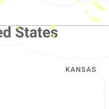
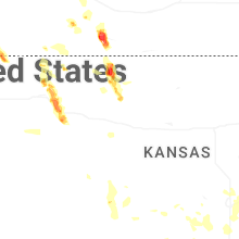

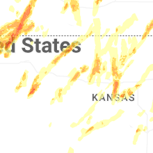

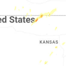


Connect with Interactive Hail Maps