

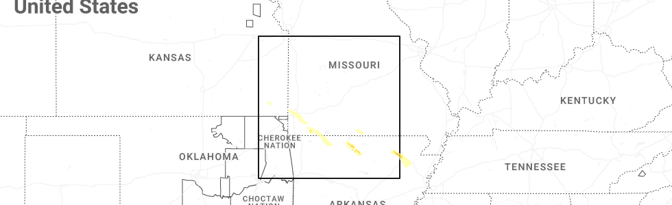
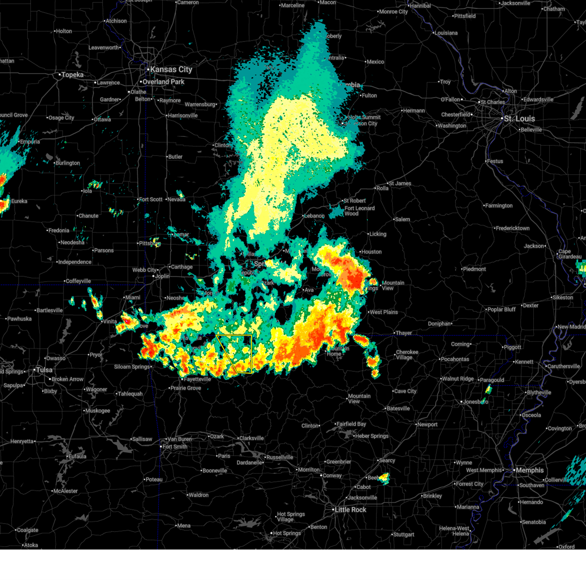
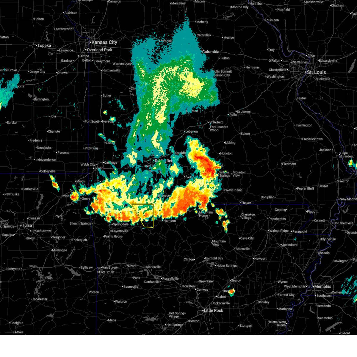
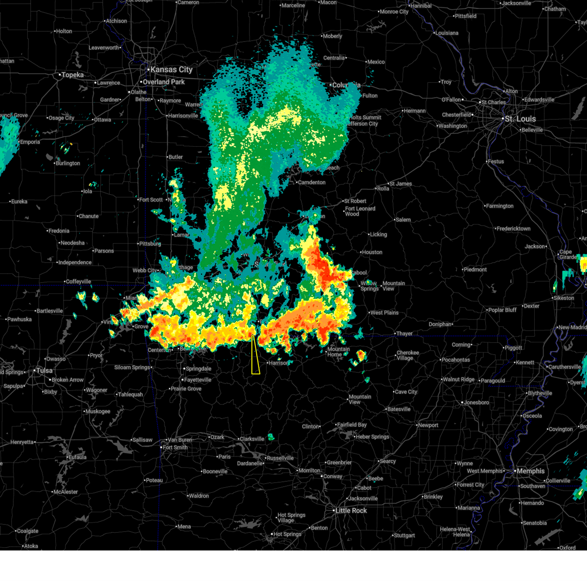
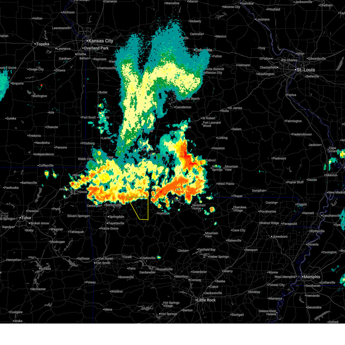
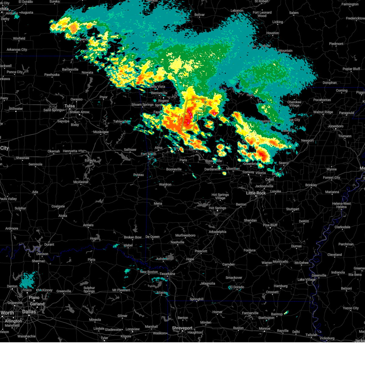
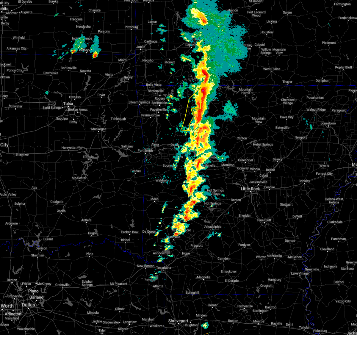
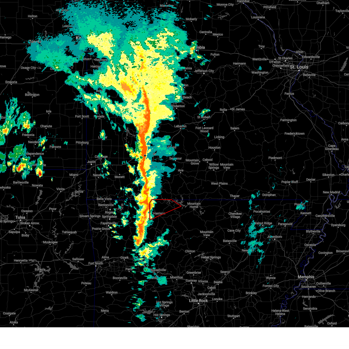
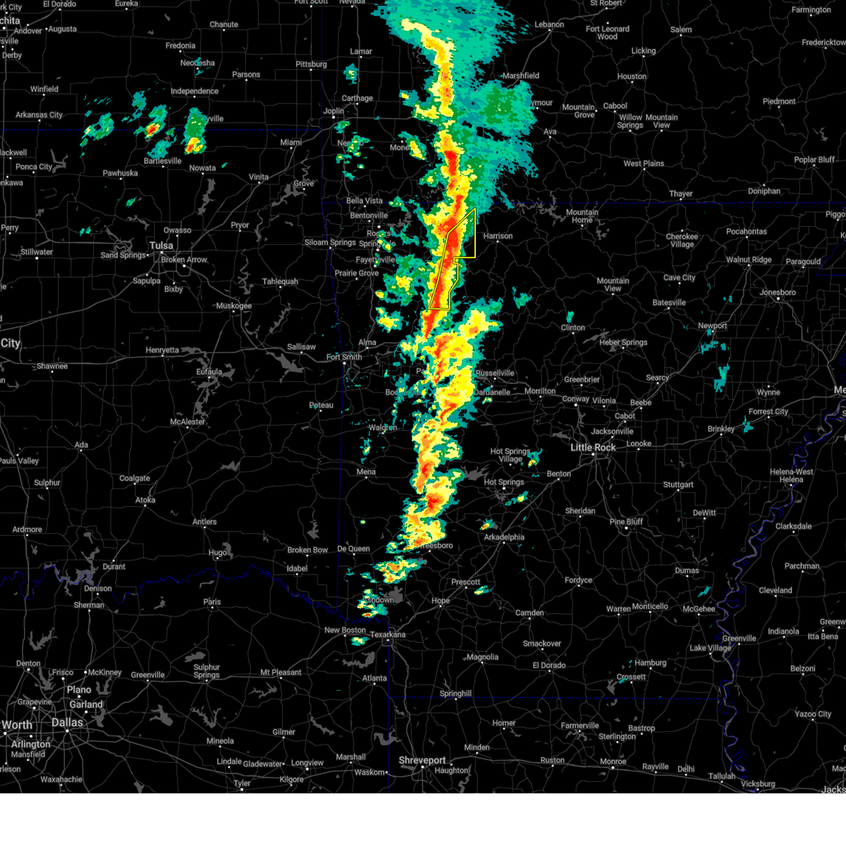
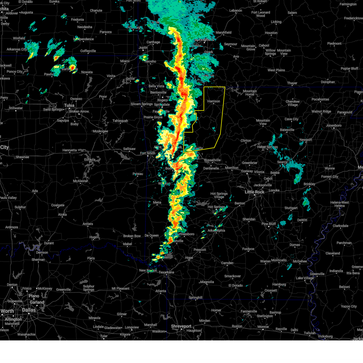
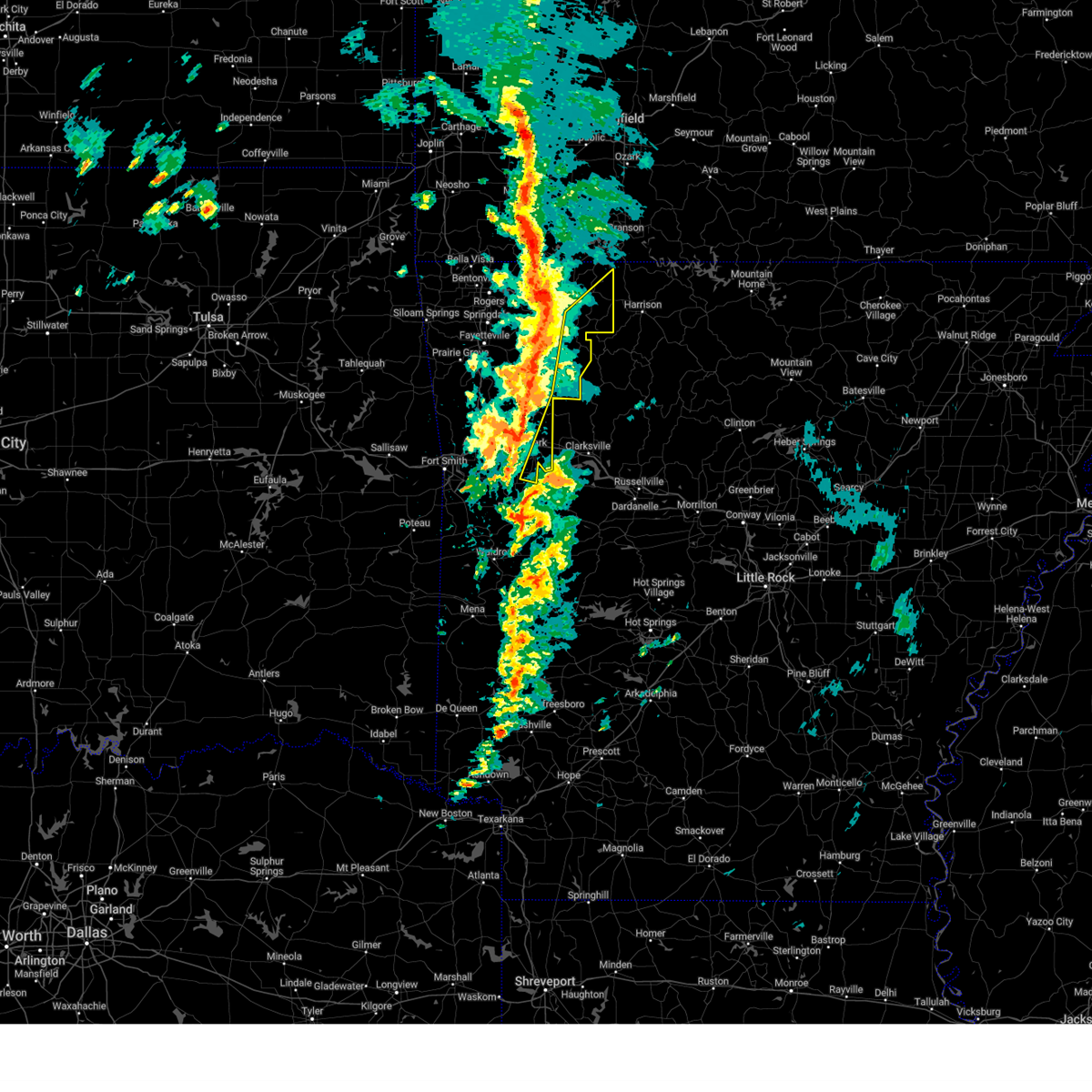
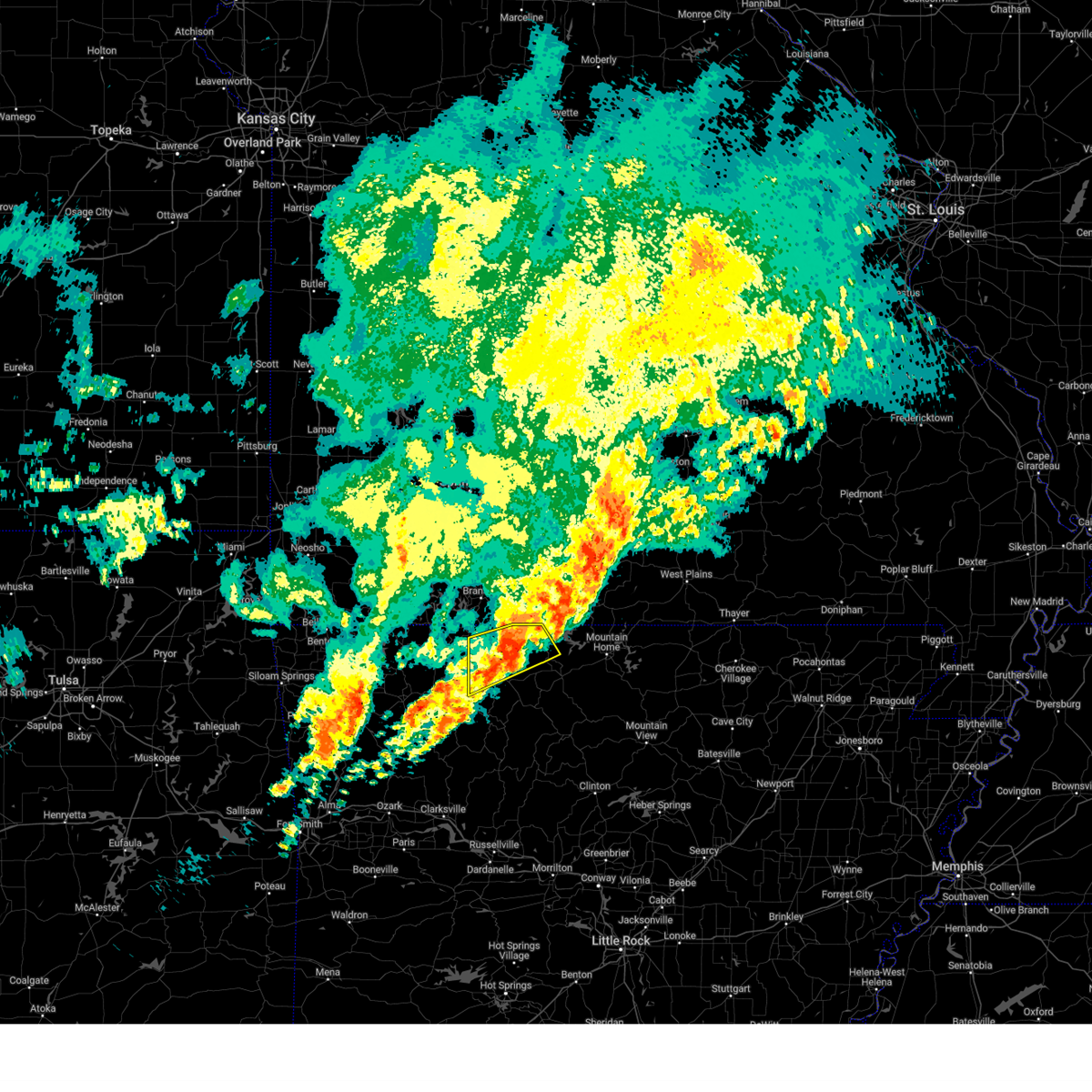
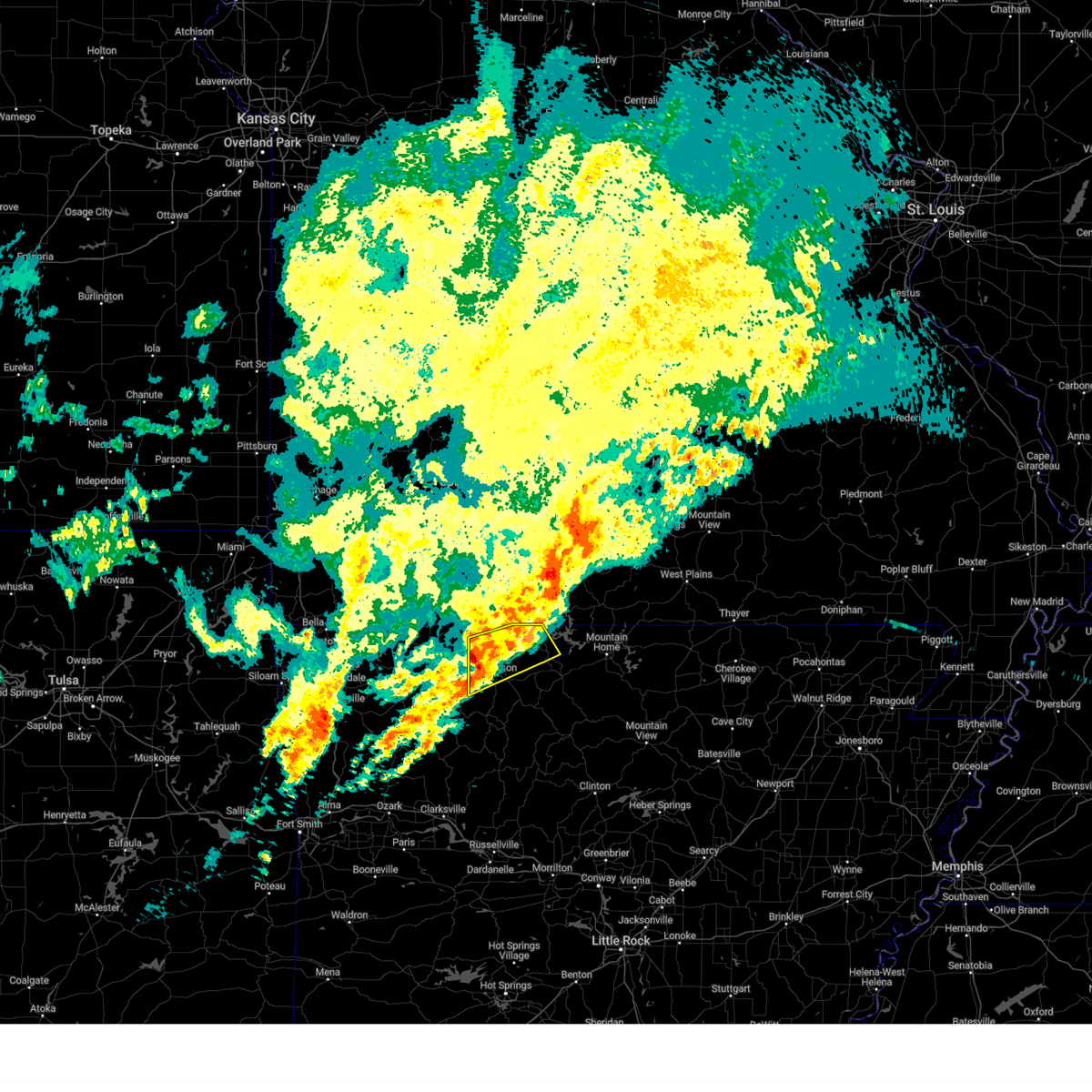
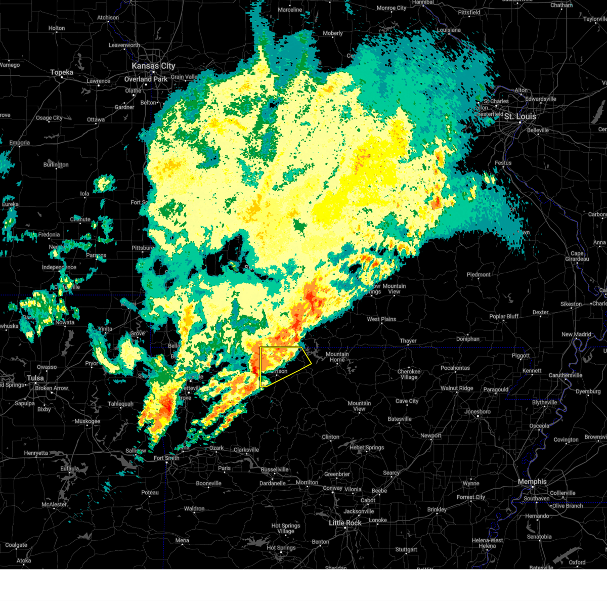
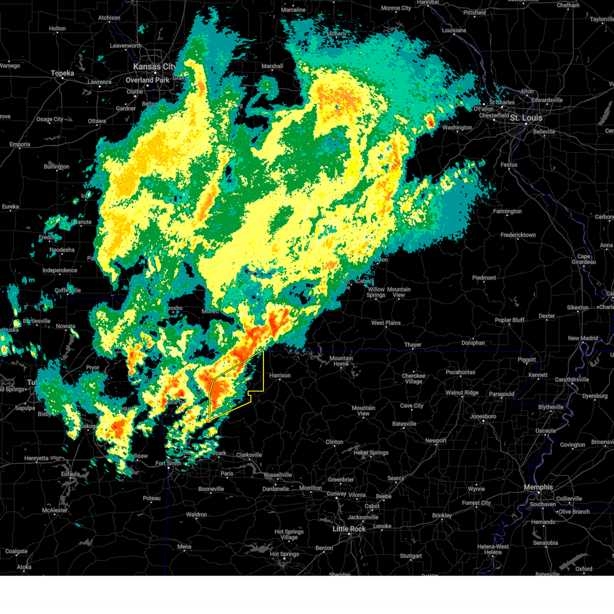
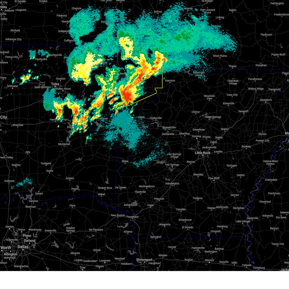
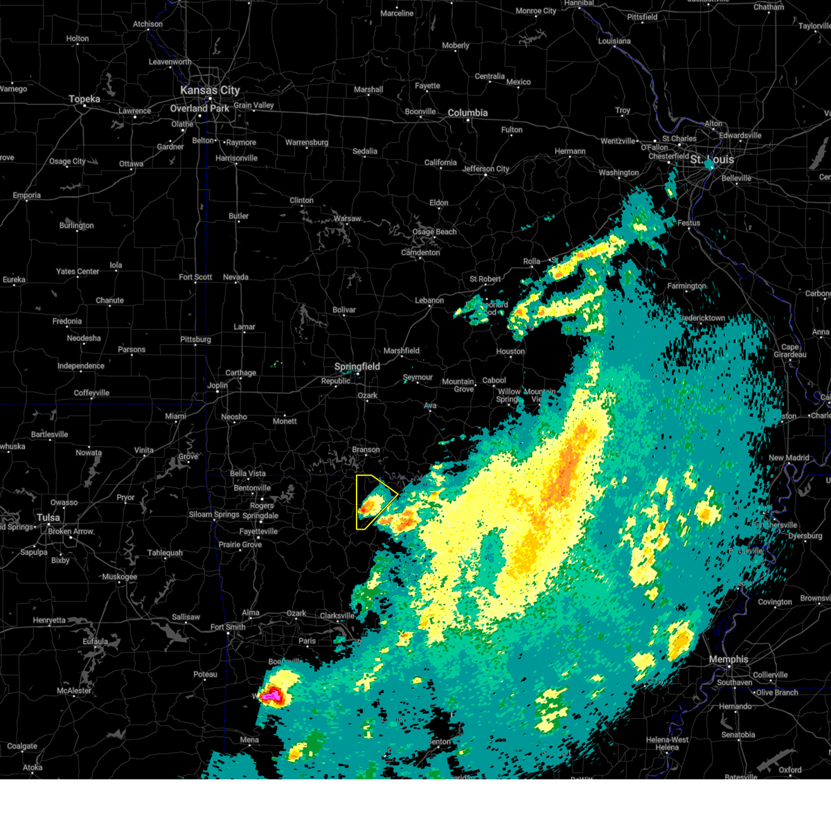
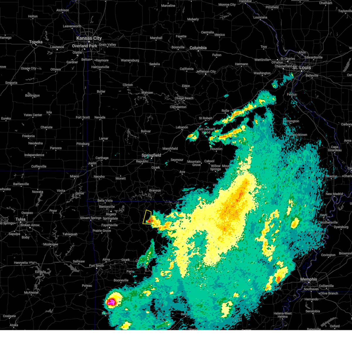
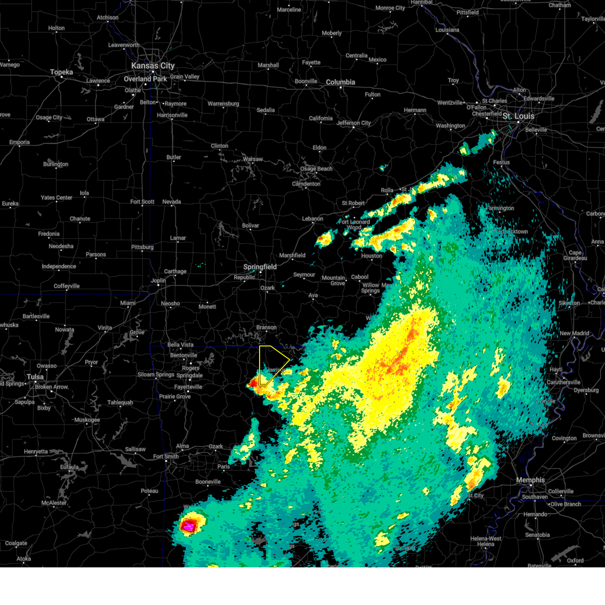
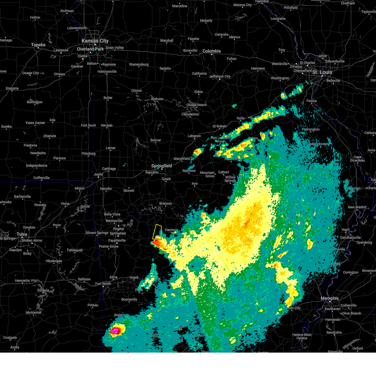
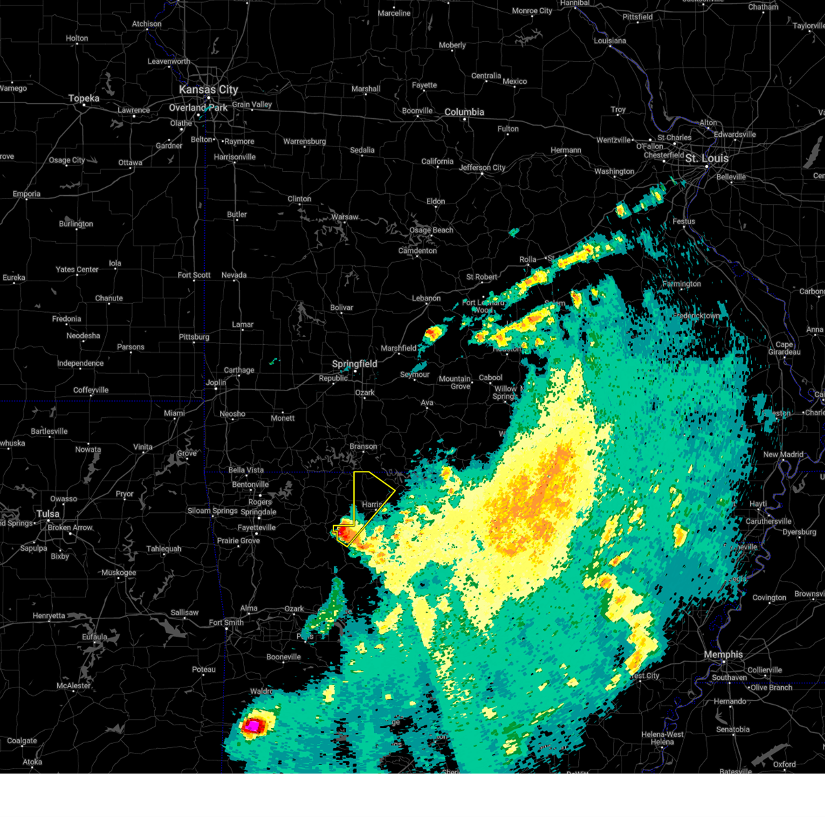
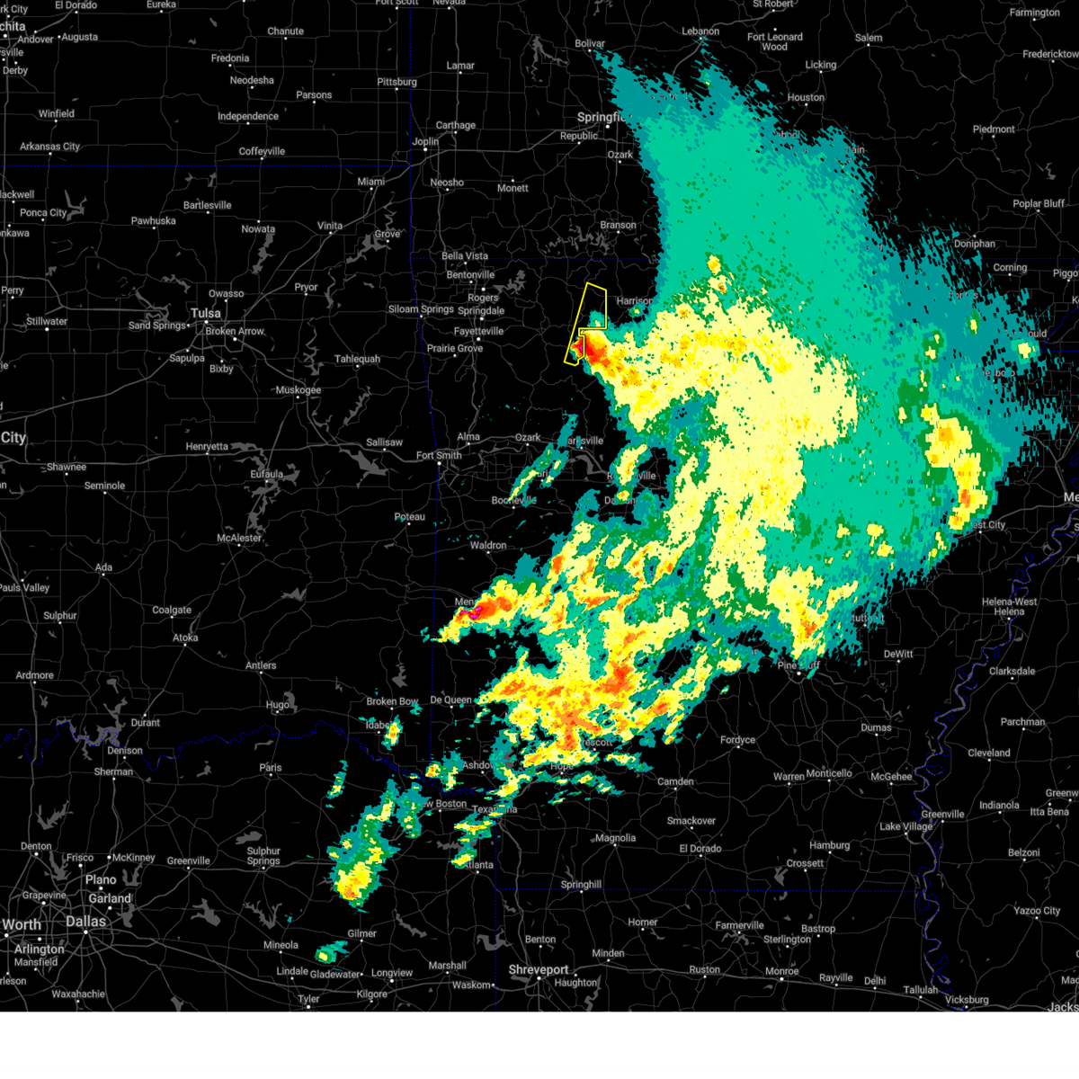
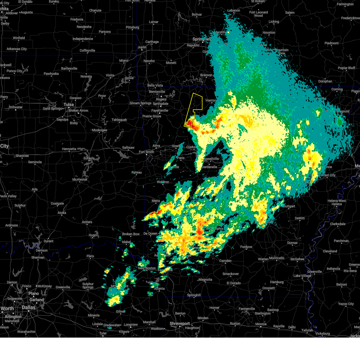
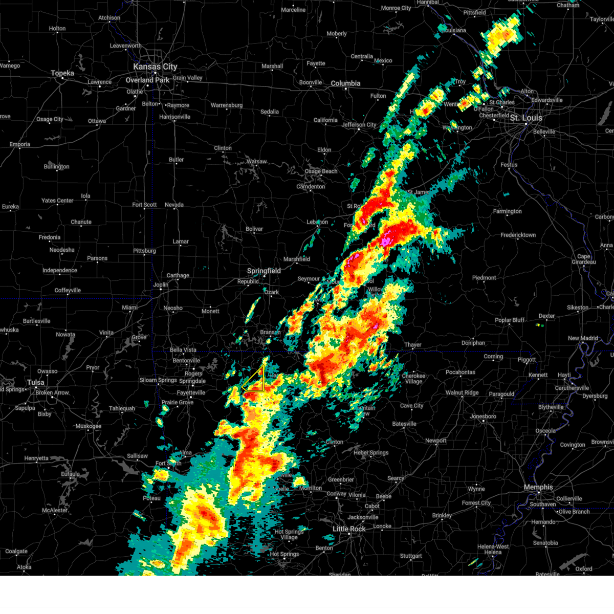
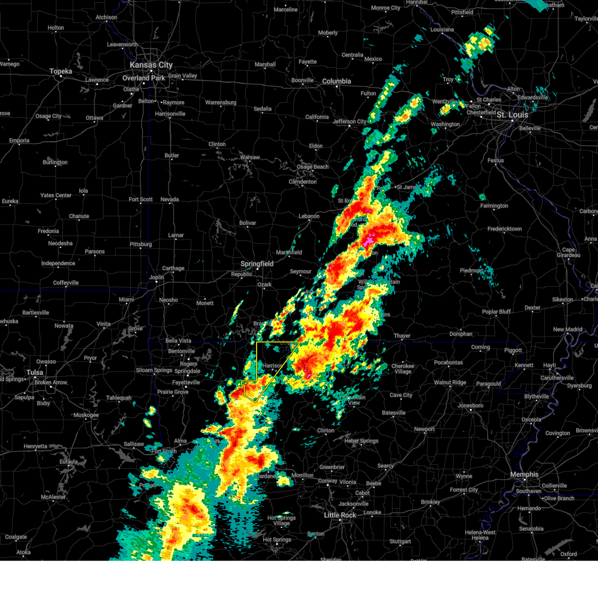
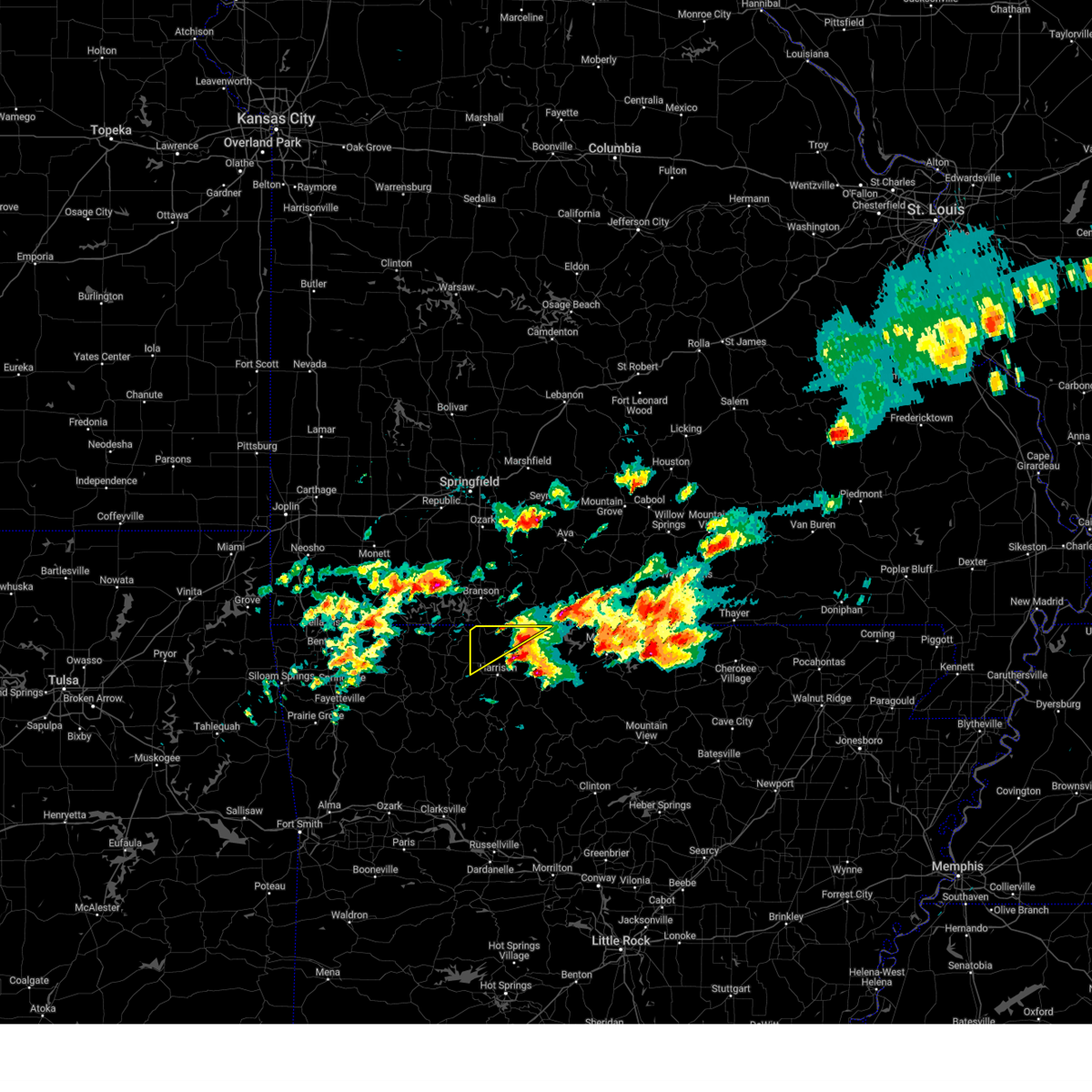
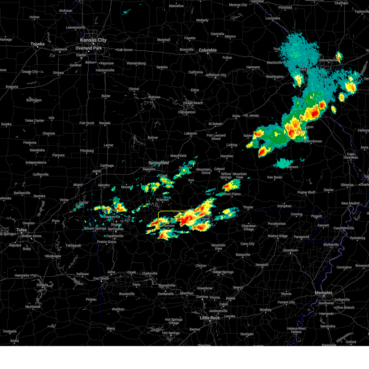
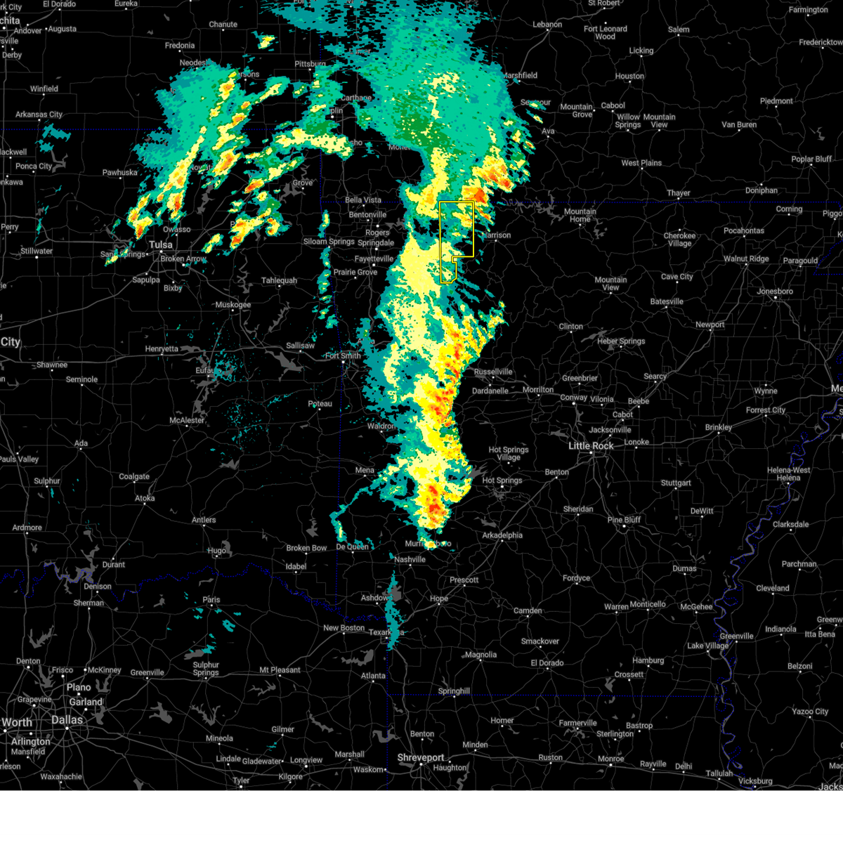
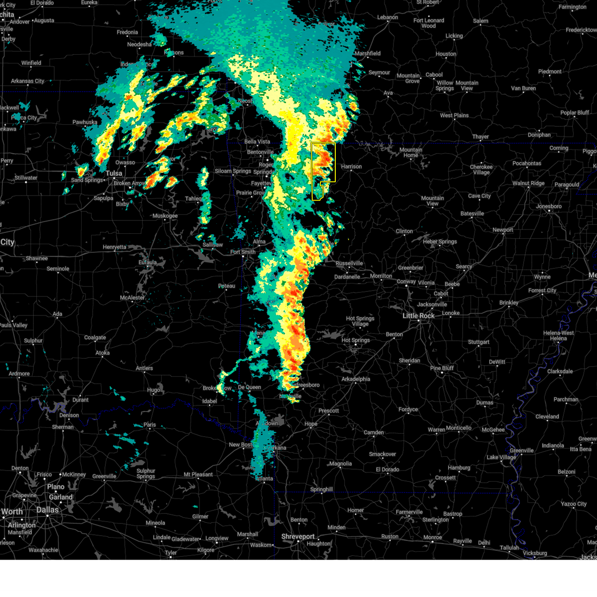
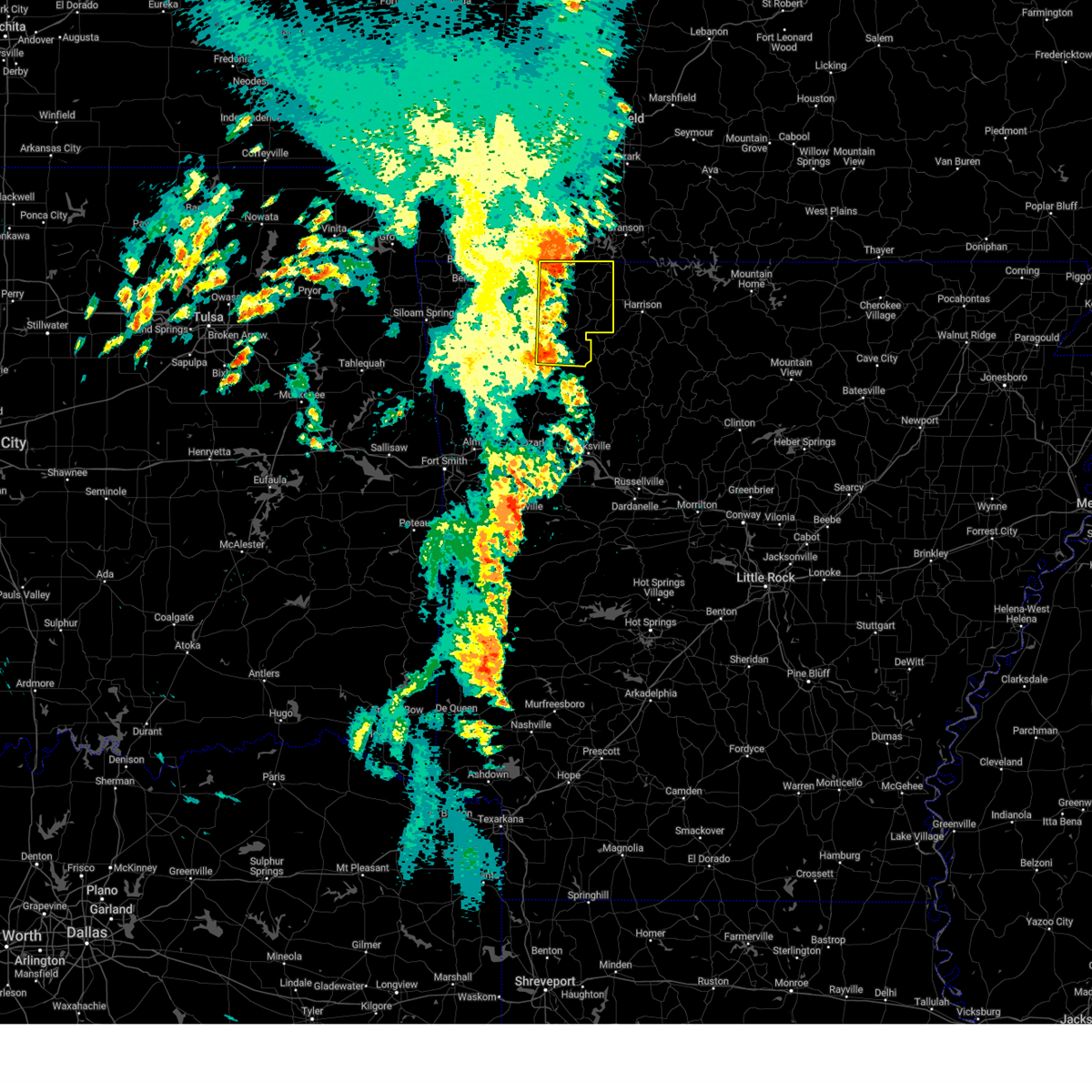
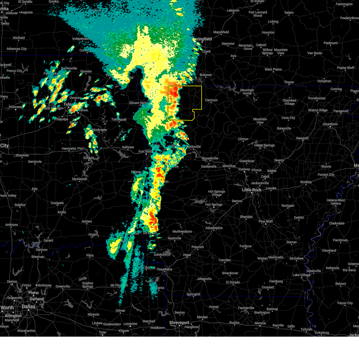
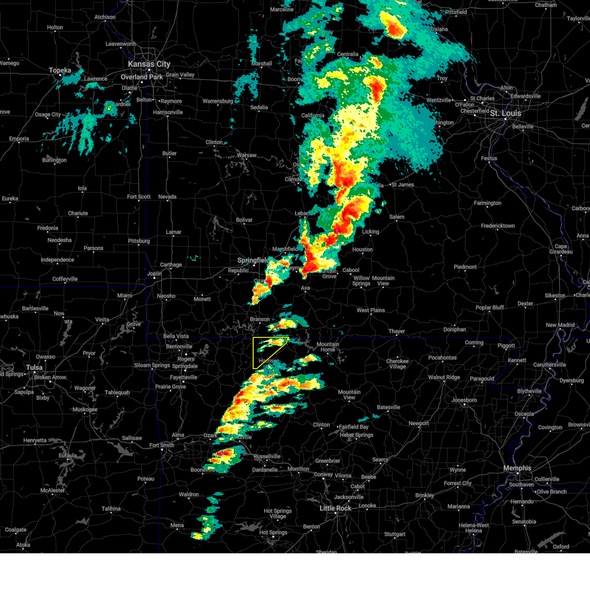
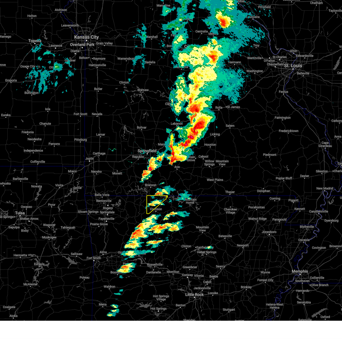
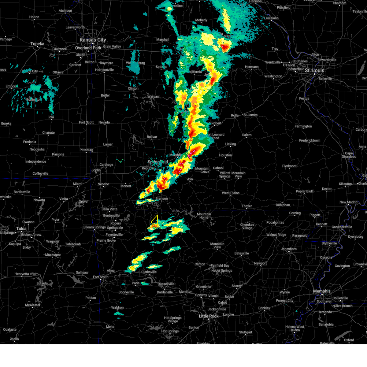
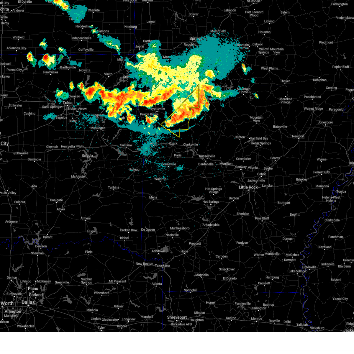
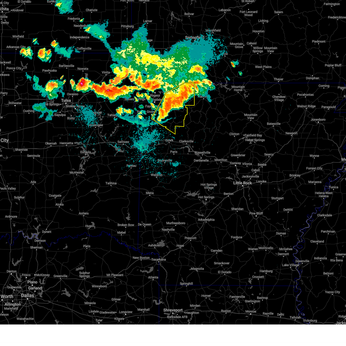
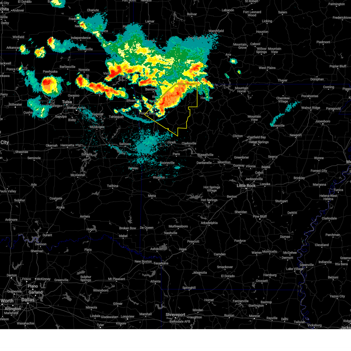
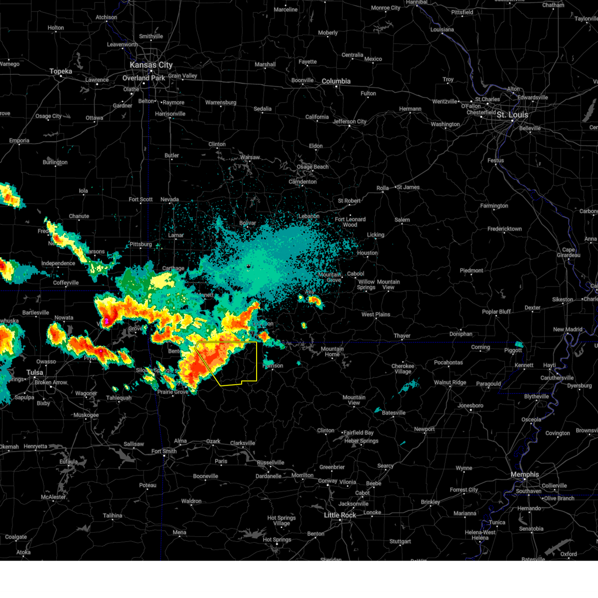
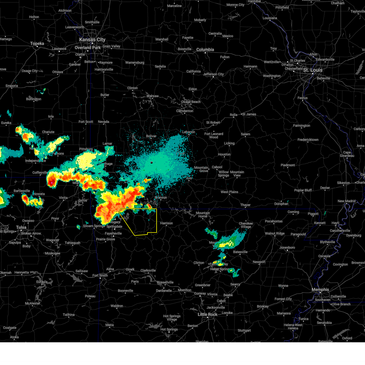
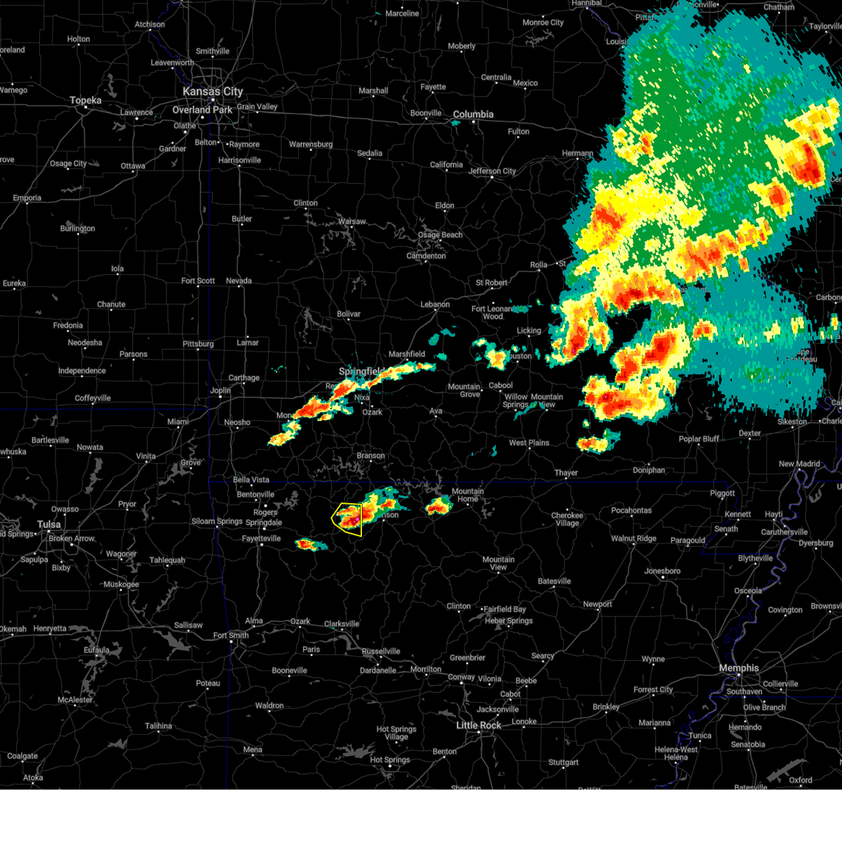
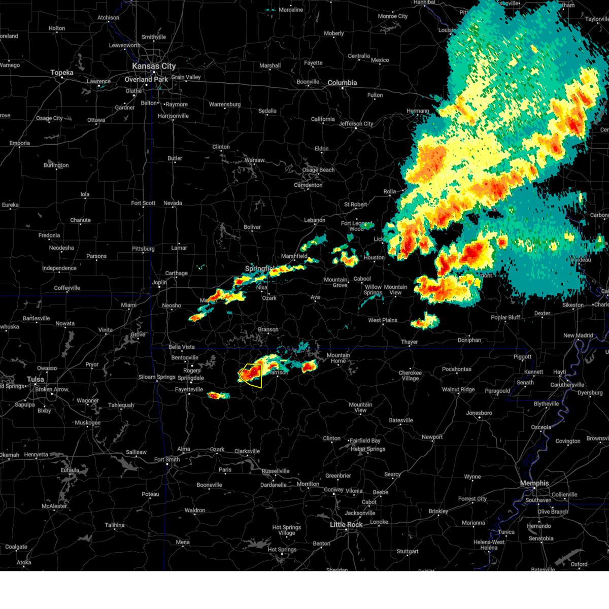
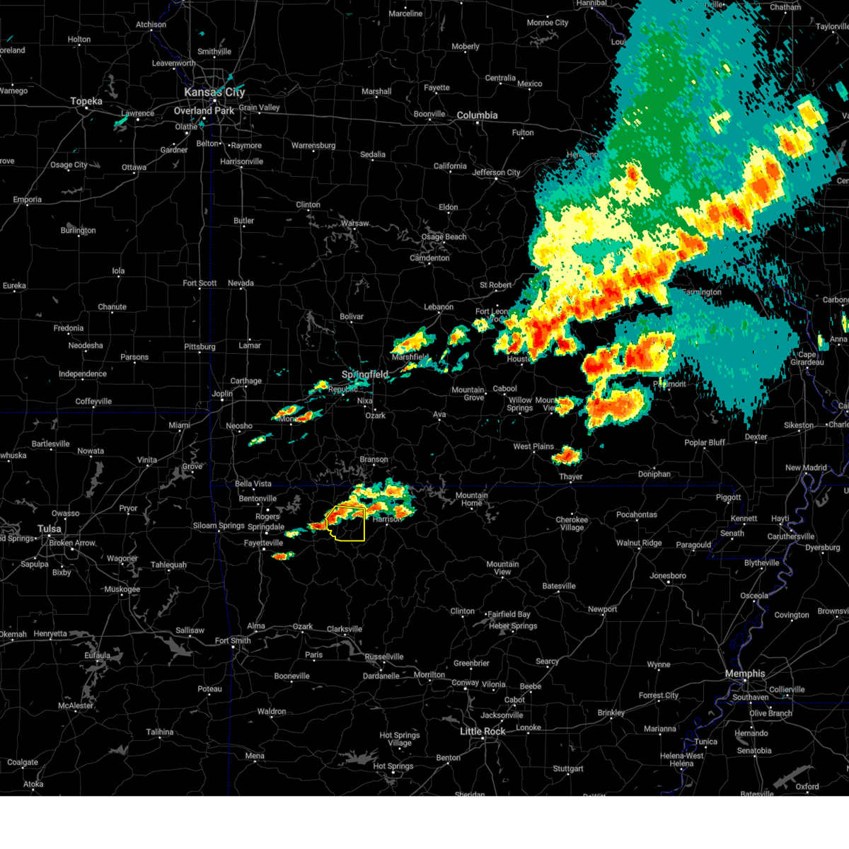
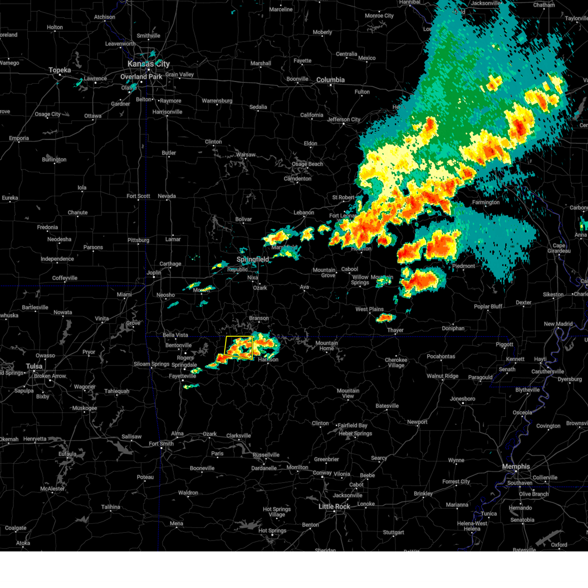
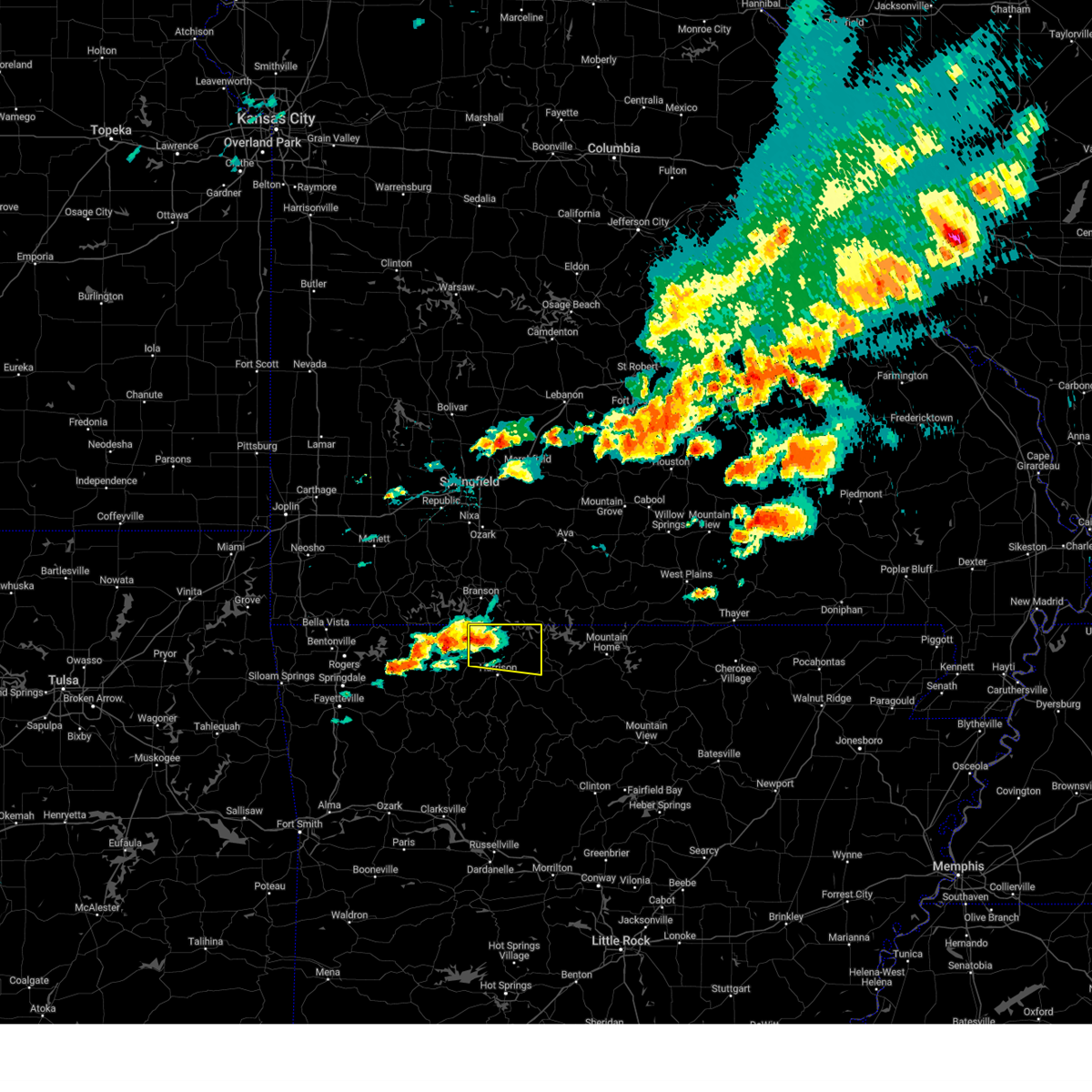
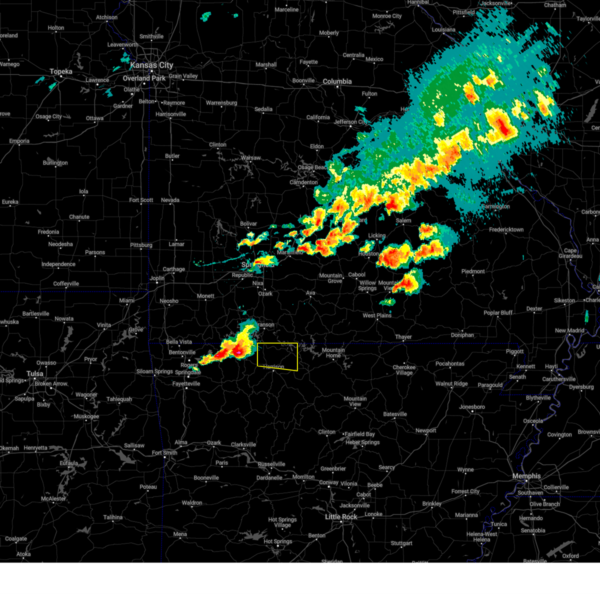
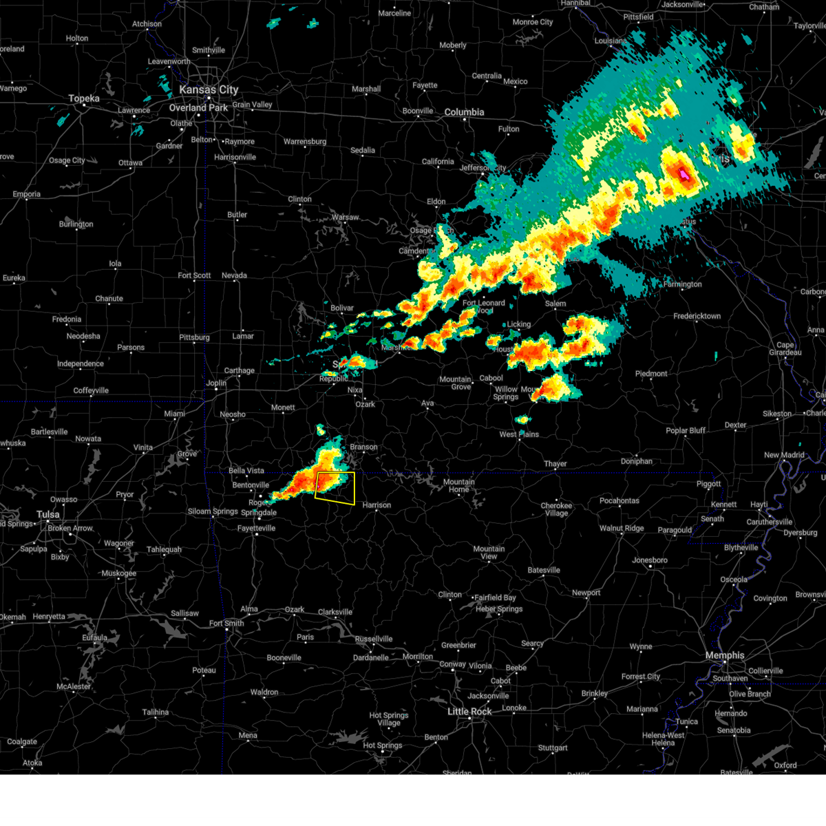
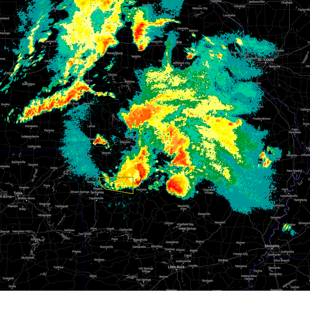
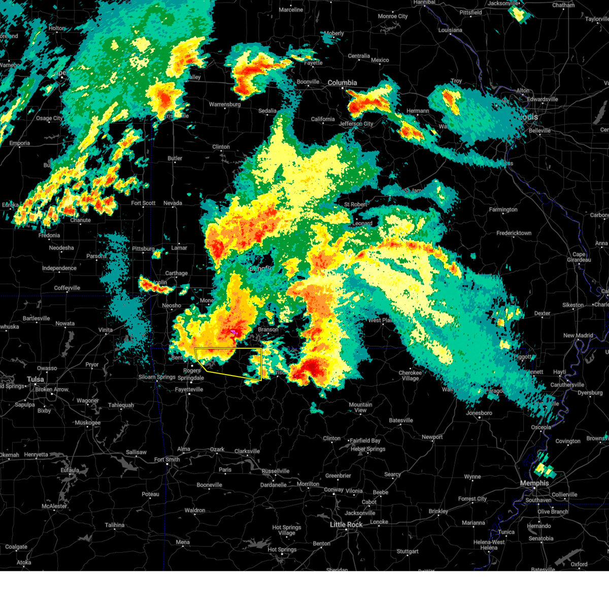
Hail Map for Alpena, AR
The Alpena, AR area has had 3 reports of on-the-ground hail by trained spotters, and has been under severe weather warnings 73 times during the past 12 months. Doppler radar has detected hail at or near Alpena, AR on 55 occasions, including 6 occasions during the past year.
| Name: | Alpena, AR |
| Where Located: | 63.1 miles S of Springfield, MO |
| Map: | Google Map for Alpena, AR |
| Population: | 392 |
| Housing Units: | 161 |
| More Info: | Search Google for Alpena, AR |
5
The Top Recent Hail Date for Alpena, AR is Wednesday, May 21, 2025 (10th out of 55)
Hail and Wind Damage Spotted near Alpena, AR
| Date / Time | Report Details |
|---|---|
| 6/29/2025 6:35 PM CDT |
 the severe thunderstorm warning has been cancelled and is no longer in effect the severe thunderstorm warning has been cancelled and is no longer in effect
|
| 6/29/2025 6:19 PM CDT |
 At 618 pm cdt, the leading edge of a line of severe thunderstorms was located along a line extending from capps to 3 miles southwest of rudd, moving southeast at 35 mph (radar indicated). Hazards include 60 mph wind gusts. Expect damage to roofs, siding, and trees. Locations in or near the path include, carrollton, dryfork, rudd, cabanal, metalton, connor, coin, osage, pleasant ridge, urbanette, delmar, berryville, green forest, denver, rule, grandview, oak hill,. At 618 pm cdt, the leading edge of a line of severe thunderstorms was located along a line extending from capps to 3 miles southwest of rudd, moving southeast at 35 mph (radar indicated). Hazards include 60 mph wind gusts. Expect damage to roofs, siding, and trees. Locations in or near the path include, carrollton, dryfork, rudd, cabanal, metalton, connor, coin, osage, pleasant ridge, urbanette, delmar, berryville, green forest, denver, rule, grandview, oak hill,.
|
| 6/29/2025 5:55 PM CDT |
 Svrlzk the national weather service in little rock has issued a * severe thunderstorm warning for, western boone county in north central arkansas, * until 630 pm cdt. * at 555 pm cdt, a severe thunderstorm was located near carrollton, or 9 miles northwest of harrison, moving south at 45 mph (radar indicated). Hazards include 60 mph wind gusts. expect damage to roofs, siding, and trees Svrlzk the national weather service in little rock has issued a * severe thunderstorm warning for, western boone county in north central arkansas, * until 630 pm cdt. * at 555 pm cdt, a severe thunderstorm was located near carrollton, or 9 miles northwest of harrison, moving south at 45 mph (radar indicated). Hazards include 60 mph wind gusts. expect damage to roofs, siding, and trees
|
| 6/29/2025 5:50 PM CDT |
 Svrtsa the national weather service in tulsa has issued a * severe thunderstorm warning for, carroll county in northwestern arkansas, * until 645 pm cdt. * at 549 pm cdt, severe thunderstorms were located along a line extending from 4 miles west of roberson hollow to 3 miles northeast of eureka springs, moving southeast at 25 mph (radar indicated). Hazards include 60 mph wind gusts. Expect damage to roofs, siding, and trees. Locations in or near the path include, carrollton, dryfork, rudd, cabanal, metalton, connor, coin, osage, pleasant ridge, urbanette, delmar, berryville, green forest, denver, rule, grandview, oak hill,. Svrtsa the national weather service in tulsa has issued a * severe thunderstorm warning for, carroll county in northwestern arkansas, * until 645 pm cdt. * at 549 pm cdt, severe thunderstorms were located along a line extending from 4 miles west of roberson hollow to 3 miles northeast of eureka springs, moving southeast at 25 mph (radar indicated). Hazards include 60 mph wind gusts. Expect damage to roofs, siding, and trees. Locations in or near the path include, carrollton, dryfork, rudd, cabanal, metalton, connor, coin, osage, pleasant ridge, urbanette, delmar, berryville, green forest, denver, rule, grandview, oak hill,.
|
| 5/19/2025 8:36 PM CDT | the tornado warning has been cancelled and is no longer in effect |
| 5/19/2025 8:31 PM CDT | The storm which prompted the warning has moved out of the area. therefore, the warning has been allowed to expire. a tornado watch remains in effect until 200 am cdt for northwestern arkansas. to report severe weather, contact your nearest law enforcement agency. they will relay your report to the national weather service tulsa. remember, a severe thunderstorm warning still remains in effect for carroll county until 9 pm cdt. |
| 5/19/2025 8:28 PM CDT |
 Svrtsa the national weather service in tulsa has issued a * severe thunderstorm warning for, madison county in northwestern arkansas, northern franklin county in west central arkansas, carroll county in northwestern arkansas, northeastern crawford county in northwestern arkansas, southeastern washington county in northwestern arkansas, * until 900 pm cdt. * at 828 pm cdt, severe thunderstorms were located along a line extending from 5 miles west of roberson hollow to 5 miles east of boston to 5 miles north of ozark, moving east at 30 mph (radar indicated). Hazards include 60 mph wind gusts. Expect damage to roofs, siding, and trees. Locations in or near the path include, jethro, wesley, carrollton, rudd, metalton, connor, forum, aurora, coin, pleasant ridge, combs, locke, turners bend, mount gayler, best, clifty, georgetown, boston, dutton, rockhouse, this includes interstate 49 between mile markers 29 and 35. Svrtsa the national weather service in tulsa has issued a * severe thunderstorm warning for, madison county in northwestern arkansas, northern franklin county in west central arkansas, carroll county in northwestern arkansas, northeastern crawford county in northwestern arkansas, southeastern washington county in northwestern arkansas, * until 900 pm cdt. * at 828 pm cdt, severe thunderstorms were located along a line extending from 5 miles west of roberson hollow to 5 miles east of boston to 5 miles north of ozark, moving east at 30 mph (radar indicated). Hazards include 60 mph wind gusts. Expect damage to roofs, siding, and trees. Locations in or near the path include, jethro, wesley, carrollton, rudd, metalton, connor, forum, aurora, coin, pleasant ridge, combs, locke, turners bend, mount gayler, best, clifty, georgetown, boston, dutton, rockhouse, this includes interstate 49 between mile markers 29 and 35.
|
| 5/19/2025 8:20 PM CDT | At 819 pm cdt, a severe thunderstorm with strong low level rotation that could produce a tornado at any time was located near osage, moving east at 55 mph (radar indicated rotation). Hazards include tornado. Flying debris will be dangerous to those caught without shelter. mobile homes will be damaged or destroyed. damage to roofs, windows, and vehicles will occur. tree damage is likely. Locations in or near the path include, coin, carrollton, osage, dryfork, rudd, metalton, delmar, green forest, connor, rule,. |
| 5/19/2025 8:20 PM CDT | the tornado warning has been cancelled and is no longer in effect |
| 5/19/2025 8:19 PM CDT | Torlzk the national weather service in little rock has issued a * tornado warning for, west central marion county in north central arkansas, boone county in north central arkansas, * until 900 pm cdt. * at 819 pm cdt, a severe thunderstorm capable of producing a tornado was located over osage, or 14 miles southeast of berryville, moving east at 55 mph (radar indicated rotation). Hazards include tornado. Flying debris will be dangerous to those caught without shelter. mobile homes will be damaged or destroyed. damage to roofs, windows, and vehicles will occur. Tree damage is likely. |
| 5/19/2025 8:13 PM CDT |
 At 813 pm cdt, a severe thunderstorm with strong low level rotation that could produce a tornado at any time was located 3 miles southwest of rudd, moving east at 60 mph (radar indicated rotation). Hazards include tornado. Flying debris will be dangerous to those caught without shelter. mobile homes will be damaged or destroyed. damage to roofs, windows, and vehicles will occur. tree damage is likely. Locations in or near the path include, carrollton, dryfork, rudd, cabanal, metalton, connor, marble, coin, osage, delmar, green forest, rule, berryville,. At 813 pm cdt, a severe thunderstorm with strong low level rotation that could produce a tornado at any time was located 3 miles southwest of rudd, moving east at 60 mph (radar indicated rotation). Hazards include tornado. Flying debris will be dangerous to those caught without shelter. mobile homes will be damaged or destroyed. damage to roofs, windows, and vehicles will occur. tree damage is likely. Locations in or near the path include, carrollton, dryfork, rudd, cabanal, metalton, connor, marble, coin, osage, delmar, green forest, rule, berryville,.
|
| 5/19/2025 8:03 PM CDT |
 At 802 pm cdt, a confirmed tornado was located over huntsville, moving east at 60 mph (radar confirmed tornado). Hazards include damaging tornado. Flying debris will be dangerous to those caught without shelter. mobile homes will be damaged or destroyed. damage to roofs, windows, and vehicles will occur. tree damage is likely. Locations in or near the path include, withrow springs state park, huntsville, carrollton, dryfork, rudd, cabanal, metalton, connor, marble, forum, coin, alabam, osage, urbanette, delmar, berryville, green forest, rule,. At 802 pm cdt, a confirmed tornado was located over huntsville, moving east at 60 mph (radar confirmed tornado). Hazards include damaging tornado. Flying debris will be dangerous to those caught without shelter. mobile homes will be damaged or destroyed. damage to roofs, windows, and vehicles will occur. tree damage is likely. Locations in or near the path include, withrow springs state park, huntsville, carrollton, dryfork, rudd, cabanal, metalton, connor, marble, forum, coin, alabam, osage, urbanette, delmar, berryville, green forest, rule,.
|
| 5/19/2025 7:57 PM CDT | Tortsa the national weather service in tulsa has issued a * tornado warning for, northern madison county in northwestern arkansas, eastern carroll county in northwestern arkansas, * until 830 pm cdt. * at 757 pm cdt, a severe thunderstorm capable of producing a tornado was located 3 miles northwest of huntsville, moving east at 60 mph (radar indicated rotation). Hazards include tornado. Flying debris will be dangerous to those caught without shelter. mobile homes will be damaged or destroyed. damage to roofs, windows, and vehicles will occur. tree damage is likely. Locations in or near the path include, rockhouse, withrow springs state park, hindsville, huntsville, carrollton, dryfork, rudd, cabanal, metalton, connor, marble, forum, coin, alabam, osage, urbanette, delmar, berryville, green forest, rule,. |
| 5/19/2025 7:37 PM CDT |
 Svrtsa the national weather service in tulsa has issued a * severe thunderstorm warning for, northeastern benton county in northwestern arkansas, madison county in northwestern arkansas, northern franklin county in west central arkansas, carroll county in northwestern arkansas, northeastern crawford county in northwestern arkansas, eastern washington county in northwestern arkansas, * until 830 pm cdt. * at 737 pm cdt, severe thunderstorms were located along a line extending from 2 miles northwest of garfield to 3 miles southwest of elkins to lake fort smith, moving east at 40 mph (radar indicated). Hazards include 70 mph wind gusts. Expect considerable tree damage. damage is likely to mobile homes, roofs, and outbuildings. Locations in or near the path include, jethro, wesley, carrollton, rudd, beaver lake, metalton, elkins, connor, forum, aurora, larue, coin, winslow, pleasant ridge, combs, locke, hobbs state park, turners bend, mount gayler, best, this includes interstate 49 between mile markers 28 and 37. Svrtsa the national weather service in tulsa has issued a * severe thunderstorm warning for, northeastern benton county in northwestern arkansas, madison county in northwestern arkansas, northern franklin county in west central arkansas, carroll county in northwestern arkansas, northeastern crawford county in northwestern arkansas, eastern washington county in northwestern arkansas, * until 830 pm cdt. * at 737 pm cdt, severe thunderstorms were located along a line extending from 2 miles northwest of garfield to 3 miles southwest of elkins to lake fort smith, moving east at 40 mph (radar indicated). Hazards include 70 mph wind gusts. Expect considerable tree damage. damage is likely to mobile homes, roofs, and outbuildings. Locations in or near the path include, jethro, wesley, carrollton, rudd, beaver lake, metalton, elkins, connor, forum, aurora, larue, coin, winslow, pleasant ridge, combs, locke, hobbs state park, turners bend, mount gayler, best, this includes interstate 49 between mile markers 28 and 37.
|
| 5/18/2025 5:31 PM CDT |
 the severe thunderstorm warning has been cancelled and is no longer in effect the severe thunderstorm warning has been cancelled and is no longer in effect
|
| 5/18/2025 5:14 PM CDT |
 At 514 pm cdt, a severe thunderstorm was located 3 miles southeast of kingston, moving east at 50 mph (radar indicated). Hazards include 70 mph wind gusts and half dollar size hail. Hail damage to vehicles is expected. expect considerable tree damage. wind damage is also likely to mobile homes, roofs, and outbuildings. locations in or near the path include, carrollton, dryfork, rudd, red star, cabanal, pettigrew, st. Paul, metalton, weathers, kingston, connor, witter, marble, aurora, alabam, osage, delmar, rule, boston, dutton,. At 514 pm cdt, a severe thunderstorm was located 3 miles southeast of kingston, moving east at 50 mph (radar indicated). Hazards include 70 mph wind gusts and half dollar size hail. Hail damage to vehicles is expected. expect considerable tree damage. wind damage is also likely to mobile homes, roofs, and outbuildings. locations in or near the path include, carrollton, dryfork, rudd, red star, cabanal, pettigrew, st. Paul, metalton, weathers, kingston, connor, witter, marble, aurora, alabam, osage, delmar, rule, boston, dutton,.
|
| 5/18/2025 4:58 PM CDT |
 Svrtsa the national weather service in tulsa has issued a * severe thunderstorm warning for, madison county in northwestern arkansas, southern carroll county in northwestern arkansas, * until 545 pm cdt. * at 458 pm cdt, a severe thunderstorm was located near huntsville, moving east at 45 mph (radar indicated). Hazards include golf ball size hail and 70 mph wind gusts. People and animals outdoors will be injured. expect hail damage to roofs, siding, windows, and vehicles. expect considerable tree damage. wind damage is also likely to mobile homes, roofs, and outbuildings. Locations in or near the path include, hindsville, huntsville, carrollton, dryfork, rudd, red star, metalton, kingston, connor, forum, aurora, crosses, alabam, combs, delmar, clifty, georgetown, boston, rockhouse, withrow springs state park,. Svrtsa the national weather service in tulsa has issued a * severe thunderstorm warning for, madison county in northwestern arkansas, southern carroll county in northwestern arkansas, * until 545 pm cdt. * at 458 pm cdt, a severe thunderstorm was located near huntsville, moving east at 45 mph (radar indicated). Hazards include golf ball size hail and 70 mph wind gusts. People and animals outdoors will be injured. expect hail damage to roofs, siding, windows, and vehicles. expect considerable tree damage. wind damage is also likely to mobile homes, roofs, and outbuildings. Locations in or near the path include, hindsville, huntsville, carrollton, dryfork, rudd, red star, metalton, kingston, connor, forum, aurora, crosses, alabam, combs, delmar, clifty, georgetown, boston, rockhouse, withrow springs state park,.
|
| 4/20/2025 4:10 PM CDT |
 The storms which prompted the warning have moved out of the area. therefore, the warning will be allowed to expire. a tornado watch remains in effect until 700 pm cdt for northwestern arkansas. The storms which prompted the warning have moved out of the area. therefore, the warning will be allowed to expire. a tornado watch remains in effect until 700 pm cdt for northwestern arkansas.
|
| 4/20/2025 3:54 PM CDT |
 Torlzk the national weather service in little rock has issued a * tornado warning for, northwestern marion county in north central arkansas, boone county in north central arkansas, * until 445 pm cdt. * at 354 pm cdt, a severe thunderstorm capable of producing a tornado was located over carrollton, or 13 miles west of harrison, moving northeast at 50 mph (radar indicated rotation). Hazards include tornado. Flying debris will be dangerous to those caught without shelter. mobile homes will be damaged or destroyed. damage to roofs, windows, and vehicles will occur. Tree damage is likely. Torlzk the national weather service in little rock has issued a * tornado warning for, northwestern marion county in north central arkansas, boone county in north central arkansas, * until 445 pm cdt. * at 354 pm cdt, a severe thunderstorm capable of producing a tornado was located over carrollton, or 13 miles west of harrison, moving northeast at 50 mph (radar indicated rotation). Hazards include tornado. Flying debris will be dangerous to those caught without shelter. mobile homes will be damaged or destroyed. damage to roofs, windows, and vehicles will occur. Tree damage is likely.
|
| 4/20/2025 3:49 PM CDT |
 At 348 pm cdt, severe thunderstorms were located along a line extending from 5 miles northeast of green forest to 7 miles south of kingston to 8 miles west of woodland, moving northeast at 35 mph (radar indicated). Hazards include 60 mph wind gusts and penny size hail. Expect damage to roofs, siding, and trees. Locations in or near the path include, carrollton, dryfork, rudd, red star, cabanal, pettigrew, metalton, weathers, kingston, connor, coin, osage, delmar, green forest, denver, rule, boston,. At 348 pm cdt, severe thunderstorms were located along a line extending from 5 miles northeast of green forest to 7 miles south of kingston to 8 miles west of woodland, moving northeast at 35 mph (radar indicated). Hazards include 60 mph wind gusts and penny size hail. Expect damage to roofs, siding, and trees. Locations in or near the path include, carrollton, dryfork, rudd, red star, cabanal, pettigrew, metalton, weathers, kingston, connor, coin, osage, delmar, green forest, denver, rule, boston,.
|
| 4/20/2025 3:49 PM CDT |
 the severe thunderstorm warning has been cancelled and is no longer in effect the severe thunderstorm warning has been cancelled and is no longer in effect
|
| 4/20/2025 3:25 PM CDT |
 Svrlzk the national weather service in little rock has issued a * severe thunderstorm warning for, newton county in north central arkansas, johnson county in western arkansas, boone county in north central arkansas, northwestern pope county in central arkansas, * until 415 pm cdt. * at 325 pm cdt, severe thunderstorms were located along a line extending from near huntsville to near cass to near ratcliff, moving northeast at 75 mph (radar indicated). Hazards include 60 mph wind gusts and nickel size hail. expect damage to roofs, siding, and trees Svrlzk the national weather service in little rock has issued a * severe thunderstorm warning for, newton county in north central arkansas, johnson county in western arkansas, boone county in north central arkansas, northwestern pope county in central arkansas, * until 415 pm cdt. * at 325 pm cdt, severe thunderstorms were located along a line extending from near huntsville to near cass to near ratcliff, moving northeast at 75 mph (radar indicated). Hazards include 60 mph wind gusts and nickel size hail. expect damage to roofs, siding, and trees
|
| 4/20/2025 3:21 PM CDT |
 Svrtsa the national weather service in tulsa has issued a * severe thunderstorm warning for, eastern madison county in northwestern arkansas, eastern franklin county in west central arkansas, southeastern carroll county in northwestern arkansas, * until 415 pm cdt. * at 321 pm cdt, severe thunderstorms were located along a line extending from 5 miles northeast of forum to 4 miles south of st. paul to 5 miles north of ratcliff, moving northeast at 45 mph (radar indicated). Hazards include 60 mph wind gusts and penny size hail. Expect damage to roofs, siding, and trees. Locations in or near the path include, carrollton, dryfork, rudd, red star, metalton, kingston, connor, coin, delmar, denver, boston, dutton, altus, denning, etna, alix, cabanal, pettigrew, weathers, marble, this includes interstate 40 in arkansas between mile markers 36 and 42. Svrtsa the national weather service in tulsa has issued a * severe thunderstorm warning for, eastern madison county in northwestern arkansas, eastern franklin county in west central arkansas, southeastern carroll county in northwestern arkansas, * until 415 pm cdt. * at 321 pm cdt, severe thunderstorms were located along a line extending from 5 miles northeast of forum to 4 miles south of st. paul to 5 miles north of ratcliff, moving northeast at 45 mph (radar indicated). Hazards include 60 mph wind gusts and penny size hail. Expect damage to roofs, siding, and trees. Locations in or near the path include, carrollton, dryfork, rudd, red star, metalton, kingston, connor, coin, delmar, denver, boston, dutton, altus, denning, etna, alix, cabanal, pettigrew, weathers, marble, this includes interstate 40 in arkansas between mile markers 36 and 42.
|
| 4/19/2025 3:58 AM CDT |
 The storm which prompted the warning has weakened below severe limits, and no longer poses an immediate threat to life or property. therefore, the warning will be allowed to expire. however small hail, gusty winds and heavy rain are still possible with this thunderstorm. a severe thunderstorm watch remains in effect until 500 am cdt for north central arkansas. The storm which prompted the warning has weakened below severe limits, and no longer poses an immediate threat to life or property. therefore, the warning will be allowed to expire. however small hail, gusty winds and heavy rain are still possible with this thunderstorm. a severe thunderstorm watch remains in effect until 500 am cdt for north central arkansas.
|
| 4/19/2025 3:48 AM CDT |
 At 348 am cdt, a severe thunderstorm was located over myrtle, or near harrison, moving northeast at 55 mph (radar indicated). Hazards include 60 mph wind gusts and quarter size hail. Hail damage to vehicles is expected. expect wind damage to roofs, siding, and trees. Locations impacted include, myrtle, ridgeway, self, lakeway, burlington, red bank, peel, winington, clark hill, hopewell in boone county, south lead hill, alpena, dodd city, monarch, capps, lead hill, bergman, crumpler subdivision, zinc, batavia,. At 348 am cdt, a severe thunderstorm was located over myrtle, or near harrison, moving northeast at 55 mph (radar indicated). Hazards include 60 mph wind gusts and quarter size hail. Hail damage to vehicles is expected. expect wind damage to roofs, siding, and trees. Locations impacted include, myrtle, ridgeway, self, lakeway, burlington, red bank, peel, winington, clark hill, hopewell in boone county, south lead hill, alpena, dodd city, monarch, capps, lead hill, bergman, crumpler subdivision, zinc, batavia,.
|
| 4/19/2025 3:41 AM CDT |
 The storm which prompted the warning has moved out of the area. therefore, the warning will be allowed to expire. a severe thunderstorm watch remains in effect until 500 am cdt for northwestern arkansas. The storm which prompted the warning has moved out of the area. therefore, the warning will be allowed to expire. a severe thunderstorm watch remains in effect until 500 am cdt for northwestern arkansas.
|
| 4/19/2025 3:36 AM CDT |
 At 336 am cdt, a severe thunderstorm was located over carrollton, or 9 miles west of harrison, moving northeast at 55 mph (radar indicated). Hazards include 60 mph wind gusts and quarter size hail. Hail damage to vehicles is expected. expect wind damage to roofs, siding, and trees. Locations impacted include, myrtle, roberson hollow, ridgeway, self, omaha, lakeway, burlington, red bank, peel, winington, clark hill, hopewell in boone county, south lead hill, alpena, dodd city, monarch, capps, lead hill, bergman, bellefonte,. At 336 am cdt, a severe thunderstorm was located over carrollton, or 9 miles west of harrison, moving northeast at 55 mph (radar indicated). Hazards include 60 mph wind gusts and quarter size hail. Hail damage to vehicles is expected. expect wind damage to roofs, siding, and trees. Locations impacted include, myrtle, roberson hollow, ridgeway, self, omaha, lakeway, burlington, red bank, peel, winington, clark hill, hopewell in boone county, south lead hill, alpena, dodd city, monarch, capps, lead hill, bergman, bellefonte,.
|
| 4/19/2025 3:26 AM CDT |
 the severe thunderstorm warning has been cancelled and is no longer in effect the severe thunderstorm warning has been cancelled and is no longer in effect
|
| 4/19/2025 3:26 AM CDT |
 At 326 am cdt, a severe thunderstorm was located over osage, or 16 miles southeast of berryville, moving northeast at 55 mph (radar indicated). Hazards include 60 mph wind gusts and quarter size hail. Hail damage to vehicles is expected. expect wind damage to roofs, siding, and trees. Locations impacted include, myrtle, roberson hollow, ridgeway, self, omaha, lakeway, burlington, red bank, peel, winington, clark hill, hopewell in boone county, south lead hill, alpena, dodd city, monarch, capps, lead hill, bergman, bellefonte,. At 326 am cdt, a severe thunderstorm was located over osage, or 16 miles southeast of berryville, moving northeast at 55 mph (radar indicated). Hazards include 60 mph wind gusts and quarter size hail. Hail damage to vehicles is expected. expect wind damage to roofs, siding, and trees. Locations impacted include, myrtle, roberson hollow, ridgeway, self, omaha, lakeway, burlington, red bank, peel, winington, clark hill, hopewell in boone county, south lead hill, alpena, dodd city, monarch, capps, lead hill, bergman, bellefonte,.
|
| 4/19/2025 3:24 AM CDT |
 At 323 am cdt, a severe thunderstorm was located near rudd, moving northeast at 60 mph (radar indicated). Hazards include 60 mph wind gusts and quarter size hail. Hail damage to vehicles is expected. expect wind damage to roofs, siding, and trees. Locations in or near the path include, carrollton, dryfork, rudd, cabanal, metalton, connor, coin, osage, delmar, green forest, denver, rule, berryville,. At 323 am cdt, a severe thunderstorm was located near rudd, moving northeast at 60 mph (radar indicated). Hazards include 60 mph wind gusts and quarter size hail. Hail damage to vehicles is expected. expect wind damage to roofs, siding, and trees. Locations in or near the path include, carrollton, dryfork, rudd, cabanal, metalton, connor, coin, osage, delmar, green forest, denver, rule, berryville,.
|
| 4/19/2025 3:24 AM CDT |
 the severe thunderstorm warning has been cancelled and is no longer in effect the severe thunderstorm warning has been cancelled and is no longer in effect
|
| 4/19/2025 3:14 AM CDT |
 Svrlzk the national weather service in little rock has issued a * severe thunderstorm warning for, northwestern newton county in north central arkansas, northwestern marion county in north central arkansas, boone county in north central arkansas, * until 400 am cdt. * at 313 am cdt, a severe thunderstorm was located over marble, or 8 miles east of huntsville, moving northeast at 60 mph (radar indicated). Hazards include 60 mph wind gusts and quarter size hail. Hail damage to vehicles is expected. Expect wind damage to roofs, siding, and trees. Svrlzk the national weather service in little rock has issued a * severe thunderstorm warning for, northwestern newton county in north central arkansas, northwestern marion county in north central arkansas, boone county in north central arkansas, * until 400 am cdt. * at 313 am cdt, a severe thunderstorm was located over marble, or 8 miles east of huntsville, moving northeast at 60 mph (radar indicated). Hazards include 60 mph wind gusts and quarter size hail. Hail damage to vehicles is expected. Expect wind damage to roofs, siding, and trees.
|
| 4/19/2025 3:12 AM CDT |
 At 312 am cdt, a severe thunderstorm was located 4 miles southwest of marble, moving northeast at 55 mph (radar indicated). Hazards include 60 mph wind gusts and quarter size hail. Hail damage to vehicles is expected. expect wind damage to roofs, siding, and trees. Locations in or near the path include, rockhouse, withrow springs state park, carrollton, dryfork, rudd, cabanal, metalton, connor, marble, forum, aurora, coin, alabam, osage, delmar, berryville, green forest, denver, rule, huntsville,. At 312 am cdt, a severe thunderstorm was located 4 miles southwest of marble, moving northeast at 55 mph (radar indicated). Hazards include 60 mph wind gusts and quarter size hail. Hail damage to vehicles is expected. expect wind damage to roofs, siding, and trees. Locations in or near the path include, rockhouse, withrow springs state park, carrollton, dryfork, rudd, cabanal, metalton, connor, marble, forum, aurora, coin, alabam, osage, delmar, berryville, green forest, denver, rule, huntsville,.
|
| 4/19/2025 3:02 AM CDT |
 At 302 am cdt, a severe thunderstorm was located 3 miles northwest of aurora, moving northeast at 60 mph (radar indicated). Hazards include 60 mph wind gusts and quarter size hail. Hail damage to vehicles is expected. expect wind damage to roofs, siding, and trees. Locations in or near the path include, hindsville, wesley, huntsville, carrollton, dryfork, rudd, metalton, kingston, connor, forum, aurora, coin, alabam, crosses, delmar, denver, best, clifty, georgetown, rockhouse,. At 302 am cdt, a severe thunderstorm was located 3 miles northwest of aurora, moving northeast at 60 mph (radar indicated). Hazards include 60 mph wind gusts and quarter size hail. Hail damage to vehicles is expected. expect wind damage to roofs, siding, and trees. Locations in or near the path include, hindsville, wesley, huntsville, carrollton, dryfork, rudd, metalton, kingston, connor, forum, aurora, coin, alabam, crosses, delmar, denver, best, clifty, georgetown, rockhouse,.
|
| 4/19/2025 3:02 AM CDT |
 the severe thunderstorm warning has been cancelled and is no longer in effect the severe thunderstorm warning has been cancelled and is no longer in effect
|
| 4/19/2025 2:40 AM CDT |
 Svrtsa the national weather service in tulsa has issued a * severe thunderstorm warning for, madison county in northwestern arkansas, carroll county in northwestern arkansas, eastern washington county in northwestern arkansas, * until 345 am cdt. * at 240 am cdt, a severe thunderstorm was located over brentwood, moving northeast at 60 mph (radar indicated). Hazards include 60 mph wind gusts and quarter size hail. Hail damage to vehicles is expected. expect wind damage to roofs, siding, and trees. Locations in or near the path include, hindsville, wesley, walnut grove, huntsville, carrollton, dryfork, rudd, woolsey, metalton, elkins, west fork, kingston, connor, forum, aurora, coin, alabam, crosses, winslow, delmar, this includes interstate 49 between mile markers 45 and 63. Svrtsa the national weather service in tulsa has issued a * severe thunderstorm warning for, madison county in northwestern arkansas, carroll county in northwestern arkansas, eastern washington county in northwestern arkansas, * until 345 am cdt. * at 240 am cdt, a severe thunderstorm was located over brentwood, moving northeast at 60 mph (radar indicated). Hazards include 60 mph wind gusts and quarter size hail. Hail damage to vehicles is expected. expect wind damage to roofs, siding, and trees. Locations in or near the path include, hindsville, wesley, walnut grove, huntsville, carrollton, dryfork, rudd, woolsey, metalton, elkins, west fork, kingston, connor, forum, aurora, coin, alabam, crosses, winslow, delmar, this includes interstate 49 between mile markers 45 and 63.
|
| 4/5/2025 2:04 AM CDT |
 the severe thunderstorm warning has been cancelled and is no longer in effect the severe thunderstorm warning has been cancelled and is no longer in effect
|
| 4/5/2025 1:56 AM CDT |
 The severe thunderstorm which prompted the warning has moved out of the warned area. therefore, the warning will be allowed to expire. however, small hail is still possible with this thunderstorm. The severe thunderstorm which prompted the warning has moved out of the warned area. therefore, the warning will be allowed to expire. however, small hail is still possible with this thunderstorm.
|
| 4/5/2025 1:51 AM CDT |
 At 151 am cdt, a severe thunderstorm was located near red bank, or 12 miles west of harrison, moving northeast at 45 mph (radar indicated). Hazards include quarter size hail. Damage to vehicles is expected. Locations impacted include, hopewell in boone county, alpena, myrtle, capps, roberson hollow, bergman, ridgeway, self, omaha, batavia, willis, harrison, burlington, red bank, new hope in boone county, bear creek springs,. At 151 am cdt, a severe thunderstorm was located near red bank, or 12 miles west of harrison, moving northeast at 45 mph (radar indicated). Hazards include quarter size hail. Damage to vehicles is expected. Locations impacted include, hopewell in boone county, alpena, myrtle, capps, roberson hollow, bergman, ridgeway, self, omaha, batavia, willis, harrison, burlington, red bank, new hope in boone county, bear creek springs,.
|
| 4/5/2025 1:51 AM CDT |
 the severe thunderstorm warning has been cancelled and is no longer in effect the severe thunderstorm warning has been cancelled and is no longer in effect
|
| 4/5/2025 1:44 AM CDT |
 the severe thunderstorm warning has been cancelled and is no longer in effect the severe thunderstorm warning has been cancelled and is no longer in effect
|
| 4/5/2025 1:44 AM CDT |
 At 143 am cdt, a severe thunderstorm was located 5 miles south of osage, moving northeast at 45 mph (radar indicated). Hazards include quarter size hail. Damage to vehicles is expected. Locations in or near the path include, delmar, coin, carrollton, connor, osage, green forest,. At 143 am cdt, a severe thunderstorm was located 5 miles south of osage, moving northeast at 45 mph (radar indicated). Hazards include quarter size hail. Damage to vehicles is expected. Locations in or near the path include, delmar, coin, carrollton, connor, osage, green forest,.
|
| 4/5/2025 1:42 AM CDT |
 Svrlzk the national weather service in little rock has issued a * severe thunderstorm warning for, northwestern newton county in north central arkansas, northwestern boone county in north central arkansas, * until 215 am cdt. * at 142 am cdt, a severe thunderstorm was located near lost valley state park, or 13 miles northwest of jasper, moving northeast at 45 mph (radar indicated). Hazards include quarter size hail. damage to vehicles is expected Svrlzk the national weather service in little rock has issued a * severe thunderstorm warning for, northwestern newton county in north central arkansas, northwestern boone county in north central arkansas, * until 215 am cdt. * at 142 am cdt, a severe thunderstorm was located near lost valley state park, or 13 miles northwest of jasper, moving northeast at 45 mph (radar indicated). Hazards include quarter size hail. damage to vehicles is expected
|
| 4/5/2025 1:33 AM CDT |
 At 133 am cdt, a severe thunderstorm was located 3 miles east of kingston, moving northeast at 55 mph (radar indicated). Hazards include quarter size hail. Damage to vehicles is expected. Locations in or near the path include, coin, carrollton, dryfork, osage, delmar, green forest, weathers, kingston, rule, connor,. At 133 am cdt, a severe thunderstorm was located 3 miles east of kingston, moving northeast at 55 mph (radar indicated). Hazards include quarter size hail. Damage to vehicles is expected. Locations in or near the path include, coin, carrollton, dryfork, osage, delmar, green forest, weathers, kingston, rule, connor,.
|
| 4/5/2025 1:23 AM CDT |
 At 123 am cdt, a severe thunderstorm was located 6 miles northeast of boston, moving northeast at 55 mph (radar indicated). Hazards include half dollar size hail. Damage to vehicles is expected. Locations in or near the path include, carrollton, dryfork, rudd, red star, metalton, weathers, kingston, connor, coin, osage, delmar, green forest, rule, boston,. At 123 am cdt, a severe thunderstorm was located 6 miles northeast of boston, moving northeast at 55 mph (radar indicated). Hazards include half dollar size hail. Damage to vehicles is expected. Locations in or near the path include, carrollton, dryfork, rudd, red star, metalton, weathers, kingston, connor, coin, osage, delmar, green forest, rule, boston,.
|
| 4/5/2025 1:13 AM CDT | Svrtsa the national weather service in tulsa has issued a * severe thunderstorm warning for, southeastern madison county in northwestern arkansas, southeastern carroll county in northwestern arkansas, * until 200 am cdt. * at 113 am cdt, a severe thunderstorm was located near pettigrew, moving northeast at 50 mph (radar indicated). Hazards include ping pong ball size hail. People and animals outdoors will be injured. expect damage to roofs, siding, windows, and vehicles. Locations in or near the path include, dutton, carrollton, dryfork, rudd, red star, cabanal, pettigrew, metalton, weathers, kingston, connor, witter, marble, coin, osage, delmar, green forest, rule, boston,. |
| 4/4/2025 3:59 PM CDT |
 the severe thunderstorm warning has been cancelled and is no longer in effect the severe thunderstorm warning has been cancelled and is no longer in effect
|
| 4/4/2025 3:46 PM CDT |
 Svrtsa the national weather service in tulsa has issued a * severe thunderstorm warning for, southeastern madison county in northwestern arkansas, northern franklin county in west central arkansas, eastern carroll county in northwestern arkansas, * until 445 pm cdt. * at 345 pm cdt, a severe thunderstorm was located 3 miles west of cass, moving northeast at 65 mph (radar indicated). Hazards include 60 mph wind gusts and quarter size hail. Hail damage to vehicles is expected. expect wind damage to roofs, siding, and trees. locations in or near the path include, jethro, cass, carrollton, dryfork, rudd, metalton, kingston, connor, aurora, coin, combs, turners bend, delmar, denver, boston, dutton, barnes, cabanal, pettigrew, st. Paul,. Svrtsa the national weather service in tulsa has issued a * severe thunderstorm warning for, southeastern madison county in northwestern arkansas, northern franklin county in west central arkansas, eastern carroll county in northwestern arkansas, * until 445 pm cdt. * at 345 pm cdt, a severe thunderstorm was located 3 miles west of cass, moving northeast at 65 mph (radar indicated). Hazards include 60 mph wind gusts and quarter size hail. Hail damage to vehicles is expected. expect wind damage to roofs, siding, and trees. locations in or near the path include, jethro, cass, carrollton, dryfork, rudd, metalton, kingston, connor, aurora, coin, combs, turners bend, delmar, denver, boston, dutton, barnes, cabanal, pettigrew, st. Paul,.
|
| 4/2/2025 2:41 PM CDT |
 The storm which prompted the warning has moved out of the area. therefore, the warning will be allowed to expire. however, small hail and gusty winds are still possible with this thunderstorm. The storm which prompted the warning has moved out of the area. therefore, the warning will be allowed to expire. however, small hail and gusty winds are still possible with this thunderstorm.
|
| 4/2/2025 2:34 PM CDT |
 the severe thunderstorm warning has been cancelled and is no longer in effect the severe thunderstorm warning has been cancelled and is no longer in effect
|
| 4/2/2025 2:34 PM CDT |
 At 234 pm cdt, a severe thunderstorm was located over myrtle, or 8 miles north of harrison, moving northeast at 70 mph (radar indicated). Hazards include 60 mph wind gusts and quarter size hail. Hail damage to vehicles is expected. expect wind damage to roofs, siding, and trees. Locations impacted include, hopewell in boone county, south lead hill, alpena, myrtle, capps, roberson hollow, lead hill, bergman, ridgeway, self, crumpler subdivision, omaha, batavia, willis, harrison, burlington, red bank, new hope in boone county, bear creek springs, diamond city,. At 234 pm cdt, a severe thunderstorm was located over myrtle, or 8 miles north of harrison, moving northeast at 70 mph (radar indicated). Hazards include 60 mph wind gusts and quarter size hail. Hail damage to vehicles is expected. expect wind damage to roofs, siding, and trees. Locations impacted include, hopewell in boone county, south lead hill, alpena, myrtle, capps, roberson hollow, lead hill, bergman, ridgeway, self, crumpler subdivision, omaha, batavia, willis, harrison, burlington, red bank, new hope in boone county, bear creek springs, diamond city,.
|
| 4/2/2025 2:25 PM CDT |
 Svrtsa the national weather service in tulsa has issued a * severe thunderstorm warning for, southeastern carroll county in northwestern arkansas, * until 245 pm cdt. * at 225 pm cdt, a severe thunderstorm was located over osage, moving northeast at 60 mph (radar indicated). Hazards include 60 mph wind gusts and quarter size hail. Hail damage to vehicles is expected. expect wind damage to roofs, siding, and trees. Locations in or near the path include, coin, carrollton, dryfork, osage, rudd, delmar, connor,. Svrtsa the national weather service in tulsa has issued a * severe thunderstorm warning for, southeastern carroll county in northwestern arkansas, * until 245 pm cdt. * at 225 pm cdt, a severe thunderstorm was located over osage, moving northeast at 60 mph (radar indicated). Hazards include 60 mph wind gusts and quarter size hail. Hail damage to vehicles is expected. expect wind damage to roofs, siding, and trees. Locations in or near the path include, coin, carrollton, dryfork, osage, rudd, delmar, connor,.
|
| 4/2/2025 2:10 PM CDT |
 Svrlzk the national weather service in little rock has issued a * severe thunderstorm warning for, northwestern newton county in north central arkansas, northwestern marion county in north central arkansas, boone county in north central arkansas, * until 245 pm cdt. * at 210 pm cdt, a severe thunderstorm was located over lost valley state park, or 13 miles west of jasper, moving northeast at 70 mph (radar indicated). Hazards include 60 mph wind gusts and quarter size hail. Hail damage to vehicles is expected. Expect wind damage to roofs, siding, and trees. Svrlzk the national weather service in little rock has issued a * severe thunderstorm warning for, northwestern newton county in north central arkansas, northwestern marion county in north central arkansas, boone county in north central arkansas, * until 245 pm cdt. * at 210 pm cdt, a severe thunderstorm was located over lost valley state park, or 13 miles west of jasper, moving northeast at 70 mph (radar indicated). Hazards include 60 mph wind gusts and quarter size hail. Hail damage to vehicles is expected. Expect wind damage to roofs, siding, and trees.
|
| 3/30/2025 3:29 PM CDT |
 The storm which prompted the warning has moved out of the area. therefore, the warning will be allowed to expire. a tornado watch remains in effect until 1100 pm cdt for north central arkansas. remember, a severe thunderstorm warning still remains in effect for eastern boone county and marion county until 4 pm cdt. The storm which prompted the warning has moved out of the area. therefore, the warning will be allowed to expire. a tornado watch remains in effect until 1100 pm cdt for north central arkansas. remember, a severe thunderstorm warning still remains in effect for eastern boone county and marion county until 4 pm cdt.
|
| 3/30/2025 3:04 PM CDT | At 304 pm cdt, a severe thunderstorm was located near omaha, or 11 miles northwest of harrison, moving northeast at 45 mph (radar indicated). Hazards include 60 mph wind gusts and quarter size hail. Hail damage to vehicles is expected. expect wind damage to roofs, siding, and trees. Locations impacted include, hopewell in boone county, myrtle, roberson hollow, ridgeway, self, crumpler subdivision, omaha, willis, burlington, new hope in boone county, bear creek springs, diamond city, lead hill, alpena, bull shoals lake,. |
| 3/30/2025 2:54 PM CDT |
 Svrlzk the national weather service in little rock has issued a * severe thunderstorm warning for, northwestern marion county in north central arkansas, northern boone county in north central arkansas, * until 330 pm cdt. * at 253 pm cdt, a severe thunderstorm was located near green forest, or 12 miles east of berryville, moving northeast at 45 mph (radar indicated). Hazards include 60 mph wind gusts and quarter size hail. Hail damage to vehicles is expected. Expect wind damage to roofs, siding, and trees. Svrlzk the national weather service in little rock has issued a * severe thunderstorm warning for, northwestern marion county in north central arkansas, northern boone county in north central arkansas, * until 330 pm cdt. * at 253 pm cdt, a severe thunderstorm was located near green forest, or 12 miles east of berryville, moving northeast at 45 mph (radar indicated). Hazards include 60 mph wind gusts and quarter size hail. Hail damage to vehicles is expected. Expect wind damage to roofs, siding, and trees.
|
| 3/30/2025 2:18 PM CDT | Svrlzk the national weather service in little rock has issued a * severe thunderstorm warning for, western marion county in north central arkansas, boone county in north central arkansas, * until 300 pm cdt. * at 217 pm cdt, a severe thunderstorm was located over red bank, or 8 miles west of harrison, moving northeast at 40 mph (radar indicated). Hazards include 60 mph wind gusts and quarter size hail. Hail damage to vehicles is expected. Expect wind damage to roofs, siding, and trees. |
| 3/30/2025 4:25 AM CDT |
 The storms which prompted the warning have weakened below severe limits, and have exited the warned area. therefore, the warning will be allowed to expire. however, gusty winds to 40 mph are still possible as additional showers and thunderstorms pass across the area. a severe thunderstorm watch remains in effect until 700 am cdt for northwestern arkansas. The storms which prompted the warning have weakened below severe limits, and have exited the warned area. therefore, the warning will be allowed to expire. however, gusty winds to 40 mph are still possible as additional showers and thunderstorms pass across the area. a severe thunderstorm watch remains in effect until 700 am cdt for northwestern arkansas.
|
| 3/30/2025 4:08 AM CDT |
 At 408 am cdt, severe thunderstorms were located along a line extending from 6 miles south of kimberling city to 3 miles southeast of kingston, moving east at 40 mph (radar indicated). Hazards include 60 mph wind gusts. Expect damage to roofs, siding, and trees. Locations in or near the path include, carrollton, dryfork, rudd, cabanal, metalton, weathers, kingston, connor, coin, osage, urbanette, delmar, berryville, green forest, denver, rule,. At 408 am cdt, severe thunderstorms were located along a line extending from 6 miles south of kimberling city to 3 miles southeast of kingston, moving east at 40 mph (radar indicated). Hazards include 60 mph wind gusts. Expect damage to roofs, siding, and trees. Locations in or near the path include, carrollton, dryfork, rudd, cabanal, metalton, weathers, kingston, connor, coin, osage, urbanette, delmar, berryville, green forest, denver, rule,.
|
| 3/30/2025 3:47 AM CDT |
 the severe thunderstorm warning has been cancelled and is no longer in effect the severe thunderstorm warning has been cancelled and is no longer in effect
|
| 3/30/2025 3:47 AM CDT |
 At 347 am cdt, severe thunderstorms were located along a line extending from 5 miles north of grandview to near aurora, moving east at 45 mph (radar indicated). Hazards include 60 mph wind gusts. Expect damage to roofs, siding, and trees. Locations in or near the path include, huntsville, carrollton, dryfork, rudd, metalton, kingston, connor, forum, aurora, coin, alabam, pleasant ridge, delmar, beaver, denver, clifty, oak hill, eureka springs, rockhouse, withrow springs state park,. At 347 am cdt, severe thunderstorms were located along a line extending from 5 miles north of grandview to near aurora, moving east at 45 mph (radar indicated). Hazards include 60 mph wind gusts. Expect damage to roofs, siding, and trees. Locations in or near the path include, huntsville, carrollton, dryfork, rudd, metalton, kingston, connor, forum, aurora, coin, alabam, pleasant ridge, delmar, beaver, denver, clifty, oak hill, eureka springs, rockhouse, withrow springs state park,.
|
| 3/30/2025 3:29 AM CDT |
 Svrtsa the national weather service in tulsa has issued a * severe thunderstorm warning for, northeastern benton county in northwestern arkansas, madison county in northwestern arkansas, carroll county in northwestern arkansas, northeastern washington county in northwestern arkansas, * until 430 am cdt. * at 328 am cdt, severe thunderstorms were located along a line extending from 3 miles west of beaver to 4 miles south of wesley, moving east at 40 mph (radar indicated). Hazards include 60 mph wind gusts. Expect damage to roofs, siding, and trees. Locations in or near the path include, hindsville, wesley, huntsville, carrollton, dryfork, rudd, beaver lake, metalton, kingston, connor, forum, aurora, larue, coin, alabam, pleasant ridge, gateway, hobbs state park, delmar, beaver,. Svrtsa the national weather service in tulsa has issued a * severe thunderstorm warning for, northeastern benton county in northwestern arkansas, madison county in northwestern arkansas, carroll county in northwestern arkansas, northeastern washington county in northwestern arkansas, * until 430 am cdt. * at 328 am cdt, severe thunderstorms were located along a line extending from 3 miles west of beaver to 4 miles south of wesley, moving east at 40 mph (radar indicated). Hazards include 60 mph wind gusts. Expect damage to roofs, siding, and trees. Locations in or near the path include, hindsville, wesley, huntsville, carrollton, dryfork, rudd, beaver lake, metalton, kingston, connor, forum, aurora, larue, coin, alabam, pleasant ridge, gateway, hobbs state park, delmar, beaver,.
|
| 3/14/2025 7:28 PM CDT |
 the severe thunderstorm warning has been cancelled and is no longer in effect the severe thunderstorm warning has been cancelled and is no longer in effect
|
| 3/14/2025 7:23 PM CDT |
 At 722 pm cdt, a severe thunderstorm was located near carrollton, or 8 miles northwest of harrison, moving northeast at 40 mph (radar indicated). Hazards include 60 mph wind gusts. Expect damage to roofs, siding, and trees. Locations impacted include, hopewell in boone county, alpena, myrtle, roberson hollow, ridgeway, self, crumpler subdivision, omaha, batavia, burlington, red bank, new hope in boone county, bear creek springs, diamond city, capps, harrison, bull shoals lake,. At 722 pm cdt, a severe thunderstorm was located near carrollton, or 8 miles northwest of harrison, moving northeast at 40 mph (radar indicated). Hazards include 60 mph wind gusts. Expect damage to roofs, siding, and trees. Locations impacted include, hopewell in boone county, alpena, myrtle, roberson hollow, ridgeway, self, crumpler subdivision, omaha, batavia, burlington, red bank, new hope in boone county, bear creek springs, diamond city, capps, harrison, bull shoals lake,.
|
| 3/14/2025 7:10 PM CDT | The storm which prompted the warning has moved out of the area. therefore, the warning will be allowed to expire. a tornado watch remains in effect until 1100 pm cdt for northwestern arkansas. to report severe weather, contact your nearest law enforcement agency. they will relay your report to the national weather service tulsa. |
| 3/14/2025 7:02 PM CDT |
 Svrtsa the national weather service in tulsa has issued a * severe thunderstorm warning for, east central carroll county in northwestern arkansas, * until 715 pm cdt. * at 702 pm cdt, a severe thunderstorm was located 3 miles north of carrollton, moving northeast at 65 mph (radar indicated). Hazards include 60 mph wind gusts. Expect damage to roofs, siding, and trees. Locations in or near the path include, coin, denver, carrollton, green forest,. Svrtsa the national weather service in tulsa has issued a * severe thunderstorm warning for, east central carroll county in northwestern arkansas, * until 715 pm cdt. * at 702 pm cdt, a severe thunderstorm was located 3 miles north of carrollton, moving northeast at 65 mph (radar indicated). Hazards include 60 mph wind gusts. Expect damage to roofs, siding, and trees. Locations in or near the path include, coin, denver, carrollton, green forest,.
|
| 3/14/2025 7:01 PM CDT |
 Svrlzk the national weather service in little rock has issued a * severe thunderstorm warning for, northern boone county in north central arkansas, * until 745 pm cdt. * at 700 pm cdt, a severe thunderstorm was located over carrollton, or 12 miles west of harrison, moving northeast at 55 mph (radar indicated). Hazards include 60 mph wind gusts and quarter size hail. Hail damage to vehicles is expected. Expect wind damage to roofs, siding, and trees. Svrlzk the national weather service in little rock has issued a * severe thunderstorm warning for, northern boone county in north central arkansas, * until 745 pm cdt. * at 700 pm cdt, a severe thunderstorm was located over carrollton, or 12 miles west of harrison, moving northeast at 55 mph (radar indicated). Hazards include 60 mph wind gusts and quarter size hail. Hail damage to vehicles is expected. Expect wind damage to roofs, siding, and trees.
|
| 8/16/2024 10:02 PM CDT |
 At 1001 pm cdt, severe thunderstorms were located along a line extending from 3 miles east of harrison to 3 miles southeast of upper buffalo wilderness area to 2 miles east of st. paul, moving southeast at 45 mph (radar indicated). Hazards include 60 mph wind gusts and quarter size hail. Hail damage to vehicles is expected. expect wind damage to roofs, siding, and trees. locations in or near the path include, huntsville, green forest, st. Paul, carrollton, rudd, saint paul, kingston, aurora, boston, pettigrew, japton, witter, marble, osage, rule, georgetown, dryfork, red star, metalton, connor,. At 1001 pm cdt, severe thunderstorms were located along a line extending from 3 miles east of harrison to 3 miles southeast of upper buffalo wilderness area to 2 miles east of st. paul, moving southeast at 45 mph (radar indicated). Hazards include 60 mph wind gusts and quarter size hail. Hail damage to vehicles is expected. expect wind damage to roofs, siding, and trees. locations in or near the path include, huntsville, green forest, st. Paul, carrollton, rudd, saint paul, kingston, aurora, boston, pettigrew, japton, witter, marble, osage, rule, georgetown, dryfork, red star, metalton, connor,.
|
| 8/16/2024 10:02 PM CDT |
 the severe thunderstorm warning has been cancelled and is no longer in effect the severe thunderstorm warning has been cancelled and is no longer in effect
|
| 8/16/2024 9:42 PM CDT |
 At 942 pm cdt, severe thunderstorms were located along a line extending from 7 miles northeast of carrollton to kingston to near saint paul, moving southeast at 45 mph (radar indicated). Hazards include 60 mph wind gusts and quarter size hail. Hail damage to vehicles is expected. expect wind damage to roofs, siding, and trees. locations in or near the path include, fayetteville, berryville, huntsville, eureka springs, green forest, elkins, west fork, st. Paul, hindsville, wesley, carrollton, rudd, saint paul, forum, aurora, hobbs state park, clifty, boston, withrow springs state park, war eagle, this includes interstate 49 near mile marker 51. At 942 pm cdt, severe thunderstorms were located along a line extending from 7 miles northeast of carrollton to kingston to near saint paul, moving southeast at 45 mph (radar indicated). Hazards include 60 mph wind gusts and quarter size hail. Hail damage to vehicles is expected. expect wind damage to roofs, siding, and trees. locations in or near the path include, fayetteville, berryville, huntsville, eureka springs, green forest, elkins, west fork, st. Paul, hindsville, wesley, carrollton, rudd, saint paul, forum, aurora, hobbs state park, clifty, boston, withrow springs state park, war eagle, this includes interstate 49 near mile marker 51.
|
| 8/16/2024 9:24 PM CDT |
 Svrtsa the national weather service in tulsa has issued a * severe thunderstorm warning for, east central benton county in northwestern arkansas, madison county in northwestern arkansas, northeastern franklin county in west central arkansas, carroll county in northwestern arkansas, eastern washington county in northwestern arkansas, * until 1015 pm cdt. * at 923 pm cdt, severe thunderstorms were located along a line extending from 5 miles northeast of urbanette to near forum to 4 miles south of elkins, moving southeast at 45 mph (radar indicated). Hazards include 60 mph wind gusts and quarter size hail. Hail damage to vehicles is expected. expect wind damage to roofs, siding, and trees. locations in or near the path include, fayetteville, springdale, berryville, huntsville, eureka springs, farmington, prairie grove, green forest, elkins, west fork, greenland, st. Paul, beaver, hindsville, wesley, carrollton, rudd, saint paul, forum, aurora, this includes interstate 49 between mile markers 50 and 70. Svrtsa the national weather service in tulsa has issued a * severe thunderstorm warning for, east central benton county in northwestern arkansas, madison county in northwestern arkansas, northeastern franklin county in west central arkansas, carroll county in northwestern arkansas, eastern washington county in northwestern arkansas, * until 1015 pm cdt. * at 923 pm cdt, severe thunderstorms were located along a line extending from 5 miles northeast of urbanette to near forum to 4 miles south of elkins, moving southeast at 45 mph (radar indicated). Hazards include 60 mph wind gusts and quarter size hail. Hail damage to vehicles is expected. expect wind damage to roofs, siding, and trees. locations in or near the path include, fayetteville, springdale, berryville, huntsville, eureka springs, farmington, prairie grove, green forest, elkins, west fork, greenland, st. Paul, beaver, hindsville, wesley, carrollton, rudd, saint paul, forum, aurora, this includes interstate 49 between mile markers 50 and 70.
|
| 8/16/2024 9:15 PM CDT |
 At 915 pm cdt, severe thunderstorms were located along a line extending from 2 miles west of clifty to 5 miles north of urbanette, moving southeast at 45 mph (radar indicated). Hazards include 60 mph wind gusts and quarter size hail. Hail damage to vehicles is expected. expect wind damage to roofs, siding, and trees. Locations in or near the path include, berryville, huntsville, eureka springs, green forest, gateway, beaver, carrollton, rudd, forum, clifty, withrow springs state park, marble, osage, urbanette, rule, grandview, dryfork, beaver lake, metalton, connor,. At 915 pm cdt, severe thunderstorms were located along a line extending from 2 miles west of clifty to 5 miles north of urbanette, moving southeast at 45 mph (radar indicated). Hazards include 60 mph wind gusts and quarter size hail. Hail damage to vehicles is expected. expect wind damage to roofs, siding, and trees. Locations in or near the path include, berryville, huntsville, eureka springs, green forest, gateway, beaver, carrollton, rudd, forum, clifty, withrow springs state park, marble, osage, urbanette, rule, grandview, dryfork, beaver lake, metalton, connor,.
|
| 8/16/2024 8:46 PM CDT |
 Svrtsa the national weather service in tulsa has issued a * severe thunderstorm warning for, northeastern benton county in northwestern arkansas, northeastern madison county in northwestern arkansas, carroll county in northwestern arkansas, * until 930 pm cdt. * at 846 pm cdt, severe thunderstorms were located along a line extending from 3 miles east of pea ridge to 6 miles northwest of grandview, moving southeast at 45 mph (radar indicated). Hazards include 60 mph wind gusts and quarter size hail. Hail damage to vehicles is expected. expect wind damage to roofs, siding, and trees. Locations in or near the path include, berryville, huntsville, eureka springs, green forest, gateway, beaver, carrollton, rudd, forum, clifty, withrow springs state park, marble, osage, urbanette, rule, grandview, dryfork, beaver lake, metalton, connor,. Svrtsa the national weather service in tulsa has issued a * severe thunderstorm warning for, northeastern benton county in northwestern arkansas, northeastern madison county in northwestern arkansas, carroll county in northwestern arkansas, * until 930 pm cdt. * at 846 pm cdt, severe thunderstorms were located along a line extending from 3 miles east of pea ridge to 6 miles northwest of grandview, moving southeast at 45 mph (radar indicated). Hazards include 60 mph wind gusts and quarter size hail. Hail damage to vehicles is expected. expect wind damage to roofs, siding, and trees. Locations in or near the path include, berryville, huntsville, eureka springs, green forest, gateway, beaver, carrollton, rudd, forum, clifty, withrow springs state park, marble, osage, urbanette, rule, grandview, dryfork, beaver lake, metalton, connor,.
|
| 5/26/2024 7:29 PM CDT |
 The storm which prompted the warning has weakened below severe limits, and no longer poses an immediate threat to life or property. therefore, the warning will be allowed to expire. however small hail is still possible with this thunderstorm. a tornado watch remains in effect until 1100 pm cdt for north central arkansas. The storm which prompted the warning has weakened below severe limits, and no longer poses an immediate threat to life or property. therefore, the warning will be allowed to expire. however small hail is still possible with this thunderstorm. a tornado watch remains in effect until 1100 pm cdt for north central arkansas.
|
| 5/26/2024 7:05 PM CDT |
 At 705 pm cdt, a severe thunderstorm was located over capps, or near harrison, moving east at 30 mph (radar indicated). Hazards include 60 mph wind gusts and quarter size hail. Hail damage to vehicles is expected. expect wind damage to roofs, siding, and trees. Locations impacted include, harrison, bergman, valley springs, dugger, olvey, capps, red bank, crawford, winington, bellefonte, alpena, everton, zinc, batavia, bear creek springs, hopewell in boone county, ridgeway, gaither, harmon,. At 705 pm cdt, a severe thunderstorm was located over capps, or near harrison, moving east at 30 mph (radar indicated). Hazards include 60 mph wind gusts and quarter size hail. Hail damage to vehicles is expected. expect wind damage to roofs, siding, and trees. Locations impacted include, harrison, bergman, valley springs, dugger, olvey, capps, red bank, crawford, winington, bellefonte, alpena, everton, zinc, batavia, bear creek springs, hopewell in boone county, ridgeway, gaither, harmon,.
|
| 5/26/2024 7:05 PM CDT |
 the severe thunderstorm warning has been cancelled and is no longer in effect the severe thunderstorm warning has been cancelled and is no longer in effect
|
| 5/26/2024 6:52 PM CDT |
 Svrlzk the national weather service in little rock has issued a * severe thunderstorm warning for, boone county in north central arkansas, * until 730 pm cdt. * at 652 pm cdt, a severe thunderstorm was located over carrollton, or 11 miles west of harrison, moving east at 30 mph (radar indicated). Hazards include golf ball size hail and 60 mph wind gusts. People and animals outdoors will be injured. expect hail damage to roofs, siding, windows, and vehicles. Expect wind damage to roofs, siding, and trees. Svrlzk the national weather service in little rock has issued a * severe thunderstorm warning for, boone county in north central arkansas, * until 730 pm cdt. * at 652 pm cdt, a severe thunderstorm was located over carrollton, or 11 miles west of harrison, moving east at 30 mph (radar indicated). Hazards include golf ball size hail and 60 mph wind gusts. People and animals outdoors will be injured. expect hail damage to roofs, siding, windows, and vehicles. Expect wind damage to roofs, siding, and trees.
|
| 5/26/2024 6:48 PM CDT |
 At 648 pm cdt, a severe thunderstorm was located 3 miles southwest of carrollton, moving east at 45 mph (radar indicated). Hazards include ping pong ball size hail and 60 mph wind gusts. People and animals outdoors will be injured. expect hail damage to roofs, siding, windows, and vehicles. expect wind damage to roofs, siding, and trees. Locations in or near the path include, green forest, carrollton, osage, rudd, rule, coin, cabanal, metalton, delmar, connor,. At 648 pm cdt, a severe thunderstorm was located 3 miles southwest of carrollton, moving east at 45 mph (radar indicated). Hazards include ping pong ball size hail and 60 mph wind gusts. People and animals outdoors will be injured. expect hail damage to roofs, siding, windows, and vehicles. expect wind damage to roofs, siding, and trees. Locations in or near the path include, green forest, carrollton, osage, rudd, rule, coin, cabanal, metalton, delmar, connor,.
|
| 5/26/2024 6:40 PM CDT |
 Svrtsa the national weather service in tulsa has issued a * severe thunderstorm warning for, southeastern carroll county in northwestern arkansas, * until 730 pm cdt. * at 640 pm cdt, a severe thunderstorm was located over rudd, moving east at 45 mph (radar indicated). Hazards include 60 mph wind gusts and quarter size hail. Hail damage to vehicles is expected. expect wind damage to roofs, siding, and trees. Locations in or near the path include, berryville, green forest, carrollton, osage, rudd, rule, coin, dryfork, cabanal, metalton, delmar, connor,. Svrtsa the national weather service in tulsa has issued a * severe thunderstorm warning for, southeastern carroll county in northwestern arkansas, * until 730 pm cdt. * at 640 pm cdt, a severe thunderstorm was located over rudd, moving east at 45 mph (radar indicated). Hazards include 60 mph wind gusts and quarter size hail. Hail damage to vehicles is expected. expect wind damage to roofs, siding, and trees. Locations in or near the path include, berryville, green forest, carrollton, osage, rudd, rule, coin, dryfork, cabanal, metalton, delmar, connor,.
|
| 5/26/2024 6:35 PM CDT |
 The storm which prompted the warning has weakened below severe limits, and no longer poses an immediate threat to life or property. therefore, the warning will be allowed to expire. however gusty winds are still possible with this thunderstorm. a tornado watch remains in effect until 1100 pm cdt for north central arkansas. The storm which prompted the warning has weakened below severe limits, and no longer poses an immediate threat to life or property. therefore, the warning will be allowed to expire. however gusty winds are still possible with this thunderstorm. a tornado watch remains in effect until 1100 pm cdt for north central arkansas.
|
| 5/26/2024 6:27 PM CDT |
 the severe thunderstorm warning has been cancelled and is no longer in effect the severe thunderstorm warning has been cancelled and is no longer in effect
|
| 5/26/2024 6:15 PM CDT |
 At 615 pm cdt, a severe thunderstorm was located near self, or 9 miles northwest of harrison, moving east at 45 mph (radar indicated). Hazards include 60 mph wind gusts and quarter size hail. Hail damage to vehicles is expected. expect wind damage to roofs, siding, and trees. Locations impacted include, harrison, diamond city, bergman, lead hill, pyatt, omaha, myrtle, roberson hollow, self, willis, winington, clark hill, alpena, crumpler subdivision, zinc, south lead hill, bear creek springs, new hope in boone county, hopewell in boone county, monarch,. At 615 pm cdt, a severe thunderstorm was located near self, or 9 miles northwest of harrison, moving east at 45 mph (radar indicated). Hazards include 60 mph wind gusts and quarter size hail. Hail damage to vehicles is expected. expect wind damage to roofs, siding, and trees. Locations impacted include, harrison, diamond city, bergman, lead hill, pyatt, omaha, myrtle, roberson hollow, self, willis, winington, clark hill, alpena, crumpler subdivision, zinc, south lead hill, bear creek springs, new hope in boone county, hopewell in boone county, monarch,.
|
| 5/26/2024 6:05 PM CDT |
 Svrlzk the national weather service in little rock has issued a * severe thunderstorm warning for, northwestern marion county in north central arkansas, boone county in north central arkansas, * until 645 pm cdt. * at 605 pm cdt, a severe thunderstorm was located near roberson hollow, or 13 miles east of berryville, moving east at 45 mph (radar indicated). Hazards include golf ball size hail and 60 mph wind gusts. People and animals outdoors will be injured. expect hail damage to roofs, siding, windows, and vehicles. Expect wind damage to roofs, siding, and trees. Svrlzk the national weather service in little rock has issued a * severe thunderstorm warning for, northwestern marion county in north central arkansas, boone county in north central arkansas, * until 645 pm cdt. * at 605 pm cdt, a severe thunderstorm was located near roberson hollow, or 13 miles east of berryville, moving east at 45 mph (radar indicated). Hazards include golf ball size hail and 60 mph wind gusts. People and animals outdoors will be injured. expect hail damage to roofs, siding, windows, and vehicles. Expect wind damage to roofs, siding, and trees.
|
| 5/26/2024 5:55 PM CDT |
 Svrtsa the national weather service in tulsa has issued a * severe thunderstorm warning for, northeastern carroll county in northwestern arkansas, * until 645 pm cdt. * at 555 pm cdt, a severe thunderstorm was located over urbanette, moving east at 40 mph (radar indicated). Hazards include ping pong ball size hail and 60 mph wind gusts. People and animals outdoors will be injured. expect hail damage to roofs, siding, windows, and vehicles. expect wind damage to roofs, siding, and trees. Locations in or near the path include, berryville, green forest, grandview, urbanette, coin, denver,. Svrtsa the national weather service in tulsa has issued a * severe thunderstorm warning for, northeastern carroll county in northwestern arkansas, * until 645 pm cdt. * at 555 pm cdt, a severe thunderstorm was located over urbanette, moving east at 40 mph (radar indicated). Hazards include ping pong ball size hail and 60 mph wind gusts. People and animals outdoors will be injured. expect hail damage to roofs, siding, windows, and vehicles. expect wind damage to roofs, siding, and trees. Locations in or near the path include, berryville, green forest, grandview, urbanette, coin, denver,.
|
| 5/26/2024 4:26 AM CDT |
 The storms which prompted the warning have weakened below severe limits, and have exited the warned area. therefore, the warning will be allowed to expire. however, heavy rain is still possible with these thunderstorms. a tornado watch remains in effect until 500 am cdt for northwestern arkansas. to report severe weather, contact your nearest law enforcement agency. they will relay your report to the national weather service tulsa. The storms which prompted the warning have weakened below severe limits, and have exited the warned area. therefore, the warning will be allowed to expire. however, heavy rain is still possible with these thunderstorms. a tornado watch remains in effect until 500 am cdt for northwestern arkansas. to report severe weather, contact your nearest law enforcement agency. they will relay your report to the national weather service tulsa.
|
| 5/26/2024 4:16 AM CDT |
 Svrlzk the national weather service in little rock has issued a * severe thunderstorm warning for, northwestern searcy county in north central arkansas, northeastern newton county in north central arkansas, northwestern marion county in north central arkansas, boone county in north central arkansas, * until 445 am cdt. * at 415 am cdt, severe thunderstorms were located along a line extending from branson to roberson hollow to near green forest, moving southeast at 45 mph (radar indicated). Hazards include 60 mph wind gusts and quarter size hail. Hail damage to vehicles is expected. Expect wind damage to roofs, siding, and trees. Svrlzk the national weather service in little rock has issued a * severe thunderstorm warning for, northwestern searcy county in north central arkansas, northeastern newton county in north central arkansas, northwestern marion county in north central arkansas, boone county in north central arkansas, * until 445 am cdt. * at 415 am cdt, severe thunderstorms were located along a line extending from branson to roberson hollow to near green forest, moving southeast at 45 mph (radar indicated). Hazards include 60 mph wind gusts and quarter size hail. Hail damage to vehicles is expected. Expect wind damage to roofs, siding, and trees.
|
| 5/26/2024 4:06 AM CDT |
 At 406 am cdt, severe thunderstorms were located along a line extending from 5 miles northeast of urbanette to 3 miles west of berryville to 4 miles southwest of garfield, moving east at 65 mph (radar indicated). Hazards include 70 mph wind gusts and half dollar size hail. Hail damage to vehicles is expected. expect considerable tree damage. wind damage is also likely to mobile homes, roofs, and outbuildings. Locations in or near the path include, berryville, eureka springs, green forest, gateway, beaver, carrollton, urbanette, rule, grandview, avoca, rockhouse, cabanal, hill top, beaver lake, metalton, walnut hill, connor, larue, coin, pleasant ridge,. At 406 am cdt, severe thunderstorms were located along a line extending from 5 miles northeast of urbanette to 3 miles west of berryville to 4 miles southwest of garfield, moving east at 65 mph (radar indicated). Hazards include 70 mph wind gusts and half dollar size hail. Hail damage to vehicles is expected. expect considerable tree damage. wind damage is also likely to mobile homes, roofs, and outbuildings. Locations in or near the path include, berryville, eureka springs, green forest, gateway, beaver, carrollton, urbanette, rule, grandview, avoca, rockhouse, cabanal, hill top, beaver lake, metalton, walnut hill, connor, larue, coin, pleasant ridge,.
|
| 5/26/2024 3:58 AM CDT |
 At 358 am cdt, severe thunderstorms were located along a line extending from 3 miles north of grandview to 3 miles south of eureka springs to 2 miles east of bella vista, moving southeast at 40 mph (radar indicated). Hazards include 70 mph wind gusts and half dollar size hail. Hail damage to vehicles is expected. expect considerable tree damage. wind damage is also likely to mobile homes, roofs, and outbuildings. Locations in or near the path include, rogers, bentonville, berryville, eureka springs, bella vista, pea ridge, green forest, gravette, gateway, beaver, carrollton, hiwasse, urbanette, rule, grandview, miller, centerton, avoca, beaver lake, connor, this includes interstate 49 between mile markers 84 and 93. At 358 am cdt, severe thunderstorms were located along a line extending from 3 miles north of grandview to 3 miles south of eureka springs to 2 miles east of bella vista, moving southeast at 40 mph (radar indicated). Hazards include 70 mph wind gusts and half dollar size hail. Hail damage to vehicles is expected. expect considerable tree damage. wind damage is also likely to mobile homes, roofs, and outbuildings. Locations in or near the path include, rogers, bentonville, berryville, eureka springs, bella vista, pea ridge, green forest, gravette, gateway, beaver, carrollton, hiwasse, urbanette, rule, grandview, miller, centerton, avoca, beaver lake, connor, this includes interstate 49 between mile markers 84 and 93.
|
| 5/26/2024 3:45 AM CDT |
 At 345 am cdt, a severe thunderstorm was located near beaver, moving east at 65 mph (radar indicated). Hazards include 70 mph wind gusts and half dollar size hail. Hail damage to vehicles is expected. expect considerable tree damage. wind damage is also likely to mobile homes, roofs, and outbuildings. Locations in or near the path include, rogers, bentonville, berryville, eureka springs, bella vista, pea ridge, green forest, gravette, gateway, beaver, carrollton, hiwasse, urbanette, rule, grandview, miller, centerton, avoca, beaver lake, connor, this includes interstate 49 between mile markers 84 and 93. At 345 am cdt, a severe thunderstorm was located near beaver, moving east at 65 mph (radar indicated). Hazards include 70 mph wind gusts and half dollar size hail. Hail damage to vehicles is expected. expect considerable tree damage. wind damage is also likely to mobile homes, roofs, and outbuildings. Locations in or near the path include, rogers, bentonville, berryville, eureka springs, bella vista, pea ridge, green forest, gravette, gateway, beaver, carrollton, hiwasse, urbanette, rule, grandview, miller, centerton, avoca, beaver lake, connor, this includes interstate 49 between mile markers 84 and 93.
|
| 5/26/2024 3:28 AM CDT |
 Svrlzk the national weather service in little rock has issued a * severe thunderstorm warning for, western marion county in north central arkansas, boone county in north central arkansas, * until 415 am cdt. * at 328 am cdt, a severe thunderstorm was located over myrtle, or near harrison, moving east at 35 mph (radar indicated). Hazards include 60 mph wind gusts and quarter size hail. Hail damage to vehicles is expected. Expect wind damage to roofs, siding, and trees. Svrlzk the national weather service in little rock has issued a * severe thunderstorm warning for, western marion county in north central arkansas, boone county in north central arkansas, * until 415 am cdt. * at 328 am cdt, a severe thunderstorm was located over myrtle, or near harrison, moving east at 35 mph (radar indicated). Hazards include 60 mph wind gusts and quarter size hail. Hail damage to vehicles is expected. Expect wind damage to roofs, siding, and trees.
|
| 5/26/2024 3:25 AM CDT |
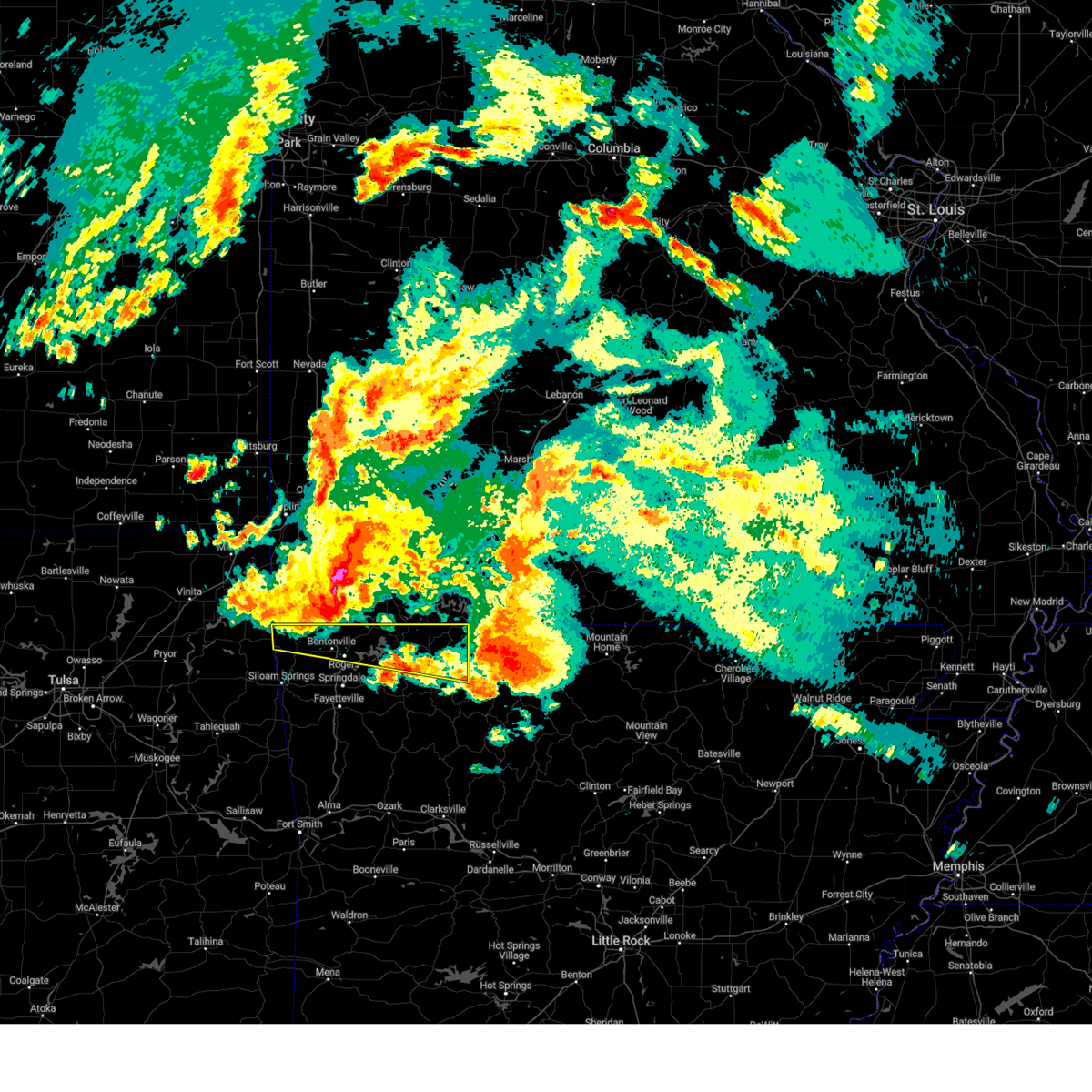 Svrtsa the national weather service in tulsa has issued a * severe thunderstorm warning for, northern benton county in northwestern arkansas, north central madison county in northwestern arkansas, carroll county in northwestern arkansas, * until 430 am cdt. * at 325 am cdt, a severe thunderstorm was located near bella vista, moving east at 60 mph (radar indicated). Hazards include 60 mph wind gusts and quarter size hail. Hail damage to vehicles is expected. expect wind damage to roofs, siding, and trees. Locations in or near the path include, rogers, bentonville, berryville, eureka springs, bella vista, pea ridge, green forest, gravette, decatur, gateway, beaver, carrollton, hiwasse, maysville, urbanette, rule, grandview, miller, centerton, avoca, this includes interstate 49 between mile markers 83 and 93. Svrtsa the national weather service in tulsa has issued a * severe thunderstorm warning for, northern benton county in northwestern arkansas, north central madison county in northwestern arkansas, carroll county in northwestern arkansas, * until 430 am cdt. * at 325 am cdt, a severe thunderstorm was located near bella vista, moving east at 60 mph (radar indicated). Hazards include 60 mph wind gusts and quarter size hail. Hail damage to vehicles is expected. expect wind damage to roofs, siding, and trees. Locations in or near the path include, rogers, bentonville, berryville, eureka springs, bella vista, pea ridge, green forest, gravette, decatur, gateway, beaver, carrollton, hiwasse, maysville, urbanette, rule, grandview, miller, centerton, avoca, this includes interstate 49 between mile markers 83 and 93.
|
| 5/26/2024 3:19 AM CDT |
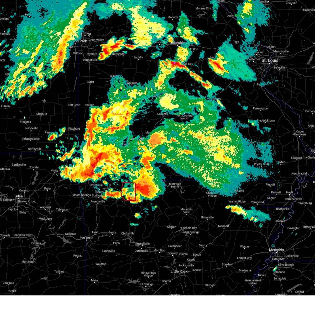 the tornado warning has been cancelled and is no longer in effect the tornado warning has been cancelled and is no longer in effect
|
| 5/26/2024 2:59 AM CDT |
 the tornado warning has been cancelled and is no longer in effect the tornado warning has been cancelled and is no longer in effect
|
| 5/26/2024 2:59 AM CDT |
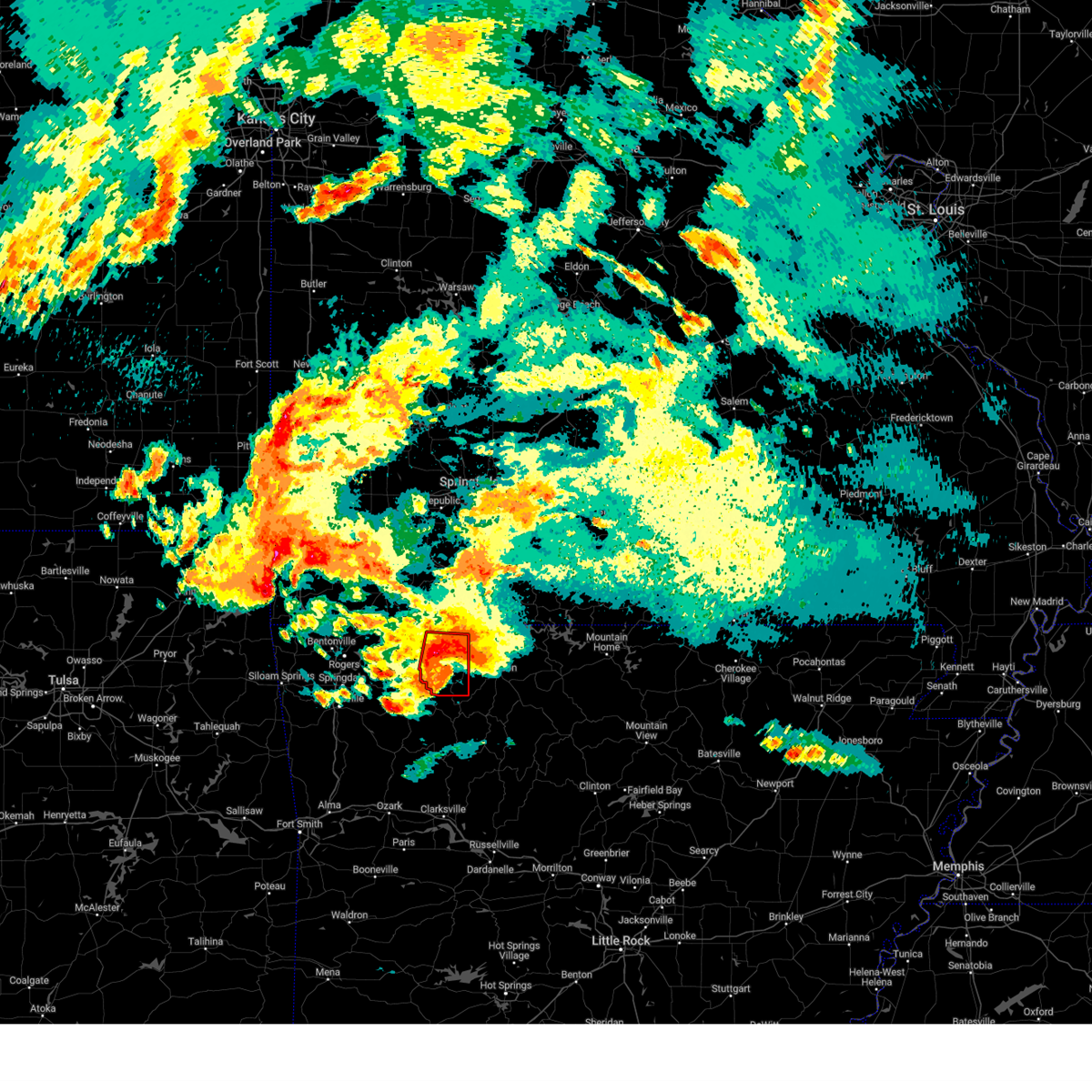 At 258 am cdt, a severe thunderstorm with strong low level rotation that could produce a tornado at any time was located over rudd, moving east at 35 mph (radar indicated rotation). Hazards include tornado and ping pong ball size hail. Flying debris will be dangerous to those caught without shelter. mobile homes will be damaged or destroyed. damage to roofs, windows, and vehicles will occur. tree damage is likely. Locations in or near the path include, berryville, green forest, carrollton, rudd, osage, urbanette, rule, dryfork, cabanal, metalton, connor, coin, delmar, denver,. At 258 am cdt, a severe thunderstorm with strong low level rotation that could produce a tornado at any time was located over rudd, moving east at 35 mph (radar indicated rotation). Hazards include tornado and ping pong ball size hail. Flying debris will be dangerous to those caught without shelter. mobile homes will be damaged or destroyed. damage to roofs, windows, and vehicles will occur. tree damage is likely. Locations in or near the path include, berryville, green forest, carrollton, rudd, osage, urbanette, rule, dryfork, cabanal, metalton, connor, coin, delmar, denver,.
|
| 5/26/2024 2:58 AM CDT |
 Torlzk the national weather service in little rock has issued a * tornado warning for, boone county in north central arkansas, * until 345 am cdt. * at 257 am cdt, a severe thunderstorm capable of producing a tornado was located over rule, or 8 miles southeast of berryville, moving east at 35 mph (radar indicated rotation). Hazards include tornado and quarter size hail. Flying debris will be dangerous to those caught without shelter. mobile homes will be damaged or destroyed. damage to roofs, windows, and vehicles will occur. Tree damage is likely. Torlzk the national weather service in little rock has issued a * tornado warning for, boone county in north central arkansas, * until 345 am cdt. * at 257 am cdt, a severe thunderstorm capable of producing a tornado was located over rule, or 8 miles southeast of berryville, moving east at 35 mph (radar indicated rotation). Hazards include tornado and quarter size hail. Flying debris will be dangerous to those caught without shelter. mobile homes will be damaged or destroyed. damage to roofs, windows, and vehicles will occur. Tree damage is likely.
|
| 5/26/2024 2:38 AM CDT |
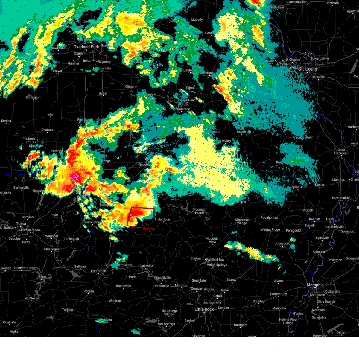 Tortsa the national weather service in tulsa has issued a * tornado warning for, northern madison county in northwestern arkansas, carroll county in northwestern arkansas, * until 345 am cdt. * at 237 am cdt, a severe thunderstorm with strong low level rotation that could produce a tornado at any time was located 4 miles east of clifty, moving east at 35 mph (radar indicated rotation). Hazards include tornado and ping pong ball size hail. Flying debris will be dangerous to those caught without shelter. mobile homes will be damaged or destroyed. damage to roofs, windows, and vehicles will occur. tree damage is likely. Locations in or near the path include, berryville, eureka springs, green forest, withrow springs state park, carrollton, rudd, marble, forum, osage, urbanette, rule, grandview, clifty, rockhouse, dryfork, cabanal, metalton, connor, coin, alabam,. Tortsa the national weather service in tulsa has issued a * tornado warning for, northern madison county in northwestern arkansas, carroll county in northwestern arkansas, * until 345 am cdt. * at 237 am cdt, a severe thunderstorm with strong low level rotation that could produce a tornado at any time was located 4 miles east of clifty, moving east at 35 mph (radar indicated rotation). Hazards include tornado and ping pong ball size hail. Flying debris will be dangerous to those caught without shelter. mobile homes will be damaged or destroyed. damage to roofs, windows, and vehicles will occur. tree damage is likely. Locations in or near the path include, berryville, eureka springs, green forest, withrow springs state park, carrollton, rudd, marble, forum, osage, urbanette, rule, grandview, clifty, rockhouse, dryfork, cabanal, metalton, connor, coin, alabam,.
|
| 5/8/2024 8:01 PM CDT |
 the severe thunderstorm warning has been cancelled and is no longer in effect the severe thunderstorm warning has been cancelled and is no longer in effect
|
| 5/8/2024 7:55 PM CDT |
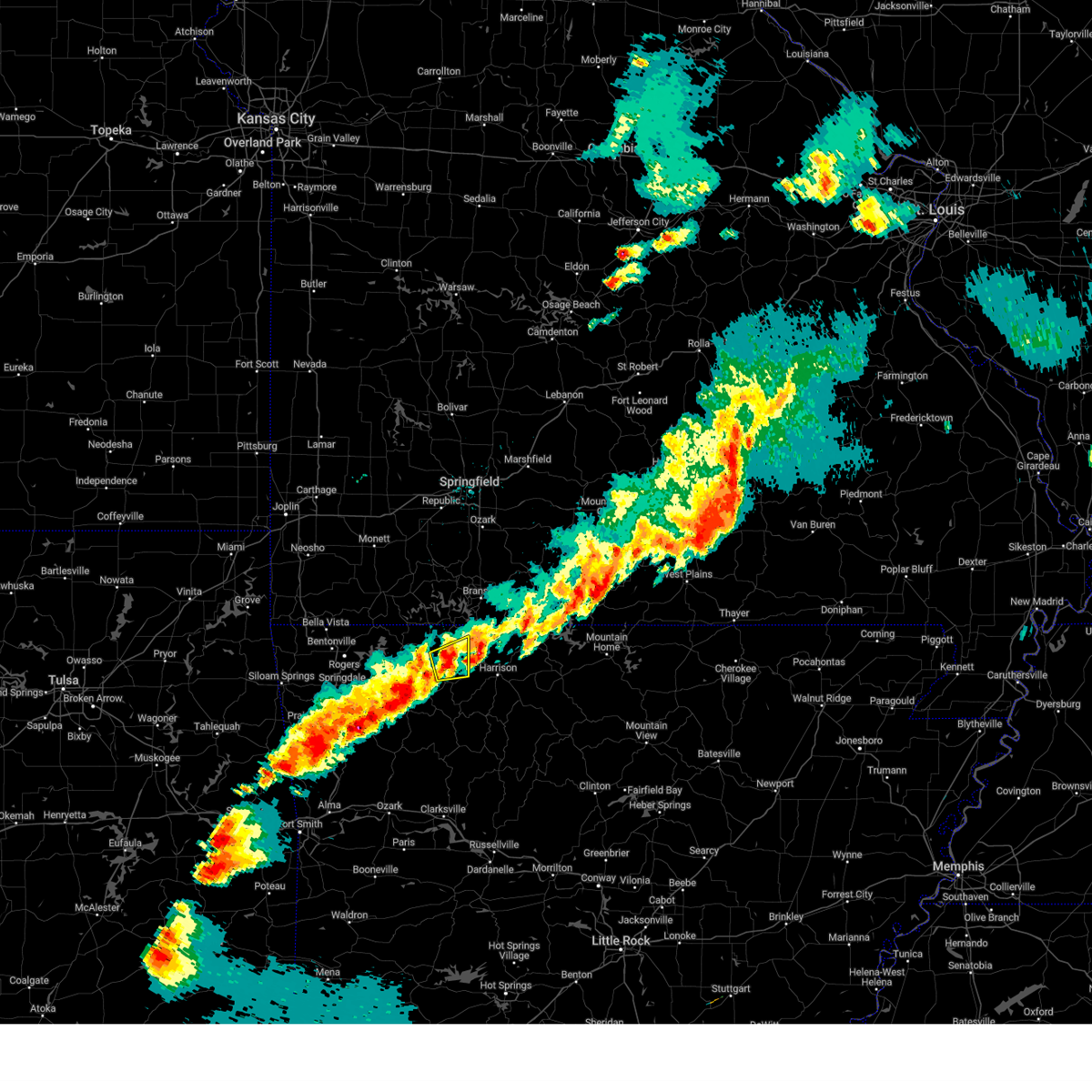 Svrtsa the national weather service in tulsa has issued a * severe thunderstorm warning for, southeastern carroll county in northwestern arkansas, * until 815 pm cdt. * at 754 pm cdt, a severe thunderstorm was located over rule, moving east at 40 mph (radar indicated). Hazards include 60 mph wind gusts and quarter size hail. Hail damage to vehicles is expected. expect wind damage to roofs, siding, and trees. Locations in or near the path include, green forest, carrollton, rudd, rule, coin, cabanal, denver, connor,. Svrtsa the national weather service in tulsa has issued a * severe thunderstorm warning for, southeastern carroll county in northwestern arkansas, * until 815 pm cdt. * at 754 pm cdt, a severe thunderstorm was located over rule, moving east at 40 mph (radar indicated). Hazards include 60 mph wind gusts and quarter size hail. Hail damage to vehicles is expected. expect wind damage to roofs, siding, and trees. Locations in or near the path include, green forest, carrollton, rudd, rule, coin, cabanal, denver, connor,.
|
| 4/28/2024 10:46 PM CDT |
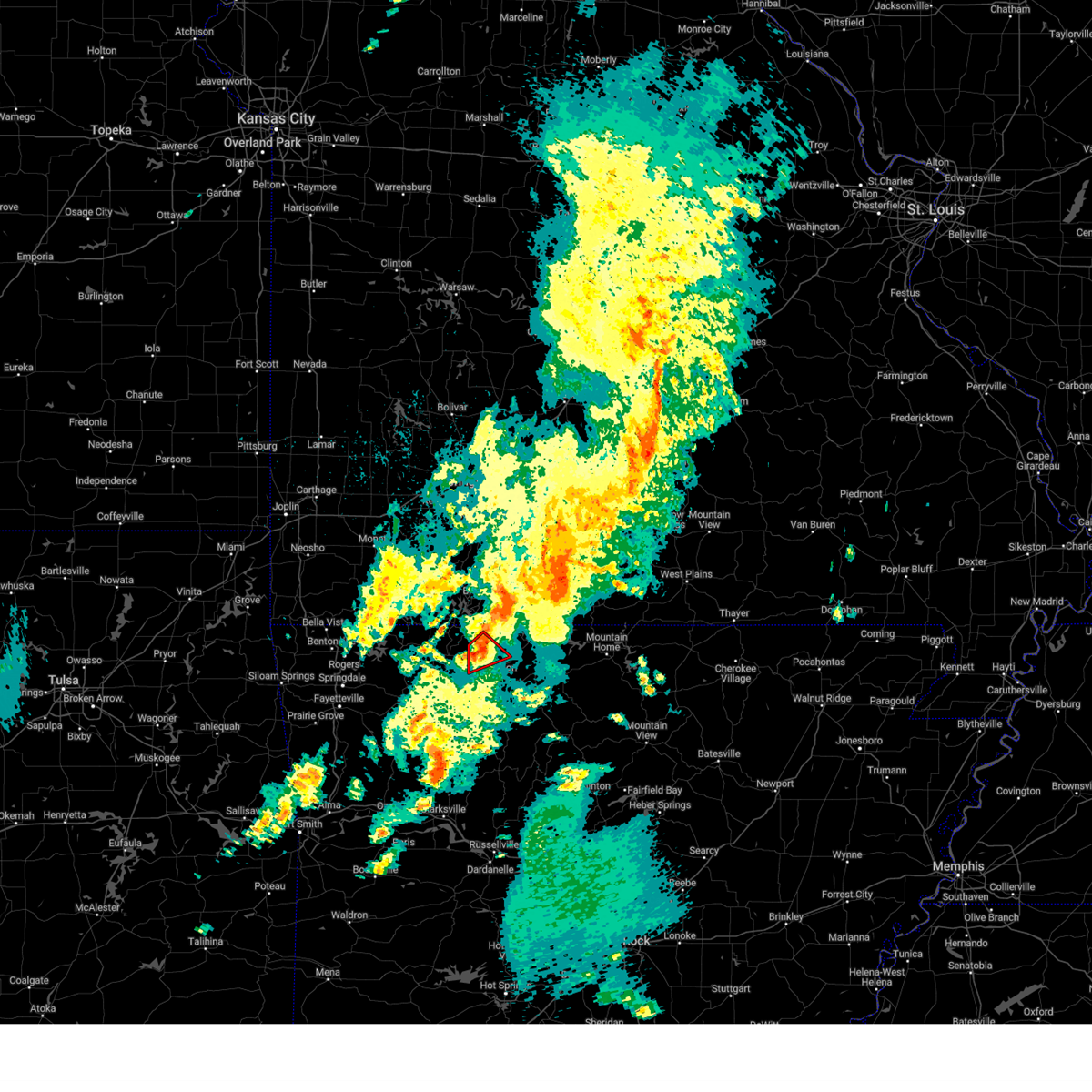 the tornado warning has been cancelled and is no longer in effect the tornado warning has been cancelled and is no longer in effect
|
| 4/28/2024 10:41 PM CDT |
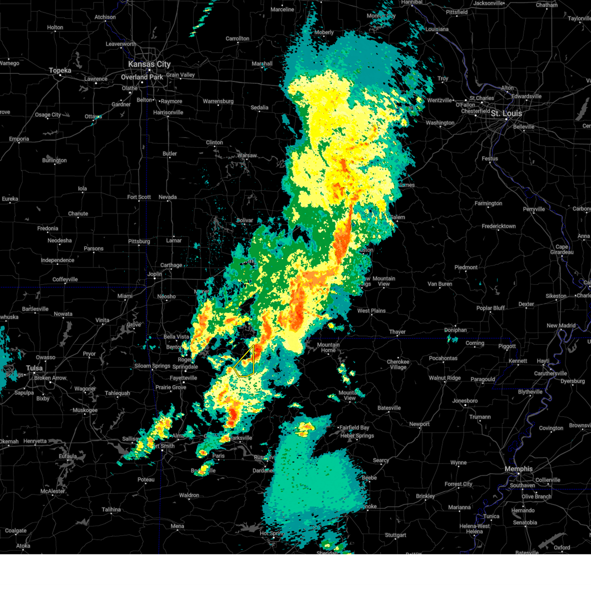 the severe thunderstorm warning has been cancelled and is no longer in effect the severe thunderstorm warning has been cancelled and is no longer in effect
|
| 4/28/2024 10:41 PM CDT |
 the tornado warning has been cancelled and is no longer in effect the tornado warning has been cancelled and is no longer in effect
|
| 4/28/2024 10:32 PM CDT |
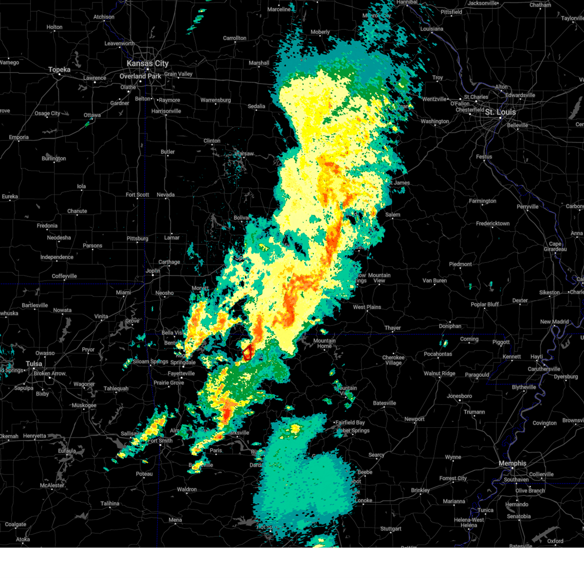 At 1032 pm cdt, a confirmed tornado was located 5 miles northeast of carrollton, moving northeast at 25 mph (broadcast media confirmed tornado). Hazards include damaging tornado and ping pong ball size hail. Flying debris will be dangerous to those caught without shelter. mobile homes will be damaged or destroyed. damage to roofs, windows, and vehicles will occur. tree damage is likely. Locations in or near the path include, carrollton, coin,. At 1032 pm cdt, a confirmed tornado was located 5 miles northeast of carrollton, moving northeast at 25 mph (broadcast media confirmed tornado). Hazards include damaging tornado and ping pong ball size hail. Flying debris will be dangerous to those caught without shelter. mobile homes will be damaged or destroyed. damage to roofs, windows, and vehicles will occur. tree damage is likely. Locations in or near the path include, carrollton, coin,.
|
| 4/28/2024 10:26 PM CDT |
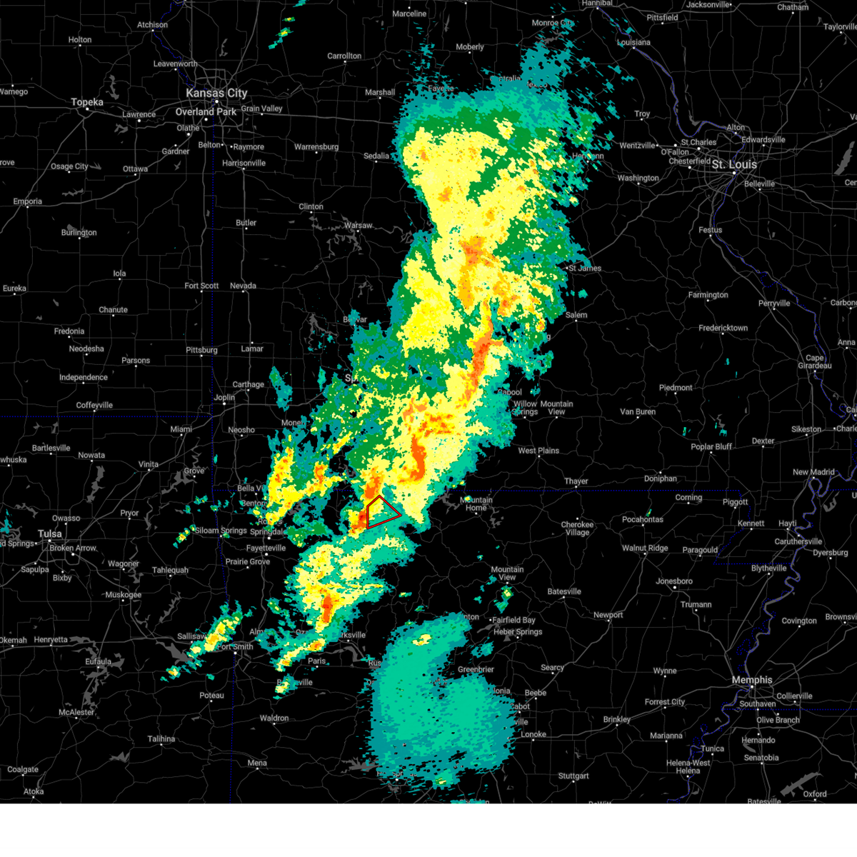 At 1026 pm cdt, a severe thunderstorm capable of producing a tornado was located over carrollton, or 10 miles west of harrison, moving northeast at 35 mph (radar indicated rotation). Hazards include tornado and quarter size hail. Flying debris will be dangerous to those caught without shelter. mobile homes will be damaged or destroyed. damage to roofs, windows, and vehicles will occur. tree damage is likely. Locations impacted include, omaha, myrtle, alpena, bear creek springs, hopewell in boone county, burlington, ridgeway,. At 1026 pm cdt, a severe thunderstorm capable of producing a tornado was located over carrollton, or 10 miles west of harrison, moving northeast at 35 mph (radar indicated rotation). Hazards include tornado and quarter size hail. Flying debris will be dangerous to those caught without shelter. mobile homes will be damaged or destroyed. damage to roofs, windows, and vehicles will occur. tree damage is likely. Locations impacted include, omaha, myrtle, alpena, bear creek springs, hopewell in boone county, burlington, ridgeway,.
|
| 4/28/2024 10:22 PM CDT |
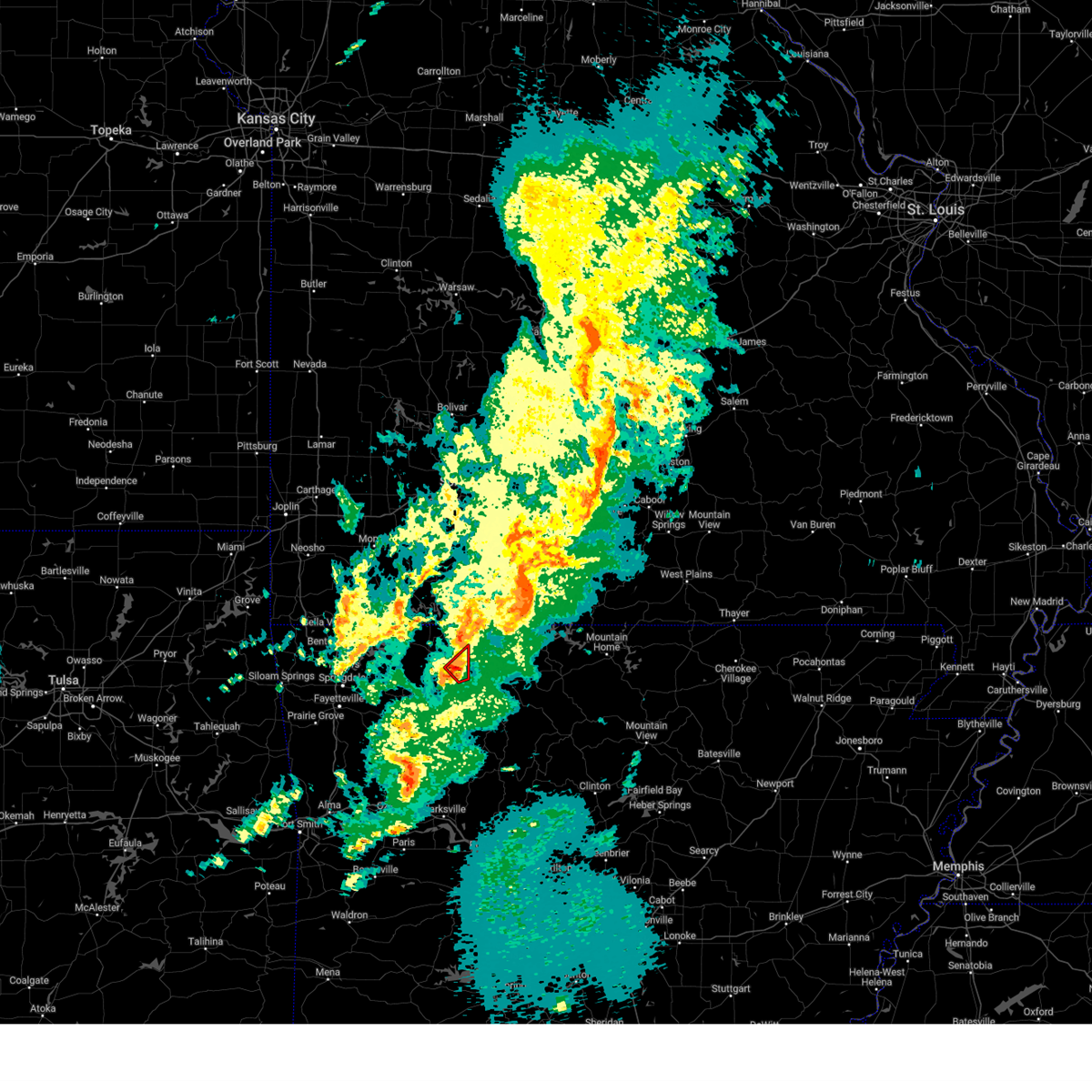 At 1022 pm cdt, a confirmed large and extremely dangerous tornado was located over carrollton, moving northeast at 30 mph. this is a particularly dangerous situation. take cover now! (broadcast media confirmed tornado). Hazards include damaging tornado. You are in a life-threatening situation. flying debris may be deadly to those caught without shelter. mobile homes will be destroyed. considerable damage to homes, businesses, and vehicles is likely and complete destruction is possible. Locations in or near the path include, carrollton, coin, connor,. At 1022 pm cdt, a confirmed large and extremely dangerous tornado was located over carrollton, moving northeast at 30 mph. this is a particularly dangerous situation. take cover now! (broadcast media confirmed tornado). Hazards include damaging tornado. You are in a life-threatening situation. flying debris may be deadly to those caught without shelter. mobile homes will be destroyed. considerable damage to homes, businesses, and vehicles is likely and complete destruction is possible. Locations in or near the path include, carrollton, coin, connor,.
|
| 4/28/2024 10:18 PM CDT |
 At 1018 pm cdt, radar indicated strong location located over carrollton, moving northeast at 30 mph (radar indicated rotation). Hazards include tornado and quarter size hail. Flying debris will be dangerous to those caught without shelter. mobile homes will be damaged or destroyed. damage to roofs, windows, and vehicles will occur. tree damage is likely. Locations in or near the path include, carrollton, osage, coin, connor,. At 1018 pm cdt, radar indicated strong location located over carrollton, moving northeast at 30 mph (radar indicated rotation). Hazards include tornado and quarter size hail. Flying debris will be dangerous to those caught without shelter. mobile homes will be damaged or destroyed. damage to roofs, windows, and vehicles will occur. tree damage is likely. Locations in or near the path include, carrollton, osage, coin, connor,.
|
| 4/28/2024 10:13 PM CDT |
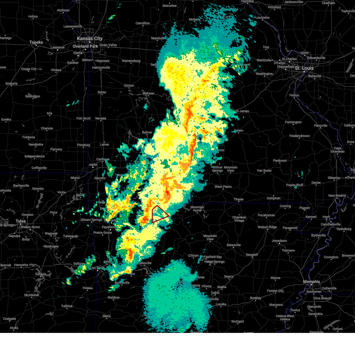 Torlzk the national weather service in little rock has issued a * tornado warning for, northwestern boone county in north central arkansas, * until 1100 pm cdt. * at 1013 pm cdt, a severe thunderstorm capable of producing a tornado was located over osage, or 13 miles southeast of berryville, moving northeast at 35 mph (radar indicated rotation). Hazards include tornado and quarter size hail. Flying debris will be dangerous to those caught without shelter. mobile homes will be damaged or destroyed. damage to roofs, windows, and vehicles will occur. Tree damage is likely. Torlzk the national weather service in little rock has issued a * tornado warning for, northwestern boone county in north central arkansas, * until 1100 pm cdt. * at 1013 pm cdt, a severe thunderstorm capable of producing a tornado was located over osage, or 13 miles southeast of berryville, moving northeast at 35 mph (radar indicated rotation). Hazards include tornado and quarter size hail. Flying debris will be dangerous to those caught without shelter. mobile homes will be damaged or destroyed. damage to roofs, windows, and vehicles will occur. Tree damage is likely.
|
| 4/28/2024 10:08 PM CDT |
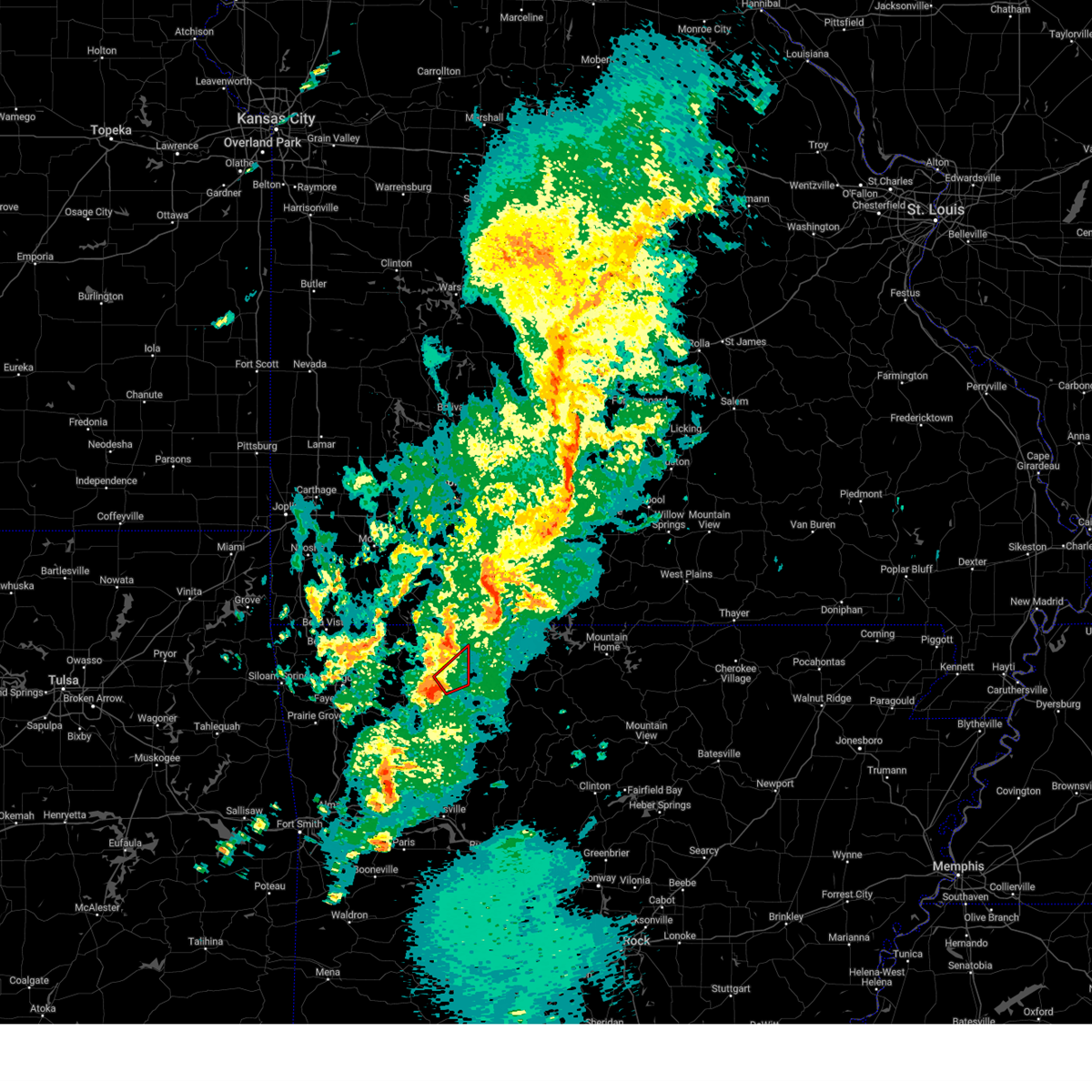 Tortsa the national weather service in tulsa has issued a * tornado warning for, southeastern carroll county in northwestern arkansas, * until 1100 pm cdt. * at 1008 pm cdt, a severe thunderstorm capable of producing a tornado was located over osage, moving northeast at 30 mph (radar indicated rotation). Hazards include tornado. Flying debris will be dangerous to those caught without shelter. mobile homes will be damaged or destroyed. damage to roofs, windows, and vehicles will occur. tree damage is likely. Locations in or near the path include, carrollton, osage, rudd, coin, connor,. Tortsa the national weather service in tulsa has issued a * tornado warning for, southeastern carroll county in northwestern arkansas, * until 1100 pm cdt. * at 1008 pm cdt, a severe thunderstorm capable of producing a tornado was located over osage, moving northeast at 30 mph (radar indicated rotation). Hazards include tornado. Flying debris will be dangerous to those caught without shelter. mobile homes will be damaged or destroyed. damage to roofs, windows, and vehicles will occur. tree damage is likely. Locations in or near the path include, carrollton, osage, rudd, coin, connor,.
|
| 4/28/2024 10:06 PM CDT |
 Svrtsa the national weather service in tulsa has issued a * severe thunderstorm warning for, southeastern carroll county in northwestern arkansas, * until 1100 pm cdt. * at 1005 pm cdt, a severe thunderstorm was located near osage, moving northeast at 20 mph (radar indicated). Hazards include 60 mph wind gusts and nickel size hail. Expect damage to roofs, siding, and trees. Locations in or near the path include, green forest, carrollton, osage, rudd, rule, coin, dryfork, metalton, delmar, denver, connor,. Svrtsa the national weather service in tulsa has issued a * severe thunderstorm warning for, southeastern carroll county in northwestern arkansas, * until 1100 pm cdt. * at 1005 pm cdt, a severe thunderstorm was located near osage, moving northeast at 20 mph (radar indicated). Hazards include 60 mph wind gusts and nickel size hail. Expect damage to roofs, siding, and trees. Locations in or near the path include, green forest, carrollton, osage, rudd, rule, coin, dryfork, metalton, delmar, denver, connor,.
|
| 4/26/2024 12:13 PM CDT |
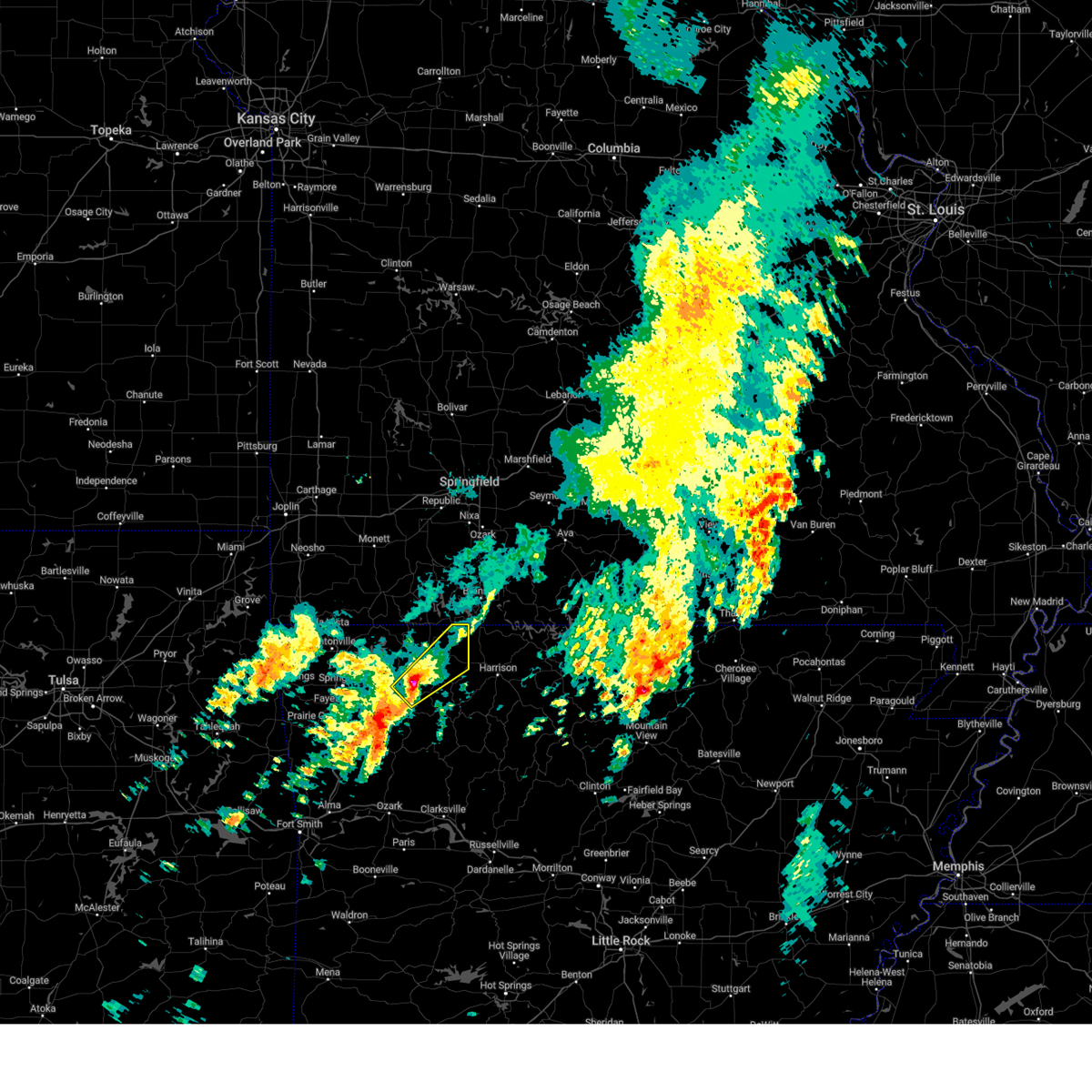 Svrtsa the national weather service in tulsa has issued a * severe thunderstorm warning for, northeastern madison county in northwestern arkansas, eastern carroll county in northwestern arkansas, * until 100 pm cdt. * at 1212 pm cdt, a severe thunderstorm was located near forum, moving northeast at 55 mph (radar indicated). Hazards include 60 mph wind gusts and quarter size hail. Hail damage to vehicles is expected. expect wind damage to roofs, siding, and trees. Locations in or near the path include, berryville, huntsville, green forest, withrow springs state park, carrollton, rudd, marble, forum, rule, rockhouse, cabanal, metalton, connor, coin, alabam, denver,. Svrtsa the national weather service in tulsa has issued a * severe thunderstorm warning for, northeastern madison county in northwestern arkansas, eastern carroll county in northwestern arkansas, * until 100 pm cdt. * at 1212 pm cdt, a severe thunderstorm was located near forum, moving northeast at 55 mph (radar indicated). Hazards include 60 mph wind gusts and quarter size hail. Hail damage to vehicles is expected. expect wind damage to roofs, siding, and trees. Locations in or near the path include, berryville, huntsville, green forest, withrow springs state park, carrollton, rudd, marble, forum, rule, rockhouse, cabanal, metalton, connor, coin, alabam, denver,.
|
| 4/2/2024 1:19 AM CDT |
 the severe thunderstorm warning has been cancelled and is no longer in effect the severe thunderstorm warning has been cancelled and is no longer in effect
|
| 4/2/2024 1:08 AM CDT |
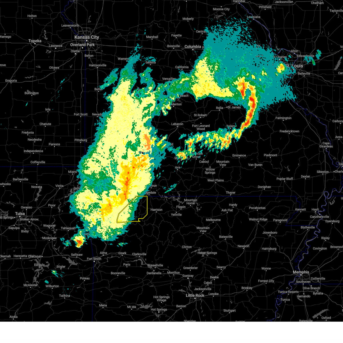 the severe thunderstorm warning has been cancelled and is no longer in effect the severe thunderstorm warning has been cancelled and is no longer in effect
|
| 4/2/2024 1:08 AM CDT |
 At 107 am cdt, severe thunderstorms were located along a line extending from 6 miles northeast of urbanette to 3 miles southwest of hindsville, moving southeast at 30 mph (radar indicated). Hazards include 60 mph wind gusts. Expect damage to roofs, siding, and trees. Locations in or near the path include, berryville, huntsville, green forest, hindsville, withrow springs state park, carrollton, rudd, marble, forum, osage, urbanette, rule, clifty, rockhouse, dryfork, cabanal, metalton, connor, coin, alabam,. At 107 am cdt, severe thunderstorms were located along a line extending from 6 miles northeast of urbanette to 3 miles southwest of hindsville, moving southeast at 30 mph (radar indicated). Hazards include 60 mph wind gusts. Expect damage to roofs, siding, and trees. Locations in or near the path include, berryville, huntsville, green forest, hindsville, withrow springs state park, carrollton, rudd, marble, forum, osage, urbanette, rule, clifty, rockhouse, dryfork, cabanal, metalton, connor, coin, alabam,.
|
| 4/2/2024 12:39 AM CDT |
 Svrtsa the national weather service in tulsa has issued a * severe thunderstorm warning for, northeastern benton county in northwestern arkansas, northern madison county in northwestern arkansas, carroll county in northwestern arkansas, northern washington county in northwestern arkansas, * until 130 am cdt. * at 1239 am cdt, severe thunderstorms were located along a line extending from 3 miles southeast of gateway to 5 miles northwest of farmington, moving east at 70 mph (radar indicated). Hazards include 60 mph wind gusts. Expect damage to roofs, siding, and trees. Locations in or near the path include, fayetteville, springdale, rogers, berryville, huntsville, eureka springs, lowell, farmington, green forest, tontitown, beaver, hindsville, carrollton, rudd, forum, hobbs state park, clifty, withrow springs state park, war eagle, marble, this includes interstate 49 between mile markers 61 and 80. Svrtsa the national weather service in tulsa has issued a * severe thunderstorm warning for, northeastern benton county in northwestern arkansas, northern madison county in northwestern arkansas, carroll county in northwestern arkansas, northern washington county in northwestern arkansas, * until 130 am cdt. * at 1239 am cdt, severe thunderstorms were located along a line extending from 3 miles southeast of gateway to 5 miles northwest of farmington, moving east at 70 mph (radar indicated). Hazards include 60 mph wind gusts. Expect damage to roofs, siding, and trees. Locations in or near the path include, fayetteville, springdale, rogers, berryville, huntsville, eureka springs, lowell, farmington, green forest, tontitown, beaver, hindsville, carrollton, rudd, forum, hobbs state park, clifty, withrow springs state park, war eagle, marble, this includes interstate 49 between mile markers 61 and 80.
|
| 3/14/2024 4:02 PM CDT |
 At 401 pm cdt, a severe thunderstorm was located 2 miles southwest of omaha, or 10 miles northwest of harrison, moving east at 35 mph (radar indicated). Hazards include 60 mph wind gusts and quarter size hail. Hail damage to vehicles is expected. expect wind damage to roofs, siding, and trees. Locations impacted include, harrison, diamond city, bergman, lead hill, omaha, myrtle, capps, roberson hollow, self, willis, winington, alpena, crumpler subdivision, zinc, south lead hill, batavia, bear creek springs, new hope in boone county, hopewell in boone county, ridgeway,. At 401 pm cdt, a severe thunderstorm was located 2 miles southwest of omaha, or 10 miles northwest of harrison, moving east at 35 mph (radar indicated). Hazards include 60 mph wind gusts and quarter size hail. Hail damage to vehicles is expected. expect wind damage to roofs, siding, and trees. Locations impacted include, harrison, diamond city, bergman, lead hill, omaha, myrtle, capps, roberson hollow, self, willis, winington, alpena, crumpler subdivision, zinc, south lead hill, batavia, bear creek springs, new hope in boone county, hopewell in boone county, ridgeway,.
|
| 3/14/2024 3:57 PM CDT |
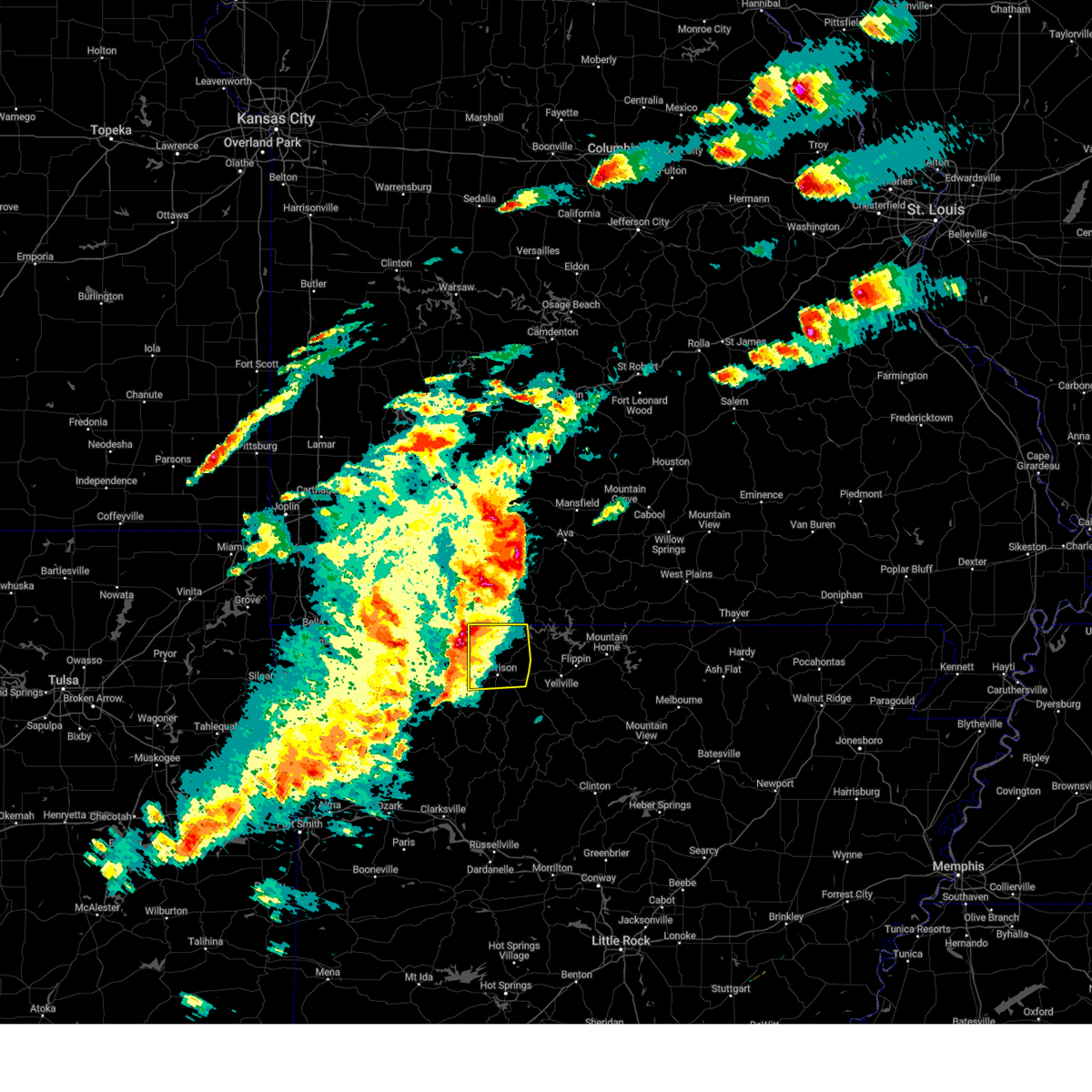 the severe thunderstorm warning has been cancelled and is no longer in effect the severe thunderstorm warning has been cancelled and is no longer in effect
|
| 3/14/2024 3:57 PM CDT |
 At 355 pm cdt, a severe thunderstorm was located 7 miles northeast of carrollton, or 11 miles northwest of harrison, moving east at 35 mph (radar indicated). Hazards include 60 mph wind gusts and quarter size hail. Hail damage to vehicles is expected. expect wind damage to roofs, siding, and trees. Locations impacted include, harrison, diamond city, bergman, lead hill, omaha, olvey, myrtle, roberson hollow, self, red bank, winington, capps, willis, bellefonte, alpena, crumpler subdivision, zinc, south lead hill, batavia, bear creek springs,. At 355 pm cdt, a severe thunderstorm was located 7 miles northeast of carrollton, or 11 miles northwest of harrison, moving east at 35 mph (radar indicated). Hazards include 60 mph wind gusts and quarter size hail. Hail damage to vehicles is expected. expect wind damage to roofs, siding, and trees. Locations impacted include, harrison, diamond city, bergman, lead hill, omaha, olvey, myrtle, roberson hollow, self, red bank, winington, capps, willis, bellefonte, alpena, crumpler subdivision, zinc, south lead hill, batavia, bear creek springs,.
|
| 3/14/2024 3:35 PM CDT |
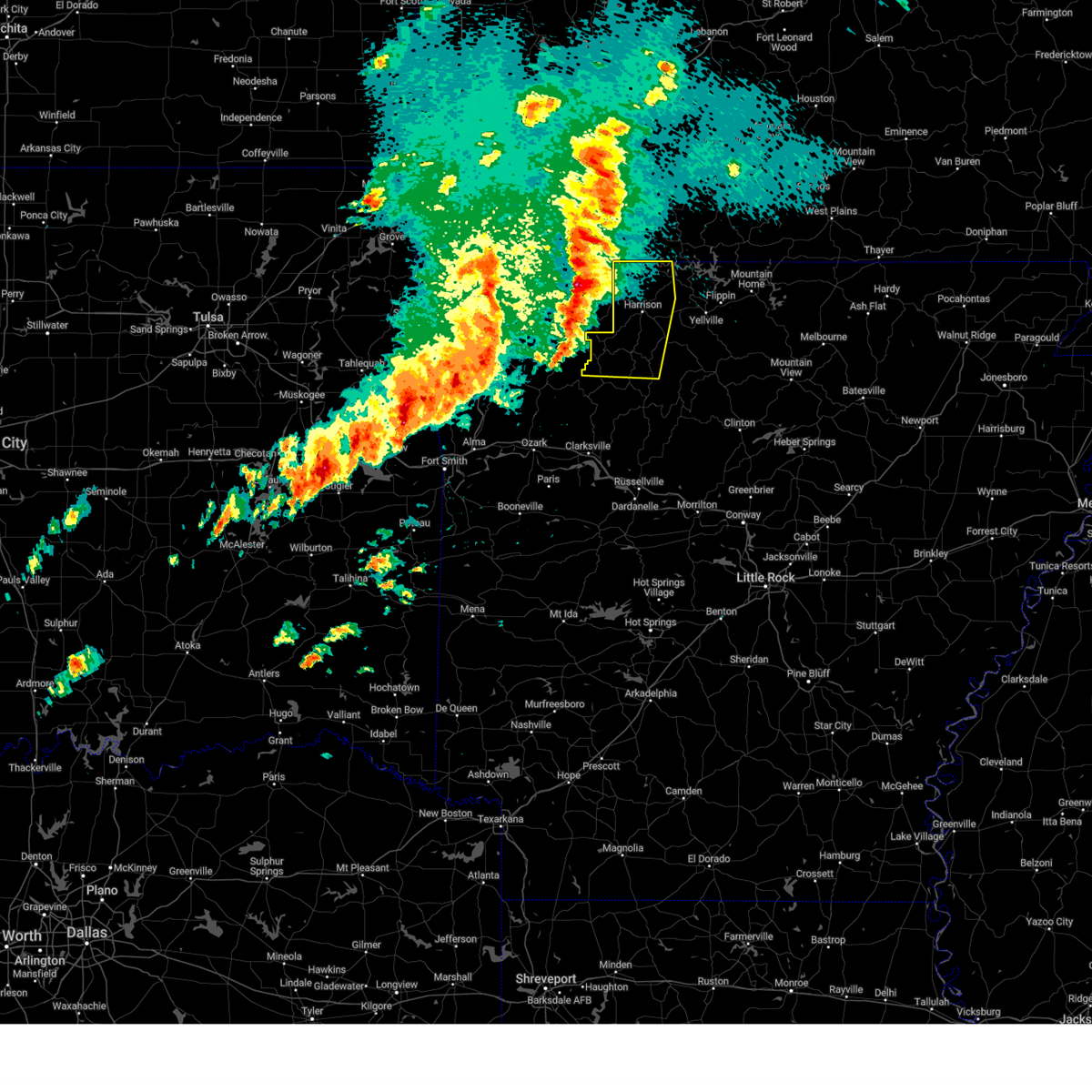 Svrlzk the national weather service in little rock has issued a * severe thunderstorm warning for, northern newton county in north central arkansas, boone county in north central arkansas, * until 430 pm cdt. * at 334 pm cdt, severe thunderstorms were located along a line extending from near urbanette to near rule to near witter, moving east at 35 mph (radar indicated). Hazards include 60 mph wind gusts and quarter size hail. Hail damage to vehicles is expected. Expect wind damage to roofs, siding, and trees. Svrlzk the national weather service in little rock has issued a * severe thunderstorm warning for, northern newton county in north central arkansas, boone county in north central arkansas, * until 430 pm cdt. * at 334 pm cdt, severe thunderstorms were located along a line extending from near urbanette to near rule to near witter, moving east at 35 mph (radar indicated). Hazards include 60 mph wind gusts and quarter size hail. Hail damage to vehicles is expected. Expect wind damage to roofs, siding, and trees.
|
| 1/12/2024 12:20 AM CST |
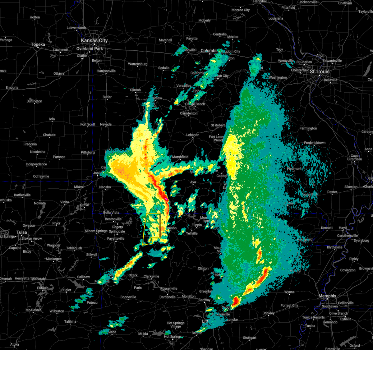 The severe thunderstorm warning for northeastern madison and carroll counties will expire at 1230 am cst, the storms which prompted the warning have moved out of the area. therefore, the warning will be allowed to expire. to report severe weather, contact your nearest law enforcement agency. they will relay your report to the national weather service tulsa. The severe thunderstorm warning for northeastern madison and carroll counties will expire at 1230 am cst, the storms which prompted the warning have moved out of the area. therefore, the warning will be allowed to expire. to report severe weather, contact your nearest law enforcement agency. they will relay your report to the national weather service tulsa.
|
| 1/12/2024 12:09 AM CST |
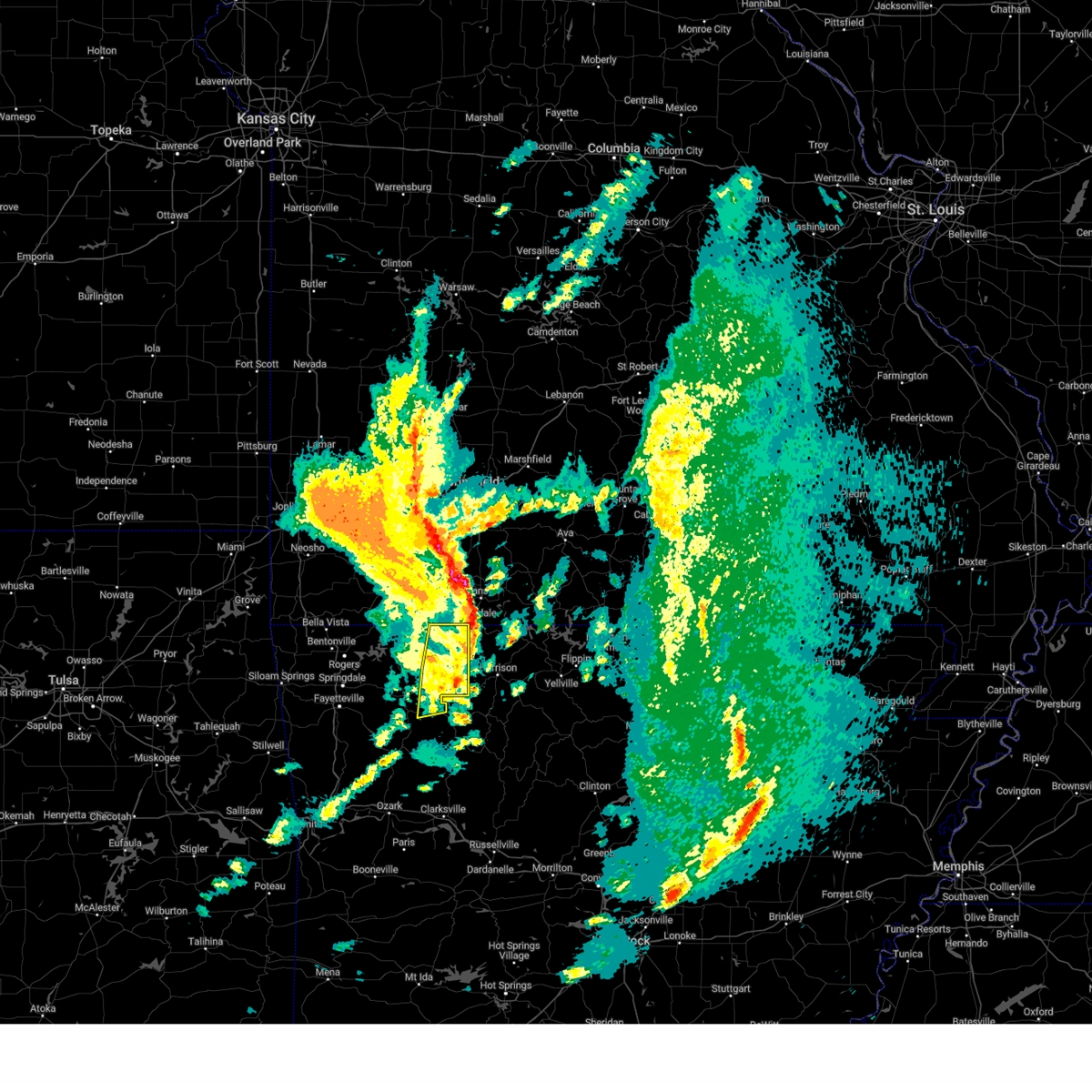 A severe thunderstorm warning remains in effect until 1230 am cst for northeastern madison and carroll counties. at 1209 am cst, severe thunderstorms were located along a line extending from 4 miles north of roberson hollow to 2 miles east of osage, moving northeast at 55 mph. hazard. 60 mph wind gusts and quarter size hail. A severe thunderstorm warning remains in effect until 1230 am cst for northeastern madison and carroll counties. at 1209 am cst, severe thunderstorms were located along a line extending from 4 miles north of roberson hollow to 2 miles east of osage, moving northeast at 55 mph. hazard. 60 mph wind gusts and quarter size hail.
|
| 1/12/2024 12:05 AM CST |
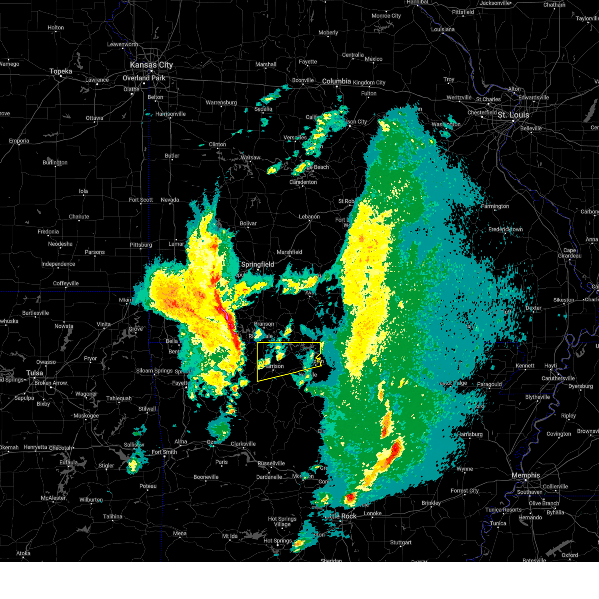 At 1205 am cst, a severe thunderstorm was located over roberson hollow, or 13 miles south of branson, moving east at 50 mph (radar indicated). Hazards include 60 mph wind gusts and quarter size hail. Hail damage to vehicles is expected. Expect wind damage to roofs, siding, and trees. At 1205 am cst, a severe thunderstorm was located over roberson hollow, or 13 miles south of branson, moving east at 50 mph (radar indicated). Hazards include 60 mph wind gusts and quarter size hail. Hail damage to vehicles is expected. Expect wind damage to roofs, siding, and trees.
|
| 1/11/2024 11:47 PM CST |
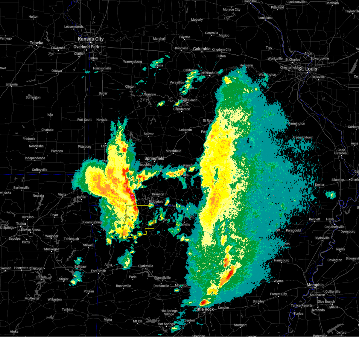 At 1147 pm cst, severe thunderstorms were located along a line extending from 9 miles northeast of holiday island to 4 miles southwest of huntsville, moving northeast at 60 mph (radar indicated). Hazards include 60 mph wind gusts and quarter size hail. Hail damage to vehicles is expected. expect wind damage to roofs, siding, and trees. locations in or near the path include, berryville, huntsville, eureka springs, holiday island, green forest, beaver, hindsville, wesley, carrollton, rudd, kingston, forum, aurora, clifty, withrow springs state park, marble, osage, urbanette, rule, grandview, hail threat, radar indicated max hail size, 1. 00 in wind threat, radar indicated max wind gust, 60 mph. At 1147 pm cst, severe thunderstorms were located along a line extending from 9 miles northeast of holiday island to 4 miles southwest of huntsville, moving northeast at 60 mph (radar indicated). Hazards include 60 mph wind gusts and quarter size hail. Hail damage to vehicles is expected. expect wind damage to roofs, siding, and trees. locations in or near the path include, berryville, huntsville, eureka springs, holiday island, green forest, beaver, hindsville, wesley, carrollton, rudd, kingston, forum, aurora, clifty, withrow springs state park, marble, osage, urbanette, rule, grandview, hail threat, radar indicated max hail size, 1. 00 in wind threat, radar indicated max wind gust, 60 mph.
|
| 1/11/2024 11:39 PM CST |
 At 1138 pm cst, severe thunderstorms were located along a line extending from 3 miles north of holiday island to 2 miles south of wesley, moving northeast at 60 mph (radar indicated). Hazards include 60 mph wind gusts and quarter size hail. Hail damage to vehicles is expected. expect wind damage to roofs, siding, and trees. locations in or near the path include, fayetteville, berryville, huntsville, eureka springs, holiday island, green forest, elkins, gateway, beaver, hindsville, wesley, carrollton, rudd, forum, aurora, hobbs state park, clifty, withrow springs state park, war eagle, marble, hail threat, radar indicated max hail size, 1. 00 in wind threat, radar indicated max wind gust, 60 mph. At 1138 pm cst, severe thunderstorms were located along a line extending from 3 miles north of holiday island to 2 miles south of wesley, moving northeast at 60 mph (radar indicated). Hazards include 60 mph wind gusts and quarter size hail. Hail damage to vehicles is expected. expect wind damage to roofs, siding, and trees. locations in or near the path include, fayetteville, berryville, huntsville, eureka springs, holiday island, green forest, elkins, gateway, beaver, hindsville, wesley, carrollton, rudd, forum, aurora, hobbs state park, clifty, withrow springs state park, war eagle, marble, hail threat, radar indicated max hail size, 1. 00 in wind threat, radar indicated max wind gust, 60 mph.
|
| 9/6/2023 1:27 AM CDT |
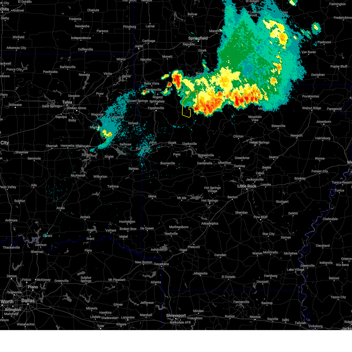 The severe thunderstorm warning for northeastern madison and southeastern carroll counties will expire at 130 am cdt, the storms which prompted the warning have weakened below severe limits, and have exited the warned area. therefore, the warning will be allowed to expire. The severe thunderstorm warning for northeastern madison and southeastern carroll counties will expire at 130 am cdt, the storms which prompted the warning have weakened below severe limits, and have exited the warned area. therefore, the warning will be allowed to expire.
|
| 9/6/2023 1:07 AM CDT |
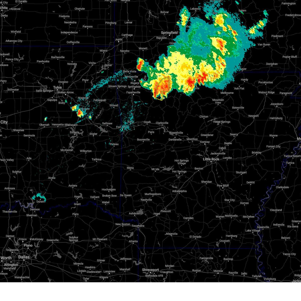 At 107 am cdt, severe thunderstorms were located along a line extending from 6 miles north of carrollton to osage to 3 miles south of kingston, moving east at 25 mph (radar indicated). Hazards include 60 mph wind gusts. Expect damage to roofs, siding, and trees. locations in or near the path include, green forest, carrollton, rudd, kingston, marble, osage, rule, dryfork, cabanal, metalton, weathers, connor, coin, delmar, denver, hail threat, radar indicated max hail size, <. 75 in wind threat, radar indicated max wind gust, 60 mph. At 107 am cdt, severe thunderstorms were located along a line extending from 6 miles north of carrollton to osage to 3 miles south of kingston, moving east at 25 mph (radar indicated). Hazards include 60 mph wind gusts. Expect damage to roofs, siding, and trees. locations in or near the path include, green forest, carrollton, rudd, kingston, marble, osage, rule, dryfork, cabanal, metalton, weathers, connor, coin, delmar, denver, hail threat, radar indicated max hail size, <. 75 in wind threat, radar indicated max wind gust, 60 mph.
|
| 9/6/2023 12:55 AM CDT |
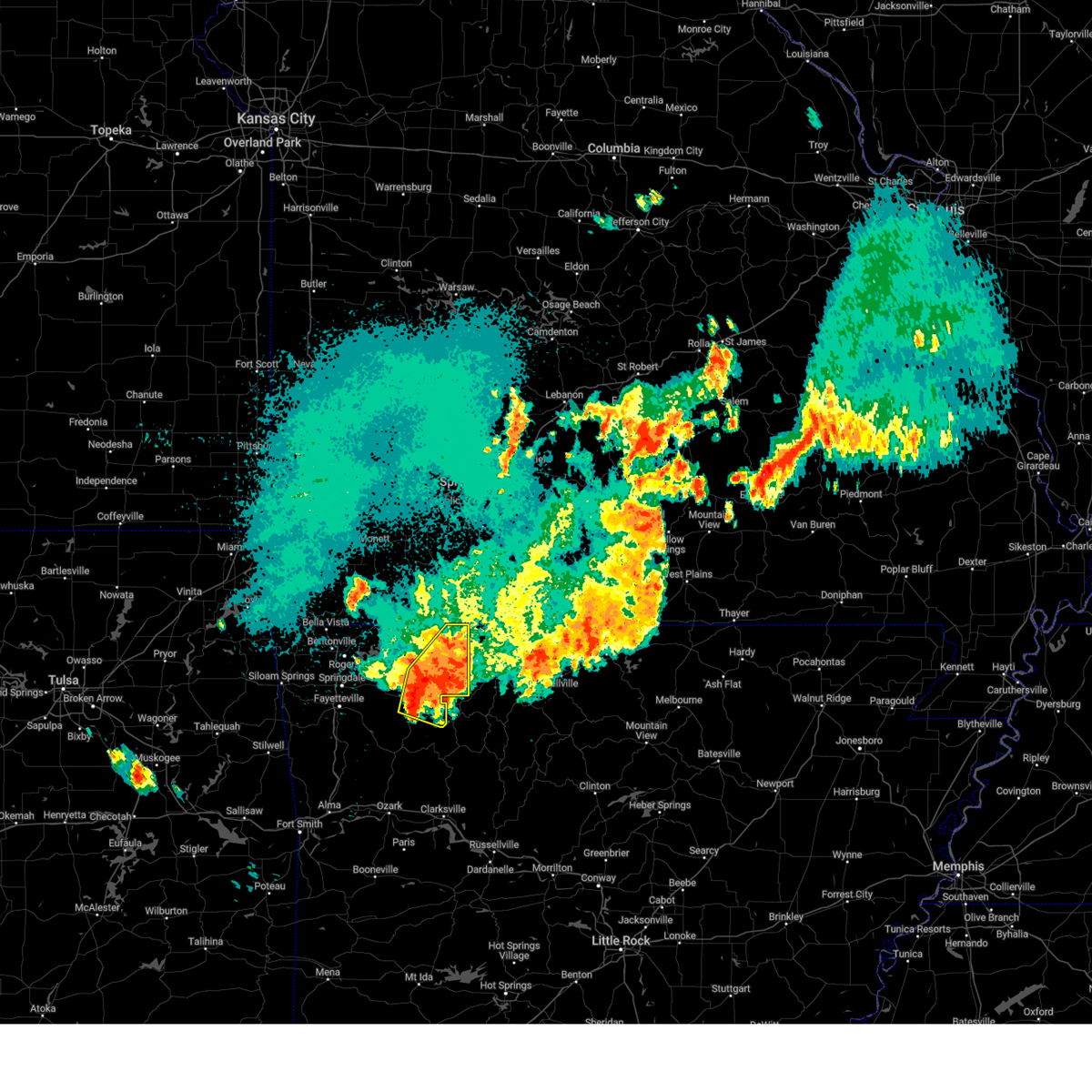 At 1255 am cdt, severe thunderstorms were located along a line extending from 5 miles north of green forest to 3 miles southeast of rule to 4 miles east of aurora, moving east at 40 mph (radar indicated). Hazards include 70 mph wind gusts. Expect considerable tree damage. damage is likely to mobile homes, roofs, and outbuildings. locations in or near the path include, berryville, huntsville, green forest, withrow springs state park, carrollton, rudd, kingston, marble, forum, osage, urbanette, rule, rockhouse, dryfork, cabanal, metalton, weathers, connor, coin, alabam, thunderstorm damage threat, considerable hail threat, radar indicated max hail size, <. 75 in wind threat, radar indicated max wind gust, 70 mph. At 1255 am cdt, severe thunderstorms were located along a line extending from 5 miles north of green forest to 3 miles southeast of rule to 4 miles east of aurora, moving east at 40 mph (radar indicated). Hazards include 70 mph wind gusts. Expect considerable tree damage. damage is likely to mobile homes, roofs, and outbuildings. locations in or near the path include, berryville, huntsville, green forest, withrow springs state park, carrollton, rudd, kingston, marble, forum, osage, urbanette, rule, rockhouse, dryfork, cabanal, metalton, weathers, connor, coin, alabam, thunderstorm damage threat, considerable hail threat, radar indicated max hail size, <. 75 in wind threat, radar indicated max wind gust, 70 mph.
|
| 9/6/2023 12:29 AM CDT |
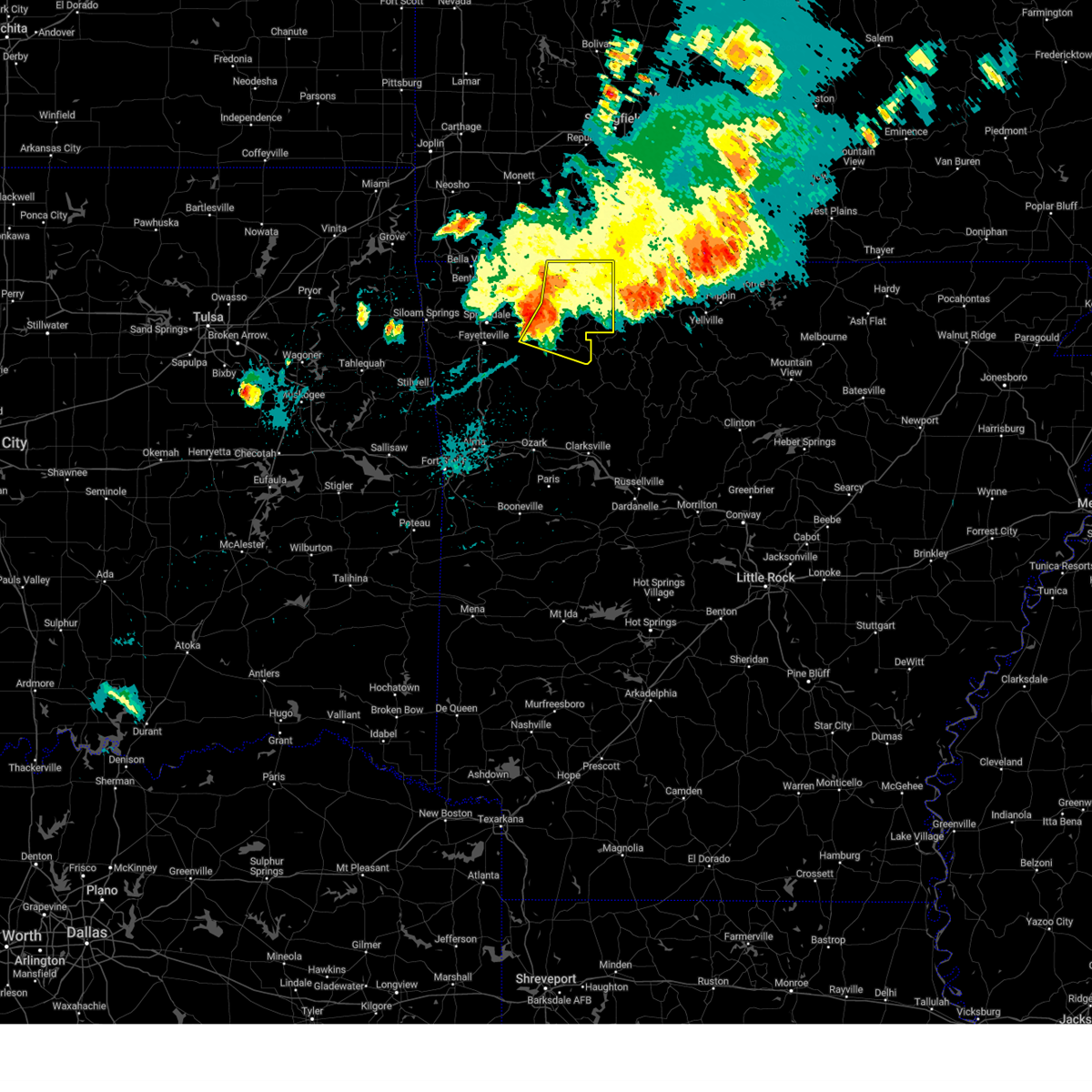 At 1229 am cdt, severe thunderstorms were located along a line extending from 3 miles northwest of grandview to 6 miles north of forum to 3 miles south of hindsville, moving east at 25 mph (radar indicated). Hazards include 70 mph wind gusts. Expect considerable tree damage. damage is likely to mobile homes, roofs, and outbuildings. locations in or near the path include, berryville, huntsville, eureka springs, holiday island, green forest, hindsville, carrollton, rudd, kingston, forum, clifty, withrow springs state park, marble, osage, urbanette, rule, grandview, dryfork, metalton, connor, thunderstorm damage threat, considerable hail threat, radar indicated max hail size, <. 75 in wind threat, radar indicated max wind gust, 70 mph. At 1229 am cdt, severe thunderstorms were located along a line extending from 3 miles northwest of grandview to 6 miles north of forum to 3 miles south of hindsville, moving east at 25 mph (radar indicated). Hazards include 70 mph wind gusts. Expect considerable tree damage. damage is likely to mobile homes, roofs, and outbuildings. locations in or near the path include, berryville, huntsville, eureka springs, holiday island, green forest, hindsville, carrollton, rudd, kingston, forum, clifty, withrow springs state park, marble, osage, urbanette, rule, grandview, dryfork, metalton, connor, thunderstorm damage threat, considerable hail threat, radar indicated max hail size, <. 75 in wind threat, radar indicated max wind gust, 70 mph.
|
| 9/6/2023 12:25 AM CDT |
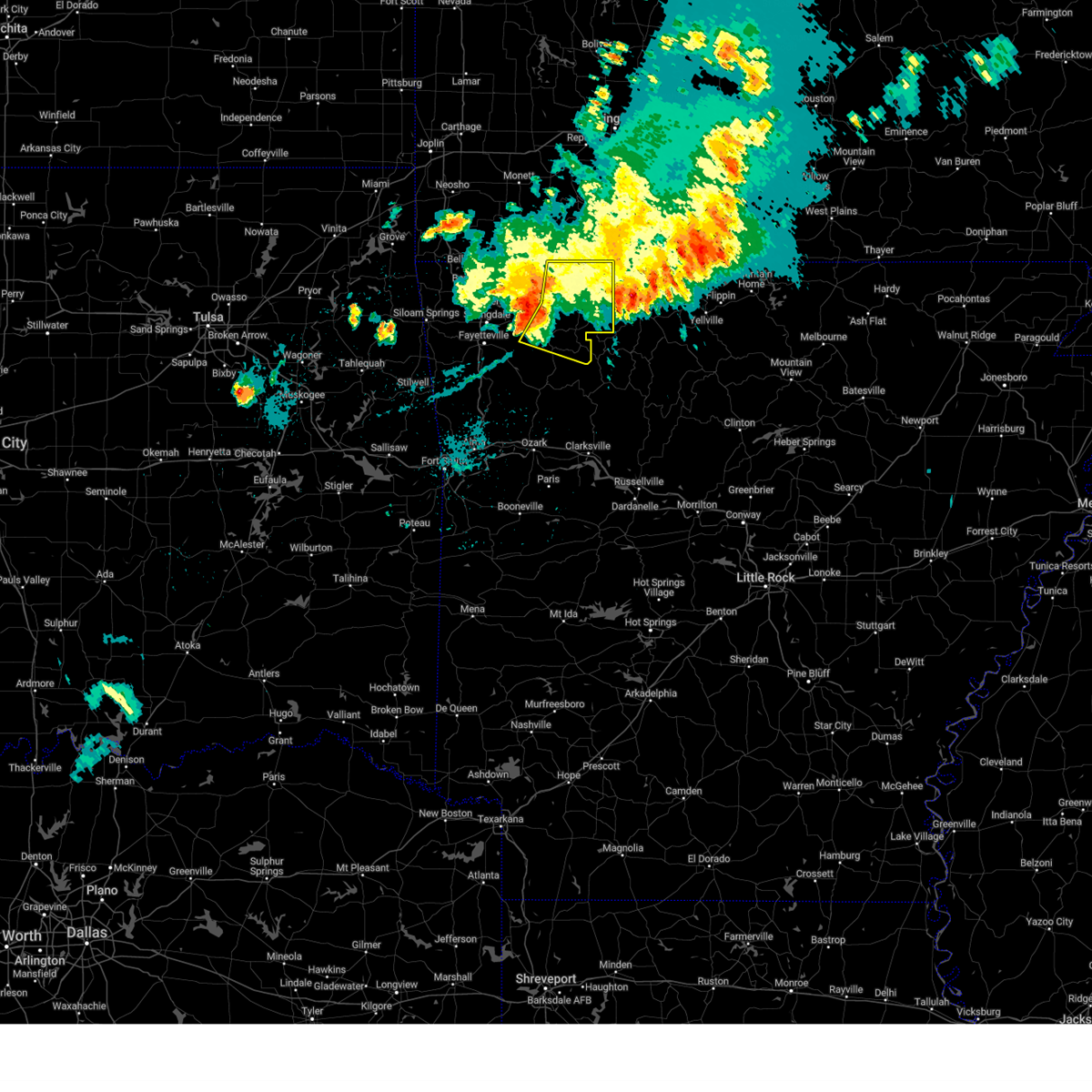 At 1224 am cdt, severe thunderstorms were located along a line extending from 2 miles east of holiday island to 5 miles east of clifty to 3 miles southwest of hindsville, moving east at 30 mph (radar indicated). Hazards include 60 mph wind gusts. Expect damage to roofs, siding, and trees. locations in or near the path include, berryville, huntsville, eureka springs, holiday island, green forest, hindsville, carrollton, rudd, kingston, forum, clifty, withrow springs state park, marble, osage, urbanette, rule, grandview, dryfork, metalton, connor, hail threat, radar indicated max hail size, <. 75 in wind threat, radar indicated max wind gust, 60 mph. At 1224 am cdt, severe thunderstorms were located along a line extending from 2 miles east of holiday island to 5 miles east of clifty to 3 miles southwest of hindsville, moving east at 30 mph (radar indicated). Hazards include 60 mph wind gusts. Expect damage to roofs, siding, and trees. locations in or near the path include, berryville, huntsville, eureka springs, holiday island, green forest, hindsville, carrollton, rudd, kingston, forum, clifty, withrow springs state park, marble, osage, urbanette, rule, grandview, dryfork, metalton, connor, hail threat, radar indicated max hail size, <. 75 in wind threat, radar indicated max wind gust, 60 mph.
|
| 8/9/2023 8:53 PM CDT |
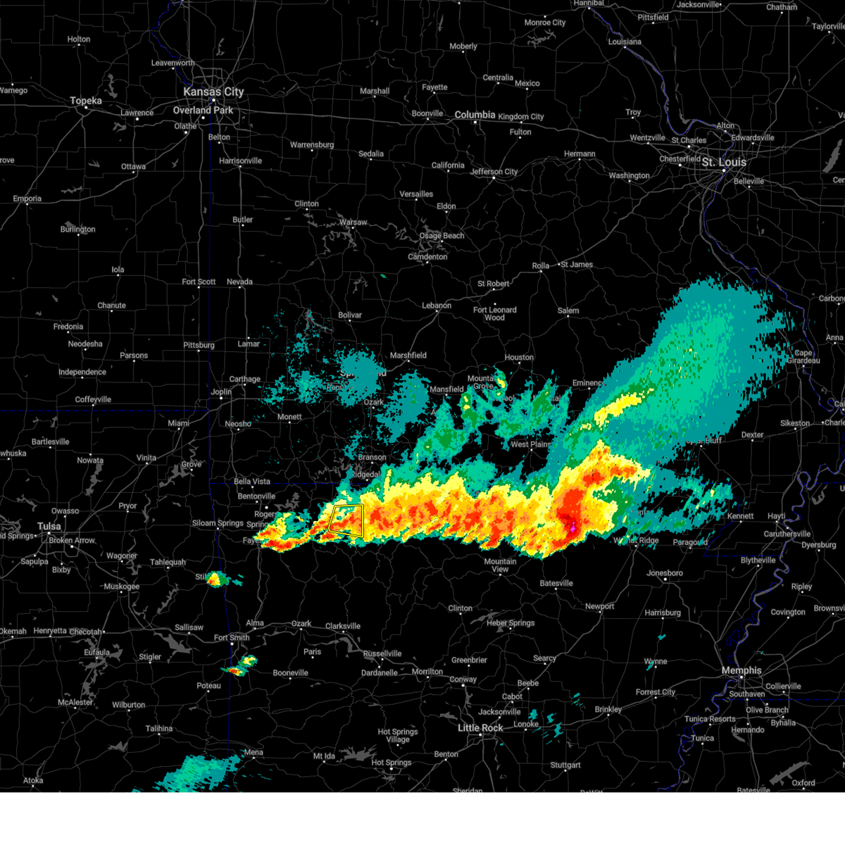 The severe thunderstorm warning for southeastern carroll county will expire at 900 pm cdt, the storms which prompted the warning have weakened below severe limits, and no longer pose an immediate threat to life or property. therefore, the warning will be allowed to expire. however small hail, gusty winds and heavy rain are still possible with these thunderstorms. a tornado watch remains in effect until 1000 pm cdt for northwestern arkansas. The severe thunderstorm warning for southeastern carroll county will expire at 900 pm cdt, the storms which prompted the warning have weakened below severe limits, and no longer pose an immediate threat to life or property. therefore, the warning will be allowed to expire. however small hail, gusty winds and heavy rain are still possible with these thunderstorms. a tornado watch remains in effect until 1000 pm cdt for northwestern arkansas.
|
| 8/9/2023 8:44 PM CDT |
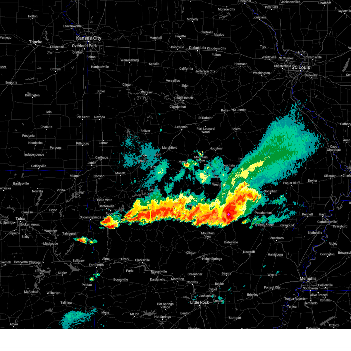 At 844 pm cdt, severe thunderstorms were located along a line extending from near carrollton to 2 miles west of rudd, moving east at 35 mph (radar indicated). Hazards include 60 mph wind gusts and quarter size hail. Hail damage to vehicles is expected. expect wind damage to roofs, siding, and trees. locations in or near the path include, green forest, carrollton, osage, rudd, rule, coin, cabanal, metalton, delmar, connor, hail threat, radar indicated max hail size, 1. 00 in wind threat, radar indicated max wind gust, 60 mph. At 844 pm cdt, severe thunderstorms were located along a line extending from near carrollton to 2 miles west of rudd, moving east at 35 mph (radar indicated). Hazards include 60 mph wind gusts and quarter size hail. Hail damage to vehicles is expected. expect wind damage to roofs, siding, and trees. locations in or near the path include, green forest, carrollton, osage, rudd, rule, coin, cabanal, metalton, delmar, connor, hail threat, radar indicated max hail size, 1. 00 in wind threat, radar indicated max wind gust, 60 mph.
|
| 8/9/2023 8:27 PM CDT |
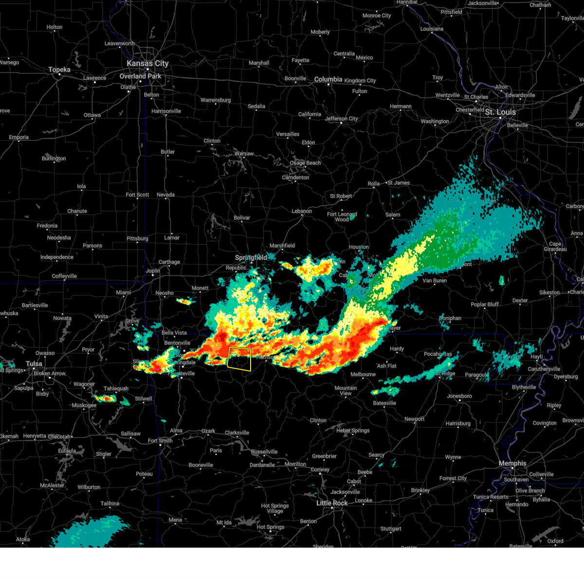 At 827 pm cdt, a severe thunderstorm was located over rule, moving east at 35 mph (radar indicated). Hazards include 60 mph wind gusts and quarter size hail. Hail damage to vehicles is expected. expect wind damage to roofs, siding, and trees. locations in or near the path include, berryville, green forest, carrollton, osage, rudd, rule, coin, cabanal, metalton, delmar, connor, hail threat, radar indicated max hail size, 1. 00 in wind threat, radar indicated max wind gust, 60 mph. At 827 pm cdt, a severe thunderstorm was located over rule, moving east at 35 mph (radar indicated). Hazards include 60 mph wind gusts and quarter size hail. Hail damage to vehicles is expected. expect wind damage to roofs, siding, and trees. locations in or near the path include, berryville, green forest, carrollton, osage, rudd, rule, coin, cabanal, metalton, delmar, connor, hail threat, radar indicated max hail size, 1. 00 in wind threat, radar indicated max wind gust, 60 mph.
|
| 7/31/2023 12:29 AM CDT |
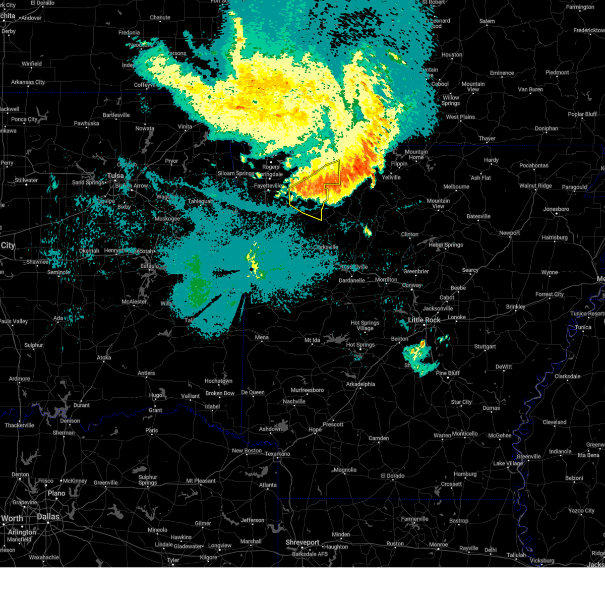 At 1229 am cdt, severe thunderstorms were located along a line extending from carver to 6 miles north of walnut to 4 miles west of saint paul, moving south at 50 mph (radar indicated). Hazards include 70 mph wind gusts. Expect considerable tree damage. damage is likely to mobile homes, roofs, and outbuildings. locations in or near the path include, huntsville, withrow springs state park, carrollton, rudd, pettigrew, japton, kingston, witter, marble, aurora, osage, rule, boston, georgetown, dryfork, red star, metalton, weathers, connor, coin, thunderstorm damage threat, considerable hail threat, radar indicated max hail size, <. 75 in wind threat, radar indicated max wind gust, 70 mph. At 1229 am cdt, severe thunderstorms were located along a line extending from carver to 6 miles north of walnut to 4 miles west of saint paul, moving south at 50 mph (radar indicated). Hazards include 70 mph wind gusts. Expect considerable tree damage. damage is likely to mobile homes, roofs, and outbuildings. locations in or near the path include, huntsville, withrow springs state park, carrollton, rudd, pettigrew, japton, kingston, witter, marble, aurora, osage, rule, boston, georgetown, dryfork, red star, metalton, weathers, connor, coin, thunderstorm damage threat, considerable hail threat, radar indicated max hail size, <. 75 in wind threat, radar indicated max wind gust, 70 mph.
|
| 7/31/2023 12:26 AM CDT |
 At 1226 am cdt, severe thunderstorms were located along a line extending from near pyatt to 7 miles east of upper buffalo wilderness area, moving southeast at 55 mph (radar indicated). Hazards include 70 mph wind gusts. Expect considerable tree damage. damage is likely to mobile homes, roofs, and outbuildings. locations impacted include, harrison, mountain home, bull shoals, marshall, yellville, jasper, gassville, flippin, lakeview in baxter county, diamond city, norfork, salesville, bergman, western grove, lead hill, briarcliff, pyatt, valley springs, arkawana, dugger, thunderstorm damage threat, considerable hail threat, radar indicated max hail size, <. 75 in wind threat, radar indicated max wind gust, 70 mph. At 1226 am cdt, severe thunderstorms were located along a line extending from near pyatt to 7 miles east of upper buffalo wilderness area, moving southeast at 55 mph (radar indicated). Hazards include 70 mph wind gusts. Expect considerable tree damage. damage is likely to mobile homes, roofs, and outbuildings. locations impacted include, harrison, mountain home, bull shoals, marshall, yellville, jasper, gassville, flippin, lakeview in baxter county, diamond city, norfork, salesville, bergman, western grove, lead hill, briarcliff, pyatt, valley springs, arkawana, dugger, thunderstorm damage threat, considerable hail threat, radar indicated max hail size, <. 75 in wind threat, radar indicated max wind gust, 70 mph.
|
| 7/31/2023 12:10 AM CDT |
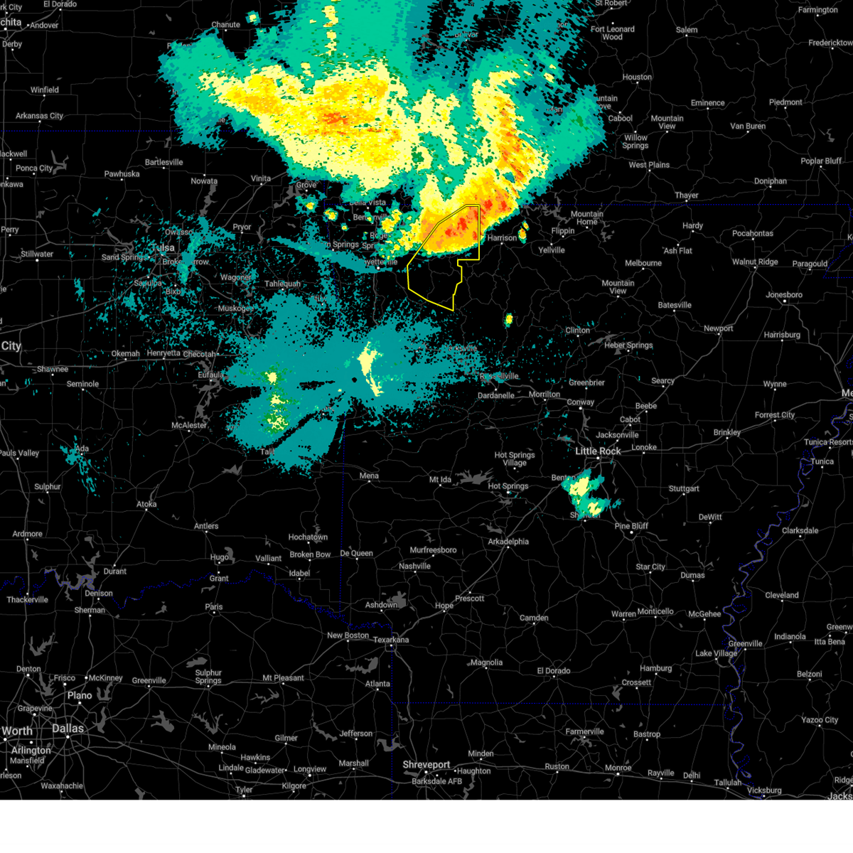 At 1210 am cdt, severe thunderstorms were located along a line extending from 2 miles northwest of lead hill to near red bank to near huntsville, moving southeast at 50 mph (radar indicated). Hazards include 70 mph wind gusts. Expect considerable tree damage. damage is likely to mobile homes, roofs, and outbuildings. locations in or near the path include, berryville, huntsville, green forest, carrollton, rudd, kingston, forum, aurora, boston, withrow springs state park, pettigrew, japton, witter, marble, osage, urbanette, rule, georgetown, dryfork, red star, thunderstorm damage threat, considerable hail threat, radar indicated max hail size, <. 75 in wind threat, radar indicated max wind gust, 70 mph. At 1210 am cdt, severe thunderstorms were located along a line extending from 2 miles northwest of lead hill to near red bank to near huntsville, moving southeast at 50 mph (radar indicated). Hazards include 70 mph wind gusts. Expect considerable tree damage. damage is likely to mobile homes, roofs, and outbuildings. locations in or near the path include, berryville, huntsville, green forest, carrollton, rudd, kingston, forum, aurora, boston, withrow springs state park, pettigrew, japton, witter, marble, osage, urbanette, rule, georgetown, dryfork, red star, thunderstorm damage threat, considerable hail threat, radar indicated max hail size, <. 75 in wind threat, radar indicated max wind gust, 70 mph.
|
| 7/31/2023 12:08 AM CDT |
 At 1206 am cdt, severe thunderstorms were located along a line extending from near diamond city to near kingston, moving southeast at 55 mph. these are destructive storms for harrison in boone county and jasper in newton county (radar indicated). Hazards include 80 mph wind gusts. Flying debris will be dangerous to those caught without shelter. mobile homes will be heavily damaged. expect considerable damage to roofs, windows, and vehicles. Extensive tree damage and power outages are likely. At 1206 am cdt, severe thunderstorms were located along a line extending from near diamond city to near kingston, moving southeast at 55 mph. these are destructive storms for harrison in boone county and jasper in newton county (radar indicated). Hazards include 80 mph wind gusts. Flying debris will be dangerous to those caught without shelter. mobile homes will be heavily damaged. expect considerable damage to roofs, windows, and vehicles. Extensive tree damage and power outages are likely.
|
| 7/31/2023 12:02 AM CDT |
 At 1201 am cdt, a severe thunderstorm was located near self, or 9 miles north of harrison, moving southeast at 60 mph. this is a destructive storm for omaha, diamond city, and harrison in boone county (radar indicated). Hazards include 80 mph wind gusts and penny size hail. Flying debris will be dangerous to those caught without shelter. mobile homes will be heavily damaged. expect considerable damage to roofs, windows, and vehicles. extensive tree damage and power outages are likely. locations impacted include, harrison, yellville, flippin, diamond city, bergman, lead hill, pyatt, valley springs, omaha, dugger, olvey, myrtle, roberson hollow, self, lakeway, red bank, winington, clark hill, dodd city, capps, thunderstorm damage threat, destructive hail threat, radar indicated max hail size, 0. 75 in wind threat, radar indicated max wind gust, 80 mph. At 1201 am cdt, a severe thunderstorm was located near self, or 9 miles north of harrison, moving southeast at 60 mph. this is a destructive storm for omaha, diamond city, and harrison in boone county (radar indicated). Hazards include 80 mph wind gusts and penny size hail. Flying debris will be dangerous to those caught without shelter. mobile homes will be heavily damaged. expect considerable damage to roofs, windows, and vehicles. extensive tree damage and power outages are likely. locations impacted include, harrison, yellville, flippin, diamond city, bergman, lead hill, pyatt, valley springs, omaha, dugger, olvey, myrtle, roberson hollow, self, lakeway, red bank, winington, clark hill, dodd city, capps, thunderstorm damage threat, destructive hail threat, radar indicated max hail size, 0. 75 in wind threat, radar indicated max wind gust, 80 mph.
|
| 7/31/2023 12:01 AM CDT |
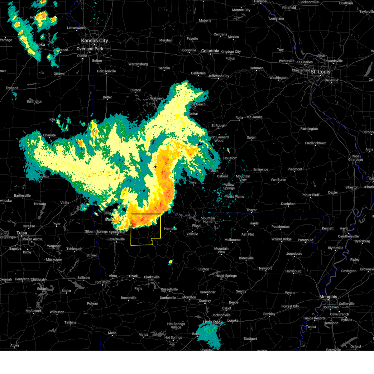 At 1200 am cdt, severe thunderstorms were located along a line extending from self to near rudd to 7 miles west of hindsville, moving southeast at 50 mph (radar indicated). Hazards include 70 mph wind gusts. Expect considerable tree damage. damage is likely to mobile homes, roofs, and outbuildings. locations in or near the path include, berryville, huntsville, eureka springs, green forest, beaver, hindsville, carrollton, rudd, kingston, forum, clifty, withrow springs state park, marble, osage, urbanette, rule, grandview, dryfork, metalton, connor, thunderstorm damage threat, considerable hail threat, radar indicated max hail size, <. 75 in wind threat, radar indicated max wind gust, 70 mph. At 1200 am cdt, severe thunderstorms were located along a line extending from self to near rudd to 7 miles west of hindsville, moving southeast at 50 mph (radar indicated). Hazards include 70 mph wind gusts. Expect considerable tree damage. damage is likely to mobile homes, roofs, and outbuildings. locations in or near the path include, berryville, huntsville, eureka springs, green forest, beaver, hindsville, carrollton, rudd, kingston, forum, clifty, withrow springs state park, marble, osage, urbanette, rule, grandview, dryfork, metalton, connor, thunderstorm damage threat, considerable hail threat, radar indicated max hail size, <. 75 in wind threat, radar indicated max wind gust, 70 mph.
|
| 7/30/2023 11:50 PM CDT |
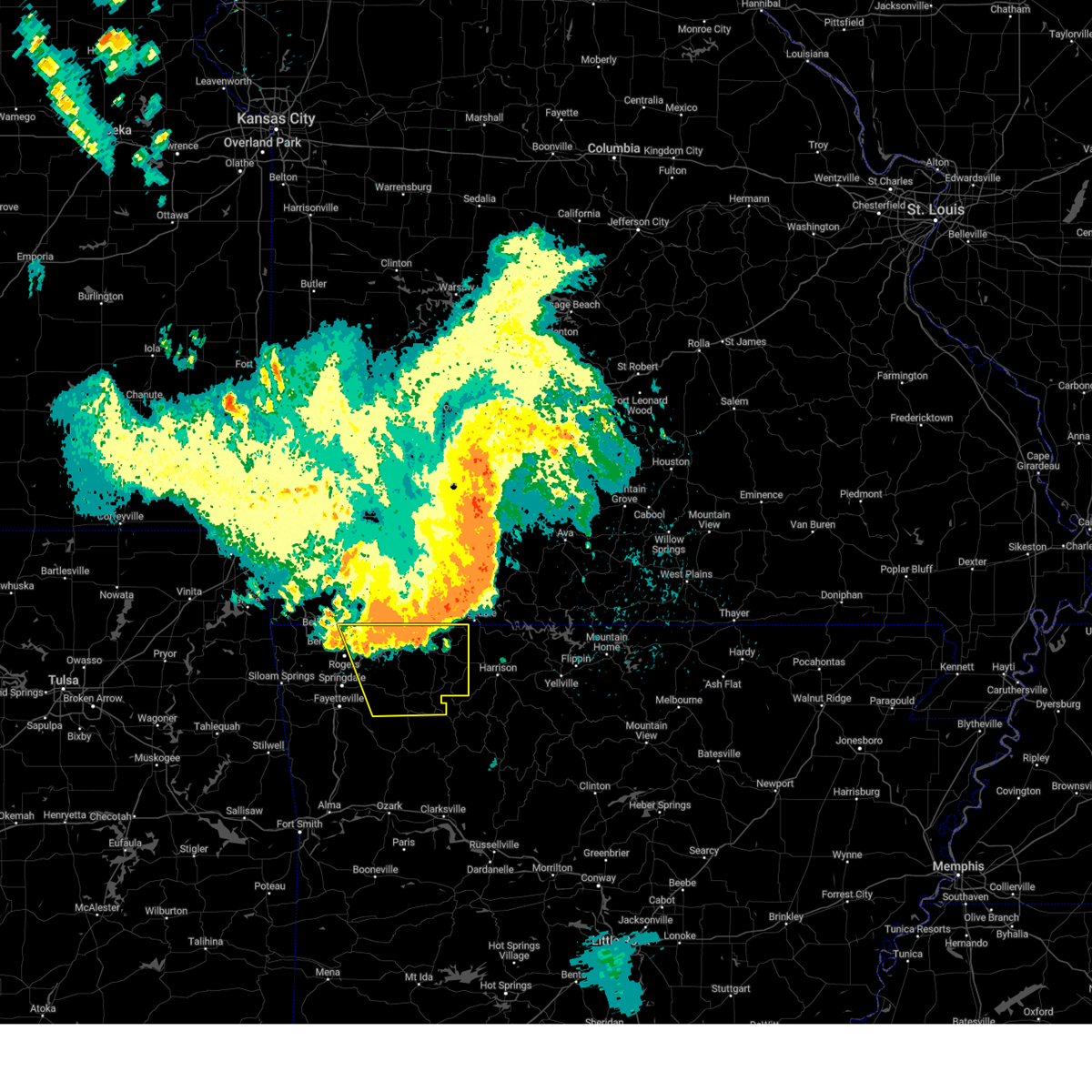 At 1150 pm cdt, severe thunderstorms were located along a line extending from 3 miles northeast of omaha to 4 miles northwest of rule to 4 miles east of lowell, moving southeast at 50 mph (radar indicated). Hazards include 70 mph wind gusts. Expect considerable tree damage. damage is likely to mobile homes, roofs, and outbuildings. locations in or near the path include, rogers, berryville, huntsville, eureka springs, pea ridge, green forest, gateway, beaver, hindsville, wesley, carrollton, rudd, kingston, forum, hobbs state park, clifty, withrow springs state park, war eagle, marble, osage, thunderstorm damage threat, considerable hail threat, radar indicated max hail size, <. 75 in wind threat, radar indicated max wind gust, 70 mph. At 1150 pm cdt, severe thunderstorms were located along a line extending from 3 miles northeast of omaha to 4 miles northwest of rule to 4 miles east of lowell, moving southeast at 50 mph (radar indicated). Hazards include 70 mph wind gusts. Expect considerable tree damage. damage is likely to mobile homes, roofs, and outbuildings. locations in or near the path include, rogers, berryville, huntsville, eureka springs, pea ridge, green forest, gateway, beaver, hindsville, wesley, carrollton, rudd, kingston, forum, hobbs state park, clifty, withrow springs state park, war eagle, marble, osage, thunderstorm damage threat, considerable hail threat, radar indicated max hail size, <. 75 in wind threat, radar indicated max wind gust, 70 mph.
|
| 7/30/2023 11:35 PM CDT |
 At 1134 pm cdt, a severe thunderstorm was located over kimberling city, moving southeast at 70 mph (radar indicated). Hazards include 70 mph wind gusts and penny size hail. Expect considerable tree damage. Damage is likely to mobile homes, roofs, and outbuildings. At 1134 pm cdt, a severe thunderstorm was located over kimberling city, moving southeast at 70 mph (radar indicated). Hazards include 70 mph wind gusts and penny size hail. Expect considerable tree damage. Damage is likely to mobile homes, roofs, and outbuildings.
|
| 7/30/2023 11:31 PM CDT |
 At 1130 pm cdt, severe thunderstorms were located along a line extending from near hollister to 6 miles northeast of grandview to 7 miles northeast of bella vista, moving southeast at 50 mph (radar indicated). Hazards include 70 mph wind gusts. Expect considerable tree damage. damage is likely to mobile homes, roofs, and outbuildings. locations in or near the path include, rogers, berryville, huntsville, eureka springs, pea ridge, green forest, gateway, beaver, hindsville, wesley, carrollton, rudd, kingston, forum, hobbs state park, clifty, withrow springs state park, war eagle, marble, osage, thunderstorm damage threat, considerable hail threat, radar indicated max hail size, <. 75 in wind threat, radar indicated max wind gust, 70 mph. At 1130 pm cdt, severe thunderstorms were located along a line extending from near hollister to 6 miles northeast of grandview to 7 miles northeast of bella vista, moving southeast at 50 mph (radar indicated). Hazards include 70 mph wind gusts. Expect considerable tree damage. damage is likely to mobile homes, roofs, and outbuildings. locations in or near the path include, rogers, berryville, huntsville, eureka springs, pea ridge, green forest, gateway, beaver, hindsville, wesley, carrollton, rudd, kingston, forum, hobbs state park, clifty, withrow springs state park, war eagle, marble, osage, thunderstorm damage threat, considerable hail threat, radar indicated max hail size, <. 75 in wind threat, radar indicated max wind gust, 70 mph.
|
| 7/30/2023 7:28 PM CDT |
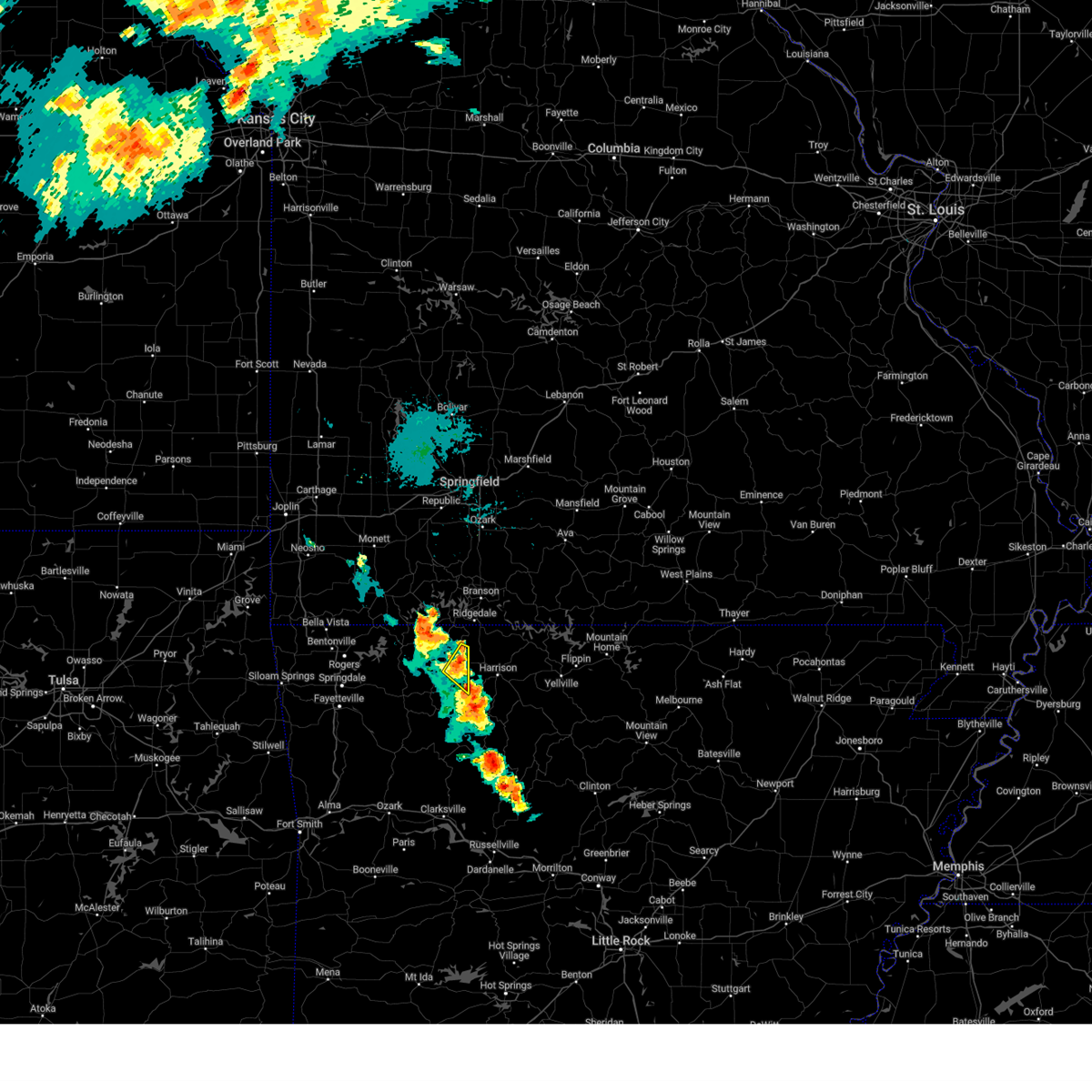 At 728 pm cdt, a severe thunderstorm was located near carrollton, moving southeast at 15 mph (radar indicated). Hazards include 60 mph wind gusts and quarter size hail. Hail damage to vehicles is expected. expect wind damage to roofs, siding, and trees. locations in or near the path include, green forest, carrollton, delmar, coin, connor, hail threat, radar indicated max hail size, 1. 00 in wind threat, radar indicated max wind gust, 60 mph. At 728 pm cdt, a severe thunderstorm was located near carrollton, moving southeast at 15 mph (radar indicated). Hazards include 60 mph wind gusts and quarter size hail. Hail damage to vehicles is expected. expect wind damage to roofs, siding, and trees. locations in or near the path include, green forest, carrollton, delmar, coin, connor, hail threat, radar indicated max hail size, 1. 00 in wind threat, radar indicated max wind gust, 60 mph.
|
| 7/30/2023 6:59 PM CDT |
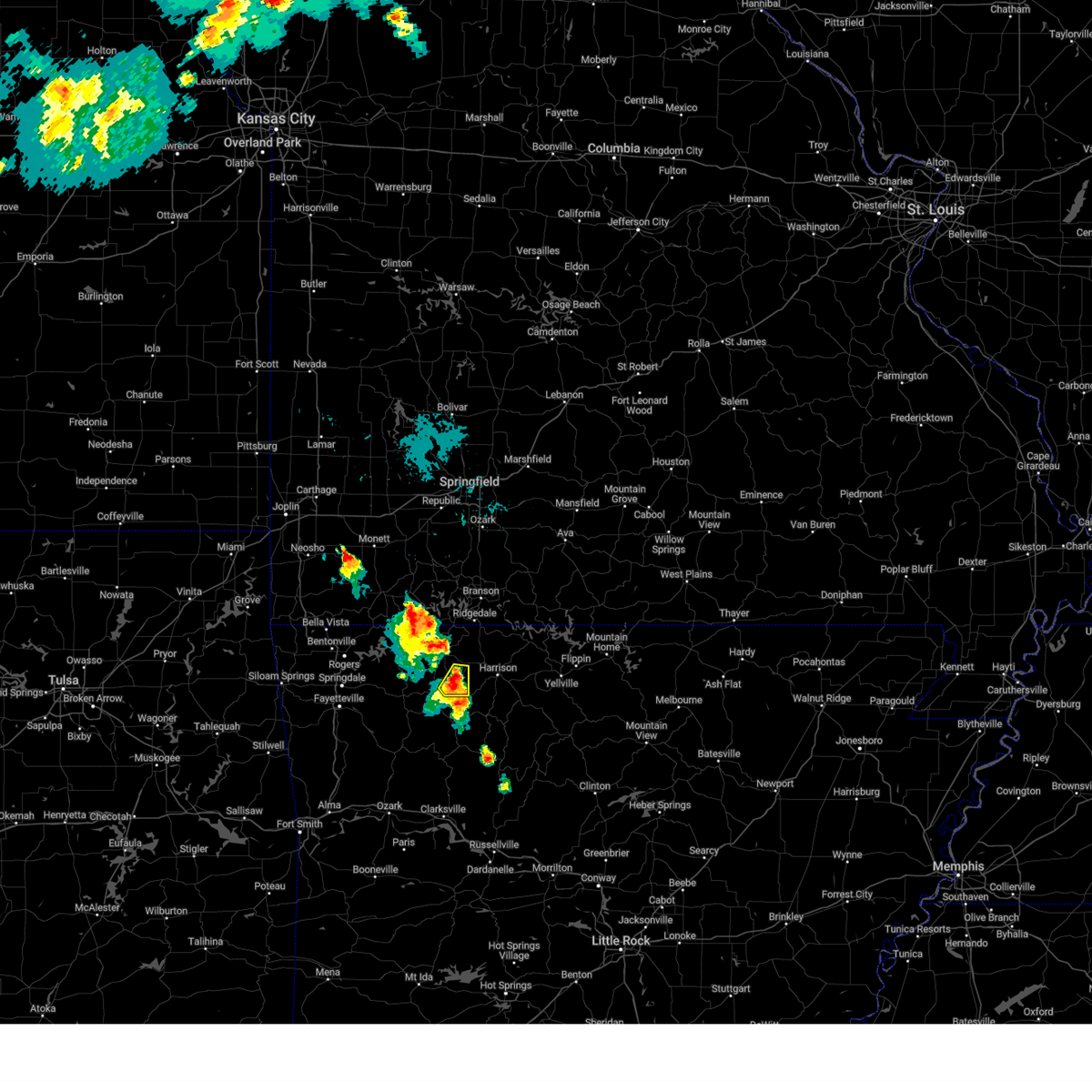 At 659 pm cdt, a severe thunderstorm was located near osage, moving southeast at 10 mph (radar indicated). Hazards include 60 mph wind gusts and quarter size hail. Hail damage to vehicles is expected. expect wind damage to roofs, siding, and trees. locations in or near the path include, carrollton, osage, delmar, dryfork, hail threat, radar indicated max hail size, 1. 00 in wind threat, radar indicated max wind gust, 60 mph. At 659 pm cdt, a severe thunderstorm was located near osage, moving southeast at 10 mph (radar indicated). Hazards include 60 mph wind gusts and quarter size hail. Hail damage to vehicles is expected. expect wind damage to roofs, siding, and trees. locations in or near the path include, carrollton, osage, delmar, dryfork, hail threat, radar indicated max hail size, 1. 00 in wind threat, radar indicated max wind gust, 60 mph.
|
| 7/14/2023 8:48 PM CDT |
 At 847 pm cdt, severe thunderstorms were located along a line extending from 6 miles southeast of forsyth to near bergman to near marble, moving southeast at 45 mph (radar indicated). Hazards include 60 mph wind gusts and penny size hail. Expect damage to roofs, siding, and trees. locations impacted include, harrison, diamond city, bergman, lead hill, pyatt, valley springs, omaha, olvey, myrtle, self, red bank, winington, clark hill, dodd city, capps, willis, crawford, bellefonte, alpena, crumpler subdivision, hail threat, radar indicated max hail size, 0. 75 in wind threat, radar indicated max wind gust, 60 mph. At 847 pm cdt, severe thunderstorms were located along a line extending from 6 miles southeast of forsyth to near bergman to near marble, moving southeast at 45 mph (radar indicated). Hazards include 60 mph wind gusts and penny size hail. Expect damage to roofs, siding, and trees. locations impacted include, harrison, diamond city, bergman, lead hill, pyatt, valley springs, omaha, olvey, myrtle, self, red bank, winington, clark hill, dodd city, capps, willis, crawford, bellefonte, alpena, crumpler subdivision, hail threat, radar indicated max hail size, 0. 75 in wind threat, radar indicated max wind gust, 60 mph.
|
| 7/14/2023 8:45 PM CDT |
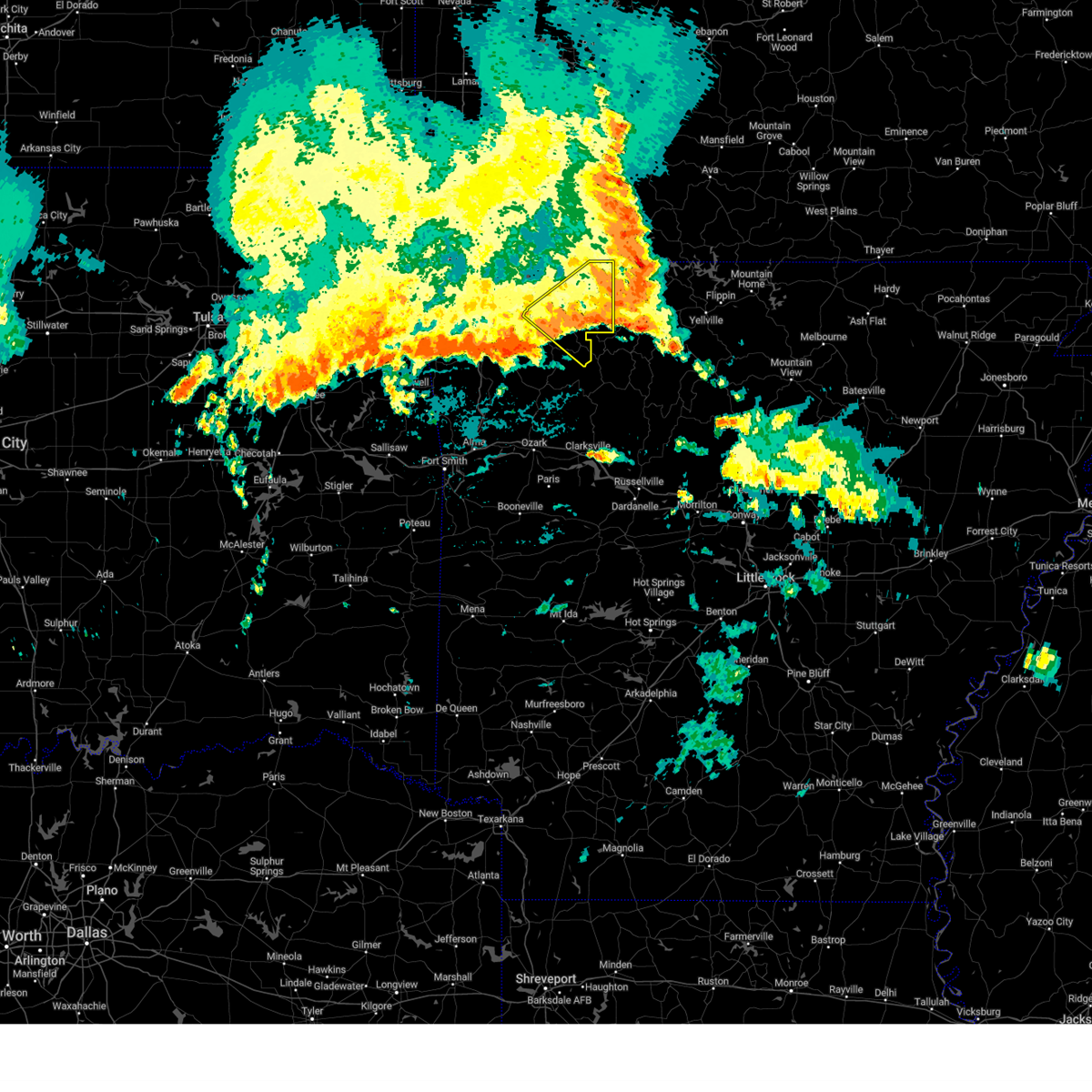 At 845 pm cdt, severe thunderstorms were located along a line extending from near self to 4 miles east of huntsville, moving southeast at 40 mph (radar indicated). Hazards include 60 mph wind gusts. Expect damage to roofs, siding, and trees. locations in or near the path include, berryville, huntsville, green forest, withrow springs state park, carrollton, rudd, kingston, marble, forum, osage, urbanette, rule, clifty, rockhouse, dryfork, cabanal, metalton, weathers, connor, coin, hail threat, radar indicated max hail size, <. 75 in wind threat, radar indicated max wind gust, 60 mph. At 845 pm cdt, severe thunderstorms were located along a line extending from near self to 4 miles east of huntsville, moving southeast at 40 mph (radar indicated). Hazards include 60 mph wind gusts. Expect damage to roofs, siding, and trees. locations in or near the path include, berryville, huntsville, green forest, withrow springs state park, carrollton, rudd, kingston, marble, forum, osage, urbanette, rule, clifty, rockhouse, dryfork, cabanal, metalton, weathers, connor, coin, hail threat, radar indicated max hail size, <. 75 in wind threat, radar indicated max wind gust, 60 mph.
|
| 7/14/2023 8:24 PM CDT |
 At 824 pm cdt, severe thunderstorms were located along a line extending from near reeds spring to near omaha to near hobbs state park, moving southeast at 45 mph (radar indicated). Hazards include 60 mph wind gusts and penny size hail. expect damage to roofs, siding, and trees At 824 pm cdt, severe thunderstorms were located along a line extending from near reeds spring to near omaha to near hobbs state park, moving southeast at 45 mph (radar indicated). Hazards include 60 mph wind gusts and penny size hail. expect damage to roofs, siding, and trees
|
| 7/14/2023 8:24 PM CDT |
 At 823 pm cdt, severe thunderstorms were located along a line extending from near roberson hollow to 3 miles northeast of hindsville, moving southeast at 60 mph (radar indicated). Hazards include 60 mph wind gusts. Expect damage to roofs, siding, and trees. locations in or near the path include, berryville, huntsville, green forest, withrow springs state park, carrollton, rudd, kingston, marble, forum, osage, urbanette, rule, clifty, rockhouse, dryfork, cabanal, metalton, weathers, connor, coin, hail threat, radar indicated max hail size, <. 75 in wind threat, radar indicated max wind gust, 60 mph. At 823 pm cdt, severe thunderstorms were located along a line extending from near roberson hollow to 3 miles northeast of hindsville, moving southeast at 60 mph (radar indicated). Hazards include 60 mph wind gusts. Expect damage to roofs, siding, and trees. locations in or near the path include, berryville, huntsville, green forest, withrow springs state park, carrollton, rudd, kingston, marble, forum, osage, urbanette, rule, clifty, rockhouse, dryfork, cabanal, metalton, weathers, connor, coin, hail threat, radar indicated max hail size, <. 75 in wind threat, radar indicated max wind gust, 60 mph.
|
| 7/14/2023 8:23 PM CDT |
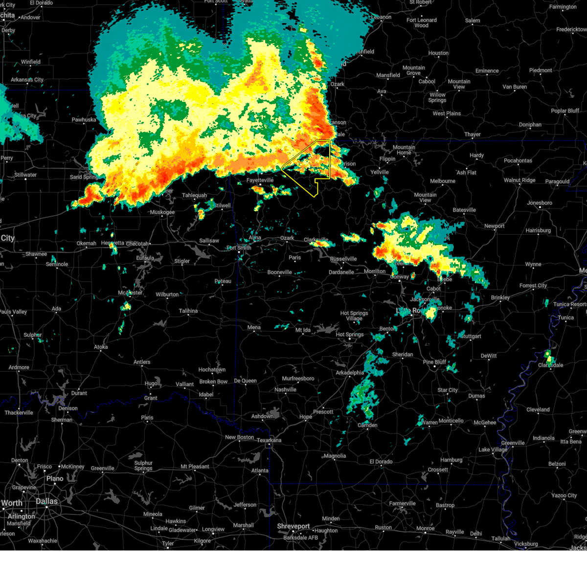 At 823 pm cdt, severe thunderstorms were located along a line extending from near roberson hollow to 3 miles northeast of hindsville, moving southeast at 60 mph (radar indicated). Hazards include 60 mph wind gusts. Expect damage to roofs, siding, and trees. locations in or near the path include, berryville, huntsville, green forest, withrow springs state park, carrollton, rudd, kingston, marble, forum, osage, urbanette, rule, clifty, rockhouse, dryfork, cabanal, metalton, weathers, connor, coin, hail threat, radar indicated max hail size, <. 75 in wind threat, radar indicated max wind gust, 60 mph. At 823 pm cdt, severe thunderstorms were located along a line extending from near roberson hollow to 3 miles northeast of hindsville, moving southeast at 60 mph (radar indicated). Hazards include 60 mph wind gusts. Expect damage to roofs, siding, and trees. locations in or near the path include, berryville, huntsville, green forest, withrow springs state park, carrollton, rudd, kingston, marble, forum, osage, urbanette, rule, clifty, rockhouse, dryfork, cabanal, metalton, weathers, connor, coin, hail threat, radar indicated max hail size, <. 75 in wind threat, radar indicated max wind gust, 60 mph.
|
| 6/18/2023 2:55 AM CDT |
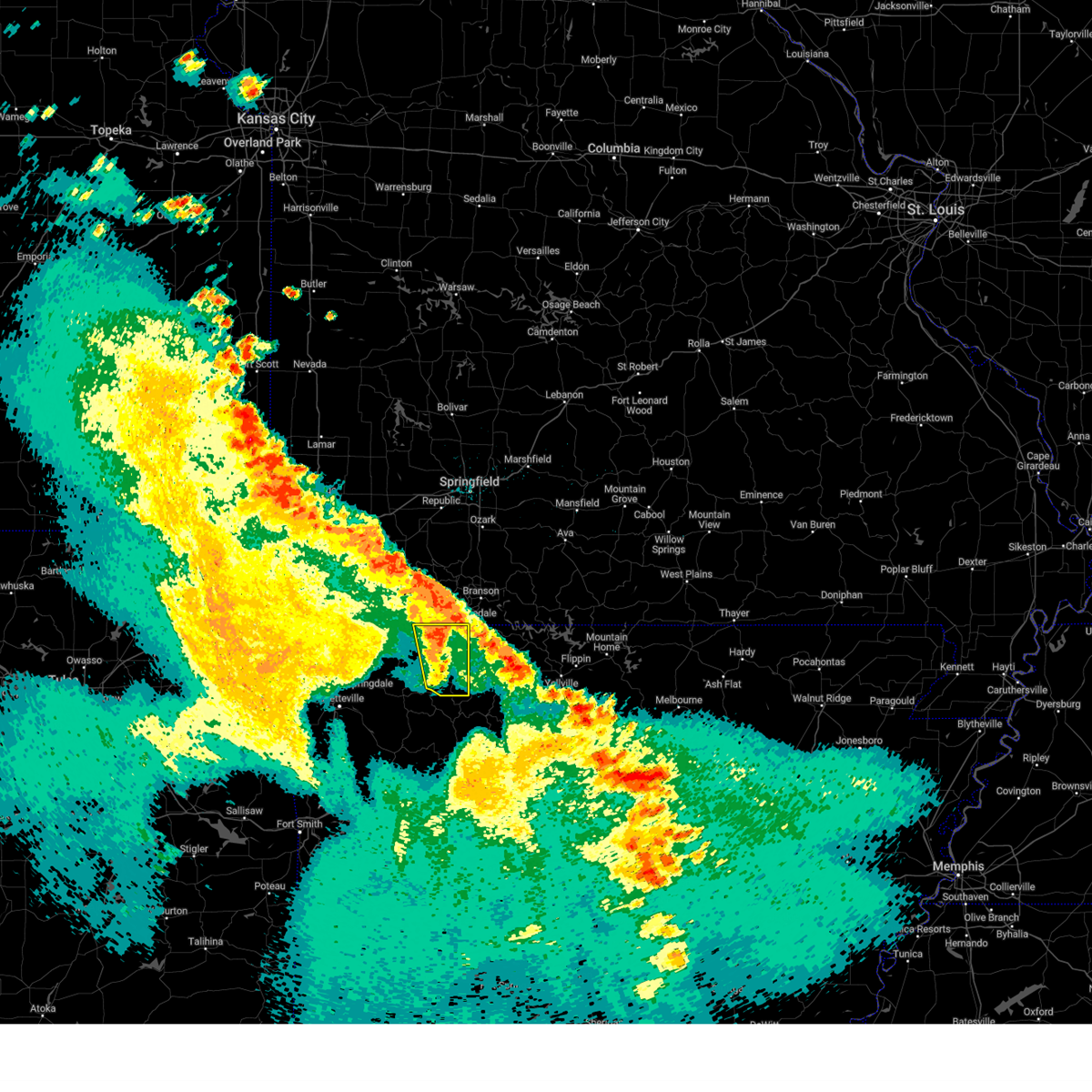 The severe thunderstorm warning for carroll county will expire at 300 am cdt, the storms which prompted the warning have weakened below severe limits, and no longer pose an immediate threat to life or property. therefore, the warning will be allowed to expire. however gusty winds to 40 mph are still possible with these thunderstorms. a severe thunderstorm watch remains in effect until 400 am cdt for northwestern arkansas. The severe thunderstorm warning for carroll county will expire at 300 am cdt, the storms which prompted the warning have weakened below severe limits, and no longer pose an immediate threat to life or property. therefore, the warning will be allowed to expire. however gusty winds to 40 mph are still possible with these thunderstorms. a severe thunderstorm watch remains in effect until 400 am cdt for northwestern arkansas.
|
| 6/18/2023 2:47 AM CDT |
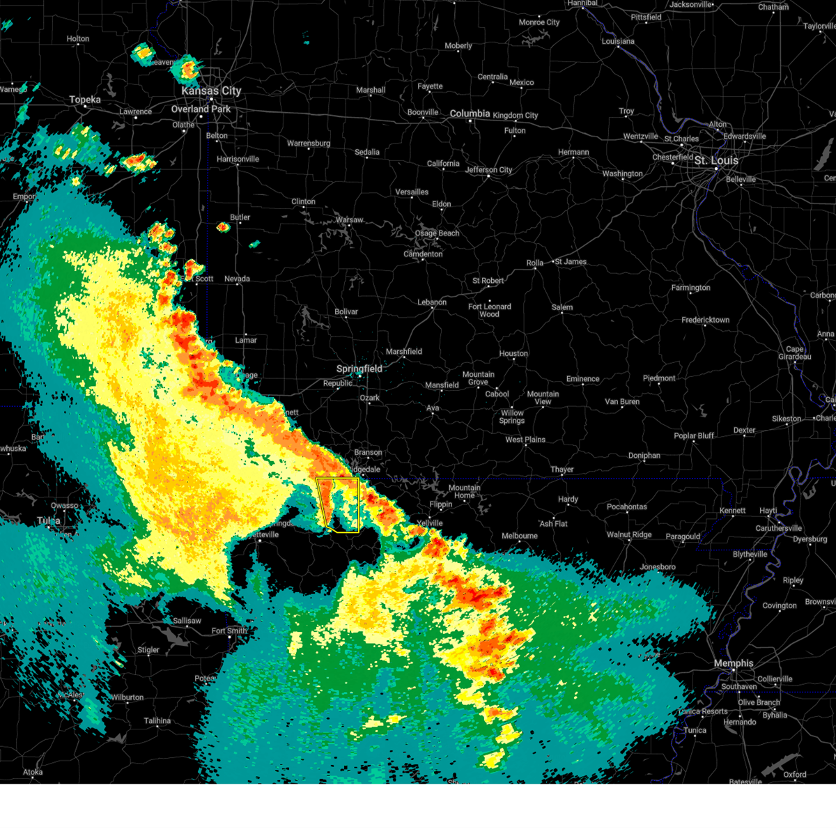 At 247 am cdt, severe thunderstorms were located along a line extending from 7 miles southwest of kimberling city to 3 miles south of rudd, moving east at 40 mph (radar indicated). Hazards include 60 mph wind gusts and penny size hail. Expect damage to roofs, siding, and trees. locations in or near the path include, berryville, green forest, carrollton, rudd, osage, urbanette, rule, grandview, dryfork, cabanal, metalton, connor, coin, pleasant ridge, delmar, denver, hail threat, radar indicated max hail size, 0. 75 in wind threat, radar indicated max wind gust, 60 mph. At 247 am cdt, severe thunderstorms were located along a line extending from 7 miles southwest of kimberling city to 3 miles south of rudd, moving east at 40 mph (radar indicated). Hazards include 60 mph wind gusts and penny size hail. Expect damage to roofs, siding, and trees. locations in or near the path include, berryville, green forest, carrollton, rudd, osage, urbanette, rule, grandview, dryfork, cabanal, metalton, connor, coin, pleasant ridge, delmar, denver, hail threat, radar indicated max hail size, 0. 75 in wind threat, radar indicated max wind gust, 60 mph.
|
| 6/18/2023 2:38 AM CDT |
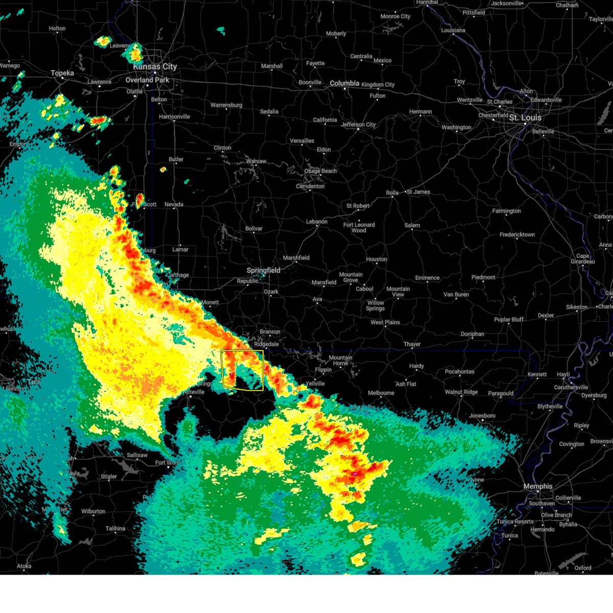 At 238 am cdt, severe thunderstorms were located along a line extending from 8 miles north of grandview to 2 miles northeast of marble, moving east at 60 mph (radar indicated). Hazards include 60 mph wind gusts and penny size hail. Expect damage to roofs, siding, and trees. locations in or near the path include, berryville, eureka springs, green forest, beaver, withrow springs state park, carrollton, rudd, marble, forum, osage, urbanette, rule, grandview, rockhouse, dryfork, cabanal, metalton, connor, coin, alabam, hail threat, radar indicated max hail size, 0. 75 in wind threat, radar indicated max wind gust, 60 mph. At 238 am cdt, severe thunderstorms were located along a line extending from 8 miles north of grandview to 2 miles northeast of marble, moving east at 60 mph (radar indicated). Hazards include 60 mph wind gusts and penny size hail. Expect damage to roofs, siding, and trees. locations in or near the path include, berryville, eureka springs, green forest, beaver, withrow springs state park, carrollton, rudd, marble, forum, osage, urbanette, rule, grandview, rockhouse, dryfork, cabanal, metalton, connor, coin, alabam, hail threat, radar indicated max hail size, 0. 75 in wind threat, radar indicated max wind gust, 60 mph.
|
| 6/18/2023 2:28 AM CDT |
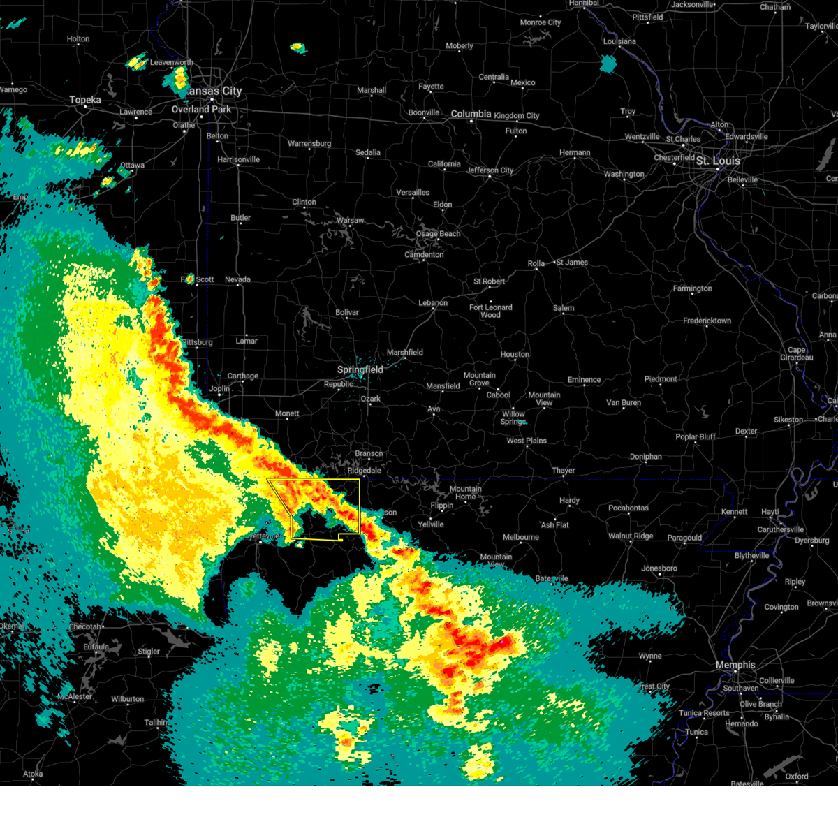 At 228 am cdt, severe thunderstorms were located along a line extending from 4 miles north of beaver to near withrow springs state park, moving east at 55 mph (radar indicated). Hazards include 70 mph wind gusts and nickel size hail. Expect considerable tree damage. damage is likely to mobile homes, roofs, and outbuildings. locations in or near the path include, berryville, huntsville, eureka springs, green forest, gateway, beaver, hindsville, carrollton, rudd, forum, clifty, withrow springs state park, marble, osage, urbanette, rule, grandview, dryfork, beaver lake, metalton, thunderstorm damage threat, considerable hail threat, radar indicated max hail size, 0. 88 in wind threat, radar indicated max wind gust, 70 mph. At 228 am cdt, severe thunderstorms were located along a line extending from 4 miles north of beaver to near withrow springs state park, moving east at 55 mph (radar indicated). Hazards include 70 mph wind gusts and nickel size hail. Expect considerable tree damage. damage is likely to mobile homes, roofs, and outbuildings. locations in or near the path include, berryville, huntsville, eureka springs, green forest, gateway, beaver, hindsville, carrollton, rudd, forum, clifty, withrow springs state park, marble, osage, urbanette, rule, grandview, dryfork, beaver lake, metalton, thunderstorm damage threat, considerable hail threat, radar indicated max hail size, 0. 88 in wind threat, radar indicated max wind gust, 70 mph.
|
| 6/18/2023 2:07 AM CDT |
 At 206 am cdt, severe thunderstorms were located along a line extending from 3 miles north of pea ridge to 3 miles east of fayetteville, moving east at 60 mph (radar indicated). Hazards include 70 mph wind gusts and nickel size hail. Expect considerable tree damage. damage is likely to mobile homes, roofs, and outbuildings. locations in or near the path include, fayetteville, springdale, rogers, bentonville, berryville, huntsville, eureka springs, lowell, pea ridge, green forest, gateway, beaver, hindsville, carrollton, rudd, forum, hobbs state park, clifty, withrow springs state park, war eagle, this includes interstate 49 between mile markers 77 and 81, and between mile markers 86 and 88. thunderstorm damage threat, considerable hail threat, radar indicated max hail size, 0. 88 in wind threat, radar indicated max wind gust, 70 mph. At 206 am cdt, severe thunderstorms were located along a line extending from 3 miles north of pea ridge to 3 miles east of fayetteville, moving east at 60 mph (radar indicated). Hazards include 70 mph wind gusts and nickel size hail. Expect considerable tree damage. damage is likely to mobile homes, roofs, and outbuildings. locations in or near the path include, fayetteville, springdale, rogers, bentonville, berryville, huntsville, eureka springs, lowell, pea ridge, green forest, gateway, beaver, hindsville, carrollton, rudd, forum, hobbs state park, clifty, withrow springs state park, war eagle, this includes interstate 49 between mile markers 77 and 81, and between mile markers 86 and 88. thunderstorm damage threat, considerable hail threat, radar indicated max hail size, 0. 88 in wind threat, radar indicated max wind gust, 70 mph.
|
| 4/20/2023 4:34 PM CDT |
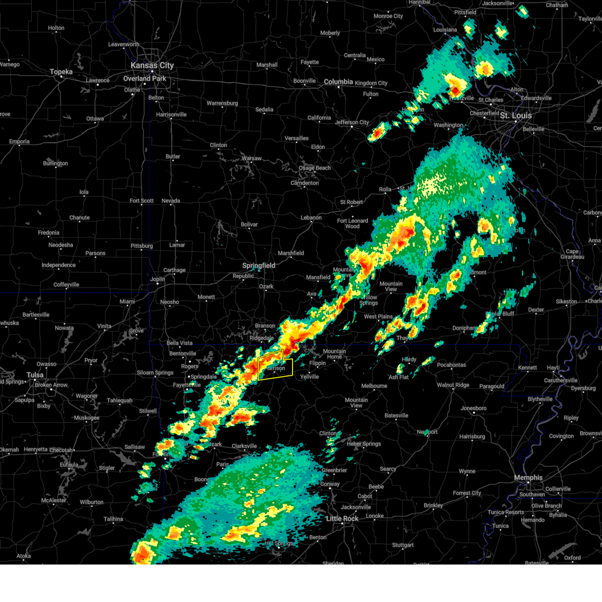 At 434 pm cdt, a severe thunderstorm was located over carrollton, or 9 miles west of harrison, moving east at 40 mph (radar indicated). Hazards include 60 mph wind gusts and half dollar size hail. Hail damage to vehicles is expected. Expect wind damage to roofs, siding, and trees. At 434 pm cdt, a severe thunderstorm was located over carrollton, or 9 miles west of harrison, moving east at 40 mph (radar indicated). Hazards include 60 mph wind gusts and half dollar size hail. Hail damage to vehicles is expected. Expect wind damage to roofs, siding, and trees.
|
| 4/20/2023 4:24 PM CDT |
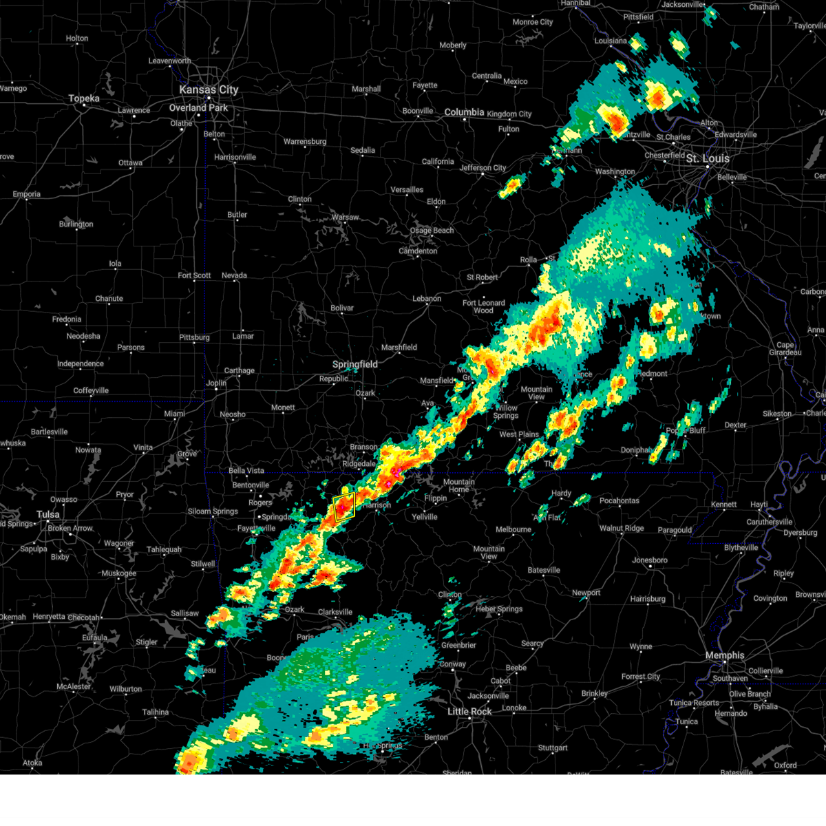 At 424 pm cdt, a severe thunderstorm was located 3 miles west of carrollton, moving east at 35 mph (radar indicated). Hazards include 60 mph wind gusts and quarter size hail. Hail damage to vehicles is expected. expect wind damage to roofs, siding, and trees. locations in or near the path include, green forest, rule, carrollton, osage, coin, connor, hail threat, radar indicated max hail size, 1. 00 in wind threat, radar indicated max wind gust, 60 mph. At 424 pm cdt, a severe thunderstorm was located 3 miles west of carrollton, moving east at 35 mph (radar indicated). Hazards include 60 mph wind gusts and quarter size hail. Hail damage to vehicles is expected. expect wind damage to roofs, siding, and trees. locations in or near the path include, green forest, rule, carrollton, osage, coin, connor, hail threat, radar indicated max hail size, 1. 00 in wind threat, radar indicated max wind gust, 60 mph.
|
| 4/20/2023 4:10 PM CDT |
 At 410 pm cdt, a severe thunderstorm was located near rudd, moving northeast at 45 mph (radar indicated). Hazards include 60 mph wind gusts and quarter size hail. Hail damage to vehicles is expected. expect wind damage to roofs, siding, and trees. locations in or near the path include, green forest, carrollton, osage, rudd, rule, coin, dryfork, cabanal, metalton, denver, connor, hail threat, radar indicated max hail size, 1. 00 in wind threat, radar indicated max wind gust, 60 mph. At 410 pm cdt, a severe thunderstorm was located near rudd, moving northeast at 45 mph (radar indicated). Hazards include 60 mph wind gusts and quarter size hail. Hail damage to vehicles is expected. expect wind damage to roofs, siding, and trees. locations in or near the path include, green forest, carrollton, osage, rudd, rule, coin, dryfork, cabanal, metalton, denver, connor, hail threat, radar indicated max hail size, 1. 00 in wind threat, radar indicated max wind gust, 60 mph.
|
| 4/15/2023 3:52 PM CDT |
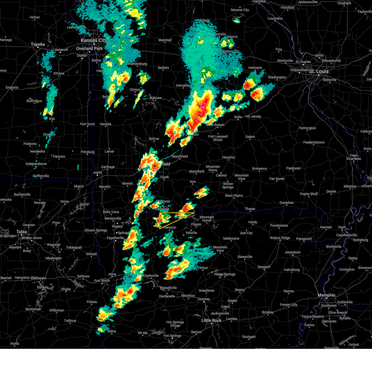 At 352 pm cdt, a severe thunderstorm was located near roberson hollow, or 13 miles northwest of harrison, moving northeast at 40 mph (radar indicated). Hazards include 60 mph wind gusts and quarter size hail. Hail damage to vehicles is expected. expect wind damage to roofs, siding, and trees. locations impacted include, diamond city, lead hill, omaha, myrtle, roberson hollow, self, willis, alpena, crumpler subdivision, south lead hill, bear creek springs, new hope in boone county, hopewell in boone county, ridgeway, burlington, bull shoals lake, hail threat, radar indicated max hail size, 1. 00 in wind threat, radar indicated max wind gust, 60 mph. At 352 pm cdt, a severe thunderstorm was located near roberson hollow, or 13 miles northwest of harrison, moving northeast at 40 mph (radar indicated). Hazards include 60 mph wind gusts and quarter size hail. Hail damage to vehicles is expected. expect wind damage to roofs, siding, and trees. locations impacted include, diamond city, lead hill, omaha, myrtle, roberson hollow, self, willis, alpena, crumpler subdivision, south lead hill, bear creek springs, new hope in boone county, hopewell in boone county, ridgeway, burlington, bull shoals lake, hail threat, radar indicated max hail size, 1. 00 in wind threat, radar indicated max wind gust, 60 mph.
|
| 4/15/2023 3:49 PM CDT |
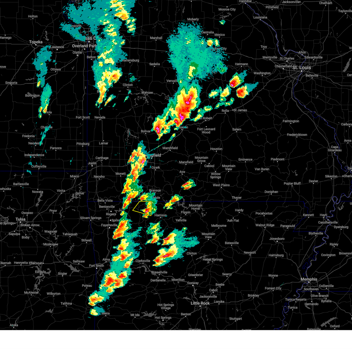 At 349 pm cdt, a severe thunderstorm was located 5 miles east of green forest, moving northeast at 35 mph (radar indicated). Hazards include 60 mph wind gusts and quarter size hail. Hail damage to vehicles is expected. expect wind damage to roofs, siding, and trees. locations in or near the path include, berryville, green forest, urbanette, coin, denver, hail threat, radar indicated max hail size, 1. 00 in wind threat, radar indicated max wind gust, 60 mph. At 349 pm cdt, a severe thunderstorm was located 5 miles east of green forest, moving northeast at 35 mph (radar indicated). Hazards include 60 mph wind gusts and quarter size hail. Hail damage to vehicles is expected. expect wind damage to roofs, siding, and trees. locations in or near the path include, berryville, green forest, urbanette, coin, denver, hail threat, radar indicated max hail size, 1. 00 in wind threat, radar indicated max wind gust, 60 mph.
|
| 4/15/2023 3:41 PM CDT |
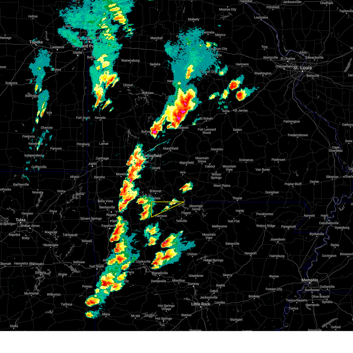 At 341 pm cdt, a severe thunderstorm was located over green forest, or 9 miles east of berryville, moving northeast at 45 mph (radar indicated). Hazards include 60 mph wind gusts and quarter size hail. Hail damage to vehicles is expected. Expect wind damage to roofs, siding, and trees. At 341 pm cdt, a severe thunderstorm was located over green forest, or 9 miles east of berryville, moving northeast at 45 mph (radar indicated). Hazards include 60 mph wind gusts and quarter size hail. Hail damage to vehicles is expected. Expect wind damage to roofs, siding, and trees.
|
| 4/15/2023 3:35 PM CDT |
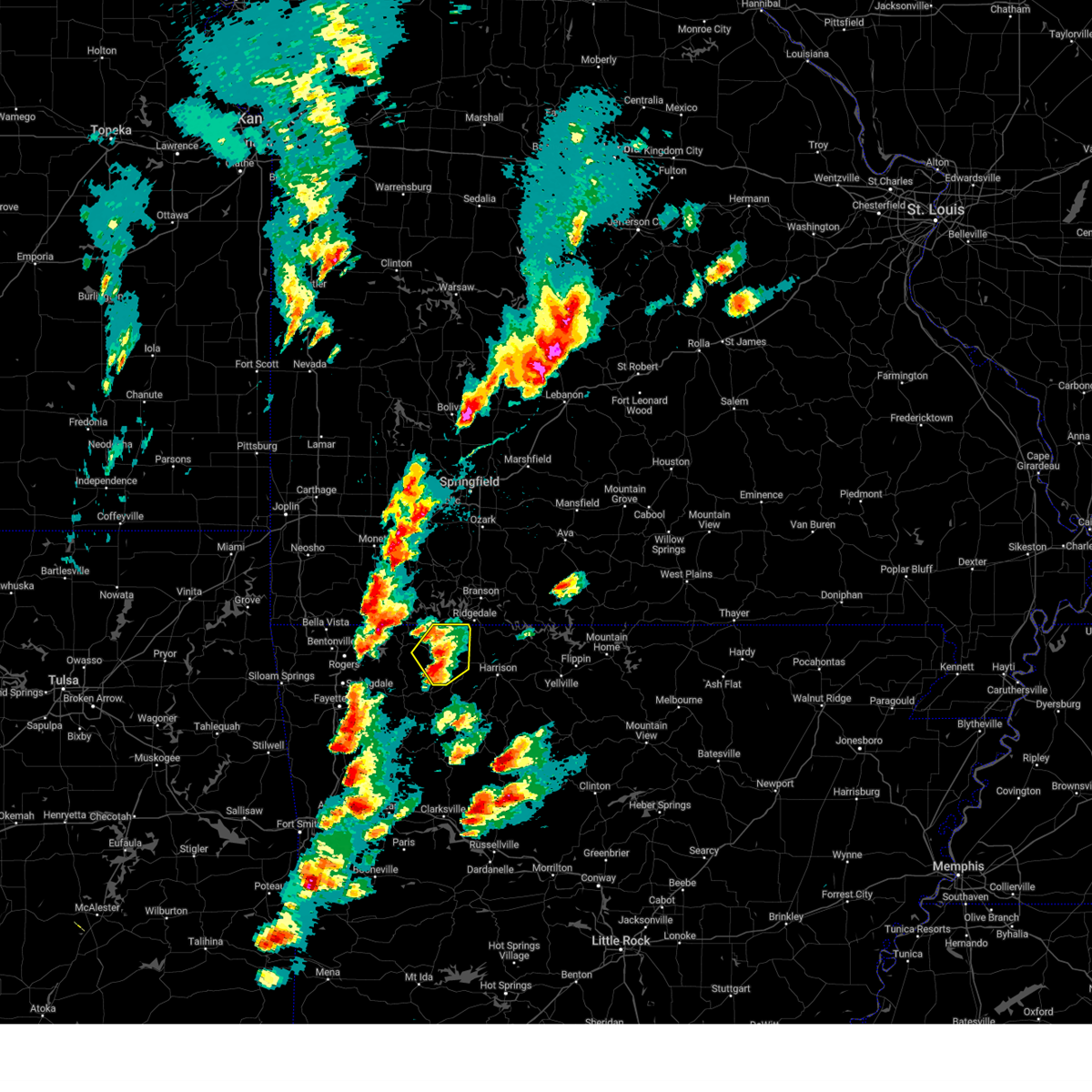 At 335 pm cdt, a severe thunderstorm was located over rule, moving northeast at 45 mph (radar indicated). Hazards include 60 mph wind gusts and quarter size hail. Hail damage to vehicles is expected. expect wind damage to roofs, siding, and trees. locations in or near the path include, berryville, green forest, carrollton, rudd, urbanette, rule, coin, cabanal, metalton, denver, connor, hail threat, radar indicated max hail size, 1. 00 in wind threat, radar indicated max wind gust, 60 mph. At 335 pm cdt, a severe thunderstorm was located over rule, moving northeast at 45 mph (radar indicated). Hazards include 60 mph wind gusts and quarter size hail. Hail damage to vehicles is expected. expect wind damage to roofs, siding, and trees. locations in or near the path include, berryville, green forest, carrollton, rudd, urbanette, rule, coin, cabanal, metalton, denver, connor, hail threat, radar indicated max hail size, 1. 00 in wind threat, radar indicated max wind gust, 60 mph.
|
| 4/15/2023 3:23 PM CDT |
 At 323 pm cdt, a severe thunderstorm was located near marble, moving northeast at 35 mph (radar indicated). Hazards include 60 mph wind gusts and quarter size hail. Hail damage to vehicles is expected. expect wind damage to roofs, siding, and trees. locations in or near the path include, berryville, green forest, carrollton, rudd, marble, forum, osage, urbanette, rule, rockhouse, dryfork, cabanal, metalton, connor, coin, alabam, delmar, denver, hail threat, radar indicated max hail size, 1. 00 in wind threat, radar indicated max wind gust, 60 mph. At 323 pm cdt, a severe thunderstorm was located near marble, moving northeast at 35 mph (radar indicated). Hazards include 60 mph wind gusts and quarter size hail. Hail damage to vehicles is expected. expect wind damage to roofs, siding, and trees. locations in or near the path include, berryville, green forest, carrollton, rudd, marble, forum, osage, urbanette, rule, rockhouse, dryfork, cabanal, metalton, connor, coin, alabam, delmar, denver, hail threat, radar indicated max hail size, 1. 00 in wind threat, radar indicated max wind gust, 60 mph.
|
| 4/5/2023 5:36 AM CDT |
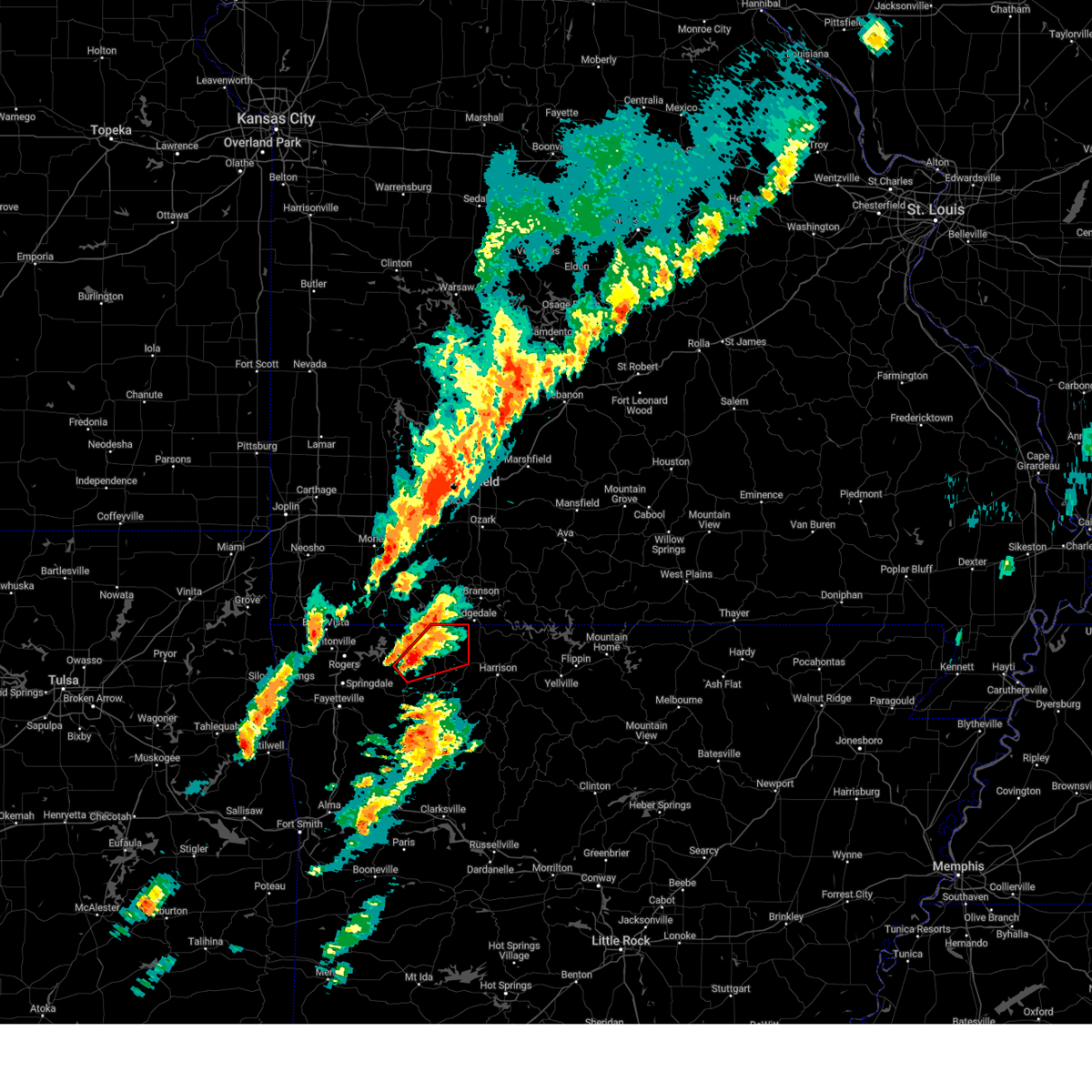 At 536 am cdt, a severe thunderstorm capable of producing a tornado was located 7 miles northeast of clifty, moving northeast at 65 mph (radar indicated rotation). Hazards include tornado and half dollar size hail. Flying debris will be dangerous to those caught without shelter. mobile homes will be damaged or destroyed. damage to roofs, windows, and vehicles will occur. tree damage is likely. Locations in or near the path include, berryville, green forest, urbanette, rule, grandview, rockhouse, coin, cabanal, denver,. At 536 am cdt, a severe thunderstorm capable of producing a tornado was located 7 miles northeast of clifty, moving northeast at 65 mph (radar indicated rotation). Hazards include tornado and half dollar size hail. Flying debris will be dangerous to those caught without shelter. mobile homes will be damaged or destroyed. damage to roofs, windows, and vehicles will occur. tree damage is likely. Locations in or near the path include, berryville, green forest, urbanette, rule, grandview, rockhouse, coin, cabanal, denver,.
|
| 4/5/2023 5:25 AM CDT |
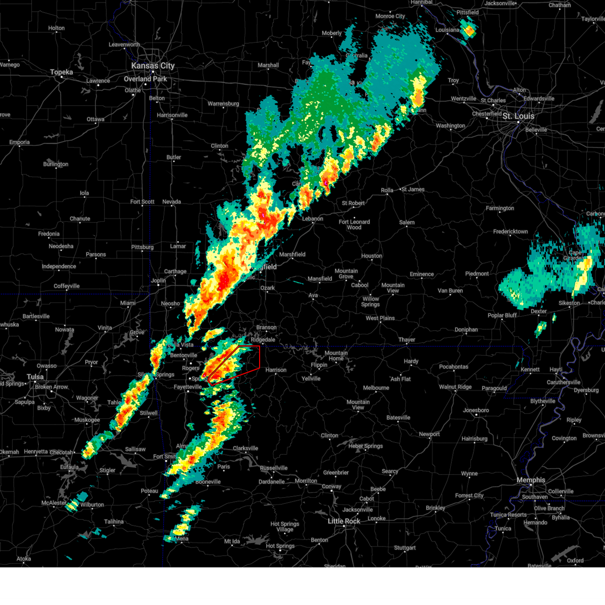 At 525 am cdt, a severe thunderstorm capable of producing a tornado was located near clifty, moving northeast at 50 mph (radar indicated rotation). Hazards include tornado and half dollar size hail. Flying debris will be dangerous to those caught without shelter. mobile homes will be damaged or destroyed. damage to roofs, windows, and vehicles will occur. tree damage is likely. Locations in or near the path include, berryville, green forest, hindsville, forum, urbanette, rule, grandview, clifty, rockhouse, cabanal, metalton, coin, denver, connor,. At 525 am cdt, a severe thunderstorm capable of producing a tornado was located near clifty, moving northeast at 50 mph (radar indicated rotation). Hazards include tornado and half dollar size hail. Flying debris will be dangerous to those caught without shelter. mobile homes will be damaged or destroyed. damage to roofs, windows, and vehicles will occur. tree damage is likely. Locations in or near the path include, berryville, green forest, hindsville, forum, urbanette, rule, grandview, clifty, rockhouse, cabanal, metalton, coin, denver, connor,.
|
| 3/2/2023 12:12 PM CST |
 At 1212 pm cst, a severe thunderstorm was located 5 miles north of marble, moving northeast at 45 mph (radar indicated). Hazards include 60 mph wind gusts and quarter size hail. Hail damage to vehicles is expected. expect wind damage to roofs, siding, and trees. locations in or near the path include, green forest, carrollton, rudd, marble, forum, osage, rule, dryfork, cabanal, metalton, connor, coin, alabam, delmar, denver, hail threat, radar indicated max hail size, 1. 00 in wind threat, radar indicated max wind gust, 60 mph. At 1212 pm cst, a severe thunderstorm was located 5 miles north of marble, moving northeast at 45 mph (radar indicated). Hazards include 60 mph wind gusts and quarter size hail. Hail damage to vehicles is expected. expect wind damage to roofs, siding, and trees. locations in or near the path include, green forest, carrollton, rudd, marble, forum, osage, rule, dryfork, cabanal, metalton, connor, coin, alabam, delmar, denver, hail threat, radar indicated max hail size, 1. 00 in wind threat, radar indicated max wind gust, 60 mph.
|
| 3/2/2023 11:53 AM CST |
 At 1152 am cst, a severe thunderstorm was located near hindsville, moving northeast at 45 mph (radar indicated). Hazards include 60 mph wind gusts and quarter size hail. Hail damage to vehicles is expected. expect wind damage to roofs, siding, and trees. locations in or near the path include, huntsville, green forest, hindsville, withrow springs state park, carrollton, rudd, marble, forum, osage, rule, dryfork, cabanal, metalton, connor, coin, alabam, delmar, denver, hail threat, radar indicated max hail size, 1. 00 in wind threat, radar indicated max wind gust, 60 mph. At 1152 am cst, a severe thunderstorm was located near hindsville, moving northeast at 45 mph (radar indicated). Hazards include 60 mph wind gusts and quarter size hail. Hail damage to vehicles is expected. expect wind damage to roofs, siding, and trees. locations in or near the path include, huntsville, green forest, hindsville, withrow springs state park, carrollton, rudd, marble, forum, osage, rule, dryfork, cabanal, metalton, connor, coin, alabam, delmar, denver, hail threat, radar indicated max hail size, 1. 00 in wind threat, radar indicated max wind gust, 60 mph.
|
| 11/4/2022 8:12 PM CDT |
 The severe thunderstorm warning for northwestern newton and boone counties will expire at 815 pm cdt, the existing warning will expire at 815 pm cdt, however the line of storms is still possible of producing severe wind gusts, and a new warning has been issued for boone and marion counties. a tornado watch remains in effect until midnight cdt for north central arkansas. remember, a severe thunderstorm warning still remains in effect for boone and marion counties until 900 pm cdt. The severe thunderstorm warning for northwestern newton and boone counties will expire at 815 pm cdt, the existing warning will expire at 815 pm cdt, however the line of storms is still possible of producing severe wind gusts, and a new warning has been issued for boone and marion counties. a tornado watch remains in effect until midnight cdt for north central arkansas. remember, a severe thunderstorm warning still remains in effect for boone and marion counties until 900 pm cdt.
|
| 11/4/2022 8:06 PM CDT |
 The tornado warning for northeastern carroll county will expire at 815 pm cdt, the storm which prompted the warning has moved out of the area. therefore, the warning will be allowed to expire. The tornado warning for northeastern carroll county will expire at 815 pm cdt, the storm which prompted the warning has moved out of the area. therefore, the warning will be allowed to expire.
|
| 11/4/2022 7:57 PM CDT |
 At 755 pm cdt, severe thunderstorms were located along a line extending from roberson hollow to near capps to near erbie, moving northeast at 55 mph (radar indicated). Hazards include 60 mph wind gusts. Expect damage to roofs, siding, and trees. locations impacted include, harrison, diamond city, bergman, lead hill, valley springs, omaha, olvey, myrtle, roberson hollow, self, erbie, red bank, winington, capps, willis, crawford, lost valley state park, upper buffalo wilderness area, bellefonte, alpena, hail threat, radar indicated max hail size, <. 75 in wind threat, radar indicated max wind gust, 60 mph. At 755 pm cdt, severe thunderstorms were located along a line extending from roberson hollow to near capps to near erbie, moving northeast at 55 mph (radar indicated). Hazards include 60 mph wind gusts. Expect damage to roofs, siding, and trees. locations impacted include, harrison, diamond city, bergman, lead hill, valley springs, omaha, olvey, myrtle, roberson hollow, self, erbie, red bank, winington, capps, willis, crawford, lost valley state park, upper buffalo wilderness area, bellefonte, alpena, hail threat, radar indicated max hail size, <. 75 in wind threat, radar indicated max wind gust, 60 mph.
|
| 11/4/2022 7:47 PM CDT |
 At 747 pm cdt, a severe thunderstorm capable of producing a tornado was located over green forest, moving northeast at 50 mph (radar indicated rotation). Hazards include tornado. Flying debris will be dangerous to those caught without shelter. mobile homes will be damaged or destroyed. damage to roofs, windows, and vehicles will occur. tree damage is likely. Locations in or near the path include, berryville, green forest, carrollton, urbanette, rule, grandview, coin, denver,. At 747 pm cdt, a severe thunderstorm capable of producing a tornado was located over green forest, moving northeast at 50 mph (radar indicated rotation). Hazards include tornado. Flying debris will be dangerous to those caught without shelter. mobile homes will be damaged or destroyed. damage to roofs, windows, and vehicles will occur. tree damage is likely. Locations in or near the path include, berryville, green forest, carrollton, urbanette, rule, grandview, coin, denver,.
|
| 11/4/2022 7:36 PM CDT |
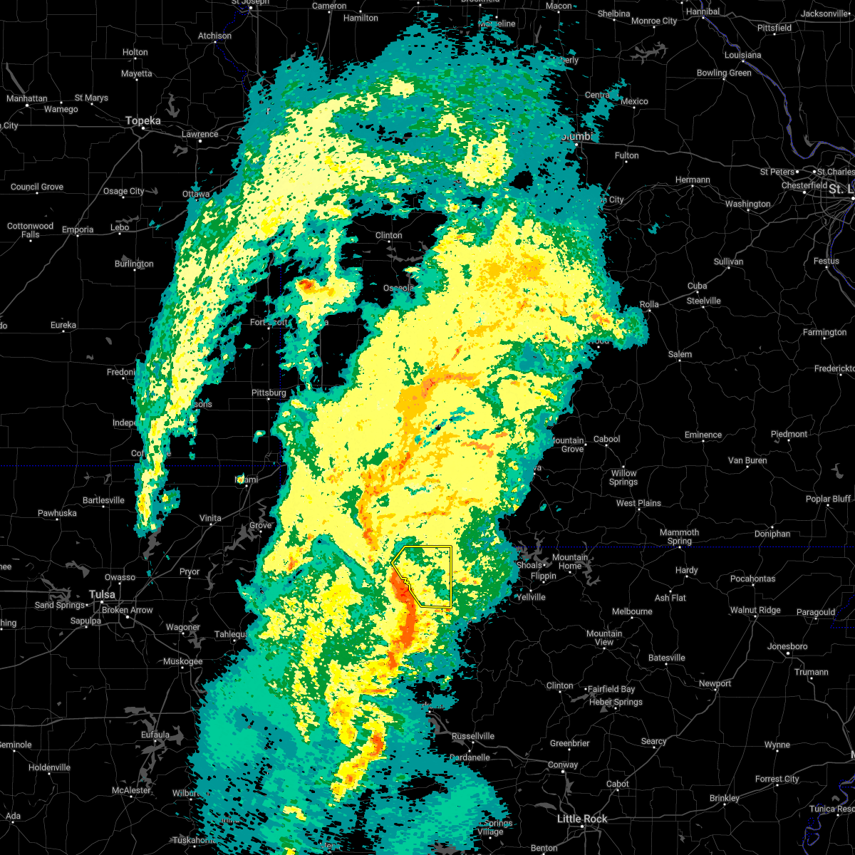 At 736 pm cdt, severe thunderstorms were located along a line extending from 3 miles southwest of grandview to near rudd, moving northeast at 55 mph (radar indicated). Hazards include 60 mph wind gusts. Expect damage to roofs, siding, and trees. locations in or near the path include, berryville, eureka springs, green forest, carrollton, rudd, osage, urbanette, rule, grandview, dryfork, cabanal, metalton, connor, coin, pleasant ridge, delmar, denver, hail threat, radar indicated max hail size, <. 75 in wind threat, radar indicated max wind gust, 60 mph. At 736 pm cdt, severe thunderstorms were located along a line extending from 3 miles southwest of grandview to near rudd, moving northeast at 55 mph (radar indicated). Hazards include 60 mph wind gusts. Expect damage to roofs, siding, and trees. locations in or near the path include, berryville, eureka springs, green forest, carrollton, rudd, osage, urbanette, rule, grandview, dryfork, cabanal, metalton, connor, coin, pleasant ridge, delmar, denver, hail threat, radar indicated max hail size, <. 75 in wind threat, radar indicated max wind gust, 60 mph.
|
| 11/4/2022 7:35 PM CDT |
 At 735 pm cdt, severe thunderstorms were located along a line extending from near berryville to near kingston to near upper buffalo wilderness area, moving northeast at 60 mph (radar indicated). Hazards include 60 mph wind gusts and quarter size hail. Hail damage to vehicles is expected. Expect wind damage to roofs, siding, and trees. At 735 pm cdt, severe thunderstorms were located along a line extending from near berryville to near kingston to near upper buffalo wilderness area, moving northeast at 60 mph (radar indicated). Hazards include 60 mph wind gusts and quarter size hail. Hail damage to vehicles is expected. Expect wind damage to roofs, siding, and trees.
|
| 5/15/2022 12:35 PM CDT |
 At 1235 pm cdt, severe thunderstorms were located along a line extending from near clifty to 4 miles southwest of roberson hollow, moving south at 35 mph (radar indicated). Hazards include 60 mph wind gusts and half dollar size hail. Hail damage to vehicles is expected. expect wind damage to roofs, siding, and trees. locations in or near the path include, berryville, huntsville, eureka springs, green forest, beaver, carrollton, rudd, forum, clifty, withrow springs state park, marble, osage, urbanette, rule, grandview, dryfork, metalton, connor, coin, alabam, hail threat, radar indicated max hail size, 1. 25 in wind threat, radar indicated max wind gust, 60 mph. At 1235 pm cdt, severe thunderstorms were located along a line extending from near clifty to 4 miles southwest of roberson hollow, moving south at 35 mph (radar indicated). Hazards include 60 mph wind gusts and half dollar size hail. Hail damage to vehicles is expected. expect wind damage to roofs, siding, and trees. locations in or near the path include, berryville, huntsville, eureka springs, green forest, beaver, carrollton, rudd, forum, clifty, withrow springs state park, marble, osage, urbanette, rule, grandview, dryfork, metalton, connor, coin, alabam, hail threat, radar indicated max hail size, 1. 25 in wind threat, radar indicated max wind gust, 60 mph.
|
| 5/15/2022 12:27 PM CDT |
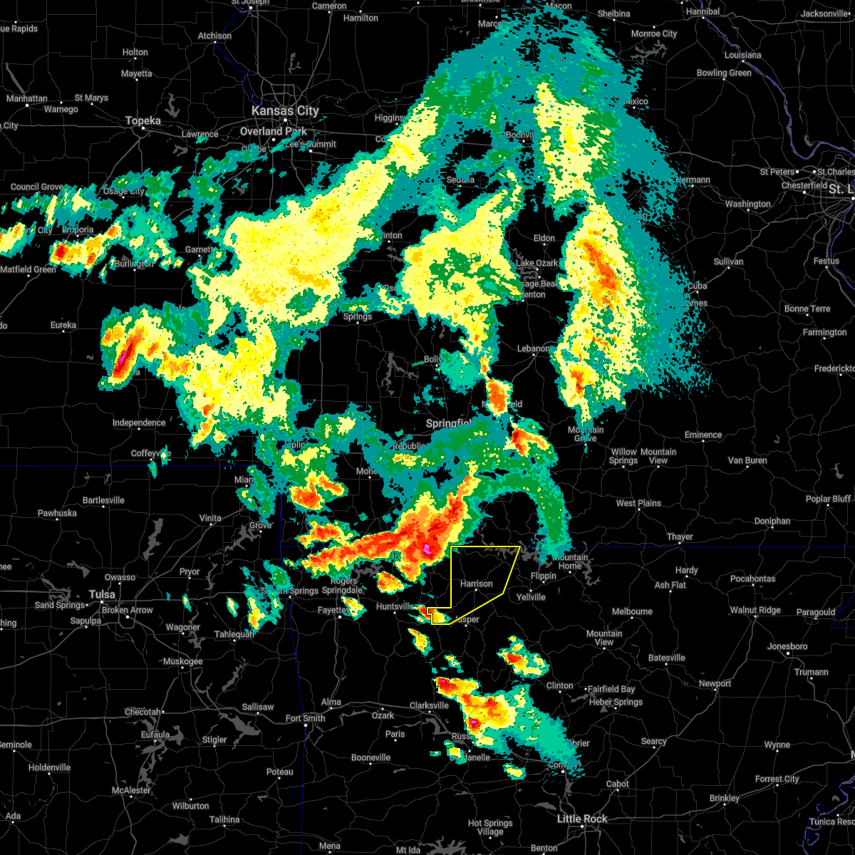 At 1227 pm cdt, severe thunderstorms were located along a line extending from merriam woods to near roberson hollow to clifty, moving southeast at 25 mph (radar indicated). Hazards include 60 mph wind gusts and quarter size hail. Hail damage to vehicles is expected. Expect wind damage to roofs, siding, and trees. At 1227 pm cdt, severe thunderstorms were located along a line extending from merriam woods to near roberson hollow to clifty, moving southeast at 25 mph (radar indicated). Hazards include 60 mph wind gusts and quarter size hail. Hail damage to vehicles is expected. Expect wind damage to roofs, siding, and trees.
|
| 5/15/2022 12:02 PM CDT | At 1202 pm cdt, severe thunderstorms were located along a line extending from 7 miles northeast of reeds spring to beaver, moving southeast at 25 mph (radar indicated). Hazards include 60 mph wind gusts and half dollar size hail. Hail damage to vehicles is expected. Expect wind damage to roofs, siding, and trees. |
| 5/15/2022 11:59 AM CDT | At 1159 am cdt, severe thunderstorms were located along a line extending from 4 miles northeast of seligman to 2 miles southwest of reeds spring, moving southeast at 35 mph (radar indicated). Hazards include 60 mph wind gusts and half dollar size hail. Hail damage to vehicles is expected. expect wind damage to roofs, siding, and trees. locations in or near the path include, berryville, huntsville, eureka springs, green forest, beaver, carrollton, rudd, forum, clifty, withrow springs state park, marble, osage, urbanette, rule, grandview, dryfork, metalton, connor, coin, alabam, hail threat, radar indicated max hail size, 1. 25 in wind threat, radar indicated max wind gust, 60 mph. |
| 5/2/2022 11:25 PM CDT |
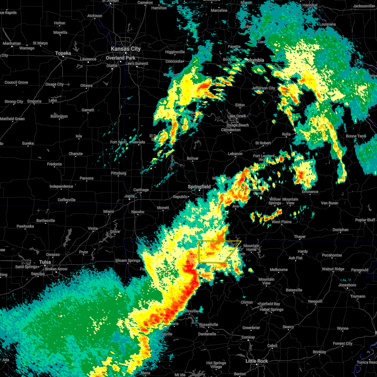 The severe thunderstorm warning for northwestern marion and boone counties will expire at 1130 pm cdt, the storms which prompted the warning have weakened below severe limits, and no longer pose an immediate threat to life or property. therefore, the warning will be allowed to expire. however gusty winds are still possible with these thunderstorms. a severe thunderstorm watch remains in effect until 400 am cdt for north central arkansas. The severe thunderstorm warning for northwestern marion and boone counties will expire at 1130 pm cdt, the storms which prompted the warning have weakened below severe limits, and no longer pose an immediate threat to life or property. therefore, the warning will be allowed to expire. however gusty winds are still possible with these thunderstorms. a severe thunderstorm watch remains in effect until 400 am cdt for north central arkansas.
|
| 5/2/2022 11:07 PM CDT |
 At 1106 pm cdt, severe thunderstorms were located along a line extending from 6 miles northwest of rudd to near kingston to 2 miles southeast of pettigrew, moving east at 45 mph (radar indicated). Hazards include 60 mph wind gusts and penny size hail. Expect damage to roofs, siding, and trees. locations in or near the path include, huntsville, green forest, st. paul, carrollton, rudd, saint paul, kingston, forum, aurora, boston, withrow springs state park, pettigrew, witter, marble, osage, rule, dryfork, red star, metalton, connor, hail threat, radar indicated max hail size, 0. 75 in wind threat, radar indicated max wind gust, 60 mph. At 1106 pm cdt, severe thunderstorms were located along a line extending from 6 miles northwest of rudd to near kingston to 2 miles southeast of pettigrew, moving east at 45 mph (radar indicated). Hazards include 60 mph wind gusts and penny size hail. Expect damage to roofs, siding, and trees. locations in or near the path include, huntsville, green forest, st. paul, carrollton, rudd, saint paul, kingston, forum, aurora, boston, withrow springs state park, pettigrew, witter, marble, osage, rule, dryfork, red star, metalton, connor, hail threat, radar indicated max hail size, 0. 75 in wind threat, radar indicated max wind gust, 60 mph.
|
| 5/2/2022 11:05 PM CDT |
 At 1105 pm cdt, severe thunderstorms were located along a line extending from 8 miles southeast of forsyth to near self to near carrollton, moving east at 45 mph (radar indicated). Hazards include 60 mph wind gusts and nickel size hail. Expect damage to roofs, siding, and trees. locations impacted include, harrison, diamond city, bergman, lead hill, pyatt, omaha, myrtle, roberson hollow, self, ozark isle, lakeway, winington, clark hill, dodd city, capps, price place, willis, olvey, bellefonte, alpena, hail threat, radar indicated max hail size, 0. 88 in wind threat, radar indicated max wind gust, 60 mph. At 1105 pm cdt, severe thunderstorms were located along a line extending from 8 miles southeast of forsyth to near self to near carrollton, moving east at 45 mph (radar indicated). Hazards include 60 mph wind gusts and nickel size hail. Expect damage to roofs, siding, and trees. locations impacted include, harrison, diamond city, bergman, lead hill, pyatt, omaha, myrtle, roberson hollow, self, ozark isle, lakeway, winington, clark hill, dodd city, capps, price place, willis, olvey, bellefonte, alpena, hail threat, radar indicated max hail size, 0. 88 in wind threat, radar indicated max wind gust, 60 mph.
|
| 5/2/2022 10:43 PM CDT |
 At 1042 pm cdt, severe thunderstorms were located along a line extending from branson west to near roberson hollow to near rule, moving east at 45 mph (radar indicated). Hazards include 60 mph wind gusts and nickel size hail. expect damage to roofs, siding, and trees At 1042 pm cdt, severe thunderstorms were located along a line extending from branson west to near roberson hollow to near rule, moving east at 45 mph (radar indicated). Hazards include 60 mph wind gusts and nickel size hail. expect damage to roofs, siding, and trees
|
| 5/2/2022 10:41 PM CDT |
 At 1041 pm cdt, severe thunderstorms were located along a line extending from near hobbs state park to 3 miles northwest of japton to 6 miles north of fern, moving east at 45 mph (radar indicated). Hazards include 60 mph wind gusts and penny size hail. Expect damage to roofs, siding, and trees. locations in or near the path include, fayetteville, huntsville, green forest, elkins, winslow, st. paul, hindsville, wesley, carrollton, rudd, saint paul, forum, aurora, clifty, boston, withrow springs state park, devils den state park, brentwood, marble, rule, this includes interstate 49 between mile markers 36 and 48. hail threat, radar indicated max hail size, 0. 75 in wind threat, radar indicated max wind gust, 60 mph. At 1041 pm cdt, severe thunderstorms were located along a line extending from near hobbs state park to 3 miles northwest of japton to 6 miles north of fern, moving east at 45 mph (radar indicated). Hazards include 60 mph wind gusts and penny size hail. Expect damage to roofs, siding, and trees. locations in or near the path include, fayetteville, huntsville, green forest, elkins, winslow, st. paul, hindsville, wesley, carrollton, rudd, saint paul, forum, aurora, clifty, boston, withrow springs state park, devils den state park, brentwood, marble, rule, this includes interstate 49 between mile markers 36 and 48. hail threat, radar indicated max hail size, 0. 75 in wind threat, radar indicated max wind gust, 60 mph.
|
| 5/2/2022 10:22 PM CDT |
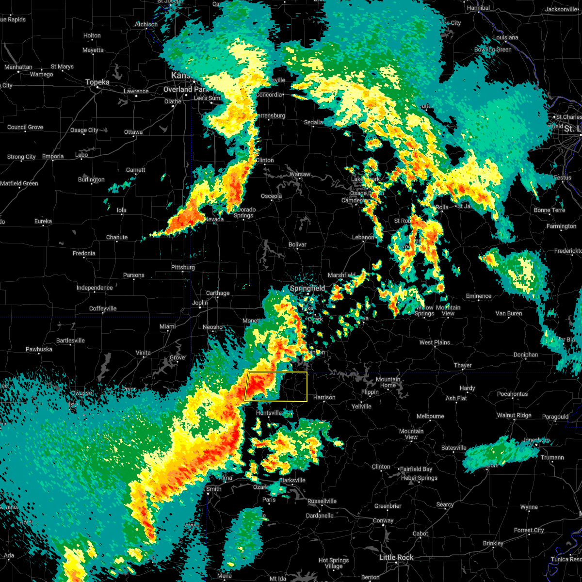 At 1022 pm cdt, a severe thunderstorm was located 4 miles southwest of grandview, moving east at 45 mph (radar indicated). Hazards include 60 mph wind gusts and nickel size hail. Expect damage to roofs, siding, and trees. locations in or near the path include, berryville, eureka springs, green forest, gateway, beaver, carrollton, war eagle, urbanette, hobbs state park, rule, grandview, clifty, rockhouse, cabanal, beaver lake, connor, larue, coin, pleasant ridge, denver, hail threat, radar indicated max hail size, 0. 88 in wind threat, radar indicated max wind gust, 60 mph. At 1022 pm cdt, a severe thunderstorm was located 4 miles southwest of grandview, moving east at 45 mph (radar indicated). Hazards include 60 mph wind gusts and nickel size hail. Expect damage to roofs, siding, and trees. locations in or near the path include, berryville, eureka springs, green forest, gateway, beaver, carrollton, war eagle, urbanette, hobbs state park, rule, grandview, clifty, rockhouse, cabanal, beaver lake, connor, larue, coin, pleasant ridge, denver, hail threat, radar indicated max hail size, 0. 88 in wind threat, radar indicated max wind gust, 60 mph.
|
| 3/30/2022 6:14 AM CDT |
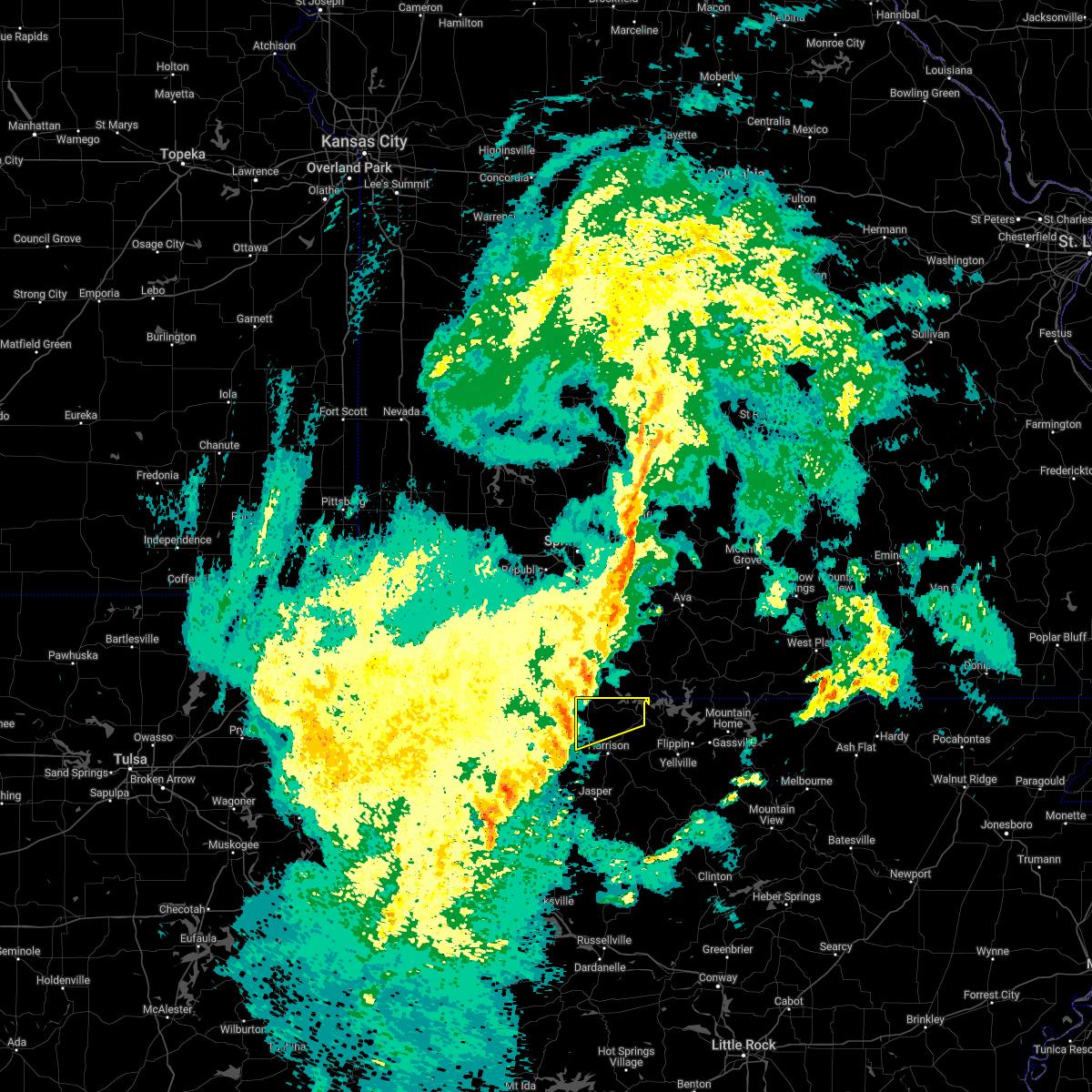 At 613 am cdt, severe thunderstorms were located along a line extending from near roberson hollow to 7 miles southwest of omaha to carrollton, moving northeast at 50 mph (radar indicated). Hazards include 60 mph wind gusts. expect damage to roofs, siding, and trees At 613 am cdt, severe thunderstorms were located along a line extending from near roberson hollow to 7 miles southwest of omaha to carrollton, moving northeast at 50 mph (radar indicated). Hazards include 60 mph wind gusts. expect damage to roofs, siding, and trees
|
| 5/27/2021 7:25 PM CDT |
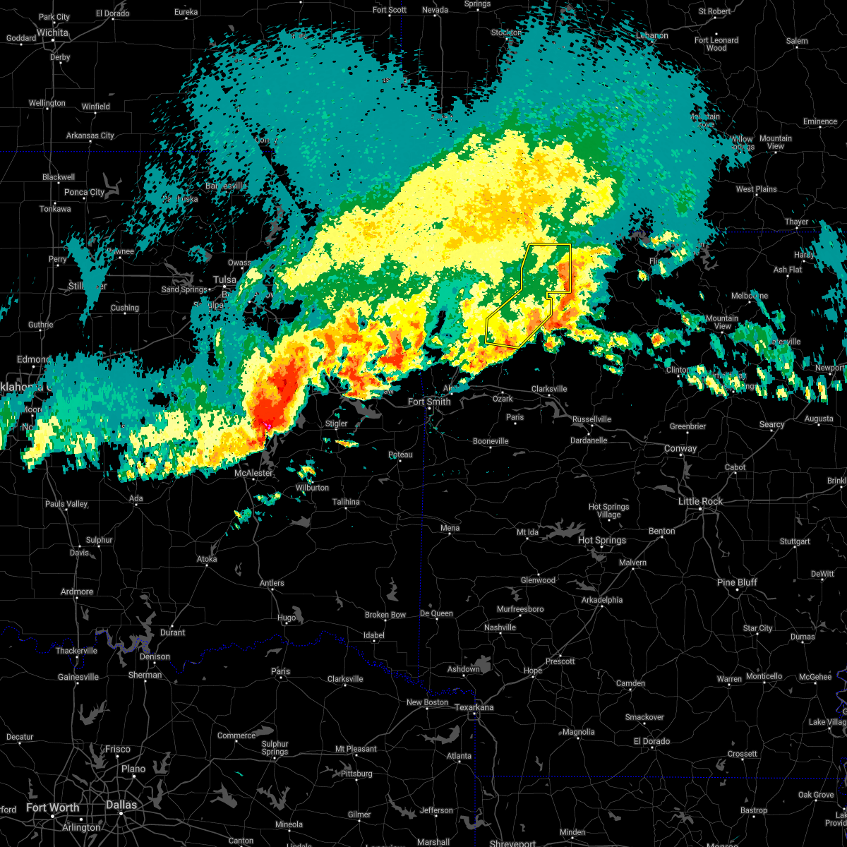 The severe thunderstorm warning for madison and eastern carroll counties will expire at 730 pm cdt, the storms which prompted the warning have weakened below severe limits, and have exited the warned area. therefore the warning will be allowed to expire. however gusty winds are still possible with these thunderstorms. a severe thunderstorm watch remains in effect until 100 am cdt for northwestern arkansas. The severe thunderstorm warning for madison and eastern carroll counties will expire at 730 pm cdt, the storms which prompted the warning have weakened below severe limits, and have exited the warned area. therefore the warning will be allowed to expire. however gusty winds are still possible with these thunderstorms. a severe thunderstorm watch remains in effect until 100 am cdt for northwestern arkansas.
|
| 5/27/2021 7:02 PM CDT |
 At 701 pm cdt, severe thunderstorms were located along a line extending from 2 miles south of urbanette to 3 miles east of marble to 9 miles east of brentwood, moving east at 35 mph (radar indicated). Hazards include 60 mph wind gusts and quarter size hail. Hail damage to vehicles is expected. expect wind damage to roofs, siding, and trees. locations in or near the path include, berryville, huntsville, green forest, st. Paul, carrollton, rudd, saint paul, kingston, aurora, pettigrew, japton, witter, marble, osage, urbanette, rule, georgetown, dryfork, metalton, connor,. At 701 pm cdt, severe thunderstorms were located along a line extending from 2 miles south of urbanette to 3 miles east of marble to 9 miles east of brentwood, moving east at 35 mph (radar indicated). Hazards include 60 mph wind gusts and quarter size hail. Hail damage to vehicles is expected. expect wind damage to roofs, siding, and trees. locations in or near the path include, berryville, huntsville, green forest, st. Paul, carrollton, rudd, saint paul, kingston, aurora, pettigrew, japton, witter, marble, osage, urbanette, rule, georgetown, dryfork, metalton, connor,.
|
| 5/27/2021 6:48 PM CDT |
 At 647 pm cdt, severe thunderstorms were located along a line extending from 3 miles southwest of grandview to 2 miles southeast of forum to 3 miles northeast of winslow, moving east at 35 mph (radar indicated). Hazards include 60 mph wind gusts and quarter size hail. Hail damage to vehicles is expected. expect wind damage to roofs, siding, and trees. locations in or near the path include, fayetteville, berryville, huntsville, eureka springs, green forest, elkins, west fork, winslow, st. Paul, hindsville, wesley, carrollton, rudd, saint paul, forum, aurora, clifty, withrow springs state park, brentwood, strickler, this includes interstate 49 between mile markers 45 and 53. At 647 pm cdt, severe thunderstorms were located along a line extending from 3 miles southwest of grandview to 2 miles southeast of forum to 3 miles northeast of winslow, moving east at 35 mph (radar indicated). Hazards include 60 mph wind gusts and quarter size hail. Hail damage to vehicles is expected. expect wind damage to roofs, siding, and trees. locations in or near the path include, fayetteville, berryville, huntsville, eureka springs, green forest, elkins, west fork, winslow, st. Paul, hindsville, wesley, carrollton, rudd, saint paul, forum, aurora, clifty, withrow springs state park, brentwood, strickler, this includes interstate 49 between mile markers 45 and 53.
|
| 5/27/2021 6:29 PM CDT |
 At 629 pm cdt, severe thunderstorms were located along a line extending from 3 miles east of gateway to 2 miles southwest of clifty to 5 miles southwest of strickler, moving east at 35 mph (radar indicated). Hazards include 60 mph wind gusts and quarter size hail. Hail damage to vehicles is expected. expect wind damage to roofs, siding, and trees. locations in or near the path include, fayetteville, berryville, huntsville, eureka springs, green forest, elkins, west fork, greenland, winslow, st. Paul, hindsville, wesley, carrollton, rudd, saint paul, forum, aurora, hobbs state park, clifty, withrow springs state park, this includes interstate 49 between mile markers 45 and 60. At 629 pm cdt, severe thunderstorms were located along a line extending from 3 miles east of gateway to 2 miles southwest of clifty to 5 miles southwest of strickler, moving east at 35 mph (radar indicated). Hazards include 60 mph wind gusts and quarter size hail. Hail damage to vehicles is expected. expect wind damage to roofs, siding, and trees. locations in or near the path include, fayetteville, berryville, huntsville, eureka springs, green forest, elkins, west fork, greenland, winslow, st. Paul, hindsville, wesley, carrollton, rudd, saint paul, forum, aurora, hobbs state park, clifty, withrow springs state park, this includes interstate 49 between mile markers 45 and 60.
|
| 5/3/2021 11:50 PM CDT |
 The severe thunderstorm warning for eastern carroll county will expire at midnight cdt, the storms which prompted the warning have moved out of the area. therefore the warning will be allowed to expire. however gusty winds are still possible with these thunderstorms. a severe thunderstorm watch remains in effect until 400 am cdt for northwestern arkansas. to report severe weather, contact your nearest law enforcement agency. they will relay your report to the national weather service tulsa. The severe thunderstorm warning for eastern carroll county will expire at midnight cdt, the storms which prompted the warning have moved out of the area. therefore the warning will be allowed to expire. however gusty winds are still possible with these thunderstorms. a severe thunderstorm watch remains in effect until 400 am cdt for northwestern arkansas. to report severe weather, contact your nearest law enforcement agency. they will relay your report to the national weather service tulsa.
|
| 5/3/2021 11:48 PM CDT |
 At 1123 pm cdt, severe thunderstorms were located along a line extending from near osage to near pruitt to piercetown to near moore to near smyrna, moving northeast at 50 mph (radar indicated). Hazards include 60 mph wind gusts and penny size hail. expect damage to roofs, siding, and trees At 1123 pm cdt, severe thunderstorms were located along a line extending from near osage to near pruitt to piercetown to near moore to near smyrna, moving northeast at 50 mph (radar indicated). Hazards include 60 mph wind gusts and penny size hail. expect damage to roofs, siding, and trees
|
| 5/3/2021 11:34 PM CDT |
 At 1134 pm cdt, severe thunderstorms were located along a line extending from near rule to 2 miles north of harrison, moving northeast at 40 mph (radar indicated). Hazards include 60 mph wind gusts. Expect damage to roofs, siding, and trees. Locations in or near the path include, green forest, carrollton, osage, rudd, rule, coin, dryfork, delmar, denver, connor,. At 1134 pm cdt, severe thunderstorms were located along a line extending from near rule to 2 miles north of harrison, moving northeast at 40 mph (radar indicated). Hazards include 60 mph wind gusts. Expect damage to roofs, siding, and trees. Locations in or near the path include, green forest, carrollton, osage, rudd, rule, coin, dryfork, delmar, denver, connor,.
|
| 5/3/2021 11:24 PM CDT |
 The national weather service in little rock has issued a * severe thunderstorm warning for. stone county in north central arkansas. searcy county in north central arkansas. eastern newton county in north central arkansas. Marion county in north central arkansas. The national weather service in little rock has issued a * severe thunderstorm warning for. stone county in north central arkansas. searcy county in north central arkansas. eastern newton county in north central arkansas. Marion county in north central arkansas.
|
| 5/3/2021 11:17 PM CDT |
 At 1117 pm cdt, severe thunderstorms were located along a line extending from near erbie to jasper, moving northeast at 50 mph (radar indicated). Hazards include 60 mph wind gusts and penny size hail. Expect damage to roofs, siding, and trees. Locations impacted include, harrison, jasper, western grove, valley springs, dugger, olvey, erbie, upper buffalo wilderness area, red bank, lost valley state park, capps, pruitt, crawford, bellefonte, alpena, everton, pindall, batavia, bear creek springs, marble falls,. At 1117 pm cdt, severe thunderstorms were located along a line extending from near erbie to jasper, moving northeast at 50 mph (radar indicated). Hazards include 60 mph wind gusts and penny size hail. Expect damage to roofs, siding, and trees. Locations impacted include, harrison, jasper, western grove, valley springs, dugger, olvey, erbie, upper buffalo wilderness area, red bank, lost valley state park, capps, pruitt, crawford, bellefonte, alpena, everton, pindall, batavia, bear creek springs, marble falls,.
|
| 5/3/2021 11:08 PM CDT |
 At 1108 pm cdt, severe thunderstorms were located along a line extending from 3 miles west of marble to 5 miles west of erbie, moving northeast at 40 mph (radar indicated). Hazards include 60 mph wind gusts. Expect damage to roofs, siding, and trees. Locations in or near the path include, berryville, green forest, carrollton, rudd, osage, rule, dryfork, cabanal, metalton, connor, coin, delmar, denver,. At 1108 pm cdt, severe thunderstorms were located along a line extending from 3 miles west of marble to 5 miles west of erbie, moving northeast at 40 mph (radar indicated). Hazards include 60 mph wind gusts. Expect damage to roofs, siding, and trees. Locations in or near the path include, berryville, green forest, carrollton, rudd, osage, rule, dryfork, cabanal, metalton, connor, coin, delmar, denver,.
|
| 5/3/2021 11:03 PM CDT |
 At 1103 pm cdt, severe thunderstorms were located along a line extending from near upper buffalo wilderness area to 7 miles north of walnut, moving northeast at 40 mph (radar indicated). Hazards include 60 mph wind gusts and nickel size hail. expect damage to roofs, siding, and trees At 1103 pm cdt, severe thunderstorms were located along a line extending from near upper buffalo wilderness area to 7 miles north of walnut, moving northeast at 40 mph (radar indicated). Hazards include 60 mph wind gusts and nickel size hail. expect damage to roofs, siding, and trees
|
| 5/3/2021 10:41 PM CDT |
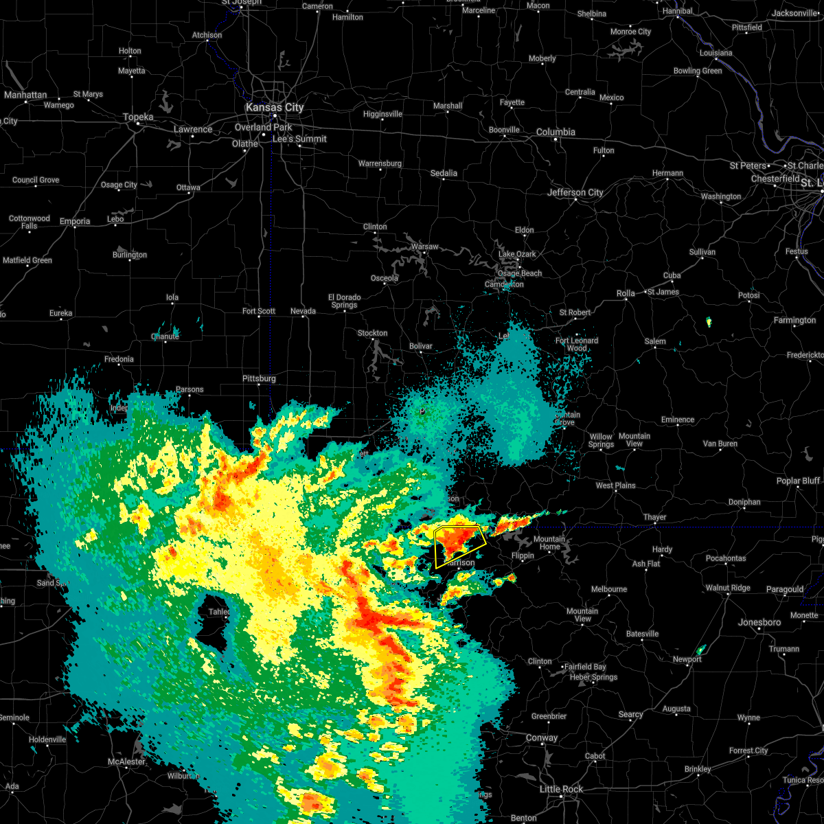 At 1040 pm cdt, a severe thunderstorm was located over self, or 10 miles north of harrison, moving northeast at 30 mph (radar indicated). Hazards include 60 mph wind gusts and quarter size hail. Hail damage to vehicles is expected. expect wind damage to roofs, siding, and trees. Locations impacted include, diamond city, lead hill, omaha, myrtle, roberson hollow, self, willis, alpena, crumpler subdivision, south lead hill, batavia, bear creek springs, new hope in boone county, hopewell in boone county, ridgeway, burlington, bull shoals lake,. At 1040 pm cdt, a severe thunderstorm was located over self, or 10 miles north of harrison, moving northeast at 30 mph (radar indicated). Hazards include 60 mph wind gusts and quarter size hail. Hail damage to vehicles is expected. expect wind damage to roofs, siding, and trees. Locations impacted include, diamond city, lead hill, omaha, myrtle, roberson hollow, self, willis, alpena, crumpler subdivision, south lead hill, batavia, bear creek springs, new hope in boone county, hopewell in boone county, ridgeway, burlington, bull shoals lake,.
|
| 5/3/2021 10:28 PM CDT |
 At 1028 pm cdt, a severe thunderstorm was located 7 miles north of capps, or 8 miles northwest of harrison, moving east at 25 mph (radar indicated). Hazards include 60 mph wind gusts and quarter size hail. Hail damage to vehicles is expected. expect wind damage to roofs, siding, and trees. Locations impacted include, diamond city, lead hill, omaha, myrtle, roberson hollow, self, willis, alpena, crumpler subdivision, south lead hill, batavia, bear creek springs, new hope in boone county, hopewell in boone county, ridgeway, burlington, bull shoals lake,. At 1028 pm cdt, a severe thunderstorm was located 7 miles north of capps, or 8 miles northwest of harrison, moving east at 25 mph (radar indicated). Hazards include 60 mph wind gusts and quarter size hail. Hail damage to vehicles is expected. expect wind damage to roofs, siding, and trees. Locations impacted include, diamond city, lead hill, omaha, myrtle, roberson hollow, self, willis, alpena, crumpler subdivision, south lead hill, batavia, bear creek springs, new hope in boone county, hopewell in boone county, ridgeway, burlington, bull shoals lake,.
|
| 5/3/2021 10:17 PM CDT |
 At 1016 pm cdt, a severe thunderstorm was located near carrollton, or 12 miles northwest of harrison, moving northeast at 25 mph (radar indicated). Hazards include 60 mph wind gusts and quarter size hail. Hail damage to vehicles is expected. Expect wind damage to roofs, siding, and trees. At 1016 pm cdt, a severe thunderstorm was located near carrollton, or 12 miles northwest of harrison, moving northeast at 25 mph (radar indicated). Hazards include 60 mph wind gusts and quarter size hail. Hail damage to vehicles is expected. Expect wind damage to roofs, siding, and trees.
|
| 4/28/2021 9:27 AM CDT |
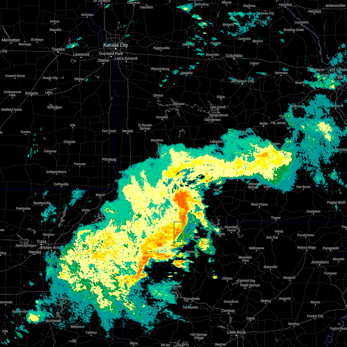 The severe thunderstorm warning for eastern carroll county will expire at 930 am cdt, the storms which prompted the warning have weakened below severe limits, and no longer pose an immediate threat to life or property. therefore the warning will be allowed to expire. however gusty winds and torrential rain are still possible with these thunderstorms. a tornado watch remains in effect until 1000 am cdt for northwestern arkansas. The severe thunderstorm warning for eastern carroll county will expire at 930 am cdt, the storms which prompted the warning have weakened below severe limits, and no longer pose an immediate threat to life or property. therefore the warning will be allowed to expire. however gusty winds and torrential rain are still possible with these thunderstorms. a tornado watch remains in effect until 1000 am cdt for northwestern arkansas.
|
| 4/28/2021 9:17 AM CDT |
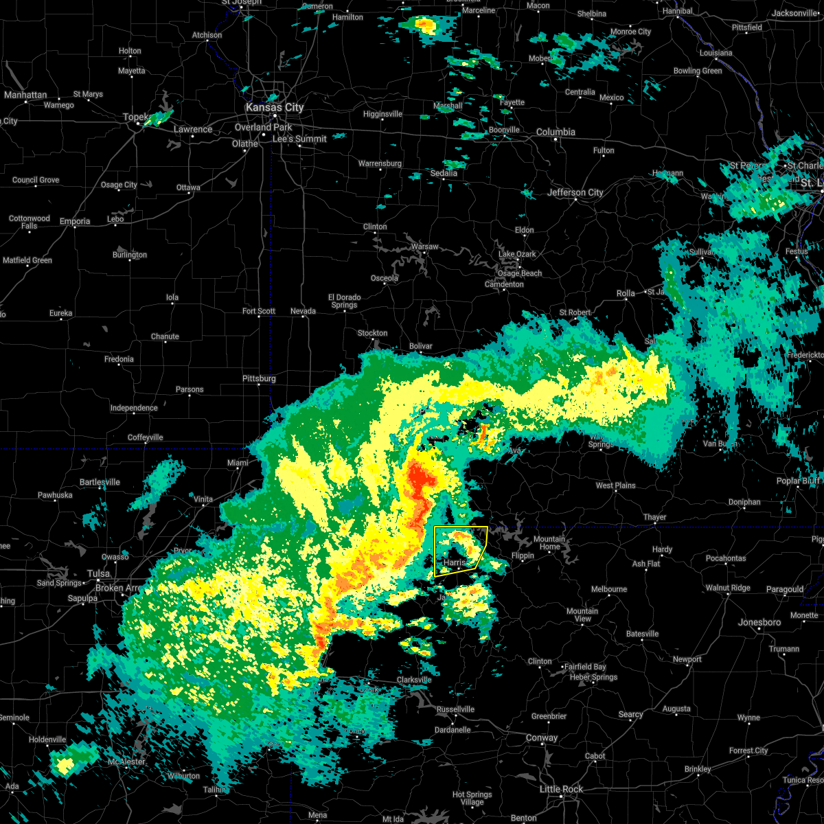 At 917 am cdt, severe thunderstorms were located along a line extending from near indian point to near green forest to near marble, moving east at 45 mph (radar indicated). Hazards include 60 mph wind gusts. expect damage to roofs, siding, and trees At 917 am cdt, severe thunderstorms were located along a line extending from near indian point to near green forest to near marble, moving east at 45 mph (radar indicated). Hazards include 60 mph wind gusts. expect damage to roofs, siding, and trees
|
| 4/28/2021 9:04 AM CDT |
 At 903 am cdt, severe thunderstorms were located along a line extending from 5 miles northeast of urbanette to 5 miles north of marble, moving east at 35 mph (radar indicated). Hazards include 70 mph wind gusts. Expect considerable tree damage. damage is likely to mobile homes, roofs, and outbuildings. Locations in or near the path include, green forest, carrollton, osage, rule, coin, delmar, denver, connor, a tornado watch remains in effect until 1000 am cdt for northwestern arkansas. At 903 am cdt, severe thunderstorms were located along a line extending from 5 miles northeast of urbanette to 5 miles north of marble, moving east at 35 mph (radar indicated). Hazards include 70 mph wind gusts. Expect considerable tree damage. damage is likely to mobile homes, roofs, and outbuildings. Locations in or near the path include, green forest, carrollton, osage, rule, coin, delmar, denver, connor, a tornado watch remains in effect until 1000 am cdt for northwestern arkansas.
|
| 4/9/2021 10:18 PM CDT |
 At 1017 pm cdt, severe thunderstorms were located along a line extending from near grandview to marble to near pettigrew, moving east at 50 mph (radar indicated). Hazards include 60 mph wind gusts. expect damage to roofs, siding, and trees At 1017 pm cdt, severe thunderstorms were located along a line extending from near grandview to marble to near pettigrew, moving east at 50 mph (radar indicated). Hazards include 60 mph wind gusts. expect damage to roofs, siding, and trees
|
| 4/9/2021 2:50 PM CDT | Quarter sized hail reported 4.7 miles WSW of Alpena, AR |
| 4/9/2021 2:50 PM CDT |
 At 250 pm cdt, a severe thunderstorm was located 4 miles northeast of green forest, moving north at 30 mph (radar indicated). Hazards include 60 mph wind gusts and quarter size hail. Hail damage to vehicles is expected. expect wind damage to roofs, siding, and trees. Locations in or near the path include, berryville, green forest, coin, denver,. At 250 pm cdt, a severe thunderstorm was located 4 miles northeast of green forest, moving north at 30 mph (radar indicated). Hazards include 60 mph wind gusts and quarter size hail. Hail damage to vehicles is expected. expect wind damage to roofs, siding, and trees. Locations in or near the path include, berryville, green forest, coin, denver,.
|
| 4/9/2021 2:41 PM CDT |
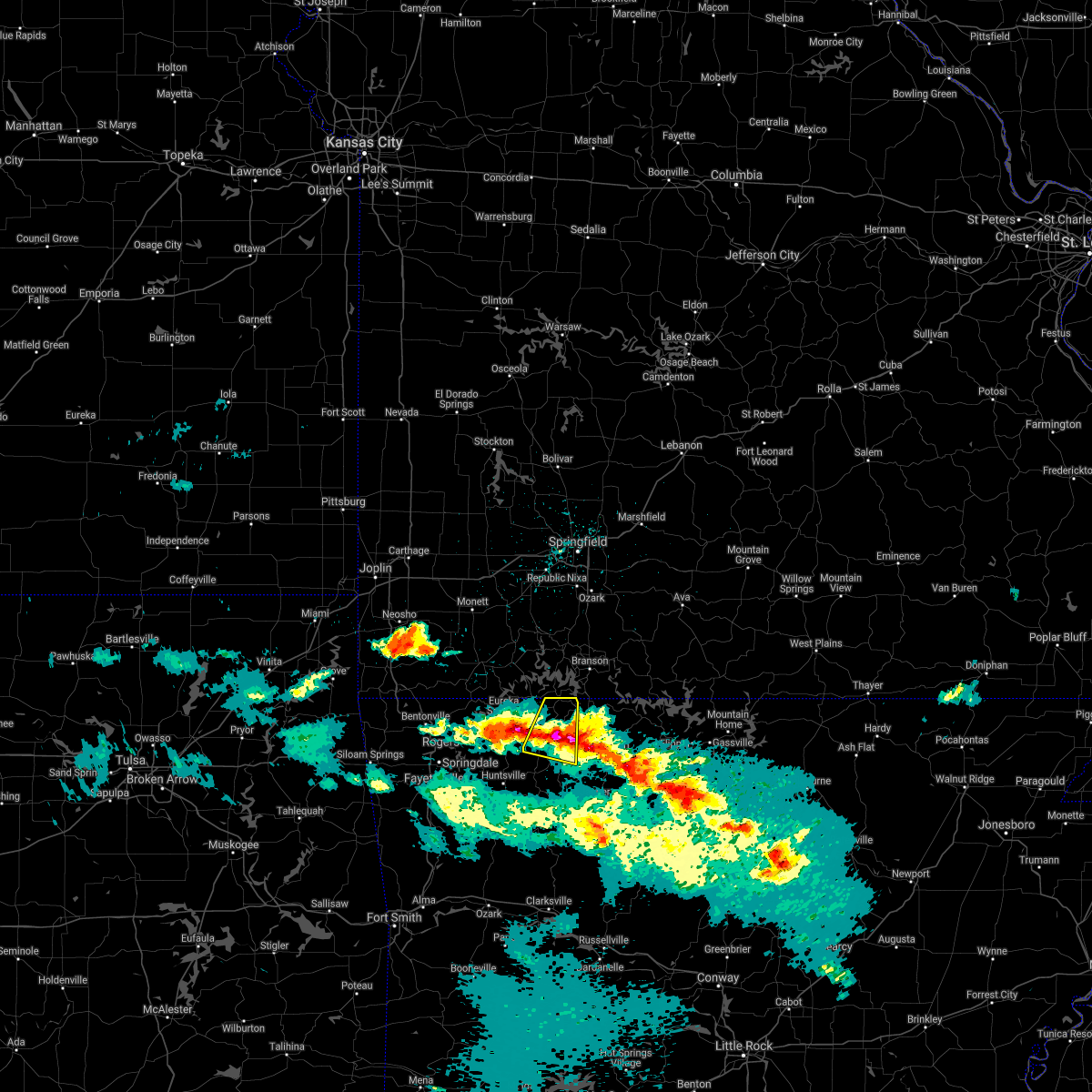 At 241 pm cdt, a severe thunderstorm was located 3 miles southeast of green forest, moving north at 40 mph (radar indicated). Hazards include 60 mph wind gusts and quarter size hail. Hail damage to vehicles is expected. expect wind damage to roofs, siding, and trees. Locations in or near the path include, berryville, green forest, carrollton, urbanette, rule, coin, cabanal, denver, connor, metalton,. At 241 pm cdt, a severe thunderstorm was located 3 miles southeast of green forest, moving north at 40 mph (radar indicated). Hazards include 60 mph wind gusts and quarter size hail. Hail damage to vehicles is expected. expect wind damage to roofs, siding, and trees. Locations in or near the path include, berryville, green forest, carrollton, urbanette, rule, coin, cabanal, denver, connor, metalton,.
|
| 11/14/2020 10:43 PM CST |
 At 1039 pm cst, severe thunderstorms were located along a line extending from 2 miles north of red bank to 5 miles northeast of mulberry to 4 miles north of fanshawe, moving southeast at 45 mph. wind gusts of 40 to 50 mph were occurring along much of the line. the strongest part of the line extended from near fort smith to mulberry to northern franklin county. wind gust to near 60 mph are most likely with these stronger storms (radar indicated). Hazards include 60 mph wind gusts. Expect damage to roofs, siding, and trees. locations in or near the path include, fort smith, van buren, poteau, ozark, charleston, cedarville, mountainburg, greenwood, alma, barling, pocola, muldrow, roland, lavaca, spiro, arkoma, mulberry, panama, wister, dyer, this includes the following highways, interstate 40 in arkansas between mile markers 0 and 38. interstate 40 in oklahoma between mile markers 314 and 328. interstate 540 between mile markers 1 and 14. interstate 49 between mile markers 22 and 33. A tornado watch remains in effect until midnight cst for northwestern and west central arkansas, and east central oklahoma. At 1039 pm cst, severe thunderstorms were located along a line extending from 2 miles north of red bank to 5 miles northeast of mulberry to 4 miles north of fanshawe, moving southeast at 45 mph. wind gusts of 40 to 50 mph were occurring along much of the line. the strongest part of the line extended from near fort smith to mulberry to northern franklin county. wind gust to near 60 mph are most likely with these stronger storms (radar indicated). Hazards include 60 mph wind gusts. Expect damage to roofs, siding, and trees. locations in or near the path include, fort smith, van buren, poteau, ozark, charleston, cedarville, mountainburg, greenwood, alma, barling, pocola, muldrow, roland, lavaca, spiro, arkoma, mulberry, panama, wister, dyer, this includes the following highways, interstate 40 in arkansas between mile markers 0 and 38. interstate 40 in oklahoma between mile markers 314 and 328. interstate 540 between mile markers 1 and 14. interstate 49 between mile markers 22 and 33. A tornado watch remains in effect until midnight cst for northwestern and west central arkansas, and east central oklahoma.
|
| 11/14/2020 10:34 PM CST |
 At 1034 pm cst, severe thunderstorms were located along a line extending from carrollton to 3 miles south of fern to 6 miles south of mccurtain, moving southeast at 45 mph (radar indicated). Hazards include 60 mph wind gusts. Expect damage to roofs, siding, and trees. locations in or near the path include, fort smith, van buren, poteau, berryville, ozark, charleston, huntsville, cedarville, mountainburg, natural dam, greenwood, alma, barling, pocola, muldrow, roland, green forest, lavaca, spiro, arkoma, this includes the following highways, interstate 40 in arkansas between mile markers 0 and 38. interstate 40 in oklahoma between mile markers 311 and 328. interstate 540 between mile markers 1 and 14. interstate 49 between mile markers 22 and 42. A tornado watch remains in effect until midnight cst for northwestern and west central arkansas, and east central oklahoma. At 1034 pm cst, severe thunderstorms were located along a line extending from carrollton to 3 miles south of fern to 6 miles south of mccurtain, moving southeast at 45 mph (radar indicated). Hazards include 60 mph wind gusts. Expect damage to roofs, siding, and trees. locations in or near the path include, fort smith, van buren, poteau, berryville, ozark, charleston, huntsville, cedarville, mountainburg, natural dam, greenwood, alma, barling, pocola, muldrow, roland, green forest, lavaca, spiro, arkoma, this includes the following highways, interstate 40 in arkansas between mile markers 0 and 38. interstate 40 in oklahoma between mile markers 311 and 328. interstate 540 between mile markers 1 and 14. interstate 49 between mile markers 22 and 42. A tornado watch remains in effect until midnight cst for northwestern and west central arkansas, and east central oklahoma.
|
| 11/14/2020 10:29 PM CST |
 At 1028 pm cst, severe thunderstorms were located along a line extending from 3 miles west of carrollton to 2 miles southeast of lake fort smith to 4 miles south of mccurtain, moving southeast at 45 mph. other smaller storms from north fort smith to near rudy were also capable of producing winds of 50 to 60 mph (radar indicated). Hazards include 60 mph wind gusts. Expect damage to roofs, siding, and trees. locations in or near the path include, fort smith, fayetteville, van buren, sallisaw, poteau, berryville, ozark, charleston, huntsville, cedarville, mountainburg, natural dam, greenwood, alma, barling, pocola, muldrow, roland, green forest, elkins, this includes the following highways, interstate 40 in arkansas between mile markers 0 and 38. interstate 40 in oklahoma between mile markers 306 and 328. interstate 540 between mile markers 1 and 14. interstate 49 between mile markers 22 and 53. A tornado watch remains in effect until midnight cst for northwestern and west central arkansas, and northeastern and east central oklahoma. At 1028 pm cst, severe thunderstorms were located along a line extending from 3 miles west of carrollton to 2 miles southeast of lake fort smith to 4 miles south of mccurtain, moving southeast at 45 mph. other smaller storms from north fort smith to near rudy were also capable of producing winds of 50 to 60 mph (radar indicated). Hazards include 60 mph wind gusts. Expect damage to roofs, siding, and trees. locations in or near the path include, fort smith, fayetteville, van buren, sallisaw, poteau, berryville, ozark, charleston, huntsville, cedarville, mountainburg, natural dam, greenwood, alma, barling, pocola, muldrow, roland, green forest, elkins, this includes the following highways, interstate 40 in arkansas between mile markers 0 and 38. interstate 40 in oklahoma between mile markers 306 and 328. interstate 540 between mile markers 1 and 14. interstate 49 between mile markers 22 and 53. A tornado watch remains in effect until midnight cst for northwestern and west central arkansas, and northeastern and east central oklahoma.
|
| 11/14/2020 10:23 PM CST |
 At 1022 pm cst, severe thunderstorms were located along a line extending from green forest to near chester to 2 miles southeast of mccurtain, moving southeast at 45 mph. wind gusts of 50 to 60 mph have occurred at many locations along this line of storms (radar indicated). Hazards include 60 mph wind gusts. Expect damage to roofs, siding, and trees. locations in or near the path include, fort smith, fayetteville, van buren, sallisaw, poteau, berryville, ozark, charleston, huntsville, cedarville, mountainburg, natural dam, greenwood, alma, barling, pocola, muldrow, roland, green forest, elkins, this includes the following highways, interstate 40 in arkansas between mile markers 0 and 38. interstate 40 in oklahoma between mile markers 306 and 328. interstate 540 between mile markers 1 and 14. interstate 49 between mile markers 22 and 53. A tornado watch remains in effect until midnight cst for northwestern and west central arkansas, and northeastern and east central oklahoma. At 1022 pm cst, severe thunderstorms were located along a line extending from green forest to near chester to 2 miles southeast of mccurtain, moving southeast at 45 mph. wind gusts of 50 to 60 mph have occurred at many locations along this line of storms (radar indicated). Hazards include 60 mph wind gusts. Expect damage to roofs, siding, and trees. locations in or near the path include, fort smith, fayetteville, van buren, sallisaw, poteau, berryville, ozark, charleston, huntsville, cedarville, mountainburg, natural dam, greenwood, alma, barling, pocola, muldrow, roland, green forest, elkins, this includes the following highways, interstate 40 in arkansas between mile markers 0 and 38. interstate 40 in oklahoma between mile markers 306 and 328. interstate 540 between mile markers 1 and 14. interstate 49 between mile markers 22 and 53. A tornado watch remains in effect until midnight cst for northwestern and west central arkansas, and northeastern and east central oklahoma.
|
| 11/14/2020 10:11 PM CST |
 At 1009 pm cst, severe thunderstorms were located along a line extending from near urbanette to near devils den state park to 5 miles northwest of mccurtain, moving southeast at 45 mph (radar indicated). Hazards include 60 mph wind gusts. Expect damage to roofs, siding, and trees. locations in or near the path include, fort smith, fayetteville, van buren, sallisaw, poteau, berryville, ozark, charleston, huntsville, cedarville, mountainburg, natural dam, greenwood, alma, barling, pocola, muldrow, roland, green forest, elkins, this includes the following highways, interstate 40 in arkansas between mile markers 0 and 38. interstate 40 in oklahoma between mile markers 306 and 328. interstate 540 between mile markers 1 and 14. interstate 49 between mile markers 22 and 53. A tornado watch remains in effect until midnight cst for northwestern and west central arkansas, and northeastern and east central oklahoma. At 1009 pm cst, severe thunderstorms were located along a line extending from near urbanette to near devils den state park to 5 miles northwest of mccurtain, moving southeast at 45 mph (radar indicated). Hazards include 60 mph wind gusts. Expect damage to roofs, siding, and trees. locations in or near the path include, fort smith, fayetteville, van buren, sallisaw, poteau, berryville, ozark, charleston, huntsville, cedarville, mountainburg, natural dam, greenwood, alma, barling, pocola, muldrow, roland, green forest, elkins, this includes the following highways, interstate 40 in arkansas between mile markers 0 and 38. interstate 40 in oklahoma between mile markers 306 and 328. interstate 540 between mile markers 1 and 14. interstate 49 between mile markers 22 and 53. A tornado watch remains in effect until midnight cst for northwestern and west central arkansas, and northeastern and east central oklahoma.
|
| 8/29/2020 11:59 AM CDT |
 At 1159 am cdt, a severe thunderstorm was located 4 miles south of rudd, moving east at 30 mph (radar indicated). Hazards include 60 mph wind gusts and quarter size hail. Hail damage to vehicles is expected. expect wind damage to roofs, siding, and trees. Locations in or near the path include, carrollton, osage, rudd, rule, marble, kingston, dryfork, cabanal, metalton, delmar, connor,. At 1159 am cdt, a severe thunderstorm was located 4 miles south of rudd, moving east at 30 mph (radar indicated). Hazards include 60 mph wind gusts and quarter size hail. Hail damage to vehicles is expected. expect wind damage to roofs, siding, and trees. Locations in or near the path include, carrollton, osage, rudd, rule, marble, kingston, dryfork, cabanal, metalton, delmar, connor,.
|
| 8/29/2020 11:43 AM CDT |
 At 1143 am cdt, a severe thunderstorm was located 3 miles east of forum, moving east at 25 mph (radar indicated). Hazards include 60 mph wind gusts and quarter size hail. Hail damage to vehicles is expected. expect wind damage to roofs, siding, and trees. Locations in or near the path include, carrollton, rudd, marble, forum, osage, rule, withrow springs state park, rockhouse, dryfork, cabanal, metalton, connor, alabam, delmar,. At 1143 am cdt, a severe thunderstorm was located 3 miles east of forum, moving east at 25 mph (radar indicated). Hazards include 60 mph wind gusts and quarter size hail. Hail damage to vehicles is expected. expect wind damage to roofs, siding, and trees. Locations in or near the path include, carrollton, rudd, marble, forum, osage, rule, withrow springs state park, rockhouse, dryfork, cabanal, metalton, connor, alabam, delmar,.
|
| 8/11/2020 12:03 PM CDT |
 At 1202 pm cdt, a severe thunderstorm was located near harrison, moving northeast at 20 mph (radar indicated). Hazards include 60 mph wind gusts and quarter size hail. Hail damage to vehicles is expected. Expect wind damage to roofs, siding, and trees. At 1202 pm cdt, a severe thunderstorm was located near harrison, moving northeast at 20 mph (radar indicated). Hazards include 60 mph wind gusts and quarter size hail. Hail damage to vehicles is expected. Expect wind damage to roofs, siding, and trees.
|
| 6/21/2020 4:20 PM CDT |
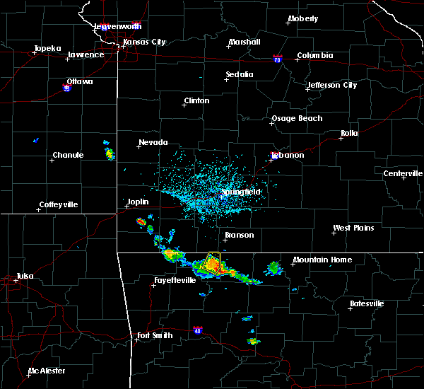 At 359 pm cdt, a severe thunderstorm was located over green forest, moving north at 10 mph (radar indicated). Hazards include 60 mph wind gusts and quarter size hail. Hail damage to vehicles is expected. expect wind damage to roofs, siding, and trees. Locations in or near the path include, berryville, green forest, rule, urbanette, coin, cabanal, denver, connor,. At 359 pm cdt, a severe thunderstorm was located over green forest, moving north at 10 mph (radar indicated). Hazards include 60 mph wind gusts and quarter size hail. Hail damage to vehicles is expected. expect wind damage to roofs, siding, and trees. Locations in or near the path include, berryville, green forest, rule, urbanette, coin, cabanal, denver, connor,.
|
| 6/21/2020 4:00 PM CDT |
 At 359 pm cdt, a severe thunderstorm was located over green forest, moving north at 10 mph (radar indicated). Hazards include 60 mph wind gusts and quarter size hail. Hail damage to vehicles is expected. expect wind damage to roofs, siding, and trees. Locations in or near the path include, berryville, green forest, rule, urbanette, coin, cabanal, denver, connor,. At 359 pm cdt, a severe thunderstorm was located over green forest, moving north at 10 mph (radar indicated). Hazards include 60 mph wind gusts and quarter size hail. Hail damage to vehicles is expected. expect wind damage to roofs, siding, and trees. Locations in or near the path include, berryville, green forest, rule, urbanette, coin, cabanal, denver, connor,.
|
| 6/4/2020 6:38 AM CDT |
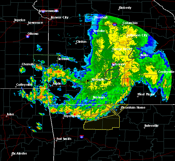 The severe thunderstorm warning for southeastern carroll county will expire at 645 am cdt, the storms which prompted the warning have moved out of the area. therefore the warning will be allowed to expire. however gusty winds to 50 mph are still possible with these thunderstorms through 7 am. The severe thunderstorm warning for southeastern carroll county will expire at 645 am cdt, the storms which prompted the warning have moved out of the area. therefore the warning will be allowed to expire. however gusty winds to 50 mph are still possible with these thunderstorms through 7 am.
|
| 6/4/2020 6:25 AM CDT |
 At 625 am cdt, severe thunderstorms were located along a line extending from near dodd city to near erbie, moving east at 40 mph (radar indicated). Hazards include 60 mph wind gusts. Expect damage to roofs, siding, and trees. Locations impacted include, harrison, yellville, flippin, diamond city, bergman, western grove, lead hill, pyatt, valley springs, dugger, olvey, erbie, lakeway, winington, clark hill, lost valley state park, pruitt, myrtle, self, red bank,. At 625 am cdt, severe thunderstorms were located along a line extending from near dodd city to near erbie, moving east at 40 mph (radar indicated). Hazards include 60 mph wind gusts. Expect damage to roofs, siding, and trees. Locations impacted include, harrison, yellville, flippin, diamond city, bergman, western grove, lead hill, pyatt, valley springs, dugger, olvey, erbie, lakeway, winington, clark hill, lost valley state park, pruitt, myrtle, self, red bank,.
|
| 6/4/2020 6:22 AM CDT |
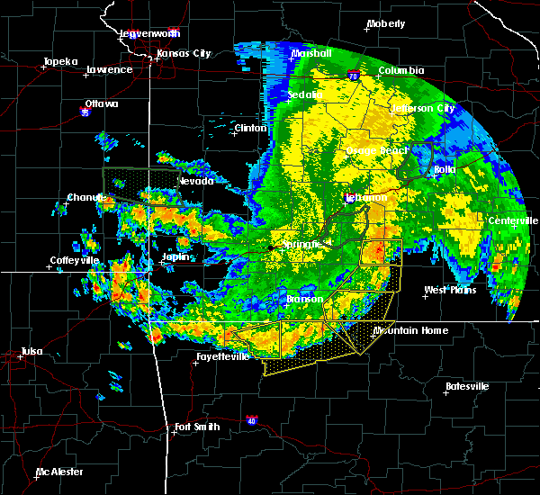 At 622 am cdt, severe thunderstorms were located along a line extending from 3 miles northeast of marble to 4 miles northwest of erbie to 3 miles northwest of valley springs, moving southeast at 40 mph (radar indicated). Hazards include 60 mph wind gusts. Expect damage to roofs, siding, and trees. Locations in or near the path include, green forest, carrollton, osage, rudd, rule, coin, dryfork, cabanal, metalton, delmar, connor,. At 622 am cdt, severe thunderstorms were located along a line extending from 3 miles northeast of marble to 4 miles northwest of erbie to 3 miles northwest of valley springs, moving southeast at 40 mph (radar indicated). Hazards include 60 mph wind gusts. Expect damage to roofs, siding, and trees. Locations in or near the path include, green forest, carrollton, osage, rudd, rule, coin, dryfork, cabanal, metalton, delmar, connor,.
|
| 6/4/2020 6:07 AM CDT |
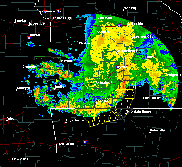 At 607 am cdt, severe thunderstorms were located along a line extending from 6 miles southwest of berryville to 3 miles southeast of rule to 4 miles southwest of myrtle, moving southeast at 50 mph (radar indicated). Hazards include 60 mph wind gusts and penny size hail. Expect damage to roofs, siding, and trees. Locations in or near the path include, berryville, eureka springs, green forest, carrollton, rudd, osage, urbanette, rule, dryfork, cabanal, metalton, connor, coin, delmar, denver,. At 607 am cdt, severe thunderstorms were located along a line extending from 6 miles southwest of berryville to 3 miles southeast of rule to 4 miles southwest of myrtle, moving southeast at 50 mph (radar indicated). Hazards include 60 mph wind gusts and penny size hail. Expect damage to roofs, siding, and trees. Locations in or near the path include, berryville, eureka springs, green forest, carrollton, rudd, osage, urbanette, rule, dryfork, cabanal, metalton, connor, coin, delmar, denver,.
|
| 6/4/2020 5:52 AM CDT |
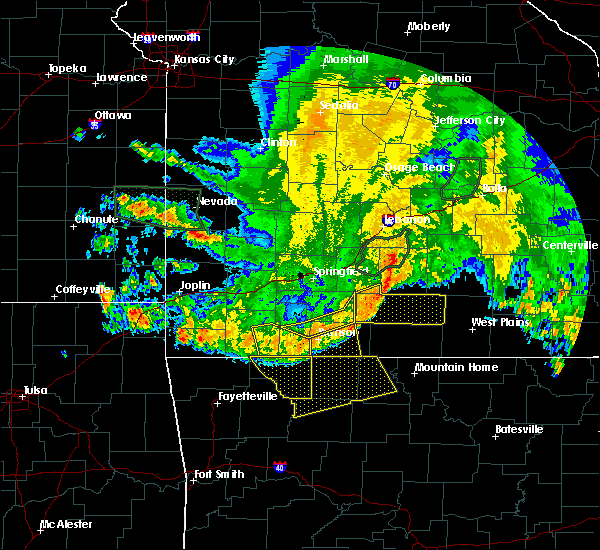 At 551 am cdt, severe thunderstorms were located along a line extending from 2 miles south of beaver to 2 miles south of urbanette to near roberson hollow, moving southeast at 50 mph (radar indicated). Hazards include 60 mph wind gusts and penny size hail. Expect damage to roofs, siding, and trees. Locations in or near the path include, berryville, eureka springs, green forest, beaver, carrollton, rudd, osage, urbanette, rule, grandview, dryfork, cabanal, metalton, connor, coin, pleasant ridge, delmar, denver, oak hill, busch,. At 551 am cdt, severe thunderstorms were located along a line extending from 2 miles south of beaver to 2 miles south of urbanette to near roberson hollow, moving southeast at 50 mph (radar indicated). Hazards include 60 mph wind gusts and penny size hail. Expect damage to roofs, siding, and trees. Locations in or near the path include, berryville, eureka springs, green forest, beaver, carrollton, rudd, osage, urbanette, rule, grandview, dryfork, cabanal, metalton, connor, coin, pleasant ridge, delmar, denver, oak hill, busch,.
|
| 6/4/2020 5:42 AM CDT |
 At 542 am cdt, severe thunderstorms were located along a line extending from taneyville to 6 miles southwest of kimberling city, moving southeast at 45 mph (radar indicated). Hazards include 60 mph wind gusts and penny size hail. expect damage to roofs, siding, and trees At 542 am cdt, severe thunderstorms were located along a line extending from taneyville to 6 miles southwest of kimberling city, moving southeast at 45 mph (radar indicated). Hazards include 60 mph wind gusts and penny size hail. expect damage to roofs, siding, and trees
|
| 6/4/2020 5:37 AM CDT |
 At 537 am cdt, severe thunderstorms were located along a line extending from 3 miles southeast of exeter to near indian point, moving southeast at 45 mph (radar indicated). Hazards include 60 mph wind gusts and penny size hail. Expect damage to roofs, siding, and trees. Locations in or near the path include, berryville, eureka springs, green forest, beaver, carrollton, rudd, osage, urbanette, rule, grandview, dryfork, cabanal, metalton, connor, coin, pleasant ridge, delmar, denver, oak hill, busch,. At 537 am cdt, severe thunderstorms were located along a line extending from 3 miles southeast of exeter to near indian point, moving southeast at 45 mph (radar indicated). Hazards include 60 mph wind gusts and penny size hail. Expect damage to roofs, siding, and trees. Locations in or near the path include, berryville, eureka springs, green forest, beaver, carrollton, rudd, osage, urbanette, rule, grandview, dryfork, cabanal, metalton, connor, coin, pleasant ridge, delmar, denver, oak hill, busch,.
|
| 5/22/2020 11:15 AM CDT |
 At 1115 am cdt, severe thunderstorms were located along a line extending from near omaha to near rosetta, moving east at 40 mph (radar indicated). Hazards include 60 mph wind gusts and penny size hail. Expect damage to roofs, siding, and trees. Locations impacted include, harrison, jasper, diamond city, bergman, western grove, lead hill, valley springs, omaha, dugger, olvey, roberson hollow, carver, erbie, moore, upper buffalo wilderness area, winington, devils knob, lost valley state park, pruitt, rosetta,. At 1115 am cdt, severe thunderstorms were located along a line extending from near omaha to near rosetta, moving east at 40 mph (radar indicated). Hazards include 60 mph wind gusts and penny size hail. Expect damage to roofs, siding, and trees. Locations impacted include, harrison, jasper, diamond city, bergman, western grove, lead hill, valley springs, omaha, dugger, olvey, roberson hollow, carver, erbie, moore, upper buffalo wilderness area, winington, devils knob, lost valley state park, pruitt, rosetta,.
|
| 5/22/2020 10:49 AM CDT |
 At 1048 am cdt, severe thunderstorms were located along a line extending from 7 miles north of urbanette to near pettigrew, moving east at 40 mph (radar indicated). Hazards include 60 mph wind gusts and quarter size hail. Hail damage to vehicles is expected. Expect wind damage to roofs, siding, and trees. At 1048 am cdt, severe thunderstorms were located along a line extending from 7 miles north of urbanette to near pettigrew, moving east at 40 mph (radar indicated). Hazards include 60 mph wind gusts and quarter size hail. Hail damage to vehicles is expected. Expect wind damage to roofs, siding, and trees.
|
| 5/4/2020 11:23 AM CDT |
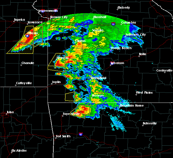 At 1123 am cdt, severe thunderstorms were located along a line extending from withrow springs state park to 2 miles northeast of rudd, moving southeast at 35 mph (radar indicated). Hazards include two inch hail. People and animals outdoors will be injured. expect damage to roofs, siding, windows, and vehicles. Locations in or near the path include, berryville, huntsville, green forest, withrow springs state park, carrollton, rudd, kingston, marble, forum, osage, rule, dryfork, cabanal, metalton, connor, coin, alabam, delmar, denver,. At 1123 am cdt, severe thunderstorms were located along a line extending from withrow springs state park to 2 miles northeast of rudd, moving southeast at 35 mph (radar indicated). Hazards include two inch hail. People and animals outdoors will be injured. expect damage to roofs, siding, windows, and vehicles. Locations in or near the path include, berryville, huntsville, green forest, withrow springs state park, carrollton, rudd, kingston, marble, forum, osage, rule, dryfork, cabanal, metalton, connor, coin, alabam, delmar, denver,.
|
| 5/4/2020 11:12 AM CDT |
 At 1112 am cdt, severe thunderstorms were located along a line extending from 2 miles south of clifty to near rule, moving east at 35 mph (radar indicated). Hazards include two inch hail. People and animals outdoors will be injured. expect damage to roofs, siding, windows, and vehicles. Locations in or near the path include, berryville, huntsville, green forest, hindsville, withrow springs state park, carrollton, rudd, kingston, marble, forum, osage, rule, clifty, rockhouse, dryfork, cabanal, metalton, connor, coin, alabam,. At 1112 am cdt, severe thunderstorms were located along a line extending from 2 miles south of clifty to near rule, moving east at 35 mph (radar indicated). Hazards include two inch hail. People and animals outdoors will be injured. expect damage to roofs, siding, windows, and vehicles. Locations in or near the path include, berryville, huntsville, green forest, hindsville, withrow springs state park, carrollton, rudd, kingston, marble, forum, osage, rule, clifty, rockhouse, dryfork, cabanal, metalton, connor, coin, alabam,.
|
| 5/4/2020 10:59 AM CDT |
 The national weather service in tulsa has issued a * severe thunderstorm warning for. east central benton county in northwestern arkansas. northern madison county in northwestern arkansas. carroll county in northwestern arkansas. Northeastern washington county in northwestern arkansas. The national weather service in tulsa has issued a * severe thunderstorm warning for. east central benton county in northwestern arkansas. northern madison county in northwestern arkansas. carroll county in northwestern arkansas. Northeastern washington county in northwestern arkansas.
|
| 5/4/2020 10:40 AM CDT |
 At 1040 am cdt, severe thunderstorms were located along a line extending from near rogers to near war eagle to 2 miles west of forum, moving east at 35 mph (radar indicated). Hazards include two inch hail. People and animals outdoors will be injured. expect damage to roofs, siding, windows, and vehicles. Locations in or near the path include, springdale, rogers, bentonville, berryville, huntsville, eureka springs, lowell, pea ridge, green forest, bethel heights, gateway, beaver, hindsville, carrollton, rudd, forum, hobbs state park, clifty, withrow springs state park, war eagle, this includes interstate 49 between mile markers 76 and 82. At 1040 am cdt, severe thunderstorms were located along a line extending from near rogers to near war eagle to 2 miles west of forum, moving east at 35 mph (radar indicated). Hazards include two inch hail. People and animals outdoors will be injured. expect damage to roofs, siding, windows, and vehicles. Locations in or near the path include, springdale, rogers, bentonville, berryville, huntsville, eureka springs, lowell, pea ridge, green forest, bethel heights, gateway, beaver, hindsville, carrollton, rudd, forum, hobbs state park, clifty, withrow springs state park, war eagle, this includes interstate 49 between mile markers 76 and 82.
|
| 5/4/2020 10:29 AM CDT |
 At 1028 am cdt, severe thunderstorms were located along a line extending from bentonville to 5 miles northwest of war eagle to 2 miles west of hindsville, moving east at 35 mph (radar indicated). Hazards include two inch hail. People and animals outdoors will be injured. expect damage to roofs, siding, windows, and vehicles. Locations in or near the path include, springdale, rogers, bentonville, berryville, huntsville, eureka springs, bella vista, lowell, pea ridge, green forest, bethel heights, highfill, gateway, beaver, hindsville, carrollton, rudd, forum, hobbs state park, clifty, this includes interstate 49 between mile markers 76 and 93. At 1028 am cdt, severe thunderstorms were located along a line extending from bentonville to 5 miles northwest of war eagle to 2 miles west of hindsville, moving east at 35 mph (radar indicated). Hazards include two inch hail. People and animals outdoors will be injured. expect damage to roofs, siding, windows, and vehicles. Locations in or near the path include, springdale, rogers, bentonville, berryville, huntsville, eureka springs, bella vista, lowell, pea ridge, green forest, bethel heights, highfill, gateway, beaver, hindsville, carrollton, rudd, forum, hobbs state park, clifty, this includes interstate 49 between mile markers 76 and 93.
|
| 5/4/2020 10:15 AM CDT |
 At 1014 am cdt, severe thunderstorms were located along a line extending from near hiwasse to near rogers to 6 miles southeast of springdale, moving east at 40 mph (radar indicated). Hazards include tennis ball size hail. People and animals outdoors will be injured. expect damage to roofs, siding, windows, and vehicles. Locations in or near the path include, fayetteville, springdale, rogers, bentonville, berryville, huntsville, eureka springs, bella vista, lowell, pea ridge, green forest, elkins, bethel heights, highfill, gateway, beaver, hindsville, carrollton, rudd, forum, this includes interstate 49 between mile markers 72 and 93. At 1014 am cdt, severe thunderstorms were located along a line extending from near hiwasse to near rogers to 6 miles southeast of springdale, moving east at 40 mph (radar indicated). Hazards include tennis ball size hail. People and animals outdoors will be injured. expect damage to roofs, siding, windows, and vehicles. Locations in or near the path include, fayetteville, springdale, rogers, bentonville, berryville, huntsville, eureka springs, bella vista, lowell, pea ridge, green forest, elkins, bethel heights, highfill, gateway, beaver, hindsville, carrollton, rudd, forum, this includes interstate 49 between mile markers 72 and 93.
|
| 5/4/2020 10:09 AM CDT |
 At 1009 am cdt, severe thunderstorms were located along a line extending from 3 miles southwest of hiwasse to 2 miles southeast of bentonville to 3 miles east of fayetteville, moving east at 35 mph (radar indicated). Hazards include two inch hail. People and animals outdoors will be injured. expect damage to roofs, siding, windows, and vehicles. Locations in or near the path include, fayetteville, springdale, rogers, bentonville, berryville, huntsville, eureka springs, bella vista, lowell, pea ridge, green forest, elkins, bethel heights, gravette, decatur, highfill, gateway, beaver, hindsville, carrollton, this includes interstate 49 between mile markers 72 and 93. At 1009 am cdt, severe thunderstorms were located along a line extending from 3 miles southwest of hiwasse to 2 miles southeast of bentonville to 3 miles east of fayetteville, moving east at 35 mph (radar indicated). Hazards include two inch hail. People and animals outdoors will be injured. expect damage to roofs, siding, windows, and vehicles. Locations in or near the path include, fayetteville, springdale, rogers, bentonville, berryville, huntsville, eureka springs, bella vista, lowell, pea ridge, green forest, elkins, bethel heights, gravette, decatur, highfill, gateway, beaver, hindsville, carrollton, this includes interstate 49 between mile markers 72 and 93.
|
| 5/4/2020 9:57 AM CDT |
 The national weather service in tulsa has issued a * severe thunderstorm warning for. benton county in northwestern arkansas. northern madison county in northwestern arkansas. carroll county in northwestern arkansas. Northeastern washington county in northwestern arkansas. The national weather service in tulsa has issued a * severe thunderstorm warning for. benton county in northwestern arkansas. northern madison county in northwestern arkansas. carroll county in northwestern arkansas. Northeastern washington county in northwestern arkansas.
|
| 4/24/2020 9:10 PM CDT |
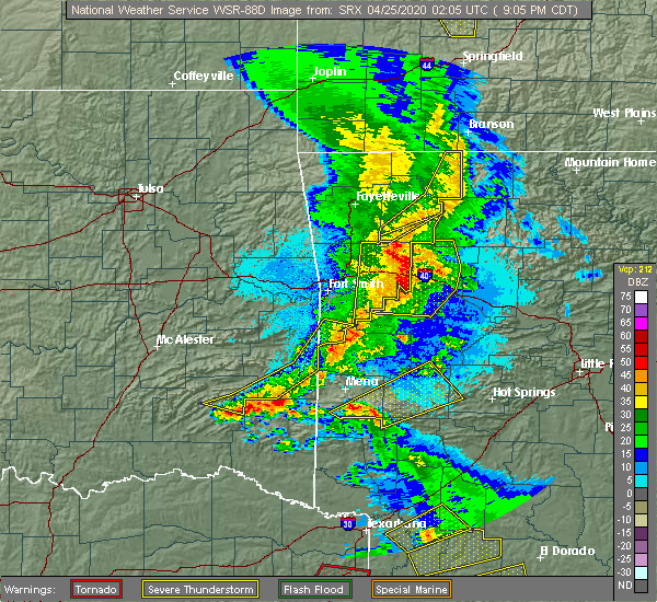 The severe thunderstorm warning for southern madison and eastern carroll counties will expire at 915 pm cdt, the storms which prompted the warning have weakened below severe limits, and no longer pose an immediate threat to life or property. therefore the warning will be allowed to expire. however gusty winds are still possible with these thunderstorms. a severe thunderstorm watch remains in effect until 1100 pm cdt for northwestern and west central arkansas. to report severe weather, contact your nearest law enforcement agency. they will relay your report to the national weather service tulsa. The severe thunderstorm warning for southern madison and eastern carroll counties will expire at 915 pm cdt, the storms which prompted the warning have weakened below severe limits, and no longer pose an immediate threat to life or property. therefore the warning will be allowed to expire. however gusty winds are still possible with these thunderstorms. a severe thunderstorm watch remains in effect until 1100 pm cdt for northwestern and west central arkansas. to report severe weather, contact your nearest law enforcement agency. they will relay your report to the national weather service tulsa.
|
| 4/24/2020 9:04 PM CDT |
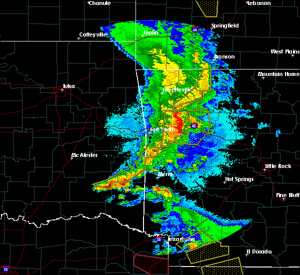 At 903 pm cdt, severe thunderstorms were located along a line extending from 7 miles northwest of roberson hollow to 2 miles east of rudd to 7 miles southwest of japton, moving east at 45 mph (radar indicated). Hazards include 60 mph wind gusts. Expect damage to roofs, siding, and trees. locations in or near the path include, green forest, st. Paul, carrollton, rudd, japton, kingston, witter, marble, aurora, osage, rule, dryfork, metalton, connor, delaney, brashears, coin, crosses, patrick, combs,. At 903 pm cdt, severe thunderstorms were located along a line extending from 7 miles northwest of roberson hollow to 2 miles east of rudd to 7 miles southwest of japton, moving east at 45 mph (radar indicated). Hazards include 60 mph wind gusts. Expect damage to roofs, siding, and trees. locations in or near the path include, green forest, st. Paul, carrollton, rudd, japton, kingston, witter, marble, aurora, osage, rule, dryfork, metalton, connor, delaney, brashears, coin, crosses, patrick, combs,.
|
| 4/24/2020 8:50 PM CDT |
 At 849 pm cdt, severe thunderstorms were located along a line extending from 6 miles north of urbanette to 4 miles north of marble to 3 miles east of brentwood, moving east at 45 mph (radar indicated). Hazards include 60 mph wind gusts and penny size hail. Expect damage to roofs, siding, and trees. locations in or near the path include, berryville, huntsville, green forest, elkins, west fork, winslow, st. Paul, hindsville, wesley, carrollton, rudd, kingston, blackburn, forum, aurora, withrow springs state park, brentwood, japton, witter, marble, this includes interstate 49 between mile markers 45 and 51. At 849 pm cdt, severe thunderstorms were located along a line extending from 6 miles north of urbanette to 4 miles north of marble to 3 miles east of brentwood, moving east at 45 mph (radar indicated). Hazards include 60 mph wind gusts and penny size hail. Expect damage to roofs, siding, and trees. locations in or near the path include, berryville, huntsville, green forest, elkins, west fork, winslow, st. Paul, hindsville, wesley, carrollton, rudd, kingston, blackburn, forum, aurora, withrow springs state park, brentwood, japton, witter, marble, this includes interstate 49 between mile markers 45 and 51.
|
| 4/24/2020 8:34 PM CDT |
 At 834 pm cdt, severe thunderstorms were located along a line extending from 2 miles northeast of beaver to 2 miles south of clifty to 3 miles north of blackburn, moving east at 40 mph (radar indicated). Hazards include 60 mph wind gusts and nickel size hail. Expect damage to roofs, siding, and trees. locations in or near the path include, fayetteville, berryville, huntsville, eureka springs, green forest, elkins, west fork, greenland, winslow, st. Paul, beaver, hindsville, wesley, carrollton, rudd, forum, aurora, hobbs state park, clifty, withrow springs state park, this includes interstate 49 between mile markers 44 and 60. At 834 pm cdt, severe thunderstorms were located along a line extending from 2 miles northeast of beaver to 2 miles south of clifty to 3 miles north of blackburn, moving east at 40 mph (radar indicated). Hazards include 60 mph wind gusts and nickel size hail. Expect damage to roofs, siding, and trees. locations in or near the path include, fayetteville, berryville, huntsville, eureka springs, green forest, elkins, west fork, greenland, winslow, st. Paul, beaver, hindsville, wesley, carrollton, rudd, forum, aurora, hobbs state park, clifty, withrow springs state park, this includes interstate 49 between mile markers 44 and 60.
|
| 4/24/2020 8:07 PM CDT |
 At 807 pm cdt, severe thunderstorms were located along a line extending from 3 miles northeast of pea ridge to springdale to 4 miles east of adair state park, moving east at 40 mph (radar indicated). Hazards include 60 mph wind gusts and nickel size hail. Expect damage to roofs, siding, and trees. Locations in or near the path include, fayetteville, springdale, rogers, bentonville, berryville, stilwell, huntsville, eureka springs, lowell, farmington, pea ridge, prairie grove, green forest, elkins, tontitown, bethel heights, west fork, lincoln, cave springs, greenland, this includes interstate 49 between mile markers 44 and 89. At 807 pm cdt, severe thunderstorms were located along a line extending from 3 miles northeast of pea ridge to springdale to 4 miles east of adair state park, moving east at 40 mph (radar indicated). Hazards include 60 mph wind gusts and nickel size hail. Expect damage to roofs, siding, and trees. Locations in or near the path include, fayetteville, springdale, rogers, bentonville, berryville, stilwell, huntsville, eureka springs, lowell, farmington, pea ridge, prairie grove, green forest, elkins, tontitown, bethel heights, west fork, lincoln, cave springs, greenland, this includes interstate 49 between mile markers 44 and 89.
|
| 3/19/2020 11:19 AM CDT |
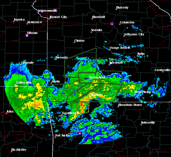 At 1119 am cdt, severe thunderstorms were located along a line extending from 6 miles northeast of urbanette to 4 miles northeast of green forest to 2 miles southwest of osage, moving northeast at 50 mph (radar indicated). Hazards include 70 mph wind gusts. Expect considerable tree damage. damage is likely to mobile homes, roofs, and outbuildings. Locations in or near the path include, green forest, carrollton, osage, rule, coin, denver, connor,. At 1119 am cdt, severe thunderstorms were located along a line extending from 6 miles northeast of urbanette to 4 miles northeast of green forest to 2 miles southwest of osage, moving northeast at 50 mph (radar indicated). Hazards include 70 mph wind gusts. Expect considerable tree damage. damage is likely to mobile homes, roofs, and outbuildings. Locations in or near the path include, green forest, carrollton, osage, rule, coin, denver, connor,.
|
| 3/19/2020 11:02 AM CDT |
 At 1102 am cdt, severe thunderstorms were located along a line extending from 3 miles southwest of grandview to 5 miles southwest of berryville to 3 miles southeast of withrow springs state park, moving northeast at 50 mph (radar indicated). Hazards include 70 mph wind gusts. Expect considerable tree damage. damage is likely to mobile homes, roofs, and outbuildings. Locations in or near the path include, berryville, eureka springs, green forest, carrollton, rudd, marble, osage, urbanette, rule, grandview, rockhouse, dryfork, cabanal, metalton, connor, coin, alabam, denver,. At 1102 am cdt, severe thunderstorms were located along a line extending from 3 miles southwest of grandview to 5 miles southwest of berryville to 3 miles southeast of withrow springs state park, moving northeast at 50 mph (radar indicated). Hazards include 70 mph wind gusts. Expect considerable tree damage. damage is likely to mobile homes, roofs, and outbuildings. Locations in or near the path include, berryville, eureka springs, green forest, carrollton, rudd, marble, osage, urbanette, rule, grandview, rockhouse, dryfork, cabanal, metalton, connor, coin, alabam, denver,.
|
| 1/10/2020 8:32 PM CST |
 At 832 pm cst, severe thunderstorms were located along a line extending from osage to 6 miles west of erbie to near lost valley state park to 7 miles northeast of walnut to near dillen, moving northeast at 60 mph (radar indicated). Hazards include 60 mph wind gusts and nickel size hail. Expect damage to roofs, siding, and trees. Locations impacted include, harrison, jasper, bergman, omaha, roberson hollow, carver, erbie, devils knob, lost valley state park, pruitt, rosetta, myrtle, self, dillen, red bank, capps, piercetown, walnut, bertha, upper buffalo wilderness area,. At 832 pm cst, severe thunderstorms were located along a line extending from osage to 6 miles west of erbie to near lost valley state park to 7 miles northeast of walnut to near dillen, moving northeast at 60 mph (radar indicated). Hazards include 60 mph wind gusts and nickel size hail. Expect damage to roofs, siding, and trees. Locations impacted include, harrison, jasper, bergman, omaha, roberson hollow, carver, erbie, devils knob, lost valley state park, pruitt, rosetta, myrtle, self, dillen, red bank, capps, piercetown, walnut, bertha, upper buffalo wilderness area,.
|
| 1/10/2020 8:05 PM CST |
 At 804 pm cst, severe thunderstorms were located along a line extending from aurora to near witter to near pettigrew to 10 miles east of cass to 7 miles northwest of woodland, moving northeast at 45 mph (radar indicated). Hazards include 70 mph wind gusts and quarter size hail. Hail damage to vehicles is expected. expect considerable tree damage. Wind damage is also likely to mobile homes, roofs, and outbuildings. At 804 pm cst, severe thunderstorms were located along a line extending from aurora to near witter to near pettigrew to 10 miles east of cass to 7 miles northwest of woodland, moving northeast at 45 mph (radar indicated). Hazards include 70 mph wind gusts and quarter size hail. Hail damage to vehicles is expected. expect considerable tree damage. Wind damage is also likely to mobile homes, roofs, and outbuildings.
|
| 1/10/2020 5:26 PM CST |
 At 525 pm cst, severe thunderstorms were located along a line extending from 4 miles northwest of grandview to 4 miles east of wesley, moving northeast at 70 mph (radar indicated). Hazards include 60 mph wind gusts and nickel size hail. Expect damage to roofs, siding, and trees. Locations in or near the path include, berryville, huntsville, eureka springs, green forest, beaver, hindsville, carrollton, rudd, forum, clifty, withrow springs state park, marble, osage, urbanette, rule, grandview, georgetown, dryfork, metalton, connor, a tornado watch remains in effect until 600 pm cst for northwestern arkansas. At 525 pm cst, severe thunderstorms were located along a line extending from 4 miles northwest of grandview to 4 miles east of wesley, moving northeast at 70 mph (radar indicated). Hazards include 60 mph wind gusts and nickel size hail. Expect damage to roofs, siding, and trees. Locations in or near the path include, berryville, huntsville, eureka springs, green forest, beaver, hindsville, carrollton, rudd, forum, clifty, withrow springs state park, marble, osage, urbanette, rule, grandview, georgetown, dryfork, metalton, connor, a tornado watch remains in effect until 600 pm cst for northwestern arkansas.
|
| 1/10/2020 5:10 PM CST |
 At 510 pm cst, severe thunderstorms were located along a line extending from 3 miles southeast of garfield to 5 miles east of brentwood, moving northeast at 60 mph (radar indicated). Hazards include 60 mph wind gusts and nickel size hail. Expect damage to roofs, siding, and trees. locations in or near the path include, fayetteville, rogers, berryville, huntsville, eureka springs, green forest, elkins, st. Paul, beaver, hindsville, wesley, carrollton, rudd, saint paul, forum, aurora, hobbs state park, clifty, boston, withrow springs state park, a tornado watch remains in effect until 600 pm cst for northwestern and west central arkansas. At 510 pm cst, severe thunderstorms were located along a line extending from 3 miles southeast of garfield to 5 miles east of brentwood, moving northeast at 60 mph (radar indicated). Hazards include 60 mph wind gusts and nickel size hail. Expect damage to roofs, siding, and trees. locations in or near the path include, fayetteville, rogers, berryville, huntsville, eureka springs, green forest, elkins, st. Paul, beaver, hindsville, wesley, carrollton, rudd, saint paul, forum, aurora, hobbs state park, clifty, boston, withrow springs state park, a tornado watch remains in effect until 600 pm cst for northwestern and west central arkansas.
|
| 10/21/2019 1:25 AM CDT |
 At 125 am cdt, severe thunderstorms were located along a line extending from 7 miles north of carrollton to 6 miles north of branch, moving east at 50 mph (radar indicated). Hazards include 60 mph wind gusts and nickel size hail. Expect damage to roofs, siding, and trees. locations in or near the path include, berryville, ozark, charleston, huntsville, barling, green forest, lavaca, mulberry, dyer, altus, branch, denning, st. paul, wiederkehr village, carrollton, rudd, saint paul, forum, aurora, boston, this includes interstate 40 in arkansas between mile markers 15 and 42. A tornado watch remains in effect until 300 am cdt for northwestern and west central arkansas. At 125 am cdt, severe thunderstorms were located along a line extending from 7 miles north of carrollton to 6 miles north of branch, moving east at 50 mph (radar indicated). Hazards include 60 mph wind gusts and nickel size hail. Expect damage to roofs, siding, and trees. locations in or near the path include, berryville, ozark, charleston, huntsville, barling, green forest, lavaca, mulberry, dyer, altus, branch, denning, st. paul, wiederkehr village, carrollton, rudd, saint paul, forum, aurora, boston, this includes interstate 40 in arkansas between mile markers 15 and 42. A tornado watch remains in effect until 300 am cdt for northwestern and west central arkansas.
|
| 10/21/2019 1:14 AM CDT |
 At 113 am cdt, severe thunderstorms were located along a line extending from 7 miles south of kimberling city to kingston to near mulberry, moving east at 60 mph (radar indicated). Hazards include 60 mph wind gusts and quarter size hail. Hail damage to vehicles is expected. Expect wind damage to roofs, siding, and trees. At 113 am cdt, severe thunderstorms were located along a line extending from 7 miles south of kimberling city to kingston to near mulberry, moving east at 60 mph (radar indicated). Hazards include 60 mph wind gusts and quarter size hail. Hail damage to vehicles is expected. Expect wind damage to roofs, siding, and trees.
|
| 10/21/2019 1:07 AM CDT |
 At 106 am cdt, severe thunderstorms were located along a line extending from 11 miles northeast of beaver to near urbanette to 4 miles southwest of marble to 2 miles north of mulberry, moving east at 70 mph (radar indicated). Hazards include 60 mph wind gusts and nickel size hail. Expect damage to roofs, siding, and trees. locations in or near the path include, fort smith, van buren, berryville, ozark, huntsville, eureka springs, cedarville, mountainburg, alma, roland, green forest, mulberry, dyer, altus, winslow, denning, chester, moffett, st. paul, rudy, this includes the following highways, interstate 40 in arkansas between mile markers 0 and 42. interstate 40 in oklahoma between mile markers 324 and 328. interstate 540 between mile markers 1 and 8. interstate 49 between mile markers 22 and 39. A tornado watch remains in effect until 300 am cdt for northwestern and west central arkansas, and southeastern oklahoma. At 106 am cdt, severe thunderstorms were located along a line extending from 11 miles northeast of beaver to near urbanette to 4 miles southwest of marble to 2 miles north of mulberry, moving east at 70 mph (radar indicated). Hazards include 60 mph wind gusts and nickel size hail. Expect damage to roofs, siding, and trees. locations in or near the path include, fort smith, van buren, berryville, ozark, huntsville, eureka springs, cedarville, mountainburg, alma, roland, green forest, mulberry, dyer, altus, winslow, denning, chester, moffett, st. paul, rudy, this includes the following highways, interstate 40 in arkansas between mile markers 0 and 42. interstate 40 in oklahoma between mile markers 324 and 328. interstate 540 between mile markers 1 and 8. interstate 49 between mile markers 22 and 39. A tornado watch remains in effect until 300 am cdt for northwestern and west central arkansas, and southeastern oklahoma.
|
| 10/21/2019 12:55 AM CDT |
 At 1254 am cdt, severe thunderstorms were located along a line extending from 5 miles east of seligman to 3 miles southeast of eureka springs to 4 miles east of wesley to near alma, moving east at 65 mph (radar indicated). Hazards include 70 mph wind gusts and quarter size hail. Hail damage to vehicles is expected. expect considerable tree damage. wind damage is also likely to mobile homes, roofs, and outbuildings. locations in or near the path include, fort smith, fayetteville, springdale, van buren, berryville, ozark, huntsville, eureka springs, cedarville, mountainburg, natural dam, alma, muldrow, roland, green forest, elkins, west fork, mulberry, greenland, dyer, this includes the following highways, interstate 40 in arkansas between mile markers 0 and 42. interstate 40 in oklahoma between mile markers 316 and 328. interstate 540 between mile markers 1 and 8. interstate 49 between mile markers 22 and 60. A tornado watch remains in effect until 300 am cdt for northwestern and west central arkansas, and southeastern, northeastern and east central oklahoma. At 1254 am cdt, severe thunderstorms were located along a line extending from 5 miles east of seligman to 3 miles southeast of eureka springs to 4 miles east of wesley to near alma, moving east at 65 mph (radar indicated). Hazards include 70 mph wind gusts and quarter size hail. Hail damage to vehicles is expected. expect considerable tree damage. wind damage is also likely to mobile homes, roofs, and outbuildings. locations in or near the path include, fort smith, fayetteville, springdale, van buren, berryville, ozark, huntsville, eureka springs, cedarville, mountainburg, natural dam, alma, muldrow, roland, green forest, elkins, west fork, mulberry, greenland, dyer, this includes the following highways, interstate 40 in arkansas between mile markers 0 and 42. interstate 40 in oklahoma between mile markers 316 and 328. interstate 540 between mile markers 1 and 8. interstate 49 between mile markers 22 and 60. A tornado watch remains in effect until 300 am cdt for northwestern and west central arkansas, and southeastern, northeastern and east central oklahoma.
|
| 10/21/2019 12:41 AM CDT |
 At 1241 am cdt, severe thunderstorms were located along a line extending from 3 miles northeast of pea ridge to 2 miles northeast of war eagle to 4 miles southwest of elkins to moffett, moving east at 70 mph (radar indicated). Hazards include 70 mph wind gusts and quarter size hail. Hail damage to vehicles is expected. expect considerable tree damage. wind damage is also likely to mobile homes, roofs, and outbuildings. locations in or near the path include, fort smith, fayetteville, springdale, rogers, bentonville, van buren, sallisaw, berryville, ozark, huntsville, eureka springs, cedarville, mountainburg, natural dam, bella vista, lowell, farmington, alma, pea ridge, prairie grove, this includes the following highways, interstate 40 in arkansas between mile markers 0 and 42. interstate 40 in oklahoma between mile markers 304 and 328. interstate 540 between mile markers 1 and 8. interstate 49 between mile markers 22 and 93. A tornado watch remains in effect until 300 am cdt for northwestern and west central arkansas, and southeastern, northeastern and east central oklahoma. At 1241 am cdt, severe thunderstorms were located along a line extending from 3 miles northeast of pea ridge to 2 miles northeast of war eagle to 4 miles southwest of elkins to moffett, moving east at 70 mph (radar indicated). Hazards include 70 mph wind gusts and quarter size hail. Hail damage to vehicles is expected. expect considerable tree damage. wind damage is also likely to mobile homes, roofs, and outbuildings. locations in or near the path include, fort smith, fayetteville, springdale, rogers, bentonville, van buren, sallisaw, berryville, ozark, huntsville, eureka springs, cedarville, mountainburg, natural dam, bella vista, lowell, farmington, alma, pea ridge, prairie grove, this includes the following highways, interstate 40 in arkansas between mile markers 0 and 42. interstate 40 in oklahoma between mile markers 304 and 328. interstate 540 between mile markers 1 and 8. interstate 49 between mile markers 22 and 93. A tornado watch remains in effect until 300 am cdt for northwestern and west central arkansas, and southeastern, northeastern and east central oklahoma.
|
| 8/27/2019 12:12 AM CDT |
 The severe thunderstorm warning for madison, northern franklin, northeastern crawford, carroll and southeastern washington counties will expire at 1215 am cdt, the storms which prompted the warning have weakened below severe limits, and no longer pose an immediate threat to life or property. therefore the warning will be allowed to expire. however gusty winds and heavy rain are still possible with these thunderstorms. a severe thunderstorm watch remains in effect until 600 am cdt for northwestern and west central arkansas. The severe thunderstorm warning for madison, northern franklin, northeastern crawford, carroll and southeastern washington counties will expire at 1215 am cdt, the storms which prompted the warning have weakened below severe limits, and no longer pose an immediate threat to life or property. therefore the warning will be allowed to expire. however gusty winds and heavy rain are still possible with these thunderstorms. a severe thunderstorm watch remains in effect until 600 am cdt for northwestern and west central arkansas.
|
| 8/26/2019 11:59 PM CDT |
 At 1144 pm cdt, severe thunderstorms were located along a line extending from near berryville to marble to near aurora to 7 miles west of saint paul, moving east at 55 mph (radar indicated). Hazards include 60 mph wind gusts. expect damage to roofs, siding, and trees At 1144 pm cdt, severe thunderstorms were located along a line extending from near berryville to marble to near aurora to 7 miles west of saint paul, moving east at 55 mph (radar indicated). Hazards include 60 mph wind gusts. expect damage to roofs, siding, and trees
|
| 8/26/2019 11:53 PM CDT |
 At 1153 pm cdt, severe thunderstorms were located along a line extending from near grandview to 3 miles southeast of marble to 8 miles northwest of cass to 2 miles southeast of devils den state park, moving east at 45 mph (radar indicated). Hazards include 60 mph wind gusts. Expect damage to roofs, siding, and trees. locations in or near the path include, berryville, huntsville, eureka springs, mountainburg, green forest, elkins, winslow, chester, st. Paul, beaver, wesley, carrollton, rudd, saint paul, forum, aurora, clifty, boston, withrow springs state park, brentwood, this includes interstate 49 between mile markers 24 and 48. At 1153 pm cdt, severe thunderstorms were located along a line extending from near grandview to 3 miles southeast of marble to 8 miles northwest of cass to 2 miles southeast of devils den state park, moving east at 45 mph (radar indicated). Hazards include 60 mph wind gusts. Expect damage to roofs, siding, and trees. locations in or near the path include, berryville, huntsville, eureka springs, mountainburg, green forest, elkins, winslow, chester, st. Paul, beaver, wesley, carrollton, rudd, saint paul, forum, aurora, clifty, boston, withrow springs state park, brentwood, this includes interstate 49 between mile markers 24 and 48.
|
| 8/26/2019 11:45 PM CDT |
 At 1144 pm cdt, severe thunderstorms were located along a line extending from near berryville to marble to near aurora to 7 miles west of saint paul, moving east at 55 mph (radar indicated). Hazards include 60 mph wind gusts. expect damage to roofs, siding, and trees At 1144 pm cdt, severe thunderstorms were located along a line extending from near berryville to marble to near aurora to 7 miles west of saint paul, moving east at 55 mph (radar indicated). Hazards include 60 mph wind gusts. expect damage to roofs, siding, and trees
|
| 8/26/2019 11:34 PM CDT |
 At 1134 pm cdt, severe thunderstorms were located along a line extending from 4 miles east of gateway to near withrow springs state park to near winslow to 6 miles west of strickler, moving east at 45 mph (radar indicated). Hazards include 60 mph wind gusts. Expect damage to roofs, siding, and trees. locations in or near the path include, berryville, ozark, huntsville, eureka springs, cedarville, mountainburg, natural dam, alma, green forest, elkins, mulberry, dyer, winslow, chester, st. paul, beaver, rudy, wesley, carrollton, rudd, this includes the following highways, interstate 40 in arkansas between mile markers 7 and 35. Interstate 49 between mile markers 22 and 48. At 1134 pm cdt, severe thunderstorms were located along a line extending from 4 miles east of gateway to near withrow springs state park to near winslow to 6 miles west of strickler, moving east at 45 mph (radar indicated). Hazards include 60 mph wind gusts. Expect damage to roofs, siding, and trees. locations in or near the path include, berryville, ozark, huntsville, eureka springs, cedarville, mountainburg, natural dam, alma, green forest, elkins, mulberry, dyer, winslow, chester, st. paul, beaver, rudy, wesley, carrollton, rudd, this includes the following highways, interstate 40 in arkansas between mile markers 7 and 35. Interstate 49 between mile markers 22 and 48.
|
| 6/26/2019 1:36 PM CDT |
 At 134 pm cdt, severe thunderstorms were located near rule to 5 miles southwest of osage to 2 miles northeast of huntsville, moving northeast at 10 mph (radar indicated). Hazards include 60 mph wind gusts and nickel size hail. Expect damage to roofs, siding, and trees. at 130 pm, a spotter reported 50 mph winds 2 miles east southeast of alabam, arkansas in northern madison county. Locations in or near the path include, huntsville, withrow springs state park, carrollton, rudd, kingston, marble, osage, rule, dryfork, cabanal, metalton, connor, alabam, delmar,. At 134 pm cdt, severe thunderstorms were located near rule to 5 miles southwest of osage to 2 miles northeast of huntsville, moving northeast at 10 mph (radar indicated). Hazards include 60 mph wind gusts and nickel size hail. Expect damage to roofs, siding, and trees. at 130 pm, a spotter reported 50 mph winds 2 miles east southeast of alabam, arkansas in northern madison county. Locations in or near the path include, huntsville, withrow springs state park, carrollton, rudd, kingston, marble, osage, rule, dryfork, cabanal, metalton, connor, alabam, delmar,.
|
| 6/26/2019 1:21 PM CDT |
 The national weather service in tulsa has issued a * severe thunderstorm warning for. central madison county in northwestern arkansas. southeastern carroll county in northwestern arkansas. until 200 pm cdt. At 120 pm cdt, severe thunderstorms were located 2 miles west of. The national weather service in tulsa has issued a * severe thunderstorm warning for. central madison county in northwestern arkansas. southeastern carroll county in northwestern arkansas. until 200 pm cdt. At 120 pm cdt, severe thunderstorms were located 2 miles west of.
|
| 6/23/2019 11:51 AM CDT |
 The severe thunderstorm warning for northern newton and boone counties will expire at noon cdt, the storm which prompted the warning has weakened below severe limits, and no longer poses an immediate threat to life or property. therefore, the warning will be allowed to expire. however gusty winds and heavy rain are still possible with this thunderstorm. The severe thunderstorm warning for northern newton and boone counties will expire at noon cdt, the storm which prompted the warning has weakened below severe limits, and no longer poses an immediate threat to life or property. therefore, the warning will be allowed to expire. however gusty winds and heavy rain are still possible with this thunderstorm.
|
| 6/23/2019 11:14 AM CDT |
 At 1113 am cdt, a severe thunderstorm was located over rudd, or 13 miles southeast of berryville, moving east at 35 mph (radar indicated). Hazards include 60 mph wind gusts and quarter size hail. Hail damage to vehicles is expected. Expect wind damage to roofs, siding, and trees. At 1113 am cdt, a severe thunderstorm was located over rudd, or 13 miles southeast of berryville, moving east at 35 mph (radar indicated). Hazards include 60 mph wind gusts and quarter size hail. Hail damage to vehicles is expected. Expect wind damage to roofs, siding, and trees.
|
| 6/23/2019 11:14 AM CDT |
 At 1114 am cdt, severe thunderstorms were located along a line extending from 2 miles northeast of green forest to 5 miles east of marble, moving east at 35 mph (radar indicated). Hazards include 60 mph wind gusts. Expect damage to roofs, siding, and trees. Locations in or near the path include, green forest, carrollton, osage, rudd, rule, coin, dryfork, delmar, denver, connor,. At 1114 am cdt, severe thunderstorms were located along a line extending from 2 miles northeast of green forest to 5 miles east of marble, moving east at 35 mph (radar indicated). Hazards include 60 mph wind gusts. Expect damage to roofs, siding, and trees. Locations in or near the path include, green forest, carrollton, osage, rudd, rule, coin, dryfork, delmar, denver, connor,.
|
| 6/23/2019 11:01 AM CDT |
 At 1101 am cdt, severe thunderstorms were located along a line extending from 2 miles southeast of berryville to 2 miles north of marble to 3 miles southeast of huntsville, moving east at 40 mph (radar indicated). Hazards include 60 mph wind gusts. Expect damage to roofs, siding, and trees. Locations in or near the path include, huntsville, green forest, withrow springs state park, carrollton, rudd, kingston, marble, forum, osage, rule, rockhouse, dryfork, cabanal, metalton, connor, coin, alabam, delmar,. At 1101 am cdt, severe thunderstorms were located along a line extending from 2 miles southeast of berryville to 2 miles north of marble to 3 miles southeast of huntsville, moving east at 40 mph (radar indicated). Hazards include 60 mph wind gusts. Expect damage to roofs, siding, and trees. Locations in or near the path include, huntsville, green forest, withrow springs state park, carrollton, rudd, kingston, marble, forum, osage, rule, rockhouse, dryfork, cabanal, metalton, connor, coin, alabam, delmar,.
|
| 6/23/2019 10:44 AM CDT |
 At 1044 am cdt, severe thunderstorms were located along a line extending from 5 miles south of eureka springs to near withrow springs state park to 3 miles northeast of wesley, moving east at 45 mph (radar indicated). Hazards include 60 mph wind gusts. Expect damage to roofs, siding, and trees. Locations in or near the path include, huntsville, green forest, hindsville, withrow springs state park, carrollton, rudd, kingston, marble, forum, osage, rule, clifty, rockhouse, dryfork, cabanal, metalton, connor, coin, alabam, delmar,. At 1044 am cdt, severe thunderstorms were located along a line extending from 5 miles south of eureka springs to near withrow springs state park to 3 miles northeast of wesley, moving east at 45 mph (radar indicated). Hazards include 60 mph wind gusts. Expect damage to roofs, siding, and trees. Locations in or near the path include, huntsville, green forest, hindsville, withrow springs state park, carrollton, rudd, kingston, marble, forum, osage, rule, clifty, rockhouse, dryfork, cabanal, metalton, connor, coin, alabam, delmar,.
|
| 6/23/2019 10:22 AM CDT |
 At 1022 am cdt, severe thunderstorms were located along a line extending from 5 miles east of lowell to 5 miles east of springdale to 2 miles northeast of fayetteville, moving east at 45 mph (radar indicated). Hazards include 60 mph wind gusts. Expect damage to roofs, siding, and trees. Locations in or near the path include, fayetteville, springdale, rogers, huntsville, green forest, hindsville, carrollton, rudd, kingston, forum, hobbs state park, clifty, withrow springs state park, war eagle, marble, osage, rule, goshen, dryfork, metalton,. At 1022 am cdt, severe thunderstorms were located along a line extending from 5 miles east of lowell to 5 miles east of springdale to 2 miles northeast of fayetteville, moving east at 45 mph (radar indicated). Hazards include 60 mph wind gusts. Expect damage to roofs, siding, and trees. Locations in or near the path include, fayetteville, springdale, rogers, huntsville, green forest, hindsville, carrollton, rudd, kingston, forum, hobbs state park, clifty, withrow springs state park, war eagle, marble, osage, rule, goshen, dryfork, metalton,.
|
| 5/29/2019 12:52 PM CDT |
 At 1251 pm cdt, severe thunderstorms were located along a line extending from 4 miles north of grandview to 4 miles north of marble, moving east at 30 mph (radar indicated). Hazards include 60 mph wind gusts and penny size hail. Expect damage to roofs, siding, and trees. Locations in or near the path include, berryville, huntsville, eureka springs, green forest, beaver, carrollton, rudd, forum, clifty, withrow springs state park, marble, osage, urbanette, rule, grandview, alpena, blue eye, dryfork, metalton, connor, a tornado watch remains in effect until 800 pm cdt for northwestern arkansas. At 1251 pm cdt, severe thunderstorms were located along a line extending from 4 miles north of grandview to 4 miles north of marble, moving east at 30 mph (radar indicated). Hazards include 60 mph wind gusts and penny size hail. Expect damage to roofs, siding, and trees. Locations in or near the path include, berryville, huntsville, eureka springs, green forest, beaver, carrollton, rudd, forum, clifty, withrow springs state park, marble, osage, urbanette, rule, grandview, alpena, blue eye, dryfork, metalton, connor, a tornado watch remains in effect until 800 pm cdt for northwestern arkansas.
|
| 5/29/2019 12:20 PM CDT |
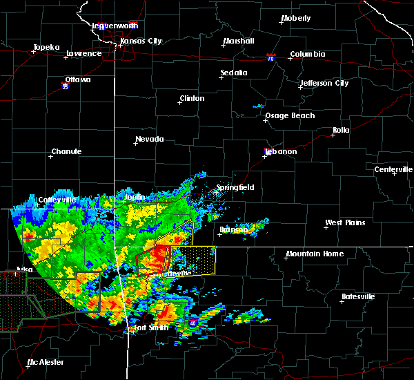 At 1219 pm cdt, severe thunderstorms were located along a line extending from near gateway to 3 miles northwest of hindsville, moving east at 30 mph (radar indicated). Hazards include 60 mph wind gusts and penny size hail. Expect damage to roofs, siding, and trees. Locations in or near the path include, berryville, huntsville, eureka springs, green forest, beaver, hindsville, carrollton, rudd, forum, hobbs state park, clifty, withrow springs state park, war eagle, marble, osage, urbanette, rule, grandview, goshen, alpena,. At 1219 pm cdt, severe thunderstorms were located along a line extending from near gateway to 3 miles northwest of hindsville, moving east at 30 mph (radar indicated). Hazards include 60 mph wind gusts and penny size hail. Expect damage to roofs, siding, and trees. Locations in or near the path include, berryville, huntsville, eureka springs, green forest, beaver, hindsville, carrollton, rudd, forum, hobbs state park, clifty, withrow springs state park, war eagle, marble, osage, urbanette, rule, grandview, goshen, alpena,.
|
| 5/21/2019 2:02 PM CDT |
 At 201 pm cdt, a severe thunderstorm was located 4 miles southwest of osage, moving northeast at 45 mph (radar indicated). Hazards include 60 mph wind gusts. Expect damage to roofs, siding, and trees. Locations in or near the path include, green forest, carrollton, osage, rudd, coin, dryfork, delmar, denver, connor,. At 201 pm cdt, a severe thunderstorm was located 4 miles southwest of osage, moving northeast at 45 mph (radar indicated). Hazards include 60 mph wind gusts. Expect damage to roofs, siding, and trees. Locations in or near the path include, green forest, carrollton, osage, rudd, coin, dryfork, delmar, denver, connor,.
|
| 5/21/2019 1:54 PM CDT |
 At 153 pm cdt, a severe thunderstorm was located over lost valley state park, or 10 miles west of jasper. another developing storm was centered near fallsville. the storms were moving northeast at 45 mph (radar indicated). Hazards include 60 mph wind gusts and quarter size hail. Hail damage to vehicles is expected. expect wind damage to roofs, siding, and trees. Locations impacted include, harrison, jasper, western grove, valley springs, dugger, olvey, roberson hollow, erbie, upper buffalo wilderness area, red bank, lost valley state park, capps, pruitt, bellefonte, alpena, everton, batavia, bear creek springs, marble falls, ridgeway, a tornado watch remains in effect until 700 pm cdt for north central arkansas. At 153 pm cdt, a severe thunderstorm was located over lost valley state park, or 10 miles west of jasper. another developing storm was centered near fallsville. the storms were moving northeast at 45 mph (radar indicated). Hazards include 60 mph wind gusts and quarter size hail. Hail damage to vehicles is expected. expect wind damage to roofs, siding, and trees. Locations impacted include, harrison, jasper, western grove, valley springs, dugger, olvey, roberson hollow, erbie, upper buffalo wilderness area, red bank, lost valley state park, capps, pruitt, bellefonte, alpena, everton, batavia, bear creek springs, marble falls, ridgeway, a tornado watch remains in effect until 700 pm cdt for north central arkansas.
|
| 5/21/2019 1:43 PM CDT |
 At 142 pm cdt, a severe thunderstorm was located 5 miles west of upper buffalo wilderness area, moving northeast at 45 mph (radar indicated). Hazards include 60 mph wind gusts. Expect damage to roofs, siding, and trees. Locations in or near the path include, green forest, carrollton, osage, kingston, rudd, coin, dryfork, red star, delmar, weathers, denver, connor, a tornado watch remains in effect until 200 pm cdt for northwestern arkansas. At 142 pm cdt, a severe thunderstorm was located 5 miles west of upper buffalo wilderness area, moving northeast at 45 mph (radar indicated). Hazards include 60 mph wind gusts. Expect damage to roofs, siding, and trees. Locations in or near the path include, green forest, carrollton, osage, kingston, rudd, coin, dryfork, red star, delmar, weathers, denver, connor, a tornado watch remains in effect until 200 pm cdt for northwestern arkansas.
|
| 5/21/2019 1:37 PM CDT |
 At 137 pm cdt, a severe thunderstorm was located near upper buffalo wilderness area, or 19 miles southwest of jasper, moving northeast at 45 mph (radar indicated). Hazards include 60 mph wind gusts and quarter size hail. Hail damage to vehicles is expected. Expect wind damage to roofs, siding, and trees. At 137 pm cdt, a severe thunderstorm was located near upper buffalo wilderness area, or 19 miles southwest of jasper, moving northeast at 45 mph (radar indicated). Hazards include 60 mph wind gusts and quarter size hail. Hail damage to vehicles is expected. Expect wind damage to roofs, siding, and trees.
|
| 5/18/2019 3:12 PM CDT |
 At 312 pm cdt, severe thunderstorms were located along a line extending from 4 miles northeast of urbanette to 2 miles southeast of rule to 3 miles east of kingston, moving east at 50 mph (radar indicated). Hazards include 60 mph wind gusts. Expect damage to roofs, siding, and trees. Locations in or near the path include, berryville, eureka springs, green forest, carrollton, rudd, kingston, marble, osage, urbanette, rule, grandview, blue eye, rockhouse, dryfork, cabanal, metalton, connor, coin, pleasant ridge, delmar, a tornado watch remains in effect until 500 pm cdt for northwestern arkansas. At 312 pm cdt, severe thunderstorms were located along a line extending from 4 miles northeast of urbanette to 2 miles southeast of rule to 3 miles east of kingston, moving east at 50 mph (radar indicated). Hazards include 60 mph wind gusts. Expect damage to roofs, siding, and trees. Locations in or near the path include, berryville, eureka springs, green forest, carrollton, rudd, kingston, marble, osage, urbanette, rule, grandview, blue eye, rockhouse, dryfork, cabanal, metalton, connor, coin, pleasant ridge, delmar, a tornado watch remains in effect until 500 pm cdt for northwestern arkansas.
|
| 5/18/2019 2:49 PM CDT |
 At 248 pm cdt, severe thunderstorms were located along a line extending from 5 miles northwest of beaver to 5 miles south of eureka springs to 3 miles northwest of aurora, moving northeast at 40 mph (radar indicated). Hazards include 60 mph wind gusts. Expect damage to roofs, siding, and trees. Locations in or near the path include, berryville, huntsville, eureka springs, green forest, garfield, gateway, beaver, hindsville, carrollton, rudd, kingston, forum, hobbs state park, clifty, withrow springs state park, marble, osage, urbanette, rule, grandview, a tornado watch remains in effect until 500 pm cdt for northwestern arkansas. At 248 pm cdt, severe thunderstorms were located along a line extending from 5 miles northwest of beaver to 5 miles south of eureka springs to 3 miles northwest of aurora, moving northeast at 40 mph (radar indicated). Hazards include 60 mph wind gusts. Expect damage to roofs, siding, and trees. Locations in or near the path include, berryville, huntsville, eureka springs, green forest, garfield, gateway, beaver, hindsville, carrollton, rudd, kingston, forum, hobbs state park, clifty, withrow springs state park, marble, osage, urbanette, rule, grandview, a tornado watch remains in effect until 500 pm cdt for northwestern arkansas.
|
| 2/7/2019 3:32 AM CST |
 At 330 am cst, severe thunderstorms were located along a line extending from near rudd to near boston and oark, moving northeast at 50 mph (radar indicated). Hazards include 60 mph wind gusts and quarter size hail. Hail damage to vehicles is expected. expect wind damage to roofs, siding, and trees. Locations impacted include, harrison, jasper, valley springs, carver, erbie, upper buffalo wilderness area, devils knob, lost valley state park, pruitt, rosetta, myrtle, self, dillen, red bank, capps, piercetown, walnut, bellefonte, alpena, batavia,. At 330 am cst, severe thunderstorms were located along a line extending from near rudd to near boston and oark, moving northeast at 50 mph (radar indicated). Hazards include 60 mph wind gusts and quarter size hail. Hail damage to vehicles is expected. expect wind damage to roofs, siding, and trees. Locations impacted include, harrison, jasper, valley springs, carver, erbie, upper buffalo wilderness area, devils knob, lost valley state park, pruitt, rosetta, myrtle, self, dillen, red bank, capps, piercetown, walnut, bellefonte, alpena, batavia,.
|
| 2/7/2019 3:13 AM CST |
 At 312 am cst, severe thunderstorms were located along a line extending from 4 miles west of beaver to 3 miles north of cass to 3 miles east of mulberry, moving east at 60 mph (radar indicated). Hazards include 60 mph wind gusts. Expect damage to roofs, siding, and trees. locations in or near the path include, berryville, ozark, huntsville, eureka springs, green forest, mulberry, altus, st. Paul, beaver, hindsville, wiederkehr village, carrollton, rudd, saint paul, forum, aurora, hobbs state park, clifty, boston, withrow springs state park, this includes interstate 40 in arkansas between mile markers 25 and 42. At 312 am cst, severe thunderstorms were located along a line extending from 4 miles west of beaver to 3 miles north of cass to 3 miles east of mulberry, moving east at 60 mph (radar indicated). Hazards include 60 mph wind gusts. Expect damage to roofs, siding, and trees. locations in or near the path include, berryville, ozark, huntsville, eureka springs, green forest, mulberry, altus, st. Paul, beaver, hindsville, wiederkehr village, carrollton, rudd, saint paul, forum, aurora, hobbs state park, clifty, boston, withrow springs state park, this includes interstate 40 in arkansas between mile markers 25 and 42.
|
| 2/7/2019 3:07 AM CST |
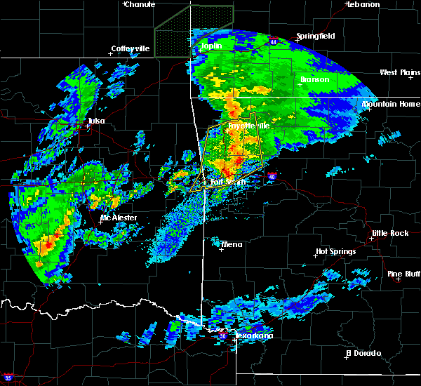 At 306 am cst, severe thunderstorms were located along a line extending from near elkins to 9 miles west of saint paul to mulberry, moving northeast at 50 mph (radar indicated). Hazards include 60 mph wind gusts and quarter size hail. Hail damage to vehicles is expected. Expect wind damage to roofs, siding, and trees. At 306 am cst, severe thunderstorms were located along a line extending from near elkins to 9 miles west of saint paul to mulberry, moving northeast at 50 mph (radar indicated). Hazards include 60 mph wind gusts and quarter size hail. Hail damage to vehicles is expected. Expect wind damage to roofs, siding, and trees.
|
| 12/1/2018 12:20 AM CST |
 At 1219 am cst, severe thunderstorms were located along a line extending from 7 miles north of urbanette to carrollton to near lost valley state park, moving northeast at 45 mph (radar indicated). Hazards include 60 mph wind gusts and quarter size hail. Hail damage to vehicles is expected. Expect wind damage to roofs, siding, and trees. At 1219 am cst, severe thunderstorms were located along a line extending from 7 miles north of urbanette to carrollton to near lost valley state park, moving northeast at 45 mph (radar indicated). Hazards include 60 mph wind gusts and quarter size hail. Hail damage to vehicles is expected. Expect wind damage to roofs, siding, and trees.
|
| 12/1/2018 12:19 AM CST |
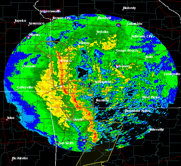 At 1218 am cst, severe thunderstorms were located along a line extending from 5 miles northeast of grandview to 3 miles northwest of erbie, moving east at 60 mph (radar indicated). Hazards include 60 mph wind gusts. Expect damage to roofs, siding, and trees. Locations in or near the path include, berryville, eureka springs, green forest, beaver, carrollton, rudd, osage, urbanette, rule, grandview, blue eye, dryfork, cabanal, metalton, connor, coin, pleasant ridge, delmar, denver, oak hill, a tornado watch remains in effect until 200 am cst for northwestern arkansas. At 1218 am cst, severe thunderstorms were located along a line extending from 5 miles northeast of grandview to 3 miles northwest of erbie, moving east at 60 mph (radar indicated). Hazards include 60 mph wind gusts. Expect damage to roofs, siding, and trees. Locations in or near the path include, berryville, eureka springs, green forest, beaver, carrollton, rudd, osage, urbanette, rule, grandview, blue eye, dryfork, cabanal, metalton, connor, coin, pleasant ridge, delmar, denver, oak hill, a tornado watch remains in effect until 200 am cst for northwestern arkansas.
|
| 11/30/2018 11:51 PM CST |
 At 1151 pm cst, severe thunderstorms were located along a line extending from 4 miles north of pea ridge to hindsville, moving northeast at 70 mph (radar indicated). Hazards include 60 mph wind gusts. Expect damage to roofs, siding, and trees. Locations in or near the path include, rogers, bella vista, berryville, huntsville, eureka springs, pea ridge, green forest, garfield, gateway, beaver, hindsville, carrollton, rudd, forum, hobbs state park, clifty, withrow springs state park, war eagle, marble, osage, a tornado watch remains in effect until 200 am cst for northwestern arkansas. At 1151 pm cst, severe thunderstorms were located along a line extending from 4 miles north of pea ridge to hindsville, moving northeast at 70 mph (radar indicated). Hazards include 60 mph wind gusts. Expect damage to roofs, siding, and trees. Locations in or near the path include, rogers, bella vista, berryville, huntsville, eureka springs, pea ridge, green forest, garfield, gateway, beaver, hindsville, carrollton, rudd, forum, hobbs state park, clifty, withrow springs state park, war eagle, marble, osage, a tornado watch remains in effect until 200 am cst for northwestern arkansas.
|
| 7/21/2018 12:32 AM CDT |
 At 1232 am cdt, severe thunderstorms were located along a line extending from bergman to near osage, moving southeast at 55 mph (radar indicated). Hazards include 60 mph wind gusts and quarter size hail. Hail damage to vehicles is expected. expect wind damage to roofs, siding, and trees. locations impacted include, harrison, jasper, bergman, western grove, valley springs, dugger, olvey, myrtle, self, carver, erbie, red bank, capps, piercetown, pruitt, crawford, bellefonte, alpena, everton, st. Joe,. At 1232 am cdt, severe thunderstorms were located along a line extending from bergman to near osage, moving southeast at 55 mph (radar indicated). Hazards include 60 mph wind gusts and quarter size hail. Hail damage to vehicles is expected. expect wind damage to roofs, siding, and trees. locations impacted include, harrison, jasper, bergman, western grove, valley springs, dugger, olvey, myrtle, self, carver, erbie, red bank, capps, piercetown, pruitt, crawford, bellefonte, alpena, everton, st. Joe,.
|
| 7/21/2018 12:19 AM CDT |
 At 1219 am cdt, severe thunderstorms were located along a line extending from omaha to near rule, moving southeast at 50 mph (radar indicated). Hazards include 60 mph wind gusts and quarter size hail. Hail damage to vehicles is expected. Expect wind damage to roofs, siding, and trees. At 1219 am cdt, severe thunderstorms were located along a line extending from omaha to near rule, moving southeast at 50 mph (radar indicated). Hazards include 60 mph wind gusts and quarter size hail. Hail damage to vehicles is expected. Expect wind damage to roofs, siding, and trees.
|
| 7/19/2018 7:56 PM CDT |
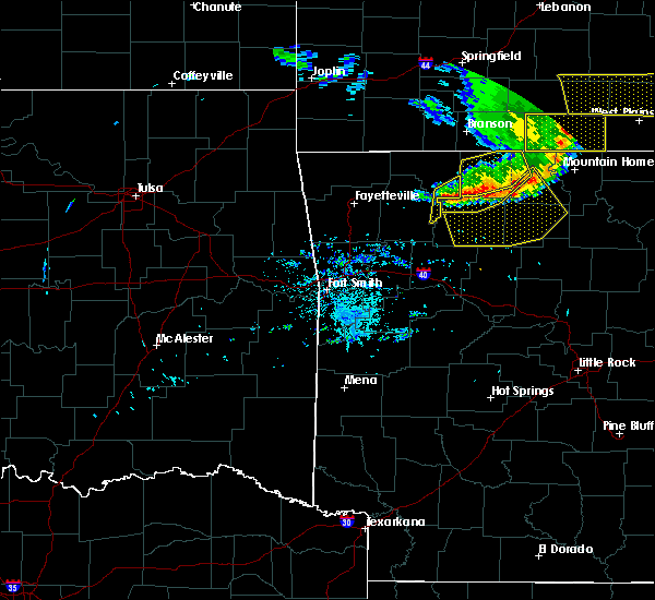 At 756 pm cdt, severe thunderstorms were located along a line extending from 2 miles south of red bank to 4 miles south of osage, moving south at 35 mph (radar indicated). Hazards include 60 mph wind gusts and penny size hail. Expect damage to roofs, siding, and trees. Locations in or near the path include, kingston, carrollton, osage, delmar, weathers, dryfork,. At 756 pm cdt, severe thunderstorms were located along a line extending from 2 miles south of red bank to 4 miles south of osage, moving south at 35 mph (radar indicated). Hazards include 60 mph wind gusts and penny size hail. Expect damage to roofs, siding, and trees. Locations in or near the path include, kingston, carrollton, osage, delmar, weathers, dryfork,.
|
| 7/19/2018 7:44 PM CDT |
 At 744 pm cdt, severe thunderstorms were located along a line extending from near lead hill to bergman to capps to osage, moving south at 45 mph (radar indicated). Hazards include 60 mph wind gusts. Expect damage to roofs, siding, and trees. Locations impacted include, harrison, jasper, diamond city, bergman, western grove, lead hill, pyatt, valley springs, dugger, olvey, myrtle, self, erbie, lakeway, red bank, clark hill, winington, dodd city, lost valley state park, capps,. At 744 pm cdt, severe thunderstorms were located along a line extending from near lead hill to bergman to capps to osage, moving south at 45 mph (radar indicated). Hazards include 60 mph wind gusts. Expect damage to roofs, siding, and trees. Locations impacted include, harrison, jasper, diamond city, bergman, western grove, lead hill, pyatt, valley springs, dugger, olvey, myrtle, self, erbie, lakeway, red bank, clark hill, winington, dodd city, lost valley state park, capps,.
|
| 7/19/2018 7:42 PM CDT |
 At 742 pm cdt, severe thunderstorms were located along a line extending from carrollton to near rudd, moving south at 35 mph (radar indicated). Hazards include 60 mph wind gusts and penny size hail. Expect damage to roofs, siding, and trees. Locations in or near the path include, green forest, carrollton, rudd, kingston, osage, rule, dryfork, cabanal, metalton, weathers, connor, coin, delmar,. At 742 pm cdt, severe thunderstorms were located along a line extending from carrollton to near rudd, moving south at 35 mph (radar indicated). Hazards include 60 mph wind gusts and penny size hail. Expect damage to roofs, siding, and trees. Locations in or near the path include, green forest, carrollton, rudd, kingston, osage, rule, dryfork, cabanal, metalton, weathers, connor, coin, delmar,.
|
| 7/19/2018 7:36 PM CDT |
 At 735 pm cdt, severe thunderstorms were located along a line extending from diamond city to self to near carrollton to near green forest, moving south at 45 mph (radar indicated). Hazards include 60 mph wind gusts. Expect damage to roofs, siding, and trees. Locations impacted include, harrison, jasper, diamond city, bergman, western grove, lead hill, pyatt, valley springs, omaha, dugger, olvey, myrtle, roberson hollow, self, erbie, lakeway, red bank, clark hill, winington, dodd city,. At 735 pm cdt, severe thunderstorms were located along a line extending from diamond city to self to near carrollton to near green forest, moving south at 45 mph (radar indicated). Hazards include 60 mph wind gusts. Expect damage to roofs, siding, and trees. Locations impacted include, harrison, jasper, diamond city, bergman, western grove, lead hill, pyatt, valley springs, omaha, dugger, olvey, myrtle, roberson hollow, self, erbie, lakeway, red bank, clark hill, winington, dodd city,.
|
| 7/19/2018 7:35 PM CDT |
 At 735 pm cdt, severe thunderstorms were located along a line extending from 4 miles northeast of carrollton to 3 miles west of rule to 4 miles northeast of clifty, moving southeast at 50 mph (radar indicated). Hazards include 60 mph wind gusts. Expect damage to roofs, siding, and trees. Locations in or near the path include, berryville, eureka springs, green forest, carrollton, rudd, kingston, marble, osage, urbanette, rule, rockhouse, dryfork, cabanal, metalton, connor, coin, alabam, delmar, denver,. At 735 pm cdt, severe thunderstorms were located along a line extending from 4 miles northeast of carrollton to 3 miles west of rule to 4 miles northeast of clifty, moving southeast at 50 mph (radar indicated). Hazards include 60 mph wind gusts. Expect damage to roofs, siding, and trees. Locations in or near the path include, berryville, eureka springs, green forest, carrollton, rudd, kingston, marble, osage, urbanette, rule, rockhouse, dryfork, cabanal, metalton, connor, coin, alabam, delmar, denver,.
|
| 7/19/2018 7:23 PM CDT |
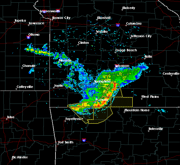 At 723 pm cdt, severe thunderstorms were located along a line extending from 7 miles north of urbanette to 3 miles northwest of grandview to 4 miles southeast of gateway, moving southeast at 35 mph (radar indicated). Hazards include 60 mph wind gusts. Expect damage to roofs, siding, and trees. Locations in or near the path include, berryville, eureka springs, green forest, garfield, gateway, beaver, carrollton, rudd, kingston, marble, osage, urbanette, rule, grandview, blue eye, dryfork, beaver lake, metalton, connor, coin,. At 723 pm cdt, severe thunderstorms were located along a line extending from 7 miles north of urbanette to 3 miles northwest of grandview to 4 miles southeast of gateway, moving southeast at 35 mph (radar indicated). Hazards include 60 mph wind gusts. Expect damage to roofs, siding, and trees. Locations in or near the path include, berryville, eureka springs, green forest, garfield, gateway, beaver, carrollton, rudd, kingston, marble, osage, urbanette, rule, grandview, blue eye, dryfork, beaver lake, metalton, connor, coin,.
|
| 7/19/2018 7:19 PM CDT |
 At 718 pm cdt, severe thunderstorms were located along a line extending from near taneyville to 8 miles south of forsyth to near roberson hollow to 7 miles northeast of urbanette, moving south at 45 mph (radar indicated). Hazards include 60 mph wind gusts. expect damage to roofs, siding, and trees At 718 pm cdt, severe thunderstorms were located along a line extending from near taneyville to 8 miles south of forsyth to near roberson hollow to 7 miles northeast of urbanette, moving south at 45 mph (radar indicated). Hazards include 60 mph wind gusts. expect damage to roofs, siding, and trees
|
| 7/19/2018 7:06 PM CDT |
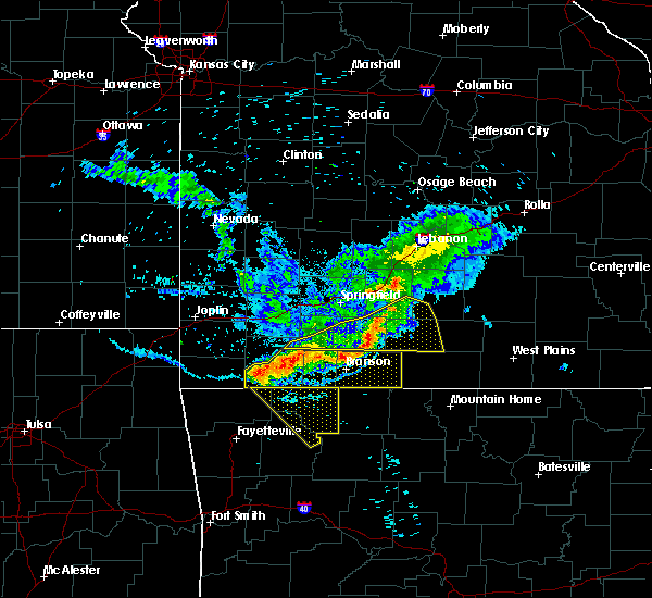 At 706 pm cdt, severe thunderstorms were located along a line extending from 4 miles west of branson west to 9 miles northeast of beaver to near seligman, moving southeast at 40 mph (radar indicated). Hazards include 70 mph wind gusts and nickel size hail. Expect considerable tree damage. damage is likely to mobile homes, roofs, and outbuildings. Locations in or near the path include, berryville, eureka springs, green forest, garfield, gateway, beaver, carrollton, rudd, kingston, marble, osage, urbanette, rule, grandview, blue eye, dryfork, beaver lake, metalton, connor, coin,. At 706 pm cdt, severe thunderstorms were located along a line extending from 4 miles west of branson west to 9 miles northeast of beaver to near seligman, moving southeast at 40 mph (radar indicated). Hazards include 70 mph wind gusts and nickel size hail. Expect considerable tree damage. damage is likely to mobile homes, roofs, and outbuildings. Locations in or near the path include, berryville, eureka springs, green forest, garfield, gateway, beaver, carrollton, rudd, kingston, marble, osage, urbanette, rule, grandview, blue eye, dryfork, beaver lake, metalton, connor, coin,.
|
| 7/19/2018 6:51 PM CDT |
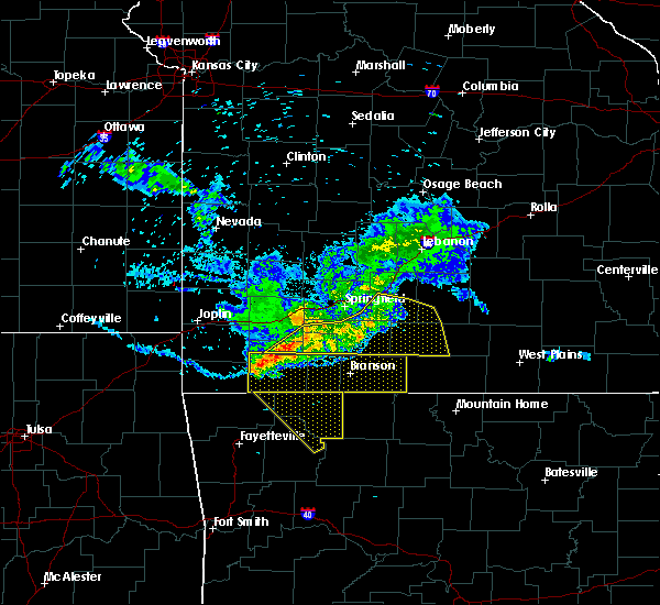 At 650 pm cdt, severe thunderstorms were located along a line extending from 5 miles southwest of crane to 4 miles east of cassville to 2 miles northwest of washburn, moving southeast at 45 mph (radar indicated). Hazards include 70 mph wind gusts. Expect considerable tree damage. damage is likely to mobile homes, roofs, and outbuildings. Locations in or near the path include, berryville, eureka springs, green forest, garfield, gateway, beaver, carrollton, rudd, kingston, marble, osage, urbanette, rule, grandview, blue eye, dryfork, beaver lake, metalton, connor, coin,. At 650 pm cdt, severe thunderstorms were located along a line extending from 5 miles southwest of crane to 4 miles east of cassville to 2 miles northwest of washburn, moving southeast at 45 mph (radar indicated). Hazards include 70 mph wind gusts. Expect considerable tree damage. damage is likely to mobile homes, roofs, and outbuildings. Locations in or near the path include, berryville, eureka springs, green forest, garfield, gateway, beaver, carrollton, rudd, kingston, marble, osage, urbanette, rule, grandview, blue eye, dryfork, beaver lake, metalton, connor, coin,.
|
| 4/13/2018 5:31 PM CDT |
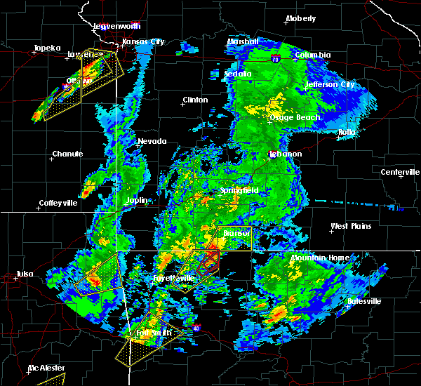 At 531 pm cdt, a severe thunderstorm capable of producing a tornado was located over green forest, or 10 miles east of berryville, moving northeast at 55 mph (radar indicated rotation). Hazards include tornado and quarter size hail. Flying debris will be dangerous to those caught without shelter. mobile homes will be damaged or destroyed. damage to roofs, windows, and vehicles will occur. Tree damage is likely. At 531 pm cdt, a severe thunderstorm capable of producing a tornado was located over green forest, or 10 miles east of berryville, moving northeast at 55 mph (radar indicated rotation). Hazards include tornado and quarter size hail. Flying debris will be dangerous to those caught without shelter. mobile homes will be damaged or destroyed. damage to roofs, windows, and vehicles will occur. Tree damage is likely.
|
| 4/13/2018 5:29 PM CDT |
 At 528 pm cdt, a severe thunderstorm capable of producing a tornado was located near green forest, moving northeast at 55 mph (radar indicated rotation). Hazards include tornado and quarter size hail. Flying debris will be dangerous to those caught without shelter. mobile homes will be damaged or destroyed. damage to roofs, windows, and vehicles will occur. tree damage is likely. Locations in or near the path include, green forest, rule, coin, denver, connor,. At 528 pm cdt, a severe thunderstorm capable of producing a tornado was located near green forest, moving northeast at 55 mph (radar indicated rotation). Hazards include tornado and quarter size hail. Flying debris will be dangerous to those caught without shelter. mobile homes will be damaged or destroyed. damage to roofs, windows, and vehicles will occur. tree damage is likely. Locations in or near the path include, green forest, rule, coin, denver, connor,.
|
| 4/13/2018 4:57 PM CDT |
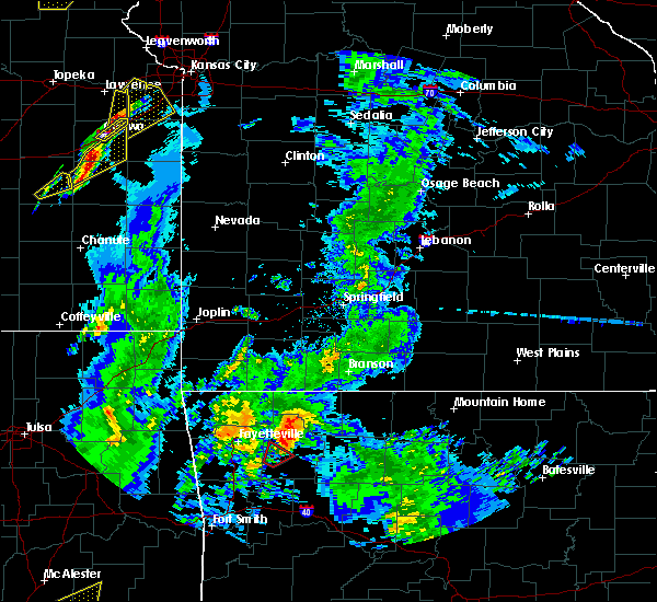 At 456 pm cdt, a severe thunderstorm was located over huntsville, moving northeast at 40 mph (radar indicated). Hazards include 60 mph wind gusts and quarter size hail. Hail damage to vehicles is expected. expect wind damage to roofs, siding, and trees. Locations in or near the path include, berryville, huntsville, green forest, withrow springs state park, carrollton, rudd, marble, forum, aurora, osage, urbanette, rule, grandview, clifty, blue eye, rockhouse, dryfork, cabanal, metalton, connor, a tornado watch remains in effect until 1000 pm cdt for northwestern arkansas. At 456 pm cdt, a severe thunderstorm was located over huntsville, moving northeast at 40 mph (radar indicated). Hazards include 60 mph wind gusts and quarter size hail. Hail damage to vehicles is expected. expect wind damage to roofs, siding, and trees. Locations in or near the path include, berryville, huntsville, green forest, withrow springs state park, carrollton, rudd, marble, forum, aurora, osage, urbanette, rule, grandview, clifty, blue eye, rockhouse, dryfork, cabanal, metalton, connor, a tornado watch remains in effect until 1000 pm cdt for northwestern arkansas.
|
| 1/21/2018 10:23 PM CST |
 The severe thunderstorm warning for eastern carroll county will expire at 1030 pm cst, the storms which prompted the warning are moving out of the warned area. therefore the warning will be allowed to expire. a tornado watch remains in effect until 1100 pm cst for northwestern arkansas. The severe thunderstorm warning for eastern carroll county will expire at 1030 pm cst, the storms which prompted the warning are moving out of the warned area. therefore the warning will be allowed to expire. a tornado watch remains in effect until 1100 pm cst for northwestern arkansas.
|
| 1/21/2018 10:14 PM CST |
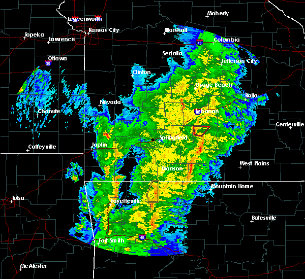 At 1013 pm cst, severe thunderstorms were located along a line extending from 6 miles west of roberson hollow to 6 miles southwest of omaha to 4 miles southeast of osage, moving northeast at 65 mph (radar indicated). Hazards include 60 mph wind gusts. Expect damage to roofs, siding, and trees. Locations in or near the path include, green forest, carrollton, rudd, osage, rule, blue eye, coin, dryfork, delmar, denver, connor, a tornado watch remains in effect until 1100 pm cst for northwestern arkansas. At 1013 pm cst, severe thunderstorms were located along a line extending from 6 miles west of roberson hollow to 6 miles southwest of omaha to 4 miles southeast of osage, moving northeast at 65 mph (radar indicated). Hazards include 60 mph wind gusts. Expect damage to roofs, siding, and trees. Locations in or near the path include, green forest, carrollton, rudd, osage, rule, blue eye, coin, dryfork, delmar, denver, connor, a tornado watch remains in effect until 1100 pm cst for northwestern arkansas.
|
| 1/21/2018 10:06 PM CST |
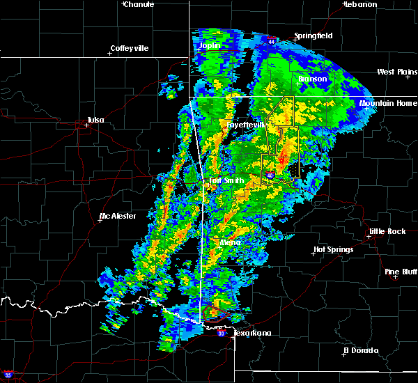 At 1005 pm cst, severe thunderstorms were located along a line extending from 2 miles northwest of green forest to near carrollton to 2 miles northwest of upper buffalo wilderness area, moving northeast at 60 mph. the most danerous part of the line was in eastern carroll county (radar indicated). Hazards include 60 mph wind gusts. Expect damage to roofs, siding, and trees. Locations in or near the path include, green forest, carrollton, rudd, kingston, osage, rule, blue eye, dryfork, cabanal, metalton, weathers, connor, coin, delmar, denver, a tornado watch remains in effect until 1100 pm cst for northwestern arkansas. At 1005 pm cst, severe thunderstorms were located along a line extending from 2 miles northwest of green forest to near carrollton to 2 miles northwest of upper buffalo wilderness area, moving northeast at 60 mph. the most danerous part of the line was in eastern carroll county (radar indicated). Hazards include 60 mph wind gusts. Expect damage to roofs, siding, and trees. Locations in or near the path include, green forest, carrollton, rudd, kingston, osage, rule, blue eye, dryfork, cabanal, metalton, weathers, connor, coin, delmar, denver, a tornado watch remains in effect until 1100 pm cst for northwestern arkansas.
|
| 1/21/2018 9:55 PM CST |
 At 954 pm cst, severe thunderstorms were located along a line extending from 5 miles north of marble to 3 miles south of rudd to 5 miles southeast of boston, moving northeast at 60 mph (radar indicated). Hazards include 60 mph wind gusts. Expect damage to roofs, siding, and trees. Locations in or near the path include, green forest, carrollton, rudd, kingston, marble, osage, rule, boston, blue eye, dryfork, red star, cabanal, metalton, weathers, connor, coin, delmar, denver, a tornado watch remains in effect until 1100 pm cst for northwestern arkansas. At 954 pm cst, severe thunderstorms were located along a line extending from 5 miles north of marble to 3 miles south of rudd to 5 miles southeast of boston, moving northeast at 60 mph (radar indicated). Hazards include 60 mph wind gusts. Expect damage to roofs, siding, and trees. Locations in or near the path include, green forest, carrollton, rudd, kingston, marble, osage, rule, boston, blue eye, dryfork, red star, cabanal, metalton, weathers, connor, coin, delmar, denver, a tornado watch remains in effect until 1100 pm cst for northwestern arkansas.
|
| 1/21/2018 9:43 PM CST |
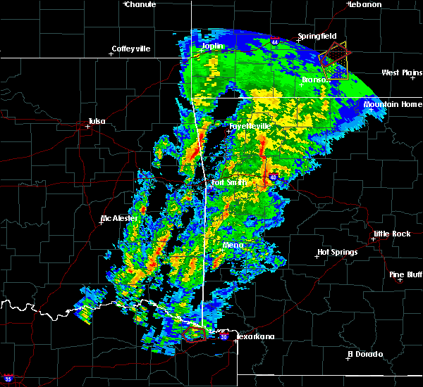 At 942 pm cst, severe thunderstorms were located along a line extending from near huntsville to 4 miles east of aurora to 2 miles east of witter, moving northeast at 55 mph (radar indicated). Hazards include 60 mph wind gusts. Expect damage to roofs, siding, and trees. Locations in or near the path include, huntsville, green forest, carrollton, rudd, pettigrew, kingston, marble, witter, aurora, osage, rule, boston, blue eye, dryfork, red star, cabanal, harmony, metalton, weathers, connor, a tornado watch remains in effect until 1100 pm cst for northwestern arkansas. At 942 pm cst, severe thunderstorms were located along a line extending from near huntsville to 4 miles east of aurora to 2 miles east of witter, moving northeast at 55 mph (radar indicated). Hazards include 60 mph wind gusts. Expect damage to roofs, siding, and trees. Locations in or near the path include, huntsville, green forest, carrollton, rudd, pettigrew, kingston, marble, witter, aurora, osage, rule, boston, blue eye, dryfork, red star, cabanal, harmony, metalton, weathers, connor, a tornado watch remains in effect until 1100 pm cst for northwestern arkansas.
|
| 8/18/2017 7:10 PM CDT |
 At 709 pm cdt, a severe thunderstorm was located over pruitt, or near jasper, moving southeast at 40 mph (radar indicated). Hazards include 60 mph wind gusts and half dollar size hail. Hail damage to vehicles is expected. expect wind damage to roofs, siding, and trees. Locations impacted include, harrison, jasper, western grove, erbie, red bank, lost valley state park, capps, pruitt, upper buffalo wilderness area, alpena, batavia, marble falls, yardelle, crossroad, gum springs in newton county, gaither, ponca, hasty, wayton, boxley,. At 709 pm cdt, a severe thunderstorm was located over pruitt, or near jasper, moving southeast at 40 mph (radar indicated). Hazards include 60 mph wind gusts and half dollar size hail. Hail damage to vehicles is expected. expect wind damage to roofs, siding, and trees. Locations impacted include, harrison, jasper, western grove, erbie, red bank, lost valley state park, capps, pruitt, upper buffalo wilderness area, alpena, batavia, marble falls, yardelle, crossroad, gum springs in newton county, gaither, ponca, hasty, wayton, boxley,.
|
| 8/18/2017 7:08 PM CDT |
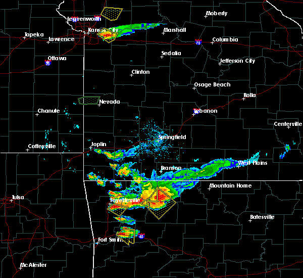 The severe thunderstorm warning for east central madison and southeastern carroll counties will expire at 715 pm cdt, the storms which prompted the warning are moving out of the area. therefore the warning will be allowed to expire. The severe thunderstorm warning for east central madison and southeastern carroll counties will expire at 715 pm cdt, the storms which prompted the warning are moving out of the area. therefore the warning will be allowed to expire.
|
| 8/18/2017 7:02 PM CDT |
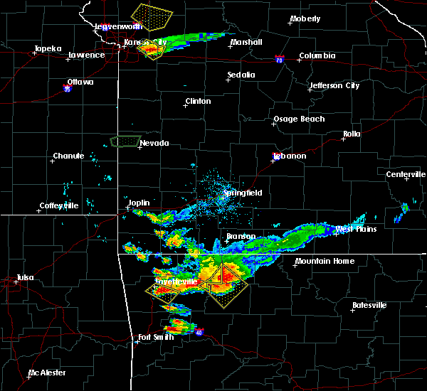 At 702 pm cdt, a severe thunderstorm was located over erbie, or near jasper, moving southeast at 30 mph (radar indicated). Hazards include 60 mph wind gusts and penny size hail. Expect damage to roofs, siding, and trees. Locations impacted include, harrison, jasper, western grove, erbie, red bank, lost valley state park, capps, pruitt, upper buffalo wilderness area, alpena, batavia, marble falls, yardelle, crossroad, gum springs in newton county, gaither, ponca, hasty, wayton, boxley,. At 702 pm cdt, a severe thunderstorm was located over erbie, or near jasper, moving southeast at 30 mph (radar indicated). Hazards include 60 mph wind gusts and penny size hail. Expect damage to roofs, siding, and trees. Locations impacted include, harrison, jasper, western grove, erbie, red bank, lost valley state park, capps, pruitt, upper buffalo wilderness area, alpena, batavia, marble falls, yardelle, crossroad, gum springs in newton county, gaither, ponca, hasty, wayton, boxley,.
|
| 8/18/2017 6:56 PM CDT |
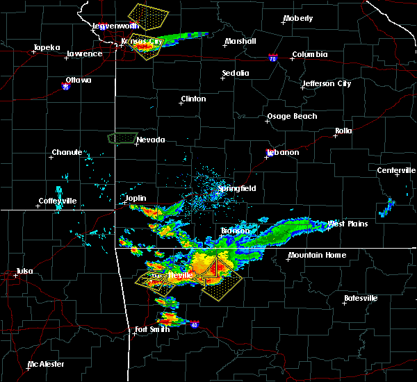 At 655 pm cdt, severe thunderstorms were located along a line extending from near carrollton to 3 miles west of erbie to kingston, moving southeast at 30 mph. the most intense storm in the line was located near and south of carrollton (radar indicated). Hazards include 60 mph wind gusts and half dollar size hail. Hail damage to vehicles is expected. expect wind damage to roofs, siding, and trees. Locations in or near the path include, kingston, carrollton, osage, delmar,. At 655 pm cdt, severe thunderstorms were located along a line extending from near carrollton to 3 miles west of erbie to kingston, moving southeast at 30 mph. the most intense storm in the line was located near and south of carrollton (radar indicated). Hazards include 60 mph wind gusts and half dollar size hail. Hail damage to vehicles is expected. expect wind damage to roofs, siding, and trees. Locations in or near the path include, kingston, carrollton, osage, delmar,.
|
| 8/18/2017 6:47 PM CDT |
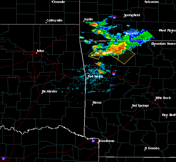 At 647 pm cdt, a severe thunderstorm was located near osage, or 12 miles northwest of jasper, moving southeast at 35 mph (radar indicated). Hazards include 60 mph wind gusts and quarter size hail. Hail damage to vehicles is expected. Expect wind damage to roofs, siding, and trees. At 647 pm cdt, a severe thunderstorm was located near osage, or 12 miles northwest of jasper, moving southeast at 35 mph (radar indicated). Hazards include 60 mph wind gusts and quarter size hail. Hail damage to vehicles is expected. Expect wind damage to roofs, siding, and trees.
|
| 8/18/2017 6:42 PM CDT |
 At 642 pm cdt, severe thunderstorms were located along a line extending from 2 miles northeast of carrollton to near osage to 3 miles southwest of marble, moving east at 35 mph (radar indicated). Hazards include 60 mph wind gusts and nickel size hail. Expect damage to roofs, siding, and trees. Locations in or near the path include, carrollton, osage, kingston, marble, coin, dryfork, delmar,. At 642 pm cdt, severe thunderstorms were located along a line extending from 2 miles northeast of carrollton to near osage to 3 miles southwest of marble, moving east at 35 mph (radar indicated). Hazards include 60 mph wind gusts and nickel size hail. Expect damage to roofs, siding, and trees. Locations in or near the path include, carrollton, osage, kingston, marble, coin, dryfork, delmar,.
|
| 8/18/2017 6:34 PM CDT |
 At 633 pm cdt, severe thunderstorms were located along a line extending from 6 miles south of roberson hollow to 2 miles northwest of osage to 3 miles southwest of rudd, moving southeast at 35 mph (radar indicated). Hazards include 60 mph wind gusts and nickel size hail. Expect damage to roofs, siding, and trees. Locations in or near the path include, berryville, green forest, carrollton, rudd, osage, urbanette, rule, blue eye, rockhouse, cabanal, metalton, connor, coin, delmar, denver,. At 633 pm cdt, severe thunderstorms were located along a line extending from 6 miles south of roberson hollow to 2 miles northwest of osage to 3 miles southwest of rudd, moving southeast at 35 mph (radar indicated). Hazards include 60 mph wind gusts and nickel size hail. Expect damage to roofs, siding, and trees. Locations in or near the path include, berryville, green forest, carrollton, rudd, osage, urbanette, rule, blue eye, rockhouse, cabanal, metalton, connor, coin, delmar, denver,.
|
| 8/18/2017 6:14 PM CDT |
 At 613 pm cdt, severe thunderstorms were located along a line extending from 5 miles northeast of urbanette to 7 miles northeast of forum, moving east-southeast at 40 mph. another storm was rapidly developing near cabanal (radar indicated). Hazards include 60 mph wind gusts and nickel size hail. Expect damage to roofs, siding, and trees. Locations in or near the path include, berryville, green forest, carrollton, rudd, osage, urbanette, rule, blue eye, rockhouse, cabanal, metalton, connor, coin, delmar, denver,. At 613 pm cdt, severe thunderstorms were located along a line extending from 5 miles northeast of urbanette to 7 miles northeast of forum, moving east-southeast at 40 mph. another storm was rapidly developing near cabanal (radar indicated). Hazards include 60 mph wind gusts and nickel size hail. Expect damage to roofs, siding, and trees. Locations in or near the path include, berryville, green forest, carrollton, rudd, osage, urbanette, rule, blue eye, rockhouse, cabanal, metalton, connor, coin, delmar, denver,.
|
| 7/8/2017 1:24 AM CDT |
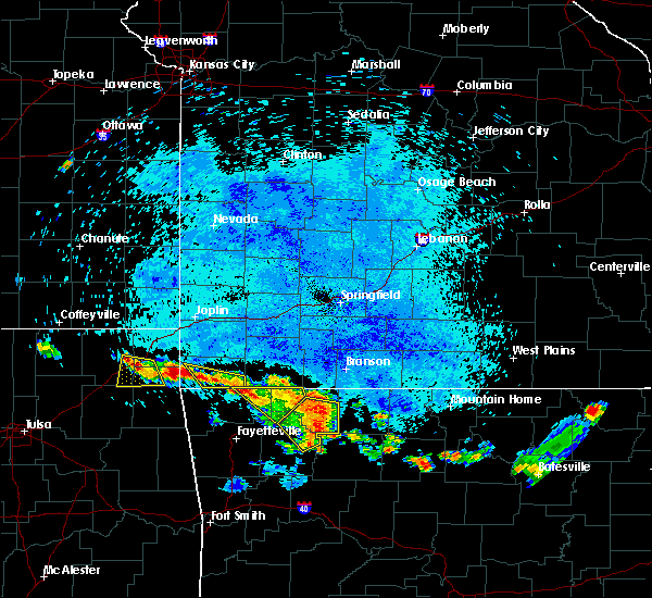 The severe thunderstorm warning for northeastern madison and eastern carroll counties will expire at 130 am cdt, the storm which prompted the warning has weakened below severe limits, and no longer poses an immediate threat to life or property. therefore the warning will be allowed to expire. however gusty winds and heavy rain are still possible with this thunderstorm. The severe thunderstorm warning for northeastern madison and eastern carroll counties will expire at 130 am cdt, the storm which prompted the warning has weakened below severe limits, and no longer poses an immediate threat to life or property. therefore the warning will be allowed to expire. however gusty winds and heavy rain are still possible with this thunderstorm.
|
| 7/8/2017 1:00 AM CDT |
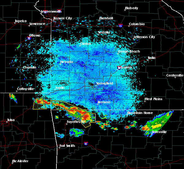 At 100 am cdt, a severe thunderstorm was located 7 miles northwest of rudd, moving southeast at 25 mph (radar indicated). Hazards include 60 mph wind gusts and quarter size hail. Hail damage to vehicles is expected. expect wind damage to roofs, siding, and trees. Locations in or near the path include, berryville, green forest, withrow springs state park, carrollton, rudd, kingston, marble, forum, osage, rule, rockhouse, dryfork, cabanal, harmony, metalton, connor, coin, alabam, delmar,. At 100 am cdt, a severe thunderstorm was located 7 miles northwest of rudd, moving southeast at 25 mph (radar indicated). Hazards include 60 mph wind gusts and quarter size hail. Hail damage to vehicles is expected. expect wind damage to roofs, siding, and trees. Locations in or near the path include, berryville, green forest, withrow springs state park, carrollton, rudd, kingston, marble, forum, osage, rule, rockhouse, dryfork, cabanal, harmony, metalton, connor, coin, alabam, delmar,.
|
| 7/8/2017 12:36 AM CDT |
 At 1235 am cdt, a severe thunderstorm was located 3 miles south of eureka springs, moving southeast at 25 mph (radar indicated). Hazards include 60 mph wind gusts and quarter size hail. Hail damage to vehicles is expected. expect wind damage to roofs, siding, and trees. Locations in or near the path include, berryville, eureka springs, green forest, withrow springs state park, carrollton, rudd, kingston, marble, forum, osage, rule, grandview, clifty, rockhouse, dryfork, cabanal, harmony, metalton, connor, coin,. At 1235 am cdt, a severe thunderstorm was located 3 miles south of eureka springs, moving southeast at 25 mph (radar indicated). Hazards include 60 mph wind gusts and quarter size hail. Hail damage to vehicles is expected. expect wind damage to roofs, siding, and trees. Locations in or near the path include, berryville, eureka springs, green forest, withrow springs state park, carrollton, rudd, kingston, marble, forum, osage, rule, grandview, clifty, rockhouse, dryfork, cabanal, harmony, metalton, connor, coin,.
|
| 5/27/2017 10:03 PM CDT |
 At 1003 pm cdt, severe thunderstorms were located along a line extending from near diamond city to near myrtle, moving east at 55 mph (radar indicated). Hazards include 60 mph wind gusts and nickel size hail. Expect damage to roofs, siding, and trees. Locations impacted include, harrison, yellville, diamond city, bergman, lead hill, pyatt, omaha, olvey, myrtle, roberson hollow, self, lakeway, winington, clark hill, dodd city, capps, willis, crawford, summit, bellefonte, a tornado watch remains in effect until 200 am cdt for north central arkansas. At 1003 pm cdt, severe thunderstorms were located along a line extending from near diamond city to near myrtle, moving east at 55 mph (radar indicated). Hazards include 60 mph wind gusts and nickel size hail. Expect damage to roofs, siding, and trees. Locations impacted include, harrison, yellville, diamond city, bergman, lead hill, pyatt, omaha, olvey, myrtle, roberson hollow, self, lakeway, winington, clark hill, dodd city, capps, willis, crawford, summit, bellefonte, a tornado watch remains in effect until 200 am cdt for north central arkansas.
|
| 5/27/2017 9:53 PM CDT |
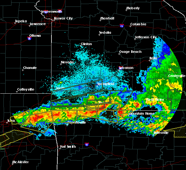 At 953 pm cdt, a severe thunderstorm was located 3 miles northwest of green forest, moving southeast at 30 mph (radar indicated). Hazards include 60 mph wind gusts and penny size hail. Expect damage to roofs, siding, and trees. Locations in or near the path include, berryville, eureka springs, green forest, beaver, urbanette, grandview, carrollton, blue eye, coin, pleasant ridge, denver, busch, oak hill, a tornado watch remains in effect until midnight cdt for northwestern arkansas. At 953 pm cdt, a severe thunderstorm was located 3 miles northwest of green forest, moving southeast at 30 mph (radar indicated). Hazards include 60 mph wind gusts and penny size hail. Expect damage to roofs, siding, and trees. Locations in or near the path include, berryville, eureka springs, green forest, beaver, urbanette, grandview, carrollton, blue eye, coin, pleasant ridge, denver, busch, oak hill, a tornado watch remains in effect until midnight cdt for northwestern arkansas.
|
| 5/27/2017 9:50 PM CDT |
 At 950 pm cdt, a severe thunderstorm was located over self, or 10 miles north of harrison, moving east at 65 mph (radar indicated). Hazards include 60 mph wind gusts and penny size hail. Expect damage to roofs, siding, and trees. Locations impacted include, harrison, yellville, diamond city, bergman, lead hill, pyatt, omaha, olvey, myrtle, roberson hollow, self, lakeway, winington, clark hill, dodd city, capps, willis, crawford, summit, bellefonte, a tornado watch remains in effect until 200 am cdt for north central arkansas. At 950 pm cdt, a severe thunderstorm was located over self, or 10 miles north of harrison, moving east at 65 mph (radar indicated). Hazards include 60 mph wind gusts and penny size hail. Expect damage to roofs, siding, and trees. Locations impacted include, harrison, yellville, diamond city, bergman, lead hill, pyatt, omaha, olvey, myrtle, roberson hollow, self, lakeway, winington, clark hill, dodd city, capps, willis, crawford, summit, bellefonte, a tornado watch remains in effect until 200 am cdt for north central arkansas.
|
| 5/27/2017 9:38 PM CDT |
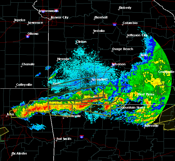 At 937 pm cdt, a severe thunderstorm was located over urbanette, or near berryville, moving east at 60 mph (radar indicated). Hazards include 60 mph wind gusts and quarter size hail. Hail damage to vehicles is expected. Expect wind damage to roofs, siding, and trees. At 937 pm cdt, a severe thunderstorm was located over urbanette, or near berryville, moving east at 60 mph (radar indicated). Hazards include 60 mph wind gusts and quarter size hail. Hail damage to vehicles is expected. Expect wind damage to roofs, siding, and trees.
|
| 5/27/2017 9:24 PM CDT |
 At 924 pm cdt, a severe thunderstorm was located over beaver, moving east at 35 mph (radar indicated). Hazards include 60 mph wind gusts and quarter size hail. Hail damage to vehicles is expected. expect wind damage to roofs, siding, and trees. Locations in or near the path include, berryville, eureka springs, green forest, beaver, urbanette, grandview, carrollton, blue eye, coin, pleasant ridge, denver, busch, oak hill, a tornado watch remains in effect until midnight cdt for northwestern arkansas. At 924 pm cdt, a severe thunderstorm was located over beaver, moving east at 35 mph (radar indicated). Hazards include 60 mph wind gusts and quarter size hail. Hail damage to vehicles is expected. expect wind damage to roofs, siding, and trees. Locations in or near the path include, berryville, eureka springs, green forest, beaver, urbanette, grandview, carrollton, blue eye, coin, pleasant ridge, denver, busch, oak hill, a tornado watch remains in effect until midnight cdt for northwestern arkansas.
|
| 5/27/2017 12:42 AM CDT |
 At 1242 am cdt, a severe thunderstorm was located over grandview, moving east at 30 mph (radar indicated). Hazards include 70 mph wind gusts and quarter size hail. Hail damage to vehicles is expected. expect considerable tree damage. wind damage is also likely to mobile homes, roofs, and outbuildings. Locations in or near the path include, berryville, green forest, urbanette, grandview, blue eye, coin, pleasant ridge, denver, oak hill,. At 1242 am cdt, a severe thunderstorm was located over grandview, moving east at 30 mph (radar indicated). Hazards include 70 mph wind gusts and quarter size hail. Hail damage to vehicles is expected. expect considerable tree damage. wind damage is also likely to mobile homes, roofs, and outbuildings. Locations in or near the path include, berryville, green forest, urbanette, grandview, blue eye, coin, pleasant ridge, denver, oak hill,.
|
| 5/27/2017 12:24 AM CDT |
 At 1223 am cdt, a severe thunderstorm was located over beaver, moving east at 30 mph (radar indicated). Hazards include 70 mph wind gusts and quarter size hail. Hail damage to vehicles is expected. expect considerable tree damage. wind damage is also likely to mobile homes, roofs, and outbuildings. Locations in or near the path include, berryville, eureka springs, green forest, beaver, urbanette, grandview, blue eye, coin, pleasant ridge, denver, busch, oak hill,. At 1223 am cdt, a severe thunderstorm was located over beaver, moving east at 30 mph (radar indicated). Hazards include 70 mph wind gusts and quarter size hail. Hail damage to vehicles is expected. expect considerable tree damage. wind damage is also likely to mobile homes, roofs, and outbuildings. Locations in or near the path include, berryville, eureka springs, green forest, beaver, urbanette, grandview, blue eye, coin, pleasant ridge, denver, busch, oak hill,.
|
| 5/19/2017 1:34 AM CDT |
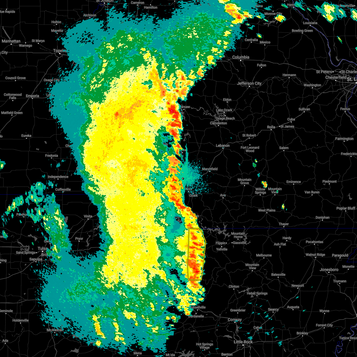 At 133 am cdt, severe thunderstorms were located along a line extending from near omaha to near harrison to near bertha, moving east at 45 mph (radar indicated). Hazards include 60 mph wind gusts and nickel size hail. Expect damage to roofs, siding, and trees. Locations impacted include, harrison, jasper, bergman, omaha, myrtle, roberson hollow, self, carver, erbie, red bank, capps, piercetown, pruitt, bellefonte, alpena, batavia, bear creek springs, new hope in boone county, marble falls, ridgeway, a tornado watch remains in effect until 600 am cdt for western and north central arkansas. At 133 am cdt, severe thunderstorms were located along a line extending from near omaha to near harrison to near bertha, moving east at 45 mph (radar indicated). Hazards include 60 mph wind gusts and nickel size hail. Expect damage to roofs, siding, and trees. Locations impacted include, harrison, jasper, bergman, omaha, myrtle, roberson hollow, self, carver, erbie, red bank, capps, piercetown, pruitt, bellefonte, alpena, batavia, bear creek springs, new hope in boone county, marble falls, ridgeway, a tornado watch remains in effect until 600 am cdt for western and north central arkansas.
|
| 5/19/2017 1:18 AM CDT |
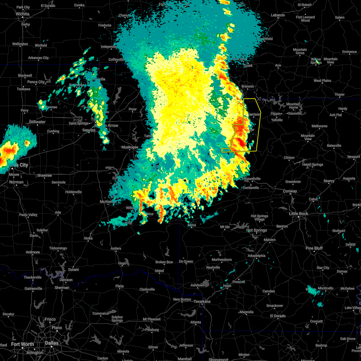 At 117 am cdt, severe thunderstorms were located along a line extending from near denver to 5 miles west of jasper to near rosetta, moving east at 45 mph (radar indicated). Hazards include 60 mph wind gusts and nickel size hail. Expect damage to roofs, siding, and trees. Locations impacted include, harrison, jasper, bergman, omaha, roberson hollow, carver, erbie, upper buffalo wilderness area, devils knob, lost valley state park, pruitt, myrtle, self, red bank, capps, piercetown, walnut, bellefonte, alpena, batavia, a tornado watch remains in effect until 600 am cdt for western, central and north central arkansas. At 117 am cdt, severe thunderstorms were located along a line extending from near denver to 5 miles west of jasper to near rosetta, moving east at 45 mph (radar indicated). Hazards include 60 mph wind gusts and nickel size hail. Expect damage to roofs, siding, and trees. Locations impacted include, harrison, jasper, bergman, omaha, roberson hollow, carver, erbie, upper buffalo wilderness area, devils knob, lost valley state park, pruitt, myrtle, self, red bank, capps, piercetown, walnut, bellefonte, alpena, batavia, a tornado watch remains in effect until 600 am cdt for western, central and north central arkansas.
|
| 5/19/2017 1:00 AM CDT |
 At 100 am cdt, severe thunderstorms were located along a line extending from 4 miles north of emerald beach to 3 miles east of berryville to 2 miles west of lost valley state park to 2 miles north of hartman, moving east at 50 mph (radar indicated). Hazards include 60 mph wind gusts and quarter size hail. Hail damage to vehicles is expected. expect wind damage to roofs, siding, and trees. locations in or near the path include, berryville, ozark, charleston, huntsville, eureka springs, green forest, mulberry, altus, gateway, branch, denning, st. paul, beaver, hindsville, wiederkehr village, carrollton, rudd, saint paul, forum, aurora, this includes interstate 40 in arkansas between mile markers 23 and 42. A tornado watch remains in effect until 600 am cdt for northwestern and west central arkansas. At 100 am cdt, severe thunderstorms were located along a line extending from 4 miles north of emerald beach to 3 miles east of berryville to 2 miles west of lost valley state park to 2 miles north of hartman, moving east at 50 mph (radar indicated). Hazards include 60 mph wind gusts and quarter size hail. Hail damage to vehicles is expected. expect wind damage to roofs, siding, and trees. locations in or near the path include, berryville, ozark, charleston, huntsville, eureka springs, green forest, mulberry, altus, gateway, branch, denning, st. paul, beaver, hindsville, wiederkehr village, carrollton, rudd, saint paul, forum, aurora, this includes interstate 40 in arkansas between mile markers 23 and 42. A tornado watch remains in effect until 600 am cdt for northwestern and west central arkansas.
|
| 5/19/2017 12:55 AM CDT |
 At 1254 am cdt, severe thunderstorms were located along a line extending from near beaver to marble to 6 miles south of boston, moving east at 40 mph (radar indicated). Hazards include 60 mph wind gusts and nickel size hail. expect damage to roofs, siding, and trees At 1254 am cdt, severe thunderstorms were located along a line extending from near beaver to marble to 6 miles south of boston, moving east at 40 mph (radar indicated). Hazards include 60 mph wind gusts and nickel size hail. expect damage to roofs, siding, and trees
|
| 5/19/2017 12:08 AM CDT |
 At 1207 am cdt, severe thunderstorms were located along a line extending from 3 miles east of gravette to 2 miles east of tontitown to near winslow to jenny lind, moving east at 50 mph (radar indicated). Hazards include 70 mph wind gusts and quarter size hail. Hail damage to vehicles is expected. expect considerable tree damage. wind damage is also likely to mobile homes, roofs, and outbuildings. locations in or near the path include, fayetteville, springdale, rogers, bentonville, berryville, ozark, charleston, huntsville, eureka springs, bella vista, greenwood, lowell, pea ridge, green forest, elkins, bethel heights, lavaca, mulberry, dyer, altus, this includes the following highways, interstate 40 in arkansas between mile markers 18 and 42. interstate 49 between mile markers 79 and 81, near mile marker 84, and between mile markers 86 and 93. A tornado watch remains in effect until 300 am cdt for northwestern and west central arkansas. At 1207 am cdt, severe thunderstorms were located along a line extending from 3 miles east of gravette to 2 miles east of tontitown to near winslow to jenny lind, moving east at 50 mph (radar indicated). Hazards include 70 mph wind gusts and quarter size hail. Hail damage to vehicles is expected. expect considerable tree damage. wind damage is also likely to mobile homes, roofs, and outbuildings. locations in or near the path include, fayetteville, springdale, rogers, bentonville, berryville, ozark, charleston, huntsville, eureka springs, bella vista, greenwood, lowell, pea ridge, green forest, elkins, bethel heights, lavaca, mulberry, dyer, altus, this includes the following highways, interstate 40 in arkansas between mile markers 18 and 42. interstate 49 between mile markers 79 and 81, near mile marker 84, and between mile markers 86 and 93. A tornado watch remains in effect until 300 am cdt for northwestern and west central arkansas.
|
| 5/11/2017 2:43 PM CDT |
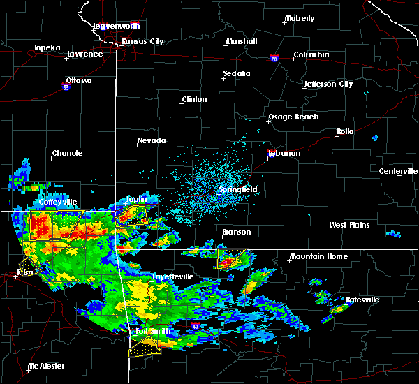 At 243 pm cdt, a severe thunderstorm was located near omaha, or 10 miles northwest of harrison, moving north at 45 mph (radar indicated). Hazards include golf ball size hail and 60 mph wind gusts. People and animals outdoors will be injured. expect hail damage to roofs, siding, windows, and vehicles. expect wind damage to roofs, siding, and trees. Locations impacted include, harrison, omaha, myrtle, roberson hollow, self, capps, alpena, crumpler subdivision, batavia, bear creek springs, new hope in boone county, hopewell in boone county, ridgeway, burlington,. At 243 pm cdt, a severe thunderstorm was located near omaha, or 10 miles northwest of harrison, moving north at 45 mph (radar indicated). Hazards include golf ball size hail and 60 mph wind gusts. People and animals outdoors will be injured. expect hail damage to roofs, siding, windows, and vehicles. expect wind damage to roofs, siding, and trees. Locations impacted include, harrison, omaha, myrtle, roberson hollow, self, capps, alpena, crumpler subdivision, batavia, bear creek springs, new hope in boone county, hopewell in boone county, ridgeway, burlington,.
|
| 5/11/2017 2:40 PM CDT | Tennis Ball sized hail reported 2.5 miles SW of Alpena, AR |
| 5/11/2017 2:37 PM CDT |
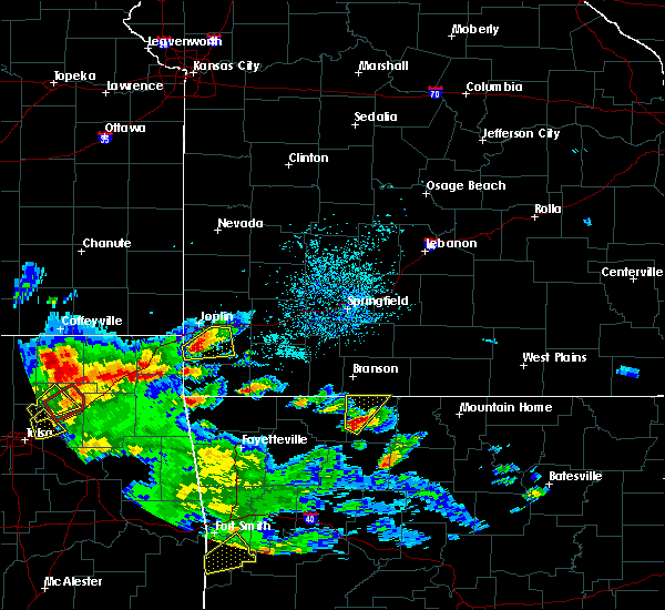 At 236 pm cdt, a severe thunderstorm was located near carrollton, or 8 miles northwest of harrison, moving northeast at 55 mph (radar indicated). Hazards include 60 mph wind gusts and quarter size hail. Hail damage to vehicles is expected. Expect wind damage to roofs, siding, and trees. At 236 pm cdt, a severe thunderstorm was located near carrollton, or 8 miles northwest of harrison, moving northeast at 55 mph (radar indicated). Hazards include 60 mph wind gusts and quarter size hail. Hail damage to vehicles is expected. Expect wind damage to roofs, siding, and trees.
|
| 4/29/2017 4:43 PM CDT |
 At 443 pm cdt, a severe thunderstorm was located near harrison, moving northeast at 60 mph (radar indicated). Hazards include 60 mph wind gusts and quarter size hail. Hail damage to vehicles is expected. Expect wind damage to roofs, siding, and trees. At 443 pm cdt, a severe thunderstorm was located near harrison, moving northeast at 60 mph (radar indicated). Hazards include 60 mph wind gusts and quarter size hail. Hail damage to vehicles is expected. Expect wind damage to roofs, siding, and trees.
|
| 4/28/2017 10:35 PM CDT |
 At 1035 pm cdt, a severe thunderstorm was located near capps moving northeast at 40 mph (radar indicated). Hazards include 60 mph wind gusts and quarter size hail. Hail damage to vehicles is expected. expect wind damage to roofs, siding, and trees. Locations impacted include, harrison, diamond city, bergman, omaha, myrtle, capps, roberson hollow, self, willis, red bank, alpena, crumpler subdivision, batavia, bear creek springs, new hope in boone county, hopewell in boone county, ridgeway, burlington,. At 1035 pm cdt, a severe thunderstorm was located near capps moving northeast at 40 mph (radar indicated). Hazards include 60 mph wind gusts and quarter size hail. Hail damage to vehicles is expected. expect wind damage to roofs, siding, and trees. Locations impacted include, harrison, diamond city, bergman, omaha, myrtle, capps, roberson hollow, self, willis, red bank, alpena, crumpler subdivision, batavia, bear creek springs, new hope in boone county, hopewell in boone county, ridgeway, burlington,.
|
| 4/28/2017 10:21 PM CDT |
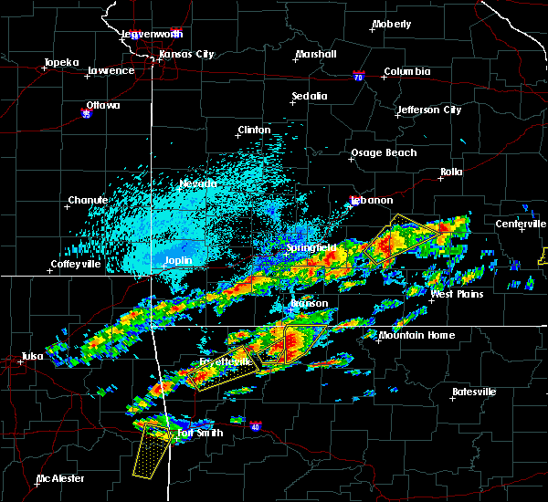 At 1020 pm cdt, a severe thunderstorm was located near lost valley state park, or 12 miles northwest of jasper, moving northeast at 40 mph (radar indicated). Hazards include 60 mph wind gusts and quarter size hail. Hail damage to vehicles is expected. Expect wind damage to roofs, siding, and trees. At 1020 pm cdt, a severe thunderstorm was located near lost valley state park, or 12 miles northwest of jasper, moving northeast at 40 mph (radar indicated). Hazards include 60 mph wind gusts and quarter size hail. Hail damage to vehicles is expected. Expect wind damage to roofs, siding, and trees.
|
| 4/28/2017 10:06 PM CDT |
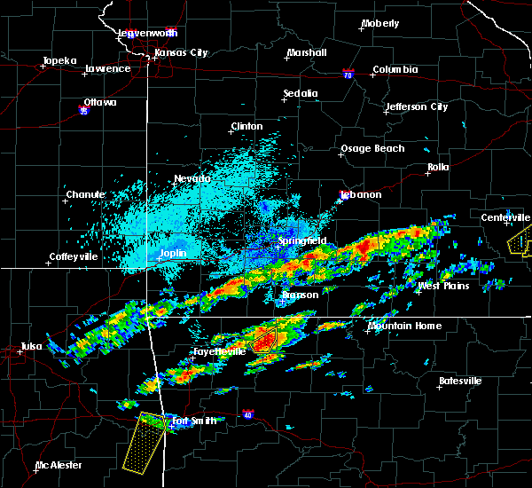 At 1006 pm cdt, a severe thunderstorm was located over osage, moving northeast at 35 mph (radar indicated). Hazards include 60 mph wind gusts and half dollar size hail. Hail damage to vehicles is expected. expect wind damage to roofs, siding, and trees. Locations in or near the path include, carrollton, rudd, osage, rule, coin, dryfork, metalton, connor,. At 1006 pm cdt, a severe thunderstorm was located over osage, moving northeast at 35 mph (radar indicated). Hazards include 60 mph wind gusts and half dollar size hail. Hail damage to vehicles is expected. expect wind damage to roofs, siding, and trees. Locations in or near the path include, carrollton, rudd, osage, rule, coin, dryfork, metalton, connor,.
|
| 4/28/2017 9:43 PM CDT |
 At 942 pm cdt, a severe thunderstorm was located 4 miles southwest of marble, moving north at 30 mph (radar indicated). Hazards include 60 mph wind gusts and half dollar size hail. Hail damage to vehicles is expected. expect wind damage to roofs, siding, and trees. Locations in or near the path include, berryville, huntsville, green forest, withrow springs state park, carrollton, rudd, kingston, marble, forum, osage, urbanette, rule, grandview, rockhouse, dryfork, cabanal, harmony, metalton, connor, coin,. At 942 pm cdt, a severe thunderstorm was located 4 miles southwest of marble, moving north at 30 mph (radar indicated). Hazards include 60 mph wind gusts and half dollar size hail. Hail damage to vehicles is expected. expect wind damage to roofs, siding, and trees. Locations in or near the path include, berryville, huntsville, green forest, withrow springs state park, carrollton, rudd, kingston, marble, forum, osage, urbanette, rule, grandview, rockhouse, dryfork, cabanal, harmony, metalton, connor, coin,.
|
| 4/26/2017 2:03 AM CDT |
 At 202 am cdt, severe thunderstorms were located along a line extending from 4 miles west of roberson hollow to 5 miles east of green forest to rudd, moving east at 35 mph (radar indicated). Hazards include 60 mph wind gusts. Expect damage to roofs, siding, and trees. Locations in or near the path include, green forest, carrollton, rudd, rule, coin, cabanal, metalton, denver, connor,. At 202 am cdt, severe thunderstorms were located along a line extending from 4 miles west of roberson hollow to 5 miles east of green forest to rudd, moving east at 35 mph (radar indicated). Hazards include 60 mph wind gusts. Expect damage to roofs, siding, and trees. Locations in or near the path include, green forest, carrollton, rudd, rule, coin, cabanal, metalton, denver, connor,.
|
| 4/26/2017 1:47 AM CDT |
 At 146 am cdt, severe thunderstorms were located along a line extending from 7 miles northeast of urbanette to rudd to near huntsville, moving east at 50 mph (radar indicated). Hazards include 60 mph wind gusts. expect damage to roofs, siding, and trees At 146 am cdt, severe thunderstorms were located along a line extending from 7 miles northeast of urbanette to rudd to near huntsville, moving east at 50 mph (radar indicated). Hazards include 60 mph wind gusts. expect damage to roofs, siding, and trees
|
| 4/26/2017 1:45 AM CDT |
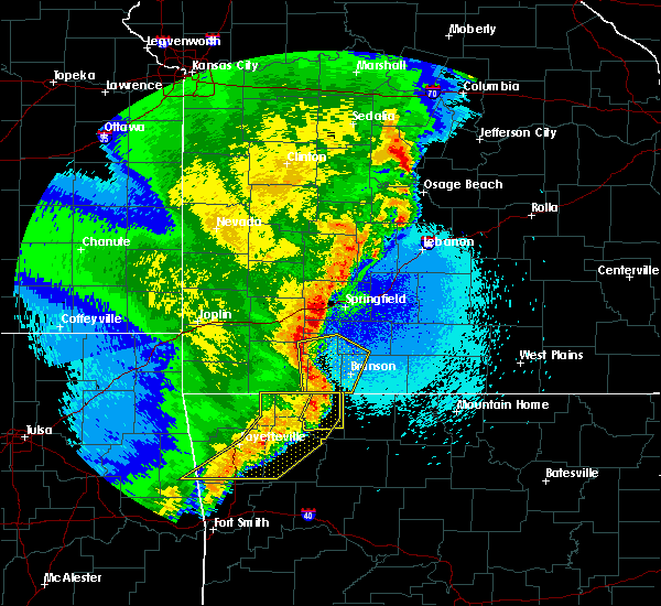 At 144 am cdt, severe thunderstorms were located along a line extending from 5 miles southwest of mccord bend to 5 miles south of coney island to 5 miles northwest of rudd, moving east at 55 mph (radar indicated). Hazards include 60 mph wind gusts. Expect damage to roofs, siding, and trees. Locations in or near the path include, berryville, green forest, carrollton, rudd, urbanette, rule, blue eye, coin, cabanal, metalton, denver, connor,. At 144 am cdt, severe thunderstorms were located along a line extending from 5 miles southwest of mccord bend to 5 miles south of coney island to 5 miles northwest of rudd, moving east at 55 mph (radar indicated). Hazards include 60 mph wind gusts. Expect damage to roofs, siding, and trees. Locations in or near the path include, berryville, green forest, carrollton, rudd, urbanette, rule, blue eye, coin, cabanal, metalton, denver, connor,.
|
| 4/4/2017 9:26 PM CDT |
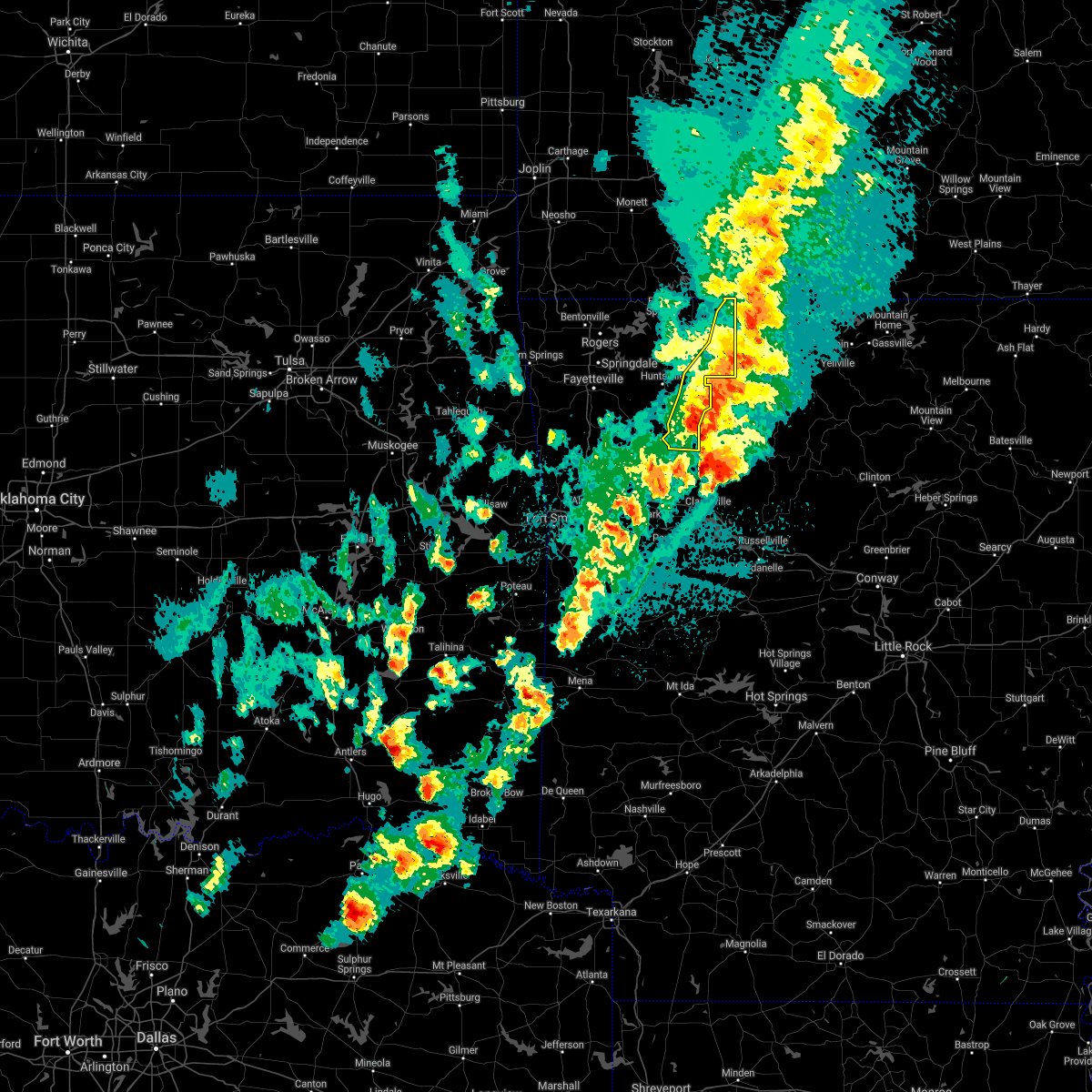 The severe thunderstorm warning for southeastern madison and eastern carroll counties will expire at 930 pm cdt. the storms which prompted the warning have weakened below severe limits, and have exited the warned area. therefore the warning will be allowed to expire. A severe thunderstorm watch remains in effect until 1100 pm cdt for. The severe thunderstorm warning for southeastern madison and eastern carroll counties will expire at 930 pm cdt. the storms which prompted the warning have weakened below severe limits, and have exited the warned area. therefore the warning will be allowed to expire. A severe thunderstorm watch remains in effect until 1100 pm cdt for.
|
| 4/4/2017 9:15 PM CDT |
 At 915 pm cdt, severe thunderstorms were located along a line extending from 5 miles southwest of roberson hollow to 4 miles east of kingston to near pettigrew, moving east at 25 mph (radar indicated). Hazards include 60 mph wind gusts and quarter size hail. Hail damage to vehicles is expected. expect wind damage to roofs, siding, and trees. Locations in or near the path include, green forest, carrollton, rudd, pettigrew, kingston, marble, witter, osage, rule, boston, dutton, dryfork, red star, weathers, connor, coin, delmar, denver,. At 915 pm cdt, severe thunderstorms were located along a line extending from 5 miles southwest of roberson hollow to 4 miles east of kingston to near pettigrew, moving east at 25 mph (radar indicated). Hazards include 60 mph wind gusts and quarter size hail. Hail damage to vehicles is expected. expect wind damage to roofs, siding, and trees. Locations in or near the path include, green forest, carrollton, rudd, pettigrew, kingston, marble, witter, osage, rule, boston, dutton, dryfork, red star, weathers, connor, coin, delmar, denver,.
|
| 4/4/2017 8:42 PM CDT |
 At 842 pm cdt, severe thunderstorms were located along a line extending from 3 miles northeast of eureka springs to 3 miles southeast of huntsville to 3 miles northwest of st. paul, moving east at 35 mph (radar indicated). Hazards include 60 mph wind gusts and quarter size hail. Hail damage to vehicles is expected. expect wind damage to roofs, siding, and trees. locations in or near the path include, berryville, huntsville, eureka springs, green forest, st. Paul, carrollton, rudd, saint paul, kingston, forum, aurora, clifty, boston, withrow springs state park, pettigrew, japton, marble, witter, osage, urbanette,. At 842 pm cdt, severe thunderstorms were located along a line extending from 3 miles northeast of eureka springs to 3 miles southeast of huntsville to 3 miles northwest of st. paul, moving east at 35 mph (radar indicated). Hazards include 60 mph wind gusts and quarter size hail. Hail damage to vehicles is expected. expect wind damage to roofs, siding, and trees. locations in or near the path include, berryville, huntsville, eureka springs, green forest, st. Paul, carrollton, rudd, saint paul, kingston, forum, aurora, clifty, boston, withrow springs state park, pettigrew, japton, marble, witter, osage, urbanette,.
|
| 4/4/2017 8:29 PM CDT |
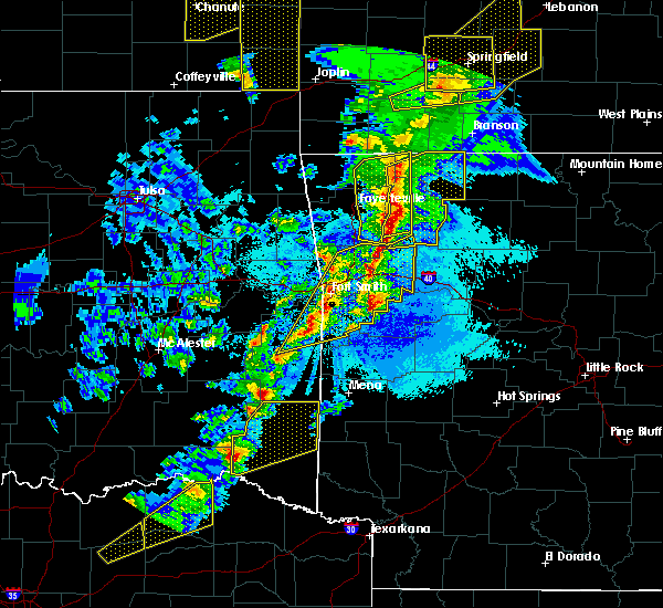 At 828 pm cdt, severe thunderstorms were located along a line extending from 7 miles southwest of eureka springs to 5 miles southwest of huntsville to 8 miles west of saint paul, moving east at 35 mph (radar indicated). Hazards include 60 mph wind gusts and quarter size hail. Hail damage to vehicles is expected. expect wind damage to roofs, siding, and trees. locations in or near the path include, berryville, huntsville, eureka springs, green forest, st. Paul, hindsville, carrollton, rudd, saint paul, forum, aurora, hobbs state park, clifty, boston, withrow springs state park, marble, rule, kingston, pettigrew, japton,. At 828 pm cdt, severe thunderstorms were located along a line extending from 7 miles southwest of eureka springs to 5 miles southwest of huntsville to 8 miles west of saint paul, moving east at 35 mph (radar indicated). Hazards include 60 mph wind gusts and quarter size hail. Hail damage to vehicles is expected. expect wind damage to roofs, siding, and trees. locations in or near the path include, berryville, huntsville, eureka springs, green forest, st. Paul, hindsville, carrollton, rudd, saint paul, forum, aurora, hobbs state park, clifty, boston, withrow springs state park, marble, rule, kingston, pettigrew, japton,.
|
| 3/24/2017 8:07 PM CDT |
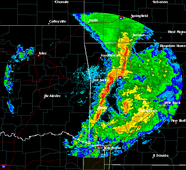 At 807 pm cdt, severe thunderstorms were located along a line extending from 4 miles northwest of roberson hollow to near walnut, moving east at 45 mph (radar indicated). Hazards include 60 mph wind gusts. Expect damage to roofs, siding, and trees. Locations in or near the path include, berryville, green forest, carrollton, rudd, kingston, marble, osage, urbanette, rule, dryfork, cabanal, metalton, weathers, connor, coin, delmar, denver,. At 807 pm cdt, severe thunderstorms were located along a line extending from 4 miles northwest of roberson hollow to near walnut, moving east at 45 mph (radar indicated). Hazards include 60 mph wind gusts. Expect damage to roofs, siding, and trees. Locations in or near the path include, berryville, green forest, carrollton, rudd, kingston, marble, osage, urbanette, rule, dryfork, cabanal, metalton, weathers, connor, coin, delmar, denver,.
|
| 3/24/2017 7:44 PM CDT |
 At 743 pm cdt, severe thunderstorms were located along a line extending from 3 miles south of arrow point to 3 miles south of pettigrew, moving east at 45 mph (radar indicated). Hazards include 60 mph wind gusts. Expect damage to roofs, siding, and trees. Locations in or near the path include, berryville, green forest, carrollton, rudd, kingston, aurora, boston, pettigrew, marble, witter, osage, urbanette, rule, grandview, blue eye, dryfork, red star, metalton, connor, coin,. At 743 pm cdt, severe thunderstorms were located along a line extending from 3 miles south of arrow point to 3 miles south of pettigrew, moving east at 45 mph (radar indicated). Hazards include 60 mph wind gusts. Expect damage to roofs, siding, and trees. Locations in or near the path include, berryville, green forest, carrollton, rudd, kingston, aurora, boston, pettigrew, marble, witter, osage, urbanette, rule, grandview, blue eye, dryfork, red star, metalton, connor, coin,.
|
| 3/9/2017 8:56 PM CST |
 The severe thunderstorm warning for northeastern madison and carroll counties will expire at 900 pm cst, the storms which prompted the warning have weakened below severe limits, and no longer pose an immediate threat to life or property. therefore the warning will be allowed to expire. however gusty winds to 50 mph are still possible with these thunderstorms. a severe thunderstorm watch remains in effect until 1100 pm cst for northwestern arkansas. The severe thunderstorm warning for northeastern madison and carroll counties will expire at 900 pm cst, the storms which prompted the warning have weakened below severe limits, and no longer pose an immediate threat to life or property. therefore the warning will be allowed to expire. however gusty winds to 50 mph are still possible with these thunderstorms. a severe thunderstorm watch remains in effect until 1100 pm cst for northwestern arkansas.
|
| 3/9/2017 8:30 PM CST |
 At 830 pm cst, severe thunderstorms were located along a line extending from 6 miles south of roberson hollow to 3 miles south of eureka springs, moving southeast at 45 mph (radar indicated). Hazards include 60 mph wind gusts and quarter size hail. Hail damage to vehicles is expected. expect wind damage to roofs, siding, and trees. Locations in or near the path include, berryville, eureka springs, green forest, beaver, carrollton, rudd, marble, osage, urbanette, rule, grandview, alpena, rockhouse, dryfork, cabanal, metalton, connor, coin, delmar, denver,. At 830 pm cst, severe thunderstorms were located along a line extending from 6 miles south of roberson hollow to 3 miles south of eureka springs, moving southeast at 45 mph (radar indicated). Hazards include 60 mph wind gusts and quarter size hail. Hail damage to vehicles is expected. expect wind damage to roofs, siding, and trees. Locations in or near the path include, berryville, eureka springs, green forest, beaver, carrollton, rudd, marble, osage, urbanette, rule, grandview, alpena, rockhouse, dryfork, cabanal, metalton, connor, coin, delmar, denver,.
|
| 3/9/2017 8:02 PM CST |
 At 800 pm cst, a severe thunderstorm was located over ozark isle, or near bull shoals, moving southeast at 35 mph (public). Hazards include golf ball size hail and 60 mph wind gusts. this will be primarily for areas near omaha in boone county and near peel in baxter county. People and animals outdoors will be injured. expect hail damage to roofs, siding, windows, and vehicles. expect wind damage to roofs, siding, and trees. Locations impacted include, harrison, mountain home, bull shoals, gassville, flippin, lakeview in baxter county, diamond city, bergman, lead hill, briarcliff, pyatt, omaha, arkawana, myrtle, roberson hollow, self, ozark regional airport, ozark isle, fawn park, lakeway,. At 800 pm cst, a severe thunderstorm was located over ozark isle, or near bull shoals, moving southeast at 35 mph (public). Hazards include golf ball size hail and 60 mph wind gusts. this will be primarily for areas near omaha in boone county and near peel in baxter county. People and animals outdoors will be injured. expect hail damage to roofs, siding, windows, and vehicles. expect wind damage to roofs, siding, and trees. Locations impacted include, harrison, mountain home, bull shoals, gassville, flippin, lakeview in baxter county, diamond city, bergman, lead hill, briarcliff, pyatt, omaha, arkawana, myrtle, roberson hollow, self, ozark regional airport, ozark isle, fawn park, lakeway,.
|
| 3/9/2017 7:18 PM CST |
 At 717 pm cst, a severe thunderstorm was located 7 miles southeast of forsyth, moving southeast at 35 mph (public). Hazards include golf ball size hail and 60 mph wind gusts. People and animals outdoors will be injured. expect hail damage to roofs, siding, windows, and vehicles. Expect wind damage to roofs, siding, and trees. At 717 pm cst, a severe thunderstorm was located 7 miles southeast of forsyth, moving southeast at 35 mph (public). Hazards include golf ball size hail and 60 mph wind gusts. People and animals outdoors will be injured. expect hail damage to roofs, siding, windows, and vehicles. Expect wind damage to roofs, siding, and trees.
|
| 3/7/2017 12:36 AM CST |
 At 1236 am cst, severe thunderstorms were located along a line extending from 7 miles northwest of ozark isle to near pruitt, moving east at 60 mph (radar indicated). Hazards include 60 mph wind gusts and penny size hail. expect damage to roofs, siding, and trees At 1236 am cst, severe thunderstorms were located along a line extending from 7 miles northwest of ozark isle to near pruitt, moving east at 60 mph (radar indicated). Hazards include 60 mph wind gusts and penny size hail. expect damage to roofs, siding, and trees
|
| 3/7/2017 12:28 AM CST |
 At 1228 am cst, severe thunderstorms were located along a line extending from 2 miles south of omaha to 3 miles southeast of enterprise, moving east at 70 mph (radar indicated). Hazards include 60 mph wind gusts. Expect damage to roofs, siding, and trees. locations in or near the path include, fort smith, van buren, sallisaw, poteau, ozark, stigler, charleston, huntsville, cedarville, mountainburg, natural dam, greenwood, alma, barling, pocola, muldrow, roland, green forest, lavaca, spiro, this includes the following highways, interstate 40 in arkansas between mile markers 0 and 40. interstate 40 in oklahoma between mile markers 299 and 328. interstate 540 between mile markers 1 and 14. interstate 49 between mile markers 22 and 49. A tornado watch remains in effect until 300 am cst for northwestern and west central arkansas, and southeastern, northeastern and east central oklahoma. At 1228 am cst, severe thunderstorms were located along a line extending from 2 miles south of omaha to 3 miles southeast of enterprise, moving east at 70 mph (radar indicated). Hazards include 60 mph wind gusts. Expect damage to roofs, siding, and trees. locations in or near the path include, fort smith, van buren, sallisaw, poteau, ozark, stigler, charleston, huntsville, cedarville, mountainburg, natural dam, greenwood, alma, barling, pocola, muldrow, roland, green forest, lavaca, spiro, this includes the following highways, interstate 40 in arkansas between mile markers 0 and 40. interstate 40 in oklahoma between mile markers 299 and 328. interstate 540 between mile markers 1 and 14. interstate 49 between mile markers 22 and 49. A tornado watch remains in effect until 300 am cst for northwestern and west central arkansas, and southeastern, northeastern and east central oklahoma.
|
| 3/7/2017 12:18 AM CST |
 At 1217 am cst, severe thunderstorms were located along a line extending from 9 miles north of diamond city to near omaha to near carrollton to near marble, moving east at 30 mph (radar indicated). Hazards include 60 mph wind gusts and nickel size hail. Expect damage to roofs, siding, and trees. Locations impacted include, harrison, bull shoals, yellville, jasper, flippin, lakeview in baxter county, diamond city, bergman, western grove, lead hill, pyatt, valley springs, omaha, arkawana, dugger, olvey, roberson hollow, carver, erbie, lakeway, a tornado watch remains in effect until 500 am cst for north central arkansas. At 1217 am cst, severe thunderstorms were located along a line extending from 9 miles north of diamond city to near omaha to near carrollton to near marble, moving east at 30 mph (radar indicated). Hazards include 60 mph wind gusts and nickel size hail. Expect damage to roofs, siding, and trees. Locations impacted include, harrison, bull shoals, yellville, jasper, flippin, lakeview in baxter county, diamond city, bergman, western grove, lead hill, pyatt, valley springs, omaha, arkawana, dugger, olvey, roberson hollow, carver, erbie, lakeway, a tornado watch remains in effect until 500 am cst for north central arkansas.
|
| 3/6/2017 11:55 PM CST |
 At 1154 pm cst, severe thunderstorms were located along a line extending from near forsyth to near urbanette to near berryville to hindsville, moving east at 55 mph (radar indicated). Hazards include 60 mph wind gusts and nickel size hail. expect damage to roofs, siding, and trees At 1154 pm cst, severe thunderstorms were located along a line extending from near forsyth to near urbanette to near berryville to hindsville, moving east at 55 mph (radar indicated). Hazards include 60 mph wind gusts and nickel size hail. expect damage to roofs, siding, and trees
|
| 3/6/2017 11:24 PM CST |
 At 1124 pm cst, severe thunderstorms were located along a line extending from 3 miles east of pea ridge to 5 miles south of tahlequah, moving east at 70 mph (radar indicated). Hazards include 60 mph wind gusts and quarter size hail. Hail damage to vehicles is expected. expect wind damage to roofs, siding, and trees. locations in or near the path include, fayetteville, springdale, rogers, bentonville, tahlequah, siloam springs, berryville, stilwell, huntsville, eureka springs, lowell, farmington, pea ridge, prairie grove, green forest, elkins, tontitown, bethel heights, west fork, lincoln, this includes interstate 49 between mile markers 41 and 84, and between mile markers 86 and 91. A tornado watch remains in effect until 300 am cst for northwestern and west central arkansas, and northeastern and east central oklahoma. At 1124 pm cst, severe thunderstorms were located along a line extending from 3 miles east of pea ridge to 5 miles south of tahlequah, moving east at 70 mph (radar indicated). Hazards include 60 mph wind gusts and quarter size hail. Hail damage to vehicles is expected. expect wind damage to roofs, siding, and trees. locations in or near the path include, fayetteville, springdale, rogers, bentonville, tahlequah, siloam springs, berryville, stilwell, huntsville, eureka springs, lowell, farmington, pea ridge, prairie grove, green forest, elkins, tontitown, bethel heights, west fork, lincoln, this includes interstate 49 between mile markers 41 and 84, and between mile markers 86 and 91. A tornado watch remains in effect until 300 am cst for northwestern and west central arkansas, and northeastern and east central oklahoma.
|
| 4/27/2016 2:25 AM CDT |
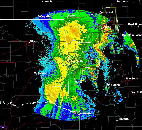 The severe thunderstorm warning for madison, northeastern franklin and carroll counties will expire at 230 am cdt, the storms which prompted the warning have moved out of the area. therefore the warning will be allowed to expire. a severe thunderstorm watch remains in effect until 500 am cdt for northwestern arkansas. The severe thunderstorm warning for madison, northeastern franklin and carroll counties will expire at 230 am cdt, the storms which prompted the warning have moved out of the area. therefore the warning will be allowed to expire. a severe thunderstorm watch remains in effect until 500 am cdt for northwestern arkansas.
|
| 4/27/2016 1:58 AM CDT |
 At 157 am cdt, severe thunderstorms were located along a line extending from grandview to near pettigrew to near booneville, moving east at 50 mph (radar indicated). Hazards include 60 mph wind gusts and penny size hail. Expect damage to roofs. siding. and trees. Locations impacted include, harrison, clarksville, paris, jasper, lamar, knoxville, subiaco, hartman, bergman, scranton, ratcliff, omaha, tokalon, capps, upper buffalo wilder, self, devils knob, walnut, hinkle, holman,. At 157 am cdt, severe thunderstorms were located along a line extending from grandview to near pettigrew to near booneville, moving east at 50 mph (radar indicated). Hazards include 60 mph wind gusts and penny size hail. Expect damage to roofs. siding. and trees. Locations impacted include, harrison, clarksville, paris, jasper, lamar, knoxville, subiaco, hartman, bergman, scranton, ratcliff, omaha, tokalon, capps, upper buffalo wilder, self, devils knob, walnut, hinkle, holman,.
|
| 4/27/2016 1:54 AM CDT |
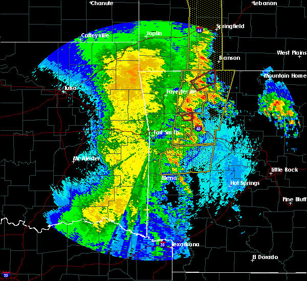 At 154 am cdt, severe thunderstorms were located along a line extending from 6 miles northeast of urbanette to 3 miles northwest of woodland, moving east at 55 mph (radar indicated). Hazards include 70 mph wind gusts. Expect considerable tree damage. damage is likely to mobile homes, roofs, and outbuildings. locations in or near the path include, berryville, huntsville, green forest, st. Paul, pettigrew, urbanette, rudd, forum, boston, aurora, withrow springs state park, witter, saint paul, osage, kingston, rule, japton, marble, carrollton, blue eye,. At 154 am cdt, severe thunderstorms were located along a line extending from 6 miles northeast of urbanette to 3 miles northwest of woodland, moving east at 55 mph (radar indicated). Hazards include 70 mph wind gusts. Expect considerable tree damage. damage is likely to mobile homes, roofs, and outbuildings. locations in or near the path include, berryville, huntsville, green forest, st. Paul, pettigrew, urbanette, rudd, forum, boston, aurora, withrow springs state park, witter, saint paul, osage, kingston, rule, japton, marble, carrollton, blue eye,.
|
| 4/27/2016 1:40 AM CDT |
 At 139 am cdt, a severe thunderstorm capable of producing a tornado was located 6 miles south of berryville, moving northeast at 55 mph (radar indicated rotation). Hazards include tornado. Flying debris will be dangerous to those caught without shelter. mobile homes will be damaged or destroyed. damage to roofs, windows, and vehicles will occur. tree damage is likely. Locations in or near the path include, berryville, green forest, rudd, rule, connor, denver, cabanal, rockhouse, coin, metalton,. At 139 am cdt, a severe thunderstorm capable of producing a tornado was located 6 miles south of berryville, moving northeast at 55 mph (radar indicated rotation). Hazards include tornado. Flying debris will be dangerous to those caught without shelter. mobile homes will be damaged or destroyed. damage to roofs, windows, and vehicles will occur. tree damage is likely. Locations in or near the path include, berryville, green forest, rudd, rule, connor, denver, cabanal, rockhouse, coin, metalton,.
|
| 4/27/2016 1:31 AM CDT |
 At 130 am cdt, severe thunderstorms were located along a line extending from 3 miles northwest of grandview to 2 miles east of huntsville to 4 miles west of saint paul, moving east at 35 mph (radar indicated). Hazards include 60 mph wind gusts and penny size hail. Expect damage to roofs. siding. and trees. locations in or near the path include, berryville, huntsville, eureka springs, green forest, st. Paul, beaver, hindsville, pettigrew, urbanette, wesley, clifty, aurora, witter, grandview, rudd, forum, boston, withrow springs state park, saint paul, osage,. At 130 am cdt, severe thunderstorms were located along a line extending from 3 miles northwest of grandview to 2 miles east of huntsville to 4 miles west of saint paul, moving east at 35 mph (radar indicated). Hazards include 60 mph wind gusts and penny size hail. Expect damage to roofs. siding. and trees. locations in or near the path include, berryville, huntsville, eureka springs, green forest, st. Paul, beaver, hindsville, pettigrew, urbanette, wesley, clifty, aurora, witter, grandview, rudd, forum, boston, withrow springs state park, saint paul, osage,.
|
| 4/27/2016 1:25 AM CDT |
 At 125 am cdt, severe thunderstorms were located along a line extending from garfield to 6 miles east of brentwood to near washburn, moving east at 50 mph (radar indicated). Hazards include 60 mph wind gusts and penny size hail. Expect damage to roofs. siding. And trees. At 125 am cdt, severe thunderstorms were located along a line extending from garfield to 6 miles east of brentwood to near washburn, moving east at 50 mph (radar indicated). Hazards include 60 mph wind gusts and penny size hail. Expect damage to roofs. siding. And trees.
|
| 4/27/2016 1:22 AM CDT |
 At 122 am cdt, a severe thunderstorm capable of producing a tornado was located 3 miles east of hindsville, moving northeast at 55 mph (radar indicated rotation). Hazards include tornado. Flying debris will be dangerous to those caught without shelter. mobile homes will be damaged or destroyed. damage to roofs, windows, and vehicles will occur. tree damage is likely. Locations in or near the path include, berryville, huntsville, green forest, hindsville, rudd, forum, rule, clifty, withrow springs state park, carrollton, harmony, cabanal, rockhouse, alabam, connor, denver, coin, metalton,. At 122 am cdt, a severe thunderstorm capable of producing a tornado was located 3 miles east of hindsville, moving northeast at 55 mph (radar indicated rotation). Hazards include tornado. Flying debris will be dangerous to those caught without shelter. mobile homes will be damaged or destroyed. damage to roofs, windows, and vehicles will occur. tree damage is likely. Locations in or near the path include, berryville, huntsville, green forest, hindsville, rudd, forum, rule, clifty, withrow springs state park, carrollton, harmony, cabanal, rockhouse, alabam, connor, denver, coin, metalton,.
|
| 4/27/2016 1:12 AM CDT |
 At 112 am cdt, a severe thunderstorm capable of producing a tornado was located 4 miles west of hindsville, moving northeast at 55 mph (radar indicated rotation). Hazards include tornado. Flying debris will be dangerous to those caught without shelter. mobile homes will be damaged or destroyed. damage to roofs, windows, and vehicles will occur. tree damage is likely. Locations in or near the path include, berryville, huntsville, green forest, hindsville, urbanette, rudd, forum, wesley, clifty, withrow springs state park, rule, carrollton, hobbs state park, goshen, blue eye, sonora, harmony, cabanal, rockhouse, connor,. At 112 am cdt, a severe thunderstorm capable of producing a tornado was located 4 miles west of hindsville, moving northeast at 55 mph (radar indicated rotation). Hazards include tornado. Flying debris will be dangerous to those caught without shelter. mobile homes will be damaged or destroyed. damage to roofs, windows, and vehicles will occur. tree damage is likely. Locations in or near the path include, berryville, huntsville, green forest, hindsville, urbanette, rudd, forum, wesley, clifty, withrow springs state park, rule, carrollton, hobbs state park, goshen, blue eye, sonora, harmony, cabanal, rockhouse, connor,.
|
| 4/27/2016 1:00 AM CDT |
 At 100 am cdt, severe thunderstorms were located along a line extending from 3 miles northwest of garfield to 4 miles east of winslow, moving east at 45 mph (radar indicated). Hazards include 60 mph wind gusts and penny size hail. Expect damage to roofs. siding. and trees. Locations in or near the path include, fayetteville, springdale, rogers, bentonville, berryville, huntsville, eureka springs, bella vista, lowell, farmington, pea ridge, prairie grove, green forest, elkins, tontitown, bethel heights, west fork, cave springs, greenland, highfill, this includes interstate 49 between mile markers 43 and 84, and between mile markers 86 and 93. At 100 am cdt, severe thunderstorms were located along a line extending from 3 miles northwest of garfield to 4 miles east of winslow, moving east at 45 mph (radar indicated). Hazards include 60 mph wind gusts and penny size hail. Expect damage to roofs. siding. and trees. Locations in or near the path include, fayetteville, springdale, rogers, bentonville, berryville, huntsville, eureka springs, bella vista, lowell, farmington, pea ridge, prairie grove, green forest, elkins, tontitown, bethel heights, west fork, cave springs, greenland, highfill, this includes interstate 49 between mile markers 43 and 84, and between mile markers 86 and 93.
|
| 7/9/2015 7:37 PM CDT |
 At 736 pm cdt, a severe thunderstorm was located over carrollton, or 13 miles west of harrison, moving east at 30 mph (radar indicated). Hazards include 60 mph wind gusts and quarter size hail. Hail damage to vehicles is expected. Expect wind damage to roofs, siding and trees. At 736 pm cdt, a severe thunderstorm was located over carrollton, or 13 miles west of harrison, moving east at 30 mph (radar indicated). Hazards include 60 mph wind gusts and quarter size hail. Hail damage to vehicles is expected. Expect wind damage to roofs, siding and trees.
|
| 7/9/2015 7:34 PM CDT |
 At 734 pm cdt, a severe thunderstorm was located 3 miles north of osage, moving east at 30 mph (radar indicated). Hazards include 60 mph wind gusts. Expect damage to roofs. siding and trees. Locations impacted include, green forest, rudd, rule, carrollton, osage, delmar, connor and coin. At 734 pm cdt, a severe thunderstorm was located 3 miles north of osage, moving east at 30 mph (radar indicated). Hazards include 60 mph wind gusts. Expect damage to roofs. siding and trees. Locations impacted include, green forest, rudd, rule, carrollton, osage, delmar, connor and coin.
|
| 7/9/2015 7:06 PM CDT |
 At 706 pm cdt, a severe thunderstorm was located 3 miles east of forum, moving east at 30 mph (radar indicated). Hazards include 60 mph wind gusts. Expect damage to roofs. Siding and trees. At 706 pm cdt, a severe thunderstorm was located 3 miles east of forum, moving east at 30 mph (radar indicated). Hazards include 60 mph wind gusts. Expect damage to roofs. Siding and trees.
|
| 7/2/2015 6:30 PM CDT |
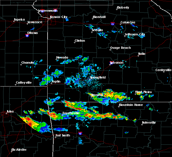 At 630 pm cdt, severe thunderstorms were located along a line extending from 3 miles northwest of garfield to 6 miles northwest of rudd, moving southeast at 10 mph (radar indicated). Hazards include 60 mph wind gusts and quarter size hail. Hail damage to vehicles is expected. Expect wind damage to roofs, siding and trees. At 630 pm cdt, severe thunderstorms were located along a line extending from 3 miles northwest of garfield to 6 miles northwest of rudd, moving southeast at 10 mph (radar indicated). Hazards include 60 mph wind gusts and quarter size hail. Hail damage to vehicles is expected. Expect wind damage to roofs, siding and trees.
|
| 6/26/2015 12:57 PM CDT |
 At 1255 pm cdt, a severe thunderstorm was located near red bank, and moving east at 25 mph (radar indicated). Hazards include 60 mph wind gusts and quarter size hail. Hail damage to vehicles is expected. Expect wind damage to roofs, siding and trees. At 1255 pm cdt, a severe thunderstorm was located near red bank, and moving east at 25 mph (radar indicated). Hazards include 60 mph wind gusts and quarter size hail. Hail damage to vehicles is expected. Expect wind damage to roofs, siding and trees.
|
| 6/26/2015 12:42 PM CDT |
 At 1239 pm cdt, a severe thunderstorm was located 5 miles west of red bank, and moving east at 25 mph (radar indicated). Hazards include 60 mph wind gusts and quarter size hail. Hail damage to vehicles is expected. Expect wind damage to roofs, siding and trees. At 1239 pm cdt, a severe thunderstorm was located 5 miles west of red bank, and moving east at 25 mph (radar indicated). Hazards include 60 mph wind gusts and quarter size hail. Hail damage to vehicles is expected. Expect wind damage to roofs, siding and trees.
|
| 5/27/2015 5:37 PM CDT | At 536 pm cdt, a severe thunderstorm was located near red bank, and moving northeast at 25 mph (radar indicated). Hazards include 60 mph wind gusts and quarter size hail. Hail damage to vehicles is expected. Expect wind damage to roofs, siding and trees. |
| 5/10/2015 12:41 PM CDT | At 1240 pm cdt, severe thunderstorms were located along a line extending from omaha to 10 miles southeast of osage, and moving northeast at 50 mph (radar indicated). Hazards include 60 mph wind gusts. Expect damage to roofs. siding and trees. locations in or near the path include, coin, delmar and denver , <. 75in. |
| 5/10/2015 12:34 PM CDT | At 1232 pm cdt, severe thunderstorms were located along a line extending from green forest to 9 miles southeast of osage, and moving northeast at 50 mph (radar indicated). Hazards include 60 mph wind gusts. Expect damage to roofs. siding and trees. locations in or near the path include, denver , <. 75in. |
| 5/10/2015 12:30 PM CDT | At 1228 pm cdt, severe thunderstorms were located along a line extending from 8 miles northwest of oak grove to 7 miles west of red bank to walnut, and moving northeast at 50 mph (radar indicated). Hazards include 60 mph wind gusts and penny size hail. Expect damage to roofs. Siding and trees. |
| 5/10/2015 12:17 PM CDT | At 1216 pm cdt, severe thunderstorms were located along a line extending from berryville to kingston, and moving east at 50 mph (radar indicated). Hazards include 60 mph wind gusts. Expect damage to roofs. siding and trees. locations in or near the path include, metalton, dryfork, cabanal, rudd, rule, osage, connor, green forest, delmar, carrollton, coin and denver. 75in. |
| 4/9/2015 4:54 PM CDT | The national weather service in tulsa has issued a * severe thunderstorm warning for. southeastern carroll county in northwest arkansas. north central madison county in northwest arkansas. until 530 pm cdt * at 453 pm cdt. a severe thunderstorm was located near forum. And. |
| 4/3/2015 12:40 AM CDT | The national weather service in little rock has issued a * tornado warning for. northern boone county in north central arkansas. until 100 am cdt * at 1238 am cdt. a severe thunderstorm capable of producing a tornado was located 5 miles southwest of omaha. And moving east at. |
| 3/25/2015 9:00 PM CDT | The national weather service in little rock has issued a * severe thunderstorm warning for. central boone county in north central arkansas. northwestern marion county in north central arkansas. until 930 pm cdt * at 857 pm cdt. Local law enforcement reported a severe. |
| 3/25/2015 7:58 PM CST | Quarter sized hail reported 3.9 miles NNW of Alpena, AR |
| 3/25/2015 8:41 PM CDT | A severe thunderstorm warning remains in effect for southeastern carroll county until 900 pm cdt. at 839 pm cdt. a severe thunderstorm was located near carrollton. and moving east at 40 mph. hazard. ping pong ball size hail and 60 mph wind gusts. source. Radar indicated. |
| 3/25/2015 8:40 PM CDT | The national weather service in little rock has issued a * severe thunderstorm warning for. boone county in north central arkansas. northwestern marion county in north central arkansas. until 930 pm cdt * at 838 pm cdt. National weather service doppler radar indicated a. |
| 3/25/2015 8:36 PM CDT | A severe thunderstorm warning remains in effect for southeastern carroll county until 900 pm cdt. at 833 pm cdt. a severe thunderstorm was located near rule. and moving east at 40 mph. hazard. ping pong ball size hail and 60 mph wind gusts. source. Radar indicated. |
| 3/25/2015 8:22 PM CDT | The national weather service in tulsa has issued a * severe thunderstorm warning for. southeastern carroll county in northwest arkansas. until 900 pm cdt * at 820 pm cdt. a severe thunderstorm was located near rudd. And moving east at 40 mph. |
| 3/25/2015 8:12 PM CDT | The severe thunderstorm warning for eastern carroll county will expire at 815 pm cdt. the storm which prompted the warning has moved out of the warned area. additional severe thunderstorms are still possible. And a severe thunderstorm watch remains in effect until 10 pm. |
| 3/25/2015 8:01 PM CDT | The national weather service in little rock has issued a * severe thunderstorm warning for. northern boone county in north central arkansas. northwestern marion county in north central arkansas. until 845 pm cdt * at 759 pm cdt. National weather service doppler radar indicated a. |
| 3/25/2015 7:57 PM CDT | The severe thunderstorm warning for northern boone and northern marion counties will expire at 800 pm cdt. the storm which prompted the warning has weakened below severe limits. and no longer poses an immediate threat to life or property. however. strong storms will move from carroll county into boone county shortly. These storms have a history of producing large hail. |
| 3/25/2015 7:47 PM CDT | The national weather service in tulsa has issued a * severe thunderstorm warning for. eastern carroll county in northwest arkansas. until 815 pm cdt * at 745 pm cdt. a severe thunderstorm was located near rule. And moving east at 45 mph. |
| 3/25/2015 6:30 PM CST | Shed blown over in alpen in boone county AR, 0.7 miles WNW of Alpena, AR |
| 3/25/2015 7:13 PM CDT | The national weather service in little rock has issued a * severe thunderstorm warning for. northern boone county in north central arkansas. northern marion county in north central arkansas. until 800 pm cdt * at 710 pm cdt. National weather service doppler radar indicated a. |
| 3/25/2015 6:39 PM CDT | The tornado warning for central carroll county will expire at 645 pm cdt. the storm which prompted the warning has weakened and no longer poses a tornado threat. a severe thunderstorm warning remains in effect until 745 pm. additional severe thunderstorms are still possible. And a severe. |
| 3/25/2015 6:19 PM CDT | The national weather service in little rock has issued a * tornado warning for. northwestern boone county in north central arkansas. until 645 pm cdt * at 617 pm cdt. national weather service doppler radar was tracking a confirmed tornado. This tornado was located near green forest. |
| 3/25/2015 6:13 PM CDT | A tornado warning remains in effect for central carroll county until 645 pm cdt. at 609 pm cdt. a confirmed tornado was 2 miles south of berryville. moving east at 30 mph. hazard. damaging tornado and ping pong ball size hail. source. Weather spotters confirmed tornado. |
| 3/25/2015 6:04 PM CDT | The national weather service in tulsa has issued a * tornado warning for. central carroll county in northwest arkansas. until 645 pm cdt * at 603 pm cdt. a severe thunderstorm capable of producing a tornado was located 5 miles southwest of berryville. And moving. |
| 3/25/2015 5:58 PM CDT | The national weather service in tulsa has issued a * severe thunderstorm warning for. northern carroll county in northwest arkansas. until 630 pm cdt * at 556 pm cdt. a severe thunderstorm was located near urbanette. And moving east at 35 mph. |
| 3/24/2015 7:00 PM CDT | The national weather service in little rock has issued a * severe thunderstorm warning for. southern boone county in north central arkansas. southwestern marion county in north central arkansas. northeastern newton county in north central arkansas. Northwestern searcy county in north central arkansas. |
| 3/24/2015 6:53 PM CDT | A severe thunderstorm warning remains in effect for southeastern carroll county until 715 pm cdt. at 651 pm cdt. a severe thunderstorm was located near rule. and moving east at 40 mph. hazard. golf ball size hail. source. Radar indicated. |
| 3/24/2015 6:38 PM CDT | A severe thunderstorm warning remains in effect for north central madison and southern carroll counties until 715 pm cdt. at 635 pm cdt. a severe thunderstorm was located 6 miles northeast of forum. and moving east at 50 mph. hazard. ping pong ball size hail. source. Radar indicated. |
| 3/24/2015 6:29 PM CDT | The national weather service in tulsa has issued a * severe thunderstorm warning for. southern carroll county in northwest arkansas. northern madison county in northwest arkansas. until 715 pm cdt * at 627 pm cdt. a severe thunderstorm was located near clifty. And. |
Hail Maps for Alpena, AR
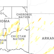
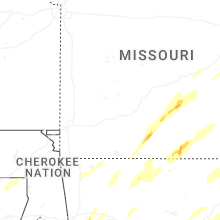
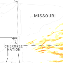


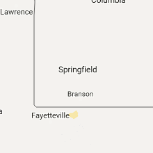


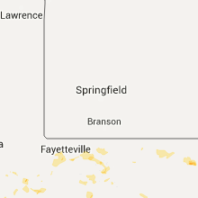


Connect with Interactive Hail Maps