

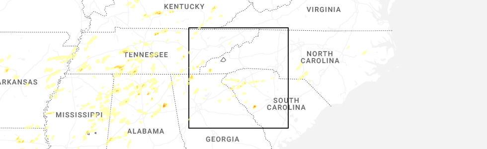
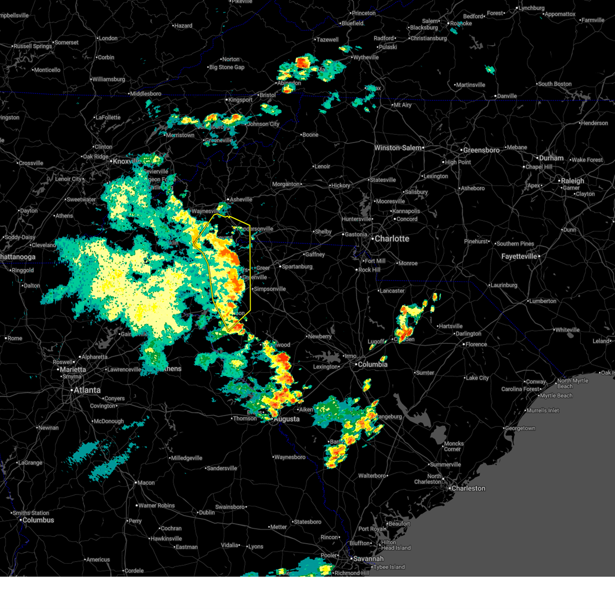
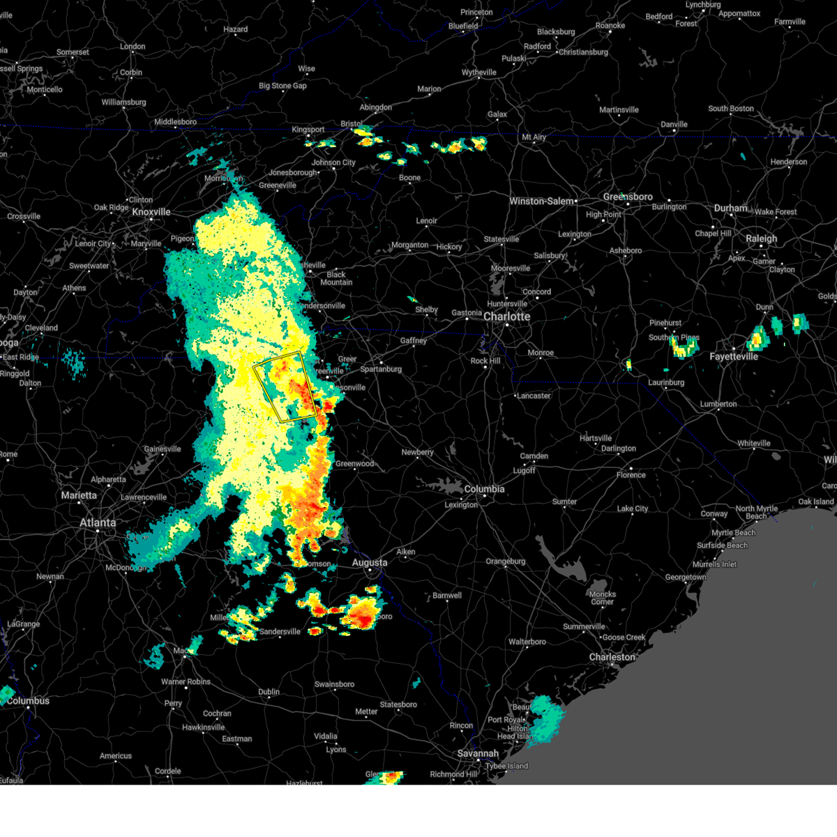
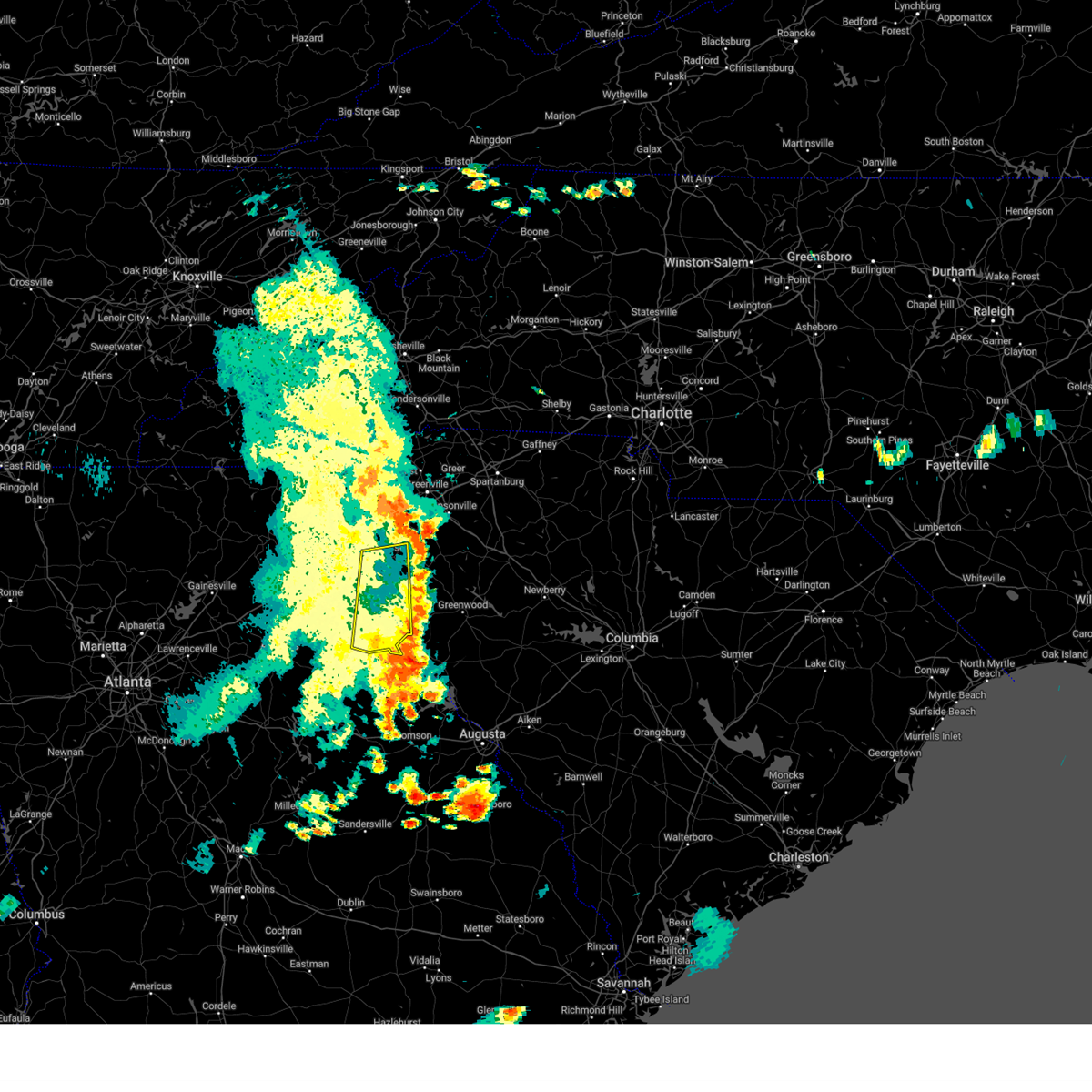
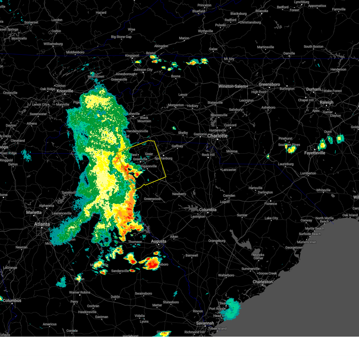
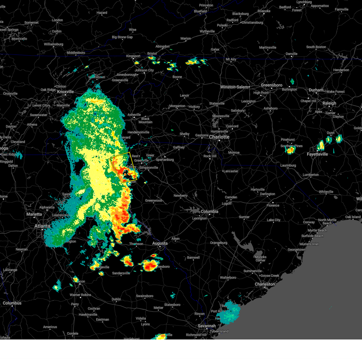
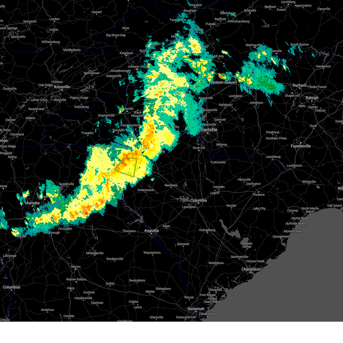
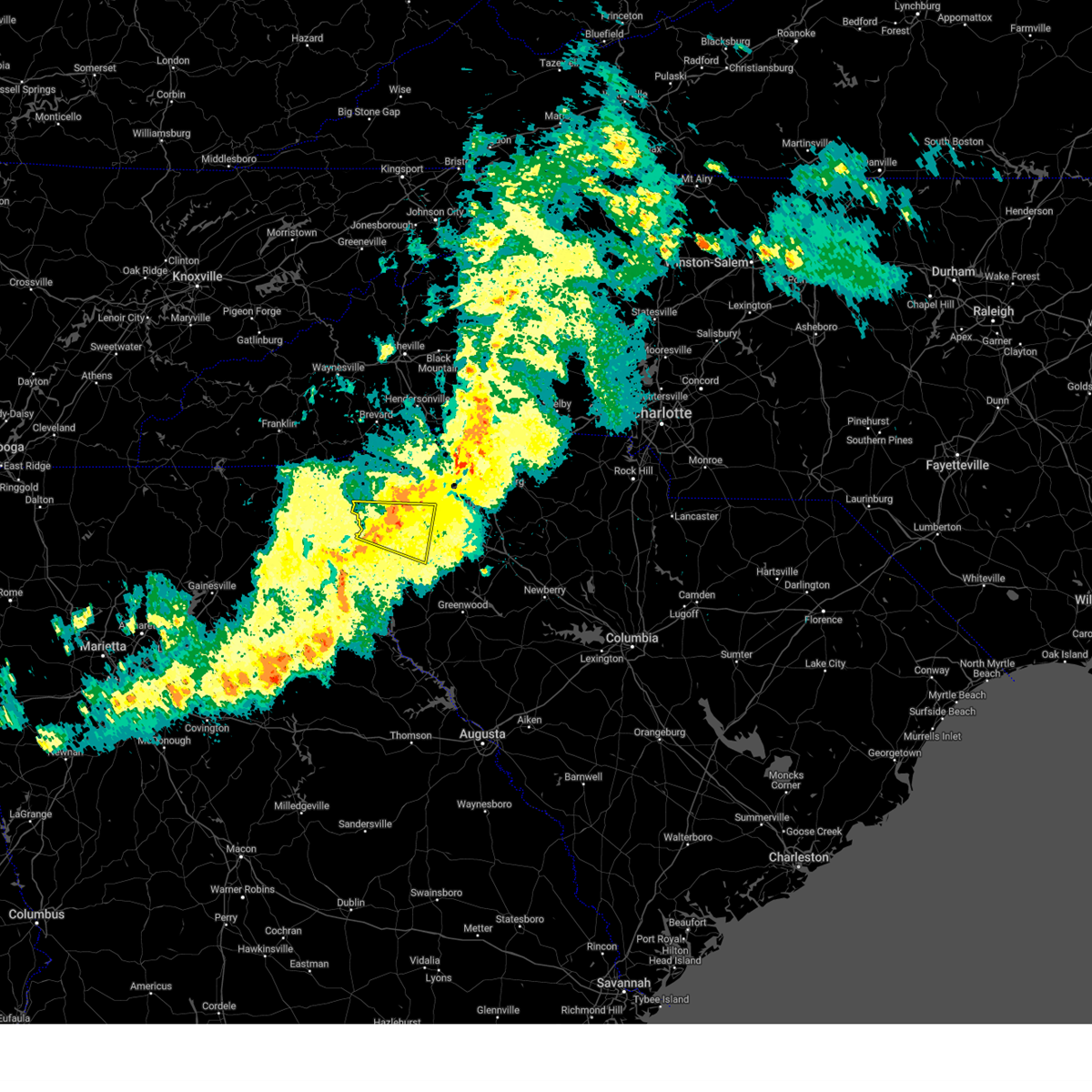
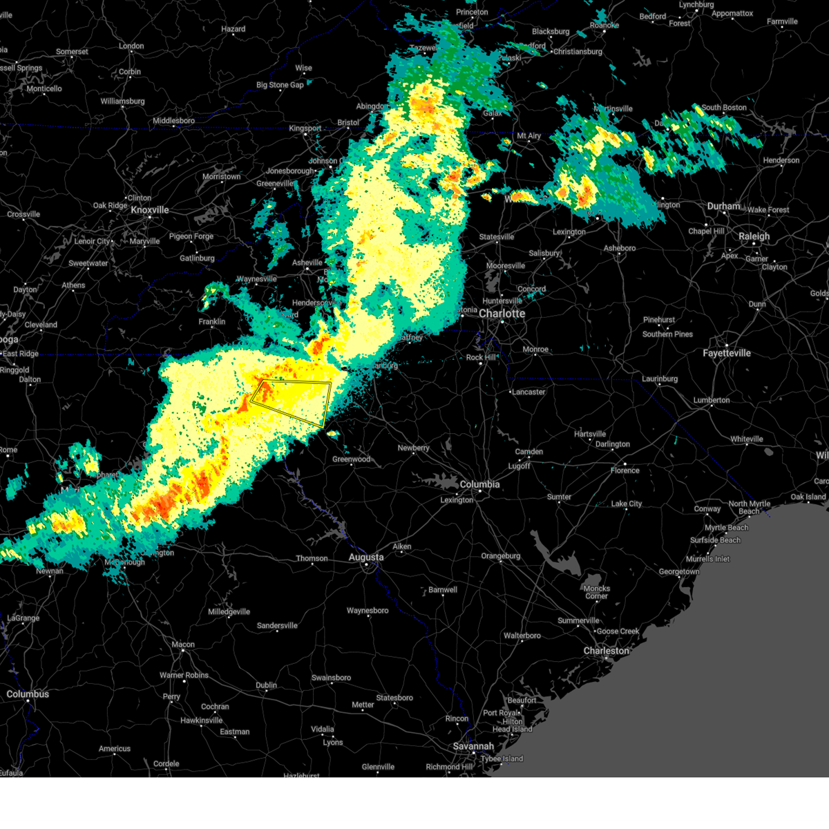
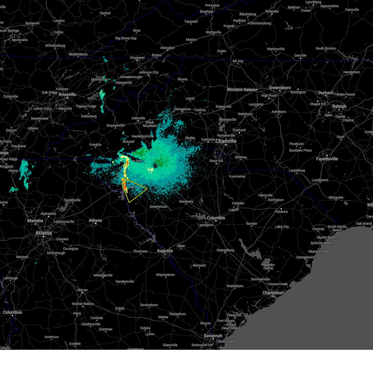
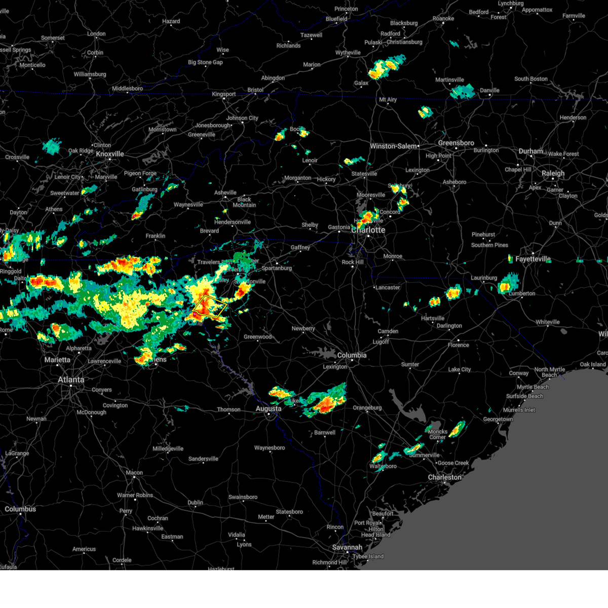
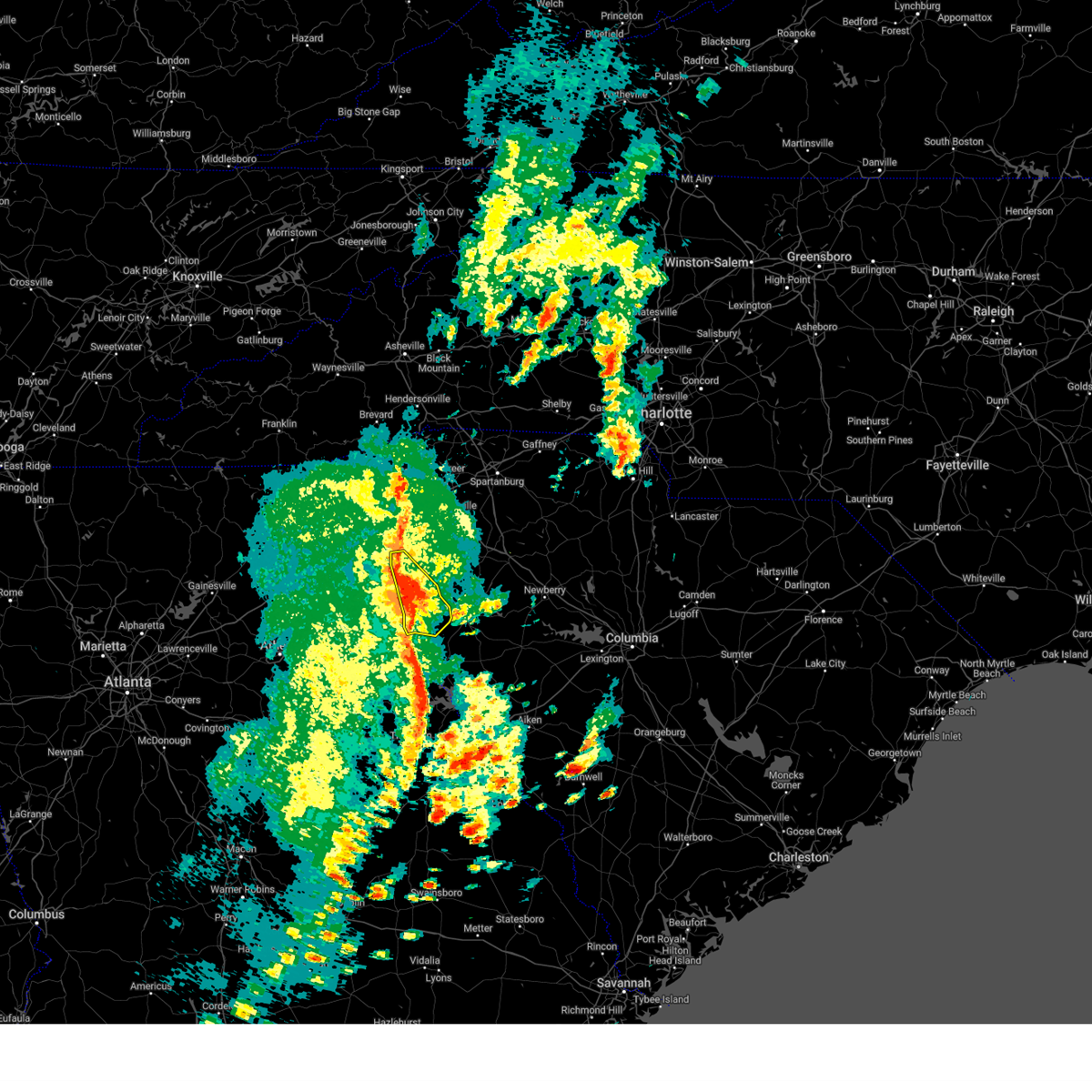
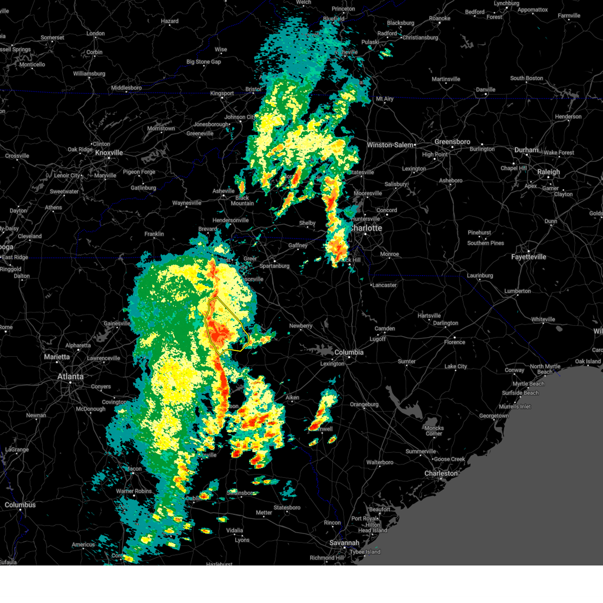
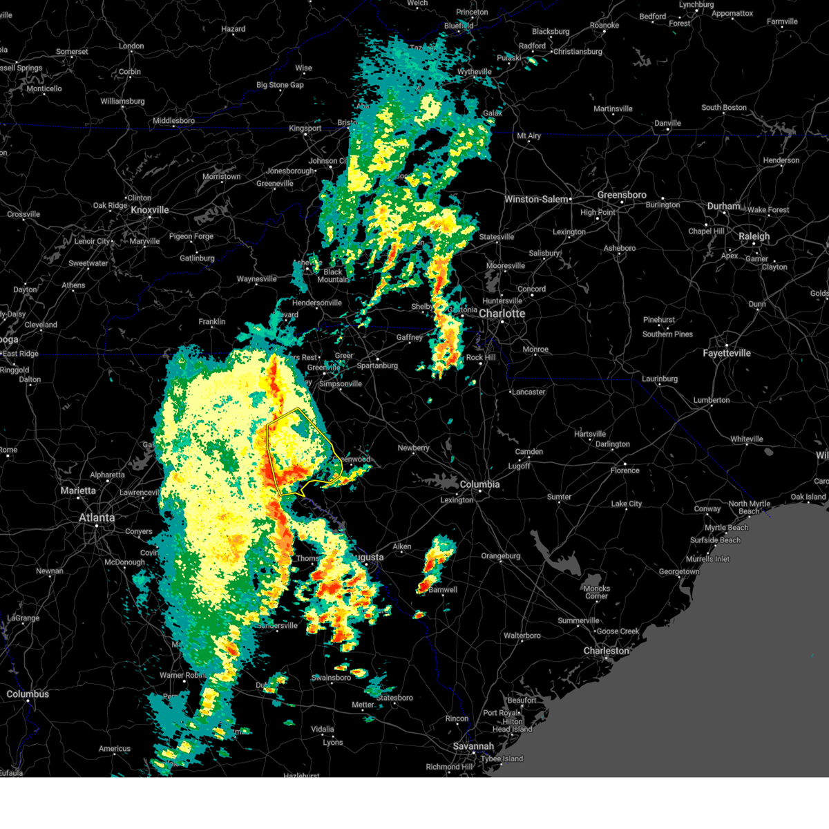
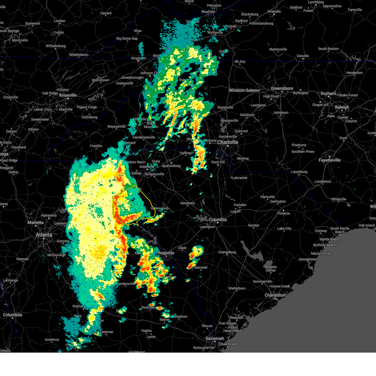
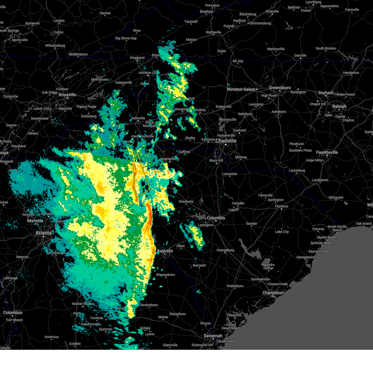
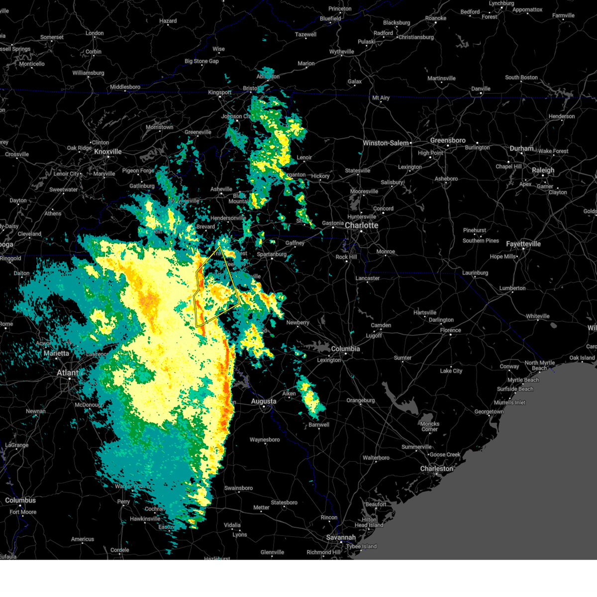
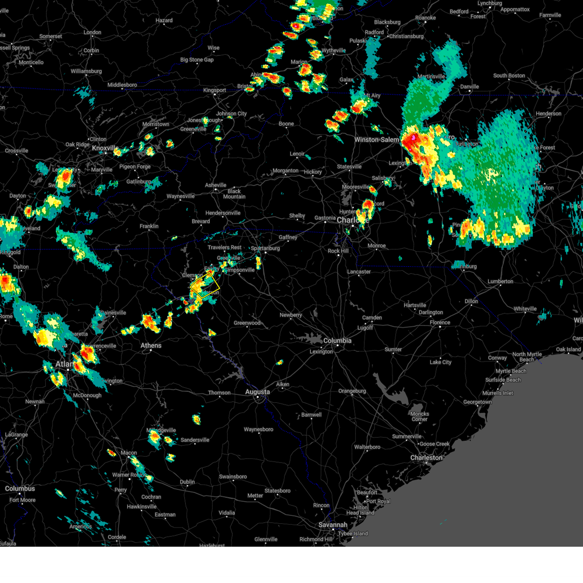
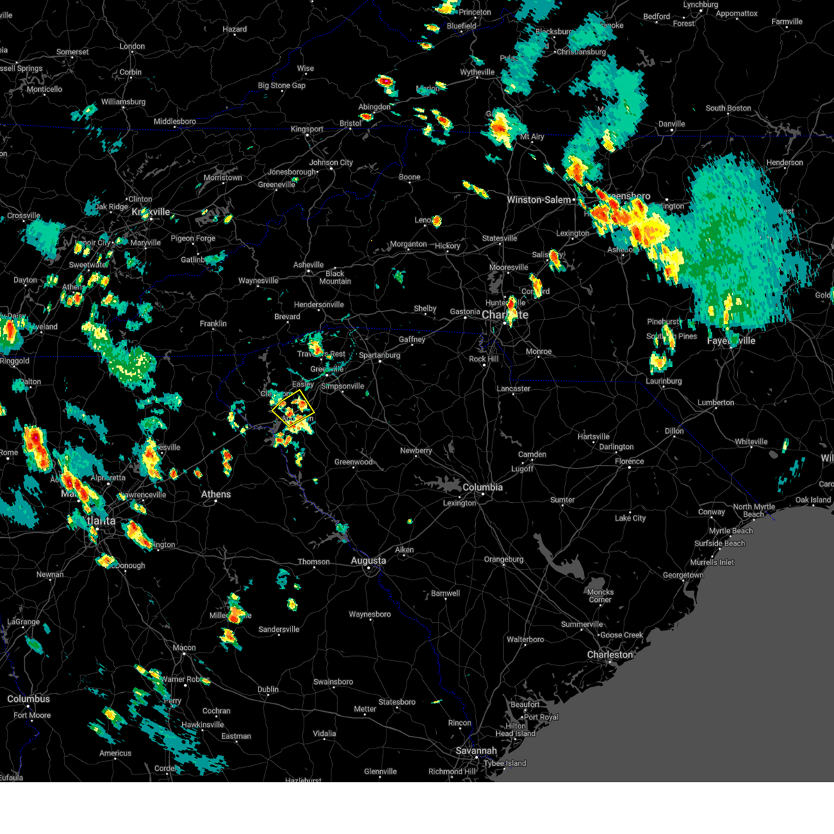
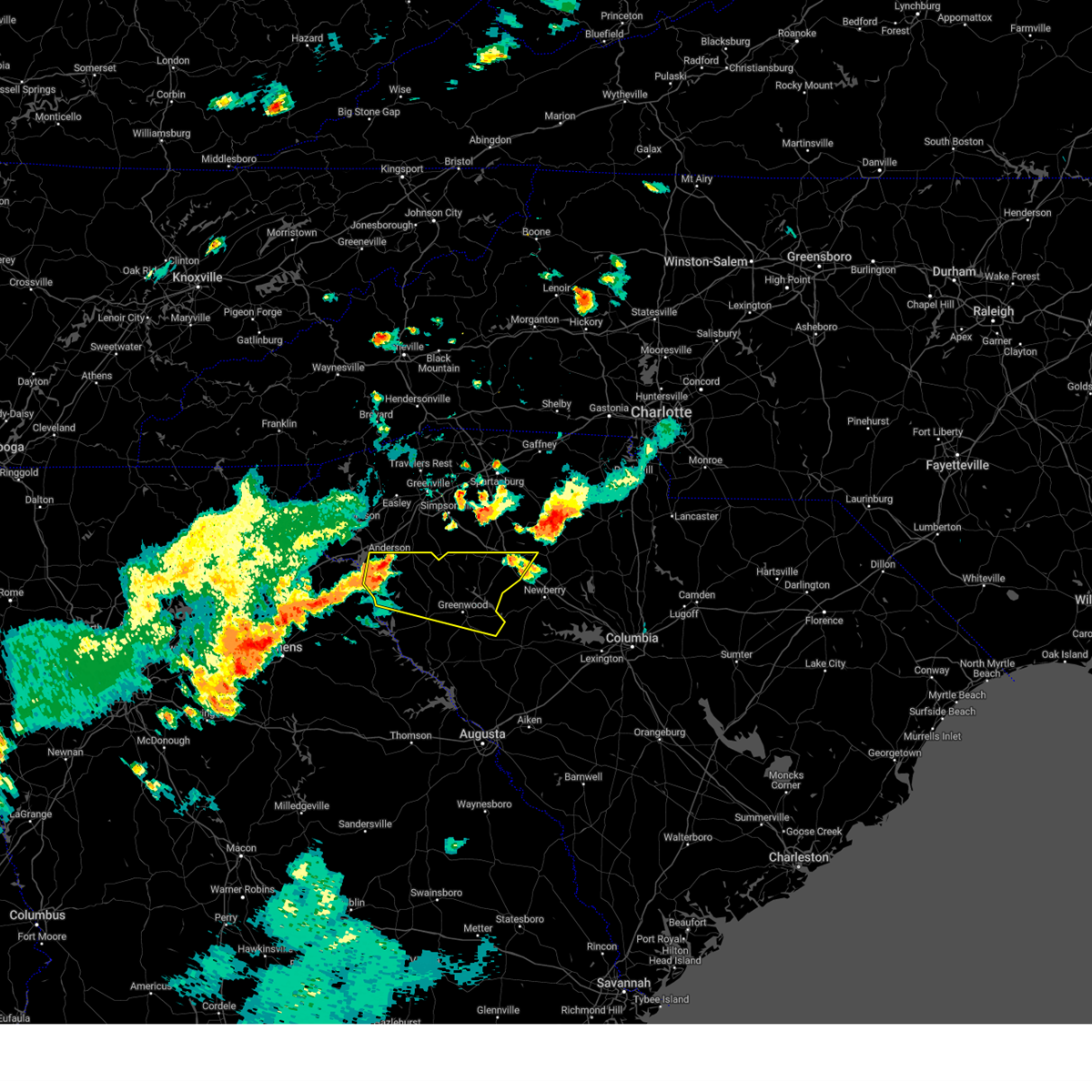
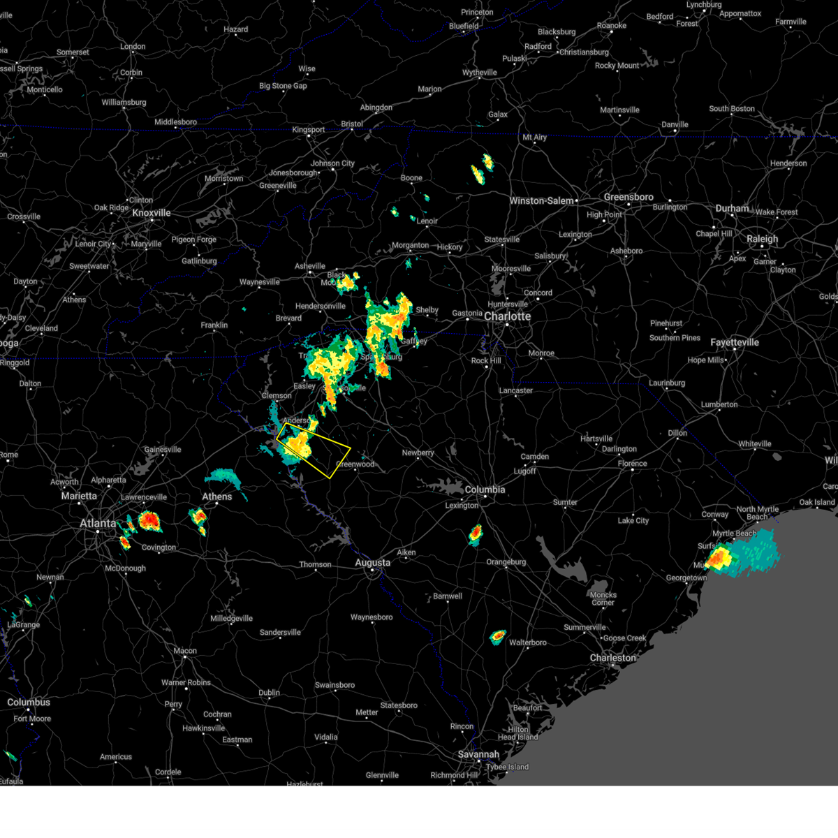
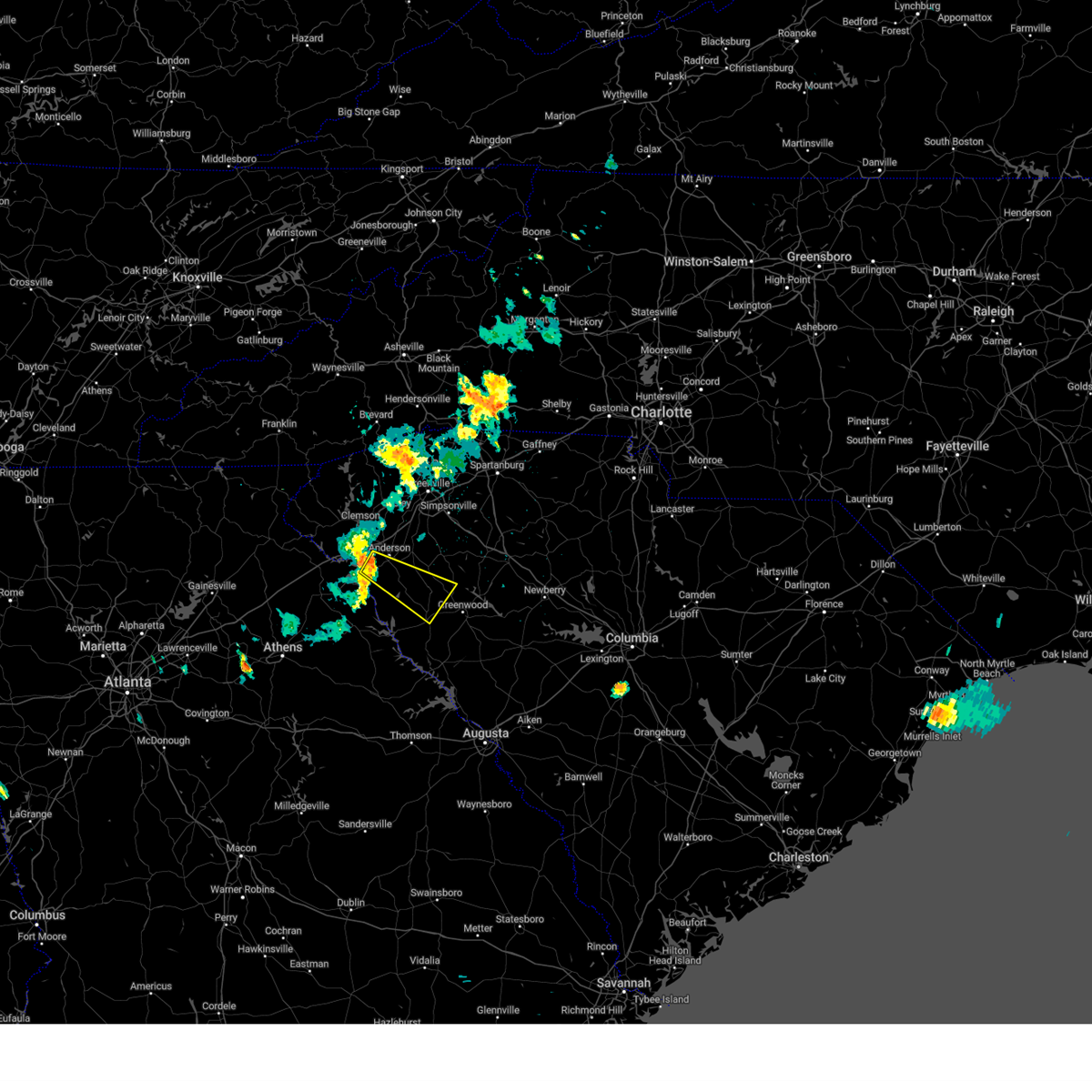
Hail Map for Anderson, SC
The Anderson, SC area has had 15 reports of on-the-ground hail by trained spotters, and has been under severe weather warnings 51 times during the past 12 months. Doppler radar has detected hail at or near Anderson, SC on 48 occasions, including 2 occasions during the past year.
| Name: | Anderson, SC |
| Where Located: | 21.2 miles S of Greenville, SC |
| Map: | Google Map for Anderson, SC |
| Population: | 26686 |
| Housing Units: | 12938 |
| More Info: | Search Google for Anderson, SC |
3
The Top Recent Hail Date for Anderson, SC is Friday, May 2, 2025 (8th out of 48)
Hail and Wind Damage Spotted near Anderson, SC
| Date / Time | Report Details |
|---|---|
| 6/25/2025 8:14 PM EDT |
 the severe thunderstorm warning has been cancelled and is no longer in effect the severe thunderstorm warning has been cancelled and is no longer in effect
|
| 6/25/2025 7:28 PM EDT |
 Svrgsp the national weather service in greenville-spartanburg has issued a * severe thunderstorm warning for, southwestern laurens county in upstate south carolina, south central greenville county in upstate south carolina, central anderson county in upstate south carolina, northeastern abbeville county in upstate south carolina, northwestern greenwood county in upstate south carolina, * until 830 pm edt. * at 727 pm edt, severe thunderstorms were located along a line extending from 7 miles northwest of laurens to 12 miles east of anderson to 9 miles east of clemson, moving south at 15 mph (radar indicated). Hazards include 60 mph wind gusts and quarter size hail. Minor hail damage to vehicles is expected. Expect wind damage to trees and power lines. Svrgsp the national weather service in greenville-spartanburg has issued a * severe thunderstorm warning for, southwestern laurens county in upstate south carolina, south central greenville county in upstate south carolina, central anderson county in upstate south carolina, northeastern abbeville county in upstate south carolina, northwestern greenwood county in upstate south carolina, * until 830 pm edt. * at 727 pm edt, severe thunderstorms were located along a line extending from 7 miles northwest of laurens to 12 miles east of anderson to 9 miles east of clemson, moving south at 15 mph (radar indicated). Hazards include 60 mph wind gusts and quarter size hail. Minor hail damage to vehicles is expected. Expect wind damage to trees and power lines.
|
| 6/17/2025 8:53 PM EDT |
 the severe thunderstorm warning has been cancelled and is no longer in effect the severe thunderstorm warning has been cancelled and is no longer in effect
|
| 6/17/2025 8:53 PM EDT |
 At 853 pm edt, severe thunderstorms were located along a line extending from 3 miles southwest of brevard to 14 miles south of hendersonville to 7 miles southeast of anderson, moving east at 30 mph (radar indicated). Hazards include 60 mph wind gusts. Expect damage to trees and power lines. Locations impacted include, greenville downtown, anderson, easley, hendersonville, brevard, pickens, greenville eastside, west greenville, mauldin, and taylors. At 853 pm edt, severe thunderstorms were located along a line extending from 3 miles southwest of brevard to 14 miles south of hendersonville to 7 miles southeast of anderson, moving east at 30 mph (radar indicated). Hazards include 60 mph wind gusts. Expect damage to trees and power lines. Locations impacted include, greenville downtown, anderson, easley, hendersonville, brevard, pickens, greenville eastside, west greenville, mauldin, and taylors.
|
| 6/17/2025 8:25 PM EDT | Trained spotter estimated 60mph wind gusts along hwy 28 in anderso in anderson county SC, 3.3 miles NNE of Anderson, SC |
| 6/17/2025 8:12 PM EDT |
 Svrgsp the national weather service in greenville-spartanburg has issued a * severe thunderstorm warning for, north central elbert county in northeastern georgia, central hart county in northeastern georgia, transylvania county in western north carolina, henderson county in western north carolina, southwestern polk county in western north carolina, greenville county in upstate south carolina, anderson county in upstate south carolina, pickens county in upstate south carolina, northwestern abbeville county in upstate south carolina, oconee county in upstate south carolina, * until 915 pm edt. * at 812 pm edt, severe thunderstorms were located along a line extending from 14 miles north of walhalla to 5 miles west of pickens to 9 miles northeast of elberton, moving northeast at 35 mph (radar indicated). Hazards include 60 mph wind gusts. expect damage to trees and power lines Svrgsp the national weather service in greenville-spartanburg has issued a * severe thunderstorm warning for, north central elbert county in northeastern georgia, central hart county in northeastern georgia, transylvania county in western north carolina, henderson county in western north carolina, southwestern polk county in western north carolina, greenville county in upstate south carolina, anderson county in upstate south carolina, pickens county in upstate south carolina, northwestern abbeville county in upstate south carolina, oconee county in upstate south carolina, * until 915 pm edt. * at 812 pm edt, severe thunderstorms were located along a line extending from 14 miles north of walhalla to 5 miles west of pickens to 9 miles northeast of elberton, moving northeast at 35 mph (radar indicated). Hazards include 60 mph wind gusts. expect damage to trees and power lines
|
| 6/7/2025 7:54 PM EDT |
 The storms which prompted the warning have moved out of the area. therefore, the warning will be allowed to expire. a severe thunderstorm watch remains in effect until 1100 pm edt for upstate south carolina. to report severe weather to the national weather service greenville-spartanburg, call toll free, 1, 800, 2 6 7, 8 1 0 1, or post on our facebook page, or tweet it using hashtag nwsgsp. your message should describe the event and the specific location where it occurred. remember, a severe thunderstorm warning still remains in effect for most of pickens county, eastern anderson county until 830 pm edt. The storms which prompted the warning have moved out of the area. therefore, the warning will be allowed to expire. a severe thunderstorm watch remains in effect until 1100 pm edt for upstate south carolina. to report severe weather to the national weather service greenville-spartanburg, call toll free, 1, 800, 2 6 7, 8 1 0 1, or post on our facebook page, or tweet it using hashtag nwsgsp. your message should describe the event and the specific location where it occurred. remember, a severe thunderstorm warning still remains in effect for most of pickens county, eastern anderson county until 830 pm edt.
|
| 6/7/2025 7:52 PM EDT |
 The storms which prompted the warning have moved out of the area. therefore, the warning will be allowed to expire. a severe thunderstorm watch remains in effect until 1100 pm edt for northeastern georgia, and upstate south carolina. to report severe weather to the national weather service greenville-spartanburg, call toll free, 1, 800, 2 6 7, 8 1 0 1, or post on our facebook page, or tweet it using hashtag nwsgsp. your message should describe the event and the specific location where it occurred. remember, a severe thunderstorm warning still remains in effect for eastern anderson and central and eastern abbeville counties until 830 pm edt. The storms which prompted the warning have moved out of the area. therefore, the warning will be allowed to expire. a severe thunderstorm watch remains in effect until 1100 pm edt for northeastern georgia, and upstate south carolina. to report severe weather to the national weather service greenville-spartanburg, call toll free, 1, 800, 2 6 7, 8 1 0 1, or post on our facebook page, or tweet it using hashtag nwsgsp. your message should describe the event and the specific location where it occurred. remember, a severe thunderstorm warning still remains in effect for eastern anderson and central and eastern abbeville counties until 830 pm edt.
|
| 6/7/2025 7:42 PM EDT |
 Svrgsp the national weather service in greenville-spartanburg has issued a * severe thunderstorm warning for, northwestern laurens county in upstate south carolina, greenville county in upstate south carolina, western spartanburg county in upstate south carolina, northeastern anderson county in upstate south carolina, pickens county in upstate south carolina, * until 830 pm edt. * at 742 pm edt, severe thunderstorms were located along a line extending from 7 miles northwest of pickens to 8 miles southeast of anderson, moving northeast at 45 mph (radar indicated). Hazards include 60 mph wind gusts. expect damage to trees and power lines Svrgsp the national weather service in greenville-spartanburg has issued a * severe thunderstorm warning for, northwestern laurens county in upstate south carolina, greenville county in upstate south carolina, western spartanburg county in upstate south carolina, northeastern anderson county in upstate south carolina, pickens county in upstate south carolina, * until 830 pm edt. * at 742 pm edt, severe thunderstorms were located along a line extending from 7 miles northwest of pickens to 8 miles southeast of anderson, moving northeast at 45 mph (radar indicated). Hazards include 60 mph wind gusts. expect damage to trees and power lines
|
| 6/7/2025 7:36 PM EDT |
 At 736 pm edt, severe thunderstorms were located along a line extending from 10 miles northeast of walhalla to 4 miles west of anderson, moving east at 50 mph (radar indicated). Hazards include 60 mph wind gusts. Expect damage to trees and power lines. Locations impacted include, easley, clemson, pickens, central, northlake, pendleton, liberty, norris, six mile, and salem. At 736 pm edt, severe thunderstorms were located along a line extending from 10 miles northeast of walhalla to 4 miles west of anderson, moving east at 50 mph (radar indicated). Hazards include 60 mph wind gusts. Expect damage to trees and power lines. Locations impacted include, easley, clemson, pickens, central, northlake, pendleton, liberty, norris, six mile, and salem.
|
| 6/7/2025 7:31 PM EDT |
 the severe thunderstorm warning has been cancelled and is no longer in effect the severe thunderstorm warning has been cancelled and is no longer in effect
|
| 6/7/2025 7:31 PM EDT |
 At 730 pm edt, severe thunderstorms were located along a line extending from 7 miles west of anderson to 7 miles south of elberton, moving east at 55 mph (radar indicated). Hazards include 60 mph wind gusts. Expect damage to trees and power lines. Locations impacted include, anderson, elberton, homeland park, calhoun falls, iva, lake secession, starr, lowndesville, anderson airport, and russell state park. At 730 pm edt, severe thunderstorms were located along a line extending from 7 miles west of anderson to 7 miles south of elberton, moving east at 55 mph (radar indicated). Hazards include 60 mph wind gusts. Expect damage to trees and power lines. Locations impacted include, anderson, elberton, homeland park, calhoun falls, iva, lake secession, starr, lowndesville, anderson airport, and russell state park.
|
| 6/7/2025 7:30 PM EDT | Numerous large limbs downed in the centerville are in anderson county SC, 3.3 miles E of Anderson, SC |
| 6/7/2025 7:29 PM EDT | Several trees downed at shores of asbury rv par in anderson county SC, 7.9 miles E of Anderson, SC |
| 6/7/2025 7:26 PM EDT | Storm damage reported in anderson county SC, 4.6 miles ENE of Anderson, SC |
| 6/7/2025 7:17 PM EDT | Several trees downed at springfield campgroun in anderson county SC, 11.7 miles ENE of Anderson, SC |
| 6/7/2025 7:15 PM EDT |
 Svrgsp the national weather service in greenville-spartanburg has issued a * severe thunderstorm warning for, northwestern anderson county in upstate south carolina, pickens county in upstate south carolina, oconee county in upstate south carolina, * until 800 pm edt. * at 714 pm edt, severe thunderstorms were located along a line extending from 8 miles northwest of walhalla to 11 miles northwest of hartwell, moving east at 45 mph (radar indicated). Hazards include 60 mph wind gusts. expect damage to trees and power lines Svrgsp the national weather service in greenville-spartanburg has issued a * severe thunderstorm warning for, northwestern anderson county in upstate south carolina, pickens county in upstate south carolina, oconee county in upstate south carolina, * until 800 pm edt. * at 714 pm edt, severe thunderstorms were located along a line extending from 8 miles northwest of walhalla to 11 miles northwest of hartwell, moving east at 45 mph (radar indicated). Hazards include 60 mph wind gusts. expect damage to trees and power lines
|
| 6/7/2025 7:09 PM EDT |
 Svrgsp the national weather service in greenville-spartanburg has issued a * severe thunderstorm warning for, eastern franklin county in northeastern georgia, elbert county in northeastern georgia, hart county in northeastern georgia, southwestern anderson county in upstate south carolina, southwestern abbeville county in upstate south carolina, * until 800 pm edt. * at 708 pm edt, severe thunderstorms were located along a line extending from 8 miles northeast of carnesville to 8 miles north of lexington, moving east at 45 mph (radar indicated). Hazards include 60 mph wind gusts. expect damage to trees and power lines Svrgsp the national weather service in greenville-spartanburg has issued a * severe thunderstorm warning for, eastern franklin county in northeastern georgia, elbert county in northeastern georgia, hart county in northeastern georgia, southwestern anderson county in upstate south carolina, southwestern abbeville county in upstate south carolina, * until 800 pm edt. * at 708 pm edt, severe thunderstorms were located along a line extending from 8 miles northeast of carnesville to 8 miles north of lexington, moving east at 45 mph (radar indicated). Hazards include 60 mph wind gusts. expect damage to trees and power lines
|
| 5/21/2025 2:15 AM EDT |
 At 214 am edt, a severe thunderstorm was located 9 miles south of easley, or 5 miles northwest of west pelzer, moving east at 50 mph (radar indicated). Hazards include 60 mph wind gusts. Expect damage to trees and power lines. Locations impacted include, sandy springs, williamston, west pelzer, northlake, piedmont, belton, donaldson center, powdersville, anderson, and west greenville. At 214 am edt, a severe thunderstorm was located 9 miles south of easley, or 5 miles northwest of west pelzer, moving east at 50 mph (radar indicated). Hazards include 60 mph wind gusts. Expect damage to trees and power lines. Locations impacted include, sandy springs, williamston, west pelzer, northlake, piedmont, belton, donaldson center, powdersville, anderson, and west greenville.
|
| 5/21/2025 2:15 AM EDT |
 the severe thunderstorm warning has been cancelled and is no longer in effect the severe thunderstorm warning has been cancelled and is no longer in effect
|
| 5/21/2025 2:09 AM EDT |
 At 209 am edt, a severe thunderstorm was located 9 miles south of easley, or 7 miles southeast of liberty, moving east at 50 mph (radar indicated). Hazards include 60 mph wind gusts. Expect damage to trees and power lines. Locations impacted include, norris, sandy springs, pendleton, williamston, west pelzer, central, belton, liberty, clemson, and northlake. At 209 am edt, a severe thunderstorm was located 9 miles south of easley, or 7 miles southeast of liberty, moving east at 50 mph (radar indicated). Hazards include 60 mph wind gusts. Expect damage to trees and power lines. Locations impacted include, norris, sandy springs, pendleton, williamston, west pelzer, central, belton, liberty, clemson, and northlake.
|
| 5/21/2025 2:09 AM EDT |
 the severe thunderstorm warning has been cancelled and is no longer in effect the severe thunderstorm warning has been cancelled and is no longer in effect
|
| 5/21/2025 1:52 AM EDT |
 Svrgsp the national weather service in greenville-spartanburg has issued a * severe thunderstorm warning for, south central greenville county in upstate south carolina, northern anderson county in upstate south carolina, southern pickens county in upstate south carolina, east central oconee county in upstate south carolina, * until 230 am edt. * at 151 am edt, a severe thunderstorm was located near seneca, moving east at 50 mph (radar indicated). Hazards include 60 mph wind gusts. expect damage to trees and power lines Svrgsp the national weather service in greenville-spartanburg has issued a * severe thunderstorm warning for, south central greenville county in upstate south carolina, northern anderson county in upstate south carolina, southern pickens county in upstate south carolina, east central oconee county in upstate south carolina, * until 230 am edt. * at 151 am edt, a severe thunderstorm was located near seneca, moving east at 50 mph (radar indicated). Hazards include 60 mph wind gusts. expect damage to trees and power lines
|
| 5/15/2025 10:52 PM EDT |
 At 1051 pm edt, a severe thunderstorm was located near anderson, moving southeast at 35 mph (radar indicated). Hazards include 60 mph wind gusts and quarter size hail. Minor hail damage to vehicles is expected. expect wind damage to trees and power lines. Locations impacted include, belton, northlake, homeland park, anderson, anderson airport, and broadway lake. At 1051 pm edt, a severe thunderstorm was located near anderson, moving southeast at 35 mph (radar indicated). Hazards include 60 mph wind gusts and quarter size hail. Minor hail damage to vehicles is expected. expect wind damage to trees and power lines. Locations impacted include, belton, northlake, homeland park, anderson, anderson airport, and broadway lake.
|
| 5/15/2025 10:39 PM EDT |
 Svrgsp the national weather service in greenville-spartanburg has issued a * severe thunderstorm warning for, central anderson county in upstate south carolina, * until 1130 pm edt. * at 1039 pm edt, a severe thunderstorm was located 4 miles south of clemson, or near pendleton, moving southeast at 35 mph (radar indicated). Hazards include 60 mph wind gusts and quarter size hail. Minor hail damage to vehicles is expected. Expect wind damage to trees and power lines. Svrgsp the national weather service in greenville-spartanburg has issued a * severe thunderstorm warning for, central anderson county in upstate south carolina, * until 1130 pm edt. * at 1039 pm edt, a severe thunderstorm was located 4 miles south of clemson, or near pendleton, moving southeast at 35 mph (radar indicated). Hazards include 60 mph wind gusts and quarter size hail. Minor hail damage to vehicles is expected. Expect wind damage to trees and power lines.
|
| 5/2/2025 2:50 PM EDT |
 the severe thunderstorm warning has been cancelled and is no longer in effect the severe thunderstorm warning has been cancelled and is no longer in effect
|
| 5/2/2025 2:50 PM EDT |
 At 250 pm edt, a severe thunderstorm was located 6 miles southeast of clemson, or near pendleton, moving east at 25 mph (radar indicated). Hazards include 60 mph wind gusts and quarter size hail. Minor hail damage to vehicles is expected. expect wind damage to trees and power lines. Locations impacted include, sandy springs, northlake, lake hartwell, homeland park, anderson, and anderson airport. At 250 pm edt, a severe thunderstorm was located 6 miles southeast of clemson, or near pendleton, moving east at 25 mph (radar indicated). Hazards include 60 mph wind gusts and quarter size hail. Minor hail damage to vehicles is expected. expect wind damage to trees and power lines. Locations impacted include, sandy springs, northlake, lake hartwell, homeland park, anderson, and anderson airport.
|
| 5/2/2025 2:16 PM EDT | Svrgsp the national weather service in greenville-spartanburg has issued a * severe thunderstorm warning for, central anderson county in upstate south carolina, southwestern pickens county in upstate south carolina, southeastern oconee county in upstate south carolina, * until 300 pm edt. * at 216 pm edt, a severe thunderstorm was located 5 miles southwest of seneca, moving east at 25 mph (radar indicated). Hazards include 60 mph wind gusts and quarter size hail. Minor hail damage to vehicles is expected. Expect wind damage to trees and power lines. |
| 4/10/2025 7:52 PM EDT | Svrgsp the national weather service in greenville-spartanburg has issued a * severe thunderstorm warning for, northeastern hart county in northeastern georgia, south central greenville county in upstate south carolina, central anderson county in upstate south carolina, northeastern abbeville county in upstate south carolina, southeastern oconee county in upstate south carolina, * until 845 pm edt. * at 752 pm edt, a severe thunderstorm was located 8 miles west of anderson, or near lake hartwell, moving east at 40 mph (radar indicated). Hazards include golf ball size hail and 60 mph wind gusts. People and animals outdoors will be injured. expect hail damage to roofs, siding, windows, and vehicles. Expect wind damage to trees and power lines. |
| 3/31/2025 3:16 PM EDT | Social media report of several trees down in the level land communit in anderson county SC, 12.5 miles NNW of Anderson, SC |
| 3/31/2025 3:15 PM EDT |
 At 314 pm edt, severe thunderstorms were located along a line extending from 11 miles northeast of pickens to 9 miles southeast of easley to 5 miles east of anderson, moving east at 45 mph (radar indicated). Hazards include 60 mph wind gusts. Expect damage to trees and power lines. Locations impacted include, paris mountain state park, tigerville, easley, fork shoals, williamston, west pelzer, gsp airport, powdersville, gowensville, and berea. At 314 pm edt, severe thunderstorms were located along a line extending from 11 miles northeast of pickens to 9 miles southeast of easley to 5 miles east of anderson, moving east at 45 mph (radar indicated). Hazards include 60 mph wind gusts. Expect damage to trees and power lines. Locations impacted include, paris mountain state park, tigerville, easley, fork shoals, williamston, west pelzer, gsp airport, powdersville, gowensville, and berea.
|
| 3/31/2025 3:14 PM EDT |
 At 314 pm edt, severe thunderstorms were located along a line extending from 7 miles southeast of anderson to 8 miles southwest of abbeville, moving northeast at 60 mph (radar indicated). Hazards include 70 mph wind gusts. Expect considerable tree damage. damage is likely to mobile homes, roofs, and outbuildings. Locations impacted include, abbeville, due west, broadway lake, antreville, anderson, lake secession, and homeland park. At 314 pm edt, severe thunderstorms were located along a line extending from 7 miles southeast of anderson to 8 miles southwest of abbeville, moving northeast at 60 mph (radar indicated). Hazards include 70 mph wind gusts. Expect considerable tree damage. damage is likely to mobile homes, roofs, and outbuildings. Locations impacted include, abbeville, due west, broadway lake, antreville, anderson, lake secession, and homeland park.
|
| 3/31/2025 3:09 PM EDT | Social media report of a tree down in anderson at a residenc in anderson county SC, 1.2 miles NNE of Anderson, SC |
| 3/31/2025 3:06 PM EDT |
 At 306 pm edt, severe thunderstorms were located along a line extending from 3 miles southwest of anderson to 14 miles east of elberton to 12 miles northeast of washington, moving northeast at 55 mph (radar indicated). Hazards include 60 mph wind gusts. Expect damage to trees and power lines. Locations impacted include, homeland park, anderson airport, starr, broadway lake, anderson, lowndesville, abbeville, northlake, calhoun falls, and iva. At 306 pm edt, severe thunderstorms were located along a line extending from 3 miles southwest of anderson to 14 miles east of elberton to 12 miles northeast of washington, moving northeast at 55 mph (radar indicated). Hazards include 60 mph wind gusts. Expect damage to trees and power lines. Locations impacted include, homeland park, anderson airport, starr, broadway lake, anderson, lowndesville, abbeville, northlake, calhoun falls, and iva.
|
| 3/31/2025 3:06 PM EDT |
 the severe thunderstorm warning has been cancelled and is no longer in effect the severe thunderstorm warning has been cancelled and is no longer in effect
|
| 3/31/2025 2:58 PM EDT |
 At 258 pm edt, severe thunderstorms were located along a line extending from 9 miles southwest of anderson to 8 miles east of elberton to 7 miles northeast of washington, moving northeast at 55 mph (radar indicated). Hazards include 60 mph wind gusts. Expect damage to trees and power lines. Locations impacted include, fortsonia, anderson airport, starr, broadway lake, russell state park, ruckersville, lowndesville, northlake, due west, and middleton. At 258 pm edt, severe thunderstorms were located along a line extending from 9 miles southwest of anderson to 8 miles east of elberton to 7 miles northeast of washington, moving northeast at 55 mph (radar indicated). Hazards include 60 mph wind gusts. Expect damage to trees and power lines. Locations impacted include, fortsonia, anderson airport, starr, broadway lake, russell state park, ruckersville, lowndesville, northlake, due west, and middleton.
|
| 3/31/2025 2:55 PM EDT |
 Svrgsp the national weather service in greenville-spartanburg has issued a * severe thunderstorm warning for, northwestern laurens county in upstate south carolina, greenville county in upstate south carolina, west central spartanburg county in upstate south carolina, northeastern anderson county in upstate south carolina, northeastern pickens county in upstate south carolina, * until 400 pm edt. * at 255 pm edt, severe thunderstorms were located along a line extending from 7 miles northwest of pickens to 5 miles east of clemson to 7 miles southwest of anderson, moving east at 45 mph (radar indicated). Hazards include 70 mph wind gusts. Expect considerable tree damage. Damage is likely to mobile homes, roofs, and outbuildings. Svrgsp the national weather service in greenville-spartanburg has issued a * severe thunderstorm warning for, northwestern laurens county in upstate south carolina, greenville county in upstate south carolina, west central spartanburg county in upstate south carolina, northeastern anderson county in upstate south carolina, northeastern pickens county in upstate south carolina, * until 400 pm edt. * at 255 pm edt, severe thunderstorms were located along a line extending from 7 miles northwest of pickens to 5 miles east of clemson to 7 miles southwest of anderson, moving east at 45 mph (radar indicated). Hazards include 70 mph wind gusts. Expect considerable tree damage. Damage is likely to mobile homes, roofs, and outbuildings.
|
| 3/31/2025 2:47 PM EDT |
 At 247 pm edt, severe thunderstorms were located along a line extending from 3 miles north of hartwell to near elberton to 5 miles northwest of washington, moving northeast at 55 mph (radar indicated). Hazards include 60 mph wind gusts. Expect damage to trees and power lines. Locations impacted include, dewy rose, bowman, fortsonia, anderson airport, starr, broadway lake, russell state park, ruckersville, lowndesville, and northlake. At 247 pm edt, severe thunderstorms were located along a line extending from 3 miles north of hartwell to near elberton to 5 miles northwest of washington, moving northeast at 55 mph (radar indicated). Hazards include 60 mph wind gusts. Expect damage to trees and power lines. Locations impacted include, dewy rose, bowman, fortsonia, anderson airport, starr, broadway lake, russell state park, ruckersville, lowndesville, and northlake.
|
| 3/31/2025 2:47 PM EDT |
 the severe thunderstorm warning has been cancelled and is no longer in effect the severe thunderstorm warning has been cancelled and is no longer in effect
|
| 3/31/2025 2:34 PM EDT |
 Svrgsp the national weather service in greenville-spartanburg has issued a * severe thunderstorm warning for, southeastern franklin county in northeastern georgia, elbert county in northeastern georgia, hart county in northeastern georgia, southern anderson county in upstate south carolina, abbeville county in upstate south carolina, * until 330 pm edt. * at 234 pm edt, severe thunderstorms were located along a line extending from 7 miles east of carnesville to 11 miles northeast of lexington to 12 miles northwest of crawfordville, moving east at 55 mph (radar indicated). Hazards include 60 mph wind gusts. expect damage to trees and power lines Svrgsp the national weather service in greenville-spartanburg has issued a * severe thunderstorm warning for, southeastern franklin county in northeastern georgia, elbert county in northeastern georgia, hart county in northeastern georgia, southern anderson county in upstate south carolina, abbeville county in upstate south carolina, * until 330 pm edt. * at 234 pm edt, severe thunderstorms were located along a line extending from 7 miles east of carnesville to 11 miles northeast of lexington to 12 miles northwest of crawfordville, moving east at 55 mph (radar indicated). Hazards include 60 mph wind gusts. expect damage to trees and power lines
|
| 2/16/2025 5:44 AM EST |
 At 544 am est, severe thunderstorms were located along a line extending from 12 miles southeast of brevard to 6 miles southeast of clemson to 8 miles south of hartwell, moving northeast at 75 mph (radar indicated). Hazards include 60 mph wind gusts. Expect damage to trees and power lines. Locations impacted include, greenville downtown, anderson, easley, clemson, hartwell, pickens, greenville eastside, west greenville, taylors, and berea. At 544 am est, severe thunderstorms were located along a line extending from 12 miles southeast of brevard to 6 miles southeast of clemson to 8 miles south of hartwell, moving northeast at 75 mph (radar indicated). Hazards include 60 mph wind gusts. Expect damage to trees and power lines. Locations impacted include, greenville downtown, anderson, easley, clemson, hartwell, pickens, greenville eastside, west greenville, taylors, and berea.
|
| 2/16/2025 5:44 AM EST |
 the severe thunderstorm warning has been cancelled and is no longer in effect the severe thunderstorm warning has been cancelled and is no longer in effect
|
| 2/16/2025 5:42 AM EST |
 The storm which prompted the warning has weakened below severe limits, and no longer appears capable of producing a tornado. therefore, the warning will be allowed to expire. however, gusty winds are still possible with this thunderstorm. The storm which prompted the warning has weakened below severe limits, and no longer appears capable of producing a tornado. therefore, the warning will be allowed to expire. however, gusty winds are still possible with this thunderstorm.
|
| 2/16/2025 5:27 AM EST | At 527 am est, a severe thunderstorm capable of producing a tornado was located 12 miles south of seneca, or near tugaloo state park, moving east at 65 mph (radar indicated rotation). Hazards include tornado. Flying debris will be dangerous to those caught without shelter. mobile homes will be damaged or destroyed. damage to roofs, windows, and vehicles will occur. tree damage is likely. this dangerous storm will be near, lake hartwell around 530 am est. northlake around 540 am est. Other locations impacted by this tornadic thunderstorm include fair play, townville, sandy springs, and oakway. |
| 2/16/2025 5:27 AM EST | the tornado warning has been cancelled and is no longer in effect |
| 2/16/2025 5:26 AM EST | Svrgsp the national weather service in greenville-spartanburg has issued a * severe thunderstorm warning for, eastern franklin county in northeastern georgia, northwestern elbert county in northeastern georgia, hart county in northeastern georgia, greenville county in upstate south carolina, anderson county in upstate south carolina, west central abbeville county in upstate south carolina, pickens county in upstate south carolina, eastern oconee county in upstate south carolina, * until 600 am est. * at 526 am est, severe thunderstorms were located along a line extending from 12 miles northwest of pickens to 10 miles northwest of hartwell to 3 miles southwest of danielsville, moving northeast at 75 mph (radar indicated). Hazards include 60 mph wind gusts. expect damage to trees and power lines |
| 2/16/2025 5:10 AM EST | Torgsp the national weather service in greenville-spartanburg has issued a * tornado warning for, northern franklin county in northeastern georgia, stephens county in northeastern georgia, northwestern hart county in northeastern georgia, northwestern anderson county in upstate south carolina, southwestern pickens county in upstate south carolina, southeastern oconee county in upstate south carolina, * until 545 am est. * at 510 am est, a severe thunderstorm capable of producing a tornado was located 8 miles northwest of carnesville, moving east at 70 mph (radar indicated rotation). Hazards include tornado. Expect damage to mobile homes, roofs, and vehicles. this dangerous storm will be near, gumlog, martin, avalon, lake hartwell, and tugaloo state park around 520 am est. Other locations impacted by this dangerous thunderstorm include fair play, townville, sandy springs, eastanolee, and oakway. |
| 12/29/2024 7:45 AM EST |
 the severe thunderstorm warning has been cancelled and is no longer in effect the severe thunderstorm warning has been cancelled and is no longer in effect
|
| 12/29/2024 7:27 AM EST |
 the severe thunderstorm warning has been cancelled and is no longer in effect the severe thunderstorm warning has been cancelled and is no longer in effect
|
| 12/29/2024 7:27 AM EST |
 At 727 am est, severe thunderstorms were located along a line extending from 9 miles north of easley to 13 miles northeast of anderson to 15 miles northwest of abbeville, moving east at 40 mph (radar indicated). Hazards include 60 mph wind gusts. Expect damage to trees and power lines. Locations impacted include, easley, welcome, powdersville, piedmont, belton, williamston, west pelzer, dacusville, broadway lake, and pumpkintown. At 727 am est, severe thunderstorms were located along a line extending from 9 miles north of easley to 13 miles northeast of anderson to 15 miles northwest of abbeville, moving east at 40 mph (radar indicated). Hazards include 60 mph wind gusts. Expect damage to trees and power lines. Locations impacted include, easley, welcome, powdersville, piedmont, belton, williamston, west pelzer, dacusville, broadway lake, and pumpkintown.
|
| 12/29/2024 7:25 AM EST | Schp reported tree downed along concord r in anderson county SC, 3.1 miles S of Anderson, SC |
| 12/29/2024 7:08 AM EST |
 the severe thunderstorm warning has been cancelled and is no longer in effect the severe thunderstorm warning has been cancelled and is no longer in effect
|
| 12/29/2024 7:08 AM EST |
 At 707 am est, severe thunderstorms were located along a line extending from 5 miles west of pickens to 6 miles south of clemson to 8 miles southeast of hartwell, moving east at 40 mph (radar indicated). Hazards include 60 mph wind gusts. Expect damage to trees and power lines. Locations impacted include, anderson, easley, clemson, pickens, welcome, homeland park, powdersville, piedmont, belton, and central. At 707 am est, severe thunderstorms were located along a line extending from 5 miles west of pickens to 6 miles south of clemson to 8 miles southeast of hartwell, moving east at 40 mph (radar indicated). Hazards include 60 mph wind gusts. Expect damage to trees and power lines. Locations impacted include, anderson, easley, clemson, pickens, welcome, homeland park, powdersville, piedmont, belton, and central.
|
| 12/29/2024 6:43 AM EST | Svrgsp the national weather service in greenville-spartanburg has issued a * severe thunderstorm warning for, central hart county in northeastern georgia, central greenville county in upstate south carolina, anderson county in upstate south carolina, pickens county in upstate south carolina, southeastern oconee county in upstate south carolina, * until 800 am est. * at 643 am est, severe thunderstorms were located along a line extending from near walhalla to 10 miles south of seneca to 9 miles southwest of hartwell, moving east at 40 mph (radar indicated). Hazards include 60 mph wind gusts. expect damage to trees and power lines |
| 8/30/2024 5:34 PM EDT |
 the severe thunderstorm warning has been cancelled and is no longer in effect the severe thunderstorm warning has been cancelled and is no longer in effect
|
| 8/30/2024 5:11 PM EDT | Trees down on power lines/utility equipmen in anderson county SC, 4.6 miles ESE of Anderson, SC |
| 8/30/2024 4:59 PM EDT |
 Svrgsp the national weather service in greenville-spartanburg has issued a * severe thunderstorm warning for, northwestern anderson county in upstate south carolina, * until 600 pm edt. * at 459 pm edt, a severe thunderstorm was located 7 miles southeast of clemson, or 4 miles northwest of northlake, moving southeast at 10 mph (radar indicated). Hazards include 60 mph wind gusts and penny size hail. expect damage to trees and power lines Svrgsp the national weather service in greenville-spartanburg has issued a * severe thunderstorm warning for, northwestern anderson county in upstate south carolina, * until 600 pm edt. * at 459 pm edt, a severe thunderstorm was located 7 miles southeast of clemson, or 4 miles northwest of northlake, moving southeast at 10 mph (radar indicated). Hazards include 60 mph wind gusts and penny size hail. expect damage to trees and power lines
|
| 8/17/2024 7:44 PM EDT |
 Svrgsp the national weather service in greenville-spartanburg has issued a * severe thunderstorm warning for, laurens county in upstate south carolina, southeastern anderson county in upstate south carolina, abbeville county in upstate south carolina, greenwood county in upstate south carolina, * until 845 pm edt. * at 743 pm edt, severe thunderstorms were located along a line extending from 3 miles southeast of anderson to 13 miles east of hartwell, moving east at 35 mph (radar indicated). Hazards include 60 mph wind gusts and quarter size hail. Minor hail damage to vehicles is expected. Expect wind damage to trees and power lines. Svrgsp the national weather service in greenville-spartanburg has issued a * severe thunderstorm warning for, laurens county in upstate south carolina, southeastern anderson county in upstate south carolina, abbeville county in upstate south carolina, greenwood county in upstate south carolina, * until 845 pm edt. * at 743 pm edt, severe thunderstorms were located along a line extending from 3 miles southeast of anderson to 13 miles east of hartwell, moving east at 35 mph (radar indicated). Hazards include 60 mph wind gusts and quarter size hail. Minor hail damage to vehicles is expected. Expect wind damage to trees and power lines.
|
| 8/1/2024 5:17 PM EDT |
 the severe thunderstorm warning has been cancelled and is no longer in effect the severe thunderstorm warning has been cancelled and is no longer in effect
|
| 8/1/2024 4:40 PM EDT |
 Svrgsp the national weather service in greenville-spartanburg has issued a * severe thunderstorm warning for, southeastern anderson county in upstate south carolina, central abbeville county in upstate south carolina, northwestern greenwood county in upstate south carolina, * until 530 pm edt. * at 440 pm edt, a severe thunderstorm was located 6 miles southwest of anderson, or near homeland park, moving southeast at 35 mph (radar indicated). Hazards include 60 mph wind gusts and nickel size hail. expect damage to trees and power lines Svrgsp the national weather service in greenville-spartanburg has issued a * severe thunderstorm warning for, southeastern anderson county in upstate south carolina, central abbeville county in upstate south carolina, northwestern greenwood county in upstate south carolina, * until 530 pm edt. * at 440 pm edt, a severe thunderstorm was located 6 miles southwest of anderson, or near homeland park, moving southeast at 35 mph (radar indicated). Hazards include 60 mph wind gusts and nickel size hail. expect damage to trees and power lines
|
| 5/9/2024 9:01 AM EDT |
 Svrgsp the national weather service in greenville-spartanburg has issued a * severe thunderstorm warning for, eastern elbert county in northeastern georgia, southern laurens county in upstate south carolina, southeastern anderson county in upstate south carolina, abbeville county in upstate south carolina, greenwood county in upstate south carolina, * until 1015 am edt. * at 901 am edt, severe thunderstorms were located along a line extending from 4 miles east of anderson to 14 miles northwest of abbeville to 7 miles south of elberton, moving east at 50 mph (radar indicated). Hazards include 60 mph wind gusts and penny size hail. expect damage to trees and power lines Svrgsp the national weather service in greenville-spartanburg has issued a * severe thunderstorm warning for, eastern elbert county in northeastern georgia, southern laurens county in upstate south carolina, southeastern anderson county in upstate south carolina, abbeville county in upstate south carolina, greenwood county in upstate south carolina, * until 1015 am edt. * at 901 am edt, severe thunderstorms were located along a line extending from 4 miles east of anderson to 14 miles northwest of abbeville to 7 miles south of elberton, moving east at 50 mph (radar indicated). Hazards include 60 mph wind gusts and penny size hail. expect damage to trees and power lines
|
| 5/9/2024 1:50 AM EDT |
 Torgsp the national weather service in greenville-spartanburg has issued a * tornado warning for, northwestern laurens county in upstate south carolina, southeastern greenville county in upstate south carolina, east central anderson county in upstate south carolina, northeastern abbeville county in upstate south carolina, * until 215 am edt. * at 150 am edt, a severe thunderstorm capable of producing a tornado was located 4 miles southeast of anderson, or near biltmore park, moving east at 55 mph (radar indicated rotation). Hazards include tornado and half dollar size hail. Flying debris will be dangerous to those caught without shelter. mobile homes will be damaged or destroyed. damage to roofs, windows, and vehicles will occur. tree damage is likely. this dangerous storm will be near, belton around 200 am edt. Other locations impacted by this dangerous thunderstorm include fork shoals, princeton, hickory tavern, and broadway lake. Torgsp the national weather service in greenville-spartanburg has issued a * tornado warning for, northwestern laurens county in upstate south carolina, southeastern greenville county in upstate south carolina, east central anderson county in upstate south carolina, northeastern abbeville county in upstate south carolina, * until 215 am edt. * at 150 am edt, a severe thunderstorm capable of producing a tornado was located 4 miles southeast of anderson, or near biltmore park, moving east at 55 mph (radar indicated rotation). Hazards include tornado and half dollar size hail. Flying debris will be dangerous to those caught without shelter. mobile homes will be damaged or destroyed. damage to roofs, windows, and vehicles will occur. tree damage is likely. this dangerous storm will be near, belton around 200 am edt. Other locations impacted by this dangerous thunderstorm include fork shoals, princeton, hickory tavern, and broadway lake.
|
| 5/9/2024 1:47 AM EDT | Anderson regional airpor in anderson county SC, 4.3 miles ENE of Anderson, SC |
| 5/9/2024 1:29 AM EDT |
 Svrgsp the national weather service in greenville-spartanburg has issued a * severe thunderstorm warning for, laurens county in upstate south carolina, southeastern greenville county in upstate south carolina, southwestern spartanburg county in upstate south carolina, anderson county in upstate south carolina, southern pickens county in upstate south carolina, northeastern abbeville county in upstate south carolina, northwestern greenwood county in upstate south carolina, * until 230 am edt. * at 129 am edt, a severe thunderstorm was located 7 miles southwest of clemson, or 6 miles southwest of pendleton, moving east at 50 mph (radar indicated). Hazards include 60 mph wind gusts and nickel size hail. expect damage to trees and power lines Svrgsp the national weather service in greenville-spartanburg has issued a * severe thunderstorm warning for, laurens county in upstate south carolina, southeastern greenville county in upstate south carolina, southwestern spartanburg county in upstate south carolina, anderson county in upstate south carolina, southern pickens county in upstate south carolina, northeastern abbeville county in upstate south carolina, northwestern greenwood county in upstate south carolina, * until 230 am edt. * at 129 am edt, a severe thunderstorm was located 7 miles southwest of clemson, or 6 miles southwest of pendleton, moving east at 50 mph (radar indicated). Hazards include 60 mph wind gusts and nickel size hail. expect damage to trees and power lines
|
| 5/6/2024 8:32 PM EDT |
 Svrgsp the national weather service in greenville-spartanburg has issued a * severe thunderstorm warning for, south central greenville county in upstate south carolina, northeastern anderson county in upstate south carolina, * until 915 pm edt. * at 832 pm edt, a severe thunderstorm was located 7 miles north of anderson, or 4 miles north of northlake, moving east at 20 mph (radar indicated). Hazards include 60 mph wind gusts and quarter size hail. Minor hail damage to vehicles is expected. Expect wind damage to trees and power lines. Svrgsp the national weather service in greenville-spartanburg has issued a * severe thunderstorm warning for, south central greenville county in upstate south carolina, northeastern anderson county in upstate south carolina, * until 915 pm edt. * at 832 pm edt, a severe thunderstorm was located 7 miles north of anderson, or 4 miles north of northlake, moving east at 20 mph (radar indicated). Hazards include 60 mph wind gusts and quarter size hail. Minor hail damage to vehicles is expected. Expect wind damage to trees and power lines.
|
| 5/6/2024 5:45 PM EDT | Half Dollar sized hail reported 8.9 miles SSW of Anderson, SC |
| 5/6/2024 5:28 PM EDT |
 Svrgsp the national weather service in greenville-spartanburg has issued a * severe thunderstorm warning for, south central greenville county in upstate south carolina, northeastern anderson county in upstate south carolina, * until 600 pm edt. * at 527 pm edt, a severe thunderstorm was located 6 miles north of anderson, or 4 miles northeast of northlake, moving northeast at 20 mph (radar indicated). Hazards include 60 mph wind gusts and nickel size hail. expect damage to trees and power lines Svrgsp the national weather service in greenville-spartanburg has issued a * severe thunderstorm warning for, south central greenville county in upstate south carolina, northeastern anderson county in upstate south carolina, * until 600 pm edt. * at 527 pm edt, a severe thunderstorm was located 6 miles north of anderson, or 4 miles northeast of northlake, moving northeast at 20 mph (radar indicated). Hazards include 60 mph wind gusts and nickel size hail. expect damage to trees and power lines
|
| 4/3/2024 1:31 AM EDT |
 the severe thunderstorm warning has been cancelled and is no longer in effect the severe thunderstorm warning has been cancelled and is no longer in effect
|
| 4/3/2024 1:31 AM EDT |
 At 130 am edt, severe thunderstorms were located along a line extending from 12 miles south of anderson to 9 miles west of abbeville to 14 miles southeast of elberton, moving east at 75 mph (radar indicated). Hazards include 60 mph wind gusts and nickel size hail. Expect damage to trees and power lines. Locations impacted include, abbeville, homeland park, calhoun falls, due west, iva, lake secession, starr, lowndesville, lake strom thurmond, and russell state park. At 130 am edt, severe thunderstorms were located along a line extending from 12 miles south of anderson to 9 miles west of abbeville to 14 miles southeast of elberton, moving east at 75 mph (radar indicated). Hazards include 60 mph wind gusts and nickel size hail. Expect damage to trees and power lines. Locations impacted include, abbeville, homeland park, calhoun falls, due west, iva, lake secession, starr, lowndesville, lake strom thurmond, and russell state park.
|
| 4/3/2024 12:58 AM EDT |
 Svrgsp the national weather service in greenville-spartanburg has issued a * severe thunderstorm warning for, elbert county in northeastern georgia, southern hart county in northeastern georgia, southern anderson county in upstate south carolina, abbeville county in upstate south carolina, * until 145 am edt. * at 1257 am edt, severe thunderstorms were located along a line extending from near danielsville to 9 miles north of lexington to 10 miles southeast of watkinsville, moving east at 75 mph (radar indicated). Hazards include 60 mph wind gusts and nickel size hail. expect damage to trees and power lines Svrgsp the national weather service in greenville-spartanburg has issued a * severe thunderstorm warning for, elbert county in northeastern georgia, southern hart county in northeastern georgia, southern anderson county in upstate south carolina, abbeville county in upstate south carolina, * until 145 am edt. * at 1257 am edt, severe thunderstorms were located along a line extending from near danielsville to 9 miles north of lexington to 10 miles southeast of watkinsville, moving east at 75 mph (radar indicated). Hazards include 60 mph wind gusts and nickel size hail. expect damage to trees and power lines
|
| 2/28/2024 4:06 PM EST |
 The storms which prompted the warning have weakened below severe limits, and no longer pose an immediate threat to life or property. therefore, the warning will be allowed to expire. however, gusty winds are still possible with these thunderstorms. to report severe weather to the national weather service greenville-spartanburg, call toll free, 1, 800, 2 6 7, 8 1 0 1, or post on our facebook page, or tweet it using hashtag nwsgsp. your message should describe the event and the specific location where it occurred. The storms which prompted the warning have weakened below severe limits, and no longer pose an immediate threat to life or property. therefore, the warning will be allowed to expire. however, gusty winds are still possible with these thunderstorms. to report severe weather to the national weather service greenville-spartanburg, call toll free, 1, 800, 2 6 7, 8 1 0 1, or post on our facebook page, or tweet it using hashtag nwsgsp. your message should describe the event and the specific location where it occurred.
|
| 2/28/2024 3:46 PM EST |
 At 345 pm est, severe thunderstorms were located along a line extending from 15 miles south of greenville downtown to 6 miles southwest of hartwell, moving east at 50 mph (radar indicated). Hazards include 60 mph wind gusts. Expect damage to trees and power lines. Locations impacted include, anderson, hartwell, homeland park, belton, williamston, northlake, royston, reed creek, gray court, and west pelzer. At 345 pm est, severe thunderstorms were located along a line extending from 15 miles south of greenville downtown to 6 miles southwest of hartwell, moving east at 50 mph (radar indicated). Hazards include 60 mph wind gusts. Expect damage to trees and power lines. Locations impacted include, anderson, hartwell, homeland park, belton, williamston, northlake, royston, reed creek, gray court, and west pelzer.
|
| 2/28/2024 3:24 PM EST |
 Svrgsp the national weather service in greenville-spartanburg has issued a * severe thunderstorm warning for, franklin county in northeastern georgia, hart county in northeastern georgia, northwestern laurens county in upstate south carolina, southeastern greenville county in upstate south carolina, anderson county in upstate south carolina, southeastern oconee county in upstate south carolina, * until 415 pm est. * at 323 pm est, severe thunderstorms were located along a line extending from 5 miles east of clemson to 7 miles west of carnesville, moving east at 60 mph (radar indicated). Hazards include 60 mph wind gusts. expect damage to trees and power lines Svrgsp the national weather service in greenville-spartanburg has issued a * severe thunderstorm warning for, franklin county in northeastern georgia, hart county in northeastern georgia, northwestern laurens county in upstate south carolina, southeastern greenville county in upstate south carolina, anderson county in upstate south carolina, southeastern oconee county in upstate south carolina, * until 415 pm est. * at 323 pm est, severe thunderstorms were located along a line extending from 5 miles east of clemson to 7 miles west of carnesville, moving east at 60 mph (radar indicated). Hazards include 60 mph wind gusts. expect damage to trees and power lines
|
| 9/12/2023 3:38 PM EDT |
 At 337 pm edt, a severe thunderstorm was located 9 miles northeast of anderson, or near williamston, moving northeast at 15 mph (radar indicated). Hazards include 60 mph wind gusts and quarter size hail. Minor hail damage to vehicles is expected. Expect wind damage to trees and power lines. At 337 pm edt, a severe thunderstorm was located 9 miles northeast of anderson, or near williamston, moving northeast at 15 mph (radar indicated). Hazards include 60 mph wind gusts and quarter size hail. Minor hail damage to vehicles is expected. Expect wind damage to trees and power lines.
|
| 9/12/2023 3:16 PM EDT | Powerline down. time estimated from rada in anderson county SC, 3.2 miles WNW of Anderson, SC |
| 8/12/2023 6:35 PM EDT |
 At 635 pm edt, severe thunderstorms were located along a line extending from 6 miles south of columbus to 5 miles east of anderson, moving southeast at 20 mph (radar indicated). Hazards include 60 mph wind gusts. Expect damage to trees and power lines. locations impacted include, simpsonville, five forks, fountain inn, belton, boiling springs sc, honea path, duncan, lyman, ware shoals and wellford. hail threat, radar indicated max hail size, <. 75 in wind threat, radar indicated max wind gust, 60 mph. At 635 pm edt, severe thunderstorms were located along a line extending from 6 miles south of columbus to 5 miles east of anderson, moving southeast at 20 mph (radar indicated). Hazards include 60 mph wind gusts. Expect damage to trees and power lines. locations impacted include, simpsonville, five forks, fountain inn, belton, boiling springs sc, honea path, duncan, lyman, ware shoals and wellford. hail threat, radar indicated max hail size, <. 75 in wind threat, radar indicated max wind gust, 60 mph.
|
| 8/12/2023 6:10 PM EDT |
 At 609 pm edt, severe thunderstorms were located along a line extending from 6 miles west of columbus to 6 miles north of anderson, moving southeast at 20 mph (radar indicated). Hazards include 60 mph wind gusts. expect damage to trees and power lines At 609 pm edt, severe thunderstorms were located along a line extending from 6 miles west of columbus to 6 miles north of anderson, moving southeast at 20 mph (radar indicated). Hazards include 60 mph wind gusts. expect damage to trees and power lines
|
| 8/12/2023 5:51 PM EDT |
 At 551 pm edt, a severe thunderstorm was located 5 miles north of anderson, or near northlake, moving southeast at 35 mph (radar indicated). Hazards include 60 mph wind gusts. expect damage to trees and power lines At 551 pm edt, a severe thunderstorm was located 5 miles north of anderson, or near northlake, moving southeast at 35 mph (radar indicated). Hazards include 60 mph wind gusts. expect damage to trees and power lines
|
| 8/7/2023 5:38 PM EDT | Reports of trees down around anderso in anderson county SC, 1.8 miles NNE of Anderson, SC |
| 8/7/2023 4:45 PM EDT | Corrects previous tstm wnd dmg report from 4 nnw anderson. trees down on roadwa in anderson county SC, 3.5 miles SSE of Anderson, SC |
| 8/7/2023 4:40 PM EDT | Corrects previous tstm wnd dmg report from 4 nnw anderson. trees down on roadwa in anderson county SC, 3.2 miles SSE of Anderson, SC |
| 8/7/2023 4:36 PM EDT | Tree limbs and power lines down in centerville. time estimated from rada in anderson county SC, 3.3 miles E of Anderson, SC |
| 8/7/2023 4:13 PM EDT |
 At 413 pm edt, severe thunderstorms were located along a line extending from 7 miles south of seneca to 8 miles northwest of hartwell to 7 miles east of carnesville, moving east at 45 mph (radar indicated). Hazards include 60 mph wind gusts and quarter size hail. Minor hail damage to vehicles is expected. Expect wind damage to trees and power lines. At 413 pm edt, severe thunderstorms were located along a line extending from 7 miles south of seneca to 8 miles northwest of hartwell to 7 miles east of carnesville, moving east at 45 mph (radar indicated). Hazards include 60 mph wind gusts and quarter size hail. Minor hail damage to vehicles is expected. Expect wind damage to trees and power lines.
|
| 8/7/2023 4:00 PM EDT | Trees down on roadwa in anderson county SC, 3.2 miles SSE of Anderson, SC |
| 8/7/2023 4:00 PM EDT | Trees down on roadwa in anderson county SC, 3.5 miles SSE of Anderson, SC |
| 7/2/2023 8:46 PM EDT | Lightning strike to house causing structure fir in anderson county SC, 6.2 miles SSE of Anderson, SC |
| 7/1/2023 6:26 PM EDT |
 The severe thunderstorm warning for west central laurens, southeastern greenville, central anderson and northeastern abbeville counties will expire at 630 pm edt, the storms which prompted the warning have weakened below severe limits, and have exited the warned area. therefore, the warning will be allowed to expire. to report severe weather to the national weather service greenville-spartanburg, call toll free, 1, 800, 2 6 7, 8 1 0 1, or post on our facebook page, or tweet it using hashtag nwsgsp. your message should describe the event and the specific location where it occurred. The severe thunderstorm warning for west central laurens, southeastern greenville, central anderson and northeastern abbeville counties will expire at 630 pm edt, the storms which prompted the warning have weakened below severe limits, and have exited the warned area. therefore, the warning will be allowed to expire. to report severe weather to the national weather service greenville-spartanburg, call toll free, 1, 800, 2 6 7, 8 1 0 1, or post on our facebook page, or tweet it using hashtag nwsgsp. your message should describe the event and the specific location where it occurred.
|
| 7/1/2023 6:22 PM EDT | Multiple trees dow in anderson county SC, 6.2 miles E of Anderson, SC |
| 7/1/2023 6:20 PM EDT | Trees down on roadwa in anderson county SC, 0.8 miles WNW of Anderson, SC |
| 7/1/2023 6:17 PM EDT | Multiple large tree limbs down in parking lo in anderson county SC, 0.3 miles SSW of Anderson, SC |
| 7/1/2023 5:45 PM EDT |
 At 545 pm edt, severe thunderstorms were located along a line extending from 6 miles southeast of greenville downtown to 11 miles northeast of anderson to 5 miles southeast of clemson, moving southeast at 30 mph (radar indicated). Hazards include 60 mph wind gusts and quarter size hail. Minor hail damage to vehicles is expected. Expect wind damage to trees and power lines. At 545 pm edt, severe thunderstorms were located along a line extending from 6 miles southeast of greenville downtown to 11 miles northeast of anderson to 5 miles southeast of clemson, moving southeast at 30 mph (radar indicated). Hazards include 60 mph wind gusts and quarter size hail. Minor hail damage to vehicles is expected. Expect wind damage to trees and power lines.
|
| 6/25/2023 7:00 PM EDT | Multiple trees down along kings r in anderson county SC, 2.6 miles SSE of Anderson, SC |
| 6/15/2023 6:58 PM EDT |
 At 658 pm edt, a severe thunderstorm was located 5 miles south of anderson, or near homeland park, moving southeast at 10 mph (radar indicated). Hazards include 60 mph wind gusts and penny size hail. Expect damage to trees and power lines. locations impacted include, homeland park and broadway lake. hail threat, radar indicated max hail size, 0. 75 in wind threat, radar indicated max wind gust, 60 mph. At 658 pm edt, a severe thunderstorm was located 5 miles south of anderson, or near homeland park, moving southeast at 10 mph (radar indicated). Hazards include 60 mph wind gusts and penny size hail. Expect damage to trees and power lines. locations impacted include, homeland park and broadway lake. hail threat, radar indicated max hail size, 0. 75 in wind threat, radar indicated max wind gust, 60 mph.
|
| 6/15/2023 6:44 PM EDT |
 At 644 pm edt, a severe thunderstorm was located 4 miles southwest of anderson, or over anderson airport, moving east at 10 mph (radar indicated). Hazards include 60 mph wind gusts and half dollar size hail. Minor hail damage to vehicles is expected. expect wind damage to trees and power lines. locations impacted include, anderson, homeland park, anderson airport and broadway lake. hail threat, radar indicated max hail size, 1. 25 in wind threat, radar indicated max wind gust, 60 mph. At 644 pm edt, a severe thunderstorm was located 4 miles southwest of anderson, or over anderson airport, moving east at 10 mph (radar indicated). Hazards include 60 mph wind gusts and half dollar size hail. Minor hail damage to vehicles is expected. expect wind damage to trees and power lines. locations impacted include, anderson, homeland park, anderson airport and broadway lake. hail threat, radar indicated max hail size, 1. 25 in wind threat, radar indicated max wind gust, 60 mph.
|
| 6/15/2023 6:42 PM EDT | Quarter sized hail reported 5.9 miles ENE of Anderson, SC, social media report of quarter size hail near the anderson airport. |
| 6/15/2023 6:30 PM EDT |
 At 630 pm edt, a severe thunderstorm was located 4 miles west of anderson, or over anderson airport, moving east at 15 mph (radar indicated). Hazards include 60 mph wind gusts and half dollar size hail. Minor hail damage to vehicles is expected. Expect wind damage to trees and power lines. At 630 pm edt, a severe thunderstorm was located 4 miles west of anderson, or over anderson airport, moving east at 15 mph (radar indicated). Hazards include 60 mph wind gusts and half dollar size hail. Minor hail damage to vehicles is expected. Expect wind damage to trees and power lines.
|
| 6/15/2023 5:10 PM EDT |
 At 510 pm edt, a severe thunderstorm was located 6 miles east of clemson, or 4 miles southeast of norris, moving southeast at 20 mph (radar indicated). Hazards include 60 mph wind gusts and quarter size hail. Minor hail damage to vehicles is expected. Expect wind damage to trees and power lines. At 510 pm edt, a severe thunderstorm was located 6 miles east of clemson, or 4 miles southeast of norris, moving southeast at 20 mph (radar indicated). Hazards include 60 mph wind gusts and quarter size hail. Minor hail damage to vehicles is expected. Expect wind damage to trees and power lines.
|
| 6/12/2023 12:32 AM EDT |
 At 1232 am edt, a severe thunderstorm was located 8 miles east of clemson, or 5 miles north of northlake, moving east at 30 mph (radar indicated). Hazards include 60 mph wind gusts. expect damage to trees and power lines At 1232 am edt, a severe thunderstorm was located 8 miles east of clemson, or 5 miles north of northlake, moving east at 30 mph (radar indicated). Hazards include 60 mph wind gusts. expect damage to trees and power lines
|
| 6/11/2023 10:07 PM EDT |
 At 1006 pm edt, a severe thunderstorm was located 11 miles south of seneca, or 4 miles northwest of lake hartwell, moving east at 25 mph (radar indicated). Hazards include 60 mph wind gusts and quarter size hail. Minor hail damage to vehicles is expected. Expect wind damage to trees and power lines. At 1006 pm edt, a severe thunderstorm was located 11 miles south of seneca, or 4 miles northwest of lake hartwell, moving east at 25 mph (radar indicated). Hazards include 60 mph wind gusts and quarter size hail. Minor hail damage to vehicles is expected. Expect wind damage to trees and power lines.
|
| 5/16/2023 5:20 PM EDT | Trees down at intersection of dixon rd and thaxton place ct in anderson county SC, 4.8 miles ESE of Anderson, SC |
| 5/16/2023 4:59 PM EDT |
 At 459 pm edt, a severe thunderstorm was located 8 miles south of clemson, or 5 miles northwest of lake hartwell, moving east at 20 mph (radar indicated). Hazards include 60 mph wind gusts and quarter size hail. Minor hail damage to vehicles is expected. Expect wind damage to trees and power lines. At 459 pm edt, a severe thunderstorm was located 8 miles south of clemson, or 5 miles northwest of lake hartwell, moving east at 20 mph (radar indicated). Hazards include 60 mph wind gusts and quarter size hail. Minor hail damage to vehicles is expected. Expect wind damage to trees and power lines.
|
| 5/16/2023 4:25 PM EDT |
 At 425 pm edt, a severe thunderstorm was located near seneca, moving east at 35 mph (radar indicated). Hazards include 60 mph wind gusts and quarter size hail. Minor hail damage to vehicles is expected. Expect wind damage to trees and power lines. At 425 pm edt, a severe thunderstorm was located near seneca, moving east at 35 mph (radar indicated). Hazards include 60 mph wind gusts and quarter size hail. Minor hail damage to vehicles is expected. Expect wind damage to trees and power lines.
|
| 3/3/2023 6:40 PM EST |
 At 640 pm est, severe thunderstorms were located along a line extending from 7 miles south of easley to 5 miles northeast of hartwell, moving east at 50 mph (radar indicated). Hazards include 60 mph wind gusts. expect damage to trees and power lines At 640 pm est, severe thunderstorms were located along a line extending from 7 miles south of easley to 5 miles northeast of hartwell, moving east at 50 mph (radar indicated). Hazards include 60 mph wind gusts. expect damage to trees and power lines
|
| 3/3/2023 6:35 PM EST | Tree and power line fell on a hous in anderson county SC, 1.9 miles NE of Anderson, SC |
| 7/30/2022 6:06 PM EDT |
 The severe thunderstorm warning for central anderson county will expire at 615 pm edt, the storm which prompted the warning has weakened below severe limits, and no longer poses an immediate threat to life or property. therefore, the warning will be allowed to expire. The severe thunderstorm warning for central anderson county will expire at 615 pm edt, the storm which prompted the warning has weakened below severe limits, and no longer poses an immediate threat to life or property. therefore, the warning will be allowed to expire.
|
| 7/30/2022 5:30 PM EDT |
 At 530 pm edt, a severe thunderstorm was located near anderson, or near northlake, moving northeast at 5 mph (radar indicated). Hazards include 60 mph wind gusts and nickel size hail. expect damage to trees and power lines At 530 pm edt, a severe thunderstorm was located near anderson, or near northlake, moving northeast at 5 mph (radar indicated). Hazards include 60 mph wind gusts and nickel size hail. expect damage to trees and power lines
|
| 7/20/2022 4:18 PM EDT |
 At 417 pm edt, a severe thunderstorm was located 10 miles south of clemson, or 4 miles northwest of lake hartwell, moving southeast at 25 mph (radar indicated). Hazards include 60 mph wind gusts and quarter size hail. Minor hail damage to vehicles is expected. expect wind damage to trees and power lines. locations impacted include, anderson, homeland park, northlake, iva, starr, anderson airport, lake hartwell, townville, sandy springs and broadway lake. hail threat, radar indicated max hail size, 1. 00 in wind threat, radar indicated max wind gust, 60 mph. At 417 pm edt, a severe thunderstorm was located 10 miles south of clemson, or 4 miles northwest of lake hartwell, moving southeast at 25 mph (radar indicated). Hazards include 60 mph wind gusts and quarter size hail. Minor hail damage to vehicles is expected. expect wind damage to trees and power lines. locations impacted include, anderson, homeland park, northlake, iva, starr, anderson airport, lake hartwell, townville, sandy springs and broadway lake. hail threat, radar indicated max hail size, 1. 00 in wind threat, radar indicated max wind gust, 60 mph.
|
| 7/20/2022 3:59 PM EDT |
 At 359 pm edt, a severe thunderstorm was located 4 miles south of seneca, moving southeast at 30 mph (radar indicated). Hazards include 60 mph wind gusts and quarter size hail. Minor hail damage to vehicles is expected. Expect wind damage to trees and power lines. At 359 pm edt, a severe thunderstorm was located 4 miles south of seneca, moving southeast at 30 mph (radar indicated). Hazards include 60 mph wind gusts and quarter size hail. Minor hail damage to vehicles is expected. Expect wind damage to trees and power lines.
|
| 7/8/2022 6:41 PM EDT |
 The severe thunderstorm warning for central anderson county will expire at 645 pm edt, the storm which prompted the warning has weakened below severe limits, and has exited the warned area. therefore, the warning will be allowed to expire. however gusty winds and heavy rain are still possible with this thunderstorm. The severe thunderstorm warning for central anderson county will expire at 645 pm edt, the storm which prompted the warning has weakened below severe limits, and has exited the warned area. therefore, the warning will be allowed to expire. however gusty winds and heavy rain are still possible with this thunderstorm.
|
| 7/8/2022 6:30 PM EDT |
 At 630 pm edt, a severe thunderstorm was located 4 miles north of anderson, or near northlake, moving southeast at 10 mph (radar indicated). Hazards include 60 mph wind gusts and quarter size hail. Minor hail damage to vehicles is expected. expect wind damage to trees and power lines. locations impacted include, anderson, williamston, northlake, anderson airport, sandy springs, belton and west pelzer. hail threat, radar indicated max hail size, 1. 00 in wind threat, radar indicated max wind gust, 60 mph. At 630 pm edt, a severe thunderstorm was located 4 miles north of anderson, or near northlake, moving southeast at 10 mph (radar indicated). Hazards include 60 mph wind gusts and quarter size hail. Minor hail damage to vehicles is expected. expect wind damage to trees and power lines. locations impacted include, anderson, williamston, northlake, anderson airport, sandy springs, belton and west pelzer. hail threat, radar indicated max hail size, 1. 00 in wind threat, radar indicated max wind gust, 60 mph.
|
| 7/8/2022 6:15 PM EDT | Trained spotter reported multiple trees down with one on house on bowen rd in anderson county SC, 4 miles SSW of Anderson, SC |
| 7/8/2022 6:10 PM EDT | Tree down on house on walker rd. a couple other trees down on houses further north in the count in anderson county SC, 7.9 miles S of Anderson, SC |
| 7/8/2022 6:00 PM EDT |
 At 600 pm edt, a severe thunderstorm was located 8 miles east of clemson, or 5 miles north of northlake, moving southeast at 10 mph (radar indicated). Hazards include 60 mph wind gusts and quarter size hail. Minor hail damage to vehicles is expected. Expect wind damage to trees and power lines. At 600 pm edt, a severe thunderstorm was located 8 miles east of clemson, or 5 miles north of northlake, moving southeast at 10 mph (radar indicated). Hazards include 60 mph wind gusts and quarter size hail. Minor hail damage to vehicles is expected. Expect wind damage to trees and power lines.
|
| 7/6/2022 6:14 PM EDT |
 At 614 pm edt, severe thunderstorms were located along a line extending from 17 miles south of easley to near anderson, moving southeast at 20 mph (radar indicated). Hazards include 60 mph wind gusts and nickel size hail. expect damage to trees and power lines At 614 pm edt, severe thunderstorms were located along a line extending from 17 miles south of easley to near anderson, moving southeast at 20 mph (radar indicated). Hazards include 60 mph wind gusts and nickel size hail. expect damage to trees and power lines
|
| 7/6/2022 6:05 PM EDT |
 At 605 pm edt, a severe thunderstorm was located 7 miles east of clemson, or 5 miles east of pendleton, moving southeast at 10 mph (radar indicated). Hazards include 60 mph wind gusts and quarter size hail. Minor hail damage to vehicles is expected. expect wind damage to trees and power lines. locations impacted include, anderson, northlake, pendleton and sandy springs. hail threat, radar indicated max hail size, 1. 00 in wind threat, radar indicated max wind gust, 60 mph. At 605 pm edt, a severe thunderstorm was located 7 miles east of clemson, or 5 miles east of pendleton, moving southeast at 10 mph (radar indicated). Hazards include 60 mph wind gusts and quarter size hail. Minor hail damage to vehicles is expected. expect wind damage to trees and power lines. locations impacted include, anderson, northlake, pendleton and sandy springs. hail threat, radar indicated max hail size, 1. 00 in wind threat, radar indicated max wind gust, 60 mph.
|
| 7/6/2022 5:25 PM EDT |
 At 525 pm edt, a severe thunderstorm was located near clemson, or near central, moving southeast at 10 mph (radar indicated). Hazards include 60 mph wind gusts and quarter size hail. Minor hail damage to vehicles is expected. Expect wind damage to trees and power lines. At 525 pm edt, a severe thunderstorm was located near clemson, or near central, moving southeast at 10 mph (radar indicated). Hazards include 60 mph wind gusts and quarter size hail. Minor hail damage to vehicles is expected. Expect wind damage to trees and power lines.
|
| 6/16/2022 3:37 PM EDT |
 At 337 pm edt, a severe thunderstorm was located 7 miles northeast of anderson, or near williamston, moving east at 15 mph (radar indicated). Hazards include 60 mph wind gusts and quarter size hail. Minor hail damage to vehicles is expected. Expect wind damage to trees and power lines. At 337 pm edt, a severe thunderstorm was located 7 miles northeast of anderson, or near williamston, moving east at 15 mph (radar indicated). Hazards include 60 mph wind gusts and quarter size hail. Minor hail damage to vehicles is expected. Expect wind damage to trees and power lines.
|
| 5/23/2022 4:49 PM EDT |
 At 449 pm edt, a severe thunderstorm capable of producing a tornado was located 8 miles east of clemson, or 6 miles north of northlake, moving northeast at 35 mph (radar indicated rotation). Hazards include tornado. Flying debris will be dangerous to those caught without shelter. mobile homes will be damaged or destroyed. damage to roofs, windows, and vehicles will occur. tree damage is likely. this dangerous storm will be near, easley and piedmont around 510 pm edt. west greenville, welcome, powdersville and donaldson center around 520 pm edt. Greenville downtown, cherrydale point, furman university, berea and greenville eastside around 530 pm edt. At 449 pm edt, a severe thunderstorm capable of producing a tornado was located 8 miles east of clemson, or 6 miles north of northlake, moving northeast at 35 mph (radar indicated rotation). Hazards include tornado. Flying debris will be dangerous to those caught without shelter. mobile homes will be damaged or destroyed. damage to roofs, windows, and vehicles will occur. tree damage is likely. this dangerous storm will be near, easley and piedmont around 510 pm edt. west greenville, welcome, powdersville and donaldson center around 520 pm edt. Greenville downtown, cherrydale point, furman university, berea and greenville eastside around 530 pm edt.
|
| 5/23/2022 4:43 PM EDT |
 At 443 pm edt, a severe thunderstorm capable of producing a tornado was located 6 miles southeast of clemson, or 4 miles east of pendleton, moving northeast at 35 mph (radar indicated rotation). Hazards include tornado. Flying debris will be dangerous to those caught without shelter. mobile homes will be damaged or destroyed. damage to roofs, windows, and vehicles will occur. tree damage is likely. This tornadic thunderstorm will remain over mainly rural areas of central anderson county, including the following locations, sandy springs. At 443 pm edt, a severe thunderstorm capable of producing a tornado was located 6 miles southeast of clemson, or 4 miles east of pendleton, moving northeast at 35 mph (radar indicated rotation). Hazards include tornado. Flying debris will be dangerous to those caught without shelter. mobile homes will be damaged or destroyed. damage to roofs, windows, and vehicles will occur. tree damage is likely. This tornadic thunderstorm will remain over mainly rural areas of central anderson county, including the following locations, sandy springs.
|
| 5/23/2022 4:35 PM EDT |
 At 434 pm edt, a severe thunderstorm capable of producing a tornado was located 7 miles west of anderson, or 4 miles northeast of lake hartwell, moving northeast at 30 mph (radar indicated rotation). Hazards include tornado. Flying debris will be dangerous to those caught without shelter. mobile homes will be damaged or destroyed. damage to roofs, windows, and vehicles will occur. tree damage is likely. this dangerous storm will be near, anderson, northlake and pendleton around 440 pm edt. Other locations impacted by this tornadic thunderstorm include townville, sandy springs and sadlers creek state park. At 434 pm edt, a severe thunderstorm capable of producing a tornado was located 7 miles west of anderson, or 4 miles northeast of lake hartwell, moving northeast at 30 mph (radar indicated rotation). Hazards include tornado. Flying debris will be dangerous to those caught without shelter. mobile homes will be damaged or destroyed. damage to roofs, windows, and vehicles will occur. tree damage is likely. this dangerous storm will be near, anderson, northlake and pendleton around 440 pm edt. Other locations impacted by this tornadic thunderstorm include townville, sandy springs and sadlers creek state park.
|
| 5/23/2022 4:25 PM EDT |
 At 424 pm edt, a severe thunderstorm capable of producing a tornado was located 9 miles northeast of hartwell, or near lake hartwell, moving northeast at 20 mph (radar indicated rotation). Hazards include tornado. Flying debris will be dangerous to those caught without shelter. mobile homes will be damaged or destroyed. damage to roofs, windows, and vehicles will occur. tree damage is likely. this dangerous storm will be near, anderson airport and homeland park around 450 pm edt. anderson and northlake around 500 pm edt. Other locations impacted by this dangerous thunderstorm include townville, sandy springs and sadlers creek state park. At 424 pm edt, a severe thunderstorm capable of producing a tornado was located 9 miles northeast of hartwell, or near lake hartwell, moving northeast at 20 mph (radar indicated rotation). Hazards include tornado. Flying debris will be dangerous to those caught without shelter. mobile homes will be damaged or destroyed. damage to roofs, windows, and vehicles will occur. tree damage is likely. this dangerous storm will be near, anderson airport and homeland park around 450 pm edt. anderson and northlake around 500 pm edt. Other locations impacted by this dangerous thunderstorm include townville, sandy springs and sadlers creek state park.
|
| 4/7/2022 3:29 AM EDT |
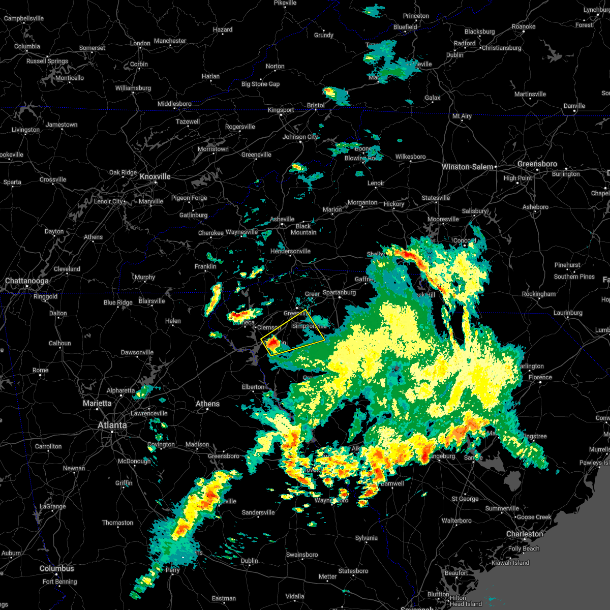 At 329 am edt, a severe thunderstorm was located 6 miles northeast of anderson, or 4 miles northwest of belton, moving northeast at 55 mph (radar indicated). Hazards include 60 mph wind gusts and quarter size hail. Minor hail damage to vehicles is expected. Expect wind damage to trees and power lines. At 329 am edt, a severe thunderstorm was located 6 miles northeast of anderson, or 4 miles northwest of belton, moving northeast at 55 mph (radar indicated). Hazards include 60 mph wind gusts and quarter size hail. Minor hail damage to vehicles is expected. Expect wind damage to trees and power lines.
|
| 4/7/2022 3:20 AM EDT | 911 call center reported numerous trees and powerlines down on lakewood lane... hiott road... and new prospect church road. also... reported roof damage to a hous in anderson county SC, 5.6 miles E of Anderson, SC |
| 4/7/2022 3:17 AM EDT |
 At 317 am edt, a severe thunderstorm was located 6 miles west of anderson, or near anderson airport, moving northeast at 50 mph (radar indicated). Hazards include 60 mph wind gusts and quarter size hail. Minor hail damage to vehicles is expected. expect wind damage to trees and power lines. locations impacted include, anderson, homeland park, belton, northlake, anderson airport, lake hartwell, sandy springs, broadway lake and honea path. hail threat, radar indicated max hail size, 1. 00 in wind threat, radar indicated max wind gust, 60 mph. At 317 am edt, a severe thunderstorm was located 6 miles west of anderson, or near anderson airport, moving northeast at 50 mph (radar indicated). Hazards include 60 mph wind gusts and quarter size hail. Minor hail damage to vehicles is expected. expect wind damage to trees and power lines. locations impacted include, anderson, homeland park, belton, northlake, anderson airport, lake hartwell, sandy springs, broadway lake and honea path. hail threat, radar indicated max hail size, 1. 00 in wind threat, radar indicated max wind gust, 60 mph.
|
| 4/7/2022 3:10 AM EDT | Trees down and a trampoline blown 300 fee in anderson county SC, 7.3 miles E of Anderson, SC |
| 4/7/2022 3:03 AM EDT |
 At 303 am edt, a severe thunderstorm was located 5 miles north of hartwell, or near reed creek, moving northeast at 50 mph (radar indicated). Hazards include 60 mph wind gusts and quarter size hail. Minor hail damage to vehicles is expected. Expect wind damage to trees and power lines. At 303 am edt, a severe thunderstorm was located 5 miles north of hartwell, or near reed creek, moving northeast at 50 mph (radar indicated). Hazards include 60 mph wind gusts and quarter size hail. Minor hail damage to vehicles is expected. Expect wind damage to trees and power lines.
|
| 2/18/2022 1:55 AM EST | 911 communications center reported powerlines down on lakewood ln in anderson county SC, 5.7 miles E of Anderson, SC |
| 2/17/2022 11:19 PM EST |
 At 1118 pm est, severe thunderstorms were located along a line extending from 6 miles northeast of clemson to 9 miles south of seneca, moving east at 80 mph (radar indicated). Hazards include 60 mph wind gusts. expect damage to trees and power lines At 1118 pm est, severe thunderstorms were located along a line extending from 6 miles northeast of clemson to 9 miles south of seneca, moving east at 80 mph (radar indicated). Hazards include 60 mph wind gusts. expect damage to trees and power lines
|
| 8/17/2021 12:12 PM EDT | Tree down on centerville roa in anderson county SC, 6.4 miles ESE of Anderson, SC |
| 8/17/2021 11:30 AM EDT | Large tree down along centerville rd. near i-85 in anderson county SC, 8.2 miles ESE of Anderson, SC |
| 8/14/2021 3:50 PM EDT |
 At 349 pm edt, a severe thunderstorm was located 6 miles north of anderson, or 4 miles northeast of northlake, moving south at 10 mph (radar indicated). Hazards include 60 mph wind gusts and quarter size hail. Minor hail damage to vehicles is expected. expect wind damage to trees and power lines. locations impacted include, anderson, piedmont, belton, williamston, northlake, west pelzer, sandy springs, pendleton, homeland park and powdersville. hail threat, radar indicated max hail size, 1. 00 in wind threat, radar indicated max wind gust, 60 mph. At 349 pm edt, a severe thunderstorm was located 6 miles north of anderson, or 4 miles northeast of northlake, moving south at 10 mph (radar indicated). Hazards include 60 mph wind gusts and quarter size hail. Minor hail damage to vehicles is expected. expect wind damage to trees and power lines. locations impacted include, anderson, piedmont, belton, williamston, northlake, west pelzer, sandy springs, pendleton, homeland park and powdersville. hail threat, radar indicated max hail size, 1. 00 in wind threat, radar indicated max wind gust, 60 mph.
|
| 8/14/2021 3:22 PM EDT |
 At 322 pm edt, a severe thunderstorm was located 9 miles south of easley, or 8 miles southeast of liberty, moving east at 5 mph (radar indicated). Hazards include 60 mph wind gusts and quarter size hail. Minor hail damage to vehicles is expected. Expect wind damage to trees and power lines. At 322 pm edt, a severe thunderstorm was located 9 miles south of easley, or 8 miles southeast of liberty, moving east at 5 mph (radar indicated). Hazards include 60 mph wind gusts and quarter size hail. Minor hail damage to vehicles is expected. Expect wind damage to trees and power lines.
|
| 8/14/2021 3:21 PM EDT |
 A severe thunderstorm warning remains in effect until 330 pm edt for northeastern anderson county, continuous cloud to ground lightning is occurring with this storm. move indoors immediately. lightning is one of nature`s leading killers. remember, if you can hear thunder, you are close enough to be struck by lightning. at 320 pm edt, a severe thunderstorm was located 5 miles northeast of anderson, moving southwest at 20 mph (radar indicated). Hazards include 60 mph wind gusts. Expect damage to trees and power lines. locations impacted include, belton, williamston, west pelzer, anderson and piedmont. hail threat, radar indicated max hail size, <. 75 in wind threat, radar indicated max wind gust, 60 mph. A severe thunderstorm warning remains in effect until 330 pm edt for northeastern anderson county, continuous cloud to ground lightning is occurring with this storm. move indoors immediately. lightning is one of nature`s leading killers. remember, if you can hear thunder, you are close enough to be struck by lightning. at 320 pm edt, a severe thunderstorm was located 5 miles northeast of anderson, moving southwest at 20 mph (radar indicated). Hazards include 60 mph wind gusts. Expect damage to trees and power lines. locations impacted include, belton, williamston, west pelzer, anderson and piedmont. hail threat, radar indicated max hail size, <. 75 in wind threat, radar indicated max wind gust, 60 mph.
|
| 8/14/2021 2:47 PM EDT |
 At 247 pm edt, a severe thunderstorm was located 10 miles southeast of easley, or near piedmont, moving south at 10 mph (radar indicated). Hazards include 60 mph wind gusts and quarter size hail. Minor hail damage to vehicles is expected. Expect wind damage to trees and power lines. At 247 pm edt, a severe thunderstorm was located 10 miles southeast of easley, or near piedmont, moving south at 10 mph (radar indicated). Hazards include 60 mph wind gusts and quarter size hail. Minor hail damage to vehicles is expected. Expect wind damage to trees and power lines.
|
| 8/11/2021 5:23 PM EDT |
 The severe thunderstorm warning for southeastern anderson county will expire at 530 pm edt, the storm which prompted the warning has weakened below severe limits, and no longer poses an immediate threat to life or property. therefore, the warning will be allowed to expire. however heavy rain and frequent cloud to ground lightning are both still possible with this thunderstorm. additional thunderstorms may still develop this evening as well. The severe thunderstorm warning for southeastern anderson county will expire at 530 pm edt, the storm which prompted the warning has weakened below severe limits, and no longer poses an immediate threat to life or property. therefore, the warning will be allowed to expire. however heavy rain and frequent cloud to ground lightning are both still possible with this thunderstorm. additional thunderstorms may still develop this evening as well.
|
| 8/11/2021 4:59 PM EDT |
 At 459 pm edt, a severe thunderstorm was located 9 miles east of anderson, or near belton, moving southeast at 5 mph (radar indicated). Hazards include 60 mph wind gusts and quarter size hail. Minor hail damage to vehicles is expected. Expect wind damage to trees and power lines. At 459 pm edt, a severe thunderstorm was located 9 miles east of anderson, or near belton, moving southeast at 5 mph (radar indicated). Hazards include 60 mph wind gusts and quarter size hail. Minor hail damage to vehicles is expected. Expect wind damage to trees and power lines.
|
| 8/11/2021 4:44 PM EDT | 911 call center reported tree down on dora d in anderson county SC, 2.7 miles NNE of Anderson, SC |
| 8/11/2021 4:42 PM EDT |
 At 440 pm edt, a severe thunderstorm was located 5 miles south of anderson, or near homeland park, and is nearly stationary (radar indicated). Hazards include 60 mph wind gusts and quarter size hail. Minor hail damage to vehicles is expected. Expect wind damage to trees and power lines. At 440 pm edt, a severe thunderstorm was located 5 miles south of anderson, or near homeland park, and is nearly stationary (radar indicated). Hazards include 60 mph wind gusts and quarter size hail. Minor hail damage to vehicles is expected. Expect wind damage to trees and power lines.
|
| 7/23/2021 6:48 PM EDT |
 At 647 pm edt, a severe thunderstorm was located near clemson, or near pendleton, moving south at 15 mph (radar indicated). Hazards include 60 mph wind gusts and quarter size hail. Minor hail damage to vehicles is expected. expect wind damage to trees and power lines. Locations impacted include, clemson, central, northlake, pendleton, sandy springs, anderson and lake hartwell. At 647 pm edt, a severe thunderstorm was located near clemson, or near pendleton, moving south at 15 mph (radar indicated). Hazards include 60 mph wind gusts and quarter size hail. Minor hail damage to vehicles is expected. expect wind damage to trees and power lines. Locations impacted include, clemson, central, northlake, pendleton, sandy springs, anderson and lake hartwell.
|
| 7/23/2021 6:32 PM EDT |
 At 631 pm edt, a severe thunderstorm was located over clemson, moving south at 15 mph (radar indicated). Hazards include 60 mph wind gusts and quarter size hail. Minor hail damage to vehicles is expected. Expect wind damage to trees and power lines. At 631 pm edt, a severe thunderstorm was located over clemson, moving south at 15 mph (radar indicated). Hazards include 60 mph wind gusts and quarter size hail. Minor hail damage to vehicles is expected. Expect wind damage to trees and power lines.
|
| 7/12/2021 10:02 PM EDT |
 At 1001 pm edt, a severe thunderstorm was located 12 miles northeast of anderson, or near west pelzer, moving northeast at 25 mph (radar indicated). Hazards include 60 mph wind gusts and nickel size hail. Expect damage to trees and power lines. Locations impacted include, anderson, piedmont, belton, williamston, northlake and west pelzer. At 1001 pm edt, a severe thunderstorm was located 12 miles northeast of anderson, or near west pelzer, moving northeast at 25 mph (radar indicated). Hazards include 60 mph wind gusts and nickel size hail. Expect damage to trees and power lines. Locations impacted include, anderson, piedmont, belton, williamston, northlake and west pelzer.
|
| 7/12/2021 9:48 PM EDT | 911 call center reported several trees down along belton hwy between the dollar general and the richard m campbell veterans nursing hom in anderson county SC, 3.9 miles NW of Anderson, SC |
| 7/12/2021 9:47 PM EDT |
 At 947 pm edt, a severe thunderstorm was located near anderson, moving northeast at 30 mph (radar indicated). Hazards include 60 mph wind gusts and quarter size hail. Minor hail damage to vehicles is expected. Expect wind damage to trees and power lines. At 947 pm edt, a severe thunderstorm was located near anderson, moving northeast at 30 mph (radar indicated). Hazards include 60 mph wind gusts and quarter size hail. Minor hail damage to vehicles is expected. Expect wind damage to trees and power lines.
|
| 7/12/2021 9:43 PM EDT | Broadcast media reported trees down on gilmer r in anderson county SC, 4.8 miles NW of Anderson, SC |
| 6/12/2021 5:04 PM EDT |
 At 504 pm edt, a severe thunderstorm was located 10 miles north of anderson, or 7 miles west of west pelzer, moving southwest at 15 mph (radar indicated). Hazards include 60 mph wind gusts and quarter size hail. Minor hail damage to vehicles is expected. Expect wind damage to trees and power lines. At 504 pm edt, a severe thunderstorm was located 10 miles north of anderson, or 7 miles west of west pelzer, moving southwest at 15 mph (radar indicated). Hazards include 60 mph wind gusts and quarter size hail. Minor hail damage to vehicles is expected. Expect wind damage to trees and power lines.
|
| 6/3/2021 5:21 PM EDT |
 At 520 pm edt, a severe thunderstorm was located 9 miles northeast of hartwell, or 5 miles west of starr, moving east at 20 mph (radar indicated). Hazards include 60 mph wind gusts and quarter size hail. Minor hail damage to vehicles is expected. expect wind damage to trees and power lines. Locations impacted include, anderson, homeland park, iva, starr, anderson airport, broadway lake, sadlers creek state park and lake hartwell. At 520 pm edt, a severe thunderstorm was located 9 miles northeast of hartwell, or 5 miles west of starr, moving east at 20 mph (radar indicated). Hazards include 60 mph wind gusts and quarter size hail. Minor hail damage to vehicles is expected. expect wind damage to trees and power lines. Locations impacted include, anderson, homeland park, iva, starr, anderson airport, broadway lake, sadlers creek state park and lake hartwell.
|
| 6/3/2021 5:06 PM EDT |
 At 506 pm edt, a severe thunderstorm was located 5 miles northeast of hartwell, or 4 miles southeast of reed creek, moving east at 25 mph (radar indicated). Hazards include 60 mph wind gusts and quarter size hail. Minor hail damage to vehicles is expected. Expect wind damage to trees and power lines. At 506 pm edt, a severe thunderstorm was located 5 miles northeast of hartwell, or 4 miles southeast of reed creek, moving east at 25 mph (radar indicated). Hazards include 60 mph wind gusts and quarter size hail. Minor hail damage to vehicles is expected. Expect wind damage to trees and power lines.
|
| 5/28/2021 10:45 PM EDT | Report of multiple downed trees in anderson county SC, 6.6 miles N of Anderson, SC |
| 5/28/2021 9:28 PM EDT |
 At 927 pm edt, severe thunderstorms were located along a line extending from 10 miles south of brevard to near easley to near anderson, moving northeast at 50 mph (radar indicated). Hazards include 70 mph wind gusts. Expect considerable tree damage. Damage is likely to mobile homes, roofs, and outbuildings. At 927 pm edt, severe thunderstorms were located along a line extending from 10 miles south of brevard to near easley to near anderson, moving northeast at 50 mph (radar indicated). Hazards include 70 mph wind gusts. Expect considerable tree damage. Damage is likely to mobile homes, roofs, and outbuildings.
|
| 5/28/2021 9:17 PM EDT |
 At 915 pm edt, severe thunderstorms were located along a line extending from 8 miles northwest of pickens to 5 miles northeast of clemson to 9 miles west of anderson, moving east at 45 mph (radar indicated). Hazards include 70 mph wind gusts. Expect considerable tree damage. damage is likely to mobile homes, roofs, and outbuildings. Locations impacted include, anderson, easley, clemson, pickens, powdersville, piedmont, belton, central, williamston and northlake. At 915 pm edt, severe thunderstorms were located along a line extending from 8 miles northwest of pickens to 5 miles northeast of clemson to 9 miles west of anderson, moving east at 45 mph (radar indicated). Hazards include 70 mph wind gusts. Expect considerable tree damage. damage is likely to mobile homes, roofs, and outbuildings. Locations impacted include, anderson, easley, clemson, pickens, powdersville, piedmont, belton, central, williamston and northlake.
|
| 5/28/2021 8:54 PM EDT |
 At 853 pm edt, severe thunderstorms were located along a line extending from 8 miles north of walhalla to 10 miles northwest of hartwell, moving east at 45 mph (radar indicated). Hazards include 60 mph wind gusts. expect damage to trees and power lines At 853 pm edt, severe thunderstorms were located along a line extending from 8 miles north of walhalla to 10 miles northwest of hartwell, moving east at 45 mph (radar indicated). Hazards include 60 mph wind gusts. expect damage to trees and power lines
|
| 4/8/2021 11:05 PM EDT |
 The severe thunderstorm warning for central anderson, southwestern pickens and southeastern oconee counties will expire at 1115 pm edt, the storm which prompted the warning has weakened below severe limits, and no longer poses an immediate threat to life or property. therefore the warning will be allowed to expire. if you observed large hail or wind damage, please report it to the national weather service greenville-spartanburg by calling toll free, 1, 800, 2 6 7, 8 1 0 1, or by posting on our facebook page, or tweet it using hashtag nwsgsp. your message should describe the event and the specific location where it occurred. The severe thunderstorm warning for central anderson, southwestern pickens and southeastern oconee counties will expire at 1115 pm edt, the storm which prompted the warning has weakened below severe limits, and no longer poses an immediate threat to life or property. therefore the warning will be allowed to expire. if you observed large hail or wind damage, please report it to the national weather service greenville-spartanburg by calling toll free, 1, 800, 2 6 7, 8 1 0 1, or by posting on our facebook page, or tweet it using hashtag nwsgsp. your message should describe the event and the specific location where it occurred.
|
| 4/8/2021 10:30 PM EDT |
 At 1029 pm edt, a severe thunderstorm was located 4 miles southeast of seneca, moving east at 25 mph (radar indicated). Hazards include 60 mph wind gusts and quarter size hail. Minor hail damage to vehicles is expected. Expect wind damage to trees and power lines. At 1029 pm edt, a severe thunderstorm was located 4 miles southeast of seneca, moving east at 25 mph (radar indicated). Hazards include 60 mph wind gusts and quarter size hail. Minor hail damage to vehicles is expected. Expect wind damage to trees and power lines.
|
| 3/26/2021 3:36 AM EDT |
 At 336 am edt, a severe thunderstorm was located 9 miles south of anderson, or over starr, moving east at 60 mph (radar indicated). Hazards include 60 mph wind gusts. Expect damage to trees and power lines. Locations impacted include, anderson, homeland park, iva, lake secession, starr, antreville, broadway lake, sadlers creek state park, anderson airport and lake hartwell. At 336 am edt, a severe thunderstorm was located 9 miles south of anderson, or over starr, moving east at 60 mph (radar indicated). Hazards include 60 mph wind gusts. Expect damage to trees and power lines. Locations impacted include, anderson, homeland park, iva, lake secession, starr, antreville, broadway lake, sadlers creek state park, anderson airport and lake hartwell.
|
| 3/26/2021 3:23 AM EDT |
 At 323 am edt, a severe thunderstorm was located 5 miles south of hartwell, moving east at 55 mph (radar indicated). Hazards include 60 mph wind gusts and penny size hail. expect damage to trees and power lines At 323 am edt, a severe thunderstorm was located 5 miles south of hartwell, moving east at 55 mph (radar indicated). Hazards include 60 mph wind gusts and penny size hail. expect damage to trees and power lines
|
| 3/25/2021 3:48 PM EDT |
 At 347 pm edt, a severe thunderstorm capable of producing a tornado was located 9 miles south of anderson, or 5 miles east of starr, moving east at 45 mph (radar indicated rotation). Hazards include tornado. Flying debris will be dangerous to those caught without shelter. mobile homes will be damaged or destroyed. damage to roofs, windows, and vehicles will occur. tree damage is likely. this dangerous storm will be near, honea path and donalds around 410 pm edt. ware shoals around 420 pm edt. Other locations impacted by this dangerous storm include princeton, fork shoals and broadway lake. At 347 pm edt, a severe thunderstorm capable of producing a tornado was located 9 miles south of anderson, or 5 miles east of starr, moving east at 45 mph (radar indicated rotation). Hazards include tornado. Flying debris will be dangerous to those caught without shelter. mobile homes will be damaged or destroyed. damage to roofs, windows, and vehicles will occur. tree damage is likely. this dangerous storm will be near, honea path and donalds around 410 pm edt. ware shoals around 420 pm edt. Other locations impacted by this dangerous storm include princeton, fork shoals and broadway lake.
|
| 3/25/2021 3:27 PM EDT |
 At 327 pm edt, a severe thunderstorm capable of producing a tornado was located 6 miles east of hartwell, or 6 miles west of starr, moving east at 55 mph (radar indicated rotation). Hazards include tornado. Flying debris will be dangerous to those caught without shelter. mobile homes will be damaged or destroyed. damage to roofs, windows, and vehicles will occur. tree damage is likely. this dangerous storm will be near, homeland park, starr, anderson airport and iva around 340 pm edt. belton around 350 pm edt. honea path and ware shoals around 400 pm edt. Other locations impacted by this dangerous thunderstorm include fork shoals, princeton, sadlers creek state park and broadway lake. At 327 pm edt, a severe thunderstorm capable of producing a tornado was located 6 miles east of hartwell, or 6 miles west of starr, moving east at 55 mph (radar indicated rotation). Hazards include tornado. Flying debris will be dangerous to those caught without shelter. mobile homes will be damaged or destroyed. damage to roofs, windows, and vehicles will occur. tree damage is likely. this dangerous storm will be near, homeland park, starr, anderson airport and iva around 340 pm edt. belton around 350 pm edt. honea path and ware shoals around 400 pm edt. Other locations impacted by this dangerous thunderstorm include fork shoals, princeton, sadlers creek state park and broadway lake.
|
| 7/18/2020 5:23 PM EDT |
 The severe thunderstorm warning for southwestern anderson county will expire at 530 pm edt, the storm which prompted the warning has weakened below severe limits, and no longer poses an immediate threat to life or property. therefore the warning will be allowed to expire. however gusty winds and heavy rain are still possible with this thunderstorm. The severe thunderstorm warning for southwestern anderson county will expire at 530 pm edt, the storm which prompted the warning has weakened below severe limits, and no longer poses an immediate threat to life or property. therefore the warning will be allowed to expire. however gusty winds and heavy rain are still possible with this thunderstorm.
|
| 7/18/2020 4:45 PM EDT |
 At 445 pm edt, a severe thunderstorm was located 8 miles southwest of anderson, or near starr, moving northwest at 10 mph (radar indicated). Hazards include 60 mph wind gusts and quarter size hail. Minor hail damage to vehicles is expected. Expect wind damage to trees and power lines. At 445 pm edt, a severe thunderstorm was located 8 miles southwest of anderson, or near starr, moving northwest at 10 mph (radar indicated). Hazards include 60 mph wind gusts and quarter size hail. Minor hail damage to vehicles is expected. Expect wind damage to trees and power lines.
|
| 6/28/2020 5:47 PM EDT |
 At 546 pm edt, severe thunderstorms were located along a line extending from 7 miles north of greenville downtown to 13 miles southeast of easley to near anderson, moving east at 35 mph (radar indicated). Hazards include 60 mph wind gusts and penny size hail. Expect damage to trees and power lines. Locations impacted include, greenville downtown, anderson, greenville eastside, west greenville, greer, mauldin, taylors, simpsonville, berea and welcome. At 546 pm edt, severe thunderstorms were located along a line extending from 7 miles north of greenville downtown to 13 miles southeast of easley to near anderson, moving east at 35 mph (radar indicated). Hazards include 60 mph wind gusts and penny size hail. Expect damage to trees and power lines. Locations impacted include, greenville downtown, anderson, greenville eastside, west greenville, greer, mauldin, taylors, simpsonville, berea and welcome.
|
| 6/28/2020 5:41 PM EDT | Trees and power lines down at intersection of martin luther king blvd and camson rd. time estimated from rada in anderson county SC, 2.4 miles ESE of Anderson, SC |
| 6/28/2020 5:40 PM EDT | Numerous reports of trees down across city of anderson and toward belton. time estimated from rada in anderson county SC, 2.2 miles NW of Anderson, SC |
| 6/28/2020 5:25 PM EDT | Schp reported trees down at knox rd and hwy 187. time estimated from rada in anderson county SC, 10.1 miles ESE of Anderson, SC |
| 6/28/2020 5:24 PM EDT |
 At 524 pm edt, severe thunderstorms were located along a line extending from 11 miles northeast of pickens to 6 miles east of clemson to 10 miles south of seneca, moving east at 35 mph (radar indicated). Hazards include 60 mph wind gusts and penny size hail. expect damage to trees and power lines At 524 pm edt, severe thunderstorms were located along a line extending from 11 miles northeast of pickens to 6 miles east of clemson to 10 miles south of seneca, moving east at 35 mph (radar indicated). Hazards include 60 mph wind gusts and penny size hail. expect damage to trees and power lines
|
| 6/22/2020 3:21 PM EDT |
 At 320 pm edt, severe thunderstorms were located along a line extending from near anderson to 10 miles north of abbeville, moving northeast at 25 mph (radar indicated). Hazards include 60 mph wind gusts and quarter size hail. Minor hail damage to vehicles is expected. expect wind damage to trees and power lines. Locations impacted include, anderson, homeland park, piedmont, belton, williamston, northlake, honea path, ware shoals, due west and west pelzer. At 320 pm edt, severe thunderstorms were located along a line extending from near anderson to 10 miles north of abbeville, moving northeast at 25 mph (radar indicated). Hazards include 60 mph wind gusts and quarter size hail. Minor hail damage to vehicles is expected. expect wind damage to trees and power lines. Locations impacted include, anderson, homeland park, piedmont, belton, williamston, northlake, honea path, ware shoals, due west and west pelzer.
|
| 6/22/2020 3:15 PM EDT | Anderson county 911 call center reported trees down on us-76. time estimated by rada in anderson county SC, 4.3 miles NW of Anderson, SC |
| 6/22/2020 3:15 PM EDT | Anderson county 911 call center reported trees down on level land rd & bear creek rd. time estimated by rada in anderson county SC, 12.5 miles NNW of Anderson, SC |
| 6/22/2020 3:03 PM EDT |
 At 302 pm edt, severe thunderstorms were located along a line extending from 8 miles southwest of anderson to 13 miles northwest of abbeville, moving northeast at 25 mph (radar indicated). Hazards include 60 mph wind gusts and quarter size hail. Minor hail damage to vehicles is expected. Expect wind damage to trees and power lines. At 302 pm edt, severe thunderstorms were located along a line extending from 8 miles southwest of anderson to 13 miles northwest of abbeville, moving northeast at 25 mph (radar indicated). Hazards include 60 mph wind gusts and quarter size hail. Minor hail damage to vehicles is expected. Expect wind damage to trees and power lines.
|
| 6/21/2020 6:59 PM EDT |
 At 642 pm edt, a severe thunderstorm was located 8 miles east of carnesville, or near bowersville, moving northeast at 25 mph (radar indicated). Hazards include 60 mph wind gusts and quarter size hail. Minor hail damage to vehicles is expected. Expect wind damage to trees and power lines. At 642 pm edt, a severe thunderstorm was located 8 miles east of carnesville, or near bowersville, moving northeast at 25 mph (radar indicated). Hazards include 60 mph wind gusts and quarter size hail. Minor hail damage to vehicles is expected. Expect wind damage to trees and power lines.
|
| 6/21/2020 6:59 PM EDT |
 At 658 pm edt, a severe thunderstorm was located 8 miles northwest of hartwell, or 4 miles southeast of tugaloo state park, moving northeast at 25 mph (radar indicated). Hazards include 60 mph wind gusts and quarter size hail. Minor hail damage to vehicles is expected. expect wind damage to trees and power lines. Locations impacted include, northlake, pendleton, reed creek, anderson airport, lake hartwell, townville, sandy springs, fair play, sadlers creek state park and anderson. At 658 pm edt, a severe thunderstorm was located 8 miles northwest of hartwell, or 4 miles southeast of tugaloo state park, moving northeast at 25 mph (radar indicated). Hazards include 60 mph wind gusts and quarter size hail. Minor hail damage to vehicles is expected. expect wind damage to trees and power lines. Locations impacted include, northlake, pendleton, reed creek, anderson airport, lake hartwell, townville, sandy springs, fair play, sadlers creek state park and anderson.
|
| 6/21/2020 6:42 PM EDT |
 At 642 pm edt, a severe thunderstorm was located 8 miles east of carnesville, or near bowersville, moving northeast at 25 mph (radar indicated). Hazards include 60 mph wind gusts and quarter size hail. Minor hail damage to vehicles is expected. Expect wind damage to trees and power lines. At 642 pm edt, a severe thunderstorm was located 8 miles east of carnesville, or near bowersville, moving northeast at 25 mph (radar indicated). Hazards include 60 mph wind gusts and quarter size hail. Minor hail damage to vehicles is expected. Expect wind damage to trees and power lines.
|
| 5/22/2020 2:42 PM EDT |
 At 242 pm edt, severe thunderstorms were located along a line extending from 11 miles south of greenville downtown to 5 miles northeast of hartwell, moving east at 40 mph (radar indicated). Hazards include 60 mph wind gusts and quarter size hail. Minor hail damage to vehicles is expected. Expect wind damage to trees and power lines. At 242 pm edt, severe thunderstorms were located along a line extending from 11 miles south of greenville downtown to 5 miles northeast of hartwell, moving east at 40 mph (radar indicated). Hazards include 60 mph wind gusts and quarter size hail. Minor hail damage to vehicles is expected. Expect wind damage to trees and power lines.
|
| 5/5/2020 2:40 AM EDT |
 At 239 am edt, severe thunderstorms were located along a line extending from 10 miles northeast of easley to 7 miles southeast of greenville downtown to 9 miles northwest of abbeville, moving east at 65 mph (radar indicated). Hazards include 70 mph wind gusts and quarter size hail. Minor hail damage to vehicles is expected. expect considerable tree damage. Wind damage is also likely to mobile homes, roofs, and outbuildings. At 239 am edt, severe thunderstorms were located along a line extending from 10 miles northeast of easley to 7 miles southeast of greenville downtown to 9 miles northwest of abbeville, moving east at 65 mph (radar indicated). Hazards include 70 mph wind gusts and quarter size hail. Minor hail damage to vehicles is expected. expect considerable tree damage. Wind damage is also likely to mobile homes, roofs, and outbuildings.
|
| 5/5/2020 2:30 AM EDT |
 At 228 am edt, severe thunderstorms were located along a line extending from 3 miles north of pickens to near easley to 6 miles southwest of anderson, moving east at 50 mph (radar indicated). Hazards include 70 mph wind gusts and quarter size hail. Minor hail damage to vehicles is expected. expect considerable tree damage. wind damage is also likely to mobile homes, roofs, and outbuildings. Locations impacted include, greenville downtown, anderson, easley, clemson, pickens, greenville eastside, west greenville, greer, mauldin and taylors. At 228 am edt, severe thunderstorms were located along a line extending from 3 miles north of pickens to near easley to 6 miles southwest of anderson, moving east at 50 mph (radar indicated). Hazards include 70 mph wind gusts and quarter size hail. Minor hail damage to vehicles is expected. expect considerable tree damage. wind damage is also likely to mobile homes, roofs, and outbuildings. Locations impacted include, greenville downtown, anderson, easley, clemson, pickens, greenville eastside, west greenville, greer, mauldin and taylors.
|
| 5/5/2020 2:16 AM EDT |
 At 215 am edt, severe thunderstorms were located along a line extending from 10 miles west of pickens to 3 miles southeast of clemson to 6 miles north of hartwell, moving east at 45 mph (radar indicated). Hazards include 60 mph wind gusts and quarter size hail. Minor hail damage to vehicles is expected. expect wind damage to trees and power lines. Locations impacted include, greenville downtown, anderson, easley, clemson, seneca, pickens, greenville eastside, west greenville, greer and mauldin. At 215 am edt, severe thunderstorms were located along a line extending from 10 miles west of pickens to 3 miles southeast of clemson to 6 miles north of hartwell, moving east at 45 mph (radar indicated). Hazards include 60 mph wind gusts and quarter size hail. Minor hail damage to vehicles is expected. expect wind damage to trees and power lines. Locations impacted include, greenville downtown, anderson, easley, clemson, seneca, pickens, greenville eastside, west greenville, greer and mauldin.
|
| 5/5/2020 2:00 AM EDT |
 At 159 am edt, severe thunderstorms were located along a line extending from 14 miles north of walhalla to 3 miles northeast of seneca to 7 miles northwest of hartwell, moving east at 65 mph (radar indicated). Hazards include 60 mph wind gusts and quarter size hail. Minor hail damage to vehicles is expected. Expect wind damage to trees and power lines. At 159 am edt, severe thunderstorms were located along a line extending from 14 miles north of walhalla to 3 miles northeast of seneca to 7 miles northwest of hartwell, moving east at 65 mph (radar indicated). Hazards include 60 mph wind gusts and quarter size hail. Minor hail damage to vehicles is expected. Expect wind damage to trees and power lines.
|
| 4/29/2020 6:27 PM EDT | Broadcast media relayed report of trees down along harris bridge roa in anderson county SC, 5.2 miles S of Anderson, SC |
| 4/29/2020 6:18 PM EDT |
 At 618 pm edt, a severe thunderstorm capable of producing a tornado was located 7 miles south of clemson, or 5 miles west of northlake, moving northeast at 45 mph (radar indicated rotation). Hazards include tornado. Flying debris will be dangerous to those caught without shelter. mobile homes will be damaged or destroyed. damage to roofs, windows, and vehicles will occur. tree damage is likely. this dangerous storm will be near, northlake and pendleton around 620 pm edt. Other locations impacted by this dangerous thunderstorm include sandy springs. At 618 pm edt, a severe thunderstorm capable of producing a tornado was located 7 miles south of clemson, or 5 miles west of northlake, moving northeast at 45 mph (radar indicated rotation). Hazards include tornado. Flying debris will be dangerous to those caught without shelter. mobile homes will be damaged or destroyed. damage to roofs, windows, and vehicles will occur. tree damage is likely. this dangerous storm will be near, northlake and pendleton around 620 pm edt. Other locations impacted by this dangerous thunderstorm include sandy springs.
|
| 4/13/2020 4:38 AM EDT |
 The severe thunderstorm warning for east central hart, western laurens, greenville, spartanburg, western cherokee, anderson, northeastern abbeville and northwestern greenwood counties will expire at 445 am edt, the storms which prompted the warning have weakened below severe limits, and no longer pose an immediate threat to life or property. therefore the warning will be allowed to expire. however gusty winds and heavy rain are still possible with these thunderstorms. a tornado watch remains in effect until 800 am edt for northeastern georgia, western north carolina, and upstate south carolina. if you observed large hail or wind damage, please report it to the national weather service greenville-spartanburg by calling toll free, 1, 800, 2 6 7, 8 1 0 1, or by posting on our facebook page, or tweet it using hashtag nwsgsp. your message should describe the event and the specific location where it occurred. The severe thunderstorm warning for east central hart, western laurens, greenville, spartanburg, western cherokee, anderson, northeastern abbeville and northwestern greenwood counties will expire at 445 am edt, the storms which prompted the warning have weakened below severe limits, and no longer pose an immediate threat to life or property. therefore the warning will be allowed to expire. however gusty winds and heavy rain are still possible with these thunderstorms. a tornado watch remains in effect until 800 am edt for northeastern georgia, western north carolina, and upstate south carolina. if you observed large hail or wind damage, please report it to the national weather service greenville-spartanburg by calling toll free, 1, 800, 2 6 7, 8 1 0 1, or by posting on our facebook page, or tweet it using hashtag nwsgsp. your message should describe the event and the specific location where it occurred.
|
| 4/13/2020 4:03 AM EDT |
 At 403 am edt, severe thunderstorms were located along a line extending from 10 miles southwest of columbus to 8 miles northeast of anderson to 5 miles east of hartwell, moving east at 45 mph (radar indicated). Hazards include 60 mph wind gusts and penny size hail. expect damage to trees and power lines At 403 am edt, severe thunderstorms were located along a line extending from 10 miles southwest of columbus to 8 miles northeast of anderson to 5 miles east of hartwell, moving east at 45 mph (radar indicated). Hazards include 60 mph wind gusts and penny size hail. expect damage to trees and power lines
|
| 4/13/2020 3:41 AM EDT |
 At 341 am edt, severe thunderstorms were located along a line extending from 11 miles north of pickens to near clemson to 5 miles west of hartwell, moving east at 60 mph (radar indicated). Hazards include 60 mph wind gusts and quarter size hail. Minor hail damage to vehicles is expected. expect wind damage to trees and power lines. Locations impacted include, greenville downtown, anderson, easley, clemson, hartwell, pickens, greenville eastside, west greenville, mauldin and taylors. At 341 am edt, severe thunderstorms were located along a line extending from 11 miles north of pickens to near clemson to 5 miles west of hartwell, moving east at 60 mph (radar indicated). Hazards include 60 mph wind gusts and quarter size hail. Minor hail damage to vehicles is expected. expect wind damage to trees and power lines. Locations impacted include, greenville downtown, anderson, easley, clemson, hartwell, pickens, greenville eastside, west greenville, mauldin and taylors.
|
| 4/13/2020 3:13 AM EDT |
 At 312 am edt, severe thunderstorms were located along a line extending from 12 miles northeast of clayton to 4 miles east of toccoa to 5 miles northeast of commerce, moving east at 55 mph (radar indicated). Hazards include 60 mph wind gusts and quarter size hail. Minor hail damage to vehicles is expected. Expect wind damage to trees and power lines. At 312 am edt, severe thunderstorms were located along a line extending from 12 miles northeast of clayton to 4 miles east of toccoa to 5 miles northeast of commerce, moving east at 55 mph (radar indicated). Hazards include 60 mph wind gusts and quarter size hail. Minor hail damage to vehicles is expected. Expect wind damage to trees and power lines.
|
| 2/13/2020 8:24 AM EST |
 At 824 am est, severe thunderstorms were located along a line extending from 11 miles south of greenville downtown to 8 miles southeast of anderson to 10 miles northeast of elberton, moving east at 45 mph (radar indicated). Hazards include 60 mph wind gusts. expect damage to trees and power lines At 824 am est, severe thunderstorms were located along a line extending from 11 miles south of greenville downtown to 8 miles southeast of anderson to 10 miles northeast of elberton, moving east at 45 mph (radar indicated). Hazards include 60 mph wind gusts. expect damage to trees and power lines
|
| 2/13/2020 8:13 AM EST | 2 trres reported down along abbeville highway and one down on amity roa in anderson county SC, 5.2 miles NW of Anderson, SC |
| 2/13/2020 8:03 AM EST |
 At 803 am est, severe thunderstorms were located along a line extending from 4 miles southeast of clemson to 6 miles northeast of hartwell to 12 miles northwest of elberton, moving east at 45 mph (radar indicated). Hazards include 60 mph wind gusts. Expect damage to trees and power lines. Locations impacted include, anderson, clemson, hartwell, homeland park, powdersville, piedmont, belton, williamston, northlake and pendleton. At 803 am est, severe thunderstorms were located along a line extending from 4 miles southeast of clemson to 6 miles northeast of hartwell to 12 miles northwest of elberton, moving east at 45 mph (radar indicated). Hazards include 60 mph wind gusts. Expect damage to trees and power lines. Locations impacted include, anderson, clemson, hartwell, homeland park, powdersville, piedmont, belton, williamston, northlake and pendleton.
|
| 2/13/2020 7:52 AM EST |
 At 751 am est, severe thunderstorms were located along a line extending from 9 miles south of clemson to 11 miles southwest of hartwell, moving east at 45 mph (radar indicated). Hazards include 60 mph wind gusts. expect damage to trees and power lines At 751 am est, severe thunderstorms were located along a line extending from 9 miles south of clemson to 11 miles southwest of hartwell, moving east at 45 mph (radar indicated). Hazards include 60 mph wind gusts. expect damage to trees and power lines
|
| 2/6/2020 10:48 AM EST |
 At 1048 am est, a severe thunderstorm capable of producing a tornado was located 5 miles southeast of anderson, or over biltmore park, moving northeast at 65 mph (radar indicated rotation). Hazards include tornado. Flying debris will be dangerous to those caught without shelter. mobile homes will be damaged or destroyed. damage to roofs, windows, and vehicles will occur. tree damage is likely. this dangerous storm will be near, belton around 1050 am est. williamston and west pelzer around 1100 am est. fountain inn and simpsonville around 1110 am est. Other locations impacted by this dangerous thunderstorm include broadway lake and fork shoals. At 1048 am est, a severe thunderstorm capable of producing a tornado was located 5 miles southeast of anderson, or over biltmore park, moving northeast at 65 mph (radar indicated rotation). Hazards include tornado. Flying debris will be dangerous to those caught without shelter. mobile homes will be damaged or destroyed. damage to roofs, windows, and vehicles will occur. tree damage is likely. this dangerous storm will be near, belton around 1050 am est. williamston and west pelzer around 1100 am est. fountain inn and simpsonville around 1110 am est. Other locations impacted by this dangerous thunderstorm include broadway lake and fork shoals.
|
| 2/6/2020 10:28 AM EST |
 At 1028 am est, a severe thunderstorm capable of producing a tornado was located 7 miles southeast of hartwell, moving northeast at 55 mph (radar indicated rotation). Hazards include tornado. Flying debris will be dangerous to those caught without shelter. mobile homes will be damaged or destroyed. damage to roofs, windows, and vehicles will occur. tree damage is likely. this dangerous storm will be near, starr, homeland park, iva and anderson airport around 1040 am est. Other locations impacted by this dangerous thunderstorm include broadway lake and sadlers creek state park. At 1028 am est, a severe thunderstorm capable of producing a tornado was located 7 miles southeast of hartwell, moving northeast at 55 mph (radar indicated rotation). Hazards include tornado. Flying debris will be dangerous to those caught without shelter. mobile homes will be damaged or destroyed. damage to roofs, windows, and vehicles will occur. tree damage is likely. this dangerous storm will be near, starr, homeland park, iva and anderson airport around 1040 am est. Other locations impacted by this dangerous thunderstorm include broadway lake and sadlers creek state park.
|
| 1/11/2020 8:29 PM EST |
 At 828 pm est, severe thunderstorms were located along a line extending from near greenville downtown to near anderson, moving northeast at 45 mph (radar indicated). Hazards include 60 mph wind gusts. expect damage to trees and power lines At 828 pm est, severe thunderstorms were located along a line extending from near greenville downtown to near anderson, moving northeast at 45 mph (radar indicated). Hazards include 60 mph wind gusts. expect damage to trees and power lines
|
| 1/11/2020 8:23 PM EST |
 At 823 pm est, a severe thunderstorm capable of producing a tornado was located 5 miles north of anderson, or near northlake, moving northeast at 55 mph (radar indicated rotation). Hazards include tornado. Flying debris will be dangerous to those caught without shelter. mobile homes will be damaged or destroyed. damage to roofs, windows, and vehicles will occur. tree damage is likely. Locations impacted include, northlake, lake hartwell, sandy springs, pendleton and anderson. At 823 pm est, a severe thunderstorm capable of producing a tornado was located 5 miles north of anderson, or near northlake, moving northeast at 55 mph (radar indicated rotation). Hazards include tornado. Flying debris will be dangerous to those caught without shelter. mobile homes will be damaged or destroyed. damage to roofs, windows, and vehicles will occur. tree damage is likely. Locations impacted include, northlake, lake hartwell, sandy springs, pendleton and anderson.
|
| 1/11/2020 8:14 PM EST |
 At 813 pm est, a severe thunderstorm capable of producing a tornado was located 6 miles west of anderson, or near lake hartwell, moving northeast at 55 mph (radar indicated rotation). Hazards include tornado. Flying debris will be dangerous to those caught without shelter. mobile homes will be damaged or destroyed. damage to roofs, windows, and vehicles will occur. tree damage is likely. This dangerous storm will remain over mainly rural areas of central anderson county, including the following locations, sandy springs. At 813 pm est, a severe thunderstorm capable of producing a tornado was located 6 miles west of anderson, or near lake hartwell, moving northeast at 55 mph (radar indicated rotation). Hazards include tornado. Flying debris will be dangerous to those caught without shelter. mobile homes will be damaged or destroyed. damage to roofs, windows, and vehicles will occur. tree damage is likely. This dangerous storm will remain over mainly rural areas of central anderson county, including the following locations, sandy springs.
|
| 1/11/2020 8:02 PM EST |
 At 802 pm est, a severe thunderstorm capable of producing a tornado was located 6 miles north of hartwell, or over reed creek, moving northeast at 50 mph (radar indicated rotation). Hazards include tornado. Flying debris will be dangerous to those caught without shelter. mobile homes will be damaged or destroyed. damage to roofs, windows, and vehicles will occur. tree damage is likely. this dangerous storm will be near, anderson, northlake and anderson airport around 820 pm est. Other locations impacted by this dangerous storm include townville, sandy springs and sadlers creek state park. At 802 pm est, a severe thunderstorm capable of producing a tornado was located 6 miles north of hartwell, or over reed creek, moving northeast at 50 mph (radar indicated rotation). Hazards include tornado. Flying debris will be dangerous to those caught without shelter. mobile homes will be damaged or destroyed. damage to roofs, windows, and vehicles will occur. tree damage is likely. this dangerous storm will be near, anderson, northlake and anderson airport around 820 pm est. Other locations impacted by this dangerous storm include townville, sandy springs and sadlers creek state park.
|
| 1/11/2020 7:54 PM EST |
 At 753 pm est, a severe thunderstorm capable of producing a tornado was located 5 miles west of hartwell, or near bowersville, moving northeast at 55 mph (radar indicated rotation). Hazards include tornado. Flying debris will be dangerous to those caught without shelter. mobile homes will be damaged or destroyed. damage to roofs, windows, and vehicles will occur. tree damage is likely. this dangerous storm will be near, reed creek around 800 pm est. anderson, northlake, anderson airport and homeland park around 820 pm est. Other locations impacted by this dangerous thunderstorm include townville, sandy springs and sadlers creek state park. At 753 pm est, a severe thunderstorm capable of producing a tornado was located 5 miles west of hartwell, or near bowersville, moving northeast at 55 mph (radar indicated rotation). Hazards include tornado. Flying debris will be dangerous to those caught without shelter. mobile homes will be damaged or destroyed. damage to roofs, windows, and vehicles will occur. tree damage is likely. this dangerous storm will be near, reed creek around 800 pm est. anderson, northlake, anderson airport and homeland park around 820 pm est. Other locations impacted by this dangerous thunderstorm include townville, sandy springs and sadlers creek state park.
|
| 1/11/2020 7:39 PM EST |
 At 739 pm est, severe thunderstorms were located along a line extending from 3 miles northeast of seneca to 8 miles north of danielsville, moving east at 25 mph (radar indicated). Hazards include 60 mph wind gusts. expect damage to trees and power lines At 739 pm est, severe thunderstorms were located along a line extending from 3 miles northeast of seneca to 8 miles north of danielsville, moving east at 25 mph (radar indicated). Hazards include 60 mph wind gusts. expect damage to trees and power lines
|
| 10/31/2019 3:36 PM EDT |
 At 336 pm edt, severe thunderstorms were located along a line extending from 7 miles southwest of columbus to near greenville downtown to 7 miles east of anderson, moving east at 45 mph (radar indicated). Hazards include 60 mph wind gusts. Expect damage to trees and power lines. Locations impacted include, greenville downtown, anderson, columbus, greenville eastside, west greenville, greer, mauldin, taylors, simpsonville and berea. At 336 pm edt, severe thunderstorms were located along a line extending from 7 miles southwest of columbus to near greenville downtown to 7 miles east of anderson, moving east at 45 mph (radar indicated). Hazards include 60 mph wind gusts. Expect damage to trees and power lines. Locations impacted include, greenville downtown, anderson, columbus, greenville eastside, west greenville, greer, mauldin, taylors, simpsonville and berea.
|
| 10/31/2019 3:15 PM EDT |
 At 315 pm edt, severe thunderstorms were located along a line extending from 14 miles southeast of brevard to 4 miles south of easley to 10 miles east of hartwell, moving northeast at 45 mph (radar indicated). Hazards include 60 mph wind gusts. expect damage to trees and power lines At 315 pm edt, severe thunderstorms were located along a line extending from 14 miles southeast of brevard to 4 miles south of easley to 10 miles east of hartwell, moving northeast at 45 mph (radar indicated). Hazards include 60 mph wind gusts. expect damage to trees and power lines
|
| 10/31/2019 3:15 PM EDT |
 The national weather service in greenville-spartanburg has issued a * severe thunderstorm warning for. polk county in western north carolina. greenville county in upstate south carolina. northwestern spartanburg county in upstate south carolina. Central anderson county in upstate south carolina. The national weather service in greenville-spartanburg has issued a * severe thunderstorm warning for. polk county in western north carolina. greenville county in upstate south carolina. northwestern spartanburg county in upstate south carolina. Central anderson county in upstate south carolina.
|
| 10/31/2019 3:03 PM EDT |
 At 302 pm edt, severe thunderstorms were located along a line extending from 7 miles north of pickens to near clemson to 7 miles southwest of hartwell, moving east at 40 mph (radar indicated). Hazards include 60 mph wind gusts. Expect damage to trees and power lines. Locations impacted include, anderson, easley, clemson, hartwell, pickens, homeland park, central, northlake, pendleton and liberty. At 302 pm edt, severe thunderstorms were located along a line extending from 7 miles north of pickens to near clemson to 7 miles southwest of hartwell, moving east at 40 mph (radar indicated). Hazards include 60 mph wind gusts. Expect damage to trees and power lines. Locations impacted include, anderson, easley, clemson, hartwell, pickens, homeland park, central, northlake, pendleton and liberty.
|
| 10/31/2019 2:35 PM EDT |
 The national weather service in greenville-spartanburg has issued a * severe thunderstorm warning for. eastern franklin county in northeastern georgia. northwestern elbert county in northeastern georgia. hart county in northeastern georgia. Northwestern greenville county in upstate south carolina. The national weather service in greenville-spartanburg has issued a * severe thunderstorm warning for. eastern franklin county in northeastern georgia. northwestern elbert county in northeastern georgia. hart county in northeastern georgia. Northwestern greenville county in upstate south carolina.
|
| 10/31/2019 2:35 PM EDT |
 At 234 pm edt, severe thunderstorms were located along a line extending from 13 miles west of pickens to 7 miles southwest of seneca to 5 miles north of danielsville, moving east at 45 mph (radar indicated). Hazards include 60 mph wind gusts. expect damage to trees and power lines At 234 pm edt, severe thunderstorms were located along a line extending from 13 miles west of pickens to 7 miles southwest of seneca to 5 miles north of danielsville, moving east at 45 mph (radar indicated). Hazards include 60 mph wind gusts. expect damage to trees and power lines
|
| 8/19/2019 5:40 PM EDT |
 A severe thunderstorm warning remains in effect until 600 pm edt for northeastern hart and southwestern anderson counties. at 540 pm edt, a severe thunderstorm was located 10 miles southwest of anderson, or near starr, and is nearly stationary. hazard. 60 mph wind gusts and quarter size hail. source. Radar indicated. A severe thunderstorm warning remains in effect until 600 pm edt for northeastern hart and southwestern anderson counties. at 540 pm edt, a severe thunderstorm was located 10 miles southwest of anderson, or near starr, and is nearly stationary. hazard. 60 mph wind gusts and quarter size hail. source. Radar indicated.
|
| 8/19/2019 5:32 PM EDT |
 At 532 pm edt, a severe thunderstorm was located 10 miles southwest of anderson, or near starr, and is nearly stationary (radar indicated). Hazards include 60 mph wind gusts and quarter size hail. Minor hail damage to vehicles is expected. Expect wind damage to trees and power lines. At 532 pm edt, a severe thunderstorm was located 10 miles southwest of anderson, or near starr, and is nearly stationary (radar indicated). Hazards include 60 mph wind gusts and quarter size hail. Minor hail damage to vehicles is expected. Expect wind damage to trees and power lines.
|
| 8/19/2019 4:28 PM EDT |
 A severe thunderstorm warning remains in effect until 445 pm edt for northwestern anderson. southwestern pickens and east central oconee counties. at 428 pm edt, a severe thunderstorm was located near clemson, and is nearly stationary. hazard. 60 mph wind gusts and quarter size hail. A severe thunderstorm warning remains in effect until 445 pm edt for northwestern anderson. southwestern pickens and east central oconee counties. at 428 pm edt, a severe thunderstorm was located near clemson, and is nearly stationary. hazard. 60 mph wind gusts and quarter size hail.
|
| 8/19/2019 4:00 PM EDT |
 At 400 pm edt, a severe thunderstorm was located near clemson, or near pendleton, and is nearly stationary (radar indicated). Hazards include 60 mph wind gusts and quarter size hail. Minor hail damage to vehicles is expected. Expect wind damage to trees and power lines. At 400 pm edt, a severe thunderstorm was located near clemson, or near pendleton, and is nearly stationary (radar indicated). Hazards include 60 mph wind gusts and quarter size hail. Minor hail damage to vehicles is expected. Expect wind damage to trees and power lines.
|
| 8/19/2019 3:30 PM EDT | Tree down and blocking brown roa in anderson county SC, 3.2 miles SE of Anderson, SC |
| 7/4/2019 8:24 PM EDT |
 At 824 pm edt, a severe thunderstorm was located 9 miles northeast of anderson, or near williamston, and is nearly stationary (radar indicated). Hazards include 60 mph wind gusts and nickel size hail. expect damage to trees and power lines At 824 pm edt, a severe thunderstorm was located 9 miles northeast of anderson, or near williamston, and is nearly stationary (radar indicated). Hazards include 60 mph wind gusts and nickel size hail. expect damage to trees and power lines
|
| 6/22/2019 2:40 AM EDT |
 The severe thunderstorm warning for eastern franklin, elbert, hart, anderson, southwestern pickens, southwestern abbeville and southeastern oconee counties will expire at 245 am edt, the storm which prompted the warning has moved out of the area. therefore the warning will be allowed to expire. however gusty winds and heavy rain are still possible with this thunderstorm. a severe thunderstorm watch remains in effect until 500 am edt for northeastern georgia, and upstate south carolina. The severe thunderstorm warning for eastern franklin, elbert, hart, anderson, southwestern pickens, southwestern abbeville and southeastern oconee counties will expire at 245 am edt, the storm which prompted the warning has moved out of the area. therefore the warning will be allowed to expire. however gusty winds and heavy rain are still possible with this thunderstorm. a severe thunderstorm watch remains in effect until 500 am edt for northeastern georgia, and upstate south carolina.
|
| 6/22/2019 2:22 AM EDT | Asos at the anderson regional airport measured a wind gust of 60 mp in anderson county SC, 4.6 miles ENE of Anderson, SC |
| 6/22/2019 2:13 AM EDT |
 At 213 am edt, a severe thunderstorm was located 6 miles east of hartwell, moving east at 30 mph (radar indicated). Hazards include 60 mph wind gusts and quarter size hail. Minor hail damage to vehicles is expected. expect wind damage to trees and power lines. Locations impacted include, anderson, clemson, seneca, elberton, hartwell, carnesville, homeland park, belton, northlake and pendleton. At 213 am edt, a severe thunderstorm was located 6 miles east of hartwell, moving east at 30 mph (radar indicated). Hazards include 60 mph wind gusts and quarter size hail. Minor hail damage to vehicles is expected. expect wind damage to trees and power lines. Locations impacted include, anderson, clemson, seneca, elberton, hartwell, carnesville, homeland park, belton, northlake and pendleton.
|
| 6/22/2019 1:57 AM EDT |
 At 157 am edt, a severe thunderstorm was located near hartwell, moving east at 30 mph (radar indicated). Hazards include 60 mph wind gusts and nickel size hail. expect damage to trees and power lines At 157 am edt, a severe thunderstorm was located near hartwell, moving east at 30 mph (radar indicated). Hazards include 60 mph wind gusts and nickel size hail. expect damage to trees and power lines
|
| 5/18/2019 5:25 PM EDT |
 The severe thunderstorm warning for northeastern hart, west central anderson and southeastern oconee counties will expire at 530 pm edt, the storm which prompted the warning has weakened below severe limits, and no longer poses an immediate threat to life or property. therefore the warning will be allowed to expire. The severe thunderstorm warning for northeastern hart, west central anderson and southeastern oconee counties will expire at 530 pm edt, the storm which prompted the warning has weakened below severe limits, and no longer poses an immediate threat to life or property. therefore the warning will be allowed to expire.
|
| 5/18/2019 5:09 PM EDT |
 At 509 pm edt, a severe thunderstorm was located 9 miles west of anderson, or over lake hartwell, moving north at 10 mph (radar indicated). Hazards include 60 mph wind gusts and quarter size hail. Minor hail damage to vehicles is expected. expect wind damage to trees and power lines. Locations impacted include, reed creek, anderson airport, lake hartwell, townville, fair play, sadlers creek state park, oakway, anderson and seneca. At 509 pm edt, a severe thunderstorm was located 9 miles west of anderson, or over lake hartwell, moving north at 10 mph (radar indicated). Hazards include 60 mph wind gusts and quarter size hail. Minor hail damage to vehicles is expected. expect wind damage to trees and power lines. Locations impacted include, reed creek, anderson airport, lake hartwell, townville, fair play, sadlers creek state park, oakway, anderson and seneca.
|
| 5/18/2019 4:51 PM EDT |
 At 450 pm edt, a severe thunderstorm was located 6 miles north of hartwell, or near reed creek, moving northeast at 10 mph (radar indicated). Hazards include 60 mph wind gusts and quarter size hail. Minor hail damage to vehicles is expected. Expect wind damage to trees and power lines. At 450 pm edt, a severe thunderstorm was located 6 miles north of hartwell, or near reed creek, moving northeast at 10 mph (radar indicated). Hazards include 60 mph wind gusts and quarter size hail. Minor hail damage to vehicles is expected. Expect wind damage to trees and power lines.
|
| 5/18/2019 4:51 PM EDT |
 The national weather service in greenville-spartanburg has issued a * severe thunderstorm warning for. northern hart county in northeastern georgia. west central anderson county in upstate south carolina. southeastern oconee county in upstate south carolina. Until 530 pm edt. The national weather service in greenville-spartanburg has issued a * severe thunderstorm warning for. northern hart county in northeastern georgia. west central anderson county in upstate south carolina. southeastern oconee county in upstate south carolina. Until 530 pm edt.
|
| 4/14/2019 9:40 PM EDT |
 The tornado warning for central anderson county will expire at 945 pm edt, the storm which prompted the warning has weakened below severe limits, and no longer appears capable of producing a tornado. therefore the warning will be allowed to expire. however, gusty winds are still possible with this thunderstorm. a severe thunderstorm watch remains in effect until 1000 pm edt for upstate south carolina. The tornado warning for central anderson county will expire at 945 pm edt, the storm which prompted the warning has weakened below severe limits, and no longer appears capable of producing a tornado. therefore the warning will be allowed to expire. however, gusty winds are still possible with this thunderstorm. a severe thunderstorm watch remains in effect until 1000 pm edt for upstate south carolina.
|
| 4/14/2019 9:30 PM EDT | 911 call center reported numerous trees and powerlines down across anderson county and especially in anderson belton and honea path. time estimated from rada in anderson county SC, 1.2 miles NNE of Anderson, SC |
| 4/14/2019 9:26 PM EDT |
 At 926 pm edt, a severe thunderstorm capable of producing a tornado was located near anderson, moving northeast at 45 mph (radar indicated rotation). Hazards include tornado. Flying debris will be dangerous to those caught without shelter. mobile homes will be damaged or destroyed. damage to roofs, windows, and vehicles will occur. tree damage is likely. this dangerous storm will be near, williamston, west pelzer and belton around 940 pm edt. Other locations impacted by this dangerous storm include broadway lake. At 926 pm edt, a severe thunderstorm capable of producing a tornado was located near anderson, moving northeast at 45 mph (radar indicated rotation). Hazards include tornado. Flying debris will be dangerous to those caught without shelter. mobile homes will be damaged or destroyed. damage to roofs, windows, and vehicles will occur. tree damage is likely. this dangerous storm will be near, williamston, west pelzer and belton around 940 pm edt. Other locations impacted by this dangerous storm include broadway lake.
|
| 4/14/2019 9:16 PM EDT |
 At 916 pm edt, a severe thunderstorm capable of producing a tornado was located 10 miles southwest of anderson, or near lake hartwell, moving northeast at 35 mph (radar indicated rotation). Hazards include tornado. Flying debris will be dangerous to those caught without shelter. mobile homes will be damaged or destroyed. damage to roofs, windows, and vehicles will occur. tree damage is likely. this dangerous storm will be near, anderson, northlake, anderson airport and homeland park around 930 pm edt. belton around 940 pm edt. Other locations impacted by this dangerous thunderstorm include sandy springs, sadlers creek state park and broadway lake. At 916 pm edt, a severe thunderstorm capable of producing a tornado was located 10 miles southwest of anderson, or near lake hartwell, moving northeast at 35 mph (radar indicated rotation). Hazards include tornado. Flying debris will be dangerous to those caught without shelter. mobile homes will be damaged or destroyed. damage to roofs, windows, and vehicles will occur. tree damage is likely. this dangerous storm will be near, anderson, northlake, anderson airport and homeland park around 930 pm edt. belton around 940 pm edt. Other locations impacted by this dangerous thunderstorm include sandy springs, sadlers creek state park and broadway lake.
|
| 4/14/2019 1:31 PM EDT |
 At 131 pm edt, a severe thunderstorm was located 11 miles southwest of seneca, or 4 miles north of tugaloo state park, moving northeast at 45 mph (radar indicated). Hazards include 60 mph wind gusts and quarter size hail. Minor hail damage to vehicles is expected. Expect wind damage to trees and power lines. At 131 pm edt, a severe thunderstorm was located 11 miles southwest of seneca, or 4 miles north of tugaloo state park, moving northeast at 45 mph (radar indicated). Hazards include 60 mph wind gusts and quarter size hail. Minor hail damage to vehicles is expected. Expect wind damage to trees and power lines.
|
| 9/27/2018 7:07 PM EDT |
 The tornado warning for northern anderson and southeastern pickens counties will expire at 715 pm edt, the tornado threat has diminished and the tornado warning has been cancelled. however, damaging winds remain likely and a severe thunderstorm warning remains in effect for the area. a severe thunderstorm watch remains in effect until 1000 pm edt for upstate south carolina. if you observed large hail or wind damage, please report it to the national weather service greenville-spartanburg by calling toll free, 1, 800, 2 6 7, 8 1 0 1, or by posting on our facebook page, or tweet it using hashtag nwsgsp. your message should describe the event and the specific location where it occurred. remember, a severe thunderstorm warning remains in effect for anderson and pickens counties. The tornado warning for northern anderson and southeastern pickens counties will expire at 715 pm edt, the tornado threat has diminished and the tornado warning has been cancelled. however, damaging winds remain likely and a severe thunderstorm warning remains in effect for the area. a severe thunderstorm watch remains in effect until 1000 pm edt for upstate south carolina. if you observed large hail or wind damage, please report it to the national weather service greenville-spartanburg by calling toll free, 1, 800, 2 6 7, 8 1 0 1, or by posting on our facebook page, or tweet it using hashtag nwsgsp. your message should describe the event and the specific location where it occurred. remember, a severe thunderstorm warning remains in effect for anderson and pickens counties.
|
| 9/27/2018 6:55 PM EDT |
 At 655 pm edt, a confirmed tornado was located 7 miles northwest of anderson, or near northlake, moving northeast at 45 mph (weather spotters confirmed tornado). Hazards include damaging tornado. Flying debris will be dangerous to those caught without shelter. mobile homes will be damaged or destroyed. damage to roofs, windows, and vehicles will occur. tree damage is likely. this tornado will be near, west pelzer around 710 pm edt. Other locations impacted by this dangerous storm include sandy springs. At 655 pm edt, a confirmed tornado was located 7 miles northwest of anderson, or near northlake, moving northeast at 45 mph (weather spotters confirmed tornado). Hazards include damaging tornado. Flying debris will be dangerous to those caught without shelter. mobile homes will be damaged or destroyed. damage to roofs, windows, and vehicles will occur. tree damage is likely. this tornado will be near, west pelzer around 710 pm edt. Other locations impacted by this dangerous storm include sandy springs.
|
| 9/27/2018 6:53 PM EDT |
 The national weather service in greenville-spartanburg has issued a * severe thunderstorm warning for. southeastern henderson county in western north carolina. southern polk county in western north carolina. northwestern laurens county in upstate south carolina. Greenville county in upstate south carolina. The national weather service in greenville-spartanburg has issued a * severe thunderstorm warning for. southeastern henderson county in western north carolina. southern polk county in western north carolina. northwestern laurens county in upstate south carolina. Greenville county in upstate south carolina.
|
| 9/27/2018 6:47 PM EDT |
 At 646 pm edt, a severe thunderstorm capable of producing a tornado was located 9 miles west of anderson, or near lake hartwell, moving northeast at 40 mph (radar indicated rotation). Hazards include tornado. Flying debris will be dangerous to those caught without shelter. mobile homes will be damaged or destroyed. damage to roofs, windows, and vehicles will occur. tree damage is likely. this dangerous storm will be near, anderson airport around 650 pm edt. anderson, northlake and pendleton around 700 pm edt. west pelzer around 710 pm edt. Other locations impacted by this dangerous thunderstorm include sandy springs. At 646 pm edt, a severe thunderstorm capable of producing a tornado was located 9 miles west of anderson, or near lake hartwell, moving northeast at 40 mph (radar indicated rotation). Hazards include tornado. Flying debris will be dangerous to those caught without shelter. mobile homes will be damaged or destroyed. damage to roofs, windows, and vehicles will occur. tree damage is likely. this dangerous storm will be near, anderson airport around 650 pm edt. anderson, northlake and pendleton around 700 pm edt. west pelzer around 710 pm edt. Other locations impacted by this dangerous thunderstorm include sandy springs.
|
| 9/27/2018 6:34 PM EDT |
 At 632 pm edt, severe thunderstorms were located along a line extending from 7 miles east of carnesville to 7 miles north of elberton to 19 miles north of washington, moving northeast at 45 mph (radar indicated. one tree has already been reported down near the town of dewy rose). Hazards include 60 mph wind gusts and penny size hail. Expect damage to trees and power lines. Locations impacted include, anderson, clemson, abbeville, hartwell, homeland park, belton, central, northlake, honea path and pendleton. At 632 pm edt, severe thunderstorms were located along a line extending from 7 miles east of carnesville to 7 miles north of elberton to 19 miles north of washington, moving northeast at 45 mph (radar indicated. one tree has already been reported down near the town of dewy rose). Hazards include 60 mph wind gusts and penny size hail. Expect damage to trees and power lines. Locations impacted include, anderson, clemson, abbeville, hartwell, homeland park, belton, central, northlake, honea path and pendleton.
|
| 9/27/2018 6:00 PM EDT |
 At 559 pm edt, severe thunderstorms were located along a line extending from 4 miles southeast of homer to 6 miles northeast of lexington, moving northeast at 45 mph (radar indicated). Hazards include 60 mph wind gusts and penny size hail. expect damage to trees and power lines At 559 pm edt, severe thunderstorms were located along a line extending from 4 miles southeast of homer to 6 miles northeast of lexington, moving northeast at 45 mph (radar indicated). Hazards include 60 mph wind gusts and penny size hail. expect damage to trees and power lines
|
| 9/10/2018 3:27 PM EDT |
 At 327 pm edt, a severe thunderstorm was located 10 miles south of clemson, or 4 miles northwest of lake hartwell, moving northeast at 15 mph (radar indicated). Hazards include 60 mph wind gusts and quarter size hail. Minor hail damage to vehicles is expected. expect wind damage to trees and power lines. Locations impacted include, homeland park, reed creek, anderson airport, lake hartwell, townville, sandy springs, oakway, fair play, pendleton and sadlers creek state park. At 327 pm edt, a severe thunderstorm was located 10 miles south of clemson, or 4 miles northwest of lake hartwell, moving northeast at 15 mph (radar indicated). Hazards include 60 mph wind gusts and quarter size hail. Minor hail damage to vehicles is expected. expect wind damage to trees and power lines. Locations impacted include, homeland park, reed creek, anderson airport, lake hartwell, townville, sandy springs, oakway, fair play, pendleton and sadlers creek state park.
|
| 9/10/2018 3:14 PM EDT |
 At 314 pm edt, a severe thunderstorm was located 10 miles north of hartwell, or 5 miles north of reed creek, moving northeast at 15 mph (radar indicated). Hazards include 60 mph wind gusts and quarter size hail. Minor hail damage to vehicles is expected. Expect wind damage to trees and power lines. At 314 pm edt, a severe thunderstorm was located 10 miles north of hartwell, or 5 miles north of reed creek, moving northeast at 15 mph (radar indicated). Hazards include 60 mph wind gusts and quarter size hail. Minor hail damage to vehicles is expected. Expect wind damage to trees and power lines.
|
| 8/21/2018 5:33 PM EDT |
 At 532 pm edt, a severe thunderstorm was located near anderson, or near homeland park, moving east at 40 mph (radar indicated). Hazards include 60 mph wind gusts. expect damage to trees and power lines At 532 pm edt, a severe thunderstorm was located near anderson, or near homeland park, moving east at 40 mph (radar indicated). Hazards include 60 mph wind gusts. expect damage to trees and power lines
|
| 8/7/2018 6:36 PM EDT |
 At 636 pm edt, a severe thunderstorm was located near clemson, or near central, moving east at 10 mph (radar indicated). Hazards include 60 mph wind gusts and quarter size hail. Minor hail damage to vehicles is expected. expect wind damage to trees and power lines. Locations impacted include, clemson, central, northlake, pendleton, norris, sandy springs and six mile. At 636 pm edt, a severe thunderstorm was located near clemson, or near central, moving east at 10 mph (radar indicated). Hazards include 60 mph wind gusts and quarter size hail. Minor hail damage to vehicles is expected. expect wind damage to trees and power lines. Locations impacted include, clemson, central, northlake, pendleton, norris, sandy springs and six mile.
|
| 8/7/2018 6:23 PM EDT |
 At 623 pm edt, a severe thunderstorm was located near clemson, moving southeast at 15 mph (radar indicated). Hazards include 60 mph wind gusts and quarter size hail. Minor hail damage to vehicles is expected. expect wind damage to trees and power lines. Locations impacted include, clemson, seneca, central, northlake, pendleton, norris, townville, sandy springs, anderson airport and six mile. At 623 pm edt, a severe thunderstorm was located near clemson, moving southeast at 15 mph (radar indicated). Hazards include 60 mph wind gusts and quarter size hail. Minor hail damage to vehicles is expected. expect wind damage to trees and power lines. Locations impacted include, clemson, seneca, central, northlake, pendleton, norris, townville, sandy springs, anderson airport and six mile.
|
| 8/7/2018 6:01 PM EDT |
 The national weather service in greenville-spartanburg has issued a * severe thunderstorm warning for. northwestern anderson county in upstate south carolina. southwestern pickens county in upstate south carolina. southeastern oconee county in upstate south carolina. Until 645 pm edt. The national weather service in greenville-spartanburg has issued a * severe thunderstorm warning for. northwestern anderson county in upstate south carolina. southwestern pickens county in upstate south carolina. southeastern oconee county in upstate south carolina. Until 645 pm edt.
|
| 8/6/2018 5:29 PM EDT |
 At 529 pm edt, severe thunderstorms were located along a line extending from 17 miles south of greenville downtown to 10 miles southeast of anderson to 7 miles southeast of toccoa to near clarkesville, moving south at 15 mph (radar indicated). Hazards include 60 mph wind gusts and quarter size hail. Minor hail damage to vehicles is expected. Expect wind damage to trees and power lines. At 529 pm edt, severe thunderstorms were located along a line extending from 17 miles south of greenville downtown to 10 miles southeast of anderson to 7 miles southeast of toccoa to near clarkesville, moving south at 15 mph (radar indicated). Hazards include 60 mph wind gusts and quarter size hail. Minor hail damage to vehicles is expected. Expect wind damage to trees and power lines.
|
| 8/6/2018 5:11 PM EDT |
 At 511 pm edt, severe thunderstorms were located along a line extending from 6 miles north of anderson to 5 miles southeast of toccoa, moving south at 10 mph (radar indicated). Hazards include 60 mph wind gusts and quarter size hail. Minor hail damage to vehicles is expected. expect wind damage to trees and power lines. Locations impacted include, anderson, clemson, toccoa, seneca, hartwell, carnesville, homeland park, northlake, pendleton and westminster. At 511 pm edt, severe thunderstorms were located along a line extending from 6 miles north of anderson to 5 miles southeast of toccoa, moving south at 10 mph (radar indicated). Hazards include 60 mph wind gusts and quarter size hail. Minor hail damage to vehicles is expected. expect wind damage to trees and power lines. Locations impacted include, anderson, clemson, toccoa, seneca, hartwell, carnesville, homeland park, northlake, pendleton and westminster.
|
| 8/6/2018 4:51 PM EDT |
 At 451 pm edt, severe thunderstorms were located along a line extending from 6 miles southwest of easley to 5 miles east of toccoa, moving south at 15 mph (radar indicated). Hazards include 60 mph wind gusts and quarter size hail. Minor hail damage to vehicles is expected. Expect wind damage to trees and power lines. At 451 pm edt, severe thunderstorms were located along a line extending from 6 miles southwest of easley to 5 miles east of toccoa, moving south at 15 mph (radar indicated). Hazards include 60 mph wind gusts and quarter size hail. Minor hail damage to vehicles is expected. Expect wind damage to trees and power lines.
|
| 7/21/2018 10:00 PM EDT | Schp reported a tree down at highway 76 and shirley store rd in anderson county SC, 4.7 miles NW of Anderson, SC |
| 7/21/2018 9:45 PM EDT | Quarter sized hail reported 4.5 miles E of Anderson, SC, amateur radio reported quarter (1.00 in) size hail on whitehall rd in west anderson. time estimated from radar. |
| 7/21/2018 9:45 PM EDT |
 At 944 pm edt, a severe thunderstorm was located 6 miles northwest of anderson, or near northlake, moving southeast at 30 mph (radar indicated). Hazards include 60 mph wind gusts and quarter size hail. Minor hail damage to vehicles is expected. expect wind damage to trees and power lines. Locations impacted include, northlake, pendleton, anderson airport, sandy springs, anderson and lake hartwell. At 944 pm edt, a severe thunderstorm was located 6 miles northwest of anderson, or near northlake, moving southeast at 30 mph (radar indicated). Hazards include 60 mph wind gusts and quarter size hail. Minor hail damage to vehicles is expected. expect wind damage to trees and power lines. Locations impacted include, northlake, pendleton, anderson airport, sandy springs, anderson and lake hartwell.
|
| 7/21/2018 9:42 PM EDT |
 At 941 pm edt, severe thunderstorms were located along a line extending from 13 miles southeast of easley, to near anderson, to 13 miles northeast of hartwell, moving east at 25 mph (radar indicated). Hazards include 60 mph wind gusts and quarter size hail. Minor hail damage to vehicles is expected. Expect wind damage to trees and power lines. At 941 pm edt, severe thunderstorms were located along a line extending from 13 miles southeast of easley, to near anderson, to 13 miles northeast of hartwell, moving east at 25 mph (radar indicated). Hazards include 60 mph wind gusts and quarter size hail. Minor hail damage to vehicles is expected. Expect wind damage to trees and power lines.
|
| 7/21/2018 9:40 PM EDT | Tree across oak hill drive at midway roa in anderson county SC, 2.5 miles SW of Anderson, SC |
| 7/21/2018 9:38 PM EDT | Quarter sized hail reported 0.6 miles NE of Anderson, SC |
| 7/21/2018 9:25 PM EDT | Trained spotter reported a tree fell on and destroyed a mobile home at west whitner street and mimosa par in anderson county SC, 2 miles NNE of Anderson, SC |
| 7/21/2018 9:22 PM EDT |
 At 922 pm edt, a severe thunderstorm was located near seneca, moving southeast at 30 mph (radar indicated). Hazards include 60 mph wind gusts and quarter size hail. Minor hail damage to vehicles is expected. Expect wind damage to trees and power lines. At 922 pm edt, a severe thunderstorm was located near seneca, moving southeast at 30 mph (radar indicated). Hazards include 60 mph wind gusts and quarter size hail. Minor hail damage to vehicles is expected. Expect wind damage to trees and power lines.
|
| 7/21/2018 9:05 PM EDT |
 At 905 pm edt, severe thunderstorms were located along a line extending from 7 miles south of easley to 9 miles south of clemson, moving southeast at 25 mph (radar indicated. similar storms in oconee and pickens counties caused damage and produced large hail within the past couple of hours). Hazards include 60 mph wind gusts and half dollar size hail. Minor hail damage to vehicles is expected. Expect wind damage to trees and power lines. At 905 pm edt, severe thunderstorms were located along a line extending from 7 miles south of easley to 9 miles south of clemson, moving southeast at 25 mph (radar indicated. similar storms in oconee and pickens counties caused damage and produced large hail within the past couple of hours). Hazards include 60 mph wind gusts and half dollar size hail. Minor hail damage to vehicles is expected. Expect wind damage to trees and power lines.
|
| 7/21/2018 7:32 PM EDT |
 At 731 pm edt, a severe thunderstorm was located 8 miles southwest of anderson, or 4 miles southeast of lake hartwell, moving southeast at 25 mph (radar indicated). Hazards include 60 mph wind gusts and penny size hail. Expect damage to trees and power lines. Locations impacted include, homeland park, iva, starr, anderson airport, broadway lake, sadlers creek state park, lake hartwell and anderson. At 731 pm edt, a severe thunderstorm was located 8 miles southwest of anderson, or 4 miles southeast of lake hartwell, moving southeast at 25 mph (radar indicated). Hazards include 60 mph wind gusts and penny size hail. Expect damage to trees and power lines. Locations impacted include, homeland park, iva, starr, anderson airport, broadway lake, sadlers creek state park, lake hartwell and anderson.
|
| 7/21/2018 7:08 PM EDT |
 At 707 pm edt, a severe thunderstorm was located 10 miles north of hartwell, or 4 miles north of reed creek, moving southeast at 20 mph (radar indicated). Hazards include 60 mph wind gusts and quarter size hail. Minor hail damage to vehicles is expected. Expect wind damage to trees and power lines. At 707 pm edt, a severe thunderstorm was located 10 miles north of hartwell, or 4 miles north of reed creek, moving southeast at 20 mph (radar indicated). Hazards include 60 mph wind gusts and quarter size hail. Minor hail damage to vehicles is expected. Expect wind damage to trees and power lines.
|
| 6/27/2018 4:43 PM EDT |
 At 443 pm edt, severe thunderstorms were located along a line extending from 7 miles southeast of greenville downtown to 11 miles east of anderson, moving southeast at 30 mph (radar indicated). Hazards include 60 mph wind gusts and quarter size hail. Minor hail damage to vehicles is expected. expect wind damage to trees and power lines. Locations impacted include, anderson, mauldin, simpsonville, fountain inn, homeland park, powdersville, piedmont, belton, williamston and honea path. At 443 pm edt, severe thunderstorms were located along a line extending from 7 miles southeast of greenville downtown to 11 miles east of anderson, moving southeast at 30 mph (radar indicated). Hazards include 60 mph wind gusts and quarter size hail. Minor hail damage to vehicles is expected. expect wind damage to trees and power lines. Locations impacted include, anderson, mauldin, simpsonville, fountain inn, homeland park, powdersville, piedmont, belton, williamston and honea path.
|
| 6/27/2018 4:23 PM EDT |
 At 423 pm edt, severe thunderstorms were located along a line extending from 4 miles east of easley to near anderson, moving southeast at 20 mph (radar indicated). Hazards include 60 mph wind gusts and quarter size hail. Minor hail damage to vehicles is expected. Expect wind damage to trees and power lines. At 423 pm edt, severe thunderstorms were located along a line extending from 4 miles east of easley to near anderson, moving southeast at 20 mph (radar indicated). Hazards include 60 mph wind gusts and quarter size hail. Minor hail damage to vehicles is expected. Expect wind damage to trees and power lines.
|
| 6/27/2018 4:10 PM EDT | Schp reported a tree down at hurricane rd and liberty highway in anderson county SC, 4.6 miles SE of Anderson, SC |
| 6/27/2018 3:56 PM EDT |
 At 356 pm edt, a severe thunderstorm was located 4 miles south of clemson, or near pendleton, moving east at 25 mph (radar indicated). Hazards include 60 mph wind gusts and quarter size hail. Minor hail damage to vehicles is expected. expect wind damage to trees and power lines. Locations impacted include, clemson, seneca, walhalla, central, northlake, pendleton, westminster, norris, anderson airport and lake hartwell. At 356 pm edt, a severe thunderstorm was located 4 miles south of clemson, or near pendleton, moving east at 25 mph (radar indicated). Hazards include 60 mph wind gusts and quarter size hail. Minor hail damage to vehicles is expected. expect wind damage to trees and power lines. Locations impacted include, clemson, seneca, walhalla, central, northlake, pendleton, westminster, norris, anderson airport and lake hartwell.
|
| 6/27/2018 3:43 PM EDT |
 The national weather service in greenville-spartanburg has issued a * severe thunderstorm warning for. northwestern anderson county in upstate south carolina. southwestern pickens county in upstate south carolina. southern oconee county in upstate south carolina. Until 430 pm edt. The national weather service in greenville-spartanburg has issued a * severe thunderstorm warning for. northwestern anderson county in upstate south carolina. southwestern pickens county in upstate south carolina. southern oconee county in upstate south carolina. Until 430 pm edt.
|
| 6/25/2018 6:36 PM EDT |
 The severe thunderstorm warning for northwestern elbert, hart, northwestern laurens, greenville, west central spartanburg, anderson, southeastern pickens and northwestern abbeville counties will expire at 645 pm edt, the storms which prompted the warning have moved out of the area. therefore the warning will be allowed to expire. however gusty winds are still possible with these thunderstorms. a severe thunderstorm watch remains in effect until 1000 pm edt for northeastern georgia, and upstate south carolina. The severe thunderstorm warning for northwestern elbert, hart, northwestern laurens, greenville, west central spartanburg, anderson, southeastern pickens and northwestern abbeville counties will expire at 645 pm edt, the storms which prompted the warning have moved out of the area. therefore the warning will be allowed to expire. however gusty winds are still possible with these thunderstorms. a severe thunderstorm watch remains in effect until 1000 pm edt for northeastern georgia, and upstate south carolina.
|
| 6/25/2018 6:25 PM EDT |
 A severe thunderstorm warning remains in effect until 645 pm edt for northwestern elbert. hart. northwestern laurens. greenville. west central spartanburg. anderson. southeastern pickens and northwestern abbeville counties. At 625 pm edt, severe thunderstorms were located along a line extending from 9 miles southwest of spartanburg to 13 miles southeast. A severe thunderstorm warning remains in effect until 645 pm edt for northwestern elbert. hart. northwestern laurens. greenville. west central spartanburg. anderson. southeastern pickens and northwestern abbeville counties. At 625 pm edt, severe thunderstorms were located along a line extending from 9 miles southwest of spartanburg to 13 miles southeast.
|
| 6/25/2018 6:25 PM EDT |
 At 625 pm edt, severe thunderstorms were located along a line extending from 9 miles southwest of spartanburg to 13 miles southeast of anderson to 8 miles south of hartwell, moving southeast at 45 mph (radar indicated). Hazards include 60 mph wind gusts and quarter size hail. Minor hail damage to vehicles is expected. expect wind damage to trees and power lines. Locations impacted include, greenville downtown, spartanburg, anderson, easley, elberton, hartwell, greenville eastside, west greenville, greer and mauldin. At 625 pm edt, severe thunderstorms were located along a line extending from 9 miles southwest of spartanburg to 13 miles southeast of anderson to 8 miles south of hartwell, moving southeast at 45 mph (radar indicated). Hazards include 60 mph wind gusts and quarter size hail. Minor hail damage to vehicles is expected. expect wind damage to trees and power lines. Locations impacted include, greenville downtown, spartanburg, anderson, easley, elberton, hartwell, greenville eastside, west greenville, greer and mauldin.
|
| 6/25/2018 5:59 PM EDT |
 At 558 pm edt, severe thunderstorms were located along a line extending from 8 miles northeast of greenville downtown to 3 miles northwest of anderson to 5 miles southeast of carnesville, moving southeast at 45 mph (radar indicated). Hazards include 60 mph wind gusts and quarter size hail. Minor hail damage to vehicles is expected. Expect wind damage to trees and power lines. At 558 pm edt, severe thunderstorms were located along a line extending from 8 miles northeast of greenville downtown to 3 miles northwest of anderson to 5 miles southeast of carnesville, moving southeast at 45 mph (radar indicated). Hazards include 60 mph wind gusts and quarter size hail. Minor hail damage to vehicles is expected. Expect wind damage to trees and power lines.
|
| 6/25/2018 5:59 PM EDT |
 The national weather service in greenville-spartanburg has issued a * severe thunderstorm warning for. franklin county in northeastern georgia. southeastern stephens county in northeastern georgia. northwestern elbert county in northeastern georgia. Hart county in northeastern georgia. The national weather service in greenville-spartanburg has issued a * severe thunderstorm warning for. franklin county in northeastern georgia. southeastern stephens county in northeastern georgia. northwestern elbert county in northeastern georgia. Hart county in northeastern georgia.
|
| 6/23/2018 5:03 PM EDT |
 At 502 pm edt, severe thunderstorms were located along a line extending from 9 miles southeast of waynesville to 5 miles south of brevard to 5 miles south of pickens to 7 miles southeast of clemson, moving east at 55 mph (radar indicated). Hazards include 60 mph wind gusts. expect damage to trees and power lines At 502 pm edt, severe thunderstorms were located along a line extending from 9 miles southeast of waynesville to 5 miles south of brevard to 5 miles south of pickens to 7 miles southeast of clemson, moving east at 55 mph (radar indicated). Hazards include 60 mph wind gusts. expect damage to trees and power lines
|
| 6/16/2018 4:19 PM EDT |
 At 419 pm edt, severe thunderstorms were located along a line extending from 4 miles northwest of greenville downtown to 4 miles east of clemson, moving southeast at 10 mph (radar indicated). Hazards include 60 mph wind gusts and quarter size hail. Minor hail damage to vehicles is expected. Expect wind damage to trees and power lines. At 419 pm edt, severe thunderstorms were located along a line extending from 4 miles northwest of greenville downtown to 4 miles east of clemson, moving southeast at 10 mph (radar indicated). Hazards include 60 mph wind gusts and quarter size hail. Minor hail damage to vehicles is expected. Expect wind damage to trees and power lines.
|
| 6/1/2018 6:09 PM EDT |
 At 609 pm edt, a severe thunderstorm was located 14 miles east of anderson, or over honea path, moving northeast at 45 mph (radar indicated). Hazards include 60 mph wind gusts and penny size hail. expect damage to trees and power lines At 609 pm edt, a severe thunderstorm was located 14 miles east of anderson, or over honea path, moving northeast at 45 mph (radar indicated). Hazards include 60 mph wind gusts and penny size hail. expect damage to trees and power lines
|
| 6/1/2018 6:05 PM EDT | Quarter sized hail reported 6.3 miles NE of Anderson, SC, quarter size hail and several shingles blown off roof. |
| 6/1/2018 5:11 PM EDT |
 At 511 pm edt, a severe thunderstorm was located 6 miles northwest of carnesville, or 6 miles west of martin, moving east at 45 mph (radar indicated). Hazards include 60 mph wind gusts and quarter size hail. Minor hail damage to vehicles is expected. Expect wind damage to trees and power lines. At 511 pm edt, a severe thunderstorm was located 6 miles northwest of carnesville, or 6 miles west of martin, moving east at 45 mph (radar indicated). Hazards include 60 mph wind gusts and quarter size hail. Minor hail damage to vehicles is expected. Expect wind damage to trees and power lines.
|
| 5/31/2018 6:15 PM EDT | Schp reported a tree down at highway 413 and abbeville highway in anderson county SC, 11.9 miles NNW of Anderson, SC |
| 5/31/2018 6:15 PM EDT |
 At 615 pm edt, a severe thunderstorm was located 13 miles south of anderson, or near iva, moving southeast at 25 mph (radar indicated). Hazards include 60 mph wind gusts and quarter size hail. Minor hail damage to vehicles is expected. expect wind damage to trees and power lines. Locations impacted include, hartwell, homeland park, reed creek, iva, lake secession, bowersville, starr, lowndesville, anderson airport and russell state park. At 615 pm edt, a severe thunderstorm was located 13 miles south of anderson, or near iva, moving southeast at 25 mph (radar indicated). Hazards include 60 mph wind gusts and quarter size hail. Minor hail damage to vehicles is expected. expect wind damage to trees and power lines. Locations impacted include, hartwell, homeland park, reed creek, iva, lake secession, bowersville, starr, lowndesville, anderson airport and russell state park.
|
| 5/31/2018 5:42 PM EDT |
 At 541 pm edt, a severe thunderstorm was located 5 miles northeast of hartwell, or near reed creek, moving southeast at 25 mph (radar indicated). Hazards include 60 mph wind gusts and quarter size hail. Minor hail damage to vehicles is expected. Expect wind damage to trees and power lines. At 541 pm edt, a severe thunderstorm was located 5 miles northeast of hartwell, or near reed creek, moving southeast at 25 mph (radar indicated). Hazards include 60 mph wind gusts and quarter size hail. Minor hail damage to vehicles is expected. Expect wind damage to trees and power lines.
|
| 5/31/2018 5:21 PM EDT |
 At 502 pm edt, a severe thunderstorm was located 12 miles northwest of hartwell, or over tugaloo state park, moving southeast at 25 mph (radar indicated). Hazards include 60 mph wind gusts and quarter size hail. Minor hail damage to vehicles is expected. Expect wind damage to trees and power lines. At 502 pm edt, a severe thunderstorm was located 12 miles northwest of hartwell, or over tugaloo state park, moving southeast at 25 mph (radar indicated). Hazards include 60 mph wind gusts and quarter size hail. Minor hail damage to vehicles is expected. Expect wind damage to trees and power lines.
|
| 5/31/2018 5:21 PM EDT |
 At 520 pm edt, a severe thunderstorm was located 9 miles north of hartwell, or near tugaloo state park, moving southeast at 15 mph (radar indicated). Hazards include 60 mph wind gusts and quarter size hail. Minor hail damage to vehicles is expected. expect wind damage to trees and power lines. Locations impacted include, homeland park, reed creek, lavonia, gumlog, tugaloo state park, anderson airport, lake hartwell, townville, oakway and fair play. At 520 pm edt, a severe thunderstorm was located 9 miles north of hartwell, or near tugaloo state park, moving southeast at 15 mph (radar indicated). Hazards include 60 mph wind gusts and quarter size hail. Minor hail damage to vehicles is expected. expect wind damage to trees and power lines. Locations impacted include, homeland park, reed creek, lavonia, gumlog, tugaloo state park, anderson airport, lake hartwell, townville, oakway and fair play.
|
| 5/31/2018 5:02 PM EDT |
 The national weather service in greenville-spartanburg has issued a * severe thunderstorm warning for. northeastern franklin county in northeastern georgia. southeastern stephens county in northeastern georgia. northern hart county in northeastern georgia. Southwestern anderson county in upstate south carolina. The national weather service in greenville-spartanburg has issued a * severe thunderstorm warning for. northeastern franklin county in northeastern georgia. southeastern stephens county in northeastern georgia. northern hart county in northeastern georgia. Southwestern anderson county in upstate south carolina.
|
| 5/31/2018 5:02 PM EDT |
 At 502 pm edt, a severe thunderstorm was located 12 miles northwest of hartwell, or over tugaloo state park, moving southeast at 25 mph (radar indicated). Hazards include 60 mph wind gusts and quarter size hail. Minor hail damage to vehicles is expected. Expect wind damage to trees and power lines. At 502 pm edt, a severe thunderstorm was located 12 miles northwest of hartwell, or over tugaloo state park, moving southeast at 25 mph (radar indicated). Hazards include 60 mph wind gusts and quarter size hail. Minor hail damage to vehicles is expected. Expect wind damage to trees and power lines.
|
| 7/28/2017 2:10 PM EDT | Trees and power lines down along east shockley ferry roa in anderson county SC, 2.4 miles N of Anderson, SC |
| 7/28/2017 2:10 PM EDT | Broadcast media reported a tree down on power lines on south mcduffie s in anderson county SC, 3.1 miles N of Anderson, SC |
| 7/28/2017 2:07 PM EDT |
 At 207 pm edt, a severe thunderstorm was located 6 miles east of anderson, or over biltmore park, moving east at 30 mph (radar indicated). Hazards include 60 mph wind gusts and quarter size hail. Minor hail damage to vehicles is expected. Expect wind damage to trees and power lines. At 207 pm edt, a severe thunderstorm was located 6 miles east of anderson, or over biltmore park, moving east at 30 mph (radar indicated). Hazards include 60 mph wind gusts and quarter size hail. Minor hail damage to vehicles is expected. Expect wind damage to trees and power lines.
|
| 7/23/2017 4:35 PM EDT |
 The severe thunderstorm warning for northeastern anderson and southwestern pickens counties will expire at 445 pm edt, the storm which prompted the warning has weakened below severe limits, and no longer poses an immediate threat to life or property. therefore the warning will be allowed to expire. if you observed large hail or wind damage, please report it to the national weather service greenville-spartanburg by calling toll free, 1, 800, 2 6 7, 8 1 0 1, or by posting on our facebook page, or tweet it using hashtag nwsgsp. your message should describe the event and the specific location where it occurred. The severe thunderstorm warning for northeastern anderson and southwestern pickens counties will expire at 445 pm edt, the storm which prompted the warning has weakened below severe limits, and no longer poses an immediate threat to life or property. therefore the warning will be allowed to expire. if you observed large hail or wind damage, please report it to the national weather service greenville-spartanburg by calling toll free, 1, 800, 2 6 7, 8 1 0 1, or by posting on our facebook page, or tweet it using hashtag nwsgsp. your message should describe the event and the specific location where it occurred.
|
| 7/23/2017 4:17 PM EDT |
 At 415 pm edt, a severe thunderstorm was located near clemson, moving southeast at 20 mph (radar indicated). Hazards include 60 mph wind gusts and penny size hail. Expect damage to trees and power lines. Locations impacted include, anderson, clemson, central, northlake, pendleton, norris, sandy springs, homeland park and lake hartwell. At 415 pm edt, a severe thunderstorm was located near clemson, moving southeast at 20 mph (radar indicated). Hazards include 60 mph wind gusts and penny size hail. Expect damage to trees and power lines. Locations impacted include, anderson, clemson, central, northlake, pendleton, norris, sandy springs, homeland park and lake hartwell.
|
| 7/23/2017 4:06 PM EDT |
 At 406 pm edt, a severe thunderstorm was located near clemson, moving southeast at 20 mph (radar indicated). Hazards include 60 mph wind gusts and penny size hail. expect damage to trees and power lines At 406 pm edt, a severe thunderstorm was located near clemson, moving southeast at 20 mph (radar indicated). Hazards include 60 mph wind gusts and penny size hail. expect damage to trees and power lines
|
| 7/18/2017 9:37 PM EDT |
 The severe thunderstorm warning for south central greenville and northeastern anderson counties will expire at 945 pm edt, the storm which prompted the warning has weakened below severe limits, and no longer poses an immediate threat to life or property. therefore the warning will be allowed to expire. however gusty winds and heavy rain are still possible with this thunderstorm. The severe thunderstorm warning for south central greenville and northeastern anderson counties will expire at 945 pm edt, the storm which prompted the warning has weakened below severe limits, and no longer poses an immediate threat to life or property. therefore the warning will be allowed to expire. however gusty winds and heavy rain are still possible with this thunderstorm.
|
| 7/18/2017 9:04 PM EDT |
 At 904 pm edt, a severe thunderstorm was located 10 miles east of anderson, or near belton, moving southwest at 10 mph (radar indicated). Hazards include 60 mph wind gusts and quarter size hail. Minor hail damage to vehicles is expected. Expect wind damage to trees and power lines. At 904 pm edt, a severe thunderstorm was located 10 miles east of anderson, or near belton, moving southwest at 10 mph (radar indicated). Hazards include 60 mph wind gusts and quarter size hail. Minor hail damage to vehicles is expected. Expect wind damage to trees and power lines.
|
| 7/15/2017 5:12 PM EDT |
 At 511 pm edt, a severe thunderstorm was located 6 miles southeast of anderson, or near biltmore park, moving east at 15 mph (radar indicated). Hazards include 60 mph wind gusts and quarter size hail. Minor hail damage to vehicles is expected. expect wind damage to trees and power lines. Locations impacted include, anderson, homeland park, belton, starr, anderson airport, broadway lake and northlake. At 511 pm edt, a severe thunderstorm was located 6 miles southeast of anderson, or near biltmore park, moving east at 15 mph (radar indicated). Hazards include 60 mph wind gusts and quarter size hail. Minor hail damage to vehicles is expected. expect wind damage to trees and power lines. Locations impacted include, anderson, homeland park, belton, starr, anderson airport, broadway lake and northlake.
|
| 7/15/2017 4:47 PM EDT |
 At 446 pm edt, a severe thunderstorm was located 4 miles southwest of anderson, or near homeland park, moving east at 10 mph (radar indicated). Hazards include 60 mph wind gusts and quarter size hail. Minor hail damage to vehicles is expected. Expect wind damage to trees and power lines. At 446 pm edt, a severe thunderstorm was located 4 miles southwest of anderson, or near homeland park, moving east at 10 mph (radar indicated). Hazards include 60 mph wind gusts and quarter size hail. Minor hail damage to vehicles is expected. Expect wind damage to trees and power lines.
|
| 7/15/2017 4:35 PM EDT |
 At 434 pm edt, a severe thunderstorm was located 6 miles north of hartwell, or over reed creek, moving east at 20 mph (radar indicated). Hazards include 60 mph wind gusts and quarter size hail. Minor hail damage to vehicles is expected. expect wind damage to trees and power lines. Locations impacted include, homeland park, northlake, reed creek, anderson airport, lake hartwell, sadlers creek state park, hartwell, anderson, bowersville and townville. At 434 pm edt, a severe thunderstorm was located 6 miles north of hartwell, or over reed creek, moving east at 20 mph (radar indicated). Hazards include 60 mph wind gusts and quarter size hail. Minor hail damage to vehicles is expected. expect wind damage to trees and power lines. Locations impacted include, homeland park, northlake, reed creek, anderson airport, lake hartwell, sadlers creek state park, hartwell, anderson, bowersville and townville.
|
| 7/15/2017 4:15 PM EDT |
 At 414 pm edt, a severe thunderstorm was located 7 miles northwest of hartwell, or 4 miles southeast of tugaloo state park, moving east at 20 mph (radar indicated). Hazards include 60 mph wind gusts and quarter size hail. Minor hail damage to vehicles is expected. Expect wind damage to trees and power lines. At 414 pm edt, a severe thunderstorm was located 7 miles northwest of hartwell, or 4 miles southeast of tugaloo state park, moving east at 20 mph (radar indicated). Hazards include 60 mph wind gusts and quarter size hail. Minor hail damage to vehicles is expected. Expect wind damage to trees and power lines.
|
| 7/6/2017 3:38 PM EDT |
 At 337 pm edt, a severe thunderstorm was located 11 miles southwest of seneca, or near tugaloo state park, moving northeast at 30 mph (radar indicated). Hazards include 60 mph wind gusts and penny size hail. Expect damage to trees and power lines. Locations impacted include, hartwell, carnesville, homeland park, royston, reed creek, lavonia, gumlog, canon, franklin springs and bowersville. At 337 pm edt, a severe thunderstorm was located 11 miles southwest of seneca, or near tugaloo state park, moving northeast at 30 mph (radar indicated). Hazards include 60 mph wind gusts and penny size hail. Expect damage to trees and power lines. Locations impacted include, hartwell, carnesville, homeland park, royston, reed creek, lavonia, gumlog, canon, franklin springs and bowersville.
|
| 7/6/2017 3:10 PM EDT |
 At 309 pm edt, a severe thunderstorm was located 6 miles north of carnesville, or 5 miles west of martin, moving northeast at 25 mph (radar indicated). Hazards include 60 mph wind gusts and penny size hail. expect damage to trees and power lines At 309 pm edt, a severe thunderstorm was located 6 miles north of carnesville, or 5 miles west of martin, moving northeast at 25 mph (radar indicated). Hazards include 60 mph wind gusts and penny size hail. expect damage to trees and power lines
|
| 6/23/2017 10:06 PM EDT |
 At 1006 pm edt, rain showers capable of producing damaging winds were located along a line extending from 8 miles northeast of seneca to 3 miles southeast of clemson to 12 miles west of anderson, moving east at 40 mph (radar indicated). Hazards include 60 mph wind gusts. Expect damage to trees and power lines. Locations impacted include, clemson, central, northlake, pendleton, norris, sandy springs, lake hartwell and liberty. At 1006 pm edt, rain showers capable of producing damaging winds were located along a line extending from 8 miles northeast of seneca to 3 miles southeast of clemson to 12 miles west of anderson, moving east at 40 mph (radar indicated). Hazards include 60 mph wind gusts. Expect damage to trees and power lines. Locations impacted include, clemson, central, northlake, pendleton, norris, sandy springs, lake hartwell and liberty.
|
| 6/23/2017 9:45 PM EDT |
 At 944 pm edt, rain showers capable of producing damaging winds were located along a line extending from 5 miles west of seneca, to 12 miles southwest of clemson to 9 miles northwest of hartwell, moving east at 45 mph (radar indicated). Hazards include 60 mph wind gusts. Expect damage to trees and power lines. Locations impacted include, clemson, seneca, central, northlake, pendleton, westminster, reed creek, norris, anderson airport and lake hartwell. At 944 pm edt, rain showers capable of producing damaging winds were located along a line extending from 5 miles west of seneca, to 12 miles southwest of clemson to 9 miles northwest of hartwell, moving east at 45 mph (radar indicated). Hazards include 60 mph wind gusts. Expect damage to trees and power lines. Locations impacted include, clemson, seneca, central, northlake, pendleton, westminster, reed creek, norris, anderson airport and lake hartwell.
|
| 6/23/2017 9:26 PM EDT |
 At 926 pm edt, rain showers capable of producing damaging winds were located along a line extending from 4 miles east of toccoa to near carnesville, moving east at 40 mph (radar indicated). Hazards include 60 mph wind gusts. expect damage to trees and power lines At 926 pm edt, rain showers capable of producing damaging winds were located along a line extending from 4 miles east of toccoa to near carnesville, moving east at 40 mph (radar indicated). Hazards include 60 mph wind gusts. expect damage to trees and power lines
|
| 6/13/2017 5:37 PM EDT |
 At 536 pm edt, a severe thunderstorm was located 8 miles south of easley, or 4 miles west of piedmont, moving south at 5 mph (radar indicated). Hazards include 60 mph wind gusts and quarter size hail. Minor hail damage to vehicles is expected. Expect wind damage to trees and power lines. At 536 pm edt, a severe thunderstorm was located 8 miles south of easley, or 4 miles west of piedmont, moving south at 5 mph (radar indicated). Hazards include 60 mph wind gusts and quarter size hail. Minor hail damage to vehicles is expected. Expect wind damage to trees and power lines.
|
| 4/6/2017 12:57 AM EDT |
 At 1256 am edt, severe thunderstorms were located along a line extending from 10 miles southeast of anderson to 9 miles west of abbeville to 16 miles east of elberton, moving northeast at 60 mph (radar indicated). Hazards include 60 mph wind gusts and quarter size hail. Hail damage to vehicles is expected. expect wind damage to roofs, siding, and trees. Locations impacted include, abbeville, belton, honea path, ware shoals, calhoun falls, due west, lake secession, donalds, cokesbury and hodges. At 1256 am edt, severe thunderstorms were located along a line extending from 10 miles southeast of anderson to 9 miles west of abbeville to 16 miles east of elberton, moving northeast at 60 mph (radar indicated). Hazards include 60 mph wind gusts and quarter size hail. Hail damage to vehicles is expected. expect wind damage to roofs, siding, and trees. Locations impacted include, abbeville, belton, honea path, ware shoals, calhoun falls, due west, lake secession, donalds, cokesbury and hodges.
|
| 4/6/2017 12:55 AM EDT | Emergency mngr reported trees down on old emerson bridge rd. at hwy 185 in anderson county SC, 9 miles NNW of Anderson, SC |
| 4/6/2017 12:54 AM EDT | Emergency mngr reported trees down on middleton r in anderson county SC, 9.3 miles N of Anderson, SC |
| 4/6/2017 12:39 AM EDT |
 At 1238 am edt, severe thunderstorms were located along a line extending from 7 miles east of hartwell to 6 miles northeast of elberton to 18 miles northeast of lexington, moving northeast at 65 mph (radar indicated). Hazards include 60 mph wind gusts and quarter size hail. Hail damage to vehicles is expected. Expect wind damage to roofs, siding, and trees. At 1238 am edt, severe thunderstorms were located along a line extending from 7 miles east of hartwell to 6 miles northeast of elberton to 18 miles northeast of lexington, moving northeast at 65 mph (radar indicated). Hazards include 60 mph wind gusts and quarter size hail. Hail damage to vehicles is expected. Expect wind damage to roofs, siding, and trees.
|
| 4/6/2017 12:20 AM EDT | Schp reported a tree down at due west highway and old emerson bridge rd in anderson county SC, 9 miles NNW of Anderson, SC |
| 4/6/2017 12:20 AM EDT | Fire dept/rescue reported trees and power lines down on highway 28 in anderson county SC, 9.1 miles NNW of Anderson, SC |
| 4/6/2017 12:16 AM EDT | Schp reported a tree down at wright school rd and highway 28 in anderson county SC, 13.6 miles NNW of Anderson, SC |
| 4/6/2017 12:16 AM EDT | Anderson regional airport asos reported a wind gust of 70 mph in anderson county SC, 4.6 miles ENE of Anderson, SC |
| 4/6/2017 12:16 AM EDT |
 At 1215 am edt, severe thunderstorms were located along a line extending from 6 miles southwest of easley to 5 miles south of anderson to 13 miles northeast of elberton, moving east at 75 mph (radar indicated). Hazards include ping pong ball size hail and 60 mph wind gusts. People and animals outdoors will be injured. expect hail and wind damage to roofs, siding, windows, vehicles, and trees. Locations impacted include, anderson, easley, homeland park, powdersville, piedmont, belton, williamston, northlake, honea path and liberty. At 1215 am edt, severe thunderstorms were located along a line extending from 6 miles southwest of easley to 5 miles south of anderson to 13 miles northeast of elberton, moving east at 75 mph (radar indicated). Hazards include ping pong ball size hail and 60 mph wind gusts. People and animals outdoors will be injured. expect hail and wind damage to roofs, siding, windows, vehicles, and trees. Locations impacted include, anderson, easley, homeland park, powdersville, piedmont, belton, williamston, northlake, honea path and liberty.
|
| 4/5/2017 11:55 PM EDT |
 At 1154 pm edt, severe thunderstorms were located along a line extending from 6 miles west of seneca to 6 miles southwest of hartwell to 7 miles east of danielsville, moving east at 55 mph (radar indicated). Hazards include golf ball size hail and 60 mph wind gusts. a brief tornado cannot be ruled out. People and animals outdoors will be injured. expect hail damage to roofs, siding, windows, and vehicles. Expect wind damage to roofs, siding, and trees. At 1154 pm edt, severe thunderstorms were located along a line extending from 6 miles west of seneca to 6 miles southwest of hartwell to 7 miles east of danielsville, moving east at 55 mph (radar indicated). Hazards include golf ball size hail and 60 mph wind gusts. a brief tornado cannot be ruled out. People and animals outdoors will be injured. expect hail damage to roofs, siding, windows, and vehicles. Expect wind damage to roofs, siding, and trees.
|
| 4/5/2017 11:55 PM EDT |
 At 1215 am edt, severe thunderstorms were located along a line extending from 6 miles southwest of easley to 5 miles south of anderson to 13 miles northeast of elberton, moving east at 75 mph (radar indicated). Hazards include ping pong ball size hail and 60 mph wind gusts. People and animals outdoors will be injured. expect hail and wind damage to roofs, siding, windows, vehicles, and trees. Locations impacted include, anderson, easley, homeland park, powdersville, piedmont, belton, williamston, northlake, honea path and liberty. At 1215 am edt, severe thunderstorms were located along a line extending from 6 miles southwest of easley to 5 miles south of anderson to 13 miles northeast of elberton, moving east at 75 mph (radar indicated). Hazards include ping pong ball size hail and 60 mph wind gusts. People and animals outdoors will be injured. expect hail and wind damage to roofs, siding, windows, vehicles, and trees. Locations impacted include, anderson, easley, homeland park, powdersville, piedmont, belton, williamston, northlake, honea path and liberty.
|
| 3/30/2017 6:26 PM EDT |
 At 626 pm edt, a severe thunderstorm was located 5 miles north of anderson, or near northlake, moving northeast at 20 mph (radar indicated). Hazards include 60 mph wind gusts and quarter size hail. Hail damage to vehicles is expected. expect wind damage to roofs, siding, and trees. Locations impacted include, anderson, piedmont, williamston, northlake, west pelzer, sandy springs and powdersville. At 626 pm edt, a severe thunderstorm was located 5 miles north of anderson, or near northlake, moving northeast at 20 mph (radar indicated). Hazards include 60 mph wind gusts and quarter size hail. Hail damage to vehicles is expected. expect wind damage to roofs, siding, and trees. Locations impacted include, anderson, piedmont, williamston, northlake, west pelzer, sandy springs and powdersville.
|
| 3/30/2017 6:12 PM EDT |
 At 612 pm edt, a severe thunderstorm was located near anderson, or near northlake, moving northeast at 15 mph (radar indicated). Hazards include 60 mph wind gusts and quarter size hail. Hail damage to vehicles is expected. Expect wind damage to roofs, siding, and trees. At 612 pm edt, a severe thunderstorm was located near anderson, or near northlake, moving northeast at 15 mph (radar indicated). Hazards include 60 mph wind gusts and quarter size hail. Hail damage to vehicles is expected. Expect wind damage to roofs, siding, and trees.
|
| 3/1/2017 6:51 PM EST |
 At 651 pm est, severe thunderstorms were located along a line extending from 10 miles southeast of columbus to 12 miles west of laurens, moving east at 55 mph (radar indicated). Hazards include 60 mph wind gusts and quarter size hail. Hail damage to vehicles is expected. expect wind damage to roofs, siding and trees. Locations impacted include, greenville downtown, spartanburg, laurens, greenville eastside, west greenville, greer, mauldin, taylors, simpsonville and berea. At 651 pm est, severe thunderstorms were located along a line extending from 10 miles southeast of columbus to 12 miles west of laurens, moving east at 55 mph (radar indicated). Hazards include 60 mph wind gusts and quarter size hail. Hail damage to vehicles is expected. expect wind damage to roofs, siding and trees. Locations impacted include, greenville downtown, spartanburg, laurens, greenville eastside, west greenville, greer, mauldin, taylors, simpsonville and berea.
|
| 3/1/2017 6:29 PM EST |
 At 629 pm est, severe thunderstorms were located along a line extending from 12 miles north of greenville downtown to 8 miles southeast of anderson, moving east at 55 mph (radar indicated). Hazards include 60 mph wind gusts and quarter size hail. Hail damage to vehicles is expected. Expect wind damage to roofs, siding and trees. At 629 pm est, severe thunderstorms were located along a line extending from 12 miles north of greenville downtown to 8 miles southeast of anderson, moving east at 55 mph (radar indicated). Hazards include 60 mph wind gusts and quarter size hail. Hail damage to vehicles is expected. Expect wind damage to roofs, siding and trees.
|
| 3/1/2017 6:22 PM EST |
 At 622 pm est, severe thunderstorms were located along a line extending from 7 miles northeast of pickens to 4 miles southwest of anderson, moving northeast at 60 mph (radar indicated). Hazards include 60 mph wind gusts and quarter size hail. Hail damage to vehicles is expected. expect wind damage to roofs, siding and trees. Locations impacted include, greenville downtown, anderson, easley, pickens, greenville eastside, west greenville, greer, mauldin, taylors and simpsonville. At 622 pm est, severe thunderstorms were located along a line extending from 7 miles northeast of pickens to 4 miles southwest of anderson, moving northeast at 60 mph (radar indicated). Hazards include 60 mph wind gusts and quarter size hail. Hail damage to vehicles is expected. expect wind damage to roofs, siding and trees. Locations impacted include, greenville downtown, anderson, easley, pickens, greenville eastside, west greenville, greer, mauldin, taylors and simpsonville.
|
| 3/1/2017 6:15 PM EST | Schp reported a tree down at highway 29 and glen eden ln in anderson county SC, 8.1 miles NE of Anderson, SC |
| 3/1/2017 6:10 PM EST |
 At 610 pm est, severe thunderstorms were located along a line extending from near pickens to 6 miles northeast of hartwell, moving northeast at 60 mph (radar indicated). Hazards include 60 mph wind gusts and quarter size hail. Hail damage to vehicles is expected. expect wind damage to roofs, siding and trees. Locations impacted include, greenville downtown, anderson, easley, clemson, hartwell, pickens, greenville eastside, west greenville, greer and mauldin. At 610 pm est, severe thunderstorms were located along a line extending from near pickens to 6 miles northeast of hartwell, moving northeast at 60 mph (radar indicated). Hazards include 60 mph wind gusts and quarter size hail. Hail damage to vehicles is expected. expect wind damage to roofs, siding and trees. Locations impacted include, greenville downtown, anderson, easley, clemson, hartwell, pickens, greenville eastside, west greenville, greer and mauldin.
|
| 3/1/2017 5:50 PM EST |
 At 550 pm est, severe thunderstorms were located along a line extending from 3 miles southeast of walhalla to 7 miles east of carnesville, moving northeast at 60 mph (radar indicated). Hazards include 60 mph wind gusts and quarter size hail. Hail damage to vehicles is expected. Expect wind damage to roofs, siding and trees. At 550 pm est, severe thunderstorms were located along a line extending from 3 miles southeast of walhalla to 7 miles east of carnesville, moving northeast at 60 mph (radar indicated). Hazards include 60 mph wind gusts and quarter size hail. Hail damage to vehicles is expected. Expect wind damage to roofs, siding and trees.
|
| 11/30/2016 4:45 PM EST | Tree down on martin dr in anderson county SC, 7.5 miles NNW of Anderson, SC |
| 11/30/2016 4:40 PM EST | Damage to a roof and power lines down at denver downs. time estimated from radar in anderson county SC, 6.3 miles SE of Anderson, SC |
| 11/30/2016 4:40 PM EST | Tree down on hickory ln in anderson county SC, 5.2 miles N of Anderson, SC |
| 11/30/2016 4:26 PM EST |
 At 423 pm est, a severe thunderstorm capable of producing a tornado was located 8 miles north of anderson, or 6 miles west of williamston, moving east at 45 mph (radar indicated rotation. at 214 pm est...radar indicated a tornado signature east of sandy springs. the radar still shows significant roation with the storm, but the tornado signature has weakened. another tornado may still develop). Hazards include tornado. Flying debris will be dangerous to those caught without shelter. mobile homes will be damaged or destroyed. damage to roofs, windows and vehicles will occur. tree damage is likely. this dangerous storm will be near, west pelzer and williamston around 430 pm est. donaldson center and piedmont around 440 pm est. simpsonville, fountain inn and mauldin around 450 pm est. five forks around 500 pm est. Other locations impacted by this dangerous storm include fork shoals. At 423 pm est, a severe thunderstorm capable of producing a tornado was located 8 miles north of anderson, or 6 miles west of williamston, moving east at 45 mph (radar indicated rotation. at 214 pm est...radar indicated a tornado signature east of sandy springs. the radar still shows significant roation with the storm, but the tornado signature has weakened. another tornado may still develop). Hazards include tornado. Flying debris will be dangerous to those caught without shelter. mobile homes will be damaged or destroyed. damage to roofs, windows and vehicles will occur. tree damage is likely. this dangerous storm will be near, west pelzer and williamston around 430 pm est. donaldson center and piedmont around 440 pm est. simpsonville, fountain inn and mauldin around 450 pm est. five forks around 500 pm est. Other locations impacted by this dangerous storm include fork shoals.
|
| 11/30/2016 4:15 PM EST | Debris reported on i-85 at mile marker 2 in anderson county SC, 5.8 miles SSE of Anderson, SC |
| 11/30/2016 4:12 PM EST |
 At 412 pm est, a severe thunderstorm capable of producing a tornado was located 6 miles northwest of anderson, or near northlake, moving east at 55 mph (radar indicated rotation). Hazards include tornado. Flying debris will be dangerous to those caught without shelter. mobile homes will be damaged or destroyed. damage to roofs, windows and vehicles will occur. tree damage is likely. this dangerous storm will be near, west pelzer, williamston and piedmont around 430 pm est. simpsonville, donaldson center and mauldin around 440 pm est. fountain inn and five forks around 450 pm est. Other locations impacted by this dangerous thunderstorm include fork shoals and sandy springs. At 412 pm est, a severe thunderstorm capable of producing a tornado was located 6 miles northwest of anderson, or near northlake, moving east at 55 mph (radar indicated rotation). Hazards include tornado. Flying debris will be dangerous to those caught without shelter. mobile homes will be damaged or destroyed. damage to roofs, windows and vehicles will occur. tree damage is likely. this dangerous storm will be near, west pelzer, williamston and piedmont around 430 pm est. simpsonville, donaldson center and mauldin around 440 pm est. fountain inn and five forks around 450 pm est. Other locations impacted by this dangerous thunderstorm include fork shoals and sandy springs.
|
| 11/30/2016 3:59 PM EST |
 At 359 pm est, severe thunderstorms were located along a line extending from 11 miles northwest of pickens to 6 miles south of clemson to near hartwell to 9 miles north of elberton to 4 miles southwest of lexington, moving east at 40 mph (radar indicated). Hazards include 60 mph wind gusts. Expect damage to roofs. Siding and trees. At 359 pm est, severe thunderstorms were located along a line extending from 11 miles northwest of pickens to 6 miles south of clemson to near hartwell to 9 miles north of elberton to 4 miles southwest of lexington, moving east at 40 mph (radar indicated). Hazards include 60 mph wind gusts. Expect damage to roofs. Siding and trees.
|
| 11/30/2016 3:38 PM EST |
 At 338 pm est, severe thunderstorms were located along a line extending from 5 miles south of walhalla to 8 miles southwest of hartwell to 3 miles southeast of athens, moving east at 40 mph (radar indicated). Hazards include 60 mph wind gusts. Expect damage to roofs. siding and trees. Locations impacted include, anderson, seneca, elberton, hartwell, carnesville, homeland park, belton, williamston, northlake and pendleton. At 338 pm est, severe thunderstorms were located along a line extending from 5 miles south of walhalla to 8 miles southwest of hartwell to 3 miles southeast of athens, moving east at 40 mph (radar indicated). Hazards include 60 mph wind gusts. Expect damage to roofs. siding and trees. Locations impacted include, anderson, seneca, elberton, hartwell, carnesville, homeland park, belton, williamston, northlake and pendleton.
|
| 11/30/2016 3:16 PM EST |
 At 316 pm est, severe thunderstorms were located along a line extending from 8 miles southwest of toccoa to 6 miles northwest of danielsville to 7 miles north of athens, moving northeast at 60 mph (radar indicated). Hazards include 60 mph wind gusts. Expect damage to roofs. Siding and trees. At 316 pm est, severe thunderstorms were located along a line extending from 8 miles southwest of toccoa to 6 miles northwest of danielsville to 7 miles north of athens, moving northeast at 60 mph (radar indicated). Hazards include 60 mph wind gusts. Expect damage to roofs. Siding and trees.
|
| 9/27/2016 4:04 PM EDT |
 At 404 pm edt, a severe thunderstorm was located 6 miles south of clemson, or 5 miles southwest of pendleton, moving east at 20 mph (radar indicated). Hazards include 60 mph wind gusts. Expect damage to roofs. siding and trees. Locations impacted include, clemson, seneca, central, northlake, pendleton, anderson airport, lake hartwell, townville, sandy springs and oakway. At 404 pm edt, a severe thunderstorm was located 6 miles south of clemson, or 5 miles southwest of pendleton, moving east at 20 mph (radar indicated). Hazards include 60 mph wind gusts. Expect damage to roofs. siding and trees. Locations impacted include, clemson, seneca, central, northlake, pendleton, anderson airport, lake hartwell, townville, sandy springs and oakway.
|
| 9/27/2016 3:50 PM EDT |
 At 350 pm edt, a severe thunderstorm was located 5 miles south of seneca, moving east at 20 mph (radar indicated). Hazards include 60 mph wind gusts and quarter size hail. Hail damage to vehicles is expected. expect wind damage to roofs, siding and trees. Locations impacted include, clemson, seneca, central, northlake, pendleton, westminster, anderson airport, lake hartwell, sandy springs and townville. At 350 pm edt, a severe thunderstorm was located 5 miles south of seneca, moving east at 20 mph (radar indicated). Hazards include 60 mph wind gusts and quarter size hail. Hail damage to vehicles is expected. expect wind damage to roofs, siding and trees. Locations impacted include, clemson, seneca, central, northlake, pendleton, westminster, anderson airport, lake hartwell, sandy springs and townville.
|
| 9/27/2016 3:37 PM EDT |
 At 337 pm edt, a severe thunderstorm was located 5 miles southwest of seneca, moving east at 20 mph (radar indicated). Hazards include 60 mph wind gusts and quarter size hail. Hail damage to vehicles is expected. Expect wind damage to roofs, siding and trees. At 337 pm edt, a severe thunderstorm was located 5 miles southwest of seneca, moving east at 20 mph (radar indicated). Hazards include 60 mph wind gusts and quarter size hail. Hail damage to vehicles is expected. Expect wind damage to roofs, siding and trees.
|
| 8/17/2016 5:30 PM EDT |
 At 529 pm edt, a severe thunderstorm was located 9 miles southeast of anderson, or 5 miles south of biltmore park, moving northeast at 10 mph (radar indicated). Hazards include 60 mph wind gusts and penny size hail. Expect damage to roofs. Siding and trees. At 529 pm edt, a severe thunderstorm was located 9 miles southeast of anderson, or 5 miles south of biltmore park, moving northeast at 10 mph (radar indicated). Hazards include 60 mph wind gusts and penny size hail. Expect damage to roofs. Siding and trees.
|
| 7/21/2016 4:21 PM EDT |
 The severe thunderstorm warning for central anderson county will expire at 430 pm edt, the storm which prompted the warning has weakened below severe limits, and no longer poses an immediate threat to life or property. therefore the warning will be allowed to expire. however gusty winds and heavy rain are still possible with this thunderstorm. The severe thunderstorm warning for central anderson county will expire at 430 pm edt, the storm which prompted the warning has weakened below severe limits, and no longer poses an immediate threat to life or property. therefore the warning will be allowed to expire. however gusty winds and heavy rain are still possible with this thunderstorm.
|
| 7/21/2016 4:06 PM EDT |
 At 406 pm edt, a severe thunderstorm was located 7 miles west of anderson, or near lake hartwell, and is nearly stationary (radar indicated). Hazards include 60 mph wind gusts and penny size hail. Expect damage to roofs. Siding and trees. At 406 pm edt, a severe thunderstorm was located 7 miles west of anderson, or near lake hartwell, and is nearly stationary (radar indicated). Hazards include 60 mph wind gusts and penny size hail. Expect damage to roofs. Siding and trees.
|
| 7/8/2016 8:56 PM EDT |
 At 855 pm edt, severe thunderstorms were located along a line extending from 8 miles northeast of hendersonville to 7 miles east of hartwell, moving east at 35 mph (radar indicated). Hazards include 60 mph wind gusts and quarter size hail. Hail damage to vehicles is expected. Expect wind damage to roofs, siding and trees. At 855 pm edt, severe thunderstorms were located along a line extending from 8 miles northeast of hendersonville to 7 miles east of hartwell, moving east at 35 mph (radar indicated). Hazards include 60 mph wind gusts and quarter size hail. Hail damage to vehicles is expected. Expect wind damage to roofs, siding and trees.
|
| 7/6/2016 2:17 PM EDT |
 At 217 pm edt, a severe thunderstorm was located 6 miles east of anderson, or near belton, moving northeast at 20 mph (radar indicated). Hazards include 60 mph wind gusts and quarter size hail. Hail damage to vehicles is expected. Expect wind damage to roofs, siding and trees. At 217 pm edt, a severe thunderstorm was located 6 miles east of anderson, or near belton, moving northeast at 20 mph (radar indicated). Hazards include 60 mph wind gusts and quarter size hail. Hail damage to vehicles is expected. Expect wind damage to roofs, siding and trees.
|
| 6/29/2016 8:30 PM EDT | Emergency manager relayed a report of a moving van and travel trailer blown down on hwy 81 nort in anderson county SC, 6.8 miles SSW of Anderson, SC |
| 5/12/2016 6:31 PM EDT |
 At 631 pm edt, severe thunderstorms were located along a line extending from 5 miles north of anderson to 16 miles east of hartwell, moving east at 35 mph (radar indicated). Hazards include 60 mph wind gusts. Expect damage to roofs. Siding and trees. At 631 pm edt, severe thunderstorms were located along a line extending from 5 miles north of anderson to 16 miles east of hartwell, moving east at 35 mph (radar indicated). Hazards include 60 mph wind gusts. Expect damage to roofs. Siding and trees.
|
| 5/12/2016 6:22 PM EDT | Tree down on house and power lines down on west side of anderso in anderson county SC, 1.9 miles NE of Anderson, SC |
| 5/12/2016 6:15 PM EDT | Large tree fell...blocking both lanes of dobbins bridge rd. time estimated from rada in anderson county SC, 9 miles ENE of Anderson, SC |
| 5/12/2016 6:15 PM EDT | Kand asos measured a 51 kt gus in anderson county SC, 4.3 miles ENE of Anderson, SC |
| 4/12/2016 6:00 PM EDT |
 At 559 pm edt, doppler radar indicated a severe thunderstorm capable of producing quarter size hail. this storm was located 4 miles southeast of anderson, or near biltmore park, moving south at 15 mph. locations impacted include, homeland park, starr, broadway lake and south anderson. At 559 pm edt, doppler radar indicated a severe thunderstorm capable of producing quarter size hail. this storm was located 4 miles southeast of anderson, or near biltmore park, moving south at 15 mph. locations impacted include, homeland park, starr, broadway lake and south anderson.
|
| 4/12/2016 5:48 PM EDT |
 At 548 pm edt, doppler radar indicated a severe thunderstorm with a history of producing quarter size hail. this storm was located over anderson, moving south at 10 mph. locations impacted include, anderson, homeland park, starr, anderson airport and broadway lake. At 548 pm edt, doppler radar indicated a severe thunderstorm with a history of producing quarter size hail. this storm was located over anderson, moving south at 10 mph. locations impacted include, anderson, homeland park, starr, anderson airport and broadway lake.
|
| 4/12/2016 5:32 PM EDT | Quarter sized hail reported 0.6 miles SE of Anderson, SC, up to 1 inch hail just north of downtown anderson... sc. |
| 4/12/2016 5:31 PM EDT |
 At 530 pm edt, doppler radar indicated a severe thunderstorm with a history of producing quarter size hail. this storm was located near anderson, or near northlake, and moving south at 15 mph. * locations in the warning include, anderson, homeland park, northlake, starr, anderson airport and broadway lake. At 530 pm edt, doppler radar indicated a severe thunderstorm with a history of producing quarter size hail. this storm was located near anderson, or near northlake, and moving south at 15 mph. * locations in the warning include, anderson, homeland park, northlake, starr, anderson airport and broadway lake.
|
| 4/12/2016 5:23 PM EDT |
 At 519 pm edt, a trained spotter reported a severe thunderstorm producing quarter size hail just north of i-85 north of anderson. this storm was located 4 miles north of anderson, or near northlake, moving south at 15 mph. locations impacted include, anderson, homeland park, northlake and broadway lake. At 519 pm edt, a trained spotter reported a severe thunderstorm producing quarter size hail just north of i-85 north of anderson. this storm was located 4 miles north of anderson, or near northlake, moving south at 15 mph. locations impacted include, anderson, homeland park, northlake and broadway lake.
|
| 4/12/2016 5:17 PM EDT | Quarter sized hail reported 5.8 miles SSE of Anderson, SC, up to 1 inch hail reported nnw of anderson just off i-85. |
| 4/12/2016 5:14 PM EDT |
 At 514 pm edt, doppler radar indicated a severe thunderstorm capable of producing large hail up to ping pong ball size. this storm was located 6 miles north of anderson, or 4 miles northeast of northlake, moving south at 15 mph. locations impacted include, anderson, homeland park, belton, northlake and broadway lake. At 514 pm edt, doppler radar indicated a severe thunderstorm capable of producing large hail up to ping pong ball size. this storm was located 6 miles north of anderson, or 4 miles northeast of northlake, moving south at 15 mph. locations impacted include, anderson, homeland park, belton, northlake and broadway lake.
|
| 4/12/2016 5:02 PM EDT |
 At 502 pm edt, doppler radar indicated a severe thunderstorm capable of producing quarter size hail. this storm was located 9 miles north of anderson, or 7 miles northeast of northlake, moving southeast at 20 mph. locations impacted include, anderson, homeland park, belton, williamston, northlake, broadway lake and west pelzer. At 502 pm edt, doppler radar indicated a severe thunderstorm capable of producing quarter size hail. this storm was located 9 miles north of anderson, or 7 miles northeast of northlake, moving southeast at 20 mph. locations impacted include, anderson, homeland park, belton, williamston, northlake, broadway lake and west pelzer.
|
| 4/12/2016 4:43 PM EDT |
 At 442 pm edt, doppler radar indicated a severe thunderstorm capable of producing damaging winds in excess of 60 mph. this storm was located 7 miles east of clemson, or 5 miles southeast of norris, and moving southeast at 15 mph. * locations in the warning include, anderson, homeland park, belton, williamston, northlake, liberty, norris, broadway lake and west pelzer. At 442 pm edt, doppler radar indicated a severe thunderstorm capable of producing damaging winds in excess of 60 mph. this storm was located 7 miles east of clemson, or 5 miles southeast of norris, and moving southeast at 15 mph. * locations in the warning include, anderson, homeland park, belton, williamston, northlake, liberty, norris, broadway lake and west pelzer.
|
| 8/11/2015 7:30 PM EDT |
 At 730 pm edt, doppler radar indicated a severe thunderstorm capable of producing damaging winds in excess of 60 mph. this storm was located 5 miles west of anderson, or near anderson airport, moving southeast at 20 mph. locations impacted include, anderson, homeland park, northlake, starr, anderson airport, lake hartwell, broadway lake and sadlers creek state park. At 730 pm edt, doppler radar indicated a severe thunderstorm capable of producing damaging winds in excess of 60 mph. this storm was located 5 miles west of anderson, or near anderson airport, moving southeast at 20 mph. locations impacted include, anderson, homeland park, northlake, starr, anderson airport, lake hartwell, broadway lake and sadlers creek state park.
|
| 8/11/2015 7:14 PM EDT |
 At 713 pm edt, doppler radar indicated a severe thunderstorm with a history of producing quarter size hail and damaging winds in excess of 60 mph. this storm was located 6 miles south of clemson, or 4 miles south of pendleton, and moving southeast at 20 mph. * locations in the warning include, anderson, homeland park, northlake, pendleton, starr, anderson airport, lake hartwell, sadlers creek state park, sandy springs and broadway lake. At 713 pm edt, doppler radar indicated a severe thunderstorm with a history of producing quarter size hail and damaging winds in excess of 60 mph. this storm was located 6 miles south of clemson, or 4 miles south of pendleton, and moving southeast at 20 mph. * locations in the warning include, anderson, homeland park, northlake, pendleton, starr, anderson airport, lake hartwell, sadlers creek state park, sandy springs and broadway lake.
|
| 8/10/2015 6:44 PM EDT | Schp reports a tree down at hattons ford rd and pine cir. time estimated from rada in anderson county SC, 1.8 miles SSE of Anderson, SC |
| 8/10/2015 6:31 PM EDT |
 At 630 pm edt, doppler radar indicated a severe thunderstorm with a history of producing damaging winds in excess of 60 mph. this storm was located over hartwell, and moving east at 30 mph. * locations in the warning include, anderson, abbeville, elberton, hartwell, homeland park, belton, northlake, honea path, ware shoals and calhoun falls. At 630 pm edt, doppler radar indicated a severe thunderstorm with a history of producing damaging winds in excess of 60 mph. this storm was located over hartwell, and moving east at 30 mph. * locations in the warning include, anderson, abbeville, elberton, hartwell, homeland park, belton, northlake, honea path, ware shoals and calhoun falls.
|
| 8/10/2015 6:03 PM EDT |
 At 602 pm edt, emergency management reported a line of severe thunderstorms producing damaging winds in excess of 60 mph. these storms were located along a line extending from 15 miles north of walhalla to 11 miles northwest of hartwell, moving east at 40 mph. locations impacted include, anderson, easley, clemson, toccoa, seneca, hartwell, walhalla, pickens, carnesville and homeland park. At 602 pm edt, emergency management reported a line of severe thunderstorms producing damaging winds in excess of 60 mph. these storms were located along a line extending from 15 miles north of walhalla to 11 miles northwest of hartwell, moving east at 40 mph. locations impacted include, anderson, easley, clemson, toccoa, seneca, hartwell, walhalla, pickens, carnesville and homeland park.
|
| 8/10/2015 5:27 PM EDT |
 At 526 pm edt, emergency management reported a line of severe thunderstorms producing damaging winds in excess of 60 mph. these storms were located along a line extending from 6 miles northwest of clayton to 9 miles southwest of toccoa, and moving east at 40 mph. * locations in the warning include, anderson, easley, clemson, toccoa, seneca, hartwell, walhalla, pickens, clayton and clarkesville. At 526 pm edt, emergency management reported a line of severe thunderstorms producing damaging winds in excess of 60 mph. these storms were located along a line extending from 6 miles northwest of clayton to 9 miles southwest of toccoa, and moving east at 40 mph. * locations in the warning include, anderson, easley, clemson, toccoa, seneca, hartwell, walhalla, pickens, clayton and clarkesville.
|
| 8/10/2015 4:46 PM EDT |
 At 446 pm edt, doppler radar indicated a severe thunderstorm capable of producing quarter size hail and damaging winds in excess of 60 mph. this storm was located 5 miles northeast of seneca, moving east at 25 mph. locations impacted include, clemson, seneca, walhalla, central, northlake, pendleton, westminster, norris, anderson airport and oakway. At 446 pm edt, doppler radar indicated a severe thunderstorm capable of producing quarter size hail and damaging winds in excess of 60 mph. this storm was located 5 miles northeast of seneca, moving east at 25 mph. locations impacted include, clemson, seneca, walhalla, central, northlake, pendleton, westminster, norris, anderson airport and oakway.
|
| 8/10/2015 4:25 PM EDT |
 At 425 pm edt, doppler radar indicated a severe thunderstorm capable of producing quarter size hail and damaging winds in excess of 60 mph. this storm was located 6 miles south of walhalla, or near westminster, and moving east at 25 mph. * locations in the warning include, clemson, seneca, walhalla, central, northlake, pendleton, westminster, norris, anderson airport and oakway. At 425 pm edt, doppler radar indicated a severe thunderstorm capable of producing quarter size hail and damaging winds in excess of 60 mph. this storm was located 6 miles south of walhalla, or near westminster, and moving east at 25 mph. * locations in the warning include, clemson, seneca, walhalla, central, northlake, pendleton, westminster, norris, anderson airport and oakway.
|
| 8/6/2015 4:59 PM EDT |
 At 458 pm edt, doppler radar indicated a severe thunderstorm capable of producing damaging winds in excess of 60 mph. this storm was located near anderson, or near biltmore park, moving east at 35 mph. penny size hail may also accompany the damaging winds. locations impacted include, anderson, homeland park, belton, williamston, northlake, west pelzer, anderson airport, lake hartwell, sandy springs and piedmont. At 458 pm edt, doppler radar indicated a severe thunderstorm capable of producing damaging winds in excess of 60 mph. this storm was located near anderson, or near biltmore park, moving east at 35 mph. penny size hail may also accompany the damaging winds. locations impacted include, anderson, homeland park, belton, williamston, northlake, west pelzer, anderson airport, lake hartwell, sandy springs and piedmont.
|
| 8/6/2015 4:55 PM EDT | Highway patrol reports a tree down at belton highway and serena cir and another down nearby at highway 252 and jule martin r in anderson county SC, 4.3 miles NW of Anderson, SC |
| 8/6/2015 4:47 PM EDT |
 At 446 pm edt, doppler radar indicated a severe thunderstorm capable of producing damaging winds in excess of 60 mph. this storm was located near anderson, or over anderson airport, moving east at 35 mph. penny size hail may also accompany the damaging winds. locations impacted include, anderson, homeland park, belton, williamston, northlake, west pelzer, starr, lake hartwell, anderson airport and sadlers creek state park. At 446 pm edt, doppler radar indicated a severe thunderstorm capable of producing damaging winds in excess of 60 mph. this storm was located near anderson, or over anderson airport, moving east at 35 mph. penny size hail may also accompany the damaging winds. locations impacted include, anderson, homeland park, belton, williamston, northlake, west pelzer, starr, lake hartwell, anderson airport and sadlers creek state park.
|
| 8/6/2015 4:29 PM EDT |
 At 429 pm edt, doppler radar indicated a severe thunderstorm capable of producing damaging winds in excess of 60 mph. this storm was located 7 miles northeast of hartwell, or near reed creek, and moving east at 35 mph. penny size hail may also accompany the damaging winds. * locations in the warning include, anderson, homeland park, belton, williamston, northlake, honea path, iva, west pelzer, starr and lake hartwell. At 429 pm edt, doppler radar indicated a severe thunderstorm capable of producing damaging winds in excess of 60 mph. this storm was located 7 miles northeast of hartwell, or near reed creek, and moving east at 35 mph. penny size hail may also accompany the damaging winds. * locations in the warning include, anderson, homeland park, belton, williamston, northlake, honea path, iva, west pelzer, starr and lake hartwell.
|
| 8/5/2015 8:38 PM EDT |
 At 838 pm edt, doppler radar indicated a severe thunderstorm capable of producing damaging winds in excess of 60 mph. this storm was located 5 miles southeast of anderson, or over biltmore park, moving northeast at 15 mph. locations impacted include, anderson, homeland park, belton, williamston, honea path, iva, starr, anderson airport and broadway lake. At 838 pm edt, doppler radar indicated a severe thunderstorm capable of producing damaging winds in excess of 60 mph. this storm was located 5 miles southeast of anderson, or over biltmore park, moving northeast at 15 mph. locations impacted include, anderson, homeland park, belton, williamston, honea path, iva, starr, anderson airport and broadway lake.
|
| 8/5/2015 8:36 PM EDT | Tree on a house on palmer street on the east side of homeland par in anderson county SC, 2.5 miles N of Anderson, SC |
| 8/5/2015 8:36 PM EDT | A few trees and power lines with at least one or two power poles down in the homeland park area. time estimated by rada in anderson county SC, 2.7 miles NNE of Anderson, SC |
| 8/5/2015 8:20 PM EDT |
 At 820 pm edt, doppler radar indicated a severe thunderstorm capable of producing damaging winds in excess of 60 mph. this storm was located 4 miles south of anderson, or near homeland park, moving northeast at 15 mph. penny size hail may also accompany the damaging winds. locations impacted include, anderson, homeland park, belton, williamston, honea path, iva, starr, anderson airport, sadlers creek state park and broadway lake. At 820 pm edt, doppler radar indicated a severe thunderstorm capable of producing damaging winds in excess of 60 mph. this storm was located 4 miles south of anderson, or near homeland park, moving northeast at 15 mph. penny size hail may also accompany the damaging winds. locations impacted include, anderson, homeland park, belton, williamston, honea path, iva, starr, anderson airport, sadlers creek state park and broadway lake.
|
| 8/5/2015 8:03 PM EDT |
 At 803 pm edt, doppler radar indicated a severe thunderstorm capable of producing damaging winds in excess of 60 mph. this storm was located 8 miles southwest of anderson, or near starr, and moving northeast at 15 mph. penny size hail may also accompany the damaging winds. * locations in the warning include, anderson, homeland park, belton, williamston, honea path, iva, starr, anderson airport, sadlers creek state park and broadway lake. At 803 pm edt, doppler radar indicated a severe thunderstorm capable of producing damaging winds in excess of 60 mph. this storm was located 8 miles southwest of anderson, or near starr, and moving northeast at 15 mph. penny size hail may also accompany the damaging winds. * locations in the warning include, anderson, homeland park, belton, williamston, honea path, iva, starr, anderson airport, sadlers creek state park and broadway lake.
|
| 7/18/2015 6:20 PM EDT |
 At 620 pm edt, doppler radar indicated a line of severe thunderstorms with a history of producing damaging winds in excess of 60 mph. these storms were located along a line extending from 3 miles east of anderson to 7 miles southwest of hartwell, moving south at 15 mph. penny size hail may also accompany the damaging winds. locations impacted include, anderson, hartwell, homeland park, reed creek, iva, bowman, lake secession, starr, lowndesville and lake hartwell. At 620 pm edt, doppler radar indicated a line of severe thunderstorms with a history of producing damaging winds in excess of 60 mph. these storms were located along a line extending from 3 miles east of anderson to 7 miles southwest of hartwell, moving south at 15 mph. penny size hail may also accompany the damaging winds. locations impacted include, anderson, hartwell, homeland park, reed creek, iva, bowman, lake secession, starr, lowndesville and lake hartwell.
|
| 7/18/2015 6:10 PM EDT | A tree fell on a house near the intersection of kelly and j streets. time estimated from radar dat in anderson county SC, 1.9 miles NE of Anderson, SC |
| 7/18/2015 6:00 PM EDT |
 At 559 pm edt, doppler radar indicated a severe thunderstorm capable of producing quarter size hail and damaging winds in excess of 60 mph. this storm was located 5 miles northwest of anderson, or near northlake, moving southeast at 25 mph. locations impacted include, anderson, powdersville, williamston, northlake, pendleton, west pelzer, anderson airport, lake hartwell, sandy springs and townville. At 559 pm edt, doppler radar indicated a severe thunderstorm capable of producing quarter size hail and damaging winds in excess of 60 mph. this storm was located 5 miles northwest of anderson, or near northlake, moving southeast at 25 mph. locations impacted include, anderson, powdersville, williamston, northlake, pendleton, west pelzer, anderson airport, lake hartwell, sandy springs and townville.
|
| 7/18/2015 5:47 PM EDT |
 At 546 pm edt, doppler radar indicated a line of severe thunderstorms capable of producing damaging winds in excess of 60 mph. these storms were located along a line extending from 5 miles east of anderson to 11 miles south of seneca, and moving south at 20 mph. penny size hail may also accompany the damaging winds. * locations in the warning include, anderson, hartwell, homeland park, reed creek, iva, bowman, lake secession, starr, lowndesville and lake hartwell. At 546 pm edt, doppler radar indicated a line of severe thunderstorms capable of producing damaging winds in excess of 60 mph. these storms were located along a line extending from 5 miles east of anderson to 11 miles south of seneca, and moving south at 20 mph. penny size hail may also accompany the damaging winds. * locations in the warning include, anderson, hartwell, homeland park, reed creek, iva, bowman, lake secession, starr, lowndesville and lake hartwell.
|
| 7/18/2015 5:26 PM EDT |
 At 526 pm edt, doppler radar indicated a line of severe thunderstorms capable of producing quarter size hail and damaging winds in excess of 60 mph. these storms were located along a line extending from 5 miles southeast of easley to 4 miles northeast of clemson to near seneca, moving south at 20 mph. locations impacted include, anderson, clemson, seneca, powdersville, central, williamston, northlake, pendleton, liberty and west pelzer. At 526 pm edt, doppler radar indicated a line of severe thunderstorms capable of producing quarter size hail and damaging winds in excess of 60 mph. these storms were located along a line extending from 5 miles southeast of easley to 4 miles northeast of clemson to near seneca, moving south at 20 mph. locations impacted include, anderson, clemson, seneca, powdersville, central, williamston, northlake, pendleton, liberty and west pelzer.
|
| 7/18/2015 5:08 PM EDT |
 At 507 pm edt, doppler radar indicated a line of severe thunderstorms capable of producing quarter size hail and damaging winds in excess of 60 mph. these storms were located along a line extending from 4 miles southeast of easley to 7 miles north of clemson to near seneca, and moving south at 15 mph. * locations in the warning include, anderson, easley, clemson, seneca, powdersville, central, williamston, northlake, pendleton and liberty. At 507 pm edt, doppler radar indicated a line of severe thunderstorms capable of producing quarter size hail and damaging winds in excess of 60 mph. these storms were located along a line extending from 4 miles southeast of easley to 7 miles north of clemson to near seneca, and moving south at 15 mph. * locations in the warning include, anderson, easley, clemson, seneca, powdersville, central, williamston, northlake, pendleton and liberty.
|
| 7/14/2015 8:14 PM EDT |
 At 814 pm edt, doppler radar indicated a line of severe thunderstorms with a history of producing damaging winds in excess of 60 mph. these storms were located along a line extending from 12 miles east of anderson to 12 miles east of elberton to 10 miles north of lexington, moving southeast at 45 mph. locations impacted include, abbeville, elberton, belton, williamston, honea path, calhoun falls, due west, iva, bowman and lake secession. At 814 pm edt, doppler radar indicated a line of severe thunderstorms with a history of producing damaging winds in excess of 60 mph. these storms were located along a line extending from 12 miles east of anderson to 12 miles east of elberton to 10 miles north of lexington, moving southeast at 45 mph. locations impacted include, abbeville, elberton, belton, williamston, honea path, calhoun falls, due west, iva, bowman and lake secession.
|
| 7/14/2015 7:52 PM EDT |
 At 751 pm edt, doppler radar indicated a line of severe thunderstorms with a history of producing damaging winds in excess of 60 mph. these storms were located along a line extending from 5 miles northeast of anderson to 6 miles south of hartwell to 3 miles northwest of commerce, moving southeast at 50 mph. locations impacted include, anderson, hartwell, carnesville, homeland park, northlake, pendleton, royston, reed creek, lavonia and gumlog. At 751 pm edt, doppler radar indicated a line of severe thunderstorms with a history of producing damaging winds in excess of 60 mph. these storms were located along a line extending from 5 miles northeast of anderson to 6 miles south of hartwell to 3 miles northwest of commerce, moving southeast at 50 mph. locations impacted include, anderson, hartwell, carnesville, homeland park, northlake, pendleton, royston, reed creek, lavonia and gumlog.
|
| 7/14/2015 7:52 PM EDT |
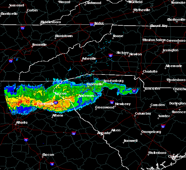 At 751 pm edt, doppler radar indicated a line of severe thunderstorms with a history of producing damaging winds in excess of 60 mph. these storms were located along a line extending from 5 miles northeast of anderson to 6 miles south of hartwell to 3 miles northwest of commerce, moving southeast at 50 mph. locations impacted include, anderson, hartwell, carnesville, homeland park, northlake, pendleton, royston, reed creek, lavonia and gumlog. At 751 pm edt, doppler radar indicated a line of severe thunderstorms with a history of producing damaging winds in excess of 60 mph. these storms were located along a line extending from 5 miles northeast of anderson to 6 miles south of hartwell to 3 miles northwest of commerce, moving southeast at 50 mph. locations impacted include, anderson, hartwell, carnesville, homeland park, northlake, pendleton, royston, reed creek, lavonia and gumlog.
|
| 7/14/2015 7:47 PM EDT |
 At 746 pm edt, doppler radar indicated a line of severe thunderstorms with a history of producing damaging winds in excess of 60 mph. these storms were located along a line extending from 6 miles east of clemson to 3 miles southeast of hartwell to 7 miles east of commerce, and moving southeast at 45 mph. At 746 pm edt, doppler radar indicated a line of severe thunderstorms with a history of producing damaging winds in excess of 60 mph. these storms were located along a line extending from 6 miles east of clemson to 3 miles southeast of hartwell to 7 miles east of commerce, and moving southeast at 45 mph.
|
| 7/14/2015 7:35 PM EDT |
 At 734 pm edt, doppler radar indicated a line of severe thunderstorms with a history of producing damaging winds in excess of 60 mph. these storms were located along a line extending from 6 miles east of clemson to 8 miles east of carnesville to 7 miles west of homer, moving southeast at 25 mph. locations impacted include, anderson, clemson, toccoa, seneca, hartwell, carnesville, homeland park, central, lake hartwell, williamston and cornelia. At 734 pm edt, doppler radar indicated a line of severe thunderstorms with a history of producing damaging winds in excess of 60 mph. these storms were located along a line extending from 6 miles east of clemson to 8 miles east of carnesville to 7 miles west of homer, moving southeast at 25 mph. locations impacted include, anderson, clemson, toccoa, seneca, hartwell, carnesville, homeland park, central, lake hartwell, williamston and cornelia.
|
| 7/14/2015 7:07 PM EDT |
 At 705 pm edt, doppler radar indicated a line of severe thunderstorms with a history of producing damaging winds of up to 70 mph. these storms were located along a line extending from 5 miles northeast of walhalla to 5 miles south of toccoa to 9 miles southwest of clarkesville, moving south at 45 mph. locations impacted include, anderson, clemson, toccoa, seneca, hartwell, walhalla, clarkesville, carnesville, lake keowee, lake hartwell, homeland park and central. At 705 pm edt, doppler radar indicated a line of severe thunderstorms with a history of producing damaging winds of up to 70 mph. these storms were located along a line extending from 5 miles northeast of walhalla to 5 miles south of toccoa to 9 miles southwest of clarkesville, moving south at 45 mph. locations impacted include, anderson, clemson, toccoa, seneca, hartwell, walhalla, clarkesville, carnesville, lake keowee, lake hartwell, homeland park and central.
|
| 7/14/2015 6:48 PM EDT |
 At 646 pm edt, doppler radar indicated a line of severe thunderstorms with a history of producing damaging winds up to 60 mph. these storms were located along a line extending from 17 miles southeast of franklin to 8 miles east of clayton to 8 miles northwest of clarkesville, and moving southeast at 40 mph. At 646 pm edt, doppler radar indicated a line of severe thunderstorms with a history of producing damaging winds up to 60 mph. these storms were located along a line extending from 17 miles southeast of franklin to 8 miles east of clayton to 8 miles northwest of clarkesville, and moving southeast at 40 mph.
|
| 7/2/2015 2:40 PM EDT | Trees down at e calhoun st and old colony rd in anderson county SC, 0.8 miles WNW of Anderson, SC |
| 7/2/2015 2:26 PM EDT |
 At 226 pm edt, doppler radar indicated a line of severe thunderstorms capable of producing damaging winds in excess of 60 mph. these storms were located along a line extending from 5 miles southwest of mauldin to 12 miles south of easley to 5 miles south of anderson, and moving southeast at 30 mph. penny size hail may also accompany the damaging winds. At 226 pm edt, doppler radar indicated a line of severe thunderstorms capable of producing damaging winds in excess of 60 mph. these storms were located along a line extending from 5 miles southwest of mauldin to 12 miles south of easley to 5 miles south of anderson, and moving southeast at 30 mph. penny size hail may also accompany the damaging winds.
|
| 6/30/2015 2:00 PM EDT | Quarter sized hail reported 0.6 miles NE of Anderson, SC |
| 6/30/2015 1:50 PM EDT | Quarter sized hail reported 0.6 miles NE of Anderson, SC, quarter sized hail to the east of the anderson airport |
| 6/30/2015 1:50 PM EDT | Power lines down on melody rd in anderson county SC, 3.6 miles NNW of Anderson, SC |
| 6/30/2015 1:45 PM EDT | Quarter sized hail reported 0.6 miles NE of Anderson, SC, quarter size hail in downtown anderson |
| 6/30/2015 1:43 PM EDT |
 At 141 pm edt, doppler radar indicated a line of severe thunderstorms capable of producing large hail up to ping pong ball size and damaging winds in excess of 60 mph. these storms were located along a line extending from near pendleton to anderson to 9 miles east of hartwell, moving northeast at 30 mph. locations impacted include, anderson, homeland park, powdersville, piedmont, belton, williamston, northlake, west pelzer, anderson airport and sandy springs. At 141 pm edt, doppler radar indicated a line of severe thunderstorms capable of producing large hail up to ping pong ball size and damaging winds in excess of 60 mph. these storms were located along a line extending from near pendleton to anderson to 9 miles east of hartwell, moving northeast at 30 mph. locations impacted include, anderson, homeland park, powdersville, piedmont, belton, williamston, northlake, west pelzer, anderson airport and sandy springs.
|
| 6/30/2015 1:28 PM EDT |
 At 128 pm edt, doppler radar indicated a line of severe thunderstorms capable of producing quarter size hail and damaging winds in excess of 60 mph. these storms were located along a line extending from near clemson to 11 miles southeast of seneca to 5 miles west of anderson to 4 miles northeast of hartwell, and moving northeast at 30 mph. At 128 pm edt, doppler radar indicated a line of severe thunderstorms capable of producing quarter size hail and damaging winds in excess of 60 mph. these storms were located along a line extending from near clemson to 11 miles southeast of seneca to 5 miles west of anderson to 4 miles northeast of hartwell, and moving northeast at 30 mph.
|
| 6/26/2015 6:06 PM EDT | At 606 pm edt, the public reported a severe thunderstorm producing quarter size hail and damaging winds in excess of 60 mph. this storm was located 8 miles northeast of anderson, or 4 miles west of williamston, moving northeast at 15 mph. locations impacted include, belton, williamston, west pelzer and northlake. |
| 6/26/2015 5:52 PM EDT | At 552 pm edt, the public reported a severe thunderstorm producing quarter size hail and damaging winds in excess of 60 mph. this storm was located near anderson, moving northeast at 15 mph. locations impacted include, anderson, homeland park, belton, williamston, northlake, west pelzer, anderson airport and broadway lake. |
| 6/26/2015 5:47 PM EDT | Trees blown down off 700 concord rd in anderson... s in anderson county SC, 2.4 miles S of Anderson, SC |
| 6/26/2015 5:45 PM EDT | 2 large trees blown down at 326 ave of oaks in anderson... s in anderson county SC, 1.8 miles SSE of Anderson, SC |
| 6/26/2015 5:45 PM EDT | One tree down on the porch of a house. also...a few trees uprooted and snapped as well as large branches down nearb in anderson county SC, 1.6 miles ENE of Anderson, SC |
| 6/26/2015 5:44 PM EDT | Quarter sized hail reported 1.8 miles SSE of Anderson, SC, 1 inch hail at 326 ave of oaks... anderson... sc. |
| 6/26/2015 5:37 PM EDT | At 537 pm edt, doppler radar indicated a severe thunderstorm capable of producing quarter size hail and damaging winds in excess of 60 mph. this storm was located near anderson, and moving northeast at 15 mph. |
| 6/18/2015 7:51 PM EDT | At 751 pm edt, doppler radar indicated a severe thunderstorm capable of producing quarter size hail and damaging winds in excess of 60 mph. this storm was located 11 miles northeast of hartwell, or near lake hartwell, moving east at 10 mph. locations impacted include, homeland park, northlake, starr, anderson airport, lake hartwell, sadlers creek state park, sandy springs and anderson. |
| 6/18/2015 7:37 PM EDT | At 737 pm edt, doppler radar indicated a severe thunderstorm capable of producing quarter size hail and damaging winds in excess of 60 mph. this storm was located 10 miles northeast of hartwell, or near lake hartwell, and moving east at 10 mph. |
| 6/18/2015 7:37 PM EDT | At 737 pm edt, doppler radar indicated a severe thunderstorm capable of producing quarter size hail and damaging winds in excess of 60 mph. this storm was located 10 miles northeast of hartwell, or near lake hartwell, and moving east at 10 mph. |
| 6/9/2015 8:22 PM EDT |
 The severe thunderstorm warning for south central greenville and northeastern anderson counties will expire at 830 pm edt, the storm which prompted the warning has weakened below severe limits, and no longer poses an immediate threat to life or property. therefore the warning will be allowed to expire. however heavy rain is still possible with this thunderstorm. The severe thunderstorm warning for south central greenville and northeastern anderson counties will expire at 830 pm edt, the storm which prompted the warning has weakened below severe limits, and no longer poses an immediate threat to life or property. therefore the warning will be allowed to expire. however heavy rain is still possible with this thunderstorm.
|
| 6/9/2015 7:58 PM EDT |
 At 758 pm edt, doppler radar indicated a severe thunderstorm capable of producing quarter size hail and damaging winds in excess of 60 mph. this storm was located 9 miles southwest of mauldin, or 4 miles northeast of west pelzer, moving south at 5 mph. locations impacted include, anderson, piedmont, belton, williamston, northlake, west pelzer, donaldson center, powderville and west greenville. At 758 pm edt, doppler radar indicated a severe thunderstorm capable of producing quarter size hail and damaging winds in excess of 60 mph. this storm was located 9 miles southwest of mauldin, or 4 miles northeast of west pelzer, moving south at 5 mph. locations impacted include, anderson, piedmont, belton, williamston, northlake, west pelzer, donaldson center, powderville and west greenville.
|
| 6/9/2015 7:40 PM EDT |
 At 740 pm edt, doppler radar indicated a severe thunderstorm capable of producing quarter size hail and damaging winds in excess of 60 mph. this storm was located 11 miles southeast of easley, or near piedmont, and moving south at 20 mph. At 740 pm edt, doppler radar indicated a severe thunderstorm capable of producing quarter size hail and damaging winds in excess of 60 mph. this storm was located 11 miles southeast of easley, or near piedmont, and moving south at 20 mph.
|
| 6/3/2015 8:15 PM EDT | At 814 pm edt, doppler radar indicated a severe thunderstorm capable of producing quarter size hail and damaging winds in excess of 60 mph. this storm was located 5 miles west of anderson, or near anderson airport, moving southeast at 15 mph. locations impacted include, anderson, homeland park, northlake, pendleton, anderson airport, lake hartwell, sandy springs and townville. |
| 6/3/2015 7:48 PM EDT | At 747 pm edt, doppler radar indicated a severe thunderstorm capable of producing quarter size hail and damaging winds in excess of 60 mph. this storm was located 9 miles south of clemson, or near townville, and moving east at 10 mph. |
| 5/26/2015 7:33 PM EDT | At 733 pm edt, doppler radar indicated a line of severe thunderstorms capable of producing quarter size hail and damaging winds in excess of 60 mph. these storms were located along a line extending from 8 miles south of easley to 12 miles north of abbeville, moving northeast at 50 mph. locations impacted include, anderson, abbeville, homeland park, belton, williamston, northlake, honea path, calhoun falls, due west and iva. |
| 5/26/2015 7:22 PM EDT | At 722 pm edt, doppler radar indicated a line of severe thunderstorms capable of producing quarter size hail and damaging winds in excess of 60 mph. these storms were located along a line extending from 9 miles east of clemson to 10 miles north of abbeville, moving northeast at 45 mph. locations impacted include, anderson, abbeville, homeland park, belton, williamston, northlake, honea path, pendleton, calhoun falls and due west. |
| 5/26/2015 7:08 PM EDT | At 707 pm edt, doppler radar indicated a line of severe thunderstorms capable of producing quarter size hail and damaging winds in excess of 60 mph. these storms were located along a line extending from 5 miles south of clemson to 13 miles northwest of abbeville, moving northeast at 55 mph. locations impacted include, anderson, abbeville, homeland park, belton, williamston, northlake, honea path, pendleton, calhoun falls and due west. |
| 5/26/2015 6:51 PM EDT | At 651 pm edt, doppler radar indicated a line of severe thunderstorms capable of producing quarter size hail and damaging winds in excess of 60 mph. these storms were located along a line extending from 7 miles north of hartwell to 4 miles northeast of elberton, and moving northeast at 50 mph. |
| 4/20/2015 3:54 PM EDT | The national weather service in columbia has issued a * tornado warning for. anderson county in south carolina. this includes the city of anderson. greenville county in south carolina. Until 445 pm edt. |
| 4/20/2015 3:26 PM EDT | At 325 pm edt, national weather service doppler radar indicated a severe thunderstorm capable of producing quarter size hail, and destructive winds in excess of 70 mph. this storm was located 6 miles northeast of martin, or 13 miles east of toccoa, and moving east at 35 mph. * the severe thunderstorm will be near, fair play by 335 pm edt, 7 miles south of seneca by 340 pm edt, sandy springs, pendleton and clemson by 355 pm edt, 7 miles south of central and 9 miles south of norris by 400 pm edt, 6 miles northwest of williamston and 7 miles southwest of piedmont by 415 pm edt,. |
| 4/20/2015 3:26 PM EDT | At 325 pm edt, national weather service doppler radar indicated a severe thunderstorm capable of producing quarter size hail, and destructive winds in excess of 70 mph. this storm was located 6 miles northeast of martin, or 13 miles east of toccoa, and moving east at 35 mph. * the severe thunderstorm will be near, fair play by 335 pm edt, 7 miles south of seneca by 340 pm edt, sandy springs, pendleton and clemson by 355 pm edt, 7 miles south of central and 9 miles south of norris by 400 pm edt, 6 miles northwest of williamston and 7 miles southwest of piedmont by 415 pm edt,. |
| 4/9/2015 4:41 PM EDT | A severe thunderstorm warning remains in effect until 500 pm edt for central abbeville and southeastern anderson counties. at 440 pm edt. doppler radar indicated a severe thunderstorm capable of producing quarter size hail and damaging winds in excess of 60 mph. this storm was located 13 miles south of anderson. or over iva. Moving northeast at 25 mph. |
| 4/9/2015 4:18 PM EDT | The national weather service in greenville-spartanburg has issued a * severe thunderstorm warning for. southeastern hart county in northeastern georgia. northeastern elbert county in northeastern georgia. northwestern abbeville county in upstate south carolina. Southeastern anderson county in upstate south carolina. |
| 4/9/2015 4:18 PM EDT | The national weather service in greenville-spartanburg has issued a * severe thunderstorm warning for. southeastern hart county in northeastern georgia. northeastern elbert county in northeastern georgia. northwestern abbeville county in upstate south carolina. Southeastern anderson county in upstate south carolina. |
| 9/13/2014 5:20 PM EDT | Multiple trees down on east morris street between main and greenville stree in anderson county SC, 0.6 miles NE of Anderson, SC |
| 5/14/2014 9:21 PM EDT | One tree down on hunter street fell on power line in anderson county SC, 1.9 miles NE of Anderson, SC |
| 7/17/2013 7:05 PM EDT | Quarter sized hail reported 7.1 miles ESE of Anderson, SC, nws employee relayed report of quarter size hail near lake hartwell in the sandy springs community. |
| 7/8/2013 11:52 PM EDT | Tree in road on sc hwy 24 near the intersection of pearman dairy roa in anderson county SC, 2.8 miles NE of Anderson, SC |
| 7/5/2013 4:15 PM EDT | Tree down on bolt driv in anderson county SC, 3.8 miles NW of Anderson, SC |
| 6/28/2013 7:29 PM EDT | 2 trees down in yard off of hwy 114 in anderson county SC, 9.5 miles ENE of Anderson, SC |
| 6/10/2013 1:24 PM EDT | Trees down on amity rd in anderson county SC, 3.6 miles W of Anderson, SC |
| 6/2/2013 6:31 PM EDT | Tree in roadway near intersection of highway 76 and highway 25 in anderson county SC, 5.6 miles NW of Anderson, SC |
| 1/30/2013 5:45 PM EST | Trees down off broadway school rd ene of anderson and just west of belto in anderson county SC, 3.7 miles WSW of Anderson, SC |
| 10/2/2012 5:00 AM EDT | Damage to 5 or 6 homes in subdivision off highway 28 by-pass...monitor dr/kingsboro rd area. several trees dow in anderson county SC, 1.1 miles ENE of Anderson, SC |
| 8/9/2012 4:14 PM EDT | Multiple large tree limbs blown down and some urban flooding in anderson county SC, 2.2 miles E of Anderson, SC |
| 7/24/2012 6:56 PM EDT | Tree in roadway near intersection of highway 252 and shirley store roa in anderson county SC, 4.7 miles NW of Anderson, SC |
| 7/16/2012 8:50 PM EDT | Numerous trees down across the county...from pendleton to iv in anderson county SC, 0.6 miles NE of Anderson, SC |
| 7/1/2012 10:00 PM EDT | Several trees blown down across city of anderson. first reports received around 10 p in anderson county SC, 0.6 miles NE of Anderson, SC |
| 6/14/2012 6:30 AM EDT | Quarter sized hail reported 4.9 miles SE of Anderson, SC |
| 6/14/2012 5:51 AM EDT | Multiple trees blown down across cobbs glen country club golf cours in anderson county SC, 1.9 miles ESE of Anderson, SC |
| 6/14/2012 5:51 AM EDT | Tree in roadway at stringer road and old williamston roa in anderson county SC, 1.9 miles ESE of Anderson, SC |
| 1/1/0001 12:00 AM | Tree down in anderson in anderson county SC, 0.6 miles NE of Anderson, SC |
| 1/1/0001 12:00 AM | Police report 5 trees dow in anderson county SC, 0.6 miles NE of Anderson, SC |
| 1/1/0001 12:00 AM | Trees down off east greenvil in anderson county SC, 0.6 miles NE of Anderson, SC |
| 1/1/0001 12:00 AM | Numerous trees down around city of anderso in anderson county SC, 0.6 miles NE of Anderson, SC |
| 1/1/0001 12:00 AM | Large branches broke in anderson county SC, 0.6 miles NE of Anderson, SC |
| 1/1/0001 12:00 AM | Tree blocking simpson road. time determined by rada in anderson county SC, 0.8 miles WSW of Anderson, SC |
| 1/1/0001 12:00 AM | Half Dollar sized hail reported 10.6 miles ESE of Anderson, SC, ice cube size hail on coneross creek rd- between quarter and golf ball size. |
| 1/1/0001 12:00 AM | Numerous trees down in and around the city of anderso in anderson county SC, 0.6 miles NE of Anderson, SC |
| 1/1/0001 12:00 AM | Quarter sized hail reported 1.8 miles NNE of Anderson, SC, dime to quarter size hail on dun |
| 1/1/0001 12:00 AM | Tree down in anderson county SC, 0.6 miles NE of Anderson, SC |
Hail Maps for Anderson, SC
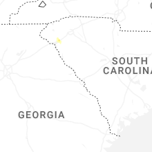


Connect with Interactive Hail Maps