

Hail Map for Andrews, IN
The Andrews, IN area has had 5 reports of on-the-ground hail by trained spotters, and has been under severe weather warnings 23 times during the past 12 months. Doppler radar has detected hail at or near Andrews, IN on 38 occasions, including 2 occasions during the past year.
| Name: | Andrews, IN |
| Where Located: | 30.2 miles WSW of Fort Wayne, IN |
| Map: | Google Map for Andrews, IN |
| Population: | 1149 |
| Housing Units: | 512 |
| More Info: | Search Google for Andrews, IN |
0
The Top Recent Hail Date for Andrews, IN is Wednesday, June 25, 2025 (38th out of 38)
Hail and Wind Damage Spotted near Andrews, IN
| Date / Time | Report Details |
|---|---|
| 6/25/2025 6:36 PM EDT | The severe thunderstorm which prompted the warning has weakened. therefore, the warning will be allowed to expire. |
| 6/25/2025 6:11 PM EDT |
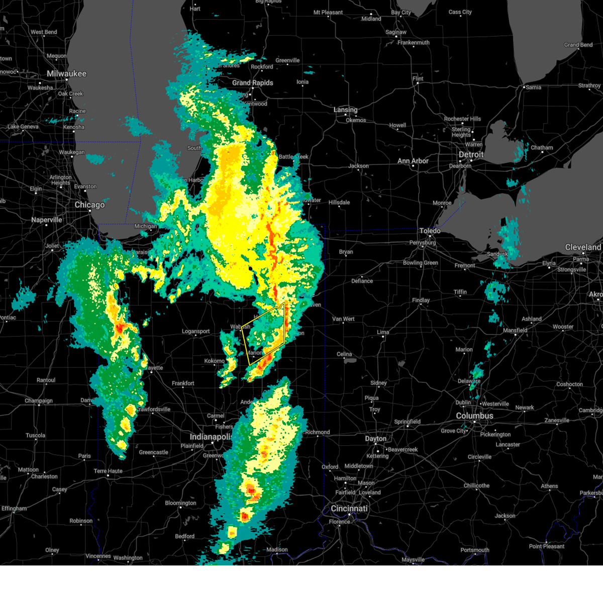
 Svriwx the national weather service in northern indiana has issued a * severe thunderstorm warning for, northeastern wabash county in north central indiana, northern huntington county in northeastern indiana, * until 645 pm edt. * at 611 pm edt, a severe thunderstorm was located over andrews, or 7 miles west of huntington, moving northeast at 20 mph (radar indicated). Hazards include 60 mph wind gusts and penny size hail. expect damage to roofs, siding, and trees Svriwx the national weather service in northern indiana has issued a * severe thunderstorm warning for, northeastern wabash county in north central indiana, northern huntington county in northeastern indiana, * until 645 pm edt. * at 611 pm edt, a severe thunderstorm was located over andrews, or 7 miles west of huntington, moving northeast at 20 mph (radar indicated). Hazards include 60 mph wind gusts and penny size hail. expect damage to roofs, siding, and trees
|
| 6/18/2025 5:15 PM EDT | Tree down on power line in huntington county IN, 8.4 miles N of Andrews, IN |
| 5/16/2025 8:01 PM EDT |
 the severe thunderstorm warning has been cancelled and is no longer in effect the severe thunderstorm warning has been cancelled and is no longer in effect
|
| 5/16/2025 8:01 PM EDT |
 At 800 pm edt, showers and embedded thunderstorms with strong winds were affecting the warned area, moving northeast at 50 mph (radar indicated). Hazards include 60 mph wind gusts. Expect damage to roofs, siding, and trees. Locations impacted include, huntington, warsaw, columbia city, winona lake, syracuse, tri-lakes, churubusco, south whitley, milford, andrews, north webster, pierceton, roanoke, etna, silver lake, leesburg, claypool, larwill, sidney, and blue lake. At 800 pm edt, showers and embedded thunderstorms with strong winds were affecting the warned area, moving northeast at 50 mph (radar indicated). Hazards include 60 mph wind gusts. Expect damage to roofs, siding, and trees. Locations impacted include, huntington, warsaw, columbia city, winona lake, syracuse, tri-lakes, churubusco, south whitley, milford, andrews, north webster, pierceton, roanoke, etna, silver lake, leesburg, claypool, larwill, sidney, and blue lake.
|
| 5/16/2025 7:41 PM EDT | Svriwx the national weather service in northern indiana has issued a * severe thunderstorm warning for, grant county in central indiana, huntington county in northeastern indiana, blackford county in east central indiana, wells county in northeastern indiana, adams county in northeastern indiana, jay county in east central indiana, * until 845 pm edt. * at 741 pm edt, severe thunderstorms were located along a line extending from la fontaine to near muncie, moving northeast at 55 mph (radar indicated). Hazards include 60 mph wind gusts. expect damage to roofs, siding, and trees |
| 5/16/2025 7:33 PM EDT | Multiple reports of trees down in andrew in huntington county IN, 0.2 miles NW of Andrews, IN |
| 5/16/2025 7:29 PM EDT | Svriwx the national weather service in northern indiana has issued a * severe thunderstorm warning for, whitley county in northeastern indiana, northern huntington county in northeastern indiana, kosciusko county in north central indiana, southeastern marshall county in north central indiana, * until 815 pm edt. * at 729 pm edt, showers and embedded thunderstorms with strong winds were located along a line extending from near mentone to 6 miles east of akron to near wabash, moving northeast at 50 mph (radar indicated). Hazards include 60 mph wind gusts. expect damage to roofs, siding, and trees |
| 3/30/2025 5:21 PM EDT |
 The storms which prompted the warning have moved out of the area. therefore, the warning will be allowed to expire. however, gusty winds are still possible with these thunderstorms. a tornado watch remains in effect until 800 pm edt for central, north central and northeastern indiana. remember, a severe thunderstorm warning still remains in effect for whitley, huntington, and allen counties until 6 pm edt. The storms which prompted the warning have moved out of the area. therefore, the warning will be allowed to expire. however, gusty winds are still possible with these thunderstorms. a tornado watch remains in effect until 800 pm edt for central, north central and northeastern indiana. remember, a severe thunderstorm warning still remains in effect for whitley, huntington, and allen counties until 6 pm edt.
|
| 3/30/2025 5:12 PM EDT | the severe thunderstorm warning has been cancelled and is no longer in effect |
| 3/30/2025 5:12 PM EDT | At 511 pm edt, severe thunderstorms were located along a line extending from near middlebury to near andrews, moving east at 65 mph. damage was reported in etna green around 5 pm, including trees and powerlines down (public). Hazards include 70 mph wind gusts and nickel size hail. Expect considerable tree damage. damage is likely to mobile homes, roofs, and outbuildings. locations impacted include, mcnatts, topeka, honeyville, landess, blue lake, la fontaine, tri-lakes, buckeye, larwill, lake wawasee, bippus, luther, bowerstown, south whitley, servia, coesse, goose lake, knapp lake, jalapa, and loon lake. This includes interstate 69 in indiana between mile markers 266 and 293. |
| 3/30/2025 5:05 PM EDT |
 Svriwx the national weather service in northern indiana has issued a * severe thunderstorm warning for, southeastern elkhart county in north central indiana, wabash county in north central indiana, noble county in northeastern indiana, northern grant county in central indiana, whitley county in northeastern indiana, huntington county in northeastern indiana, eastern kosciusko county in north central indiana, southern lagrange county in northeastern indiana, steuben county in northeastern indiana, allen county in northeastern indiana, de kalb county in northeastern indiana, wells county in northeastern indiana, northern adams county in northeastern indiana, * until 600 pm edt. * at 504 pm edt, severe thunderstorms were located along a line extending from millersburg to 6 miles northwest of van buren, moving east at 115 mph (radar indicated). Hazards include 70 mph wind gusts and quarter size hail. Hail damage to vehicles is expected. expect considerable tree damage. Wind damage is also likely to mobile homes, roofs, and outbuildings. Svriwx the national weather service in northern indiana has issued a * severe thunderstorm warning for, southeastern elkhart county in north central indiana, wabash county in north central indiana, noble county in northeastern indiana, northern grant county in central indiana, whitley county in northeastern indiana, huntington county in northeastern indiana, eastern kosciusko county in north central indiana, southern lagrange county in northeastern indiana, steuben county in northeastern indiana, allen county in northeastern indiana, de kalb county in northeastern indiana, wells county in northeastern indiana, northern adams county in northeastern indiana, * until 600 pm edt. * at 504 pm edt, severe thunderstorms were located along a line extending from millersburg to 6 miles northwest of van buren, moving east at 115 mph (radar indicated). Hazards include 70 mph wind gusts and quarter size hail. Hail damage to vehicles is expected. expect considerable tree damage. Wind damage is also likely to mobile homes, roofs, and outbuildings.
|
| 3/30/2025 4:50 PM EDT | the severe thunderstorm warning has been cancelled and is no longer in effect |
| 3/30/2025 4:50 PM EDT | At 450 pm edt, severe thunderstorms were located along a line extending from near nappanee to near peru, moving northeast at 65 mph (radar indicated). Hazards include 70 mph wind gusts and nickel size hail. Expect considerable tree damage. damage is likely to mobile homes, roofs, and outbuildings. locations impacted include, mcnatts, honeyville, atwood, la fontaine, macy, tri-lakes, locke, syracuse, bippus, luther, nead, bowerstown, little chapman lake, warsaw, james lake, goose lake, knapp lake, jalapa, new paris, and loon lake. This includes interstate 69 in indiana between mile markers 266 and 293. |
| 3/30/2025 4:33 PM EDT |
 Svriwx the national weather service in northern indiana has issued a * severe thunderstorm warning for, southern elkhart county in north central indiana, wabash county in north central indiana, noble county in northeastern indiana, northern grant county in central indiana, whitley county in northeastern indiana, huntington county in northeastern indiana, kosciusko county in north central indiana, cass county in north central indiana, southwestern lagrange county in northeastern indiana, fulton county in north central indiana, western wells county in northeastern indiana, miami county in north central indiana, marshall county in north central indiana, * until 530 pm edt. * at 433 pm edt, severe thunderstorms were located along a line extending from plymouth to near walton, moving northeast at 65 mph (radar indicated). Hazards include 70 mph wind gusts and nickel size hail. Expect considerable tree damage. Damage is likely to mobile homes, roofs, and outbuildings. Svriwx the national weather service in northern indiana has issued a * severe thunderstorm warning for, southern elkhart county in north central indiana, wabash county in north central indiana, noble county in northeastern indiana, northern grant county in central indiana, whitley county in northeastern indiana, huntington county in northeastern indiana, kosciusko county in north central indiana, cass county in north central indiana, southwestern lagrange county in northeastern indiana, fulton county in north central indiana, western wells county in northeastern indiana, miami county in north central indiana, marshall county in north central indiana, * until 530 pm edt. * at 433 pm edt, severe thunderstorms were located along a line extending from plymouth to near walton, moving northeast at 65 mph (radar indicated). Hazards include 70 mph wind gusts and nickel size hail. Expect considerable tree damage. Damage is likely to mobile homes, roofs, and outbuildings.
|
| 3/19/2025 9:05 PM EDT |
 The storms which prompted the warning have weakened below severe limits, and have exited the warned area. therefore, the warning will be allowed to expire. a severe thunderstorm watch remains in effect until 100 am edt for central, north central and northeastern indiana. The storms which prompted the warning have weakened below severe limits, and have exited the warned area. therefore, the warning will be allowed to expire. a severe thunderstorm watch remains in effect until 100 am edt for central, north central and northeastern indiana.
|
| 3/19/2025 8:41 PM EDT |
 Svriwx the national weather service in northern indiana has issued a * severe thunderstorm warning for, southwestern allen county in northeastern indiana, southeastern wabash county in north central indiana, northeastern grant county in central indiana, huntington county in northeastern indiana, western wells county in northeastern indiana, * until 915 pm edt. * at 841 pm edt, severe thunderstorms were located along a line extending from near andrews to 6 miles south of huntington to near jonesboro, moving northeast at 60 mph (radar indicated). Hazards include 60 mph wind gusts and penny size hail. expect damage to roofs, siding, and trees Svriwx the national weather service in northern indiana has issued a * severe thunderstorm warning for, southwestern allen county in northeastern indiana, southeastern wabash county in north central indiana, northeastern grant county in central indiana, huntington county in northeastern indiana, western wells county in northeastern indiana, * until 915 pm edt. * at 841 pm edt, severe thunderstorms were located along a line extending from near andrews to 6 miles south of huntington to near jonesboro, moving northeast at 60 mph (radar indicated). Hazards include 60 mph wind gusts and penny size hail. expect damage to roofs, siding, and trees
|
| 3/15/2025 4:16 AM EDT | Svriwx the national weather service in northern indiana has issued a * severe thunderstorm warning for, western allen county in northeastern indiana, eastern wabash county in north central indiana, southern noble county in northeastern indiana, whitley county in northeastern indiana, southwestern de kalb county in northeastern indiana, huntington county in northeastern indiana, southeastern kosciusko county in north central indiana, northeastern wells county in northeastern indiana, * until 445 am edt. * at 416 am edt, severe thunderstorms were located along a line extending from near north webster to andrews to near la fontaine, moving northeast at 55 mph (radar indicated). Hazards include 60 mph wind gusts. expect damage to roofs, siding, and trees |
| 3/15/2025 4:11 AM EDT | The storms which prompted the warning have weakened below severe limits, and no longer pose an immediate threat to life or property. therefore, the warning will be allowed to expire. however, gusty winds are still possible with these thunderstorms. a severe thunderstorm watch remains in effect until 900 am edt for central, north central and northeastern indiana. to report severe weather, contact your nearest law enforcement agency. they will relay your report to the national weather service northern indiana. |
| 3/15/2025 4:00 AM EDT | At 400 am edt, severe thunderstorms were located along a line extending from 6 miles east of akron to wabash to 8 miles northeast of kokomo, moving northeast at 55 mph (radar indicated). Hazards include 60 mph wind gusts. Expect damage to roofs, siding, and trees. Locations impacted include, richvalley, gas city, wabash, amboy, collamer, liberty mills, north manchester, la fontaine, mier, herbst, wawpecong, roann, point isabel, jonesboro, banquo, peoria, roseburg, bippus, swayzee, and luther. |
| 3/15/2025 3:48 AM EDT |
 Svriwx the national weather service in northern indiana has issued a * severe thunderstorm warning for, wabash county in north central indiana, grant county in central indiana, southwestern whitley county in northeastern indiana, western huntington county in northeastern indiana, southeastern kosciusko county in north central indiana, miami county in north central indiana, * until 415 am edt. * at 348 am edt, severe thunderstorms were located along a line extending from 8 miles south of akron to near peru to near kokomo, moving northeast at 60 mph (radar indicated). Hazards include 60 mph wind gusts. expect damage to roofs, siding, and trees Svriwx the national weather service in northern indiana has issued a * severe thunderstorm warning for, wabash county in north central indiana, grant county in central indiana, southwestern whitley county in northeastern indiana, western huntington county in northeastern indiana, southeastern kosciusko county in north central indiana, miami county in north central indiana, * until 415 am edt. * at 348 am edt, severe thunderstorms were located along a line extending from 8 miles south of akron to near peru to near kokomo, moving northeast at 60 mph (radar indicated). Hazards include 60 mph wind gusts. expect damage to roofs, siding, and trees
|
| 7/16/2024 12:50 AM EDT |
 Svriwx the national weather service in northern indiana has issued a * severe thunderstorm warning for, southeastern wabash county in north central indiana, northeastern grant county in central indiana, huntington county in northeastern indiana, wells county in northeastern indiana, adams county in northeastern indiana, * until 130 am edt. * at 1250 am edt, severe thunderstorms were located along a line extending from near huntington to near van buren, moving east at 70 mph (radar indicated). Hazards include 60 mph wind gusts. expect damage to roofs, siding, and trees Svriwx the national weather service in northern indiana has issued a * severe thunderstorm warning for, southeastern wabash county in north central indiana, northeastern grant county in central indiana, huntington county in northeastern indiana, wells county in northeastern indiana, adams county in northeastern indiana, * until 130 am edt. * at 1250 am edt, severe thunderstorms were located along a line extending from near huntington to near van buren, moving east at 70 mph (radar indicated). Hazards include 60 mph wind gusts. expect damage to roofs, siding, and trees
|
| 7/14/2024 12:40 PM EDT |
 the severe thunderstorm warning has been cancelled and is no longer in effect the severe thunderstorm warning has been cancelled and is no longer in effect
|
| 7/14/2024 12:40 PM EDT |
 At 1239 pm edt, a severe thunderstorm was located over huntington, moving southeast at 40 mph (emergency management reported trees down in south whitley). Hazards include 60 mph wind gusts. Expect damage to roofs, siding, and trees. locations impacted include, huntington, andrews, markle, roanoke, bowerstown, goblesville, plum tree, buckeye, washington center, majenica, mahon, bippus, and luther. This includes interstate 69 in indiana between mile markers 278 and 292. At 1239 pm edt, a severe thunderstorm was located over huntington, moving southeast at 40 mph (emergency management reported trees down in south whitley). Hazards include 60 mph wind gusts. Expect damage to roofs, siding, and trees. locations impacted include, huntington, andrews, markle, roanoke, bowerstown, goblesville, plum tree, buckeye, washington center, majenica, mahon, bippus, and luther. This includes interstate 69 in indiana between mile markers 278 and 292.
|
| 7/14/2024 12:26 PM EDT |
 Svriwx the national weather service in northern indiana has issued a * severe thunderstorm warning for, northeastern wabash county in north central indiana, southwestern whitley county in northeastern indiana, huntington county in northeastern indiana, * until 100 pm edt. * at 1226 pm edt, a severe thunderstorm was located near north manchester, moving southeast at 40 mph (radar indicated). Hazards include 60 mph wind gusts. expect damage to roofs, siding, and trees Svriwx the national weather service in northern indiana has issued a * severe thunderstorm warning for, northeastern wabash county in north central indiana, southwestern whitley county in northeastern indiana, huntington county in northeastern indiana, * until 100 pm edt. * at 1226 pm edt, a severe thunderstorm was located near north manchester, moving southeast at 40 mph (radar indicated). Hazards include 60 mph wind gusts. expect damage to roofs, siding, and trees
|
| 5/7/2024 6:04 PM EDT |
 Svriwx the national weather service in northern indiana has issued a * severe thunderstorm warning for, wabash county in north central indiana, southern whitley county in northeastern indiana, northern huntington county in northeastern indiana, southeastern kosciusko county in north central indiana, north central miami county in north central indiana, * until 630 pm edt. * at 604 pm edt, severe thunderstorms were located along a line extending from 9 miles northeast of mexico to 6 miles northeast of wabash to near huntington, moving northeast at 50 mph (radar indicated). Hazards include 60 mph wind gusts and quarter size hail. Hail damage to vehicles is expected. Expect wind damage to roofs, siding, and trees. Svriwx the national weather service in northern indiana has issued a * severe thunderstorm warning for, wabash county in north central indiana, southern whitley county in northeastern indiana, northern huntington county in northeastern indiana, southeastern kosciusko county in north central indiana, north central miami county in north central indiana, * until 630 pm edt. * at 604 pm edt, severe thunderstorms were located along a line extending from 9 miles northeast of mexico to 6 miles northeast of wabash to near huntington, moving northeast at 50 mph (radar indicated). Hazards include 60 mph wind gusts and quarter size hail. Hail damage to vehicles is expected. Expect wind damage to roofs, siding, and trees.
|
| 3/14/2024 6:50 PM EDT |
 the severe thunderstorm warning has been cancelled and is no longer in effect the severe thunderstorm warning has been cancelled and is no longer in effect
|
| 3/14/2024 6:42 PM EDT |
 At 642 pm edt, a severe thunderstorm was located near andrews, or near huntington, moving east at 75 mph (radar indicated). Hazards include 60 mph wind gusts and quarter size hail. Hail damage to vehicles is expected. expect wind damage to roofs, siding, and trees. locations impacted include, huntington, wabash, andrews, markle, lancaster, lagro, mount etna, bowerstown, majenica, servia, lincolnville, and plum tree. This includes interstate 69 in indiana between mile markers 280 and 291. At 642 pm edt, a severe thunderstorm was located near andrews, or near huntington, moving east at 75 mph (radar indicated). Hazards include 60 mph wind gusts and quarter size hail. Hail damage to vehicles is expected. expect wind damage to roofs, siding, and trees. locations impacted include, huntington, wabash, andrews, markle, lancaster, lagro, mount etna, bowerstown, majenica, servia, lincolnville, and plum tree. This includes interstate 69 in indiana between mile markers 280 and 291.
|
| 3/14/2024 6:42 PM EDT |
 the severe thunderstorm warning has been cancelled and is no longer in effect the severe thunderstorm warning has been cancelled and is no longer in effect
|
| 3/14/2024 6:29 PM EDT |
 Svriwx the national weather service in northern indiana has issued a * severe thunderstorm warning for, southern wabash county in north central indiana, central huntington county in northeastern indiana, central miami county in north central indiana, * until 700 pm edt. * at 628 pm edt, a severe thunderstorm was located near wabash, moving east at 75 mph (emergency management confirmed ping pong size hail in peru at of 625 pm edt). Hazards include ping pong ball size hail and 60 mph wind gusts. People and animals outdoors will be injured. expect hail damage to roofs, siding, windows, and vehicles. Expect wind damage to roofs, siding, and trees. Svriwx the national weather service in northern indiana has issued a * severe thunderstorm warning for, southern wabash county in north central indiana, central huntington county in northeastern indiana, central miami county in north central indiana, * until 700 pm edt. * at 628 pm edt, a severe thunderstorm was located near wabash, moving east at 75 mph (emergency management confirmed ping pong size hail in peru at of 625 pm edt). Hazards include ping pong ball size hail and 60 mph wind gusts. People and animals outdoors will be injured. expect hail damage to roofs, siding, windows, and vehicles. Expect wind damage to roofs, siding, and trees.
|
| 7/29/2023 2:09 AM EDT |
 At 208 am edt, severe thunderstorms were located along a line extending from 6 miles south of winona lake to peru, moving east at 55 mph (radar indicated). Hazards include 60 mph wind gusts. expect damage to roofs, siding, and trees At 208 am edt, severe thunderstorms were located along a line extending from 6 miles south of winona lake to peru, moving east at 55 mph (radar indicated). Hazards include 60 mph wind gusts. expect damage to roofs, siding, and trees
|
| 3/31/2023 11:11 PM EDT | Quarter sized hail reported 0.2 miles NW of Andrews, IN |
| 8/29/2022 4:34 PM EDT |
 At 433 pm edt, severe thunderstorms were located along a line extending from near avilla to 6 miles north of huntington, moving east at 50 mph (radar indicated). Hazards include 70 mph wind gusts. Expect considerable tree damage. Damage is likely to mobile homes, roofs, and outbuildings. At 433 pm edt, severe thunderstorms were located along a line extending from near avilla to 6 miles north of huntington, moving east at 50 mph (radar indicated). Hazards include 70 mph wind gusts. Expect considerable tree damage. Damage is likely to mobile homes, roofs, and outbuildings.
|
| 7/23/2022 9:04 AM EDT |
 At 904 am edt, severe thunderstorms were located along a line extending from near andrews to near la fontaine to near kokomo, moving south at 40 mph (radar indicated). Hazards include 70 mph wind gusts. Expect considerable tree damage. Damage is likely to mobile homes, roofs, and outbuildings. At 904 am edt, severe thunderstorms were located along a line extending from near andrews to near la fontaine to near kokomo, moving south at 40 mph (radar indicated). Hazards include 70 mph wind gusts. Expect considerable tree damage. Damage is likely to mobile homes, roofs, and outbuildings.
|
| 3/6/2022 3:28 AM EST |
 The severe thunderstorm warning for western allen, southeastern wabash, southeastern noble, northern grant, whitley, huntington and wells counties will expire at 330 am est, the storms which prompted the warning have moved out of the area. therefore, the warning will be allowed to expire. however gusty winds up to around 45 mph are still possible. a severe thunderstorm watch remains in effect until 500 am est for central, north central and northeastern indiana. there are other warnings still in effect. visit our website for more information. The severe thunderstorm warning for western allen, southeastern wabash, southeastern noble, northern grant, whitley, huntington and wells counties will expire at 330 am est, the storms which prompted the warning have moved out of the area. therefore, the warning will be allowed to expire. however gusty winds up to around 45 mph are still possible. a severe thunderstorm watch remains in effect until 500 am est for central, north central and northeastern indiana. there are other warnings still in effect. visit our website for more information.
|
| 3/6/2022 3:13 AM EST |
 At 312 am est, severe thunderstorms were located along a line extending from huntertown to near markle to van buren, moving east at 65 mph (radar indicated). Hazards include 60 mph wind gusts. Expect damage to roofs, siding, and trees. locations impacted include, fort wayne, marion, huntington, new haven, bluffton, columbia city, ossian, tri-lakes, huntertown, avilla, churubusco, south whitley, sweetser, andrews, markle, la fontaine, van buren, aboite, leo-cedarville and swan. this includes the following highways, interstate 469 between mile markers 0 and 15, and between mile markers 25 and 30. Interstate 69 in indiana between mile markers 266 and 322. At 312 am est, severe thunderstorms were located along a line extending from huntertown to near markle to van buren, moving east at 65 mph (radar indicated). Hazards include 60 mph wind gusts. Expect damage to roofs, siding, and trees. locations impacted include, fort wayne, marion, huntington, new haven, bluffton, columbia city, ossian, tri-lakes, huntertown, avilla, churubusco, south whitley, sweetser, andrews, markle, la fontaine, van buren, aboite, leo-cedarville and swan. this includes the following highways, interstate 469 between mile markers 0 and 15, and between mile markers 25 and 30. Interstate 69 in indiana between mile markers 266 and 322.
|
| 3/6/2022 3:07 AM EST |
 At 307 am est, severe thunderstorms were located along a line extending from near churubusco to near markle to near van buren, moving east at 65 mph (radar indicated). Hazards include 60 mph wind gusts. Expect damage to roofs, siding, and trees. locations impacted include, fort wayne, marion, huntington, new haven, bluffton, columbia city, ossian, tri-lakes, huntertown, avilla, churubusco, south whitley, sweetser, andrews, markle, la fontaine, van buren, aboite, leo-cedarville and swan. this includes the following highways, interstate 469 between mile markers 0 and 15, and between mile markers 25 and 30. interstate 69 in indiana between mile markers 266 and 322. hail threat, radar indicated max hail size, <. 75 in wind threat, observed max wind gust, 60 mph. At 307 am est, severe thunderstorms were located along a line extending from near churubusco to near markle to near van buren, moving east at 65 mph (radar indicated). Hazards include 60 mph wind gusts. Expect damage to roofs, siding, and trees. locations impacted include, fort wayne, marion, huntington, new haven, bluffton, columbia city, ossian, tri-lakes, huntertown, avilla, churubusco, south whitley, sweetser, andrews, markle, la fontaine, van buren, aboite, leo-cedarville and swan. this includes the following highways, interstate 469 between mile markers 0 and 15, and between mile markers 25 and 30. interstate 69 in indiana between mile markers 266 and 322. hail threat, radar indicated max hail size, <. 75 in wind threat, observed max wind gust, 60 mph.
|
| 3/6/2022 2:43 AM EST |
 At 243 am est, severe thunderstorms were located along a line extending from near winona lake to 6 miles northwest of wabash to 6 miles northeast of kokomo, moving east at 65 mph (radar indicated). Hazards include 60 mph wind gusts. expect damage to roofs, siding, and trees At 243 am est, severe thunderstorms were located along a line extending from near winona lake to 6 miles northwest of wabash to 6 miles northeast of kokomo, moving east at 65 mph (radar indicated). Hazards include 60 mph wind gusts. expect damage to roofs, siding, and trees
|
| 8/11/2021 1:50 PM EDT |
 At 150 pm edt, severe thunderstorms were located along a line extending from near rome city to huntertown to near andrews, moving east at 50 mph (radar indicated). Hazards include 60 mph wind gusts and penny size hail. Expect damage to roofs, siding, and trees. locations impacted include, fort wayne, huntington, kendallville, columbia city, garrett, tri-lakes, huntertown, avilla, albion, churubusco, rome city, andrews, aboite, swan, roanoke, lagro, corunna, altona, mount etna and saint johns. this includes interstate 69 in indiana between mile markers 300 and 312, and between mile markers 315 and 326. hail threat, radar indicated max hail size, 0. 75 in wind threat, radar indicated max wind gust, 60 mph. At 150 pm edt, severe thunderstorms were located along a line extending from near rome city to huntertown to near andrews, moving east at 50 mph (radar indicated). Hazards include 60 mph wind gusts and penny size hail. Expect damage to roofs, siding, and trees. locations impacted include, fort wayne, huntington, kendallville, columbia city, garrett, tri-lakes, huntertown, avilla, albion, churubusco, rome city, andrews, aboite, swan, roanoke, lagro, corunna, altona, mount etna and saint johns. this includes interstate 69 in indiana between mile markers 300 and 312, and between mile markers 315 and 326. hail threat, radar indicated max hail size, 0. 75 in wind threat, radar indicated max wind gust, 60 mph.
|
| 8/11/2021 1:42 PM EDT |
 At 142 pm edt, severe thunderstorms were located along a line extending from near rome city to churubusco to near wabash, moving east at 50 mph (radar indicated). Hazards include 60 mph wind gusts and penny size hail. Expect damage to roofs, siding, and trees. locations impacted include, fort wayne, huntington, peru, wabash, kendallville, columbia city, garrett, north manchester, ligonier, tri-lakes, huntertown, avilla, albion, churubusco, south whitley, rome city, andrews, north webster, pierceton and aboite. this includes interstate 69 in indiana between mile markers 300 and 312, and between mile markers 315 and 326. hail threat, radar indicated max hail size, 0. 75 in wind threat, radar indicated max wind gust, 60 mph. At 142 pm edt, severe thunderstorms were located along a line extending from near rome city to churubusco to near wabash, moving east at 50 mph (radar indicated). Hazards include 60 mph wind gusts and penny size hail. Expect damage to roofs, siding, and trees. locations impacted include, fort wayne, huntington, peru, wabash, kendallville, columbia city, garrett, north manchester, ligonier, tri-lakes, huntertown, avilla, albion, churubusco, south whitley, rome city, andrews, north webster, pierceton and aboite. this includes interstate 69 in indiana between mile markers 300 and 312, and between mile markers 315 and 326. hail threat, radar indicated max hail size, 0. 75 in wind threat, radar indicated max wind gust, 60 mph.
|
| 8/11/2021 1:17 PM EDT |
 At 116 pm edt, severe thunderstorms were located along a line extending from near new paris to pierceton to near mexico, moving east at 50 mph (radar indicated). Hazards include 60 mph wind gusts and penny size hail. expect damage to roofs, siding, and trees At 116 pm edt, severe thunderstorms were located along a line extending from near new paris to pierceton to near mexico, moving east at 50 mph (radar indicated). Hazards include 60 mph wind gusts and penny size hail. expect damage to roofs, siding, and trees
|
| 11/15/2020 9:45 AM EST | Reports of multiple trees and power lines down across the county. estimated strongest gusts 55 mp in huntington county IN, 2.3 miles NW of Andrews, IN |
| 8/10/2020 7:20 PM EDT |
 At 719 pm edt, severe thunderstorms were located along a line extending from near columbia city to andrews, moving east at 45 mph (radar indicated). Hazards include 60 mph wind gusts. Expect damage to roofs, siding, and trees. These severe thunderstorms will remain over mainly rural areas of northeastern wabash, southern whitley and northern huntington counties, including the following locations, laud, bowerstown, collamer, servia, bracken, goblesville, roanoke, tunker, washington center and raber. At 719 pm edt, severe thunderstorms were located along a line extending from near columbia city to andrews, moving east at 45 mph (radar indicated). Hazards include 60 mph wind gusts. Expect damage to roofs, siding, and trees. These severe thunderstorms will remain over mainly rural areas of northeastern wabash, southern whitley and northern huntington counties, including the following locations, laud, bowerstown, collamer, servia, bracken, goblesville, roanoke, tunker, washington center and raber.
|
| 8/10/2020 6:48 PM EDT |
 At 648 pm edt, severe thunderstorms were located along a line extending from 7 miles northwest of north manchester to 6 miles northeast of mexico, moving east at 45 mph (radar indicated). Hazards include 60 mph wind gusts. Expect damage to roofs, siding, and trees. severe thunderstorms will be near, north manchester around 655 pm edt. wabash around 700 pm edt. south whitley around 705 pm edt. andrews around 720 pm edt. huntington around 725 pm edt. This includes interstate 69 in indiana near mile marker 284. At 648 pm edt, severe thunderstorms were located along a line extending from 7 miles northwest of north manchester to 6 miles northeast of mexico, moving east at 45 mph (radar indicated). Hazards include 60 mph wind gusts. Expect damage to roofs, siding, and trees. severe thunderstorms will be near, north manchester around 655 pm edt. wabash around 700 pm edt. south whitley around 705 pm edt. andrews around 720 pm edt. huntington around 725 pm edt. This includes interstate 69 in indiana near mile marker 284.
|
| 7/19/2020 2:31 PM EDT |
 At 230 pm edt, severe thunderstorms were located along a line extending from 8 miles north of huntington to 6 miles southwest of markle to near fairmount, moving east at 57 mph (radar indicated). Hazards include 60 mph wind gusts. Expect damage to roofs, siding, and trees. Locations impacted include, fort wayne, marion, huntington, bluffton, hartford city, gas city, upland, ossian, fairmount, montpelier, jonesboro, andrews, markle, van buren, matthews, aboite, roanoke, warren, lancaster and nottingham. At 230 pm edt, severe thunderstorms were located along a line extending from 8 miles north of huntington to 6 miles southwest of markle to near fairmount, moving east at 57 mph (radar indicated). Hazards include 60 mph wind gusts. Expect damage to roofs, siding, and trees. Locations impacted include, fort wayne, marion, huntington, bluffton, hartford city, gas city, upland, ossian, fairmount, montpelier, jonesboro, andrews, markle, van buren, matthews, aboite, roanoke, warren, lancaster and nottingham.
|
| 7/19/2020 2:22 PM EDT |
 At 222 pm edt, severe thunderstorms were located along a line extending from near south whitley to 8 miles south of huntington to 6 miles southwest of fairmount, moving east at 60 mph (radar indicated). Hazards include 60 mph wind gusts. Expect damage to roofs, siding, and trees. Locations impacted include, fort wayne, marion, huntington, new haven, bluffton, hartford city, north manchester, gas city, berne, upland, ossian, fairmount, dunkirk, montpelier, jonesboro, redkey, geneva, sweetser, andrews and markle. At 222 pm edt, severe thunderstorms were located along a line extending from near south whitley to 8 miles south of huntington to 6 miles southwest of fairmount, moving east at 60 mph (radar indicated). Hazards include 60 mph wind gusts. Expect damage to roofs, siding, and trees. Locations impacted include, fort wayne, marion, huntington, new haven, bluffton, hartford city, north manchester, gas city, berne, upland, ossian, fairmount, dunkirk, montpelier, jonesboro, redkey, geneva, sweetser, andrews and markle.
|
| 7/19/2020 2:12 PM EDT |
 At 212 pm edt, severe thunderstorms were located along a line extending from north manchester to 6 miles north of la fontaine to near windfall city, moving east at 60 mph (radar indicated). Hazards include 60 mph wind gusts. Expect damage to roofs, siding, and trees. Locations impacted include, fort wayne, marion, huntington, new haven, wabash, bluffton, hartford city, north manchester, gas city, berne, upland, ossian, fairmount, dunkirk, montpelier, jonesboro, redkey, geneva, sweetser and andrews. At 212 pm edt, severe thunderstorms were located along a line extending from north manchester to 6 miles north of la fontaine to near windfall city, moving east at 60 mph (radar indicated). Hazards include 60 mph wind gusts. Expect damage to roofs, siding, and trees. Locations impacted include, fort wayne, marion, huntington, new haven, wabash, bluffton, hartford city, north manchester, gas city, berne, upland, ossian, fairmount, dunkirk, montpelier, jonesboro, redkey, geneva, sweetser and andrews.
|
| 7/19/2020 1:58 PM EDT |
 At 158 pm edt, severe thunderstorms were located along a line extending from near akron to near wabash to 6 miles west of windfall city, moving east at 60 mph (radar indicated). Hazards include 60 mph wind gusts. expect damage to roofs, siding, and trees At 158 pm edt, severe thunderstorms were located along a line extending from near akron to near wabash to 6 miles west of windfall city, moving east at 60 mph (radar indicated). Hazards include 60 mph wind gusts. expect damage to roofs, siding, and trees
|
| 6/10/2020 2:33 PM EDT |
 At 231 pm edt, a severe thunderstorm was located near columbia city, moving northeast at 70 mph. another severe thunderstorm was near salamonie lake, moving northeast at 70 mph. reports of winds in excess of 60 mph, as well as trees and power lines down have been reported with both of these storms (radar indicated). Hazards include 60 mph wind gusts and half dollar size hail. Hail damage to vehicles is expected. expect wind damage to roofs, siding, and trees. Locations impacted include, fort wayne, huntington, columbia city, tri-lakes, huntertown, churubusco, andrews, markle, aboite, leo-cedarville, roanoke, warren, lancaster, zanesville, lagro, mount etna, laud, merriam, blue lake and laotto. At 231 pm edt, a severe thunderstorm was located near columbia city, moving northeast at 70 mph. another severe thunderstorm was near salamonie lake, moving northeast at 70 mph. reports of winds in excess of 60 mph, as well as trees and power lines down have been reported with both of these storms (radar indicated). Hazards include 60 mph wind gusts and half dollar size hail. Hail damage to vehicles is expected. expect wind damage to roofs, siding, and trees. Locations impacted include, fort wayne, huntington, columbia city, tri-lakes, huntertown, churubusco, andrews, markle, aboite, leo-cedarville, roanoke, warren, lancaster, zanesville, lagro, mount etna, laud, merriam, blue lake and laotto.
|
| 6/10/2020 2:13 PM EDT |
 At 213 pm edt, a severe thunderstorm was located near andrews, or 7 miles west of huntington, moving northeast at 70 mph (radar indicated). Hazards include golf ball size hail and 70 mph wind gusts. People and animals outdoors will be injured. expect hail damage to roofs, siding, windows, and vehicles. expect considerable tree damage. Wind damage is also likely to mobile homes, roofs, and outbuildings. At 213 pm edt, a severe thunderstorm was located near andrews, or 7 miles west of huntington, moving northeast at 70 mph (radar indicated). Hazards include golf ball size hail and 70 mph wind gusts. People and animals outdoors will be injured. expect hail damage to roofs, siding, windows, and vehicles. expect considerable tree damage. Wind damage is also likely to mobile homes, roofs, and outbuildings.
|
| 6/10/2020 2:08 PM EDT | Widespread tree damage... trees on houses... cars and power line in huntington county IN, 0.2 miles NW of Andrews, IN |
| 6/10/2020 2:07 PM EDT | Multiple 2-3 ft diameter tree down onto wire in huntington county IN, 0.2 miles NW of Andrews, IN |
| 6/10/2020 1:55 PM EDT |
 At 154 pm edt, a severe thunderstorm was located 7 miles northwest of sweetser, or 10 miles south of wabash, moving northeast at 70 mph. golf ball size hail was reported with this storm near the miami and howard county line (trained weather spotters). Hazards include golf ball size hail and 70 mph wind gusts. People and animals outdoors will be injured. expect hail damage to roofs, siding, windows, and vehicles. expect considerable tree damage. wind damage is also likely to mobile homes, roofs, and outbuildings. Locations impacted include, marion, huntington, wabash, north manchester, gas city, sweetser, andrews, swayzee, la fontaine, sims, converse, lagro, amboy, mount etna, mier, herbst, point isabel, banquo, roseburg and bippus. At 154 pm edt, a severe thunderstorm was located 7 miles northwest of sweetser, or 10 miles south of wabash, moving northeast at 70 mph. golf ball size hail was reported with this storm near the miami and howard county line (trained weather spotters). Hazards include golf ball size hail and 70 mph wind gusts. People and animals outdoors will be injured. expect hail damage to roofs, siding, windows, and vehicles. expect considerable tree damage. wind damage is also likely to mobile homes, roofs, and outbuildings. Locations impacted include, marion, huntington, wabash, north manchester, gas city, sweetser, andrews, swayzee, la fontaine, sims, converse, lagro, amboy, mount etna, mier, herbst, point isabel, banquo, roseburg and bippus.
|
| 6/10/2020 1:47 PM EDT |
 At 146 pm edt, a severe thunderstorm was located near swayzee, or 12 miles northeast of kokomo, moving northeast at 75 mph (radar indicated). Hazards include 70 mph wind gusts and ping pong ball size hail. People and animals outdoors will be injured. expect hail damage to roofs, siding, windows, and vehicles. expect considerable tree damage. Wind damage is also likely to mobile homes, roofs, and outbuildings. At 146 pm edt, a severe thunderstorm was located near swayzee, or 12 miles northeast of kokomo, moving northeast at 75 mph (radar indicated). Hazards include 70 mph wind gusts and ping pong ball size hail. People and animals outdoors will be injured. expect hail damage to roofs, siding, windows, and vehicles. expect considerable tree damage. Wind damage is also likely to mobile homes, roofs, and outbuildings.
|
| 6/9/2020 6:47 PM EDT |
 At 647 pm edt, severe thunderstorms were located along a line extending from near north manchester to near andrews to 8 miles northeast of la fontaine, moving northeast at 40 mph (radar indicated). Hazards include 60 mph wind gusts. Expect damage to roofs, siding, and trees. these severe storms will be near, andrews around 655 pm edt. north manchester around 700 pm edt. huntington around 705 pm edt. south whitley around 710 pm edt. Other locations impacted by these severe thunderstorms include laud, ijamsville, bowerstown, liberty mills, collamer, bracken, goblesville, sidney, roanoke and urbana. At 647 pm edt, severe thunderstorms were located along a line extending from near north manchester to near andrews to 8 miles northeast of la fontaine, moving northeast at 40 mph (radar indicated). Hazards include 60 mph wind gusts. Expect damage to roofs, siding, and trees. these severe storms will be near, andrews around 655 pm edt. north manchester around 700 pm edt. huntington around 705 pm edt. south whitley around 710 pm edt. Other locations impacted by these severe thunderstorms include laud, ijamsville, bowerstown, liberty mills, collamer, bracken, goblesville, sidney, roanoke and urbana.
|
| 6/9/2020 6:29 PM EDT |
 At 627 pm edt, severe thunderstorms were located along a line extending from near wabash to near la fontaine to near sweetser, moving northeast at 40 mph (radar indicated). Hazards include 60 mph wind gusts. Expect damage to roofs, siding, and trees. severe thunderstorms will be near, wabash around 635 pm edt. north manchester and andrews around 655 pm edt. huntington and south whitley around 705 pm edt. Other locations impacted by these severe thunderstorms include laud, liberty mills, collamer, roanoke, banquo, bippus, luther, somerset, ijamsville and bowerstown. At 627 pm edt, severe thunderstorms were located along a line extending from near wabash to near la fontaine to near sweetser, moving northeast at 40 mph (radar indicated). Hazards include 60 mph wind gusts. Expect damage to roofs, siding, and trees. severe thunderstorms will be near, wabash around 635 pm edt. north manchester and andrews around 655 pm edt. huntington and south whitley around 705 pm edt. Other locations impacted by these severe thunderstorms include laud, liberty mills, collamer, roanoke, banquo, bippus, luther, somerset, ijamsville and bowerstown.
|
| 9/12/2019 5:03 PM EDT |
 At 437 pm edt, a severe thunderstorm was located over north manchester, moving southeast at 10 mph (radar indicated). Hazards include 60 mph wind gusts and penny size hail. expect damage to roofs, siding, and trees At 437 pm edt, a severe thunderstorm was located over north manchester, moving southeast at 10 mph (radar indicated). Hazards include 60 mph wind gusts and penny size hail. expect damage to roofs, siding, and trees
|
| 9/12/2019 4:37 PM EDT |
 At 437 pm edt, a severe thunderstorm was located over north manchester, moving southeast at 10 mph (radar indicated). Hazards include 60 mph wind gusts and penny size hail. expect damage to roofs, siding, and trees At 437 pm edt, a severe thunderstorm was located over north manchester, moving southeast at 10 mph (radar indicated). Hazards include 60 mph wind gusts and penny size hail. expect damage to roofs, siding, and trees
|
| 5/28/2019 4:27 PM EDT | Half Dollar sized hail reported 8.4 miles N of Andrews, IN |
| 5/28/2019 4:20 PM EDT |
 At 419 pm edt, a severe thunderstorm was located near andrews, or 7 miles east of wabash, moving east at 35 mph (trained weather spotters reported pea sized hail in wabash at 405 pm edt). Hazards include 60 mph wind gusts and quarter size hail. Hail damage to vehicles is expected. expect wind damage to roofs, siding, and trees. Locations impacted include, huntington, andrews, markle, warren, lancaster, lagro, mount etna, buckeye, majenica, lincolnville and plum tree. At 419 pm edt, a severe thunderstorm was located near andrews, or 7 miles east of wabash, moving east at 35 mph (trained weather spotters reported pea sized hail in wabash at 405 pm edt). Hazards include 60 mph wind gusts and quarter size hail. Hail damage to vehicles is expected. expect wind damage to roofs, siding, and trees. Locations impacted include, huntington, andrews, markle, warren, lancaster, lagro, mount etna, buckeye, majenica, lincolnville and plum tree.
|
| 5/28/2019 4:09 PM EDT |
 At 409 pm edt, a severe thunderstorm was located over wabash, moving east at 35 mph (trained weather spotters reported pea sized hail in wabash at 405 pm edt). Hazards include 60 mph wind gusts and quarter size hail. Hail damage to vehicles is expected. Expect wind damage to roofs, siding, and trees. At 409 pm edt, a severe thunderstorm was located over wabash, moving east at 35 mph (trained weather spotters reported pea sized hail in wabash at 405 pm edt). Hazards include 60 mph wind gusts and quarter size hail. Hail damage to vehicles is expected. Expect wind damage to roofs, siding, and trees.
|
| 5/28/2019 4:05 PM EDT |
 At 404 pm edt, a severe thunderstorm was located near huntington, moving east at 40 mph (emergency management reported ping pong ball sized hail in andrews at 402 pm edt). Hazards include ping pong ball size hail and 60 mph wind gusts. People and animals outdoors will be injured. expect hail damage to roofs, siding, windows, and vehicles. expect wind damage to roofs, siding, and trees. Locations impacted include, huntington, andrews, markle, roanoke, mahon and bowerstown. At 404 pm edt, a severe thunderstorm was located near huntington, moving east at 40 mph (emergency management reported ping pong ball sized hail in andrews at 402 pm edt). Hazards include ping pong ball size hail and 60 mph wind gusts. People and animals outdoors will be injured. expect hail damage to roofs, siding, windows, and vehicles. expect wind damage to roofs, siding, and trees. Locations impacted include, huntington, andrews, markle, roanoke, mahon and bowerstown.
|
| 5/28/2019 4:04 PM EDT | Ping Pong Ball sized hail reported 1.3 miles SSE of Andrews, IN |
| 5/28/2019 3:58 PM EDT |
 At 356 pm edt, a severe thunderstorm was located near huntington, moving east at 40 mph (trained weather spotters reported pea sized hail northwest of huntington at 355 pm edt). Hazards include 60 mph wind gusts and quarter size hail. Hail damage to vehicles is expected. expect wind damage to roofs, siding, and trees. Locations impacted include, huntington, andrews, markle, roanoke, lagro, bowerstown, mahon, bippus, bracken, goblesville and luther. At 356 pm edt, a severe thunderstorm was located near huntington, moving east at 40 mph (trained weather spotters reported pea sized hail northwest of huntington at 355 pm edt). Hazards include 60 mph wind gusts and quarter size hail. Hail damage to vehicles is expected. expect wind damage to roofs, siding, and trees. Locations impacted include, huntington, andrews, markle, roanoke, lagro, bowerstown, mahon, bippus, bracken, goblesville and luther.
|
| 5/28/2019 3:39 PM EDT |
 At 339 pm edt, a severe thunderstorm was located 7 miles south of north manchester, moving east at 40 mph (radar indicated). Hazards include 60 mph wind gusts and nickel size hail. expect damage to roofs, siding, and trees At 339 pm edt, a severe thunderstorm was located 7 miles south of north manchester, moving east at 40 mph (radar indicated). Hazards include 60 mph wind gusts and nickel size hail. expect damage to roofs, siding, and trees
|
| 5/27/2019 5:15 PM EDT | Half Dollar sized hail reported 8.4 miles N of Andrews, IN |
| 5/23/2019 5:03 AM EDT |
 At 503 am edt, severe thunderstorms were located along a line extending from 9 miles south of columbia city to 7 miles south of andrews to near windfall city, moving east at 65 mph (radar indicated). Hazards include 70 mph wind gusts and penny size hail. Expect considerable tree damage. Damage is likely to mobile homes, roofs, and outbuildings. At 503 am edt, severe thunderstorms were located along a line extending from 9 miles south of columbia city to 7 miles south of andrews to near windfall city, moving east at 65 mph (radar indicated). Hazards include 70 mph wind gusts and penny size hail. Expect considerable tree damage. Damage is likely to mobile homes, roofs, and outbuildings.
|
| 5/23/2019 4:56 AM EDT |
 At 456 am edt, severe thunderstorms were located along a line extending from near albion to near south whitley to 6 miles west of swayzee, moving east at 45 mph (radar indicated). Hazards include 70 mph wind gusts. Expect considerable tree damage. damage is likely to mobile homes, roofs, and outbuildings. locations impacted include, marion, huntington, warsaw, peru, wabash, columbia city, north manchester, winona lake, tri-lakes, grissom afb, south whitley, sweetser, andrews, pierceton, swayzee, bunker hill, la fontaine, sims, etna and miami. This is a dangerous line of storms with a history of producing wind gusts of 60 to 70 mph. At 456 am edt, severe thunderstorms were located along a line extending from near albion to near south whitley to 6 miles west of swayzee, moving east at 45 mph (radar indicated). Hazards include 70 mph wind gusts. Expect considerable tree damage. damage is likely to mobile homes, roofs, and outbuildings. locations impacted include, marion, huntington, warsaw, peru, wabash, columbia city, north manchester, winona lake, tri-lakes, grissom afb, south whitley, sweetser, andrews, pierceton, swayzee, bunker hill, la fontaine, sims, etna and miami. This is a dangerous line of storms with a history of producing wind gusts of 60 to 70 mph.
|
| 5/23/2019 4:37 AM EDT |
 At 436 am edt, severe thunderstorms were located along a line extending from near warsaw to 6 miles northwest of north manchester to 11 miles east of frankfort, moving east at 65 mph (radar indicated). Hazards include 60 mph wind gusts. Expect damage to roofs, siding, and trees. Locations impacted include, marion, logansport, huntington, warsaw, peru, wabash, columbia city, rochester, north manchester, winona lake, tri-lakes, grissom afb, south whitley, sweetser, akron, andrews, walton, pierceton, mentone and swayzee. At 436 am edt, severe thunderstorms were located along a line extending from near warsaw to 6 miles northwest of north manchester to 11 miles east of frankfort, moving east at 65 mph (radar indicated). Hazards include 60 mph wind gusts. Expect damage to roofs, siding, and trees. Locations impacted include, marion, logansport, huntington, warsaw, peru, wabash, columbia city, rochester, north manchester, winona lake, tri-lakes, grissom afb, south whitley, sweetser, akron, andrews, walton, pierceton, mentone and swayzee.
|
| 5/23/2019 4:09 AM EDT |
 At 407 am edt, severe thunderstorms were located along a line extending from near culver to 9 miles northeast of royal center to 8 miles north of crawfordsville, moving east at 65 mph (radar indicated). Hazards include 70 mph wind gusts. Expect considerable tree damage. Damage is likely to mobile homes, roofs, and outbuildings. At 407 am edt, severe thunderstorms were located along a line extending from near culver to 9 miles northeast of royal center to 8 miles north of crawfordsville, moving east at 65 mph (radar indicated). Hazards include 70 mph wind gusts. Expect considerable tree damage. Damage is likely to mobile homes, roofs, and outbuildings.
|
| 5/19/2019 6:18 PM EDT |
 At 618 pm edt, severe thunderstorms were located along a line extending from near churubusco to 8 miles southwest of fort wayne to 7 miles south of andrews, moving northeast at 55 mph (radar indicated). Hazards include 60 mph wind gusts and penny size hail. Expect damage to roofs, siding, and trees. locations impacted include, fort wayne, huntington, new haven, auburn, garrett, butler, huntertown, churubusco, andrews, grabill, la fontaine, st. Joe, aboite, leo-cedarville, roanoke, concord, zanesville, newville, yoder and butler center. At 618 pm edt, severe thunderstorms were located along a line extending from near churubusco to 8 miles southwest of fort wayne to 7 miles south of andrews, moving northeast at 55 mph (radar indicated). Hazards include 60 mph wind gusts and penny size hail. Expect damage to roofs, siding, and trees. locations impacted include, fort wayne, huntington, new haven, auburn, garrett, butler, huntertown, churubusco, andrews, grabill, la fontaine, st. Joe, aboite, leo-cedarville, roanoke, concord, zanesville, newville, yoder and butler center.
|
| 5/19/2019 5:59 PM EDT |
 The national weather service in northern indiana has issued a * severe thunderstorm warning for. allen county in northeastern indiana. southeastern wabash county in north central indiana. southeastern noble county in northeastern indiana. Whitley county in northeastern indiana. The national weather service in northern indiana has issued a * severe thunderstorm warning for. allen county in northeastern indiana. southeastern wabash county in north central indiana. southeastern noble county in northeastern indiana. Whitley county in northeastern indiana.
|
| 5/19/2019 5:36 PM EDT |
 At 535 pm edt, severe thunderstorms were located along a line extending from near akron to 7 miles east of mexico to 6 miles northwest of kokomo, moving northeast at 55 mph. sporadic reports of tree damage as well as wind gusts as high as 57 mph have been recorded in logansport, denver and walton (radar indicated). Hazards include 60 mph wind gusts and penny size hail. expect damage to roofs, siding, and trees At 535 pm edt, severe thunderstorms were located along a line extending from near akron to 7 miles east of mexico to 6 miles northwest of kokomo, moving northeast at 55 mph. sporadic reports of tree damage as well as wind gusts as high as 57 mph have been recorded in logansport, denver and walton (radar indicated). Hazards include 60 mph wind gusts and penny size hail. expect damage to roofs, siding, and trees
|
| 5/16/2019 9:11 PM EDT |
 At 911 pm edt, a severe thunderstorm was located near huntington, moving east at 40 mph (radar indicated). Hazards include golf ball size hail and 60 mph wind gusts. People and animals outdoors will be injured. expect hail damage to roofs, siding, windows, and vehicles. Expect wind damage to roofs, siding, and trees. At 911 pm edt, a severe thunderstorm was located near huntington, moving east at 40 mph (radar indicated). Hazards include golf ball size hail and 60 mph wind gusts. People and animals outdoors will be injured. expect hail damage to roofs, siding, windows, and vehicles. Expect wind damage to roofs, siding, and trees.
|
| 8/20/2018 3:54 PM EDT | 8 to 10 inch healthy limb down into power line in huntington county IN, 0.2 miles NW of Andrews, IN |
| 8/20/2018 3:54 PM EDT | Healthy 10 inch diameter tree uprooted in yar in huntington county IN, 4.3 miles N of Andrews, IN |
| 8/8/2018 5:19 PM EDT |
 At 518 pm edt, a severe thunderstorm was located near andrews, or 9 miles east of wabash, moving southeast at 40 mph (radar indicated). Hazards include 60 mph wind gusts. Expect damage to roofs, siding, and trees. Locations impacted include, wabash, andrews, lagro, mount etna, servia and lincolnville. At 518 pm edt, a severe thunderstorm was located near andrews, or 9 miles east of wabash, moving southeast at 40 mph (radar indicated). Hazards include 60 mph wind gusts. Expect damage to roofs, siding, and trees. Locations impacted include, wabash, andrews, lagro, mount etna, servia and lincolnville.
|
| 8/8/2018 5:08 PM EDT |
 At 508 pm edt, a severe thunderstorm was located 7 miles southwest of north manchester, moving southeast at 25 mph (radar indicated). Hazards include 60 mph wind gusts and penny size hail. expect damage to roofs, siding, and trees At 508 pm edt, a severe thunderstorm was located 7 miles southwest of north manchester, moving southeast at 25 mph (radar indicated). Hazards include 60 mph wind gusts and penny size hail. expect damage to roofs, siding, and trees
|
| 7/20/2018 3:15 PM EDT |
 At 315 pm edt, severe thunderstorms were located along a line extending from near tri-lakes to 6 miles north of huntington to 8 miles northeast of la fontaine, moving east at 30 mph (radar indicated). Hazards include 60 mph wind gusts and penny size hail. Expect damage to roofs, siding, and trees. locations impacted include, huntington, columbia city, tri-lakes, churubusco, south whitley, andrews, markle, aboite, roanoke, lancaster, zanesville, lagro, mount etna, laud, raber, arcola, majenica, banquo, bippus and rolling hills. A tornado watch remains in effect until 600 pm edt for north central and northeastern indiana. At 315 pm edt, severe thunderstorms were located along a line extending from near tri-lakes to 6 miles north of huntington to 8 miles northeast of la fontaine, moving east at 30 mph (radar indicated). Hazards include 60 mph wind gusts and penny size hail. Expect damage to roofs, siding, and trees. locations impacted include, huntington, columbia city, tri-lakes, churubusco, south whitley, andrews, markle, aboite, roanoke, lancaster, zanesville, lagro, mount etna, laud, raber, arcola, majenica, banquo, bippus and rolling hills. A tornado watch remains in effect until 600 pm edt for north central and northeastern indiana.
|
| 7/20/2018 3:00 PM EDT |
 At 259 pm edt, severe thunderstorms were located along a line extending from near columbia city to 6 miles north of andrews to la fontaine, moving east at 30 mph (radar indicated). Hazards include 60 mph wind gusts and penny size hail. expect damage to roofs, siding, and trees At 259 pm edt, severe thunderstorms were located along a line extending from near columbia city to 6 miles north of andrews to la fontaine, moving east at 30 mph (radar indicated). Hazards include 60 mph wind gusts and penny size hail. expect damage to roofs, siding, and trees
|
| 5/31/2018 9:36 PM EDT |
 At 935 pm edt, severe thunderstorms were located along a line extending from 9 miles east of akron to north manchester to near wabash, moving east at 35 mph (radar indicated). Hazards include 60 mph wind gusts and nickel size hail. Expect damage to roofs, siding, and trees. Locations impacted include, huntington, wabash, north manchester, south whitley, lagro, liberty mills, urbana, tunker, speicherville, laketon, bippus and luther. At 935 pm edt, severe thunderstorms were located along a line extending from 9 miles east of akron to north manchester to near wabash, moving east at 35 mph (radar indicated). Hazards include 60 mph wind gusts and nickel size hail. Expect damage to roofs, siding, and trees. Locations impacted include, huntington, wabash, north manchester, south whitley, lagro, liberty mills, urbana, tunker, speicherville, laketon, bippus and luther.
|
| 5/31/2018 9:20 PM EDT |
 At 920 pm edt, severe thunderstorms were located along a line extending from near akron to 9 miles southwest of north manchester to 6 miles east of mexico, moving east at 35 mph (radar indicated). Hazards include 60 mph wind gusts and nickel size hail. expect damage to roofs, siding, and trees At 920 pm edt, severe thunderstorms were located along a line extending from near akron to 9 miles southwest of north manchester to 6 miles east of mexico, moving east at 35 mph (radar indicated). Hazards include 60 mph wind gusts and nickel size hail. expect damage to roofs, siding, and trees
|
| 5/31/2018 2:25 PM EDT |
 At 224 pm edt, a severe thunderstorm was located near andrews, or 7 miles east of wabash, moving east at 25 mph (radar indicated). Hazards include 60 mph wind gusts and nickel size hail. Expect damage to roofs, siding, and trees. Locations impacted include, huntington, wabash, andrews, lancaster, lagro, mount etna, bowerstown, majenica, servia, lincolnville and bippus. At 224 pm edt, a severe thunderstorm was located near andrews, or 7 miles east of wabash, moving east at 25 mph (radar indicated). Hazards include 60 mph wind gusts and nickel size hail. Expect damage to roofs, siding, and trees. Locations impacted include, huntington, wabash, andrews, lancaster, lagro, mount etna, bowerstown, majenica, servia, lincolnville and bippus.
|
| 5/31/2018 2:12 PM EDT |
 At 212 pm edt, a severe thunderstorm was located near wabash, moving east at 25 mph (radar indicated). Hazards include 60 mph wind gusts and quarter size hail. Hail damage to vehicles is expected. Expect wind damage to roofs, siding, and trees. At 212 pm edt, a severe thunderstorm was located near wabash, moving east at 25 mph (radar indicated). Hazards include 60 mph wind gusts and quarter size hail. Hail damage to vehicles is expected. Expect wind damage to roofs, siding, and trees.
|
| 8/3/2017 7:29 PM EDT | Tree dow in huntington county IN, 4.3 miles N of Andrews, IN |
| 7/10/2017 9:06 PM EDT |
 At 906 pm edt, a confirmed large and extremely dangerous tornado was located near andrews, or 8 miles east of wabash, moving east at 20 mph. this is a particularly dangerous situation. take cover now! (radar confirmed tornado). Hazards include damaging tornado. You are in a life-threatening situation. flying debris may be deadly to those caught without shelter. mobile homes will be destroyed. considerable damage to homes, businesses, and vehicles is likely and complete destruction is possible. the tornado will be near, andrews around 915 pm edt. Huntington around 930 pm edt. At 906 pm edt, a confirmed large and extremely dangerous tornado was located near andrews, or 8 miles east of wabash, moving east at 20 mph. this is a particularly dangerous situation. take cover now! (radar confirmed tornado). Hazards include damaging tornado. You are in a life-threatening situation. flying debris may be deadly to those caught without shelter. mobile homes will be destroyed. considerable damage to homes, businesses, and vehicles is likely and complete destruction is possible. the tornado will be near, andrews around 915 pm edt. Huntington around 930 pm edt.
|
| 7/10/2017 8:42 PM EDT |
 At 842 pm edt, a severe thunderstorm capable of producing a tornado was located near andrews, or 7 miles east of wabash, moving east at 15 mph (weather spotters reported funnel cloud). Hazards include tornado. Flying debris will be dangerous to those caught without shelter. mobile homes will be damaged or destroyed. damage to roofs, windows, and vehicles will occur. tree damage is likely. this dangerous storm will be near, andrews around 900 pm edt. huntington around 915 pm edt. Other locations impacted by this tornadic thunderstorm include majenica. At 842 pm edt, a severe thunderstorm capable of producing a tornado was located near andrews, or 7 miles east of wabash, moving east at 15 mph (weather spotters reported funnel cloud). Hazards include tornado. Flying debris will be dangerous to those caught without shelter. mobile homes will be damaged or destroyed. damage to roofs, windows, and vehicles will occur. tree damage is likely. this dangerous storm will be near, andrews around 900 pm edt. huntington around 915 pm edt. Other locations impacted by this tornadic thunderstorm include majenica.
|
| 7/7/2017 11:09 AM EDT |
 At 1108 am edt, a severe thunderstorm was located near andrews, or near huntington, moving southeast at 25 mph (radar indicated). Hazards include 60 mph wind gusts and nickel size hail. torrential rainfall is expected. Expect damage to roofs, siding, and trees. Locations impacted include, huntington, north manchester, andrews, claypool, lagro, ijamsville, liberty mills, goblesville, bracken, urbana, laketon, bippus, disko and luther. At 1108 am edt, a severe thunderstorm was located near andrews, or near huntington, moving southeast at 25 mph (radar indicated). Hazards include 60 mph wind gusts and nickel size hail. torrential rainfall is expected. Expect damage to roofs, siding, and trees. Locations impacted include, huntington, north manchester, andrews, claypool, lagro, ijamsville, liberty mills, goblesville, bracken, urbana, laketon, bippus, disko and luther.
|
| 7/7/2017 10:29 AM EDT |
 The national weather service in northern indiana has issued a * severe thunderstorm warning for. northern wabash county in north central indiana. southwestern whitley county in northeastern indiana. northwestern huntington county in northeastern indiana. Southeastern kosciusko county in north central indiana. The national weather service in northern indiana has issued a * severe thunderstorm warning for. northern wabash county in north central indiana. southwestern whitley county in northeastern indiana. northwestern huntington county in northeastern indiana. Southeastern kosciusko county in north central indiana.
|
| 5/28/2017 5:49 PM EDT |
 At 547 pm edt, a severe thunderstorm was located near huntington, moving east at 35 mph (radar indicated). Hazards include 60 mph wind gusts and quarter size hail. Hail damage to vehicles is expected. expect wind damage to roofs, siding, and trees. Locations impacted include, huntington, andrews, markle, lancaster, bowerstown, majenica and plum tree. At 547 pm edt, a severe thunderstorm was located near huntington, moving east at 35 mph (radar indicated). Hazards include 60 mph wind gusts and quarter size hail. Hail damage to vehicles is expected. expect wind damage to roofs, siding, and trees. Locations impacted include, huntington, andrews, markle, lancaster, bowerstown, majenica and plum tree.
|
| 5/28/2017 5:19 PM EDT |
 At 518 pm edt, a severe thunderstorm was located near wabash, moving east at 35 mph (radar indicated). Hazards include 60 mph wind gusts and quarter size hail. Hail damage to vehicles is expected. Expect wind damage to roofs, siding, and trees. At 518 pm edt, a severe thunderstorm was located near wabash, moving east at 35 mph (radar indicated). Hazards include 60 mph wind gusts and quarter size hail. Hail damage to vehicles is expected. Expect wind damage to roofs, siding, and trees.
|
| 4/26/2017 8:42 PM EDT |
 At 842 pm edt, a severe thunderstorm was located near huntington, moving northeast at 40 mph (radar indicated). Hazards include 60 mph wind gusts and quarter size hail. Hail damage to vehicles is expected. Expect wind damage to roofs, siding, and trees. At 842 pm edt, a severe thunderstorm was located near huntington, moving northeast at 40 mph (radar indicated). Hazards include 60 mph wind gusts and quarter size hail. Hail damage to vehicles is expected. Expect wind damage to roofs, siding, and trees.
|
| 4/26/2017 8:20 PM EDT |
 At 820 pm edt, a severe thunderstorm was located near la fontaine, or 9 miles north of marion, moving northeast at 45 mph (radar indicated). Hazards include ping pong ball size hail and 60 mph wind gusts. People and animals outdoors will be injured. expect hail damage to roofs, siding, windows, and vehicles. Expect wind damage to roofs, siding, and trees. At 820 pm edt, a severe thunderstorm was located near la fontaine, or 9 miles north of marion, moving northeast at 45 mph (radar indicated). Hazards include ping pong ball size hail and 60 mph wind gusts. People and animals outdoors will be injured. expect hail damage to roofs, siding, windows, and vehicles. Expect wind damage to roofs, siding, and trees.
|
| 3/1/2017 2:59 AM EST |
 At 258 am est, a severe thunderstorm was located near la fontaine, or near marion, moving east at 75 mph (radar indicated). Hazards include 60 mph wind gusts and quarter size hail. Hail damage to vehicles is expected. Expect wind damage to roofs, siding, and trees. At 258 am est, a severe thunderstorm was located near la fontaine, or near marion, moving east at 75 mph (radar indicated). Hazards include 60 mph wind gusts and quarter size hail. Hail damage to vehicles is expected. Expect wind damage to roofs, siding, and trees.
|
| 8/24/2016 7:05 PM EDT |
 At 705 pm edt, a severe thunderstorm capable of producing a tornado was located near huntington, moving east at 25 mph (radar indicated rotation). Hazards include tornado. Flying debris will be dangerous to those caught without shelter. mobile homes will be damaged or destroyed. damage to roofs, windows, and vehicles will occur. tree damage is likely. this dangerous storm will be near, huntington around 710 pm edt. Other locations impacted by this tornadic thunderstorm include mahon, bowerstown, bippus and roanoke. At 705 pm edt, a severe thunderstorm capable of producing a tornado was located near huntington, moving east at 25 mph (radar indicated rotation). Hazards include tornado. Flying debris will be dangerous to those caught without shelter. mobile homes will be damaged or destroyed. damage to roofs, windows, and vehicles will occur. tree damage is likely. this dangerous storm will be near, huntington around 710 pm edt. Other locations impacted by this tornadic thunderstorm include mahon, bowerstown, bippus and roanoke.
|
| 8/15/2016 9:06 PM EDT |
 At 905 pm edt, a severe thunderstorm capable of producing a tornado was located over andrews, or near huntington, moving northeast at 25 mph (radar indicated rotation. spotters were reporting funnel clouds with this storm). Hazards include tornado. Flying debris will be dangerous to those caught without shelter. mobile homes will be damaged or destroyed. damage to roofs, windows, and vehicles will occur. tree damage is likely. this dangerous storm will be near, huntington around 915 pm edt. Other locations impacted by this tornadic thunderstorm include bippus, washington center, goblesville, luther, tunker and roanoke. At 905 pm edt, a severe thunderstorm capable of producing a tornado was located over andrews, or near huntington, moving northeast at 25 mph (radar indicated rotation. spotters were reporting funnel clouds with this storm). Hazards include tornado. Flying debris will be dangerous to those caught without shelter. mobile homes will be damaged or destroyed. damage to roofs, windows, and vehicles will occur. tree damage is likely. this dangerous storm will be near, huntington around 915 pm edt. Other locations impacted by this tornadic thunderstorm include bippus, washington center, goblesville, luther, tunker and roanoke.
|
| 6/23/2016 12:49 AM EDT |
 At 1248 am edt, a severe thunderstorm was located near huntington, moving east at 40 mph (radar indicated). Hazards include 60 mph wind gusts. Expect damage to roofs. siding and trees. this severe storm will be near, markle around 100 am edt. other locations impacted by this severe thunderstorm include mahon, bowerstown, goblesville, laud and roanoke. this includes interstate 69 in indiana between mile markers 283 and 292. A tornado watch remains in effect until 500 am edt for northeastern indiana. At 1248 am edt, a severe thunderstorm was located near huntington, moving east at 40 mph (radar indicated). Hazards include 60 mph wind gusts. Expect damage to roofs. siding and trees. this severe storm will be near, markle around 100 am edt. other locations impacted by this severe thunderstorm include mahon, bowerstown, goblesville, laud and roanoke. this includes interstate 69 in indiana between mile markers 283 and 292. A tornado watch remains in effect until 500 am edt for northeastern indiana.
|
| 6/23/2016 12:45 AM EDT | Reported at andrews... i in huntington county IN, 0.2 miles NW of Andrews, IN |
| 6/23/2016 12:30 AM EDT |
 At 1229 am edt, a severe thunderstorm was located 7 miles east of north manchester, moving southeast at 40 mph (radar indicated). Hazards include 60 mph wind gusts. Expect damage to roofs. siding and trees. this severe thunderstorm will be near, andrews around 1240 am edt. huntington around 1245 am edt. markle around 100 am edt. other locations impacted by this severe thunderstorm include mahon, washington center, bippus, bracken, laud, collamer, tunker, bowerstown, goblesville and luther. this includes interstate 69 in indiana between mile markers 283 and 292. A tornado watch remains in effect until 500 am edt for northeastern indiana. At 1229 am edt, a severe thunderstorm was located 7 miles east of north manchester, moving southeast at 40 mph (radar indicated). Hazards include 60 mph wind gusts. Expect damage to roofs. siding and trees. this severe thunderstorm will be near, andrews around 1240 am edt. huntington around 1245 am edt. markle around 100 am edt. other locations impacted by this severe thunderstorm include mahon, washington center, bippus, bracken, laud, collamer, tunker, bowerstown, goblesville and luther. this includes interstate 69 in indiana between mile markers 283 and 292. A tornado watch remains in effect until 500 am edt for northeastern indiana.
|
| 6/20/2016 5:03 PM EDT | A large tree and power lines were blown down onto two vehicles in andrews. in huntington county IN, 0.2 miles NW of Andrews, IN |
| 5/10/2016 8:20 PM EDT |
 The severe thunderstorm warning for southwestern huntington, southeastern wabash and north central grant counties will expire at 830 pm edt, the storm which prompted the warning has weakened below severe limits, and no longer pose an immediate threat to life or property. therefore the warning will be allowed to expire. The severe thunderstorm warning for southwestern huntington, southeastern wabash and north central grant counties will expire at 830 pm edt, the storm which prompted the warning has weakened below severe limits, and no longer pose an immediate threat to life or property. therefore the warning will be allowed to expire.
|
| 5/10/2016 7:48 PM EDT |
 At 747 pm edt, a severe thunderstorm was located over la fontaine, moving north at 30 mph (radar indicated). Hazards include quarter size hail. damage to vehicles is expected At 747 pm edt, a severe thunderstorm was located over la fontaine, moving north at 30 mph (radar indicated). Hazards include quarter size hail. damage to vehicles is expected
|
| 3/27/2016 6:10 PM EDT |
 At 610 pm edt, a severe thunderstorm was located near van buren, or 13 miles south of huntington, moving northeast at 45 mph (radar indicated). Hazards include quarter size hail. Damage to vehicles is expected. locations impacted include, huntington, ossian, andrews, markle, warren, lancaster, zanesville, lagro, uniondale, mount etna, mahon, pleasant plain, majenica, plum tree, rockford and bowerstown. This includes interstate 69 in indiana between mile markers 272 and 293. At 610 pm edt, a severe thunderstorm was located near van buren, or 13 miles south of huntington, moving northeast at 45 mph (radar indicated). Hazards include quarter size hail. Damage to vehicles is expected. locations impacted include, huntington, ossian, andrews, markle, warren, lancaster, zanesville, lagro, uniondale, mount etna, mahon, pleasant plain, majenica, plum tree, rockford and bowerstown. This includes interstate 69 in indiana between mile markers 272 and 293.
|
| 3/27/2016 5:56 PM EDT |
 At 556 pm edt, a severe thunderstorm was located near marion, moving northeast at 45 mph (radar indicated). Hazards include quarter size hail. damage to vehicles is expected At 556 pm edt, a severe thunderstorm was located near marion, moving northeast at 45 mph (radar indicated). Hazards include quarter size hail. damage to vehicles is expected
|
| 9/4/2015 4:31 PM EDT |
 At 431 pm edt, a severe thunderstorm was located over huntington, moving east at 30 mph (radar indicated). Hazards include 60 mph wind gusts and quarter size hail. Hail damage to vehicles is expected. Expect wind damage to roofs, siding and trees. At 431 pm edt, a severe thunderstorm was located over huntington, moving east at 30 mph (radar indicated). Hazards include 60 mph wind gusts and quarter size hail. Hail damage to vehicles is expected. Expect wind damage to roofs, siding and trees.
|
| 8/19/2014 9:00 PM EDT | 2 trees down in this vicinity in huntington county IN, 2.1 miles SSW of Andrews, IN |
| 8/19/2014 8:56 PM EDT | One tree down blocking 1000w just north of 250n in huntington county IN, 1.9 miles E of Andrews, IN |
| 5/9/2014 6:03 PM EDT | Tree down in 300 block of n main street. unknown conditions or size of the tre in huntington county IN, 0.2 miles NW of Andrews, IN |
| 7/10/2013 1:30 PM EDT | Large limb down blocking part of 750 w north of us 24 in huntington county. time estimated from rada in huntington county IN, 3.4 miles SSW of Andrews, IN |
| 7/10/2013 1:25 PM EDT | Large limb down blocking porting of maple grove road east of sr 105 in huntington county. time estimated from rada in huntington county IN, 2 miles S of Andrews, IN |
| 6/22/2013 4:05 PM EDT | Several large tree limbs down in cemetary on river road w of sr105 in huntington county IN, 0.6 miles SSW of Andrews, IN |
| 8/9/2012 10:04 PM EDT | Quarter sized hail reported 2.2 miles N of Andrews, IN, quarter sized hail at the intersection of sr105 and division rd. |
| 8/4/2012 7:47 PM EDT | Large tree down on mckeever road. time estimated from rada in huntington county IN, 0.2 miles NW of Andrews, IN |
| 8/4/2012 7:45 PM EDT | Tree down near county road 115n and route 2 in huntington county IN, 2 miles NE of Andrews, IN |
| 6/29/2012 2:42 PM EDT | Tree down on division road and on 300w near 1100 n in huntington county IN, 2.4 miles NNE of Andrews, IN |
| 1/1/0001 12:00 AM | Report of a partial tree down onto a car. time estimated from rada in huntington county IN, 0.2 miles NW of Andrews, IN |
| 1/1/0001 12:00 AM | Tree across road on sr 105 just north of us 24. time estimated from radar in huntington county IN, 1 miles ESE of Andrews, IN |
| 1/1/0001 12:00 AM | Storm damage reported in huntington county IN, 0.2 miles NW of Andrews, IN |
Hail Maps for Andrews, IN
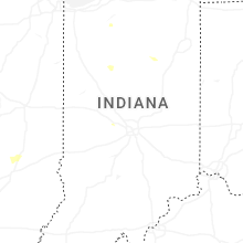
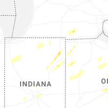


Connect with Interactive Hail Maps