

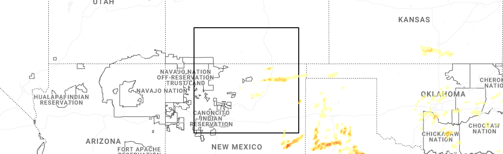
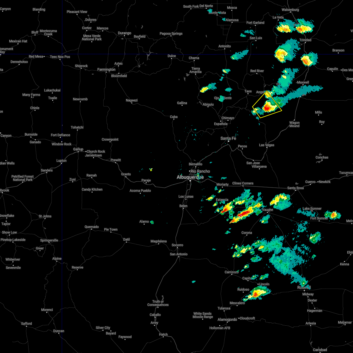
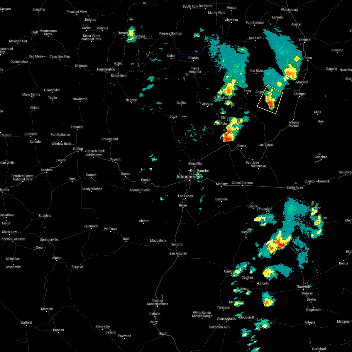
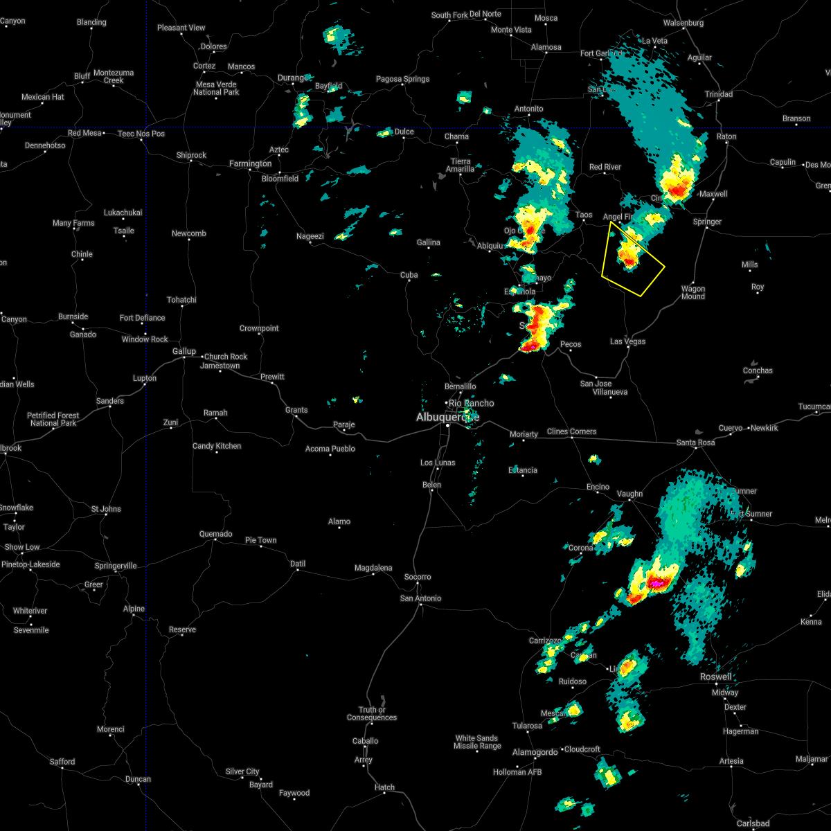
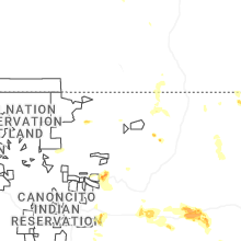
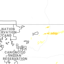
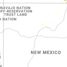
Hail Map for Angel Fire, NM
The Angel Fire, NM area has had 5 reports of on-the-ground hail by trained spotters, and has been under severe weather warnings 6 times during the past 12 months. Doppler radar has detected hail at or near Angel Fire, NM on 22 occasions, including 2 occasions during the past year.
| Name: | Angel Fire, NM |
| Where Located: | 15.8 miles E of Taos, NM |
| Map: | Google Map for Angel Fire, NM |
| Population: | 1216 |
| Housing Units: | 2417 |
| More Info: | Search Google for Angel Fire, NM |
1
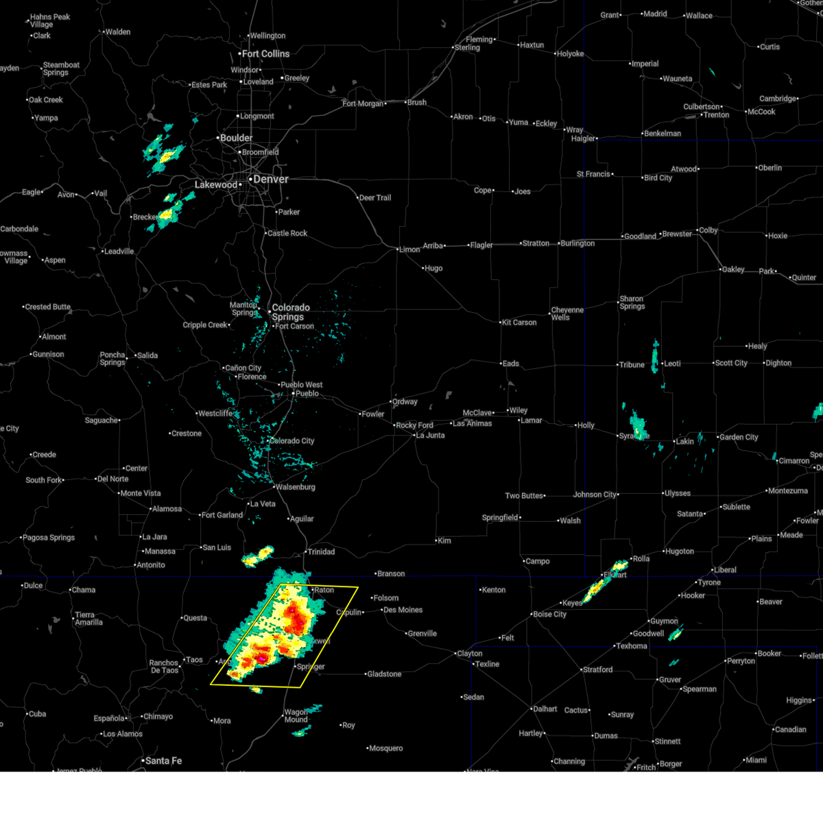
The Top Recent Hail Date for Angel Fire, NM is Sunday, May 25, 2025 (5th out of 22)
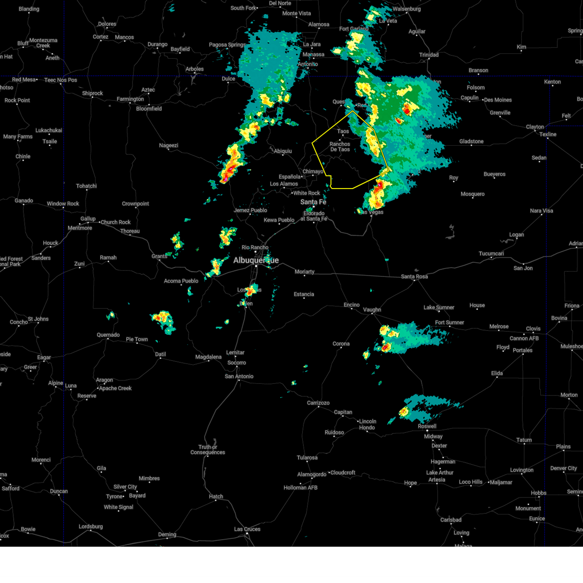
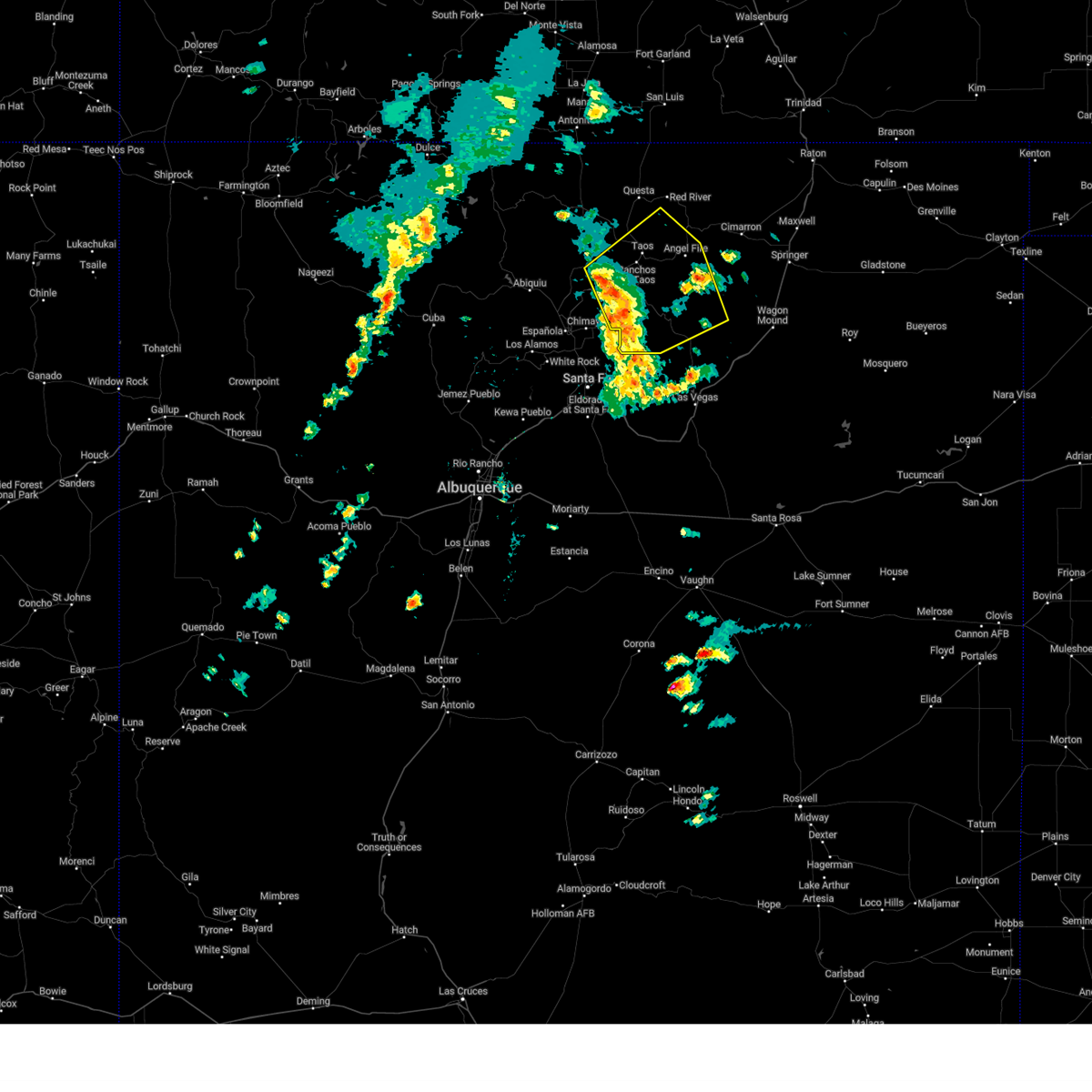
Hail and Wind Damage Spotted near Angel Fire, NM
| Date / Time | Report Details |
|---|---|
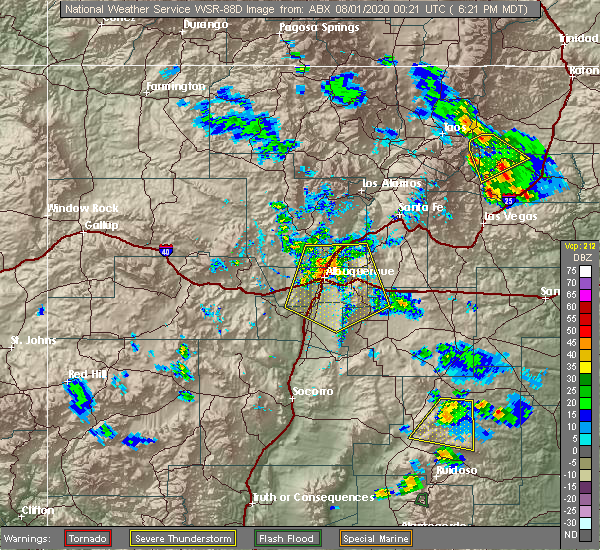
| 6/23/2025 2:41 PM MDT |
 Svrabq the national weather service in albuquerque has issued a * severe thunderstorm warning for, central colfax county in northeastern new mexico, north central mora county in northeastern new mexico, * until 330 pm mdt. * at 241 pm mdt, severe thunderstorms were located along a line from near raton crews airport to 8 miles east of black lake, moving east at 15 mph (radar indicated). Hazards include 60 mph wind gusts and quarter size hail. Hail damage to vehicles is expected. Expect wind damage to roofs, siding, and trees. Svrabq the national weather service in albuquerque has issued a * severe thunderstorm warning for, central colfax county in northeastern new mexico, north central mora county in northeastern new mexico, * until 330 pm mdt. * at 241 pm mdt, severe thunderstorms were located along a line from near raton crews airport to 8 miles east of black lake, moving east at 15 mph (radar indicated). Hazards include 60 mph wind gusts and quarter size hail. Hail damage to vehicles is expected. Expect wind damage to roofs, siding, and trees.
|
| 9/17/2024 1:49 PM MDT |
 the severe thunderstorm warning has been cancelled and is no longer in effect the severe thunderstorm warning has been cancelled and is no longer in effect
|
| 9/17/2024 12:53 PM MDT |
 Svrabq the national weather service in albuquerque has issued a * severe thunderstorm warning for, southern taos county in north central new mexico, southeastern rio arriba county in north central new mexico, northwestern mora county in northeastern new mexico, southwestern colfax county in northeastern new mexico, * until 200 pm mdt. * at 1253 pm mdt, severe thunderstorms were located along a line extending from 6 miles north of dixon to cowles, moving northeast at 45 mph (radar indicated). Hazards include 60 mph wind gusts. expect damage to roofs, siding, and trees Svrabq the national weather service in albuquerque has issued a * severe thunderstorm warning for, southern taos county in north central new mexico, southeastern rio arriba county in north central new mexico, northwestern mora county in northeastern new mexico, southwestern colfax county in northeastern new mexico, * until 200 pm mdt. * at 1253 pm mdt, severe thunderstorms were located along a line extending from 6 miles north of dixon to cowles, moving northeast at 45 mph (radar indicated). Hazards include 60 mph wind gusts. expect damage to roofs, siding, and trees
|
| 7/18/2024 2:46 PM MDT |
 the severe thunderstorm warning has been cancelled and is no longer in effect the severe thunderstorm warning has been cancelled and is no longer in effect
|
| 7/18/2024 2:29 PM MDT |
 At 229 pm mdt, a severe thunderstorm was located over cimarron canyon state park, or 23 miles northeast of taos, moving south at 15 mph (radar indicated). Hazards include 60 mph wind gusts and quarter size hail. Hail damage to vehicles is expected. expect wind damage to roofs, siding, and trees. locations impacted include, angel fire, eagle nest, cimarron canyon state park, eagle nest lake state park, elizabethtown, vietnam veterans memorial state park, and ute park. this includes the following highways, highway 64 between mile markers 268 and 298. State road 434 between mile markers 31 and 36. At 229 pm mdt, a severe thunderstorm was located over cimarron canyon state park, or 23 miles northeast of taos, moving south at 15 mph (radar indicated). Hazards include 60 mph wind gusts and quarter size hail. Hail damage to vehicles is expected. expect wind damage to roofs, siding, and trees. locations impacted include, angel fire, eagle nest, cimarron canyon state park, eagle nest lake state park, elizabethtown, vietnam veterans memorial state park, and ute park. this includes the following highways, highway 64 between mile markers 268 and 298. State road 434 between mile markers 31 and 36.
|
| 7/18/2024 2:23 PM MDT |
 Svrabq the national weather service in albuquerque has issued a * severe thunderstorm warning for, east central taos county in north central new mexico, southwestern colfax county in northeastern new mexico, * until 315 pm mdt. * at 222 pm mdt, a severe thunderstorm was located near eagle nest, or 23 miles east of questa, moving south at 15 mph (radar indicated). Hazards include ping pong ball size hail and 60 mph wind gusts. People and animals outdoors will be injured. expect hail damage to roofs, siding, windows, and vehicles. Expect wind damage to roofs, siding, and trees. Svrabq the national weather service in albuquerque has issued a * severe thunderstorm warning for, east central taos county in north central new mexico, southwestern colfax county in northeastern new mexico, * until 315 pm mdt. * at 222 pm mdt, a severe thunderstorm was located near eagle nest, or 23 miles east of questa, moving south at 15 mph (radar indicated). Hazards include ping pong ball size hail and 60 mph wind gusts. People and animals outdoors will be injured. expect hail damage to roofs, siding, windows, and vehicles. Expect wind damage to roofs, siding, and trees.
|
| 6/6/2023 2:01 PM MDT | Quarter sized hail reported 19.9 miles NW of Angel Fire, NM, very heavy rain and quarter sized hail falling at the time of report. |
| 5/30/2021 2:38 PM MDT | Quarter sized hail reported 19.9 miles NW of Angel Fire, NM |
| 5/30/2021 1:22 PM MDT |
 The severe thunderstorm warning for southeastern taos, northwestern mora and southwestern colfax counties will expire at 130 pm mdt, the storm which prompted the warning has weakened below severe limits, and no longer poses an immediate threat to life or property. therefore, the warning will be allowed to expire. however small hail, gusty winds and heavy rain are still possible with this thunderstorm. a severe thunderstorm watch remains in effect until 600 pm mdt for north central and northeastern new mexico. The severe thunderstorm warning for southeastern taos, northwestern mora and southwestern colfax counties will expire at 130 pm mdt, the storm which prompted the warning has weakened below severe limits, and no longer poses an immediate threat to life or property. therefore, the warning will be allowed to expire. however small hail, gusty winds and heavy rain are still possible with this thunderstorm. a severe thunderstorm watch remains in effect until 600 pm mdt for north central and northeastern new mexico.
|
| 5/30/2021 1:01 PM MDT |
 At 101 pm mdt, a severe thunderstorm was located over chacon, or 13 miles north of mora, moving northeast at 15 mph (radar indicated). Hazards include 60 mph wind gusts and quarter size hail. Hail damage to vehicles is expected. expect wind damage to roofs, siding, and trees. Locations impacted include, angel fire, black lake, ocate, coyote creek state park, chacon, guadalupita and el turquillo. At 101 pm mdt, a severe thunderstorm was located over chacon, or 13 miles north of mora, moving northeast at 15 mph (radar indicated). Hazards include 60 mph wind gusts and quarter size hail. Hail damage to vehicles is expected. expect wind damage to roofs, siding, and trees. Locations impacted include, angel fire, black lake, ocate, coyote creek state park, chacon, guadalupita and el turquillo.
|
| 5/30/2021 12:31 PM MDT |
 At 1231 pm mdt, a severe thunderstorm was located over chacon, or 13 miles north of mora, moving northeast at 20 mph (radar indicated). Hazards include 60 mph wind gusts and quarter size hail. Hail damage to vehicles is expected. Expect wind damage to roofs, siding, and trees. At 1231 pm mdt, a severe thunderstorm was located over chacon, or 13 miles north of mora, moving northeast at 20 mph (radar indicated). Hazards include 60 mph wind gusts and quarter size hail. Hail damage to vehicles is expected. Expect wind damage to roofs, siding, and trees.
|
| 5/22/2021 4:45 PM MDT |
 At 445 pm mdt, a severe thunderstorm was located near black lake, or 21 miles northeast of mora, moving northeast at 40 mph (radar indicated). Hazards include 60 mph wind gusts and nickel size hail. expect damage to roofs, siding, and trees At 445 pm mdt, a severe thunderstorm was located near black lake, or 21 miles northeast of mora, moving northeast at 40 mph (radar indicated). Hazards include 60 mph wind gusts and nickel size hail. expect damage to roofs, siding, and trees
|
| 5/22/2021 4:34 PM MDT |
 At 433 pm mdt, a severe thunderstorm was located near black lake, or 19 miles north of mora, moving north at 40 mph (radar indicated). Hazards include 60 mph wind gusts and quarter size hail. Hail damage to vehicles is expected. expect wind damage to roofs, siding, and trees. locations impacted include, angel fire, black lake, ocate, coyote creek state park, chacon, holman, ojo feliz, guadalupita, el turquillo and luceros. This includes highway 64 between mile markers 269 and 270. At 433 pm mdt, a severe thunderstorm was located near black lake, or 19 miles north of mora, moving north at 40 mph (radar indicated). Hazards include 60 mph wind gusts and quarter size hail. Hail damage to vehicles is expected. expect wind damage to roofs, siding, and trees. locations impacted include, angel fire, black lake, ocate, coyote creek state park, chacon, holman, ojo feliz, guadalupita, el turquillo and luceros. This includes highway 64 between mile markers 269 and 270.
|
| 5/22/2021 4:02 PM MDT |
 At 402 pm mdt, a severe thunderstorm was located over mora, moving north at 40 mph (radar indicated). Hazards include 60 mph wind gusts and quarter size hail. Hail damage to vehicles is expected. Expect wind damage to roofs, siding, and trees. At 402 pm mdt, a severe thunderstorm was located over mora, moving north at 40 mph (radar indicated). Hazards include 60 mph wind gusts and quarter size hail. Hail damage to vehicles is expected. Expect wind damage to roofs, siding, and trees.
|
| 5/22/2021 3:15 PM MDT |
 At 315 pm mdt, a severe thunderstorm was located near coyote creek state park, or 11 miles northeast of mora, moving northeast at 35 mph (radar indicated). Hazards include 60 mph wind gusts and half dollar size hail. Hail damage to vehicles is expected. expect wind damage to roofs, siding, and trees. locations impacted include, mora, angel fire, la cueva, ledoux, cleveland, black lake, tierra monte, ocate, coyote creek state park and morphy lake state park. This includes highway 64 between mile markers 264 and 268. At 315 pm mdt, a severe thunderstorm was located near coyote creek state park, or 11 miles northeast of mora, moving northeast at 35 mph (radar indicated). Hazards include 60 mph wind gusts and half dollar size hail. Hail damage to vehicles is expected. expect wind damage to roofs, siding, and trees. locations impacted include, mora, angel fire, la cueva, ledoux, cleveland, black lake, tierra monte, ocate, coyote creek state park and morphy lake state park. This includes highway 64 between mile markers 264 and 268.
|
| 5/22/2021 2:45 PM MDT |
 At 245 pm mdt, a severe thunderstorm was located over tierra monte, or near mora, moving northeast at 35 mph (radar indicated). Hazards include 60 mph wind gusts and quarter size hail. Hail damage to vehicles is expected. Expect wind damage to roofs, siding, and trees. At 245 pm mdt, a severe thunderstorm was located over tierra monte, or near mora, moving northeast at 35 mph (radar indicated). Hazards include 60 mph wind gusts and quarter size hail. Hail damage to vehicles is expected. Expect wind damage to roofs, siding, and trees.
|
| 7/31/2020 6:24 PM MDT |
 The severe thunderstorm warning for north central mora and southwestern colfax counties will expire at 630 pm mdt, the storm which prompted the warning has weakened below severe limits, and no longer poses an immediate threat to life or property. therefore, the warning will be allowed to expire. however small hail, gusty winds and heavy rain are still possible with this thunderstorm. a severe thunderstorm watch remains in effect until 1000 pm mdt for north central and northeastern new mexico. The severe thunderstorm warning for north central mora and southwestern colfax counties will expire at 630 pm mdt, the storm which prompted the warning has weakened below severe limits, and no longer poses an immediate threat to life or property. therefore, the warning will be allowed to expire. however small hail, gusty winds and heavy rain are still possible with this thunderstorm. a severe thunderstorm watch remains in effect until 1000 pm mdt for north central and northeastern new mexico.
|
| 7/31/2020 6:01 PM MDT |
 At 601 pm mdt, a severe thunderstorm was located over black lake, or 20 miles north of mora, moving south at 15 mph (radar indicated). Hazards include 60 mph wind gusts and half dollar size hail. Hail damage to vehicles is expected. expect wind damage to roofs, siding, and trees. Locations impacted include, angel fire, black lake, ocate, coyote creek state park, ojo feliz, guadalupita, el turquillo and luceros. At 601 pm mdt, a severe thunderstorm was located over black lake, or 20 miles north of mora, moving south at 15 mph (radar indicated). Hazards include 60 mph wind gusts and half dollar size hail. Hail damage to vehicles is expected. expect wind damage to roofs, siding, and trees. Locations impacted include, angel fire, black lake, ocate, coyote creek state park, ojo feliz, guadalupita, el turquillo and luceros.
|
| 7/31/2020 6:00 PM MDT | Quarter sized hail reported 10.9 miles NW of Angel Fire, NM |
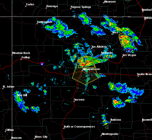
| 7/31/2020 5:39 PM MDT |
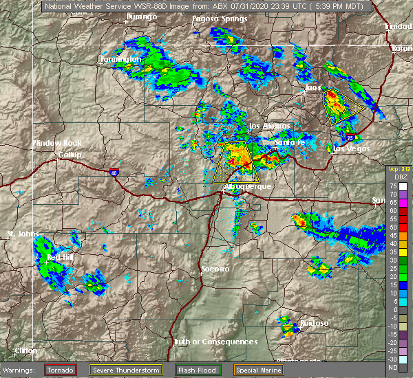 At 539 pm mdt, a severe thunderstorm was located over black lake, or 19 miles east of taos, moving southeast at 20 mph (radar indicated). Hazards include 60 mph wind gusts and quarter size hail. Hail damage to vehicles is expected. Expect wind damage to roofs, siding, and trees. At 539 pm mdt, a severe thunderstorm was located over black lake, or 19 miles east of taos, moving southeast at 20 mph (radar indicated). Hazards include 60 mph wind gusts and quarter size hail. Hail damage to vehicles is expected. Expect wind damage to roofs, siding, and trees.
|
| 6/17/2019 2:47 PM MDT |
 At 247 pm mdt, a severe thunderstorm was located near tres ritos, or 12 miles southeast of taos, moving northeast at 15 mph (radar indicated). Hazards include 60 mph wind gusts and nickel size hail. Expect damage to roofs, siding, and trees. Locations impacted include, shady brook and black lake. At 247 pm mdt, a severe thunderstorm was located near tres ritos, or 12 miles southeast of taos, moving northeast at 15 mph (radar indicated). Hazards include 60 mph wind gusts and nickel size hail. Expect damage to roofs, siding, and trees. Locations impacted include, shady brook and black lake.
|
| 6/17/2019 2:35 PM MDT |
 At 235 pm mdt, a severe thunderstorm was located near tres ritos, or 13 miles south of taos, moving northeast at 15 mph (radar indicated). Hazards include 60 mph wind gusts and quarter size hail. Hail damage to vehicles is expected. Expect wind damage to roofs, siding, and trees. At 235 pm mdt, a severe thunderstorm was located near tres ritos, or 13 miles south of taos, moving northeast at 15 mph (radar indicated). Hazards include 60 mph wind gusts and quarter size hail. Hail damage to vehicles is expected. Expect wind damage to roofs, siding, and trees.
|
| 6/2/2019 3:25 PM MDT |
 The severe thunderstorm warning for north central mora and southwestern colfax counties will expire at 330 pm mdt, the storm which prompted the warning has weakened below severe limits, and no longer poses an immediate threat to life or property. therefore the warning will be allowed to expire. however small hail, gusty winds and heavy rain are still possible with this thunderstorm. a severe thunderstorm watch remains in effect until 800 pm mdt for northeastern new mexico. The severe thunderstorm warning for north central mora and southwestern colfax counties will expire at 330 pm mdt, the storm which prompted the warning has weakened below severe limits, and no longer poses an immediate threat to life or property. therefore the warning will be allowed to expire. however small hail, gusty winds and heavy rain are still possible with this thunderstorm. a severe thunderstorm watch remains in effect until 800 pm mdt for northeastern new mexico.
|
| 6/2/2019 3:03 PM MDT |
 At 303 pm mdt, a severe thunderstorm was located near philmont scout ranch, or 20 miles west of springer, moving northeast at 15 mph (radar indicated). Hazards include 60 mph wind gusts and quarter size hail. Hail damage to vehicles is expected. expect wind damage to roofs, siding, and trees. Locations impacted include, angel fire, cimarron, philmont scout ranch, rayado and miami. At 303 pm mdt, a severe thunderstorm was located near philmont scout ranch, or 20 miles west of springer, moving northeast at 15 mph (radar indicated). Hazards include 60 mph wind gusts and quarter size hail. Hail damage to vehicles is expected. expect wind damage to roofs, siding, and trees. Locations impacted include, angel fire, cimarron, philmont scout ranch, rayado and miami.
|
| 6/2/2019 2:42 PM MDT |
 At 242 pm mdt, a severe thunderstorm was located 7 miles southwest of philmont scout ranch, or 21 miles west of springer, moving northeast at 15 mph (radar indicated). Hazards include 60 mph wind gusts and quarter size hail. Hail damage to vehicles is expected. expect wind damage to roofs, siding, and trees. Locations impacted include, angel fire, cimarron, philmont scout ranch, rayado and miami. At 242 pm mdt, a severe thunderstorm was located 7 miles southwest of philmont scout ranch, or 21 miles west of springer, moving northeast at 15 mph (radar indicated). Hazards include 60 mph wind gusts and quarter size hail. Hail damage to vehicles is expected. expect wind damage to roofs, siding, and trees. Locations impacted include, angel fire, cimarron, philmont scout ranch, rayado and miami.
|
| 6/2/2019 2:23 PM MDT |
 At 222 pm mdt, a severe thunderstorm was located 10 miles east of black lake, or 26 miles west of springer, moving northeast at 20 mph (radar indicated). Hazards include 60 mph wind gusts and quarter size hail. Hail damage to vehicles is expected. Expect wind damage to roofs, siding, and trees. At 222 pm mdt, a severe thunderstorm was located 10 miles east of black lake, or 26 miles west of springer, moving northeast at 20 mph (radar indicated). Hazards include 60 mph wind gusts and quarter size hail. Hail damage to vehicles is expected. Expect wind damage to roofs, siding, and trees.
|
| 8/18/2018 1:59 PM MDT |
 The national weather service in albuquerque has issued a * severe thunderstorm warning for. east central taos county in north central new mexico. southwestern colfax county in northeastern new mexico. until 245 pm mdt. At 159 pm mdt, a severe thunderstorm was located near questa,. The national weather service in albuquerque has issued a * severe thunderstorm warning for. east central taos county in north central new mexico. southwestern colfax county in northeastern new mexico. until 245 pm mdt. At 159 pm mdt, a severe thunderstorm was located near questa,.
|
| 8/9/2018 2:38 PM MDT |
 At 236 pm mdt, a severe thunderstorm was located over eagle nest lake state park, or 16 miles northeast of taos, and is nearly stationary. a funnel cloud has been observed with this storm (radar indicated). Hazards include 60 mph wind gusts and quarter size hail. Hail damage to vehicles is expected. Expect wind damage to roofs, siding, and trees. At 236 pm mdt, a severe thunderstorm was located over eagle nest lake state park, or 16 miles northeast of taos, and is nearly stationary. a funnel cloud has been observed with this storm (radar indicated). Hazards include 60 mph wind gusts and quarter size hail. Hail damage to vehicles is expected. Expect wind damage to roofs, siding, and trees.
|
| 8/8/2018 4:28 PM MDT |
 At 427 pm mdt, a severe thunderstorm was located 8 miles south of cimarron canyon state park, or 25 miles east of taos, moving south at 20 mph (radar indicated). Hazards include two inch hail and 70 mph wind gusts. People and animals outdoors will be injured. expect hail damage to roofs, siding, windows, and vehicles. expect considerable tree damage. Wind damage is also likely to mobile homes, roofs, and outbuildings. At 427 pm mdt, a severe thunderstorm was located 8 miles south of cimarron canyon state park, or 25 miles east of taos, moving south at 20 mph (radar indicated). Hazards include two inch hail and 70 mph wind gusts. People and animals outdoors will be injured. expect hail damage to roofs, siding, windows, and vehicles. expect considerable tree damage. Wind damage is also likely to mobile homes, roofs, and outbuildings.
|
| 8/8/2018 3:57 PM MDT |
 At 356 pm mdt, a severe thunderstorm was located over cimarron canyon state park, or 24 miles northeast of taos, moving south at 15 mph (radar indicated). Hazards include 70 mph wind gusts and ping pong ball size hail. People and animals outdoors will be injured. expect hail damage to roofs, siding, windows, and vehicles. expect considerable tree damage. wind damage is also likely to mobile homes, roofs, and outbuildings. Locations impacted include, angel fire, eagle nest, cimarron canyon state park, vietnam veterans memorial state park, eagle nest lake state park and ute park. At 356 pm mdt, a severe thunderstorm was located over cimarron canyon state park, or 24 miles northeast of taos, moving south at 15 mph (radar indicated). Hazards include 70 mph wind gusts and ping pong ball size hail. People and animals outdoors will be injured. expect hail damage to roofs, siding, windows, and vehicles. expect considerable tree damage. wind damage is also likely to mobile homes, roofs, and outbuildings. Locations impacted include, angel fire, eagle nest, cimarron canyon state park, vietnam veterans memorial state park, eagle nest lake state park and ute park.
|
| 8/8/2018 3:34 PM MDT |
 At 333 pm mdt, a severe thunderstorm was located near ute park, or 25 miles east of questa, moving south at 15 mph (radar indicated). Hazards include 70 mph wind gusts and ping pong ball size hail. People and animals outdoors will be injured. expect hail damage to roofs, siding, windows, and vehicles. expect considerable tree damage. Wind damage is also likely to mobile homes, roofs, and outbuildings. At 333 pm mdt, a severe thunderstorm was located near ute park, or 25 miles east of questa, moving south at 15 mph (radar indicated). Hazards include 70 mph wind gusts and ping pong ball size hail. People and animals outdoors will be injured. expect hail damage to roofs, siding, windows, and vehicles. expect considerable tree damage. Wind damage is also likely to mobile homes, roofs, and outbuildings.
|
| 8/8/2018 2:10 PM MDT | Ping Pong Ball sized hail reported 19.9 miles NW of Angel Fire, NM, spotter reported ping-pong sized hail and very heavy rainfall. |
| 5/16/2016 6:15 PM MDT | Kaxx awo in colfax county NM, 1.4 miles S of Angel Fire, NM |
| 6/16/2015 4:05 PM MDT |
 At 404 pm mdt, a line of severe thunderstorms was stretching from 10 miles west of arroyo seco to 8 miles east of arroyo seco. this line was moving southeast at 15 mph (radar indicated). Hazards include quarter size hail and 60 mph wind gusts. Hail damage to vehicles is expected. Expect wind damage to roofs, siding and trees. At 404 pm mdt, a line of severe thunderstorms was stretching from 10 miles west of arroyo seco to 8 miles east of arroyo seco. this line was moving southeast at 15 mph (radar indicated). Hazards include quarter size hail and 60 mph wind gusts. Hail damage to vehicles is expected. Expect wind damage to roofs, siding and trees.
|
| 6/5/2013 1:30 PM MDT | Quarter sized hail reported 22.8 miles NW of Angel Fire, NM |
Hail Maps for Angel Fire, NM


Connect with Interactive Hail Maps