

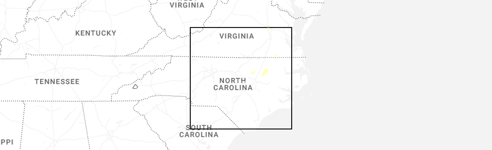
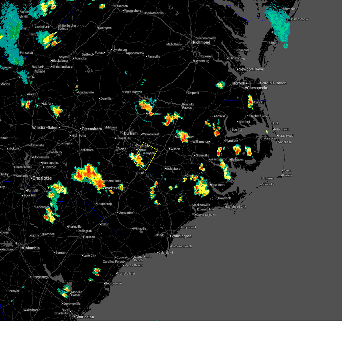
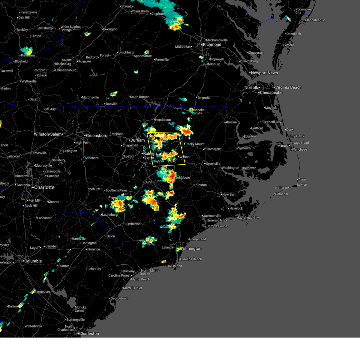
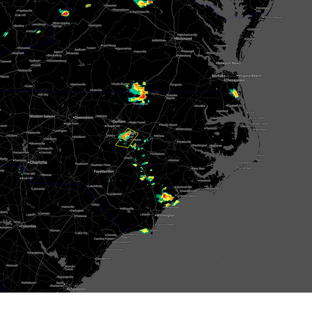
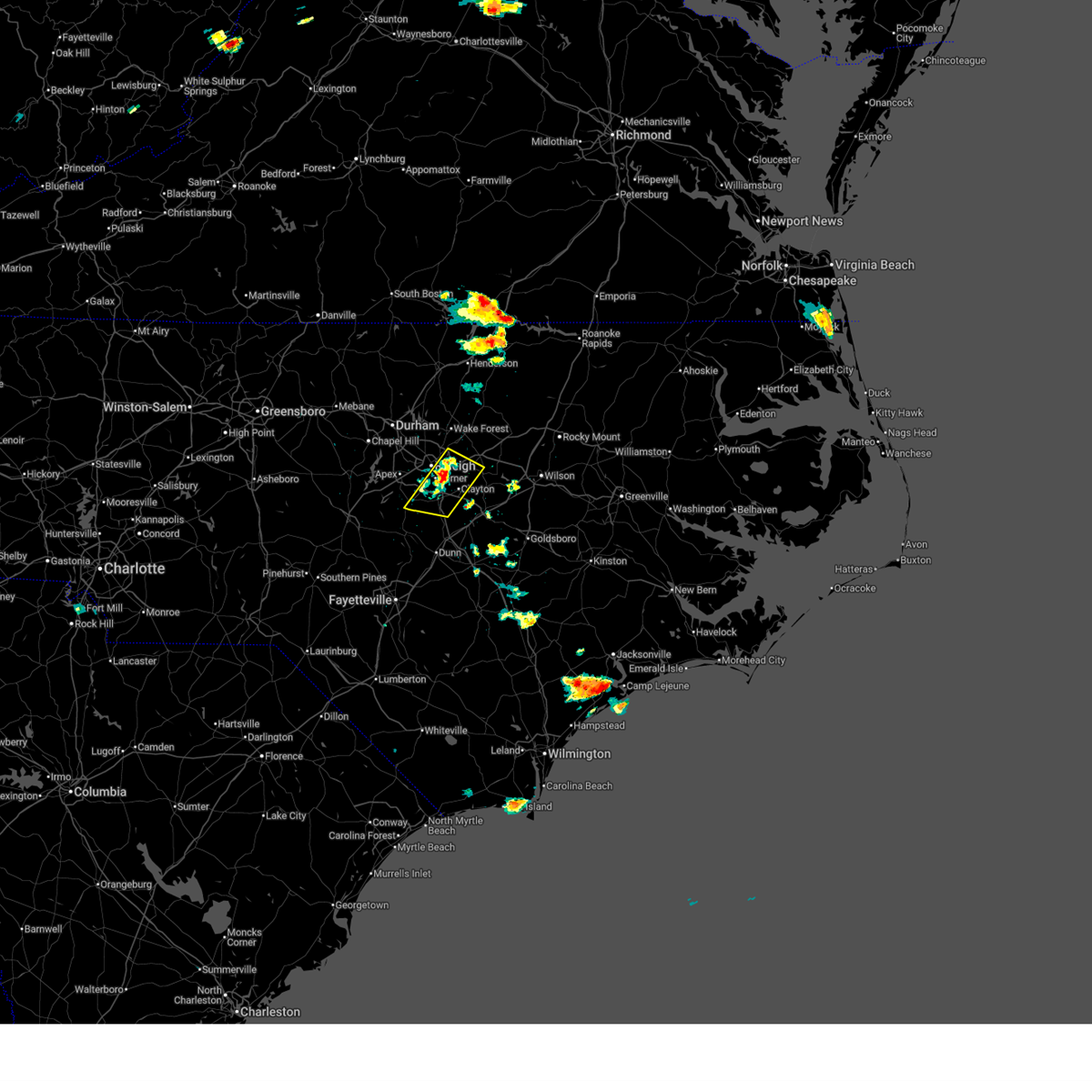
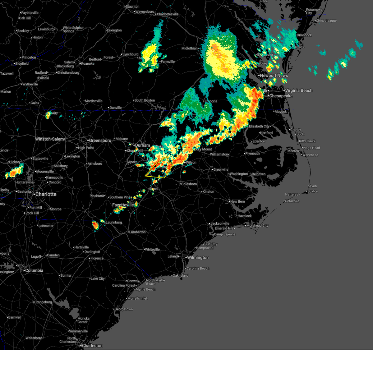
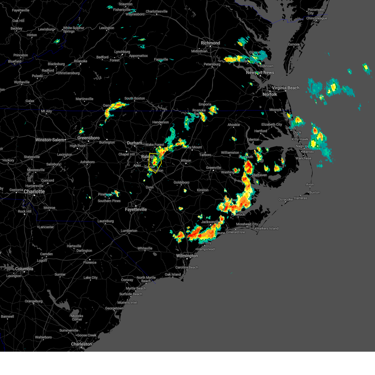
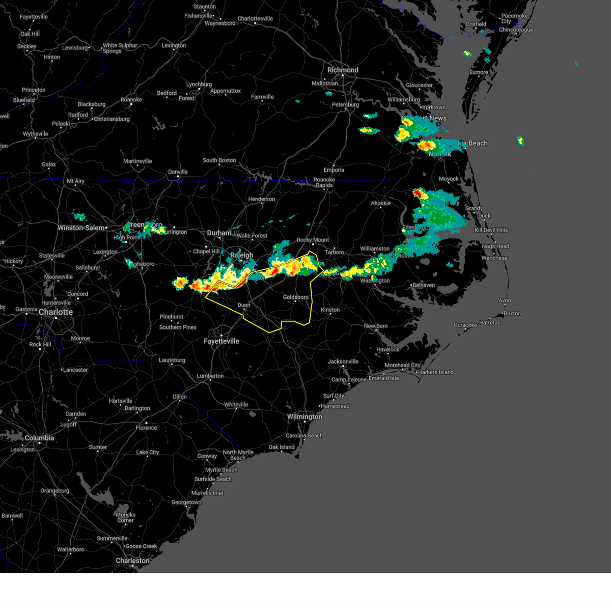
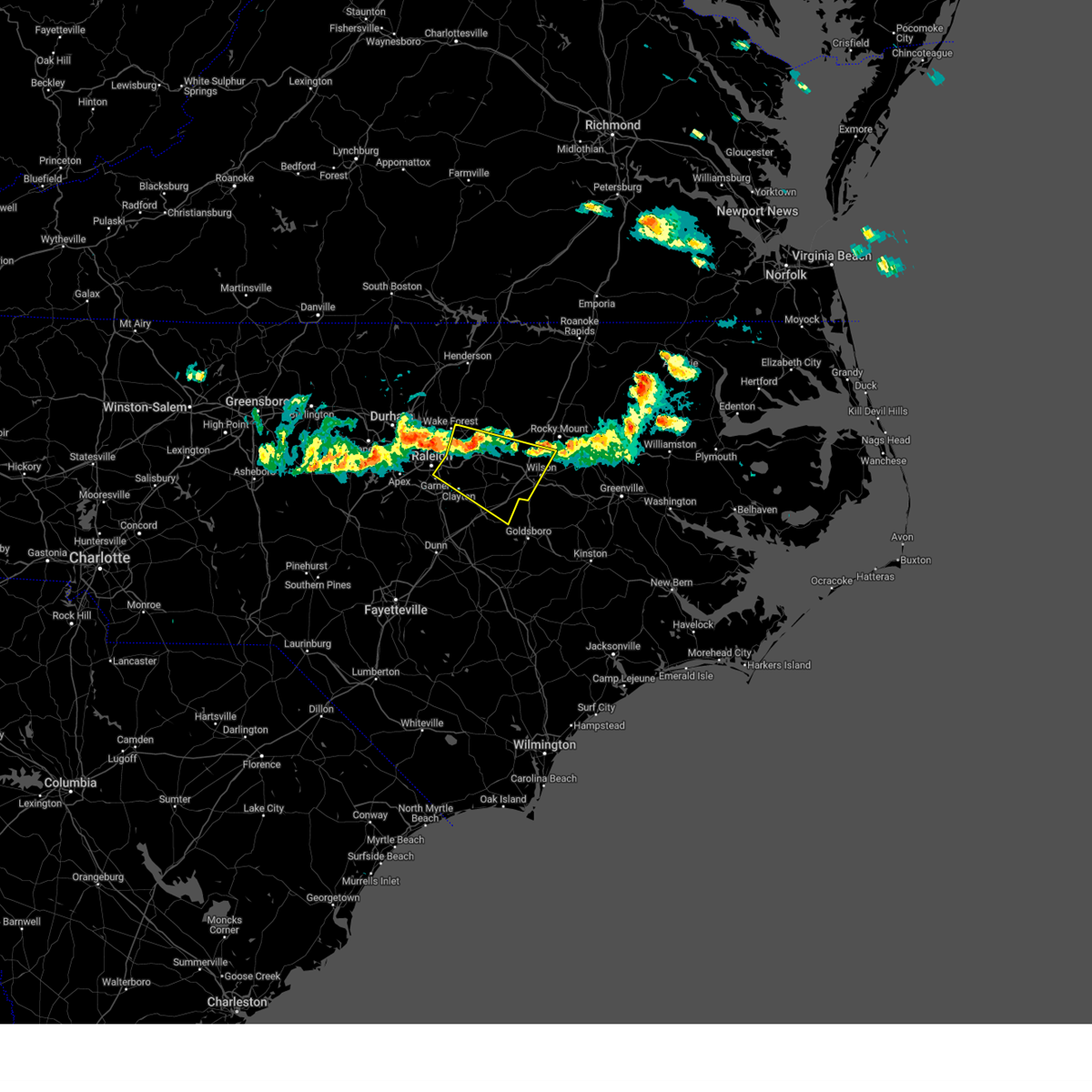
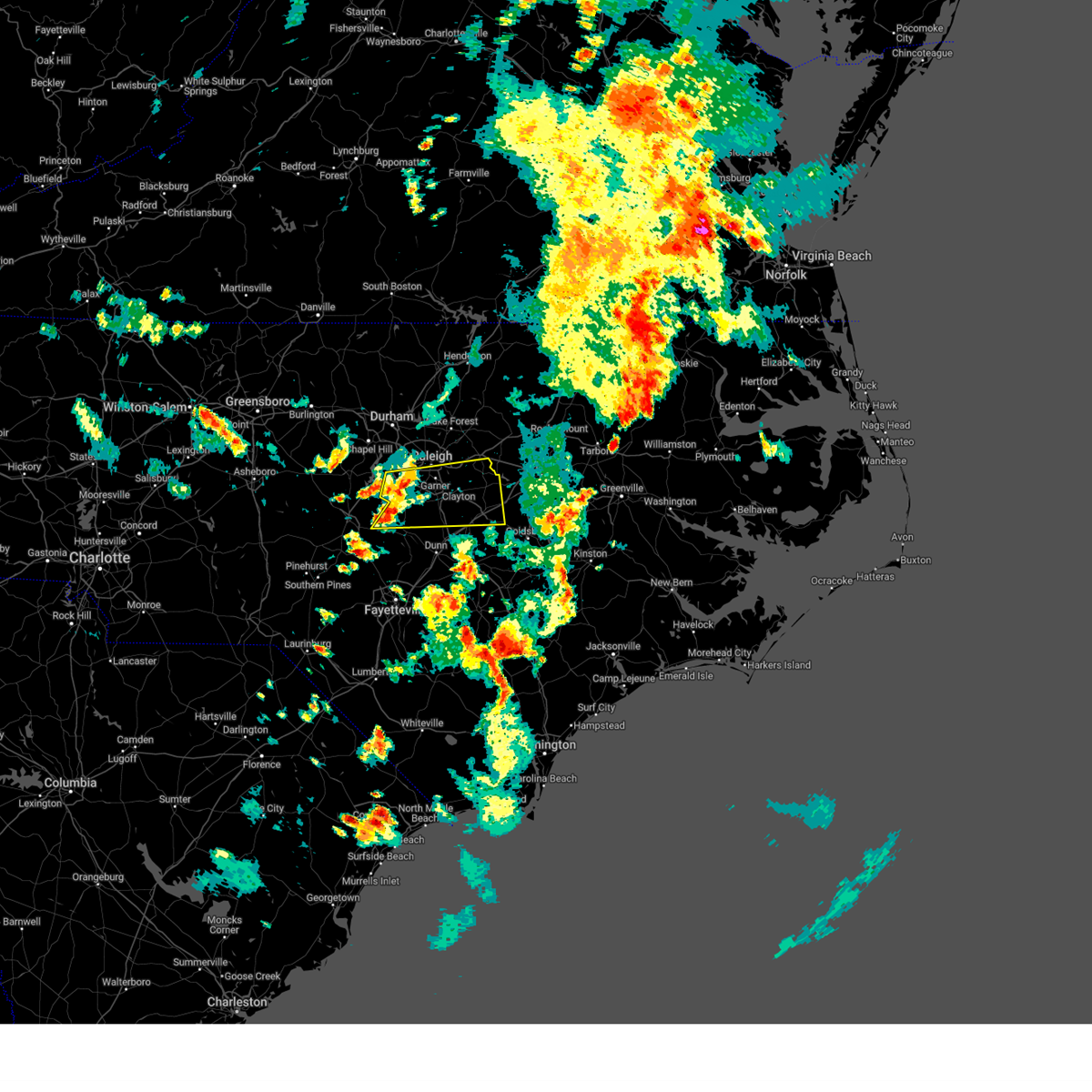
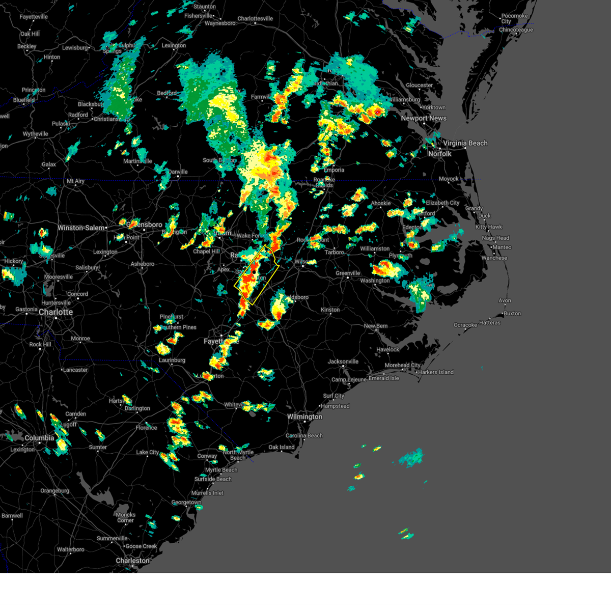
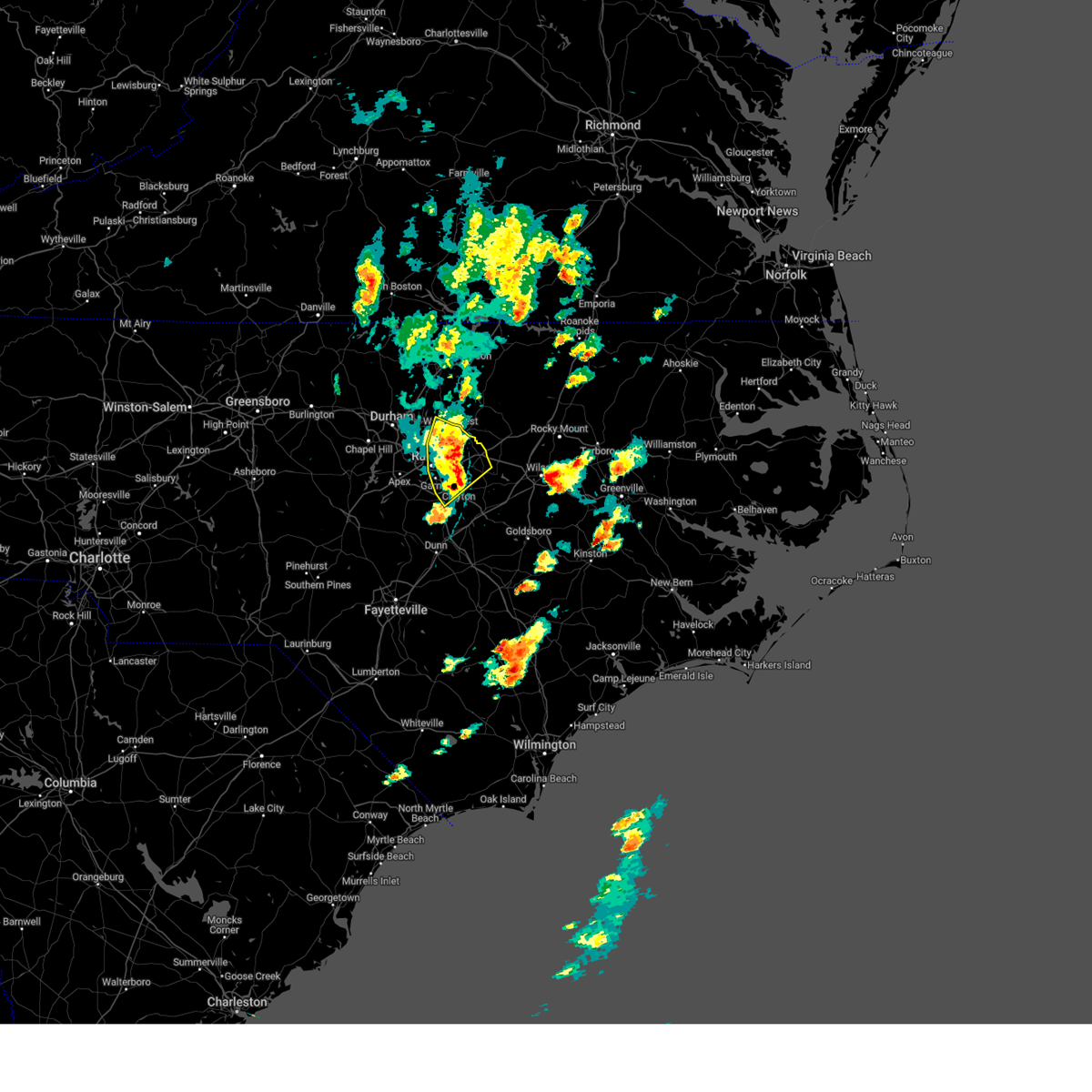
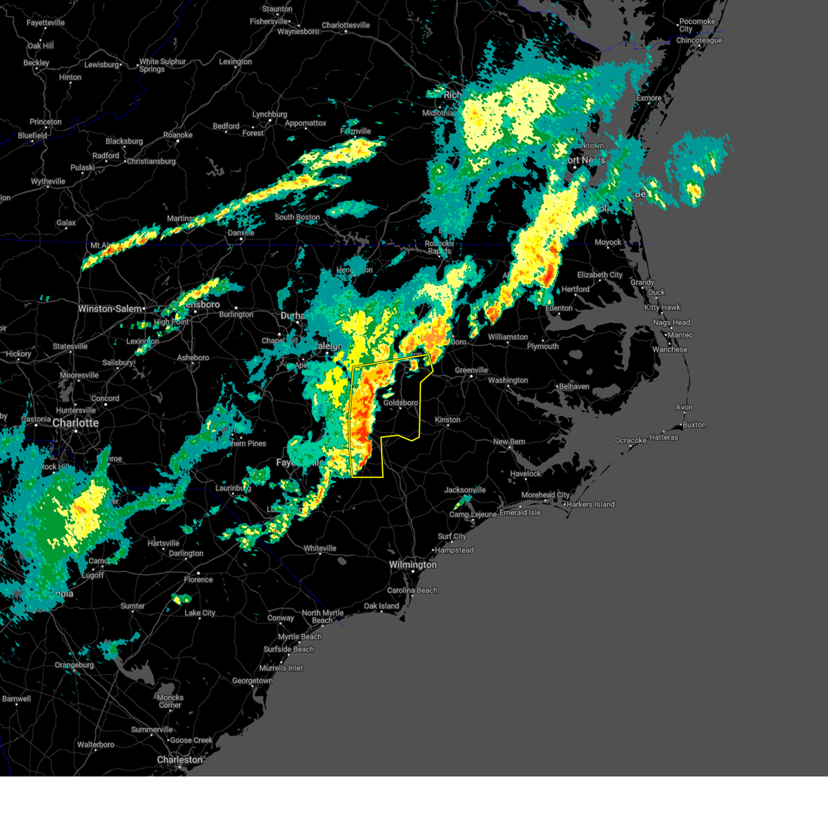
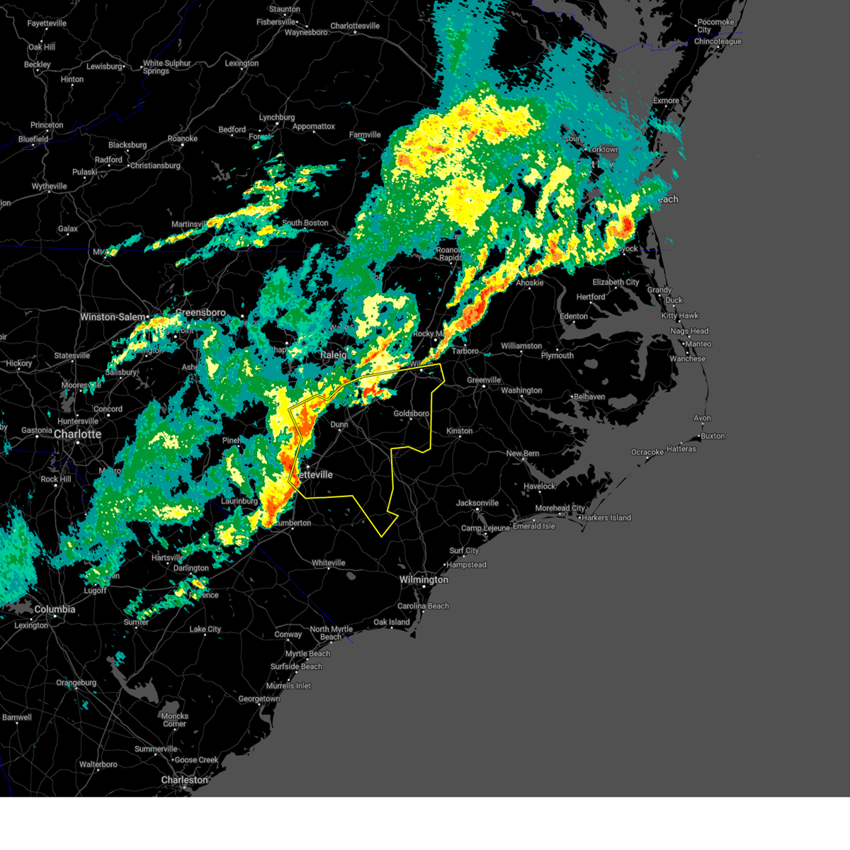
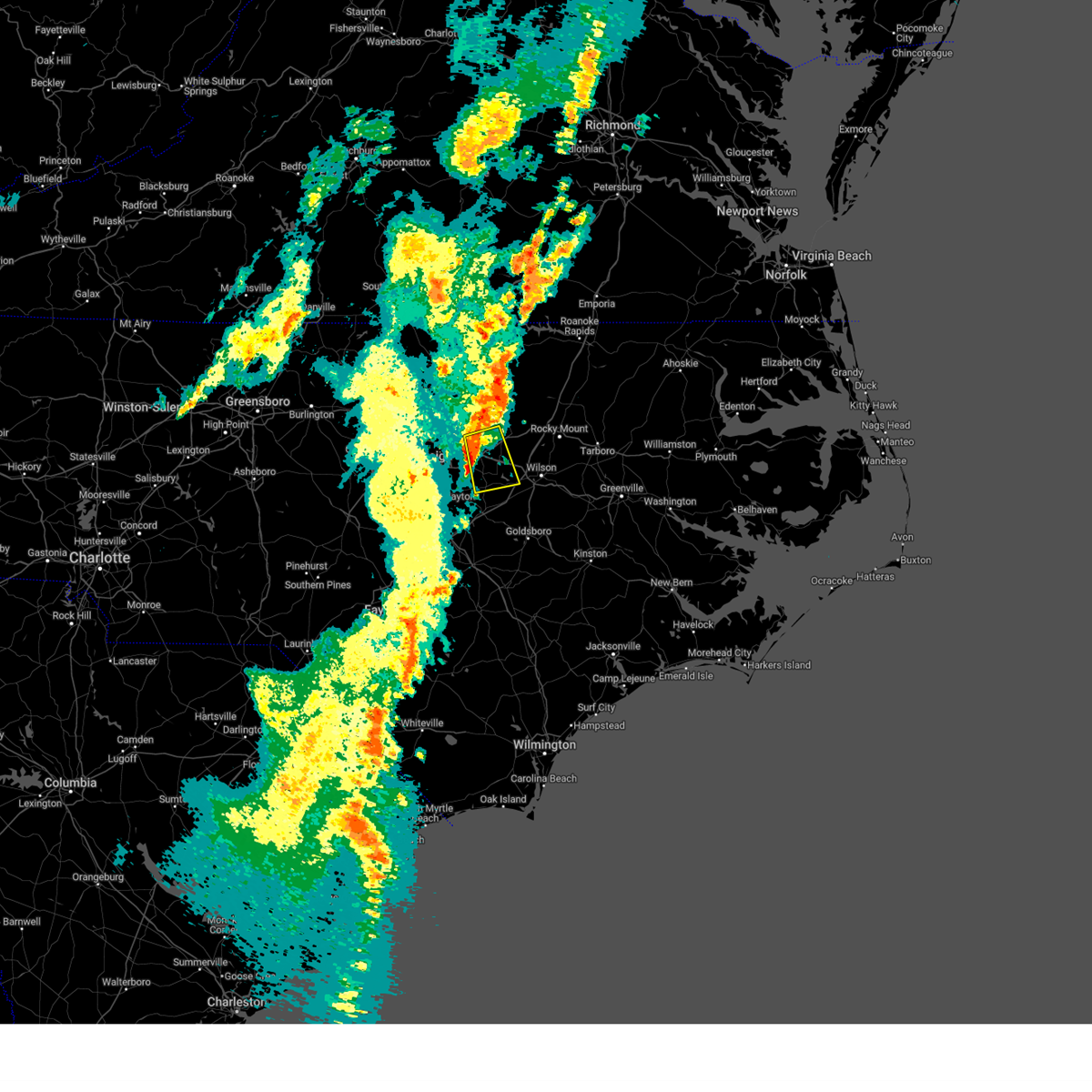
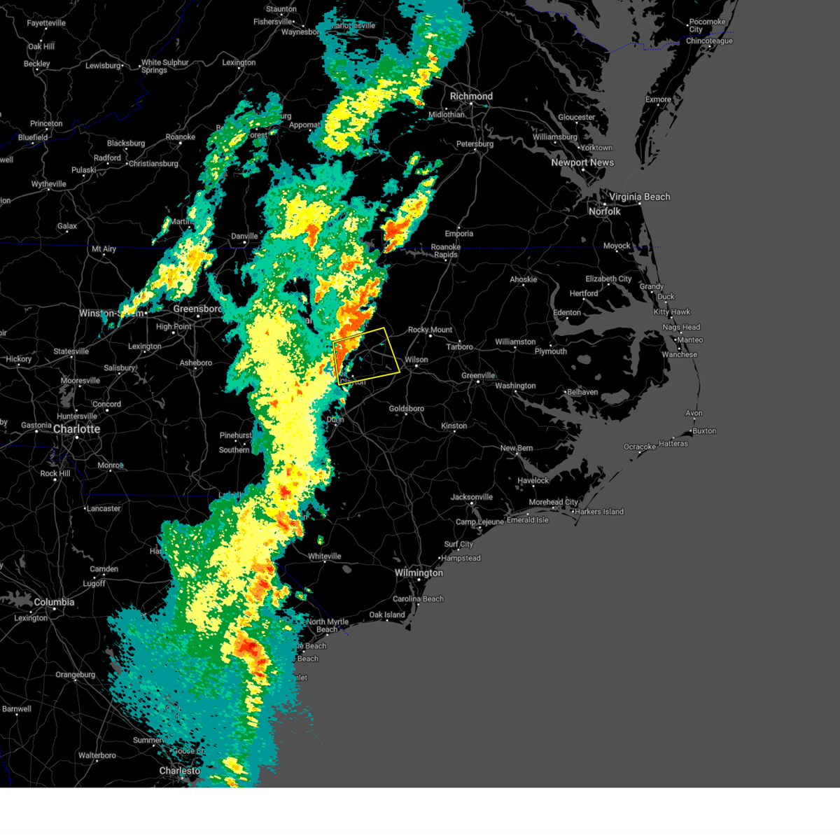
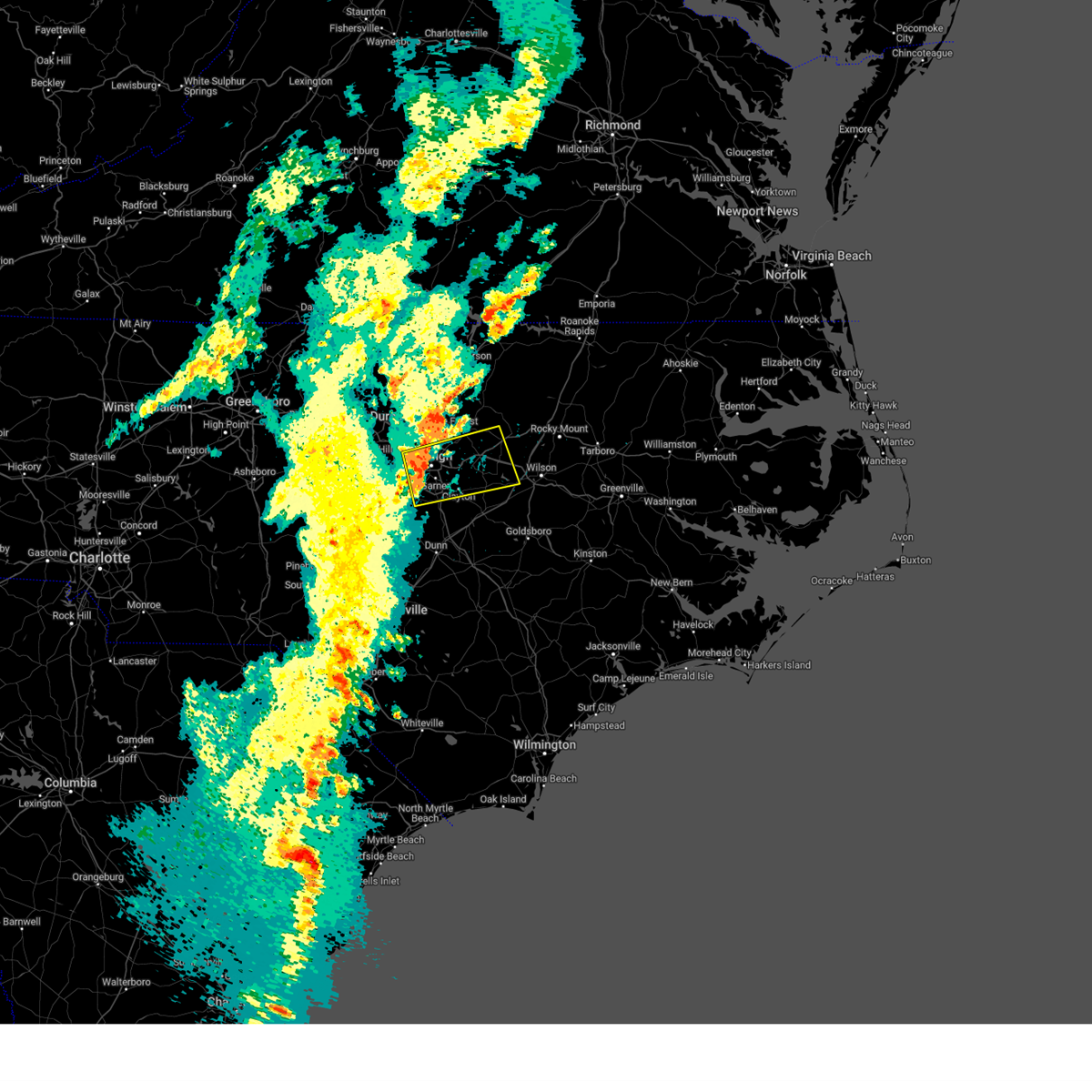
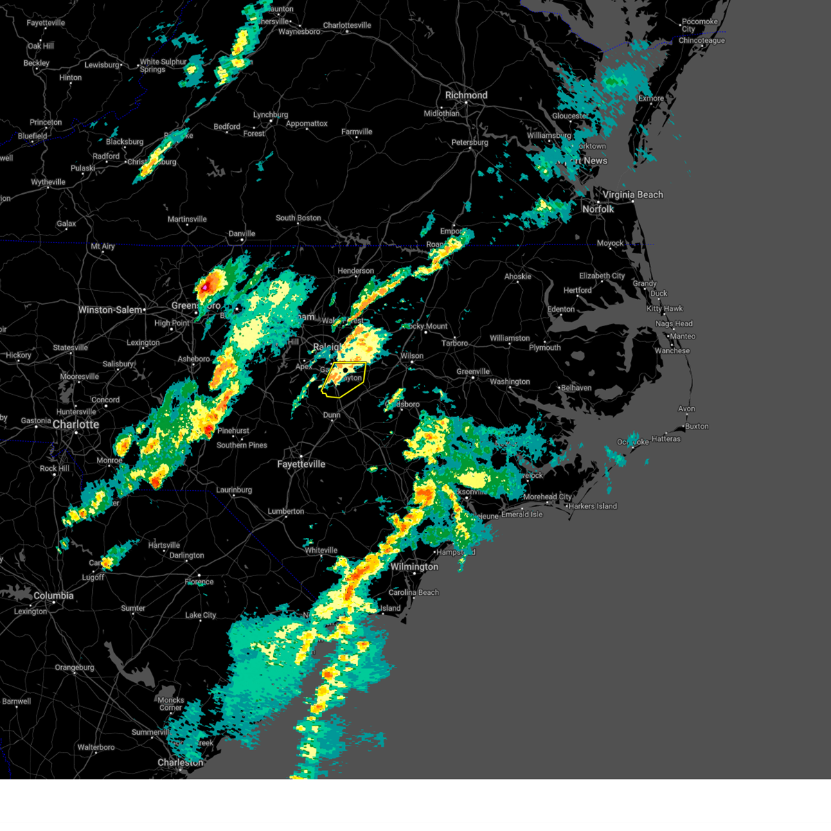
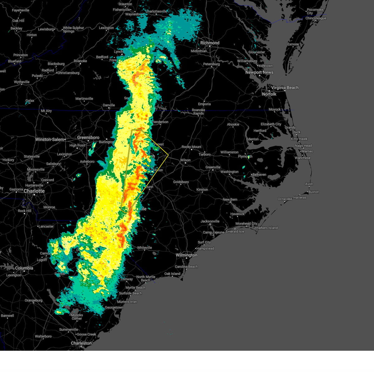
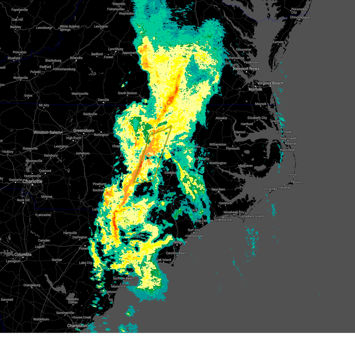
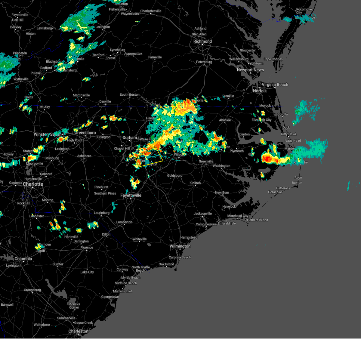
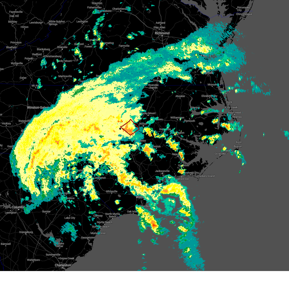
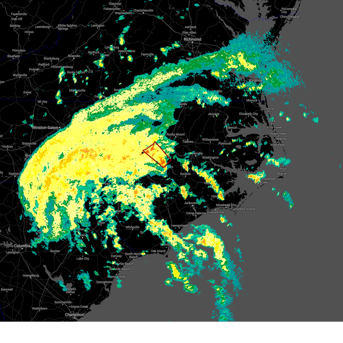
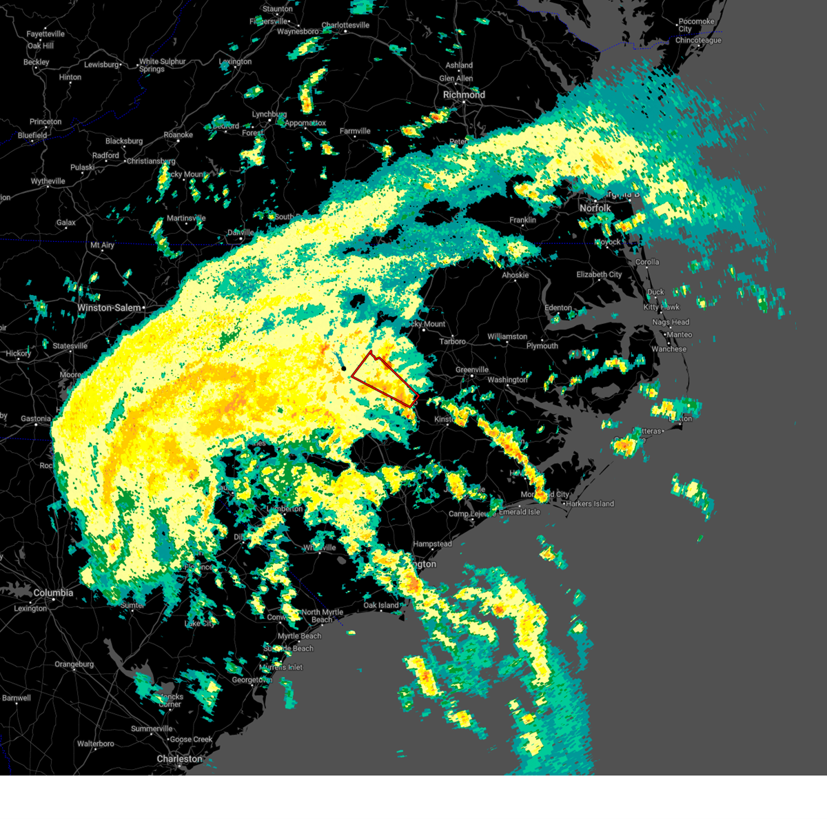
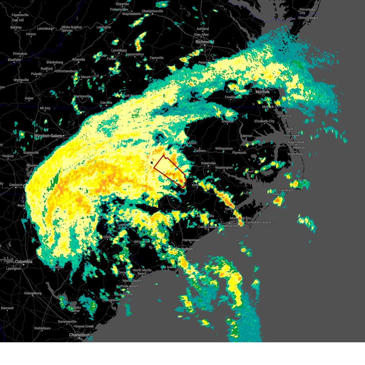
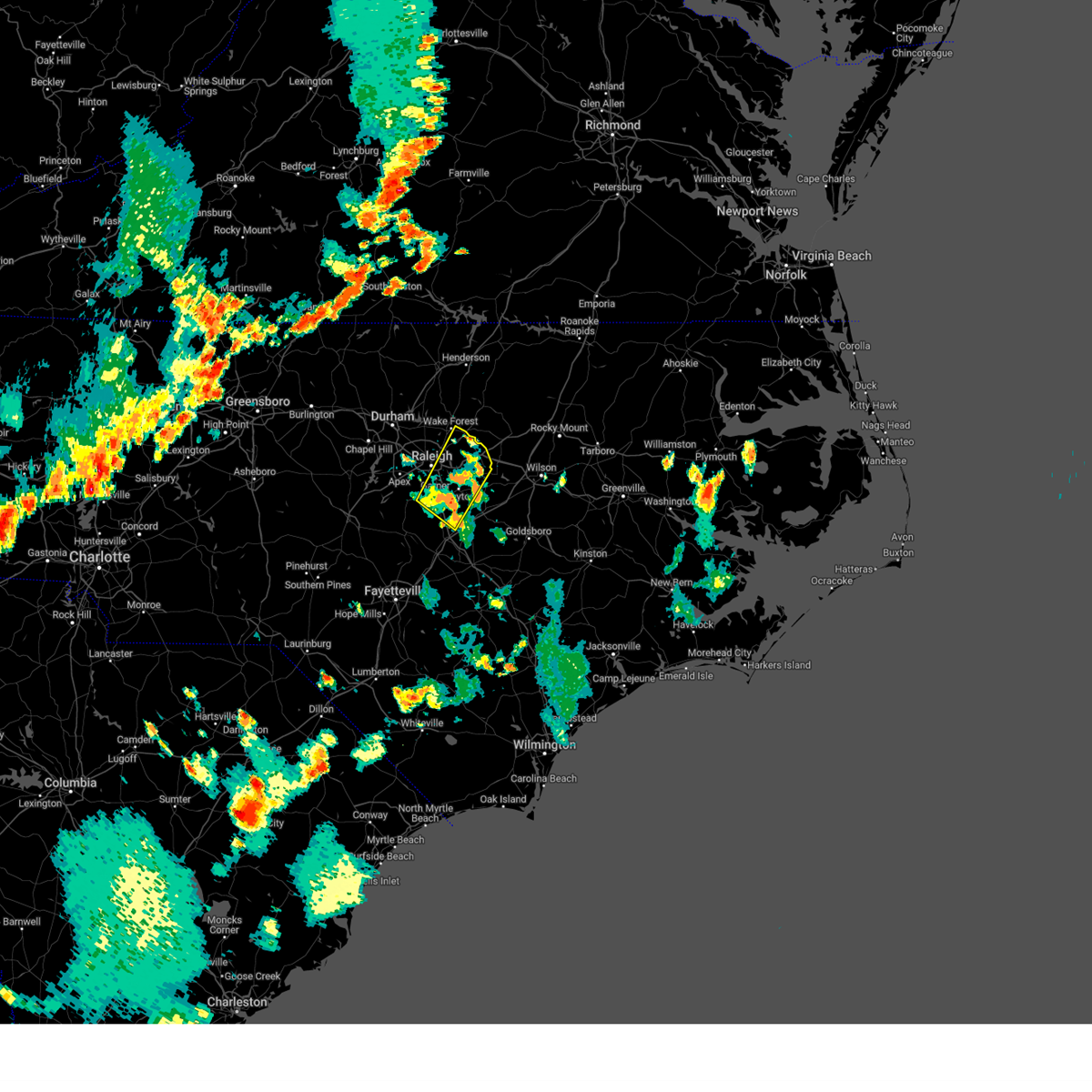
Hail Map for Archer Lodge, NC
The Archer Lodge, NC area has had 0 reports of on-the-ground hail by trained spotters, and has been under severe weather warnings 92 times during the past 12 months. Doppler radar has detected hail at or near Archer Lodge, NC on 64 occasions, including 6 occasions during the past year.
| Name: | Archer Lodge, NC |
| Where Located: | 16.4 miles ESE of Raleigh, NC |
| Map: | Google Map for Archer Lodge, NC |
| Population: | 4292 |
| Housing Units: | 1536 |
| More Info: | Search Google for Archer Lodge, NC |
0
The Top Recent Hail Date for Archer Lodge, NC is Sunday, June 15, 2025 (64th out of 64)
Hail and Wind Damage Spotted near Archer Lodge, NC
| Date / Time | Report Details |
|---|---|
| 7/10/2025 7:45 PM EDT |
 The storms which prompted the warning have weakened below severe limits, and no longer pose an immediate threat to life or property. therefore, the warning will be allowed to expire. however, gusty winds and heavy rain are still possible with these thunderstorms. The storms which prompted the warning have weakened below severe limits, and no longer pose an immediate threat to life or property. therefore, the warning will be allowed to expire. however, gusty winds and heavy rain are still possible with these thunderstorms.
|
| 7/10/2025 7:28 PM EDT |
 At 728 pm edt, severe thunderstorms were located along a line extending from near zebulon to near garner, moving southeast at 15 mph (radar indicated). Hazards include 60 mph wind gusts and penny size hail. Expect damage to roofs, siding, and trees. Locations impacted include, raleigh, smithfield, garner, clayton, zebulon, knightdale, wendell, middlesex, emit, and flowers. At 728 pm edt, severe thunderstorms were located along a line extending from near zebulon to near garner, moving southeast at 15 mph (radar indicated). Hazards include 60 mph wind gusts and penny size hail. Expect damage to roofs, siding, and trees. Locations impacted include, raleigh, smithfield, garner, clayton, zebulon, knightdale, wendell, middlesex, emit, and flowers.
|
| 7/10/2025 7:05 PM EDT |
 Svrrah the national weather service in raleigh has issued a * severe thunderstorm warning for, southwestern nash county in central north carolina, central wake county in central north carolina, northwestern johnston county in central north carolina, * until 745 pm edt. * at 705 pm edt, severe thunderstorms were located along a line extending from 8 miles south of wake forest to near garner, moving southeast at 15 mph (radar indicated). Hazards include 60 mph wind gusts and penny size hail. expect damage to roofs, siding, and trees Svrrah the national weather service in raleigh has issued a * severe thunderstorm warning for, southwestern nash county in central north carolina, central wake county in central north carolina, northwestern johnston county in central north carolina, * until 745 pm edt. * at 705 pm edt, severe thunderstorms were located along a line extending from 8 miles south of wake forest to near garner, moving southeast at 15 mph (radar indicated). Hazards include 60 mph wind gusts and penny size hail. expect damage to roofs, siding, and trees
|
| 7/9/2025 9:14 PM EDT | The storms which prompted the warning have weakened below severe limits, and no longer pose an immediate threat to life or property. therefore, the warning will be allowed to expire. however, gusty winds up to 50 to 55 mph and heavy rain are still possible with these thunderstorms. |
| 7/9/2025 8:37 PM EDT | Svrrah the national weather service in raleigh has issued a * severe thunderstorm warning for, vance county in central north carolina, warren county in central north carolina, western nash county in central north carolina, harnett county in central north carolina, southern granville county in central north carolina, northeastern lee county in central north carolina, northwestern halifax county in central north carolina, wake county in central north carolina, central johnston county in central north carolina, durham county in central north carolina, eastern chatham county in central north carolina, franklin county in central north carolina, * until 915 pm edt. * at 837 pm edt, severe thunderstorms were located along a line extending from near kittrell to rdu international to 9 miles east of sanford, moving southeast at 25 mph (radar indicated). Hazards include 60 mph wind gusts and quarter size hail. Hail damage to vehicles is expected. Expect wind damage to roofs, siding, and trees. |
| 6/27/2025 5:24 PM EDT |
 The storm which prompted the warning has weakened below severe limits, and no longer poses an immediate threat to life or property. therefore, the warning will be allowed to expire. The storm which prompted the warning has weakened below severe limits, and no longer poses an immediate threat to life or property. therefore, the warning will be allowed to expire.
|
| 6/27/2025 5:11 PM EDT | the severe thunderstorm warning has been cancelled and is no longer in effect |
| 6/27/2025 5:11 PM EDT | At 511 pm edt, a severe thunderstorm was located near benson, or 8 miles southwest of smithfield, moving east at 10 mph (radar indicated). Hazards include 60 mph wind gusts. Expect damage to roofs, siding, and trees. Locations impacted include, smithfield, clayton, selma, four oaks, coats crossroads, and flowers. |
| 6/27/2025 4:52 PM EDT |
 Svrrah the national weather service in raleigh has issued a * severe thunderstorm warning for, southeastern wake county in central north carolina, central johnston county in central north carolina, * until 530 pm edt. * at 452 pm edt, a severe thunderstorm was located near clayton, or 11 miles northwest of smithfield, moving northeast at 15 mph (radar indicated). Hazards include 60 mph wind gusts. expect damage to roofs, siding, and trees Svrrah the national weather service in raleigh has issued a * severe thunderstorm warning for, southeastern wake county in central north carolina, central johnston county in central north carolina, * until 530 pm edt. * at 452 pm edt, a severe thunderstorm was located near clayton, or 11 miles northwest of smithfield, moving northeast at 15 mph (radar indicated). Hazards include 60 mph wind gusts. expect damage to roofs, siding, and trees
|
| 6/25/2025 4:51 PM EDT | The storms which prompted the warning have weakened below severe limits, and no longer pose an immediate threat to life or property. therefore, the warning will be allowed to expire. however, gusty winds and heavy rain are still possible with these thunderstorms. a severe thunderstorm watch remains in effect until midnight edt for central north carolina. |
| 6/25/2025 4:33 PM EDT |
 the severe thunderstorm warning has been cancelled and is no longer in effect the severe thunderstorm warning has been cancelled and is no longer in effect
|
| 6/25/2025 4:33 PM EDT |
 At 433 pm edt, severe thunderstorms were located along a line extending from near cary to 6 miles east of clayton, moving south at 10 mph (radar indicated). Hazards include 60 mph wind gusts and penny size hail. Expect damage to roofs, siding, and trees. Locations impacted include, raleigh, cary, goldsboro, smithfield, wilson, garner, fuquay-varina, clayton, zebulon, and angier. At 433 pm edt, severe thunderstorms were located along a line extending from near cary to 6 miles east of clayton, moving south at 10 mph (radar indicated). Hazards include 60 mph wind gusts and penny size hail. Expect damage to roofs, siding, and trees. Locations impacted include, raleigh, cary, goldsboro, smithfield, wilson, garner, fuquay-varina, clayton, zebulon, and angier.
|
| 6/25/2025 4:13 PM EDT |
 The storms which prompted the warning have moved out of the area. therefore, the warning will be allowed to expire. however, small hail, gusty winds and heavy rain are still possible with these thunderstorms. a severe thunderstorm watch remains in effect until midnight edt for central north carolina. remember, a severe thunderstorm warning still remains in effect until 500 pm. The storms which prompted the warning have moved out of the area. therefore, the warning will be allowed to expire. however, small hail, gusty winds and heavy rain are still possible with these thunderstorms. a severe thunderstorm watch remains in effect until midnight edt for central north carolina. remember, a severe thunderstorm warning still remains in effect until 500 pm.
|
| 6/25/2025 4:11 PM EDT |
 Svrrah the national weather service in raleigh has issued a * severe thunderstorm warning for, central wayne county in central north carolina, southwestern nash county in central north carolina, northeastern harnett county in central north carolina, wake county in central north carolina, wilson county in central north carolina, johnston county in central north carolina, southwestern franklin county in central north carolina, * until 500 pm edt. * at 411 pm edt, severe thunderstorms were located along a line extending from near raleigh to 10 miles northwest of fremont, moving southwest at 35 mph (emergency management reported trees down and pea to dime sized hail). Hazards include 60 mph wind gusts and penny size hail. expect damage to roofs, siding, and trees Svrrah the national weather service in raleigh has issued a * severe thunderstorm warning for, central wayne county in central north carolina, southwestern nash county in central north carolina, northeastern harnett county in central north carolina, wake county in central north carolina, wilson county in central north carolina, johnston county in central north carolina, southwestern franklin county in central north carolina, * until 500 pm edt. * at 411 pm edt, severe thunderstorms were located along a line extending from near raleigh to 10 miles northwest of fremont, moving southwest at 35 mph (emergency management reported trees down and pea to dime sized hail). Hazards include 60 mph wind gusts and penny size hail. expect damage to roofs, siding, and trees
|
| 6/25/2025 3:53 PM EDT |
 At 352 pm edt, severe thunderstorms were located along a line extending from 7 miles southeast of wake forest to near zebulon, moving south at 35 mph (emergency management reported multiple trees down). Hazards include 60 mph wind gusts and penny size hail. Expect damage to roofs, siding, and trees. Locations impacted include, nashville, wilson, wake forest, clayton, zebulon, bailey, bunn, wendell, rolesville, and kenly. At 352 pm edt, severe thunderstorms were located along a line extending from 7 miles southeast of wake forest to near zebulon, moving south at 35 mph (emergency management reported multiple trees down). Hazards include 60 mph wind gusts and penny size hail. Expect damage to roofs, siding, and trees. Locations impacted include, nashville, wilson, wake forest, clayton, zebulon, bailey, bunn, wendell, rolesville, and kenly.
|
| 6/25/2025 3:35 PM EDT |
 Svrrah the national weather service in raleigh has issued a * severe thunderstorm warning for, nash county in central north carolina, northeastern wake county in central north carolina, wilson county in central north carolina, northeastern johnston county in central north carolina, franklin county in central north carolina, * until 415 pm edt. * at 335 pm edt, severe thunderstorms were located along a line extending from 6 miles northwest of zebulon to near nashville, moving southwest at 15 mph (radar indicated). Hazards include 60 mph wind gusts and penny size hail. expect damage to roofs, siding, and trees Svrrah the national weather service in raleigh has issued a * severe thunderstorm warning for, nash county in central north carolina, northeastern wake county in central north carolina, wilson county in central north carolina, northeastern johnston county in central north carolina, franklin county in central north carolina, * until 415 pm edt. * at 335 pm edt, severe thunderstorms were located along a line extending from 6 miles northwest of zebulon to near nashville, moving southwest at 15 mph (radar indicated). Hazards include 60 mph wind gusts and penny size hail. expect damage to roofs, siding, and trees
|
| 6/25/2025 2:01 PM EDT |
 At 200 pm edt, a severe thunderstorm was located 8 miles northeast of garner, or 8 miles east of raleigh, moving east at 5 mph (radar indicated). Hazards include 60 mph wind gusts. Expect damage to roofs, siding, and trees. Locations impacted include, raleigh, garner, fuquay-varina, clayton, knightdale, wendell, coats crossroads, and lake benson. At 200 pm edt, a severe thunderstorm was located 8 miles northeast of garner, or 8 miles east of raleigh, moving east at 5 mph (radar indicated). Hazards include 60 mph wind gusts. Expect damage to roofs, siding, and trees. Locations impacted include, raleigh, garner, fuquay-varina, clayton, knightdale, wendell, coats crossroads, and lake benson.
|
| 6/25/2025 1:47 PM EDT |
 Svrrah the national weather service in raleigh has issued a * severe thunderstorm warning for, southeastern wake county in central north carolina, northwestern johnston county in central north carolina, * until 245 pm edt. * at 146 pm edt, a severe thunderstorm was located near garner, or 9 miles southeast of raleigh, moving southeast at 5 mph (radar indicated). Hazards include 60 mph wind gusts. expect damage to roofs, siding, and trees Svrrah the national weather service in raleigh has issued a * severe thunderstorm warning for, southeastern wake county in central north carolina, northwestern johnston county in central north carolina, * until 245 pm edt. * at 146 pm edt, a severe thunderstorm was located near garner, or 9 miles southeast of raleigh, moving southeast at 5 mph (radar indicated). Hazards include 60 mph wind gusts. expect damage to roofs, siding, and trees
|
| 6/19/2025 9:34 PM EDT |
 Svrrah the national weather service in raleigh has issued a * severe thunderstorm warning for, central johnston county in central north carolina, * until 1015 pm edt. * at 933 pm edt, a severe thunderstorm was located near clayton, or 10 miles north of smithfield, moving east at 50 mph (radar indicated). Hazards include 60 mph wind gusts. expect damage to roofs, siding, and trees Svrrah the national weather service in raleigh has issued a * severe thunderstorm warning for, central johnston county in central north carolina, * until 1015 pm edt. * at 933 pm edt, a severe thunderstorm was located near clayton, or 10 miles north of smithfield, moving east at 50 mph (radar indicated). Hazards include 60 mph wind gusts. expect damage to roofs, siding, and trees
|
| 6/19/2025 9:22 PM EDT |
 At 922 pm edt, a severe thunderstorm was located 7 miles southwest of clayton, or 13 miles northwest of smithfield, moving east at 55 mph (radar indicated). Hazards include 60 mph wind gusts. Expect damage to roofs, siding, and trees. Locations impacted include, raleigh, smithfield, garner, clayton, bailey, knightdale, selma, wendell, middlesex, and flowers. At 922 pm edt, a severe thunderstorm was located 7 miles southwest of clayton, or 13 miles northwest of smithfield, moving east at 55 mph (radar indicated). Hazards include 60 mph wind gusts. Expect damage to roofs, siding, and trees. Locations impacted include, raleigh, smithfield, garner, clayton, bailey, knightdale, selma, wendell, middlesex, and flowers.
|
| 6/19/2025 9:22 PM EDT |
 the severe thunderstorm warning has been cancelled and is no longer in effect the severe thunderstorm warning has been cancelled and is no longer in effect
|
| 6/19/2025 9:10 PM EDT |
 the severe thunderstorm warning has been cancelled and is no longer in effect the severe thunderstorm warning has been cancelled and is no longer in effect
|
| 6/19/2025 9:10 PM EDT |
 At 909 pm edt, a severe thunderstorm was located from raleigh to near zebulon, or 15 miles south of louisburg, moving east at 50 mph (radar indicated). Hazards include 60 mph wind gusts. Expect damage to roofs, siding, and trees. Locations impacted include, raleigh, cary, smithfield, garner, fuquay-varina, clayton, zebulon, bailey, bunn, and knightdale. At 909 pm edt, a severe thunderstorm was located from raleigh to near zebulon, or 15 miles south of louisburg, moving east at 50 mph (radar indicated). Hazards include 60 mph wind gusts. Expect damage to roofs, siding, and trees. Locations impacted include, raleigh, cary, smithfield, garner, fuquay-varina, clayton, zebulon, bailey, bunn, and knightdale.
|
| 6/19/2025 8:41 PM EDT |
 Svrrah the national weather service in raleigh has issued a * severe thunderstorm warning for, southwestern nash county in central north carolina, wake county in central north carolina, northern johnston county in central north carolina, southeastern durham county in central north carolina, southern franklin county in central north carolina, * until 930 pm edt. * at 841 pm edt, a severe thunderstorm was located over raleigh, moving east at 60 mph (radar indicated). Hazards include 60 mph wind gusts. expect damage to roofs, siding, and trees Svrrah the national weather service in raleigh has issued a * severe thunderstorm warning for, southwestern nash county in central north carolina, wake county in central north carolina, northern johnston county in central north carolina, southeastern durham county in central north carolina, southern franklin county in central north carolina, * until 930 pm edt. * at 841 pm edt, a severe thunderstorm was located over raleigh, moving east at 60 mph (radar indicated). Hazards include 60 mph wind gusts. expect damage to roofs, siding, and trees
|
| 6/15/2025 8:29 PM EDT |
 The storm which prompted the warning has weakened below severe limits, and no longer poses an immediate threat to life or property. therefore, the warning will be allowed to expire. however, gusty winds and heavy rain are still possible with this thunderstorm. The storm which prompted the warning has weakened below severe limits, and no longer poses an immediate threat to life or property. therefore, the warning will be allowed to expire. however, gusty winds and heavy rain are still possible with this thunderstorm.
|
| 6/15/2025 7:46 PM EDT | Svrrah the national weather service in raleigh has issued a * severe thunderstorm warning for, southwestern nash county in central north carolina, southwestern wilson county in central north carolina, central johnston county in central north carolina, * until 830 pm edt. * at 746 pm edt, a severe thunderstorm was located 9 miles north of benson, or 10 miles west of smithfield, moving northeast at 25 mph (radar indicated). Hazards include 60 mph wind gusts and penny size hail. expect damage to roofs, siding, and trees |
| 6/7/2025 6:23 PM EDT |
 The storm which prompted the warning has weakened below severe limits, and no longer poses an immediate threat to life or property. therefore, the warning will be allowed to expire. The storm which prompted the warning has weakened below severe limits, and no longer poses an immediate threat to life or property. therefore, the warning will be allowed to expire.
|
| 6/7/2025 6:11 PM EDT |
 At 611 pm edt, a severe thunderstorm was located near garner, or 8 miles southeast of raleigh, moving east at 30 mph (radar indicated). Hazards include 60 mph wind gusts and quarter size hail. Hail damage to vehicles is expected. expect wind damage to roofs, siding, and trees. Locations impacted include, raleigh, garner, clayton, knightdale, and lake benson. At 611 pm edt, a severe thunderstorm was located near garner, or 8 miles southeast of raleigh, moving east at 30 mph (radar indicated). Hazards include 60 mph wind gusts and quarter size hail. Hail damage to vehicles is expected. expect wind damage to roofs, siding, and trees. Locations impacted include, raleigh, garner, clayton, knightdale, and lake benson.
|
| 6/7/2025 5:59 PM EDT |
 At 559 pm edt, a severe thunderstorm was located near raleigh, moving east at 30 mph (radar indicated). Hazards include 60 mph wind gusts and quarter size hail. Hail damage to vehicles is expected. expect wind damage to roofs, siding, and trees. Locations impacted include, raleigh, cary, garner, clayton, knightdale, lake wheeler, lake benson, and william b umstead state park. At 559 pm edt, a severe thunderstorm was located near raleigh, moving east at 30 mph (radar indicated). Hazards include 60 mph wind gusts and quarter size hail. Hail damage to vehicles is expected. expect wind damage to roofs, siding, and trees. Locations impacted include, raleigh, cary, garner, clayton, knightdale, lake wheeler, lake benson, and william b umstead state park.
|
| 6/7/2025 5:50 PM EDT |
 Svrrah the national weather service in raleigh has issued a * severe thunderstorm warning for, central wake county in central north carolina, northwestern johnston county in central north carolina, * until 630 pm edt. * at 549 pm edt, a severe thunderstorm was located near cary, moving east at 30 mph (radar indicated). Hazards include 60 mph wind gusts and quarter size hail. Hail damage to vehicles is expected. Expect wind damage to roofs, siding, and trees. Svrrah the national weather service in raleigh has issued a * severe thunderstorm warning for, central wake county in central north carolina, northwestern johnston county in central north carolina, * until 630 pm edt. * at 549 pm edt, a severe thunderstorm was located near cary, moving east at 30 mph (radar indicated). Hazards include 60 mph wind gusts and quarter size hail. Hail damage to vehicles is expected. Expect wind damage to roofs, siding, and trees.
|
| 5/31/2025 6:04 PM EDT |
 At 603 pm edt, severe thunderstorms were located along a line extending from near wilson to 11 miles northeast of smithfield to near angier, moving southeast at 45 mph (radar indicated). Hazards include 60 mph wind gusts. Expect damage to roofs, siding, and trees. Locations impacted include, goldsboro, smithfield, lillington, wilson, clayton, dunn, mount olive, angier, benson, and elm city. At 603 pm edt, severe thunderstorms were located along a line extending from near wilson to 11 miles northeast of smithfield to near angier, moving southeast at 45 mph (radar indicated). Hazards include 60 mph wind gusts. Expect damage to roofs, siding, and trees. Locations impacted include, goldsboro, smithfield, lillington, wilson, clayton, dunn, mount olive, angier, benson, and elm city.
|
| 5/31/2025 6:04 PM EDT |
 the severe thunderstorm warning has been cancelled and is no longer in effect the severe thunderstorm warning has been cancelled and is no longer in effect
|
| 5/31/2025 5:58 PM EDT |
 Svrrah the national weather service in raleigh has issued a * severe thunderstorm warning for, wayne county in central north carolina, northern sampson county in central north carolina, harnett county in central north carolina, southeastern wake county in central north carolina, wilson county in central north carolina, johnston county in central north carolina, * until 645 pm edt. * at 557 pm edt, severe thunderstorms were located along a line extending from near wilson to 11 miles southwest of bailey to near angier, moving southeast at 40 mph (radar indicated). Hazards include 60 mph wind gusts. expect damage to roofs, siding, and trees Svrrah the national weather service in raleigh has issued a * severe thunderstorm warning for, wayne county in central north carolina, northern sampson county in central north carolina, harnett county in central north carolina, southeastern wake county in central north carolina, wilson county in central north carolina, johnston county in central north carolina, * until 645 pm edt. * at 557 pm edt, severe thunderstorms were located along a line extending from near wilson to 11 miles southwest of bailey to near angier, moving southeast at 40 mph (radar indicated). Hazards include 60 mph wind gusts. expect damage to roofs, siding, and trees
|
| 5/31/2025 5:51 PM EDT |
 the severe thunderstorm warning has been cancelled and is no longer in effect the severe thunderstorm warning has been cancelled and is no longer in effect
|
| 5/31/2025 5:51 PM EDT |
 At 551 pm edt, a severe thunderstorm was located near wilson, or 18 miles south of nashville, moving southeast at 40 mph (radar indicated). Hazards include 60 mph wind gusts. Expect damage to roofs, siding, and trees. Locations impacted include, raleigh, wilson, garner, clayton, elm city, bailey, knightdale, micro, selma, and wendell. At 551 pm edt, a severe thunderstorm was located near wilson, or 18 miles south of nashville, moving southeast at 40 mph (radar indicated). Hazards include 60 mph wind gusts. Expect damage to roofs, siding, and trees. Locations impacted include, raleigh, wilson, garner, clayton, elm city, bailey, knightdale, micro, selma, and wendell.
|
| 5/31/2025 5:17 PM EDT |
 Svrrah the national weather service in raleigh has issued a * severe thunderstorm warning for, southwestern nash county in central north carolina, northeastern wake county in central north carolina, western wilson county in central north carolina, northeastern johnston county in central north carolina, southwestern franklin county in central north carolina, * until 600 pm edt. * at 517 pm edt, a severe thunderstorm was located over zebulon, or 16 miles south of louisburg, moving southeast at 40 mph (radar indicated). Hazards include 60 mph wind gusts. expect damage to roofs, siding, and trees Svrrah the national weather service in raleigh has issued a * severe thunderstorm warning for, southwestern nash county in central north carolina, northeastern wake county in central north carolina, western wilson county in central north carolina, northeastern johnston county in central north carolina, southwestern franklin county in central north carolina, * until 600 pm edt. * at 517 pm edt, a severe thunderstorm was located over zebulon, or 16 miles south of louisburg, moving southeast at 40 mph (radar indicated). Hazards include 60 mph wind gusts. expect damage to roofs, siding, and trees
|
| 5/14/2025 5:54 PM EDT |
 Svrrah the national weather service in raleigh has issued a * severe thunderstorm warning for, northern harnett county in central north carolina, southern wake county in central north carolina, johnston county in central north carolina, * until 645 pm edt. * at 554 pm edt, a severe thunderstorm was located near fuquay-varina, or 8 miles south of cary, moving east at 30 mph (radar indicated). Hazards include 60 mph wind gusts and nickel size hail. expect damage to roofs, siding, and trees Svrrah the national weather service in raleigh has issued a * severe thunderstorm warning for, northern harnett county in central north carolina, southern wake county in central north carolina, johnston county in central north carolina, * until 645 pm edt. * at 554 pm edt, a severe thunderstorm was located near fuquay-varina, or 8 miles south of cary, moving east at 30 mph (radar indicated). Hazards include 60 mph wind gusts and nickel size hail. expect damage to roofs, siding, and trees
|
| 5/14/2025 3:17 PM EDT |
 the severe thunderstorm warning has been cancelled and is no longer in effect the severe thunderstorm warning has been cancelled and is no longer in effect
|
| 5/14/2025 3:17 PM EDT |
 At 316 pm edt, a severe thunderstorm was located near clayton, or 14 miles southeast of raleigh, moving northeast at 35 mph (radar indicated). Hazards include 60 mph wind gusts and penny size hail. Expect damage to roofs, siding, and trees. Locations impacted include, smithfield, garner, clayton, zebulon, benson, knightdale, wendell, four oaks, emit, and flowers. At 316 pm edt, a severe thunderstorm was located near clayton, or 14 miles southeast of raleigh, moving northeast at 35 mph (radar indicated). Hazards include 60 mph wind gusts and penny size hail. Expect damage to roofs, siding, and trees. Locations impacted include, smithfield, garner, clayton, zebulon, benson, knightdale, wendell, four oaks, emit, and flowers.
|
| 5/14/2025 2:53 PM EDT |
 Svrrah the national weather service in raleigh has issued a * severe thunderstorm warning for, northeastern harnett county in central north carolina, eastern wake county in central north carolina, central johnston county in central north carolina, * until 330 pm edt. * at 251 pm edt, a severe thunderstorm was located from near angier to near garner moving northeast at 25 mph (radar indicated). Hazards include 60 mph wind gusts and penny size hail. expect damage to roofs, siding, and trees Svrrah the national weather service in raleigh has issued a * severe thunderstorm warning for, northeastern harnett county in central north carolina, eastern wake county in central north carolina, central johnston county in central north carolina, * until 330 pm edt. * at 251 pm edt, a severe thunderstorm was located from near angier to near garner moving northeast at 25 mph (radar indicated). Hazards include 60 mph wind gusts and penny size hail. expect damage to roofs, siding, and trees
|
| 5/13/2025 6:57 PM EDT |
 Svrrah the national weather service in raleigh has issued a * severe thunderstorm warning for, nash county in central north carolina, east central wake county in central north carolina, northeastern johnston county in central north carolina, eastern franklin county in central north carolina, * until 745 pm edt. * at 657 pm edt, a severe thunderstorm was located near elm city, or 8 miles south of nashville, moving northeast at 50 mph (radar indicated). Hazards include 60 mph wind gusts and quarter size hail. expect wind damage to roofs, siding, and trees Svrrah the national weather service in raleigh has issued a * severe thunderstorm warning for, nash county in central north carolina, east central wake county in central north carolina, northeastern johnston county in central north carolina, eastern franklin county in central north carolina, * until 745 pm edt. * at 657 pm edt, a severe thunderstorm was located near elm city, or 8 miles south of nashville, moving northeast at 50 mph (radar indicated). Hazards include 60 mph wind gusts and quarter size hail. expect wind damage to roofs, siding, and trees
|
| 5/5/2025 3:33 PM EDT |
 At 332 pm edt, severe thunderstorms were located along a line extending from near louisburg to near bailey to 8 miles northeast of smithfield, moving northeast at 30 mph (radar indicated). Hazards include quarter size hail. Damage to vehicles is expected. Locations impacted include, rocky mount, smithfield, nashville, louisburg, wilson, franklinton, elm city, dortches, bailey, and bunn. At 332 pm edt, severe thunderstorms were located along a line extending from near louisburg to near bailey to 8 miles northeast of smithfield, moving northeast at 30 mph (radar indicated). Hazards include quarter size hail. Damage to vehicles is expected. Locations impacted include, rocky mount, smithfield, nashville, louisburg, wilson, franklinton, elm city, dortches, bailey, and bunn.
|
| 5/5/2025 3:33 PM EDT |
 the severe thunderstorm warning has been cancelled and is no longer in effect the severe thunderstorm warning has been cancelled and is no longer in effect
|
| 5/5/2025 3:12 PM EDT |
 Svrrah the national weather service in raleigh has issued a * severe thunderstorm warning for, southeastern warren county in central north carolina, nash county in central north carolina, west central halifax county in central north carolina, east central wake county in central north carolina, wilson county in central north carolina, northeastern johnston county in central north carolina, franklin county in central north carolina, * until 400 pm edt. * at 311 pm edt, severe thunderstorms were located along a line extending from near franklinton to near zebulon to near smithfield, moving northeast at 30 mph (radar indicated. at 2:37pm, quarter size hail was reported on i-540 between capital blvd and us 64). Hazards include quarter size hail. damage to vehicles is expected Svrrah the national weather service in raleigh has issued a * severe thunderstorm warning for, southeastern warren county in central north carolina, nash county in central north carolina, west central halifax county in central north carolina, east central wake county in central north carolina, wilson county in central north carolina, northeastern johnston county in central north carolina, franklin county in central north carolina, * until 400 pm edt. * at 311 pm edt, severe thunderstorms were located along a line extending from near franklinton to near zebulon to near smithfield, moving northeast at 30 mph (radar indicated. at 2:37pm, quarter size hail was reported on i-540 between capital blvd and us 64). Hazards include quarter size hail. damage to vehicles is expected
|
| 5/5/2025 2:55 PM EDT |
 At 254 pm edt, a severe thunderstorm was located 7 miles southeast of wake forest, or 13 miles east of raleigh, moving northeast at 20 mph (radar indicated). Hazards include quarter size hail. Damage to vehicles is expected. Locations impacted include, raleigh, wake forest, garner, clayton, zebulon, knightdale, wendell, rolesville, purnell, and lake benson. At 254 pm edt, a severe thunderstorm was located 7 miles southeast of wake forest, or 13 miles east of raleigh, moving northeast at 20 mph (radar indicated). Hazards include quarter size hail. Damage to vehicles is expected. Locations impacted include, raleigh, wake forest, garner, clayton, zebulon, knightdale, wendell, rolesville, purnell, and lake benson.
|
| 5/5/2025 2:29 PM EDT |
 Svrrah the national weather service in raleigh has issued a * severe thunderstorm warning for, wake county in central north carolina, northwestern johnston county in central north carolina, * until 315 pm edt. * at 228 pm edt, a severe thunderstorm was located near raleigh, moving northeast at 20 mph. a second storm was located northeast of fuquay-varina (radar indicated). Hazards include quarter size hail. damage to vehicles is expected Svrrah the national weather service in raleigh has issued a * severe thunderstorm warning for, wake county in central north carolina, northwestern johnston county in central north carolina, * until 315 pm edt. * at 228 pm edt, a severe thunderstorm was located near raleigh, moving northeast at 20 mph. a second storm was located northeast of fuquay-varina (radar indicated). Hazards include quarter size hail. damage to vehicles is expected
|
| 4/22/2025 5:24 PM EDT |
 the severe thunderstorm warning has been cancelled and is no longer in effect the severe thunderstorm warning has been cancelled and is no longer in effect
|
| 4/22/2025 5:24 PM EDT |
 At 524 pm edt, a severe thunderstorm was located over raleigh, moving east at 35 mph (radar indicated). Hazards include ping pong ball size hail and 60 mph wind gusts. People and animals outdoors will be injured. expect hail damage to roofs, siding, windows, and vehicles. expect wind damage to roofs, siding, and trees. Locations impacted include, rolesville, knightdale, raleigh, wendell, william b umstead state park, cary, zebulon, rdu international, morrisville, and garner. At 524 pm edt, a severe thunderstorm was located over raleigh, moving east at 35 mph (radar indicated). Hazards include ping pong ball size hail and 60 mph wind gusts. People and animals outdoors will be injured. expect hail damage to roofs, siding, windows, and vehicles. expect wind damage to roofs, siding, and trees. Locations impacted include, rolesville, knightdale, raleigh, wendell, william b umstead state park, cary, zebulon, rdu international, morrisville, and garner.
|
| 4/22/2025 5:12 PM EDT |
 Svrrah the national weather service in raleigh has issued a * severe thunderstorm warning for, central wake county in central north carolina, north central johnston county in central north carolina, southeastern durham county in central north carolina, south central franklin county in central north carolina, * until 600 pm edt. * at 512 pm edt, a severe thunderstorm was located over rdu international, or near cary, moving east at 35 mph (radar indicated). Hazards include ping pong ball size hail and 60 mph wind gusts. People and animals outdoors will be injured. expect hail damage to roofs, siding, windows, and vehicles. Expect wind damage to roofs, siding, and trees. Svrrah the national weather service in raleigh has issued a * severe thunderstorm warning for, central wake county in central north carolina, north central johnston county in central north carolina, southeastern durham county in central north carolina, south central franklin county in central north carolina, * until 600 pm edt. * at 512 pm edt, a severe thunderstorm was located over rdu international, or near cary, moving east at 35 mph (radar indicated). Hazards include ping pong ball size hail and 60 mph wind gusts. People and animals outdoors will be injured. expect hail damage to roofs, siding, windows, and vehicles. Expect wind damage to roofs, siding, and trees.
|
| 4/7/2025 3:13 PM EDT |
 At 313 pm edt, severe thunderstorms were located along a line extending from near smithfield to 15 miles west of fremont to 13 miles northwest of mount olive to 10 miles northwest of bowdens to near clinton, moving east at 55 mph (radar indicated). Hazards include 70 mph wind gusts. Expect considerable tree damage. damage is likely to mobile homes, roofs, and outbuildings. Locations impacted include, pine level, mar-mac, micro, elroy, flowers, seven springs, selma, smithfield, kenly, and lucama. At 313 pm edt, severe thunderstorms were located along a line extending from near smithfield to 15 miles west of fremont to 13 miles northwest of mount olive to 10 miles northwest of bowdens to near clinton, moving east at 55 mph (radar indicated). Hazards include 70 mph wind gusts. Expect considerable tree damage. damage is likely to mobile homes, roofs, and outbuildings. Locations impacted include, pine level, mar-mac, micro, elroy, flowers, seven springs, selma, smithfield, kenly, and lucama.
|
| 4/7/2025 3:02 PM EDT |
 the severe thunderstorm warning has been cancelled and is no longer in effect the severe thunderstorm warning has been cancelled and is no longer in effect
|
| 4/7/2025 3:02 PM EDT |
 At 302 pm edt, severe thunderstorms were located along a line extending from near smithfield to 13 miles east of benson to 15 miles east of dunn to 6 miles northwest of clinton to near ammon, moving northeast at 70 mph (radar indicated). Hazards include 70 mph wind gusts. Expect considerable tree damage. damage is likely to mobile homes, roofs, and outbuildings. Locations impacted include, pine level, mar-mac, salemburg, harrells, ivanhoe, micro, elroy, flowers, seven springs, and selma. At 302 pm edt, severe thunderstorms were located along a line extending from near smithfield to 13 miles east of benson to 15 miles east of dunn to 6 miles northwest of clinton to near ammon, moving northeast at 70 mph (radar indicated). Hazards include 70 mph wind gusts. Expect considerable tree damage. damage is likely to mobile homes, roofs, and outbuildings. Locations impacted include, pine level, mar-mac, salemburg, harrells, ivanhoe, micro, elroy, flowers, seven springs, and selma.
|
| 4/7/2025 2:53 PM EDT |
 At 253 pm edt, severe thunderstorms were located along a line extending from 8 miles southwest of clayton to benson to 7 miles southeast of dunn to 14 miles northeast of jerome to duart, moving east at 50 mph (radar indicated). Hazards include 70 mph wind gusts. Expect considerable tree damage. damage is likely to mobile homes, roofs, and outbuildings. Locations impacted include, mar-mac, salemburg, harrells, seven springs, falcon, selma, smithfield, dunn, kenly, and buckhorn reservoir. At 253 pm edt, severe thunderstorms were located along a line extending from 8 miles southwest of clayton to benson to 7 miles southeast of dunn to 14 miles northeast of jerome to duart, moving east at 50 mph (radar indicated). Hazards include 70 mph wind gusts. Expect considerable tree damage. damage is likely to mobile homes, roofs, and outbuildings. Locations impacted include, mar-mac, salemburg, harrells, seven springs, falcon, selma, smithfield, dunn, kenly, and buckhorn reservoir.
|
| 4/7/2025 2:42 PM EDT |
 At 242 pm edt, severe thunderstorms were located along a line extending from near angier to near dunn to near godwin to 7 miles north of jerome to near st. pauls, moving east at 60 mph (radar indicated). Hazards include 70 mph wind gusts. Expect considerable tree damage. damage is likely to mobile homes, roofs, and outbuildings. Locations impacted include, mar-mac, salemburg, harrells, seven springs, falcon, selma, smithfield, dunn, kenly, and buckhorn reservoir. At 242 pm edt, severe thunderstorms were located along a line extending from near angier to near dunn to near godwin to 7 miles north of jerome to near st. pauls, moving east at 60 mph (radar indicated). Hazards include 70 mph wind gusts. Expect considerable tree damage. damage is likely to mobile homes, roofs, and outbuildings. Locations impacted include, mar-mac, salemburg, harrells, seven springs, falcon, selma, smithfield, dunn, kenly, and buckhorn reservoir.
|
| 4/7/2025 2:31 PM EDT |
 Svrrah the national weather service in raleigh has issued a * severe thunderstorm warning for, wayne county in central north carolina, sampson county in central north carolina, harnett county in central north carolina, cumberland county in central north carolina, wilson county in central north carolina, johnston county in central north carolina, * until 330 pm edt. * at 231 pm edt, severe thunderstorms were located along a line extending from 7 miles west of lillington to 9 miles northeast of pope afb to near fayetteville to rex, moving east at 70 mph (radar indicated). Hazards include 60 mph wind gusts. expect damage to roofs, siding, and trees Svrrah the national weather service in raleigh has issued a * severe thunderstorm warning for, wayne county in central north carolina, sampson county in central north carolina, harnett county in central north carolina, cumberland county in central north carolina, wilson county in central north carolina, johnston county in central north carolina, * until 330 pm edt. * at 231 pm edt, severe thunderstorms were located along a line extending from 7 miles west of lillington to 9 miles northeast of pope afb to near fayetteville to rex, moving east at 70 mph (radar indicated). Hazards include 60 mph wind gusts. expect damage to roofs, siding, and trees
|
| 3/31/2025 7:44 PM EDT |
 At 744 pm edt, a severe thunderstorm was located over zebulon, or 19 miles south of louisburg, moving east at 40 mph (radar indicated). Hazards include 60 mph wind gusts and quarter size hail. Hail damage to vehicles is expected. expect wind damage to roofs, siding, and trees. Locations impacted include, pilot, emit, wendell, buckhorn reservoir, middlesex, zebulon, flowers, bunn, and bailey. At 744 pm edt, a severe thunderstorm was located over zebulon, or 19 miles south of louisburg, moving east at 40 mph (radar indicated). Hazards include 60 mph wind gusts and quarter size hail. Hail damage to vehicles is expected. expect wind damage to roofs, siding, and trees. Locations impacted include, pilot, emit, wendell, buckhorn reservoir, middlesex, zebulon, flowers, bunn, and bailey.
|
| 3/31/2025 7:29 PM EDT |
 At 729 pm edt, a severe thunderstorm was located 9 miles north of clayton, or 9 miles east of raleigh, moving east at 35 mph (radar indicated). Hazards include 60 mph wind gusts and half dollar size hail. Hail damage to vehicles is expected. expect wind damage to roofs, siding, and trees. Locations impacted include, pilot, rolesville, zebulon, flowers, bunn, clayton, knightdale, emit, wendell, and buckhorn reservoir. At 729 pm edt, a severe thunderstorm was located 9 miles north of clayton, or 9 miles east of raleigh, moving east at 35 mph (radar indicated). Hazards include 60 mph wind gusts and half dollar size hail. Hail damage to vehicles is expected. expect wind damage to roofs, siding, and trees. Locations impacted include, pilot, rolesville, zebulon, flowers, bunn, clayton, knightdale, emit, wendell, and buckhorn reservoir.
|
| 3/31/2025 7:09 PM EDT |
 Svrrah the national weather service in raleigh has issued a * severe thunderstorm warning for, southwestern nash county in central north carolina, central wake county in central north carolina, west central wilson county in central north carolina, northern johnston county in central north carolina, south central franklin county in central north carolina, * until 800 pm edt. * at 709 pm edt, a severe thunderstorm was located near garner, or near cary, moving east at 35 mph (radar indicated). Hazards include 60 mph wind gusts and half dollar size hail. Hail damage to vehicles is expected. Expect wind damage to roofs, siding, and trees. Svrrah the national weather service in raleigh has issued a * severe thunderstorm warning for, southwestern nash county in central north carolina, central wake county in central north carolina, west central wilson county in central north carolina, northern johnston county in central north carolina, south central franklin county in central north carolina, * until 800 pm edt. * at 709 pm edt, a severe thunderstorm was located near garner, or near cary, moving east at 35 mph (radar indicated). Hazards include 60 mph wind gusts and half dollar size hail. Hail damage to vehicles is expected. Expect wind damage to roofs, siding, and trees.
|
| 3/16/2025 8:02 PM EDT |
 the severe thunderstorm warning has been cancelled and is no longer in effect the severe thunderstorm warning has been cancelled and is no longer in effect
|
| 3/16/2025 7:47 PM EDT |
 the severe thunderstorm warning has been cancelled and is no longer in effect the severe thunderstorm warning has been cancelled and is no longer in effect
|
| 3/16/2025 7:47 PM EDT |
 At 747 pm edt, a severe thunderstorm was located 8 miles east of angier, or 13 miles west of smithfield, moving north at 40 mph (radar indicated). Hazards include 60 mph wind gusts and penny size hail. Expect damage to roofs, siding, and trees. Locations impacted include, coats crossroads, flowers, clayton, lake benson and garner. At 747 pm edt, a severe thunderstorm was located 8 miles east of angier, or 13 miles west of smithfield, moving north at 40 mph (radar indicated). Hazards include 60 mph wind gusts and penny size hail. Expect damage to roofs, siding, and trees. Locations impacted include, coats crossroads, flowers, clayton, lake benson and garner.
|
| 3/16/2025 7:30 PM EDT |
 Svrrah the national weather service in raleigh has issued a * severe thunderstorm warning for, eastern harnett county in central north carolina, south central wake county in central north carolina, johnston county in central north carolina, * until 815 pm edt. * at 729 pm edt, a severe thunderstorm was located near dunn, or 8 miles east of lillington, moving northeast at 35 mph (radar indicated). Hazards include 60 mph wind gusts and penny size hail. expect damage to roofs, siding, and trees Svrrah the national weather service in raleigh has issued a * severe thunderstorm warning for, eastern harnett county in central north carolina, south central wake county in central north carolina, johnston county in central north carolina, * until 815 pm edt. * at 729 pm edt, a severe thunderstorm was located near dunn, or 8 miles east of lillington, moving northeast at 35 mph (radar indicated). Hazards include 60 mph wind gusts and penny size hail. expect damage to roofs, siding, and trees
|
| 3/16/2025 11:59 AM EDT |
 The storms which prompted the warning have weakened below severe limits, and no longer pose an immediate threat to life or property. therefore, the warning will be allowed to expire. however, gusty winds and heavy rain are still possible with these thunderstorms. a tornado watch remains in effect until 200 pm edt for central north carolina. The storms which prompted the warning have weakened below severe limits, and no longer pose an immediate threat to life or property. therefore, the warning will be allowed to expire. however, gusty winds and heavy rain are still possible with these thunderstorms. a tornado watch remains in effect until 200 pm edt for central north carolina.
|
| 3/16/2025 11:40 AM EDT |
 the severe thunderstorm warning has been cancelled and is no longer in effect the severe thunderstorm warning has been cancelled and is no longer in effect
|
| 3/16/2025 11:40 AM EDT |
 At 1139 am edt, severe thunderstorms were located along a line extending from near creedmoor to 6 miles northeast of raleigh to near lillington, moving northeast at 70 mph (radar indicated). Hazards include 60 mph wind gusts. Expect damage to roofs, siding, and trees. Locations impacted include, lake wheeler, parkwood, bahama, lake benson, wake forest, knightdale, lake butner, anderson creek, morrisville, and buies creek. At 1139 am edt, severe thunderstorms were located along a line extending from near creedmoor to 6 miles northeast of raleigh to near lillington, moving northeast at 70 mph (radar indicated). Hazards include 60 mph wind gusts. Expect damage to roofs, siding, and trees. Locations impacted include, lake wheeler, parkwood, bahama, lake benson, wake forest, knightdale, lake butner, anderson creek, morrisville, and buies creek.
|
| 3/16/2025 11:03 AM EDT |
 Svrrah the national weather service in raleigh has issued a * severe thunderstorm warning for, southeastern moore county in central north carolina, orange county in central north carolina, harnett county in central north carolina, southwestern granville county in central north carolina, northwestern cumberland county in central north carolina, lee county in central north carolina, wake county in central north carolina, northwestern johnston county in central north carolina, hoke county in central north carolina, durham county in central north carolina, eastern chatham county in central north carolina, southwestern franklin county in central north carolina, * until noon edt. * at 1103 am edt, severe thunderstorms were located along a line extending from near pittsboro to 7 miles east of sanford to antioch, moving northeast at 65 mph (radar indicated). Hazards include 60 mph wind gusts. expect damage to roofs, siding, and trees Svrrah the national weather service in raleigh has issued a * severe thunderstorm warning for, southeastern moore county in central north carolina, orange county in central north carolina, harnett county in central north carolina, southwestern granville county in central north carolina, northwestern cumberland county in central north carolina, lee county in central north carolina, wake county in central north carolina, northwestern johnston county in central north carolina, hoke county in central north carolina, durham county in central north carolina, eastern chatham county in central north carolina, southwestern franklin county in central north carolina, * until noon edt. * at 1103 am edt, severe thunderstorms were located along a line extending from near pittsboro to 7 miles east of sanford to antioch, moving northeast at 65 mph (radar indicated). Hazards include 60 mph wind gusts. expect damage to roofs, siding, and trees
|
| 3/5/2025 1:52 PM EST |
 The storms which prompted the warning have moved out of portions of the warned the area. new severe thunderstorm warnings have been issued for johnston, nash, and franklin counties. a tornado watch remains in effect until 800 pm est for central north carolina. The storms which prompted the warning have moved out of portions of the warned the area. new severe thunderstorm warnings have been issued for johnston, nash, and franklin counties. a tornado watch remains in effect until 800 pm est for central north carolina.
|
| 3/5/2025 1:43 PM EST |
 At 143 pm est, severe thunderstorms were located along a line extending from 14 miles northwest of dortches to near benson, moving east at 20 mph (radar indicated). Hazards include 60 mph wind gusts. Expect damage to roofs, siding, and trees. Locations impacted include, pilot, benson, zebulon, coats crossroads, flowers, bunn, clayton, selma, smithfield, and dunn. At 143 pm est, severe thunderstorms were located along a line extending from 14 miles northwest of dortches to near benson, moving east at 20 mph (radar indicated). Hazards include 60 mph wind gusts. Expect damage to roofs, siding, and trees. Locations impacted include, pilot, benson, zebulon, coats crossroads, flowers, bunn, clayton, selma, smithfield, and dunn.
|
| 3/5/2025 1:04 PM EST |
 Svrrah the national weather service in raleigh has issued a * severe thunderstorm warning for, western nash county in central north carolina, southeastern harnett county in central north carolina, eastern wake county in central north carolina, johnston county in central north carolina, central franklin county in central north carolina, * until 200 pm est. * at 104 pm est, severe thunderstorms were located along a line extending from near louisburg to near dunn, moving northeast at 20 mph (radar indicated). Hazards include 60 mph wind gusts. expect damage to roofs, siding, and trees Svrrah the national weather service in raleigh has issued a * severe thunderstorm warning for, western nash county in central north carolina, southeastern harnett county in central north carolina, eastern wake county in central north carolina, johnston county in central north carolina, central franklin county in central north carolina, * until 200 pm est. * at 104 pm est, severe thunderstorms were located along a line extending from near louisburg to near dunn, moving northeast at 20 mph (radar indicated). Hazards include 60 mph wind gusts. expect damage to roofs, siding, and trees
|
| 2/16/2025 9:32 AM EST |
 Svrrah the national weather service in raleigh has issued a * severe thunderstorm warning for, warren county in central north carolina, nash county in central north carolina, edgecombe county in central north carolina, halifax county in central north carolina, northeastern wake county in central north carolina, northern wilson county in central north carolina, northeastern johnston county in central north carolina, franklin county in central north carolina, * until 1015 am est. * at 932 am est, severe thunderstorms were located along a line extending from 7 miles southwest of ebony to 7 miles southeast of franklinton to near garner, moving east at 45 mph (radar indicated). Hazards include 60 mph wind gusts. expect damage to roofs, siding, and trees Svrrah the national weather service in raleigh has issued a * severe thunderstorm warning for, warren county in central north carolina, nash county in central north carolina, edgecombe county in central north carolina, halifax county in central north carolina, northeastern wake county in central north carolina, northern wilson county in central north carolina, northeastern johnston county in central north carolina, franklin county in central north carolina, * until 1015 am est. * at 932 am est, severe thunderstorms were located along a line extending from 7 miles southwest of ebony to 7 miles southeast of franklinton to near garner, moving east at 45 mph (radar indicated). Hazards include 60 mph wind gusts. expect damage to roofs, siding, and trees
|
| 2/16/2025 9:11 AM EST |
 Svrrah the national weather service in raleigh has issued a * severe thunderstorm warning for, wayne county in central north carolina, southwestern nash county in central north carolina, sampson county in central north carolina, harnett county in central north carolina, southwestern edgecombe county in central north carolina, cumberland county in central north carolina, southern wake county in central north carolina, wilson county in central north carolina, johnston county in central north carolina, southeastern hoke county in central north carolina, * until 1015 am est. * at 911 am est, severe thunderstorms were located along a line extending from near cary to 6 miles northwest of rex to near mccoll, moving northeast at 60 mph (radar indicated). Hazards include 60 mph wind gusts. expect damage to roofs, siding, and trees Svrrah the national weather service in raleigh has issued a * severe thunderstorm warning for, wayne county in central north carolina, southwestern nash county in central north carolina, sampson county in central north carolina, harnett county in central north carolina, southwestern edgecombe county in central north carolina, cumberland county in central north carolina, southern wake county in central north carolina, wilson county in central north carolina, johnston county in central north carolina, southeastern hoke county in central north carolina, * until 1015 am est. * at 911 am est, severe thunderstorms were located along a line extending from near cary to 6 miles northwest of rex to near mccoll, moving northeast at 60 mph (radar indicated). Hazards include 60 mph wind gusts. expect damage to roofs, siding, and trees
|
| 2/16/2025 8:44 AM EST |
 Svrrah the national weather service in raleigh has issued a * severe thunderstorm warning for, vance county in central north carolina, warren county in central north carolina, western nash county in central north carolina, granville county in central north carolina, northwestern halifax county in central north carolina, wake county in central north carolina, northern johnston county in central north carolina, eastern durham county in central north carolina, northeastern chatham county in central north carolina, franklin county in central north carolina, * until 930 am est. * at 844 am est, severe thunderstorms were located along a line extending from 8 miles southeast of virgilina to 7 miles south of butner to 9 miles southeast of pittsboro, moving northeast at 65 mph (radar indicated). Hazards include 60 mph wind gusts. expect damage to roofs, siding, and trees Svrrah the national weather service in raleigh has issued a * severe thunderstorm warning for, vance county in central north carolina, warren county in central north carolina, western nash county in central north carolina, granville county in central north carolina, northwestern halifax county in central north carolina, wake county in central north carolina, northern johnston county in central north carolina, eastern durham county in central north carolina, northeastern chatham county in central north carolina, franklin county in central north carolina, * until 930 am est. * at 844 am est, severe thunderstorms were located along a line extending from 8 miles southeast of virgilina to 7 miles south of butner to 9 miles southeast of pittsboro, moving northeast at 65 mph (radar indicated). Hazards include 60 mph wind gusts. expect damage to roofs, siding, and trees
|
| 9/1/2024 4:08 PM EDT |
 At 407 pm edt, a severe thunderstorm was located near garner, or 10 miles southeast of raleigh, moving northeast at 25 mph (radar indicated). Hazards include 60 mph wind gusts. Expect damage to roofs, siding, and trees. Locations impacted include, raleigh, garner, clayton, zebulon, knightdale, wendell, flowers, and lake benson. At 407 pm edt, a severe thunderstorm was located near garner, or 10 miles southeast of raleigh, moving northeast at 25 mph (radar indicated). Hazards include 60 mph wind gusts. Expect damage to roofs, siding, and trees. Locations impacted include, raleigh, garner, clayton, zebulon, knightdale, wendell, flowers, and lake benson.
|
| 9/1/2024 3:58 PM EDT |
 At 357 pm edt, a severe thunderstorm was located near garner, or 11 miles south of raleigh, moving northeast at 25 mph (radar indicated). Hazards include 60 mph wind gusts. Expect damage to roofs, siding, and trees. Locations impacted include, raleigh, cary, garner, clayton, zebulon, knightdale, wendell, lake wheeler, flowers, and lake benson. At 357 pm edt, a severe thunderstorm was located near garner, or 11 miles south of raleigh, moving northeast at 25 mph (radar indicated). Hazards include 60 mph wind gusts. Expect damage to roofs, siding, and trees. Locations impacted include, raleigh, cary, garner, clayton, zebulon, knightdale, wendell, lake wheeler, flowers, and lake benson.
|
| 9/1/2024 3:43 PM EDT |
 Svrrah the national weather service in raleigh has issued a * severe thunderstorm warning for, southern wake county in central north carolina, northwestern johnston county in central north carolina, * until 430 pm edt. * at 343 pm edt, a severe thunderstorm was located over fuquay-varina, or 11 miles south of cary, moving northeast at 30 mph (radar indicated). Hazards include 60 mph wind gusts. expect damage to roofs, siding, and trees Svrrah the national weather service in raleigh has issued a * severe thunderstorm warning for, southern wake county in central north carolina, northwestern johnston county in central north carolina, * until 430 pm edt. * at 343 pm edt, a severe thunderstorm was located over fuquay-varina, or 11 miles south of cary, moving northeast at 30 mph (radar indicated). Hazards include 60 mph wind gusts. expect damage to roofs, siding, and trees
|
| 8/18/2024 6:33 PM EDT | the severe thunderstorm warning has been cancelled and is no longer in effect |
| 8/18/2024 6:33 PM EDT | At 631 pm edt, a severe thunderstorm was located near smithfield, moving east at 25 mph (radar indicated). Hazards include 60 mph wind gusts and quarter size hail. Hail damage to vehicles is expected. expect wind damage to roofs, siding, and trees. Locations impacted include, smithfield, clayton, micro, selma, pine level, and flowers. |
| 8/18/2024 6:19 PM EDT |
 At 619 pm edt, a severe thunderstorm was located near clayton, or 10 miles west of smithfield, moving east at 20 mph (radar indicated). Hazards include 60 mph wind gusts and quarter size hail. Hail damage to vehicles is expected. expect wind damage to roofs, siding, and trees. Locations impacted include, smithfield, clayton, micro, selma, wendell, pine level, coats crossroads, and flowers. At 619 pm edt, a severe thunderstorm was located near clayton, or 10 miles west of smithfield, moving east at 20 mph (radar indicated). Hazards include 60 mph wind gusts and quarter size hail. Hail damage to vehicles is expected. expect wind damage to roofs, siding, and trees. Locations impacted include, smithfield, clayton, micro, selma, wendell, pine level, coats crossroads, and flowers.
|
| 8/18/2024 6:06 PM EDT |
 Svrrah the national weather service in raleigh has issued a * severe thunderstorm warning for, southeastern wake county in central north carolina, central johnston county in central north carolina, * until 645 pm edt. * at 606 pm edt, a severe thunderstorm was located 8 miles east of angier, or 14 miles west of smithfield, moving east at 25 mph (radar indicated). Hazards include 60 mph wind gusts and quarter size hail. Hail damage to vehicles is expected. Expect wind damage to roofs, siding, and trees. Svrrah the national weather service in raleigh has issued a * severe thunderstorm warning for, southeastern wake county in central north carolina, central johnston county in central north carolina, * until 645 pm edt. * at 606 pm edt, a severe thunderstorm was located 8 miles east of angier, or 14 miles west of smithfield, moving east at 25 mph (radar indicated). Hazards include 60 mph wind gusts and quarter size hail. Hail damage to vehicles is expected. Expect wind damage to roofs, siding, and trees.
|
| 8/8/2024 3:33 AM EDT |
 the tornado warning has been cancelled and is no longer in effect the tornado warning has been cancelled and is no longer in effect
|
| 8/8/2024 3:33 AM EDT |
 At 332 am edt, a severe thunderstorm capable of producing a tornado was located 11 miles northeast of smithfield, moving northwest at 30 mph (radar indicated rotation). Hazards include tornado. Flying debris will be dangerous to those caught without shelter. mobile homes will be damaged or destroyed. damage to roofs, windows, and vehicles will occur. tree damage is likely. Locations impacted include, micro, kenly, middlesex, emit, flowers, and buckhorn reservoir. At 332 am edt, a severe thunderstorm capable of producing a tornado was located 11 miles northeast of smithfield, moving northwest at 30 mph (radar indicated rotation). Hazards include tornado. Flying debris will be dangerous to those caught without shelter. mobile homes will be damaged or destroyed. damage to roofs, windows, and vehicles will occur. tree damage is likely. Locations impacted include, micro, kenly, middlesex, emit, flowers, and buckhorn reservoir.
|
| 8/8/2024 3:12 AM EDT |
 Torrah the national weather service in raleigh has issued a * tornado warning for, north central wayne county in central north carolina, southwestern nash county in central north carolina, southwestern wilson county in central north carolina, northeastern johnston county in central north carolina, * until 345 am edt. * at 312 am edt, a severe thunderstorm capable of producing a tornado was located near fremont, or 12 miles northwest of goldsboro, moving northwest at 45 mph (radar indicated rotation). Hazards include tornado. Flying debris will be dangerous to those caught without shelter. mobile homes will be damaged or destroyed. damage to roofs, windows, and vehicles will occur. tree damage is likely. This tornadic thunderstorm will remain over mainly rural areas of north central wayne, southwestern nash, southwestern wilson and northeastern johnston counties, including the following locations, kenly, emit, lucama, buckhorn reservoir, and middlesex. Torrah the national weather service in raleigh has issued a * tornado warning for, north central wayne county in central north carolina, southwestern nash county in central north carolina, southwestern wilson county in central north carolina, northeastern johnston county in central north carolina, * until 345 am edt. * at 312 am edt, a severe thunderstorm capable of producing a tornado was located near fremont, or 12 miles northwest of goldsboro, moving northwest at 45 mph (radar indicated rotation). Hazards include tornado. Flying debris will be dangerous to those caught without shelter. mobile homes will be damaged or destroyed. damage to roofs, windows, and vehicles will occur. tree damage is likely. This tornadic thunderstorm will remain over mainly rural areas of north central wayne, southwestern nash, southwestern wilson and northeastern johnston counties, including the following locations, kenly, emit, lucama, buckhorn reservoir, and middlesex.
|
| 8/8/2024 3:01 AM EDT |
 At 300 am edt, a severe thunderstorm capable of producing a tornado was located near goldsboro, moving northwest at 45 mph (radar indicated rotation). Hazards include tornado. Flying debris will be dangerous to those caught without shelter. mobile homes will be damaged or destroyed. damage to roofs, windows, and vehicles will occur. tree damage is likely. this dangerous storm will be near, fremont around 305 am edt. Other locations impacted by this tornadic thunderstorm include kenly, emit, buckhorn reservoir, nahunta, and micro. At 300 am edt, a severe thunderstorm capable of producing a tornado was located near goldsboro, moving northwest at 45 mph (radar indicated rotation). Hazards include tornado. Flying debris will be dangerous to those caught without shelter. mobile homes will be damaged or destroyed. damage to roofs, windows, and vehicles will occur. tree damage is likely. this dangerous storm will be near, fremont around 305 am edt. Other locations impacted by this tornadic thunderstorm include kenly, emit, buckhorn reservoir, nahunta, and micro.
|
| 8/8/2024 2:49 AM EDT |
 Torrah the national weather service in raleigh has issued a * tornado warning for, northeastern wayne county in central north carolina, southwestern wilson county in central north carolina, northeastern johnston county in central north carolina, * until 315 am edt. * at 249 am edt, a severe thunderstorm capable of producing a tornado was located near goldsboro, moving northwest at 55 mph (radar indicated rotation). Hazards include tornado. Flying debris will be dangerous to those caught without shelter. mobile homes will be damaged or destroyed. damage to roofs, windows, and vehicles will occur. tree damage is likely. this dangerous storm will be near, goldsboro and fremont around 255 am edt. Other locations impacted by this tornadic thunderstorm include kenly, pine level, emit, princeton, and buckhorn reservoir. Torrah the national weather service in raleigh has issued a * tornado warning for, northeastern wayne county in central north carolina, southwestern wilson county in central north carolina, northeastern johnston county in central north carolina, * until 315 am edt. * at 249 am edt, a severe thunderstorm capable of producing a tornado was located near goldsboro, moving northwest at 55 mph (radar indicated rotation). Hazards include tornado. Flying debris will be dangerous to those caught without shelter. mobile homes will be damaged or destroyed. damage to roofs, windows, and vehicles will occur. tree damage is likely. this dangerous storm will be near, goldsboro and fremont around 255 am edt. Other locations impacted by this tornadic thunderstorm include kenly, pine level, emit, princeton, and buckhorn reservoir.
|
| 8/2/2024 4:43 PM EDT |
 Svrrah the national weather service in raleigh has issued a * severe thunderstorm warning for, eastern wake county in central north carolina, central johnston county in central north carolina, * until 530 pm edt. * at 442 pm edt, a severe thunderstorm was located near clayton, or 11 miles northwest of smithfield, moving northeast at 15 mph (radar indicated). Hazards include 60 mph wind gusts. expect damage to roofs, siding, and trees Svrrah the national weather service in raleigh has issued a * severe thunderstorm warning for, eastern wake county in central north carolina, central johnston county in central north carolina, * until 530 pm edt. * at 442 pm edt, a severe thunderstorm was located near clayton, or 11 miles northwest of smithfield, moving northeast at 15 mph (radar indicated). Hazards include 60 mph wind gusts. expect damage to roofs, siding, and trees
|
| 7/24/2024 12:37 AM EDT |
 The storms which prompted the warning have weakened below severe limits, and no longer pose an immediate threat to life or property. therefore, the warning will be allowed to expire. however, heavy rain and gusty winds are still possible with these thunderstorms. The storms which prompted the warning have weakened below severe limits, and no longer pose an immediate threat to life or property. therefore, the warning will be allowed to expire. however, heavy rain and gusty winds are still possible with these thunderstorms.
|
| 7/24/2024 12:29 AM EDT |
 At 1229 am edt, severe thunderstorms were located along a line extending from near kittrell to near bunn to near garner to 8 miles southwest of clayton, moving northeast at 30 mph (radar indicated). Hazards include 60 mph wind gusts. Expect damage to roofs, siding, and trees. Locations impacted include, raleigh, henderson, louisburg, wake forest, garner, clayton, zebulon, franklinton, kittrell, and bunn. At 1229 am edt, severe thunderstorms were located along a line extending from near kittrell to near bunn to near garner to 8 miles southwest of clayton, moving northeast at 30 mph (radar indicated). Hazards include 60 mph wind gusts. Expect damage to roofs, siding, and trees. Locations impacted include, raleigh, henderson, louisburg, wake forest, garner, clayton, zebulon, franklinton, kittrell, and bunn.
|
| 7/24/2024 12:10 AM EDT |
 At 1210 am edt, severe thunderstorms were located along a line extending from near creedmoor to near wake forest to near fuquay-varina, moving northeast at 25 mph (radar indicated). Hazards include 60 mph wind gusts. Expect damage to roofs, siding, and trees. Locations impacted include, raleigh, cary, henderson, oxford, creedmoor, louisburg, wake forest, garner, fuquay-varina, and clayton. At 1210 am edt, severe thunderstorms were located along a line extending from near creedmoor to near wake forest to near fuquay-varina, moving northeast at 25 mph (radar indicated). Hazards include 60 mph wind gusts. Expect damage to roofs, siding, and trees. Locations impacted include, raleigh, cary, henderson, oxford, creedmoor, louisburg, wake forest, garner, fuquay-varina, and clayton.
|
| 7/23/2024 11:55 PM EDT |
 Svrrah the national weather service in raleigh has issued a * severe thunderstorm warning for, southern vance county in central north carolina, southern granville county in central north carolina, wake county in central north carolina, northwestern johnston county in central north carolina, franklin county in central north carolina, * until 1245 am edt. * at 1155 pm edt, severe thunderstorms were located along a line extending from near creedmoor to near raleigh to near fuquay-varina, moving northeast at 50 mph (radar indicated). Hazards include 60 mph wind gusts. expect damage to roofs, siding, and trees Svrrah the national weather service in raleigh has issued a * severe thunderstorm warning for, southern vance county in central north carolina, southern granville county in central north carolina, wake county in central north carolina, northwestern johnston county in central north carolina, franklin county in central north carolina, * until 1245 am edt. * at 1155 pm edt, severe thunderstorms were located along a line extending from near creedmoor to near raleigh to near fuquay-varina, moving northeast at 50 mph (radar indicated). Hazards include 60 mph wind gusts. expect damage to roofs, siding, and trees
|
| 7/18/2024 5:20 PM EDT |
 The storm which prompted the warning has weakened below severe limits, and no longer poses an immediate threat to life or property. therefore, the warning will be allowed to expire. however, heavy rain is still possible with this thunderstorm. a severe thunderstorm watch remains in effect until 900 pm edt for central north carolina. The storm which prompted the warning has weakened below severe limits, and no longer poses an immediate threat to life or property. therefore, the warning will be allowed to expire. however, heavy rain is still possible with this thunderstorm. a severe thunderstorm watch remains in effect until 900 pm edt for central north carolina.
|
| 7/18/2024 4:57 PM EDT |
 At 456 pm edt, a severe thunderstorm was located near raleigh, moving east at 25 mph (radar indicated). Hazards include 60 mph wind gusts. Expect damage to roofs, siding, and trees. Locations impacted include, raleigh, cary, garner, clayton, zebulon, apex, holly springs, morrisville, knightdale, and wendell. At 456 pm edt, a severe thunderstorm was located near raleigh, moving east at 25 mph (radar indicated). Hazards include 60 mph wind gusts. Expect damage to roofs, siding, and trees. Locations impacted include, raleigh, cary, garner, clayton, zebulon, apex, holly springs, morrisville, knightdale, and wendell.
|
| 7/18/2024 4:38 PM EDT |
 Svrrah the national weather service in raleigh has issued a * severe thunderstorm warning for, central wake county in central north carolina, northwestern johnston county in central north carolina, * until 530 pm edt. * at 437 pm edt, a severe thunderstorm was located near rdu international, or near raleigh, moving east at 25 mph (radar indicated). Hazards include 60 mph wind gusts. expect damage to roofs, siding, and trees Svrrah the national weather service in raleigh has issued a * severe thunderstorm warning for, central wake county in central north carolina, northwestern johnston county in central north carolina, * until 530 pm edt. * at 437 pm edt, a severe thunderstorm was located near rdu international, or near raleigh, moving east at 25 mph (radar indicated). Hazards include 60 mph wind gusts. expect damage to roofs, siding, and trees
|
| 6/6/2024 10:36 PM EDT |
 The storms which prompted the warning have weakened below severe limits, and no longer pose an immediate threat to life or property. therefore, the warning will be allowed to expire. however, heavy rain is still possible with these thunderstorms. to report severe weather, contact your nearest law enforcement agency. they will relay your report to the national weather service raleigh. The storms which prompted the warning have weakened below severe limits, and no longer pose an immediate threat to life or property. therefore, the warning will be allowed to expire. however, heavy rain is still possible with these thunderstorms. to report severe weather, contact your nearest law enforcement agency. they will relay your report to the national weather service raleigh.
|
| 6/6/2024 10:23 PM EDT |
 At 1023 pm edt, severe thunderstorms were located along a line extending from 6 miles west of nashville to near bailey, moving east at 35 mph (radar indicated). Hazards include 60 mph wind gusts. Expect damage to roofs, siding, and trees. Locations impacted include, rocky mount, nashville, wilson, dortches, bailey, red oak, spring hope, middlesex, sims, and emit. At 1023 pm edt, severe thunderstorms were located along a line extending from 6 miles west of nashville to near bailey, moving east at 35 mph (radar indicated). Hazards include 60 mph wind gusts. Expect damage to roofs, siding, and trees. Locations impacted include, rocky mount, nashville, wilson, dortches, bailey, red oak, spring hope, middlesex, sims, and emit.
|
| 6/6/2024 10:23 PM EDT |
 the severe thunderstorm warning has been cancelled and is no longer in effect the severe thunderstorm warning has been cancelled and is no longer in effect
|
| 6/6/2024 10:08 PM EDT |
 At 1007 pm edt, severe thunderstorms were located along a line extending from near bunn to 6 miles north of bailey to 7 miles southeast of zebulon, moving east at 35 mph (radar indicated). Hazards include 60 mph wind gusts. Expect damage to roofs, siding, and trees. Locations impacted include, rocky mount, nashville, wilson, dortches, bailey, bunn, red oak, spring hope, middlesex, and sims. At 1007 pm edt, severe thunderstorms were located along a line extending from near bunn to 6 miles north of bailey to 7 miles southeast of zebulon, moving east at 35 mph (radar indicated). Hazards include 60 mph wind gusts. Expect damage to roofs, siding, and trees. Locations impacted include, rocky mount, nashville, wilson, dortches, bailey, bunn, red oak, spring hope, middlesex, and sims.
|
| 6/6/2024 10:08 PM EDT |
 the severe thunderstorm warning has been cancelled and is no longer in effect the severe thunderstorm warning has been cancelled and is no longer in effect
|
| 6/6/2024 9:54 PM EDT |
 Svrrah the national weather service in raleigh has issued a * severe thunderstorm warning for, nash county in central north carolina, northeastern wake county in central north carolina, northwestern wilson county in central north carolina, northeastern johnston county in central north carolina, franklin county in central north carolina, * until 1045 pm edt. * at 953 pm edt, severe thunderstorms were located along a line extending from near louisburg to near zebulon to 8 miles northeast of clayton, moving east at 40 mph (radar indicated). Hazards include 60 mph wind gusts and quarter size hail. Hail damage to vehicles is expected. Expect wind damage to roofs, siding, and trees. Svrrah the national weather service in raleigh has issued a * severe thunderstorm warning for, nash county in central north carolina, northeastern wake county in central north carolina, northwestern wilson county in central north carolina, northeastern johnston county in central north carolina, franklin county in central north carolina, * until 1045 pm edt. * at 953 pm edt, severe thunderstorms were located along a line extending from near louisburg to near zebulon to 8 miles northeast of clayton, moving east at 40 mph (radar indicated). Hazards include 60 mph wind gusts and quarter size hail. Hail damage to vehicles is expected. Expect wind damage to roofs, siding, and trees.
|
| 5/27/2024 3:35 PM EDT |
 Svrrah the national weather service in raleigh has issued a * severe thunderstorm warning for, southwestern nash county in central north carolina, east central wake county in central north carolina, north central johnston county in central north carolina, south central franklin county in central north carolina, * until 415 pm edt. * at 335 pm edt, a severe thunderstorm was located over zebulon, or 18 miles south of louisburg, moving northeast at 45 mph (radar indicated). Hazards include 60 mph wind gusts and quarter size hail. Hail damage to vehicles is expected. Expect wind damage to roofs, siding, and trees. Svrrah the national weather service in raleigh has issued a * severe thunderstorm warning for, southwestern nash county in central north carolina, east central wake county in central north carolina, north central johnston county in central north carolina, south central franklin county in central north carolina, * until 415 pm edt. * at 335 pm edt, a severe thunderstorm was located over zebulon, or 18 miles south of louisburg, moving northeast at 45 mph (radar indicated). Hazards include 60 mph wind gusts and quarter size hail. Hail damage to vehicles is expected. Expect wind damage to roofs, siding, and trees.
|
| 5/26/2024 11:55 PM EDT |
 Svrrah the national weather service in raleigh has issued a * severe thunderstorm warning for, wayne county in central north carolina, southern wilson county in central north carolina, johnston county in central north carolina, * until 1245 am edt. * at 1155 pm edt, severe thunderstorms were located along a line extending from 6 miles south of zebulon to smithfield to 6 miles northeast of benson, moving east at 30 mph (radar indicated). Hazards include 60 mph wind gusts. expect damage to roofs, siding, and trees Svrrah the national weather service in raleigh has issued a * severe thunderstorm warning for, wayne county in central north carolina, southern wilson county in central north carolina, johnston county in central north carolina, * until 1245 am edt. * at 1155 pm edt, severe thunderstorms were located along a line extending from 6 miles south of zebulon to smithfield to 6 miles northeast of benson, moving east at 30 mph (radar indicated). Hazards include 60 mph wind gusts. expect damage to roofs, siding, and trees
|
| 5/26/2024 11:48 PM EDT |
 At 1148 pm edt, severe thunderstorms were located along a line extending from near zebulon to near smithfield to near dunn, moving east at 25 mph (law enforcement). Hazards include 60 mph wind gusts. Expect damage to roofs, siding, and trees. Locations impacted include, raleigh, goldsboro, smithfield, garner, clayton, dunn, mount olive, zebulon, benson, and knightdale. At 1148 pm edt, severe thunderstorms were located along a line extending from near zebulon to near smithfield to near dunn, moving east at 25 mph (law enforcement). Hazards include 60 mph wind gusts. Expect damage to roofs, siding, and trees. Locations impacted include, raleigh, goldsboro, smithfield, garner, clayton, dunn, mount olive, zebulon, benson, and knightdale.
|
| 5/26/2024 11:38 PM EDT |
 At 1138 pm edt, severe thunderstorms were located along a line extending from 7 miles east of raleigh to smithfield to near dunn, moving east at 65 mph (law enforcement). Hazards include 60 mph wind gusts. Expect damage to roofs, siding, and trees. Locations impacted include, raleigh, cary, goldsboro, smithfield, lillington, garner, fuquay-varina, clayton, dunn, and mount olive. At 1138 pm edt, severe thunderstorms were located along a line extending from 7 miles east of raleigh to smithfield to near dunn, moving east at 65 mph (law enforcement). Hazards include 60 mph wind gusts. Expect damage to roofs, siding, and trees. Locations impacted include, raleigh, cary, goldsboro, smithfield, lillington, garner, fuquay-varina, clayton, dunn, and mount olive.
|
| 5/26/2024 11:06 PM EDT |
 Svrrah the national weather service in raleigh has issued a * severe thunderstorm warning for, central wayne county in central north carolina, northern sampson county in central north carolina, eastern harnett county in central north carolina, wake county in central north carolina, johnston county in central north carolina, * until midnight edt. * at 1105 pm edt, severe thunderstorms were located along a line extending from chapel hill to near fuquay-varina to near lillington, moving east at 45 mph (law enforcement. trees have been reported down in several locations in randolph and chatham counties). Hazards include 60 mph wind gusts. expect damage to roofs, siding, and trees Svrrah the national weather service in raleigh has issued a * severe thunderstorm warning for, central wayne county in central north carolina, northern sampson county in central north carolina, eastern harnett county in central north carolina, wake county in central north carolina, johnston county in central north carolina, * until midnight edt. * at 1105 pm edt, severe thunderstorms were located along a line extending from chapel hill to near fuquay-varina to near lillington, moving east at 45 mph (law enforcement. trees have been reported down in several locations in randolph and chatham counties). Hazards include 60 mph wind gusts. expect damage to roofs, siding, and trees
|
| 1/9/2024 6:40 PM EST |
 At 640 pm est, severe thunderstorms were located along a line extending from near clayton to 14 miles southeast of benson to near ammon, moving northeast at 80 mph (radar indicated). Hazards include 70 mph wind gusts. Expect considerable tree damage. Damage is likely to mobile homes, roofs, and outbuildings. At 640 pm est, severe thunderstorms were located along a line extending from near clayton to 14 miles southeast of benson to near ammon, moving northeast at 80 mph (radar indicated). Hazards include 70 mph wind gusts. Expect considerable tree damage. Damage is likely to mobile homes, roofs, and outbuildings.
|
| 1/9/2024 6:34 PM EST |
 At 633 pm est, severe thunderstorms capable of producing both tornadoes and extensive straight line wind damage were located near benson, or 10 miles west of smithfield, moving northeast at 80 mph (radar indicated rotation). Hazards include tornado. Flying debris will be dangerous to those caught without shelter. mobile homes will be damaged or destroyed. damage to roofs, windows, and vehicles will occur. tree damage is likely. these dangerous storms will be near, smithfield and clayton around 640 pm est. Other locations impacted by this tornadic thunderstorm include emit, coats crossroads, flowers, selma, and buckhorn reservoir. At 633 pm est, severe thunderstorms capable of producing both tornadoes and extensive straight line wind damage were located near benson, or 10 miles west of smithfield, moving northeast at 80 mph (radar indicated rotation). Hazards include tornado. Flying debris will be dangerous to those caught without shelter. mobile homes will be damaged or destroyed. damage to roofs, windows, and vehicles will occur. tree damage is likely. these dangerous storms will be near, smithfield and clayton around 640 pm est. Other locations impacted by this tornadic thunderstorm include emit, coats crossroads, flowers, selma, and buckhorn reservoir.
|
| 1/9/2024 6:16 PM EST |
 At 616 pm est, severe thunderstorms were located along a line extending from near garner to 8 miles northeast of angier to near godwin to jerome, moving northeast at 50 mph (radar indicated). Hazards include 70 mph wind gusts. Expect considerable tree damage. damage is likely to mobile homes, roofs, and outbuildings. Locations impacted include, fayetteville, smithfield, lillington, garner, fuquay-varina, clayton, dunn, zebulon, angier, and benson. At 616 pm est, severe thunderstorms were located along a line extending from near garner to 8 miles northeast of angier to near godwin to jerome, moving northeast at 50 mph (radar indicated). Hazards include 70 mph wind gusts. Expect considerable tree damage. damage is likely to mobile homes, roofs, and outbuildings. Locations impacted include, fayetteville, smithfield, lillington, garner, fuquay-varina, clayton, dunn, zebulon, angier, and benson.
|
| 1/9/2024 6:06 PM EST |
 At 605 pm est, severe thunderstorms were located along a line extending from near fuquay-varina to near angier to near fayetteville to near howellsville, moving northeast at 70 mph (radar indicated). Hazards include 60 mph wind gusts. expect damage to roofs, siding, and trees At 605 pm est, severe thunderstorms were located along a line extending from near fuquay-varina to near angier to near fayetteville to near howellsville, moving northeast at 70 mph (radar indicated). Hazards include 60 mph wind gusts. expect damage to roofs, siding, and trees
|
| 9/8/2023 3:25 PM EDT |
 At 325 pm edt, a severe thunderstorm was located 8 miles west of smithfield, moving north at 35 mph (radar indicated). Hazards include 60 mph wind gusts and quarter size hail. Hail damage to vehicles is expected. expect wind damage to roofs, siding, and trees. locations impacted include, smithfield, clayton, zebulon, knightdale, wendell, four oaks, emit, coats crossroads and flowers. hail threat, radar indicated max hail size, 1. 00 in wind threat, radar indicated max wind gust, 60 mph. At 325 pm edt, a severe thunderstorm was located 8 miles west of smithfield, moving north at 35 mph (radar indicated). Hazards include 60 mph wind gusts and quarter size hail. Hail damage to vehicles is expected. expect wind damage to roofs, siding, and trees. locations impacted include, smithfield, clayton, zebulon, knightdale, wendell, four oaks, emit, coats crossroads and flowers. hail threat, radar indicated max hail size, 1. 00 in wind threat, radar indicated max wind gust, 60 mph.
|
| 9/8/2023 3:07 PM EDT |
 At 307 pm edt, a severe thunderstorm was located over benson, or 13 miles southwest of smithfield, moving north at 45 mph (radar indicated). Hazards include 60 mph wind gusts and quarter size hail. Hail damage to vehicles is expected. Expect wind damage to roofs, siding, and trees. At 307 pm edt, a severe thunderstorm was located over benson, or 13 miles southwest of smithfield, moving north at 45 mph (radar indicated). Hazards include 60 mph wind gusts and quarter size hail. Hail damage to vehicles is expected. Expect wind damage to roofs, siding, and trees.
|
| 8/15/2023 5:58 PM EDT |
 At 558 pm edt, severe thunderstorms were located along a line extending from near bailey to 12 miles southeast of zebulon to near smithfield, moving east at 25 mph (radar indicated). Hazards include 60 mph wind gusts and penny size hail. Expect damage to roofs, siding, and trees. locations impacted include, smithfield, clayton, fremont, bailey, micro, selma, four oaks, pine level, kenly and princeton. hail threat, radar indicated max hail size, 0. 75 in wind threat, radar indicated max wind gust, 60 mph. At 558 pm edt, severe thunderstorms were located along a line extending from near bailey to 12 miles southeast of zebulon to near smithfield, moving east at 25 mph (radar indicated). Hazards include 60 mph wind gusts and penny size hail. Expect damage to roofs, siding, and trees. locations impacted include, smithfield, clayton, fremont, bailey, micro, selma, four oaks, pine level, kenly and princeton. hail threat, radar indicated max hail size, 0. 75 in wind threat, radar indicated max wind gust, 60 mph.
|
| 8/15/2023 5:50 PM EDT |
 At 550 pm edt, severe thunderstorms were located along a line extending from 6 miles southwest of zebulon to near clayton to 6 miles north of benson, moving east at 35 mph (radar indicated). Hazards include 60 mph wind gusts and penny size hail. Expect damage to roofs, siding, and trees. locations impacted include, raleigh, garner, clayton, angier, knightdale, coats crossroads and lake benson. hail threat, radar indicated max hail size, 0. 75 in wind threat, radar indicated max wind gust, 60 mph. At 550 pm edt, severe thunderstorms were located along a line extending from 6 miles southwest of zebulon to near clayton to 6 miles north of benson, moving east at 35 mph (radar indicated). Hazards include 60 mph wind gusts and penny size hail. Expect damage to roofs, siding, and trees. locations impacted include, raleigh, garner, clayton, angier, knightdale, coats crossroads and lake benson. hail threat, radar indicated max hail size, 0. 75 in wind threat, radar indicated max wind gust, 60 mph.
|
| 8/15/2023 5:31 PM EDT |
 At 531 pm edt, severe thunderstorms were located along a line extending from near zebulon to near clayton to 6 miles southwest of smithfield, moving east at 30 mph (radar indicated). Hazards include 60 mph wind gusts and penny size hail. expect damage to roofs, siding, and trees At 531 pm edt, severe thunderstorms were located along a line extending from near zebulon to near clayton to 6 miles southwest of smithfield, moving east at 30 mph (radar indicated). Hazards include 60 mph wind gusts and penny size hail. expect damage to roofs, siding, and trees
|
| 8/15/2023 5:14 PM EDT |
 At 514 pm edt, severe thunderstorms were located along a line extending from near cary to fuquay-varina to near lillington, moving east at 40 mph (radar indicated). Hazards include 60 mph wind gusts and nickel size hail. expect damage to roofs, siding, and trees At 514 pm edt, severe thunderstorms were located along a line extending from near cary to fuquay-varina to near lillington, moving east at 40 mph (radar indicated). Hazards include 60 mph wind gusts and nickel size hail. expect damage to roofs, siding, and trees
|
| 8/15/2023 4:58 PM EDT |
 At 458 pm edt, a severe thunderstorm was located 8 miles northeast of smithfield, moving east at 30 mph (radar indicated). Hazards include 60 mph wind gusts and nickel size hail. Expect damage to roofs, siding, and trees. locations impacted include, smithfield, clayton, micro, selma, pine level, kenly, emit, flowers and buckhorn reservoir. hail threat, radar indicated max hail size, 0. 88 in wind threat, radar indicated max wind gust, 60 mph. At 458 pm edt, a severe thunderstorm was located 8 miles northeast of smithfield, moving east at 30 mph (radar indicated). Hazards include 60 mph wind gusts and nickel size hail. Expect damage to roofs, siding, and trees. locations impacted include, smithfield, clayton, micro, selma, pine level, kenly, emit, flowers and buckhorn reservoir. hail threat, radar indicated max hail size, 0. 88 in wind threat, radar indicated max wind gust, 60 mph.
|
| 8/15/2023 4:38 PM EDT |
 At 437 pm edt, a severe thunderstorm was located near smithfield, moving east at 35 mph (radar indicated). Hazards include 60 mph wind gusts and nickel size hail. expect damage to roofs, siding, and trees At 437 pm edt, a severe thunderstorm was located near smithfield, moving east at 35 mph (radar indicated). Hazards include 60 mph wind gusts and nickel size hail. expect damage to roofs, siding, and trees
|
| 8/7/2023 8:14 PM EDT |
 At 813 pm edt, severe thunderstorms were located along a line extending from 7 miles northeast of louisburg to nashville to 8 miles northwest of fremont to 8 miles northwest of mount olive, moving east at 65 mph (radar indicated). Hazards include 60 mph wind gusts. Expect damage to roofs, siding, and trees. Locations impacted include, rocky mount, goldsboro, tarboro, smithfield, nashville, louisburg, wilson, mount olive, zebulon and scotland neck. At 813 pm edt, severe thunderstorms were located along a line extending from 7 miles northeast of louisburg to nashville to 8 miles northwest of fremont to 8 miles northwest of mount olive, moving east at 65 mph (radar indicated). Hazards include 60 mph wind gusts. Expect damage to roofs, siding, and trees. Locations impacted include, rocky mount, goldsboro, tarboro, smithfield, nashville, louisburg, wilson, mount olive, zebulon and scotland neck.
|
| 8/7/2023 7:53 PM EDT |
 At 752 pm edt, severe thunderstorms were located along a line extending from creedmoor to 7 miles southwest of zebulon to 6 miles southeast of dunn, moving east at 50 mph (radar indicated). Hazards include 60 mph wind gusts. expect damage to roofs, siding, and trees At 752 pm edt, severe thunderstorms were located along a line extending from creedmoor to 7 miles southwest of zebulon to 6 miles southeast of dunn, moving east at 50 mph (radar indicated). Hazards include 60 mph wind gusts. expect damage to roofs, siding, and trees
|
| 8/7/2023 7:45 PM EDT |
 At 744 pm edt, severe thunderstorms were located along a line extending from near creedmoor to 6 miles west of zebulon to 6 miles west of smithfield, moving east at 60 mph (radar indicated). Hazards include 70 mph wind gusts. Expect considerable tree damage. damage is likely to mobile homes, roofs, and outbuildings. Locations impacted include, raleigh, cary, smithfield, creedmoor, louisburg, wake forest, garner, fuquay-varina, clayton and butner. At 744 pm edt, severe thunderstorms were located along a line extending from near creedmoor to 6 miles west of zebulon to 6 miles west of smithfield, moving east at 60 mph (radar indicated). Hazards include 70 mph wind gusts. Expect considerable tree damage. damage is likely to mobile homes, roofs, and outbuildings. Locations impacted include, raleigh, cary, smithfield, creedmoor, louisburg, wake forest, garner, fuquay-varina, clayton and butner.
|
| 8/7/2023 7:31 PM EDT |
 At 731 pm edt, severe thunderstorms were located along a line extending from near butner to raleigh to near angier, moving east at 50 mph (radar indicated). Hazards include 70 mph wind gusts. Expect considerable tree damage. damage is likely to mobile homes, roofs, and outbuildings. Locations impacted include, raleigh, durham, cary, smithfield, creedmoor, louisburg, wake forest, garner, fuquay-varina and clayton. At 731 pm edt, severe thunderstorms were located along a line extending from near butner to raleigh to near angier, moving east at 50 mph (radar indicated). Hazards include 70 mph wind gusts. Expect considerable tree damage. damage is likely to mobile homes, roofs, and outbuildings. Locations impacted include, raleigh, durham, cary, smithfield, creedmoor, louisburg, wake forest, garner, fuquay-varina and clayton.
|
| 8/7/2023 7:23 PM EDT |
 At 723 pm edt, severe thunderstorms were located along a line extending from 6 miles northeast of hillsborough to 8 miles west of rdu international to 9 miles west of fuquay-varina, moving east at 45 mph (radar indicated). Hazards include 70 mph wind gusts. Expect considerable tree damage. damage is likely to mobile homes, roofs, and outbuildings. Locations impacted include, raleigh, durham, cary, chapel hill, smithfield, hillsborough, creedmoor, louisburg, wake forest and garner. At 723 pm edt, severe thunderstorms were located along a line extending from 6 miles northeast of hillsborough to 8 miles west of rdu international to 9 miles west of fuquay-varina, moving east at 45 mph (radar indicated). Hazards include 70 mph wind gusts. Expect considerable tree damage. damage is likely to mobile homes, roofs, and outbuildings. Locations impacted include, raleigh, durham, cary, chapel hill, smithfield, hillsborough, creedmoor, louisburg, wake forest and garner.
|
| 8/7/2023 7:04 PM EDT |
 At 704 pm edt, severe thunderstorms were located along a line extending from near mebane to 7 miles southwest of carrboro to near sanford, moving east at 55 mph (radar indicated). Hazards include 70 mph wind gusts. Expect considerable tree damage. Damage is likely to mobile homes, roofs, and outbuildings. At 704 pm edt, severe thunderstorms were located along a line extending from near mebane to 7 miles southwest of carrboro to near sanford, moving east at 55 mph (radar indicated). Hazards include 70 mph wind gusts. Expect considerable tree damage. Damage is likely to mobile homes, roofs, and outbuildings.
|
| 7/9/2023 2:24 PM EDT |
 At 223 pm edt, severe thunderstorms were located along a line extending from 11 miles south of boydton to near zebulon to dunn, moving east at 45 mph (radar indicated). Hazards include 60 mph wind gusts and penny size hail. expect damage to roofs, siding, and trees At 223 pm edt, severe thunderstorms were located along a line extending from 11 miles south of boydton to near zebulon to dunn, moving east at 45 mph (radar indicated). Hazards include 60 mph wind gusts and penny size hail. expect damage to roofs, siding, and trees
|
| 7/9/2023 1:55 PM EDT |
 At 154 pm edt, severe thunderstorms were located along a line extending from the virginia border to near wake forest to near angier to 7 miles northeast of pope afb, moving southeast at 35 mph (radar indicated). Hazards include 60 mph wind gusts and quarter size hail. Hail damage to vehicles is expected. Expect wind damage to roofs, siding, and trees. At 154 pm edt, severe thunderstorms were located along a line extending from the virginia border to near wake forest to near angier to 7 miles northeast of pope afb, moving southeast at 35 mph (radar indicated). Hazards include 60 mph wind gusts and quarter size hail. Hail damage to vehicles is expected. Expect wind damage to roofs, siding, and trees.
|
| 7/1/2023 6:36 PM EDT |
 At 635 pm edt, severe thunderstorms were located along a line extending from near garner to near benson to near lillington, moving southeast at 30 mph (radar indicated). Hazards include 60 mph wind gusts and nickel size hail. Expect damage to roofs, siding, and trees. locations impacted include, raleigh, sanford, smithfield, lillington, garner, fuquay-varina, clayton, dunn, angier and benson. hail threat, radar indicated max hail size, 0. 88 in wind threat, radar indicated max wind gust, 60 mph. At 635 pm edt, severe thunderstorms were located along a line extending from near garner to near benson to near lillington, moving southeast at 30 mph (radar indicated). Hazards include 60 mph wind gusts and nickel size hail. Expect damage to roofs, siding, and trees. locations impacted include, raleigh, sanford, smithfield, lillington, garner, fuquay-varina, clayton, dunn, angier and benson. hail threat, radar indicated max hail size, 0. 88 in wind threat, radar indicated max wind gust, 60 mph.
|
| 7/1/2023 6:05 PM EDT |
 At 604 pm edt, severe thunderstorms were located along a line extending from near cary to near fuquay-varina to 9 miles east of sanford, moving southeast at 35 mph (radar indicated). Hazards include 60 mph wind gusts and nickel size hail. expect damage to roofs, siding, and trees At 604 pm edt, severe thunderstorms were located along a line extending from near cary to near fuquay-varina to 9 miles east of sanford, moving southeast at 35 mph (radar indicated). Hazards include 60 mph wind gusts and nickel size hail. expect damage to roofs, siding, and trees
|
| 6/26/2023 10:53 PM EDT |
 At 1053 pm edt, a severe thunderstorm was located 11 miles southeast of smithfield, moving east at 60 mph (radar indicated). Hazards include 60 mph wind gusts and quarter size hail. Hail damage to vehicles is expected. Expect wind damage to roofs, siding, and trees. At 1053 pm edt, a severe thunderstorm was located 11 miles southeast of smithfield, moving east at 60 mph (radar indicated). Hazards include 60 mph wind gusts and quarter size hail. Hail damage to vehicles is expected. Expect wind damage to roofs, siding, and trees.
|
| 5/17/2023 12:25 AM EDT |
 At 1225 am edt, severe thunderstorms were located along a line extending from 7 miles northeast of clayton to 6 miles southeast of angier to near lillington, moving east at 55 mph (radar indicated). Hazards include 60 mph wind gusts. Expect damage to roofs, siding, and trees. locations impacted include, lillington, garner, fuquay-varina, clayton, angier, erwin, coats, raven rock state park, coats crossroads and flowers. hail threat, radar indicated max hail size, <. 75 in wind threat, radar indicated max wind gust, 60 mph. At 1225 am edt, severe thunderstorms were located along a line extending from 7 miles northeast of clayton to 6 miles southeast of angier to near lillington, moving east at 55 mph (radar indicated). Hazards include 60 mph wind gusts. Expect damage to roofs, siding, and trees. locations impacted include, lillington, garner, fuquay-varina, clayton, angier, erwin, coats, raven rock state park, coats crossroads and flowers. hail threat, radar indicated max hail size, <. 75 in wind threat, radar indicated max wind gust, 60 mph.
|
| 5/17/2023 12:15 AM EDT |
 At 1215 am edt, severe thunderstorms were located along a line extending from near garner to near lillington to 11 miles north of pope afb, moving east at 40 mph (radar indicated). Hazards include 60 mph wind gusts. Expect damage to roofs, siding, and trees. locations impacted include, raleigh, cary, lillington, garner, fuquay-varina, clayton, angier, holly springs, knightdale and erwin. hail threat, radar indicated max hail size, <. 75 in wind threat, radar indicated max wind gust, 60 mph. At 1215 am edt, severe thunderstorms were located along a line extending from near garner to near lillington to 11 miles north of pope afb, moving east at 40 mph (radar indicated). Hazards include 60 mph wind gusts. Expect damage to roofs, siding, and trees. locations impacted include, raleigh, cary, lillington, garner, fuquay-varina, clayton, angier, holly springs, knightdale and erwin. hail threat, radar indicated max hail size, <. 75 in wind threat, radar indicated max wind gust, 60 mph.
|
| 5/16/2023 11:58 PM EDT | At 1158 pm edt, severe thunderstorms were located along a line extending from near fuquay-varina to 6 miles southeast of sanford to near carthage, moving east at 55 mph (radar indicated). Hazards include 60 mph wind gusts. expect damage to roofs, siding, and trees |
| 5/16/2023 11:40 PM EDT |
 At 1139 pm edt, severe thunderstorms were located along a line extending from near nashville to 8 miles south of bailey to near smithfield, moving east at 55 mph (radar indicated). Hazards include 60 mph wind gusts. Expect damage to roofs, siding, and trees. locations impacted include, rocky mount, smithfield, nashville, wilson, elm city, bailey, micro, selma, sharpsburg and kenly. hail threat, radar indicated max hail size, <. 75 in wind threat, radar indicated max wind gust, 60 mph. At 1139 pm edt, severe thunderstorms were located along a line extending from near nashville to 8 miles south of bailey to near smithfield, moving east at 55 mph (radar indicated). Hazards include 60 mph wind gusts. Expect damage to roofs, siding, and trees. locations impacted include, rocky mount, smithfield, nashville, wilson, elm city, bailey, micro, selma, sharpsburg and kenly. hail threat, radar indicated max hail size, <. 75 in wind threat, radar indicated max wind gust, 60 mph.
|
| 5/16/2023 11:32 PM EDT |
 At 1131 pm edt, severe thunderstorms were located along a line extending from 6 miles west of nashville to 8 miles southwest of bailey to near clayton, moving southeast at 40 mph (radar indicated). Hazards include 60 mph wind gusts. Expect damage to roofs, siding, and trees. locations impacted include, rocky mount, smithfield, nashville, wilson, clayton, elm city, bailey, micro, selma and sharpsburg. hail threat, radar indicated max hail size, <. 75 in wind threat, radar indicated max wind gust, 60 mph. At 1131 pm edt, severe thunderstorms were located along a line extending from 6 miles west of nashville to 8 miles southwest of bailey to near clayton, moving southeast at 40 mph (radar indicated). Hazards include 60 mph wind gusts. Expect damage to roofs, siding, and trees. locations impacted include, rocky mount, smithfield, nashville, wilson, clayton, elm city, bailey, micro, selma and sharpsburg. hail threat, radar indicated max hail size, <. 75 in wind threat, radar indicated max wind gust, 60 mph.
|
| 5/16/2023 11:24 PM EDT |
 At 1123 pm edt, severe thunderstorms were located along a line extending from near nashville to near clayton, moving east at 55 mph (radar indicated). Hazards include 60 mph wind gusts. Expect damage to roofs, siding, and trees. locations impacted include, rocky mount, smithfield, nashville, wilson, clayton, elm city, bailey, bunn, micro and selma. hail threat, radar indicated max hail size, <. 75 in wind threat, radar indicated max wind gust, 60 mph. At 1123 pm edt, severe thunderstorms were located along a line extending from near nashville to near clayton, moving east at 55 mph (radar indicated). Hazards include 60 mph wind gusts. Expect damage to roofs, siding, and trees. locations impacted include, rocky mount, smithfield, nashville, wilson, clayton, elm city, bailey, bunn, micro and selma. hail threat, radar indicated max hail size, <. 75 in wind threat, radar indicated max wind gust, 60 mph.
|
| 5/16/2023 11:04 PM EDT |
 At 1103 pm edt, severe thunderstorms were located along a line extending from near bunn to near fuquay-varina, moving east at 55 mph (radar indicated). Hazards include 60 mph wind gusts. expect damage to roofs, siding, and trees At 1103 pm edt, severe thunderstorms were located along a line extending from near bunn to near fuquay-varina, moving east at 55 mph (radar indicated). Hazards include 60 mph wind gusts. expect damage to roofs, siding, and trees
|
| 5/9/2023 3:33 PM EDT |
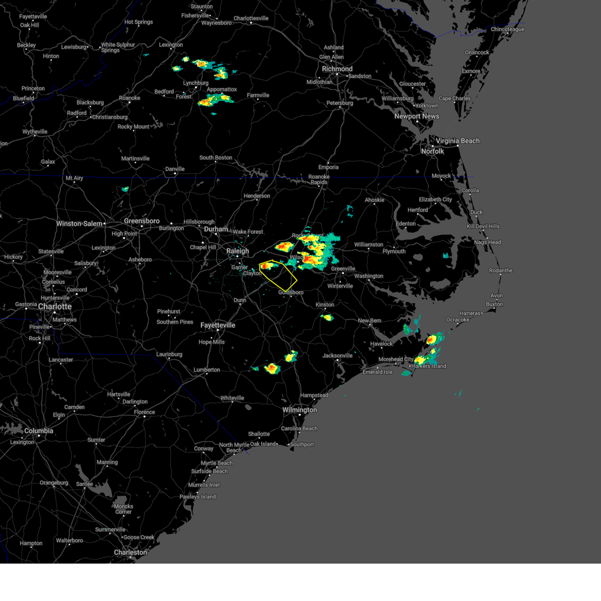 At 333 pm edt, a severe thunderstorm was located 8 miles east of clayton, or 10 miles north of smithfield, moving southeast at 30 mph (radar indicated). Hazards include 60 mph wind gusts and quarter size hail. Hail damage to vehicles is expected. expect wind damage to roofs, siding, and trees. locations impacted include, fremont, micro, kenly, pikeville, buckhorn reservoir, nahunta and flowers. hail threat, radar indicated max hail size, 1. 00 in wind threat, radar indicated max wind gust, 60 mph. At 333 pm edt, a severe thunderstorm was located 8 miles east of clayton, or 10 miles north of smithfield, moving southeast at 30 mph (radar indicated). Hazards include 60 mph wind gusts and quarter size hail. Hail damage to vehicles is expected. expect wind damage to roofs, siding, and trees. locations impacted include, fremont, micro, kenly, pikeville, buckhorn reservoir, nahunta and flowers. hail threat, radar indicated max hail size, 1. 00 in wind threat, radar indicated max wind gust, 60 mph.
|
| 5/9/2023 3:25 PM EDT |
 At 324 pm edt, a severe thunderstorm was located near clayton, or 12 miles north of smithfield, moving southeast at 25 mph (radar indicated). Hazards include 60 mph wind gusts and quarter size hail. Hail damage to vehicles is expected. Expect wind damage to roofs, siding, and trees. At 324 pm edt, a severe thunderstorm was located near clayton, or 12 miles north of smithfield, moving southeast at 25 mph (radar indicated). Hazards include 60 mph wind gusts and quarter size hail. Hail damage to vehicles is expected. Expect wind damage to roofs, siding, and trees.
|
| 4/22/2023 5:55 PM EDT |
 At 555 pm edt, severe thunderstorms were located along a line extending from near smithfield to 11 miles east of benson to 10 miles northwest of clinton to near jerome to near pembroke, moving east at 35 mph (radar indicated). Hazards include 60 mph wind gusts and penny size hail. Expect damage to roofs, siding, and trees. locations impacted include, smithfield, clinton, clayton, micro, selma, four oaks, pine level, kenly, princeton and roseboro. hail threat, radar indicated max hail size, 0. 75 in wind threat, radar indicated max wind gust, 60 mph. At 555 pm edt, severe thunderstorms were located along a line extending from near smithfield to 11 miles east of benson to 10 miles northwest of clinton to near jerome to near pembroke, moving east at 35 mph (radar indicated). Hazards include 60 mph wind gusts and penny size hail. Expect damage to roofs, siding, and trees. locations impacted include, smithfield, clinton, clayton, micro, selma, four oaks, pine level, kenly, princeton and roseboro. hail threat, radar indicated max hail size, 0. 75 in wind threat, radar indicated max wind gust, 60 mph.
|
| 4/22/2023 5:48 PM EDT |
 At 548 pm edt, severe thunderstorms were located along a line extending from near smithfield to 8 miles east of benson to 11 miles northwest of clinton to jerome to near elrod, moving east at 35 mph (radar indicated). Hazards include 60 mph wind gusts and penny size hail. Expect damage to roofs, siding, and trees. locations impacted include, smithfield, clinton, clayton, dunn, benson, godwin, micro, selma, four oaks and pine level. hail threat, radar indicated max hail size, 0. 75 in wind threat, radar indicated max wind gust, 60 mph. At 548 pm edt, severe thunderstorms were located along a line extending from near smithfield to 8 miles east of benson to 11 miles northwest of clinton to jerome to near elrod, moving east at 35 mph (radar indicated). Hazards include 60 mph wind gusts and penny size hail. Expect damage to roofs, siding, and trees. locations impacted include, smithfield, clinton, clayton, dunn, benson, godwin, micro, selma, four oaks and pine level. hail threat, radar indicated max hail size, 0. 75 in wind threat, radar indicated max wind gust, 60 mph.
|
| 4/22/2023 5:39 PM EDT |
 At 539 pm edt, severe thunderstorms were located along a line extending from near smithfield to near benson to 10 miles southeast of godwin to near duart to elrod, moving east at 40 mph (radar indicated). Hazards include 60 mph wind gusts and penny size hail. Expect damage to roofs, siding, and trees. locations impacted include, smithfield, clinton, clayton, dunn, benson, godwin, micro, selma, erwin and eastover. hail threat, radar indicated max hail size, 0. 75 in wind threat, radar indicated max wind gust, 60 mph. At 539 pm edt, severe thunderstorms were located along a line extending from near smithfield to near benson to 10 miles southeast of godwin to near duart to elrod, moving east at 40 mph (radar indicated). Hazards include 60 mph wind gusts and penny size hail. Expect damage to roofs, siding, and trees. locations impacted include, smithfield, clinton, clayton, dunn, benson, godwin, micro, selma, erwin and eastover. hail threat, radar indicated max hail size, 0. 75 in wind threat, radar indicated max wind gust, 60 mph.
|
| 4/22/2023 5:26 PM EDT |
 At 526 pm edt, severe thunderstorms were located along a line extending from 7 miles east of angier to near dunn to 7 miles south of godwin to st. pauls to near raemon, moving east at 35 mph (radar indicated). Hazards include 60 mph wind gusts and penny size hail. Expect damage to roofs, siding, and trees. locations impacted include, fayetteville, smithfield, clinton, clayton, dunn, benson, godwin, hope mills, micro and selma. hail threat, radar indicated max hail size, 0. 75 in wind threat, radar indicated max wind gust, 60 mph. At 526 pm edt, severe thunderstorms were located along a line extending from 7 miles east of angier to near dunn to 7 miles south of godwin to st. pauls to near raemon, moving east at 35 mph (radar indicated). Hazards include 60 mph wind gusts and penny size hail. Expect damage to roofs, siding, and trees. locations impacted include, fayetteville, smithfield, clinton, clayton, dunn, benson, godwin, hope mills, micro and selma. hail threat, radar indicated max hail size, 0. 75 in wind threat, radar indicated max wind gust, 60 mph.
|
| 4/22/2023 5:12 PM EDT |
 At 512 pm edt, severe thunderstorms were located along a line extending from angier to near lillington to near fayetteville to near rex to near clio, moving east at 35 mph (radar indicated). Hazards include 60 mph wind gusts and penny size hail. expect damage to roofs, siding, and trees At 512 pm edt, severe thunderstorms were located along a line extending from angier to near lillington to near fayetteville to near rex to near clio, moving east at 35 mph (radar indicated). Hazards include 60 mph wind gusts and penny size hail. expect damage to roofs, siding, and trees
|
| 1/12/2023 10:05 PM EST |
 At 1005 pm est, severe thunderstorms were located along a line extending from near barley to 6 miles northwest of nashville to near smithfield, moving northeast at 45 mph (radar indicated). Hazards include 60 mph wind gusts. Expect damage to roofs, siding, and trees. locations impacted include, rocky mount, roanoke rapids, smithfield, nashville, halifax, wilson, benson, dortches, bailey and micro. hail threat, radar indicated max hail size, <. 75 in wind threat, radar indicated max wind gust, 60 mph. At 1005 pm est, severe thunderstorms were located along a line extending from near barley to 6 miles northwest of nashville to near smithfield, moving northeast at 45 mph (radar indicated). Hazards include 60 mph wind gusts. Expect damage to roofs, siding, and trees. locations impacted include, rocky mount, roanoke rapids, smithfield, nashville, halifax, wilson, benson, dortches, bailey and micro. hail threat, radar indicated max hail size, <. 75 in wind threat, radar indicated max wind gust, 60 mph.
|
| 1/12/2023 9:26 PM EST |
 At 926 pm est, severe thunderstorms were located along a line extending from near warrenton to near wake forest to 6 miles south of lillington, moving northeast at 45 mph (radar indicated). Hazards include 60 mph wind gusts. expect damage to roofs, siding, and trees At 926 pm est, severe thunderstorms were located along a line extending from near warrenton to near wake forest to 6 miles south of lillington, moving northeast at 45 mph (radar indicated). Hazards include 60 mph wind gusts. expect damage to roofs, siding, and trees
|
| 1/4/2023 1:28 PM EST |
 At 128 pm est, severe thunderstorms were located along a line extending from near bunn to 7 miles southwest of bailey to near smithfield to 14 miles east of benson, moving east at 40 mph (radar indicated). Hazards include 60 mph wind gusts. expect damage to roofs, siding, and trees At 128 pm est, severe thunderstorms were located along a line extending from near bunn to 7 miles southwest of bailey to near smithfield to 14 miles east of benson, moving east at 40 mph (radar indicated). Hazards include 60 mph wind gusts. expect damage to roofs, siding, and trees
|
| 9/12/2022 8:36 PM EDT |
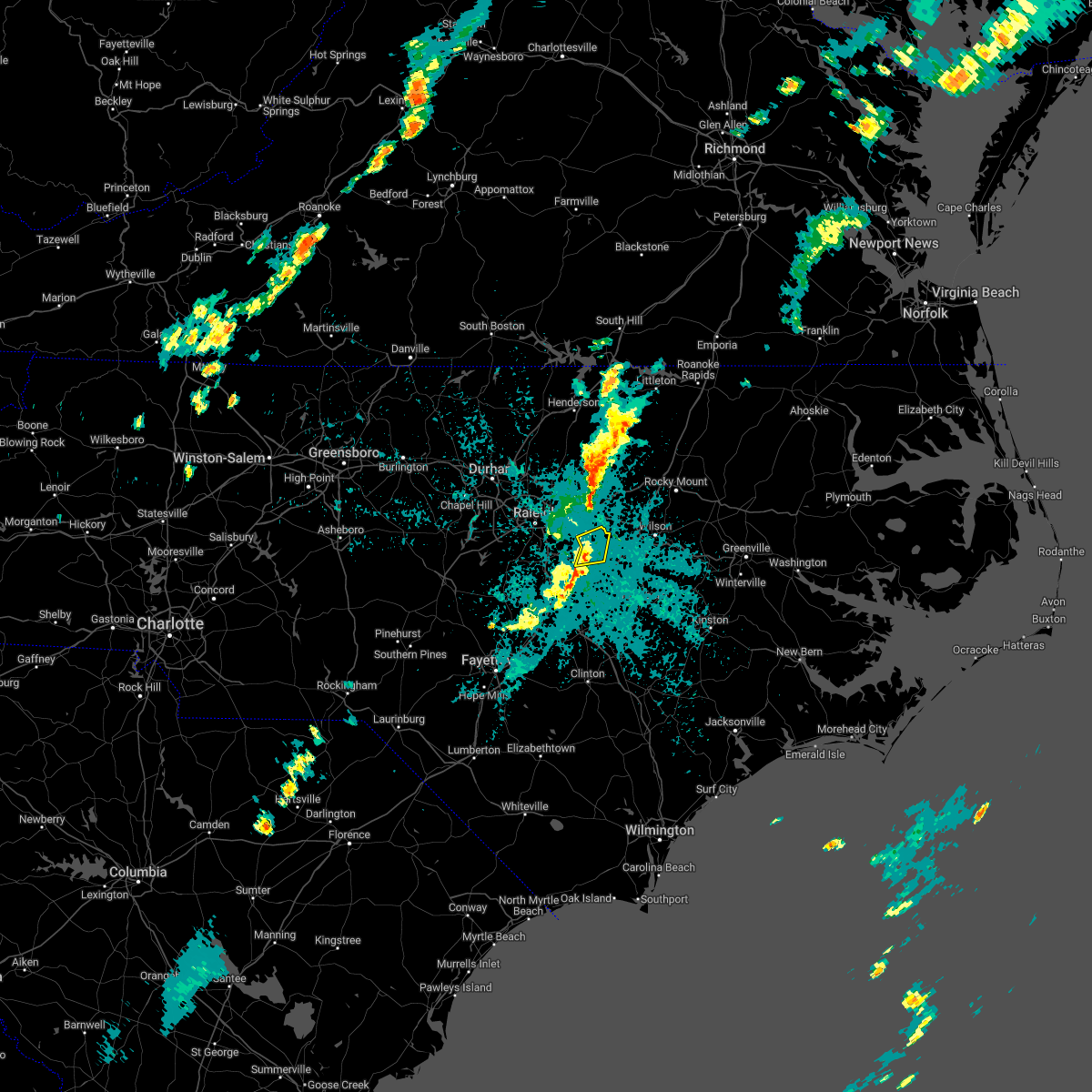 The severe thunderstorm warning for northeastern johnston county will expire at 845 pm edt, the storm which prompted the warning has weakened below severe limits, and no longer poses an immediate threat to life or property. therefore, the warning will be allowed to expire. to report severe weather, contact your nearest law enforcement agency. they will relay your report to the national weather service raleigh. The severe thunderstorm warning for northeastern johnston county will expire at 845 pm edt, the storm which prompted the warning has weakened below severe limits, and no longer poses an immediate threat to life or property. therefore, the warning will be allowed to expire. to report severe weather, contact your nearest law enforcement agency. they will relay your report to the national weather service raleigh.
|
| 9/12/2022 8:31 PM EDT |
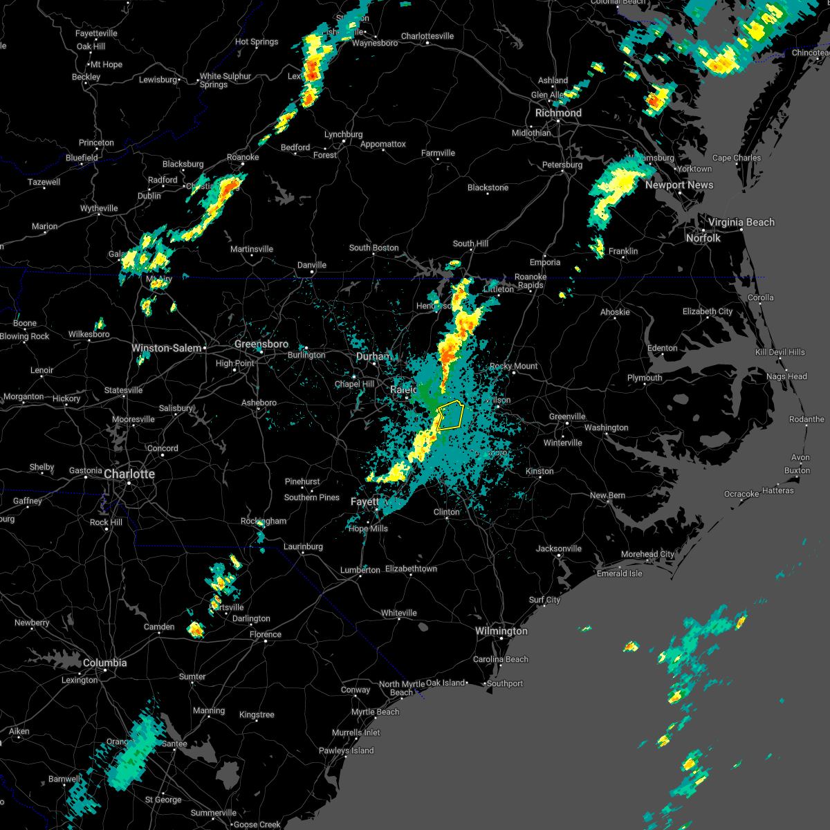 At 830 pm edt, a severe thunderstorm was located near flowers and wilsons mills, moving east at 25 mph (radar indicated). Hazards include 60 mph wind gusts. Expect damage to roofs, siding, and trees. locations impacted include, emit and flowers. hail threat, radar indicated max hail size, <. 75 in wind threat, radar indicated max wind gust, 60 mph. At 830 pm edt, a severe thunderstorm was located near flowers and wilsons mills, moving east at 25 mph (radar indicated). Hazards include 60 mph wind gusts. Expect damage to roofs, siding, and trees. locations impacted include, emit and flowers. hail threat, radar indicated max hail size, <. 75 in wind threat, radar indicated max wind gust, 60 mph.
|
| 9/12/2022 8:20 PM EDT |
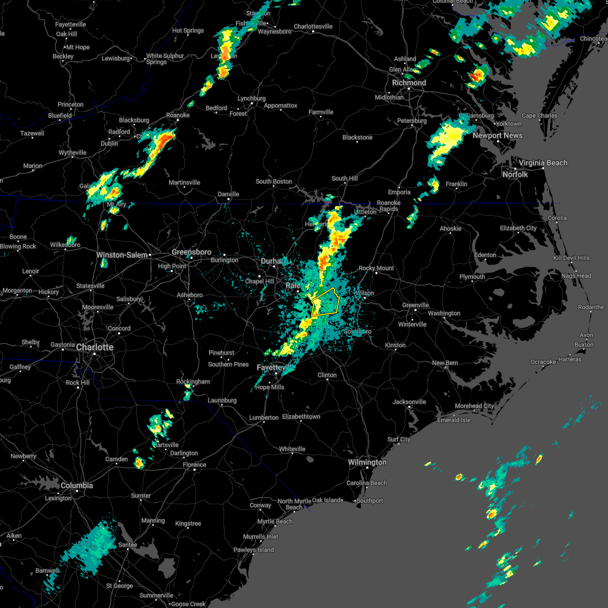 At 819 pm edt, a severe thunderstorm was located near clayton, or 13 miles northwest of smithfield, moving east at 25 mph (radar indicated). Hazards include 60 mph wind gusts. Expect damage to roofs, siding, and trees. locations impacted include, clayton, emit and flowers. hail threat, radar indicated max hail size, <. 75 in wind threat, radar indicated max wind gust, 60 mph. At 819 pm edt, a severe thunderstorm was located near clayton, or 13 miles northwest of smithfield, moving east at 25 mph (radar indicated). Hazards include 60 mph wind gusts. Expect damage to roofs, siding, and trees. locations impacted include, clayton, emit and flowers. hail threat, radar indicated max hail size, <. 75 in wind threat, radar indicated max wind gust, 60 mph.
|
| 9/12/2022 7:58 PM EDT |
 At 758 pm edt, a severe thunderstorm was located near garner, or 12 miles south of raleigh, moving east at 25 mph (radar indicated). Hazards include 60 mph wind gusts. expect damage to roofs, siding, and trees At 758 pm edt, a severe thunderstorm was located near garner, or 12 miles south of raleigh, moving east at 25 mph (radar indicated). Hazards include 60 mph wind gusts. expect damage to roofs, siding, and trees
|
| 8/11/2022 7:42 PM EDT |
 The severe thunderstorm warning for central wake and north central johnston counties will expire at 745 pm edt, the storm which prompted the warning has weakened below severe limits, and no longer poses an immediate threat to life or property. therefore, the warning will be allowed to expire. however gusty winds and heavy rain are still possible with this thunderstorm. The severe thunderstorm warning for central wake and north central johnston counties will expire at 745 pm edt, the storm which prompted the warning has weakened below severe limits, and no longer poses an immediate threat to life or property. therefore, the warning will be allowed to expire. however gusty winds and heavy rain are still possible with this thunderstorm.
|
| 8/11/2022 7:31 PM EDT |
 At 731 pm edt, a severe thunderstorm was located over garner, or near raleigh, moving east at 20 mph (radar indicated). Hazards include 60 mph wind gusts. Expect damage to roofs, siding, and trees. locations impacted include, raleigh, cary, garner, clayton, zebulon, knightdale, wendell, lake wheeler, flowers and lake benson. hail threat, radar indicated max hail size, <. 75 in wind threat, radar indicated max wind gust, 60 mph. At 731 pm edt, a severe thunderstorm was located over garner, or near raleigh, moving east at 20 mph (radar indicated). Hazards include 60 mph wind gusts. Expect damage to roofs, siding, and trees. locations impacted include, raleigh, cary, garner, clayton, zebulon, knightdale, wendell, lake wheeler, flowers and lake benson. hail threat, radar indicated max hail size, <. 75 in wind threat, radar indicated max wind gust, 60 mph.
|
| 8/11/2022 6:56 PM EDT |
 At 656 pm edt, a severe thunderstorm was located over cary, moving east at 25 mph (radar indicated). Hazards include 60 mph wind gusts and quarter size hail. Hail damage to vehicles is expected. Expect wind damage to roofs, siding, and trees. At 656 pm edt, a severe thunderstorm was located over cary, moving east at 25 mph (radar indicated). Hazards include 60 mph wind gusts and quarter size hail. Hail damage to vehicles is expected. Expect wind damage to roofs, siding, and trees.
|
| 7/26/2022 3:37 PM EDT |
 The severe thunderstorm warning for central wake, northwestern johnston and southwestern franklin counties will expire at 345 pm edt, the storms which prompted the warning have moved out of the area. therefore, the warning will be allowed to expire. The severe thunderstorm warning for central wake, northwestern johnston and southwestern franklin counties will expire at 345 pm edt, the storms which prompted the warning have moved out of the area. therefore, the warning will be allowed to expire.
|
| 7/26/2022 3:14 PM EDT |
 At 313 pm edt, severe thunderstorms were located along a line extending from near wake forest to angier, moving east at 35 mph (radar indicated). Hazards include 60 mph wind gusts and quarter size hail. Hail damage to vehicles is expected. expect wind damage to roofs, siding, and trees. locations impacted include, raleigh, cary, wake forest, garner, fuquay-varina, clayton, zebulon, bunn, holly springs and knightdale. hail threat, radar indicated max hail size, 1. 00 in wind threat, radar indicated max wind gust, 60 mph. At 313 pm edt, severe thunderstorms were located along a line extending from near wake forest to angier, moving east at 35 mph (radar indicated). Hazards include 60 mph wind gusts and quarter size hail. Hail damage to vehicles is expected. expect wind damage to roofs, siding, and trees. locations impacted include, raleigh, cary, wake forest, garner, fuquay-varina, clayton, zebulon, bunn, holly springs and knightdale. hail threat, radar indicated max hail size, 1. 00 in wind threat, radar indicated max wind gust, 60 mph.
|
| 7/26/2022 3:00 PM EDT |
 At 259 pm edt, severe thunderstorms were located along a line extending from near wake forest to 7 miles southwest of fuquay-varina, moving east at 35 mph (radar indicated). Hazards include 60 mph wind gusts and quarter size hail. Hail damage to vehicles is expected. Expect wind damage to roofs, siding, and trees. At 259 pm edt, severe thunderstorms were located along a line extending from near wake forest to 7 miles southwest of fuquay-varina, moving east at 35 mph (radar indicated). Hazards include 60 mph wind gusts and quarter size hail. Hail damage to vehicles is expected. Expect wind damage to roofs, siding, and trees.
|
| 7/25/2022 10:03 PM EDT |
 At 1002 pm edt, a severe thunderstorm was located near clayton, or 10 miles southeast of raleigh, moving northeast at 30 mph (radar indicated). Hazards include 60 mph wind gusts. expect damage to roofs, siding, and trees At 1002 pm edt, a severe thunderstorm was located near clayton, or 10 miles southeast of raleigh, moving northeast at 30 mph (radar indicated). Hazards include 60 mph wind gusts. expect damage to roofs, siding, and trees
|
| 7/25/2022 9:59 PM EDT |
 At 959 pm edt, severe thunderstorms were located along a line extending from 7 miles southeast of raleigh to 6 miles west of clayton to near garner, moving northeast at 30 mph (radar indicated). Hazards include 60 mph wind gusts. Expect damage to roofs, siding, and trees. locations impacted include, raleigh, garner, clayton, knightdale, lake benson and lake wheeler. hail threat, radar indicated max hail size, <. 75 in wind threat, radar indicated max wind gust, 60 mph. At 959 pm edt, severe thunderstorms were located along a line extending from 7 miles southeast of raleigh to 6 miles west of clayton to near garner, moving northeast at 30 mph (radar indicated). Hazards include 60 mph wind gusts. Expect damage to roofs, siding, and trees. locations impacted include, raleigh, garner, clayton, knightdale, lake benson and lake wheeler. hail threat, radar indicated max hail size, <. 75 in wind threat, radar indicated max wind gust, 60 mph.
|
| 7/25/2022 9:42 PM EDT |
 At 941 pm edt, severe thunderstorms were located along a line extending from near garner to near angier to near fuquay-varina, moving northeast at 30 mph (radar indicated). Hazards include 60 mph wind gusts. Expect damage to roofs, siding, and trees. locations impacted include, raleigh, garner, fuquay-varina, clayton, holly springs, knightdale, lake wheeler and lake benson. hail threat, radar indicated max hail size, <. 75 in wind threat, radar indicated max wind gust, 60 mph. At 941 pm edt, severe thunderstorms were located along a line extending from near garner to near angier to near fuquay-varina, moving northeast at 30 mph (radar indicated). Hazards include 60 mph wind gusts. Expect damage to roofs, siding, and trees. locations impacted include, raleigh, garner, fuquay-varina, clayton, holly springs, knightdale, lake wheeler and lake benson. hail threat, radar indicated max hail size, <. 75 in wind threat, radar indicated max wind gust, 60 mph.
|
| 7/25/2022 9:28 PM EDT |
 At 928 pm edt, severe thunderstorms were located along a line extending from 8 miles southwest of garner to near fuquay-varina to 9 miles northwest of lillington, moving northeast at 30 mph (radar indicated). Hazards include 60 mph wind gusts. Expect damage to roofs, siding, and trees. locations impacted include, raleigh, cary, smithfield, lillington, garner, fuquay-varina, clayton, angier, apex and holly springs. hail threat, radar indicated max hail size, <. 75 in wind threat, radar indicated max wind gust, 60 mph. At 928 pm edt, severe thunderstorms were located along a line extending from 8 miles southwest of garner to near fuquay-varina to 9 miles northwest of lillington, moving northeast at 30 mph (radar indicated). Hazards include 60 mph wind gusts. Expect damage to roofs, siding, and trees. locations impacted include, raleigh, cary, smithfield, lillington, garner, fuquay-varina, clayton, angier, apex and holly springs. hail threat, radar indicated max hail size, <. 75 in wind threat, radar indicated max wind gust, 60 mph.
|
| 7/25/2022 9:16 PM EDT |
 At 915 pm edt, a severe thunderstorm was located 9 miles northwest of lillington, moving east at 30 mph (radar indicated). Hazards include 60 mph wind gusts. expect damage to roofs, siding, and trees At 915 pm edt, a severe thunderstorm was located 9 miles northwest of lillington, moving east at 30 mph (radar indicated). Hazards include 60 mph wind gusts. expect damage to roofs, siding, and trees
|
| 7/8/2022 7:05 PM EDT |
 At 705 pm edt, a severe thunderstorm was located 10 miles northeast of smithfield, moving southeast at 5 mph (radar indicated). Hazards include 60 mph wind gusts. Expect damage to roofs, siding, and trees. locations impacted include, selma, emit, flowers and buckhorn reservoir. hail threat, radar indicated max hail size, <. 75 in wind threat, radar indicated max wind gust, 60 mph. At 705 pm edt, a severe thunderstorm was located 10 miles northeast of smithfield, moving southeast at 5 mph (radar indicated). Hazards include 60 mph wind gusts. Expect damage to roofs, siding, and trees. locations impacted include, selma, emit, flowers and buckhorn reservoir. hail threat, radar indicated max hail size, <. 75 in wind threat, radar indicated max wind gust, 60 mph.
|
| 7/8/2022 6:56 PM EDT |
 At 656 pm edt, a severe thunderstorm was located 10 miles northeast of smithfield, moving east at 15 mph (radar indicated). Hazards include 60 mph wind gusts. Expect damage to roofs, siding, and trees. locations impacted include, selma, emit, flowers and buckhorn reservoir. hail threat, radar indicated max hail size, <. 75 in wind threat, radar indicated max wind gust, 60 mph. At 656 pm edt, a severe thunderstorm was located 10 miles northeast of smithfield, moving east at 15 mph (radar indicated). Hazards include 60 mph wind gusts. Expect damage to roofs, siding, and trees. locations impacted include, selma, emit, flowers and buckhorn reservoir. hail threat, radar indicated max hail size, <. 75 in wind threat, radar indicated max wind gust, 60 mph.
|
| 7/8/2022 6:46 PM EDT |
 At 646 pm edt, a severe thunderstorm was located 7 miles east of clayton, or 10 miles north of smithfield, moving east at 10 mph (radar indicated). Hazards include 60 mph wind gusts. Expect damage to roofs, siding, and trees. locations impacted include, smithfield, clayton, selma, emit, flowers and buckhorn reservoir. hail threat, radar indicated max hail size, <. 75 in wind threat, radar indicated max wind gust, 60 mph. At 646 pm edt, a severe thunderstorm was located 7 miles east of clayton, or 10 miles north of smithfield, moving east at 10 mph (radar indicated). Hazards include 60 mph wind gusts. Expect damage to roofs, siding, and trees. locations impacted include, smithfield, clayton, selma, emit, flowers and buckhorn reservoir. hail threat, radar indicated max hail size, <. 75 in wind threat, radar indicated max wind gust, 60 mph.
|
| 7/8/2022 6:26 PM EDT |
 At 625 pm edt, a severe thunderstorm was located near clayton, or 13 miles southeast of raleigh, moving southeast at 5 mph (radar indicated). Hazards include 60 mph wind gusts. expect damage to roofs, siding, and trees At 625 pm edt, a severe thunderstorm was located near clayton, or 13 miles southeast of raleigh, moving southeast at 5 mph (radar indicated). Hazards include 60 mph wind gusts. expect damage to roofs, siding, and trees
|
| 7/7/2022 7:45 PM EDT |
 At 744 pm edt, a severe thunderstorm was located near clayton, or 7 miles north of smithfield, moving east at 20 mph (radar indicated). Hazards include 60 mph wind gusts. Expect damage to roofs, siding, and trees. locations impacted include, smithfield, clayton, coats crossroads and flowers. hail threat, radar indicated max hail size, <. 75 in wind threat, radar indicated max wind gust, 60 mph. At 744 pm edt, a severe thunderstorm was located near clayton, or 7 miles north of smithfield, moving east at 20 mph (radar indicated). Hazards include 60 mph wind gusts. Expect damage to roofs, siding, and trees. locations impacted include, smithfield, clayton, coats crossroads and flowers. hail threat, radar indicated max hail size, <. 75 in wind threat, radar indicated max wind gust, 60 mph.
|
| 7/7/2022 7:08 PM EDT |
 At 708 pm edt, a severe thunderstorm was located near clayton, or 11 miles southeast of raleigh, moving southeast at 10 mph (radar indicated). Hazards include 60 mph wind gusts. expect damage to roofs, siding, and trees At 708 pm edt, a severe thunderstorm was located near clayton, or 11 miles southeast of raleigh, moving southeast at 10 mph (radar indicated). Hazards include 60 mph wind gusts. expect damage to roofs, siding, and trees
|
| 7/7/2022 6:14 PM EDT |
 At 613 pm edt, a severe thunderstorm was located near clayton, or 8 miles north of smithfield, moving southeast at 15 mph (radar indicated). Hazards include 60 mph wind gusts. Expect damage to roofs, siding, and trees. locations impacted include, smithfield, clayton, selma, emit, flowers and buckhorn reservoir. hail threat, radar indicated max hail size, <. 75 in wind threat, radar indicated max wind gust, 60 mph. At 613 pm edt, a severe thunderstorm was located near clayton, or 8 miles north of smithfield, moving southeast at 15 mph (radar indicated). Hazards include 60 mph wind gusts. Expect damage to roofs, siding, and trees. locations impacted include, smithfield, clayton, selma, emit, flowers and buckhorn reservoir. hail threat, radar indicated max hail size, <. 75 in wind threat, radar indicated max wind gust, 60 mph.
|
| 7/7/2022 5:42 PM EDT |
 At 542 pm edt, a severe thunderstorm was located near clayton, or 13 miles southeast of raleigh, moving southeast at 15 mph (radar indicated). Hazards include 60 mph wind gusts. expect damage to roofs, siding, and trees At 542 pm edt, a severe thunderstorm was located near clayton, or 13 miles southeast of raleigh, moving southeast at 15 mph (radar indicated). Hazards include 60 mph wind gusts. expect damage to roofs, siding, and trees
|
| 7/6/2022 9:50 PM EDT |
 At 950 pm edt, severe thunderstorms were located along a line extending from near bunn to 6 miles northwest of bailey to near zebulon, moving east at 15 mph (radar indicated). Hazards include 60 mph wind gusts. expect damage to roofs, siding, and trees At 950 pm edt, severe thunderstorms were located along a line extending from near bunn to 6 miles northwest of bailey to near zebulon, moving east at 15 mph (radar indicated). Hazards include 60 mph wind gusts. expect damage to roofs, siding, and trees
|
| 7/6/2022 7:37 PM EDT |
 At 735 pm edt, severe thunderstorms were located along a line extending from falls lake to youngsville to knightdale to middlesex, moving east at 25 mph (radar indicated). Hazards include 70 mph wind gusts and quarter size hail around falls lake. 60 mph wind gusts elsewhere within the warning area. Hail damage to vehicles is expected. expect considerable tree damage. wind damage is also likely to mobile homes, roofs, and outbuildings. locations impacted include, raleigh, louisburg, wake forest, zebulon, franklinton, bailey, bunn, knightdale, wendell and rolesville. thunderstorm damage threat, considerable hail threat, radar indicated max hail size, 1. 00 in wind threat, radar indicated max wind gust, 70 mph. At 735 pm edt, severe thunderstorms were located along a line extending from falls lake to youngsville to knightdale to middlesex, moving east at 25 mph (radar indicated). Hazards include 70 mph wind gusts and quarter size hail around falls lake. 60 mph wind gusts elsewhere within the warning area. Hail damage to vehicles is expected. expect considerable tree damage. wind damage is also likely to mobile homes, roofs, and outbuildings. locations impacted include, raleigh, louisburg, wake forest, zebulon, franklinton, bailey, bunn, knightdale, wendell and rolesville. thunderstorm damage threat, considerable hail threat, radar indicated max hail size, 1. 00 in wind threat, radar indicated max wind gust, 70 mph.
|
| 7/6/2022 7:28 PM EDT |
 At 728 pm edt, severe thunderstorms were located along a line extending from near durham to 6 miles north of clayton, moving east at 15 mph (radar indicated). Hazards include 60 mph wind gusts. expect damage to roofs, siding, and trees At 728 pm edt, severe thunderstorms were located along a line extending from near durham to 6 miles north of clayton, moving east at 15 mph (radar indicated). Hazards include 60 mph wind gusts. expect damage to roofs, siding, and trees
|
| 6/17/2022 7:17 PM EDT |
 At 716 pm edt, severe thunderstorms were located along a line extending from 6 miles northwest of wilson to 8 miles southeast of benson to near fayetteville to near antioch, moving southeast at 40 mph (public. there are widespread reports of trees and power lines down across this area). Hazards include 70 mph wind gusts. Expect considerable tree damage. damage is likely to mobile homes, roofs, and outbuildings. locations impacted include, fayetteville, smithfield, raeford, fort bragg, wilson, dunn, benson, elm city, fremont and bailey. thunderstorm damage threat, considerable hail threat, radar indicated max hail size, <. 75 in wind threat, radar indicated max wind gust, 70 mph. At 716 pm edt, severe thunderstorms were located along a line extending from 6 miles northwest of wilson to 8 miles southeast of benson to near fayetteville to near antioch, moving southeast at 40 mph (public. there are widespread reports of trees and power lines down across this area). Hazards include 70 mph wind gusts. Expect considerable tree damage. damage is likely to mobile homes, roofs, and outbuildings. locations impacted include, fayetteville, smithfield, raeford, fort bragg, wilson, dunn, benson, elm city, fremont and bailey. thunderstorm damage threat, considerable hail threat, radar indicated max hail size, <. 75 in wind threat, radar indicated max wind gust, 70 mph.
|
| 6/17/2022 6:54 PM EDT |
 At 653 pm edt, severe thunderstorms were located along a line extending from 6 miles east of bunn to 6 miles north of benson to near pope afb to 6 miles south of aberdeen, moving southeast at 40 mph (public). Hazards include 70 mph wind gusts. Expect considerable tree damage. damage is likely to mobile homes, roofs, and outbuildings. locations impacted include, raleigh, fayetteville, southern pines, smithfield, raeford, louisburg, lillington, fort bragg, wilson and garner. thunderstorm damage threat, considerable hail threat, radar indicated max hail size, <. 75 in wind threat, radar indicated max wind gust, 70 mph. At 653 pm edt, severe thunderstorms were located along a line extending from 6 miles east of bunn to 6 miles north of benson to near pope afb to 6 miles south of aberdeen, moving southeast at 40 mph (public). Hazards include 70 mph wind gusts. Expect considerable tree damage. damage is likely to mobile homes, roofs, and outbuildings. locations impacted include, raleigh, fayetteville, southern pines, smithfield, raeford, louisburg, lillington, fort bragg, wilson and garner. thunderstorm damage threat, considerable hail threat, radar indicated max hail size, <. 75 in wind threat, radar indicated max wind gust, 70 mph.
|
| 6/17/2022 6:40 PM EDT |
 At 640 pm edt, severe thunderstorms were located along a line extending from near louisburg to near angier to 10 miles southeast of sanford to near pinehurst, moving southeast at 40 mph (emergency management. at 610 pm, a 63 mph gust was measured northwest of chapel hill). Hazards include 70 mph wind gusts. Expect considerable tree damage. Damage is likely to mobile homes, roofs, and outbuildings. At 640 pm edt, severe thunderstorms were located along a line extending from near louisburg to near angier to 10 miles southeast of sanford to near pinehurst, moving southeast at 40 mph (emergency management. at 610 pm, a 63 mph gust was measured northwest of chapel hill). Hazards include 70 mph wind gusts. Expect considerable tree damage. Damage is likely to mobile homes, roofs, and outbuildings.
|
| 6/17/2022 6:29 PM EDT |
 At 627 pm edt, severe thunderstorms were located along a line extending from near franklinton to near fuquay-varina to near sanford to near biscoe, moving southeast at 45 mph (emergency management. at 610 pm, a 63 mph gust was measured northwest of chapel hill). Hazards include 70 mph wind gusts. Expect considerable tree damage. damage is likely to mobile homes, roofs, and outbuildings. locations impacted include, raleigh, durham, cary, chapel hill, sanford, southern pines, creedmoor, pittsboro, lillington and troy. thunderstorm damage threat, considerable hail threat, radar indicated max hail size, <. 75 in wind threat, observed max wind gust, 70 mph. At 627 pm edt, severe thunderstorms were located along a line extending from near franklinton to near fuquay-varina to near sanford to near biscoe, moving southeast at 45 mph (emergency management. at 610 pm, a 63 mph gust was measured northwest of chapel hill). Hazards include 70 mph wind gusts. Expect considerable tree damage. damage is likely to mobile homes, roofs, and outbuildings. locations impacted include, raleigh, durham, cary, chapel hill, sanford, southern pines, creedmoor, pittsboro, lillington and troy. thunderstorm damage threat, considerable hail threat, radar indicated max hail size, <. 75 in wind threat, observed max wind gust, 70 mph.
|
| 6/17/2022 5:58 PM EDT |
 At 557 pm edt, the outflow from severe thunderstorms was located along a line extending from 8 miles north of butner to near carrboro to near siler city to 10 miles northeast of badin lake, moving southeast at 45 mph. the cores of the thunderstorms remain slightly farther to the west (emergency management). Hazards include 70 mph wind gusts. Expect considerable tree damage. Damage is likely to mobile homes, roofs, and outbuildings. At 557 pm edt, the outflow from severe thunderstorms was located along a line extending from 8 miles north of butner to near carrboro to near siler city to 10 miles northeast of badin lake, moving southeast at 45 mph. the cores of the thunderstorms remain slightly farther to the west (emergency management). Hazards include 70 mph wind gusts. Expect considerable tree damage. Damage is likely to mobile homes, roofs, and outbuildings.
|
| 6/16/2022 6:25 PM EDT |
 The severe thunderstorm warning for central wake and northwestern johnston counties will expire at 630 pm edt, the storm which prompted the warning has weakened below severe limits, and no longer poses an immediate threat to life or property. therefore, the warning will be allowed to expire. however gusty winds and heavy rain are still possible with this thunderstorm. a severe thunderstorm watch remains in effect until 900 pm edt for central north carolina. The severe thunderstorm warning for central wake and northwestern johnston counties will expire at 630 pm edt, the storm which prompted the warning has weakened below severe limits, and no longer poses an immediate threat to life or property. therefore, the warning will be allowed to expire. however gusty winds and heavy rain are still possible with this thunderstorm. a severe thunderstorm watch remains in effect until 900 pm edt for central north carolina.
|
| 6/16/2022 6:19 PM EDT |
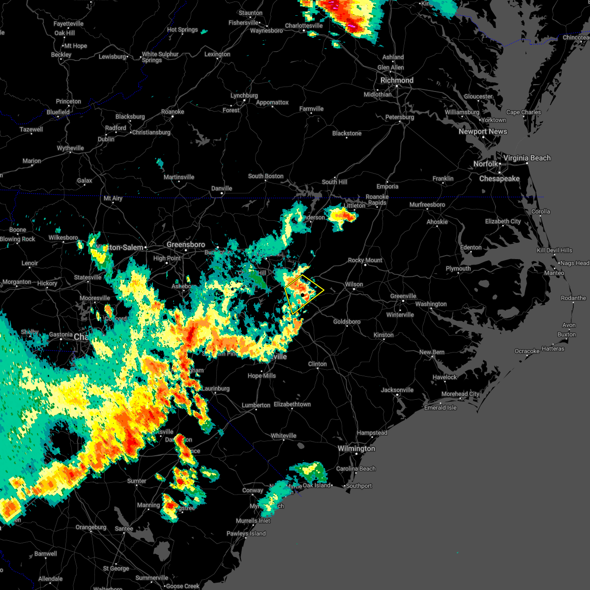 At 618 pm edt, a severe thunderstorm was located near clayton, or 10 miles southeast of raleigh, moving southeast at 25 mph (radar indicated). Hazards include 60 mph wind gusts. Expect damage to roofs, siding, and trees. locations impacted include, raleigh, garner, clayton, knightdale, wendell, flowers and lake benson. hail threat, radar indicated max hail size, <. 75 in wind threat, radar indicated max wind gust, 60 mph. At 618 pm edt, a severe thunderstorm was located near clayton, or 10 miles southeast of raleigh, moving southeast at 25 mph (radar indicated). Hazards include 60 mph wind gusts. Expect damage to roofs, siding, and trees. locations impacted include, raleigh, garner, clayton, knightdale, wendell, flowers and lake benson. hail threat, radar indicated max hail size, <. 75 in wind threat, radar indicated max wind gust, 60 mph.
|
| 6/16/2022 5:44 PM EDT |
 At 544 pm edt, a severe thunderstorm was located near raleigh, moving southeast at 25 mph (radar indicated). Hazards include 60 mph wind gusts and penny size hail. expect damage to roofs, siding, and trees At 544 pm edt, a severe thunderstorm was located near raleigh, moving southeast at 25 mph (radar indicated). Hazards include 60 mph wind gusts and penny size hail. expect damage to roofs, siding, and trees
|
| 6/8/2022 7:03 PM EDT |
 At 703 pm edt, a severe thunderstorm was located near clayton, or 13 miles northwest of smithfield, moving east at 40 mph (radar indicated). Hazards include 60 mph wind gusts. Expect damage to roofs, siding, and trees. locations impacted include, raleigh, cary, smithfield, lillington, garner, fuquay-varina, clayton, dunn, zebulon and angier. hail threat, radar indicated max hail size, <. 75 in wind threat, radar indicated max wind gust, 60 mph. At 703 pm edt, a severe thunderstorm was located near clayton, or 13 miles northwest of smithfield, moving east at 40 mph (radar indicated). Hazards include 60 mph wind gusts. Expect damage to roofs, siding, and trees. locations impacted include, raleigh, cary, smithfield, lillington, garner, fuquay-varina, clayton, dunn, zebulon and angier. hail threat, radar indicated max hail size, <. 75 in wind threat, radar indicated max wind gust, 60 mph.
|
| 6/8/2022 6:42 PM EDT |
 At 642 pm edt, a severe thunderstorm was located over fuquay-varina, or 11 miles south of cary, moving northeast at 55 mph (radar indicated). Hazards include 60 mph wind gusts. expect damage to roofs, siding, and trees At 642 pm edt, a severe thunderstorm was located over fuquay-varina, or 11 miles south of cary, moving northeast at 55 mph (radar indicated). Hazards include 60 mph wind gusts. expect damage to roofs, siding, and trees
|
| 5/27/2022 5:42 PM EDT |
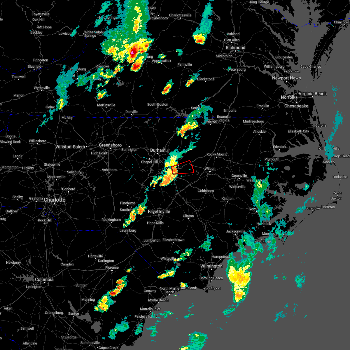 At 541 pm edt, a severe thunderstorm capable of producing a tornado was located near garner, or 8 miles southeast of raleigh, moving east at 30 mph (radar indicated rotation). Hazards include tornado. Flying debris will be dangerous to those caught without shelter. mobile homes will be damaged or destroyed. damage to roofs, windows, and vehicles will occur. tree damage is likely. this dangerous storm will be near, zebulon around 610 pm edt. Other locations impacted by this tornadic thunderstorm include wendell, knightdale and emit. At 541 pm edt, a severe thunderstorm capable of producing a tornado was located near garner, or 8 miles southeast of raleigh, moving east at 30 mph (radar indicated rotation). Hazards include tornado. Flying debris will be dangerous to those caught without shelter. mobile homes will be damaged or destroyed. damage to roofs, windows, and vehicles will occur. tree damage is likely. this dangerous storm will be near, zebulon around 610 pm edt. Other locations impacted by this tornadic thunderstorm include wendell, knightdale and emit.
|
| 5/27/2022 10:31 AM EDT |
 At 1030 am edt, severe thunderstorms were located along a line extending from near la crosse to near warrenton to 6 miles south of norlina to 8 miles southeast of henderson to near louisburg to raleigh, moving northeast at 45 mph (radar indicated). Hazards include 60 mph wind gusts. Expect damage to roofs, siding, and trees. locations impacted include, raleigh, durham, cary, henderson, oxford, creedmoor, louisburg, warrenton, wake forest and garner. hail threat, radar indicated max hail size, <. 75 in wind threat, radar indicated max wind gust, 60 mph. At 1030 am edt, severe thunderstorms were located along a line extending from near la crosse to near warrenton to 6 miles south of norlina to 8 miles southeast of henderson to near louisburg to raleigh, moving northeast at 45 mph (radar indicated). Hazards include 60 mph wind gusts. Expect damage to roofs, siding, and trees. locations impacted include, raleigh, durham, cary, henderson, oxford, creedmoor, louisburg, warrenton, wake forest and garner. hail threat, radar indicated max hail size, <. 75 in wind threat, radar indicated max wind gust, 60 mph.
|
| 5/27/2022 10:10 AM EDT |
 At 1009 am edt, severe thunderstorms were located along a line extending from 11 miles north of henderson to near kittrell to 7 miles south of oxford to creedmoor to 6 miles east of durham to 9 miles northwest of lillington, moving northeast at 40 mph (radar indicated). Hazards include 60 mph wind gusts. expect damage to roofs, siding, and trees At 1009 am edt, severe thunderstorms were located along a line extending from 11 miles north of henderson to near kittrell to 7 miles south of oxford to creedmoor to 6 miles east of durham to 9 miles northwest of lillington, moving northeast at 40 mph (radar indicated). Hazards include 60 mph wind gusts. expect damage to roofs, siding, and trees
|
| 5/23/2022 4:53 PM EDT |
 The severe thunderstorm warning for northeastern wake and northeastern johnston counties will expire at 500 pm edt, the storms which prompted the warning have moved out of the area. therefore, the warning will be allowed to expire. however gusty winds are still possible with these thunderstorms. The severe thunderstorm warning for northeastern wake and northeastern johnston counties will expire at 500 pm edt, the storms which prompted the warning have moved out of the area. therefore, the warning will be allowed to expire. however gusty winds are still possible with these thunderstorms.
|
| 5/23/2022 4:39 PM EDT |
 At 439 pm edt, severe thunderstorms were located along a line extending from near wake forest to 7 miles east of clayton, moving northeast at 40 mph (radar indicated). Hazards include 60 mph wind gusts. Expect damage to roofs, siding, and trees. locations impacted include, raleigh, smithfield, wake forest, clayton, zebulon, knightdale, micro, selma, wendell and rolesville. hail threat, radar indicated max hail size, <. 75 in wind threat, radar indicated max wind gust, 60 mph. At 439 pm edt, severe thunderstorms were located along a line extending from near wake forest to 7 miles east of clayton, moving northeast at 40 mph (radar indicated). Hazards include 60 mph wind gusts. Expect damage to roofs, siding, and trees. locations impacted include, raleigh, smithfield, wake forest, clayton, zebulon, knightdale, micro, selma, wendell and rolesville. hail threat, radar indicated max hail size, <. 75 in wind threat, radar indicated max wind gust, 60 mph.
|
| 5/23/2022 4:05 PM EDT |
 At 405 pm edt, severe thunderstorms were located along a line extending from rdu international to 7 miles northeast of angier, moving east at 40 mph (radar indicated). Hazards include 60 mph wind gusts. expect damage to roofs, siding, and trees At 405 pm edt, severe thunderstorms were located along a line extending from rdu international to 7 miles northeast of angier, moving east at 40 mph (radar indicated). Hazards include 60 mph wind gusts. expect damage to roofs, siding, and trees
|
| 5/22/2022 6:21 PM EDT |
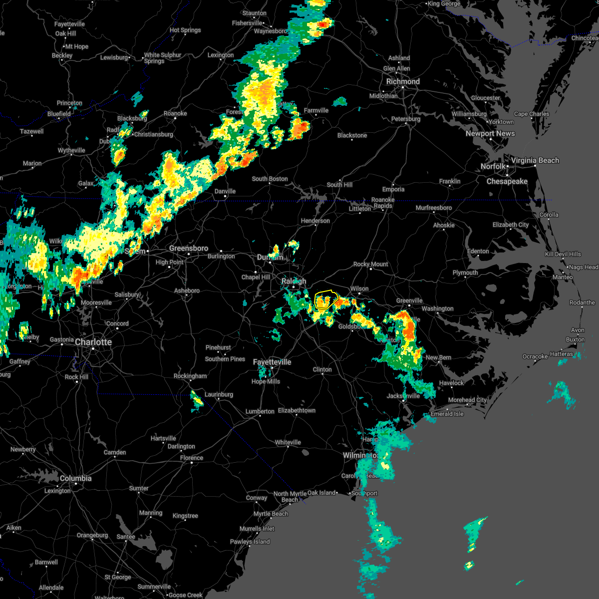 The severe thunderstorm warning for northeastern johnston county will expire at 630 pm edt, the storm which prompted the warning has weakened below severe limits, and no longer poses an immediate threat to life or property. therefore, the warning will be allowed to expire. however gusty winds are still possible with this thunderstorm. The severe thunderstorm warning for northeastern johnston county will expire at 630 pm edt, the storm which prompted the warning has weakened below severe limits, and no longer poses an immediate threat to life or property. therefore, the warning will be allowed to expire. however gusty winds are still possible with this thunderstorm.
|
| 5/22/2022 6:15 PM EDT |
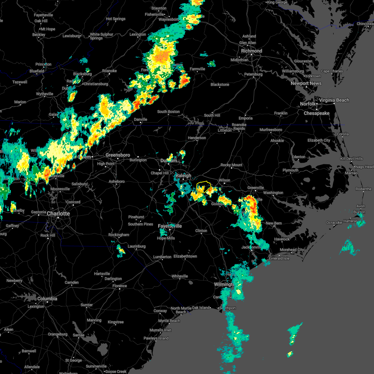 At 615 pm edt, a severe thunderstorm was located near clayton, or 9 miles north of smithfield, moving northeast at 20 mph (radar indicated). Hazards include 60 mph wind gusts. Expect damage to roofs, siding, and trees. locations impacted include, emit, flowers and buckhorn reservoir. hail threat, radar indicated max hail size, <. 75 in wind threat, radar indicated max wind gust, 60 mph. At 615 pm edt, a severe thunderstorm was located near clayton, or 9 miles north of smithfield, moving northeast at 20 mph (radar indicated). Hazards include 60 mph wind gusts. Expect damage to roofs, siding, and trees. locations impacted include, emit, flowers and buckhorn reservoir. hail threat, radar indicated max hail size, <. 75 in wind threat, radar indicated max wind gust, 60 mph.
|
| 5/22/2022 6:03 PM EDT |
 At 603 pm edt, a severe thunderstorm was located near clayton, or near smithfield, moving northeast at 20 mph (radar indicated). Hazards include 60 mph wind gusts. Expect damage to roofs, siding, and trees. locations impacted include, smithfield, clayton, selma, emit, flowers and buckhorn reservoir. hail threat, radar indicated max hail size, <. 75 in wind threat, radar indicated max wind gust, 60 mph. At 603 pm edt, a severe thunderstorm was located near clayton, or near smithfield, moving northeast at 20 mph (radar indicated). Hazards include 60 mph wind gusts. Expect damage to roofs, siding, and trees. locations impacted include, smithfield, clayton, selma, emit, flowers and buckhorn reservoir. hail threat, radar indicated max hail size, <. 75 in wind threat, radar indicated max wind gust, 60 mph.
|
| 5/22/2022 5:49 PM EDT |
 At 549 pm edt, a severe thunderstorm was located near smithfield, moving northeast at 20 mph (radar indicated). Hazards include 60 mph wind gusts. expect damage to roofs, siding, and trees At 549 pm edt, a severe thunderstorm was located near smithfield, moving northeast at 20 mph (radar indicated). Hazards include 60 mph wind gusts. expect damage to roofs, siding, and trees
|
| 5/21/2022 6:09 PM EDT |
 At 609 pm edt, a severe thunderstorm was located near clayton, or 14 miles southeast of raleigh, moving northeast at 35 mph (radar indicated). Hazards include 60 mph wind gusts and penny size hail. Expect damage to roofs, siding, and trees. locations impacted include, raleigh, garner, clayton, knightdale, wendell, emit and flowers. hail threat, radar indicated max hail size, 0. 75 in wind threat, radar indicated max wind gust, 60 mph. At 609 pm edt, a severe thunderstorm was located near clayton, or 14 miles southeast of raleigh, moving northeast at 35 mph (radar indicated). Hazards include 60 mph wind gusts and penny size hail. Expect damage to roofs, siding, and trees. locations impacted include, raleigh, garner, clayton, knightdale, wendell, emit and flowers. hail threat, radar indicated max hail size, 0. 75 in wind threat, radar indicated max wind gust, 60 mph.
|
| 5/21/2022 5:41 PM EDT |
 At 541 pm edt, a severe thunderstorm was located near clayton, or 13 miles southeast of raleigh, moving northeast at 30 mph (radar indicated). Hazards include 60 mph wind gusts and penny size hail. Expect damage to roofs, siding, and trees. locations impacted include, raleigh, garner, clayton, knightdale, wendell, emit, flowers and lake benson. hail threat, radar indicated max hail size, 0. 75 in wind threat, radar indicated max wind gust, 60 mph. At 541 pm edt, a severe thunderstorm was located near clayton, or 13 miles southeast of raleigh, moving northeast at 30 mph (radar indicated). Hazards include 60 mph wind gusts and penny size hail. Expect damage to roofs, siding, and trees. locations impacted include, raleigh, garner, clayton, knightdale, wendell, emit, flowers and lake benson. hail threat, radar indicated max hail size, 0. 75 in wind threat, radar indicated max wind gust, 60 mph.
|
| 5/21/2022 5:27 PM EDT |
 At 527 pm edt, a severe thunderstorm was located 8 miles northeast of angier, or 15 miles west of smithfield, moving northeast at 30 mph (radar indicated). Hazards include 60 mph wind gusts and penny size hail. expect damage to roofs, siding, and trees At 527 pm edt, a severe thunderstorm was located 8 miles northeast of angier, or 15 miles west of smithfield, moving northeast at 30 mph (radar indicated). Hazards include 60 mph wind gusts and penny size hail. expect damage to roofs, siding, and trees
|
| 5/20/2022 1:02 AM EDT |
 At 102 am edt, a severe thunderstorm was located near smithfield, moving east at 25 mph (radar indicated). Hazards include 70 mph wind gusts and quarter size hail. Hail damage to vehicles is expected. expect considerable tree damage. wind damage is also likely to mobile homes, roofs, and outbuildings. locations impacted include, smithfield, selma, four oaks, emit, coats crossroads and flowers. thunderstorm damage threat, considerable hail threat, radar indicated max hail size, 1. 00 in wind threat, radar indicated max wind gust, 70 mph. At 102 am edt, a severe thunderstorm was located near smithfield, moving east at 25 mph (radar indicated). Hazards include 70 mph wind gusts and quarter size hail. Hail damage to vehicles is expected. expect considerable tree damage. wind damage is also likely to mobile homes, roofs, and outbuildings. locations impacted include, smithfield, selma, four oaks, emit, coats crossroads and flowers. thunderstorm damage threat, considerable hail threat, radar indicated max hail size, 1. 00 in wind threat, radar indicated max wind gust, 70 mph.
|
| 5/20/2022 12:47 AM EDT |
 At 1247 am edt, a severe thunderstorm was located near clayton, or 10 miles northwest of smithfield, moving east at 30 mph (radar indicated). Hazards include 70 mph wind gusts and ping pong ball size hail. People and animals outdoors will be injured. expect hail damage to roofs, siding, windows, and vehicles. expect considerable tree damage. wind damage is also likely to mobile homes, roofs, and outbuildings. locations impacted include, smithfield, clayton, selma, four oaks, emit, coats crossroads and flowers. thunderstorm damage threat, considerable hail threat, radar indicated max hail size, 1. 50 in wind threat, radar indicated max wind gust, 70 mph. At 1247 am edt, a severe thunderstorm was located near clayton, or 10 miles northwest of smithfield, moving east at 30 mph (radar indicated). Hazards include 70 mph wind gusts and ping pong ball size hail. People and animals outdoors will be injured. expect hail damage to roofs, siding, windows, and vehicles. expect considerable tree damage. wind damage is also likely to mobile homes, roofs, and outbuildings. locations impacted include, smithfield, clayton, selma, four oaks, emit, coats crossroads and flowers. thunderstorm damage threat, considerable hail threat, radar indicated max hail size, 1. 50 in wind threat, radar indicated max wind gust, 70 mph.
|
| 5/20/2022 12:32 AM EDT |
 At 1231 am edt, a severe thunderstorm was located near garner, or 9 miles southeast of cary, moving east at 25 mph. this is a destructive storm for lake wheeler and garner (radar indicated). Hazards include 80 mph wind gusts and ping pong ball size hail. Flying debris will be dangerous to those caught without shelter. mobile homes will be heavily damaged. expect considerable damage to roofs, windows, and vehicles. Extensive tree damage and power outages are likely. At 1231 am edt, a severe thunderstorm was located near garner, or 9 miles southeast of cary, moving east at 25 mph. this is a destructive storm for lake wheeler and garner (radar indicated). Hazards include 80 mph wind gusts and ping pong ball size hail. Flying debris will be dangerous to those caught without shelter. mobile homes will be heavily damaged. expect considerable damage to roofs, windows, and vehicles. Extensive tree damage and power outages are likely.
|
| 5/16/2022 6:44 PM EDT |
 At 644 pm edt, severe thunderstorms were located along a line extending from near zebulon to 10 miles northeast of smithfield, moving east at 40 mph (radar indicated). Hazards include 60 mph wind gusts. Expect damage to roofs, siding, and trees. locations impacted include, wilson, fremont, bailey, kenly, lucama, middlesex, stantonsburg, black creek, pikeville and saratoga. hail threat, radar indicated max hail size, <. 75 in wind threat, radar indicated max wind gust, 60 mph. At 644 pm edt, severe thunderstorms were located along a line extending from near zebulon to 10 miles northeast of smithfield, moving east at 40 mph (radar indicated). Hazards include 60 mph wind gusts. Expect damage to roofs, siding, and trees. locations impacted include, wilson, fremont, bailey, kenly, lucama, middlesex, stantonsburg, black creek, pikeville and saratoga. hail threat, radar indicated max hail size, <. 75 in wind threat, radar indicated max wind gust, 60 mph.
|
| 5/16/2022 6:41 PM EDT |
 At 640 pm edt, severe thunderstorms were located along a line extending from 7 miles northeast of clayton to near smithfield, moving east at 50 mph (radar indicated). Hazards include 60 mph wind gusts and penny size hail. Expect damage to roofs, siding, and trees. locations impacted include, smithfield, clayton, selma, four oaks, coats crossroads and flowers. hail threat, radar indicated max hail size, 0. 75 in wind threat, radar indicated max wind gust, 60 mph. At 640 pm edt, severe thunderstorms were located along a line extending from 7 miles northeast of clayton to near smithfield, moving east at 50 mph (radar indicated). Hazards include 60 mph wind gusts and penny size hail. Expect damage to roofs, siding, and trees. locations impacted include, smithfield, clayton, selma, four oaks, coats crossroads and flowers. hail threat, radar indicated max hail size, 0. 75 in wind threat, radar indicated max wind gust, 60 mph.
|
| 5/16/2022 6:26 PM EDT |
 At 626 pm edt, a severe thunderstorm was located near bailey, or 17 miles northeast of smithfield, moving southeast at 35 mph (radar indicated). Hazards include 60 mph wind gusts. Expect damage to roofs, siding, and trees. locations impacted include, wilson, fremont, bailey, kenly, lucama, middlesex, stantonsburg, black creek, pikeville and saratoga. hail threat, radar indicated max hail size, <. 75 in wind threat, radar indicated max wind gust, 60 mph. At 626 pm edt, a severe thunderstorm was located near bailey, or 17 miles northeast of smithfield, moving southeast at 35 mph (radar indicated). Hazards include 60 mph wind gusts. Expect damage to roofs, siding, and trees. locations impacted include, wilson, fremont, bailey, kenly, lucama, middlesex, stantonsburg, black creek, pikeville and saratoga. hail threat, radar indicated max hail size, <. 75 in wind threat, radar indicated max wind gust, 60 mph.
|
| 5/16/2022 6:24 PM EDT |
 At 624 pm edt, severe thunderstorms were located along a line extending from near garner to near clayton to near angier, moving east at 40 mph (radar indicated). Hazards include 60 mph wind gusts and penny size hail. Expect damage to roofs, siding, and trees. locations impacted include, raleigh, cary, smithfield, garner, fuquay-varina, clayton, holly springs, knightdale, selma and wendell. hail threat, radar indicated max hail size, 0. 75 in wind threat, radar indicated max wind gust, 60 mph. At 624 pm edt, severe thunderstorms were located along a line extending from near garner to near clayton to near angier, moving east at 40 mph (radar indicated). Hazards include 60 mph wind gusts and penny size hail. Expect damage to roofs, siding, and trees. locations impacted include, raleigh, cary, smithfield, garner, fuquay-varina, clayton, holly springs, knightdale, selma and wendell. hail threat, radar indicated max hail size, 0. 75 in wind threat, radar indicated max wind gust, 60 mph.
|
| 5/16/2022 6:15 PM EDT |
 At 614 pm edt, a severe thunderstorm was located over zebulon, or 19 miles north of smithfield, moving east at 30 mph (radar indicated). Hazards include 60 mph wind gusts and penny size hail. Expect damage to roofs, siding, and trees. locations impacted include, wilson, fremont, bailey, kenly, lucama, middlesex, stantonsburg, black creek, pikeville and saratoga. hail threat, radar indicated max hail size, 0. 75 in wind threat, radar indicated max wind gust, 60 mph. At 614 pm edt, a severe thunderstorm was located over zebulon, or 19 miles north of smithfield, moving east at 30 mph (radar indicated). Hazards include 60 mph wind gusts and penny size hail. Expect damage to roofs, siding, and trees. locations impacted include, wilson, fremont, bailey, kenly, lucama, middlesex, stantonsburg, black creek, pikeville and saratoga. hail threat, radar indicated max hail size, 0. 75 in wind threat, radar indicated max wind gust, 60 mph.
|
| 5/16/2022 6:07 PM EDT |
 At 607 pm edt, severe thunderstorms were located along a line extending from near cary to 7 miles west of garner to near fuquay-varina, moving east at 40 mph (radar indicated). Hazards include 60 mph wind gusts and quarter size hail. Hail damage to vehicles is expected. Expect wind damage to roofs, siding, and trees. At 607 pm edt, severe thunderstorms were located along a line extending from near cary to 7 miles west of garner to near fuquay-varina, moving east at 40 mph (radar indicated). Hazards include 60 mph wind gusts and quarter size hail. Hail damage to vehicles is expected. Expect wind damage to roofs, siding, and trees.
|
| 5/16/2022 6:02 PM EDT |
 At 602 pm edt, severe thunderstorms were located along a line extending from near bunn to near zebulon to 9 miles north of clayton, moving east at 35 mph (radar indicated). Hazards include 60 mph wind gusts and quarter size hail. Hail damage to vehicles is expected. Expect wind damage to roofs, siding, and trees. At 602 pm edt, severe thunderstorms were located along a line extending from near bunn to near zebulon to 9 miles north of clayton, moving east at 35 mph (radar indicated). Hazards include 60 mph wind gusts and quarter size hail. Hail damage to vehicles is expected. Expect wind damage to roofs, siding, and trees.
|
| 5/6/2022 8:38 PM EDT |
 At 837 pm edt, a severe thunderstorm was located near raleigh, moving northeast at 65 mph (radar indicated). Hazards include 60 mph wind gusts. expect damage to roofs, siding, and trees At 837 pm edt, a severe thunderstorm was located near raleigh, moving northeast at 65 mph (radar indicated). Hazards include 60 mph wind gusts. expect damage to roofs, siding, and trees
|
| 5/6/2022 7:40 PM EDT |
 At 739 pm edt, a severe thunderstorm was located near godwin, or 11 miles south of lillington, moving northeast at 50 mph (radar indicated). Hazards include 60 mph wind gusts and half dollar size hail. Hail damage to vehicles is expected. Expect wind damage to roofs, siding, and trees. At 739 pm edt, a severe thunderstorm was located near godwin, or 11 miles south of lillington, moving northeast at 50 mph (radar indicated). Hazards include 60 mph wind gusts and half dollar size hail. Hail damage to vehicles is expected. Expect wind damage to roofs, siding, and trees.
|
| 5/3/2022 4:33 PM EDT |
 At 432 pm edt, a severe thunderstorm was located near angier, or 15 miles northeast of lillington, moving northeast at 20 mph (radar indicated). Hazards include 60 mph wind gusts and quarter size hail. Hail damage to vehicles is expected. expect wind damage to roofs, siding, and trees. locations impacted include, raleigh, garner, fuquay-varina, clayton, knightdale, coats crossroads, flowers and lake benson. hail threat, radar indicated max hail size, 1. 00 in wind threat, radar indicated max wind gust, 60 mph. At 432 pm edt, a severe thunderstorm was located near angier, or 15 miles northeast of lillington, moving northeast at 20 mph (radar indicated). Hazards include 60 mph wind gusts and quarter size hail. Hail damage to vehicles is expected. expect wind damage to roofs, siding, and trees. locations impacted include, raleigh, garner, fuquay-varina, clayton, knightdale, coats crossroads, flowers and lake benson. hail threat, radar indicated max hail size, 1. 00 in wind threat, radar indicated max wind gust, 60 mph.
|
| 5/3/2022 4:12 PM EDT |
 At 412 pm edt, a severe thunderstorm was located near fuquay-varina, or 11 miles north of lillington, moving northeast at 20 mph (radar indicated). Hazards include 60 mph wind gusts and quarter size hail. Hail damage to vehicles is expected. Expect wind damage to roofs, siding, and trees. At 412 pm edt, a severe thunderstorm was located near fuquay-varina, or 11 miles north of lillington, moving northeast at 20 mph (radar indicated). Hazards include 60 mph wind gusts and quarter size hail. Hail damage to vehicles is expected. Expect wind damage to roofs, siding, and trees.
|
| 4/26/2022 5:05 PM EDT |
 At 505 pm edt, severe thunderstorms were located along a line extending from near gaston to near fremont to near jerome, moving east at 35 mph (radar indicated). Hazards include 60 mph wind gusts and quarter size hail. Hail damage to vehicles is expected. expect wind damage to roofs, siding, and trees. these severe storms will be near, roanoke rapids around 510 pm edt. fremont around 515 pm edt. other locations impacted by these severe thunderstorms include mar-mac, salemburg, whitakers, medoc mountain state park and pinetops. hail threat, radar indicated max hail size, 1. 00 in wind threat, radar indicated max wind gust, 60 mph. At 505 pm edt, severe thunderstorms were located along a line extending from near gaston to near fremont to near jerome, moving east at 35 mph (radar indicated). Hazards include 60 mph wind gusts and quarter size hail. Hail damage to vehicles is expected. expect wind damage to roofs, siding, and trees. these severe storms will be near, roanoke rapids around 510 pm edt. fremont around 515 pm edt. other locations impacted by these severe thunderstorms include mar-mac, salemburg, whitakers, medoc mountain state park and pinetops. hail threat, radar indicated max hail size, 1. 00 in wind threat, radar indicated max wind gust, 60 mph.
|
| 4/26/2022 4:51 PM EDT |
 The severe thunderstorm warning for vance, warren, western nash, northwestern sampson, harnett, southeastern granville, northern cumberland, central wake, western wilson, johnston and franklin counties will expire at 500 pm edt, the storms which prompted the warning have moved east and new warnings have been issued to include areas farther east. therefore, the original warning will be allowed to expire. The severe thunderstorm warning for vance, warren, western nash, northwestern sampson, harnett, southeastern granville, northern cumberland, central wake, western wilson, johnston and franklin counties will expire at 500 pm edt, the storms which prompted the warning have moved east and new warnings have been issued to include areas farther east. therefore, the original warning will be allowed to expire.
|
| 4/26/2022 4:44 PM EDT |
 At 442 pm edt, severe thunderstorms were located along a line extending from near gasburg to near smithfield to near rex, moving east at 35 mph (radar indicated). Hazards include 60 mph wind gusts and quarter size hail. Hail damage is expected. expect wind damage to trees and subsequent damage to homes and businesses from falling trees. severe thunderstorms will be near, littleton around 450 pm edt. jerome around 505 pm edt. roanoke rapids and fremont around 510 pm edt. other locations impacted by these severe thunderstorms include pilot, mar-mac, salemburg, whitakers and medoc mountain state park. hail threat, radar indicated max hail size, 1. 00 in wind threat, radar indicated max wind gust, 60 mph. At 442 pm edt, severe thunderstorms were located along a line extending from near gasburg to near smithfield to near rex, moving east at 35 mph (radar indicated). Hazards include 60 mph wind gusts and quarter size hail. Hail damage is expected. expect wind damage to trees and subsequent damage to homes and businesses from falling trees. severe thunderstorms will be near, littleton around 450 pm edt. jerome around 505 pm edt. roanoke rapids and fremont around 510 pm edt. other locations impacted by these severe thunderstorms include pilot, mar-mac, salemburg, whitakers and medoc mountain state park. hail threat, radar indicated max hail size, 1. 00 in wind threat, radar indicated max wind gust, 60 mph.
|
| 4/26/2022 4:03 PM EDT |
 At 402 pm edt, severe thunderstorms were located along a line extending from near oxford to near garner to near pope afb, moving east at 35 mph (radar indicated). Hazards include 60 mph wind gusts and quarter size hail. Hail damage to vehicles is expected. expect wind damage to roofs, siding, and trees. severe thunderstorms will be near, oxford and garner around 405 pm edt. henderson, clayton and kittrell around 415 pm edt. fayetteville around 420 pm edt. zebulon around 430 pm edt. godwin around 440 pm edt. warrenton and norlina around 445 pm edt. dunn and bailey around 450 pm edt. benson around 455 pm edt. other locations impacted by these severe thunderstorms include pilot, gillburg, lake benson, falcon and selma. hail threat, radar indicated max hail size, 1. 00 in wind threat, radar indicated max wind gust, 60 mph. At 402 pm edt, severe thunderstorms were located along a line extending from near oxford to near garner to near pope afb, moving east at 35 mph (radar indicated). Hazards include 60 mph wind gusts and quarter size hail. Hail damage to vehicles is expected. expect wind damage to roofs, siding, and trees. severe thunderstorms will be near, oxford and garner around 405 pm edt. henderson, clayton and kittrell around 415 pm edt. fayetteville around 420 pm edt. zebulon around 430 pm edt. godwin around 440 pm edt. warrenton and norlina around 445 pm edt. dunn and bailey around 450 pm edt. benson around 455 pm edt. other locations impacted by these severe thunderstorms include pilot, gillburg, lake benson, falcon and selma. hail threat, radar indicated max hail size, 1. 00 in wind threat, radar indicated max wind gust, 60 mph.
|
| 4/7/2022 5:57 PM EDT |
 At 557 pm edt, a severe thunderstorm was located near smithfield, moving northeast at 50 mph (radar indicated). Hazards include 60 mph wind gusts and quarter size hail. Hail damage to vehicles is expected. Expect wind damage to roofs, siding, and trees. At 557 pm edt, a severe thunderstorm was located near smithfield, moving northeast at 50 mph (radar indicated). Hazards include 60 mph wind gusts and quarter size hail. Hail damage to vehicles is expected. Expect wind damage to roofs, siding, and trees.
|
| 4/7/2022 5:41 PM EDT |
 At 540 pm edt, a severe thunderstorm was located 7 miles west of smithfield, moving northeast at 50 mph (radar indicated). Hazards include 60 mph wind gusts and quarter size hail. Hail damage to vehicles is expected. expect wind damage to roofs, siding, and trees. locations impacted include, smithfield, clayton, benson, bailey, micro, selma, four oaks, pine level, kenly and lucama. hail threat, radar indicated max hail size, 1. 00 in wind threat, radar indicated max wind gust, 60 mph. At 540 pm edt, a severe thunderstorm was located 7 miles west of smithfield, moving northeast at 50 mph (radar indicated). Hazards include 60 mph wind gusts and quarter size hail. Hail damage to vehicles is expected. expect wind damage to roofs, siding, and trees. locations impacted include, smithfield, clayton, benson, bailey, micro, selma, four oaks, pine level, kenly and lucama. hail threat, radar indicated max hail size, 1. 00 in wind threat, radar indicated max wind gust, 60 mph.
|
| 4/7/2022 5:16 PM EDT |
 At 515 pm edt, a severe thunderstorm was located near godwin, or 11 miles southeast of lillington, moving northeast at 50 mph (radar indicated). Hazards include 60 mph wind gusts and quarter size hail. Hail damage to vehicles is expected. Expect wind damage to roofs, siding, and trees. At 515 pm edt, a severe thunderstorm was located near godwin, or 11 miles southeast of lillington, moving northeast at 50 mph (radar indicated). Hazards include 60 mph wind gusts and quarter size hail. Hail damage to vehicles is expected. Expect wind damage to roofs, siding, and trees.
|
| 4/7/2022 4:26 PM EDT |
 At 426 pm edt, a severe thunderstorm was located near zebulon, or 15 miles south of louisburg, moving northeast at 40 mph (radar indicated). Hazards include 60 mph wind gusts and quarter size hail. Hail damage to vehicles is expected. expect wind damage to roofs, siding, and trees. locations impacted include, zebulon, bailey, bunn, wendell, spring hope, middlesex, sims, castalia, pilot and emit. hail threat, radar indicated max hail size, 1. 00 in wind threat, radar indicated max wind gust, 60 mph. At 426 pm edt, a severe thunderstorm was located near zebulon, or 15 miles south of louisburg, moving northeast at 40 mph (radar indicated). Hazards include 60 mph wind gusts and quarter size hail. Hail damage to vehicles is expected. expect wind damage to roofs, siding, and trees. locations impacted include, zebulon, bailey, bunn, wendell, spring hope, middlesex, sims, castalia, pilot and emit. hail threat, radar indicated max hail size, 1. 00 in wind threat, radar indicated max wind gust, 60 mph.
|
| 4/7/2022 4:01 PM EDT |
 At 400 pm edt, a severe thunderstorm was located near garner, or 9 miles southeast of raleigh, moving northeast at 40 mph (radar indicated). Hazards include 60 mph wind gusts and quarter size hail. Hail damage to vehicles is expected. Expect wind damage to roofs, siding, and trees. At 400 pm edt, a severe thunderstorm was located near garner, or 9 miles southeast of raleigh, moving northeast at 40 mph (radar indicated). Hazards include 60 mph wind gusts and quarter size hail. Hail damage to vehicles is expected. Expect wind damage to roofs, siding, and trees.
|
| 4/7/2022 3:57 PM EDT |
 At 356 pm edt, a severe thunderstorm was located near angier, or 13 miles northeast of lillington, moving northeast at 30 mph (radar indicated). Hazards include 60 mph wind gusts and quarter size hail. Hail damage to vehicles is expected. expect wind damage to roofs, siding, and trees. locations impacted include, smithfield, lillington, fuquay-varina, clayton, angier, coats, four oaks, coats crossroads, buies creek and raven rock state park. hail threat, radar indicated max hail size, 1. 00 in wind threat, radar indicated max wind gust, 60 mph. At 356 pm edt, a severe thunderstorm was located near angier, or 13 miles northeast of lillington, moving northeast at 30 mph (radar indicated). Hazards include 60 mph wind gusts and quarter size hail. Hail damage to vehicles is expected. expect wind damage to roofs, siding, and trees. locations impacted include, smithfield, lillington, fuquay-varina, clayton, angier, coats, four oaks, coats crossroads, buies creek and raven rock state park. hail threat, radar indicated max hail size, 1. 00 in wind threat, radar indicated max wind gust, 60 mph.
|
| 4/7/2022 3:39 PM EDT |
 At 338 pm edt, a severe thunderstorm was located near angier, or near lillington, moving northeast at 50 mph (radar indicated). Hazards include 60 mph wind gusts and quarter size hail. Hail damage to vehicles is expected. expect wind damage to roofs, siding, and trees. locations impacted include, smithfield, lillington, fuquay-varina, clayton, angier, coats, four oaks, coats crossroads, buies creek and raven rock state park. hail threat, radar indicated max hail size, 1. 00 in wind threat, radar indicated max wind gust, 60 mph. At 338 pm edt, a severe thunderstorm was located near angier, or near lillington, moving northeast at 50 mph (radar indicated). Hazards include 60 mph wind gusts and quarter size hail. Hail damage to vehicles is expected. expect wind damage to roofs, siding, and trees. locations impacted include, smithfield, lillington, fuquay-varina, clayton, angier, coats, four oaks, coats crossroads, buies creek and raven rock state park. hail threat, radar indicated max hail size, 1. 00 in wind threat, radar indicated max wind gust, 60 mph.
|
| 4/7/2022 3:25 PM EDT |
 At 324 pm edt, a severe thunderstorm was located 7 miles west of lillington, moving northeast at 40 mph (radar indicated). Hazards include 60 mph wind gusts and quarter size hail. Hail damage to vehicles is expected. Expect wind damage to roofs, siding, and trees. At 324 pm edt, a severe thunderstorm was located 7 miles west of lillington, moving northeast at 40 mph (radar indicated). Hazards include 60 mph wind gusts and quarter size hail. Hail damage to vehicles is expected. Expect wind damage to roofs, siding, and trees.
|
| 1/3/2022 8:04 AM EST |
 At 803 am est, severe thunderstorms were located along a line extending from 6 miles northwest of zebulon to 8 miles southwest of bailey to 6 miles northeast of mount olive, moving northeast at 45 mph (radar indicated). Hazards include 60 mph wind gusts. Expect damage to roofs, siding, and trees. locations impacted include, goldsboro, smithfield, louisburg, wilson, wake forest, mount olive, zebulon, fremont, walnut creek and bailey. hail threat, radar indicated max hail size, <. 75 in wind threat, radar indicated max wind gust, 60 mph. At 803 am est, severe thunderstorms were located along a line extending from 6 miles northwest of zebulon to 8 miles southwest of bailey to 6 miles northeast of mount olive, moving northeast at 45 mph (radar indicated). Hazards include 60 mph wind gusts. Expect damage to roofs, siding, and trees. locations impacted include, goldsboro, smithfield, louisburg, wilson, wake forest, mount olive, zebulon, fremont, walnut creek and bailey. hail threat, radar indicated max hail size, <. 75 in wind threat, radar indicated max wind gust, 60 mph.
|
| 1/3/2022 7:41 AM EST |
 At 741 am est, severe thunderstorms were located along a line extending from cary to 8 miles south of smithfield to near rose hill, moving east at 45 mph (radar indicated). Hazards include 60 mph wind gusts. Expect damage to roofs, siding, and trees. locations impacted include, raleigh, cary, goldsboro, smithfield, clinton, louisburg, wilson, wake forest, garner and fuquay-varina. hail threat, radar indicated max hail size, <. 75 in wind threat, radar indicated max wind gust, 60 mph. At 741 am est, severe thunderstorms were located along a line extending from cary to 8 miles south of smithfield to near rose hill, moving east at 45 mph (radar indicated). Hazards include 60 mph wind gusts. Expect damage to roofs, siding, and trees. locations impacted include, raleigh, cary, goldsboro, smithfield, clinton, louisburg, wilson, wake forest, garner and fuquay-varina. hail threat, radar indicated max hail size, <. 75 in wind threat, radar indicated max wind gust, 60 mph.
|
| 1/3/2022 7:23 AM EST |
 At 723 am est, severe thunderstorms were located along a line extending from 10 miles east of pittsboro to near godwin to near lagoon, moving east at 50 mph (radar indicated). Hazards include 60 mph wind gusts. expect damage to roofs, siding, and trees At 723 am est, severe thunderstorms were located along a line extending from 10 miles east of pittsboro to near godwin to near lagoon, moving east at 50 mph (radar indicated). Hazards include 60 mph wind gusts. expect damage to roofs, siding, and trees
|
| 9/8/2021 6:12 PM EDT |
 At 612 pm edt, a severe thunderstorm was located near benson, or 17 miles southwest of smithfield, moving northeast at 30 mph (radar indicated). Hazards include 60 mph wind gusts and quarter size hail. Hail damage to vehicles is expected. Expect wind damage to roofs, siding, and trees. At 612 pm edt, a severe thunderstorm was located near benson, or 17 miles southwest of smithfield, moving northeast at 30 mph (radar indicated). Hazards include 60 mph wind gusts and quarter size hail. Hail damage to vehicles is expected. Expect wind damage to roofs, siding, and trees.
|
| 8/20/2021 4:42 PM EDT |
 The severe thunderstorm warning for central johnston county will expire at 445 pm edt, the storm which prompted the warning has weakened below severe limits, and no longer poses an immediate threat to life or property. therefore, the warning will be allowed to expire. however heavy rain is still possible with this thunderstorm. The severe thunderstorm warning for central johnston county will expire at 445 pm edt, the storm which prompted the warning has weakened below severe limits, and no longer poses an immediate threat to life or property. therefore, the warning will be allowed to expire. however heavy rain is still possible with this thunderstorm.
|
| 8/20/2021 4:26 PM EDT |
 At 424 pm edt, a severe thunderstorm was located near smithfield, moving southeast at 20 mph (radar indicated). Hazards include 60 mph wind gusts and penny size hail. Expect damage to roofs, siding, and trees. locations impacted include, smithfield, clayton, micro, selma, four oaks, pine level, kenly and flowers. hail threat, radar indicated max hail size, 0. 75 in wind threat, radar indicated max wind gust, 60 mph. At 424 pm edt, a severe thunderstorm was located near smithfield, moving southeast at 20 mph (radar indicated). Hazards include 60 mph wind gusts and penny size hail. Expect damage to roofs, siding, and trees. locations impacted include, smithfield, clayton, micro, selma, four oaks, pine level, kenly and flowers. hail threat, radar indicated max hail size, 0. 75 in wind threat, radar indicated max wind gust, 60 mph.
|
| 8/20/2021 4:03 PM EDT |
 At 403 pm edt, a severe thunderstorm was located over clayton, or 9 miles north of smithfield, moving southeast at 20 mph (radar indicated). Hazards include 60 mph wind gusts and penny size hail. expect damage to roofs, siding, and trees At 403 pm edt, a severe thunderstorm was located over clayton, or 9 miles north of smithfield, moving southeast at 20 mph (radar indicated). Hazards include 60 mph wind gusts and penny size hail. expect damage to roofs, siding, and trees
|
| 8/14/2021 2:56 PM EDT |
 The severe thunderstorm warning for southwestern nash, eastern wake, north central johnston and southwestern franklin counties will expire at 300 pm edt, the storm which prompted the warning has weakened below severe limits, and no longer poses an immediate threat to life or property. therefore, the warning will be allowed to expire. remember, a severe thunderstorm warning still remains in effect for central and western wake county, including the city of raleigh. The severe thunderstorm warning for southwestern nash, eastern wake, north central johnston and southwestern franklin counties will expire at 300 pm edt, the storm which prompted the warning has weakened below severe limits, and no longer poses an immediate threat to life or property. therefore, the warning will be allowed to expire. remember, a severe thunderstorm warning still remains in effect for central and western wake county, including the city of raleigh.
|
| 8/14/2021 2:32 PM EDT |
 At 232 pm edt, a severe thunderstorm was located 7 miles west of zebulon, or 11 miles east of raleigh, and is nearly stationary (radar indicated). Hazards include 60 mph wind gusts and quarter size hail. Hail damage to vehicles is expected. expect wind damage to roofs, siding, and trees. locations impacted include, raleigh, wake forest, garner, clayton, zebulon, bunn, knightdale, wendell, rolesville and middlesex. hail threat, radar indicated max hail size, 1. 00 in wind threat, radar indicated max wind gust, 60 mph. At 232 pm edt, a severe thunderstorm was located 7 miles west of zebulon, or 11 miles east of raleigh, and is nearly stationary (radar indicated). Hazards include 60 mph wind gusts and quarter size hail. Hail damage to vehicles is expected. expect wind damage to roofs, siding, and trees. locations impacted include, raleigh, wake forest, garner, clayton, zebulon, bunn, knightdale, wendell, rolesville and middlesex. hail threat, radar indicated max hail size, 1. 00 in wind threat, radar indicated max wind gust, 60 mph.
|
| 8/14/2021 2:15 PM EDT |
 At 215 pm edt, a severe thunderstorm was located 8 miles west of zebulon, or 10 miles east of raleigh, moving east at 5 mph (radar indicated). Hazards include 60 mph wind gusts and quarter size hail. Hail damage to vehicles is expected. Expect wind damage to roofs, siding, and trees. At 215 pm edt, a severe thunderstorm was located 8 miles west of zebulon, or 10 miles east of raleigh, moving east at 5 mph (radar indicated). Hazards include 60 mph wind gusts and quarter size hail. Hail damage to vehicles is expected. Expect wind damage to roofs, siding, and trees.
|
| 8/1/2021 1:22 PM EDT |
 At 121 pm edt, severe thunderstorms were located along a line extending from elm city to near angier, moving east at 30 mph (radar indicated). Hazards include 60 mph wind gusts and penny size hail. expect damage to roofs, siding, and trees At 121 pm edt, severe thunderstorms were located along a line extending from elm city to near angier, moving east at 30 mph (radar indicated). Hazards include 60 mph wind gusts and penny size hail. expect damage to roofs, siding, and trees
|
| 7/28/2021 4:56 PM EDT |
 At 455 pm edt, a severe thunderstorm was located 11 miles southwest of bailey, or 11 miles northeast of smithfield, moving east at 35 mph (radar indicated). Hazards include 60 mph wind gusts and quarter size hail. Hail damage to vehicles is expected. expect wind damage to roofs, siding, and trees. Locations impacted include, goldsboro, wilson, clayton, fremont, micro, selma, pine level, kenly, princeton and lucama. At 455 pm edt, a severe thunderstorm was located 11 miles southwest of bailey, or 11 miles northeast of smithfield, moving east at 35 mph (radar indicated). Hazards include 60 mph wind gusts and quarter size hail. Hail damage to vehicles is expected. expect wind damage to roofs, siding, and trees. Locations impacted include, goldsboro, wilson, clayton, fremont, micro, selma, pine level, kenly, princeton and lucama.
|
| 7/28/2021 4:42 PM EDT |
 At 442 pm edt, a severe thunderstorm was located 9 miles south of zebulon, or 12 miles north of smithfield, moving southeast at 40 mph (radar indicated). Hazards include 60 mph wind gusts and quarter size hail. Hail damage to vehicles is expected. Expect wind damage to roofs, siding, and trees. At 442 pm edt, a severe thunderstorm was located 9 miles south of zebulon, or 12 miles north of smithfield, moving southeast at 40 mph (radar indicated). Hazards include 60 mph wind gusts and quarter size hail. Hail damage to vehicles is expected. Expect wind damage to roofs, siding, and trees.
|
| 7/9/2021 5:24 PM EDT |
 At 524 pm edt, a severe thunderstorm was located near rdu international, or near raleigh, moving east at 15 mph (trained weather spotters reported trees down in chatham county). Hazards include 60 mph wind gusts and penny size hail. expect damage to roofs, siding, and trees At 524 pm edt, a severe thunderstorm was located near rdu international, or near raleigh, moving east at 15 mph (trained weather spotters reported trees down in chatham county). Hazards include 60 mph wind gusts and penny size hail. expect damage to roofs, siding, and trees
|
| 7/1/2021 10:19 PM EDT |
 At 1018 pm edt, severe thunderstorms were located along a line extending from near kittrell to near zebulon to near smithfield, moving northeast at 60 mph (radar indicated). Hazards include 60 mph wind gusts and nickel size hail. Expect damage to roofs, siding, and trees. Locations impacted include, raleigh, cary, smithfield, lillington, garner, fuquay-varina, clayton, dunn, angier and benson. At 1018 pm edt, severe thunderstorms were located along a line extending from near kittrell to near zebulon to near smithfield, moving northeast at 60 mph (radar indicated). Hazards include 60 mph wind gusts and nickel size hail. Expect damage to roofs, siding, and trees. Locations impacted include, raleigh, cary, smithfield, lillington, garner, fuquay-varina, clayton, dunn, angier and benson.
|
| 7/1/2021 9:38 PM EDT |
 At 937 pm edt, severe thunderstorms were located along a line extending from 10 miles southwest of cary to near lillington to fayetteville, moving northeast at 60 mph (radar indicated). Hazards include 60 mph wind gusts and nickel size hail. expect damage to roofs, siding, and trees At 937 pm edt, severe thunderstorms were located along a line extending from 10 miles southwest of cary to near lillington to fayetteville, moving northeast at 60 mph (radar indicated). Hazards include 60 mph wind gusts and nickel size hail. expect damage to roofs, siding, and trees
|
| 5/29/2021 5:14 PM EDT |
 At 514 pm edt, a severe thunderstorm was located over smithfield, moving east at 25 mph (radar indicated). Hazards include 60 mph wind gusts and quarter size hail. Hail damage to vehicles is expected. Expect wind damage to roofs, siding, and trees. At 514 pm edt, a severe thunderstorm was located over smithfield, moving east at 25 mph (radar indicated). Hazards include 60 mph wind gusts and quarter size hail. Hail damage to vehicles is expected. Expect wind damage to roofs, siding, and trees.
|
| 3/31/2021 5:01 PM EDT |
 At 501 pm edt, a severe thunderstorm was located over raleigh, moving east at 45 mph (radar indicated). Hazards include 60 mph wind gusts and half dollar size hail. Hail damage to vehicles is expected. expect wind damage to roofs, siding, and trees. Locations impacted include, raleigh, cary, garner, knightdale, wendell, rolesville, lake wheeler, william b umstead state park and lake benson. At 501 pm edt, a severe thunderstorm was located over raleigh, moving east at 45 mph (radar indicated). Hazards include 60 mph wind gusts and half dollar size hail. Hail damage to vehicles is expected. expect wind damage to roofs, siding, and trees. Locations impacted include, raleigh, cary, garner, knightdale, wendell, rolesville, lake wheeler, william b umstead state park and lake benson.
|
| 3/31/2021 4:48 PM EDT |
 At 447 pm edt, a severe thunderstorm was located near cary, moving east at 45 mph (radar indicated). Hazards include 60 mph wind gusts and quarter size hail. Hail damage to vehicles is expected. expect wind damage to roofs, siding, and trees. Locations impacted include, raleigh, cary, garner, apex, holly springs, morrisville, knightdale, wendell, rolesville and lake wheeler. At 447 pm edt, a severe thunderstorm was located near cary, moving east at 45 mph (radar indicated). Hazards include 60 mph wind gusts and quarter size hail. Hail damage to vehicles is expected. expect wind damage to roofs, siding, and trees. Locations impacted include, raleigh, cary, garner, apex, holly springs, morrisville, knightdale, wendell, rolesville and lake wheeler.
|
| 3/31/2021 4:33 PM EDT |
 At 431 pm edt, a severe thunderstorm was located 7 miles east of pittsboro, moving east at 45 mph (radar indicated). Hazards include 60 mph wind gusts and quarter size hail. Hail damage to vehicles is expected. Expect wind damage to roofs, siding, and trees. At 431 pm edt, a severe thunderstorm was located 7 miles east of pittsboro, moving east at 45 mph (radar indicated). Hazards include 60 mph wind gusts and quarter size hail. Hail damage to vehicles is expected. Expect wind damage to roofs, siding, and trees.
|
| 3/27/2021 6:19 PM EDT |
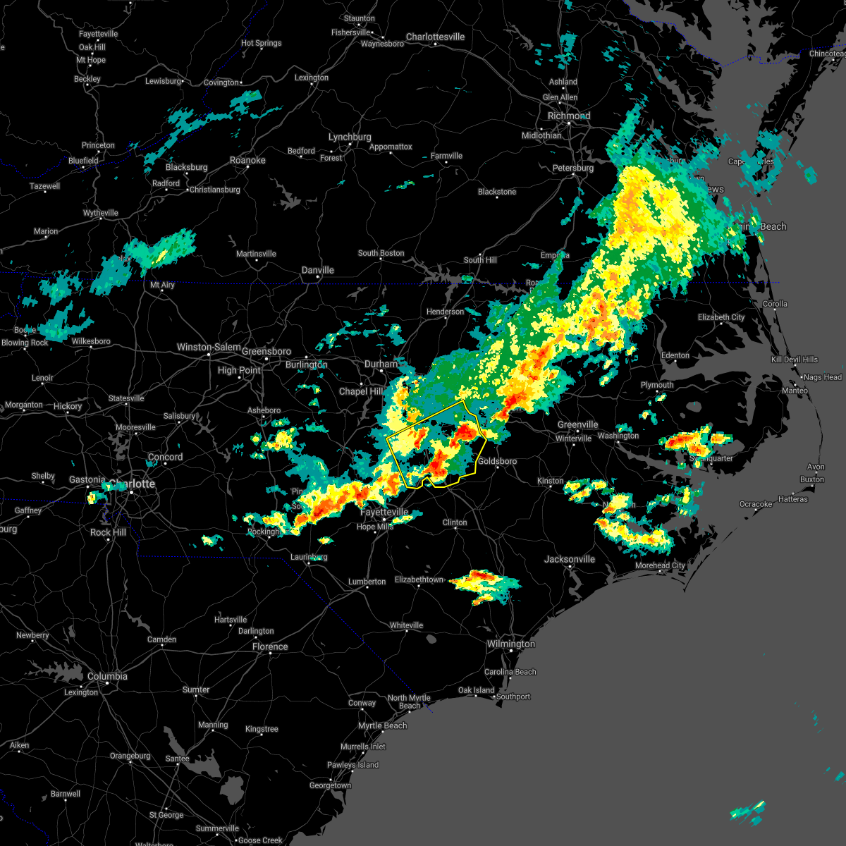 At 619 pm edt, severe thunderstorms were located along a line extending from near dunn to 10 miles north of pope afb, moving east at 30 mph (radar indicated). Hazards include 60 mph wind gusts. Expect damage to roofs, siding, and trees. Locations impacted include, smithfield, garner, fuquay-varina, clayton, dunn, angier, benson, micro, selma and erwin. At 619 pm edt, severe thunderstorms were located along a line extending from near dunn to 10 miles north of pope afb, moving east at 30 mph (radar indicated). Hazards include 60 mph wind gusts. Expect damage to roofs, siding, and trees. Locations impacted include, smithfield, garner, fuquay-varina, clayton, dunn, angier, benson, micro, selma and erwin.
|
| 3/27/2021 5:42 PM EDT |
 At 541 pm edt, severe thunderstorms were located along a line extending from 9 miles southwest of lillington to near carthage, moving east at 30 mph (radar indicated). Hazards include 60 mph wind gusts. expect damage to roofs, siding, and trees At 541 pm edt, severe thunderstorms were located along a line extending from 9 miles southwest of lillington to near carthage, moving east at 30 mph (radar indicated). Hazards include 60 mph wind gusts. expect damage to roofs, siding, and trees
|
| 3/27/2021 5:39 PM EDT |
 At 538 pm edt, a severe thunderstorm capable of producing a tornado was located near zebulon, or 18 miles north of smithfield, moving east at 40 mph (radar indicated rotation). Hazards include tornado. Flying debris will be dangerous to those caught without shelter. mobile homes will be damaged or destroyed. damage to roofs, windows, and vehicles will occur. tree damage is likely. this dangerous storm will be near, bailey around 550 pm edt. wilson around 610 pm edt. Other locations impacted by this tornadic thunderstorm include kenly, emit, wendell, buckhorn reservoir and middlesex. At 538 pm edt, a severe thunderstorm capable of producing a tornado was located near zebulon, or 18 miles north of smithfield, moving east at 40 mph (radar indicated rotation). Hazards include tornado. Flying debris will be dangerous to those caught without shelter. mobile homes will be damaged or destroyed. damage to roofs, windows, and vehicles will occur. tree damage is likely. this dangerous storm will be near, bailey around 550 pm edt. wilson around 610 pm edt. Other locations impacted by this tornadic thunderstorm include kenly, emit, wendell, buckhorn reservoir and middlesex.
|
| 3/27/2021 5:23 PM EDT |
 At 521 pm edt, a severe thunderstorm capable of producing a tornado was located near knightdale, or 15 miles east of raleigh, moving east at 35 mph (radar indicated rotation). Hazards include tornado and quarter size hail. Flying debris will be dangerous to those caught without shelter. mobile homes will be damaged or destroyed. damage to roofs, windows, and vehicles will occur. tree damage is likely. this dangerous storm will be near, wendell around 530 pm edt. bailey around 545 pm edt. wilson around 605 pm edt. Other locations impacted by this tornadic thunderstorm include kenly, knightdale, emit, wendell and buckhorn reservoir. At 521 pm edt, a severe thunderstorm capable of producing a tornado was located near knightdale, or 15 miles east of raleigh, moving east at 35 mph (radar indicated rotation). Hazards include tornado and quarter size hail. Flying debris will be dangerous to those caught without shelter. mobile homes will be damaged or destroyed. damage to roofs, windows, and vehicles will occur. tree damage is likely. this dangerous storm will be near, wendell around 530 pm edt. bailey around 545 pm edt. wilson around 605 pm edt. Other locations impacted by this tornadic thunderstorm include kenly, knightdale, emit, wendell and buckhorn reservoir.
|
| 3/27/2021 5:13 PM EDT |
 At 513 pm edt, a severe thunderstorm capable of producing a tornado was located 8 miles north of clayton, or 9 miles southeast of raleigh, moving east at 40 mph (radar indicated rotation). Hazards include tornado and quarter size hail. Flying debris will be dangerous to those caught without shelter. mobile homes will be damaged or destroyed. damage to roofs, windows, and vehicles will occur. tree damage is likely. this dangerous storm will be near, zebulon around 525 pm edt. bailey around 545 pm edt. wilson around 600 pm edt. Other locations impacted by this tornadic thunderstorm include kenly, knightdale, emit, wendell and buckhorn reservoir. At 513 pm edt, a severe thunderstorm capable of producing a tornado was located 8 miles north of clayton, or 9 miles southeast of raleigh, moving east at 40 mph (radar indicated rotation). Hazards include tornado and quarter size hail. Flying debris will be dangerous to those caught without shelter. mobile homes will be damaged or destroyed. damage to roofs, windows, and vehicles will occur. tree damage is likely. this dangerous storm will be near, zebulon around 525 pm edt. bailey around 545 pm edt. wilson around 600 pm edt. Other locations impacted by this tornadic thunderstorm include kenly, knightdale, emit, wendell and buckhorn reservoir.
|
| 12/24/2020 9:57 PM EST |
 The severe thunderstorm warning for western wayne, nash, southeastern warren, northeastern sampson, northwestern halifax, east central wake, western wilson, eastern johnston and central franklin counties will expire at 1000 pm est, the storms which prompted the warning have moved out of the area. therefore, the warning will be allowed to expire. a tornado watch remains in effect until 1100 pm est for central north carolina. remember, a severe thunderstorm warning still remains in effect for edgecombe, halifax, nash, wayne, and wilson counties until 11pm. The severe thunderstorm warning for western wayne, nash, southeastern warren, northeastern sampson, northwestern halifax, east central wake, western wilson, eastern johnston and central franklin counties will expire at 1000 pm est, the storms which prompted the warning have moved out of the area. therefore, the warning will be allowed to expire. a tornado watch remains in effect until 1100 pm est for central north carolina. remember, a severe thunderstorm warning still remains in effect for edgecombe, halifax, nash, wayne, and wilson counties until 11pm.
|
| 12/24/2020 9:38 PM EST |
 At 938 pm est, severe thunderstorms were located along a line extending from 7 miles southeast of warrenton to near bailey to 12 miles northwest of mount olive, moving northeast at 60 mph (radar indicated). Hazards include 60 mph wind gusts. Expect damage to roofs, siding, and trees. Locations impacted include, smithfield, clinton, nashville, louisburg, zebulon, littleton, bailey, bunn, micro and selma. At 938 pm est, severe thunderstorms were located along a line extending from 7 miles southeast of warrenton to near bailey to 12 miles northwest of mount olive, moving northeast at 60 mph (radar indicated). Hazards include 60 mph wind gusts. Expect damage to roofs, siding, and trees. Locations impacted include, smithfield, clinton, nashville, louisburg, zebulon, littleton, bailey, bunn, micro and selma.
|
| 12/24/2020 9:20 PM EST |
 At 919 pm est, severe thunderstorms were located along a line extending from louisburg to near clayton to 8 miles west of clinton, moving northeast at 65 mph (radar indicated). Hazards include 60 mph wind gusts. Expect damage to roofs, siding, and trees. Locations impacted include, smithfield, clinton, nashville, louisburg, clayton, zebulon, benson, littleton, bailey and bunn. At 919 pm est, severe thunderstorms were located along a line extending from louisburg to near clayton to 8 miles west of clinton, moving northeast at 65 mph (radar indicated). Hazards include 60 mph wind gusts. Expect damage to roofs, siding, and trees. Locations impacted include, smithfield, clinton, nashville, louisburg, clayton, zebulon, benson, littleton, bailey and bunn.
|
| 12/24/2020 8:58 PM EST |
 At 857 pm est, severe thunderstorms were located along a line extending from 6 miles southeast of raleigh to 6 miles northwest of godwin to near tolarsville, moving northeast at 70 mph (radar indicated). Hazards include 60 mph wind gusts. expect damage to roofs, siding, and trees At 857 pm est, severe thunderstorms were located along a line extending from 6 miles southeast of raleigh to 6 miles northwest of godwin to near tolarsville, moving northeast at 70 mph (radar indicated). Hazards include 60 mph wind gusts. expect damage to roofs, siding, and trees
|
| 12/24/2020 4:13 PM EST |
 The severe thunderstorm warning for northeastern wake, north central johnston and southwestern franklin counties will expire at 415 pm est, the storm which prompted the warning has weakened below severe limits, and no longer poses an immediate threat to life or property. therefore, the warning will be allowed to expire. a tornado watch remains in effect until 1000 pm est for central north carolina. The severe thunderstorm warning for northeastern wake, north central johnston and southwestern franklin counties will expire at 415 pm est, the storm which prompted the warning has weakened below severe limits, and no longer poses an immediate threat to life or property. therefore, the warning will be allowed to expire. a tornado watch remains in effect until 1000 pm est for central north carolina.
|
| 12/24/2020 4:00 PM EST |
 At 400 pm est, a severe thunderstorm was located 7 miles southwest of zebulon, or 14 miles east of raleigh, moving north at 55 mph (radar indicated). Hazards include 60 mph wind gusts and quarter size hail. Hail damage to vehicles is expected. expect wind damage to roofs, siding, and trees. Locations impacted include, raleigh, garner, zebulon, bunn, knightdale, wendell, rolesville, youngsville, pilot and flowers. At 400 pm est, a severe thunderstorm was located 7 miles southwest of zebulon, or 14 miles east of raleigh, moving north at 55 mph (radar indicated). Hazards include 60 mph wind gusts and quarter size hail. Hail damage to vehicles is expected. expect wind damage to roofs, siding, and trees. Locations impacted include, raleigh, garner, zebulon, bunn, knightdale, wendell, rolesville, youngsville, pilot and flowers.
|
| 12/24/2020 3:45 PM EST |
 At 345 pm est, a severe thunderstorm was located 7 miles southwest of clayton, or 9 miles west of smithfield, moving north at 60 mph (radar indicated). Hazards include 60 mph wind gusts and quarter size hail. Hail damage to vehicles is expected. Expect wind damage to roofs, siding, and trees. At 345 pm est, a severe thunderstorm was located 7 miles southwest of clayton, or 9 miles west of smithfield, moving north at 60 mph (radar indicated). Hazards include 60 mph wind gusts and quarter size hail. Hail damage to vehicles is expected. Expect wind damage to roofs, siding, and trees.
|
| 8/6/2020 4:21 PM EDT |
 At 421 pm edt, a severe thunderstorm was located near zebulon, or 18 miles north of smithfield, moving east at 10 mph (radar indicated). Hazards include 60 mph wind gusts and quarter size hail. Hail damage to vehicles is expected. expect wind damage to roofs, siding, and trees. Locations impacted include, zebulon, wendell and emit. At 421 pm edt, a severe thunderstorm was located near zebulon, or 18 miles north of smithfield, moving east at 10 mph (radar indicated). Hazards include 60 mph wind gusts and quarter size hail. Hail damage to vehicles is expected. expect wind damage to roofs, siding, and trees. Locations impacted include, zebulon, wendell and emit.
|
| 8/6/2020 4:05 PM EDT |
 At 405 pm edt, a severe thunderstorm was located over zebulon, or 17 miles east of raleigh, moving east at 10 mph (radar indicated). Hazards include 60 mph wind gusts and quarter size hail. Hail damage to vehicles is expected. expect wind damage to roofs, siding, and trees. Locations impacted include, zebulon, bailey, wendell, spring hope, lucama, middlesex, sims, pilot, emit and buckhorn reservoir. At 405 pm edt, a severe thunderstorm was located over zebulon, or 17 miles east of raleigh, moving east at 10 mph (radar indicated). Hazards include 60 mph wind gusts and quarter size hail. Hail damage to vehicles is expected. expect wind damage to roofs, siding, and trees. Locations impacted include, zebulon, bailey, wendell, spring hope, lucama, middlesex, sims, pilot, emit and buckhorn reservoir.
|
| 8/6/2020 3:42 PM EDT |
 At 342 pm edt, a severe thunderstorm was located near zebulon, or 14 miles east of raleigh, moving northeast at 15 mph (radar indicated). Hazards include 60 mph wind gusts and quarter size hail. Hail damage to vehicles is expected. Expect wind damage to roofs, siding, and trees. At 342 pm edt, a severe thunderstorm was located near zebulon, or 14 miles east of raleigh, moving northeast at 15 mph (radar indicated). Hazards include 60 mph wind gusts and quarter size hail. Hail damage to vehicles is expected. Expect wind damage to roofs, siding, and trees.
|
| 8/1/2020 5:01 PM EDT |
 At 501 pm edt, severe thunderstorms were located along a line extending from near zebulon to 7 miles south of bailey, moving northeast at 25 mph (radar indicated). Hazards include 60 mph wind gusts. Expect damage to roofs, siding, and trees. Locations impacted include, smithfield, wilson, zebulon, bailey, bunn, micro, selma, wendell, pine level and kenly. At 501 pm edt, severe thunderstorms were located along a line extending from near zebulon to 7 miles south of bailey, moving northeast at 25 mph (radar indicated). Hazards include 60 mph wind gusts. Expect damage to roofs, siding, and trees. Locations impacted include, smithfield, wilson, zebulon, bailey, bunn, micro, selma, wendell, pine level and kenly.
|
| 8/1/2020 4:47 PM EDT |
 At 447 pm edt, severe thunderstorms were located along a line extending from near zebulon to 10 miles northeast of smithfield, moving northeast at 25 mph (radar indicated). Hazards include 60 mph wind gusts. Expect damage to roofs, siding, and trees. Locations impacted include, raleigh, smithfield, wilson, garner, clayton, zebulon, bailey, bunn, knightdale and micro. At 447 pm edt, severe thunderstorms were located along a line extending from near zebulon to 10 miles northeast of smithfield, moving northeast at 25 mph (radar indicated). Hazards include 60 mph wind gusts. Expect damage to roofs, siding, and trees. Locations impacted include, raleigh, smithfield, wilson, garner, clayton, zebulon, bailey, bunn, knightdale and micro.
|
| 8/1/2020 4:30 PM EDT |
 At 430 pm edt, severe thunderstorms were located along a line extending from 6 miles northeast of clayton to near smithfield, moving northeast at 25 mph (radar indicated). Hazards include 60 mph wind gusts. Expect damage to roofs, siding, and trees. Locations impacted include, raleigh, smithfield, wilson, garner, clayton, zebulon, bailey, bunn, knightdale and micro. At 430 pm edt, severe thunderstorms were located along a line extending from 6 miles northeast of clayton to near smithfield, moving northeast at 25 mph (radar indicated). Hazards include 60 mph wind gusts. Expect damage to roofs, siding, and trees. Locations impacted include, raleigh, smithfield, wilson, garner, clayton, zebulon, bailey, bunn, knightdale and micro.
|
| 8/1/2020 4:16 PM EDT |
 At 415 pm edt, severe thunderstorms were located along a line extending from near clayton to smithfield, moving northeast at 25 mph (radar indicated). Hazards include 60 mph wind gusts. expect damage to roofs, siding, and trees At 415 pm edt, severe thunderstorms were located along a line extending from near clayton to smithfield, moving northeast at 25 mph (radar indicated). Hazards include 60 mph wind gusts. expect damage to roofs, siding, and trees
|
| 8/1/2020 1:35 AM EDT |
 The severe thunderstorm warning for southern nash, southern edgecombe, east central wake, wilson, northeastern johnston and south central franklin counties will expire at 145 am edt, the storms which prompted the warning have weakened below severe limits, and have exited the warned area. therefore, the warning will be allowed to expire. however gusty winds and heavy rain are still possible with these thunderstorms. to report severe weather, contact your nearest law enforcement agency. they will relay your report to the national weather service raleigh. The severe thunderstorm warning for southern nash, southern edgecombe, east central wake, wilson, northeastern johnston and south central franklin counties will expire at 145 am edt, the storms which prompted the warning have weakened below severe limits, and have exited the warned area. therefore, the warning will be allowed to expire. however gusty winds and heavy rain are still possible with these thunderstorms. to report severe weather, contact your nearest law enforcement agency. they will relay your report to the national weather service raleigh.
|
| 8/1/2020 1:26 AM EDT |
 At 126 am edt, severe thunderstorms were located along a line extending from 6 miles west of bethel to zebulon, moving east at 15 mph (radar indicated). Hazards include 60 mph wind gusts. Expect damage to roofs, siding, and trees. Locations impacted include, rocky mount, tarboro, wilson, zebulon, elm city, bailey, wendell, princeville, sharpsburg and pinetops. At 126 am edt, severe thunderstorms were located along a line extending from 6 miles west of bethel to zebulon, moving east at 15 mph (radar indicated). Hazards include 60 mph wind gusts. Expect damage to roofs, siding, and trees. Locations impacted include, rocky mount, tarboro, wilson, zebulon, elm city, bailey, wendell, princeville, sharpsburg and pinetops.
|
| 8/1/2020 1:00 AM EDT |
 At 100 am edt, severe thunderstorms were located along a line extending from near tarboro to zebulon, moving east at 25 mph (radar indicated). Hazards include 60 mph wind gusts. Expect damage to roofs, siding, and trees. Locations impacted include, rocky mount, tarboro, wilson, zebulon, elm city, bailey, wendell, princeville, sharpsburg and pinetops. At 100 am edt, severe thunderstorms were located along a line extending from near tarboro to zebulon, moving east at 25 mph (radar indicated). Hazards include 60 mph wind gusts. Expect damage to roofs, siding, and trees. Locations impacted include, rocky mount, tarboro, wilson, zebulon, elm city, bailey, wendell, princeville, sharpsburg and pinetops.
|
| 8/1/2020 12:51 AM EDT |
 At 1250 am edt, a severe thunderstorm was located over zebulon, or 17 miles east of raleigh, moving east at 20 mph (radar indicated). Hazards include 60 mph wind gusts. expect damage to roofs, siding, and trees At 1250 am edt, a severe thunderstorm was located over zebulon, or 17 miles east of raleigh, moving east at 20 mph (radar indicated). Hazards include 60 mph wind gusts. expect damage to roofs, siding, and trees
|
| 7/18/2020 4:39 PM EDT |
 The severe thunderstorm warning for central wake and northern johnston counties will expire at 445 pm edt, the storms which prompted the warning have weakened below severe limits, and no longer pose an immediate threat to life or property. therefore, the warning will be allowed to expire. however gusty winds are still possible with these thunderstorms. The severe thunderstorm warning for central wake and northern johnston counties will expire at 445 pm edt, the storms which prompted the warning have weakened below severe limits, and no longer pose an immediate threat to life or property. therefore, the warning will be allowed to expire. however gusty winds are still possible with these thunderstorms.
|
| 7/18/2020 4:28 PM EDT |
 At 428 pm edt, severe thunderstorms were located along a line extending from near garner to clayton to 9 miles north of smithfield, moving southwest at 10 mph (radar indicated). Hazards include 60 mph wind gusts. Expect damage to roofs, siding, and trees. Locations impacted include, raleigh, smithfield, wake forest, garner, clayton, knightdale, micro, selma, emit and flowers. At 428 pm edt, severe thunderstorms were located along a line extending from near garner to clayton to 9 miles north of smithfield, moving southwest at 10 mph (radar indicated). Hazards include 60 mph wind gusts. Expect damage to roofs, siding, and trees. Locations impacted include, raleigh, smithfield, wake forest, garner, clayton, knightdale, micro, selma, emit and flowers.
|
| 7/18/2020 3:49 PM EDT |
 At 349 pm edt, severe thunderstorms were located along a line extending from 8 miles east of raleigh to 7 miles north of clayton to near zebulon, moving south at 15 mph (radar indicated). Hazards include 60 mph wind gusts. expect damage to roofs, siding, and trees At 349 pm edt, severe thunderstorms were located along a line extending from 8 miles east of raleigh to 7 miles north of clayton to near zebulon, moving south at 15 mph (radar indicated). Hazards include 60 mph wind gusts. expect damage to roofs, siding, and trees
|
| 7/13/2020 6:44 PM EDT |
 At 641 pm edt, a severe thunderstorm was located near garner, or 13 miles southeast of cary, moving south at 5 mph (radar indicated). Hazards include 60 mph wind gusts and quarter size hail. Hail damage to vehicles is expected. Expect wind damage to roofs, siding, and trees. At 641 pm edt, a severe thunderstorm was located near garner, or 13 miles southeast of cary, moving south at 5 mph (radar indicated). Hazards include 60 mph wind gusts and quarter size hail. Hail damage to vehicles is expected. Expect wind damage to roofs, siding, and trees.
|
| 7/5/2020 5:35 PM EDT |
 At 533 pm edt, severe thunderstorms were located along a line extending from near smithfield and wilson mills to erwin, coats, and buies creek, nearly stationary (radar indicated). Hazards include 60 mph wind gusts. Expect damage to roofs, siding, and trees. Locations impacted include, smithfield, lillington, clayton, dunn, angier, benson, micro, selma, erwin and coats. At 533 pm edt, severe thunderstorms were located along a line extending from near smithfield and wilson mills to erwin, coats, and buies creek, nearly stationary (radar indicated). Hazards include 60 mph wind gusts. Expect damage to roofs, siding, and trees. Locations impacted include, smithfield, lillington, clayton, dunn, angier, benson, micro, selma, erwin and coats.
|
| 7/5/2020 5:22 PM EDT |
 At 521 pm edt, severe thunderstorms were located along a line extending from near smithfield to 8 miles northeast of benson to 6 miles southeast of angier, and are nearly stationary. the most intense wind gusts through 530 pm will be around selma, pine level, and micro in johnston county (radar indicated). Hazards include 60 mph wind gusts. Expect damage to roofs, siding, and trees. Locations impacted include, smithfield, lillington, clayton, dunn, angier, benson, micro, selma, erwin and coats. At 521 pm edt, severe thunderstorms were located along a line extending from near smithfield to 8 miles northeast of benson to 6 miles southeast of angier, and are nearly stationary. the most intense wind gusts through 530 pm will be around selma, pine level, and micro in johnston county (radar indicated). Hazards include 60 mph wind gusts. Expect damage to roofs, siding, and trees. Locations impacted include, smithfield, lillington, clayton, dunn, angier, benson, micro, selma, erwin and coats.
|
| 7/5/2020 5:04 PM EDT |
 At 504 pm edt, severe thunderstorms were located along a line extending from 7 miles north of smithfield to near benson to near dunn, moving northwest at 15 mph (radar indicated). Hazards include 60 mph wind gusts. expect damage to roofs, siding, and trees At 504 pm edt, severe thunderstorms were located along a line extending from 7 miles north of smithfield to near benson to near dunn, moving northwest at 15 mph (radar indicated). Hazards include 60 mph wind gusts. expect damage to roofs, siding, and trees
|
| 6/30/2020 3:29 PM EDT |
 At 328 pm edt, a severe thunderstorm was located near zebulon, or 14 miles east of raleigh, moving east at 10 mph (radar indicated). Hazards include 60 mph wind gusts and quarter size hail. Hail damage to vehicles is expected. Expect wind damage to roofs, siding, and trees. At 328 pm edt, a severe thunderstorm was located near zebulon, or 14 miles east of raleigh, moving east at 10 mph (radar indicated). Hazards include 60 mph wind gusts and quarter size hail. Hail damage to vehicles is expected. Expect wind damage to roofs, siding, and trees.
|
| 6/28/2020 5:30 PM EDT |
 At 529 pm edt, a severe thunderstorm was located near cary, moving east at 25 mph (radar indicated). Hazards include 60 mph wind gusts. expect damage to roofs, siding, and trees At 529 pm edt, a severe thunderstorm was located near cary, moving east at 25 mph (radar indicated). Hazards include 60 mph wind gusts. expect damage to roofs, siding, and trees
|
| 4/13/2020 8:25 AM EDT |
 At 824 am edt, severe thunderstorms were located along a line extending from near fremont to near ammon, moving east at 60 mph (radar indicated). Hazards include 70 mph wind gusts. Expect considerable tree damage. damage is likely to mobile homes, roofs, and outbuildings. Locations impacted include, goldsboro, smithfield, clinton, clayton, mount olive, benson, fremont, walnut creek, bailey and harrells. At 824 am edt, severe thunderstorms were located along a line extending from near fremont to near ammon, moving east at 60 mph (radar indicated). Hazards include 70 mph wind gusts. Expect considerable tree damage. damage is likely to mobile homes, roofs, and outbuildings. Locations impacted include, goldsboro, smithfield, clinton, clayton, mount olive, benson, fremont, walnut creek, bailey and harrells.
|
| 4/13/2020 8:00 AM EDT |
 At 759 am edt, severe thunderstorms were located along a line extending from near smithfield to howellsville, moving east at 60 mph (radar indicated). Hazards include 70 mph wind gusts. Expect considerable tree damage. Damage is likely to mobile homes, roofs, and outbuildings. At 759 am edt, severe thunderstorms were located along a line extending from near smithfield to howellsville, moving east at 60 mph (radar indicated). Hazards include 70 mph wind gusts. Expect considerable tree damage. Damage is likely to mobile homes, roofs, and outbuildings.
|
| 4/8/2020 8:23 PM EDT |
 At 823 pm edt, severe thunderstorms were located along a line extending from near smithfield to near dunn, moving southeast at 55 mph (radar indicated). Hazards include 60 mph wind gusts and penny size hail. Expect damage to roofs, siding, and trees. Locations impacted include, smithfield, clayton, dunn, benson, micro, selma, erwin, coats, four oaks and pine level. At 823 pm edt, severe thunderstorms were located along a line extending from near smithfield to near dunn, moving southeast at 55 mph (radar indicated). Hazards include 60 mph wind gusts and penny size hail. Expect damage to roofs, siding, and trees. Locations impacted include, smithfield, clayton, dunn, benson, micro, selma, erwin, coats, four oaks and pine level.
|
| 4/8/2020 8:11 PM EDT |
 At 810 pm edt, severe thunderstorms were located along a line extending from clayton to near lillington, moving southeast at 55 mph (radar indicated). Hazards include 60 mph wind gusts and penny size hail. Expect damage to roofs, siding, and trees. Locations impacted include, smithfield, lillington, garner, fuquay-varina, clayton, dunn, angier, benson, holly springs and micro. At 810 pm edt, severe thunderstorms were located along a line extending from clayton to near lillington, moving southeast at 55 mph (radar indicated). Hazards include 60 mph wind gusts and penny size hail. Expect damage to roofs, siding, and trees. Locations impacted include, smithfield, lillington, garner, fuquay-varina, clayton, dunn, angier, benson, holly springs and micro.
|
| 4/8/2020 7:53 PM EDT |
 At 752 pm edt, severe thunderstorms were located along a line extending from near garner to 9 miles northeast of sanford, moving southeast at 50 mph (radar indicated). Hazards include 60 mph wind gusts and quarter size hail. Hail damage to vehicles is expected. Expect wind damage to roofs, siding, and trees. At 752 pm edt, severe thunderstorms were located along a line extending from near garner to 9 miles northeast of sanford, moving southeast at 50 mph (radar indicated). Hazards include 60 mph wind gusts and quarter size hail. Hail damage to vehicles is expected. Expect wind damage to roofs, siding, and trees.
|
| 4/8/2020 7:21 PM EDT |
 At 721 pm edt, severe thunderstorms were located along a line extending from near dortches to 6 miles southeast of bailey to 7 miles east of clayton, moving southeast at 40 mph (radar indicated). Hazards include 60 mph wind gusts and quarter size hail. Hail damage to vehicles is expected. Expect wind damage to roofs, siding, and trees. At 721 pm edt, severe thunderstorms were located along a line extending from near dortches to 6 miles southeast of bailey to 7 miles east of clayton, moving southeast at 40 mph (radar indicated). Hazards include 60 mph wind gusts and quarter size hail. Hail damage to vehicles is expected. Expect wind damage to roofs, siding, and trees.
|
| 4/8/2020 6:42 PM EDT |
 At 642 pm edt, severe thunderstorms were located along a line extending from near franklinton to near wake forest to 7 miles northeast of rdu international, moving southeast at 40 mph (radar indicated). Hazards include 60 mph wind gusts and quarter size hail. Hail damage to vehicles is expected. Expect wind damage to roofs, siding, and trees. At 642 pm edt, severe thunderstorms were located along a line extending from near franklinton to near wake forest to 7 miles northeast of rdu international, moving southeast at 40 mph (radar indicated). Hazards include 60 mph wind gusts and quarter size hail. Hail damage to vehicles is expected. Expect wind damage to roofs, siding, and trees.
|
| 2/6/2020 2:50 PM EST |
 At 249 pm est, severe thunderstorms were located along a line extending from 6 miles southeast of littleton to 11 miles southwest of halifax to near dortches to near bailey, moving northeast at 75 mph (radar indicated). Hazards include 70 mph wind gusts and penny size hail. Expect considerable tree damage. damage is likely to mobile homes, roofs, and outbuildings. Locations impacted include, rocky mount, roanoke rapids, nashville, garner, zebulon, dortches, littleton, bailey, bunn and knightdale. At 249 pm est, severe thunderstorms were located along a line extending from 6 miles southeast of littleton to 11 miles southwest of halifax to near dortches to near bailey, moving northeast at 75 mph (radar indicated). Hazards include 70 mph wind gusts and penny size hail. Expect considerable tree damage. damage is likely to mobile homes, roofs, and outbuildings. Locations impacted include, rocky mount, roanoke rapids, nashville, garner, zebulon, dortches, littleton, bailey, bunn and knightdale.
|
| 2/6/2020 2:37 PM EST |
 At 236 pm est, severe thunderstorms were located along a line extending from 9 miles southeast of warrenton to 12 miles northwest of dortches to near nashville to 6 miles southwest of zebulon, moving northeast at 80 mph (radar indicated). Hazards include 70 mph wind gusts and penny size hail. Expect considerable tree damage. damage is likely to mobile homes, roofs, and outbuildings. Locations impacted include, raleigh, rocky mount, roanoke rapids, henderson, nashville, louisburg, warrenton, garner, zebulon and dortches. At 236 pm est, severe thunderstorms were located along a line extending from 9 miles southeast of warrenton to 12 miles northwest of dortches to near nashville to 6 miles southwest of zebulon, moving northeast at 80 mph (radar indicated). Hazards include 70 mph wind gusts and penny size hail. Expect considerable tree damage. damage is likely to mobile homes, roofs, and outbuildings. Locations impacted include, raleigh, rocky mount, roanoke rapids, henderson, nashville, louisburg, warrenton, garner, zebulon and dortches.
|
| 2/6/2020 2:17 PM EST |
 At 217 pm est, severe thunderstorms were located along a line extending from near franklinton to near wake forest to 8 miles west of zebulon to near fuquay-varina, moving east at 75 mph (radar indicated). Hazards include 70 mph wind gusts and penny size hail. Expect considerable tree damage. Damage is likely to mobile homes, roofs, and outbuildings. At 217 pm est, severe thunderstorms were located along a line extending from near franklinton to near wake forest to 8 miles west of zebulon to near fuquay-varina, moving east at 75 mph (radar indicated). Hazards include 70 mph wind gusts and penny size hail. Expect considerable tree damage. Damage is likely to mobile homes, roofs, and outbuildings.
|
| 1/12/2020 12:49 AM EST |
 At 1249 am est, severe thunderstorms were located along a line extending from 6 miles north of bailey to 8 miles east of smithfield to 11 miles northeast of jerome, moving northeast at 65 mph (radar indicated). Hazards include 60 mph wind gusts. Expect damage to roofs, siding, and trees. Locations impacted include, fayetteville, smithfield, clinton, fort bragg, dunn, benson, godwin, pope afb, hope mills and spring lake. At 1249 am est, severe thunderstorms were located along a line extending from 6 miles north of bailey to 8 miles east of smithfield to 11 miles northeast of jerome, moving northeast at 65 mph (radar indicated). Hazards include 60 mph wind gusts. Expect damage to roofs, siding, and trees. Locations impacted include, fayetteville, smithfield, clinton, fort bragg, dunn, benson, godwin, pope afb, hope mills and spring lake.
|
| 1/12/2020 12:41 AM EST |
 At 1240 am est, severe thunderstorms were located along a line extending from zebulon to smithfield to near jerome, moving northeast at 65 mph (radar indicated). Hazards include 60 mph wind gusts. Expect damage to roofs, siding, and trees. Locations impacted include, fayetteville, smithfield, clinton, raeford, lillington, fort bragg, clayton, dunn, zebulon and angier. At 1240 am est, severe thunderstorms were located along a line extending from zebulon to smithfield to near jerome, moving northeast at 65 mph (radar indicated). Hazards include 60 mph wind gusts. Expect damage to roofs, siding, and trees. Locations impacted include, fayetteville, smithfield, clinton, raeford, lillington, fort bragg, clayton, dunn, zebulon and angier.
|
| 1/12/2020 12:28 AM EST |
 At 1228 am est, severe thunderstorms were located along a line extending from near wake forest to near benson to near tobermory, moving northeast at 50 mph (radar indicated). Hazards include 60 mph wind gusts. Expect damage to roofs, siding, and trees. Locations impacted include, raleigh, fayetteville, cary, smithfield, clinton, raeford, lillington, fort bragg, wake forest and garner. At 1228 am est, severe thunderstorms were located along a line extending from near wake forest to near benson to near tobermory, moving northeast at 50 mph (radar indicated). Hazards include 60 mph wind gusts. Expect damage to roofs, siding, and trees. Locations impacted include, raleigh, fayetteville, cary, smithfield, clinton, raeford, lillington, fort bragg, wake forest and garner.
|
| 1/11/2020 11:52 PM EST |
 At 1151 pm est, severe thunderstorms were located along a line extending from near chapel hill to near pope afb to near raemon, moving northeast at 65 mph (radar indicated). Hazards include 60 mph wind gusts. expect damage to roofs, siding, and trees At 1151 pm est, severe thunderstorms were located along a line extending from near chapel hill to near pope afb to near raemon, moving northeast at 65 mph (radar indicated). Hazards include 60 mph wind gusts. expect damage to roofs, siding, and trees
|
| 10/31/2019 8:59 PM EDT |
 At 859 pm edt, severe thunderstorms were located along a line extending from near wake forest to near garner to fuquay-varina, moving northeast at 45 mph (radar indicated). Hazards include 60 mph wind gusts. expect damage to roofs, siding, and trees At 859 pm edt, severe thunderstorms were located along a line extending from near wake forest to near garner to fuquay-varina, moving northeast at 45 mph (radar indicated). Hazards include 60 mph wind gusts. expect damage to roofs, siding, and trees
|
| 8/22/2019 8:05 PM EDT |
 A severe thunderstorm warning remains in effect until 815 pm edt for southeastern wake and central johnston counties. at 805 pm edt, a severe thunderstorm was located near angier, or 15 miles northeast of lillington, moving east at 15 mph. hazard. 60 mph wind gusts. source. Radar indicated. A severe thunderstorm warning remains in effect until 815 pm edt for southeastern wake and central johnston counties. at 805 pm edt, a severe thunderstorm was located near angier, or 15 miles northeast of lillington, moving east at 15 mph. hazard. 60 mph wind gusts. source. Radar indicated.
|
| 8/22/2019 7:55 PM EDT |
 At 755 pm edt, a severe thunderstorm was located near angier, or 14 miles northeast of lillington, moving east at 15 mph (radar indicated). Hazards include 60 mph wind gusts and penny size hail. Expect damage to roofs, siding, and trees. Locations impacted include, raleigh, smithfield, lillington, garner, fuquay-varina, clayton, dunn, angier, benson and holly springs. At 755 pm edt, a severe thunderstorm was located near angier, or 14 miles northeast of lillington, moving east at 15 mph (radar indicated). Hazards include 60 mph wind gusts and penny size hail. Expect damage to roofs, siding, and trees. Locations impacted include, raleigh, smithfield, lillington, garner, fuquay-varina, clayton, dunn, angier, benson and holly springs.
|
| 8/22/2019 7:47 PM EDT |
 At 735 pm edt, severe thunderstorms were located along a line extending from near zebulon to 8 miles north of clayton to near fuquay-varina, moving east at 15 mph (radar indicated). Hazards include 60 mph wind gusts and penny size hail. Expect damage to roofs, siding, and trees. Locations impacted include, raleigh, cary, smithfield, lillington, garner, fuquay-varina, clayton, dunn, zebulon and angier. At 735 pm edt, severe thunderstorms were located along a line extending from near zebulon to 8 miles north of clayton to near fuquay-varina, moving east at 15 mph (radar indicated). Hazards include 60 mph wind gusts and penny size hail. Expect damage to roofs, siding, and trees. Locations impacted include, raleigh, cary, smithfield, lillington, garner, fuquay-varina, clayton, dunn, zebulon and angier.
|
| 8/22/2019 7:35 PM EDT |
 At 735 pm edt, severe thunderstorms were located along a line extending from near zebulon to 8 miles north of clayton to near fuquay-varina, moving east at 15 mph (radar indicated). Hazards include 60 mph wind gusts and penny size hail. Expect damage to roofs, siding, and trees. Locations impacted include, raleigh, cary, smithfield, lillington, garner, fuquay-varina, clayton, dunn, zebulon and angier. At 735 pm edt, severe thunderstorms were located along a line extending from near zebulon to 8 miles north of clayton to near fuquay-varina, moving east at 15 mph (radar indicated). Hazards include 60 mph wind gusts and penny size hail. Expect damage to roofs, siding, and trees. Locations impacted include, raleigh, cary, smithfield, lillington, garner, fuquay-varina, clayton, dunn, zebulon and angier.
|
| 8/22/2019 7:04 PM EDT |
 A severe thunderstorm warning remains in effect until 815 pm edt for harnett. wake and central johnston counties. at 704 pm edt, severe thunderstorms were located along a line extending from near wake forest to near raleigh to 8 miles west of fuquay-varina, moving east at 20 mph. hazard. 60 mph wind gusts and penny size hail. A severe thunderstorm warning remains in effect until 815 pm edt for harnett. wake and central johnston counties. at 704 pm edt, severe thunderstorms were located along a line extending from near wake forest to near raleigh to 8 miles west of fuquay-varina, moving east at 20 mph. hazard. 60 mph wind gusts and penny size hail.
|
| 8/22/2019 6:53 PM EDT |
 At 653 pm edt, a severe thunderstorm was located near cary, moving east at 15 mph (radar indicated). Hazards include 60 mph wind gusts and penny size hail. expect damage to roofs, siding, and trees At 653 pm edt, a severe thunderstorm was located near cary, moving east at 15 mph (radar indicated). Hazards include 60 mph wind gusts and penny size hail. expect damage to roofs, siding, and trees
|
| 8/19/2019 5:33 PM EDT |
 The national weather service in raleigh has issued a * severe thunderstorm warning for. southwestern nash county in central north carolina. northeastern wake county in central north carolina. western wilson county in central north carolina. Northeastern johnston county in central north carolina. The national weather service in raleigh has issued a * severe thunderstorm warning for. southwestern nash county in central north carolina. northeastern wake county in central north carolina. western wilson county in central north carolina. Northeastern johnston county in central north carolina.
|
| 8/19/2019 5:26 PM EDT |
 At 501 pm edt, a severe thunderstorm was located 8 miles south of bailey, or 18 miles northeast of smithfield, moving southwest at 10 mph (radar indicated). Hazards include 60 mph wind gusts and quarter size hail. Hail damage to vehicles is expected. expect wind damage to roofs, siding, and trees. Locations impacted include, wilson, clayton, elm city, fremont, bailey, micro, sharpsburg, kenly, lucama and middlesex. At 501 pm edt, a severe thunderstorm was located 8 miles south of bailey, or 18 miles northeast of smithfield, moving southwest at 10 mph (radar indicated). Hazards include 60 mph wind gusts and quarter size hail. Hail damage to vehicles is expected. expect wind damage to roofs, siding, and trees. Locations impacted include, wilson, clayton, elm city, fremont, bailey, micro, sharpsburg, kenly, lucama and middlesex.
|
| 8/19/2019 5:02 PM EDT |
 A severe thunderstorm warning remains in effect until 530 pm edt for northeastern wayne. southern nash. wilson and northeastern johnston counties. At 501 pm edt, a severe thunderstorm was located 8 miles south of bailey, or 18 miles northeast of smithfield, moving southwest at 10 mph. A severe thunderstorm warning remains in effect until 530 pm edt for northeastern wayne. southern nash. wilson and northeastern johnston counties. At 501 pm edt, a severe thunderstorm was located 8 miles south of bailey, or 18 miles northeast of smithfield, moving southwest at 10 mph.
|
| 8/19/2019 4:25 PM EDT |
 At 425 pm edt, a severe thunderstorm was located near wilson, or 18 miles south of nashville, moving southwest at 10 mph (radar indicated). Hazards include 60 mph wind gusts and quarter size hail. Hail damage to vehicles is expected. Expect wind damage to roofs, siding, and trees. At 425 pm edt, a severe thunderstorm was located near wilson, or 18 miles south of nashville, moving southwest at 10 mph (radar indicated). Hazards include 60 mph wind gusts and quarter size hail. Hail damage to vehicles is expected. Expect wind damage to roofs, siding, and trees.
|
| 8/15/2019 6:40 PM EDT |
 The national weather service in raleigh has issued a * severe thunderstorm warning for. eastern harnett county in central north carolina. johnston county in central north carolina. Until 745 pm edt * at 640 pm edt, severe thunderstorms were located along a line. The national weather service in raleigh has issued a * severe thunderstorm warning for. eastern harnett county in central north carolina. johnston county in central north carolina. Until 745 pm edt * at 640 pm edt, severe thunderstorms were located along a line.
|
| 8/8/2019 1:37 AM EDT |
 The severe thunderstorm warning for western nash, east central wake, western wilson, northeastern johnston and southeastern franklin counties will expire at 145 am edt, the storm which prompted the warning has weakened below severe limits, and no longer poses an immediate threat to life or property. therefore the warning will be allowed to expire. however gusty winds and heavy rain are still possible with this thunderstorm. to report severe weather, contact your nearest law enforcement agency. they will relay your report to the national weather service raleigh. The severe thunderstorm warning for western nash, east central wake, western wilson, northeastern johnston and southeastern franklin counties will expire at 145 am edt, the storm which prompted the warning has weakened below severe limits, and no longer poses an immediate threat to life or property. therefore the warning will be allowed to expire. however gusty winds and heavy rain are still possible with this thunderstorm. to report severe weather, contact your nearest law enforcement agency. they will relay your report to the national weather service raleigh.
|
| 8/8/2019 1:21 AM EDT |
 A severe thunderstorm warning remains in effect until 145 am edt for western nash. east central wake. western wilson. northeastern johnston and southeastern franklin counties. at 120 am edt, a severe thunderstorm was located near zebulon, or 18 miles southwest of nashville, moving east at 25 mph. hazard. 60 mph wind gusts. A severe thunderstorm warning remains in effect until 145 am edt for western nash. east central wake. western wilson. northeastern johnston and southeastern franklin counties. at 120 am edt, a severe thunderstorm was located near zebulon, or 18 miles southwest of nashville, moving east at 25 mph. hazard. 60 mph wind gusts.
|
| 8/8/2019 1:08 AM EDT |
 At 108 am edt, a severe thunderstorm was located over zebulon, or 18 miles east of raleigh, moving east at 25 mph (radar indicated). Hazards include 60 mph wind gusts. Expect damage to roofs, siding, and trees. Locations impacted include, goldsboro, smithfield, clayton, zebulon, benson, fremont, bailey, bunn, knightdale and micro. At 108 am edt, a severe thunderstorm was located over zebulon, or 18 miles east of raleigh, moving east at 25 mph (radar indicated). Hazards include 60 mph wind gusts. Expect damage to roofs, siding, and trees. Locations impacted include, goldsboro, smithfield, clayton, zebulon, benson, fremont, bailey, bunn, knightdale and micro.
|
| 8/8/2019 12:52 AM EDT |
 At 1251 am edt, a severe thunderstorm was located 7 miles north of clayton, or 11 miles east of raleigh, moving east at 25 mph (radar indicated). Hazards include 60 mph wind gusts. expect damage to roofs, siding, and trees At 1251 am edt, a severe thunderstorm was located 7 miles north of clayton, or 11 miles east of raleigh, moving east at 25 mph (radar indicated). Hazards include 60 mph wind gusts. expect damage to roofs, siding, and trees
|
| 8/8/2019 12:37 AM EDT |
 At 1237 am edt, a severe thunderstorm was located near garner, or near raleigh, moving east at 40 mph (radar indicated). Hazards include 60 mph wind gusts. Expect damage to roofs, siding, and trees. Locations impacted include, raleigh, cary, smithfield, wake forest, garner, fuquay-varina, clayton, angier, knightdale and coats. At 1237 am edt, a severe thunderstorm was located near garner, or near raleigh, moving east at 40 mph (radar indicated). Hazards include 60 mph wind gusts. Expect damage to roofs, siding, and trees. Locations impacted include, raleigh, cary, smithfield, wake forest, garner, fuquay-varina, clayton, angier, knightdale and coats.
|
| 8/8/2019 12:18 AM EDT |
 At 1218 am edt, a severe thunderstorm was located 7 miles southwest of cary, moving east at 40 mph (radar indicated). Hazards include 60 mph wind gusts. expect damage to roofs, siding, and trees At 1218 am edt, a severe thunderstorm was located 7 miles southwest of cary, moving east at 40 mph (radar indicated). Hazards include 60 mph wind gusts. expect damage to roofs, siding, and trees
|
| 7/23/2019 3:25 PM EDT |
 At 314 pm edt, a severe thunderstorm capable of producing a tornado was located 8 miles east of clayton, or 8 miles north of smithfield, moving east at 25 mph (radar indicated rotation). Hazards include tornado. Flying debris will be dangerous to those caught without shelter. mobile homes will be damaged or destroyed. damage to roofs, windows, and vehicles will occur. tree damage is likely. Locations impacted include, kenly, flowers and buckhorn reservoir. At 314 pm edt, a severe thunderstorm capable of producing a tornado was located 8 miles east of clayton, or 8 miles north of smithfield, moving east at 25 mph (radar indicated rotation). Hazards include tornado. Flying debris will be dangerous to those caught without shelter. mobile homes will be damaged or destroyed. damage to roofs, windows, and vehicles will occur. tree damage is likely. Locations impacted include, kenly, flowers and buckhorn reservoir.
|
| 7/23/2019 3:23 PM EDT |
 The national weather service in raleigh has issued a * severe thunderstorm warning for. northeastern wayne county in central north carolina. wilson county in central north carolina. northeastern johnston county in central north carolina. Until 415 pm edt. The national weather service in raleigh has issued a * severe thunderstorm warning for. northeastern wayne county in central north carolina. wilson county in central north carolina. northeastern johnston county in central north carolina. Until 415 pm edt.
|
| 7/23/2019 3:14 PM EDT |
 At 306 pm edt, a severe thunderstorm capable of producing a tornado was located near clayton, or 8 miles north of smithfield, moving east at 40 mph (radar indicated rotation). Hazards include tornado. Flying debris will be dangerous to those caught without shelter. mobile homes will be damaged or destroyed. damage to roofs, windows, and vehicles will occur. tree damage is likely. Locations impacted include, kenly, lucama, flowers and buckhorn reservoir. At 306 pm edt, a severe thunderstorm capable of producing a tornado was located near clayton, or 8 miles north of smithfield, moving east at 40 mph (radar indicated rotation). Hazards include tornado. Flying debris will be dangerous to those caught without shelter. mobile homes will be damaged or destroyed. damage to roofs, windows, and vehicles will occur. tree damage is likely. Locations impacted include, kenly, lucama, flowers and buckhorn reservoir.
|
| 7/23/2019 3:07 PM EDT |
 A tornado warning remains in effect until 330 pm edt for southwestern wilson and northeastern johnston counties. at 306 pm edt, a severe thunderstorm capable of producing a tornado was located near clayton, or 8 miles north of smithfield, moving east at 40 mph. hazard. Tornado. A tornado warning remains in effect until 330 pm edt for southwestern wilson and northeastern johnston counties. at 306 pm edt, a severe thunderstorm capable of producing a tornado was located near clayton, or 8 miles north of smithfield, moving east at 40 mph. hazard. Tornado.
|
| 7/23/2019 3:06 PM EDT |
 At 227 pm edt, a severe thunderstorm was located near fuquay-varina, or 10 miles south of cary, moving east at 40 mph (radar indicated). Hazards include 60 mph wind gusts. expect damage to roofs, siding, and trees At 227 pm edt, a severe thunderstorm was located near fuquay-varina, or 10 miles south of cary, moving east at 40 mph (radar indicated). Hazards include 60 mph wind gusts. expect damage to roofs, siding, and trees
|
| 7/23/2019 2:59 PM EDT |
 The national weather service in raleigh has issued a * tornado warning for. north central wayne county in central north carolina. southwestern wilson county in central north carolina. northeastern johnston county in central north carolina. Until 330 pm edt. The national weather service in raleigh has issued a * tornado warning for. north central wayne county in central north carolina. southwestern wilson county in central north carolina. northeastern johnston county in central north carolina. Until 330 pm edt.
|
| 7/23/2019 2:40 PM EDT |
 A severe thunderstorm warning remains in effect until 330 pm edt for northeastern harnett. southern wake and johnston counties. at 240 pm edt, a severe thunderstorm was located near angier, or 14 miles southeast of cary, moving east at 40 mph. hazard. 60 mph wind gusts. source. Radar indicated. A severe thunderstorm warning remains in effect until 330 pm edt for northeastern harnett. southern wake and johnston counties. at 240 pm edt, a severe thunderstorm was located near angier, or 14 miles southeast of cary, moving east at 40 mph. hazard. 60 mph wind gusts. source. Radar indicated.
|
| 7/23/2019 2:28 PM EDT |
 At 227 pm edt, a severe thunderstorm was located near fuquay-varina, or 10 miles south of cary, moving east at 40 mph (radar indicated). Hazards include 60 mph wind gusts. expect damage to roofs, siding, and trees At 227 pm edt, a severe thunderstorm was located near fuquay-varina, or 10 miles south of cary, moving east at 40 mph (radar indicated). Hazards include 60 mph wind gusts. expect damage to roofs, siding, and trees
|
| 7/23/2019 12:40 PM EDT |
 A severe thunderstorm warning remains in effect until 115 pm edt for southeastern wake and northwestern johnston counties. at 1240 pm edt, a severe thunderstorm was located over garner, or 9 miles south of raleigh, moving east at 25 mph. hazard. 60 mph wind gusts. source. Radar indicated. A severe thunderstorm warning remains in effect until 115 pm edt for southeastern wake and northwestern johnston counties. at 1240 pm edt, a severe thunderstorm was located over garner, or 9 miles south of raleigh, moving east at 25 mph. hazard. 60 mph wind gusts. source. Radar indicated.
|
| 7/23/2019 12:31 PM EDT |
 At 1231 pm edt, a severe thunderstorm was located over garner, or 9 miles south of raleigh, moving east at 30 mph (radar indicated). Hazards include 60 mph wind gusts. expect damage to roofs, siding, and trees At 1231 pm edt, a severe thunderstorm was located over garner, or 9 miles south of raleigh, moving east at 30 mph (radar indicated). Hazards include 60 mph wind gusts. expect damage to roofs, siding, and trees
|
| 7/22/2019 5:37 PM EDT |
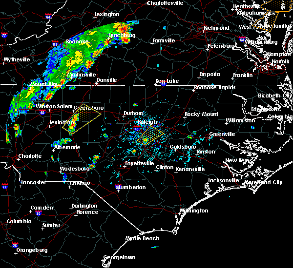 At 537 pm edt, a severe thunderstorm was located near clayton, or 10 miles northwest of smithfield, moving northeast at 30 mph (radar indicated). Hazards include 60 mph wind gusts. Expect damage to roofs, siding, and trees. Locations impacted include, clayton, wendell, emit and flowers. At 537 pm edt, a severe thunderstorm was located near clayton, or 10 miles northwest of smithfield, moving northeast at 30 mph (radar indicated). Hazards include 60 mph wind gusts. Expect damage to roofs, siding, and trees. Locations impacted include, clayton, wendell, emit and flowers.
|
| 7/22/2019 5:28 PM EDT |
 At 528 pm edt, a severe thunderstorm was located 7 miles southwest of clayton, or 11 miles west of smithfield, moving northeast at 30 mph (radar indicated). Hazards include 60 mph wind gusts. expect damage to roofs, siding, and trees At 528 pm edt, a severe thunderstorm was located 7 miles southwest of clayton, or 11 miles west of smithfield, moving northeast at 30 mph (radar indicated). Hazards include 60 mph wind gusts. expect damage to roofs, siding, and trees
|
| 7/18/2019 12:11 AM EDT |
 At 1211 am edt, a severe thunderstorm was located 7 miles northeast of smithfield, moving east at 35 mph (radar indicated). Hazards include 60 mph wind gusts. expect damage to roofs, siding, and trees At 1211 am edt, a severe thunderstorm was located 7 miles northeast of smithfield, moving east at 35 mph (radar indicated). Hazards include 60 mph wind gusts. expect damage to roofs, siding, and trees
|
| 7/17/2019 11:58 PM EDT |
 At 1158 pm edt, a severe thunderstorm was located near clayton, or near smithfield, moving east at 25 mph (radar indicated). Hazards include 60 mph wind gusts. Expect damage to roofs, siding, and trees. Locations impacted include, smithfield, clayton, selma, four oaks, pine level, coats crossroads and flowers. At 1158 pm edt, a severe thunderstorm was located near clayton, or near smithfield, moving east at 25 mph (radar indicated). Hazards include 60 mph wind gusts. Expect damage to roofs, siding, and trees. Locations impacted include, smithfield, clayton, selma, four oaks, pine level, coats crossroads and flowers.
|
| 7/17/2019 11:40 PM EDT |
 At 1140 pm edt, a severe thunderstorm was located 7 miles east of angier, or 14 miles west of smithfield, moving east at 25 mph (radar indicated). Hazards include 60 mph wind gusts. expect damage to roofs, siding, and trees At 1140 pm edt, a severe thunderstorm was located 7 miles east of angier, or 14 miles west of smithfield, moving east at 25 mph (radar indicated). Hazards include 60 mph wind gusts. expect damage to roofs, siding, and trees
|
| 7/11/2019 7:57 PM EDT |
 The severe thunderstorm warning for northeastern wake and northeastern johnston counties will expire at 800 pm edt. the storm which prompted the warning has moved out of the area. Therefore the warning will be allowed to expire. The severe thunderstorm warning for northeastern wake and northeastern johnston counties will expire at 800 pm edt. the storm which prompted the warning has moved out of the area. Therefore the warning will be allowed to expire.
|
| 7/11/2019 7:48 PM EDT |
 At 748 pm edt, a severe thunderstorm was located 7 miles northeast of garner, or 9 miles southeast of raleigh, moving northeast at 25 mph (radar indicated). Hazards include 60 mph wind gusts. Expect damage to roofs, siding, and trees. Locations impacted include, wake forest, zebulon, wendell, rolesville, emit, flowers and buckhorn reservoir. At 748 pm edt, a severe thunderstorm was located 7 miles northeast of garner, or 9 miles southeast of raleigh, moving northeast at 25 mph (radar indicated). Hazards include 60 mph wind gusts. Expect damage to roofs, siding, and trees. Locations impacted include, wake forest, zebulon, wendell, rolesville, emit, flowers and buckhorn reservoir.
|
| 7/11/2019 7:28 PM EDT |
 At 727 pm edt, a severe thunderstorm was located over garner, or 10 miles south of raleigh, moving northeast at 25 mph (radar indicated). Hazards include 60 mph wind gusts. Expect damage to roofs, siding, and trees. Locations impacted include, garner, clayton, zebulon, knightdale, wendell, flowers and lake benson. At 727 pm edt, a severe thunderstorm was located over garner, or 10 miles south of raleigh, moving northeast at 25 mph (radar indicated). Hazards include 60 mph wind gusts. Expect damage to roofs, siding, and trees. Locations impacted include, garner, clayton, zebulon, knightdale, wendell, flowers and lake benson.
|
| 7/11/2019 7:08 PM EDT |
 At 708 pm edt, a severe thunderstorm was located near fuquay-varina, or 13 miles southeast of cary, moving northeast at 25 mph (radar indicated). Hazards include 60 mph wind gusts. expect damage to roofs, siding, and trees At 708 pm edt, a severe thunderstorm was located near fuquay-varina, or 13 miles southeast of cary, moving northeast at 25 mph (radar indicated). Hazards include 60 mph wind gusts. expect damage to roofs, siding, and trees
|
| 7/4/2019 4:35 PM EDT |
 At 435 pm edt, a severe thunderstorm was located over clayton, or 11 miles northwest of smithfield, moving southeast at 10 mph (radar indicated). Hazards include 60 mph wind gusts and penny size hail. Expect damage to roofs, siding, and trees. Locations impacted include, garner and clayton. At 435 pm edt, a severe thunderstorm was located over clayton, or 11 miles northwest of smithfield, moving southeast at 10 mph (radar indicated). Hazards include 60 mph wind gusts and penny size hail. Expect damage to roofs, siding, and trees. Locations impacted include, garner and clayton.
|
| 7/4/2019 4:08 PM EDT |
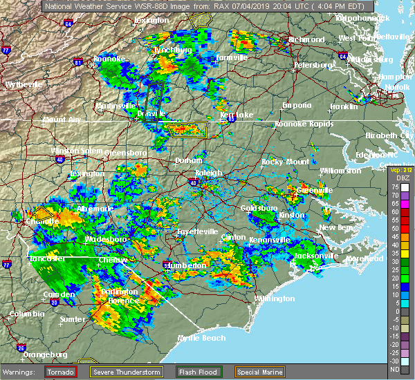 At 408 pm edt, a severe thunderstorm was located near clayton, or 12 miles southeast of raleigh, moving southeast at 10 mph (radar indicated). Hazards include 60 mph wind gusts and nickel size hail. expect damage to roofs, siding, and trees At 408 pm edt, a severe thunderstorm was located near clayton, or 12 miles southeast of raleigh, moving southeast at 10 mph (radar indicated). Hazards include 60 mph wind gusts and nickel size hail. expect damage to roofs, siding, and trees
|
| 6/30/2019 5:59 PM EDT |
 At 559 pm edt, a severe thunderstorm was located near garner, or 11 miles southeast of raleigh, moving southeast at 30 mph (radar indicated). Hazards include 60 mph wind gusts. Expect damage to roofs, siding, and trees. Locations impacted include, garner, clayton, flowers and lake benson. At 559 pm edt, a severe thunderstorm was located near garner, or 11 miles southeast of raleigh, moving southeast at 30 mph (radar indicated). Hazards include 60 mph wind gusts. Expect damage to roofs, siding, and trees. Locations impacted include, garner, clayton, flowers and lake benson.
|
| 6/30/2019 5:35 PM EDT |
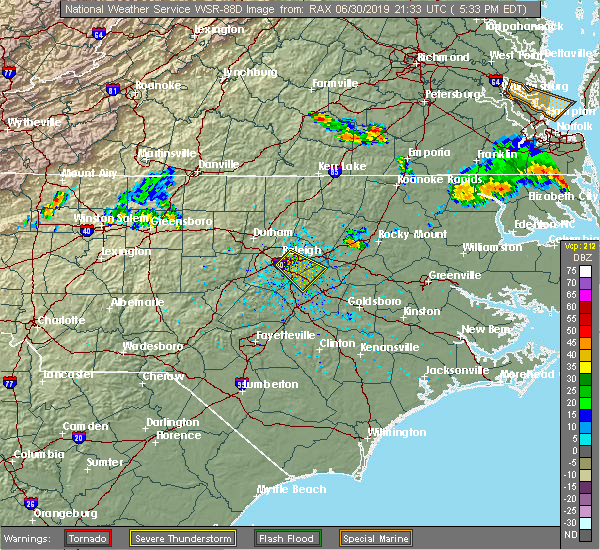 At 534 pm edt, a severe thunderstorm was located near garner, or near raleigh, moving southeast at 25 mph (radar indicated). Hazards include 60 mph wind gusts. Expect damage to roofs, siding, and trees. Locations impacted include, raleigh, garner, clayton, knightdale, flowers and lake benson. At 534 pm edt, a severe thunderstorm was located near garner, or near raleigh, moving southeast at 25 mph (radar indicated). Hazards include 60 mph wind gusts. Expect damage to roofs, siding, and trees. Locations impacted include, raleigh, garner, clayton, knightdale, flowers and lake benson.
|
| 6/30/2019 5:23 PM EDT |
 At 523 pm edt, a severe thunderstorm was located over raleigh, moving southeast at 25 mph (radar indicated). Hazards include 60 mph wind gusts. expect damage to roofs, siding, and trees At 523 pm edt, a severe thunderstorm was located over raleigh, moving southeast at 25 mph (radar indicated). Hazards include 60 mph wind gusts. expect damage to roofs, siding, and trees
|
| 6/20/2019 6:36 PM EDT |
 The severe thunderstorm warning for central johnston county will expire at 645 pm edt, the storm which prompted the warning has weakened below severe limits, and has exited the warned area. therefore, the warning will be allowed to expire. a severe thunderstorm watch remains in effect until 1000 pm edt for central north carolina. The severe thunderstorm warning for central johnston county will expire at 645 pm edt, the storm which prompted the warning has weakened below severe limits, and has exited the warned area. therefore, the warning will be allowed to expire. a severe thunderstorm watch remains in effect until 1000 pm edt for central north carolina.
|
| 6/20/2019 6:31 PM EDT |
 At 630 pm edt, a severe thunderstorm was located 8 miles south of zebulon, or 14 miles north of smithfield, moving east at 50 mph (radar indicated). Hazards include 60 mph wind gusts. Expect damage to roofs, siding, and trees. Locations impacted include, smithfield, clayton and flowers. At 630 pm edt, a severe thunderstorm was located 8 miles south of zebulon, or 14 miles north of smithfield, moving east at 50 mph (radar indicated). Hazards include 60 mph wind gusts. Expect damage to roofs, siding, and trees. Locations impacted include, smithfield, clayton and flowers.
|
| 6/20/2019 6:27 PM EDT |
 At 627 pm edt, a severe thunderstorm was located 8 miles south of zebulon, or 14 miles north of smithfield, moving east at 60 mph (radar indicated). Hazards include 60 mph wind gusts. expect damage to roofs, siding, and trees At 627 pm edt, a severe thunderstorm was located 8 miles south of zebulon, or 14 miles north of smithfield, moving east at 60 mph (radar indicated). Hazards include 60 mph wind gusts. expect damage to roofs, siding, and trees
|
| 6/20/2019 6:09 PM EDT |
 At 609 pm edt, a severe thunderstorm was located over garner, or 10 miles south of raleigh, moving east at 50 mph (radar indicated). Hazards include 70 mph wind gusts. Expect considerable tree damage. damage is likely to mobile homes, roofs, and outbuildings. Locations impacted include, raleigh, cary, smithfield, garner, clayton, knightdale, wendell, lake wheeler, flowers and lake benson. At 609 pm edt, a severe thunderstorm was located over garner, or 10 miles south of raleigh, moving east at 50 mph (radar indicated). Hazards include 70 mph wind gusts. Expect considerable tree damage. damage is likely to mobile homes, roofs, and outbuildings. Locations impacted include, raleigh, cary, smithfield, garner, clayton, knightdale, wendell, lake wheeler, flowers and lake benson.
|
| 6/20/2019 5:56 PM EDT |
 At 555 pm edt, a severe thunderstorm was located near holly springs, or 8 miles south of cary, moving east at 50 mph (radar indicated). Hazards include 70 mph wind gusts. Expect considerable tree damage. damage is likely to mobile homes, roofs, and outbuildings. Locations impacted include, raleigh, cary, smithfield, garner, fuquay-varina, clayton, apex, holly springs, knightdale and wendell. At 555 pm edt, a severe thunderstorm was located near holly springs, or 8 miles south of cary, moving east at 50 mph (radar indicated). Hazards include 70 mph wind gusts. Expect considerable tree damage. damage is likely to mobile homes, roofs, and outbuildings. Locations impacted include, raleigh, cary, smithfield, garner, fuquay-varina, clayton, apex, holly springs, knightdale and wendell.
|
| 6/20/2019 5:42 PM EDT |
 The national weather service in raleigh has issued a * severe thunderstorm warning for. north central harnett county in central north carolina. northeastern lee county in central north carolina. southern wake county in central north carolina. Northwestern johnston county in central north carolina. The national weather service in raleigh has issued a * severe thunderstorm warning for. north central harnett county in central north carolina. northeastern lee county in central north carolina. southern wake county in central north carolina. Northwestern johnston county in central north carolina.
|
| 5/31/2019 8:39 PM EDT |
 At 838 pm edt, a severe thunderstorm was located from knightdale to smithfield, moving east at 30 mph (radar indicated). Hazards include 60 mph wind gusts and quarter size hail. Hail damage to vehicles is expected. expect wind damage to roofs, siding, and trees. Locations impacted include, smithfield, clayton, dunn, zebulon, benson, knightdale, micro, selma, wendell and four oaks. At 838 pm edt, a severe thunderstorm was located from knightdale to smithfield, moving east at 30 mph (radar indicated). Hazards include 60 mph wind gusts and quarter size hail. Hail damage to vehicles is expected. expect wind damage to roofs, siding, and trees. Locations impacted include, smithfield, clayton, dunn, zebulon, benson, knightdale, micro, selma, wendell and four oaks.
|
| 5/31/2019 8:13 PM EDT |
 At 810 pm edt, a line of severe thunderstorms extended from raleigh to fuquay-varina to coats, moving east at 30 mph (radar indicated). Hazards include 60 mph wind gusts and quarter size hail. Hail damage to vehicles is expected. Expect wind damage to roofs, siding, and trees. At 810 pm edt, a line of severe thunderstorms extended from raleigh to fuquay-varina to coats, moving east at 30 mph (radar indicated). Hazards include 60 mph wind gusts and quarter size hail. Hail damage to vehicles is expected. Expect wind damage to roofs, siding, and trees.
|
| 5/31/2019 7:27 PM EDT |
 At 726 pm edt, a severe thunderstorm was located 5 miles north of wendell, moving southeast at 30 mph (radar indicated). Hazards include quarter size hail. Damage to vehicles is expected. Locations impacted include, clayton, zebulon, knightdale, wendell, emit and flowers. At 726 pm edt, a severe thunderstorm was located 5 miles north of wendell, moving southeast at 30 mph (radar indicated). Hazards include quarter size hail. Damage to vehicles is expected. Locations impacted include, clayton, zebulon, knightdale, wendell, emit and flowers.
|
| 5/31/2019 7:02 PM EDT |
 At 701 pm edt, a severe thunderstorm was located near raleigh, moving east at 30 mph (radar indicated). Hazards include golf ball size hail. People and animals outdoors will be injured. expect damage to roofs, siding, windows, and vehicles. Locations impacted include, raleigh, smithfield, garner, clayton, zebulon, knightdale, wendell, emit, coats crossroads and flowers. At 701 pm edt, a severe thunderstorm was located near raleigh, moving east at 30 mph (radar indicated). Hazards include golf ball size hail. People and animals outdoors will be injured. expect damage to roofs, siding, windows, and vehicles. Locations impacted include, raleigh, smithfield, garner, clayton, zebulon, knightdale, wendell, emit, coats crossroads and flowers.
|
| 5/31/2019 6:43 PM EDT |
 The national weather service in raleigh has issued a * severe thunderstorm warning for. wake county in central north carolina. central johnston county in central north carolina. southeastern durham county in central north carolina. Until 745 pm edt. The national weather service in raleigh has issued a * severe thunderstorm warning for. wake county in central north carolina. central johnston county in central north carolina. southeastern durham county in central north carolina. Until 745 pm edt.
|
| 5/13/2019 1:55 PM EDT |
 The national weather service in raleigh has issued a * tornado warning for. north central wayne county in central north carolina. southwestern wilson county in central north carolina. east central johnston county in central north carolina. Until 230 pm edt. The national weather service in raleigh has issued a * tornado warning for. north central wayne county in central north carolina. southwestern wilson county in central north carolina. east central johnston county in central north carolina. Until 230 pm edt.
|
| 5/13/2019 1:45 PM EDT |
 At 144 pm edt, a severe thunderstorm with large, destructive hail was located near clayton, or 12 miles northwest of smithfield, moving east at 45 mph (trained weather spotters). Hazards include golf ball size hail. People and animals outdoors will be injured. expect damage to roofs, siding, windows, and vehicles. Locations impacted include, smithfield, clayton, micro, selma, four oaks, pine level, emit, coats crossroads and flowers. At 144 pm edt, a severe thunderstorm with large, destructive hail was located near clayton, or 12 miles northwest of smithfield, moving east at 45 mph (trained weather spotters). Hazards include golf ball size hail. People and animals outdoors will be injured. expect damage to roofs, siding, windows, and vehicles. Locations impacted include, smithfield, clayton, micro, selma, four oaks, pine level, emit, coats crossroads and flowers.
|
| 5/13/2019 1:35 PM EDT |
 At 135 pm edt, a severe thunderstorm was located near garner, or 15 miles south of raleigh, moving east at 40 mph (law enforcement). Hazards include 60 mph wind gusts and quarter size hail. Hail damage to vehicles is expected. expect wind damage to roofs, siding, and trees. Locations impacted include, smithfield, garner, fuquay-varina, clayton, micro, selma, four oaks, pine level, emit and coats crossroads. At 135 pm edt, a severe thunderstorm was located near garner, or 15 miles south of raleigh, moving east at 40 mph (law enforcement). Hazards include 60 mph wind gusts and quarter size hail. Hail damage to vehicles is expected. expect wind damage to roofs, siding, and trees. Locations impacted include, smithfield, garner, fuquay-varina, clayton, micro, selma, four oaks, pine level, emit and coats crossroads.
|
| 5/13/2019 1:26 PM EDT |
 At 126 pm edt, a severe thunderstorm was located near fuquay-varina, or 12 miles south of cary, moving east at 40 mph (trained weather spotters). Hazards include 60 mph wind gusts and half dollar size hail. Hail damage to vehicles is expected. Expect wind damage to roofs, siding, and trees. At 126 pm edt, a severe thunderstorm was located near fuquay-varina, or 12 miles south of cary, moving east at 40 mph (trained weather spotters). Hazards include 60 mph wind gusts and half dollar size hail. Hail damage to vehicles is expected. Expect wind damage to roofs, siding, and trees.
|
| 5/13/2019 11:06 AM EDT |
 At 1105 am edt, a severe thunderstorm was located near zebulon, or 16 miles east of raleigh, moving east at 45 mph (radar indicated). Hazards include 60 mph wind gusts and quarter size hail. Hail damage to vehicles is expected. expect wind damage to roofs, siding, and trees. Locations impacted include, clayton, zebulon, knightdale, wendell, emit and flowers. At 1105 am edt, a severe thunderstorm was located near zebulon, or 16 miles east of raleigh, moving east at 45 mph (radar indicated). Hazards include 60 mph wind gusts and quarter size hail. Hail damage to vehicles is expected. expect wind damage to roofs, siding, and trees. Locations impacted include, clayton, zebulon, knightdale, wendell, emit and flowers.
|
| 5/13/2019 10:53 AM EDT |
 At 1052 am edt, a severe thunderstorm was located near garner, or near raleigh, moving east at 40 mph (radar indicated). Hazards include 60 mph wind gusts and quarter size hail. Hail damage to vehicles is expected. expect wind damage to roofs, siding, and trees. Locations impacted include, raleigh, garner, clayton, zebulon, knightdale, wendell, emit, lake wheeler, flowers and lake benson. At 1052 am edt, a severe thunderstorm was located near garner, or near raleigh, moving east at 40 mph (radar indicated). Hazards include 60 mph wind gusts and quarter size hail. Hail damage to vehicles is expected. expect wind damage to roofs, siding, and trees. Locations impacted include, raleigh, garner, clayton, zebulon, knightdale, wendell, emit, lake wheeler, flowers and lake benson.
|
| 5/13/2019 10:35 AM EDT |
 At 1035 am edt, a severe thunderstorm was located over cary, moving east at 40 mph (radar indicated). Hazards include 60 mph wind gusts and quarter size hail. Hail damage to vehicles is expected. Expect wind damage to roofs, siding, and trees. At 1035 am edt, a severe thunderstorm was located over cary, moving east at 40 mph (radar indicated). Hazards include 60 mph wind gusts and quarter size hail. Hail damage to vehicles is expected. Expect wind damage to roofs, siding, and trees.
|
| 4/19/2019 5:27 PM EDT |
 At 526 pm edt, severe thunderstorms were located along a line extending from 7 miles south of virgilina to near wake forest to 10 miles northwest of mount olive to 9 miles northwest of harrells, moving east at 55 mph (radar indicated). Hazards include 60 mph wind gusts and penny size hail. expect damage to roofs, siding, and trees At 526 pm edt, severe thunderstorms were located along a line extending from 7 miles south of virgilina to near wake forest to 10 miles northwest of mount olive to 9 miles northwest of harrells, moving east at 55 mph (radar indicated). Hazards include 60 mph wind gusts and penny size hail. expect damage to roofs, siding, and trees
|
| 4/19/2019 5:16 PM EDT |
 At 515 pm edt, severe thunderstorms were located along a line extending from cary to 9 miles south of smithfield to 7 miles northeast of ammon, moving northeast at 60 mph (radar indicated). Hazards include 60 mph wind gusts and penny size hail. Expect damage to roofs, siding, and trees. locations impacted include, raleigh, cary, smithfield, clinton, garner, fuquay-varina, clayton, dunn, zebulon and angier. a tornado watch remains in effect until 800 pm edt for central north carolina. A tornado watch also remains in effect until midnight edt for central north carolina. At 515 pm edt, severe thunderstorms were located along a line extending from cary to 9 miles south of smithfield to 7 miles northeast of ammon, moving northeast at 60 mph (radar indicated). Hazards include 60 mph wind gusts and penny size hail. Expect damage to roofs, siding, and trees. locations impacted include, raleigh, cary, smithfield, clinton, garner, fuquay-varina, clayton, dunn, zebulon and angier. a tornado watch remains in effect until 800 pm edt for central north carolina. A tornado watch also remains in effect until midnight edt for central north carolina.
|
| 4/19/2019 4:31 PM EDT |
 At 430 pm edt, severe thunderstorms were located along a line extending from near carthage to tobermory, moving northeast at 55 mph (radar indicated). Hazards include 60 mph wind gusts. expect damage to roofs, siding, and trees At 430 pm edt, severe thunderstorms were located along a line extending from near carthage to tobermory, moving northeast at 55 mph (radar indicated). Hazards include 60 mph wind gusts. expect damage to roofs, siding, and trees
|
| 4/19/2019 12:44 PM EDT |
 At 1244 pm edt, severe thunderstorms were located along a line extending from near zebulon to near goldsboro, moving north at 55 mph (radar indicated). Hazards include 60 mph wind gusts. Expect damage to roofs, siding, and trees. locations impacted include, goldsboro, wilson, zebulon, elm city, fremont, walnut creek, bailey, micro, wendell and pine level. A tornado watch remains in effect until 500 pm edt for central north carolina. At 1244 pm edt, severe thunderstorms were located along a line extending from near zebulon to near goldsboro, moving north at 55 mph (radar indicated). Hazards include 60 mph wind gusts. Expect damage to roofs, siding, and trees. locations impacted include, goldsboro, wilson, zebulon, elm city, fremont, walnut creek, bailey, micro, wendell and pine level. A tornado watch remains in effect until 500 pm edt for central north carolina.
|
| 4/19/2019 12:33 PM EDT |
 At 1232 pm edt, severe thunderstorms were located along a line extending from 6 miles south of zebulon to near mount olive, moving north at 55 mph (radar indicated). Hazards include 60 mph wind gusts. expect damage to roofs, siding, and trees At 1232 pm edt, severe thunderstorms were located along a line extending from 6 miles south of zebulon to near mount olive, moving north at 55 mph (radar indicated). Hazards include 60 mph wind gusts. expect damage to roofs, siding, and trees
|
| 4/19/2019 11:53 AM EDT |
 The severe thunderstorm warning for north central wayne, northeastern wake, central johnston and southwestern wilson counties will expire at noon edt, the storms which prompted the warning are moving out of the area. therefore the warning will be allowed to expire. however gusty winds and heavy rain are still possible with these thunderstorms. a tornado watch remains in effect until 500 pm edt for central north carolina. The severe thunderstorm warning for north central wayne, northeastern wake, central johnston and southwestern wilson counties will expire at noon edt, the storms which prompted the warning are moving out of the area. therefore the warning will be allowed to expire. however gusty winds and heavy rain are still possible with these thunderstorms. a tornado watch remains in effect until 500 pm edt for central north carolina.
|
| 4/19/2019 11:36 AM EDT |
 At 1135 am edt, severe thunderstorms were located along a line extending from 7 miles northeast of garner to near clayton to near smithfield, moving north at 65 mph (radar indicated). Hazards include 60 mph wind gusts. Expect damage to roofs, siding, and trees. locations impacted include, raleigh, smithfield, garner, clayton, zebulon, knightdale, micro, selma, wendell and rolesville. A tornado watch remains in effect until 500 pm edt for central north carolina. At 1135 am edt, severe thunderstorms were located along a line extending from 7 miles northeast of garner to near clayton to near smithfield, moving north at 65 mph (radar indicated). Hazards include 60 mph wind gusts. Expect damage to roofs, siding, and trees. locations impacted include, raleigh, smithfield, garner, clayton, zebulon, knightdale, micro, selma, wendell and rolesville. A tornado watch remains in effect until 500 pm edt for central north carolina.
|
| 4/19/2019 11:26 AM EDT |
 At 1125 am edt, severe thunderstorms were located along a line extending from near clayton to 6 miles west of smithfield to 11 miles southeast of benson, moving north at 70 mph (radar indicated). Hazards include 60 mph wind gusts. expect damage to roofs, siding, and trees At 1125 am edt, severe thunderstorms were located along a line extending from near clayton to 6 miles west of smithfield to 11 miles southeast of benson, moving north at 70 mph (radar indicated). Hazards include 60 mph wind gusts. expect damage to roofs, siding, and trees
|
| 4/15/2019 1:52 AM EDT |
 The severe thunderstorm warning for wake and northwestern johnston counties will expire at 200 am edt, the storm which prompted the warning has moved out of the area. therefore the warning will be allowed to expire. a tornado watch remains in effect until 500 am edt for wake county. a tornado watch also remains in effect until 700 am edt for johnston county. please report any wind damage to your nearest law enforcement agency. they will relay your report to the national weather service raleigh. The severe thunderstorm warning for wake and northwestern johnston counties will expire at 200 am edt, the storm which prompted the warning has moved out of the area. therefore the warning will be allowed to expire. a tornado watch remains in effect until 500 am edt for wake county. a tornado watch also remains in effect until 700 am edt for johnston county. please report any wind damage to your nearest law enforcement agency. they will relay your report to the national weather service raleigh.
|
| 4/15/2019 1:34 AM EDT |
 At 133 am edt, a severe thunderstorm was located near raleigh, moving northeast at 60 mph (radar indicated). Hazards include 60 mph wind gusts. Expect damage to roofs, siding, and trees. locations impacted include, raleigh, cary, wake forest, garner, fuquay-varina, clayton, zebulon, apex, holly springs and knightdale. a tornado watch remains in effect until 500 am edt for central north carolina. A tornado watch also remains in effect until 700 am edt for central north carolina. At 133 am edt, a severe thunderstorm was located near raleigh, moving northeast at 60 mph (radar indicated). Hazards include 60 mph wind gusts. Expect damage to roofs, siding, and trees. locations impacted include, raleigh, cary, wake forest, garner, fuquay-varina, clayton, zebulon, apex, holly springs and knightdale. a tornado watch remains in effect until 500 am edt for central north carolina. A tornado watch also remains in effect until 700 am edt for central north carolina.
|
| 4/15/2019 1:16 AM EDT |
 At 116 am edt, a severe thunderstorm was located over fuquay-varina, or 11 miles south of cary, moving northeast at 60 mph (radar indicated). Hazards include 60 mph wind gusts. expect damage to roofs, siding, and trees At 116 am edt, a severe thunderstorm was located over fuquay-varina, or 11 miles south of cary, moving northeast at 60 mph (radar indicated). Hazards include 60 mph wind gusts. expect damage to roofs, siding, and trees
|
| 4/8/2019 7:04 PM EDT |
 At 704 pm edt, a severe thunderstorm was located near raleigh, moving east at 40 mph (radar indicated). Hazards include 60 mph wind gusts. Expect damage to roofs, siding, and trees. Locations impacted include, raleigh, cary, wake forest, garner, fuquay-varina, clayton, zebulon, apex, holly springs and knightdale. At 704 pm edt, a severe thunderstorm was located near raleigh, moving east at 40 mph (radar indicated). Hazards include 60 mph wind gusts. Expect damage to roofs, siding, and trees. Locations impacted include, raleigh, cary, wake forest, garner, fuquay-varina, clayton, zebulon, apex, holly springs and knightdale.
|
| 4/8/2019 6:44 PM EDT |
 At 643 pm edt, a severe thunderstorm was located over cary, moving east at 40 mph (radar indicated). Hazards include 60 mph wind gusts. expect damage to roofs, siding, and trees At 643 pm edt, a severe thunderstorm was located over cary, moving east at 40 mph (radar indicated). Hazards include 60 mph wind gusts. expect damage to roofs, siding, and trees
|
| 4/8/2019 6:11 PM EDT |
 The severe thunderstorm warning for northeastern harnett, southeastern wake and johnston counties will expire at 615 pm edt, the storm which prompted the warning is moving out of the area, and this warning will be allowed to expire. however, another severe thunderstorm warning has been issued for this storm further east. a severe thunderstorm watch remains in effect until 1000 pm edt for central north carolina. a severe thunderstorm watch also remains in effect until 1000 pm edt for central north carolina. The severe thunderstorm warning for northeastern harnett, southeastern wake and johnston counties will expire at 615 pm edt, the storm which prompted the warning is moving out of the area, and this warning will be allowed to expire. however, another severe thunderstorm warning has been issued for this storm further east. a severe thunderstorm watch remains in effect until 1000 pm edt for central north carolina. a severe thunderstorm watch also remains in effect until 1000 pm edt for central north carolina.
|
| 4/8/2019 6:10 PM EDT |
 At 609 pm edt, a severe thunderstorm was located 9 miles east of clayton, or 12 miles north of smithfield, moving northeast at 45 mph. doppler radar is indicating winds of 60 to 65 mph with this storm (radar indicated). Hazards include 65 mph wind gusts and nickel size hail. expect damage to roofs, siding, and trees At 609 pm edt, a severe thunderstorm was located 9 miles east of clayton, or 12 miles north of smithfield, moving northeast at 45 mph. doppler radar is indicating winds of 60 to 65 mph with this storm (radar indicated). Hazards include 65 mph wind gusts and nickel size hail. expect damage to roofs, siding, and trees
|
| 4/8/2019 5:42 PM EDT |
 At 542 pm edt, a severe thunderstorm was located 7 miles east of angier, or 14 miles west of smithfield, moving northeast at 40 mph. doppler radar is indicating 70 mph winds just off the surface with this storm (radar indicated). Hazards include 70 mph wind gusts and quarter size hail. Hail damage to vehicles is expected. expect considerable tree damage. wind damage is also likely to mobile homes, roofs, and outbuildings. Locations impacted include, smithfield, clayton, zebulon, angier, micro, selma, wendell, coats, four oaks and pine level. At 542 pm edt, a severe thunderstorm was located 7 miles east of angier, or 14 miles west of smithfield, moving northeast at 40 mph. doppler radar is indicating 70 mph winds just off the surface with this storm (radar indicated). Hazards include 70 mph wind gusts and quarter size hail. Hail damage to vehicles is expected. expect considerable tree damage. wind damage is also likely to mobile homes, roofs, and outbuildings. Locations impacted include, smithfield, clayton, zebulon, angier, micro, selma, wendell, coats, four oaks and pine level.
|
| 4/8/2019 5:30 PM EDT |
 At 529 pm edt, a severe thunderstorm was located near angier, or near lillington, moving northeast at 45 mph (radar indicated). Hazards include 60 mph wind gusts and quarter size hail. Hail damage to vehicles is expected. Expect wind damage to roofs, siding, and trees. At 529 pm edt, a severe thunderstorm was located near angier, or near lillington, moving northeast at 45 mph (radar indicated). Hazards include 60 mph wind gusts and quarter size hail. Hail damage to vehicles is expected. Expect wind damage to roofs, siding, and trees.
|
| 10/11/2018 6:26 PM EDT |
 The severe thunderstorm warning for wayne, sampson, johnston and wilson counties will expire at 630 pm edt, the damaging winds which prompted the warning have weakened below severe limits, and no longer pose an immediate threat to life or property. therefore the warning will be allowed to expire. however gusty winds will likely persist as the remnants of tropical storm michael pull northeast into virginia tonight. The severe thunderstorm warning for wayne, sampson, johnston and wilson counties will expire at 630 pm edt, the damaging winds which prompted the warning have weakened below severe limits, and no longer pose an immediate threat to life or property. therefore the warning will be allowed to expire. however gusty winds will likely persist as the remnants of tropical storm michael pull northeast into virginia tonight.
|
| 10/11/2018 5:05 PM EDT |
 At 504 pm edt, a line of damaging winds mixing south along the western side of michael were pushing sootheast along a line extending from near angier through godwin to 8 miles south of fayetteville, moving east at 30 mph. this line of wind gusts has a history of producing extensive wind damage to structures and can persist for up to thirty minutes (radar indicated and emergency management reported). Hazards include 60 mph wind gusts. expect damage to roofs, siding, and trees At 504 pm edt, a line of damaging winds mixing south along the western side of michael were pushing sootheast along a line extending from near angier through godwin to 8 miles south of fayetteville, moving east at 30 mph. this line of wind gusts has a history of producing extensive wind damage to structures and can persist for up to thirty minutes (radar indicated and emergency management reported). Hazards include 60 mph wind gusts. expect damage to roofs, siding, and trees
|
| 8/20/2018 12:55 AM EDT |
 At 1255 am edt, a severe thunderstorm was located near clayton, or 13 miles southeast of raleigh, moving east at 20 mph (radar indicated). Hazards include 60 mph wind gusts. Expect damage to roofs, siding, and trees. Locations impacted include, raleigh, smithfield, garner, clayton, zebulon, knightdale, selma, wendell, emit and lake wheeler. At 1255 am edt, a severe thunderstorm was located near clayton, or 13 miles southeast of raleigh, moving east at 20 mph (radar indicated). Hazards include 60 mph wind gusts. Expect damage to roofs, siding, and trees. Locations impacted include, raleigh, smithfield, garner, clayton, zebulon, knightdale, selma, wendell, emit and lake wheeler.
|
| 8/20/2018 12:38 AM EDT |
 At 1238 am edt, a severe thunderstorm was located near garner, or 8 miles southeast of raleigh, moving east at 15 mph (radar indicated). Hazards include 60 mph wind gusts. Expect damage to roofs, siding, and trees. Locations impacted include, raleigh, smithfield, garner, clayton, zebulon, knightdale, selma, wendell, emit and lake wheeler. At 1238 am edt, a severe thunderstorm was located near garner, or 8 miles southeast of raleigh, moving east at 15 mph (radar indicated). Hazards include 60 mph wind gusts. Expect damage to roofs, siding, and trees. Locations impacted include, raleigh, smithfield, garner, clayton, zebulon, knightdale, selma, wendell, emit and lake wheeler.
|
| 8/20/2018 12:06 AM EDT |
 At 1206 am edt, a severe thunderstorm was located near raleigh, moving east at 15 mph (radar indicated). Hazards include 60 mph wind gusts. expect damage to roofs, siding, and trees At 1206 am edt, a severe thunderstorm was located near raleigh, moving east at 15 mph (radar indicated). Hazards include 60 mph wind gusts. expect damage to roofs, siding, and trees
|
| 8/8/2018 9:29 PM EDT |
 At 929 pm edt, severe thunderstorms were located along a line extending from smithfield to 12 miles east of benson to 8 miles northeast of jerome, moving east at 20 mph (radar indicated). Hazards include 60 mph wind gusts. Expect damage to roofs, siding, and trees. Locations impacted include, fayetteville, goldsboro, smithfield, clinton, clayton, mount olive, walnut creek, godwin, hope mills and micro. At 929 pm edt, severe thunderstorms were located along a line extending from smithfield to 12 miles east of benson to 8 miles northeast of jerome, moving east at 20 mph (radar indicated). Hazards include 60 mph wind gusts. Expect damage to roofs, siding, and trees. Locations impacted include, fayetteville, goldsboro, smithfield, clinton, clayton, mount olive, walnut creek, godwin, hope mills and micro.
|
| 8/8/2018 9:04 PM EDT |
 At 904 pm edt, severe thunderstorms were located along a line extending from near angier to near benson to 8 miles southeast of fayetteville, moving east at 35 mph (radar indicated). Hazards include 60 mph wind gusts. Expect damage to roofs, siding, and trees. Locations impacted include, fayetteville, goldsboro, smithfield, clinton, lillington, fort bragg, clayton, dunn, mount olive and angier. At 904 pm edt, severe thunderstorms were located along a line extending from near angier to near benson to 8 miles southeast of fayetteville, moving east at 35 mph (radar indicated). Hazards include 60 mph wind gusts. Expect damage to roofs, siding, and trees. Locations impacted include, fayetteville, goldsboro, smithfield, clinton, lillington, fort bragg, clayton, dunn, mount olive and angier.
|
| 8/8/2018 8:35 PM EDT |
 At 834 pm edt, severe thunderstorms were located along a line extending from near fuquay-varina to near lillington to 8 miles west of fort bragg, moving east at 35 mph (radar indicated). Hazards include 60 mph wind gusts. expect damage to roofs, siding, and trees At 834 pm edt, severe thunderstorms were located along a line extending from near fuquay-varina to near lillington to 8 miles west of fort bragg, moving east at 35 mph (radar indicated). Hazards include 60 mph wind gusts. expect damage to roofs, siding, and trees
|
| 8/8/2018 7:43 PM EDT |
 At 740 pm edt, a severe thunderstorm was located near buies creek, or 5 miles southeast of lillington, moving southeast at 10 mph (radar indicated). Hazards include 60 mph wind gusts. expect damage to roofs, siding, and trees At 740 pm edt, a severe thunderstorm was located near buies creek, or 5 miles southeast of lillington, moving southeast at 10 mph (radar indicated). Hazards include 60 mph wind gusts. expect damage to roofs, siding, and trees
|
| 7/28/2018 7:23 PM EDT |
 At 722 pm edt, a severe thunderstorm was located near zebulon, or 16 miles north of smithfield, moving southeast at 15 mph (radar indicated). Hazards include 60 mph wind gusts and quarter size hail. Hail damage to vehicles is expected. expect wind damage to roofs, siding, and trees. Locations impacted include, emit. At 722 pm edt, a severe thunderstorm was located near zebulon, or 16 miles north of smithfield, moving southeast at 15 mph (radar indicated). Hazards include 60 mph wind gusts and quarter size hail. Hail damage to vehicles is expected. expect wind damage to roofs, siding, and trees. Locations impacted include, emit.
|
| 7/28/2018 7:16 PM EDT |
 At 716 pm edt, a severe thunderstorm was located near clayton, or 12 miles north of smithfield, moving south at 15 mph (radar indicated). Hazards include 60 mph wind gusts and quarter size hail. Hail damage to vehicles is expected. expect wind damage to roofs, siding, and trees. Locations impacted include, smithfield, micro, selma, emit and flowers. At 716 pm edt, a severe thunderstorm was located near clayton, or 12 miles north of smithfield, moving south at 15 mph (radar indicated). Hazards include 60 mph wind gusts and quarter size hail. Hail damage to vehicles is expected. expect wind damage to roofs, siding, and trees. Locations impacted include, smithfield, micro, selma, emit and flowers.
|
| 7/28/2018 6:49 PM EDT |
 At 648 pm edt, a severe thunderstorm was located near zebulon, or 14 miles east of raleigh, moving south at 15 mph (radar indicated). Hazards include 60 mph wind gusts and quarter size hail. Hail damage to vehicles is expected. Expect wind damage to roofs, siding, and trees. At 648 pm edt, a severe thunderstorm was located near zebulon, or 14 miles east of raleigh, moving south at 15 mph (radar indicated). Hazards include 60 mph wind gusts and quarter size hail. Hail damage to vehicles is expected. Expect wind damage to roofs, siding, and trees.
|
| 7/23/2018 1:15 AM EDT |
 At 114 am edt, a severe thunderstorm was located 9 miles east of smithfield, moving north at 40 mph (radar indicated). Hazards include 60 mph wind gusts. expect damage to roofs, siding, and trees At 114 am edt, a severe thunderstorm was located 9 miles east of smithfield, moving north at 40 mph (radar indicated). Hazards include 60 mph wind gusts. expect damage to roofs, siding, and trees
|
| 7/21/2018 11:56 PM EDT |
 At 1156 pm edt, a severe thunderstorm was located over clayton, or 9 miles northwest of smithfield, moving northeast at 20 mph (radar indicated). Hazards include 60 mph wind gusts. Expect damage to roofs, siding, and trees. Locations impacted include, raleigh, garner, clayton, zebulon, knightdale, wendell, emit, lake wheeler, flowers and lake benson. At 1156 pm edt, a severe thunderstorm was located over clayton, or 9 miles northwest of smithfield, moving northeast at 20 mph (radar indicated). Hazards include 60 mph wind gusts. Expect damage to roofs, siding, and trees. Locations impacted include, raleigh, garner, clayton, zebulon, knightdale, wendell, emit, lake wheeler, flowers and lake benson.
|
| 7/21/2018 11:47 PM EDT |
 At 1147 pm edt, a severe thunderstorm was located near garner, or 11 miles southeast of raleigh, moving northeast at 25 mph (radar indicated). Hazards include 60 mph wind gusts. Expect damage to roofs, siding, and trees. Locations impacted include, raleigh, garner, clayton, zebulon, knightdale, wendell, emit, lake wheeler, flowers and lake benson. At 1147 pm edt, a severe thunderstorm was located near garner, or 11 miles southeast of raleigh, moving northeast at 25 mph (radar indicated). Hazards include 60 mph wind gusts. Expect damage to roofs, siding, and trees. Locations impacted include, raleigh, garner, clayton, zebulon, knightdale, wendell, emit, lake wheeler, flowers and lake benson.
|
| 7/21/2018 11:40 PM EDT |
 At 1139 pm edt, a severe thunderstorm was located near garner, or 12 miles southeast of raleigh, moving northeast at 25 mph (radar indicated). Hazards include 60 mph wind gusts and penny size hail. Expect damage to roofs, siding, and trees. Locations impacted include, raleigh, garner, clayton, zebulon, knightdale, wendell, emit, lake wheeler, coats crossroads and flowers. At 1139 pm edt, a severe thunderstorm was located near garner, or 12 miles southeast of raleigh, moving northeast at 25 mph (radar indicated). Hazards include 60 mph wind gusts and penny size hail. Expect damage to roofs, siding, and trees. Locations impacted include, raleigh, garner, clayton, zebulon, knightdale, wendell, emit, lake wheeler, coats crossroads and flowers.
|
| 7/21/2018 11:27 PM EDT |
 At 1125 pm edt, a severe thunderstorm was located near garner, or 14 miles southeast of cary, moving northeast at 25 mph (radar indicated). Hazards include 70 mph wind gusts and penny size hail. Expect considerable tree damage. damage is likely to mobile homes, roofs, and outbuildings. Locations impacted include, willow springs, garner, eastern raleigh, fuquay-varina, clayton, zebulon, knightdale, wendell, emit, lake wheeler and coats crossroads. At 1125 pm edt, a severe thunderstorm was located near garner, or 14 miles southeast of cary, moving northeast at 25 mph (radar indicated). Hazards include 70 mph wind gusts and penny size hail. Expect considerable tree damage. damage is likely to mobile homes, roofs, and outbuildings. Locations impacted include, willow springs, garner, eastern raleigh, fuquay-varina, clayton, zebulon, knightdale, wendell, emit, lake wheeler and coats crossroads.
|
| 7/21/2018 11:09 PM EDT |
 The national weather service in raleigh has issued a * severe thunderstorm warning for. central wake county in central north carolina. northwestern johnston county in central north carolina. Until 1215 am edt * at 1109 pm edt, a severe thunderstorm was located near angier, or. The national weather service in raleigh has issued a * severe thunderstorm warning for. central wake county in central north carolina. northwestern johnston county in central north carolina. Until 1215 am edt * at 1109 pm edt, a severe thunderstorm was located near angier, or.
|
| 6/20/2018 6:19 PM EDT |
 At 618 pm edt, a severe thunderstorm was located near bailey, or 18 miles northeast of smithfield, moving east at 15 mph (radar indicated). Hazards include 60 mph wind gusts. Expect damage to roofs, siding, and trees. Locations impacted include, bailey, kenly, middlesex, sims, emit and buckhorn reservoir. At 618 pm edt, a severe thunderstorm was located near bailey, or 18 miles northeast of smithfield, moving east at 15 mph (radar indicated). Hazards include 60 mph wind gusts. Expect damage to roofs, siding, and trees. Locations impacted include, bailey, kenly, middlesex, sims, emit and buckhorn reservoir.
|
| 6/20/2018 5:54 PM EDT |
 The severe thunderstorm warning for central johnston county will expire at 600 pm edt, the storm which prompted the warning has weakened below severe limits, and no longer poses an immediate threat to life or property. therefore the warning will be allowed to expire. to report severe weather, contact your nearest law enforcement agency. they will relay your report to the national weather service raleigh. remember, a severe thunderstorm warning still remains in effect for north portions of johnston county until 630 pm. The severe thunderstorm warning for central johnston county will expire at 600 pm edt, the storm which prompted the warning has weakened below severe limits, and no longer poses an immediate threat to life or property. therefore the warning will be allowed to expire. to report severe weather, contact your nearest law enforcement agency. they will relay your report to the national weather service raleigh. remember, a severe thunderstorm warning still remains in effect for north portions of johnston county until 630 pm.
|
| 6/20/2018 5:52 PM EDT |
 At 552 pm edt, a severe thunderstorm was located near zebulon, or 17 miles east of raleigh, moving east at 15 mph (radar indicated). Hazards include 60 mph wind gusts. expect damage to roofs, siding, and trees At 552 pm edt, a severe thunderstorm was located near zebulon, or 17 miles east of raleigh, moving east at 15 mph (radar indicated). Hazards include 60 mph wind gusts. expect damage to roofs, siding, and trees
|
| 6/20/2018 5:37 PM EDT |
 At 534 pm edt, a severe thunderstorm was located near clayton, or 7 miles northwest of smithfield, moving east at 20 mph (radar indicated). Hazards include 60 mph wind gusts. Expect damage to roofs, siding, and trees. Locations impacted include, smithfield, clayton, micro, selma, four oaks, pine level, kenly, princeton, coats crossroads and flowers. At 534 pm edt, a severe thunderstorm was located near clayton, or 7 miles northwest of smithfield, moving east at 20 mph (radar indicated). Hazards include 60 mph wind gusts. Expect damage to roofs, siding, and trees. Locations impacted include, smithfield, clayton, micro, selma, four oaks, pine level, kenly, princeton, coats crossroads and flowers.
|
| 6/20/2018 5:06 PM EDT |
 At 506 pm edt, a severe thunderstorm was located near garner, or 15 miles south of raleigh, moving east at 25 mph (radar indicated). Hazards include 60 mph wind gusts and quarter size hail. Hail damage to vehicles is expected. Expect wind damage to roofs, siding, and trees. At 506 pm edt, a severe thunderstorm was located near garner, or 15 miles south of raleigh, moving east at 25 mph (radar indicated). Hazards include 60 mph wind gusts and quarter size hail. Hail damage to vehicles is expected. Expect wind damage to roofs, siding, and trees.
|
| 4/15/2018 10:42 PM EDT |
 At 1042 pm edt, severe thunderstorms were located along a line extending from 6 miles west of bunn to 8 miles south of bailey to 6 miles southeast of clinton, moving northeast at 45 mph (radar indicated). Hazards include 60 mph wind gusts. Expect damage to roofs, siding, and trees. locations impacted include, raleigh, rocky mount, goldsboro, smithfield, clinton, nashville, wilson, clayton, mount olive and elm city. a tornado watch remains in effect until 1100 pm edt for central north carolina. A tornado watch also remains in effect until 300 am edt for central north carolina. At 1042 pm edt, severe thunderstorms were located along a line extending from 6 miles west of bunn to 8 miles south of bailey to 6 miles southeast of clinton, moving northeast at 45 mph (radar indicated). Hazards include 60 mph wind gusts. Expect damage to roofs, siding, and trees. locations impacted include, raleigh, rocky mount, goldsboro, smithfield, clinton, nashville, wilson, clayton, mount olive and elm city. a tornado watch remains in effect until 1100 pm edt for central north carolina. A tornado watch also remains in effect until 300 am edt for central north carolina.
|
| 4/15/2018 10:26 PM EDT |
 At 1025 pm edt, severe thunderstorms were located along a line extending from near wake forest to 9 miles northeast of smithfield to 7 miles south of clinton, moving northeast at 55 mph (radar indicated). Hazards include 60 mph wind gusts. expect damage to roofs, siding, and trees At 1025 pm edt, severe thunderstorms were located along a line extending from near wake forest to 9 miles northeast of smithfield to 7 miles south of clinton, moving northeast at 55 mph (radar indicated). Hazards include 60 mph wind gusts. expect damage to roofs, siding, and trees
|
| 4/15/2018 10:21 PM EDT |
 At 1021 pm edt, severe thunderstorms were located along a line extending from near wake forest to 6 miles southeast of clayton to near clinton, moving north at 70 mph (radar indicated). Hazards include 60 mph wind gusts. Expect damage to roofs, siding, and trees. locations impacted include, raleigh, goldsboro, smithfield, clinton, garner, fuquay-varina, clayton, benson, fremont and knightdale. a tornado watch remains in effect until 1100 pm edt for central north carolina. A tornado watch also remains in effect until 300 am edt for central north carolina. At 1021 pm edt, severe thunderstorms were located along a line extending from near wake forest to 6 miles southeast of clayton to near clinton, moving north at 70 mph (radar indicated). Hazards include 60 mph wind gusts. Expect damage to roofs, siding, and trees. locations impacted include, raleigh, goldsboro, smithfield, clinton, garner, fuquay-varina, clayton, benson, fremont and knightdale. a tornado watch remains in effect until 1100 pm edt for central north carolina. A tornado watch also remains in effect until 300 am edt for central north carolina.
|
| 4/15/2018 10:07 PM EDT |
 At 1007 pm edt, severe thunderstorms were located along a line extending from raleigh to 9 miles north of benson to near clinton, moving north at 70 mph (radar indicated). Hazards include 60 mph wind gusts. Expect damage to roofs, siding, and trees. locations impacted include, raleigh, cary, goldsboro, smithfield, clinton, lillington, garner, fuquay-varina, clayton and dunn. a tornado watch remains in effect until 1100 pm edt for central north carolina. A tornado watch also remains in effect until 300 am edt for central north carolina. At 1007 pm edt, severe thunderstorms were located along a line extending from raleigh to 9 miles north of benson to near clinton, moving north at 70 mph (radar indicated). Hazards include 60 mph wind gusts. Expect damage to roofs, siding, and trees. locations impacted include, raleigh, cary, goldsboro, smithfield, clinton, lillington, garner, fuquay-varina, clayton and dunn. a tornado watch remains in effect until 1100 pm edt for central north carolina. A tornado watch also remains in effect until 300 am edt for central north carolina.
|
| 4/15/2018 9:46 PM EDT |
 At 946 pm edt, severe thunderstorms were located along a line extending from near angier to near godwin to near ammon, moving north at 70 mph (radar indicated). Hazards include 60 mph wind gusts. expect damage to roofs, siding, and trees At 946 pm edt, severe thunderstorms were located along a line extending from near angier to near godwin to near ammon, moving north at 70 mph (radar indicated). Hazards include 60 mph wind gusts. expect damage to roofs, siding, and trees
|
| 9/1/2017 6:39 PM EDT |
 At 637 pm edt, severe thunderstorms were located near clayton, goldsboro, and wilson, moving east at 30 mph (radar indicated). Hazards include 60 mph wind gusts and nickel size hail. Expect damage to roofs, siding, and trees. locations impacted include, rocky mount, goldsboro, smithfield, nashville, wilson, clayton, zebulon, elm city, fremont and dortches. A tornado watch remains in effect until 1000 pm edt for central north carolina. At 637 pm edt, severe thunderstorms were located near clayton, goldsboro, and wilson, moving east at 30 mph (radar indicated). Hazards include 60 mph wind gusts and nickel size hail. Expect damage to roofs, siding, and trees. locations impacted include, rocky mount, goldsboro, smithfield, nashville, wilson, clayton, zebulon, elm city, fremont and dortches. A tornado watch remains in effect until 1000 pm edt for central north carolina.
|
| 9/1/2017 6:10 PM EDT |
 At 607 pm edt, multiple clusters of severe thunderstorms were located near raleigh, garner and clayton, moving east at 50 mph (radar indicated). Hazards include 60 mph wind gusts and quarter size hail. Hail damage to vehicles is expected. Expect wind damage to roofs, siding, and trees. At 607 pm edt, multiple clusters of severe thunderstorms were located near raleigh, garner and clayton, moving east at 50 mph (radar indicated). Hazards include 60 mph wind gusts and quarter size hail. Hail damage to vehicles is expected. Expect wind damage to roofs, siding, and trees.
|
| 9/1/2017 5:38 PM EDT |
 The severe thunderstorm warning for northeastern harnett, south central wake and johnston counties will expire at 545 pm edt, the storm which prompted the warning has been replaced by a tornado warning, in effect for johnston county until 615 pm. in addition to a tornado, this storm is still capable of producing hail near 2 inches in diameter and damaging winds over 70 mph. a tornado watch remains in effect until 1000 pm edt for central north carolina. The severe thunderstorm warning for northeastern harnett, south central wake and johnston counties will expire at 545 pm edt, the storm which prompted the warning has been replaced by a tornado warning, in effect for johnston county until 615 pm. in addition to a tornado, this storm is still capable of producing hail near 2 inches in diameter and damaging winds over 70 mph. a tornado watch remains in effect until 1000 pm edt for central north carolina.
|
| 9/1/2017 5:27 PM EDT |
 At 527 pm edt, a severe thunderstorm capable of producing a tornado was located 8 miles southwest of clayton, or 13 miles west of smithfield, moving east at 20 mph (radar indicated rotation). Hazards include tornado and ping pong ball size hail. Flying debris will be dangerous to those caught without shelter. mobile homes will be damaged or destroyed. damage to roofs, windows, and vehicles will occur. Tree damage is likely. At 527 pm edt, a severe thunderstorm capable of producing a tornado was located 8 miles southwest of clayton, or 13 miles west of smithfield, moving east at 20 mph (radar indicated rotation). Hazards include tornado and ping pong ball size hail. Flying debris will be dangerous to those caught without shelter. mobile homes will be damaged or destroyed. damage to roofs, windows, and vehicles will occur. Tree damage is likely.
|
| 9/1/2017 5:04 PM EDT |
 At 504 pm edt, a tornado was located over angier, or 11 miles northeast of lillington, moving east at 40 mph (law enforcement confirmed tornado). Hazards include damaging tornado and quarter size hail. Flying debris will be dangerous to those caught without shelter. mobile homes will be damaged or destroyed. damage to roofs, windows, and vehicles will occur. Tree damage is likely. At 504 pm edt, a tornado was located over angier, or 11 miles northeast of lillington, moving east at 40 mph (law enforcement confirmed tornado). Hazards include damaging tornado and quarter size hail. Flying debris will be dangerous to those caught without shelter. mobile homes will be damaged or destroyed. damage to roofs, windows, and vehicles will occur. Tree damage is likely.
|
| 9/1/2017 5:02 PM EDT |
 At 501 pm edt, a severe thunderstorm was located near angier, or 12 miles northeast of lillington, moving east at 40 mph (radar indicated). Hazards include 70 mph wind gusts and quarter size hail. Hail damage to vehicles is expected. expect considerable tree damage. Wind damage is also likely to mobile homes, roofs, and outbuildings. At 501 pm edt, a severe thunderstorm was located near angier, or 12 miles northeast of lillington, moving east at 40 mph (radar indicated). Hazards include 70 mph wind gusts and quarter size hail. Hail damage to vehicles is expected. expect considerable tree damage. Wind damage is also likely to mobile homes, roofs, and outbuildings.
|
| 7/23/2017 7:43 PM EDT |
 At 742 pm edt, severe thunderstorms were located along a line extending from near scotland neck to 7 miles south of tarboro to near bailey, moving southeast at 20 mph (radar indicated). Hazards include 60 mph wind gusts. Expect damage to roofs, siding, and trees. Locations impacted include, rocky mount, tarboro, nashville, wilson, clayton, scotland neck, elm city, dortches, bailey and red oak. At 742 pm edt, severe thunderstorms were located along a line extending from near scotland neck to 7 miles south of tarboro to near bailey, moving southeast at 20 mph (radar indicated). Hazards include 60 mph wind gusts. Expect damage to roofs, siding, and trees. Locations impacted include, rocky mount, tarboro, nashville, wilson, clayton, scotland neck, elm city, dortches, bailey and red oak.
|
| 7/23/2017 7:24 PM EDT |
 At 723 pm edt, severe thunderstorms were located along a line extending from near scotland neck to near rocky mount to near zebulon, moving southeast at 15 mph (radar indicated). Hazards include 60 mph wind gusts and penny size hail. expect damage to roofs, siding, and trees At 723 pm edt, severe thunderstorms were located along a line extending from near scotland neck to near rocky mount to near zebulon, moving southeast at 15 mph (radar indicated). Hazards include 60 mph wind gusts and penny size hail. expect damage to roofs, siding, and trees
|
| 7/8/2017 8:35 PM EDT |
 At 835 pm edt, a severe thunderstorm was located near smithfield, moving southeast at 15 mph (radar indicated). Hazards include 60 mph wind gusts and penny size hail. Expect damage to roofs, siding, and trees. Locations impacted include, smithfield, micro, selma, four oaks, pine level, kenly, princeton, flowers and buckhorn reservoir. At 835 pm edt, a severe thunderstorm was located near smithfield, moving southeast at 15 mph (radar indicated). Hazards include 60 mph wind gusts and penny size hail. Expect damage to roofs, siding, and trees. Locations impacted include, smithfield, micro, selma, four oaks, pine level, kenly, princeton, flowers and buckhorn reservoir.
|
| 7/8/2017 8:27 PM EDT |
 At 826 pm edt, a severe thunderstorm was located near angier, or 12 miles northeast of lillington, moving east at 15 mph (radar indicated). Hazards include 60 mph wind gusts and quarter size hail. Hail damage to vehicles is expected. Expect wind damage to roofs, siding, and trees. At 826 pm edt, a severe thunderstorm was located near angier, or 12 miles northeast of lillington, moving east at 15 mph (radar indicated). Hazards include 60 mph wind gusts and quarter size hail. Hail damage to vehicles is expected. Expect wind damage to roofs, siding, and trees.
|
| 7/8/2017 8:15 PM EDT |
 At 815 pm edt, a severe thunderstorm was located near clayton, or 7 miles north of smithfield, moving southeast at 15 mph (radar indicated). Hazards include 60 mph wind gusts and quarter size hail. Hail damage to vehicles is expected. Expect wind damage to roofs, siding, and trees. At 815 pm edt, a severe thunderstorm was located near clayton, or 7 miles north of smithfield, moving southeast at 15 mph (radar indicated). Hazards include 60 mph wind gusts and quarter size hail. Hail damage to vehicles is expected. Expect wind damage to roofs, siding, and trees.
|
| 7/8/2017 8:10 PM EDT |
 At 810 pm edt, a severe thunderstorm was located over angier, or near lillington, moving east at 45 mph (radar indicated). Hazards include 60 mph wind gusts and quarter size hail. Hail damage to vehicles is expected. expect wind damage to roofs, siding, and trees. Locations impacted include, lillington, garner, fuquay-varina, clayton, dunn, angier, benson, holly springs, erwin and coats. At 810 pm edt, a severe thunderstorm was located over angier, or near lillington, moving east at 45 mph (radar indicated). Hazards include 60 mph wind gusts and quarter size hail. Hail damage to vehicles is expected. expect wind damage to roofs, siding, and trees. Locations impacted include, lillington, garner, fuquay-varina, clayton, dunn, angier, benson, holly springs, erwin and coats.
|
| 7/8/2017 7:48 PM EDT |
 At 748 pm edt, a severe thunderstorm was located 7 miles east of sanford, moving east at 25 mph (radar indicated). Hazards include 60 mph wind gusts and quarter size hail. Hail damage to vehicles is expected. Expect wind damage to roofs, siding, and trees. At 748 pm edt, a severe thunderstorm was located 7 miles east of sanford, moving east at 25 mph (radar indicated). Hazards include 60 mph wind gusts and quarter size hail. Hail damage to vehicles is expected. Expect wind damage to roofs, siding, and trees.
|
| 7/8/2017 7:44 PM EDT |
 At 743 pm edt, severe thunderstorms were located along a line extending from near elm city to near bailey, moving east at 15 mph (radar indicated). Hazards include 60 mph wind gusts and quarter size hail. Hail damage to vehicles is expected. expect wind damage to roofs, siding, and trees. Locations impacted include, rocky mount, tarboro, nashville, wilson, elm city, dortches, bailey, red oak and sharpsburg. At 743 pm edt, severe thunderstorms were located along a line extending from near elm city to near bailey, moving east at 15 mph (radar indicated). Hazards include 60 mph wind gusts and quarter size hail. Hail damage to vehicles is expected. expect wind damage to roofs, siding, and trees. Locations impacted include, rocky mount, tarboro, nashville, wilson, elm city, dortches, bailey, red oak and sharpsburg.
|
| 7/8/2017 7:25 PM EDT |
 At 723 pm edt, severe thunderstorms were located along a line extending from near elm city to zebulon, moving east at 15 mph (radar indicated). Hazards include 60 mph wind gusts and quarter size hail. Hail damage to vehicles is expected. expect wind damage to roofs, siding, and trees. Locations impacted include, nashville, wendell, zebulon, sims, elm city, dortches, bailey and bunn. At 723 pm edt, severe thunderstorms were located along a line extending from near elm city to zebulon, moving east at 15 mph (radar indicated). Hazards include 60 mph wind gusts and quarter size hail. Hail damage to vehicles is expected. expect wind damage to roofs, siding, and trees. Locations impacted include, nashville, wendell, zebulon, sims, elm city, dortches, bailey and bunn.
|
| 7/8/2017 6:58 PM EDT |
 At 657 pm edt, severe thunderstorms were located along a line extending from 6 miles northeast of bailey to near zebulon, moving east at 20 mph (radar indicated). Hazards include 60 mph wind gusts and penny size hail. expect damage to roofs, siding, and trees At 657 pm edt, severe thunderstorms were located along a line extending from 6 miles northeast of bailey to near zebulon, moving east at 20 mph (radar indicated). Hazards include 60 mph wind gusts and penny size hail. expect damage to roofs, siding, and trees
|
| 6/14/2017 8:27 PM EDT |
 At 826 pm edt, severe thunderstorms were located along a line extending from 11 miles southwest of bailey to near smithfield, moving east at 15 mph (radar indicated). Hazards include 60 mph wind gusts and penny size hail. Expect damage to roofs, siding, and trees. Locations impacted include, smithfield, micro, selma, four oaks, pine level, kenly, princeton, emit and flowers. At 826 pm edt, severe thunderstorms were located along a line extending from 11 miles southwest of bailey to near smithfield, moving east at 15 mph (radar indicated). Hazards include 60 mph wind gusts and penny size hail. Expect damage to roofs, siding, and trees. Locations impacted include, smithfield, micro, selma, four oaks, pine level, kenly, princeton, emit and flowers.
|
| 6/14/2017 8:13 PM EDT |
 At 812 pm edt, a severe thunderstorm was located near clayton, or 8 miles north of smithfield, moving southeast at 20 mph (radar indicated). Hazards include 60 mph wind gusts and quarter size hail. Hail damage to vehicles is expected. Expect wind damage to roofs, siding, and trees. At 812 pm edt, a severe thunderstorm was located near clayton, or 8 miles north of smithfield, moving southeast at 20 mph (radar indicated). Hazards include 60 mph wind gusts and quarter size hail. Hail damage to vehicles is expected. Expect wind damage to roofs, siding, and trees.
|
| 5/11/2017 10:05 PM EDT |
 At 1004 pm edt, severe thunderstorms were located along a line extending from zebulon to 12 miles west of bailey to near clayton, moving southeast at 45 mph (radar indicated). Hazards include 60 mph wind gusts. Expect damage to roofs, siding, and trees. Locations impacted include, goldsboro, smithfield, wilson, clayton, fremont, walnut creek, bailey, micro, selma and pine level. At 1004 pm edt, severe thunderstorms were located along a line extending from zebulon to 12 miles west of bailey to near clayton, moving southeast at 45 mph (radar indicated). Hazards include 60 mph wind gusts. Expect damage to roofs, siding, and trees. Locations impacted include, goldsboro, smithfield, wilson, clayton, fremont, walnut creek, bailey, micro, selma and pine level.
|
| 5/11/2017 9:51 PM EDT |
 At 949 pm edt, severe thunderstorms were located along a line extending from near wake forest to 8 miles west of zebulon to garner, moving southeast at 45 mph. these storms have a history of producing wind damage across durham county. seek shelter now inside a sturdy structure and stay away from windows (radar indicated). Hazards include 60 mph wind gusts. expect damage to roofs, siding, and trees At 949 pm edt, severe thunderstorms were located along a line extending from near wake forest to 8 miles west of zebulon to garner, moving southeast at 45 mph. these storms have a history of producing wind damage across durham county. seek shelter now inside a sturdy structure and stay away from windows (radar indicated). Hazards include 60 mph wind gusts. expect damage to roofs, siding, and trees
|
| 5/5/2017 5:19 AM EDT |
 At 519 am edt, a severe thunderstorm was located near benson, or 14 miles southwest of smithfield, moving northeast at 30 mph (radar indicated). Hazards include 60 mph wind gusts. expect damage to roofs, siding, and trees At 519 am edt, a severe thunderstorm was located near benson, or 14 miles southwest of smithfield, moving northeast at 30 mph (radar indicated). Hazards include 60 mph wind gusts. expect damage to roofs, siding, and trees
|
| 4/6/2017 8:26 AM EDT |
 At 826 am edt, a severe thunderstorm was located 8 miles southeast of dunn, or 19 miles northwest of clinton, moving northeast at 70 mph (public). Hazards include 60 mph wind gusts and quarter size hail. Hail damage to vehicles is expected. Expect wind damage to roofs, siding, and trees. At 826 am edt, a severe thunderstorm was located 8 miles southeast of dunn, or 19 miles northwest of clinton, moving northeast at 70 mph (public). Hazards include 60 mph wind gusts and quarter size hail. Hail damage to vehicles is expected. Expect wind damage to roofs, siding, and trees.
|
| 7/19/2016 10:49 PM EDT |
 At 1049 pm edt, a severe thunderstorm was located 7 miles southwest of zebulon, or 13 miles east of raleigh, moving south at 25 mph (radar indicated). Hazards include 60 mph wind gusts and quarter size hail. Hail damage to vehicles is expected. expect wind damage to roofs, siding, and trees. Locations impacted include, raleigh, smithfield, garner, clayton, zebulon, knightdale, micro, selma, wendell and pine level. At 1049 pm edt, a severe thunderstorm was located 7 miles southwest of zebulon, or 13 miles east of raleigh, moving south at 25 mph (radar indicated). Hazards include 60 mph wind gusts and quarter size hail. Hail damage to vehicles is expected. expect wind damage to roofs, siding, and trees. Locations impacted include, raleigh, smithfield, garner, clayton, zebulon, knightdale, micro, selma, wendell and pine level.
|
| 7/19/2016 10:24 PM EDT |
 At 1024 pm edt, a severe thunderstorm was located near wake forest, or 13 miles east of raleigh, moving south at 25 mph (radar indicated). Hazards include 60 mph wind gusts and quarter size hail. Hail damage to vehicles is expected. Expect wind damage to roofs, siding, and trees. At 1024 pm edt, a severe thunderstorm was located near wake forest, or 13 miles east of raleigh, moving south at 25 mph (radar indicated). Hazards include 60 mph wind gusts and quarter size hail. Hail damage to vehicles is expected. Expect wind damage to roofs, siding, and trees.
|
| 7/16/2016 10:50 PM EDT |
 The severe thunderstorm warning for central wayne and eastern johnston counties will expire at 1100 pm edt, the storms which prompted the warning have weakened below severe limits, and no longer pose an immediate threat to life or property. therefore the warning will be allowed to expire. however heavy rain is still possible with these thunderstorms. to report severe weather, contact your nearest law enforcement agency. they will relay your report to the national weather service raleigh. The severe thunderstorm warning for central wayne and eastern johnston counties will expire at 1100 pm edt, the storms which prompted the warning have weakened below severe limits, and no longer pose an immediate threat to life or property. therefore the warning will be allowed to expire. however heavy rain is still possible with these thunderstorms. to report severe weather, contact your nearest law enforcement agency. they will relay your report to the national weather service raleigh.
|
| 7/16/2016 10:40 PM EDT |
 At 1039 pm edt, severe thunderstorms were located along a line extending from 8 miles southeast of zebulon to near smithfield to 14 miles east of benson, moving east at 15 mph (radar indicated). Hazards include 60 mph wind gusts. Expect damage to roofs. siding. and trees. Locations impacted include, goldsboro, smithfield, mount olive, micro, selma, pine level, kenly, princeton, flowers and brogden. At 1039 pm edt, severe thunderstorms were located along a line extending from 8 miles southeast of zebulon to near smithfield to 14 miles east of benson, moving east at 15 mph (radar indicated). Hazards include 60 mph wind gusts. Expect damage to roofs. siding. and trees. Locations impacted include, goldsboro, smithfield, mount olive, micro, selma, pine level, kenly, princeton, flowers and brogden.
|
| 7/16/2016 10:28 PM EDT |
 At 1028 pm edt, severe thunderstorms were located along a line extending from 6 miles southwest of bailey to near smithfield to 6 miles north of benson, moving east at 50 mph (radar indicated). Hazards include 60 mph wind gusts. Expect damage to roofs. siding. and trees. Locations impacted include, goldsboro, smithfield, clayton, mount olive, micro, selma, four oaks, pine level, kenly and princeton. At 1028 pm edt, severe thunderstorms were located along a line extending from 6 miles southwest of bailey to near smithfield to 6 miles north of benson, moving east at 50 mph (radar indicated). Hazards include 60 mph wind gusts. Expect damage to roofs. siding. and trees. Locations impacted include, goldsboro, smithfield, clayton, mount olive, micro, selma, four oaks, pine level, kenly and princeton.
|
| 7/16/2016 9:56 PM EDT |
 At 954 pm edt, a line of severe thunderstorms moving through the warned area at 25 mph (radar indicated). Hazards include 60 mph wind gusts... very heavy rain... and lightning. Expect damage to roofs. siding. And trees. At 954 pm edt, a line of severe thunderstorms moving through the warned area at 25 mph (radar indicated). Hazards include 60 mph wind gusts... very heavy rain... and lightning. Expect damage to roofs. siding. And trees.
|
| 7/16/2016 6:04 PM EDT |
 At 603 pm edt, severe thunderstorms were located along a line extending from near garner to near clayton to 7 miles northwest of smithfield, moving northeast at 10 mph (radar indicated). Hazards include 60 mph wind gusts. Expect damage to roofs. siding. and trees. Locations impacted include, raleigh, garner, clayton, knightdale, lake benson, flowers and coats crossroads. At 603 pm edt, severe thunderstorms were located along a line extending from near garner to near clayton to 7 miles northwest of smithfield, moving northeast at 10 mph (radar indicated). Hazards include 60 mph wind gusts. Expect damage to roofs. siding. and trees. Locations impacted include, raleigh, garner, clayton, knightdale, lake benson, flowers and coats crossroads.
|
| 7/16/2016 5:18 PM EDT |
 At 518 pm edt, a severe thunderstorm was located near garner, or 14 miles south of raleigh, moving northeast at 15 mph (radar indicated). Hazards include 60 mph wind gusts. Expect damage to roofs. siding. And trees. At 518 pm edt, a severe thunderstorm was located near garner, or 14 miles south of raleigh, moving northeast at 15 mph (radar indicated). Hazards include 60 mph wind gusts. Expect damage to roofs. siding. And trees.
|
| 7/16/2016 4:49 PM EDT |
 At 447 pm edt, a severe thunderstorm was located over emit, moving northeast at 20 mph (radar indicated). Hazards include 60 mph wind gusts. Expect damage to trees. Locations impacted include, emit, flowers and buckhorn reservoir. At 447 pm edt, a severe thunderstorm was located over emit, moving northeast at 20 mph (radar indicated). Hazards include 60 mph wind gusts. Expect damage to trees. Locations impacted include, emit, flowers and buckhorn reservoir.
|
| 7/16/2016 4:25 PM EDT |
 At 424 pm edt, a severe thunderstorm was located over clayton, or 9 miles northwest of smithfield, moving northeast at 20 mph (radar indicated). Hazards include 60 mph wind gusts. expect damage to trees At 424 pm edt, a severe thunderstorm was located over clayton, or 9 miles northwest of smithfield, moving northeast at 20 mph (radar indicated). Hazards include 60 mph wind gusts. expect damage to trees
|
| 7/15/2016 6:31 PM EDT |
 At 631 pm edt, severe thunderstorms were located along a line extending from 11 miles west of scotland neck to near rocky mount to bailey, moving east at 25 mph (radar indicated). Hazards include 60 mph wind gusts and penny size hail. Expect damage to roofs. siding. and trees. Locations impacted include, rocky mount, tarboro, nashville, wilson, zebulon, scotland neck, elm city, dortches, bailey and wendell. At 631 pm edt, severe thunderstorms were located along a line extending from 11 miles west of scotland neck to near rocky mount to bailey, moving east at 25 mph (radar indicated). Hazards include 60 mph wind gusts and penny size hail. Expect damage to roofs. siding. and trees. Locations impacted include, rocky mount, tarboro, nashville, wilson, zebulon, scotland neck, elm city, dortches, bailey and wendell.
|
| 7/15/2016 6:13 PM EDT |
 At 612 pm edt, severe thunderstorms were located along a line extending from 12 miles southwest of halifax to near nashville to near zebulon, moving east at 20 mph (radar indicated). Hazards include 60 mph wind gusts and quarter size hail. Hail damage to vehicles is expected. Expect wind damage to roofs, siding, and trees. At 612 pm edt, severe thunderstorms were located along a line extending from 12 miles southwest of halifax to near nashville to near zebulon, moving east at 20 mph (radar indicated). Hazards include 60 mph wind gusts and quarter size hail. Hail damage to vehicles is expected. Expect wind damage to roofs, siding, and trees.
|
| 7/8/2016 9:51 PM EDT |
 At 950 pm edt, a severe thunderstorm was located over raleigh, moving east at 35 mph (radar indicated). Hazards include 60 mph wind gusts. Expect damage to roofs. siding. and trees. locations impacted include, raleigh, cary, garner, fuquay-varina, clayton, benson, rdu international, apex, holly springs and morrisville. A severe thunderstorm watch remains in effect until midnight edt for central north carolina. At 950 pm edt, a severe thunderstorm was located over raleigh, moving east at 35 mph (radar indicated). Hazards include 60 mph wind gusts. Expect damage to roofs. siding. and trees. locations impacted include, raleigh, cary, garner, fuquay-varina, clayton, benson, rdu international, apex, holly springs and morrisville. A severe thunderstorm watch remains in effect until midnight edt for central north carolina.
|
| 7/8/2016 9:38 PM EDT |
 At 937 pm edt, severe thunderstorms were located along a line extending from near cary to near pittsboro to 6 miles south of goldston, moving east at 40 mph (radar indicated). Hazards include 60 mph wind gusts. Expect damage to roofs. siding. and trees. locations impacted include, raleigh, cary, pittsboro, garner, fuquay-varina, clayton, benson, rdu international, apex and holly springs. A severe thunderstorm watch remains in effect until midnight edt for central north carolina. At 937 pm edt, severe thunderstorms were located along a line extending from near cary to near pittsboro to 6 miles south of goldston, moving east at 40 mph (radar indicated). Hazards include 60 mph wind gusts. Expect damage to roofs. siding. and trees. locations impacted include, raleigh, cary, pittsboro, garner, fuquay-varina, clayton, benson, rdu international, apex and holly springs. A severe thunderstorm watch remains in effect until midnight edt for central north carolina.
|
| 7/8/2016 9:27 PM EDT |
 At 927 pm edt, severe thunderstorms were located along a line extending from 6 miles west of rdu international to near pittsboro to 7 miles southwest of goldston, moving east at 40 mph (radar indicated). Hazards include 60 mph wind gusts. Expect damage to roofs. siding. And trees. At 927 pm edt, severe thunderstorms were located along a line extending from 6 miles west of rdu international to near pittsboro to 7 miles southwest of goldston, moving east at 40 mph (radar indicated). Hazards include 60 mph wind gusts. Expect damage to roofs. siding. And trees.
|
| 7/8/2016 9:01 PM EDT |
 At 900 pm edt, severe thunderstorms were located along a line extending from 8 miles northwest of snow hill to 6 miles east of clayton, moving southeast at 55 mph (radar indicated). Hazards include 60 mph wind gusts and quarter size hail. Hail damage to vehicles is expected. expect wind damage to roofs, siding, and trees. locations impacted include, goldsboro, smithfield, wilson, clayton, fremont, micro, selma, pine level, kenly and princeton. A severe thunderstorm watch remains in effect until midnight edt for central north carolina. At 900 pm edt, severe thunderstorms were located along a line extending from 8 miles northwest of snow hill to 6 miles east of clayton, moving southeast at 55 mph (radar indicated). Hazards include 60 mph wind gusts and quarter size hail. Hail damage to vehicles is expected. expect wind damage to roofs, siding, and trees. locations impacted include, goldsboro, smithfield, wilson, clayton, fremont, micro, selma, pine level, kenly and princeton. A severe thunderstorm watch remains in effect until midnight edt for central north carolina.
|
| 7/8/2016 8:49 PM EDT |
 At 846 pm edt, severe thunderstorms were located along a line extending from 7 miles southeast of aulander to 7 miles northwest of farmville to near garner, moving southeast at 60 mph (radar indicated). Hazards include 60 mph wind gusts. Expect damage to roofs. siding. and trees. locations impacted include, rocky mount, goldsboro, tarboro, smithfield, wilson, clayton, scotland neck, elm city, fremont and bailey. A severe thunderstorm watch remains in effect until midnight edt for central north carolina. At 846 pm edt, severe thunderstorms were located along a line extending from 7 miles southeast of aulander to 7 miles northwest of farmville to near garner, moving southeast at 60 mph (radar indicated). Hazards include 60 mph wind gusts. Expect damage to roofs. siding. and trees. locations impacted include, rocky mount, goldsboro, tarboro, smithfield, wilson, clayton, scotland neck, elm city, fremont and bailey. A severe thunderstorm watch remains in effect until midnight edt for central north carolina.
|
| 7/8/2016 8:34 PM EDT |
 At 833 pm edt, severe thunderstorms were located along a line extending from near roxobel to wilson to rdu international, moving east at 45 mph (radar indicated). Hazards include 60 mph wind gusts. Expect damage to roofs. siding. and trees. locations impacted include, raleigh, durham, cary, rocky mount, chapel hill, goldsboro, tarboro, smithfield, nashville and wilson. A severe thunderstorm watch remains in effect until midnight edt for central north carolina. At 833 pm edt, severe thunderstorms were located along a line extending from near roxobel to wilson to rdu international, moving east at 45 mph (radar indicated). Hazards include 60 mph wind gusts. Expect damage to roofs. siding. and trees. locations impacted include, raleigh, durham, cary, rocky mount, chapel hill, goldsboro, tarboro, smithfield, nashville and wilson. A severe thunderstorm watch remains in effect until midnight edt for central north carolina.
|
| 7/8/2016 8:03 PM EDT |
 At 803 pm edt, severe thunderstorms were located along a line extending from 6 miles northwest of rich square to near nashville to near durham, moving southeast at 60 mph (radar indicated). Hazards include 60 mph wind gusts. Expect damage to roofs. siding. And trees. At 803 pm edt, severe thunderstorms were located along a line extending from 6 miles northwest of rich square to near nashville to near durham, moving southeast at 60 mph (radar indicated). Hazards include 60 mph wind gusts. Expect damage to roofs. siding. And trees.
|
| 7/7/2016 8:08 PM EDT |
 The severe thunderstorm warning for northeastern johnston county will expire at 815 pm edt, the storms which prompted the warning have moved out of the area. therefore the warning will be allowed to expire. a severe thunderstorm watch remains in effect until 1100 pm edt for central north carolina. to report severe weather, contact your nearest law enforcement agency. they will relay your report to the national weather service raleigh. The severe thunderstorm warning for northeastern johnston county will expire at 815 pm edt, the storms which prompted the warning have moved out of the area. therefore the warning will be allowed to expire. a severe thunderstorm watch remains in effect until 1100 pm edt for central north carolina. to report severe weather, contact your nearest law enforcement agency. they will relay your report to the national weather service raleigh.
|
| 7/7/2016 7:54 PM EDT |
 At 754 pm edt, severe thunderstorms were located along a line extending from near zebulon to 9 miles southwest of bailey to 7 miles northeast of smithfield, moving east at 30 mph (radar indicated). Hazards include 60 mph wind gusts. Expect damage to roofs. siding. And trees. At 754 pm edt, severe thunderstorms were located along a line extending from near zebulon to 9 miles southwest of bailey to 7 miles northeast of smithfield, moving east at 30 mph (radar indicated). Hazards include 60 mph wind gusts. Expect damage to roofs. siding. And trees.
|
| 7/7/2016 7:50 PM EDT |
 At 750 pm edt, severe thunderstorms were located along a line extending from near zebulon to 10 miles southwest of bailey to near smithfield, moving east at 30 mph (radar indicated). Hazards include 60 mph wind gusts. Expect damage to roofs. siding. and trees. locations impacted include, smithfield, selma, flowers and emit. A severe thunderstorm watch remains in effect until 1100 pm edt for central north carolina. At 750 pm edt, severe thunderstorms were located along a line extending from near zebulon to 10 miles southwest of bailey to near smithfield, moving east at 30 mph (radar indicated). Hazards include 60 mph wind gusts. Expect damage to roofs. siding. and trees. locations impacted include, smithfield, selma, flowers and emit. A severe thunderstorm watch remains in effect until 1100 pm edt for central north carolina.
|
| 7/7/2016 7:36 PM EDT |
 At 736 pm edt, severe thunderstorms were located along a line extending from near raleigh to near clayton to 7 miles northwest of smithfield, moving northeast at 30 mph (radar indicated). Hazards include 60 mph wind gusts. Expect damage to roofs. siding. and trees. locations impacted include, raleigh, smithfield, garner, clayton, zebulon, knightdale, selma, wendell, rolesville and flowers. A severe thunderstorm watch remains in effect until 1100 pm edt for central north carolina. At 736 pm edt, severe thunderstorms were located along a line extending from near raleigh to near clayton to 7 miles northwest of smithfield, moving northeast at 30 mph (radar indicated). Hazards include 60 mph wind gusts. Expect damage to roofs. siding. and trees. locations impacted include, raleigh, smithfield, garner, clayton, zebulon, knightdale, selma, wendell, rolesville and flowers. A severe thunderstorm watch remains in effect until 1100 pm edt for central north carolina.
|
| 7/7/2016 7:19 PM EDT |
 At 719 pm edt, severe thunderstorms were located along a line extending from near cary to near garner to near angier, moving east at 30 mph (radar indicated). Hazards include 60 mph wind gusts. Expect damage to roofs. siding. And trees. At 719 pm edt, severe thunderstorms were located along a line extending from near cary to near garner to near angier, moving east at 30 mph (radar indicated). Hazards include 60 mph wind gusts. Expect damage to roofs. siding. And trees.
|
| 7/7/2016 5:03 PM EDT |
 At 503 pm edt, a severe thunderstorm was located 7 miles east of clayton, or 9 miles north of smithfield, moving east at 40 mph (radar indicated). Hazards include 60 mph wind gusts. Expect damage to roofs. siding. and trees. locations impacted include, smithfield, clayton, micro, selma, kenly, flowers, emit and buckhorn reservoir. A severe thunderstorm watch remains in effect until 1100 pm edt for central north carolina. At 503 pm edt, a severe thunderstorm was located 7 miles east of clayton, or 9 miles north of smithfield, moving east at 40 mph (radar indicated). Hazards include 60 mph wind gusts. Expect damage to roofs. siding. and trees. locations impacted include, smithfield, clayton, micro, selma, kenly, flowers, emit and buckhorn reservoir. A severe thunderstorm watch remains in effect until 1100 pm edt for central north carolina.
|
| 7/7/2016 4:45 PM EDT |
 At 444 pm edt, a severe thunderstorm was located near clayton, or 14 miles northwest of smithfield, moving east at 40 mph (radar indicated). Hazards include 60 mph wind gusts. Expect damage to roofs. siding. And trees. At 444 pm edt, a severe thunderstorm was located near clayton, or 14 miles northwest of smithfield, moving east at 40 mph (radar indicated). Hazards include 60 mph wind gusts. Expect damage to roofs. siding. And trees.
|
| 7/5/2016 6:34 PM EDT |
 At 634 pm edt, severe thunderstorms were located along a line extending from 6 miles east of raleigh to 7 miles east of clayton to near angier, moving east at 25 mph (radar indicated). Hazards include 60 mph wind gusts. Expect damage to roofs. siding. and trees. locations impacted include, raleigh, smithfield, garner, clayton, zebulon, knightdale, micro, selma, wendell and pine level. A severe thunderstorm watch remains in effect until 1000 pm edt for central north carolina. At 634 pm edt, severe thunderstorms were located along a line extending from 6 miles east of raleigh to 7 miles east of clayton to near angier, moving east at 25 mph (radar indicated). Hazards include 60 mph wind gusts. Expect damage to roofs. siding. and trees. locations impacted include, raleigh, smithfield, garner, clayton, zebulon, knightdale, micro, selma, wendell and pine level. A severe thunderstorm watch remains in effect until 1000 pm edt for central north carolina.
|
| 7/5/2016 6:15 PM EDT |
 At 613 pm edt, severe thunderstorms were located along a line extending from near cary to near clayton to near fuquay-varina, moving east at 30 mph (radar indicated). Hazards include 60 mph wind gusts. Expect damage to roofs. siding. and trees. locations impacted include, raleigh, cary, smithfield, garner, fuquay-varina, clayton, zebulon, apex, holly springs and morrisville. A severe thunderstorm watch remains in effect until 1000 pm edt for central north carolina. At 613 pm edt, severe thunderstorms were located along a line extending from near cary to near clayton to near fuquay-varina, moving east at 30 mph (radar indicated). Hazards include 60 mph wind gusts. Expect damage to roofs. siding. and trees. locations impacted include, raleigh, cary, smithfield, garner, fuquay-varina, clayton, zebulon, apex, holly springs and morrisville. A severe thunderstorm watch remains in effect until 1000 pm edt for central north carolina.
|
| 7/5/2016 5:57 PM EDT |
 At 557 pm edt, severe thunderstorms were located along a line extending from near chapel hill to near garner to 11 miles west of fuquay-varina, moving east at 25 mph (radar indicated). Hazards include 60 mph wind gusts and quarter size hail. Hail damage to vehicles is expected. Expect wind damage to roofs, siding, and trees. At 557 pm edt, severe thunderstorms were located along a line extending from near chapel hill to near garner to 11 miles west of fuquay-varina, moving east at 25 mph (radar indicated). Hazards include 60 mph wind gusts and quarter size hail. Hail damage to vehicles is expected. Expect wind damage to roofs, siding, and trees.
|
| 6/29/2016 8:48 PM EDT |
 At 847 pm edt, a severe thunderstorm was located near clayton, or 14 miles north of smithfield, moving southeast at 35 mph (radar indicated). Hazards include 60 mph wind gusts and quarter size hail. Hail damage to vehicles is expected. Expect wind damage to roofs, siding, and trees. At 847 pm edt, a severe thunderstorm was located near clayton, or 14 miles north of smithfield, moving southeast at 35 mph (radar indicated). Hazards include 60 mph wind gusts and quarter size hail. Hail damage to vehicles is expected. Expect wind damage to roofs, siding, and trees.
|
| 6/23/2016 12:58 AM EDT |
 At 1257 am edt, a severe thunderstorm was located over zebulon, or 18 miles east of raleigh, moving east at 30 mph (trained spotter reported). Hazards include 60 mph wind gusts and quarter size hail. Hail damage to vehicles is possible. Locations impacted include, zebulon, knightdale, wendell, rolesville, middlesex, pilot, flowers and emit. At 1257 am edt, a severe thunderstorm was located over zebulon, or 18 miles east of raleigh, moving east at 30 mph (trained spotter reported). Hazards include 60 mph wind gusts and quarter size hail. Hail damage to vehicles is possible. Locations impacted include, zebulon, knightdale, wendell, rolesville, middlesex, pilot, flowers and emit.
|
| 6/23/2016 12:41 AM EDT |
 At 1239 am edt, a severe thunderstorm was located over raleigh, moving east at 30 mph (trained weather spotters reported quarter size hail in northeast raleigh at 1237 am edt). Hazards include 60 mph wind gusts and quarter size hail. Hail damage to vehicles is possible. Locations impacted include, raleigh, garner, clayton, zebulon, and knightdale. At 1239 am edt, a severe thunderstorm was located over raleigh, moving east at 30 mph (trained weather spotters reported quarter size hail in northeast raleigh at 1237 am edt). Hazards include 60 mph wind gusts and quarter size hail. Hail damage to vehicles is possible. Locations impacted include, raleigh, garner, clayton, zebulon, and knightdale.
|
| 6/23/2016 12:30 AM EDT |
 At 1230 am edt, a severe thunderstorm was located 7 miles east of raleigh, moving east at 35 mph (radar indicated). Hazards include 60 mph wind gusts and quarter size hail. Hail damage to vehicles is expected. Expect wind damage to roofs, siding, and trees. At 1230 am edt, a severe thunderstorm was located 7 miles east of raleigh, moving east at 35 mph (radar indicated). Hazards include 60 mph wind gusts and quarter size hail. Hail damage to vehicles is expected. Expect wind damage to roofs, siding, and trees.
|
| 6/4/2016 8:10 PM EDT |
 At 807 pm edt, doppler radar continued to indicate a severe thunderstorm over garner, or near raleigh, moving northeast at 15 mph (radar indicated). Hazards include brief wind gusts up to 60 mph...dime to quarter size. Expect wind damage to roofs. siding. and trees. Locations impacted include, raleigh, cary, wake forest, garner, clayton, zebulon, knightdale, wendell, and rolesville. At 807 pm edt, doppler radar continued to indicate a severe thunderstorm over garner, or near raleigh, moving northeast at 15 mph (radar indicated). Hazards include brief wind gusts up to 60 mph...dime to quarter size. Expect wind damage to roofs. siding. and trees. Locations impacted include, raleigh, cary, wake forest, garner, clayton, zebulon, knightdale, wendell, and rolesville.
|
| 6/4/2016 7:31 PM EDT |
 At 731 pm edt, a severe thunderstorm was located near garner, or 9 miles southeast of cary, moving northeast at 15 mph (radar indicated). Hazards include 60 mph wind gusts and quarter size hail. Hail damage to vehicles is expected. Expect wind damage to roofs, siding, and trees. At 731 pm edt, a severe thunderstorm was located near garner, or 9 miles southeast of cary, moving northeast at 15 mph (radar indicated). Hazards include 60 mph wind gusts and quarter size hail. Hail damage to vehicles is expected. Expect wind damage to roofs, siding, and trees.
|
| 5/3/2016 10:45 PM EDT |
 At 1044 pm edt, a severe thunderstorm was located near clayton, or near smithfield, moving east at 65 mph (radar indicated). Hazards include 60 mph wind gusts and quarter size hail. Hail damage to vehicles is expected. expect wind damage to roofs, siding, and trees. Locations impacted include, smithfield, clayton, micro, selma, four oaks, pine level, kenly, princeton and flowers. At 1044 pm edt, a severe thunderstorm was located near clayton, or near smithfield, moving east at 65 mph (radar indicated). Hazards include 60 mph wind gusts and quarter size hail. Hail damage to vehicles is expected. expect wind damage to roofs, siding, and trees. Locations impacted include, smithfield, clayton, micro, selma, four oaks, pine level, kenly, princeton and flowers.
|
| 5/3/2016 10:18 PM EDT |
 At 1017 pm edt, a severe thunderstorm was located near lillington, moving east at 35 mph (radar indicated). Hazards include 60 mph wind gusts and quarter size hail. Hail damage to vehicles is expected. Expect wind damage to roofs, siding, and trees. At 1017 pm edt, a severe thunderstorm was located near lillington, moving east at 35 mph (radar indicated). Hazards include 60 mph wind gusts and quarter size hail. Hail damage to vehicles is expected. Expect wind damage to roofs, siding, and trees.
|
| 5/3/2016 6:35 PM EDT |
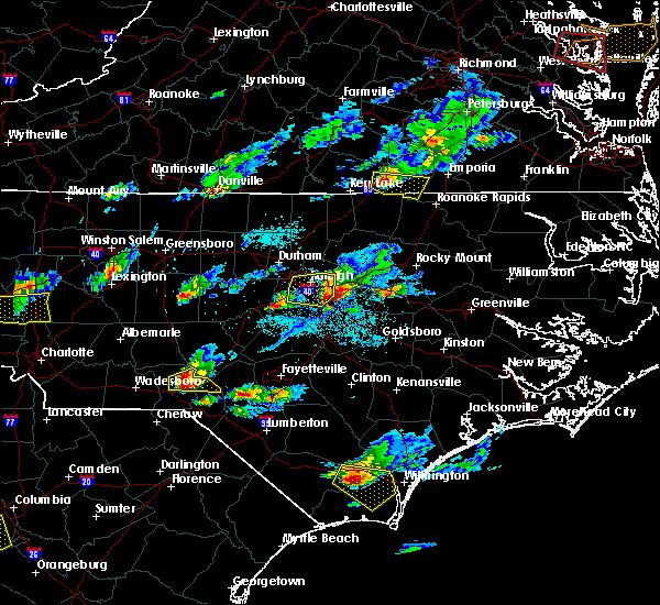 At 635 pm edt, a severe thunderstorm was located over clayton, or 13 miles northwest of smithfield, moving east at 50 mph (trained weather spotters). Hazards include half dollar size hail. damage to vehicles is expected At 635 pm edt, a severe thunderstorm was located over clayton, or 13 miles northwest of smithfield, moving east at 50 mph (trained weather spotters). Hazards include half dollar size hail. damage to vehicles is expected
|
| 4/28/2016 9:54 PM EDT |
 The severe thunderstorm warning for north central johnston and east central wake counties will expire at 1000 pm edt, the storm which prompted the warning has weakened below severe limits, and no longer poses an immediate threat to life or property. therefore the warning will be allowed to expire. however heavy rain is still possible with this thunderstorm. The severe thunderstorm warning for north central johnston and east central wake counties will expire at 1000 pm edt, the storm which prompted the warning has weakened below severe limits, and no longer poses an immediate threat to life or property. therefore the warning will be allowed to expire. however heavy rain is still possible with this thunderstorm.
|
| 4/28/2016 9:50 PM EDT |
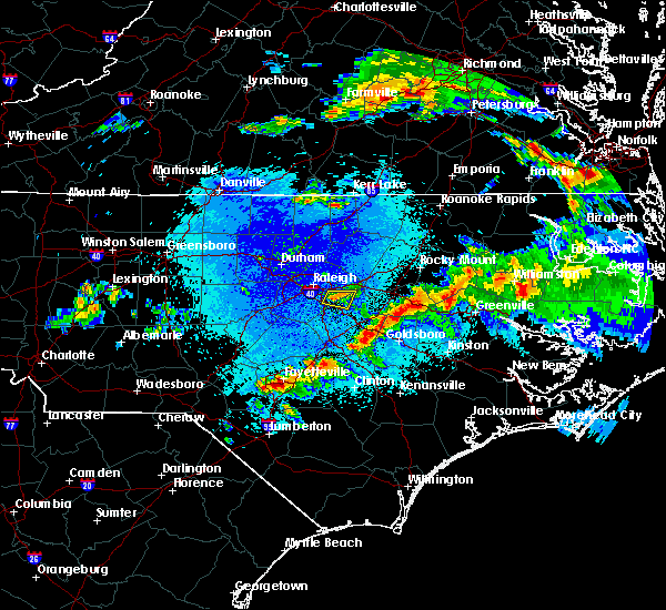 At 948 pm edt, a strong thunderstorm was located near clayton, or 11 miles southeast of raleigh, moving southeast at 25 mph (radar indicated). Hazards include 60 mph wind gusts and quarter size hail. Hail damage to vegetation is expected. expect wind damage to trees. Locations impacted include, clayton and wendell. At 948 pm edt, a strong thunderstorm was located near clayton, or 11 miles southeast of raleigh, moving southeast at 25 mph (radar indicated). Hazards include 60 mph wind gusts and quarter size hail. Hail damage to vegetation is expected. expect wind damage to trees. Locations impacted include, clayton and wendell.
|
| 4/28/2016 9:24 PM EDT |
 At 924 pm edt, a severe thunderstorm was located over raleigh, moving east at 35 mph (radar indicated). Hazards include 60 mph wind gusts and quarter size hail. Hail damage to vehicles is expected. Expect wind damage to roofs, siding, and trees. At 924 pm edt, a severe thunderstorm was located over raleigh, moving east at 35 mph (radar indicated). Hazards include 60 mph wind gusts and quarter size hail. Hail damage to vehicles is expected. Expect wind damage to roofs, siding, and trees.
|
| 4/28/2016 6:56 PM EDT |
 The severe thunderstorm warning for north central wayne and johnston counties will expire at 700 pm edt, the storm which prompted the warning has moved out of the area. therefore the warning will be allowed to expire. a severe thunderstorm watch remains in effect until 1100 pm edt for central north carolina. The severe thunderstorm warning for north central wayne and johnston counties will expire at 700 pm edt, the storm which prompted the warning has moved out of the area. therefore the warning will be allowed to expire. a severe thunderstorm watch remains in effect until 1100 pm edt for central north carolina.
|
| 4/28/2016 6:33 PM EDT |
 At 633 pm edt, a severe thunderstorm was located near smithfield, moving northeast at 25 mph (radar indicated). Hazards include 60 mph wind gusts and quarter size hail. Hail damage to vehicles is expected. expect wind damage to roofs, siding, and trees. Locations impacted include, smithfield, clayton, micro, selma, four oaks, pine level, kenly, princeton, flowers and nahunta. At 633 pm edt, a severe thunderstorm was located near smithfield, moving northeast at 25 mph (radar indicated). Hazards include 60 mph wind gusts and quarter size hail. Hail damage to vehicles is expected. expect wind damage to roofs, siding, and trees. Locations impacted include, smithfield, clayton, micro, selma, four oaks, pine level, kenly, princeton, flowers and nahunta.
|
| 4/28/2016 6:20 PM EDT |
 At 619 pm edt, a severe thunderstorm was located over smithfield, moving northeast at 30 mph (radar indicated). Hazards include 60 mph wind gusts and quarter size hail. Hail damage to vehicles is expected. Expect wind damage to roofs, siding, and trees. At 619 pm edt, a severe thunderstorm was located over smithfield, moving northeast at 30 mph (radar indicated). Hazards include 60 mph wind gusts and quarter size hail. Hail damage to vehicles is expected. Expect wind damage to roofs, siding, and trees.
|
| 4/28/2016 5:51 PM EDT |
 At 550 pm edt, a severe thunderstorm was located near raleigh, moving northeast at 45 mph (radar indicated). Hazards include 60 mph wind gusts and quarter size hail. Hail damage to vegetation is expected. expect wind damage to house siding, and trees. Locations impacted include, raleigh, wake forest, garner, clayton, zebulon, knightdale, wendell, rolesville, youngsville and flowers. At 550 pm edt, a severe thunderstorm was located near raleigh, moving northeast at 45 mph (radar indicated). Hazards include 60 mph wind gusts and quarter size hail. Hail damage to vegetation is expected. expect wind damage to house siding, and trees. Locations impacted include, raleigh, wake forest, garner, clayton, zebulon, knightdale, wendell, rolesville, youngsville and flowers.
|
| 4/28/2016 5:46 PM EDT |
 At 546 pm edt, a severe thunderstorm was located 7 miles northwest of zebulon, or 13 miles east of raleigh, moving northeast at 55 mph (radar indicated). Hazards include 60 mph wind gusts and quarter size hail. Hail damage to vehicles is expected. expect wind damage to roofs, siding, and trees. Locations impacted include, raleigh, cary, wake forest, garner, clayton, zebulon, morrisville, knightdale, wendell and rolesville. At 546 pm edt, a severe thunderstorm was located 7 miles northwest of zebulon, or 13 miles east of raleigh, moving northeast at 55 mph (radar indicated). Hazards include 60 mph wind gusts and quarter size hail. Hail damage to vehicles is expected. expect wind damage to roofs, siding, and trees. Locations impacted include, raleigh, cary, wake forest, garner, clayton, zebulon, morrisville, knightdale, wendell and rolesville.
|
| 4/28/2016 5:24 PM EDT |
 At 524 pm edt, a severe thunderstorm was located near cary, moving northeast at 55 mph (radar indicated). Hazards include 60 mph wind gusts and half dollar size hail. Hail damage to vehicles is expected. Expect wind damage to roofs, siding, and trees. At 524 pm edt, a severe thunderstorm was located near cary, moving northeast at 55 mph (radar indicated). Hazards include 60 mph wind gusts and half dollar size hail. Hail damage to vehicles is expected. Expect wind damage to roofs, siding, and trees.
|
| 3/14/2016 11:04 PM EDT |
 At 1103 pm edt, doppler radar indicated a severe thunderstorm capable of producing quarter size hail and damaging winds in excess of 58 mph. this storm was located 7 miles north of clayton, or 11 miles southeast of raleigh, and moving east at 25 mph. At 1103 pm edt, doppler radar indicated a severe thunderstorm capable of producing quarter size hail and damaging winds in excess of 58 mph. this storm was located 7 miles north of clayton, or 11 miles southeast of raleigh, and moving east at 25 mph.
|
| 2/16/2016 6:28 AM EST |
 At 626 am est, doppler radar indicated a line of severe thunderstorms capable of producing damaging winds to 60 mph. the line extended from five county stadium south through selma, moving northeast at 55 mph. At 626 am est, doppler radar indicated a line of severe thunderstorms capable of producing damaging winds to 60 mph. the line extended from five county stadium south through selma, moving northeast at 55 mph.
|
| 2/16/2016 6:16 AM EST |
 At 613 am est, doppler radar continued to indicate a line of thunderstorms capable of producing damaging winds to near 60 mph. the line of storms extended from falls lake to knightdale, to clayton and smithfield, moving northeast at 50 mph. winds gusted to 42 mph at the ncsu centennial campus and 54 mph at pope air field with these storms. locations impacted include, smithfield, wake forest, clayton, zebulon, benson, knightdale, micro, selma and wendell. At 613 am est, doppler radar continued to indicate a line of thunderstorms capable of producing damaging winds to near 60 mph. the line of storms extended from falls lake to knightdale, to clayton and smithfield, moving northeast at 50 mph. winds gusted to 42 mph at the ncsu centennial campus and 54 mph at pope air field with these storms. locations impacted include, smithfield, wake forest, clayton, zebulon, benson, knightdale, micro, selma and wendell.
|
| 2/16/2016 6:03 AM EST |
 At 602 am est, doppler radar indicated a severe thunderstorm capable of producing damaging winds in excess of 58 mph. this storm was located over raleigh, and moving northeast at 55 mph. At 602 am est, doppler radar indicated a severe thunderstorm capable of producing damaging winds in excess of 58 mph. this storm was located over raleigh, and moving northeast at 55 mph.
|
| 8/11/2015 7:52 PM EDT |
 At 750 pm edt, doppler radar continued to indicate a severe thunderstorm capable of producing damaging winds in excess of 58 mph. this storm was located near zebulon, or 16 miles north of smithfield, moving southeast at 30 mph. locations impacted include, smithfield, clayton, micro, selma, pine level, kenly, lucama, buckhorn reservoir, flowers and emit. At 750 pm edt, doppler radar continued to indicate a severe thunderstorm capable of producing damaging winds in excess of 58 mph. this storm was located near zebulon, or 16 miles north of smithfield, moving southeast at 30 mph. locations impacted include, smithfield, clayton, micro, selma, pine level, kenly, lucama, buckhorn reservoir, flowers and emit.
|
| 8/11/2015 7:41 PM EDT | Trees down in the roadwa in johnston county NC, 1.5 miles W of Archer Lodge, NC |
| 8/11/2015 7:41 PM EDT |
 At 741 pm edt, doppler radar continued to indicate a severe thunderstorm capable of producing damaging winds in excess of 58 mph. this storm was located 9 miles south of zebulon, or 13 miles north of smithfield, moving southeast at 25 mph. locations impacted include, smithfield, clayton, micro, selma, pine level, kenly, lucama, middlesex, buckhorn reservoir and flowers. At 741 pm edt, doppler radar continued to indicate a severe thunderstorm capable of producing damaging winds in excess of 58 mph. this storm was located 9 miles south of zebulon, or 13 miles north of smithfield, moving southeast at 25 mph. locations impacted include, smithfield, clayton, micro, selma, pine level, kenly, lucama, middlesex, buckhorn reservoir and flowers.
|
| 8/11/2015 7:25 PM EDT |
 At 725 pm edt, doppler radar indicated a severe thunderstorm capable of producing damaging winds in excess of 58 mph. this storm was located near zebulon, or 14 miles east of raleigh, and moving southeast at 25 mph. At 725 pm edt, doppler radar indicated a severe thunderstorm capable of producing damaging winds in excess of 58 mph. this storm was located near zebulon, or 14 miles east of raleigh, and moving southeast at 25 mph.
|
| 7/23/2015 11:48 AM EDT |
 At 1147 am edt, doppler radar continued to indicate a severe thunderstorm capable of producing quarter size hail and damaging winds in excess of 58 mph. this storm was located near clayton, or 11 miles north of smithfield, moving southeast at 20 mph. locations impacted include, smithfield, clayton, micro, selma, pine level, kenly, buckhorn reservoir, flowers and emit. At 1147 am edt, doppler radar continued to indicate a severe thunderstorm capable of producing quarter size hail and damaging winds in excess of 58 mph. this storm was located near clayton, or 11 miles north of smithfield, moving southeast at 20 mph. locations impacted include, smithfield, clayton, micro, selma, pine level, kenly, buckhorn reservoir, flowers and emit.
|
| 7/23/2015 11:31 AM EDT |
 At 1131 am edt, doppler radar indicated a severe thunderstorm capable of producing quarter size hail and damaging winds in excess of 58 mph. this storm was located 7 miles north of clayton, or 12 miles southeast of raleigh, and moving southeast at 20 mph. At 1131 am edt, doppler radar indicated a severe thunderstorm capable of producing quarter size hail and damaging winds in excess of 58 mph. this storm was located 7 miles north of clayton, or 12 miles southeast of raleigh, and moving southeast at 20 mph.
|
| 7/21/2015 8:06 PM EDT |
 At 805 pm edt, doppler radar continued to indicate a line of severe thunderstorms capable of producing damaging winds in excess of 58 mph. these storms were located along a line extending from 10 miles southwest of bailey to near smithfield, moving east at 30 mph. locations impacted include, goldsboro, smithfield, wilson, fremont, walnut creek, bailey, micro, selma, four oaks and pine level. At 805 pm edt, doppler radar continued to indicate a line of severe thunderstorms capable of producing damaging winds in excess of 58 mph. these storms were located along a line extending from 10 miles southwest of bailey to near smithfield, moving east at 30 mph. locations impacted include, goldsboro, smithfield, wilson, fremont, walnut creek, bailey, micro, selma, four oaks and pine level.
|
| 7/21/2015 7:54 PM EDT |
 At 753 pm edt, doppler radar continued to indicate a cluster of severe thunderstorms capable of producing damaging winds in excess of 58 mph. these storms were located along a line extending from 7 miles east of clayton to 6 miles southwest of smithfield, moving east at 35 mph. locations impacted include, goldsboro, smithfield, wilson, clayton, fremont, walnut creek, bailey, micro, selma and four oaks. At 753 pm edt, doppler radar continued to indicate a cluster of severe thunderstorms capable of producing damaging winds in excess of 58 mph. these storms were located along a line extending from 7 miles east of clayton to 6 miles southwest of smithfield, moving east at 35 mph. locations impacted include, goldsboro, smithfield, wilson, clayton, fremont, walnut creek, bailey, micro, selma and four oaks.
|
| 7/21/2015 7:45 PM EDT |
 At 745 pm edt, doppler radar continued to indicate a severe thunderstorm capable of producing damaging winds in excess of 58 mph. this storm was located over clayton, or 11 miles northwest of smithfield, moving east at 30 mph. locations impacted include, goldsboro, smithfield, wilson, garner, clayton, zebulon, fremont, walnut creek, bailey and knightdale. At 745 pm edt, doppler radar continued to indicate a severe thunderstorm capable of producing damaging winds in excess of 58 mph. this storm was located over clayton, or 11 miles northwest of smithfield, moving east at 30 mph. locations impacted include, goldsboro, smithfield, wilson, garner, clayton, zebulon, fremont, walnut creek, bailey and knightdale.
|
| 7/21/2015 7:34 PM EDT |
 At 733 pm edt, doppler radar indicated a severe thunderstorm capable of producing damaging winds in excess of 58 mph. this storm was located over clayton, or 10 miles northwest of smithfield, and moving east at 40 mph. At 733 pm edt, doppler radar indicated a severe thunderstorm capable of producing damaging winds in excess of 58 mph. this storm was located over clayton, or 10 miles northwest of smithfield, and moving east at 40 mph.
|
| 7/18/2015 3:12 PM EDT |
 At 312 pm edt, emergency management reported a line of severe thunderstorms producing damaging winds in excess of 58 mph. these storms were located along a line extending from near nashville to 7 miles north of bailey, moving east at 30 mph. locations impacted include, rocky mount, nashville, zebulon, dortches, bailey, bunn, wendell, red oak, sharpsburg and spring hope. At 312 pm edt, emergency management reported a line of severe thunderstorms producing damaging winds in excess of 58 mph. these storms were located along a line extending from near nashville to 7 miles north of bailey, moving east at 30 mph. locations impacted include, rocky mount, nashville, zebulon, dortches, bailey, bunn, wendell, red oak, sharpsburg and spring hope.
|
| 7/18/2015 2:45 PM EDT |
 At 244 pm edt, doppler radar indicated a line of severe thunderstorms capable of producing damaging winds in excess of 58 mph. these storms were located along a line extending from 7 miles east of bunn to near zebulon, and moving east at 30 mph. At 244 pm edt, doppler radar indicated a line of severe thunderstorms capable of producing damaging winds in excess of 58 mph. these storms were located along a line extending from 7 miles east of bunn to near zebulon, and moving east at 30 mph.
|
| 7/13/2015 7:47 AM EDT |
 At 745 am edt, doppler radar continued to indicate a cluster of severe thunderstorms capable of producing damaging winds in excess of 58 mph. these storms were located along a line extending from near clayton to near angier, moving east at 30 mph. locations impacted include, smithfield, clayton, angier, benson, micro, selma, coats, four oaks, pine level and kenly. At 745 am edt, doppler radar continued to indicate a cluster of severe thunderstorms capable of producing damaging winds in excess of 58 mph. these storms were located along a line extending from near clayton to near angier, moving east at 30 mph. locations impacted include, smithfield, clayton, angier, benson, micro, selma, coats, four oaks, pine level and kenly.
|
| 7/13/2015 7:38 AM EDT |
 At 737 am edt, doppler radar continued to indicate a cluster of severe thunderstorms capable of producing damaging winds in excess of 58 mph. these storms were located along a line extending from near clayton to near angier, moving east at 30 mph. locations impacted include, smithfield, garner, fuquay-varina, clayton, angier, benson, micro, selma, coats and four oaks. At 737 am edt, doppler radar continued to indicate a cluster of severe thunderstorms capable of producing damaging winds in excess of 58 mph. these storms were located along a line extending from near clayton to near angier, moving east at 30 mph. locations impacted include, smithfield, garner, fuquay-varina, clayton, angier, benson, micro, selma, coats and four oaks.
|
| 7/13/2015 7:21 AM EDT |
 At 721 am edt, doppler radar indicated a severe thunderstorm capable of producing quarter size hail and damaging winds in excess of 58 mph. this storm was located near garner, or 13 miles south of raleigh, and moving east at 25 mph. At 721 am edt, doppler radar indicated a severe thunderstorm capable of producing quarter size hail and damaging winds in excess of 58 mph. this storm was located near garner, or 13 miles south of raleigh, and moving east at 25 mph.
|
| 7/8/2015 10:38 PM EDT |
 At 1036 pm edt, doppler radar indicated a severe thunderstorm capable of producing damaging winds in excess of 58 mph. this storm was located 8 miles west of fremont, or 12 miles east of smithfield, and moving east at 40 mph. this storm has a history of producing wind damage. At 1036 pm edt, doppler radar indicated a severe thunderstorm capable of producing damaging winds in excess of 58 mph. this storm was located 8 miles west of fremont, or 12 miles east of smithfield, and moving east at 40 mph. this storm has a history of producing wind damage.
|
| 7/8/2015 10:04 PM EDT |
 At 1003 pm edt, a severe thunderstorm with damaging winds in excess of 58 mph was located 9 miles south of zebulon, or 13 miles north of smithfield, moving east at 30 mph. locations impacted include, raleigh, smithfield, garner, clayton, zebulon, angier, knightdale, selma, wendell and four oaks. At 1003 pm edt, a severe thunderstorm with damaging winds in excess of 58 mph was located 9 miles south of zebulon, or 13 miles north of smithfield, moving east at 30 mph. locations impacted include, raleigh, smithfield, garner, clayton, zebulon, angier, knightdale, selma, wendell and four oaks.
|
| 7/8/2015 9:47 PM EDT |
 At 947 pm edt, doppler radar continued to indicate a severe thunderstorm capable of producing damaging winds in excess of 58 mph. this storm was located near clayton, or 14 miles north of smithfield, moving east at 30 mph. locations impacted include, raleigh, cary, smithfield, wake forest, garner, fuquay-varina, clayton, zebulon, angier and bunn. At 947 pm edt, doppler radar continued to indicate a severe thunderstorm capable of producing damaging winds in excess of 58 mph. this storm was located near clayton, or 14 miles north of smithfield, moving east at 30 mph. locations impacted include, raleigh, cary, smithfield, wake forest, garner, fuquay-varina, clayton, zebulon, angier and bunn.
|
| 7/8/2015 9:24 PM EDT |
 At 924 pm edt, doppler radar indicated a severe thunderstorm capable of producing quarter size hail and damaging winds in excess of 58 mph. this storm was located over garner, or near raleigh, and moving east at 35 mph. At 924 pm edt, doppler radar indicated a severe thunderstorm capable of producing quarter size hail and damaging winds in excess of 58 mph. this storm was located over garner, or near raleigh, and moving east at 35 mph.
|
| 7/5/2015 9:56 PM EDT |
 At 956 pm edt, doppler radar continued to indicate a severe thunderstorm capable of producing damaging winds in excess of 58 mph. this storm was located near garner, or 13 miles southeast of raleigh, moving northeast at 25 mph. locations impacted include, raleigh, zebulon, knightdale, wendell, rolesville, flowers and emit. At 956 pm edt, doppler radar continued to indicate a severe thunderstorm capable of producing damaging winds in excess of 58 mph. this storm was located near garner, or 13 miles southeast of raleigh, moving northeast at 25 mph. locations impacted include, raleigh, zebulon, knightdale, wendell, rolesville, flowers and emit.
|
| 7/5/2015 9:34 PM EDT |
 At 934 pm edt, doppler radar indicated a severe thunderstorm capable of producing quarter size hail and damaging winds in excess of 58 mph. this storm was located near angier, or 13 miles northeast of lillington, and moving northeast at 25 mph. At 934 pm edt, doppler radar indicated a severe thunderstorm capable of producing quarter size hail and damaging winds in excess of 58 mph. this storm was located near angier, or 13 miles northeast of lillington, and moving northeast at 25 mph.
|
| 7/2/2015 6:56 PM EDT |
 At 655 pm edt, doppler radar indicated a line of severe thunderstorms capable of producing damaging winds in excess of 58 mph. these storms were located along a line extending from 6 miles east of clayton to near smithfield, and moving southeast at 30 mph. At 655 pm edt, doppler radar indicated a line of severe thunderstorms capable of producing damaging winds in excess of 58 mph. these storms were located along a line extending from 6 miles east of clayton to near smithfield, and moving southeast at 30 mph.
|
| 6/27/2015 8:16 PM EDT |
 At 815 pm edt, doppler radar continued to indicate a line of severe thunderstorms capable of producing damaging winds in excess of 58 mph. these storms were located along a line extending from near smithfield to 15 miles west of fremont, moving northeast at 45 mph. locations impacted include, smithfield, clayton, micro, selma, four oaks, pine level, kenly, princeton, flowers and nahunta. At 815 pm edt, doppler radar continued to indicate a line of severe thunderstorms capable of producing damaging winds in excess of 58 mph. these storms were located along a line extending from near smithfield to 15 miles west of fremont, moving northeast at 45 mph. locations impacted include, smithfield, clayton, micro, selma, four oaks, pine level, kenly, princeton, flowers and nahunta.
|
| 6/27/2015 8:00 PM EDT |
 At 800 pm edt, doppler radar indicated a line of severe thunderstorms capable of producing damaging winds in excess of 58 mph. these storms were located along a line extending from near garner to 10 miles west of smithfield to near benson, and moving east at 30 mph. At 800 pm edt, doppler radar indicated a line of severe thunderstorms capable of producing damaging winds in excess of 58 mph. these storms were located along a line extending from near garner to 10 miles west of smithfield to near benson, and moving east at 30 mph.
|
| 6/27/2015 7:46 PM EDT |
 At 744 pm edt, doppler radar indicated a line of thunderstorms capable of producing damaging winds in excess of 58 mph. these storms were located along a line extending from near cary to 7 miles south of garner to dunn, moving east at 40 mph. locations impacted include, raleigh, cary, smithfield, wake forest, garner, fuquay-varina, clayton, dunn, zebulon and angier. At 744 pm edt, doppler radar indicated a line of thunderstorms capable of producing damaging winds in excess of 58 mph. these storms were located along a line extending from near cary to 7 miles south of garner to dunn, moving east at 40 mph. locations impacted include, raleigh, cary, smithfield, wake forest, garner, fuquay-varina, clayton, dunn, zebulon and angier.
|
| 6/27/2015 7:33 PM EDT |
 At 732 pm edt, doppler radar continued to indicate a line of severe thunderstorms capable of producing damaging winds in excess of 58 mph. these storms were located along a line extending from 7 miles northwest of fuquay-varina to near angier to 8 miles south of lillington, moving east at 40 mph. locations impacted include, raleigh, cary, smithfield, lillington, wake forest, garner, fuquay-varina, clayton, dunn and zebulon. At 732 pm edt, doppler radar continued to indicate a line of severe thunderstorms capable of producing damaging winds in excess of 58 mph. these storms were located along a line extending from 7 miles northwest of fuquay-varina to near angier to 8 miles south of lillington, moving east at 40 mph. locations impacted include, raleigh, cary, smithfield, lillington, wake forest, garner, fuquay-varina, clayton, dunn and zebulon.
|
| 6/27/2015 7:20 PM EDT |
 At 719 pm edt, doppler radar continued to indicate a line of severe thunderstorms capable of producing damaging winds in excess of 58 mph. these storms were located along a line extending from 7 miles southwest of cary to 7 miles northwest of lillington to near pope afb, moving east at 40 mph. locations impacted include, raleigh, cary, smithfield, lillington, wake forest, garner, fuquay-varina, clayton, dunn and zebulon. At 719 pm edt, doppler radar continued to indicate a line of severe thunderstorms capable of producing damaging winds in excess of 58 mph. these storms were located along a line extending from 7 miles southwest of cary to 7 miles northwest of lillington to near pope afb, moving east at 40 mph. locations impacted include, raleigh, cary, smithfield, lillington, wake forest, garner, fuquay-varina, clayton, dunn and zebulon.
|
| 6/27/2015 6:57 PM EDT |
 At 657 pm edt, doppler radar indicated a line of severe thunderstorms capable of producing damaging winds in excess of 58 mph. these storms were located along a line extending from near pittsboro to near sanford to 11 miles northeast of southern pines, and moving east at 35 mph. At 657 pm edt, doppler radar indicated a line of severe thunderstorms capable of producing damaging winds in excess of 58 mph. these storms were located along a line extending from near pittsboro to near sanford to 11 miles northeast of southern pines, and moving east at 35 mph.
|
| 6/26/2015 4:31 PM EDT | At 428 pm edt, trained weather spotters reported a severe thunderstorm producing quarter size hail and damaging winds in excess of 58 mph. this storm was located 7 miles south of clayton, or 9 miles west of smithfield, moving southeast at 15 mph. in addition, at 415 pm, quarter size hail was reported west central johnston county with this storm. locations impacted include, smithfield, clayton, four oaks, flowers and coats crossroads. |
| 6/26/2015 3:56 PM EDT | At 356 pm edt, doppler radar indicated a severe thunderstorm capable of producing quarter size hail and damaging winds in excess of 58 mph. this storm was located near garner, or 14 miles south of raleigh, and moving east at 25 mph. |
| 6/25/2015 9:50 PM EDT |
 The severe thunderstorm warning for northwestern johnston and northeastern harnett counties will expire at 1000 pm edt, the line of storms which prompted the warning have weakened below severe limits. therefore the warning will be allowed to expire. The severe thunderstorm warning for northwestern johnston and northeastern harnett counties will expire at 1000 pm edt, the line of storms which prompted the warning have weakened below severe limits. therefore the warning will be allowed to expire.
|
| 6/25/2015 9:48 PM EDT |
 At 947 pm edt, doppler radar continued to indicate a line of severe thunderstorms capable of producing damaging winds in excess of 58 mph. these storms were located along a line extending from near clayton to angier, moving southeast at 15 mph. locations impacted include, clayton, angier, flowers and coats crossroads. At 947 pm edt, doppler radar continued to indicate a line of severe thunderstorms capable of producing damaging winds in excess of 58 mph. these storms were located along a line extending from near clayton to angier, moving southeast at 15 mph. locations impacted include, clayton, angier, flowers and coats crossroads.
|
| 6/25/2015 9:16 PM EDT |
 At 915 pm edt, doppler radar continued to indicate a line of severe thunderstorms capable of producing quarter size hail and damaging winds in excess of 58 mph. these storms were located along a line extending from near garner to angier, moving southeast at 15 mph. locations impacted include, raleigh, cary, garner, fuquay-varina, clayton, angier, apex, holly springs, knightdale and wendell. At 915 pm edt, doppler radar continued to indicate a line of severe thunderstorms capable of producing quarter size hail and damaging winds in excess of 58 mph. these storms were located along a line extending from near garner to angier, moving southeast at 15 mph. locations impacted include, raleigh, cary, garner, fuquay-varina, clayton, angier, apex, holly springs, knightdale and wendell.
|
| 6/25/2015 8:57 PM EDT |
 At 856 pm edt, doppler radar indicated a severe thunderstorm capable of producing quarter size hail and damaging winds in excess of 58 mph. this storm was located near fuquay-varina, or 9 miles south of cary, and moving southeast at 10 mph. At 856 pm edt, doppler radar indicated a severe thunderstorm capable of producing quarter size hail and damaging winds in excess of 58 mph. this storm was located near fuquay-varina, or 9 miles south of cary, and moving southeast at 10 mph.
|
| 6/20/2015 9:52 PM EDT |
 At 950 pm edt, doppler radar continued to indicate a severe thunderstorm capable of producing damaging wind gusts up to 60 mph. this storm was located over zebulon, or 16 miles south of louisburg, moving east at 35 mph. locations impacted include, zebulon, bailey, bunn, wendell, spring hope, middlesex, pilot and emit. At 950 pm edt, doppler radar continued to indicate a severe thunderstorm capable of producing damaging wind gusts up to 60 mph. this storm was located over zebulon, or 16 miles south of louisburg, moving east at 35 mph. locations impacted include, zebulon, bailey, bunn, wendell, spring hope, middlesex, pilot and emit.
|
| 6/20/2015 9:42 PM EDT |
 At 942 pm edt, doppler radar indicated a severe thunderstorm capable of producing damaging winds up to 60 mph. this storm was located near zebulon, or 13 miles east of raleigh, and moving east at 35 mph. At 942 pm edt, doppler radar indicated a severe thunderstorm capable of producing damaging winds up to 60 mph. this storm was located near zebulon, or 13 miles east of raleigh, and moving east at 35 mph.
|
| 6/20/2015 9:22 PM EDT |
 At 921 pm edt, doppler radar indicated a severe thunderstorm capable of producing damaging wind gusts up to 60 mph. this storm was located over zebulon, or 17 miles south of louisburg, moving east at 35 mph. locations impacted include, zebulon, bunn, wendell, rolesville, middlesex, pilot, emit and buckhorn reservoir. At 921 pm edt, doppler radar indicated a severe thunderstorm capable of producing damaging wind gusts up to 60 mph. this storm was located over zebulon, or 17 miles south of louisburg, moving east at 35 mph. locations impacted include, zebulon, bunn, wendell, rolesville, middlesex, pilot, emit and buckhorn reservoir.
|
| 6/20/2015 9:14 PM EDT |
 At 912 pm edt, doppler radar indicated a severe thunderstorm capable of producing damaging wind gusts up to 60 mph. this storm was located near zebulon, or 14 miles east of raleigh, moving east at 30 mph. locations impacted include, raleigh, clayton, zebulon, bunn, knightdale, wendell, rolesville, middlesex, pilot and emit. At 912 pm edt, doppler radar indicated a severe thunderstorm capable of producing damaging wind gusts up to 60 mph. this storm was located near zebulon, or 14 miles east of raleigh, moving east at 30 mph. locations impacted include, raleigh, clayton, zebulon, bunn, knightdale, wendell, rolesville, middlesex, pilot and emit.
|
| 6/20/2015 8:59 PM EDT |
 At 858 pm edt, doppler radar indicated a severe thunderstorm capable of producing damaging wind gusts up to 60 mph. this storm was located near garner, or near raleigh, moving east at 30 mph. locations impacted include, raleigh, garner, clayton, zebulon, bunn, knightdale, wendell, rolesville, middlesex and pilot. At 858 pm edt, doppler radar indicated a severe thunderstorm capable of producing damaging wind gusts up to 60 mph. this storm was located near garner, or near raleigh, moving east at 30 mph. locations impacted include, raleigh, garner, clayton, zebulon, bunn, knightdale, wendell, rolesville, middlesex and pilot.
|
| 6/20/2015 8:46 PM EDT |
 At 846 pm edt, doppler radar indicated a severe thunderstorm capable of producing damaging winds up to 60 mph. this storm was located near garner, or near raleigh, and moving east at 25 mph. At 846 pm edt, doppler radar indicated a severe thunderstorm capable of producing damaging winds up to 60 mph. this storm was located near garner, or near raleigh, and moving east at 25 mph.
|
| 6/17/2015 11:15 PM EDT |
 At 1114 pm edt, trained weather spotters reported a severe thunderstorm producing large hail up to quarter size and strong damaging winds to 58 mph. this storm was near garner moving southeast at 20 mph. At 1114 pm edt, trained weather spotters reported a severe thunderstorm producing large hail up to quarter size and strong damaging winds to 58 mph. this storm was near garner moving southeast at 20 mph.
|
| 4/9/2015 9:10 PM EDT | The severe thunderstorm warning for central johnston and southeastern wake counties will expire at 915 pm edt. the storms which prompted the warning have weakened below severe limits. and no longer poses an immediate threat to life or property. therefore the warning will be allowed to expire. However heavy rain is still possible with these thunderstorms. |
| 4/9/2015 8:46 PM EDT | A severe thunderstorm warning remains in effect until 915 pm edt for central johnston and southeastern wake counties. at 846 pm edt. doppler radar indicated a severe thunderstorm capable of producing damaging winds in excess of 58 mph. this storm was located over clayton. or 9 miles north of smithfield. Moving east at 20 mph. |
| 4/9/2015 8:26 PM EDT | The national weather service in raleigh has issued a * severe thunderstorm warning for. central johnston county in central north carolina. southeastern wake county in central north carolina. until 915 pm edt * at 825 pm edt. Doppler radar indicated a line of severe. |
| 6/11/2014 4:56 PM EDT | A one foot in diameter pine tree was reported down near the flowers are in johnston county NC, 1.4 miles N of Archer Lodge, NC |
| 9/8/2012 8:00 PM EDT | Tree blown down on power lines near archer lodge in johnston county NC, 0.2 miles E of Archer Lodge, NC |
| 8/8/2012 7:51 PM EDT | Tree down on thanksgiving fire road... time estimated by radar in johnston county NC, 4 miles WNW of Archer Lodge, NC |
| 7/28/2012 10:36 PM EDT | Several trees down in johnston county NC, 3.5 miles SSE of Archer Lodge, NC |
| 5/4/2012 6:58 PM EDT | Tree down in the road... time estimated by radar in johnston county NC, 2.6 miles W of Archer Lodge, NC |
| 1/1/0001 12:00 AM | 30 inch dialeter tree blown across powerlines on murphrey road in johnston county NC, 1.4 miles N of Archer Lodge, NC |
| 1/1/0001 12:00 AM | Tree down near archers lodge off wendell road in johnston county NC, 1.6 miles SSW of Archer Lodge, NC |
| 1/1/0001 12:00 AM | One tree down near the intersection of wendell road and salem church road in johnston county NC, 2.2 miles SSW of Archer Lodge, NC |
| 1/1/0001 12:00 AM | Tree down in the 8000 block of hwy 42 in johnston county NC, 5.8 miles WNW of Archer Lodge, NC |
| 1/1/0001 12:00 AM | One tree fell on a truck along wendell road near archer lodge roa in johnston county NC, 0.8 miles SSW of Archer Lodge, NC |
| 1/1/0001 12:00 AM | Multiple trees down and screen door blown off house on cecil rd near archer lodg in johnston county NC, 0.9 miles W of Archer Lodge, NC |
Hail Maps for Archer Lodge, NC
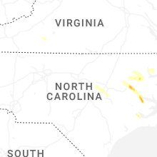


Connect with Interactive Hail Maps