

Hail Map for Arnegard, ND
The Arnegard, ND area has had 6 reports of on-the-ground hail by trained spotters, and has been under severe weather warnings 7 times during the past 12 months. Doppler radar has detected hail at or near Arnegard, ND on 39 occasions, including 1 occasion during the past year.
| Name: | Arnegard, ND |
| Where Located: | 24.9 miles SSE of Williston, ND |
| Map: | Google Map for Arnegard, ND |
| Population: | 115 |
| Housing Units: | 59 |
| More Info: | Search Google for Arnegard, ND |
1
The Top Recent Hail Date for Arnegard, ND is Wednesday, August 14, 2024 (23rd out of 39)

Hail and Wind Damage Spotted near Arnegard, ND
| Date / Time | Report Details |
|---|---|
| 6/16/2025 12:56 AM CDT |
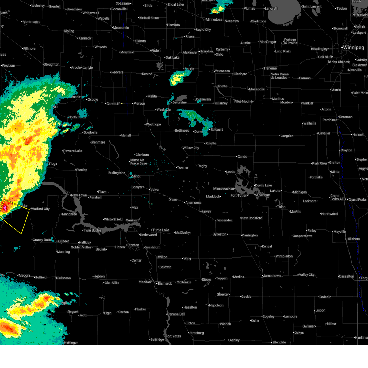
 The storm which prompted the warning has weakened below severe limits, and no longer poses an immediate threat to life or property. therefore, the warning will be allowed to expire. however, gusty winds are still possible with this thunderstorm. a severe thunderstorm watch remains in effect until 500 am cdt for northwestern north dakota. The storm which prompted the warning has weakened below severe limits, and no longer poses an immediate threat to life or property. therefore, the warning will be allowed to expire. however, gusty winds are still possible with this thunderstorm. a severe thunderstorm watch remains in effect until 500 am cdt for northwestern north dakota.
|
| 6/16/2025 12:43 AM CDT |
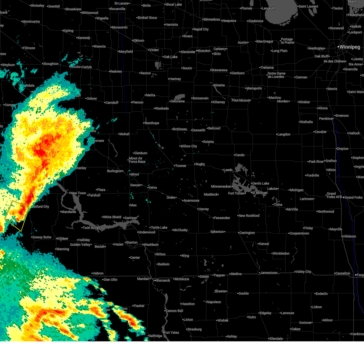
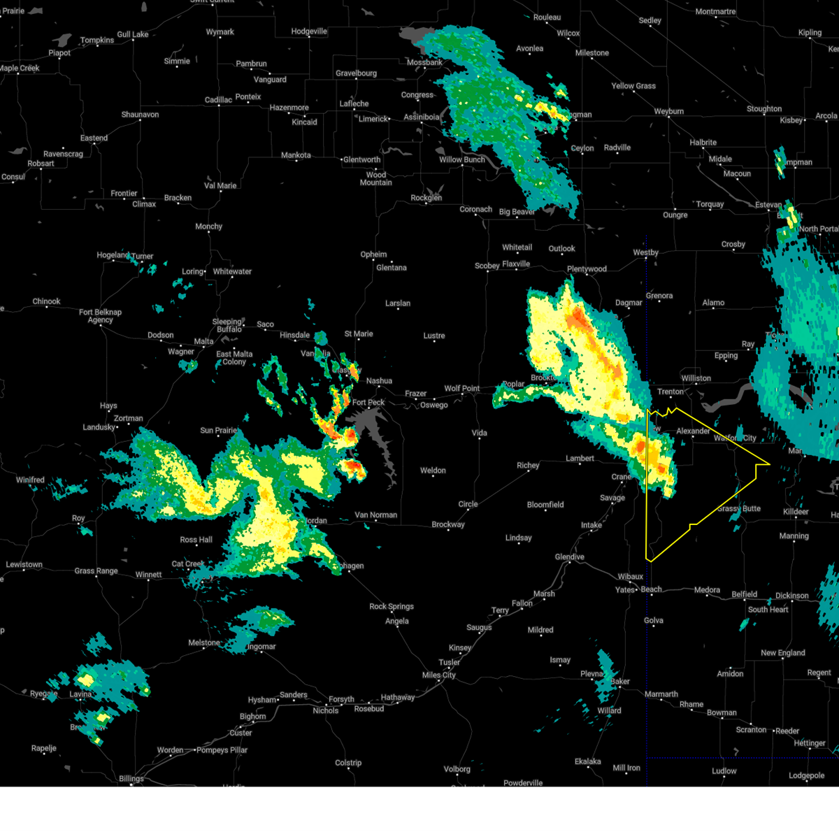
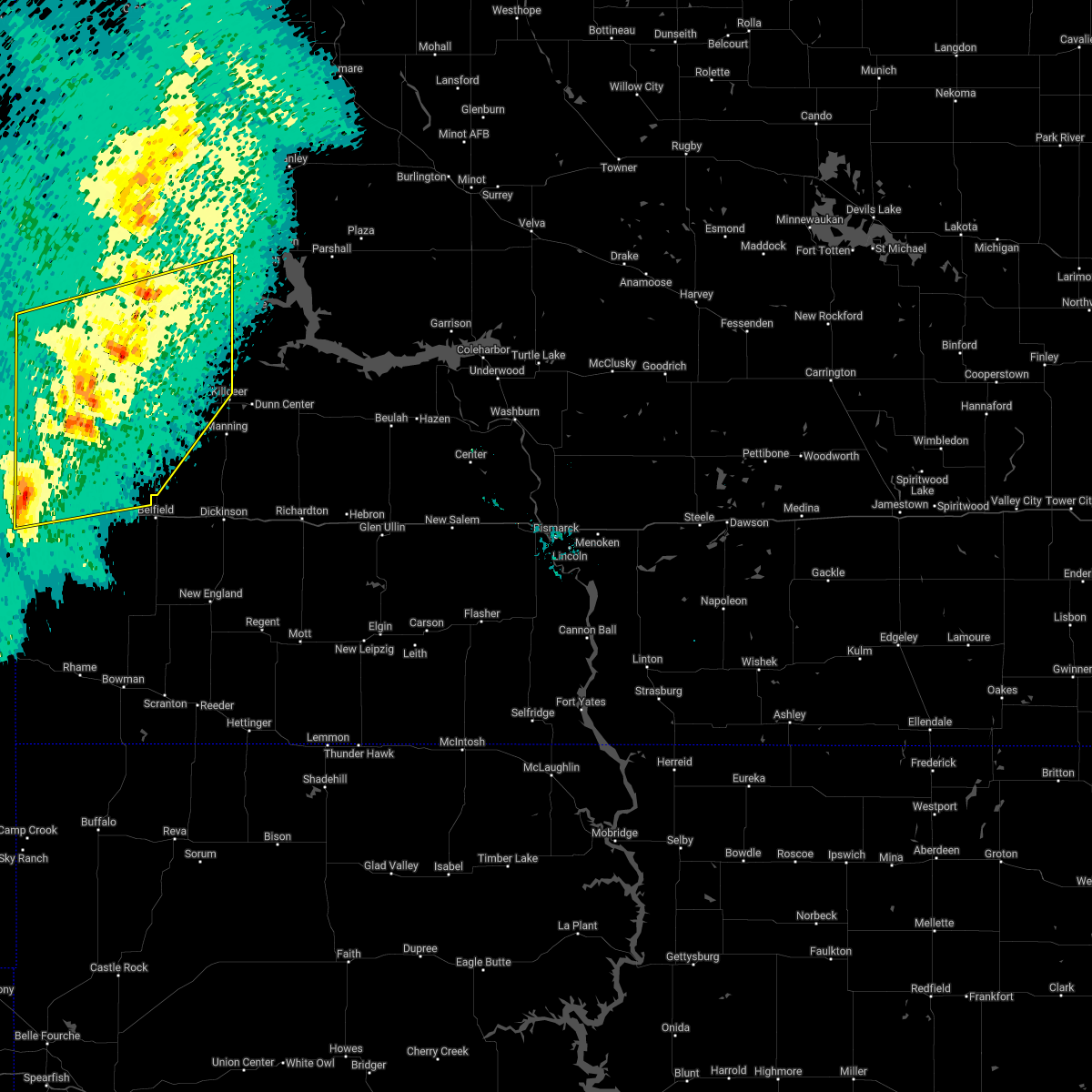
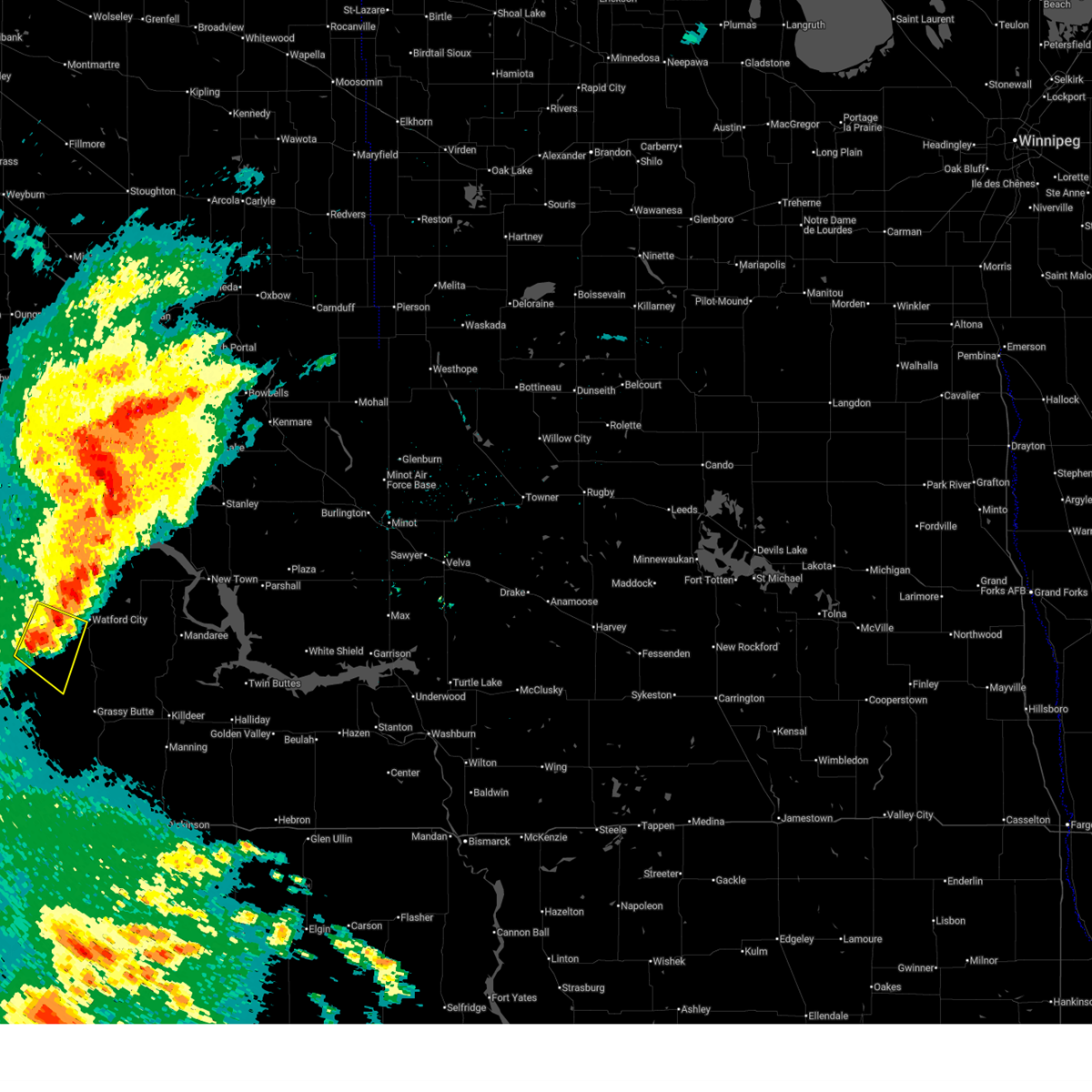 At 1243 am cdt, a severe thunderstorm was located 7 miles southwest of arnegard, or 13 miles southwest of watford city, moving southeast at 20 mph (radar indicated). Hazards include 60 mph wind gusts and quarter size hail. Hail damage to vehicles is expected. expect wind damage to roofs, siding, and trees. Locations impacted include, alexander, arnegard, and rawson. At 1243 am cdt, a severe thunderstorm was located 7 miles southwest of arnegard, or 13 miles southwest of watford city, moving southeast at 20 mph (radar indicated). Hazards include 60 mph wind gusts and quarter size hail. Hail damage to vehicles is expected. expect wind damage to roofs, siding, and trees. Locations impacted include, alexander, arnegard, and rawson.
|
| 6/16/2025 12:15 AM CDT |
 At 1214 am cdt, a severe thunderstorm was located 5 miles southwest of alexander, or 20 miles west of watford city, moving southeast at 20 mph (radar indicated). Hazards include 60 mph wind gusts and half dollar size hail. Hail damage to vehicles is expected. expect wind damage to roofs, siding, and trees. Locations impacted include, alexander, arnegard, sather dam, charbonneau, and rawson. At 1214 am cdt, a severe thunderstorm was located 5 miles southwest of alexander, or 20 miles west of watford city, moving southeast at 20 mph (radar indicated). Hazards include 60 mph wind gusts and half dollar size hail. Hail damage to vehicles is expected. expect wind damage to roofs, siding, and trees. Locations impacted include, alexander, arnegard, sather dam, charbonneau, and rawson.
|
| 6/15/2025 11:54 PM CDT |
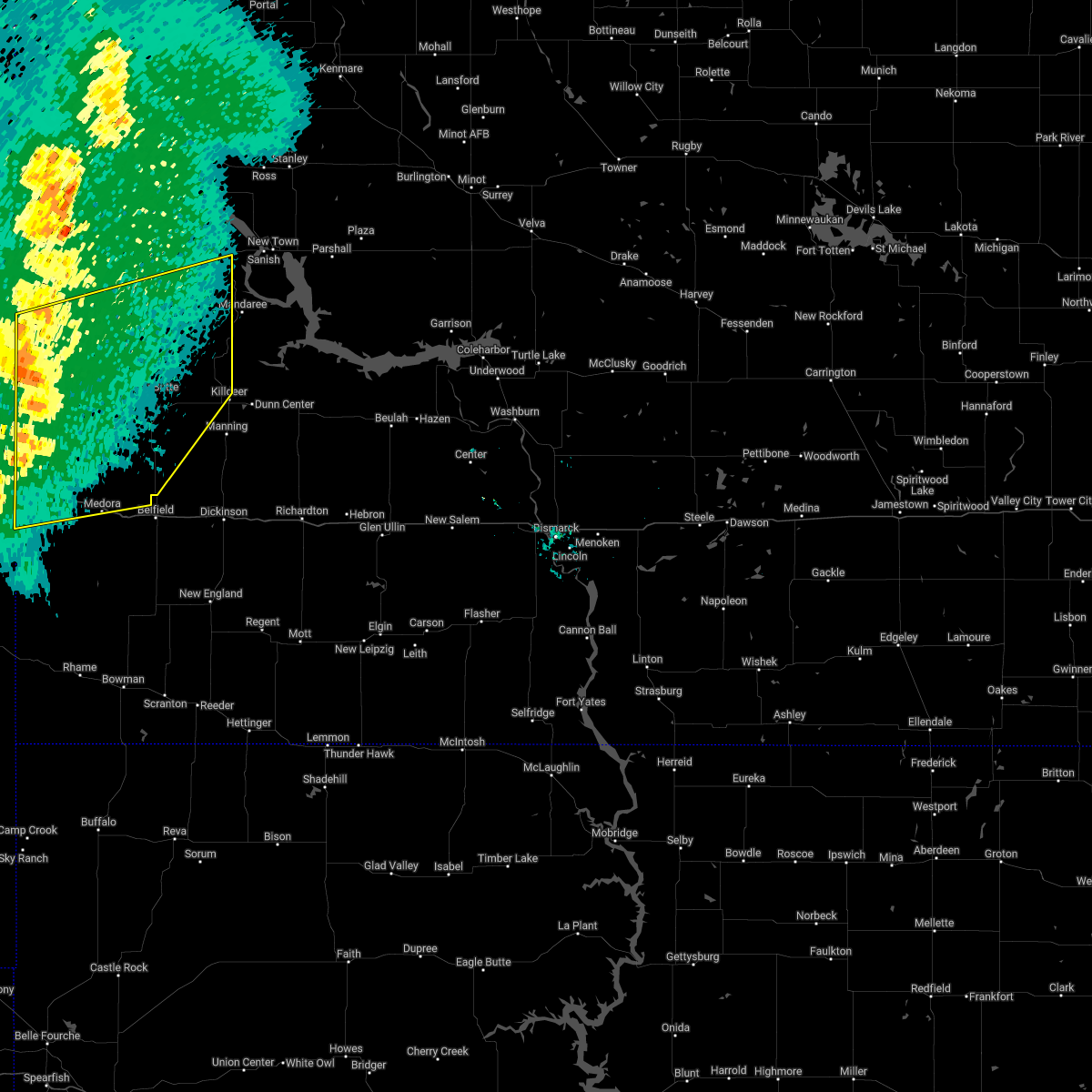
 Svrbis the national weather service in bismarck has issued a * severe thunderstorm warning for, southwestern mckenzie county in northwestern north dakota, * until 100 am cdt. * at 1154 pm cdt, a severe thunderstorm was located 9 miles east of east fairview, or 16 miles northeast of sidney, moving southeast at 20 mph (radar indicated). Hazards include ping pong ball size hail and 60 mph wind gusts. People and animals outdoors will be injured. expect hail damage to roofs, siding, windows, and vehicles. Expect wind damage to roofs, siding, and trees. Svrbis the national weather service in bismarck has issued a * severe thunderstorm warning for, southwestern mckenzie county in northwestern north dakota, * until 100 am cdt. * at 1154 pm cdt, a severe thunderstorm was located 9 miles east of east fairview, or 16 miles northeast of sidney, moving southeast at 20 mph (radar indicated). Hazards include ping pong ball size hail and 60 mph wind gusts. People and animals outdoors will be injured. expect hail damage to roofs, siding, windows, and vehicles. Expect wind damage to roofs, siding, and trees.
|
| 9/12/2024 8:32 PM CDT |
 the severe thunderstorm warning has been cancelled and is no longer in effect the severe thunderstorm warning has been cancelled and is no longer in effect
|
| 9/12/2024 8:13 PM CDT |
 At 812 pm cdt/712 pm mdt/, a severe thunderstorm was located 5 miles northeast of skaar, or 21 miles southeast of sidney, moving northeast at 45 mph (radar indicated). Hazards include 60 mph wind gusts. Expect damage to roofs, siding, and trees. Locations impacted include, watford city, alexander, arnegard, east fairview, skaar, theodore roosevelt national park north unit, trotters, fort union trading post, cartwright, sather dam, charbonneau, and rawson. At 812 pm cdt/712 pm mdt/, a severe thunderstorm was located 5 miles northeast of skaar, or 21 miles southeast of sidney, moving northeast at 45 mph (radar indicated). Hazards include 60 mph wind gusts. Expect damage to roofs, siding, and trees. Locations impacted include, watford city, alexander, arnegard, east fairview, skaar, theodore roosevelt national park north unit, trotters, fort union trading post, cartwright, sather dam, charbonneau, and rawson.
|
| 9/12/2024 7:57 PM CDT |
 Svrbis the national weather service in bismarck has issued a * severe thunderstorm warning for, northwestern golden valley county in southwestern north dakota, western mckenzie county in northwestern north dakota, * until 845 pm cdt/745 pm mdt/. * at 757 pm cdt/657 pm mdt/, a severe thunderstorm was located near skaar, or 24 miles north of wibaux, moving northeast at 55 mph (radar indicated). Hazards include 60 mph wind gusts and quarter size hail. Hail damage to vehicles is expected. Expect wind damage to roofs, siding, and trees. Svrbis the national weather service in bismarck has issued a * severe thunderstorm warning for, northwestern golden valley county in southwestern north dakota, western mckenzie county in northwestern north dakota, * until 845 pm cdt/745 pm mdt/. * at 757 pm cdt/657 pm mdt/, a severe thunderstorm was located near skaar, or 24 miles north of wibaux, moving northeast at 55 mph (radar indicated). Hazards include 60 mph wind gusts and quarter size hail. Hail damage to vehicles is expected. Expect wind damage to roofs, siding, and trees.
|
| 6/27/2024 8:36 PM CDT |
 The storms which prompted the warning have weakened below severe limits. therefore, the warning will be allowed to expire. a tornado watch remains in effect until 1000 pm cdt for southwestern and northwestern north dakota. a severe thunderstorm watch remains in effect until 200 am cdt for south central and northwestern north dakota. The storms which prompted the warning have weakened below severe limits. therefore, the warning will be allowed to expire. a tornado watch remains in effect until 1000 pm cdt for southwestern and northwestern north dakota. a severe thunderstorm watch remains in effect until 200 am cdt for south central and northwestern north dakota.
|
| 6/27/2024 8:11 PM CDT |
 At 810 pm cdt, severe thunderstorms were located along a line extending from 14 miles northeast of watford city to 7 miles west of mandaree to 5 miles north of dunn center, moving east at 45 mph (radar indicated). Hazards include 60 mph wind gusts and penny size hail. Expect damage to roofs, siding, and trees. Locations impacted include, watford city, new town, killdeer, halliday, dunn center, arnegard, mandaree, 4 bears lodge, mckenzie bay recreation area, four bears village, keene, white earth bay recreation area, pouch point recreation area, little missouri state park, oakdale, charlson, skunk creek bay recreation area, twin buttes, tobacco garden bay recreation area, and crow flies high state recreation area. At 810 pm cdt, severe thunderstorms were located along a line extending from 14 miles northeast of watford city to 7 miles west of mandaree to 5 miles north of dunn center, moving east at 45 mph (radar indicated). Hazards include 60 mph wind gusts and penny size hail. Expect damage to roofs, siding, and trees. Locations impacted include, watford city, new town, killdeer, halliday, dunn center, arnegard, mandaree, 4 bears lodge, mckenzie bay recreation area, four bears village, keene, white earth bay recreation area, pouch point recreation area, little missouri state park, oakdale, charlson, skunk creek bay recreation area, twin buttes, tobacco garden bay recreation area, and crow flies high state recreation area.
|
| 6/27/2024 7:40 PM CDT |
 Svrbis the national weather service in bismarck has issued a * severe thunderstorm warning for, northern dunn county in southwestern north dakota, central mckenzie county in northwestern north dakota, southwestern mountrail county in northwestern north dakota, * until 845 pm cdt. * at 740 pm cdt, severe thunderstorms were located along a line extending from near alexander to theodore roosevelt national park north unit to 9 miles southeast of grassy butte, moving northeast at 40 mph (radar indicated). Hazards include 60 mph wind gusts and quarter size hail. Hail damage to vehicles is expected. Expect wind damage to roofs, siding, and trees. Svrbis the national weather service in bismarck has issued a * severe thunderstorm warning for, northern dunn county in southwestern north dakota, central mckenzie county in northwestern north dakota, southwestern mountrail county in northwestern north dakota, * until 845 pm cdt. * at 740 pm cdt, severe thunderstorms were located along a line extending from near alexander to theodore roosevelt national park north unit to 9 miles southeast of grassy butte, moving northeast at 40 mph (radar indicated). Hazards include 60 mph wind gusts and quarter size hail. Hail damage to vehicles is expected. Expect wind damage to roofs, siding, and trees.
|
| 6/27/2024 7:26 PM CDT |
 At 726 pm cdt, severe thunderstorms were located along a line extending from 4 miles west of alexander to 10 miles west of theodore roosevelt national park north unit to 5 miles southeast of grassy butte, moving northeast at 60 mph (radar indicated). Hazards include 70 mph wind gusts and quarter size hail. Hail damage to vehicles is expected. expect considerable tree damage. wind damage is also likely to mobile homes, roofs, and outbuildings. Locations impacted include, watford city, alexander, arnegard, skaar, theodore roosevelt national park north unit, grassy butte, sather dam, charbonneau, and rawson. At 726 pm cdt, severe thunderstorms were located along a line extending from 4 miles west of alexander to 10 miles west of theodore roosevelt national park north unit to 5 miles southeast of grassy butte, moving northeast at 60 mph (radar indicated). Hazards include 70 mph wind gusts and quarter size hail. Hail damage to vehicles is expected. expect considerable tree damage. wind damage is also likely to mobile homes, roofs, and outbuildings. Locations impacted include, watford city, alexander, arnegard, skaar, theodore roosevelt national park north unit, grassy butte, sather dam, charbonneau, and rawson.
|
| 6/27/2024 7:09 PM CDT |
 Svrbis the national weather service in bismarck has issued a * severe thunderstorm warning for, mckenzie county in northwestern north dakota, * until 800 pm cdt. * at 708 pm cdt, severe thunderstorms were located along a line extending from 9 miles southeast of sidney to 11 miles northeast of trotters to 20 miles southwest of grassy butte, moving northeast at 60 mph (radar indicated). Hazards include 70 mph wind gusts and quarter size hail. Hail damage to vehicles is expected. expect considerable tree damage. Wind damage is also likely to mobile homes, roofs, and outbuildings. Svrbis the national weather service in bismarck has issued a * severe thunderstorm warning for, mckenzie county in northwestern north dakota, * until 800 pm cdt. * at 708 pm cdt, severe thunderstorms were located along a line extending from 9 miles southeast of sidney to 11 miles northeast of trotters to 20 miles southwest of grassy butte, moving northeast at 60 mph (radar indicated). Hazards include 70 mph wind gusts and quarter size hail. Hail damage to vehicles is expected. expect considerable tree damage. Wind damage is also likely to mobile homes, roofs, and outbuildings.
|
| 6/15/2024 11:00 PM CDT |
 At 1100 pm cdt, severe thunderstorms were located along a line extending from 14 miles northeast of watford city to near grassy butte, moving east at 40 mph (radar indicated). Hazards include 70 mph wind gusts and ping pong ball size hail. People and animals outdoors will be injured. expect hail damage to roofs, siding, windows, and vehicles. expect considerable tree damage. wind damage is also likely to mobile homes, roofs, and outbuildings. Locations impacted include, watford city, killdeer, alexander, arnegard, mandaree, theodore roosevelt national park north unit, grassy butte, keene, rawson, little missouri state park, oakdale, and johnsons corner. At 1100 pm cdt, severe thunderstorms were located along a line extending from 14 miles northeast of watford city to near grassy butte, moving east at 40 mph (radar indicated). Hazards include 70 mph wind gusts and ping pong ball size hail. People and animals outdoors will be injured. expect hail damage to roofs, siding, windows, and vehicles. expect considerable tree damage. wind damage is also likely to mobile homes, roofs, and outbuildings. Locations impacted include, watford city, killdeer, alexander, arnegard, mandaree, theodore roosevelt national park north unit, grassy butte, keene, rawson, little missouri state park, oakdale, and johnsons corner.
|
| 6/15/2024 10:44 PM CDT |
 At 1044 pm cdt, severe thunderstorms were located along a line extending from 6 miles northeast of watford city to 5 miles southwest of grassy butte, moving east at 40 mph (radar indicated). Hazards include 70 mph wind gusts and half dollar size hail. Hail damage to vehicles is expected. expect considerable tree damage. wind damage is also likely to mobile homes, roofs, and outbuildings. Locations impacted include, watford city, killdeer, alexander, arnegard, mandaree, grassy butte, theodore roosevelt national park north unit, keene, sather dam, charbonneau, little missouri state park, oakdale, rawson, and johnsons corner. At 1044 pm cdt, severe thunderstorms were located along a line extending from 6 miles northeast of watford city to 5 miles southwest of grassy butte, moving east at 40 mph (radar indicated). Hazards include 70 mph wind gusts and half dollar size hail. Hail damage to vehicles is expected. expect considerable tree damage. wind damage is also likely to mobile homes, roofs, and outbuildings. Locations impacted include, watford city, killdeer, alexander, arnegard, mandaree, grassy butte, theodore roosevelt national park north unit, keene, sather dam, charbonneau, little missouri state park, oakdale, rawson, and johnsons corner.
|
| 6/15/2024 10:40 PM CDT | Nddot us-85 arnegard statio in mckenzie county ND, 2.5 miles ENE of Arnegard, ND |
| 6/15/2024 10:22 PM CDT |
 Svrbis the national weather service in bismarck has issued a * severe thunderstorm warning for, northwestern dunn county in southwestern north dakota, mckenzie county in northwestern north dakota, * until 1115 pm cdt. * at 1022 pm cdt, severe thunderstorms were located along a line extending from near alexander to 13 miles east of trotters, moving east at 45 mph (radar indicated). Hazards include 70 mph wind gusts and ping pong ball size hail. People and animals outdoors will be injured. expect hail damage to roofs, siding, windows, and vehicles. expect considerable tree damage. Wind damage is also likely to mobile homes, roofs, and outbuildings. Svrbis the national weather service in bismarck has issued a * severe thunderstorm warning for, northwestern dunn county in southwestern north dakota, mckenzie county in northwestern north dakota, * until 1115 pm cdt. * at 1022 pm cdt, severe thunderstorms were located along a line extending from near alexander to 13 miles east of trotters, moving east at 45 mph (radar indicated). Hazards include 70 mph wind gusts and ping pong ball size hail. People and animals outdoors will be injured. expect hail damage to roofs, siding, windows, and vehicles. expect considerable tree damage. Wind damage is also likely to mobile homes, roofs, and outbuildings.
|
| 6/15/2024 9:54 PM CDT |
 At 954 pm cdt, severe thunderstorms were located along a line extending from near plentywood to 13 miles northeast of bainville to 5 miles northwest of skaar, moving east at 45 mph (radar indicated). Hazards include 70 mph wind gusts and quarter size hail. Hail damage to vehicles is expected. expect considerable tree damage. wind damage is also likely to mobile homes, roofs, and outbuildings. Locations impacted include, williston, fairview, grenora, alexander, westby, arnegard, epping, writing rock state historical site, bonetrail, skaar, hanks city, alkabo, fort union trading post, east fairview, trenton, cartwright, charbonneau, blacktail lake, zahl, and sather dam. At 954 pm cdt, severe thunderstorms were located along a line extending from near plentywood to 13 miles northeast of bainville to 5 miles northwest of skaar, moving east at 45 mph (radar indicated). Hazards include 70 mph wind gusts and quarter size hail. Hail damage to vehicles is expected. expect considerable tree damage. wind damage is also likely to mobile homes, roofs, and outbuildings. Locations impacted include, williston, fairview, grenora, alexander, westby, arnegard, epping, writing rock state historical site, bonetrail, skaar, hanks city, alkabo, fort union trading post, east fairview, trenton, cartwright, charbonneau, blacktail lake, zahl, and sather dam.
|
| 6/15/2024 9:33 PM CDT |
 Svrbis the national weather service in bismarck has issued a * severe thunderstorm warning for, western mckenzie county in northwestern north dakota, williams county in northwestern north dakota, western divide county in northwestern north dakota, * until 1030 pm cdt. * at 933 pm cdt, severe thunderstorms were located along a line extending from 5 miles southwest of archer to 7 miles northwest of bainville to 7 miles southwest of savage, moving east at 40 mph (radar indicated). Hazards include 70 mph wind gusts and quarter size hail. Hail damage to vehicles is expected. expect considerable tree damage. Wind damage is also likely to mobile homes, roofs, and outbuildings. Svrbis the national weather service in bismarck has issued a * severe thunderstorm warning for, western mckenzie county in northwestern north dakota, williams county in northwestern north dakota, western divide county in northwestern north dakota, * until 1030 pm cdt. * at 933 pm cdt, severe thunderstorms were located along a line extending from 5 miles southwest of archer to 7 miles northwest of bainville to 7 miles southwest of savage, moving east at 40 mph (radar indicated). Hazards include 70 mph wind gusts and quarter size hail. Hail damage to vehicles is expected. expect considerable tree damage. Wind damage is also likely to mobile homes, roofs, and outbuildings.
|
| 5/29/2024 7:16 PM CDT | Ndawn station located 8se antelope cree in mckenzie county ND, 9.5 miles N of Arnegard, ND |
| 5/17/2024 4:10 PM CDT |
 Svrbis the national weather service in bismarck has issued a * severe thunderstorm warning for, northeastern mckenzie county in northwestern north dakota, southeastern williams county in northwestern north dakota, southwestern mountrail county in northwestern north dakota, * until 500 pm cdt. * at 410 pm cdt, a severe thunderstorm was located 8 miles northeast of watford city, moving east at 55 mph (radar indicated). Hazards include 60 mph wind gusts and quarter size hail. Hail damage to vehicles is expected. Expect wind damage to roofs, siding, and trees. Svrbis the national weather service in bismarck has issued a * severe thunderstorm warning for, northeastern mckenzie county in northwestern north dakota, southeastern williams county in northwestern north dakota, southwestern mountrail county in northwestern north dakota, * until 500 pm cdt. * at 410 pm cdt, a severe thunderstorm was located 8 miles northeast of watford city, moving east at 55 mph (radar indicated). Hazards include 60 mph wind gusts and quarter size hail. Hail damage to vehicles is expected. Expect wind damage to roofs, siding, and trees.
|
| 5/17/2024 3:58 PM CDT |
 At 358 pm cdt, a severe thunderstorm was located 5 miles north of arnegard, or 8 miles northwest of watford city, moving east at 50 mph (radar indicated). Hazards include 60 mph wind gusts and quarter size hail. Hail damage to vehicles is expected. expect wind damage to roofs, siding, and trees. Locations impacted include, watford city, alexander, arnegard, lewis and clark state park, and rawson. At 358 pm cdt, a severe thunderstorm was located 5 miles north of arnegard, or 8 miles northwest of watford city, moving east at 50 mph (radar indicated). Hazards include 60 mph wind gusts and quarter size hail. Hail damage to vehicles is expected. expect wind damage to roofs, siding, and trees. Locations impacted include, watford city, alexander, arnegard, lewis and clark state park, and rawson.
|
| 5/17/2024 3:49 PM CDT | Nddot site on highway 85 near arnegar in mckenzie county ND, 2.5 miles ENE of Arnegard, ND |
| 5/17/2024 3:48 PM CDT |
 At 347 pm cdt, a severe thunderstorm was located near alexander, or 15 miles west of watford city, moving east at 45 mph (radar indicated). Hazards include 60 mph wind gusts and quarter size hail. Hail damage to vehicles is expected. expect wind damage to roofs, siding, and trees. Locations impacted include, watford city, alexander, arnegard, lewis and clark state park, charbonneau, and rawson. At 347 pm cdt, a severe thunderstorm was located near alexander, or 15 miles west of watford city, moving east at 45 mph (radar indicated). Hazards include 60 mph wind gusts and quarter size hail. Hail damage to vehicles is expected. expect wind damage to roofs, siding, and trees. Locations impacted include, watford city, alexander, arnegard, lewis and clark state park, charbonneau, and rawson.
|
| 5/17/2024 3:22 PM CDT |
 Svrbis the national weather service in bismarck has issued a * severe thunderstorm warning for, northwestern mckenzie county in northwestern north dakota, southwestern williams county in northwestern north dakota, * until 415 pm cdt. * at 322 pm cdt, a severe thunderstorm was located over east fairview, or 14 miles northeast of sidney, moving east at 45 mph (radar indicated). Hazards include 60 mph wind gusts and half dollar size hail. Hail damage to vehicles is expected. Expect wind damage to roofs, siding, and trees. Svrbis the national weather service in bismarck has issued a * severe thunderstorm warning for, northwestern mckenzie county in northwestern north dakota, southwestern williams county in northwestern north dakota, * until 415 pm cdt. * at 322 pm cdt, a severe thunderstorm was located over east fairview, or 14 miles northeast of sidney, moving east at 45 mph (radar indicated). Hazards include 60 mph wind gusts and half dollar size hail. Hail damage to vehicles is expected. Expect wind damage to roofs, siding, and trees.
|
| 8/30/2023 10:23 PM CDT |
 At 1023 pm cdt, severe thunderstorms were located along a line extending from 14 miles west of bonetrail to 6 miles southeast of fort union trading post to 16 miles south of alexander, moving northeast at 45 mph (radar indicated). Hazards include 60 mph wind gusts and quarter size hail. Hail damage to vehicles is expected. expect wind damage to roofs, siding, and trees. these severe storms will be near, alexander around 1030 pm cdt. grenora and bonetrail around 1040 pm cdt. williston around 1045 pm cdt. hanks city around 1050 pm cdt. writing rock state historical site around 1055 pm cdt. other locations impacted by these severe thunderstorms include zahl, cartwright, sather dam, fort buford state historical site, charbonneau, appam, rawson, hanks, trenton and spring brook. hail threat, radar indicated max hail size, 1. 00 in wind threat, observed max wind gust, 60 mph. At 1023 pm cdt, severe thunderstorms were located along a line extending from 14 miles west of bonetrail to 6 miles southeast of fort union trading post to 16 miles south of alexander, moving northeast at 45 mph (radar indicated). Hazards include 60 mph wind gusts and quarter size hail. Hail damage to vehicles is expected. expect wind damage to roofs, siding, and trees. these severe storms will be near, alexander around 1030 pm cdt. grenora and bonetrail around 1040 pm cdt. williston around 1045 pm cdt. hanks city around 1050 pm cdt. writing rock state historical site around 1055 pm cdt. other locations impacted by these severe thunderstorms include zahl, cartwright, sather dam, fort buford state historical site, charbonneau, appam, rawson, hanks, trenton and spring brook. hail threat, radar indicated max hail size, 1. 00 in wind threat, observed max wind gust, 60 mph.
|
| 8/30/2023 10:07 PM CDT |
 At 1007 pm cdt, severe thunderstorms were located along a line extending from 9 miles north of bainville to east fairview to 12 miles northeast of skaar, moving northeast at 45 mph (radar indicated). Hazards include 60 mph wind gusts and quarter size hail. Hail damage to vehicles is expected. expect wind damage to roofs, siding, and trees. severe thunderstorms will be near, alexander around 1030 pm cdt. williston, grenora and bonetrail around 1040 pm cdt. hanks city around 1050 pm cdt. other locations impacted by these severe thunderstorms include zahl, cartwright, sather dam, fort buford state historical site, charbonneau, appam, rawson, hanks, trenton and spring brook. hail threat, radar indicated max hail size, 1. 00 in wind threat, radar indicated max wind gust, 60 mph. At 1007 pm cdt, severe thunderstorms were located along a line extending from 9 miles north of bainville to east fairview to 12 miles northeast of skaar, moving northeast at 45 mph (radar indicated). Hazards include 60 mph wind gusts and quarter size hail. Hail damage to vehicles is expected. expect wind damage to roofs, siding, and trees. severe thunderstorms will be near, alexander around 1030 pm cdt. williston, grenora and bonetrail around 1040 pm cdt. hanks city around 1050 pm cdt. other locations impacted by these severe thunderstorms include zahl, cartwright, sather dam, fort buford state historical site, charbonneau, appam, rawson, hanks, trenton and spring brook. hail threat, radar indicated max hail size, 1. 00 in wind threat, radar indicated max wind gust, 60 mph.
|
| 8/30/2023 8:03 PM CDT |
 At 802 pm cdt, a severe thunderstorm was located near arnegard, or 5 miles northwest of watford city, moving northeast at 20 mph (radar indicated). Hazards include golf ball size hail and 60 mph wind gusts. People and animals outdoors will be injured. expect hail damage to roofs, siding, windows, and vehicles. expect wind damage to roofs, siding, and trees. this severe storm will be near, watford city around 810 pm cdt. other locations impacted by this severe thunderstorm include rawson. thunderstorm damage threat, considerable hail threat, observed max hail size, 1. 75 in wind threat, radar indicated max wind gust, 60 mph. At 802 pm cdt, a severe thunderstorm was located near arnegard, or 5 miles northwest of watford city, moving northeast at 20 mph (radar indicated). Hazards include golf ball size hail and 60 mph wind gusts. People and animals outdoors will be injured. expect hail damage to roofs, siding, windows, and vehicles. expect wind damage to roofs, siding, and trees. this severe storm will be near, watford city around 810 pm cdt. other locations impacted by this severe thunderstorm include rawson. thunderstorm damage threat, considerable hail threat, observed max hail size, 1. 75 in wind threat, radar indicated max wind gust, 60 mph.
|
| 8/30/2023 7:59 PM CDT |
 At 758 pm cdt, a severe thunderstorm was located over arnegard, or 6 miles west of watford city, moving northeast at 20 mph (radar indicated). Hazards include ping pong ball size hail and 60 mph wind gusts. People and animals outdoors will be injured. expect hail damage to roofs, siding, windows, and vehicles. expect wind damage to roofs, siding, and trees. this severe thunderstorm will be near, watford city around 805 pm cdt. other locations impacted by this severe thunderstorm include rawson. hail threat, radar indicated max hail size, 1. 50 in wind threat, radar indicated max wind gust, 60 mph. At 758 pm cdt, a severe thunderstorm was located over arnegard, or 6 miles west of watford city, moving northeast at 20 mph (radar indicated). Hazards include ping pong ball size hail and 60 mph wind gusts. People and animals outdoors will be injured. expect hail damage to roofs, siding, windows, and vehicles. expect wind damage to roofs, siding, and trees. this severe thunderstorm will be near, watford city around 805 pm cdt. other locations impacted by this severe thunderstorm include rawson. hail threat, radar indicated max hail size, 1. 50 in wind threat, radar indicated max wind gust, 60 mph.
|
| 8/30/2023 7:55 PM CDT | Golf Ball sized hail reported 0.2 miles SSE of Arnegard, ND, heavy rain and wind gusts to 40 mph. |
| 8/30/2023 7:48 PM CDT |
 At 748 pm cdt, a severe thunderstorm was located over arnegard, or 8 miles west of watford city, moving northeast at 20 mph (radar indicated). Hazards include ping pong ball size hail and 60 mph wind gusts. People and animals outdoors will be injured. expect hail damage to roofs, siding, windows, and vehicles. expect wind damage to roofs, siding, and trees. this severe storm will be near, watford city around 755 pm cdt. other locations impacted by this severe thunderstorm include rawson. hail threat, radar indicated max hail size, 1. 50 in wind threat, radar indicated max wind gust, 60 mph. At 748 pm cdt, a severe thunderstorm was located over arnegard, or 8 miles west of watford city, moving northeast at 20 mph (radar indicated). Hazards include ping pong ball size hail and 60 mph wind gusts. People and animals outdoors will be injured. expect hail damage to roofs, siding, windows, and vehicles. expect wind damage to roofs, siding, and trees. this severe storm will be near, watford city around 755 pm cdt. other locations impacted by this severe thunderstorm include rawson. hail threat, radar indicated max hail size, 1. 50 in wind threat, radar indicated max wind gust, 60 mph.
|
| 8/30/2023 7:46 PM CDT | Half Dollar sized hail reported 0.2 miles SSE of Arnegard, ND, heavy rain along with wind gusts to 40 mph. |
| 8/30/2023 7:35 PM CDT |
 At 734 pm cdt, a severe thunderstorm was located 5 miles west of arnegard, or 12 miles west of watford city, moving northeast at 25 mph (radar indicated). Hazards include 60 mph wind gusts and quarter size hail. Hail damage to vehicles is expected. expect wind damage to roofs, siding, and trees. this severe storm will be near, alexander and arnegard around 740 pm cdt. other locations impacted by this severe thunderstorm include rawson. hail threat, radar indicated max hail size, 1. 00 in wind threat, radar indicated max wind gust, 60 mph. At 734 pm cdt, a severe thunderstorm was located 5 miles west of arnegard, or 12 miles west of watford city, moving northeast at 25 mph (radar indicated). Hazards include 60 mph wind gusts and quarter size hail. Hail damage to vehicles is expected. expect wind damage to roofs, siding, and trees. this severe storm will be near, alexander and arnegard around 740 pm cdt. other locations impacted by this severe thunderstorm include rawson. hail threat, radar indicated max hail size, 1. 00 in wind threat, radar indicated max wind gust, 60 mph.
|
| 8/30/2023 7:20 PM CDT |
 At 719 pm cdt, a severe thunderstorm was located 8 miles south of alexander, or 16 miles west of watford city, moving northeast at 30 mph (radar indicated). Hazards include 60 mph wind gusts and quarter size hail. Hail damage to vehicles is expected. expect wind damage to roofs, siding, and trees. this severe thunderstorm will be near, alexander and arnegard around 725 pm cdt. other locations impacted by this severe thunderstorm include charbonneau, sather dam and rawson. hail threat, radar indicated max hail size, 1. 00 in wind threat, radar indicated max wind gust, 60 mph. At 719 pm cdt, a severe thunderstorm was located 8 miles south of alexander, or 16 miles west of watford city, moving northeast at 30 mph (radar indicated). Hazards include 60 mph wind gusts and quarter size hail. Hail damage to vehicles is expected. expect wind damage to roofs, siding, and trees. this severe thunderstorm will be near, alexander and arnegard around 725 pm cdt. other locations impacted by this severe thunderstorm include charbonneau, sather dam and rawson. hail threat, radar indicated max hail size, 1. 00 in wind threat, radar indicated max wind gust, 60 mph.
|
| 8/1/2023 6:39 PM CDT |
 At 638 pm cdt, a severe thunderstorm was located near arnegard, or 8 miles southwest of watford city, moving east at 15 mph (radar indicated). Hazards include golf ball size hail and 60 mph wind gusts. People and animals outdoors will be injured. expect hail damage to roofs, siding, windows, and vehicles. expect wind damage to roofs, siding, and trees. this severe storm will be near, watford city around 720 pm cdt. other locations impacted by this severe thunderstorm include johnsons corner. thunderstorm damage threat, considerable hail threat, radar indicated max hail size, 1. 75 in wind threat, radar indicated max wind gust, 60 mph. At 638 pm cdt, a severe thunderstorm was located near arnegard, or 8 miles southwest of watford city, moving east at 15 mph (radar indicated). Hazards include golf ball size hail and 60 mph wind gusts. People and animals outdoors will be injured. expect hail damage to roofs, siding, windows, and vehicles. expect wind damage to roofs, siding, and trees. this severe storm will be near, watford city around 720 pm cdt. other locations impacted by this severe thunderstorm include johnsons corner. thunderstorm damage threat, considerable hail threat, radar indicated max hail size, 1. 75 in wind threat, radar indicated max wind gust, 60 mph.
|
| 8/1/2023 6:22 PM CDT |
 At 622 pm cdt, a severe thunderstorm was located 8 miles southwest of arnegard, or 14 miles west of watford city, moving east at 10 mph (radar indicated). Hazards include ping pong ball size hail and 60 mph wind gusts. People and animals outdoors will be injured. expect hail damage to roofs, siding, windows, and vehicles. expect wind damage to roofs, siding, and trees. this severe thunderstorm will be near, arnegard around 705 pm cdt. watford city around 730 pm cdt. other locations impacted by this severe thunderstorm include rawson and johnsons corner. hail threat, radar indicated max hail size, 1. 50 in wind threat, radar indicated max wind gust, 60 mph. At 622 pm cdt, a severe thunderstorm was located 8 miles southwest of arnegard, or 14 miles west of watford city, moving east at 10 mph (radar indicated). Hazards include ping pong ball size hail and 60 mph wind gusts. People and animals outdoors will be injured. expect hail damage to roofs, siding, windows, and vehicles. expect wind damage to roofs, siding, and trees. this severe thunderstorm will be near, arnegard around 705 pm cdt. watford city around 730 pm cdt. other locations impacted by this severe thunderstorm include rawson and johnsons corner. hail threat, radar indicated max hail size, 1. 50 in wind threat, radar indicated max wind gust, 60 mph.
|
| 7/9/2022 2:26 AM MDT |
 The severe thunderstorm warning for northern golden valley, northwestern dunn, billings and mckenzie counties will expire at 330 am cdt/230 am mdt/, the storms which prompted the warning have weakened below severe limits, and no longer pose an immediate threat to life or property. therefore, the warning will be allowed to expire. however gusty winds are still possible with these thunderstorms. a severe thunderstorm watch remains in effect until 400 am cdt/300 am mdt/ for southwestern and northwestern north dakota. a severe thunderstorm watch also remains in effect until 800 am cdt/700 am mdt/ for southwestern north dakota. The severe thunderstorm warning for northern golden valley, northwestern dunn, billings and mckenzie counties will expire at 330 am cdt/230 am mdt/, the storms which prompted the warning have weakened below severe limits, and no longer pose an immediate threat to life or property. therefore, the warning will be allowed to expire. however gusty winds are still possible with these thunderstorms. a severe thunderstorm watch remains in effect until 400 am cdt/300 am mdt/ for southwestern and northwestern north dakota. a severe thunderstorm watch also remains in effect until 800 am cdt/700 am mdt/ for southwestern north dakota.
|
| 7/9/2022 3:07 AM CDT |
 At 306 am cdt/206 am mdt/, severe thunderstorms were located along a line extending from columbus to 5 miles east of tioga to 11 miles northeast of watford city, moving east at 45 mph (radar indicated). Hazards include 60 mph wind gusts. Expect damage to roofs, siding, and trees. these severe storms will be near, portal around 315 am cdt. lignite around 320 am cdt. ross around 325 am cdt. flaxton and lostwood around 330 am cdt. stanley around 335 am cdt. bowbells and palermo around 340 am cdt. blaisdell around 350 am cdt. other locations impacted by these severe thunderstorms include hamlet, white earth, cartwright, charbonneau, white earth bay recreation area, larson, niobe, white tail bay recreation area, wheelock and coteau. hail threat, radar indicated max hail size, <. 75 in wind threat, radar indicated max wind gust, 60 mph. At 306 am cdt/206 am mdt/, severe thunderstorms were located along a line extending from columbus to 5 miles east of tioga to 11 miles northeast of watford city, moving east at 45 mph (radar indicated). Hazards include 60 mph wind gusts. Expect damage to roofs, siding, and trees. these severe storms will be near, portal around 315 am cdt. lignite around 320 am cdt. ross around 325 am cdt. flaxton and lostwood around 330 am cdt. stanley around 335 am cdt. bowbells and palermo around 340 am cdt. blaisdell around 350 am cdt. other locations impacted by these severe thunderstorms include hamlet, white earth, cartwright, charbonneau, white earth bay recreation area, larson, niobe, white tail bay recreation area, wheelock and coteau. hail threat, radar indicated max hail size, <. 75 in wind threat, radar indicated max wind gust, 60 mph.
|
| 7/9/2022 2:04 AM MDT |
 At 304 am cdt/204 am mdt/, severe thunderstorms were located along a line extending from 7 miles east of watford city to 4 miles south of grassy butte to 6 miles southwest of beach, moving east at 50 mph (radar indicated). Hazards include 60 mph wind gusts and penny size hail. Expect damage to roofs, siding, and trees. these severe storms will be near, grassy butte around 210 am mdt. sentinel butte around 220 am mdt. medora around 235 am mdt. other locations impacted by these severe thunderstorms include oakdale, sather dam, fairfield and johnsons corner. hail threat, radar indicated max hail size, 0. 75 in wind threat, radar indicated max wind gust, 60 mph. At 304 am cdt/204 am mdt/, severe thunderstorms were located along a line extending from 7 miles east of watford city to 4 miles south of grassy butte to 6 miles southwest of beach, moving east at 50 mph (radar indicated). Hazards include 60 mph wind gusts and penny size hail. Expect damage to roofs, siding, and trees. these severe storms will be near, grassy butte around 210 am mdt. sentinel butte around 220 am mdt. medora around 235 am mdt. other locations impacted by these severe thunderstorms include oakdale, sather dam, fairfield and johnsons corner. hail threat, radar indicated max hail size, 0. 75 in wind threat, radar indicated max wind gust, 60 mph.
|
| 7/9/2022 2:44 AM CDT |
 At 243 am cdt/143 am mdt/, severe thunderstorms were located along a line extending from 6 miles east of crosby to 7 miles north of ray to near arnegard, moving east at 55 mph (radar indicated. at 220 am cdt a 61 mph wind gust was reported at charbonneau). Hazards include 60 mph wind gusts. Expect damage to roofs, siding, and trees. severe thunderstorms will be near, noonan around 250 am cdt. tioga around 255 am cdt. columbus around 300 am cdt. other locations in the path of these severe thunderstorms include lignite, portal, ross, stanley, flaxton, lostwood, bowbells, palermo and blaisdell. hail threat, radar indicated max hail size, <. 75 in wind threat, observed max wind gust, 60 mph. At 243 am cdt/143 am mdt/, severe thunderstorms were located along a line extending from 6 miles east of crosby to 7 miles north of ray to near arnegard, moving east at 55 mph (radar indicated. at 220 am cdt a 61 mph wind gust was reported at charbonneau). Hazards include 60 mph wind gusts. Expect damage to roofs, siding, and trees. severe thunderstorms will be near, noonan around 250 am cdt. tioga around 255 am cdt. columbus around 300 am cdt. other locations in the path of these severe thunderstorms include lignite, portal, ross, stanley, flaxton, lostwood, bowbells, palermo and blaisdell. hail threat, radar indicated max hail size, <. 75 in wind threat, observed max wind gust, 60 mph.
|
| 7/9/2022 1:37 AM MDT |
 At 237 am cdt/137 am mdt/, severe thunderstorms were located along a line extending from 11 miles east of sidney to 10 miles southeast of trotters to 4 miles southwest of beach, moving east at 35 mph (radar indicated). Hazards include 60 mph wind gusts and nickel size hail. expect damage to roofs, siding, and trees At 237 am cdt/137 am mdt/, severe thunderstorms were located along a line extending from 11 miles east of sidney to 10 miles southeast of trotters to 4 miles southwest of beach, moving east at 35 mph (radar indicated). Hazards include 60 mph wind gusts and nickel size hail. expect damage to roofs, siding, and trees
|
| 7/9/2022 2:21 AM CDT |
 At 221 am cdt/121 am mdt/, severe thunderstorms were located along a line extending from 10 miles east of fortuna to 4 miles south of alamo to 10 miles south of sidney, moving east at 50 mph (radar indicated). Hazards include 60 mph wind gusts and penny size hail. Expect damage to roofs, siding, and trees. these severe storms will be near, alamo around 225 am cdt. crosby around 235 am cdt. tioga and noonan around 250 am cdt. other locations impacted by these severe thunderstorms include hamlet, zahl, cartwright, sather dam, lewis and clark state park, charbonneau, appam, ambrose, spring brook and white tail bay recreation area. hail threat, radar indicated max hail size, 0. 75 in wind threat, radar indicated max wind gust, 60 mph. At 221 am cdt/121 am mdt/, severe thunderstorms were located along a line extending from 10 miles east of fortuna to 4 miles south of alamo to 10 miles south of sidney, moving east at 50 mph (radar indicated). Hazards include 60 mph wind gusts and penny size hail. Expect damage to roofs, siding, and trees. these severe storms will be near, alamo around 225 am cdt. crosby around 235 am cdt. tioga and noonan around 250 am cdt. other locations impacted by these severe thunderstorms include hamlet, zahl, cartwright, sather dam, lewis and clark state park, charbonneau, appam, ambrose, spring brook and white tail bay recreation area. hail threat, radar indicated max hail size, 0. 75 in wind threat, radar indicated max wind gust, 60 mph.
|
| 7/9/2022 2:07 AM CDT |
 At 206 am cdt/106 am mdt/, severe thunderstorms were located along a line extending from near alkabo to 8 miles southeast of grenora to 10 miles north of savage, moving east at 50 mph (radar indicated). Hazards include 60 mph wind gusts and penny size hail. Expect damage to roofs, siding, and trees. these severe storms will be near, alkabo around 210 am cdt. fortuna around 215 am cdt. alamo around 225 am cdt. crosby and wildrose around 240 am cdt. noonan around 255 am cdt. arnegard around 300 am cdt. watford city around 310 am cdt. other locations impacted by these severe thunderstorms include hamlet, zahl, cartwright, sather dam, lewis and clark state park, charbonneau, appam, ambrose, spring brook and white tail bay recreation area. hail threat, radar indicated max hail size, 0. 75 in wind threat, radar indicated max wind gust, 60 mph. At 206 am cdt/106 am mdt/, severe thunderstorms were located along a line extending from near alkabo to 8 miles southeast of grenora to 10 miles north of savage, moving east at 50 mph (radar indicated). Hazards include 60 mph wind gusts and penny size hail. Expect damage to roofs, siding, and trees. these severe storms will be near, alkabo around 210 am cdt. fortuna around 215 am cdt. alamo around 225 am cdt. crosby and wildrose around 240 am cdt. noonan around 255 am cdt. arnegard around 300 am cdt. watford city around 310 am cdt. other locations impacted by these severe thunderstorms include hamlet, zahl, cartwright, sather dam, lewis and clark state park, charbonneau, appam, ambrose, spring brook and white tail bay recreation area. hail threat, radar indicated max hail size, 0. 75 in wind threat, radar indicated max wind gust, 60 mph.
|
| 7/9/2022 1:35 AM CDT |
 At 134 am cdt/1234 am mdt/, severe thunderstorms were located along a line extending from 9 miles southeast of port of raymond to 5 miles southeast of froid to 9 miles southwest of lambert, moving east at 55 mph (radar indicated). Hazards include 60 mph wind gusts and penny size hail. Expect damage to roofs, siding, and trees. severe thunderstorms will be near, westby around 1250 am mdt. alkabo around 200 am cdt. fortuna and bonetrail around 205 am cdt. epping around 225 am cdt. crosby around 230 am cdt. ray around 235 am cdt. noonan around 240 am cdt. tioga around 245 am cdt. other locations impacted by these severe thunderstorms include hamlet, zahl, cartwright, sather dam, lewis and clark state park, charbonneau, appam, ambrose, spring brook and white tail bay recreation area. hail threat, radar indicated max hail size, 0. 75 in wind threat, radar indicated max wind gust, 60 mph. At 134 am cdt/1234 am mdt/, severe thunderstorms were located along a line extending from 9 miles southeast of port of raymond to 5 miles southeast of froid to 9 miles southwest of lambert, moving east at 55 mph (radar indicated). Hazards include 60 mph wind gusts and penny size hail. Expect damage to roofs, siding, and trees. severe thunderstorms will be near, westby around 1250 am mdt. alkabo around 200 am cdt. fortuna and bonetrail around 205 am cdt. epping around 225 am cdt. crosby around 230 am cdt. ray around 235 am cdt. noonan around 240 am cdt. tioga around 245 am cdt. other locations impacted by these severe thunderstorms include hamlet, zahl, cartwright, sather dam, lewis and clark state park, charbonneau, appam, ambrose, spring brook and white tail bay recreation area. hail threat, radar indicated max hail size, 0. 75 in wind threat, radar indicated max wind gust, 60 mph.
|
| 8/27/2021 6:23 PM CDT |
 At 623 pm cdt, a severe thunderstorm was located near arnegard, or 5 miles northwest of watford city, moving northeast at 35 mph (radar indicated). Hazards include ping pong ball size hail and 60 mph wind gusts. People and animals outdoors will be injured. expect hail damage to roofs, siding, windows, and vehicles. expect wind damage to roofs, siding, and trees. this severe thunderstorm will be near, watford city around 630 pm cdt. hail threat, radar indicated max hail size, 1. 50 in wind threat, radar indicated max wind gust, 60 mph. At 623 pm cdt, a severe thunderstorm was located near arnegard, or 5 miles northwest of watford city, moving northeast at 35 mph (radar indicated). Hazards include ping pong ball size hail and 60 mph wind gusts. People and animals outdoors will be injured. expect hail damage to roofs, siding, windows, and vehicles. expect wind damage to roofs, siding, and trees. this severe thunderstorm will be near, watford city around 630 pm cdt. hail threat, radar indicated max hail size, 1. 50 in wind threat, radar indicated max wind gust, 60 mph.
|
| 7/8/2021 6:14 PM MDT |
 At 714 pm cdt/614 pm mdt/, severe thunderstorms were located along a line extending from 14 miles northeast of watford city to 9 miles southwest of theodore roosevelt national park north unit, moving east at 40 mph (radar indicated). Hazards include 60 mph wind gusts and quarter size hail. Hail damage to vehicles is expected. expect wind damage to roofs, siding, and trees. severe thunderstorms will be near, grassy butte around 630 pm mdt. little missouri state park around 635 pm mdt. mandaree around 740 pm cdt. killdeer around 700 pm mdt. dunn center around 710 pm mdt. Other locations impacted by these severe thunderstorms include oakdale, skunk creek bay recreation area, rawson, johnsons corner, and pouch point recreation area. At 714 pm cdt/614 pm mdt/, severe thunderstorms were located along a line extending from 14 miles northeast of watford city to 9 miles southwest of theodore roosevelt national park north unit, moving east at 40 mph (radar indicated). Hazards include 60 mph wind gusts and quarter size hail. Hail damage to vehicles is expected. expect wind damage to roofs, siding, and trees. severe thunderstorms will be near, grassy butte around 630 pm mdt. little missouri state park around 635 pm mdt. mandaree around 740 pm cdt. killdeer around 700 pm mdt. dunn center around 710 pm mdt. Other locations impacted by these severe thunderstorms include oakdale, skunk creek bay recreation area, rawson, johnsons corner, and pouch point recreation area.
|
| 7/8/2021 6:55 PM CDT |
 At 655 pm cdt/555 pm mdt/, a severe thunderstorm was located 6 miles southwest of watford city, moving east at 40 mph (radar indicated). Hazards include 60 mph wind gusts and quarter size hail. Hail damage to vehicles is expected. expect wind damage to roofs, siding, and trees. this severe storm will be near, theodore roosevelt national park north unit around 705 pm cdt. Other locations impacted by this severe thunderstorm include rawson and sather dam. At 655 pm cdt/555 pm mdt/, a severe thunderstorm was located 6 miles southwest of watford city, moving east at 40 mph (radar indicated). Hazards include 60 mph wind gusts and quarter size hail. Hail damage to vehicles is expected. expect wind damage to roofs, siding, and trees. this severe storm will be near, theodore roosevelt national park north unit around 705 pm cdt. Other locations impacted by this severe thunderstorm include rawson and sather dam.
|
| 7/8/2021 6:38 PM CDT |
 At 638 pm cdt/538 pm mdt/, a severe thunderstorm was located near alexander, or 16 miles west of watford city, moving east at 40 mph (radar indicated). Hazards include 60 mph wind gusts and quarter size hail. Hail damage to vehicles is expected. expect wind damage to roofs, siding, and trees. this severe thunderstorm will be near, arnegard around 650 pm cdt. Other locations in the path of this severe thunderstorm include watford city. At 638 pm cdt/538 pm mdt/, a severe thunderstorm was located near alexander, or 16 miles west of watford city, moving east at 40 mph (radar indicated). Hazards include 60 mph wind gusts and quarter size hail. Hail damage to vehicles is expected. expect wind damage to roofs, siding, and trees. this severe thunderstorm will be near, arnegard around 650 pm cdt. Other locations in the path of this severe thunderstorm include watford city.
|
| 6/10/2021 11:14 PM CDT |
 At 1113 pm cdt, severe thunderstorms were located along a line extending from 6 miles northeast of grenora to 9 miles northwest of epping to 6 miles northwest of theodore roosevelt national park north unit, moving northeast at 45 mph (radar indicated). Hazards include 70 mph wind gusts and ping pong ball size hail. People and animals outdoors will be injured. expect hail damage to roofs, siding, windows, and vehicles. expect considerable tree damage. Wind damage is also likely to mobile homes, roofs, and outbuildings. At 1113 pm cdt, severe thunderstorms were located along a line extending from 6 miles northeast of grenora to 9 miles northwest of epping to 6 miles northwest of theodore roosevelt national park north unit, moving northeast at 45 mph (radar indicated). Hazards include 70 mph wind gusts and ping pong ball size hail. People and animals outdoors will be injured. expect hail damage to roofs, siding, windows, and vehicles. expect considerable tree damage. Wind damage is also likely to mobile homes, roofs, and outbuildings.
|
| 6/10/2021 11:04 PM CDT |
 At 1104 pm cdt/1004 pm mdt/, severe thunderstorms were located along a line extending from 4 miles south of williston to arnegard to 8 miles southwest of theodore roosevelt national park north unit, moving northeast at 45 mph (radar indicated). Hazards include 70 mph wind gusts and half dollar size hail. Hail damage to vehicles is expected. expect considerable tree damage. wind damage is also likely to mobile homes, roofs, and outbuildings. Locations impacted include, watford city, alexander, arnegard, theodore roosevelt national park north unit, charbonneau and rawson. At 1104 pm cdt/1004 pm mdt/, severe thunderstorms were located along a line extending from 4 miles south of williston to arnegard to 8 miles southwest of theodore roosevelt national park north unit, moving northeast at 45 mph (radar indicated). Hazards include 70 mph wind gusts and half dollar size hail. Hail damage to vehicles is expected. expect considerable tree damage. wind damage is also likely to mobile homes, roofs, and outbuildings. Locations impacted include, watford city, alexander, arnegard, theodore roosevelt national park north unit, charbonneau and rawson.
|
| 6/10/2021 9:48 PM MDT |
 At 1048 pm cdt/948 pm mdt/, severe thunderstorms were located along a line extending from 6 miles northwest of alexander to 13 miles west of grassy butte to 18 miles northwest of south fairfield, moving northeast at 40 mph (radar indicated). Hazards include 70 mph wind gusts and half dollar size hail. Hail damage to vehicles is expected. expect considerable tree damage. wind damage is also likely to mobile homes, roofs, and outbuildings. Locations impacted include, watford city, alexander, arnegard, theodore roosevelt national park north unit, grassy butte, sather dam, charbonneau and rawson. At 1048 pm cdt/948 pm mdt/, severe thunderstorms were located along a line extending from 6 miles northwest of alexander to 13 miles west of grassy butte to 18 miles northwest of south fairfield, moving northeast at 40 mph (radar indicated). Hazards include 70 mph wind gusts and half dollar size hail. Hail damage to vehicles is expected. expect considerable tree damage. wind damage is also likely to mobile homes, roofs, and outbuildings. Locations impacted include, watford city, alexander, arnegard, theodore roosevelt national park north unit, grassy butte, sather dam, charbonneau and rawson.
|
| 6/10/2021 9:35 PM MDT |
 At 1034 pm cdt/934 pm mdt/, severe thunderstorms were located along a line extending from 8 miles east of east fairview to 14 miles northeast of trotters to 9 miles northwest of medora, moving northeast at 40 mph (radar indicated). Hazards include 70 mph wind gusts and half dollar size hail. Hail damage to vehicles is expected. expect considerable tree damage. Wind damage is also likely to mobile homes, roofs, and outbuildings. At 1034 pm cdt/934 pm mdt/, severe thunderstorms were located along a line extending from 8 miles east of east fairview to 14 miles northeast of trotters to 9 miles northwest of medora, moving northeast at 40 mph (radar indicated). Hazards include 70 mph wind gusts and half dollar size hail. Hail damage to vehicles is expected. expect considerable tree damage. Wind damage is also likely to mobile homes, roofs, and outbuildings.
|
| 6/10/2021 7:10 PM CDT |
 At 710 pm cdt/610 pm mdt/, a severe thunderstorm was located over alexander, or 18 miles west of watford city, moving northeast at 25 mph (radar indicated). Hazards include 70 mph wind gusts and half dollar size hail. Hail damage to vehicles is expected. expect considerable tree damage. wind damage is also likely to mobile homes, roofs, and outbuildings. This severe thunderstorm will be near, alexander around 715 pm cdt. At 710 pm cdt/610 pm mdt/, a severe thunderstorm was located over alexander, or 18 miles west of watford city, moving northeast at 25 mph (radar indicated). Hazards include 70 mph wind gusts and half dollar size hail. Hail damage to vehicles is expected. expect considerable tree damage. wind damage is also likely to mobile homes, roofs, and outbuildings. This severe thunderstorm will be near, alexander around 715 pm cdt.
|
| 6/9/2021 12:09 AM CDT |
 The severe thunderstorm warning for mckenzie and southwestern williams counties will expire at 1215 am cdt/1115 pm mdt/, the storms which prompted the warning have weakened below severe limits. therefore, the warning will be allowed to expire. however gusty winds are still possible with these thunderstorms. a severe thunderstorm watch remains in effect until 100 am cdt/midnight mdt/ for southwestern and northwestern north dakota. The severe thunderstorm warning for mckenzie and southwestern williams counties will expire at 1215 am cdt/1115 pm mdt/, the storms which prompted the warning have weakened below severe limits. therefore, the warning will be allowed to expire. however gusty winds are still possible with these thunderstorms. a severe thunderstorm watch remains in effect until 100 am cdt/midnight mdt/ for southwestern and northwestern north dakota.
|
| 6/8/2021 11:50 PM CDT |
 At 1150 pm cdt/1050 pm mdt/, severe thunderstorms were located along a line extending from 4 miles northeast of williston to 13 miles northeast of trotters, moving east at 40 mph. these are very dangerous storms (radar indicated). Hazards include 80 mph wind gusts. Flying debris will be dangerous to those caught without shelter. mobile homes will be heavily damaged. expect considerable damage to roofs, windows, and vehicles. extensive tree damage and power outages are likely. Locations impacted include, williston, watford city, alexander, arnegard, east fairview, grassy butte, theodore roosevelt national park north unit, fort union trading post, trenton, sather dam, cartwright, lewis and clark state park, charbonneau, white tail bay recreation area, fort buford state historical site and rawson. At 1150 pm cdt/1050 pm mdt/, severe thunderstorms were located along a line extending from 4 miles northeast of williston to 13 miles northeast of trotters, moving east at 40 mph. these are very dangerous storms (radar indicated). Hazards include 80 mph wind gusts. Flying debris will be dangerous to those caught without shelter. mobile homes will be heavily damaged. expect considerable damage to roofs, windows, and vehicles. extensive tree damage and power outages are likely. Locations impacted include, williston, watford city, alexander, arnegard, east fairview, grassy butte, theodore roosevelt national park north unit, fort union trading post, trenton, sather dam, cartwright, lewis and clark state park, charbonneau, white tail bay recreation area, fort buford state historical site and rawson.
|
| 6/8/2021 11:26 PM CDT |
 At 1125 pm cdt/1025 pm mdt/, severe thunderstorms were located along a line extending from 12 miles northeast of fort union trading post to skaar, moving east at 45 mph. these are very dangerous storms (radar indicated). Hazards include 80 mph wind gusts. Flying debris will be dangerous to those caught without shelter. mobile homes will be heavily damaged. expect considerable damage to roofs, windows, and vehicles. extensive tree damage and power outages are likely. Locations impacted include, williston, watford city, alexander, arnegard, east fairview, grassy butte, theodore roosevelt national park north unit, fort union trading post, trenton, sather dam, cartwright, lewis and clark state park, charbonneau, white tail bay recreation area, fort buford state historical site and rawson. At 1125 pm cdt/1025 pm mdt/, severe thunderstorms were located along a line extending from 12 miles northeast of fort union trading post to skaar, moving east at 45 mph. these are very dangerous storms (radar indicated). Hazards include 80 mph wind gusts. Flying debris will be dangerous to those caught without shelter. mobile homes will be heavily damaged. expect considerable damage to roofs, windows, and vehicles. extensive tree damage and power outages are likely. Locations impacted include, williston, watford city, alexander, arnegard, east fairview, grassy butte, theodore roosevelt national park north unit, fort union trading post, trenton, sather dam, cartwright, lewis and clark state park, charbonneau, white tail bay recreation area, fort buford state historical site and rawson.
|
| 6/8/2021 11:14 PM CDT |
 At 1113 pm cdt/1013 pm mdt/, severe thunderstorms were located along a line extending from bainville to 9 miles south of savage, moving east at 40 mph (radar indicated). Hazards include 60 mph wind gusts. expect damage to roofs, siding, and trees At 1113 pm cdt/1013 pm mdt/, severe thunderstorms were located along a line extending from bainville to 9 miles south of savage, moving east at 40 mph (radar indicated). Hazards include 60 mph wind gusts. expect damage to roofs, siding, and trees
|
| 7/7/2020 10:02 PM CDT |
 At 943 pm cdt, severe thunderstorms were located along a line extending from near crosby south to near arnegard, moving east at 55 mph (radar indicated). Hazards include 70 mph wind gusts and penny size hail. Expect considerable tree damage. Damage is likely to mobile homes, roofs, and outbuildings. At 943 pm cdt, severe thunderstorms were located along a line extending from near crosby south to near arnegard, moving east at 55 mph (radar indicated). Hazards include 70 mph wind gusts and penny size hail. Expect considerable tree damage. Damage is likely to mobile homes, roofs, and outbuildings.
|
| 7/7/2020 9:44 PM CDT |
 At 943 pm cdt, severe thunderstorms were located along a line extending from near crosby south to near arnegard, moving east at 55 mph (radar indicated). Hazards include 70 mph wind gusts and penny size hail. Expect considerable tree damage. Damage is likely to mobile homes, roofs, and outbuildings. At 943 pm cdt, severe thunderstorms were located along a line extending from near crosby south to near arnegard, moving east at 55 mph (radar indicated). Hazards include 70 mph wind gusts and penny size hail. Expect considerable tree damage. Damage is likely to mobile homes, roofs, and outbuildings.
|
| 7/7/2020 9:17 PM CDT |
 At 915 pm cdt/815 pm mdt/, severe thunderstorms were located along a line extending from 10 miles northwest of fortuna, to 3 miles west of williston, 14 miles southwest of alexander, moving east at 60 mph (radar indicated). Hazards include 70 mph wind gusts and penny size hail. Expect considerable tree damage. damage is likely to mobile homes, roofs, and outbuildings. Locations impacted include, williston, watford city, crosby, tioga, ray, grenora, alexander, westby, noonan, arnegard, wildrose, epping, alamo, fortuna, writing rock state historical site, bonetrail, alkabo, fort union trading post, east fairview and trenton. At 915 pm cdt/815 pm mdt/, severe thunderstorms were located along a line extending from 10 miles northwest of fortuna, to 3 miles west of williston, 14 miles southwest of alexander, moving east at 60 mph (radar indicated). Hazards include 70 mph wind gusts and penny size hail. Expect considerable tree damage. damage is likely to mobile homes, roofs, and outbuildings. Locations impacted include, williston, watford city, crosby, tioga, ray, grenora, alexander, westby, noonan, arnegard, wildrose, epping, alamo, fortuna, writing rock state historical site, bonetrail, alkabo, fort union trading post, east fairview and trenton.
|
| 7/7/2020 8:43 PM CDT |
 At 842 pm cdt/742 pm mdt/, severe thunderstorms were located across northeastern montana, 15 miles west of the north dakota border. movement of these storms was to the east at 60 mph (radar indicated). Hazards include 70 mph wind gusts and nickel size hail. Expect considerable tree damage. Damage is likely to mobile homes, roofs, and outbuildings. At 842 pm cdt/742 pm mdt/, severe thunderstorms were located across northeastern montana, 15 miles west of the north dakota border. movement of these storms was to the east at 60 mph (radar indicated). Hazards include 70 mph wind gusts and nickel size hail. Expect considerable tree damage. Damage is likely to mobile homes, roofs, and outbuildings.
|
| 6/29/2020 7:27 PM CDT |
 At 727 pm cdt/627 pm mdt/, a severe thunderstorm was located near theodore roosevelt national park north unit, or 15 miles south of watford city, moving north at 20 mph (radar indicated). Hazards include golf ball size hail and 70 mph wind gusts. People and animals outdoors will be injured. expect hail damage to roofs, siding, windows, and vehicles. expect considerable tree damage. wind damage is also likely to mobile homes, roofs, and outbuildings. this severe storm will be near, theodore roosevelt national park north unit around 735 pm cdt. watford city around 815 pm cdt. Other locations impacted by this severe thunderstorm include johnsons corner. At 727 pm cdt/627 pm mdt/, a severe thunderstorm was located near theodore roosevelt national park north unit, or 15 miles south of watford city, moving north at 20 mph (radar indicated). Hazards include golf ball size hail and 70 mph wind gusts. People and animals outdoors will be injured. expect hail damage to roofs, siding, windows, and vehicles. expect considerable tree damage. wind damage is also likely to mobile homes, roofs, and outbuildings. this severe storm will be near, theodore roosevelt national park north unit around 735 pm cdt. watford city around 815 pm cdt. Other locations impacted by this severe thunderstorm include johnsons corner.
|
| 6/29/2020 7:10 PM CDT |
 At 710 pm cdt/610 pm mdt/, a severe thunderstorm was located 8 miles southwest of theodore roosevelt national park north unit, or 21 miles south of watford city, moving north at 20 mph (radar indicated). Hazards include golf ball size hail and 70 mph wind gusts. People and animals outdoors will be injured. expect hail damage to roofs, siding, windows, and vehicles. expect considerable tree damage. wind damage is also likely to mobile homes, roofs, and outbuildings. this severe thunderstorm will be near, theodore roosevelt national park north unit around 735 pm cdt. watford city around 815 pm cdt. Other locations impacted by this severe thunderstorm include johnsons corner. At 710 pm cdt/610 pm mdt/, a severe thunderstorm was located 8 miles southwest of theodore roosevelt national park north unit, or 21 miles south of watford city, moving north at 20 mph (radar indicated). Hazards include golf ball size hail and 70 mph wind gusts. People and animals outdoors will be injured. expect hail damage to roofs, siding, windows, and vehicles. expect considerable tree damage. wind damage is also likely to mobile homes, roofs, and outbuildings. this severe thunderstorm will be near, theodore roosevelt national park north unit around 735 pm cdt. watford city around 815 pm cdt. Other locations impacted by this severe thunderstorm include johnsons corner.
|
| 6/29/2020 6:59 PM CDT |
 At 658 pm cdt/558 pm mdt/, a severe thunderstorm was located 12 miles west of grassy butte, or 31 miles south of watford city, moving north at 30 mph (radar indicated). Hazards include ping pong ball size hail and 60 mph wind gusts. People and animals outdoors will be injured. expect hail damage to roofs, siding, windows, and vehicles. expect wind damage to roofs, siding, and trees. Locations impacted include, alexander, arnegard, sather dam, charbonneau and rawson. At 658 pm cdt/558 pm mdt/, a severe thunderstorm was located 12 miles west of grassy butte, or 31 miles south of watford city, moving north at 30 mph (radar indicated). Hazards include ping pong ball size hail and 60 mph wind gusts. People and animals outdoors will be injured. expect hail damage to roofs, siding, windows, and vehicles. expect wind damage to roofs, siding, and trees. Locations impacted include, alexander, arnegard, sather dam, charbonneau and rawson.
|
| 6/29/2020 6:53 PM CDT |
 At 652 pm cdt/552 pm mdt/, a severe thunderstorm was located near theodore roosevelt national park north unit, or 16 miles south of watford city, moving north at 25 mph (radar indicated). Hazards include two inch hail and 70 mph wind gusts. People and animals outdoors will be injured. expect hail damage to roofs, siding, windows, and vehicles. expect considerable tree damage. wind damage is also likely to mobile homes, roofs, and outbuildings. this severe storm will be near, theodore roosevelt national park north unit around 655 pm cdt. Watford city around 730 pm cdt. At 652 pm cdt/552 pm mdt/, a severe thunderstorm was located near theodore roosevelt national park north unit, or 16 miles south of watford city, moving north at 25 mph (radar indicated). Hazards include two inch hail and 70 mph wind gusts. People and animals outdoors will be injured. expect hail damage to roofs, siding, windows, and vehicles. expect considerable tree damage. wind damage is also likely to mobile homes, roofs, and outbuildings. this severe storm will be near, theodore roosevelt national park north unit around 655 pm cdt. Watford city around 730 pm cdt.
|
| 6/29/2020 5:45 PM MDT |
 At 644 pm cdt/544 pm mdt/, a severe thunderstorm was located 14 miles east of trotters, or 34 miles northeast of beach, moving north at 45 mph (radar indicated). Hazards include 60 mph wind gusts and half dollar size hail. Hail damage to vehicles is expected. expect wind damage to roofs, siding, and trees. This severe thunderstorm will remain over mainly rural areas of northeastern golden valley, northwestern billings and southwestern mckenzie counties, including the following locations, sather dam, cartwright, charbonneau and rawson. At 644 pm cdt/544 pm mdt/, a severe thunderstorm was located 14 miles east of trotters, or 34 miles northeast of beach, moving north at 45 mph (radar indicated). Hazards include 60 mph wind gusts and half dollar size hail. Hail damage to vehicles is expected. expect wind damage to roofs, siding, and trees. This severe thunderstorm will remain over mainly rural areas of northeastern golden valley, northwestern billings and southwestern mckenzie counties, including the following locations, sather dam, cartwright, charbonneau and rawson.
|
| 6/29/2020 6:32 PM CDT |
 At 631 pm cdt/531 pm mdt/, a severe thunderstorm was located over theodore roosevelt national park north unit, or 16 miles south of watford city, moving north at 35 mph (radar indicated). Hazards include two inch hail and 60 mph wind gusts. People and animals outdoors will be injured. expect hail damage to roofs, siding, windows, and vehicles. expect wind damage to roofs, siding, and trees. this severe storm will be near, theodore roosevelt national park north unit around 635 pm cdt. Watford city and arnegard around 700 pm cdt. At 631 pm cdt/531 pm mdt/, a severe thunderstorm was located over theodore roosevelt national park north unit, or 16 miles south of watford city, moving north at 35 mph (radar indicated). Hazards include two inch hail and 60 mph wind gusts. People and animals outdoors will be injured. expect hail damage to roofs, siding, windows, and vehicles. expect wind damage to roofs, siding, and trees. this severe storm will be near, theodore roosevelt national park north unit around 635 pm cdt. Watford city and arnegard around 700 pm cdt.
|
| 6/29/2020 6:24 PM CDT |
 At 624 pm cdt/524 pm mdt/, a severe thunderstorm was located 6 miles north of grassy butte, or 21 miles south of watford city, moving north at 35 mph (radar indicated). Hazards include golf ball size hail and 60 mph wind gusts. People and animals outdoors will be injured. expect hail damage to roofs, siding, windows, and vehicles. expect wind damage to roofs, siding, and trees. this severe thunderstorm will be near, theodore roosevelt national park north unit around 535 pm mdt. watford city around 700 pm cdt. Arnegard around 705 pm cdt. At 624 pm cdt/524 pm mdt/, a severe thunderstorm was located 6 miles north of grassy butte, or 21 miles south of watford city, moving north at 35 mph (radar indicated). Hazards include golf ball size hail and 60 mph wind gusts. People and animals outdoors will be injured. expect hail damage to roofs, siding, windows, and vehicles. expect wind damage to roofs, siding, and trees. this severe thunderstorm will be near, theodore roosevelt national park north unit around 535 pm mdt. watford city around 700 pm cdt. Arnegard around 705 pm cdt.
|
| 6/29/2020 6:23 PM CDT |
 At 623 pm cdt/523 pm mdt/, a severe thunderstorm was located 8 miles northeast of trotters, or 25 miles southeast of sidney, moving north at 50 mph (radar indicated). Hazards include two inch hail and 60 mph wind gusts. People and animals outdoors will be injured. expect hail damage to roofs, siding, windows, and vehicles. expect wind damage to roofs, siding, and trees. this severe storm will be near, alexander around 700 pm cdt. Other locations impacted by this severe thunderstorm include sather dam, cartwright, charbonneau and rawson. At 623 pm cdt/523 pm mdt/, a severe thunderstorm was located 8 miles northeast of trotters, or 25 miles southeast of sidney, moving north at 50 mph (radar indicated). Hazards include two inch hail and 60 mph wind gusts. People and animals outdoors will be injured. expect hail damage to roofs, siding, windows, and vehicles. expect wind damage to roofs, siding, and trees. this severe storm will be near, alexander around 700 pm cdt. Other locations impacted by this severe thunderstorm include sather dam, cartwright, charbonneau and rawson.
|
| 6/29/2020 6:07 PM CDT |
 At 604 pm cdt/504 pm mdt/, a severe thunderstorm was located 16 miles northeast of trotters, or 28 miles southwest of watford city, moving north at 40 mph (radar indicated). Hazards include two inch hail and 60 mph wind gusts. People and animals outdoors will be injured. expect hail damage to roofs, siding, windows, and vehicles. expect wind damage to roofs, siding, and trees. this severe storm will be near, alexander around 645 pm cdt. other locations impacted by this severe thunderstorm include sather dam, cartwright, charbonneau and rawson. another severe thunderstorm was located just to the southwest of this storm along the montana border and is also capable of producing hail up to two inches and 60 mph winds. Skaar is in the path of this second storm. At 604 pm cdt/504 pm mdt/, a severe thunderstorm was located 16 miles northeast of trotters, or 28 miles southwest of watford city, moving north at 40 mph (radar indicated). Hazards include two inch hail and 60 mph wind gusts. People and animals outdoors will be injured. expect hail damage to roofs, siding, windows, and vehicles. expect wind damage to roofs, siding, and trees. this severe storm will be near, alexander around 645 pm cdt. other locations impacted by this severe thunderstorm include sather dam, cartwright, charbonneau and rawson. another severe thunderstorm was located just to the southwest of this storm along the montana border and is also capable of producing hail up to two inches and 60 mph winds. Skaar is in the path of this second storm.
|
| 6/29/2020 5:50 PM CDT |
 At 550 pm cdt/450 pm mdt/, a severe thunderstorm was located 14 miles east of trotters, or 32 miles southwest of watford city, moving north at 50 mph (radar indicated). Hazards include golf ball size hail and 60 mph wind gusts. People and animals outdoors will be injured. expect hail damage to roofs, siding, windows, and vehicles. expect wind damage to roofs, siding, and trees. this severe thunderstorm will be near, alexander around 630 pm cdt. Other locations impacted by this severe thunderstorm include sather dam, cartwright, charbonneau and rawson. At 550 pm cdt/450 pm mdt/, a severe thunderstorm was located 14 miles east of trotters, or 32 miles southwest of watford city, moving north at 50 mph (radar indicated). Hazards include golf ball size hail and 60 mph wind gusts. People and animals outdoors will be injured. expect hail damage to roofs, siding, windows, and vehicles. expect wind damage to roofs, siding, and trees. this severe thunderstorm will be near, alexander around 630 pm cdt. Other locations impacted by this severe thunderstorm include sather dam, cartwright, charbonneau and rawson.
|
| 9/17/2019 9:12 PM CDT | Report via social media. time estimated by rada in mckenzie county ND, 6.4 miles S of Arnegard, ND |
| 9/2/2019 12:13 PM CDT |
 At 1212 pm cdt, a severe thunderstorm was located over alexander, or 14 miles west of watford city, moving east at 30 mph (radar indicated). Hazards include ping pong ball size hail. People and animals outdoors will be injured. expect damage to roofs, siding, windows, and vehicles. this severe thunderstorm will be near, arnegard around 1230 pm cdt. watford city around 1245 pm cdt. Other locations impacted by this severe thunderstorm include rawson, johnsons corner and keene. At 1212 pm cdt, a severe thunderstorm was located over alexander, or 14 miles west of watford city, moving east at 30 mph (radar indicated). Hazards include ping pong ball size hail. People and animals outdoors will be injured. expect damage to roofs, siding, windows, and vehicles. this severe thunderstorm will be near, arnegard around 1230 pm cdt. watford city around 1245 pm cdt. Other locations impacted by this severe thunderstorm include rawson, johnsons corner and keene.
|
| 9/2/2019 11:54 AM CDT |
 At 1154 am cdt/1054 am mdt/, a severe thunderstorm was located 13 miles north of arnegard, or 14 miles north of watford city, moving east at 35 mph (radar indicated). Hazards include golf ball size hail and 60 mph wind gusts. People and animals outdoors will be injured. expect hail damage to roofs, siding, windows, and vehicles. expect wind damage to roofs, siding, and trees. Locations impacted include, alexander, arnegard, east fairview, fort union trading post, trenton, keene, cartwright, lewis and clark state park, charbonneau, white tail bay recreation area, fort buford state historical site, rawson and tobacco garden bay recreation area. At 1154 am cdt/1054 am mdt/, a severe thunderstorm was located 13 miles north of arnegard, or 14 miles north of watford city, moving east at 35 mph (radar indicated). Hazards include golf ball size hail and 60 mph wind gusts. People and animals outdoors will be injured. expect hail damage to roofs, siding, windows, and vehicles. expect wind damage to roofs, siding, and trees. Locations impacted include, alexander, arnegard, east fairview, fort union trading post, trenton, keene, cartwright, lewis and clark state park, charbonneau, white tail bay recreation area, fort buford state historical site, rawson and tobacco garden bay recreation area.
|
| 9/2/2019 11:27 AM CDT |
 The national weather service in bismarck has issued a * severe thunderstorm warning for. northwestern mckenzie county in northwestern north dakota. southern williams county in northwestern north dakota. until 1215 pm cdt/1115 am mdt/. At 1127 am cdt/1027 am mdt/, a severe thunderstorm was located 8. The national weather service in bismarck has issued a * severe thunderstorm warning for. northwestern mckenzie county in northwestern north dakota. southern williams county in northwestern north dakota. until 1215 pm cdt/1115 am mdt/. At 1127 am cdt/1027 am mdt/, a severe thunderstorm was located 8.
|
| 8/1/2019 2:16 PM CDT |
 At 215 pm cdt, severe thunderstorms were located along a line extending from 8 miles south of epping to near arnegard, moving east at 10 mph (radar indicated). Hazards include ping pong ball size hail and 60 mph wind gusts. People and animals outdoors will be injured. expect hail damage to roofs, siding, windows, and vehicles. expect wind damage to roofs, siding, and trees. these severe storms will be near, watford city around 245 pm cdt. Other locations impacted by these severe thunderstorms include lewis and clark state park. At 215 pm cdt, severe thunderstorms were located along a line extending from 8 miles south of epping to near arnegard, moving east at 10 mph (radar indicated). Hazards include ping pong ball size hail and 60 mph wind gusts. People and animals outdoors will be injured. expect hail damage to roofs, siding, windows, and vehicles. expect wind damage to roofs, siding, and trees. these severe storms will be near, watford city around 245 pm cdt. Other locations impacted by these severe thunderstorms include lewis and clark state park.
|
| 8/1/2019 2:09 PM CDT | Quarter sized hail reported 9.1 miles S of Arnegard, ND |
| 8/1/2019 1:59 PM CDT |
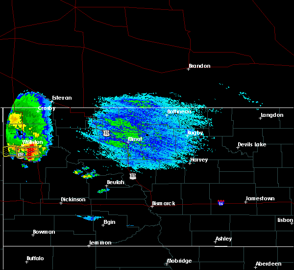 The national weather service in bismarck has issued a * severe thunderstorm warning for. north central mckenzie county in northwestern north dakota. south central williams county in northwestern north dakota. until 245 pm cdt. At 157 pm cdt, severe thunderstorms were located along a line. The national weather service in bismarck has issued a * severe thunderstorm warning for. north central mckenzie county in northwestern north dakota. south central williams county in northwestern north dakota. until 245 pm cdt. At 157 pm cdt, severe thunderstorms were located along a line.
|
| 7/21/2018 7:19 PM CDT |
 At 719 pm cdt/619 pm mdt/, severe thunderstorms were located along a line extending from 14 miles west of 4 bears lodge to near theodore roosevelt national park north unit to 9 miles northeast of skaar, moving southeast at 40 mph (trained weather spotters reported golf ball size hail north of watford city ). Hazards include golf ball size hail and 70 mph wind gusts. People and animals outdoors will be injured. expect hail damage to roofs, siding, windows, and vehicles. expect considerable tree damage. wind damage is also likely to mobile homes, roofs, and outbuildings. these severe storms will be near, theodore roosevelt national park north unit around 725 pm cdt. grassy butte around 640 pm mdt. mandaree around 650 pm mdt. little missouri state park around 700 pm mdt. Other locations impacted by these severe thunderstorms include white tail bay recreation area, sather dam, keene, rawson, tobacco garden bay recreation area, oakdale, charlson and johnsons corner. At 719 pm cdt/619 pm mdt/, severe thunderstorms were located along a line extending from 14 miles west of 4 bears lodge to near theodore roosevelt national park north unit to 9 miles northeast of skaar, moving southeast at 40 mph (trained weather spotters reported golf ball size hail north of watford city ). Hazards include golf ball size hail and 70 mph wind gusts. People and animals outdoors will be injured. expect hail damage to roofs, siding, windows, and vehicles. expect considerable tree damage. wind damage is also likely to mobile homes, roofs, and outbuildings. these severe storms will be near, theodore roosevelt national park north unit around 725 pm cdt. grassy butte around 640 pm mdt. mandaree around 650 pm mdt. little missouri state park around 700 pm mdt. Other locations impacted by these severe thunderstorms include white tail bay recreation area, sather dam, keene, rawson, tobacco garden bay recreation area, oakdale, charlson and johnsons corner.
|
| 7/21/2018 6:56 PM CDT |
 At 655 pm cdt/555 pm mdt/, severe thunderstorms were located along a line extending from 19 miles south of ray to near arnegard to 11 miles northeast of skaar, moving southeast at 35 mph. these are very dangerous storms (radar indicated). Hazards include 80 mph wind gusts and two inch hail. Flying debris will be dangerous to those caught without shelter. mobile homes will be heavily damaged. expect considerable damage to roofs, windows, and vehicles. extensive tree damage and power outages are likely. severe thunderstorms will be near, theodore roosevelt national park north unit around 625 pm mdt. grassy butte around 645 pm mdt. mandaree around 650 pm mdt. Other locations impacted by these severe thunderstorms include white tail bay recreation area, sather dam, cartwright, keene, lewis and clark state park, charbonneau, rawson, tobacco garden bay recreation area, oakdale and charlson. At 655 pm cdt/555 pm mdt/, severe thunderstorms were located along a line extending from 19 miles south of ray to near arnegard to 11 miles northeast of skaar, moving southeast at 35 mph. these are very dangerous storms (radar indicated). Hazards include 80 mph wind gusts and two inch hail. Flying debris will be dangerous to those caught without shelter. mobile homes will be heavily damaged. expect considerable damage to roofs, windows, and vehicles. extensive tree damage and power outages are likely. severe thunderstorms will be near, theodore roosevelt national park north unit around 625 pm mdt. grassy butte around 645 pm mdt. mandaree around 650 pm mdt. Other locations impacted by these severe thunderstorms include white tail bay recreation area, sather dam, cartwright, keene, lewis and clark state park, charbonneau, rawson, tobacco garden bay recreation area, oakdale and charlson.
|
| 7/21/2018 6:48 PM CDT |
 At 647 pm cdt/547 pm mdt/, a severe thunderstorm was located near arnegard, or 11 miles west of watford city, moving southeast at 35 mph. this is a very dangerous storm (emergency management). Hazards include 80 mph wind gusts and two inch hail. Flying debris will be dangerous to those caught without shelter. mobile homes will be heavily damaged. expect considerable damage to roofs, windows, and vehicles. extensive tree damage and power outages are likely. this severe storm will be near, arnegard around 655 pm cdt. watford city around 700 pm cdt. Other locations impacted by this severe thunderstorm include white tail bay recreation area, sather dam, cartwright, lewis and clark state park, fort buford state historical site, charbonneau, rawson, tobacco garden bay recreation area and trenton. At 647 pm cdt/547 pm mdt/, a severe thunderstorm was located near arnegard, or 11 miles west of watford city, moving southeast at 35 mph. this is a very dangerous storm (emergency management). Hazards include 80 mph wind gusts and two inch hail. Flying debris will be dangerous to those caught without shelter. mobile homes will be heavily damaged. expect considerable damage to roofs, windows, and vehicles. extensive tree damage and power outages are likely. this severe storm will be near, arnegard around 655 pm cdt. watford city around 700 pm cdt. Other locations impacted by this severe thunderstorm include white tail bay recreation area, sather dam, cartwright, lewis and clark state park, fort buford state historical site, charbonneau, rawson, tobacco garden bay recreation area and trenton.
|
| 7/21/2018 6:18 PM CDT |
 At 618 pm cdt/518 pm mdt/, a severe thunderstorm was located 11 miles southwest of williston, moving southeast at 25 mph. this is a very dangerous storm (emergency management reported strong winds, large hail and power outages around trenton). Hazards include 80 mph wind gusts and tennis ball size hail. Flying debris will be dangerous to those caught without shelter. mobile homes will be heavily damaged. expect considerable damage to roofs, windows, and vehicles. extensive tree damage and power outages are likely. this severe storm will be near, alexander around 645 pm cdt. arnegard around 700 pm cdt. Other locations impacted by this severe thunderstorm include white tail bay recreation area, sather dam, cartwright, lewis and clark state park, fort buford state historical site, charbonneau, rawson, tobacco garden bay recreation area and trenton. At 618 pm cdt/518 pm mdt/, a severe thunderstorm was located 11 miles southwest of williston, moving southeast at 25 mph. this is a very dangerous storm (emergency management reported strong winds, large hail and power outages around trenton). Hazards include 80 mph wind gusts and tennis ball size hail. Flying debris will be dangerous to those caught without shelter. mobile homes will be heavily damaged. expect considerable damage to roofs, windows, and vehicles. extensive tree damage and power outages are likely. this severe storm will be near, alexander around 645 pm cdt. arnegard around 700 pm cdt. Other locations impacted by this severe thunderstorm include white tail bay recreation area, sather dam, cartwright, lewis and clark state park, fort buford state historical site, charbonneau, rawson, tobacco garden bay recreation area and trenton.
|
| 7/21/2018 5:56 PM CDT |
 At 555 pm cdt/455 pm mdt/, a severe thunderstorm was located 7 miles northeast of fort union trading post, or 15 miles west of williston, moving southeast at 25 mph. this is a very dangerous storm (trained spotters have reported extensive damage in eastern montana with this storm). Hazards include 80 mph wind gusts and tennis ball size hail. Flying debris will be dangerous to those caught without shelter. mobile homes will be heavily damaged. expect considerable damage to roofs, windows, and vehicles. extensive tree damage and power outages are likely. this severe thunderstorm will be near, arnegard around 700 pm cdt. Other locations impacted by this severe thunderstorm include white tail bay recreation area, sather dam, cartwright, lewis and clark state park, fort buford state historical site, charbonneau, rawson, tobacco garden bay recreation area, trenton and spring brook. At 555 pm cdt/455 pm mdt/, a severe thunderstorm was located 7 miles northeast of fort union trading post, or 15 miles west of williston, moving southeast at 25 mph. this is a very dangerous storm (trained spotters have reported extensive damage in eastern montana with this storm). Hazards include 80 mph wind gusts and tennis ball size hail. Flying debris will be dangerous to those caught without shelter. mobile homes will be heavily damaged. expect considerable damage to roofs, windows, and vehicles. extensive tree damage and power outages are likely. this severe thunderstorm will be near, arnegard around 700 pm cdt. Other locations impacted by this severe thunderstorm include white tail bay recreation area, sather dam, cartwright, lewis and clark state park, fort buford state historical site, charbonneau, rawson, tobacco garden bay recreation area, trenton and spring brook.
|
| 7/10/2018 1:12 AM CDT |
 At 110 am cdt/1210 am mdt/, severe thunderstorms were located along a line extending from 12 miles northwest of 4 bears lodge to 10 miles east of theodore roosevelt national park north unit to 15 miles south of alexander, moving southeast at 30 mph (public. wind damage is being reported in watford city). Hazards include two inch hail and 70 mph wind gusts. People and animals outdoors will be injured. expect hail damage to roofs, siding, windows, and vehicles. expect considerable tree damage. wind damage is also likely to mobile homes, roofs, and outbuildings. these severe storms will be near, 4 bears lodge around 1235 am mdt. Other locations impacted by these severe thunderstorms include keene, charlson, skunk creek bay recreation area, rawson, johnsons corner and pouch point recreation area. At 110 am cdt/1210 am mdt/, severe thunderstorms were located along a line extending from 12 miles northwest of 4 bears lodge to 10 miles east of theodore roosevelt national park north unit to 15 miles south of alexander, moving southeast at 30 mph (public. wind damage is being reported in watford city). Hazards include two inch hail and 70 mph wind gusts. People and animals outdoors will be injured. expect hail damage to roofs, siding, windows, and vehicles. expect considerable tree damage. wind damage is also likely to mobile homes, roofs, and outbuildings. these severe storms will be near, 4 bears lodge around 1235 am mdt. Other locations impacted by these severe thunderstorms include keene, charlson, skunk creek bay recreation area, rawson, johnsons corner and pouch point recreation area.
|
| 7/10/2018 12:59 AM CDT |
 At 1242 am cdt/1142 pm mdt/, severe thunderstorms were located along a line extending from 12 miles east of watford city to 7 miles south of arnegard to 9 miles east of sidney, moving southeast at 30 mph (radar indicated). Hazards include two inch hail and 70 mph wind gusts. People and animals outdoors will be injured. expect hail damage to roofs, siding, windows, and vehicles. expect considerable tree damage. wind damage is also likely to mobile homes, roofs, and outbuildings. severe thunderstorms will be near, theodore roosevelt national park north unit around 100 am cdt. mandaree around 120 am cdt. Other locations impacted by these severe thunderstorms include watford city, keene, skunk creek bay recreation area, rawson, pouch point recreation area, tobacco garden bay recreation area, charlson and johnsons corner. At 1242 am cdt/1142 pm mdt/, severe thunderstorms were located along a line extending from 12 miles east of watford city to 7 miles south of arnegard to 9 miles east of sidney, moving southeast at 30 mph (radar indicated). Hazards include two inch hail and 70 mph wind gusts. People and animals outdoors will be injured. expect hail damage to roofs, siding, windows, and vehicles. expect considerable tree damage. wind damage is also likely to mobile homes, roofs, and outbuildings. severe thunderstorms will be near, theodore roosevelt national park north unit around 100 am cdt. mandaree around 120 am cdt. Other locations impacted by these severe thunderstorms include watford city, keene, skunk creek bay recreation area, rawson, pouch point recreation area, tobacco garden bay recreation area, charlson and johnsons corner.
|
| 7/10/2018 12:43 AM CDT |
 At 1242 am cdt/1142 pm mdt/, severe thunderstorms were located along a line extending from 12 miles east of watford city to 7 miles south of arnegard to 9 miles east of sidney, moving southeast at 30 mph (radar indicated). Hazards include two inch hail and 70 mph wind gusts. People and animals outdoors will be injured. expect hail damage to roofs, siding, windows, and vehicles. expect considerable tree damage. wind damage is also likely to mobile homes, roofs, and outbuildings. severe thunderstorms will be near, theodore roosevelt national park north unit around 100 am cdt. mandaree around 120 am cdt. Other locations impacted by these severe thunderstorms include watford city, keene, skunk creek bay recreation area, rawson, pouch point recreation area, tobacco garden bay recreation area, charlson and johnsons corner. At 1242 am cdt/1142 pm mdt/, severe thunderstorms were located along a line extending from 12 miles east of watford city to 7 miles south of arnegard to 9 miles east of sidney, moving southeast at 30 mph (radar indicated). Hazards include two inch hail and 70 mph wind gusts. People and animals outdoors will be injured. expect hail damage to roofs, siding, windows, and vehicles. expect considerable tree damage. wind damage is also likely to mobile homes, roofs, and outbuildings. severe thunderstorms will be near, theodore roosevelt national park north unit around 100 am cdt. mandaree around 120 am cdt. Other locations impacted by these severe thunderstorms include watford city, keene, skunk creek bay recreation area, rawson, pouch point recreation area, tobacco garden bay recreation area, charlson and johnsons corner.
|
| 7/10/2018 12:34 AM CDT | Storm damage reported in mckenzie county ND, 0.2 miles SSE of Arnegard, ND |
| 7/10/2018 12:29 AM CDT |
 At 1229 am cdt/1129 pm mdt/, severe thunderstorms were located along a line extending from 7 miles northeast of watford city to 6 miles southeast of alexander, moving southeast at 30 mph (radar indicated). Hazards include two inch hail and 70 mph wind gusts. People and animals outdoors will be injured. expect hail damage to roofs, siding, windows, and vehicles. expect considerable tree damage. wind damage is also likely to mobile homes, roofs, and outbuildings. these severe storms will be near, watford city around 1235 am cdt. Other locations impacted by these severe thunderstorms include white tail bay recreation area, cartwright, keene, lewis and clark state park, fort buford state historical site, charbonneau, rawson, tobacco garden bay recreation area, trenton and charlson. At 1229 am cdt/1129 pm mdt/, severe thunderstorms were located along a line extending from 7 miles northeast of watford city to 6 miles southeast of alexander, moving southeast at 30 mph (radar indicated). Hazards include two inch hail and 70 mph wind gusts. People and animals outdoors will be injured. expect hail damage to roofs, siding, windows, and vehicles. expect considerable tree damage. wind damage is also likely to mobile homes, roofs, and outbuildings. these severe storms will be near, watford city around 1235 am cdt. Other locations impacted by these severe thunderstorms include white tail bay recreation area, cartwright, keene, lewis and clark state park, fort buford state historical site, charbonneau, rawson, tobacco garden bay recreation area, trenton and charlson.
|
| 7/10/2018 12:15 AM CDT |
 At 1214 am cdt/1114 pm mdt/, severe thunderstorms were located along a line extending from 6 miles north of watford city to near alexander, moving southeast at 30 mph (radar indicated). Hazards include golf ball size hail and 70 mph wind gusts. People and animals outdoors will be injured. expect hail damage to roofs, siding, windows, and vehicles. expect considerable tree damage. wind damage is also likely to mobile homes, roofs, and outbuildings. these severe storms will be near, watford city around 1220 am cdt. arnegard around 1235 am cdt. Other locations impacted by these severe thunderstorms include cartwright, lewis and clark state park, charbonneau, charlson, spring brook, white tail bay recreation area, keene, fort buford state historical site, wheelock and rawson. At 1214 am cdt/1114 pm mdt/, severe thunderstorms were located along a line extending from 6 miles north of watford city to near alexander, moving southeast at 30 mph (radar indicated). Hazards include golf ball size hail and 70 mph wind gusts. People and animals outdoors will be injured. expect hail damage to roofs, siding, windows, and vehicles. expect considerable tree damage. wind damage is also likely to mobile homes, roofs, and outbuildings. these severe storms will be near, watford city around 1220 am cdt. arnegard around 1235 am cdt. Other locations impacted by these severe thunderstorms include cartwright, lewis and clark state park, charbonneau, charlson, spring brook, white tail bay recreation area, keene, fort buford state historical site, wheelock and rawson.
|
| 7/9/2018 11:55 PM CDT |
 At 1155 pm cdt/1055 pm mdt/, a severe thunderstorm was located 10 miles north of arnegard, or 12 miles northwest of watford city, moving southeast at 25 mph (radar indicated). Hazards include two inch hail and 70 mph wind gusts. People and animals outdoors will be injured. expect hail damage to roofs, siding, windows, and vehicles. expect considerable tree damage. wind damage is also likely to mobile homes, roofs, and outbuildings. this severe storm will be near, watford city around 1225 am cdt. Other locations impacted by this severe thunderstorm include cartwright, lewis and clark state park, charbonneau, charlson, spring brook, white tail bay recreation area, keene, fort buford state historical site, wheelock and rawson. At 1155 pm cdt/1055 pm mdt/, a severe thunderstorm was located 10 miles north of arnegard, or 12 miles northwest of watford city, moving southeast at 25 mph (radar indicated). Hazards include two inch hail and 70 mph wind gusts. People and animals outdoors will be injured. expect hail damage to roofs, siding, windows, and vehicles. expect considerable tree damage. wind damage is also likely to mobile homes, roofs, and outbuildings. this severe storm will be near, watford city around 1225 am cdt. Other locations impacted by this severe thunderstorm include cartwright, lewis and clark state park, charbonneau, charlson, spring brook, white tail bay recreation area, keene, fort buford state historical site, wheelock and rawson.
|
| 7/9/2018 11:42 PM CDT |
 At 1141 pm cdt/1041 pm mdt/, a severe thunderstorm was located 11 miles southeast of williston, moving southeast at 25 mph (public). Hazards include tennis ball size hail and 70 mph wind gusts. People and animals outdoors will be injured. expect hail damage to roofs, siding, windows, and vehicles. expect considerable tree damage. wind damage is also likely to mobile homes, roofs, and outbuildings. this severe thunderstorm will be near, watford city around 1225 am cdt. Other locations impacted by this severe thunderstorm include cartwright, lewis and clark state park, charbonneau, charlson, spring brook, white tail bay recreation area, keene, fort buford state historical site, wheelock and rawson. At 1141 pm cdt/1041 pm mdt/, a severe thunderstorm was located 11 miles southeast of williston, moving southeast at 25 mph (public). Hazards include tennis ball size hail and 70 mph wind gusts. People and animals outdoors will be injured. expect hail damage to roofs, siding, windows, and vehicles. expect considerable tree damage. wind damage is also likely to mobile homes, roofs, and outbuildings. this severe thunderstorm will be near, watford city around 1225 am cdt. Other locations impacted by this severe thunderstorm include cartwright, lewis and clark state park, charbonneau, charlson, spring brook, white tail bay recreation area, keene, fort buford state historical site, wheelock and rawson.
|
| 7/9/2018 10:00 PM CDT |
 At 959 pm cdt, a severe thunderstorm was located 6 miles northwest of williston, moving southeast at 25 mph. this is a very dangerous storm (radar indicated). Hazards include 80 mph wind gusts and baseball size hail. Flying debris will be dangerous to those caught without shelter. mobile homes will be heavily damaged. expect considerable damage to roofs, windows, and vehicles. extensive tree damage and power outages are likely. this severe storm will be near, williston around 1010 pm cdt. Other locations impacted by this severe thunderstorm include white tail bay recreation area, lewis and clark state park, charbonneau, wheelock, rawson, tobacco garden bay recreation area, trenton, spring brook and blacktail lake. At 959 pm cdt, a severe thunderstorm was located 6 miles northwest of williston, moving southeast at 25 mph. this is a very dangerous storm (radar indicated). Hazards include 80 mph wind gusts and baseball size hail. Flying debris will be dangerous to those caught without shelter. mobile homes will be heavily damaged. expect considerable damage to roofs, windows, and vehicles. extensive tree damage and power outages are likely. this severe storm will be near, williston around 1010 pm cdt. Other locations impacted by this severe thunderstorm include white tail bay recreation area, lewis and clark state park, charbonneau, wheelock, rawson, tobacco garden bay recreation area, trenton, spring brook and blacktail lake.
|
| 7/9/2018 9:42 PM CDT |
 At 941 pm cdt, a severe thunderstorm was located 7 miles south of bonetrail, or 14 miles northwest of williston, moving southeast at 30 mph. this is a very dangerous storm (radar indicated). Hazards include 80 mph wind gusts and baseball size hail. Flying debris will be dangerous to those caught without shelter. mobile homes will be heavily damaged. expect considerable damage to roofs, windows, and vehicles. extensive tree damage and power outages are likely. this severe thunderstorm will be near, williston around 1000 pm cdt. Other locations impacted by this severe thunderstorm include white tail bay recreation area, lewis and clark state park, charbonneau, wheelock, rawson, tobacco garden bay recreation area, trenton, spring brook and blacktail lake. At 941 pm cdt, a severe thunderstorm was located 7 miles south of bonetrail, or 14 miles northwest of williston, moving southeast at 30 mph. this is a very dangerous storm (radar indicated). Hazards include 80 mph wind gusts and baseball size hail. Flying debris will be dangerous to those caught without shelter. mobile homes will be heavily damaged. expect considerable damage to roofs, windows, and vehicles. extensive tree damage and power outages are likely. this severe thunderstorm will be near, williston around 1000 pm cdt. Other locations impacted by this severe thunderstorm include white tail bay recreation area, lewis and clark state park, charbonneau, wheelock, rawson, tobacco garden bay recreation area, trenton, spring brook and blacktail lake.
|
| 7/3/2018 11:54 PM CDT |
 At 1130 pm cdt/1030 pm mdt/, a severe thunderstorm was located 12 miles west of theodore roosevelt national park north unit, or 17 miles southwest of watford city, moving northeast at 25 mph (radar indicated). Hazards include 60 mph wind gusts and quarter size hail. Hail damage to vehicles is expected. expect wind damage to roofs, siding, and trees. this severe thunderstorm will be near, theodore roosevelt national park north unit around 1155 pm cdt. watford city around 1210 am cdt. Other locations impacted by this severe thunderstorm include johnsons corner and keene. At 1130 pm cdt/1030 pm mdt/, a severe thunderstorm was located 12 miles west of theodore roosevelt national park north unit, or 17 miles southwest of watford city, moving northeast at 25 mph (radar indicated). Hazards include 60 mph wind gusts and quarter size hail. Hail damage to vehicles is expected. expect wind damage to roofs, siding, and trees. this severe thunderstorm will be near, theodore roosevelt national park north unit around 1155 pm cdt. watford city around 1210 am cdt. Other locations impacted by this severe thunderstorm include johnsons corner and keene.
|
| 7/3/2018 11:30 PM CDT |
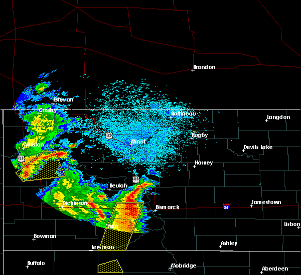 At 1130 pm cdt/1030 pm mdt/, a severe thunderstorm was located 12 miles west of theodore roosevelt national park north unit, or 17 miles southwest of watford city, moving northeast at 25 mph (radar indicated). Hazards include 60 mph wind gusts and quarter size hail. Hail damage to vehicles is expected. expect wind damage to roofs, siding, and trees. this severe thunderstorm will be near, theodore roosevelt national park north unit around 1155 pm cdt. watford city around 1210 am cdt. Other locations impacted by this severe thunderstorm include johnsons corner and keene. At 1130 pm cdt/1030 pm mdt/, a severe thunderstorm was located 12 miles west of theodore roosevelt national park north unit, or 17 miles southwest of watford city, moving northeast at 25 mph (radar indicated). Hazards include 60 mph wind gusts and quarter size hail. Hail damage to vehicles is expected. expect wind damage to roofs, siding, and trees. this severe thunderstorm will be near, theodore roosevelt national park north unit around 1155 pm cdt. watford city around 1210 am cdt. Other locations impacted by this severe thunderstorm include johnsons corner and keene.
|
| 7/3/2018 10:07 PM MDT |
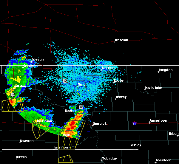 At 1106 pm cdt/1006 pm mdt/, a severe thunderstorm was located 19 miles south of alexander, or 22 miles southeast of sidney, moving northeast at 35 mph (radar indicated). Hazards include ping pong ball size hail and 60 mph wind gusts. People and animals outdoors will be injured. expect hail damage to roofs, siding, windows, and vehicles. expect wind damage to roofs, siding, and trees. Locations impacted include, arnegard and sather dam. At 1106 pm cdt/1006 pm mdt/, a severe thunderstorm was located 19 miles south of alexander, or 22 miles southeast of sidney, moving northeast at 35 mph (radar indicated). Hazards include ping pong ball size hail and 60 mph wind gusts. People and animals outdoors will be injured. expect hail damage to roofs, siding, windows, and vehicles. expect wind damage to roofs, siding, and trees. Locations impacted include, arnegard and sather dam.
|
| 7/3/2018 9:46 PM MDT |
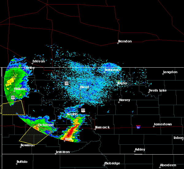 At 1046 pm cdt/946 pm mdt/, a severe thunderstorm was located 10 miles northeast of skaar, or 17 miles southeast of sidney, moving northeast at 35 mph (radar indicated). Hazards include ping pong ball size hail and 60 mph wind gusts. People and animals outdoors will be injured. expect hail damage to roofs, siding, windows, and vehicles. expect wind damage to roofs, siding, and trees. Locations impacted include, arnegard and sather dam. At 1046 pm cdt/946 pm mdt/, a severe thunderstorm was located 10 miles northeast of skaar, or 17 miles southeast of sidney, moving northeast at 35 mph (radar indicated). Hazards include ping pong ball size hail and 60 mph wind gusts. People and animals outdoors will be injured. expect hail damage to roofs, siding, windows, and vehicles. expect wind damage to roofs, siding, and trees. Locations impacted include, arnegard and sather dam.
|
| 7/3/2018 9:24 PM MDT |
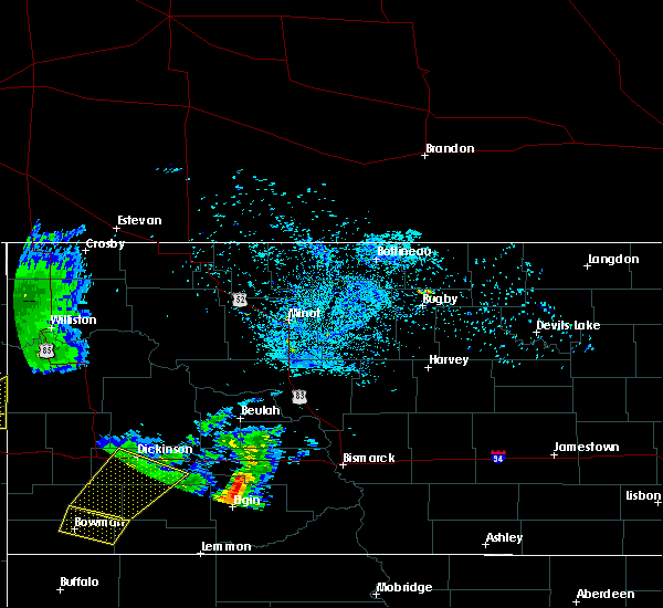 At 1023 pm cdt/923 pm mdt/, a severe thunderstorm was located 7 miles southeast of savage, or 21 miles south of sidney, moving northeast at 35 mph (radar indicated). Hazards include golf ball size hail and 60 mph wind gusts. People and animals outdoors will be injured. expect hail damage to roofs, siding, windows, and vehicles. expect wind damage to roofs, siding, and trees. This severe thunderstorm will remain over mainly rural areas of southwestern mckenzie county, including the following locations, sather dam. At 1023 pm cdt/923 pm mdt/, a severe thunderstorm was located 7 miles southeast of savage, or 21 miles south of sidney, moving northeast at 35 mph (radar indicated). Hazards include golf ball size hail and 60 mph wind gusts. People and animals outdoors will be injured. expect hail damage to roofs, siding, windows, and vehicles. expect wind damage to roofs, siding, and trees. This severe thunderstorm will remain over mainly rural areas of southwestern mckenzie county, including the following locations, sather dam.
|
| 6/28/2018 10:14 PM CDT |
 At 1013 pm cdt/913 pm mdt/, severe thunderstorms were located along a line extending from 8 miles northwest of battleview to 16 miles west of 4 bears lodge to near killdeer, moving east at 60 mph. these are very dangerous storms (trained weather spotters reported 80 mph winds 4 miles north of ray). Hazards include 80 mph wind gusts and quarter size hail. Flying debris will be dangerous to those caught without shelter. mobile homes will be heavily damaged. expect considerable damage to roofs, windows, and vehicles. extensive tree damage and power outages are likely. these severe storms will be near, battleview around 1020 pm cdt. 4 bears lodge around 1030 pm cdt. new town around 1035 pm cdt. belden around 1040 pm cdt. other locations impacted by these severe thunderstorms include hamlet, white earth, lewis and clark state park, white earth bay recreation area, pouch point recreation area, oakdale, charlson, spring brook, white tail bay recreation area and keene. A tornado watch remains in effect until 1100 pm cdt/1000 pm mdt/ for south central, southwestern, north central and northwestern north dakota. At 1013 pm cdt/913 pm mdt/, severe thunderstorms were located along a line extending from 8 miles northwest of battleview to 16 miles west of 4 bears lodge to near killdeer, moving east at 60 mph. these are very dangerous storms (trained weather spotters reported 80 mph winds 4 miles north of ray). Hazards include 80 mph wind gusts and quarter size hail. Flying debris will be dangerous to those caught without shelter. mobile homes will be heavily damaged. expect considerable damage to roofs, windows, and vehicles. extensive tree damage and power outages are likely. these severe storms will be near, battleview around 1020 pm cdt. 4 bears lodge around 1030 pm cdt. new town around 1035 pm cdt. belden around 1040 pm cdt. other locations impacted by these severe thunderstorms include hamlet, white earth, lewis and clark state park, white earth bay recreation area, pouch point recreation area, oakdale, charlson, spring brook, white tail bay recreation area and keene. A tornado watch remains in effect until 1100 pm cdt/1000 pm mdt/ for south central, southwestern, north central and northwestern north dakota.
|
| 6/28/2018 9:59 PM CDT |
 At 958 pm cdt/858 pm mdt/, severe thunderstorms were located along a line extending from wildrose to 17 miles north of watford city to 10 miles east of grassy butte, moving east at 65 mph (emergency management reported 68 mph winds in williston). Hazards include 70 mph wind gusts and quarter size hail. Hail damage to vehicles is expected. expect considerable tree damage. wind damage is also likely to mobile homes, roofs, and outbuildings. these severe storms will be near, battleview around 1015 pm cdt. powers lake around 1020 pm cdt. 4 bears lodge around 1025 pm cdt. new town around 1030 pm cdt. belden around 1035 pm cdt. other locations impacted by these severe thunderstorms include hamlet, white earth, lewis and clark state park, white earth bay recreation area, pouch point recreation area, oakdale, charlson, spring brook, white tail bay recreation area and keene. A tornado watch remains in effect until 1100 pm cdt/1000 pm mdt/ for south central, southwestern, north central and northwestern north dakota. At 958 pm cdt/858 pm mdt/, severe thunderstorms were located along a line extending from wildrose to 17 miles north of watford city to 10 miles east of grassy butte, moving east at 65 mph (emergency management reported 68 mph winds in williston). Hazards include 70 mph wind gusts and quarter size hail. Hail damage to vehicles is expected. expect considerable tree damage. wind damage is also likely to mobile homes, roofs, and outbuildings. these severe storms will be near, battleview around 1015 pm cdt. powers lake around 1020 pm cdt. 4 bears lodge around 1025 pm cdt. new town around 1030 pm cdt. belden around 1035 pm cdt. other locations impacted by these severe thunderstorms include hamlet, white earth, lewis and clark state park, white earth bay recreation area, pouch point recreation area, oakdale, charlson, spring brook, white tail bay recreation area and keene. A tornado watch remains in effect until 1100 pm cdt/1000 pm mdt/ for south central, southwestern, north central and northwestern north dakota.
|
| 6/28/2018 9:46 PM CDT |
 The national weather service in bismarck has issued a * severe thunderstorm warning for. northern dunn county in southwestern north dakota. southern burke county in northwestern north dakota. central mckenzie county in northwestern north dakota. Eastern williams county in northwestern north dakota. The national weather service in bismarck has issued a * severe thunderstorm warning for. northern dunn county in southwestern north dakota. southern burke county in northwestern north dakota. central mckenzie county in northwestern north dakota. Eastern williams county in northwestern north dakota.
|
| 6/28/2018 9:27 PM CDT |
 At 926 pm cdt/826 pm mdt/, severe thunderstorms were located along a line extending from 6 miles east of bonetrail to 18 miles northeast of trotters, moving east at 60 mph (emergency management reported 65 mph winds 8 miles west of williston). Hazards include 70 mph wind gusts and quarter size hail. Hail damage to vehicles is expected. expect considerable tree damage. wind damage is also likely to mobile homes, roofs, and outbuildings. these severe storms will be near, theodore roosevelt national park north unit around 945 pm cdt. other locations impacted by these severe thunderstorms include zahl, sather dam, cartwright, lewis and clark state park, charbonneau, appam, charlson, spring brook, white tail bay recreation area and keene. A tornado watch remains in effect until 1100 pm cdt/1000 pm mdt/ for southwestern and northwestern north dakota. At 926 pm cdt/826 pm mdt/, severe thunderstorms were located along a line extending from 6 miles east of bonetrail to 18 miles northeast of trotters, moving east at 60 mph (emergency management reported 65 mph winds 8 miles west of williston). Hazards include 70 mph wind gusts and quarter size hail. Hail damage to vehicles is expected. expect considerable tree damage. wind damage is also likely to mobile homes, roofs, and outbuildings. these severe storms will be near, theodore roosevelt national park north unit around 945 pm cdt. other locations impacted by these severe thunderstorms include zahl, sather dam, cartwright, lewis and clark state park, charbonneau, appam, charlson, spring brook, white tail bay recreation area and keene. A tornado watch remains in effect until 1100 pm cdt/1000 pm mdt/ for southwestern and northwestern north dakota.
|
| 6/28/2018 9:15 PM CDT |
 At 915 pm cdt/815 pm mdt/, severe thunderstorms were located along a line extending from bonetrail to 13 miles northeast of skaar, moving east at 60 mph (radar indicated). Hazards include 70 mph wind gusts and quarter size hail. Hail damage to vehicles is expected. expect considerable tree damage. wind damage is also likely to mobile homes, roofs, and outbuildings. these severe storms will be near, bonetrail around 920 pm cdt. alamo around 935 pm cdt. theodore roosevelt national park north unit around 945 pm cdt. other locations impacted by these severe thunderstorms include zahl, sather dam, cartwright, lewis and clark state park, charbonneau, appam, charlson, spring brook, white tail bay recreation area and keene. A tornado watch remains in effect until 1100 pm cdt/1000 pm mdt/ for southwestern and northwestern north dakota. At 915 pm cdt/815 pm mdt/, severe thunderstorms were located along a line extending from bonetrail to 13 miles northeast of skaar, moving east at 60 mph (radar indicated). Hazards include 70 mph wind gusts and quarter size hail. Hail damage to vehicles is expected. expect considerable tree damage. wind damage is also likely to mobile homes, roofs, and outbuildings. these severe storms will be near, bonetrail around 920 pm cdt. alamo around 935 pm cdt. theodore roosevelt national park north unit around 945 pm cdt. other locations impacted by these severe thunderstorms include zahl, sather dam, cartwright, lewis and clark state park, charbonneau, appam, charlson, spring brook, white tail bay recreation area and keene. A tornado watch remains in effect until 1100 pm cdt/1000 pm mdt/ for southwestern and northwestern north dakota.
|
| 6/28/2018 8:47 PM CDT |
 At 847 pm cdt/747 pm mdt/, severe thunderstorms were located along a line extending from near froid to 4 miles west of savage, moving east at 60 mph (radar indicated). Hazards include 70 mph wind gusts and quarter size hail. Hail damage to vehicles is expected. expect considerable tree damage. wind damage is also likely to mobile homes, roofs, and outbuildings. severe thunderstorms will be near, bonetrail around 915 pm cdt. alamo around 935 pm cdt. theodore roosevelt national park north unit around 940 pm cdt. other locations impacted by these severe thunderstorms include zahl, sather dam, cartwright, lewis and clark state park, charbonneau, appam, charlson, spring brook, white tail bay recreation area and keene. A tornado watch remains in effect until 1100 pm cdt/1000 pm mdt/ for southwestern and northwestern north dakota. At 847 pm cdt/747 pm mdt/, severe thunderstorms were located along a line extending from near froid to 4 miles west of savage, moving east at 60 mph (radar indicated). Hazards include 70 mph wind gusts and quarter size hail. Hail damage to vehicles is expected. expect considerable tree damage. wind damage is also likely to mobile homes, roofs, and outbuildings. severe thunderstorms will be near, bonetrail around 915 pm cdt. alamo around 935 pm cdt. theodore roosevelt national park north unit around 940 pm cdt. other locations impacted by these severe thunderstorms include zahl, sather dam, cartwright, lewis and clark state park, charbonneau, appam, charlson, spring brook, white tail bay recreation area and keene. A tornado watch remains in effect until 1100 pm cdt/1000 pm mdt/ for southwestern and northwestern north dakota.
|
| 6/28/2018 4:38 PM CDT |
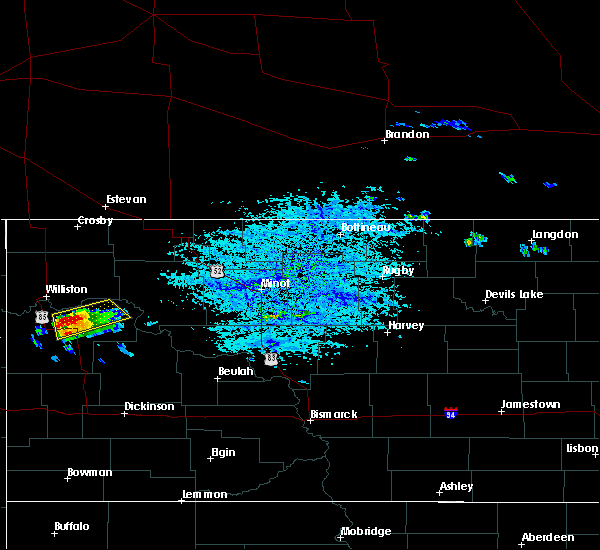 At 438 pm cdt, a severe thunderstorm was located 9 miles north of watford city, moving northeast at 35 mph (radar indicated). Hazards include ping pong ball size hail and 60 mph wind gusts. People and animals outdoors will be injured. expect hail damage to roofs, siding, windows, and vehicles. expect wind damage to roofs, siding, and trees. locations impacted include, watford city, arnegard, keene and charlson. A tornado watch remains in effect until 1100 pm cdt for northwestern north dakota. At 438 pm cdt, a severe thunderstorm was located 9 miles north of watford city, moving northeast at 35 mph (radar indicated). Hazards include ping pong ball size hail and 60 mph wind gusts. People and animals outdoors will be injured. expect hail damage to roofs, siding, windows, and vehicles. expect wind damage to roofs, siding, and trees. locations impacted include, watford city, arnegard, keene and charlson. A tornado watch remains in effect until 1100 pm cdt for northwestern north dakota.
|
| 6/28/2018 4:25 PM CDT |
 At 424 pm cdt, a severe thunderstorm was located 5 miles northwest of watford city, moving northeast at 45 mph (radar indicated). Hazards include ping pong ball size hail. People and animals outdoors will be injured. expect damage to roofs, siding, windows, and vehicles. this severe thunderstorm will remain over mainly rural areas of northeastern mckenzie county, including the following locations, rawson, keene and charlson. A tornado watch remains in effect until 1100 pm cdt for northwestern north dakota. At 424 pm cdt, a severe thunderstorm was located 5 miles northwest of watford city, moving northeast at 45 mph (radar indicated). Hazards include ping pong ball size hail. People and animals outdoors will be injured. expect damage to roofs, siding, windows, and vehicles. this severe thunderstorm will remain over mainly rural areas of northeastern mckenzie county, including the following locations, rawson, keene and charlson. A tornado watch remains in effect until 1100 pm cdt for northwestern north dakota.
|
| 6/28/2018 4:17 PM CDT |
 At 417 pm cdt, a severe thunderstorm was located over arnegard, or 8 miles west of watford city, moving northeast at 45 mph (radar indicated). Hazards include quarter size hail. Damage to vehicles is expected. this severe thunderstorm will be near, watford city around 425 pm cdt. other locations impacted by this severe thunderstorm include rawson, keene and charlson. A tornado watch remains in effect until 1100 pm cdt for northwestern north dakota. At 417 pm cdt, a severe thunderstorm was located over arnegard, or 8 miles west of watford city, moving northeast at 45 mph (radar indicated). Hazards include quarter size hail. Damage to vehicles is expected. this severe thunderstorm will be near, watford city around 425 pm cdt. other locations impacted by this severe thunderstorm include rawson, keene and charlson. A tornado watch remains in effect until 1100 pm cdt for northwestern north dakota.
|
| 6/1/2018 5:01 PM CDT |
 At 500 pm cdt/400 pm mdt/, severe thunderstorms were located along a line extending from 4 miles northeast of arnegard to 9 miles southeast of grassy butte, moving north at 70 mph (radar indicated). Hazards include 60 mph wind gusts and quarter size hail. Hail damage to vehicles is expected. Expect wind damage to roofs, siding, and trees. At 500 pm cdt/400 pm mdt/, severe thunderstorms were located along a line extending from 4 miles northeast of arnegard to 9 miles southeast of grassy butte, moving north at 70 mph (radar indicated). Hazards include 60 mph wind gusts and quarter size hail. Hail damage to vehicles is expected. Expect wind damage to roofs, siding, and trees.
|
| 6/1/2018 4:50 PM CDT |
 At 447 pm cdt/347 pm mdt/, a severe thunderstorm was located near theodore roosevelt national park north unit, or 18 miles south of watford city, moving north at 35 mph. a tornado warning is also in effect for areas near grassy butte and the north unit of theodore roosevelt national park. campers and hikers should seek a sturdy shelter (radar indicated). Hazards include 60 mph wind gusts and half dollar size hail. a tornado is also a hazard near grassy butte and theodore roosevelt national park. Hail damage to vehicles is expected. expect wind damage to roofs, siding, and trees. locations impacted include, watford city, arnegard, theodore roosevelt national park north unit, tobacco garden bay recreation area and rawson. A tornado watch remains in effect until 1100 pm cdt/1000 pm mdt/ for northwestern north dakota. At 447 pm cdt/347 pm mdt/, a severe thunderstorm was located near theodore roosevelt national park north unit, or 18 miles south of watford city, moving north at 35 mph. a tornado warning is also in effect for areas near grassy butte and the north unit of theodore roosevelt national park. campers and hikers should seek a sturdy shelter (radar indicated). Hazards include 60 mph wind gusts and half dollar size hail. a tornado is also a hazard near grassy butte and theodore roosevelt national park. Hail damage to vehicles is expected. expect wind damage to roofs, siding, and trees. locations impacted include, watford city, arnegard, theodore roosevelt national park north unit, tobacco garden bay recreation area and rawson. A tornado watch remains in effect until 1100 pm cdt/1000 pm mdt/ for northwestern north dakota.
|
| 6/1/2018 4:36 PM CDT |
 At 434 pm cdt/334 pm mdt/, a severe thunderstorm was located 7 miles west of grassy butte, or 29 miles south of watford city, moving north at 20 mph (radar indicated). Hazards include 60 mph wind gusts and half dollar size hail. a tornado warning is also in effect for the grassy butte area and the north unit of theodore roosevelt national park. Hail damage to vehicles is expected. expect wind damage to roofs, siding, and trees. locations impacted include, watford city, alexander, arnegard, theodore roosevelt national park north unit, tobacco garden bay recreation area and rawson. A tornado watch remains in effect until 1100 pm cdt/1000 pm mdt/ for northwestern north dakota. At 434 pm cdt/334 pm mdt/, a severe thunderstorm was located 7 miles west of grassy butte, or 29 miles south of watford city, moving north at 20 mph (radar indicated). Hazards include 60 mph wind gusts and half dollar size hail. a tornado warning is also in effect for the grassy butte area and the north unit of theodore roosevelt national park. Hail damage to vehicles is expected. expect wind damage to roofs, siding, and trees. locations impacted include, watford city, alexander, arnegard, theodore roosevelt national park north unit, tobacco garden bay recreation area and rawson. A tornado watch remains in effect until 1100 pm cdt/1000 pm mdt/ for northwestern north dakota.
|
| 6/1/2018 4:21 PM CDT |
 At 420 pm cdt/320 pm mdt/, a severe thunderstorm was located 9 miles southwest of grassy butte, or 31 miles west of killdeer, moving north at 25 mph (radar indicated). Hazards include 60 mph wind gusts and quarter size hail. some rotation was detected on doppler radar. severe storms can produce tornadoes. Hail damage to vehicles is expected. expect wind damage to roofs, siding, and trees. locations impacted include, watford city, alexander, arnegard, theodore roosevelt national park north unit, tobacco garden bay recreation area and rawson. A tornado watch remains in effect until 1100 pm cdt/1000 pm mdt/ for northwestern north dakota. At 420 pm cdt/320 pm mdt/, a severe thunderstorm was located 9 miles southwest of grassy butte, or 31 miles west of killdeer, moving north at 25 mph (radar indicated). Hazards include 60 mph wind gusts and quarter size hail. some rotation was detected on doppler radar. severe storms can produce tornadoes. Hail damage to vehicles is expected. expect wind damage to roofs, siding, and trees. locations impacted include, watford city, alexander, arnegard, theodore roosevelt national park north unit, tobacco garden bay recreation area and rawson. A tornado watch remains in effect until 1100 pm cdt/1000 pm mdt/ for northwestern north dakota.
|
| 6/1/2018 4:07 PM CDT |
 At 407 pm cdt/307 pm mdt/, a severe thunderstorm was located 14 miles west of grassy butte, or 34 miles south of watford city, moving north at 20 mph (radar indicated). Hazards include 60 mph wind gusts and quarter size hail. Hail damage to vehicles is expected. Expect wind damage to roofs, siding, and trees. At 407 pm cdt/307 pm mdt/, a severe thunderstorm was located 14 miles west of grassy butte, or 34 miles south of watford city, moving north at 20 mph (radar indicated). Hazards include 60 mph wind gusts and quarter size hail. Hail damage to vehicles is expected. Expect wind damage to roofs, siding, and trees.
|
| 5/31/2018 3:34 AM CDT |
 At 333 am cdt, a severe thunderstorm was located over watford city, moving northeast at 20 mph (radar indicated). Hazards include 60 mph wind gusts and quarter size hail. Hail damage to vehicles is expected. expect wind damage to roofs, siding, and trees. Locations impacted include, watford city, arnegard and rawson. At 333 am cdt, a severe thunderstorm was located over watford city, moving northeast at 20 mph (radar indicated). Hazards include 60 mph wind gusts and quarter size hail. Hail damage to vehicles is expected. expect wind damage to roofs, siding, and trees. Locations impacted include, watford city, arnegard and rawson.
|
| 5/31/2018 3:16 AM CDT |
 At 300 am cdt/200 am mdt/, a severe thunderstorm was located 10 miles southwest of arnegard, or 15 miles southwest of watford city, moving east at 20 mph (radar indicated). Hazards include 60 mph wind gusts and quarter size hail. Hail damage to vehicles is expected. expect wind damage to roofs, siding, and trees. this severe thunderstorm will be near, arnegard around 325 am cdt. watford city around 345 am cdt. Other locations impacted by this severe thunderstorm include rawson. At 300 am cdt/200 am mdt/, a severe thunderstorm was located 10 miles southwest of arnegard, or 15 miles southwest of watford city, moving east at 20 mph (radar indicated). Hazards include 60 mph wind gusts and quarter size hail. Hail damage to vehicles is expected. expect wind damage to roofs, siding, and trees. this severe thunderstorm will be near, arnegard around 325 am cdt. watford city around 345 am cdt. Other locations impacted by this severe thunderstorm include rawson.
|
| 5/31/2018 3:00 AM CDT |
 The national weather service in bismarck has issued a * severe thunderstorm warning for. central mckenzie county in northwestern north dakota. until 400 am cdt/300 am mdt/. At 300 am cdt/200 am mdt/, a severe thunderstorm was located 10 miles southwest of arnegard, or 15 miles southwest of watford city,. The national weather service in bismarck has issued a * severe thunderstorm warning for. central mckenzie county in northwestern north dakota. until 400 am cdt/300 am mdt/. At 300 am cdt/200 am mdt/, a severe thunderstorm was located 10 miles southwest of arnegard, or 15 miles southwest of watford city,.
|
| 5/27/2018 1:47 AM CDT |
 At 147 am cdt/1247 am mdt/, severe thunderstorms were located along a line extending from 18 miles northeast of watford city to 11 miles west of mandaree to 5 miles south of grassy butte, moving northeast at 45 mph (radar indicated). Hazards include 70 mph wind gusts and quarter size hail. Hail damage to vehicles is expected. expect considerable tree damage. wind damage is also likely to mobile homes, roofs, and outbuildings. Locations impacted include, watford city, arnegard, theodore roosevelt national park north unit, grassy butte, trotters, skaar, keene, rawson, tobacco garden bay recreation area, charlson and johnsons corner. At 147 am cdt/1247 am mdt/, severe thunderstorms were located along a line extending from 18 miles northeast of watford city to 11 miles west of mandaree to 5 miles south of grassy butte, moving northeast at 45 mph (radar indicated). Hazards include 70 mph wind gusts and quarter size hail. Hail damage to vehicles is expected. expect considerable tree damage. wind damage is also likely to mobile homes, roofs, and outbuildings. Locations impacted include, watford city, arnegard, theodore roosevelt national park north unit, grassy butte, trotters, skaar, keene, rawson, tobacco garden bay recreation area, charlson and johnsons corner.
|
| 5/27/2018 1:28 AM CDT |
 At 127 am cdt/1227 am mdt/, severe thunderstorms were located along a line extending from 12 miles northeast of watford city to theodore roosevelt national park north unit to 15 miles southeast of trotters, moving east at 50 mph (radar indicated). Hazards include 70 mph wind gusts and quarter size hail. Hail damage to vehicles is expected. expect considerable tree damage. wind damage is also likely to mobile homes, roofs, and outbuildings. Locations impacted include, watford city, alexander, arnegard, grassy butte, skaar, theodore roosevelt national park north unit, trotters, keene, sather dam, charlson, rawson, tobacco garden bay recreation area and johnsons corner. At 127 am cdt/1227 am mdt/, severe thunderstorms were located along a line extending from 12 miles northeast of watford city to theodore roosevelt national park north unit to 15 miles southeast of trotters, moving east at 50 mph (radar indicated). Hazards include 70 mph wind gusts and quarter size hail. Hail damage to vehicles is expected. expect considerable tree damage. wind damage is also likely to mobile homes, roofs, and outbuildings. Locations impacted include, watford city, alexander, arnegard, grassy butte, skaar, theodore roosevelt national park north unit, trotters, keene, sather dam, charlson, rawson, tobacco garden bay recreation area and johnsons corner.
|
| 5/27/2018 1:15 AM CDT |
 At 113 am cdt/1213 am mdt/, severe thunderstorms were located along a line extending from 8 miles north of watford city to 5 miles south of trotters, moving east at 45 mph (public. at 108 am cdt wind damage was reported in arnegard). Hazards include 70 mph wind gusts and quarter size hail. Hail damage to vehicles is expected. expect considerable tree damage. wind damage is also likely to mobile homes, roofs, and outbuildings. Locations impacted include, watford city, alexander, arnegard, grassy butte, skaar, theodore roosevelt national park north unit, trotters, keene, sather dam, cartwright, charbonneau, charlson, rawson, tobacco garden bay recreation area and johnsons corner. At 113 am cdt/1213 am mdt/, severe thunderstorms were located along a line extending from 8 miles north of watford city to 5 miles south of trotters, moving east at 45 mph (public. at 108 am cdt wind damage was reported in arnegard). Hazards include 70 mph wind gusts and quarter size hail. Hail damage to vehicles is expected. expect considerable tree damage. wind damage is also likely to mobile homes, roofs, and outbuildings. Locations impacted include, watford city, alexander, arnegard, grassy butte, skaar, theodore roosevelt national park north unit, trotters, keene, sather dam, cartwright, charbonneau, charlson, rawson, tobacco garden bay recreation area and johnsons corner.
|
| 5/27/2018 1:08 AM CDT | A barn was reported damaged. report relayed by state radi in mckenzie county ND, 1.5 miles E of Arnegard, ND |
| 5/27/2018 1:07 AM CDT | Corrects previous tstm wnd dmg report from 1 wnw arnegard. a barn (mobile home sized) was heavily damaged. estimated winds were 70 mp in mckenzie county ND, 1.5 miles E of Arnegard, ND |
| 5/27/2018 12:55 AM CDT |
 At 1253 am cdt/1153 pm mdt/, severe thunderstorms were located along a line extending from 9 miles northeast of alexander to 14 miles southeast of intake, moving east at 40 mph (radar indicated). Hazards include 70 mph wind gusts and quarter size hail. Hail damage to vehicles is expected. expect considerable tree damage. Wind damage is also likely to mobile homes, roofs, and outbuildings. At 1253 am cdt/1153 pm mdt/, severe thunderstorms were located along a line extending from 9 miles northeast of alexander to 14 miles southeast of intake, moving east at 40 mph (radar indicated). Hazards include 70 mph wind gusts and quarter size hail. Hail damage to vehicles is expected. expect considerable tree damage. Wind damage is also likely to mobile homes, roofs, and outbuildings.
|
| 5/27/2018 12:42 AM CDT |
 At 1241 am cdt/1141 pm mdt/, severe thunderstorms were located along a line extending from 6 miles northwest of alexander to near skaar, moving east at 35 mph (radar indicated). Hazards include 70 mph wind gusts and quarter size hail. Hail damage to vehicles is expected. expect considerable tree damage. wind damage is also likely to mobile homes, roofs, and outbuildings. Locations impacted include, alexander, arnegard, fort union trading post, sather dam, cartwright, charbonneau and rawson. At 1241 am cdt/1141 pm mdt/, severe thunderstorms were located along a line extending from 6 miles northwest of alexander to near skaar, moving east at 35 mph (radar indicated). Hazards include 70 mph wind gusts and quarter size hail. Hail damage to vehicles is expected. expect considerable tree damage. wind damage is also likely to mobile homes, roofs, and outbuildings. Locations impacted include, alexander, arnegard, fort union trading post, sather dam, cartwright, charbonneau and rawson.
|
| 5/27/2018 12:26 AM CDT |
 At 1226 am cdt/1126 pm mdt/, severe thunderstorms were located along a line extending from 11 miles east of fort union trading post to 11 miles southwest of skaar, moving east at 35 mph (radar indicated). Hazards include 70 mph wind gusts and quarter size hail. Hail damage to vehicles is expected. expect considerable tree damage. wind damage is also likely to mobile homes, roofs, and outbuildings. Locations impacted include, alexander, arnegard, fort union trading post, sather dam, cartwright, charbonneau and rawson. At 1226 am cdt/1126 pm mdt/, severe thunderstorms were located along a line extending from 11 miles east of fort union trading post to 11 miles southwest of skaar, moving east at 35 mph (radar indicated). Hazards include 70 mph wind gusts and quarter size hail. Hail damage to vehicles is expected. expect considerable tree damage. wind damage is also likely to mobile homes, roofs, and outbuildings. Locations impacted include, alexander, arnegard, fort union trading post, sather dam, cartwright, charbonneau and rawson.
|
| 5/27/2018 12:06 AM CDT |
 At 1205 am cdt/1105 pm mdt/, severe thunderstorms were located along a line extending from fort union trading post to near intake, moving east at 30 mph (radar indicated). Hazards include 60 mph wind gusts and quarter size hail. Hail damage to vehicles is expected. expect wind damage to roofs, siding, and trees. severe thunderstorms will be near, fort union trading post around 1110 pm mdt. Other locations impacted by these severe thunderstorms include sather dam, cartwright, charbonneau and rawson. At 1205 am cdt/1105 pm mdt/, severe thunderstorms were located along a line extending from fort union trading post to near intake, moving east at 30 mph (radar indicated). Hazards include 60 mph wind gusts and quarter size hail. Hail damage to vehicles is expected. expect wind damage to roofs, siding, and trees. severe thunderstorms will be near, fort union trading post around 1110 pm mdt. Other locations impacted by these severe thunderstorms include sather dam, cartwright, charbonneau and rawson.
|
| 7/20/2017 4:05 PM CDT |
 At 403 pm cdt/303 pm mdt/, a severe thunderstorm was located 8 miles south of arnegard, or 11 miles southwest of watford city, moving east at 35 mph. another thunderstorm was located between wooley in eastern montana and east fairview in mckenzie county in north dakota. this storm was intensifying, and moving east at around 35 mph (radar indicated). Hazards include 60 mph wind gusts and quarter size hail. Hail damage to vehicles is expected. expect wind damage to roofs, siding, and trees. Locations impacted include, watford city, alexander, arnegard, east fairview, sather dam, cartwright, charbonneau and rawson. At 403 pm cdt/303 pm mdt/, a severe thunderstorm was located 8 miles south of arnegard, or 11 miles southwest of watford city, moving east at 35 mph. another thunderstorm was located between wooley in eastern montana and east fairview in mckenzie county in north dakota. this storm was intensifying, and moving east at around 35 mph (radar indicated). Hazards include 60 mph wind gusts and quarter size hail. Hail damage to vehicles is expected. expect wind damage to roofs, siding, and trees. Locations impacted include, watford city, alexander, arnegard, east fairview, sather dam, cartwright, charbonneau and rawson.
|
| 7/20/2017 3:33 PM CDT |
 At 332 pm cdt/232 pm mdt/, a severe thunderstorm was located near sather dam, 11 miles southwest of alexander, or 16 miles east of sidney, moving east at 35 mph (radar indicated). Hazards include 60 mph wind gusts and quarter size hail. Hail damage to vehicles is expected. expect wind damage to roofs, siding, and trees. Locations impacted include, watford city, alexander, arnegard, east fairview, sather dam, cartwright, charbonneau and rawson. At 332 pm cdt/232 pm mdt/, a severe thunderstorm was located near sather dam, 11 miles southwest of alexander, or 16 miles east of sidney, moving east at 35 mph (radar indicated). Hazards include 60 mph wind gusts and quarter size hail. Hail damage to vehicles is expected. expect wind damage to roofs, siding, and trees. Locations impacted include, watford city, alexander, arnegard, east fairview, sather dam, cartwright, charbonneau and rawson.
|
| 7/20/2017 3:15 PM CDT |
 The national weather service in bismarck has issued a * severe thunderstorm warning for. northwestern mckenzie county in northwestern north dakota. Until 415 pm cdt/315 pm mdt/ * at 315 pm cdt/215 pm mdt/, a severe thunderstorm was located 5 miles northeast of sidney, moving northeast at 35 mph. The national weather service in bismarck has issued a * severe thunderstorm warning for. northwestern mckenzie county in northwestern north dakota. Until 415 pm cdt/315 pm mdt/ * at 315 pm cdt/215 pm mdt/, a severe thunderstorm was located 5 miles northeast of sidney, moving northeast at 35 mph.
|
| 6/14/2017 1:25 AM CDT |
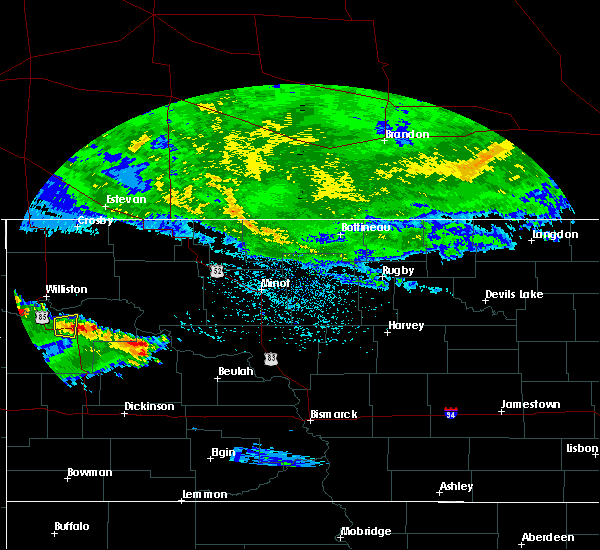 At 125 am cdt, a severe thunderstorm was located over watford city, moving north at 5 mph (radar indicated). Hazards include quarter size hail. Damage to vehicles is expected. Locations impacted include, arnegard. At 125 am cdt, a severe thunderstorm was located over watford city, moving north at 5 mph (radar indicated). Hazards include quarter size hail. Damage to vehicles is expected. Locations impacted include, arnegard.
|
| 6/14/2017 1:18 AM CDT |
 At 118 am cdt, a severe thunderstorm was located over watford city, moving north at 10 mph (radar indicated). Hazards include quarter size hail. Damage to vehicles is expected. Locations impacted include, arnegard and rawson. At 118 am cdt, a severe thunderstorm was located over watford city, moving north at 10 mph (radar indicated). Hazards include quarter size hail. Damage to vehicles is expected. Locations impacted include, arnegard and rawson.
|
| 6/14/2017 1:10 AM CDT |
 At 110 am cdt, a severe thunderstorm was located over arnegard, or 6 miles west of watford city, moving north at 10 mph (radar indicated). Hazards include quarter size hail. Damage to vehicles is expected. Locations impacted include, alexander, arnegard and rawson. At 110 am cdt, a severe thunderstorm was located over arnegard, or 6 miles west of watford city, moving north at 10 mph (radar indicated). Hazards include quarter size hail. Damage to vehicles is expected. Locations impacted include, alexander, arnegard and rawson.
|
| 6/14/2017 12:57 AM CDT |
 At 1257 am cdt, a severe thunderstorm was located over arnegard, or 8 miles west of watford city, moving north at 10 mph (radar indicated). Hazards include 60 mph wind gusts and quarter size hail. Hail damage to vehicles is expected. expect wind damage to roofs, siding, and trees. this severe thunderstorm will be near, alexander around 120 am cdt. Other locations impacted by this severe thunderstorm include rawson. At 1257 am cdt, a severe thunderstorm was located over arnegard, or 8 miles west of watford city, moving north at 10 mph (radar indicated). Hazards include 60 mph wind gusts and quarter size hail. Hail damage to vehicles is expected. expect wind damage to roofs, siding, and trees. this severe thunderstorm will be near, alexander around 120 am cdt. Other locations impacted by this severe thunderstorm include rawson.
|
| 9/2/2016 10:27 PM CDT |
 At 1027 pm cdt/927 pm mdt/, severe thunderstorms were located along a line extending from 8 miles north of fort union trading post to 16 miles north of medora, moving northeast at 50 mph (radar indicated). Hazards include 60 mph wind gusts. Expect damage to roofs. siding. and trees. these severe storms will be near, williston around 1045 pm cdt. Other locations impacted by these severe thunderstorms include fort buford state historical site, rawson, trenton, sather dam, fairfield, charbonneau and cartwright. At 1027 pm cdt/927 pm mdt/, severe thunderstorms were located along a line extending from 8 miles north of fort union trading post to 16 miles north of medora, moving northeast at 50 mph (radar indicated). Hazards include 60 mph wind gusts. Expect damage to roofs. siding. and trees. these severe storms will be near, williston around 1045 pm cdt. Other locations impacted by these severe thunderstorms include fort buford state historical site, rawson, trenton, sather dam, fairfield, charbonneau and cartwright.
|
| 9/2/2016 9:52 PM CDT |
 At 951 pm cdt/851 pm mdt/, severe thunderstorms were located along a line extending from 12 miles south of culbertson to wibaux, moving northeast at 50 mph (trained weather spotters). Hazards include 60 mph wind gusts. Expect damage to roofs. siding. and trees. severe thunderstorms will be near, fort union trading post around 920 pm mdt. williston around 1045 pm cdt. Other locations impacted by these severe thunderstorms include fort buford state historical site, rawson, trenton, sather dam, fairfield, charbonneau and cartwright. At 951 pm cdt/851 pm mdt/, severe thunderstorms were located along a line extending from 12 miles south of culbertson to wibaux, moving northeast at 50 mph (trained weather spotters). Hazards include 60 mph wind gusts. Expect damage to roofs. siding. and trees. severe thunderstorms will be near, fort union trading post around 920 pm mdt. williston around 1045 pm cdt. Other locations impacted by these severe thunderstorms include fort buford state historical site, rawson, trenton, sather dam, fairfield, charbonneau and cartwright.
|
| 6/24/2016 10:49 PM CDT | Watford city raws statio in mckenzie county ND, 10 miles NNW of Arnegard, ND |
| 6/24/2016 10:16 PM CDT |
 At 1015 pm cdt/915 pm mdt/, severe thunderstorms were located along a line extending from 10 miles southwest of westby to near theodore roosevelt national park north unit, moving east at 60 mph. these are very dangerous storms (public. at 1005 pm cdt...wind gusts of 60 mph were estimated in williston, breaking tree branches). Hazards include 80 mph wind gusts and quarter size hail. Flying debris will be dangerous to those caught without shelter. mobile homes will be heavily damaged. expect considerable damage to roofs, windows, and vehicles. extensive tree damage and power outages are likely. these severe storms will be near, watford city, epping and theodore roosevelt national park north unit around 1020 pm cdt. ray around 1025 pm cdt. tioga, writing rock state historical site and alkabo around 1030 pm cdt. Other locations impacted by these severe thunderstorms include keene, rawson, twin buttes, fort buford state historical site, wheelock, trenton, oakdale, appam, white earth bay recreation area and hamlet. At 1015 pm cdt/915 pm mdt/, severe thunderstorms were located along a line extending from 10 miles southwest of westby to near theodore roosevelt national park north unit, moving east at 60 mph. these are very dangerous storms (public. at 1005 pm cdt...wind gusts of 60 mph were estimated in williston, breaking tree branches). Hazards include 80 mph wind gusts and quarter size hail. Flying debris will be dangerous to those caught without shelter. mobile homes will be heavily damaged. expect considerable damage to roofs, windows, and vehicles. extensive tree damage and power outages are likely. these severe storms will be near, watford city, epping and theodore roosevelt national park north unit around 1020 pm cdt. ray around 1025 pm cdt. tioga, writing rock state historical site and alkabo around 1030 pm cdt. Other locations impacted by these severe thunderstorms include keene, rawson, twin buttes, fort buford state historical site, wheelock, trenton, oakdale, appam, white earth bay recreation area and hamlet.
|
| 6/24/2016 10:03 PM CDT |
 At 1001 pm cdt/901 pm mdt/, severe thunderstorms were located along a line extending from 43 miles north of fortuna to near theodore roosevelt national park north unit, moving northeast at 60 mph. these are very dangerous storms (radar indicated). Hazards include 80 mph wind gusts and quarter size hail. Flying debris will be dangerous to those caught without shelter. mobile homes will be heavily damaged. expect considerable damage to roofs, windows, and vehicles. extensive tree damage and power outages are likely. these severe storms will be near, tioga around 1015 pm cdt mandaree around 1030 pm cdt. Other locations impacted by these severe thunderstorms include keene, rawson, sather dam, twin buttes, fort buford state historical site, wheelock, trenton, oakdale, appam and white earth bay recreation area. At 1001 pm cdt/901 pm mdt/, severe thunderstorms were located along a line extending from 43 miles north of fortuna to near theodore roosevelt national park north unit, moving northeast at 60 mph. these are very dangerous storms (radar indicated). Hazards include 80 mph wind gusts and quarter size hail. Flying debris will be dangerous to those caught without shelter. mobile homes will be heavily damaged. expect considerable damage to roofs, windows, and vehicles. extensive tree damage and power outages are likely. these severe storms will be near, tioga around 1015 pm cdt mandaree around 1030 pm cdt. Other locations impacted by these severe thunderstorms include keene, rawson, sather dam, twin buttes, fort buford state historical site, wheelock, trenton, oakdale, appam and white earth bay recreation area.
|
| 6/24/2016 9:34 PM CDT |
 At 932 pm cdt/832 pm mdt/, severe thunderstorms were located along a line extending from 25 miles north of port of raymond to 7 miles northeast of trotters, moving northeast at 60 mph. these are very dangerous storms (radar indicated). Hazards include 80 mph wind gusts and quarter size hail. Flying debris will be dangerous to those caught without shelter. mobile homes will be heavily damaged. expect considerable damage to roofs, windows, and vehicles. extensive tree damage and power outages are likely. severe thunderstorms will be near, theodore roosevelt national park north unit around 1005 pm cdt. williston and watford city around 1000 pm cdt mandaree around 1030 pm cdt. Other locations impacted by these severe thunderstorms include keene, rawson, sather dam, twin buttes, fort buford state historical site, wheelock, trenton, oakdale, appam and white earth bay recreation area. At 932 pm cdt/832 pm mdt/, severe thunderstorms were located along a line extending from 25 miles north of port of raymond to 7 miles northeast of trotters, moving northeast at 60 mph. these are very dangerous storms (radar indicated). Hazards include 80 mph wind gusts and quarter size hail. Flying debris will be dangerous to those caught without shelter. mobile homes will be heavily damaged. expect considerable damage to roofs, windows, and vehicles. extensive tree damage and power outages are likely. severe thunderstorms will be near, theodore roosevelt national park north unit around 1005 pm cdt. williston and watford city around 1000 pm cdt mandaree around 1030 pm cdt. Other locations impacted by these severe thunderstorms include keene, rawson, sather dam, twin buttes, fort buford state historical site, wheelock, trenton, oakdale, appam and white earth bay recreation area.
|
| 6/21/2016 10:02 PM CDT |
 At 1001 pm cdt, a severe thunderstorm capable of producing a tornado was located near arnegard, or near watford city, moving east at 40 mph (radar indicated rotation). Hazards include tornado and ping pong ball size hail. Flying debris will be dangerous to those caught without shelter. mobile homes will be damaged or destroyed. damage to roofs, windows, and vehicles will occur. tree damage is likely. this dangerous storm will be near, watford city around 1005 pm cdt. law enforcement has reported funnel clouds in the arnegard area with this storm. Other locations impacted by this tornadic thunderstorm include rawson. At 1001 pm cdt, a severe thunderstorm capable of producing a tornado was located near arnegard, or near watford city, moving east at 40 mph (radar indicated rotation). Hazards include tornado and ping pong ball size hail. Flying debris will be dangerous to those caught without shelter. mobile homes will be damaged or destroyed. damage to roofs, windows, and vehicles will occur. tree damage is likely. this dangerous storm will be near, watford city around 1005 pm cdt. law enforcement has reported funnel clouds in the arnegard area with this storm. Other locations impacted by this tornadic thunderstorm include rawson.
|
| 6/21/2016 9:48 PM CDT |
 At 947 pm cdt, a confirmed tornado was located near alexander, or 12 miles west of watford city, moving east at 45 mph (law enforcement confirmed tornado). Hazards include damaging tornado and golf ball size hail. Flying debris will be dangerous to those caught without shelter. mobile homes will be damaged or destroyed. damage to roofs, windows, and vehicles will occur. tree damage is likely. the tornado will be near, watford city around 1005 pm cdt. Other locations impacted by this tornadic thunderstorm include rawson. At 947 pm cdt, a confirmed tornado was located near alexander, or 12 miles west of watford city, moving east at 45 mph (law enforcement confirmed tornado). Hazards include damaging tornado and golf ball size hail. Flying debris will be dangerous to those caught without shelter. mobile homes will be damaged or destroyed. damage to roofs, windows, and vehicles will occur. tree damage is likely. the tornado will be near, watford city around 1005 pm cdt. Other locations impacted by this tornadic thunderstorm include rawson.
|
| 6/21/2016 9:46 PM CDT |
 At 946 pm cdt, a severe thunderstorm was located 5 miles northeast of alexander, or 16 miles northwest of watford city, moving east at 40 mph (radar indicated). Hazards include golf ball size hail and 70 mph wind gusts. People and animals outdoors will be injured. expect hail damage to roofs, siding, windows, and vehicles. expect considerable tree damage. wind damage is also likely to mobile homes, roofs, and outbuildings. this severe storm will be near, arnegard around 1000 pm cdt. Other locations impacted by this severe thunderstorm include rawson and charbonneau. At 946 pm cdt, a severe thunderstorm was located 5 miles northeast of alexander, or 16 miles northwest of watford city, moving east at 40 mph (radar indicated). Hazards include golf ball size hail and 70 mph wind gusts. People and animals outdoors will be injured. expect hail damage to roofs, siding, windows, and vehicles. expect considerable tree damage. wind damage is also likely to mobile homes, roofs, and outbuildings. this severe storm will be near, arnegard around 1000 pm cdt. Other locations impacted by this severe thunderstorm include rawson and charbonneau.
|
| 6/21/2016 9:28 PM CDT |
 At 928 pm cdt/828 pm mdt/, a severe thunderstorm was located 8 miles east of east fairview, or 17 miles northeast of sidney, moving east at 40 mph (radar indicated). Hazards include tennis ball size hail and 70 mph wind gusts. People and animals outdoors will be injured. expect hail damage to roofs, siding, windows, and vehicles. expect considerable tree damage. wind damage is also likely to mobile homes, roofs, and outbuildings. this severe storm will be near, alexander around 945 pm cdt. arnegard around 1000 pm cdt. Other locations impacted by this severe thunderstorm include fort buford state historical site, charbonneau, rawson, trenton and cartwright. At 928 pm cdt/828 pm mdt/, a severe thunderstorm was located 8 miles east of east fairview, or 17 miles northeast of sidney, moving east at 40 mph (radar indicated). Hazards include tennis ball size hail and 70 mph wind gusts. People and animals outdoors will be injured. expect hail damage to roofs, siding, windows, and vehicles. expect considerable tree damage. wind damage is also likely to mobile homes, roofs, and outbuildings. this severe storm will be near, alexander around 945 pm cdt. arnegard around 1000 pm cdt. Other locations impacted by this severe thunderstorm include fort buford state historical site, charbonneau, rawson, trenton and cartwright.
|
| 6/21/2016 9:05 PM CDT |
 At 905 pm cdt/805 pm mdt/, a severe thunderstorm was located 7 miles southwest of fort union trading post, or 16 miles north of sidney, moving east at 40 mph (radar indicated). Hazards include tennis ball size hail and 70 mph wind gusts. People and animals outdoors will be injured. expect hail damage to roofs, siding, windows, and vehicles. expect considerable tree damage. wind damage is also likely to mobile homes, roofs, and outbuildings. this severe thunderstorm will be near, fairview, fort union trading post and east fairview around 815 pm mdt. alexander around 945 pm cdt. arnegard around 1000 pm cdt. Other locations impacted by this severe thunderstorm include fort buford state historical site, charbonneau, rawson, trenton and cartwright. At 905 pm cdt/805 pm mdt/, a severe thunderstorm was located 7 miles southwest of fort union trading post, or 16 miles north of sidney, moving east at 40 mph (radar indicated). Hazards include tennis ball size hail and 70 mph wind gusts. People and animals outdoors will be injured. expect hail damage to roofs, siding, windows, and vehicles. expect considerable tree damage. wind damage is also likely to mobile homes, roofs, and outbuildings. this severe thunderstorm will be near, fairview, fort union trading post and east fairview around 815 pm mdt. alexander around 945 pm cdt. arnegard around 1000 pm cdt. Other locations impacted by this severe thunderstorm include fort buford state historical site, charbonneau, rawson, trenton and cartwright.
|
| 6/21/2016 8:36 PM CDT |
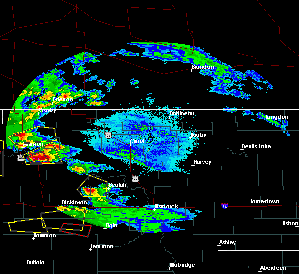 At 836 pm cdt, a severe thunderstorm was located 9 miles north of watford city, moving east at 40 mph (radar indicated). Hazards include golf ball size hail and 60 mph wind gusts. People and animals outdoors will be injured. expect hail damage to roofs, siding, windows, and vehicles. expect wind damage to roofs, siding, and trees. Locations impacted include, arnegard, keene, tobacco garden bay recreation area, lewis and clark state park, rawson and white tail bay recreation area. At 836 pm cdt, a severe thunderstorm was located 9 miles north of watford city, moving east at 40 mph (radar indicated). Hazards include golf ball size hail and 60 mph wind gusts. People and animals outdoors will be injured. expect hail damage to roofs, siding, windows, and vehicles. expect wind damage to roofs, siding, and trees. Locations impacted include, arnegard, keene, tobacco garden bay recreation area, lewis and clark state park, rawson and white tail bay recreation area.
|
| 6/21/2016 8:24 PM CDT |
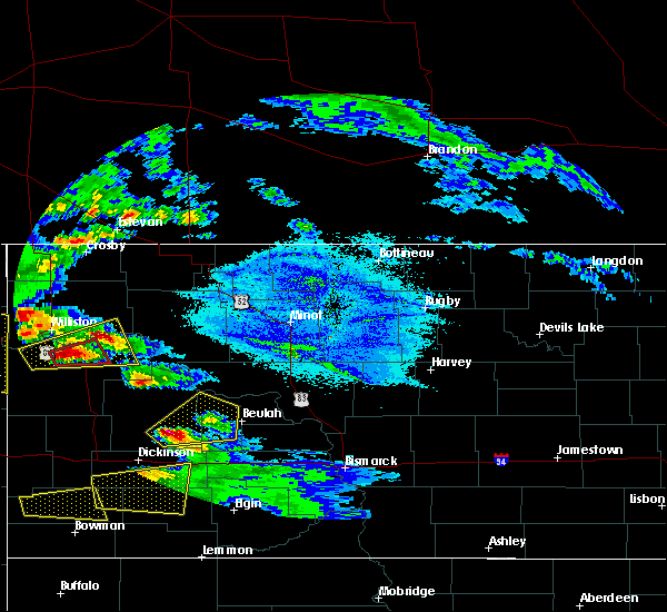 At 824 pm cdt, a severe thunderstorm was located 8 miles north of arnegard, or 12 miles northwest of watford city, moving east at 40 mph (radar indicated). Hazards include 60 mph wind gusts and half dollar size hail. Hail damage to vehicles is expected. expect wind damage to roofs, siding, and trees. This severe thunderstorm will remain over mainly rural areas of southeastern williams and northeastern mckenzie counties, including the following locations: tobacco garden bay recreation area, lewis and clark state park, keene, rawson and white tail bay recreation area. At 824 pm cdt, a severe thunderstorm was located 8 miles north of arnegard, or 12 miles northwest of watford city, moving east at 40 mph (radar indicated). Hazards include 60 mph wind gusts and half dollar size hail. Hail damage to vehicles is expected. expect wind damage to roofs, siding, and trees. This severe thunderstorm will remain over mainly rural areas of southeastern williams and northeastern mckenzie counties, including the following locations: tobacco garden bay recreation area, lewis and clark state park, keene, rawson and white tail bay recreation area.
|
| 6/21/2016 8:05 PM CDT |
 At 805 pm cdt/705 pm mdt/, a severe thunderstorm was located 6 miles northwest of alexander, or 18 miles south of williston, moving northeast at 40 mph (radar indicated). Hazards include 60 mph wind gusts and half dollar size hail. Hail damage to vehicles is expected. expect wind damage to roofs, siding, and trees. this severe thunderstorm will be near, alexander around 810 pm cdt. Other locations impacted by this severe thunderstorm include tobacco garden bay recreation area, lewis and clark state park, keene, charbonneau, rawson and white tail bay recreation area. At 805 pm cdt/705 pm mdt/, a severe thunderstorm was located 6 miles northwest of alexander, or 18 miles south of williston, moving northeast at 40 mph (radar indicated). Hazards include 60 mph wind gusts and half dollar size hail. Hail damage to vehicles is expected. expect wind damage to roofs, siding, and trees. this severe thunderstorm will be near, alexander around 810 pm cdt. Other locations impacted by this severe thunderstorm include tobacco garden bay recreation area, lewis and clark state park, keene, charbonneau, rawson and white tail bay recreation area.
|
| 6/19/2016 12:16 AM CDT |
 At 1215 am cdt/1115 pm mdt/, severe thunderstorms were located along a line extending from 4 miles northwest of alamo to near alexander, moving east at 55 mph (radar indicated). Hazards include golf ball size hail and 70 mph wind gusts. People and animals outdoors will be injured. expect hail damage to roofs, siding, windows, and vehicles. expect considerable tree damage. wind damage is also likely to mobile homes, roofs, and outbuildings. these severe storms will be near, williston and arnegard around 1220 am cdt. watford city and wildrose around 1230 am cdt. Other locations impacted by these severe thunderstorms include spring brook, blacktail lake, keene, rawson, white tail bay recreation area, charlson, sather dam, hanks, lewis and clark state park and zahl. At 1215 am cdt/1115 pm mdt/, severe thunderstorms were located along a line extending from 4 miles northwest of alamo to near alexander, moving east at 55 mph (radar indicated). Hazards include golf ball size hail and 70 mph wind gusts. People and animals outdoors will be injured. expect hail damage to roofs, siding, windows, and vehicles. expect considerable tree damage. wind damage is also likely to mobile homes, roofs, and outbuildings. these severe storms will be near, williston and arnegard around 1220 am cdt. watford city and wildrose around 1230 am cdt. Other locations impacted by these severe thunderstorms include spring brook, blacktail lake, keene, rawson, white tail bay recreation area, charlson, sather dam, hanks, lewis and clark state park and zahl.
|
| 6/18/2016 11:56 PM CDT |
 At 1156 pm cdt/1056 pm mdt/, severe thunderstorms were located along a line extending from 4 miles southwest of writing rock state historical site to 10 miles east of sidney, moving east at 55 mph (radar indicated). Hazards include golf ball size hail and 70 mph wind gusts. People and animals outdoors will be injured. expect hail damage to roofs, siding, windows, and vehicles. expect considerable tree damage. wind damage is also likely to mobile homes, roofs, and outbuildings. these severe storms will be near, writing rock state historical site around 1200 am cdt. williston and alexander around 1215 am cdt. arnegard around 1220 am cdt. watford city and crosby around 1230 am cdt. Other locations impacted by these severe thunderstorms include spring brook, blacktail lake, keene, rawson, white tail bay recreation area, charlson, sather dam, hanks, lewis and clark state park and ambrose. At 1156 pm cdt/1056 pm mdt/, severe thunderstorms were located along a line extending from 4 miles southwest of writing rock state historical site to 10 miles east of sidney, moving east at 55 mph (radar indicated). Hazards include golf ball size hail and 70 mph wind gusts. People and animals outdoors will be injured. expect hail damage to roofs, siding, windows, and vehicles. expect considerable tree damage. wind damage is also likely to mobile homes, roofs, and outbuildings. these severe storms will be near, writing rock state historical site around 1200 am cdt. williston and alexander around 1215 am cdt. arnegard around 1220 am cdt. watford city and crosby around 1230 am cdt. Other locations impacted by these severe thunderstorms include spring brook, blacktail lake, keene, rawson, white tail bay recreation area, charlson, sather dam, hanks, lewis and clark state park and ambrose.
|
| 6/18/2016 11:28 PM CDT |
 At 1128 pm cdt/1028 pm mdt/, severe thunderstorms were located along a line extending from 12 miles west of westby to 6 miles northwest of sidney, moving east at 55 mph (radar indicated). Hazards include golf ball size hail and 70 mph wind gusts. People and animals outdoors will be injured. expect hail damage to roofs, siding, windows, and vehicles. expect considerable tree damage. wind damage is also likely to mobile homes, roofs, and outbuildings. severe thunderstorms will be near, westby and east fairview around 1140 pm cdt. alkabo and writing rock state historical site around 1150 pm cdt. fortuna around 1155 pm cdt. williston and alexander around 1200 am cdt. arnegard around 1210 am cdt. watford city and crosby around 1220 am cdt. noonan around 1230 am cdt. Other locations impacted by these severe thunderstorms include spring brook, blacktail lake, keene, rawson, white tail bay recreation area, charlson, sather dam, hanks, lewis and clark state park and ambrose. At 1128 pm cdt/1028 pm mdt/, severe thunderstorms were located along a line extending from 12 miles west of westby to 6 miles northwest of sidney, moving east at 55 mph (radar indicated). Hazards include golf ball size hail and 70 mph wind gusts. People and animals outdoors will be injured. expect hail damage to roofs, siding, windows, and vehicles. expect considerable tree damage. wind damage is also likely to mobile homes, roofs, and outbuildings. severe thunderstorms will be near, westby and east fairview around 1140 pm cdt. alkabo and writing rock state historical site around 1150 pm cdt. fortuna around 1155 pm cdt. williston and alexander around 1200 am cdt. arnegard around 1210 am cdt. watford city and crosby around 1220 am cdt. noonan around 1230 am cdt. Other locations impacted by these severe thunderstorms include spring brook, blacktail lake, keene, rawson, white tail bay recreation area, charlson, sather dam, hanks, lewis and clark state park and ambrose.
|
| 7/27/2015 11:21 PM CDT |
 At 1119 pm cdt /1019 pm mdt/, severe thunderstorms were located along a line extending from 4 miles northwest of alexander to little missouri state park, moving northeast at 45 mph (public. 60 mph wind gust was reported at 955 pm mdt at grassy butte). Hazards include 60 mph wind gusts and penny size hail. Expect damage to roofs. siding and trees. Locations impacted include, watford city, keene, and alexander. At 1119 pm cdt /1019 pm mdt/, severe thunderstorms were located along a line extending from 4 miles northwest of alexander to little missouri state park, moving northeast at 45 mph (public. 60 mph wind gust was reported at 955 pm mdt at grassy butte). Hazards include 60 mph wind gusts and penny size hail. Expect damage to roofs. siding and trees. Locations impacted include, watford city, keene, and alexander.
|
| 7/27/2015 10:03 PM MDT |
 At 1100 pm cdt /1000 pm mdt/, severe thunderstorms were located along a line extending from 9 miles southeast of east fairview to 8 miles west of manning, moving northeast at 45 mph (radar indicated). Hazards include 60 mph wind gusts and penny size hail. Expect damage to roofs. siding and trees. These severe storms will imapct the following locations, manning, killdeer, theodore roosevelt national park north unit, watford city, charbonneau, and alexander. At 1100 pm cdt /1000 pm mdt/, severe thunderstorms were located along a line extending from 9 miles southeast of east fairview to 8 miles west of manning, moving northeast at 45 mph (radar indicated). Hazards include 60 mph wind gusts and penny size hail. Expect damage to roofs. siding and trees. These severe storms will imapct the following locations, manning, killdeer, theodore roosevelt national park north unit, watford city, charbonneau, and alexander.
|
| 7/27/2015 9:31 PM MDT |
 At 1030 pm cdt /930 pm mdt/, severe thunderstorms were located along a line extending from 6 miles north of skaar to 5 miles north of medora, moving northeast at 40 mph (public. at 900 pm mdt 70 mph wind gusts were reported at beach). Hazards include 60 mph wind gusts. Expect damage to roofs. siding and trees. severe thunderstorms will be near, south fairfield around 955 pm mdt. arnegard and manning around 1025 pm mdt. watford city, killdeer and dunn center around 1030 pm mdt. Other locations impacted by these severe thunderstorms include keene, rawson, oakdale, sather dam, fairfield, charbonneau, johnsons corner, cartwright and new hradec. At 1030 pm cdt /930 pm mdt/, severe thunderstorms were located along a line extending from 6 miles north of skaar to 5 miles north of medora, moving northeast at 40 mph (public. at 900 pm mdt 70 mph wind gusts were reported at beach). Hazards include 60 mph wind gusts. Expect damage to roofs. siding and trees. severe thunderstorms will be near, south fairfield around 955 pm mdt. arnegard and manning around 1025 pm mdt. watford city, killdeer and dunn center around 1030 pm mdt. Other locations impacted by these severe thunderstorms include keene, rawson, oakdale, sather dam, fairfield, charbonneau, johnsons corner, cartwright and new hradec.
|
| 7/15/2015 5:57 PM CDT |
 At 556 pm cdt /456 pm mdt/, a severe thunderstorm was located over alexander, or 15 miles west of watford city, moving northeast at 30 mph (radar indicated). Hazards include 60 mph wind gusts and half dollar size hail. Hail damage to vehicles is expected. expect wind damage to roofs, siding and trees. this severe storm will be near, arnegard around 605 pm cdt. Other locations impacted by this severe thunderstorm include sather dam, charbonneau, rawson and cartwright. At 556 pm cdt /456 pm mdt/, a severe thunderstorm was located over alexander, or 15 miles west of watford city, moving northeast at 30 mph (radar indicated). Hazards include 60 mph wind gusts and half dollar size hail. Hail damage to vehicles is expected. expect wind damage to roofs, siding and trees. this severe storm will be near, arnegard around 605 pm cdt. Other locations impacted by this severe thunderstorm include sather dam, charbonneau, rawson and cartwright.
|
| 7/15/2015 5:35 PM CDT |
 At 534 pm cdt /434 pm mdt/, a severe thunderstorm was located 10 miles southwest of alexander, or 18 miles east of sidney, moving northeast at 30 mph (radar indicated). Hazards include 60 mph wind gusts and quarter size hail. Hail damage to vehicles is expected. expect wind damage to roofs, siding and trees. this severe thunderstorm will be near, alexander around 555 pm cdt. arnegard around 605 pm cdt. Other locations impacted by this severe thunderstorm include sather dam, charbonneau, rawson and cartwright. At 534 pm cdt /434 pm mdt/, a severe thunderstorm was located 10 miles southwest of alexander, or 18 miles east of sidney, moving northeast at 30 mph (radar indicated). Hazards include 60 mph wind gusts and quarter size hail. Hail damage to vehicles is expected. expect wind damage to roofs, siding and trees. this severe thunderstorm will be near, alexander around 555 pm cdt. arnegard around 605 pm cdt. Other locations impacted by this severe thunderstorm include sather dam, charbonneau, rawson and cartwright.
|
| 6/19/2015 6:02 PM CDT |
 At 559 pm cdt /459 pm mdt/, severe thunderstorms were located along a line extending from 11 miles southeast of williston to 16 miles west of theodore roosevelt national park north unit, moving east at 45 mph (radar indicated. earlier...golf ball sized hail fell 14 miles northwest of alexander with these storms). Hazards include golf ball size hail and 60 mph wind gusts. People and animals outdoors will be injured. expect hail damage to roofs, siding, windows and vehicles. expect wind damage to roofs, siding and trees. severe thunderstorms will be near, theodore roosevelt national park north unit around 620 pm cdt. little missouri state park around 650 pm cdt. 4 bears lodge around 655 pm cdt. Other locations impacted by these severe thunderstorms include tobacco garden bay recreation area, keene, rawson, johnsons corner, charlson and oakdale. At 559 pm cdt /459 pm mdt/, severe thunderstorms were located along a line extending from 11 miles southeast of williston to 16 miles west of theodore roosevelt national park north unit, moving east at 45 mph (radar indicated. earlier...golf ball sized hail fell 14 miles northwest of alexander with these storms). Hazards include golf ball size hail and 60 mph wind gusts. People and animals outdoors will be injured. expect hail damage to roofs, siding, windows and vehicles. expect wind damage to roofs, siding and trees. severe thunderstorms will be near, theodore roosevelt national park north unit around 620 pm cdt. little missouri state park around 650 pm cdt. 4 bears lodge around 655 pm cdt. Other locations impacted by these severe thunderstorms include tobacco garden bay recreation area, keene, rawson, johnsons corner, charlson and oakdale.
|
| 6/19/2015 5:49 PM CDT |
 At 546 pm cdt /446 pm mdt/, a severe thunderstorm was located 6 miles south of alexander, or 15 miles west of watford city, moving southeast at 50 mph (trained weather spotters). Hazards include golf ball size hail and 60 mph wind gusts. People and animals outdoors will be injured. expect hail damage to roofs, siding, windows and vehicles. expect wind damage to roofs, siding and trees. this severe storm will be near, arnegard around 550 pm cdt. Other locations impacted by this severe thunderstorm include sather dam, charbonneau, rawson and cartwright. At 546 pm cdt /446 pm mdt/, a severe thunderstorm was located 6 miles south of alexander, or 15 miles west of watford city, moving southeast at 50 mph (trained weather spotters). Hazards include golf ball size hail and 60 mph wind gusts. People and animals outdoors will be injured. expect hail damage to roofs, siding, windows and vehicles. expect wind damage to roofs, siding and trees. this severe storm will be near, arnegard around 550 pm cdt. Other locations impacted by this severe thunderstorm include sather dam, charbonneau, rawson and cartwright.
|
| 6/19/2015 5:30 PM CDT |
 At 525 pm cdt /425 pm mdt/, a severe thunderstorm was located near east fairview, or 15 miles northeast of sidney, moving east at 50 mph (radar indicated). Hazards include ping pong ball size hail and 60 mph wind gusts. People and animals outdoors will be injured. expect hail damage to roofs, siding, windows and vehicles. expect wind damage to roofs, siding and trees. this severe storm will be near, cartwright around 535 pm cdt. alexander around 545 pm cdt. arnegard around 555 pm cdt. Other locations impacted by this severe thunderstorm include sather dam, fort buford state historical site, charbonneau, rawson, trenton. At 525 pm cdt /425 pm mdt/, a severe thunderstorm was located near east fairview, or 15 miles northeast of sidney, moving east at 50 mph (radar indicated). Hazards include ping pong ball size hail and 60 mph wind gusts. People and animals outdoors will be injured. expect hail damage to roofs, siding, windows and vehicles. expect wind damage to roofs, siding and trees. this severe storm will be near, cartwright around 535 pm cdt. alexander around 545 pm cdt. arnegard around 555 pm cdt. Other locations impacted by this severe thunderstorm include sather dam, fort buford state historical site, charbonneau, rawson, trenton.
|
| 6/19/2015 5:11 PM CDT |
 At 510 pm cdt /410 pm mdt/, a severe thunderstorm was located 8 miles west of east fairview, or 12 miles north of sidney, moving southeast at 55 mph (radar indicated). Hazards include ping pong ball size hail and 60 mph wind gusts. People and animals outdoors will be injured. expect hail damage to roofs, siding, windows and vehicles. expect wind damage to roofs, siding and trees. this severe thunderstorm will be near, east fairview around 420 pm mdt. Other locations impacted by this severe thunderstorm include sather dam, fort buford state historical site, charbonneau, rawson, trenton and cartwright. At 510 pm cdt /410 pm mdt/, a severe thunderstorm was located 8 miles west of east fairview, or 12 miles north of sidney, moving southeast at 55 mph (radar indicated). Hazards include ping pong ball size hail and 60 mph wind gusts. People and animals outdoors will be injured. expect hail damage to roofs, siding, windows and vehicles. expect wind damage to roofs, siding and trees. this severe thunderstorm will be near, east fairview around 420 pm mdt. Other locations impacted by this severe thunderstorm include sather dam, fort buford state historical site, charbonneau, rawson, trenton and cartwright.
|
| 7/24/2014 6:04 AM CDT | Quarter sized hail reported 2.2 miles S of Arnegard, ND, report relayed by broadcast media. it came in to their social media site. |
| 5/26/2014 7:15 PM CDT | Hen Egg sized hail reported 0.2 miles SSE of Arnegard, ND, mckenzie county deputy sheriff reported hail between golf ball and baseball size until 720 pm cdt. |
| 7/21/2013 3:00 PM CDT | Half Dollar sized hail reported 8.2 miles N of Arnegard, ND |
Hail Maps for Arnegard, ND


Connect with Interactive Hail Maps