

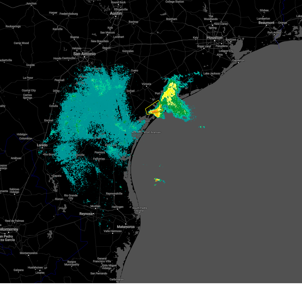
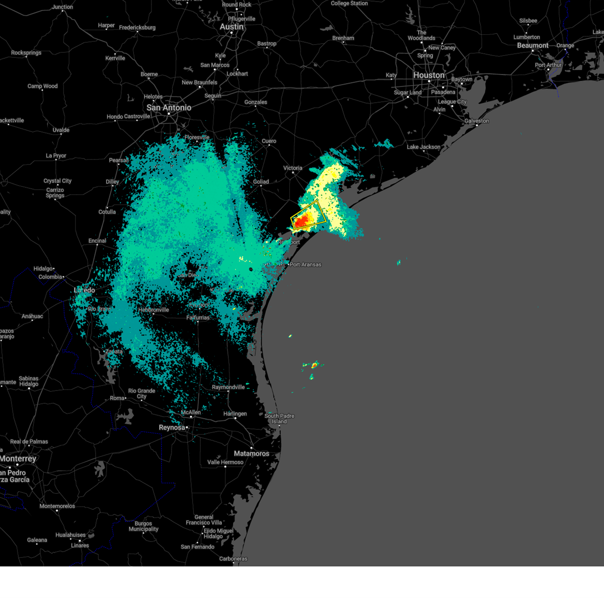
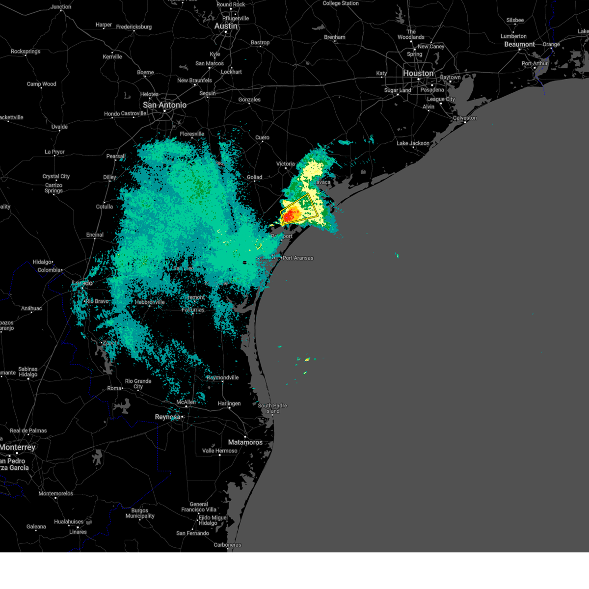
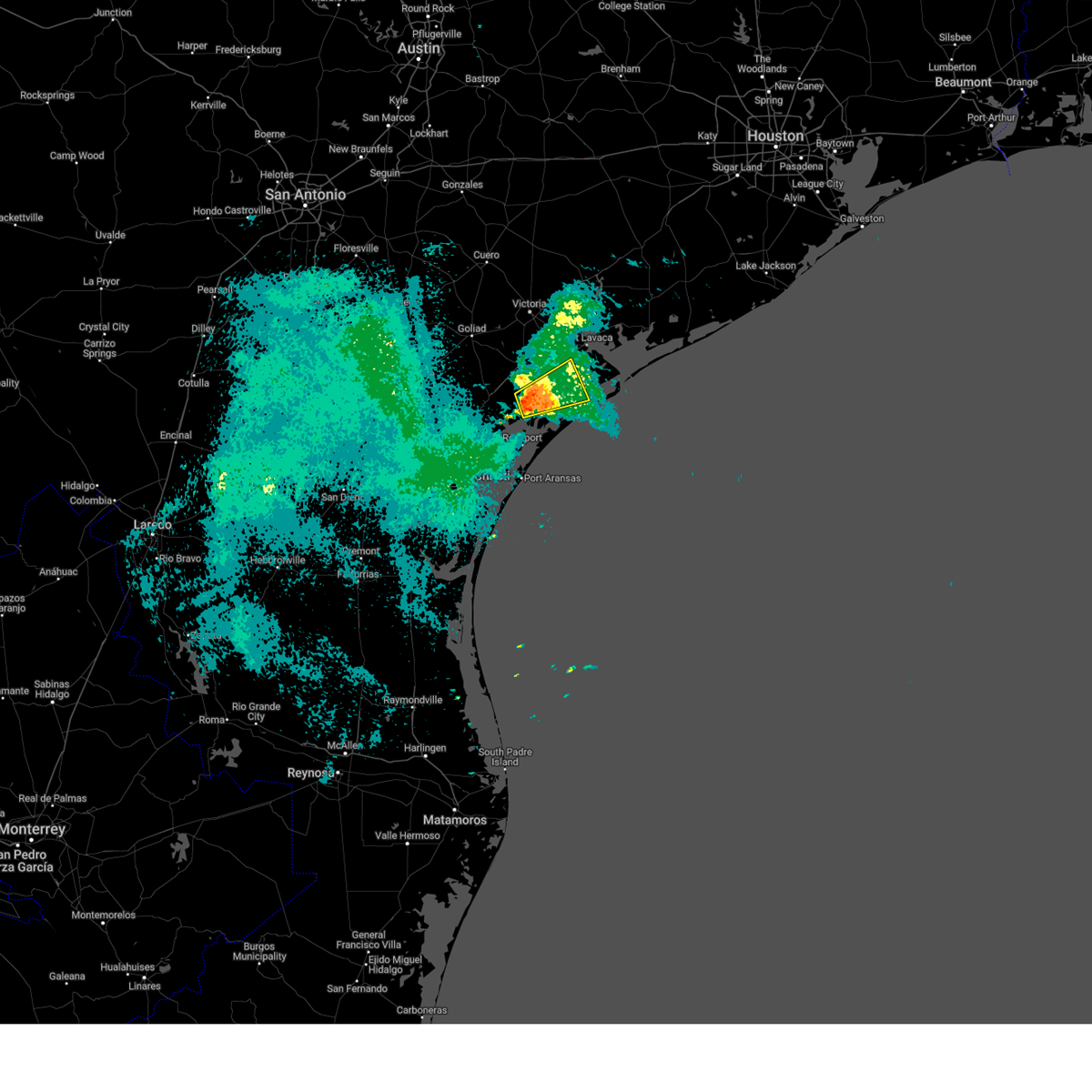
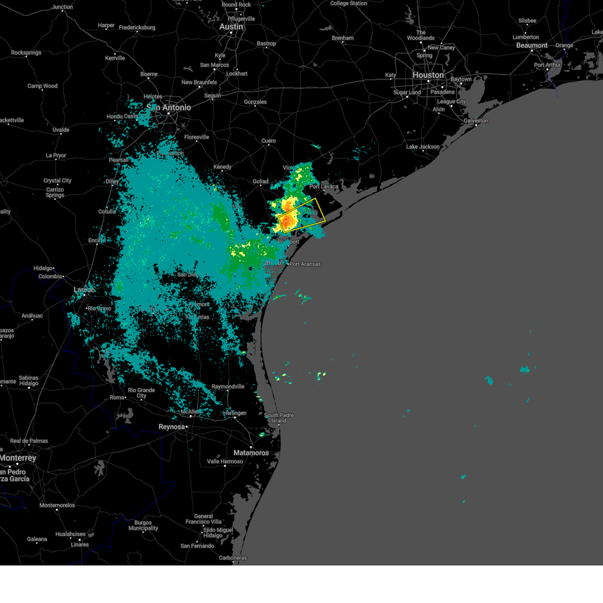
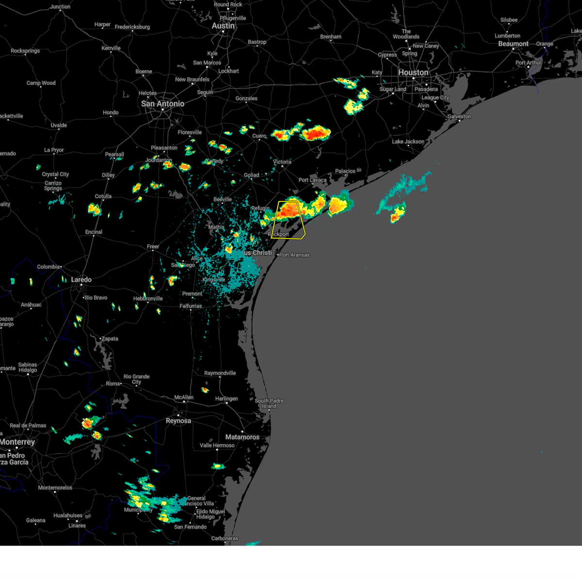
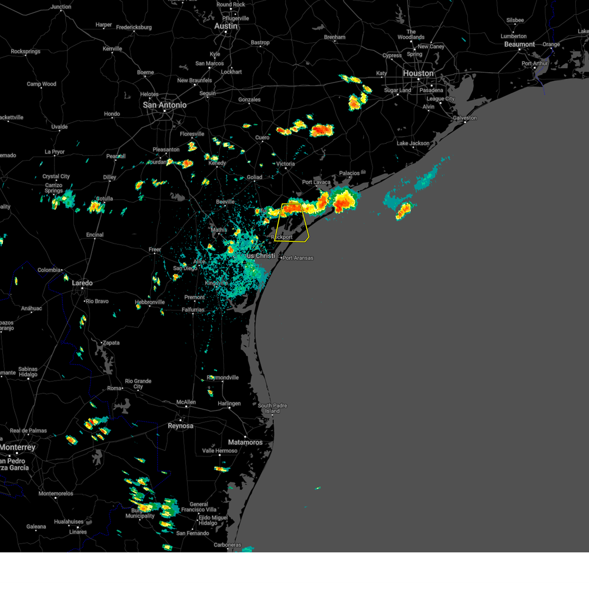
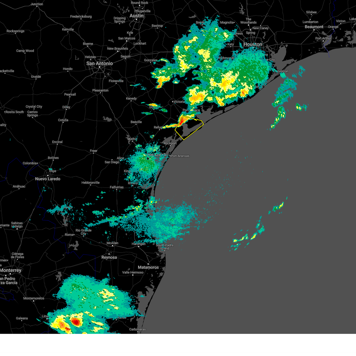
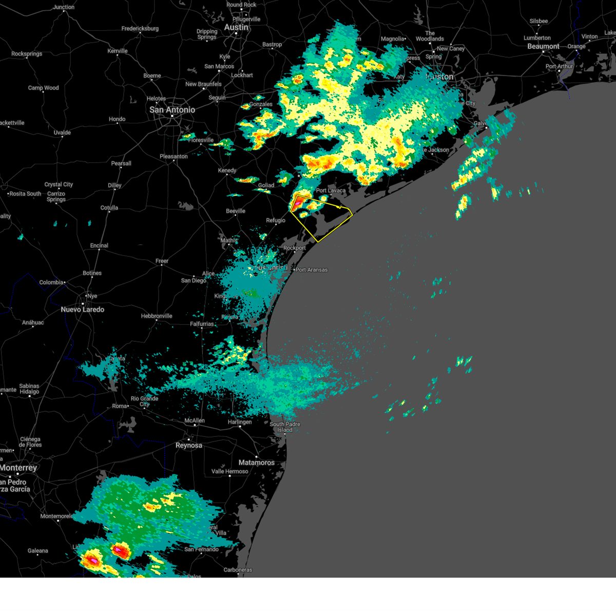
Hail Map for Austwell, TX
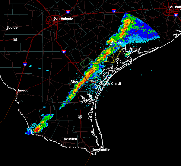
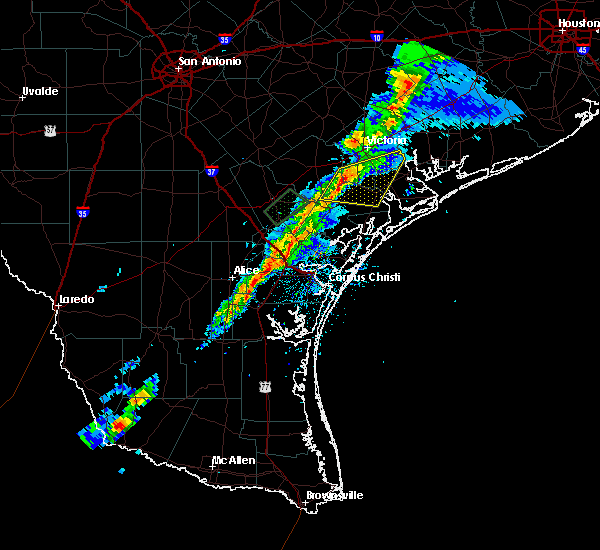
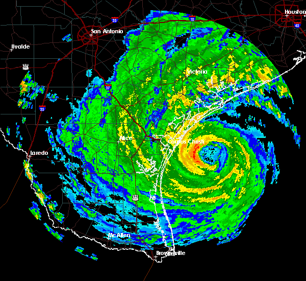
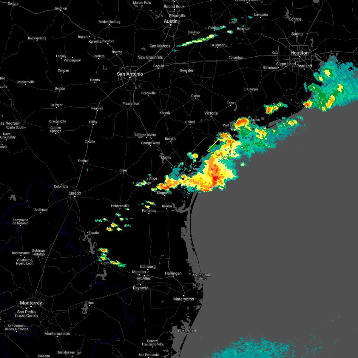
The Austwell, TX area has had 5 reports of on-the-ground hail by trained spotters, and has been under severe weather warnings 7 times during the past 12 months. Doppler radar has detected hail at or near Austwell, TX on 18 occasions.
| Name: | Austwell, TX |
| Where Located: | 53.5 miles NE of Corpus Christi, TX |
| Map: | Google Map for Austwell, TX |
| Population: | 147 |
| Housing Units: | 126 |
| More Info: | Search Google for Austwell, TX |
0
The Top Recent Hail Date for Austwell, TX is Sunday, May 5, 2024 (13th out of 18)

Hail and Wind Damage Spotted near Austwell, TX
| Date / Time | Report Details |
|---|---|
| 5/2/2025 4:47 AM CDT |
 The storm which prompted the warning has weakened below severe limits, and no longer poses an immediate threat to life or property. therefore, the warning has been allowed to expire. The storm which prompted the warning has weakened below severe limits, and no longer poses an immediate threat to life or property. therefore, the warning has been allowed to expire.
|
| 5/2/2025 4:24 AM CDT |
 At 424 am cdt, a severe thunderstorm was located 7 miles west of aransas national wildlife refuge, or 13 miles southwest of seadrift, moving east at 20 mph (radar indicated). Hazards include ping pong ball size hail and 60 mph wind gusts. People and animals outdoors will be injured. expect hail damage to roofs, siding, windows, and vehicles. expect wind damage to roofs, siding, and trees. Locations impacted include, seadrift, aransas national wildlife refuge, long mott, and austwell. At 424 am cdt, a severe thunderstorm was located 7 miles west of aransas national wildlife refuge, or 13 miles southwest of seadrift, moving east at 20 mph (radar indicated). Hazards include ping pong ball size hail and 60 mph wind gusts. People and animals outdoors will be injured. expect hail damage to roofs, siding, windows, and vehicles. expect wind damage to roofs, siding, and trees. Locations impacted include, seadrift, aransas national wildlife refuge, long mott, and austwell.
|
| 5/2/2025 4:14 AM CDT |
 At 414 am cdt, a severe thunderstorm was located 10 miles north of holiday beach, or 17 miles south of mcfaddin, moving east at 20 mph (radar indicated). Hazards include 60 mph wind gusts and half dollar size hail. Hail damage to vehicles is expected. expect wind damage to roofs, siding, and trees. Locations impacted include, seadrift, aransas national wildlife refuge, long mott, and austwell. At 414 am cdt, a severe thunderstorm was located 10 miles north of holiday beach, or 17 miles south of mcfaddin, moving east at 20 mph (radar indicated). Hazards include 60 mph wind gusts and half dollar size hail. Hail damage to vehicles is expected. expect wind damage to roofs, siding, and trees. Locations impacted include, seadrift, aransas national wildlife refuge, long mott, and austwell.
|
| 5/2/2025 4:08 AM CDT |
 At 408 am cdt, a severe thunderstorm was located 9 miles north of holiday beach, or 16 miles east of refugio, moving east at 20 mph (radar indicated). Hazards include quarter size hail. Damage to vehicles is expected. Locations impacted include, seadrift, aransas national wildlife refuge, long mott, and austwell. At 408 am cdt, a severe thunderstorm was located 9 miles north of holiday beach, or 16 miles east of refugio, moving east at 20 mph (radar indicated). Hazards include quarter size hail. Damage to vehicles is expected. Locations impacted include, seadrift, aransas national wildlife refuge, long mott, and austwell.
|
| 5/2/2025 3:51 AM CDT |
 Svrcrp the national weather service in corpus christi has issued a * severe thunderstorm warning for, northeastern aransas county in south central texas, west central calhoun county in south texas, southeastern refugio county in south central texas, * until 445 am cdt. * at 351 am cdt, a severe thunderstorm was located near quintana, or 12 miles east of refugio, moving east at 20 mph (radar indicated). Hazards include quarter size hail. damage to vehicles is expected Svrcrp the national weather service in corpus christi has issued a * severe thunderstorm warning for, northeastern aransas county in south central texas, west central calhoun county in south texas, southeastern refugio county in south central texas, * until 445 am cdt. * at 351 am cdt, a severe thunderstorm was located near quintana, or 12 miles east of refugio, moving east at 20 mph (radar indicated). Hazards include quarter size hail. damage to vehicles is expected
|
| 9/25/2024 4:29 PM CDT |
 At 429 pm cdt, a severe thunderstorm was located near holiday beach, or 14 miles northeast of rockport, moving south at 20 mph (radar indicated). Hazards include 60 mph wind gusts. Expect damage to roofs, siding, and trees. Locations impacted include, rockport, lamar, key allegro, holiday beach, aransas national wildlife refuge, copano village, fulton, and austwell. At 429 pm cdt, a severe thunderstorm was located near holiday beach, or 14 miles northeast of rockport, moving south at 20 mph (radar indicated). Hazards include 60 mph wind gusts. Expect damage to roofs, siding, and trees. Locations impacted include, rockport, lamar, key allegro, holiday beach, aransas national wildlife refuge, copano village, fulton, and austwell.
|
| 9/25/2024 4:14 PM CDT |
 Svrcrp the national weather service in corpus christi has issued a * severe thunderstorm warning for, aransas county in south central texas, southwestern calhoun county in south texas, southeastern refugio county in south central texas, * until 500 pm cdt. * at 414 pm cdt, a severe thunderstorm was located 9 miles west of aransas national wildlife refuge, or 16 miles southwest of seadrift, moving south at 20 mph (radar indicated). Hazards include 60 mph wind gusts and quarter size hail. Hail damage to vehicles is expected. Expect wind damage to roofs, siding, and trees. Svrcrp the national weather service in corpus christi has issued a * severe thunderstorm warning for, aransas county in south central texas, southwestern calhoun county in south texas, southeastern refugio county in south central texas, * until 500 pm cdt. * at 414 pm cdt, a severe thunderstorm was located 9 miles west of aransas national wildlife refuge, or 16 miles southwest of seadrift, moving south at 20 mph (radar indicated). Hazards include 60 mph wind gusts and quarter size hail. Hail damage to vehicles is expected. Expect wind damage to roofs, siding, and trees.
|
| 4/21/2024 3:00 AM CDT |
 the severe thunderstorm warning has been cancelled and is no longer in effect the severe thunderstorm warning has been cancelled and is no longer in effect
|
| 4/21/2024 3:00 AM CDT |
 At 258 am cdt, a severe thunderstorm was located over seadrift, moving southeast at 40 mph (radar indicated). Hazards include quarter size hail. Damage to vehicles is expected. Locations impacted include, seadrift, port oconnor, green lake, aransas national wildlife refuge, long mott, and austwell. At 258 am cdt, a severe thunderstorm was located over seadrift, moving southeast at 40 mph (radar indicated). Hazards include quarter size hail. Damage to vehicles is expected. Locations impacted include, seadrift, port oconnor, green lake, aransas national wildlife refuge, long mott, and austwell.
|
| 4/21/2024 2:38 AM CDT |
 Svrcrp the national weather service in corpus christi has issued a * severe thunderstorm warning for, northeastern aransas county in south central texas, central calhoun county in south texas, south central victoria county in south central texas, northeastern refugio county in south central texas, * until 330 am cdt. * at 237 am cdt, a severe thunderstorm was located near tivoli, or near mcfaddin, moving southeast at 50 mph (radar indicated). Hazards include two inch hail. People and animals outdoors will be injured. Expect damage to roofs, siding, windows, and vehicles. Svrcrp the national weather service in corpus christi has issued a * severe thunderstorm warning for, northeastern aransas county in south central texas, central calhoun county in south texas, south central victoria county in south central texas, northeastern refugio county in south central texas, * until 330 am cdt. * at 237 am cdt, a severe thunderstorm was located near tivoli, or near mcfaddin, moving southeast at 50 mph (radar indicated). Hazards include two inch hail. People and animals outdoors will be injured. Expect damage to roofs, siding, windows, and vehicles.
|
| 5/25/2022 2:55 AM CDT |
 The severe thunderstorm warning for aransas, calhoun, southeastern victoria, southeastern goliad and refugio counties will expire at 300 am cdt, the storms which prompted the warning have weakened below severe limits, and no longer pose an immediate threat to life or property. therefore, the warning will be allowed to expire. however heavy rain is still possible with these thunderstorms. a severe thunderstorm watch remains in effect until 500 am cdt for south central and south texas. to report severe weather, contact your nearest law enforcement agency. they will relay your report to the national weather service corpus christi. The severe thunderstorm warning for aransas, calhoun, southeastern victoria, southeastern goliad and refugio counties will expire at 300 am cdt, the storms which prompted the warning have weakened below severe limits, and no longer pose an immediate threat to life or property. therefore, the warning will be allowed to expire. however heavy rain is still possible with these thunderstorms. a severe thunderstorm watch remains in effect until 500 am cdt for south central and south texas. to report severe weather, contact your nearest law enforcement agency. they will relay your report to the national weather service corpus christi.
|
| 5/25/2022 1:56 AM CDT |
 At 155 am cdt, severe thunderstorms were located along a line extending from near inez to near bloomington to near quintana, moving southeast at 45 mph (radar indicated). Hazards include 70 mph wind gusts and penny size hail. Expect considerable tree damage. Damage is likely to mobile homes, roofs, and outbuildings. At 155 am cdt, severe thunderstorms were located along a line extending from near inez to near bloomington to near quintana, moving southeast at 45 mph (radar indicated). Hazards include 70 mph wind gusts and penny size hail. Expect considerable tree damage. Damage is likely to mobile homes, roofs, and outbuildings.
|
| 6/14/2021 5:41 PM CDT |
 The severe thunderstorm warning for northwestern calhoun, northeastern aransas and northeastern refugio counties will expire at 545 pm cdt, the storm which prompted the warning has weakened below severe limits, and no longer poses an immediate threat to life or property. therefore, the warning will be allowed to expire. however gusty winds are still possible with this thunderstorm. The severe thunderstorm warning for northwestern calhoun, northeastern aransas and northeastern refugio counties will expire at 545 pm cdt, the storm which prompted the warning has weakened below severe limits, and no longer poses an immediate threat to life or property. therefore, the warning will be allowed to expire. however gusty winds are still possible with this thunderstorm.
|
| 6/14/2021 5:16 PM CDT | Gusts estimated near 60 mp in refugio county TX, 0.2 miles NW of Austwell, TX |
| 6/14/2021 4:56 PM CDT |
 At 455 pm cdt, a severe thunderstorm was located near port lavaca, moving southwest at 25 mph (radar indicated). Hazards include 60 mph wind gusts and quarter size hail. Hail damage to vehicles is expected. Expect wind damage to roofs, siding, and trees. At 455 pm cdt, a severe thunderstorm was located near port lavaca, moving southwest at 25 mph (radar indicated). Hazards include 60 mph wind gusts and quarter size hail. Hail damage to vehicles is expected. Expect wind damage to roofs, siding, and trees.
|
| 5/19/2021 12:30 AM CDT |
 At 1229 am cdt, a severe thunderstorm was located over green lake, or 9 miles north of seadrift, moving northeast at 35 mph (radar indicated). Hazards include ping pong ball size hail. People and animals outdoors will be injured. expect damage to roofs, siding, windows, and vehicles. locations impacted include, port lavaca, point comfort, alamo beach, green lake, magnolia beach, tivoli, long mott and austwell. This includes us highway 87 between mile markers 830 and 840. At 1229 am cdt, a severe thunderstorm was located over green lake, or 9 miles north of seadrift, moving northeast at 35 mph (radar indicated). Hazards include ping pong ball size hail. People and animals outdoors will be injured. expect damage to roofs, siding, windows, and vehicles. locations impacted include, port lavaca, point comfort, alamo beach, green lake, magnolia beach, tivoli, long mott and austwell. This includes us highway 87 between mile markers 830 and 840.
|
| 5/19/2021 12:17 AM CDT |
 At 1216 am cdt, a severe thunderstorm was located over tivoli, or 10 miles west of seadrift, moving northeast at 35 mph (radar indicated). Hazards include ping pong ball size hail. People and animals outdoors will be injured. Expect damage to roofs, siding, windows, and vehicles. At 1216 am cdt, a severe thunderstorm was located over tivoli, or 10 miles west of seadrift, moving northeast at 35 mph (radar indicated). Hazards include ping pong ball size hail. People and animals outdoors will be injured. Expect damage to roofs, siding, windows, and vehicles.
|
| 5/16/2021 12:13 PM CDT |
 At 1213 pm cdt, a severe thunderstorm capable of producing a tornado was located over aransas national wildlife refuge, or 8 miles southwest of seadrift, moving north at 15 mph (radar indicated rotation). Hazards include tornado. Flying debris will be dangerous to those caught without shelter. mobile homes will be damaged or destroyed. damage to roofs, windows, and vehicles will occur. tree damage is likely. This tornadic thunderstorm will remain over mainly rural areas of northeastern aransas and eastern refugio counties. At 1213 pm cdt, a severe thunderstorm capable of producing a tornado was located over aransas national wildlife refuge, or 8 miles southwest of seadrift, moving north at 15 mph (radar indicated rotation). Hazards include tornado. Flying debris will be dangerous to those caught without shelter. mobile homes will be damaged or destroyed. damage to roofs, windows, and vehicles will occur. tree damage is likely. This tornadic thunderstorm will remain over mainly rural areas of northeastern aransas and eastern refugio counties.
|
| 5/16/2021 12:09 PM CDT |
 The national weather service in corpus christi has issued a * tornado warning for. northeastern aransas county in south central texas. eastern refugio county in south central texas. until 1230 pm cdt. At 1209 pm cdt, a severe thunderstorm capable of producing a. The national weather service in corpus christi has issued a * tornado warning for. northeastern aransas county in south central texas. eastern refugio county in south central texas. until 1230 pm cdt. At 1209 pm cdt, a severe thunderstorm capable of producing a.
|
| 4/23/2021 9:31 PM CDT |
 At 931 pm cdt, a severe thunderstorm was located over quintana, or 9 miles northeast of refugio, moving east at 45 mph (radar indicated). Hazards include 60 mph wind gusts and quarter size hail. Hail damage to vehicles is expected. Expect wind damage to roofs, siding, and trees. At 931 pm cdt, a severe thunderstorm was located over quintana, or 9 miles northeast of refugio, moving east at 45 mph (radar indicated). Hazards include 60 mph wind gusts and quarter size hail. Hail damage to vehicles is expected. Expect wind damage to roofs, siding, and trees.
|
| 5/28/2020 8:14 PM CDT |
 At 814 pm cdt, a severe thunderstorm was located over bayside, or 10 miles southeast of woodsboro, moving southwest at 25 mph (radar indicated). Hazards include 60 mph wind gusts and quarter size hail. Hail damage to vehicles is expected. expect wind damage to roofs, siding, and trees. Locations impacted include, rockport, sinton, taft, refugio, woodsboro, lamar, ingleside, aransas pass, bayside, quintana, palm harbor, key allegro, copano village, bonnie view, holiday beach, tivoli, aransas national wildlife refuge, fulton and austwell. At 814 pm cdt, a severe thunderstorm was located over bayside, or 10 miles southeast of woodsboro, moving southwest at 25 mph (radar indicated). Hazards include 60 mph wind gusts and quarter size hail. Hail damage to vehicles is expected. expect wind damage to roofs, siding, and trees. Locations impacted include, rockport, sinton, taft, refugio, woodsboro, lamar, ingleside, aransas pass, bayside, quintana, palm harbor, key allegro, copano village, bonnie view, holiday beach, tivoli, aransas national wildlife refuge, fulton and austwell.
|
| 5/28/2020 8:10 PM CDT | Quarter sized hail reported 0.2 miles NW of Austwell, TX |
| 5/28/2020 7:57 PM CDT |
 At 756 pm cdt, a severe thunderstorm was located near bayside, or 8 miles northwest of rockport, moving south at 25 mph (radar indicated). Hazards include 60 mph wind gusts and quarter size hail. Hail damage to vehicles is expected. Expect wind damage to roofs, siding, and trees. At 756 pm cdt, a severe thunderstorm was located near bayside, or 8 miles northwest of rockport, moving south at 25 mph (radar indicated). Hazards include 60 mph wind gusts and quarter size hail. Hail damage to vehicles is expected. Expect wind damage to roofs, siding, and trees.
|
| 5/28/2020 7:28 PM CDT |
 At 728 pm cdt, a severe thunderstorm was located near quintana, or 10 miles east of refugio, moving southwest at 20 mph (radar indicated). Hazards include 60 mph wind gusts and quarter size hail. Hail damage to vehicles is expected. expect wind damage to roofs, siding, and trees. Locations impacted include, refugio, woodsboro, quintana, bonnie view, tivoli, aransas national wildlife refuge, blanconia and austwell. At 728 pm cdt, a severe thunderstorm was located near quintana, or 10 miles east of refugio, moving southwest at 20 mph (radar indicated). Hazards include 60 mph wind gusts and quarter size hail. Hail damage to vehicles is expected. expect wind damage to roofs, siding, and trees. Locations impacted include, refugio, woodsboro, quintana, bonnie view, tivoli, aransas national wildlife refuge, blanconia and austwell.
|
| 5/28/2020 7:06 PM CDT |
 At 706 pm cdt, a severe thunderstorm was located 8 miles east of quintana, or 12 miles south of mcfaddin, moving southwest at 20 mph (radar indicated). Hazards include 60 mph wind gusts and quarter size hail. Hail damage to vehicles is expected. Expect wind damage to roofs, siding, and trees. At 706 pm cdt, a severe thunderstorm was located 8 miles east of quintana, or 12 miles south of mcfaddin, moving southwest at 20 mph (radar indicated). Hazards include 60 mph wind gusts and quarter size hail. Hail damage to vehicles is expected. Expect wind damage to roofs, siding, and trees.
|
| 5/9/2019 11:41 PM CDT |
 At 1140 pm cdt, severe thunderstorms were located along a line extending from 8 miles northeast of salem to 18 miles east of key allegro, moving east at 35 mph (radar indicated). Hazards include 60 mph wind gusts and penny size hail. expect damage to roofs, siding, and trees At 1140 pm cdt, severe thunderstorms were located along a line extending from 8 miles northeast of salem to 18 miles east of key allegro, moving east at 35 mph (radar indicated). Hazards include 60 mph wind gusts and penny size hail. expect damage to roofs, siding, and trees
|
| 5/9/2019 11:30 PM CDT |
 At 1129 pm cdt, severe thunderstorms were located along a line extending from 9 miles northwest of point comfort to near aransas national wildlife refuge, moving east at 40 mph (radar indicated). Hazards include 60 mph wind gusts and penny size hail. Expect damage to roofs, siding, and trees. Locations impacted include, victoria, port lavaca, seadrift, mcfaddin, guadalupe, point comfort, quintana, victoria colony creek country club, alamo beach, dacosta, wood hi, bloomington, long mott, victoria riverside park, placedo, victoria college, saxet lakes, green lake, holiday beach and tivoli. At 1129 pm cdt, severe thunderstorms were located along a line extending from 9 miles northwest of point comfort to near aransas national wildlife refuge, moving east at 40 mph (radar indicated). Hazards include 60 mph wind gusts and penny size hail. Expect damage to roofs, siding, and trees. Locations impacted include, victoria, port lavaca, seadrift, mcfaddin, guadalupe, point comfort, quintana, victoria colony creek country club, alamo beach, dacosta, wood hi, bloomington, long mott, victoria riverside park, placedo, victoria college, saxet lakes, green lake, holiday beach and tivoli.
|
| 5/9/2019 10:56 PM CDT |
 At 1055 pm cdt, severe thunderstorms were located along a line extending from near saxet lakes to near quintana, moving east at 40 mph (radar indicated). Hazards include 60 mph wind gusts and quarter size hail. Hail damage to vehicles is expected. Expect wind damage to roofs, siding, and trees. At 1055 pm cdt, severe thunderstorms were located along a line extending from near saxet lakes to near quintana, moving east at 40 mph (radar indicated). Hazards include 60 mph wind gusts and quarter size hail. Hail damage to vehicles is expected. Expect wind damage to roofs, siding, and trees.
|
| 4/24/2019 7:40 PM CDT |
 The severe thunderstorm warning for northwestern calhoun, southern victoria, southeastern goliad and northeastern refugio counties will expire at 745 pm cdt, the storm which prompted the warning has weakened below severe limits, and no longer poses an immediate threat to life or property. therefore, the warning will be allowed to expire. however gusty winds are still possible with this thunderstorm. The severe thunderstorm warning for northwestern calhoun, southern victoria, southeastern goliad and northeastern refugio counties will expire at 745 pm cdt, the storm which prompted the warning has weakened below severe limits, and no longer poses an immediate threat to life or property. therefore, the warning will be allowed to expire. however gusty winds are still possible with this thunderstorm.
|
| 4/24/2019 7:30 PM CDT |
 At 730 pm cdt, a severe thunderstorm was located near mcfaddin, moving east at 40 mph (radar indicated). Hazards include 60 mph wind gusts and penny size hail. Expect damage to roofs, siding, and trees. Locations impacted include, mcfaddin, placedo, dacosta, green lake, bloomington, tivoli and austwell. At 730 pm cdt, a severe thunderstorm was located near mcfaddin, moving east at 40 mph (radar indicated). Hazards include 60 mph wind gusts and penny size hail. Expect damage to roofs, siding, and trees. Locations impacted include, mcfaddin, placedo, dacosta, green lake, bloomington, tivoli and austwell.
|
| 4/24/2019 7:13 PM CDT |
 At 713 pm cdt, a severe thunderstorm was located 12 miles south of fannin, or 13 miles southeast of goliad, moving east at 30 mph (radar indicated). Hazards include 60 mph wind gusts and penny size hail. Expect damage to roofs, siding, and trees. Locations impacted include, mcfaddin, quintana, placedo, dacosta, green lake, bloomington, tivoli and austwell. At 713 pm cdt, a severe thunderstorm was located 12 miles south of fannin, or 13 miles southeast of goliad, moving east at 30 mph (radar indicated). Hazards include 60 mph wind gusts and penny size hail. Expect damage to roofs, siding, and trees. Locations impacted include, mcfaddin, quintana, placedo, dacosta, green lake, bloomington, tivoli and austwell.
|
| 4/24/2019 7:06 PM CDT |
 At 705 pm cdt, severe thunderstorms were located along a line extending from near schroeder to near woodsboro, moving east at 40 mph (radar indicated). Hazards include 60 mph wind gusts and nickel size hail. Expect damage to roofs, siding, and trees. Locations impacted include, victoria, mcfaddin, guadalupe, fannin, quintana, victoria colony creek country club, nursery, victoria riverside park, victoria college, victoria mall, saxet lakes, green lake, inez, salem, telferner, tivoli, downtown victoria, fordtran, schroeder and dacosta. At 705 pm cdt, severe thunderstorms were located along a line extending from near schroeder to near woodsboro, moving east at 40 mph (radar indicated). Hazards include 60 mph wind gusts and nickel size hail. Expect damage to roofs, siding, and trees. Locations impacted include, victoria, mcfaddin, guadalupe, fannin, quintana, victoria colony creek country club, nursery, victoria riverside park, victoria college, victoria mall, saxet lakes, green lake, inez, salem, telferner, tivoli, downtown victoria, fordtran, schroeder and dacosta.
|
| 4/24/2019 6:53 PM CDT |
 At 652 pm cdt, severe thunderstorms were located along a line extending from near schroeder to 9 miles northeast of papalote, moving east at 40 mph (radar indicated). Hazards include 60 mph wind gusts and quarter size hail. Hail damage to vehicles is expected. Expect wind damage to roofs, siding, and trees. At 652 pm cdt, severe thunderstorms were located along a line extending from near schroeder to 9 miles northeast of papalote, moving east at 40 mph (radar indicated). Hazards include 60 mph wind gusts and quarter size hail. Hail damage to vehicles is expected. Expect wind damage to roofs, siding, and trees.
|
| 4/7/2019 8:15 AM CDT |
 At 814 am cdt, severe thunderstorms were located along a line extending from 6 miles southeast of charco to near refugio to near taft to near naval air station cabaniss field, moving east at 40 mph (radar indicated). Hazards include 60 mph wind gusts and penny size hail. expect damage to roofs, siding, and trees At 814 am cdt, severe thunderstorms were located along a line extending from 6 miles southeast of charco to near refugio to near taft to near naval air station cabaniss field, moving east at 40 mph (radar indicated). Hazards include 60 mph wind gusts and penny size hail. expect damage to roofs, siding, and trees
|
| 4/14/2018 2:51 AM CDT |
 At 251 am cdt, severe thunderstorms were located along a line extending from 7 miles south of schicke point to near key allegro, moving east at 35 mph (radar indicated). Hazards include 60 mph wind gusts. Expect damage to roofs, siding, and trees. Locations impacted include, rockport, seadrift, port oconnor, lamar, bayside, alamo beach, key allegro, indianola, magnolia beach, copano village, holiday beach, aransas national wildlife refuge, matagorda island state park, fulton and austwell. At 251 am cdt, severe thunderstorms were located along a line extending from 7 miles south of schicke point to near key allegro, moving east at 35 mph (radar indicated). Hazards include 60 mph wind gusts. Expect damage to roofs, siding, and trees. Locations impacted include, rockport, seadrift, port oconnor, lamar, bayside, alamo beach, key allegro, indianola, magnolia beach, copano village, holiday beach, aransas national wildlife refuge, matagorda island state park, fulton and austwell.
|
| 4/14/2018 2:32 AM CDT |
 At 232 am cdt, severe thunderstorms were located along a line extending from near magnolia beach to near copano village, moving east at 35 mph (radar indicated). Hazards include 60 mph wind gusts. expect damage to roofs, siding, and trees At 232 am cdt, severe thunderstorms were located along a line extending from near magnolia beach to near copano village, moving east at 35 mph (radar indicated). Hazards include 60 mph wind gusts. expect damage to roofs, siding, and trees
|
| 4/14/2018 2:14 AM CDT |
 At 213 am cdt, severe thunderstorms were located along a line extending from point comfort to 9 miles west of blanconia to near san patricio, moving southeast at 50 mph (radar indicated). Hazards include 60 mph wind gusts. Expect damage to roofs, siding, and trees. locations impacted include, portland, port lavaca, rockport, sinton, mathis, taft, refugio, woodsboro, seadrift, skidmore, lamar, ingleside, aransas pass, gregory, st. Paul, point comfort, lake city, bayside, quintana and palm harbor. At 213 am cdt, severe thunderstorms were located along a line extending from point comfort to 9 miles west of blanconia to near san patricio, moving southeast at 50 mph (radar indicated). Hazards include 60 mph wind gusts. Expect damage to roofs, siding, and trees. locations impacted include, portland, port lavaca, rockport, sinton, mathis, taft, refugio, woodsboro, seadrift, skidmore, lamar, ingleside, aransas pass, gregory, st. Paul, point comfort, lake city, bayside, quintana and palm harbor.
|
| 4/14/2018 2:07 AM CDT |
 At 207 am cdt, severe thunderstorms were located along a line extending from near point comfort to 7 miles south of berclair to san patricio, moving southeast at 50 mph (radar indicated). Hazards include 60 mph wind gusts. Expect damage to roofs, siding, and trees. Locations impacted include, victoria, portland, beeville, port lavaca, rockport, sinton, mathis, taft, refugio, goliad, woodsboro, seadrift, mcfaddin, port oconnor, skidmore, guadalupe, lamar, fannin, ingleside and aransas pass. At 207 am cdt, severe thunderstorms were located along a line extending from near point comfort to 7 miles south of berclair to san patricio, moving southeast at 50 mph (radar indicated). Hazards include 60 mph wind gusts. Expect damage to roofs, siding, and trees. Locations impacted include, victoria, portland, beeville, port lavaca, rockport, sinton, mathis, taft, refugio, goliad, woodsboro, seadrift, mcfaddin, port oconnor, skidmore, guadalupe, lamar, fannin, ingleside and aransas pass.
|
| 4/14/2018 1:45 AM CDT |
 At 144 am cdt, severe thunderstorms were located along a line extending from near inez to pettus to near mount lucas, moving southeast at 50 mph (radar indicated). Hazards include 60 mph wind gusts and penny size hail. expect damage to roofs, siding, and trees At 144 am cdt, severe thunderstorms were located along a line extending from near inez to pettus to near mount lucas, moving southeast at 50 mph (radar indicated). Hazards include 60 mph wind gusts and penny size hail. expect damage to roofs, siding, and trees
|
| 3/29/2018 1:41 AM CDT |
 The severe thunderstorm warning for aransas, southeastern nueces, eastern san patricio, eastern refugio and northeastern kleberg counties will expire at 145 am cdt, the severe portion of the storms which prompted the warning are pushing offshore.therefore the warning will be allowed to expire. however small hail, gusty winds and heavy rain are still possible with the remaining thunderstorms. a severe thunderstorm watch remains in effect until 300 am cdt for south central and south texas. to report severe weather, contact your nearest law enforcement agency. they will relay your report to the national weather service corpus christi. The severe thunderstorm warning for aransas, southeastern nueces, eastern san patricio, eastern refugio and northeastern kleberg counties will expire at 145 am cdt, the severe portion of the storms which prompted the warning are pushing offshore.therefore the warning will be allowed to expire. however small hail, gusty winds and heavy rain are still possible with the remaining thunderstorms. a severe thunderstorm watch remains in effect until 300 am cdt for south central and south texas. to report severe weather, contact your nearest law enforcement agency. they will relay your report to the national weather service corpus christi.
|
| 3/29/2018 1:19 AM CDT |
 At 118 am cdt, severe thunderstorms were located along a line extending from near wood hi to near bayside to 7 miles south of clarkwood, moving east at 45 mph (radar indicated). Hazards include 60 mph wind gusts and penny size hail. Expect damage to roofs, siding, and trees. Locations impacted include, corpus christi, portland, robstown, rockport, port aransas, taft, corpus christi international airport, lamar, ingleside, aransas pass, gregory, ingleside on the bay, bayside, flour bluff, palm harbor, christus spohn hospital south, corpus christi north beach, padre balli park, bay area medical center and padre isles country club. At 118 am cdt, severe thunderstorms were located along a line extending from near wood hi to near bayside to 7 miles south of clarkwood, moving east at 45 mph (radar indicated). Hazards include 60 mph wind gusts and penny size hail. Expect damage to roofs, siding, and trees. Locations impacted include, corpus christi, portland, robstown, rockport, port aransas, taft, corpus christi international airport, lamar, ingleside, aransas pass, gregory, ingleside on the bay, bayside, flour bluff, palm harbor, christus spohn hospital south, corpus christi north beach, padre balli park, bay area medical center and padre isles country club.
|
| 3/29/2018 12:56 AM CDT |
 At 1255 am cdt, severe thunderstorms were located along a line extending from near oak village to near sinton to near driscoll, moving east at 45 mph (radar indicated). Hazards include 70 mph wind gusts and penny size hail. Expect considerable tree damage. Damage is likely to mobile homes, roofs, and outbuildings. At 1255 am cdt, severe thunderstorms were located along a line extending from near oak village to near sinton to near driscoll, moving east at 45 mph (radar indicated). Hazards include 70 mph wind gusts and penny size hail. Expect considerable tree damage. Damage is likely to mobile homes, roofs, and outbuildings.
|
| 8/25/2017 4:32 PM CDT |
 At 432 pm cdt, a severe thunderstorm capable of producing a tornado was located near tivoli, or 11 miles west of seadrift, moving southwest at 45 mph (radar indicated rotation). Hazards include tornado. Flying debris will be dangerous to those caught without shelter. mobile homes will be damaged or destroyed. damage to roofs, windows, and vehicles will occur. tree damage is likely. this dangerous storm will be near, quintana around 450 pm cdt. Other locations impacted by this tornadic thunderstorm include austwell. At 432 pm cdt, a severe thunderstorm capable of producing a tornado was located near tivoli, or 11 miles west of seadrift, moving southwest at 45 mph (radar indicated rotation). Hazards include tornado. Flying debris will be dangerous to those caught without shelter. mobile homes will be damaged or destroyed. damage to roofs, windows, and vehicles will occur. tree damage is likely. this dangerous storm will be near, quintana around 450 pm cdt. Other locations impacted by this tornadic thunderstorm include austwell.
|
| 5/23/2017 8:44 PM CDT |
 The severe thunderstorm warning for southwestern calhoun, northeastern aransas and east central refugio counties will expire at 845 pm cdt, the storm which prompted the warning has weakened below severe limits, and no longer poses an immediate threat to life or property. therefore the warning will be allowed to expire. however gusty winds are still possible with this thunderstorm. a severe thunderstorm watch remains in effect until 1100 pm cdt for south central and south texas. The severe thunderstorm warning for southwestern calhoun, northeastern aransas and east central refugio counties will expire at 845 pm cdt, the storm which prompted the warning has weakened below severe limits, and no longer poses an immediate threat to life or property. therefore the warning will be allowed to expire. however gusty winds are still possible with this thunderstorm. a severe thunderstorm watch remains in effect until 1100 pm cdt for south central and south texas.
|
| 5/23/2017 8:33 PM CDT |
 At 832 pm cdt, a severe thunderstorm was located over aransas national wildlife refuge, or 9 miles southwest of seadrift, moving east at 20 mph (radar indicated). Hazards include 60 mph wind gusts and penny size hail. Expect damage to roofs, siding, and trees. Locations impacted include, seadrift, aransas national wildlife refuge and austwell. At 832 pm cdt, a severe thunderstorm was located over aransas national wildlife refuge, or 9 miles southwest of seadrift, moving east at 20 mph (radar indicated). Hazards include 60 mph wind gusts and penny size hail. Expect damage to roofs, siding, and trees. Locations impacted include, seadrift, aransas national wildlife refuge and austwell.
|
| 5/23/2017 8:05 PM CDT |
 At 805 pm cdt, a severe thunderstorm was located 10 miles southwest of tivoli, or 15 miles south of mcfaddin, moving east at 20 mph (radar indicated). Hazards include 60 mph wind gusts and quarter size hail. Hail damage to vehicles is expected. Expect wind damage to roofs, siding, and trees. At 805 pm cdt, a severe thunderstorm was located 10 miles southwest of tivoli, or 15 miles south of mcfaddin, moving east at 20 mph (radar indicated). Hazards include 60 mph wind gusts and quarter size hail. Hail damage to vehicles is expected. Expect wind damage to roofs, siding, and trees.
|
| 2/14/2017 7:48 AM CST |
 At 746 am cst, line of strong thunderstorms capable of producing brief tornadoes was located along a line extending from near green lake to 9 miles north of holiday beach, moving east at 45 mph (radar indicated rotation). Hazards include tornado. Flying debris will be dangerous to those caught without shelter. mobile homes will be damaged or destroyed. damage to roofs, windows, and vehicles will occur. tree damage is likely. these dangerous storms will be near, green lake around 750 am cst. port lavaca, aransas national wildlife refuge and alamo beach around 800 am cst. point comfort around 805 am cst. seadrift, olivia and long mott around 810 am cst. port alto and schicke point around 815 am cst. Other locations impacted by these tornadic storms include austwell. At 746 am cst, line of strong thunderstorms capable of producing brief tornadoes was located along a line extending from near green lake to 9 miles north of holiday beach, moving east at 45 mph (radar indicated rotation). Hazards include tornado. Flying debris will be dangerous to those caught without shelter. mobile homes will be damaged or destroyed. damage to roofs, windows, and vehicles will occur. tree damage is likely. these dangerous storms will be near, green lake around 750 am cst. port lavaca, aransas national wildlife refuge and alamo beach around 800 am cst. point comfort around 805 am cst. seadrift, olivia and long mott around 810 am cst. port alto and schicke point around 815 am cst. Other locations impacted by these tornadic storms include austwell.
|
| 4/30/2016 4:30 PM CDT |
 At 430 pm cdt, a severe thunderstorm was located near quintana, or 11 miles south of mcfaddin, moving east at 20 mph (radar indicated). Hazards include 60 mph wind gusts and quarter size hail. Hail damage to vehicles is expected. Expect wind damage to roofs, siding, and trees. At 430 pm cdt, a severe thunderstorm was located near quintana, or 11 miles south of mcfaddin, moving east at 20 mph (radar indicated). Hazards include 60 mph wind gusts and quarter size hail. Hail damage to vehicles is expected. Expect wind damage to roofs, siding, and trees.
|
| 3/9/2016 8:55 AM CST |
 At 854 am cst, severe thunderstorms were located along a line extending from near cuero to 7 miles southeast of fannin to near tivoli, moving northeast at 40 mph (radar indicated). Hazards include 60 mph wind gusts. Expect damage to roofs. siding. and trees. Locations impacted include, victoria, port lavaca, seadrift, mcfaddin, guadalupe, fannin, victoria detar hospital north, long mott, dacosta, coleto creek park, nursery, wood hi, victoria regional airport, downtown victoria, kamey, tivoli, kamay, victoria colony creek country club, victoria college and saxet lakes. At 854 am cst, severe thunderstorms were located along a line extending from near cuero to 7 miles southeast of fannin to near tivoli, moving northeast at 40 mph (radar indicated). Hazards include 60 mph wind gusts. Expect damage to roofs. siding. and trees. Locations impacted include, victoria, port lavaca, seadrift, mcfaddin, guadalupe, fannin, victoria detar hospital north, long mott, dacosta, coleto creek park, nursery, wood hi, victoria regional airport, downtown victoria, kamey, tivoli, kamay, victoria colony creek country club, victoria college and saxet lakes.
|
| 3/9/2016 8:33 AM CST |
 At 832 am cst, severe thunderstorms were located along a line extending from weser to 6 miles east of blanconia to near holiday beach, moving northeast at 40 mph (radar indicated). Hazards include 60 mph wind gusts. Expect damage to roofs. siding. And trees. At 832 am cst, severe thunderstorms were located along a line extending from weser to 6 miles east of blanconia to near holiday beach, moving northeast at 40 mph (radar indicated). Hazards include 60 mph wind gusts. Expect damage to roofs. siding. And trees.
|
| 5/24/2015 2:14 AM CDT | At 213 am cdt, doppler radar indicated a severe squall line capable of producing a tornado as well as damaging straight line winds. these dangerous storms were located near holiday beach, or 10 miles north of rockport, and moving northeast at 45 mph. |
| 4/22/2015 5:43 PM CDT | Tennis Ball sized hail reported 4.3 miles NW of Austwell, TX, wind blown tennis ball size hail destroyed windows and siding in hopper/s landing. pavillion also blown into the bay. very large trees blown down. report from sheriff. |
| 4/22/2015 5:42 PM CDT | Golf Ball sized hail reported 1.1 miles E of Austwell, TX, windblown golfball size hail caused damage to many windows and businesses/homes in austwell. metal garage blown over. large trees down. numerous powerlines down through |
| 4/22/2015 5:35 PM CDT | Co op observer in austwell suffered roof damage to home from strong thunderstorm wind gusts in refugio county TX, 1.1 miles NW of Austwell, TX |
| 4/22/2015 5:35 PM CDT | At 534 pm cdt, doppler radar indicated a severe thunderstorm capable of producing large damaging hail up to golf ball size and damaging winds in excess of 60 mph. this storm was located near aransas nwr, or 9 miles west of seadrift, moving southeast at 40 mph. locations impacted include, seadrift, tivoli, long mott, aransas nwr, green lake and austwell. a tornado watch remains in effect until 600 pm cdt for south texas. |
| 4/22/2015 5:34 PM CDT | Golf Ball sized hail reported 0.2 miles NW of Austwell, TX, windblown golfball size hail caused damage to many windows and businesses/homes in austwell. metal garage blown over. large trees down. numerous powerlines down through |
| 4/22/2015 5:33 PM CDT | Co op observer in austwell suffered roof damage to home from strong thunderstorm wind gusts in refugio county TX, 0.2 miles NW of Austwell, TX |
| 4/22/2015 5:16 PM CDT | At 515 pm cdt, doppler radar indicated a severe thunderstorm capable of producing large hail up to ping pong ball size and damaging winds in excess of 60 mph. this storm was located near tivoli, or near mcfaddin, and moving east-southeast at 50 mph. |
| 4/22/2015 4:56 PM CDT | At 456 pm cdt, doppler radar indicated a severe thunderstorm capable of producing large damaging hail up to golf ball size and damaging winds in excess of 60 mph. this storm was located near mcfaddin, moving east-southeast at 50 mph. locations impacted include, port lavaca, seadrift, mcfaddin, guadalupe, fannin, quintana, long mott, dacosta, coleto creek park, oak village, kamey, tivoli, bloomington, magnolia beach, alamo beach, kamay, green lake, placedo and austwell. a tornado watch remains in effect until 600 pm cdt for south texas. |
| 4/22/2015 4:44 PM CDT | At 442 pm cdt, doppler radar indicated a severe thunderstorm capable of producing large destructive hail up to baseball size and damaging winds in excess of 60 mph. this storm was located near coleto creek park, or 11 miles northwest of mcfaddin, and moving east-southeast at 50 mph. |
| 4/16/2015 3:25 PM CDT | A tornado warning remains in effect until 345 pm cdt for south central victoria. west central calhoun and northeastern refugio counties. at 323 pm cdt. doppler radar indicated a severe thunderstorm capable of producing a tornado. this dangerous storm was located 7 miles west of tivoli. or 9 miles south of mcfaddin. Moving northeast at 20. |
| 4/16/2015 3:14 PM CDT | The national weather service in corpus christi has issued a * tornado warning for. south central victoria county in south central texas. west central calhoun county in south central texas. northeastern refugio county in south central texas. Until 345 pm cdt. |
| 4/16/2015 2:53 PM CDT | A tornado warning remains in effect until 315 pm cdt for northeastern aransas and northeastern refugio counties. at 250 pm cdt. doppler radar indicated a severe thunderstorm capable of producing a tornado. this tornadic storm was located over quintana. or 9 miles east of refugio. moving east at 35 mph. At 241 pm cdt the sherriff`s office reported a brief touchdown 6. |
| 4/16/2015 2:43 PM CDT | The national weather service in corpus christi has issued a * tornado warning for. northeastern aransas county in south central texas. northeastern refugio county in south central texas. until 315 pm cdt * at 242 pm cdt. Doppler radar indicated a severe thunderstorm. |
| 4/4/2012 3:28 PM CDT | Golf Ball sized hail reported 0.2 miles NW of Austwell, TX, reported by mayor who is also the postmaster |
Hail Maps for Austwell, TX


Connect with Interactive Hail Maps