

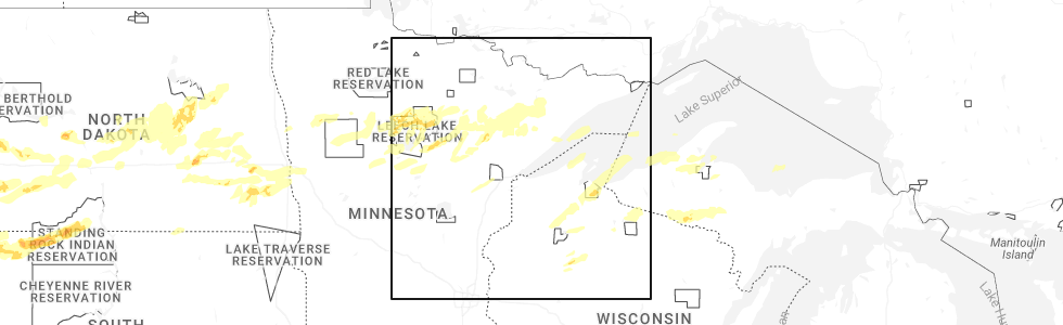
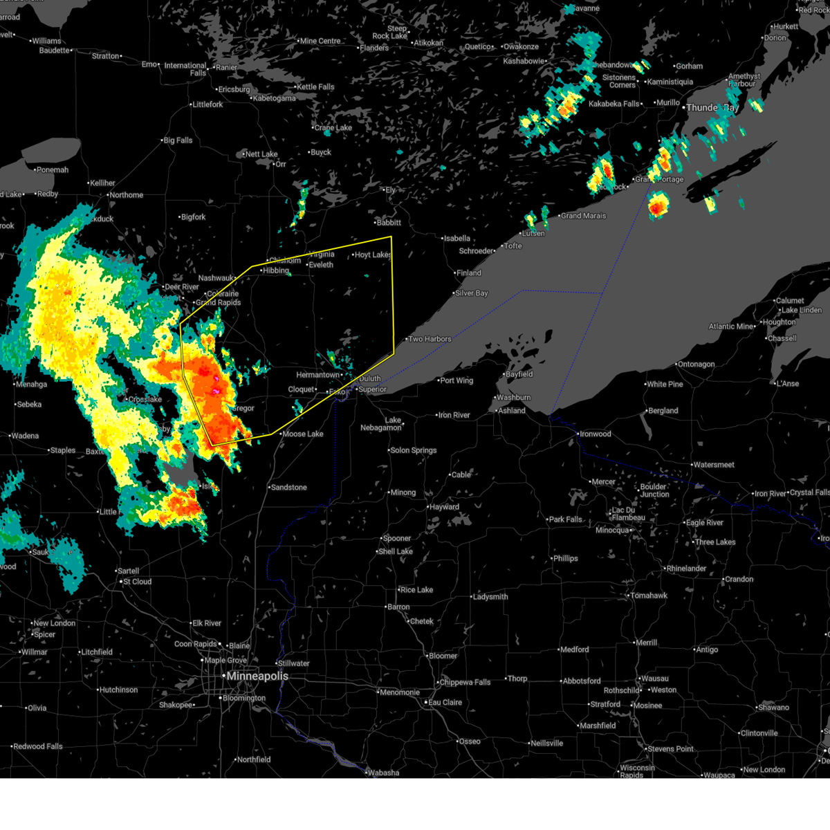
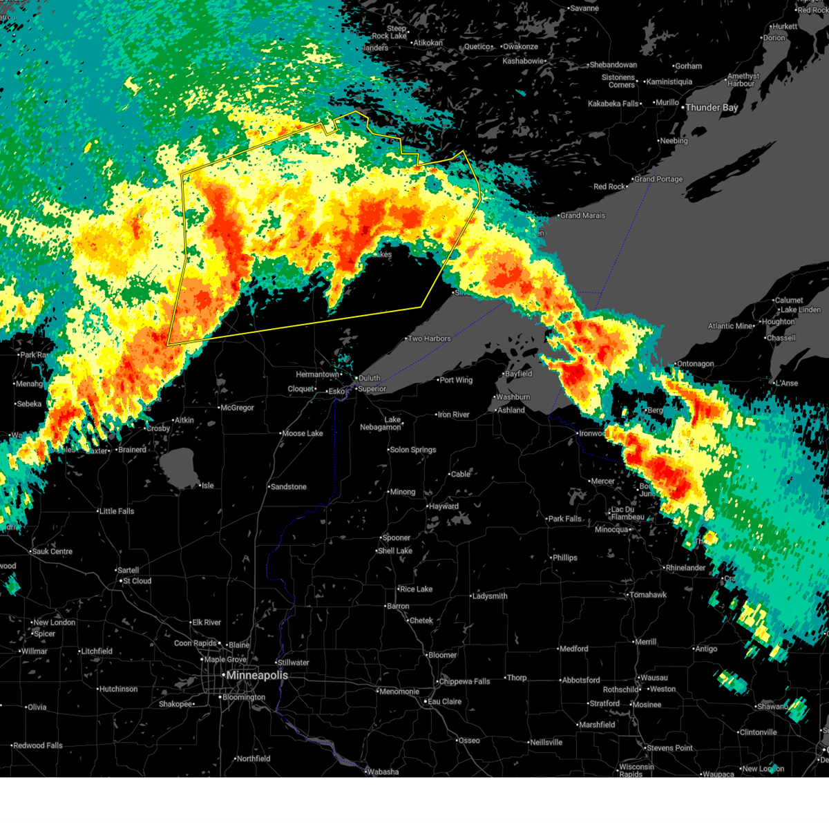
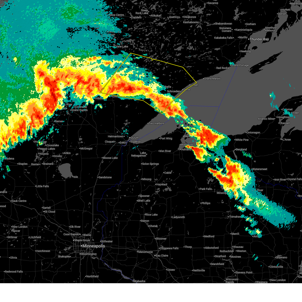
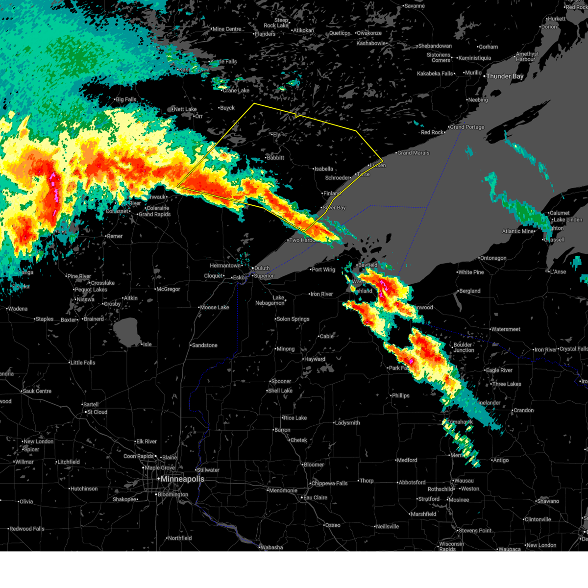
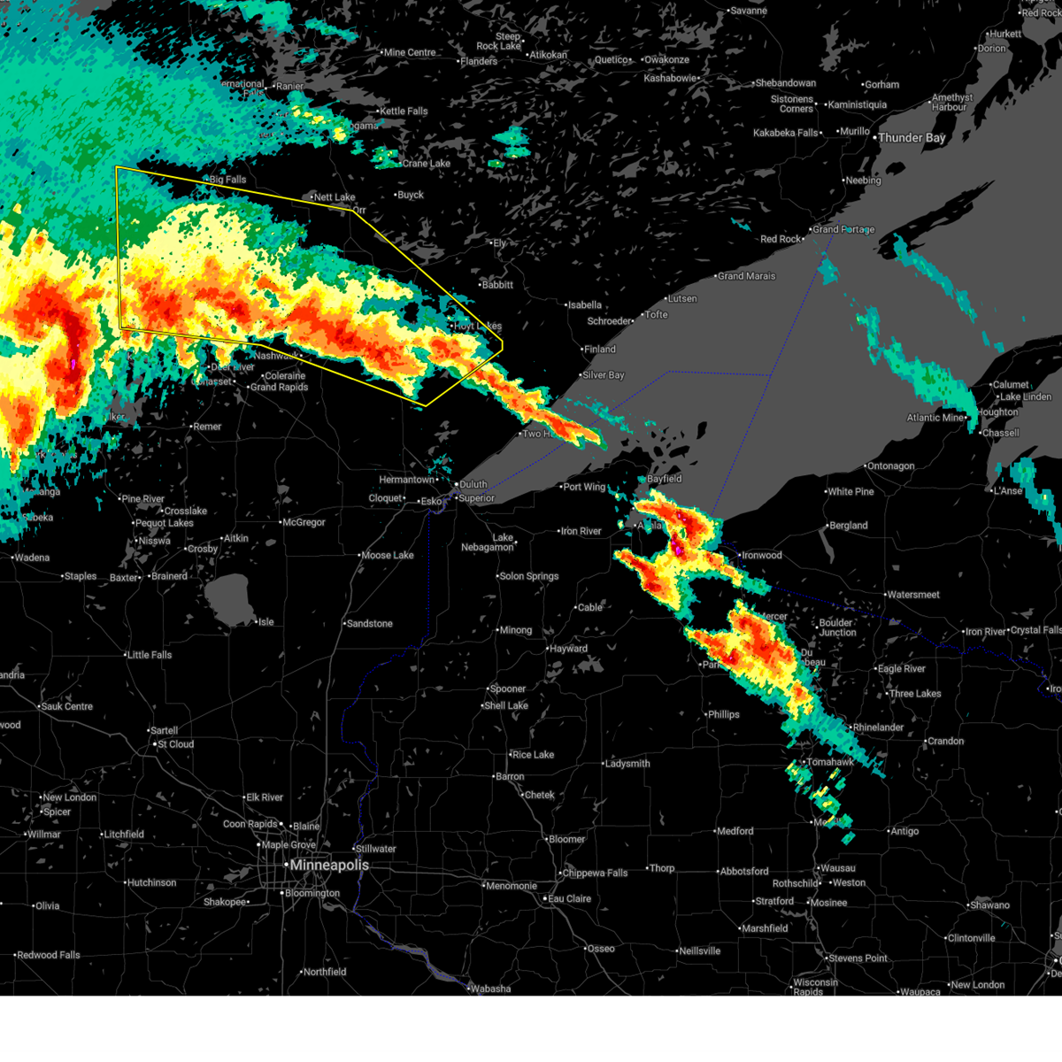
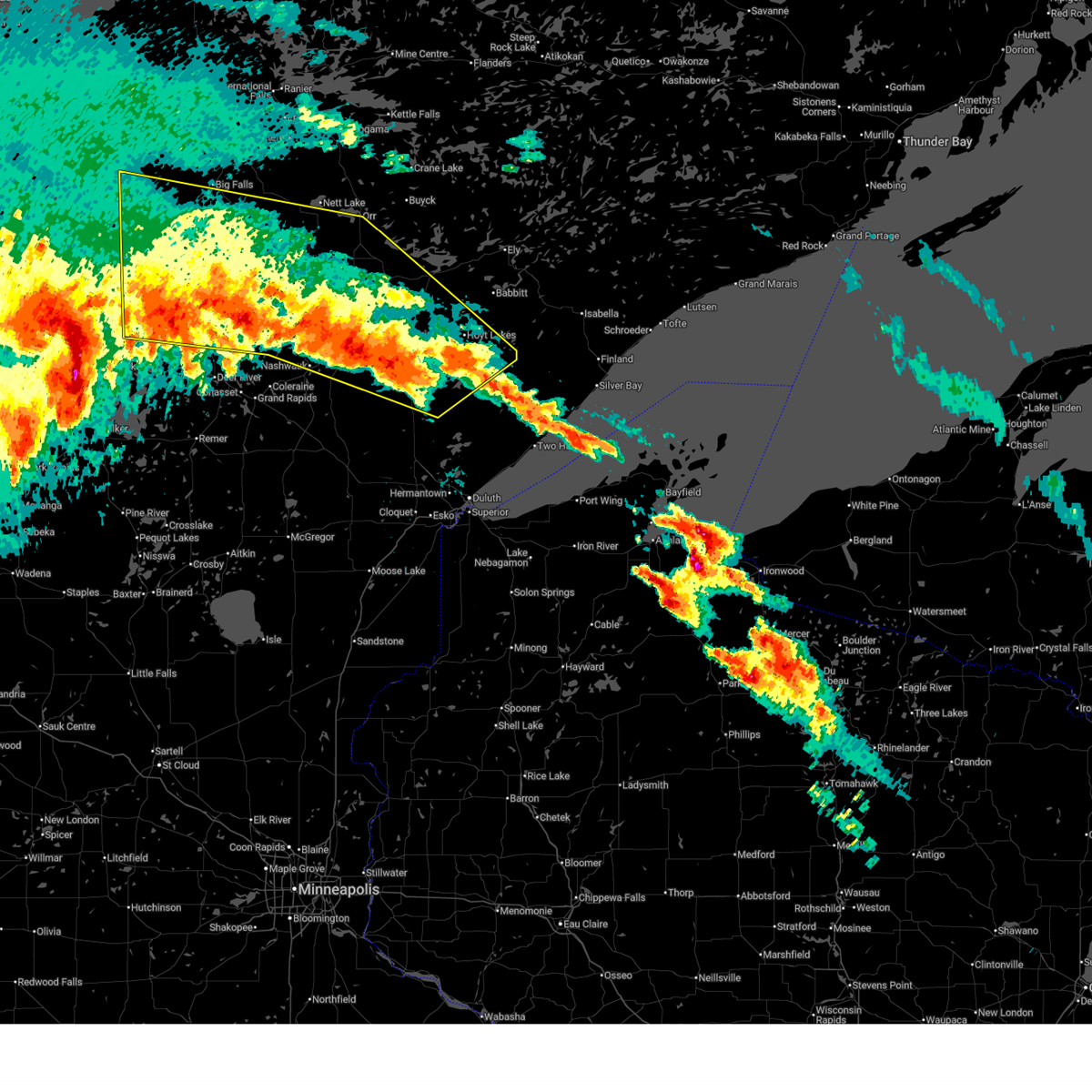
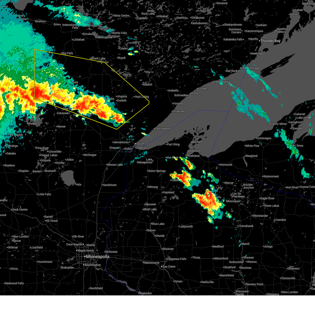
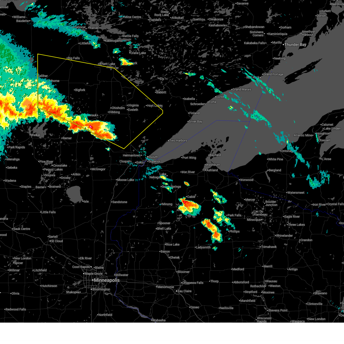
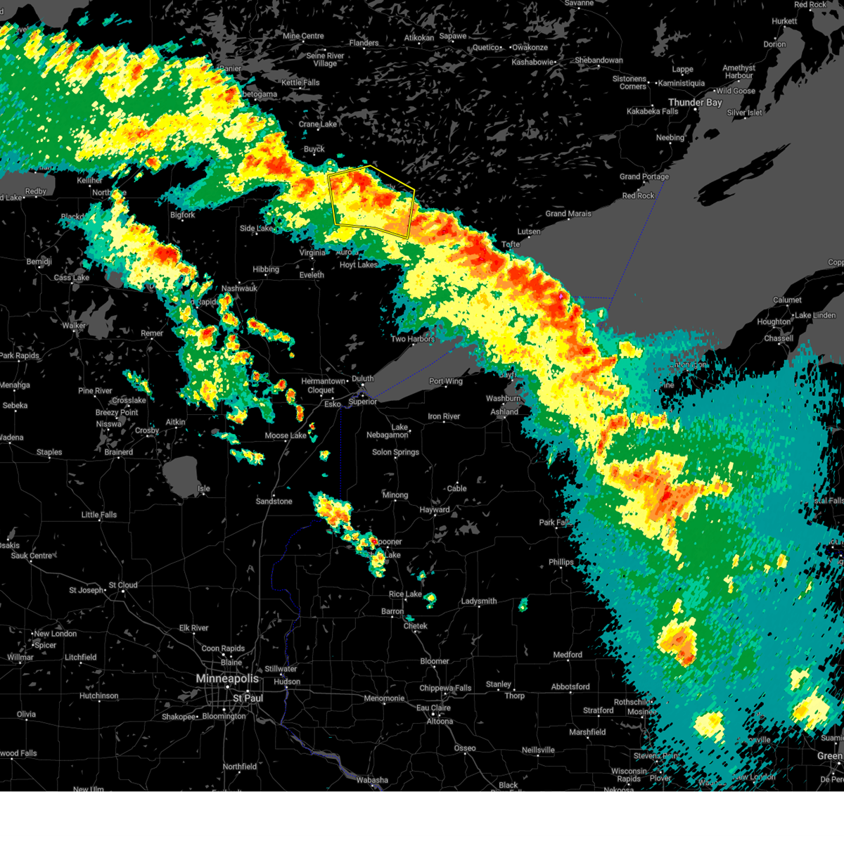
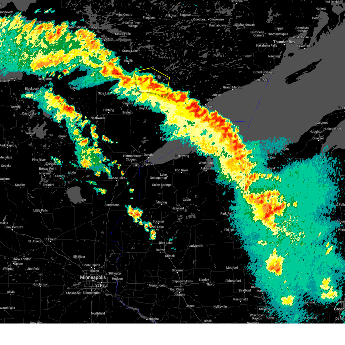
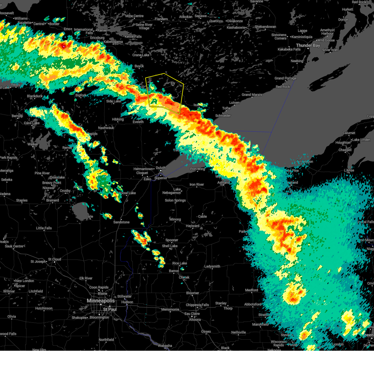
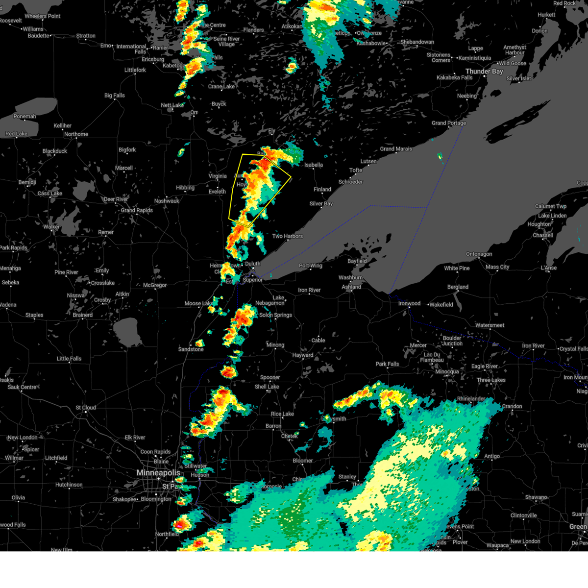
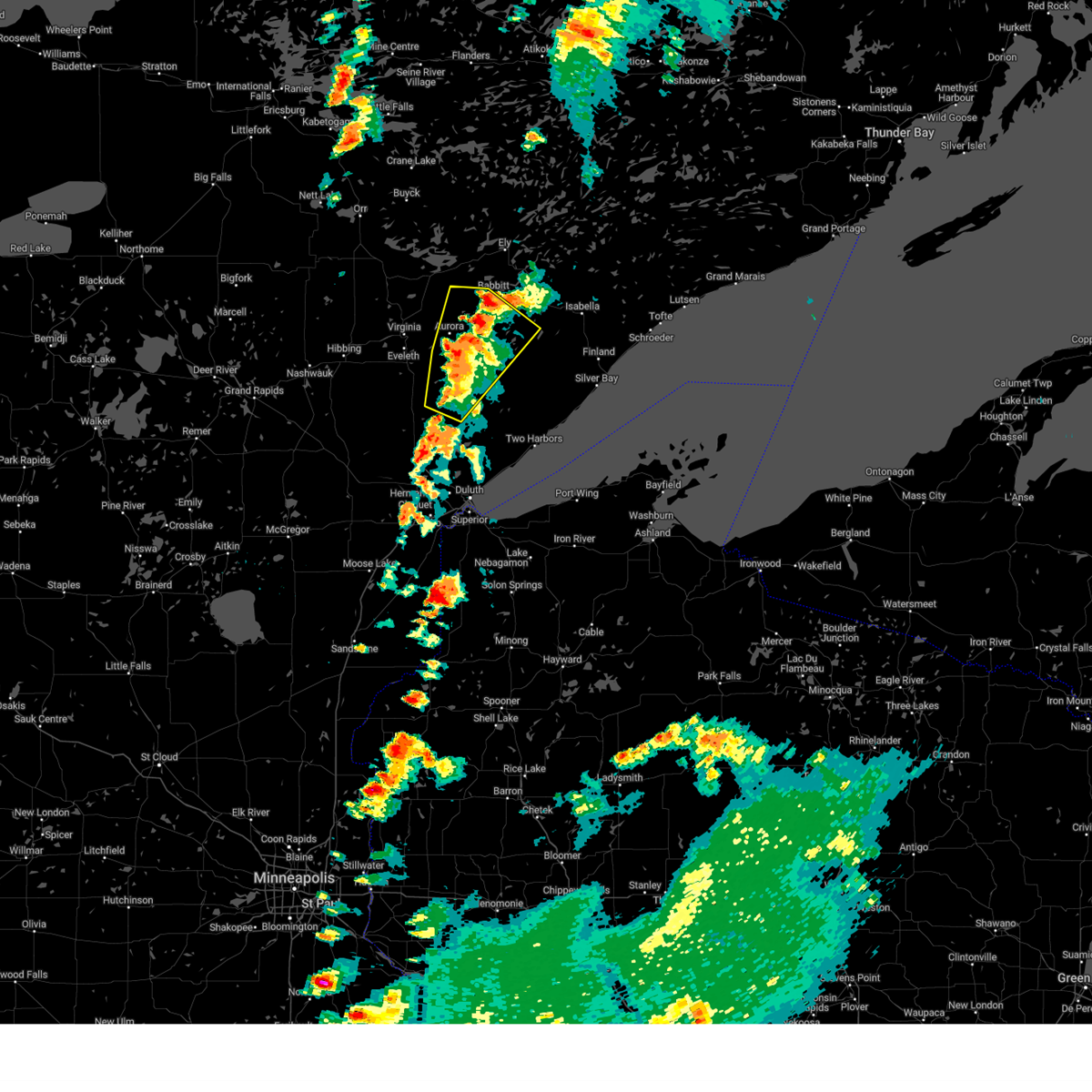
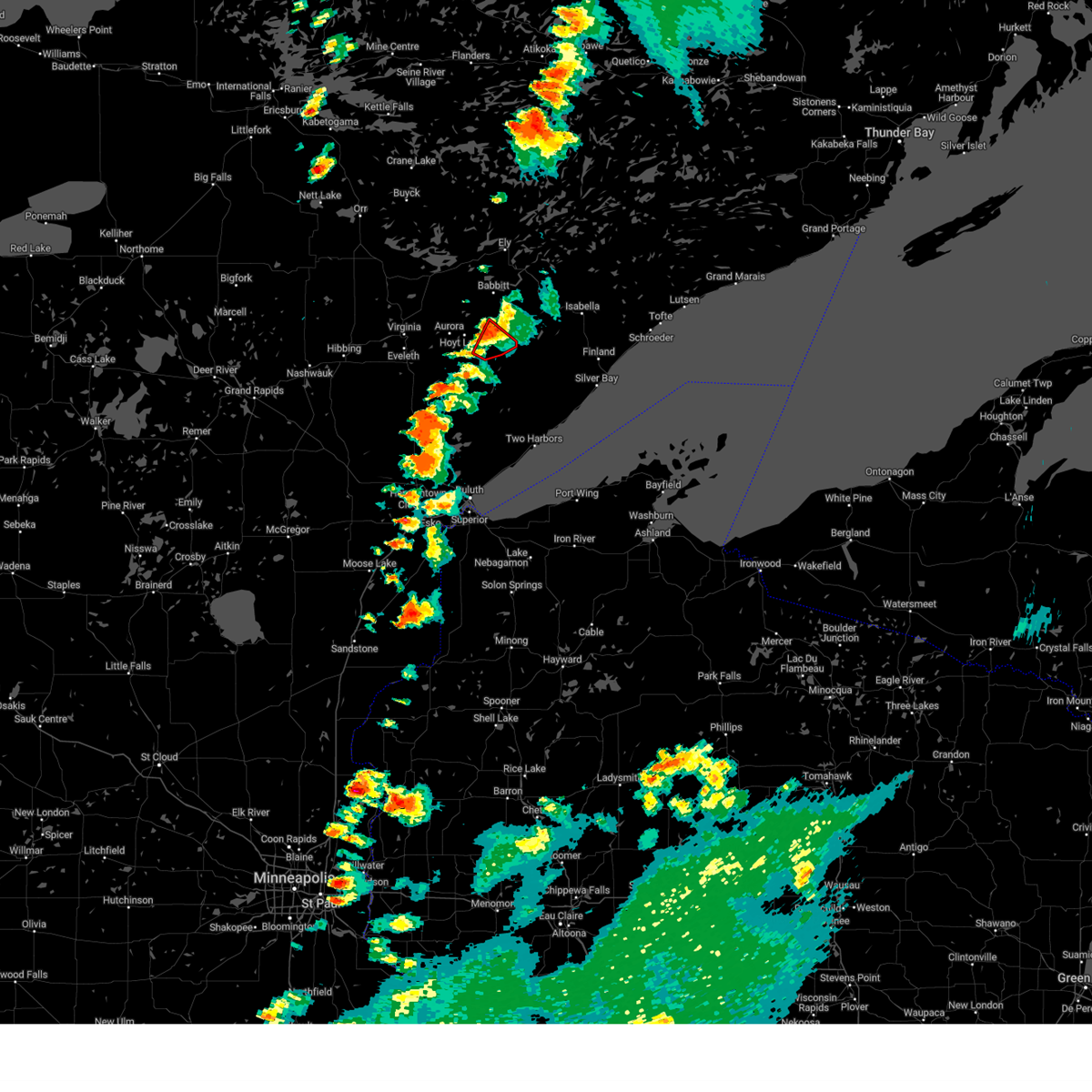
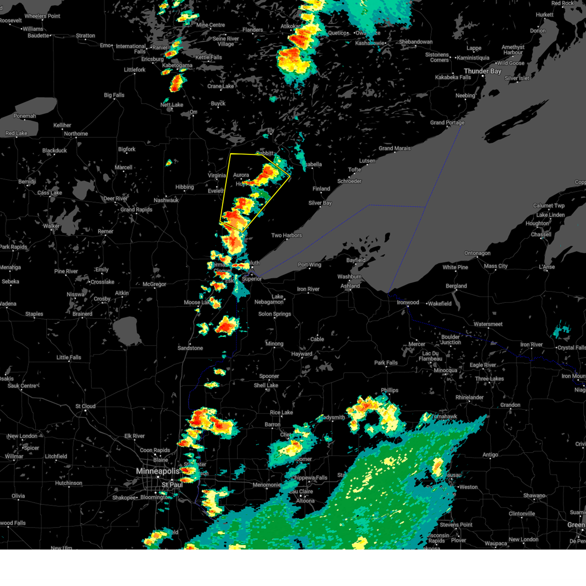
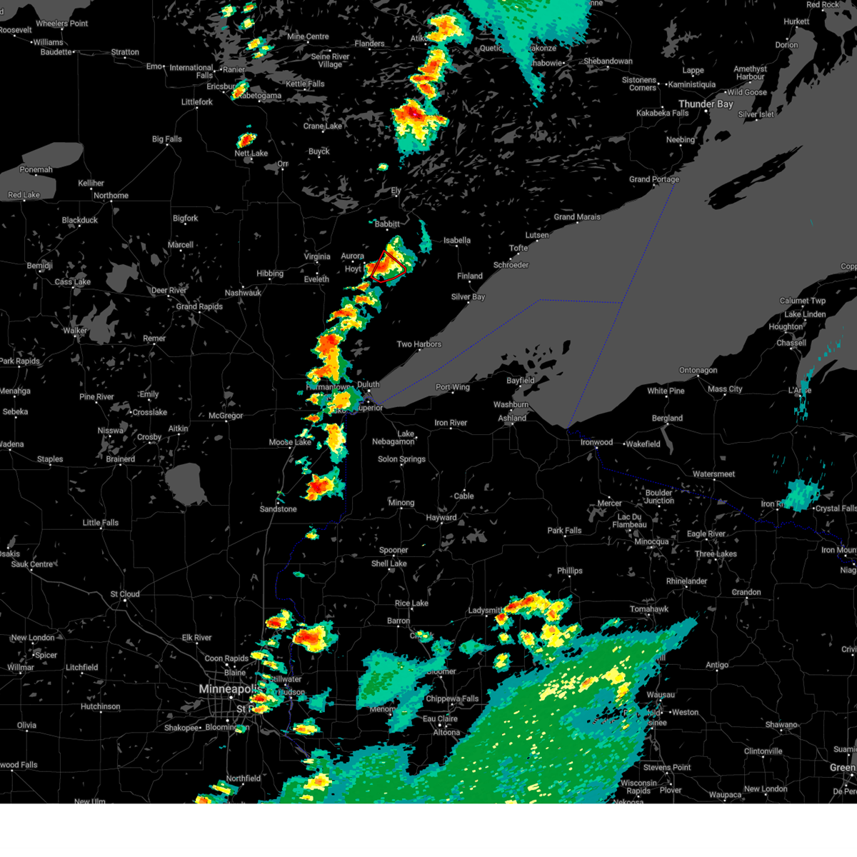
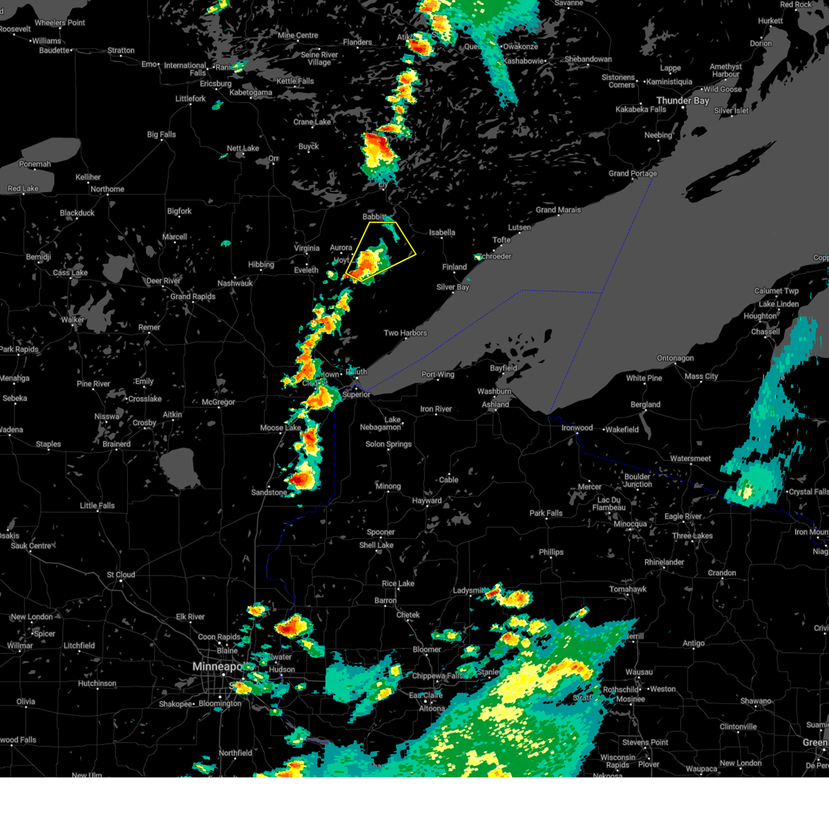
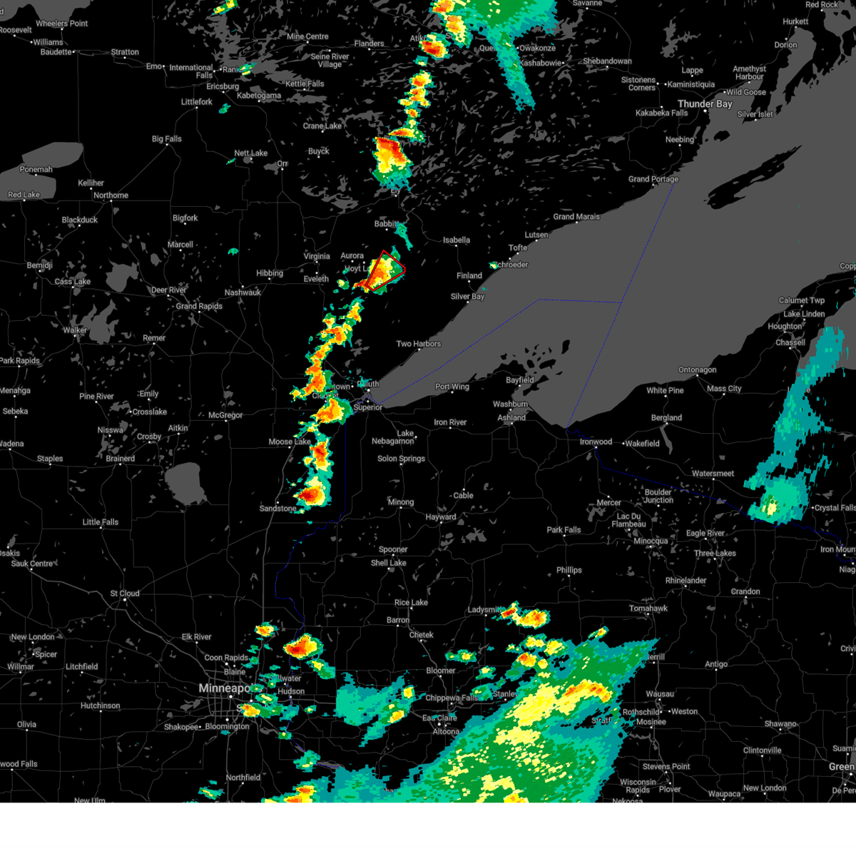
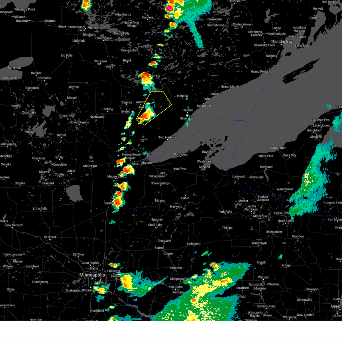
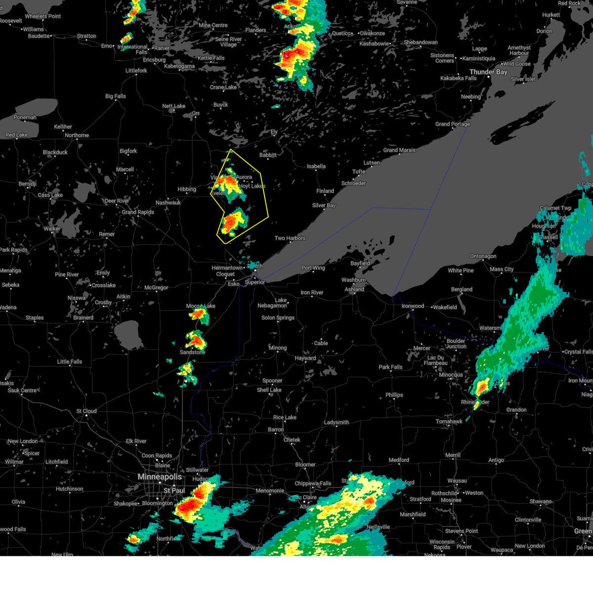
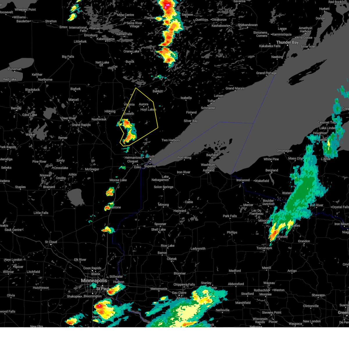
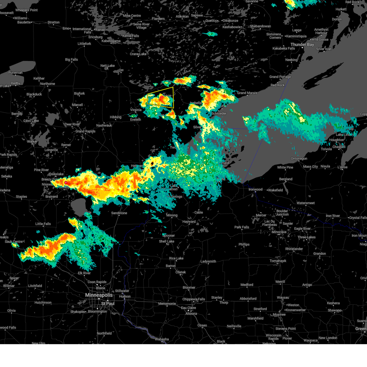
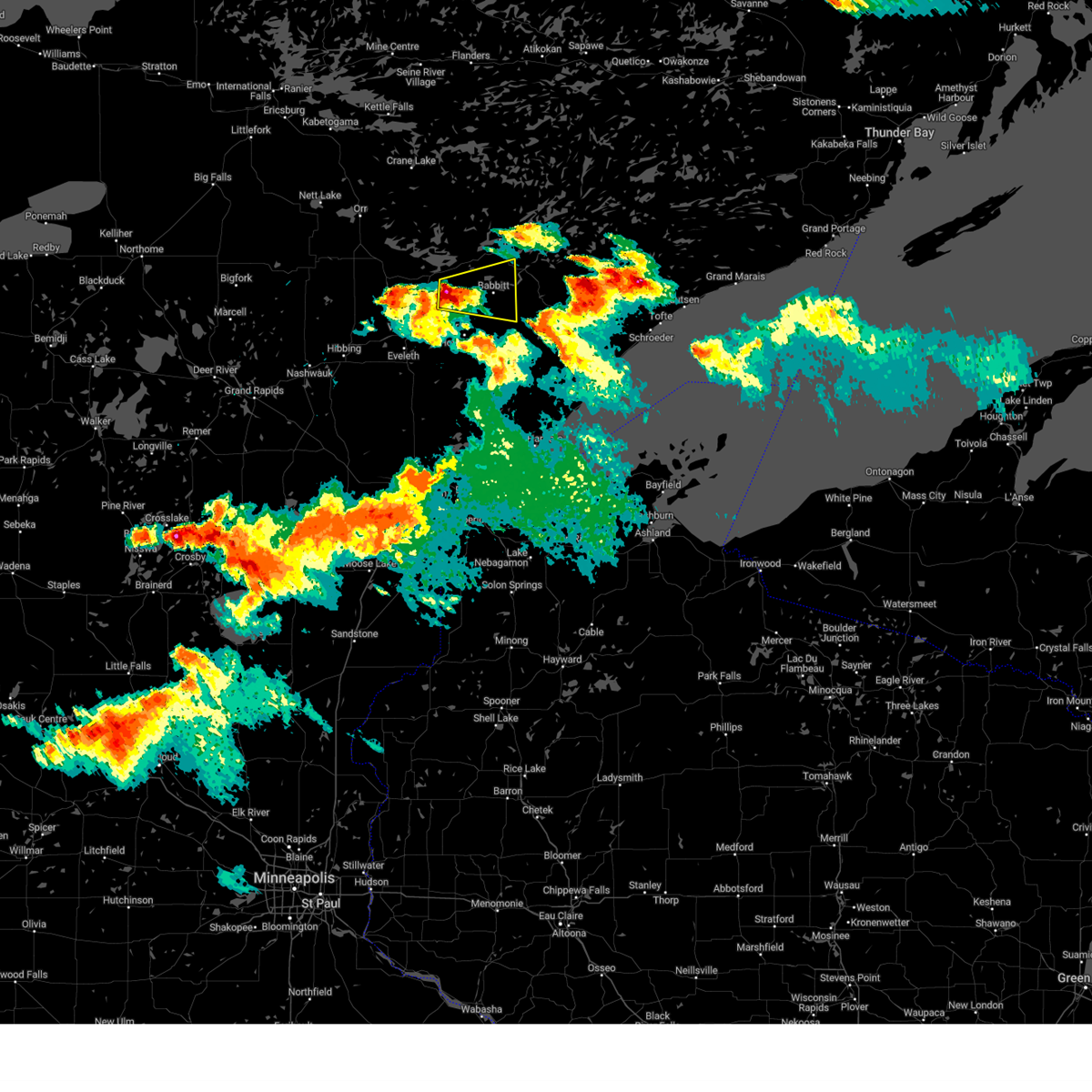
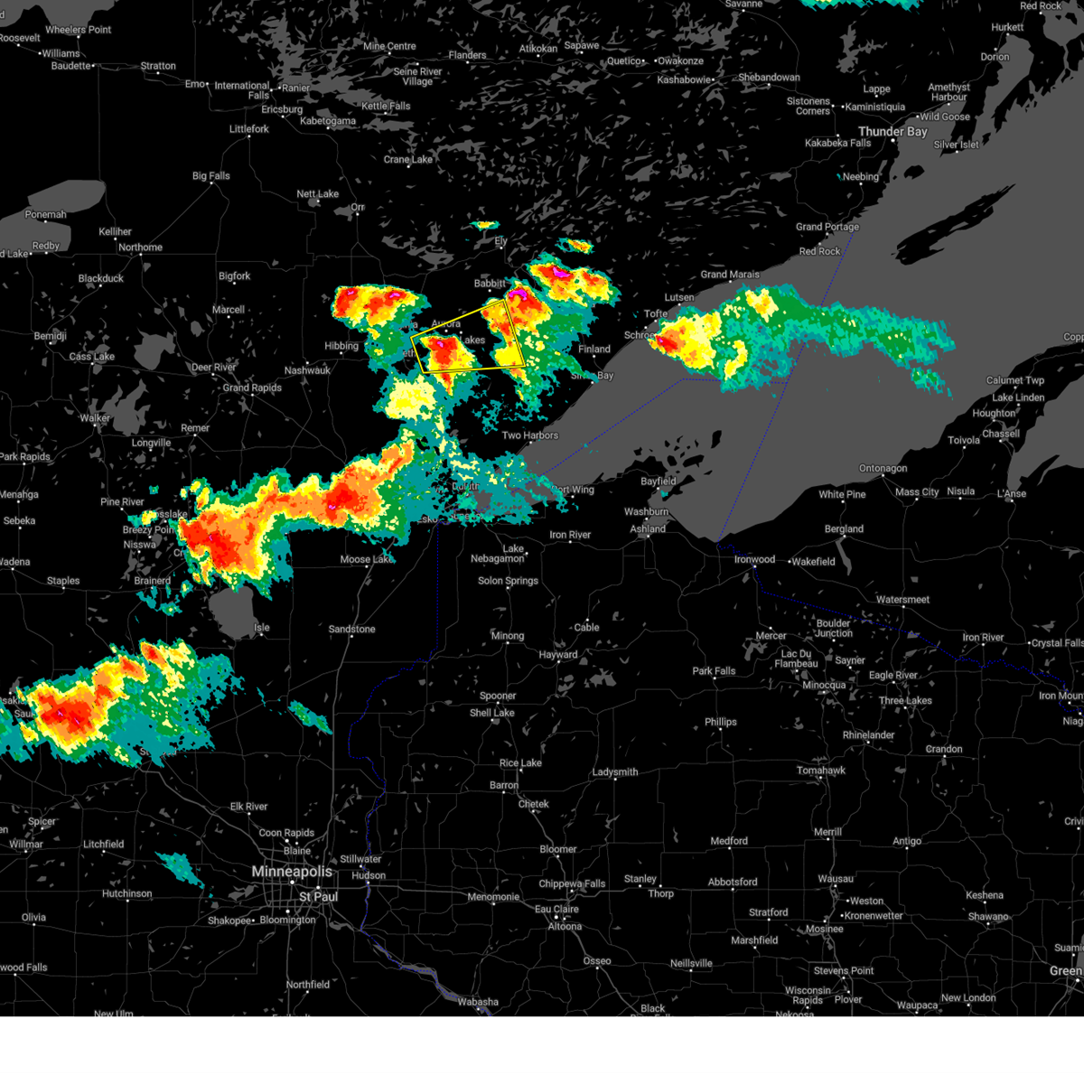
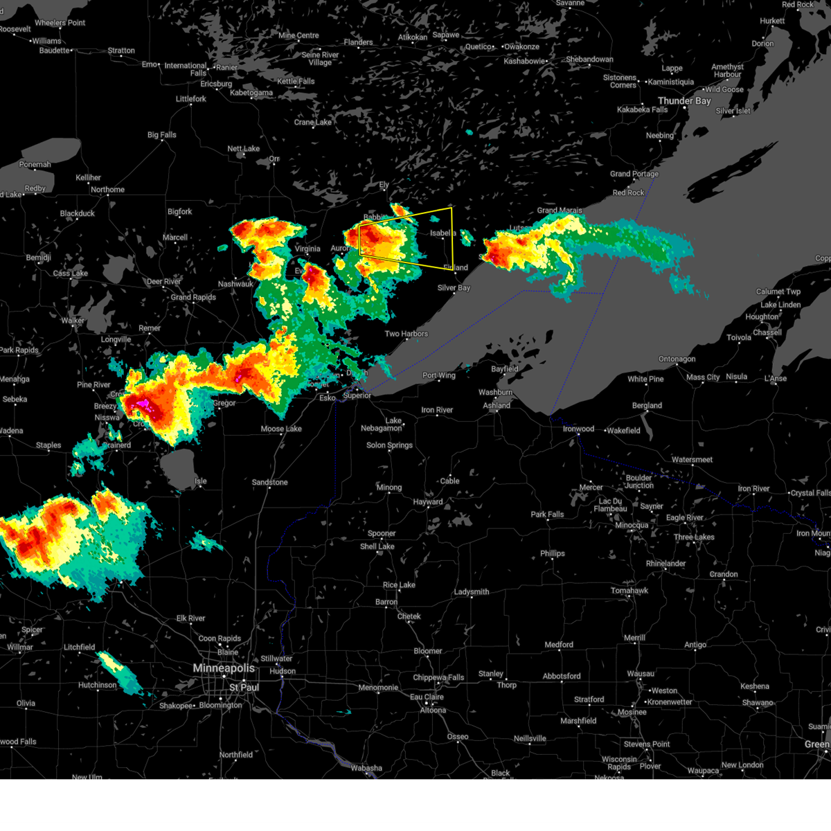
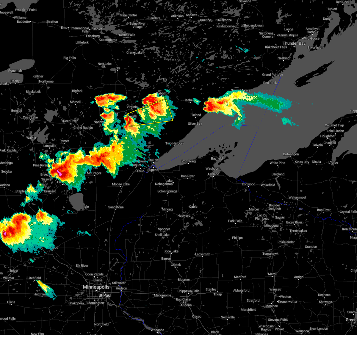
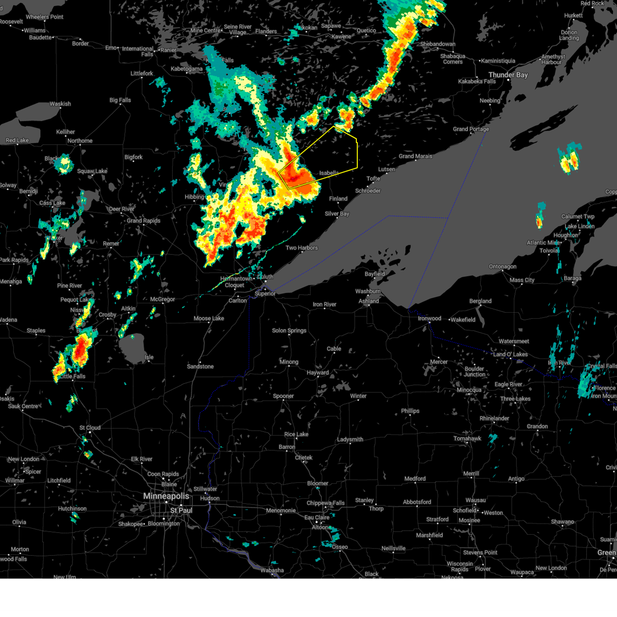
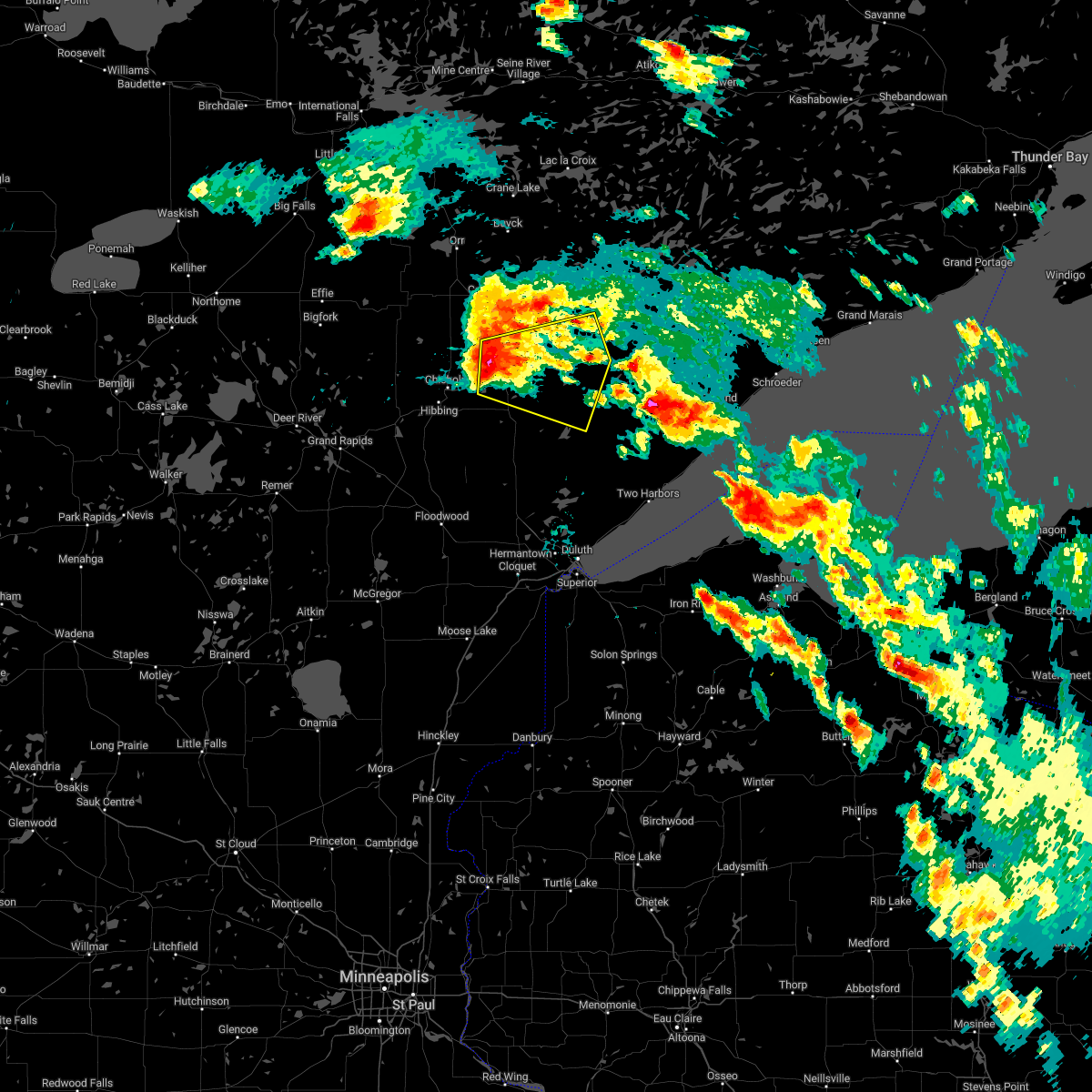
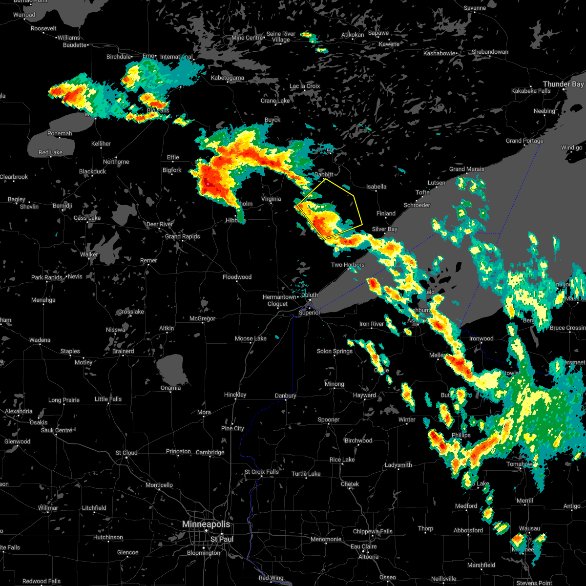
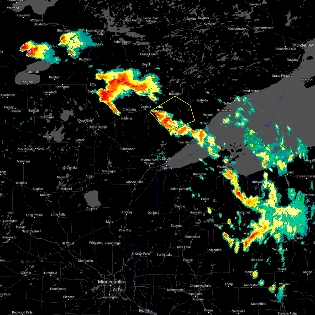
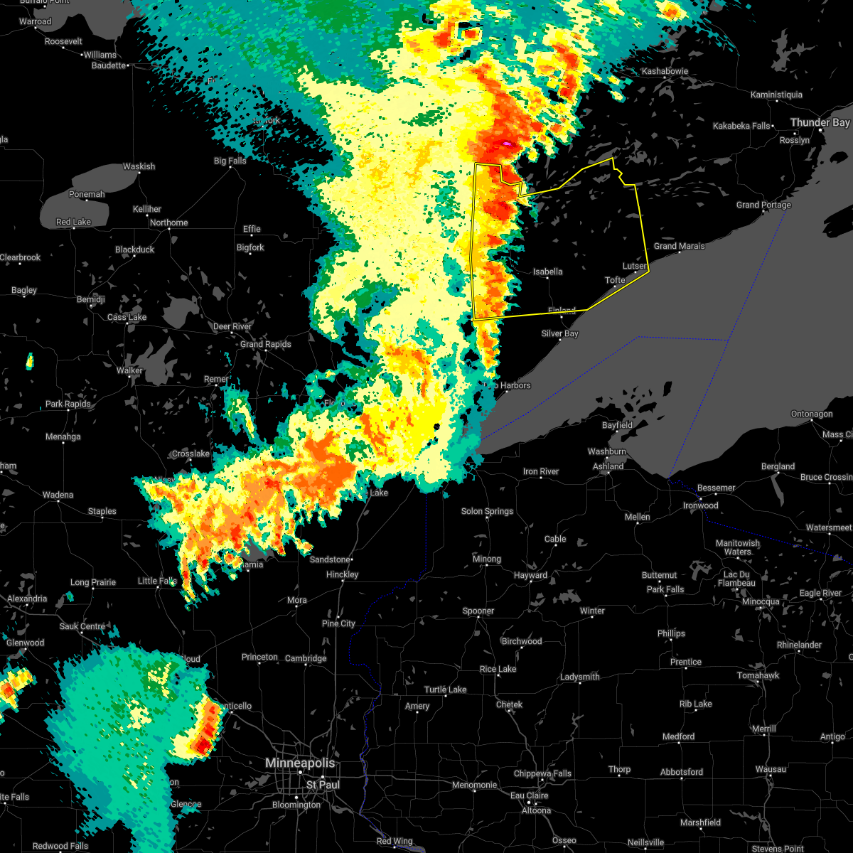
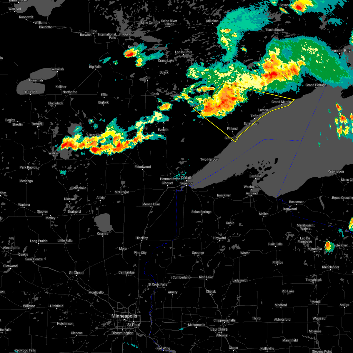
Hail Map for Babbitt, MN
The Babbitt, MN area has had 3 reports of on-the-ground hail by trained spotters, and has been under severe weather warnings 34 times during the past 12 months. Doppler radar has detected hail at or near Babbitt, MN on 52 occasions, including 2 occasions during the past year.
| Name: | Babbitt, MN |
| Where Located: | 61.2 miles N of Duluth, MN |
| Map: | Google Map for Babbitt, MN |
| Population: | 1475 |
| Housing Units: | 818 |
| More Info: | Search Google for Babbitt, MN |
4
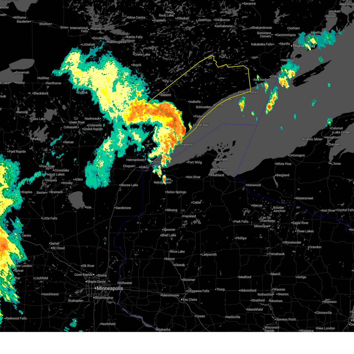
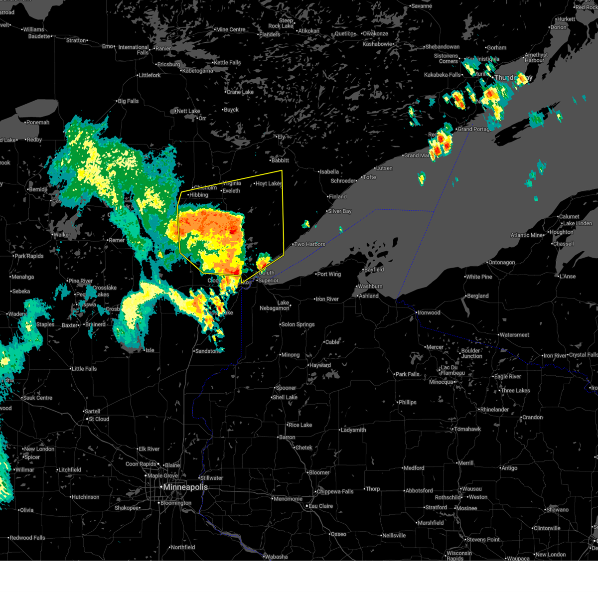
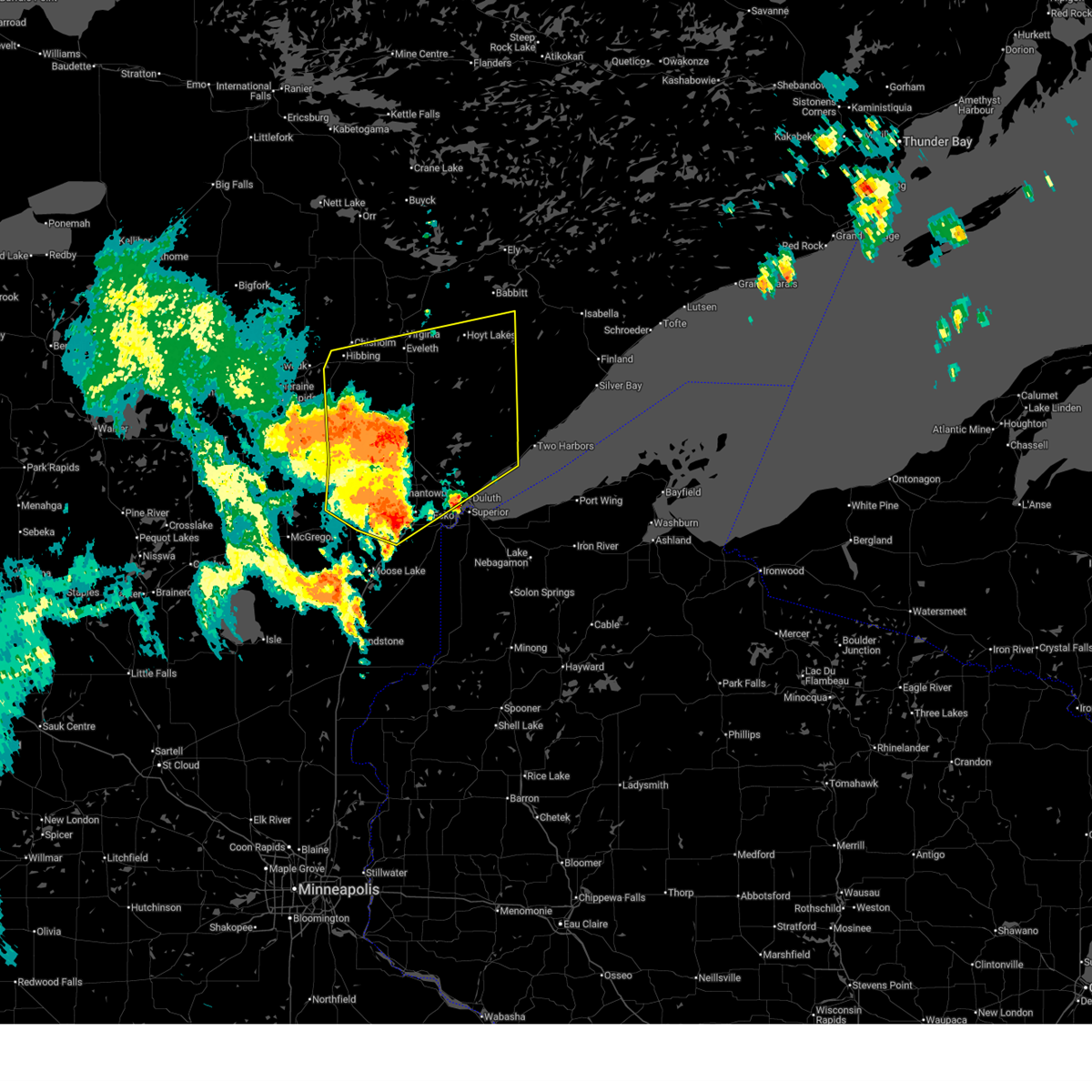
The Top Recent Hail Date for Babbitt, MN is Friday, June 20, 2025 (8th out of 52)
Hail and Wind Damage Spotted near Babbitt, MN
| Date / Time | Report Details |
|---|---|
| 6/23/2025 4:27 AM CDT |
 Svrdlh the national weather service in duluth mn has issued a * severe thunderstorm warning for, cook county in northeastern minnesota, east central st. louis county in northeastern minnesota, lake county in northeastern minnesota, * until 530 am cdt. * at 427 am cdt, severe thunderstorms were located along a line extending from birch lake to near isabella to near split rock lighthouse, moving northeast at 70 mph (radar indicated). Hazards include 60 mph wind gusts and penny size hail. Expect damage to roofs, siding, and trees. severe thunderstorms will be near, silver bay, beaver bay, dumbbell lake, illgen city, isabella, birch lake, finland, tettegouche state park, and southeastern boundary waters canoe area wilderness around 430 am cdt. clear lake, little marais, and george manitou state park around 435 am cdt. temperance river state park, forest center, and sugar loaf cove around 440 am cdt. tofte, taconite harbor, and snowbank lake around 445 am cdt. Other locations in the path of these severe thunderstorms include lutsen, eagle mountain, little saganaga lake, cascade river state park, gunflint lake, sea gull lake, alpine lake, grand marais and saganaga lake. Svrdlh the national weather service in duluth mn has issued a * severe thunderstorm warning for, cook county in northeastern minnesota, east central st. louis county in northeastern minnesota, lake county in northeastern minnesota, * until 530 am cdt. * at 427 am cdt, severe thunderstorms were located along a line extending from birch lake to near isabella to near split rock lighthouse, moving northeast at 70 mph (radar indicated). Hazards include 60 mph wind gusts and penny size hail. Expect damage to roofs, siding, and trees. severe thunderstorms will be near, silver bay, beaver bay, dumbbell lake, illgen city, isabella, birch lake, finland, tettegouche state park, and southeastern boundary waters canoe area wilderness around 430 am cdt. clear lake, little marais, and george manitou state park around 435 am cdt. temperance river state park, forest center, and sugar loaf cove around 440 am cdt. tofte, taconite harbor, and snowbank lake around 445 am cdt. Other locations in the path of these severe thunderstorms include lutsen, eagle mountain, little saganaga lake, cascade river state park, gunflint lake, sea gull lake, alpine lake, grand marais and saganaga lake.
|
| 6/23/2025 3:45 AM CDT |
 the severe thunderstorm warning has been cancelled and is no longer in effect the severe thunderstorm warning has been cancelled and is no longer in effect
|
| 6/23/2025 3:45 AM CDT |
 At 344 am cdt, severe thunderstorms were located along a line extending from near cherry to 9 miles southeast of eveleth to 6 miles south of whiteface reservoir to hermantown, moving northeast at 65 mph (radar indicated). Hazards include 60 mph wind gusts and quarter size hail. Hail damage to vehicles is expected. expect wind damage to roofs, siding, and trees. Locations impacted include, duluth, hibbing, hermantown, virginia, chisholm, eveleth, proctor, mountain iron, hoyt lakes, gilbert, aurora, babbitt, buhl, biwabik, cherry, floodwood, cotton, toivola, brookston, and meadowlands. At 344 am cdt, severe thunderstorms were located along a line extending from near cherry to 9 miles southeast of eveleth to 6 miles south of whiteface reservoir to hermantown, moving northeast at 65 mph (radar indicated). Hazards include 60 mph wind gusts and quarter size hail. Hail damage to vehicles is expected. expect wind damage to roofs, siding, and trees. Locations impacted include, duluth, hibbing, hermantown, virginia, chisholm, eveleth, proctor, mountain iron, hoyt lakes, gilbert, aurora, babbitt, buhl, biwabik, cherry, floodwood, cotton, toivola, brookston, and meadowlands.
|
| 6/23/2025 3:30 AM CDT |
 At 330 am cdt, severe thunderstorms were located along a line extending from 12 miles northeast of swan river to near toivola to near canyon to near mahtowa, moving northeast at 65 mph (radar indicated). Hazards include 60 mph wind gusts and nickel size hail. Expect damage to roofs, siding, and trees. Locations impacted include, hibbing, cloquet, hermantown, scanlon, carlton, cotton, thomson, pike lake near duluth, saginaw, fond du lac band cloquet area, island lake, boulder lake, duluth, proctor, cherry, whiteface reservoir, city of rice lake, eveleth, mountain iron, gilbert, virginia, hoyt lakes, fairbanks, wolf lake, aurora, babbitt, biwabik, brimson, mcquade harbor and french river. At 330 am cdt, severe thunderstorms were located along a line extending from 12 miles northeast of swan river to near toivola to near canyon to near mahtowa, moving northeast at 65 mph (radar indicated). Hazards include 60 mph wind gusts and nickel size hail. Expect damage to roofs, siding, and trees. Locations impacted include, hibbing, cloquet, hermantown, scanlon, carlton, cotton, thomson, pike lake near duluth, saginaw, fond du lac band cloquet area, island lake, boulder lake, duluth, proctor, cherry, whiteface reservoir, city of rice lake, eveleth, mountain iron, gilbert, virginia, hoyt lakes, fairbanks, wolf lake, aurora, babbitt, biwabik, brimson, mcquade harbor and french river.
|
| 6/23/2025 3:30 AM CDT |
 the severe thunderstorm warning has been cancelled and is no longer in effect the severe thunderstorm warning has been cancelled and is no longer in effect
|
| 6/23/2025 3:02 AM CDT |
 Svrdlh the national weather service in duluth mn has issued a * severe thunderstorm warning for, southeastern itasca county in north central minnesota, northeastern aitkin county in east central minnesota, southern st. louis county in northeastern minnesota, carlton county in northeastern minnesota, * until 400 am cdt. * at 301 am cdt, severe thunderstorms were located along a line extending from near hill city to jacobson to near cromwell to 8 miles west of kettle river, moving northeast at 55 mph (radar indicated. wind gusts to 62 mph have been observerd with this storm in aitkin county). Hazards include 70 mph wind gusts and quarter size hail. Hail damage to vehicles is expected. expect considerable tree damage. wind damage is also likely to mobile homes, roofs, and outbuildings. severe thunderstorms will be near, swan river, cromwell, kettle river, jacobson, and savanna portage state park around 305 am cdt. floodwood, warba, fond du lac band sawyer area, and fond du lac band brookston area around 310 am cdt. cloquet, mahtowa, brookston, meadowlands, and fond du lac band cloquet area around 320 am cdt. Other locations in the path of these severe thunderstorms include toivola, scanlon, carlton, saginaw, hibbing, hermantown, thomson, canyon, pike lake near duluth, jay cooke state park, proctor, cotton, island lake, duluth, city of rice lake and boulder lake. Svrdlh the national weather service in duluth mn has issued a * severe thunderstorm warning for, southeastern itasca county in north central minnesota, northeastern aitkin county in east central minnesota, southern st. louis county in northeastern minnesota, carlton county in northeastern minnesota, * until 400 am cdt. * at 301 am cdt, severe thunderstorms were located along a line extending from near hill city to jacobson to near cromwell to 8 miles west of kettle river, moving northeast at 55 mph (radar indicated. wind gusts to 62 mph have been observerd with this storm in aitkin county). Hazards include 70 mph wind gusts and quarter size hail. Hail damage to vehicles is expected. expect considerable tree damage. wind damage is also likely to mobile homes, roofs, and outbuildings. severe thunderstorms will be near, swan river, cromwell, kettle river, jacobson, and savanna portage state park around 305 am cdt. floodwood, warba, fond du lac band sawyer area, and fond du lac band brookston area around 310 am cdt. cloquet, mahtowa, brookston, meadowlands, and fond du lac band cloquet area around 320 am cdt. Other locations in the path of these severe thunderstorms include toivola, scanlon, carlton, saginaw, hibbing, hermantown, thomson, canyon, pike lake near duluth, jay cooke state park, proctor, cotton, island lake, duluth, city of rice lake and boulder lake.
|
| 6/21/2025 3:19 AM CDT |
 At 319 am cdt, severe thunderstorms were located along a line extending from 7 miles southeast of birch lake to 7 miles northeast of thomas lake near brimson to near larsmont to near wisconsin point, moving east at 50 mph (radar indicated). Hazards include 60 mph wind gusts. Expect damage to roofs, siding, and trees. these severe storms will be near, whyte, castle danger, gooseberry falls state park, and split rock lighthouse state park around 325 am cdt. Other locations in the path of these severe thunderstorms include silver bay, beaver bay, split rock lighthouse, isabella, finland, tettegouche state park, port wing, dumbbell lake, illgen city, herbster, little marais, george manitou state park, clear lake, sugar loaf cove, cornucopia, apostle island sea caves, temperance river state park, taconite harbor, sand bay, sand island, tofte and york island. At 319 am cdt, severe thunderstorms were located along a line extending from 7 miles southeast of birch lake to 7 miles northeast of thomas lake near brimson to near larsmont to near wisconsin point, moving east at 50 mph (radar indicated). Hazards include 60 mph wind gusts. Expect damage to roofs, siding, and trees. these severe storms will be near, whyte, castle danger, gooseberry falls state park, and split rock lighthouse state park around 325 am cdt. Other locations in the path of these severe thunderstorms include silver bay, beaver bay, split rock lighthouse, isabella, finland, tettegouche state park, port wing, dumbbell lake, illgen city, herbster, little marais, george manitou state park, clear lake, sugar loaf cove, cornucopia, apostle island sea caves, temperance river state park, taconite harbor, sand bay, sand island, tofte and york island.
|
| 6/21/2025 3:07 AM CDT |
 At 306 am cdt, severe thunderstorms were located along a line extending from near babbitt to near brimson to near french river to superior, moving east at 60 mph (radar indicated). Hazards include 60 mph wind gusts. Expect damage to roofs, siding, and trees. these severe storms will be near, duluth, superior, two harbors, babbitt, thomas lake near brimson, highland lake, wisconsin point, knife river, larsmont, and french river around 310 am cdt. Other locations in the path of these severe thunderstorms include castle danger, whyte, gooseberry falls state park, split rock lighthouse state park, split rock lighthouse, silver bay, beaver bay, isabella, finland, tettegouche state park, port wing, herbster, dumbbell lake, illgen city, little marais, cornucopia, george manitou state park, clear lake, sand island, apostle island sea caves, sand bay, temperance river state park, taconite harbor, sugar loaf cove and york island. At 306 am cdt, severe thunderstorms were located along a line extending from near babbitt to near brimson to near french river to superior, moving east at 60 mph (radar indicated). Hazards include 60 mph wind gusts. Expect damage to roofs, siding, and trees. these severe storms will be near, duluth, superior, two harbors, babbitt, thomas lake near brimson, highland lake, wisconsin point, knife river, larsmont, and french river around 310 am cdt. Other locations in the path of these severe thunderstorms include castle danger, whyte, gooseberry falls state park, split rock lighthouse state park, split rock lighthouse, silver bay, beaver bay, isabella, finland, tettegouche state park, port wing, herbster, dumbbell lake, illgen city, little marais, cornucopia, george manitou state park, clear lake, sand island, apostle island sea caves, sand bay, temperance river state park, taconite harbor, sugar loaf cove and york island.
|
| 6/21/2025 2:53 AM CDT |
 Svrdlh the national weather service in duluth mn has issued a * severe thunderstorm warning for, southwestern cook county in northeastern minnesota, southeastern st. louis county in northeastern minnesota, northeastern carlton county in northeastern minnesota, lake county in northeastern minnesota, northern bayfield county in northwestern wisconsin, northeastern douglas county in northwestern wisconsin, * until 400 am cdt. * at 252 am cdt, severe thunderstorms were located along a line extending from near embarrass to near whiteface reservoir to island lake to near cloquet, moving east at 50 mph (radar indicated). Hazards include 60 mph wind gusts. Expect damage to roofs, siding, and trees. severe thunderstorms will be near, duluth, hermantown, proctor, hoyt lakes, babbitt, fairbanks, wolf lake, city of rice lake, and island lake around 300 am cdt. superior, brimson, and birch lake around 305 am cdt. highland lake, knife river, french river, mcquade harbor, and stoney point around 310 am cdt. Other locations in the path of these severe thunderstorms include two harbors, thomas lake near brimson, wisconsin point, larsmont, whyte, castle danger, gooseberry falls state park, split rock lighthouse state park, split rock lighthouse, silver bay, beaver bay, isabella, finland and tettegouche state park. Svrdlh the national weather service in duluth mn has issued a * severe thunderstorm warning for, southwestern cook county in northeastern minnesota, southeastern st. louis county in northeastern minnesota, northeastern carlton county in northeastern minnesota, lake county in northeastern minnesota, northern bayfield county in northwestern wisconsin, northeastern douglas county in northwestern wisconsin, * until 400 am cdt. * at 252 am cdt, severe thunderstorms were located along a line extending from near embarrass to near whiteface reservoir to island lake to near cloquet, moving east at 50 mph (radar indicated). Hazards include 60 mph wind gusts. Expect damage to roofs, siding, and trees. severe thunderstorms will be near, duluth, hermantown, proctor, hoyt lakes, babbitt, fairbanks, wolf lake, city of rice lake, and island lake around 300 am cdt. superior, brimson, and birch lake around 305 am cdt. highland lake, knife river, french river, mcquade harbor, and stoney point around 310 am cdt. Other locations in the path of these severe thunderstorms include two harbors, thomas lake near brimson, wisconsin point, larsmont, whyte, castle danger, gooseberry falls state park, split rock lighthouse state park, split rock lighthouse, silver bay, beaver bay, isabella, finland and tettegouche state park.
|
| 6/21/2025 2:36 AM CDT |
 At 235 am cdt, severe thunderstorms were located along a line extending from boundary waters canoe area wilderness to near bear head lake state park to 9 miles northwest of whiteface reservoir, moving east at 80 mph (radar indicated). Hazards include 70 mph wind gusts and penny size hail. Expect considerable tree damage. damage is likely to mobile homes, roofs, and outbuildings. Locations impacted include, hibbing, ely, lake vermilion, virginia, chisholm, eveleth, mountain iron, hoyt lakes, gilbert, aurora, babbitt, keewatin, buhl, nashwauk, biwabik, cherry, swan river, embarrass, cook, and tower. At 235 am cdt, severe thunderstorms were located along a line extending from boundary waters canoe area wilderness to near bear head lake state park to 9 miles northwest of whiteface reservoir, moving east at 80 mph (radar indicated). Hazards include 70 mph wind gusts and penny size hail. Expect considerable tree damage. damage is likely to mobile homes, roofs, and outbuildings. Locations impacted include, hibbing, ely, lake vermilion, virginia, chisholm, eveleth, mountain iron, hoyt lakes, gilbert, aurora, babbitt, keewatin, buhl, nashwauk, biwabik, cherry, swan river, embarrass, cook, and tower.
|
| 6/21/2025 2:36 AM CDT |
 the severe thunderstorm warning has been cancelled and is no longer in effect the severe thunderstorm warning has been cancelled and is no longer in effect
|
| 6/21/2025 2:18 AM CDT |
 At 217 am cdt, severe thunderstorms were located along a line extending from near buyck to 8 miles north of biwabik to 7 miles north of toivola, moving east at 80 mph (radar indicated). Hazards include 70 mph wind gusts and penny size hail. Expect considerable tree damage. damage is likely to mobile homes, roofs, and outbuildings. Locations impacted include, lake vermilion, virginia, eveleth, hoyt lakes, gilbert, aurora, biwabik, embarrass, tower, boundary waters canoe area wilderness near trout lake, babbitt, robinson, birch lake, burntside lake, ely, white iron lake, winton, fall lake, basswood lake, snowbank lake, forest center and isabella. At 217 am cdt, severe thunderstorms were located along a line extending from near buyck to 8 miles north of biwabik to 7 miles north of toivola, moving east at 80 mph (radar indicated). Hazards include 70 mph wind gusts and penny size hail. Expect considerable tree damage. damage is likely to mobile homes, roofs, and outbuildings. Locations impacted include, lake vermilion, virginia, eveleth, hoyt lakes, gilbert, aurora, biwabik, embarrass, tower, boundary waters canoe area wilderness near trout lake, babbitt, robinson, birch lake, burntside lake, ely, white iron lake, winton, fall lake, basswood lake, snowbank lake, forest center and isabella.
|
| 6/21/2025 1:55 AM CDT |
 Svrdlh the national weather service in duluth mn has issued a * severe thunderstorm warning for, eastern itasca county in north central minnesota, north central aitkin county in east central minnesota, southeastern koochiching county in north central minnesota, st. louis county in northeastern minnesota, lake county in northeastern minnesota, * until 300 am cdt. * at 155 am cdt, severe thunderstorms were located along a line extending from 9 miles north of togo to near chisholm to near warba, moving east at 80 mph (radar indicated). Hazards include 70 mph wind gusts and penny size hail. Expect considerable tree damage. damage is likely to mobile homes, roofs, and outbuildings. severe thunderstorms will be near, hibbing, chisholm, keewatin, buhl, nashwauk, meadow brook, warba, and pelican lake around 200 am cdt. mountain iron, cook, orr, and gheen around 205 am cdt. lake vermilion, virginia, eveleth, and cherry around 210 am cdt. gilbert, biwabik, and buyck around 215 am cdt. Other locations in the path of these severe thunderstorms include embarrass, tower, boundary waters canoe area wilderness near trout lake, soudan underground mine state park, hoyt lakes, aurora, babbitt, bear head lake state park, robinson, birch lake, burntside lake, ely, winton, white iron lake and fall lake. Svrdlh the national weather service in duluth mn has issued a * severe thunderstorm warning for, eastern itasca county in north central minnesota, north central aitkin county in east central minnesota, southeastern koochiching county in north central minnesota, st. louis county in northeastern minnesota, lake county in northeastern minnesota, * until 300 am cdt. * at 155 am cdt, severe thunderstorms were located along a line extending from 9 miles north of togo to near chisholm to near warba, moving east at 80 mph (radar indicated). Hazards include 70 mph wind gusts and penny size hail. Expect considerable tree damage. damage is likely to mobile homes, roofs, and outbuildings. severe thunderstorms will be near, hibbing, chisholm, keewatin, buhl, nashwauk, meadow brook, warba, and pelican lake around 200 am cdt. mountain iron, cook, orr, and gheen around 205 am cdt. lake vermilion, virginia, eveleth, and cherry around 210 am cdt. gilbert, biwabik, and buyck around 215 am cdt. Other locations in the path of these severe thunderstorms include embarrass, tower, boundary waters canoe area wilderness near trout lake, soudan underground mine state park, hoyt lakes, aurora, babbitt, bear head lake state park, robinson, birch lake, burntside lake, ely, winton, white iron lake and fall lake.
|
| 6/21/2025 1:22 AM CDT |
 At 122 am cdt, severe thunderstorms were located along a line extending from near biwabik to near whyte to 11 miles northwest of devils island, moving east at 45 mph (radar indicated). Hazards include 60 mph wind gusts and quarter size hail. Hail damage to vehicles is expected. expect wind damage to roofs, siding, and trees. Locations impacted include, hoyt lakes, babbitt, biwabik, embarrass, whyte, little marais, illgen city, finland, tettegouche state park, george manitou state park, sugar loaf cove, taconite harbor, isabella, birch lake, temperance river state park, dumbbell lake, clear lake, tofte, lutsen, southern boundary waters canoe area wilderness, forest center and cascade river state park. At 122 am cdt, severe thunderstorms were located along a line extending from near biwabik to near whyte to 11 miles northwest of devils island, moving east at 45 mph (radar indicated). Hazards include 60 mph wind gusts and quarter size hail. Hail damage to vehicles is expected. expect wind damage to roofs, siding, and trees. Locations impacted include, hoyt lakes, babbitt, biwabik, embarrass, whyte, little marais, illgen city, finland, tettegouche state park, george manitou state park, sugar loaf cove, taconite harbor, isabella, birch lake, temperance river state park, dumbbell lake, clear lake, tofte, lutsen, southern boundary waters canoe area wilderness, forest center and cascade river state park.
|
| 6/21/2025 12:56 AM CDT |
 Svrdlh the national weather service in duluth mn has issued a * severe thunderstorm warning for, southwestern cook county in northeastern minnesota, central st. louis county in northeastern minnesota, lake county in northeastern minnesota, * until 200 am cdt. * at 1255 am cdt, severe thunderstorms were located along a line extending from near buhl to near brimson to 7 miles southeast of gooseberry falls state park, moving east at 45 mph (radar indicated). Hazards include 60 mph wind gusts and half dollar size hail. Hail damage to vehicles is expected. expect wind damage to roofs, siding, and trees. severe thunderstorms will be near, virginia, eveleth, mountain iron, gilbert, buhl, fairbanks, whiteface reservoir, split rock lighthouse, gooseberry falls state park, and split rock lighthouse state park around 100 am cdt. hoyt lakes, biwabik, and beaver bay around 105 am cdt. silver bay and aurora around 110 am cdt. whyte and tettegouche state park around 115 am cdt. Other locations in the path of these severe thunderstorms include babbitt, illgen city, finland, embarrass, little marais and george manitou state park. Svrdlh the national weather service in duluth mn has issued a * severe thunderstorm warning for, southwestern cook county in northeastern minnesota, central st. louis county in northeastern minnesota, lake county in northeastern minnesota, * until 200 am cdt. * at 1255 am cdt, severe thunderstorms were located along a line extending from near buhl to near brimson to 7 miles southeast of gooseberry falls state park, moving east at 45 mph (radar indicated). Hazards include 60 mph wind gusts and half dollar size hail. Hail damage to vehicles is expected. expect wind damage to roofs, siding, and trees. severe thunderstorms will be near, virginia, eveleth, mountain iron, gilbert, buhl, fairbanks, whiteface reservoir, split rock lighthouse, gooseberry falls state park, and split rock lighthouse state park around 100 am cdt. hoyt lakes, biwabik, and beaver bay around 105 am cdt. silver bay and aurora around 110 am cdt. whyte and tettegouche state park around 115 am cdt. Other locations in the path of these severe thunderstorms include babbitt, illgen city, finland, embarrass, little marais and george manitou state park.
|
| 6/21/2025 12:48 AM CDT |
 the severe thunderstorm warning has been cancelled and is no longer in effect the severe thunderstorm warning has been cancelled and is no longer in effect
|
| 6/21/2025 12:48 AM CDT |
 At 1246 am cdt, severe thunderstorms were located along a line extending from near effie to near mccarthy beach state park to eveleth, moving northeast at 45 mph (radar indicated). Hazards include two inch hail and 60 mph wind gusts. People and animals outdoors will be injured. expect hail damage to roofs, siding, windows, and vehicles. expect wind damage to roofs, siding, and trees. Locations impacted include, hibbing, lake vermilion, virginia, chisholm, eveleth, mountain iron, hoyt lakes, gilbert, aurora, babbitt, keewatin, buhl, nashwauk, biwabik, cherry, embarrass, cook, marcell, bigfork, and orr. At 1246 am cdt, severe thunderstorms were located along a line extending from near effie to near mccarthy beach state park to eveleth, moving northeast at 45 mph (radar indicated). Hazards include two inch hail and 60 mph wind gusts. People and animals outdoors will be injured. expect hail damage to roofs, siding, windows, and vehicles. expect wind damage to roofs, siding, and trees. Locations impacted include, hibbing, lake vermilion, virginia, chisholm, eveleth, mountain iron, hoyt lakes, gilbert, aurora, babbitt, keewatin, buhl, nashwauk, biwabik, cherry, embarrass, cook, marcell, bigfork, and orr.
|
| 6/21/2025 12:22 AM CDT |
 At 1221 am cdt, severe thunderstorms were located along a line extending from 6 miles northeast of inger to 8 miles north of hill annex mine state park to 7 miles north of toivola, moving northeast at 45 mph (radar indicated). Hazards include tennis ball size hail and 70 mph wind gusts. People and animals outdoors will be injured. expect hail damage to roofs, siding, windows, and vehicles. expect considerable tree damage. wind damage is also likely to mobile homes, roofs, and outbuildings. Locations impacted include, hibbing, keewatin, nashwauk, marcell, chisholm, cherry, bigfork, scenic state park, mountain iron, buhl, eveleth, effie, virginia, gilbert, mccarthy beach state park, biwabik, togo, cook and meadow brook. At 1221 am cdt, severe thunderstorms were located along a line extending from 6 miles northeast of inger to 8 miles north of hill annex mine state park to 7 miles north of toivola, moving northeast at 45 mph (radar indicated). Hazards include tennis ball size hail and 70 mph wind gusts. People and animals outdoors will be injured. expect hail damage to roofs, siding, windows, and vehicles. expect considerable tree damage. wind damage is also likely to mobile homes, roofs, and outbuildings. Locations impacted include, hibbing, keewatin, nashwauk, marcell, chisholm, cherry, bigfork, scenic state park, mountain iron, buhl, eveleth, effie, virginia, gilbert, mccarthy beach state park, biwabik, togo, cook and meadow brook.
|
| 6/21/2025 12:04 AM CDT |
 Svrdlh the national weather service in duluth mn has issued a * severe thunderstorm warning for, itasca county in north central minnesota, northeastern cass county in north central minnesota, southern koochiching county in north central minnesota, southern st. louis county in northeastern minnesota, * until 100 am cdt. * at 1204 am cdt, severe thunderstorms were located along a line extending from near inger to near coleraine to 8 miles northeast of swan river, moving northeast at 45 mph (radar indicated). Hazards include golf ball size hail and 60 mph wind gusts. People and animals outdoors will be injured. expect hail damage to roofs, siding, windows, and vehicles. expect wind damage to roofs, siding, and trees. severe thunderstorms will be near, hibbing, nashwauk, taconite, inger, hill annex mine state park, and pengilly around 1210 am cdt. keewatin and marcell around 1215 am cdt. Other locations in the path of these severe thunderstorms include chisholm, cherry, bigfork, scenic state park, mountain iron, buhl, virginia, eveleth, gilbert, effie, mccarthy beach state park and togo. Svrdlh the national weather service in duluth mn has issued a * severe thunderstorm warning for, itasca county in north central minnesota, northeastern cass county in north central minnesota, southern koochiching county in north central minnesota, southern st. louis county in northeastern minnesota, * until 100 am cdt. * at 1204 am cdt, severe thunderstorms were located along a line extending from near inger to near coleraine to 8 miles northeast of swan river, moving northeast at 45 mph (radar indicated). Hazards include golf ball size hail and 60 mph wind gusts. People and animals outdoors will be injured. expect hail damage to roofs, siding, windows, and vehicles. expect wind damage to roofs, siding, and trees. severe thunderstorms will be near, hibbing, nashwauk, taconite, inger, hill annex mine state park, and pengilly around 1210 am cdt. keewatin and marcell around 1215 am cdt. Other locations in the path of these severe thunderstorms include chisholm, cherry, bigfork, scenic state park, mountain iron, buhl, virginia, eveleth, gilbert, effie, mccarthy beach state park and togo.
|
| 5/15/2025 7:21 PM CDT |
 The storms which prompted the warning have weakened below severe limits, and no longer pose an immediate threat to life or property. therefore, the warning will be allowed to expire. however, gusty winds are still possible with these thunderstorms. The storms which prompted the warning have weakened below severe limits, and no longer pose an immediate threat to life or property. therefore, the warning will be allowed to expire. however, gusty winds are still possible with these thunderstorms.
|
| 5/15/2025 7:09 PM CDT |
 At 709 pm cdt, severe thunderstorms were located along a line extending from 7 miles west of isabella to robinson to soudan underground mine state park, moving north at 50 mph (radar indicated). Hazards include 60 mph wind gusts and penny size hail. Expect damage to roofs, siding, and trees. These severe storms will be near, ely, lake vermilion, winton, white iron lake, birch lake, burntside lake, fall lake, and boundary waters canoe area wilderness near trout lake around 715 pm cdt. At 709 pm cdt, severe thunderstorms were located along a line extending from 7 miles west of isabella to robinson to soudan underground mine state park, moving north at 50 mph (radar indicated). Hazards include 60 mph wind gusts and penny size hail. Expect damage to roofs, siding, and trees. These severe storms will be near, ely, lake vermilion, winton, white iron lake, birch lake, burntside lake, fall lake, and boundary waters canoe area wilderness near trout lake around 715 pm cdt.
|
| 5/15/2025 6:56 PM CDT |
 At 655 pm cdt, severe thunderstorms were located along a line extending from near whyte to near bear head lake state park to near embarrass, moving north at 40 mph (radar indicated). Hazards include 60 mph wind gusts and penny size hail. Expect damage to roofs, siding, and trees. these severe storms will be near, lake vermilion, babbitt, tower, birch lake, bear head lake state park, and soudan underground mine state park around 700 pm cdt. robinson and white iron lake around 705 pm cdt. Other locations in the path of these severe thunderstorms include ely, burntside lake, boundary waters canoe area wilderness near trout lake, winton and fall lake. At 655 pm cdt, severe thunderstorms were located along a line extending from near whyte to near bear head lake state park to near embarrass, moving north at 40 mph (radar indicated). Hazards include 60 mph wind gusts and penny size hail. Expect damage to roofs, siding, and trees. these severe storms will be near, lake vermilion, babbitt, tower, birch lake, bear head lake state park, and soudan underground mine state park around 700 pm cdt. robinson and white iron lake around 705 pm cdt. Other locations in the path of these severe thunderstorms include ely, burntside lake, boundary waters canoe area wilderness near trout lake, winton and fall lake.
|
| 5/15/2025 6:45 PM CDT | Svrdlh the national weather service in duluth mn has issued a * severe thunderstorm warning for, east central st. louis county in northeastern minnesota, west central lake county in northeastern minnesota, * until 730 pm cdt. * at 645 pm cdt, severe thunderstorms were located along a line extending from near whyte to near babbitt to near embarrass, moving north at 50 mph (radar indicated). Hazards include 60 mph wind gusts and penny size hail. Expect damage to roofs, siding, and trees. severe thunderstorms will be near, babbitt, embarrass, birch lake, and bear head lake state park around 650 pm cdt. lake vermilion, tower, and soudan underground mine state park around 655 pm cdt. robinson around 700 pm cdt. ely, white iron lake, burntside lake, and boundary waters canoe area wilderness near trout lake around 705 pm cdt. Other locations in the path of these severe thunderstorms include winton and fall lake. |
| 9/19/2024 6:56 PM CDT |
 the severe thunderstorm warning has been cancelled and is no longer in effect the severe thunderstorm warning has been cancelled and is no longer in effect
|
| 9/19/2024 6:48 PM CDT |
 At 647 pm cdt, a severe thunderstorm was located near hoyt lakes, or 32 miles south of lake vermilion, moving northeast at 45 mph (radar indicated). Hazards include 60 mph wind gusts and quarter size hail. Hail damage to vehicles is expected. expect wind damage to roofs, siding, and trees. Locations impacted include, hoyt lakes, aurora and babbitt. At 647 pm cdt, a severe thunderstorm was located near hoyt lakes, or 32 miles south of lake vermilion, moving northeast at 45 mph (radar indicated). Hazards include 60 mph wind gusts and quarter size hail. Hail damage to vehicles is expected. expect wind damage to roofs, siding, and trees. Locations impacted include, hoyt lakes, aurora and babbitt.
|
| 9/19/2024 6:27 PM CDT |
 The storm which prompted the warning has weakened below severe limits, and no longer appears capable of producing a tornado. therefore, the warning will be allowed to expire. however, gusty winds and heavy rain are still possible with this thunderstorm. a tornado watch remains in effect until 1100 pm cdt for northeastern minnesota. The storm which prompted the warning has weakened below severe limits, and no longer appears capable of producing a tornado. therefore, the warning will be allowed to expire. however, gusty winds and heavy rain are still possible with this thunderstorm. a tornado watch remains in effect until 1100 pm cdt for northeastern minnesota.
|
| 9/19/2024 6:26 PM CDT |
 Svrdlh the national weather service in duluth mn has issued a * severe thunderstorm warning for, southeastern st. louis county in northeastern minnesota, west central lake county in northeastern minnesota, * until 715 pm cdt. * at 625 pm cdt, a severe thunderstorm was located near cotton, or 30 miles southeast of hibbing, moving northeast at 45 mph (radar indicated). Hazards include ping pong ball size hail and 60 mph wind gusts. People and animals outdoors will be injured. expect hail damage to roofs, siding, windows, and vehicles. expect wind damage to roofs, siding, and trees. this severe thunderstorm will be near, whiteface reservoir around 630 pm cdt. hoyt lakes around 645 pm cdt. Other locations in the path of this severe thunderstorm include aurora and babbitt. Svrdlh the national weather service in duluth mn has issued a * severe thunderstorm warning for, southeastern st. louis county in northeastern minnesota, west central lake county in northeastern minnesota, * until 715 pm cdt. * at 625 pm cdt, a severe thunderstorm was located near cotton, or 30 miles southeast of hibbing, moving northeast at 45 mph (radar indicated). Hazards include ping pong ball size hail and 60 mph wind gusts. People and animals outdoors will be injured. expect hail damage to roofs, siding, windows, and vehicles. expect wind damage to roofs, siding, and trees. this severe thunderstorm will be near, whiteface reservoir around 630 pm cdt. hoyt lakes around 645 pm cdt. Other locations in the path of this severe thunderstorm include aurora and babbitt.
|
| 9/19/2024 6:26 PM CDT |
 The storm which prompted the warning has weakened below severe limits, and no longer poses an immediate threat to life or property. therefore, the warning will be allowed to expire. however, gusty winds and heavy rain are still possible with this thunderstorm. a tornado watch remains in effect until 1100 pm cdt for northeastern minnesota. The storm which prompted the warning has weakened below severe limits, and no longer poses an immediate threat to life or property. therefore, the warning will be allowed to expire. however, gusty winds and heavy rain are still possible with this thunderstorm. a tornado watch remains in effect until 1100 pm cdt for northeastern minnesota.
|
| 9/19/2024 6:16 PM CDT |
 At 616 pm cdt, a severe thunderstorm capable of producing a tornado was located 7 miles northwest of fairbanks, or 31 miles south of ely, moving northeast at 25 mph (radar indicated rotation). Hazards include tornado and quarter size hail. Flying debris will be dangerous to those caught without shelter. mobile homes will be damaged or destroyed. damage to roofs, windows, and vehicles will occur. tree damage is likely. Locations impacted include, babbitt, skibo, and seven beaver lake. At 616 pm cdt, a severe thunderstorm capable of producing a tornado was located 7 miles northwest of fairbanks, or 31 miles south of ely, moving northeast at 25 mph (radar indicated rotation). Hazards include tornado and quarter size hail. Flying debris will be dangerous to those caught without shelter. mobile homes will be damaged or destroyed. damage to roofs, windows, and vehicles will occur. tree damage is likely. Locations impacted include, babbitt, skibo, and seven beaver lake.
|
| 9/19/2024 6:07 PM CDT |
 At 607 pm cdt, a severe thunderstorm was located near babbitt, or 25 miles south of ely, moving northeast at 35 mph (radar indicated). Hazards include 60 mph wind gusts and quarter size hail. Hail damage to vehicles is expected. expect wind damage to roofs, siding, and trees. Locations impacted include, babbitt. At 607 pm cdt, a severe thunderstorm was located near babbitt, or 25 miles south of ely, moving northeast at 35 mph (radar indicated). Hazards include 60 mph wind gusts and quarter size hail. Hail damage to vehicles is expected. expect wind damage to roofs, siding, and trees. Locations impacted include, babbitt.
|
| 9/19/2024 6:05 PM CDT |
 Tordlh the national weather service in duluth mn has issued a * tornado warning for, east central st. louis county in northeastern minnesota, * until 630 pm cdt. * at 605 pm cdt, a severe thunderstorm capable of producing a tornado was located near fairbanks, or 35 miles south of ely, moving northeast at 25 mph (radar indicated rotation). Hazards include tornado and quarter size hail. Flying debris will be dangerous to those caught without shelter. mobile homes will be damaged or destroyed. damage to roofs, windows, and vehicles will occur. tree damage is likely. this tornadic thunderstorm will remain over mainly rural areas of east central st. Louis county, including the following locations, skibo and seven beaver lake. Tordlh the national weather service in duluth mn has issued a * tornado warning for, east central st. louis county in northeastern minnesota, * until 630 pm cdt. * at 605 pm cdt, a severe thunderstorm capable of producing a tornado was located near fairbanks, or 35 miles south of ely, moving northeast at 25 mph (radar indicated rotation). Hazards include tornado and quarter size hail. Flying debris will be dangerous to those caught without shelter. mobile homes will be damaged or destroyed. damage to roofs, windows, and vehicles will occur. tree damage is likely. this tornadic thunderstorm will remain over mainly rural areas of east central st. Louis county, including the following locations, skibo and seven beaver lake.
|
| 9/19/2024 5:44 PM CDT |
 Svrdlh the national weather service in duluth mn has issued a * severe thunderstorm warning for, east central st. louis county in northeastern minnesota, west central lake county in northeastern minnesota, * until 630 pm cdt. * at 544 pm cdt, a severe thunderstorm was located near whiteface reservoir, or 37 miles south of lake vermilion, moving northeast at 35 mph (radar indicated). Hazards include 60 mph wind gusts and quarter size hail. Hail damage to vehicles is expected. expect wind damage to roofs, siding, and trees. this severe thunderstorm will be near, hoyt lakes around 550 pm cdt. Babbitt around 600 pm cdt. Svrdlh the national weather service in duluth mn has issued a * severe thunderstorm warning for, east central st. louis county in northeastern minnesota, west central lake county in northeastern minnesota, * until 630 pm cdt. * at 544 pm cdt, a severe thunderstorm was located near whiteface reservoir, or 37 miles south of lake vermilion, moving northeast at 35 mph (radar indicated). Hazards include 60 mph wind gusts and quarter size hail. Hail damage to vehicles is expected. expect wind damage to roofs, siding, and trees. this severe thunderstorm will be near, hoyt lakes around 550 pm cdt. Babbitt around 600 pm cdt.
|
| 9/19/2024 5:04 PM CDT |
 At 503 pm cdt, severe thunderstorms were located along a line extending from near eveleth to 8 miles west of whiteface reservoir to near cotton, moving northeast at 45 mph (radar indicated). Hazards include ping pong ball size hail and 60 mph wind gusts. People and animals outdoors will be injured. expect hail damage to roofs, siding, windows, and vehicles. expect wind damage to roofs, siding, and trees. Locations impacted include, virginia, gilbert, biwabik, aurora, hoyt lakes, babbitt and embarrass. At 503 pm cdt, severe thunderstorms were located along a line extending from near eveleth to 8 miles west of whiteface reservoir to near cotton, moving northeast at 45 mph (radar indicated). Hazards include ping pong ball size hail and 60 mph wind gusts. People and animals outdoors will be injured. expect hail damage to roofs, siding, windows, and vehicles. expect wind damage to roofs, siding, and trees. Locations impacted include, virginia, gilbert, biwabik, aurora, hoyt lakes, babbitt and embarrass.
|
| 9/19/2024 4:44 PM CDT |
 Svrdlh the national weather service in duluth mn has issued a * severe thunderstorm warning for, southeastern st. louis county in northeastern minnesota, * until 530 pm cdt. * at 444 pm cdt, severe thunderstorms were located along a line extending from 11 miles southeast of cherry to near cotton to near meadowlands, moving northeast at 45 mph (radar indicated). Hazards include 60 mph wind gusts and quarter size hail. Hail damage to vehicles is expected. expect wind damage to roofs, siding, and trees. severe thunderstorms will be near, cotton around 450 pm cdt. gilbert around 500 pm cdt. Other locations in the path of these severe thunderstorms include biwabik, hoyt lakes and aurora. Svrdlh the national weather service in duluth mn has issued a * severe thunderstorm warning for, southeastern st. louis county in northeastern minnesota, * until 530 pm cdt. * at 444 pm cdt, severe thunderstorms were located along a line extending from 11 miles southeast of cherry to near cotton to near meadowlands, moving northeast at 45 mph (radar indicated). Hazards include 60 mph wind gusts and quarter size hail. Hail damage to vehicles is expected. expect wind damage to roofs, siding, and trees. severe thunderstorms will be near, cotton around 450 pm cdt. gilbert around 500 pm cdt. Other locations in the path of these severe thunderstorms include biwabik, hoyt lakes and aurora.
|
| 6/12/2024 7:29 PM CDT |
 The storm which prompted the warning has weakened below severe limits, and no longer poses an immediate threat to life or property. therefore, the warning will be allowed to expire. however, small hail is still possible with this thunderstorm. a severe thunderstorm watch remains in effect until 1000 pm cdt for northeastern minnesota. The storm which prompted the warning has weakened below severe limits, and no longer poses an immediate threat to life or property. therefore, the warning will be allowed to expire. however, small hail is still possible with this thunderstorm. a severe thunderstorm watch remains in effect until 1000 pm cdt for northeastern minnesota.
|
| 6/12/2024 7:18 PM CDT |
 At 718 pm cdt, a severe thunderstorm was located near embarrass, or 17 miles southeast of lake vermilion, moving east at 45 mph (radar indicated). Hazards include 60 mph wind gusts and half dollar size hail. Hail damage to vehicles is expected. expect wind damage to roofs, siding, and trees. This severe storm will be near, babbitt and birch lake around 725 pm cdt. At 718 pm cdt, a severe thunderstorm was located near embarrass, or 17 miles southeast of lake vermilion, moving east at 45 mph (radar indicated). Hazards include 60 mph wind gusts and half dollar size hail. Hail damage to vehicles is expected. expect wind damage to roofs, siding, and trees. This severe storm will be near, babbitt and birch lake around 725 pm cdt.
|
| 6/12/2024 7:07 PM CDT |
 The storm which prompted the warning has weakened below severe limits, and no longer poses an immediate threat to life or property. therefore, the warning will be allowed to expire. however, small hail is still possible with this thunderstorm. a severe thunderstorm watch remains in effect until 1000 pm cdt for northeastern minnesota. The storm which prompted the warning has weakened below severe limits, and no longer poses an immediate threat to life or property. therefore, the warning will be allowed to expire. however, small hail is still possible with this thunderstorm. a severe thunderstorm watch remains in effect until 1000 pm cdt for northeastern minnesota.
|
| 6/12/2024 7:06 PM CDT |
 Svrdlh the national weather service in duluth mn has issued a * severe thunderstorm warning for, east central st. louis county in northeastern minnesota, * until 730 pm cdt. * at 705 pm cdt, a severe thunderstorm was located near embarrass, or 13 miles south of lake vermilion, moving east at 45 mph (radar indicated). Hazards include ping pong ball size hail and 60 mph wind gusts. People and animals outdoors will be injured. expect hail damage to roofs, siding, windows, and vehicles. expect wind damage to roofs, siding, and trees. this severe thunderstorm will be near, embarrass around 710 pm cdt. babbitt around 720 pm cdt. Birch lake around 725 pm cdt. Svrdlh the national weather service in duluth mn has issued a * severe thunderstorm warning for, east central st. louis county in northeastern minnesota, * until 730 pm cdt. * at 705 pm cdt, a severe thunderstorm was located near embarrass, or 13 miles south of lake vermilion, moving east at 45 mph (radar indicated). Hazards include ping pong ball size hail and 60 mph wind gusts. People and animals outdoors will be injured. expect hail damage to roofs, siding, windows, and vehicles. expect wind damage to roofs, siding, and trees. this severe thunderstorm will be near, embarrass around 710 pm cdt. babbitt around 720 pm cdt. Birch lake around 725 pm cdt.
|
| 6/12/2024 6:59 PM CDT | Ping Pong Ball sized hail reported 16 miles W of Babbitt, MN |
| 6/12/2024 6:51 PM CDT |
 At 651 pm cdt, a severe thunderstorm was located near hoyt lakes, or 32 miles south of lake vermilion, moving east at 50 mph (radar indicated). Hazards include ping pong ball size hail and 60 mph wind gusts. People and animals outdoors will be injured. expect hail damage to roofs, siding, windows, and vehicles. expect wind damage to roofs, siding, and trees. This severe storm will be near, hoyt lakes around 655 pm cdt. At 651 pm cdt, a severe thunderstorm was located near hoyt lakes, or 32 miles south of lake vermilion, moving east at 50 mph (radar indicated). Hazards include ping pong ball size hail and 60 mph wind gusts. People and animals outdoors will be injured. expect hail damage to roofs, siding, windows, and vehicles. expect wind damage to roofs, siding, and trees. This severe storm will be near, hoyt lakes around 655 pm cdt.
|
| 6/12/2024 6:47 PM CDT |
 At 646 pm cdt, a severe thunderstorm was located 9 miles east of babbitt, or 20 miles south of ely, moving east at 55 mph (radar indicated). Hazards include 60 mph wind gusts and half dollar size hail. Hail damage to vehicles is expected. expect wind damage to roofs, siding, and trees. Locations impacted include, isabella. At 646 pm cdt, a severe thunderstorm was located 9 miles east of babbitt, or 20 miles south of ely, moving east at 55 mph (radar indicated). Hazards include 60 mph wind gusts and half dollar size hail. Hail damage to vehicles is expected. expect wind damage to roofs, siding, and trees. Locations impacted include, isabella.
|
| 6/12/2024 6:39 PM CDT |
 Svrdlh the national weather service in duluth mn has issued a * severe thunderstorm warning for, east central st. louis county in northeastern minnesota, southwestern lake county in northeastern minnesota, * until 715 pm cdt. * at 639 pm cdt, a severe thunderstorm was located near gilbert, or 25 miles east of hibbing, moving east at 50 mph (radar indicated). Hazards include ping pong ball size hail and 60 mph wind gusts. People and animals outdoors will be injured. expect hail damage to roofs, siding, windows, and vehicles. expect wind damage to roofs, siding, and trees. This severe thunderstorm will be near, hoyt lakes around 650 pm cdt. Svrdlh the national weather service in duluth mn has issued a * severe thunderstorm warning for, east central st. louis county in northeastern minnesota, southwestern lake county in northeastern minnesota, * until 715 pm cdt. * at 639 pm cdt, a severe thunderstorm was located near gilbert, or 25 miles east of hibbing, moving east at 50 mph (radar indicated). Hazards include ping pong ball size hail and 60 mph wind gusts. People and animals outdoors will be injured. expect hail damage to roofs, siding, windows, and vehicles. expect wind damage to roofs, siding, and trees. This severe thunderstorm will be near, hoyt lakes around 650 pm cdt.
|
| 6/12/2024 6:28 PM CDT |
 Svrdlh the national weather service in duluth mn has issued a * severe thunderstorm warning for, east central st. louis county in northeastern minnesota, west central lake county in northeastern minnesota, * until 715 pm cdt. * at 627 pm cdt, a severe thunderstorm was located near hoyt lakes, or 24 miles southwest of ely, moving east at 55 mph (radar indicated). Hazards include ping pong ball size hail and 60 mph wind gusts. People and animals outdoors will be injured. expect hail damage to roofs, siding, windows, and vehicles. expect wind damage to roofs, siding, and trees. this severe thunderstorm will be near, babbitt around 635 pm cdt. Other locations in the path of this severe thunderstorm include isabella. Svrdlh the national weather service in duluth mn has issued a * severe thunderstorm warning for, east central st. louis county in northeastern minnesota, west central lake county in northeastern minnesota, * until 715 pm cdt. * at 627 pm cdt, a severe thunderstorm was located near hoyt lakes, or 24 miles southwest of ely, moving east at 55 mph (radar indicated). Hazards include ping pong ball size hail and 60 mph wind gusts. People and animals outdoors will be injured. expect hail damage to roofs, siding, windows, and vehicles. expect wind damage to roofs, siding, and trees. this severe thunderstorm will be near, babbitt around 635 pm cdt. Other locations in the path of this severe thunderstorm include isabella.
|
| 6/12/2024 6:14 PM CDT |
 At 613 pm cdt, a severe thunderstorm was located near biwabik, or 28 miles south of lake vermilion, moving east at 60 mph (radar indicated. at 610 pm golfball size hail was reported near mountain iron). Hazards include two inch hail and 60 mph wind gusts. People and animals outdoors will be injured. expect hail damage to roofs, siding, windows, and vehicles. expect wind damage to roofs, siding, and trees. Locations impacted include, hoyt lakes, aurora and babbitt. At 613 pm cdt, a severe thunderstorm was located near biwabik, or 28 miles south of lake vermilion, moving east at 60 mph (radar indicated. at 610 pm golfball size hail was reported near mountain iron). Hazards include two inch hail and 60 mph wind gusts. People and animals outdoors will be injured. expect hail damage to roofs, siding, windows, and vehicles. expect wind damage to roofs, siding, and trees. Locations impacted include, hoyt lakes, aurora and babbitt.
|
| 6/12/2024 5:59 PM CDT | Ping Pong Ball sized hail reported 16 miles W of Babbitt, MN, corrects previous hail report from 12 wnw isabella. |
| 6/12/2024 5:57 PM CDT |
 Svrdlh the national weather service in duluth mn has issued a * severe thunderstorm warning for, central st. louis county in northeastern minnesota, * until 630 pm cdt. * at 556 pm cdt, a severe thunderstorm was located near cherry, or 13 miles east of hibbing, moving east at 60 mph (radar indicated). Hazards include two inch hail and 60 mph wind gusts. People and animals outdoors will be injured. expect hail damage to roofs, siding, windows, and vehicles. expect wind damage to roofs, siding, and trees. this severe thunderstorm will be near, virginia, eveleth, mountain iron, and gilbert around 600 pm cdt. biwabik around 610 pm cdt. hoyt lakes and aurora around 615 pm cdt. Other locations in the path of this severe thunderstorm include babbitt. Svrdlh the national weather service in duluth mn has issued a * severe thunderstorm warning for, central st. louis county in northeastern minnesota, * until 630 pm cdt. * at 556 pm cdt, a severe thunderstorm was located near cherry, or 13 miles east of hibbing, moving east at 60 mph (radar indicated). Hazards include two inch hail and 60 mph wind gusts. People and animals outdoors will be injured. expect hail damage to roofs, siding, windows, and vehicles. expect wind damage to roofs, siding, and trees. this severe thunderstorm will be near, virginia, eveleth, mountain iron, and gilbert around 600 pm cdt. biwabik around 610 pm cdt. hoyt lakes and aurora around 615 pm cdt. Other locations in the path of this severe thunderstorm include babbitt.
|
| 9/5/2023 4:15 PM CDT |
 At 414 pm cdt, a severe thunderstorm was located 9 miles east of babbitt, or 19 miles south of ely, moving northeast at 35 mph (radar indicated). Hazards include ping pong ball size hail and 60 mph wind gusts. People and animals outdoors will be injured. expect hail damage to roofs, siding, windows, and vehicles. Expect wind damage to roofs, siding, and trees. At 414 pm cdt, a severe thunderstorm was located 9 miles east of babbitt, or 19 miles south of ely, moving northeast at 35 mph (radar indicated). Hazards include ping pong ball size hail and 60 mph wind gusts. People and animals outdoors will be injured. expect hail damage to roofs, siding, windows, and vehicles. Expect wind damage to roofs, siding, and trees.
|
| 8/28/2022 11:57 PM CDT | The severe thunderstorm warning for east central st. louis and west central lake counties will expire at midnight cdt, the storm which prompted the warning has weakened below severe limits, and no longer poses an immediate threat to life or property. therefore, the warning will be allowed to expire. |
| 8/28/2022 11:21 PM CDT | At 1121 pm cdt, a severe thunderstorm was located over whiteface reservoir, or 38 miles east of hibbing, moving northeast at 35 mph (radar indicated). Hazards include ping pong ball size hail and 60 mph wind gusts. People and animals outdoors will be injured. expect hail damage to roofs, siding, windows, and vehicles. Expect wind damage to roofs, siding, and trees. |
| 8/2/2022 4:36 PM CDT |
 The severe thunderstorm warning for east central st. louis county will expire at 445 pm cdt, the storm which prompted the warning has weakened below severe limits, and no longer poses an immediate threat to life or property. therefore, the warning will be allowed to expire. The severe thunderstorm warning for east central st. louis county will expire at 445 pm cdt, the storm which prompted the warning has weakened below severe limits, and no longer poses an immediate threat to life or property. therefore, the warning will be allowed to expire.
|
| 8/2/2022 4:25 PM CDT |
 At 424 pm cdt, a severe thunderstorm was located near embarrass, or 20 miles southeast of lake vermilion, moving east at 45 mph (radar indicated). Hazards include 60 mph wind gusts and quarter size hail. Hail damage to vehicles is expected. expect wind damage to roofs, siding, and trees. locations impacted include, virginia, hoyt lakes, gilbert, aurora, babbitt, biwabik, embarrass, mckinley, esquagama lake, mesaba, wynne lake, skibo, ridge, big rice lake, and bear head lake state park. hail threat, radar indicated max hail size, 1. 00 in wind threat, radar indicated max wind gust, 60 mph. At 424 pm cdt, a severe thunderstorm was located near embarrass, or 20 miles southeast of lake vermilion, moving east at 45 mph (radar indicated). Hazards include 60 mph wind gusts and quarter size hail. Hail damage to vehicles is expected. expect wind damage to roofs, siding, and trees. locations impacted include, virginia, hoyt lakes, gilbert, aurora, babbitt, biwabik, embarrass, mckinley, esquagama lake, mesaba, wynne lake, skibo, ridge, big rice lake, and bear head lake state park. hail threat, radar indicated max hail size, 1. 00 in wind threat, radar indicated max wind gust, 60 mph.
|
| 8/2/2022 4:10 PM CDT |
 At 410 pm cdt, a severe thunderstorm was located 7 miles north of virginia, or 18 miles south of lake vermilion, moving east at 45 mph (radar indicated). Hazards include 60 mph wind gusts and quarter size hail. Hail damage to vehicles is expected. expect wind damage to roofs, siding, and trees. locations impacted include, biwabik, aurora, embarrass, hoyt lakes and babbitt. hail threat, radar indicated max hail size, 1. 00 in wind threat, radar indicated max wind gust, 60 mph. At 410 pm cdt, a severe thunderstorm was located 7 miles north of virginia, or 18 miles south of lake vermilion, moving east at 45 mph (radar indicated). Hazards include 60 mph wind gusts and quarter size hail. Hail damage to vehicles is expected. expect wind damage to roofs, siding, and trees. locations impacted include, biwabik, aurora, embarrass, hoyt lakes and babbitt. hail threat, radar indicated max hail size, 1. 00 in wind threat, radar indicated max wind gust, 60 mph.
|
| 8/2/2022 3:55 PM CDT |
 At 355 pm cdt, a severe thunderstorm was located 7 miles northwest of mountain iron, or 17 miles northeast of hibbing, moving east at 45 mph (radar indicated). Hazards include 60 mph wind gusts and quarter size hail. Hail damage to vehicles is expected. expect wind damage to roofs, siding, and trees. this severe thunderstorm will be near, virginia and mountain iron around 405 pm cdt. gilbert around 415 pm cdt. other locations in the path of this severe thunderstorm include biwabik, aurora, embarrass and hoyt lakes. hail threat, radar indicated max hail size, 1. 00 in wind threat, radar indicated max wind gust, 60 mph. At 355 pm cdt, a severe thunderstorm was located 7 miles northwest of mountain iron, or 17 miles northeast of hibbing, moving east at 45 mph (radar indicated). Hazards include 60 mph wind gusts and quarter size hail. Hail damage to vehicles is expected. expect wind damage to roofs, siding, and trees. this severe thunderstorm will be near, virginia and mountain iron around 405 pm cdt. gilbert around 415 pm cdt. other locations in the path of this severe thunderstorm include biwabik, aurora, embarrass and hoyt lakes. hail threat, radar indicated max hail size, 1. 00 in wind threat, radar indicated max wind gust, 60 mph.
|
| 8/2/2022 3:41 PM CDT |
 At 341 pm cdt, severe thunderstorms were located along a line extending from 6 miles northeast of hoyt lakes, to 10 miles southeast of babbitt, to 7 miles east of fairbanks, moving northeast at 30 mph (radar indicated). Hazards include golf ball size hail and 60 mph wind gusts. People and animals outdoors will be injured. expect hail damage to roofs, siding, windows, and vehicles. expect wind damage to roofs, siding, and trees. locations impacted include, hoyt lakes, babbitt, fairbanks, whyte, greenwood lake, seven beaver lake, bassett lake, and skibo. thunderstorm damage threat, considerable hail threat, observed max hail size, 1. 75 in wind threat, radar indicated max wind gust, 60 mph. At 341 pm cdt, severe thunderstorms were located along a line extending from 6 miles northeast of hoyt lakes, to 10 miles southeast of babbitt, to 7 miles east of fairbanks, moving northeast at 30 mph (radar indicated). Hazards include golf ball size hail and 60 mph wind gusts. People and animals outdoors will be injured. expect hail damage to roofs, siding, windows, and vehicles. expect wind damage to roofs, siding, and trees. locations impacted include, hoyt lakes, babbitt, fairbanks, whyte, greenwood lake, seven beaver lake, bassett lake, and skibo. thunderstorm damage threat, considerable hail threat, observed max hail size, 1. 75 in wind threat, radar indicated max wind gust, 60 mph.
|
| 8/2/2022 3:30 PM CDT |
 At 330 pm cdt, severe thunderstorms were located along a line extending from near hoyt lakes, to 11 miles south of babbitt, to near fairbanks, moving northeast at 30 mph (radar indicated). Hazards include golf ball size hail and 60 mph wind gusts. People and animals outdoors will be injured. expect hail damage to roofs, siding, windows, and vehicles. expect wind damage to roofs, siding, and trees. locations impacted include, whyte and babbitt. thunderstorm damage threat, considerable hail threat, observed max hail size, 1. 75 in wind threat, radar indicated max wind gust, 60 mph. At 330 pm cdt, severe thunderstorms were located along a line extending from near hoyt lakes, to 11 miles south of babbitt, to near fairbanks, moving northeast at 30 mph (radar indicated). Hazards include golf ball size hail and 60 mph wind gusts. People and animals outdoors will be injured. expect hail damage to roofs, siding, windows, and vehicles. expect wind damage to roofs, siding, and trees. locations impacted include, whyte and babbitt. thunderstorm damage threat, considerable hail threat, observed max hail size, 1. 75 in wind threat, radar indicated max wind gust, 60 mph.
|
| 8/2/2022 3:14 PM CDT |
 At 312 pm cdt, severe thunderstorms were located along a line extending from near aurora, to 7 miles southeast of hoyt lakes, to near wolf lake, moving northeast at 25 mph (trained weather spotter reported golf ball sized hail near markham lake). Hazards include golf ball size hail and 60 mph wind gusts. People and animals outdoors will be injured. expect hail damage to roofs, siding, windows, and vehicles. expect wind damage to roofs, siding, and trees. severe thunderstorms will be near, fairbanks, wolf lake and brimson around 320 pm cdt. other locations in the path of these severe thunderstorms include hoyt lakes, babbitt and whyte. thunderstorm damage threat, considerable hail threat, observed max hail size, 1. 75 in wind threat, radar indicated max wind gust, 60 mph. At 312 pm cdt, severe thunderstorms were located along a line extending from near aurora, to 7 miles southeast of hoyt lakes, to near wolf lake, moving northeast at 25 mph (trained weather spotter reported golf ball sized hail near markham lake). Hazards include golf ball size hail and 60 mph wind gusts. People and animals outdoors will be injured. expect hail damage to roofs, siding, windows, and vehicles. expect wind damage to roofs, siding, and trees. severe thunderstorms will be near, fairbanks, wolf lake and brimson around 320 pm cdt. other locations in the path of these severe thunderstorms include hoyt lakes, babbitt and whyte. thunderstorm damage threat, considerable hail threat, observed max hail size, 1. 75 in wind threat, radar indicated max wind gust, 60 mph.
|
| 6/20/2022 11:09 PM CDT |
 At 1109 pm cdt, severe thunderstorms were located along a line extending from near basswood lake, to 12 miles northwest of isabella, to 8 miles northeast of thomas lake near brimson, moving east at 45 mph (radar indicated). Hazards include 60 mph wind gusts and penny size hail. Expect damage to roofs, siding, and trees. severe thunderstorms will be near, forest center and snowbank lake around 1125 pm cdt. other locations in the path of these severe thunderstorms include finland, clear lake, alpine lake, little saganaga lake, saganaga lake, sea gull lake and gunflint lake. hail threat, radar indicated max hail size, 0. 75 in wind threat, radar indicated max wind gust, 60 mph. At 1109 pm cdt, severe thunderstorms were located along a line extending from near basswood lake, to 12 miles northwest of isabella, to 8 miles northeast of thomas lake near brimson, moving east at 45 mph (radar indicated). Hazards include 60 mph wind gusts and penny size hail. Expect damage to roofs, siding, and trees. severe thunderstorms will be near, forest center and snowbank lake around 1125 pm cdt. other locations in the path of these severe thunderstorms include finland, clear lake, alpine lake, little saganaga lake, saganaga lake, sea gull lake and gunflint lake. hail threat, radar indicated max hail size, 0. 75 in wind threat, radar indicated max wind gust, 60 mph.
|
| 6/20/2022 11:03 PM CDT |
 At 1103 pm cdt, severe thunderstorms were located along a line extending from 10 miles southeast of kettle falls, to white iron lake, to near highland lake, moving east at 45 mph (radar indicated). Hazards include 60 mph wind gusts and nickel size hail. Expect damage to roofs, siding, and trees. locations impacted include, ely, hoyt lakes, babbitt, winton, fairbanks, wolf lake, basswood lake, fall lake, birch lake, burntside lake, white iron lake, brimson, robinson, whyte, castle danger, thomas lake near brimson, highland lake, snowbank lake, boundary waters canoe area wilderness near trout lake, and western boundary waters canoe area wilderness. hail threat, radar indicated max hail size, 0. 88 in wind threat, radar indicated max wind gust, 60 mph. At 1103 pm cdt, severe thunderstorms were located along a line extending from 10 miles southeast of kettle falls, to white iron lake, to near highland lake, moving east at 45 mph (radar indicated). Hazards include 60 mph wind gusts and nickel size hail. Expect damage to roofs, siding, and trees. locations impacted include, ely, hoyt lakes, babbitt, winton, fairbanks, wolf lake, basswood lake, fall lake, birch lake, burntside lake, white iron lake, brimson, robinson, whyte, castle danger, thomas lake near brimson, highland lake, snowbank lake, boundary waters canoe area wilderness near trout lake, and western boundary waters canoe area wilderness. hail threat, radar indicated max hail size, 0. 88 in wind threat, radar indicated max wind gust, 60 mph.
|
| 6/20/2022 10:45 PM CDT |
 At 1044 pm cdt, severe thunderstorms were located along a line extending from near voyageurs national park, to near robinson, to near whiteface reservoir, moving east at 45 mph (radar indicated). Hazards include 60 mph wind gusts and nickel size hail. Expect damage to roofs, siding, and trees. locations impacted include, robinson, wolf lake, burntside lake, ely, winton, brimson, white iron lake, fall lake, highland lake, thomas lake near brimson, birch lake, western boundary waters canoe area wilderness and castle danger. hail threat, radar indicated max hail size, 0. 88 in wind threat, radar indicated max wind gust, 60 mph. At 1044 pm cdt, severe thunderstorms were located along a line extending from near voyageurs national park, to near robinson, to near whiteface reservoir, moving east at 45 mph (radar indicated). Hazards include 60 mph wind gusts and nickel size hail. Expect damage to roofs, siding, and trees. locations impacted include, robinson, wolf lake, burntside lake, ely, winton, brimson, white iron lake, fall lake, highland lake, thomas lake near brimson, birch lake, western boundary waters canoe area wilderness and castle danger. hail threat, radar indicated max hail size, 0. 88 in wind threat, radar indicated max wind gust, 60 mph.
|
| 6/20/2022 10:27 PM CDT |
 At 1026 pm cdt, severe thunderstorms were located along a line extending from near kabetogama, to near lake vermilion, to 8 miles northeast of cotton, moving east at 45 mph (radar indicated). Hazards include 60 mph wind gusts and nickel size hail. Expect damage to roofs, siding, and trees. severe thunderstorms will be near, whiteface reservoir around 1040 pm cdt. robinson and voyageurs national park around 1045 pm cdt. other locations in the path of these severe thunderstorms include wolf lake, burntside lake, ely, winton, brimson, white iron lake, fall lake, highland lake, thomas lake near brimson, birch lake, western boundary waters canoe area wilderness and castle danger. hail threat, radar indicated max hail size, 0. 88 in wind threat, radar indicated max wind gust, 60 mph. At 1026 pm cdt, severe thunderstorms were located along a line extending from near kabetogama, to near lake vermilion, to 8 miles northeast of cotton, moving east at 45 mph (radar indicated). Hazards include 60 mph wind gusts and nickel size hail. Expect damage to roofs, siding, and trees. severe thunderstorms will be near, whiteface reservoir around 1040 pm cdt. robinson and voyageurs national park around 1045 pm cdt. other locations in the path of these severe thunderstorms include wolf lake, burntside lake, ely, winton, brimson, white iron lake, fall lake, highland lake, thomas lake near brimson, birch lake, western boundary waters canoe area wilderness and castle danger. hail threat, radar indicated max hail size, 0. 88 in wind threat, radar indicated max wind gust, 60 mph.
|
| 5/30/2022 8:07 PM CDT |
 At 806 pm cdt, severe thunderstorms were located along a line extending from 8 miles south of buyck, to near tower, to 9 miles west of embarrass, moving east at 65 mph (radar indicated. tree damage has been reported west of cook). Hazards include 60 mph wind gusts and quarter size hail. Hail damage to vehicles is expected. expect wind damage to roofs, siding, and trees. Locations impacted include, tower, embarrass, robinson, boundary waters canoe area wilderness near trout lake, babbitt, burntside lake and birch lake. At 806 pm cdt, severe thunderstorms were located along a line extending from 8 miles south of buyck, to near tower, to 9 miles west of embarrass, moving east at 65 mph (radar indicated. tree damage has been reported west of cook). Hazards include 60 mph wind gusts and quarter size hail. Hail damage to vehicles is expected. expect wind damage to roofs, siding, and trees. Locations impacted include, tower, embarrass, robinson, boundary waters canoe area wilderness near trout lake, babbitt, burntside lake and birch lake.
|
| 5/30/2022 7:44 PM CDT |
 At 744 pm cdt, severe thunderstorms were located along a line extending from near meadow brook, to 11 miles southwest of cook, to 8 miles north of buhl, moving east at 65 mph (radar indicated). Hazards include 60 mph wind gusts and quarter size hail. Hail damage to vehicles is expected. expect wind damage to roofs, siding, and trees. severe thunderstorms will be near, mountain iron, orr and gheen around 755 pm cdt. Other locations in the path of these severe thunderstorms include lake vermilion, embarrass, tower, buyck and robinson. At 744 pm cdt, severe thunderstorms were located along a line extending from near meadow brook, to 11 miles southwest of cook, to 8 miles north of buhl, moving east at 65 mph (radar indicated). Hazards include 60 mph wind gusts and quarter size hail. Hail damage to vehicles is expected. expect wind damage to roofs, siding, and trees. severe thunderstorms will be near, mountain iron, orr and gheen around 755 pm cdt. Other locations in the path of these severe thunderstorms include lake vermilion, embarrass, tower, buyck and robinson.
|
| 10/10/2021 3:55 PM CDT |
 At 355 pm cdt, a severe thunderstorm was located over brimson, or 37 miles north of duluth, moving northeast at 30 mph (radar indicated). Hazards include 60 mph wind gusts and quarter size hail. Hail damage to vehicles is expected. expect wind damage to roofs, siding, and trees. Locations impacted include, fairbanks, wolf lake, brimson, whyte, thomas lake near brimson, greenwood lake, seven beaver lake, wales, bassett lake, and pequaywan lake. At 355 pm cdt, a severe thunderstorm was located over brimson, or 37 miles north of duluth, moving northeast at 30 mph (radar indicated). Hazards include 60 mph wind gusts and quarter size hail. Hail damage to vehicles is expected. expect wind damage to roofs, siding, and trees. Locations impacted include, fairbanks, wolf lake, brimson, whyte, thomas lake near brimson, greenwood lake, seven beaver lake, wales, bassett lake, and pequaywan lake.
|
| 10/10/2021 3:41 PM CDT |
 At 341 pm cdt, a severe thunderstorm was located near wolf lake, or 30 miles north of duluth, moving northeast at 30 mph (radar indicated). Hazards include 60 mph wind gusts and half dollar size hail. Hail damage to vehicles is expected. Expect wind damage to roofs, siding, and trees. At 341 pm cdt, a severe thunderstorm was located near wolf lake, or 30 miles north of duluth, moving northeast at 30 mph (radar indicated). Hazards include 60 mph wind gusts and half dollar size hail. Hail damage to vehicles is expected. Expect wind damage to roofs, siding, and trees.
|
| 7/26/2021 7:00 PM CDT |
 At 700 pm cdt, a severe thunderstorm was located near babbitt, or 25 miles south of ely, moving east at 35 mph (radar indicated). Hazards include 60 mph wind gusts and half dollar size hail. Hail damage to vehicles is expected. expect wind damage to roofs, siding, and trees. Locations impacted include, hoyt lakes, babbitt, fairbanks, seven beaver lake, bassett lake, skibo, and mesaba. At 700 pm cdt, a severe thunderstorm was located near babbitt, or 25 miles south of ely, moving east at 35 mph (radar indicated). Hazards include 60 mph wind gusts and half dollar size hail. Hail damage to vehicles is expected. expect wind damage to roofs, siding, and trees. Locations impacted include, hoyt lakes, babbitt, fairbanks, seven beaver lake, bassett lake, skibo, and mesaba.
|
| 7/26/2021 6:44 PM CDT |
 At 644 pm cdt, a severe thunderstorm was located near hoyt lakes, or 24 miles southeast of lake vermilion, moving east at 35 mph (radar indicated). Hazards include 60 mph wind gusts and half dollar size hail. Hail damage to vehicles is expected. expect wind damage to roofs, siding, and trees. this severe thunderstorm will remain over mainly rural areas of east central st. Louis and west central lake counties, including the following locations, wynne lake, mckinley, seven beaver lake, esquagama lake, bassett lake, skibo, ridge and mesaba. At 644 pm cdt, a severe thunderstorm was located near hoyt lakes, or 24 miles southeast of lake vermilion, moving east at 35 mph (radar indicated). Hazards include 60 mph wind gusts and half dollar size hail. Hail damage to vehicles is expected. expect wind damage to roofs, siding, and trees. this severe thunderstorm will remain over mainly rural areas of east central st. Louis and west central lake counties, including the following locations, wynne lake, mckinley, seven beaver lake, esquagama lake, bassett lake, skibo, ridge and mesaba.
|
| 7/26/2021 6:26 PM CDT |
 At 626 pm cdt, a severe thunderstorm was located near biwabik, or 20 miles south of lake vermilion, moving east at 35 mph (radar indicated). Hazards include 60 mph wind gusts and half dollar size hail. Hail damage to vehicles is expected. expect wind damage to roofs, siding, and trees. this severe thunderstorm will be near, aurora and embarrass around 640 pm cdt. Other locations in the path of this severe thunderstorm include hoyt lakes. At 626 pm cdt, a severe thunderstorm was located near biwabik, or 20 miles south of lake vermilion, moving east at 35 mph (radar indicated). Hazards include 60 mph wind gusts and half dollar size hail. Hail damage to vehicles is expected. expect wind damage to roofs, siding, and trees. this severe thunderstorm will be near, aurora and embarrass around 640 pm cdt. Other locations in the path of this severe thunderstorm include hoyt lakes.
|
| 7/23/2021 7:30 PM CDT |
 At 729 pm cdt, severe thunderstorms were located along a line extending from boundary waters canoe area wilderness near snowbank lake, to 6 miles southwest of forest center, to 9 miles southeast of birch lake, moving east at 50 mph (radar indicated). Hazards include 70 mph wind gusts and penny size hail. Expect considerable tree damage. damage is likely to mobile homes, roofs, and outbuildings. severe thunderstorms will be near, forest center around 735 pm cdt. Other locations in the path of these severe thunderstorms include clear lake, isabella, dumbbell lake, lutsen, taconite harbor, tofte and grand marais. At 729 pm cdt, severe thunderstorms were located along a line extending from boundary waters canoe area wilderness near snowbank lake, to 6 miles southwest of forest center, to 9 miles southeast of birch lake, moving east at 50 mph (radar indicated). Hazards include 70 mph wind gusts and penny size hail. Expect considerable tree damage. damage is likely to mobile homes, roofs, and outbuildings. severe thunderstorms will be near, forest center around 735 pm cdt. Other locations in the path of these severe thunderstorms include clear lake, isabella, dumbbell lake, lutsen, taconite harbor, tofte and grand marais.
|
| 7/23/2021 7:23 PM CDT |
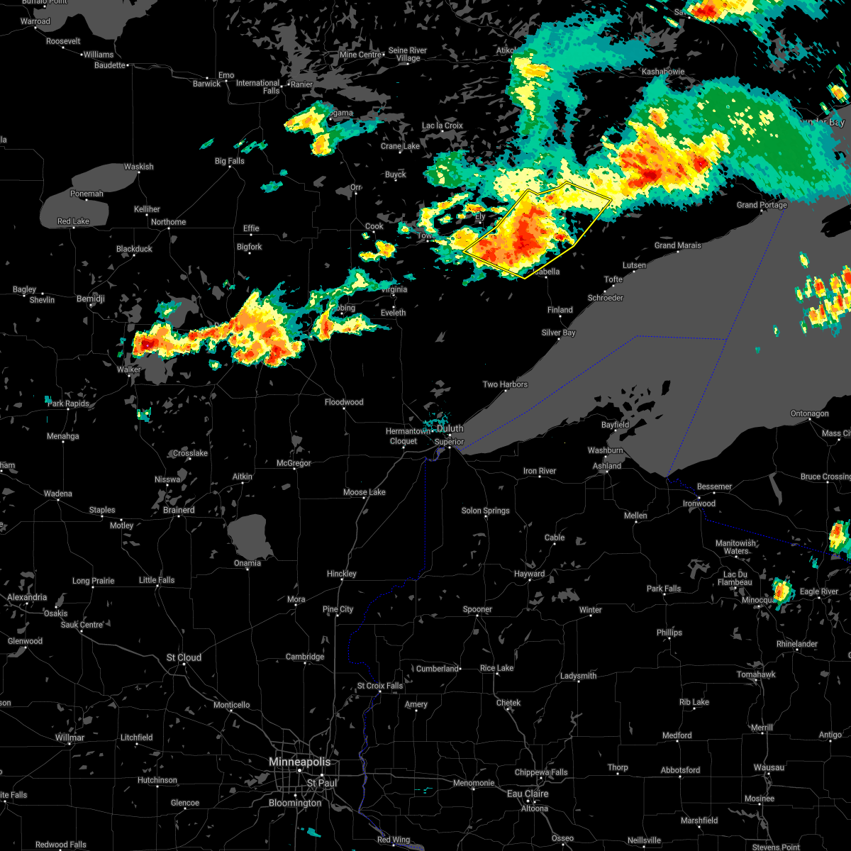 At 722 pm cdt, severe thunderstorms were located along a line extending from boundary waters canoe area wilderness near snowbank lake, to near forest center, to 9 miles southeast of birch lake, moving east at 50 mph (radar indicated). Hazards include 70 mph wind gusts and quarter size hail. Hail damage to vehicles is expected. expect considerable tree damage. wind damage is also likely to mobile homes, roofs, and outbuildings. Locations impacted include, babbitt, birch lake, snowbank lake, southern boundary waters canoe area wilderness, forest center, little saganaga lake, white iron lake, basswood lake, ensign lake, kekekabic lake, bald eagle lake, gabbro lake, alice lake, ojibway lake, kawishiwi lake, isabella lake, disappointment lake, greenstone lake, lake three, and gabimichigami lake. At 722 pm cdt, severe thunderstorms were located along a line extending from boundary waters canoe area wilderness near snowbank lake, to near forest center, to 9 miles southeast of birch lake, moving east at 50 mph (radar indicated). Hazards include 70 mph wind gusts and quarter size hail. Hail damage to vehicles is expected. expect considerable tree damage. wind damage is also likely to mobile homes, roofs, and outbuildings. Locations impacted include, babbitt, birch lake, snowbank lake, southern boundary waters canoe area wilderness, forest center, little saganaga lake, white iron lake, basswood lake, ensign lake, kekekabic lake, bald eagle lake, gabbro lake, alice lake, ojibway lake, kawishiwi lake, isabella lake, disappointment lake, greenstone lake, lake three, and gabimichigami lake.
|
| 7/23/2021 7:05 PM CDT |
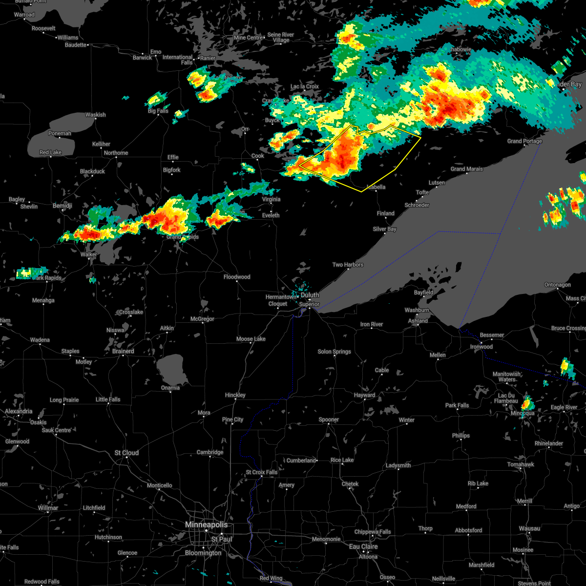 At 703 pm cdt, severe thunderstorms were located along a line extending from boundary waters canoe area wilderness near ely, to 9 miles southeast of white iron lake, to near birch lake, moving east at 50 mph (radar indicated). Hazards include 70 mph wind gusts and quarter size hail. Hail damage to vehicles is expected. expect considerable tree damage. wind damage is also likely to mobile homes, roofs, and outbuildings. Locations impacted include, snowbank lake and forest center. At 703 pm cdt, severe thunderstorms were located along a line extending from boundary waters canoe area wilderness near ely, to 9 miles southeast of white iron lake, to near birch lake, moving east at 50 mph (radar indicated). Hazards include 70 mph wind gusts and quarter size hail. Hail damage to vehicles is expected. expect considerable tree damage. wind damage is also likely to mobile homes, roofs, and outbuildings. Locations impacted include, snowbank lake and forest center.
|
| 7/23/2021 6:47 PM CDT |
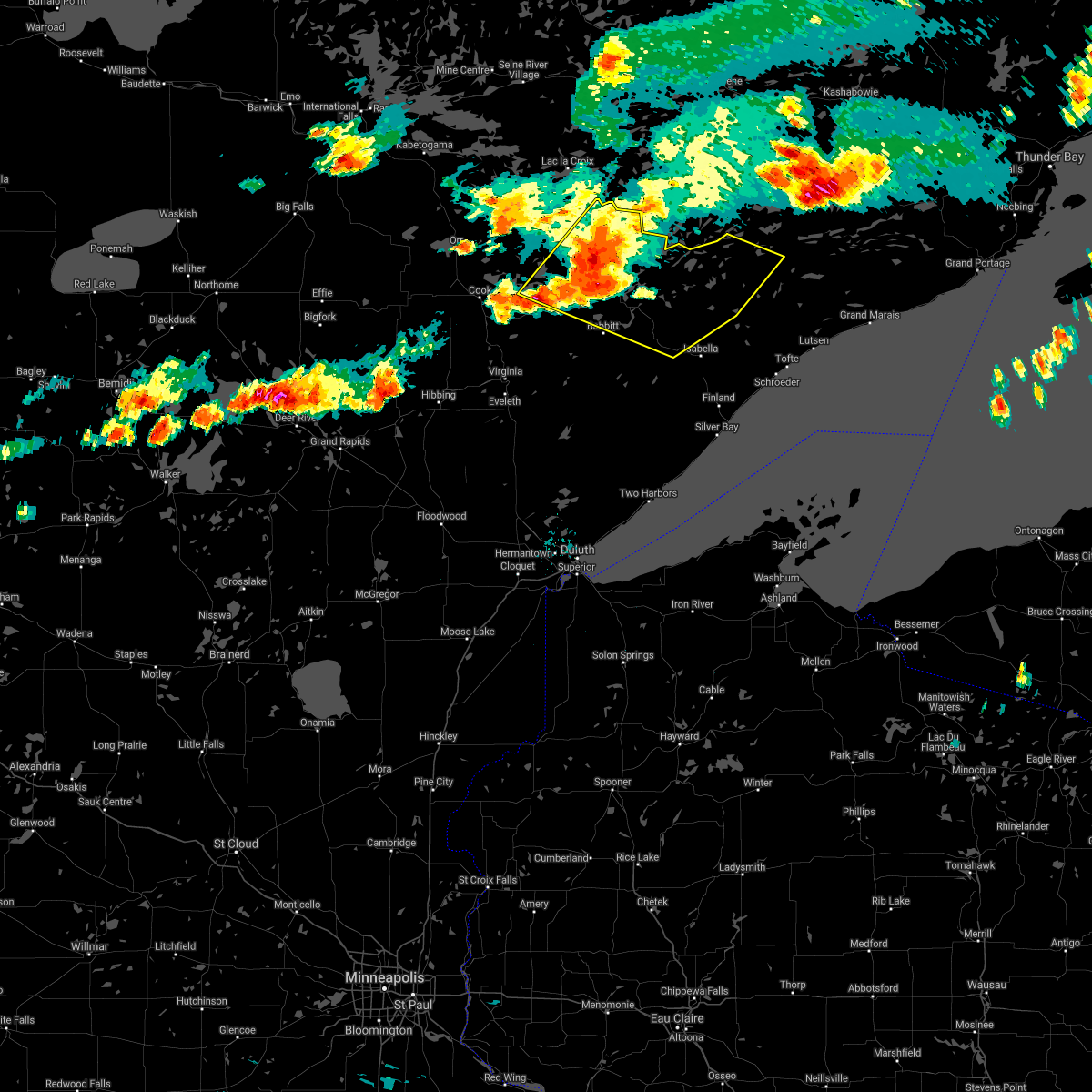 At 646 pm cdt, severe thunderstorms were located along a line extending from boundary waters canoe area wilderness near ely, to near winton, to burntside lake, to near robinson, moving east at 50 mph (radar indicated). Hazards include 70 mph wind gusts and nickel size hail. Expect considerable tree damage. damage is likely to mobile homes, roofs, and outbuildings. Locations impacted include, ely, winton, white iron lake, fall lake, birch lake, babbitt, basswood lake, snowbank lake and forest center. At 646 pm cdt, severe thunderstorms were located along a line extending from boundary waters canoe area wilderness near ely, to near winton, to burntside lake, to near robinson, moving east at 50 mph (radar indicated). Hazards include 70 mph wind gusts and nickel size hail. Expect considerable tree damage. damage is likely to mobile homes, roofs, and outbuildings. Locations impacted include, ely, winton, white iron lake, fall lake, birch lake, babbitt, basswood lake, snowbank lake and forest center.
|
| 7/23/2021 6:28 PM CDT |
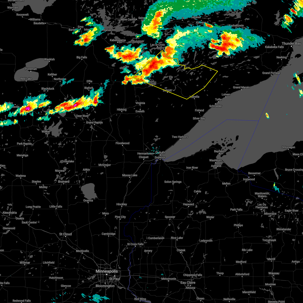 At 627 pm cdt, severe thunderstorms were located along a line extending from boundary waters canoe area wilderness northwest of ely, to 11 miles northwest of burntside lake, to near lake vermilion, moving east at 50 mph (radar indicated). Hazards include 70 mph wind gusts and nickel size hail. Expect considerable tree damage. damage is likely to mobile homes, roofs, and outbuildings. severe thunderstorms will be near, burntside lake around 645 pm cdt. Other locations in the path of these severe thunderstorms include ely, winton, robinson, white iron lake, fall lake, basswood lake, snowbank lake, birch lake, babbitt, forest center and little saganaga lake. At 627 pm cdt, severe thunderstorms were located along a line extending from boundary waters canoe area wilderness northwest of ely, to 11 miles northwest of burntside lake, to near lake vermilion, moving east at 50 mph (radar indicated). Hazards include 70 mph wind gusts and nickel size hail. Expect considerable tree damage. damage is likely to mobile homes, roofs, and outbuildings. severe thunderstorms will be near, burntside lake around 645 pm cdt. Other locations in the path of these severe thunderstorms include ely, winton, robinson, white iron lake, fall lake, basswood lake, snowbank lake, birch lake, babbitt, forest center and little saganaga lake.
|
| 7/16/2020 5:53 PM CDT |
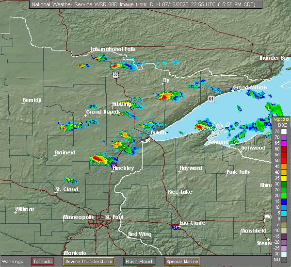 At 553 pm cdt, a severe thunderstorm was located 8 miles southeast of babbitt, or 23 miles south of ely, moving east at 35 mph (radar indicated). Hazards include quarter size hail. damage to vehicles is expected At 553 pm cdt, a severe thunderstorm was located 8 miles southeast of babbitt, or 23 miles south of ely, moving east at 35 mph (radar indicated). Hazards include quarter size hail. damage to vehicles is expected
|
| 7/14/2020 12:06 AM CDT |
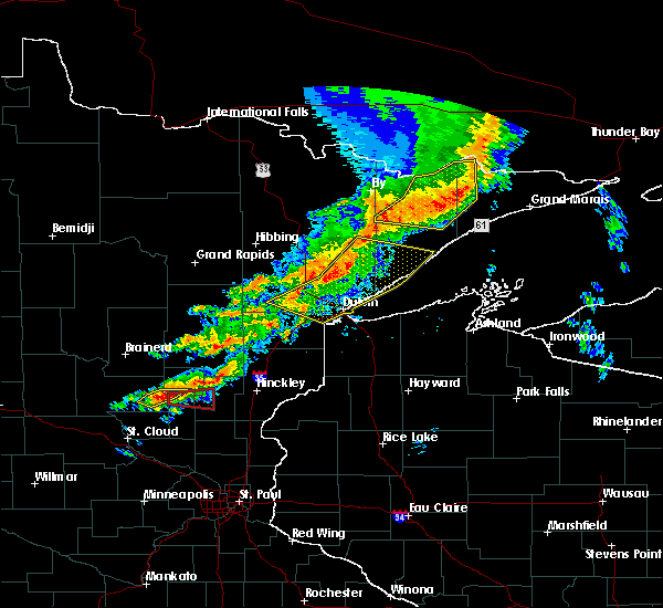 The severe thunderstorm warning for northwestern cook and northern lake counties will expire at 1215 am cdt, the storms which prompted the warning have weakened below severe limits, and no longer pose an immediate threat to life or property. therefore, the warning will be allowed to expire. however gusty winds to 50 mph are still possible with these thunderstorms. a severe thunderstorm watch remains in effect until 200 am cdt for northeastern minnesota. The severe thunderstorm warning for northwestern cook and northern lake counties will expire at 1215 am cdt, the storms which prompted the warning have weakened below severe limits, and no longer pose an immediate threat to life or property. therefore, the warning will be allowed to expire. however gusty winds to 50 mph are still possible with these thunderstorms. a severe thunderstorm watch remains in effect until 200 am cdt for northeastern minnesota.
|
| 7/13/2020 11:40 PM CDT |
 At 1139 pm cdt, severe thunderstorms were located along a line extending from 6 miles northeast of boundary waters canoe area wilderness near trout lake, to boundary waters canoe area wilderness, to near forest center, to 10 miles northwest of isabella, to 11 miles southeast of birch lake, moving east at 45 mph (radar indicated). Hazards include 60 mph wind gusts and nickel size hail. Expect damage to roofs, siding, and trees. Locations impacted include, clear lake, sea gull lake, snowbank lake, southern boundary waters canoe area wilderness, forest center, little saganaga lake, alpine lake, isabella, dumbbell lake, saganaga lake, ensign lake, kekekabic lake, bald eagle lake, alice lake, perent lake, phoebe lake, kawishiwi lake, isabella lake, disappointment lake, and silver island lake. At 1139 pm cdt, severe thunderstorms were located along a line extending from 6 miles northeast of boundary waters canoe area wilderness near trout lake, to boundary waters canoe area wilderness, to near forest center, to 10 miles northwest of isabella, to 11 miles southeast of birch lake, moving east at 45 mph (radar indicated). Hazards include 60 mph wind gusts and nickel size hail. Expect damage to roofs, siding, and trees. Locations impacted include, clear lake, sea gull lake, snowbank lake, southern boundary waters canoe area wilderness, forest center, little saganaga lake, alpine lake, isabella, dumbbell lake, saganaga lake, ensign lake, kekekabic lake, bald eagle lake, alice lake, perent lake, phoebe lake, kawishiwi lake, isabella lake, disappointment lake, and silver island lake.
|
| 7/13/2020 11:23 PM CDT |
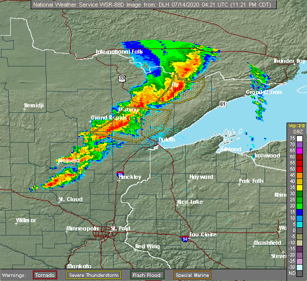 At 1123 pm cdt, severe thunderstorms were located along a line extending from boundary waters canoe area wilderness, to 7 miles east of fall lake, to near birch lake, to near babbitt, moving east at 45 mph (radar indicated). Hazards include 60 mph wind gusts and nickel size hail. expect damage to roofs, siding, and trees At 1123 pm cdt, severe thunderstorms were located along a line extending from boundary waters canoe area wilderness, to 7 miles east of fall lake, to near birch lake, to near babbitt, moving east at 45 mph (radar indicated). Hazards include 60 mph wind gusts and nickel size hail. expect damage to roofs, siding, and trees
|
| 7/13/2020 11:18 PM CDT |
 At 1118 pm cdt, severe thunderstorms were located along a line extending from boundary waters canoe area wilderness, to near fall lake, to near birch lake, to 9 miles southwest of white iron lake, to near babbitt, moving east at 45 mph (radar indicated). Hazards include 60 mph wind gusts and nickel size hail. Expect damage to roofs, siding, and trees. Locations impacted include, ely, babbitt, winton, basswood lake, fall lake, birch lake, white iron lake, snowbank lake, southern boundary waters canoe area wilderness, forest center, ensign lake, kekekabic lake, bald eagle lake, gabbro lake, alice lake, ojibway lake, farm lake, bear island lake, disappointment lake, and greenstone lake. At 1118 pm cdt, severe thunderstorms were located along a line extending from boundary waters canoe area wilderness, to near fall lake, to near birch lake, to 9 miles southwest of white iron lake, to near babbitt, moving east at 45 mph (radar indicated). Hazards include 60 mph wind gusts and nickel size hail. Expect damage to roofs, siding, and trees. Locations impacted include, ely, babbitt, winton, basswood lake, fall lake, birch lake, white iron lake, snowbank lake, southern boundary waters canoe area wilderness, forest center, ensign lake, kekekabic lake, bald eagle lake, gabbro lake, alice lake, ojibway lake, farm lake, bear island lake, disappointment lake, and greenstone lake.
|
| 7/13/2020 10:59 PM CDT |
 At 1059 pm cdt, severe thunderstorms were located along a line extending from boundary waters canoe area wilderness, to near burntside lake, to 7 miles southwest of robinson, to near embarrass, moving east at 50 mph (radar indicated). Hazards include 60 mph wind gusts and nickel size hail. Expect damage to roofs, siding, and trees. Locations impacted include, ely, lake vermilion, babbitt, embarrass, tower, winton, basswood lake, fall lake, boundary waters canoe area wilderness near trout lake, birch lake, burntside lake, white iron lake, snowbank lake, southern boundary waters canoe area wilderness, robinson, forest center, ensign lake, kekekabic lake, bald eagle lake, and gabbro lake. At 1059 pm cdt, severe thunderstorms were located along a line extending from boundary waters canoe area wilderness, to near burntside lake, to 7 miles southwest of robinson, to near embarrass, moving east at 50 mph (radar indicated). Hazards include 60 mph wind gusts and nickel size hail. Expect damage to roofs, siding, and trees. Locations impacted include, ely, lake vermilion, babbitt, embarrass, tower, winton, basswood lake, fall lake, boundary waters canoe area wilderness near trout lake, birch lake, burntside lake, white iron lake, snowbank lake, southern boundary waters canoe area wilderness, robinson, forest center, ensign lake, kekekabic lake, bald eagle lake, and gabbro lake.
|
| 7/13/2020 10:49 PM CDT |
 At 1048 pm cdt, severe thunderstorms were located along a line extending from 14 miles east of buyck, to 10 miles northeast of lake vermilion, to near tower, to 11 miles north of mountain iron, moving east at 50 mph (radar indicated). Hazards include 60 mph wind gusts and nickel size hail. expect damage to roofs, siding, and trees At 1048 pm cdt, severe thunderstorms were located along a line extending from 14 miles east of buyck, to 10 miles northeast of lake vermilion, to near tower, to 11 miles north of mountain iron, moving east at 50 mph (radar indicated). Hazards include 60 mph wind gusts and nickel size hail. expect damage to roofs, siding, and trees
|
| 6/21/2020 12:33 PM CDT |
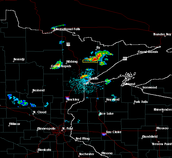 At 1233 pm cdt, a severe thunderstorm was located near babbitt, or 24 miles south of ely, moving east at 30 mph (radar indicated). Hazards include quarter size hail. Damage to vehicles is expected. Locations impacted include, babbitt and seven beaver lake. At 1233 pm cdt, a severe thunderstorm was located near babbitt, or 24 miles south of ely, moving east at 30 mph (radar indicated). Hazards include quarter size hail. Damage to vehicles is expected. Locations impacted include, babbitt and seven beaver lake.
|
| 6/21/2020 12:00 PM CDT |
 The national weather service in duluth mn has issued a * severe thunderstorm warning for. east central st. louis county in northeastern minnesota. until 1245 pm cdt. At 1200 pm cdt, a severe thunderstorm was located over aurora, or 27 miles south of lake vermilion, moving east at 30 mph. The national weather service in duluth mn has issued a * severe thunderstorm warning for. east central st. louis county in northeastern minnesota. until 1245 pm cdt. At 1200 pm cdt, a severe thunderstorm was located over aurora, or 27 miles south of lake vermilion, moving east at 30 mph.
|
| 7/26/2019 6:22 PM CDT |
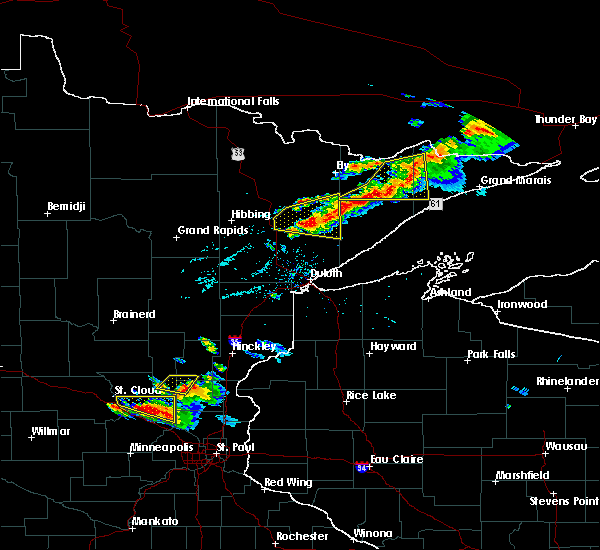 At 621 pm cdt, a severe thunderstorm was located near whiteface reservoir, or 37 miles east of hibbing, moving east at 35 mph (trained weather spotters reported quarter size hail south of aurora with these storms). Hazards include 60 mph wind gusts and half dollar size hail. Hail damage to vehicles is expected. expect wind damage to roofs, siding, and trees. Locations impacted include, hoyt lakes, babbitt, fairbanks, wolf lake, brimson, whiteface reservoir, seven beaver lake, markham, bassett lake, and skibo. At 621 pm cdt, a severe thunderstorm was located near whiteface reservoir, or 37 miles east of hibbing, moving east at 35 mph (trained weather spotters reported quarter size hail south of aurora with these storms). Hazards include 60 mph wind gusts and half dollar size hail. Hail damage to vehicles is expected. expect wind damage to roofs, siding, and trees. Locations impacted include, hoyt lakes, babbitt, fairbanks, wolf lake, brimson, whiteface reservoir, seven beaver lake, markham, bassett lake, and skibo.
|
| 7/26/2019 6:10 PM CDT |
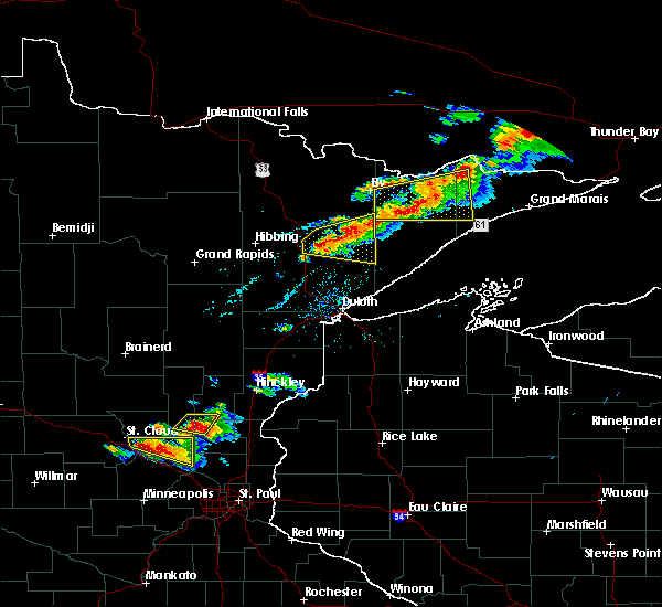 At 610 pm cdt, severe thunderstorms were located along a line extending from boundary waters canoe area wilderness, to forest center, to 7 miles northwest of isabella, moving east at 45 mph (radar indicated). Hazards include 70 mph wind gusts and quarter size hail. Hail damage to vehicles is expected. expect considerable tree damage. wind damage is also likely to mobile homes, roofs, and outbuildings. Locations impacted include, clear lake, forest center, little saganaga lake, southern boundary waters canoe area wilderness, hudson lake, alice lake, thomas lake, perent lake, phoebe lake, kawishiwi lake, isabella lake, disappointment lake, silver island lake, gabimichigami lake, wilson lake, and sawbill lake. At 610 pm cdt, severe thunderstorms were located along a line extending from boundary waters canoe area wilderness, to forest center, to 7 miles northwest of isabella, moving east at 45 mph (radar indicated). Hazards include 70 mph wind gusts and quarter size hail. Hail damage to vehicles is expected. expect considerable tree damage. wind damage is also likely to mobile homes, roofs, and outbuildings. Locations impacted include, clear lake, forest center, little saganaga lake, southern boundary waters canoe area wilderness, hudson lake, alice lake, thomas lake, perent lake, phoebe lake, kawishiwi lake, isabella lake, disappointment lake, silver island lake, gabimichigami lake, wilson lake, and sawbill lake.
|
| 7/26/2019 5:59 PM CDT |
 At 559 pm cdt, a severe thunderstorm was located near gilbert, or 26 miles east of hibbing, moving east at 30 mph (radar indicated). Hazards include 60 mph wind gusts and quarter size hail. Hail damage to vehicles is expected. Expect wind damage to roofs, siding, and trees. At 559 pm cdt, a severe thunderstorm was located near gilbert, or 26 miles east of hibbing, moving east at 30 mph (radar indicated). Hazards include 60 mph wind gusts and quarter size hail. Hail damage to vehicles is expected. Expect wind damage to roofs, siding, and trees.
|
| 7/26/2019 5:40 PM CDT |
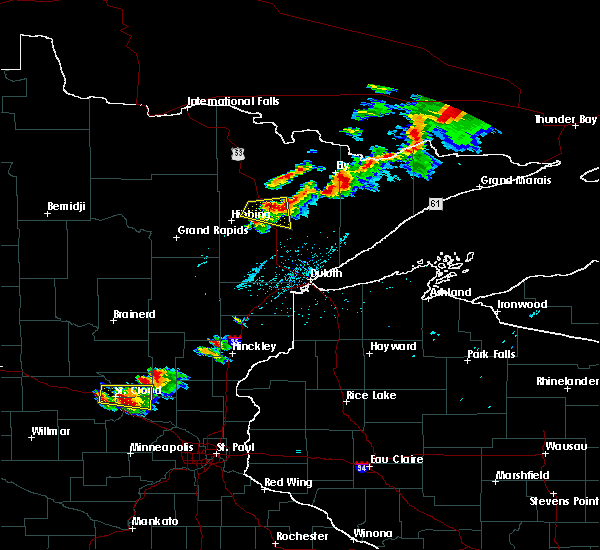 At 540 pm cdt, a severe thunderstorm was located near white iron lake, or 7 miles southeast of ely, moving east at 50 mph (radar indicated). Hazards include 70 mph wind gusts and ping pong ball size hail. People and animals outdoors will be injured. expect hail damage to roofs, siding, windows, and vehicles. expect considerable tree damage. Wind damage is also likely to mobile homes, roofs, and outbuildings. At 540 pm cdt, a severe thunderstorm was located near white iron lake, or 7 miles southeast of ely, moving east at 50 mph (radar indicated). Hazards include 70 mph wind gusts and ping pong ball size hail. People and animals outdoors will be injured. expect hail damage to roofs, siding, windows, and vehicles. expect considerable tree damage. Wind damage is also likely to mobile homes, roofs, and outbuildings.
|
| 7/26/2019 5:21 PM CDT |
 At 521 pm cdt, a severe thunderstorm was located near robinson, or 14 miles southwest of ely, moving east at 35 mph (radar indicated). Hazards include 60 mph wind gusts and penny size hail. Expect damage to roofs, siding, and trees. Locations impacted include, lake vermilion, babbitt, embarrass, robinson, burntside lake, bear head lake, bear head lake state park, ridge, and soudan underground mine state park. At 521 pm cdt, a severe thunderstorm was located near robinson, or 14 miles southwest of ely, moving east at 35 mph (radar indicated). Hazards include 60 mph wind gusts and penny size hail. Expect damage to roofs, siding, and trees. Locations impacted include, lake vermilion, babbitt, embarrass, robinson, burntside lake, bear head lake, bear head lake state park, ridge, and soudan underground mine state park.
|
| 7/26/2019 5:10 PM CDT |
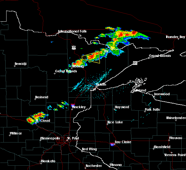 At 510 pm cdt, a severe thunderstorm was located near tower, or 10 miles southeast of lake vermilion, moving east at 40 mph (radar indicated). Hazards include 60 mph wind gusts and quarter size hail. Hail damage to vehicles is expected. expect wind damage to roofs, siding, and trees. Locations impacted include, lake vermilion, babbitt, embarrass, tower, robinson, burntside lake, soudan underground mine state park, soudan, bear head lake state park, bear head lake, vermillion lake reservation, wahlsten, and ridge. At 510 pm cdt, a severe thunderstorm was located near tower, or 10 miles southeast of lake vermilion, moving east at 40 mph (radar indicated). Hazards include 60 mph wind gusts and quarter size hail. Hail damage to vehicles is expected. expect wind damage to roofs, siding, and trees. Locations impacted include, lake vermilion, babbitt, embarrass, tower, robinson, burntside lake, soudan underground mine state park, soudan, bear head lake state park, bear head lake, vermillion lake reservation, wahlsten, and ridge.
|
| 7/26/2019 4:58 PM CDT |
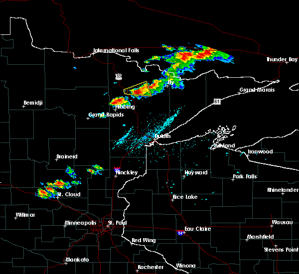 At 458 pm cdt, a severe thunderstorm was located 8 miles southwest of lake vermilion, moving east at 35 mph (radar indicated). Hazards include 60 mph wind gusts and half dollar size hail. Hail damage to vehicles is expected. Expect wind damage to roofs, siding, and trees. At 458 pm cdt, a severe thunderstorm was located 8 miles southwest of lake vermilion, moving east at 35 mph (radar indicated). Hazards include 60 mph wind gusts and half dollar size hail. Hail damage to vehicles is expected. Expect wind damage to roofs, siding, and trees.
|
| 7/25/2019 6:54 PM CDT |
 At 654 pm cdt, a severe thunderstorm was located 9 miles northeast of lake vermilion, moving southeast at 25 mph (radar indicated). Hazards include 60 mph wind gusts. Expect damage to roofs, siding, and trees. Locations impacted include, ely, lake vermilion, babbitt, tower, robinson, burntside lake, birch lake, soudan underground mine state park, soudan, bear head lake state park, bear island lake, bear head lake, cummings lake, trout lake, shagawa lake, ridge, and vermillion lake reservation. At 654 pm cdt, a severe thunderstorm was located 9 miles northeast of lake vermilion, moving southeast at 25 mph (radar indicated). Hazards include 60 mph wind gusts. Expect damage to roofs, siding, and trees. Locations impacted include, ely, lake vermilion, babbitt, tower, robinson, burntside lake, birch lake, soudan underground mine state park, soudan, bear head lake state park, bear island lake, bear head lake, cummings lake, trout lake, shagawa lake, ridge, and vermillion lake reservation.
|
| 7/25/2019 6:40 PM CDT |
 At 639 pm cdt, a severe thunderstorm was located 8 miles northeast of lake vermilion, moving southeast at 30 mph (radar indicated). Hazards include 60 mph wind gusts. expect damage to roofs, siding, and trees At 639 pm cdt, a severe thunderstorm was located 8 miles northeast of lake vermilion, moving southeast at 30 mph (radar indicated). Hazards include 60 mph wind gusts. expect damage to roofs, siding, and trees
|
| 6/30/2019 3:12 AM CDT |
 At 311 am cdt, severe thunderstorms were located along a line extending from 9 miles northwest of mountain iron, to near buhl, to near cherry, moving southeast at 40 mph (radar indicated). Hazards include 60 mph wind gusts and quarter size hail. Hail damage to vehicles is expected. Expect wind damage to roofs, siding, and trees. At 311 am cdt, severe thunderstorms were located along a line extending from 9 miles northwest of mountain iron, to near buhl, to near cherry, moving southeast at 40 mph (radar indicated). Hazards include 60 mph wind gusts and quarter size hail. Hail damage to vehicles is expected. Expect wind damage to roofs, siding, and trees.
|
| 10/3/2018 3:00 PM CDT |
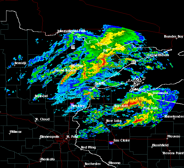 At 300 pm cdt, severe thunderstorms were located along a line extending from near babbitt, to 12 miles south of birch lake, to 8 miles north of fairbanks, moving east at 80 mph (radar indicated). Hazards include 70 mph wind gusts and penny size hail. Expect considerable tree damage. damage is likely to mobile homes, roofs, and outbuildings. Locations impacted include, babbitt, whyte, isabella, dumbbell lake, finland, birch lake, greenwood lake, bald eagle lake, seven beaver lake, and murphy city. At 300 pm cdt, severe thunderstorms were located along a line extending from near babbitt, to 12 miles south of birch lake, to 8 miles north of fairbanks, moving east at 80 mph (radar indicated). Hazards include 70 mph wind gusts and penny size hail. Expect considerable tree damage. damage is likely to mobile homes, roofs, and outbuildings. Locations impacted include, babbitt, whyte, isabella, dumbbell lake, finland, birch lake, greenwood lake, bald eagle lake, seven beaver lake, and murphy city.
|
| 10/3/2018 2:53 PM CDT |
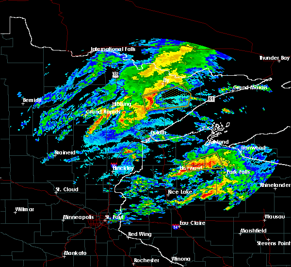 At 252 pm cdt, severe thunderstorms were located along a line extending from near embarrass, to near hoyt lakes, to 8 miles northwest of fairbanks, moving east at 75 mph (radar indicated). Hazards include 70 mph wind gusts and penny size hail. Expect considerable tree damage. Damage is likely to mobile homes, roofs, and outbuildings. At 252 pm cdt, severe thunderstorms were located along a line extending from near embarrass, to near hoyt lakes, to 8 miles northwest of fairbanks, moving east at 75 mph (radar indicated). Hazards include 70 mph wind gusts and penny size hail. Expect considerable tree damage. Damage is likely to mobile homes, roofs, and outbuildings.
|
| 8/31/2018 8:55 PM CDT |
 At 855 pm cdt, severe thunderstorms were located along a line extending from 10 miles east of babbitt, to 8 miles south of whyte, to two harbors, moving northeast at 60 mph (radar indicated). Hazards include 70 mph wind gusts. Expect considerable tree damage. damage is likely to mobile homes, roofs, and outbuildings. Locations impacted include, two harbors, silver bay, babbitt, clear lake, lutsen, tofte, beaver bay, little marais, larsmont, whyte, castle danger, knife river, taconite harbor, thomas lake near brimson, finland, highland lake, isabella, illgen city, dumbbell lake, and french river. At 855 pm cdt, severe thunderstorms were located along a line extending from 10 miles east of babbitt, to 8 miles south of whyte, to two harbors, moving northeast at 60 mph (radar indicated). Hazards include 70 mph wind gusts. Expect considerable tree damage. damage is likely to mobile homes, roofs, and outbuildings. Locations impacted include, two harbors, silver bay, babbitt, clear lake, lutsen, tofte, beaver bay, little marais, larsmont, whyte, castle danger, knife river, taconite harbor, thomas lake near brimson, finland, highland lake, isabella, illgen city, dumbbell lake, and french river.
|
| 8/31/2018 8:42 PM CDT |
 At 842 pm cdt, severe thunderstorms were located along a line extending from 8 miles north of fairbanks, to near brimson, to near french river, moving east at 65 mph (radar indicated). Hazards include 70 mph wind gusts. Expect considerable tree damage. Damage is likely to mobile homes, roofs, and outbuildings. At 842 pm cdt, severe thunderstorms were located along a line extending from 8 miles north of fairbanks, to near brimson, to near french river, moving east at 65 mph (radar indicated). Hazards include 70 mph wind gusts. Expect considerable tree damage. Damage is likely to mobile homes, roofs, and outbuildings.
|
| 7/12/2018 2:54 AM CDT |
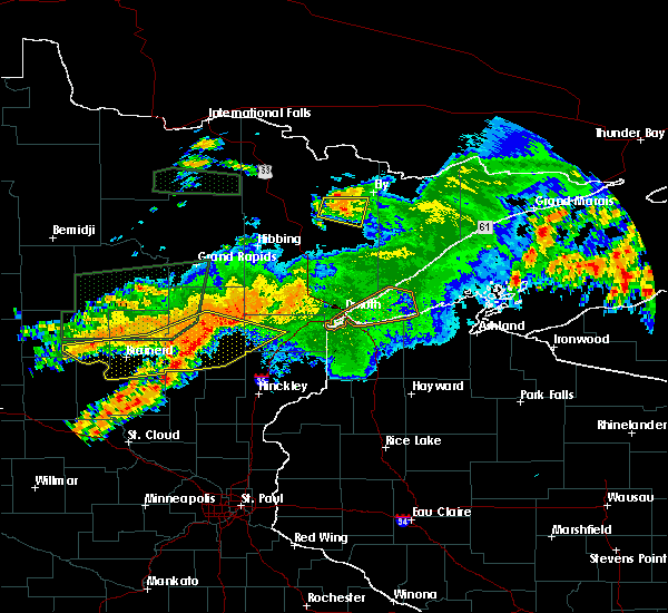 The severe thunderstorm warning for east central st. louis county will expire at 300 am cdt, the storm which prompted the warning has weakened below severe limits, and no longer poses an immediate threat to life or property. therefore, the warning will be allowed to expire. a severe thunderstorm watch remains in effect until 700 am cdt for northeastern minnesota. The severe thunderstorm warning for east central st. louis county will expire at 300 am cdt, the storm which prompted the warning has weakened below severe limits, and no longer poses an immediate threat to life or property. therefore, the warning will be allowed to expire. a severe thunderstorm watch remains in effect until 700 am cdt for northeastern minnesota.
|
| 7/12/2018 2:45 AM CDT |
 At 245 am cdt, a severe thunderstorm was located near tower, or 13 miles southeast of lake vermilion, moving east at 20 mph (radar indicated). Hazards include 60 mph wind gusts and penny size hail. Expect damage to roofs, siding, and trees. Locations impacted include, lake vermilion, hoyt lakes, babbitt, embarrass, tower, robinson, birch lake, soudan underground mine state park, soudan, bear head lake state park, bear island lake, bear head lake, vermillion lake reservation, wahlsten, and ridge. At 245 am cdt, a severe thunderstorm was located near tower, or 13 miles southeast of lake vermilion, moving east at 20 mph (radar indicated). Hazards include 60 mph wind gusts and penny size hail. Expect damage to roofs, siding, and trees. Locations impacted include, lake vermilion, hoyt lakes, babbitt, embarrass, tower, robinson, birch lake, soudan underground mine state park, soudan, bear head lake state park, bear island lake, bear head lake, vermillion lake reservation, wahlsten, and ridge.
|
| 7/12/2018 2:22 AM CDT |
 At 222 am cdt, a severe thunderstorm was located over tower, or 8 miles southeast of lake vermilion, moving east at 20 mph (radar indicated). Hazards include 60 mph wind gusts and penny size hail. expect damage to roofs, siding, and trees At 222 am cdt, a severe thunderstorm was located over tower, or 8 miles southeast of lake vermilion, moving east at 20 mph (radar indicated). Hazards include 60 mph wind gusts and penny size hail. expect damage to roofs, siding, and trees
|
| 7/8/2018 9:42 AM CDT |
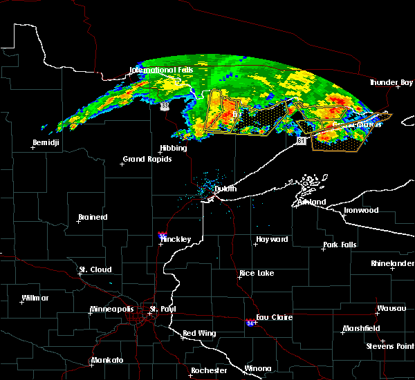 At 942 am cdt, severe thunderstorms were located along a line extending from boundary waters canoe area wilderness, to 7 miles northwest of winton, to near robinson, moving east at 55 mph (radar indicated). Hazards include 60 mph wind gusts. expect damage to roofs, siding, and trees At 942 am cdt, severe thunderstorms were located along a line extending from boundary waters canoe area wilderness, to 7 miles northwest of winton, to near robinson, moving east at 55 mph (radar indicated). Hazards include 60 mph wind gusts. expect damage to roofs, siding, and trees
|
| 7/8/2018 9:39 AM CDT |
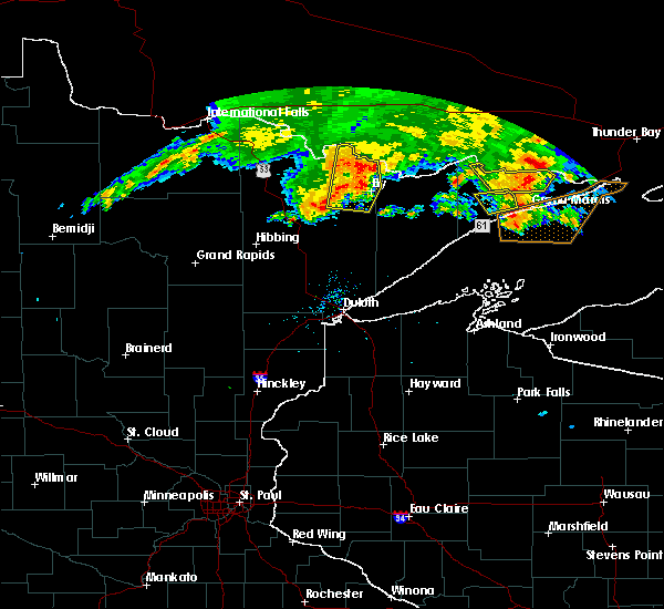 At 923 am cdt, severe thunderstorms were located along a line extending from near crane lake, to 11 miles southeast of buyck, to near lake verm!** ilion, to near tower, moving east at 50 mph (radar indicated). Hazards include 70 mph wind gusts and penny size hail. Expect considerable tree damage. damage is likely to mobile homes, roofs, and outbuildings. Locations impacted include, ely, lake vermilion, tower, winton, crane lake, burntside lake, buyck, white iron lake, robinson, fall lake, birch lake, soudan, bear island lake, bear head lake, cummings lake, high lake, vermillion lake reservation, trout lake, lac la croix, and soudan underground mine state park. At 923 am cdt, severe thunderstorms were located along a line extending from near crane lake, to 11 miles southeast of buyck, to near lake verm!** ilion, to near tower, moving east at 50 mph (radar indicated). Hazards include 70 mph wind gusts and penny size hail. Expect considerable tree damage. damage is likely to mobile homes, roofs, and outbuildings. Locations impacted include, ely, lake vermilion, tower, winton, crane lake, burntside lake, buyck, white iron lake, robinson, fall lake, birch lake, soudan, bear island lake, bear head lake, cummings lake, high lake, vermillion lake reservation, trout lake, lac la croix, and soudan underground mine state park.
|
| 7/8/2018 9:23 AM CDT |
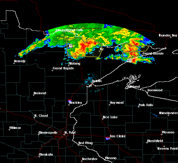 At 923 am cdt, severe thunderstorms were located along a line extending from near crane lake, to 11 miles southeast of buyck, to near lake verm!** ilion, to near tower, moving east at 50 mph (radar indicated). Hazards include 70 mph wind gusts and penny size hail. Expect considerable tree damage. damage is likely to mobile homes, roofs, and outbuildings. Locations impacted include, ely, lake vermilion, tower, winton, crane lake, burntside lake, buyck, white iron lake, robinson, fall lake, birch lake, soudan, bear island lake, bear head lake, cummings lake, high lake, vermillion lake reservation, trout lake, lac la croix, and soudan underground mine state park. At 923 am cdt, severe thunderstorms were located along a line extending from near crane lake, to 11 miles southeast of buyck, to near lake verm!** ilion, to near tower, moving east at 50 mph (radar indicated). Hazards include 70 mph wind gusts and penny size hail. Expect considerable tree damage. damage is likely to mobile homes, roofs, and outbuildings. Locations impacted include, ely, lake vermilion, tower, winton, crane lake, burntside lake, buyck, white iron lake, robinson, fall lake, birch lake, soudan, bear island lake, bear head lake, cummings lake, high lake, vermillion lake reservation, trout lake, lac la croix, and soudan underground mine state park.
|
| 7/8/2018 9:05 AM CDT |
 At 905 am cdt, severe thunderstorms were located along a line extending from 8 miles northeast of ash lake, to near orr, to near cook, moving east at 55 mph (radar indicated). Hazards include 70 mph wind gusts and penny size hail. Expect considerable tree damage. damage is likely to mobile homes, roofs, and outbuildings. Locations impacted include, ely, lake vermilion, babbitt, cook, tower, orr, meadow brook, winton, ash lake, crane lake, gheen, burntside lake, buyck, white iron lake, robinson, pelican lake, cusson, fall lake, birch lake, and voyageurs national park. At 905 am cdt, severe thunderstorms were located along a line extending from 8 miles northeast of ash lake, to near orr, to near cook, moving east at 55 mph (radar indicated). Hazards include 70 mph wind gusts and penny size hail. Expect considerable tree damage. damage is likely to mobile homes, roofs, and outbuildings. Locations impacted include, ely, lake vermilion, babbitt, cook, tower, orr, meadow brook, winton, ash lake, crane lake, gheen, burntside lake, buyck, white iron lake, robinson, pelican lake, cusson, fall lake, birch lake, and voyageurs national park.
|
| 7/8/2018 8:56 AM CDT |
 At 856 am cdt, severe thunderstorms were located along a line extending from 6 miles north of ash lake, to pelican lake, to near meadow brook, to 6 miles east of togo, moving east at 55 mph (radar indicated). Hazards include 70 mph wind gusts and penny size hail. Expect considerable tree damage. Damage is likely to mobile homes, roofs, and outbuildings. At 856 am cdt, severe thunderstorms were located along a line extending from 6 miles north of ash lake, to pelican lake, to near meadow brook, to 6 miles east of togo, moving east at 55 mph (radar indicated). Hazards include 70 mph wind gusts and penny size hail. Expect considerable tree damage. Damage is likely to mobile homes, roofs, and outbuildings.
|
| 7/8/2018 8:20 AM CDT |
 At 820 am cdt, a severe thunderstorm was located 16 miles west of nett lake, or 38 miles south of international falls, moving east at 80 mph (radar indicated). Hazards include 70 mph wind gusts and penny size hail. Expect considerable tree damage. Damage is likely to mobile homes, roofs, and outbuildings. At 820 am cdt, a severe thunderstorm was located 16 miles west of nett lake, or 38 miles south of international falls, moving east at 80 mph (radar indicated). Hazards include 70 mph wind gusts and penny size hail. Expect considerable tree damage. Damage is likely to mobile homes, roofs, and outbuildings.
|
| 6/29/2018 8:09 AM CDT |
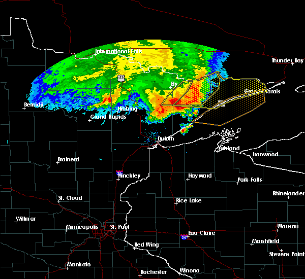 At 809 am cdt, severe thunderstorms were located along a line extending from boundary waters canoe area wilderness, to near forest center, to near dumbbell lake, to near whyte, moving east at 55 mph (radar indicated). Hazards include 70 mph wind gusts and quarter size hail. Hail damage to vehicles is expected. expect considerable tree damage. wind damage is also likely to mobile homes, roofs, and outbuildings. Locations impacted include, babbitt, clear lake, sea gull lake, birch lake, snowbank lake, southern boundary waters canoe area wilderness, forest center, little saganaga lake, saganaga lake, alpine lake, isabella, dumbbell lake, white iron lake, basswood lake, ensign lake, kekekabic lake, bald eagle lake, alice lake, gabbro lake, and perent lake. At 809 am cdt, severe thunderstorms were located along a line extending from boundary waters canoe area wilderness, to near forest center, to near dumbbell lake, to near whyte, moving east at 55 mph (radar indicated). Hazards include 70 mph wind gusts and quarter size hail. Hail damage to vehicles is expected. expect considerable tree damage. wind damage is also likely to mobile homes, roofs, and outbuildings. Locations impacted include, babbitt, clear lake, sea gull lake, birch lake, snowbank lake, southern boundary waters canoe area wilderness, forest center, little saganaga lake, saganaga lake, alpine lake, isabella, dumbbell lake, white iron lake, basswood lake, ensign lake, kekekabic lake, bald eagle lake, alice lake, gabbro lake, and perent lake.
|
| 6/29/2018 7:52 AM CDT |
 At 750 am cdt, severe thunderstorms were located along a line extending from the far western areas of the boundary waters canoe area wilderness, to near white iron lake, to 6 miles southeast of birch lake, to 6 miles south of babbitt, moving east at 75 mph. these are very dangerous storms (trained weather spotters reported 20 inch trees broken in babbitt with these storms). Hazards include 80 mph wind gusts and half dollar size hail. Flying debris will be dangerous to those caught without shelter. mobile homes will be heavily damaged. expect considerable damage to roofs, windows, and vehicles. Extensive tree damage and power outages are likely. At 750 am cdt, severe thunderstorms were located along a line extending from the far western areas of the boundary waters canoe area wilderness, to near white iron lake, to 6 miles southeast of birch lake, to 6 miles south of babbitt, moving east at 75 mph. these are very dangerous storms (trained weather spotters reported 20 inch trees broken in babbitt with these storms). Hazards include 80 mph wind gusts and half dollar size hail. Flying debris will be dangerous to those caught without shelter. mobile homes will be heavily damaged. expect considerable damage to roofs, windows, and vehicles. Extensive tree damage and power outages are likely.
|
| 6/29/2018 7:48 AM CDT |
 At 747 am cdt, a severe thunderstorm was located over biwabik, or 26 miles south of lake vermilion, moving east at 65 mph (radar indicated). Hazards include 60 mph wind gusts and half dollar size hail. Hail damage to vehicles is expected. expect wind damage to roofs, siding, and trees. Locations impacted include, hoyt lakes, gilbert, aurora, biwabik, mckinley, esquagama lake, and skibo. At 747 am cdt, a severe thunderstorm was located over biwabik, or 26 miles south of lake vermilion, moving east at 65 mph (radar indicated). Hazards include 60 mph wind gusts and half dollar size hail. Hail damage to vehicles is expected. expect wind damage to roofs, siding, and trees. Locations impacted include, hoyt lakes, gilbert, aurora, biwabik, mckinley, esquagama lake, and skibo.
|
| 6/29/2018 7:45 AM CDT |
 At 743 am cdt, severe thunderstorms were located along a line extending from boundary waters canoe area wilderness, to fall lake, to near birch lake, to 7 miles south of babbitt, moving east at 75 mph. these are very dangerous storms (radar indicated. trained spotters reported 20 inch diameter trees broken in babbitt at 740 am). Hazards include 80 mph wind gusts and quarter size hail. Flying debris will be dangerous to those caught without shelter. mobile homes will be heavily damaged. expect considerable damage to roofs, windows, and vehicles. extensive tree damage and power outages are likely. Locations impacted include, ely, lake vermilion, virginia, mountain iron, hoyt lakes, aurora, babbitt, biwabik, embarrass, clear lake, tower, winton, basswood lake, boundary waters canoe area wilderness near trout lake, birch lake, burntside lake, white iron lake, saganaga lake, dumbbell lake, and sea gull lake. At 743 am cdt, severe thunderstorms were located along a line extending from boundary waters canoe area wilderness, to fall lake, to near birch lake, to 7 miles south of babbitt, moving east at 75 mph. these are very dangerous storms (radar indicated. trained spotters reported 20 inch diameter trees broken in babbitt at 740 am). Hazards include 80 mph wind gusts and quarter size hail. Flying debris will be dangerous to those caught without shelter. mobile homes will be heavily damaged. expect considerable damage to roofs, windows, and vehicles. extensive tree damage and power outages are likely. Locations impacted include, ely, lake vermilion, virginia, mountain iron, hoyt lakes, aurora, babbitt, biwabik, embarrass, clear lake, tower, winton, basswood lake, boundary waters canoe area wilderness near trout lake, birch lake, burntside lake, white iron lake, saganaga lake, dumbbell lake, and sea gull lake.
|
| 6/29/2018 7:42 AM CDT | 20 inch diameter tree toppled and power line knocked dow in st. louis county MN, 2.3 miles S of Babbitt, MN |
| 6/29/2018 7:27 AM CDT |
 At 727 am cdt, severe thunderstorms were located along a line extending from near virginia, to near cherry, to near toivola, moving east at 60 mph (radar indicated). Hazards include 60 mph wind gusts and half dollar size hail. Hail damage to vehicles is expected. expect wind damage to roofs, siding, and trees. Locations impacted include, hibbing, virginia, chisholm, eveleth, mountain iron, hoyt lakes, gilbert, aurora, keewatin, buhl, nashwauk, biwabik, cherry, cotton, toivola, fairbanks, wolf lake, boulder lake, brimson, and whiteface reservoir. At 727 am cdt, severe thunderstorms were located along a line extending from near virginia, to near cherry, to near toivola, moving east at 60 mph (radar indicated). Hazards include 60 mph wind gusts and half dollar size hail. Hail damage to vehicles is expected. expect wind damage to roofs, siding, and trees. Locations impacted include, hibbing, virginia, chisholm, eveleth, mountain iron, hoyt lakes, gilbert, aurora, keewatin, buhl, nashwauk, biwabik, cherry, cotton, toivola, fairbanks, wolf lake, boulder lake, brimson, and whiteface reservoir.
|
| 6/29/2018 7:24 AM CDT |
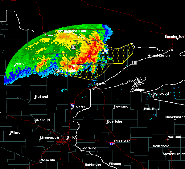 At 722 am cdt, severe thunderstorms were located along a line extending from near crane lake, to 10 miles southeast of buyck, to near tower, to mountain iron, moving east at 70 mph. there were severe thunderstorms ahead of the main line located near embarrass and moving northeast at 45 mph (radar indicated. trained spotters reported quarter-size hail near mountain iron and a 58 mph wind gusts was reported at the cook airport with these storms). Hazards include 70 mph wind gusts and quarter size hail. Hail damage to vehicles is expected. expect considerable tree damage. wind damage is also likely to mobile homes, roofs, and outbuildings. Locations impacted include, hibbing, ely, lake vermilion, virginia, mountain iron, hoyt lakes, aurora, babbitt, biwabik, embarrass, cook, clear lake, tower, winton, crane lake, basswood lake, boundary waters canoe area wilderness near trout lake, birch lake, burntside lake, and buyck. At 722 am cdt, severe thunderstorms were located along a line extending from near crane lake, to 10 miles southeast of buyck, to near tower, to mountain iron, moving east at 70 mph. there were severe thunderstorms ahead of the main line located near embarrass and moving northeast at 45 mph (radar indicated. trained spotters reported quarter-size hail near mountain iron and a 58 mph wind gusts was reported at the cook airport with these storms). Hazards include 70 mph wind gusts and quarter size hail. Hail damage to vehicles is expected. expect considerable tree damage. wind damage is also likely to mobile homes, roofs, and outbuildings. Locations impacted include, hibbing, ely, lake vermilion, virginia, mountain iron, hoyt lakes, aurora, babbitt, biwabik, embarrass, cook, clear lake, tower, winton, crane lake, basswood lake, boundary waters canoe area wilderness near trout lake, birch lake, burntside lake, and buyck.
|
| 6/29/2018 7:12 AM CDT |
 At 712 am cdt, severe thunderstorms were located along a line extending from 7 miles north of buhl, to hibbing, to near pengilly, moving east at 55 mph (radar indicated). Hazards include 60 mph wind gusts and penny size hail. expect damage to roofs, siding, and trees At 712 am cdt, severe thunderstorms were located along a line extending from 7 miles north of buhl, to hibbing, to near pengilly, moving east at 55 mph (radar indicated). Hazards include 60 mph wind gusts and penny size hail. expect damage to roofs, siding, and trees
|
| 6/29/2018 7:10 AM CDT |
 At 708 am cdt, severe thunderstorms were located along a line extending from 7 miles northeast of ash lake, to 7 miles east of gheen, to near cook, to 6 miles north of chisholm, moving east at 75 mph. there were also severe thunderstorms ahead of the main line located near cook and virginia moving northeast at 45 mph. these are very dangerous storms (radar indicated). Hazards include 80 mph wind gusts and quarter size hail. Flying debris will be dangerous to those caught without shelter. mobile homes will be heavily damaged. expect considerable damage to roofs, windows, and vehicles. Extensive tree damage and power outages are likely. At 708 am cdt, severe thunderstorms were located along a line extending from 7 miles northeast of ash lake, to 7 miles east of gheen, to near cook, to 6 miles north of chisholm, moving east at 75 mph. there were also severe thunderstorms ahead of the main line located near cook and virginia moving northeast at 45 mph. these are very dangerous storms (radar indicated). Hazards include 80 mph wind gusts and quarter size hail. Flying debris will be dangerous to those caught without shelter. mobile homes will be heavily damaged. expect considerable damage to roofs, windows, and vehicles. Extensive tree damage and power outages are likely.
|
| 5/29/2018 7:28 PM CDT |
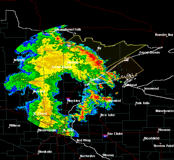 At 727 pm cdt, severe thunderstorms were located along a line extending from near ash lake, to near ely, to 9 miles west of beaver bay, moving northeast at 55 mph (radar indicated). Hazards include 60 mph wind gusts. Expect damage to roofs, siding, and trees. Travelers in the bwca should seek shelter. At 727 pm cdt, severe thunderstorms were located along a line extending from near ash lake, to near ely, to 9 miles west of beaver bay, moving northeast at 55 mph (radar indicated). Hazards include 60 mph wind gusts. Expect damage to roofs, siding, and trees. Travelers in the bwca should seek shelter.
|
| 5/29/2018 7:09 PM CDT |
 At 709 pm cdt, severe thunderstorms were located along a line extending from near whiteface reservoir, to 6 miles south of castle danger, moving northeast at 50 mph (radar indicated). Hazards include 60 mph wind gusts. Expect damage to roofs, siding, and trees. Locations impacted include, two harbors, hoyt lakes, silver bay, babbitt, beaver bay, fairbanks, wolf lake, brimson, whyte, castle danger, thomas lake near brimson, whiteface reservoir, highland lake, illgen city, alger, seven beaver lake, wales, gooseberry falls state park, tettegouche state park, and mesaba. At 709 pm cdt, severe thunderstorms were located along a line extending from near whiteface reservoir, to 6 miles south of castle danger, moving northeast at 50 mph (radar indicated). Hazards include 60 mph wind gusts. Expect damage to roofs, siding, and trees. Locations impacted include, two harbors, hoyt lakes, silver bay, babbitt, beaver bay, fairbanks, wolf lake, brimson, whyte, castle danger, thomas lake near brimson, whiteface reservoir, highland lake, illgen city, alger, seven beaver lake, wales, gooseberry falls state park, tettegouche state park, and mesaba.
|
| 5/29/2018 7:00 PM CDT |
 At 700 pm cdt, severe thunderstorms were located along a line extending from near gheen, to 8 miles south of lake vermilion, to aurora, moving northeast at 60 mph (radar indicated). Hazards include 60 mph wind gusts. Expect damage to roofs, siding, and trees. Locations impacted include, lake vermilion, virginia, eveleth, mountain iron, hoyt lakes, gilbert, aurora, babbitt, biwabik, embarrass, cook, tower, orr, meadow brook, ash lake, gheen, robinson, pelican lake, cusson, and birch lake. At 700 pm cdt, severe thunderstorms were located along a line extending from near gheen, to 8 miles south of lake vermilion, to aurora, moving northeast at 60 mph (radar indicated). Hazards include 60 mph wind gusts. Expect damage to roofs, siding, and trees. Locations impacted include, lake vermilion, virginia, eveleth, mountain iron, hoyt lakes, gilbert, aurora, babbitt, biwabik, embarrass, cook, tower, orr, meadow brook, ash lake, gheen, robinson, pelican lake, cusson, and birch lake.
|
| 5/29/2018 6:57 PM CDT |
 At 657 pm cdt, severe thunderstorms were located along a line extending from near whiteface reservoir, to 6 miles south of castle danger, moving northeast at 50 mph (radar indicated). Hazards include 60 mph wind gusts. Expect damage to roofs, siding, and trees. Locations impacted include, two harbors, hoyt lakes, silver bay, babbitt, beaver bay, fairbanks, wolf lake, larsmont, brimson, whyte, castle danger, knife river, thomas lake near brimson, whiteface reservoir, highland lake, illgen city, alger, comstock lake, seven beaver lake, and wales. At 657 pm cdt, severe thunderstorms were located along a line extending from near whiteface reservoir, to 6 miles south of castle danger, moving northeast at 50 mph (radar indicated). Hazards include 60 mph wind gusts. Expect damage to roofs, siding, and trees. Locations impacted include, two harbors, hoyt lakes, silver bay, babbitt, beaver bay, fairbanks, wolf lake, larsmont, brimson, whyte, castle danger, knife river, thomas lake near brimson, whiteface reservoir, highland lake, illgen city, alger, comstock lake, seven beaver lake, and wales.
|
| 5/29/2018 6:50 PM CDT |
 At 649 pm cdt, severe thunderstorms were located along a line extending from near meadow brook, to 11 miles north of mountain iron, to 6 miles southeast of gilbert, moving northeast at 60 mph (radar indicated). Hazards include 60 mph wind gusts. expect damage to roofs, siding, and trees At 649 pm cdt, severe thunderstorms were located along a line extending from near meadow brook, to 11 miles north of mountain iron, to 6 miles southeast of gilbert, moving northeast at 60 mph (radar indicated). Hazards include 60 mph wind gusts. expect damage to roofs, siding, and trees
|
| 5/29/2018 6:40 PM CDT |
 At 639 pm cdt, severe thunderstorms were located along a line extending from 6 miles east of cotton, to near knife river, moving northeast at 50 mph (radar indicated). Hazards include 60 mph wind gusts. expect damage to roofs, siding, and trees At 639 pm cdt, severe thunderstorms were located along a line extending from 6 miles east of cotton, to near knife river, moving northeast at 50 mph (radar indicated). Hazards include 60 mph wind gusts. expect damage to roofs, siding, and trees
|
| 9/14/2017 5:43 PM CDT |
 At 543 pm cdt, a severe thunderstorm was located near just north of biwabik, or 20 miles south of lake vermilion, moving east at 15 mph (radar indicated). Hazards include 70 mph wind gusts and half dollar size hail. Hail damage to vehicles is expected. expect considerable tree damage. wind damage is also likely to mobile homes, roofs, and outbuildings. Locations impacted include, virginia, hoyt lakes, biwabik, embarrass, wynne lake, wahlsten, mesaba, and bear head lake state park. At 543 pm cdt, a severe thunderstorm was located near just north of biwabik, or 20 miles south of lake vermilion, moving east at 15 mph (radar indicated). Hazards include 70 mph wind gusts and half dollar size hail. Hail damage to vehicles is expected. expect considerable tree damage. wind damage is also likely to mobile homes, roofs, and outbuildings. Locations impacted include, virginia, hoyt lakes, biwabik, embarrass, wynne lake, wahlsten, mesaba, and bear head lake state park.
|
| 9/14/2017 5:31 PM CDT |
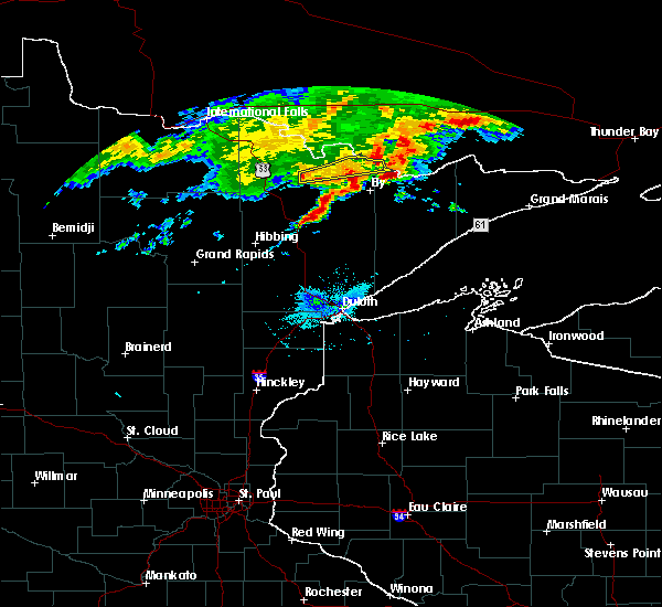 At 530 pm cdt, a severe thunderstorm was located near biwabik, or 19 miles south of lake vermilion, moving east at 20 mph (radar indicated). Hazards include golf ball size hail and 70 mph wind gusts. People and animals outdoors will be injured. expect hail damage to roofs, siding, windows, and vehicles. expect considerable tree damage. Wind damage is also likely to mobile homes, roofs, and outbuildings. At 530 pm cdt, a severe thunderstorm was located near biwabik, or 19 miles south of lake vermilion, moving east at 20 mph (radar indicated). Hazards include golf ball size hail and 70 mph wind gusts. People and animals outdoors will be injured. expect hail damage to roofs, siding, windows, and vehicles. expect considerable tree damage. Wind damage is also likely to mobile homes, roofs, and outbuildings.
|
| 9/3/2017 8:56 PM CDT |
 At 855 pm cdt, severe thunderstorms were located along a line extending from 6 miles east of birch lake, to 6 miles southeast of babbitt, to 6 miles east of hoyt lakes, moving southeast at 65 mph (radar indicated). Hazards include 70 mph wind gusts and penny size hail. Expect considerable tree damage. damage is likely to mobile homes, roofs, and outbuildings. these severe storms will be near, whyte around 910 pm cdt. isabella and dumbbell lake around 915 pm cdt. Other locations impacted by these severe thunderstorms include skibo and seven beaver lake. At 855 pm cdt, severe thunderstorms were located along a line extending from 6 miles east of birch lake, to 6 miles southeast of babbitt, to 6 miles east of hoyt lakes, moving southeast at 65 mph (radar indicated). Hazards include 70 mph wind gusts and penny size hail. Expect considerable tree damage. damage is likely to mobile homes, roofs, and outbuildings. these severe storms will be near, whyte around 910 pm cdt. isabella and dumbbell lake around 915 pm cdt. Other locations impacted by these severe thunderstorms include skibo and seven beaver lake.
|
| 9/3/2017 8:46 PM CDT |
 At 845 pm cdt, severe thunderstorms were located along a line extending from near robinson, to near babbitt, to near embarrass, moving southeast at 65 mph (radar indicated). Hazards include 70 mph wind gusts and penny size hail. Expect considerable tree damage. damage is likely to mobile homes, roofs, and outbuildings. severe thunderstorms will be near, white iron lake around 850 pm cdt. babbitt around 855 pm cdt. whyte around 910 pm cdt. isabella and dumbbell lake around 915 pm cdt. Other locations impacted by these severe thunderstorms include skibo, seven beaver lake, ridge, mesaba, and bear island lake. At 845 pm cdt, severe thunderstorms were located along a line extending from near robinson, to near babbitt, to near embarrass, moving southeast at 65 mph (radar indicated). Hazards include 70 mph wind gusts and penny size hail. Expect considerable tree damage. damage is likely to mobile homes, roofs, and outbuildings. severe thunderstorms will be near, white iron lake around 850 pm cdt. babbitt around 855 pm cdt. whyte around 910 pm cdt. isabella and dumbbell lake around 915 pm cdt. Other locations impacted by these severe thunderstorms include skibo, seven beaver lake, ridge, mesaba, and bear island lake.
|
| 7/17/2017 7:19 PM CDT |
 At 719 pm cdt, a severe thunderstorm was located near hoyt lakes, or 32 miles south of lake vermilion, moving east at 20 mph (radar indicated). Hazards include ping pong ball size hail and 60 mph wind gusts. People and animals outdoors will be injured. expect hail damage to roofs, siding, windows, and vehicles. expect wind damage to roofs, siding, and trees. this severe thunderstorm will remain over mainly rural areas of east central st. Louis county, including the following locations: skibo and bassett lake. At 719 pm cdt, a severe thunderstorm was located near hoyt lakes, or 32 miles south of lake vermilion, moving east at 20 mph (radar indicated). Hazards include ping pong ball size hail and 60 mph wind gusts. People and animals outdoors will be injured. expect hail damage to roofs, siding, windows, and vehicles. expect wind damage to roofs, siding, and trees. this severe thunderstorm will remain over mainly rural areas of east central st. Louis county, including the following locations: skibo and bassett lake.
|
| 7/17/2017 7:03 PM CDT |
 At 701 pm cdt, a severe thunderstorm was located over aurora, or 27 miles south of lake vermilion, moving east at 15 mph. quarter sized hail was reported at 0653 pm cdt in biwabik (law enforcement). Hazards include golf ball size hail and 60 mph wind gusts. People and animals outdoors will be injured. expect hail damage to roofs, siding, windows, and vehicles. expect wind damage to roofs, siding, and trees. this severe thunderstorm will remain over mainly rural areas of east central st. Louis county, including the following locations: wynne lake, skibo, esquagama lake, mesaba and bassett lake. At 701 pm cdt, a severe thunderstorm was located over aurora, or 27 miles south of lake vermilion, moving east at 15 mph. quarter sized hail was reported at 0653 pm cdt in biwabik (law enforcement). Hazards include golf ball size hail and 60 mph wind gusts. People and animals outdoors will be injured. expect hail damage to roofs, siding, windows, and vehicles. expect wind damage to roofs, siding, and trees. this severe thunderstorm will remain over mainly rural areas of east central st. Louis county, including the following locations: wynne lake, skibo, esquagama lake, mesaba and bassett lake.
|
| 7/17/2017 6:53 PM CDT |
 At 652 pm cdt, a severe thunderstorm was located near aurora, or 27 miles south of lake vermilion, moving east at 20 mph (radar indicated). Hazards include ping pong ball size hail and 60 mph wind gusts. People and animals outdoors will be injured. expect hail damage to roofs, siding, windows, and vehicles. expect wind damage to roofs, siding, and trees. this severe thunderstorm will be near, aurora around 700 pm cdt. Other locations impacted by this severe thunderstorm include wynne lake, skibo, esquagama lake, mesaba, mckinley, and bassett lake. At 652 pm cdt, a severe thunderstorm was located near aurora, or 27 miles south of lake vermilion, moving east at 20 mph (radar indicated). Hazards include ping pong ball size hail and 60 mph wind gusts. People and animals outdoors will be injured. expect hail damage to roofs, siding, windows, and vehicles. expect wind damage to roofs, siding, and trees. this severe thunderstorm will be near, aurora around 700 pm cdt. Other locations impacted by this severe thunderstorm include wynne lake, skibo, esquagama lake, mesaba, mckinley, and bassett lake.
|
| 9/6/2016 12:21 AM CDT |
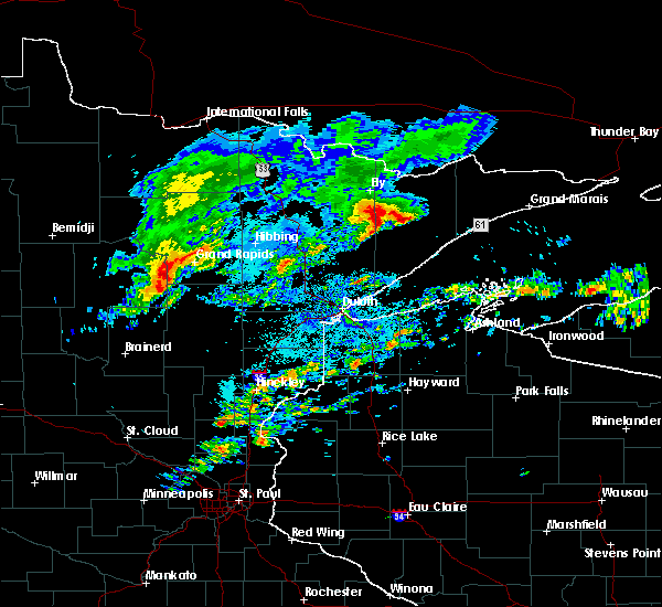 At 1220 am cdt, a severe thunderstorm was located 8 miles southeast of birch lake, or 16 miles southeast of ely, moving east at 55 mph (radar indicated). Hazards include 60 mph wind gusts. Expect damage to roofs. siding. and trees. this severe thunderstorm will be near, forest center around 1240 am cdt. Other locations impacted by this severe thunderstorm include sawbill landing, hudson lake, disappointment lake, wilson lake, silver island lake, butterfly lake, alice lake, lake three, bald eagle lake and isabella lake. At 1220 am cdt, a severe thunderstorm was located 8 miles southeast of birch lake, or 16 miles southeast of ely, moving east at 55 mph (radar indicated). Hazards include 60 mph wind gusts. Expect damage to roofs. siding. and trees. this severe thunderstorm will be near, forest center around 1240 am cdt. Other locations impacted by this severe thunderstorm include sawbill landing, hudson lake, disappointment lake, wilson lake, silver island lake, butterfly lake, alice lake, lake three, bald eagle lake and isabella lake.
|
| 9/6/2016 12:12 AM CDT |
 The severe thunderstorm warning for east central st. louis county will expire at 1215 am cdt, the storm which prompted the warning has weakened below severe limits, and no longer pose an immediate threat to life or property. therefore the warning will be allowed to expire. however small. The severe thunderstorm warning for east central st. louis county will expire at 1215 am cdt, the storm which prompted the warning has weakened below severe limits, and no longer pose an immediate threat to life or property. therefore the warning will be allowed to expire. however small.
|
| 9/6/2016 12:01 AM CDT |
 At 1200 am cdt, a severe thunderstorm was located near embarrass, or 21 miles southeast of lake vermilion, moving northeast at 40 mph (radar indicated). Hazards include 60 mph wind gusts and half dollar size hail. Hail damage to vehicles is expected. expect wind damage to roofs, siding, and trees. this severe storm will be near, babbitt around 1215 am cdt. Other locations impacted by this severe thunderstorm include bear island lake, wynne lake, mesaba, ridge and bear head lake state park. At 1200 am cdt, a severe thunderstorm was located near embarrass, or 21 miles southeast of lake vermilion, moving northeast at 40 mph (radar indicated). Hazards include 60 mph wind gusts and half dollar size hail. Hail damage to vehicles is expected. expect wind damage to roofs, siding, and trees. this severe storm will be near, babbitt around 1215 am cdt. Other locations impacted by this severe thunderstorm include bear island lake, wynne lake, mesaba, ridge and bear head lake state park.
|
| 9/5/2016 11:48 PM CDT |
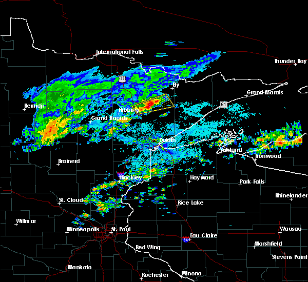 At 1147 pm cdt, a severe thunderstorm was located over biwabik, or 22 miles south of lake vermilion, moving northeast at 40 mph (radar indicated). Hazards include 60 mph wind gusts and half dollar size hail. Hail damage to vehicles is expected. expect wind damage to roofs, siding, and trees. this severe storm will be near, embarrass around 1200 am cdt. hoyt lakes around 1210 am cdt. Other locations impacted by this severe thunderstorm include bear island lake, wynne lake, mesaba, franklin, mckinley, esquagama lake, ridge and bear head lake state park. At 1147 pm cdt, a severe thunderstorm was located over biwabik, or 22 miles south of lake vermilion, moving northeast at 40 mph (radar indicated). Hazards include 60 mph wind gusts and half dollar size hail. Hail damage to vehicles is expected. expect wind damage to roofs, siding, and trees. this severe storm will be near, embarrass around 1200 am cdt. hoyt lakes around 1210 am cdt. Other locations impacted by this severe thunderstorm include bear island lake, wynne lake, mesaba, franklin, mckinley, esquagama lake, ridge and bear head lake state park.
|
| 9/5/2016 11:36 PM CDT |
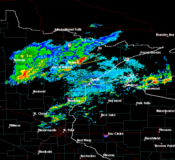 At 1135 pm cdt, a severe thunderstorm was located over virginia, or 21 miles east of hibbing, moving northeast at 40 mph (radar indicated). Hazards include 60 mph wind gusts and half dollar size hail. Hail damage to vehicles is expected. expect wind damage to roofs, siding, and trees. this severe thunderstorm will be near, biwabik around 1150 pm cdt. aurora around 1155 pm cdt. embarrass around 1205 am cdt. hoyt lakes around 1210 am cdt. Other locations impacted by this severe thunderstorm include bear island lake, wynne lake, mesaba, leonidas, franklin, mckinley, esquagama lake, ridge and bear head lake state park. At 1135 pm cdt, a severe thunderstorm was located over virginia, or 21 miles east of hibbing, moving northeast at 40 mph (radar indicated). Hazards include 60 mph wind gusts and half dollar size hail. Hail damage to vehicles is expected. expect wind damage to roofs, siding, and trees. this severe thunderstorm will be near, biwabik around 1150 pm cdt. aurora around 1155 pm cdt. embarrass around 1205 am cdt. hoyt lakes around 1210 am cdt. Other locations impacted by this severe thunderstorm include bear island lake, wynne lake, mesaba, leonidas, franklin, mckinley, esquagama lake, ridge and bear head lake state park.
|
| 6/25/2016 5:12 PM CDT |
 At 511 pm cdt, severe thunderstorms were located along a line extending from near cusson to near white iron lake, moving northeast at 40 mph (radar indicated). Hazards include 60 mph wind gusts and quarter size hail. Hail damage to vehicles is expected. expect wind damage to roofs, siding, and trees. severe thunderstorms will be near, ely and burntside lake around 520 pm cdt. winton, white iron lake and birch lake around 525 pm cdt. crane lake and fall lake around 530 pm cdt. basswood lake around 540 pm cdt. other locations impacted by these severe thunderstorms include big moose lake, bear island lake, johnson lake, sand point lake, cummings lake, fourtown lake, bear head lake state park, black duck lake, lac la croix and crooked lake. A tornado watch remains in effect until 900 pm cdt for northeastern minnesota. At 511 pm cdt, severe thunderstorms were located along a line extending from near cusson to near white iron lake, moving northeast at 40 mph (radar indicated). Hazards include 60 mph wind gusts and quarter size hail. Hail damage to vehicles is expected. expect wind damage to roofs, siding, and trees. severe thunderstorms will be near, ely and burntside lake around 520 pm cdt. winton, white iron lake and birch lake around 525 pm cdt. crane lake and fall lake around 530 pm cdt. basswood lake around 540 pm cdt. other locations impacted by these severe thunderstorms include big moose lake, bear island lake, johnson lake, sand point lake, cummings lake, fourtown lake, bear head lake state park, black duck lake, lac la croix and crooked lake. A tornado watch remains in effect until 900 pm cdt for northeastern minnesota.
|
| 6/25/2016 5:04 PM CDT |
 At 504 pm cdt, severe thunderstorms were located along a line extending from orr to near robinson, moving northeast at 55 mph (radar indicated). Hazards include 60 mph wind gusts and quarter size hail. Hail damage to vehicles is expected. expect wind damage to roofs, siding, and trees. these severe storms will be near, robinson around 510 pm cdt. ely, winton, burntside lake and fall lake around 515 pm cdt. other locations impacted by these severe thunderstorms include big moose lake, angora, celina, bear island lake, wynne lake, cummings lake, soudan underground mine state park, bear head lake state park, greaney and black duck lake. A tornado watch remains in effect until 900 pm cdt for northeastern minnesota. At 504 pm cdt, severe thunderstorms were located along a line extending from orr to near robinson, moving northeast at 55 mph (radar indicated). Hazards include 60 mph wind gusts and quarter size hail. Hail damage to vehicles is expected. expect wind damage to roofs, siding, and trees. these severe storms will be near, robinson around 510 pm cdt. ely, winton, burntside lake and fall lake around 515 pm cdt. other locations impacted by these severe thunderstorms include big moose lake, angora, celina, bear island lake, wynne lake, cummings lake, soudan underground mine state park, bear head lake state park, greaney and black duck lake. A tornado watch remains in effect until 900 pm cdt for northeastern minnesota.
|
| 6/25/2016 4:55 PM CDT |
 At 455 pm cdt, severe thunderstorms were located along a line extending from near pelican lake to 7 miles south of robinson, moving northeast at 55 mph (radar indicated). Hazards include 60 mph wind gusts and quarter size hail. Hail damage to vehicles is expected. expect wind damage to roofs, siding, and trees. these severe storms will be near, robinson around 505 pm cdt. ash lake and burntside lake around 510 pm cdt. ely, winton and fall lake around 515 pm cdt. other locations impacted by these severe thunderstorms include side lake, angora, celina, bear island lake, perch lake, greaney, black duck lake, shagawa lake, echo lake and soudan. A tornado watch remains in effect until 900 pm cdt for northeastern minnesota. At 455 pm cdt, severe thunderstorms were located along a line extending from near pelican lake to 7 miles south of robinson, moving northeast at 55 mph (radar indicated). Hazards include 60 mph wind gusts and quarter size hail. Hail damage to vehicles is expected. expect wind damage to roofs, siding, and trees. these severe storms will be near, robinson around 505 pm cdt. ash lake and burntside lake around 510 pm cdt. ely, winton and fall lake around 515 pm cdt. other locations impacted by these severe thunderstorms include side lake, angora, celina, bear island lake, perch lake, greaney, black duck lake, shagawa lake, echo lake and soudan. A tornado watch remains in effect until 900 pm cdt for northeastern minnesota.
|
| 6/25/2016 4:45 PM CDT |
 At 444 pm cdt, severe thunderstorms were located along a line extending from near meadow brook to embarrass, moving northeast at 55 mph (radar indicated). Hazards include 60 mph wind gusts and quarter size hail. Hail damage to vehicles is expected. expect wind damage to roofs, siding, and trees. these severe storms will be near, embarrass around 450 pm cdt. tower around 455 pm cdt. orr around 500 pm cdt. cusson, pelican lake and robinson around 505 pm cdt. ely, ash lake and burntside lake around 510 pm cdt. winton and fall lake around 515 pm cdt. other locations impacted by these severe thunderstorms include side lake, angora, celina, bear island lake, perch lake, greaney, black duck lake, shagawa lake, echo lake and soudan. A tornado watch remains in effect until 900 pm cdt for northeastern minnesota. At 444 pm cdt, severe thunderstorms were located along a line extending from near meadow brook to embarrass, moving northeast at 55 mph (radar indicated). Hazards include 60 mph wind gusts and quarter size hail. Hail damage to vehicles is expected. expect wind damage to roofs, siding, and trees. these severe storms will be near, embarrass around 450 pm cdt. tower around 455 pm cdt. orr around 500 pm cdt. cusson, pelican lake and robinson around 505 pm cdt. ely, ash lake and burntside lake around 510 pm cdt. winton and fall lake around 515 pm cdt. other locations impacted by these severe thunderstorms include side lake, angora, celina, bear island lake, perch lake, greaney, black duck lake, shagawa lake, echo lake and soudan. A tornado watch remains in effect until 900 pm cdt for northeastern minnesota.
|
| 6/25/2016 4:32 PM CDT |
 At 432 pm cdt, severe thunderstorms were located along a line extending from near togo to biwabik, moving northeast at 55 mph (radar indicated). Hazards include 60 mph wind gusts and quarter size hail. Hail damage to vehicles is expected. expect wind damage to roofs, siding, and trees. severe thunderstorms will be near, gilbert, aurora and biwabik around 435 pm cdt. hoyt lakes, embarrass and meadow brook around 445 pm cdt. tower around 450 pm cdt. gheen around 455 pm cdt. orr, robinson and pelican lake around 500 pm cdt. cusson around 505 pm cdt. ely, ash lake and burntside lake around 510 pm cdt. winton, fall lake and buyck around 515 pm cdt. other locations impacted by these severe thunderstorms include side lake, angora, celina, bear island lake, perch lake, greaney, black duck lake, shagawa lake, echo lake and soudan. A tornado watch remains in effect until 900 pm cdt for northeastern minnesota. At 432 pm cdt, severe thunderstorms were located along a line extending from near togo to biwabik, moving northeast at 55 mph (radar indicated). Hazards include 60 mph wind gusts and quarter size hail. Hail damage to vehicles is expected. expect wind damage to roofs, siding, and trees. severe thunderstorms will be near, gilbert, aurora and biwabik around 435 pm cdt. hoyt lakes, embarrass and meadow brook around 445 pm cdt. tower around 450 pm cdt. gheen around 455 pm cdt. orr, robinson and pelican lake around 500 pm cdt. cusson around 505 pm cdt. ely, ash lake and burntside lake around 510 pm cdt. winton, fall lake and buyck around 515 pm cdt. other locations impacted by these severe thunderstorms include side lake, angora, celina, bear island lake, perch lake, greaney, black duck lake, shagawa lake, echo lake and soudan. A tornado watch remains in effect until 900 pm cdt for northeastern minnesota.
|
| 6/25/2016 9:07 AM CDT |
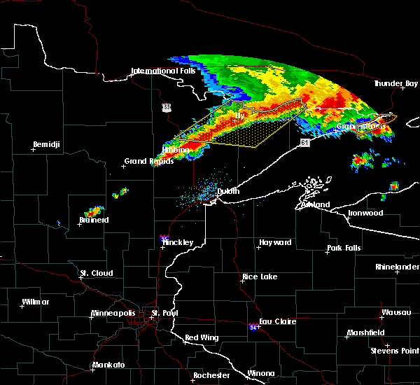 At 905 am cdt, severe thunderstorms were located along a line extending from near lake saganaga in the boundary waters canoe area wilderness to near white iron lake to near embarrass, moving east at 35 mph (radar indicated). Hazards include 60 mph wind gusts and penny size hail. Expect damage to roofs. siding. and trees. Locations impacted include, ely, saganaga lake, gunflint lake, lake vermilion, hoyt lakes, babbitt, embarrass, tower, winton, fall lake, burntside lake, basswood lake, robinson, snowbank lake, alpine lake, forest center, white iron lake, little saganaga lake, the eastern boundary waters canoe area wilderness and sea gull lake. At 905 am cdt, severe thunderstorms were located along a line extending from near lake saganaga in the boundary waters canoe area wilderness to near white iron lake to near embarrass, moving east at 35 mph (radar indicated). Hazards include 60 mph wind gusts and penny size hail. Expect damage to roofs. siding. and trees. Locations impacted include, ely, saganaga lake, gunflint lake, lake vermilion, hoyt lakes, babbitt, embarrass, tower, winton, fall lake, burntside lake, basswood lake, robinson, snowbank lake, alpine lake, forest center, white iron lake, little saganaga lake, the eastern boundary waters canoe area wilderness and sea gull lake.
|
| 6/25/2016 8:45 AM CDT |
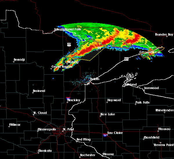 At 844 am cdt, severe thunderstorms were located along a line extending from near crooked lake in the boundary waters canoe area wilderness to near burntside lake to 8 miles north of biwabik, moving east at 35 mph (radar indicated). Hazards include 60 mph wind gusts and penny size hail. Expect damage to roofs. siding. And trees. At 844 am cdt, severe thunderstorms were located along a line extending from near crooked lake in the boundary waters canoe area wilderness to near burntside lake to 8 miles north of biwabik, moving east at 35 mph (radar indicated). Hazards include 60 mph wind gusts and penny size hail. Expect damage to roofs. siding. And trees.
|
| 6/25/2016 8:30 AM CDT |
 At 830 am cdt, severe thunderstorms were located along a line extending from just east of lac la croix in the boundary waters canoe area wilderness to 9 miles northeast of lake vermilion to 9 miles north of mountain iron, moving southeast at 35 mph (radar indicated). Hazards include 60 mph wind gusts. Expect damage to roofs. siding. and trees. Locations impacted include, ely, lake vermilion, mountain iron, hoyt lakes, babbitt, biwabik, embarrass, cook, tower, winton, white iron lake, fall lake, burntside lake, basswood lake, robinson, birch lake, boundary waters canoe area wilderness and bear island lake. At 830 am cdt, severe thunderstorms were located along a line extending from just east of lac la croix in the boundary waters canoe area wilderness to 9 miles northeast of lake vermilion to 9 miles north of mountain iron, moving southeast at 35 mph (radar indicated). Hazards include 60 mph wind gusts. Expect damage to roofs. siding. and trees. Locations impacted include, ely, lake vermilion, mountain iron, hoyt lakes, babbitt, biwabik, embarrass, cook, tower, winton, white iron lake, fall lake, burntside lake, basswood lake, robinson, birch lake, boundary waters canoe area wilderness and bear island lake.
|
| 6/25/2016 8:06 AM CDT |
 At 805 am cdt, severe thunderstorms were located along a line extending from 28 miles northwest of basswood lake to cook, moving southeast at 35 mph (radar indicated). Hazards include 60 mph wind gusts and nickel size hail. Expect roof and tree damage. severe thunderstorms will be near, mountain iron around 825 am cdt. biwabik around 845 am cdt. other locations impacted by these severe thunderstorms include big moose lake, angora, bear island lake, wynne lake, cummings lake, fourtown lake, soudan underground mine state park, bear head lake state park, ridge and crooked lake. Large hail. At 805 am cdt, severe thunderstorms were located along a line extending from 28 miles northwest of basswood lake to cook, moving southeast at 35 mph (radar indicated). Hazards include 60 mph wind gusts and nickel size hail. Expect roof and tree damage. severe thunderstorms will be near, mountain iron around 825 am cdt. biwabik around 845 am cdt. other locations impacted by these severe thunderstorms include big moose lake, angora, bear island lake, wynne lake, cummings lake, fourtown lake, soudan underground mine state park, bear head lake state park, ridge and crooked lake. Large hail.
|
| 6/19/2016 9:18 PM CDT |
 At 918 pm cdt, a severe thunderstorm was located near fairbanks, or 31 miles northwest of split rock lighthouse state park, moving northeast at 60 mph (radar indicated). Hazards include 60 mph wind gusts and half dollar size hail. Hail damage to vehicles is expected. expect wind damage to roofs, siding, and trees. Locations impacted include, hoyt lakes, fairbanks, wolf lake, brimson, whiteface reservoir, markham, comstock lake, bassett lake, seven beaver lake and skibo. At 918 pm cdt, a severe thunderstorm was located near fairbanks, or 31 miles northwest of split rock lighthouse state park, moving northeast at 60 mph (radar indicated). Hazards include 60 mph wind gusts and half dollar size hail. Hail damage to vehicles is expected. expect wind damage to roofs, siding, and trees. Locations impacted include, hoyt lakes, fairbanks, wolf lake, brimson, whiteface reservoir, markham, comstock lake, bassett lake, seven beaver lake and skibo.
|
| 6/19/2016 8:57 PM CDT |
 At 857 pm cdt, a severe thunderstorm was located 8 miles southwest of whiteface reservoir, or 31 miles east of hibbing, moving northeast at 70 mph (radar indicated). Hazards include 60 mph wind gusts and half dollar size hail. Hail damage to vehicles is expected. Expect wind damage to roofs, siding, and trees. At 857 pm cdt, a severe thunderstorm was located 8 miles southwest of whiteface reservoir, or 31 miles east of hibbing, moving northeast at 70 mph (radar indicated). Hazards include 60 mph wind gusts and half dollar size hail. Hail damage to vehicles is expected. Expect wind damage to roofs, siding, and trees.
|
| 6/10/2016 1:25 PM CDT | Photos sent in of tree damage. tree snapped halfway up the trunk. time estimated by rada in st. louis county MN, 6.5 miles SSE of Babbitt, MN |
| 6/10/2016 1:25 PM CDT | Report of multiple trees down near intersection of highway 21 and county road 904. in st. louis county MN, 5.3 miles SSE of Babbitt, MN |
| 3/8/2016 7:37 AM CST | Half Dollar sized hail reported 14.6 miles WNW of Babbitt, MN, delayed report received at 1025 am. hail was still on ground and ranged from pea size to 1 1/8 inch. time of event estimated with radar. |
| 8/2/2015 3:03 AM CDT |
 At 303 am cdt, severe thunderstorms were located along a line extending from robinson to 6 miles north of virginia, moving southeast at 40 mph (radar indicated). Hazards include 60 mph wind gusts and penny size hail. Expect damage to roofs. siding and trees. Locations impacted include, vermillion lake, virginia, mountain iron, hoyt lakes, gilbert, aurora, babbitt, biwabik, embarrass, tower, birch lake, robinson, mckinley, billings park, bear island lake, ridge, soudan, big rice lake, bear head lake and esquagama lake. At 303 am cdt, severe thunderstorms were located along a line extending from robinson to 6 miles north of virginia, moving southeast at 40 mph (radar indicated). Hazards include 60 mph wind gusts and penny size hail. Expect damage to roofs. siding and trees. Locations impacted include, vermillion lake, virginia, mountain iron, hoyt lakes, gilbert, aurora, babbitt, biwabik, embarrass, tower, birch lake, robinson, mckinley, billings park, bear island lake, ridge, soudan, big rice lake, bear head lake and esquagama lake.
|
| 8/2/2015 2:45 AM CDT |
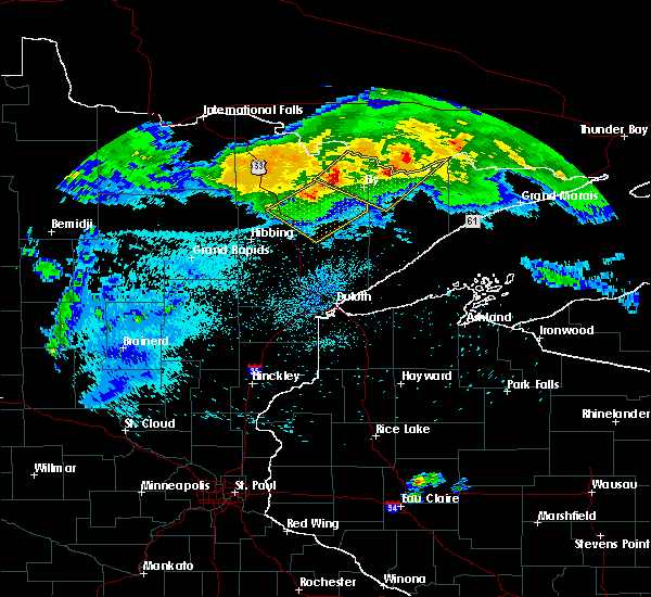 At 245 am cdt, severe thunderstorms were located along a line extending from 9 miles northeast of vermillion lake to 9 miles south of cook, moving southeast at 40 mph (radar indicated). Hazards include 60 mph wind gusts and penny size hail. Expect damage to roofs. Siding and trees. At 245 am cdt, severe thunderstorms were located along a line extending from 9 miles northeast of vermillion lake to 9 miles south of cook, moving southeast at 40 mph (radar indicated). Hazards include 60 mph wind gusts and penny size hail. Expect damage to roofs. Siding and trees.
|
| 7/30/2015 2:17 PM CDT |
 At 217 pm cdt, a severe thunderstorm was located near fairbanks, or 32 miles south of ely, moving southeast at 40 mph (radar indicated). Hazards include quarter size hail. damage to vehicles is expected At 217 pm cdt, a severe thunderstorm was located near fairbanks, or 32 miles south of ely, moving southeast at 40 mph (radar indicated). Hazards include quarter size hail. damage to vehicles is expected
|
| 7/5/2015 9:43 PM CDT |
 At 943 pm cdt, severe thunderstorms were located along a line extending from 7 miles north of fairbanks to brimson to near saginaw to near floodwood, moving east at 45 mph (radar indicated). Hazards include 60 mph wind gusts and quarter size hail. Hail damage to vehicles is expected. expect wind damage to roofs, siding and trees. severe thunderstorms will be near, brimson around 950 pm cdt. thomas lake near brimson and highland lake around 955 pm cdt. brookston around 1000 pm cdt. whyte around 1005 pm cdt. arnold and castle danger around 1010 pm cdt. gooseberry falls state park around 1015 pm cdt. duluth, beaver bay and french river around 1020 pm cdt. hermantown and knife river around 1025 pm cdt. Other locations impacted by these severe thunderstorms include prosit, chester park-umd, lakewood twp, markham, kenwood, pequaywam lake, morley hts/parkview, alborn, seven beaver lake and east hillside. At 943 pm cdt, severe thunderstorms were located along a line extending from 7 miles north of fairbanks to brimson to near saginaw to near floodwood, moving east at 45 mph (radar indicated). Hazards include 60 mph wind gusts and quarter size hail. Hail damage to vehicles is expected. expect wind damage to roofs, siding and trees. severe thunderstorms will be near, brimson around 950 pm cdt. thomas lake near brimson and highland lake around 955 pm cdt. brookston around 1000 pm cdt. whyte around 1005 pm cdt. arnold and castle danger around 1010 pm cdt. gooseberry falls state park around 1015 pm cdt. duluth, beaver bay and french river around 1020 pm cdt. hermantown and knife river around 1025 pm cdt. Other locations impacted by these severe thunderstorms include prosit, chester park-umd, lakewood twp, markham, kenwood, pequaywam lake, morley hts/parkview, alborn, seven beaver lake and east hillside.
|
| 7/5/2015 8:57 PM CDT |
 At 857 pm cdt, severe thunderstorms were located along a line extending from virginia to 8 miles northwest of cotton to near swan river to 7 miles west of jacobson, moving east at 40 mph (radar indicated). Hazards include 70 mph wind gusts and quarter size hail. Hail damage to vehicles is expected. expect considerable tree damage. wind damage is also likely to mobile homes, roofs and outbuildings. severe thunderstorms will be near, virginia and eveleth around 900 pm cdt. gilbert around 905 pm cdt. biwabik and cotton around 910 pm cdt. aurora around 915 pm cdt. meadowlands around 925 pm cdt. boulder lake and whiteface reservoir around 930 pm cdt. floodwood around 935 pm cdt. fairbanks around 940 pm cdt. Other locations impacted by these severe thunderstorms include prosit, markham, pequaywam lake, kelsey, nichols lake, alborn, island, seven beaver lake, gowan and fish lake. At 857 pm cdt, severe thunderstorms were located along a line extending from virginia to 8 miles northwest of cotton to near swan river to 7 miles west of jacobson, moving east at 40 mph (radar indicated). Hazards include 70 mph wind gusts and quarter size hail. Hail damage to vehicles is expected. expect considerable tree damage. wind damage is also likely to mobile homes, roofs and outbuildings. severe thunderstorms will be near, virginia and eveleth around 900 pm cdt. gilbert around 905 pm cdt. biwabik and cotton around 910 pm cdt. aurora around 915 pm cdt. meadowlands around 925 pm cdt. boulder lake and whiteface reservoir around 930 pm cdt. floodwood around 935 pm cdt. fairbanks around 940 pm cdt. Other locations impacted by these severe thunderstorms include prosit, markham, pequaywam lake, kelsey, nichols lake, alborn, island, seven beaver lake, gowan and fish lake.
|
| 7/5/2015 8:31 PM CDT |
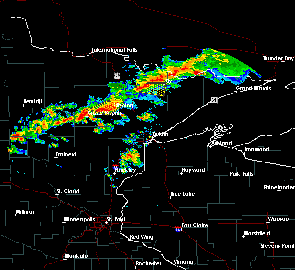 At 831 pm cdt, a severe thunderstorm was located near robinson, or 13 miles east of vermillion lake, moving east at 45 mph (radar indicated). Hazards include 60 mph wind gusts and quarter size hail. Hail damage to vehicles is expected. expect wind damage to roofs, siding and trees. this severe storm will be near, bear head lake state park and robinson around 835 pm cdt. ely around 845 pm cdt. Other locations impacted by this severe thunderstorm include bear head lake, shagawa lake, bear island lake and soudan. At 831 pm cdt, a severe thunderstorm was located near robinson, or 13 miles east of vermillion lake, moving east at 45 mph (radar indicated). Hazards include 60 mph wind gusts and quarter size hail. Hail damage to vehicles is expected. expect wind damage to roofs, siding and trees. this severe storm will be near, bear head lake state park and robinson around 835 pm cdt. ely around 845 pm cdt. Other locations impacted by this severe thunderstorm include bear head lake, shagawa lake, bear island lake and soudan.
|
| 7/5/2015 8:19 PM CDT |
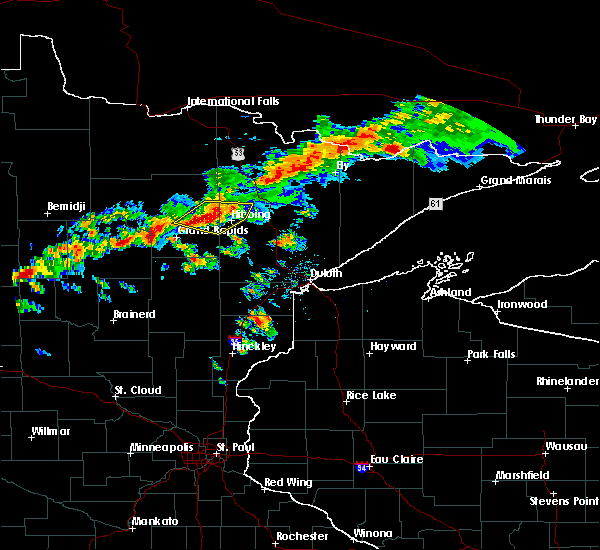 At 819 pm cdt, a severe thunderstorm was located over vermillion lake, moving east at 45 mph (radar indicated). Hazards include 60 mph wind gusts and quarter size hail. Hail damage to vehicles is expected. expect wind damage to roofs, siding and trees. this severe thunderstorm will be near, soudan underground mine state park around 825 pm cdt. robinson around 840 pm cdt. burntside lake around 845 pm cdt. Other locations impacted by this severe thunderstorm include bear head lake, shagawa lake, bear island lake, soudan and trout lake. At 819 pm cdt, a severe thunderstorm was located over vermillion lake, moving east at 45 mph (radar indicated). Hazards include 60 mph wind gusts and quarter size hail. Hail damage to vehicles is expected. expect wind damage to roofs, siding and trees. this severe thunderstorm will be near, soudan underground mine state park around 825 pm cdt. robinson around 840 pm cdt. burntside lake around 845 pm cdt. Other locations impacted by this severe thunderstorm include bear head lake, shagawa lake, bear island lake, soudan and trout lake.
|
| 6/29/2015 9:37 AM CDT |
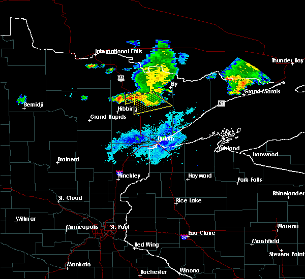 At 935 am cdt, a severe thunderstorm was located over aurora, or 30 miles southwest of ely, moving southeast at 45 mph (radar indicated). Hazards include 60 mph wind gusts and quarter size hail. Hail damage to vehicles is expected. expect wind damage to roofs, siding and trees. Locations impacted include, eveleth, mountain iron, hoyt lakes, gilbert, biwabik, and mckinley,. At 935 am cdt, a severe thunderstorm was located over aurora, or 30 miles southwest of ely, moving southeast at 45 mph (radar indicated). Hazards include 60 mph wind gusts and quarter size hail. Hail damage to vehicles is expected. expect wind damage to roofs, siding and trees. Locations impacted include, eveleth, mountain iron, hoyt lakes, gilbert, biwabik, and mckinley,.
|
| 6/29/2015 9:09 AM CDT |
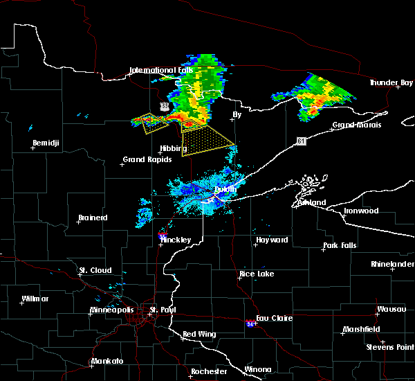 At 909 am cdt, a severe thunderstorm was located near wahlsten, or 28 miles southwest of ely, moving southeast at 45 mph (radar indicated). Hazards include quarter size hail and 60 mph wind gusts. Hail damage to vehicles is expected. Expect wind damage to roofs, siding and trees. At 909 am cdt, a severe thunderstorm was located near wahlsten, or 28 miles southwest of ely, moving southeast at 45 mph (radar indicated). Hazards include quarter size hail and 60 mph wind gusts. Hail damage to vehicles is expected. Expect wind damage to roofs, siding and trees.
|
| 7/22/2014 1:24 AM CDT | Trees and power lines dow in st. louis county MN, 1.2 miles N of Babbitt, MN |
| 7/4/2012 3:35 PM CDT | Several 1.5 foot diameter trees down in lake county MN, 16 miles WSW of Babbitt, MN |
Hail Maps for Babbitt, MN


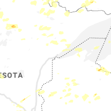


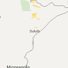


Connect with Interactive Hail Maps