

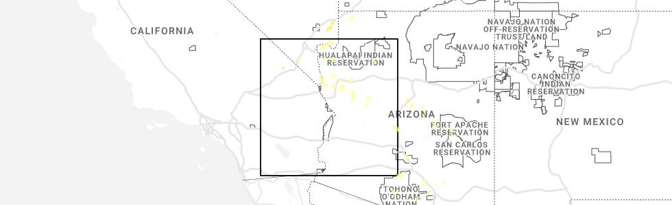
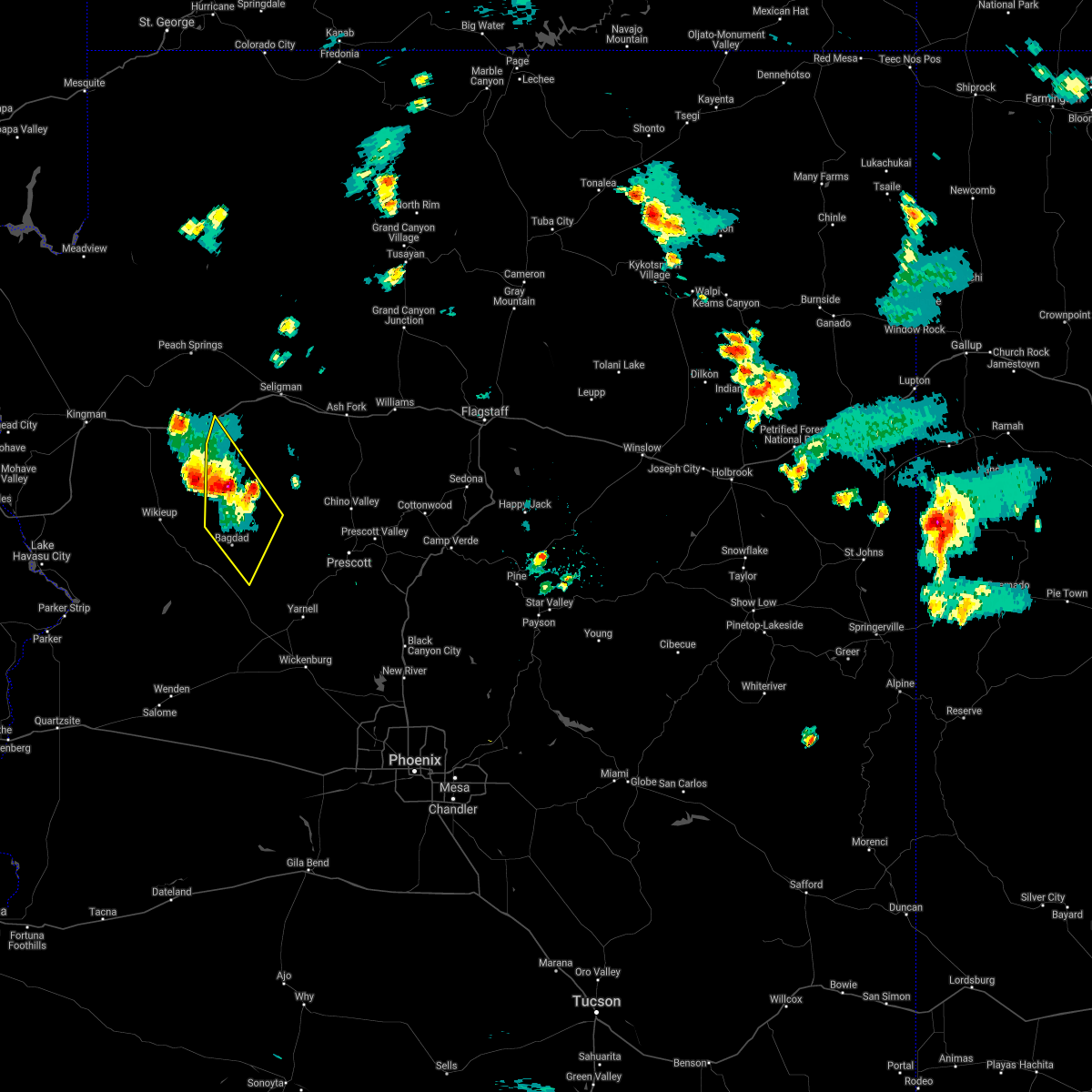
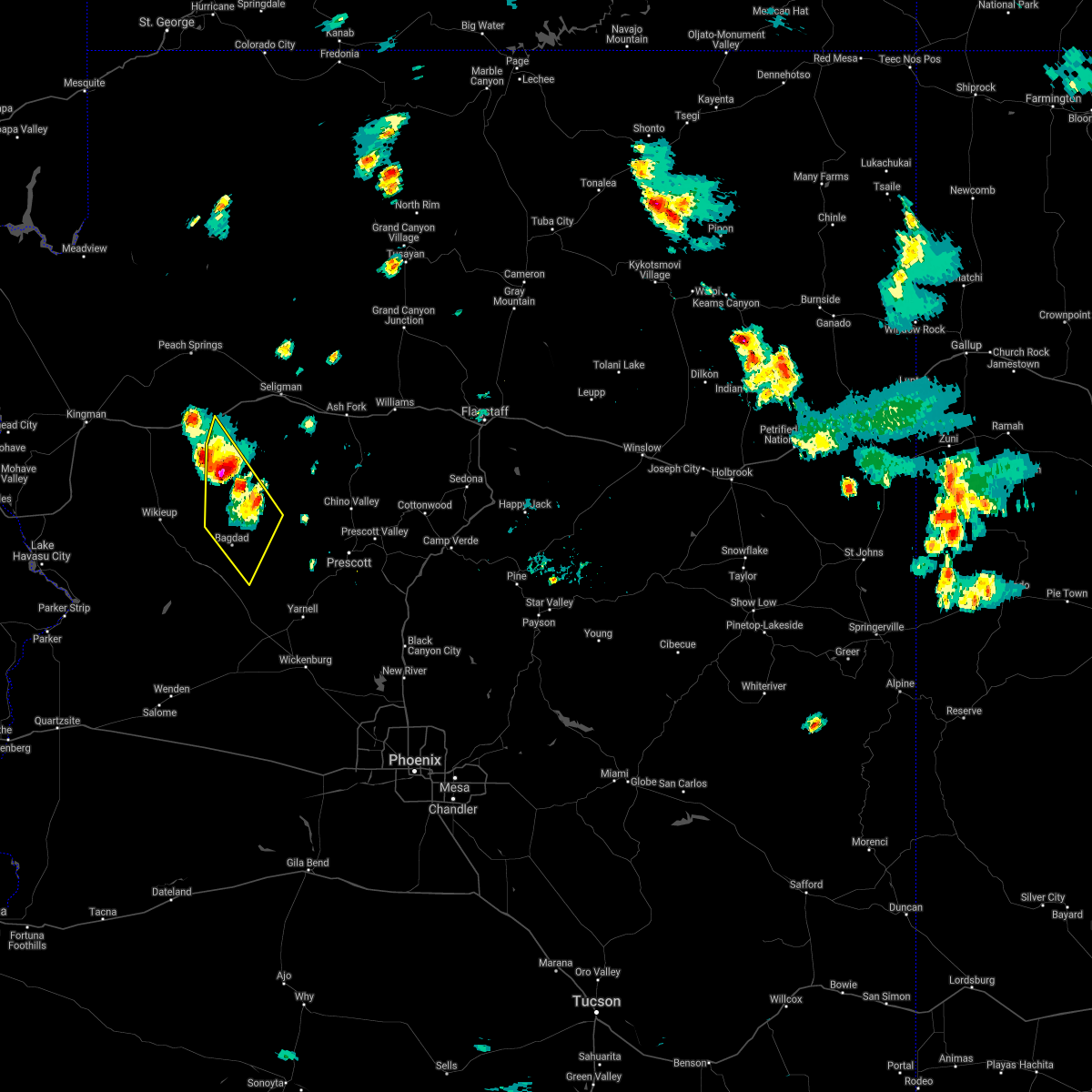
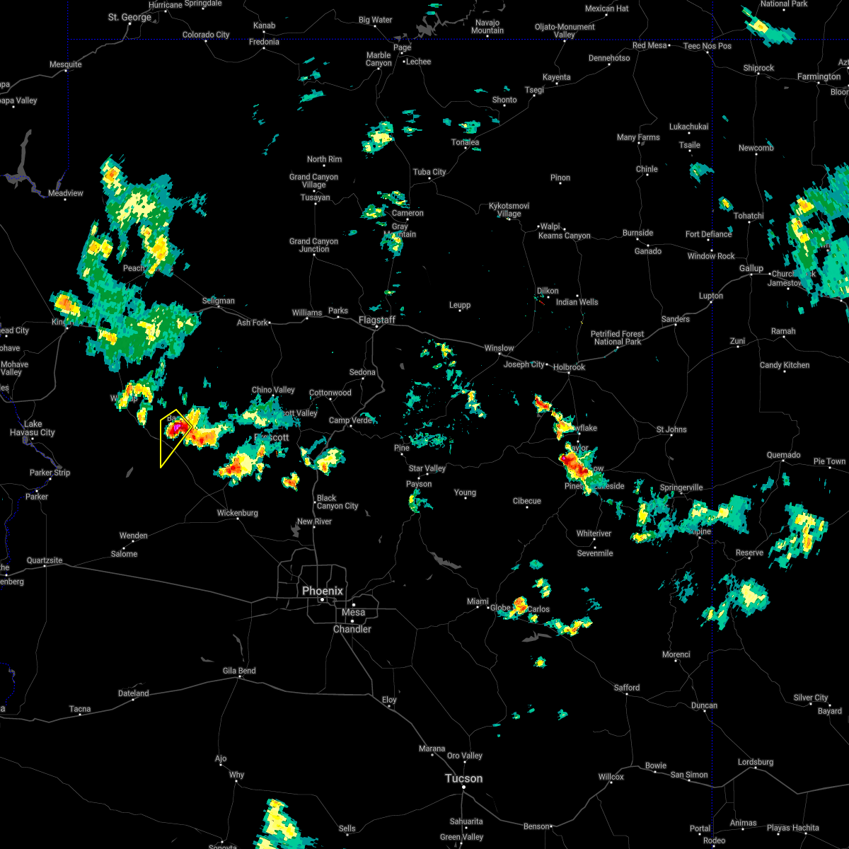
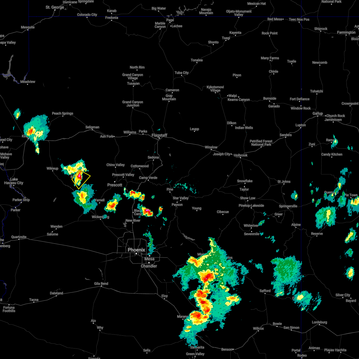
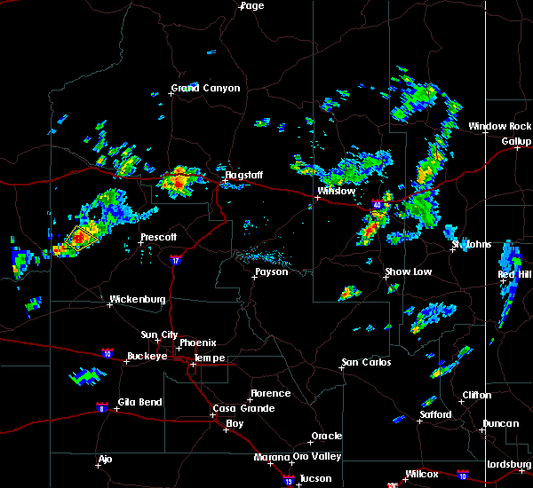
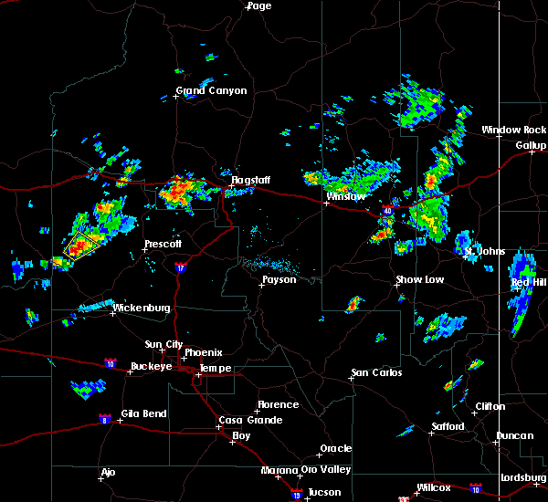
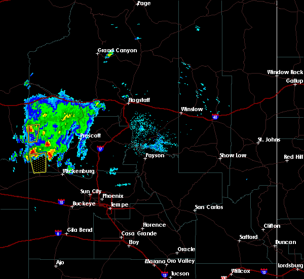
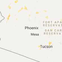
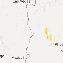
Hail Map for Bagdad, AZ
The Bagdad, AZ area has had 1 report of on-the-ground hail by trained spotters, and has been under severe weather warnings 0 times during the past 12 months. Doppler radar has detected hail at or near Bagdad, AZ on 19 occasions.
| Name: | Bagdad, AZ |
| Where Located: | 67.2 miles E of Lake Havasu City, AZ |
| Map: | Google Map for Bagdad, AZ |
| Population: | 1876 |
| Housing Units: | 838 |
| More Info: | Search Google for Bagdad, AZ |
1
The Top Recent Hail Date for Bagdad, AZ is Thursday, August 31, 2023 (11th out of 19)
Hail and Wind Damage Spotted near Bagdad, AZ
| Date / Time | Report Details |
|---|---|
| 8/23/2022 5:07 PM MST | At 506 pm mst, a severe thunderstorm was located near bagdad, moving southwest at 10 mph (radar indicated). Hazards include 60 mph wind gusts and quarter size hail. Hail damage to vehicles is expected. Expect wind damage to roofs, siding, and trees. |
| 8/15/2021 4:13 PM MST |
 The severe thunderstorm warning for yavapai county will expire at 415 pm mst, the storms in remote western yavapai county which prompted the warning have weakened below severe limits, and no longer pose an immediate threat to life or property. therefore, the warning will be allowed to expire. The severe thunderstorm warning for yavapai county will expire at 415 pm mst, the storms in remote western yavapai county which prompted the warning have weakened below severe limits, and no longer pose an immediate threat to life or property. therefore, the warning will be allowed to expire.
|
| 8/15/2021 3:54 PM MST |
 At 353 pm mst, severe thunderstorms were located along a line extending from 19 miles south of diamond m ranch to 12 miles northeast of bagdad, moving south at 20 mph (radar indicated). Hazards include 60 mph wind gusts and half dollar size hail. Hail damage to vehicles is expected. expect wind damage to roofs, siding, and trees. locations impacted include, bagdad, cross mountain and mount hope. hail threat, radar indicated max hail size, 1. 25 in wind threat, radar indicated max wind gust, 60 mph. At 353 pm mst, severe thunderstorms were located along a line extending from 19 miles south of diamond m ranch to 12 miles northeast of bagdad, moving south at 20 mph (radar indicated). Hazards include 60 mph wind gusts and half dollar size hail. Hail damage to vehicles is expected. expect wind damage to roofs, siding, and trees. locations impacted include, bagdad, cross mountain and mount hope. hail threat, radar indicated max hail size, 1. 25 in wind threat, radar indicated max wind gust, 60 mph.
|
| 8/15/2021 3:36 PM MST |
 At 336 pm mst, severe thunderstorms were located along a line extending from 15 miles south of diamond m ranch to 16 miles northeast of bagdad, moving south at 15 mph (radar indicated). Hazards include 60 mph wind gusts and half dollar size hail. Hail damage to vehicles is expected. Expect wind damage to roofs, siding, and trees. At 336 pm mst, severe thunderstorms were located along a line extending from 15 miles south of diamond m ranch to 16 miles northeast of bagdad, moving south at 15 mph (radar indicated). Hazards include 60 mph wind gusts and half dollar size hail. Hail damage to vehicles is expected. Expect wind damage to roofs, siding, and trees.
|
| 7/9/2021 5:40 PM MST |
 At 539 pm mst, a severe thunderstorm was located near bagdad, or 24 miles southeast of wikieup, moving southwest at 30 mph (radar indicated). Hazards include 70 mph wind gusts and quarter size hail. Hail damage to vehicles is expected. expect considerable tree damage. Wind damage is also likely to mobile homes, roofs, and outbuildings. At 539 pm mst, a severe thunderstorm was located near bagdad, or 24 miles southeast of wikieup, moving southwest at 30 mph (radar indicated). Hazards include 70 mph wind gusts and quarter size hail. Hail damage to vehicles is expected. expect considerable tree damage. Wind damage is also likely to mobile homes, roofs, and outbuildings.
|
| 8/16/2020 4:09 PM MST |
 The national weather service in flagstaff has issued a * severe thunderstorm warning for. yavapai county in west central arizona. until 500 pm mst. At 408 pm mst, a severe thunderstorm was located near bagdad, or 28 miles east of wikieup, and is nearly stationary. The national weather service in flagstaff has issued a * severe thunderstorm warning for. yavapai county in west central arizona. until 500 pm mst. At 408 pm mst, a severe thunderstorm was located near bagdad, or 28 miles east of wikieup, and is nearly stationary.
|
| 7/17/2017 5:25 PM MST | Power lines and trees dow in yavapai county AZ, 0.4 miles NNW of Bagdad, AZ |
| 8/9/2016 4:32 PM MST |
 At 431 pm mst, doppler radar indicated a severe thunderstorm capable of producing quarter size hail and damaging winds in excess of 60 mph. this storm was located 7 miles northeast of bagdad, or 31 miles east of wikieup, moving northeast at 15 mph. this severe thunderstorm will remain over mainly rural areas of yavapai county. At 431 pm mst, doppler radar indicated a severe thunderstorm capable of producing quarter size hail and damaging winds in excess of 60 mph. this storm was located 7 miles northeast of bagdad, or 31 miles east of wikieup, moving northeast at 15 mph. this severe thunderstorm will remain over mainly rural areas of yavapai county.
|
| 8/9/2016 4:20 PM MST |
 At 420 pm mst, doppler radar indicated a severe thunderstorm capable of producing quarter size hail and damaging winds in excess of 60 mph. this storm was located near bagdad, or 29 miles east of wikieup, and moving northeast at 15 mph. At 420 pm mst, doppler radar indicated a severe thunderstorm capable of producing quarter size hail and damaging winds in excess of 60 mph. this storm was located near bagdad, or 29 miles east of wikieup, and moving northeast at 15 mph.
|
| 10/19/2015 10:56 PM MST |
 At 1055 pm mst, doppler radar indicated a severe thunderstorm capable of producing large damaging hail up to golf ball size. this storm was located 15 miles south of bagdad, or 20 miles east of alamo lake, and moving north at 35 mph. At 1055 pm mst, doppler radar indicated a severe thunderstorm capable of producing large damaging hail up to golf ball size. this storm was located 15 miles south of bagdad, or 20 miles east of alamo lake, and moving north at 35 mph.
|
| 10/19/2015 10:26 PM MST |
 At 1026 pm mst, doppler radar indicated a severe thunderstorm capable of producing large damaging hail up to golf ball size. this storm was located west of bagdad, or 20 miles east of wikieup, and moving north at 30 mph. * this severe thunderstorm will remain over mainly rural areas of west central yavapai county. At 1026 pm mst, doppler radar indicated a severe thunderstorm capable of producing large damaging hail up to golf ball size. this storm was located west of bagdad, or 20 miles east of wikieup, and moving north at 30 mph. * this severe thunderstorm will remain over mainly rural areas of west central yavapai county.
|
| 1/1/0001 12:00 AM | Quarter sized hail reported 0.5 miles NE of Bagdad, AZ, quarter sized hail and minor street flooding. |
Hail Maps for Bagdad, AZ


Connect with Interactive Hail Maps