

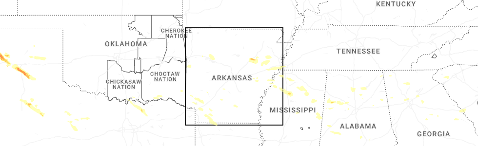
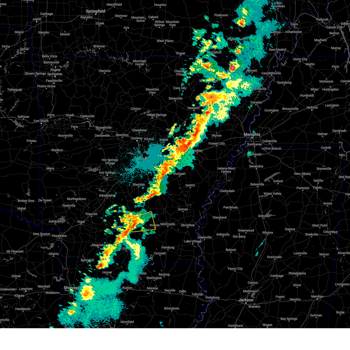
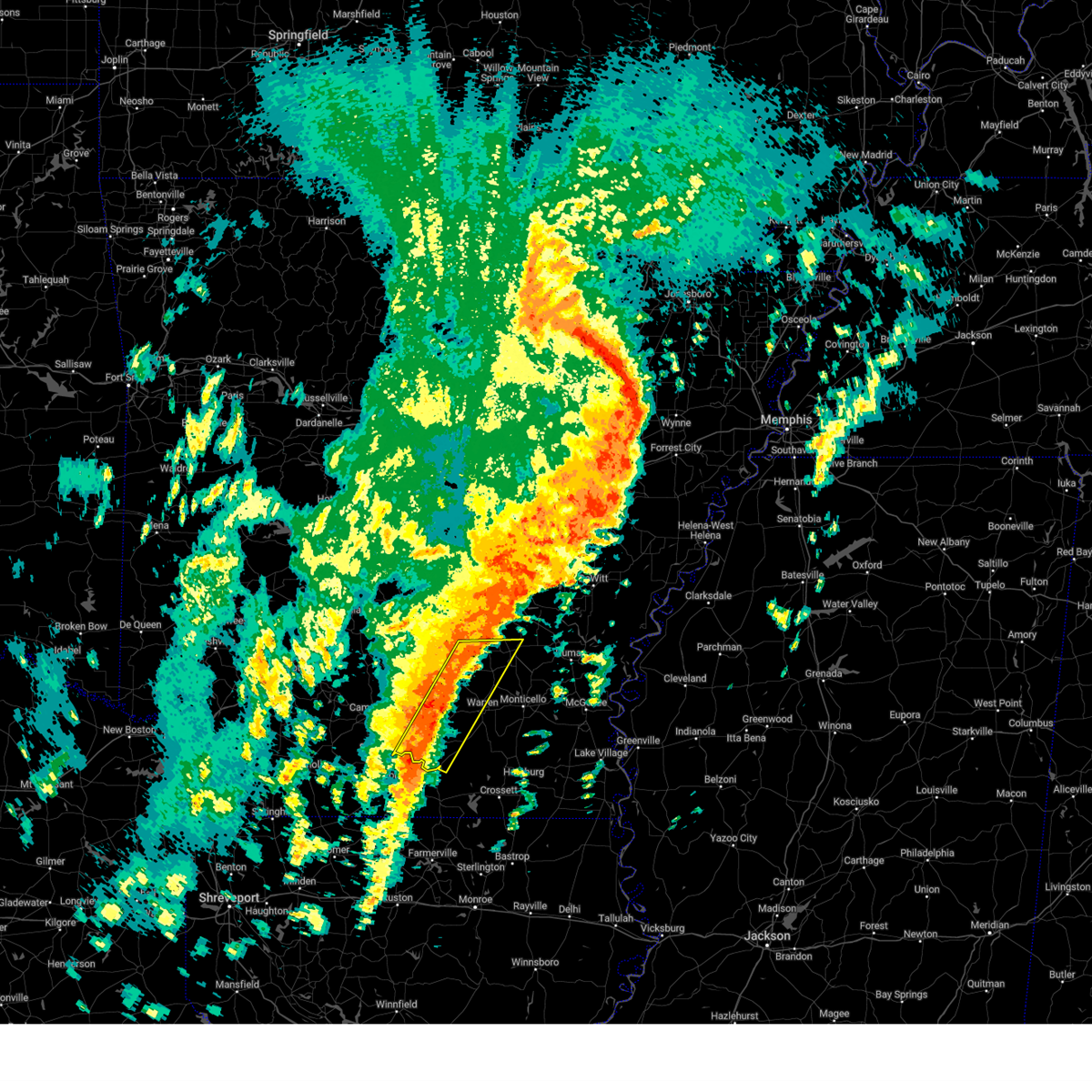
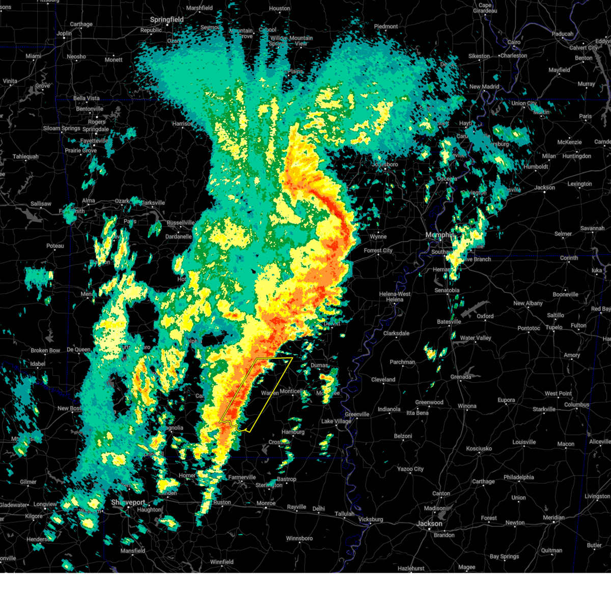
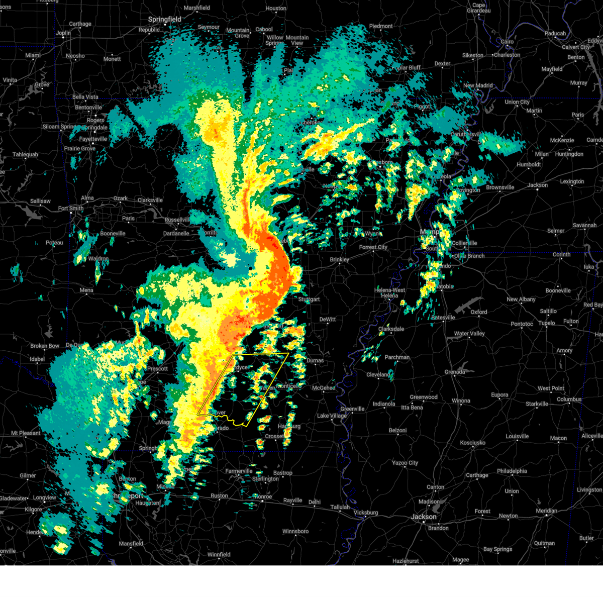
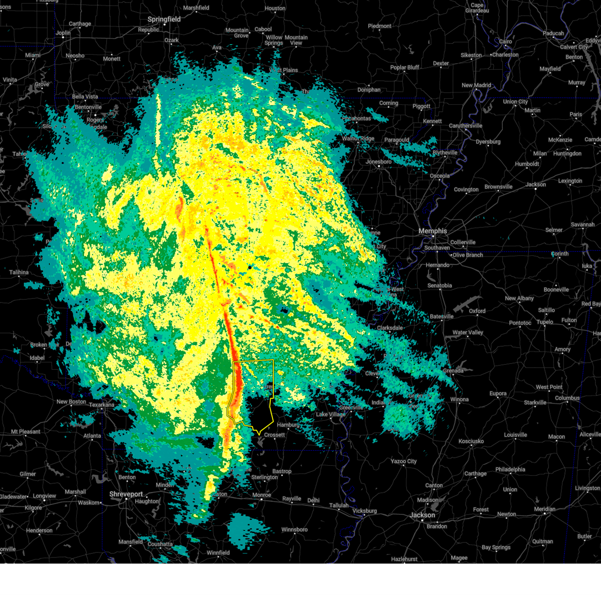
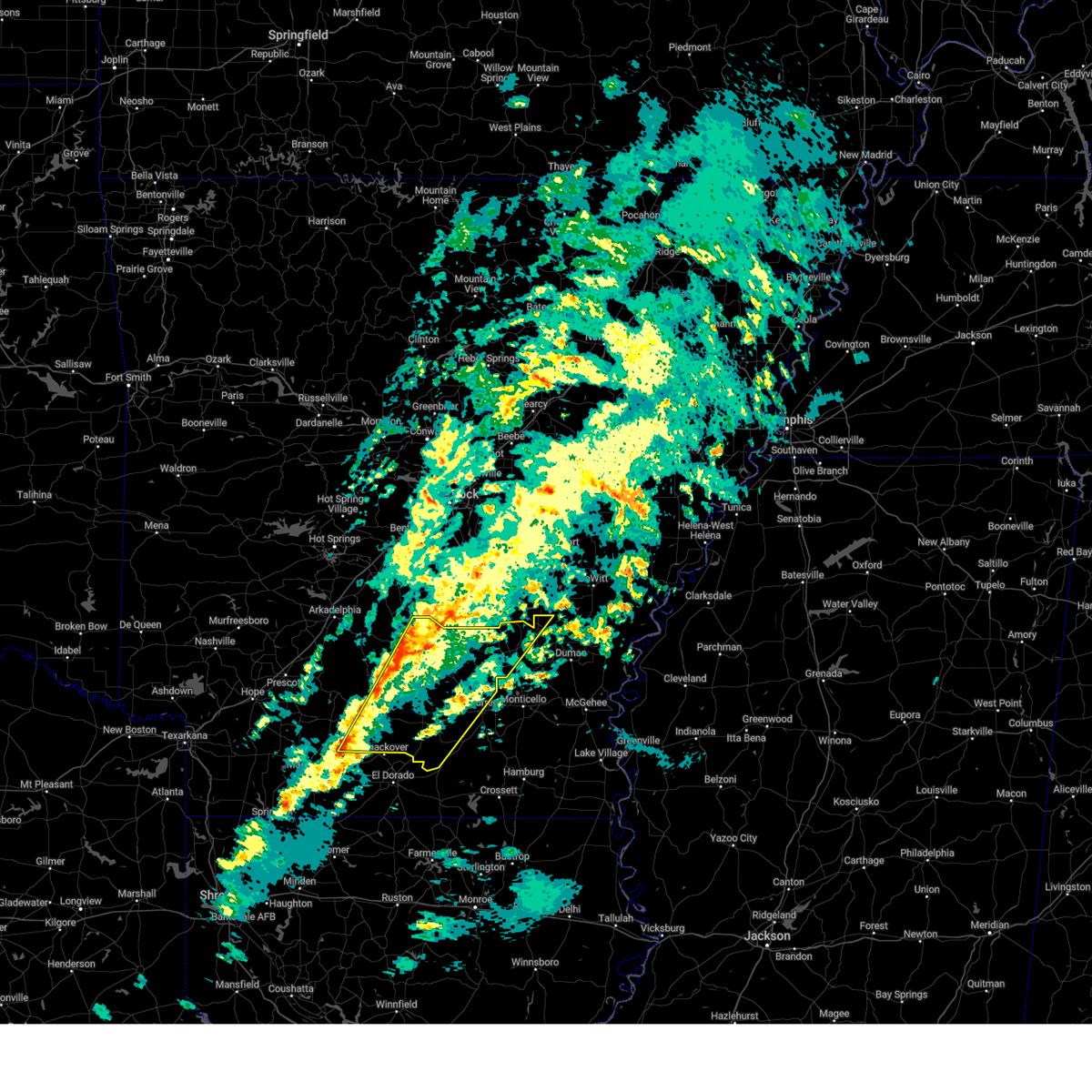
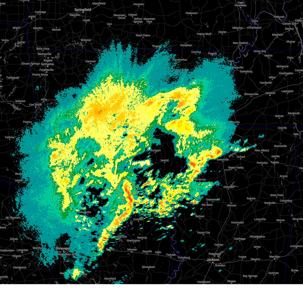
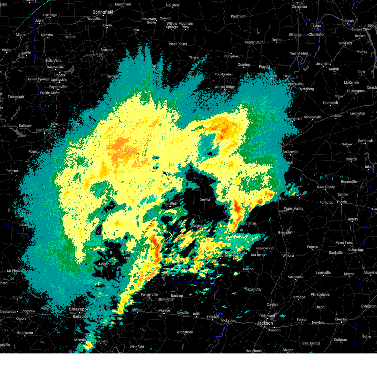
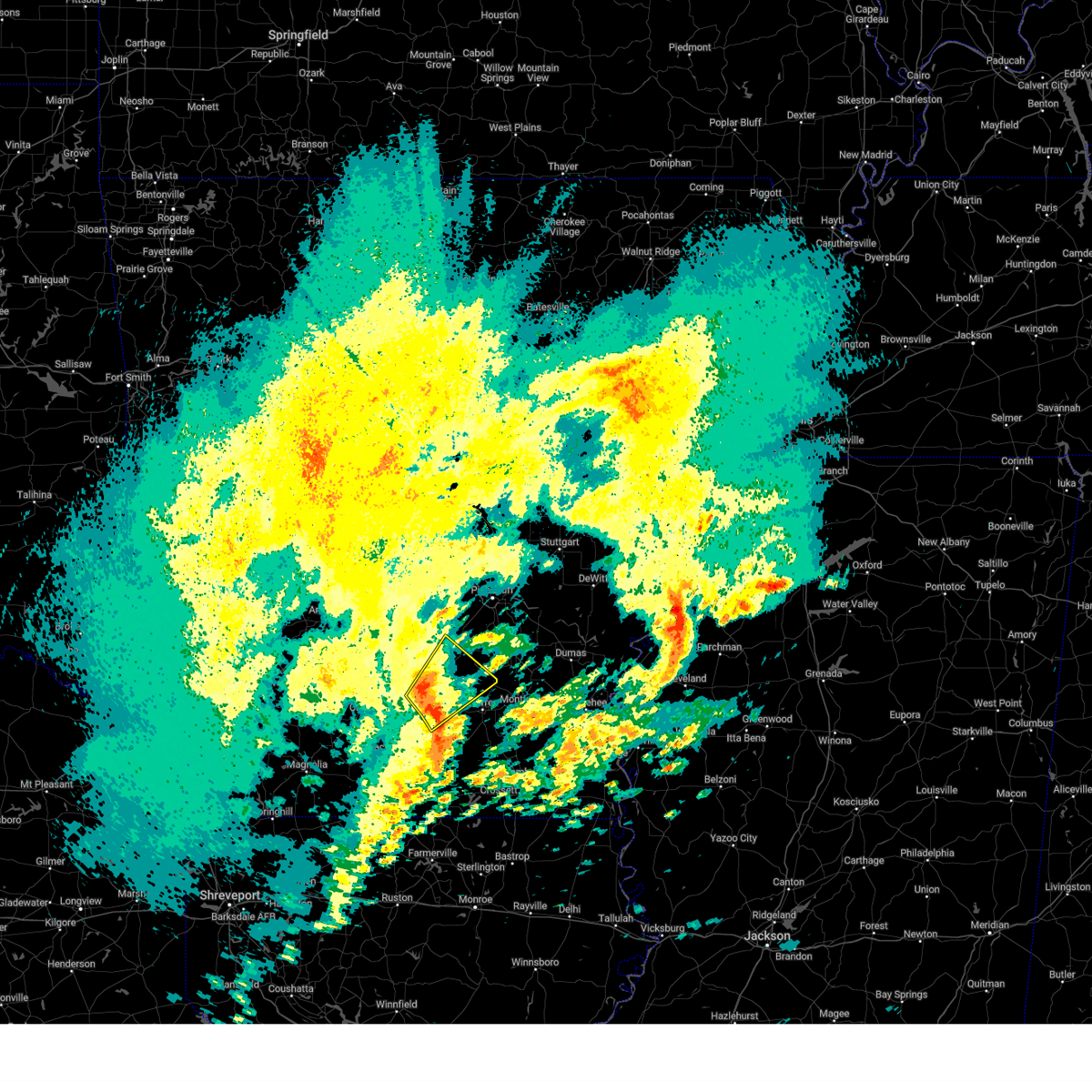
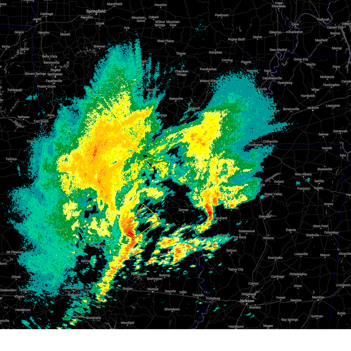
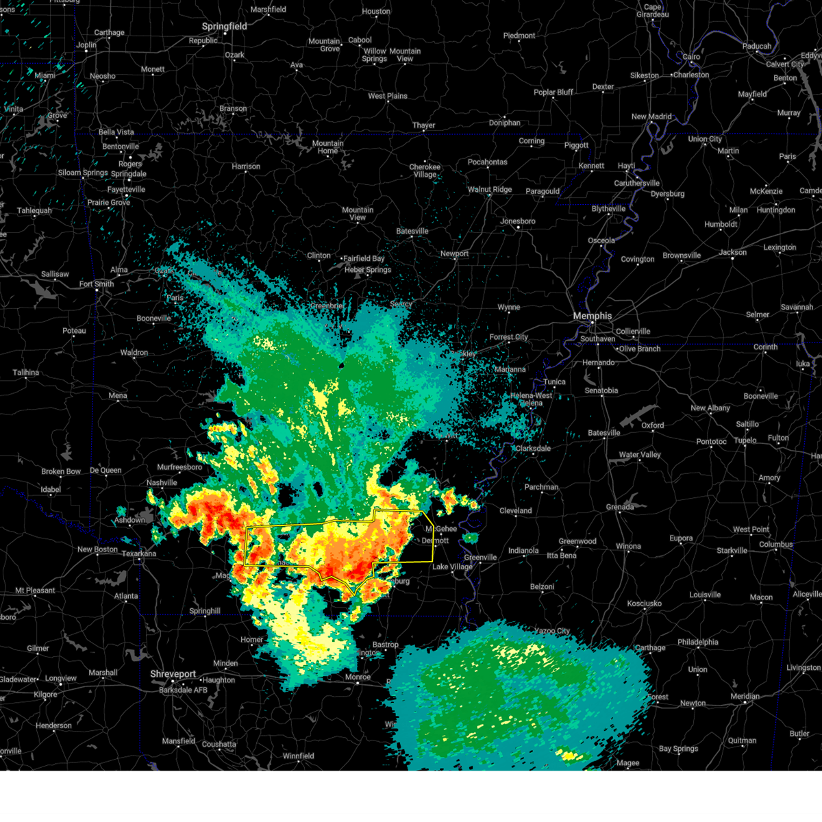
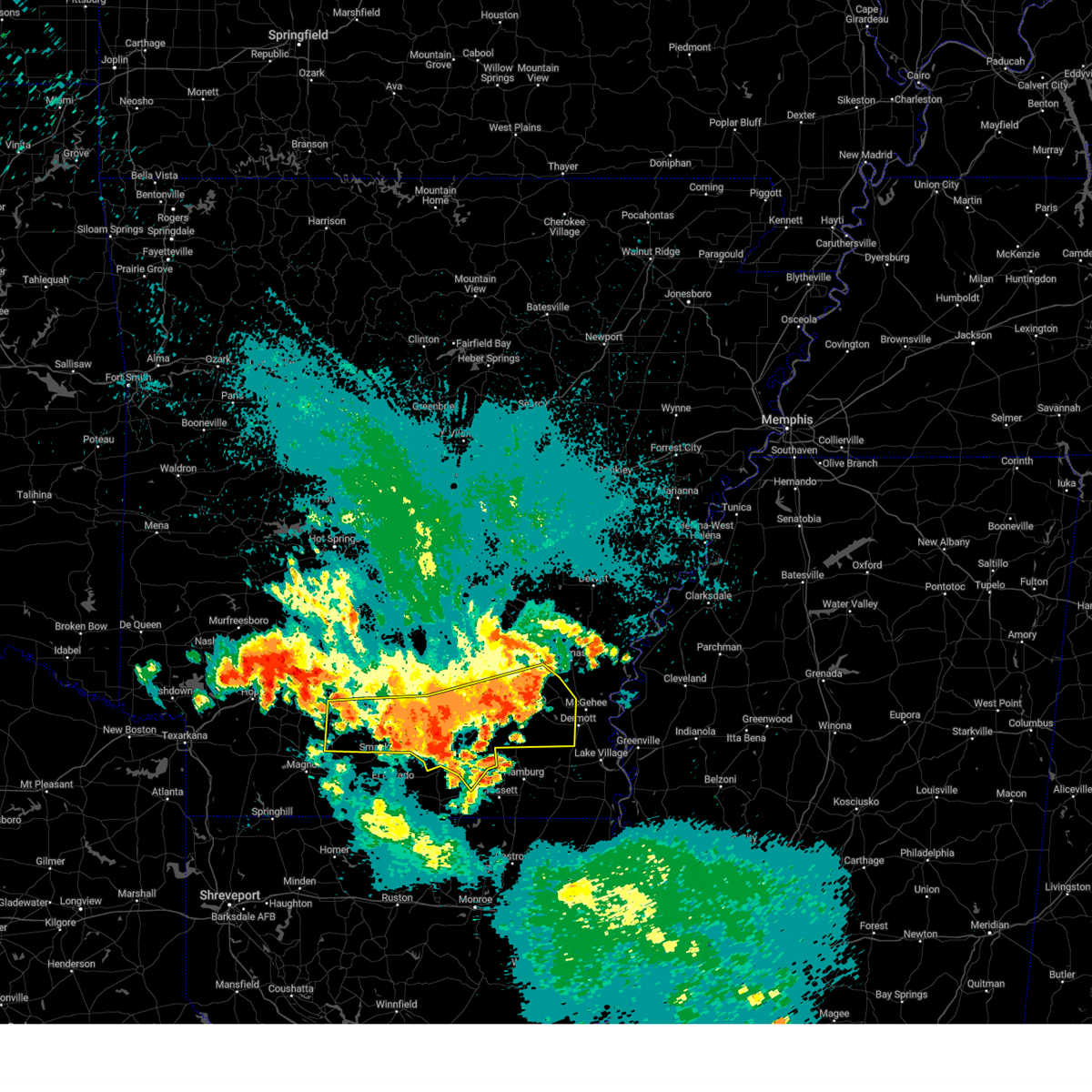
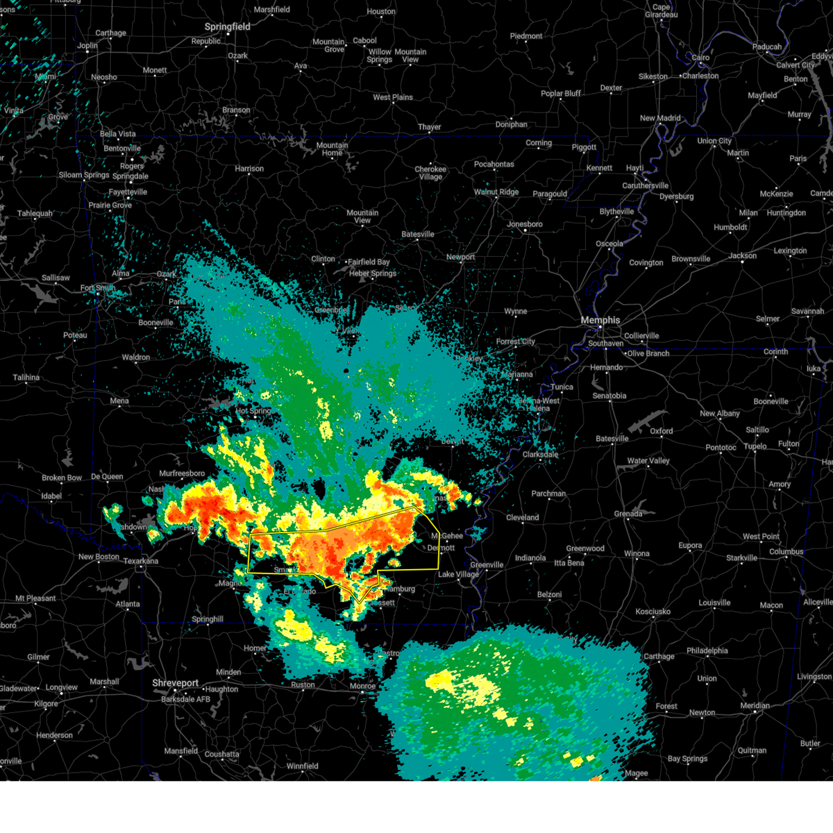
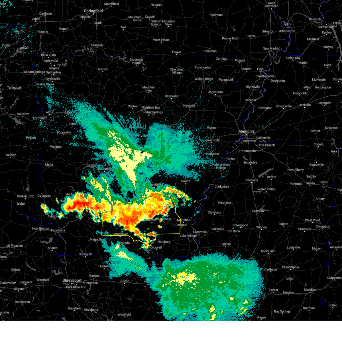
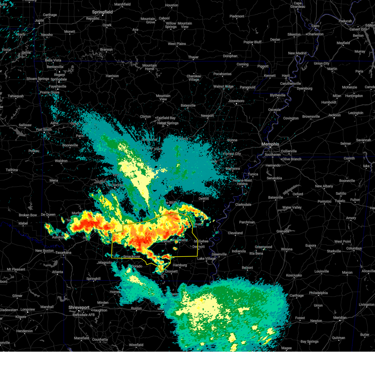
Hail Map for Banks, AR
The Banks, AR area has had 0 reports of on-the-ground hail by trained spotters, and has been under severe weather warnings 27 times during the past 12 months. Doppler radar has detected hail at or near Banks, AR on 49 occasions, including 3 occasions during the past year.
| Name: | Banks, AR |
| Where Located: | 58.7 miles NNW of Bastrop, LA |
| Map: | Google Map for Banks, AR |
| Population: | 124 |
| Housing Units: | 65 |
| More Info: | Search Google for Banks, AR |
0
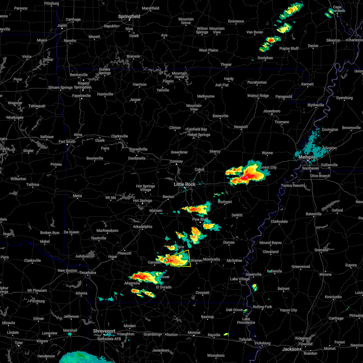
The Top Recent Hail Date for Banks, AR is Saturday, June 7, 2025 (49th out of 49)
Hail and Wind Damage Spotted near Banks, AR
| Date / Time | Report Details |
|---|---|
| 6/19/2025 3:48 PM CDT | Svrlzk the national weather service in little rock has issued a * severe thunderstorm warning for, bradley county in southeastern arkansas, southeastern cleveland county in southeastern arkansas, drew county in southeastern arkansas, southwestern lincoln county in southeastern arkansas, * until 445 pm cdt. * at 348 pm cdt, severe thunderstorms were located along a line extending from plantersville to near weeks, moving south at 20 mph (radar indicated). Hazards include 60 mph wind gusts and quarter size hail. Hail damage to vehicles is expected. Expect wind damage to roofs, siding, and trees. |
| 6/7/2025 11:59 PM CDT |
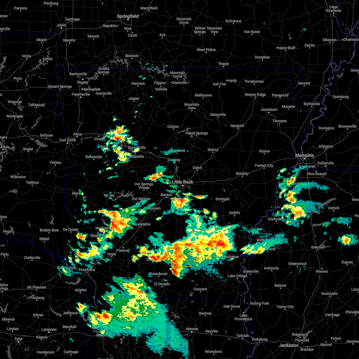
 Svrlzk the national weather service in little rock has issued a * severe thunderstorm warning for, northern bradley county in southeastern arkansas, south central cleveland county in southeastern arkansas, northeastern calhoun county in southwestern arkansas, southwestern drew county in southeastern arkansas, * until 1245 am cdt. * at 1159 pm cdt, a severe thunderstorm was located over weeks, or 7 miles west of warren, moving southeast at 35 mph (radar indicated). Hazards include 60 mph wind gusts and quarter size hail. Hail damage to vehicles is expected. Expect wind damage to roofs, siding, and trees. Svrlzk the national weather service in little rock has issued a * severe thunderstorm warning for, northern bradley county in southeastern arkansas, south central cleveland county in southeastern arkansas, northeastern calhoun county in southwestern arkansas, southwestern drew county in southeastern arkansas, * until 1245 am cdt. * at 1159 pm cdt, a severe thunderstorm was located over weeks, or 7 miles west of warren, moving southeast at 35 mph (radar indicated). Hazards include 60 mph wind gusts and quarter size hail. Hail damage to vehicles is expected. Expect wind damage to roofs, siding, and trees.
|
| 5/25/2025 5:07 PM CDT |
 Svrlzk the national weather service in little rock has issued a * severe thunderstorm warning for, northern bradley county in southeastern arkansas, southeastern cleveland county in southeastern arkansas, * until 545 pm cdt. * at 506 pm cdt, a severe thunderstorm was located over weeks, or 10 miles west of warren, moving east at 15 mph (radar indicated). Hazards include 60 mph wind gusts and quarter size hail. Hail damage to vehicles is expected. Expect wind damage to roofs, siding, and trees. Svrlzk the national weather service in little rock has issued a * severe thunderstorm warning for, northern bradley county in southeastern arkansas, southeastern cleveland county in southeastern arkansas, * until 545 pm cdt. * at 506 pm cdt, a severe thunderstorm was located over weeks, or 10 miles west of warren, moving east at 15 mph (radar indicated). Hazards include 60 mph wind gusts and quarter size hail. Hail damage to vehicles is expected. Expect wind damage to roofs, siding, and trees.
|
| 4/30/2025 5:25 PM CDT |
 Svrlzk the national weather service in little rock has issued a * severe thunderstorm warning for, bradley county in southeastern arkansas, central cleveland county in southeastern arkansas, calhoun county in southwestern arkansas, southern dallas county in southwestern arkansas, eastern ouachita county in southwestern arkansas, * until 630 pm cdt. * at 524 pm cdt, severe thunderstorms were located along a line extending from 7 miles east of sparkman to near louann, moving east at 35 mph (radar indicated). Hazards include 60 mph wind gusts. expect damage to roofs, siding, and trees Svrlzk the national weather service in little rock has issued a * severe thunderstorm warning for, bradley county in southeastern arkansas, central cleveland county in southeastern arkansas, calhoun county in southwestern arkansas, southern dallas county in southwestern arkansas, eastern ouachita county in southwestern arkansas, * until 630 pm cdt. * at 524 pm cdt, severe thunderstorms were located along a line extending from 7 miles east of sparkman to near louann, moving east at 35 mph (radar indicated). Hazards include 60 mph wind gusts. expect damage to roofs, siding, and trees
|
| 4/20/2025 9:07 PM CDT |
 the severe thunderstorm warning has been cancelled and is no longer in effect the severe thunderstorm warning has been cancelled and is no longer in effect
|
| 4/20/2025 9:07 PM CDT |
 At 906 pm cdt, a severe thunderstorm was located 8 miles southeast of harlow, or 8 miles north of hampton, moving east at 25 mph (radar indicated). Hazards include 60 mph wind gusts and quarter size hail. Hail damage to vehicles is expected. expect wind damage to roofs, siding, and trees. Locations impacted include, chambersville, ellisville, weeks, mt elba, tipton, warren, harlow, thornton, mckinney, orlando, marks mill state park, hebron, woodberry, banks, new edinburg, tinsman, hampton, fordyce,. At 906 pm cdt, a severe thunderstorm was located 8 miles southeast of harlow, or 8 miles north of hampton, moving east at 25 mph (radar indicated). Hazards include 60 mph wind gusts and quarter size hail. Hail damage to vehicles is expected. expect wind damage to roofs, siding, and trees. Locations impacted include, chambersville, ellisville, weeks, mt elba, tipton, warren, harlow, thornton, mckinney, orlando, marks mill state park, hebron, woodberry, banks, new edinburg, tinsman, hampton, fordyce,.
|
| 4/20/2025 8:42 PM CDT | Svrlzk the national weather service in little rock has issued a * severe thunderstorm warning for, northern bradley county in southeastern arkansas, south central cleveland county in southeastern arkansas, northern calhoun county in southwestern arkansas, southeastern dallas county in southwestern arkansas, east central ouachita county in southwestern arkansas, * until 930 pm cdt. * at 841 pm cdt, a severe thunderstorm was located over highland industrial park, or 11 miles east of camden, moving east at 35 mph (radar indicated). Hazards include 60 mph wind gusts and quarter size hail. Hail damage to vehicles is expected. Expect wind damage to roofs, siding, and trees. |
| 4/5/2025 12:26 PM CDT |
 The storms which prompted the warning have weakened below severe limits, and no longer pose an immediate threat to life or property. therefore, the warning will be allowed to expire. a tornado watch remains in effect until 700 pm cdt for southeastern and southwestern arkansas. The storms which prompted the warning have weakened below severe limits, and no longer pose an immediate threat to life or property. therefore, the warning will be allowed to expire. a tornado watch remains in effect until 700 pm cdt for southeastern and southwestern arkansas.
|
| 4/5/2025 12:15 PM CDT |
 At 1215 pm cdt, severe thunderstorms were located along a line extending from near rison to near harrell, moving northeast at 50 mph (radar indicated). Hazards include 60 mph wind gusts. Expect damage to roofs, siding, and trees. Locations impacted include, feenyville, farmville, ellisville, hilo, cornerville, millers bluff, palmyra, mckinney, hampton municipal airport, hebron, gravelridge, woodberry, banks, kingsland, star city, new edinburg, moro bay, jersey, rye, glendale in lincoln county,. At 1215 pm cdt, severe thunderstorms were located along a line extending from near rison to near harrell, moving northeast at 50 mph (radar indicated). Hazards include 60 mph wind gusts. Expect damage to roofs, siding, and trees. Locations impacted include, feenyville, farmville, ellisville, hilo, cornerville, millers bluff, palmyra, mckinney, hampton municipal airport, hebron, gravelridge, woodberry, banks, kingsland, star city, new edinburg, moro bay, jersey, rye, glendale in lincoln county,.
|
| 4/5/2025 11:42 AM CDT |
 Svrlzk the national weather service in little rock has issued a * severe thunderstorm warning for, northwestern bradley county in southeastern arkansas, cleveland county in southeastern arkansas, calhoun county in southwestern arkansas, southeastern dallas county in southwestern arkansas, eastern ouachita county in southwestern arkansas, northwestern drew county in southeastern arkansas, southwestern lincoln county in southeastern arkansas, * until 1230 pm cdt. * at 1141 am cdt, severe thunderstorms were located along a line extending from 8 miles northwest of fordyce to near cullendale, moving east at 45 mph (radar indicated). Hazards include 60 mph wind gusts and quarter size hail. Hail damage to vehicles is expected. Expect wind damage to roofs, siding, and trees. Svrlzk the national weather service in little rock has issued a * severe thunderstorm warning for, northwestern bradley county in southeastern arkansas, cleveland county in southeastern arkansas, calhoun county in southwestern arkansas, southeastern dallas county in southwestern arkansas, eastern ouachita county in southwestern arkansas, northwestern drew county in southeastern arkansas, southwestern lincoln county in southeastern arkansas, * until 1230 pm cdt. * at 1141 am cdt, severe thunderstorms were located along a line extending from 8 miles northwest of fordyce to near cullendale, moving east at 45 mph (radar indicated). Hazards include 60 mph wind gusts and quarter size hail. Hail damage to vehicles is expected. Expect wind damage to roofs, siding, and trees.
|
| 3/4/2025 10:47 AM CST |
 At 1046 am cst, severe thunderstorms were located along a line extending from near fordyce to near ellisville to near calion, moving east at 45 mph (radar indicated). Hazards include 60 mph wind gusts and penny size hail. Expect damage to roofs, siding, and trees. Locations impacted include, ingalls, carmel, farmville, ellisville, hilo, hermitage, johnsonville, warren, mckinney, vick, hampton municipal airport, hebron, gravelridge, mt olive in bradley county, banks, kingsland, new edinburg, moro bay, jersey, sumpter,. At 1046 am cst, severe thunderstorms were located along a line extending from near fordyce to near ellisville to near calion, moving east at 45 mph (radar indicated). Hazards include 60 mph wind gusts and penny size hail. Expect damage to roofs, siding, and trees. Locations impacted include, ingalls, carmel, farmville, ellisville, hilo, hermitage, johnsonville, warren, mckinney, vick, hampton municipal airport, hebron, gravelridge, mt olive in bradley county, banks, kingsland, new edinburg, moro bay, jersey, sumpter,.
|
| 3/4/2025 10:30 AM CST |
 Svrlzk the national weather service in little rock has issued a * severe thunderstorm warning for, bradley county in southeastern arkansas, southern cleveland county in southeastern arkansas, calhoun county in southwestern arkansas, southeastern dallas county in southwestern arkansas, * until 1130 am cst. * at 1029 am cst, severe thunderstorms were located along a line extending from 10 miles west of fordyce to 8 miles east of camden to near norphlet, moving east at 45 mph (radar indicated). Hazards include 60 mph wind gusts and penny size hail. expect damage to roofs, siding, and trees Svrlzk the national weather service in little rock has issued a * severe thunderstorm warning for, bradley county in southeastern arkansas, southern cleveland county in southeastern arkansas, calhoun county in southwestern arkansas, southeastern dallas county in southwestern arkansas, * until 1130 am cst. * at 1029 am cst, severe thunderstorms were located along a line extending from 10 miles west of fordyce to 8 miles east of camden to near norphlet, moving east at 45 mph (radar indicated). Hazards include 60 mph wind gusts and penny size hail. expect damage to roofs, siding, and trees
|
| 1/5/2025 1:04 PM CST |
 the severe thunderstorm warning has been cancelled and is no longer in effect the severe thunderstorm warning has been cancelled and is no longer in effect
|
| 1/5/2025 12:40 PM CST |
 At 1239 pm cst, severe thunderstorms were located along a line extending from near kedron to near smackover, moving east at 60 mph (radar indicated). Hazards include 60 mph wind gusts and penny size hail. Expect damage to roofs, siding, and trees. Locations impacted include, warren, fordyce, star city, rison, hampton, bearden, calion, grady, kingsland, thornton, harrell, louann, whitefield, hampton municipal airport, moro bay, weeks, woodville, tipton, herbine, nebo,. At 1239 pm cst, severe thunderstorms were located along a line extending from near kedron to near smackover, moving east at 60 mph (radar indicated). Hazards include 60 mph wind gusts and penny size hail. Expect damage to roofs, siding, and trees. Locations impacted include, warren, fordyce, star city, rison, hampton, bearden, calion, grady, kingsland, thornton, harrell, louann, whitefield, hampton municipal airport, moro bay, weeks, woodville, tipton, herbine, nebo,.
|
| 1/5/2025 12:24 PM CST |
 Svrlzk the national weather service in little rock has issued a * severe thunderstorm warning for, northwestern bradley county in southeastern arkansas, cleveland county in southeastern arkansas, calhoun county in southwestern arkansas, eastern dallas county in southwestern arkansas, central ouachita county in southwestern arkansas, western lincoln county in southeastern arkansas, * until 115 pm cst. * at 1224 pm cst, severe thunderstorms were located along a line extending from 8 miles east of carthage to near louann, moving east at 50 mph (radar indicated). Hazards include 60 mph wind gusts. expect damage to roofs, siding, and trees Svrlzk the national weather service in little rock has issued a * severe thunderstorm warning for, northwestern bradley county in southeastern arkansas, cleveland county in southeastern arkansas, calhoun county in southwestern arkansas, eastern dallas county in southwestern arkansas, central ouachita county in southwestern arkansas, western lincoln county in southeastern arkansas, * until 115 pm cst. * at 1224 pm cst, severe thunderstorms were located along a line extending from 8 miles east of carthage to near louann, moving east at 50 mph (radar indicated). Hazards include 60 mph wind gusts. expect damage to roofs, siding, and trees
|
| 12/28/2024 1:36 PM CST |
 The storm which prompted the warning has weakened below severe limits, and no longer poses an immediate threat to life or property. therefore, the warning will be allowed to expire. The storm which prompted the warning has weakened below severe limits, and no longer poses an immediate threat to life or property. therefore, the warning will be allowed to expire.
|
| 12/28/2024 1:28 PM CST |
 At 128 pm cst, a severe thunderstorm was located over marks mill state park, or 9 miles southeast of fordyce, moving northeast at 40 mph (radar indicated). Hazards include 60 mph wind gusts. Expect damage to roofs, siding, and trees. Locations impacted include, fordyce, kingsland, thornton, ellisville, weeks, mt elba, tipton, marks mill state park, hebron, banks, tinsman, chambersville, mckinney, orlando, new edinburg,. At 128 pm cst, a severe thunderstorm was located over marks mill state park, or 9 miles southeast of fordyce, moving northeast at 40 mph (radar indicated). Hazards include 60 mph wind gusts. Expect damage to roofs, siding, and trees. Locations impacted include, fordyce, kingsland, thornton, ellisville, weeks, mt elba, tipton, marks mill state park, hebron, banks, tinsman, chambersville, mckinney, orlando, new edinburg,.
|
| 12/28/2024 1:15 PM CST |
 At 114 pm cst, a severe thunderstorm was located near ellisville, or 8 miles northeast of hampton, moving northeast at 50 mph (radar indicated). Hazards include 60 mph wind gusts. Expect damage to roofs, siding, and trees. Locations impacted include, fordyce, hampton, kingsland, thornton, harrell, ellisville, weeks, mt elba, tipton, marks mill state park, hebron, banks, tinsman, chambersville, mckinney, orlando, new edinburg,. At 114 pm cst, a severe thunderstorm was located near ellisville, or 8 miles northeast of hampton, moving northeast at 50 mph (radar indicated). Hazards include 60 mph wind gusts. Expect damage to roofs, siding, and trees. Locations impacted include, fordyce, hampton, kingsland, thornton, harrell, ellisville, weeks, mt elba, tipton, marks mill state park, hebron, banks, tinsman, chambersville, mckinney, orlando, new edinburg,.
|
| 12/28/2024 1:01 PM CST |
 Svrlzk the national weather service in little rock has issued a * severe thunderstorm warning for, northwestern bradley county in southeastern arkansas, southwestern cleveland county in southeastern arkansas, northern calhoun county in southwestern arkansas, southeastern dallas county in southwestern arkansas, * until 145 pm cst. * at 101 pm cst, a severe thunderstorm was located near hampton, moving northeast at 50 mph (radar indicated). Hazards include 60 mph wind gusts and quarter size hail. Hail damage to vehicles is expected. Expect wind damage to roofs, siding, and trees. Svrlzk the national weather service in little rock has issued a * severe thunderstorm warning for, northwestern bradley county in southeastern arkansas, southwestern cleveland county in southeastern arkansas, northern calhoun county in southwestern arkansas, southeastern dallas county in southwestern arkansas, * until 145 pm cst. * at 101 pm cst, a severe thunderstorm was located near hampton, moving northeast at 50 mph (radar indicated). Hazards include 60 mph wind gusts and quarter size hail. Hail damage to vehicles is expected. Expect wind damage to roofs, siding, and trees.
|
| 8/18/2024 10:35 PM CDT |
 the severe thunderstorm warning has been cancelled and is no longer in effect the severe thunderstorm warning has been cancelled and is no longer in effect
|
| 8/18/2024 10:35 PM CDT |
 At 1035 pm cdt, severe thunderstorms were located along a line extending from 8 miles east of monticello to near ingalls to near lisbon, moving southeast at 60 mph (radar indicated). Hazards include 60 mph wind gusts. Expect damage to roofs, siding, and trees. Locations impacted include, camden, monticello, warren, hampton, stephens, hermitage, wilmar, harrell, louann, ingalls, plantersville, hampton municipal airport, moro bay, weeks, poison springs state park, cullendale, ellisville, hilo, ladelle, green hill,. At 1035 pm cdt, severe thunderstorms were located along a line extending from 8 miles east of monticello to near ingalls to near lisbon, moving southeast at 60 mph (radar indicated). Hazards include 60 mph wind gusts. Expect damage to roofs, siding, and trees. Locations impacted include, camden, monticello, warren, hampton, stephens, hermitage, wilmar, harrell, louann, ingalls, plantersville, hampton municipal airport, moro bay, weeks, poison springs state park, cullendale, ellisville, hilo, ladelle, green hill,.
|
| 8/18/2024 10:30 PM CDT |
 At 1030 pm cdt, severe thunderstorms were located along a line extending from 7 miles east of monticello to ingalls to near lisbon, moving southeast at 60 mph (radar indicated). Hazards include 60 mph wind gusts. Expect damage to roofs, siding, and trees. Locations impacted include, camden, monticello, warren, hampton, stephens, hermitage, wilmar, harrell, louann, ingalls, plantersville, hampton municipal airport, moro bay, weeks, poison springs state park, cullendale, ellisville, hilo, ladelle, green hill,. At 1030 pm cdt, severe thunderstorms were located along a line extending from 7 miles east of monticello to ingalls to near lisbon, moving southeast at 60 mph (radar indicated). Hazards include 60 mph wind gusts. Expect damage to roofs, siding, and trees. Locations impacted include, camden, monticello, warren, hampton, stephens, hermitage, wilmar, harrell, louann, ingalls, plantersville, hampton municipal airport, moro bay, weeks, poison springs state park, cullendale, ellisville, hilo, ladelle, green hill,.
|
| 8/18/2024 10:30 PM CDT |
 the severe thunderstorm warning has been cancelled and is no longer in effect the severe thunderstorm warning has been cancelled and is no longer in effect
|
| 8/18/2024 10:20 PM CDT |
 the severe thunderstorm warning has been cancelled and is no longer in effect the severe thunderstorm warning has been cancelled and is no longer in effect
|
| 8/18/2024 10:20 PM CDT |
 At 1020 pm cdt, severe thunderstorms were located along a line extending from 8 miles northeast of monticello to hermitage to near louann, moving south at 60 mph (radar indicated). Hazards include 60 mph wind gusts. Expect damage to roofs, siding, and trees. Locations impacted include, camden, monticello, warren, fordyce, star city, rison, hampton, bearden, stephens, hermitage, wilmar, grady, kingsland, sparkman, thornton, chidester, harrell, louann, whitefield, weeks,. At 1020 pm cdt, severe thunderstorms were located along a line extending from 8 miles northeast of monticello to hermitage to near louann, moving south at 60 mph (radar indicated). Hazards include 60 mph wind gusts. Expect damage to roofs, siding, and trees. Locations impacted include, camden, monticello, warren, fordyce, star city, rison, hampton, bearden, stephens, hermitage, wilmar, grady, kingsland, sparkman, thornton, chidester, harrell, louann, whitefield, weeks,.
|
| 8/18/2024 10:10 PM CDT |
 At 1010 pm cdt, severe thunderstorms were located along a line extending from near cane creek state park to near lanark to 7 miles east of stephens, moving south at 50 mph (radar indicated). Hazards include 70 mph wind gusts and nickel size hail. Expect considerable tree damage. damage is likely to mobile homes, roofs, and outbuildings. Locations impacted include, camden, monticello, warren, fordyce, star city, rison, hampton, bearden, stephens, hermitage, wilmar, grady, kingsland, sparkman, thornton, chidester, harrell, louann, whelen springs, whitefield,. At 1010 pm cdt, severe thunderstorms were located along a line extending from near cane creek state park to near lanark to 7 miles east of stephens, moving south at 50 mph (radar indicated). Hazards include 70 mph wind gusts and nickel size hail. Expect considerable tree damage. damage is likely to mobile homes, roofs, and outbuildings. Locations impacted include, camden, monticello, warren, fordyce, star city, rison, hampton, bearden, stephens, hermitage, wilmar, grady, kingsland, sparkman, thornton, chidester, harrell, louann, whelen springs, whitefield,.
|
| 8/18/2024 9:54 PM CDT |
 Svrlzk the national weather service in little rock has issued a * severe thunderstorm warning for, bradley county in southeastern arkansas, cleveland county in southeastern arkansas, southeastern clark county in southwestern arkansas, west central desha county in southeastern arkansas, calhoun county in southwestern arkansas, southern dallas county in southwestern arkansas, ouachita county in southwestern arkansas, drew county in southeastern arkansas, southwestern jefferson county in southeastern arkansas, lincoln county in southeastern arkansas, * until 1045 pm cdt. * at 953 pm cdt, severe thunderstorms were located along a line extending from 6 miles northwest of feenyville to near fordyce to near bluff city, moving southeast at 60 mph (radar indicated). Hazards include 70 mph wind gusts and nickel size hail. Expect considerable tree damage. Damage is likely to mobile homes, roofs, and outbuildings. Svrlzk the national weather service in little rock has issued a * severe thunderstorm warning for, bradley county in southeastern arkansas, cleveland county in southeastern arkansas, southeastern clark county in southwestern arkansas, west central desha county in southeastern arkansas, calhoun county in southwestern arkansas, southern dallas county in southwestern arkansas, ouachita county in southwestern arkansas, drew county in southeastern arkansas, southwestern jefferson county in southeastern arkansas, lincoln county in southeastern arkansas, * until 1045 pm cdt. * at 953 pm cdt, severe thunderstorms were located along a line extending from 6 miles northwest of feenyville to near fordyce to near bluff city, moving southeast at 60 mph (radar indicated). Hazards include 70 mph wind gusts and nickel size hail. Expect considerable tree damage. Damage is likely to mobile homes, roofs, and outbuildings.
|
| 6/3/2024 6:54 PM CDT |
 At 653 pm cdt, severe thunderstorms were located along a line extending from near brandon to hermitage to near moro bay state park, moving southeast at 40 mph (radar indicated). Hazards include 60 mph wind gusts. Expect damage to roofs, siding, and trees. Locations impacted include, monticello, warren, hermitage, wilmar, ingalls, hilo, plantersville, moro bay, ladelle, green hill, weeks, brandon, moro bay state park, lanark, herbine, banks, carmel, farmville, florence, johnsonville,. At 653 pm cdt, severe thunderstorms were located along a line extending from near brandon to hermitage to near moro bay state park, moving southeast at 40 mph (radar indicated). Hazards include 60 mph wind gusts. Expect damage to roofs, siding, and trees. Locations impacted include, monticello, warren, hermitage, wilmar, ingalls, hilo, plantersville, moro bay, ladelle, green hill, weeks, brandon, moro bay state park, lanark, herbine, banks, carmel, farmville, florence, johnsonville,.
|
| 6/3/2024 6:42 PM CDT |
 Svrlzk the national weather service in little rock has issued a * severe thunderstorm warning for, bradley county in southeastern arkansas, southeastern cleveland county in southeastern arkansas, southeastern calhoun county in southwestern arkansas, western drew county in southeastern arkansas, southwestern lincoln county in southeastern arkansas, * until 730 pm cdt. * at 641 pm cdt, severe thunderstorms were located along a line extending from near mt elba to near lanark to near calion, moving southeast at 35 mph (radar indicated). Hazards include 60 mph wind gusts. expect damage to roofs, siding, and trees Svrlzk the national weather service in little rock has issued a * severe thunderstorm warning for, bradley county in southeastern arkansas, southeastern cleveland county in southeastern arkansas, southeastern calhoun county in southwestern arkansas, western drew county in southeastern arkansas, southwestern lincoln county in southeastern arkansas, * until 730 pm cdt. * at 641 pm cdt, severe thunderstorms were located along a line extending from near mt elba to near lanark to near calion, moving southeast at 35 mph (radar indicated). Hazards include 60 mph wind gusts. expect damage to roofs, siding, and trees
|
| 5/27/2024 1:07 AM CDT |
 At 107 am cdt, a severe thunderstorm was located near wilmar, or near warren, moving east at 45 mph (radar indicated). Hazards include 60 mph wind gusts and quarter size hail. Hail damage to vehicles is expected. expect wind damage to roofs, siding, and trees. Locations impacted include, monticello, warren, wilmar, winchester, ellisville, plantersville, hebron, ladelle, green hill, weeks, brandon, tipton, marks mill state park, herbine, banks, tinsman, carmel, farmville, cornerville, florence,. At 107 am cdt, a severe thunderstorm was located near wilmar, or near warren, moving east at 45 mph (radar indicated). Hazards include 60 mph wind gusts and quarter size hail. Hail damage to vehicles is expected. expect wind damage to roofs, siding, and trees. Locations impacted include, monticello, warren, wilmar, winchester, ellisville, plantersville, hebron, ladelle, green hill, weeks, brandon, tipton, marks mill state park, herbine, banks, tinsman, carmel, farmville, cornerville, florence,.
|
| 5/27/2024 12:52 AM CDT |
 Svrlzk the national weather service in little rock has issued a * severe thunderstorm warning for, northern bradley county in southeastern arkansas, eastern cleveland county in southeastern arkansas, western desha county in southeastern arkansas, northeastern calhoun county in southwestern arkansas, drew county in southeastern arkansas, southwestern lincoln county in southeastern arkansas, * until 130 am cdt. * at 1252 am cdt, a severe thunderstorm was located over weeks, or 10 miles northwest of warren, moving east at 50 mph (radar indicated). Hazards include 60 mph wind gusts and quarter size hail. Hail damage to vehicles is expected. Expect wind damage to roofs, siding, and trees. Svrlzk the national weather service in little rock has issued a * severe thunderstorm warning for, northern bradley county in southeastern arkansas, eastern cleveland county in southeastern arkansas, western desha county in southeastern arkansas, northeastern calhoun county in southwestern arkansas, drew county in southeastern arkansas, southwestern lincoln county in southeastern arkansas, * until 130 am cdt. * at 1252 am cdt, a severe thunderstorm was located over weeks, or 10 miles northwest of warren, moving east at 50 mph (radar indicated). Hazards include 60 mph wind gusts and quarter size hail. Hail damage to vehicles is expected. Expect wind damage to roofs, siding, and trees.
|
| 5/27/2024 12:38 AM CDT |
 At 1238 am cdt, a severe thunderstorm was located over fordyce, moving southeast at 45 mph (radar indicated). Hazards include 60 mph wind gusts and quarter size hail. Hail damage to vehicles is expected. expect wind damage to roofs, siding, and trees. Locations impacted include, fordyce, bearden, kingsland, thornton, ellisville, weeks, mt elba, tipton, harlow, marks mill state park, hebron, lanark, herbine, banks, tinsman, chambersville, holly springs, mckinney, hopeville, orlando,. At 1238 am cdt, a severe thunderstorm was located over fordyce, moving southeast at 45 mph (radar indicated). Hazards include 60 mph wind gusts and quarter size hail. Hail damage to vehicles is expected. expect wind damage to roofs, siding, and trees. Locations impacted include, fordyce, bearden, kingsland, thornton, ellisville, weeks, mt elba, tipton, harlow, marks mill state park, hebron, lanark, herbine, banks, tinsman, chambersville, holly springs, mckinney, hopeville, orlando,.
|
| 5/27/2024 12:17 AM CDT |
 Svrlzk the national weather service in little rock has issued a * severe thunderstorm warning for, northwestern bradley county in southeastern arkansas, southern cleveland county in southeastern arkansas, northeastern calhoun county in southwestern arkansas, southeastern dallas county in southwestern arkansas, northeastern ouachita county in southwestern arkansas, * until 100 am cdt. * at 1217 am cdt, a severe thunderstorm was located 8 miles east of sparkman, or 18 miles west of fordyce, moving southeast at 45 mph (radar indicated). Hazards include 60 mph wind gusts and quarter size hail. Hail damage to vehicles is expected. Expect wind damage to roofs, siding, and trees. Svrlzk the national weather service in little rock has issued a * severe thunderstorm warning for, northwestern bradley county in southeastern arkansas, southern cleveland county in southeastern arkansas, northeastern calhoun county in southwestern arkansas, southeastern dallas county in southwestern arkansas, northeastern ouachita county in southwestern arkansas, * until 100 am cdt. * at 1217 am cdt, a severe thunderstorm was located 8 miles east of sparkman, or 18 miles west of fordyce, moving southeast at 45 mph (radar indicated). Hazards include 60 mph wind gusts and quarter size hail. Hail damage to vehicles is expected. Expect wind damage to roofs, siding, and trees.
|
| 4/28/2024 9:33 PM CDT |
 At 931 pm cdt, severe thunderstorms were located along a line extending from near fordyce to near hermitage and strong, moving northeast at 45 mph (radar indicated). Hazards include 70 mph wind gusts and penny size hail. Expect considerable tree damage. damage is likely to mobile homes, roofs, and outbuildings. Locations impacted include, monticello, warren, fordyce, star city, hermitage, wilmar, kingsland, thornton, tillar, ingalls, plantersville, moro bay, weeks, tipton, herbine, nebo, feenyville, ellisville, hilo, cane creek state park,. At 931 pm cdt, severe thunderstorms were located along a line extending from near fordyce to near hermitage and strong, moving northeast at 45 mph (radar indicated). Hazards include 70 mph wind gusts and penny size hail. Expect considerable tree damage. damage is likely to mobile homes, roofs, and outbuildings. Locations impacted include, monticello, warren, fordyce, star city, hermitage, wilmar, kingsland, thornton, tillar, ingalls, plantersville, moro bay, weeks, tipton, herbine, nebo, feenyville, ellisville, hilo, cane creek state park,.
|
| 4/28/2024 9:26 PM CDT |
 Svrlzk the national weather service in little rock has issued a * severe thunderstorm warning for, bradley county in southeastern arkansas, southeastern cleveland county in southeastern arkansas, eastern calhoun county in southwestern arkansas, southeastern dallas county in southwestern arkansas, drew county in southeastern arkansas, southwestern lincoln county in southeastern arkansas, * until 1030 pm cdt. * at 924 pm cdt, severe thunderstorms were located along a line extending from near thornton to 5 miles west of hermitage to strong, moving northeast at 45 mph (radar indicated). Hazards include 60 mph wind gusts and penny size hail. expect damage to roofs, siding, and trees Svrlzk the national weather service in little rock has issued a * severe thunderstorm warning for, bradley county in southeastern arkansas, southeastern cleveland county in southeastern arkansas, eastern calhoun county in southwestern arkansas, southeastern dallas county in southwestern arkansas, drew county in southeastern arkansas, southwestern lincoln county in southeastern arkansas, * until 1030 pm cdt. * at 924 pm cdt, severe thunderstorms were located along a line extending from near thornton to 5 miles west of hermitage to strong, moving northeast at 45 mph (radar indicated). Hazards include 60 mph wind gusts and penny size hail. expect damage to roofs, siding, and trees
|
| 4/28/2024 8:59 PM CDT |
 Svrlzk the national weather service in little rock has issued a * severe thunderstorm warning for, central bradley county in southeastern arkansas, southwestern cleveland county in southeastern arkansas, southeastern clark county in southwestern arkansas, calhoun county in southwestern arkansas, dallas county in southwestern arkansas, northern ouachita county in southwestern arkansas, * until 930 pm cdt. * at 858 pm cdt, severe thunderstorms were located along a line extending from near willisville to 6 miles east of stephens to near louann to near el dorado, moving northeast at 50 mph (radar indicated). Hazards include 60 mph wind gusts and quarter size hail. Hail damage to vehicles is expected. Expect wind damage to roofs, siding, and trees. Svrlzk the national weather service in little rock has issued a * severe thunderstorm warning for, central bradley county in southeastern arkansas, southwestern cleveland county in southeastern arkansas, southeastern clark county in southwestern arkansas, calhoun county in southwestern arkansas, dallas county in southwestern arkansas, northern ouachita county in southwestern arkansas, * until 930 pm cdt. * at 858 pm cdt, severe thunderstorms were located along a line extending from near willisville to 6 miles east of stephens to near louann to near el dorado, moving northeast at 50 mph (radar indicated). Hazards include 60 mph wind gusts and quarter size hail. Hail damage to vehicles is expected. Expect wind damage to roofs, siding, and trees.
|
| 6/26/2023 2:31 AM CDT |
 At 231 am cdt, severe thunderstorms were located along a line extending from thornton to 8 miles southwest of poison springs state park, moving southeast at 40 mph (radar indicated). Hazards include 60 mph wind gusts and quarter size hail. Hail damage to vehicles is expected. Expect wind damage to roofs, siding, and trees. At 231 am cdt, severe thunderstorms were located along a line extending from thornton to 8 miles southwest of poison springs state park, moving southeast at 40 mph (radar indicated). Hazards include 60 mph wind gusts and quarter size hail. Hail damage to vehicles is expected. Expect wind damage to roofs, siding, and trees.
|
| 6/26/2023 12:31 AM CDT |
 At 1230 am cdt, a severe thunderstorm was located over marks mill state park, or 11 miles east of fordyce, moving southeast at 25 mph (radar indicated). Hazards include 60 mph wind gusts and quarter size hail. Hail damage to vehicles is expected. expect wind damage to roofs, siding, and trees. locations impacted include, warren, fordyce, rison, hermitage, wilmar, kingsland, thornton, ellisville, plantersville, hebron, weeks, brandon, mt elba, tipton, marks mill state park, toledo, lanark, herbine, banks, tinsman, hail threat, radar indicated max hail size, 1. 00 in wind threat, radar indicated max wind gust, 60 mph. At 1230 am cdt, a severe thunderstorm was located over marks mill state park, or 11 miles east of fordyce, moving southeast at 25 mph (radar indicated). Hazards include 60 mph wind gusts and quarter size hail. Hail damage to vehicles is expected. expect wind damage to roofs, siding, and trees. locations impacted include, warren, fordyce, rison, hermitage, wilmar, kingsland, thornton, ellisville, plantersville, hebron, weeks, brandon, mt elba, tipton, marks mill state park, toledo, lanark, herbine, banks, tinsman, hail threat, radar indicated max hail size, 1. 00 in wind threat, radar indicated max wind gust, 60 mph.
|
| 6/26/2023 12:13 AM CDT |
 At 1212 am cdt, a severe thunderstorm was located over kingsland, or 7 miles east of fordyce, moving southeast at 35 mph (radar indicated). Hazards include 60 mph wind gusts and quarter size hail. Hail damage to vehicles is expected. Expect wind damage to roofs, siding, and trees. At 1212 am cdt, a severe thunderstorm was located over kingsland, or 7 miles east of fordyce, moving southeast at 35 mph (radar indicated). Hazards include 60 mph wind gusts and quarter size hail. Hail damage to vehicles is expected. Expect wind damage to roofs, siding, and trees.
|
| 6/18/2023 2:47 AM CDT |
 At 247 am cdt, severe thunderstorms were located along a line extending from near carthage to near fordyce to near hampton municipal airport, moving east at 60 mph (radar indicated). Hazards include 70 mph wind gusts and penny size hail. Expect considerable tree damage. damage is likely to mobile homes, roofs, and outbuildings. locations impacted include, warren, fordyce, rison, hampton, hermitage, kingsland, thornton, carthage, harrell, ingalls, ellisville, hilo, lamont, hampton municipal airport, hebron, kedron, weeks, mt elba, tipton, marks mill state park, thunderstorm damage threat, considerable hail threat, radar indicated max hail size, 0. 75 in wind threat, radar indicated max wind gust, 70 mph. At 247 am cdt, severe thunderstorms were located along a line extending from near carthage to near fordyce to near hampton municipal airport, moving east at 60 mph (radar indicated). Hazards include 70 mph wind gusts and penny size hail. Expect considerable tree damage. damage is likely to mobile homes, roofs, and outbuildings. locations impacted include, warren, fordyce, rison, hampton, hermitage, kingsland, thornton, carthage, harrell, ingalls, ellisville, hilo, lamont, hampton municipal airport, hebron, kedron, weeks, mt elba, tipton, marks mill state park, thunderstorm damage threat, considerable hail threat, radar indicated max hail size, 0. 75 in wind threat, radar indicated max wind gust, 70 mph.
|
| 6/18/2023 2:36 AM CDT |
 At 235 am cdt, severe thunderstorms were located along a line extending from 6 miles southwest of leola to near thornton to 10 miles northeast of smackover, moving east at 60 mph (radar indicated). Hazards include 70 mph wind gusts and penny size hail. Expect considerable tree damage. damage is likely to mobile homes, roofs, and outbuildings. locations impacted include, warren, fordyce, rison, hampton, bearden, hermitage, kingsland, thornton, carthage, harrell, louann, ingalls, hampton municipal airport, weeks, tipton, herbine, ellisville, hilo, lamont, harlow, thunderstorm damage threat, considerable hail threat, radar indicated max hail size, 0. 75 in wind threat, radar indicated max wind gust, 70 mph. At 235 am cdt, severe thunderstorms were located along a line extending from 6 miles southwest of leola to near thornton to 10 miles northeast of smackover, moving east at 60 mph (radar indicated). Hazards include 70 mph wind gusts and penny size hail. Expect considerable tree damage. damage is likely to mobile homes, roofs, and outbuildings. locations impacted include, warren, fordyce, rison, hampton, bearden, hermitage, kingsland, thornton, carthage, harrell, louann, ingalls, hampton municipal airport, weeks, tipton, herbine, ellisville, hilo, lamont, harlow, thunderstorm damage threat, considerable hail threat, radar indicated max hail size, 0. 75 in wind threat, radar indicated max wind gust, 70 mph.
|
| 6/18/2023 2:15 AM CDT |
 At 214 am cdt, severe thunderstorms were located along a line extending from arkadelphia to 8 miles northeast of chidester to 6 miles north of stephens, moving east at 60 mph (radar indicated). Hazards include 70 mph wind gusts and penny size hail. Expect considerable tree damage. Damage is likely to mobile homes, roofs, and outbuildings. At 214 am cdt, severe thunderstorms were located along a line extending from arkadelphia to 8 miles northeast of chidester to 6 miles north of stephens, moving east at 60 mph (radar indicated). Hazards include 70 mph wind gusts and penny size hail. Expect considerable tree damage. Damage is likely to mobile homes, roofs, and outbuildings.
|
| 6/18/2023 1:59 AM CDT |
 At 158 am cdt, severe thunderstorms were located along a line extending from near carthage to near thornton to hampton municipal airport, moving east at 40 mph (radar indicated). Hazards include 60 mph wind gusts and penny size hail. Expect damage to roofs, siding, and trees. locations impacted include, pine bluff, warren, fordyce, rison, hampton, bearden, hermitage, wilmar, kingsland, thornton, carthage, harrell, ingalls, hampton municipal airport, moro bay, weeks, tipton, herbine, ellisville, hilo, hail threat, radar indicated max hail size, 0. 75 in wind threat, radar indicated max wind gust, 60 mph. At 158 am cdt, severe thunderstorms were located along a line extending from near carthage to near thornton to hampton municipal airport, moving east at 40 mph (radar indicated). Hazards include 60 mph wind gusts and penny size hail. Expect damage to roofs, siding, and trees. locations impacted include, pine bluff, warren, fordyce, rison, hampton, bearden, hermitage, wilmar, kingsland, thornton, carthage, harrell, ingalls, hampton municipal airport, moro bay, weeks, tipton, herbine, ellisville, hilo, hail threat, radar indicated max hail size, 0. 75 in wind threat, radar indicated max wind gust, 60 mph.
|
| 6/18/2023 1:36 AM CDT |
 At 136 am cdt, severe thunderstorms were located along a line extending from 7 miles northeast of sparkman to 9 miles northwest of bearden to 6 miles southwest of highland industrial park, moving east at 50 mph (radar indicated). Hazards include 60 mph wind gusts and penny size hail. expect damage to roofs, siding, and trees At 136 am cdt, severe thunderstorms were located along a line extending from 7 miles northeast of sparkman to 9 miles northwest of bearden to 6 miles southwest of highland industrial park, moving east at 50 mph (radar indicated). Hazards include 60 mph wind gusts and penny size hail. expect damage to roofs, siding, and trees
|
| 6/14/2023 6:55 PM CDT |
 At 655 pm cdt, a severe thunderstorm was located near lanark, or 12 miles southwest of warren, moving east at 45 mph (radar indicated). Hazards include 60 mph wind gusts and quarter size hail. Hail damage to vehicles is expected. expect wind damage to roofs, siding, and trees. locations impacted include, warren, hermitage, ingalls, lanark, banks, carmel, farmville, johnsonville, vick, gravelridge, mt olive in bradley county, jersey, sumpter, hail threat, radar indicated max hail size, 1. 00 in wind threat, radar indicated max wind gust, 60 mph. At 655 pm cdt, a severe thunderstorm was located near lanark, or 12 miles southwest of warren, moving east at 45 mph (radar indicated). Hazards include 60 mph wind gusts and quarter size hail. Hail damage to vehicles is expected. expect wind damage to roofs, siding, and trees. locations impacted include, warren, hermitage, ingalls, lanark, banks, carmel, farmville, johnsonville, vick, gravelridge, mt olive in bradley county, jersey, sumpter, hail threat, radar indicated max hail size, 1. 00 in wind threat, radar indicated max wind gust, 60 mph.
|
| 6/14/2023 6:38 PM CDT |
 At 638 pm cdt, a severe thunderstorm was located near cullendale, or 8 miles southeast of camden, moving east at 35 mph (radar indicated). Hazards include 60 mph wind gusts and quarter size hail. Hail damage to vehicles is expected. Expect wind damage to roofs, siding, and trees. At 638 pm cdt, a severe thunderstorm was located near cullendale, or 8 miles southeast of camden, moving east at 35 mph (radar indicated). Hazards include 60 mph wind gusts and quarter size hail. Hail damage to vehicles is expected. Expect wind damage to roofs, siding, and trees.
|
| 6/13/2023 9:28 PM CDT |
 At 927 pm cdt, a severe thunderstorm was located near poison springs state park, or 9 miles northwest of camden, moving east at 50 mph (radar indicated). Hazards include quarter size hail. damage to vehicles is expected At 927 pm cdt, a severe thunderstorm was located near poison springs state park, or 9 miles northwest of camden, moving east at 50 mph (radar indicated). Hazards include quarter size hail. damage to vehicles is expected
|
| 3/12/2023 1:04 AM CDT |
 At 1204 am cst, severe thunderstorms were located along a line extending from merrisach lake to near rohwer to near dermott to ladelle, moving east at 55 mph (radar indicated). Hazards include 60 mph wind gusts and quarter size hail. Hail damage to vehicles is expected. expect wind damage to roofs, siding, and trees. locations impacted include, monticello, warren, dumas, dermott, rosedale, hampton, rohwer, gould, hermitage, gillett, wilmar, arkansas city, mitchellville, harrell, tillar, watson, winchester, ingalls, lucca landing, hampton municipal airport, hail threat, radar indicated max hail size, 1. 00 in wind threat, radar indicated max wind gust, 60 mph. At 1204 am cst, severe thunderstorms were located along a line extending from merrisach lake to near rohwer to near dermott to ladelle, moving east at 55 mph (radar indicated). Hazards include 60 mph wind gusts and quarter size hail. Hail damage to vehicles is expected. expect wind damage to roofs, siding, and trees. locations impacted include, monticello, warren, dumas, dermott, rosedale, hampton, rohwer, gould, hermitage, gillett, wilmar, arkansas city, mitchellville, harrell, tillar, watson, winchester, ingalls, lucca landing, hampton municipal airport, hail threat, radar indicated max hail size, 1. 00 in wind threat, radar indicated max wind gust, 60 mph.
|
| 3/12/2023 12:49 AM CDT |
 At 1148 pm cst, severe thunderstorms were located along a line extending from douglas to near winchester to near monticello to 7 miles east of hermitage, moving east at 55 mph (radar indicated). Hazards include 60 mph wind gusts and quarter size hail. Hail damage to vehicles is expected. expect wind damage to roofs, siding, and trees. locations impacted include, camden, monticello, warren, dumas, dermott, rosedale, hampton, rohwer, gould, hermitage, gillett, wilmar, grady, arkansas city, mitchellville, harrell, tillar, watson, winchester, ingalls, hail threat, radar indicated max hail size, 1. 00 in wind threat, radar indicated max wind gust, 60 mph. At 1148 pm cst, severe thunderstorms were located along a line extending from douglas to near winchester to near monticello to 7 miles east of hermitage, moving east at 55 mph (radar indicated). Hazards include 60 mph wind gusts and quarter size hail. Hail damage to vehicles is expected. expect wind damage to roofs, siding, and trees. locations impacted include, camden, monticello, warren, dumas, dermott, rosedale, hampton, rohwer, gould, hermitage, gillett, wilmar, grady, arkansas city, mitchellville, harrell, tillar, watson, winchester, ingalls, hail threat, radar indicated max hail size, 1. 00 in wind threat, radar indicated max wind gust, 60 mph.
|
| 3/12/2023 12:27 AM CDT |
 At 1127 pm cst, a severe thunderstorm was located near harrell, or near hampton, moving east at 40 mph (radar indicated). Hazards include 60 mph wind gusts and half dollar size hail. Hail damage to vehicles is expected. expect wind damage to roofs, siding, and trees. locations impacted include, camden, warren, hampton, harrell, highland industrial park, ellisville, weeks, hampton municipal airport, lanark, east camden, banks, tinsman, artesian, delhi, farmville, locust bayou, orlando, woodberry, new edinburg, jersey, hail threat, radar indicated max hail size, 1. 25 in wind threat, radar indicated max wind gust, 60 mph. At 1127 pm cst, a severe thunderstorm was located near harrell, or near hampton, moving east at 40 mph (radar indicated). Hazards include 60 mph wind gusts and half dollar size hail. Hail damage to vehicles is expected. expect wind damage to roofs, siding, and trees. locations impacted include, camden, warren, hampton, harrell, highland industrial park, ellisville, weeks, hampton municipal airport, lanark, east camden, banks, tinsman, artesian, delhi, farmville, locust bayou, orlando, woodberry, new edinburg, jersey, hail threat, radar indicated max hail size, 1. 25 in wind threat, radar indicated max wind gust, 60 mph.
|
| 3/12/2023 12:25 AM CDT |
 At 1125 pm cst, severe thunderstorms were located along a line extending from cottondale to near star city to near warren to 6 miles north of harrell, moving east at 55 mph (radar indicated). Hazards include 60 mph wind gusts and quarter size hail. Hail damage to vehicles is expected. Expect wind damage to roofs, siding, and trees. At 1125 pm cst, severe thunderstorms were located along a line extending from cottondale to near star city to near warren to 6 miles north of harrell, moving east at 55 mph (radar indicated). Hazards include 60 mph wind gusts and quarter size hail. Hail damage to vehicles is expected. Expect wind damage to roofs, siding, and trees.
|
| 3/12/2023 12:02 AM CDT |
 At 1102 pm cst, a severe thunderstorm was located near bearden, or 13 miles northeast of camden, moving east at 40 mph (radar indicated). Hazards include 60 mph wind gusts and half dollar size hail. Hail damage to vehicles is expected. Expect wind damage to roofs, siding, and trees. At 1102 pm cst, a severe thunderstorm was located near bearden, or 13 miles northeast of camden, moving east at 40 mph (radar indicated). Hazards include 60 mph wind gusts and half dollar size hail. Hail damage to vehicles is expected. Expect wind damage to roofs, siding, and trees.
|
| 3/3/2023 12:45 AM CST |
 At 1244 am cst, severe thunderstorms were located along a line extending from prattsville to near carthage to 7 miles northwest of louann, moving east at 40 mph (radar indicated). Hazards include 60 mph wind gusts and penny size hail. expect damage to roofs, siding, and trees At 1244 am cst, severe thunderstorms were located along a line extending from prattsville to near carthage to 7 miles northwest of louann, moving east at 40 mph (radar indicated). Hazards include 60 mph wind gusts and penny size hail. expect damage to roofs, siding, and trees
|
| 1/2/2023 9:21 PM CST |
 At 921 pm cst, severe thunderstorms were located along a line extending from 6 miles south of herbine to 7 miles east of ingalls to 6 miles northeast of lapile, moving northeast at 45 mph (radar indicated). Hazards include 60 mph wind gusts and penny size hail. Expect damage to roofs, siding, and trees. locations impacted include, monticello, warren, star city, hermitage, wilmar, ingalls, hilo, plantersville, cane creek state park, ladelle, green hill, weeks, brandon, lanark, herbine, prairie grove, banks, garrett bridge, carmel, farmville, hail threat, radar indicated max hail size, 0. 75 in wind threat, radar indicated max wind gust, 60 mph. At 921 pm cst, severe thunderstorms were located along a line extending from 6 miles south of herbine to 7 miles east of ingalls to 6 miles northeast of lapile, moving northeast at 45 mph (radar indicated). Hazards include 60 mph wind gusts and penny size hail. Expect damage to roofs, siding, and trees. locations impacted include, monticello, warren, star city, hermitage, wilmar, ingalls, hilo, plantersville, cane creek state park, ladelle, green hill, weeks, brandon, lanark, herbine, prairie grove, banks, garrett bridge, carmel, farmville, hail threat, radar indicated max hail size, 0. 75 in wind threat, radar indicated max wind gust, 60 mph.
|
| 1/2/2023 9:10 PM CST |
 At 910 pm cst, severe thunderstorms were located along a line extending from near lanark to near moro bay state park to 7 miles southwest of strong, moving northeast at 55 mph (radar indicated). Hazards include 60 mph wind gusts and penny size hail. expect damage to roofs, siding, and trees At 910 pm cst, severe thunderstorms were located along a line extending from near lanark to near moro bay state park to 7 miles southwest of strong, moving northeast at 55 mph (radar indicated). Hazards include 60 mph wind gusts and penny size hail. expect damage to roofs, siding, and trees
|
| 12/13/2022 7:54 PM CST |
 At 754 pm cst, a severe thunderstorm was located over lanark, or 10 miles southwest of warren, moving northeast at 40 mph (radar indicated). Hazards include 60 mph wind gusts. Expect damage to roofs, siding, and trees. locations impacted include, monticello, warren, star city, hermitage, wilmar, plantersville, green hill, weeks, brandon, lanark, herbine, banks, carmel, farmville, cornerville, enon, montongo, gravelridge, jersey, sumpter, hail threat, radar indicated max hail size, <. 75 in wind threat, radar indicated max wind gust, 60 mph. At 754 pm cst, a severe thunderstorm was located over lanark, or 10 miles southwest of warren, moving northeast at 40 mph (radar indicated). Hazards include 60 mph wind gusts. Expect damage to roofs, siding, and trees. locations impacted include, monticello, warren, star city, hermitage, wilmar, plantersville, green hill, weeks, brandon, lanark, herbine, banks, carmel, farmville, cornerville, enon, montongo, gravelridge, jersey, sumpter, hail threat, radar indicated max hail size, <. 75 in wind threat, radar indicated max wind gust, 60 mph.
|
| 12/13/2022 7:37 PM CST |
 At 737 pm cst, a severe thunderstorm was located over harrell, or near hampton, moving northeast at 45 mph (radar indicated). Hazards include 60 mph wind gusts and quarter size hail. Hail damage to vehicles is expected. Expect wind damage to roofs, siding, and trees. At 737 pm cst, a severe thunderstorm was located over harrell, or near hampton, moving northeast at 45 mph (radar indicated). Hazards include 60 mph wind gusts and quarter size hail. Hail damage to vehicles is expected. Expect wind damage to roofs, siding, and trees.
|
| 12/13/2022 5:09 PM CST |
 At 509 pm cst, a severe thunderstorm was located near cullendale, or near camden, moving northeast at 40 mph (radar indicated). Hazards include 60 mph wind gusts. Expect damage to roofs, siding, and trees. locations impacted include, camden, fordyce, hampton, bearden, thornton, harrell, cullendale, ellisville, harlow, hampton municipal airport, highland industrial park, lanark, east camden, banks, tinsman, delhi, harmony grove, frenchport, elliot, fairview in ouachita county, hail threat, radar indicated max hail size, <. 75 in wind threat, radar indicated max wind gust, 60 mph. At 509 pm cst, a severe thunderstorm was located near cullendale, or near camden, moving northeast at 40 mph (radar indicated). Hazards include 60 mph wind gusts. Expect damage to roofs, siding, and trees. locations impacted include, camden, fordyce, hampton, bearden, thornton, harrell, cullendale, ellisville, harlow, hampton municipal airport, highland industrial park, lanark, east camden, banks, tinsman, delhi, harmony grove, frenchport, elliot, fairview in ouachita county, hail threat, radar indicated max hail size, <. 75 in wind threat, radar indicated max wind gust, 60 mph.
|
| 12/13/2022 4:59 PM CST |
 At 459 pm cst, a severe thunderstorm was located over cullendale, or near camden, moving northeast at 45 mph (radar indicated). Hazards include 60 mph wind gusts and penny size hail. expect damage to roofs, siding, and trees At 459 pm cst, a severe thunderstorm was located over cullendale, or near camden, moving northeast at 45 mph (radar indicated). Hazards include 60 mph wind gusts and penny size hail. expect damage to roofs, siding, and trees
|
| 11/29/2022 6:06 PM CST |
 At 606 pm cst, a severe thunderstorm was located near ellisville, or 11 miles northeast of hampton, moving northeast at 55 mph (radar indicated). Hazards include 60 mph wind gusts and quarter size hail. Hail damage to vehicles is expected. expect wind damage to roofs, siding, and trees. locations impacted include, warren, ellisville, weeks, banks, tinsman, hail threat, radar indicated max hail size, 1. 00 in wind threat, radar indicated max wind gust, 60 mph. At 606 pm cst, a severe thunderstorm was located near ellisville, or 11 miles northeast of hampton, moving northeast at 55 mph (radar indicated). Hazards include 60 mph wind gusts and quarter size hail. Hail damage to vehicles is expected. expect wind damage to roofs, siding, and trees. locations impacted include, warren, ellisville, weeks, banks, tinsman, hail threat, radar indicated max hail size, 1. 00 in wind threat, radar indicated max wind gust, 60 mph.
|
| 11/29/2022 5:52 PM CST |
 At 552 pm cst, a severe thunderstorm was located near norphlet, moving northeast at 50 mph (radar indicated). Hazards include 60 mph wind gusts and quarter size hail. Hail damage to vehicles is expected. Expect wind damage to roofs, siding, and trees. At 552 pm cst, a severe thunderstorm was located near norphlet, moving northeast at 50 mph (radar indicated). Hazards include 60 mph wind gusts and quarter size hail. Hail damage to vehicles is expected. Expect wind damage to roofs, siding, and trees.
|
| 11/5/2022 12:01 AM CDT |
 At 1200 am cdt, severe thunderstorms were located along a line extending from 8 miles southeast of carthage to 7 miles north of calion, and are nearly stationary (radar indicated). Hazards include 60 mph wind gusts and penny size hail. Expect damage to roofs, siding, and trees. locations impacted include, pine bluff, warren, fordyce, rison, hampton, hermitage, kingsland, thornton, harrell, ingalls, ellisville, hilo, lamont, hampton municipal airport, hebron, moro bay, kedron, weeks, mt elba, moro bay state park, hail threat, radar indicated max hail size, 0. 75 in wind threat, radar indicated max wind gust, 60 mph. At 1200 am cdt, severe thunderstorms were located along a line extending from 8 miles southeast of carthage to 7 miles north of calion, and are nearly stationary (radar indicated). Hazards include 60 mph wind gusts and penny size hail. Expect damage to roofs, siding, and trees. locations impacted include, pine bluff, warren, fordyce, rison, hampton, hermitage, kingsland, thornton, harrell, ingalls, ellisville, hilo, lamont, hampton municipal airport, hebron, moro bay, kedron, weeks, mt elba, moro bay state park, hail threat, radar indicated max hail size, 0. 75 in wind threat, radar indicated max wind gust, 60 mph.
|
| 11/4/2022 11:30 PM CDT |
 At 1129 pm cdt, severe thunderstorms were located along a line extending from 8 miles southeast of carthage to 6 miles north of calion, moving east at 15 mph (radar indicated). Hazards include 60 mph wind gusts and penny size hail. expect damage to roofs, siding, and trees At 1129 pm cdt, severe thunderstorms were located along a line extending from 8 miles southeast of carthage to 6 miles north of calion, moving east at 15 mph (radar indicated). Hazards include 60 mph wind gusts and penny size hail. expect damage to roofs, siding, and trees
|
| 10/12/2022 9:01 PM CDT |
 At 901 pm cdt, a severe thunderstorm was located over lanark, or 9 miles west of warren, moving east at 45 mph (radar indicated). Hazards include ping pong ball size hail and 60 mph wind gusts. People and animals outdoors will be injured. expect hail damage to roofs, siding, windows, and vehicles. expect wind damage to roofs, siding, and trees. locations impacted include, hampton, bearden, hermitage, harrell, highland industrial park, ellisville, weeks, harlow, hampton municipal airport, lanark, east camden, banks, tinsman, farmville, eagle mills, harmony grove, warner, gravelridge, woodberry, millville, hail threat, radar indicated max hail size, 1. 50 in wind threat, radar indicated max wind gust, 60 mph. At 901 pm cdt, a severe thunderstorm was located over lanark, or 9 miles west of warren, moving east at 45 mph (radar indicated). Hazards include ping pong ball size hail and 60 mph wind gusts. People and animals outdoors will be injured. expect hail damage to roofs, siding, windows, and vehicles. expect wind damage to roofs, siding, and trees. locations impacted include, hampton, bearden, hermitage, harrell, highland industrial park, ellisville, weeks, harlow, hampton municipal airport, lanark, east camden, banks, tinsman, farmville, eagle mills, harmony grove, warner, gravelridge, woodberry, millville, hail threat, radar indicated max hail size, 1. 50 in wind threat, radar indicated max wind gust, 60 mph.
|
| 10/12/2022 8:53 PM CDT |
 At 852 pm cdt, a severe thunderstorm was located near harrell, or 7 miles northeast of hampton, moving east at 45 mph (radar indicated). Hazards include 60 mph wind gusts and quarter size hail. Hail damage to vehicles is expected. expect wind damage to roofs, siding, and trees. locations impacted include, hampton, bearden, hermitage, harrell, highland industrial park, ellisville, weeks, harlow, hampton municipal airport, lanark, east camden, banks, tinsman, amy, farmville, eagle mills, harmony grove, warner, gravelridge, woodberry, hail threat, radar indicated max hail size, 1. 00 in wind threat, radar indicated max wind gust, 60 mph. At 852 pm cdt, a severe thunderstorm was located near harrell, or 7 miles northeast of hampton, moving east at 45 mph (radar indicated). Hazards include 60 mph wind gusts and quarter size hail. Hail damage to vehicles is expected. expect wind damage to roofs, siding, and trees. locations impacted include, hampton, bearden, hermitage, harrell, highland industrial park, ellisville, weeks, harlow, hampton municipal airport, lanark, east camden, banks, tinsman, amy, farmville, eagle mills, harmony grove, warner, gravelridge, woodberry, hail threat, radar indicated max hail size, 1. 00 in wind threat, radar indicated max wind gust, 60 mph.
|
| 10/12/2022 8:28 PM CDT |
 At 827 pm cdt, a severe thunderstorm was located near bearden, or 13 miles northeast of camden, moving southeast at 45 mph (radar indicated). Hazards include 60 mph wind gusts and quarter size hail. Hail damage to vehicles is expected. Expect wind damage to roofs, siding, and trees. At 827 pm cdt, a severe thunderstorm was located near bearden, or 13 miles northeast of camden, moving southeast at 45 mph (radar indicated). Hazards include 60 mph wind gusts and quarter size hail. Hail damage to vehicles is expected. Expect wind damage to roofs, siding, and trees.
|
| 10/12/2022 5:19 PM CDT |
 At 518 pm cdt, a severe thunderstorm was located near hilo, or 11 miles southeast of hampton, moving southeast at 40 mph (radar indicated). Hazards include ping pong ball size hail and 60 mph wind gusts. People and animals outdoors will be injured. expect hail damage to roofs, siding, windows, and vehicles. expect wind damage to roofs, siding, and trees. locations impacted include, hampton, harrell, hampton municipal airport, lanark, banks, woodberry, jersey, hail threat, radar indicated max hail size, 1. 50 in wind threat, radar indicated max wind gust, 60 mph. At 518 pm cdt, a severe thunderstorm was located near hilo, or 11 miles southeast of hampton, moving southeast at 40 mph (radar indicated). Hazards include ping pong ball size hail and 60 mph wind gusts. People and animals outdoors will be injured. expect hail damage to roofs, siding, windows, and vehicles. expect wind damage to roofs, siding, and trees. locations impacted include, hampton, harrell, hampton municipal airport, lanark, banks, woodberry, jersey, hail threat, radar indicated max hail size, 1. 50 in wind threat, radar indicated max wind gust, 60 mph.
|
| 10/12/2022 5:08 PM CDT |
 At 508 pm cdt, a severe thunderstorm was located over harrell, or near hampton, moving southeast at 40 mph (radar indicated). Hazards include 60 mph wind gusts and quarter size hail. Hail damage to vehicles is expected. expect wind damage to roofs, siding, and trees. locations impacted include, hampton, harrell, hampton municipal airport, lanark, banks, woodberry, jersey, locust bayou, hail threat, radar indicated max hail size, 1. 00 in wind threat, radar indicated max wind gust, 60 mph. At 508 pm cdt, a severe thunderstorm was located over harrell, or near hampton, moving southeast at 40 mph (radar indicated). Hazards include 60 mph wind gusts and quarter size hail. Hail damage to vehicles is expected. expect wind damage to roofs, siding, and trees. locations impacted include, hampton, harrell, hampton municipal airport, lanark, banks, woodberry, jersey, locust bayou, hail threat, radar indicated max hail size, 1. 00 in wind threat, radar indicated max wind gust, 60 mph.
|
| 10/12/2022 4:42 PM CDT |
 At 441 pm cdt, a severe thunderstorm was located over highland industrial park, or 9 miles east of camden, moving southeast at 40 mph (radar indicated). Hazards include 60 mph wind gusts and quarter size hail. Hail damage to vehicles is expected. Expect wind damage to roofs, siding, and trees. At 441 pm cdt, a severe thunderstorm was located over highland industrial park, or 9 miles east of camden, moving southeast at 40 mph (radar indicated). Hazards include 60 mph wind gusts and quarter size hail. Hail damage to vehicles is expected. Expect wind damage to roofs, siding, and trees.
|
| 7/21/2022 5:45 PM CDT |
 At 544 pm cdt, severe thunderstorms were located along a line extending from near weeks to near harlow, moving northeast at 5 mph (radar indicated). Hazards include 60 mph wind gusts and quarter size hail. Hail damage to vehicles is expected. expect wind damage to roofs, siding, and trees. locations impacted include, thornton, harlow, weeks, ellisville, banks, tinsman, chambersville, hopeville, hail threat, radar indicated max hail size, 1. 00 in wind threat, radar indicated max wind gust, 60 mph. At 544 pm cdt, severe thunderstorms were located along a line extending from near weeks to near harlow, moving northeast at 5 mph (radar indicated). Hazards include 60 mph wind gusts and quarter size hail. Hail damage to vehicles is expected. expect wind damage to roofs, siding, and trees. locations impacted include, thornton, harlow, weeks, ellisville, banks, tinsman, chambersville, hopeville, hail threat, radar indicated max hail size, 1. 00 in wind threat, radar indicated max wind gust, 60 mph.
|
| 7/21/2022 5:22 PM CDT |
 At 521 pm cdt, severe thunderstorms were located from near warren to near hampton to near hopeville. these storms are nearly stationary (radar indicated). Hazards include 60 mph wind gusts and quarter size hail. Hail damage to vehicles is expected. Expect wind damage to roofs, siding, and trees. At 521 pm cdt, severe thunderstorms were located from near warren to near hampton to near hopeville. these storms are nearly stationary (radar indicated). Hazards include 60 mph wind gusts and quarter size hail. Hail damage to vehicles is expected. Expect wind damage to roofs, siding, and trees.
|
| 7/21/2022 4:45 PM CDT |
 At 445 pm cdt, a severe thunderstorm was located over warren, and is nearly stationary (radar indicated). Hazards include 60 mph wind gusts and quarter size hail. Hail damage to vehicles is expected. Expect wind damage to roofs, siding, and trees. At 445 pm cdt, a severe thunderstorm was located over warren, and is nearly stationary (radar indicated). Hazards include 60 mph wind gusts and quarter size hail. Hail damage to vehicles is expected. Expect wind damage to roofs, siding, and trees.
|
| 6/10/2022 8:37 AM CDT |
 At 837 am cdt, a severe thunderstorm was located near harrell, or 10 miles southeast of hampton, moving southeast at 55 mph (radar indicated). Hazards include 60 mph wind gusts. expect damage to roofs, siding, and trees At 837 am cdt, a severe thunderstorm was located near harrell, or 10 miles southeast of hampton, moving southeast at 55 mph (radar indicated). Hazards include 60 mph wind gusts. expect damage to roofs, siding, and trees
|
| 6/10/2022 7:55 AM CDT |
 At 755 am cdt, a severe thunderstorm was located 7 miles south of sparkman, or 16 miles north of camden, moving southeast at 60 mph (radar indicated). Hazards include 60 mph wind gusts. expect damage to roofs, siding, and trees At 755 am cdt, a severe thunderstorm was located 7 miles south of sparkman, or 16 miles north of camden, moving southeast at 60 mph (radar indicated). Hazards include 60 mph wind gusts. expect damage to roofs, siding, and trees
|
| 5/21/2022 11:37 PM CDT |
 At 1137 pm cdt, severe thunderstorms were located along a line extending from near gillett to 10 miles southwest of mills to near warren to near harrell to cullendale, moving southeast at 30 mph (radar indicated). Hazards include 60 mph wind gusts and penny size hail. Expect damage to roofs, siding, and trees. locations impacted include, camden, monticello, warren, dumas, star city, hampton, rohwer, bearden, stephens, gould, hermitage, gillett, wilmar, calion, grady, thornton, mitchellville, chidester, harrell, tillar, hail threat, radar indicated max hail size, 0. 75 in wind threat, radar indicated max wind gust, 60 mph. At 1137 pm cdt, severe thunderstorms were located along a line extending from near gillett to 10 miles southwest of mills to near warren to near harrell to cullendale, moving southeast at 30 mph (radar indicated). Hazards include 60 mph wind gusts and penny size hail. Expect damage to roofs, siding, and trees. locations impacted include, camden, monticello, warren, dumas, star city, hampton, rohwer, bearden, stephens, gould, hermitage, gillett, wilmar, calion, grady, thornton, mitchellville, chidester, harrell, tillar, hail threat, radar indicated max hail size, 0. 75 in wind threat, radar indicated max wind gust, 60 mph.
|
| 5/21/2022 11:05 PM CDT |
 At 1104 pm cdt, severe thunderstorms were located along a line extending from 9 miles southwest of almyra to near nebo to near hebron to near harlow to near chidester, moving southeast at 30 mph (radar indicated). Hazards include 60 mph wind gusts and quarter size hail. Hail damage to vehicles is expected. Expect wind damage to roofs, siding, and trees. At 1104 pm cdt, severe thunderstorms were located along a line extending from 9 miles southwest of almyra to near nebo to near hebron to near harlow to near chidester, moving southeast at 30 mph (radar indicated). Hazards include 60 mph wind gusts and quarter size hail. Hail damage to vehicles is expected. Expect wind damage to roofs, siding, and trees.
|
| 5/15/2022 6:38 PM CDT |
 The severe thunderstorm warning for southeastern cleveland, northern bradley, northeastern calhoun and northwestern drew counties will expire at 645 pm cdt, the storms which prompted the warning are exiting into areas to the south. therefore, the warning will be allowed to expire. a severe thunderstorm watch remains in effect until 900 pm cdt for southeastern and southwestern arkansas. &&. The severe thunderstorm warning for southeastern cleveland, northern bradley, northeastern calhoun and northwestern drew counties will expire at 645 pm cdt, the storms which prompted the warning are exiting into areas to the south. therefore, the warning will be allowed to expire. a severe thunderstorm watch remains in effect until 900 pm cdt for southeastern and southwestern arkansas. &&.
|
| 5/15/2022 6:16 PM CDT |
 At 616 pm cdt, severe thunderstorms were located along a line extending from near monticello to near warren to near hampton, moving southeast at 40 mph (radar indicated). Hazards include 60 mph wind gusts and penny size hail. Expect damage to roofs, siding, and trees. locations impacted include, warren, hampton, hermitage, wilmar, harrell, weeks, brandon, hampton municipal airport, lanark, banks, tinsman, farmville, orlando, gravelridge, woodberry, rock springs, rye, carmel, hail threat, radar indicated max hail size, 0. 75 in wind threat, radar indicated max wind gust, 60 mph. At 616 pm cdt, severe thunderstorms were located along a line extending from near monticello to near warren to near hampton, moving southeast at 40 mph (radar indicated). Hazards include 60 mph wind gusts and penny size hail. Expect damage to roofs, siding, and trees. locations impacted include, warren, hampton, hermitage, wilmar, harrell, weeks, brandon, hampton municipal airport, lanark, banks, tinsman, farmville, orlando, gravelridge, woodberry, rock springs, rye, carmel, hail threat, radar indicated max hail size, 0. 75 in wind threat, radar indicated max wind gust, 60 mph.
|
| 5/15/2022 5:47 PM CDT |
 At 546 pm cdt, severe thunderstorms were located along a line extending from near toledo to tipton to near bearden, moving southeast at 40 mph (radar indicated). Hazards include 60 mph wind gusts and penny size hail. expect damage to roofs, siding, and trees At 546 pm cdt, severe thunderstorms were located along a line extending from near toledo to tipton to near bearden, moving southeast at 40 mph (radar indicated). Hazards include 60 mph wind gusts and penny size hail. expect damage to roofs, siding, and trees
|
| 4/30/2022 8:19 PM CDT |
 At 818 pm cdt, a severe thunderstorm was located near ellisville, or 7 miles northeast of hampton, moving southeast at 20 mph (radar indicated). Hazards include 60 mph wind gusts and quarter size hail. Hail damage to vehicles is expected. expect wind damage to roofs, siding, and trees. locations impacted include, weeks, banks, tinsman, hail threat, radar indicated max hail size, 1. 00 in wind threat, radar indicated max wind gust, 60 mph. At 818 pm cdt, a severe thunderstorm was located near ellisville, or 7 miles northeast of hampton, moving southeast at 20 mph (radar indicated). Hazards include 60 mph wind gusts and quarter size hail. Hail damage to vehicles is expected. expect wind damage to roofs, siding, and trees. locations impacted include, weeks, banks, tinsman, hail threat, radar indicated max hail size, 1. 00 in wind threat, radar indicated max wind gust, 60 mph.
|
| 4/30/2022 8:00 PM CDT |
 At 759 pm cdt, a severe thunderstorm was located 7 miles southeast of harlow, or 7 miles north of hampton, moving east at 20 mph (radar indicated). Hazards include 60 mph wind gusts and quarter size hail. Hail damage to vehicles is expected. Expect wind damage to roofs, siding, and trees. At 759 pm cdt, a severe thunderstorm was located 7 miles southeast of harlow, or 7 miles north of hampton, moving east at 20 mph (radar indicated). Hazards include 60 mph wind gusts and quarter size hail. Hail damage to vehicles is expected. Expect wind damage to roofs, siding, and trees.
|
| 4/17/2022 3:18 PM CDT |
 At 317 pm cdt, a severe thunderstorm was located near weeks, or near warren, moving east at 30 mph (radar indicated). Hazards include quarter size hail. Damage to vehicles is expected. locations impacted include, warren, weeks, banks, carmel, hail threat, radar indicated max hail size, 1. 00 in wind threat, radar indicated max wind gust, <50 mph. At 317 pm cdt, a severe thunderstorm was located near weeks, or near warren, moving east at 30 mph (radar indicated). Hazards include quarter size hail. Damage to vehicles is expected. locations impacted include, warren, weeks, banks, carmel, hail threat, radar indicated max hail size, 1. 00 in wind threat, radar indicated max wind gust, <50 mph.
|
| 4/17/2022 2:50 PM CDT |
 At 249 pm cdt, a severe thunderstorm was located near ellisville, or 7 miles north of hampton, moving east at 30 mph (radar indicated). Hazards include quarter size hail. damage to vehicles is expected At 249 pm cdt, a severe thunderstorm was located near ellisville, or 7 miles north of hampton, moving east at 30 mph (radar indicated). Hazards include quarter size hail. damage to vehicles is expected
|
| 4/17/2022 2:28 PM CDT |
 At 227 pm cdt, severe thunderstorms were located along a line extending from near fordyce to near harrell, moving east at 35 mph (radar indicated). Hazards include quarter size hail. Damage to vehicles is expected. locations impacted include, hampton, thornton, harrell, hampton municipal airport, ellisville, lanark, banks, tinsman, chambersville, hopeville, farmville, hail threat, radar indicated max hail size, 1. 00 in wind threat, radar indicated max wind gust, <50 mph. At 227 pm cdt, severe thunderstorms were located along a line extending from near fordyce to near harrell, moving east at 35 mph (radar indicated). Hazards include quarter size hail. Damage to vehicles is expected. locations impacted include, hampton, thornton, harrell, hampton municipal airport, ellisville, lanark, banks, tinsman, chambersville, hopeville, farmville, hail threat, radar indicated max hail size, 1. 00 in wind threat, radar indicated max wind gust, <50 mph.
|
| 4/17/2022 1:57 PM CDT |
 At 157 pm cdt, severe thunderstorms were located along a line extending from 8 miles northwest of highland industrial park to 8 miles west of hampton, moving east at 35 mph (radar indicated). Hazards include quarter size hail. damage to vehicles is expected At 157 pm cdt, severe thunderstorms were located along a line extending from 8 miles northwest of highland industrial park to 8 miles west of hampton, moving east at 35 mph (radar indicated). Hazards include quarter size hail. damage to vehicles is expected
|
| 4/16/2022 9:21 AM CDT |
 At 921 am cdt, a severe thunderstorm was located over hermitage, or 12 miles southwest of warren, moving east at 35 mph (radar indicated). Hazards include 60 mph wind gusts and half dollar size hail. Hail damage to vehicles is expected. expect wind damage to roofs, siding, and trees. Locations impacted include, warren, hampton, hermitage, wilmar, harrell, ingalls, weeks, hilo, hampton municipal airport, lanark, banks, tinsman, carmel, farmville, johnsonville, vick, valley, gravelridge, mt olive in bradley county, marsden,. At 921 am cdt, a severe thunderstorm was located over hermitage, or 12 miles southwest of warren, moving east at 35 mph (radar indicated). Hazards include 60 mph wind gusts and half dollar size hail. Hail damage to vehicles is expected. expect wind damage to roofs, siding, and trees. Locations impacted include, warren, hampton, hermitage, wilmar, harrell, ingalls, weeks, hilo, hampton municipal airport, lanark, banks, tinsman, carmel, farmville, johnsonville, vick, valley, gravelridge, mt olive in bradley county, marsden,.
|
| 4/16/2022 9:02 AM CDT |
 At 902 am cdt, a severe thunderstorm was located over lanark, or 9 miles east of hampton, moving east at 30 mph (radar indicated). Hazards include 60 mph wind gusts and quarter size hail. Hail damage to vehicles is expected. expect wind damage to roofs, siding, and trees. locations impacted include, hampton, harrell, hampton municipal airport, weeks, lanark, banks, tinsman, farmville, hail threat, radar indicated max hail size, 1. 00 in wind threat, radar indicated max wind gust, 60 mph. At 902 am cdt, a severe thunderstorm was located over lanark, or 9 miles east of hampton, moving east at 30 mph (radar indicated). Hazards include 60 mph wind gusts and quarter size hail. Hail damage to vehicles is expected. expect wind damage to roofs, siding, and trees. locations impacted include, hampton, harrell, hampton municipal airport, weeks, lanark, banks, tinsman, farmville, hail threat, radar indicated max hail size, 1. 00 in wind threat, radar indicated max wind gust, 60 mph.
|
| 4/16/2022 9:01 AM CDT |
 At 901 am cdt, a severe thunderstorm was located near lanark, or 8 miles east of hampton, moving east at 35 mph (radar indicated). Hazards include 60 mph wind gusts and quarter size hail. Hail damage to vehicles is expected. Expect wind damage to roofs, siding, and trees. At 901 am cdt, a severe thunderstorm was located near lanark, or 8 miles east of hampton, moving east at 35 mph (radar indicated). Hazards include 60 mph wind gusts and quarter size hail. Hail damage to vehicles is expected. Expect wind damage to roofs, siding, and trees.
|
| 4/16/2022 8:31 AM CDT |
 At 831 am cdt, a severe thunderstorm was located 7 miles north of hampton, moving east at 30 mph (radar indicated). Hazards include 60 mph wind gusts and quarter size hail. Hail damage to vehicles is expected. Expect wind damage to roofs, siding, and trees. At 831 am cdt, a severe thunderstorm was located 7 miles north of hampton, moving east at 30 mph (radar indicated). Hazards include 60 mph wind gusts and quarter size hail. Hail damage to vehicles is expected. Expect wind damage to roofs, siding, and trees.
|
| 4/16/2022 7:51 AM CDT |
 At 751 am cdt, severe thunderstorms were located along a line extending from 7 miles southeast of harlow to 7 miles east of hermitage, moving northeast at 25 mph (radar indicated). Hazards include 60 mph wind gusts and quarter size hail. Hail damage to vehicles is expected. expect wind damage to roofs, siding, and trees. locations impacted include, hampton, hermitage, harrell, ingalls, hilo, hampton municipal airport, lanark, banks, tinsman, artesian, farmville, valley, gravelridge, woodberry, mt olive in bradley county, jersey, sumpter, hail threat, radar indicated max hail size, 1. 00 in wind threat, radar indicated max wind gust, 60 mph. At 751 am cdt, severe thunderstorms were located along a line extending from 7 miles southeast of harlow to 7 miles east of hermitage, moving northeast at 25 mph (radar indicated). Hazards include 60 mph wind gusts and quarter size hail. Hail damage to vehicles is expected. expect wind damage to roofs, siding, and trees. locations impacted include, hampton, hermitage, harrell, ingalls, hilo, hampton municipal airport, lanark, banks, tinsman, artesian, farmville, valley, gravelridge, woodberry, mt olive in bradley county, jersey, sumpter, hail threat, radar indicated max hail size, 1. 00 in wind threat, radar indicated max wind gust, 60 mph.
|
| 4/16/2022 7:17 AM CDT |
 At 717 am cdt, severe thunderstorms were located along a line extending from near highland industrial park to hilo, moving northeast at 25 mph (radar indicated). Hazards include 60 mph wind gusts and quarter size hail. Hail damage to vehicles is expected. Expect wind damage to roofs, siding, and trees. At 717 am cdt, severe thunderstorms were located along a line extending from near highland industrial park to hilo, moving northeast at 25 mph (radar indicated). Hazards include 60 mph wind gusts and quarter size hail. Hail damage to vehicles is expected. Expect wind damage to roofs, siding, and trees.
|
| 4/13/2022 4:05 PM CDT |
 At 404 pm cdt, severe thunderstorms were located along a line extending from near thornton to near hampton to near norphlet, moving east at 60 mph (radar indicated). Hazards include 60 mph wind gusts and penny size hail. expect damage to roofs, siding, and trees At 404 pm cdt, severe thunderstorms were located along a line extending from near thornton to near hampton to near norphlet, moving east at 60 mph (radar indicated). Hazards include 60 mph wind gusts and penny size hail. expect damage to roofs, siding, and trees
|
| 4/13/2022 4:05 PM CDT |
 The national weather service in little rock has issued a * severe thunderstorm warning for. southeastern cleveland county in southeastern arkansas. bradley county in southeastern arkansas. calhoun county in southwestern arkansas. Drew county in southeastern arkansas. The national weather service in little rock has issued a * severe thunderstorm warning for. southeastern cleveland county in southeastern arkansas. bradley county in southeastern arkansas. calhoun county in southwestern arkansas. Drew county in southeastern arkansas.
|
| 3/7/2022 1:23 AM CST |
 At 122 am cst, a severe thunderstorm capable of producing a tornado was located near ellisville, or 10 miles northeast of hampton, moving northeast at 45 mph (radar indicated rotation). Hazards include tornado. Flying debris will be dangerous to those caught without shelter. mobile homes will be damaged or destroyed. damage to roofs, windows, and vehicles will occur. Tree damage is likely. At 122 am cst, a severe thunderstorm capable of producing a tornado was located near ellisville, or 10 miles northeast of hampton, moving northeast at 45 mph (radar indicated rotation). Hazards include tornado. Flying debris will be dangerous to those caught without shelter. mobile homes will be damaged or destroyed. damage to roofs, windows, and vehicles will occur. Tree damage is likely.
|
| 3/7/2022 1:11 AM CST |
 At 111 am cst, a severe thunderstorm capable of producing a tornado was located near hampton, moving northeast at 50 mph (radar indicated rotation). Hazards include tornado. Flying debris will be dangerous to those caught without shelter. mobile homes will be damaged or destroyed. damage to roofs, windows, and vehicles will occur. tree damage is likely. Locations impacted include, hampton, harrell, hampton municipal airport, ellisville, lanark, banks, tinsman, woodberry,. At 111 am cst, a severe thunderstorm capable of producing a tornado was located near hampton, moving northeast at 50 mph (radar indicated rotation). Hazards include tornado. Flying debris will be dangerous to those caught without shelter. mobile homes will be damaged or destroyed. damage to roofs, windows, and vehicles will occur. tree damage is likely. Locations impacted include, hampton, harrell, hampton municipal airport, ellisville, lanark, banks, tinsman, woodberry,.
|
| 3/7/2022 1:04 AM CST |
 At 103 am cst, a severe thunderstorm capable of producing a tornado was located near hampton, moving northeast at 40 mph (radar indicated rotation). Hazards include tornado. Flying debris will be dangerous to those caught without shelter. mobile homes will be damaged or destroyed. damage to roofs, windows, and vehicles will occur. Tree damage is likely. At 103 am cst, a severe thunderstorm capable of producing a tornado was located near hampton, moving northeast at 40 mph (radar indicated rotation). Hazards include tornado. Flying debris will be dangerous to those caught without shelter. mobile homes will be damaged or destroyed. damage to roofs, windows, and vehicles will occur. Tree damage is likely.
|
| 12/29/2021 2:27 PM CST |
 The severe thunderstorm warning for central bradley county will expire at 230 pm cst, the storm which prompted the warning has moved out of the area. therefore, the warning will be allowed to expire. a tornado watch remains in effect until 700 pm cst for southeastern and southwestern arkansas. to report severe weather, contact your nearest law enforcement agency. they will relay your report to the national weather service little rock. The severe thunderstorm warning for central bradley county will expire at 230 pm cst, the storm which prompted the warning has moved out of the area. therefore, the warning will be allowed to expire. a tornado watch remains in effect until 700 pm cst for southeastern and southwestern arkansas. to report severe weather, contact your nearest law enforcement agency. they will relay your report to the national weather service little rock.
|
| 12/29/2021 2:08 PM CST |
 At 207 pm cst, a severe thunderstorm was located over hermitage, or 13 miles southwest of warren, moving east at 45 mph (radar indicated). Hazards include golf ball size hail and 60 mph wind gusts. People and animals outdoors will be injured. expect hail damage to roofs, siding, windows, and vehicles. expect wind damage to roofs, siding, and trees. locations impacted include, warren, hermitage, hilo, lanark, banks, carmel, farmville, gravelridge, mt olive in bradley county, jersey, sumpter, thunderstorm damage threat, considerable hail threat, radar indicated max hail size, 1. 75 in wind threat, radar indicated max wind gust, 60 mph. At 207 pm cst, a severe thunderstorm was located over hermitage, or 13 miles southwest of warren, moving east at 45 mph (radar indicated). Hazards include golf ball size hail and 60 mph wind gusts. People and animals outdoors will be injured. expect hail damage to roofs, siding, windows, and vehicles. expect wind damage to roofs, siding, and trees. locations impacted include, warren, hermitage, hilo, lanark, banks, carmel, farmville, gravelridge, mt olive in bradley county, jersey, sumpter, thunderstorm damage threat, considerable hail threat, radar indicated max hail size, 1. 75 in wind threat, radar indicated max wind gust, 60 mph.
|
| 12/29/2021 1:54 PM CST |
 At 154 pm cst, a severe thunderstorm was located over harrell, or near hampton, moving northeast at 35 mph (radar indicated). Hazards include golf ball size hail and 60 mph wind gusts. People and animals outdoors will be injured. expect hail damage to roofs, siding, windows, and vehicles. expect wind damage to roofs, siding, and trees. locations impacted include, warren, hermitage, harrell, hilo, lanark, banks, artesian, carmel, farmville, gravelridge, mt olive in bradley county, jersey, sumpter, thunderstorm damage threat, considerable hail threat, radar indicated max hail size, 1. 75 in wind threat, radar indicated max wind gust, 60 mph. At 154 pm cst, a severe thunderstorm was located over harrell, or near hampton, moving northeast at 35 mph (radar indicated). Hazards include golf ball size hail and 60 mph wind gusts. People and animals outdoors will be injured. expect hail damage to roofs, siding, windows, and vehicles. expect wind damage to roofs, siding, and trees. locations impacted include, warren, hermitage, harrell, hilo, lanark, banks, artesian, carmel, farmville, gravelridge, mt olive in bradley county, jersey, sumpter, thunderstorm damage threat, considerable hail threat, radar indicated max hail size, 1. 75 in wind threat, radar indicated max wind gust, 60 mph.
|
| 12/29/2021 1:38 PM CST |
 At 137 pm cst, a severe thunderstorm was located near calion, or 9 miles northeast of norphlet, moving northeast at 35 mph (radar indicated). Hazards include 60 mph wind gusts and quarter size hail. Hail damage to vehicles is expected. Expect wind damage to roofs, siding, and trees. At 137 pm cst, a severe thunderstorm was located near calion, or 9 miles northeast of norphlet, moving northeast at 35 mph (radar indicated). Hazards include 60 mph wind gusts and quarter size hail. Hail damage to vehicles is expected. Expect wind damage to roofs, siding, and trees.
|
| 6/7/2021 5:23 PM CDT |
 At 522 pm cdt, severe thunderstorms were located along a line extending from 7 miles east of carthage to kingsland to near weeks to near hermitage, moving northeast at 35 mph (radar indicated). Hazards include 60 mph wind gusts. Expect damage to roofs, siding, and trees. Locations impacted include, pine bluff, warren, sheridan, star city, rison, white hall, hermitage, wilmar, kingsland, ingalls, cane creek, plantersville, moro bay, weeks, tipton, herbine, nebo, feenyville, hilo, lamont, this includes interstate 530 between mile markers 23 and 46. At 522 pm cdt, severe thunderstorms were located along a line extending from 7 miles east of carthage to kingsland to near weeks to near hermitage, moving northeast at 35 mph (radar indicated). Hazards include 60 mph wind gusts. Expect damage to roofs, siding, and trees. Locations impacted include, pine bluff, warren, sheridan, star city, rison, white hall, hermitage, wilmar, kingsland, ingalls, cane creek, plantersville, moro bay, weeks, tipton, herbine, nebo, feenyville, hilo, lamont, this includes interstate 530 between mile markers 23 and 46.
|
| 6/7/2021 5:04 PM CDT |
 At 504 pm cdt, severe thunderstorms were located along a line extending from near carthage to near fordyce to near weeks to near hilo, moving north at 50 mph (radar indicated). Hazards include 60 mph wind gusts. expect damage to roofs, siding, and trees At 504 pm cdt, severe thunderstorms were located along a line extending from near carthage to near fordyce to near weeks to near hilo, moving north at 50 mph (radar indicated). Hazards include 60 mph wind gusts. expect damage to roofs, siding, and trees
|
| 6/7/2021 4:54 PM CDT |
 At 454 pm cdt, severe thunderstorms were located along a line extending from near highland industrial park to near hilo, moving northeast at 45 mph (radar indicated). Hazards include 60 mph wind gusts. Expect damage to roofs, siding, and trees. Locations impacted include, warren, fordyce, hampton, hermitage, calion, thornton, harrell, ingalls, hilo, ellisville, hampton municipal airport, moro bay, highland industrial park, weeks, moro bay state park, tipton, marks mill state park, lanark, banks, tinsman,. At 454 pm cdt, severe thunderstorms were located along a line extending from near highland industrial park to near hilo, moving northeast at 45 mph (radar indicated). Hazards include 60 mph wind gusts. Expect damage to roofs, siding, and trees. Locations impacted include, warren, fordyce, hampton, hermitage, calion, thornton, harrell, ingalls, hilo, ellisville, hampton municipal airport, moro bay, highland industrial park, weeks, moro bay state park, tipton, marks mill state park, lanark, banks, tinsman,.
|
| 6/7/2021 4:35 PM CDT |
 At 435 pm cdt, severe thunderstorms were located along a line extending from near cullendale to near moro bay, moving northeast at 40 mph (radar indicated). Hazards include 60 mph wind gusts. expect damage to roofs, siding, and trees At 435 pm cdt, severe thunderstorms were located along a line extending from near cullendale to near moro bay, moving northeast at 40 mph (radar indicated). Hazards include 60 mph wind gusts. expect damage to roofs, siding, and trees
|
| 5/9/2021 7:26 PM CDT |
 The severe thunderstorm warning for bradley and southeastern calhoun counties will expire at 730 pm cdt, the storm which prompted the warning has weakened below severe limits, and no longer poses an immediate threat to life or property. therefore, the warning will be allowed to expire. however small hail is still possible with this thunderstorm. a severe thunderstorm watch remains in effect until 900 pm cdt for southeastern and southwestern arkansas. The severe thunderstorm warning for bradley and southeastern calhoun counties will expire at 730 pm cdt, the storm which prompted the warning has weakened below severe limits, and no longer poses an immediate threat to life or property. therefore, the warning will be allowed to expire. however small hail is still possible with this thunderstorm. a severe thunderstorm watch remains in effect until 900 pm cdt for southeastern and southwestern arkansas.
|
| 5/9/2021 7:08 PM CDT |
 At 708 pm cdt, a severe thunderstorm was located near hilo, or 17 miles northwest of west crossett, moving east at 30 mph (radar indicated). Hazards include ping pong ball size hail and 60 mph wind gusts. People and animals outdoors will be injured. expect hail damage to roofs, siding, windows, and vehicles. expect wind damage to roofs, siding, and trees. Locations impacted include, warren, hermitage, ingalls, hilo, moro bay state park, lanark, moro bay, banks, carmel, farmville, johnsonville, blanchton, vick, gravelridge, mt olive in bradley county, marsden, jersey, sumpter,. At 708 pm cdt, a severe thunderstorm was located near hilo, or 17 miles northwest of west crossett, moving east at 30 mph (radar indicated). Hazards include ping pong ball size hail and 60 mph wind gusts. People and animals outdoors will be injured. expect hail damage to roofs, siding, windows, and vehicles. expect wind damage to roofs, siding, and trees. Locations impacted include, warren, hermitage, ingalls, hilo, moro bay state park, lanark, moro bay, banks, carmel, farmville, johnsonville, blanchton, vick, gravelridge, mt olive in bradley county, marsden, jersey, sumpter,.
|
| 5/9/2021 6:55 PM CDT |
 At 655 pm cdt, a severe thunderstorm was located over hilo, or 14 miles southeast of hampton, moving east at 35 mph (radar indicated). Hazards include golf ball size hail and 60 mph wind gusts. People and animals outdoors will be injured. expect hail damage to roofs, siding, windows, and vehicles. Expect wind damage to roofs, siding, and trees. At 655 pm cdt, a severe thunderstorm was located over hilo, or 14 miles southeast of hampton, moving east at 35 mph (radar indicated). Hazards include golf ball size hail and 60 mph wind gusts. People and animals outdoors will be injured. expect hail damage to roofs, siding, windows, and vehicles. Expect wind damage to roofs, siding, and trees.
|
| 5/9/2021 6:39 PM CDT |
 At 631 pm cdt, a severe thunderstorm was located near harrell, or near hampton, and is nearly stationary (radar indicated). Hazards include 60 mph wind gusts and quarter size hail. Hail damage to vehicles is expected. expect wind damage to roofs, siding, and trees. Locations impacted include, hampton, hermitage, harrell, ingalls, hilo, moro bay state park, hampton municipal airport, lanark, moro bay, artesian, carmel, farmville, johnsonville, vick, gravelridge, mt olive in bradley county, marsden, jersey, sumpter,. At 631 pm cdt, a severe thunderstorm was located near harrell, or near hampton, and is nearly stationary (radar indicated). Hazards include 60 mph wind gusts and quarter size hail. Hail damage to vehicles is expected. expect wind damage to roofs, siding, and trees. Locations impacted include, hampton, hermitage, harrell, ingalls, hilo, moro bay state park, hampton municipal airport, lanark, moro bay, artesian, carmel, farmville, johnsonville, vick, gravelridge, mt olive in bradley county, marsden, jersey, sumpter,.
|
| 5/9/2021 6:32 PM CDT |
 At 631 pm cdt, a severe thunderstorm was located near harrell, or near hampton, and is nearly stationary (radar indicated). Hazards include 60 mph wind gusts and quarter size hail. Hail damage to vehicles is expected. expect wind damage to roofs, siding, and trees. Locations impacted include, hampton, hermitage, harrell, ingalls, hilo, moro bay state park, hampton municipal airport, lanark, moro bay, artesian, carmel, farmville, johnsonville, vick, gravelridge, mt olive in bradley county, marsden, jersey, sumpter,. At 631 pm cdt, a severe thunderstorm was located near harrell, or near hampton, and is nearly stationary (radar indicated). Hazards include 60 mph wind gusts and quarter size hail. Hail damage to vehicles is expected. expect wind damage to roofs, siding, and trees. Locations impacted include, hampton, hermitage, harrell, ingalls, hilo, moro bay state park, hampton municipal airport, lanark, moro bay, artesian, carmel, farmville, johnsonville, vick, gravelridge, mt olive in bradley county, marsden, jersey, sumpter,.
|
| 5/9/2021 6:23 PM CDT |
 At 621 pm cdt, a severe thunderstorm was located near hampton municipal airport, or near hampton, moving east at 35 mph (radar indicated). Hazards include 60 mph wind gusts and quarter size hail. Hail damage to vehicles is expected. Expect wind damage to roofs, siding, and trees. At 621 pm cdt, a severe thunderstorm was located near hampton municipal airport, or near hampton, moving east at 35 mph (radar indicated). Hazards include 60 mph wind gusts and quarter size hail. Hail damage to vehicles is expected. Expect wind damage to roofs, siding, and trees.
|
| 5/9/2021 6:07 PM CDT |
 At 606 pm cdt, a severe thunderstorm was located near cullendale, or 7 miles east of camden, moving east at 35 mph (radar indicated). Hazards include 60 mph wind gusts and half dollar size hail. Hail damage to vehicles is expected. expect wind damage to roofs, siding, and trees. this storm has produced half dollar size hail. Locations impacted include, camden, hampton, hermitage, harrell, highland industrial park, weeks, hampton municipal airport, lanark, east camden, banks, tinsman, delhi, farmville, harmony grove, locust bayou, warner, woodberry, frenchport,. At 606 pm cdt, a severe thunderstorm was located near cullendale, or 7 miles east of camden, moving east at 35 mph (radar indicated). Hazards include 60 mph wind gusts and half dollar size hail. Hail damage to vehicles is expected. expect wind damage to roofs, siding, and trees. this storm has produced half dollar size hail. Locations impacted include, camden, hampton, hermitage, harrell, highland industrial park, weeks, hampton municipal airport, lanark, east camden, banks, tinsman, delhi, farmville, harmony grove, locust bayou, warner, woodberry, frenchport,.
|
| 5/9/2021 5:42 PM CDT |
 At 541 pm cdt, a severe thunderstorm was located near poison springs state park, or 9 miles west of camden, moving east at 30 mph (radar indicated). Hazards include 60 mph wind gusts and quarter size hail. Hail damage to vehicles is expected. Expect wind damage to roofs, siding, and trees. At 541 pm cdt, a severe thunderstorm was located near poison springs state park, or 9 miles west of camden, moving east at 30 mph (radar indicated). Hazards include 60 mph wind gusts and quarter size hail. Hail damage to vehicles is expected. Expect wind damage to roofs, siding, and trees.
|
| 5/9/2021 4:58 PM CDT |
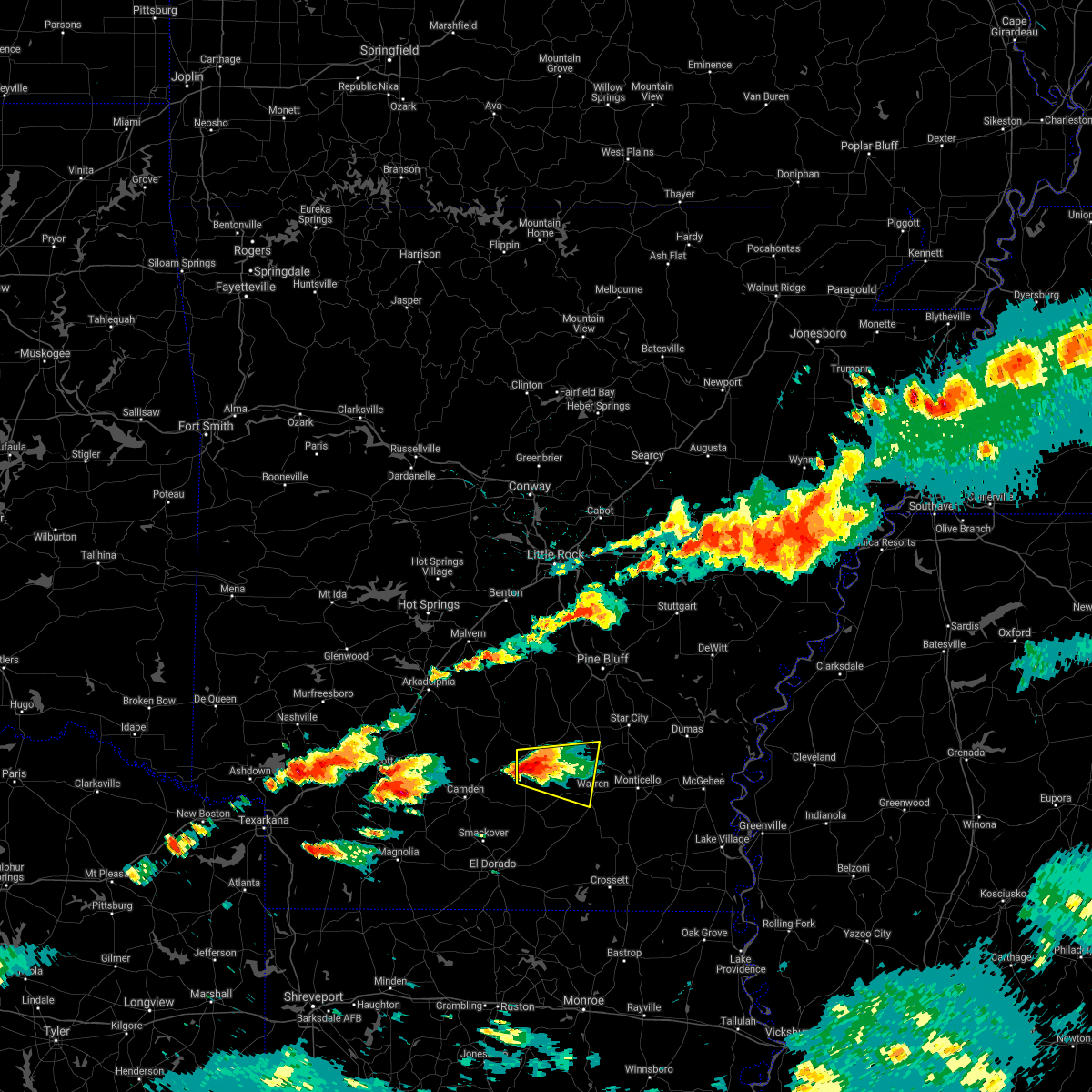 The national weather service in little rock has issued a * severe thunderstorm warning for. northwestern bradley county in southeastern arkansas. southeastern cleveland county in southeastern arkansas. northeastern calhoun county in southwestern arkansas. Southeastern dallas county in southwestern arkansas. The national weather service in little rock has issued a * severe thunderstorm warning for. northwestern bradley county in southeastern arkansas. southeastern cleveland county in southeastern arkansas. northeastern calhoun county in southwestern arkansas. Southeastern dallas county in southwestern arkansas.
|
| 5/9/2021 4:49 PM CDT |
 At 449 pm cdt, a severe thunderstorm was located near thornton, or 7 miles southwest of fordyce, moving east at 20 mph (radar indicated). Hazards include 60 mph wind gusts and quarter size hail. Hail damage to vehicles is expected. expect wind damage to roofs, siding, and trees. Locations impacted include, fordyce, thornton, weeks, ellisville, mt elba, tipton, harlow, marks mill state park, hebron, banks, tinsman, chambersville, new edinburg, hopeville,. At 449 pm cdt, a severe thunderstorm was located near thornton, or 7 miles southwest of fordyce, moving east at 20 mph (radar indicated). Hazards include 60 mph wind gusts and quarter size hail. Hail damage to vehicles is expected. expect wind damage to roofs, siding, and trees. Locations impacted include, fordyce, thornton, weeks, ellisville, mt elba, tipton, harlow, marks mill state park, hebron, banks, tinsman, chambersville, new edinburg, hopeville,.
|
| 5/9/2021 4:38 PM CDT |
 At 438 pm cdt, a severe thunderstorm was located over harlow, or 9 miles southwest of fordyce, moving east at 30 mph (radar indicated). Hazards include 60 mph wind gusts and half dollar size hail. Hail damage to vehicles is expected. expect wind damage to roofs, siding, and trees. Locations impacted include, fordyce, bearden, thornton, weeks, ellisville, mt elba, tipton, harlow, marks mill state park, hebron, banks, tinsman, chambersville, hopeville, new edinburg,. At 438 pm cdt, a severe thunderstorm was located over harlow, or 9 miles southwest of fordyce, moving east at 30 mph (radar indicated). Hazards include 60 mph wind gusts and half dollar size hail. Hail damage to vehicles is expected. expect wind damage to roofs, siding, and trees. Locations impacted include, fordyce, bearden, thornton, weeks, ellisville, mt elba, tipton, harlow, marks mill state park, hebron, banks, tinsman, chambersville, hopeville, new edinburg,.
|
| 5/9/2021 4:22 PM CDT |
 At 422 pm cdt, a severe thunderstorm was located over bearden, or 14 miles west of fordyce, moving east at 35 mph (radar indicated). Hazards include ping pong ball size hail and 60 mph wind gusts. People and animals outdoors will be injured. expect hail damage to roofs, siding, windows, and vehicles. Expect wind damage to roofs, siding, and trees. At 422 pm cdt, a severe thunderstorm was located over bearden, or 14 miles west of fordyce, moving east at 35 mph (radar indicated). Hazards include ping pong ball size hail and 60 mph wind gusts. People and animals outdoors will be injured. expect hail damage to roofs, siding, windows, and vehicles. Expect wind damage to roofs, siding, and trees.
|
| 4/10/2021 1:37 AM CDT |
 The severe thunderstorm warning for bradley and cleveland counties will expire at 145 am cdt, the storms which prompted the warning have weakened below severe limits, and no longer pose an immediate threat to life or property. therefore, the warning will be allowed to expire. however gusty winds are still possible with these thunderstorms. The severe thunderstorm warning for bradley and cleveland counties will expire at 145 am cdt, the storms which prompted the warning have weakened below severe limits, and no longer pose an immediate threat to life or property. therefore, the warning will be allowed to expire. however gusty winds are still possible with these thunderstorms.
|
| 4/10/2021 1:26 AM CDT |
 At 125 am cdt, severe thunderstorms were located along a line extending from near toledo to near ingalls to near lapile, moving east at 60 mph (radar indicated). Hazards include 60 mph wind gusts. Expect damage to roofs, siding, and trees. Locations impacted include, warren, rison, hermitage, kingsland, ingalls, hilo, hebron, kedron, weeks, mt elba, moro bay state park, tipton, marks mill state park, toledo, lanark, herbine, moro bay, banks, carmel, farmville,. At 125 am cdt, severe thunderstorms were located along a line extending from near toledo to near ingalls to near lapile, moving east at 60 mph (radar indicated). Hazards include 60 mph wind gusts. Expect damage to roofs, siding, and trees. Locations impacted include, warren, rison, hermitage, kingsland, ingalls, hilo, hebron, kedron, weeks, mt elba, moro bay state park, tipton, marks mill state park, toledo, lanark, herbine, moro bay, banks, carmel, farmville,.
|
| 4/10/2021 1:14 AM CDT |
 At 113 am cdt, severe thunderstorms were located along a line extending from 6 miles north of kingsland to hilo to near strong, moving east at 65 mph. this storm has a history of producing 60 mph wind gusts, most recently in camden (radar indicated). Hazards include 60 mph wind gusts and quarter size hail. Hail damage to vehicles is expected. expect wind damage to roofs, siding, and trees. Locations impacted include, warren, fordyce, rison, hampton, hermitage, calion, kingsland, thornton, carthage, harrell, ingalls, hampton municipal airport, moro bay, weeks, tipton, herbine, hilo, ellisville, harlow, hebron,. At 113 am cdt, severe thunderstorms were located along a line extending from 6 miles north of kingsland to hilo to near strong, moving east at 65 mph. this storm has a history of producing 60 mph wind gusts, most recently in camden (radar indicated). Hazards include 60 mph wind gusts and quarter size hail. Hail damage to vehicles is expected. expect wind damage to roofs, siding, and trees. Locations impacted include, warren, fordyce, rison, hampton, hermitage, calion, kingsland, thornton, carthage, harrell, ingalls, hampton municipal airport, moro bay, weeks, tipton, herbine, hilo, ellisville, harlow, hebron,.
|
| 4/10/2021 12:57 AM CDT |
 At 1254 am cdt, severe thunderstorms were located along a line extending from carthage southward to millers bluff, moving east at 60 mph. this storm has a history of producing 60 mph wind gusts recently in the town of camden (radar indicated). Hazards include 60 mph wind gusts and quarter size hail. Hail damage to vehicles is expected. Expect wind damage to roofs, siding, and trees. At 1254 am cdt, severe thunderstorms were located along a line extending from carthage southward to millers bluff, moving east at 60 mph. this storm has a history of producing 60 mph wind gusts recently in the town of camden (radar indicated). Hazards include 60 mph wind gusts and quarter size hail. Hail damage to vehicles is expected. Expect wind damage to roofs, siding, and trees.
|
| 4/9/2021 4:04 PM CDT |
 At 404 pm cdt, severe thunderstorms were located along a line extending from near marks mill state park to 6 miles north of hermitage, moving east at 40 mph (trained weather spotters). Hazards include 70 mph wind gusts and ping pong ball size hail. People and animals outdoors will be injured. expect hail damage to roofs, siding, windows, and vehicles. expect considerable tree damage. wind damage is also likely to mobile homes, roofs, and outbuildings. Locations impacted include, hermitage, ingalls, weeks, hilo, moro bay state park, tipton, marks mill state park, hebron, lanark, moro bay, banks, farmville, orlando, gravelridge, new edinburg, marsden, jersey,. At 404 pm cdt, severe thunderstorms were located along a line extending from near marks mill state park to 6 miles north of hermitage, moving east at 40 mph (trained weather spotters). Hazards include 70 mph wind gusts and ping pong ball size hail. People and animals outdoors will be injured. expect hail damage to roofs, siding, windows, and vehicles. expect considerable tree damage. wind damage is also likely to mobile homes, roofs, and outbuildings. Locations impacted include, hermitage, ingalls, weeks, hilo, moro bay state park, tipton, marks mill state park, hebron, lanark, moro bay, banks, farmville, orlando, gravelridge, new edinburg, marsden, jersey,.
|
| 4/9/2021 3:48 PM CDT |
 At 347 pm cdt, severe thunderstorms were located along a line extending from ellisville to near lanark, moving east at 40 mph (trained weather spotters). Hazards include 70 mph wind gusts and ping pong ball size hail. People and animals outdoors will be injured. expect hail damage to roofs, siding, windows, and vehicles. expect considerable tree damage. wind damage is also likely to mobile homes, roofs, and outbuildings. Locations impacted include, fordyce, hampton, hermitage, thornton, harrell, ingalls, hilo, ellisville, harlow, hampton municipal airport, hebron, moro bay, weeks, moro bay state park, tipton, marks mill state park, lanark, banks, tinsman, artesian,. At 347 pm cdt, severe thunderstorms were located along a line extending from ellisville to near lanark, moving east at 40 mph (trained weather spotters). Hazards include 70 mph wind gusts and ping pong ball size hail. People and animals outdoors will be injured. expect hail damage to roofs, siding, windows, and vehicles. expect considerable tree damage. wind damage is also likely to mobile homes, roofs, and outbuildings. Locations impacted include, fordyce, hampton, hermitage, thornton, harrell, ingalls, hilo, ellisville, harlow, hampton municipal airport, hebron, moro bay, weeks, moro bay state park, tipton, marks mill state park, lanark, banks, tinsman, artesian,.
|
| 4/9/2021 3:42 PM CDT |
 At 337 pm cdt, severe thunderstorms were located along a line extending from near ellisville to harrell, moving east at 60 mph (radar indicated). Hazards include 70 mph wind gusts and ping pong ball size hail. People and animals outdoors will be injured. expect hail damage to roofs, siding, windows, and vehicles. expect considerable tree damage. wind damage is also likely to mobile homes, roofs, and outbuildings. Locations impacted include, camden, fordyce, hampton, bearden, hermitage, thornton, harrell, louann, ingalls, cullendale, hilo, ellisville, harlow, hampton municipal airport, hebron, moro bay, highland industrial park, weeks, moro bay state park, tipton,. At 337 pm cdt, severe thunderstorms were located along a line extending from near ellisville to harrell, moving east at 60 mph (radar indicated). Hazards include 70 mph wind gusts and ping pong ball size hail. People and animals outdoors will be injured. expect hail damage to roofs, siding, windows, and vehicles. expect considerable tree damage. wind damage is also likely to mobile homes, roofs, and outbuildings. Locations impacted include, camden, fordyce, hampton, bearden, hermitage, thornton, harrell, louann, ingalls, cullendale, hilo, ellisville, harlow, hampton municipal airport, hebron, moro bay, highland industrial park, weeks, moro bay state park, tipton,.
|
| 4/9/2021 3:38 PM CDT |
 At 337 pm cdt, severe thunderstorms were located along a line extending from near ellisville to harrell, moving east at 60 mph (radar indicated). Hazards include 70 mph wind gusts and ping pong ball size hail. People and animals outdoors will be injured. expect hail damage to roofs, siding, windows, and vehicles. expect considerable tree damage. wind damage is also likely to mobile homes, roofs, and outbuildings. Locations impacted include, camden, fordyce, hampton, bearden, hermitage, thornton, harrell, louann, ingalls, cullendale, hilo, ellisville, harlow, hampton municipal airport, hebron, moro bay, highland industrial park, weeks, moro bay state park, tipton,. At 337 pm cdt, severe thunderstorms were located along a line extending from near ellisville to harrell, moving east at 60 mph (radar indicated). Hazards include 70 mph wind gusts and ping pong ball size hail. People and animals outdoors will be injured. expect hail damage to roofs, siding, windows, and vehicles. expect considerable tree damage. wind damage is also likely to mobile homes, roofs, and outbuildings. Locations impacted include, camden, fordyce, hampton, bearden, hermitage, thornton, harrell, louann, ingalls, cullendale, hilo, ellisville, harlow, hampton municipal airport, hebron, moro bay, highland industrial park, weeks, moro bay state park, tipton,.
|
| 4/9/2021 3:09 PM CDT |
 At 309 pm cdt, severe thunderstorms were located along a line extending from near highland industrial park to near wesson, moving east at 40 mph (radar indicated). Hazards include ping pong ball size hail and 60 mph wind gusts. People and animals outdoors will be injured. expect hail damage to roofs, siding, windows, and vehicles. Expect wind damage to roofs, siding, and trees. At 309 pm cdt, severe thunderstorms were located along a line extending from near highland industrial park to near wesson, moving east at 40 mph (radar indicated). Hazards include ping pong ball size hail and 60 mph wind gusts. People and animals outdoors will be injured. expect hail damage to roofs, siding, windows, and vehicles. Expect wind damage to roofs, siding, and trees.
|
| 4/7/2021 2:30 PM CDT |
 At 230 pm cdt, severe thunderstorms were located along a line extending from 8 miles east of chidester to near highland industrial park to 7 miles west of hampton, moving northeast at 45 mph (radar indicated). Hazards include 60 mph wind gusts and quarter size hail. Hail damage to vehicles is expected. expect wind damage to roofs, siding, and trees. Locations impacted include, fordyce, hampton, bearden, kingsland, thornton, ellisville, harlow, hampton municipal airport, hebron, highland industrial park, weeks, tipton, marks mill state park, east camden, banks, tinsman, amy, delhi, harmony grove, locust bayou,. At 230 pm cdt, severe thunderstorms were located along a line extending from 8 miles east of chidester to near highland industrial park to 7 miles west of hampton, moving northeast at 45 mph (radar indicated). Hazards include 60 mph wind gusts and quarter size hail. Hail damage to vehicles is expected. expect wind damage to roofs, siding, and trees. Locations impacted include, fordyce, hampton, bearden, kingsland, thornton, ellisville, harlow, hampton municipal airport, hebron, highland industrial park, weeks, tipton, marks mill state park, east camden, banks, tinsman, amy, delhi, harmony grove, locust bayou,.
|
| 4/7/2021 2:18 PM CDT |
 At 217 pm cdt, severe thunderstorms were located along a line extending from poison springs state park to camden to near smackover, moving northeast at 45 mph (radar indicated). Hazards include 60 mph wind gusts and quarter size hail. Hail damage to vehicles is expected. Expect wind damage to roofs, siding, and trees. At 217 pm cdt, severe thunderstorms were located along a line extending from poison springs state park to camden to near smackover, moving northeast at 45 mph (radar indicated). Hazards include 60 mph wind gusts and quarter size hail. Hail damage to vehicles is expected. Expect wind damage to roofs, siding, and trees.
|
| 3/27/2021 9:57 PM CDT |
 At 957 pm cdt, a severe thunderstorm capable of producing a tornado was located over weeks, or 8 miles northwest of warren, moving northeast at 40 mph (radar indicated rotation). Hazards include tornado and quarter size hail. Flying debris will be dangerous to those caught without shelter. mobile homes will be damaged or destroyed. damage to roofs, windows, and vehicles will occur. Tree damage is likely. At 957 pm cdt, a severe thunderstorm capable of producing a tornado was located over weeks, or 8 miles northwest of warren, moving northeast at 40 mph (radar indicated rotation). Hazards include tornado and quarter size hail. Flying debris will be dangerous to those caught without shelter. mobile homes will be damaged or destroyed. damage to roofs, windows, and vehicles will occur. Tree damage is likely.
|
| 3/27/2021 9:51 PM CDT |
 At 951 pm cdt, a severe thunderstorm was located near weeks, or 11 miles west of warren, moving northeast at 40 mph (radar indicated). Hazards include 60 mph wind gusts and quarter size hail. Hail damage to vehicles is expected. expect wind damage to roofs, siding, and trees. Locations impacted include, harrell, lanark, ellisville, banks, tinsman,. At 951 pm cdt, a severe thunderstorm was located near weeks, or 11 miles west of warren, moving northeast at 40 mph (radar indicated). Hazards include 60 mph wind gusts and quarter size hail. Hail damage to vehicles is expected. expect wind damage to roofs, siding, and trees. Locations impacted include, harrell, lanark, ellisville, banks, tinsman,.
|
| 3/27/2021 9:42 PM CDT |
 At 942 pm cdt, a severe thunderstorm capable of producing a tornado was located near tinsman, or 8 miles northeast of hampton, moving northeast at 40 mph (radar indicated rotation). Hazards include tornado and quarter size hail. Flying debris will be dangerous to those caught without shelter. mobile homes will be damaged or destroyed. damage to roofs, windows, and vehicles will occur. tree damage is likely. Locations impacted include, warren, harrell, weeks, lanark, banks, tinsman, farmville, carmel,. At 942 pm cdt, a severe thunderstorm capable of producing a tornado was located near tinsman, or 8 miles northeast of hampton, moving northeast at 40 mph (radar indicated rotation). Hazards include tornado and quarter size hail. Flying debris will be dangerous to those caught without shelter. mobile homes will be damaged or destroyed. damage to roofs, windows, and vehicles will occur. tree damage is likely. Locations impacted include, warren, harrell, weeks, lanark, banks, tinsman, farmville, carmel,.
|
| 3/27/2021 9:32 PM CDT |
 At 931 pm cdt, a severe thunderstorm capable of producing a tornado was located near hampton, moving east at 40 mph (radar indicated rotation). Hazards include tornado. Flying debris will be dangerous to those caught without shelter. mobile homes will be damaged or destroyed. damage to roofs, windows, and vehicles will occur. Tree damage is likely. At 931 pm cdt, a severe thunderstorm capable of producing a tornado was located near hampton, moving east at 40 mph (radar indicated rotation). Hazards include tornado. Flying debris will be dangerous to those caught without shelter. mobile homes will be damaged or destroyed. damage to roofs, windows, and vehicles will occur. Tree damage is likely.
|
| 3/27/2021 9:26 PM CDT |
 At 926 pm cdt, a severe thunderstorm was located near hampton, moving east at 35 mph (radar indicated). Hazards include 60 mph wind gusts and half dollar size hail. Hail damage to vehicles is expected. expect wind damage to roofs, siding, and trees. Locations impacted include, hampton, harrell, hampton municipal airport, ellisville, lanark, highland industrial park, banks, tinsman, delhi, woodberry, locust bayou,. At 926 pm cdt, a severe thunderstorm was located near hampton, moving east at 35 mph (radar indicated). Hazards include 60 mph wind gusts and half dollar size hail. Hail damage to vehicles is expected. expect wind damage to roofs, siding, and trees. Locations impacted include, hampton, harrell, hampton municipal airport, ellisville, lanark, highland industrial park, banks, tinsman, delhi, woodberry, locust bayou,.
|
| 3/27/2021 9:08 PM CDT |
 The national weather service in little rock has issued a * severe thunderstorm warning for. northwestern bradley county in southeastern arkansas. calhoun county in southwestern arkansas. southeastern ouachita county in southwestern arkansas. Until 1015 pm cdt. The national weather service in little rock has issued a * severe thunderstorm warning for. northwestern bradley county in southeastern arkansas. calhoun county in southwestern arkansas. southeastern ouachita county in southwestern arkansas. Until 1015 pm cdt.
|
| 3/27/2021 7:40 PM CDT |
 At 740 pm cdt, a severe thunderstorm capable of producing a tornado was located near hampton, moving east at 40 mph (radar indicated rotation). Hazards include tornado and half dollar size hail. Flying debris will be dangerous to those caught without shelter. mobile homes will be damaged or destroyed. damage to roofs, windows, and vehicles will occur. tree damage is likely. Locations impacted include, hampton, ellisville, banks, tinsman, woodberry, chambersville,. At 740 pm cdt, a severe thunderstorm capable of producing a tornado was located near hampton, moving east at 40 mph (radar indicated rotation). Hazards include tornado and half dollar size hail. Flying debris will be dangerous to those caught without shelter. mobile homes will be damaged or destroyed. damage to roofs, windows, and vehicles will occur. tree damage is likely. Locations impacted include, hampton, ellisville, banks, tinsman, woodberry, chambersville,.
|
| 3/27/2021 7:34 PM CDT |
 At 732 pm cdt, a severe thunderstorm capable of producing a tornado was located near hampton, moving east at 40 mph (radar indicated rotation). Hazards include tornado and half dollar size hail. Flying debris will be dangerous to those caught without shelter. mobile homes will be damaged or destroyed. damage to roofs, windows, and vehicles will occur. tree damage is likely. Locations impacted include, hampton, hampton municipal airport, highland industrial park, ellisville, east camden, banks, tinsman, chambersville, woodberry, locust bayou, eagle mills, harmony grove,. At 732 pm cdt, a severe thunderstorm capable of producing a tornado was located near hampton, moving east at 40 mph (radar indicated rotation). Hazards include tornado and half dollar size hail. Flying debris will be dangerous to those caught without shelter. mobile homes will be damaged or destroyed. damage to roofs, windows, and vehicles will occur. tree damage is likely. Locations impacted include, hampton, hampton municipal airport, highland industrial park, ellisville, east camden, banks, tinsman, chambersville, woodberry, locust bayou, eagle mills, harmony grove,.
|
| 3/27/2021 7:25 PM CDT |
 At 724 pm cdt, a severe thunderstorm capable of producing a tornado was located near highland industrial park, or 10 miles west of hampton, moving east at 45 mph (radar indicated rotation). Hazards include tornado and ping pong ball size hail. Flying debris will be dangerous to those caught without shelter. mobile homes will be damaged or destroyed. damage to roofs, windows, and vehicles will occur. Tree damage is likely. At 724 pm cdt, a severe thunderstorm capable of producing a tornado was located near highland industrial park, or 10 miles west of hampton, moving east at 45 mph (radar indicated rotation). Hazards include tornado and ping pong ball size hail. Flying debris will be dangerous to those caught without shelter. mobile homes will be damaged or destroyed. damage to roofs, windows, and vehicles will occur. Tree damage is likely.
|
| 3/27/2021 7:12 PM CDT |
 At 711 pm cdt, a severe thunderstorm was located over cullendale, or over camden, moving northeast at 55 mph (radar indicated). Hazards include ping pong ball size hail and 60 mph wind gusts. People and animals outdoors will be injured. expect hail damage to roofs, siding, windows, and vehicles. Expect wind damage to roofs, siding, and trees. At 711 pm cdt, a severe thunderstorm was located over cullendale, or over camden, moving northeast at 55 mph (radar indicated). Hazards include ping pong ball size hail and 60 mph wind gusts. People and animals outdoors will be injured. expect hail damage to roofs, siding, windows, and vehicles. Expect wind damage to roofs, siding, and trees.
|
| 3/17/2021 1:27 AM CDT |
 The severe thunderstorm warning for bradley, south central cleveland, northeastern calhoun and southwestern drew counties will expire at 130 am cdt, the storms which prompted the warning have weakened below severe limits, and no longer pose an immediate threat to life or property. therefore, the warning will be allowed to expire. however heavy rain is still possible with these thunderstorms. The severe thunderstorm warning for bradley, south central cleveland, northeastern calhoun and southwestern drew counties will expire at 130 am cdt, the storms which prompted the warning have weakened below severe limits, and no longer pose an immediate threat to life or property. therefore, the warning will be allowed to expire. however heavy rain is still possible with these thunderstorms.
|
| 3/17/2021 1:11 AM CDT |
 At 111 am cdt, severe thunderstorms were located along a line extending from near harrell to 8 miles northeast of ingalls, moving northeast at 35 mph (radar indicated). Hazards include ping pong ball size hail and 60 mph wind gusts. People and animals outdoors will be injured. expect hail damage to roofs, siding, windows, and vehicles. expect wind damage to roofs, siding, and trees. Locations impacted include, monticello, warren, hampton, hermitage, wilmar, harrell, green hill, ingalls, weeks, ellisville, hampton municipal airport, lanark, banks, tinsman, new hope in drew county, carmel, farmville, johnsonville, valley, gravelridge,. At 111 am cdt, severe thunderstorms were located along a line extending from near harrell to 8 miles northeast of ingalls, moving northeast at 35 mph (radar indicated). Hazards include ping pong ball size hail and 60 mph wind gusts. People and animals outdoors will be injured. expect hail damage to roofs, siding, windows, and vehicles. expect wind damage to roofs, siding, and trees. Locations impacted include, monticello, warren, hampton, hermitage, wilmar, harrell, green hill, ingalls, weeks, ellisville, hampton municipal airport, lanark, banks, tinsman, new hope in drew county, carmel, farmville, johnsonville, valley, gravelridge,.
|
| 3/17/2021 1:05 AM CDT |
 At 105 am cdt, severe thunderstorms were located along a line extending from 6 miles northeast of calion to near ingalls, moving northeast at 35 mph (radar indicated). Hazards include 60 mph wind gusts and quarter size hail. Hail damage to vehicles is expected. expect wind damage to roofs, siding, and trees. Locations impacted include, monticello, warren, hampton, hermitage, wilmar, harrell, ingalls, hilo, ellisville, hampton municipal airport, green hill, weeks, lanark, highland industrial park, banks, tinsman, artesian, delhi, carmel, farmville,. At 105 am cdt, severe thunderstorms were located along a line extending from 6 miles northeast of calion to near ingalls, moving northeast at 35 mph (radar indicated). Hazards include 60 mph wind gusts and quarter size hail. Hail damage to vehicles is expected. expect wind damage to roofs, siding, and trees. Locations impacted include, monticello, warren, hampton, hermitage, wilmar, harrell, ingalls, hilo, ellisville, hampton municipal airport, green hill, weeks, lanark, highland industrial park, banks, tinsman, artesian, delhi, carmel, farmville,.
|
| 3/17/2021 12:34 AM CDT |
 At 1234 am cdt, severe thunderstorms were located along a line extending from wesson to near strong, moving northeast at 30 mph (radar indicated). Hazards include 60 mph wind gusts and quarter size hail. Hail damage to vehicles is expected. Expect wind damage to roofs, siding, and trees. At 1234 am cdt, severe thunderstorms were located along a line extending from wesson to near strong, moving northeast at 30 mph (radar indicated). Hazards include 60 mph wind gusts and quarter size hail. Hail damage to vehicles is expected. Expect wind damage to roofs, siding, and trees.
|
| 4/29/2020 12:57 AM CDT |
 At 1256 am cdt, severe thunderstorms were located along a line extending from near deeson to near yancopin to 7 miles southeast of cane creek state park to brandon to near weeks to near moro bay, moving east at 60 mph (radar indicated). Hazards include 60 mph wind gusts and quarter size hail. Hail damage to vehicles is expected. Expect wind damage to roofs, siding, and trees. At 1256 am cdt, severe thunderstorms were located along a line extending from near deeson to near yancopin to 7 miles southeast of cane creek state park to brandon to near weeks to near moro bay, moving east at 60 mph (radar indicated). Hazards include 60 mph wind gusts and quarter size hail. Hail damage to vehicles is expected. Expect wind damage to roofs, siding, and trees.
|
| 4/29/2020 12:46 AM CDT |
 At 1244 am cdt, severe thunderstorms were located along a line extending from near cane creek state park to 6 miles southeast of hebron to near hampton to near hampton municipal airport, moving southeast at 40 mph (radar indicated). Hazards include 60 mph wind gusts and quarter size hail. Hail damage to vehicles is expected. expect wind damage to roofs, siding, and trees. Locations impacted include, warren, fordyce, star city, rison, hampton, bearden, kingsland, thornton, harrell, plantersville, hampton municipal airport, weeks, tipton, herbine, feenyville, ellisville, harlow, hebron, highland industrial park, brandon,. At 1244 am cdt, severe thunderstorms were located along a line extending from near cane creek state park to 6 miles southeast of hebron to near hampton to near hampton municipal airport, moving southeast at 40 mph (radar indicated). Hazards include 60 mph wind gusts and quarter size hail. Hail damage to vehicles is expected. expect wind damage to roofs, siding, and trees. Locations impacted include, warren, fordyce, star city, rison, hampton, bearden, kingsland, thornton, harrell, plantersville, hampton municipal airport, weeks, tipton, herbine, feenyville, ellisville, harlow, hebron, highland industrial park, brandon,.
|
| 4/29/2020 12:26 AM CDT |
 At 1226 am cdt, severe thunderstorms were located along a line extending from near feenyville to kingsland to near bearden to near highland industrial park to near louann, moving southeast at 35 mph (radar indicated). Hazards include 60 mph wind gusts and quarter size hail. Hail damage to vehicles is expected. expect wind damage to roofs, siding, and trees. Locations impacted include, camden, warren, fordyce, star city, rison, hampton, bearden, stephens, kingsland, thornton, chidester, harrell, plantersville, hampton municipal airport, weeks, tipton, herbine, poison springs state park, feenyville, cullendale,. At 1226 am cdt, severe thunderstorms were located along a line extending from near feenyville to kingsland to near bearden to near highland industrial park to near louann, moving southeast at 35 mph (radar indicated). Hazards include 60 mph wind gusts and quarter size hail. Hail damage to vehicles is expected. expect wind damage to roofs, siding, and trees. Locations impacted include, camden, warren, fordyce, star city, rison, hampton, bearden, stephens, kingsland, thornton, chidester, harrell, plantersville, hampton municipal airport, weeks, tipton, herbine, poison springs state park, feenyville, cullendale,.
|
| 4/28/2020 11:55 PM CDT |
 At 1155 pm cdt, severe thunderstorms were located along a line extending from near lamont to near carthage to near sparkman to near beirne, moving southeast at 35 mph (radar indicated). Hazards include 60 mph wind gusts and quarter size hail. Hail damage to vehicles is expected. Expect wind damage to roofs, siding, and trees. At 1155 pm cdt, severe thunderstorms were located along a line extending from near lamont to near carthage to near sparkman to near beirne, moving southeast at 35 mph (radar indicated). Hazards include 60 mph wind gusts and quarter size hail. Hail damage to vehicles is expected. Expect wind damage to roofs, siding, and trees.
|
| 4/12/2020 7:56 PM CDT |
 At 756 pm cdt, a severe thunderstorm was located over harrell, or near hampton, moving east at 60 mph (radar indicated). Hazards include 70 mph wind gusts and ping pong ball size hail. People and animals outdoors will be injured. expect hail damage to roofs, siding, windows, and vehicles. expect considerable tree damage. Wind damage is also likely to mobile homes, roofs, and outbuildings. At 756 pm cdt, a severe thunderstorm was located over harrell, or near hampton, moving east at 60 mph (radar indicated). Hazards include 70 mph wind gusts and ping pong ball size hail. People and animals outdoors will be injured. expect hail damage to roofs, siding, windows, and vehicles. expect considerable tree damage. Wind damage is also likely to mobile homes, roofs, and outbuildings.
|
| 1/11/2020 1:31 AM CST |
 At 130 am cst, severe thunderstorms were located along a line extending from near kedron to marks mill state park to near hampton to near louann, moving east at 25 mph (radar indicated). Hazards include 60 mph wind gusts. expect damage to roofs, siding, and trees At 130 am cst, severe thunderstorms were located along a line extending from near kedron to marks mill state park to near hampton to near louann, moving east at 25 mph (radar indicated). Hazards include 60 mph wind gusts. expect damage to roofs, siding, and trees
|
| 1/11/2020 12:44 AM CST |
 At 1243 am cst, severe thunderstorms were located along a line extending from 6 miles east of carthage to near harlow to near highland industrial park to stephens, moving east at 15 mph (radar indicated). Hazards include 60 mph wind gusts. expect damage to roofs, siding, and trees At 1243 am cst, severe thunderstorms were located along a line extending from 6 miles east of carthage to near harlow to near highland industrial park to stephens, moving east at 15 mph (radar indicated). Hazards include 60 mph wind gusts. expect damage to roofs, siding, and trees
|
| 11/30/2019 12:27 PM CST |
 At 1227 pm cst, a severe thunderstorm was located near weeks, or 10 miles west of warren, moving northeast at 65 mph (radar indicated). Hazards include 60 mph wind gusts and quarter size hail. Hail damage to vehicles is expected. expect wind damage to roofs, siding, and trees. Locations impacted include, monticello, warren, star city, wilmar, plantersville, cane creek state park, weeks, brandon, herbine, banks, garrett bridge, gourd, cornerville, florence, tyro, rose hill, crigler, selma, montongo, relfs bluff,. At 1227 pm cst, a severe thunderstorm was located near weeks, or 10 miles west of warren, moving northeast at 65 mph (radar indicated). Hazards include 60 mph wind gusts and quarter size hail. Hail damage to vehicles is expected. expect wind damage to roofs, siding, and trees. Locations impacted include, monticello, warren, star city, wilmar, plantersville, cane creek state park, weeks, brandon, herbine, banks, garrett bridge, gourd, cornerville, florence, tyro, rose hill, crigler, selma, montongo, relfs bluff,.
|
| 11/30/2019 12:21 PM CST |
 At 1221 pm cst, a severe thunderstorm was located near harrell, or near hampton, moving northeast at 65 mph (radar indicated). Hazards include 60 mph wind gusts and quarter size hail. Hail damage to vehicles is expected. Expect wind damage to roofs, siding, and trees. At 1221 pm cst, a severe thunderstorm was located near harrell, or near hampton, moving northeast at 65 mph (radar indicated). Hazards include 60 mph wind gusts and quarter size hail. Hail damage to vehicles is expected. Expect wind damage to roofs, siding, and trees.
|
| 10/21/2019 5:32 AM CDT |
 At 532 am cdt, severe thunderstorms were located along a line extending from near feenyville to near harrell, moving east at 50 mph (radar indicated). Hazards include 60 mph wind gusts. Expect damage to roofs, siding, and trees. Locations impacted include, rison, hampton, kingsland, harrell, weeks, ellisville, mt elba, tipton, hampton municipal airport, marks mill state park, hebron, toledo, herbine, banks, tinsman, artesian, millers bluff, standard umpstead, calmer, orlando,. At 532 am cdt, severe thunderstorms were located along a line extending from near feenyville to near harrell, moving east at 50 mph (radar indicated). Hazards include 60 mph wind gusts. Expect damage to roofs, siding, and trees. Locations impacted include, rison, hampton, kingsland, harrell, weeks, ellisville, mt elba, tipton, hampton municipal airport, marks mill state park, hebron, toledo, herbine, banks, tinsman, artesian, millers bluff, standard umpstead, calmer, orlando,.
|
| 10/21/2019 5:21 AM CDT |
 At 521 am cdt, severe thunderstorms were located along a line extending from near toledo to 7 miles north of calion, moving east at 55 mph (radar indicated). Hazards include 60 mph wind gusts. Expect damage to roofs, siding, and trees. Locations impacted include, fordyce, rison, hampton, kingsland, thornton, harrell, louann, ellisville, harlow, hampton municipal airport, hebron, weeks, mt elba, tipton, marks mill state park, toledo, herbine, highland industrial park, banks, tinsman,. At 521 am cdt, severe thunderstorms were located along a line extending from near toledo to 7 miles north of calion, moving east at 55 mph (radar indicated). Hazards include 60 mph wind gusts. Expect damage to roofs, siding, and trees. Locations impacted include, fordyce, rison, hampton, kingsland, thornton, harrell, louann, ellisville, harlow, hampton municipal airport, hebron, weeks, mt elba, tipton, marks mill state park, toledo, herbine, highland industrial park, banks, tinsman,.
|
| 10/21/2019 5:19 AM CDT |
 At 519 am cdt, severe thunderstorms were located along a line extending from 6 miles southeast of kedron to near smackover, moving east at 55 mph (radar indicated). Hazards include 60 mph wind gusts. expect damage to roofs, siding, and trees At 519 am cdt, severe thunderstorms were located along a line extending from 6 miles southeast of kedron to near smackover, moving east at 55 mph (radar indicated). Hazards include 60 mph wind gusts. expect damage to roofs, siding, and trees
|
| 10/21/2019 4:54 AM CDT |
 At 454 am cdt, severe thunderstorms were located along a line extending from near sparkman to near willisville, moving east at 50 mph (radar indicated). Hazards include 60 mph wind gusts. expect damage to roofs, siding, and trees At 454 am cdt, severe thunderstorms were located along a line extending from near sparkman to near willisville, moving east at 50 mph (radar indicated). Hazards include 60 mph wind gusts. expect damage to roofs, siding, and trees
|
| 6/23/2019 8:05 PM CDT |
 At 805 pm cdt, severe thunderstorms were located along a line extending from near harrell to near hilo to 6 miles southeast of moro bay state park, moving east at 40 mph (radar indicated). Hazards include 60 mph wind gusts and penny size hail. expect damage to roofs, siding, and trees At 805 pm cdt, severe thunderstorms were located along a line extending from near harrell to near hilo to 6 miles southeast of moro bay state park, moving east at 40 mph (radar indicated). Hazards include 60 mph wind gusts and penny size hail. expect damage to roofs, siding, and trees
|
| 6/19/2019 9:42 PM CDT |
 The severe thunderstorm warning for bradley, south central cleveland and southeastern calhoun counties will expire at 945 pm cdt, the storms which prompted the warning are exiting to the east of the warned area. therefore, the warning will be allowed to expire. a tornado watch remains in effect until midnight cdt for southwestern arkansas. a severe thunderstorm watch remains in effect until 400 am cdt for southeastern arkansas. &&. The severe thunderstorm warning for bradley, south central cleveland and southeastern calhoun counties will expire at 945 pm cdt, the storms which prompted the warning are exiting to the east of the warned area. therefore, the warning will be allowed to expire. a tornado watch remains in effect until midnight cdt for southwestern arkansas. a severe thunderstorm watch remains in effect until 400 am cdt for southeastern arkansas. &&.
|
| 6/19/2019 9:24 PM CDT |
 At 923 pm cdt, severe thunderstorms were located along a line extending from near weeks to near hermitage to near moro bay state park, moving east at 65 mph. these are very dangerous storms (radar indicated). Hazards include 80 mph wind gusts and nickel size hail. Flying debris will be dangerous to those caught without shelter. mobile homes will be heavily damaged. expect considerable damage to roofs, windows, and vehicles. extensive tree damage and power outages are likely. Locations impacted include, warren, hermitage, ingalls, weeks, hilo, ellisville, moro bay state park, lanark, moro bay, banks, tinsman, carmel, farmville, blanchton, vick, orlando, gravelridge, mt olive in bradley county, marsden, jersey, a tornado watch remains in effect until midnight cdt for southwestern arkansas. At 923 pm cdt, severe thunderstorms were located along a line extending from near weeks to near hermitage to near moro bay state park, moving east at 65 mph. these are very dangerous storms (radar indicated). Hazards include 80 mph wind gusts and nickel size hail. Flying debris will be dangerous to those caught without shelter. mobile homes will be heavily damaged. expect considerable damage to roofs, windows, and vehicles. extensive tree damage and power outages are likely. Locations impacted include, warren, hermitage, ingalls, weeks, hilo, ellisville, moro bay state park, lanark, moro bay, banks, tinsman, carmel, farmville, blanchton, vick, orlando, gravelridge, mt olive in bradley county, marsden, jersey, a tornado watch remains in effect until midnight cdt for southwestern arkansas.
|
| 6/19/2019 8:47 PM CDT |
 At 847 pm cdt, severe thunderstorms were located along a line extending from 8 miles north of camden to near cullendale to near mount holly, moving east at 65 mph. these are very dangerous storms (radar indicated). Hazards include 80 mph wind gusts and nickel size hail. Flying debris will be dangerous to those caught without shelter. mobile homes will be heavily damaged. expect considerable damage to roofs, windows, and vehicles. Extensive tree damage and power outages are likely. At 847 pm cdt, severe thunderstorms were located along a line extending from 8 miles north of camden to near cullendale to near mount holly, moving east at 65 mph. these are very dangerous storms (radar indicated). Hazards include 80 mph wind gusts and nickel size hail. Flying debris will be dangerous to those caught without shelter. mobile homes will be heavily damaged. expect considerable damage to roofs, windows, and vehicles. Extensive tree damage and power outages are likely.
|
| 5/8/2019 5:58 PM CDT |
 The severe thunderstorm warning for bradley and southwestern drew counties will expire at 600 pm cdt, the storm which prompted the warning has moved out of the area. therefore, the warning will be allowed to expire. a tornado watch remains in effect until 1100 pm cdt for southeastern and southwestern arkansas. to report severe weather, contact your nearest law enforcement agency. they will relay your report to the national weather service little rock. The severe thunderstorm warning for bradley and southwestern drew counties will expire at 600 pm cdt, the storm which prompted the warning has moved out of the area. therefore, the warning will be allowed to expire. a tornado watch remains in effect until 1100 pm cdt for southeastern and southwestern arkansas. to report severe weather, contact your nearest law enforcement agency. they will relay your report to the national weather service little rock.
|
| 5/8/2019 5:34 PM CDT |
 At 534 pm cdt, a severe thunderstorm was located over hermitage, or 11 miles southwest of warren, moving east at 50 mph (radar indicated). Hazards include 60 mph wind gusts. Expect damage to roofs, siding, and trees. Locations impacted include, warren, hermitage, ingalls, hilo, lanark, banks, carmel, farmville, johnsonville, blanchton, vick, gravelridge, mt olive in bradley county, marsden, sumpter,. At 534 pm cdt, a severe thunderstorm was located over hermitage, or 11 miles southwest of warren, moving east at 50 mph (radar indicated). Hazards include 60 mph wind gusts. Expect damage to roofs, siding, and trees. Locations impacted include, warren, hermitage, ingalls, hilo, lanark, banks, carmel, farmville, johnsonville, blanchton, vick, gravelridge, mt olive in bradley county, marsden, sumpter,.
|
| 5/8/2019 5:22 PM CDT |
 At 522 pm cdt, a severe thunderstorm was located near harrell, or 9 miles southeast of hampton, moving east at 50 mph (radar indicated). Hazards include 60 mph wind gusts. expect damage to roofs, siding, and trees At 522 pm cdt, a severe thunderstorm was located near harrell, or 9 miles southeast of hampton, moving east at 50 mph (radar indicated). Hazards include 60 mph wind gusts. expect damage to roofs, siding, and trees
|
| 4/7/2019 7:47 AM CDT |
 At 747 am cdt, a severe thunderstorm was located near hilo, or 11 miles southeast of hampton, moving northeast at 50 mph (radar indicated). Hazards include quarter size hail. Damage to vehicles is expected. Locations impacted include, warren, hermitage, wilmar, harrell, green hill, ingalls, weeks, hilo, moro bay state park, lanark, moro bay, banks, artesian, new hope in drew county, carmel, farmville, valley, orlando, gravelridge, mt olive in bradley county,. At 747 am cdt, a severe thunderstorm was located near hilo, or 11 miles southeast of hampton, moving northeast at 50 mph (radar indicated). Hazards include quarter size hail. Damage to vehicles is expected. Locations impacted include, warren, hermitage, wilmar, harrell, green hill, ingalls, weeks, hilo, moro bay state park, lanark, moro bay, banks, artesian, new hope in drew county, carmel, farmville, valley, orlando, gravelridge, mt olive in bradley county,.
|
| 4/7/2019 7:23 AM CDT |
 At 723 am cdt, a severe thunderstorm was located near moro bay, or 14 miles east of norphlet, moving northeast at 50 mph (radar indicated). Hazards include quarter size hail. damage to vehicles is expected At 723 am cdt, a severe thunderstorm was located near moro bay, or 14 miles east of norphlet, moving northeast at 50 mph (radar indicated). Hazards include quarter size hail. damage to vehicles is expected
|
| 3/14/2019 6:30 AM CDT |
 At 629 am cdt, a severe thunderstorm was located near warren, moving northeast at 60 mph (radar indicated). Hazards include 60 mph wind gusts. Expect damage to roofs, siding, and trees. Locations impacted include, monticello, warren, hermitage, wilmar, ingalls, plantersville, ladelle, green hill, weeks, brandon, lanark, herbine, prairie grove, banks, carmel, farmville, cornerville, johnsonville, palmyra, vick, a tornado watch remains in effect until noon cdt for southeastern arkansas. At 629 am cdt, a severe thunderstorm was located near warren, moving northeast at 60 mph (radar indicated). Hazards include 60 mph wind gusts. Expect damage to roofs, siding, and trees. Locations impacted include, monticello, warren, hermitage, wilmar, ingalls, plantersville, ladelle, green hill, weeks, brandon, lanark, herbine, prairie grove, banks, carmel, farmville, cornerville, johnsonville, palmyra, vick, a tornado watch remains in effect until noon cdt for southeastern arkansas.
|
| 3/14/2019 6:10 AM CDT |
 At 609 am cdt, a severe thunderstorm was located near hilo, or 13 miles southeast of hampton, moving northeast at 55 mph (radar indicated). Hazards include 60 mph wind gusts and nickel size hail. expect damage to roofs, siding, and trees At 609 am cdt, a severe thunderstorm was located near hilo, or 13 miles southeast of hampton, moving northeast at 55 mph (radar indicated). Hazards include 60 mph wind gusts and nickel size hail. expect damage to roofs, siding, and trees
|
| 4/14/2018 2:16 AM CDT |
 At 216 am cdt, a severe thunderstorm capable of producing a tornado was located 7 miles northwest of moro bay, or 10 miles south of hampton, moving northeast at 60 mph (radar indicated rotation). Hazards include tornado. Flying debris will be dangerous to those caught without shelter. mobile homes will be damaged or destroyed. damage to roofs, windows, and vehicles will occur. tree damage is likely. Locations impacted include, hampton, hermitage, harrell, hilo, moro bay state park, hampton municipal airport, lanark, moro bay, banks, tinsman, artesian, farmville, gravelridge, jersey,. At 216 am cdt, a severe thunderstorm capable of producing a tornado was located 7 miles northwest of moro bay, or 10 miles south of hampton, moving northeast at 60 mph (radar indicated rotation). Hazards include tornado. Flying debris will be dangerous to those caught without shelter. mobile homes will be damaged or destroyed. damage to roofs, windows, and vehicles will occur. tree damage is likely. Locations impacted include, hampton, hermitage, harrell, hilo, moro bay state park, hampton municipal airport, lanark, moro bay, banks, tinsman, artesian, farmville, gravelridge, jersey,.
|
| 4/14/2018 2:08 AM CDT |
 At 207 am cdt, an area of severe thunderstorms capable of producing tornadoes was located near calion, or 9 miles east of norphlet, moving northeast at 50 mph (radar indicated rotation). Hazards include tornado. Flying debris will be dangerous to those caught without shelter. mobile homes will be damaged or destroyed. damage to roofs, windows, and vehicles will occur. Tree damage is likely. At 207 am cdt, an area of severe thunderstorms capable of producing tornadoes was located near calion, or 9 miles east of norphlet, moving northeast at 50 mph (radar indicated rotation). Hazards include tornado. Flying debris will be dangerous to those caught without shelter. mobile homes will be damaged or destroyed. damage to roofs, windows, and vehicles will occur. Tree damage is likely.
|
| 4/14/2018 12:28 AM CDT |
 At 1228 am cdt, a severe thunderstorm capable of producing a tornado was located near lanark, or 7 miles southwest of warren, moving northeast at 55 mph (radar indicated rotation). Hazards include tornado and quarter size hail. Flying debris will be dangerous to those caught without shelter. mobile homes will be damaged or destroyed. damage to roofs, windows, and vehicles will occur. tree damage is likely. Locations impacted include, monticello, warren, hermitage, wilmar, weeks, brandon, lanark, green hill, banks, carmel, farmville, orlando, gravelridge, rock springs, rye, sumpter,. At 1228 am cdt, a severe thunderstorm capable of producing a tornado was located near lanark, or 7 miles southwest of warren, moving northeast at 55 mph (radar indicated rotation). Hazards include tornado and quarter size hail. Flying debris will be dangerous to those caught without shelter. mobile homes will be damaged or destroyed. damage to roofs, windows, and vehicles will occur. tree damage is likely. Locations impacted include, monticello, warren, hermitage, wilmar, weeks, brandon, lanark, green hill, banks, carmel, farmville, orlando, gravelridge, rock springs, rye, sumpter,.
|
| 4/14/2018 12:21 AM CDT |
 At 1221 am cdt, a severe thunderstorm capable of producing a tornado was located near lanark, or 13 miles east of hampton, moving northeast at 55 mph (radar indicated rotation). Hazards include tornado and quarter size hail. Flying debris will be dangerous to those caught without shelter. mobile homes will be damaged or destroyed. damage to roofs, windows, and vehicles will occur. Tree damage is likely. At 1221 am cdt, a severe thunderstorm capable of producing a tornado was located near lanark, or 13 miles east of hampton, moving northeast at 55 mph (radar indicated rotation). Hazards include tornado and quarter size hail. Flying debris will be dangerous to those caught without shelter. mobile homes will be damaged or destroyed. damage to roofs, windows, and vehicles will occur. Tree damage is likely.
|
| 3/11/2018 2:09 AM CDT |
 The severe thunderstorm warning for central bradley county will expire at 115 am cst, the storm which prompted the warning has weakened, and has exited the warned area. therefore, the warning will be allowed to expire. however gusty winds and heavy rain are still possible with this thunderstorm. The severe thunderstorm warning for central bradley county will expire at 115 am cst, the storm which prompted the warning has weakened, and has exited the warned area. therefore, the warning will be allowed to expire. however gusty winds and heavy rain are still possible with this thunderstorm.
|
| 3/11/2018 1:59 AM CDT |
 At 1258 am cst, a severe thunderstorm was located over hermitage, or 10 miles southwest of warren, moving southeast at 25 mph (radar indicated). Hazards include 60 mph wind gusts and quarter size hail. Hail damage to vehicles is expected. expect wind damage to roofs, siding, and trees. very heavy rain was also occurring and localized flooding will be seen. Locations impacted include, hermitage, lanark, banks, carmel, farmville, gravelridge,. At 1258 am cst, a severe thunderstorm was located over hermitage, or 10 miles southwest of warren, moving southeast at 25 mph (radar indicated). Hazards include 60 mph wind gusts and quarter size hail. Hail damage to vehicles is expected. expect wind damage to roofs, siding, and trees. very heavy rain was also occurring and localized flooding will be seen. Locations impacted include, hermitage, lanark, banks, carmel, farmville, gravelridge,.
|
| 3/11/2018 1:44 AM CDT |
 At 1244 am cst, a severe thunderstorm was located over lanark, or 11 miles east of hampton, moving southeast at 25 mph (radar indicated). Hazards include 60 mph wind gusts and quarter size hail. Hail damage to vehicles is expected. Expect wind damage to roofs, siding, and trees. At 1244 am cst, a severe thunderstorm was located over lanark, or 11 miles east of hampton, moving southeast at 25 mph (radar indicated). Hazards include 60 mph wind gusts and quarter size hail. Hail damage to vehicles is expected. Expect wind damage to roofs, siding, and trees.
|
| 11/3/2017 5:25 PM CDT |
 The severe thunderstorm warning for northern bradley county will expire at 530 pm cdt, the storm which prompted the warning has weakened below severe limits, and no longer poses an immediate threat to life or property. therefore, the warning will be allowed to expire. however small hail and gusty winds are still possible with this thunderstorm. as a result, a significant weather advisory will be issued. a severe thunderstorm watch remains in effect until 1000 pm cdt for southeastern arkansas. The severe thunderstorm warning for northern bradley county will expire at 530 pm cdt, the storm which prompted the warning has weakened below severe limits, and no longer poses an immediate threat to life or property. therefore, the warning will be allowed to expire. however small hail and gusty winds are still possible with this thunderstorm. as a result, a significant weather advisory will be issued. a severe thunderstorm watch remains in effect until 1000 pm cdt for southeastern arkansas.
|
| 11/3/2017 5:10 PM CDT |
 At 509 pm cdt, a severe thunderstorm was located near weeks, or 8 miles west of warren, moving east at 20 mph (radar indicated). Hazards include 60 mph wind gusts and quarter size hail. Hail damage to vehicles is expected. expect wind damage to roofs, siding, and trees. Locations impacted include, warren,. At 509 pm cdt, a severe thunderstorm was located near weeks, or 8 miles west of warren, moving east at 20 mph (radar indicated). Hazards include 60 mph wind gusts and quarter size hail. Hail damage to vehicles is expected. expect wind damage to roofs, siding, and trees. Locations impacted include, warren,.
|
| 11/3/2017 4:55 PM CDT |
 At 454 pm cdt, a severe thunderstorm was located near lanark, or 10 miles northeast of hampton, moving east at 25 mph (radar indicated). Hazards include 60 mph wind gusts and quarter size hail. Hail damage to vehicles is expected. Expect wind damage to roofs, siding, and trees. At 454 pm cdt, a severe thunderstorm was located near lanark, or 10 miles northeast of hampton, moving east at 25 mph (radar indicated). Hazards include 60 mph wind gusts and quarter size hail. Hail damage to vehicles is expected. Expect wind damage to roofs, siding, and trees.
|
| 5/21/2017 3:01 AM CDT |
 At 300 am cdt, a cluster of severe thunderstorms was located over harrell, or near hampton, moving northeast at 40 mph (radar indicated). Hazards include 60 mph wind gusts and quarter size hail. Hail damage to vehicles is expected. Expect wind damage to roofs, siding, and trees. At 300 am cdt, a cluster of severe thunderstorms was located over harrell, or near hampton, moving northeast at 40 mph (radar indicated). Hazards include 60 mph wind gusts and quarter size hail. Hail damage to vehicles is expected. Expect wind damage to roofs, siding, and trees.
|
| 4/29/2017 6:40 PM CDT |
 At 640 pm cdt, a severe thunderstorm was located near ellisville, or 9 miles northeast of hampton, moving north at 40 mph (radar indicated). Hazards include 60 mph wind gusts and quarter size hail. Hail damage to vehicles is expected. Expect wind damage to roofs, siding, and trees. At 640 pm cdt, a severe thunderstorm was located near ellisville, or 9 miles northeast of hampton, moving north at 40 mph (radar indicated). Hazards include 60 mph wind gusts and quarter size hail. Hail damage to vehicles is expected. Expect wind damage to roofs, siding, and trees.
|
| 4/29/2017 6:33 PM CDT |
 At 633 pm cdt, a severe thunderstorm was located over harrell, or near hampton, moving northeast at 35 mph (radar indicated). Hazards include 60 mph wind gusts and half dollar size hail. Hail damage to vehicles is expected. expect wind damage to roofs, siding, and trees. Locations impacted include, hampton, harrell, hampton municipal airport, lanark, banks, tinsman, farmville, woodberry,. At 633 pm cdt, a severe thunderstorm was located over harrell, or near hampton, moving northeast at 35 mph (radar indicated). Hazards include 60 mph wind gusts and half dollar size hail. Hail damage to vehicles is expected. expect wind damage to roofs, siding, and trees. Locations impacted include, hampton, harrell, hampton municipal airport, lanark, banks, tinsman, farmville, woodberry,.
|
| 4/29/2017 5:57 PM CDT |
 At 556 pm cdt, a severe thunderstorm was located over norphlet, moving northeast at 35 mph (radar indicated). Hazards include 60 mph wind gusts and quarter size hail. Hail damage to vehicles is expected. Expect wind damage to roofs, siding, and trees. At 556 pm cdt, a severe thunderstorm was located over norphlet, moving northeast at 35 mph (radar indicated). Hazards include 60 mph wind gusts and quarter size hail. Hail damage to vehicles is expected. Expect wind damage to roofs, siding, and trees.
|
| 4/29/2017 4:30 PM CDT |
 At 430 pm cdt, severe thunderstorms were located along a line extending from near norphlet to near crossett, moving northeast at 25 mph (radar indicated). Hazards include 60 mph wind gusts. expect damage to roofs, siding, and trees At 430 pm cdt, severe thunderstorms were located along a line extending from near norphlet to near crossett, moving northeast at 25 mph (radar indicated). Hazards include 60 mph wind gusts. expect damage to roofs, siding, and trees
|
| 4/26/2017 5:09 PM CDT |
 At 509 pm cdt, a severe thunderstorm was located over hampton, moving east at 45 mph (radar indicated). Hazards include 60 mph wind gusts and penny size hail. Expect damage to roofs, siding, and trees. Locations impacted include, warren, hampton, harrell, weeks, ellisville, hampton municipal airport, lanark, herbine, banks, tinsman, farmville, orlando, pansy, woodberry, new edinburg, rye, carmel, a tornado watch remains in effect until 1100 pm cdt for southeastern and southwestern arkansas. At 509 pm cdt, a severe thunderstorm was located over hampton, moving east at 45 mph (radar indicated). Hazards include 60 mph wind gusts and penny size hail. Expect damage to roofs, siding, and trees. Locations impacted include, warren, hampton, harrell, weeks, ellisville, hampton municipal airport, lanark, herbine, banks, tinsman, farmville, orlando, pansy, woodberry, new edinburg, rye, carmel, a tornado watch remains in effect until 1100 pm cdt for southeastern and southwestern arkansas.
|
| 4/26/2017 5:04 PM CDT |
 At 503 pm cdt, a severe thunderstorm was located over hampton, moving northeast at 65 mph (radar indicated). Hazards include 60 mph wind gusts and penny size hail. expect damage to roofs, siding, and trees At 503 pm cdt, a severe thunderstorm was located over hampton, moving northeast at 65 mph (radar indicated). Hazards include 60 mph wind gusts and penny size hail. expect damage to roofs, siding, and trees
|
| 4/2/2017 4:23 PM CDT |
 At 423 pm cdt, severe thunderstorms were located along a line extending from near lanark to near old milo to 6 miles northeast of beekman, moving east at 65 mph (radar indicated). Hazards include 60 mph wind gusts and quarter size hail. Hail damage to vehicles is expected. expect wind damage to roofs, siding, and trees. Locations impacted include, monticello, warren, hermitage, wilmar, green hill, weeks, lanark, ladelle, prairie grove, banks, new hope in drew county, carmel, farmville, johnsonville, valley, mt olive in bradley county, sumpter, lacey,. At 423 pm cdt, severe thunderstorms were located along a line extending from near lanark to near old milo to 6 miles northeast of beekman, moving east at 65 mph (radar indicated). Hazards include 60 mph wind gusts and quarter size hail. Hail damage to vehicles is expected. expect wind damage to roofs, siding, and trees. Locations impacted include, monticello, warren, hermitage, wilmar, green hill, weeks, lanark, ladelle, prairie grove, banks, new hope in drew county, carmel, farmville, johnsonville, valley, mt olive in bradley county, sumpter, lacey,.
|
| 4/2/2017 4:10 PM CDT |
 At 409 pm cdt, severe thunderstorms were located along a line extending from near hampton municipal airport to 9 miles northeast of lapile to 11 miles southeast of huttig, moving east at 55 mph (radar indicated). Hazards include 60 mph wind gusts and quarter size hail. Hail damage to vehicles is expected. expect wind damage to roofs, siding, and trees. Locations impacted include, monticello, warren, hampton, hermitage, wilmar, harrell, ingalls, hilo, hampton municipal airport, moro bay, ladelle, green hill, weeks, moro bay state park, lanark, highland industrial park, prairie grove, banks, tinsman, carmel,. At 409 pm cdt, severe thunderstorms were located along a line extending from near hampton municipal airport to 9 miles northeast of lapile to 11 miles southeast of huttig, moving east at 55 mph (radar indicated). Hazards include 60 mph wind gusts and quarter size hail. Hail damage to vehicles is expected. expect wind damage to roofs, siding, and trees. Locations impacted include, monticello, warren, hampton, hermitage, wilmar, harrell, ingalls, hilo, hampton municipal airport, moro bay, ladelle, green hill, weeks, moro bay state park, lanark, highland industrial park, prairie grove, banks, tinsman, carmel,.
|
| 4/2/2017 3:41 PM CDT |
 At 340 pm cdt, severe thunderstorms were located along a line extending from near mount holly to 6 miles south of el dorado to 7 miles west of farmerville, moving east at 55 mph (radar indicated). Hazards include 60 mph wind gusts and quarter size hail. Hail damage to vehicles is expected. Expect wind damage to roofs, siding, and trees. At 340 pm cdt, severe thunderstorms were located along a line extending from near mount holly to 6 miles south of el dorado to 7 miles west of farmerville, moving east at 55 mph (radar indicated). Hazards include 60 mph wind gusts and quarter size hail. Hail damage to vehicles is expected. Expect wind damage to roofs, siding, and trees.
|
| 1/21/2017 8:21 PM CST |
 At 821 pm cst, severe thunderstorms were located along a line extending from near ellisville to near marks mill state park to near weeks to 7 miles west of old milo, moving northeast at 50 mph (radar indicated). Hazards include 70 mph wind gusts and nickel size hail. Expect considerable tree damage. damage is likely to mobile homes, roofs, and outbuildings. locations impacted include, monticello, warren, fordyce, star city, rison, hermitage, wilmar, kingsland, thornton, hebron, tipton, lanark, green hill, herbine, ladelle, ingalls, cane creek state park, toledo, weeks, brandon, a tornado watch remains in effect until 900 pm cst for southeastern, central and southwestern arkansas. A tornado watch also remains in effect until 300 am cst for southeastern arkansas. At 821 pm cst, severe thunderstorms were located along a line extending from near ellisville to near marks mill state park to near weeks to 7 miles west of old milo, moving northeast at 50 mph (radar indicated). Hazards include 70 mph wind gusts and nickel size hail. Expect considerable tree damage. damage is likely to mobile homes, roofs, and outbuildings. locations impacted include, monticello, warren, fordyce, star city, rison, hermitage, wilmar, kingsland, thornton, hebron, tipton, lanark, green hill, herbine, ladelle, ingalls, cane creek state park, toledo, weeks, brandon, a tornado watch remains in effect until 900 pm cst for southeastern, central and southwestern arkansas. A tornado watch also remains in effect until 300 am cst for southeastern arkansas.
|
| 1/21/2017 8:05 PM CST |
 At 805 pm cst, severe thunderstorms were located along a line extending from 6 miles north of hampton to near ellisville to lanark to ingalls, moving northeast at 40 mph (radar indicated). Hazards include 70 mph wind gusts and nickel size hail. Expect considerable tree damage. Damage is likely to mobile homes, roofs, and outbuildings. At 805 pm cst, severe thunderstorms were located along a line extending from 6 miles north of hampton to near ellisville to lanark to ingalls, moving northeast at 40 mph (radar indicated). Hazards include 70 mph wind gusts and nickel size hail. Expect considerable tree damage. Damage is likely to mobile homes, roofs, and outbuildings.
|
| 1/21/2017 7:53 PM CST |
 At 753 pm cst, severe thunderstorms were located along a line extending from 6 miles west of hampton to harrell to near moro bay to near hilo, moving northeast at 50 mph (radar indicated). Hazards include 70 mph wind gusts and quarter size hail. Hail damage to vehicles is expected. expect considerable tree damage. wind damage is also likely to mobile homes, roofs, and outbuildings. locations impacted include, warren, hampton, hermitage, harrell, ingalls, lanark, weeks, green hill, ellisville, hilo, moro bay state park, hampton municipal airport, moro bay, highland industrial park, banks, tinsman, artesian, sumpter, carmel, johnsonville, a tornado watch remains in effect until 900 pm cst for southwestern arkansas. A tornado watch also remains in effect until 300 am cst for southeastern arkansas. At 753 pm cst, severe thunderstorms were located along a line extending from 6 miles west of hampton to harrell to near moro bay to near hilo, moving northeast at 50 mph (radar indicated). Hazards include 70 mph wind gusts and quarter size hail. Hail damage to vehicles is expected. expect considerable tree damage. wind damage is also likely to mobile homes, roofs, and outbuildings. locations impacted include, warren, hampton, hermitage, harrell, ingalls, lanark, weeks, green hill, ellisville, hilo, moro bay state park, hampton municipal airport, moro bay, highland industrial park, banks, tinsman, artesian, sumpter, carmel, johnsonville, a tornado watch remains in effect until 900 pm cst for southwestern arkansas. A tornado watch also remains in effect until 300 am cst for southeastern arkansas.
|
| 1/21/2017 7:42 PM CST |
 At 742 pm cst, severe thunderstorms were located along a line extending from 8 miles northeast of smackover to 6 miles north of calion to near moro bay to near urbana, moving northeast at 40 mph (radar indicated). Hazards include 60 mph wind gusts and quarter size hail. Hail damage to vehicles is expected. expect wind damage to roofs, siding, and trees. Locations impacted include, warren, hampton, hermitage, calion, harrell, ingalls, lanark, weeks, green hill, ellisville, hilo, moro bay state park, hampton municipal airport, moro bay, highland industrial park, banks, tinsman, artesian, millers bluff, sumpter, a tornado watch remains in effect until 900 pm cst for southeastern and southwestern arkansas. At 742 pm cst, severe thunderstorms were located along a line extending from 8 miles northeast of smackover to 6 miles north of calion to near moro bay to near urbana, moving northeast at 40 mph (radar indicated). Hazards include 60 mph wind gusts and quarter size hail. Hail damage to vehicles is expected. expect wind damage to roofs, siding, and trees. Locations impacted include, warren, hampton, hermitage, calion, harrell, ingalls, lanark, weeks, green hill, ellisville, hilo, moro bay state park, hampton municipal airport, moro bay, highland industrial park, banks, tinsman, artesian, millers bluff, sumpter, a tornado watch remains in effect until 900 pm cst for southeastern and southwestern arkansas.
|
| 1/21/2017 7:25 PM CST |
 At 724 pm cst, severe thunderstorms were located along a line extending from near louann to near calion to near moro bay to 7 miles southwest of urbana, moving northeast at 40 mph (radar indicated). Hazards include 60 mph wind gusts and quarter size hail. Hail damage to vehicles is expected. Expect wind damage to roofs, siding, and trees. At 724 pm cst, severe thunderstorms were located along a line extending from near louann to near calion to near moro bay to 7 miles southwest of urbana, moving northeast at 40 mph (radar indicated). Hazards include 60 mph wind gusts and quarter size hail. Hail damage to vehicles is expected. Expect wind damage to roofs, siding, and trees.
|
| 7/14/2016 7:08 PM CDT |
 At 705 pm cdt, severe thunderstorms were located along a line extending from woodville to near warren, moving southeast at 45 mph (radar indicated). Hazards include 60 mph wind gusts. Expect damage to roofs. siding. and trees. Locations impacted include, pine bluff, monticello, warren, star city, rison, white hall, altheimer, gould, hermitage, humphrey, wilmar, grady, kingsland, little bayou meto park, hebron, pine bluff arsenal, tipton, madding, woodville, douglas,. At 705 pm cdt, severe thunderstorms were located along a line extending from woodville to near warren, moving southeast at 45 mph (radar indicated). Hazards include 60 mph wind gusts. Expect damage to roofs. siding. and trees. Locations impacted include, pine bluff, monticello, warren, star city, rison, white hall, altheimer, gould, hermitage, humphrey, wilmar, grady, kingsland, little bayou meto park, hebron, pine bluff arsenal, tipton, madding, woodville, douglas,.
|
| 7/14/2016 6:30 PM CDT |
 At 630 pm cdt, severe thunderstorms were located along a line extending from near pine bluff arsenal to near thornton, moving southeast at 45 mph (radar indicated). Hazards include 60 mph wind gusts. Expect damage to roofs. siding. And trees. At 630 pm cdt, severe thunderstorms were located along a line extending from near pine bluff arsenal to near thornton, moving southeast at 45 mph (radar indicated). Hazards include 60 mph wind gusts. Expect damage to roofs. siding. And trees.
|
| 4/11/2016 1:56 PM CDT |
 At 155 pm cdt, severe thunderstorms were located along a line extending from near ellisville to near harrell to near el dorado, moving east at 50 mph (radar indicated). Hazards include 70 mph wind gusts. Expect some tree damage. Damage is possible to mobile homes, roofs, and outbuildings. At 155 pm cdt, severe thunderstorms were located along a line extending from near ellisville to near harrell to near el dorado, moving east at 50 mph (radar indicated). Hazards include 70 mph wind gusts. Expect some tree damage. Damage is possible to mobile homes, roofs, and outbuildings.
|
| 3/13/2016 7:35 PM CDT |
 At 735 pm cdt, a severe thunderstorm was located near harrell, or near hampton, moving northeast at 30 mph (radar indicated). Hazards include 70 mph wind gusts and quarter size hail. Hail damage to vehicles is expected. expect considerable tree damage. Wind damage is also likely to mobile homes, roofs, and outbuildings. At 735 pm cdt, a severe thunderstorm was located near harrell, or near hampton, moving northeast at 30 mph (radar indicated). Hazards include 70 mph wind gusts and quarter size hail. Hail damage to vehicles is expected. expect considerable tree damage. Wind damage is also likely to mobile homes, roofs, and outbuildings.
|
| 5/26/2015 11:24 PM CDT | At 1121 pm cdt, severe thunderstorms were located along a line extending from 6 miles north of hampton to 6 miles northeast of lanark, and moving north at 20 mph (radar indicated). Hazards include 60 mph wind gusts and quarter size hail. Hail damage to vehicles is expected. Expect wind damage to roofs, siding and trees. |
| 5/26/2015 10:59 PM CDT | At 1057 pm cdt, severe thunderstorms were located along a line extending from hampton to lanark, and moving north at 20 mph (radar indicated). Hazards include 60 mph wind gusts and quarter size hail. Hail damage to vehicles is expected. Expect wind damage to roofs, siding and trees. |
| 5/26/2015 10:44 PM CDT | At 1041 pm cdt, severe thunderstorms were located along a line extending from 7 miles southwest of hampton muni arpt to hilo, and moving northeast at 20 mph (radar indicated). Hazards include 60 mph wind gusts and quarter size hail. Hail damage to vehicles is expected. Expect wind damage to roofs, siding and trees. |
| 5/25/2015 6:53 PM CDT | At 643 pm cdt, a severe thunderstorm was located 5 miles northwest of moro bay, and moving north at 45 mph (radar indicated). Hazards include 60 mph wind gusts and quarter size hail. Hail damage to vehicles is expected. Expect wind damage to roofs, siding and trees. |
| 5/25/2015 6:36 PM CDT | At 632 pm cdt, a severe thunderstorm was located 6 miles southwest of moro bay state park, and moving north at 45 mph. another storm was located 10 miles west of artesian, and may become severe (radar indicated). Hazards include 60 mph wind gusts and quarter size hail. Hail damage to vehicles is expected. Expect wind damage to roofs, siding and trees. |
| 5/24/2015 3:34 PM CDT | At 332 pm cdt, severe thunderstorms were located along a line extending from fordyce to weeks to hermitage, and moving northeast at 45 mph (radar indicated). Hazards include 60 mph wind gusts and nickel size hail. Expect damage to roofs. Siding and trees. |
| 5/24/2015 3:19 PM CDT | At 316 pm cdt, severe thunderstorms were located along a line extending from thornton to harrell to hilo, and moving northeast at 45 mph (radar indicated). Hazards include 60 mph wind gusts and penny size hail. Expect damage to roofs. Siding and trees. |
| 4/24/2015 9:49 PM CDT | At 945 pm cdt, severe thunderstorms were located along a line extending from 7 miles northwest of feenyville to mt elba to hampton, and moving east at 40 mph (radar indicated). Hazards include 60 mph wind gusts and nickel size hail. Expect damage to roofs. Siding and trees. |
| 4/24/2015 9:26 PM CDT | At 922 pm cdt, severe thunderstorms were located along a line extending from grays lake to 5 miles southwest of highland indstrl pk, and moving east at 55 mph (radar indicated). Hazards include 60 mph wind gusts and nickel size hail. Expect damage to roofs. Siding and trees. |
| 4/9/2015 6:54 PM CDT | The severe thunderstorm warning for southeastern ouachita. south central cleveland. central calhoun and northwestern bradley counties will expire at 700 pm cdt. the storm which prompted the warning has weakened below severe limits. And no longer poses an immediate threat to life or property. |
| 4/9/2015 6:14 PM CDT | The national weather service in little rock has issued a * severe thunderstorm warning for. northwestern bradley county in southeast arkansas. central calhoun county in southwest arkansas. south central cleveland county in southeast arkansas. Southeastern ouachita county in southwest arkansas. |
| 12/27/2014 11:04 AM CST | Large tree limbs have been downe in bradley county AR, 1.7 miles NE of Banks, AR |
| 7/23/2014 7:00 PM CDT | Tree fell on a vehicle on us278 w near bank in bradley county AR, 0.3 miles SSE of Banks, AR |
| 1/1/0001 12:00 AM | Trees were blown down...causing severe damage to a mobile home. there were no injurie in bradley county AR, 0.3 miles SSE of Banks, AR |
Hail Maps for Banks, AR
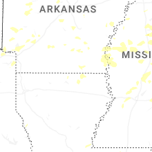


Connect with Interactive Hail Maps