

Hail Map for Barnstable Town, MA
The Barnstable Town, MA area has had 2 reports of on-the-ground hail by trained spotters, and has been under severe weather warnings 7 times during the past 12 months. Doppler radar has detected hail at or near Barnstable Town, MA on 10 occasions, including 3 occasions during the past year.
| Name: | Barnstable Town, MA |
| Where Located: | 54.8 miles ESE of Providence, RI |
| Map: | Google Map for Barnstable Town, MA |
| Population: | 45193 |
| Housing Units: | 26343 |
| More Info: | Search Google for Barnstable Town, MA |
1
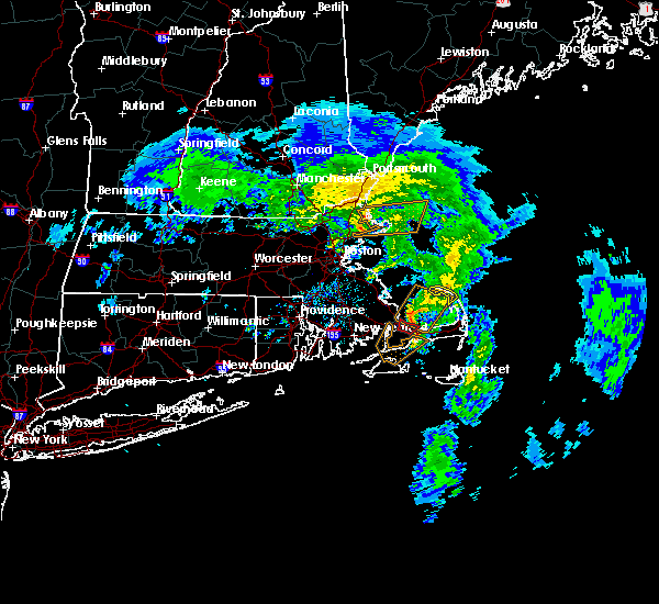
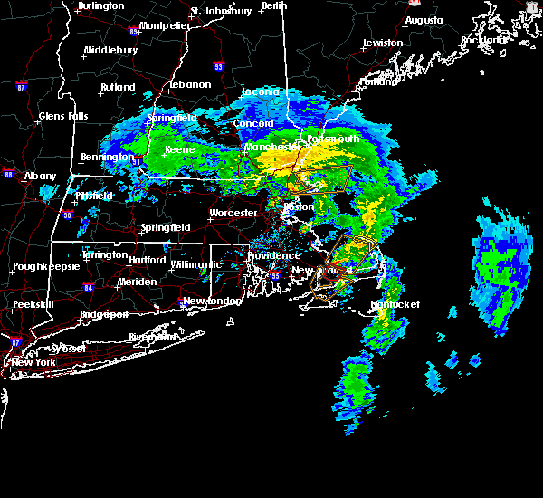
The Top Recent Hail Date for Barnstable Town, MA is Monday, August 26, 2024 (3rd out of 10)

Hail and Wind Damage Spotted near Barnstable Town, MA
| Date / Time | Report Details |
|---|---|
| 8/26/2024 1:07 PM EDT |
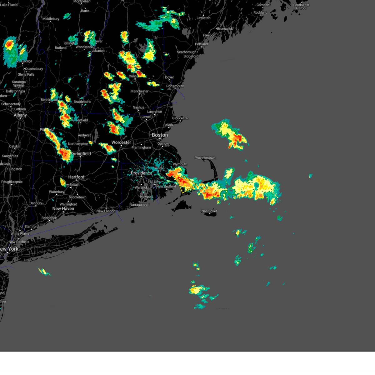 At 107 pm edt, a severe thunderstorm was located over bourne, or 10 miles north of falmouth, moving southeast at 5 mph (radar indicated). Hazards include 60 mph wind gusts and quarter size hail. Hail damage to vehicles is expected. expect wind damage to trees and power lines. Locations impacted include, plymouth, barnstable, falmouth, wareham, sandwich, bourne, and mashpee. At 107 pm edt, a severe thunderstorm was located over bourne, or 10 miles north of falmouth, moving southeast at 5 mph (radar indicated). Hazards include 60 mph wind gusts and quarter size hail. Hail damage to vehicles is expected. expect wind damage to trees and power lines. Locations impacted include, plymouth, barnstable, falmouth, wareham, sandwich, bourne, and mashpee.
|
| 8/26/2024 1:04 PM EDT |
 the severe thunderstorm warning has been cancelled and is no longer in effect the severe thunderstorm warning has been cancelled and is no longer in effect
|
| 8/26/2024 12:55 PM EDT |
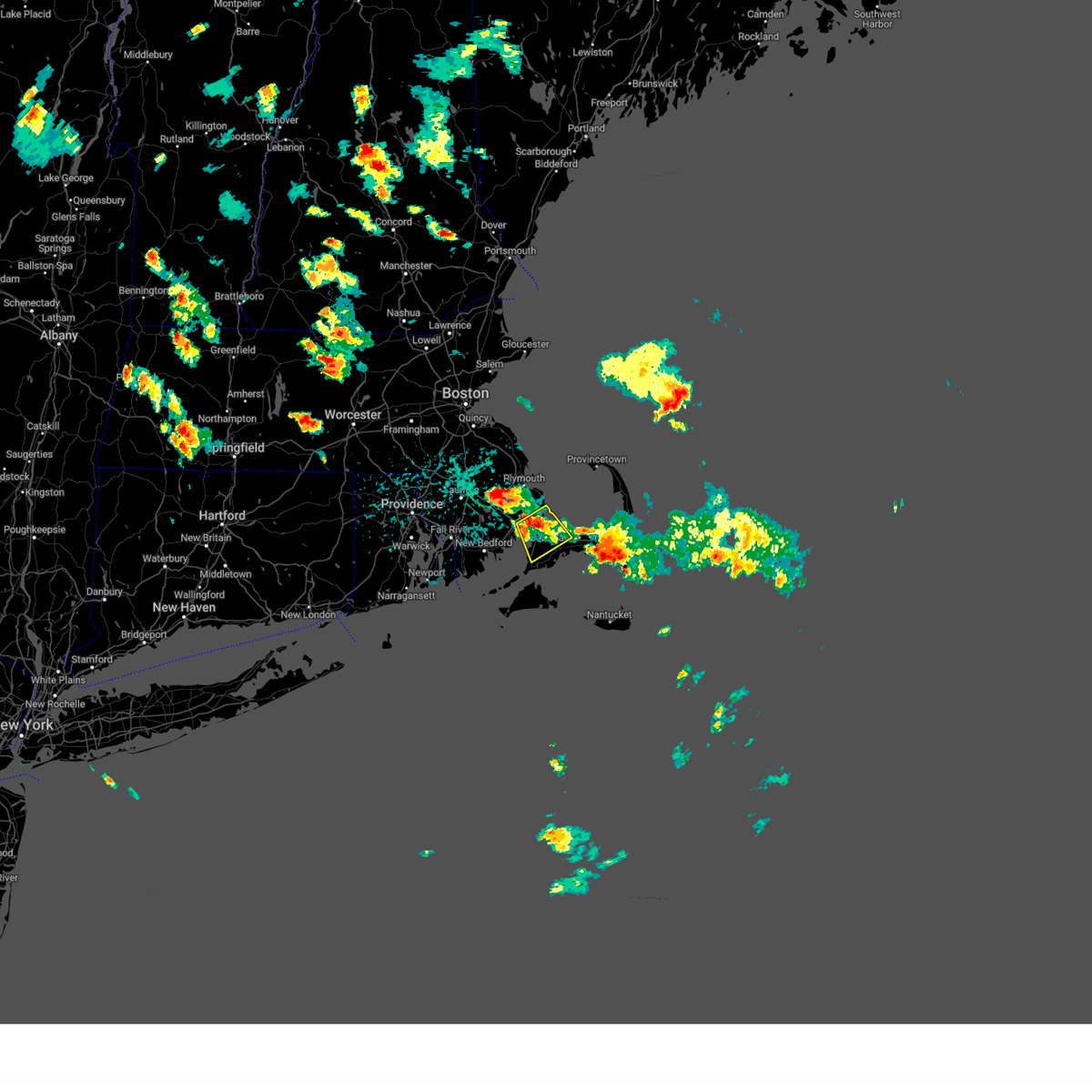
 At 1255 pm edt, a severe thunderstorm was located over dennis, or near brewster, moving southeast at 5 mph (radar indicated). Hazards include 60 mph wind gusts and quarter size hail. Hail damage to vehicles is expected. expect wind damage to trees and power lines. Locations impacted include, brewster, yarmouth, dennis, harwich, and chatham. At 1255 pm edt, a severe thunderstorm was located over dennis, or near brewster, moving southeast at 5 mph (radar indicated). Hazards include 60 mph wind gusts and quarter size hail. Hail damage to vehicles is expected. expect wind damage to trees and power lines. Locations impacted include, brewster, yarmouth, dennis, harwich, and chatham.
|
| 8/26/2024 12:51 PM EDT |
 Svrbox the national weather service in boston/norton has issued a * severe thunderstorm warning for, southwestern barnstable county in southeastern massachusetts, southeastern plymouth county in southeastern massachusetts, * until 130 pm edt. * at 1251 pm edt, a severe thunderstorm was located over bourne, or 8 miles south of plymouth, moving southeast at 5 mph (radar indicated). Hazards include 60 mph wind gusts and quarter size hail. Hail damage to vehicles is expected. Expect wind damage to trees and power lines. Svrbox the national weather service in boston/norton has issued a * severe thunderstorm warning for, southwestern barnstable county in southeastern massachusetts, southeastern plymouth county in southeastern massachusetts, * until 130 pm edt. * at 1251 pm edt, a severe thunderstorm was located over bourne, or 8 miles south of plymouth, moving southeast at 5 mph (radar indicated). Hazards include 60 mph wind gusts and quarter size hail. Hail damage to vehicles is expected. Expect wind damage to trees and power lines.
|
| 8/26/2024 12:39 PM EDT |
 Svrbox the national weather service in boston/norton has issued a * severe thunderstorm warning for, southeastern barnstable county in southeastern massachusetts, * until 130 pm edt. * at 1239 pm edt, a severe thunderstorm was located over dennis, or near brewster, moving southeast at 5 mph (radar indicated). Hazards include 60 mph wind gusts and quarter size hail. Hail damage to vehicles is expected. Expect wind damage to trees and power lines. Svrbox the national weather service in boston/norton has issued a * severe thunderstorm warning for, southeastern barnstable county in southeastern massachusetts, * until 130 pm edt. * at 1239 pm edt, a severe thunderstorm was located over dennis, or near brewster, moving southeast at 5 mph (radar indicated). Hazards include 60 mph wind gusts and quarter size hail. Hail damage to vehicles is expected. Expect wind damage to trees and power lines.
|
| 8/15/2024 4:38 PM EDT |
 The storm which prompted the warning has weakened below severe limits, and no longer poses an immediate threat to life or property. therefore, the warning will be allowed to expire. The storm which prompted the warning has weakened below severe limits, and no longer poses an immediate threat to life or property. therefore, the warning will be allowed to expire.
|
| 8/15/2024 3:55 PM EDT |
 Svrbox the national weather service in boston/norton has issued a * severe thunderstorm warning for, southwestern barnstable county in southeastern massachusetts, southeastern plymouth county in southeastern massachusetts, * until 445 pm edt. * at 355 pm edt, a severe thunderstorm was located over wareham, or near marion, moving southeast at 15 mph (radar indicated). Hazards include 60 mph wind gusts and penny size hail. expect damage to trees and power lines Svrbox the national weather service in boston/norton has issued a * severe thunderstorm warning for, southwestern barnstable county in southeastern massachusetts, southeastern plymouth county in southeastern massachusetts, * until 445 pm edt. * at 355 pm edt, a severe thunderstorm was located over wareham, or near marion, moving southeast at 15 mph (radar indicated). Hazards include 60 mph wind gusts and penny size hail. expect damage to trees and power lines
|
| 5/8/2024 8:32 PM EDT |
 At 832 pm edt, a severe thunderstorm was located 7 miles south of mashpee, or 8 miles northeast of oak bluffs, moving east at 35 mph (radar indicated). Hazards include quarter size hail. Damage to vehicles is expected. Locations impacted include, barnstable, falmouth, tisbury, yarmouth, dennis, mashpee, gosnold, and hyannis. At 832 pm edt, a severe thunderstorm was located 7 miles south of mashpee, or 8 miles northeast of oak bluffs, moving east at 35 mph (radar indicated). Hazards include quarter size hail. Damage to vehicles is expected. Locations impacted include, barnstable, falmouth, tisbury, yarmouth, dennis, mashpee, gosnold, and hyannis.
|
| 5/8/2024 8:32 PM EDT |
 the severe thunderstorm warning has been cancelled and is no longer in effect the severe thunderstorm warning has been cancelled and is no longer in effect
|
| 5/8/2024 8:10 PM EDT |
 Svrbox the national weather service in boston/norton has issued a * severe thunderstorm warning for, southwestern barnstable county in southeastern massachusetts, south central plymouth county in southeastern massachusetts, southeastern bristol county in southeastern massachusetts, * until 900 pm edt. * at 809 pm edt, a severe thunderstorm was located near fairhaven, or 9 miles south of marion, moving east at 35 mph (radar indicated). Hazards include ping pong ball size hail. People and animals outdoors will be injured. Expect damage to roofs, siding, windows, and vehicles. Svrbox the national weather service in boston/norton has issued a * severe thunderstorm warning for, southwestern barnstable county in southeastern massachusetts, south central plymouth county in southeastern massachusetts, southeastern bristol county in southeastern massachusetts, * until 900 pm edt. * at 809 pm edt, a severe thunderstorm was located near fairhaven, or 9 miles south of marion, moving east at 35 mph (radar indicated). Hazards include ping pong ball size hail. People and animals outdoors will be injured. Expect damage to roofs, siding, windows, and vehicles.
|
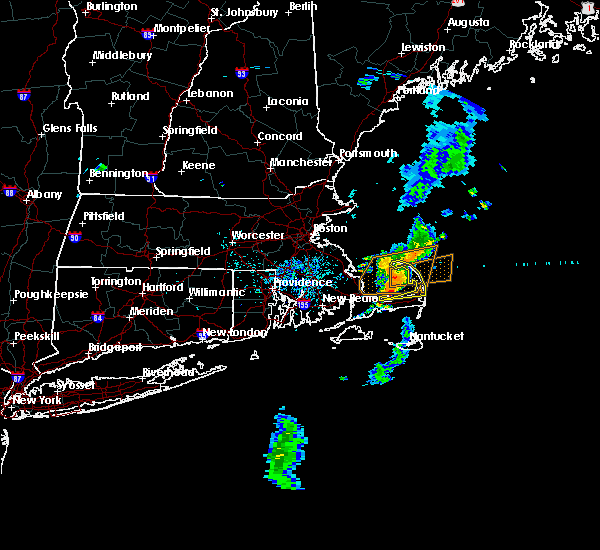
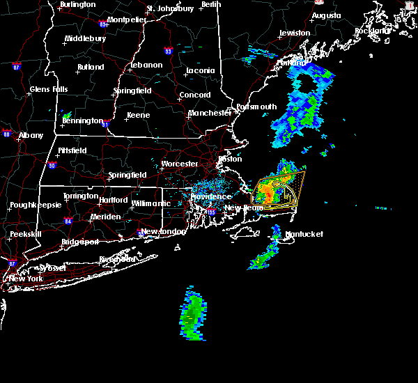
| 8/8/2023 12:36 PM EDT |
 At 1236 pm edt, severe thunderstorms were located along a line extending from near truro to eastham to near barnstable, moving northeast at 40 mph (radar indicated). Hazards include 60 mph wind gusts. Expect damage to roofs, siding, and trees. Locations impacted include, barnstable, brewster, provincetown, yarmouth, dennis, harwich, chatham, orleans, eastham, wellfleet, truro, and hyannis. At 1236 pm edt, severe thunderstorms were located along a line extending from near truro to eastham to near barnstable, moving northeast at 40 mph (radar indicated). Hazards include 60 mph wind gusts. Expect damage to roofs, siding, and trees. Locations impacted include, barnstable, brewster, provincetown, yarmouth, dennis, harwich, chatham, orleans, eastham, wellfleet, truro, and hyannis.
|
| 8/8/2023 12:21 PM EDT |
 The tornado warning for southeastern barnstable county will expire at 1230 pm edt, the tornado threat has diminished and the tornado warning has been cancelled. however, damaging winds remain likely and a severe thunderstorm warning remains in effect for the area. to report severe weather, contact your nearest law enforcement agency. they will relay your report to the national weather service boston/norton. The tornado warning for southeastern barnstable county will expire at 1230 pm edt, the tornado threat has diminished and the tornado warning has been cancelled. however, damaging winds remain likely and a severe thunderstorm warning remains in effect for the area. to report severe weather, contact your nearest law enforcement agency. they will relay your report to the national weather service boston/norton.
|
| 8/8/2023 12:19 PM EDT |
 At 1218 pm edt, severe thunderstorms were located along a line extending from 6 miles south of provincetown to near dennis to 6 miles south of mashpee, moving northeast at 40 mph (radar indicated). Hazards include 60 mph wind gusts. expect damage to roofs, siding, and trees At 1218 pm edt, severe thunderstorms were located along a line extending from 6 miles south of provincetown to near dennis to 6 miles south of mashpee, moving northeast at 40 mph (radar indicated). Hazards include 60 mph wind gusts. expect damage to roofs, siding, and trees
|
| 8/8/2023 12:15 PM EDT | Tree down along rt 6 near exit 68. relayed by amateur radi in barnstable county MA, 2.8 miles SW of Barnstable Town, MA |
| 8/8/2023 12:05 PM EDT | Several reports of trees and wires down and trees blocking the road on west barnstable road in osterville and on commerce road at main stree in barnstable county MA, 4.8 miles SW of Barnstable Town, MA |
| 8/8/2023 12:05 PM EDT |
 At 1204 pm edt, severe thunderstorms were located along a line extending from 7 miles north of plymouth to 7 miles northeast of sandwich to near barnstable to near falmouth, moving northeast at 30 mph (radar indicated). Hazards include 60 mph wind gusts. Expect damage to roofs, siding, and trees. Locations impacted include, barnstable, falmouth, brewster, provincetown, yarmouth, sandwich, bourne, dennis, mashpee, harwich, chatham, orleans, eastham, wellfleet, truro, and hyannis. At 1204 pm edt, severe thunderstorms were located along a line extending from 7 miles north of plymouth to 7 miles northeast of sandwich to near barnstable to near falmouth, moving northeast at 30 mph (radar indicated). Hazards include 60 mph wind gusts. Expect damage to roofs, siding, and trees. Locations impacted include, barnstable, falmouth, brewster, provincetown, yarmouth, sandwich, bourne, dennis, mashpee, harwich, chatham, orleans, eastham, wellfleet, truro, and hyannis.
|
| 8/8/2023 12:02 PM EDT |
 At 1202 pm edt, a severe thunderstorm capable of producing a tornado was located over barnstable, moving east at 25 mph (radar indicated rotation). Hazards include tornado. Flying debris will be dangerous to those caught without shelter. mobile homes will be damaged or destroyed. damage to roofs, windows, and vehicles will occur. tree damage is likely. this dangerous storm will be near, barnstable, yarmouth, and dennis around 1205 pm edt. brewster and harwich around 1210 pm edt. Other locations impacted by this tornadic thunderstorm include hyannis. At 1202 pm edt, a severe thunderstorm capable of producing a tornado was located over barnstable, moving east at 25 mph (radar indicated rotation). Hazards include tornado. Flying debris will be dangerous to those caught without shelter. mobile homes will be damaged or destroyed. damage to roofs, windows, and vehicles will occur. tree damage is likely. this dangerous storm will be near, barnstable, yarmouth, and dennis around 1205 pm edt. brewster and harwich around 1210 pm edt. Other locations impacted by this tornadic thunderstorm include hyannis.
|
| 8/8/2023 11:53 AM EDT |
 At 1153 am edt, a severe thunderstorm capable of producing a tornado was located over barnstable, moving northeast at 40 mph (radar indicated rotation). Hazards include tornado. Flying debris will be dangerous to those caught without shelter. mobile homes will be damaged or destroyed. damage to roofs, windows, and vehicles will occur. tree damage is likely. this dangerous storm will be near, barnstable, yarmouth, sandwich, and dennis around 1200 pm edt. brewster and harwich around 1205 pm edt. orleans around 1215 pm edt. Other locations impacted by this tornadic thunderstorm include hyannis. At 1153 am edt, a severe thunderstorm capable of producing a tornado was located over barnstable, moving northeast at 40 mph (radar indicated rotation). Hazards include tornado. Flying debris will be dangerous to those caught without shelter. mobile homes will be damaged or destroyed. damage to roofs, windows, and vehicles will occur. tree damage is likely. this dangerous storm will be near, barnstable, yarmouth, sandwich, and dennis around 1200 pm edt. brewster and harwich around 1205 pm edt. orleans around 1215 pm edt. Other locations impacted by this tornadic thunderstorm include hyannis.
|
| 8/8/2023 11:37 AM EDT |
 At 1137 am edt, severe thunderstorms were located along a line extending from near carver to near bourne to near falmouth to near gosnold, moving northeast at 30 mph (radar indicated). Hazards include 60 mph wind gusts. expect damage to roofs, siding, and trees At 1137 am edt, severe thunderstorms were located along a line extending from near carver to near bourne to near falmouth to near gosnold, moving northeast at 30 mph (radar indicated). Hazards include 60 mph wind gusts. expect damage to roofs, siding, and trees
|
| 7/29/2023 9:43 PM EDT |
 The severe thunderstorm warning for central dukes, barnstable, southern plymouth, southeastern bristol, northeastern newport and east central bristol counties will expire at 945 pm edt, the storms which prompted the warning have weakened below severe limits, and no longer pose an immediate threat to life or property. therefore, the warning will be allowed to expire. however gusty winds are still possible with these thunderstorms. The severe thunderstorm warning for central dukes, barnstable, southern plymouth, southeastern bristol, northeastern newport and east central bristol counties will expire at 945 pm edt, the storms which prompted the warning have weakened below severe limits, and no longer pose an immediate threat to life or property. therefore, the warning will be allowed to expire. however gusty winds are still possible with these thunderstorms.
|
| 7/29/2023 9:12 PM EDT |
 At 912 pm edt, severe thunderstorms were located along a line extending from 6 miles northeast of plymouth to near westport, moving southeast at 30 mph (radar indicated). Hazards include 60 mph wind gusts. Expect damage to trees and power lines. locations impacted include, new bedford, fall river, plymouth, barnstable, dartmouth, falmouth, marion, oak bluffs, edgartown, tisbury, aquinnah, yarmouth, middleborough, wareham, sandwich, bourne, somerset, fairhaven, swansea and tiverton. hail threat, radar indicated max hail size, <. 75 in wind threat, radar indicated max wind gust, 60 mph. At 912 pm edt, severe thunderstorms were located along a line extending from 6 miles northeast of plymouth to near westport, moving southeast at 30 mph (radar indicated). Hazards include 60 mph wind gusts. Expect damage to trees and power lines. locations impacted include, new bedford, fall river, plymouth, barnstable, dartmouth, falmouth, marion, oak bluffs, edgartown, tisbury, aquinnah, yarmouth, middleborough, wareham, sandwich, bourne, somerset, fairhaven, swansea and tiverton. hail threat, radar indicated max hail size, <. 75 in wind threat, radar indicated max wind gust, 60 mph.
|
| 7/29/2023 8:39 PM EDT |
 At 839 pm edt, severe thunderstorms were located along a line extending from near duxbury to near seekonk, moving southeast at 30 mph (radar indicated). Hazards include 60 mph wind gusts. expect damage to trees and power lines At 839 pm edt, severe thunderstorms were located along a line extending from near duxbury to near seekonk, moving southeast at 30 mph (radar indicated). Hazards include 60 mph wind gusts. expect damage to trees and power lines
|
| 6/14/2023 8:43 PM EDT | Wires down on great neck road nort in barnstable county MA, 5.5 miles E of Barnstable Town, MA |
| 11/13/2021 6:36 PM EST |
 The severe thunderstorm warning for southwestern barnstable and southeastern plymouth counties will expire at 645 pm est, the storm which prompted the warning has moved out of the area. therefore, the warning will be allowed to expire. The severe thunderstorm warning for southwestern barnstable and southeastern plymouth counties will expire at 645 pm est, the storm which prompted the warning has moved out of the area. therefore, the warning will be allowed to expire.
|
| 11/13/2021 6:28 PM EST |
 The tornado warning for south central barnstable county will expire at 630 pm est, the tornadic thunderstorm which prompted the warning has moved out of the warned area. therefore, the warning will be allowed to expire. The tornado warning for south central barnstable county will expire at 630 pm est, the tornadic thunderstorm which prompted the warning has moved out of the warned area. therefore, the warning will be allowed to expire.
|
| 11/13/2021 6:27 PM EST |
 At 626 pm est, a severe thunderstorm capable of producing a tornado was located near barnstable, moving northeast at 55 mph (radar indicated rotation). Hazards include tornado. Flying debris will be dangerous to those caught without shelter. mobile homes will be damaged or destroyed. damage to roofs, windows, and vehicles will occur. tree damage is likely. this dangerous storm will be near, yarmouth and dennis around 630 pm est. brewster around 640 pm est. Other locations impacted by this tornadic thunderstorm include hyannis. At 626 pm est, a severe thunderstorm capable of producing a tornado was located near barnstable, moving northeast at 55 mph (radar indicated rotation). Hazards include tornado. Flying debris will be dangerous to those caught without shelter. mobile homes will be damaged or destroyed. damage to roofs, windows, and vehicles will occur. tree damage is likely. this dangerous storm will be near, yarmouth and dennis around 630 pm est. brewster around 640 pm est. Other locations impacted by this tornadic thunderstorm include hyannis.
|
| 11/13/2021 6:17 PM EST |
 At 617 pm est, a severe thunderstorm capable of producing a tornado was located near mashpee, or near barnstable, moving northeast at 60 mph (radar indicated rotation). Hazards include tornado. Flying debris will be dangerous to those caught without shelter. mobile homes will be damaged or destroyed. damage to roofs, windows, and vehicles will occur. tree damage is likely. this dangerous storm will be near, barnstable and yarmouth around 625 pm est. dennis around 630 pm est. Other locations impacted by this tornadic thunderstorm include hyannis. At 617 pm est, a severe thunderstorm capable of producing a tornado was located near mashpee, or near barnstable, moving northeast at 60 mph (radar indicated rotation). Hazards include tornado. Flying debris will be dangerous to those caught without shelter. mobile homes will be damaged or destroyed. damage to roofs, windows, and vehicles will occur. tree damage is likely. this dangerous storm will be near, barnstable and yarmouth around 625 pm est. dennis around 630 pm est. Other locations impacted by this tornadic thunderstorm include hyannis.
|
| 11/13/2021 6:16 PM EST |
 At 616 pm est, a severe thunderstorm was located over mashpee, or near barnstable, moving east at 50 mph (radar indicated). Hazards include 60 mph wind gusts. Expect damage to trees and power lines. Locations impacted include, plymouth, barnstable, falmouth, yarmouth, sandwich, bourne, mashpee and hyannis. At 616 pm est, a severe thunderstorm was located over mashpee, or near barnstable, moving east at 50 mph (radar indicated). Hazards include 60 mph wind gusts. Expect damage to trees and power lines. Locations impacted include, plymouth, barnstable, falmouth, yarmouth, sandwich, bourne, mashpee and hyannis.
|
| 11/13/2021 6:07 PM EST |
 At 607 pm est, a severe thunderstorm capable of producing a tornado was located over oak bluffs, moving northeast at 65 mph (radar indicated rotation). Hazards include tornado. Flying debris will be dangerous to those caught without shelter. mobile homes will be damaged or destroyed. damage to roofs, windows, and vehicles will occur. tree damage is likely. this dangerous storm will be near, mashpee around 620 pm est. barnstable and yarmouth around 625 pm est. dennis around 630 pm est. Other locations impacted by this tornadic thunderstorm include hyannis. At 607 pm est, a severe thunderstorm capable of producing a tornado was located over oak bluffs, moving northeast at 65 mph (radar indicated rotation). Hazards include tornado. Flying debris will be dangerous to those caught without shelter. mobile homes will be damaged or destroyed. damage to roofs, windows, and vehicles will occur. tree damage is likely. this dangerous storm will be near, mashpee around 620 pm est. barnstable and yarmouth around 625 pm est. dennis around 630 pm est. Other locations impacted by this tornadic thunderstorm include hyannis.
|
| 11/13/2021 5:45 PM EST |
 At 545 pm est, a severe thunderstorm was located over aquinnah, moving northeast at 50 mph (radar indicated). Hazards include 60 mph wind gusts. expect damage to trees and power lines At 545 pm est, a severe thunderstorm was located over aquinnah, moving northeast at 50 mph (radar indicated). Hazards include 60 mph wind gusts. expect damage to trees and power lines
|
| 10/31/2021 2:26 AM EDT |
 At 225 am edt, a severe thunderstorm was located 7 miles southeast of edgartown, moving north at 45 mph (radar indicated). Hazards include 60 mph wind gusts. expect damage to trees and power lines At 225 am edt, a severe thunderstorm was located 7 miles southeast of edgartown, moving north at 45 mph (radar indicated). Hazards include 60 mph wind gusts. expect damage to trees and power lines
|
| 9/28/2021 2:23 PM EDT |
 At 222 pm edt, a severe thunderstorm was located near westport, or near dartmouth, moving northeast at 45 mph (radar indicated). Hazards include 60 mph wind gusts and penny size hail. Expect damage to trees and power lines. locations impacted include, new bedford, fall river, plymouth, barnstable, dartmouth, falmouth, marion, wareham, sandwich, bourne, fairhaven, tiverton, westport, mashpee, carver, acushnet, freetown, mattapoisett, rochester and little compton. hail threat, radar indicated max hail size, 0. 75 in wind threat, radar indicated max wind gust, 60 mph. At 222 pm edt, a severe thunderstorm was located near westport, or near dartmouth, moving northeast at 45 mph (radar indicated). Hazards include 60 mph wind gusts and penny size hail. Expect damage to trees and power lines. locations impacted include, new bedford, fall river, plymouth, barnstable, dartmouth, falmouth, marion, wareham, sandwich, bourne, fairhaven, tiverton, westport, mashpee, carver, acushnet, freetown, mattapoisett, rochester and little compton. hail threat, radar indicated max hail size, 0. 75 in wind threat, radar indicated max wind gust, 60 mph.
|
| 9/28/2021 2:07 PM EDT |
 At 207 pm edt, a severe thunderstorm was located over newport, moving northeast at 40 mph (radar indicated). Hazards include 60 mph wind gusts. expect damage to trees and power lines At 207 pm edt, a severe thunderstorm was located over newport, moving northeast at 40 mph (radar indicated). Hazards include 60 mph wind gusts. expect damage to trees and power lines
|
| 9/16/2021 8:06 AM EDT |
 The severe thunderstorm warning for north central dukes, southern barnstable, south central plymouth and southeastern bristol counties will expire at 815 am edt, the storm which prompted the warning has moved out of the area. therefore, the warning will be allowed to expire. however heavy rain and street flooding is still possible with this thunderstorm. The severe thunderstorm warning for north central dukes, southern barnstable, south central plymouth and southeastern bristol counties will expire at 815 am edt, the storm which prompted the warning has moved out of the area. therefore, the warning will be allowed to expire. however heavy rain and street flooding is still possible with this thunderstorm.
|
| 9/16/2021 7:13 AM EDT |
 At 713 am edt, a severe thunderstorm was located near mattapoisett, or 7 miles south of marion, moving east at 30 mph (radar indicated). Hazards include 60 mph wind gusts and penny size hail. expect damage to trees and power lines At 713 am edt, a severe thunderstorm was located near mattapoisett, or 7 miles south of marion, moving east at 30 mph (radar indicated). Hazards include 60 mph wind gusts and penny size hail. expect damage to trees and power lines
|
| 9/2/2021 2:13 AM EDT |
 At 213 am edt, a severe thunderstorm capable of producing a tornado was located over dennis, or near brewster, moving northeast at 40 mph (radar indicated rotation). Hazards include tornado. Flying debris will be dangerous to those caught without shelter. mobile homes will be damaged or destroyed. damage to roofs, windows, and vehicles will occur. tree damage is likely. This dangerous storm will be near, brewster around 220 am edt. At 213 am edt, a severe thunderstorm capable of producing a tornado was located over dennis, or near brewster, moving northeast at 40 mph (radar indicated rotation). Hazards include tornado. Flying debris will be dangerous to those caught without shelter. mobile homes will be damaged or destroyed. damage to roofs, windows, and vehicles will occur. tree damage is likely. This dangerous storm will be near, brewster around 220 am edt.
|
| 9/2/2021 1:56 AM EDT |
 At 156 am edt, a severe thunderstorm capable of producing a tornado was located near barnstable, moving northeast at 40 mph (radar indicated rotation). Hazards include tornado. Flying debris will be dangerous to those caught without shelter. mobile homes will be damaged or destroyed. damage to roofs, windows, and vehicles will occur. tree damage is likely. this dangerous storm will be near, yarmouth around 200 am edt. dennis around 205 am edt. harwich around 210 am edt. brewster around 220 am edt. Other locations impacted by this tornadic thunderstorm include hyannis. At 156 am edt, a severe thunderstorm capable of producing a tornado was located near barnstable, moving northeast at 40 mph (radar indicated rotation). Hazards include tornado. Flying debris will be dangerous to those caught without shelter. mobile homes will be damaged or destroyed. damage to roofs, windows, and vehicles will occur. tree damage is likely. this dangerous storm will be near, yarmouth around 200 am edt. dennis around 205 am edt. harwich around 210 am edt. brewster around 220 am edt. Other locations impacted by this tornadic thunderstorm include hyannis.
|
| 9/2/2021 1:18 AM EDT |
 At 118 am edt, a severe thunderstorm capable of producing a tornado was located 7 miles northwest of dennis, or 9 miles northeast of barnstable, moving northeast at 35 mph (radar indicated rotation). Hazards include tornado. Flying debris will be dangerous to those caught without shelter. mobile homes will be damaged or destroyed. damage to roofs, windows, and vehicles will occur. tree damage is likely. This tornadic thunderstorm will remain over mainly rural areas of southwestern barnstable and dukes counties, including the following locations, hyannis. At 118 am edt, a severe thunderstorm capable of producing a tornado was located 7 miles northwest of dennis, or 9 miles northeast of barnstable, moving northeast at 35 mph (radar indicated rotation). Hazards include tornado. Flying debris will be dangerous to those caught without shelter. mobile homes will be damaged or destroyed. damage to roofs, windows, and vehicles will occur. tree damage is likely. This tornadic thunderstorm will remain over mainly rural areas of southwestern barnstable and dukes counties, including the following locations, hyannis.
|
| 9/2/2021 12:45 AM EDT |
 At 1244 am edt, a severe thunderstorm capable of producing a tornado was located near falmouth, moving northeast at 35 mph (radar indicated rotation). Hazards include tornado. Flying debris will be dangerous to those caught without shelter. mobile homes will be damaged or destroyed. damage to roofs, windows, and vehicles will occur. tree damage is likely. this dangerous storm will be near, mashpee around 1255 am edt. yarmouth around 105 am edt. barnstable around 110 am edt. Other locations impacted by this tornadic thunderstorm include hyannis. At 1244 am edt, a severe thunderstorm capable of producing a tornado was located near falmouth, moving northeast at 35 mph (radar indicated rotation). Hazards include tornado. Flying debris will be dangerous to those caught without shelter. mobile homes will be damaged or destroyed. damage to roofs, windows, and vehicles will occur. tree damage is likely. this dangerous storm will be near, mashpee around 1255 am edt. yarmouth around 105 am edt. barnstable around 110 am edt. Other locations impacted by this tornadic thunderstorm include hyannis.
|
| 9/2/2021 12:18 AM EDT |
 At 1217 am edt, a severe thunderstorm capable of producing a tornado was located over falmouth, moving northeast at 35 mph (radar indicated rotation). Hazards include tornado. Flying debris will be dangerous to those caught without shelter. mobile homes will be damaged or destroyed. damage to roofs, windows, and vehicles will occur. tree damage is likely. this dangerous storm will be near, mashpee around 1235 am edt. sandwich and bourne around 1240 am edt. Barnstable around 1245 am edt. At 1217 am edt, a severe thunderstorm capable of producing a tornado was located over falmouth, moving northeast at 35 mph (radar indicated rotation). Hazards include tornado. Flying debris will be dangerous to those caught without shelter. mobile homes will be damaged or destroyed. damage to roofs, windows, and vehicles will occur. tree damage is likely. this dangerous storm will be near, mashpee around 1235 am edt. sandwich and bourne around 1240 am edt. Barnstable around 1245 am edt.
|
| 9/1/2021 11:56 PM EDT |
 At 1156 pm edt, a severe thunderstorm capable of producing a tornado was located near gosnold, or 7 miles west of tisbury, moving northeast at 40 mph (radar indicated rotation). Hazards include tornado. Flying debris will be dangerous to those caught without shelter. mobile homes will be damaged or destroyed. damage to roofs, windows, and vehicles will occur. tree damage is likely. this dangerous storm will be near, tisbury around 1200 am edt. falmouth around 1215 am edt. mashpee around 1225 am edt. sandwich and bourne around 1230 am edt. Barnstable around 1235 am edt. At 1156 pm edt, a severe thunderstorm capable of producing a tornado was located near gosnold, or 7 miles west of tisbury, moving northeast at 40 mph (radar indicated rotation). Hazards include tornado. Flying debris will be dangerous to those caught without shelter. mobile homes will be damaged or destroyed. damage to roofs, windows, and vehicles will occur. tree damage is likely. this dangerous storm will be near, tisbury around 1200 am edt. falmouth around 1215 am edt. mashpee around 1225 am edt. sandwich and bourne around 1230 am edt. Barnstable around 1235 am edt.
|
| 8/14/2021 12:28 PM EDT |
 At 1226 pm edt, a severe thunderstorm was located near sandwich, or 10 miles northwest of barnstable, moving east at 25 mph (radar indicated and public. at 1222 pm, amateur radio reported tree down on sandwich road at ben abbey drive as well as tree down on 6 tyler drive). Hazards include 60 mph wind gusts and quarter size hail. Expect wind damage to trees and power lines. minor hail damage to vehicles is possible. locations impacted include, plymouth, barnstable, brewster, yarmouth, wareham, sandwich, bourne, dennis, mashpee and harwich. hail threat, radar indicated max hail size, 1. 00 in wind threat, radar indicated max wind gust, 60 mph. At 1226 pm edt, a severe thunderstorm was located near sandwich, or 10 miles northwest of barnstable, moving east at 25 mph (radar indicated and public. at 1222 pm, amateur radio reported tree down on sandwich road at ben abbey drive as well as tree down on 6 tyler drive). Hazards include 60 mph wind gusts and quarter size hail. Expect wind damage to trees and power lines. minor hail damage to vehicles is possible. locations impacted include, plymouth, barnstable, brewster, yarmouth, wareham, sandwich, bourne, dennis, mashpee and harwich. hail threat, radar indicated max hail size, 1. 00 in wind threat, radar indicated max wind gust, 60 mph.
|
| 8/14/2021 12:26 PM EDT |
 At 1224 pm edt, a severe thunderstorm was located near sandwich, or 10 miles southeast of plymouth, moving east at 25 mph (radar indicated and train spotter reported. weather station reported a sustained 40 mph wind with 50 mph gust at sandwich marina). Hazards include 60 mph wind gusts and quarter size hail. Expect wind damage to trees and power lines. minor hail damage to vehicles is possible. locations impacted include, plymouth, barnstable, brewster, yarmouth, wareham, sandwich, bourne, dennis, mashpee and harwich. hail threat, radar indicated max hail size, 1. 00 in wind threat, radar indicated max wind gust, 60 mph. At 1224 pm edt, a severe thunderstorm was located near sandwich, or 10 miles southeast of plymouth, moving east at 25 mph (radar indicated and train spotter reported. weather station reported a sustained 40 mph wind with 50 mph gust at sandwich marina). Hazards include 60 mph wind gusts and quarter size hail. Expect wind damage to trees and power lines. minor hail damage to vehicles is possible. locations impacted include, plymouth, barnstable, brewster, yarmouth, wareham, sandwich, bourne, dennis, mashpee and harwich. hail threat, radar indicated max hail size, 1. 00 in wind threat, radar indicated max wind gust, 60 mph.
|
| 8/14/2021 12:08 PM EDT |
 At 1208 pm edt, a severe thunderstorm was located over bourne, or 8 miles northeast of marion, moving east at 25 mph (radar indicated). Hazards include 60 mph wind gusts and quarter size hail. Expect wind damage to trees and power lines. Minor hail damage to vehicles is possible. At 1208 pm edt, a severe thunderstorm was located over bourne, or 8 miles northeast of marion, moving east at 25 mph (radar indicated). Hazards include 60 mph wind gusts and quarter size hail. Expect wind damage to trees and power lines. Minor hail damage to vehicles is possible.
|
| 11/23/2020 11:58 AM EST |
 At 1157 am est, a severe thunderstorm was located over dennis, or near brewster, moving northeast at 60 mph (radar indicated). Hazards include 60 mph wind gusts. expect damage to trees and power lines At 1157 am est, a severe thunderstorm was located over dennis, or near brewster, moving northeast at 60 mph (radar indicated). Hazards include 60 mph wind gusts. expect damage to trees and power lines
|
| 11/23/2020 11:50 AM EST | Weatherflow site in barnstable county MA, 3.9 miles W of Barnstable Town, MA |
| 11/23/2020 11:40 AM EST |
 At 1136 am est, a severe thunderstorm capable of producing a tornado was located 8 miles south of barnstable, moving northeast at 50 mph (radar indicated rotation. at 1132 am in edgartown ma on marthas vineyard a gusts to 45 mph was reported by skywarn spotter). Hazards include tornado. Flying debris will be dangerous to those caught without shelter. mobile homes will be damaged or destroyed. damage to roofs, windows, and vehicles will occur. tree damage is likely. this dangerous storm will be near, yarmouth around 1140 am est. dennis and harwich around 1145 am est. brewster around 1150 am est. Other locations impacted by this tornadic thunderstorm include hyannis. At 1136 am est, a severe thunderstorm capable of producing a tornado was located 8 miles south of barnstable, moving northeast at 50 mph (radar indicated rotation. at 1132 am in edgartown ma on marthas vineyard a gusts to 45 mph was reported by skywarn spotter). Hazards include tornado. Flying debris will be dangerous to those caught without shelter. mobile homes will be damaged or destroyed. damage to roofs, windows, and vehicles will occur. tree damage is likely. this dangerous storm will be near, yarmouth around 1140 am est. dennis and harwich around 1145 am est. brewster around 1150 am est. Other locations impacted by this tornadic thunderstorm include hyannis.
|
| 11/23/2020 11:23 AM EST |
 At 1122 am est, a severe thunderstorm capable of producing a tornado was located near edgartown, moving northeast at 50 mph (radar indicated rotation). Hazards include tornado. Flying debris will be dangerous to those caught without shelter. mobile homes will be damaged or destroyed. damage to roofs, windows, and vehicles will occur. tree damage is likely. this dangerous storm will be near, yarmouth and dennis around 1145 am est. brewster and harwich around 1150 am est. Other locations impacted by this tornadic thunderstorm include hyannis. At 1122 am est, a severe thunderstorm capable of producing a tornado was located near edgartown, moving northeast at 50 mph (radar indicated rotation). Hazards include tornado. Flying debris will be dangerous to those caught without shelter. mobile homes will be damaged or destroyed. damage to roofs, windows, and vehicles will occur. tree damage is likely. this dangerous storm will be near, yarmouth and dennis around 1145 am est. brewster and harwich around 1150 am est. Other locations impacted by this tornadic thunderstorm include hyannis.
|
| 10/7/2020 7:06 PM EDT |
 At 705 pm edt, severe thunderstorms were located along a line extending from 42 miles northeast of truro to 13 miles northeast of wellfleet to 9 miles north of barnstable, moving east at 60 mph. a wind gust to 63 mph was recorded in provincetown (radar indicated). Hazards include 60 mph wind gusts. Expect damage to trees and power lines. Locations impacted include, new bedford, barnstable, dartmouth, falmouth, brewster, marion, yarmouth, wareham, sandwich, bourne, fairhaven, dennis, mashpee, harwich, mattapoisett, orleans, eastham, wellfleet, truro and gosnold. At 705 pm edt, severe thunderstorms were located along a line extending from 42 miles northeast of truro to 13 miles northeast of wellfleet to 9 miles north of barnstable, moving east at 60 mph. a wind gust to 63 mph was recorded in provincetown (radar indicated). Hazards include 60 mph wind gusts. Expect damage to trees and power lines. Locations impacted include, new bedford, barnstable, dartmouth, falmouth, brewster, marion, yarmouth, wareham, sandwich, bourne, fairhaven, dennis, mashpee, harwich, mattapoisett, orleans, eastham, wellfleet, truro and gosnold.
|
| 10/7/2020 6:36 PM EDT |
 At 635 pm edt, severe thunderstorms were located along a line extending from 18 miles north of provincetown to near plymouth to near somerset, moving east at 60 mph (radar indicated). Hazards include 60 mph wind gusts. expect damage to trees and power lines At 635 pm edt, severe thunderstorms were located along a line extending from 18 miles north of provincetown to near plymouth to near somerset, moving east at 60 mph (radar indicated). Hazards include 60 mph wind gusts. expect damage to trees and power lines
|
| 8/22/2020 5:52 PM EDT |
 The severe thunderstorm warning for southwestern barnstable county will expire at 600 pm edt, the storm which prompted the warning has moved out of the area. therefore, the warning will be allowed to expire. however gusty winds and heavy rain are still possible with this thunderstorm. The severe thunderstorm warning for southwestern barnstable county will expire at 600 pm edt, the storm which prompted the warning has moved out of the area. therefore, the warning will be allowed to expire. however gusty winds and heavy rain are still possible with this thunderstorm.
|
| 8/22/2020 5:35 PM EDT |
 At 535 pm edt, a severe thunderstorm was located near mashpee, or near falmouth, moving southeast at 30 mph (radar indicated). Hazards include 60 mph wind gusts and quarter size hail. Expect wind damage to trees and power lines. minor hail damage to vehicles is possible. Locations impacted include, barnstable, falmouth, sandwich, bourne and mashpee. At 535 pm edt, a severe thunderstorm was located near mashpee, or near falmouth, moving southeast at 30 mph (radar indicated). Hazards include 60 mph wind gusts and quarter size hail. Expect wind damage to trees and power lines. minor hail damage to vehicles is possible. Locations impacted include, barnstable, falmouth, sandwich, bourne and mashpee.
|
| 8/22/2020 5:16 PM EDT |
 At 515 pm edt, a severe thunderstorm was located near falmouth, moving southeast at 30 mph (radar indicated). Hazards include 60 mph wind gusts and quarter size hail. Expect wind damage to trees and power lines. Minor hail damage to vehicles is possible. At 515 pm edt, a severe thunderstorm was located near falmouth, moving southeast at 30 mph (radar indicated). Hazards include 60 mph wind gusts and quarter size hail. Expect wind damage to trees and power lines. Minor hail damage to vehicles is possible.
|
| 8/22/2020 5:03 PM EDT |
 At 503 pm edt, a severe thunderstorm was located over bourne, or near marion, moving southeast at 20 mph (radar indicated). Hazards include 60 mph wind gusts and quarter size hail. Expect wind damage to trees and power lines. minor hail damage to vehicles is possible. Locations impacted include, plymouth, barnstable, falmouth, marion, wareham, sandwich, bourne, mashpee, carver, acushnet, mattapoisett and rochester. At 503 pm edt, a severe thunderstorm was located over bourne, or near marion, moving southeast at 20 mph (radar indicated). Hazards include 60 mph wind gusts and quarter size hail. Expect wind damage to trees and power lines. minor hail damage to vehicles is possible. Locations impacted include, plymouth, barnstable, falmouth, marion, wareham, sandwich, bourne, mashpee, carver, acushnet, mattapoisett and rochester.
|
| 8/22/2020 4:45 PM EDT |
 At 445 pm edt, a severe thunderstorm was located over wareham, or near marion, moving southeast at 20 mph (radar indicated). Hazards include 60 mph wind gusts and quarter size hail. Expect wind damage to trees and power lines. minor hail damage to vehicles is possible. Locations impacted include, new bedford, plymouth, barnstable, falmouth, marion, middleborough, wareham, sandwich, bourne, mashpee, kingston, carver, lakeville, acushnet, freetown, mattapoisett, rochester and plympton. At 445 pm edt, a severe thunderstorm was located over wareham, or near marion, moving southeast at 20 mph (radar indicated). Hazards include 60 mph wind gusts and quarter size hail. Expect wind damage to trees and power lines. minor hail damage to vehicles is possible. Locations impacted include, new bedford, plymouth, barnstable, falmouth, marion, middleborough, wareham, sandwich, bourne, mashpee, kingston, carver, lakeville, acushnet, freetown, mattapoisett, rochester and plympton.
|
| 8/22/2020 4:30 PM EDT |
 At 429 pm edt, a severe thunderstorm was located near carver, or 9 miles north of marion, moving southeast at 20 mph (radar indicated. this storm has a history of widespread wind damage in the bridgewater and lakevill areas). Hazards include 60 mph wind gusts and half dollar size hail. Expect wind damage to trees and power lines. Minor hail damage to vehicles is possible. At 429 pm edt, a severe thunderstorm was located near carver, or 9 miles north of marion, moving southeast at 20 mph (radar indicated. this storm has a history of widespread wind damage in the bridgewater and lakevill areas). Hazards include 60 mph wind gusts and half dollar size hail. Expect wind damage to trees and power lines. Minor hail damage to vehicles is possible.
|
| 4/9/2020 5:12 PM EDT |
 At 509 pm edt, severe thunderstorms were located along a line extending from 10 miles north of nantucket to 33 miles southeast of edgartown, moving east at 65 mph. these storms produced 60 mph gusts on block island and 58 mph gusts in marstons mills (radar indicated). Hazards include 60 mph wind gusts. Expect damage to trees and power lines. Locations impacted include, barnstable, nantucket, brewster, yarmouth, dennis, harwich, chatham, orleans, eastham and hyannis. At 509 pm edt, severe thunderstorms were located along a line extending from 10 miles north of nantucket to 33 miles southeast of edgartown, moving east at 65 mph. these storms produced 60 mph gusts on block island and 58 mph gusts in marstons mills (radar indicated). Hazards include 60 mph wind gusts. Expect damage to trees and power lines. Locations impacted include, barnstable, nantucket, brewster, yarmouth, dennis, harwich, chatham, orleans, eastham and hyannis.
|
| 4/9/2020 4:33 PM EDT | Storm damage reported in barnstable county MA, 2.3 miles E of Barnstable Town, MA |
| 4/9/2020 4:24 PM EDT |
 At 423 pm edt, severe thunderstorms were located along a line extending from near gosnold to 22 miles south of chilmark, moving east at 65 mph. these storms produced 60 mph gusts on block island (radar indicated). Hazards include 60 mph wind gusts. expect damage to trees and power lines At 423 pm edt, severe thunderstorms were located along a line extending from near gosnold to 22 miles south of chilmark, moving east at 65 mph. these storms produced 60 mph gusts on block island (radar indicated). Hazards include 60 mph wind gusts. expect damage to trees and power lines
|
| 4/9/2020 4:11 PM EDT |
 At 410 pm edt, severe thunderstorms were located along a line extending from near dartmouth to 20 miles east of block island, moving east at 70 mph. these storms produced 60 mph on block island (radar indicated). Hazards include 60 mph wind gusts. Expect damage to trees and power lines. Locations impacted include, new bedford, dartmouth, falmouth, marion, oak bluffs, edgartown, tisbury, wareham, sandwich, bourne, fairhaven, westport, mashpee, acushnet, mattapoisett, little compton, west tisbury, chilmark and gosnold. At 410 pm edt, severe thunderstorms were located along a line extending from near dartmouth to 20 miles east of block island, moving east at 70 mph. these storms produced 60 mph on block island (radar indicated). Hazards include 60 mph wind gusts. Expect damage to trees and power lines. Locations impacted include, new bedford, dartmouth, falmouth, marion, oak bluffs, edgartown, tisbury, wareham, sandwich, bourne, fairhaven, westport, mashpee, acushnet, mattapoisett, little compton, west tisbury, chilmark and gosnold.
|
| 4/9/2020 3:32 PM EDT |
 At 331 pm edt, severe thunderstorms were located along a line extending from near exeter to hither hills state park, moving east at 60 mph (radar indicated). Hazards include 60 mph wind gusts. expect damage to trees and power lines At 331 pm edt, severe thunderstorms were located along a line extending from near exeter to hither hills state park, moving east at 60 mph (radar indicated). Hazards include 60 mph wind gusts. expect damage to trees and power lines
|
| 8/8/2019 3:28 AM EDT |
 At 327 am edt, a severe thunderstorm was located near barnstable, moving northeast at 30 mph (radar indicated). Hazards include 60 mph wind gusts. Expect damage to trees and power lines. Locations impacted include, barnstable, brewster, yarmouth, sandwich, dennis, mashpee, harwich, chatham, orleans and hyannis. At 327 am edt, a severe thunderstorm was located near barnstable, moving northeast at 30 mph (radar indicated). Hazards include 60 mph wind gusts. Expect damage to trees and power lines. Locations impacted include, barnstable, brewster, yarmouth, sandwich, dennis, mashpee, harwich, chatham, orleans and hyannis.
|
| 8/8/2019 3:18 AM EDT |
 At 317 am edt, a severe thunderstorm was located 8 miles east of oak bluffs, moving northeast at 30 mph (radar indicated). Hazards include 60 mph wind gusts. Expect damage to trees and power lines. Locations impacted include, barnstable, falmouth, brewster, oak bluffs, edgartown, tisbury, yarmouth, sandwich, dennis, mashpee, harwich, chatham, orleans and hyannis. At 317 am edt, a severe thunderstorm was located 8 miles east of oak bluffs, moving northeast at 30 mph (radar indicated). Hazards include 60 mph wind gusts. Expect damage to trees and power lines. Locations impacted include, barnstable, falmouth, brewster, oak bluffs, edgartown, tisbury, yarmouth, sandwich, dennis, mashpee, harwich, chatham, orleans and hyannis.
|
| 8/8/2019 2:59 AM EDT |
 At 259 am edt, a severe thunderstorm was located over edgartown, moving northeast at 30 mph (radar indicated). Hazards include 60 mph wind gusts. expect damage to trees and power lines At 259 am edt, a severe thunderstorm was located over edgartown, moving northeast at 30 mph (radar indicated). Hazards include 60 mph wind gusts. expect damage to trees and power lines
|
| 7/23/2019 12:05 PM EDT | Tree down on wires on scudder road. several large trees and many large branches down on wianno avenue. 2 small boats flipped over in west ba in barnstable county MA, 2.2 miles NNE of Barnstable Town, MA |
| 7/23/2019 12:03 PM EDT |
 At 1202 pm edt, a confirmed tornado was located over yarmouth, or 8 miles east of barnstable, moving northeast at 35 mph (radar confirmed tornado). Hazards include damaging tornado. Flying debris will be dangerous to those caught without shelter. mobile homes will be damaged or destroyed. damage to roofs, windows, and vehicles will occur. tree damage is likely. this tornado will be near, harwich around 1210 pm edt. brewster around 1215 pm edt. Other locations impacted by this tornadic thunderstorm include hyannis. At 1202 pm edt, a confirmed tornado was located over yarmouth, or 8 miles east of barnstable, moving northeast at 35 mph (radar confirmed tornado). Hazards include damaging tornado. Flying debris will be dangerous to those caught without shelter. mobile homes will be damaged or destroyed. damage to roofs, windows, and vehicles will occur. tree damage is likely. this tornado will be near, harwich around 1210 pm edt. brewster around 1215 pm edt. Other locations impacted by this tornadic thunderstorm include hyannis.
|
| 7/23/2019 12:01 PM EDT | Tree down on gosnold street at old colony roa in barnstable county MA, 3.9 miles W of Barnstable Town, MA |
| 7/23/2019 11:59 AM EDT | Storm damage reported in barnstable county MA, 5.3 miles WNW of Barnstable Town, MA |
| 7/23/2019 11:58 AM EDT |
 At 1157 am edt, a severe thunderstorm capable of producing a tornado was located over yarmouth, or near barnstable, moving northeast at 35 mph. wind gusts to 70 mph have been observed (radar indicated rotation). Hazards include tornado. Flying debris will be dangerous to those caught without shelter. mobile homes will be damaged or destroyed. damage to roofs, windows, and vehicles will occur. tree damage is likely. this dangerous storm will be near, dennis around 1205 pm edt. harwich around 1210 pm edt. brewster around 1215 pm edt. Other locations impacted by this tornadic thunderstorm include hyannis. At 1157 am edt, a severe thunderstorm capable of producing a tornado was located over yarmouth, or near barnstable, moving northeast at 35 mph. wind gusts to 70 mph have been observed (radar indicated rotation). Hazards include tornado. Flying debris will be dangerous to those caught without shelter. mobile homes will be damaged or destroyed. damage to roofs, windows, and vehicles will occur. tree damage is likely. this dangerous storm will be near, dennis around 1205 pm edt. harwich around 1210 pm edt. brewster around 1215 pm edt. Other locations impacted by this tornadic thunderstorm include hyannis.
|
| 7/23/2019 11:48 AM EDT | Tree down on wires on barnstable road. large branch down in front of the simmons homestead on pitchers way blocking one lane. wires down on scudder avenue. tree down bl in barnstable county MA, 4.8 miles SW of Barnstable Town, MA |
| 7/23/2019 11:40 AM EDT | Multiple trees down across tow in barnstable county MA, 5.5 miles E of Barnstable Town, MA |
| 7/23/2019 11:39 AM EDT |
 The national weather service in boston/norton has issued a * tornado warning for. southern barnstable county in southeastern massachusetts. until 1215 pm edt. At 1138 am edt, a severe thunderstorm capable of producing a tornado was located over mashpee, or 7 miles southwest of. The national weather service in boston/norton has issued a * tornado warning for. southern barnstable county in southeastern massachusetts. until 1215 pm edt. At 1138 am edt, a severe thunderstorm capable of producing a tornado was located over mashpee, or 7 miles southwest of.
|
| 7/23/2019 11:38 AM EDT | Popponesset in barnstable county MA, 5.5 miles E of Barnstable Town, MA |
| 7/23/2019 11:32 AM EDT |
 At 1131 am edt, a severe thunderstorm capable of producing a tornado was located near oak bluffs, moving northeast at 35 mph (radar indicated rotation). Hazards include tornado. Flying debris will be dangerous to those caught without shelter. mobile homes will be damaged or destroyed. damage to roofs, windows, and vehicles will occur. tree damage is likely. This dangerous storm will be near, mashpee around 1145 am edt. At 1131 am edt, a severe thunderstorm capable of producing a tornado was located near oak bluffs, moving northeast at 35 mph (radar indicated rotation). Hazards include tornado. Flying debris will be dangerous to those caught without shelter. mobile homes will be damaged or destroyed. damage to roofs, windows, and vehicles will occur. tree damage is likely. This dangerous storm will be near, mashpee around 1145 am edt.
|
| 7/23/2019 11:13 AM EDT |
 At 1113 am edt, a severe thunderstorm capable of producing a tornado was located near gosnold, or 7 miles west of tisbury, moving northeast at 35 mph (radar indicated rotation). Hazards include tornado. Flying debris will be dangerous to those caught without shelter. mobile homes will be damaged or destroyed. damage to roofs, windows, and vehicles will occur. tree damage is likely. this dangerous storm will be near, tisbury around 1125 am edt. oak bluffs around 1130 am edt. Mashpee around 1145 am edt. At 1113 am edt, a severe thunderstorm capable of producing a tornado was located near gosnold, or 7 miles west of tisbury, moving northeast at 35 mph (radar indicated rotation). Hazards include tornado. Flying debris will be dangerous to those caught without shelter. mobile homes will be damaged or destroyed. damage to roofs, windows, and vehicles will occur. tree damage is likely. this dangerous storm will be near, tisbury around 1125 am edt. oak bluffs around 1130 am edt. Mashpee around 1145 am edt.
|
| 7/22/2019 10:13 PM EDT | Tree down on asa meigs road in marstons mills. oak street with tree down blocking one lane of the road in west barnstabl in barnstable county MA, 4.8 miles SW of Barnstable Town, MA |
| 7/22/2019 10:13 PM EDT | Tree down on great neck road south in barnstable county MA, 5.5 miles E of Barnstable Town, MA |
| 7/22/2019 10:13 PM EDT |
 At 1012 pm edt, a severe thunderstorm capable of producing a tornado was located over yarmouth, or near barnstable, moving northeast at 35 mph (radar indicated rotation). Hazards include tornado. Flying debris will be dangerous to those caught without shelter. mobile homes will be damaged or destroyed. damage to roofs, windows, and vehicles will occur. tree damage is likely. This tornadic thunderstorm will remain over mainly rural areas of south central barnstable county, including the following locations, hyannis. At 1012 pm edt, a severe thunderstorm capable of producing a tornado was located over yarmouth, or near barnstable, moving northeast at 35 mph (radar indicated rotation). Hazards include tornado. Flying debris will be dangerous to those caught without shelter. mobile homes will be damaged or destroyed. damage to roofs, windows, and vehicles will occur. tree damage is likely. This tornadic thunderstorm will remain over mainly rural areas of south central barnstable county, including the following locations, hyannis.
|
| 7/22/2019 10:05 PM EDT |
 At 1005 pm edt, a severe thunderstorm capable of producing a tornado was located near barnstable, moving northeast at 30 mph (radar indicated rotation). Hazards include tornado. Flying debris will be dangerous to those caught without shelter. mobile homes will be damaged or destroyed. damage to roofs, windows, and vehicles will occur. tree damage is likely. this dangerous storm will be near, barnstable and yarmouth around 1015 pm edt. dennis around 1025 pm edt. Other locations impacted by this tornadic thunderstorm include hyannis. At 1005 pm edt, a severe thunderstorm capable of producing a tornado was located near barnstable, moving northeast at 30 mph (radar indicated rotation). Hazards include tornado. Flying debris will be dangerous to those caught without shelter. mobile homes will be damaged or destroyed. damage to roofs, windows, and vehicles will occur. tree damage is likely. this dangerous storm will be near, barnstable and yarmouth around 1015 pm edt. dennis around 1025 pm edt. Other locations impacted by this tornadic thunderstorm include hyannis.
|
| 7/22/2019 9:55 PM EDT |
 At 954 pm edt, a severe thunderstorm capable of producing a tornado was located near mashpee, or near falmouth, moving northeast at 30 mph (radar indicated rotation). Hazards include tornado. Flying debris will be dangerous to those caught without shelter. mobile homes will be damaged or destroyed. damage to roofs, windows, and vehicles will occur. tree damage is likely. this dangerous storm will be near, mashpee around 1010 pm edt. barnstable and yarmouth around 1025 pm edt. dennis around 1030 pm edt. Other locations impacted by this tornadic thunderstorm include hyannis. At 954 pm edt, a severe thunderstorm capable of producing a tornado was located near mashpee, or near falmouth, moving northeast at 30 mph (radar indicated rotation). Hazards include tornado. Flying debris will be dangerous to those caught without shelter. mobile homes will be damaged or destroyed. damage to roofs, windows, and vehicles will occur. tree damage is likely. this dangerous storm will be near, mashpee around 1010 pm edt. barnstable and yarmouth around 1025 pm edt. dennis around 1030 pm edt. Other locations impacted by this tornadic thunderstorm include hyannis.
|
| 7/22/2019 9:47 PM EDT |
 At 946 pm edt, a severe thunderstorm was located near gosnold, or near aquinnah, moving northeast at 30 mph (radar indicated). Hazards include 60 mph wind gusts. Expect damage to trees and power lines. Locations impacted include, plymouth, barnstable, falmouth, marion, oak bluffs, edgartown, tisbury, aquinnah, middleborough, wareham, sandwich, bourne, mashpee, carver, mattapoisett, rochester, west tisbury, chilmark and gosnold. At 946 pm edt, a severe thunderstorm was located near gosnold, or near aquinnah, moving northeast at 30 mph (radar indicated). Hazards include 60 mph wind gusts. Expect damage to trees and power lines. Locations impacted include, plymouth, barnstable, falmouth, marion, oak bluffs, edgartown, tisbury, aquinnah, middleborough, wareham, sandwich, bourne, mashpee, carver, mattapoisett, rochester, west tisbury, chilmark and gosnold.
|
| 7/22/2019 9:33 PM EDT |
 At 933 pm edt, a severe thunderstorm was located over aquinnah, moving northeast at 30 mph (radar indicated). Hazards include 60 mph wind gusts. expect damage to trees and power lines At 933 pm edt, a severe thunderstorm was located over aquinnah, moving northeast at 30 mph (radar indicated). Hazards include 60 mph wind gusts. expect damage to trees and power lines
|
| 6/30/2019 4:38 PM EDT |
 At 438 pm edt, a severe thunderstorm was located over marion, moving southeast at 15 mph (radar indicated). Hazards include 60 mph wind gusts and quarter size hail. Hail damage to vehicles is possible. expect damage to trees and power lines. Locations impacted include, barnstable, falmouth, marion, wareham, sandwich, bourne and mashpee. At 438 pm edt, a severe thunderstorm was located over marion, moving southeast at 15 mph (radar indicated). Hazards include 60 mph wind gusts and quarter size hail. Hail damage to vehicles is possible. expect damage to trees and power lines. Locations impacted include, barnstable, falmouth, marion, wareham, sandwich, bourne and mashpee.
|
| 6/30/2019 4:28 PM EDT |
 At 428 pm edt, a severe thunderstorm was located over wareham, or over marion, moving southeast at 20 mph (radar indicated). Hazards include 60 mph wind gusts and quarter size hail. Hail damage to vehicles is possible. expect damage to trees and power lines. Locations impacted include, plymouth, barnstable, falmouth, marion, yarmouth, wareham, sandwich, bourne, dennis, mashpee, rochester and hyannis. At 428 pm edt, a severe thunderstorm was located over wareham, or over marion, moving southeast at 20 mph (radar indicated). Hazards include 60 mph wind gusts and quarter size hail. Hail damage to vehicles is possible. expect damage to trees and power lines. Locations impacted include, plymouth, barnstable, falmouth, marion, yarmouth, wareham, sandwich, bourne, dennis, mashpee, rochester and hyannis.
|
| 6/30/2019 3:58 PM EDT |
 At 358 pm edt, a severe thunderstorm was located over middleborough, or 11 miles southeast of bridgewater, moving southeast at 15 mph (radar indicated). Hazards include 60 mph wind gusts and quarter size hail. Hail damage to vehicles is possible. Expect damage to trees and power lines. At 358 pm edt, a severe thunderstorm was located over middleborough, or 11 miles southeast of bridgewater, moving southeast at 15 mph (radar indicated). Hazards include 60 mph wind gusts and quarter size hail. Hail damage to vehicles is possible. Expect damage to trees and power lines.
|
| 10/29/2018 10:25 AM EDT |
 At 1024 am edt, a severe thunderstorm capable of producing a tornado was located near sandwich, or near barnstable, moving northeast at 45 mph (radar indicated rotation). Hazards include tornado. Flying debris will be dangerous to those caught without shelter. mobile homes will be damaged or destroyed. damage to roofs, windows, and vehicles will occur. tree damage is likely. This tornadic thunderstorm will remain over mainly rural areas of west central barnstable county. At 1024 am edt, a severe thunderstorm capable of producing a tornado was located near sandwich, or near barnstable, moving northeast at 45 mph (radar indicated rotation). Hazards include tornado. Flying debris will be dangerous to those caught without shelter. mobile homes will be damaged or destroyed. damage to roofs, windows, and vehicles will occur. tree damage is likely. This tornadic thunderstorm will remain over mainly rural areas of west central barnstable county.
|
| 10/29/2018 10:19 AM EDT |
 At 1018 am edt, a severe thunderstorm capable of producing a tornado was located over sandwich, or 7 miles west of barnstable, moving northeast at 30 mph (radar indicated rotation). Hazards include tornado. Flying debris will be dangerous to those caught without shelter. mobile homes will be damaged or destroyed. damage to roofs, windows, and vehicles will occur. tree damage is likely. This dangerous storm will be near, barnstable around 1030 am edt. At 1018 am edt, a severe thunderstorm capable of producing a tornado was located over sandwich, or 7 miles west of barnstable, moving northeast at 30 mph (radar indicated rotation). Hazards include tornado. Flying debris will be dangerous to those caught without shelter. mobile homes will be damaged or destroyed. damage to roofs, windows, and vehicles will occur. tree damage is likely. This dangerous storm will be near, barnstable around 1030 am edt.
|
| 10/29/2018 10:08 AM EDT |
 At 1006 am edt, a severe thunderstorm capable of producing a tornado was located over falmouth, moving northeast at 40 mph (radar indicated rotation. woods hole passage reported a 65 mph wind gust at 958 am. we had a confirmed waterspout at 950 am south of woods hole). Hazards include tornado. Flying debris will be dangerous to those caught without shelter. mobile homes will be damaged or destroyed. damage to roofs, windows, and vehicles will occur. tree damage is likely. this dangerous storm will be near, mashpee around 1015 am edt. sandwich and bourne around 1020 am edt. Barnstable around 1025 am edt. At 1006 am edt, a severe thunderstorm capable of producing a tornado was located over falmouth, moving northeast at 40 mph (radar indicated rotation. woods hole passage reported a 65 mph wind gust at 958 am. we had a confirmed waterspout at 950 am south of woods hole). Hazards include tornado. Flying debris will be dangerous to those caught without shelter. mobile homes will be damaged or destroyed. damage to roofs, windows, and vehicles will occur. tree damage is likely. this dangerous storm will be near, mashpee around 1015 am edt. sandwich and bourne around 1020 am edt. Barnstable around 1025 am edt.
|
| 10/29/2018 10:00 AM EDT |
 At 959 am edt, a severe thunderstorm capable of producing a tornado was located over falmouth, moving northeast at 40 mph (radar indicated rotation). Hazards include tornado. Flying debris will be dangerous to those caught without shelter. mobile homes will be damaged or destroyed. damage to roofs, windows, and vehicles will occur. tree damage is likely. this dangerous storm will be near, mashpee around 1010 am edt. Barnstable, sandwich and bourne around 1015 am edt. At 959 am edt, a severe thunderstorm capable of producing a tornado was located over falmouth, moving northeast at 40 mph (radar indicated rotation). Hazards include tornado. Flying debris will be dangerous to those caught without shelter. mobile homes will be damaged or destroyed. damage to roofs, windows, and vehicles will occur. tree damage is likely. this dangerous storm will be near, mashpee around 1010 am edt. Barnstable, sandwich and bourne around 1015 am edt.
|
| 10/29/2018 9:34 AM EDT |
 At 934 am edt, a severe thunderstorm capable of producing a tornado was located near gosnold, or near aquinnah, moving northeast at 40 mph (radar indicated rotation). Hazards include tornado and quarter size hail. Flying debris will be dangerous to those caught without shelter. mobile homes will be damaged or destroyed. damage to roofs, windows, and vehicles will occur. tree damage is likely. this dangerous storm will be near, tisbury and west tisbury around 945 am edt. falmouth around 1000 am edt. mashpee around 1010 am edt. Barnstable, sandwich and bourne around 1015 am edt. At 934 am edt, a severe thunderstorm capable of producing a tornado was located near gosnold, or near aquinnah, moving northeast at 40 mph (radar indicated rotation). Hazards include tornado and quarter size hail. Flying debris will be dangerous to those caught without shelter. mobile homes will be damaged or destroyed. damage to roofs, windows, and vehicles will occur. tree damage is likely. this dangerous storm will be near, tisbury and west tisbury around 945 am edt. falmouth around 1000 am edt. mashpee around 1010 am edt. Barnstable, sandwich and bourne around 1015 am edt.
|
| 9/18/2018 3:04 PM EDT |
 At 304 pm edt, a severe thunderstorm was located 9 miles northeast of sandwich, or 10 miles north of barnstable, moving east at 35 mph (radar indicated). Hazards include 60 mph wind gusts. expect damage to trees and power lines At 304 pm edt, a severe thunderstorm was located 9 miles northeast of sandwich, or 10 miles north of barnstable, moving east at 35 mph (radar indicated). Hazards include 60 mph wind gusts. expect damage to trees and power lines
|
| 8/9/2018 9:13 AM EDT |
 At 912 am edt, severe thunderstorms were located over cape cod bay just west of truro and wellfleet, moving east at 25 mph. the strongest winds will reach truro and wellfleet before 930 am. get inside now! (radar indicated). Hazards include 60 mph wind gusts. Expect damage to trees and power lines. Locations impacted include, barnstable, brewster, provincetown, dennis, orleans, eastham, wellfleet and truro. At 912 am edt, severe thunderstorms were located over cape cod bay just west of truro and wellfleet, moving east at 25 mph. the strongest winds will reach truro and wellfleet before 930 am. get inside now! (radar indicated). Hazards include 60 mph wind gusts. Expect damage to trees and power lines. Locations impacted include, barnstable, brewster, provincetown, dennis, orleans, eastham, wellfleet and truro.
|
| 8/9/2018 9:00 AM EDT |
 At 858 am edt, severe thunderstorms were located along a line over cape cod bay, moving east at 25 mph. damaging winds are expected on the outer cape, especially between wellfleet and provincetown (radar indicated). Hazards include 60 mph wind gusts. expect damage to trees and power lines At 858 am edt, severe thunderstorms were located along a line over cape cod bay, moving east at 25 mph. damaging winds are expected on the outer cape, especially between wellfleet and provincetown (radar indicated). Hazards include 60 mph wind gusts. expect damage to trees and power lines
|
| 1/23/2018 3:08 PM EST |
 At 308 pm est, severe thunderstorms were located along a line extending from near falmouth to 30 miles south of chilmark, moving northeast at 75 mph (radar indicated). Hazards include 60 mph wind gusts. expect damage to trees and power lines At 308 pm est, severe thunderstorms were located along a line extending from near falmouth to 30 miles south of chilmark, moving northeast at 75 mph (radar indicated). Hazards include 60 mph wind gusts. expect damage to trees and power lines
|
| 7/23/2016 12:39 AM EDT |
 At 1235 am edt, a severe thunderstorm was located just northwest of tisbury, moving to the east-southeast at 45 mph. this storm has a history of downing trees and wires in dartmouth (trained weather spotters). Hazards include 60 mph wind gusts and penny size hail. Expect damage to roofs. siding. and trees. Locations impacted include, oak bluffs, edgartown, tisbury, aquinnah. At 1235 am edt, a severe thunderstorm was located just northwest of tisbury, moving to the east-southeast at 45 mph. this storm has a history of downing trees and wires in dartmouth (trained weather spotters). Hazards include 60 mph wind gusts and penny size hail. Expect damage to roofs. siding. and trees. Locations impacted include, oak bluffs, edgartown, tisbury, aquinnah.
|
| 7/22/2016 11:55 PM EDT |
 At 1154 pm edt, a severe thunderstorm was located over portsmouth, or near bristol, moving east at 40 mph (trained weather spotters have reported pockets of significant wind damage with this activity). Hazards include 60 mph wind gusts and penny size hail. Expect damage to roofs. siding. And trees. At 1154 pm edt, a severe thunderstorm was located over portsmouth, or near bristol, moving east at 40 mph (trained weather spotters have reported pockets of significant wind damage with this activity). Hazards include 60 mph wind gusts and penny size hail. Expect damage to roofs. siding. And trees.
|
| 7/22/2016 11:43 PM EDT | Large branches down on great neck r in barnstable county MA, 5.5 miles E of Barnstable Town, MA |
| 7/22/2016 11:29 PM EDT |
 At 1128 pm edt, a severe thunderstorm was located over mashpee, or near barnstable, moving east at 40 mph. this is a dangerous storm. radar indicated wind gusts of 70 mph (radar indicated). Hazards include 70 mph wind gusts. Expect considerable tree damage. damage is likely to mobile homes, roofs, and outbuildings. Locations impacted include, barnstable, falmouth, yarmouth, sandwich, bourne, dennis, mashpee, harwich and hyannis. At 1128 pm edt, a severe thunderstorm was located over mashpee, or near barnstable, moving east at 40 mph. this is a dangerous storm. radar indicated wind gusts of 70 mph (radar indicated). Hazards include 70 mph wind gusts. Expect considerable tree damage. damage is likely to mobile homes, roofs, and outbuildings. Locations impacted include, barnstable, falmouth, yarmouth, sandwich, bourne, dennis, mashpee, harwich and hyannis.
|
| 7/22/2016 11:14 PM EDT |
 At 1113 pm edt, a severe thunderstorm was located near falmouth, moving east at 40 mph (radar indicated). Hazards include 60 mph wind gusts. Expect damage to roofs. siding. And trees. At 1113 pm edt, a severe thunderstorm was located near falmouth, moving east at 40 mph (radar indicated). Hazards include 60 mph wind gusts. Expect damage to roofs. siding. And trees.
|
| 7/22/2016 10:05 PM EDT |
 At 1005 pm edt, a severe thunderstorm was located 8 miles northeast of sandwich, or 8 miles north of barnstable, moving east at 30 mph (radar indicated). Hazards include 60 mph wind gusts and penny size hail. Expect damage to roofs. siding. And trees. At 1005 pm edt, a severe thunderstorm was located 8 miles northeast of sandwich, or 8 miles north of barnstable, moving east at 30 mph (radar indicated). Hazards include 60 mph wind gusts and penny size hail. Expect damage to roofs. siding. And trees.
|
| 7/22/2016 10:00 PM EDT |
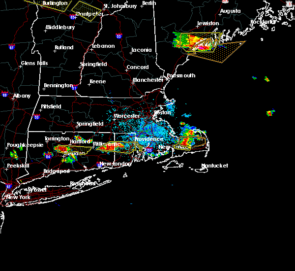 At 1000 pm edt, a severe thunderstorm was located near sandwich, or 8 miles northwest of barnstable, moving east at 30 mph (radar indicated). Hazards include 60 mph wind gusts and penny size hail. Expect damage to roofs. siding. and trees. Locations impacted include, barnstable and sandwich. At 1000 pm edt, a severe thunderstorm was located near sandwich, or 8 miles northwest of barnstable, moving east at 30 mph (radar indicated). Hazards include 60 mph wind gusts and penny size hail. Expect damage to roofs. siding. and trees. Locations impacted include, barnstable and sandwich.
|
| 7/22/2016 9:57 PM EDT |
 At 956 pm edt, a severe thunderstorm was located near sandwich, or 10 miles northwest of barnstable, moving east at 30 mph (radar indicated). Hazards include 60 mph wind gusts and penny size hail. Expect damage to roofs. siding. and trees. Locations impacted include, barnstable, sandwich and bourne. At 956 pm edt, a severe thunderstorm was located near sandwich, or 10 miles northwest of barnstable, moving east at 30 mph (radar indicated). Hazards include 60 mph wind gusts and penny size hail. Expect damage to roofs. siding. and trees. Locations impacted include, barnstable, sandwich and bourne.
|
| 7/22/2016 9:40 PM EDT |
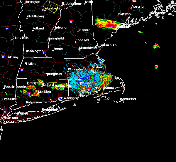 At 939 pm edt, a severe thunderstorm was located near wareham, or near plymouth, moving east at 30 mph (radar indicated). Hazards include 60 mph wind gusts and quarter size hail. Hail damage to vehicles is expected. Expect wind damage to roofs, siding, and trees. At 939 pm edt, a severe thunderstorm was located near wareham, or near plymouth, moving east at 30 mph (radar indicated). Hazards include 60 mph wind gusts and quarter size hail. Hail damage to vehicles is expected. Expect wind damage to roofs, siding, and trees.
|
| 7/1/2016 11:16 PM EDT |
 At 1115 pm edt, severe thunderstorms were located along a line extending from near oak bluffs to 20 miles south of edgartown, moving northeast at 50 mph (radar indicated). Hazards include 60 mph wind gusts. Expect damage to roofs. siding. And trees. At 1115 pm edt, severe thunderstorms were located along a line extending from near oak bluffs to 20 miles south of edgartown, moving northeast at 50 mph (radar indicated). Hazards include 60 mph wind gusts. Expect damage to roofs. siding. And trees.
|
| 10/16/2015 10:01 AM EDT |
 At 959 am edt, doppler radar indicated a severe thunderstorm capable of producing quarter size hail and damaging winds in excess of 60 mph. this storm was located near mashpee, or 8 miles southwest of barnstable, and was moving northeast at nearly 60 mph. At 959 am edt, doppler radar indicated a severe thunderstorm capable of producing quarter size hail and damaging winds in excess of 60 mph. this storm was located near mashpee, or 8 miles southwest of barnstable, and was moving northeast at nearly 60 mph.
|
| 10/16/2015 9:46 AM EDT |
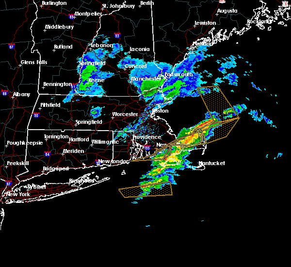 At 940 am edt, doppler radar indicated a cluster of severe thunderstormss capable of producing quarter size hail and damaging winds of 60 to 70 mph. this storm was centered over cape cod bay and will likely produce one or more swaths of damaging winds across truro, wellfleet, eastham, and orleans between 955 am and 1015 am. hail up to an inch in size is also possible. these storms may cause damage to moored boats including the wellfleet harbor area. the storms were moving rapidly northeast at 55 to 60 mph. locations impacted include, barnstable, brewster, provincetown, yarmouth, sandwich, dennis, orleans, eastham, wellfleet and truro. At 940 am edt, doppler radar indicated a cluster of severe thunderstormss capable of producing quarter size hail and damaging winds of 60 to 70 mph. this storm was centered over cape cod bay and will likely produce one or more swaths of damaging winds across truro, wellfleet, eastham, and orleans between 955 am and 1015 am. hail up to an inch in size is also possible. these storms may cause damage to moored boats including the wellfleet harbor area. the storms were moving rapidly northeast at 55 to 60 mph. locations impacted include, barnstable, brewster, provincetown, yarmouth, sandwich, dennis, orleans, eastham, wellfleet and truro.
|
| 10/16/2015 9:36 AM EDT |
 At 935 am edt, doppler radar indicated a severe thunderstorm capable of producing quarter size hail and damaging winds in excess of 60 mph. this storm was located near sandwich, or 7 miles north of barnstable, and was moving east at 65 mph. At 935 am edt, doppler radar indicated a severe thunderstorm capable of producing quarter size hail and damaging winds in excess of 60 mph. this storm was located near sandwich, or 7 miles north of barnstable, and was moving east at 65 mph.
|
| 8/4/2015 7:55 AM EDT |
 At 753 am edt, doppler radar indicated a line of severe thunderstorms capable of producing destructive winds up to 80 mph. these storms were located along a line extending from 11 miles northwest of provincetown to near dennis, moving east at 50 mph. this is a very dangerous situation. widespread significant wind damage is likely from provincetown to wellfleet. locations impacted include, barnstable, brewster, provincetown, yarmouth, dennis, harwich, chatham, orleans, eastham, wellfleet and truro. At 753 am edt, doppler radar indicated a line of severe thunderstorms capable of producing destructive winds up to 80 mph. these storms were located along a line extending from 11 miles northwest of provincetown to near dennis, moving east at 50 mph. this is a very dangerous situation. widespread significant wind damage is likely from provincetown to wellfleet. locations impacted include, barnstable, brewster, provincetown, yarmouth, dennis, harwich, chatham, orleans, eastham, wellfleet and truro.
|
| 8/4/2015 7:45 AM EDT |
 At 744 am edt, doppler radar indicated a line of severe thunderstorms capable of producing destructive winds in excess of 70 mph. these storms were located along a line extending from 13 miles northwest of provincetown to near barnstable, moving east at 45 mph. this is a dangerous situation. widespread wind damage is likely. locations impacted include, plymouth, barnstable, falmouth, brewster, provincetown, yarmouth, sandwich, bourne, dennis, mashpee, harwich, chatham, orleans, eastham, wellfleet, truro and hyannis. At 744 am edt, doppler radar indicated a line of severe thunderstorms capable of producing destructive winds in excess of 70 mph. these storms were located along a line extending from 13 miles northwest of provincetown to near barnstable, moving east at 45 mph. this is a dangerous situation. widespread wind damage is likely. locations impacted include, plymouth, barnstable, falmouth, brewster, provincetown, yarmouth, sandwich, bourne, dennis, mashpee, harwich, chatham, orleans, eastham, wellfleet, truro and hyannis.
|
| 8/4/2015 7:25 AM EDT |
 At 724 am edt, doppler radar indicated a severe thunderstorm capable of producing destructive winds in excess of 70 mph. this storm was located just west of falmouth, moving east at 50 mph. locations impacted include, plymouth, barnstable, falmouth, brewster, provincetown, yarmouth, sandwich, bourne, dennis, mashpee, harwich, chatham, orleans, eastham, wellfleet, truro and hyannis. At 724 am edt, doppler radar indicated a severe thunderstorm capable of producing destructive winds in excess of 70 mph. this storm was located just west of falmouth, moving east at 50 mph. locations impacted include, plymouth, barnstable, falmouth, brewster, provincetown, yarmouth, sandwich, bourne, dennis, mashpee, harwich, chatham, orleans, eastham, wellfleet, truro and hyannis.
|
| 8/4/2015 7:15 AM EDT |
 At 714 am edt, doppler radar indicated a severe thunderstorm capable of producing damaging winds in excess of 60 mph. this storm was located over fairhaven, or near new bedford, and was moving east at 50 mph. * some locations impacted include, plymouth, barnstable, falmouth, brewster, provincetown, yarmouth, sandwich, bourne, dennis, mashpee, harwich, chatham, orleans, eastham, wellfleet, truro and hyannis. At 714 am edt, doppler radar indicated a severe thunderstorm capable of producing damaging winds in excess of 60 mph. this storm was located over fairhaven, or near new bedford, and was moving east at 50 mph. * some locations impacted include, plymouth, barnstable, falmouth, brewster, provincetown, yarmouth, sandwich, bourne, dennis, mashpee, harwich, chatham, orleans, eastham, wellfleet, truro and hyannis.
|
| 7/1/2015 9:25 AM EDT |
 The tornado warning for southwestern barnstable county will expire at 930 am edt, the tornadic thunderstorm which prompted the warning has moved out of the area therefore the warning will be allowed to expire. The tornado warning for southwestern barnstable county will expire at 930 am edt, the tornadic thunderstorm which prompted the warning has moved out of the area therefore the warning will be allowed to expire.
|
| 7/1/2015 8:53 AM EDT |
 At 853 am edt, doppler radar indicated a severe squall line capable of producing a tornado as well as damaging straight line winds. these dangerous storms were located near falmouth, and was moving northeast at 40 mph. * some locations impacted include, barnstable, falmouth, yarmouth, mashpee and hyannis. At 853 am edt, doppler radar indicated a severe squall line capable of producing a tornado as well as damaging straight line winds. these dangerous storms were located near falmouth, and was moving northeast at 40 mph. * some locations impacted include, barnstable, falmouth, yarmouth, mashpee and hyannis.
|
| 7/1/2015 8:49 AM EDT |
 At 848 am edt, doppler radar indicated a severe thunderstorm capable of producing damaging winds in excess of 60 mph. this storm was located near falmouth, and was moving northeast at 45 mph. * some locations impacted include, barnstable, falmouth, yarmouth, sandwich, bourne, dennis, mashpee and hyannis. At 848 am edt, doppler radar indicated a severe thunderstorm capable of producing damaging winds in excess of 60 mph. this storm was located near falmouth, and was moving northeast at 45 mph. * some locations impacted include, barnstable, falmouth, yarmouth, sandwich, bourne, dennis, mashpee and hyannis.
|
| 6/23/2015 9:58 PM EDT |
 At 957 pm edt, doppler radar continued to indicate a cluster of severe thunderstorms capable of producing damaging winds in excess of 60 mph moving east at 35 mph across the eastern half of cape cod. in addition, within the last 10 minutes, hyannis airport reported a 71 mph gust! numerous reports have been gathered with this storm of wind gusts on average of around 55 to 65 mph. seek shelter immediately! locations impacted include, barnstable, brewster, yarmouth, dennis, harwich, chatham, orleans, eastham, wellfleet and hyannis. At 957 pm edt, doppler radar continued to indicate a cluster of severe thunderstorms capable of producing damaging winds in excess of 60 mph moving east at 35 mph across the eastern half of cape cod. in addition, within the last 10 minutes, hyannis airport reported a 71 mph gust! numerous reports have been gathered with this storm of wind gusts on average of around 55 to 65 mph. seek shelter immediately! locations impacted include, barnstable, brewster, yarmouth, dennis, harwich, chatham, orleans, eastham, wellfleet and hyannis.
|
| 6/23/2015 9:53 PM EDT | Multiple wires down on rte 28 near rotary blocking raod in barnstable county MA, 5 miles W of Barnstable Town, MA |
| 6/23/2015 9:53 PM EDT | Wires down on sea street in barnstable county MA, 5 miles W of Barnstable Town, MA |
| 6/23/2015 9:50 PM EDT | Numerous trees down at pine and eilliot street in barnstable county MA, 1.5 miles WNW of Barnstable Town, MA |
| 6/23/2015 9:48 PM EDT | Tree down os sea view ave in barnstable county MA, 2.2 miles NNE of Barnstable Town, MA |
| 6/23/2015 9:47 PM EDT | Tree down blocking main street at old mill road in barnstable county MA, 4.8 miles SW of Barnstable Town, MA |
| 6/23/2015 9:46 PM EDT |
 At 944 pm edt, doppler radar indicated a cluster of severe thunderstorms across the western cape capable of producing damaging winds in excess of 60 mph moving east across the cape at 30 mph. in addition, within the last 10 minutes, numerous locations across the western cape have reported wind gusts of around 55 to 65 mph including west falmouth, otis airforce base, and woods hole. locations impacted include, barnstable, falmouth, brewster, yarmouth, sandwich, bourne, dennis, mashpee, harwich, chatham, orleans, eastham, wellfleet and hyannis. At 944 pm edt, doppler radar indicated a cluster of severe thunderstorms across the western cape capable of producing damaging winds in excess of 60 mph moving east across the cape at 30 mph. in addition, within the last 10 minutes, numerous locations across the western cape have reported wind gusts of around 55 to 65 mph including west falmouth, otis airforce base, and woods hole. locations impacted include, barnstable, falmouth, brewster, yarmouth, sandwich, bourne, dennis, mashpee, harwich, chatham, orleans, eastham, wellfleet and hyannis.
|
| 6/23/2015 9:30 PM EDT |
 At 930 pm edt, doppler radar indicated a line of severe thunderstorms capable of producing damaging winds in excess of 60 mph. these storms were located along a line extending from near bourne to falmouth to tisbury to near gosnold, and was moving east at 40 mph. * some locations impacted include, barnstable, falmouth, brewster, yarmouth, sandwich, bourne, dennis, mashpee, harwich, chatham, orleans, eastham, wellfleet and hyannis. At 930 pm edt, doppler radar indicated a line of severe thunderstorms capable of producing damaging winds in excess of 60 mph. these storms were located along a line extending from near bourne to falmouth to tisbury to near gosnold, and was moving east at 40 mph. * some locations impacted include, barnstable, falmouth, brewster, yarmouth, sandwich, bourne, dennis, mashpee, harwich, chatham, orleans, eastham, wellfleet and hyannis.
|
| 1/1/0001 12:00 AM | Quarter sized hail reported 5.5 miles E of Barnstable Town, MA |
| 1/1/0001 12:00 AM | Quarter sized hail reported 5.5 miles E of Barnstable Town, MA |
Hail Maps for Barnstable Town, MA


Connect with Interactive Hail Maps