

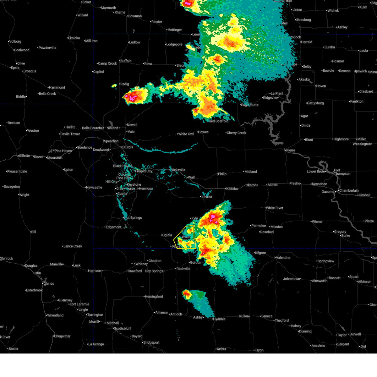
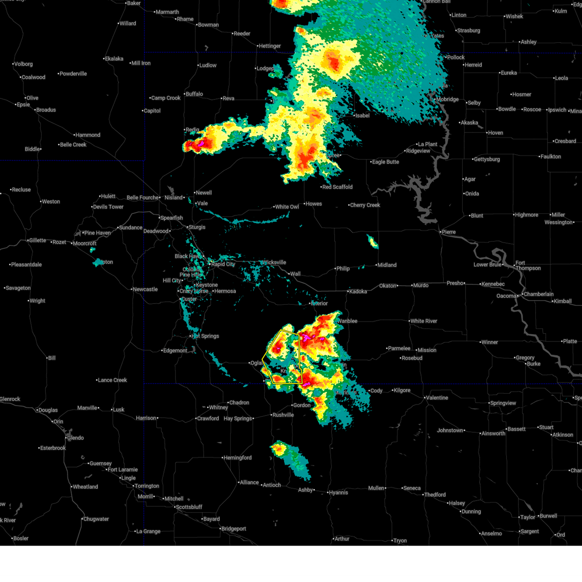
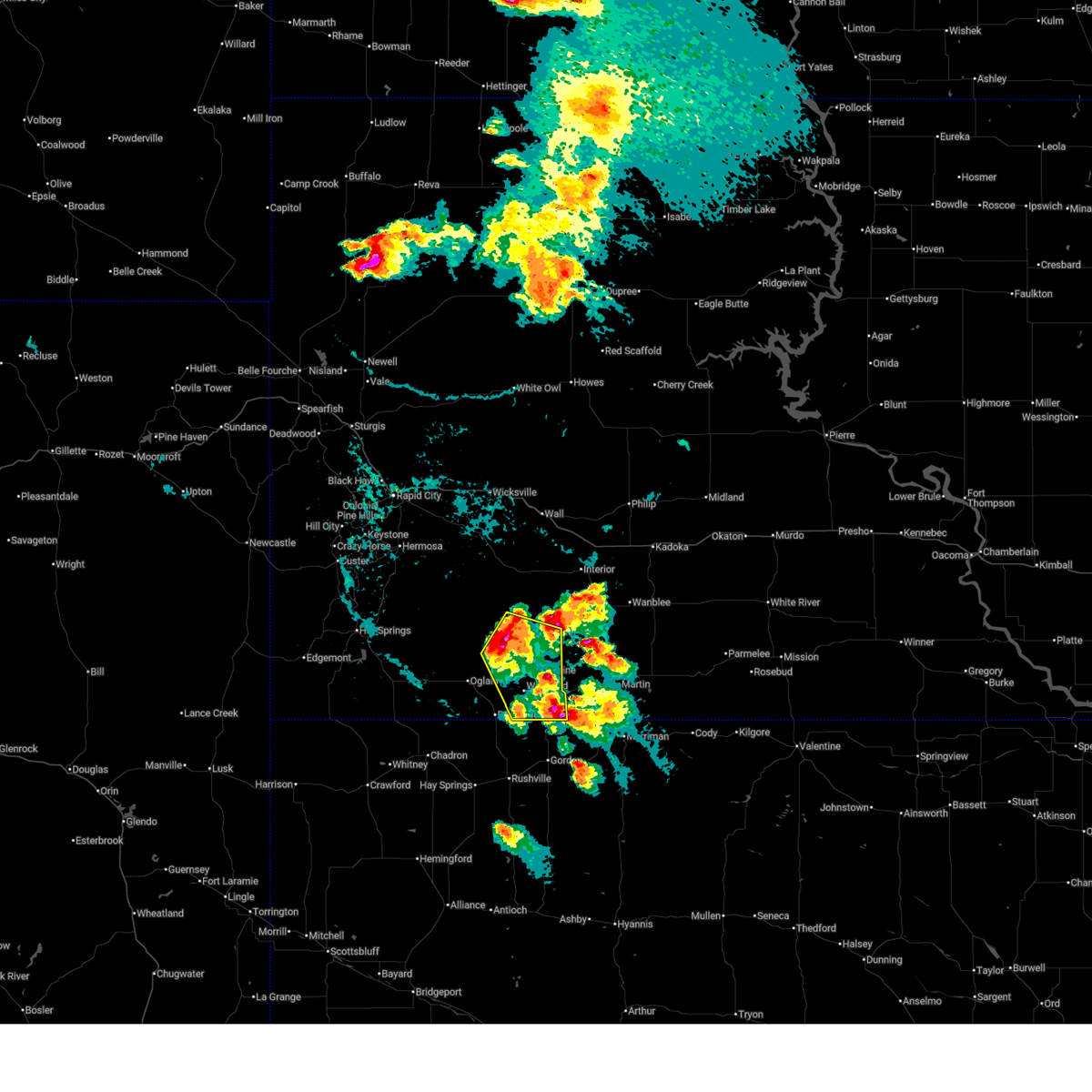
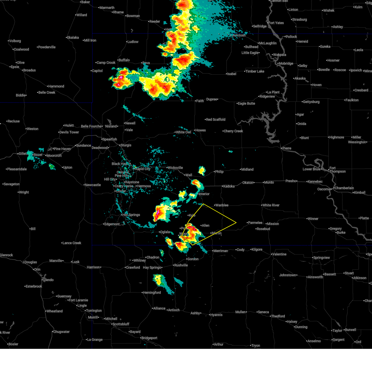
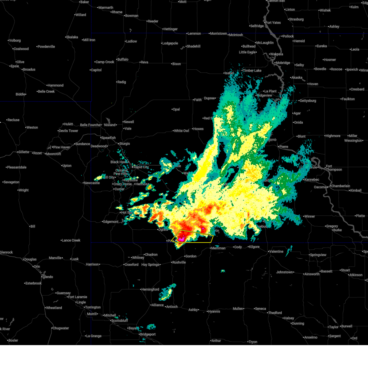
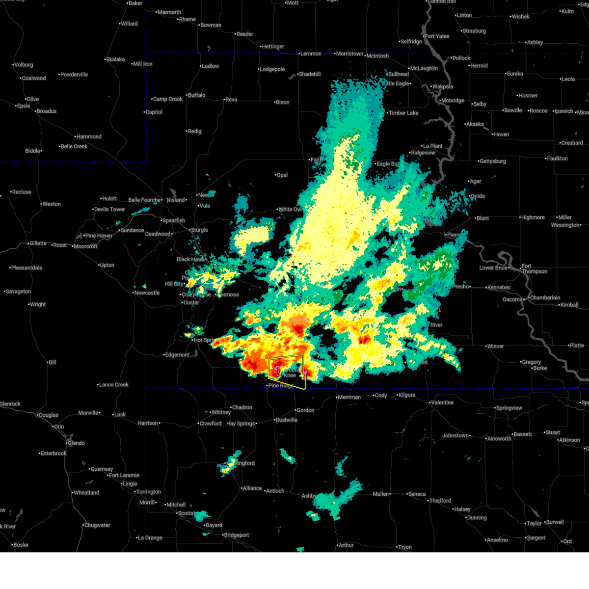
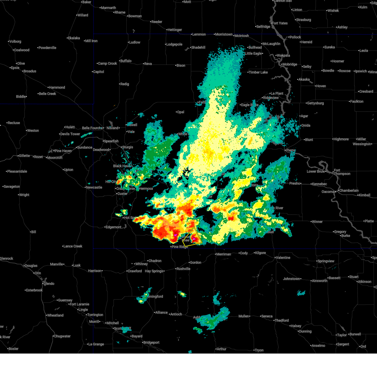
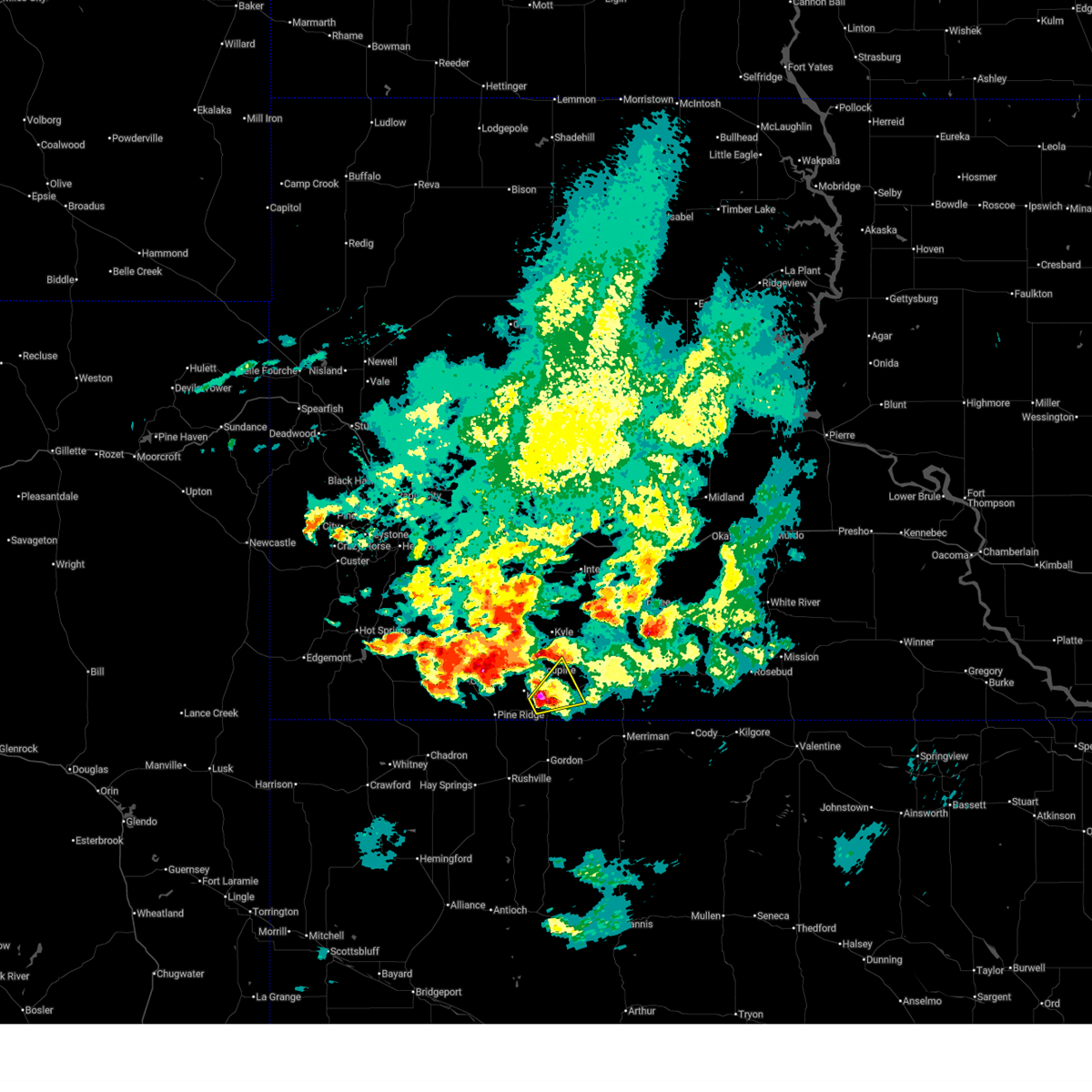
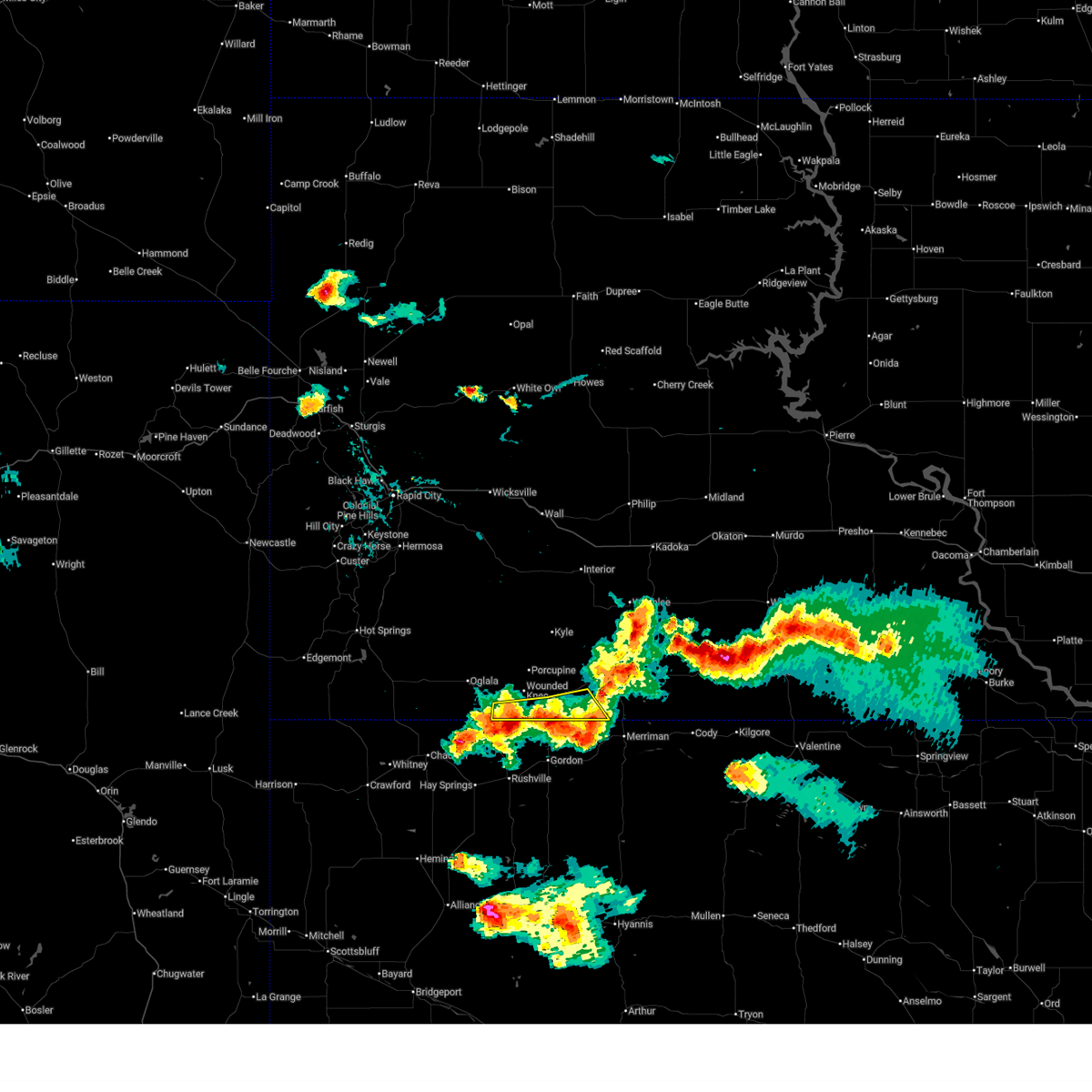
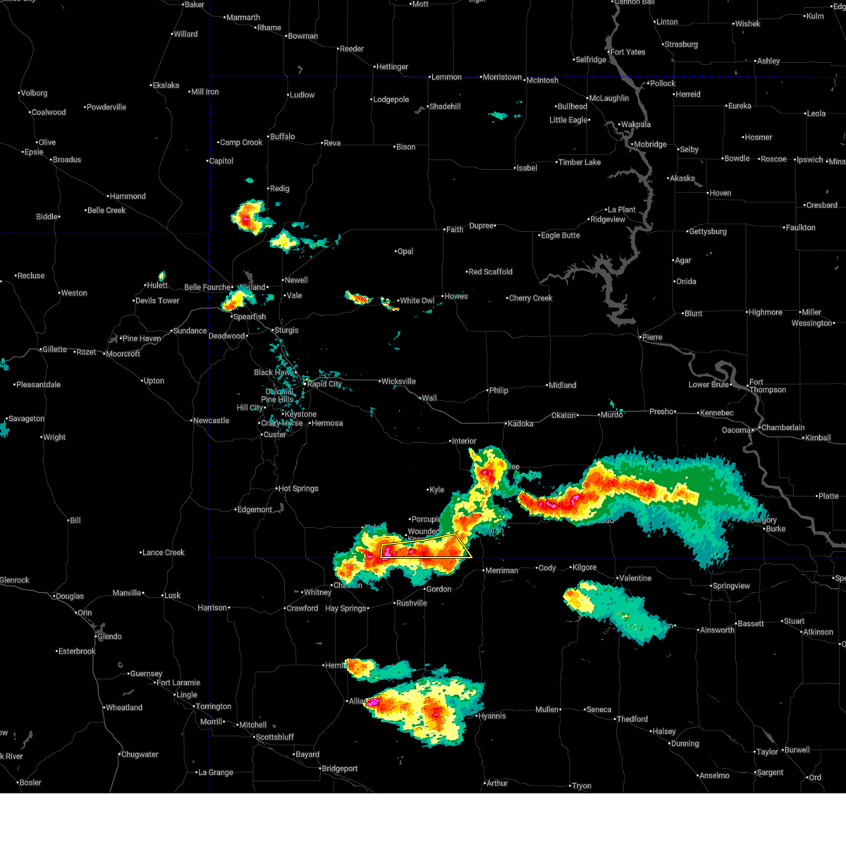
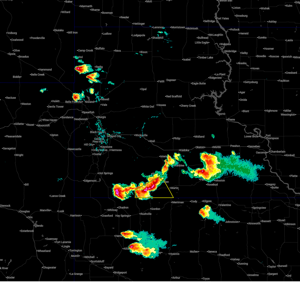
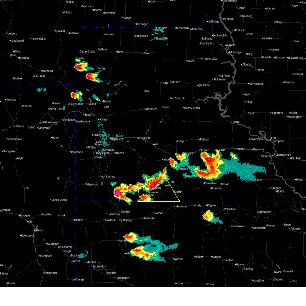
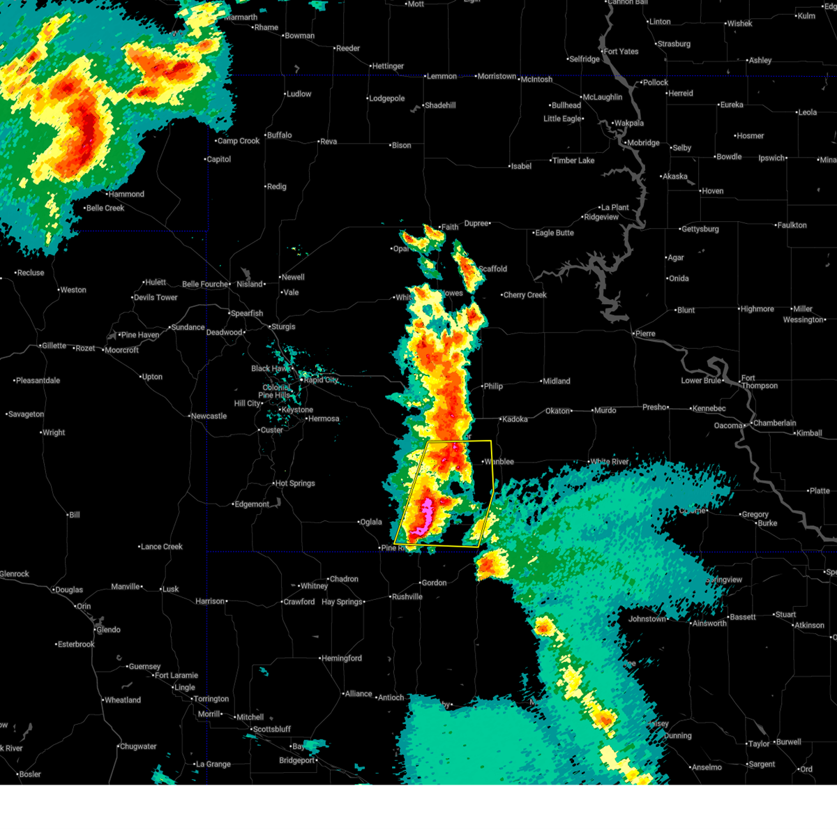
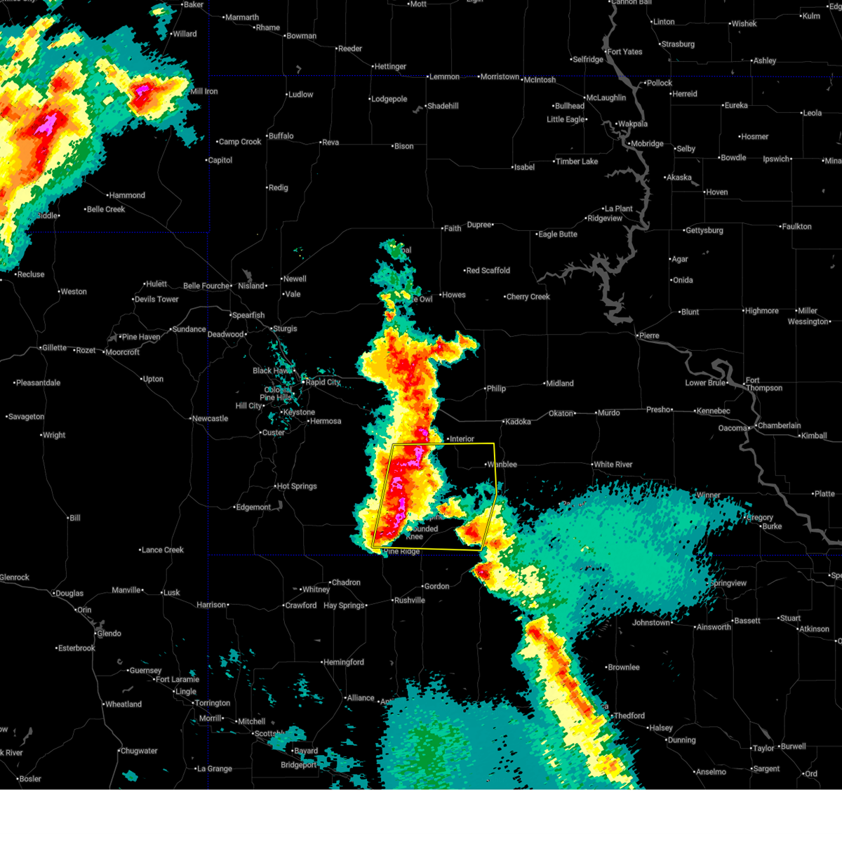
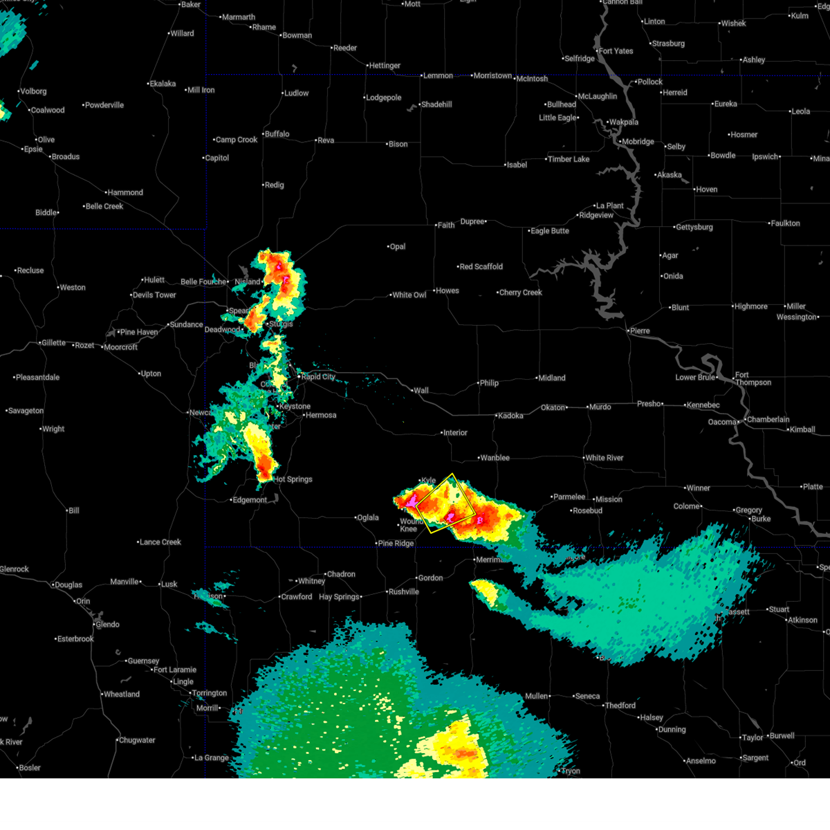
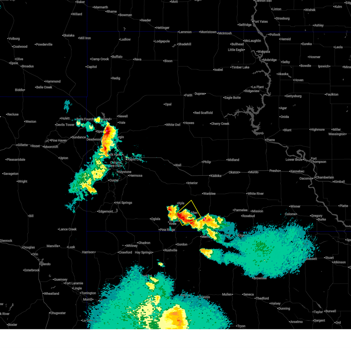
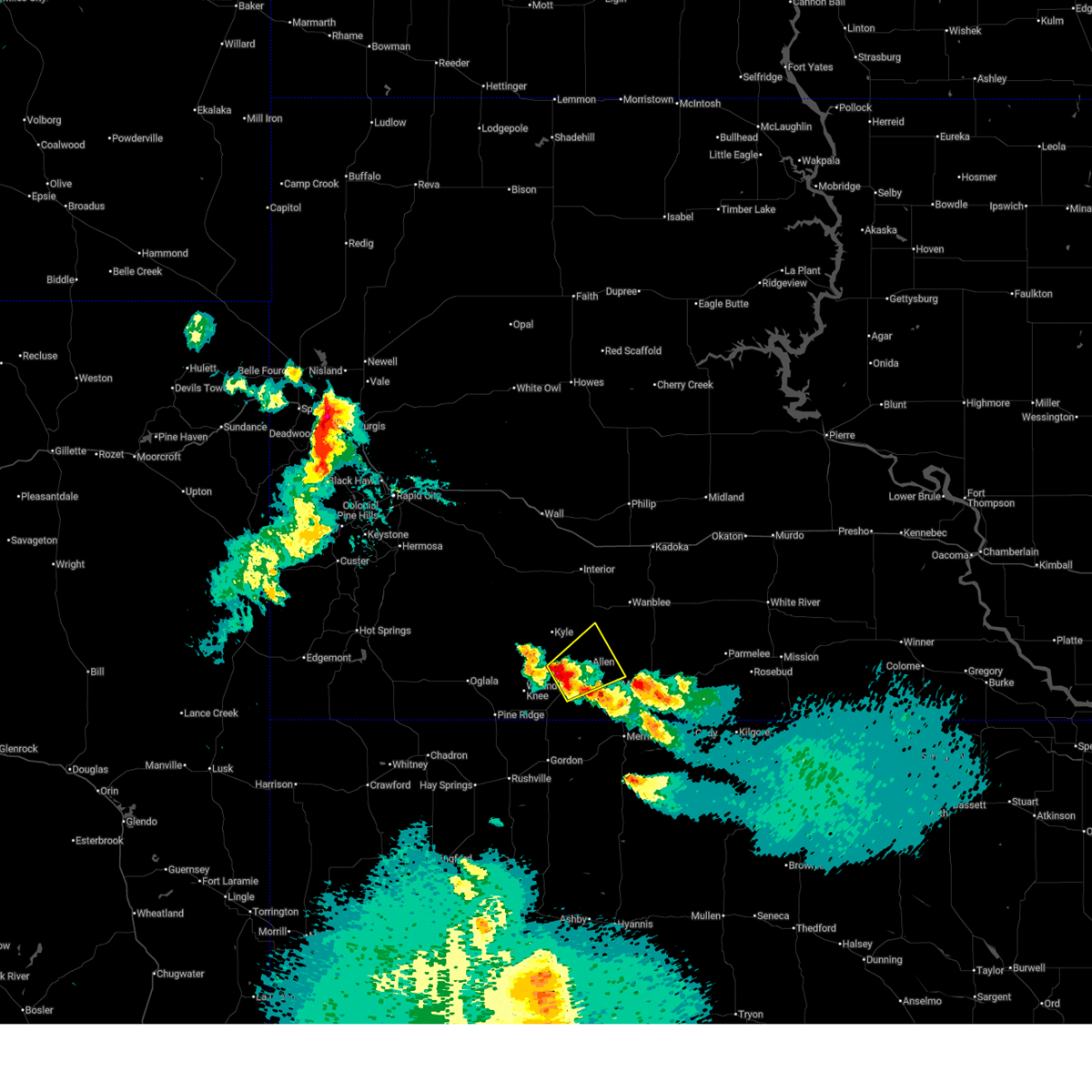
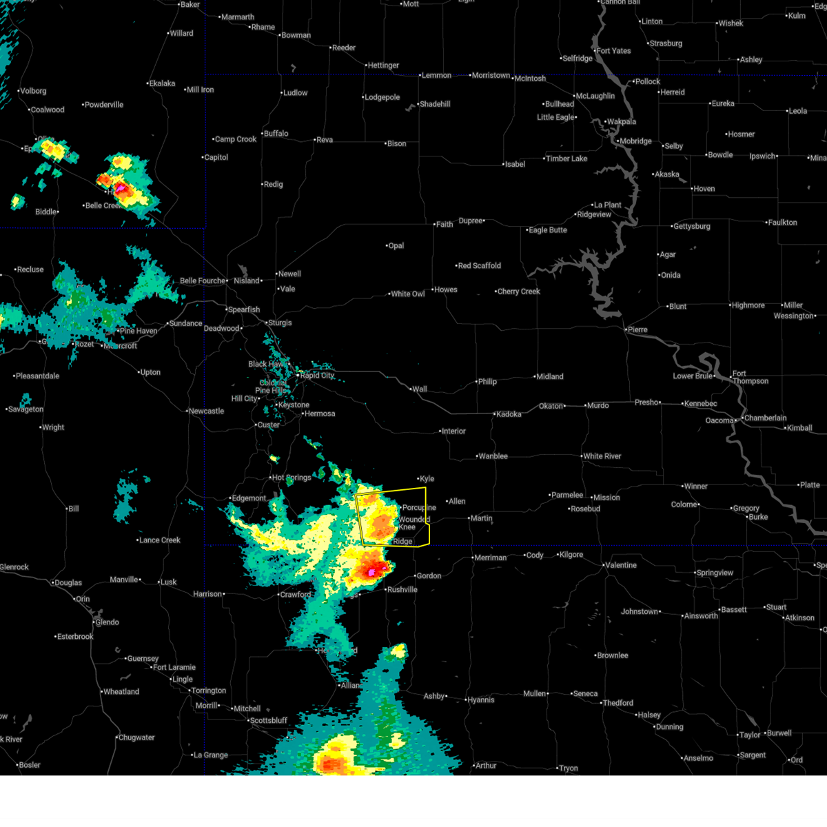
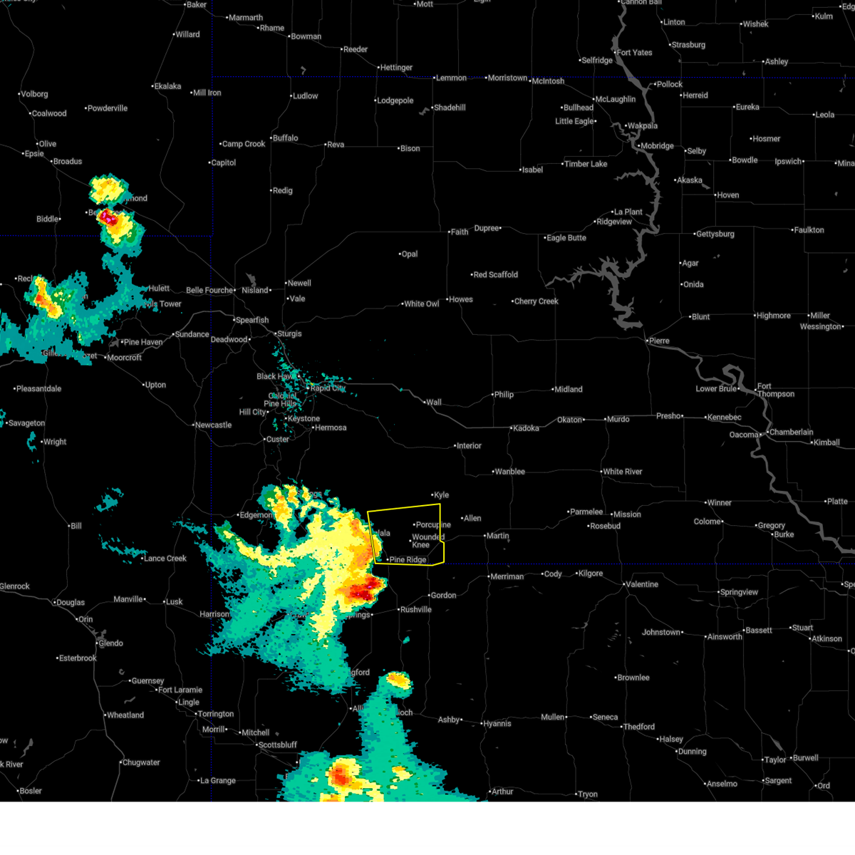
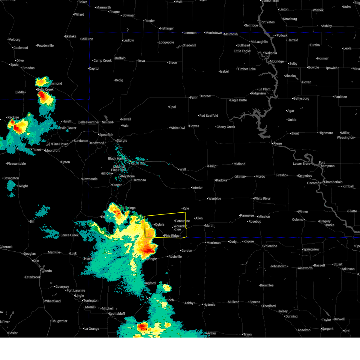
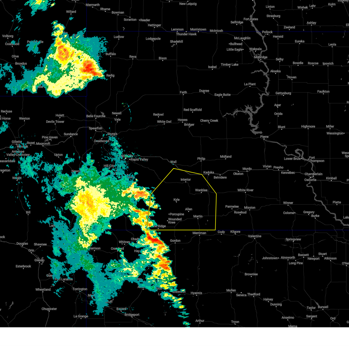
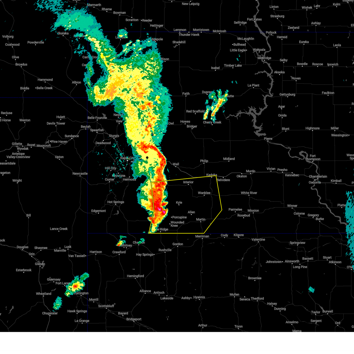
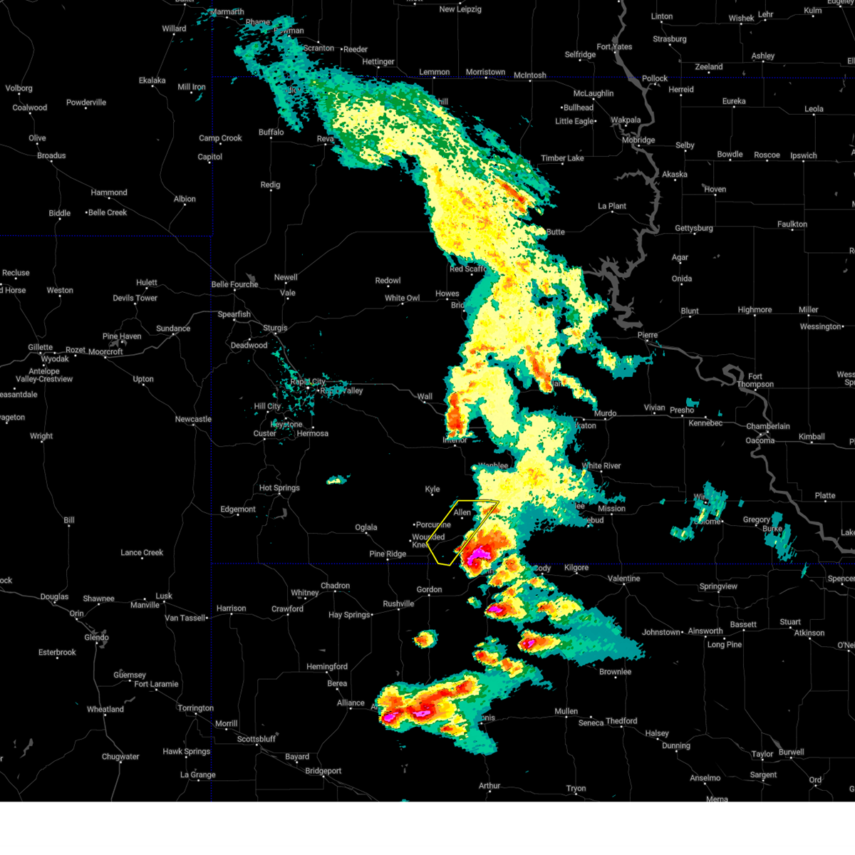
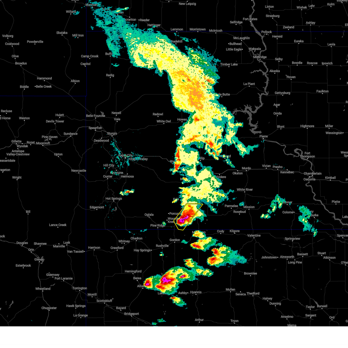
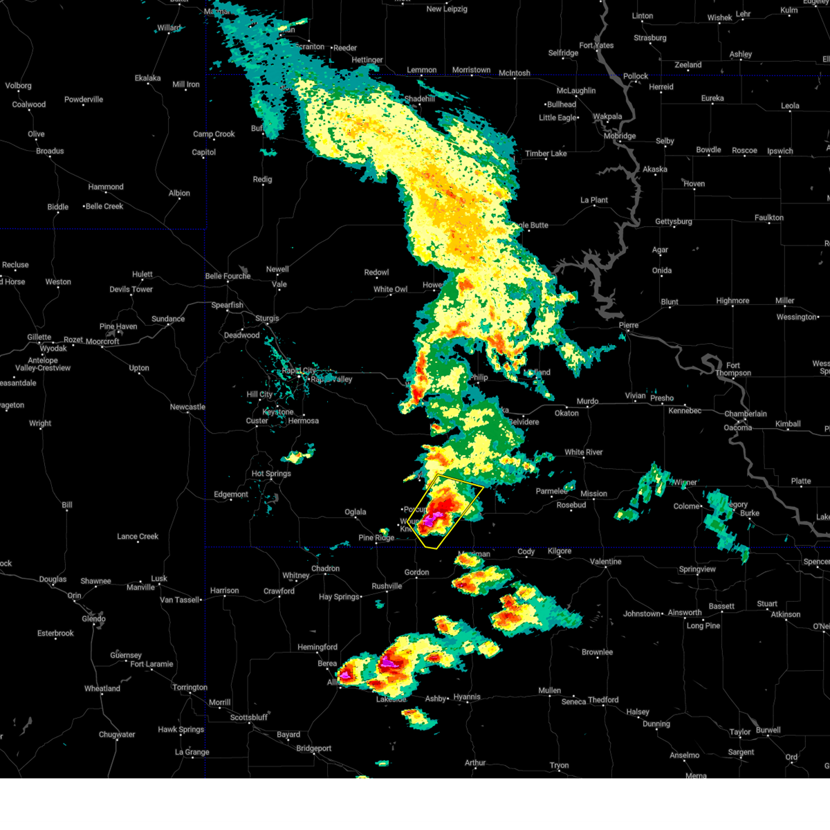
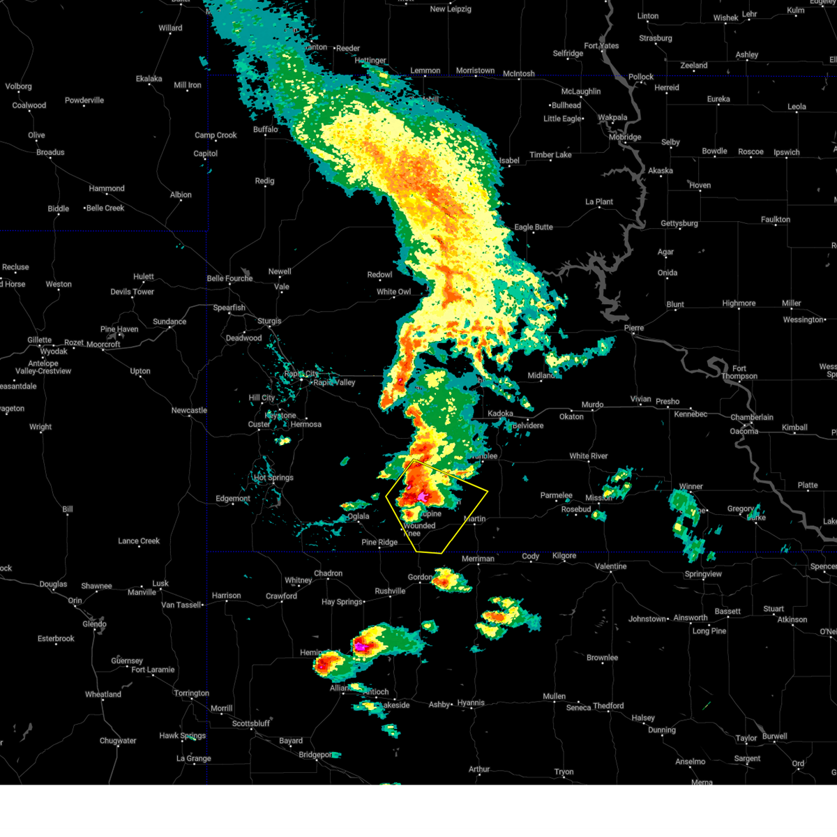
Hail Map for Batesland, SD
The Batesland, SD area has had 14 reports of on-the-ground hail by trained spotters, and has been under severe weather warnings 45 times during the past 12 months. Doppler radar has detected hail at or near Batesland, SD on 96 occasions, including 13 occasions during the past year.
| Name: | Batesland, SD |
| Where Located: | 80.6 miles WNW of Valentine, NE |
| Map: | Google Map for Batesland, SD |
| Population: | 108 |
| Housing Units: | 33 |
| More Info: | Search Google for Batesland, SD |
4
The Top Recent Hail Date for Batesland, SD is Sunday, August 11, 2024 (3rd out of 96)

Hail and Wind Damage Spotted near Batesland, SD
| Date / Time | Report Details |
|---|---|
| 7/9/2025 4:50 PM MDT |
 the severe thunderstorm warning has been cancelled and is no longer in effect the severe thunderstorm warning has been cancelled and is no longer in effect
|
| 7/9/2025 4:43 PM MDT | At 443 pm mdt, a severe thunderstorm was located 5 miles east of porcupine, or 21 miles northeast of pine ridge, moving southeast at 35 mph (radar indicated). Hazards include 60 mph wind gusts. Expect damage to roofs, siding, and trees. Locations impacted include, porcupine, wounded knee, batesland, wakpamni, wolf creek housing, porcupine butte housing, and southern pine ridge reservation. |
| 7/9/2025 4:29 PM MDT |
 At 428 pm mdt, a severe thunderstorm was located over evergreen, or 20 miles northeast of pine ridge, moving southeast at 20 mph (radar indicated). Hazards include 60 mph wind gusts and quarter size hail. Hail damage to vehicles is expected. expect wind damage to roofs, siding, and trees. Locations impacted include, porcupine, kyle, manderson, wounded knee, batesland, wakpamni, kyle north route housing, sharps corner, evergreen, wolf creek housing, porcupine butte housing, and southern pine ridge reservation. At 428 pm mdt, a severe thunderstorm was located over evergreen, or 20 miles northeast of pine ridge, moving southeast at 20 mph (radar indicated). Hazards include 60 mph wind gusts and quarter size hail. Hail damage to vehicles is expected. expect wind damage to roofs, siding, and trees. Locations impacted include, porcupine, kyle, manderson, wounded knee, batesland, wakpamni, kyle north route housing, sharps corner, evergreen, wolf creek housing, porcupine butte housing, and southern pine ridge reservation.
|
| 7/9/2025 4:18 PM MDT |
 At 418 pm mdt, a severe thunderstorm was located near goose neck housing, or 21 miles north of pine ridge, moving southeast at 30 mph (radar indicated). Hazards include 60 mph wind gusts and quarter size hail. Hail damage to vehicles is expected. expect wind damage to roofs, siding, and trees. Locations impacted include, porcupine, kyle, manderson, wounded knee, batesland, lonesome valley, goose neck housing, thunder valley, wakpamni, rockyford, sharps corner, kyle north route housing, evergreen, wolf creek housing, porcupine butte housing, and southern pine ridge reservation. At 418 pm mdt, a severe thunderstorm was located near goose neck housing, or 21 miles north of pine ridge, moving southeast at 30 mph (radar indicated). Hazards include 60 mph wind gusts and quarter size hail. Hail damage to vehicles is expected. expect wind damage to roofs, siding, and trees. Locations impacted include, porcupine, kyle, manderson, wounded knee, batesland, lonesome valley, goose neck housing, thunder valley, wakpamni, rockyford, sharps corner, kyle north route housing, evergreen, wolf creek housing, porcupine butte housing, and southern pine ridge reservation.
|
| 7/9/2025 3:59 PM MDT | Storm damage reported in bennett county SD, 0.2 miles SW of Batesland, SD |
| 7/9/2025 3:57 PM MDT | Svrunr the national weather service in rapid city has issued a * severe thunderstorm warning for, oglala lakota county in southwestern south dakota, * until 500 pm mdt. * at 357 pm mdt, a severe thunderstorm was located 7 miles southwest of lonesome valley, or 22 miles north of pine ridge, moving southeast at 20 mph (radar indicated). Hazards include 60 mph wind gusts and quarter size hail. Hail damage to vehicles is expected. Expect wind damage to roofs, siding, and trees. |
| 7/9/2025 3:45 PM MDT |
 Svrunr the national weather service in rapid city has issued a * severe thunderstorm warning for, southeastern oglala lakota county in southwestern south dakota, southwestern jackson county in southwestern south dakota, northwestern bennett county in southwestern south dakota, * until 430 pm mdt. * at 344 pm mdt, a severe thunderstorm was located near allen, or 13 miles northwest of martin, and and another storm was near batesland. both storms were moving northeast at 30 mph (radar indicated). Hazards include 60 mph wind gusts and quarter size hail. Hail damage to vehicles is expected. Expect wind damage to roofs, siding, and trees. Svrunr the national weather service in rapid city has issued a * severe thunderstorm warning for, southeastern oglala lakota county in southwestern south dakota, southwestern jackson county in southwestern south dakota, northwestern bennett county in southwestern south dakota, * until 430 pm mdt. * at 344 pm mdt, a severe thunderstorm was located near allen, or 13 miles northwest of martin, and and another storm was near batesland. both storms were moving northeast at 30 mph (radar indicated). Hazards include 60 mph wind gusts and quarter size hail. Hail damage to vehicles is expected. Expect wind damage to roofs, siding, and trees.
|
| 7/6/2025 6:31 AM MDT |
 Svrunr the national weather service in rapid city has issued a * severe thunderstorm warning for, southeastern oglala lakota county in southwestern south dakota, southwestern bennett county in southwestern south dakota, * until 730 am mdt. * at 630 am mdt, a severe thunderstorm was located near wakpamni, or 16 miles north of gordon, moving east at 30 mph (radar indicated). Hazards include 60 mph wind gusts and half dollar size hail. Hail damage to vehicles is expected. Expect wind damage to roofs, siding, and trees. Svrunr the national weather service in rapid city has issued a * severe thunderstorm warning for, southeastern oglala lakota county in southwestern south dakota, southwestern bennett county in southwestern south dakota, * until 730 am mdt. * at 630 am mdt, a severe thunderstorm was located near wakpamni, or 16 miles north of gordon, moving east at 30 mph (radar indicated). Hazards include 60 mph wind gusts and half dollar size hail. Hail damage to vehicles is expected. Expect wind damage to roofs, siding, and trees.
|
| 7/6/2025 5:48 AM MDT |
 Svrunr the national weather service in rapid city has issued a * severe thunderstorm warning for, southeastern oglala lakota county in southwestern south dakota, * until 630 am mdt. * at 547 am mdt, a severe thunderstorm was located near wounded knee, or 12 miles northeast of pine ridge, moving east at 15 mph (radar indicated). Hazards include 60 mph wind gusts and half dollar size hail. Hail damage to vehicles is expected. Expect wind damage to roofs, siding, and trees. Svrunr the national weather service in rapid city has issued a * severe thunderstorm warning for, southeastern oglala lakota county in southwestern south dakota, * until 630 am mdt. * at 547 am mdt, a severe thunderstorm was located near wounded knee, or 12 miles northeast of pine ridge, moving east at 15 mph (radar indicated). Hazards include 60 mph wind gusts and half dollar size hail. Hail damage to vehicles is expected. Expect wind damage to roofs, siding, and trees.
|
| 7/6/2025 5:42 AM MDT |
 The storm which prompted the warning has weakened below severe limits, and has exited the warned area. therefore, the warning will be allowed to expire. The storm which prompted the warning has weakened below severe limits, and has exited the warned area. therefore, the warning will be allowed to expire.
|
| 7/6/2025 5:21 AM MDT |
 Svrunr the national weather service in rapid city has issued a * severe thunderstorm warning for, southeastern oglala lakota county in southwestern south dakota, west central bennett county in southwestern south dakota, * until 545 am mdt. * at 520 am mdt, a severe thunderstorm was located 6 miles west of batesland, or 17 miles east of pine ridge, moving northeast at 15 mph (radar indicated). Hazards include 60 mph wind gusts and quarter size hail. Hail damage to vehicles is expected. Expect wind damage to roofs, siding, and trees. Svrunr the national weather service in rapid city has issued a * severe thunderstorm warning for, southeastern oglala lakota county in southwestern south dakota, west central bennett county in southwestern south dakota, * until 545 am mdt. * at 520 am mdt, a severe thunderstorm was located 6 miles west of batesland, or 17 miles east of pine ridge, moving northeast at 15 mph (radar indicated). Hazards include 60 mph wind gusts and quarter size hail. Hail damage to vehicles is expected. Expect wind damage to roofs, siding, and trees.
|
| 7/1/2025 7:40 PM MDT |
 The storms which prompted the warning have moved out of the area. therefore, the warning will be allowed to expire. however, gusty winds and heavy rain are still possible with these thunderstorms. a severe thunderstorm watch remains in effect until 1100 pm mdt for southwestern south dakota. The storms which prompted the warning have moved out of the area. therefore, the warning will be allowed to expire. however, gusty winds and heavy rain are still possible with these thunderstorms. a severe thunderstorm watch remains in effect until 1100 pm mdt for southwestern south dakota.
|
| 7/1/2025 7:27 PM MDT |
 At 727 pm mdt, severe thunderstorms were located along a line extending from 8 miles southeast of batesland to 5 miles west of wakpamni to 2 miles east of pine ridge, moving southeast at 25 mph (radar indicated). Hazards include 60 mph wind gusts and quarter size hail. Hail damage to vehicles is expected. expect wind damage to roofs, siding, and trees. Locations impacted include, pine ridge, wolf creek housing, and wakpamni. At 727 pm mdt, severe thunderstorms were located along a line extending from 8 miles southeast of batesland to 5 miles west of wakpamni to 2 miles east of pine ridge, moving southeast at 25 mph (radar indicated). Hazards include 60 mph wind gusts and quarter size hail. Hail damage to vehicles is expected. expect wind damage to roofs, siding, and trees. Locations impacted include, pine ridge, wolf creek housing, and wakpamni.
|
| 7/1/2025 6:57 PM MDT | Storm damage reported in oglala lakota county SD, 8 miles NE of Batesland, SD |
| 7/1/2025 6:56 PM MDT |
 At 656 pm mdt, severe thunderstorms were located along a line extending from 5 miles southwest of yellow bear canyon to 3 miles southeast of wounded knee, moving south at 35 mph (radar indicated). Hazards include 70 mph wind gusts and ping pong ball size hail. People and animals outdoors will be injured. expect hail damage to roofs, siding, windows, and vehicles. expect considerable tree damage. wind damage is also likely to mobile homes, roofs, and outbuildings. Locations impacted include, pine ridge, porcupine, allen, wounded knee, batesland, wakpamni, swett, wolf creek housing, porcupine butte housing, yellow bear canyon, and southern pine ridge reservation. At 656 pm mdt, severe thunderstorms were located along a line extending from 5 miles southwest of yellow bear canyon to 3 miles southeast of wounded knee, moving south at 35 mph (radar indicated). Hazards include 70 mph wind gusts and ping pong ball size hail. People and animals outdoors will be injured. expect hail damage to roofs, siding, windows, and vehicles. expect considerable tree damage. wind damage is also likely to mobile homes, roofs, and outbuildings. Locations impacted include, pine ridge, porcupine, allen, wounded knee, batesland, wakpamni, swett, wolf creek housing, porcupine butte housing, yellow bear canyon, and southern pine ridge reservation.
|
| 7/1/2025 6:43 PM MDT |
 Svrunr the national weather service in rapid city has issued a * severe thunderstorm warning for, southeastern oglala lakota county in southwestern south dakota, western bennett county in southwestern south dakota, * until 745 pm mdt. * at 643 pm mdt, severe thunderstorms were located along a line extending from 2 miles northwest of yellow bear canyon to 3 miles east of porcupine, moving south at 25 mph (radar indicated). Hazards include 60 mph wind gusts and half dollar size hail. Hail damage to vehicles is expected. Expect wind damage to roofs, siding, and trees. Svrunr the national weather service in rapid city has issued a * severe thunderstorm warning for, southeastern oglala lakota county in southwestern south dakota, western bennett county in southwestern south dakota, * until 745 pm mdt. * at 643 pm mdt, severe thunderstorms were located along a line extending from 2 miles northwest of yellow bear canyon to 3 miles east of porcupine, moving south at 25 mph (radar indicated). Hazards include 60 mph wind gusts and half dollar size hail. Hail damage to vehicles is expected. Expect wind damage to roofs, siding, and trees.
|
| 6/29/2025 5:51 PM MDT |
 The storm which prompted the warning has moved out of the area. therefore, the warning will be allowed to expire. however, small hail and gusty winds are still possible with this thunderstorm. a severe thunderstorm watch remains in effect until 900 pm mdt for southwestern south dakota. The storm which prompted the warning has moved out of the area. therefore, the warning will be allowed to expire. however, small hail and gusty winds are still possible with this thunderstorm. a severe thunderstorm watch remains in effect until 900 pm mdt for southwestern south dakota.
|
| 6/29/2025 5:26 PM MDT |
 At 526 pm mdt, a severe thunderstorm was located 4 miles southeast of porcupine butte housing, or 16 miles northeast of pine ridge, moving southeast at 35 mph (radar indicated). Hazards include ping pong ball size hail and 60 mph wind gusts. People and animals outdoors will be injured. expect hail damage to roofs, siding, windows, and vehicles. expect wind damage to roofs, siding, and trees. Locations impacted include, porcupine, wounded knee, batesland, porcupine butte housing, and wakpamni. At 526 pm mdt, a severe thunderstorm was located 4 miles southeast of porcupine butte housing, or 16 miles northeast of pine ridge, moving southeast at 35 mph (radar indicated). Hazards include ping pong ball size hail and 60 mph wind gusts. People and animals outdoors will be injured. expect hail damage to roofs, siding, windows, and vehicles. expect wind damage to roofs, siding, and trees. Locations impacted include, porcupine, wounded knee, batesland, porcupine butte housing, and wakpamni.
|
| 6/29/2025 5:00 PM MDT |
 Svrunr the national weather service in rapid city has issued a * severe thunderstorm warning for, southeastern oglala lakota county in southwestern south dakota, southwestern bennett county in southwestern south dakota, * until 600 pm mdt. * at 500 pm mdt, a severe thunderstorm was located over manderson, or 16 miles north of pine ridge, moving southeast at 35 mph (radar indicated). Hazards include golf ball size hail and 60 mph wind gusts. People and animals outdoors will be injured. expect hail damage to roofs, siding, windows, and vehicles. Expect wind damage to roofs, siding, and trees. Svrunr the national weather service in rapid city has issued a * severe thunderstorm warning for, southeastern oglala lakota county in southwestern south dakota, southwestern bennett county in southwestern south dakota, * until 600 pm mdt. * at 500 pm mdt, a severe thunderstorm was located over manderson, or 16 miles north of pine ridge, moving southeast at 35 mph (radar indicated). Hazards include golf ball size hail and 60 mph wind gusts. People and animals outdoors will be injured. expect hail damage to roofs, siding, windows, and vehicles. Expect wind damage to roofs, siding, and trees.
|
| 6/28/2025 10:50 PM MDT |
 Svrunr the national weather service in rapid city has issued a * severe thunderstorm warning for, southeastern oglala lakota county in southwestern south dakota, southern jackson county in southwestern south dakota, bennett county in southwestern south dakota, * until 1130 pm mdt. * at 1049 pm mdt, severe thunderstorms were located along a line extending from 3 miles east of potato creek to 3 miles northwest of allen to 3 miles north of batesland, moving east at 55 mph. wind gusts of 67 mph were recently measured near porcupine (automated observations). Hazards include 70 mph wind gusts and penny size hail. Expect considerable tree damage. Damage is likely to mobile homes, roofs, and outbuildings. Svrunr the national weather service in rapid city has issued a * severe thunderstorm warning for, southeastern oglala lakota county in southwestern south dakota, southern jackson county in southwestern south dakota, bennett county in southwestern south dakota, * until 1130 pm mdt. * at 1049 pm mdt, severe thunderstorms were located along a line extending from 3 miles east of potato creek to 3 miles northwest of allen to 3 miles north of batesland, moving east at 55 mph. wind gusts of 67 mph were recently measured near porcupine (automated observations). Hazards include 70 mph wind gusts and penny size hail. Expect considerable tree damage. Damage is likely to mobile homes, roofs, and outbuildings.
|
| 6/15/2025 10:16 PM MDT |
 the severe thunderstorm warning has been cancelled and is no longer in effect the severe thunderstorm warning has been cancelled and is no longer in effect
|
| 6/15/2025 10:16 PM MDT |
 At 1015 pm mdt, severe thunderstorms were located along a line extending from 6 miles southeast of cedar pass to batesland, moving east at 40 mph (radar indicated). Hazards include ping pong ball size hail and 60 mph wind gusts. People and animals outdoors will be injured. expect hail damage to roofs, siding, windows, and vehicles. expect wind damage to roofs, siding, and trees. these severe storms will be near, wanblee, allen, swett, hisle, southern yellow bear canyon, snake butte, and eagle nest butte around 1020 pm mdt. martin, lacreek north housing, and sunrise housing around 1025 pm mdt. southwestern lacreek wildlife refuge around 1030 pm mdt. Other locations impacted by these severe thunderstorms include pine ridge reservation. At 1015 pm mdt, severe thunderstorms were located along a line extending from 6 miles southeast of cedar pass to batesland, moving east at 40 mph (radar indicated). Hazards include ping pong ball size hail and 60 mph wind gusts. People and animals outdoors will be injured. expect hail damage to roofs, siding, windows, and vehicles. expect wind damage to roofs, siding, and trees. these severe storms will be near, wanblee, allen, swett, hisle, southern yellow bear canyon, snake butte, and eagle nest butte around 1020 pm mdt. martin, lacreek north housing, and sunrise housing around 1025 pm mdt. southwestern lacreek wildlife refuge around 1030 pm mdt. Other locations impacted by these severe thunderstorms include pine ridge reservation.
|
| 6/15/2025 9:54 PM MDT |
 Svrunr the national weather service in rapid city has issued a * severe thunderstorm warning for, eastern oglala lakota county in southwestern south dakota, southwestern jackson county in southwestern south dakota, western bennett county in southwestern south dakota, southeastern pennington county in west central south dakota, * until 1045 pm mdt. * at 953 pm mdt, severe thunderstorms were located along a line extending from 6 miles southwest of interior to near wounded knee, moving east at 40 mph (radar indicated). Hazards include two inch hail and 60 mph wind gusts. People and animals outdoors will be injured. expect hail damage to roofs, siding, windows, and vehicles. expect wind damage to roofs, siding, and trees. severe thunderstorms will be near, kyle, potato creek, batesland, yellow bear canyon, and snake butte around 1000 pm mdt. allen and swett around 1005 pm mdt. wanblee and hisle around 1015 pm mdt. martin and eagle nest butte around 1020 pm mdt. Other locations impacted by these severe thunderstorms include pine ridge reservation. Svrunr the national weather service in rapid city has issued a * severe thunderstorm warning for, eastern oglala lakota county in southwestern south dakota, southwestern jackson county in southwestern south dakota, western bennett county in southwestern south dakota, southeastern pennington county in west central south dakota, * until 1045 pm mdt. * at 953 pm mdt, severe thunderstorms were located along a line extending from 6 miles southwest of interior to near wounded knee, moving east at 40 mph (radar indicated). Hazards include two inch hail and 60 mph wind gusts. People and animals outdoors will be injured. expect hail damage to roofs, siding, windows, and vehicles. expect wind damage to roofs, siding, and trees. severe thunderstorms will be near, kyle, potato creek, batesland, yellow bear canyon, and snake butte around 1000 pm mdt. allen and swett around 1005 pm mdt. wanblee and hisle around 1015 pm mdt. martin and eagle nest butte around 1020 pm mdt. Other locations impacted by these severe thunderstorms include pine ridge reservation.
|
| 6/15/2025 8:22 PM MDT |
 The storm which prompted the warning is going to be reissued on. large hail and strong winds are still a threat to life or property. a severe thunderstorm watch remains in effect until 100 am mdt for southwestern south dakota. The storm which prompted the warning is going to be reissued on. large hail and strong winds are still a threat to life or property. a severe thunderstorm watch remains in effect until 100 am mdt for southwestern south dakota.
|
| 6/15/2025 7:50 PM MDT |
 At 750 pm mdt, a severe thunderstorm was located 5 miles south of yellow bear canyon, or 17 miles west of martin, moving northeast at 20 mph (radar indicated). Hazards include ping pong ball size hail and 60 mph wind gusts. People and animals outdoors will be injured. expect hail damage to roofs, siding, windows, and vehicles. expect wind damage to roofs, siding, and trees. this severe storm will be near, allen, swett, and yellow bear canyon around 755 pm mdt. snake butte around 800 pm mdt. Other locations impacted by this severe thunderstorm include southeastern pine ridge reservation. At 750 pm mdt, a severe thunderstorm was located 5 miles south of yellow bear canyon, or 17 miles west of martin, moving northeast at 20 mph (radar indicated). Hazards include ping pong ball size hail and 60 mph wind gusts. People and animals outdoors will be injured. expect hail damage to roofs, siding, windows, and vehicles. expect wind damage to roofs, siding, and trees. this severe storm will be near, allen, swett, and yellow bear canyon around 755 pm mdt. snake butte around 800 pm mdt. Other locations impacted by this severe thunderstorm include southeastern pine ridge reservation.
|
| 6/15/2025 7:46 PM MDT |
 Svrunr the national weather service in rapid city has issued a * severe thunderstorm warning for, east central oglala lakota county in southwestern south dakota, southern jackson county in southwestern south dakota, northwestern bennett county in southwestern south dakota, * until 830 pm mdt. * at 746 pm mdt, a severe thunderstorm was located 6 miles north of batesland, or 18 miles west of martin, moving northeast at 20 mph (radar indicated). Hazards include 60 mph wind gusts and quarter size hail. Hail damage to vehicles is expected. expect wind damage to roofs, siding, and trees. this severe thunderstorm will be near, allen, swett, and yellow bear canyon around 750 pm mdt. snake butte around 800 pm mdt. Other locations impacted by this severe thunderstorm include southeastern pine ridge reservation. Svrunr the national weather service in rapid city has issued a * severe thunderstorm warning for, east central oglala lakota county in southwestern south dakota, southern jackson county in southwestern south dakota, northwestern bennett county in southwestern south dakota, * until 830 pm mdt. * at 746 pm mdt, a severe thunderstorm was located 6 miles north of batesland, or 18 miles west of martin, moving northeast at 20 mph (radar indicated). Hazards include 60 mph wind gusts and quarter size hail. Hail damage to vehicles is expected. expect wind damage to roofs, siding, and trees. this severe thunderstorm will be near, allen, swett, and yellow bear canyon around 750 pm mdt. snake butte around 800 pm mdt. Other locations impacted by this severe thunderstorm include southeastern pine ridge reservation.
|
| 6/13/2025 8:10 PM MDT |
 The storms which prompted the warning have weakened below severe limits, and no longer pose an immediate threat to life or property. therefore, the warning will be allowed to expire. however, gusty winds are still possible with these thunderstorms. The storms which prompted the warning have weakened below severe limits, and no longer pose an immediate threat to life or property. therefore, the warning will be allowed to expire. however, gusty winds are still possible with these thunderstorms.
|
| 6/13/2025 7:44 PM MDT |
 At 744 pm mdt, severe thunderstorms were located along a line extending from 5 miles southwest of goose neck housing to 2 miles east of pine ridge, moving east at 40 mph (radar indicated). Hazards include 60 mph wind gusts. Expect damage to roofs, siding, and trees. Locations impacted include, porcupine, manderson, wounded knee, evergreen, porcupine butte housing, wolf creek housing, wakpamni and batesland. At 744 pm mdt, severe thunderstorms were located along a line extending from 5 miles southwest of goose neck housing to 2 miles east of pine ridge, moving east at 40 mph (radar indicated). Hazards include 60 mph wind gusts. Expect damage to roofs, siding, and trees. Locations impacted include, porcupine, manderson, wounded knee, evergreen, porcupine butte housing, wolf creek housing, wakpamni and batesland.
|
| 6/13/2025 7:28 PM MDT |
 Svrunr the national weather service in rapid city has issued a * severe thunderstorm warning for, southern oglala lakota county in southwestern south dakota, * until 815 pm mdt. * at 728 pm mdt, a severe thunderstorm was located 4 miles southwest of number 4, or 7 miles northwest of pine ridge, moving east at 40 mph (radar indicated). Hazards include 60 mph wind gusts. Expect damage to roofs, siding, and trees. this severe thunderstorm will be near, pine ridge, manderson, wounded knee, calico, number 4, and wolf creek housing around 735 pm mdt. porcupine butte housing around 740 pm mdt. porcupine around 745 pm mdt. Other locations in the path of this severe thunderstorm include batesland and wakpamni. Svrunr the national weather service in rapid city has issued a * severe thunderstorm warning for, southern oglala lakota county in southwestern south dakota, * until 815 pm mdt. * at 728 pm mdt, a severe thunderstorm was located 4 miles southwest of number 4, or 7 miles northwest of pine ridge, moving east at 40 mph (radar indicated). Hazards include 60 mph wind gusts. Expect damage to roofs, siding, and trees. this severe thunderstorm will be near, pine ridge, manderson, wounded knee, calico, number 4, and wolf creek housing around 735 pm mdt. porcupine butte housing around 740 pm mdt. porcupine around 745 pm mdt. Other locations in the path of this severe thunderstorm include batesland and wakpamni.
|
| 4/27/2025 6:39 PM MDT |
 At 639 pm mdt, severe thunderstorms were located along a line extending from 7 miles southwest of white clay to 2 miles west of wounded knee, moving north at 25 mph (radar indicated). Hazards include hail up to golf ball size hail and 60 mph wind gusts. People and animals outdoors will be injured. expect hail damage to roofs, siding, windows, and vehicles. expect wind damage to roofs, siding, and trees. Locations impacted include, loneman, goose neck housing, dry wood housing, batesland, manderson, wounded knee, south lakeside, wakpamni, sharps corner, oglala, pine ridge, number 4, porcupine, calico, slim buttes housing, evergreen, wolf creek housing, porcupine butte housing, and pine ridge reservation. At 639 pm mdt, severe thunderstorms were located along a line extending from 7 miles southwest of white clay to 2 miles west of wounded knee, moving north at 25 mph (radar indicated). Hazards include hail up to golf ball size hail and 60 mph wind gusts. People and animals outdoors will be injured. expect hail damage to roofs, siding, windows, and vehicles. expect wind damage to roofs, siding, and trees. Locations impacted include, loneman, goose neck housing, dry wood housing, batesland, manderson, wounded knee, south lakeside, wakpamni, sharps corner, oglala, pine ridge, number 4, porcupine, calico, slim buttes housing, evergreen, wolf creek housing, porcupine butte housing, and pine ridge reservation.
|
| 4/27/2025 6:18 PM MDT |
 Svrunr the national weather service in rapid city has issued a * severe thunderstorm warning for, southern oglala lakota county in southwestern south dakota, * until 730 pm mdt. * at 618 pm mdt, a severe thunderstorm was located 3 miles southwest of wolf creek housing, or 5 miles southeast of pine ridge, moving north at 25 mph (radar indicated). Hazards include ping pong ball size hail and 60 mph wind gusts. People and animals outdoors will be injured. expect hail damage to roofs, siding, windows, and vehicles. Expect wind damage to roofs, siding, and trees. Svrunr the national weather service in rapid city has issued a * severe thunderstorm warning for, southern oglala lakota county in southwestern south dakota, * until 730 pm mdt. * at 618 pm mdt, a severe thunderstorm was located 3 miles southwest of wolf creek housing, or 5 miles southeast of pine ridge, moving north at 25 mph (radar indicated). Hazards include ping pong ball size hail and 60 mph wind gusts. People and animals outdoors will be injured. expect hail damage to roofs, siding, windows, and vehicles. Expect wind damage to roofs, siding, and trees.
|
| 9/17/2024 8:09 PM MDT |
 The storms which prompted the warning have weakened below severe limits and no longer pose an immediate threat to life or property. therefore, the warning will be allowed to expire. however, gusty winds up to 50 mph and heavy rain are still possible with these thunderstorms. The storms which prompted the warning have weakened below severe limits and no longer pose an immediate threat to life or property. therefore, the warning will be allowed to expire. however, gusty winds up to 50 mph and heavy rain are still possible with these thunderstorms.
|
| 9/17/2024 7:46 PM MDT |
 At 745 pm mdt, severe thunderstorms were located along a line extending from 5 miles east of badlands national park to 2 miles south of kyle to near wakpamni, moving northeast at 50 mph (radar indicated). Hazards include 60 mph wind gusts. Expect damage to roofs, siding, and trees. locations impacted include, kyle, potato creek, allen, batesland, kyle north route housing, swett, snake butte, yellow bear canyon, pinnacles ranger station, eastern badlands national park, interior, martin, lacreek north housing, cedar pass, delta 1 launch facility, sunrise housing, hisle, cactus flat, minuteman missile visitors center, eagle nest butte, wanblee, george town and long valley. This includes interstate 90 in south dakota between mile markers 124 and 144. At 745 pm mdt, severe thunderstorms were located along a line extending from 5 miles east of badlands national park to 2 miles south of kyle to near wakpamni, moving northeast at 50 mph (radar indicated). Hazards include 60 mph wind gusts. Expect damage to roofs, siding, and trees. locations impacted include, kyle, potato creek, allen, batesland, kyle north route housing, swett, snake butte, yellow bear canyon, pinnacles ranger station, eastern badlands national park, interior, martin, lacreek north housing, cedar pass, delta 1 launch facility, sunrise housing, hisle, cactus flat, minuteman missile visitors center, eagle nest butte, wanblee, george town and long valley. This includes interstate 90 in south dakota between mile markers 124 and 144.
|
| 9/17/2024 7:16 PM MDT |
 Svrunr the national weather service in rapid city has issued a * severe thunderstorm warning for, oglala lakota county in southwestern south dakota, southwestern jackson county in southwestern south dakota, bennett county in southwestern south dakota, southeastern pennington county in west central south dakota, * until 815 pm mdt. * at 714 pm mdt, severe thunderstorms were located along a line extending from 5 miles northwest of lonesome valley to 2 miles north of wolf creek housing to 3 miles north of rushville, moving northeast at 50 mph. a 60 mph wind gust was recently reported at pine ridge airport (radar and automated observations indicated). Hazards include 60 mph wind gusts. Expect damage to roofs, siding, and trees. severe thunderstorms will be near, porcupine, manderson, wounded knee, evergreen, goose neck housing, lonesome valley, porcupine butte housing, wolf creek housing, wakpamni, and thunder valley around 720 pm mdt. kyle, batesland, and kyle north route housing around 725 pm mdt. swett and yellow bear canyon around 730 pm mdt. This includes interstate 90 in south dakota between mile markers 124 and 144. Svrunr the national weather service in rapid city has issued a * severe thunderstorm warning for, oglala lakota county in southwestern south dakota, southwestern jackson county in southwestern south dakota, bennett county in southwestern south dakota, southeastern pennington county in west central south dakota, * until 815 pm mdt. * at 714 pm mdt, severe thunderstorms were located along a line extending from 5 miles northwest of lonesome valley to 2 miles north of wolf creek housing to 3 miles north of rushville, moving northeast at 50 mph. a 60 mph wind gust was recently reported at pine ridge airport (radar and automated observations indicated). Hazards include 60 mph wind gusts. Expect damage to roofs, siding, and trees. severe thunderstorms will be near, porcupine, manderson, wounded knee, evergreen, goose neck housing, lonesome valley, porcupine butte housing, wolf creek housing, wakpamni, and thunder valley around 720 pm mdt. kyle, batesland, and kyle north route housing around 725 pm mdt. swett and yellow bear canyon around 730 pm mdt. This includes interstate 90 in south dakota between mile markers 124 and 144.
|
| 8/26/2024 5:58 PM MDT |
 Svrunr the national weather service in rapid city has issued a * severe thunderstorm warning for, southeastern oglala lakota county in southwestern south dakota, northwestern todd county in south central south dakota, southwestern mellette county in south central south dakota, southeastern jackson county in southwestern south dakota, bennett county in southwestern south dakota, * until 700 pm mdt/800 pm cdt/. * at 558 pm mdt/658 pm cdt/, severe thunderstorms were located along a line extending from 7 miles north of wanblee to 4 miles south of hisle to near wakpamni, moving east at 30 mph (radar indicated). Hazards include 70 mph wind gusts and quarter size hail. Hail damage to vehicles is expected. expect considerable tree damage. Wind damage is also likely to mobile homes, roofs, and outbuildings. Svrunr the national weather service in rapid city has issued a * severe thunderstorm warning for, southeastern oglala lakota county in southwestern south dakota, northwestern todd county in south central south dakota, southwestern mellette county in south central south dakota, southeastern jackson county in southwestern south dakota, bennett county in southwestern south dakota, * until 700 pm mdt/800 pm cdt/. * at 558 pm mdt/658 pm cdt/, severe thunderstorms were located along a line extending from 7 miles north of wanblee to 4 miles south of hisle to near wakpamni, moving east at 30 mph (radar indicated). Hazards include 70 mph wind gusts and quarter size hail. Hail damage to vehicles is expected. expect considerable tree damage. Wind damage is also likely to mobile homes, roofs, and outbuildings.
|
| 8/26/2024 5:47 PM MDT |
 the severe thunderstorm warning has been cancelled and is no longer in effect the severe thunderstorm warning has been cancelled and is no longer in effect
|
| 8/26/2024 5:47 PM MDT |
 At 546 pm mdt, severe thunderstorms were located along a line extending from 5 miles east of cedar pass to 2 miles southeast of snake butte to 2 miles east of wakpamni, moving east at 35 mph (radar indicated). Hazards include 70 mph wind gusts and quarter size hail. Hail damage to vehicles is expected. expect considerable tree damage. wind damage is also likely to mobile homes, roofs, and outbuildings. Locations impacted include, martin, porcupine, kyle, wanblee, potato creek, allen, wounded knee, long valley, batesland, interior, hisle, cedar pass, wakpamni, george town, lacreek north housing, kyle north route housing, wolf creek housing, swett, sunrise housing, and porcupine butte housing. At 546 pm mdt, severe thunderstorms were located along a line extending from 5 miles east of cedar pass to 2 miles southeast of snake butte to 2 miles east of wakpamni, moving east at 35 mph (radar indicated). Hazards include 70 mph wind gusts and quarter size hail. Hail damage to vehicles is expected. expect considerable tree damage. wind damage is also likely to mobile homes, roofs, and outbuildings. Locations impacted include, martin, porcupine, kyle, wanblee, potato creek, allen, wounded knee, long valley, batesland, interior, hisle, cedar pass, wakpamni, george town, lacreek north housing, kyle north route housing, wolf creek housing, swett, sunrise housing, and porcupine butte housing.
|
| 8/26/2024 5:21 PM MDT |
 At 521 pm mdt, severe thunderstorms were located along a line extending from 8 miles southeast of pinnacles ranger station to near yellow bear canyon to 5 miles northeast of wolf creek housing, moving east at 45 mph (radar indicated). Hazards include 70 mph wind gusts and quarter size hail. Hail damage to vehicles is expected. expect considerable tree damage. wind damage is also likely to mobile homes, roofs, and outbuildings. Locations impacted include, pine ridge, martin, porcupine, kyle, wanblee, potato creek, manderson, allen, wounded knee, long valley, batesland, interior, lonesome valley, goose neck housing, hisle, cedar pass, wakpamni, rockyford, sharps corner, and george town. At 521 pm mdt, severe thunderstorms were located along a line extending from 8 miles southeast of pinnacles ranger station to near yellow bear canyon to 5 miles northeast of wolf creek housing, moving east at 45 mph (radar indicated). Hazards include 70 mph wind gusts and quarter size hail. Hail damage to vehicles is expected. expect considerable tree damage. wind damage is also likely to mobile homes, roofs, and outbuildings. Locations impacted include, pine ridge, martin, porcupine, kyle, wanblee, potato creek, manderson, allen, wounded knee, long valley, batesland, interior, lonesome valley, goose neck housing, hisle, cedar pass, wakpamni, rockyford, sharps corner, and george town.
|
| 8/26/2024 4:58 PM MDT |
 Svrunr the national weather service in rapid city has issued a * severe thunderstorm warning for, oglala lakota county in southwestern south dakota, jackson county in southwestern south dakota, bennett county in southwestern south dakota, southeastern pennington county in west central south dakota, * until 600 pm mdt. * at 458 pm mdt, severe thunderstorms were located along a line extending from badlands national park to 2 miles northwest of evergreen to 3 miles south of number 4, moving east at 45 mph (radar indicated). Hazards include 60 mph wind gusts and quarter size hail. Hail damage to vehicles is expected. Expect wind damage to roofs, siding, and trees. Svrunr the national weather service in rapid city has issued a * severe thunderstorm warning for, oglala lakota county in southwestern south dakota, jackson county in southwestern south dakota, bennett county in southwestern south dakota, southeastern pennington county in west central south dakota, * until 600 pm mdt. * at 458 pm mdt, severe thunderstorms were located along a line extending from badlands national park to 2 miles northwest of evergreen to 3 miles south of number 4, moving east at 45 mph (radar indicated). Hazards include 60 mph wind gusts and quarter size hail. Hail damage to vehicles is expected. Expect wind damage to roofs, siding, and trees.
|
| 8/21/2024 7:22 PM MDT |
 The storms which prompted the warning have weakened below severe limits, and no longer pose an immediate threat to life or property. therefore, the warning will be allowed to expire. however, gusty winds are still possible with these thunderstorms. a severe thunderstorm watch remains in effect until 1000 pm mdt for southwestern and west central south dakota. The storms which prompted the warning have weakened below severe limits, and no longer pose an immediate threat to life or property. therefore, the warning will be allowed to expire. however, gusty winds are still possible with these thunderstorms. a severe thunderstorm watch remains in effect until 1000 pm mdt for southwestern and west central south dakota.
|
| 8/21/2024 6:55 PM MDT |
 At 655 pm mdt, severe thunderstorms were located along a line extending from 5 miles east of badlands national park to 2 miles southwest of kyle north route housing to 4 miles southeast of wounded knee, moving northeast at 35 mph (radar indicated). Hazards include 60 mph wind gusts. Expect damage to roofs, siding, and trees. Locations impacted include, kyle, potato creek, batesland, kyle north route housing, yellow bear canyon, southeastern badlands national park, allen, interior, swett, snake butte and cedar pass. At 655 pm mdt, severe thunderstorms were located along a line extending from 5 miles east of badlands national park to 2 miles southwest of kyle north route housing to 4 miles southeast of wounded knee, moving northeast at 35 mph (radar indicated). Hazards include 60 mph wind gusts. Expect damage to roofs, siding, and trees. Locations impacted include, kyle, potato creek, batesland, kyle north route housing, yellow bear canyon, southeastern badlands national park, allen, interior, swett, snake butte and cedar pass.
|
| 8/21/2024 6:30 PM MDT |
 Svrunr the national weather service in rapid city has issued a * severe thunderstorm warning for, oglala lakota county in southwestern south dakota, southwestern jackson county in southwestern south dakota, western bennett county in southwestern south dakota, southeastern pennington county in west central south dakota, * until 730 pm mdt. * at 630 pm mdt, severe thunderstorms were located along a line extending from badlands national park to near goose neck housing to near wolf creek housing, moving northeast at 40 mph (radar indicated). Hazards include 60 mph wind gusts and quarter size hail. Hail damage to vehicles is expected. expect wind damage to roofs, siding, and trees. severe thunderstorms will be near, porcupine, manderson, wounded knee, wolf creek housing, thunder valley, porcupine butte housing, rockyford, sharps corner, evergreen, and goose neck housing around 635 pm mdt. kyle around 640 pm mdt. batesland and yellow bear canyon around 645 pm mdt. Other locations in the path of these severe thunderstorms include potato creek, swett, allen, snake butte, interior and cedar pass. Svrunr the national weather service in rapid city has issued a * severe thunderstorm warning for, oglala lakota county in southwestern south dakota, southwestern jackson county in southwestern south dakota, western bennett county in southwestern south dakota, southeastern pennington county in west central south dakota, * until 730 pm mdt. * at 630 pm mdt, severe thunderstorms were located along a line extending from badlands national park to near goose neck housing to near wolf creek housing, moving northeast at 40 mph (radar indicated). Hazards include 60 mph wind gusts and quarter size hail. Hail damage to vehicles is expected. expect wind damage to roofs, siding, and trees. severe thunderstorms will be near, porcupine, manderson, wounded knee, wolf creek housing, thunder valley, porcupine butte housing, rockyford, sharps corner, evergreen, and goose neck housing around 635 pm mdt. kyle around 640 pm mdt. batesland and yellow bear canyon around 645 pm mdt. Other locations in the path of these severe thunderstorms include potato creek, swett, allen, snake butte, interior and cedar pass.
|
| 8/11/2024 4:36 PM MDT |
 The storm which prompted the warning has moved out of the area. therefore, the warning will be allowed to expire. a severe thunderstorm watch remains in effect until 700 pm mdt for southwestern south dakota. The storm which prompted the warning has moved out of the area. therefore, the warning will be allowed to expire. a severe thunderstorm watch remains in effect until 700 pm mdt for southwestern south dakota.
|
| 8/11/2024 4:19 PM MDT |
 At 419 pm mdt, a severe thunderstorm was located over swett, or 12 miles west of martin, moving southeast at 20 mph (radar indicated). Hazards include two inch hail and 60 mph wind gusts. People and animals outdoors will be injured. expect hail damage to roofs, siding, windows, and vehicles. expect wind damage to roofs, siding, and trees. this severe storm will be near, swett around 425 pm mdt. Other locations impacted by this severe thunderstorm include southern pine ridge reservation. At 419 pm mdt, a severe thunderstorm was located over swett, or 12 miles west of martin, moving southeast at 20 mph (radar indicated). Hazards include two inch hail and 60 mph wind gusts. People and animals outdoors will be injured. expect hail damage to roofs, siding, windows, and vehicles. expect wind damage to roofs, siding, and trees. this severe storm will be near, swett around 425 pm mdt. Other locations impacted by this severe thunderstorm include southern pine ridge reservation.
|
| 8/11/2024 4:19 PM MDT |
 the severe thunderstorm warning has been cancelled and is no longer in effect the severe thunderstorm warning has been cancelled and is no longer in effect
|
| 8/11/2024 4:13 PM MDT |
 At 413 pm mdt, a severe thunderstorm was located 3 miles west of swett, or 14 miles west of martin, moving southeast at 35 mph (radar indicated). Hazards include 60 mph wind gusts and quarter size hail. Hail damage to vehicles is expected. expect wind damage to roofs, siding, and trees. this severe storm will be near, swett around 420 pm mdt. Other locations impacted by this severe thunderstorm include eastern pine ridge reservation. At 413 pm mdt, a severe thunderstorm was located 3 miles west of swett, or 14 miles west of martin, moving southeast at 35 mph (radar indicated). Hazards include 60 mph wind gusts and quarter size hail. Hail damage to vehicles is expected. expect wind damage to roofs, siding, and trees. this severe storm will be near, swett around 420 pm mdt. Other locations impacted by this severe thunderstorm include eastern pine ridge reservation.
|
| 8/11/2024 3:49 PM MDT |
 Svrunr the national weather service in rapid city has issued a * severe thunderstorm warning for, southeastern oglala lakota county in southwestern south dakota, southwestern jackson county in southwestern south dakota, western bennett county in southwestern south dakota, * until 445 pm mdt. * at 349 pm mdt, a severe thunderstorm was located 6 miles southwest of kyle, or 27 miles northeast of pine ridge, moving southeast at 20 mph (radar indicated). Hazards include 60 mph wind gusts and quarter size hail. Hail damage to vehicles is expected. expect wind damage to roofs, siding, and trees. this severe thunderstorm will be near, yellow bear canyon around 355 pm mdt. allen around 405 pm mdt. batesland and swett around 410 pm mdt. Other locations impacted by this severe thunderstorm include pine ridge reservation. Svrunr the national weather service in rapid city has issued a * severe thunderstorm warning for, southeastern oglala lakota county in southwestern south dakota, southwestern jackson county in southwestern south dakota, western bennett county in southwestern south dakota, * until 445 pm mdt. * at 349 pm mdt, a severe thunderstorm was located 6 miles southwest of kyle, or 27 miles northeast of pine ridge, moving southeast at 20 mph (radar indicated). Hazards include 60 mph wind gusts and quarter size hail. Hail damage to vehicles is expected. expect wind damage to roofs, siding, and trees. this severe thunderstorm will be near, yellow bear canyon around 355 pm mdt. allen around 405 pm mdt. batesland and swett around 410 pm mdt. Other locations impacted by this severe thunderstorm include pine ridge reservation.
|
| 7/3/2024 1:58 PM MDT | Quarter sized hail reported 3.2 miles SSE of Batesland, SD, combined with 50mph winds |
| 7/3/2024 1:43 PM MDT |
 At 143 pm mdt, a severe thunderstorm was located 4 miles southwest of swett, or 14 miles west of martin, moving east at 20 mph (radar indicated). Hazards include golf ball size hail and 60 mph wind gusts. People and animals outdoors will be injured. expect hail damage to roofs, siding, windows, and vehicles. expect wind damage to roofs, siding, and trees. this severe storm will be near, martin, allen, swett, and lacreek north housing around 150 pm mdt. sunrise housing and southwestern lacreek wildlife refuge around 155 pm mdt. Other locations impacted by this severe thunderstorm include southeastern pine ridge reservation. At 143 pm mdt, a severe thunderstorm was located 4 miles southwest of swett, or 14 miles west of martin, moving east at 20 mph (radar indicated). Hazards include golf ball size hail and 60 mph wind gusts. People and animals outdoors will be injured. expect hail damage to roofs, siding, windows, and vehicles. expect wind damage to roofs, siding, and trees. this severe storm will be near, martin, allen, swett, and lacreek north housing around 150 pm mdt. sunrise housing and southwestern lacreek wildlife refuge around 155 pm mdt. Other locations impacted by this severe thunderstorm include southeastern pine ridge reservation.
|
| 7/3/2024 1:35 PM MDT | Baseball sized hail reported 0.2 miles SW of Batesland, SD, mostly golf ball size with a few baseball. |
| 7/3/2024 1:28 PM MDT |
 At 127 pm mdt, a severe thunderstorm was located 3 miles west of swett, or 14 miles west of martin, moving east at 25 mph (radar indicated). Hazards include 60 mph wind gusts and half dollar size hail. Hail damage to vehicles is expected. expect wind damage to roofs, siding, and trees. this severe storm will be near, martin, allen, swett, and lacreek north housing around 135 pm mdt. sunrise housing around 140 pm mdt. southwestern lacreek wildlife refuge around 145 pm mdt. Other locations impacted by this severe thunderstorm include southeastern pine ridge reservation. At 127 pm mdt, a severe thunderstorm was located 3 miles west of swett, or 14 miles west of martin, moving east at 25 mph (radar indicated). Hazards include 60 mph wind gusts and half dollar size hail. Hail damage to vehicles is expected. expect wind damage to roofs, siding, and trees. this severe storm will be near, martin, allen, swett, and lacreek north housing around 135 pm mdt. sunrise housing around 140 pm mdt. southwestern lacreek wildlife refuge around 145 pm mdt. Other locations impacted by this severe thunderstorm include southeastern pine ridge reservation.
|
| 7/3/2024 1:15 PM MDT |
 Svrunr the national weather service in rapid city has issued a * severe thunderstorm warning for, southeastern oglala lakota county in southwestern south dakota, southwestern jackson county in southwestern south dakota, western bennett county in southwestern south dakota, * until 215 pm mdt. * at 115 pm mdt, a severe thunderstorm was located 3 miles north of batesland, or 19 miles west of martin, moving east at 25 mph (radar indicated). Hazards include 60 mph wind gusts and half dollar size hail. Hail damage to vehicles is expected. expect wind damage to roofs, siding, and trees. this severe thunderstorm will be near, allen, swett, and yellow bear canyon around 120 pm mdt. martin and lacreek north housing around 135 pm mdt. sunrise housing around 140 pm mdt. southwestern lacreek wildlife refuge around 145 pm mdt. Other locations impacted by this severe thunderstorm include southeastern pine ridge reservation. Svrunr the national weather service in rapid city has issued a * severe thunderstorm warning for, southeastern oglala lakota county in southwestern south dakota, southwestern jackson county in southwestern south dakota, western bennett county in southwestern south dakota, * until 215 pm mdt. * at 115 pm mdt, a severe thunderstorm was located 3 miles north of batesland, or 19 miles west of martin, moving east at 25 mph (radar indicated). Hazards include 60 mph wind gusts and half dollar size hail. Hail damage to vehicles is expected. expect wind damage to roofs, siding, and trees. this severe thunderstorm will be near, allen, swett, and yellow bear canyon around 120 pm mdt. martin and lacreek north housing around 135 pm mdt. sunrise housing around 140 pm mdt. southwestern lacreek wildlife refuge around 145 pm mdt. Other locations impacted by this severe thunderstorm include southeastern pine ridge reservation.
|
| 7/3/2024 10:27 AM MDT |
 The storm which prompted the warning has weakened below severe limits, and no longer poses an immediate threat to life or property. therefore, the warning will be allowed to expire. however, small hail, gusty winds and heavy rain are still possible with this thunderstorm. The storm which prompted the warning has weakened below severe limits, and no longer poses an immediate threat to life or property. therefore, the warning will be allowed to expire. however, small hail, gusty winds and heavy rain are still possible with this thunderstorm.
|
| 7/3/2024 10:15 AM MDT |
 At 1015 am mdt, a severe thunderstorm was located 4 miles southwest of allen, or 14 miles west of martin, moving northeast at 30 mph (radar indicated). Hazards include 60 mph wind gusts and quarter size hail. Hail damage to vehicles is expected. expect wind damage to roofs, siding, and trees. this severe storm will be near, northern yellow bear canyon around 1020 am mdt. Other locations impacted by this severe thunderstorm include southern pine ridge reservation. At 1015 am mdt, a severe thunderstorm was located 4 miles southwest of allen, or 14 miles west of martin, moving northeast at 30 mph (radar indicated). Hazards include 60 mph wind gusts and quarter size hail. Hail damage to vehicles is expected. expect wind damage to roofs, siding, and trees. this severe storm will be near, northern yellow bear canyon around 1020 am mdt. Other locations impacted by this severe thunderstorm include southern pine ridge reservation.
|
| 7/3/2024 9:53 AM MDT |
 At 953 am mdt, a severe thunderstorm was located 4 miles northwest of batesland, or 21 miles west of martin, moving northeast at 25 mph (radar indicated). Hazards include 60 mph wind gusts and quarter size hail. Hail damage to vehicles is expected. expect wind damage to roofs, siding, and trees. this severe storm will be near, swett and yellow bear canyon around 1000 am mdt. Other locations impacted by this severe thunderstorm include pine ridge reservation. At 953 am mdt, a severe thunderstorm was located 4 miles northwest of batesland, or 21 miles west of martin, moving northeast at 25 mph (radar indicated). Hazards include 60 mph wind gusts and quarter size hail. Hail damage to vehicles is expected. expect wind damage to roofs, siding, and trees. this severe storm will be near, swett and yellow bear canyon around 1000 am mdt. Other locations impacted by this severe thunderstorm include pine ridge reservation.
|
| 7/3/2024 9:27 AM MDT |
 Svrunr the national weather service in rapid city has issued a * severe thunderstorm warning for, southeastern oglala lakota county in southwestern south dakota, western bennett county in southwestern south dakota, * until 1030 am mdt. * at 927 am mdt, a severe thunderstorm was located 3 miles south of wounded knee, or 10 miles northeast of pine ridge, moving northeast at 25 mph (radar indicated). Hazards include 60 mph wind gusts and quarter size hail. Hail damage to vehicles is expected. expect wind damage to roofs, siding, and trees. this severe thunderstorm will be near, porcupine, wounded knee, wakpamni, and porcupine butte housing around 930 am mdt. batesland around 935 am mdt. yellow bear canyon around 950 am mdt. swett around 955 am mdt. Other locations impacted by this severe thunderstorm include pine ridge reservation. Svrunr the national weather service in rapid city has issued a * severe thunderstorm warning for, southeastern oglala lakota county in southwestern south dakota, western bennett county in southwestern south dakota, * until 1030 am mdt. * at 927 am mdt, a severe thunderstorm was located 3 miles south of wounded knee, or 10 miles northeast of pine ridge, moving northeast at 25 mph (radar indicated). Hazards include 60 mph wind gusts and quarter size hail. Hail damage to vehicles is expected. expect wind damage to roofs, siding, and trees. this severe thunderstorm will be near, porcupine, wounded knee, wakpamni, and porcupine butte housing around 930 am mdt. batesland around 935 am mdt. yellow bear canyon around 950 am mdt. swett around 955 am mdt. Other locations impacted by this severe thunderstorm include pine ridge reservation.
|
| 7/1/2024 4:00 PM MDT |
 the severe thunderstorm warning has been cancelled and is no longer in effect the severe thunderstorm warning has been cancelled and is no longer in effect
|
| 7/1/2024 3:52 PM MDT |
 At 351 pm mdt, a severe thunderstorm was located 8 miles north of batesland, or 22 miles west of martin, moving east at 40 mph (trained weather spotters reported 60 mph winds). Hazards include 60 mph wind gusts and quarter size hail. Hail damage to vehicles is expected. expect wind damage to roofs, siding, and trees. This severe storm will be near, allen, swett, and yellow bear canyon around 355 pm mdt. At 351 pm mdt, a severe thunderstorm was located 8 miles north of batesland, or 22 miles west of martin, moving east at 40 mph (trained weather spotters reported 60 mph winds). Hazards include 60 mph wind gusts and quarter size hail. Hail damage to vehicles is expected. expect wind damage to roofs, siding, and trees. This severe storm will be near, allen, swett, and yellow bear canyon around 355 pm mdt.
|
| 7/1/2024 3:36 PM MDT |
 Svrunr the national weather service in rapid city has issued a * severe thunderstorm warning for, southeastern oglala lakota county in southwestern south dakota, southwestern jackson county in southwestern south dakota, northwestern bennett county in southwestern south dakota, * until 415 pm mdt. * at 336 pm mdt, a severe thunderstorm was located over porcupine butte housing, or 14 miles northeast of pine ridge, moving east at 40 mph (radar indicated). Hazards include 60 mph wind gusts and quarter size hail. Hail damage to vehicles is expected. expect wind damage to roofs, siding, and trees. this severe thunderstorm will be near, porcupine, batesland, and porcupine butte housing around 340 pm mdt. yellow bear canyon around 345 pm mdt. swett around 350 pm mdt. Allen around 355 pm mdt. Svrunr the national weather service in rapid city has issued a * severe thunderstorm warning for, southeastern oglala lakota county in southwestern south dakota, southwestern jackson county in southwestern south dakota, northwestern bennett county in southwestern south dakota, * until 415 pm mdt. * at 336 pm mdt, a severe thunderstorm was located over porcupine butte housing, or 14 miles northeast of pine ridge, moving east at 40 mph (radar indicated). Hazards include 60 mph wind gusts and quarter size hail. Hail damage to vehicles is expected. expect wind damage to roofs, siding, and trees. this severe thunderstorm will be near, porcupine, batesland, and porcupine butte housing around 340 pm mdt. yellow bear canyon around 345 pm mdt. swett around 350 pm mdt. Allen around 355 pm mdt.
|
| 6/1/2024 8:59 PM MDT | Tennis Ball sized hail reported 2.7 miles ENE of Batesland, SD |
| 6/1/2024 8:51 PM MDT | Hen Egg sized hail reported 3.5 miles ESE of Batesland, SD |
| 6/1/2024 8:51 PM MDT | Hen Egg sized hail reported 0.2 miles SW of Batesland, SD |
| 6/1/2024 8:38 PM MDT |
 At 837 pm mdt, a severe thunderstorm was located 6 miles west of wakpamni, or 15 miles east of pine ridge, moving northeast at 25 mph (radar indicated). Hazards include golf ball size hail and 60 mph wind gusts. People and animals outdoors will be injured. expect hail damage to roofs, siding, windows, and vehicles. expect wind damage to roofs, siding, and trees. Locations impacted include, batesland, swett, wakpamni, yellow bear canyon, and southern pine ridge reservation. At 837 pm mdt, a severe thunderstorm was located 6 miles west of wakpamni, or 15 miles east of pine ridge, moving northeast at 25 mph (radar indicated). Hazards include golf ball size hail and 60 mph wind gusts. People and animals outdoors will be injured. expect hail damage to roofs, siding, windows, and vehicles. expect wind damage to roofs, siding, and trees. Locations impacted include, batesland, swett, wakpamni, yellow bear canyon, and southern pine ridge reservation.
|
| 6/1/2024 8:35 PM MDT | Quarter sized hail reported 11.8 miles ENE of Batesland, SD |
| 6/1/2024 8:20 PM MDT |
 Svrunr the national weather service in rapid city has issued a * severe thunderstorm warning for, southeastern oglala lakota county in southwestern south dakota, southwestern bennett county in southwestern south dakota, * until 915 pm mdt. * at 820 pm mdt, a severe thunderstorm was located 3 miles east of wolf creek housing, or 9 miles east of pine ridge, moving northeast at 30 mph (radar indicated). Hazards include ping pong ball size hail and 60 mph wind gusts. People and animals outdoors will be injured. expect hail damage to roofs, siding, windows, and vehicles. Expect wind damage to roofs, siding, and trees. Svrunr the national weather service in rapid city has issued a * severe thunderstorm warning for, southeastern oglala lakota county in southwestern south dakota, southwestern bennett county in southwestern south dakota, * until 915 pm mdt. * at 820 pm mdt, a severe thunderstorm was located 3 miles east of wolf creek housing, or 9 miles east of pine ridge, moving northeast at 30 mph (radar indicated). Hazards include ping pong ball size hail and 60 mph wind gusts. People and animals outdoors will be injured. expect hail damage to roofs, siding, windows, and vehicles. Expect wind damage to roofs, siding, and trees.
|
| 9/7/2023 3:31 PM MDT |
 At 331 pm mdt, a severe thunderstorm was located 3 miles southwest of calico, or 4 miles northwest of pine ridge, moving southeast at 30 mph (radar indicated). Hazards include 60 mph wind gusts and quarter size hail. Hail damage to vehicles is expected. expect wind damage to roofs, siding, and trees. locations impacted include, pine ridge, calico and wolf creek housing. hail threat, radar indicated max hail size, 1. 00 in wind threat, radar indicated max wind gust, 60 mph. At 331 pm mdt, a severe thunderstorm was located 3 miles southwest of calico, or 4 miles northwest of pine ridge, moving southeast at 30 mph (radar indicated). Hazards include 60 mph wind gusts and quarter size hail. Hail damage to vehicles is expected. expect wind damage to roofs, siding, and trees. locations impacted include, pine ridge, calico and wolf creek housing. hail threat, radar indicated max hail size, 1. 00 in wind threat, radar indicated max wind gust, 60 mph.
|
| 9/7/2023 3:13 PM MDT |
 At 313 pm mdt, a severe thunderstorm was located over south lakeside, or 13 miles northwest of pine ridge, moving southeast at 30 mph (radar indicated). Hazards include 60 mph wind gusts and quarter size hail. Hail damage to vehicles is expected. expect wind damage to roofs, siding, and trees. this severe thunderstorm will be near, number 4 around 320 pm mdt. calico around 325 pm mdt. pine ridge around 330 pm mdt. other locations in the path of this severe thunderstorm include wolf creek housing. hail threat, radar indicated max hail size, 1. 00 in wind threat, radar indicated max wind gust, 60 mph. At 313 pm mdt, a severe thunderstorm was located over south lakeside, or 13 miles northwest of pine ridge, moving southeast at 30 mph (radar indicated). Hazards include 60 mph wind gusts and quarter size hail. Hail damage to vehicles is expected. expect wind damage to roofs, siding, and trees. this severe thunderstorm will be near, number 4 around 320 pm mdt. calico around 325 pm mdt. pine ridge around 330 pm mdt. other locations in the path of this severe thunderstorm include wolf creek housing. hail threat, radar indicated max hail size, 1. 00 in wind threat, radar indicated max wind gust, 60 mph.
|
| 8/12/2023 10:56 PM MDT |
 At 1056 pm mdt, a severe thunderstorm was located 7 miles northwest of batesland, or 22 miles west of martin, moving southeast at 30 mph (radar indicated). Hazards include 60 mph wind gusts and half dollar size hail. Hail damage to vehicles is expected. expect wind damage to roofs, siding, and trees. this severe thunderstorm will be near, swett around 1115 pm mdt. other locations in the path of this severe thunderstorm include southwestern lacreek wildlife refuge. hail threat, radar indicated max hail size, 1. 25 in wind threat, radar indicated max wind gust, 60 mph. At 1056 pm mdt, a severe thunderstorm was located 7 miles northwest of batesland, or 22 miles west of martin, moving southeast at 30 mph (radar indicated). Hazards include 60 mph wind gusts and half dollar size hail. Hail damage to vehicles is expected. expect wind damage to roofs, siding, and trees. this severe thunderstorm will be near, swett around 1115 pm mdt. other locations in the path of this severe thunderstorm include southwestern lacreek wildlife refuge. hail threat, radar indicated max hail size, 1. 25 in wind threat, radar indicated max wind gust, 60 mph.
|
| 8/12/2023 10:11 PM MDT |
 At 1011 pm mdt, a severe thunderstorm was located 6 miles east of evergreen, or 26 miles northeast of pine ridge, moving southeast at 35 mph (radar indicated). Hazards include 60 mph wind gusts and half dollar size hail. Hail damage to vehicles is expected. expect wind damage to roofs, siding, and trees. locations impacted include, southern yellow bear canyon and swett. hail threat, radar indicated max hail size, 1. 25 in wind threat, radar indicated max wind gust, 60 mph. At 1011 pm mdt, a severe thunderstorm was located 6 miles east of evergreen, or 26 miles northeast of pine ridge, moving southeast at 35 mph (radar indicated). Hazards include 60 mph wind gusts and half dollar size hail. Hail damage to vehicles is expected. expect wind damage to roofs, siding, and trees. locations impacted include, southern yellow bear canyon and swett. hail threat, radar indicated max hail size, 1. 25 in wind threat, radar indicated max wind gust, 60 mph.
|
| 8/12/2023 9:57 PM MDT |
 At 957 pm mdt, a severe thunderstorm was located over sharps corner, or 25 miles north of pine ridge, moving southeast at 30 mph (radar indicated). Hazards include golf ball size hail and 60 mph wind gusts. People and animals outdoors will be injured. expect hail damage to roofs, siding, windows, and vehicles. expect wind damage to roofs, siding, and trees. this severe thunderstorm will be near, evergreen around 1000 pm mdt. other locations in the path of this severe thunderstorm include swett. thunderstorm damage threat, considerable hail threat, radar indicated max hail size, 1. 75 in wind threat, radar indicated max wind gust, 60 mph. At 957 pm mdt, a severe thunderstorm was located over sharps corner, or 25 miles north of pine ridge, moving southeast at 30 mph (radar indicated). Hazards include golf ball size hail and 60 mph wind gusts. People and animals outdoors will be injured. expect hail damage to roofs, siding, windows, and vehicles. expect wind damage to roofs, siding, and trees. this severe thunderstorm will be near, evergreen around 1000 pm mdt. other locations in the path of this severe thunderstorm include swett. thunderstorm damage threat, considerable hail threat, radar indicated max hail size, 1. 75 in wind threat, radar indicated max wind gust, 60 mph.
|
| 7/30/2023 8:46 PM MDT | Storm damage reported in oglala lakota county SD, 8 miles NE of Batesland, SD |
| 7/23/2023 5:09 PM MDT |
 At 509 pm mdt, severe thunderstorms were located along a line extending from 2 miles west of yellow bear canyon to near wolf creek housing, moving southeast at 25 mph (radar indicated). Hazards include 60 mph wind gusts and quarter size hail. Hail damage to vehicles is expected. expect wind damage to roofs, siding, and trees. these severe storms will be near, yellow bear canyon around 515 pm mdt. other locations in the path of these severe thunderstorms include allen, swett, wakpamni, martin, lacreek north housing and sunrise housing. hail threat, radar indicated max hail size, 1. 00 in wind threat, radar indicated max wind gust, 60 mph. At 509 pm mdt, severe thunderstorms were located along a line extending from 2 miles west of yellow bear canyon to near wolf creek housing, moving southeast at 25 mph (radar indicated). Hazards include 60 mph wind gusts and quarter size hail. Hail damage to vehicles is expected. expect wind damage to roofs, siding, and trees. these severe storms will be near, yellow bear canyon around 515 pm mdt. other locations in the path of these severe thunderstorms include allen, swett, wakpamni, martin, lacreek north housing and sunrise housing. hail threat, radar indicated max hail size, 1. 00 in wind threat, radar indicated max wind gust, 60 mph.
|
| 7/23/2023 4:55 PM MDT |
 At 455 pm mdt, severe thunderstorms were located along a line extending from 4 miles southwest of kyle to 2 miles east of calico, moving southeast at 30 mph (radar indicated). Hazards include 70 mph wind gusts and half dollar size hail. Hail damage to vehicles is expected. expect considerable tree damage. wind damage is also likely to mobile homes, roofs, and outbuildings. severe thunderstorms will be near, wolf creek housing around 510 pm mdt. yellow bear canyon around 515 pm mdt. other locations in the path of these severe thunderstorms include allen, swett, wakpamni, martin, sunrise housing and lacreek north housing. thunderstorm damage threat, considerable hail threat, radar indicated max hail size, 1. 25 in wind threat, radar indicated max wind gust, 70 mph. At 455 pm mdt, severe thunderstorms were located along a line extending from 4 miles southwest of kyle to 2 miles east of calico, moving southeast at 30 mph (radar indicated). Hazards include 70 mph wind gusts and half dollar size hail. Hail damage to vehicles is expected. expect considerable tree damage. wind damage is also likely to mobile homes, roofs, and outbuildings. severe thunderstorms will be near, wolf creek housing around 510 pm mdt. yellow bear canyon around 515 pm mdt. other locations in the path of these severe thunderstorms include allen, swett, wakpamni, martin, sunrise housing and lacreek north housing. thunderstorm damage threat, considerable hail threat, radar indicated max hail size, 1. 25 in wind threat, radar indicated max wind gust, 70 mph.
|
| 7/13/2023 5:05 PM MDT |
 The severe thunderstorm warning for southeastern oglala lakota and southwestern bennett counties will expire at 515 pm mdt, the storm which prompted the warning has moved out of the area. therefore, the warning will be allowed to expire. a severe thunderstorm watch remains in effect until 900 pm mdt for southwestern south dakota. The severe thunderstorm warning for southeastern oglala lakota and southwestern bennett counties will expire at 515 pm mdt, the storm which prompted the warning has moved out of the area. therefore, the warning will be allowed to expire. a severe thunderstorm watch remains in effect until 900 pm mdt for southwestern south dakota.
|
| 7/13/2023 4:50 PM MDT |
 At 449 pm mdt, a severe thunderstorm was located 7 miles southeast of wakpamni, or 12 miles northeast of gordon, moving southeast at 35 mph (radar indicated). Hazards include golf ball size hail and 70 mph wind gusts. People and animals outdoors will be injured. expect hail damage to roofs, siding, windows, and vehicles. expect considerable tree damage. wind damage is also likely to mobile homes, roofs, and outbuildings. locations impacted include, swett and wakpamni. thunderstorm damage threat, considerable hail threat, radar indicated max hail size, 1. 75 in wind threat, radar indicated max wind gust, 70 mph. At 449 pm mdt, a severe thunderstorm was located 7 miles southeast of wakpamni, or 12 miles northeast of gordon, moving southeast at 35 mph (radar indicated). Hazards include golf ball size hail and 70 mph wind gusts. People and animals outdoors will be injured. expect hail damage to roofs, siding, windows, and vehicles. expect considerable tree damage. wind damage is also likely to mobile homes, roofs, and outbuildings. locations impacted include, swett and wakpamni. thunderstorm damage threat, considerable hail threat, radar indicated max hail size, 1. 75 in wind threat, radar indicated max wind gust, 70 mph.
|
| 1/1/0001 12:00 AM | Two power poles snapped along county road 1 in oglala lakota county SD, 7 miles NE of Batesland, SD |
| 7/13/2023 4:36 PM MDT | Quarter sized hail reported 6 miles NE of Batesland, SD |
| 7/13/2023 4:36 PM MDT | Wind driven hail broke out windows on buildings and homes... crops and vegetation stripped bare. hail accumulation of several inches blown into large pile in oglala lakota county SD, 6 miles NE of Batesland, SD |
| 1/1/0001 12:00 AM | Storm damage reported in oglala lakota county SD, 8 miles NE of Batesland, SD |
| 7/13/2023 4:19 PM MDT |
 At 418 pm mdt, a severe thunderstorm was located 4 miles southeast of wounded knee, or 14 miles northeast of pine ridge, moving southeast at 35 mph (radar indicated). Hazards include golf ball size hail and 70 mph wind gusts. People and animals outdoors will be injured. expect hail damage to roofs, siding, windows, and vehicles. expect considerable tree damage. wind damage is also likely to mobile homes, roofs, and outbuildings. locations impacted include, porcupine, wounded knee, batesland, wakpamni, swett, porcupine butte housing, southwestern lacreek wildlife refuge and southern pine ridge reservation. thunderstorm damage threat, considerable hail threat, radar indicated max hail size, 1. 75 in wind threat, radar indicated max wind gust, 70 mph. At 418 pm mdt, a severe thunderstorm was located 4 miles southeast of wounded knee, or 14 miles northeast of pine ridge, moving southeast at 35 mph (radar indicated). Hazards include golf ball size hail and 70 mph wind gusts. People and animals outdoors will be injured. expect hail damage to roofs, siding, windows, and vehicles. expect considerable tree damage. wind damage is also likely to mobile homes, roofs, and outbuildings. locations impacted include, porcupine, wounded knee, batesland, wakpamni, swett, porcupine butte housing, southwestern lacreek wildlife refuge and southern pine ridge reservation. thunderstorm damage threat, considerable hail threat, radar indicated max hail size, 1. 75 in wind threat, radar indicated max wind gust, 70 mph.
|
| 7/13/2023 4:12 PM MDT |
 At 412 pm mdt, a severe thunderstorm was located over wounded knee, or 13 miles northeast of pine ridge, moving southeast at 35 mph (radar indicated). Hazards include golf ball size hail. People and animals outdoors will be injured. expect damage to roofs, siding, windows, and vehicles. locations impacted include, porcupine, manderson, wounded knee, batesland, wakpamni, swett, evergreen, porcupine butte housing, southwestern lacreek wildlife refuge and southwestern pine ridge reservation. thunderstorm damage threat, considerable hail threat, radar indicated max hail size, 1. 75 in wind threat, radar indicated max wind gust, <50 mph. At 412 pm mdt, a severe thunderstorm was located over wounded knee, or 13 miles northeast of pine ridge, moving southeast at 35 mph (radar indicated). Hazards include golf ball size hail. People and animals outdoors will be injured. expect damage to roofs, siding, windows, and vehicles. locations impacted include, porcupine, manderson, wounded knee, batesland, wakpamni, swett, evergreen, porcupine butte housing, southwestern lacreek wildlife refuge and southwestern pine ridge reservation. thunderstorm damage threat, considerable hail threat, radar indicated max hail size, 1. 75 in wind threat, radar indicated max wind gust, <50 mph.
|
| 7/13/2023 4:07 PM MDT |
 At 407 pm mdt, a severe thunderstorm was located 3 miles northwest of wounded knee, or 13 miles northeast of pine ridge, moving southeast at 35 mph (radar indicated). Hazards include quarter size hail. damage to vehicles is expected At 407 pm mdt, a severe thunderstorm was located 3 miles northwest of wounded knee, or 13 miles northeast of pine ridge, moving southeast at 35 mph (radar indicated). Hazards include quarter size hail. damage to vehicles is expected
|
| 9/16/2022 2:33 PM MDT |
 At 233 pm mdt, a severe thunderstorm was located 3 miles southeast of batesland, or 18 miles west of martin, moving northeast at 30 mph (radar indicated). Hazards include 60 mph wind gusts and quarter size hail. Hail damage to vehicles is expected. Expect wind damage to roofs, siding, and trees. At 233 pm mdt, a severe thunderstorm was located 3 miles southeast of batesland, or 18 miles west of martin, moving northeast at 30 mph (radar indicated). Hazards include 60 mph wind gusts and quarter size hail. Hail damage to vehicles is expected. Expect wind damage to roofs, siding, and trees.
|
| 7/11/2022 3:04 AM MDT |
 At 304 am mdt, a severe thunderstorm was located 5 miles northwest of wakpamni, or 18 miles east of pine ridge, moving east at 45 mph (radar indicated). Hazards include 60 mph wind gusts and half dollar size hail. Hail damage to vehicles is expected. expect wind damage to roofs, siding, and trees. this severe thunderstorm will be near, batesland around 310 am mdt. other locations in the path of this severe thunderstorm include southwestern lacreek wildlife refuge. hail threat, radar indicated max hail size, 1. 25 in wind threat, radar indicated max wind gust, 60 mph. At 304 am mdt, a severe thunderstorm was located 5 miles northwest of wakpamni, or 18 miles east of pine ridge, moving east at 45 mph (radar indicated). Hazards include 60 mph wind gusts and half dollar size hail. Hail damage to vehicles is expected. expect wind damage to roofs, siding, and trees. this severe thunderstorm will be near, batesland around 310 am mdt. other locations in the path of this severe thunderstorm include southwestern lacreek wildlife refuge. hail threat, radar indicated max hail size, 1. 25 in wind threat, radar indicated max wind gust, 60 mph.
|
| 7/7/2022 5:31 PM MDT |
 At 531 pm mdt, severe thunderstorms were located along a line extending from 4 miles southwest of yellow bear canyon to 4 miles north of wakpamni to 5 miles south of white clay, moving southeast at 25 mph (radar indicated). Hazards include 60 mph wind gusts. Expect damage to roofs, siding, and trees. locations impacted include, pine ridge, martin, porcupine, allen, wounded knee, batesland, wakpamni, swett, calico, wolf creek housing, porcupine butte housing and southern pine ridge reservation. hail threat, radar indicated max hail size, <. 75 in wind threat, radar indicated max wind gust, 60 mph. At 531 pm mdt, severe thunderstorms were located along a line extending from 4 miles southwest of yellow bear canyon to 4 miles north of wakpamni to 5 miles south of white clay, moving southeast at 25 mph (radar indicated). Hazards include 60 mph wind gusts. Expect damage to roofs, siding, and trees. locations impacted include, pine ridge, martin, porcupine, allen, wounded knee, batesland, wakpamni, swett, calico, wolf creek housing, porcupine butte housing and southern pine ridge reservation. hail threat, radar indicated max hail size, <. 75 in wind threat, radar indicated max wind gust, 60 mph.
|
| 7/7/2022 5:15 PM MDT |
 At 515 pm mdt, severe thunderstorms were located along a line extending from 4 miles northwest of yellow bear canyon to 3 miles southeast of porcupine butte housing to 4 miles southwest of white clay, moving southeast at 25 mph (radar indicated). Hazards include 60 mph wind gusts. expect damage to roofs, siding, and trees At 515 pm mdt, severe thunderstorms were located along a line extending from 4 miles northwest of yellow bear canyon to 3 miles southeast of porcupine butte housing to 4 miles southwest of white clay, moving southeast at 25 mph (radar indicated). Hazards include 60 mph wind gusts. expect damage to roofs, siding, and trees
|
| 7/3/2022 9:21 PM MDT |
 At 921 pm mdt, severe thunderstorms were located along a line extending from 2 miles north of potato creek to 5 miles northeast of yellow bear canyon to 2 miles south of wakpamni, moving east at 30 mph (radar indicated). Hazards include 70 mph wind gusts. Expect considerable tree damage. damage is likely to mobile homes, roofs, and outbuildings. severe thunderstorms will be near, potato creek, allen and snake butte around 925 pm mdt. Other locations in the path of these severe thunderstorms include hisle, eagle nest butte, wanblee, martin, long valley, george town, lacreek wildlife refuge, sunrise housing and tuthill. At 921 pm mdt, severe thunderstorms were located along a line extending from 2 miles north of potato creek to 5 miles northeast of yellow bear canyon to 2 miles south of wakpamni, moving east at 30 mph (radar indicated). Hazards include 70 mph wind gusts. Expect considerable tree damage. damage is likely to mobile homes, roofs, and outbuildings. severe thunderstorms will be near, potato creek, allen and snake butte around 925 pm mdt. Other locations in the path of these severe thunderstorms include hisle, eagle nest butte, wanblee, martin, long valley, george town, lacreek wildlife refuge, sunrise housing and tuthill.
|
| 6/20/2022 4:08 PM MDT |
 At 407 pm mdt, severe thunderstorms were located along a line extending from 9 miles south of wasta to badlands national park to 5 miles west of batesland, moving east at 35 mph (radar indicated). Hazards include 60 mph wind gusts. Expect damage to roofs, siding, and trees. severe thunderstorms will be near, batesland around 415 pm mdt. pinnacles ranger station around 420 pm mdt. other locations in the path of these severe thunderstorms include potato creek, swett, delta 9 missile silo, allen, martin, lacreek north housing, sunrise housing, cottonwood and wanblee. this includes interstate 90 in south dakota between mile markers 114 and 143. hail threat, radar indicated max hail size, <. 75 in wind threat, radar indicated max wind gust, 60 mph. At 407 pm mdt, severe thunderstorms were located along a line extending from 9 miles south of wasta to badlands national park to 5 miles west of batesland, moving east at 35 mph (radar indicated). Hazards include 60 mph wind gusts. Expect damage to roofs, siding, and trees. severe thunderstorms will be near, batesland around 415 pm mdt. pinnacles ranger station around 420 pm mdt. other locations in the path of these severe thunderstorms include potato creek, swett, delta 9 missile silo, allen, martin, lacreek north housing, sunrise housing, cottonwood and wanblee. this includes interstate 90 in south dakota between mile markers 114 and 143. hail threat, radar indicated max hail size, <. 75 in wind threat, radar indicated max wind gust, 60 mph.
|
| 6/6/2022 4:58 PM MDT |
 At 458 pm mdt, a severe thunderstorm was located 5 miles southwest of manderson, or 10 miles north of pine ridge, moving southeast at 40 mph (radar indicated). Hazards include 60 mph wind gusts and quarter size hail. Hail damage to vehicles is expected. expect wind damage to roofs, siding, and trees. this severe thunderstorm will be near, wounded knee and porcupine butte housing around 510 pm mdt. wolf creek housing around 515 pm mdt. other locations in the path of this severe thunderstorm include wakpamni. hail threat, radar indicated max hail size, 1. 00 in wind threat, radar indicated max wind gust, 60 mph. At 458 pm mdt, a severe thunderstorm was located 5 miles southwest of manderson, or 10 miles north of pine ridge, moving southeast at 40 mph (radar indicated). Hazards include 60 mph wind gusts and quarter size hail. Hail damage to vehicles is expected. expect wind damage to roofs, siding, and trees. this severe thunderstorm will be near, wounded knee and porcupine butte housing around 510 pm mdt. wolf creek housing around 515 pm mdt. other locations in the path of this severe thunderstorm include wakpamni. hail threat, radar indicated max hail size, 1. 00 in wind threat, radar indicated max wind gust, 60 mph.
|
| 6/6/2022 3:15 PM MDT | Quarter sized hail reported 6 miles NE of Batesland, SD |
| 6/6/2022 3:04 PM MDT |
 At 304 pm mdt, a severe thunderstorm was located 6 miles southeast of wounded knee, or 14 miles east of pine ridge, moving southeast at 35 mph (radar indicated). Hazards include golf ball size hail and 60 mph wind gusts. People and animals outdoors will be injured. expect hail damage to roofs, siding, windows, and vehicles. expect wind damage to roofs, siding, and trees. This severe thunderstorm will be near, batesland and wakpamni around 315 pm mdt. At 304 pm mdt, a severe thunderstorm was located 6 miles southeast of wounded knee, or 14 miles east of pine ridge, moving southeast at 35 mph (radar indicated). Hazards include golf ball size hail and 60 mph wind gusts. People and animals outdoors will be injured. expect hail damage to roofs, siding, windows, and vehicles. expect wind damage to roofs, siding, and trees. This severe thunderstorm will be near, batesland and wakpamni around 315 pm mdt.
|
| 5/28/2022 4:42 PM MDT |
 At 442 pm mdt, a severe thunderstorm was located over wakpamni, or 16 miles north of gordon, moving northeast at 35 mph (radar indicated). Hazards include 60 mph wind gusts and quarter size hail. Hail damage to vehicles is expected. expect wind damage to roofs, siding, and trees. this severe thunderstorm will be near, batesland around 455 pm mdt. other locations in the path of this severe thunderstorm include swett, allen and yellow bear canyon. hail threat, radar indicated max hail size, 1. 00 in wind threat, radar indicated max wind gust, 60 mph. At 442 pm mdt, a severe thunderstorm was located over wakpamni, or 16 miles north of gordon, moving northeast at 35 mph (radar indicated). Hazards include 60 mph wind gusts and quarter size hail. Hail damage to vehicles is expected. expect wind damage to roofs, siding, and trees. this severe thunderstorm will be near, batesland around 455 pm mdt. other locations in the path of this severe thunderstorm include swett, allen and yellow bear canyon. hail threat, radar indicated max hail size, 1. 00 in wind threat, radar indicated max wind gust, 60 mph.
|
| 8/6/2021 7:20 PM MDT |
 At 719 pm mdt, severe thunderstorms were located along a line extending from 2 miles west of potato creek to 3 miles east of allen to 4 miles north of merriman, moving northeast at 40 mph (radar indicated). Hazards include 60 mph wind gusts. Expect damage to roofs, siding, and trees. locations impacted include, potato creek, lacreek wildlife refuge, hisle, tuthill, eagle nest butte, long valley, vetal and george town. hail threat, radar indicated max hail size, <. 75 in wind threat, radar indicated max wind gust, 60 mph. At 719 pm mdt, severe thunderstorms were located along a line extending from 2 miles west of potato creek to 3 miles east of allen to 4 miles north of merriman, moving northeast at 40 mph (radar indicated). Hazards include 60 mph wind gusts. Expect damage to roofs, siding, and trees. locations impacted include, potato creek, lacreek wildlife refuge, hisle, tuthill, eagle nest butte, long valley, vetal and george town. hail threat, radar indicated max hail size, <. 75 in wind threat, radar indicated max wind gust, 60 mph.
|
| 8/6/2021 6:56 PM MDT | Storm damage reported in oglala lakota county SD, 8 miles NE of Batesland, SD |
| 8/6/2021 6:53 PM MDT |
 At 652 pm mdt, severe thunderstorms were located along a line extending from 5 miles southwest of kyle north route housing to 2 miles south of batesland to 8 miles west of merriman, moving northeast at 35 mph (radar indicated). Hazards include 60 mph wind gusts. Expect damage to roofs, siding, and trees. severe thunderstorms will be near, kyle and kyle north route housing around 700 pm mdt. swett around 710 pm mdt. other locations in the path of these severe thunderstorms include lacreek wildlife refuge, martin, potato creek, allen, lacreek north housing, tuthill, hisle and vetal. hail threat, radar indicated max hail size, <. 75 in wind threat, radar indicated max wind gust, 60 mph. At 652 pm mdt, severe thunderstorms were located along a line extending from 5 miles southwest of kyle north route housing to 2 miles south of batesland to 8 miles west of merriman, moving northeast at 35 mph (radar indicated). Hazards include 60 mph wind gusts. Expect damage to roofs, siding, and trees. severe thunderstorms will be near, kyle and kyle north route housing around 700 pm mdt. swett around 710 pm mdt. other locations in the path of these severe thunderstorms include lacreek wildlife refuge, martin, potato creek, allen, lacreek north housing, tuthill, hisle and vetal. hail threat, radar indicated max hail size, <. 75 in wind threat, radar indicated max wind gust, 60 mph.
|
| 8/6/2021 6:50 PM MDT | Storm damage reported in oglala lakota county SD, 8 miles NE of Batesland, SD |
| 8/6/2021 6:40 PM MDT | Storm damage reported in oglala lakota county SD, 8 miles NE of Batesland, SD |
| 8/6/2021 6:21 PM MDT |
 At 620 pm mdt, severe thunderstorms were located along a line extending from 3 miles southwest of dry wood housing to 2 miles northeast of number 4 to 4 miles southeast of wolf creek housing, moving northeast at 35 mph (radar indicated). Hazards include 60 mph wind gusts. Expect damage to roofs, siding, and trees. locations impacted include, wolf creek housing, manderson, wounded knee, wakpamni, porcupine butte housing, porcupine, batesland, evergreen, goose neck housing, lonesome valley, thunder valley, sharps corner and kyle. hail threat, radar indicated max hail size, <. 75 in wind threat, radar indicated max wind gust, 60 mph. At 620 pm mdt, severe thunderstorms were located along a line extending from 3 miles southwest of dry wood housing to 2 miles northeast of number 4 to 4 miles southeast of wolf creek housing, moving northeast at 35 mph (radar indicated). Hazards include 60 mph wind gusts. Expect damage to roofs, siding, and trees. locations impacted include, wolf creek housing, manderson, wounded knee, wakpamni, porcupine butte housing, porcupine, batesland, evergreen, goose neck housing, lonesome valley, thunder valley, sharps corner and kyle. hail threat, radar indicated max hail size, <. 75 in wind threat, radar indicated max wind gust, 60 mph.
|
| 8/6/2021 5:53 PM MDT |
 At 553 pm mdt, severe thunderstorms were located along a line extending from 2 miles southeast of hay canyon butte to 4 miles southwest of prairie winds casino to 8 miles southwest of slim butte, moving east at 50 mph (radar indicated). Hazards include 60 mph wind gusts. Expect damage to roofs, siding, and trees. severe thunderstorms will be near, slim butte around 605 pm mdt. oglala, loneman, south lakeside and slim buttes housing around 610 pm mdt. other locations in the path of these severe thunderstorms include dry wood housing, number 4, calico, manderson, wounded knee, lonesome valley, goose neck housing, porcupine, thunder valley, sharps corner, evergreen, porcupine butte housing, kyle and kyle north route housing. hail threat, radar indicated max hail size, <. 75 in wind threat, radar indicated max wind gust, 60 mph. At 553 pm mdt, severe thunderstorms were located along a line extending from 2 miles southeast of hay canyon butte to 4 miles southwest of prairie winds casino to 8 miles southwest of slim butte, moving east at 50 mph (radar indicated). Hazards include 60 mph wind gusts. Expect damage to roofs, siding, and trees. severe thunderstorms will be near, slim butte around 605 pm mdt. oglala, loneman, south lakeside and slim buttes housing around 610 pm mdt. other locations in the path of these severe thunderstorms include dry wood housing, number 4, calico, manderson, wounded knee, lonesome valley, goose neck housing, porcupine, thunder valley, sharps corner, evergreen, porcupine butte housing, kyle and kyle north route housing. hail threat, radar indicated max hail size, <. 75 in wind threat, radar indicated max wind gust, 60 mph.
|
| 7/16/2021 7:12 PM MDT |
 At 710 pm mdt, a severe thunderstorm was located 4 miles northwest of wakpamni, or 16 miles east of pine ridge, moving southeast at 30 mph (radar indicated. tribal emergency management has received numerous calls of wind and hail damage). Hazards include golf ball size hail and 70 mph wind gusts. People and animals outdoors will be injured. expect hail damage to roofs, siding, windows, and vehicles. expect considerable tree damage. wind damage is also likely to mobile homes, roofs, and outbuildings. this severe thunderstorm will be near, batesland around 715 pm mdt. Wakpamni around 720 pm mdt. At 710 pm mdt, a severe thunderstorm was located 4 miles northwest of wakpamni, or 16 miles east of pine ridge, moving southeast at 30 mph (radar indicated. tribal emergency management has received numerous calls of wind and hail damage). Hazards include golf ball size hail and 70 mph wind gusts. People and animals outdoors will be injured. expect hail damage to roofs, siding, windows, and vehicles. expect considerable tree damage. wind damage is also likely to mobile homes, roofs, and outbuildings. this severe thunderstorm will be near, batesland around 715 pm mdt. Wakpamni around 720 pm mdt.
|
| 7/16/2021 6:50 PM MDT |
 At 648 pm mdt, severe thunderstorms were located along a line extending from 5 miles northeast of kyle north route housing to 5 miles east of calico, moving southeast at 25 mph. these are very dangerous storms (radar indicated. tribal emergency management has received numerous calls of wind and hail damage). Hazards include baseball size hail and 70 mph wind gusts. People and animals outdoors will be severely injured. expect shattered windows, extensive damage to roofs, siding, and vehicles. Locations impacted include, potato creek, wounded knee, wolf creek housing, snake butte, yellow bear canyon, wakpamni and allen. At 648 pm mdt, severe thunderstorms were located along a line extending from 5 miles northeast of kyle north route housing to 5 miles east of calico, moving southeast at 25 mph. these are very dangerous storms (radar indicated. tribal emergency management has received numerous calls of wind and hail damage). Hazards include baseball size hail and 70 mph wind gusts. People and animals outdoors will be severely injured. expect shattered windows, extensive damage to roofs, siding, and vehicles. Locations impacted include, potato creek, wounded knee, wolf creek housing, snake butte, yellow bear canyon, wakpamni and allen.
|
| 7/16/2021 6:36 PM MDT |
 At 636 pm mdt, severe thunderstorms were located along a line extending from 8 miles north of kyle north route housing to 5 miles northeast of number 4, moving southeast at 25 mph (radar indicated). Hazards include tennis ball size hail and 70 mph wind gusts. People and animals outdoors will be injured. expect hail damage to roofs, siding, windows, and vehicles. expect considerable tree damage. wind damage is also likely to mobile homes, roofs, and outbuildings. Locations impacted include, pine ridge, oglala, porcupine, kyle, potato creek, manderson, allen, wounded knee, batesland, lonesome valley, loneman, goose neck housing, south lakeside, wakpamni, rockyford, sharps corner, number 4, kyle north route housing, wolf creek housing and dry wood housing. At 636 pm mdt, severe thunderstorms were located along a line extending from 8 miles north of kyle north route housing to 5 miles northeast of number 4, moving southeast at 25 mph (radar indicated). Hazards include tennis ball size hail and 70 mph wind gusts. People and animals outdoors will be injured. expect hail damage to roofs, siding, windows, and vehicles. expect considerable tree damage. wind damage is also likely to mobile homes, roofs, and outbuildings. Locations impacted include, pine ridge, oglala, porcupine, kyle, potato creek, manderson, allen, wounded knee, batesland, lonesome valley, loneman, goose neck housing, south lakeside, wakpamni, rockyford, sharps corner, number 4, kyle north route housing, wolf creek housing and dry wood housing.
|
| 7/16/2021 6:23 PM MDT |
 At 622 pm mdt, severe thunderstorms were located along a line extending from 10 miles northwest of kyle north route housing to 4 miles southeast of dry wood housing, moving southeast at 25 mph (radar indicated). Hazards include tennis ball size hail and 60 mph wind gusts. People and animals outdoors will be injured. expect hail damage to roofs, siding, windows, and vehicles. expect wind damage to roofs, siding, and trees. Locations impacted include, pine ridge, oglala, porcupine, kyle, potato creek, manderson, allen, wounded knee, batesland, lonesome valley, loneman, goose neck housing, south lakeside, wakpamni, rockyford, sharps corner, number 4, kyle north route housing, wolf creek housing and dry wood housing. At 622 pm mdt, severe thunderstorms were located along a line extending from 10 miles northwest of kyle north route housing to 4 miles southeast of dry wood housing, moving southeast at 25 mph (radar indicated). Hazards include tennis ball size hail and 60 mph wind gusts. People and animals outdoors will be injured. expect hail damage to roofs, siding, windows, and vehicles. expect wind damage to roofs, siding, and trees. Locations impacted include, pine ridge, oglala, porcupine, kyle, potato creek, manderson, allen, wounded knee, batesland, lonesome valley, loneman, goose neck housing, south lakeside, wakpamni, rockyford, sharps corner, number 4, kyle north route housing, wolf creek housing and dry wood housing.
|
| 7/16/2021 6:10 PM MDT |
 At 609 pm mdt, severe thunderstorms were located along a line extending from 5 miles southeast of badlands national park to near dry wood housing, moving southeast at 25 mph (radar indicated). Hazards include golf ball size hail and 60 mph wind gusts. People and animals outdoors will be injured. expect hail damage to roofs, siding, windows, and vehicles. Expect wind damage to roofs, siding, and trees. At 609 pm mdt, severe thunderstorms were located along a line extending from 5 miles southeast of badlands national park to near dry wood housing, moving southeast at 25 mph (radar indicated). Hazards include golf ball size hail and 60 mph wind gusts. People and animals outdoors will be injured. expect hail damage to roofs, siding, windows, and vehicles. Expect wind damage to roofs, siding, and trees.
|
| 7/8/2021 7:16 PM MDT |
 At 716 pm mdt, a severe thunderstorm was located near kyle, or 28 miles northwest of martin, moving southeast at 35 mph (radar indicated). Hazards include ping pong ball size hail and 60 mph wind gusts. People and animals outdoors will be injured. expect hail damage to roofs, siding, windows, and vehicles. expect wind damage to roofs, siding, and trees. this severe storm will be near, snake butte around 730 pm mdt. Other locations in the path of this severe thunderstorm include yellow bear canyon, allen, swett, martin, lacreek north housing and sunrise housing. At 716 pm mdt, a severe thunderstorm was located near kyle, or 28 miles northwest of martin, moving southeast at 35 mph (radar indicated). Hazards include ping pong ball size hail and 60 mph wind gusts. People and animals outdoors will be injured. expect hail damage to roofs, siding, windows, and vehicles. expect wind damage to roofs, siding, and trees. this severe storm will be near, snake butte around 730 pm mdt. Other locations in the path of this severe thunderstorm include yellow bear canyon, allen, swett, martin, lacreek north housing and sunrise housing.
|
| 7/8/2021 7:10 PM MDT |
 At 709 pm mdt, a severe thunderstorm was located 4 miles north of kyle north route housing, or 33 miles northwest of martin, moving southeast at 35 mph (radar indicated). Hazards include ping pong ball size hail and 60 mph wind gusts. People and animals outdoors will be injured. expect hail damage to roofs, siding, windows, and vehicles. expect wind damage to roofs, siding, and trees. this severe thunderstorm will be near, kyle around 720 pm mdt. Other locations in the path of this severe thunderstorm include snake butte, yellow bear canyon, allen, swett, martin, lacreek north housing and sunrise housing. At 709 pm mdt, a severe thunderstorm was located 4 miles north of kyle north route housing, or 33 miles northwest of martin, moving southeast at 35 mph (radar indicated). Hazards include ping pong ball size hail and 60 mph wind gusts. People and animals outdoors will be injured. expect hail damage to roofs, siding, windows, and vehicles. expect wind damage to roofs, siding, and trees. this severe thunderstorm will be near, kyle around 720 pm mdt. Other locations in the path of this severe thunderstorm include snake butte, yellow bear canyon, allen, swett, martin, lacreek north housing and sunrise housing.
|
| 6/10/2021 11:00 PM MDT |
 At 1059 pm mdt, severe thunderstorms were located along a line extending from badlands national park to 6 miles northwest of kyle north route housing to 4 miles southwest of calico, moving northeast at 55 mph (radar indicated). Hazards include 70 mph wind gusts and penny size hail. Expect considerable tree damage. damage is likely to mobile homes, roofs, and outbuildings. locations impacted include, kyle, kyle north route housing, pinnacles ranger station, delta 9 missile silo, wounded knee, porcupine butte housing, porcupine and batesland. This includes interstate 90 in south dakota between mile markers 117 and 121. At 1059 pm mdt, severe thunderstorms were located along a line extending from badlands national park to 6 miles northwest of kyle north route housing to 4 miles southwest of calico, moving northeast at 55 mph (radar indicated). Hazards include 70 mph wind gusts and penny size hail. Expect considerable tree damage. damage is likely to mobile homes, roofs, and outbuildings. locations impacted include, kyle, kyle north route housing, pinnacles ranger station, delta 9 missile silo, wounded knee, porcupine butte housing, porcupine and batesland. This includes interstate 90 in south dakota between mile markers 117 and 121.
|
| 6/10/2021 10:32 PM MDT |
 At 1032 pm mdt, severe thunderstorms were located along a line extending from 7 miles northeast of red shirt to 6 miles south of intersection of red shirt and cuny table roads to 4 miles south of slim butte, moving northeast at 50 mph (radar indicated). Hazards include 70 mph wind gusts and quarter size hail. Hail damage to vehicles is expected. expect considerable tree damage. wind damage is also likely to mobile homes, roofs, and outbuildings. severe thunderstorms will be near, sheep mountain table around 1040 pm mdt. scenic, south lakeside and loneman around 1045 pm mdt. oglala, number 4, calico and lonesome valley around 1050 pm mdt. other locations in the path of these severe thunderstorms include rockyford, badlands national park, manderson, wounded knee, pinnacles ranger station, porcupine butte housing, porcupine, evergreen and delta 9 missile silo. This includes interstate 90 in south dakota between mile markers 117 and 121. At 1032 pm mdt, severe thunderstorms were located along a line extending from 7 miles northeast of red shirt to 6 miles south of intersection of red shirt and cuny table roads to 4 miles south of slim butte, moving northeast at 50 mph (radar indicated). Hazards include 70 mph wind gusts and quarter size hail. Hail damage to vehicles is expected. expect considerable tree damage. wind damage is also likely to mobile homes, roofs, and outbuildings. severe thunderstorms will be near, sheep mountain table around 1040 pm mdt. scenic, south lakeside and loneman around 1045 pm mdt. oglala, number 4, calico and lonesome valley around 1050 pm mdt. other locations in the path of these severe thunderstorms include rockyford, badlands national park, manderson, wounded knee, pinnacles ranger station, porcupine butte housing, porcupine, evergreen and delta 9 missile silo. This includes interstate 90 in south dakota between mile markers 117 and 121.
|
| 8/8/2020 8:09 PM MDT |
 At 808 pm mdt, severe thunderstorms were located along a line extending from 4 miles north of quinn to 4 miles north of martin, moving northeast at 30 mph (radar indicated). Hazards include 60 mph wind gusts and nickel size hail. Expect damage to roofs, siding, and trees. locations impacted include, porcupine, kyle, wall, potato creek, allen, batesland, interior, wasta, quinn, grindstone, hisle, cactus flat, cedar pass, swett, cottonwood, delta 9 missile silo, minuteman missile visitors center, pinnacles ranger station, delta 1 launch facility and eagle nest butte. This includes interstate 90 in south dakota between mile markers 97 and 138. At 808 pm mdt, severe thunderstorms were located along a line extending from 4 miles north of quinn to 4 miles north of martin, moving northeast at 30 mph (radar indicated). Hazards include 60 mph wind gusts and nickel size hail. Expect damage to roofs, siding, and trees. locations impacted include, porcupine, kyle, wall, potato creek, allen, batesland, interior, wasta, quinn, grindstone, hisle, cactus flat, cedar pass, swett, cottonwood, delta 9 missile silo, minuteman missile visitors center, pinnacles ranger station, delta 1 launch facility and eagle nest butte. This includes interstate 90 in south dakota between mile markers 97 and 138.
|
| 8/8/2020 7:54 PM MDT |
 A severe thunderstorm warning remains in effect until 830 pm mdt for southwestern haakon. oglala lakota. western jackson. western bennett and southeastern pennington counties. At 753 pm mdt, severe thunderstorms were located along a line extending from 2 miles southwest of delta 9 missile silo to 6 miles southwest of martin, moving east at 35 mph. A severe thunderstorm warning remains in effect until 830 pm mdt for southwestern haakon. oglala lakota. western jackson. western bennett and southeastern pennington counties. At 753 pm mdt, severe thunderstorms were located along a line extending from 2 miles southwest of delta 9 missile silo to 6 miles southwest of martin, moving east at 35 mph.
|
| 8/8/2020 7:26 PM MDT |
 At 726 pm mdt, severe thunderstorms were located along a line extending from 9 miles north of scenic to pine ridge, moving east at 35 mph (radar indicated). Hazards include 60 mph wind gusts and quarter size hail. Hail damage to vehicles is expected. Expect wind damage to roofs, siding, and trees. At 726 pm mdt, severe thunderstorms were located along a line extending from 9 miles north of scenic to pine ridge, moving east at 35 mph (radar indicated). Hazards include 60 mph wind gusts and quarter size hail. Hail damage to vehicles is expected. Expect wind damage to roofs, siding, and trees.
|
| 7/10/2020 6:47 PM MDT |
 At 647 pm mdt, a severe thunderstorm capable of producing a tornado was located 4 miles northwest of swett, or 15 miles west of martin, moving southeast at 25 mph (radar indicated rotation). Hazards include tornado and softball size hail. Flying debris will be dangerous to those caught without shelter. mobile homes will be damaged or destroyed. damage to roofs, windows, and vehicles will occur. tree damage is likely. this dangerous storm will be near, swett around 700 pm mdt. Southwestern lacreek wildlife refuge around 730 pm mdt. At 647 pm mdt, a severe thunderstorm capable of producing a tornado was located 4 miles northwest of swett, or 15 miles west of martin, moving southeast at 25 mph (radar indicated rotation). Hazards include tornado and softball size hail. Flying debris will be dangerous to those caught without shelter. mobile homes will be damaged or destroyed. damage to roofs, windows, and vehicles will occur. tree damage is likely. this dangerous storm will be near, swett around 700 pm mdt. Southwestern lacreek wildlife refuge around 730 pm mdt.
|
| 7/10/2020 6:34 PM MDT |
 At 634 pm mdt, a severe thunderstorm capable of producing a tornado was located 7 miles north of batesland, or 20 miles west of martin, moving southeast at 50 mph (radar indicated rotation). Hazards include tornado and softball size hail. Flying debris will be dangerous to those caught without shelter. mobile homes will be damaged or destroyed. damage to roofs, windows, and vehicles will occur. tree damage is likely. this dangerous storm will be near, batesland around 640 pm mdt. swett around 645 pm mdt. Southwestern lacreek wildlife refuge around 705 pm mdt. At 634 pm mdt, a severe thunderstorm capable of producing a tornado was located 7 miles north of batesland, or 20 miles west of martin, moving southeast at 50 mph (radar indicated rotation). Hazards include tornado and softball size hail. Flying debris will be dangerous to those caught without shelter. mobile homes will be damaged or destroyed. damage to roofs, windows, and vehicles will occur. tree damage is likely. this dangerous storm will be near, batesland around 640 pm mdt. swett around 645 pm mdt. Southwestern lacreek wildlife refuge around 705 pm mdt.
|
| 7/10/2020 6:32 PM MDT |
 At 632 pm mdt, a severe thunderstorm was located 7 miles south of kyle, or 25 miles northeast of pine ridge, moving southeast at 40 mph. softball sized hail was recently reported 1 miles southeast of sharps corner. this is a very dangerous storm (law enforcement). Hazards include softball size hail and 70 mph wind gusts. People and animals outdoors will be severely injured. expect shattered windows, extensive damage to roofs, siding, and vehicles. this severe storm will be near, allen and batesland around 655 pm mdt. swett around 700 pm mdt. martin around 715 pm mdt. Lacreek wildlife refuge around 725 pm mdt. At 632 pm mdt, a severe thunderstorm was located 7 miles south of kyle, or 25 miles northeast of pine ridge, moving southeast at 40 mph. softball sized hail was recently reported 1 miles southeast of sharps corner. this is a very dangerous storm (law enforcement). Hazards include softball size hail and 70 mph wind gusts. People and animals outdoors will be severely injured. expect shattered windows, extensive damage to roofs, siding, and vehicles. this severe storm will be near, allen and batesland around 655 pm mdt. swett around 700 pm mdt. martin around 715 pm mdt. Lacreek wildlife refuge around 725 pm mdt.
|
| 7/10/2020 6:25 PM MDT |
 At 625 pm mdt, a severe thunderstorm capable of producing a tornado was located 6 miles northeast of porcupine, or 24 miles northeast of pine ridge, moving southeast at 50 mph (radar indicated rotation). Hazards include tornado and golf ball size hail. Flying debris will be dangerous to those caught without shelter. mobile homes will be damaged or destroyed. damage to roofs, windows, and vehicles will occur. tree damage is likely. this dangerous storm will be near, batesland around 640 pm mdt. Swett around 645 pm mdt. At 625 pm mdt, a severe thunderstorm capable of producing a tornado was located 6 miles northeast of porcupine, or 24 miles northeast of pine ridge, moving southeast at 50 mph (radar indicated rotation). Hazards include tornado and golf ball size hail. Flying debris will be dangerous to those caught without shelter. mobile homes will be damaged or destroyed. damage to roofs, windows, and vehicles will occur. tree damage is likely. this dangerous storm will be near, batesland around 640 pm mdt. Swett around 645 pm mdt.
|
| 7/10/2020 6:12 PM MDT |
 At 612 pm mdt, a severe thunderstorm was located 3 miles northwest of sharps corner, or 27 miles north of pine ridge, moving southeast at 45 mph. this is a very dangerous storm (radar indicated). Hazards include baseball size hail and 70 mph wind gusts. People and animals outdoors will be severely injured. expect shattered windows, extensive damage to roofs, siding, and vehicles. this severe thunderstorm will be near, sharps corner around 615 pm mdt. porcupine around 630 pm mdt. batesland around 650 pm mdt. swett around 655 pm mdt. martin around 705 pm mdt. Southwestern lacreek wildlife refuge around 715 pm mdt. At 612 pm mdt, a severe thunderstorm was located 3 miles northwest of sharps corner, or 27 miles north of pine ridge, moving southeast at 45 mph. this is a very dangerous storm (radar indicated). Hazards include baseball size hail and 70 mph wind gusts. People and animals outdoors will be severely injured. expect shattered windows, extensive damage to roofs, siding, and vehicles. this severe thunderstorm will be near, sharps corner around 615 pm mdt. porcupine around 630 pm mdt. batesland around 650 pm mdt. swett around 655 pm mdt. martin around 705 pm mdt. Southwestern lacreek wildlife refuge around 715 pm mdt.
|
| 7/7/2020 5:40 PM MDT |
 At 539 pm mdt, severe thunderstorms were located along a line extending from 3 miles northeast of sharps corner to 3 miles northeast of kyle to near snake butte, moving northeast at 35 mph (radar indicated). Hazards include 60 mph wind gusts and quarter size hail. Hail damage to vehicles is expected. expect wind damage to roofs, siding, and trees. these severe storms will be near, snake butte around 545 pm mdt. potato creek around 555 pm mdt. wanblee around 610 pm mdt. interior and cedar pass around 630 pm mdt. intersection of highway 73 and white river around 635 pm mdt. cactus flat and minuteman missile visitors center around 640 pm mdt. This includes interstate 90 in south dakota between mile markers 127 and 137. At 539 pm mdt, severe thunderstorms were located along a line extending from 3 miles northeast of sharps corner to 3 miles northeast of kyle to near snake butte, moving northeast at 35 mph (radar indicated). Hazards include 60 mph wind gusts and quarter size hail. Hail damage to vehicles is expected. expect wind damage to roofs, siding, and trees. these severe storms will be near, snake butte around 545 pm mdt. potato creek around 555 pm mdt. wanblee around 610 pm mdt. interior and cedar pass around 630 pm mdt. intersection of highway 73 and white river around 635 pm mdt. cactus flat and minuteman missile visitors center around 640 pm mdt. This includes interstate 90 in south dakota between mile markers 127 and 137.
|
| 7/7/2020 5:28 PM MDT |
 At 527 pm mdt, severe thunderstorms were located along a line extending from 4 miles northwest of manderson to 7 miles northeast of porcupine to 2 miles northwest of batesland, moving north at 30 mph (radar indicated). Hazards include 60 mph wind gusts and penny size hail. expect damage to roofs, siding, and trees At 527 pm mdt, severe thunderstorms were located along a line extending from 4 miles northwest of manderson to 7 miles northeast of porcupine to 2 miles northwest of batesland, moving north at 30 mph (radar indicated). Hazards include 60 mph wind gusts and penny size hail. expect damage to roofs, siding, and trees
|
| 6/28/2020 8:03 PM MDT |
 At 803 pm mdt, severe thunderstorms were located along a line extending from 10 miles northwest of manderson to 7 miles north of batesland to 10 miles south of swett, moving northeast at 35 mph (radar indicated). Hazards include 60 mph wind gusts and quarter size hail. Hail damage to vehicles is expected. expect wind damage to roofs, siding, and trees. severe thunderstorms will be near, lacreek wildlife refuge around 820 pm mdt. martin, allen, rockyford and sharps corner around 825 pm mdt. snake butte around 835 pm mdt. hisle around 845 pm mdt. Eagle nest butte around 855 pm mdt. At 803 pm mdt, severe thunderstorms were located along a line extending from 10 miles northwest of manderson to 7 miles north of batesland to 10 miles south of swett, moving northeast at 35 mph (radar indicated). Hazards include 60 mph wind gusts and quarter size hail. Hail damage to vehicles is expected. expect wind damage to roofs, siding, and trees. severe thunderstorms will be near, lacreek wildlife refuge around 820 pm mdt. martin, allen, rockyford and sharps corner around 825 pm mdt. snake butte around 835 pm mdt. hisle around 845 pm mdt. Eagle nest butte around 855 pm mdt.
|
| 6/6/2020 7:43 PM MDT |
 At 742 pm mdt/842 pm cdt/, severe thunderstorms were located along a line extending from 4 miles south of pinnacles ranger station to 6 miles northeast of snake butte to 5 miles south of lacreek wildlife refuge, moving east at 45 mph (radar indicated). Hazards include 70 mph wind gusts. Expect considerable tree damage. damage is likely to mobile homes, roofs, and outbuildings. these severe storms will be near, wanblee, tuthill and eagle nest butte around 755 pm mdt. cedar pass around 800 pm mdt. long valley, cactus flat, cottonwood and minuteman missile visitors center around 805 pm mdt. harrington around 810 pm mdt. spring creek around 825 pm mdt. saint francis around 930 pm cdt. rosebud, cedar butte and lakeview around 940 pm cdt. This includes interstate 90 in south dakota between mile markers 113 and 174. At 742 pm mdt/842 pm cdt/, severe thunderstorms were located along a line extending from 4 miles south of pinnacles ranger station to 6 miles northeast of snake butte to 5 miles south of lacreek wildlife refuge, moving east at 45 mph (radar indicated). Hazards include 70 mph wind gusts. Expect considerable tree damage. damage is likely to mobile homes, roofs, and outbuildings. these severe storms will be near, wanblee, tuthill and eagle nest butte around 755 pm mdt. cedar pass around 800 pm mdt. long valley, cactus flat, cottonwood and minuteman missile visitors center around 805 pm mdt. harrington around 810 pm mdt. spring creek around 825 pm mdt. saint francis around 930 pm cdt. rosebud, cedar butte and lakeview around 940 pm cdt. This includes interstate 90 in south dakota between mile markers 113 and 174.
|
| 6/6/2020 7:28 PM MDT |
 At 728 pm mdt/828 pm cdt/, severe thunderstorms were located along a line extending from badlands national park to 3 miles northeast of kyle to 8 miles northwest of merriman, moving east at 85 mph (radar indicated). Hazards include 70 mph wind gusts. Expect considerable tree damage. damage is likely to mobile homes, roofs, and outbuildings. severe thunderstorms will be near, potato creek, lacreek wildlife refuge and snake butte around 735 pm mdt. tuthill around 740 pm mdt. wanblee, vetal and eagle nest butte around 745 pm mdt. harrington and pinnacles ranger station around 750 pm mdt. spring creek and cedar pass around 755 pm mdt. parmelee, cactus flat, cottonwood, minuteman missile visitors center and delta 1 launch facility around 800 pm mdt. rosebud around 805 pm mdt. This includes interstate 90 in south dakota between mile markers 113 and 174. At 728 pm mdt/828 pm cdt/, severe thunderstorms were located along a line extending from badlands national park to 3 miles northeast of kyle to 8 miles northwest of merriman, moving east at 85 mph (radar indicated). Hazards include 70 mph wind gusts. Expect considerable tree damage. damage is likely to mobile homes, roofs, and outbuildings. severe thunderstorms will be near, potato creek, lacreek wildlife refuge and snake butte around 735 pm mdt. tuthill around 740 pm mdt. wanblee, vetal and eagle nest butte around 745 pm mdt. harrington and pinnacles ranger station around 750 pm mdt. spring creek and cedar pass around 755 pm mdt. parmelee, cactus flat, cottonwood, minuteman missile visitors center and delta 1 launch facility around 800 pm mdt. rosebud around 805 pm mdt. This includes interstate 90 in south dakota between mile markers 113 and 174.
|
| 6/6/2020 7:25 PM MDT |
 At 723 pm mdt, severe thunderstorms were located along a line extending from 3 miles southwest of red shirt to badlands national park to near batesland, moving northeast at 80 mph (radar indicated. at 715 pm mdt a 64 mph gust was reported at batesland). Hazards include 70 mph wind gusts. Expect considerable tree damage. damage is likely to mobile homes, roofs, and outbuildings. these severe storms will be near, sheep mountain table around 735 pm mdt. interior around 740 pm mdt. cedar pass around 745 pm mdt. cactus flat, badlands national park and minuteman missile visitors center around 750 pm mdt. This includes interstate 90 in south dakota between mile markers 130 and 131. At 723 pm mdt, severe thunderstorms were located along a line extending from 3 miles southwest of red shirt to badlands national park to near batesland, moving northeast at 80 mph (radar indicated. at 715 pm mdt a 64 mph gust was reported at batesland). Hazards include 70 mph wind gusts. Expect considerable tree damage. damage is likely to mobile homes, roofs, and outbuildings. these severe storms will be near, sheep mountain table around 735 pm mdt. interior around 740 pm mdt. cedar pass around 745 pm mdt. cactus flat, badlands national park and minuteman missile visitors center around 750 pm mdt. This includes interstate 90 in south dakota between mile markers 130 and 131.
|
| 6/6/2020 7:15 PM MDT | Storm damage reported in oglala lakota county SD, 8 miles NE of Batesland, SD |
| 6/6/2020 6:45 PM MDT |
 At 644 pm mdt, severe thunderstorms were located along a line extending from 5 miles southwest of folsom to 8 miles south of intersection of red shirt and cuny table roads to 11 miles north of chadron airport, moving east at 50 mph (radar indicated). Hazards include 60 mph wind gusts. Expect damage to roofs, siding, and trees. severe thunderstorms will be near, slim buttes around 700 pm mdt. oglala and rockyford around 710 pm mdt. pine ridge and sharps corner around 715 pm mdt. badlands national park around 720 pm mdt. kyle around 730 pm mdt. porcupine around 735 pm mdt. potato creek and batesland around 745 pm mdt. This includes interstate 90 in south dakota between mile markers 130 and 131. At 644 pm mdt, severe thunderstorms were located along a line extending from 5 miles southwest of folsom to 8 miles south of intersection of red shirt and cuny table roads to 11 miles north of chadron airport, moving east at 50 mph (radar indicated). Hazards include 60 mph wind gusts. Expect damage to roofs, siding, and trees. severe thunderstorms will be near, slim buttes around 700 pm mdt. oglala and rockyford around 710 pm mdt. pine ridge and sharps corner around 715 pm mdt. badlands national park around 720 pm mdt. kyle around 730 pm mdt. porcupine around 735 pm mdt. potato creek and batesland around 745 pm mdt. This includes interstate 90 in south dakota between mile markers 130 and 131.
|
| 4/30/2020 9:10 PM MDT |
 At 909 pm mdt, severe thunderstorms were located along a line extending from 7 miles southwest of interior to 10 miles northwest of merriman, moving east at 60 mph (radar indicated). Hazards include 60 mph wind gusts. Expect damage to roofs, siding, and trees. these severe storms will be near, lacreek wildlife refuge around 920 pm mdt. Wanblee around 930 pm mdt. At 909 pm mdt, severe thunderstorms were located along a line extending from 7 miles southwest of interior to 10 miles northwest of merriman, moving east at 60 mph (radar indicated). Hazards include 60 mph wind gusts. Expect damage to roofs, siding, and trees. these severe storms will be near, lacreek wildlife refuge around 920 pm mdt. Wanblee around 930 pm mdt.
|
| 4/30/2020 8:44 PM MDT |
 At 843 pm mdt, severe thunderstorm winds were located along a line extending from badlands national park to 9 miles south of wounded knee, moving east at 60 mph (radar indicated). Hazards include 60 mph wind gusts. Expect damage to roofs, siding, and trees. severe thunderstorms will be near, lacreek wildlife refuge around 915 pm mdt. Wanblee around 930 pm mdt. At 843 pm mdt, severe thunderstorm winds were located along a line extending from badlands national park to 9 miles south of wounded knee, moving east at 60 mph (radar indicated). Hazards include 60 mph wind gusts. Expect damage to roofs, siding, and trees. severe thunderstorms will be near, lacreek wildlife refuge around 915 pm mdt. Wanblee around 930 pm mdt.
|
| 8/25/2019 10:42 PM MDT |
 At 1040 pm mdt, a severe thunderstorm was located 9 miles southeast of batesland, or 17 miles southwest of martin, moving east at 40 mph (radar indicated). Hazards include 60 mph wind gusts. Expect damage to roofs, siding, and trees. Locations impacted include, areas of far southeast oglala lakota county and far southwest bennett county, south and southeast of batesland. At 1040 pm mdt, a severe thunderstorm was located 9 miles southeast of batesland, or 17 miles southwest of martin, moving east at 40 mph (radar indicated). Hazards include 60 mph wind gusts. Expect damage to roofs, siding, and trees. Locations impacted include, areas of far southeast oglala lakota county and far southwest bennett county, south and southeast of batesland.
|
| 8/25/2019 10:18 PM MDT |
 At 1017 pm mdt, a severe thunderstorm was located 10 miles southeast of wounded knee, or 14 miles east of pine ridge, moving east at 50 mph (radar indicated). Hazards include 70 mph wind gusts and quarter size hail. Hail damage to vehicles is expected. expect considerable tree damage. Wind damage is also likely to mobile homes, roofs, and outbuildings. At 1017 pm mdt, a severe thunderstorm was located 10 miles southeast of wounded knee, or 14 miles east of pine ridge, moving east at 50 mph (radar indicated). Hazards include 70 mph wind gusts and quarter size hail. Hail damage to vehicles is expected. expect considerable tree damage. Wind damage is also likely to mobile homes, roofs, and outbuildings.
|
| 8/11/2019 7:48 PM MDT |
 At 710 pm mdt, severe thunderstorms were located along a line extending from 4 miles east of kyle to allen to 10 miles south of batesland, moving east at 40 mph (radar indicated). Hazards include 60 mph wind gusts and penny size hail. expect damage to roofs, siding, and trees At 710 pm mdt, severe thunderstorms were located along a line extending from 4 miles east of kyle to allen to 10 miles south of batesland, moving east at 40 mph (radar indicated). Hazards include 60 mph wind gusts and penny size hail. expect damage to roofs, siding, and trees
|
| 8/11/2019 7:11 PM MDT |
 The national weather service in rapid city has issued a * severe thunderstorm warning for. southeastern oglala lakota county in southwestern south dakota. southern jackson county in southwestern south dakota. bennett county in southwestern south dakota. Until 800 pm mdt. The national weather service in rapid city has issued a * severe thunderstorm warning for. southeastern oglala lakota county in southwestern south dakota. southern jackson county in southwestern south dakota. bennett county in southwestern south dakota. Until 800 pm mdt.
|
| 8/11/2019 7:00 PM MDT |
 At 700 pm mdt, severe thunderstorms were located along a line extending from 3 miles southeast of sharps corner to 3 miles west of allen to 12 miles southwest of batesland, moving east at 60 mph (radar indicated). Hazards include 70 mph wind gusts and nickel size hail. Expect considerable tree damage. damage is likely to mobile homes, roofs, and outbuildings. Locations impacted include, martin, porcupine, kyle, manderson, allen, wounded knee, long valley, batesland, tuthill, hisle, harrington, swett, sharps corner, vetal, eagle nest butte, snake butte and lacreek wildlife refuge. At 700 pm mdt, severe thunderstorms were located along a line extending from 3 miles southeast of sharps corner to 3 miles west of allen to 12 miles southwest of batesland, moving east at 60 mph (radar indicated). Hazards include 70 mph wind gusts and nickel size hail. Expect considerable tree damage. damage is likely to mobile homes, roofs, and outbuildings. Locations impacted include, martin, porcupine, kyle, manderson, allen, wounded knee, long valley, batesland, tuthill, hisle, harrington, swett, sharps corner, vetal, eagle nest butte, snake butte and lacreek wildlife refuge.
|
| 8/11/2019 6:48 PM MDT |
 At 647 pm mdt, severe thunderstorms were located along a line extending from sharps corner to 9 miles west of allen to 7 miles east of pine ridge, moving east at 55 mph (radar indicated). Hazards include 60 mph wind gusts and quarter size hail. Hail damage to vehicles is expected. expect wind damage to roofs, siding, and trees. Locations impacted include, pine ridge, martin, porcupine, kyle, wanblee, potato creek, manderson, allen, wounded knee, long valley, batesland, tuthill, hisle, harrington, swett, sharps corner, vetal, eagle nest butte, snake butte and lacreek wildlife refuge. At 647 pm mdt, severe thunderstorms were located along a line extending from sharps corner to 9 miles west of allen to 7 miles east of pine ridge, moving east at 55 mph (radar indicated). Hazards include 60 mph wind gusts and quarter size hail. Hail damage to vehicles is expected. expect wind damage to roofs, siding, and trees. Locations impacted include, pine ridge, martin, porcupine, kyle, wanblee, potato creek, manderson, allen, wounded knee, long valley, batesland, tuthill, hisle, harrington, swett, sharps corner, vetal, eagle nest butte, snake butte and lacreek wildlife refuge.
|
| 8/11/2019 6:30 PM MDT |
 At 630 pm mdt, severe thunderstorms were located along a line extending from badlands national park to 7 miles south of kyle to near white clay, moving east at 65 mph (radar indicated). Hazards include 60 mph wind gusts and quarter size hail. Hail damage to vehicles is expected. Expect wind damage to roofs, siding, and trees. At 630 pm mdt, severe thunderstorms were located along a line extending from badlands national park to 7 miles south of kyle to near white clay, moving east at 65 mph (radar indicated). Hazards include 60 mph wind gusts and quarter size hail. Hail damage to vehicles is expected. Expect wind damage to roofs, siding, and trees.
|
| 8/4/2019 3:45 PM MDT |
 At 344 pm mdt, severe thunderstorms were located along a line extending from near allen to 4 miles northwest of batesland, moving southeast at 30 mph. golf ball sized hail and 60 mph winds were recently reported near porcupine (trained weather spotters). Hazards include golf ball size hail and 70 mph wind gusts. People and animals outdoors will be injured. expect hail damage to roofs, siding, windows, and vehicles. expect considerable tree damage. wind damage is also likely to mobile homes, roofs, and outbuildings. Locations impacted include, martin, allen, batesland, tuthill, hisle, harrington, swett, vetal, snake butte and lacreek wildlife refuge. At 344 pm mdt, severe thunderstorms were located along a line extending from near allen to 4 miles northwest of batesland, moving southeast at 30 mph. golf ball sized hail and 60 mph winds were recently reported near porcupine (trained weather spotters). Hazards include golf ball size hail and 70 mph wind gusts. People and animals outdoors will be injured. expect hail damage to roofs, siding, windows, and vehicles. expect considerable tree damage. wind damage is also likely to mobile homes, roofs, and outbuildings. Locations impacted include, martin, allen, batesland, tuthill, hisle, harrington, swett, vetal, snake butte and lacreek wildlife refuge.
|
| 8/4/2019 3:38 PM MDT |
 At 337 pm mdt, severe thunderstorms were located along a line extending from 3 miles west of hisle to 7 miles northwest of batesland, moving southeast at 35 mph (trained weather spotters). Hazards include tennis ball size hail and 70 mph wind gusts. People and animals outdoors will be injured. expect hail damage to roofs, siding, windows, and vehicles. expect considerable tree damage. wind damage is also likely to mobile homes, roofs, and outbuildings. Locations impacted include, martin, allen, batesland, tuthill, hisle, harrington, swett, vetal, snake butte and lacreek wildlife refuge. At 337 pm mdt, severe thunderstorms were located along a line extending from 3 miles west of hisle to 7 miles northwest of batesland, moving southeast at 35 mph (trained weather spotters). Hazards include tennis ball size hail and 70 mph wind gusts. People and animals outdoors will be injured. expect hail damage to roofs, siding, windows, and vehicles. expect considerable tree damage. wind damage is also likely to mobile homes, roofs, and outbuildings. Locations impacted include, martin, allen, batesland, tuthill, hisle, harrington, swett, vetal, snake butte and lacreek wildlife refuge.
|
| 8/4/2019 3:30 PM MDT |
 At 329 pm mdt, a severe thunderstorm was located 6 miles northwest of allen, or 19 miles northwest of martin, moving southeast at 35 mph. trained spotters recently reported golf ball sized hail and wind gusts to 70 mph near kyle (trained weather spotters). Hazards include golf ball size hail and 70 mph wind gusts. People and animals outdoors will be injured. expect hail damage to roofs, siding, windows, and vehicles. expect considerable tree damage. wind damage is also likely to mobile homes, roofs, and outbuildings. Locations impacted include, martin, kyle, allen, batesland, tuthill, hisle, harrington, swett, vetal, eagle nest butte, snake butte and lacreek wildlife refuge. At 329 pm mdt, a severe thunderstorm was located 6 miles northwest of allen, or 19 miles northwest of martin, moving southeast at 35 mph. trained spotters recently reported golf ball sized hail and wind gusts to 70 mph near kyle (trained weather spotters). Hazards include golf ball size hail and 70 mph wind gusts. People and animals outdoors will be injured. expect hail damage to roofs, siding, windows, and vehicles. expect considerable tree damage. wind damage is also likely to mobile homes, roofs, and outbuildings. Locations impacted include, martin, kyle, allen, batesland, tuthill, hisle, harrington, swett, vetal, eagle nest butte, snake butte and lacreek wildlife refuge.
|
| 8/4/2019 3:13 PM MDT |
 At 312 pm mdt, a severe thunderstorm was located near kyle, or 27 miles northwest of martin, moving southeast at 35 mph (radar indicated). Hazards include 60 mph wind gusts and quarter size hail. Hail damage to vehicles is expected. Expect wind damage to roofs, siding, and trees. At 312 pm mdt, a severe thunderstorm was located near kyle, or 27 miles northwest of martin, moving southeast at 35 mph (radar indicated). Hazards include 60 mph wind gusts and quarter size hail. Hail damage to vehicles is expected. Expect wind damage to roofs, siding, and trees.
|
| 8/4/2019 1:30 PM MDT | Quarter sized hail reported 6.7 miles NNE of Batesland, SD, very heavy rainfall |
| 8/4/2019 1:15 PM MDT |
 At 115 pm mdt, a severe thunderstorm was located 7 miles south of batesland, or 16 miles north of gordon, moving southeast at 15 mph (radar indicated). Hazards include golf ball size hail and 60 mph wind gusts. People and animals outdoors will be injured. expect hail damage to roofs, siding, windows, and vehicles. expect wind damage to roofs, siding, and trees. Locations impacted include, batesland. At 115 pm mdt, a severe thunderstorm was located 7 miles south of batesland, or 16 miles north of gordon, moving southeast at 15 mph (radar indicated). Hazards include golf ball size hail and 60 mph wind gusts. People and animals outdoors will be injured. expect hail damage to roofs, siding, windows, and vehicles. expect wind damage to roofs, siding, and trees. Locations impacted include, batesland.
|
| 8/4/2019 1:12 PM MDT |
 At 111 pm mdt, a severe thunderstorm was located 7 miles south of batesland, or 16 miles north of gordon, moving southeast at 15 mph (radar indicated). Hazards include 60 mph wind gusts and quarter size hail. Hail damage to vehicles is expected. Expect wind damage to roofs, siding, and trees. At 111 pm mdt, a severe thunderstorm was located 7 miles south of batesland, or 16 miles north of gordon, moving southeast at 15 mph (radar indicated). Hazards include 60 mph wind gusts and quarter size hail. Hail damage to vehicles is expected. Expect wind damage to roofs, siding, and trees.
|
| 7/31/2019 3:50 AM MDT |
 The severe thunderstorm warning for east central oglala lakota, southwestern jackson and western bennett counties will expire at 400 am mdt, the storm which prompted the warning has weakened below severe limits, and no longer poses an immediate threat to life or property. therefore, the warning will be allowed to expire. however gusty winds and heavy rain are still possible with this thunderstorm. The severe thunderstorm warning for east central oglala lakota, southwestern jackson and western bennett counties will expire at 400 am mdt, the storm which prompted the warning has weakened below severe limits, and no longer poses an immediate threat to life or property. therefore, the warning will be allowed to expire. however gusty winds and heavy rain are still possible with this thunderstorm.
|
| 7/31/2019 3:34 AM MDT |
 At 334 am mdt, a severe thunderstorm was located 4 miles southeast of snake butte, or 16 miles northwest of martin, moving southeast at 50 mph (radar indicated). Hazards include 60 mph wind gusts and penny size hail. Expect damage to roofs, siding, and trees. Locations impacted include, kyle, potato creek, wanblee, allen, batesland, hisle, swett, eagle nest butte and snake butte. At 334 am mdt, a severe thunderstorm was located 4 miles southeast of snake butte, or 16 miles northwest of martin, moving southeast at 50 mph (radar indicated). Hazards include 60 mph wind gusts and penny size hail. Expect damage to roofs, siding, and trees. Locations impacted include, kyle, potato creek, wanblee, allen, batesland, hisle, swett, eagle nest butte and snake butte.
|
| 7/31/2019 3:22 AM MDT |
 At 321 am mdt, severe thunderstorms were located along a line extending from 5 miles east of pinnacles ranger station to 4 miles east of sharps corner, moving southeast at 40 mph (radar indicated). Hazards include 60 mph wind gusts and nickel size hail. Expect damage to roofs, siding, and trees. locations impacted include, kadoka, kyle, wall, wanblee, potato creek, allen, batesland, interior, scenic, belvidere, hisle, cactus flat, cedar pass, rockyford, sharps corner, swett, delta 9 missile silo, eagle nest butte, snake butte and sheep mountain table. This includes interstate 90 in south dakota between mile markers 110 and 164. At 321 am mdt, severe thunderstorms were located along a line extending from 5 miles east of pinnacles ranger station to 4 miles east of sharps corner, moving southeast at 40 mph (radar indicated). Hazards include 60 mph wind gusts and nickel size hail. Expect damage to roofs, siding, and trees. locations impacted include, kadoka, kyle, wall, wanblee, potato creek, allen, batesland, interior, scenic, belvidere, hisle, cactus flat, cedar pass, rockyford, sharps corner, swett, delta 9 missile silo, eagle nest butte, snake butte and sheep mountain table. This includes interstate 90 in south dakota between mile markers 110 and 164.
|
| 7/31/2019 3:00 AM MDT |
 At 259 am mdt, severe thunderstorms were located along a line extending from badlands national park to 2 miles west of rockyford, moving southeast at 40 mph (radar indicated). Hazards include 60 mph wind gusts and nickel size hail. expect damage to roofs, siding, and trees At 259 am mdt, severe thunderstorms were located along a line extending from badlands national park to 2 miles west of rockyford, moving southeast at 40 mph (radar indicated). Hazards include 60 mph wind gusts and nickel size hail. expect damage to roofs, siding, and trees
|
| 7/16/2019 8:41 PM MDT |
 At 841 pm mdt, a severe thunderstorm was located 5 miles north of batesland, or 17 miles west of martin, moving east at 30 mph (radar indicated). Hazards include 60 mph wind gusts and quarter size hail. Hail damage to vehicles is expected. expect wind damage to roofs, siding, and trees. Locations impacted include, martin, porcupine, allen, wounded knee, batesland, swett, snake butte and southwestern lacreek wildlife refuge. At 841 pm mdt, a severe thunderstorm was located 5 miles north of batesland, or 17 miles west of martin, moving east at 30 mph (radar indicated). Hazards include 60 mph wind gusts and quarter size hail. Hail damage to vehicles is expected. expect wind damage to roofs, siding, and trees. Locations impacted include, martin, porcupine, allen, wounded knee, batesland, swett, snake butte and southwestern lacreek wildlife refuge.
|
| 7/16/2019 8:35 PM MDT | Storm damage reported in oglala lakota county SD, 7.7 miles NE of Batesland, SD |
| 7/16/2019 8:35 PM MDT | Storm damage reported in oglala lakota county SD, 8 miles NE of Batesland, SD |
| 7/16/2019 8:25 PM MDT |
 At 824 pm mdt, a severe thunderstorm was located 5 miles southeast of porcupine, or 18 miles northeast of pine ridge, moving east at 30 mph (radar indicated). Hazards include 60 mph wind gusts and quarter size hail. Hail damage to vehicles is expected. Expect wind damage to roofs, siding, and trees. At 824 pm mdt, a severe thunderstorm was located 5 miles southeast of porcupine, or 18 miles northeast of pine ridge, moving east at 30 mph (radar indicated). Hazards include 60 mph wind gusts and quarter size hail. Hail damage to vehicles is expected. Expect wind damage to roofs, siding, and trees.
|
| 7/3/2019 5:26 PM MDT |
 At 525 pm mdt, severe thunderstorms were located along a line extending from 11 miles southeast of hisle to 10 miles northeast of gordon, moving south at 15 mph (radar indicated). Hazards include golf ball size hail and 60 mph wind gusts. People and animals outdoors will be injured. expect hail damage to roofs, siding, windows, and vehicles. Expect wind damage to roofs, siding, and trees. At 525 pm mdt, severe thunderstorms were located along a line extending from 11 miles southeast of hisle to 10 miles northeast of gordon, moving south at 15 mph (radar indicated). Hazards include golf ball size hail and 60 mph wind gusts. People and animals outdoors will be injured. expect hail damage to roofs, siding, windows, and vehicles. Expect wind damage to roofs, siding, and trees.
|
| 7/3/2019 5:14 PM MDT | Golf Ball sized hail reported 6.7 miles NNE of Batesland, SD |
| 7/3/2019 5:12 PM MDT |
 At 512 pm mdt, a severe thunderstorm was located 6 miles southeast of batesland, or 17 miles southwest of martin, moving northeast at 20 mph (radar indicated). Hazards include ping pong ball size hail and 60 mph wind gusts. People and animals outdoors will be injured. expect hail damage to roofs, siding, windows, and vehicles. Expect wind damage to roofs, siding, and trees. At 512 pm mdt, a severe thunderstorm was located 6 miles southeast of batesland, or 17 miles southwest of martin, moving northeast at 20 mph (radar indicated). Hazards include ping pong ball size hail and 60 mph wind gusts. People and animals outdoors will be injured. expect hail damage to roofs, siding, windows, and vehicles. Expect wind damage to roofs, siding, and trees.
|
| 6/10/2018 8:05 PM MDT |
 The severe thunderstorm warning for eastern oglala lakota county will expire at 815 pm mdt, the storms which prompted the warning have weakened below severe limits, and no longer pose an immediate threat to life or property. therefore, the warning will be allowed to expire. however small hail and gusty winds are still possible with these thunderstorms. The severe thunderstorm warning for eastern oglala lakota county will expire at 815 pm mdt, the storms which prompted the warning have weakened below severe limits, and no longer pose an immediate threat to life or property. therefore, the warning will be allowed to expire. however small hail and gusty winds are still possible with these thunderstorms.
|
| 6/10/2018 7:54 PM MDT |
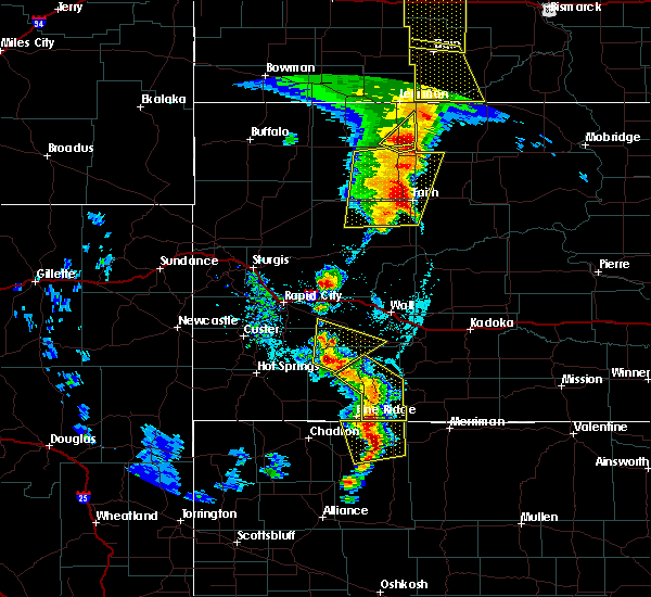 At 754 pm mdt, severe thunderstorms were located along a line extending from near rockyford to near porcupine to 8 miles south of wounded knee, moving northeast at 20 mph (radar indicated). Hazards include 60 mph wind gusts and penny size hail. Expect damage to roofs, siding, and trees. Locations impacted include, porcupine, kyle, manderson, wounded knee, batesland, rockyford and sharps corner. At 754 pm mdt, severe thunderstorms were located along a line extending from near rockyford to near porcupine to 8 miles south of wounded knee, moving northeast at 20 mph (radar indicated). Hazards include 60 mph wind gusts and penny size hail. Expect damage to roofs, siding, and trees. Locations impacted include, porcupine, kyle, manderson, wounded knee, batesland, rockyford and sharps corner.
|
| 6/10/2018 7:33 PM MDT |
 At 733 pm mdt, severe thunderstorms were located along a line extending from 8 miles east of intersection of red shirt and cuny table roads to manderson to 7 miles south of wounded knee, moving northeast at 35 mph (radar indicated). Hazards include 60 mph wind gusts and quarter size hail. Hail damage to vehicles is expected. expect wind damage to roofs, siding, and trees. Locations impacted include, pine ridge, porcupine, kyle, manderson, wounded knee, batesland, rockyford and sharps corner. At 733 pm mdt, severe thunderstorms were located along a line extending from 8 miles east of intersection of red shirt and cuny table roads to manderson to 7 miles south of wounded knee, moving northeast at 35 mph (radar indicated). Hazards include 60 mph wind gusts and quarter size hail. Hail damage to vehicles is expected. expect wind damage to roofs, siding, and trees. Locations impacted include, pine ridge, porcupine, kyle, manderson, wounded knee, batesland, rockyford and sharps corner.
|
| 6/10/2018 7:12 PM MDT |
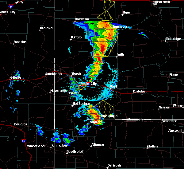 At 712 pm mdt, severe thunderstorms were located along a line extending from 13 miles south of intersection of red shirt and cuny table roads to 6 miles southeast of oglala to near white clay, moving northeast at 30 mph (radar indicated). Hazards include 60 mph wind gusts and quarter size hail. Hail damage to vehicles is expected. Expect wind damage to roofs, siding, and trees. At 712 pm mdt, severe thunderstorms were located along a line extending from 13 miles south of intersection of red shirt and cuny table roads to 6 miles southeast of oglala to near white clay, moving northeast at 30 mph (radar indicated). Hazards include 60 mph wind gusts and quarter size hail. Hail damage to vehicles is expected. Expect wind damage to roofs, siding, and trees.
|
| 8/14/2017 9:42 PM MDT |
 The severe thunderstorm warning for southeastern oglala lakota and northwestern bennett counties will expire at 945 pm mdt, the storm which prompted the warning has weakened below severe limits, and no longer poses an immediate threat to life or property. therefore, the warning will be allowed to expire. however, small hail and heavy rain are still possible with this thunderstorm. The severe thunderstorm warning for southeastern oglala lakota and northwestern bennett counties will expire at 945 pm mdt, the storm which prompted the warning has weakened below severe limits, and no longer poses an immediate threat to life or property. therefore, the warning will be allowed to expire. however, small hail and heavy rain are still possible with this thunderstorm.
|
| 8/14/2017 9:15 PM MDT |
 At 915 pm mdt, a severe thunderstorm was located 7 miles north of batesland, or 19 miles west of martin, moving east at 30 mph (public. at 855 pm mdt, quarter sized hail was reported 2 miles south of porcupine). Hazards include 60 mph wind gusts and half dollar size hail. Hail damage to vehicles is expected. expect wind damage to roofs, siding, and trees. Locations impacted include, allen, batesland and swett. At 915 pm mdt, a severe thunderstorm was located 7 miles north of batesland, or 19 miles west of martin, moving east at 30 mph (public. at 855 pm mdt, quarter sized hail was reported 2 miles south of porcupine). Hazards include 60 mph wind gusts and half dollar size hail. Hail damage to vehicles is expected. expect wind damage to roofs, siding, and trees. Locations impacted include, allen, batesland and swett.
|
| 8/14/2017 8:50 PM MDT |
 At 848 pm mdt, severe thunderstorms were located along a line extending from near allen to near manderson, moving east at 20 mph (trained weather spotters. at 745 pm mdt, golf ball sized hail was reported 5 miles northeast of porcupine). Hazards include golf ball size hail and 60 mph wind gusts. People and animals outdoors will be injured. expect hail damage to roofs, siding, windows, and vehicles. Expect wind damage to roofs, siding, and trees. At 848 pm mdt, severe thunderstorms were located along a line extending from near allen to near manderson, moving east at 20 mph (trained weather spotters. at 745 pm mdt, golf ball sized hail was reported 5 miles northeast of porcupine). Hazards include golf ball size hail and 60 mph wind gusts. People and animals outdoors will be injured. expect hail damage to roofs, siding, windows, and vehicles. Expect wind damage to roofs, siding, and trees.
|
| 8/14/2017 8:28 PM MDT |
 At 828 pm mdt, severe thunderstorms were located along a line extending from 7 miles west of allen to near manderson, moving southeast at 20 mph (radar indicated). Hazards include golf ball size hail. People and animals outdoors will be injured. expect damage to roofs, siding, windows, and vehicles. Locations impacted include, porcupine, kyle, manderson, wounded knee, batesland, swett and sharps corner. At 828 pm mdt, severe thunderstorms were located along a line extending from 7 miles west of allen to near manderson, moving southeast at 20 mph (radar indicated). Hazards include golf ball size hail. People and animals outdoors will be injured. expect damage to roofs, siding, windows, and vehicles. Locations impacted include, porcupine, kyle, manderson, wounded knee, batesland, swett and sharps corner.
|
| 8/14/2017 7:50 PM MDT |
 At 749 pm mdt, severe thunderstorms were located along a line extending from 7 miles southeast of kyle to near manderson, moving southeast at 20 mph. these are very dangerous storms (public. at 745 pm mdt, baseball sized hail was reported at sharps corner). Hazards include baseball size hail. People and animals outdoors will be severely injured. expect shattered windows, extensive damage to roofs, siding, and vehicles. Locations impacted include, porcupine, kyle, manderson, wounded knee, batesland, swett and sharps corner. At 749 pm mdt, severe thunderstorms were located along a line extending from 7 miles southeast of kyle to near manderson, moving southeast at 20 mph. these are very dangerous storms (public. at 745 pm mdt, baseball sized hail was reported at sharps corner). Hazards include baseball size hail. People and animals outdoors will be severely injured. expect shattered windows, extensive damage to roofs, siding, and vehicles. Locations impacted include, porcupine, kyle, manderson, wounded knee, batesland, swett and sharps corner.
|
| 8/14/2017 7:37 PM MDT |
 At 736 pm mdt, severe thunderstorms were located along a line extending from near kyle to near manderson, moving southeast at 20 mph (radar indicated). Hazards include ping pong ball size hail. People and animals outdoors will be injured. Expect damage to roofs, siding, windows, and vehicles. At 736 pm mdt, severe thunderstorms were located along a line extending from near kyle to near manderson, moving southeast at 20 mph (radar indicated). Hazards include ping pong ball size hail. People and animals outdoors will be injured. Expect damage to roofs, siding, windows, and vehicles.
|
| 7/17/2017 9:20 PM MDT |
 The severe thunderstorm warning for southeastern oglala lakota county will expire at 930 pm mdt, the storm which prompted the warning has moved out of the area. therefore the warning will be allowed to expire. however gusty winds and heavy rain are still possible with this thunderstorm. The severe thunderstorm warning for southeastern oglala lakota county will expire at 930 pm mdt, the storm which prompted the warning has moved out of the area. therefore the warning will be allowed to expire. however gusty winds and heavy rain are still possible with this thunderstorm.
|
| 7/17/2017 8:52 PM MDT |
 At 852 pm mdt, a severe thunderstorm was located 8 miles south of wounded knee, or 8 miles east of pine ridge, moving southeast at 25 mph (radar indicated). Hazards include 60 mph wind gusts and quarter size hail. Hail damage to vehicles is expected. expect wind damage to roofs, siding, and trees. Locations impacted include, pine ridge and wounded knee. At 852 pm mdt, a severe thunderstorm was located 8 miles south of wounded knee, or 8 miles east of pine ridge, moving southeast at 25 mph (radar indicated). Hazards include 60 mph wind gusts and quarter size hail. Hail damage to vehicles is expected. expect wind damage to roofs, siding, and trees. Locations impacted include, pine ridge and wounded knee.
|
| 7/17/2017 8:37 PM MDT |
 At 837 pm mdt, a severe thunderstorm was located near pine ridge, moving southeast at 30 mph (radar indicated). Hazards include 60 mph wind gusts and quarter size hail. Hail damage to vehicles is expected. expect wind damage to roofs, siding, and trees. Locations impacted include, pine ridge, porcupine, manderson, wounded knee and batesland. At 837 pm mdt, a severe thunderstorm was located near pine ridge, moving southeast at 30 mph (radar indicated). Hazards include 60 mph wind gusts and quarter size hail. Hail damage to vehicles is expected. expect wind damage to roofs, siding, and trees. Locations impacted include, pine ridge, porcupine, manderson, wounded knee and batesland.
|
| 7/17/2017 8:22 PM MDT |
 At 822 pm mdt, a severe thunderstorm was located near oglala, or 9 miles northwest of pine ridge, moving east at 25 mph (radar indicated). Hazards include 60 mph wind gusts and quarter size hail. Hail damage to vehicles is expected. Expect wind damage to roofs, siding, and trees. At 822 pm mdt, a severe thunderstorm was located near oglala, or 9 miles northwest of pine ridge, moving east at 25 mph (radar indicated). Hazards include 60 mph wind gusts and quarter size hail. Hail damage to vehicles is expected. Expect wind damage to roofs, siding, and trees.
|
| 6/27/2017 11:44 AM MDT |
 At 544 pm mdt, severe thunderstorms were located along a line extending from near sharps corner to near pine ridge, moving east at 55 mph (radar indicated). Hazards include 60 mph wind gusts and nickel size hail. Expect damage to roofs, siding, and trees. Locations impacted include, pine ridge, martin, oglala, porcupine, kyle, wanblee, potato creek, manderson, allen, wounded knee, batesland, hisle, swett, sharps corner, snake butte and southwestern lacreek wildlife refuge. At 544 pm mdt, severe thunderstorms were located along a line extending from near sharps corner to near pine ridge, moving east at 55 mph (radar indicated). Hazards include 60 mph wind gusts and nickel size hail. Expect damage to roofs, siding, and trees. Locations impacted include, pine ridge, martin, oglala, porcupine, kyle, wanblee, potato creek, manderson, allen, wounded knee, batesland, hisle, swett, sharps corner, snake butte and southwestern lacreek wildlife refuge.
|
| 6/27/2017 11:26 AM MDT |
 At 526 pm mdt, severe thunderstorms were located along a line extending from 9 miles southeast of intersection of red shirt and cuny table roads to near slim butte, moving east at 50 mph (radar indicated). Hazards include 60 mph wind gusts and quarter size hail. Hail damage to vehicles is expected. Expect wind damage to roofs, siding, and trees. At 526 pm mdt, severe thunderstorms were located along a line extending from 9 miles southeast of intersection of red shirt and cuny table roads to near slim butte, moving east at 50 mph (radar indicated). Hazards include 60 mph wind gusts and quarter size hail. Hail damage to vehicles is expected. Expect wind damage to roofs, siding, and trees.
|
| 6/12/2017 9:10 PM MDT |
 The tornado warning for east central oglala lakota and west central bennett counties will expire at 915 pm mdt, the tornado threat has diminished and the tornado warning has been cancelled. however, large hail and damaging winds remain likely and a severe thunderstorm warning remains in effect for the area. a tornado watch remains in effect until 200 am mdt for southwestern south dakota. The tornado warning for east central oglala lakota and west central bennett counties will expire at 915 pm mdt, the tornado threat has diminished and the tornado warning has been cancelled. however, large hail and damaging winds remain likely and a severe thunderstorm warning remains in effect for the area. a tornado watch remains in effect until 200 am mdt for southwestern south dakota.
|
| 6/12/2017 8:57 PM MDT |
 At 856 pm mdt, a severe squall line capable of producing both tornadoes and extensive straight line wind damage was located along a line extending from 7 miles east of porcupine to near batesland, moving northeast at 35 mph (radar indicated rotation). Hazards include tornado. Flying debris will be dangerous to those caught without shelter. mobile homes will be damaged or destroyed. damage to roofs, windows, and vehicles will occur. tree damage is likely. These dangerous storms will be near, swett around 905 pm mdt. At 856 pm mdt, a severe squall line capable of producing both tornadoes and extensive straight line wind damage was located along a line extending from 7 miles east of porcupine to near batesland, moving northeast at 35 mph (radar indicated rotation). Hazards include tornado. Flying debris will be dangerous to those caught without shelter. mobile homes will be damaged or destroyed. damage to roofs, windows, and vehicles will occur. tree damage is likely. These dangerous storms will be near, swett around 905 pm mdt.
|
| 6/12/2017 8:51 PM MDT |
 At 850 pm mdt, severe thunderstorms were located along a line extending from near manderson to near batesland to 10 miles south of swett, moving northeast at 35 mph. these are very dangerous storms (radar indicated). Hazards include 80 mph wind gusts and quarter size hail. Flying debris will be dangerous to those caught without shelter. mobile homes will be heavily damaged. expect considerable damage to roofs, windows, and vehicles. extensive tree damage and power outages are likely. locations impacted include, porcupine, allen, wounded knee, batesland, swett and sharps corner. A tornado watch remains in effect until 200 am mdt for southwestern south dakota. At 850 pm mdt, severe thunderstorms were located along a line extending from near manderson to near batesland to 10 miles south of swett, moving northeast at 35 mph. these are very dangerous storms (radar indicated). Hazards include 80 mph wind gusts and quarter size hail. Flying debris will be dangerous to those caught without shelter. mobile homes will be heavily damaged. expect considerable damage to roofs, windows, and vehicles. extensive tree damage and power outages are likely. locations impacted include, porcupine, allen, wounded knee, batesland, swett and sharps corner. A tornado watch remains in effect until 200 am mdt for southwestern south dakota.
|
| 6/12/2017 8:39 PM MDT |
 At 839 pm mdt, a severe thunderstorm capable of producing a tornado was located near batesland, or 18 miles north of gordon, moving northeast at 35 mph (radar indicated rotation). Hazards include tornado. Flying debris will be dangerous to those caught without shelter. mobile homes will be damaged or destroyed. damage to roofs, windows, and vehicles will occur. tree damage is likely. this dangerous storm will be near, batesland around 850 pm mdt. Swett around 900 pm mdt. At 839 pm mdt, a severe thunderstorm capable of producing a tornado was located near batesland, or 18 miles north of gordon, moving northeast at 35 mph (radar indicated rotation). Hazards include tornado. Flying debris will be dangerous to those caught without shelter. mobile homes will be damaged or destroyed. damage to roofs, windows, and vehicles will occur. tree damage is likely. this dangerous storm will be near, batesland around 850 pm mdt. Swett around 900 pm mdt.
|
| 6/12/2017 8:31 PM MDT |
 At 831 pm mdt, a severe thunderstorm was located 7 miles southeast of wounded knee, or 14 miles east of pine ridge, moving northeast at 35 mph (radar indicated). Hazards include 60 mph wind gusts and half dollar size hail. Hail damage to vehicles is expected. Expect wind damage to roofs, siding, and trees. At 831 pm mdt, a severe thunderstorm was located 7 miles southeast of wounded knee, or 14 miles east of pine ridge, moving northeast at 35 mph (radar indicated). Hazards include 60 mph wind gusts and half dollar size hail. Hail damage to vehicles is expected. Expect wind damage to roofs, siding, and trees.
|
| 9/4/2016 6:01 PM MDT | Storm damage reported in oglala lakota county SD, 6.5 miles NNE of Batesland, SD |
| 9/4/2016 5:53 PM MDT |
 At 553 pm mdt, severe thunderstorms were located along a line extending from near sharps corner to near porcupine to 9 miles southwest of batesland, moving northeast at 40 mph (radar indicated). Hazards include 60 mph wind gusts and quarter size hail. Hail damage to vehicles is expected. expect wind damage to roofs, siding, and trees. Locations impacted include, martin, porcupine, kyle, potato creek, allen, wounded knee, batesland, sharps corner, swett, hisle, snake butte and southwestern lacreek wildlife refuge. At 553 pm mdt, severe thunderstorms were located along a line extending from near sharps corner to near porcupine to 9 miles southwest of batesland, moving northeast at 40 mph (radar indicated). Hazards include 60 mph wind gusts and quarter size hail. Hail damage to vehicles is expected. expect wind damage to roofs, siding, and trees. Locations impacted include, martin, porcupine, kyle, potato creek, allen, wounded knee, batesland, sharps corner, swett, hisle, snake butte and southwestern lacreek wildlife refuge.
|
| 9/4/2016 5:40 PM MDT |
 The national weather service in rapid city has issued a * severe thunderstorm warning for. western bennett county in southwestern south dakota. southeastern oglala lakota county in southwestern south dakota. southwestern jackson county in southwestern south dakota. Until 645 pm mdt. The national weather service in rapid city has issued a * severe thunderstorm warning for. western bennett county in southwestern south dakota. southeastern oglala lakota county in southwestern south dakota. southwestern jackson county in southwestern south dakota. Until 645 pm mdt.
|
| 9/4/2016 3:24 PM MDT |
 At 324 pm mdt, a severe thunderstorm was located near batesland, or 20 miles west of martin, moving northeast at 25 mph (radar indicated). Hazards include 60 mph wind gusts and quarter size hail. Hail damage to vehicles is expected. expect wind damage to roofs, siding, and trees. Locations impacted include, batesland. At 324 pm mdt, a severe thunderstorm was located near batesland, or 20 miles west of martin, moving northeast at 25 mph (radar indicated). Hazards include 60 mph wind gusts and quarter size hail. Hail damage to vehicles is expected. expect wind damage to roofs, siding, and trees. Locations impacted include, batesland.
|
| 9/4/2016 3:04 PM MDT |
 At 302 pm mdt, severe thunderstorms were located along a line extending from manderson to near wounded knee, moving northeast at 25 mph (radar indicated. these storms have a history of producing quarter size hail). Hazards include 60 mph wind gusts and quarter size hail. Hail damage to vehicles is expected. expect wind damage to roofs, siding, and trees. Locations impacted include, porcupine, manderson, wounded knee, batesland and sharps corner. At 302 pm mdt, severe thunderstorms were located along a line extending from manderson to near wounded knee, moving northeast at 25 mph (radar indicated. these storms have a history of producing quarter size hail). Hazards include 60 mph wind gusts and quarter size hail. Hail damage to vehicles is expected. expect wind damage to roofs, siding, and trees. Locations impacted include, porcupine, manderson, wounded knee, batesland and sharps corner.
|
| 9/4/2016 2:43 PM MDT |
 At 243 pm mdt, a severe thunderstorm was located near pine ridge, moving northeast at 25 mph (radar indicated). Hazards include 60 mph wind gusts and half dollar size hail. Hail damage to vehicles is expected. Expect wind damage to roofs, siding, and trees. At 243 pm mdt, a severe thunderstorm was located near pine ridge, moving northeast at 25 mph (radar indicated). Hazards include 60 mph wind gusts and half dollar size hail. Hail damage to vehicles is expected. Expect wind damage to roofs, siding, and trees.
|
| 8/8/2016 7:45 PM MDT |
 At 744 pm mdt, a severe thunderstorm was located near wounded knee, or 8 miles northeast of pine ridge, moving southeast at 25 mph. this is a very dangerous storm (radar indicated). Hazards include three inch hail and 70 mph wind gusts. People and animals outdoors will be severely injured. expect shattered windows, extensive damage to roofs, siding, and vehicles. Locations impacted include, pine ridge, porcupine, manderson, wounded knee, batesland and swett. At 744 pm mdt, a severe thunderstorm was located near wounded knee, or 8 miles northeast of pine ridge, moving southeast at 25 mph. this is a very dangerous storm (radar indicated). Hazards include three inch hail and 70 mph wind gusts. People and animals outdoors will be severely injured. expect shattered windows, extensive damage to roofs, siding, and vehicles. Locations impacted include, pine ridge, porcupine, manderson, wounded knee, batesland and swett.
|
| 8/8/2016 7:24 PM MDT |
 At 724 pm mdt, a severe thunderstorm was located 8 miles east of oglala, or 8 miles north of pine ridge, moving southeast at 30 mph. this is a very dangerous storm (radar indicated). Hazards include softball size hail and 70 mph wind gusts. People and animals outdoors will be severely injured. Expect shattered windows, extensive damage to roofs, siding, and vehicles. At 724 pm mdt, a severe thunderstorm was located 8 miles east of oglala, or 8 miles north of pine ridge, moving southeast at 30 mph. this is a very dangerous storm (radar indicated). Hazards include softball size hail and 70 mph wind gusts. People and animals outdoors will be severely injured. Expect shattered windows, extensive damage to roofs, siding, and vehicles.
|
| 8/3/2016 5:30 PM MDT |
 At 529 pm mdt, severe thunderstorms were located along a line extending from 6 miles northeast of rockyford to near manderson to near pine ridge, moving east at 35 mph (radar indicated and spotter confirmed). Hazards include 60 mph wind gusts and penny size hail. Expect damage to roofs. siding. and trees. Locations impacted include, pine ridge, oglala, porcupine, kyle, manderson, wounded knee, batesland, sharps corner, rockyford and slim butte. At 529 pm mdt, severe thunderstorms were located along a line extending from 6 miles northeast of rockyford to near manderson to near pine ridge, moving east at 35 mph (radar indicated and spotter confirmed). Hazards include 60 mph wind gusts and penny size hail. Expect damage to roofs. siding. and trees. Locations impacted include, pine ridge, oglala, porcupine, kyle, manderson, wounded knee, batesland, sharps corner, rockyford and slim butte.
|
| 8/3/2016 4:53 PM MDT |
 At 452 pm mdt, severe thunderstorms were located along a line extending from 15 miles south of red shirt to 6 miles west of slim butte, moving east at 35 mph (radar indicated). Hazards include 60 mph wind gusts and penny size hail. Expect damage to roofs. siding. And trees. At 452 pm mdt, severe thunderstorms were located along a line extending from 15 miles south of red shirt to 6 miles west of slim butte, moving east at 35 mph (radar indicated). Hazards include 60 mph wind gusts and penny size hail. Expect damage to roofs. siding. And trees.
|
| 7/30/2016 10:50 PM MDT |
 At 1049 pm mdt/1149 pm cdt/, severe thunderstorms were located along a line extending from 7 miles south of belvidere to 9 miles north of vetal to near merriman to near gordon, moving southeast at 50 mph (radar indicated). Hazards include 70 mph wind gusts and penny size hail. Expect considerable tree damage. damage is likely to mobile homes, roofs, and outbuildings. Locations impacted include, mission, martin, kadoka, rosebud, porcupine, kyle, potato creek, wanblee, saint francis, parmelee, allen, wounded knee, spring creek, long valley, norris, batesland, interior, tuthill, cedar butte and lakeview. At 1049 pm mdt/1149 pm cdt/, severe thunderstorms were located along a line extending from 7 miles south of belvidere to 9 miles north of vetal to near merriman to near gordon, moving southeast at 50 mph (radar indicated). Hazards include 70 mph wind gusts and penny size hail. Expect considerable tree damage. damage is likely to mobile homes, roofs, and outbuildings. Locations impacted include, mission, martin, kadoka, rosebud, porcupine, kyle, potato creek, wanblee, saint francis, parmelee, allen, wounded knee, spring creek, long valley, norris, batesland, interior, tuthill, cedar butte and lakeview.
|
| 7/30/2016 10:32 PM MDT |
 At 1030 pm mdt/1130 pm cdt/, severe thunderstorms were located along a line extending from near kadoka to near long valley to 9 miles southwest of martin to 8 miles west of gordon, moving east at 50 mph (radar indicated. at 1025 pm mdt a 69 mph wind gust was reported at batesland and a 55 mph wind gust was reported at cactus flats). Hazards include 70 mph wind gusts and penny size hail. Expect considerable tree damage. damage is likely to mobile homes, roofs, and outbuildings. Locations impacted include, mission, martin, philip, kadoka, rosebud, porcupine, kyle, potato creek, wanblee, saint francis, parmelee, allen, wounded knee, spring creek, long valley, norris, batesland, interior, tuthill and cedar butte. At 1030 pm mdt/1130 pm cdt/, severe thunderstorms were located along a line extending from near kadoka to near long valley to 9 miles southwest of martin to 8 miles west of gordon, moving east at 50 mph (radar indicated. at 1025 pm mdt a 69 mph wind gust was reported at batesland and a 55 mph wind gust was reported at cactus flats). Hazards include 70 mph wind gusts and penny size hail. Expect considerable tree damage. damage is likely to mobile homes, roofs, and outbuildings. Locations impacted include, mission, martin, philip, kadoka, rosebud, porcupine, kyle, potato creek, wanblee, saint francis, parmelee, allen, wounded knee, spring creek, long valley, norris, batesland, interior, tuthill and cedar butte.
|
| 7/30/2016 10:20 PM MDT | Storm damage reported in oglala lakota county SD, 8 miles NE of Batesland, SD |
| 7/30/2016 9:57 PM MDT |
 At 957 pm mdt/1057 pm cdt/, severe thunderstorms were located along a line extending from 10 miles northwest of kadoka to near interior to near batesland to 7 miles southwest of white clay, moving southeast at 50 mph (trained weather spotters). Hazards include 70 mph wind gusts and penny size hail. Expect considerable tree damage. Damage is likely to mobile homes, roofs, and outbuildings. At 957 pm mdt/1057 pm cdt/, severe thunderstorms were located along a line extending from 10 miles northwest of kadoka to near interior to near batesland to 7 miles southwest of white clay, moving southeast at 50 mph (trained weather spotters). Hazards include 70 mph wind gusts and penny size hail. Expect considerable tree damage. Damage is likely to mobile homes, roofs, and outbuildings.
|
| 7/30/2016 9:36 PM MDT |
 At 936 pm mdt, severe thunderstorms were located along a line extending from 9 miles east of badlands national park to manderson to 8 miles west of slim butte to 9 miles southwest of oelrichs, moving southeast at 45 mph (radar indicated). Hazards include 70 mph wind gusts and penny size hail. Expect considerable tree damage. damage is likely to mobile homes, roofs, and outbuildings. Locations impacted include, oglala, porcupine, kyle, potato creek, manderson, allen, wounded knee, oelrichs, batesland, scenic, smithwick, red shirt, hisle, sharps corner, rockyford, badlands national park, slim butte, white clay, southeastern angostura reservoir and pine ridge. At 936 pm mdt, severe thunderstorms were located along a line extending from 9 miles east of badlands national park to manderson to 8 miles west of slim butte to 9 miles southwest of oelrichs, moving southeast at 45 mph (radar indicated). Hazards include 70 mph wind gusts and penny size hail. Expect considerable tree damage. damage is likely to mobile homes, roofs, and outbuildings. Locations impacted include, oglala, porcupine, kyle, potato creek, manderson, allen, wounded knee, oelrichs, batesland, scenic, smithwick, red shirt, hisle, sharps corner, rockyford, badlands national park, slim butte, white clay, southeastern angostura reservoir and pine ridge.
|
| 7/30/2016 9:12 PM MDT |
 At 911 pm mdt, severe thunderstorms were located along a line extending from 7 miles south of owanka to 9 miles southwest of rockyford to near smithwick to 7 miles southwest of angostura reservoir, moving southeast at 50 mph (radar indicated. at 906 pm mdt...65 mph wind gusts were reported 8 miles east of smithwick). Hazards include 70 mph wind gusts and nickel size hail. Expect considerable tree damage. damage is likely to mobile homes, roofs, and outbuildings. Locations impacted include, hot springs, oglala, porcupine, kyle, potato creek, manderson, allen, wounded knee, oral, buffalo gap, oelrichs, batesland, fairburn, scenic, smithwick, owanka, sharps corner, folsom, rockyford and red shirt. At 911 pm mdt, severe thunderstorms were located along a line extending from 7 miles south of owanka to 9 miles southwest of rockyford to near smithwick to 7 miles southwest of angostura reservoir, moving southeast at 50 mph (radar indicated. at 906 pm mdt...65 mph wind gusts were reported 8 miles east of smithwick). Hazards include 70 mph wind gusts and nickel size hail. Expect considerable tree damage. damage is likely to mobile homes, roofs, and outbuildings. Locations impacted include, hot springs, oglala, porcupine, kyle, potato creek, manderson, allen, wounded knee, oral, buffalo gap, oelrichs, batesland, fairburn, scenic, smithwick, owanka, sharps corner, folsom, rockyford and red shirt.
|
| 7/30/2016 8:26 PM MDT |
 At 825 pm mdt, severe thunderstorms were located along a line extending from 7 miles east of farmingdale to 8 miles northwest of edgemont, moving southeast at 45 mph (radar indicated). Hazards include 60 mph wind gusts and nickel size hail. Expect damage to roofs. siding. And trees. At 825 pm mdt, severe thunderstorms were located along a line extending from 7 miles east of farmingdale to 8 miles northwest of edgemont, moving southeast at 45 mph (radar indicated). Hazards include 60 mph wind gusts and nickel size hail. Expect damage to roofs. siding. And trees.
|
| 7/30/2016 7:32 PM MDT |
 At 730 pm mdt, severe thunderstorms were located near vetal and south of batesland, moving south at 20 mph (trained weather spotters). Hazards include 60 mph wind gusts and half dollar size hail. Hail damage to vehicles is expected. expect wind damage to roofs, siding, and trees. Locations impacted include, tuthill, harrington, vetal, lacreek wildlife refuge and cody lake. At 730 pm mdt, severe thunderstorms were located near vetal and south of batesland, moving south at 20 mph (trained weather spotters). Hazards include 60 mph wind gusts and half dollar size hail. Hail damage to vehicles is expected. expect wind damage to roofs, siding, and trees. Locations impacted include, tuthill, harrington, vetal, lacreek wildlife refuge and cody lake.
|
| 7/30/2016 6:57 PM MDT |
 At 656 pm mdt, severe thunderstorms were located along a line extending from 6 miles north of vetal to near batesland, moving south at 20 mph (trained weather spotters). Hazards include 60 mph wind gusts and quarter size hail. Hail damage to vehicles is expected. Expect wind damage to roofs, siding, and trees. At 656 pm mdt, severe thunderstorms were located along a line extending from 6 miles north of vetal to near batesland, moving south at 20 mph (trained weather spotters). Hazards include 60 mph wind gusts and quarter size hail. Hail damage to vehicles is expected. Expect wind damage to roofs, siding, and trees.
|
| 7/30/2016 6:29 PM MDT |
 At 628 pm mdt/728 pm cdt/, severe thunderstorms were located along a line extending from 7 miles northeast of parmelee to near batesland, moving southeast at 25 mph (trained weather spotters. at 554 pm mdt...60 mph wind gusts were reported at sharps corner in oglala lakota county). Hazards include 60 mph wind gusts and quarter size hail. Hail damage to vehicles is expected. expect wind damage to roofs, siding, and trees. Locations impacted include, mission, martin, rosebud, porcupine, parmelee, allen, long valley, norris, batesland, tuthill, cedar butte, swett, harrington, vetal, hisle and northeastern lacreek wildlife refuge. At 628 pm mdt/728 pm cdt/, severe thunderstorms were located along a line extending from 7 miles northeast of parmelee to near batesland, moving southeast at 25 mph (trained weather spotters. at 554 pm mdt...60 mph wind gusts were reported at sharps corner in oglala lakota county). Hazards include 60 mph wind gusts and quarter size hail. Hail damage to vehicles is expected. expect wind damage to roofs, siding, and trees. Locations impacted include, mission, martin, rosebud, porcupine, parmelee, allen, long valley, norris, batesland, tuthill, cedar butte, swett, harrington, vetal, hisle and northeastern lacreek wildlife refuge.
|
| 7/30/2016 5:56 PM MDT |
 At 554 pm mdt/654 pm cdt/, severe thunderstorms were located along a line extending from white river to near sharps corner, moving southeast at 35 mph (trained weather spotters. at 550 pm mdt...60 mph wind gusts were reported 2 miles southeast of kyle). Hazards include 60 mph wind gusts and quarter size hail. Hail damage to vehicles is expected. expect wind damage to roofs, siding, and trees. Locations impacted include, mission, martin, white river, rosebud, porcupine, kyle, wanblee, parmelee, allen, okreek, long valley, norris, batesland, tuthill, wood, cedar butte, swett, harrington, vetal and hisle. At 554 pm mdt/654 pm cdt/, severe thunderstorms were located along a line extending from white river to near sharps corner, moving southeast at 35 mph (trained weather spotters. at 550 pm mdt...60 mph wind gusts were reported 2 miles southeast of kyle). Hazards include 60 mph wind gusts and quarter size hail. Hail damage to vehicles is expected. expect wind damage to roofs, siding, and trees. Locations impacted include, mission, martin, white river, rosebud, porcupine, kyle, wanblee, parmelee, allen, okreek, long valley, norris, batesland, tuthill, wood, cedar butte, swett, harrington, vetal and hisle.
|
| 7/30/2016 5:44 PM MDT |
 At 543 pm mdt/643 pm cdt/, severe thunderstorms were located along a line extending from 7 miles northeast of cedar butte to sharps corner, moving east at 45 mph (law enforcement. at 530 pm mdt...a 60 mph wind gust was reported in wanblee). Hazards include 60 mph wind gusts and quarter size hail. Hail damage to vehicles is expected. Expect wind damage to roofs, siding, and trees. At 543 pm mdt/643 pm cdt/, severe thunderstorms were located along a line extending from 7 miles northeast of cedar butte to sharps corner, moving east at 45 mph (law enforcement. at 530 pm mdt...a 60 mph wind gust was reported in wanblee). Hazards include 60 mph wind gusts and quarter size hail. Hail damage to vehicles is expected. Expect wind damage to roofs, siding, and trees.
|
| 7/16/2016 6:36 PM MDT |
 At 635 pm mdt, a confirmed tornado was located near batesland, or 20 miles west of martin, moving east at 45 mph (weather spotters confirmed tornado). Hazards include damaging tornado and golf ball size hail. Flying debris will be dangerous to those caught without shelter. mobile homes will be damaged or destroyed. damage to roofs, windows, and vehicles will occur. tree damage is likely. This tornado will be near, swett around 650 pm mdt. At 635 pm mdt, a confirmed tornado was located near batesland, or 20 miles west of martin, moving east at 45 mph (weather spotters confirmed tornado). Hazards include damaging tornado and golf ball size hail. Flying debris will be dangerous to those caught without shelter. mobile homes will be damaged or destroyed. damage to roofs, windows, and vehicles will occur. tree damage is likely. This tornado will be near, swett around 650 pm mdt.
|
| 7/16/2016 6:25 PM MDT |
 At 625 pm mdt, a severe thunderstorm capable of producing a tornado was located over porcupine, or 18 miles northeast of pine ridge, moving east at 45 mph (radar indicated rotation). Hazards include tornado and golf ball size hail. Flying debris will be dangerous to those caught without shelter. mobile homes will be damaged or destroyed. damage to roofs, windows, and vehicles will occur. tree damage is likely. this dangerous storm will be near, batesland around 640 pm mdt. Allen and swett around 650 pm mdt. At 625 pm mdt, a severe thunderstorm capable of producing a tornado was located over porcupine, or 18 miles northeast of pine ridge, moving east at 45 mph (radar indicated rotation). Hazards include tornado and golf ball size hail. Flying debris will be dangerous to those caught without shelter. mobile homes will be damaged or destroyed. damage to roofs, windows, and vehicles will occur. tree damage is likely. this dangerous storm will be near, batesland around 640 pm mdt. Allen and swett around 650 pm mdt.
|
| 7/10/2016 8:41 PM MDT |
 At 839 pm mdt, a thunderstorm gust front was located along a line extending from 13 miles northwest of oglala to 8 miles south of wounded knee, moving east at 50 mph (radar indicated). Hazards include 60 mph wind gusts. Expect damage to roofs. siding. and trees. Locations impacted include, pine ridge, oglala, porcupine, manderson, wounded knee, batesland, sharps corner and slim butte. At 839 pm mdt, a thunderstorm gust front was located along a line extending from 13 miles northwest of oglala to 8 miles south of wounded knee, moving east at 50 mph (radar indicated). Hazards include 60 mph wind gusts. Expect damage to roofs. siding. and trees. Locations impacted include, pine ridge, oglala, porcupine, manderson, wounded knee, batesland, sharps corner and slim butte.
|
| 7/10/2016 8:25 PM MDT |
 At 823 pm mdt, a thunderstorm outflow boundary was located along a line extending from near smithwick to near slim butte, moving northeast at 45 mph (radar indicated). Hazards include 60 mph wind gusts. Expect damage to roofs. siding. And trees. At 823 pm mdt, a thunderstorm outflow boundary was located along a line extending from near smithwick to near slim butte, moving northeast at 45 mph (radar indicated). Hazards include 60 mph wind gusts. Expect damage to roofs. siding. And trees.
|
| 7/3/2016 7:55 PM MDT |
 The severe thunderstorm warning for southwestern bennett and southeastern oglala lakota counties will expire at 800 pm mdt, the severe thunderstorm which prompted the warning has weakened. therefore the warning will be allowed to expire. The severe thunderstorm warning for southwestern bennett and southeastern oglala lakota counties will expire at 800 pm mdt, the severe thunderstorm which prompted the warning has weakened. therefore the warning will be allowed to expire.
|
| 7/3/2016 7:44 PM MDT |
 At 743 pm mdt, a severe thunderstorm was located near batesland, or 18 miles east of pine ridge, moving southeast at 30 mph (radar indicated). Hazards include half dollar size hail. Damage to vehicles is expected. Locations impacted include, wounded knee and batesland. At 743 pm mdt, a severe thunderstorm was located near batesland, or 18 miles east of pine ridge, moving southeast at 30 mph (radar indicated). Hazards include half dollar size hail. Damage to vehicles is expected. Locations impacted include, wounded knee and batesland.
|
| 7/3/2016 7:21 PM MDT |
 At 720 pm mdt, a severe thunderstorm was located over porcupine, or 17 miles northeast of pine ridge, moving southeast at 40 mph (radar indicated). Hazards include half dollar size hail. damage to vehicles is expected At 720 pm mdt, a severe thunderstorm was located over porcupine, or 17 miles northeast of pine ridge, moving southeast at 40 mph (radar indicated). Hazards include half dollar size hail. damage to vehicles is expected
|
| 6/13/2016 6:22 PM MDT |
 At 622 pm mdt, severe thunderstorms were located along a line extending from near potato creek to 9 miles northeast of gordon, moving east at 30 mph (radar indicated). Hazards include ping pong ball size hail and 60 mph wind gusts. People and animals outdoors will be injured. expect hail damage to roofs, siding, windows, and vehicles. expect wind damage to roofs, siding, and trees. Locations impacted include, martin, kyle, potato creek, wanblee, allen, long valley, batesland, tuthill, swett, hisle and lacreek wildlife refuge. At 622 pm mdt, severe thunderstorms were located along a line extending from near potato creek to 9 miles northeast of gordon, moving east at 30 mph (radar indicated). Hazards include ping pong ball size hail and 60 mph wind gusts. People and animals outdoors will be injured. expect hail damage to roofs, siding, windows, and vehicles. expect wind damage to roofs, siding, and trees. Locations impacted include, martin, kyle, potato creek, wanblee, allen, long valley, batesland, tuthill, swett, hisle and lacreek wildlife refuge.
|
| 6/13/2016 6:06 PM MDT |
 At 606 pm mdt, severe thunderstorms were located along a line extending from 10 miles west of potato creek to near gordon, moving east at 30 mph (radar indicated). Hazards include 60 mph wind gusts and quarter size hail. Hail damage to vehicles is expected. Expect wind damage to roofs, siding, and trees. At 606 pm mdt, severe thunderstorms were located along a line extending from 10 miles west of potato creek to near gordon, moving east at 30 mph (radar indicated). Hazards include 60 mph wind gusts and quarter size hail. Hail damage to vehicles is expected. Expect wind damage to roofs, siding, and trees.
|
| 5/24/2016 6:55 PM MDT |
 A severe thunderstorm warning remains in effect until 730 pm mdt for western bennett and southeastern oglala lakota counties. at 654 pm mdt. a severe thunderstorm was located near porcupine. or 24 miles northeast of pine ridge. moving east at 40 mph. hazard. 60 mph wind gusts and half dollar size hail. source. Trained weather spotters. A severe thunderstorm warning remains in effect until 730 pm mdt for western bennett and southeastern oglala lakota counties. at 654 pm mdt. a severe thunderstorm was located near porcupine. or 24 miles northeast of pine ridge. moving east at 40 mph. hazard. 60 mph wind gusts and half dollar size hail. source. Trained weather spotters.
|
| 5/24/2016 6:25 PM MDT | The national weather service in rapid city has issued a * severe thunderstorm warning for. western bennett county in southwestern south dakota. southeastern oglala lakota county in southwestern south dakota. until 730 pm mdt * at 625 pm mdt. a severe thunderstorm was located near oglala. Or 10. |
| 8/1/2015 6:32 PM MDT |
 At 630 pm mdt, a severe thunderstorm was located near 8 miles southeast of batesland, or 17 miles southwest of martin, moving east at 25 mph (radar indicated. at 618 pm...half dollar sized hail was reported 7 miles southwest of batesland). Hazards include quarter size hail. Damage to vehicles is expected. Locations impacted include, batesland and swett. At 630 pm mdt, a severe thunderstorm was located near 8 miles southeast of batesland, or 17 miles southwest of martin, moving east at 25 mph (radar indicated. at 618 pm...half dollar sized hail was reported 7 miles southwest of batesland). Hazards include quarter size hail. Damage to vehicles is expected. Locations impacted include, batesland and swett.
|
| 8/1/2015 6:18 PM MDT | Half Dollar sized hail reported 6.7 miles NNE of Batesland, SD |
| 8/1/2015 6:15 PM MDT |
 At 613 pm mdt, a severe thunderstorm was located 6 miles south of batesland, or 21 miles west of pine ridge, moving east at 35 mph (radar indicated). Hazards include half dollar size hail. Damage to vehicles is expected. Locations impacted include, batesland and swett. At 613 pm mdt, a severe thunderstorm was located 6 miles south of batesland, or 21 miles west of pine ridge, moving east at 35 mph (radar indicated). Hazards include half dollar size hail. Damage to vehicles is expected. Locations impacted include, batesland and swett.
|
| 8/1/2015 5:55 PM MDT |
 At 554 pm mdt, a severe thunderstorm was located 8 miles south of wounded knee, or 11 miles east of pine ridge, moving east at 25 mph (radar indicated. at 530 pm mdt...quarter sized hail was reported in pine ridge). Hazards include quarter size hail. damage to vehicles is expected At 554 pm mdt, a severe thunderstorm was located 8 miles south of wounded knee, or 11 miles east of pine ridge, moving east at 25 mph (radar indicated. at 530 pm mdt...quarter sized hail was reported in pine ridge). Hazards include quarter size hail. damage to vehicles is expected
|
| 7/27/2015 7:34 PM MDT |
 At 733 pm mdt, severe thunderstorms were located along a line extending from 7 miles southwest of creighton to near wounded knee, moving east at 40 mph (radar indicated). Hazards include 60 mph wind gusts and quarter size hail. Hail damage to vehicles is expected. expect wind damage to roofs, siding and trees. locations impacted include, pine ridge, oglala, porcupine, kyle, wall, manderson, wounded knee, batesland, wasta, scenic, quinn, owanka, wicksville, sharps corner, creighton, rockyford, badlands national park, slim butte and pinnacles ranger station. This includes interstate 90 in south dakota between mile markers 91 and 124. At 733 pm mdt, severe thunderstorms were located along a line extending from 7 miles southwest of creighton to near wounded knee, moving east at 40 mph (radar indicated). Hazards include 60 mph wind gusts and quarter size hail. Hail damage to vehicles is expected. expect wind damage to roofs, siding and trees. locations impacted include, pine ridge, oglala, porcupine, kyle, wall, manderson, wounded knee, batesland, wasta, scenic, quinn, owanka, wicksville, sharps corner, creighton, rockyford, badlands national park, slim butte and pinnacles ranger station. This includes interstate 90 in south dakota between mile markers 91 and 124.
|
| 7/27/2015 7:01 PM MDT |
 At 701 pm mdt, severe thunderstorms were located along a line extending from 6 miles east of farmingdale to near slim butte, moving east at 40 mph (radar indicated). Hazards include 60 mph wind gusts and quarter size hail. Hail damage to vehicles is expected. Expect wind damage to roofs, siding and trees. At 701 pm mdt, severe thunderstorms were located along a line extending from 6 miles east of farmingdale to near slim butte, moving east at 40 mph (radar indicated). Hazards include 60 mph wind gusts and quarter size hail. Hail damage to vehicles is expected. Expect wind damage to roofs, siding and trees.
|
| 7/5/2015 3:26 PM MDT |
 At 325 pm mdt, a severe thunderstorm was located 7 miles east of pine ridge, moving east at 15 mph (radar indicated). Hazards include golf ball size hail. People and animals outdoors will be injured. Expect damage to roofs, siding, windows and vehicles. At 325 pm mdt, a severe thunderstorm was located 7 miles east of pine ridge, moving east at 15 mph (radar indicated). Hazards include golf ball size hail. People and animals outdoors will be injured. Expect damage to roofs, siding, windows and vehicles.
|
| 6/24/2015 5:04 AM MDT |
 At 503 am mdt, a severe thunderstorm was located near wounded knee, or 12 miles east of pine ridge, moving southeast at 50 mph (radar indicated). Hazards include 60 mph wind gusts and half dollar size hail. Hail damage to vehicles is expected. expect wind damage to roofs, siding and trees. Locations impacted include, pine ridge, porcupine, manderson, wounded knee and batesland. At 503 am mdt, a severe thunderstorm was located near wounded knee, or 12 miles east of pine ridge, moving southeast at 50 mph (radar indicated). Hazards include 60 mph wind gusts and half dollar size hail. Hail damage to vehicles is expected. expect wind damage to roofs, siding and trees. Locations impacted include, pine ridge, porcupine, manderson, wounded knee and batesland.
|
| 6/24/2015 4:43 AM MDT |
 At 443 am mdt, a severe thunderstorm was located near slim butte, or 7 miles west of pine ridge, moving southeast at 50 mph (radar indicated). Hazards include 60 mph wind gusts and half dollar size hail. Hail damage to vehicles is expected. Expect wind damage to roofs, siding and trees. At 443 am mdt, a severe thunderstorm was located near slim butte, or 7 miles west of pine ridge, moving southeast at 50 mph (radar indicated). Hazards include 60 mph wind gusts and half dollar size hail. Hail damage to vehicles is expected. Expect wind damage to roofs, siding and trees.
|
| 6/24/2015 3:41 AM MDT |
 The severe thunderstorm warning for southwestern bennett, southern shannon and eastern fall river counties will expire at 345 am mdt, the storms which prompted the warning have weakened below severe limits, and no longer pose an immediate threat to life or property. therefore the warning will be allowed to expire. however heavy rain is still possible with these thunderstorms. a severe thunderstorm watch remains in effect until 500 am mdt for southwestern south dakota. The severe thunderstorm warning for southwestern bennett, southern shannon and eastern fall river counties will expire at 345 am mdt, the storms which prompted the warning have weakened below severe limits, and no longer pose an immediate threat to life or property. therefore the warning will be allowed to expire. however heavy rain is still possible with these thunderstorms. a severe thunderstorm watch remains in effect until 500 am mdt for southwestern south dakota.
|
| 6/24/2015 3:29 AM MDT |
 At 329 am mdt, severe thunderstorms were located along a line extending from 8 miles northeast of smithwick to 7 miles northeast of mount maria, moving northeast at 25 mph (radar indicated). Hazards include 60 mph wind gusts and quarter size hail. Hail damage to vehicles is expected. expect wind damage to roofs, siding and trees. Locations impacted include, pine ridge, oglala, porcupine, manderson, wounded knee, oral, oelrichs, batesland, smithwick, slim butte and angostura reservoir. At 329 am mdt, severe thunderstorms were located along a line extending from 8 miles northeast of smithwick to 7 miles northeast of mount maria, moving northeast at 25 mph (radar indicated). Hazards include 60 mph wind gusts and quarter size hail. Hail damage to vehicles is expected. expect wind damage to roofs, siding and trees. Locations impacted include, pine ridge, oglala, porcupine, manderson, wounded knee, oral, oelrichs, batesland, smithwick, slim butte and angostura reservoir.
|
| 6/24/2015 3:05 AM MDT |
 At 305 am mdt, severe thunderstorms were located along a line extending from near smithwick to 7 miles southwest of hoover lake, moving northeast at 25 mph (radar indicated). Hazards include 60 mph wind gusts and quarter size hail. Hail damage to vehicles is expected. expect wind damage to roofs, siding and trees. Locations impacted include, pine ridge, oglala, porcupine, manderson, wounded knee, oral, oelrichs, batesland, smithwick, slim butte and angostura reservoir. At 305 am mdt, severe thunderstorms were located along a line extending from near smithwick to 7 miles southwest of hoover lake, moving northeast at 25 mph (radar indicated). Hazards include 60 mph wind gusts and quarter size hail. Hail damage to vehicles is expected. expect wind damage to roofs, siding and trees. Locations impacted include, pine ridge, oglala, porcupine, manderson, wounded knee, oral, oelrichs, batesland, smithwick, slim butte and angostura reservoir.
|
| 6/24/2015 2:37 AM MDT |
 At 237 am mdt, severe thunderstorms were located along a line extending from 6 miles south of angostura reservoir to near clinton, moving northeast at 25 mph (radar indicated). Hazards include 60 mph wind gusts and quarter size hail. Hail damage to vehicles is expected. Expect wind damage to roofs, siding and trees. At 237 am mdt, severe thunderstorms were located along a line extending from 6 miles south of angostura reservoir to near clinton, moving northeast at 25 mph (radar indicated). Hazards include 60 mph wind gusts and quarter size hail. Hail damage to vehicles is expected. Expect wind damage to roofs, siding and trees.
|
| 6/21/2015 3:21 AM MDT |
 The severe thunderstorm warning for southwestern bennett and southeastern shannon counties will expire at 330 am mdt, the storm which prompted the warning has moved out of the area. therefore the warning will be allowed to expire. The severe thunderstorm warning for southwestern bennett and southeastern shannon counties will expire at 330 am mdt, the storm which prompted the warning has moved out of the area. therefore the warning will be allowed to expire.
|
| 6/21/2015 3:03 AM MDT |
 At 303 am mdt, a severe thunderstorm was located 7 miles southeast of wounded knee, or 14 miles east of pine ridge, moving southeast at 50 mph (radar indicated). Hazards include 70 mph wind gusts and half dollar size hail. Hail damage to vehicles is expected. expect considerable tree damage. wind damage is also likely to mobile homes, roofs and outbuildings. Locations impacted include, pine ridge, porcupine, wounded knee and batesland. At 303 am mdt, a severe thunderstorm was located 7 miles southeast of wounded knee, or 14 miles east of pine ridge, moving southeast at 50 mph (radar indicated). Hazards include 70 mph wind gusts and half dollar size hail. Hail damage to vehicles is expected. expect considerable tree damage. wind damage is also likely to mobile homes, roofs and outbuildings. Locations impacted include, pine ridge, porcupine, wounded knee and batesland.
|
| 6/21/2015 2:48 AM MDT |
 At 248 am mdt, a severe thunderstorm was located 9 miles southeast of swett, or 9 miles southwest of martin, moving southeast at 60 mph (radar indicated). Hazards include 70 mph wind gusts and ping pong ball size hail. People and animals outdoors will be injured. expect hail damage to roofs, siding, windows and vehicles. expect considerable tree damage. wind damage is also likely to mobile homes, roofs and outbuildings. Locations impacted include, martin, porcupine, kyle, manderson, allen, wounded knee, batesland, swett and lacreek wildlife refuge. At 248 am mdt, a severe thunderstorm was located 9 miles southeast of swett, or 9 miles southwest of martin, moving southeast at 60 mph (radar indicated). Hazards include 70 mph wind gusts and ping pong ball size hail. People and animals outdoors will be injured. expect hail damage to roofs, siding, windows and vehicles. expect considerable tree damage. wind damage is also likely to mobile homes, roofs and outbuildings. Locations impacted include, martin, porcupine, kyle, manderson, allen, wounded knee, batesland, swett and lacreek wildlife refuge.
|
| 6/21/2015 2:45 AM MDT |
 At 245 am mdt, a severe thunderstorm was located near manderson, or 8 miles north of pine ridge, moving southeast at 35 mph (radar indicated). Hazards include 70 mph wind gusts and half dollar size hail. Hail damage to vehicles is expected. expect considerable tree damage. wind damage is also likely to mobile homes, roofs and outbuildings. Locations impacted include, pine ridge, oglala, porcupine, manderson, wounded knee, batesland, sharps corner and slim butte. At 245 am mdt, a severe thunderstorm was located near manderson, or 8 miles north of pine ridge, moving southeast at 35 mph (radar indicated). Hazards include 70 mph wind gusts and half dollar size hail. Hail damage to vehicles is expected. expect considerable tree damage. wind damage is also likely to mobile homes, roofs and outbuildings. Locations impacted include, pine ridge, oglala, porcupine, manderson, wounded knee, batesland, sharps corner and slim butte.
|
| 6/21/2015 2:26 AM MDT |
 At 225 am mdt, a severe thunderstorm was located near oglala, or 17 miles northwest of pine ridge, moving southeast at 40 mph (radar indicated). Hazards include 70 mph wind gusts and quarter size hail. Hail damage to vehicles is expected. expect considerable tree damage. Wind damage is also likely to mobile homes, roofs and outbuildings. At 225 am mdt, a severe thunderstorm was located near oglala, or 17 miles northwest of pine ridge, moving southeast at 40 mph (radar indicated). Hazards include 70 mph wind gusts and quarter size hail. Hail damage to vehicles is expected. expect considerable tree damage. Wind damage is also likely to mobile homes, roofs and outbuildings.
|
| 6/21/2015 2:17 AM MDT |
 At 216 am mdt, a severe thunderstorm was located near porcupine, or 22 miles northeast of pine ridge, moving southeast at 40 mph (radar indicated). Hazards include ping pong ball size hail and 60 mph wind gusts. People and animals outdoors will be injured. expect hail damage to roofs, siding, windows and vehicles. Expect wind damage to roofs, siding and trees. At 216 am mdt, a severe thunderstorm was located near porcupine, or 22 miles northeast of pine ridge, moving southeast at 40 mph (radar indicated). Hazards include ping pong ball size hail and 60 mph wind gusts. People and animals outdoors will be injured. expect hail damage to roofs, siding, windows and vehicles. Expect wind damage to roofs, siding and trees.
|
| 6/21/2015 1:11 AM MDT |
 At 110 am mdt, a severe thunderstorm was located 7 miles north of batesland, or 20 miles west of martin, moving east at 35 mph. this is a very dangerous storm (radar indicated). Hazards include baseball size hail. People and animals outdoors will be severely injured. Expect shattered windows, extensive damage to roofs, siding and vehicles. At 110 am mdt, a severe thunderstorm was located 7 miles north of batesland, or 20 miles west of martin, moving east at 35 mph. this is a very dangerous storm (radar indicated). Hazards include baseball size hail. People and animals outdoors will be severely injured. Expect shattered windows, extensive damage to roofs, siding and vehicles.
|
| 6/21/2015 12:15 AM MDT |
 At 1215 am mdt, a severe thunderstorm was located near porcupine, or 24 miles northeast of pine ridge, moving east at 35 mph (radar indicated). Hazards include golf ball size hail. People and animals outdoors will be injured. Expect damage to roofs, siding, windows and vehicles. At 1215 am mdt, a severe thunderstorm was located near porcupine, or 24 miles northeast of pine ridge, moving east at 35 mph (radar indicated). Hazards include golf ball size hail. People and animals outdoors will be injured. Expect damage to roofs, siding, windows and vehicles.
|
| 6/18/2015 12:48 AM MDT |
 At 1248 am mdt, severe thunderstorms were located along a line extending from 7 miles north of allen to swett to 6 miles west of hoover lake, moving southeast at 45 mph (radar indicated. 63 mph winds were reported near porcupine and 61 mph winds were reported in pine ridge). Hazards include 70 mph wind gusts and quarter size hail. Hail damage to vehicles is expected. expect considerable tree damage. wind damage is also likely to mobile homes, roofs and outbuildings. Locations impacted include, pine ridge, porcupine, kyle, potato creek, allen, wounded knee, batesland, swett and hisle. At 1248 am mdt, severe thunderstorms were located along a line extending from 7 miles north of allen to swett to 6 miles west of hoover lake, moving southeast at 45 mph (radar indicated. 63 mph winds were reported near porcupine and 61 mph winds were reported in pine ridge). Hazards include 70 mph wind gusts and quarter size hail. Hail damage to vehicles is expected. expect considerable tree damage. wind damage is also likely to mobile homes, roofs and outbuildings. Locations impacted include, pine ridge, porcupine, kyle, potato creek, allen, wounded knee, batesland, swett and hisle.
|
| 6/18/2015 12:33 AM MDT |
 At 1233 am mdt, severe thunderstorms were located along a line extending from near kyle to 8 miles north of batesland to near wounded knee, moving southeast at 50 mph (radar indicated). Hazards include 70 mph wind gusts and quarter size hail. Hail damage to vehicles is expected. expect considerable tree damage. wind damage is also likely to mobile homes, roofs and outbuildings. Locations impacted include, pine ridge, porcupine, kyle, potato creek, manderson, allen, wounded knee, batesland, sharps corner, swett and hisle. At 1233 am mdt, severe thunderstorms were located along a line extending from near kyle to 8 miles north of batesland to near wounded knee, moving southeast at 50 mph (radar indicated). Hazards include 70 mph wind gusts and quarter size hail. Hail damage to vehicles is expected. expect considerable tree damage. wind damage is also likely to mobile homes, roofs and outbuildings. Locations impacted include, pine ridge, porcupine, kyle, potato creek, manderson, allen, wounded knee, batesland, sharps corner, swett and hisle.
|
| 6/18/2015 12:15 AM MDT |
 At 1215 am mdt, severe thunderstorms were located along a line extending from 11 miles southeast of badlands national park to near sharps corner to near manderson, moving southeast at 45 mph (radar indicated). Hazards include 60 mph wind gusts and quarter size hail. Hail damage to vehicles is expected. Expect wind damage to roofs, siding and trees. At 1215 am mdt, severe thunderstorms were located along a line extending from 11 miles southeast of badlands national park to near sharps corner to near manderson, moving southeast at 45 mph (radar indicated). Hazards include 60 mph wind gusts and quarter size hail. Hail damage to vehicles is expected. Expect wind damage to roofs, siding and trees.
|
| 6/17/2015 11:25 PM MDT |
 At 1124 pm mdt, a severe thunderstorm was located near porcupine, or 20 miles northeast of pine ridge, moving east at 35 mph (radar indicated). Hazards include 60 mph wind gusts and half dollar size hail. Hail damage to vehicles is expected. Expect wind damage to roofs, siding and trees. At 1124 pm mdt, a severe thunderstorm was located near porcupine, or 20 miles northeast of pine ridge, moving east at 35 mph (radar indicated). Hazards include 60 mph wind gusts and half dollar size hail. Hail damage to vehicles is expected. Expect wind damage to roofs, siding and trees.
|
| 5/28/2015 3:53 PM MDT | At 352 pm mdt, a severe thunderstorm was located near batesland, or 21 miles northeast of pine ridge, moving east at 20 mph (radar indicated). Hazards include golf ball size hail. People and animals outdoors will be injured. Expect damage to roofs, siding, windows and vehicles. |
| 6/13/2014 9:16 PM MDT | Half Dollar sized hail reported 0.2 miles SW of Batesland, SD |
| 6/13/2014 8:55 PM MDT | Quarter sized hail reported 6.5 miles SE of Batesland, SD |
| 8/3/2013 5:25 AM MDT | Corn and wheat crops flat in shannon county SD, 6.7 miles NNE of Batesland, SD |
| 7/10/2013 8:45 PM MDT | Strong winds lasted for 20-25 minutes in shannon county SD, 6.7 miles NNE of Batesland, SD |
| 8/26/2012 4:20 PM MDT | Storm damage reported in shannon county SD, 7.7 miles NE of Batesland, SD |
| 6/25/2012 6:50 PM MDT | Storm damage reported in shannon county SD, 0.2 miles SW of Batesland, SD |
| 6/7/2012 8:40 PM MDT | Quarter sized hail reported 20.6 miles ENE of Batesland, SD |
| 1/1/0001 12:00 AM | Pea sized hail as well in bennett county SD, 6.1 miles WSW of Batesland, SD |
| 1/1/0001 12:00 AM | Storm damage reported in shannon county SD, 7.7 miles NE of Batesland, SD |
Hail Maps for Batesland, SD
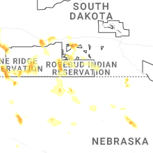
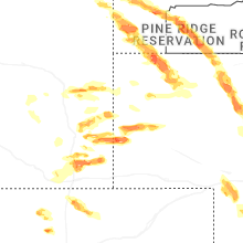
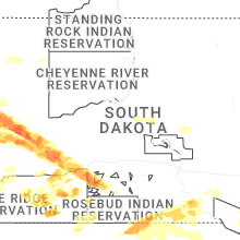
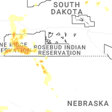
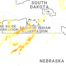


Connect with Interactive Hail Maps