

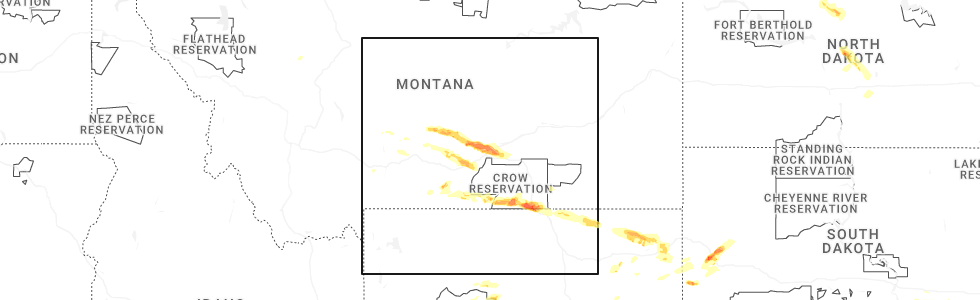
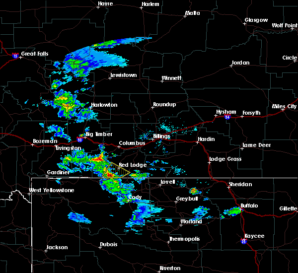
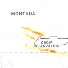
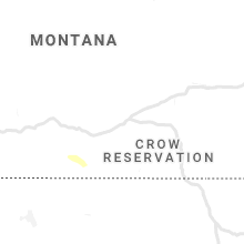
Hail Map for Bearcreek, MT
The Bearcreek, MT area has had 0 reports of on-the-ground hail by trained spotters, and has been under severe weather warnings 1 time during the past 12 months. Doppler radar has detected hail at or near Bearcreek, MT on 14 occasions, including 1 occasion during the past year.
| Name: | Bearcreek, MT |
| Where Located: | 53.5 miles SW of Billings, MT |
| Map: | Google Map for Bearcreek, MT |
| Population: | 79 |
| Housing Units: | 51 |
| More Info: | Search Google for Bearcreek, MT |
0
The Top Recent Hail Date for Bearcreek, MT is Monday, June 16, 2025 (14th out of 14)
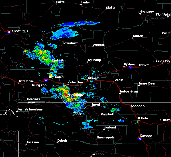
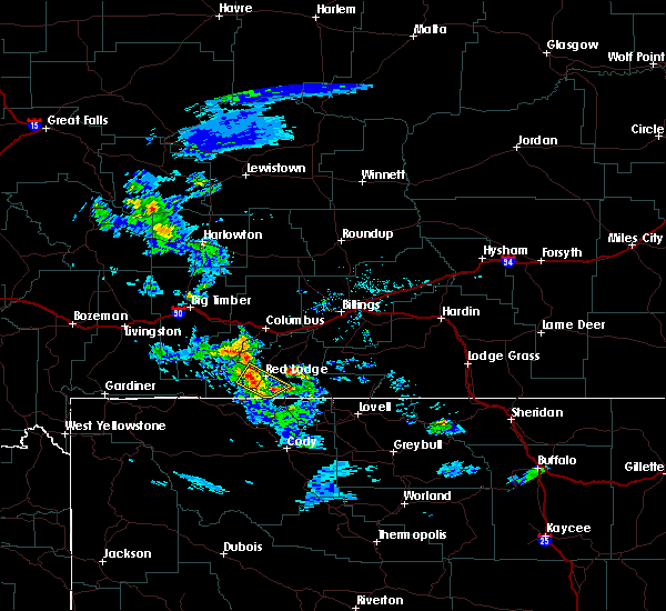
Hail and Wind Damage Spotted near Bearcreek, MT
| Date / Time | Report Details |
|---|---|
| 6/16/2025 4:38 PM MDT |
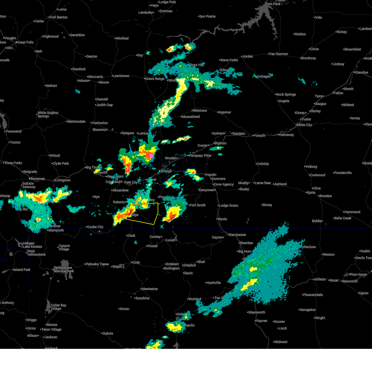 Svrbyz the national weather service in billings has issued a * severe thunderstorm warning for, western big horn county in south central montana, south central carbon county in south central montana, * until 530 pm mdt. * at 438 pm mdt, severe thunderstorms were located along a line from near bridger to 8 miles southeast of red lodge, or along a line from 15 miles northeast of red lodge to 8 miles southeast of red lodge, moving east at 35 mph (radar indicated). Hazards include 60 mph wind gusts and quarter size hail. Hail damage to vehicles is expected. Expect wind damage to roofs, siding, and trees. Svrbyz the national weather service in billings has issued a * severe thunderstorm warning for, western big horn county in south central montana, south central carbon county in south central montana, * until 530 pm mdt. * at 438 pm mdt, severe thunderstorms were located along a line from near bridger to 8 miles southeast of red lodge, or along a line from 15 miles northeast of red lodge to 8 miles southeast of red lodge, moving east at 35 mph (radar indicated). Hazards include 60 mph wind gusts and quarter size hail. Hail damage to vehicles is expected. Expect wind damage to roofs, siding, and trees.
|
| 7/23/2019 8:36 PM MDT |
 The severe thunderstorm warning for southwestern carbon county will expire at 845 pm mdt, the storm which prompted the warning has weakened below severe limits, and no longer poses an immediate threat to life or property. therefore, the warning will be allowed to expire. The severe thunderstorm warning for southwestern carbon county will expire at 845 pm mdt, the storm which prompted the warning has weakened below severe limits, and no longer poses an immediate threat to life or property. therefore, the warning will be allowed to expire.
|
| 7/23/2019 8:23 PM MDT |
 At 805 pm mdt, a severe thunderstorm was located near beartooth pass, or 12 miles southwest of red lodge, moving northeast at 20 mph (radar indicated). Hazards include 60 mph wind gusts and quarter size hail. Hail damage to vehicles is expected. Expect wind damage to roofs, siding, and trees. At 805 pm mdt, a severe thunderstorm was located near beartooth pass, or 12 miles southwest of red lodge, moving northeast at 20 mph (radar indicated). Hazards include 60 mph wind gusts and quarter size hail. Hail damage to vehicles is expected. Expect wind damage to roofs, siding, and trees.
|
| 7/23/2019 8:05 PM MDT |
 The national weather service in billings has issued a * severe thunderstorm warning for. southwestern carbon county in south central montana. until 845 pm mdt. At 805 pm mdt, a severe thunderstorm was located near beartooth pass, or 12 miles southwest of red lodge, moving northeast at 20. The national weather service in billings has issued a * severe thunderstorm warning for. southwestern carbon county in south central montana. until 845 pm mdt. At 805 pm mdt, a severe thunderstorm was located near beartooth pass, or 12 miles southwest of red lodge, moving northeast at 20.
|
| 7/26/2018 5:33 PM MDT |
 At 532 pm mdt, a severe thunderstorm was located 7 miles west of fromberg, or 15 miles northeast of red lodge, moving southeast at 40 mph (trained weather spotters. golfball hail was reported 7 miles south of columbus with this storm). Hazards include golf ball size hail and 60 mph wind gusts. People and animals outdoors will be injured. expect hail damage to roofs, siding, windows, and vehicles. Expect wind damage to roofs, siding, and trees. At 532 pm mdt, a severe thunderstorm was located 7 miles west of fromberg, or 15 miles northeast of red lodge, moving southeast at 40 mph (trained weather spotters. golfball hail was reported 7 miles south of columbus with this storm). Hazards include golf ball size hail and 60 mph wind gusts. People and animals outdoors will be injured. expect hail damage to roofs, siding, windows, and vehicles. Expect wind damage to roofs, siding, and trees.
|
| 8/1/2017 9:38 PM MDT |
 The severe thunderstorm warning for western big horn and southeastern carbon counties will expire at 945 pm mdt, the storm which prompted the warning has weakened below severe limits, and no longer poses an immediate threat to life or property. therefore the warning has been cancelled. however small hail, gusty winds and heavy rain are still possible with this thunderstorm. The severe thunderstorm warning for western big horn and southeastern carbon counties will expire at 945 pm mdt, the storm which prompted the warning has weakened below severe limits, and no longer poses an immediate threat to life or property. therefore the warning has been cancelled. however small hail, gusty winds and heavy rain are still possible with this thunderstorm.
|
| 8/1/2017 9:12 PM MDT |
 At 909 pm mdt, a severe thunderstorm was located near bridger, or 10 miles east of red lodge, moving southeast at 30 mph (radar indicated). Hazards include 60 mph wind gusts and quarter size hail. Hail damage to vehicles is expected. expect wind damage to roofs, siding, and trees. Locations impacted include, red lodge, bridger, fromberg, bearcreek, cooney reservoir state park, warren, belfry, washoe, roberts and fox. At 909 pm mdt, a severe thunderstorm was located near bridger, or 10 miles east of red lodge, moving southeast at 30 mph (radar indicated). Hazards include 60 mph wind gusts and quarter size hail. Hail damage to vehicles is expected. expect wind damage to roofs, siding, and trees. Locations impacted include, red lodge, bridger, fromberg, bearcreek, cooney reservoir state park, warren, belfry, washoe, roberts and fox.
|
| 8/1/2017 8:47 PM MDT |
 At 846 pm mdt, a severe thunderstorm was located near roberts, or 11 miles north of red lodge, moving southeast at 30 mph (radar indicated). Hazards include 60 mph wind gusts and quarter size hail. Hail damage to vehicles is expected. Expect wind damage to roofs, siding, and trees. At 846 pm mdt, a severe thunderstorm was located near roberts, or 11 miles north of red lodge, moving southeast at 30 mph (radar indicated). Hazards include 60 mph wind gusts and quarter size hail. Hail damage to vehicles is expected. Expect wind damage to roofs, siding, and trees.
|
| 6/12/2017 5:47 PM MDT |
 At 547 pm mdt, a severe thunderstorm was located near elk basin, or 17 miles southeast of red lodge, moving north at 30 mph (radar indicated). Hazards include 70 mph wind gusts and half dollar size hail. Hail damage to vehicles is expected. expect considerable tree damage. wind damage is also likely to mobile homes, roofs, and outbuildings. Locations impacted include, red lodge, bridger, bearcreek, belfry, fox and washoe. At 547 pm mdt, a severe thunderstorm was located near elk basin, or 17 miles southeast of red lodge, moving north at 30 mph (radar indicated). Hazards include 70 mph wind gusts and half dollar size hail. Hail damage to vehicles is expected. expect considerable tree damage. wind damage is also likely to mobile homes, roofs, and outbuildings. Locations impacted include, red lodge, bridger, bearcreek, belfry, fox and washoe.
|
| 6/12/2017 5:35 PM MDT |
 At 534 pm mdt, a severe thunderstorm was located near elk basin, or 18 miles northwest of powell, moving north at 30 mph (radar indicated). Hazards include 70 mph wind gusts and half dollar size hail. Hail damage to vehicles is expected. expect considerable tree damage. Wind damage is also likely to mobile homes, roofs, and outbuildings. At 534 pm mdt, a severe thunderstorm was located near elk basin, or 18 miles northwest of powell, moving north at 30 mph (radar indicated). Hazards include 70 mph wind gusts and half dollar size hail. Hail damage to vehicles is expected. expect considerable tree damage. Wind damage is also likely to mobile homes, roofs, and outbuildings.
|
Hail Maps for Bearcreek, MT


Connect with Interactive Hail Maps