

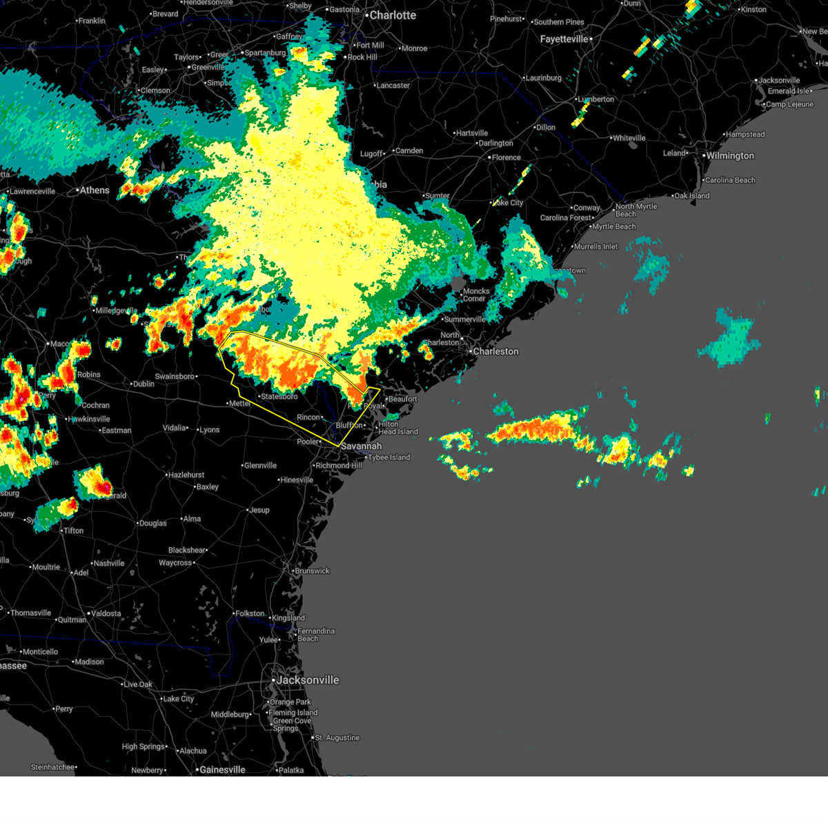
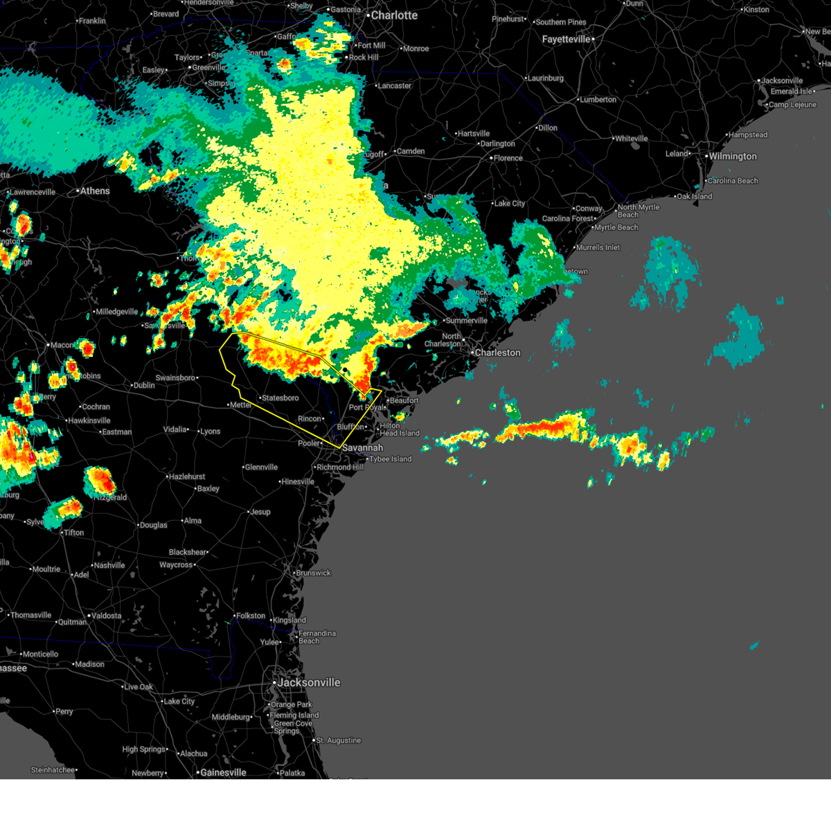
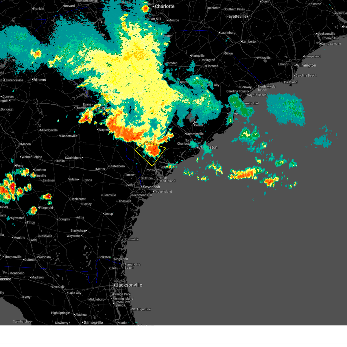
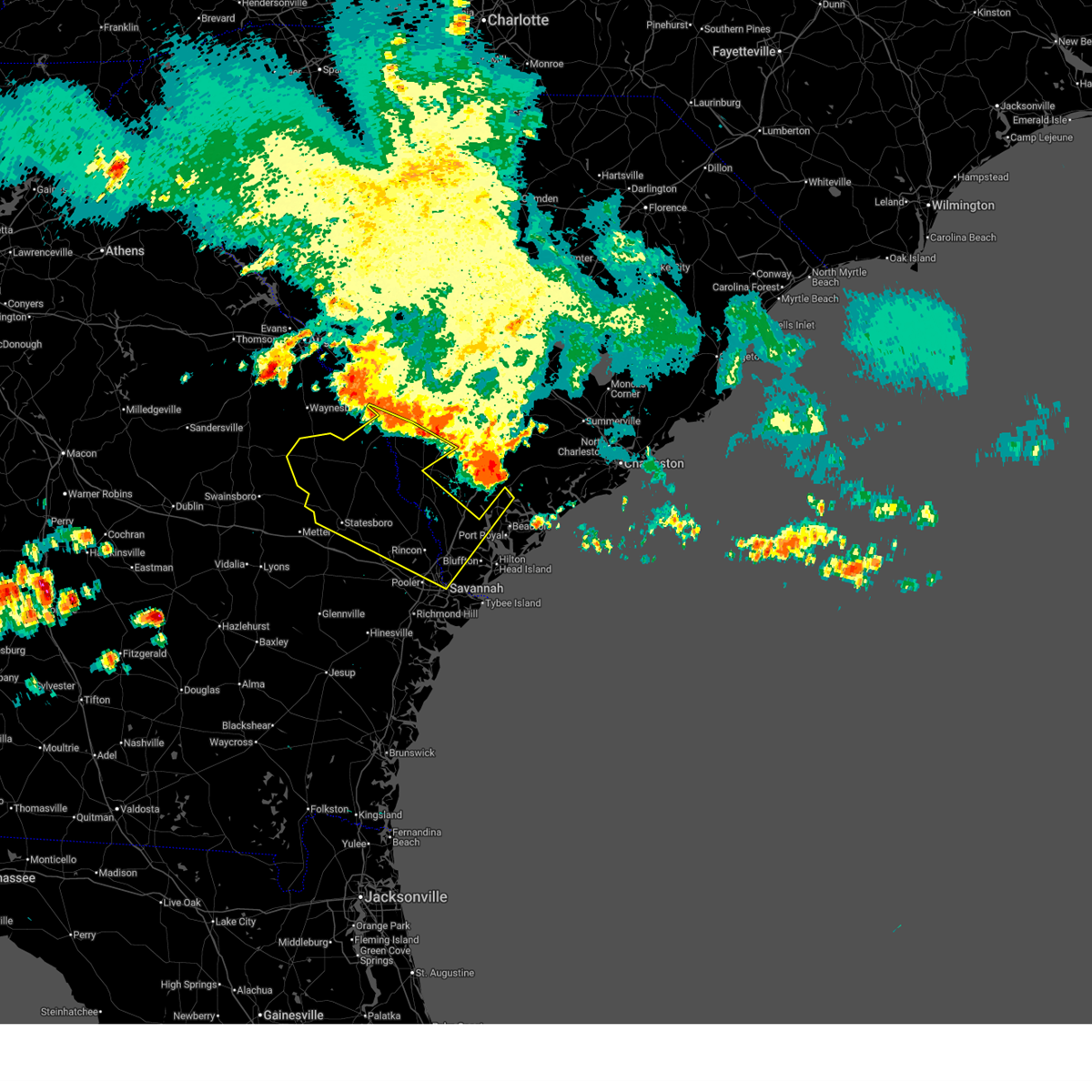
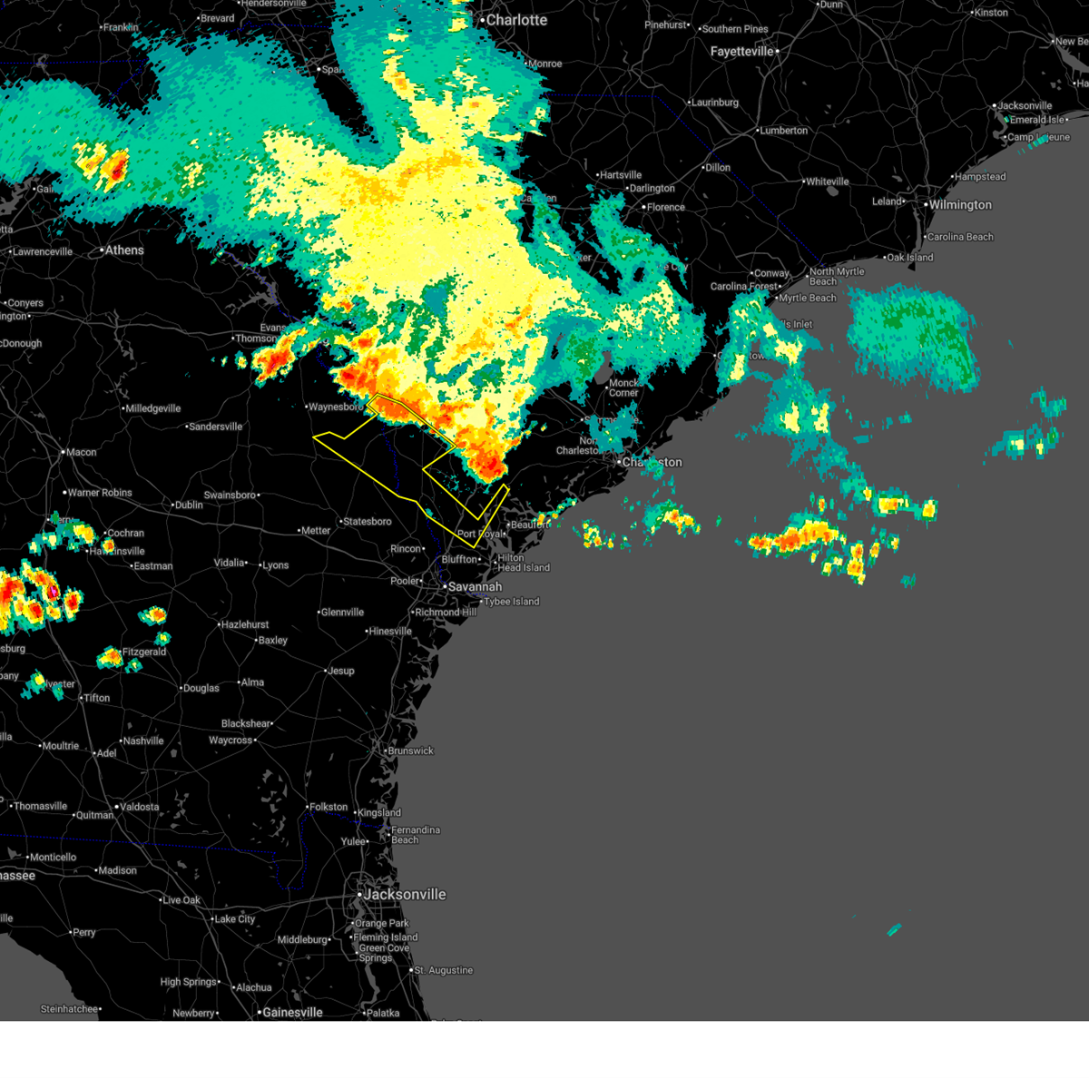
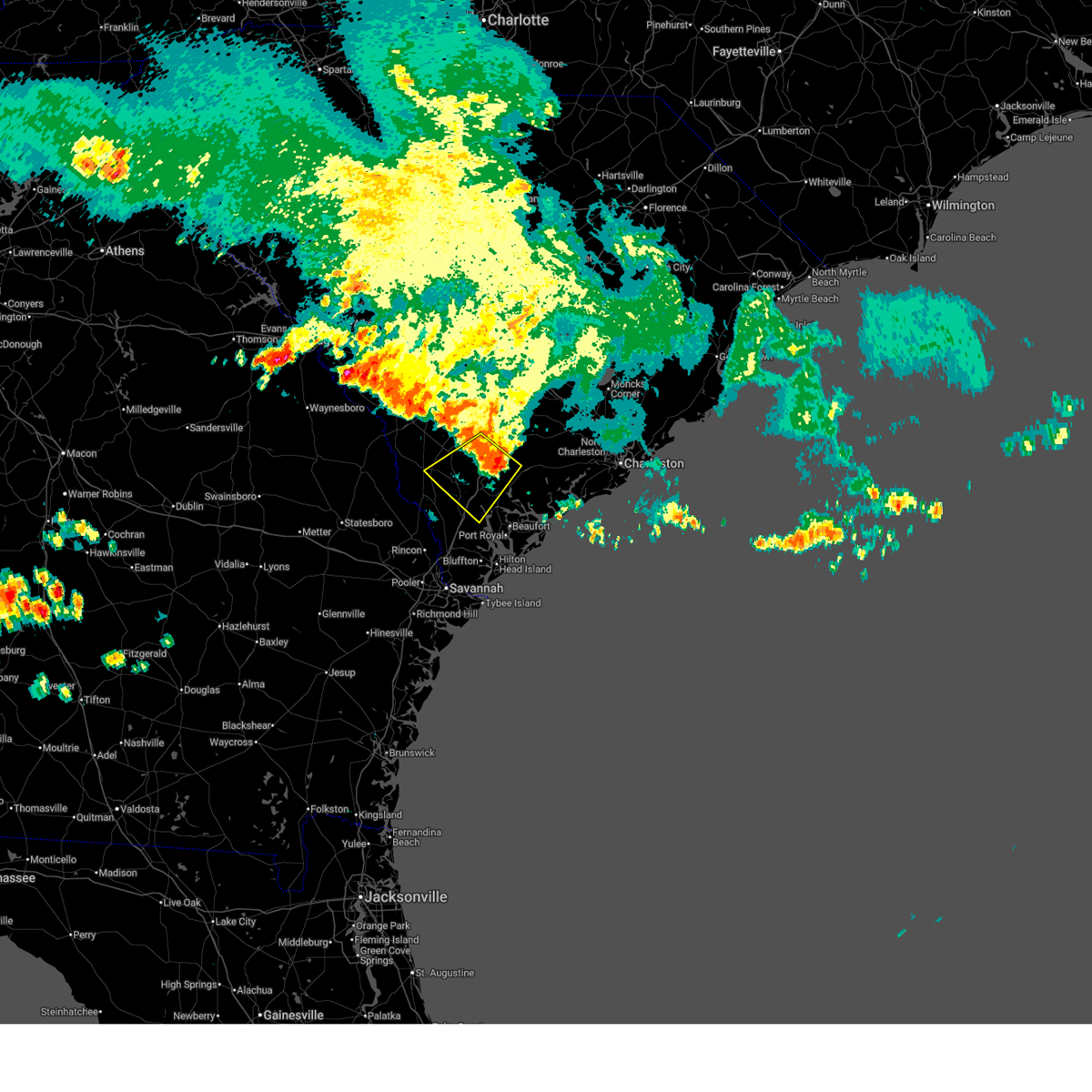
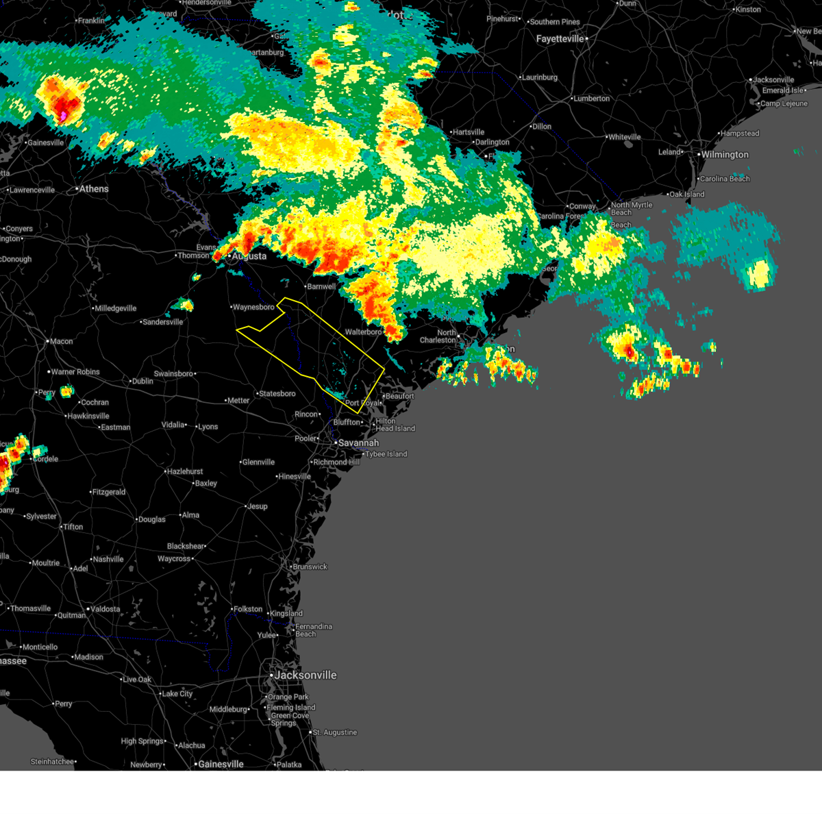
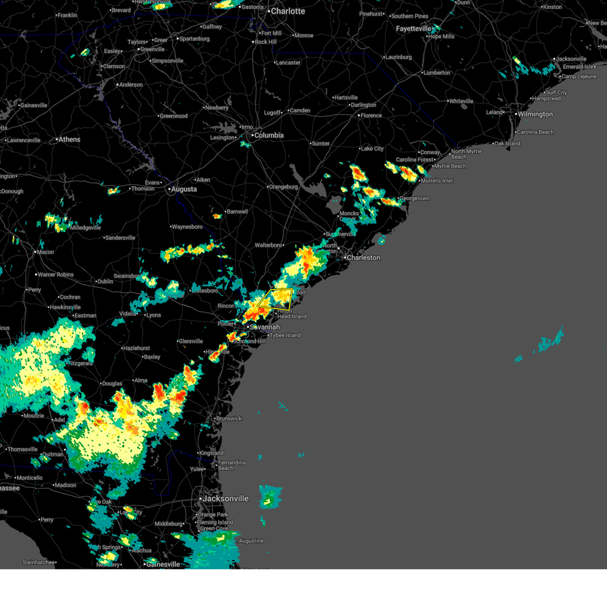
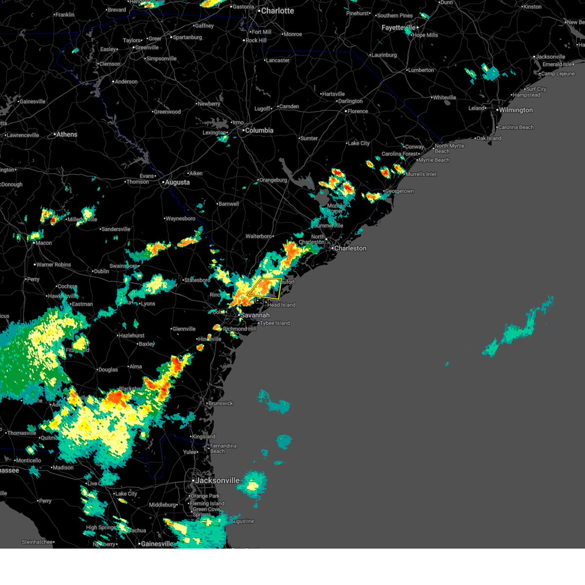
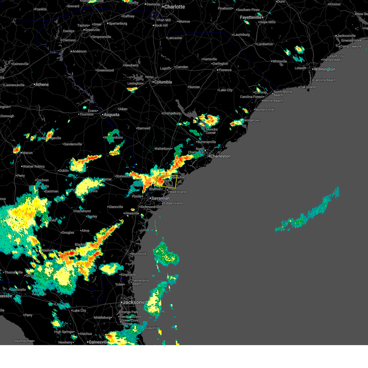
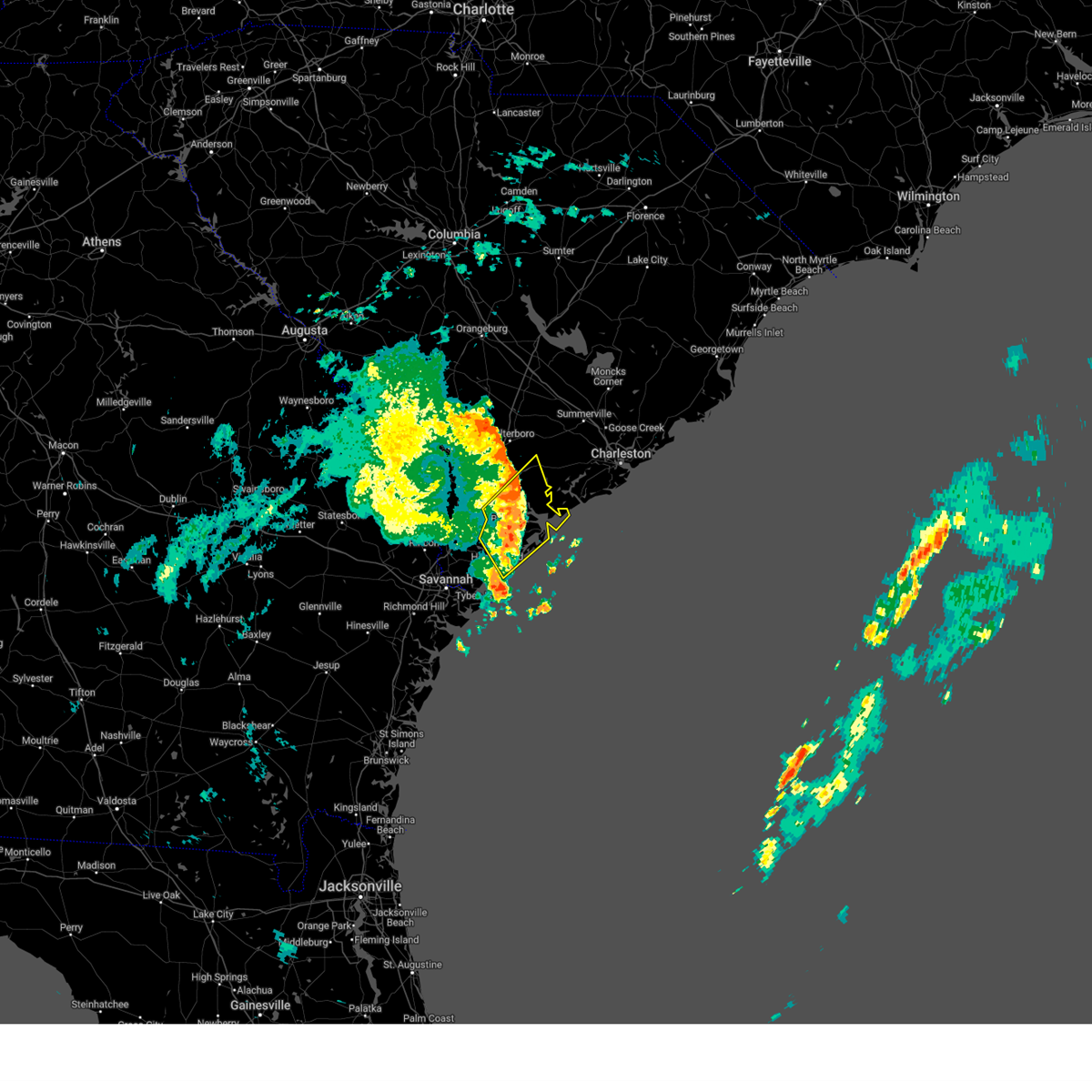
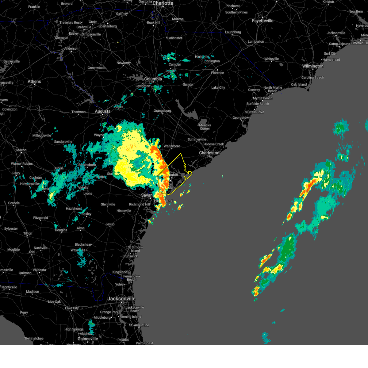
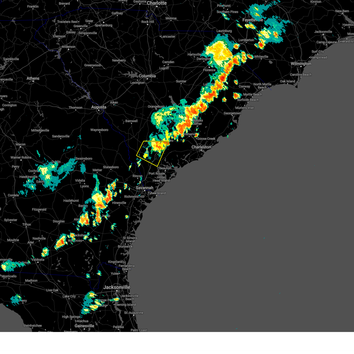
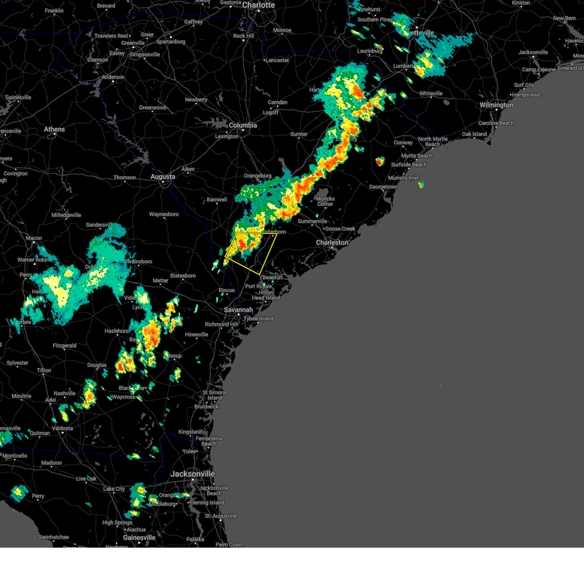
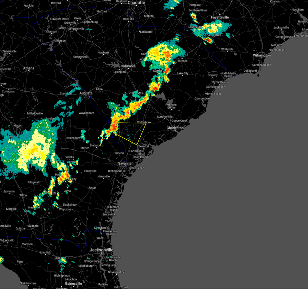
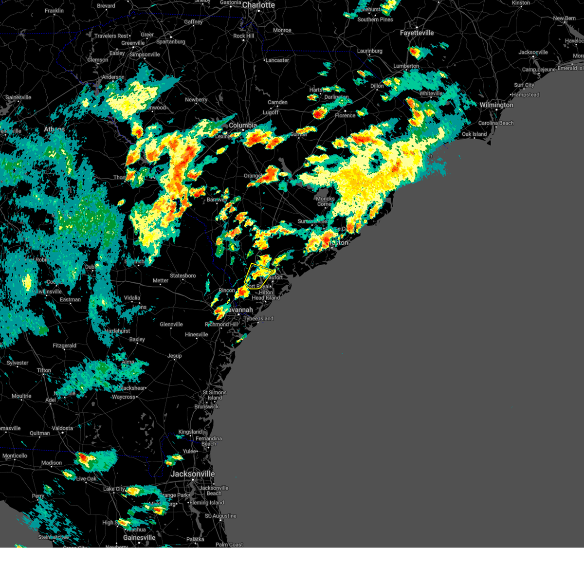
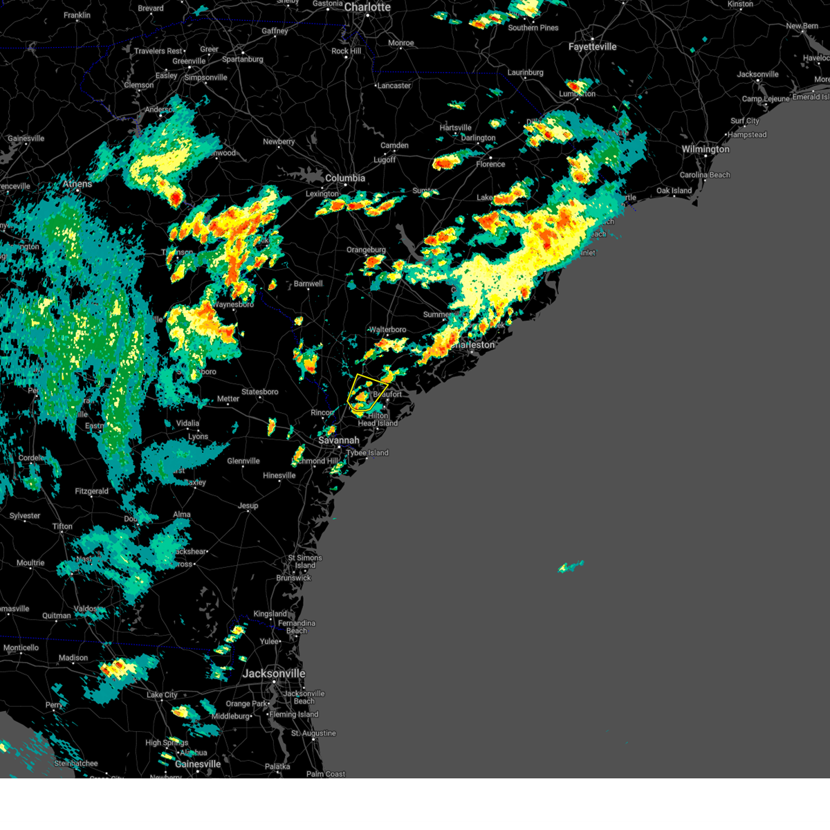
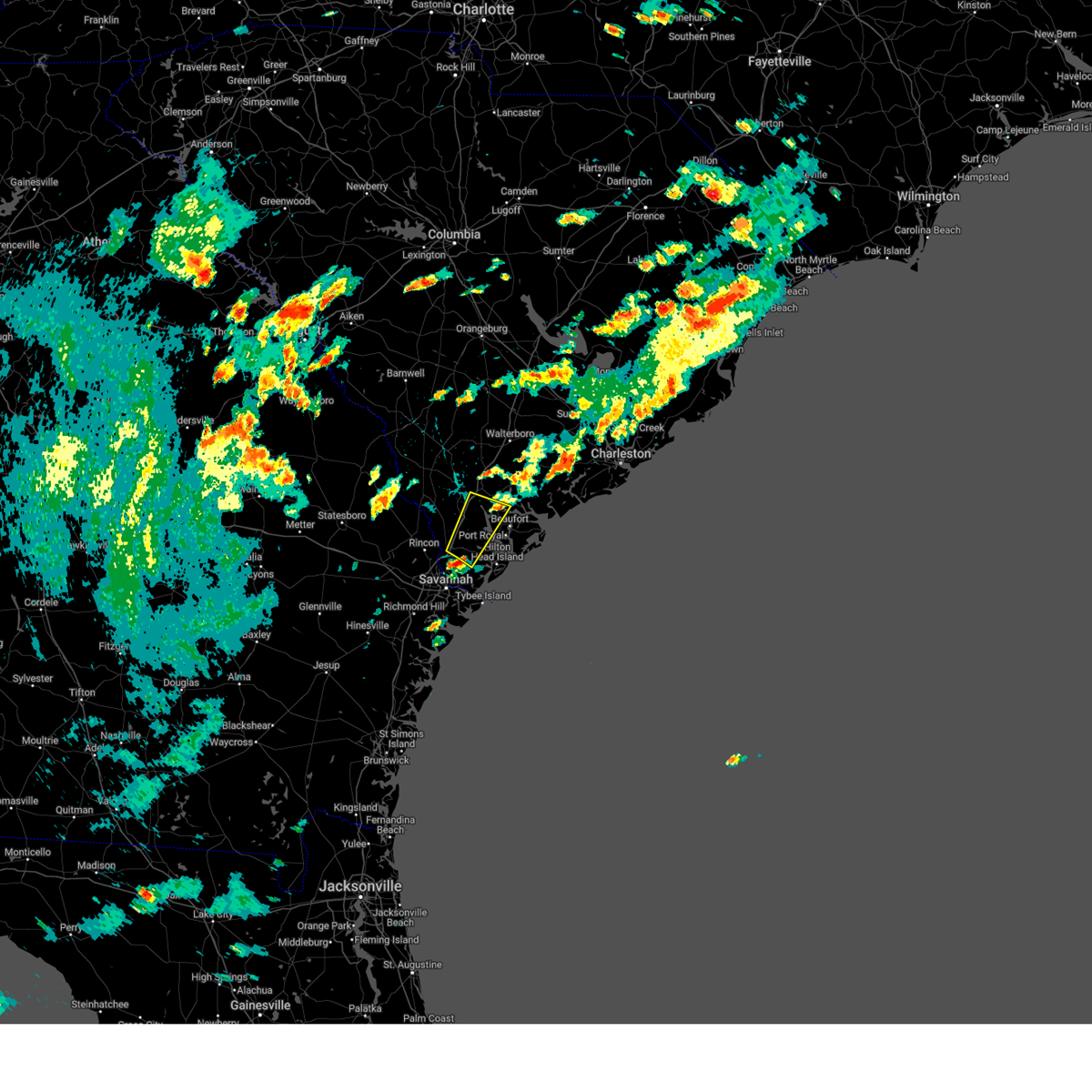
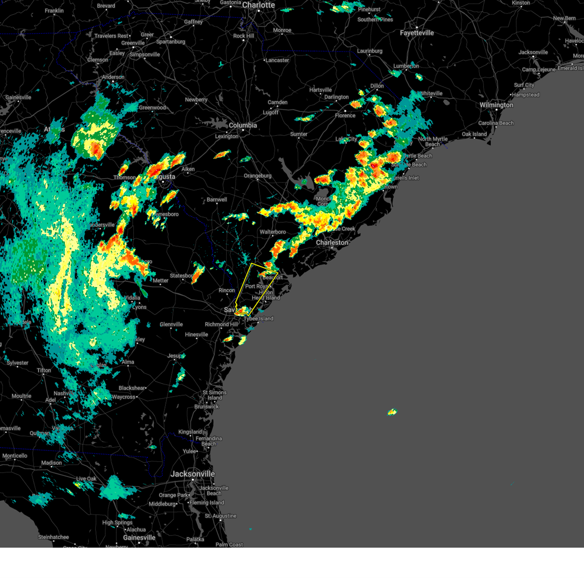
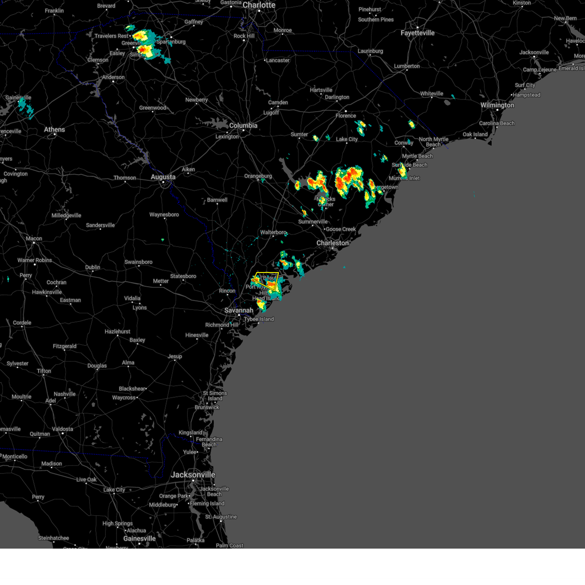
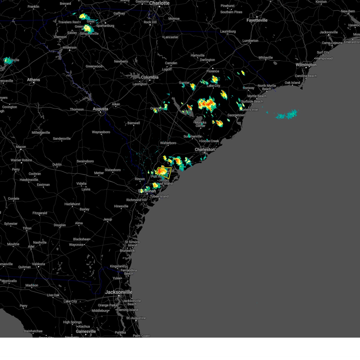
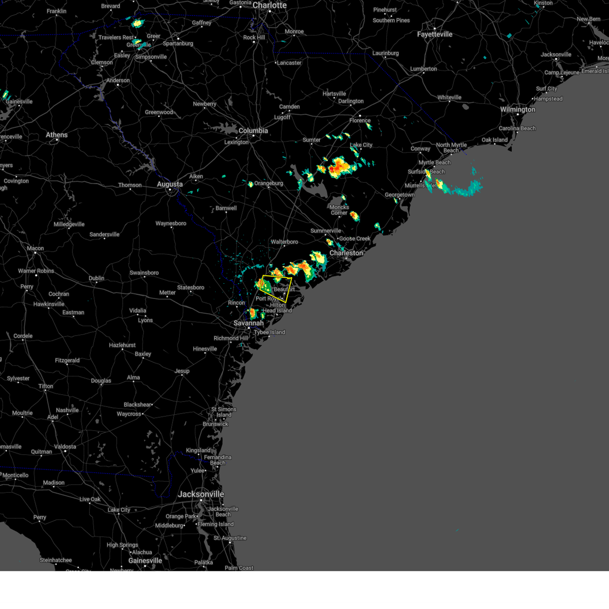
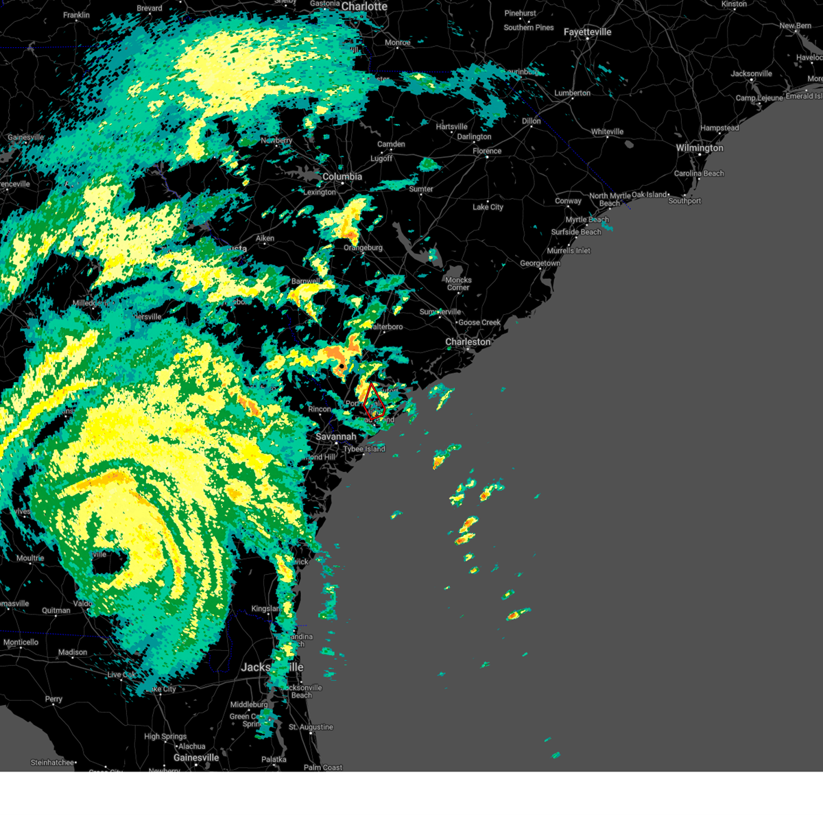
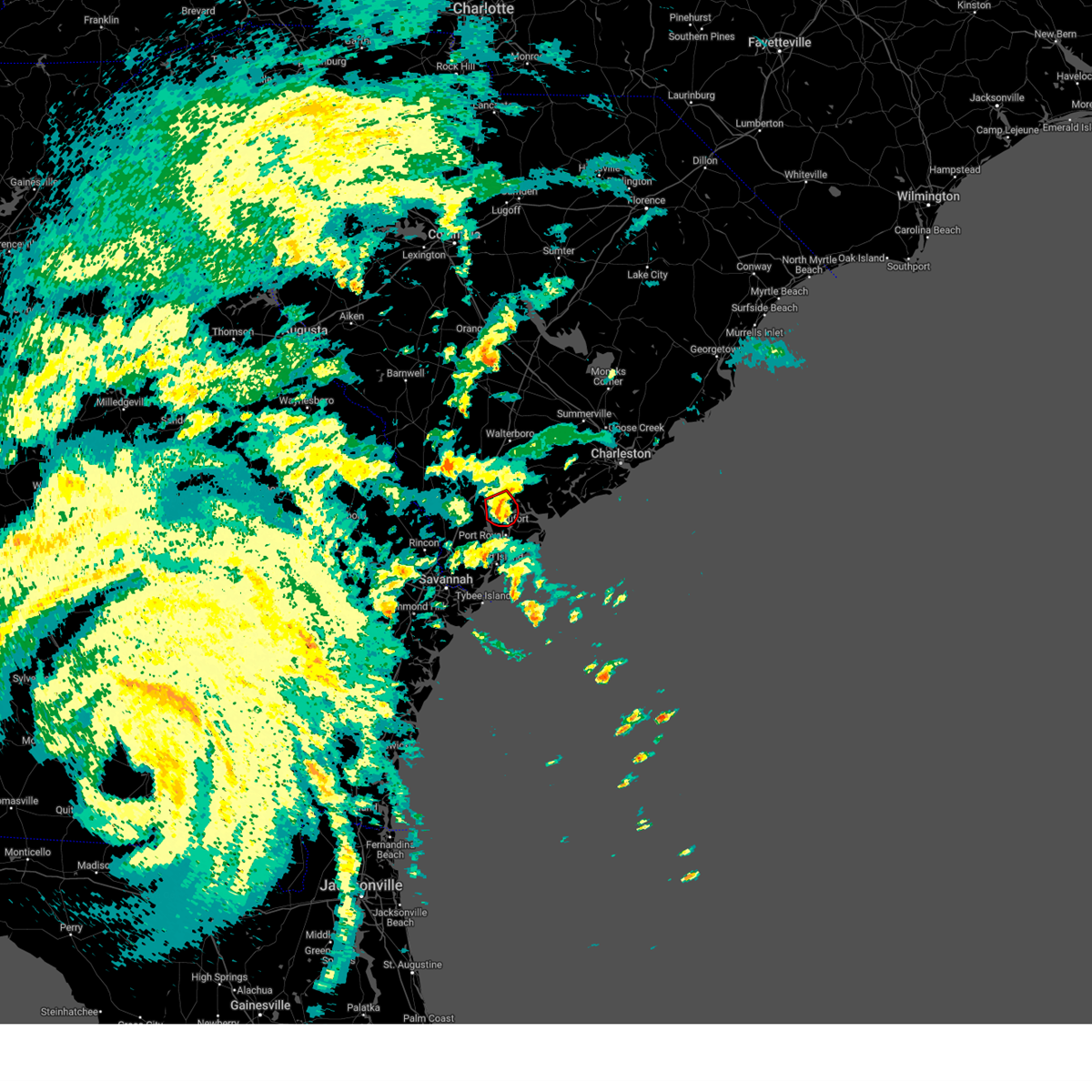
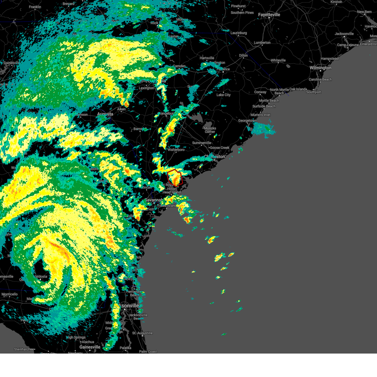
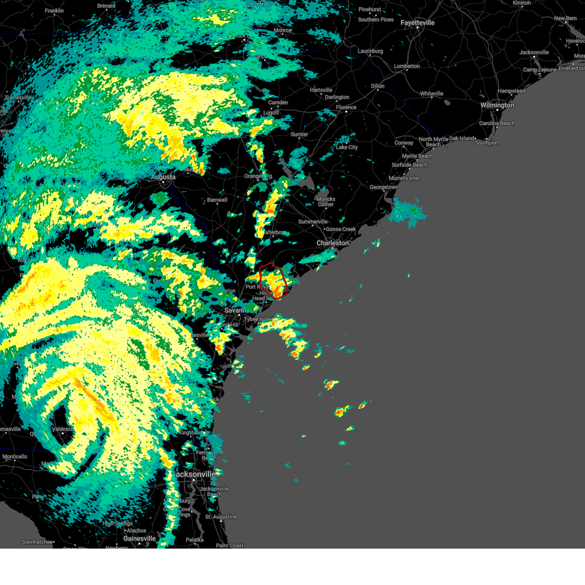
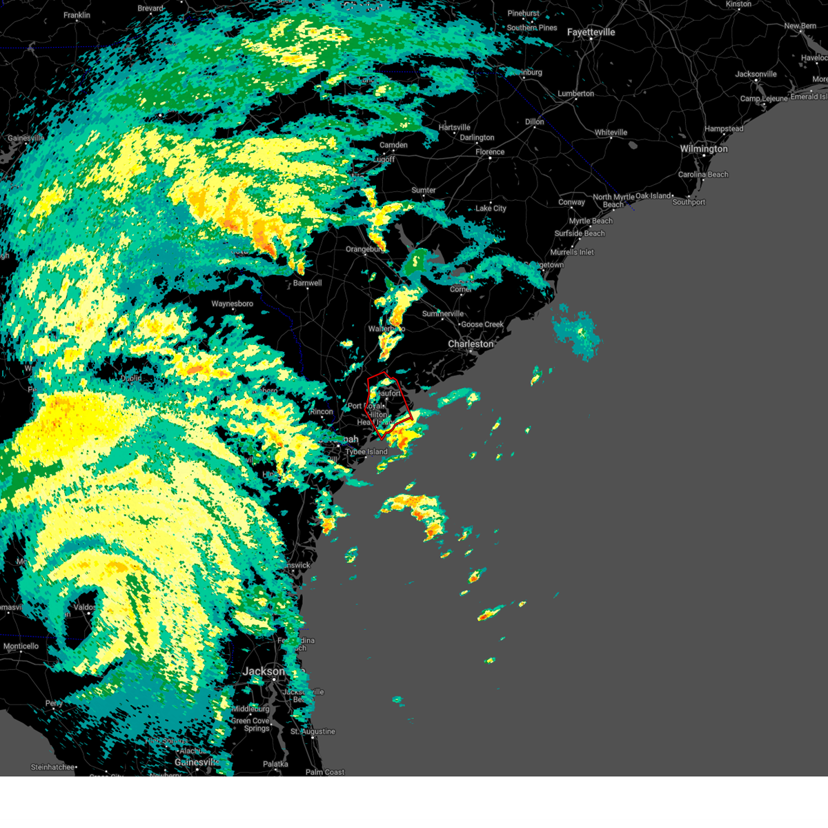
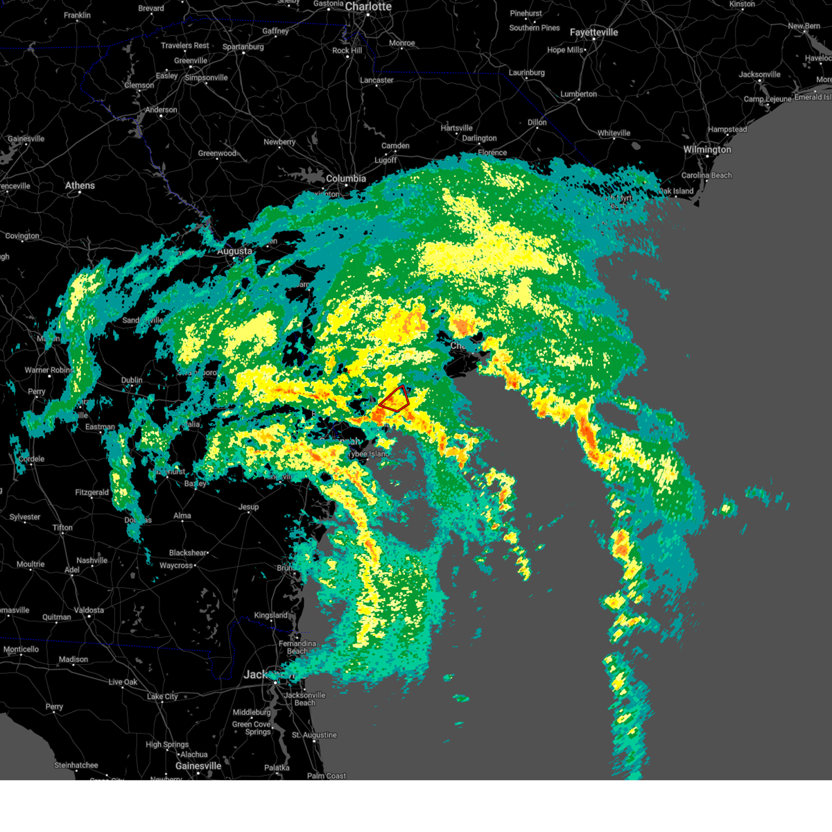
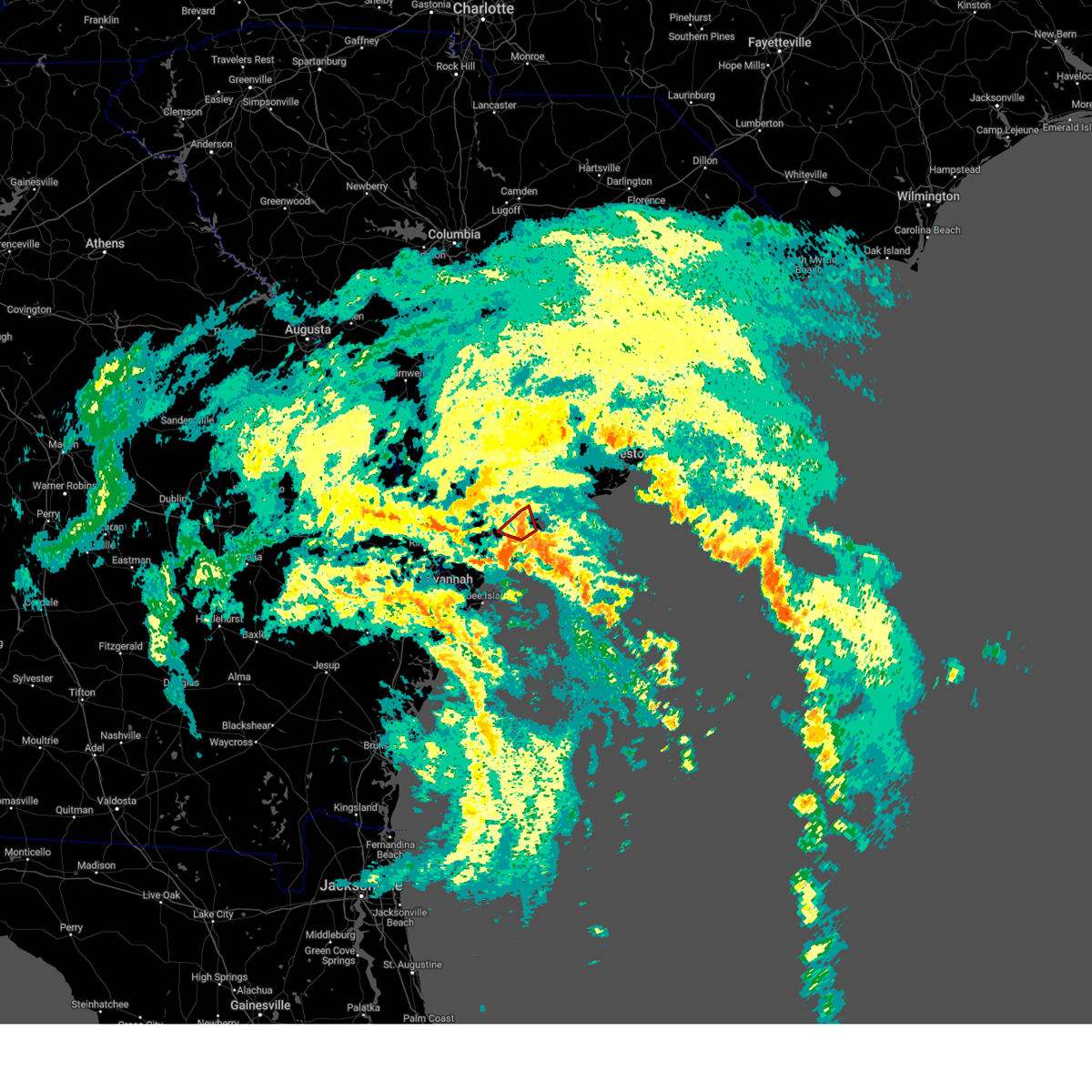
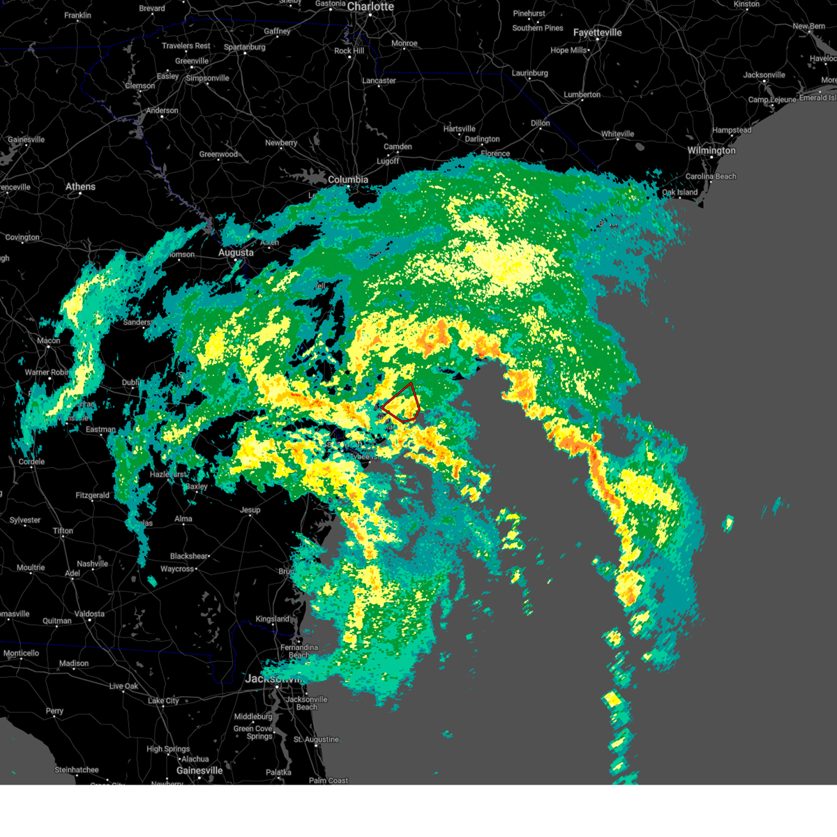
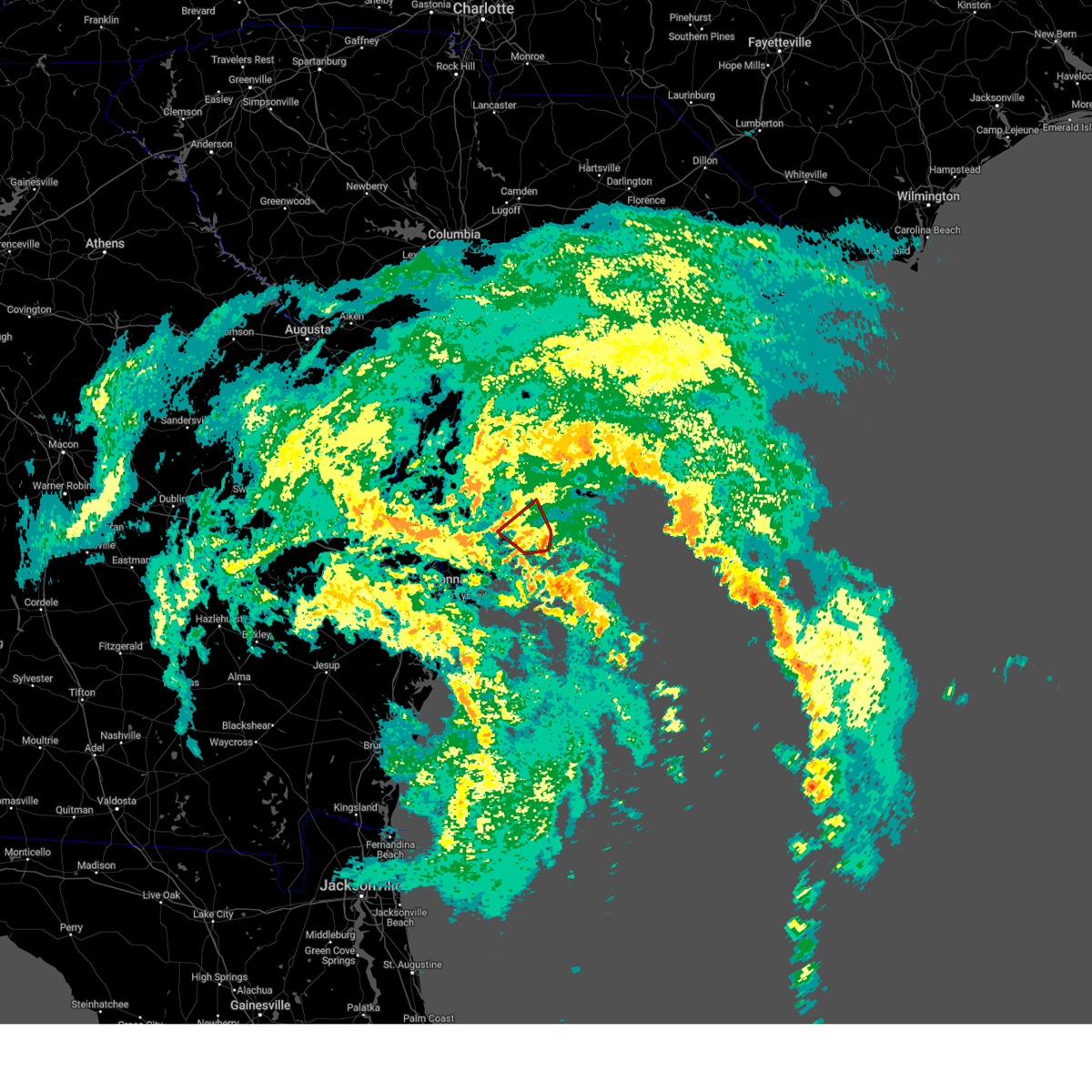
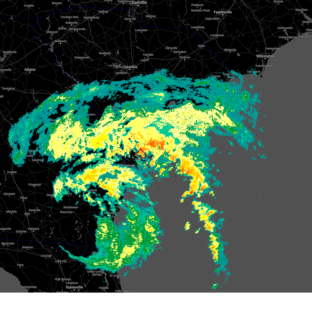
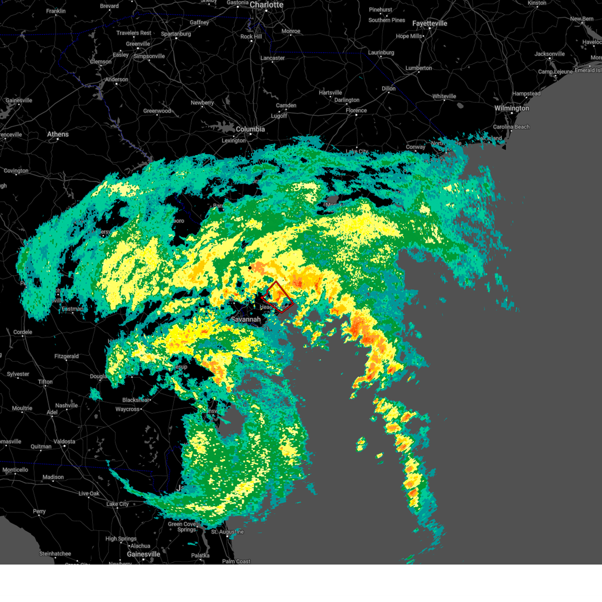
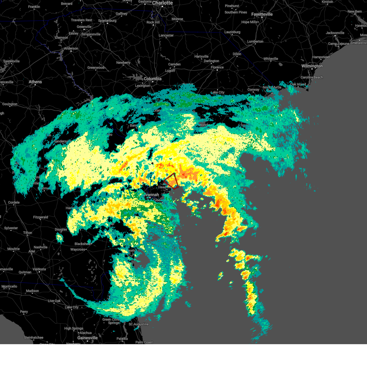
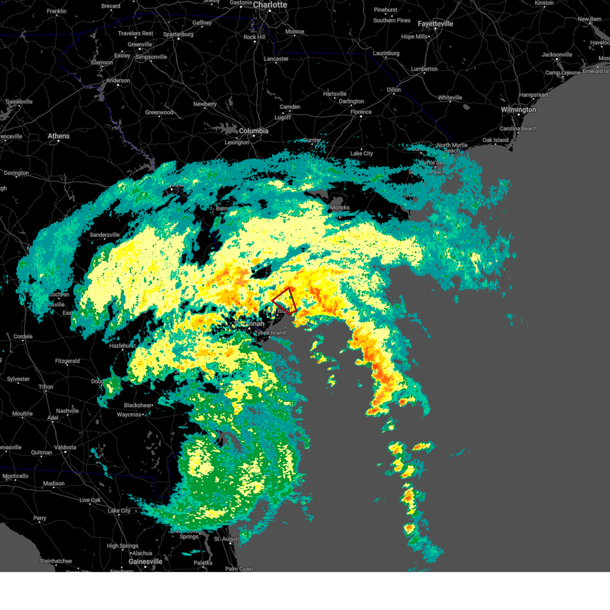
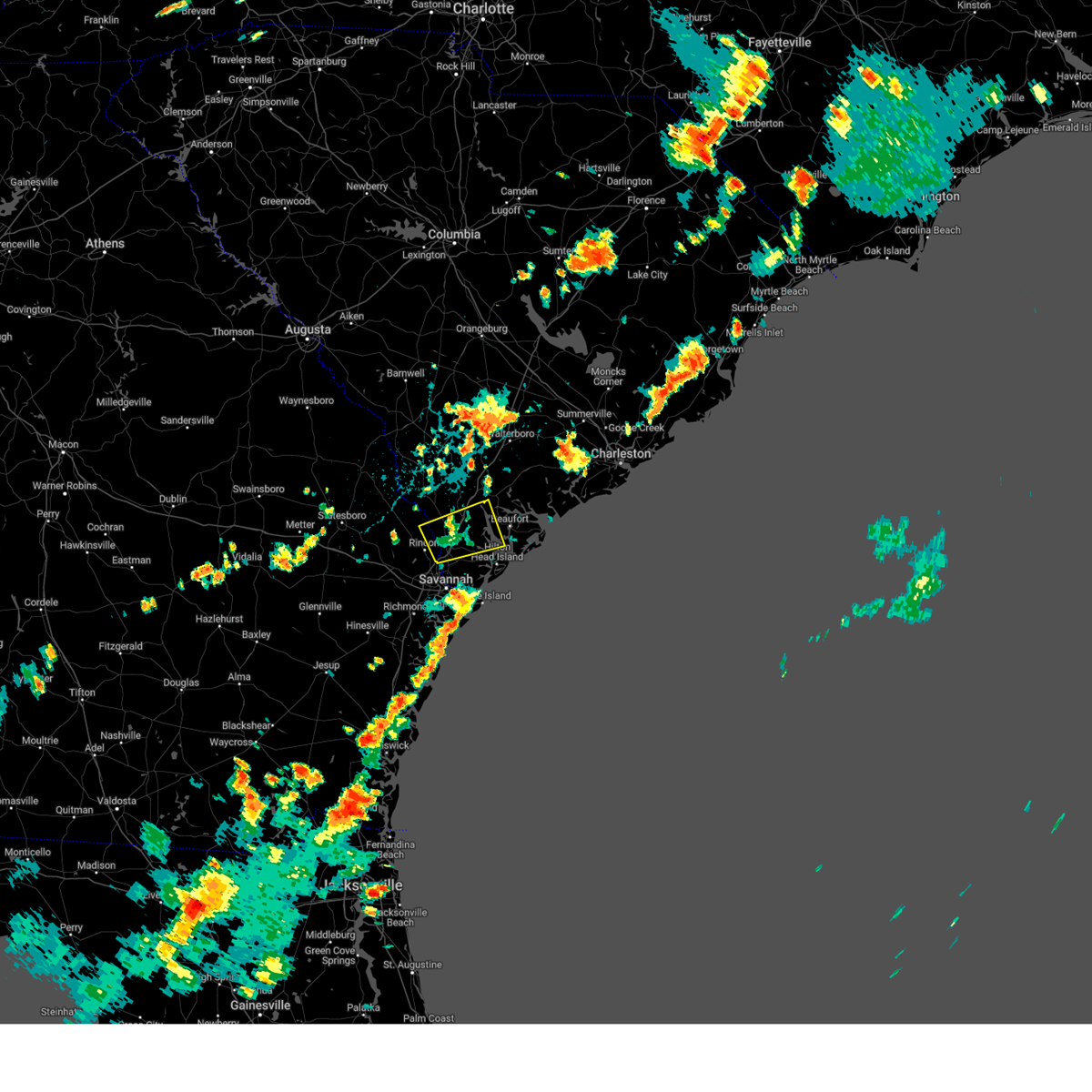
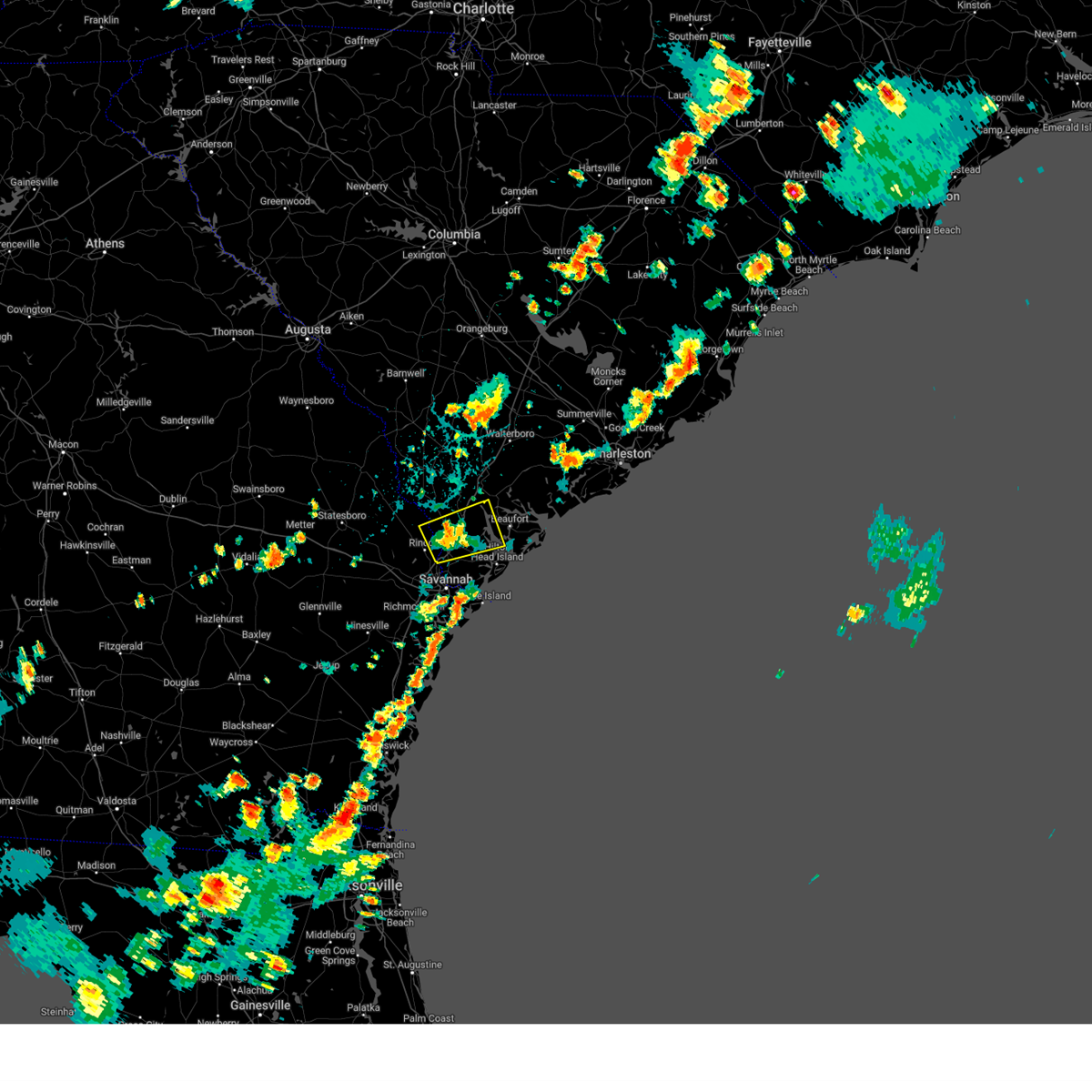
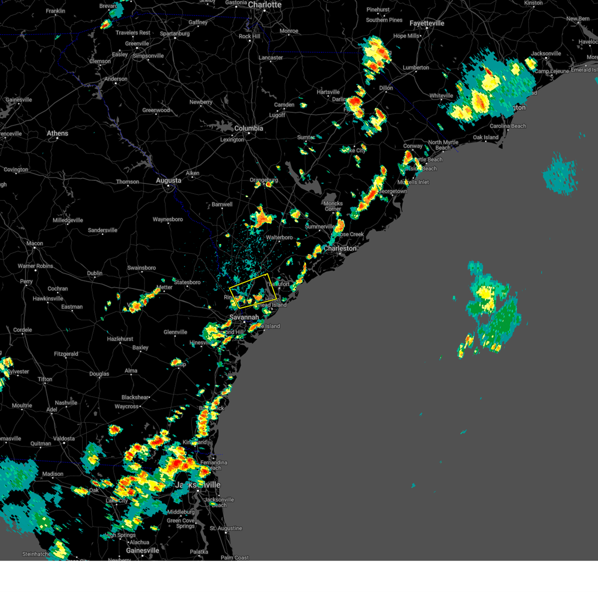
Hail Map for Beaufort, SC
The Beaufort, SC area has had 14 reports of on-the-ground hail by trained spotters, and has been under severe weather warnings 62 times during the past 12 months. Doppler radar has detected hail at or near Beaufort, SC on 62 occasions, including 3 occasions during the past year.
| Name: | Beaufort, SC |
| Where Located: | 33.7 miles NE of Savannah, GA |
| Map: | Google Map for Beaufort, SC |
| Population: | 12361 |
| Housing Units: | 5630 |
| More Info: | Search Google for Beaufort, SC |
1
The Top Recent Hail Date for Beaufort, SC is Sunday, May 25, 2025 (2nd out of 62)

Hail and Wind Damage Spotted near Beaufort, SC
| Date / Time | Report Details |
|---|---|
| 6/25/2025 11:40 PM EDT |
 The severe thunderstorm warning that was previously in effect has been reissued for screven, jenkins, effingham, and bulloch counties and is in effect until 1230 am edt. please refer to that bulletin for the latest severe weather information. a severe thunderstorm watch remains in effect until 400 am edt for portions of southeast georgia and southeast south carolina. The severe thunderstorm warning that was previously in effect has been reissued for screven, jenkins, effingham, and bulloch counties and is in effect until 1230 am edt. please refer to that bulletin for the latest severe weather information. a severe thunderstorm watch remains in effect until 400 am edt for portions of southeast georgia and southeast south carolina.
|
| 6/25/2025 11:23 PM EDT |
 The storms which prompted the warning have weakened below severe limits, and have exited the warned area. therefore, the warning will be allowed to expire. a severe thunderstorm watch remains in effect until 1200 am edt for a portion of southeast south carolina. The storms which prompted the warning have weakened below severe limits, and have exited the warned area. therefore, the warning will be allowed to expire. a severe thunderstorm watch remains in effect until 1200 am edt for a portion of southeast south carolina.
|
| 6/25/2025 11:22 PM EDT |
 At 1122 pm edt, severe thunderstorms were located along a line from over old house to over millen, moving southwest at 30 mph (law enforcement reported. at 1020 pm, law enforcement officials reported trees down near sylvania as well as other portions of screven county). Hazards include 60 mph wind gusts and small hail. Expect damage to roofs, siding, and trees. locations impacted include, beaufort, sylvania, ridgeland, millen, springfield, statesboro, bluffton, godley station, savannah international airport and pooler. this includes the following highways, i-95 in georgia between mile markers 106 and 112. I-95 in south carolina between mile markers 2 and 25. At 1122 pm edt, severe thunderstorms were located along a line from over old house to over millen, moving southwest at 30 mph (law enforcement reported. at 1020 pm, law enforcement officials reported trees down near sylvania as well as other portions of screven county). Hazards include 60 mph wind gusts and small hail. Expect damage to roofs, siding, and trees. locations impacted include, beaufort, sylvania, ridgeland, millen, springfield, statesboro, bluffton, godley station, savannah international airport and pooler. this includes the following highways, i-95 in georgia between mile markers 106 and 112. I-95 in south carolina between mile markers 2 and 25.
|
| 6/25/2025 10:57 PM EDT |
 At 1057 pm edt, severe thunderstorms were located along a line from near clarendon to over early branch, moving south at 30 mph (radar indicated). Hazards include 60 mph wind gusts and quarter size hail. Hail damage to vehicles is expected. expect wind damage to roofs, siding, and trees. locations impacted include, yemassee, pocotaligo, cummings, early branch, mcphersonville, estill, coosawhatchie, grays, furman and ridgeland. This includes i-95 in south carolina between mile markers 25 and 49. At 1057 pm edt, severe thunderstorms were located along a line from near clarendon to over early branch, moving south at 30 mph (radar indicated). Hazards include 60 mph wind gusts and quarter size hail. Hail damage to vehicles is expected. expect wind damage to roofs, siding, and trees. locations impacted include, yemassee, pocotaligo, cummings, early branch, mcphersonville, estill, coosawhatchie, grays, furman and ridgeland. This includes i-95 in south carolina between mile markers 25 and 49.
|
| 6/25/2025 10:49 PM EDT |
 Svrchs the national weather service in charleston has issued a * severe thunderstorm warning for portions of, bulloch county in southeastern georgia, chatham county in southeastern georgia, effingham county in southeastern georgia, jenkins county in southeastern georgia, screven county in southeastern georgia, allendale county in southeastern south carolina, beaufort county in southeastern south carolina, hampton county in southeastern south carolina, jasper county in southeastern south carolina, * until 1145 pm edt. * at 1049 pm edt, severe thunderstorms were located along a line from near sheldon to 12 miles northeast of perkins, moving southwest at 30 mph (radar indicated). Hazards include 60 mph wind gusts and small hail. expect damage to roofs, siding, and trees Svrchs the national weather service in charleston has issued a * severe thunderstorm warning for portions of, bulloch county in southeastern georgia, chatham county in southeastern georgia, effingham county in southeastern georgia, jenkins county in southeastern georgia, screven county in southeastern georgia, allendale county in southeastern south carolina, beaufort county in southeastern south carolina, hampton county in southeastern south carolina, jasper county in southeastern south carolina, * until 1145 pm edt. * at 1049 pm edt, severe thunderstorms were located along a line from near sheldon to 12 miles northeast of perkins, moving southwest at 30 mph (radar indicated). Hazards include 60 mph wind gusts and small hail. expect damage to roofs, siding, and trees
|
| 6/25/2025 10:44 PM EDT |
 At 1044 pm edt, a severe thunderstorm was located over yemassee, moving southwest at 20 mph (emergency management reported. at 1020 pm, golf ball size hail was reported in hendersonville). Hazards include golf ball size hail and 70 mph wind gusts. People and animals outdoors will be injured. expect hail damage to roofs, siding, windows, and vehicles. expect considerable tree damage. wind damage is also likely to mobile homes, roofs, and outbuildings. locations impacted include, yemassee, early branch, cummings, mcphersonville, pocotaligo, grays, coosawhatchie, ridgeland, estill and furman. This includes i-95 in south carolina between mile markers 25 and 53. At 1044 pm edt, a severe thunderstorm was located over yemassee, moving southwest at 20 mph (emergency management reported. at 1020 pm, golf ball size hail was reported in hendersonville). Hazards include golf ball size hail and 70 mph wind gusts. People and animals outdoors will be injured. expect hail damage to roofs, siding, windows, and vehicles. expect considerable tree damage. wind damage is also likely to mobile homes, roofs, and outbuildings. locations impacted include, yemassee, early branch, cummings, mcphersonville, pocotaligo, grays, coosawhatchie, ridgeland, estill and furman. This includes i-95 in south carolina between mile markers 25 and 53.
|
| 6/25/2025 10:43 PM EDT |
 At 1043 pm edt, severe thunderstorms were located along a line from over gardens corner to 12 miles northwest of millhaven, moving southwest at 30 mph (radar indicated). Hazards include 60 mph wind gusts and small hail. Expect damage to roofs, siding, and trees. locations impacted include, ridgeland, allendale, sylvania, hampton, lake warren state park, clarendon, jasper, varnville, estill and fairfax. This includes i-95 in south carolina between mile markers 14 and 25. At 1043 pm edt, severe thunderstorms were located along a line from over gardens corner to 12 miles northwest of millhaven, moving southwest at 30 mph (radar indicated). Hazards include 60 mph wind gusts and small hail. Expect damage to roofs, siding, and trees. locations impacted include, ridgeland, allendale, sylvania, hampton, lake warren state park, clarendon, jasper, varnville, estill and fairfax. This includes i-95 in south carolina between mile markers 14 and 25.
|
| 6/25/2025 10:43 PM EDT |
 the severe thunderstorm warning has been cancelled and is no longer in effect the severe thunderstorm warning has been cancelled and is no longer in effect
|
| 6/25/2025 10:29 PM EDT |
 At 1029 pm edt, a severe thunderstorm was located near hendersonville, moving southwest at 20 mph (emergency management reported. at 1020 pm, golf ball size hail was reported in hendersonville). Hazards include golf ball size hail and 70 mph wind gusts. People and animals outdoors will be injured. expect hail damage to roofs, siding, windows, and vehicles. expect considerable tree damage. wind damage is also likely to mobile homes, roofs, and outbuildings. locations impacted include, yemassee, early branch, cummings, mcphersonville, pocotaligo, grays, coosawhatchie, ridgeland, estill and furman. This includes i-95 in south carolina between mile markers 25 and 53. At 1029 pm edt, a severe thunderstorm was located near hendersonville, moving southwest at 20 mph (emergency management reported. at 1020 pm, golf ball size hail was reported in hendersonville). Hazards include golf ball size hail and 70 mph wind gusts. People and animals outdoors will be injured. expect hail damage to roofs, siding, windows, and vehicles. expect considerable tree damage. wind damage is also likely to mobile homes, roofs, and outbuildings. locations impacted include, yemassee, early branch, cummings, mcphersonville, pocotaligo, grays, coosawhatchie, ridgeland, estill and furman. This includes i-95 in south carolina between mile markers 25 and 53.
|
| 6/25/2025 10:26 PM EDT |
 Svrchs the national weather service in charleston has issued a * severe thunderstorm warning for portions of, beaufort county in southeastern south carolina, colleton county in southeastern south carolina, hampton county in southeastern south carolina, jasper county in southeastern south carolina, * until 1130 pm edt. * at 1026 pm edt, a severe thunderstorm was located near hendersonville, moving southwest at 20 mph (radar indicated). Hazards include 70 mph wind gusts and ping pong ball size hail. People and animals outdoors will be injured. expect hail damage to roofs, siding, windows, and vehicles. expect considerable tree damage. Wind damage is also likely to mobile homes, roofs, and outbuildings. Svrchs the national weather service in charleston has issued a * severe thunderstorm warning for portions of, beaufort county in southeastern south carolina, colleton county in southeastern south carolina, hampton county in southeastern south carolina, jasper county in southeastern south carolina, * until 1130 pm edt. * at 1026 pm edt, a severe thunderstorm was located near hendersonville, moving southwest at 20 mph (radar indicated). Hazards include 70 mph wind gusts and ping pong ball size hail. People and animals outdoors will be injured. expect hail damage to roofs, siding, windows, and vehicles. expect considerable tree damage. Wind damage is also likely to mobile homes, roofs, and outbuildings.
|
| 6/25/2025 10:04 PM EDT |
 Svrchs the national weather service in charleston has issued a * severe thunderstorm warning for portions of, jenkins county in southeastern georgia, screven county in southeastern georgia, allendale county in southeastern south carolina, beaufort county in southeastern south carolina, colleton county in southeastern south carolina, hampton county in southeastern south carolina, jasper county in southeastern south carolina, * until 1100 pm edt. * at 1004 pm edt, severe thunderstorms were located along a line from over hendersonville to 16 miles north of millett, moving southwest at 30 mph (radar indicated). Hazards include 60 mph wind gusts and small hail. expect damage to roofs, siding, and trees Svrchs the national weather service in charleston has issued a * severe thunderstorm warning for portions of, jenkins county in southeastern georgia, screven county in southeastern georgia, allendale county in southeastern south carolina, beaufort county in southeastern south carolina, colleton county in southeastern south carolina, hampton county in southeastern south carolina, jasper county in southeastern south carolina, * until 1100 pm edt. * at 1004 pm edt, severe thunderstorms were located along a line from over hendersonville to 16 miles north of millett, moving southwest at 30 mph (radar indicated). Hazards include 60 mph wind gusts and small hail. expect damage to roofs, siding, and trees
|
| 6/15/2025 5:51 PM EDT |
 The storm which prompted the warning has weakened below severe limits, and no longer poses an immediate threat to life or property. therefore, the warning will be allowed to expire. however, gusty winds are still possible with this thunderstorm. The storm which prompted the warning has weakened below severe limits, and no longer poses an immediate threat to life or property. therefore, the warning will be allowed to expire. however, gusty winds are still possible with this thunderstorm.
|
| 6/15/2025 5:37 PM EDT |
 At 537 pm edt, a severe thunderstorm was located over parris island, moving east at 20 mph (radar indicated). Hazards include 60 mph wind gusts. Expect damage to roofs, siding, and trees. Locations impacted include, hilton head island, beaufort, port royal, shell point, parris island, burton, lemon island, laurel bay, calawassie island and ladys island. At 537 pm edt, a severe thunderstorm was located over parris island, moving east at 20 mph (radar indicated). Hazards include 60 mph wind gusts. Expect damage to roofs, siding, and trees. Locations impacted include, hilton head island, beaufort, port royal, shell point, parris island, burton, lemon island, laurel bay, calawassie island and ladys island.
|
| 6/15/2025 5:13 PM EDT |
 Svrchs the national weather service in charleston has issued a * severe thunderstorm warning for portions of, beaufort county in southeastern south carolina, jasper county in southeastern south carolina, * until 600 pm edt. * at 513 pm edt, a severe thunderstorm was located over calawassie island, moving east at 15 mph (radar indicated). Hazards include 60 mph wind gusts and small hail. expect damage to roofs, siding, and trees Svrchs the national weather service in charleston has issued a * severe thunderstorm warning for portions of, beaufort county in southeastern south carolina, jasper county in southeastern south carolina, * until 600 pm edt. * at 513 pm edt, a severe thunderstorm was located over calawassie island, moving east at 15 mph (radar indicated). Hazards include 60 mph wind gusts and small hail. expect damage to roofs, siding, and trees
|
| 6/10/2025 9:49 AM EDT |
 the severe thunderstorm warning has been cancelled and is no longer in effect the severe thunderstorm warning has been cancelled and is no longer in effect
|
| 6/10/2025 9:49 AM EDT |
 At 949 am edt, a severe thunderstorm was located over ladys island, moving northeast at 50 mph (radar indicated). Hazards include 60 mph wind gusts. Expect damage to roofs, siding, and trees. Locations impacted include, hilton head island, beaufort, port royal, edisto beach, clarendon, ladys island, beaufort marine corps air station, dale, burton and parris island. At 949 am edt, a severe thunderstorm was located over ladys island, moving northeast at 50 mph (radar indicated). Hazards include 60 mph wind gusts. Expect damage to roofs, siding, and trees. Locations impacted include, hilton head island, beaufort, port royal, edisto beach, clarendon, ladys island, beaufort marine corps air station, dale, burton and parris island.
|
| 6/10/2025 9:40 AM EDT | Tree down at wash farm rd near trask pkw in beaufort county SC, 9.6 miles SSE of Beaufort, SC |
| 6/10/2025 9:39 AM EDT |
 Svrchs the national weather service in charleston has issued a * severe thunderstorm warning for portions of, beaufort county in southeastern south carolina, colleton county in southeastern south carolina, jasper county in southeastern south carolina, * until 1030 am edt. * at 939 am edt, a severe thunderstorm was located over port royal, moving northeast at 50 mph (radar indicated). Hazards include 60 mph wind gusts. expect damage to roofs, siding, and trees Svrchs the national weather service in charleston has issued a * severe thunderstorm warning for portions of, beaufort county in southeastern south carolina, colleton county in southeastern south carolina, jasper county in southeastern south carolina, * until 1030 am edt. * at 939 am edt, a severe thunderstorm was located over port royal, moving northeast at 50 mph (radar indicated). Hazards include 60 mph wind gusts. expect damage to roofs, siding, and trees
|
| 6/8/2025 12:55 PM EDT |
 The storm which prompted the warning has moved out of the area. therefore, the warning will be allowed to expire. a severe thunderstorm watch remains in effect until 500 pm edt for a portion of southeast south carolina. The storm which prompted the warning has moved out of the area. therefore, the warning will be allowed to expire. a severe thunderstorm watch remains in effect until 500 pm edt for a portion of southeast south carolina.
|
| 6/8/2025 12:48 PM EDT |
 Svrchs the national weather service in charleston has issued a * severe thunderstorm warning for portions of, beaufort county in southeastern south carolina, charleston county in southeastern south carolina, colleton county in southeastern south carolina, dorchester county in southeastern south carolina, jasper county in southeastern south carolina, * until 130 pm edt. * at 1248 pm edt, severe thunderstorms were located along a line from near ritter to near pineland, moving east at 30 mph (radar indicated). Hazards include 60 mph wind gusts and small hail. expect damage to roofs, siding, and trees Svrchs the national weather service in charleston has issued a * severe thunderstorm warning for portions of, beaufort county in southeastern south carolina, charleston county in southeastern south carolina, colleton county in southeastern south carolina, dorchester county in southeastern south carolina, jasper county in southeastern south carolina, * until 130 pm edt. * at 1248 pm edt, severe thunderstorms were located along a line from near ritter to near pineland, moving east at 30 mph (radar indicated). Hazards include 60 mph wind gusts and small hail. expect damage to roofs, siding, and trees
|
| 6/8/2025 12:35 PM EDT |
 the severe thunderstorm warning has been cancelled and is no longer in effect the severe thunderstorm warning has been cancelled and is no longer in effect
|
| 6/8/2025 12:35 PM EDT |
 At 1235 pm edt, a severe thunderstorm was located over early branch, moving east at 35 mph (radar indicated). Hazards include 60 mph wind gusts and small hail. Expect damage to roofs, siding, and trees. locations impacted include, walterboro, hampton, yemassee, varnville, estill, furman, scotia, early branch, cummings and mcphersonville. This includes i-95 in south carolina between mile markers 28 and 58. At 1235 pm edt, a severe thunderstorm was located over early branch, moving east at 35 mph (radar indicated). Hazards include 60 mph wind gusts and small hail. Expect damage to roofs, siding, and trees. locations impacted include, walterboro, hampton, yemassee, varnville, estill, furman, scotia, early branch, cummings and mcphersonville. This includes i-95 in south carolina between mile markers 28 and 58.
|
| 6/8/2025 12:00 PM EDT |
 Svrchs the national weather service in charleston has issued a * severe thunderstorm warning for portions of, allendale county in southeastern south carolina, beaufort county in southeastern south carolina, colleton county in southeastern south carolina, hampton county in southeastern south carolina, jasper county in southeastern south carolina, * until 100 pm edt. * at noon edt, a severe thunderstorm was located over gifford, moving east at 35 mph (radar indicated). Hazards include 60 mph wind gusts and small hail. expect damage to roofs, siding, and trees Svrchs the national weather service in charleston has issued a * severe thunderstorm warning for portions of, allendale county in southeastern south carolina, beaufort county in southeastern south carolina, colleton county in southeastern south carolina, hampton county in southeastern south carolina, jasper county in southeastern south carolina, * until 100 pm edt. * at noon edt, a severe thunderstorm was located over gifford, moving east at 35 mph (radar indicated). Hazards include 60 mph wind gusts and small hail. expect damage to roofs, siding, and trees
|
| 5/29/2025 3:45 PM EDT |
 The storm which prompted the warning has weakened below severe limits, and no longer poses an immediate threat to life or property. therefore, the warning has been allowed to expire. to report severe weather, contact your nearest law enforcement agency. they will send your report to the national weather service office. The storm which prompted the warning has weakened below severe limits, and no longer poses an immediate threat to life or property. therefore, the warning has been allowed to expire. to report severe weather, contact your nearest law enforcement agency. they will send your report to the national weather service office.
|
| 5/29/2025 3:20 PM EDT |
 At 320 pm edt, a severe thunderstorm was located near old house, moving northeast at 30 mph (radar indicated). Hazards include 60 mph wind gusts and small hail. Expect damage to roofs, siding, and trees. locations impacted include, beaufort, ridgeland, clarendon, old house, laurel bay, grahamville, lemon island, coosawhatchie, burton and switzerland. This includes i-95 in south carolina between mile markers 17 and 32. At 320 pm edt, a severe thunderstorm was located near old house, moving northeast at 30 mph (radar indicated). Hazards include 60 mph wind gusts and small hail. Expect damage to roofs, siding, and trees. locations impacted include, beaufort, ridgeland, clarendon, old house, laurel bay, grahamville, lemon island, coosawhatchie, burton and switzerland. This includes i-95 in south carolina between mile markers 17 and 32.
|
| 5/29/2025 3:05 PM EDT |
 At 305 pm edt, a severe thunderstorm was located over jasper, moving northeast at 30 mph (radar indicated). Hazards include 60 mph wind gusts and small hail. Expect damage to roofs, siding, and trees. locations impacted include, bluffton, beaufort, ridgeland, clarendon, jasper, hardeeville, old house, grahamville, lemon island and calawassie island. This includes i-95 in south carolina between mile markers 7 and 32. At 305 pm edt, a severe thunderstorm was located over jasper, moving northeast at 30 mph (radar indicated). Hazards include 60 mph wind gusts and small hail. Expect damage to roofs, siding, and trees. locations impacted include, bluffton, beaufort, ridgeland, clarendon, jasper, hardeeville, old house, grahamville, lemon island and calawassie island. This includes i-95 in south carolina between mile markers 7 and 32.
|
| 5/29/2025 2:40 PM EDT |
 Svrchs the national weather service in charleston has issued a * severe thunderstorm warning for portions of, beaufort county in southeastern south carolina, jasper county in southeastern south carolina, * until 345 pm edt. * at 240 pm edt, a severe thunderstorm was located over bellinger hill area, moving northeast at 30 mph (radar indicated). Hazards include 60 mph wind gusts and quarter size hail. Hail damage to vehicles is expected. Expect wind damage to roofs, siding, and trees. Svrchs the national weather service in charleston has issued a * severe thunderstorm warning for portions of, beaufort county in southeastern south carolina, jasper county in southeastern south carolina, * until 345 pm edt. * at 240 pm edt, a severe thunderstorm was located over bellinger hill area, moving northeast at 30 mph (radar indicated). Hazards include 60 mph wind gusts and quarter size hail. Hail damage to vehicles is expected. Expect wind damage to roofs, siding, and trees.
|
| 4/26/2025 5:55 PM EDT |
 The storm which prompted the warning has weakened below severe limits, and no longer poses an immediate threat to life or property. therefore, the warning will be allowed to expire. The storm which prompted the warning has weakened below severe limits, and no longer poses an immediate threat to life or property. therefore, the warning will be allowed to expire.
|
| 4/26/2025 5:25 PM EDT |
 At 525 pm edt, a severe thunderstorm was located over laurel bay, moving southeast at 20 mph (radar indicated). Hazards include quarter size hail. Damage to vehicles is expected. Locations impacted include, beaufort, port royal, clarendon, beaufort marine corps air station, burton, laurel bay, shell point, ladys island, parris island and old house. At 525 pm edt, a severe thunderstorm was located over laurel bay, moving southeast at 20 mph (radar indicated). Hazards include quarter size hail. Damage to vehicles is expected. Locations impacted include, beaufort, port royal, clarendon, beaufort marine corps air station, burton, laurel bay, shell point, ladys island, parris island and old house.
|
| 4/26/2025 5:00 PM EDT |
 Svrchs the national weather service in charleston has issued a * severe thunderstorm warning for portions of, beaufort county in southeastern south carolina, jasper county in southeastern south carolina, * until 600 pm edt. * at 500 pm edt, a severe thunderstorm was located near old house, moving east at 15 mph (radar indicated). Hazards include quarter size hail. damage to vehicles is expected Svrchs the national weather service in charleston has issued a * severe thunderstorm warning for portions of, beaufort county in southeastern south carolina, jasper county in southeastern south carolina, * until 600 pm edt. * at 500 pm edt, a severe thunderstorm was located near old house, moving east at 15 mph (radar indicated). Hazards include quarter size hail. damage to vehicles is expected
|
| 3/31/2025 6:21 PM EDT |
 Svrchs the national weather service in charleston has issued a * severe thunderstorm warning for portions of, beaufort county in southeastern south carolina, berkeley county in southeastern south carolina, charleston county in southeastern south carolina, colleton county in southeastern south carolina, dorchester county in southeastern south carolina, * until 715 pm edt. * at 621 pm edt, severe thunderstorms were located along a line from 6 miles west of delemar crossroads to near folly field, moving east at 45 mph (radar indicated). Hazards include 60 mph wind gusts. expect damage to roofs, siding, and trees Svrchs the national weather service in charleston has issued a * severe thunderstorm warning for portions of, beaufort county in southeastern south carolina, berkeley county in southeastern south carolina, charleston county in southeastern south carolina, colleton county in southeastern south carolina, dorchester county in southeastern south carolina, * until 715 pm edt. * at 621 pm edt, severe thunderstorms were located along a line from 6 miles west of delemar crossroads to near folly field, moving east at 45 mph (radar indicated). Hazards include 60 mph wind gusts. expect damage to roofs, siding, and trees
|
| 3/31/2025 6:16 PM EDT | Tree down on two houses. no injuries although occupants displace in beaufort county SC, 4.6 miles NNE of Beaufort, SC |
| 3/31/2025 6:16 PM EDT | Tree down on a vehicle. no injuries reporte in beaufort county SC, 4.2 miles NNE of Beaufort, SC |
| 3/31/2025 6:11 PM EDT | Several trees down across beaufort county between 0600 pm and 0630 pm. time estimated from rada in beaufort county SC, 1.5 miles W of Beaufort, SC |
| 9/27/2024 2:01 AM EDT |
 the tornado warning has been cancelled and is no longer in effect the tornado warning has been cancelled and is no longer in effect
|
| 9/27/2024 1:51 AM EDT |
 At 151 am edt, a severe thunderstorm capable of producing a tornado was located over shell point, moving northwest at 75 mph (radar indicated rotation). Hazards include tornado. Flying debris will be dangerous to those caught without shelter. mobile homes will be damaged or destroyed. damage to roofs, windows and vehicles will occur. tree damage is likely. Locations impacted include, beaufort, port royal, clarendon, shell point, burton, lemon island, parris island, laurel bay, chesterfield and edwards burton rodgers bridge. At 151 am edt, a severe thunderstorm capable of producing a tornado was located over shell point, moving northwest at 75 mph (radar indicated rotation). Hazards include tornado. Flying debris will be dangerous to those caught without shelter. mobile homes will be damaged or destroyed. damage to roofs, windows and vehicles will occur. tree damage is likely. Locations impacted include, beaufort, port royal, clarendon, shell point, burton, lemon island, parris island, laurel bay, chesterfield and edwards burton rodgers bridge.
|
| 9/27/2024 1:46 AM EDT |
 Torchs the national weather service in charleston has issued a * tornado warning for portions of, beaufort county in southeastern south carolina, * until 215 am edt. * at 146 am edt, a confirmed waterspout was located over hilton head airport, moving northwest at 75 mph (weather spotters confirmed waterspout moving onshore). Hazards include tornado. Flying debris will be dangerous to those caught without shelter. mobile homes will be damaged or destroyed. damage to roofs, windows and vehicles will occur. Tree damage is likely. Torchs the national weather service in charleston has issued a * tornado warning for portions of, beaufort county in southeastern south carolina, * until 215 am edt. * at 146 am edt, a confirmed waterspout was located over hilton head airport, moving northwest at 75 mph (weather spotters confirmed waterspout moving onshore). Hazards include tornado. Flying debris will be dangerous to those caught without shelter. mobile homes will be damaged or destroyed. damage to roofs, windows and vehicles will occur. Tree damage is likely.
|
| 9/27/2024 1:25 AM EDT |
 At 125 am edt, a severe thunderstorm capable of producing a tornado was located over beaufort marine corps air station, moving northwest at 60 mph (radar indicated rotation). Hazards include tornado. Flying debris will be dangerous to those caught without shelter. mobile homes will be damaged or destroyed. damage to roofs, windows and vehicles will occur. tree damage is likely. Locations impacted include, beaufort, clarendon, dale, beaufort marine corps air station, gardens corner, laurel bay, burton, grays hill, lobeco and walling grove. At 125 am edt, a severe thunderstorm capable of producing a tornado was located over beaufort marine corps air station, moving northwest at 60 mph (radar indicated rotation). Hazards include tornado. Flying debris will be dangerous to those caught without shelter. mobile homes will be damaged or destroyed. damage to roofs, windows and vehicles will occur. tree damage is likely. Locations impacted include, beaufort, clarendon, dale, beaufort marine corps air station, gardens corner, laurel bay, burton, grays hill, lobeco and walling grove.
|
| 9/27/2024 1:21 AM EDT |
 At 121 am edt, a severe thunderstorm capable of producing a tornado was located over beaufort, moving northwest at 55 mph (radar indicated rotation). Hazards include tornado. Flying debris will be dangerous to those caught without shelter. mobile homes will be damaged or destroyed. damage to roofs, windows and vehicles will occur. tree damage is likely. Locations impacted include, beaufort, port royal, clarendon, beaufort marine corps air station, ladys island, dale, burton, laurel bay, shell point and gardens corner. At 121 am edt, a severe thunderstorm capable of producing a tornado was located over beaufort, moving northwest at 55 mph (radar indicated rotation). Hazards include tornado. Flying debris will be dangerous to those caught without shelter. mobile homes will be damaged or destroyed. damage to roofs, windows and vehicles will occur. tree damage is likely. Locations impacted include, beaufort, port royal, clarendon, beaufort marine corps air station, ladys island, dale, burton, laurel bay, shell point and gardens corner.
|
| 9/27/2024 1:11 AM EDT |
 At 111 am edt, a severe thunderstorm capable of producing a tornado was located near parris island, moving north at 40 mph (radar indicated rotation). Hazards include tornado. Flying debris will be dangerous to those caught without shelter. mobile homes will be damaged or destroyed. damage to roofs, windows and vehicles will occur. tree damage is likely. Locations impacted include, hilton head island, beaufort, port royal, clarendon, ladys island, beaufort marine corps air station, burton, shell point, parris island and laurel bay. At 111 am edt, a severe thunderstorm capable of producing a tornado was located near parris island, moving north at 40 mph (radar indicated rotation). Hazards include tornado. Flying debris will be dangerous to those caught without shelter. mobile homes will be damaged or destroyed. damage to roofs, windows and vehicles will occur. tree damage is likely. Locations impacted include, hilton head island, beaufort, port royal, clarendon, ladys island, beaufort marine corps air station, burton, shell point, parris island and laurel bay.
|
| 9/27/2024 12:58 AM EDT |
 Torchs the national weather service in charleston has issued a * tornado warning for portions of, beaufort county in southeastern south carolina, * until 145 am edt. * at 1258 am edt, a confirmed waterspout was located 7 miles east of folly field, moving north at 60 mph (weather spotters confirmed waterspout moving onshore). Hazards include tornado. Flying debris will be dangerous to those caught without shelter. mobile homes will be damaged or destroyed. damage to roofs, windows and vehicles will occur. Tree damage is likely. Torchs the national weather service in charleston has issued a * tornado warning for portions of, beaufort county in southeastern south carolina, * until 145 am edt. * at 1258 am edt, a confirmed waterspout was located 7 miles east of folly field, moving north at 60 mph (weather spotters confirmed waterspout moving onshore). Hazards include tornado. Flying debris will be dangerous to those caught without shelter. mobile homes will be damaged or destroyed. damage to roofs, windows and vehicles will occur. Tree damage is likely.
|
| 8/6/2024 12:59 AM EDT |
 The storm which prompted the warning has weakened below severe limits, and no longer appears capable of producing a tornado. therefore, the warning will be allowed to expire. a tornado watch remains in effect until 700 am edt for southeastern south carolina. The storm which prompted the warning has weakened below severe limits, and no longer appears capable of producing a tornado. therefore, the warning will be allowed to expire. a tornado watch remains in effect until 700 am edt for southeastern south carolina.
|
| 8/6/2024 12:49 AM EDT |
 At 1249 am edt, a severe thunderstorm capable of producing a tornado was located near ladys island, moving northwest at 40 mph (radar indicated rotation). Hazards include tornado. Flying debris will be dangerous to those caught without shelter. mobile homes will be damaged or destroyed. damage to roofs, windows, and vehicles will occur. tree damage is likely. Locations impacted include: beaufort, port royal, ladys island, and burton. At 1249 am edt, a severe thunderstorm capable of producing a tornado was located near ladys island, moving northwest at 40 mph (radar indicated rotation). Hazards include tornado. Flying debris will be dangerous to those caught without shelter. mobile homes will be damaged or destroyed. damage to roofs, windows, and vehicles will occur. tree damage is likely. Locations impacted include: beaufort, port royal, ladys island, and burton.
|
| 8/6/2024 12:49 AM EDT |
 the tornado warning has been cancelled and is no longer in effect the tornado warning has been cancelled and is no longer in effect
|
| 8/6/2024 12:39 AM EDT |
 At 1239 am edt, a severe thunderstorm capable of producing a tornado was located over fripp island, moving northwest at 30 mph (radar indicated rotation). Hazards include tornado. Flying debris will be dangerous to those caught without shelter. mobile homes will be damaged or destroyed. damage to roofs, windows, and vehicles will occur. tree damage is likely. Locations impacted include: beaufort, port royal, ladys island, fripp island, burton, and parris island. At 1239 am edt, a severe thunderstorm capable of producing a tornado was located over fripp island, moving northwest at 30 mph (radar indicated rotation). Hazards include tornado. Flying debris will be dangerous to those caught without shelter. mobile homes will be damaged or destroyed. damage to roofs, windows, and vehicles will occur. tree damage is likely. Locations impacted include: beaufort, port royal, ladys island, fripp island, burton, and parris island.
|
| 8/6/2024 12:28 AM EDT |
 Torchs the national weather service in charleston has issued a * tornado warning for portions of, beaufort county in southeastern south carolina, colleton county in southeastern south carolina, * until 100 am edt. * at 1228 am edt, a severe thunderstorm capable of producing a tornado was located near fripp island, moving northwest at 30 mph (radar indicated rotation). Hazards include tornado. Flying debris will be dangerous to those caught without shelter. mobile homes will be damaged or destroyed. damage to roofs, windows, and vehicles will occur. tree damage is likely. Locations impacted include: beaufort, port royal, fripp island, ladys island, burton, shell point, and parris island. Torchs the national weather service in charleston has issued a * tornado warning for portions of, beaufort county in southeastern south carolina, colleton county in southeastern south carolina, * until 100 am edt. * at 1228 am edt, a severe thunderstorm capable of producing a tornado was located near fripp island, moving northwest at 30 mph (radar indicated rotation). Hazards include tornado. Flying debris will be dangerous to those caught without shelter. mobile homes will be damaged or destroyed. damage to roofs, windows, and vehicles will occur. tree damage is likely. Locations impacted include: beaufort, port royal, fripp island, ladys island, burton, shell point, and parris island.
|
| 8/5/2024 10:36 PM EDT |
 The storms which prompted the warning have weakened below severe limits, and have exited the warned area. therefore, the warning will be allowed to expire. a tornado watch remains in effect until 100 am edt for southeastern south carolina. The storms which prompted the warning have weakened below severe limits, and have exited the warned area. therefore, the warning will be allowed to expire. a tornado watch remains in effect until 100 am edt for southeastern south carolina.
|
| 8/5/2024 10:10 PM EDT |
 Torchs the national weather service in charleston has issued a * tornado warning for portions of, beaufort county in southeastern south carolina, * until 1045 pm edt. * at 1010 pm edt, severe thunderstorms capable of producing a tornado were located along a line extending from folly field to 6 miles east of hilton head airport, moving northwest at 30 mph (radar indicated rotation). Hazards include tornado. Flying debris will be dangerous to those caught without shelter. mobile homes will be damaged or destroyed. damage to roofs, windows, and vehicles will occur. tree damage is likely. Locations impacted include: hilton head island, bluffton, beaufort, port royal, hilton head airport, rose hill, parris island, folly field, and shell point. Torchs the national weather service in charleston has issued a * tornado warning for portions of, beaufort county in southeastern south carolina, * until 1045 pm edt. * at 1010 pm edt, severe thunderstorms capable of producing a tornado were located along a line extending from folly field to 6 miles east of hilton head airport, moving northwest at 30 mph (radar indicated rotation). Hazards include tornado. Flying debris will be dangerous to those caught without shelter. mobile homes will be damaged or destroyed. damage to roofs, windows, and vehicles will occur. tree damage is likely. Locations impacted include: hilton head island, bluffton, beaufort, port royal, hilton head airport, rose hill, parris island, folly field, and shell point.
|
| 8/5/2024 9:43 PM EDT |
 The storm which prompted the warning has weakened below severe limits, and no longer appears capable of producing a tornado. therefore, the warning will be allowed to expire. a tornado watch remains in effect until 100 am edt for southeastern south carolina. to report severe weather, contact your nearest law enforcement agency. they will relay your report to the national weather service charleston. The storm which prompted the warning has weakened below severe limits, and no longer appears capable of producing a tornado. therefore, the warning will be allowed to expire. a tornado watch remains in effect until 100 am edt for southeastern south carolina. to report severe weather, contact your nearest law enforcement agency. they will relay your report to the national weather service charleston.
|
| 8/5/2024 9:32 PM EDT |
 At 932 pm edt, a severe thunderstorm capable of producing a tornado was located over parris island, moving northwest at 20 mph (radar indicated rotation). Hazards include tornado. Flying debris will be dangerous to those caught without shelter. mobile homes will be damaged or destroyed. damage to roofs, windows, and vehicles will occur. tree damage is likely. Locations impacted include: port royal, shell point, lemon island, parris island, burton, calawassie island, and laurel bay. At 932 pm edt, a severe thunderstorm capable of producing a tornado was located over parris island, moving northwest at 20 mph (radar indicated rotation). Hazards include tornado. Flying debris will be dangerous to those caught without shelter. mobile homes will be damaged or destroyed. damage to roofs, windows, and vehicles will occur. tree damage is likely. Locations impacted include: port royal, shell point, lemon island, parris island, burton, calawassie island, and laurel bay.
|
| 8/5/2024 9:20 PM EDT |
 Torchs the national weather service in charleston has issued a * tornado warning for portions of, beaufort county in southeastern south carolina, * until 945 pm edt. * at 920 pm edt, a severe thunderstorm capable of producing a tornado was located near parris island, moving northwest at 20 mph (radar indicated rotation). Hazards include tornado. Flying debris will be dangerous to those caught without shelter. mobile homes will be damaged or destroyed. damage to roofs, windows, and vehicles will occur. tree damage is likely. Locations impacted include: hilton head island, beaufort, port royal, shell point, burton, calawassie island, laurel bay, hilton head airport, lemon island, beaufort marine corps air station, and parris island. Torchs the national weather service in charleston has issued a * tornado warning for portions of, beaufort county in southeastern south carolina, * until 945 pm edt. * at 920 pm edt, a severe thunderstorm capable of producing a tornado was located near parris island, moving northwest at 20 mph (radar indicated rotation). Hazards include tornado. Flying debris will be dangerous to those caught without shelter. mobile homes will be damaged or destroyed. damage to roofs, windows, and vehicles will occur. tree damage is likely. Locations impacted include: hilton head island, beaufort, port royal, shell point, burton, calawassie island, laurel bay, hilton head airport, lemon island, beaufort marine corps air station, and parris island.
|
| 8/5/2024 9:15 PM EDT |
 the tornado warning has been cancelled and is no longer in effect the tornado warning has been cancelled and is no longer in effect
|
| 8/5/2024 8:56 PM EDT |
 Torchs the national weather service in charleston has issued a * tornado warning for portions of, beaufort county in southeastern south carolina, * until 930 pm edt. * at 856 pm edt, a severe thunderstorm capable of producing a tornado was located 7 miles east of hilton head airport, moving northwest at 30 mph (radar indicated rotation). Hazards include tornado. Flying debris will be dangerous to those caught without shelter. mobile homes will be damaged or destroyed. damage to roofs, windows, and vehicles will occur. tree damage is likely. Locations impacted include: beaufort, port royal, ladys island, shell point, parris island, and burton. Torchs the national weather service in charleston has issued a * tornado warning for portions of, beaufort county in southeastern south carolina, * until 930 pm edt. * at 856 pm edt, a severe thunderstorm capable of producing a tornado was located 7 miles east of hilton head airport, moving northwest at 30 mph (radar indicated rotation). Hazards include tornado. Flying debris will be dangerous to those caught without shelter. mobile homes will be damaged or destroyed. damage to roofs, windows, and vehicles will occur. tree damage is likely. Locations impacted include: beaufort, port royal, ladys island, shell point, parris island, and burton.
|
| 8/2/2024 2:43 PM EDT |
 the severe thunderstorm warning has been cancelled and is no longer in effect the severe thunderstorm warning has been cancelled and is no longer in effect
|
| 8/2/2024 2:29 PM EDT |
 At 228 pm edt, a severe thunderstorm was located near purysburgh, moving northeast at 10 mph (radar indicated). Hazards include 60 mph wind gusts and quarter size hail. Minor hail damage to vehicles is possible. expect wind damage to trees and powerlines. locations impacted include: port royal, ridgeland, clarendon, jasper, hardeeville, grahamville, ebenezer, lemon island, rose hill, sun city, switzerland, purysburgh, shell point, burton, and calawassie island. This warning includes i-95 in south carolina between mile markers 2 and 25. At 228 pm edt, a severe thunderstorm was located near purysburgh, moving northeast at 10 mph (radar indicated). Hazards include 60 mph wind gusts and quarter size hail. Minor hail damage to vehicles is possible. expect wind damage to trees and powerlines. locations impacted include: port royal, ridgeland, clarendon, jasper, hardeeville, grahamville, ebenezer, lemon island, rose hill, sun city, switzerland, purysburgh, shell point, burton, and calawassie island. This warning includes i-95 in south carolina between mile markers 2 and 25.
|
| 8/2/2024 1:56 PM EDT |
 Svrchs the national weather service in charleston has issued a * severe thunderstorm warning for portions of, effingham county in southeastern georgia, beaufort county in southeastern south carolina, jasper county in southeastern south carolina, * until 300 pm edt. * at 156 pm edt, a severe thunderstorm was located over purysburgh, moving northeast at 10 mph (radar indicated). Hazards include 60 mph wind gusts and quarter size hail. Minor hail damage to vehicles is possible. expect wind damage to trees and powerlines. locations impacted include: port royal, ridgeland, clarendon, jasper, hardeeville, grahamville, ebenezer, lemon island, rose hill, sun city, switzerland, purysburgh, shell point, burton, and calawassie island. This warning includes i-95 in south carolina between mile markers 2 and 25. Svrchs the national weather service in charleston has issued a * severe thunderstorm warning for portions of, effingham county in southeastern georgia, beaufort county in southeastern south carolina, jasper county in southeastern south carolina, * until 300 pm edt. * at 156 pm edt, a severe thunderstorm was located over purysburgh, moving northeast at 10 mph (radar indicated). Hazards include 60 mph wind gusts and quarter size hail. Minor hail damage to vehicles is possible. expect wind damage to trees and powerlines. locations impacted include: port royal, ridgeland, clarendon, jasper, hardeeville, grahamville, ebenezer, lemon island, rose hill, sun city, switzerland, purysburgh, shell point, burton, and calawassie island. This warning includes i-95 in south carolina between mile markers 2 and 25.
|
| 7/20/2024 6:45 PM EDT |
 The storms which prompted the warning have weakened below severe limits, and no longer pose an immediate threat to life or property. therefore, the warning has been allowed to expire. however, gusty winds and heavy rain are still possible with these thunderstorms. The storms which prompted the warning have weakened below severe limits, and no longer pose an immediate threat to life or property. therefore, the warning has been allowed to expire. however, gusty winds and heavy rain are still possible with these thunderstorms.
|
| 7/20/2024 6:21 PM EDT |
 At 621 pm edt, severe thunderstorms were located along a line from 6 miles northeast of ladys island to near hardeeville, moving east at 15 mph (radar indicated). Hazards include 60 mph wind gusts and small hail. Expect damage to roofs, siding, and trees. locations impacted include, bluffton, beaufort, port royal, bellinger hill area, clarendon, jasper, hardeeville, lemon island, calawassie island and old house. This includes i-95 in south carolina between mile markers 2 and 19. At 621 pm edt, severe thunderstorms were located along a line from 6 miles northeast of ladys island to near hardeeville, moving east at 15 mph (radar indicated). Hazards include 60 mph wind gusts and small hail. Expect damage to roofs, siding, and trees. locations impacted include, bluffton, beaufort, port royal, bellinger hill area, clarendon, jasper, hardeeville, lemon island, calawassie island and old house. This includes i-95 in south carolina between mile markers 2 and 19.
|
| 7/20/2024 5:55 PM EDT | Tree limb down on a power line on the 1900 block of trask parkway. the power line later started the tree on fir in beaufort county SC, 8.3 miles SSE of Beaufort, SC |
| 7/20/2024 5:51 PM EDT |
 Svrchs the national weather service in charleston has issued a * severe thunderstorm warning for portions of, beaufort county in southeastern south carolina, jasper county in southeastern south carolina, * until 645 pm edt. * at 551 pm edt, a severe thunderstorm was located near sheldon, moving east at 20 mph (radar indicated). Hazards include 60 mph wind gusts and quarter size hail. Hail damage to vehicles is expected. Expect wind damage to roofs, siding, and trees. Svrchs the national weather service in charleston has issued a * severe thunderstorm warning for portions of, beaufort county in southeastern south carolina, jasper county in southeastern south carolina, * until 645 pm edt. * at 551 pm edt, a severe thunderstorm was located near sheldon, moving east at 20 mph (radar indicated). Hazards include 60 mph wind gusts and quarter size hail. Hail damage to vehicles is expected. Expect wind damage to roofs, siding, and trees.
|
| 7/15/2024 5:11 PM EDT | The storm which prompted the warning has weakened below severe limits, and no longer poses an immediate threat to life or property. therefore, the warning will be allowed to expire. however, gusty winds and heavy rain are still possible with this thunderstorm. |
| 7/15/2024 4:41 PM EDT | At 441 pm edt, a severe thunderstorm was located near tillman, moving northeast at 10 mph (radar indicated). Hazards include 60 mph wind gusts and quarter size hail. Hail damage to vehicles is expected. expect wind damage to roofs, siding, and trees. locations impacted include, ridgeland, yemassee, clarendon, coosawhatchie, gillisonville, grahamville, grays, old house, mcphersonville and switzerland. This includes i-95 in south carolina between mile markers 13 and 41. |
| 7/15/2024 4:18 PM EDT |
 Svrchs the national weather service in charleston has issued a * severe thunderstorm warning for portions of, beaufort county in southeastern south carolina, hampton county in southeastern south carolina, jasper county in southeastern south carolina, * until 515 pm edt. * at 418 pm edt, a severe thunderstorm was located over tillman, moving northeast at 10 mph (radar indicated). Hazards include 60 mph wind gusts and quarter size hail. Hail damage to vehicles is expected. Expect wind damage to roofs, siding, and trees. Svrchs the national weather service in charleston has issued a * severe thunderstorm warning for portions of, beaufort county in southeastern south carolina, hampton county in southeastern south carolina, jasper county in southeastern south carolina, * until 515 pm edt. * at 418 pm edt, a severe thunderstorm was located over tillman, moving northeast at 10 mph (radar indicated). Hazards include 60 mph wind gusts and quarter size hail. Hail damage to vehicles is expected. Expect wind damage to roofs, siding, and trees.
|
| 7/13/2024 4:04 PM EDT |
 the severe thunderstorm warning has been cancelled and is no longer in effect the severe thunderstorm warning has been cancelled and is no longer in effect
|
| 7/13/2024 3:42 PM EDT |
 At 341 pm edt, a severe thunderstorm was located over pocotaligo, moving northwest at 10 mph (radar indicated). Hazards include 60 mph wind gusts and penny size hail. Expect damage to trees and powerlines. Locations impacted include: beaufort, clarendon, burton, laurel bay, dale, gardens corner, sheldon, ladys island, beaufort marine corps air station, and pocotaligo. At 341 pm edt, a severe thunderstorm was located over pocotaligo, moving northwest at 10 mph (radar indicated). Hazards include 60 mph wind gusts and penny size hail. Expect damage to trees and powerlines. Locations impacted include: beaufort, clarendon, burton, laurel bay, dale, gardens corner, sheldon, ladys island, beaufort marine corps air station, and pocotaligo.
|
| 7/13/2024 3:42 PM EDT |
 the severe thunderstorm warning has been cancelled and is no longer in effect the severe thunderstorm warning has been cancelled and is no longer in effect
|
| 7/13/2024 3:10 PM EDT |
 Svrchs the national weather service in charleston has issued a * severe thunderstorm warning for portions of, beaufort county in southeastern south carolina, colleton county in southeastern south carolina, jasper county in southeastern south carolina, * until 415 pm edt. * at 309 pm edt, a severe thunderstorm was located over gardens corner, moving northwest at 10 mph (radar indicated). Hazards include 60 mph wind gusts and penny size hail. Expect damage to trees and powerlines. locations impacted include: beaufort, ridgeland, yemassee, clarendon, grahamville, coosawhatchie, gardens corner, old house, laurel bay, dale, sheldon, ladys island, gillisonville, beaufort marine corps air station, and pocotaligo. This warning includes i-95 in south carolina between mile markers 21 and 34. Svrchs the national weather service in charleston has issued a * severe thunderstorm warning for portions of, beaufort county in southeastern south carolina, colleton county in southeastern south carolina, jasper county in southeastern south carolina, * until 415 pm edt. * at 309 pm edt, a severe thunderstorm was located over gardens corner, moving northwest at 10 mph (radar indicated). Hazards include 60 mph wind gusts and penny size hail. Expect damage to trees and powerlines. locations impacted include: beaufort, ridgeland, yemassee, clarendon, grahamville, coosawhatchie, gardens corner, old house, laurel bay, dale, sheldon, ladys island, gillisonville, beaufort marine corps air station, and pocotaligo. This warning includes i-95 in south carolina between mile markers 21 and 34.
|
| 6/27/2024 5:45 PM EDT | Several large tree limbs down at carteret st and craven s in beaufort county SC, 2.2 miles WNW of Beaufort, SC |
| 6/27/2024 5:27 PM EDT | Tree down on young circl in beaufort county SC, 6 miles S of Beaufort, SC |
| 6/27/2024 5:24 PM EDT | Tree down at agnes major rd and cuthbert farm r in beaufort county SC, 12.1 miles SSE of Beaufort, SC |
| 6/27/2024 5:23 PM EDT | Tree down on robert smalls parkway and parris island gatewa in beaufort county SC, 1.8 miles ENE of Beaufort, SC |
| 6/27/2024 5:18 PM EDT | Tree down at joe frazier rd and laurel bay r in beaufort county SC, 5.1 miles ESE of Beaufort, SC |
| 6/10/2024 6:33 PM EDT |
 At 632 pm edt, a severe thunderstorm was located near switzerland, moving northeast at 30 mph (radar indicated). Hazards include golf ball size hail and 60 mph wind gusts. People and animals outdoors will be injured. expect hail damage to roofs, siding, windows, and vehicles. expect wind damage to trees and powerlines. locations impacted include: port royal, ridgeland, jasper, hardeeville, grahamville, lemon island, sun city, switzerland, shell point, calawassie island, old house, tillman, burton, laurel bay, and parris island. This warning includes i-95 in south carolina between mile markers 7 and 27. At 632 pm edt, a severe thunderstorm was located near switzerland, moving northeast at 30 mph (radar indicated). Hazards include golf ball size hail and 60 mph wind gusts. People and animals outdoors will be injured. expect hail damage to roofs, siding, windows, and vehicles. expect wind damage to trees and powerlines. locations impacted include: port royal, ridgeland, jasper, hardeeville, grahamville, lemon island, sun city, switzerland, shell point, calawassie island, old house, tillman, burton, laurel bay, and parris island. This warning includes i-95 in south carolina between mile markers 7 and 27.
|
| 6/10/2024 6:33 PM EDT |
 the severe thunderstorm warning has been cancelled and is no longer in effect the severe thunderstorm warning has been cancelled and is no longer in effect
|
| 6/10/2024 6:21 PM EDT |
 Svrchs the national weather service in charleston has issued a * severe thunderstorm warning for portions of, beaufort county in southeastern south carolina, hampton county in southeastern south carolina, colleton county in southeastern south carolina, jasper county in southeastern south carolina, * until 715 pm edt. * at 621 pm edt, a severe thunderstorm was located over old house, moving northeast at 25 mph (radar indicated). Hazards include ping pong ball size hail and 60 mph wind gusts. People and animals outdoors will be injured. expect hail damage to roofs, siding, windows, and vehicles. expect wind damage to trees and powerlines. locations impacted include: beaufort, port royal, ridgeland, yemassee, clarendon, bennetts point, grahamville, coosawhatchie, gardens corner, burton, green pond, ladys island, pocotaligo, lemon island, and ritter. This warning includes i-95 in south carolina between mile markers 18 and 37. Svrchs the national weather service in charleston has issued a * severe thunderstorm warning for portions of, beaufort county in southeastern south carolina, hampton county in southeastern south carolina, colleton county in southeastern south carolina, jasper county in southeastern south carolina, * until 715 pm edt. * at 621 pm edt, a severe thunderstorm was located over old house, moving northeast at 25 mph (radar indicated). Hazards include ping pong ball size hail and 60 mph wind gusts. People and animals outdoors will be injured. expect hail damage to roofs, siding, windows, and vehicles. expect wind damage to trees and powerlines. locations impacted include: beaufort, port royal, ridgeland, yemassee, clarendon, bennetts point, grahamville, coosawhatchie, gardens corner, burton, green pond, ladys island, pocotaligo, lemon island, and ritter. This warning includes i-95 in south carolina between mile markers 18 and 37.
|
| 6/10/2024 6:05 PM EDT |
 At 604 pm edt, a severe thunderstorm was located near switzerland, moving northeast at 25 mph (radar indicated). Hazards include golf ball size hail and 60 mph wind gusts. People and animals outdoors will be injured. expect hail damage to roofs, siding, windows, and vehicles. expect wind damage to trees and powerlines. locations impacted include: port royal, ridgeland, springfield, jasper, rincon, port wentworth, hardeeville, grahamville, ebenezer, lemon island, sun city, stillwell, switzerland, purysburgh, and shell point. this warning includes the following interstates: i-95 in south carolina between mile markers 2 and 27. I-95 in georgia between mile markers 111 and 112. At 604 pm edt, a severe thunderstorm was located near switzerland, moving northeast at 25 mph (radar indicated). Hazards include golf ball size hail and 60 mph wind gusts. People and animals outdoors will be injured. expect hail damage to roofs, siding, windows, and vehicles. expect wind damage to trees and powerlines. locations impacted include: port royal, ridgeland, springfield, jasper, rincon, port wentworth, hardeeville, grahamville, ebenezer, lemon island, sun city, stillwell, switzerland, purysburgh, and shell point. this warning includes the following interstates: i-95 in south carolina between mile markers 2 and 27. I-95 in georgia between mile markers 111 and 112.
|
| 6/10/2024 5:45 PM EDT |
 Svrchs the national weather service in charleston has issued a * severe thunderstorm warning for portions of, effingham county in southeastern georgia, chatham county in southeastern georgia, beaufort county in southeastern south carolina, jasper county in southeastern south carolina, * until 645 pm edt. * at 545 pm edt, a severe thunderstorm was located near rincon, moving northeast at 25 mph (radar indicated). Hazards include 60 mph wind gusts and half dollar size hail. Minor hail damage to vehicles is possible. expect wind damage to trees and powerlines. locations impacted include: port royal, ridgeland, springfield, jasper, rincon, port wentworth, hardeeville, grahamville, ebenezer, lemon island, sun city, stillwell, switzerland, purysburgh, and shell point. this warning includes the following interstates: i-95 in south carolina between mile markers 2 and 27. I-95 in georgia between mile markers 111 and 112. Svrchs the national weather service in charleston has issued a * severe thunderstorm warning for portions of, effingham county in southeastern georgia, chatham county in southeastern georgia, beaufort county in southeastern south carolina, jasper county in southeastern south carolina, * until 645 pm edt. * at 545 pm edt, a severe thunderstorm was located near rincon, moving northeast at 25 mph (radar indicated). Hazards include 60 mph wind gusts and half dollar size hail. Minor hail damage to vehicles is possible. expect wind damage to trees and powerlines. locations impacted include: port royal, ridgeland, springfield, jasper, rincon, port wentworth, hardeeville, grahamville, ebenezer, lemon island, sun city, stillwell, switzerland, purysburgh, and shell point. this warning includes the following interstates: i-95 in south carolina between mile markers 2 and 27. I-95 in georgia between mile markers 111 and 112.
|
| 5/24/2024 5:23 PM EDT |
 The storm which prompted the warning has moved out of the area. therefore, the warning will be allowed to expire. The storm which prompted the warning has moved out of the area. therefore, the warning will be allowed to expire.
|
| 5/24/2024 4:50 PM EDT |
 the severe thunderstorm warning has been cancelled and is no longer in effect the severe thunderstorm warning has been cancelled and is no longer in effect
|
| 5/24/2024 4:50 PM EDT |
 At 450 pm edt, a severe thunderstorm was located over sheldon, moving east at 20 mph (radar indicated). Hazards include 60 mph wind gusts and penny size hail. Expect damage to trees and powerlines. Locations impacted include: beaufort, yemassee, green pond, dale, gardens corner, sheldon, pocotaligo, and white hall. At 450 pm edt, a severe thunderstorm was located over sheldon, moving east at 20 mph (radar indicated). Hazards include 60 mph wind gusts and penny size hail. Expect damage to trees and powerlines. Locations impacted include: beaufort, yemassee, green pond, dale, gardens corner, sheldon, pocotaligo, and white hall.
|
| 5/24/2024 4:36 PM EDT |
 Svrchs the national weather service in charleston has issued a * severe thunderstorm warning for portions of, beaufort county in southeastern south carolina, hampton county in southeastern south carolina, colleton county in southeastern south carolina, jasper county in southeastern south carolina, * until 530 pm edt. * at 435 pm edt, a severe thunderstorm was located over pocotaligo, moving east at 20 mph (radar indicated). Hazards include 60 mph wind gusts and penny size hail. Expect damage to trees and powerlines. locations impacted include: beaufort, yemassee, green pond, coosawhatchie, dale, gardens corner, sheldon, mcphersonville, pocotaligo, and white hall. This warning includes i-95 in south carolina between mile markers 27 and 39. Svrchs the national weather service in charleston has issued a * severe thunderstorm warning for portions of, beaufort county in southeastern south carolina, hampton county in southeastern south carolina, colleton county in southeastern south carolina, jasper county in southeastern south carolina, * until 530 pm edt. * at 435 pm edt, a severe thunderstorm was located over pocotaligo, moving east at 20 mph (radar indicated). Hazards include 60 mph wind gusts and penny size hail. Expect damage to trees and powerlines. locations impacted include: beaufort, yemassee, green pond, coosawhatchie, dale, gardens corner, sheldon, mcphersonville, pocotaligo, and white hall. This warning includes i-95 in south carolina between mile markers 27 and 39.
|
| 5/19/2024 2:20 PM EDT | Golf Ball sized hail reported 15.8 miles WNW of Beaufort, SC, spotter reported golf ball size hail on fripp island. |
| 5/19/2024 1:55 PM EDT |
 Svrchs the national weather service in charleston has issued a * severe thunderstorm warning for portions of, beaufort county in southeastern south carolina, * until 245 pm edt. * at 154 pm edt, a severe thunderstorm was located near fripp island, moving southeast at 20 mph (radar indicated). Hazards include 60 mph wind gusts and quarter size hail. Minor hail damage to vehicles is possible. expect wind damage to trees and powerlines. Locations impacted include: beaufort, port royal, fripp island, and parris island. Svrchs the national weather service in charleston has issued a * severe thunderstorm warning for portions of, beaufort county in southeastern south carolina, * until 245 pm edt. * at 154 pm edt, a severe thunderstorm was located near fripp island, moving southeast at 20 mph (radar indicated). Hazards include 60 mph wind gusts and quarter size hail. Minor hail damage to vehicles is possible. expect wind damage to trees and powerlines. Locations impacted include: beaufort, port royal, fripp island, and parris island.
|
| 5/19/2024 1:51 PM EDT | Two trees reported down near the penn center south of frogmore... s in beaufort county SC, 8.2 miles WNW of Beaufort, SC |
| 5/19/2024 1:48 PM EDT |
 At 147 pm edt, a severe thunderstorm was located over ladys island, moving southeast at 10 mph (radar indicated). Hazards include 60 mph wind gusts and quarter size hail. Minor hail damage to vehicles is possible. Expect wind damage to trees and powerlines. At 147 pm edt, a severe thunderstorm was located over ladys island, moving southeast at 10 mph (radar indicated). Hazards include 60 mph wind gusts and quarter size hail. Minor hail damage to vehicles is possible. Expect wind damage to trees and powerlines.
|
| 5/19/2024 1:42 PM EDT | Quarter sized hail reported 2.3 miles SW of Beaufort, SC, quarter size hail reported in beaufort. shredded leaves off trees. hail lasted 12 minutes. |
| 5/19/2024 1:40 PM EDT | Ping Pong Ball sized hail reported 3.8 miles W of Beaufort, SC, social media report and picture of ping pong ball size hail on lady's island. |
| 5/19/2024 1:33 PM EDT | Beaufort county warning point reported a tree down at middle road and needlerush cour in beaufort county SC, 3.9 miles WSW of Beaufort, SC |
| 5/19/2024 1:27 PM EDT | Beaufort county warning point reported a tree down at brickyard point road and pleasant point driv in beaufort county SC, 3.2 miles SW of Beaufort, SC |
| 5/19/2024 1:26 PM EDT |
 Svrchs the national weather service in charleston has issued a * severe thunderstorm warning for portions of, beaufort county in southeastern south carolina, * until 200 pm edt. * at 126 pm edt, a severe thunderstorm was located over beaufort marine corps air station, moving southeast at 10 mph (radar indicated). Hazards include 60 mph wind gusts and nickel size hail. Expect damage to trees and powerlines. Locations impacted include: beaufort, port royal, burton, ladys island, beaufort marine corps air station, laurel bay, and parris island. Svrchs the national weather service in charleston has issued a * severe thunderstorm warning for portions of, beaufort county in southeastern south carolina, * until 200 pm edt. * at 126 pm edt, a severe thunderstorm was located over beaufort marine corps air station, moving southeast at 10 mph (radar indicated). Hazards include 60 mph wind gusts and nickel size hail. Expect damage to trees and powerlines. Locations impacted include: beaufort, port royal, burton, ladys island, beaufort marine corps air station, laurel bay, and parris island.
|
| 5/19/2024 1:22 PM EDT | Storm damage reported in beaufort county SC, 3.2 miles S of Beaufort, SC |
| 4/21/2024 2:33 PM EDT |
 At 232 pm edt, a severe thunderstorm was located near bennetts point, moving east at 40 mph (radar indicated). Hazards include 60 mph wind gusts and quarter size hail. Minor hail damage to vehicles is possible. expect wind damage to trees and powerlines. This severe thunderstorm will remain over mainly rural areas of beaufort, charleston and colleton counties, including the following locations, walling grove, sams point, edisto beach state park, ashdale, chisolm point, daniels, wiggins, fenwick, and coosaw island. At 232 pm edt, a severe thunderstorm was located near bennetts point, moving east at 40 mph (radar indicated). Hazards include 60 mph wind gusts and quarter size hail. Minor hail damage to vehicles is possible. expect wind damage to trees and powerlines. This severe thunderstorm will remain over mainly rural areas of beaufort, charleston and colleton counties, including the following locations, walling grove, sams point, edisto beach state park, ashdale, chisolm point, daniels, wiggins, fenwick, and coosaw island.
|
| 4/21/2024 2:25 PM EDT |
 At 225 pm edt, a severe thunderstorm was located near ladys island, moving east at 35 mph (radar indicated). Hazards include 60 mph wind gusts and quarter size hail. Minor hail damage to vehicles is possible. expect wind damage to trees and powerlines. Locations impacted include: beaufort, edisto beach, meggett, bennetts point, edisto island, dale, ladys island, adams run, beaufort marine corps air station, and burton. At 225 pm edt, a severe thunderstorm was located near ladys island, moving east at 35 mph (radar indicated). Hazards include 60 mph wind gusts and quarter size hail. Minor hail damage to vehicles is possible. expect wind damage to trees and powerlines. Locations impacted include: beaufort, edisto beach, meggett, bennetts point, edisto island, dale, ladys island, adams run, beaufort marine corps air station, and burton.
|
| 4/21/2024 2:19 PM EDT | Beaufort mcas gusted to 50 k in beaufort county SC, 3.2 miles S of Beaufort, SC |
| 4/21/2024 2:14 PM EDT |
 Svrchs the national weather service in charleston has issued a * severe thunderstorm warning for portions of, beaufort county in southeastern south carolina, charleston county in southeastern south carolina, colleton county in southeastern south carolina, * until 300 pm edt. * at 214 pm edt, a severe thunderstorm was located near dale, moving east at 40 mph (radar indicated). Hazards include 60 mph wind gusts and quarter size hail. Minor hail damage to vehicles is possible. expect wind damage to trees and powerlines. Locations impacted include: beaufort, edisto beach, clarendon, meggett, bennetts point, gardens corner, edisto island, laurel bay, dale, ladys island, adams run, beaufort marine corps air station, and burton. Svrchs the national weather service in charleston has issued a * severe thunderstorm warning for portions of, beaufort county in southeastern south carolina, charleston county in southeastern south carolina, colleton county in southeastern south carolina, * until 300 pm edt. * at 214 pm edt, a severe thunderstorm was located near dale, moving east at 40 mph (radar indicated). Hazards include 60 mph wind gusts and quarter size hail. Minor hail damage to vehicles is possible. expect wind damage to trees and powerlines. Locations impacted include: beaufort, edisto beach, clarendon, meggett, bennetts point, gardens corner, edisto island, laurel bay, dale, ladys island, adams run, beaufort marine corps air station, and burton.
|
| 1/9/2024 4:02 PM EST |
 At 402 pm est, severe thunderstorms were located along a line extending from near clarendon to near bluffton, moving northeast at 60 mph (radar indicated). Hazards include 60 mph wind gusts. Expect damage to trees and powerlines. locations impacted include: hilton head island, bluffton, beaufort, port royal, clarendon, lemon island, rose hill, shell point, burton, calawassie island, laurel bay, hilton head airport, ladys island, beaufort marine corps air station, and parris island. hail threat, radar indicated max hail size, <. 75 in wind threat, radar indicated max wind gust, 60 mph. At 402 pm est, severe thunderstorms were located along a line extending from near clarendon to near bluffton, moving northeast at 60 mph (radar indicated). Hazards include 60 mph wind gusts. Expect damage to trees and powerlines. locations impacted include: hilton head island, bluffton, beaufort, port royal, clarendon, lemon island, rose hill, shell point, burton, calawassie island, laurel bay, hilton head airport, ladys island, beaufort marine corps air station, and parris island. hail threat, radar indicated max hail size, <. 75 in wind threat, radar indicated max wind gust, 60 mph.
|
| 1/9/2024 3:33 PM EST |
 At 333 pm est, severe thunderstorms were located along a line extending from switzerland to sunbury, moving northeast at 50 mph (radar indicated). Hazards include 60 mph wind gusts. Expect damage to trees and powerlines. locations impacted include: hilton head island, bluffton, beaufort, port royal, ridgeland, tybee island, bellinger hill area, wilmington island, fort pulaski national monument, midtown savannah, downtown savannah, coffee bluff, hunter army airfield, clarendon, and jasper. this warning includes the following interstates: i-16 between mile markers 162 and 168. i-516 between mile markers 3 and 9. i-95 in south carolina between mile markers 3 and 22. hail threat, radar indicated max hail size, <. 75 in wind threat, radar indicated max wind gust, 60 mph. At 333 pm est, severe thunderstorms were located along a line extending from switzerland to sunbury, moving northeast at 50 mph (radar indicated). Hazards include 60 mph wind gusts. Expect damage to trees and powerlines. locations impacted include: hilton head island, bluffton, beaufort, port royal, ridgeland, tybee island, bellinger hill area, wilmington island, fort pulaski national monument, midtown savannah, downtown savannah, coffee bluff, hunter army airfield, clarendon, and jasper. this warning includes the following interstates: i-16 between mile markers 162 and 168. i-516 between mile markers 3 and 9. i-95 in south carolina between mile markers 3 and 22. hail threat, radar indicated max hail size, <. 75 in wind threat, radar indicated max wind gust, 60 mph.
|
| 1/9/2024 3:28 PM EST |
 At 328 pm est, severe thunderstorms were located along a line extending from near smoaks to near tarboro, moving northeast at 55 mph (radar indicated). Hazards include 60 mph wind gusts. Expect damage to trees and powerlines. locations impacted include: beaufort, walterboro, ridgeland, saint george, yemassee, givhans ferry state park, dorchester, cottageville, harleyville, reevesville, smoaks, williams, coosawhatchie, ruffin, and gardens corner. this warning includes the following interstates: i-26 between mile markers 171 and 186. i-95 in south carolina between mile markers 23 and 85. hail threat, radar indicated max hail size, <. 75 in wind threat, radar indicated max wind gust, 60 mph. At 328 pm est, severe thunderstorms were located along a line extending from near smoaks to near tarboro, moving northeast at 55 mph (radar indicated). Hazards include 60 mph wind gusts. Expect damage to trees and powerlines. locations impacted include: beaufort, walterboro, ridgeland, saint george, yemassee, givhans ferry state park, dorchester, cottageville, harleyville, reevesville, smoaks, williams, coosawhatchie, ruffin, and gardens corner. this warning includes the following interstates: i-26 between mile markers 171 and 186. i-95 in south carolina between mile markers 23 and 85. hail threat, radar indicated max hail size, <. 75 in wind threat, radar indicated max wind gust, 60 mph.
|
| 1/9/2024 3:25 PM EST |
 At 325 pm est, severe thunderstorms were located along a line extending from near smoaks to near tarboro, moving northeast at 55 mph (radar indicated). Hazards include 60 mph wind gusts and quarter size hail. Minor hail damage to vehicles is possible. expect wind damage to trees and powerlines. locations impacted include: beaufort, walterboro, ridgeland, saint george, yemassee, givhans ferry state park, dorchester, cottageville, harleyville, reevesville, smoaks, williams, coosawhatchie, ruffin, and gardens corner. this warning includes the following interstates: i-26 between mile markers 171 and 186. i-95 in south carolina between mile markers 23 and 85. hail threat, radar indicated max hail size, 1. 00 in wind threat, radar indicated max wind gust, 60 mph. At 325 pm est, severe thunderstorms were located along a line extending from near smoaks to near tarboro, moving northeast at 55 mph (radar indicated). Hazards include 60 mph wind gusts and quarter size hail. Minor hail damage to vehicles is possible. expect wind damage to trees and powerlines. locations impacted include: beaufort, walterboro, ridgeland, saint george, yemassee, givhans ferry state park, dorchester, cottageville, harleyville, reevesville, smoaks, williams, coosawhatchie, ruffin, and gardens corner. this warning includes the following interstates: i-26 between mile markers 171 and 186. i-95 in south carolina between mile markers 23 and 85. hail threat, radar indicated max hail size, 1. 00 in wind threat, radar indicated max wind gust, 60 mph.
|
| 10/20/2023 4:42 PM EDT |
 At 441 pm edt, a severe thunderstorm was located near almeda intersection, moving east at 45 mph (radar indicated). Hazards include 60 mph wind gusts and penny size hail. Expect damage to trees and powerlines. locations impacted include: yemassee, varnville, furman, scotia, coosawhatchie, gardens corner, grays, ritter, hendersonville, green pond, sheldon, early branch, ashepoo, cummings, and gillisonville. this warning includes i-95 in south carolina between mile markers 29 and 52. hail threat, radar indicated max hail size, 0. 75 in wind threat, radar indicated max wind gust, 60 mph. At 441 pm edt, a severe thunderstorm was located near almeda intersection, moving east at 45 mph (radar indicated). Hazards include 60 mph wind gusts and penny size hail. Expect damage to trees and powerlines. locations impacted include: yemassee, varnville, furman, scotia, coosawhatchie, gardens corner, grays, ritter, hendersonville, green pond, sheldon, early branch, ashepoo, cummings, and gillisonville. this warning includes i-95 in south carolina between mile markers 29 and 52. hail threat, radar indicated max hail size, 0. 75 in wind threat, radar indicated max wind gust, 60 mph.
|
| 9/11/2023 7:32 PM EDT |
 At 732 pm edt, severe thunderstorms were located along a line extending from 6 miles southwest of adams run to near bennetts point to near dale, moving southeast at 20 mph (radar indicated). Hazards include 60 mph wind gusts. Expect damage to trees and powerlines. locations impacted include: beaufort, clarendon, meggett, laurel bay, dale, gardens corner, and sheldon. hail threat, radar indicated max hail size, <. 75 in wind threat, radar indicated max wind gust, 60 mph. At 732 pm edt, severe thunderstorms were located along a line extending from 6 miles southwest of adams run to near bennetts point to near dale, moving southeast at 20 mph (radar indicated). Hazards include 60 mph wind gusts. Expect damage to trees and powerlines. locations impacted include: beaufort, clarendon, meggett, laurel bay, dale, gardens corner, and sheldon. hail threat, radar indicated max hail size, <. 75 in wind threat, radar indicated max wind gust, 60 mph.
|
| 9/11/2023 7:19 PM EDT |
 At 719 pm edt, severe thunderstorms were located along a line extending from adams run to near bennetts point to near gardens corner, moving southeast at 20 mph (radar indicated). Hazards include 60 mph wind gusts. Expect damage to trees and powerlines. locations impacted include: beaufort, clarendon, hollywood, meggett, gardens corner, jacksonboro, green pond, laurel bay, dale, sheldon, adams run, ashepoo, and white hall. hail threat, radar indicated max hail size, <. 75 in wind threat, radar indicated max wind gust, 60 mph. At 719 pm edt, severe thunderstorms were located along a line extending from adams run to near bennetts point to near gardens corner, moving southeast at 20 mph (radar indicated). Hazards include 60 mph wind gusts. Expect damage to trees and powerlines. locations impacted include: beaufort, clarendon, hollywood, meggett, gardens corner, jacksonboro, green pond, laurel bay, dale, sheldon, adams run, ashepoo, and white hall. hail threat, radar indicated max hail size, <. 75 in wind threat, radar indicated max wind gust, 60 mph.
|
| 9/11/2023 7:04 PM EDT |
 At 704 pm edt, severe thunderstorms were located along a line extending from near jacksonboro to near green pond to near yemassee, moving southeast at 20 mph (radar indicated). Hazards include 60 mph wind gusts and penny size hail. Expect damage to trees and powerlines. locations impacted include: beaufort, walterboro, yemassee, clarendon, hollywood, meggett, gardens corner, jacksonboro, ritter, hendersonville, green pond, laurel bay, dale, sheldon, and adams run. this warning includes i-95 in south carolina between mile markers 45 and 54. hail threat, radar indicated max hail size, 0. 75 in wind threat, radar indicated max wind gust, 60 mph. At 704 pm edt, severe thunderstorms were located along a line extending from near jacksonboro to near green pond to near yemassee, moving southeast at 20 mph (radar indicated). Hazards include 60 mph wind gusts and penny size hail. Expect damage to trees and powerlines. locations impacted include: beaufort, walterboro, yemassee, clarendon, hollywood, meggett, gardens corner, jacksonboro, ritter, hendersonville, green pond, laurel bay, dale, sheldon, and adams run. this warning includes i-95 in south carolina between mile markers 45 and 54. hail threat, radar indicated max hail size, 0. 75 in wind threat, radar indicated max wind gust, 60 mph.
|
| 9/11/2023 6:57 PM EDT |
 At 656 pm edt, severe thunderstorms were located along a line extending from jacksonboro to near green pond to near yemassee, moving southeast at 20 mph (radar indicated). Hazards include 60 mph wind gusts and nickel size hail. Expect damage to trees and powerlines. locations impacted include: beaufort, walterboro, yemassee, clarendon, hollywood, meggett, gardens corner, jacksonboro, ritter, hendersonville, green pond, laurel bay, dale, sheldon, and adams run. this warning includes i-95 in south carolina between mile markers 39 and 60. hail threat, radar indicated max hail size, 0. 88 in wind threat, radar indicated max wind gust, 60 mph. At 656 pm edt, severe thunderstorms were located along a line extending from jacksonboro to near green pond to near yemassee, moving southeast at 20 mph (radar indicated). Hazards include 60 mph wind gusts and nickel size hail. Expect damage to trees and powerlines. locations impacted include: beaufort, walterboro, yemassee, clarendon, hollywood, meggett, gardens corner, jacksonboro, ritter, hendersonville, green pond, laurel bay, dale, sheldon, and adams run. this warning includes i-95 in south carolina between mile markers 39 and 60. hail threat, radar indicated max hail size, 0. 88 in wind threat, radar indicated max wind gust, 60 mph.
|
| 9/11/2023 6:38 PM EDT |
 At 638 pm edt, a severe thunderstorm was located over ritter, moving southeast at 20 mph (radar indicated). Hazards include 60 mph wind gusts and quarter size hail. Minor hail damage to vehicles is possible. expect wind damage to trees and powerlines. locations impacted include: beaufort, walterboro, yemassee, clarendon, hollywood, meggett, gardens corner, jacksonboro, ritter, hendersonville, islandton, green pond, laurel bay, dale, and sheldon. this warning includes i-95 in south carolina between mile markers 34 and 60. hail threat, radar indicated max hail size, 1. 00 in wind threat, radar indicated max wind gust, 60 mph. At 638 pm edt, a severe thunderstorm was located over ritter, moving southeast at 20 mph (radar indicated). Hazards include 60 mph wind gusts and quarter size hail. Minor hail damage to vehicles is possible. expect wind damage to trees and powerlines. locations impacted include: beaufort, walterboro, yemassee, clarendon, hollywood, meggett, gardens corner, jacksonboro, ritter, hendersonville, islandton, green pond, laurel bay, dale, and sheldon. this warning includes i-95 in south carolina between mile markers 34 and 60. hail threat, radar indicated max hail size, 1. 00 in wind threat, radar indicated max wind gust, 60 mph.
|
| 8/8/2023 9:13 PM EDT |
 The severe thunderstorm warning for portions of beaufort county will expire at 915 pm edt, the storm which prompted the warning has moved out of the area. therefore, the warning will be allowed to expire. a severe thunderstorm watch remains in effect until 1100 pm edt for southeastern south carolina. to report severe weather, contact your nearest law enforcement agency. they will relay your report to the national weather service charleston. The severe thunderstorm warning for portions of beaufort county will expire at 915 pm edt, the storm which prompted the warning has moved out of the area. therefore, the warning will be allowed to expire. a severe thunderstorm watch remains in effect until 1100 pm edt for southeastern south carolina. to report severe weather, contact your nearest law enforcement agency. they will relay your report to the national weather service charleston.
|
| 8/8/2023 9:03 PM EDT |
 At 903 pm edt, a severe thunderstorm was located near parris island, moving east at 40 mph (radar indicated). Hazards include 60 mph wind gusts. Expect damage to trees and powerlines. locations impacted include: hilton head island, beaufort, port royal, shell point, hilton head airport, fripp island, lemon island, parris island, folly field, ladys island, and burton. hail threat, radar indicated max hail size, <. 75 in wind threat, radar indicated max wind gust, 60 mph. At 903 pm edt, a severe thunderstorm was located near parris island, moving east at 40 mph (radar indicated). Hazards include 60 mph wind gusts. Expect damage to trees and powerlines. locations impacted include: hilton head island, beaufort, port royal, shell point, hilton head airport, fripp island, lemon island, parris island, folly field, ladys island, and burton. hail threat, radar indicated max hail size, <. 75 in wind threat, radar indicated max wind gust, 60 mph.
|
| 8/8/2023 8:43 PM EDT |
 At 843 pm edt, a severe thunderstorm was located near rose hill, moving east at 25 mph (radar indicated). Hazards include 60 mph wind gusts. Expect damage to trees and powerlines. locations impacted include: hilton head island, bluffton, beaufort, port royal, ridgeland, clarendon, jasper, bennetts point, grahamville, rose hill, burton, pritchardville, ladys island, parris island, and folly field. this warning includes i-95 in south carolina between mile markers 16 and 24. hail threat, radar indicated max hail size, <. 75 in wind threat, radar indicated max wind gust, 60 mph. At 843 pm edt, a severe thunderstorm was located near rose hill, moving east at 25 mph (radar indicated). Hazards include 60 mph wind gusts. Expect damage to trees and powerlines. locations impacted include: hilton head island, bluffton, beaufort, port royal, ridgeland, clarendon, jasper, bennetts point, grahamville, rose hill, burton, pritchardville, ladys island, parris island, and folly field. this warning includes i-95 in south carolina between mile markers 16 and 24. hail threat, radar indicated max hail size, <. 75 in wind threat, radar indicated max wind gust, 60 mph.
|
| 8/8/2023 8:18 PM EDT |
 At 817 pm edt, a severe thunderstorm was located over stillwell, moving east at 45 mph (radar indicated). Hazards include 60 mph wind gusts. Expect damage to trees and powerlines. locations impacted include: hilton head island, bluffton, beaufort, port royal, ridgeland, clarendon, jasper, rincon, port wentworth, hardeeville, bennetts point, grahamville, coosawhatchie, gardens corner, and tarboro. this warning includes the following interstates: i-95 in south carolina between mile markers 2 and 35. i-95 in georgia between mile markers 111 and 112. hail threat, radar indicated max hail size, <. 75 in wind threat, radar indicated max wind gust, 60 mph. At 817 pm edt, a severe thunderstorm was located over stillwell, moving east at 45 mph (radar indicated). Hazards include 60 mph wind gusts. Expect damage to trees and powerlines. locations impacted include: hilton head island, bluffton, beaufort, port royal, ridgeland, clarendon, jasper, rincon, port wentworth, hardeeville, bennetts point, grahamville, coosawhatchie, gardens corner, and tarboro. this warning includes the following interstates: i-95 in south carolina between mile markers 2 and 35. i-95 in georgia between mile markers 111 and 112. hail threat, radar indicated max hail size, <. 75 in wind threat, radar indicated max wind gust, 60 mph.
|
| 8/7/2023 9:07 PM EDT | Emergency manager reported a tree down along the 3000 block of wiggins rd. time was estimated via radar dat in colleton county SC, 13.6 miles SSW of Beaufort, SC |
| 8/7/2023 8:42 PM EDT |
 At 841 pm edt, severe thunderstorms were located along a line extending from near round o to ritter to sheldon, moving southeast at 30 mph (emergency management. these storms have a history of producing wind damage. colleton county emergency management has reported several trees down across the county so far). Hazards include 60 mph wind gusts. Expect damage to trees and powerlines. locations impacted include: north charleston, summerville, beaufort, yemassee, hollywood, ravenel, meggett, cottageville, bennetts point, gardens corner, jacksonboro, ritter, hendersonville, round o, and delemar crossroads. hail threat, radar indicated max hail size, <. 75 in wind threat, radar indicated max wind gust, 60 mph. At 841 pm edt, severe thunderstorms were located along a line extending from near round o to ritter to sheldon, moving southeast at 30 mph (emergency management. these storms have a history of producing wind damage. colleton county emergency management has reported several trees down across the county so far). Hazards include 60 mph wind gusts. Expect damage to trees and powerlines. locations impacted include: north charleston, summerville, beaufort, yemassee, hollywood, ravenel, meggett, cottageville, bennetts point, gardens corner, jacksonboro, ritter, hendersonville, round o, and delemar crossroads. hail threat, radar indicated max hail size, <. 75 in wind threat, radar indicated max wind gust, 60 mph.
|
| 7/4/2023 4:47 PM EDT | Beaufort marine corps air station gusted to 50 knots (58 mph in beaufort county SC, 3.2 miles S of Beaufort, SC |
| 6/14/2023 8:23 PM EDT |
 At 823 pm edt, severe thunderstorms were located along a line extending from near adams run to near forest beach, moving east at 55 mph (radar indicated). Hazards include 60 mph wind gusts. Expect damage to trees and powerlines. locations impacted include: hilton head island, bluffton, beaufort, port royal, edisto beach, bellinger hill area, johns island, james island, folly beach, seabrook island, kiawah island, meggett, rockville, bennetts point, and bears bluff. hail threat, radar indicated max hail size, <. 75 in wind threat, radar indicated max wind gust, 60 mph. At 823 pm edt, severe thunderstorms were located along a line extending from near adams run to near forest beach, moving east at 55 mph (radar indicated). Hazards include 60 mph wind gusts. Expect damage to trees and powerlines. locations impacted include: hilton head island, bluffton, beaufort, port royal, edisto beach, bellinger hill area, johns island, james island, folly beach, seabrook island, kiawah island, meggett, rockville, bennetts point, and bears bluff. hail threat, radar indicated max hail size, <. 75 in wind threat, radar indicated max wind gust, 60 mph.
|
| 6/14/2023 8:11 PM EDT | Tree down at 1302 jericho roa in beaufort county SC, 1.9 miles NNE of Beaufort, SC |
| 6/14/2023 8:10 PM EDT |
 The tornado warning for portions of beaufort and jasper counties will expire at 815 pm edt, the tornado threat has diminished and the tornado warning has been cancelled. however, damaging winds remain likely and a severe thunderstorm warning remains in effect for the area. The tornado warning for portions of beaufort and jasper counties will expire at 815 pm edt, the tornado threat has diminished and the tornado warning has been cancelled. however, damaging winds remain likely and a severe thunderstorm warning remains in effect for the area.
|
| 6/14/2023 8:09 PM EDT |
 At 808 pm edt, severe thunderstorms were located along a line extending from green pond to near whitemarsh island, moving east at 55 mph (radar indicated). Hazards include 60 mph wind gusts. Expect damage to trees and powerlines. locations impacted include: hilton head island, bluffton, beaufort, port royal, tybee island, edisto beach, bellinger hill area, wilmington island, fort pulaski national monument, hutchinson island, midtown savannah, johns island, downtown savannah, hunter army airfield, and windsor forest. hail threat, radar indicated max hail size, <. 75 in wind threat, radar indicated max wind gust, 60 mph. At 808 pm edt, severe thunderstorms were located along a line extending from green pond to near whitemarsh island, moving east at 55 mph (radar indicated). Hazards include 60 mph wind gusts. Expect damage to trees and powerlines. locations impacted include: hilton head island, bluffton, beaufort, port royal, tybee island, edisto beach, bellinger hill area, wilmington island, fort pulaski national monument, hutchinson island, midtown savannah, johns island, downtown savannah, hunter army airfield, and windsor forest. hail threat, radar indicated max hail size, <. 75 in wind threat, radar indicated max wind gust, 60 mph.
|
| 6/14/2023 8:02 PM EDT |
 At 801 pm edt, a severe thunderstorm capable of producing a tornado was located over jasper, moving east at 45 mph (radar indicated rotation). Hazards include tornado. Flying debris will be dangerous to those caught without shelter. mobile homes will be damaged or destroyed. damage to roofs, windows, and vehicles will occur. tree damage is likely. locations impacted include: hilton head island, bluffton, beaufort, port royal, jasper, hardeeville, lemon island, rose hill, sun city, shell point, burton, calawassie island, laurel bay, and parris island. This warning includes i-95 in south carolina between mile markers 8 and 17. At 801 pm edt, a severe thunderstorm capable of producing a tornado was located over jasper, moving east at 45 mph (radar indicated rotation). Hazards include tornado. Flying debris will be dangerous to those caught without shelter. mobile homes will be damaged or destroyed. damage to roofs, windows, and vehicles will occur. tree damage is likely. locations impacted include: hilton head island, bluffton, beaufort, port royal, jasper, hardeeville, lemon island, rose hill, sun city, shell point, burton, calawassie island, laurel bay, and parris island. This warning includes i-95 in south carolina between mile markers 8 and 17.
|
| 6/14/2023 7:52 PM EDT |
 At 751 pm edt, a confirmed tornado was located over purysburgh, moving east at 45 mph (weather spotters confirmed tornado). Hazards include damaging tornado. Flying debris will be dangerous to those caught without shelter. mobile homes will be damaged or destroyed. damage to roofs, windows, and vehicles will occur. tree damage is likely. locations impacted include: hilton head island, bluffton, beaufort, port royal, jasper, hardeeville, lemon island, rose hill, sun city, purysburgh, shell point, burton, calawassie island, laurel bay, and parris island. This warning includes i-95 in south carolina between mile markers 6 and 17. At 751 pm edt, a confirmed tornado was located over purysburgh, moving east at 45 mph (weather spotters confirmed tornado). Hazards include damaging tornado. Flying debris will be dangerous to those caught without shelter. mobile homes will be damaged or destroyed. damage to roofs, windows, and vehicles will occur. tree damage is likely. locations impacted include: hilton head island, bluffton, beaufort, port royal, jasper, hardeeville, lemon island, rose hill, sun city, purysburgh, shell point, burton, calawassie island, laurel bay, and parris island. This warning includes i-95 in south carolina between mile markers 6 and 17.
|
| 6/12/2023 7:39 PM EDT |
 At 738 pm edt, severe thunderstorms were located along a line extending from 7 miles southeast of ashepoo to near bennetts point to near fripp island, moving east at 40 mph (radar indicated. at 715 pm, a wind gust to 53 mph was observed at the beaufort marine corps air station). Hazards include 60 mph wind gusts. Expect damage to trees and powerlines. locations impacted include: beaufort, port royal, edisto beach, johns island, seabrook island, kiawah island, meggett, rockville, edisto island, fripp island, bears bluff, and parris island. hail threat, radar indicated max hail size, <. 75 in wind threat, radar indicated max wind gust, 60 mph. At 738 pm edt, severe thunderstorms were located along a line extending from 7 miles southeast of ashepoo to near bennetts point to near fripp island, moving east at 40 mph (radar indicated. at 715 pm, a wind gust to 53 mph was observed at the beaufort marine corps air station). Hazards include 60 mph wind gusts. Expect damage to trees and powerlines. locations impacted include: beaufort, port royal, edisto beach, johns island, seabrook island, kiawah island, meggett, rockville, edisto island, fripp island, bears bluff, and parris island. hail threat, radar indicated max hail size, <. 75 in wind threat, radar indicated max wind gust, 60 mph.
|
| 6/12/2023 7:28 PM EDT |
 At 727 pm edt, severe thunderstorms were located along a line extending from 6 miles northeast of dale to 6 miles northeast of ladys island to port royal, moving east at 45 mph (radar indicated). Hazards include 60 mph wind gusts. Expect damage to trees and powerlines. locations impacted include: beaufort, port royal, bennetts point, shell point, ladys island, parris island, and burton. hail threat, radar indicated max hail size, <. 75 in wind threat, radar indicated max wind gust, 60 mph. At 727 pm edt, severe thunderstorms were located along a line extending from 6 miles northeast of dale to 6 miles northeast of ladys island to port royal, moving east at 45 mph (radar indicated). Hazards include 60 mph wind gusts. Expect damage to trees and powerlines. locations impacted include: beaufort, port royal, bennetts point, shell point, ladys island, parris island, and burton. hail threat, radar indicated max hail size, <. 75 in wind threat, radar indicated max wind gust, 60 mph.
|
| 6/12/2023 7:24 PM EDT |
 At 724 pm edt, severe thunderstorms were located along a line extending from near white hall to 6 miles northeast of ladys island to near port royal, moving east at 40 mph (radar indicated). Hazards include 60 mph wind gusts and quarter size hail. Minor hail damage to vehicles is possible. expect wind damage to trees and powerlines. locations impacted include: beaufort, port royal, edisto beach, johns island, seabrook island, kiawah island, meggett, rockville, edisto island, fripp island, bears bluff, and parris island. hail threat, radar indicated max hail size, 1. 00 in wind threat, radar indicated max wind gust, 60 mph. At 724 pm edt, severe thunderstorms were located along a line extending from near white hall to 6 miles northeast of ladys island to near port royal, moving east at 40 mph (radar indicated). Hazards include 60 mph wind gusts and quarter size hail. Minor hail damage to vehicles is possible. expect wind damage to trees and powerlines. locations impacted include: beaufort, port royal, edisto beach, johns island, seabrook island, kiawah island, meggett, rockville, edisto island, fripp island, bears bluff, and parris island. hail threat, radar indicated max hail size, 1. 00 in wind threat, radar indicated max wind gust, 60 mph.
|
| 6/12/2023 7:13 PM EDT |
 At 713 pm edt, severe thunderstorms were located along a line extending from near gardens corner to beaufort marine corps air station to near old house, moving southeast at 45 mph (radar indicated). Hazards include 60 mph wind gusts. Expect damage to trees and powerlines. locations impacted include: beaufort, port royal, clarendon, bennetts point, gardens corner, lemon island, shell point, burton, calawassie island, old house, laurel bay, dale, sheldon, ladys island, and beaufort marine corps air station. this warning includes i-95 in south carolina between mile markers 17 and 18. hail threat, radar indicated max hail size, <. 75 in wind threat, radar indicated max wind gust, 60 mph. At 713 pm edt, severe thunderstorms were located along a line extending from near gardens corner to beaufort marine corps air station to near old house, moving southeast at 45 mph (radar indicated). Hazards include 60 mph wind gusts. Expect damage to trees and powerlines. locations impacted include: beaufort, port royal, clarendon, bennetts point, gardens corner, lemon island, shell point, burton, calawassie island, old house, laurel bay, dale, sheldon, ladys island, and beaufort marine corps air station. this warning includes i-95 in south carolina between mile markers 17 and 18. hail threat, radar indicated max hail size, <. 75 in wind threat, radar indicated max wind gust, 60 mph.
|
| 6/12/2023 7:12 PM EDT | Beaufort county warning point reported a tree down at 300 block of wimbee landing roa in beaufort county SC, 8.7 miles S of Beaufort, SC |
| 6/12/2023 7:12 PM EDT | Beaufort county warning point reported a tree down at the 300 block of bruce k smalls driv in beaufort county SC, 4.7 miles S of Beaufort, SC |
| 6/12/2023 7:08 PM EDT | Beaufort county warning point reported trees down on clarendon roa in beaufort county SC, 5.4 miles SE of Beaufort, SC |
| 6/12/2023 6:58 PM EDT |
 At 658 pm edt, severe thunderstorms were located along a line extending from sheldon to near tillman, moving east at 40 mph (radar indicated). Hazards include 60 mph wind gusts. Expect damage to trees and powerlines. locations impacted include: beaufort, port royal, ridgeland, clarendon, bennetts point, grahamville, coosawhatchie, gardens corner, lemon island, switzerland, shell point, burton, calawassie island, old house, and laurel bay. this warning includes i-95 in south carolina between mile markers 17 and 34. hail threat, radar indicated max hail size, <. 75 in wind threat, radar indicated max wind gust, 60 mph. At 658 pm edt, severe thunderstorms were located along a line extending from sheldon to near tillman, moving east at 40 mph (radar indicated). Hazards include 60 mph wind gusts. Expect damage to trees and powerlines. locations impacted include: beaufort, port royal, ridgeland, clarendon, bennetts point, grahamville, coosawhatchie, gardens corner, lemon island, switzerland, shell point, burton, calawassie island, old house, and laurel bay. this warning includes i-95 in south carolina between mile markers 17 and 34. hail threat, radar indicated max hail size, <. 75 in wind threat, radar indicated max wind gust, 60 mph.
|
| 6/11/2023 5:33 PM EDT |
 At 532 pm edt, severe thunderstorms were located along a line extending from near hendersonville to hardeeville, moving northeast at 25 mph (law enforcement). Hazards include 60 mph wind gusts and penny size hail. Expect damage to trees and powerlines. locations impacted include: bluffton, beaufort, port royal, ridgeland, clarendon, jasper, hardeeville, grahamville, rose hill, stillwell, purysburgh, burton, green pond, ladys island, and ebenezer. this warning includes i-95 in south carolina between mile markers 7 and 28. hail threat, radar indicated max hail size, 0. 75 in wind threat, radar indicated max wind gust, 60 mph. At 532 pm edt, severe thunderstorms were located along a line extending from near hendersonville to hardeeville, moving northeast at 25 mph (law enforcement). Hazards include 60 mph wind gusts and penny size hail. Expect damage to trees and powerlines. locations impacted include: bluffton, beaufort, port royal, ridgeland, clarendon, jasper, hardeeville, grahamville, rose hill, stillwell, purysburgh, burton, green pond, ladys island, and ebenezer. this warning includes i-95 in south carolina between mile markers 7 and 28. hail threat, radar indicated max hail size, 0. 75 in wind threat, radar indicated max wind gust, 60 mph.
|
| 6/11/2023 5:03 PM EDT |
 At 502 pm edt, severe thunderstorms were located along a line extending from near reevesville to mcphersonville to near ebenezer, moving east at 45 mph (law enforcement. at 502 pm, colleton county officials reported trees blown down in multiple locations across the county). Hazards include 60 mph wind gusts and penny size hail. Expect damage to trees and powerlines. locations impacted include: bluffton, beaufort, port royal, walterboro, ridgeland, springfield, saint george, givhans ferry state park, dorchester, clarendon, jasper, rincon, hardeeville, ridgeville, and cottageville. this warning includes the following interstates: i-26 between mile markers 172 and 191. i-95 in south carolina between mile markers 6 and 28. hail threat, radar indicated max hail size, 0. 75 in wind threat, radar indicated max wind gust, 60 mph. At 502 pm edt, severe thunderstorms were located along a line extending from near reevesville to mcphersonville to near ebenezer, moving east at 45 mph (law enforcement. at 502 pm, colleton county officials reported trees blown down in multiple locations across the county). Hazards include 60 mph wind gusts and penny size hail. Expect damage to trees and powerlines. locations impacted include: bluffton, beaufort, port royal, walterboro, ridgeland, springfield, saint george, givhans ferry state park, dorchester, clarendon, jasper, rincon, hardeeville, ridgeville, and cottageville. this warning includes the following interstates: i-26 between mile markers 172 and 191. i-95 in south carolina between mile markers 6 and 28. hail threat, radar indicated max hail size, 0. 75 in wind threat, radar indicated max wind gust, 60 mph.
|
| 6/7/2023 9:35 PM EDT |
 The severe thunderstorm warning for portions of beaufort county will expire at 945 pm edt, the storm which prompted the warning has moved out of the area. therefore, the warning will be allowed to expire. The severe thunderstorm warning for portions of beaufort county will expire at 945 pm edt, the storm which prompted the warning has moved out of the area. therefore, the warning will be allowed to expire.
|
| 6/7/2023 9:23 PM EDT |
 At 922 pm edt, a severe thunderstorm was located near port royal, moving east at 20 mph (radar indicated). Hazards include 60 mph wind gusts and penny size hail. Expect damage to trees and powerlines. locations impacted include: beaufort, port royal, and parris island. hail threat, radar indicated max hail size, 0. 75 in wind threat, radar indicated max wind gust, 60 mph. At 922 pm edt, a severe thunderstorm was located near port royal, moving east at 20 mph (radar indicated). Hazards include 60 mph wind gusts and penny size hail. Expect damage to trees and powerlines. locations impacted include: beaufort, port royal, and parris island. hail threat, radar indicated max hail size, 0. 75 in wind threat, radar indicated max wind gust, 60 mph.
|
| 6/7/2023 9:07 PM EDT |
 At 907 pm edt, a severe thunderstorm was located over port royal, moving east at 20 mph (radar indicated). Hazards include 60 mph wind gusts and penny size hail. Expect damage to trees and powerlines. locations impacted include: beaufort, port royal, shell point, burton, ladys island, parris island, and laurel bay. hail threat, radar indicated max hail size, 0. 75 in wind threat, radar indicated max wind gust, 60 mph. At 907 pm edt, a severe thunderstorm was located over port royal, moving east at 20 mph (radar indicated). Hazards include 60 mph wind gusts and penny size hail. Expect damage to trees and powerlines. locations impacted include: beaufort, port royal, shell point, burton, ladys island, parris island, and laurel bay. hail threat, radar indicated max hail size, 0. 75 in wind threat, radar indicated max wind gust, 60 mph.
|
| 6/7/2023 8:53 PM EDT | A 911 call center relayed a report of 3 trees down in roadway along castle rock rd near clearwater way. time was estimated via radar dat in beaufort county SC, 4 miles NE of Beaufort, SC |
| 6/7/2023 8:45 PM EDT |
 At 844 pm edt, a severe thunderstorm was located near laurel bay, moving east at 20 mph (radar indicated). Hazards include 60 mph wind gusts and quarter size hail. Minor hail damage to vehicles is possible. expect wind damage to trees and powerlines. locations impacted include: beaufort, port royal, shell point, burton, laurel bay, lemon island, ladys island, and parris island. hail threat, radar indicated max hail size, 1. 00 in wind threat, radar indicated max wind gust, 60 mph. At 844 pm edt, a severe thunderstorm was located near laurel bay, moving east at 20 mph (radar indicated). Hazards include 60 mph wind gusts and quarter size hail. Minor hail damage to vehicles is possible. expect wind damage to trees and powerlines. locations impacted include: beaufort, port royal, shell point, burton, laurel bay, lemon island, ladys island, and parris island. hail threat, radar indicated max hail size, 1. 00 in wind threat, radar indicated max wind gust, 60 mph.
|
| 9/9/2022 5:03 PM EDT | Grapefruit sized hail reported 16.3 miles WNW of Beaufort, SC, a public weather station on fripp island reported 4.36 inches of rain so far today. |
| 8/19/2022 8:10 PM EDT |
 The severe thunderstorm warning for portions of beaufort and colleton counties will expire at 815 pm edt, the storms which prompted the warning have weakened below severe limits, and no longer pose an immediate threat to life or property. therefore, the warning will be allowed to expire. The severe thunderstorm warning for portions of beaufort and colleton counties will expire at 815 pm edt, the storms which prompted the warning have weakened below severe limits, and no longer pose an immediate threat to life or property. therefore, the warning will be allowed to expire.
|
| 8/19/2022 7:58 PM EDT |
 At 758 pm edt, severe thunderstorms were located along a line extending from near ladys island to near fripp island to near folly field, moving east at 25 mph (radar indicated). Hazards include 60 mph wind gusts. Expect damage to trees and powerlines. locations impacted include: hilton head island, bluffton, beaufort, port royal, bennetts point, fripp island, lemon island, rose hill, shell point, burton, calawassie island, hilton head airport, dale, forest beach and ladys island. hail threat, radar indicated max hail size, <. 75 in wind threat, radar indicated max wind gust, 60 mph. At 758 pm edt, severe thunderstorms were located along a line extending from near ladys island to near fripp island to near folly field, moving east at 25 mph (radar indicated). Hazards include 60 mph wind gusts. Expect damage to trees and powerlines. locations impacted include: hilton head island, bluffton, beaufort, port royal, bennetts point, fripp island, lemon island, rose hill, shell point, burton, calawassie island, hilton head airport, dale, forest beach and ladys island. hail threat, radar indicated max hail size, <. 75 in wind threat, radar indicated max wind gust, 60 mph.
|
| 8/19/2022 7:15 PM EDT |
 At 715 pm edt, severe thunderstorms were located along a line extending from near old house to lemon island to bluffton, moving east at 30 mph (radar indicated). Hazards include 60 mph wind gusts and penny size hail. Expect damage to trees and powerlines. locations impacted include: hilton head island, bluffton, beaufort, port royal, bellinger hill area, clarendon, bennetts point, coosawhatchie, gardens corner, rose hill, burton, pritchardville, ladys island, parris island and folly field. this warning includes i-95 in south carolina between mile markers 29 and 30. hail threat, radar indicated max hail size, 0. 75 in wind threat, radar indicated max wind gust, 60 mph. At 715 pm edt, severe thunderstorms were located along a line extending from near old house to lemon island to bluffton, moving east at 30 mph (radar indicated). Hazards include 60 mph wind gusts and penny size hail. Expect damage to trees and powerlines. locations impacted include: hilton head island, bluffton, beaufort, port royal, bellinger hill area, clarendon, bennetts point, coosawhatchie, gardens corner, rose hill, burton, pritchardville, ladys island, parris island and folly field. this warning includes i-95 in south carolina between mile markers 29 and 30. hail threat, radar indicated max hail size, 0. 75 in wind threat, radar indicated max wind gust, 60 mph.
|
| 8/19/2022 7:01 PM EDT |
 At 700 pm edt, severe thunderstorms were located along a line extending from grahamville to near calawassie island to near monteith, moving east at 45 mph (radar indicated). Hazards include 60 mph wind gusts. Expect damage to trees and powerlines. locations impacted include: hilton head island, bluffton, beaufort, port royal, ridgeland, springfield, bellinger hill area, godley station, savannah international airport, clarendon, jasper, rincon, port wentworth, hardeeville and grahamville. this warning includes the following interstates: i-95 in south carolina between mile markers 2 and 34. i-95 in georgia between mile markers 107 and 112. hail threat, radar indicated max hail size, <. 75 in wind threat, radar indicated max wind gust, 60 mph. At 700 pm edt, severe thunderstorms were located along a line extending from grahamville to near calawassie island to near monteith, moving east at 45 mph (radar indicated). Hazards include 60 mph wind gusts. Expect damage to trees and powerlines. locations impacted include: hilton head island, bluffton, beaufort, port royal, ridgeland, springfield, bellinger hill area, godley station, savannah international airport, clarendon, jasper, rincon, port wentworth, hardeeville and grahamville. this warning includes the following interstates: i-95 in south carolina between mile markers 2 and 34. i-95 in georgia between mile markers 107 and 112. hail threat, radar indicated max hail size, <. 75 in wind threat, radar indicated max wind gust, 60 mph.
|
| 8/19/2022 6:37 PM EDT |
 At 636 pm edt, severe thunderstorms were located along a line extending from clyo to ebenezer to near marlow, moving east at 45 mph (radar indicated. at 6:20 pm the effingham 911 center reported a tree down in the springfield area). Hazards include 60 mph wind gusts. Expect damage to trees and powerlines. locations impacted include: hilton head island, pooler, bluffton, beaufort, port royal, ridgeland, springfield, bellinger hill area, godley station, savannah international airport, clarendon, jasper, rincon, port wentworth and hardeeville. this warning includes the following interstates: i-95 in south carolina between mile markers 2 and 34. i-95 in georgia between mile markers 107 and 112. hail threat, radar indicated max hail size, <. 75 in wind threat, radar indicated max wind gust, 60 mph. At 636 pm edt, severe thunderstorms were located along a line extending from clyo to ebenezer to near marlow, moving east at 45 mph (radar indicated. at 6:20 pm the effingham 911 center reported a tree down in the springfield area). Hazards include 60 mph wind gusts. Expect damage to trees and powerlines. locations impacted include: hilton head island, pooler, bluffton, beaufort, port royal, ridgeland, springfield, bellinger hill area, godley station, savannah international airport, clarendon, jasper, rincon, port wentworth and hardeeville. this warning includes the following interstates: i-95 in south carolina between mile markers 2 and 34. i-95 in georgia between mile markers 107 and 112. hail threat, radar indicated max hail size, <. 75 in wind threat, radar indicated max wind gust, 60 mph.
|
| 8/19/2022 6:18 PM EDT |
 At 618 pm edt, severe thunderstorms were located along a line extending from kildare to near springfield to near blitchton, moving east at 45 mph (radar indicated). Hazards include 60 mph wind gusts and quarter size hail. Minor hail damage to vehicles is possible. expect wind damage to trees and powerlines. locations impacted include: hilton head island, pooler, bluffton, beaufort, port royal, ridgeland, springfield, bellinger hill area, godley station, savannah international airport, clarendon, jasper, rincon, port wentworth and hardeeville. this warning includes the following interstates: i-95 in south carolina between mile markers 2 and 34. i-95 in georgia between mile markers 107 and 112. hail threat, radar indicated max hail size, 1. 00 in wind threat, radar indicated max wind gust, 60 mph. At 618 pm edt, severe thunderstorms were located along a line extending from kildare to near springfield to near blitchton, moving east at 45 mph (radar indicated). Hazards include 60 mph wind gusts and quarter size hail. Minor hail damage to vehicles is possible. expect wind damage to trees and powerlines. locations impacted include: hilton head island, pooler, bluffton, beaufort, port royal, ridgeland, springfield, bellinger hill area, godley station, savannah international airport, clarendon, jasper, rincon, port wentworth and hardeeville. this warning includes the following interstates: i-95 in south carolina between mile markers 2 and 34. i-95 in georgia between mile markers 107 and 112. hail threat, radar indicated max hail size, 1. 00 in wind threat, radar indicated max wind gust, 60 mph.
|
| 7/9/2022 4:51 PM EDT | A 911 call center reported a tree down near parris island gateway and burton creek dr. time was estimated via radar dat in beaufort county SC, 2.8 miles NNE of Beaufort, SC |
| 7/9/2022 4:51 PM EDT | A member of the public reported a 58 mph wind gust measured by an ambient weather station sensor in downtown beaufort near the woods memorial bridge. time estimated via in beaufort county SC, 2.2 miles WNW of Beaufort, SC |
| 6/17/2022 9:34 PM EDT |
 At 933 pm edt, severe thunderstorms were located along a line extending from near dale to near purysburgh, moving southeast at 45 mph (emergency management). Hazards include 60 mph wind gusts and penny size hail. Expect damage to trees and powerlines. locations impacted include: beaufort, port royal, ridgeland, springfield, clarendon, jasper, rincon, hardeeville, grahamville, coosawhatchie, gardens corner, stillwell, purysburgh, burton and pocotaligo. this warning includes i-95 in south carolina between mile markers 2 and 34. hail threat, radar indicated max hail size, 0. 75 in wind threat, radar indicated max wind gust, 60 mph. At 933 pm edt, severe thunderstorms were located along a line extending from near dale to near purysburgh, moving southeast at 45 mph (emergency management). Hazards include 60 mph wind gusts and penny size hail. Expect damage to trees and powerlines. locations impacted include: beaufort, port royal, ridgeland, springfield, clarendon, jasper, rincon, hardeeville, grahamville, coosawhatchie, gardens corner, stillwell, purysburgh, burton and pocotaligo. this warning includes i-95 in south carolina between mile markers 2 and 34. hail threat, radar indicated max hail size, 0. 75 in wind threat, radar indicated max wind gust, 60 mph.
|
| 6/17/2022 9:29 PM EDT | Large tree limb down on shanklin r in beaufort county SC, 2.9 miles ESE of Beaufort, SC |
| 6/17/2022 9:27 PM EDT |
 At 927 pm edt, severe thunderstorms were located along a line extending from near ladys island to near hardeeville to near meldrim, moving southeast at 30 mph (radar indicated). Hazards include 60 mph wind gusts and quarter size hail. Minor hail damage to vehicles is possible. expect wind damage to trees and powerlines. locations impacted include: hilton head island, pooler, bluffton, beaufort, port royal, tybee island, wilmington island, fort pulaski national monument, bellinger hill area, midtown savannah, downtown savannah, coffee bluff, savannah international airport, i-16/i-95 interchange and hunter army airfield. this warning includes the following interstates: i-16 between mile markers 150 and 168. i-516 between mile markers 3 and 9. i-95 in georgia between mile markers 94 and 110. hail threat, radar indicated max hail size, 1. 00 in wind threat, radar indicated max wind gust, 60 mph. At 927 pm edt, severe thunderstorms were located along a line extending from near ladys island to near hardeeville to near meldrim, moving southeast at 30 mph (radar indicated). Hazards include 60 mph wind gusts and quarter size hail. Minor hail damage to vehicles is possible. expect wind damage to trees and powerlines. locations impacted include: hilton head island, pooler, bluffton, beaufort, port royal, tybee island, wilmington island, fort pulaski national monument, bellinger hill area, midtown savannah, downtown savannah, coffee bluff, savannah international airport, i-16/i-95 interchange and hunter army airfield. this warning includes the following interstates: i-16 between mile markers 150 and 168. i-516 between mile markers 3 and 9. i-95 in georgia between mile markers 94 and 110. hail threat, radar indicated max hail size, 1. 00 in wind threat, radar indicated max wind gust, 60 mph.
|
| 6/17/2022 9:16 PM EDT | Beaufort mcas asos gusted to 53 knot in beaufort county SC, 3.2 miles S of Beaufort, SC |
| 6/17/2022 8:45 PM EDT |
 At 844 pm edt, severe thunderstorms were located along a line extending from near islandton to oliver, moving southeast at 20 mph (emergency management). Hazards include 70 mph wind gusts and nickel size hail. Expect considerable tree damage. damage is likely to mobile homes, roofs, and outbuildings. locations impacted include: beaufort, port royal, ridgeland, springfield, hampton, yemassee, clarendon, jasper, rincon, hardeeville, varnville, estill, newington, furman and oliver. this warning includes i-95 in south carolina between mile markers 2 and 42. thunderstorm damage threat, considerable hail threat, radar indicated max hail size, 0. 88 in wind threat, radar indicated max wind gust, 70 mph. At 844 pm edt, severe thunderstorms were located along a line extending from near islandton to oliver, moving southeast at 20 mph (emergency management). Hazards include 70 mph wind gusts and nickel size hail. Expect considerable tree damage. damage is likely to mobile homes, roofs, and outbuildings. locations impacted include: beaufort, port royal, ridgeland, springfield, hampton, yemassee, clarendon, jasper, rincon, hardeeville, varnville, estill, newington, furman and oliver. this warning includes i-95 in south carolina between mile markers 2 and 42. thunderstorm damage threat, considerable hail threat, radar indicated max hail size, 0. 88 in wind threat, radar indicated max wind gust, 70 mph.
|
| 6/9/2022 3:28 PM EDT |
 At 326 pm edt, severe thunderstorms were located along a line extending from near bennetts point to ladys island, moving east at 25 mph (radar indicated. at 325 pm, the beaufort county warning point indicated this line of storms is producing wind damage with numerous trees being reported down across parts of the county). Hazards include 60 mph wind gusts. Expect damage to trees and powerlines. locations impacted include: beaufort, edisto beach and ladys island. hail threat, radar indicated max hail size, <. 75 in wind threat, radar indicated max wind gust, 60 mph. At 326 pm edt, severe thunderstorms were located along a line extending from near bennetts point to ladys island, moving east at 25 mph (radar indicated. at 325 pm, the beaufort county warning point indicated this line of storms is producing wind damage with numerous trees being reported down across parts of the county). Hazards include 60 mph wind gusts. Expect damage to trees and powerlines. locations impacted include: beaufort, edisto beach and ladys island. hail threat, radar indicated max hail size, <. 75 in wind threat, radar indicated max wind gust, 60 mph.
|
| 6/9/2022 3:20 PM EDT | Beaufort county dispatch reported a tree down on ball park road near the intersection with saxonville roa in beaufort county SC, 9.2 miles WNW of Beaufort, SC |
| 6/9/2022 3:19 PM EDT | Beaufort county dispatch reported a tree down on doctor martin luther king junior drive near penn center roa in beaufort county SC, 8.2 miles WNW of Beaufort, SC |
| 6/9/2022 3:12 PM EDT | Beaufort county dispatch reported a tree down on a house with power lines down causing a structure fire in the 20 block of gay driv in beaufort county SC, 4 miles NW of Beaufort, SC |
| 6/9/2022 3:10 PM EDT | Beaufort county dispatch reported a tree down on southern magnolia drive near the intersection with sams point roa in beaufort county SC, 3.8 miles W of Beaufort, SC |
| 6/9/2022 3:09 PM EDT | Beaufort county dispatch reported a tree down on ribaut road near the intersection with north stree in beaufort county SC, 1.3 miles NW of Beaufort, SC |
| 6/9/2022 3:09 PM EDT | Beaufort county dispatch reported a tree down near the intersection of marsh road and duke stree in beaufort county SC, 0.9 miles WNW of Beaufort, SC |
| 6/9/2022 3:09 PM EDT | Beaufort county dispatch reported a tree down on thomas sumter street and sams point roa in beaufort county SC, 3.8 miles W of Beaufort, SC |
| 6/9/2022 3:05 PM EDT | Beaufort county dispatch reported a tree down on power lines near the intersection of salem road and salem drive eas in beaufort county SC, 1 miles NNE of Beaufort, SC |
| 6/9/2022 3:05 PM EDT | Beaufort county dispatch reported a tree down on stone marten circl in beaufort county SC, 2.5 miles NNE of Beaufort, SC |
| 6/9/2022 3:04 PM EDT | Burton fire department shared pictures on twitter of 4 large trees down on mink point boulevard. the road is currently close in beaufort county SC, 2.5 miles NNE of Beaufort, SC |
| 6/9/2022 3:04 PM EDT | Burton fire department reported a tree down on a home on falls road. the large tree damaged a propane tank which was leakin in beaufort county SC, 3.7 miles NE of Beaufort, SC |
| 6/9/2022 3:01 PM EDT |
 At 300 pm edt, severe thunderstorms were located along a line extending from beaufort marine corps air station to near old house, moving east at 35 mph (radar indicated). Hazards include 60 mph wind gusts and nickel size hail. Expect damage to trees and powerlines. locations impacted include: beaufort, port royal, edisto beach, ladys island, parris island and fripp island. hail threat, radar indicated max hail size, 0. 88 in wind threat, radar indicated max wind gust, 60 mph. At 300 pm edt, severe thunderstorms were located along a line extending from beaufort marine corps air station to near old house, moving east at 35 mph (radar indicated). Hazards include 60 mph wind gusts and nickel size hail. Expect damage to trees and powerlines. locations impacted include: beaufort, port royal, edisto beach, ladys island, parris island and fripp island. hail threat, radar indicated max hail size, 0. 88 in wind threat, radar indicated max wind gust, 60 mph.
|
| 6/9/2022 3:01 PM EDT |
 At 301 pm edt, severe thunderstorms were located along a line extending from near beaufort marine corps air station to old house, moving east at 35 mph (radar indicated). Hazards include 60 mph wind gusts and nickel size hail. Expect damage to trees and powerlines. locations impacted include: beaufort, port royal, clarendon, jasper, lemon island, shell point, burton, calawassie island, old house, laurel bay, dale, beaufort marine corps air station and parris island. hail threat, radar indicated max hail size, 0. 88 in wind threat, radar indicated max wind gust, 60 mph. At 301 pm edt, severe thunderstorms were located along a line extending from near beaufort marine corps air station to old house, moving east at 35 mph (radar indicated). Hazards include 60 mph wind gusts and nickel size hail. Expect damage to trees and powerlines. locations impacted include: beaufort, port royal, clarendon, jasper, lemon island, shell point, burton, calawassie island, old house, laurel bay, dale, beaufort marine corps air station and parris island. hail threat, radar indicated max hail size, 0. 88 in wind threat, radar indicated max wind gust, 60 mph.
|
| 6/9/2022 2:55 PM EDT |
 At 254 pm edt, severe thunderstorms were located along a line extending from beaufort marine corps air station to near grahamville, moving east at 35 mph (radar indicated. this storm has produced some tree damage near ridgeland and tillman). Hazards include 60 mph wind gusts. Expect damage to trees and powerlines. locations impacted include: beaufort, port royal, ridgeland, clarendon, grahamville, lemon island, switzerland, shell point, burton, calawassie island, old house, laurel bay, dale, tillman and beaufort marine corps air station. this warning includes i-95 in south carolina between mile markers 15 and 28. hail threat, radar indicated max hail size, <. 75 in wind threat, radar indicated max wind gust, 60 mph. At 254 pm edt, severe thunderstorms were located along a line extending from beaufort marine corps air station to near grahamville, moving east at 35 mph (radar indicated. this storm has produced some tree damage near ridgeland and tillman). Hazards include 60 mph wind gusts. Expect damage to trees and powerlines. locations impacted include: beaufort, port royal, ridgeland, clarendon, grahamville, lemon island, switzerland, shell point, burton, calawassie island, old house, laurel bay, dale, tillman and beaufort marine corps air station. this warning includes i-95 in south carolina between mile markers 15 and 28. hail threat, radar indicated max hail size, <. 75 in wind threat, radar indicated max wind gust, 60 mph.
|
| 6/9/2022 2:47 PM EDT |
 At 247 pm edt, severe thunderstorms were located along a line extending from near clarendon to near switzerland, moving east at 35 mph (radar indicated). Hazards include 60 mph wind gusts. Expect damage to trees and powerlines. locations impacted include: beaufort, port royal, ridgeland, clarendon, grahamville, lemon island, switzerland, shell point, burton, calawassie island, old house, laurel bay, dale, tillman and beaufort marine corps air station. this warning includes i-95 in south carolina between mile markers 15 and 28. hail threat, radar indicated max hail size, <. 75 in wind threat, radar indicated max wind gust, 60 mph. At 247 pm edt, severe thunderstorms were located along a line extending from near clarendon to near switzerland, moving east at 35 mph (radar indicated). Hazards include 60 mph wind gusts. Expect damage to trees and powerlines. locations impacted include: beaufort, port royal, ridgeland, clarendon, grahamville, lemon island, switzerland, shell point, burton, calawassie island, old house, laurel bay, dale, tillman and beaufort marine corps air station. this warning includes i-95 in south carolina between mile markers 15 and 28. hail threat, radar indicated max hail size, <. 75 in wind threat, radar indicated max wind gust, 60 mph.
|
| 6/9/2022 2:35 PM EDT |
 At 235 pm edt, a severe thunderstorm was located near ridgeland, moving east at 30 mph (radar indicated). Hazards include 60 mph wind gusts. Expect damage to trees and powerlines. locations impacted include: beaufort, port royal, ridgeland, clarendon, jasper, grahamville, lemon island, tarboro, switzerland, shell point, burton, calawassie island, old house, laurel bay and dale. this warning includes i-95 in south carolina between mile markers 13 and 28. hail threat, radar indicated max hail size, <. 75 in wind threat, radar indicated max wind gust, 60 mph. At 235 pm edt, a severe thunderstorm was located near ridgeland, moving east at 30 mph (radar indicated). Hazards include 60 mph wind gusts. Expect damage to trees and powerlines. locations impacted include: beaufort, port royal, ridgeland, clarendon, jasper, grahamville, lemon island, tarboro, switzerland, shell point, burton, calawassie island, old house, laurel bay and dale. this warning includes i-95 in south carolina between mile markers 13 and 28. hail threat, radar indicated max hail size, <. 75 in wind threat, radar indicated max wind gust, 60 mph.
|
| 4/6/2022 10:45 PM EDT | Power lines reported down at barnwell drive and pleasant point drive. time estimated from rada in beaufort county SC, 2.3 miles SW of Beaufort, SC |
| 4/6/2022 10:42 PM EDT | Tree reported down at duke street and marsh road. time estimated from rada in beaufort county SC, 0.9 miles WNW of Beaufort, SC |
| 4/6/2022 10:42 PM EDT | A tree and power lines were reported down on county shed road and moody sons lane. time estimated from rada in beaufort county SC, 1.5 miles E of Beaufort, SC |
| 4/6/2022 10:42 PM EDT | Tree reported down at moss street and salem road. time estimated from rada in beaufort county SC, 1 miles NNE of Beaufort, SC |
| 4/6/2022 10:40 PM EDT | Tree reported down along pine grove road. time estimated from rada in beaufort county SC, 3.8 miles E of Beaufort, SC |
| 4/6/2022 10:40 PM EDT | Tree reported down at robert smalls pkwy and burton hill rd. time estimated from rada in beaufort county SC, 1.3 miles NE of Beaufort, SC |
| 4/6/2022 10:40 PM EDT | Tree on roadway at wk alston drive and robert smalls parkway. time estimated from rada in beaufort county SC, 2.2 miles NE of Beaufort, SC |
| 4/6/2022 10:40 PM EDT |
 At 1040 pm edt, a severe thunderstorm was located over burton, moving east at 55 mph (radar indicated). Hazards include 60 mph wind gusts and penny size hail. Expect damage to trees and powerlines. locations impacted include: beaufort, port royal, clarendon, bennetts point, fripp island, gardens corner, lemon island, shell point, burton, laurel bay, dale, ladys island, beaufort marine corps air station and parris island. hail threat, radar indicated max hail size, 0. 75 in wind threat, radar indicated max wind gust, 60 mph. At 1040 pm edt, a severe thunderstorm was located over burton, moving east at 55 mph (radar indicated). Hazards include 60 mph wind gusts and penny size hail. Expect damage to trees and powerlines. locations impacted include: beaufort, port royal, clarendon, bennetts point, fripp island, gardens corner, lemon island, shell point, burton, laurel bay, dale, ladys island, beaufort marine corps air station and parris island. hail threat, radar indicated max hail size, 0. 75 in wind threat, radar indicated max wind gust, 60 mph.
|
| 4/6/2022 10:38 PM EDT | Tree and power lines reported down at joe frazier road and cherokee farms road. time estimated from rada in beaufort county SC, 4.4 miles E of Beaufort, SC |
| 4/6/2022 10:42 AM EDT | Tree reported down at duke street and marsh road. time estimated from rada in beaufort county SC, 0.9 miles WNW of Beaufort, SC |
| 4/5/2022 7:19 PM EDT | Beaufort county warning point reported tree down at darby drive and sycamore street...and tree and wires down at 1800 block of morris stree in beaufort county SC, 1 miles WSW of Beaufort, SC |
| 4/5/2022 7:16 PM EDT | Beaufort county warning point reported powerlines down at pleasant farm drive and saluda wa in beaufort county SC, 4.5 miles ENE of Beaufort, SC |
| 4/5/2022 7:15 PM EDT | Beaufort county warning point reported tree down at roseida road and stroman lan in beaufort county SC, 2.7 miles E of Beaufort, SC |
| 4/5/2022 7:14 PM EDT |
 At 713 pm edt, severe thunderstorms were located along a line extending from 6 miles northeast of round o to cottageville to green pond, moving east at 60 mph (radar indicated). Hazards include 60 mph wind gusts and penny size hail. Expect damage to trees and powerlines. locations impacted include: north charleston, summerville, goose creek, hanahan, beaufort, walterboro, saint george, west ashley, daniel island, givhans ferry state park, naval weapons station charleston, ladson, i-26/i-526 interchange, downtown charleston and johns island. this warning includes the following interstates: i-26 between mile markers 171 and 219. i-526 between mile markers 11 and 26. i-95 in south carolina between mile markers 58 and 85. hail threat, radar indicated max hail size, 0. 75 in wind threat, radar indicated max wind gust, 60 mph. At 713 pm edt, severe thunderstorms were located along a line extending from 6 miles northeast of round o to cottageville to green pond, moving east at 60 mph (radar indicated). Hazards include 60 mph wind gusts and penny size hail. Expect damage to trees and powerlines. locations impacted include: north charleston, summerville, goose creek, hanahan, beaufort, walterboro, saint george, west ashley, daniel island, givhans ferry state park, naval weapons station charleston, ladson, i-26/i-526 interchange, downtown charleston and johns island. this warning includes the following interstates: i-26 between mile markers 171 and 219. i-526 between mile markers 11 and 26. i-95 in south carolina between mile markers 58 and 85. hail threat, radar indicated max hail size, 0. 75 in wind threat, radar indicated max wind gust, 60 mph.
|
| 4/5/2022 7:12 PM EDT | Beaufort county warning point reported tree down on powerlines at 64 butler farm roa in beaufort county SC, 9.3 miles SSE of Beaufort, SC |
| 4/5/2022 6:56 PM EDT |
 The tornado warning for portions of beaufort county will expire at 700 pm edt, the storm which prompted the warning has moved out of the area. therefore, the warning will be allowed to expire. however, strong to severe winds are still possible as more thunderstorms move into the area from the west. The tornado warning for portions of beaufort county will expire at 700 pm edt, the storm which prompted the warning has moved out of the area. therefore, the warning will be allowed to expire. however, strong to severe winds are still possible as more thunderstorms move into the area from the west.
|
| 4/5/2022 6:45 PM EDT |
 At 645 pm edt, severe thunderstorms were located along a line extending from near green pond to near ladys island, moving east at 40 mph (radar indicated). Hazards include 60 mph wind gusts and penny size hail. Expect damage to trees and powerlines. locations impacted include: north charleston, edisto beach, downtown charleston, west ashley, johns island, hollywood, folly beach, ravenel, seabrook island, kiawah island, meggett, rockville, bennetts point, bears bluff and wadmalaw island. this warning includes the following interstates: i-26 between mile markers 219 and 221. i-526 between mile markers 11 and 14. hail threat, radar indicated max hail size, 0. 75 in wind threat, radar indicated max wind gust, 60 mph. At 645 pm edt, severe thunderstorms were located along a line extending from near green pond to near ladys island, moving east at 40 mph (radar indicated). Hazards include 60 mph wind gusts and penny size hail. Expect damage to trees and powerlines. locations impacted include: north charleston, edisto beach, downtown charleston, west ashley, johns island, hollywood, folly beach, ravenel, seabrook island, kiawah island, meggett, rockville, bennetts point, bears bluff and wadmalaw island. this warning includes the following interstates: i-26 between mile markers 219 and 221. i-526 between mile markers 11 and 14. hail threat, radar indicated max hail size, 0. 75 in wind threat, radar indicated max wind gust, 60 mph.
|
| 4/5/2022 6:41 PM EDT |
 At 640 pm edt, severe thunderstorms were located along a line extending from crocketville to near pineland to near godley station, moving east at 60 mph (radar indicated). Hazards include 60 mph wind gusts and penny size hail. Expect damage to trees and powerlines. locations impacted include: ridgeland, springfield, yemassee, godley station, jasper, rincon, port wentworth, hardeeville, varnville, guyton, furman, grahamville, coosawhatchie, eden and tarboro. this warning includes the following interstates: i-16 between mile markers 143 and 147. i-95 in south carolina between mile markers 2 and 43. i-95 in georgia between mile markers 110 and 112. hail threat, radar indicated max hail size, 0. 75 in wind threat, radar indicated max wind gust, 60 mph. At 640 pm edt, severe thunderstorms were located along a line extending from crocketville to near pineland to near godley station, moving east at 60 mph (radar indicated). Hazards include 60 mph wind gusts and penny size hail. Expect damage to trees and powerlines. locations impacted include: ridgeland, springfield, yemassee, godley station, jasper, rincon, port wentworth, hardeeville, varnville, guyton, furman, grahamville, coosawhatchie, eden and tarboro. this warning includes the following interstates: i-16 between mile markers 143 and 147. i-95 in south carolina between mile markers 2 and 43. i-95 in georgia between mile markers 110 and 112. hail threat, radar indicated max hail size, 0. 75 in wind threat, radar indicated max wind gust, 60 mph.
|
| 4/5/2022 6:37 PM EDT |
 At 637 pm edt, a severe thunderstorm capable of producing a tornado was located over clarendon, moving northeast at 40 mph (weather spotters reported a funnel cloud). Hazards include tornado. Flying debris will be dangerous to those caught without shelter. mobile homes will be damaged or destroyed. damage to roofs, windows, and vehicles will occur. tree damage is likely. Locations impacted include: beaufort, port royal, clarendon, shell point, burton, laurel bay, dale, gardens corner, sheldon, ladys island, beaufort marine corps air station and parris island. At 637 pm edt, a severe thunderstorm capable of producing a tornado was located over clarendon, moving northeast at 40 mph (weather spotters reported a funnel cloud). Hazards include tornado. Flying debris will be dangerous to those caught without shelter. mobile homes will be damaged or destroyed. damage to roofs, windows, and vehicles will occur. tree damage is likely. Locations impacted include: beaufort, port royal, clarendon, shell point, burton, laurel bay, dale, gardens corner, sheldon, ladys island, beaufort marine corps air station and parris island.
|
| 4/5/2022 6:24 PM EDT |
 At 624 pm edt, a severe thunderstorm capable of producing a tornado was located near old house, moving northeast at 30 mph (radar indicated rotation). Hazards include tornado. Flying debris will be dangerous to those caught without shelter. mobile homes will be damaged or destroyed. damage to roofs, windows, and vehicles will occur. tree damage is likely. locations impacted include: beaufort, port royal, ridgeland, clarendon, jasper, grahamville, gardens corner, lemon island, sun city, switzerland, shell point, burton, calawassie island, old house and laurel bay. This warning includes i-95 in south carolina between mile markers 15 and 32. At 624 pm edt, a severe thunderstorm capable of producing a tornado was located near old house, moving northeast at 30 mph (radar indicated rotation). Hazards include tornado. Flying debris will be dangerous to those caught without shelter. mobile homes will be damaged or destroyed. damage to roofs, windows, and vehicles will occur. tree damage is likely. locations impacted include: beaufort, port royal, ridgeland, clarendon, jasper, grahamville, gardens corner, lemon island, sun city, switzerland, shell point, burton, calawassie island, old house and laurel bay. This warning includes i-95 in south carolina between mile markers 15 and 32.
|
| 4/5/2022 6:13 PM EDT |
 At 612 pm edt, a severe thunderstorm capable of producing a tornado was located near switzerland, moving northeast at 30 mph (radar indicated rotation). Hazards include tornado. Flying debris will be dangerous to those caught without shelter. mobile homes will be damaged or destroyed. damage to roofs, windows, and vehicles will occur. tree damage is likely. locations impacted include: beaufort, port royal, ridgeland, clarendon, jasper, hardeeville, grahamville, gardens corner, lemon island, sun city, switzerland, shell point, burton, calawassie island and old house. This warning includes i-95 in south carolina between mile markers 8 and 29, and between mile markers 31 and 32. At 612 pm edt, a severe thunderstorm capable of producing a tornado was located near switzerland, moving northeast at 30 mph (radar indicated rotation). Hazards include tornado. Flying debris will be dangerous to those caught without shelter. mobile homes will be damaged or destroyed. damage to roofs, windows, and vehicles will occur. tree damage is likely. locations impacted include: beaufort, port royal, ridgeland, clarendon, jasper, hardeeville, grahamville, gardens corner, lemon island, sun city, switzerland, shell point, burton, calawassie island and old house. This warning includes i-95 in south carolina between mile markers 8 and 29, and between mile markers 31 and 32.
|
| 9/8/2021 5:40 PM EDT | 2-3 trees are down in the beaufort and port royal areas. some trees have downed powerline in beaufort county SC, 1.5 miles W of Beaufort, SC |
| 9/8/2021 5:05 PM EDT | Social media picture from the burton fire department showed a large tree down on a car and home. time estimated from radar dat in beaufort county SC, 0.9 miles ENE of Beaufort, SC |
| 7/18/2021 3:04 PM EDT |
 At 304 pm edt, severe thunderstorms were located along a line extending from near white hall to near clarendon, moving northeast at 20 mph (radar indicated). Hazards include 60 mph wind gusts and nickel size hail. expect damage to trees and powerlines At 304 pm edt, severe thunderstorms were located along a line extending from near white hall to near clarendon, moving northeast at 20 mph (radar indicated). Hazards include 60 mph wind gusts and nickel size hail. expect damage to trees and powerlines
|
| 7/17/2021 3:41 PM EDT |
 At 340 pm edt, a severe thunderstorm was located near coosawhatchie, moving east at 5 mph (radar indicated). Hazards include 60 mph wind gusts and quarter size hail. Minor hail damage to vehicles is possible. expect wind damage to trees and powerlines. locations impacted include, beaufort, sheldon, coosawhatchie, dale and gardens corner. This warning includes i-95 in south carolina between mile markers 26 and 33. At 340 pm edt, a severe thunderstorm was located near coosawhatchie, moving east at 5 mph (radar indicated). Hazards include 60 mph wind gusts and quarter size hail. Minor hail damage to vehicles is possible. expect wind damage to trees and powerlines. locations impacted include, beaufort, sheldon, coosawhatchie, dale and gardens corner. This warning includes i-95 in south carolina between mile markers 26 and 33.
|
| 7/17/2021 3:09 PM EDT |
 At 309 pm edt, a severe thunderstorm was located over coosawhatchie, moving east at 10 mph (radar indicated). Hazards include 60 mph wind gusts and quarter size hail. Minor hail damage to vehicles is possible. Expect wind damage to trees and powerlines. At 309 pm edt, a severe thunderstorm was located over coosawhatchie, moving east at 10 mph (radar indicated). Hazards include 60 mph wind gusts and quarter size hail. Minor hail damage to vehicles is possible. Expect wind damage to trees and powerlines.
|
| 7/9/2021 7:50 PM EDT |
 At 750 pm edt, a severe thunderstorm was located near white hall, moving east at 25 mph (radar indicated). Hazards include 60 mph wind gusts and quarter size hail. Minor hail damage to vehicles is possible. expect wind damage to trees and powerlines. locations impacted include, beaufort, clarendon, hendersonville, green pond, laurel bay, dale, gardens corner, sheldon, ashepoo, ritter and white hall. This warning includes i-95 in south carolina between mile markers 46 and 50. At 750 pm edt, a severe thunderstorm was located near white hall, moving east at 25 mph (radar indicated). Hazards include 60 mph wind gusts and quarter size hail. Minor hail damage to vehicles is possible. expect wind damage to trees and powerlines. locations impacted include, beaufort, clarendon, hendersonville, green pond, laurel bay, dale, gardens corner, sheldon, ashepoo, ritter and white hall. This warning includes i-95 in south carolina between mile markers 46 and 50.
|
| 7/9/2021 7:38 PM EDT |
 At 738 pm edt, a severe thunderstorm was located over hendersonville, moving southeast at 15 mph (radar indicated). Hazards include 60 mph wind gusts and quarter size hail. Minor hail damage to vehicles is possible. Expect wind damage to trees and powerlines. At 738 pm edt, a severe thunderstorm was located over hendersonville, moving southeast at 15 mph (radar indicated). Hazards include 60 mph wind gusts and quarter size hail. Minor hail damage to vehicles is possible. Expect wind damage to trees and powerlines.
|
| 7/8/2021 12:22 AM EDT |
 The severe thunderstorm warning for portions of beaufort, colleton and jasper counties will expire at 1230 am edt, the storm which prompted the warning has weakened below severe limits. therefore the warning will be allowed to expire. a tropical storm warning remains in effect. The severe thunderstorm warning for portions of beaufort, colleton and jasper counties will expire at 1230 am edt, the storm which prompted the warning has weakened below severe limits. therefore the warning will be allowed to expire. a tropical storm warning remains in effect.
|
| 7/8/2021 12:05 AM EDT |
 The tornado warning for portions of beaufort and jasper counties will expire at 1215 am edt, the storm which prompted the warning has weakened below severe limits, and no longer appears capable of producing a tornado. therefore the warning will be allowed to expire. The tornado warning for portions of beaufort and jasper counties will expire at 1215 am edt, the storm which prompted the warning has weakened below severe limits, and no longer appears capable of producing a tornado. therefore the warning will be allowed to expire.
|
| 7/7/2021 11:50 PM EDT |
 At 1150 pm edt, a severe thunderstorm capable of producing a tornado was located over parris island, moving northwest at 40 mph (radar indicated rotation). Hazards include tornado. Flying debris will be dangerous to those caught without shelter. mobile homes will be damaged or destroyed. damage to roofs, windows, and vehicles will occur. tree damage is likely. Locations impacted include, hilton head island, beaufort, port royal, shell point, burton, calawassie island, laurel bay, hilton head airport, lemon island, beaufort marine corps air station, parris island and folly field. At 1150 pm edt, a severe thunderstorm capable of producing a tornado was located over parris island, moving northwest at 40 mph (radar indicated rotation). Hazards include tornado. Flying debris will be dangerous to those caught without shelter. mobile homes will be damaged or destroyed. damage to roofs, windows, and vehicles will occur. tree damage is likely. Locations impacted include, hilton head island, beaufort, port royal, shell point, burton, calawassie island, laurel bay, hilton head airport, lemon island, beaufort marine corps air station, parris island and folly field.
|
| 7/7/2021 11:39 PM EDT |
 At 1139 pm edt, a severe thunderstorm capable of producing a tornado was located over hilton head airport, moving northwest at 35 mph (radar indicated rotation). Hazards include tornado. Flying debris will be dangerous to those caught without shelter. mobile homes will be damaged or destroyed. damage to roofs, windows, and vehicles will occur. Tree damage is likely. At 1139 pm edt, a severe thunderstorm capable of producing a tornado was located over hilton head airport, moving northwest at 35 mph (radar indicated rotation). Hazards include tornado. Flying debris will be dangerous to those caught without shelter. mobile homes will be damaged or destroyed. damage to roofs, windows, and vehicles will occur. Tree damage is likely.
|
| 7/7/2021 11:23 PM EDT |
 At 1123 pm edt, severe thunderstorms with damaging winds were located over forest beach, moving northeast at 45 mph. this is a very dangerous storm (radar indicated). Hazards include 80 mph wind gusts. Flying debris will be dangerous to those caught without shelter. mobile homes will be heavily damaged. expect considerable damage to roofs, windows, and vehicles. Extensive tree damage and power outages are likely. At 1123 pm edt, severe thunderstorms with damaging winds were located over forest beach, moving northeast at 45 mph. this is a very dangerous storm (radar indicated). Hazards include 80 mph wind gusts. Flying debris will be dangerous to those caught without shelter. mobile homes will be heavily damaged. expect considerable damage to roofs, windows, and vehicles. Extensive tree damage and power outages are likely.
|
| 6/15/2021 10:41 PM EDT |
 At 1040 pm edt, severe thunderstorms were located along a line extending from near port wentworth to rose hill, moving east at 35 mph (trained weather spotters. at 1037 pm, a trainer weather spotter reported hail to the size of quarters north of prichardville). Hazards include 60 mph wind gusts and quarter size hail. Minor hail damage to vehicles is possible. expect wind damage to trees and powerlines. locations impacted include, hilton head island, bluffton, beaufort, port royal, bellinger hill area, godley station, savannah international airport, jasper, rincon, port wentworth, hardeeville, rose hill, purysburgh, pritchardville and parris island. this warning includes the following interstates: i-95 in south carolina between mile markers 2 and 12. I-95 in georgia between mile markers 108 and 112. At 1040 pm edt, severe thunderstorms were located along a line extending from near port wentworth to rose hill, moving east at 35 mph (trained weather spotters. at 1037 pm, a trainer weather spotter reported hail to the size of quarters north of prichardville). Hazards include 60 mph wind gusts and quarter size hail. Minor hail damage to vehicles is possible. expect wind damage to trees and powerlines. locations impacted include, hilton head island, bluffton, beaufort, port royal, bellinger hill area, godley station, savannah international airport, jasper, rincon, port wentworth, hardeeville, rose hill, purysburgh, pritchardville and parris island. this warning includes the following interstates: i-95 in south carolina between mile markers 2 and 12. I-95 in georgia between mile markers 108 and 112.
|
| 6/15/2021 10:26 PM EDT |
 At 1026 pm edt, severe thunderstorms were located along a line extending from near marlow to near hardeeville, moving east at 20 mph (radar indicated). Hazards include 60 mph wind gusts and quarter size hail. Minor hail damage to vehicles is possible. Expect wind damage to trees and powerlines. At 1026 pm edt, severe thunderstorms were located along a line extending from near marlow to near hardeeville, moving east at 20 mph (radar indicated). Hazards include 60 mph wind gusts and quarter size hail. Minor hail damage to vehicles is possible. Expect wind damage to trees and powerlines.
|
| 3/31/2021 8:53 PM EDT |
 At 853 pm edt, a severe thunderstorm was located over kiawah island, moving east at 40 mph (radar indicated). Hazards include 60 mph wind gusts. Expect damage to trees and powerlines. Locations impacted include, mount pleasant, hilton head island, beaufort, port royal, edisto beach, fort sumter, johns island, downtown charleston, clarendon, isle of palms, folly beach, sullivan`s island, seabrook island, kiawah island and meggett. At 853 pm edt, a severe thunderstorm was located over kiawah island, moving east at 40 mph (radar indicated). Hazards include 60 mph wind gusts. Expect damage to trees and powerlines. Locations impacted include, mount pleasant, hilton head island, beaufort, port royal, edisto beach, fort sumter, johns island, downtown charleston, clarendon, isle of palms, folly beach, sullivan`s island, seabrook island, kiawah island and meggett.
|
| 3/31/2021 8:31 PM EDT |
 At 831 pm edt, a severe thunderstorm was located over edisto island, moving east at 40 mph (radar indicated). Hazards include 60 mph wind gusts and quarter size hail. Minor hail damage to vehicles is possible. Expect wind damage to trees and powerlines. At 831 pm edt, a severe thunderstorm was located over edisto island, moving east at 40 mph (radar indicated). Hazards include 60 mph wind gusts and quarter size hail. Minor hail damage to vehicles is possible. Expect wind damage to trees and powerlines.
|
| 9/29/2020 5:55 PM EDT |
 At 555 pm edt, a severe thunderstorm was located near fripp island, moving northeast at 35 mph (radar indicated). Hazards include 60 mph wind gusts. Expect damage to trees and powerlines. Locations impacted include, port royal, fripp island and parris island. At 555 pm edt, a severe thunderstorm was located near fripp island, moving northeast at 35 mph (radar indicated). Hazards include 60 mph wind gusts. Expect damage to trees and powerlines. Locations impacted include, port royal, fripp island and parris island.
|
| 9/29/2020 5:29 PM EDT |
 At 529 pm edt, a severe thunderstorm was located over hilton head island, moving northeast at 35 mph (radar indicated). Hazards include 60 mph wind gusts. expect damage to trees and powerlines At 529 pm edt, a severe thunderstorm was located over hilton head island, moving northeast at 35 mph (radar indicated). Hazards include 60 mph wind gusts. expect damage to trees and powerlines
|
| 8/14/2020 6:22 PM EDT |
 The severe thunderstorm warning for beaufort and jasper counties will expire at 630 pm edt, the storm which prompted the warning has moved out of the area. therefore the warning will be allowed to expire. The severe thunderstorm warning for beaufort and jasper counties will expire at 630 pm edt, the storm which prompted the warning has moved out of the area. therefore the warning will be allowed to expire.
|
| 8/14/2020 6:17 PM EDT |
 At 617 pm edt, a severe thunderstorm was located near gillisonville, moving north at 30 mph (law enforcement). Hazards include 60 mph wind gusts and penny size hail. expect damage to trees and powerlines At 617 pm edt, a severe thunderstorm was located near gillisonville, moving north at 30 mph (law enforcement). Hazards include 60 mph wind gusts and penny size hail. expect damage to trees and powerlines
|
| 8/14/2020 5:59 PM EDT |
 At 558 pm edt, a severe thunderstorm was located over grahamville, moving northeast at 30 mph (emergency management). Hazards include 70 mph wind gusts and penny size hail. Expect considerable tree damage. damage is likely to mobile homes, roofs, and outbuildings. locations impacted include, bluffton, beaufort, port royal, ridgeland, clarendon, jasper, grahamville, coosawhatchie, lemon island, rose hill, sun city, switzerland, shell point, burton and calawassie island. This warning includes i-95 in south carolina between mile markers 10 and 34. At 558 pm edt, a severe thunderstorm was located over grahamville, moving northeast at 30 mph (emergency management). Hazards include 70 mph wind gusts and penny size hail. Expect considerable tree damage. damage is likely to mobile homes, roofs, and outbuildings. locations impacted include, bluffton, beaufort, port royal, ridgeland, clarendon, jasper, grahamville, coosawhatchie, lemon island, rose hill, sun city, switzerland, shell point, burton and calawassie island. This warning includes i-95 in south carolina between mile markers 10 and 34.
|
| 8/14/2020 5:33 PM EDT |
 At 533 pm edt, a severe thunderstorm was located over hardeeville, moving northeast at 30 mph (radar indicated). Hazards include 60 mph wind gusts. expect damage to trees and powerlines At 533 pm edt, a severe thunderstorm was located over hardeeville, moving northeast at 30 mph (radar indicated). Hazards include 60 mph wind gusts. expect damage to trees and powerlines
|
| 8/9/2020 3:38 PM EDT | A tree was reported to have fallen through a roof while another tree fell onto a powerline near roseida road and alexandra loo in beaufort county SC, 2.1 miles ESE of Beaufort, SC |
| 8/9/2020 3:34 PM EDT | A tree was reported to have fallen across county shed road near roseida roa in beaufort county SC, 2.7 miles E of Beaufort, SC |
| 6/19/2020 4:23 PM EDT |
 At 423 pm edt, severe thunderstorms were located along a line extending from near delemar crossroads to near gardens corner, moving east at 15 mph (radar indicated). Hazards include 60 mph wind gusts and nickel size hail. Expect damage to trees and powerlines. Locations impacted include, beaufort, green pond, dale, gardens corner, sheldon, jacksonboro and ashepoo. At 423 pm edt, severe thunderstorms were located along a line extending from near delemar crossroads to near gardens corner, moving east at 15 mph (radar indicated). Hazards include 60 mph wind gusts and nickel size hail. Expect damage to trees and powerlines. Locations impacted include, beaufort, green pond, dale, gardens corner, sheldon, jacksonboro and ashepoo.
|
| 6/19/2020 3:53 PM EDT |
 At 353 pm edt, severe thunderstorms were located along a line extending from near cottageville to near coosawhatchie, moving east at 15 mph (radar indicated). Hazards include 60 mph wind gusts and quarter size hail. Minor hail damage to vehicles is possible. Expect wind damage to trees and powerlines. At 353 pm edt, severe thunderstorms were located along a line extending from near cottageville to near coosawhatchie, moving east at 15 mph (radar indicated). Hazards include 60 mph wind gusts and quarter size hail. Minor hail damage to vehicles is possible. Expect wind damage to trees and powerlines.
|
| 4/19/2020 1:25 PM EDT |
 The severe thunderstorm warning for beaufort county will expire at 130 pm edt, the storm which prompted the warning has moved out of the area. therefore the warning will be allowed to expire. The severe thunderstorm warning for beaufort county will expire at 130 pm edt, the storm which prompted the warning has moved out of the area. therefore the warning will be allowed to expire.
|
| 4/19/2020 12:51 PM EDT |
 At 1251 pm edt, a severe thunderstorm was located near fripp island, moving east at 40 mph (public). Hazards include 60 mph wind gusts. Expect damage to trees and powerlines. Locations impacted include, hilton head island, fripp island and parris island. At 1251 pm edt, a severe thunderstorm was located near fripp island, moving east at 40 mph (public). Hazards include 60 mph wind gusts. Expect damage to trees and powerlines. Locations impacted include, hilton head island, fripp island and parris island.
|
| 4/19/2020 12:36 PM EDT | A 911 center reported that a tree fell onto a powerline on center drive wes in beaufort county SC, 2.5 miles NNW of Beaufort, SC |
| 4/19/2020 12:29 PM EDT |
 At 1229 pm edt, a severe thunderstorm was located near lemon island, moving east at 55 mph (radar indicated). Hazards include 60 mph wind gusts. expect damage to trees and powerlines At 1229 pm edt, a severe thunderstorm was located near lemon island, moving east at 55 mph (radar indicated). Hazards include 60 mph wind gusts. expect damage to trees and powerlines
|
| 4/13/2020 8:13 AM EDT |
 At 812 am edt, severe thunderstorms were located along a line extending from near hilton head airport to shellman bluff, moving east at 50 mph (trained weather spotters). Hazards include 70 mph wind gusts and penny size hail. Expect considerable tree damage. Damage is likely to mobile homes, roofs, and outbuildings. At 812 am edt, severe thunderstorms were located along a line extending from near hilton head airport to shellman bluff, moving east at 50 mph (trained weather spotters). Hazards include 70 mph wind gusts and penny size hail. Expect considerable tree damage. Damage is likely to mobile homes, roofs, and outbuildings.
|
| 4/13/2020 7:42 AM EDT |
 At 741 am edt, severe thunderstorms were located along a line extending from 7 miles southwest of jamestown to near magnolia gardens to near dale, moving east at 50 mph (radar indicated). Hazards include 70 mph wind gusts and penny size hail. Expect considerable tree damage. Damage is likely to mobile homes, roofs, and outbuildings. At 741 am edt, severe thunderstorms were located along a line extending from 7 miles southwest of jamestown to near magnolia gardens to near dale, moving east at 50 mph (radar indicated). Hazards include 70 mph wind gusts and penny size hail. Expect considerable tree damage. Damage is likely to mobile homes, roofs, and outbuildings.
|
| 4/13/2020 7:08 AM EDT |
 At 707 am edt, severe thunderstorms were located along a line extending from near coosawhatchie to 9 miles northwest of fort stewart, moving east at 40 mph (radar indicated). Hazards include 70 mph wind gusts and penny size hail. Expect considerable tree damage. Damage is likely to mobile homes, roofs, and outbuildings. At 707 am edt, severe thunderstorms were located along a line extending from near coosawhatchie to 9 miles northwest of fort stewart, moving east at 40 mph (radar indicated). Hazards include 70 mph wind gusts and penny size hail. Expect considerable tree damage. Damage is likely to mobile homes, roofs, and outbuildings.
|
| 4/13/2020 6:53 AM EDT |
 At 652 am edt, severe thunderstorms were located along a line extending from near santee cooper regional airport to near cottageville to tillman, moving east at 90 mph (radar indicated). Hazards include 70 mph wind gusts and penny size hail. Expect considerable tree damage. Damage is likely to mobile homes, roofs, and outbuildings. At 652 am edt, severe thunderstorms were located along a line extending from near santee cooper regional airport to near cottageville to tillman, moving east at 90 mph (radar indicated). Hazards include 70 mph wind gusts and penny size hail. Expect considerable tree damage. Damage is likely to mobile homes, roofs, and outbuildings.
|
| 3/31/2020 5:09 PM EDT |
 At 508 pm edt, severe thunderstorms were located along a line extending from ridgeville to near round o to near grays, moving east at 40 mph (radar indicated). Hazards include 60 mph wind gusts and quarter size hail. Minor hail damage to vehicles is possible. Expect wind damage to trees and powerlines. At 508 pm edt, severe thunderstorms were located along a line extending from ridgeville to near round o to near grays, moving east at 40 mph (radar indicated). Hazards include 60 mph wind gusts and quarter size hail. Minor hail damage to vehicles is possible. Expect wind damage to trees and powerlines.
|
| 8/14/2019 4:22 PM EDT |
 At 421 pm edt, a severe thunderstorm was located over beaufort, moving northeast at 10 mph (radar indicated). Hazards include 60 mph wind gusts and penny size hail. Expect damage to trees and powerlines. Locations impacted include, beaufort, port royal, edisto beach, clarendon, bennetts point, shell point, burton and dale. At 421 pm edt, a severe thunderstorm was located over beaufort, moving northeast at 10 mph (radar indicated). Hazards include 60 mph wind gusts and penny size hail. Expect damage to trees and powerlines. Locations impacted include, beaufort, port royal, edisto beach, clarendon, bennetts point, shell point, burton and dale.
|
| 8/14/2019 4:10 PM EDT | A tree was reported down and partially blocked springfield road near marsh hawk. time is estimated by rada in beaufort county SC, 4.5 miles WSW of Beaufort, SC |
| 8/14/2019 4:08 PM EDT | A tree was reported down and partially blocked springfield road near marsh hawk. time is estimated by rada in beaufort county SC, 4.2 miles WSW of Beaufort, SC |
| 8/14/2019 4:02 PM EDT |
 At 402 pm edt, a severe thunderstorm was located near beaufort, moving east at 10 mph (radar indicated). Hazards include 60 mph wind gusts and nickel size hail. Expect damage to trees and powerlines. Locations impacted include, beaufort, port royal, edisto beach, clarendon, bennetts point, shell point, burton and dale. At 402 pm edt, a severe thunderstorm was located near beaufort, moving east at 10 mph (radar indicated). Hazards include 60 mph wind gusts and nickel size hail. Expect damage to trees and powerlines. Locations impacted include, beaufort, port royal, edisto beach, clarendon, bennetts point, shell point, burton and dale.
|
| 8/14/2019 3:52 PM EDT | A large tree was reported down and blocking baynard road near dogwood street. time is estimated by rada in beaufort county SC, 5.1 miles NNE of Beaufort, SC |
| 8/14/2019 3:47 PM EDT | Half Dollar sized hail reported 1.8 miles ENE of Beaufort, SC, an emergency manager reported hail up to the size of a half dollar coin. time is estimated by radar. |
| 8/14/2019 3:44 PM EDT | A tree was reported down at middle road and brickyard point road. time is estimated by rada in beaufort county SC, 4.1 miles SW of Beaufort, SC |
| 8/14/2019 3:41 PM EDT |
 At 341 pm edt, a severe thunderstorm was located 11 miles northeast of beaufort, moving northeast at 15 mph (radar indicated). Hazards include 60 mph wind gusts and nickel size hail. Expect damage to trees and powerlines. T At 341 pm edt, a severe thunderstorm was located 11 miles northeast of beaufort, moving northeast at 15 mph (radar indicated). Hazards include 60 mph wind gusts and nickel size hail. Expect damage to trees and powerlines. T
|
| 6/22/2019 6:26 PM EDT | Beaufort county dispatch reported a tree down on family ln near lands end r in beaufort county SC, 8.8 miles NW of Beaufort, SC |
| 6/22/2019 5:57 PM EDT |
 At 557 pm edt, severe thunderstorms were located along a line extending from hilton head island to edisto beach, moving east at 25 mph (radar indicated). Hazards include 60 mph wind gusts. Expect damage to trees and powerlines. Locations impacted include, hilton head island, bluffton, beaufort, port royal, edisto beach, bennetts point, edisto island and hilton head airport. At 557 pm edt, severe thunderstorms were located along a line extending from hilton head island to edisto beach, moving east at 25 mph (radar indicated). Hazards include 60 mph wind gusts. Expect damage to trees and powerlines. Locations impacted include, hilton head island, bluffton, beaufort, port royal, edisto beach, bennetts point, edisto island and hilton head airport.
|
| 6/22/2019 5:40 PM EDT |
 At 539 pm edt, severe thunderstorms were located along a line extending from near hilton head island to 8 miles west of edisto beach, moving east at 20 mph (radar indicated). Hazards include 60 mph wind gusts and quarter size hail. Minor hail damage to vehicles is possible. Expect wind damage to trees and powerlines. At 539 pm edt, severe thunderstorms were located along a line extending from near hilton head island to 8 miles west of edisto beach, moving east at 20 mph (radar indicated). Hazards include 60 mph wind gusts and quarter size hail. Minor hail damage to vehicles is possible. Expect wind damage to trees and powerlines.
|
| 6/22/2019 5:25 PM EDT | The 911 center reported wires down on sams point rd. time is estimated by rada in beaufort county SC, 1.5 miles W of Beaufort, SC |
| 6/22/2019 5:24 PM EDT |
 At 524 pm edt, severe thunderstorms were located along a line extending from 11 miles north of beaufort to near edisto beach, moving east at 35 mph (radar indicated). Hazards include 60 mph wind gusts. Expect damage to trees and powerlines. locations impacted include, beaufort, walterboro, edisto beach, clarendon, hollywood, meggett, cottageville and bennetts point. This warning includes i-95 in south carolina between mile markers 49 and 55. At 524 pm edt, severe thunderstorms were located along a line extending from 11 miles north of beaufort to near edisto beach, moving east at 35 mph (radar indicated). Hazards include 60 mph wind gusts. Expect damage to trees and powerlines. locations impacted include, beaufort, walterboro, edisto beach, clarendon, hollywood, meggett, cottageville and bennetts point. This warning includes i-95 in south carolina between mile markers 49 and 55.
|
| 6/22/2019 5:22 PM EDT | The 911 center reported wires down on boundary street and wilmington street. time is estimated by rada in beaufort county SC, 4.7 miles WSW of Beaufort, SC |
| 6/22/2019 5:15 PM EDT |
 At 514 pm edt, severe thunderstorms were located along a line extending from near yemassee to 10 miles northeast of beaufort, moving east at 35 mph (radar indicated). Hazards include 60 mph wind gusts. expect damage to trees and powerlines At 514 pm edt, severe thunderstorms were located along a line extending from near yemassee to 10 miles northeast of beaufort, moving east at 35 mph (radar indicated). Hazards include 60 mph wind gusts. expect damage to trees and powerlines
|
| 6/22/2019 4:57 PM EDT | A tree was reported down by the beaufort county 911 center on wimbee landing road and kinloch rd. time is estimated by rada in beaufort county SC, 8.7 miles S of Beaufort, SC |
| 6/22/2019 4:51 PM EDT |
 At 451 pm edt, severe thunderstorms were located along a line extending from near yemassee to 6 miles north of beaufort, moving east at 45 mph (radar indicated). Hazards include 60 mph wind gusts. expect damage to trees and powerlines At 451 pm edt, severe thunderstorms were located along a line extending from near yemassee to 6 miles north of beaufort, moving east at 45 mph (radar indicated). Hazards include 60 mph wind gusts. expect damage to trees and powerlines
|
| 6/22/2019 4:41 PM EDT |
 At 440 pm edt, severe thunderstorms were located along a line extending from 8 miles west of lake warren state park to 9 miles southeast of yemassee, moving east at 30 mph (radar indicated. this line of storms has a history of producing wind damage). Hazards include 70 mph wind gusts. Expect considerable tree damage. damage is likely to mobile homes, roofs, and outbuildings. locations impacted include, ridgeland, hampton, yemassee, lake warren state park, varnville, estill, brunson and gifford. This warning includes i-95 in south carolina between mile markers 24 and 49. At 440 pm edt, severe thunderstorms were located along a line extending from 8 miles west of lake warren state park to 9 miles southeast of yemassee, moving east at 30 mph (radar indicated. this line of storms has a history of producing wind damage). Hazards include 70 mph wind gusts. Expect considerable tree damage. damage is likely to mobile homes, roofs, and outbuildings. locations impacted include, ridgeland, hampton, yemassee, lake warren state park, varnville, estill, brunson and gifford. This warning includes i-95 in south carolina between mile markers 24 and 49.
|
| 6/22/2019 4:26 PM EDT |
 At 425 pm edt, severe thunderstorms were located along a line extending from 9 miles west of lake warren state park to 8 miles northwest of ridgeland, moving east at 15 mph (radar indicated). Hazards include 70 mph wind gusts and penny size hail. Expect considerable tree damage. damage is likely to mobile homes, roofs, and outbuildings. locations impacted include, ridgeland, hampton, yemassee, lake warren state park, varnville, estill, brunson and gifford. This warning includes i-95 in south carolina between mile markers 24 and 49. At 425 pm edt, severe thunderstorms were located along a line extending from 9 miles west of lake warren state park to 8 miles northwest of ridgeland, moving east at 15 mph (radar indicated). Hazards include 70 mph wind gusts and penny size hail. Expect considerable tree damage. damage is likely to mobile homes, roofs, and outbuildings. locations impacted include, ridgeland, hampton, yemassee, lake warren state park, varnville, estill, brunson and gifford. This warning includes i-95 in south carolina between mile markers 24 and 49.
|
| 6/22/2019 4:12 PM EDT |
 At 412 pm edt, severe thunderstorms were located along a line extending from 8 miles west of lake warren state park to 9 miles northwest of ridgeland, moving east at 40 mph (radar indicated). Hazards include 60 mph wind gusts and penny size hail. expect damage to trees and powerlines At 412 pm edt, severe thunderstorms were located along a line extending from 8 miles west of lake warren state park to 9 miles northwest of ridgeland, moving east at 40 mph (radar indicated). Hazards include 60 mph wind gusts and penny size hail. expect damage to trees and powerlines
|
| 6/22/2019 7:07 AM EDT |
 The severe thunderstorm warning for beaufort, colleton and jasper counties will expire at 715 am edt, the storms which prompted the warning have weakened below severe limits, and no longer pose an immediate threat to life or property. therefore the warning will be allowed to expire. however gusty winds are still possible with these thunderstorms. The severe thunderstorm warning for beaufort, colleton and jasper counties will expire at 715 am edt, the storms which prompted the warning have weakened below severe limits, and no longer pose an immediate threat to life or property. therefore the warning will be allowed to expire. however gusty winds are still possible with these thunderstorms.
|
| 6/22/2019 6:47 AM EDT |
 At 646 am edt, severe thunderstorms were located along a line extending from 6 miles south of yawkey south island to 14 miles southeast of fort sumter to near hilton head island, moving east at 40 mph (radar indicated). Hazards include 60 mph wind gusts and quarter size hail. Minor hail damage to vehicles is possible. expect wind damage to trees and powerlines. Locations impacted include, hilton head island, bluffton, beaufort, port royal, edisto beach, bellinger hill area, bennetts point and fripp island. At 646 am edt, severe thunderstorms were located along a line extending from 6 miles south of yawkey south island to 14 miles southeast of fort sumter to near hilton head island, moving east at 40 mph (radar indicated). Hazards include 60 mph wind gusts and quarter size hail. Minor hail damage to vehicles is possible. expect wind damage to trees and powerlines. Locations impacted include, hilton head island, bluffton, beaufort, port royal, edisto beach, bellinger hill area, bennetts point and fripp island.
|
| 6/22/2019 6:36 AM EDT |
 The severe thunderstorm warning for bulloch, candler, effingham, beaufort, hampton and jasper counties will expire at 645 am edt, the storms which prompted the warning have moved out of the area. therefore the warning will be allowed to expire. to report severe weather, contact your nearest law enforcement agency. they will relay your report to the national weather service charleston. The severe thunderstorm warning for bulloch, candler, effingham, beaufort, hampton and jasper counties will expire at 645 am edt, the storms which prompted the warning have moved out of the area. therefore the warning will be allowed to expire. to report severe weather, contact your nearest law enforcement agency. they will relay your report to the national weather service charleston.
|
| 6/22/2019 6:28 AM EDT |
 At 628 am edt, severe thunderstorms were located along a line extending from 6 miles northeast of mcclellanville to 8 miles southwest of fort sumter to near hilton head island, moving southeast at 50 mph (radar indicated). Hazards include 60 mph wind gusts and quarter size hail. Minor hail damage to vehicles is possible. expect wind damage to trees and powerlines. locations impacted include, charleston, north charleston, mount pleasant, hilton head island, goose creek, hanahan, bluffton and beaufort. this warning includes, i-26 between mile markers 210 and 221. I-526 between mile markers 11 and 31. At 628 am edt, severe thunderstorms were located along a line extending from 6 miles northeast of mcclellanville to 8 miles southwest of fort sumter to near hilton head island, moving southeast at 50 mph (radar indicated). Hazards include 60 mph wind gusts and quarter size hail. Minor hail damage to vehicles is possible. expect wind damage to trees and powerlines. locations impacted include, charleston, north charleston, mount pleasant, hilton head island, goose creek, hanahan, bluffton and beaufort. this warning includes, i-26 between mile markers 210 and 221. I-526 between mile markers 11 and 31.
|
| 6/22/2019 6:10 AM EDT |
 At 610 am edt, severe thunderstorms were located along a line extending from 6 miles southwest of yemassee to near bay, moving east at 45 mph (radar indicated). Hazards include 60 mph wind gusts and quarter size hail. Minor hail damage to vehicles is possible. expect wind damage to trees and powerlines. locations impacted include, statesboro, metter, ridgeland, springfield, yemassee, lake warren state park, westside and bay. this warning includes, i-16 between mile markers 96 and 137. I-95 in south carolina between mile markers 2 and 42. At 610 am edt, severe thunderstorms were located along a line extending from 6 miles southwest of yemassee to near bay, moving east at 45 mph (radar indicated). Hazards include 60 mph wind gusts and quarter size hail. Minor hail damage to vehicles is possible. expect wind damage to trees and powerlines. locations impacted include, statesboro, metter, ridgeland, springfield, yemassee, lake warren state park, westside and bay. this warning includes, i-16 between mile markers 96 and 137. I-95 in south carolina between mile markers 2 and 42.
|
| 6/22/2019 6:09 AM EDT |
 The national weather service in charleston has issued a * severe thunderstorm warning for portions of. beaufort county in southeastern south carolina. charleston county in southeastern south carolina. colleton county in southeastern south carolina. Berkeley county in southeastern south carolina. The national weather service in charleston has issued a * severe thunderstorm warning for portions of. beaufort county in southeastern south carolina. charleston county in southeastern south carolina. colleton county in southeastern south carolina. Berkeley county in southeastern south carolina.
|
| 6/22/2019 5:40 AM EDT |
 At 540 am edt, severe thunderstorms were located along a line extending from 11 miles southwest of lake warren state park to 6 miles south of westside, moving east at 45 mph (radar indicated). Hazards include 60 mph wind gusts and quarter size hail. Minor hail damage to vehicles is possible. Expect wind damage to trees and powerlines. At 540 am edt, severe thunderstorms were located along a line extending from 11 miles southwest of lake warren state park to 6 miles south of westside, moving east at 45 mph (radar indicated). Hazards include 60 mph wind gusts and quarter size hail. Minor hail damage to vehicles is possible. Expect wind damage to trees and powerlines.
|
| 6/20/2019 7:29 PM EDT |
 At 729 pm edt, severe thunderstorms were located along a line extending from 7 miles southeast of yemassee to 10 miles west of ridgeland, moving southeast at 30 mph (radar indicated). Hazards include 60 mph wind gusts. expect damage to trees and powerlines At 729 pm edt, severe thunderstorms were located along a line extending from 7 miles southeast of yemassee to 10 miles west of ridgeland, moving southeast at 30 mph (radar indicated). Hazards include 60 mph wind gusts. expect damage to trees and powerlines
|
| 6/4/2019 6:51 PM EDT |
 The severe thunderstorm warning for beaufort and colleton counties will expire at 700 pm edt, the storm which prompted the warning has weakened below severe limits, and no longer pose an immediate threat to life or property. therefore the warning will be allowed to expire. however heavy rain is still possible with this thunderstorm. The severe thunderstorm warning for beaufort and colleton counties will expire at 700 pm edt, the storm which prompted the warning has weakened below severe limits, and no longer pose an immediate threat to life or property. therefore the warning will be allowed to expire. however heavy rain is still possible with this thunderstorm.
|
| 6/4/2019 6:35 PM EDT |
 At 635 pm edt, a severe thunderstorm was located near beaufort, and is nearly stationary (radar indicated). Hazards include 60 mph wind gusts. Expect damage to trees and powerlines. Locations impacted include, beaufort, port royal, clarendon, burton, dale, gardens corner, ladys island and beaufort marine corps air station. At 635 pm edt, a severe thunderstorm was located near beaufort, and is nearly stationary (radar indicated). Hazards include 60 mph wind gusts. Expect damage to trees and powerlines. Locations impacted include, beaufort, port royal, clarendon, burton, dale, gardens corner, ladys island and beaufort marine corps air station.
|
| 6/4/2019 6:25 PM EDT | Tree down on on hampton drive. time estimated by rada in beaufort county SC, 5 miles SSE of Beaufort, SC |
| 6/4/2019 6:09 PM EDT |
 The national weather service in charleston has issued a * severe thunderstorm warning for portions of. beaufort county in southeastern south carolina. colleton county in southeastern south carolina. jasper county in southeastern south carolina. Until 700 pm edt. The national weather service in charleston has issued a * severe thunderstorm warning for portions of. beaufort county in southeastern south carolina. colleton county in southeastern south carolina. jasper county in southeastern south carolina. Until 700 pm edt.
|
| 4/19/2019 2:07 PM EDT |
 At 206 pm edt, a severe thunderstorm was located 10 miles southwest of edisto beach, moving northeast at 60 mph (radar indicated). Hazards include 60 mph wind gusts. Expect damage to trees and powerlines. Locations impacted include, beaufort, port royal, burton, dale, fripp island, ladys island and beaufort marine corps air station. At 206 pm edt, a severe thunderstorm was located 10 miles southwest of edisto beach, moving northeast at 60 mph (radar indicated). Hazards include 60 mph wind gusts. Expect damage to trees and powerlines. Locations impacted include, beaufort, port royal, burton, dale, fripp island, ladys island and beaufort marine corps air station.
|
| 4/19/2019 1:53 PM EDT | Trees down on sherman d in beaufort county SC, 7.7 miles WSW of Beaufort, SC |
| 4/19/2019 1:49 PM EDT | Tree on power lines on sea island pkw in beaufort county SC, 7.9 miles WNW of Beaufort, SC |
| 4/19/2019 1:46 PM EDT | Tree down on sea island pkw in beaufort county SC, 4.4 miles WNW of Beaufort, SC |
| 4/19/2019 1:44 PM EDT | Tree down on alston rd near sams poin in beaufort county SC, 6.9 miles WSW of Beaufort, SC |
| 4/19/2019 1:43 PM EDT |
 At 142 pm edt, a severe thunderstorm was located over bluffton, moving northeast at 85 mph (radar indicated. these thunderstorms have produced wind damage). Hazards include 60 mph wind gusts. expect damage to trees and powerlines At 142 pm edt, a severe thunderstorm was located over bluffton, moving northeast at 85 mph (radar indicated. these thunderstorms have produced wind damage). Hazards include 60 mph wind gusts. expect damage to trees and powerlines
|
| 4/19/2019 1:39 PM EDT | Tree down on egret driv in beaufort county SC, 3.9 miles WSW of Beaufort, SC |
| 4/19/2019 1:34 PM EDT | Tree down at ribaut rd and allison r in beaufort county SC, 2.5 miles NNW of Beaufort, SC |
| 4/19/2019 1:32 PM EDT | Trees down blocking roadway and power lines down on wiggins r in colleton county SC, 14.7 miles SSW of Beaufort, SC |
| 4/19/2019 1:26 PM EDT |
 At 123 pm edt, severe thunderstorms were located along a line extending from 7 miles northeast of allendale to 8 miles northwest of beaufort, moving northeast at 55 mph (radar indicated). Hazards include 70 mph wind gusts. Expect considerable tree damage. damage is likely to mobile homes, roofs, and outbuildings. locations impacted include, hilton head island, bluffton, beaufort, port royal, walterboro, ridgeland, allendale and hampton. those attending the rbc heritage golf tournament at harbour town are in the path of this storm and should prepare for imminent, dangerous weather conditions. Seek shelter now! this warning includes i-95 in south carolina between mile markers 15 and 66. At 123 pm edt, severe thunderstorms were located along a line extending from 7 miles northeast of allendale to 8 miles northwest of beaufort, moving northeast at 55 mph (radar indicated). Hazards include 70 mph wind gusts. Expect considerable tree damage. damage is likely to mobile homes, roofs, and outbuildings. locations impacted include, hilton head island, bluffton, beaufort, port royal, walterboro, ridgeland, allendale and hampton. those attending the rbc heritage golf tournament at harbour town are in the path of this storm and should prepare for imminent, dangerous weather conditions. Seek shelter now! this warning includes i-95 in south carolina between mile markers 15 and 66.
|
| 4/19/2019 1:23 PM EDT | Tree down on trask pkw in beaufort county SC, 0.9 miles ENE of Beaufort, SC |
| 4/19/2019 1:22 PM EDT | Tree on power lines on bruce k smalls d in beaufort county SC, 4.1 miles SSE of Beaufort, SC |
| 4/19/2019 1:21 PM EDT | Tree down on john meeks rd at morgan r in beaufort county SC, 7.5 miles SSE of Beaufort, SC |
| 4/19/2019 1:21 PM EDT | Tree down on stuart point rd at gillison loo in beaufort county SC, 6.1 miles SSE of Beaufort, SC |
| 4/19/2019 1:17 PM EDT | Tree down on william a campbell rd at entrance to brays islan in beaufort county SC, 11.2 miles SSE of Beaufort, SC |
| 4/19/2019 1:16 PM EDT | Tree on power lines on pine grove rd at brilliant l in beaufort county SC, 3.8 miles E of Beaufort, SC |
| 4/19/2019 1:07 PM EDT |
 At 104 pm edt, severe thunderstorms were located along a line extending from 8 miles southwest of allendale to 7 miles northwest of bluffton, moving northeast at 55 mph (radar indicated. these thunderstorms have been producing wind damage). Hazards include 70 mph wind gusts. Expect considerable tree damage. damage is likely to mobile homes, roofs, and outbuildings. locations impacted include, hilton head island, bluffton, beaufort, port royal, walterboro, ridgeland, allendale and hampton. those attending the rbc heritage golf tournament at harbour town are in the path of this storm and should prepare for imminent, dangerous weather conditions. Seek shelter now! this warning includes i-95 in south carolina between mile markers 2 and 66. At 104 pm edt, severe thunderstorms were located along a line extending from 8 miles southwest of allendale to 7 miles northwest of bluffton, moving northeast at 55 mph (radar indicated. these thunderstorms have been producing wind damage). Hazards include 70 mph wind gusts. Expect considerable tree damage. damage is likely to mobile homes, roofs, and outbuildings. locations impacted include, hilton head island, bluffton, beaufort, port royal, walterboro, ridgeland, allendale and hampton. those attending the rbc heritage golf tournament at harbour town are in the path of this storm and should prepare for imminent, dangerous weather conditions. Seek shelter now! this warning includes i-95 in south carolina between mile markers 2 and 66.
|
| 4/19/2019 12:49 PM EDT |
 At 1247 pm edt, severe thunderstorms were located along a line extending from 6 miles east of sylvania to 6 miles north of savannah, moving northeast at 55 mph (radar indicated. at 1246 pm edt a wind gust to 66 mph was reported at the savannah airport). Hazards include 70 mph wind gusts. Expect considerable tree damage. Damage is likely to mobile homes, roofs, and outbuildings. At 1247 pm edt, severe thunderstorms were located along a line extending from 6 miles east of sylvania to 6 miles north of savannah, moving northeast at 55 mph (radar indicated. at 1246 pm edt a wind gust to 66 mph was reported at the savannah airport). Hazards include 70 mph wind gusts. Expect considerable tree damage. Damage is likely to mobile homes, roofs, and outbuildings.
|
| 10/10/2018 11:29 PM EDT |
 At 1128 pm edt, a severe thunderstorm capable of producing a tornado was located near port royal, moving north at 50 mph. another shower with rotation was moving onshore over far southern hilton head island (radar indicated rotation). Hazards include tornado. Flying debris will be dangerous to those caught without shelter. mobile homes will be damaged or destroyed. damage to roofs, windows, and vehicles will occur. tree damage is likely. locations impacted include, hilton head island, bluffton, beaufort, port royal, clarendon, gardens corner, lemon island and rose hill. This warning includes i-95 in south carolina near mile marker 32. At 1128 pm edt, a severe thunderstorm capable of producing a tornado was located near port royal, moving north at 50 mph. another shower with rotation was moving onshore over far southern hilton head island (radar indicated rotation). Hazards include tornado. Flying debris will be dangerous to those caught without shelter. mobile homes will be damaged or destroyed. damage to roofs, windows, and vehicles will occur. tree damage is likely. locations impacted include, hilton head island, bluffton, beaufort, port royal, clarendon, gardens corner, lemon island and rose hill. This warning includes i-95 in south carolina near mile marker 32.
|
| 10/10/2018 11:15 PM EDT |
 At 1114 pm edt, a severe thunderstorm capable of producing a tornado was located over hilton head island, moving north at 50 mph (radar indicated rotation). Hazards include tornado. Flying debris will be dangerous to those caught without shelter. mobile homes will be damaged or destroyed. damage to roofs, windows, and vehicles will occur. Tree damage is likely. At 1114 pm edt, a severe thunderstorm capable of producing a tornado was located over hilton head island, moving north at 50 mph (radar indicated rotation). Hazards include tornado. Flying debris will be dangerous to those caught without shelter. mobile homes will be damaged or destroyed. damage to roofs, windows, and vehicles will occur. Tree damage is likely.
|
| 9/29/2018 1:21 PM EDT |
 The severe thunderstorm warning for beaufort county will expire at 130 pm edt, the storm which prompted the warning has weakened below severe limits, and no longer pose an immediate threat to life or property. therefore the warning will be allowed to expire. however heavy rain is still possible with these thunderstorms. The severe thunderstorm warning for beaufort county will expire at 130 pm edt, the storm which prompted the warning has weakened below severe limits, and no longer pose an immediate threat to life or property. therefore the warning will be allowed to expire. however heavy rain is still possible with these thunderstorms.
|
| 9/29/2018 12:58 PM EDT |
 At 1258 pm edt, a severe thunderstorm was located near bluffton, moving southeast at 15 mph (radar indicated). Hazards include 60 mph wind gusts. Expect damage to trees and powerlines. Locations impacted include, hilton head island, bluffton, beaufort, port royal, fripp island, lemon island, rose hill and sun city. At 1258 pm edt, a severe thunderstorm was located near bluffton, moving southeast at 15 mph (radar indicated). Hazards include 60 mph wind gusts. Expect damage to trees and powerlines. Locations impacted include, hilton head island, bluffton, beaufort, port royal, fripp island, lemon island, rose hill and sun city.
|
| 9/29/2018 12:45 PM EDT |
 At 1244 pm edt, a severe thunderstorm was located 8 miles north of bluffton, moving southeast at 15 mph (radar indicated). Hazards include 60 mph wind gusts. Expect damage to trees and powerlines. locations impacted include, hilton head island, bluffton, beaufort, port royal, jasper, hardeeville and grahamville. This warning includes i-95 in south carolina between mile markers 8 and 23. At 1244 pm edt, a severe thunderstorm was located 8 miles north of bluffton, moving southeast at 15 mph (radar indicated). Hazards include 60 mph wind gusts. Expect damage to trees and powerlines. locations impacted include, hilton head island, bluffton, beaufort, port royal, jasper, hardeeville and grahamville. This warning includes i-95 in south carolina between mile markers 8 and 23.
|
| 9/29/2018 12:30 PM EDT |
 At 1229 pm edt, a severe thunderstorm was located near ridgeland, moving southeast at 10 mph (radar indicated). Hazards include 60 mph wind gusts. expect damage to trees and powerlines At 1229 pm edt, a severe thunderstorm was located near ridgeland, moving southeast at 10 mph (radar indicated). Hazards include 60 mph wind gusts. expect damage to trees and powerlines
|
| 6/25/2018 1:50 AM EDT |
 The severe thunderstorm warning for beaufort, colleton and jasper counties will expire at 200 am edt, the immediate risk for severe weather will end by 2 am. The severe thunderstorm warning for beaufort, colleton and jasper counties will expire at 200 am edt, the immediate risk for severe weather will end by 2 am.
|
| 6/25/2018 12:58 AM EDT |
 At 1257 am edt, severe thunderstorms were located along a line extending from 7 miles west of edisto beach to 8 miles northwest of bellinger hill area, moving southeast at 35 mph (radar indicated). Hazards include 60 mph wind gusts. expect damage to trees and powerlines At 1257 am edt, severe thunderstorms were located along a line extending from 7 miles west of edisto beach to 8 miles northwest of bellinger hill area, moving southeast at 35 mph (radar indicated). Hazards include 60 mph wind gusts. expect damage to trees and powerlines
|
| 6/25/2018 12:48 AM EDT |
 At 1248 am edt, severe thunderstorms were located along a line extending from 13 miles north of edisto beach to 6 miles north of bluffton to 9 miles east of bay, moving southeast at 35 mph (radar indicated). Hazards include 60 mph wind gusts. Expect damage to trees and powerlines. locations impacted include, bluffton, beaufort, port royal, ridgeland, springfield, yemassee, clarendon and jasper. this warning includes, i-95 in south carolina between mile markers 2 and 38. I-95 in georgia between mile markers 109 and 112. At 1248 am edt, severe thunderstorms were located along a line extending from 13 miles north of edisto beach to 6 miles north of bluffton to 9 miles east of bay, moving southeast at 35 mph (radar indicated). Hazards include 60 mph wind gusts. Expect damage to trees and powerlines. locations impacted include, bluffton, beaufort, port royal, ridgeland, springfield, yemassee, clarendon and jasper. this warning includes, i-95 in south carolina between mile markers 2 and 38. I-95 in georgia between mile markers 109 and 112.
|
| 6/25/2018 12:29 AM EDT |
 At 1229 am edt, severe thunderstorms were located along a line extending from 14 miles southeast of walterboro to near ridgeland to 9 miles north of bay, moving southeast at 40 mph (radar indicated). Hazards include 60 mph wind gusts. Expect damage to trees and powerlines. locations impacted include, bluffton, beaufort, port royal, walterboro, ridgeland, springfield, yemassee and clarendon. this warning includes, i-95 in south carolina between mile markers 2 and 64. I-95 in georgia between mile markers 109 and 112. At 1229 am edt, severe thunderstorms were located along a line extending from 14 miles southeast of walterboro to near ridgeland to 9 miles north of bay, moving southeast at 40 mph (radar indicated). Hazards include 60 mph wind gusts. Expect damage to trees and powerlines. locations impacted include, bluffton, beaufort, port royal, walterboro, ridgeland, springfield, yemassee and clarendon. this warning includes, i-95 in south carolina between mile markers 2 and 64. I-95 in georgia between mile markers 109 and 112.
|
| 6/24/2018 11:58 PM EDT |
 At 1158 pm edt, severe thunderstorms were located along a line extending from near walterboro to 16 miles south of lake warren state park to middleground, moving southeast at 35 mph (radar indicated). Hazards include 60 mph wind gusts. expect damage to trees and powerlines At 1158 pm edt, severe thunderstorms were located along a line extending from near walterboro to 16 miles south of lake warren state park to middleground, moving southeast at 35 mph (radar indicated). Hazards include 60 mph wind gusts. expect damage to trees and powerlines
|
| 4/15/2018 5:25 PM EDT | South carolina highway patrol reported a tree down on bridge point near west have in beaufort county SC, 4.5 miles ENE of Beaufort, SC |
| 3/20/2018 3:00 PM EDT | Golf Ball sized hail reported 9.4 miles NW of Beaufort, SC, largest hail identified was 1.75 inches...average size 1.0 inches. |
| 3/20/2018 2:41 PM EDT |
 At 241 pm edt, a severe thunderstorm was located near bellinger hill area, moving northeast at 50 mph (radar indicated). Hazards include golf ball size hail and 60 mph wind gusts. People and animals outdoors will be injured. expect hail damage to roofs, siding, windows, and vehicles. expect wind damage to trees and powerlines. Locations impacted include, hilton head island, bluffton, beaufort, port royal, wilmington island, fort pulaski national monument, bellinger hill area and fripp island. At 241 pm edt, a severe thunderstorm was located near bellinger hill area, moving northeast at 50 mph (radar indicated). Hazards include golf ball size hail and 60 mph wind gusts. People and animals outdoors will be injured. expect hail damage to roofs, siding, windows, and vehicles. expect wind damage to trees and powerlines. Locations impacted include, hilton head island, bluffton, beaufort, port royal, wilmington island, fort pulaski national monument, bellinger hill area and fripp island.
|
| 3/20/2018 2:28 PM EDT |
 At 228 pm edt, a severe thunderstorm was located over savannah, moving northeast at 55 mph (radar indicated). Hazards include 60 mph wind gusts and quarter size hail. Minor hail damage to vehicles is possible. Expect wind damage to trees and powerlines. At 228 pm edt, a severe thunderstorm was located over savannah, moving northeast at 55 mph (radar indicated). Hazards include 60 mph wind gusts and quarter size hail. Minor hail damage to vehicles is possible. Expect wind damage to trees and powerlines.
|
| 9/11/2017 3:13 PM EDT |
 At 308 pm edt, a severe thunderstorm capable of producing a tornado was located 8 miles north of beaufort, moving northwest at 40 mph (radar indicated rotation). Hazards include tornado. Flying debris will be dangerous to those caught without shelter. mobile homes will be damaged or destroyed. damage to roofs, windows, and vehicles will occur. tree damage is likely. Locations impacted include, beaufort, sheldon, ladys island, dale, fripp island and gardens corner. At 308 pm edt, a severe thunderstorm capable of producing a tornado was located 8 miles north of beaufort, moving northwest at 40 mph (radar indicated rotation). Hazards include tornado. Flying debris will be dangerous to those caught without shelter. mobile homes will be damaged or destroyed. damage to roofs, windows, and vehicles will occur. tree damage is likely. Locations impacted include, beaufort, sheldon, ladys island, dale, fripp island and gardens corner.
|
| 9/11/2017 3:08 PM EDT |
 At 308 pm edt, a severe thunderstorm capable of producing a tornado was located 8 miles north of beaufort, moving northwest at 40 mph (radar indicated rotation). Hazards include tornado. Flying debris will be dangerous to those caught without shelter. mobile homes will be damaged or destroyed. damage to roofs, windows, and vehicles will occur. tree damage is likely. Locations impacted include, beaufort, sheldon, ladys island, dale, fripp island and gardens corner. At 308 pm edt, a severe thunderstorm capable of producing a tornado was located 8 miles north of beaufort, moving northwest at 40 mph (radar indicated rotation). Hazards include tornado. Flying debris will be dangerous to those caught without shelter. mobile homes will be damaged or destroyed. damage to roofs, windows, and vehicles will occur. tree damage is likely. Locations impacted include, beaufort, sheldon, ladys island, dale, fripp island and gardens corner.
|
| 9/11/2017 2:55 PM EDT |
 At 255 pm edt, severe thunderstorms capable of producing tornadoes were located along a line extending from near beaufort to 9 miles east of port royal, moving northwest at 40 mph (radar indicated rotation). Hazards include tornado. Flying debris will be dangerous to those caught without shelter. mobile homes will be damaged or destroyed. damage to roofs, windows, and vehicles will occur. tree damage is likely. Locations impacted include, beaufort, sheldon, ladys island, dale, fripp island and gardens corner. At 255 pm edt, severe thunderstorms capable of producing tornadoes were located along a line extending from near beaufort to 9 miles east of port royal, moving northwest at 40 mph (radar indicated rotation). Hazards include tornado. Flying debris will be dangerous to those caught without shelter. mobile homes will be damaged or destroyed. damage to roofs, windows, and vehicles will occur. tree damage is likely. Locations impacted include, beaufort, sheldon, ladys island, dale, fripp island and gardens corner.
|
| 9/11/2017 2:45 PM EDT |
 At 245 pm edt, a severe thunderstorm capable of producing a tornado was located 12 miles east of port royal, moving northwest at 50 mph (radar indicated rotation). Hazards include tornado. Flying debris will be dangerous to those caught without shelter. mobile homes will be damaged or destroyed. damage to roofs, windows, and vehicles will occur. Tree damage is likely. At 245 pm edt, a severe thunderstorm capable of producing a tornado was located 12 miles east of port royal, moving northwest at 50 mph (radar indicated rotation). Hazards include tornado. Flying debris will be dangerous to those caught without shelter. mobile homes will be damaged or destroyed. damage to roofs, windows, and vehicles will occur. Tree damage is likely.
|
| 9/11/2017 12:01 PM EDT |
 At 1200 pm edt, a severe thunderstorm capable of producing a tornado was located near edisto beach, moving northwest at 60 mph (radar indicated rotation). Hazards include tornado. Flying debris will be dangerous to those caught without shelter. mobile homes will be damaged or destroyed. damage to roofs, windows, and vehicles will occur. Tree damage is likely. At 1200 pm edt, a severe thunderstorm capable of producing a tornado was located near edisto beach, moving northwest at 60 mph (radar indicated rotation). Hazards include tornado. Flying debris will be dangerous to those caught without shelter. mobile homes will be damaged or destroyed. damage to roofs, windows, and vehicles will occur. Tree damage is likely.
|
| 9/1/2017 6:06 PM EDT |
 The severe thunderstorm warning for beaufort, colleton and jasper counties will expire at 615 pm edt, the storm which prompted the warning has weakened below severe limits, and no longer poses an immediate threat to life or property. therefore the warning will be allowed to expire. however heavy rain and frequent lightning is still possible with this thunderstorm. The severe thunderstorm warning for beaufort, colleton and jasper counties will expire at 615 pm edt, the storm which prompted the warning has weakened below severe limits, and no longer poses an immediate threat to life or property. therefore the warning will be allowed to expire. however heavy rain and frequent lightning is still possible with this thunderstorm.
|
| 9/1/2017 5:44 PM EDT |
 At 543 pm edt, a severe thunderstorm was located near beaufort, moving northeast at 40 mph (radar indicated). Hazards include 60 mph wind gusts and penny size hail. Expect damage to trees and powerlines. Locations impacted include, bluffton, beaufort, port royal, clarendon, jasper, bennetts point, gardens corner and lemon island. At 543 pm edt, a severe thunderstorm was located near beaufort, moving northeast at 40 mph (radar indicated). Hazards include 60 mph wind gusts and penny size hail. Expect damage to trees and powerlines. Locations impacted include, bluffton, beaufort, port royal, clarendon, jasper, bennetts point, gardens corner and lemon island.
|
| 9/1/2017 5:19 PM EDT |
 At 519 pm edt, a severe thunderstorm was located 8 miles southeast of ridgeland, moving northeast at 30 mph (radar indicated). Hazards include 60 mph wind gusts and penny size hail. expect damage to trees and powerlines At 519 pm edt, a severe thunderstorm was located 8 miles southeast of ridgeland, moving northeast at 30 mph (radar indicated). Hazards include 60 mph wind gusts and penny size hail. expect damage to trees and powerlines
|
| 7/19/2017 6:34 PM EDT |
 At 634 pm edt, a severe thunderstorm was located near beaufort, moving southwest at 15 mph (radar indicated). Hazards include 70 mph wind gusts and half dollar size hail. Minor hail damage to vehicles is possible. expect considerable tree damage. wind damage is also likely to mobile homes, roofs, and outbuildings. locations impacted include, bluffton, beaufort, port royal, ridgeland, clarendon, jasper, grahamville and lemon island. This warning includes i-95 in south carolina between mile markers 13 and 27. At 634 pm edt, a severe thunderstorm was located near beaufort, moving southwest at 15 mph (radar indicated). Hazards include 70 mph wind gusts and half dollar size hail. Minor hail damage to vehicles is possible. expect considerable tree damage. wind damage is also likely to mobile homes, roofs, and outbuildings. locations impacted include, bluffton, beaufort, port royal, ridgeland, clarendon, jasper, grahamville and lemon island. This warning includes i-95 in south carolina between mile markers 13 and 27.
|
| 7/19/2017 6:23 PM EDT |
 At 623 pm edt, a severe thunderstorm was located near beaufort, moving southwest at 15 mph (radar indicated). Hazards include 60 mph wind gusts and quarter size hail. Minor hail damage to vehicles is possible. Expect wind damage to trees and powerlines. At 623 pm edt, a severe thunderstorm was located near beaufort, moving southwest at 15 mph (radar indicated). Hazards include 60 mph wind gusts and quarter size hail. Minor hail damage to vehicles is possible. Expect wind damage to trees and powerlines.
|
| 7/8/2017 9:59 PM EDT |
 At 959 pm edt, severe thunderstorms were located along a line extending from 8 miles southwest of slands bridge to near hilton head island, moving east at 25 mph (radar indicated). Hazards include 60 mph wind gusts. expect damage to trees and powerlines At 959 pm edt, severe thunderstorms were located along a line extending from 8 miles southwest of slands bridge to near hilton head island, moving east at 25 mph (radar indicated). Hazards include 60 mph wind gusts. expect damage to trees and powerlines
|
| 6/25/2017 3:20 PM EDT |
 At 319 pm edt, a severe thunderstorm was located 10 miles southeast of port royal, moving east at 35 mph (radar indicated). Hazards include 60 mph wind gusts and quarter size hail. Minor hail damage to vehicles is possible. expect wind damage to trees and powerlines. Locations impacted include, hilton head island, bluffton, beaufort, port royal, clarendon, lemon island, rose hill and shell point. At 319 pm edt, a severe thunderstorm was located 10 miles southeast of port royal, moving east at 35 mph (radar indicated). Hazards include 60 mph wind gusts and quarter size hail. Minor hail damage to vehicles is possible. expect wind damage to trees and powerlines. Locations impacted include, hilton head island, bluffton, beaufort, port royal, clarendon, lemon island, rose hill and shell point.
|
| 6/25/2017 3:02 PM EDT |
 At 302 pm edt, a severe thunderstorm was located near hilton head island, moving east at 35 mph (radar indicated). Hazards include 60 mph wind gusts and quarter size hail. Minor hail damage to vehicles is possible. Expect wind damage to trees and powerlines. At 302 pm edt, a severe thunderstorm was located near hilton head island, moving east at 35 mph (radar indicated). Hazards include 60 mph wind gusts and quarter size hail. Minor hail damage to vehicles is possible. Expect wind damage to trees and powerlines.
|
| 6/25/2017 2:53 PM EDT | Tree down on shanklin road in the burton area. time estimated based on rada in beaufort county SC, 2.7 miles SE of Beaufort, SC |
| 4/3/2017 5:53 PM EDT |
 At 552 pm edt, severe thunderstorms were located along a line extending from 12 miles southeast of walterboro to 11 miles northeast of beaufort, moving east at 55 mph (radar indicated). Hazards include 60 mph wind gusts and nickel size hail. Expect damage to roofs, siding, and trees. locations impacted include, beaufort, port royal, clarendon, gardens corner, lemon island, jacksonboro, shell point and burton. A tornado watch remains in effect until 900 pm edt for southeastern south carolina. At 552 pm edt, severe thunderstorms were located along a line extending from 12 miles southeast of walterboro to 11 miles northeast of beaufort, moving east at 55 mph (radar indicated). Hazards include 60 mph wind gusts and nickel size hail. Expect damage to roofs, siding, and trees. locations impacted include, beaufort, port royal, clarendon, gardens corner, lemon island, jacksonboro, shell point and burton. A tornado watch remains in effect until 900 pm edt for southeastern south carolina.
|
| 4/3/2017 5:36 PM EDT |
 At 535 pm edt, severe thunderstorms were located along a line extending from 7 miles south of walterboro to 8 miles northeast of ridgeland, moving east at 30 mph (radar indicated). Hazards include 60 mph wind gusts and quarter size hail. Hail damage to vehicles is expected. Expect wind damage to roofs, siding, and trees. At 535 pm edt, severe thunderstorms were located along a line extending from 7 miles south of walterboro to 8 miles northeast of ridgeland, moving east at 30 mph (radar indicated). Hazards include 60 mph wind gusts and quarter size hail. Hail damage to vehicles is expected. Expect wind damage to roofs, siding, and trees.
|
| 3/22/2017 12:57 AM EDT |
 At 1257 am edt, a severe thunderstorm was located 7 miles east of beaufort, moving southeast at 30 mph (radar indicated). Hazards include 60 mph wind gusts and quarter size hail. Hail damage to vehicles is expected. expect wind damage to roofs, siding, and trees. Locations impacted include, hilton head island, beaufort, port royal, edisto beach, hilton head airport, fripp island, ladys island and parris island. At 1257 am edt, a severe thunderstorm was located 7 miles east of beaufort, moving southeast at 30 mph (radar indicated). Hazards include 60 mph wind gusts and quarter size hail. Hail damage to vehicles is expected. expect wind damage to roofs, siding, and trees. Locations impacted include, hilton head island, beaufort, port royal, edisto beach, hilton head airport, fripp island, ladys island and parris island.
|
| 3/22/2017 12:41 AM EDT |
 At 1240 am edt, a severe thunderstorm was located over beaufort, moving east at 75 mph (radar indicated). Hazards include 60 mph wind gusts and quarter size hail. Hail damage to vehicles is expected. Expect wind damage to roofs, siding, and trees. At 1240 am edt, a severe thunderstorm was located over beaufort, moving east at 75 mph (radar indicated). Hazards include 60 mph wind gusts and quarter size hail. Hail damage to vehicles is expected. Expect wind damage to roofs, siding, and trees.
|
| 1/22/2017 6:35 AM EST |
 At 635 am est, severe thunderstorms were located along a line extending from 10 miles west of springfield to 6 miles northwest of ludowici, moving east at 55 mph (radar indicated). Hazards include 60 mph wind gusts and quarter size hail. Hail damage to vehicles is expected. Expect wind damage to roofs, siding, and trees. At 635 am est, severe thunderstorms were located along a line extending from 10 miles west of springfield to 6 miles northwest of ludowici, moving east at 55 mph (radar indicated). Hazards include 60 mph wind gusts and quarter size hail. Hail damage to vehicles is expected. Expect wind damage to roofs, siding, and trees.
|
| 1/21/2017 4:38 PM EST |
 The severe thunderstorm warning for beaufort, charleston, colleton, berkeley, dorchester and jasper counties will expire at 445 pm est, the storms which prompted the warning have weakened below severe limits, and no longer pose an immediate threat to life or property. therefore the warning will be allowed to expire. however gusty winds are still possible with these thunderstorms. The severe thunderstorm warning for beaufort, charleston, colleton, berkeley, dorchester and jasper counties will expire at 445 pm est, the storms which prompted the warning have weakened below severe limits, and no longer pose an immediate threat to life or property. therefore the warning will be allowed to expire. however gusty winds are still possible with these thunderstorms.
|
| 1/21/2017 4:12 PM EST |
 At 411 pm est, severe thunderstorms were located along a line extending from near saint george to 14 miles southwest of slands bridge to 6 miles east of beaufort, moving east at 45 mph (radar indicated). Hazards include 60 mph wind gusts. Expect damage to roofs, siding, and trees. locations impacted include, charleston, north charleston, summerville, goose creek, hanahan, beaufort, port royal and moncks corner. A tornado watch remains in effect until 700 pm est for southeastern south carolina. At 411 pm est, severe thunderstorms were located along a line extending from near saint george to 14 miles southwest of slands bridge to 6 miles east of beaufort, moving east at 45 mph (radar indicated). Hazards include 60 mph wind gusts. Expect damage to roofs, siding, and trees. locations impacted include, charleston, north charleston, summerville, goose creek, hanahan, beaufort, port royal and moncks corner. A tornado watch remains in effect until 700 pm est for southeastern south carolina.
|
| 1/21/2017 3:56 PM EST |
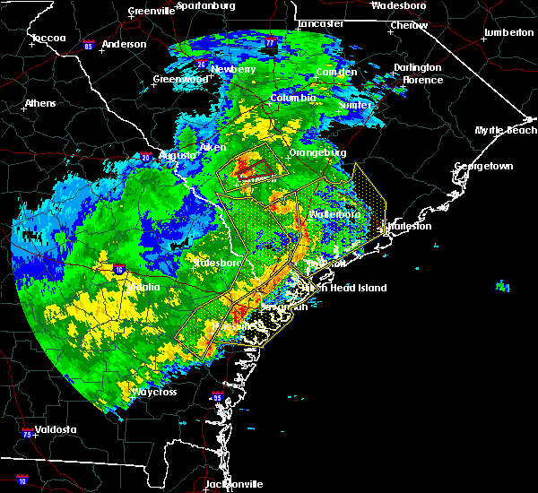 At 356 pm est, severe thunderstorms were located along a line extending from 16 miles southeast of bamberg to 10 miles south of walterboro to near port royal, moving east at 65 mph (radar indicated). Hazards include 60 mph wind gusts. expect damage to roofs, siding, and trees At 356 pm est, severe thunderstorms were located along a line extending from 16 miles southeast of bamberg to 10 miles south of walterboro to near port royal, moving east at 65 mph (radar indicated). Hazards include 60 mph wind gusts. expect damage to roofs, siding, and trees
|
| 1/3/2017 2:26 AM EST |
 At 226 am est, severe thunderstorms were located along a line extending from 18 miles southeast of walterboro to 8 miles northwest of edisto beach to 8 miles east of port royal, moving east at 50 mph (radar indicated). Hazards include 60 mph wind gusts. Expect damage to roofs, siding, and trees. Locations impacted include, beaufort, port royal, edisto beach, clarendon, hollywood, ravenel, meggett and bennetts point. At 226 am est, severe thunderstorms were located along a line extending from 18 miles southeast of walterboro to 8 miles northwest of edisto beach to 8 miles east of port royal, moving east at 50 mph (radar indicated). Hazards include 60 mph wind gusts. Expect damage to roofs, siding, and trees. Locations impacted include, beaufort, port royal, edisto beach, clarendon, hollywood, ravenel, meggett and bennetts point.
|
| 1/3/2017 2:04 AM EST | Trees down near the intersection of trask parkway and jasmine hall road. time estimated based on rada in beaufort county SC, 8.9 miles SSE of Beaufort, SC |
| 1/3/2017 2:04 AM EST |
 At 203 am est, a severe thunderstorm was located near beaufort, moving east at 35 mph (radar indicated). Hazards include 60 mph wind gusts and penny size hail. expect damage to roofs, siding, and trees At 203 am est, a severe thunderstorm was located near beaufort, moving east at 35 mph (radar indicated). Hazards include 60 mph wind gusts and penny size hail. expect damage to roofs, siding, and trees
|
| 9/11/2016 6:54 PM EDT |
 At 654 pm edt, severe thunderstorms were located along a line extending from 8 miles northwest of ridgeland to 6 miles southeast of yemassee, moving west at 10 mph (radar indicated). Hazards include 60 mph wind gusts and nickel size hail. Expect damage to roofs. siding. and trees. Locations impacted include, ridgeland, clarendon, tarboro, coosawhatchie, grahamville, old house, sheldon and tillman. At 654 pm edt, severe thunderstorms were located along a line extending from 8 miles northwest of ridgeland to 6 miles southeast of yemassee, moving west at 10 mph (radar indicated). Hazards include 60 mph wind gusts and nickel size hail. Expect damage to roofs. siding. and trees. Locations impacted include, ridgeland, clarendon, tarboro, coosawhatchie, grahamville, old house, sheldon and tillman.
|
| 9/11/2016 6:43 PM EDT |
 At 643 pm edt, severe thunderstorms were located along a line extending from 6 miles northwest of ridgeland to 7 miles southeast of yemassee, moving southwest at 5 mph (radar indicated). Hazards include 60 mph wind gusts and nickel size hail. Expect damage to roofs. siding. And trees. At 643 pm edt, severe thunderstorms were located along a line extending from 6 miles northwest of ridgeland to 7 miles southeast of yemassee, moving southwest at 5 mph (radar indicated). Hazards include 60 mph wind gusts and nickel size hail. Expect damage to roofs. siding. And trees.
|
| 7/21/2016 5:40 PM EDT |
 At 540 pm edt, severe thunderstorms were located along a line extending from 9 miles north of beaufort to 9 miles north of yemassee, moving west at 15 mph (radar indicated). Hazards include 60 mph wind gusts. Expect damage to roofs. siding. and trees. Locations impacted include, beaufort, yemassee, sheldon, hendersonville, white hall, beaufort marine corps air station, gardens corner and green pond. At 540 pm edt, severe thunderstorms were located along a line extending from 9 miles north of beaufort to 9 miles north of yemassee, moving west at 15 mph (radar indicated). Hazards include 60 mph wind gusts. Expect damage to roofs. siding. and trees. Locations impacted include, beaufort, yemassee, sheldon, hendersonville, white hall, beaufort marine corps air station, gardens corner and green pond.
|
| 7/21/2016 5:23 PM EDT |
 At 523 pm edt, a severe thunderstorm was located 14 miles east of yemassee, moving west at 10 mph (radar indicated). Hazards include 60 mph wind gusts. Expect damage to roofs. siding. and trees. Locations impacted include, beaufort, yemassee, ashepoo, ritter, sheldon, hendersonville, white hall and beaufort marine corps air station. At 523 pm edt, a severe thunderstorm was located 14 miles east of yemassee, moving west at 10 mph (radar indicated). Hazards include 60 mph wind gusts. Expect damage to roofs. siding. and trees. Locations impacted include, beaufort, yemassee, ashepoo, ritter, sheldon, hendersonville, white hall and beaufort marine corps air station.
|
| 7/21/2016 5:07 PM EDT |
 At 507 pm edt, a severe thunderstorm was located 15 miles southeast of walterboro, moving west at 10 mph (radar indicated). Hazards include 60 mph wind gusts. Expect damage to roofs. siding. and trees. Locations impacted include, beaufort, walterboro, yemassee, sheldon, hendersonville, white hall, ritter and ashepoo. At 507 pm edt, a severe thunderstorm was located 15 miles southeast of walterboro, moving west at 10 mph (radar indicated). Hazards include 60 mph wind gusts. Expect damage to roofs. siding. and trees. Locations impacted include, beaufort, walterboro, yemassee, sheldon, hendersonville, white hall, ritter and ashepoo.
|
| 7/21/2016 4:53 PM EDT |
 At 453 pm edt, a severe thunderstorm was located 16 miles southeast of walterboro, moving west at 10 mph (radar indicated). Hazards include 60 mph wind gusts. Expect damage to roofs. siding. And trees. At 453 pm edt, a severe thunderstorm was located 16 miles southeast of walterboro, moving west at 10 mph (radar indicated). Hazards include 60 mph wind gusts. Expect damage to roofs. siding. And trees.
|
| 7/20/2016 4:26 PM EDT |
 The severe thunderstorm warning for beaufort county will expire at 430 pm edt, the storms which prompted the warning have weakened below severe limits, and no longer pose an immediate threat to life or property. therefore the warning will be allowed to expire. however gusty winds are still possible with these thunderstorms. to report severe weather, contact your nearest law enforcement agency. they will relay your report to the national weather service charleston. The severe thunderstorm warning for beaufort county will expire at 430 pm edt, the storms which prompted the warning have weakened below severe limits, and no longer pose an immediate threat to life or property. therefore the warning will be allowed to expire. however gusty winds are still possible with these thunderstorms. to report severe weather, contact your nearest law enforcement agency. they will relay your report to the national weather service charleston.
|
| 7/20/2016 4:18 PM EDT |
 At 417 pm edt, severe thunderstorms were located along a line extending from 13 miles southeast of beaufort to near port royal, moving southwest at 15 mph (radar indicated). Hazards include 60 mph wind gusts and quarter size hail. Hail damage to vehicles is expected. expect wind damage to roofs, siding, and trees. Locations impacted include, beaufort and fripp island. At 417 pm edt, severe thunderstorms were located along a line extending from 13 miles southeast of beaufort to near port royal, moving southwest at 15 mph (radar indicated). Hazards include 60 mph wind gusts and quarter size hail. Hail damage to vehicles is expected. expect wind damage to roofs, siding, and trees. Locations impacted include, beaufort and fripp island.
|
| 7/20/2016 4:12 PM EDT | Beaufort county 911 center reported a tree down at the intersection of lands end road and storyteller road on st helena island. time was estimated from radar dat in beaufort county SC, 8.9 miles NW of Beaufort, SC |
| 7/20/2016 3:48 PM EDT |
 At 347 pm edt, a severe thunderstorm was located 10 miles east of beaufort, moving southwest at 10 mph (radar indicated). Hazards include 60 mph wind gusts and quarter size hail. Hail damage to vehicles is expected. expect wind damage to roofs, siding, and trees. Locations impacted include, beaufort, fripp island, hunting island and ladys island. At 347 pm edt, a severe thunderstorm was located 10 miles east of beaufort, moving southwest at 10 mph (radar indicated). Hazards include 60 mph wind gusts and quarter size hail. Hail damage to vehicles is expected. expect wind damage to roofs, siding, and trees. Locations impacted include, beaufort, fripp island, hunting island and ladys island.
|
| 7/20/2016 3:29 PM EDT |
 At 329 pm edt, a severe thunderstorm was located 8 miles west of edisto beach, moving southwest at 10 mph (radar indicated). Hazards include 60 mph wind gusts and quarter size hail. Hail damage to vehicles is expected. Expect wind damage to roofs, siding, and trees. At 329 pm edt, a severe thunderstorm was located 8 miles west of edisto beach, moving southwest at 10 mph (radar indicated). Hazards include 60 mph wind gusts and quarter size hail. Hail damage to vehicles is expected. Expect wind damage to roofs, siding, and trees.
|
| 7/9/2016 4:17 PM EDT |
 At 416 pm edt, severe thunderstorms were located along a line extending from 23 miles southwest of charleston to near edisto beach to near hilton head island, moving southeast at 25 mph (radar indicated). Hazards include 60 mph wind gusts and quarter size hail. Hail damage to vehicles is expected. expect wind damage to roofs, siding, and trees. Locations impacted include, hilton head island, bluffton, beaufort, port royal, edisto beach, clarendon, seabrook island and kiawah island. At 416 pm edt, severe thunderstorms were located along a line extending from 23 miles southwest of charleston to near edisto beach to near hilton head island, moving southeast at 25 mph (radar indicated). Hazards include 60 mph wind gusts and quarter size hail. Hail damage to vehicles is expected. expect wind damage to roofs, siding, and trees. Locations impacted include, hilton head island, bluffton, beaufort, port royal, edisto beach, clarendon, seabrook island and kiawah island.
|
| 7/9/2016 3:55 PM EDT | Tree reported down on trask pkwy at the intersection with hwy 17. time estimated based on rada in beaufort county SC, 11.2 miles SSE of Beaufort, SC |
| 7/9/2016 3:52 PM EDT |
 At 351 pm edt, severe thunderstorms were located along a line extending from 7 miles north of edisto beach to 10 miles northeast of beaufort to near bluffton, moving southeast at 25 mph (radar indicated). Hazards include 60 mph wind gusts and quarter size hail. Hail damage to vehicles is expected. Expect wind damage to roofs, siding, and trees. At 351 pm edt, severe thunderstorms were located along a line extending from 7 miles north of edisto beach to 10 miles northeast of beaufort to near bluffton, moving southeast at 25 mph (radar indicated). Hazards include 60 mph wind gusts and quarter size hail. Hail damage to vehicles is expected. Expect wind damage to roofs, siding, and trees.
|
| 7/6/2016 6:33 PM EDT |
 At 632 pm edt, severe thunderstorms were located along a line extending from 9 miles northeast of edisto beach to near hilton head island, moving east at 50 mph (radar indicated). Hazards include 60 mph wind gusts. Expect damage to roofs. siding. and trees. Locations impacted include, charleston, hilton head island, beaufort, port royal, edisto beach, clarendon, hollywood and folly beach. At 632 pm edt, severe thunderstorms were located along a line extending from 9 miles northeast of edisto beach to near hilton head island, moving east at 50 mph (radar indicated). Hazards include 60 mph wind gusts. Expect damage to roofs. siding. and trees. Locations impacted include, charleston, hilton head island, beaufort, port royal, edisto beach, clarendon, hollywood and folly beach.
|
| 7/6/2016 6:14 PM EDT |
 At 613 pm edt, severe thunderstorms were located along a line extending from 10 miles northwest of edisto beach to near bluffton, moving southeast at 30 mph (radar indicated). Hazards include 60 mph wind gusts. Expect damage to roofs. siding. and trees. Locations impacted include, charleston, hilton head island, bluffton, beaufort, port royal, ridgeland, yemassee and edisto beach. At 613 pm edt, severe thunderstorms were located along a line extending from 10 miles northwest of edisto beach to near bluffton, moving southeast at 30 mph (radar indicated). Hazards include 60 mph wind gusts. Expect damage to roofs. siding. and trees. Locations impacted include, charleston, hilton head island, bluffton, beaufort, port royal, ridgeland, yemassee and edisto beach.
|
| 7/6/2016 6:01 PM EDT | Report of numerous trees down with outflow from thunderstorm on bruce k smalls dr. time estimated from radar in beaufort county SC, 3.8 miles SSE of Beaufort, SC |
| 7/6/2016 5:58 PM EDT |
 At 558 pm edt, a severe thunderstorm was located near yemassee, moving east at 50 mph (radar indicated). Hazards include 60 mph wind gusts. Expect damage to roofs. siding. And trees. At 558 pm edt, a severe thunderstorm was located near yemassee, moving east at 50 mph (radar indicated). Hazards include 60 mph wind gusts. Expect damage to roofs. siding. And trees.
|
| 7/4/2016 5:53 PM EDT |
 At 553 pm edt, severe thunderstorms were located along a line extending from 15 miles south of walterboro to near beaufort, moving northeast at 35 mph (radar indicated). Hazards include 60 mph wind gusts. Expect damage to roofs. siding. And trees. At 553 pm edt, severe thunderstorms were located along a line extending from 15 miles south of walterboro to near beaufort, moving northeast at 35 mph (radar indicated). Hazards include 60 mph wind gusts. Expect damage to roofs. siding. And trees.
|
| 6/29/2016 4:40 PM EDT |
 The severe thunderstorm warning for chatham, effingham, beaufort and jasper counties will expire at 445 pm edt, the storms which prompted the warning have weakened below severe limits, and no longer pose an immediate threat to life or property. therefore the warning will be allowed to expire. however gusty winds are still possible with these thunderstorms. The severe thunderstorm warning for chatham, effingham, beaufort and jasper counties will expire at 445 pm edt, the storms which prompted the warning have weakened below severe limits, and no longer pose an immediate threat to life or property. therefore the warning will be allowed to expire. however gusty winds are still possible with these thunderstorms.
|
| 6/29/2016 4:09 PM EDT |
 At 409 pm edt, severe thunderstorms were located along a line extending from port royal to near bellinger hill area to 6 miles northwest of pooler, moving southeast at 30 mph (radar indicated). Hazards include 60 mph wind gusts. Expect damage to roofs. siding. and trees. Locations impacted include, savannah, hilton head island, pooler, bluffton, beaufort, port royal, bellinger hill area and rincon. At 409 pm edt, severe thunderstorms were located along a line extending from port royal to near bellinger hill area to 6 miles northwest of pooler, moving southeast at 30 mph (radar indicated). Hazards include 60 mph wind gusts. Expect damage to roofs. siding. and trees. Locations impacted include, savannah, hilton head island, pooler, bluffton, beaufort, port royal, bellinger hill area and rincon.
|
| 6/29/2016 4:03 PM EDT |
 At 402 pm edt, severe thunderstorms were located along a line extending from 8 miles north of bluffton to 9 miles southeast of springfield, moving southeast at 25 mph (radar indicated). Hazards include 60 mph wind gusts. Expect damage to roofs. siding. and trees. Locations impacted include, bluffton, beaufort, jasper, rincon, hardeeville, sun city, old house and purysburgh. At 402 pm edt, severe thunderstorms were located along a line extending from 8 miles north of bluffton to 9 miles southeast of springfield, moving southeast at 25 mph (radar indicated). Hazards include 60 mph wind gusts. Expect damage to roofs. siding. and trees. Locations impacted include, bluffton, beaufort, jasper, rincon, hardeeville, sun city, old house and purysburgh.
|
| 6/29/2016 3:54 PM EDT |
 At 353 pm edt, severe thunderstorms were located along a line extending from 7 miles north of bluffton to 7 miles north of pooler, moving southeast at 15 mph (radar indicated). Hazards include 70 mph wind gusts and penny size hail. Expect considerable tree damage. damage is likely to mobile homes, roofs, and outbuildings. Locations impacted include, savannah, hilton head island, pooler, bluffton, beaufort, port royal, bellinger hill area and rincon. At 353 pm edt, severe thunderstorms were located along a line extending from 7 miles north of bluffton to 7 miles north of pooler, moving southeast at 15 mph (radar indicated). Hazards include 70 mph wind gusts and penny size hail. Expect considerable tree damage. damage is likely to mobile homes, roofs, and outbuildings. Locations impacted include, savannah, hilton head island, pooler, bluffton, beaufort, port royal, bellinger hill area and rincon.
|
| 6/29/2016 3:47 PM EDT |
 At 346 pm edt, severe thunderstorms were located along a line extending from 8 miles north of bluffton to 7 miles north of pooler, moving southeast at 25 mph (radar indicated). Hazards include 60 mph wind gusts and penny size hail. Expect damage to roofs. siding. And trees. At 346 pm edt, severe thunderstorms were located along a line extending from 8 miles north of bluffton to 7 miles north of pooler, moving southeast at 25 mph (radar indicated). Hazards include 60 mph wind gusts and penny size hail. Expect damage to roofs. siding. And trees.
|
| 6/29/2016 3:35 PM EDT |
 At 335 pm edt, severe thunderstorms were located along a line extending from near ridgeland to 8 miles southeast of springfield, moving east at 20 mph (radar indicated). Hazards include 60 mph wind gusts and penny size hail. Expect damage to roofs. siding. and trees. Locations impacted include, bluffton, beaufort, ridgeland, springfield, clarendon, jasper, rincon and hardeeville. At 335 pm edt, severe thunderstorms were located along a line extending from near ridgeland to 8 miles southeast of springfield, moving east at 20 mph (radar indicated). Hazards include 60 mph wind gusts and penny size hail. Expect damage to roofs. siding. and trees. Locations impacted include, bluffton, beaufort, ridgeland, springfield, clarendon, jasper, rincon and hardeeville.
|
| 6/29/2016 3:23 PM EDT |
 At 323 pm edt, severe thunderstorms were located along a line extending from near ridgeland to near springfield, moving southeast at 10 mph (radar indicated). Hazards include 60 mph wind gusts. Expect damage to roofs. siding. and trees. Locations impacted include, bluffton, beaufort, ridgeland, springfield, clarendon, jasper, rincon and hardeeville. At 323 pm edt, severe thunderstorms were located along a line extending from near ridgeland to near springfield, moving southeast at 10 mph (radar indicated). Hazards include 60 mph wind gusts. Expect damage to roofs. siding. and trees. Locations impacted include, bluffton, beaufort, ridgeland, springfield, clarendon, jasper, rincon and hardeeville.
|
| 6/29/2016 3:09 PM EDT |
 At 309 pm edt, severe thunderstorms were located along a line extending from near ridgeland to near springfield, moving east at 20 mph (radar indicated). Hazards include 60 mph wind gusts. Expect damage to roofs. siding. And trees. At 309 pm edt, severe thunderstorms were located along a line extending from near ridgeland to near springfield, moving east at 20 mph (radar indicated). Hazards include 60 mph wind gusts. Expect damage to roofs. siding. And trees.
|
| 6/17/2016 5:35 PM EDT | Storm damage reported in beaufort county SC, 4.9 miles WNW of Beaufort, SC |
| 6/17/2016 5:33 PM EDT |
 At 532 pm edt, severe thunderstorms were located along a line extending from near bluffton to near edisto beach, moving southeast at 45 mph (radar indicated). Hazards include 70 mph wind gusts. Expect considerable tree damage. damage is likely to mobile homes, roofs, and outbuildings. Locations impacted include, hilton head island, bluffton, beaufort, port royal, ridgeland, edisto beach, bellinger hill area and clarendon. At 532 pm edt, severe thunderstorms were located along a line extending from near bluffton to near edisto beach, moving southeast at 45 mph (radar indicated). Hazards include 70 mph wind gusts. Expect considerable tree damage. damage is likely to mobile homes, roofs, and outbuildings. Locations impacted include, hilton head island, bluffton, beaufort, port royal, ridgeland, edisto beach, bellinger hill area and clarendon.
|
| 6/17/2016 5:27 PM EDT | Tree down along old jericho road near us 2 in beaufort county SC, 2.2 miles NE of Beaufort, SC |
| 6/17/2016 5:23 PM EDT |
 At 523 pm edt, severe thunderstorms were located along a line extending from near ridgeland to 6 miles northwest of edisto beach, moving east at 35 mph (radar indicated). Hazards include 70 mph wind gusts. Expect considerable tree damage. damage is likely to mobile homes, roofs, and outbuildings. Locations impacted include, hilton head island, bluffton, beaufort, port royal, ridgeland, edisto beach, bellinger hill area and clarendon. At 523 pm edt, severe thunderstorms were located along a line extending from near ridgeland to 6 miles northwest of edisto beach, moving east at 35 mph (radar indicated). Hazards include 70 mph wind gusts. Expect considerable tree damage. damage is likely to mobile homes, roofs, and outbuildings. Locations impacted include, hilton head island, bluffton, beaufort, port royal, ridgeland, edisto beach, bellinger hill area and clarendon.
|
| 6/17/2016 5:22 PM EDT | Spotter reported wind gust of 58 mph near the north end of the beaufort mcas in beaufort county SC, 4 miles SSE of Beaufort, SC |
| 6/17/2016 5:22 PM EDT | Spotter reports two trees down at old jericho rd and hwy 21 in beaufort county SC, 2.2 miles NE of Beaufort, SC |
| 6/17/2016 5:07 PM EDT |
 At 507 pm edt, severe thunderstorms were located along a line extending from near ridgeland to 12 miles northwest of edisto beach, moving southeast at 40 mph (radar indicated). Hazards include 60 mph wind gusts and nickel size hail. Expect damage to roofs. siding. and trees. Locations impacted include, hilton head island, bluffton, beaufort, port royal, ridgeland, edisto beach, bellinger hill area and clarendon. At 507 pm edt, severe thunderstorms were located along a line extending from near ridgeland to 12 miles northwest of edisto beach, moving southeast at 40 mph (radar indicated). Hazards include 60 mph wind gusts and nickel size hail. Expect damage to roofs. siding. and trees. Locations impacted include, hilton head island, bluffton, beaufort, port royal, ridgeland, edisto beach, bellinger hill area and clarendon.
|
| 6/17/2016 4:50 PM EDT |
 At 449 pm edt, severe thunderstorms were located along a line extending from 11 miles northwest of ridgeland to 14 miles southeast of walterboro, moving southeast at 40 mph (radar indicated). Hazards include 70 mph wind gusts and quarter size hail. Hail damage to vehicles is expected. expect considerable tree damage. Wind damage is also likely to mobile homes, roofs, and outbuildings. At 449 pm edt, severe thunderstorms were located along a line extending from 11 miles northwest of ridgeland to 14 miles southeast of walterboro, moving southeast at 40 mph (radar indicated). Hazards include 70 mph wind gusts and quarter size hail. Hail damage to vehicles is expected. expect considerable tree damage. Wind damage is also likely to mobile homes, roofs, and outbuildings.
|
| 5/3/2016 9:07 PM EDT |
 At 906 pm edt, a severe thunderstorm was located near yemassee, moving east at 55 mph (radar indicated). Hazards include 60 mph wind gusts. Expect damage to roofs. siding. and trees. Locations impacted include, hilton head island, beaufort, port royal, ridgeland, yemassee, edisto beach, clarendon and furman. At 906 pm edt, a severe thunderstorm was located near yemassee, moving east at 55 mph (radar indicated). Hazards include 60 mph wind gusts. Expect damage to roofs. siding. and trees. Locations impacted include, hilton head island, beaufort, port royal, ridgeland, yemassee, edisto beach, clarendon and furman.
|
| 5/3/2016 8:14 PM EDT |
 At 813 pm edt, a severe thunderstorm was located near bluffton, moving east at 30 mph. additional severe thunderstorms will affect areas west of interstate 95 (radar indicated). Hazards include 60 mph wind gusts and quarter size hail. Hail damage to vehicles is expected. Expect wind damage to roofs, siding, and trees. At 813 pm edt, a severe thunderstorm was located near bluffton, moving east at 30 mph. additional severe thunderstorms will affect areas west of interstate 95 (radar indicated). Hazards include 60 mph wind gusts and quarter size hail. Hail damage to vehicles is expected. Expect wind damage to roofs, siding, and trees.
|
| 9/10/2015 8:12 PM EDT |
 At 811 pm edt, severe thunderstorms were located along a line extending from near ladson to hilton head island, moving east at 35 mph (radar indicated). Hazards include 60 mph wind gusts. Expect damage to roofs. siding and trees. Locations impacted include, charleston, ladson, mount pleasant, summerville, hilton head island, goose creek, hanahan and bluffton. At 811 pm edt, severe thunderstorms were located along a line extending from near ladson to hilton head island, moving east at 35 mph (radar indicated). Hazards include 60 mph wind gusts. Expect damage to roofs. siding and trees. Locations impacted include, charleston, ladson, mount pleasant, summerville, hilton head island, goose creek, hanahan and bluffton.
|
| 9/10/2015 7:54 PM EDT |
 At 754 pm edt, severe thunderstorms were located along a line extending from near slands bridge to bluffton, moving east at 35 mph (radar indicated). Hazards include 60 mph wind gusts. Expect damage to roofs. Siding and trees. At 754 pm edt, severe thunderstorms were located along a line extending from near slands bridge to bluffton, moving east at 35 mph (radar indicated). Hazards include 60 mph wind gusts. Expect damage to roofs. Siding and trees.
|
| 9/4/2015 4:10 PM EDT | Damage survey conducted by beaufort county emergency management indicates a thunderstorm downburst occurred along seabrook road in northwest beaufort county. ten large in beaufort county SC, 6.5 miles SSE of Beaufort, SC |
| 8/22/2015 6:17 PM EDT |
 At 617 pm edt, severe thunderstorms were located along a line extending from 6 miles northeast of hilton head island to near i-16/i-95 interchange, moving southeast at 45 mph (radar indicated). Hazards include 60 mph wind gusts. Expect damage to roofs. siding and trees. Locations impacted include, savannah, hilton head island, pooler, bluffton, beaufort, port royal, wilmington island and i-16/i-95 interchange. At 617 pm edt, severe thunderstorms were located along a line extending from 6 miles northeast of hilton head island to near i-16/i-95 interchange, moving southeast at 45 mph (radar indicated). Hazards include 60 mph wind gusts. Expect damage to roofs. siding and trees. Locations impacted include, savannah, hilton head island, pooler, bluffton, beaufort, port royal, wilmington island and i-16/i-95 interchange.
|
| 8/22/2015 5:49 PM EDT |
 At 549 pm edt, severe thunderstorms were located along a line extending from near beaufort to near i-16/i-95 interchange, moving southeast at 40 mph (radar indicated). Hazards include 60 mph wind gusts. Expect damage to roofs. siding and trees. Locations impacted include, savannah, hilton head island, pooler, bluffton, beaufort, port royal, ridgeland and fort pulaski national monument. At 549 pm edt, severe thunderstorms were located along a line extending from near beaufort to near i-16/i-95 interchange, moving southeast at 40 mph (radar indicated). Hazards include 60 mph wind gusts. Expect damage to roofs. siding and trees. Locations impacted include, savannah, hilton head island, pooler, bluffton, beaufort, port royal, ridgeland and fort pulaski national monument.
|
| 8/22/2015 5:28 PM EDT | Tree down at highway 17 and old sheldon church rd. time estimated by rada in beaufort county SC, 11.4 miles SSE of Beaufort, SC |
| 8/22/2015 5:25 PM EDT |
 At 525 pm edt, severe thunderstorms were located along a line extending from 7 miles north of beaufort to near springfield, moving southeast at 45 mph (radar indicated). Hazards include 60 mph wind gusts. Expect damage to roofs. Siding and trees. At 525 pm edt, severe thunderstorms were located along a line extending from 7 miles north of beaufort to near springfield, moving southeast at 45 mph (radar indicated). Hazards include 60 mph wind gusts. Expect damage to roofs. Siding and trees.
|
| 8/20/2015 3:04 PM EDT |
 At 303 pm edt, severe thunderstorms were located along a line extending from 7 miles northeast of beaufort to near port royal, moving east at 20 mph (radar indicated. at 303 pm...law enforcement reported a tree blown down on a house near burton). Hazards include 60 mph wind gusts. Expect damage to roofs. siding and trees. Locations impacted include, beaufort, port royal, shell point, burton, beaufort marine corps air station, ladys island, parris island and lemon island. At 303 pm edt, severe thunderstorms were located along a line extending from 7 miles northeast of beaufort to near port royal, moving east at 20 mph (radar indicated. at 303 pm...law enforcement reported a tree blown down on a house near burton). Hazards include 60 mph wind gusts. Expect damage to roofs. siding and trees. Locations impacted include, beaufort, port royal, shell point, burton, beaufort marine corps air station, ladys island, parris island and lemon island.
|
| 8/20/2015 2:57 PM EDT |
 At 257 pm edt, severe thunderstorms were located along a line extending from 7 miles northeast of beaufort to near port royal, moving east at 20 mph (radar indicated). Hazards include 60 mph wind gusts. Expect damage to roofs. siding and trees. Locations impacted include, beaufort, port royal, shell point, burton, beaufort marine corps air station, ladys island, parris island and lemon island. At 257 pm edt, severe thunderstorms were located along a line extending from 7 miles northeast of beaufort to near port royal, moving east at 20 mph (radar indicated). Hazards include 60 mph wind gusts. Expect damage to roofs. siding and trees. Locations impacted include, beaufort, port royal, shell point, burton, beaufort marine corps air station, ladys island, parris island and lemon island.
|
| 8/20/2015 2:42 PM EDT |
 At 241 pm edt, severe thunderstorms were located along a line extending from 6 miles north of beaufort to 8 miles southeast of ridgeland, moving east at 20 mph (radar indicated). Hazards include 60 mph wind gusts. Expect damage to roofs. Siding and trees. At 241 pm edt, severe thunderstorms were located along a line extending from 6 miles north of beaufort to 8 miles southeast of ridgeland, moving east at 20 mph (radar indicated). Hazards include 60 mph wind gusts. Expect damage to roofs. Siding and trees.
|
| 8/11/2015 6:10 PM EDT |
 The severe thunderstorm warning for charleston, colleton and beaufort counties will expire at 615 pm edt, the storms which prompted the warning have moved out of the area. therefore the warning will be allowed to expire. The severe thunderstorm warning for charleston, colleton and beaufort counties will expire at 615 pm edt, the storms which prompted the warning have moved out of the area. therefore the warning will be allowed to expire.
|
| 8/11/2015 5:55 PM EDT | Tree down across roadway at the intersection of janette dr adn coffin point rd. time estimated from radar in beaufort county SC, 13.2 miles W of Beaufort, SC |
| 8/11/2015 5:53 PM EDT |
 At 552 pm edt, severe thunderstorms were located along a line extending from 14 miles northeast of port royal to 8 miles east of beaufort to 9 miles east of hilton head island, moving east at 30 mph (radar indicated). Hazards include 60 mph wind gusts. Expect damage to roofs. siding and trees. Locations impacted include, hilton head island, bluffton, beaufort, port royal, edisto beach, fripp island, burton and ladys island. At 552 pm edt, severe thunderstorms were located along a line extending from 14 miles northeast of port royal to 8 miles east of beaufort to 9 miles east of hilton head island, moving east at 30 mph (radar indicated). Hazards include 60 mph wind gusts. Expect damage to roofs. siding and trees. Locations impacted include, hilton head island, bluffton, beaufort, port royal, edisto beach, fripp island, burton and ladys island.
|
| 8/11/2015 5:26 PM EDT |
 At 525 pm edt, severe thunderstorms were located along a line extending from 17 miles northwest of edisto beach to 6 miles west of beaufort to near port royal, moving east at 110 mph (radar indicated). Hazards include 60 mph wind gusts and penny size hail. Expect damage to roofs. Siding and trees. At 525 pm edt, severe thunderstorms were located along a line extending from 17 miles northwest of edisto beach to 6 miles west of beaufort to near port royal, moving east at 110 mph (radar indicated). Hazards include 60 mph wind gusts and penny size hail. Expect damage to roofs. Siding and trees.
|
| 7/23/2015 4:52 PM EDT |
 At 452 pm edt, a severe thunderstorm was located 11 miles east of port royal, moving southeast at 15 mph (radar indicated). Hazards include 60 mph wind gusts. Expect damage to roofs. siding and trees. Locations impacted include, beaufort, port royal, fripp island and parris island. At 452 pm edt, a severe thunderstorm was located 11 miles east of port royal, moving southeast at 15 mph (radar indicated). Hazards include 60 mph wind gusts. Expect damage to roofs. siding and trees. Locations impacted include, beaufort, port royal, fripp island and parris island.
|
| 7/23/2015 4:38 PM EDT |
 At 437 pm edt, a severe thunderstorm was located 8 miles east of port royal, moving southeast at 10 mph (radar indicated). Hazards include 60 mph wind gusts and penny size hail. Expect damage to roofs. Siding and trees. At 437 pm edt, a severe thunderstorm was located 8 miles east of port royal, moving southeast at 10 mph (radar indicated). Hazards include 60 mph wind gusts and penny size hail. Expect damage to roofs. Siding and trees.
|
| 7/23/2015 4:30 PM EDT | Three trees were reported down along martin luther king junior driv in beaufort county SC, 8.2 miles WNW of Beaufort, SC |
| 7/23/2015 4:27 PM EDT | Sc highway patrol reports a tree down and in the roadway on sea island parkway near polowana road. scdot is responding to the downed tre in beaufort county SC, 7.9 miles WNW of Beaufort, SC |
| 7/23/2015 4:20 PM EDT | Sc highway patrol reports a tree down and in the roadway on gumwood drive near little capers road. scdot is responding to the downed tre in beaufort county SC, 4.4 miles W of Beaufort, SC |
| 7/23/2015 4:17 PM EDT | 1 tree down near the intersection of bay street and ribaut roa in beaufort county SC, 1.3 miles NW of Beaufort, SC |
| 7/23/2015 3:25 PM EDT | Sc highway patrol reports 2 trees down and in the roadway on jacob white road near enoch norris road and highway 1 in beaufort county SC, 12.2 miles S of Beaufort, SC |
| 7/22/2015 5:27 PM EDT | The severe thunderstorm warning for jasper and beaufort counties will expire at 530 pm edt, the storm which prompted the warning has weakened below severe limits, and no longer pose an immediate threat to life or property. therefore the warning will be allowed to expire. however gusty winds are still possible with this thunderstorm. to report severe weather, contact your nearest law enforcement agency. they will relay your report to the national weather service charleston. |
| 7/22/2015 5:02 PM EDT |
 At 502 pm edt, a severe thunderstorm was located 9 miles east of ridgeland, moving southeast at 10 mph (radar indicated). Hazards include 60 mph wind gusts. Expect damage to roofs. siding and trees. Locations impacted include, beaufort, port royal, clarendon, burton, ladys island, lemon island, shell point and old house. At 502 pm edt, a severe thunderstorm was located 9 miles east of ridgeland, moving southeast at 10 mph (radar indicated). Hazards include 60 mph wind gusts. Expect damage to roofs. siding and trees. Locations impacted include, beaufort, port royal, clarendon, burton, ladys island, lemon island, shell point and old house.
|
| 7/22/2015 4:48 PM EDT |
 At 447 pm edt, a severe thunderstorm was located 7 miles northeast of ridgeland, moving southeast at 10 mph (radar indicated). Hazards include 60 mph wind gusts and penny size hail. Expect damage to roofs. siding and trees. Locations impacted include, beaufort, port royal, ridgeland, clarendon, pocotaligo, grahamville, sheldon and burton. At 447 pm edt, a severe thunderstorm was located 7 miles northeast of ridgeland, moving southeast at 10 mph (radar indicated). Hazards include 60 mph wind gusts and penny size hail. Expect damage to roofs. siding and trees. Locations impacted include, beaufort, port royal, ridgeland, clarendon, pocotaligo, grahamville, sheldon and burton.
|
| 7/22/2015 4:28 PM EDT |
 At 428 pm edt, a severe thunderstorm was located 7 miles northeast of ridgeland, moving southeast at 10 mph (radar indicated). Hazards include 60 mph wind gusts and penny size hail. Expect damage to roofs. Siding and trees. At 428 pm edt, a severe thunderstorm was located 7 miles northeast of ridgeland, moving southeast at 10 mph (radar indicated). Hazards include 60 mph wind gusts and penny size hail. Expect damage to roofs. Siding and trees.
|
| 7/21/2015 5:04 PM EDT |
 At 504 pm edt, severe thunderstorms were located along a line extending from near bluffton to 13 miles east of port royal, moving east at 20 mph (radar indicated). Hazards include 60 mph wind gusts and nickel size hail. Expect damage to roofs. siding and trees. Locations impacted include, hilton head island, bluffton, beaufort, port royal, bellinger hill area, jasper, hardeeville and fripp island. At 504 pm edt, severe thunderstorms were located along a line extending from near bluffton to 13 miles east of port royal, moving east at 20 mph (radar indicated). Hazards include 60 mph wind gusts and nickel size hail. Expect damage to roofs. siding and trees. Locations impacted include, hilton head island, bluffton, beaufort, port royal, bellinger hill area, jasper, hardeeville and fripp island.
|
| 7/21/2015 4:43 PM EDT |
 At 442 pm edt, severe thunderstorms were located along a line extending from 11 miles northwest of bellinger hill area to 9 miles southeast of port royal, moving east at 15 mph (radar indicated). Hazards include 60 mph wind gusts and nickel size hail. Expect damage to roofs. Siding and trees. At 442 pm edt, severe thunderstorms were located along a line extending from 11 miles northwest of bellinger hill area to 9 miles southeast of port royal, moving east at 15 mph (radar indicated). Hazards include 60 mph wind gusts and nickel size hail. Expect damage to roofs. Siding and trees.
|
| 7/21/2015 4:27 PM EDT |
 At 427 pm edt, severe thunderstorms were located along a line extending from near beaufort to 7 miles north of bellinger hill area, moving southeast at 15 mph (radar indicated). Hazards include 60 mph wind gusts and quarter size hail. Hail damage to vehicles is expected. expect wind damage to roofs, siding and trees. Locations impacted include, hilton head island, bluffton, beaufort, port royal, bellinger hill area, jasper, hardeeville and burton. At 427 pm edt, severe thunderstorms were located along a line extending from near beaufort to 7 miles north of bellinger hill area, moving southeast at 15 mph (radar indicated). Hazards include 60 mph wind gusts and quarter size hail. Hail damage to vehicles is expected. expect wind damage to roofs, siding and trees. Locations impacted include, hilton head island, bluffton, beaufort, port royal, bellinger hill area, jasper, hardeeville and burton.
|
| 7/21/2015 4:23 PM EDT | Beaufort 911 center reports a tree down on fripp point roa in beaufort county SC, 12.1 miles W of Beaufort, SC |
| 7/21/2015 4:08 PM EDT |
 At 408 pm edt, severe thunderstorms were located along a line extending from beaufort to 10 miles northwest of bellinger hill area, moving east at 15 mph (radar indicated). Hazards include 60 mph wind gusts. Expect damage to roofs. siding and trees. Locations impacted include, hilton head island, bluffton, beaufort, port royal, bellinger hill area, jasper, hardeeville and burton. At 408 pm edt, severe thunderstorms were located along a line extending from beaufort to 10 miles northwest of bellinger hill area, moving east at 15 mph (radar indicated). Hazards include 60 mph wind gusts. Expect damage to roofs. siding and trees. Locations impacted include, hilton head island, bluffton, beaufort, port royal, bellinger hill area, jasper, hardeeville and burton.
|
| 7/21/2015 3:37 PM EDT |
 At 337 pm edt, a severe thunderstorm was located near ridgeland, moving southeast at 15 mph (radar indicated). Hazards include 60 mph wind gusts. Expect damage to roofs. Siding and trees. At 337 pm edt, a severe thunderstorm was located near ridgeland, moving southeast at 15 mph (radar indicated). Hazards include 60 mph wind gusts. Expect damage to roofs. Siding and trees.
|
| 7/21/2015 2:50 PM EDT |
 At 250 pm edt, severe thunderstorms were located along a line extending from 11 miles northeast of edisto beach to 9 miles east of port royal, moving east at 25 mph (radar indicated). Hazards include 60 mph wind gusts. Expect damage to roofs. siding and trees. Locations impacted include, edisto beach, hollywood, folly beach, seabrook island, kiawah island, meggett, rockville, hunting island and edisto island. At 250 pm edt, severe thunderstorms were located along a line extending from 11 miles northeast of edisto beach to 9 miles east of port royal, moving east at 25 mph (radar indicated). Hazards include 60 mph wind gusts. Expect damage to roofs. siding and trees. Locations impacted include, edisto beach, hollywood, folly beach, seabrook island, kiawah island, meggett, rockville, hunting island and edisto island.
|
| 7/21/2015 2:35 PM EDT | Schp reported a tree down on u.s. route 21 at the day lilly drive intersectio in beaufort county SC, 12.2 miles W of Beaufort, SC |
| 7/21/2015 2:28 PM EDT |
 At 228 pm edt, severe thunderstorms were located along a line extending from 13 miles north of edisto beach to beaufort, moving east at 20 mph (radar indicated). Hazards include 60 mph wind gusts and penny size hail. Expect damage to roofs. Siding and trees. At 228 pm edt, severe thunderstorms were located along a line extending from 13 miles north of edisto beach to beaufort, moving east at 20 mph (radar indicated). Hazards include 60 mph wind gusts and penny size hail. Expect damage to roofs. Siding and trees.
|
| 7/21/2015 2:15 PM EDT | Beaufort 911 center reports a tree down on lafayette stree in beaufort county SC, 1.5 miles WSW of Beaufort, SC |
| 7/21/2015 2:13 PM EDT |
 At 213 pm edt, severe thunderstorms were located along a line extending from 14 miles northwest of edisto beach to near beaufort, moving east at 20 mph (radar indicated). Hazards include 60 mph wind gusts and penny size hail. Expect damage to roofs. siding and trees. Locations impacted include, beaufort, edisto beach, clarendon, seabrook island, meggett, edisto island, bears bluff and beaufort marine corps air station. At 213 pm edt, severe thunderstorms were located along a line extending from 14 miles northwest of edisto beach to near beaufort, moving east at 20 mph (radar indicated). Hazards include 60 mph wind gusts and penny size hail. Expect damage to roofs. siding and trees. Locations impacted include, beaufort, edisto beach, clarendon, seabrook island, meggett, edisto island, bears bluff and beaufort marine corps air station.
|
| 7/21/2015 1:32 PM EDT |
 At 132 pm edt, a severe thunderstorm was located 7 miles southeast of yemassee, moving east at 30 mph (radar indicated). Hazards include 60 mph wind gusts and quarter size hail. Hail damage to vehicles is expected. Expect wind damage to roofs, siding and trees. At 132 pm edt, a severe thunderstorm was located 7 miles southeast of yemassee, moving east at 30 mph (radar indicated). Hazards include 60 mph wind gusts and quarter size hail. Hail damage to vehicles is expected. Expect wind damage to roofs, siding and trees.
|
| 7/19/2015 4:11 PM EDT |
 At 410 pm edt, severe thunderstorms were located along a line extending from 8 miles northwest of edisto beach to 12 miles east of beaufort, moving east at 30 mph. these are very dangerous storms (radar indicated). Hazards include 80 mph wind gusts and quarter size hail. Flying debris will be dangerous to those caught without shelter. mobile homes will be heavily damaged. expect considerable damage to roofs, windows and vehicles. extensive tree damage and power outages are likely. Locations impacted include, beaufort, yemassee, clarendon, pocotaligo, old house, sheldon, beaufort marine corps air station and gardens corner. At 410 pm edt, severe thunderstorms were located along a line extending from 8 miles northwest of edisto beach to 12 miles east of beaufort, moving east at 30 mph. these are very dangerous storms (radar indicated). Hazards include 80 mph wind gusts and quarter size hail. Flying debris will be dangerous to those caught without shelter. mobile homes will be heavily damaged. expect considerable damage to roofs, windows and vehicles. extensive tree damage and power outages are likely. Locations impacted include, beaufort, yemassee, clarendon, pocotaligo, old house, sheldon, beaufort marine corps air station and gardens corner.
|
| 7/19/2015 3:40 PM EDT | Beaufort 911 center reports a large tree down on a house on cornelius drive. no injurie in beaufort county SC, 5.3 miles S of Beaufort, SC |
| 7/19/2015 3:24 PM EDT |
 At 324 pm edt, severe thunderstorms were located along a line extending from near yemassee to 7 miles southeast of ridgeland, moving east at 30 mph (radar indicated). Hazards include 60 mph wind gusts and quarter size hail. Hail damage to vehicles is expected. Expect wind damage to roofs, siding and trees. At 324 pm edt, severe thunderstorms were located along a line extending from near yemassee to 7 miles southeast of ridgeland, moving east at 30 mph (radar indicated). Hazards include 60 mph wind gusts and quarter size hail. Hail damage to vehicles is expected. Expect wind damage to roofs, siding and trees.
|
| 7/19/2015 3:10 PM EDT |
 At 310 pm edt, severe thunderstorms were located along a line extending from 6 miles west of port royal to bellinger hill area, moving southeast at 30 mph (radar indicated). Hazards include 60 mph wind gusts and quarter size hail. Hail damage to vehicles is expected. Expect wind damage to roofs, siding and trees. At 310 pm edt, severe thunderstorms were located along a line extending from 6 miles west of port royal to bellinger hill area, moving southeast at 30 mph (radar indicated). Hazards include 60 mph wind gusts and quarter size hail. Hail damage to vehicles is expected. Expect wind damage to roofs, siding and trees.
|
| 7/5/2015 5:51 PM EDT |
 The severe thunderstorm warning for bryan, chatham, beaufort and jasper counties will expire at 600 pm edt, the storms which prompted the warning have weakened below severe limits, and no longer pose an immediate threat to life or property. therefore the warning will be allowed to expire. to report severe weather, contact your nearest law enforcement agency. they will relay your report to the national weather service charleston. The severe thunderstorm warning for bryan, chatham, beaufort and jasper counties will expire at 600 pm edt, the storms which prompted the warning have weakened below severe limits, and no longer pose an immediate threat to life or property. therefore the warning will be allowed to expire. to report severe weather, contact your nearest law enforcement agency. they will relay your report to the national weather service charleston.
|
| 7/5/2015 5:32 PM EDT |
 At 532 pm edt, severe thunderstorms were located along a line extending from near fort pulaski national monument to near ossabaw sound, moving northeast at 25 mph (radar indicated). Hazards include 60 mph wind gusts. Expect damage to roofs. siding and trees. Locations impacted include, savannah, hilton head island, pooler, bluffton, beaufort, port royal, wilmington island and fort pulaski national monument. At 532 pm edt, severe thunderstorms were located along a line extending from near fort pulaski national monument to near ossabaw sound, moving northeast at 25 mph (radar indicated). Hazards include 60 mph wind gusts. Expect damage to roofs. siding and trees. Locations impacted include, savannah, hilton head island, pooler, bluffton, beaufort, port royal, wilmington island and fort pulaski national monument.
|
| 7/5/2015 5:16 PM EDT |
 At 515 pm edt, severe thunderstorms were located along a line extending from near whitemarsh island to ossabaw sound, moving northeast at 30 mph (radar indicated. at 443 pm these thunderstorms blew down tree limbs and power lines near windsor forest). Hazards include 60 mph wind gusts. Expect damage to roofs. siding and trees. Locations impacted include, savannah, hilton head island, pooler, bluffton, beaufort, port royal, wilmington island and fort pulaski national monument. At 515 pm edt, severe thunderstorms were located along a line extending from near whitemarsh island to ossabaw sound, moving northeast at 30 mph (radar indicated. at 443 pm these thunderstorms blew down tree limbs and power lines near windsor forest). Hazards include 60 mph wind gusts. Expect damage to roofs. siding and trees. Locations impacted include, savannah, hilton head island, pooler, bluffton, beaufort, port royal, wilmington island and fort pulaski national monument.
|
| 7/5/2015 5:00 PM EDT |
 At 459 pm edt, severe thunderstorms were located along a line extending from thunderbolt to near keller, moving northeast at 30 mph (radar indicated). Hazards include 60 mph wind gusts and penny size hail. Expect damage to roofs. Siding and trees. At 459 pm edt, severe thunderstorms were located along a line extending from thunderbolt to near keller, moving northeast at 30 mph (radar indicated). Hazards include 60 mph wind gusts and penny size hail. Expect damage to roofs. Siding and trees.
|
| 7/4/2015 6:04 PM EDT |
 At 604 pm edt, a severe thunderstorm was located near bluffton, moving northeast at 15 mph (radar indicated). Hazards include 60 mph wind gusts and penny size hail. Expect damage to roofs. siding and trees. Locations impacted include, bluffton, beaufort and port royal. At 604 pm edt, a severe thunderstorm was located near bluffton, moving northeast at 15 mph (radar indicated). Hazards include 60 mph wind gusts and penny size hail. Expect damage to roofs. siding and trees. Locations impacted include, bluffton, beaufort and port royal.
|
| 7/4/2015 5:53 PM EDT |
 At 553 pm edt, a severe thunderstorm was located over bluffton, moving northeast at 15 mph (radar indicated). Hazards include 60 mph wind gusts and penny size hail. Expect damage to roofs. siding and trees. Locations impacted include, hilton head island, bluffton, beaufort and port royal. At 553 pm edt, a severe thunderstorm was located over bluffton, moving northeast at 15 mph (radar indicated). Hazards include 60 mph wind gusts and penny size hail. Expect damage to roofs. siding and trees. Locations impacted include, hilton head island, bluffton, beaufort and port royal.
|
| 7/4/2015 5:40 PM EDT |
 At 539 pm edt, a severe thunderstorm was located near pritchardville, or near bluffton, moving northeast at 15 mph (radar indicated). Hazards include 60 mph wind gusts and quarter size hail. Hail damage to vehicles is expected. Expect wind damage to roofs, siding and trees. At 539 pm edt, a severe thunderstorm was located near pritchardville, or near bluffton, moving northeast at 15 mph (radar indicated). Hazards include 60 mph wind gusts and quarter size hail. Hail damage to vehicles is expected. Expect wind damage to roofs, siding and trees.
|
| 7/3/2015 2:54 PM EDT |
 At 254 pm edt, severe thunderstorms were located along a line extending from near don holt bridge to near edisto island, moving east at 45 mph (radar indicated). Hazards include 60 mph wind gusts. Expect damage to roofs. siding and trees. Locations impacted include, charleston, north charleston, hanahan, beaufort, magnolia gardens and i-26/i-526 interchange. At 254 pm edt, severe thunderstorms were located along a line extending from near don holt bridge to near edisto island, moving east at 45 mph (radar indicated). Hazards include 60 mph wind gusts. Expect damage to roofs. siding and trees. Locations impacted include, charleston, north charleston, hanahan, beaufort, magnolia gardens and i-26/i-526 interchange.
|
| 7/3/2015 2:50 PM EDT |
 At 249 pm edt, severe thunderstorms were located along a line extending from don holt bridge to near lemon island, moving east at 45 mph (radar indicated. at 245 pm there was a wind gust to 62 mph at the charleston international airport). Hazards include 60 mph wind gusts. Expect damage to roofs. siding and trees. Locations impacted include, charleston, north charleston, mount pleasant, hilton head island, beaufort, port royal, mcclellanville and edisto beach. At 249 pm edt, severe thunderstorms were located along a line extending from don holt bridge to near lemon island, moving east at 45 mph (radar indicated. at 245 pm there was a wind gust to 62 mph at the charleston international airport). Hazards include 60 mph wind gusts. Expect damage to roofs. siding and trees. Locations impacted include, charleston, north charleston, mount pleasant, hilton head island, beaufort, port royal, mcclellanville and edisto beach.
|
| 7/3/2015 2:43 PM EDT |
 At 242 pm edt, severe thunderstorms were located along a line extending from near archdale to 6 miles north of bennetts point, moving east at 45 mph (radar indicated). Hazards include 60 mph wind gusts. Expect damage to roofs. siding and trees. locations impacted include, charleston, north charleston, summerville, hanahan, beaufort, slands bridge, archdale and magnolia gardens. This line of thunderstorms has a history of producing wind damage to trees. At 242 pm edt, severe thunderstorms were located along a line extending from near archdale to 6 miles north of bennetts point, moving east at 45 mph (radar indicated). Hazards include 60 mph wind gusts. Expect damage to roofs. siding and trees. locations impacted include, charleston, north charleston, summerville, hanahan, beaufort, slands bridge, archdale and magnolia gardens. This line of thunderstorms has a history of producing wind damage to trees.
|
| 7/3/2015 2:40 PM EDT |
 At 239 pm edt, severe thunderstorms were located along a line extending from 6 miles south of jamestown to old house, moving east at 40 mph (radar indicated). Hazards include 60 mph wind gusts. Expect damage to roofs. Siding and trees. At 239 pm edt, severe thunderstorms were located along a line extending from 6 miles south of jamestown to old house, moving east at 40 mph (radar indicated). Hazards include 60 mph wind gusts. Expect damage to roofs. Siding and trees.
|
| 7/3/2015 2:20 PM EDT |
 At 219 pm edt, severe thunderstorms were located along a line extending from givhans to near white hall, moving east at 45 mph (radar indicated). Hazards include 60 mph wind gusts. Expect damage to roofs. siding and trees. Locations impacted include, givhans, white hall, ashepoo, jacksonboro, charleston, north charleston, summerville, hanahan, beaufort, slands bridge, archdale and magnolia gardens. At 219 pm edt, severe thunderstorms were located along a line extending from givhans to near white hall, moving east at 45 mph (radar indicated). Hazards include 60 mph wind gusts. Expect damage to roofs. siding and trees. Locations impacted include, givhans, white hall, ashepoo, jacksonboro, charleston, north charleston, summerville, hanahan, beaufort, slands bridge, archdale and magnolia gardens.
|
| 7/3/2015 2:05 PM EDT |
 At 205 pm edt, severe thunderstorms were located along a line extending from 6 miles east of canadys to early branch, moving east at 45 mph (radar indicated). Hazards include 60 mph wind gusts and quarter size hail. Hail damage to vehicles is expected. Expect wind damage to roofs, siding and trees. At 205 pm edt, severe thunderstorms were located along a line extending from 6 miles east of canadys to early branch, moving east at 45 mph (radar indicated). Hazards include 60 mph wind gusts and quarter size hail. Hail damage to vehicles is expected. Expect wind damage to roofs, siding and trees.
|
| 7/2/2015 8:23 PM EDT |
 At 822 pm edt, severe thunderstorms were located along a line extending from near jamestown to near charleston to near fripp island, moving east at 35 mph (radar indicated). Hazards include 60 mph wind gusts. Expect damage to roofs. siding and trees. Locations impacted include, charleston, north charleston, mount pleasant, summerville, goose creek, hanahan, beaufort and port royal. At 822 pm edt, severe thunderstorms were located along a line extending from near jamestown to near charleston to near fripp island, moving east at 35 mph (radar indicated). Hazards include 60 mph wind gusts. Expect damage to roofs. siding and trees. Locations impacted include, charleston, north charleston, mount pleasant, summerville, goose creek, hanahan, beaufort and port royal.
|
| 7/2/2015 8:12 PM EDT |
 At 810 pm edt, severe thunderstorms were located along a line extending from near jamestown to near forest beach, moving east at 25 mph (radar indicated). Hazards include 70 mph wind gusts. Expect considerable tree damage. damage is likely to mobile homes, roofs and outbuildings. locations impacted include, park circle, charleston, north charleston, mount pleasant, summerville, hilton head island, goose creek, hanahan, fripp island, hunting island and beaufort. those attending the music festival in the park circle north charleston area are in the path of these storms and should prepare for imminent dangerous weather conditions. Seek shelter now!. At 810 pm edt, severe thunderstorms were located along a line extending from near jamestown to near forest beach, moving east at 25 mph (radar indicated). Hazards include 70 mph wind gusts. Expect considerable tree damage. damage is likely to mobile homes, roofs and outbuildings. locations impacted include, park circle, charleston, north charleston, mount pleasant, summerville, hilton head island, goose creek, hanahan, fripp island, hunting island and beaufort. those attending the music festival in the park circle north charleston area are in the path of these storms and should prepare for imminent dangerous weather conditions. Seek shelter now!.
|
| 7/2/2015 8:05 PM EDT | South carolina highway patrol reported that a tree was blown down onto sea island parkway. time of event was estimated from radar dat in beaufort county SC, 16 miles WNW of Beaufort, SC |
| 7/2/2015 7:57 PM EDT |
 At 756 pm edt, severe thunderstorms were located along a line extending from jamestown to 6 miles north of fort pulaski national monument, moving east at 30 mph (radar indicated). Hazards include 70 mph wind gusts. Expect considerable tree damage. Damage is likely to mobile homes, roofs and outbuildings. At 756 pm edt, severe thunderstorms were located along a line extending from jamestown to 6 miles north of fort pulaski national monument, moving east at 30 mph (radar indicated). Hazards include 70 mph wind gusts. Expect considerable tree damage. Damage is likely to mobile homes, roofs and outbuildings.
|
| 7/2/2015 7:46 PM EDT | County warning point reports several trees down on ladys islan in beaufort county SC, 3.8 miles W of Beaufort, SC |
| 7/2/2015 7:42 PM EDT |
 At 740 pm edt, severe thunderstorms were located along a line extending from near jamestown to near calawassie island, moving east at 55 mph (radar indicated). Hazards include 70 mph wind gusts. Expect considerable tree damage. damage is likely to mobile homes, roofs and outbuildings. locations impacted include, beaufort, parris island, fripp island, charleston, north charleston, mount pleasant, summerville, hilton head island, goose creek, hanahan and bluffton. those attending the music festival in the north charleston park circle area at river front park are in the path of these storms and should prepare for imminent dangerous weather conditions. Seek shelter now!. At 740 pm edt, severe thunderstorms were located along a line extending from near jamestown to near calawassie island, moving east at 55 mph (radar indicated). Hazards include 70 mph wind gusts. Expect considerable tree damage. damage is likely to mobile homes, roofs and outbuildings. locations impacted include, beaufort, parris island, fripp island, charleston, north charleston, mount pleasant, summerville, hilton head island, goose creek, hanahan and bluffton. those attending the music festival in the north charleston park circle area at river front park are in the path of these storms and should prepare for imminent dangerous weather conditions. Seek shelter now!.
|
| 7/2/2015 7:40 PM EDT | County warning point reports numerous trees down in and around beaufor in beaufort county SC, 1.5 miles W of Beaufort, SC |
| 7/2/2015 7:33 PM EDT |
 At 731 pm edt, severe thunderstorms were located along a line extending from near bonneau to old house, moving east at 70 mph (radar indicated). Hazards include 60 mph wind gusts. Expect damage to roofs. siding and trees. locations impacted include, charleston, north charleston, mount pleasant, summerville, hilton head island, goose creek, moncks corner, hanahan, laurel bay, ashepoo, jacksonboro and bluffton. those attending the music festival at river front park in north charleston and park circle area are in the path of these storms and should prepare for imminent dangerous weather conditions. Seek shelter now!. At 731 pm edt, severe thunderstorms were located along a line extending from near bonneau to old house, moving east at 70 mph (radar indicated). Hazards include 60 mph wind gusts. Expect damage to roofs. siding and trees. locations impacted include, charleston, north charleston, mount pleasant, summerville, hilton head island, goose creek, moncks corner, hanahan, laurel bay, ashepoo, jacksonboro and bluffton. those attending the music festival at river front park in north charleston and park circle area are in the path of these storms and should prepare for imminent dangerous weather conditions. Seek shelter now!.
|
| 7/2/2015 7:07 PM EDT |
 At 706 pm edt, severe thunderstorms were located along a line extending from st. stephen to near white hall, moving east at 65 mph (radar indicated). Hazards include 60 mph wind gusts. Expect damage to roofs. Siding and trees. At 706 pm edt, severe thunderstorms were located along a line extending from st. stephen to near white hall, moving east at 65 mph (radar indicated). Hazards include 60 mph wind gusts. Expect damage to roofs. Siding and trees.
|
| 7/2/2015 12:16 AM EDT |
 At 1216 am edt, a severe thunderstorm was located near bennetts point, or 10 miles west of edisto beach, moving east at 40 mph (radar indicated). Hazards include 60 mph wind gusts. Expect damage to roofs. siding and trees. Locations impacted include, beaufort and edisto beach. At 1216 am edt, a severe thunderstorm was located near bennetts point, or 10 miles west of edisto beach, moving east at 40 mph (radar indicated). Hazards include 60 mph wind gusts. Expect damage to roofs. siding and trees. Locations impacted include, beaufort and edisto beach.
|
| 7/2/2015 12:00 AM EDT |
 At 1159 pm edt, a severe thunderstorm was located near edisto beach, moving east at 40 mph (radar indicated). Hazards include 60 mph wind gusts. Expect damage to roofs. siding and trees. Locations impacted include, beaufort, port royal and edisto beach. At 1159 pm edt, a severe thunderstorm was located near edisto beach, moving east at 40 mph (radar indicated). Hazards include 60 mph wind gusts. Expect damage to roofs. siding and trees. Locations impacted include, beaufort, port royal and edisto beach.
|
| 7/1/2015 11:43 PM EDT |
 At 1143 pm edt, a severe thunderstorm was located over old house, or 7 miles east of ridgeland, moving east at 40 mph (radar indicated). Hazards include 60 mph wind gusts. Expect damage to roofs. Siding and trees. At 1143 pm edt, a severe thunderstorm was located over old house, or 7 miles east of ridgeland, moving east at 40 mph (radar indicated). Hazards include 60 mph wind gusts. Expect damage to roofs. Siding and trees.
|
| 6/25/2015 4:57 PM EDT |
 At 457 pm edt, a severe thunderstorm was located near laurel bay, or 7 miles west of port royal, moving east at 15 mph (radar indicated). Hazards include 60 mph wind gusts and penny size hail. Expect damage to roofs. siding and trees. Locations impacted include, beaufort and port royal. At 457 pm edt, a severe thunderstorm was located near laurel bay, or 7 miles west of port royal, moving east at 15 mph (radar indicated). Hazards include 60 mph wind gusts and penny size hail. Expect damage to roofs. siding and trees. Locations impacted include, beaufort and port royal.
|
| 6/25/2015 4:44 PM EDT |
 At 443 pm edt, a severe thunderstorm was located near old house, or 7 miles east of ridgeland, moving east at 15 mph (radar indicated. at 425 pm...a tree was reported down near palm key in jasper county). Hazards include 60 mph wind gusts and penny size hail. Expect damage to roofs. siding and trees. Locations impacted include, beaufort and port royal. At 443 pm edt, a severe thunderstorm was located near old house, or 7 miles east of ridgeland, moving east at 15 mph (radar indicated. at 425 pm...a tree was reported down near palm key in jasper county). Hazards include 60 mph wind gusts and penny size hail. Expect damage to roofs. siding and trees. Locations impacted include, beaufort and port royal.
|
| 6/25/2015 4:25 PM EDT |
 At 425 pm edt, a severe thunderstorm was located over old house, or near ridgeland, moving east at 15 mph (radar indicated). Hazards include 60 mph wind gusts and penny size hail. Expect damage to roofs. Siding and trees. At 425 pm edt, a severe thunderstorm was located over old house, or near ridgeland, moving east at 15 mph (radar indicated). Hazards include 60 mph wind gusts and penny size hail. Expect damage to roofs. Siding and trees.
|
| 6/25/2015 2:05 AM EDT |
 At 201 am edt, severe thunderstorms were located along a line extending from near bears bluff to ladys island, moving southeast at 15 mph (radar indicated). Hazards include 60 mph wind gusts and quarter size hail. Hail damage to vehicles is expected. expect wind damage to roofs, siding and trees. Locations impacted include, beaufort, port royal and edisto beach. At 201 am edt, severe thunderstorms were located along a line extending from near bears bluff to ladys island, moving southeast at 15 mph (radar indicated). Hazards include 60 mph wind gusts and quarter size hail. Hail damage to vehicles is expected. expect wind damage to roofs, siding and trees. Locations impacted include, beaufort, port royal and edisto beach.
|
| 6/25/2015 1:34 AM EDT |
 At 134 am edt, severe thunderstorms were located along a line extending from near adams run to near beaufort marine corps air station, moving southeast at 15 mph (radar indicated). Hazards include 60 mph wind gusts and quarter size hail. Hail damage to vehicles is expected. Expect wind damage to roofs, siding and trees. At 134 am edt, severe thunderstorms were located along a line extending from near adams run to near beaufort marine corps air station, moving southeast at 15 mph (radar indicated). Hazards include 60 mph wind gusts and quarter size hail. Hail damage to vehicles is expected. Expect wind damage to roofs, siding and trees.
|
| 6/22/2015 8:32 PM EDT |
 At 831 pm edt, a severe thunderstorm was located over dale, or near beaufort, and is nearly stationary (radar indicated). Hazards include 60 mph wind gusts and penny size hail. Expect damage to roofs. siding and trees. Locations impacted include, bluffton, beaufort, port royal, walterboro, ridgeland and yemassee. At 831 pm edt, a severe thunderstorm was located over dale, or near beaufort, and is nearly stationary (radar indicated). Hazards include 60 mph wind gusts and penny size hail. Expect damage to roofs. siding and trees. Locations impacted include, bluffton, beaufort, port royal, walterboro, ridgeland and yemassee.
|
| 6/22/2015 8:11 PM EDT |
 At 811 pm edt, severe thunderstorms were located along a line extending from near ladys island to near yemassee, moving southeast at 10 mph (radar indicated). Hazards include 60 mph wind gusts and quarter size hail. Hail damage to vehicles is expected. expect wind damage to roofs, siding and trees. Locations impacted include, bluffton, beaufort, port royal, walterboro, ridgeland and yemassee. At 811 pm edt, severe thunderstorms were located along a line extending from near ladys island to near yemassee, moving southeast at 10 mph (radar indicated). Hazards include 60 mph wind gusts and quarter size hail. Hail damage to vehicles is expected. expect wind damage to roofs, siding and trees. Locations impacted include, bluffton, beaufort, port royal, walterboro, ridgeland and yemassee.
|
| 6/22/2015 7:53 PM EDT |
 At 753 pm edt, a severe thunderstorm was located near white hall, or near yemassee, moving southwest at 15 mph (radar indicated). Hazards include 60 mph wind gusts and quarter size hail. Hail damage to vehicles is expected. Expect wind damage to roofs, siding and trees. At 753 pm edt, a severe thunderstorm was located near white hall, or near yemassee, moving southwest at 15 mph (radar indicated). Hazards include 60 mph wind gusts and quarter size hail. Hail damage to vehicles is expected. Expect wind damage to roofs, siding and trees.
|
| 6/19/2015 4:40 PM EDT |
 At 440 pm edt, a severe thunderstorm was located over gardens corner, or 8 miles southeast of yemassee, moving east at 20 mph (radar indicated). Hazards include 60 mph wind gusts. Expect damage to roofs. siding and trees. Locations impacted include, beaufort and yemassee. At 440 pm edt, a severe thunderstorm was located over gardens corner, or 8 miles southeast of yemassee, moving east at 20 mph (radar indicated). Hazards include 60 mph wind gusts. Expect damage to roofs. siding and trees. Locations impacted include, beaufort and yemassee.
|
| 6/19/2015 4:25 PM EDT |
 At 425 pm edt, a severe thunderstorm was located over sheldon, or 7 miles south of yemassee, moving east at 20 mph (radar indicated). Hazards include 60 mph wind gusts. Expect damage to roofs. siding and trees. Locations impacted include, beaufort and yemassee. At 425 pm edt, a severe thunderstorm was located over sheldon, or 7 miles south of yemassee, moving east at 20 mph (radar indicated). Hazards include 60 mph wind gusts. Expect damage to roofs. siding and trees. Locations impacted include, beaufort and yemassee.
|
| 6/19/2015 4:14 PM EDT |
 At 414 pm edt, a severe thunderstorm was located near pocotaligo, or 7 miles south of yemassee, moving east at 20 mph (radar indicated). Hazards include 60 mph wind gusts and quarter size hail. Hail damage to vehicles is expected. Expect wind damage to roofs, siding and trees. At 414 pm edt, a severe thunderstorm was located near pocotaligo, or 7 miles south of yemassee, moving east at 20 mph (radar indicated). Hazards include 60 mph wind gusts and quarter size hail. Hail damage to vehicles is expected. Expect wind damage to roofs, siding and trees.
|
| 6/9/2015 8:39 PM EDT |
 The severe thunderstorm warning for colleton and beaufort counties will expire at 845 pm edt, the storms which prompted the warning have weakened below severe limits, and no longer pose an immediate threat to life or property. therefore the warning will be allowed to expire. however gusty winds and frequent lightning strikes are still possible with these thunderstorms. to report severe weather, contact your nearest law enforcement agency. they will relay your report to the national weather service charleston. The severe thunderstorm warning for colleton and beaufort counties will expire at 845 pm edt, the storms which prompted the warning have weakened below severe limits, and no longer pose an immediate threat to life or property. therefore the warning will be allowed to expire. however gusty winds and frequent lightning strikes are still possible with these thunderstorms. to report severe weather, contact your nearest law enforcement agency. they will relay your report to the national weather service charleston.
|
| 6/9/2015 8:25 PM EDT |
 At 825 pm edt, severe thunderstorms were located along a line extending from 6 miles south of ashepoo to near fripp island, moving east at 35 mph (radar indicated). Hazards include 60 mph wind gusts and penny size hail. Expect damage to roofs. siding and trees. Locations impacted include, beaufort, port royal and edisto beach. At 825 pm edt, severe thunderstorms were located along a line extending from 6 miles south of ashepoo to near fripp island, moving east at 35 mph (radar indicated). Hazards include 60 mph wind gusts and penny size hail. Expect damage to roofs. siding and trees. Locations impacted include, beaufort, port royal and edisto beach.
|
| 6/9/2015 8:25 PM EDT |
 The severe thunderstorm warning for beaufort and jasper counties will expire at 830 pm edt, the storms which prompted the warning have moved out of the area. therefore the warning will be allowed to expire. a severe thunderstorm warning remains in effect for eastern beaufort county until 845 pm edt. to report severe weather, contact your nearest law enforcement agency. they will relay your report to the national weather service charleston. The severe thunderstorm warning for beaufort and jasper counties will expire at 830 pm edt, the storms which prompted the warning have moved out of the area. therefore the warning will be allowed to expire. a severe thunderstorm warning remains in effect for eastern beaufort county until 845 pm edt. to report severe weather, contact your nearest law enforcement agency. they will relay your report to the national weather service charleston.
|
| 6/9/2015 8:16 PM EDT | Tree down near 40 block of candy johnson d in beaufort county SC, 7.8 miles NW of Beaufort, SC |
| 6/9/2015 8:12 PM EDT |
 At 811 pm edt, severe thunderstorms were located along a line extending from port royal to hilton head airport to near fort pulaski national monument, moving east at 30 mph (radar indicated). Hazards include 60 mph wind gusts and quarter size hail. Hail damage to vehicles is expected. expect wind damage to roofs, siding and trees. Locations impacted include, hilton head island, bluffton, port royal and bellinger hill area. At 811 pm edt, severe thunderstorms were located along a line extending from port royal to hilton head airport to near fort pulaski national monument, moving east at 30 mph (radar indicated). Hazards include 60 mph wind gusts and quarter size hail. Hail damage to vehicles is expected. expect wind damage to roofs, siding and trees. Locations impacted include, hilton head island, bluffton, port royal and bellinger hill area.
|
| 6/9/2015 8:07 PM EDT |
 At 807 pm edt, severe thunderstorms were located along a line extending from white hall to folly field, moving northeast at 35 mph (radar indicated). Hazards include 60 mph wind gusts and penny size hail. Expect damage to roofs. Siding and trees. At 807 pm edt, severe thunderstorms were located along a line extending from white hall to folly field, moving northeast at 35 mph (radar indicated). Hazards include 60 mph wind gusts and penny size hail. Expect damage to roofs. Siding and trees.
|
| 6/9/2015 7:49 PM EDT |
 At 748 pm edt, severe thunderstorms were located along a line extending from near jasper to near bluffton to savannah historic district, moving northeast at 25 mph (radar indicated). Hazards include 60 mph wind gusts and quarter size hail. Hail damage to vehicles is expected. expect wind damage to roofs, siding and trees. Locations impacted include, savannah, hilton head island, bluffton, port royal, bellinger hill area and wilmington island. At 748 pm edt, severe thunderstorms were located along a line extending from near jasper to near bluffton to savannah historic district, moving northeast at 25 mph (radar indicated). Hazards include 60 mph wind gusts and quarter size hail. Hail damage to vehicles is expected. expect wind damage to roofs, siding and trees. Locations impacted include, savannah, hilton head island, bluffton, port royal, bellinger hill area and wilmington island.
|
| 6/9/2015 7:29 PM EDT |
 At 729 pm edt, a severe thunderstorm was located near port wentworth, or 7 miles west of bellinger hill area, moving northeast at 25 mph (radar indicated). Hazards include 60 mph wind gusts and quarter size hail. Hail damage to vehicles is expected. Expect wind damage to roofs, siding and trees. At 729 pm edt, a severe thunderstorm was located near port wentworth, or 7 miles west of bellinger hill area, moving northeast at 25 mph (radar indicated). Hazards include 60 mph wind gusts and quarter size hail. Hail damage to vehicles is expected. Expect wind damage to roofs, siding and trees.
|
| 5/12/2015 8:18 PM EDT | At 816 pm edt, a severe thunderstorm was located over parris island, or near port royal, moving east at 30 mph (radar indicated. these thunderstorms have blown down scattered trees in jasper county). Hazards include 60 mph wind gusts. Expect damage to roofs. siding and trees. locations impacted include, hilton head island, bluffton, beaufort, port royal and edisto beach. 75in. |
| 5/12/2015 7:56 PM EDT | At 755 pm edt, a severe thunderstorm was located over lemon island, or 8 miles west of port royal, moving southeast at 20 mph (radar indicated). Hazards include 60 mph wind gusts. Expect damage to roofs. siding and trees. locations impacted include, hilton head island, bluffton, beaufort, port royal, ridgeland and edisto beach. 75in. |
| 5/12/2015 7:42 PM EDT | At 741 pm edt, a severe thunderstorm was located over laurel bay, or 7 miles west of beaufort, moving southeast at 35 mph (radar indicated). Hazards include 60 mph wind gusts and penny size hail. Expect damage to roofs. siding and trees. locations impacted include, hilton head island, bluffton, beaufort, port royal, ridgeland and edisto beach. 0. 75in. |
| 5/12/2015 7:32 PM EDT | At 732 pm edt, a severe thunderstorm was located near sheldon, or near yemassee, moving east at 30 mph (radar indicated). Hazards include 60 mph wind gusts and penny size hail. Expect damage to roofs. Siding and trees. |
| 4/25/2015 9:20 PM EDT | At 917 pm edt, severe thunderstorms were located along a line extending from near bellinger hill area to near wilmington island to near isle of hope, moving east at 50 mph. these are very dangerous storms (radar indicated). Hazards include 80 mph wind gusts. Flying debris will be dangerous to those caught without shelter. mobile homes will be heavily damaged. expect considerable damage to roofs, windows and vehicles. extensive tree damage and power outages are likely. locations impacted include, savannah, hilton head island, pooler, bluffton, beaufort, port royal, richmond hill and wilmington island. 75in. |
| 4/25/2015 9:20 PM EDT | At 917 pm edt, severe thunderstorms were located along a line extending from near bellinger hill area to near wilmington island to near isle of hope, moving east at 50 mph. these are very dangerous storms (radar indicated). Hazards include 80 mph wind gusts. Flying debris will be dangerous to those caught without shelter. mobile homes will be heavily damaged. expect considerable damage to roofs, windows and vehicles. extensive tree damage and power outages are likely. locations impacted include, savannah, hilton head island, pooler, bluffton, beaufort, port royal, richmond hill and wilmington island. 75in. |
| 4/25/2015 9:05 PM EDT | At 903 pm edt, severe thunderstorms were located along a line extending from near port wentworth to hutchinson island to near white bluff, moving east at 75 mph. these are very dangerous storms (radar indicated). Hazards include 80 mph wind gusts. Flying debris will be dangerous to those caught without shelter. mobile homes will be heavily damaged. expect considerable damage to roofs, windows and vehicles. extensive tree damage and power outages are likely. locations impacted include, savannah, hilton head island, pooler, bluffton, beaufort, port royal, richmond hill and ridgeland. 75in. |
| 4/25/2015 9:05 PM EDT | At 903 pm edt, severe thunderstorms were located along a line extending from near port wentworth to hutchinson island to near white bluff, moving east at 75 mph. these are very dangerous storms (radar indicated). Hazards include 80 mph wind gusts. Flying debris will be dangerous to those caught without shelter. mobile homes will be heavily damaged. expect considerable damage to roofs, windows and vehicles. extensive tree damage and power outages are likely. locations impacted include, savannah, hilton head island, pooler, bluffton, beaufort, port royal, richmond hill and ridgeland. 75in. |
| 4/25/2015 8:58 PM EDT | At 857 pm edt, severe thunderstorms were located along a line extending from near hilton head island to 6 miles northwest of richmond hill, moving southeast at 40 mph (radar indicated). Hazards include quarter size hail and 60 mph wind gusts. Hail damage to vehicles is expected. Expect wind damage to roofs, siding and trees. |
| 4/25/2015 8:58 PM EDT | At 857 pm edt, severe thunderstorms were located along a line extending from near hilton head island to 6 miles northwest of richmond hill, moving southeast at 40 mph (radar indicated). Hazards include quarter size hail and 60 mph wind gusts. Hail damage to vehicles is expected. Expect wind damage to roofs, siding and trees. |
| 4/25/2015 8:39 PM EDT | At 838 pm edt, a severe thunderstorm was located near hardeeville, or 7 miles northwest of bellinger hill area, moving east at 30 mph (radar indicated). Hazards include quarter size hail and 60 mph wind gusts. Hail damage to vehicles is expected. expect wind damage to roofs, siding and trees. locations impacted include, savannah, hilton head island, pooler, bluffton, beaufort, port royal, springfield and pembroke. 1. 00in. |
| 4/25/2015 8:39 PM EDT | At 838 pm edt, a severe thunderstorm was located near hardeeville, or 7 miles northwest of bellinger hill area, moving east at 30 mph (radar indicated). Hazards include quarter size hail and 60 mph wind gusts. Hail damage to vehicles is expected. expect wind damage to roofs, siding and trees. locations impacted include, savannah, hilton head island, pooler, bluffton, beaufort, port royal, springfield and pembroke. 1. 00in. |
| 4/25/2015 8:07 PM EDT | At 806 pm edt, a severe thunderstorm was located over monteith, or 7 miles northeast of pooler, moving east at 35 mph (radar indicated). Hazards include quarter size hail and 60 mph wind gusts. Hail damage to vehicles is expected. Expect wind damage to roofs, siding and trees. |
| 4/25/2015 8:07 PM EDT | At 806 pm edt, a severe thunderstorm was located over monteith, or 7 miles northeast of pooler, moving east at 35 mph (radar indicated). Hazards include quarter size hail and 60 mph wind gusts. Hail damage to vehicles is expected. Expect wind damage to roofs, siding and trees. |
| 4/19/2015 5:21 PM EDT | At 520 pm edt, severe thunderstorms were located along a line extending from near old house to port royal to near folly field, moving northeast at 50 mph (public. at 515 pm...multiple reports of wind damage were received in bluffton). Hazards include 60 mph wind gusts. Expect damage to roofs. siding and trees. locations impacted include, beaufort and port royal. a tornado watch remains in effect until 800 pm edt for southeastern south carolina. 75in. |
| 4/19/2015 5:15 PM EDT | At 514 pm edt, severe thunderstorms were located along a line extending from near smoaks to pocotaligo, moving northeast at 40 mph (radar indicated. this line of storms has a history of producing damaging winds). Hazards include 60 mph wind gusts. Expect damage to roofs. Siding and trees. |
| 4/19/2015 5:06 PM EDT | At 505 pm edt, severe thunderstorms were located along a line extending from near grahamville to shell point to near folly field, moving northeast at 50 mph (radar indicated). Hazards include 60 mph wind gusts. Expect damage to roofs. siding and trees. locations impacted include, hilton head island, beaufort and port royal. a tornado watch remains in effect until 800 pm edt for southeastern south carolina. 75in. |
| 4/19/2015 4:47 PM EDT | this alert has expired |
| 7/25/2014 6:11 PM EDT | Tree down on perry rd at orange grove r in beaufort county SC, 8 miles NW of Beaufort, SC |
| 7/25/2014 6:01 PM EDT | Sc hwy patrol reports a tree down on glover rd on st helena islan in beaufort county SC, 6.7 miles NW of Beaufort, SC |
| 7/25/2014 5:51 PM EDT | Tree down on sea island pkwy on ladys islan in beaufort county SC, 4 miles NW of Beaufort, SC |
| 7/25/2014 5:50 PM EDT | Tree down on vehicle on ladys island drive. no injuries reporte in beaufort county SC, 3.5 miles NW of Beaufort, SC |
| 7/15/2014 5:16 PM EDT | Traffic light down around the 1300 block of ribaut roa in beaufort county SC, 3.1 miles NNW of Beaufort, SC |
| 6/5/2014 6:31 PM EDT | Trees down on sea island parkwa in beaufort county SC, 3.1 miles WNW of Beaufort, SC |
| 6/5/2014 6:27 PM EDT | Trees dow in beaufort county SC, 1.5 miles W of Beaufort, SC |
| 6/5/2014 6:15 PM EDT | Trees dow in beaufort county SC, 11.2 miles SSE of Beaufort, SC |
| 6/5/2014 6:05 PM EDT | Tree down highway 17 and cotton hall roa in beaufort county SC, 11.4 miles SSE of Beaufort, SC |
| 6/5/2014 6:03 PM EDT | Trees dow in beaufort county SC, 11.9 miles SSE of Beaufort, SC |
| 6/26/2013 6:52 PM EDT | Warning point reported tree down along wistsell road and keans neck road. time estimated by rada in beaufort county SC, 8.1 miles S of Beaufort, SC |
| 6/26/2013 6:52 PM EDT | Warning point reported tree down along witsell road and keans neck road. time estimated by rada in beaufort county SC, 8.1 miles S of Beaufort, SC |
| 6/26/2013 6:43 PM EDT | Warning point reported one tree down along the intersection of kinloch road and stroban road. time estimated by rada in beaufort county SC, 11.5 miles S of Beaufort, SC |
| 4/19/2013 6:35 PM EDT | Tree down in publix shopping center parking lo in beaufort county SC, 4 miles NW of Beaufort, SC |
| 3/18/2013 11:01 PM EDT | Quarter sized hail reported 3.7 miles N of Beaufort, SC |
| 8/11/2012 4:22 PM EDT | Beaufort county warning point reported a tree down on oyster cove road. time estimated by rada in beaufort county SC, 3.3 miles NNW of Beaufort, SC |
| 7/24/2012 11:15 PM EDT | 1 palmetto tree down. very strong wind lasted 2 to 3 minute in beaufort county SC, 2.2 miles WNW of Beaufort, SC |
| 7/1/2012 8:19 PM EDT | Tree down on a house on laudonniere street. time estimated based on rada in beaufort county SC, 2.1 miles WSW of Beaufort, SC |
| 6/11/2012 6:08 PM EDT | The public reported a tree down on witsell roa in beaufort county SC, 8.6 miles SW of Beaufort, SC |
| 5/14/2012 4:50 PM EDT | Beaufort county warning point reported 1 tree down on paige point bluff road. time estimated by rada in beaufort county SC, 10 miles SSE of Beaufort, SC |
| 4/5/2012 6:51 PM EDT | 3 to 4 tress down in the sheldon area. time based on rada in beaufort county SC, 12.1 miles SSE of Beaufort, SC |
| 3/24/2012 2:35 PM EDT | Several trees down in the vicinity of lands end road and tuck in the woods. time estimated based on rada in beaufort county SC, 8.9 miles NW of Beaufort, SC |
| 1/1/0001 12:00 AM | Beaufort county 911 center reported that a tree was blown down on waight stree in beaufort county SC, 1.3 miles NW of Beaufort, SC |
| 1/1/0001 12:00 AM | Law enforcement reported 1 tree down near the intersection of jackson street and old jericho roa in beaufort county SC, 3.7 miles N of Beaufort, SC |
| 1/1/0001 12:00 AM | The beaufort county warning point reported several trees down on ladys island...south carolin in beaufort county SC, 3.8 miles W of Beaufort, SC |
| 1/1/0001 12:00 AM | Tree blocking roadway in front of residence on ridenour plac in beaufort county SC, 3.7 miles N of Beaufort, SC |
| 1/1/0001 12:00 AM | Tree blocking adventure stree in beaufort county SC, 1.5 miles W of Beaufort, SC |
| 1/1/0001 12:00 AM | Tree blocking both lanes of sams point roa in beaufort county SC, 3.6 miles WNW of Beaufort, SC |
| 1/1/0001 12:00 AM | Wires and trees down near keans neck and kinloch roa in beaufort county SC, 9.1 miles SSW of Beaufort, SC |
| 1/1/0001 12:00 AM | Numerous reports of trees down in sheldon. time estimated by rada in beaufort county SC, 11.9 miles SSE of Beaufort, SC |
| 1/1/0001 12:00 AM | Limbs down blocking the road at old sheldon church road and trask parkwa in beaufort county SC, 11.4 miles SSE of Beaufort, SC |
| 1/1/0001 12:00 AM | Tress and power lines down and peas size hai in beaufort county SC, 3.6 miles WNW of Beaufort, SC |
| 1/1/0001 12:00 AM | Trees down in seabrook and grays hill in beaufort county SC, 7.1 miles SSE of Beaufort, SC |
| 1/1/0001 12:00 AM | Tree down on rail bed roa in beaufort county SC, 11.9 miles SSE of Beaufort, SC |
| 1/1/0001 12:00 AM | Dispatch center reported trees down on colony gardens r in beaufort county SC, 2.6 miles W of Beaufort, SC |
| 1/1/0001 12:00 AM | Dispatch center reported trees down near jenkins and green circl in beaufort county SC, 11.5 miles S of Beaufort, SC |
| 1/1/0001 12:00 AM | Report of 6 inch tree branches blown dow in beaufort county SC, 1.5 miles W of Beaufort, SC |
| 1/1/0001 12:00 AM | Public reported power lines down and on fire along hwy 21 towards beaufort...in the pristine are in beaufort county SC, 1.5 miles W of Beaufort, SC |
| 1/1/0001 12:00 AM | Fire department reported one tree down along sams point roa in beaufort county SC, 4 miles NW of Beaufort, SC |
| 1/1/0001 12:00 AM | Half Dollar sized hail reported 1.5 miles W of Beaufort, SC, half dollar size hail broke car window on shell point rd. |
| 1/1/0001 12:00 AM | Golf Ball sized hail reported 6 miles NNW of Beaufort, SC, dime to nickel size and a few golf ball size hail reported at the south carolina national golf club. |
| 1/1/0001 12:00 AM | Half Dollar sized hail reported 1.5 miles W of Beaufort, SC, public reported half dollar size hail in beaufort on hwy 170. |
| 1/1/0001 12:00 AM | Quarter sized hail reported 1.5 miles W of Beaufort, SC, quarter size hail on council rock rd. |
| 1/1/0001 12:00 AM | Golf Ball sized hail reported 5.3 miles NW of Beaufort, SC, golf ball size hail fell for 15 minutes between 145 pm and 200 pm. hail covered the ground. |
| 1/1/0001 12:00 AM | Golf Ball sized hail reported 0.9 miles ENE of Beaufort, SC |
| 1/1/0001 12:00 AM | Golf Ball sized hail reported 1.5 miles W of Beaufort, SC, public reported golf ball size hail in shell point area. |
Hail Maps for Beaufort, SC
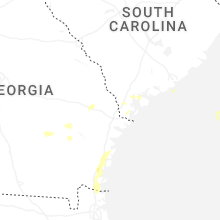
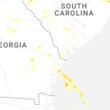
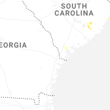


Connect with Interactive Hail Maps