

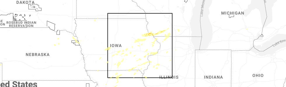
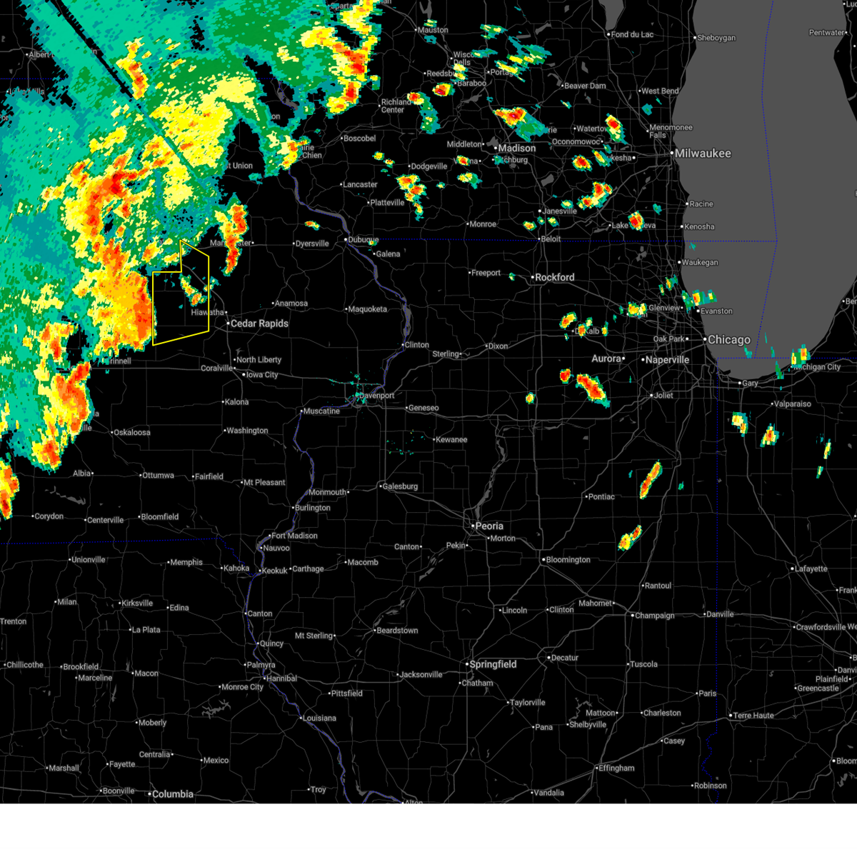
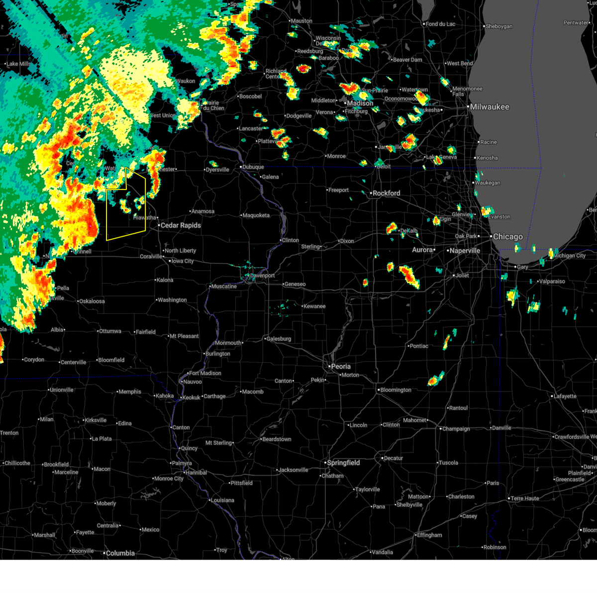
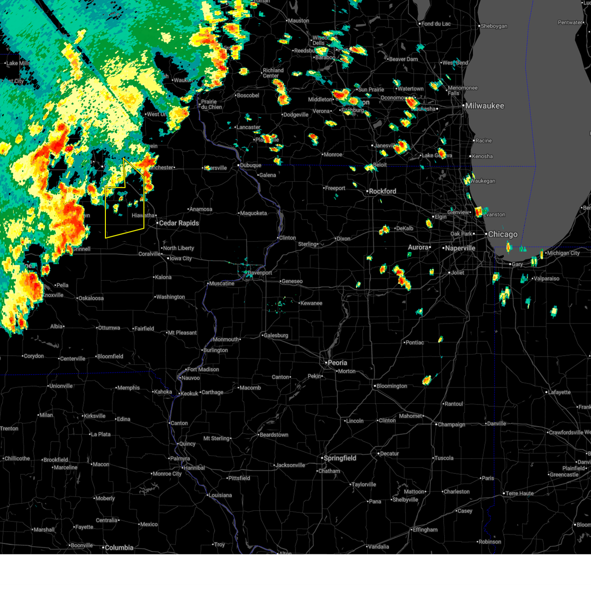
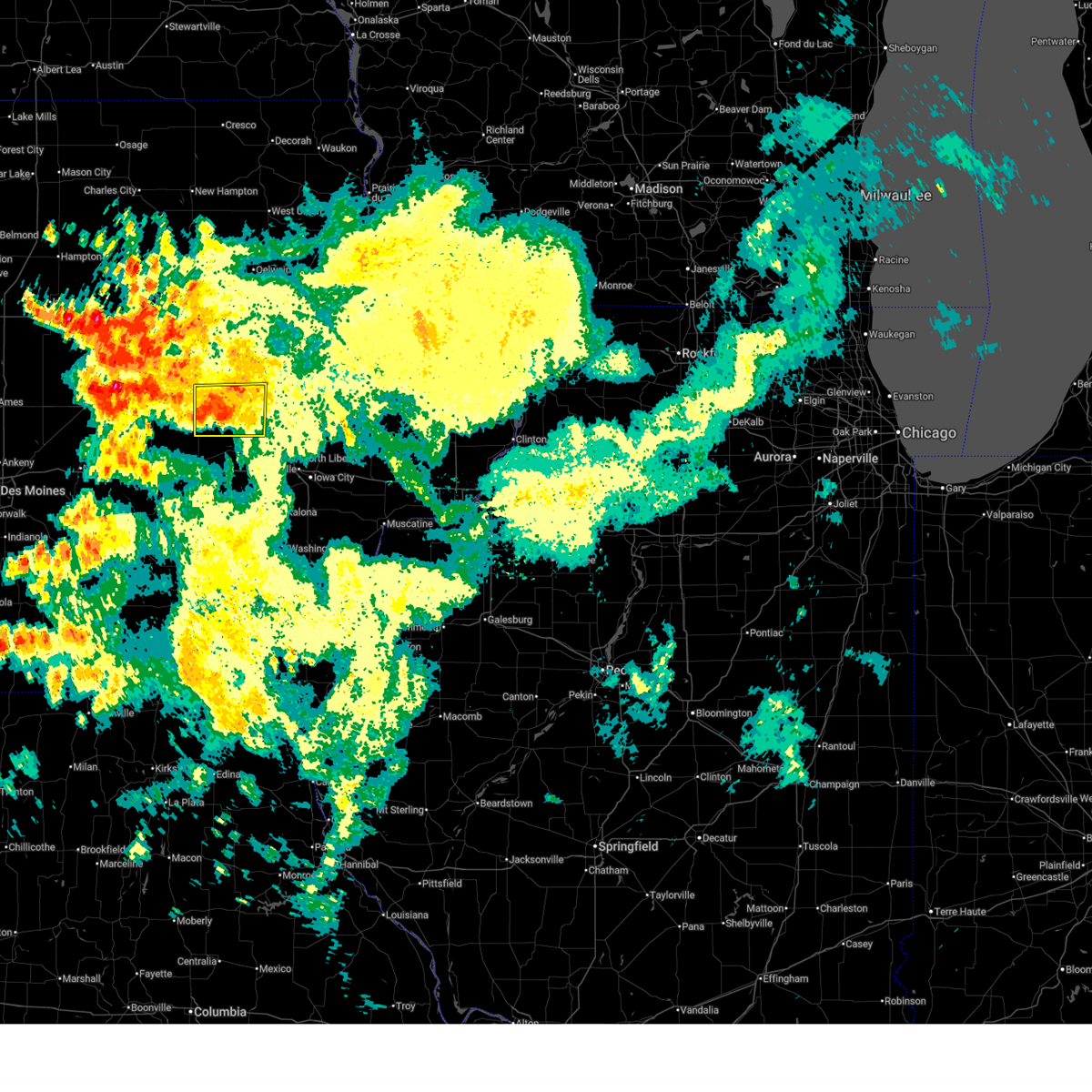
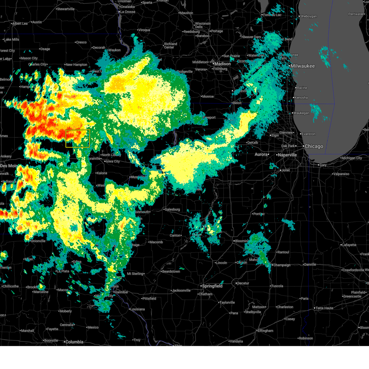
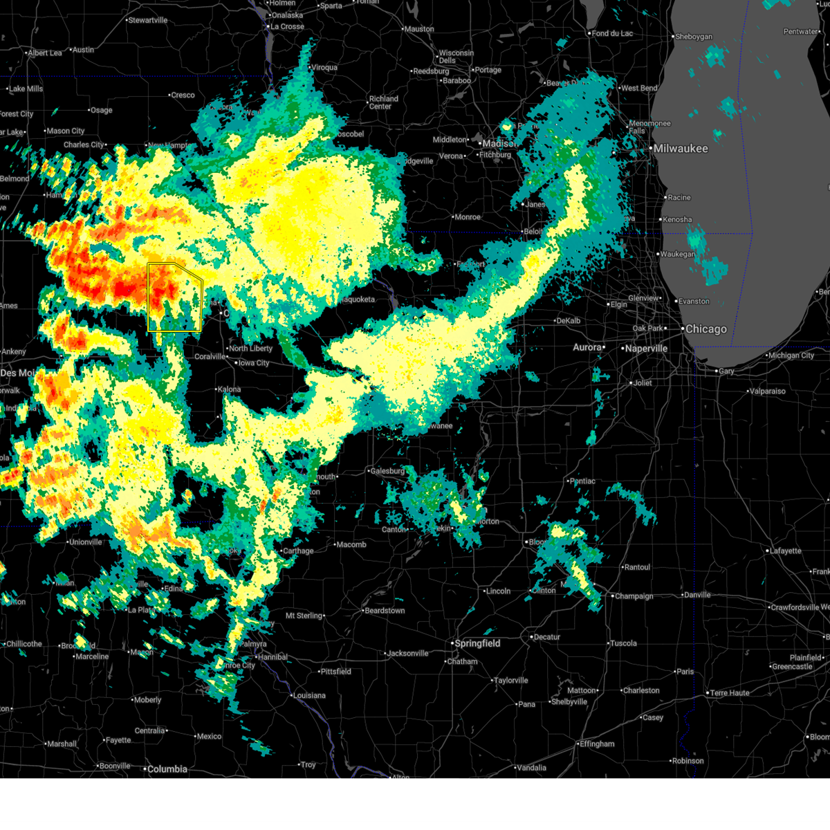
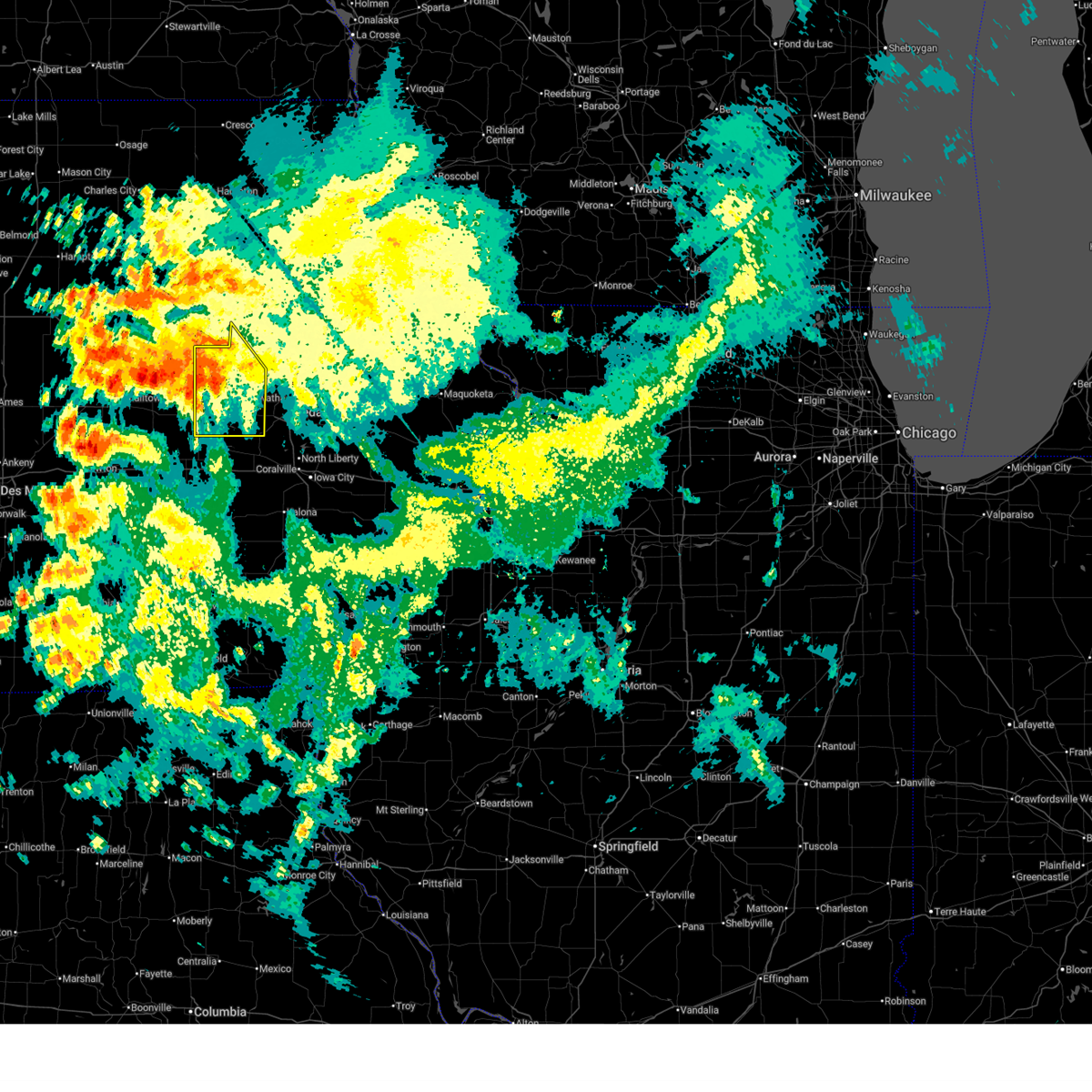
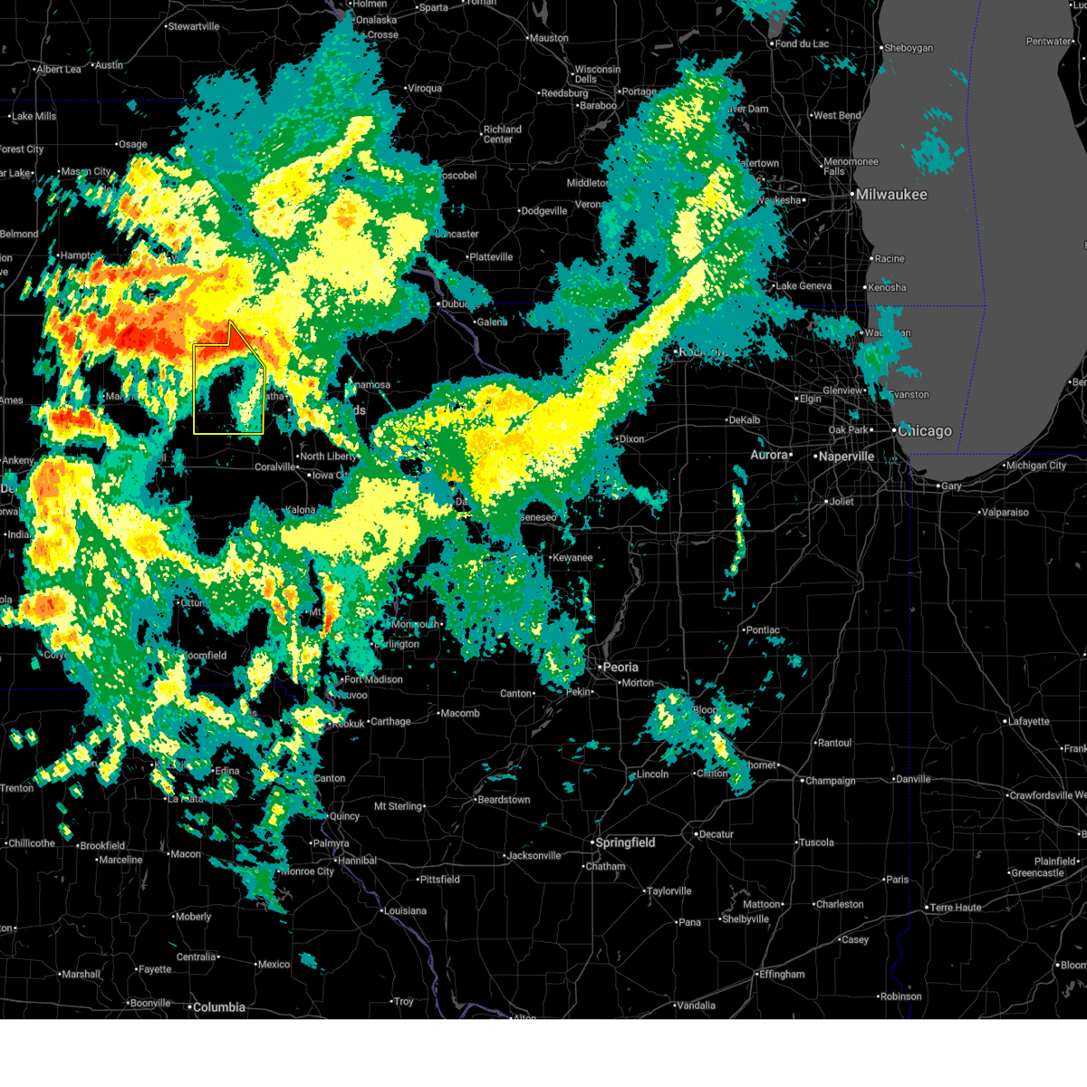
Hail Map for Belle Plaine, IA
The Belle Plaine, IA area has had 7 reports of on-the-ground hail by trained spotters, and has been under severe weather warnings 25 times during the past 12 months. Doppler radar has detected hail at or near Belle Plaine, IA on 39 occasions, including 2 occasions during the past year.
| Name: | Belle Plaine, IA |
| Where Located: | 31.6 miles W of Cedar Rapids, IA |
| Map: | Google Map for Belle Plaine, IA |
| Population: | 2534 |
| Housing Units: | 1258 |
| More Info: | Search Google for Belle Plaine, IA |
1
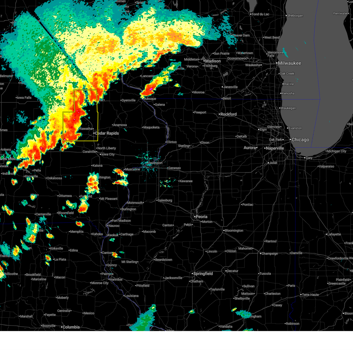
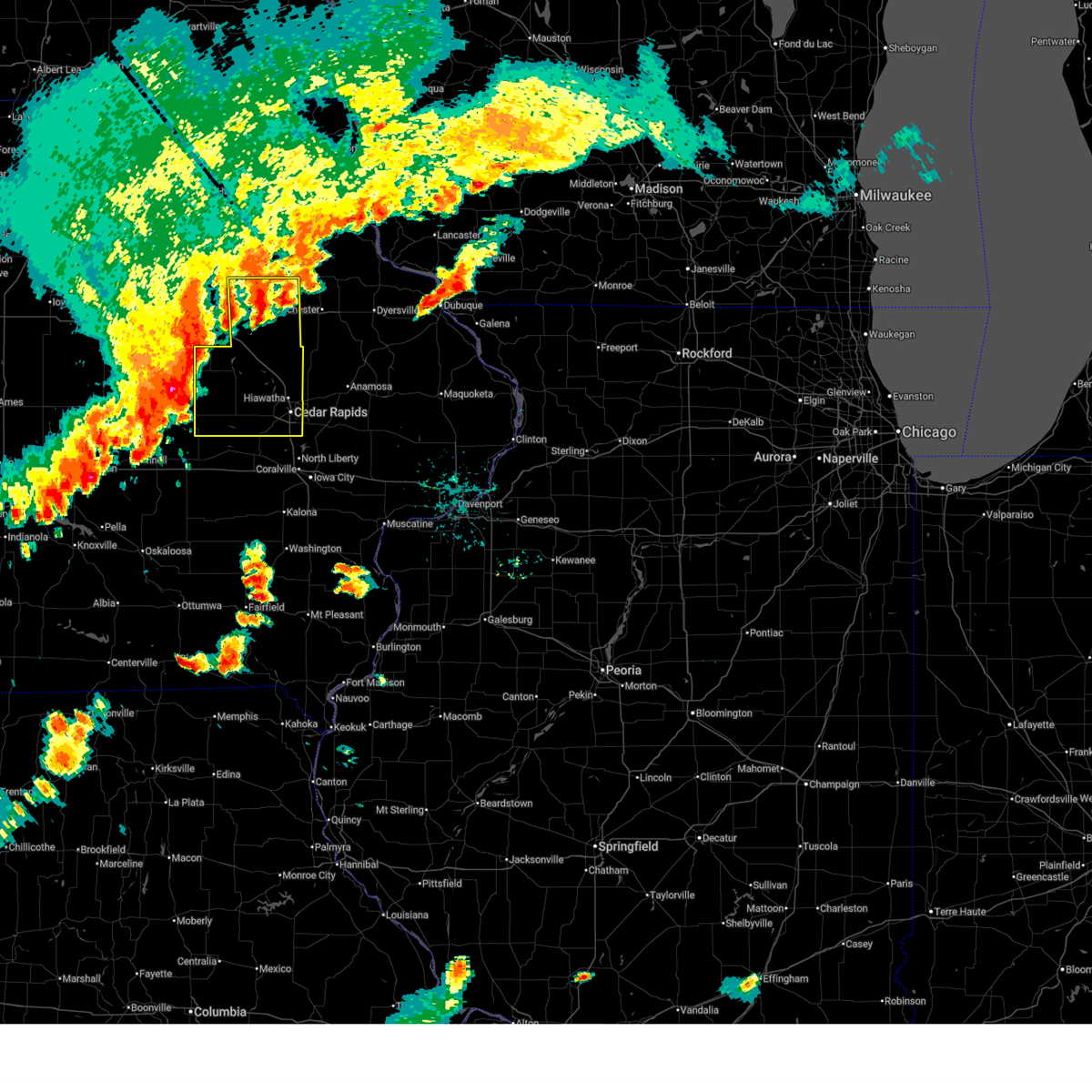
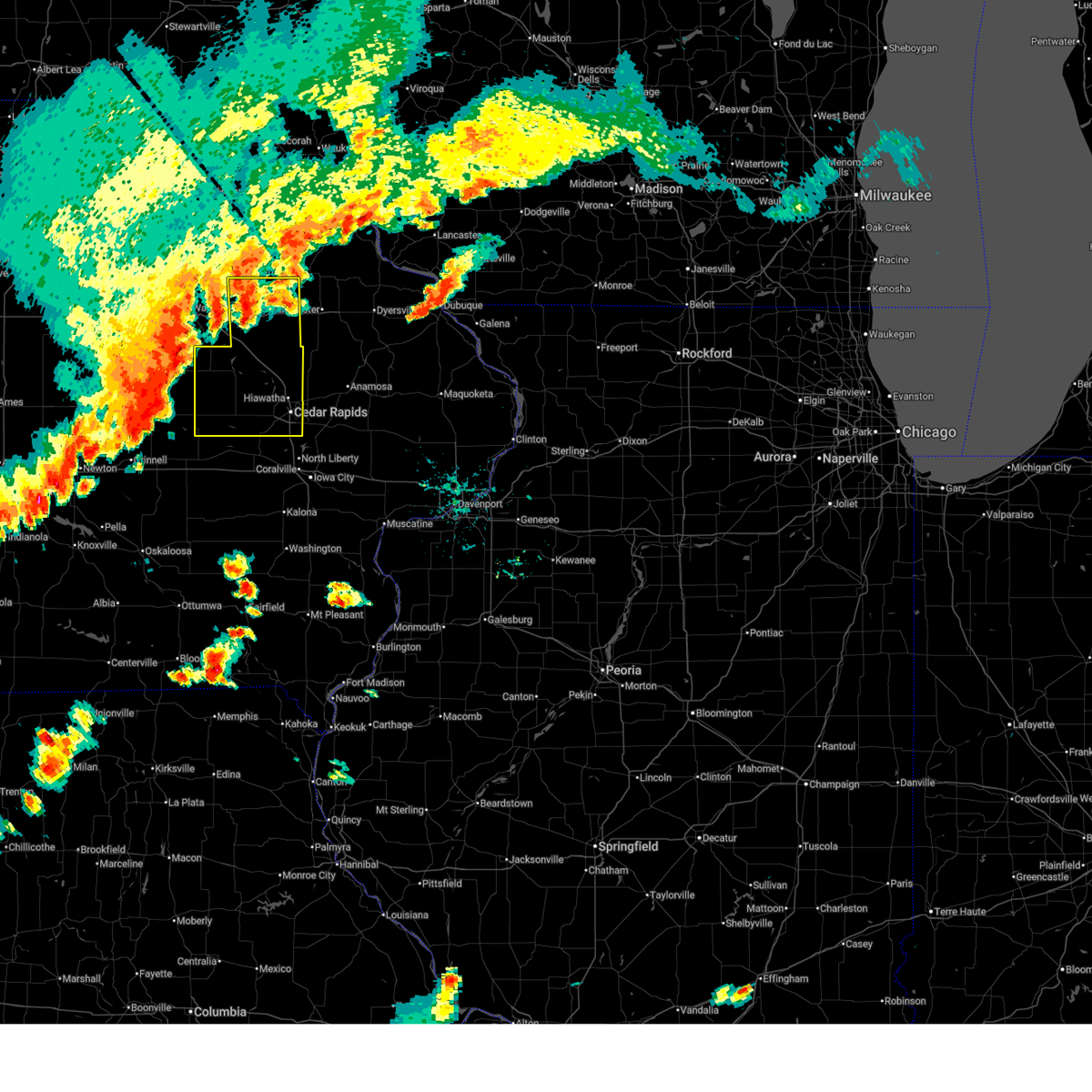
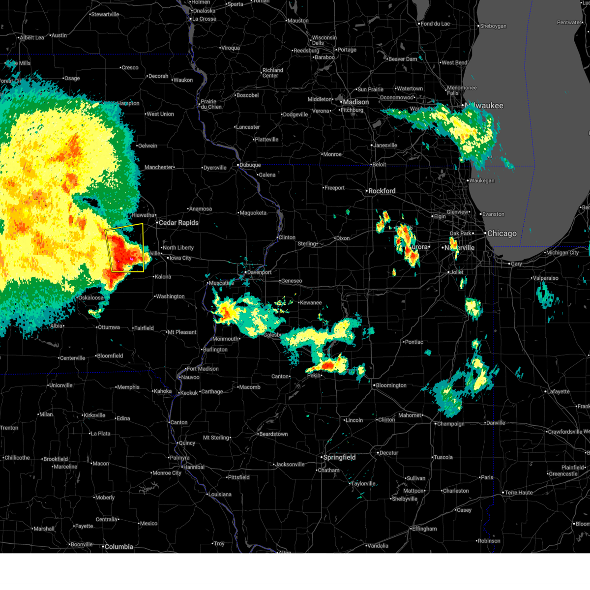
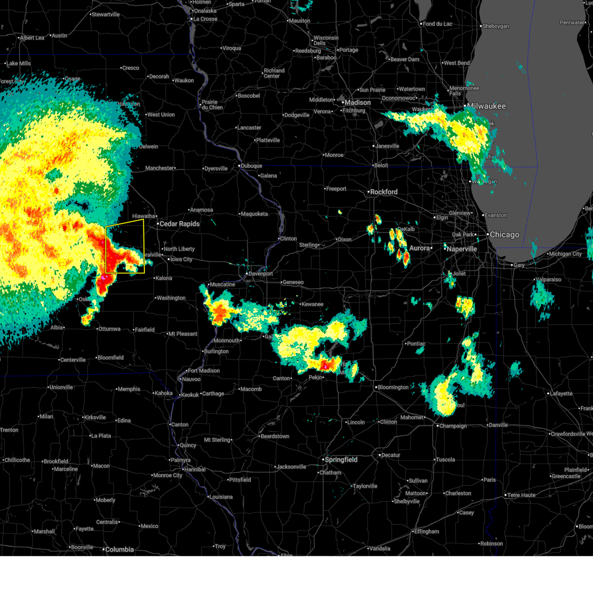
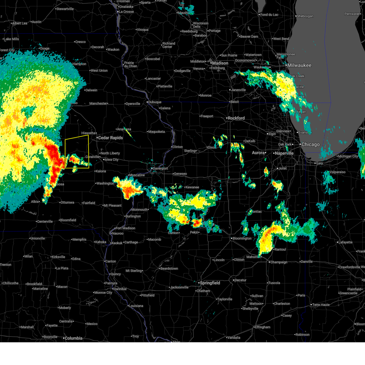
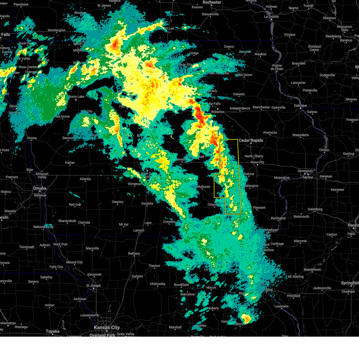
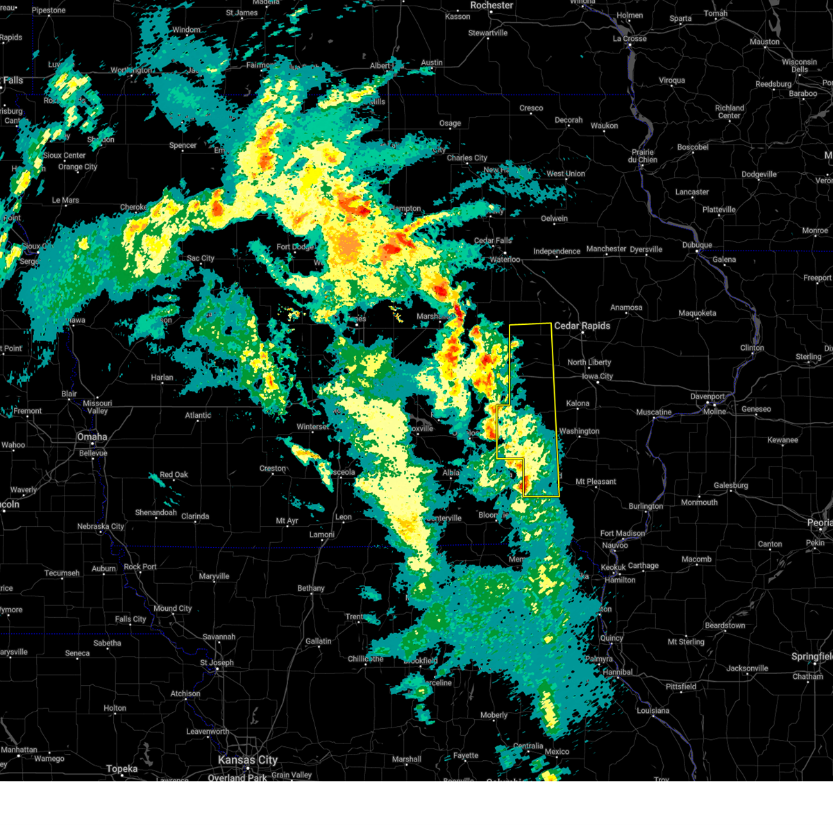
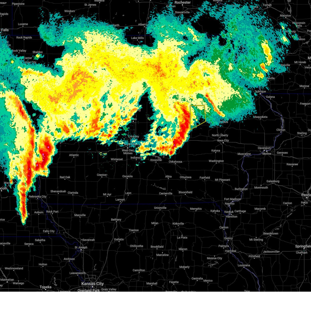
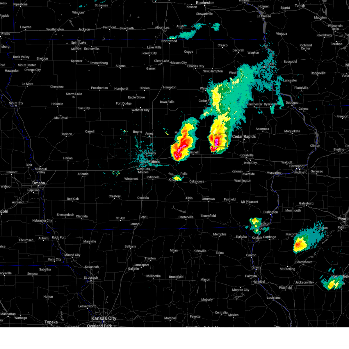
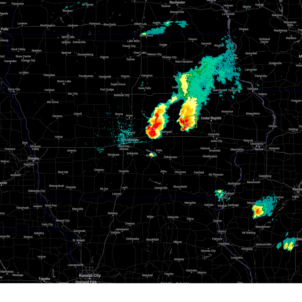
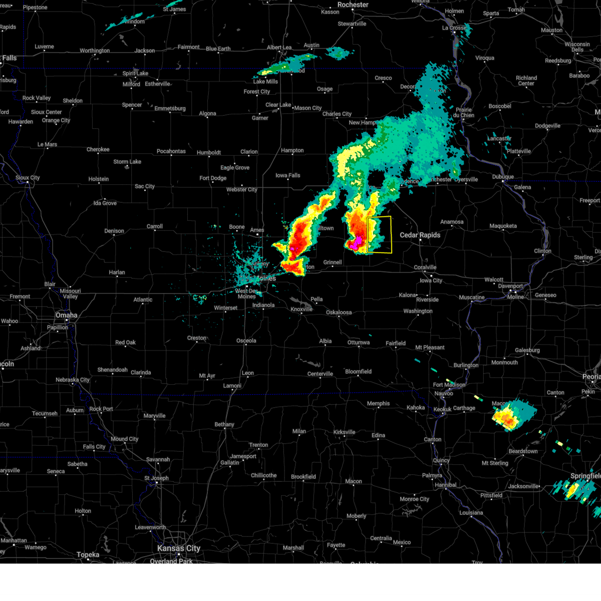
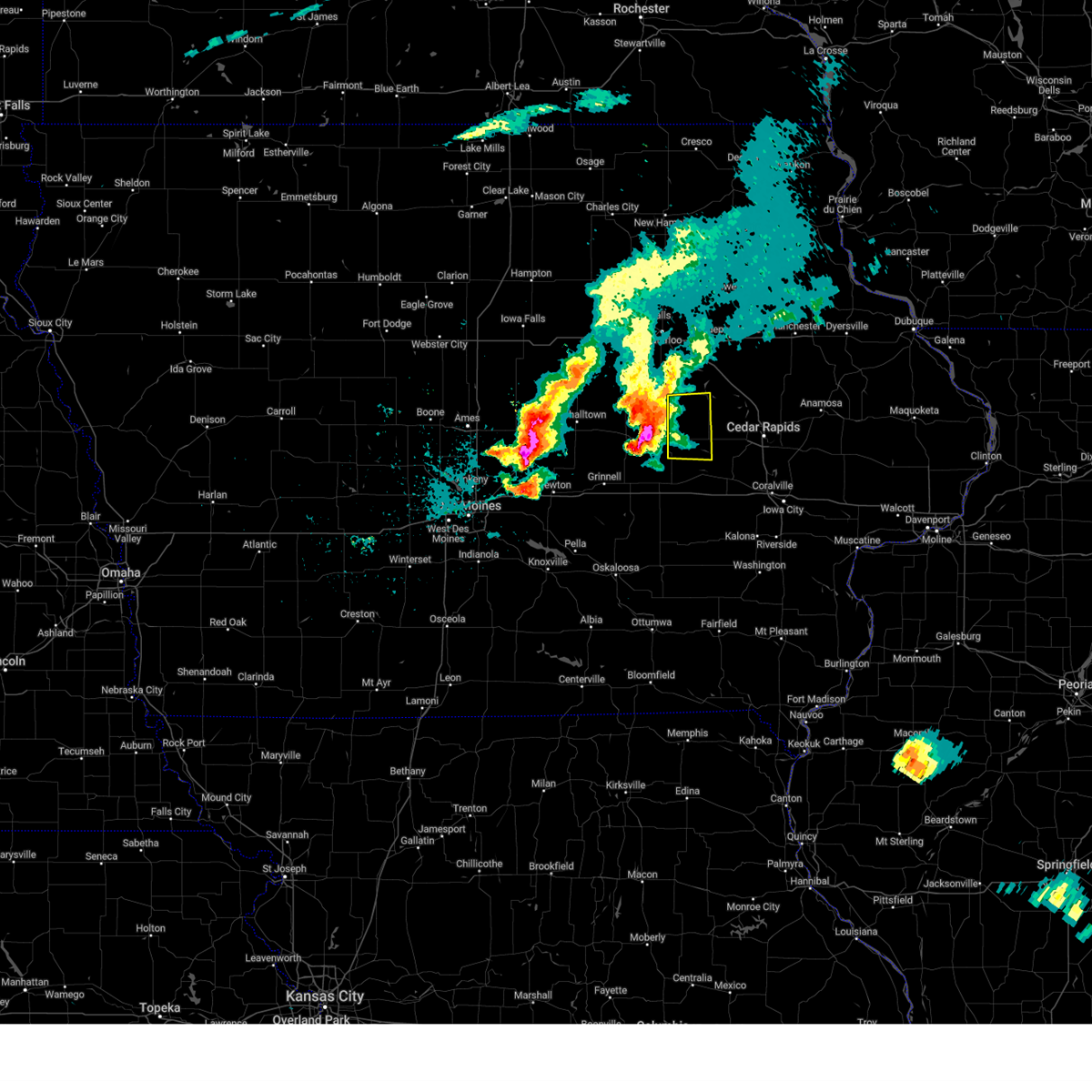
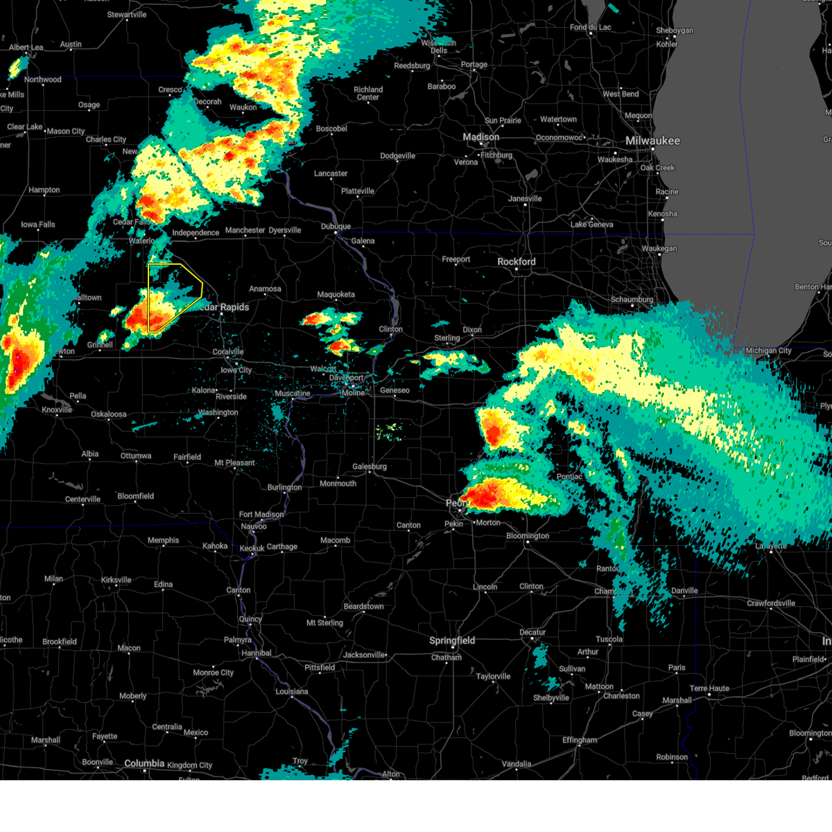
The Top Recent Hail Date for Belle Plaine, IA is Friday, July 11, 2025 (14th out of 39)
Hail and Wind Damage Spotted near Belle Plaine, IA
| Date / Time | Report Details |
|---|---|
| 7/11/2025 3:46 PM CDT |
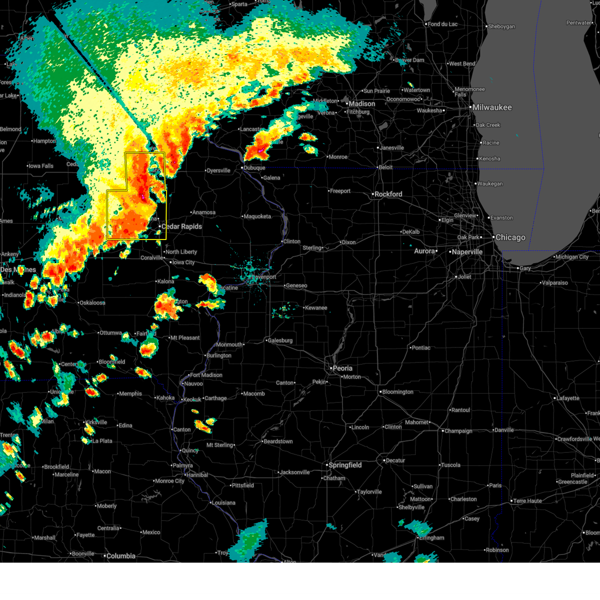 At 346 pm cdt, severe thunderstorms were located along a line extending from near winthrop to near benton city park to near iowa county fairgrounds, moving east at 35 mph (trained weather spotters). Hazards include 60 mph wind gusts and nickel size hail. Expect damage to roofs, siding, and trees. locations impacted include, cedar rapids, independence, vinton, marion, hiawatha, robins, belle plaine, jesup, center point, fairfax, ely, atkins, walford, urbana, dysart, fairbank, palo, shellsburg, newhall, and winthrop. This includes interstate 380 between mile markers 12 and 55. At 346 pm cdt, severe thunderstorms were located along a line extending from near winthrop to near benton city park to near iowa county fairgrounds, moving east at 35 mph (trained weather spotters). Hazards include 60 mph wind gusts and nickel size hail. Expect damage to roofs, siding, and trees. locations impacted include, cedar rapids, independence, vinton, marion, hiawatha, robins, belle plaine, jesup, center point, fairfax, ely, atkins, walford, urbana, dysart, fairbank, palo, shellsburg, newhall, and winthrop. This includes interstate 380 between mile markers 12 and 55.
|
| 7/11/2025 3:34 PM CDT |
 At 334 pm cdt, severe thunderstorms were located along a line extending from independence to near benton county fairgrounds to near koszta, moving east at 35 mph (radar indicated). Hazards include 60 mph wind gusts. Expect damage to roofs, siding, and trees. locations impacted include, cedar rapids, independence, vinton, marion, hiawatha, robins, belle plaine, jesup, center point, fairfax, ely, atkins, walford, urbana, dysart, fairbank, palo, shellsburg, newhall, and winthrop. This includes interstate 380 between mile markers 12 and 55. At 334 pm cdt, severe thunderstorms were located along a line extending from independence to near benton county fairgrounds to near koszta, moving east at 35 mph (radar indicated). Hazards include 60 mph wind gusts. Expect damage to roofs, siding, and trees. locations impacted include, cedar rapids, independence, vinton, marion, hiawatha, robins, belle plaine, jesup, center point, fairfax, ely, atkins, walford, urbana, dysart, fairbank, palo, shellsburg, newhall, and winthrop. This includes interstate 380 between mile markers 12 and 55.
|
| 7/11/2025 3:20 PM CDT | At 319 pm cdt, severe thunderstorms were located along a line extending from jesup to near garrison to near hartwick, moving east at 35 mph (radar indicated). Hazards include 60 mph wind gusts. Expect damage to roofs, siding, and trees. locations impacted include, cedar rapids, independence, vinton, marion, hiawatha, robins, belle plaine, jesup, center point, fairfax, ely, atkins, walford, urbana, dysart, fairbank, palo, shellsburg, newhall, and winthrop. This includes interstate 380 between mile markers 12 and 55. |
| 7/11/2025 3:12 PM CDT |
 At 311 pm cdt, severe thunderstorms were located along a line extending from near raymond to near dysart to near holiday lake, moving east at 35 mph (radar indicated). Hazards include 60 mph wind gusts. Expect damage to roofs, siding, and trees. locations impacted include, cedar rapids, independence, vinton, marion, hiawatha, robins, belle plaine, jesup, center point, fairfax, ely, atkins, walford, urbana, dysart, fairbank, palo, shellsburg, newhall, and winthrop. This includes interstate 380 between mile markers 12 and 55. At 311 pm cdt, severe thunderstorms were located along a line extending from near raymond to near dysart to near holiday lake, moving east at 35 mph (radar indicated). Hazards include 60 mph wind gusts. Expect damage to roofs, siding, and trees. locations impacted include, cedar rapids, independence, vinton, marion, hiawatha, robins, belle plaine, jesup, center point, fairfax, ely, atkins, walford, urbana, dysart, fairbank, palo, shellsburg, newhall, and winthrop. This includes interstate 380 between mile markers 12 and 55.
|
| 7/11/2025 3:03 PM CDT |
 Svrdvn the national weather service in the quad cities has issued a * severe thunderstorm warning for, buchanan county in northeastern iowa, benton county in east central iowa, western linn county in east central iowa, * until 400 pm cdt. * at 303 pm cdt, severe thunderstorms were located along a line extending from elk run heights to near clutier to near holiday lake, moving east at 35 mph (radar indicated). Hazards include 60 mph wind gusts. expect damage to roofs, siding, and trees Svrdvn the national weather service in the quad cities has issued a * severe thunderstorm warning for, buchanan county in northeastern iowa, benton county in east central iowa, western linn county in east central iowa, * until 400 pm cdt. * at 303 pm cdt, severe thunderstorms were located along a line extending from elk run heights to near clutier to near holiday lake, moving east at 35 mph (radar indicated). Hazards include 60 mph wind gusts. expect damage to roofs, siding, and trees
|
| 7/11/2025 2:53 AM CDT |
 At 253 am cdt, severe thunderstorms were located along a line extending from near hannen lake park to near parnell, moving east at 40 mph (radar indicated). Hazards include 60 mph wind gusts and penny size hail. Expect damage to roofs, siding, and trees. locations impacted include, marengo, williamsburg, belle plaine, walford, blairstown, norway, ladora, parnell, millersburg, luzerne, amana, conroy, middle amana, upper south amana, east amana, hannen lake park, koszta, high amana, iowa county fairgrounds, and south amana. This includes interstate 80 in iowa between mile markers 208 and 228. At 253 am cdt, severe thunderstorms were located along a line extending from near hannen lake park to near parnell, moving east at 40 mph (radar indicated). Hazards include 60 mph wind gusts and penny size hail. Expect damage to roofs, siding, and trees. locations impacted include, marengo, williamsburg, belle plaine, walford, blairstown, norway, ladora, parnell, millersburg, luzerne, amana, conroy, middle amana, upper south amana, east amana, hannen lake park, koszta, high amana, iowa county fairgrounds, and south amana. This includes interstate 80 in iowa between mile markers 208 and 228.
|
| 7/11/2025 2:48 AM CDT |
 At 247 am cdt, severe thunderstorms were located along a line extending from luzerne to near north english, moving east at 35 mph (radar indicated). Hazards include 60 mph wind gusts and penny size hail. Expect damage to roofs, siding, and trees. locations impacted include, marengo, williamsburg, belle plaine, walford, blairstown, norway, ladora, parnell, millersburg, luzerne, amana, conroy, middle amana, upper south amana, east amana, hannen lake park, koszta, high amana, iowa county fairgrounds, and south amana. This includes interstate 80 in iowa between mile markers 208 and 228. At 247 am cdt, severe thunderstorms were located along a line extending from luzerne to near north english, moving east at 35 mph (radar indicated). Hazards include 60 mph wind gusts and penny size hail. Expect damage to roofs, siding, and trees. locations impacted include, marengo, williamsburg, belle plaine, walford, blairstown, norway, ladora, parnell, millersburg, luzerne, amana, conroy, middle amana, upper south amana, east amana, hannen lake park, koszta, high amana, iowa county fairgrounds, and south amana. This includes interstate 80 in iowa between mile markers 208 and 228.
|
| 7/11/2025 2:41 AM CDT |
 At 241 am cdt, severe thunderstorms were located along a line extending from near luzerne to millersburg, moving east at 35 mph (radar indicated). Hazards include 60 mph wind gusts and penny size hail. Expect damage to roofs, siding, and trees. locations impacted include, marengo, williamsburg, belle plaine, atkins, walford, victor, newhall, blairstown, norway, ladora, parnell, millersburg, luzerne, amana, conroy, middle amana, upper south amana, east amana, hannen lake park, and koszta. This includes interstate 80 in iowa between mile markers 205 and 228. At 241 am cdt, severe thunderstorms were located along a line extending from near luzerne to millersburg, moving east at 35 mph (radar indicated). Hazards include 60 mph wind gusts and penny size hail. Expect damage to roofs, siding, and trees. locations impacted include, marengo, williamsburg, belle plaine, atkins, walford, victor, newhall, blairstown, norway, ladora, parnell, millersburg, luzerne, amana, conroy, middle amana, upper south amana, east amana, hannen lake park, and koszta. This includes interstate 80 in iowa between mile markers 205 and 228.
|
| 7/11/2025 2:34 AM CDT |
 At 234 am cdt, severe thunderstorms were located along a line extending from near belle plaine to millersburg, moving east at 40 mph (radar indicated). Hazards include 60 mph wind gusts and penny size hail. Expect damage to roofs, siding, and trees. locations impacted include, marengo, williamsburg, belle plaine, atkins, walford, victor, newhall, blairstown, norway, ladora, parnell, millersburg, luzerne, amana, conroy, middle amana, upper south amana, east amana, hannen lake park, and koszta. This includes interstate 80 in iowa between mile markers 205 and 228. At 234 am cdt, severe thunderstorms were located along a line extending from near belle plaine to millersburg, moving east at 40 mph (radar indicated). Hazards include 60 mph wind gusts and penny size hail. Expect damage to roofs, siding, and trees. locations impacted include, marengo, williamsburg, belle plaine, atkins, walford, victor, newhall, blairstown, norway, ladora, parnell, millersburg, luzerne, amana, conroy, middle amana, upper south amana, east amana, hannen lake park, and koszta. This includes interstate 80 in iowa between mile markers 205 and 228.
|
| 7/11/2025 2:22 AM CDT |
 Svrdvn the national weather service in the quad cities has issued a * severe thunderstorm warning for, southern benton county in east central iowa, iowa county in east central iowa, * until 315 am cdt. * at 221 am cdt, severe thunderstorms were located along a line extending from near holiday lake to near thornburg, moving east at 40 mph (radar indicated). Hazards include 60 mph wind gusts and penny size hail. expect damage to roofs, siding, and trees Svrdvn the national weather service in the quad cities has issued a * severe thunderstorm warning for, southern benton county in east central iowa, iowa county in east central iowa, * until 315 am cdt. * at 221 am cdt, severe thunderstorms were located along a line extending from near holiday lake to near thornburg, moving east at 40 mph (radar indicated). Hazards include 60 mph wind gusts and penny size hail. expect damage to roofs, siding, and trees
|
| 6/26/2025 6:22 PM CDT |
 At 621 pm cdt, severe thunderstorms were located along a line extending from near la porte city to near rodgers park to near van horne to luzerne, moving east at 55 mph (radar indicated). Hazards include 60 mph wind gusts. Expect damage to roofs, siding, and trees. locations impacted include, vinton, belle plaine, jesup, atkins, urbana, dysart, shellsburg, newhall, blairstown, van horne, keystone, garrison, brandon, rowley, mount auburn, luzerne, vinton memorial airport, minne estema park, benton county fairgrounds, and wildcat bluff park. This includes interstate 380 between mile markers 40 and 55. At 621 pm cdt, severe thunderstorms were located along a line extending from near la porte city to near rodgers park to near van horne to luzerne, moving east at 55 mph (radar indicated). Hazards include 60 mph wind gusts. Expect damage to roofs, siding, and trees. locations impacted include, vinton, belle plaine, jesup, atkins, urbana, dysart, shellsburg, newhall, blairstown, van horne, keystone, garrison, brandon, rowley, mount auburn, luzerne, vinton memorial airport, minne estema park, benton county fairgrounds, and wildcat bluff park. This includes interstate 380 between mile markers 40 and 55.
|
| 6/26/2025 6:09 PM CDT |
 At 608 pm cdt, severe thunderstorms were located along a line extending from near tf clark state park to near dysart to elberon to near hartwick, moving east at 35 mph (radar indicated). Hazards include 60 mph wind gusts. Expect damage to roofs, siding, and trees. locations impacted include, vinton, belle plaine, jesup, atkins, urbana, dysart, shellsburg, newhall, blairstown, van horne, keystone, garrison, brandon, rowley, mount auburn, luzerne, vinton memorial airport, minne estema park, benton county fairgrounds, and wildcat bluff park. This includes interstate 380 between mile markers 40 and 55. At 608 pm cdt, severe thunderstorms were located along a line extending from near tf clark state park to near dysart to elberon to near hartwick, moving east at 35 mph (radar indicated). Hazards include 60 mph wind gusts. Expect damage to roofs, siding, and trees. locations impacted include, vinton, belle plaine, jesup, atkins, urbana, dysart, shellsburg, newhall, blairstown, van horne, keystone, garrison, brandon, rowley, mount auburn, luzerne, vinton memorial airport, minne estema park, benton county fairgrounds, and wildcat bluff park. This includes interstate 380 between mile markers 40 and 55.
|
| 6/26/2025 5:53 PM CDT |
 Svrdvn the national weather service in the quad cities has issued a * severe thunderstorm warning for, southwestern buchanan county in northeastern iowa, benton county in east central iowa, northwestern iowa county in east central iowa, * until 700 pm cdt. * at 553 pm cdt, severe thunderstorms were located along a line extending from near lincoln to near clutier to near malcom, moving east at 45 mph (radar indicated). Hazards include 60 mph wind gusts. expect damage to roofs, siding, and trees Svrdvn the national weather service in the quad cities has issued a * severe thunderstorm warning for, southwestern buchanan county in northeastern iowa, benton county in east central iowa, northwestern iowa county in east central iowa, * until 700 pm cdt. * at 553 pm cdt, severe thunderstorms were located along a line extending from near lincoln to near clutier to near malcom, moving east at 45 mph (radar indicated). Hazards include 60 mph wind gusts. expect damage to roofs, siding, and trees
|
| 6/20/2025 9:11 AM CDT |
 The storms which prompted the warning have weakened below severe limits, and no longer pose an immediate threat to life or property. therefore, the warning will be allowed to expire. however, heavy rain is still possible with these thunderstorms. The storms which prompted the warning have weakened below severe limits, and no longer pose an immediate threat to life or property. therefore, the warning will be allowed to expire. however, heavy rain is still possible with these thunderstorms.
|
| 6/20/2025 9:02 AM CDT |
 At 901 am cdt, severe thunderstorms were located along a line extending from near cedar rapids to watkins to tama, moving southeast at 40 mph (radar indicated). Hazards include 60 mph wind gusts. Expect damage to roofs, siding, and trees. Locations impacted include, belle plaine, atkins, walford, shellsburg, newhall, blairstown, van horne, keystone, norway, luzerne, hannen lake park, and watkins. At 901 am cdt, severe thunderstorms were located along a line extending from near cedar rapids to watkins to tama, moving southeast at 40 mph (radar indicated). Hazards include 60 mph wind gusts. Expect damage to roofs, siding, and trees. Locations impacted include, belle plaine, atkins, walford, shellsburg, newhall, blairstown, van horne, keystone, norway, luzerne, hannen lake park, and watkins.
|
| 6/20/2025 8:50 AM CDT |
 the severe thunderstorm warning has been cancelled and is no longer in effect the severe thunderstorm warning has been cancelled and is no longer in effect
|
| 6/20/2025 8:50 AM CDT |
 At 849 am cdt, severe thunderstorms were located along a line extending from toddville to near van horne to near garwin, moving east at 40 mph (radar indicated). Hazards include 60 mph wind gusts. Expect damage to roofs, siding, and trees. Locations impacted include, vinton, belle plaine, atkins, walford, urbana, dysart, shellsburg, newhall, blairstown, van horne, keystone, norway, garrison, mount auburn, luzerne, vinton memorial airport, rodgers park, benton city park, hoefle-dulin park, and hannen lake park. At 849 am cdt, severe thunderstorms were located along a line extending from toddville to near van horne to near garwin, moving east at 40 mph (radar indicated). Hazards include 60 mph wind gusts. Expect damage to roofs, siding, and trees. Locations impacted include, vinton, belle plaine, atkins, walford, urbana, dysart, shellsburg, newhall, blairstown, van horne, keystone, norway, garrison, mount auburn, luzerne, vinton memorial airport, rodgers park, benton city park, hoefle-dulin park, and hannen lake park.
|
| 6/20/2025 8:39 AM CDT |
 At 839 am cdt, severe thunderstorms were located along a line extending from center point to near keystone to union grove state park, moving southeast at 40 mph (radar indicated). Hazards include 60 mph wind gusts and penny size hail. Expect damage to roofs, siding, and trees. locations impacted include, vinton, belle plaine, atkins, walford, urbana, dysart, shellsburg, newhall, blairstown, van horne, keystone, norway, garrison, brandon, mount auburn, luzerne, vinton memorial airport, hannen lake park, minne estema park, and benton county fairgrounds. This includes interstate 380 between mile markers 43 and 55. At 839 am cdt, severe thunderstorms were located along a line extending from center point to near keystone to union grove state park, moving southeast at 40 mph (radar indicated). Hazards include 60 mph wind gusts and penny size hail. Expect damage to roofs, siding, and trees. locations impacted include, vinton, belle plaine, atkins, walford, urbana, dysart, shellsburg, newhall, blairstown, van horne, keystone, norway, garrison, brandon, mount auburn, luzerne, vinton memorial airport, hannen lake park, minne estema park, and benton county fairgrounds. This includes interstate 380 between mile markers 43 and 55.
|
| 6/20/2025 8:22 AM CDT |
 Svrdvn the national weather service in the quad cities has issued a * severe thunderstorm warning for, southwestern buchanan county in northeastern iowa, benton county in east central iowa, * until 915 am cdt. * at 822 am cdt, severe thunderstorms were located along a line extending from near spencers grove to dysart to near beaman, moving southeast at 40 mph (radar indicated). Hazards include 60 mph wind gusts and penny size hail. expect damage to roofs, siding, and trees Svrdvn the national weather service in the quad cities has issued a * severe thunderstorm warning for, southwestern buchanan county in northeastern iowa, benton county in east central iowa, * until 915 am cdt. * at 822 am cdt, severe thunderstorms were located along a line extending from near spencers grove to dysart to near beaman, moving southeast at 40 mph (radar indicated). Hazards include 60 mph wind gusts and penny size hail. expect damage to roofs, siding, and trees
|
| 3/14/2025 7:16 PM CDT |
 At 715 pm cdt, a severe thunderstorm was located near north english, or 13 miles north of sigourney, moving north at 60 mph (radar indicated). Hazards include 70 mph wind gusts. Expect considerable tree damage. damage is likely to mobile homes, roofs, and outbuildings. locations impacted include, newhall, parnell, richland, pekin, jefferson county park, what cheer, high amana, lake darling state park, iowa county fairgrounds, hedrick, abingdon, thornburg, keokuk county fairgrounds, belle plaine, conroy, hayesville, west amana, perlee, lake iowa park, and keswick. This includes interstate 80 in iowa between mile markers 205 and 224. At 715 pm cdt, a severe thunderstorm was located near north english, or 13 miles north of sigourney, moving north at 60 mph (radar indicated). Hazards include 70 mph wind gusts. Expect considerable tree damage. damage is likely to mobile homes, roofs, and outbuildings. locations impacted include, newhall, parnell, richland, pekin, jefferson county park, what cheer, high amana, lake darling state park, iowa county fairgrounds, hedrick, abingdon, thornburg, keokuk county fairgrounds, belle plaine, conroy, hayesville, west amana, perlee, lake iowa park, and keswick. This includes interstate 80 in iowa between mile markers 205 and 224.
|
| 3/14/2025 6:49 PM CDT |
 Svrdvn the national weather service in the quad cities has issued a * severe thunderstorm warning for, keokuk county in southeastern iowa, western washington county in southeastern iowa, southwestern benton county in east central iowa, jefferson county in southeastern iowa, iowa county in east central iowa, * until 745 pm cdt. * at 648 pm cdt, a severe thunderstorm was located over linby, or 12 miles northwest of fairfield, moving north at 60 mph (radar indicated). Hazards include 70 mph wind gusts. Expect considerable tree damage. Damage is likely to mobile homes, roofs, and outbuildings. Svrdvn the national weather service in the quad cities has issued a * severe thunderstorm warning for, keokuk county in southeastern iowa, western washington county in southeastern iowa, southwestern benton county in east central iowa, jefferson county in southeastern iowa, iowa county in east central iowa, * until 745 pm cdt. * at 648 pm cdt, a severe thunderstorm was located over linby, or 12 miles northwest of fairfield, moving north at 60 mph (radar indicated). Hazards include 70 mph wind gusts. Expect considerable tree damage. Damage is likely to mobile homes, roofs, and outbuildings.
|
| 7/15/2024 5:59 PM CDT |
 At 559 pm cdt, severe thunderstorms were located along a line extending from near luxemburg to near cedar rapids municipal airport, moving east at 25 mph (radar indicated). Hazards include 70 mph wind gusts and penny size hail. Expect considerable tree damage. damage is likely to mobile homes, roofs, and outbuildings. locations impacted include, cedar rapids, anamosa, vinton, manchester, mechanicsville, marion, hiawatha, mount vernon, dyersville, monticello, robins, belle plaine, center point, cascade, lisbon, fairfax, solon, epworth, ely, and atkins. This includes interstate 380 between mile markers 8 and 45. At 559 pm cdt, severe thunderstorms were located along a line extending from near luxemburg to near cedar rapids municipal airport, moving east at 25 mph (radar indicated). Hazards include 70 mph wind gusts and penny size hail. Expect considerable tree damage. damage is likely to mobile homes, roofs, and outbuildings. locations impacted include, cedar rapids, anamosa, vinton, manchester, mechanicsville, marion, hiawatha, mount vernon, dyersville, monticello, robins, belle plaine, center point, cascade, lisbon, fairfax, solon, epworth, ely, and atkins. This includes interstate 380 between mile markers 8 and 45.
|
| 7/15/2024 5:40 PM CDT | At 539 pm cdt, severe thunderstorms were located along a line extending from near twin bridges park to near fairfax, moving east at 25 mph (radar indicated). Hazards include 70 mph wind gusts and penny size hail. Expect considerable tree damage. damage is likely to mobile homes, roofs, and outbuildings. locations impacted include, cedar rapids, independence, anamosa, vinton, manchester, mechanicsville, marion, hiawatha, mount vernon, dyersville, monticello, robins, belle plaine, jesup, center point, cascade, lisbon, fairfax, solon, and epworth. This includes interstate 380 between mile markers 8 and 55. |
| 7/15/2024 5:20 PM CDT | Svrdvn the national weather service in the quad cities has issued a * severe thunderstorm warning for, buchanan county in northeastern iowa, northwestern cedar county in east central iowa, western dubuque county in northeastern iowa, northern johnson county in east central iowa, benton county in east central iowa, jones county in east central iowa, delaware county in northeastern iowa, linn county in east central iowa, northeastern iowa county in east central iowa, * until 630 pm cdt. * at 520 pm cdt, severe thunderstorms were located along a line extending from edgewood to near norway, moving east at 25 mph (radar indicated). Hazards include 70 mph wind gusts and quarter size hail. Hail damage to vehicles is expected. expect considerable tree damage. Wind damage is also likely to mobile homes, roofs, and outbuildings. |
| 7/15/2024 4:56 PM CDT | Svrdvn the national weather service in the quad cities has issued a * severe thunderstorm warning for, southern benton county in east central iowa, southwestern linn county in east central iowa, * until 600 pm cdt. * at 456 pm cdt, a severe thunderstorm was located over keystone, or 14 miles northwest of marengo, moving east at 50 mph (radar indicated). Hazards include 70 mph wind gusts and quarter size hail. Hail damage to vehicles is expected. expect considerable tree damage. Wind damage is also likely to mobile homes, roofs, and outbuildings. |
| 6/18/2024 10:32 PM CDT |
 At 1031 pm cdt, severe thunderstorms were located along a line extending from near fairbank to near elberon, moving east at 60 mph (observed winds at marshalltown and waterloo airports). Hazards include 60 mph wind gusts. Expect damage to roofs, siding, and trees. locations impacted include, cedar rapids, independence, vinton, manchester, hiawatha, robins, belle plaine, jesup, center point, atkins, urbana, dysart, fairbank, palo, shellsburg, newhall, edgewood, winthrop, hazleton, and walker. This includes interstate 380 between mile markers 25 and 55. At 1031 pm cdt, severe thunderstorms were located along a line extending from near fairbank to near elberon, moving east at 60 mph (observed winds at marshalltown and waterloo airports). Hazards include 60 mph wind gusts. Expect damage to roofs, siding, and trees. locations impacted include, cedar rapids, independence, vinton, manchester, hiawatha, robins, belle plaine, jesup, center point, atkins, urbana, dysart, fairbank, palo, shellsburg, newhall, edgewood, winthrop, hazleton, and walker. This includes interstate 380 between mile markers 25 and 55.
|
| 6/18/2024 10:19 PM CDT |
 Svrdvn the national weather service in the quad cities has issued a * severe thunderstorm warning for, buchanan county in northeastern iowa, benton county in east central iowa, western delaware county in northeastern iowa, northwestern linn county in east central iowa, * until 1100 pm cdt. * at 1018 pm cdt, severe thunderstorms were located along a line extending from near denver to tama, moving east at 50 mph (observed winds at marshalltown and waterloo airports). Hazards include 60 mph wind gusts. expect damage to roofs, siding, and trees Svrdvn the national weather service in the quad cities has issued a * severe thunderstorm warning for, buchanan county in northeastern iowa, benton county in east central iowa, western delaware county in northeastern iowa, northwestern linn county in east central iowa, * until 1100 pm cdt. * at 1018 pm cdt, severe thunderstorms were located along a line extending from near denver to tama, moving east at 50 mph (observed winds at marshalltown and waterloo airports). Hazards include 60 mph wind gusts. expect damage to roofs, siding, and trees
|
| 5/24/2024 6:40 AM CDT |
 At 640 am cdt, severe thunderstorms were located along a line extending from near brandon to near shellsburg to homestead, moving east at 55 mph (radar indicated). Hazards include 60 mph wind gusts and nickel size hail. Expect damage to roofs, siding, and trees. locations impacted include, cedar rapids, independence, vinton, hiawatha, robins, belle plaine, jesup, center point, fairfax, atkins, walford, urbana, dysart, fairbank, palo, shellsburg, newhall, walker, blairstown, and van horne. This includes interstate 380 between mile markers 12 and 55. At 640 am cdt, severe thunderstorms were located along a line extending from near brandon to near shellsburg to homestead, moving east at 55 mph (radar indicated). Hazards include 60 mph wind gusts and nickel size hail. Expect damage to roofs, siding, and trees. locations impacted include, cedar rapids, independence, vinton, hiawatha, robins, belle plaine, jesup, center point, fairfax, atkins, walford, urbana, dysart, fairbank, palo, shellsburg, newhall, walker, blairstown, and van horne. This includes interstate 380 between mile markers 12 and 55.
|
| 5/24/2024 6:23 AM CDT |
 At 623 am cdt, severe thunderstorms were located along a line extending from near washburn to near van horne to near ladora, moving east at 55 mph (radar indicated). Hazards include 60 mph wind gusts and penny size hail. Expect damage to roofs, siding, and trees. locations impacted include, cedar rapids, independence, vinton, hiawatha, robins, belle plaine, jesup, center point, fairfax, atkins, walford, urbana, dysart, fairbank, palo, shellsburg, newhall, walker, blairstown, and van horne. This includes interstate 380 between mile markers 12 and 55. At 623 am cdt, severe thunderstorms were located along a line extending from near washburn to near van horne to near ladora, moving east at 55 mph (radar indicated). Hazards include 60 mph wind gusts and penny size hail. Expect damage to roofs, siding, and trees. locations impacted include, cedar rapids, independence, vinton, hiawatha, robins, belle plaine, jesup, center point, fairfax, atkins, walford, urbana, dysart, fairbank, palo, shellsburg, newhall, walker, blairstown, and van horne. This includes interstate 380 between mile markers 12 and 55.
|
| 5/24/2024 6:13 AM CDT |
 Svrdvn the national weather service in the quad cities has issued a * severe thunderstorm warning for, western buchanan county in northeastern iowa, benton county in east central iowa, western linn county in east central iowa, * until 700 am cdt. * at 613 am cdt, severe thunderstorms were located along a line extending from near reinbeck to near elberon to hartwick, moving east at 55 mph (radar indicated). Hazards include 60 mph wind gusts and penny size hail. expect damage to roofs, siding, and trees Svrdvn the national weather service in the quad cities has issued a * severe thunderstorm warning for, western buchanan county in northeastern iowa, benton county in east central iowa, western linn county in east central iowa, * until 700 am cdt. * at 613 am cdt, severe thunderstorms were located along a line extending from near reinbeck to near elberon to hartwick, moving east at 55 mph (radar indicated). Hazards include 60 mph wind gusts and penny size hail. expect damage to roofs, siding, and trees
|
| 5/21/2024 6:57 PM CDT |
 At 656 pm cdt, severe thunderstorms were located along a line extending from near county road w 45 and 187 to shellsburg, moving northeast at 45 mph. these are destructive storms for buchanan county (emergency management). Hazards include 80 mph wind gusts and quarter size hail. Flying debris will be dangerous to those caught without shelter. mobile homes will be heavily damaged. expect considerable damage to roofs, windows, and vehicles. extensive tree damage and power outages are likely. locations impacted include, independence, vinton, manchester, belle plaine, jesup, center point, urbana, dysart, fairbank, shellsburg, edgewood, winthrop, hazleton, walker, van horne, coggon, keystone, quasqueton, lamont, and garrison. This includes interstate 380 between mile markers 34 and 55. At 656 pm cdt, severe thunderstorms were located along a line extending from near county road w 45 and 187 to shellsburg, moving northeast at 45 mph. these are destructive storms for buchanan county (emergency management). Hazards include 80 mph wind gusts and quarter size hail. Flying debris will be dangerous to those caught without shelter. mobile homes will be heavily damaged. expect considerable damage to roofs, windows, and vehicles. extensive tree damage and power outages are likely. locations impacted include, independence, vinton, manchester, belle plaine, jesup, center point, urbana, dysart, fairbank, shellsburg, edgewood, winthrop, hazleton, walker, van horne, coggon, keystone, quasqueton, lamont, and garrison. This includes interstate 380 between mile markers 34 and 55.
|
| 5/21/2024 6:40 PM CDT |
 At 639 pm cdt, severe thunderstorms were located along a line extending from near county road w 45 and 187 to van horne, moving northeast at 65 mph. these are destructive storms for buchanan and benton counties! (emergency management). Hazards include 80 mph wind gusts and quarter size hail. Flying debris will be dangerous to those caught without shelter. mobile homes will be heavily damaged. expect considerable damage to roofs, windows, and vehicles. extensive tree damage and power outages are likely. locations impacted include, independence, vinton, manchester, belle plaine, jesup, center point, urbana, dysart, fairbank, shellsburg, edgewood, winthrop, hazleton, walker, van horne, coggon, keystone, quasqueton, lamont, and garrison. This includes interstate 380 between mile markers 34 and 55. At 639 pm cdt, severe thunderstorms were located along a line extending from near county road w 45 and 187 to van horne, moving northeast at 65 mph. these are destructive storms for buchanan and benton counties! (emergency management). Hazards include 80 mph wind gusts and quarter size hail. Flying debris will be dangerous to those caught without shelter. mobile homes will be heavily damaged. expect considerable damage to roofs, windows, and vehicles. extensive tree damage and power outages are likely. locations impacted include, independence, vinton, manchester, belle plaine, jesup, center point, urbana, dysart, fairbank, shellsburg, edgewood, winthrop, hazleton, walker, van horne, coggon, keystone, quasqueton, lamont, and garrison. This includes interstate 380 between mile markers 34 and 55.
|
| 5/21/2024 6:32 PM CDT |
 the severe thunderstorm warning has been cancelled and is no longer in effect the severe thunderstorm warning has been cancelled and is no longer in effect
|
| 5/21/2024 6:32 PM CDT |
 At 631 pm cdt, a severe thunderstorm was located near lake iowa park, or 10 miles southwest of marengo, moving northeast at 55 mph (radar indicated). Hazards include 60 mph wind gusts and quarter size hail. Hail damage to vehicles is expected. expect wind damage to roofs, siding, and trees. locations impacted include, marengo, belle plaine, victor, newhall, blairstown, van horne, ladora, luzerne, lake iowa park, genoa bluff, hannen lake park, watkins, koszta, and iowa county fairgrounds. This includes interstate 80 in iowa between mile markers 205 and 215. At 631 pm cdt, a severe thunderstorm was located near lake iowa park, or 10 miles southwest of marengo, moving northeast at 55 mph (radar indicated). Hazards include 60 mph wind gusts and quarter size hail. Hail damage to vehicles is expected. expect wind damage to roofs, siding, and trees. locations impacted include, marengo, belle plaine, victor, newhall, blairstown, van horne, ladora, luzerne, lake iowa park, genoa bluff, hannen lake park, watkins, koszta, and iowa county fairgrounds. This includes interstate 80 in iowa between mile markers 205 and 215.
|
| 5/21/2024 6:24 PM CDT |
 Svrdvn the national weather service in the quad cities has issued a * severe thunderstorm warning for, buchanan county in northeastern iowa, benton county in east central iowa, western delaware county in northeastern iowa, northwestern linn county in east central iowa, * until 715 pm cdt. * at 624 pm cdt, severe thunderstorms were located along a line extending from near fairbank to near belle plaine, moving northeast at 60 mph (radar indicated). Hazards include 70 mph wind gusts and quarter size hail. Hail damage to vehicles is expected. expect considerable tree damage. Wind damage is also likely to mobile homes, roofs, and outbuildings. Svrdvn the national weather service in the quad cities has issued a * severe thunderstorm warning for, buchanan county in northeastern iowa, benton county in east central iowa, western delaware county in northeastern iowa, northwestern linn county in east central iowa, * until 715 pm cdt. * at 624 pm cdt, severe thunderstorms were located along a line extending from near fairbank to near belle plaine, moving northeast at 60 mph (radar indicated). Hazards include 70 mph wind gusts and quarter size hail. Hail damage to vehicles is expected. expect considerable tree damage. Wind damage is also likely to mobile homes, roofs, and outbuildings.
|
| 5/21/2024 6:23 PM CDT |
 At 623 pm cdt, a severe thunderstorm was located near deep river, or 11 miles east of montezuma, moving northeast at 60 mph (radar indicated). Hazards include 70 mph wind gusts and half dollar size hail. Hail damage to vehicles is expected. expect considerable tree damage. wind damage is also likely to mobile homes, roofs, and outbuildings. locations impacted include, marengo, williamsburg, belle plaine, victor, blairstown, van horne, norway, ladora, keswick, millersburg, luzerne, amana, conroy, middle amana, upper south amana, east amana, hannen lake park, koszta, high amana, and iowa county fairgrounds. This includes interstate 80 in iowa between mile markers 205 and 226. At 623 pm cdt, a severe thunderstorm was located near deep river, or 11 miles east of montezuma, moving northeast at 60 mph (radar indicated). Hazards include 70 mph wind gusts and half dollar size hail. Hail damage to vehicles is expected. expect considerable tree damage. wind damage is also likely to mobile homes, roofs, and outbuildings. locations impacted include, marengo, williamsburg, belle plaine, victor, blairstown, van horne, norway, ladora, keswick, millersburg, luzerne, amana, conroy, middle amana, upper south amana, east amana, hannen lake park, koszta, high amana, and iowa county fairgrounds. This includes interstate 80 in iowa between mile markers 205 and 226.
|
| 5/21/2024 6:18 PM CDT |
 Svrdvn the national weather service in the quad cities has issued a * severe thunderstorm warning for, northwestern keokuk county in southeastern iowa, northwestern johnson county in east central iowa, southern benton county in east central iowa, iowa county in east central iowa, * until 700 pm cdt. * at 617 pm cdt, a severe thunderstorm was located over gibson, or 9 miles southeast of montezuma, moving northeast at 55 mph (radar indicated). Hazards include 70 mph wind gusts and half dollar size hail. Hail damage to vehicles is expected. expect considerable tree damage. Wind damage is also likely to mobile homes, roofs, and outbuildings. Svrdvn the national weather service in the quad cities has issued a * severe thunderstorm warning for, northwestern keokuk county in southeastern iowa, northwestern johnson county in east central iowa, southern benton county in east central iowa, iowa county in east central iowa, * until 700 pm cdt. * at 617 pm cdt, a severe thunderstorm was located over gibson, or 9 miles southeast of montezuma, moving northeast at 55 mph (radar indicated). Hazards include 70 mph wind gusts and half dollar size hail. Hail damage to vehicles is expected. expect considerable tree damage. Wind damage is also likely to mobile homes, roofs, and outbuildings.
|
| 5/21/2024 7:19 AM CDT |
 the severe thunderstorm warning has been cancelled and is no longer in effect the severe thunderstorm warning has been cancelled and is no longer in effect
|
| 5/21/2024 7:09 AM CDT |
 At 709 am cdt, severe thunderstorms were located along a line extending from near garrison to near blairstown to near ladora, moving east at 30 mph (radar indicated). Hazards include 60 mph wind gusts and penny size hail. Expect damage to roofs, siding, and trees. these severe storms will be near, vinton, marengo, newhall, blairstown, norway, ladora, genoa bluff, watkins, hoefle-dulin park, and hannen lake park around 715 am cdt. atkins and west amana around 720 am cdt. walford, shellsburg, conroy, upper south amana, high amana, south amana, and benton city park around 725 am cdt. fairfax, palo, and middle amana around 730 am cdt. other locations impacted by these severe thunderstorms include middle amana, south amana, vinton memorial airport, west amana, rodgers park, upper south amana, benton city park, pleasant creek state recreation area, hoefle-dulin park, and genoa bluff. This includes interstate 380 between mile markers 33 and 48. At 709 am cdt, severe thunderstorms were located along a line extending from near garrison to near blairstown to near ladora, moving east at 30 mph (radar indicated). Hazards include 60 mph wind gusts and penny size hail. Expect damage to roofs, siding, and trees. these severe storms will be near, vinton, marengo, newhall, blairstown, norway, ladora, genoa bluff, watkins, hoefle-dulin park, and hannen lake park around 715 am cdt. atkins and west amana around 720 am cdt. walford, shellsburg, conroy, upper south amana, high amana, south amana, and benton city park around 725 am cdt. fairfax, palo, and middle amana around 730 am cdt. other locations impacted by these severe thunderstorms include middle amana, south amana, vinton memorial airport, west amana, rodgers park, upper south amana, benton city park, pleasant creek state recreation area, hoefle-dulin park, and genoa bluff. This includes interstate 380 between mile markers 33 and 48.
|
| 5/21/2024 6:51 AM CDT |
 Svrdvn the national weather service in the quad cities has issued a * severe thunderstorm warning for, benton county in east central iowa, northwestern linn county in east central iowa, northern iowa county in east central iowa, * until 730 am cdt. * at 650 am cdt, severe thunderstorms were located along a line extending from near keystone to luzerne to near guernsey, moving northeast at 30 mph (radar indicated). Hazards include 60 mph wind gusts and quarter size hail. Hail damage to vehicles is expected. expect wind damage to roofs, siding, and trees. severe thunderstorms will be near, victor, blairstown, van horne, keystone, ladora, luzerne, victor, koszta, and hannen lake park around 655 am cdt. garrison around 700 am cdt. vinton, marengo, newhall, and genoa bluff around 705 am cdt. watkins, benton county fairgrounds, and iowa county fairgrounds around 710 am cdt. norway, vinton memorial airport, and hoefle-dulin park around 715 am cdt. other locations impacted by these severe thunderstorms include middle amana, south amana, vinton memorial airport, west amana, rodgers park, upper south amana, benton city park, pleasant creek state recreation area, hoefle-dulin park, and genoa bluff. This includes interstate 380 between mile markers 33 and 48. Svrdvn the national weather service in the quad cities has issued a * severe thunderstorm warning for, benton county in east central iowa, northwestern linn county in east central iowa, northern iowa county in east central iowa, * until 730 am cdt. * at 650 am cdt, severe thunderstorms were located along a line extending from near keystone to luzerne to near guernsey, moving northeast at 30 mph (radar indicated). Hazards include 60 mph wind gusts and quarter size hail. Hail damage to vehicles is expected. expect wind damage to roofs, siding, and trees. severe thunderstorms will be near, victor, blairstown, van horne, keystone, ladora, luzerne, victor, koszta, and hannen lake park around 655 am cdt. garrison around 700 am cdt. vinton, marengo, newhall, and genoa bluff around 705 am cdt. watkins, benton county fairgrounds, and iowa county fairgrounds around 710 am cdt. norway, vinton memorial airport, and hoefle-dulin park around 715 am cdt. other locations impacted by these severe thunderstorms include middle amana, south amana, vinton memorial airport, west amana, rodgers park, upper south amana, benton city park, pleasant creek state recreation area, hoefle-dulin park, and genoa bluff. This includes interstate 380 between mile markers 33 and 48.
|
| 5/21/2024 6:21 AM CDT |
 Svrdvn the national weather service in the quad cities has issued a * severe thunderstorm warning for, western benton county in east central iowa, * until 700 am cdt. * at 620 am cdt, severe thunderstorms were located along a line extending from near tf clark state park to chelsea, moving northeast at 25 mph (radar indicated). Hazards include 60 mph wind gusts and penny size hail. Expect damage to roofs, siding, and trees. severe thunderstorms will be near, dysart around 625 am cdt. keystone around 635 am cdt. garrison around 645 am cdt. Other locations impacted by these severe thunderstorms include rodgers park, vinton memorial airport, hoefle-dulin park, minne estema park, and benton county fairgrounds. Svrdvn the national weather service in the quad cities has issued a * severe thunderstorm warning for, western benton county in east central iowa, * until 700 am cdt. * at 620 am cdt, severe thunderstorms were located along a line extending from near tf clark state park to chelsea, moving northeast at 25 mph (radar indicated). Hazards include 60 mph wind gusts and penny size hail. Expect damage to roofs, siding, and trees. severe thunderstorms will be near, dysart around 625 am cdt. keystone around 635 am cdt. garrison around 645 am cdt. Other locations impacted by these severe thunderstorms include rodgers park, vinton memorial airport, hoefle-dulin park, minne estema park, and benton county fairgrounds.
|
| 5/20/2024 12:08 AM CDT |
 Svrdvn the national weather service in the quad cities has issued a * severe thunderstorm warning for, northern keokuk county in southeastern iowa, southeastern benton county in east central iowa, iowa county in east central iowa, * until 100 am cdt. * at 1208 am cdt, severe thunderstorms were located along a line extending from near koszta to near lake iowa park to yenruogis county park, moving northeast at 25 mph (radar indicated). Hazards include 60 mph wind gusts and quarter size hail. Hail damage to vehicles is expected. Expect wind damage to roofs, siding, and trees. Svrdvn the national weather service in the quad cities has issued a * severe thunderstorm warning for, northern keokuk county in southeastern iowa, southeastern benton county in east central iowa, iowa county in east central iowa, * until 100 am cdt. * at 1208 am cdt, severe thunderstorms were located along a line extending from near koszta to near lake iowa park to yenruogis county park, moving northeast at 25 mph (radar indicated). Hazards include 60 mph wind gusts and quarter size hail. Hail damage to vehicles is expected. Expect wind damage to roofs, siding, and trees.
|
| 5/7/2024 3:39 AM CDT |
 The storms which prompted the warning have weakened below severe limits, and no longer pose an immediate threat to life or property. therefore, the warning will be allowed to expire. however, gusty winds are still possible with these thunderstorms. The storms which prompted the warning have weakened below severe limits, and no longer pose an immediate threat to life or property. therefore, the warning will be allowed to expire. however, gusty winds are still possible with these thunderstorms.
|
| 5/7/2024 3:25 AM CDT |
 At 325 am cdt, severe thunderstorms were located along a line extending from 6 miles southwest of washburn to garrison to near williamsburg, moving northeast at 50 mph (radar indicated). Hazards include 60 mph wind gusts and penny size hail. Expect damage to roofs, siding, and trees. locations impacted include, vinton, marengo, williamsburg, belle plaine, atkins, walford, urbana, north english, shellsburg, victor, newhall, blairstown, van horne, keystone, norway, garrison, ladora, parnell, millersburg, and mount auburn. this includes the following highways, interstate 80 in iowa between mile markers 206 and 228. Interstate 380 between mile markers 40 and 48. At 325 am cdt, severe thunderstorms were located along a line extending from 6 miles southwest of washburn to garrison to near williamsburg, moving northeast at 50 mph (radar indicated). Hazards include 60 mph wind gusts and penny size hail. Expect damage to roofs, siding, and trees. locations impacted include, vinton, marengo, williamsburg, belle plaine, atkins, walford, urbana, north english, shellsburg, victor, newhall, blairstown, van horne, keystone, norway, garrison, ladora, parnell, millersburg, and mount auburn. this includes the following highways, interstate 80 in iowa between mile markers 206 and 228. Interstate 380 between mile markers 40 and 48.
|
| 5/7/2024 3:16 AM CDT |
 At 316 am cdt, severe thunderstorms were located along a line extending from near washburn to near keystone to williamsburg, moving north at 45 mph (radar indicated). Hazards include 60 mph wind gusts and penny size hail. Expect damage to roofs, siding, and trees. locations impacted include, vinton, marengo, williamsburg, belle plaine, atkins, walford, urbana, north english, shellsburg, victor, newhall, blairstown, van horne, keystone, norway, garrison, ladora, parnell, millersburg, and mount auburn. this includes the following highways, interstate 80 in iowa between mile markers 206 and 228. Interstate 380 between mile markers 40 and 48. At 316 am cdt, severe thunderstorms were located along a line extending from near washburn to near keystone to williamsburg, moving north at 45 mph (radar indicated). Hazards include 60 mph wind gusts and penny size hail. Expect damage to roofs, siding, and trees. locations impacted include, vinton, marengo, williamsburg, belle plaine, atkins, walford, urbana, north english, shellsburg, victor, newhall, blairstown, van horne, keystone, norway, garrison, ladora, parnell, millersburg, and mount auburn. this includes the following highways, interstate 80 in iowa between mile markers 206 and 228. Interstate 380 between mile markers 40 and 48.
|
| 5/7/2024 3:02 AM CDT |
 At 301 am cdt, severe thunderstorms were located along a line extending from near reinbeck to vining to lake iowa park, moving north at 50 mph (radar indicated). Hazards include 60 mph wind gusts and penny size hail. Expect damage to roofs, siding, and trees. locations impacted include, vinton, marengo, williamsburg, belle plaine, atkins, walford, urbana, north english, shellsburg, victor, newhall, blairstown, van horne, keystone, norway, garrison, ladora, parnell, millersburg, and mount auburn. this includes the following highways, interstate 80 in iowa between mile markers 206 and 228. Interstate 380 between mile markers 40 and 48. At 301 am cdt, severe thunderstorms were located along a line extending from near reinbeck to vining to lake iowa park, moving north at 50 mph (radar indicated). Hazards include 60 mph wind gusts and penny size hail. Expect damage to roofs, siding, and trees. locations impacted include, vinton, marengo, williamsburg, belle plaine, atkins, walford, urbana, north english, shellsburg, victor, newhall, blairstown, van horne, keystone, norway, garrison, ladora, parnell, millersburg, and mount auburn. this includes the following highways, interstate 80 in iowa between mile markers 206 and 228. Interstate 380 between mile markers 40 and 48.
|
| 5/7/2024 2:56 AM CDT |
 Svrdvn the national weather service in the quad cities has issued a * severe thunderstorm warning for, benton county in east central iowa, iowa county in east central iowa, * until 345 am cdt. * at 256 am cdt, severe thunderstorms were located along a line extending from near traer to chelsea to near lake iowa park, moving north at 50 mph (radar indicated). Hazards include 60 mph wind gusts and penny size hail. expect damage to roofs, siding, and trees Svrdvn the national weather service in the quad cities has issued a * severe thunderstorm warning for, benton county in east central iowa, iowa county in east central iowa, * until 345 am cdt. * at 256 am cdt, severe thunderstorms were located along a line extending from near traer to chelsea to near lake iowa park, moving north at 50 mph (radar indicated). Hazards include 60 mph wind gusts and penny size hail. expect damage to roofs, siding, and trees
|
| 10/11/2023 5:34 PM CDT |
 At 534 pm cdt, a severe thunderstorm was located over newhall, or 12 miles northeast of marengo, moving east at 30 mph (radar indicated). Hazards include quarter size hail. Damage to vehicles is expected. locations impacted include, cedar rapids, marion, hiawatha, robins, belle plaine, fairfax, atkins, central city, springville, palo, shellsburg, newhall, blairstown, van horne, alburnett, keystone, norway, prairieburg, luzerne, and toddville. hail threat, radar indicated max hail size, 1. 00 in wind threat, radar indicated max wind gust, <50 mph. At 534 pm cdt, a severe thunderstorm was located over newhall, or 12 miles northeast of marengo, moving east at 30 mph (radar indicated). Hazards include quarter size hail. Damage to vehicles is expected. locations impacted include, cedar rapids, marion, hiawatha, robins, belle plaine, fairfax, atkins, central city, springville, palo, shellsburg, newhall, blairstown, van horne, alburnett, keystone, norway, prairieburg, luzerne, and toddville. hail threat, radar indicated max hail size, 1. 00 in wind threat, radar indicated max wind gust, <50 mph.
|
| 10/11/2023 5:27 PM CDT |
 At 526 pm cdt, a severe thunderstorm was located over fairfax, or near cedar rapids, moving east at 25 mph. a second severe thunderstorm was located north of blairstown also moving east (radar indicated). Hazards include quarter size hail. Damage to vehicles is expected. locations impacted include, cedar rapids, marion, hiawatha, robins, belle plaine, fairfax, atkins, central city, springville, palo, shellsburg, newhall, blairstown, van horne, alburnett, keystone, norway, prairieburg, luzerne, and toddville. hail threat, radar indicated max hail size, 1. 00 in wind threat, radar indicated max wind gust, <50 mph. At 526 pm cdt, a severe thunderstorm was located over fairfax, or near cedar rapids, moving east at 25 mph. a second severe thunderstorm was located north of blairstown also moving east (radar indicated). Hazards include quarter size hail. Damage to vehicles is expected. locations impacted include, cedar rapids, marion, hiawatha, robins, belle plaine, fairfax, atkins, central city, springville, palo, shellsburg, newhall, blairstown, van horne, alburnett, keystone, norway, prairieburg, luzerne, and toddville. hail threat, radar indicated max hail size, 1. 00 in wind threat, radar indicated max wind gust, <50 mph.
|
| 10/11/2023 5:18 PM CDT |
 At 517 pm cdt, a severe thunderstorm was located near atkins, or 9 miles west of cedar rapids, moving east at 40 mph. a second severe thunderstorm was located south of keystone (radar indicated). Hazards include quarter size hail. damage to vehicles is expected At 517 pm cdt, a severe thunderstorm was located near atkins, or 9 miles west of cedar rapids, moving east at 40 mph. a second severe thunderstorm was located south of keystone (radar indicated). Hazards include quarter size hail. damage to vehicles is expected
|
| 7/28/2023 7:40 PM CDT |
 At 740 pm cdt, severe thunderstorms were located along a line extending from near dysart to meskwaki casino, moving east at 40 mph (radar indicated). Hazards include 60 mph wind gusts and quarter size hail. Hail damage to vehicles is expected. Expect wind damage to roofs, siding, and trees. At 740 pm cdt, severe thunderstorms were located along a line extending from near dysart to meskwaki casino, moving east at 40 mph (radar indicated). Hazards include 60 mph wind gusts and quarter size hail. Hail damage to vehicles is expected. Expect wind damage to roofs, siding, and trees.
|
| 7/12/2023 8:17 AM CDT |
 At 817 am cdt, severe thunderstorms were located along a line extending from hannen lake park to near williamsburg to webster, moving east at 50 mph (radar indicated). Hazards include 60 mph wind gusts. Expect damage to roofs, siding, and trees. locations impacted include, cedar rapids, iowa city, marengo, coralville, north liberty, williamsburg, belle plaine, kalona, fairfax, tiffin, ely, walford, wellman, north english, riverside, victor, swisher, oxford, blairstown and what cheer. hail threat, radar indicated max hail size, <. 75 in wind threat, radar indicated max wind gust, 60 mph. At 817 am cdt, severe thunderstorms were located along a line extending from hannen lake park to near williamsburg to webster, moving east at 50 mph (radar indicated). Hazards include 60 mph wind gusts. Expect damage to roofs, siding, and trees. locations impacted include, cedar rapids, iowa city, marengo, coralville, north liberty, williamsburg, belle plaine, kalona, fairfax, tiffin, ely, walford, wellman, north english, riverside, victor, swisher, oxford, blairstown and what cheer. hail threat, radar indicated max hail size, <. 75 in wind threat, radar indicated max wind gust, 60 mph.
|
| 7/12/2023 8:05 AM CDT |
 At 805 am cdt, severe thunderstorms were located along a line extending from koszta to near keswick, moving east at 40 mph (radar indicated). Hazards include 60 mph wind gusts. expect damage to roofs, siding, and trees At 805 am cdt, severe thunderstorms were located along a line extending from koszta to near keswick, moving east at 40 mph (radar indicated). Hazards include 60 mph wind gusts. expect damage to roofs, siding, and trees
|
| 5/7/2023 4:30 PM CDT |
 At 429 pm cdt, severe thunderstorms were located along a line extending from near keystone to ladora, moving east at 30 mph. these are destructive storms for ladora through van horne (trained weather spotters). Hazards include baseball size hail and 70 mph wind gusts. People and animals outdoors will be severely injured. expect shattered windows, extensive damage to roofs, siding, and vehicles. these severe storms will be near, blairstown and van horne around 435 pm cdt. other locations in the path of these severe thunderstorms include marengo, iowa county fairgrounds, williamsburg, newhall, conroy, norway, upper south amana, south amana, west amana, atkins, amana, homestead, high amana, middle amana and east amana. thunderstorm damage threat, destructive hail threat, radar indicated max hail size, 2. 75 in wind threat, radar indicated max wind gust, 70 mph. At 429 pm cdt, severe thunderstorms were located along a line extending from near keystone to ladora, moving east at 30 mph. these are destructive storms for ladora through van horne (trained weather spotters). Hazards include baseball size hail and 70 mph wind gusts. People and animals outdoors will be severely injured. expect shattered windows, extensive damage to roofs, siding, and vehicles. these severe storms will be near, blairstown and van horne around 435 pm cdt. other locations in the path of these severe thunderstorms include marengo, iowa county fairgrounds, williamsburg, newhall, conroy, norway, upper south amana, south amana, west amana, atkins, amana, homestead, high amana, middle amana and east amana. thunderstorm damage threat, destructive hail threat, radar indicated max hail size, 2. 75 in wind threat, radar indicated max wind gust, 70 mph.
|
| 5/7/2023 4:24 PM CDT |
 At 424 pm cdt, severe thunderstorms were located along a line extending from keystone to near ladora, moving east at 30 mph (trained weather spotters). Hazards include golf ball size hail and 60 mph wind gusts. People and animals outdoors will be injured. expect hail damage to roofs, siding, windows, and vehicles. expect wind damage to roofs, siding, and trees. severe thunderstorms will be near, blairstown and van horne around 435 pm cdt. other locations in the path of these severe thunderstorms include marengo, newhall, iowa county fairgrounds, williamsburg, norway, conroy, upper south amana, south amana, high amana, west amana, atkins, amana, homestead, middle amana and east amana. thunderstorm damage threat, considerable hail threat, radar indicated max hail size, 1. 75 in wind threat, radar indicated max wind gust, 60 mph. At 424 pm cdt, severe thunderstorms were located along a line extending from keystone to near ladora, moving east at 30 mph (trained weather spotters). Hazards include golf ball size hail and 60 mph wind gusts. People and animals outdoors will be injured. expect hail damage to roofs, siding, windows, and vehicles. expect wind damage to roofs, siding, and trees. severe thunderstorms will be near, blairstown and van horne around 435 pm cdt. other locations in the path of these severe thunderstorms include marengo, newhall, iowa county fairgrounds, williamsburg, norway, conroy, upper south amana, south amana, high amana, west amana, atkins, amana, homestead, middle amana and east amana. thunderstorm damage threat, considerable hail threat, radar indicated max hail size, 1. 75 in wind threat, radar indicated max wind gust, 60 mph.
|
| 5/7/2023 4:18 PM CDT |
 At 417 pm cdt, a severe thunderstorm was located over luzerne, or 9 miles northwest of marengo, moving east at 20 mph (trained weather spotters). Hazards include ping pong ball size hail and 60 mph wind gusts. People and animals outdoors will be injured. expect hail damage to roofs, siding, windows, and vehicles. expect wind damage to roofs, siding, and trees. locations impacted include, belle plaine, blairstown, van horne, keystone, luzerne and hannen lake park. hail threat, observed max hail size, 1. 50 in wind threat, radar indicated max wind gust, 60 mph. At 417 pm cdt, a severe thunderstorm was located over luzerne, or 9 miles northwest of marengo, moving east at 20 mph (trained weather spotters). Hazards include ping pong ball size hail and 60 mph wind gusts. People and animals outdoors will be injured. expect hail damage to roofs, siding, windows, and vehicles. expect wind damage to roofs, siding, and trees. locations impacted include, belle plaine, blairstown, van horne, keystone, luzerne and hannen lake park. hail threat, observed max hail size, 1. 50 in wind threat, radar indicated max wind gust, 60 mph.
|
| 5/7/2023 4:13 PM CDT |
 At 413 pm cdt, a severe thunderstorm was located over koszta, or 9 miles west of marengo, moving east at 30 mph (trained weather spotters). Hazards include ping pong ball size hail and 60 mph wind gusts. People and animals outdoors will be injured. expect hail damage to roofs, siding, windows, and vehicles. expect wind damage to roofs, siding, and trees. this severe storm will be near, ladora around 420 pm cdt. hannen lake park and genoa bluff around 425 pm cdt. other locations in the path of this severe thunderstorm include marengo, iowa county fairgrounds and williamsburg. hail threat, radar indicated max hail size, 1. 50 in wind threat, radar indicated max wind gust, 60 mph. At 413 pm cdt, a severe thunderstorm was located over koszta, or 9 miles west of marengo, moving east at 30 mph (trained weather spotters). Hazards include ping pong ball size hail and 60 mph wind gusts. People and animals outdoors will be injured. expect hail damage to roofs, siding, windows, and vehicles. expect wind damage to roofs, siding, and trees. this severe storm will be near, ladora around 420 pm cdt. hannen lake park and genoa bluff around 425 pm cdt. other locations in the path of this severe thunderstorm include marengo, iowa county fairgrounds and williamsburg. hail threat, radar indicated max hail size, 1. 50 in wind threat, radar indicated max wind gust, 60 mph.
|
| 5/7/2023 4:12 PM CDT |
 At 412 pm cdt, a severe thunderstorm was located over belle plaine, or 11 miles northwest of marengo, moving east at 20 mph (trained weather spotters). Hazards include golf ball size hail and 60 mph wind gusts. People and animals outdoors will be injured. expect hail damage to roofs, siding, windows, and vehicles. expect wind damage to roofs, siding, and trees. locations impacted include, belle plaine, blairstown, van horne, keystone, luzerne and hannen lake park. thunderstorm damage threat, considerable hail threat, observed max hail size, 1. 75 in wind threat, radar indicated max wind gust, 60 mph. At 412 pm cdt, a severe thunderstorm was located over belle plaine, or 11 miles northwest of marengo, moving east at 20 mph (trained weather spotters). Hazards include golf ball size hail and 60 mph wind gusts. People and animals outdoors will be injured. expect hail damage to roofs, siding, windows, and vehicles. expect wind damage to roofs, siding, and trees. locations impacted include, belle plaine, blairstown, van horne, keystone, luzerne and hannen lake park. thunderstorm damage threat, considerable hail threat, observed max hail size, 1. 75 in wind threat, radar indicated max wind gust, 60 mph.
|
| 5/7/2023 4:08 PM CDT | Ping Pong Ball sized hail reported 0.3 miles SSE of Belle Plaine, IA |
| 5/7/2023 4:08 PM CDT |
 At 407 pm cdt, a severe thunderstorm was located near belle plaine, or 12 miles west of marengo, moving east at 30 mph (trained weather spotters). Hazards include ping pong ball size hail and 60 mph wind gusts. People and animals outdoors will be injured. expect hail damage to roofs, siding, windows, and vehicles. expect wind damage to roofs, siding, and trees. this severe thunderstorm will be near, koszta around 420 pm cdt. ladora and hannen lake park around 425 pm cdt. other locations in the path of this severe thunderstorm include marengo, genoa bluff, iowa county fairgrounds and williamsburg. hail threat, radar indicated max hail size, 1. 50 in wind threat, radar indicated max wind gust, 60 mph. At 407 pm cdt, a severe thunderstorm was located near belle plaine, or 12 miles west of marengo, moving east at 30 mph (trained weather spotters). Hazards include ping pong ball size hail and 60 mph wind gusts. People and animals outdoors will be injured. expect hail damage to roofs, siding, windows, and vehicles. expect wind damage to roofs, siding, and trees. this severe thunderstorm will be near, koszta around 420 pm cdt. ladora and hannen lake park around 425 pm cdt. other locations in the path of this severe thunderstorm include marengo, genoa bluff, iowa county fairgrounds and williamsburg. hail threat, radar indicated max hail size, 1. 50 in wind threat, radar indicated max wind gust, 60 mph.
|
| 5/7/2023 4:05 PM CDT | Quarter sized hail reported 0.3 miles SSE of Belle Plaine, IA |
| 5/7/2023 4:05 PM CDT |
 At 405 pm cdt, a severe thunderstorm was located over belle plaine, or 14 miles northwest of marengo, moving east at 35 mph (trained weather spotters). Hazards include golf ball size hail and 60 mph wind gusts. People and animals outdoors will be injured. expect hail damage to roofs, siding, windows, and vehicles. expect wind damage to roofs, siding, and trees. locations impacted include, vinton, belle plaine, dysart, blairstown, van horne, keystone, garrison, luzerne, benton county fairgrounds and hannen lake park. thunderstorm damage threat, considerable hail threat, observed max hail size, 1. 75 in wind threat, radar indicated max wind gust, 60 mph. At 405 pm cdt, a severe thunderstorm was located over belle plaine, or 14 miles northwest of marengo, moving east at 35 mph (trained weather spotters). Hazards include golf ball size hail and 60 mph wind gusts. People and animals outdoors will be injured. expect hail damage to roofs, siding, windows, and vehicles. expect wind damage to roofs, siding, and trees. locations impacted include, vinton, belle plaine, dysart, blairstown, van horne, keystone, garrison, luzerne, benton county fairgrounds and hannen lake park. thunderstorm damage threat, considerable hail threat, observed max hail size, 1. 75 in wind threat, radar indicated max wind gust, 60 mph.
|
| 5/7/2023 3:58 PM CDT |
 At 358 pm cdt, a severe thunderstorm was located near vining, or 12 miles east of toledo, moving east at 25 mph (radar indicated). Hazards include golf ball size hail and 60 mph wind gusts. People and animals outdoors will be injured. expect hail damage to roofs, siding, windows, and vehicles. expect wind damage to roofs, siding, and trees. locations impacted include, vinton, belle plaine, dysart, blairstown, van horne, keystone, garrison, luzerne, benton county fairgrounds and hannen lake park. thunderstorm damage threat, considerable hail threat, observed max hail size, 1. 75 in wind threat, radar indicated max wind gust, 60 mph. At 358 pm cdt, a severe thunderstorm was located near vining, or 12 miles east of toledo, moving east at 25 mph (radar indicated). Hazards include golf ball size hail and 60 mph wind gusts. People and animals outdoors will be injured. expect hail damage to roofs, siding, windows, and vehicles. expect wind damage to roofs, siding, and trees. locations impacted include, vinton, belle plaine, dysart, blairstown, van horne, keystone, garrison, luzerne, benton county fairgrounds and hannen lake park. thunderstorm damage threat, considerable hail threat, observed max hail size, 1. 75 in wind threat, radar indicated max wind gust, 60 mph.
|
| 5/7/2023 3:51 PM CDT |
 At 350 pm cdt, a severe thunderstorm was located near vining, or near toledo, moving east at 20 mph (storm spotters). Hazards include golf ball size hail and 60 mph wind gusts. People and animals outdoors will be injured. expect hail damage to roofs, siding, windows, and vehicles. Expect wind damage to roofs, siding, and trees. At 350 pm cdt, a severe thunderstorm was located near vining, or near toledo, moving east at 20 mph (storm spotters). Hazards include golf ball size hail and 60 mph wind gusts. People and animals outdoors will be injured. expect hail damage to roofs, siding, windows, and vehicles. Expect wind damage to roofs, siding, and trees.
|
| 4/4/2023 8:21 PM CDT |
 At 820 pm cdt, a severe thunderstorm was located over chelsea, or 11 miles southeast of toledo, moving northeast at 40 mph (radar indicated). Hazards include 60 mph wind gusts and half dollar size hail. Hail damage to vehicles is expected. expect wind damage to roofs, siding, and trees. this severe thunderstorm will be near, belle plaine around 830 pm cdt. luzerne around 835 pm cdt. keystone around 840 pm cdt. van horne around 845 pm cdt. garrison around 855 pm cdt. vinton, shellsburg, benton county fairgrounds, hoefle-dulin park, vinton memorial airport, rodgers park, benton city park, wildcat bluff park and minne estema park around 900 pm cdt. Other locations impacted by this severe thunderstorm include vinton memorial airport, minne estema park, benton county fairgrounds, rodgers park, wildcat bluff park, benton city park and hoefle-dulin park. At 820 pm cdt, a severe thunderstorm was located over chelsea, or 11 miles southeast of toledo, moving northeast at 40 mph (radar indicated). Hazards include 60 mph wind gusts and half dollar size hail. Hail damage to vehicles is expected. expect wind damage to roofs, siding, and trees. this severe thunderstorm will be near, belle plaine around 830 pm cdt. luzerne around 835 pm cdt. keystone around 840 pm cdt. van horne around 845 pm cdt. garrison around 855 pm cdt. vinton, shellsburg, benton county fairgrounds, hoefle-dulin park, vinton memorial airport, rodgers park, benton city park, wildcat bluff park and minne estema park around 900 pm cdt. Other locations impacted by this severe thunderstorm include vinton memorial airport, minne estema park, benton county fairgrounds, rodgers park, wildcat bluff park, benton city park and hoefle-dulin park.
|
| 3/31/2023 5:05 PM CDT | At least 70; could be 70 plus wind gus in benton county IA, 1.5 miles SE of Belle Plaine, IA |
| 8/2/2022 4:05 AM CDT |
 At 404 am cdt, a severe thunderstorm was located over blairstown, or 7 miles north of marengo, moving east at 40 mph (radar indicated). Hazards include 60 mph wind gusts and quarter size hail. Hail damage to vehicles is expected. expect wind damage to roofs, siding, and trees. locations impacted include, marengo, belle plaine, atkins, walford, newhall, blairstown, van horne, keystone, norway, luzerne, amana, middle amana, south amana, homestead, west amana, east amana, hannen lake park, watkins, koszta and high amana. hail threat, radar indicated max hail size, 1. 00 in wind threat, radar indicated max wind gust, 60 mph. At 404 am cdt, a severe thunderstorm was located over blairstown, or 7 miles north of marengo, moving east at 40 mph (radar indicated). Hazards include 60 mph wind gusts and quarter size hail. Hail damage to vehicles is expected. expect wind damage to roofs, siding, and trees. locations impacted include, marengo, belle plaine, atkins, walford, newhall, blairstown, van horne, keystone, norway, luzerne, amana, middle amana, south amana, homestead, west amana, east amana, hannen lake park, watkins, koszta and high amana. hail threat, radar indicated max hail size, 1. 00 in wind threat, radar indicated max wind gust, 60 mph.
|
| 8/2/2022 3:59 AM CDT |
 At 359 am cdt, a severe thunderstorm was located over luzerne, or 9 miles northwest of marengo, moving east at 35 mph (radar indicated). Hazards include 60 mph wind gusts and quarter size hail. Hail damage to vehicles is expected. Expect wind damage to roofs, siding, and trees. At 359 am cdt, a severe thunderstorm was located over luzerne, or 9 miles northwest of marengo, moving east at 35 mph (radar indicated). Hazards include 60 mph wind gusts and quarter size hail. Hail damage to vehicles is expected. Expect wind damage to roofs, siding, and trees.
|
| 7/11/2022 6:10 AM CDT |
 At 610 am cdt, severe thunderstorms were located along a line extending from near benton county fairgrounds to near riverside, moving east at 40 mph (radar indicated). Hazards include 60 mph wind gusts. Expect damage to roofs, siding, and trees. locations impacted include, cedar rapids, iowa city, vinton, marengo, marion, coralville, north liberty, hiawatha, robins, williamsburg, belle plaine, center point, kalona, fairfax, solon, tiffin, ely, atkins, walford and urbana. hail threat, radar indicated max hail size, <. 75 in wind threat, radar indicated max wind gust, 60 mph. At 610 am cdt, severe thunderstorms were located along a line extending from near benton county fairgrounds to near riverside, moving east at 40 mph (radar indicated). Hazards include 60 mph wind gusts. Expect damage to roofs, siding, and trees. locations impacted include, cedar rapids, iowa city, vinton, marengo, marion, coralville, north liberty, hiawatha, robins, williamsburg, belle plaine, center point, kalona, fairfax, solon, tiffin, ely, atkins, walford and urbana. hail threat, radar indicated max hail size, <. 75 in wind threat, radar indicated max wind gust, 60 mph.
|
| 7/11/2022 6:03 AM CDT |
 At 603 am cdt, severe thunderstorms were located along a line extending from garrison to near riverside, moving east at 45 mph (radar indicated). Hazards include 60 mph wind gusts and quarter size hail. Hail damage to vehicles is expected. expect wind damage to roofs, siding, and trees. locations impacted include, cedar rapids, iowa city, vinton, marengo, marion, coralville, north liberty, hiawatha, robins, williamsburg, belle plaine, center point, kalona, fairfax, solon, tiffin, ely, atkins, walford and urbana. hail threat, radar indicated max hail size, 1. 00 in wind threat, radar indicated max wind gust, 60 mph. At 603 am cdt, severe thunderstorms were located along a line extending from garrison to near riverside, moving east at 45 mph (radar indicated). Hazards include 60 mph wind gusts and quarter size hail. Hail damage to vehicles is expected. expect wind damage to roofs, siding, and trees. locations impacted include, cedar rapids, iowa city, vinton, marengo, marion, coralville, north liberty, hiawatha, robins, williamsburg, belle plaine, center point, kalona, fairfax, solon, tiffin, ely, atkins, walford and urbana. hail threat, radar indicated max hail size, 1. 00 in wind threat, radar indicated max wind gust, 60 mph.
|
| 7/11/2022 5:51 AM CDT |
 At 551 am cdt, severe thunderstorms were located along a line extending from near dysart to amish, moving east at 45 mph (radar indicated). Hazards include 60 mph wind gusts and quarter size hail. Hail damage to vehicles is expected. expect wind damage to roofs, siding, and trees. locations impacted include, cedar rapids, iowa city, vinton, marengo, marion, coralville, north liberty, hiawatha, robins, williamsburg, belle plaine, center point, kalona, fairfax, solon, tiffin, ely, atkins, walford and urbana. hail threat, radar indicated max hail size, 1. 00 in wind threat, radar indicated max wind gust, 60 mph. At 551 am cdt, severe thunderstorms were located along a line extending from near dysart to amish, moving east at 45 mph (radar indicated). Hazards include 60 mph wind gusts and quarter size hail. Hail damage to vehicles is expected. expect wind damage to roofs, siding, and trees. locations impacted include, cedar rapids, iowa city, vinton, marengo, marion, coralville, north liberty, hiawatha, robins, williamsburg, belle plaine, center point, kalona, fairfax, solon, tiffin, ely, atkins, walford and urbana. hail threat, radar indicated max hail size, 1. 00 in wind threat, radar indicated max wind gust, 60 mph.
|
| 7/11/2022 5:43 AM CDT |
 At 543 am cdt, severe thunderstorms were located along a line extending from near clutier to near holbrook, moving east at 45 mph (radar indicated). Hazards include 60 mph wind gusts and quarter size hail. Hail damage to vehicles is expected. Expect wind damage to roofs, siding, and trees. At 543 am cdt, severe thunderstorms were located along a line extending from near clutier to near holbrook, moving east at 45 mph (radar indicated). Hazards include 60 mph wind gusts and quarter size hail. Hail damage to vehicles is expected. Expect wind damage to roofs, siding, and trees.
|
| 3/5/2022 7:46 PM CST |
 At 746 pm cst, severe thunderstorms were located along a line extending from near troy mills to near shellsburg to near marengo, moving east at 35 mph (trained weather spotters). Hazards include 60 mph wind gusts and quarter size hail. Hail damage to vehicles is expected. expect wind damage to roofs, siding, and trees. these severe storms will be near, shellsburg around 750 pm cst. Other locations in the path of these severe thunderstorms include central city, palo, paris, conroy, coggon, toddville, hiawatha, robins, prairieburg, alburnett, norway, amana, cedar rapids, marion, fairfax, walford, whittier and waubeek. At 746 pm cst, severe thunderstorms were located along a line extending from near troy mills to near shellsburg to near marengo, moving east at 35 mph (trained weather spotters). Hazards include 60 mph wind gusts and quarter size hail. Hail damage to vehicles is expected. expect wind damage to roofs, siding, and trees. these severe storms will be near, shellsburg around 750 pm cst. Other locations in the path of these severe thunderstorms include central city, palo, paris, conroy, coggon, toddville, hiawatha, robins, prairieburg, alburnett, norway, amana, cedar rapids, marion, fairfax, walford, whittier and waubeek.
|
| 3/5/2022 7:34 PM CST |
 At 734 pm cst, severe thunderstorms were located along a line extending from near center point to near shellsburg to near ladora, moving east at 50 mph (trained weather spotters). Hazards include 60 mph wind gusts and quarter size hail. Hail damage to vehicles is expected. expect wind damage to roofs, siding, and trees. severe thunderstorms will be near, center point, atkins, palo and shellsburg around 740 pm cst. hiawatha, blairstown and toddville around 745 pm cst. robins, central city, alburnett, paris and conroy around 750 pm cst. other locations in the path of these severe thunderstorms include marion, coggon, norway, cedar rapids, fairfax, walford, prairieburg, waubeek, whittier and amana. hail threat, radar indicated max hail size, 1. 00 in wind threat, observed max wind gust, 60 mph. At 734 pm cst, severe thunderstorms were located along a line extending from near center point to near shellsburg to near ladora, moving east at 50 mph (trained weather spotters). Hazards include 60 mph wind gusts and quarter size hail. Hail damage to vehicles is expected. expect wind damage to roofs, siding, and trees. severe thunderstorms will be near, center point, atkins, palo and shellsburg around 740 pm cst. hiawatha, blairstown and toddville around 745 pm cst. robins, central city, alburnett, paris and conroy around 750 pm cst. other locations in the path of these severe thunderstorms include marion, coggon, norway, cedar rapids, fairfax, walford, prairieburg, waubeek, whittier and amana. hail threat, radar indicated max hail size, 1. 00 in wind threat, observed max wind gust, 60 mph.
|
| 12/15/2021 8:02 PM CST |
 At 802 pm cst, severe thunderstorms were located along a line extending from mount auburn to near marengo, moving east at 60 mph (trained weather spotters. a 60 mph wind gust was measured in blairstown). Hazards include 70 mph wind gusts and penny size hail. Expect considerable tree damage. damage is likely to mobile homes, roofs, and outbuildings. Locations impacted include, vinton, marengo, williamsburg, belle plaine, atkins, walford, urbana, dysart, north english, shellsburg, victor, newhall, blairstown, van horne, keystone, norway, garrison, ladora, parnell and millersburg. At 802 pm cst, severe thunderstorms were located along a line extending from mount auburn to near marengo, moving east at 60 mph (trained weather spotters. a 60 mph wind gust was measured in blairstown). Hazards include 70 mph wind gusts and penny size hail. Expect considerable tree damage. damage is likely to mobile homes, roofs, and outbuildings. Locations impacted include, vinton, marengo, williamsburg, belle plaine, atkins, walford, urbana, dysart, north english, shellsburg, victor, newhall, blairstown, van horne, keystone, norway, garrison, ladora, parnell and millersburg.
|
| 12/15/2021 7:50 PM CST |
 At 749 pm cst, severe thunderstorms were located along a line extending from dysart to near victor, moving northeast at 65 mph. these are destructive storms for portions of eastern iowa (radar indicated). Hazards include 80 mph wind gusts and penny size hail. Flying debris will be dangerous to those caught without shelter. mobile homes will be heavily damaged. expect considerable damage to roofs, windows, and vehicles. extensive tree damage and power outages are likely. Locations impacted include, vinton, marengo, williamsburg, belle plaine, atkins, walford, urbana, dysart, north english, shellsburg, victor, newhall, blairstown, van horne, keystone, norway, garrison, ladora, parnell and millersburg. At 749 pm cst, severe thunderstorms were located along a line extending from dysart to near victor, moving northeast at 65 mph. these are destructive storms for portions of eastern iowa (radar indicated). Hazards include 80 mph wind gusts and penny size hail. Flying debris will be dangerous to those caught without shelter. mobile homes will be heavily damaged. expect considerable damage to roofs, windows, and vehicles. extensive tree damage and power outages are likely. Locations impacted include, vinton, marengo, williamsburg, belle plaine, atkins, walford, urbana, dysart, north english, shellsburg, victor, newhall, blairstown, van horne, keystone, norway, garrison, ladora, parnell and millersburg.
|
| 12/15/2021 7:27 PM CST |
 At 726 pm cst, severe thunderstorms were located along a line extending from 6 miles northeast of grinnell to near new sharon, moving northeast at 70 mph. these are destructive storms for portions of eastern iowa (radar indicated). Hazards include 80 mph wind gusts and penny size hail. Flying debris will be dangerous to those caught without shelter. mobile homes will be heavily damaged. expect considerable damage to roofs, windows, and vehicles. extensive tree damage and power outages are likely. Locations impacted include, vinton, marengo, williamsburg, belle plaine, atkins, walford, urbana, dysart, north english, shellsburg, victor, newhall, blairstown, van horne, keystone, norway, garrison, ladora, parnell and millersburg. At 726 pm cst, severe thunderstorms were located along a line extending from 6 miles northeast of grinnell to near new sharon, moving northeast at 70 mph. these are destructive storms for portions of eastern iowa (radar indicated). Hazards include 80 mph wind gusts and penny size hail. Flying debris will be dangerous to those caught without shelter. mobile homes will be heavily damaged. expect considerable damage to roofs, windows, and vehicles. extensive tree damage and power outages are likely. Locations impacted include, vinton, marengo, williamsburg, belle plaine, atkins, walford, urbana, dysart, north english, shellsburg, victor, newhall, blairstown, van horne, keystone, norway, garrison, ladora, parnell and millersburg.
|
| 12/15/2021 7:17 PM CST |
 At 716 pm cst, severe thunderstorms were located along a line extending from 6 miles southeast of marshalltown to 9 miles south of grinnell to near new sharon, moving northeast at 60 mph. these are destructive storms for portions of eastern iowa (radar indicated). Hazards include 80 mph wind gusts and penny size hail. Flying debris will be dangerous to those caught without shelter. mobile homes will be heavily damaged. expect considerable damage to roofs, windows, and vehicles. Extensive tree damage and power outages are likely. At 716 pm cst, severe thunderstorms were located along a line extending from 6 miles southeast of marshalltown to 9 miles south of grinnell to near new sharon, moving northeast at 60 mph. these are destructive storms for portions of eastern iowa (radar indicated). Hazards include 80 mph wind gusts and penny size hail. Flying debris will be dangerous to those caught without shelter. mobile homes will be heavily damaged. expect considerable damage to roofs, windows, and vehicles. Extensive tree damage and power outages are likely.
|
| 8/24/2021 5:42 PM CDT |
 The severe thunderstorm warning for benton and northern iowa counties will expire at 545 pm cdt, the storms which prompted the warning have moved out of the area. therefore, the warning will be allowed to expire. however gusty winds and heavy rain are still possible with these thunderstorms. a severe thunderstorm watch remains in effect until 700 pm cdt for east central iowa. to report severe weather, contact your nearest law enforcement agency. they will relay your report to the national weather service the quad cities. The severe thunderstorm warning for benton and northern iowa counties will expire at 545 pm cdt, the storms which prompted the warning have moved out of the area. therefore, the warning will be allowed to expire. however gusty winds and heavy rain are still possible with these thunderstorms. a severe thunderstorm watch remains in effect until 700 pm cdt for east central iowa. to report severe weather, contact your nearest law enforcement agency. they will relay your report to the national weather service the quad cities.
|
| 8/24/2021 5:31 PM CDT |
 At 531 pm cdt, severe thunderstorms were located along a line extending from near vinton to walford to near williamsburg, moving southeast at 45 mph (radar indicated). Hazards include 60 mph wind gusts. Expect damage to roofs, siding, and trees. these severe storms will be near, amana around 535 pm cdt. other locations in the path of these severe thunderstorms include atkins. hail threat, radar indicated max hail size, <. 75 in wind threat, radar indicated max wind gust, 60 mph. At 531 pm cdt, severe thunderstorms were located along a line extending from near vinton to walford to near williamsburg, moving southeast at 45 mph (radar indicated). Hazards include 60 mph wind gusts. Expect damage to roofs, siding, and trees. these severe storms will be near, amana around 535 pm cdt. other locations in the path of these severe thunderstorms include atkins. hail threat, radar indicated max hail size, <. 75 in wind threat, radar indicated max wind gust, 60 mph.
|
| 8/24/2021 5:15 PM CDT |
 At 514 pm cdt, severe thunderstorms were located along a line extending from mount auburn to near newhall to near marengo, moving east at 50 mph (radar indicated). Hazards include 60 mph wind gusts. Expect damage to roofs, siding, and trees. these severe storms will be near, shellsburg, newhall and norway around 520 pm cdt. atkins and walford around 525 pm cdt. other locations in the path of these severe thunderstorms include urbana and amana. hail threat, radar indicated max hail size, <. 75 in wind threat, radar indicated max wind gust, 60 mph. At 514 pm cdt, severe thunderstorms were located along a line extending from mount auburn to near newhall to near marengo, moving east at 50 mph (radar indicated). Hazards include 60 mph wind gusts. Expect damage to roofs, siding, and trees. these severe storms will be near, shellsburg, newhall and norway around 520 pm cdt. atkins and walford around 525 pm cdt. other locations in the path of these severe thunderstorms include urbana and amana. hail threat, radar indicated max hail size, <. 75 in wind threat, radar indicated max wind gust, 60 mph.
|
| 8/24/2021 5:05 PM CDT |
 At 504 pm cdt, severe thunderstorms were located along a line extending from near la porte city to near van horne to near belle plaine, moving east at 50 mph (radar indicated). Hazards include 60 mph wind gusts. Expect damage to roofs, siding, and trees. severe thunderstorms will be near, van horne around 510 pm cdt. newhall and garrison around 515 pm cdt. vinton, marengo, shellsburg and norway around 520 pm cdt. other locations in the path of these severe thunderstorms include atkins, walford, urbana and amana. hail threat, radar indicated max hail size, <. 75 in wind threat, radar indicated max wind gust, 60 mph. At 504 pm cdt, severe thunderstorms were located along a line extending from near la porte city to near van horne to near belle plaine, moving east at 50 mph (radar indicated). Hazards include 60 mph wind gusts. Expect damage to roofs, siding, and trees. severe thunderstorms will be near, van horne around 510 pm cdt. newhall and garrison around 515 pm cdt. vinton, marengo, shellsburg and norway around 520 pm cdt. other locations in the path of these severe thunderstorms include atkins, walford, urbana and amana. hail threat, radar indicated max hail size, <. 75 in wind threat, radar indicated max wind gust, 60 mph.
|
| 8/24/2021 4:58 PM CDT |
 The severe thunderstorm warning for northeastern poweshiek, marshall, southwestern black hawk, tama and central grundy counties will expire at 500 pm cdt, the storm which prompted the warning has moved out of the area. therefore, the warning will be allowed to expire. however small hail and gusty winds are still possible with this thunderstorm. a severe thunderstorm watch remains in effect until 700 pm cdt for central and northeastern iowa. The severe thunderstorm warning for northeastern poweshiek, marshall, southwestern black hawk, tama and central grundy counties will expire at 500 pm cdt, the storm which prompted the warning has moved out of the area. therefore, the warning will be allowed to expire. however small hail and gusty winds are still possible with this thunderstorm. a severe thunderstorm watch remains in effect until 700 pm cdt for central and northeastern iowa.
|
| 8/24/2021 4:35 PM CDT |
 At 434 pm cdt, a severe thunderstorm was located over traer, or 17 miles northeast of toledo, moving east at 50 mph (radar indicated). Hazards include 60 mph wind gusts and quarter size hail. Hail damage to vehicles is expected. expect wind damage to roofs, siding, and trees. locations impacted include, waterloo, cedar falls, marshalltown, grundy center, toledo, evansdale, tama, hudson, traer, reinbeck, dysart, dike, conrad, meskwaki casino, crossroads mall, gladbrook, le grand, victor, garwin and gilman. hail threat, radar indicated max hail size, 1. 00 in wind threat, radar indicated max wind gust, 60 mph. At 434 pm cdt, a severe thunderstorm was located over traer, or 17 miles northeast of toledo, moving east at 50 mph (radar indicated). Hazards include 60 mph wind gusts and quarter size hail. Hail damage to vehicles is expected. expect wind damage to roofs, siding, and trees. locations impacted include, waterloo, cedar falls, marshalltown, grundy center, toledo, evansdale, tama, hudson, traer, reinbeck, dysart, dike, conrad, meskwaki casino, crossroads mall, gladbrook, le grand, victor, garwin and gilman. hail threat, radar indicated max hail size, 1. 00 in wind threat, radar indicated max wind gust, 60 mph.
|
| 8/24/2021 4:03 PM CDT |
 At 402 pm cdt, a severe thunderstorm was located near conrad, or 9 miles southeast of eldora, moving east at 50 mph (radar indicated). Hazards include 60 mph wind gusts and quarter size hail. Hail damage to vehicles is expected. Expect wind damage to roofs, siding, and trees. At 402 pm cdt, a severe thunderstorm was located near conrad, or 9 miles southeast of eldora, moving east at 50 mph (radar indicated). Hazards include 60 mph wind gusts and quarter size hail. Hail damage to vehicles is expected. Expect wind damage to roofs, siding, and trees.
|
| 8/10/2021 4:17 PM CDT |
 At 416 pm cdt, severe thunderstorms were located along a line extending from near coggon to 7 miles west of belle plaine, moving east at 25 mph (radar indicated). Hazards include 60 mph wind gusts and quarter size hail. Hail damage to vehicles is expected. expect wind damage to roofs, siding, and trees. locations impacted include, vinton, marengo, belle plaine, atkins, walford, urbana, dysart, shellsburg, newhall, blairstown, van horne, keystone, norway, garrison, brandon, rowley, mount auburn, luzerne, amana and middle amana. hail threat, radar indicated max hail size, 1. 00 in wind threat, radar indicated max wind gust, 60 mph. At 416 pm cdt, severe thunderstorms were located along a line extending from near coggon to 7 miles west of belle plaine, moving east at 25 mph (radar indicated). Hazards include 60 mph wind gusts and quarter size hail. Hail damage to vehicles is expected. expect wind damage to roofs, siding, and trees. locations impacted include, vinton, marengo, belle plaine, atkins, walford, urbana, dysart, shellsburg, newhall, blairstown, van horne, keystone, norway, garrison, brandon, rowley, mount auburn, luzerne, amana and middle amana. hail threat, radar indicated max hail size, 1. 00 in wind threat, radar indicated max wind gust, 60 mph.
|
| 8/10/2021 4:00 PM CDT |
 At 400 pm cdt, severe thunderstorms were located along a line extending from near troy mills to near tama, moving east at 25 mph (radar indicated). Hazards include 60 mph wind gusts and quarter size hail. Hail damage to vehicles is expected. expect wind damage to roofs, siding, and trees. locations impacted include, belle plaine, luzerne, marengo, blairstown and norway. hail threat, radar indicated max hail size, 1. 00 in wind threat, radar indicated max wind gust, 60 mph. At 400 pm cdt, severe thunderstorms were located along a line extending from near troy mills to near tama, moving east at 25 mph (radar indicated). Hazards include 60 mph wind gusts and quarter size hail. Hail damage to vehicles is expected. expect wind damage to roofs, siding, and trees. locations impacted include, belle plaine, luzerne, marengo, blairstown and norway. hail threat, radar indicated max hail size, 1. 00 in wind threat, radar indicated max wind gust, 60 mph.
|
| 8/10/2021 3:49 PM CDT |
 At 349 pm cdt, severe thunderstorms were located along a line extending from walker to 7 miles southwest of tama, moving east at 25 mph (radar indicated). Hazards include 60 mph wind gusts and quarter size hail. Hail damage to vehicles is expected. expect wind damage to roofs, siding, and trees. severe thunderstorms will be near, urbana and rowley around 355 pm cdt. other locations in the path of these severe thunderstorms include belle plaine, luzerne, blairstown, van horne and keystone. hail threat, radar indicated max hail size, 1. 00 in wind threat, radar indicated max wind gust, 60 mph. At 349 pm cdt, severe thunderstorms were located along a line extending from walker to 7 miles southwest of tama, moving east at 25 mph (radar indicated). Hazards include 60 mph wind gusts and quarter size hail. Hail damage to vehicles is expected. expect wind damage to roofs, siding, and trees. severe thunderstorms will be near, urbana and rowley around 355 pm cdt. other locations in the path of these severe thunderstorms include belle plaine, luzerne, blairstown, van horne and keystone. hail threat, radar indicated max hail size, 1. 00 in wind threat, radar indicated max wind gust, 60 mph.
|
| 7/14/2021 9:30 PM CDT |
 At 930 pm cdt, a severe thunderstorm was located near ladora, or near marengo, moving east at 40 mph (radar indicated). Hazards include 60 mph wind gusts. Expect damage to roofs, siding, and trees. Locations impacted include, marengo, williamsburg, belle plaine, atkins, walford, victor, newhall, blairstown, keystone, norway, ladora, luzerne, amana, conroy, middle amana, upper south amana, east amana, hannen lake park, koszta and high amana. At 930 pm cdt, a severe thunderstorm was located near ladora, or near marengo, moving east at 40 mph (radar indicated). Hazards include 60 mph wind gusts. Expect damage to roofs, siding, and trees. Locations impacted include, marengo, williamsburg, belle plaine, atkins, walford, victor, newhall, blairstown, keystone, norway, ladora, luzerne, amana, conroy, middle amana, upper south amana, east amana, hannen lake park, koszta and high amana.
|
| 7/14/2021 9:21 PM CDT |
 At 921 pm cdt, a severe thunderstorm was located near belle plaine, or 10 miles west of marengo, moving east at 40 mph (radar indicated). Hazards include 60 mph wind gusts. Expect damage to roofs, siding, and trees. Locations impacted include, ladora, luzerne, blairstown, marengo, williamsburg, conroy, norway, walford and amana. At 921 pm cdt, a severe thunderstorm was located near belle plaine, or 10 miles west of marengo, moving east at 40 mph (radar indicated). Hazards include 60 mph wind gusts. Expect damage to roofs, siding, and trees. Locations impacted include, ladora, luzerne, blairstown, marengo, williamsburg, conroy, norway, walford and amana.
|
| 7/14/2021 9:08 PM CDT |
 At 907 pm cdt, a severe thunderstorm was located 7 miles north of brooklyn, or 12 miles southeast of toledo, moving east at 40 mph (radar indicated). Hazards include 60 mph wind gusts. Expect damage to roofs, siding, and trees. this severe thunderstorm will be near, belle plaine and victor around 920 pm cdt. Other locations in the path of this severe thunderstorm include ladora, luzerne, blairstown, marengo, williamsburg, conroy, walford and amana. At 907 pm cdt, a severe thunderstorm was located 7 miles north of brooklyn, or 12 miles southeast of toledo, moving east at 40 mph (radar indicated). Hazards include 60 mph wind gusts. Expect damage to roofs, siding, and trees. this severe thunderstorm will be near, belle plaine and victor around 920 pm cdt. Other locations in the path of this severe thunderstorm include ladora, luzerne, blairstown, marengo, williamsburg, conroy, walford and amana.
|
| 8/10/2020 12:15 PM CDT | Multiple spotter reports of 70+ mph winds from belle plaine to luzern in benton county IA, 0.5 miles SW of Belle Plaine, IA |
| 8/10/2020 12:09 PM CDT |
 At 1208 pm cdt, severe thunderstorms were located along a line extending from near dysart to 6 miles south of ladora to near what cheer, moving east at 70 mph. these are very dangerous storms (trained weather spotters. this line of storms has a history of producing 80 to 90 mph winds and significant tree damage over parts of central iowa). Hazards include 90 mph wind gusts. You are in a life-threatening situation. flying debris may be deadly to those caught without shelter. mobile homes will be heavily damaged or destroyed. homes and businesses will have substantial roof and window damage. expect extensive tree damage and power outages. locations impacted include, cedar rapids, iowa city, vinton, marengo, west branch, sigourney, marion, coralville, north liberty, hiawatha, mount vernon, robins, williamsburg, belle plaine, center point, kalona, lisbon, fairfax, solon and tiffin. this includes the following highways, interstate 80 in iowa between mile markers 205 and 253. Interstate 380 between mile markers 1 and 40. At 1208 pm cdt, severe thunderstorms were located along a line extending from near dysart to 6 miles south of ladora to near what cheer, moving east at 70 mph. these are very dangerous storms (trained weather spotters. this line of storms has a history of producing 80 to 90 mph winds and significant tree damage over parts of central iowa). Hazards include 90 mph wind gusts. You are in a life-threatening situation. flying debris may be deadly to those caught without shelter. mobile homes will be heavily damaged or destroyed. homes and businesses will have substantial roof and window damage. expect extensive tree damage and power outages. locations impacted include, cedar rapids, iowa city, vinton, marengo, west branch, sigourney, marion, coralville, north liberty, hiawatha, mount vernon, robins, williamsburg, belle plaine, center point, kalona, lisbon, fairfax, solon and tiffin. this includes the following highways, interstate 80 in iowa between mile markers 205 and 253. Interstate 380 between mile markers 1 and 40.
|
| 8/10/2020 11:48 AM CDT |
 At 1148 am cdt, severe thunderstorms were located along a line extending from 7 miles east of conrad to near montezuma to near pella, moving east at 70 mph. these are very dangerous storms! (radar indicated). Hazards include 80 mph wind gusts. Flying debris will be dangerous to those caught without shelter. mobile homes will be heavily damaged. expect considerable damage to roofs, windows, and vehicles. Extensive tree damage and power outages are likely. At 1148 am cdt, severe thunderstorms were located along a line extending from 7 miles east of conrad to near montezuma to near pella, moving east at 70 mph. these are very dangerous storms! (radar indicated). Hazards include 80 mph wind gusts. Flying debris will be dangerous to those caught without shelter. mobile homes will be heavily damaged. expect considerable damage to roofs, windows, and vehicles. Extensive tree damage and power outages are likely.
|
| 3/28/2020 6:09 PM CDT |
 At 609 pm cdt, severe thunderstorms were located along a line extending from near fairbank to belle plaine, moving northeast at 50 mph (radar indicated). Hazards include 60 mph wind gusts. Expect damage to roofs, siding, and trees. locations impacted include, independence, vinton, belle plaine, jesup, urbana, fairbank, hazleton, blairstown, van horne, keystone, garrison, brandon, rowley, aurora, mount auburn, stanley, luzerne, wapsipinicon golf course, vinton memorial airport and fontana county park. This includes interstate 380 between mile markers 44 and 55. At 609 pm cdt, severe thunderstorms were located along a line extending from near fairbank to belle plaine, moving northeast at 50 mph (radar indicated). Hazards include 60 mph wind gusts. Expect damage to roofs, siding, and trees. locations impacted include, independence, vinton, belle plaine, jesup, urbana, fairbank, hazleton, blairstown, van horne, keystone, garrison, brandon, rowley, aurora, mount auburn, stanley, luzerne, wapsipinicon golf course, vinton memorial airport and fontana county park. This includes interstate 380 between mile markers 44 and 55.
|
| 3/28/2020 6:03 PM CDT |
 At 602 pm cdt, severe thunderstorms were located along a line extending from 6 miles southwest of fairbank to luzerne, moving northeast at 55 mph (radar indicated). Hazards include 60 mph wind gusts. expect damage to roofs, siding, and trees At 602 pm cdt, severe thunderstorms were located along a line extending from 6 miles southwest of fairbank to luzerne, moving northeast at 55 mph (radar indicated). Hazards include 60 mph wind gusts. expect damage to roofs, siding, and trees
|
| 8/20/2019 7:01 AM CDT |
 A severe thunderstorm warning remains in effect until 730 am cdt for northwestern cedar. northern johnson. southern benton. southwestern jones. southern linn and northern iowa counties. At 701 am cdt, severe thunderstorms were located along a line extending from 7 miles northwest of belle plaine to near victor, moving east at 35 mph. A severe thunderstorm warning remains in effect until 730 am cdt for northwestern cedar. northern johnson. southern benton. southwestern jones. southern linn and northern iowa counties. At 701 am cdt, severe thunderstorms were located along a line extending from 7 miles northwest of belle plaine to near victor, moving east at 35 mph.
|
| 8/20/2019 6:37 AM CDT |
 At 637 am cdt, severe thunderstorms were located along a line extending from near belle plaine to near victor, moving east at 45 mph (radar indicated). Hazards include 60 mph wind gusts. expect damage to roofs, siding, and trees At 637 am cdt, severe thunderstorms were located along a line extending from near belle plaine to near victor, moving east at 45 mph (radar indicated). Hazards include 60 mph wind gusts. expect damage to roofs, siding, and trees
|
| 6/15/2019 7:12 PM CDT |
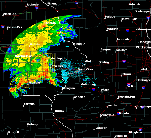 At 712 pm cdt, a severe thunderstorm was located over luzerne, or 8 miles northwest of marengo, moving east at 25 mph (radar indicated). Hazards include 60 mph wind gusts. Expect damage to roofs, siding, and trees. Locations impacted include, belle plaine, atkins, walford, shellsburg, newhall, blairstown, van horne, keystone, norway, luzerne, hannen lake park and watkins. At 712 pm cdt, a severe thunderstorm was located over luzerne, or 8 miles northwest of marengo, moving east at 25 mph (radar indicated). Hazards include 60 mph wind gusts. Expect damage to roofs, siding, and trees. Locations impacted include, belle plaine, atkins, walford, shellsburg, newhall, blairstown, van horne, keystone, norway, luzerne, hannen lake park and watkins.
|
| 6/15/2019 7:01 PM CDT |
 At 701 pm cdt, a severe thunderstorm was located over luzerne, or 11 miles northwest of marengo, moving east at 25 mph (radar indicated). Hazards include 60 mph wind gusts. expect damage to roofs, siding, and trees At 701 pm cdt, a severe thunderstorm was located over luzerne, or 11 miles northwest of marengo, moving east at 25 mph (radar indicated). Hazards include 60 mph wind gusts. expect damage to roofs, siding, and trees
|
| 6/15/2019 6:48 PM CDT |
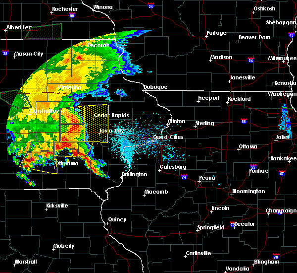 At 648 pm cdt, severe thunderstorms were located along a line extending from near garrison to near atkins to near walford, moving east at 40 mph (radar indicated). Hazards include 60 mph wind gusts. Expect damage to roofs, siding, and trees. Locations impacted include, vinton, belle plaine, atkins, walford, shellsburg, newhall, blairstown, van horne, keystone, norway, garrison, luzerne, benton city park, hoefle-dulin park, hannen lake park, watkins, benton county fairgrounds and wildcat bluff park. At 648 pm cdt, severe thunderstorms were located along a line extending from near garrison to near atkins to near walford, moving east at 40 mph (radar indicated). Hazards include 60 mph wind gusts. Expect damage to roofs, siding, and trees. Locations impacted include, vinton, belle plaine, atkins, walford, shellsburg, newhall, blairstown, van horne, keystone, norway, garrison, luzerne, benton city park, hoefle-dulin park, hannen lake park, watkins, benton county fairgrounds and wildcat bluff park.
|
| 6/15/2019 6:39 PM CDT |
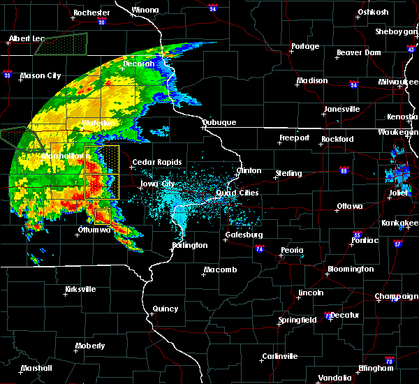 At 637 pm cdt, severe thunderstorms were located along a line extending from near dysart to near van horne to near blairstown, moving east at 40 mph (radar indicated. at 631 pm cdt measured 60 mph winds were reported near keystone). Hazards include 70 mph wind gusts. Expect considerable tree damage. damage is likely to mobile homes, roofs, and outbuildings. Locations impacted include, vinton, belle plaine, atkins, walford, shellsburg, newhall, blairstown, van horne, keystone, norway, garrison, luzerne, benton city park, hoefle-dulin park, hannen lake park, watkins, benton county fairgrounds and wildcat bluff park. At 637 pm cdt, severe thunderstorms were located along a line extending from near dysart to near van horne to near blairstown, moving east at 40 mph (radar indicated. at 631 pm cdt measured 60 mph winds were reported near keystone). Hazards include 70 mph wind gusts. Expect considerable tree damage. damage is likely to mobile homes, roofs, and outbuildings. Locations impacted include, vinton, belle plaine, atkins, walford, shellsburg, newhall, blairstown, van horne, keystone, norway, garrison, luzerne, benton city park, hoefle-dulin park, hannen lake park, watkins, benton county fairgrounds and wildcat bluff park.
|
| 6/15/2019 6:31 PM CDT | Near hwy 30 and ia 13 in benton county IA, 4.9 miles SSW of Belle Plaine, IA |
| 6/15/2019 6:28 PM CDT |
 At 628 pm cdt, severe thunderstorms were located along a line extending from near dysart to keystone to near luzerne, moving east at 30 mph (radar indicated). Hazards include 70 mph wind gusts. Expect considerable tree damage. damage is likely to mobile homes, roofs, and outbuildings. locations impacted include, vinton, belle plaine, atkins, walford, urbana, dysart, shellsburg, newhall, blairstown, van horne, keystone, norway, garrison, luzerne, vinton memorial airport, rodgers park, benton city park, hoefle-dulin park, hannen lake park and watkins. This includes interstate 380 between mile markers 40 and 43. At 628 pm cdt, severe thunderstorms were located along a line extending from near dysart to keystone to near luzerne, moving east at 30 mph (radar indicated). Hazards include 70 mph wind gusts. Expect considerable tree damage. damage is likely to mobile homes, roofs, and outbuildings. locations impacted include, vinton, belle plaine, atkins, walford, urbana, dysart, shellsburg, newhall, blairstown, van horne, keystone, norway, garrison, luzerne, vinton memorial airport, rodgers park, benton city park, hoefle-dulin park, hannen lake park and watkins. This includes interstate 380 between mile markers 40 and 43.
|
| 6/15/2019 6:12 PM CDT |
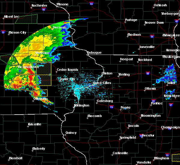 At 612 pm cdt, severe thunderstorms were located along a line extending from near dysart to near keystone to near belle plaine, moving east at 45 mph (radar indicated). Hazards include 70 mph wind gusts. Expect considerable tree damage. damage is likely to mobile homes, roofs, and outbuildings. locations impacted include, vinton, belle plaine, atkins, walford, urbana, dysart, shellsburg, newhall, blairstown, van horne, keystone, norway, garrison, luzerne, vinton memorial airport, rodgers park, benton city park, hoefle-dulin park, hannen lake park and watkins. This includes interstate 380 between mile markers 40 and 43. At 612 pm cdt, severe thunderstorms were located along a line extending from near dysart to near keystone to near belle plaine, moving east at 45 mph (radar indicated). Hazards include 70 mph wind gusts. Expect considerable tree damage. damage is likely to mobile homes, roofs, and outbuildings. locations impacted include, vinton, belle plaine, atkins, walford, urbana, dysart, shellsburg, newhall, blairstown, van horne, keystone, norway, garrison, luzerne, vinton memorial airport, rodgers park, benton city park, hoefle-dulin park, hannen lake park and watkins. This includes interstate 380 between mile markers 40 and 43.
|
| 6/15/2019 6:09 PM CDT |
 At 600 pm cdt, severe thunderstorms were located along a line extending from near traer to near toledo to near tama, moving east at 40 mph (radar indicated). Hazards include 70 mph wind gusts. Expect considerable tree damage. Damage is likely to mobile homes, roofs, and outbuildings. At 600 pm cdt, severe thunderstorms were located along a line extending from near traer to near toledo to near tama, moving east at 40 mph (radar indicated). Hazards include 70 mph wind gusts. Expect considerable tree damage. Damage is likely to mobile homes, roofs, and outbuildings.
|
| 6/15/2019 6:02 PM CDT |
 At 600 pm cdt, severe thunderstorms were located along a line extending from near traer to near toledo to near tama, moving east at 40 mph (radar indicated). Hazards include 70 mph wind gusts. Expect considerable tree damage. Damage is likely to mobile homes, roofs, and outbuildings. At 600 pm cdt, severe thunderstorms were located along a line extending from near traer to near toledo to near tama, moving east at 40 mph (radar indicated). Hazards include 70 mph wind gusts. Expect considerable tree damage. Damage is likely to mobile homes, roofs, and outbuildings.
|
| 5/29/2019 6:41 PM CDT |
 At 641 pm cdt, a severe thunderstorm capable of producing a tornado was located near ladora, or 7 miles west of marengo, moving northeast at 15 mph (radar indicated rotation). Hazards include tornado and quarter size hail. Flying debris will be dangerous to those caught without shelter. mobile homes will be damaged or destroyed. damage to roofs, windows, and vehicles will occur. tree damage is likely. this dangerous storm will be near, marengo, belle plaine, blairstown and luzerne around 700 pm cdt. other locations impacted by this tornadic thunderstorm include hannen lake park, watkins, koszta, iowa county fairgrounds, victor and genoa bluff. This includes interstate 80 in iowa between mile markers 210 and 211. At 641 pm cdt, a severe thunderstorm capable of producing a tornado was located near ladora, or 7 miles west of marengo, moving northeast at 15 mph (radar indicated rotation). Hazards include tornado and quarter size hail. Flying debris will be dangerous to those caught without shelter. mobile homes will be damaged or destroyed. damage to roofs, windows, and vehicles will occur. tree damage is likely. this dangerous storm will be near, marengo, belle plaine, blairstown and luzerne around 700 pm cdt. other locations impacted by this tornadic thunderstorm include hannen lake park, watkins, koszta, iowa county fairgrounds, victor and genoa bluff. This includes interstate 80 in iowa between mile markers 210 and 211.
|
| 5/29/2019 6:20 PM CDT |
 At 618 pm cdt, a severe thunderstorm capable of producing a tornado was located over victor, or 12 miles west of marengo, moving northeast at 15 mph. a rotating wall cloud was reported with this storm at 605 pm in poweshiek county (radar indicated rotation). Hazards include tornado and quarter size hail. Flying debris will be dangerous to those caught without shelter. mobile homes will be damaged or destroyed. damage to roofs, windows, and vehicles will occur. tree damage is likely. this dangerous storm will be near, ladora around 635 pm cdt. marengo, belle plaine, blairstown and luzerne around 700 pm cdt. other locations impacted by this tornadic thunderstorm include hannen lake park, watkins, koszta, iowa county fairgrounds, victor and genoa bluff. This includes interstate 80 in iowa between mile markers 205 and 211. At 618 pm cdt, a severe thunderstorm capable of producing a tornado was located over victor, or 12 miles west of marengo, moving northeast at 15 mph. a rotating wall cloud was reported with this storm at 605 pm in poweshiek county (radar indicated rotation). Hazards include tornado and quarter size hail. Flying debris will be dangerous to those caught without shelter. mobile homes will be damaged or destroyed. damage to roofs, windows, and vehicles will occur. tree damage is likely. this dangerous storm will be near, ladora around 635 pm cdt. marengo, belle plaine, blairstown and luzerne around 700 pm cdt. other locations impacted by this tornadic thunderstorm include hannen lake park, watkins, koszta, iowa county fairgrounds, victor and genoa bluff. This includes interstate 80 in iowa between mile markers 205 and 211.
|
| 5/16/2019 8:47 PM CDT |
 At 846 pm cdt, severe thunderstorms were located along a line extending from near atkins to near norway to ladora, moving east at 35 mph (trained weather spotters measured a gust to 67 mph 2 miles south of keystone). Hazards include 60 mph wind gusts and quarter size hail. Hail damage to vehicles is expected. expect wind damage to roofs, siding, and trees. Locations impacted include, marengo, belle plaine, atkins, walford, newhall, blairstown, norway, ladora, luzerne, amana, middle amana, south amana, homestead, west amana, upper south amana, east amana, hannen lake park, watkins, koszta and high amana. At 846 pm cdt, severe thunderstorms were located along a line extending from near atkins to near norway to ladora, moving east at 35 mph (trained weather spotters measured a gust to 67 mph 2 miles south of keystone). Hazards include 60 mph wind gusts and quarter size hail. Hail damage to vehicles is expected. expect wind damage to roofs, siding, and trees. Locations impacted include, marengo, belle plaine, atkins, walford, newhall, blairstown, norway, ladora, luzerne, amana, middle amana, south amana, homestead, west amana, upper south amana, east amana, hannen lake park, watkins, koszta and high amana.
|
| 5/16/2019 8:32 PM CDT |
 At 832 pm cdt, severe thunderstorms were located along a line extending from near shellsburg to near newhall to near victor, moving east at 25 mph (radar indicated). Hazards include 60 mph wind gusts and half dollar size hail. Hail damage to vehicles is expected. expect wind damage to roofs, siding, and trees. Locations impacted include, marengo, belle plaine, atkins, walford, newhall, blairstown, van horne, keystone, norway, ladora, luzerne, amana, middle amana, south amana, homestead, west amana, upper south amana, east amana, hannen lake park and watkins. At 832 pm cdt, severe thunderstorms were located along a line extending from near shellsburg to near newhall to near victor, moving east at 25 mph (radar indicated). Hazards include 60 mph wind gusts and half dollar size hail. Hail damage to vehicles is expected. expect wind damage to roofs, siding, and trees. Locations impacted include, marengo, belle plaine, atkins, walford, newhall, blairstown, van horne, keystone, norway, ladora, luzerne, amana, middle amana, south amana, homestead, west amana, upper south amana, east amana, hannen lake park and watkins.
|
| 5/16/2019 8:13 PM CDT |
 At 813 pm cdt, severe thunderstorms were located along a line extending from 6 miles south of dysart to near van horne to near brooklyn, moving east at 35 mph (radar indicated). Hazards include ping pong ball size hail and 60 mph wind gusts. People and animals outdoors will be injured. expect hail damage to roofs, siding, windows, and vehicles. expect wind damage to roofs, siding, and trees. Locations impacted include, marengo, belle plaine, atkins, walford, newhall, blairstown, van horne, keystone, norway, ladora, luzerne, amana, middle amana, south amana, homestead, west amana, upper south amana, east amana, hannen lake park and watkins. At 813 pm cdt, severe thunderstorms were located along a line extending from 6 miles south of dysart to near van horne to near brooklyn, moving east at 35 mph (radar indicated). Hazards include ping pong ball size hail and 60 mph wind gusts. People and animals outdoors will be injured. expect hail damage to roofs, siding, windows, and vehicles. expect wind damage to roofs, siding, and trees. Locations impacted include, marengo, belle plaine, atkins, walford, newhall, blairstown, van horne, keystone, norway, ladora, luzerne, amana, middle amana, south amana, homestead, west amana, upper south amana, east amana, hannen lake park and watkins.
|
| 5/16/2019 8:00 PM CDT |
 The national weather service in the quad cities has issued a * severe thunderstorm warning for. southern benton county in east central iowa. northern iowa county in east central iowa. until 900 pm cdt. At 759 pm cdt, severe thunderstorms were located along a line. The national weather service in the quad cities has issued a * severe thunderstorm warning for. southern benton county in east central iowa. northern iowa county in east central iowa. until 900 pm cdt. At 759 pm cdt, severe thunderstorms were located along a line.
|
| 4/17/2019 6:16 PM CDT |
 At 615 pm cdt, a severe thunderstorm was located over norway, or 8 miles northeast of marengo, moving east at 40 mph (radar indicated). Hazards include 60 mph wind gusts and penny size hail. Expect damage to roofs, siding, and trees. Locations impacted include, marengo, belle plaine, atkins, walford, shellsburg, newhall, blairstown, van horne, norway, luzerne, amana, middle amana, south amana, homestead, west amana, east amana, hannen lake park, watkins, koszta and high amana. At 615 pm cdt, a severe thunderstorm was located over norway, or 8 miles northeast of marengo, moving east at 40 mph (radar indicated). Hazards include 60 mph wind gusts and penny size hail. Expect damage to roofs, siding, and trees. Locations impacted include, marengo, belle plaine, atkins, walford, shellsburg, newhall, blairstown, van horne, norway, luzerne, amana, middle amana, south amana, homestead, west amana, east amana, hannen lake park, watkins, koszta and high amana.
|
| 4/17/2019 6:05 PM CDT |
 At 605 pm cdt, a severe thunderstorm was located over blairstown, or 8 miles north of marengo, moving east at 40 mph (radar indicated). Hazards include 60 mph wind gusts and nickel size hail. Expect damage to roofs, siding, and trees. Locations impacted include, marengo, belle plaine, atkins, walford, shellsburg, newhall, blairstown, van horne, keystone, norway, luzerne, amana, middle amana, south amana, homestead, west amana, east amana, hannen lake park, watkins and koszta. At 605 pm cdt, a severe thunderstorm was located over blairstown, or 8 miles north of marengo, moving east at 40 mph (radar indicated). Hazards include 60 mph wind gusts and nickel size hail. Expect damage to roofs, siding, and trees. Locations impacted include, marengo, belle plaine, atkins, walford, shellsburg, newhall, blairstown, van horne, keystone, norway, luzerne, amana, middle amana, south amana, homestead, west amana, east amana, hannen lake park, watkins and koszta.
|
| 4/17/2019 5:53 PM CDT |
 At 553 pm cdt, a severe thunderstorm was located over belle plaine, or 11 miles northwest of marengo, moving east at 40 mph (radar indicated). Hazards include 60 mph wind gusts. expect damage to roofs, siding, and trees At 553 pm cdt, a severe thunderstorm was located over belle plaine, or 11 miles northwest of marengo, moving east at 40 mph (radar indicated). Hazards include 60 mph wind gusts. expect damage to roofs, siding, and trees
|
| 10/9/2018 3:28 PM CDT |
 At 317 pm cdt, a severe thunderstorm capable of producing a tornado was located near ladora, or 9 miles southwest of marengo, moving north at 30 mph (weather spotters reported a funnel cloud). Hazards include tornado. Flying debris will be dangerous to those caught without shelter. mobile homes will be damaged or destroyed. damage to roofs, windows, and vehicles will occur. tree damage is likely. this dangerous storm will be near, ladora around 325 pm cdt. marengo around 335 pm cdt. blairstown and luzerne around 345 pm cdt. other locations impacted by this tornadic thunderstorm include genoa bluff, hannen lake park, koszta, iowa county fairgrounds and victor. This includes interstate 80 in iowa between mile markers 205 and 214. At 317 pm cdt, a severe thunderstorm capable of producing a tornado was located near ladora, or 9 miles southwest of marengo, moving north at 30 mph (weather spotters reported a funnel cloud). Hazards include tornado. Flying debris will be dangerous to those caught without shelter. mobile homes will be damaged or destroyed. damage to roofs, windows, and vehicles will occur. tree damage is likely. this dangerous storm will be near, ladora around 325 pm cdt. marengo around 335 pm cdt. blairstown and luzerne around 345 pm cdt. other locations impacted by this tornadic thunderstorm include genoa bluff, hannen lake park, koszta, iowa county fairgrounds and victor. This includes interstate 80 in iowa between mile markers 205 and 214.
|
| 10/9/2018 3:17 PM CDT |
 At 317 pm cdt, a severe thunderstorm capable of producing a tornado was located near ladora, or 9 miles southwest of marengo, moving north at 30 mph (weather spotters reported a funnel cloud). Hazards include tornado. Flying debris will be dangerous to those caught without shelter. mobile homes will be damaged or destroyed. damage to roofs, windows, and vehicles will occur. tree damage is likely. this dangerous storm will be near, ladora around 325 pm cdt. marengo around 335 pm cdt. blairstown and luzerne around 345 pm cdt. other locations impacted by this tornadic thunderstorm include genoa bluff, hannen lake park, koszta, iowa county fairgrounds and victor. This includes interstate 80 in iowa between mile markers 205 and 214. At 317 pm cdt, a severe thunderstorm capable of producing a tornado was located near ladora, or 9 miles southwest of marengo, moving north at 30 mph (weather spotters reported a funnel cloud). Hazards include tornado. Flying debris will be dangerous to those caught without shelter. mobile homes will be damaged or destroyed. damage to roofs, windows, and vehicles will occur. tree damage is likely. this dangerous storm will be near, ladora around 325 pm cdt. marengo around 335 pm cdt. blairstown and luzerne around 345 pm cdt. other locations impacted by this tornadic thunderstorm include genoa bluff, hannen lake park, koszta, iowa county fairgrounds and victor. This includes interstate 80 in iowa between mile markers 205 and 214.
|
| 10/9/2018 3:10 PM CDT |
 At 310 pm cdt, a severe thunderstorm capable of producing a tornado was located near ladora, or 10 miles southwest of marengo, moving north at 30 mph (weather spotters reported a funnel cloud). Hazards include tornado. Flying debris will be dangerous to those caught without shelter. mobile homes will be damaged or destroyed. damage to roofs, windows, and vehicles will occur. tree damage is likely. this dangerous storm will be near, ladora around 320 pm cdt. marengo around 330 pm cdt. luzerne around 340 pm cdt. newhall, blairstown and van horne around 345 pm cdt. other locations impacted by this tornadic thunderstorm include genoa bluff, hannen lake park, watkins, koszta, iowa county fairgrounds, lake iowa park and victor. This includes interstate 80 in iowa between mile markers 205 and 217. At 310 pm cdt, a severe thunderstorm capable of producing a tornado was located near ladora, or 10 miles southwest of marengo, moving north at 30 mph (weather spotters reported a funnel cloud). Hazards include tornado. Flying debris will be dangerous to those caught without shelter. mobile homes will be damaged or destroyed. damage to roofs, windows, and vehicles will occur. tree damage is likely. this dangerous storm will be near, ladora around 320 pm cdt. marengo around 330 pm cdt. luzerne around 340 pm cdt. newhall, blairstown and van horne around 345 pm cdt. other locations impacted by this tornadic thunderstorm include genoa bluff, hannen lake park, watkins, koszta, iowa county fairgrounds, lake iowa park and victor. This includes interstate 80 in iowa between mile markers 205 and 217.
|
| 10/9/2018 3:06 PM CDT |
 At 305 pm cdt, a severe thunderstorm capable of producing a tornado was located near victor, or 11 miles southwest of marengo, moving north at 35 mph (radar indicated rotation). Hazards include tornado. Flying debris will be dangerous to those caught without shelter. mobile homes will be damaged or destroyed. damage to roofs, windows, and vehicles will occur. tree damage is likely. this dangerous storm will be near, victor and ladora around 315 pm cdt. marengo around 325 pm cdt. belle plaine and luzerne around 335 pm cdt. blairstown around 340 pm cdt. newhall, van horne and keystone around 345 pm cdt. other locations impacted by this tornadic thunderstorm include genoa bluff, hannen lake park, watkins, koszta, iowa county fairgrounds, lake iowa park and victor. This includes interstate 80 in iowa between mile markers 205 and 217. At 305 pm cdt, a severe thunderstorm capable of producing a tornado was located near victor, or 11 miles southwest of marengo, moving north at 35 mph (radar indicated rotation). Hazards include tornado. Flying debris will be dangerous to those caught without shelter. mobile homes will be damaged or destroyed. damage to roofs, windows, and vehicles will occur. tree damage is likely. this dangerous storm will be near, victor and ladora around 315 pm cdt. marengo around 325 pm cdt. belle plaine and luzerne around 335 pm cdt. blairstown around 340 pm cdt. newhall, van horne and keystone around 345 pm cdt. other locations impacted by this tornadic thunderstorm include genoa bluff, hannen lake park, watkins, koszta, iowa county fairgrounds, lake iowa park and victor. This includes interstate 80 in iowa between mile markers 205 and 217.
|
| 10/8/2018 10:46 PM CDT |
 At 1045 pm cdt, a severe thunderstorm was located over luzerne, or 10 miles northwest of marengo, moving northeast at 40 mph. at 1044 pm cdt a trained spotter reported winds of 55 mph in belle plaine (radar indicated). Hazards include 60 mph wind gusts. Expect damage to roofs, siding, and trees. locations impacted include, vinton, marengo, belle plaine, atkins, walford, urbana, shellsburg, victor, newhall, blairstown, van horne, keystone, norway, garrison, ladora, luzerne, amana, middle amana, vinton memorial airport and upper south amana. This includes interstate 380 between mile markers 40 and 44. At 1045 pm cdt, a severe thunderstorm was located over luzerne, or 10 miles northwest of marengo, moving northeast at 40 mph. at 1044 pm cdt a trained spotter reported winds of 55 mph in belle plaine (radar indicated). Hazards include 60 mph wind gusts. Expect damage to roofs, siding, and trees. locations impacted include, vinton, marengo, belle plaine, atkins, walford, urbana, shellsburg, victor, newhall, blairstown, van horne, keystone, norway, garrison, ladora, luzerne, amana, middle amana, vinton memorial airport and upper south amana. This includes interstate 380 between mile markers 40 and 44.
|
| 10/8/2018 10:29 PM CDT |
 At 1029 pm cdt, a severe thunderstorm was located near belle plaine, or 14 miles west of marengo, moving northeast at 40 mph (radar indicated). Hazards include 60 mph wind gusts. expect damage to roofs, siding, and trees At 1029 pm cdt, a severe thunderstorm was located near belle plaine, or 14 miles west of marengo, moving northeast at 40 mph (radar indicated). Hazards include 60 mph wind gusts. expect damage to roofs, siding, and trees
|
| 9/25/2018 1:03 PM CDT |
 At 103 pm cdt, severe thunderstorms were located along a line extending from near shellsburg to norway to near ladora, moving east at 50 mph (radar indicated). Hazards include 60 mph wind gusts. Expect damage to roofs, siding, and trees. locations impacted include, cedar rapids, iowa city, vinton, marengo, marion, coralville, north liberty, hiawatha, mount vernon, robins, williamsburg, belle plaine, center point, lisbon, fairfax, solon, tiffin, ely, atkins and walford. this includes the following highways, interstate 80 in iowa between mile markers 205 and 248. Interstate 380 between mile markers 1 and 40. At 103 pm cdt, severe thunderstorms were located along a line extending from near shellsburg to norway to near ladora, moving east at 50 mph (radar indicated). Hazards include 60 mph wind gusts. Expect damage to roofs, siding, and trees. locations impacted include, cedar rapids, iowa city, vinton, marengo, marion, coralville, north liberty, hiawatha, mount vernon, robins, williamsburg, belle plaine, center point, lisbon, fairfax, solon, tiffin, ely, atkins and walford. this includes the following highways, interstate 80 in iowa between mile markers 205 and 248. Interstate 380 between mile markers 1 and 40.
|
| 9/25/2018 12:54 PM CDT |
 At 1254 pm cdt, severe thunderstorms were located along a line extending from near vinton to blairstown to near ladora, moving east at 50 mph (radar indicated). Hazards include 60 mph wind gusts. Expect damage to roofs, siding, and trees. locations impacted include, cedar rapids, iowa city, vinton, marengo, marion, coralville, north liberty, hiawatha, mount vernon, robins, williamsburg, belle plaine, center point, lisbon, fairfax, solon, tiffin, ely, atkins and walford. this includes the following highways, interstate 80 in iowa between mile markers 205 and 248. Interstate 380 between mile markers 1 and 40. At 1254 pm cdt, severe thunderstorms were located along a line extending from near vinton to blairstown to near ladora, moving east at 50 mph (radar indicated). Hazards include 60 mph wind gusts. Expect damage to roofs, siding, and trees. locations impacted include, cedar rapids, iowa city, vinton, marengo, marion, coralville, north liberty, hiawatha, mount vernon, robins, williamsburg, belle plaine, center point, lisbon, fairfax, solon, tiffin, ely, atkins and walford. this includes the following highways, interstate 80 in iowa between mile markers 205 and 248. Interstate 380 between mile markers 1 and 40.
|
| 9/25/2018 12:48 PM CDT |
 At 1248 pm cdt, severe thunderstorms were located along a line extending from near garrison to near luzerne to near victor, moving east at 50 mph (radar indicated). Hazards include 60 mph wind gusts. expect damage to roofs, siding, and trees At 1248 pm cdt, severe thunderstorms were located along a line extending from near garrison to near luzerne to near victor, moving east at 50 mph (radar indicated). Hazards include 60 mph wind gusts. expect damage to roofs, siding, and trees
|
| 6/9/2018 8:58 PM CDT |
 At 857 pm cdt, a severe thunderstorm capable of producing a tornado was located over van horne, or 12 miles southwest of vinton, moving east at 20 mph. another possible tornado was located near koszta, moving east at 20 nph (radar indicated rotation). Hazards include tornado and quarter size hail. Flying debris will be dangerous to those caught without shelter. mobile homes will be damaged or destroyed. damage to roofs, windows, and vehicles will occur. tree damage is likely. this dangerous storm will be near, blairstown and van horne around 905 pm cdt. newhall around 925 pm cdt. norway around 930 pm cdt. Other locations impacted by this tornadic thunderstorm include hannen lake park, south amana, watkins, koszta, west amana, high amana, iowa county fairgrounds and upper south amana. At 857 pm cdt, a severe thunderstorm capable of producing a tornado was located over van horne, or 12 miles southwest of vinton, moving east at 20 mph. another possible tornado was located near koszta, moving east at 20 nph (radar indicated rotation). Hazards include tornado and quarter size hail. Flying debris will be dangerous to those caught without shelter. mobile homes will be damaged or destroyed. damage to roofs, windows, and vehicles will occur. tree damage is likely. this dangerous storm will be near, blairstown and van horne around 905 pm cdt. newhall around 925 pm cdt. norway around 930 pm cdt. Other locations impacted by this tornadic thunderstorm include hannen lake park, south amana, watkins, koszta, west amana, high amana, iowa county fairgrounds and upper south amana.
|
| 6/9/2018 8:31 PM CDT |
 At 831 pm cdt, a severe thunderstorm capable of producing a tornado was located near luzerne, or 11 miles north of marengo, moving east at 25 mph (radar indicated rotation). Hazards include tornado and half dollar size hail. Flying debris will be dangerous to those caught without shelter. mobile homes will be damaged or destroyed. damage to roofs, windows, and vehicles will occur. tree damage is likely. this dangerous storm will be near, blairstown around 835 pm cdt. van horne around 840 pm cdt. Newhall around 845 pm cdt. At 831 pm cdt, a severe thunderstorm capable of producing a tornado was located near luzerne, or 11 miles north of marengo, moving east at 25 mph (radar indicated rotation). Hazards include tornado and half dollar size hail. Flying debris will be dangerous to those caught without shelter. mobile homes will be damaged or destroyed. damage to roofs, windows, and vehicles will occur. tree damage is likely. this dangerous storm will be near, blairstown around 835 pm cdt. van horne around 840 pm cdt. Newhall around 845 pm cdt.
|
| 6/9/2018 8:19 PM CDT |
 At 816 pm cdt, a severe thunderstorm capable of producing a tornado was located over luzerne, or 10 miles northwest of marengo, moving east at 20 mph (radar indicated rotation). Hazards include tornado and quarter size hail. Flying debris will be dangerous to those caught without shelter. mobile homes will be damaged or destroyed. damage to roofs, windows, and vehicles will occur. tree damage is likely. this dangerous storm will be near, keystone and luzerne around 820 pm cdt. blairstown around 835 pm cdt. van horne around 840 pm cdt. newhall and norway around 845 pm cdt. Other locations impacted by this tornadic thunderstorm include watkins and hannen lake park. At 816 pm cdt, a severe thunderstorm capable of producing a tornado was located over luzerne, or 10 miles northwest of marengo, moving east at 20 mph (radar indicated rotation). Hazards include tornado and quarter size hail. Flying debris will be dangerous to those caught without shelter. mobile homes will be damaged or destroyed. damage to roofs, windows, and vehicles will occur. tree damage is likely. this dangerous storm will be near, keystone and luzerne around 820 pm cdt. blairstown around 835 pm cdt. van horne around 840 pm cdt. newhall and norway around 845 pm cdt. Other locations impacted by this tornadic thunderstorm include watkins and hannen lake park.
|
| 6/9/2018 8:05 PM CDT |
 The national weather service in the quad cities has issued a * tornado warning for. southern benton county in east central iowa. until 845 pm cdt. At 804 pm cdt, a severe thunderstorm capable of producing a tornado was located over belle plaine, or 11 miles northwest of marengo,. The national weather service in the quad cities has issued a * tornado warning for. southern benton county in east central iowa. until 845 pm cdt. At 804 pm cdt, a severe thunderstorm capable of producing a tornado was located over belle plaine, or 11 miles northwest of marengo,.
|
| 7/20/2017 11:57 PM CDT |
 At 1148 pm cdt, severe thunderstorms were located along a line extending from 6 miles northwest of keystone to ladora to near what cheer, moving east at 40 mph (radar indicated). Hazards include 60 mph wind gusts. Expect damage to roofs, siding, and trees. locations impacted include, marengo, williamsburg, belle plaine, north english, victor, newhall, blairstown, van horne, what cheer, keystone, norway, ladora, keswick, south english, parnell, millersburg, luzerne, kinross, amana and conroy. This includes interstate 80 in iowa between mile markers 205 and 226. At 1148 pm cdt, severe thunderstorms were located along a line extending from 6 miles northwest of keystone to ladora to near what cheer, moving east at 40 mph (radar indicated). Hazards include 60 mph wind gusts. Expect damage to roofs, siding, and trees. locations impacted include, marengo, williamsburg, belle plaine, north english, victor, newhall, blairstown, van horne, what cheer, keystone, norway, ladora, keswick, south english, parnell, millersburg, luzerne, kinross, amana and conroy. This includes interstate 80 in iowa between mile markers 205 and 226.
|
| 7/20/2017 11:48 PM CDT |
 At 1148 pm cdt, severe thunderstorms were located along a line extending from 6 miles northwest of keystone to ladora to near what cheer, moving east at 40 mph (radar indicated). Hazards include 60 mph wind gusts. Expect damage to roofs, siding, and trees. locations impacted include, marengo, williamsburg, belle plaine, north english, victor, newhall, blairstown, van horne, what cheer, keystone, norway, ladora, keswick, south english, parnell, millersburg, luzerne, kinross, amana and conroy. This includes interstate 80 in iowa between mile markers 205 and 226. At 1148 pm cdt, severe thunderstorms were located along a line extending from 6 miles northwest of keystone to ladora to near what cheer, moving east at 40 mph (radar indicated). Hazards include 60 mph wind gusts. Expect damage to roofs, siding, and trees. locations impacted include, marengo, williamsburg, belle plaine, north english, victor, newhall, blairstown, van horne, what cheer, keystone, norway, ladora, keswick, south english, parnell, millersburg, luzerne, kinross, amana and conroy. This includes interstate 80 in iowa between mile markers 205 and 226.
|
| 7/20/2017 11:39 PM CDT |
 At 1139 pm cdt, severe thunderstorms were located along a line extending from 9 miles west of keystone to near victor to 6 miles northwest of what cheer, moving east at 35 mph (radar indicated). Hazards include 60 mph wind gusts. expect damage to roofs, siding, and trees At 1139 pm cdt, severe thunderstorms were located along a line extending from 9 miles west of keystone to near victor to 6 miles northwest of what cheer, moving east at 35 mph (radar indicated). Hazards include 60 mph wind gusts. expect damage to roofs, siding, and trees
|
| 6/29/2017 5:15 PM CDT |
 At 1013 pm cdt, severe thunderstorms were located along a line extending from near hazleton to near independence to near vinton to near belle plaine, moving east at 50 mph (trained spotters have reported up to 60 mph winds with this line of storms). Hazards include 60 mph wind gusts and penny size hail. Expect damage to roofs, siding, and trees. locations impacted include, independence, vinton, belle plaine, jesup, center point, atkins, urbana, fairbank, palo, shellsburg, newhall, winthrop, hazleton, walker, blairstown, van horne, keystone, quasqueton, norway and lamont. This includes interstate 380 between mile markers 48 and 55. At 1013 pm cdt, severe thunderstorms were located along a line extending from near hazleton to near independence to near vinton to near belle plaine, moving east at 50 mph (trained spotters have reported up to 60 mph winds with this line of storms). Hazards include 60 mph wind gusts and penny size hail. Expect damage to roofs, siding, and trees. locations impacted include, independence, vinton, belle plaine, jesup, center point, atkins, urbana, fairbank, palo, shellsburg, newhall, winthrop, hazleton, walker, blairstown, van horne, keystone, quasqueton, norway and lamont. This includes interstate 380 between mile markers 48 and 55.
|
| 6/29/2017 5:03 PM CDT |
 At 1002 pm cdt, severe thunderstorms were located along a line extending from fairbank to near jesup to dysart to toledo, moving east at 45 mph (radar indicated). Hazards include 60 mph wind gusts and penny size hail. Expect damage to roofs, siding, and trees. locations impacted include, independence, vinton, belle plaine, jesup, center point, atkins, urbana, fairbank, palo, shellsburg, newhall, winthrop, hazleton, walker, blairstown, van horne, keystone, quasqueton, norway and lamont. This includes interstate 380 between mile markers 48 and 55. At 1002 pm cdt, severe thunderstorms were located along a line extending from fairbank to near jesup to dysart to toledo, moving east at 45 mph (radar indicated). Hazards include 60 mph wind gusts and penny size hail. Expect damage to roofs, siding, and trees. locations impacted include, independence, vinton, belle plaine, jesup, center point, atkins, urbana, fairbank, palo, shellsburg, newhall, winthrop, hazleton, walker, blairstown, van horne, keystone, quasqueton, norway and lamont. This includes interstate 380 between mile markers 48 and 55.
|
| 6/29/2017 4:53 PM CDT |
 At 952 pm cdt, severe thunderstorms were located along a line extending from near denver to 6 miles northeast of traer to 10 miles southwest of meskwaki casino, moving east at 45 mph (radar indicated). Hazards include 60 mph wind gusts and penny size hail. expect damage to roofs, siding, and trees At 952 pm cdt, severe thunderstorms were located along a line extending from near denver to 6 miles northeast of traer to 10 miles southwest of meskwaki casino, moving east at 45 mph (radar indicated). Hazards include 60 mph wind gusts and penny size hail. expect damage to roofs, siding, and trees
|
| 6/16/2017 11:38 PM CDT |
 At 1138 pm cdt, a severe thunderstorm was located over van horne, or 9 miles south of vinton, moving east at 30 mph (radar indicated). Hazards include 60 mph wind gusts and quarter size hail. Hail damage to vehicles is expected. expect wind damage to roofs, siding, and trees. locations impacted include, cedar rapids, vinton, belle plaine, fairfax, atkins, walford, palo, shellsburg, newhall, blairstown, van horne, keystone, norway, luzerne, toddville, pleasant creek state recreation area, hannen lake park, watkins, benton county fairgrounds and morgan creek park. This includes interstate 380 between mile markers 31 and 34. At 1138 pm cdt, a severe thunderstorm was located over van horne, or 9 miles south of vinton, moving east at 30 mph (radar indicated). Hazards include 60 mph wind gusts and quarter size hail. Hail damage to vehicles is expected. expect wind damage to roofs, siding, and trees. locations impacted include, cedar rapids, vinton, belle plaine, fairfax, atkins, walford, palo, shellsburg, newhall, blairstown, van horne, keystone, norway, luzerne, toddville, pleasant creek state recreation area, hannen lake park, watkins, benton county fairgrounds and morgan creek park. This includes interstate 380 between mile markers 31 and 34.
|
| 6/16/2017 11:29 PM CDT |
 At 1129 pm cdt, a severe thunderstorm was located over van horne, or 10 miles southwest of vinton, moving east at 30 mph (radar indicated). Hazards include 60 mph wind gusts and quarter size hail. Hail damage to vehicles is expected. expect wind damage to roofs, siding, and trees. locations impacted include, cedar rapids, vinton, belle plaine, fairfax, atkins, walford, palo, shellsburg, newhall, blairstown, van horne, keystone, norway, garrison, luzerne, toddville, pleasant creek state recreation area, hannen lake park, watkins and benton county fairgrounds. This includes interstate 380 between mile markers 31 and 34. At 1129 pm cdt, a severe thunderstorm was located over van horne, or 10 miles southwest of vinton, moving east at 30 mph (radar indicated). Hazards include 60 mph wind gusts and quarter size hail. Hail damage to vehicles is expected. expect wind damage to roofs, siding, and trees. locations impacted include, cedar rapids, vinton, belle plaine, fairfax, atkins, walford, palo, shellsburg, newhall, blairstown, van horne, keystone, norway, garrison, luzerne, toddville, pleasant creek state recreation area, hannen lake park, watkins and benton county fairgrounds. This includes interstate 380 between mile markers 31 and 34.
|
| 6/16/2017 11:23 PM CDT |
 At 1122 pm cdt, a severe thunderstorm was located over keystone, or 12 miles southwest of vinton, moving east at 30 mph (radar indicated). Hazards include 60 mph wind gusts and quarter size hail. Hail damage to vehicles is expected. Expect wind damage to roofs, siding, and trees. At 1122 pm cdt, a severe thunderstorm was located over keystone, or 12 miles southwest of vinton, moving east at 30 mph (radar indicated). Hazards include 60 mph wind gusts and quarter size hail. Hail damage to vehicles is expected. Expect wind damage to roofs, siding, and trees.
|
| 6/15/2017 11:59 PM CDT | Quarter sized hail reported 1.5 miles W of Belle Plaine, IA |
| 6/15/2017 11:59 PM CDT |
 At 1158 pm cdt, a severe thunderstorm was located over luzerne, or 8 miles northwest of marengo, moving east at 45 mph (trained weather spotters reported nickel size hail in belle plaine at 1155 pm). Hazards include 60 mph wind gusts and quarter size hail. Hail damage to vehicles is expected. expect wind damage to roofs, siding, and trees. locations impacted include, cedar rapids, marengo, marion, north liberty, hiawatha, robins, belle plaine, fairfax, ely, atkins, walford, palo, swisher, newhall, blairstown, van horne, keystone, shueyville, norway and bertram. This includes interstate 380 between mile markers 4 and 27. At 1158 pm cdt, a severe thunderstorm was located over luzerne, or 8 miles northwest of marengo, moving east at 45 mph (trained weather spotters reported nickel size hail in belle plaine at 1155 pm). Hazards include 60 mph wind gusts and quarter size hail. Hail damage to vehicles is expected. expect wind damage to roofs, siding, and trees. locations impacted include, cedar rapids, marengo, marion, north liberty, hiawatha, robins, belle plaine, fairfax, ely, atkins, walford, palo, swisher, newhall, blairstown, van horne, keystone, shueyville, norway and bertram. This includes interstate 380 between mile markers 4 and 27.
|
| 6/15/2017 11:55 PM CDT |
 At 1155 pm cdt, a severe thunderstorm was located over luzerne, or 10 miles northwest of marengo, moving east at 45 mph (radar indicated). Hazards include 60 mph wind gusts and quarter size hail. Hail damage to vehicles is expected. Expect wind damage to roofs, siding, and trees. At 1155 pm cdt, a severe thunderstorm was located over luzerne, or 10 miles northwest of marengo, moving east at 45 mph (radar indicated). Hazards include 60 mph wind gusts and quarter size hail. Hail damage to vehicles is expected. Expect wind damage to roofs, siding, and trees.
|
| 5/17/2017 5:58 PM CDT |
 The severe thunderstorm warning for central keokuk, benton and iowa counties will expire at 600 pm cdt, the storms which prompted the warning have moved out of the area. therefore, the warning will be allowed to expire. however heavy rain is still possible with these thunderstorms. a tornado watch remains in effect until 1100 pm cdt for southeastern, northeastern and east central iowa. remember, a severe thunderstorm warning still remains in effect for eastern benton and eastern iowa county. The severe thunderstorm warning for central keokuk, benton and iowa counties will expire at 600 pm cdt, the storms which prompted the warning have moved out of the area. therefore, the warning will be allowed to expire. however heavy rain is still possible with these thunderstorms. a tornado watch remains in effect until 1100 pm cdt for southeastern, northeastern and east central iowa. remember, a severe thunderstorm warning still remains in effect for eastern benton and eastern iowa county.
|
| 5/17/2017 5:51 PM CDT |
 At 551 pm cdt, severe thunderstorms were located along a line extending from near dysart to near norway to near south english, moving northeast at 45 mph (trained weather spotters). Hazards include 70 mph wind gusts and quarter size hail. Hail damage to vehicles is expected. expect considerable tree damage. wind damage is also likely to mobile homes, roofs, and outbuildings. locations impacted include, vinton, marengo, sigourney, williamsburg, belle plaine, atkins, urbana, north english, shellsburg, newhall, hedrick, blairstown, van horne, keystone, norway, garrison, ladora, keswick, south english and parnell. this includes the following highways, interstate 80 in iowa between mile markers 208 and 227. interstate 380 between mile markers 42 and 48. A tornado watch remains in effect until 1100 pm cdt for southeastern, northeastern and east central iowa. At 551 pm cdt, severe thunderstorms were located along a line extending from near dysart to near norway to near south english, moving northeast at 45 mph (trained weather spotters). Hazards include 70 mph wind gusts and quarter size hail. Hail damage to vehicles is expected. expect considerable tree damage. wind damage is also likely to mobile homes, roofs, and outbuildings. locations impacted include, vinton, marengo, sigourney, williamsburg, belle plaine, atkins, urbana, north english, shellsburg, newhall, hedrick, blairstown, van horne, keystone, norway, garrison, ladora, keswick, south english and parnell. this includes the following highways, interstate 80 in iowa between mile markers 208 and 227. interstate 380 between mile markers 42 and 48. A tornado watch remains in effect until 1100 pm cdt for southeastern, northeastern and east central iowa.
|
| 5/17/2017 5:43 PM CDT |
 At 543 pm cdt, severe thunderstorms were located along a line extending from near traer to near marengo to near harper, moving northeast at 40 mph (trained weather spotters). Hazards include 70 mph wind gusts and quarter size hail. Hail damage to vehicles is expected. expect considerable tree damage. wind damage is also likely to mobile homes, roofs, and outbuildings. locations impacted include, vinton, marengo, sigourney, williamsburg, belle plaine, atkins, urbana, dysart, north english, shellsburg, victor, newhall, hedrick, blairstown, van horne, what cheer, keystone, norway, garrison and delta. this includes the following highways, interstate 80 in iowa between mile markers 205 and 227. interstate 380 between mile markers 42 and 48. A tornado watch remains in effect until 1100 pm cdt for southeastern, northeastern and east central iowa. At 543 pm cdt, severe thunderstorms were located along a line extending from near traer to near marengo to near harper, moving northeast at 40 mph (trained weather spotters). Hazards include 70 mph wind gusts and quarter size hail. Hail damage to vehicles is expected. expect considerable tree damage. wind damage is also likely to mobile homes, roofs, and outbuildings. locations impacted include, vinton, marengo, sigourney, williamsburg, belle plaine, atkins, urbana, dysart, north english, shellsburg, victor, newhall, hedrick, blairstown, van horne, what cheer, keystone, norway, garrison and delta. this includes the following highways, interstate 80 in iowa between mile markers 205 and 227. interstate 380 between mile markers 42 and 48. A tornado watch remains in effect until 1100 pm cdt for southeastern, northeastern and east central iowa.
|
| 5/17/2017 5:31 PM CDT |
 At 531 pm cdt, severe thunderstorms were located along a line extending from near traer to near ladora to hayesville, moving northeast at 45 mph (radar indicated). Hazards include 70 mph wind gusts and quarter size hail. Hail damage to vehicles is expected. expect considerable tree damage. wind damage is also likely to mobile homes, roofs, and outbuildings. locations impacted include, vinton, marengo, sigourney, williamsburg, belle plaine, atkins, urbana, dysart, north english, shellsburg, victor, newhall, hedrick, blairstown, van horne, what cheer, keystone, norway, garrison and delta. this includes the following highways, interstate 80 in iowa between mile markers 205 and 227. interstate 380 between mile markers 42 and 48. A tornado watch remains in effect until 1100 pm cdt for southeastern, northeastern and east central iowa. At 531 pm cdt, severe thunderstorms were located along a line extending from near traer to near ladora to hayesville, moving northeast at 45 mph (radar indicated). Hazards include 70 mph wind gusts and quarter size hail. Hail damage to vehicles is expected. expect considerable tree damage. wind damage is also likely to mobile homes, roofs, and outbuildings. locations impacted include, vinton, marengo, sigourney, williamsburg, belle plaine, atkins, urbana, dysart, north english, shellsburg, victor, newhall, hedrick, blairstown, van horne, what cheer, keystone, norway, garrison and delta. this includes the following highways, interstate 80 in iowa between mile markers 205 and 227. interstate 380 between mile markers 42 and 48. A tornado watch remains in effect until 1100 pm cdt for southeastern, northeastern and east central iowa.
|
| 5/17/2017 5:26 PM CDT |
 At 526 pm cdt, severe thunderstorms were located along a line extending from 6 miles south of traer to near ladora to near hayesville, moving northeast at 50 mph (radar indicated). Hazards include 70 mph wind gusts and quarter size hail. Hail damage to vehicles is expected. expect considerable tree damage. wind damage is also likely to mobile homes, roofs, and outbuildings. locations impacted include, vinton, marengo, sigourney, williamsburg, belle plaine, atkins, urbana, dysart, north english, shellsburg, victor, newhall, hedrick, blairstown, van horne, what cheer, keystone, norway, garrison and delta. this includes the following highways, interstate 80 in iowa between mile markers 205 and 227. interstate 380 between mile markers 42 and 48. A tornado watch remains in effect until 1100 pm cdt for southeastern, northeastern and east central iowa. At 526 pm cdt, severe thunderstorms were located along a line extending from 6 miles south of traer to near ladora to near hayesville, moving northeast at 50 mph (radar indicated). Hazards include 70 mph wind gusts and quarter size hail. Hail damage to vehicles is expected. expect considerable tree damage. wind damage is also likely to mobile homes, roofs, and outbuildings. locations impacted include, vinton, marengo, sigourney, williamsburg, belle plaine, atkins, urbana, dysart, north english, shellsburg, victor, newhall, hedrick, blairstown, van horne, what cheer, keystone, norway, garrison and delta. this includes the following highways, interstate 80 in iowa between mile markers 205 and 227. interstate 380 between mile markers 42 and 48. A tornado watch remains in effect until 1100 pm cdt for southeastern, northeastern and east central iowa.
|
| 5/17/2017 5:20 PM CDT |
 At 520 pm cdt, severe thunderstorms were located along a line extending from 6 miles southeast of tama to 6 miles southeast of victor to delta, moving northeast at 50 mph (radar indicated). Hazards include 70 mph wind gusts and quarter size hail. Hail damage to vehicles is expected. expect considerable tree damage. wind damage is also likely to mobile homes, roofs, and outbuildings. locations impacted include, vinton, marengo, sigourney, williamsburg, belle plaine, atkins, urbana, dysart, north english, shellsburg, victor, newhall, hedrick, blairstown, van horne, what cheer, keystone, norway, garrison and delta. this includes the following highways, interstate 80 in iowa between mile markers 205 and 227. interstate 380 between mile markers 42 and 48. A tornado watch remains in effect until 1100 pm cdt for southeastern, northeastern and east central iowa. At 520 pm cdt, severe thunderstorms were located along a line extending from 6 miles southeast of tama to 6 miles southeast of victor to delta, moving northeast at 50 mph (radar indicated). Hazards include 70 mph wind gusts and quarter size hail. Hail damage to vehicles is expected. expect considerable tree damage. wind damage is also likely to mobile homes, roofs, and outbuildings. locations impacted include, vinton, marengo, sigourney, williamsburg, belle plaine, atkins, urbana, dysart, north english, shellsburg, victor, newhall, hedrick, blairstown, van horne, what cheer, keystone, norway, garrison and delta. this includes the following highways, interstate 80 in iowa between mile markers 205 and 227. interstate 380 between mile markers 42 and 48. A tornado watch remains in effect until 1100 pm cdt for southeastern, northeastern and east central iowa.
|
| 5/17/2017 5:12 PM CDT |
 At 512 pm cdt, severe thunderstorms were located along a line extending from near brooklyn to 7 miles west of millersburg to near hedrick, moving northeast at 50 mph (radar indicated). Hazards include 60 mph wind gusts and quarter size hail. Hail damage to vehicles is expected. expect wind damage to roofs, siding, and trees. locations impacted include, vinton, marengo, sigourney, williamsburg, belle plaine, atkins, urbana, dysart, north english, shellsburg, victor, newhall, hedrick, blairstown, van horne, what cheer, keystone, norway, garrison and delta. this includes the following highways, interstate 80 in iowa between mile markers 205 and 227. interstate 380 between mile markers 42 and 48. A tornado watch remains in effect until 1100 pm cdt for southeastern, northeastern and east central iowa. At 512 pm cdt, severe thunderstorms were located along a line extending from near brooklyn to 7 miles west of millersburg to near hedrick, moving northeast at 50 mph (radar indicated). Hazards include 60 mph wind gusts and quarter size hail. Hail damage to vehicles is expected. expect wind damage to roofs, siding, and trees. locations impacted include, vinton, marengo, sigourney, williamsburg, belle plaine, atkins, urbana, dysart, north english, shellsburg, victor, newhall, hedrick, blairstown, van horne, what cheer, keystone, norway, garrison and delta. this includes the following highways, interstate 80 in iowa between mile markers 205 and 227. interstate 380 between mile markers 42 and 48. A tornado watch remains in effect until 1100 pm cdt for southeastern, northeastern and east central iowa.
|
| 5/17/2017 5:03 PM CDT |
 At 503 pm cdt, severe thunderstorms were located along a line extending from near montezuma to near what cheer to near hedrick, moving northeast at 45 mph (radar indicated). Hazards include 60 mph wind gusts and quarter size hail. Hail damage to vehicles is expected. Expect wind damage to roofs, siding, and trees. At 503 pm cdt, severe thunderstorms were located along a line extending from near montezuma to near what cheer to near hedrick, moving northeast at 45 mph (radar indicated). Hazards include 60 mph wind gusts and quarter size hail. Hail damage to vehicles is expected. Expect wind damage to roofs, siding, and trees.
|
| 4/15/2017 8:53 PM CDT | Quarter sized hail reported 0.3 miles SSE of Belle Plaine, IA |
| 4/15/2017 8:52 PM CDT |
 At 851 pm cdt, a severe thunderstorm was located over keystone, or 13 miles north of marengo, moving east at 45 mph (radar indicated). Hazards include quarter size hail. Damage to vehicles is expected. locations impacted include, cedar rapids, vinton, marion, hiawatha, robins, belle plaine, center point, fairfax, atkins, central city, springville, palo, shellsburg, newhall, blairstown, van horne, alburnett, keystone, norway and garrison. This includes interstate 380 between mile markers 16 and 38. At 851 pm cdt, a severe thunderstorm was located over keystone, or 13 miles north of marengo, moving east at 45 mph (radar indicated). Hazards include quarter size hail. Damage to vehicles is expected. locations impacted include, cedar rapids, vinton, marion, hiawatha, robins, belle plaine, center point, fairfax, atkins, central city, springville, palo, shellsburg, newhall, blairstown, van horne, alburnett, keystone, norway and garrison. This includes interstate 380 between mile markers 16 and 38.
|
| 4/15/2017 8:47 PM CDT |
 At 847 pm cdt, a severe thunderstorm was located over keystone, or 14 miles northwest of marengo, moving east at 45 mph (radar indicated). Hazards include 60 mph wind gusts and quarter size hail. Hail damage to vehicles is expected. expect wind damage to roofs, siding, and trees. locations impacted include, cedar rapids, vinton, marion, hiawatha, robins, belle plaine, center point, fairfax, atkins, central city, springville, palo, shellsburg, newhall, blairstown, van horne, alburnett, keystone, norway and garrison. This includes interstate 380 between mile markers 16 and 38. At 847 pm cdt, a severe thunderstorm was located over keystone, or 14 miles northwest of marengo, moving east at 45 mph (radar indicated). Hazards include 60 mph wind gusts and quarter size hail. Hail damage to vehicles is expected. expect wind damage to roofs, siding, and trees. locations impacted include, cedar rapids, vinton, marion, hiawatha, robins, belle plaine, center point, fairfax, atkins, central city, springville, palo, shellsburg, newhall, blairstown, van horne, alburnett, keystone, norway and garrison. This includes interstate 380 between mile markers 16 and 38.
|
| 4/15/2017 8:41 PM CDT |
 At 840 pm cdt, a severe thunderstorm was located near belle plaine, or 13 miles east of toledo, moving east at 45 mph (radar indicated). Hazards include 60 mph wind gusts and quarter size hail. Hail damage to vehicles is expected. expect wind damage to roofs, siding, and trees. locations impacted include, cedar rapids, vinton, marion, hiawatha, robins, belle plaine, center point, fairfax, atkins, central city, springville, palo, shellsburg, newhall, blairstown, van horne, alburnett, keystone, norway and garrison. This includes interstate 380 between mile markers 16 and 38. At 840 pm cdt, a severe thunderstorm was located near belle plaine, or 13 miles east of toledo, moving east at 45 mph (radar indicated). Hazards include 60 mph wind gusts and quarter size hail. Hail damage to vehicles is expected. expect wind damage to roofs, siding, and trees. locations impacted include, cedar rapids, vinton, marion, hiawatha, robins, belle plaine, center point, fairfax, atkins, central city, springville, palo, shellsburg, newhall, blairstown, van horne, alburnett, keystone, norway and garrison. This includes interstate 380 between mile markers 16 and 38.
|
| 4/15/2017 8:37 PM CDT |
 At 836 pm cdt, a severe thunderstorm was located over luzerne, or 10 miles northwest of marengo, moving northeast at 35 mph. other severe thunderstorms are located over portions of linn county, near alburnett through marion (trained weather spotters). Hazards include 60 mph wind gusts and quarter size hail. Hail damage to vehicles is expected. expect wind damage to roofs, siding, and trees. locations impacted include, cedar rapids, vinton, marion, hiawatha, robins, belle plaine, center point, fairfax, atkins, central city, springville, palo, shellsburg, newhall, blairstown, van horne, alburnett, keystone, norway and garrison. This includes interstate 380 between mile markers 16 and 38. At 836 pm cdt, a severe thunderstorm was located over luzerne, or 10 miles northwest of marengo, moving northeast at 35 mph. other severe thunderstorms are located over portions of linn county, near alburnett through marion (trained weather spotters). Hazards include 60 mph wind gusts and quarter size hail. Hail damage to vehicles is expected. expect wind damage to roofs, siding, and trees. locations impacted include, cedar rapids, vinton, marion, hiawatha, robins, belle plaine, center point, fairfax, atkins, central city, springville, palo, shellsburg, newhall, blairstown, van horne, alburnett, keystone, norway and garrison. This includes interstate 380 between mile markers 16 and 38.
|
| 4/15/2017 8:30 PM CDT |
 At 830 pm cdt, a severe thunderstorm was located over luzerne, or 10 miles northwest of marengo, moving northeast at 35 mph (trained weather spotters). Hazards include 60 mph wind gusts and quarter size hail. Hail damage to vehicles is expected. expect wind damage to roofs, siding, and trees. locations impacted include, cedar rapids, vinton, marion, hiawatha, robins, belle plaine, center point, fairfax, atkins, central city, springville, palo, shellsburg, newhall, blairstown, van horne, alburnett, keystone, norway and garrison. This includes interstate 380 between mile markers 16 and 38. At 830 pm cdt, a severe thunderstorm was located over luzerne, or 10 miles northwest of marengo, moving northeast at 35 mph (trained weather spotters). Hazards include 60 mph wind gusts and quarter size hail. Hail damage to vehicles is expected. expect wind damage to roofs, siding, and trees. locations impacted include, cedar rapids, vinton, marion, hiawatha, robins, belle plaine, center point, fairfax, atkins, central city, springville, palo, shellsburg, newhall, blairstown, van horne, alburnett, keystone, norway and garrison. This includes interstate 380 between mile markers 16 and 38.
|
| 4/15/2017 8:29 PM CDT | Quarter sized hail reported 0.3 miles SSE of Belle Plaine, IA |
| 4/15/2017 8:25 PM CDT |
 At 824 pm cdt, a severe thunderstorm was located over toddville, or 7 miles northwest of cedar rapids, moving east at 30 mph (radar indicated). Hazards include 60 mph wind gusts and quarter size hail. Hail damage to vehicles is expected. expect wind damage to roofs, siding, and trees. locations impacted include, cedar rapids, vinton, marion, hiawatha, robins, belle plaine, center point, fairfax, atkins, central city, springville, palo, shellsburg, newhall, blairstown, van horne, alburnett, keystone, norway and garrison. This includes interstate 380 between mile markers 16 and 38. At 824 pm cdt, a severe thunderstorm was located over toddville, or 7 miles northwest of cedar rapids, moving east at 30 mph (radar indicated). Hazards include 60 mph wind gusts and quarter size hail. Hail damage to vehicles is expected. expect wind damage to roofs, siding, and trees. locations impacted include, cedar rapids, vinton, marion, hiawatha, robins, belle plaine, center point, fairfax, atkins, central city, springville, palo, shellsburg, newhall, blairstown, van horne, alburnett, keystone, norway and garrison. This includes interstate 380 between mile markers 16 and 38.
|
| 4/15/2017 8:18 PM CDT |
 At 818 pm cdt, a severe thunderstorm was located over palo, or 10 miles northwest of cedar rapids, moving east at 30 mph (radar indicated). Hazards include 60 mph wind gusts and quarter size hail. Hail damage to vehicles is expected. expect wind damage to roofs, siding, and trees. locations impacted include, cedar rapids, vinton, marion, hiawatha, robins, belle plaine, center point, fairfax, atkins, central city, springville, palo, shellsburg, newhall, blairstown, van horne, alburnett, keystone, norway and garrison. This includes interstate 380 between mile markers 16 and 38. At 818 pm cdt, a severe thunderstorm was located over palo, or 10 miles northwest of cedar rapids, moving east at 30 mph (radar indicated). Hazards include 60 mph wind gusts and quarter size hail. Hail damage to vehicles is expected. expect wind damage to roofs, siding, and trees. locations impacted include, cedar rapids, vinton, marion, hiawatha, robins, belle plaine, center point, fairfax, atkins, central city, springville, palo, shellsburg, newhall, blairstown, van horne, alburnett, keystone, norway and garrison. This includes interstate 380 between mile markers 16 and 38.
|
| 4/15/2017 8:14 PM CDT |
 At 814 pm cdt, a severe thunderstorm was located over shellsburg, or 8 miles southeast of vinton, moving east at 30 mph (radar indicated). Hazards include 60 mph wind gusts and quarter size hail. Hail damage to vehicles is expected. expect wind damage to roofs, siding, and trees. locations impacted include, cedar rapids, vinton, marion, hiawatha, robins, belle plaine, center point, fairfax, atkins, central city, springville, palo, shellsburg, newhall, blairstown, van horne, alburnett, keystone, norway and garrison. This includes interstate 380 between mile markers 16 and 38. At 814 pm cdt, a severe thunderstorm was located over shellsburg, or 8 miles southeast of vinton, moving east at 30 mph (radar indicated). Hazards include 60 mph wind gusts and quarter size hail. Hail damage to vehicles is expected. expect wind damage to roofs, siding, and trees. locations impacted include, cedar rapids, vinton, marion, hiawatha, robins, belle plaine, center point, fairfax, atkins, central city, springville, palo, shellsburg, newhall, blairstown, van horne, alburnett, keystone, norway and garrison. This includes interstate 380 between mile markers 16 and 38.
|
| 4/15/2017 8:08 PM CDT |
 At 808 pm cdt, a severe thunderstorm was located near newhall, or 7 miles southeast of vinton, moving east at 30 mph (radar indicated). Hazards include 60 mph wind gusts and quarter size hail. Hail damage to vehicles is expected. expect wind damage to roofs, siding, and trees. locations impacted include, cedar rapids, vinton, marion, hiawatha, robins, belle plaine, center point, fairfax, atkins, central city, springville, palo, shellsburg, newhall, blairstown, van horne, alburnett, keystone, norway and garrison. This includes interstate 380 between mile markers 16 and 38. At 808 pm cdt, a severe thunderstorm was located near newhall, or 7 miles southeast of vinton, moving east at 30 mph (radar indicated). Hazards include 60 mph wind gusts and quarter size hail. Hail damage to vehicles is expected. expect wind damage to roofs, siding, and trees. locations impacted include, cedar rapids, vinton, marion, hiawatha, robins, belle plaine, center point, fairfax, atkins, central city, springville, palo, shellsburg, newhall, blairstown, van horne, alburnett, keystone, norway and garrison. This includes interstate 380 between mile markers 16 and 38.
|
| 4/15/2017 8:00 PM CDT |
 At 759 pm cdt, a severe thunderstorm was located near newhall, or 8 miles south of vinton, moving east at 30 mph (radar indicated). Hazards include 60 mph wind gusts and quarter size hail. Hail damage to vehicles is expected. Expect wind damage to roofs, siding, and trees. At 759 pm cdt, a severe thunderstorm was located near newhall, or 8 miles south of vinton, moving east at 30 mph (radar indicated). Hazards include 60 mph wind gusts and quarter size hail. Hail damage to vehicles is expected. Expect wind damage to roofs, siding, and trees.
|
| 3/6/2017 8:31 PM CST |
 At 831 pm cst, severe thunderstorms were located along a line extending from near maynard to near independence to near mount auburn to near belle plaine to near ladora to near keswick to 6 miles east of oskaloosa, moving east at 50 mph. these are very dangerous storms! (trained weather spotters). Hazards include 90 mph wind gusts. You are in a life-threatening situation. flying debris may be deadly to those caught without shelter. mobile homes will be heavily damaged or destroyed. homes and businesses will have substantial roof and window damage. expect extensive tree damage and power outages. locations impacted include, independence, vinton, marengo, williamsburg, belle plaine, jesup, atkins, walford, urbana, dysart, fairbank, north english, shellsburg, victor, newhall, winthrop, hazleton, blairstown, van horne and keystone. this includes the following highways, interstate 80 in iowa between mile markers 205 and 229. interstate 380 between mile markers 40 and 55. A tornado watch remains in effect until 1000 pm cst for southeastern, northeastern and east central iowa. At 831 pm cst, severe thunderstorms were located along a line extending from near maynard to near independence to near mount auburn to near belle plaine to near ladora to near keswick to 6 miles east of oskaloosa, moving east at 50 mph. these are very dangerous storms! (trained weather spotters). Hazards include 90 mph wind gusts. You are in a life-threatening situation. flying debris may be deadly to those caught without shelter. mobile homes will be heavily damaged or destroyed. homes and businesses will have substantial roof and window damage. expect extensive tree damage and power outages. locations impacted include, independence, vinton, marengo, williamsburg, belle plaine, jesup, atkins, walford, urbana, dysart, fairbank, north english, shellsburg, victor, newhall, winthrop, hazleton, blairstown, van horne and keystone. this includes the following highways, interstate 80 in iowa between mile markers 205 and 229. interstate 380 between mile markers 40 and 55. A tornado watch remains in effect until 1000 pm cst for southeastern, northeastern and east central iowa.
|
| 3/6/2017 8:30 PM CST | Storm damage reported in benton county IA, 0.5 miles SW of Belle Plaine, IA |
| 3/6/2017 8:26 PM CST | Storm damage reported in benton county IA, 0.7 miles ESE of Belle Plaine, IA |
| 3/6/2017 8:15 PM CST |
 At 814 pm cst, severe thunderstorms were located along a line extending from near fairbank to near jesup to dysart to 8 miles southeast of tama to near brooklyn to near new sharon to 8 miles northwest of eddyville, moving east at 60 mph (radar indicated). Hazards include 70 mph wind gusts. Expect considerable tree damage. damage is likely to mobile homes, roofs, and outbuildings. locations impacted include, independence, vinton, marengo, williamsburg, belle plaine, jesup, atkins, walford, urbana, dysart, fairbank, north english, shellsburg, victor, newhall, winthrop, hazleton, blairstown, van horne and keystone. this includes the following highways, interstate 80 in iowa between mile markers 205 and 229. interstate 380 between mile markers 40 and 55. A tornado watch remains in effect until 1000 pm cst for southeastern, northeastern and east central iowa. At 814 pm cst, severe thunderstorms were located along a line extending from near fairbank to near jesup to dysart to 8 miles southeast of tama to near brooklyn to near new sharon to 8 miles northwest of eddyville, moving east at 60 mph (radar indicated). Hazards include 70 mph wind gusts. Expect considerable tree damage. damage is likely to mobile homes, roofs, and outbuildings. locations impacted include, independence, vinton, marengo, williamsburg, belle plaine, jesup, atkins, walford, urbana, dysart, fairbank, north english, shellsburg, victor, newhall, winthrop, hazleton, blairstown, van horne and keystone. this includes the following highways, interstate 80 in iowa between mile markers 205 and 229. interstate 380 between mile markers 40 and 55. A tornado watch remains in effect until 1000 pm cst for southeastern, northeastern and east central iowa.
|
| 3/6/2017 8:02 PM CST |
 At 802 pm cst, severe thunderstorms were located along a line extending from 6 miles east of denver to near traer to near tama to near grinnell to 6 miles southwest of new sharon to 12 miles southeast of knoxville, moving east at 50 mph (radar indicated). Hazards include 70 mph wind gusts. Expect considerable tree damage. Damage is likely to mobile homes, roofs, and outbuildings. At 802 pm cst, severe thunderstorms were located along a line extending from 6 miles east of denver to near traer to near tama to near grinnell to 6 miles southwest of new sharon to 12 miles southeast of knoxville, moving east at 50 mph (radar indicated). Hazards include 70 mph wind gusts. Expect considerable tree damage. Damage is likely to mobile homes, roofs, and outbuildings.
|
| 8/4/2016 8:08 PM CDT |
 At 807 pm cdt, severe thunderstorms were located along a line extending from near prairieburg to near mount vernon to norway, moving east at 55 mph (this storm has a history of wind damage with downed trees and power lines in portions of linn county). Hazards include 70 mph wind gusts. Expect considerable tree damage. damage is likely to mobile homes, roofs, and outbuildings. Locations impacted include, cedar rapids, marion, hiawatha, mount vernon, robins, belle plaine, lisbon, fairfax, ely, atkins, walford, central city, springville, palo, newhall, blairstown, van horne, alburnett, coggon and shueyville. At 807 pm cdt, severe thunderstorms were located along a line extending from near prairieburg to near mount vernon to norway, moving east at 55 mph (this storm has a history of wind damage with downed trees and power lines in portions of linn county). Hazards include 70 mph wind gusts. Expect considerable tree damage. damage is likely to mobile homes, roofs, and outbuildings. Locations impacted include, cedar rapids, marion, hiawatha, mount vernon, robins, belle plaine, lisbon, fairfax, ely, atkins, walford, central city, springville, palo, newhall, blairstown, van horne, alburnett, coggon and shueyville.
|
| 8/4/2016 7:52 PM CDT |
 At 752 pm cdt, severe thunderstorms were located along a line extending from paris to near alburnett to near norway, moving east at 55 mph (radar indicated). Hazards include 70 mph wind gusts. Expect considerable tree damage. damage is likely to mobile homes, roofs, and outbuildings. Locations impacted include, cedar rapids, vinton, marion, hiawatha, mount vernon, robins, belle plaine, center point, lisbon, fairfax, ely, atkins, walford, urbana, central city, springville, palo, shellsburg, newhall and walker. At 752 pm cdt, severe thunderstorms were located along a line extending from paris to near alburnett to near norway, moving east at 55 mph (radar indicated). Hazards include 70 mph wind gusts. Expect considerable tree damage. damage is likely to mobile homes, roofs, and outbuildings. Locations impacted include, cedar rapids, vinton, marion, hiawatha, mount vernon, robins, belle plaine, center point, lisbon, fairfax, ely, atkins, walford, urbana, central city, springville, palo, shellsburg, newhall and walker.
|
| 8/4/2016 7:15 PM CDT |
 At 715 pm cdt, severe thunderstorms were located along a line extending from near la porte city to 9 miles northeast of toledo, moving east at 45 mph (radar indicated). Hazards include 60 mph wind gusts. Expect damage to roofs. siding. And trees. At 715 pm cdt, severe thunderstorms were located along a line extending from near la porte city to 9 miles northeast of toledo, moving east at 45 mph (radar indicated). Hazards include 60 mph wind gusts. Expect damage to roofs. siding. And trees.
|
| 7/17/2016 5:17 AM CDT |
 At 517 am cdt, severe thunderstorms were located along a line extending from near troy mills to near norway to 7 miles north of new sharon, moving southeast at 60 mph (radar indicated). Hazards include 60 mph wind gusts. Expect damage to roofs. siding. and trees. Locations impacted include, cedar rapids, iowa city, marengo, marion, coralville, north liberty, hiawatha, mount vernon, robins, williamsburg, belle plaine, center point, lisbon, fairfax, solon, tiffin, ely, atkins, walford and central city. At 517 am cdt, severe thunderstorms were located along a line extending from near troy mills to near norway to 7 miles north of new sharon, moving southeast at 60 mph (radar indicated). Hazards include 60 mph wind gusts. Expect damage to roofs. siding. and trees. Locations impacted include, cedar rapids, iowa city, marengo, marion, coralville, north liberty, hiawatha, mount vernon, robins, williamsburg, belle plaine, center point, lisbon, fairfax, solon, tiffin, ely, atkins, walford and central city.
|
| 7/17/2016 5:03 AM CDT |
 At 502 am cdt, severe thunderstorms were located along a line extending from near quasqueton to near van horne to near iowa speedway, moving southeast at 50 mph (radar indicated). Hazards include 60 mph wind gusts. Expect damage to roofs. siding. and trees. Locations impacted include, cedar rapids, iowa city, independence, vinton, marengo, marion, coralville, north liberty, hiawatha, mount vernon, robins, williamsburg, belle plaine, jesup, center point, lisbon, fairfax, solon, tiffin and ely. At 502 am cdt, severe thunderstorms were located along a line extending from near quasqueton to near van horne to near iowa speedway, moving southeast at 50 mph (radar indicated). Hazards include 60 mph wind gusts. Expect damage to roofs. siding. and trees. Locations impacted include, cedar rapids, iowa city, independence, vinton, marengo, marion, coralville, north liberty, hiawatha, mount vernon, robins, williamsburg, belle plaine, jesup, center point, lisbon, fairfax, solon, tiffin and ely.
|
| 7/17/2016 4:37 AM CDT |
 At 436 am cdt, severe thunderstorms were located along a line extending from near waterloo to near toledo to near bondurant, moving southeast at 60 mph (radar indicated). Hazards include 60 mph wind gusts. Expect damage to roofs. siding. And trees. At 436 am cdt, severe thunderstorms were located along a line extending from near waterloo to near toledo to near bondurant, moving southeast at 60 mph (radar indicated). Hazards include 60 mph wind gusts. Expect damage to roofs. siding. And trees.
|
| 11/11/2015 5:00 PM CST |
 At 459 pm cst, severe thunderstorms were located along a line extending from 7 miles west of la porte city to near garrison to marengo, moving northeast at 70 mph (radar indicated). Hazards include 60 mph wind gusts and nickel size hail. Expect damage to roofs. siding and trees. locations impacted include, vinton, marengo, williamsburg, belle plaine, atkins, walford, urbana, dysart, shellsburg, newhall, blairstown, van horne, keystone, norway, garrison, ladora, mount auburn, luzerne, conroy and amana. this includes the following highways, interstate 80 in iowa between mile markers 217 and 229. interstate 380 between mile markers 40 and 48. A tornado watch remains in effect until 900 pm cst for northeastern iowa. At 459 pm cst, severe thunderstorms were located along a line extending from 7 miles west of la porte city to near garrison to marengo, moving northeast at 70 mph (radar indicated). Hazards include 60 mph wind gusts and nickel size hail. Expect damage to roofs. siding and trees. locations impacted include, vinton, marengo, williamsburg, belle plaine, atkins, walford, urbana, dysart, shellsburg, newhall, blairstown, van horne, keystone, norway, garrison, ladora, mount auburn, luzerne, conroy and amana. this includes the following highways, interstate 80 in iowa between mile markers 217 and 229. interstate 380 between mile markers 40 and 48. A tornado watch remains in effect until 900 pm cst for northeastern iowa.
|
| 11/11/2015 4:28 PM CST |
 At 426 pm cst, severe thunderstorms were located along a line extending from near meskwaki casino to 7 miles west of brooklyn to 7 miles northeast of oskaloosa, moving northeast at 55 mph (radar indicated). Hazards include 60 mph wind gusts and nickel size hail. Expect damage to roofs. siding and trees. locations impacted include, vinton, marengo, williamsburg, belle plaine, atkins, walford, urbana, dysart, north english, shellsburg, victor, newhall, blairstown, van horne, keystone, norway, garrison, ladora, parnell and millersburg. this includes the following highways, interstate 80 in iowa between mile markers 205 and 229. interstate 380 between mile markers 40 and 48. A tornado watch remains in effect until 900 pm cst for northeastern iowa. At 426 pm cst, severe thunderstorms were located along a line extending from near meskwaki casino to 7 miles west of brooklyn to 7 miles northeast of oskaloosa, moving northeast at 55 mph (radar indicated). Hazards include 60 mph wind gusts and nickel size hail. Expect damage to roofs. siding and trees. locations impacted include, vinton, marengo, williamsburg, belle plaine, atkins, walford, urbana, dysart, north english, shellsburg, victor, newhall, blairstown, van horne, keystone, norway, garrison, ladora, parnell and millersburg. this includes the following highways, interstate 80 in iowa between mile markers 205 and 229. interstate 380 between mile markers 40 and 48. A tornado watch remains in effect until 900 pm cst for northeastern iowa.
|
| 11/11/2015 4:16 PM CST |
 At 415 pm cst, severe thunderstorms were located along a line extending from near marshalltown to near grinnell to near oskaloosa, moving northeast at 50 mph (radar indicated). Hazards include 60 mph wind gusts and nickel size hail. Expect damage to roofs. Siding and trees. At 415 pm cst, severe thunderstorms were located along a line extending from near marshalltown to near grinnell to near oskaloosa, moving northeast at 50 mph (radar indicated). Hazards include 60 mph wind gusts and nickel size hail. Expect damage to roofs. Siding and trees.
|
| 7/28/2015 4:53 PM CDT |
 At 452 pm cdt, a severe thunderstorm was located near belle plaine, or 9 miles west of marengo, moving east at 40 mph (radar indicated). Hazards include 60 mph wind gusts. Expect damage to roofs. siding and trees. locations impacted include, marengo, williamsburg, belle plaine, walford, victor, blairstown, norway, ladora, parnell, luzerne, conroy, amana, middle amana, holbrook, east amana, homestead, koszta, south amana, watkins and genoa bluff. This includes interstate 80 in iowa between mile markers 205 and 229. At 452 pm cdt, a severe thunderstorm was located near belle plaine, or 9 miles west of marengo, moving east at 40 mph (radar indicated). Hazards include 60 mph wind gusts. Expect damage to roofs. siding and trees. locations impacted include, marengo, williamsburg, belle plaine, walford, victor, blairstown, norway, ladora, parnell, luzerne, conroy, amana, middle amana, holbrook, east amana, homestead, koszta, south amana, watkins and genoa bluff. This includes interstate 80 in iowa between mile markers 205 and 229.
|
| 7/28/2015 4:45 PM CDT |
 At 444 pm cdt, a severe thunderstorm was located near belle plaine, or 14 miles southeast of toledo, moving east at 45 mph (radar indicated). Hazards include 60 mph wind gusts. Expect damage to roofs. Siding and trees. At 444 pm cdt, a severe thunderstorm was located near belle plaine, or 14 miles southeast of toledo, moving east at 45 mph (radar indicated). Hazards include 60 mph wind gusts. Expect damage to roofs. Siding and trees.
|
| 6/22/2015 9:06 AM CDT |
 At 904 am cdt, severe thunderstorms were located along a line extending from near prairieburg to near keystone, moving east at 65 mph (radar indicated). Hazards include 60 to 70 mph wind gusts and penny size hail. Expect considerable tree damage. damage is likely to mobile homes, roofs and outbuildings. locations impacted include, cedar rapids, vinton, marion, hiawatha, center point, lisbon, fairfax, central city, and springville. This includes interstate 380 between mile markers 12 and 48. At 904 am cdt, severe thunderstorms were located along a line extending from near prairieburg to near keystone, moving east at 65 mph (radar indicated). Hazards include 60 to 70 mph wind gusts and penny size hail. Expect considerable tree damage. damage is likely to mobile homes, roofs and outbuildings. locations impacted include, cedar rapids, vinton, marion, hiawatha, center point, lisbon, fairfax, central city, and springville. This includes interstate 380 between mile markers 12 and 48.
|
| 6/22/2015 8:58 AM CDT |
 At 854 am cdt, a line of severe thunderstorms were located along a line extending from ryan to 6 miles south of traer, moving east at 65 mph (radar indicated). Hazards include 60 to 70 mph wind gusts and penny size hail. Expect considerable tree damage. damage is likely to mobile homes, roofs and outbuildings. locations impacted include, cedar rapids, vinton, marion, hiawatha, center point, fairfax, atkins, walford, urbana, dysart, central city, and springville. This includes interstate 380 between mile markers 12 and 48. At 854 am cdt, a line of severe thunderstorms were located along a line extending from ryan to 6 miles south of traer, moving east at 65 mph (radar indicated). Hazards include 60 to 70 mph wind gusts and penny size hail. Expect considerable tree damage. damage is likely to mobile homes, roofs and outbuildings. locations impacted include, cedar rapids, vinton, marion, hiawatha, center point, fairfax, atkins, walford, urbana, dysart, central city, and springville. This includes interstate 380 between mile markers 12 and 48.
|
| 6/22/2015 8:44 AM CDT |
 At 843 am cdt, severe thunderstorms were located along a line extending from near masonville to 7 miles west of traer, moving east at 65 mph (radar indicated). Hazards include 70 mph wind gusts and penny size hail. Expect considerable tree damage. Damage is likely to mobile homes, roofs and outbuildings. At 843 am cdt, severe thunderstorms were located along a line extending from near masonville to 7 miles west of traer, moving east at 65 mph (radar indicated). Hazards include 70 mph wind gusts and penny size hail. Expect considerable tree damage. Damage is likely to mobile homes, roofs and outbuildings.
|
| 6/20/2015 6:14 PM CDT |
 At 614 pm cdt, a severe thunderstorm was located near williamsburg, or 9 miles southeast of marengo, moving east at 35 mph (radar indicated). Hazards include 60 mph wind gusts and half dollar size hail. Hail damage to vehicles is expected. expect wind damage to roofs, siding and trees. locations impacted include, marengo, williamsburg, belle plaine, walford, victor, oxford, blairstown, norway, ladora, luzerne, conroy, amana, cosgrove, middle amana, high amana, upper south amana, east amana, homestead, west amana and koszta. this includes interstate 80 in iowa between mile markers 205 and 234. A tornado watch remains in effect until 1100 pm cdt for east central iowa. At 614 pm cdt, a severe thunderstorm was located near williamsburg, or 9 miles southeast of marengo, moving east at 35 mph (radar indicated). Hazards include 60 mph wind gusts and half dollar size hail. Hail damage to vehicles is expected. expect wind damage to roofs, siding and trees. locations impacted include, marengo, williamsburg, belle plaine, walford, victor, oxford, blairstown, norway, ladora, luzerne, conroy, amana, cosgrove, middle amana, high amana, upper south amana, east amana, homestead, west amana and koszta. this includes interstate 80 in iowa between mile markers 205 and 234. A tornado watch remains in effect until 1100 pm cdt for east central iowa.
|
| 6/20/2015 5:53 PM CDT |
 At 552 pm cdt, a severe thunderstorm was located near conroy, or near marengo, moving east at 40 mph (radar indicated). Hazards include 60 mph wind gusts and quarter size hail. Hail damage to vehicles is expected. expect wind damage to roofs, siding and trees. this severe storm will be near, amana around 600 pm cdt. walford around 605 pm cdt. oxford around 610 pm cdt. other locations impacted by this severe thunderstorm include cosgrove, middle amana, high amana, koszta, south amana, upper south amana, east amana, genoa bluff, watkins and homestead. this includes interstate 80 in iowa between mile markers 205 and 234. A tornado watch remains in effect until 1100 pm cdt for east central iowa. At 552 pm cdt, a severe thunderstorm was located near conroy, or near marengo, moving east at 40 mph (radar indicated). Hazards include 60 mph wind gusts and quarter size hail. Hail damage to vehicles is expected. expect wind damage to roofs, siding and trees. this severe storm will be near, amana around 600 pm cdt. walford around 605 pm cdt. oxford around 610 pm cdt. other locations impacted by this severe thunderstorm include cosgrove, middle amana, high amana, koszta, south amana, upper south amana, east amana, genoa bluff, watkins and homestead. this includes interstate 80 in iowa between mile markers 205 and 234. A tornado watch remains in effect until 1100 pm cdt for east central iowa.
|
| 6/20/2015 5:41 PM CDT |
 At 540 pm cdt, a severe thunderstorm was located near ladora, or near marengo, moving east at 40 mph (radar indicated). Hazards include 60 mph wind gusts and half dollar size hail. Hail damage to vehicles is expected. expect wind damage to roofs, siding and trees. this severe thunderstorm will be near, marengo around 545 pm cdt. conroy around 550 pm cdt. williamsburg around 555 pm cdt. amana around 600 pm cdt. walford around 605 pm cdt. oxford around 610 pm cdt. other locations impacted by this severe thunderstorm include cosgrove, middle amana, high amana, koszta, south amana, upper south amana, east amana, genoa bluff, watkins and homestead. this includes interstate 80 in iowa between mile markers 205 and 234. A tornado watch remains in effect until 1100 pm cdt for east central iowa. At 540 pm cdt, a severe thunderstorm was located near ladora, or near marengo, moving east at 40 mph (radar indicated). Hazards include 60 mph wind gusts and half dollar size hail. Hail damage to vehicles is expected. expect wind damage to roofs, siding and trees. this severe thunderstorm will be near, marengo around 545 pm cdt. conroy around 550 pm cdt. williamsburg around 555 pm cdt. amana around 600 pm cdt. walford around 605 pm cdt. oxford around 610 pm cdt. other locations impacted by this severe thunderstorm include cosgrove, middle amana, high amana, koszta, south amana, upper south amana, east amana, genoa bluff, watkins and homestead. this includes interstate 80 in iowa between mile markers 205 and 234. A tornado watch remains in effect until 1100 pm cdt for east central iowa.
|
| 6/20/2015 5:31 PM CDT |
 At 531 pm cdt, a severe thunderstorm was located near ladora, or 9 miles west of marengo, moving east at 35 mph (radar indicated). Hazards include 60 mph wind gusts and quarter size hail. Hail damage to vehicles is expected. expect wind damage to roofs, siding and trees. this severe storm will be near, ladora around 540 pm cdt. marengo and conroy around 545 pm cdt. other locations impacted by this severe thunderstorm include middle amana, lake iowa, high amana, koszta, south amana, upper south amana, east amana, genoa bluff, watkins and homestead. this includes interstate 80 in iowa between mile markers 205 and 229. A tornado watch remains in effect until 1100 pm cdt for east central iowa. At 531 pm cdt, a severe thunderstorm was located near ladora, or 9 miles west of marengo, moving east at 35 mph (radar indicated). Hazards include 60 mph wind gusts and quarter size hail. Hail damage to vehicles is expected. expect wind damage to roofs, siding and trees. this severe storm will be near, ladora around 540 pm cdt. marengo and conroy around 545 pm cdt. other locations impacted by this severe thunderstorm include middle amana, lake iowa, high amana, koszta, south amana, upper south amana, east amana, genoa bluff, watkins and homestead. this includes interstate 80 in iowa between mile markers 205 and 229. A tornado watch remains in effect until 1100 pm cdt for east central iowa.
|
| 6/20/2015 5:18 PM CDT |
 At 517 pm cdt, severe thunderstorms were located along a line extending from near belle plaine to 6 miles northwest of millersburg, moving east at 50 mph (radar indicated). Hazards include 60 mph wind gusts and quarter size hail. Hail damage to vehicles is expected. Expect wind damage to roofs, siding and trees. At 517 pm cdt, severe thunderstorms were located along a line extending from near belle plaine to 6 miles northwest of millersburg, moving east at 50 mph (radar indicated). Hazards include 60 mph wind gusts and quarter size hail. Hail damage to vehicles is expected. Expect wind damage to roofs, siding and trees.
|
| 6/30/2014 4:06 PM CDT | From storms earlier - 2 big trees down at 1805 11th ave- one fell on house... one fell on garage in benton county IA, 0.5 miles SW of Belle Plaine, IA |
| 6/30/2014 2:23 PM CDT | Time estimated -2 big trees down at 1805 11th ave- one fell on house... one fell on garage in benton county IA, 0.5 miles SW of Belle Plaine, IA |
| 6/30/2014 2:23 PM CDT | 60-65 mph wind. very heavy rain. power is ou in benton county IA, 0.3 miles SSE of Belle Plaine, IA |
| 9/19/2013 6:02 PM CDT | Large tree down and blocking a road in belle plaine in benton county IA, 0.3 miles SSE of Belle Plaine, IA |
| 4/9/2013 2:41 AM CDT | Half Dollar sized hail reported 0.4 miles NNE of Belle Plaine, IA |
| 6/29/2012 5:39 PM CDT | Large tree snapped and covering an entire street in town...near the corner of 13th street and 4th avenu in benton county IA, 0.5 miles SW of Belle Plaine, IA |
| 6/29/2012 5:20 PM CDT | 3 light poles down in town...near 1304 15th stree in benton county IA, 0.5 miles SW of Belle Plaine, IA |
| 6/29/2012 5:17 PM CDT | Power pole down in town. electricity out. winds over 40 mph for over 10 minutes no in benton county IA, 0.5 miles SW of Belle Plaine, IA |
| 6/29/2012 5:14 PM CDT | Storm damage reported in benton county IA, 0.4 miles NNE of Belle Plaine, IA |
| 6/29/2012 5:06 PM CDT | Widespread tree limbs and power lines down across the southern third of benton county in benton county IA, 0.5 miles SW of Belle Plaine, IA |
| 4/14/2012 9:15 PM CDT | Delayed report from april 14. a tree fell on a house on 11th street near 2nd avenue in belle plaine. relayed by a spotter. time estimate in benton county IA, 0.5 miles SW of Belle Plaine, IA |
| 1/1/0001 12:00 AM | Storm damage reported in benton county IA, 0.5 miles SW of Belle Plaine, IA |
| 1/1/0001 12:00 AM | Large trees down in town with power outages reported on north sid in benton county IA, 0.5 miles SW of Belle Plaine, IA |
| 1/1/0001 12:00 AM | Quarter sized hail reported 0.4 miles NNE of Belle Plaine, IA |
Hail Maps for Belle Plaine, IA


Connect with Interactive Hail Maps