

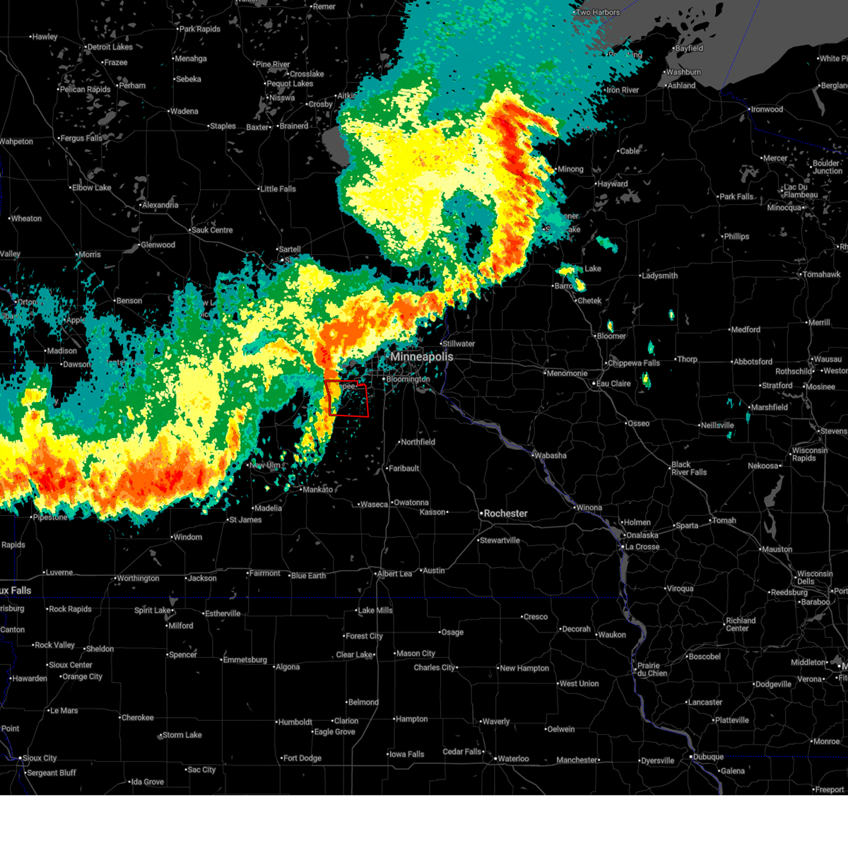
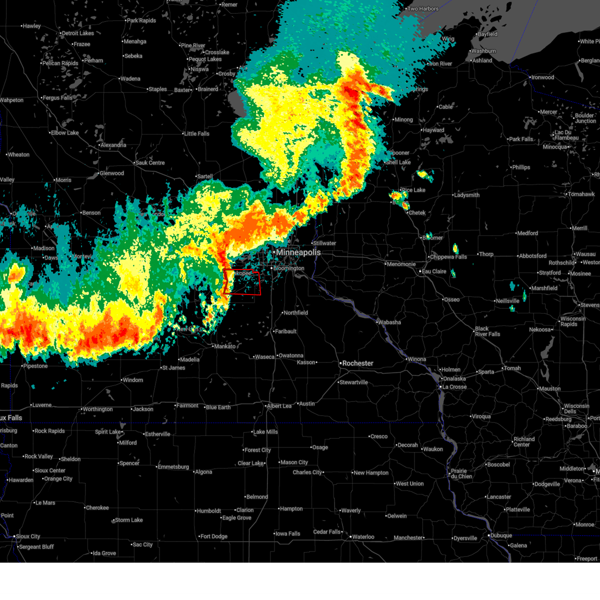
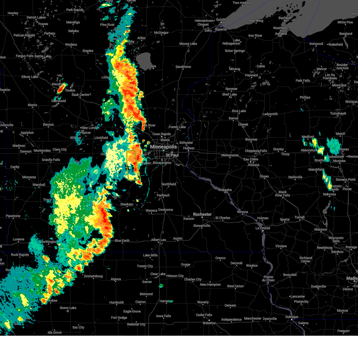
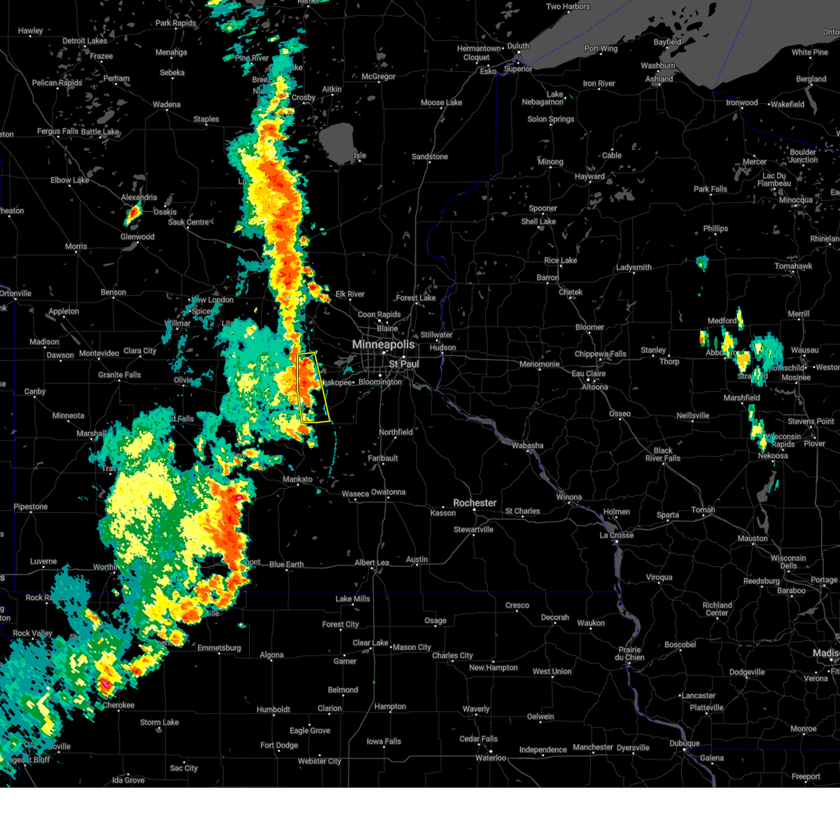
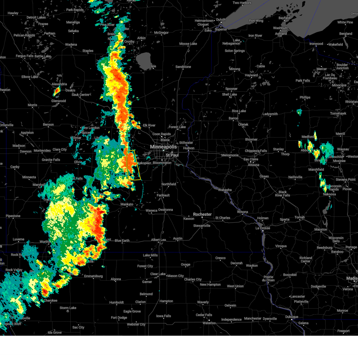
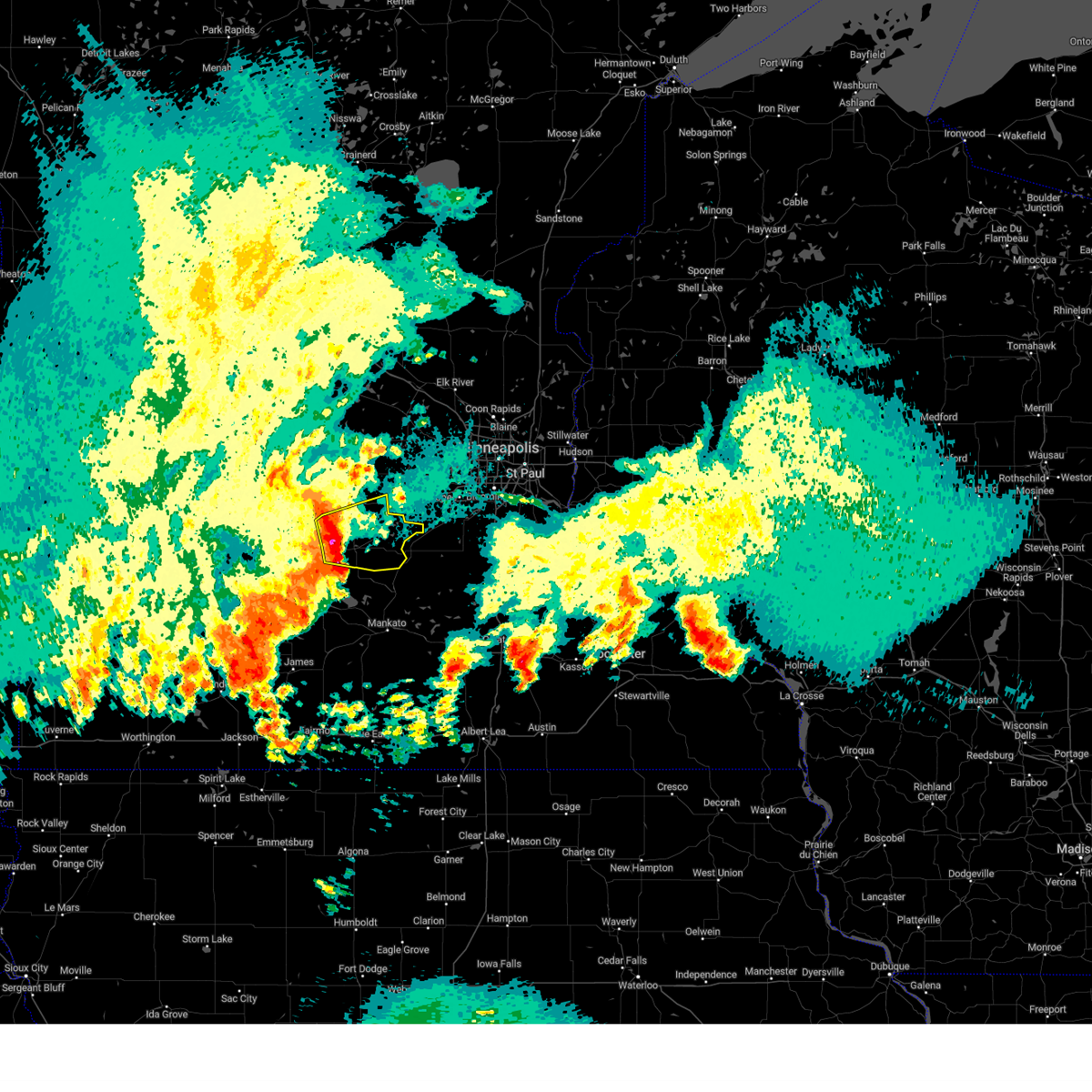
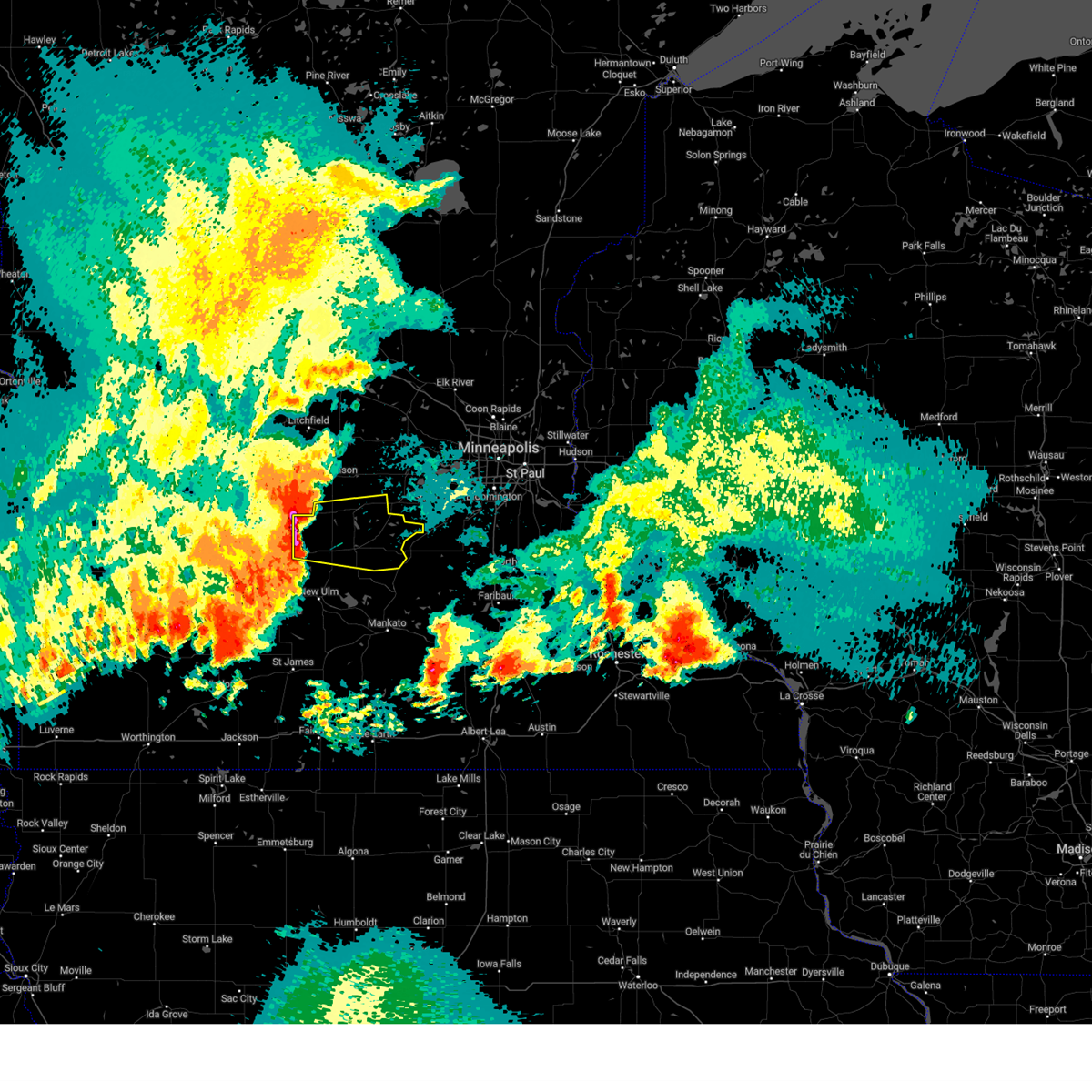
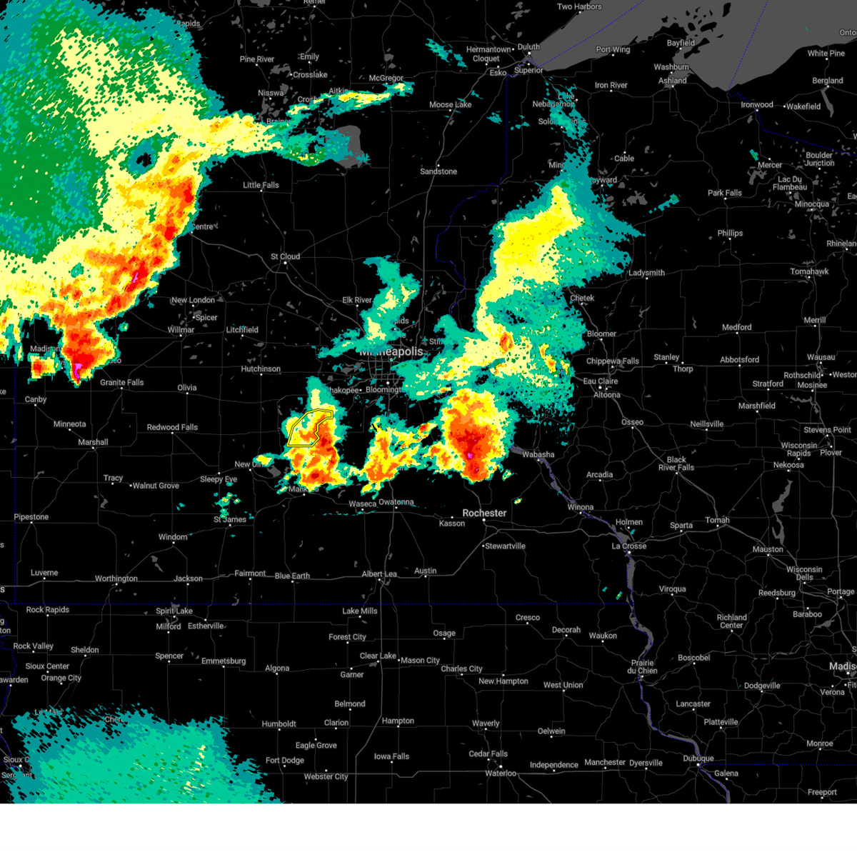
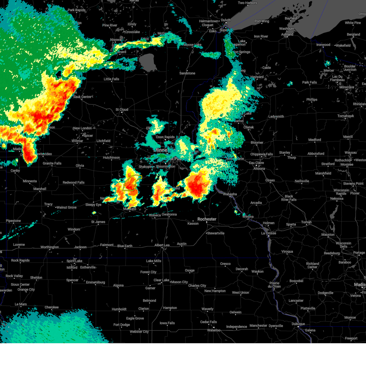
Hail Map for Belle Plaine, MN
The Belle Plaine, MN area has had 8 reports of on-the-ground hail by trained spotters, and has been under severe weather warnings 16 times during the past 12 months. Doppler radar has detected hail at or near Belle Plaine, MN on 58 occasions, including 2 occasions during the past year.
| Name: | Belle Plaine, MN |
| Where Located: | 34.8 miles SW of Minneapolis, MN |
| Map: | Google Map for Belle Plaine, MN |
| Population: | 6661 |
| Housing Units: | 2501 |
| More Info: | Search Google for Belle Plaine, MN |
2
The Top Recent Hail Date for Belle Plaine, MN is Wednesday, July 31, 2024 (18th out of 58)

Hail and Wind Damage Spotted near Belle Plaine, MN
| Date / Time | Report Details |
|---|---|
| 6/29/2025 12:22 AM CDT |
 the tornado warning has been cancelled and is no longer in effect the tornado warning has been cancelled and is no longer in effect
|
| 6/29/2025 12:22 AM CDT |
 At 1222 am cdt, a tornado producing storm was located over carver, or 23 miles southwest of minneapolis, moving east at 35 mph (radar confirmed tornado). Hazards include damaging tornado. Flying debris will be dangerous to those caught without shelter. mobile homes will be damaged or destroyed. damage to roofs, windows and vehicles will occur. tree damage is likely. Locations impacted include, eden prairie, shakopee, chaska, chanhassen, prior lake, waconia, belle plaine, jordan, carver, cologne, minnesota valley state recreation area, marystown and mn valley state rec area. At 1222 am cdt, a tornado producing storm was located over carver, or 23 miles southwest of minneapolis, moving east at 35 mph (radar confirmed tornado). Hazards include damaging tornado. Flying debris will be dangerous to those caught without shelter. mobile homes will be damaged or destroyed. damage to roofs, windows and vehicles will occur. tree damage is likely. Locations impacted include, eden prairie, shakopee, chaska, chanhassen, prior lake, waconia, belle plaine, jordan, carver, cologne, minnesota valley state recreation area, marystown and mn valley state rec area.
|
| 6/29/2025 12:15 AM CDT |
 Tormpx the national weather service in the twin cities has issued a * tornado warning for, east central sibley county in central minnesota, southeastern carver county in east central minnesota, central scott county in east central minnesota, * until 1245 am cdt. * at 1215 am cdt, a severe thunderstorm capable of producing a tornado was located over cologne, or 28 miles southwest of minneapolis, moving east at 35 mph (radar indicated rotation). Hazards include tornado. Flying debris will be dangerous to those caught without shelter. mobile homes will be damaged or destroyed. damage to roofs, windows and vehicles will occur. Tree damage is likely. Tormpx the national weather service in the twin cities has issued a * tornado warning for, east central sibley county in central minnesota, southeastern carver county in east central minnesota, central scott county in east central minnesota, * until 1245 am cdt. * at 1215 am cdt, a severe thunderstorm capable of producing a tornado was located over cologne, or 28 miles southwest of minneapolis, moving east at 35 mph (radar indicated rotation). Hazards include tornado. Flying debris will be dangerous to those caught without shelter. mobile homes will be damaged or destroyed. damage to roofs, windows and vehicles will occur. Tree damage is likely.
|
| 8/29/2024 3:59 PM CDT |
 The storms which prompted the warning have moved out of the area. therefore, the warning will be allowed to expire. a severe thunderstorm watch remains in effect until 900 pm cdt for central and east central minnesota. The storms which prompted the warning have moved out of the area. therefore, the warning will be allowed to expire. a severe thunderstorm watch remains in effect until 900 pm cdt for central and east central minnesota.
|
| 8/29/2024 3:46 PM CDT |
 the severe thunderstorm warning has been cancelled and is no longer in effect the severe thunderstorm warning has been cancelled and is no longer in effect
|
| 8/29/2024 3:46 PM CDT |
 At 346 pm cdt, severe thunderstorms were located along a line extending from near watertown to 5 miles west of belle plaine, moving east at 40 mph (radar indicated). Hazards include 60 mph wind gusts and quarter size hail. Hail damage to vehicles is expected. expect wind damage to roofs, siding, and trees. Locations impacted include, waconia, belle plaine, watertown, norwood young america, mayer, cologne, hollywood, hamburg, new germany, and minnesota valley state recreation area. At 346 pm cdt, severe thunderstorms were located along a line extending from near watertown to 5 miles west of belle plaine, moving east at 40 mph (radar indicated). Hazards include 60 mph wind gusts and quarter size hail. Hail damage to vehicles is expected. expect wind damage to roofs, siding, and trees. Locations impacted include, waconia, belle plaine, watertown, norwood young america, mayer, cologne, hollywood, hamburg, new germany, and minnesota valley state recreation area.
|
| 8/29/2024 3:26 PM CDT |
 At 326 pm cdt, a severe thunderstorm was located near glencoe, or 18 miles southeast of hutchinson, moving northeast at 45 mph (trained weather spotters). Hazards include 60 mph wind gusts and quarter size hail. Hail damage to vehicles is expected. expect wind damage to roofs, siding, and trees. Locations impacted include, waconia, belle plaine, glencoe, watertown, norwood young america, winsted, gaylord, arlington, mayer, lester prairie, cologne, and silver lake. At 326 pm cdt, a severe thunderstorm was located near glencoe, or 18 miles southeast of hutchinson, moving northeast at 45 mph (trained weather spotters). Hazards include 60 mph wind gusts and quarter size hail. Hail damage to vehicles is expected. expect wind damage to roofs, siding, and trees. Locations impacted include, waconia, belle plaine, glencoe, watertown, norwood young america, winsted, gaylord, arlington, mayer, lester prairie, cologne, and silver lake.
|
| 8/29/2024 3:12 PM CDT |
 Svrmpx the national weather service in the twin cities has issued a * severe thunderstorm warning for, northeastern sibley county in central minnesota, southwestern scott county in east central minnesota, mcleod county in central minnesota, western carver county in east central minnesota, * until 400 pm cdt. * at 311 pm cdt, a severe thunderstorm was located near gaylord, or 21 miles northeast of new ulm, moving northeast at 40 mph. emergency management reported trees down in the city of new ulm (trained weather spotters). Hazards include 60 mph wind gusts and quarter size hail. Hail damage to vehicles is expected. Expect wind damage to roofs, siding, and trees. Svrmpx the national weather service in the twin cities has issued a * severe thunderstorm warning for, northeastern sibley county in central minnesota, southwestern scott county in east central minnesota, mcleod county in central minnesota, western carver county in east central minnesota, * until 400 pm cdt. * at 311 pm cdt, a severe thunderstorm was located near gaylord, or 21 miles northeast of new ulm, moving northeast at 40 mph. emergency management reported trees down in the city of new ulm (trained weather spotters). Hazards include 60 mph wind gusts and quarter size hail. Hail damage to vehicles is expected. Expect wind damage to roofs, siding, and trees.
|
| 8/27/2024 5:00 AM CDT |
 Svrmpx the national weather service in the twin cities has issued a * severe thunderstorm warning for, hennepin county in east central minnesota, northwestern dakota county in east central minnesota, scott county in east central minnesota, carver county in east central minnesota, * until 545 am cdt. * at 459 am cdt, severe thunderstorms were located along a line extending from near mayer to near victoria to near new prague, moving northeast at 45 mph (radar indicated). Hazards include 60 mph wind gusts. Expect damage to roofs, siding, and trees. severe thunderstorms will be near, eden prairie, minnetonka, shakopee, chaska, and chanhassen around 505 am cdt. bloomington, savage, hopkins, wayzata, and independence around 510 am cdt. plymouth, burnsville, lakeville, edina, and st. louis park around 515 am cdt. minneapolis, apple valley, and richfield around 520 am cdt. Eagan, maple grove, brooklyn center, mendota heights, and msp international airport around 525 am cdt. Svrmpx the national weather service in the twin cities has issued a * severe thunderstorm warning for, hennepin county in east central minnesota, northwestern dakota county in east central minnesota, scott county in east central minnesota, carver county in east central minnesota, * until 545 am cdt. * at 459 am cdt, severe thunderstorms were located along a line extending from near mayer to near victoria to near new prague, moving northeast at 45 mph (radar indicated). Hazards include 60 mph wind gusts. Expect damage to roofs, siding, and trees. severe thunderstorms will be near, eden prairie, minnetonka, shakopee, chaska, and chanhassen around 505 am cdt. bloomington, savage, hopkins, wayzata, and independence around 510 am cdt. plymouth, burnsville, lakeville, edina, and st. louis park around 515 am cdt. minneapolis, apple valley, and richfield around 520 am cdt. Eagan, maple grove, brooklyn center, mendota heights, and msp international airport around 525 am cdt.
|
| 7/31/2024 9:32 PM CDT |
 At 932 pm cdt, a severe thunderstorm was located over winthrop, or 19 miles north of new ulm, moving east at 30 mph (radar indicated). Hazards include 60 mph wind gusts and quarter size hail. Hail damage to vehicles is expected. expect wind damage to roofs, siding, and trees. Locations impacted include, glencoe, gaylord, arlington, winthrop, henderson, brownton, green isle, sumter, new auburn, plato, new sweden, and rush river. At 932 pm cdt, a severe thunderstorm was located over winthrop, or 19 miles north of new ulm, moving east at 30 mph (radar indicated). Hazards include 60 mph wind gusts and quarter size hail. Hail damage to vehicles is expected. expect wind damage to roofs, siding, and trees. Locations impacted include, glencoe, gaylord, arlington, winthrop, henderson, brownton, green isle, sumter, new auburn, plato, new sweden, and rush river.
|
| 7/31/2024 9:12 PM CDT |
 Svrmpx the national weather service in the twin cities has issued a * severe thunderstorm warning for, sibley county in central minnesota, southern mcleod county in central minnesota, * until 1000 pm cdt. * at 909 pm cdt, a severe thunderstorm was located 6 miles south of stewart, or 19 miles southwest of hutchinson, moving east at 35 mph (radar indicated). Hazards include 60 mph wind gusts and half dollar size hail. Hail damage to vehicles is expected. Expect wind damage to roofs, siding, and trees. Svrmpx the national weather service in the twin cities has issued a * severe thunderstorm warning for, sibley county in central minnesota, southern mcleod county in central minnesota, * until 1000 pm cdt. * at 909 pm cdt, a severe thunderstorm was located 6 miles south of stewart, or 19 miles southwest of hutchinson, moving east at 35 mph (radar indicated). Hazards include 60 mph wind gusts and half dollar size hail. Hail damage to vehicles is expected. Expect wind damage to roofs, siding, and trees.
|
| 7/31/2024 7:04 PM CDT |
 the severe thunderstorm warning has been cancelled and is no longer in effect the severe thunderstorm warning has been cancelled and is no longer in effect
|
| 7/31/2024 6:53 PM CDT |
 At 653 pm cdt, a severe thunderstorm was located near henderson, or 24 miles north of mankato, moving east at 25 mph (trained weather spotters). Hazards include golf ball size hail and 60 mph wind gusts. People and animals outdoors will be injured. expect hail damage to roofs, siding, windows, and vehicles. expect wind damage to roofs, siding, and trees. this severe storm will be near, henderson around 700 pm cdt. Other locations impacted by this severe thunderstorm include rush river and new rome. At 653 pm cdt, a severe thunderstorm was located near henderson, or 24 miles north of mankato, moving east at 25 mph (trained weather spotters). Hazards include golf ball size hail and 60 mph wind gusts. People and animals outdoors will be injured. expect hail damage to roofs, siding, windows, and vehicles. expect wind damage to roofs, siding, and trees. this severe storm will be near, henderson around 700 pm cdt. Other locations impacted by this severe thunderstorm include rush river and new rome.
|
| 7/31/2024 6:44 PM CDT | At 643 pm cdt, a severe thunderstorm was located over arlington, or 25 miles southeast of hutchinson, moving east at 25 mph (trained weather spotters). Hazards include golf ball size hail and 60 mph wind gusts. People and animals outdoors will be injured. expect hail damage to roofs, siding, windows, and vehicles. expect wind damage to roofs, siding, and trees. this severe storm will be near, arlington around 650 pm cdt. henderson around 700 pm cdt. Other locations impacted by this severe thunderstorm include rush river, new rome, and new auburn. |
| 7/31/2024 6:44 PM CDT | the severe thunderstorm warning has been cancelled and is no longer in effect |
| 7/31/2024 6:20 PM CDT |
 Svrmpx the national weather service in the twin cities has issued a * severe thunderstorm warning for, sibley county in central minnesota, southeastern mcleod county in central minnesota, * until 715 pm cdt. * at 618 pm cdt, a severe thunderstorm was located near winthrop, or 19 miles south of hutchinson, moving east at 25 mph (trained weather spotters. at 615 pm, quarter size hail was reported in winthrop. a 62 mph wind gust was also reported near winthrop. doppler radar indicates potential for 2 inch hail). Hazards include two inch hail and 60 mph wind gusts. People and animals outdoors will be injured. expect hail damage to roofs, siding, windows, and vehicles. expect wind damage to roofs, siding, and trees. this severe thunderstorm will be near, gaylord around 625 pm cdt. arlington around 635 pm cdt. henderson around 700 pm cdt. other locations impacted by this severe thunderstorm include rush river, new sweden, new rome, and new auburn. this includes u. s. Highway 212 near mile marker 109. Svrmpx the national weather service in the twin cities has issued a * severe thunderstorm warning for, sibley county in central minnesota, southeastern mcleod county in central minnesota, * until 715 pm cdt. * at 618 pm cdt, a severe thunderstorm was located near winthrop, or 19 miles south of hutchinson, moving east at 25 mph (trained weather spotters. at 615 pm, quarter size hail was reported in winthrop. a 62 mph wind gust was also reported near winthrop. doppler radar indicates potential for 2 inch hail). Hazards include two inch hail and 60 mph wind gusts. People and animals outdoors will be injured. expect hail damage to roofs, siding, windows, and vehicles. expect wind damage to roofs, siding, and trees. this severe thunderstorm will be near, gaylord around 625 pm cdt. arlington around 635 pm cdt. henderson around 700 pm cdt. other locations impacted by this severe thunderstorm include rush river, new sweden, new rome, and new auburn. this includes u. s. Highway 212 near mile marker 109.
|
| 8/11/2023 5:00 PM CDT |
 At 500 pm cdt, severe thunderstorms were located along a line extending from plymouth to near delano to lester prairie, moving east at 40 mph (radar indicated). Hazards include golf ball size hail and 60 mph wind gusts. People and animals outdoors will be injured. expect hail damage to roofs, siding, windows, and vehicles. expect wind damage to roofs, siding, and trees. severe thunderstorms will be near, plymouth, brooklyn center and golden valley around 505 pm cdt. minneapolis, columbia heights and maple plain around 510 pm cdt. mound, minnetrista, watertown and norwood young america around 515 pm cdt. roseville, waconia, orono, medina and wayzata around 520 pm cdt. other locations in the path of these severe thunderstorms include st. paul, maplewood, west st. paul, mendota heights, cologne, eden prairie, minnetonka, st. louis park, chaska, chanhassen, edina, carver, excelsior, woodbury and afton. thunderstorm damage threat, considerable hail threat, radar indicated max hail size, 1. 75 in wind threat, radar indicated max wind gust, 60 mph. At 500 pm cdt, severe thunderstorms were located along a line extending from plymouth to near delano to lester prairie, moving east at 40 mph (radar indicated). Hazards include golf ball size hail and 60 mph wind gusts. People and animals outdoors will be injured. expect hail damage to roofs, siding, windows, and vehicles. expect wind damage to roofs, siding, and trees. severe thunderstorms will be near, plymouth, brooklyn center and golden valley around 505 pm cdt. minneapolis, columbia heights and maple plain around 510 pm cdt. mound, minnetrista, watertown and norwood young america around 515 pm cdt. roseville, waconia, orono, medina and wayzata around 520 pm cdt. other locations in the path of these severe thunderstorms include st. paul, maplewood, west st. paul, mendota heights, cologne, eden prairie, minnetonka, st. louis park, chaska, chanhassen, edina, carver, excelsior, woodbury and afton. thunderstorm damage threat, considerable hail threat, radar indicated max hail size, 1. 75 in wind threat, radar indicated max wind gust, 60 mph.
|
| 8/11/2023 4:58 PM CDT |
 At 456 pm cdt, a severe thunderstorm was located over arlington, or 23 miles southeast of hutchinson, moving southeast at 50 mph (radar indicated). Hazards include two inch hail and 60 mph wind gusts. People and animals outdoors will be injured. expect hail damage to roofs, siding, windows, and vehicles. expect wind damage to roofs, siding, and trees. this severe thunderstorm will be near, belle plaine around 515 pm cdt. thunderstorm damage threat, considerable hail threat, radar indicated max hail size, 2. 00 in wind threat, radar indicated max wind gust, 60 mph. At 456 pm cdt, a severe thunderstorm was located over arlington, or 23 miles southeast of hutchinson, moving southeast at 50 mph (radar indicated). Hazards include two inch hail and 60 mph wind gusts. People and animals outdoors will be injured. expect hail damage to roofs, siding, windows, and vehicles. expect wind damage to roofs, siding, and trees. this severe thunderstorm will be near, belle plaine around 515 pm cdt. thunderstorm damage threat, considerable hail threat, radar indicated max hail size, 2. 00 in wind threat, radar indicated max wind gust, 60 mph.
|
| 5/30/2022 6:43 PM CDT |
 The severe thunderstorm warning for western hennepin, southeastern wright, eastern sibley, east central mcleod, carver and northeastern nicollet counties will expire at 645 pm cdt, the storms which prompted the warning have weakened below severe limits, and no longer pose an immediate threat to life or property. therefore, the warning will be allowed to expire. however gusty winds and heavy rain are still possible with these thunderstorms. a tornado watch remains in effect until 1000 pm cdt for south central, central and east central minnesota. The severe thunderstorm warning for western hennepin, southeastern wright, eastern sibley, east central mcleod, carver and northeastern nicollet counties will expire at 645 pm cdt, the storms which prompted the warning have weakened below severe limits, and no longer pose an immediate threat to life or property. therefore, the warning will be allowed to expire. however gusty winds and heavy rain are still possible with these thunderstorms. a tornado watch remains in effect until 1000 pm cdt for south central, central and east central minnesota.
|
| 5/30/2022 6:30 PM CDT |
 At 630 pm cdt, severe thunderstorms were located along a line extending from near watertown to waconia to near belle plaine, moving northeast at 70 mph (public). Hazards include 70 mph wind gusts and quarter size hail. Hail damage to vehicles is expected. expect considerable tree damage. wind damage is also likely to mobile homes, roofs, and outbuildings. locations impacted include, delano, montrose, st. bonifacius, mound, orono, minnetrista, rockford, maple plain, chaska, medina, independence, chanhassen, st. michael, victoria and corcoran. thunderstorm damage threat, considerable hail threat, radar indicated max hail size, 1. 00 in wind threat, radar indicated max wind gust, 70 mph. At 630 pm cdt, severe thunderstorms were located along a line extending from near watertown to waconia to near belle plaine, moving northeast at 70 mph (public). Hazards include 70 mph wind gusts and quarter size hail. Hail damage to vehicles is expected. expect considerable tree damage. wind damage is also likely to mobile homes, roofs, and outbuildings. locations impacted include, delano, montrose, st. bonifacius, mound, orono, minnetrista, rockford, maple plain, chaska, medina, independence, chanhassen, st. michael, victoria and corcoran. thunderstorm damage threat, considerable hail threat, radar indicated max hail size, 1. 00 in wind threat, radar indicated max wind gust, 70 mph.
|
| 5/30/2022 6:08 PM CDT |
 At 607 pm cdt, severe thunderstorms were located along a line extending from 5 miles southwest of glencoe to near arlington to 5 miles north of nicollet, moving northeast at 70 mph (public). Hazards include 70 mph wind gusts and quarter size hail. Hail damage to vehicles is expected. expect considerable tree damage. wind damage is also likely to mobile homes, roofs, and outbuildings. severe thunderstorms will be near, glencoe and green isle around 615 pm cdt. lester prairie around 620 pm cdt. norwood young america, mayer and henderson around 625 pm cdt. other locations in the path of these severe thunderstorms include waconia, watertown, delano, st. bonifacius, mound, orono, rockford, maple plain, chaska, victoria and corcoran. thunderstorm damage threat, considerable hail threat, radar indicated max hail size, 1. 00 in wind threat, radar indicated max wind gust, 70 mph. At 607 pm cdt, severe thunderstorms were located along a line extending from 5 miles southwest of glencoe to near arlington to 5 miles north of nicollet, moving northeast at 70 mph (public). Hazards include 70 mph wind gusts and quarter size hail. Hail damage to vehicles is expected. expect considerable tree damage. wind damage is also likely to mobile homes, roofs, and outbuildings. severe thunderstorms will be near, glencoe and green isle around 615 pm cdt. lester prairie around 620 pm cdt. norwood young america, mayer and henderson around 625 pm cdt. other locations in the path of these severe thunderstorms include waconia, watertown, delano, st. bonifacius, mound, orono, rockford, maple plain, chaska, victoria and corcoran. thunderstorm damage threat, considerable hail threat, radar indicated max hail size, 1. 00 in wind threat, radar indicated max wind gust, 70 mph.
|
| 5/12/2022 8:18 PM CDT |
 At 816 pm cdt, a gust front was located along a line extending from near ramsey to near eden prairie to 5 miles northeast of new prague, moving east at 50 mph (radar indicated). Hazards include 60 mph wind gusts. Expect damage to roofs, siding, and trees. the gust front will be near, andover, savage, ramsey and anoka around 820 pm cdt. burnsville, edina, ham lake and elko new market around 825 pm cdt. lakeville, richfield, east bethel and msp international airport around 830 pm cdt. bloomington around 835 pm cdt. mendota heights around 840 pm cdt. other locations impacted by these severe thunderstorms include nowthen, robbinsdale, flying cloud airport, cedar, north minneapolis, mall of america, helena, rassat, marystown and plato. thunderstorms with heavy rain will follow the gust front by up to 30 minutes. hail threat, radar indicated max hail size, <. 75 in wind threat, radar indicated max wind gust, 60 mph. At 816 pm cdt, a gust front was located along a line extending from near ramsey to near eden prairie to 5 miles northeast of new prague, moving east at 50 mph (radar indicated). Hazards include 60 mph wind gusts. Expect damage to roofs, siding, and trees. the gust front will be near, andover, savage, ramsey and anoka around 820 pm cdt. burnsville, edina, ham lake and elko new market around 825 pm cdt. lakeville, richfield, east bethel and msp international airport around 830 pm cdt. bloomington around 835 pm cdt. mendota heights around 840 pm cdt. other locations impacted by these severe thunderstorms include nowthen, robbinsdale, flying cloud airport, cedar, north minneapolis, mall of america, helena, rassat, marystown and plato. thunderstorms with heavy rain will follow the gust front by up to 30 minutes. hail threat, radar indicated max hail size, <. 75 in wind threat, radar indicated max wind gust, 60 mph.
|
| 5/12/2022 8:02 PM CDT |
 At 802 pm cdt, severe thunderstorms were located along a line extending from near otsego to near cologne to near belle plaine, moving east at 50 mph (radar indicated). Hazards include 60 mph wind gusts. Expect damage to roofs, siding, and trees. these severe storms will be near, elk river, st. michael, big lake and albertville around 805 pm cdt. chaska, chanhassen and otsego around 810 pm cdt. ramsey, st. francis and excelsior around 815 pm cdt. eden prairie, shakopee, andover, savage and prior lake around 820 pm cdt. burnsville, minnetonka, edina, st. louis park and hopkins around 825 pm cdt. lakeville, richfield, east bethel and msp international airport around 830 pm cdt. hail threat, radar indicated max hail size, <. 75 in wind threat, radar indicated max wind gust, 60 mph. At 802 pm cdt, severe thunderstorms were located along a line extending from near otsego to near cologne to near belle plaine, moving east at 50 mph (radar indicated). Hazards include 60 mph wind gusts. Expect damage to roofs, siding, and trees. these severe storms will be near, elk river, st. michael, big lake and albertville around 805 pm cdt. chaska, chanhassen and otsego around 810 pm cdt. ramsey, st. francis and excelsior around 815 pm cdt. eden prairie, shakopee, andover, savage and prior lake around 820 pm cdt. burnsville, minnetonka, edina, st. louis park and hopkins around 825 pm cdt. lakeville, richfield, east bethel and msp international airport around 830 pm cdt. hail threat, radar indicated max hail size, <. 75 in wind threat, radar indicated max wind gust, 60 mph.
|
| 5/12/2022 7:45 PM CDT |
 At 744 pm cdt, severe thunderstorms were located along a line extending from near montrose to green isle to near le sueur, moving east at 50 mph (radar indicated). Hazards include 60 mph wind gusts. Expect damage to roofs, siding, and trees. severe thunderstorms will be near, buffalo around 750 pm cdt. delano around 755 pm cdt. belle plaine, rockford and cologne around 800 pm cdt. new prague, jordan, medina, independence and maple plain around 805 pm cdt. maple grove, st. michael, otsego, rogers and corcoran around 810 pm cdt. plymouth around 815 pm cdt. minneapolis, brooklyn park, shakopee, brooklyn center and savage around 820 pm cdt. coon rapids, burnsville, fridley, columbia heights and spring lake park around 825 pm cdt. hail threat, radar indicated max hail size, <. 75 in wind threat, radar indicated max wind gust, 60 mph. At 744 pm cdt, severe thunderstorms were located along a line extending from near montrose to green isle to near le sueur, moving east at 50 mph (radar indicated). Hazards include 60 mph wind gusts. Expect damage to roofs, siding, and trees. severe thunderstorms will be near, buffalo around 750 pm cdt. delano around 755 pm cdt. belle plaine, rockford and cologne around 800 pm cdt. new prague, jordan, medina, independence and maple plain around 805 pm cdt. maple grove, st. michael, otsego, rogers and corcoran around 810 pm cdt. plymouth around 815 pm cdt. minneapolis, brooklyn park, shakopee, brooklyn center and savage around 820 pm cdt. coon rapids, burnsville, fridley, columbia heights and spring lake park around 825 pm cdt. hail threat, radar indicated max hail size, <. 75 in wind threat, radar indicated max wind gust, 60 mph.
|
| 5/11/2022 7:31 PM CDT |
 At 731 pm cdt, a severe thunderstorm capable of producing a tornado was located over henderson, or 25 miles north of mankato, moving northeast at 50 mph (radar indicated rotation). Hazards include tornado and quarter size hail. Flying debris will be dangerous to those caught without shelter. mobile homes will be damaged or destroyed. damage to roofs, windows, and vehicles will occur. tree damage is likely. this dangerous storm will be near, belle plaine around 745 pm cdt. new prague and jordan around 750 pm cdt. Other locations in the path of this tornadic thunderstorm include shakopee, prior lake, savage and lakeville. At 731 pm cdt, a severe thunderstorm capable of producing a tornado was located over henderson, or 25 miles north of mankato, moving northeast at 50 mph (radar indicated rotation). Hazards include tornado and quarter size hail. Flying debris will be dangerous to those caught without shelter. mobile homes will be damaged or destroyed. damage to roofs, windows, and vehicles will occur. tree damage is likely. this dangerous storm will be near, belle plaine around 745 pm cdt. new prague and jordan around 750 pm cdt. Other locations in the path of this tornadic thunderstorm include shakopee, prior lake, savage and lakeville.
|
| 5/11/2022 7:29 PM CDT |
 At 729 pm cdt, a severe thunderstorm capable of producing a tornado was located over arlington, or 22 miles southeast of hutchinson, moving northeast at 45 mph (radar indicated rotation). Hazards include tornado and quarter size hail. Flying debris will be dangerous to those caught without shelter. mobile homes will be damaged or destroyed. damage to roofs, windows, and vehicles will occur. tree damage is likely. Locations impacted include, green isle. At 729 pm cdt, a severe thunderstorm capable of producing a tornado was located over arlington, or 22 miles southeast of hutchinson, moving northeast at 45 mph (radar indicated rotation). Hazards include tornado and quarter size hail. Flying debris will be dangerous to those caught without shelter. mobile homes will be damaged or destroyed. damage to roofs, windows, and vehicles will occur. tree damage is likely. Locations impacted include, green isle.
|
| 5/11/2022 7:27 PM CDT |
 At 727 pm cdt, a severe thunderstorm was located near le sueur, or 20 miles north of mankato, moving northeast at 50 mph (radar indicated). Hazards include 70 mph wind gusts and quarter size hail. Hail damage to vehicles is expected. expect considerable tree damage. wind damage is also likely to mobile homes, roofs, and outbuildings. this severe thunderstorm will be near, belle plaine around 745 pm cdt. Other locations in the path of this severe thunderstorm include new prague, jordan, elko new market and lakeville. At 727 pm cdt, a severe thunderstorm was located near le sueur, or 20 miles north of mankato, moving northeast at 50 mph (radar indicated). Hazards include 70 mph wind gusts and quarter size hail. Hail damage to vehicles is expected. expect considerable tree damage. wind damage is also likely to mobile homes, roofs, and outbuildings. this severe thunderstorm will be near, belle plaine around 745 pm cdt. Other locations in the path of this severe thunderstorm include new prague, jordan, elko new market and lakeville.
|
| 5/11/2022 7:10 PM CDT | Half Dollar sized hail reported 0.7 miles SSE of Belle Plaine, MN, time estimated by radar. |
| 5/11/2022 6:59 PM CDT |
 At 658 pm cdt, a confirmed tornado was located near buffalo lake, or 19 miles southwest of hutchinson, moving northeast at 50 mph (weather spotters confirmed tornado earlier with this storm). Hazards include damaging tornado and quarter size hail. Flying debris will be dangerous to those caught without shelter. mobile homes will be damaged or destroyed. damage to roofs, windows, and vehicles will occur. tree damage is likely. the tornado will be near, stewart around 705 pm cdt. Other locations in the path of this tornadic thunderstorm include hutchinson and silver lake. At 658 pm cdt, a confirmed tornado was located near buffalo lake, or 19 miles southwest of hutchinson, moving northeast at 50 mph (weather spotters confirmed tornado earlier with this storm). Hazards include damaging tornado and quarter size hail. Flying debris will be dangerous to those caught without shelter. mobile homes will be damaged or destroyed. damage to roofs, windows, and vehicles will occur. tree damage is likely. the tornado will be near, stewart around 705 pm cdt. Other locations in the path of this tornadic thunderstorm include hutchinson and silver lake.
|
| 4/12/2022 9:35 PM CDT |
 At 935 pm cdt, severe thunderstorms were located along a line extending from jordan to near elko new market, moving northeast at 60 mph (emergency management). Hazards include 60 mph wind gusts and quarter size hail. Hail damage to vehicles is expected. expect wind damage to roofs, siding, and trees. severe thunderstorms will be near, elko new market around 940 pm cdt. lakeville around 945 pm cdt. apple valley, shakopee, savage, prior lake and rosemount around 950 pm cdt. eden prairie and burnsville around 955 pm cdt. bloomington, eagan, edina, richfield and inver grove heights around 1000 pm cdt. other locations impacted by these severe thunderstorms include south st paul airport, lilydale, flying cloud airport, credit river, sunfish, fort snelling state park, sunfish lake, mall of america, south st paul and helena. hail threat, radar indicated max hail size, 1. 00 in wind threat, radar indicated max wind gust, 60 mph. At 935 pm cdt, severe thunderstorms were located along a line extending from jordan to near elko new market, moving northeast at 60 mph (emergency management). Hazards include 60 mph wind gusts and quarter size hail. Hail damage to vehicles is expected. expect wind damage to roofs, siding, and trees. severe thunderstorms will be near, elko new market around 940 pm cdt. lakeville around 945 pm cdt. apple valley, shakopee, savage, prior lake and rosemount around 950 pm cdt. eden prairie and burnsville around 955 pm cdt. bloomington, eagan, edina, richfield and inver grove heights around 1000 pm cdt. other locations impacted by these severe thunderstorms include south st paul airport, lilydale, flying cloud airport, credit river, sunfish, fort snelling state park, sunfish lake, mall of america, south st paul and helena. hail threat, radar indicated max hail size, 1. 00 in wind threat, radar indicated max wind gust, 60 mph.
|
| 4/12/2022 9:23 PM CDT |
 At 923 pm cdt, severe thunderstorms were located along a line extending from 5 miles northwest of arlington to near henderson, moving northeast at 55 mph (radar indicated). Hazards include 60 mph wind gusts and quarter size hail. Hail damage to vehicles is expected. expect wind damage to roofs, siding, and trees. severe thunderstorms will be near, norwood young america, lester prairie and cologne around 940 pm cdt. waconia, carver and mayer around 945 pm cdt. chaska, chanhassen, victoria and watertown around 950 pm cdt. minnetrista around 1000 pm cdt. other locations impacted by these severe thunderstorms include hollywood, lake waconia, plato, new germany, hamburg, glencoe airport and new auburn. hail threat, radar indicated max hail size, 1. 00 in wind threat, radar indicated max wind gust, 60 mph. At 923 pm cdt, severe thunderstorms were located along a line extending from 5 miles northwest of arlington to near henderson, moving northeast at 55 mph (radar indicated). Hazards include 60 mph wind gusts and quarter size hail. Hail damage to vehicles is expected. expect wind damage to roofs, siding, and trees. severe thunderstorms will be near, norwood young america, lester prairie and cologne around 940 pm cdt. waconia, carver and mayer around 945 pm cdt. chaska, chanhassen, victoria and watertown around 950 pm cdt. minnetrista around 1000 pm cdt. other locations impacted by these severe thunderstorms include hollywood, lake waconia, plato, new germany, hamburg, glencoe airport and new auburn. hail threat, radar indicated max hail size, 1. 00 in wind threat, radar indicated max wind gust, 60 mph.
|
| 9/17/2021 2:45 AM CDT |
 At 244 am cdt, severe thunderstorms were located along a line extending from near waconia to near belle plaine, moving northeast at 70 mph (radar indicated). Hazards include 60 mph wind gusts. Expect damage to roofs, siding, and trees. severe thunderstorms will be near, carver and st. bonifacius around 250 am cdt. chaska, chanhassen, prior lake, mound and victoria around 255 am cdt. eden prairie, shakopee, savage, hopkins and orono around 300 am cdt. hail threat, radar indicated max hail size, <. 75 in wind threat, radar indicated max wind gust, 60 mph. At 244 am cdt, severe thunderstorms were located along a line extending from near waconia to near belle plaine, moving northeast at 70 mph (radar indicated). Hazards include 60 mph wind gusts. Expect damage to roofs, siding, and trees. severe thunderstorms will be near, carver and st. bonifacius around 250 am cdt. chaska, chanhassen, prior lake, mound and victoria around 255 am cdt. eden prairie, shakopee, savage, hopkins and orono around 300 am cdt. hail threat, radar indicated max hail size, <. 75 in wind threat, radar indicated max wind gust, 60 mph.
|
| 9/17/2021 2:39 AM CDT |
 At 239 am cdt, severe thunderstorms were located along a line extending from 5 miles south of lester prairie to 5 miles southeast of green isle, moving northeast at 70 mph (radar indicated). Hazards include 60 mph wind gusts. Expect damage to roofs, siding, and trees. locations impacted include, waconia, jordan, watertown, mayer, cologne, carver, st. bonifacius and minnetrista. hail threat, radar indicated max hail size, <. 75 in wind threat, radar indicated max wind gust, 60 mph. At 239 am cdt, severe thunderstorms were located along a line extending from 5 miles south of lester prairie to 5 miles southeast of green isle, moving northeast at 70 mph (radar indicated). Hazards include 60 mph wind gusts. Expect damage to roofs, siding, and trees. locations impacted include, waconia, jordan, watertown, mayer, cologne, carver, st. bonifacius and minnetrista. hail threat, radar indicated max hail size, <. 75 in wind threat, radar indicated max wind gust, 60 mph.
|
| 9/17/2021 2:29 AM CDT |
 At 228 am cdt, severe thunderstorms were located along a line extending from near glencoe to near arlington, moving northeast at 70 mph. this storm has a history of producing 60mph wind gusts (radar indicated). Hazards include 60 mph wind gusts. Expect damage to roofs, siding, and trees. severe thunderstorms will be near, belle plaine and norwood young america around 240 am cdt. waconia, jordan, watertown, st. bonifacius and mayer around 245 am cdt. hail threat, radar indicated max hail size, <. 75 in wind threat, radar indicated max wind gust, 60 mph. At 228 am cdt, severe thunderstorms were located along a line extending from near glencoe to near arlington, moving northeast at 70 mph. this storm has a history of producing 60mph wind gusts (radar indicated). Hazards include 60 mph wind gusts. Expect damage to roofs, siding, and trees. severe thunderstorms will be near, belle plaine and norwood young america around 240 am cdt. waconia, jordan, watertown, st. bonifacius and mayer around 245 am cdt. hail threat, radar indicated max hail size, <. 75 in wind threat, radar indicated max wind gust, 60 mph.
|
| 8/24/2021 5:59 AM CDT |
 At 559 am cdt, a severe thunderstorm was located near lester prairie, or 14 miles east of hutchinson, moving east at 45 mph (radar indicated). Hazards include 60 mph wind gusts and nickel size hail. Expect damage to roofs, siding, and trees. this severe thunderstorm will be near, mayer around 610 am cdt. norwood young america around 615 am cdt. other locations in the path of this severe thunderstorm include waconia, cologne, chaska and carver. hail threat, radar indicated max hail size, 0. 88 in wind threat, radar indicated max wind gust, 60 mph. At 559 am cdt, a severe thunderstorm was located near lester prairie, or 14 miles east of hutchinson, moving east at 45 mph (radar indicated). Hazards include 60 mph wind gusts and nickel size hail. Expect damage to roofs, siding, and trees. this severe thunderstorm will be near, mayer around 610 am cdt. norwood young america around 615 am cdt. other locations in the path of this severe thunderstorm include waconia, cologne, chaska and carver. hail threat, radar indicated max hail size, 0. 88 in wind threat, radar indicated max wind gust, 60 mph.
|
| 8/24/2021 3:21 AM CDT |
 At 320 am cdt, a severe thunderstorm was located over jordan, or 25 miles northwest of northfield, moving northeast at 35 mph (radar indicated). Hazards include half dollar size hail. Damage to vehicles is expected. locations impacted include, new prague, belle plaine, jordan, carver, helena, mn valley state rec area and st benedict. hail threat, radar indicated max hail size, 1. 25 in wind threat, radar indicated max wind gust, <50 mph. At 320 am cdt, a severe thunderstorm was located over jordan, or 25 miles northwest of northfield, moving northeast at 35 mph (radar indicated). Hazards include half dollar size hail. Damage to vehicles is expected. locations impacted include, new prague, belle plaine, jordan, carver, helena, mn valley state rec area and st benedict. hail threat, radar indicated max hail size, 1. 25 in wind threat, radar indicated max wind gust, <50 mph.
|
| 8/24/2021 3:12 AM CDT |
 At 311 am cdt, a severe thunderstorm was located over belle plaine, or 30 miles west of northfield, moving northeast at 35 mph (radar indicated). Hazards include half dollar size hail. Damage to vehicles is expected. locations impacted include, new prague and jordan. hail threat, radar indicated max hail size, 1. 25 in wind threat, radar indicated max wind gust, <50 mph. At 311 am cdt, a severe thunderstorm was located over belle plaine, or 30 miles west of northfield, moving northeast at 35 mph (radar indicated). Hazards include half dollar size hail. Damage to vehicles is expected. locations impacted include, new prague and jordan. hail threat, radar indicated max hail size, 1. 25 in wind threat, radar indicated max wind gust, <50 mph.
|
| 8/24/2021 2:55 AM CDT |
 At 254 am cdt, a severe thunderstorm was located over henderson, or 26 miles north of mankato, moving northeast at 35 mph (radar indicated). Hazards include quarter size hail. Damage to vehicles is expected. this severe thunderstorm will be near, belle plaine around 310 am cdt. other locations in the path of this severe thunderstorm include new prague and jordan. hail threat, radar indicated max hail size, 1. 00 in wind threat, radar indicated max wind gust, <50 mph. At 254 am cdt, a severe thunderstorm was located over henderson, or 26 miles north of mankato, moving northeast at 35 mph (radar indicated). Hazards include quarter size hail. Damage to vehicles is expected. this severe thunderstorm will be near, belle plaine around 310 am cdt. other locations in the path of this severe thunderstorm include new prague and jordan. hail threat, radar indicated max hail size, 1. 00 in wind threat, radar indicated max wind gust, <50 mph.
|
| 6/17/2021 7:22 PM CDT |
 At 722 pm cdt, a severe thunderstorm was located near jordan, or 26 miles northwest of northfield, moving east at 40 mph (radar indicated). Hazards include ping pong ball size hail and 60 mph wind gusts. People and animals outdoors will be injured. expect hail damage to roofs, siding, windows, and vehicles. expect wind damage to roofs, siding, and trees. this severe storm will be near, new prague around 725 pm cdt. elko new market around 745 pm cdt. Other locations impacted by this severe thunderstorm include marystown, credit river, mn valley state rec area, st benedict and helena. At 722 pm cdt, a severe thunderstorm was located near jordan, or 26 miles northwest of northfield, moving east at 40 mph (radar indicated). Hazards include ping pong ball size hail and 60 mph wind gusts. People and animals outdoors will be injured. expect hail damage to roofs, siding, windows, and vehicles. expect wind damage to roofs, siding, and trees. this severe storm will be near, new prague around 725 pm cdt. elko new market around 745 pm cdt. Other locations impacted by this severe thunderstorm include marystown, credit river, mn valley state rec area, st benedict and helena.
|
| 6/17/2021 7:15 PM CDT | Quarter sized hail reported 0.3 miles E of Belle Plaine, MN, picture on social media. time estimated from radar. |
| 6/17/2021 7:06 PM CDT |
 At 706 pm cdt, a severe thunderstorm was located near belle plaine, or 31 miles north of mankato, moving east at 30 mph (radar indicated). Hazards include ping pong ball size hail and 60 mph wind gusts. People and animals outdoors will be injured. expect hail damage to roofs, siding, windows, and vehicles. expect wind damage to roofs, siding, and trees. this severe thunderstorm will be near, belle plaine around 715 pm cdt. other locations in the path of this severe thunderstorm include new prague, jordan, prior lake, elko new market and lakeville. This includes mystic lake casino. At 706 pm cdt, a severe thunderstorm was located near belle plaine, or 31 miles north of mankato, moving east at 30 mph (radar indicated). Hazards include ping pong ball size hail and 60 mph wind gusts. People and animals outdoors will be injured. expect hail damage to roofs, siding, windows, and vehicles. expect wind damage to roofs, siding, and trees. this severe thunderstorm will be near, belle plaine around 715 pm cdt. other locations in the path of this severe thunderstorm include new prague, jordan, prior lake, elko new market and lakeville. This includes mystic lake casino.
|
| 5/19/2021 8:28 PM CDT |
 At 827 pm cdt, a confirmed tornado was located near belle plaine, or 31 miles southeast of hutchinson, moving north at 20 mph (weather spotters confirmed tornado). Hazards include damaging tornado. Flying debris will be dangerous to those caught without shelter. mobile homes will be damaged or destroyed. damage to roofs, windows, and vehicles will occur. tree damage is likely. This tornadic thunderstorm will remain over mainly rural areas of south central carver county. At 827 pm cdt, a confirmed tornado was located near belle plaine, or 31 miles southeast of hutchinson, moving north at 20 mph (weather spotters confirmed tornado). Hazards include damaging tornado. Flying debris will be dangerous to those caught without shelter. mobile homes will be damaged or destroyed. damage to roofs, windows, and vehicles will occur. tree damage is likely. This tornadic thunderstorm will remain over mainly rural areas of south central carver county.
|
| 5/19/2021 8:06 PM CDT |
 At 805 pm cdt, a confirmed tornado was located near henderson, or 28 miles north of mankato, moving north at 15 mph (weather spotters confirmed tornado). Hazards include damaging tornado. Flying debris will be dangerous to those caught without shelter. mobile homes will be damaged or destroyed. damage to roofs, windows, and vehicles will occur. tree damage is likely. Locations impacted include, belle plaine and mn valley state rec area. At 805 pm cdt, a confirmed tornado was located near henderson, or 28 miles north of mankato, moving north at 15 mph (weather spotters confirmed tornado). Hazards include damaging tornado. Flying debris will be dangerous to those caught without shelter. mobile homes will be damaged or destroyed. damage to roofs, windows, and vehicles will occur. tree damage is likely. Locations impacted include, belle plaine and mn valley state rec area.
|
| 5/19/2021 7:58 PM CDT |
 At 758 pm cdt, a severe thunderstorm capable of producing a tornado was located near henderson, or 27 miles north of mankato, moving north at 15 mph (radar indicated rotation). Hazards include tornado. Flying debris will be dangerous to those caught without shelter. mobile homes will be damaged or destroyed. damage to roofs, windows, and vehicles will occur. Tree damage is likely. At 758 pm cdt, a severe thunderstorm capable of producing a tornado was located near henderson, or 27 miles north of mankato, moving north at 15 mph (radar indicated rotation). Hazards include tornado. Flying debris will be dangerous to those caught without shelter. mobile homes will be damaged or destroyed. damage to roofs, windows, and vehicles will occur. Tree damage is likely.
|
| 9/5/2020 11:58 PM CDT |
 At 1158 pm cdt, severe thunderstorms were located along a line extending from near glencoe to 6 miles northeast of fairfax, moving southeast at 30 mph (radar indicated). Hazards include 60 mph wind gusts and quarter size hail. Hail damage to vehicles is expected. expect wind damage to roofs, siding, and trees. severe thunderstorms will be near, glencoe around 1205 am cdt. arlington around 1220 am cdt. winthrop, green isle and lafayette around 1225 am cdt. gaylord around 1235 am cdt. Other locations impacted by these severe thunderstorms include sumter, fernando, rush river, glencoe airport, new sweden, new rome and new auburn. At 1158 pm cdt, severe thunderstorms were located along a line extending from near glencoe to 6 miles northeast of fairfax, moving southeast at 30 mph (radar indicated). Hazards include 60 mph wind gusts and quarter size hail. Hail damage to vehicles is expected. expect wind damage to roofs, siding, and trees. severe thunderstorms will be near, glencoe around 1205 am cdt. arlington around 1220 am cdt. winthrop, green isle and lafayette around 1225 am cdt. gaylord around 1235 am cdt. Other locations impacted by these severe thunderstorms include sumter, fernando, rush river, glencoe airport, new sweden, new rome and new auburn.
|
| 8/10/2020 2:08 AM CDT |
 At 207 am cdt, a severe thunderstorm was located near jordan, or 23 miles northwest of northfield, moving east at 20 mph (radar indicated). Hazards include 60 mph wind gusts and quarter size hail. Hail damage to vehicles is expected. Expect wind damage to roofs, siding, and trees. At 207 am cdt, a severe thunderstorm was located near jordan, or 23 miles northwest of northfield, moving east at 20 mph (radar indicated). Hazards include 60 mph wind gusts and quarter size hail. Hail damage to vehicles is expected. Expect wind damage to roofs, siding, and trees.
|
| 7/9/2020 4:12 AM CDT |
 At 412 am cdt, a severe thunderstorm was located over belle plaine, or 32 miles southwest of minneapolis, moving northeast at 40 mph (radar indicated). Hazards include 60 mph wind gusts and half dollar size hail. Hail damage to vehicles is expected. Expect wind damage to roofs, siding, and trees. At 412 am cdt, a severe thunderstorm was located over belle plaine, or 32 miles southwest of minneapolis, moving northeast at 40 mph (radar indicated). Hazards include 60 mph wind gusts and half dollar size hail. Hail damage to vehicles is expected. Expect wind damage to roofs, siding, and trees.
|
| 9/24/2019 7:16 PM CDT |
 At 715 pm cdt, a severe thunderstorm was located near le sueur, or 23 miles north of mankato, moving northeast at 50 mph (radar indicated). Hazards include ping pong ball size hail and 60 mph wind gusts. People and animals outdoors will be injured. expect hail damage to roofs, siding, windows, and vehicles. expect wind damage to roofs, siding, and trees. this severe thunderstorm will be near, belle plaine around 725 pm cdt. new prague around 730 pm cdt. jordan around 735 pm cdt. Shakopee around 750 pm cdt. At 715 pm cdt, a severe thunderstorm was located near le sueur, or 23 miles north of mankato, moving northeast at 50 mph (radar indicated). Hazards include ping pong ball size hail and 60 mph wind gusts. People and animals outdoors will be injured. expect hail damage to roofs, siding, windows, and vehicles. expect wind damage to roofs, siding, and trees. this severe thunderstorm will be near, belle plaine around 725 pm cdt. new prague around 730 pm cdt. jordan around 735 pm cdt. Shakopee around 750 pm cdt.
|
| 9/2/2019 10:48 PM CDT |
 At 1048 pm cdt, severe thunderstorms were located along a line extending from star prairie to near rosemount to near le center, moving east at 45 mph (radar indicated). Hazards include 60 mph wind gusts and quarter size hail. Hail damage to vehicles is expected. expect wind damage to roofs, siding, and trees. locations impacted include, minneapolis, st. paul, bloomington, eagan, woodbury, eden prairie, burnsville, lakeville, minnetonka, apple valley, edina and st. Louis park. At 1048 pm cdt, severe thunderstorms were located along a line extending from star prairie to near rosemount to near le center, moving east at 45 mph (radar indicated). Hazards include 60 mph wind gusts and quarter size hail. Hail damage to vehicles is expected. expect wind damage to roofs, siding, and trees. locations impacted include, minneapolis, st. paul, bloomington, eagan, woodbury, eden prairie, burnsville, lakeville, minnetonka, apple valley, edina and st. Louis park.
|
| 9/2/2019 10:37 PM CDT |
 At 1037 pm cdt, severe thunderstorms were located along a line extending from near somerset to burnsville to near le sueur, moving east at 60 mph (radar indicated). Hazards include 70 mph wind gusts. Expect considerable tree damage. damage is likely to mobile homes, roofs, and outbuildings. locations impacted include, minneapolis, st. Paul, bloomington, brooklyn park, plymouth, eagan, woodbury, eden prairie, burnsville, lakeville, minnetonka and apple valley. At 1037 pm cdt, severe thunderstorms were located along a line extending from near somerset to burnsville to near le sueur, moving east at 60 mph (radar indicated). Hazards include 70 mph wind gusts. Expect considerable tree damage. damage is likely to mobile homes, roofs, and outbuildings. locations impacted include, minneapolis, st. Paul, bloomington, brooklyn park, plymouth, eagan, woodbury, eden prairie, burnsville, lakeville, minnetonka and apple valley.
|
| 9/2/2019 10:22 PM CDT |
 At 1022 pm cdt, severe thunderstorms were located along a line extending from near forest lake to 6 miles south of arlington, moving east at 45 mph (radar indicated). Hazards include 70 mph wind gusts. Expect considerable tree damage. Damage is likely to mobile homes, roofs, and outbuildings. At 1022 pm cdt, severe thunderstorms were located along a line extending from near forest lake to 6 miles south of arlington, moving east at 45 mph (radar indicated). Hazards include 70 mph wind gusts. Expect considerable tree damage. Damage is likely to mobile homes, roofs, and outbuildings.
|
| 7/15/2019 6:58 PM CDT |
 The national weather service in the twin cities has issued a * tornado warning for. southern scott county in east central minnesota. until 745 pm cdt. At 658 pm cdt, a severe thunderstorm capable of producing a tornado was located over belle plaine, or 29 miles west of northfield,. The national weather service in the twin cities has issued a * tornado warning for. southern scott county in east central minnesota. until 745 pm cdt. At 658 pm cdt, a severe thunderstorm capable of producing a tornado was located over belle plaine, or 29 miles west of northfield,.
|
| 7/12/2019 1:13 PM CDT |
 The severe thunderstorm warning for northeastern sibley, southwestern scott, east central mcleod and southern carver counties will expire at 115 pm cdt, the storm which prompted the warning has weakened below severe limits, and has exited the warned area. therefore, the warning will be allowed to expire. however gusty winds are still possible with this thunderstorm. to report severe weather, contact your nearest law enforcement agency. they will relay your report to the national weather service the twin cities. The severe thunderstorm warning for northeastern sibley, southwestern scott, east central mcleod and southern carver counties will expire at 115 pm cdt, the storm which prompted the warning has weakened below severe limits, and has exited the warned area. therefore, the warning will be allowed to expire. however gusty winds are still possible with this thunderstorm. to report severe weather, contact your nearest law enforcement agency. they will relay your report to the national weather service the twin cities.
|
| 7/12/2019 1:12 PM CDT | Numerous branches and trees up to one foot in diameter dow in scott county MN, 1.2 miles W of Belle Plaine, MN |
| 7/12/2019 1:00 PM CDT | Several larger tree branches down (4+ inch in diameter) time is estimated from rada in scott county MN, 0.3 miles E of Belle Plaine, MN |
| 7/12/2019 12:59 PM CDT |
 At 1257 pm cdt, a severe thunderstorm was located near jordan, or 25 miles southwest of minneapolis, moving east at 60 mph (a trained weather spotter reported a large tree fell on an apartment building in norwood-young america at 1253 pm cdt). Hazards include 60 mph wind gusts and penny size hail. Expect damage to roofs, siding, and trees. Locations impacted include, chaska, belle plaine, glencoe, jordan, carver, norwood young america, arlington, cologne, green isle, hamburg, plato and mn valley state rec area. At 1257 pm cdt, a severe thunderstorm was located near jordan, or 25 miles southwest of minneapolis, moving east at 60 mph (a trained weather spotter reported a large tree fell on an apartment building in norwood-young america at 1253 pm cdt). Hazards include 60 mph wind gusts and penny size hail. Expect damage to roofs, siding, and trees. Locations impacted include, chaska, belle plaine, glencoe, jordan, carver, norwood young america, arlington, cologne, green isle, hamburg, plato and mn valley state rec area.
|
| 7/12/2019 12:40 PM CDT |
 At 1240 pm cdt, a severe thunderstorm was located over green isle, or 22 miles southeast of hutchinson, moving east at 60 mph (radar indicated). Hazards include 60 mph wind gusts and penny size hail. expect damage to roofs, siding, and trees At 1240 pm cdt, a severe thunderstorm was located over green isle, or 22 miles southeast of hutchinson, moving east at 60 mph (radar indicated). Hazards include 60 mph wind gusts and penny size hail. expect damage to roofs, siding, and trees
|
| 7/5/2019 5:39 PM CDT |
 At 538 pm cdt, a severe thunderstorm was located near arlington, or 28 miles southeast of hutchinson, moving east at 20 mph (radar indicated). Hazards include 60 mph wind gusts and half dollar size hail. Hail damage to vehicles is expected. Expect wind damage to roofs, siding, and trees. At 538 pm cdt, a severe thunderstorm was located near arlington, or 28 miles southeast of hutchinson, moving east at 20 mph (radar indicated). Hazards include 60 mph wind gusts and half dollar size hail. Hail damage to vehicles is expected. Expect wind damage to roofs, siding, and trees.
|
| 6/30/2019 11:54 PM CDT |
 At 1153 pm cdt, severe thunderstorms were located along a line extending from waconia to near cologne to near carver to near jordan, moving east at 55 mph (radar indicated). Hazards include 70 mph wind gusts. Expect considerable tree damage. damage is likely to mobile homes, roofs, and outbuildings. severe thunderstorms will be near, chanhassen and excelsior around 1205 am cdt. eden prairie, shakopee, savage, prior lake and wayzata around 1210 am cdt. burnsville, minnetonka, st. louis park and hopkins around 1215 am cdt. bloomington, edina, richfield and msp international airport around 1220 am cdt. mendota heights around 1230 am cdt. st. paul around 1235 am cdt. Other locations impacted by these severe thunderstorms include univ of mn minneapolis campus and mystic lake casino. At 1153 pm cdt, severe thunderstorms were located along a line extending from waconia to near cologne to near carver to near jordan, moving east at 55 mph (radar indicated). Hazards include 70 mph wind gusts. Expect considerable tree damage. damage is likely to mobile homes, roofs, and outbuildings. severe thunderstorms will be near, chanhassen and excelsior around 1205 am cdt. eden prairie, shakopee, savage, prior lake and wayzata around 1210 am cdt. burnsville, minnetonka, st. louis park and hopkins around 1215 am cdt. bloomington, edina, richfield and msp international airport around 1220 am cdt. mendota heights around 1230 am cdt. st. paul around 1235 am cdt. Other locations impacted by these severe thunderstorms include univ of mn minneapolis campus and mystic lake casino.
|
| 6/30/2019 11:48 PM CDT |
 At 1147 pm cdt, severe thunderstorms were located along a line extending from near mayer to cologne to near belle plaine, moving east at 55 mph (radar indicated). Hazards include 70 mph wind gusts. Expect considerable tree damage. damage is likely to mobile homes, roofs, and outbuildings. these severe storms will be near, chaska and carver around 1200 am cdt. Chanhassen, victoria and minnetrista around 1205 am cdt. At 1147 pm cdt, severe thunderstorms were located along a line extending from near mayer to cologne to near belle plaine, moving east at 55 mph (radar indicated). Hazards include 70 mph wind gusts. Expect considerable tree damage. damage is likely to mobile homes, roofs, and outbuildings. these severe storms will be near, chaska and carver around 1200 am cdt. Chanhassen, victoria and minnetrista around 1205 am cdt.
|
| 6/30/2019 11:41 PM CDT |
 At 1140 pm cdt, severe thunderstorms were located along a line extending from near lester prairie to near norwood young america to near green isle to 6 miles west of henderson, moving east at 55 mph (radar indicated). Hazards include 60 mph wind gusts. Expect damage to roofs, siding, and trees. these severe storms will be near, mayer around 1145 pm cdt. watertown and cologne around 1150 pm cdt. waconia and carver around 1155 pm cdt. Chaska, chanhassen and victoria around 1200 am cdt. At 1140 pm cdt, severe thunderstorms were located along a line extending from near lester prairie to near norwood young america to near green isle to 6 miles west of henderson, moving east at 55 mph (radar indicated). Hazards include 60 mph wind gusts. Expect damage to roofs, siding, and trees. these severe storms will be near, mayer around 1145 pm cdt. watertown and cologne around 1150 pm cdt. waconia and carver around 1155 pm cdt. Chaska, chanhassen and victoria around 1200 am cdt.
|
| 6/30/2019 11:29 PM CDT |
 The national weather service in the twin cities has issued a * severe thunderstorm warning for. sibley county in central minnesota. eastern mcleod county in central minnesota. carver county in east central minnesota. Until 1215 am cdt. The national weather service in the twin cities has issued a * severe thunderstorm warning for. sibley county in central minnesota. eastern mcleod county in central minnesota. carver county in east central minnesota. Until 1215 am cdt.
|
| 6/4/2019 4:30 PM CDT | Numerous 1 inch branches and a few larger branches about 3 inches in diameter down in belle plain in scott county MN, 0.2 miles WNW of Belle Plaine, MN |
| 6/4/2019 4:25 PM CDT | Tree and limbs down; roof blown off she in scott county MN, 6.2 miles NW of Belle Plaine, MN |
| 6/4/2019 4:18 PM CDT | Power lines down - iago blv in scott county MN, 2.1 miles W of Belle Plaine, MN |
| 6/4/2019 4:15 PM CDT | At hwy 25 and scenic bywa in carver county MN, 1.4 miles SSE of Belle Plaine, MN |
| 6/4/2019 4:13 PM CDT |
 At 413 pm cdt, a severe thunderstorm was located near henderson, or 26 miles north of mankato, moving east at 45 mph (radar indicated). Hazards include ping pong ball size hail and 60 mph wind gusts. People and animals outdoors will be injured. expect hail damage to roofs, siding, windows, and vehicles. Expect wind damage to roofs, siding, and trees. At 413 pm cdt, a severe thunderstorm was located near henderson, or 26 miles north of mankato, moving east at 45 mph (radar indicated). Hazards include ping pong ball size hail and 60 mph wind gusts. People and animals outdoors will be injured. expect hail damage to roofs, siding, windows, and vehicles. Expect wind damage to roofs, siding, and trees.
|
| 6/4/2019 4:12 PM CDT | Power lines down - 26400 block of german roa in scott county MN, 3.9 miles NNE of Belle Plaine, MN |
| 6/4/2019 3:34 PM CDT |
 The national weather service in the twin cities has issued a * severe thunderstorm warning for. eastern sibley county in central minnesota. mcleod county in central minnesota. southwestern carver county in east central minnesota. East central renville county in central minnesota. The national weather service in the twin cities has issued a * severe thunderstorm warning for. eastern sibley county in central minnesota. mcleod county in central minnesota. southwestern carver county in east central minnesota. East central renville county in central minnesota.
|
| 9/20/2018 6:24 PM CDT |
 At 624 pm cdt, severe thunderstorms were located along a line extending from loretto to chaska to st benedict, moving northeast at 70 mph (radar indicated). Hazards include 60 mph wind gusts and penny size hail. Expect damage to roofs, siding, and trees. locations impacted include, minneapolis, st. paul, bloomington, brooklyn park, plymouth, eagan, maple grove, eden prairie, burnsville, lakeville, minnetonka and apple valley. A tornado watch remains in effect until 1100 pm cdt for south central and east central minnesota. At 624 pm cdt, severe thunderstorms were located along a line extending from loretto to chaska to st benedict, moving northeast at 70 mph (radar indicated). Hazards include 60 mph wind gusts and penny size hail. Expect damage to roofs, siding, and trees. locations impacted include, minneapolis, st. paul, bloomington, brooklyn park, plymouth, eagan, maple grove, eden prairie, burnsville, lakeville, minnetonka and apple valley. A tornado watch remains in effect until 1100 pm cdt for south central and east central minnesota.
|
| 9/20/2018 6:13 PM CDT |
 At 613 pm cdt, severe thunderstorms were located along a line extending from independence to near heidelberg, moving east at 70 mph (radar indicated). Hazards include 60 mph wind gusts and penny size hail. expect damage to roofs, siding, and trees At 613 pm cdt, severe thunderstorms were located along a line extending from independence to near heidelberg, moving east at 70 mph (radar indicated). Hazards include 60 mph wind gusts and penny size hail. expect damage to roofs, siding, and trees
|
| 8/27/2018 5:09 PM CDT |
 The severe thunderstorm warning for northeastern le sueur, eastern sibley, southwestern scott and northwestern rice counties will expire at 515 pm cdt, the storms which prompted the warning have moved out of the area. therefore, the warning will be allowed to expire. a severe thunderstorm watch remains in effect until 1000 pm cdt for south central, central and east central minnesota. to report severe weather, contact your nearest law enforcement agency. they will relay your report to the national weather service the twin cities. The severe thunderstorm warning for northeastern le sueur, eastern sibley, southwestern scott and northwestern rice counties will expire at 515 pm cdt, the storms which prompted the warning have moved out of the area. therefore, the warning will be allowed to expire. a severe thunderstorm watch remains in effect until 1000 pm cdt for south central, central and east central minnesota. to report severe weather, contact your nearest law enforcement agency. they will relay your report to the national weather service the twin cities.
|
| 8/27/2018 5:03 PM CDT |
 At 503 pm cdt, severe thunderstorms were located along a line extending from near jordan to near dundas, moving northeast at 55 mph (radar indicated). Hazards include 60 mph wind gusts and nickel size hail. Expect damage to roofs, siding, and trees. these severe storms will be near, northfield around 510 pm cdt. Other locations impacted by these severe thunderstorms include faribault airport, helena, bridgewater, veseli, heidelberg, new rome and st benedict. At 503 pm cdt, severe thunderstorms were located along a line extending from near jordan to near dundas, moving northeast at 55 mph (radar indicated). Hazards include 60 mph wind gusts and nickel size hail. Expect damage to roofs, siding, and trees. these severe storms will be near, northfield around 510 pm cdt. Other locations impacted by these severe thunderstorms include faribault airport, helena, bridgewater, veseli, heidelberg, new rome and st benedict.
|
| 8/27/2018 5:02 PM CDT |
 At 500 pm cdt, severe thunderstorms were located along a line extending from near belle plaine to helena to near bridgewater, moving northeast at 50 mph (radar indicated). Hazards include 60 mph wind gusts. Expect damage to roofs, siding, and trees. severe thunderstorms will be near, northfield and elko new market around 510 pm cdt. lakeville, farmington and carver around 520 pm cdt. burnsville, apple valley, chaska and prior lake around 525 pm cdt. shakopee, savage, rosemount and excelsior around 530 pm cdt. bloomington, eagan and eden prairie around 535 pm cdt. minnetonka, edina, st. louis park, richfield and cottage grove around 540 pm cdt. st. paul and golden valley around 545 pm cdt. minneapolis, woodbury, maplewood, oakdale and columbia heights around 550 pm cdt. This warning also includes the minnesota state fair and mystic lake casino. At 500 pm cdt, severe thunderstorms were located along a line extending from near belle plaine to helena to near bridgewater, moving northeast at 50 mph (radar indicated). Hazards include 60 mph wind gusts. Expect damage to roofs, siding, and trees. severe thunderstorms will be near, northfield and elko new market around 510 pm cdt. lakeville, farmington and carver around 520 pm cdt. burnsville, apple valley, chaska and prior lake around 525 pm cdt. shakopee, savage, rosemount and excelsior around 530 pm cdt. bloomington, eagan and eden prairie around 535 pm cdt. minnetonka, edina, st. louis park, richfield and cottage grove around 540 pm cdt. st. paul and golden valley around 545 pm cdt. minneapolis, woodbury, maplewood, oakdale and columbia heights around 550 pm cdt. This warning also includes the minnesota state fair and mystic lake casino.
|
| 8/27/2018 4:50 PM CDT |
 At 450 pm cdt, severe thunderstorms were located along a line extending from near st thomas to near faribault airport, moving northeast at 55 mph (radar indicated). Hazards include 60 mph wind gusts and nickel size hail. Expect damage to roofs, siding, and trees. these severe storms will be near, lonsdale around 455 pm cdt. new prague, webster and dundas around 500 pm cdt. northfield around 505 pm cdt. Other locations impacted by these severe thunderstorms include st thomas, rush river, bridgewater, st henry, norseland, faribault airport, kilkenny, helena, veseli and ottawa. At 450 pm cdt, severe thunderstorms were located along a line extending from near st thomas to near faribault airport, moving northeast at 55 mph (radar indicated). Hazards include 60 mph wind gusts and nickel size hail. Expect damage to roofs, siding, and trees. these severe storms will be near, lonsdale around 455 pm cdt. new prague, webster and dundas around 500 pm cdt. northfield around 505 pm cdt. Other locations impacted by these severe thunderstorms include st thomas, rush river, bridgewater, st henry, norseland, faribault airport, kilkenny, helena, veseli and ottawa.
|
| 8/27/2018 4:39 PM CDT |
 At 438 pm cdt, severe thunderstorms were located along a line extending from near ottawa to near kilkenny, moving northeast at 55 mph (radar indicated). Hazards include 70 mph wind gusts and nickel size hail. Expect considerable tree damage. damage is likely to mobile homes, roofs, and outbuildings. these severe storms will be near, faribault, morristown and warsaw around 445 pm cdt. belle plaine and lonsdale around 455 pm cdt. new prague, webster and dundas around 500 pm cdt. northfield around 505 pm cdt. Other locations impacted by these severe thunderstorms include st thomas, rush river, bridgewater, lake jefferson, st henry, norseland, oshawa, faribault airport, kilkenny and helena. At 438 pm cdt, severe thunderstorms were located along a line extending from near ottawa to near kilkenny, moving northeast at 55 mph (radar indicated). Hazards include 70 mph wind gusts and nickel size hail. Expect considerable tree damage. damage is likely to mobile homes, roofs, and outbuildings. these severe storms will be near, faribault, morristown and warsaw around 445 pm cdt. belle plaine and lonsdale around 455 pm cdt. new prague, webster and dundas around 500 pm cdt. northfield around 505 pm cdt. Other locations impacted by these severe thunderstorms include st thomas, rush river, bridgewater, lake jefferson, st henry, norseland, oshawa, faribault airport, kilkenny and helena.
|
| 8/27/2018 4:14 PM CDT |
 At 413 pm cdt, severe thunderstorms were located along a line extending from near judson to st. clair, moving northeast at 55 mph (radar indicated). Hazards include 70 mph wind gusts and nickel size hail. Expect considerable tree damage. damage is likely to mobile homes, roofs, and outbuildings. severe thunderstorms will be near, st. peter, kasota and elysian around 430 pm cdt. waterville and cleveland around 435 pm cdt. le sueur, morristown and warsaw around 440 pm cdt. faribault and henderson around 445 pm cdt. lonsdale around 450 pm cdt. new prague and belle plaine around 455 pm cdt. Northfield, webster and dundas around 500 pm cdt. At 413 pm cdt, severe thunderstorms were located along a line extending from near judson to st. clair, moving northeast at 55 mph (radar indicated). Hazards include 70 mph wind gusts and nickel size hail. Expect considerable tree damage. damage is likely to mobile homes, roofs, and outbuildings. severe thunderstorms will be near, st. peter, kasota and elysian around 430 pm cdt. waterville and cleveland around 435 pm cdt. le sueur, morristown and warsaw around 440 pm cdt. faribault and henderson around 445 pm cdt. lonsdale around 450 pm cdt. new prague and belle plaine around 455 pm cdt. Northfield, webster and dundas around 500 pm cdt.
|
| 5/28/2018 3:35 PM CDT | Quarter sized hail reported 5.5 miles WNW of Belle Plaine, MN, reported at church ave... and 250th... jordan... mn. |
| 5/24/2018 6:46 PM CDT |
 At 646 pm cdt, severe thunderstorms were located along a line extending from near watertown to cologne to near henderson, moving east at 35 mph (trained weather spotters). Hazards include 60 mph wind gusts. Expect damage to roofs, siding, and trees. severe thunderstorms will be near, chaska and st. bonifacius around 655 pm cdt. mound, minnetrista and carver around 700 pm cdt. chanhassen, orono, victoria and jordan around 705 pm cdt. excelsior around 710 pm cdt. minnetonka, shakopee, prior lake, hopkins and wayzata around 715 pm cdt. other locations impacted by these severe thunderstorms include mn valley state rec area, greenwood, deephaven, shorewood, marystown, flying cloud airport and woodland. This includes mystic lake casino. At 646 pm cdt, severe thunderstorms were located along a line extending from near watertown to cologne to near henderson, moving east at 35 mph (trained weather spotters). Hazards include 60 mph wind gusts. Expect damage to roofs, siding, and trees. severe thunderstorms will be near, chaska and st. bonifacius around 655 pm cdt. mound, minnetrista and carver around 700 pm cdt. chanhassen, orono, victoria and jordan around 705 pm cdt. excelsior around 710 pm cdt. minnetonka, shakopee, prior lake, hopkins and wayzata around 715 pm cdt. other locations impacted by these severe thunderstorms include mn valley state rec area, greenwood, deephaven, shorewood, marystown, flying cloud airport and woodland. This includes mystic lake casino.
|
| 5/24/2018 6:21 PM CDT |
 At 620 pm cdt, severe thunderstorms were located along a line extending from near lester prairie to plato to near glencoe airport, moving east at 25 mph (law enforcement). Hazards include 60 mph wind gusts and penny size hail. Expect damage to roofs, siding, and trees. severe thunderstorms will be near, norwood young america, mayer and green isle around 635 pm cdt. waconia and cologne around 650 pm cdt. minnetrista around 700 pm cdt. other locations impacted by these severe thunderstorms include lake waconia, hollywood, plato, new germany, hamburg and glencoe airport. this includes u. s. Highway 212 between mile markers 121 and 126. At 620 pm cdt, severe thunderstorms were located along a line extending from near lester prairie to plato to near glencoe airport, moving east at 25 mph (law enforcement). Hazards include 60 mph wind gusts and penny size hail. Expect damage to roofs, siding, and trees. severe thunderstorms will be near, norwood young america, mayer and green isle around 635 pm cdt. waconia and cologne around 650 pm cdt. minnetrista around 700 pm cdt. other locations impacted by these severe thunderstorms include lake waconia, hollywood, plato, new germany, hamburg and glencoe airport. this includes u. s. Highway 212 between mile markers 121 and 126.
|
| 6/11/2017 8:42 AM CDT |
 At 842 am cdt, severe thunderstorms were located along a line extending from near edina to le center, moving east at 55 mph (law enforcement reported wind damage earlier with this storm). Hazards include ping pong ball size hail and 60 mph wind gusts. People and animals outdoors will be injured. expect hail damage to roofs, siding, windows, and vehicles. expect wind damage to roofs, siding, and trees. these severe storms will be near, shakopee around 845 am cdt. montgomery around 850 am cdt. Other locations impacted by these severe thunderstorms include marystown, heidelberg, mn valley state rec area, st benedict and helena. At 842 am cdt, severe thunderstorms were located along a line extending from near edina to le center, moving east at 55 mph (law enforcement reported wind damage earlier with this storm). Hazards include ping pong ball size hail and 60 mph wind gusts. People and animals outdoors will be injured. expect hail damage to roofs, siding, windows, and vehicles. expect wind damage to roofs, siding, and trees. these severe storms will be near, shakopee around 845 am cdt. montgomery around 850 am cdt. Other locations impacted by these severe thunderstorms include marystown, heidelberg, mn valley state rec area, st benedict and helena.
|
| 6/11/2017 8:39 AM CDT |
 At 839 am cdt, severe thunderstorms were located along a line extending from near athens to richfield, moving east at 60 mph (radar indicated). Hazards include golf ball size hail and 60 mph wind gusts. People and animals outdoors will be injured. expect hail damage to roofs, siding, windows, and vehicles. expect wind damage to roofs, siding, and trees. These severe thunderstorms will remain over mainly rural areas of east central wright, western hennepin and central carver counties, including the following locations: loretto, hanover, greenfield, greenwood, deephaven, shorewood, long lake, hamel and woodland. At 839 am cdt, severe thunderstorms were located along a line extending from near athens to richfield, moving east at 60 mph (radar indicated). Hazards include golf ball size hail and 60 mph wind gusts. People and animals outdoors will be injured. expect hail damage to roofs, siding, windows, and vehicles. expect wind damage to roofs, siding, and trees. These severe thunderstorms will remain over mainly rural areas of east central wright, western hennepin and central carver counties, including the following locations: loretto, hanover, greenfield, greenwood, deephaven, shorewood, long lake, hamel and woodland.
|
| 6/11/2017 8:30 AM CDT |
 At 830 am cdt, severe thunderstorms were located along a line extending from chanhassen to ottawa, moving east at 55 mph (radar indicated). Hazards include ping pong ball size hail and 60 mph wind gusts. People and animals outdoors will be injured. expect hail damage to roofs, siding, windows, and vehicles. expect wind damage to roofs, siding, and trees. these severe storms will be near, chaska around 835 am cdt. shakopee around 840 am cdt. montgomery around 850 am cdt. Other locations impacted by these severe thunderstorms include mn valley state rec area, helena, rush river, marystown, heidelberg, new sweden, new rome and st benedict. At 830 am cdt, severe thunderstorms were located along a line extending from chanhassen to ottawa, moving east at 55 mph (radar indicated). Hazards include ping pong ball size hail and 60 mph wind gusts. People and animals outdoors will be injured. expect hail damage to roofs, siding, windows, and vehicles. expect wind damage to roofs, siding, and trees. these severe storms will be near, chaska around 835 am cdt. shakopee around 840 am cdt. montgomery around 850 am cdt. Other locations impacted by these severe thunderstorms include mn valley state rec area, helena, rush river, marystown, heidelberg, new sweden, new rome and st benedict.
|
| 6/11/2017 8:21 AM CDT |
 At 821 am cdt, severe thunderstorms were located along a line extending from near orrock to near victoria, moving east at 60 mph (radar indicated). Hazards include golf ball size hail and 60 mph wind gusts. People and animals outdoors will be injured. expect hail damage to roofs, siding, windows, and vehicles. expect wind damage to roofs, siding, and trees. these severe storms will be near, eden prairie and shakopee around 830 am cdt. Other locations impacted by these severe thunderstorms include loretto, enfield, hanover, buffalo airport, silver creek, greenwood, deephaven, hamburg, woodland and greenfield. At 821 am cdt, severe thunderstorms were located along a line extending from near orrock to near victoria, moving east at 60 mph (radar indicated). Hazards include golf ball size hail and 60 mph wind gusts. People and animals outdoors will be injured. expect hail damage to roofs, siding, windows, and vehicles. expect wind damage to roofs, siding, and trees. these severe storms will be near, eden prairie and shakopee around 830 am cdt. Other locations impacted by these severe thunderstorms include loretto, enfield, hanover, buffalo airport, silver creek, greenwood, deephaven, hamburg, woodland and greenfield.
|
| 6/11/2017 8:10 AM CDT |
 At 809 am cdt, severe thunderstorms were located along a line extending from near new germany to 6 miles east of klossner, moving east at 55 mph (radar indicated). Hazards include ping pong ball size hail and 60 mph wind gusts. People and animals outdoors will be injured. expect hail damage to roofs, siding, windows, and vehicles. expect wind damage to roofs, siding, and trees. severe thunderstorms will be near, chaska and carver around 825 am cdt. le sueur around 830 am cdt. shakopee around 835 am cdt. montgomery around 850 am cdt. other locations impacted by these severe thunderstorms include mn valley state rec area, helena, rush river, marystown, plato, glencoe airport, heidelberg, new sweden, new rome and st benedict. this includes the following highways, u. s. highway 169 between mile markers 76 and 84. u. s. Highway 212 between mile markers 115 and 126. At 809 am cdt, severe thunderstorms were located along a line extending from near new germany to 6 miles east of klossner, moving east at 55 mph (radar indicated). Hazards include ping pong ball size hail and 60 mph wind gusts. People and animals outdoors will be injured. expect hail damage to roofs, siding, windows, and vehicles. expect wind damage to roofs, siding, and trees. severe thunderstorms will be near, chaska and carver around 825 am cdt. le sueur around 830 am cdt. shakopee around 835 am cdt. montgomery around 850 am cdt. other locations impacted by these severe thunderstorms include mn valley state rec area, helena, rush river, marystown, plato, glencoe airport, heidelberg, new sweden, new rome and st benedict. this includes the following highways, u. s. highway 169 between mile markers 76 and 84. u. s. Highway 212 between mile markers 115 and 126.
|
| 6/11/2017 7:50 AM CDT |
 At 749 am cdt, severe thunderstorms were located along a line extending from near kimball to near sumter, moving east at 60 mph (radar indicated). Hazards include golf ball size hail and 60 mph wind gusts. People and animals outdoors will be injured. expect hail damage to roofs, siding, windows, and vehicles. expect wind damage to roofs, siding, and trees. severe thunderstorms will be near, annandale around 755 am cdt. norwood young america around 805 am cdt. monticello, mayer and cologne around 810 am cdt. waconia and st. bonifacius around 815 am cdt. chaska, chanhassen, mound, victoria and carver around 820 am cdt. excelsior around 825 am cdt. eden prairie and shakopee around 830 am cdt. other locations impacted by these severe thunderstorms include loretto, enfield, hanover, buffalo airport, silver creek, greenwood, deephaven, hamburg, woodland and greenfield. this includes the following highways, interstate 94 in minnesota between mile markers 185 and 205. u. s. Highway 12 between mile markers 126 and 140. At 749 am cdt, severe thunderstorms were located along a line extending from near kimball to near sumter, moving east at 60 mph (radar indicated). Hazards include golf ball size hail and 60 mph wind gusts. People and animals outdoors will be injured. expect hail damage to roofs, siding, windows, and vehicles. expect wind damage to roofs, siding, and trees. severe thunderstorms will be near, annandale around 755 am cdt. norwood young america around 805 am cdt. monticello, mayer and cologne around 810 am cdt. waconia and st. bonifacius around 815 am cdt. chaska, chanhassen, mound, victoria and carver around 820 am cdt. excelsior around 825 am cdt. eden prairie and shakopee around 830 am cdt. other locations impacted by these severe thunderstorms include loretto, enfield, hanover, buffalo airport, silver creek, greenwood, deephaven, hamburg, woodland and greenfield. this includes the following highways, interstate 94 in minnesota between mile markers 185 and 205. u. s. Highway 12 between mile markers 126 and 140.
|
| 7/16/2016 9:47 PM CDT |
 At 947 pm cdt, severe thunderstorms were located along a line extending from near fernando to near lafayette to klossner, moving southeast at 30 mph (radar indicated). Hazards include 60 mph wind gusts and quarter size hail. Hail damage to vehicles is expected. expect wind damage to roofs, siding, and trees. these severe storms will be near, new ulm and lafayette around 950 pm cdt. gaylord and courtland around 1005 pm cdt. arlington and nicollet around 1015 pm cdt. st. peter, le sueur and henderson around 1030 pm cdt. Other locations impacted by these severe thunderstorms include norseland, rush river, klossner, new rome, fernando, new auburn, oshawa, st george and new sweden. At 947 pm cdt, severe thunderstorms were located along a line extending from near fernando to near lafayette to klossner, moving southeast at 30 mph (radar indicated). Hazards include 60 mph wind gusts and quarter size hail. Hail damage to vehicles is expected. expect wind damage to roofs, siding, and trees. these severe storms will be near, new ulm and lafayette around 950 pm cdt. gaylord and courtland around 1005 pm cdt. arlington and nicollet around 1015 pm cdt. st. peter, le sueur and henderson around 1030 pm cdt. Other locations impacted by these severe thunderstorms include norseland, rush river, klossner, new rome, fernando, new auburn, oshawa, st george and new sweden.
|
| 7/16/2016 9:30 PM CDT |
 At 930 pm cdt, severe thunderstorms were located along a line extending from fernando to gibbon to near fairfax, moving east at 35 mph (radar indicated). Hazards include 60 mph wind gusts. Expect damage to roofs. siding. and trees. severe thunderstorms will be near, brownton around 935 pm cdt. winthrop around 940 pm cdt. gaylord and lafayette around 955 pm cdt. arlington around 1000 pm cdt. Le sueur, nicollet and henderson around 1020 pm cdt. At 930 pm cdt, severe thunderstorms were located along a line extending from fernando to gibbon to near fairfax, moving east at 35 mph (radar indicated). Hazards include 60 mph wind gusts. Expect damage to roofs. siding. and trees. severe thunderstorms will be near, brownton around 935 pm cdt. winthrop around 940 pm cdt. gaylord and lafayette around 955 pm cdt. arlington around 1000 pm cdt. Le sueur, nicollet and henderson around 1020 pm cdt.
|
| 7/5/2016 7:05 PM CDT |
 At 705 pm cdt, a severe thunderstorm was located over heidelberg, or 22 miles northwest of faribault, moving east at 40 mph (radar indicated). Hazards include 70 mph wind gusts and ping pong ball size hail. People and animals outdoors will be injured. expect hail damage to roofs, siding, windows, and vehicles. expect considerable tree damage. wind damage is also likely to mobile homes, roofs, and outbuildings. this severe storm will be near, montgomery around 710 pm cdt. lonsdale around 720 pm cdt. other locations impacted by this severe thunderstorm include credit river, marystown, st thomas, heidelberg, st benedict, mn valley state rec area, veseli and helena. A tornado watch remains in effect until 900 pm cdt for south central and central minnesota. At 705 pm cdt, a severe thunderstorm was located over heidelberg, or 22 miles northwest of faribault, moving east at 40 mph (radar indicated). Hazards include 70 mph wind gusts and ping pong ball size hail. People and animals outdoors will be injured. expect hail damage to roofs, siding, windows, and vehicles. expect considerable tree damage. wind damage is also likely to mobile homes, roofs, and outbuildings. this severe storm will be near, montgomery around 710 pm cdt. lonsdale around 720 pm cdt. other locations impacted by this severe thunderstorm include credit river, marystown, st thomas, heidelberg, st benedict, mn valley state rec area, veseli and helena. A tornado watch remains in effect until 900 pm cdt for south central and central minnesota.
|
| 7/5/2016 7:02 PM CDT |
 At 702 pm cdt, a severe thunderstorm was located over mn valley state rec area, or 30 miles southwest of minneapolis, moving east at 30 mph (public). Hazards include 60 mph wind gusts and half dollar size hail. Hail damage to vehicles is expected. expect wind damage to roofs, siding, and trees. this severe thunderstorm will remain over mainly rural areas of southern carver and eastern sibley counties, including the following locations: new rome and hamburg. A tornado watch remains in effect until 900 pm cdt for central minnesota. At 702 pm cdt, a severe thunderstorm was located over mn valley state rec area, or 30 miles southwest of minneapolis, moving east at 30 mph (public). Hazards include 60 mph wind gusts and half dollar size hail. Hail damage to vehicles is expected. expect wind damage to roofs, siding, and trees. this severe thunderstorm will remain over mainly rural areas of southern carver and eastern sibley counties, including the following locations: new rome and hamburg. A tornado watch remains in effect until 900 pm cdt for central minnesota.
|
| 7/5/2016 6:47 PM CDT |
 At 647 pm cdt, a severe thunderstorm was located near belle plaine, or 31 miles north of mankato, moving east at 45 mph (radar indicated). Hazards include ping pong ball size hail and 60 mph wind gusts. People and animals outdoors will be injured. expect hail damage to roofs, siding, windows, and vehicles. expect wind damage to roofs, siding, and trees. this severe thunderstorm will be near, belle plaine around 650 pm cdt. jordan around 700 pm cdt. new prague around 705 pm cdt. lonsdale around 715 pm cdt. webster and elko new market around 720 pm cdt. other locations impacted by this severe thunderstorm include credit river, marystown, st thomas, heidelberg, st benedict, mn valley state rec area, veseli and helena. this includes u. s. highway 169 between mile markers 79 and 110. A tornado watch remains in effect until 900 pm cdt for south central and central minnesota. At 647 pm cdt, a severe thunderstorm was located near belle plaine, or 31 miles north of mankato, moving east at 45 mph (radar indicated). Hazards include ping pong ball size hail and 60 mph wind gusts. People and animals outdoors will be injured. expect hail damage to roofs, siding, windows, and vehicles. expect wind damage to roofs, siding, and trees. this severe thunderstorm will be near, belle plaine around 650 pm cdt. jordan around 700 pm cdt. new prague around 705 pm cdt. lonsdale around 715 pm cdt. webster and elko new market around 720 pm cdt. other locations impacted by this severe thunderstorm include credit river, marystown, st thomas, heidelberg, st benedict, mn valley state rec area, veseli and helena. this includes u. s. highway 169 between mile markers 79 and 110. A tornado watch remains in effect until 900 pm cdt for south central and central minnesota.
|
| 7/5/2016 6:28 PM CDT |
 At 628 pm cdt, a severe thunderstorm was located over glencoe airport, or 17 miles southeast of hutchinson, moving east at 30 mph (public). Hazards include golf ball size hail and 60 mph wind gusts. People and animals outdoors will be injured. expect hail damage to roofs, siding, windows, and vehicles. expect wind damage to roofs, siding, and trees. this severe thunderstorm will be near, norwood young america and green isle around 640 pm cdt. cologne around 655 pm cdt. other locations impacted by this severe thunderstorm include new rome, fernando, new auburn, hamburg, glencoe airport, plato and new sweden. this includes the following highways, u. s. highway 169 near mile marker 78. u. s. highway 212 between mile markers 115 and 147. A tornado watch remains in effect until 900 pm cdt for central minnesota. At 628 pm cdt, a severe thunderstorm was located over glencoe airport, or 17 miles southeast of hutchinson, moving east at 30 mph (public). Hazards include golf ball size hail and 60 mph wind gusts. People and animals outdoors will be injured. expect hail damage to roofs, siding, windows, and vehicles. expect wind damage to roofs, siding, and trees. this severe thunderstorm will be near, norwood young america and green isle around 640 pm cdt. cologne around 655 pm cdt. other locations impacted by this severe thunderstorm include new rome, fernando, new auburn, hamburg, glencoe airport, plato and new sweden. this includes the following highways, u. s. highway 169 near mile marker 78. u. s. highway 212 between mile markers 115 and 147. A tornado watch remains in effect until 900 pm cdt for central minnesota.
|
| 6/22/2016 6:54 PM CDT |
 At 653 pm cdt, a severe thunderstorm was located over belle plaine, or 29 miles northwest of northfield, moving east at 35 mph (radar indicated). Hazards include 60 mph wind gusts and quarter size hail. Hail damage to vehicles is expected. expect wind damage to roofs, siding, and trees. this severe storm will be near, new prague around 705 pm cdt. Other locations impacted by this severe thunderstorm include mn valley state rec area, st benedict and helena. At 653 pm cdt, a severe thunderstorm was located over belle plaine, or 29 miles northwest of northfield, moving east at 35 mph (radar indicated). Hazards include 60 mph wind gusts and quarter size hail. Hail damage to vehicles is expected. expect wind damage to roofs, siding, and trees. this severe storm will be near, new prague around 705 pm cdt. Other locations impacted by this severe thunderstorm include mn valley state rec area, st benedict and helena.
|
| 6/22/2016 6:41 PM CDT |
 At 641 pm cdt, a severe thunderstorm was located near hamburg, or 28 miles southeast of hutchinson, moving southeast at 30 mph (radar indicated). Hazards include 60 mph wind gusts and quarter size hail. Hail damage to vehicles is expected. expect wind damage to roofs, siding, and trees. this severe thunderstorm will be near, belle plaine around 655 pm cdt. jordan around 705 pm cdt. new prague around 715 pm cdt. other locations impacted by this severe thunderstorm include mn valley state rec area, st benedict and helena. this includes u. s. Highway 169 between mile markers 87 and 100. At 641 pm cdt, a severe thunderstorm was located near hamburg, or 28 miles southeast of hutchinson, moving southeast at 30 mph (radar indicated). Hazards include 60 mph wind gusts and quarter size hail. Hail damage to vehicles is expected. expect wind damage to roofs, siding, and trees. this severe thunderstorm will be near, belle plaine around 655 pm cdt. jordan around 705 pm cdt. new prague around 715 pm cdt. other locations impacted by this severe thunderstorm include mn valley state rec area, st benedict and helena. this includes u. s. Highway 169 between mile markers 87 and 100.
|
| 6/10/2016 3:25 PM CDT |
 At 323 pm cdt, severe thunderstorms were located along a line extending from near st thomas to near madison lake, moving east at 40 mph. additional strong to severe thunderstorms are developing ahead of the main severe storm across eastern le sueur county. all of the storms are moving to the east at 40 mph (radar indicated). Hazards include half dollar size hail. Damage to vehicles is expected. locations impacted include, mankato, north mankato, st. Peter, new prague, belle plaine, le sueur, montgomery, le center, eagle lake, waterville, madison lake and henderson. At 323 pm cdt, severe thunderstorms were located along a line extending from near st thomas to near madison lake, moving east at 40 mph. additional strong to severe thunderstorms are developing ahead of the main severe storm across eastern le sueur county. all of the storms are moving to the east at 40 mph (radar indicated). Hazards include half dollar size hail. Damage to vehicles is expected. locations impacted include, mankato, north mankato, st. Peter, new prague, belle plaine, le sueur, montgomery, le center, eagle lake, waterville, madison lake and henderson.
|
| 6/10/2016 3:08 PM CDT |
 At 307 pm cdt, severe thunderstorms were located along a line extending from near new rome to skyline, moving east at 40 mph (radar indicated). Hazards include two inch hail. People and animals outdoors will be injured. Expect damage to roofs, siding, windows, and vehicles. At 307 pm cdt, severe thunderstorms were located along a line extending from near new rome to skyline, moving east at 40 mph (radar indicated). Hazards include two inch hail. People and animals outdoors will be injured. Expect damage to roofs, siding, windows, and vehicles.
|
| 5/24/2016 7:20 PM CDT | Quarter sized hail reported 4.7 miles ESE of Belle Plaine, MN |
| 5/24/2016 7:16 PM CDT | A severe thunderstorm warning remains in effect until 730 pm cdt for south central carver. northeastern sibley and southwestern scott counties. at 716 pm cdt. a severe thunderstorm was located near belle plaine. or 31 miles southeast of hutchinson. moving east at 15 mph. hazard. Half dollar size hail. |
| 7/18/2015 12:20 AM CDT |
 At 1220 am cdt, severe thunderstorms were located along a line extending from chanhassen to heidelberg to near judson, moving east at 50 mph (radar indicated). Hazards include 60 mph wind gusts and penny size hail. Expect damage to roofs. siding and trees. these severe storms will be near, eden prairie, chaska, chanhassen, new prague and carver around 1225 am cdt. shakopee, prior lake and kasota around 1230 am cdt. other locations impacted by these severe thunderstorms include norseland, marystown, st thomas, rush river, st benedict, st henry, new rome, mn valley state rec area, hamburg and lake waconia. this includes the following highways, u. s. highway 14 between mile markers 105 and 125. u. s. highway 169 between mile markers 58 and 116. u. s. Highway 212 between mile markers 130 and 154. At 1220 am cdt, severe thunderstorms were located along a line extending from chanhassen to heidelberg to near judson, moving east at 50 mph (radar indicated). Hazards include 60 mph wind gusts and penny size hail. Expect damage to roofs. siding and trees. these severe storms will be near, eden prairie, chaska, chanhassen, new prague and carver around 1225 am cdt. shakopee, prior lake and kasota around 1230 am cdt. other locations impacted by these severe thunderstorms include norseland, marystown, st thomas, rush river, st benedict, st henry, new rome, mn valley state rec area, hamburg and lake waconia. this includes the following highways, u. s. highway 14 between mile markers 105 and 125. u. s. highway 169 between mile markers 58 and 116. u. s. Highway 212 between mile markers 130 and 154.
|
| 7/17/2015 11:44 PM CDT |
 At 1144 pm cdt, severe thunderstorms were located along a line extending from silver lake to near new auburn to near evan, moving east at 45 mph (radar indicated). Hazards include 60 mph wind gusts and penny size hail. Expect damage to roofs. siding and trees. severe thunderstorms will be near, winsted, gaylord and silver lake around 1150 pm cdt. arlington and lester prairie around 1155 pm cdt. green isle around 1200 am cdt. new ulm, watertown, norwood young america and mayer around 1205 am cdt. waconia, henderson and lafayette around 1210 am cdt. belle plaine and cologne around 1215 am cdt. chaska, chanhassen, victoria and courtland around 1220 am cdt. jordan and carver around 1225 am cdt. other locations impacted by these severe thunderstorms include norseland, marystown, klossner, st benedict, new germany, new rome, essig, evan, hamburg and lake waconia. this includes the following highways, u. s. highway 14 between mile markers 93 and 125. u. s. highway 169 between mile markers 58 and 116. u. s. Highway 212 between mile markers 110 and 154. At 1144 pm cdt, severe thunderstorms were located along a line extending from silver lake to near new auburn to near evan, moving east at 45 mph (radar indicated). Hazards include 60 mph wind gusts and penny size hail. Expect damage to roofs. siding and trees. severe thunderstorms will be near, winsted, gaylord and silver lake around 1150 pm cdt. arlington and lester prairie around 1155 pm cdt. green isle around 1200 am cdt. new ulm, watertown, norwood young america and mayer around 1205 am cdt. waconia, henderson and lafayette around 1210 am cdt. belle plaine and cologne around 1215 am cdt. chaska, chanhassen, victoria and courtland around 1220 am cdt. jordan and carver around 1225 am cdt. other locations impacted by these severe thunderstorms include norseland, marystown, klossner, st benedict, new germany, new rome, essig, evan, hamburg and lake waconia. this includes the following highways, u. s. highway 14 between mile markers 93 and 125. u. s. highway 169 between mile markers 58 and 116. u. s. Highway 212 between mile markers 110 and 154.
|
| 5/3/2015 5:04 PM CDT | At 503 pm cdt, severe thunderstorms were located along a line extending from near eagan to near credit river, moving east at 25 mph (radar indicated). Hazards include half dollar size hail. Damage to vehicles is expected. locations impacted include, bloomington, eagan, burnsville, lakeville, apple valley, shakopee, inver grove heights, savage, prior lake, rosemount, farmington and south st. paul. 1. 25in. |
| 5/3/2015 4:50 PM CDT | At 449 pm cdt, severe thunderstorms were located along a line extending from richfield to carver, moving east at 25 mph (radar indicated. hail up to one and one half inch in diameter has been reported in multiple locations including the national weather service twin cities office). Hazards include half dollar size hail. Damage to vehicles is expected. locations impacted include, minneapolis, st. paul, bloomington, eagan, eden prairie, burnsville, lakeville, minnetonka, apple valley, edina, st. louis park and maplewood. 1. 25in. |
| 5/3/2015 4:50 PM CDT | At 449 pm cdt, severe thunderstorms were located along a line extending from richfield to carver, moving east at 25 mph (radar indicated. hail up to one and one half inch in diameter has been reported in multiple locations including the national weather service twin cities office). Hazards include half dollar size hail. Damage to vehicles is expected. locations impacted include, minneapolis, st. paul, bloomington, eagan, eden prairie, burnsville, lakeville, minnetonka, apple valley, edina, st. louis park and maplewood. 1. 25in. |
| 5/3/2015 4:39 PM CDT | At 437 pm cdt, severe thunderstorms were located along a line extending from edina to near carver, moving east at 25 mph (radar indicated. hail up to one and one half inch in diameter was reported at the national weather service twin cities office). Hazards include half dollar size hail. Damage to vehicles is expected. locations impacted include, minneapolis, st. paul, bloomington, eagan, eden prairie, burnsville, lakeville, minnetonka, apple valley, edina, st. louis park and maplewood. 1. 25in. |
| 5/3/2015 4:20 PM CDT | At 419 pm cdt, severe thunderstorms were located along a line extending from eden prairie to near cologne, moving east at 25 mph (radar indicated). Hazards include half dollar size hail. damage to vehicles is expected |
| 4/1/2015 8:21 PM CDT | The severe thunderstorm warning for south central scott county will expire at 830 pm cdt. the line of storms which prompted the warning has moved out of the area. Therefore the warning will be allowed to expire. |
| 4/1/2015 8:10 PM CDT | A severe thunderstorm warning remains in effect until 830 pm cdt for southwestern scott and north central le sueur counties. at 809 pm cdt. severe thunderstorms were located along a line extending from near belle plaine to near st thomas. moving east at 25 mph. hazard. Quarter size hail and 60 mph wind gusts. |
| 4/1/2015 7:59 PM CDT | A severe thunderstorm warning remains in effect until 830 pm cdt for southwestern scott. southeastern sibley and north central le sueur counties. at 759 pm cdt. severe thunderstorms were located along a line extending from belle plaine to near le sueur. moving east at 30 mph. hazard. Quarter size hail and 60 mph wind gusts. |
| 4/1/2015 7:57 PM CDT | A severe thunderstorm warning remains in effect until 830 pm cdt for southwestern scott. southeastern sibley and north central le sueur counties. at 756 pm cdt. severe thunderstorms were located along a line extending from belle plaine to near le sueur. moving east at 30 mph. hazard. Quarter size hail and 60 mph wind gusts. |
| 4/1/2015 7:47 PM CDT | The national weather service in the twin cities has issued a * severe thunderstorm warning for. southwestern scott county in east central minnesota. southeastern sibley county in central minnesota. north central le sueur county in south central minnesota. Until 830 pm cdt. |
| 6/19/2012 3:55 AM CDT | Quarter sized hail reported 0.2 miles WNW of Belle Plaine, MN |
| 6/19/2012 3:55 AM CDT | Storm damage reported in scott county MN, 0.2 miles WNW of Belle Plaine, MN |
| 6/19/2012 3:55 AM CDT | 50 to 60 trees down. power lines dow in scott county MN, 0.2 miles WNW of Belle Plaine, MN |
| 6/10/2012 8:51 PM CDT | 12 inch diameter tree dow in le sueur county MN, 5.6 miles N of Belle Plaine, MN |
| 6/10/2012 8:35 PM CDT | Roof blown off in scott county MN, 5.2 miles NNE of Belle Plaine, MN |
| 7/23/2011 9:00 AM CDT | Quarter sized hail reported 4.9 miles N of Belle Plaine, MN, pea to dime size hail with some quarter size. two inch branches also down. |
| 1/1/0001 12:00 AM | Golf Ball sized hail reported 3 miles SSE of Belle Plaine, MN, hail occurred approximately 2 miles south of blakely. |
| 1/1/0001 12:00 AM | Quarter sized hail reported 5.1 miles NE of Belle Plaine, MN, reported near county roads 1 and 169. |
Hail Maps for Belle Plaine, MN


Connect with Interactive Hail Maps