

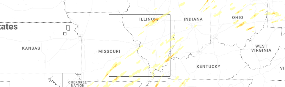
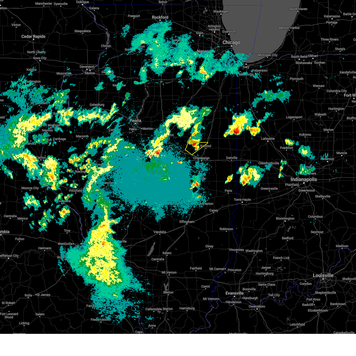
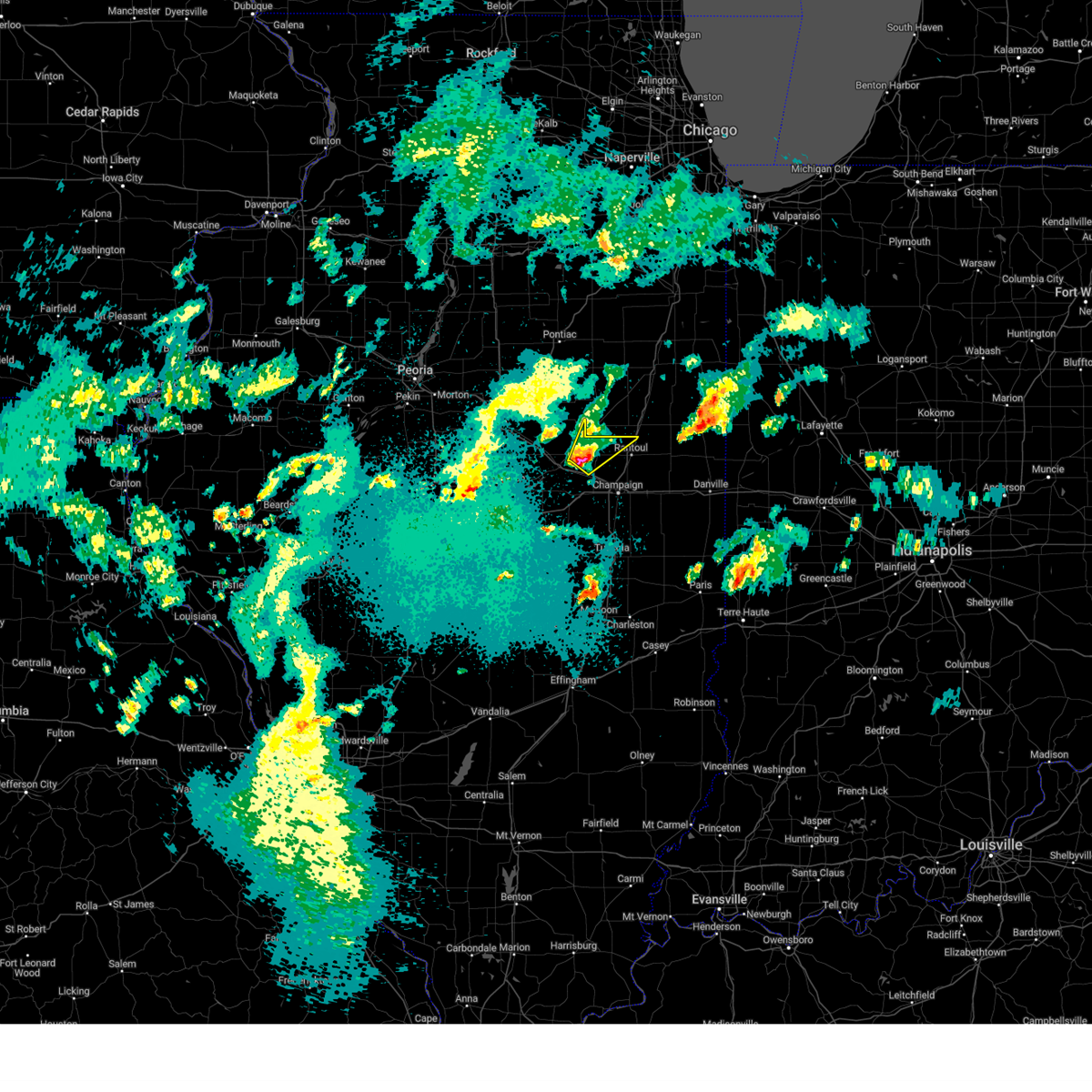
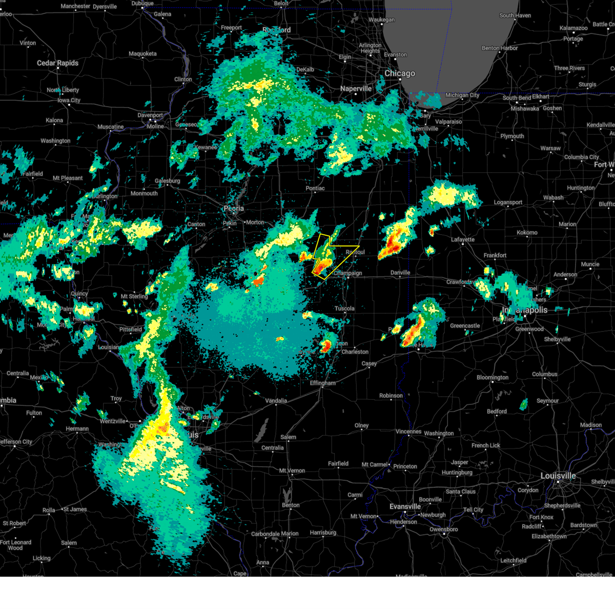
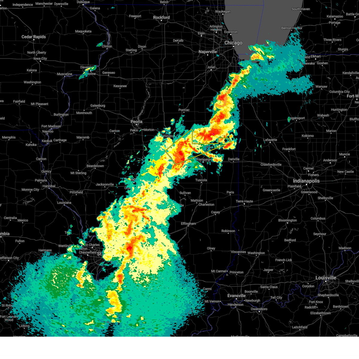
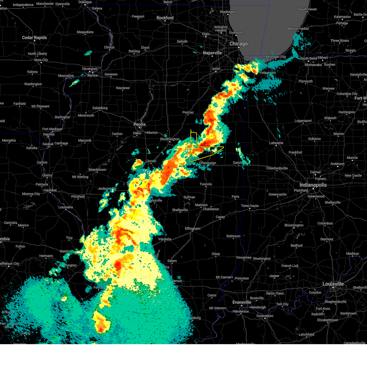
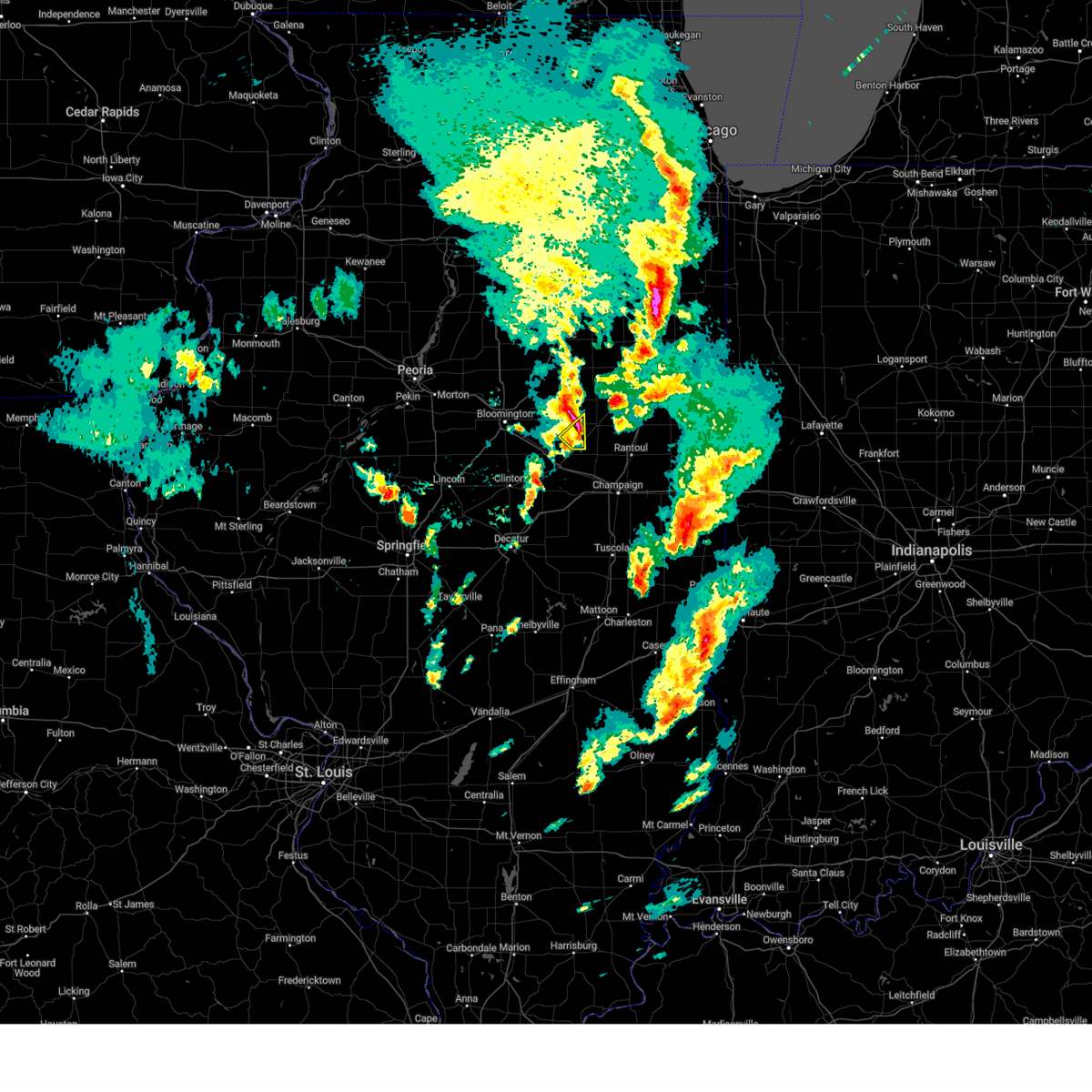
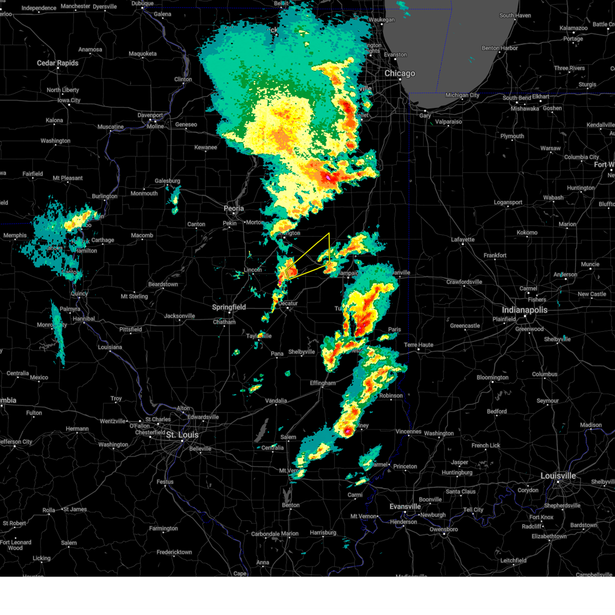
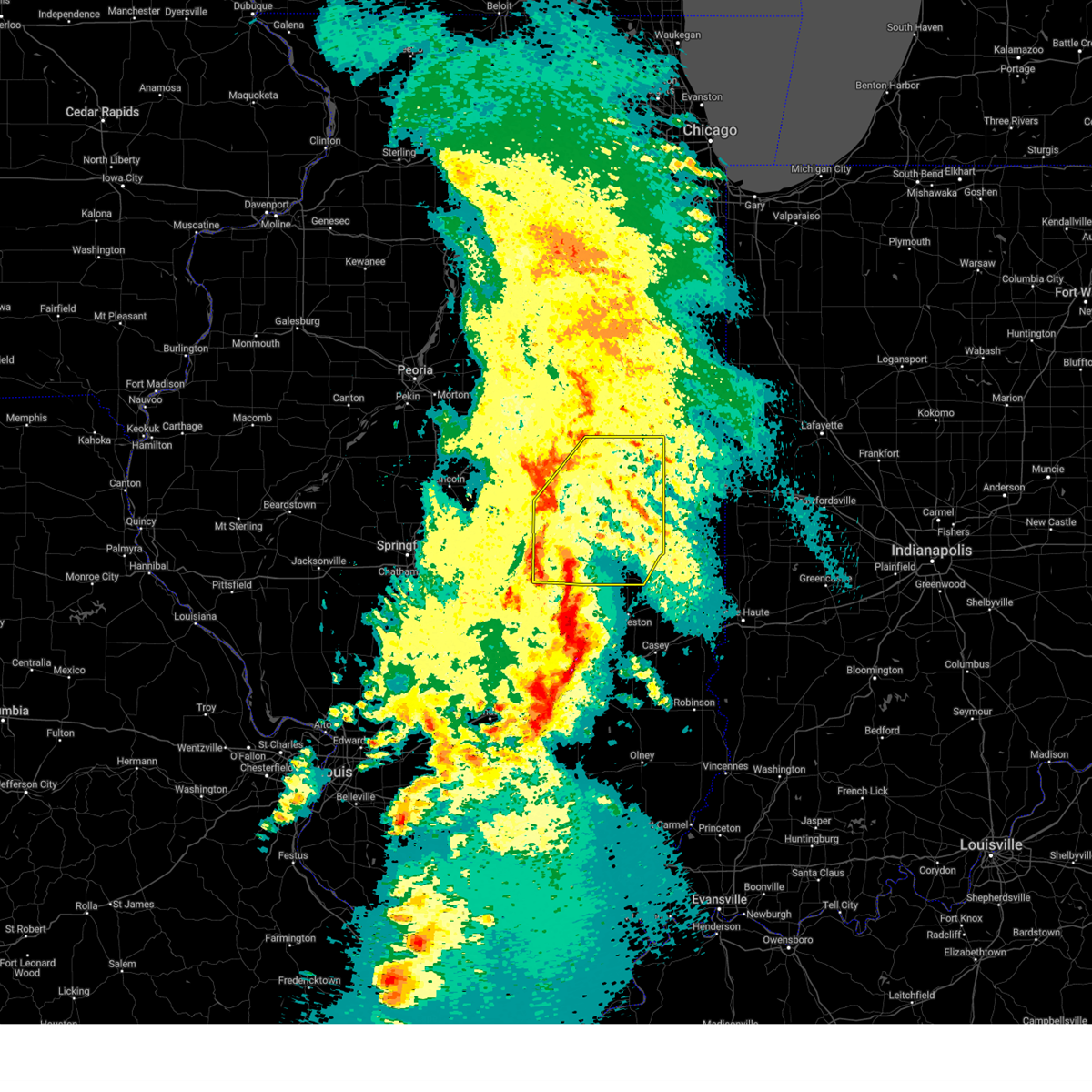
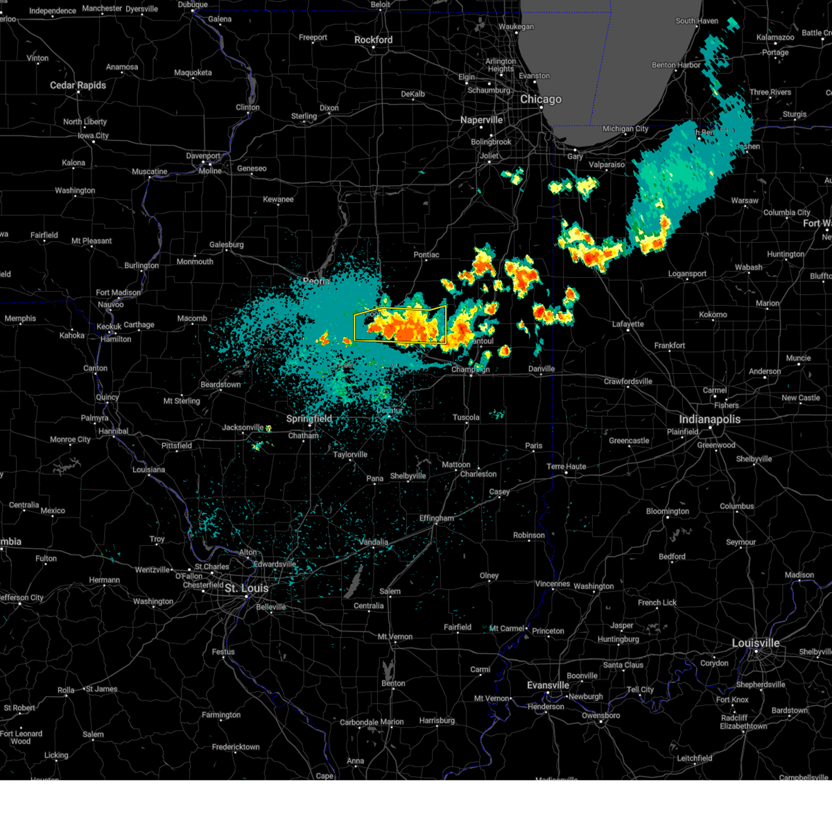
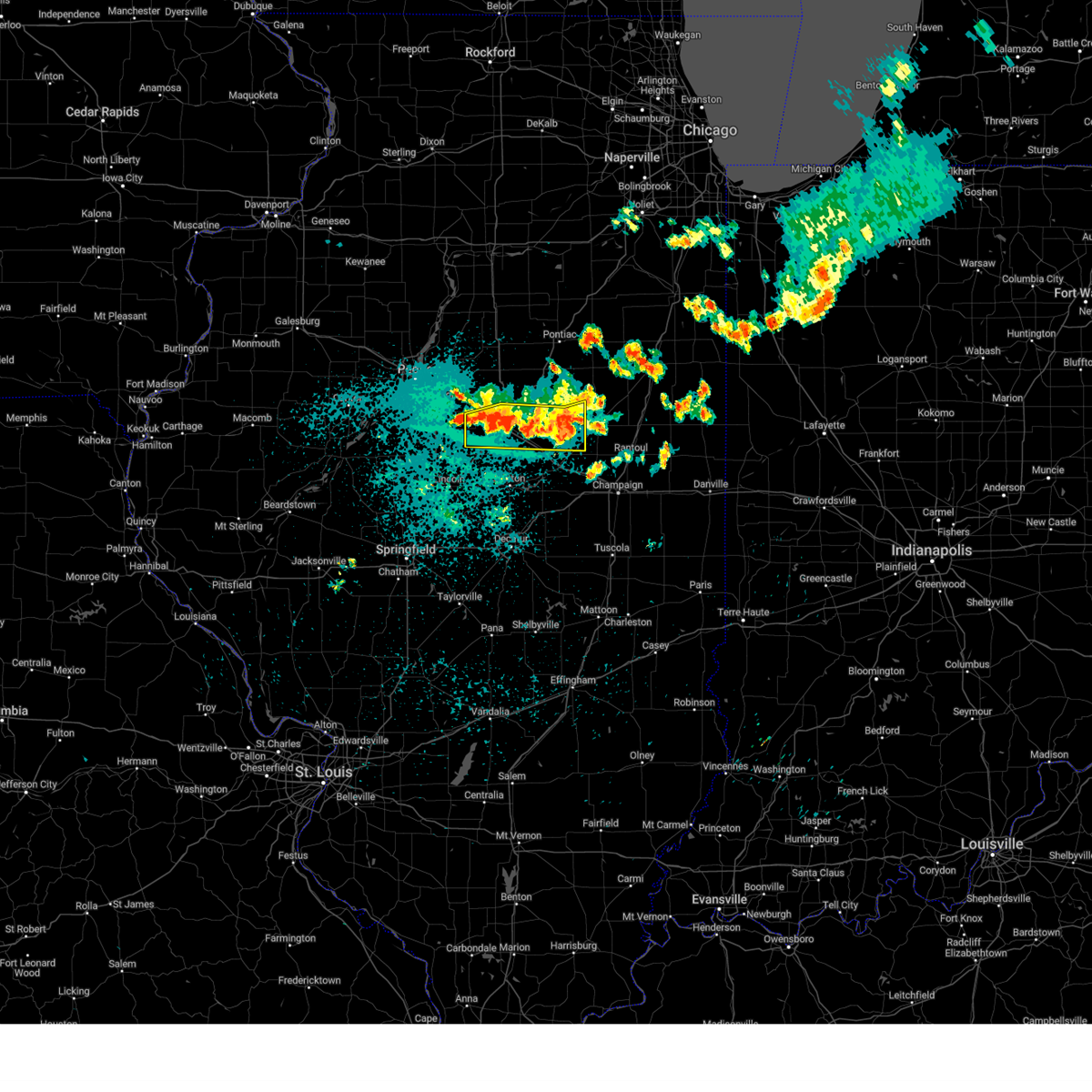
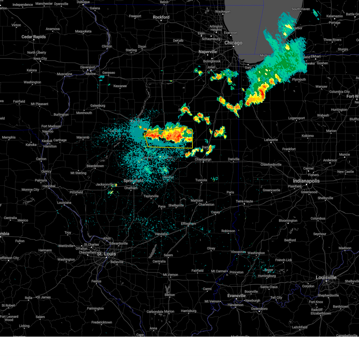
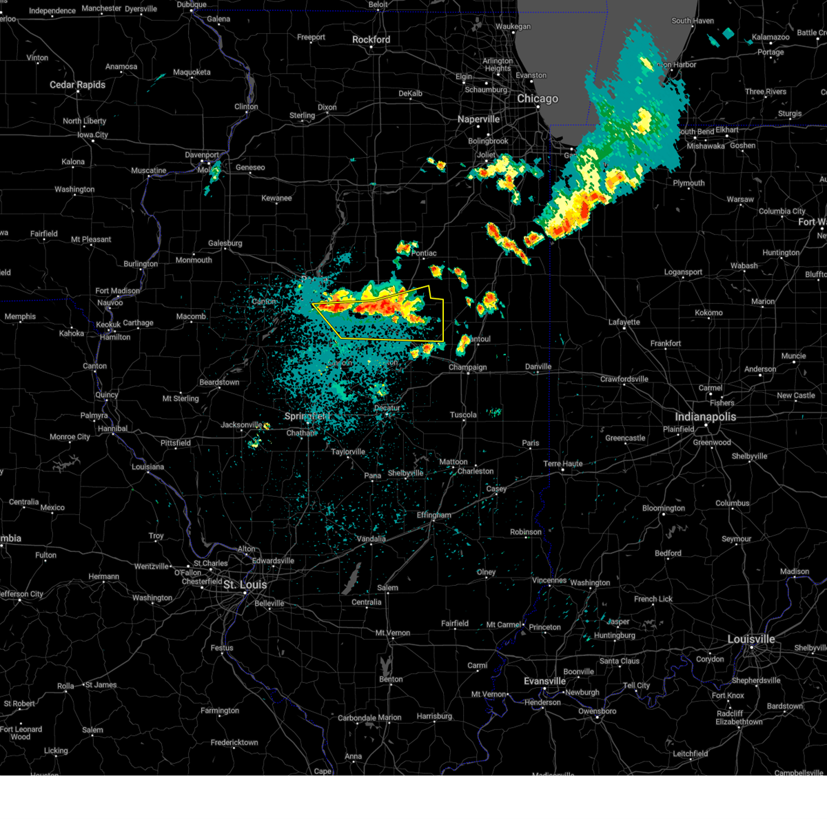
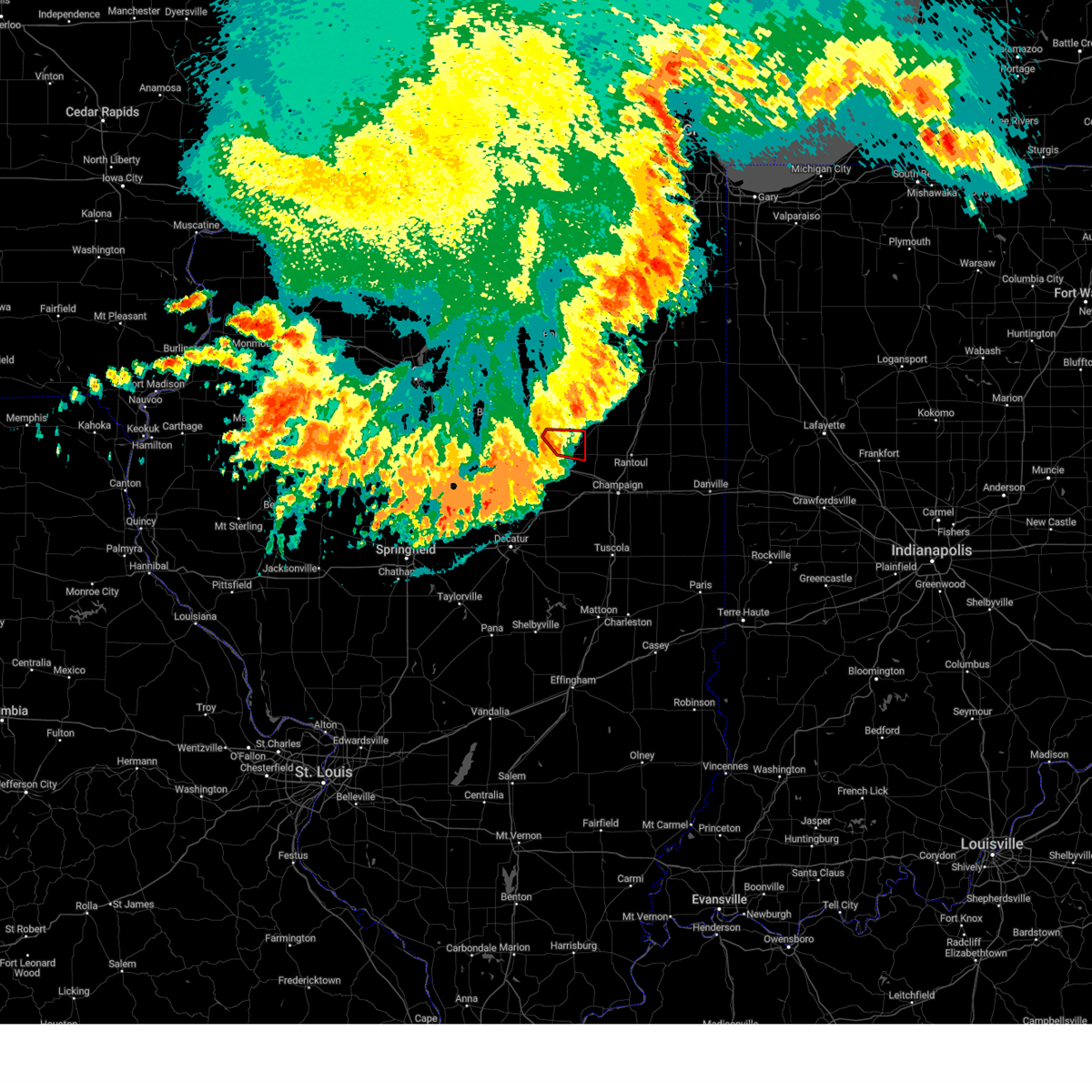
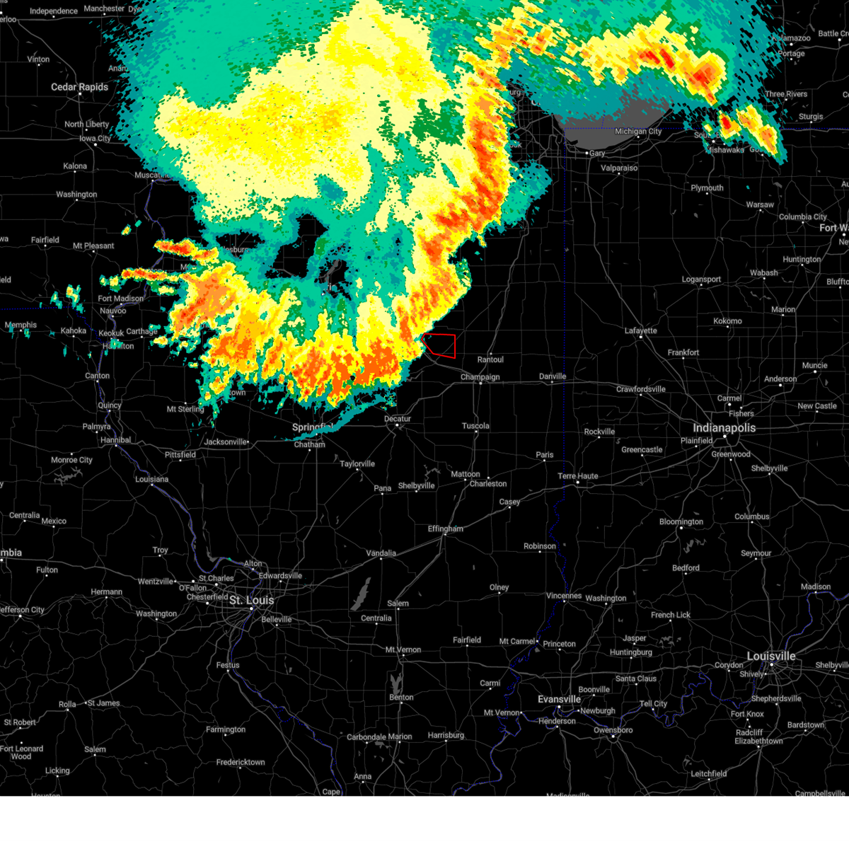
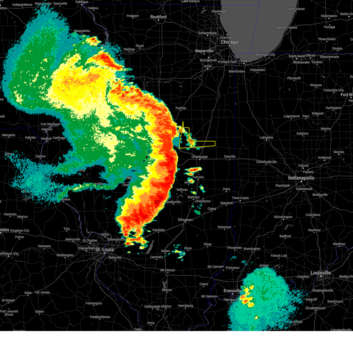
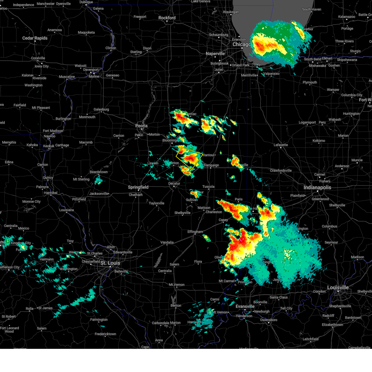
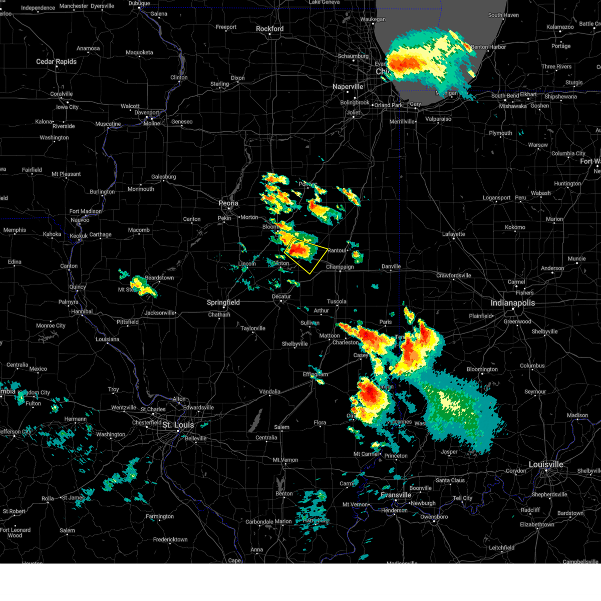
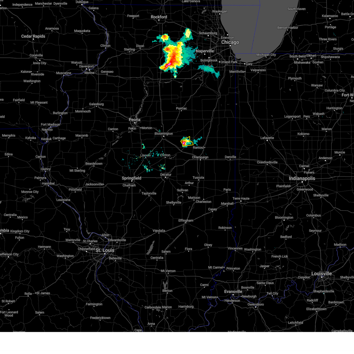
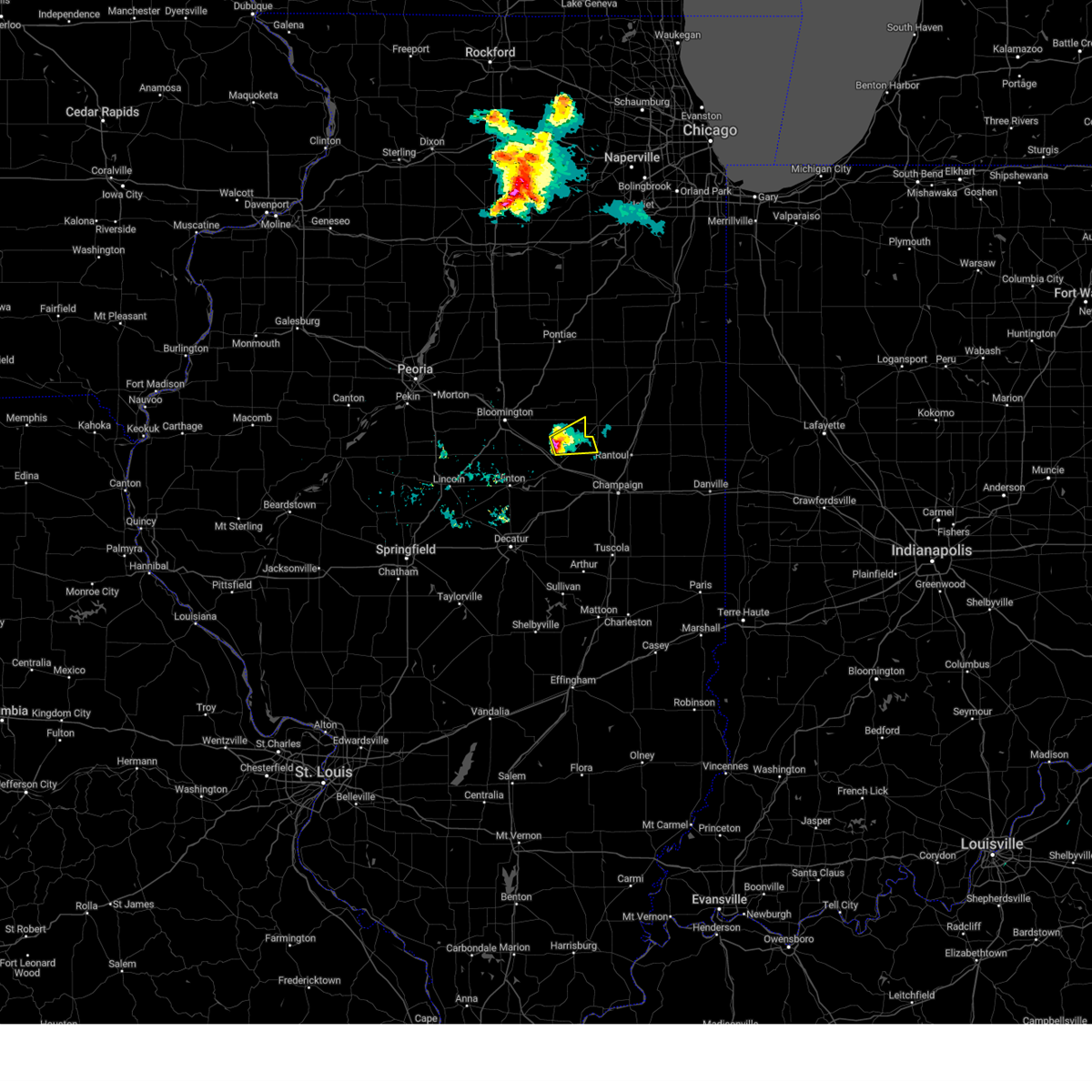
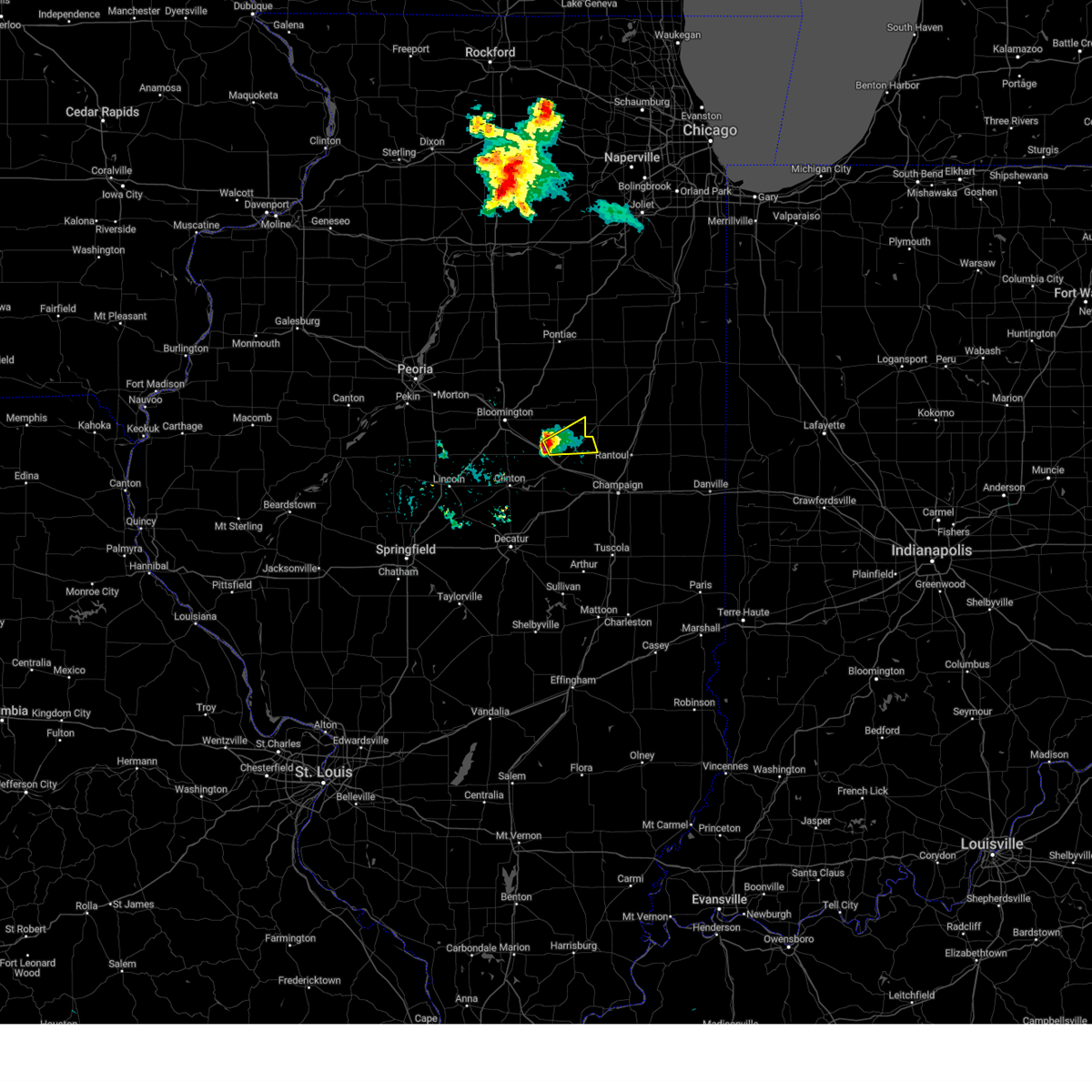
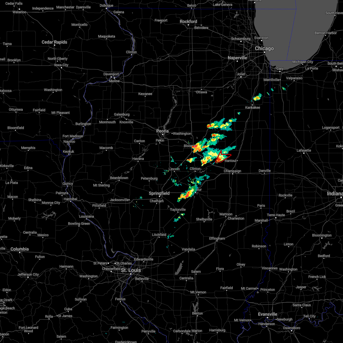
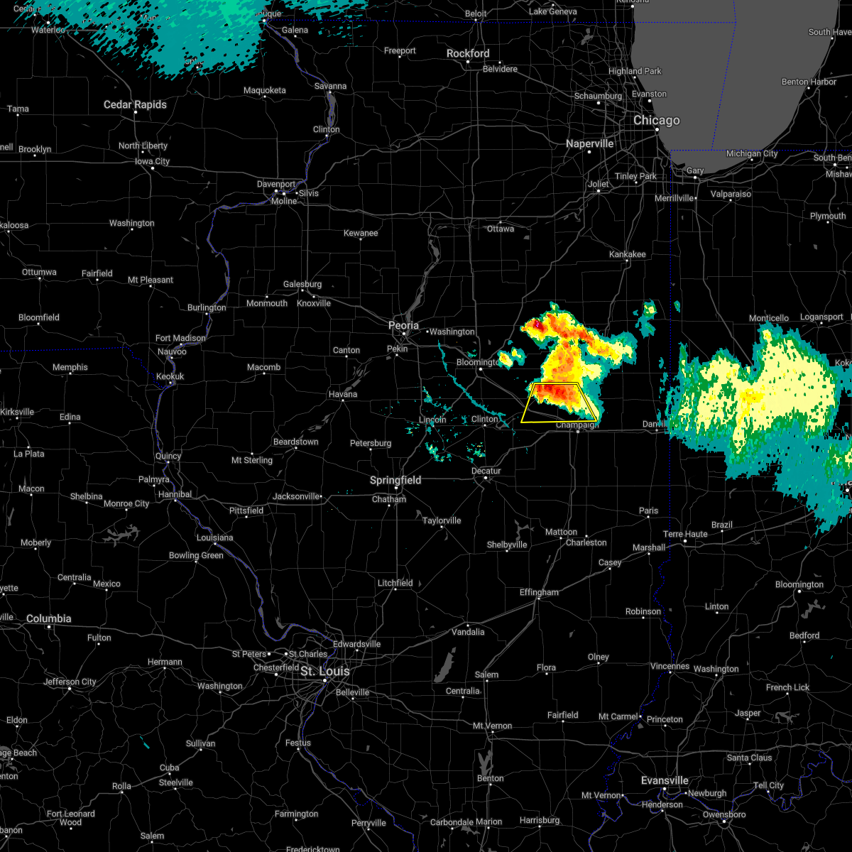
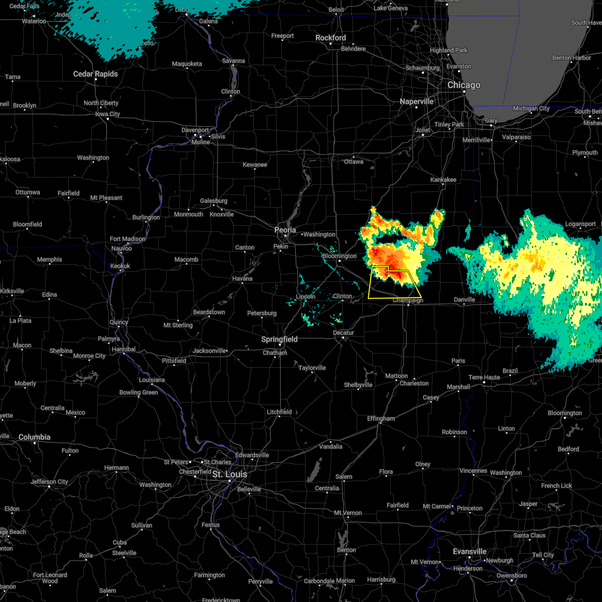
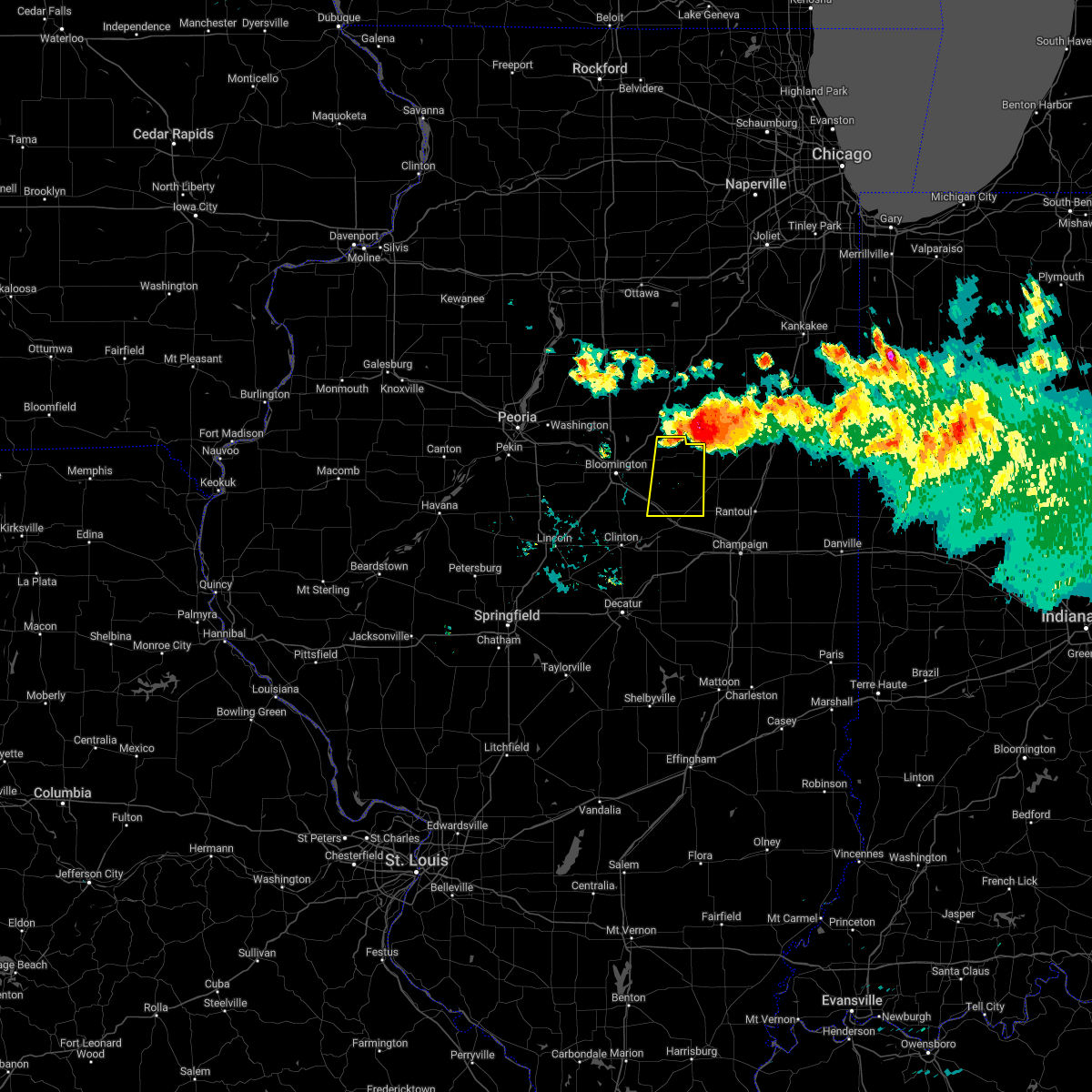
Hail Map for Bellflower, IL
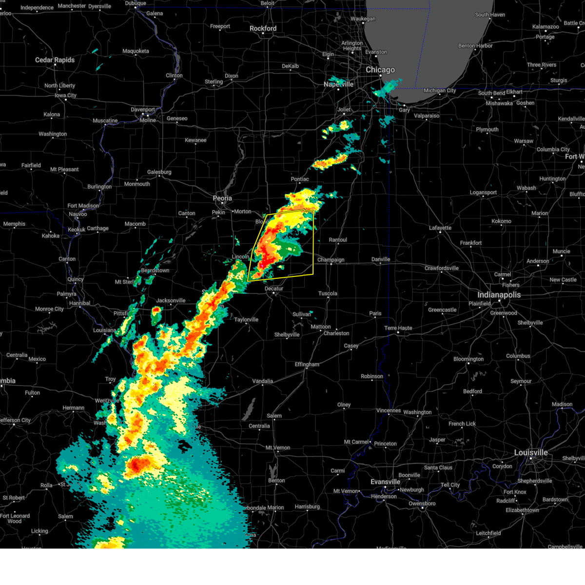
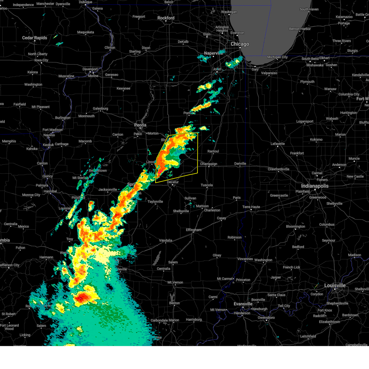
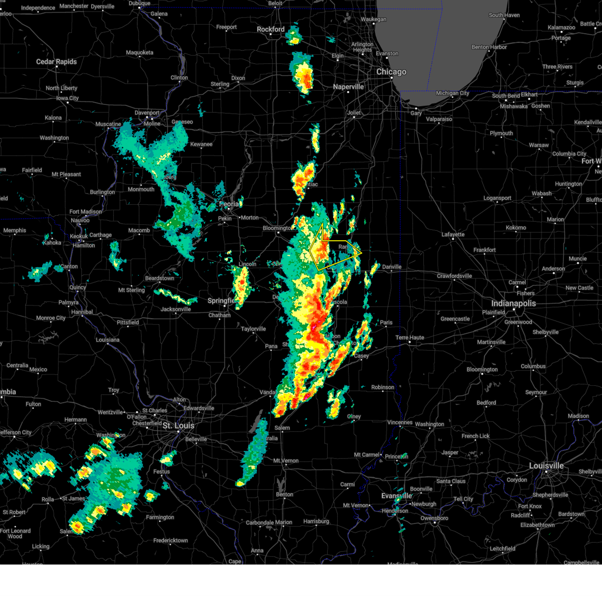
The Bellflower, IL area has had 3 reports of on-the-ground hail by trained spotters, and has been under severe weather warnings 48 times during the past 12 months. Doppler radar has detected hail at or near Bellflower, IL on 50 occasions, including 3 occasions during the past year.
| Name: | Bellflower, IL |
| Where Located: | 59.7 miles N of Mattoon, IL |
| Map: | Google Map for Bellflower, IL |
| Population: | 357 |
| Housing Units: | 173 |
| More Info: | Search Google for Bellflower, IL |
5
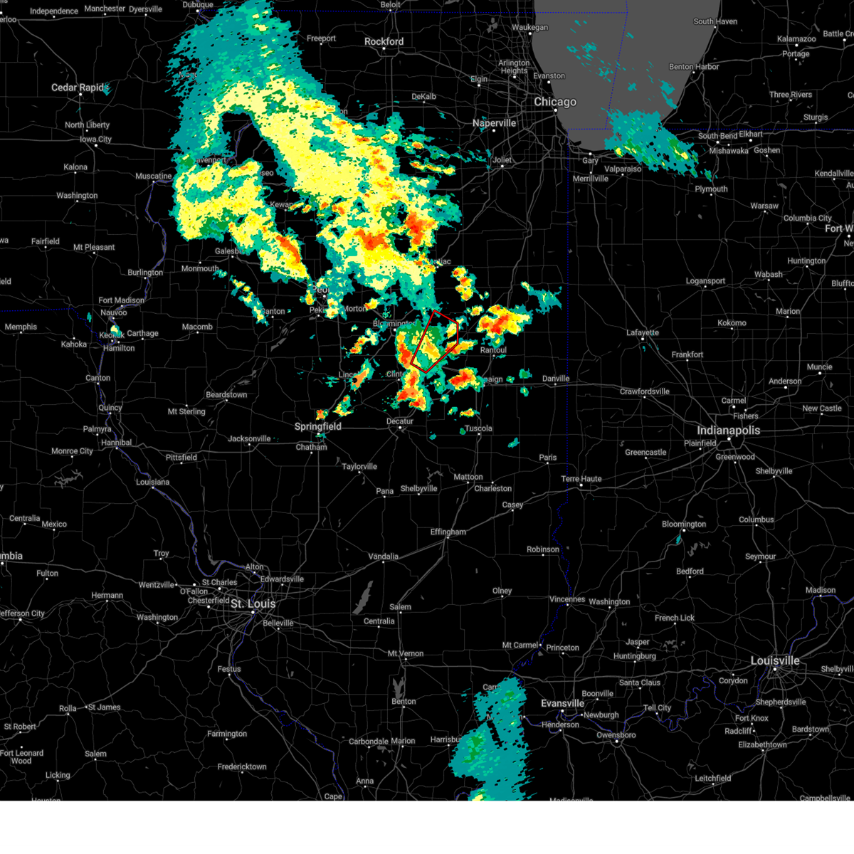
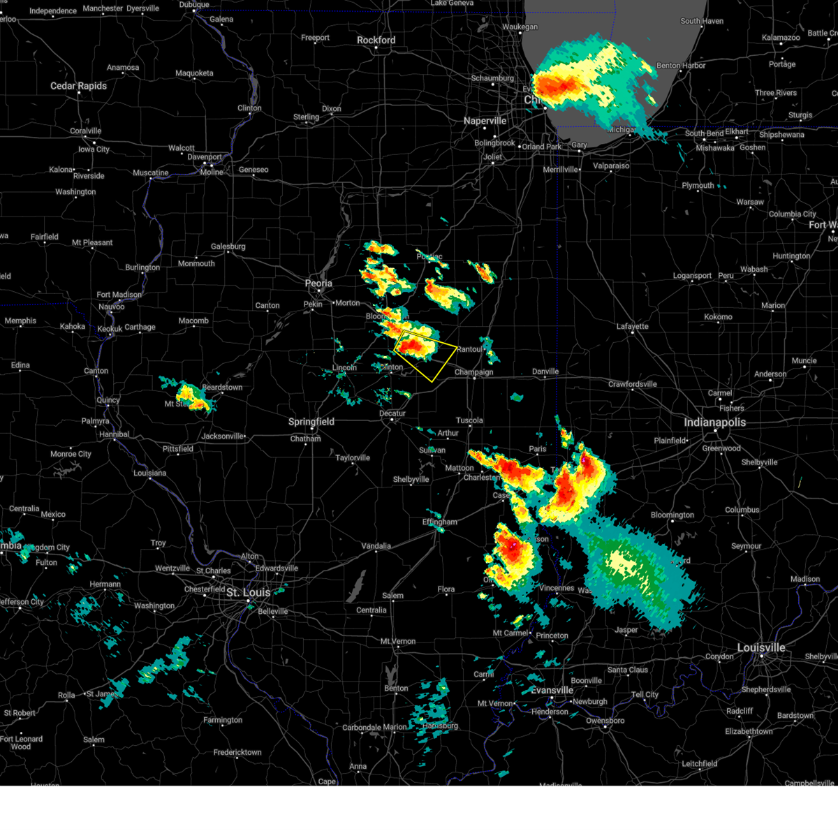
The Top Recent Hail Date for Bellflower, IL is Wednesday, April 2, 2025 (2nd out of 50)
Hail and Wind Damage Spotted near Bellflower, IL
| Date / Time | Report Details |
|---|---|
| 6/18/2025 2:29 PM CDT | The storm which prompted the warning has weakened below severe limits, and no longer appears capable of producing a tornado. therefore, the warning will be allowed to expire. a tornado watch remains in effect until 400 pm cdt for central and east central illinois. |
| 6/18/2025 2:16 PM CDT |
 the tornado warning has been cancelled and is no longer in effect the tornado warning has been cancelled and is no longer in effect
|
| 6/18/2025 2:16 PM CDT |
 At 216 pm cdt, a severe thunderstorm capable of producing a tornado was located near saybrook, or 9 miles southwest of gibson city, moving northeast at 30 mph (radar indicated rotation). Hazards include tornado. Flying debris will be dangerous to those caught without shelter. mobile homes will be damaged or destroyed. damage to roofs, windows, and vehicles will occur. tree damage is likely. this dangerous storm will be near, saybrook around 220 pm cdt. Other locations impacted by this tornadic thunderstorm include bellflower and foosland. At 216 pm cdt, a severe thunderstorm capable of producing a tornado was located near saybrook, or 9 miles southwest of gibson city, moving northeast at 30 mph (radar indicated rotation). Hazards include tornado. Flying debris will be dangerous to those caught without shelter. mobile homes will be damaged or destroyed. damage to roofs, windows, and vehicles will occur. tree damage is likely. this dangerous storm will be near, saybrook around 220 pm cdt. Other locations impacted by this tornadic thunderstorm include bellflower and foosland.
|
| 6/18/2025 2:04 PM CDT | At 204 pm cdt, a severe thunderstorm capable of producing a tornado was located near farmer city, or 16 miles southwest of gibson city, moving northeast at 35 mph (radar indicated rotation). Hazards include tornado. Flying debris will be dangerous to those caught without shelter. mobile homes will be damaged or destroyed. damage to roofs, windows, and vehicles will occur. tree damage is likely. this dangerous storm will be near, saybrook around 215 pm cdt. Other locations impacted by this tornadic thunderstorm include bellflower and foosland. |
| 6/18/2025 2:03 PM CDT |
 the severe thunderstorm warning has been cancelled and is no longer in effect the severe thunderstorm warning has been cancelled and is no longer in effect
|
| 6/18/2025 2:03 PM CDT |
 At 203 pm cdt, severe thunderstorms were located along a line extending from colfax to near saybrook, moving northeast at 55 mph (radar indicated). Hazards include 60 mph wind gusts. Expect damage to roofs, siding, and trees. these severe storms will be near, saybrook around 210 pm cdt. other locations impacted by these severe thunderstorms include ellsworth, anchor, weston, holder, cooksville, moraine view state park, arrowsmith, bellflower, cropsey, and foosland. This includes interstate 74 between mile markers 147 and 163. At 203 pm cdt, severe thunderstorms were located along a line extending from colfax to near saybrook, moving northeast at 55 mph (radar indicated). Hazards include 60 mph wind gusts. Expect damage to roofs, siding, and trees. these severe storms will be near, saybrook around 210 pm cdt. other locations impacted by these severe thunderstorms include ellsworth, anchor, weston, holder, cooksville, moraine view state park, arrowsmith, bellflower, cropsey, and foosland. This includes interstate 74 between mile markers 147 and 163.
|
| 6/18/2025 1:55 PM CDT |
 At 154 pm cdt, a confirmed tornado was located near farmer city, or 14 miles northeast of clinton, moving northeast at 30 mph (radar confirmed tornado). Hazards include damaging tornado. Flying debris will be dangerous to those caught without shelter. mobile homes will be damaged or destroyed. damage to roofs, windows, and vehicles will occur. tree damage is likely. this tornado will be near, farmer city around 200 pm cdt. saybrook around 215 pm cdt. other locations impacted by this tornadic thunderstorm include bellflower and foosland. This includes interstate 74 between mile markers 153 and 158. At 154 pm cdt, a confirmed tornado was located near farmer city, or 14 miles northeast of clinton, moving northeast at 30 mph (radar confirmed tornado). Hazards include damaging tornado. Flying debris will be dangerous to those caught without shelter. mobile homes will be damaged or destroyed. damage to roofs, windows, and vehicles will occur. tree damage is likely. this tornado will be near, farmer city around 200 pm cdt. saybrook around 215 pm cdt. other locations impacted by this tornadic thunderstorm include bellflower and foosland. This includes interstate 74 between mile markers 153 and 158.
|
| 6/18/2025 1:52 PM CDT |
 Torilx the national weather service in lincoln has issued a * tornado warning for, north central piatt county in central illinois, northeastern de witt county in central illinois, southeastern mclean county in central illinois, northwestern champaign county in east central illinois, * until 230 pm cdt. * at 152 pm cdt, a severe thunderstorm capable of producing a tornado was located near farmer city, or 12 miles northeast of clinton, moving northeast at 30 mph (radar indicated rotation). Hazards include tornado. Flying debris will be dangerous to those caught without shelter. mobile homes will be damaged or destroyed. damage to roofs, windows, and vehicles will occur. tree damage is likely. this dangerous storm will be near, farmer city around 200 pm cdt. other locations in the path of this tornadic thunderstorm include saybrook. This includes interstate 74 between mile markers 152 and 160. Torilx the national weather service in lincoln has issued a * tornado warning for, north central piatt county in central illinois, northeastern de witt county in central illinois, southeastern mclean county in central illinois, northwestern champaign county in east central illinois, * until 230 pm cdt. * at 152 pm cdt, a severe thunderstorm capable of producing a tornado was located near farmer city, or 12 miles northeast of clinton, moving northeast at 30 mph (radar indicated rotation). Hazards include tornado. Flying debris will be dangerous to those caught without shelter. mobile homes will be damaged or destroyed. damage to roofs, windows, and vehicles will occur. tree damage is likely. this dangerous storm will be near, farmer city around 200 pm cdt. other locations in the path of this tornadic thunderstorm include saybrook. This includes interstate 74 between mile markers 152 and 160.
|
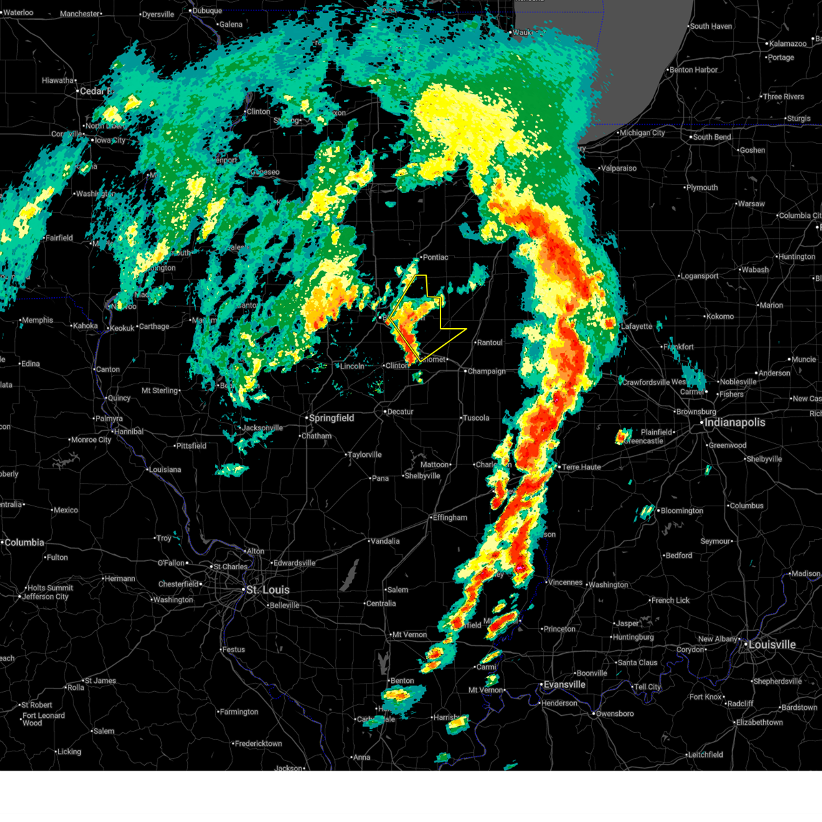
| 6/18/2025 1:48 PM CDT | Svrilx the national weather service in lincoln has issued a * severe thunderstorm warning for, northeastern piatt county in central illinois, eastern de witt county in central illinois, eastern mclean county in central illinois, northwestern champaign county in east central illinois, northeastern macon county in central illinois, * until 215 pm cdt. * at 148 pm cdt, severe thunderstorms were located along a line extending from near le roy to 6 miles north of weldon, moving northeast at 55 mph (radar indicated). Hazards include 60 mph wind gusts. Expect damage to roofs, siding, and trees. severe thunderstorms will be near, farmer city and colfax around 155 pm cdt. saybrook around 200 pm cdt. This includes interstate 74 between mile markers 139 and 163. |
| 5/20/2025 4:33 PM CDT | Svrilx the national weather service in lincoln has issued a * severe thunderstorm warning for, southeastern mclean county in central illinois, northwestern champaign county in east central illinois, * until 445 pm cdt. * at 433 pm cdt, a severe thunderstorm was located near saybrook, or 7 miles southwest of gibson city, moving northeast at 40 mph (radar indicated). Hazards include 60 mph wind gusts. Expect damage to roofs, siding, and trees. This severe thunderstorm will remain over mainly rural areas of southeastern mclean and northwestern champaign counties, including the following locations, bellflower and foosland. |
| 5/20/2025 4:02 PM CDT |
 the tornado warning has been cancelled and is no longer in effect the tornado warning has been cancelled and is no longer in effect
|
| 5/20/2025 3:50 PM CDT | Torilx the national weather service in lincoln has issued a * tornado warning for, northeastern de witt county in central illinois, southeastern mclean county in central illinois, * until 430 pm cdt. * at 350 pm cdt, a severe thunderstorm capable of producing a tornado was located near le roy, or 12 miles northeast of clinton, moving northeast at 35 mph (radar indicated rotation). Hazards include tornado. Flying debris will be dangerous to those caught without shelter. mobile homes will be damaged or destroyed. damage to roofs, windows, and vehicles will occur. tree damage is likely. this dangerous storm will be near, le roy around 355 pm cdt. other locations in the path of this tornadic thunderstorm include saybrook. This includes interstate 74 between mile markers 148 and 157. |
| 4/30/2025 11:29 PM CDT |
 The storm which prompted the warning has weakened below severe limits, and no longer poses an immediate threat to life or property. therefore, the warning will be allowed to expire. however, small hail and heavy rain are still possible with this thunderstorm. The storm which prompted the warning has weakened below severe limits, and no longer poses an immediate threat to life or property. therefore, the warning will be allowed to expire. however, small hail and heavy rain are still possible with this thunderstorm.
|
| 4/30/2025 11:13 PM CDT |
 At 1112 pm cdt, a severe thunderstorm was located near mansfield, or 12 miles south of gibson city, moving northeast at 30 mph (radar indicated). Hazards include quarter size hail. Damage to vehicles is expected. locations impacted include, fisher, ludlow, bellflower, foosland, and dewey. This includes interstate 57 between mile markers 256 and 257. At 1112 pm cdt, a severe thunderstorm was located near mansfield, or 12 miles south of gibson city, moving northeast at 30 mph (radar indicated). Hazards include quarter size hail. Damage to vehicles is expected. locations impacted include, fisher, ludlow, bellflower, foosland, and dewey. This includes interstate 57 between mile markers 256 and 257.
|
| 4/30/2025 10:59 PM CDT |
 Svrilx the national weather service in lincoln has issued a * severe thunderstorm warning for, northeastern piatt county in central illinois, southeastern mclean county in central illinois, northwestern champaign county in east central illinois, * until 1130 pm cdt. * at 1058 pm cdt, a severe thunderstorm was located over mansfield, or 12 miles north of monticello, moving northeast at 35 mph (radar indicated). Hazards include quarter size hail. Damage to vehicles is expected. this severe thunderstorm will remain over mainly rural areas of northeastern piatt, southeastern mclean and northwestern champaign counties, including the following locations, galesville, bellflower, foosland, dewey, and ludlow. this includes the following highways, interstate 57 between mile markers 256 and 257. Interstate 74 between mile markers 161 and 172. Svrilx the national weather service in lincoln has issued a * severe thunderstorm warning for, northeastern piatt county in central illinois, southeastern mclean county in central illinois, northwestern champaign county in east central illinois, * until 1130 pm cdt. * at 1058 pm cdt, a severe thunderstorm was located over mansfield, or 12 miles north of monticello, moving northeast at 35 mph (radar indicated). Hazards include quarter size hail. Damage to vehicles is expected. this severe thunderstorm will remain over mainly rural areas of northeastern piatt, southeastern mclean and northwestern champaign counties, including the following locations, galesville, bellflower, foosland, dewey, and ludlow. this includes the following highways, interstate 57 between mile markers 256 and 257. Interstate 74 between mile markers 161 and 172.
|
| 4/2/2025 5:07 PM CDT |
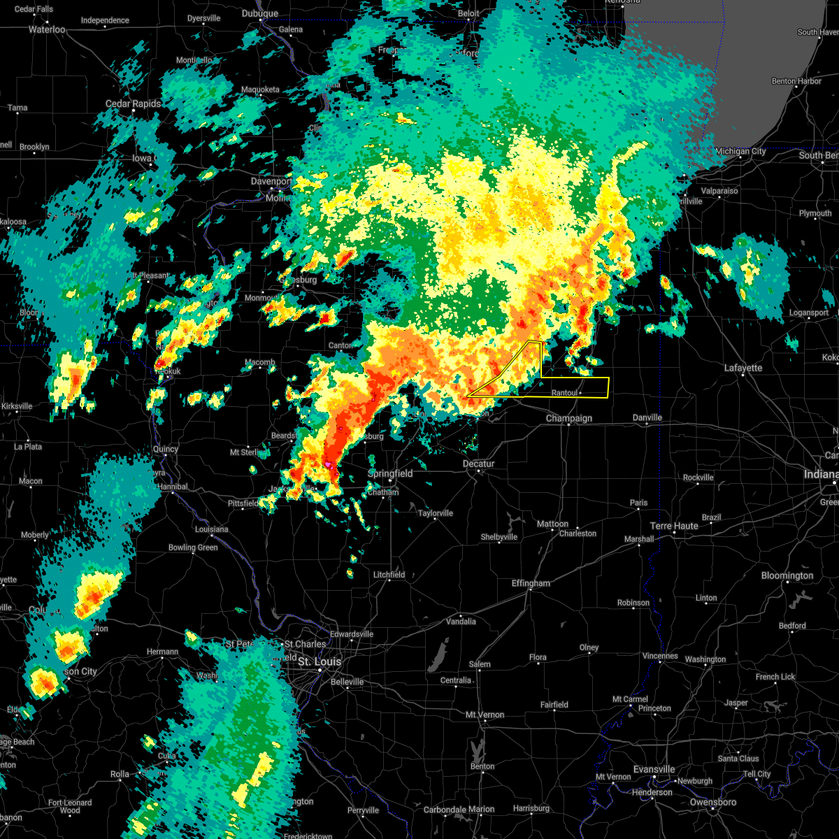
 At 506 pm cdt, severe thunderstorms were located along a line extending from near fisher to near seymour, moving northeast at 70 mph (radar indicated). Hazards include 70 mph wind gusts and quarter size hail. Hail damage to vehicles is expected. expect considerable tree damage. wind damage is also likely to mobile homes, roofs, and outbuildings. these severe storms will be near, mahomet, fisher, and lake of the woods around 510 pm cdt. rantoul around 515 pm cdt. gifford around 525 pm cdt. rankin around 530 pm cdt. other locations impacted by these severe thunderstorms include ellsworth, anchor, dewey, ludlow, moraine view state park, arrowsmith, de witt, galesville, bellflower, and cropsey. this includes the following highways, interstate 57 between mile markers 248 and 257. Interstate 74 between mile markers 144 and 171. At 506 pm cdt, severe thunderstorms were located along a line extending from near fisher to near seymour, moving northeast at 70 mph (radar indicated). Hazards include 70 mph wind gusts and quarter size hail. Hail damage to vehicles is expected. expect considerable tree damage. wind damage is also likely to mobile homes, roofs, and outbuildings. these severe storms will be near, mahomet, fisher, and lake of the woods around 510 pm cdt. rantoul around 515 pm cdt. gifford around 525 pm cdt. rankin around 530 pm cdt. other locations impacted by these severe thunderstorms include ellsworth, anchor, dewey, ludlow, moraine view state park, arrowsmith, de witt, galesville, bellflower, and cropsey. this includes the following highways, interstate 57 between mile markers 248 and 257. Interstate 74 between mile markers 144 and 171.
|
| 4/2/2025 4:50 PM CDT | Svrilx the national weather service in lincoln has issued a * severe thunderstorm warning for, northern piatt county in central illinois, eastern de witt county in central illinois, northwestern vermilion county in east central illinois, southeastern mclean county in central illinois, northern champaign county in east central illinois, * until 530 pm cdt. * at 449 pm cdt, a severe thunderstorm was located near le roy, or 13 miles northeast of clinton, moving northeast at 60 mph (radar indicated). Hazards include 70 mph wind gusts and quarter size hail. Hail damage to vehicles is expected. expect considerable tree damage. wind damage is also likely to mobile homes, roofs, and outbuildings. this severe thunderstorm will be near, le roy around 455 pm cdt. saybrook around 500 pm cdt. this includes the following highways, interstate 57 between mile markers 248 and 257. Interstate 74 between mile markers 144 and 171. |
| 4/2/2025 4:38 PM CDT |
 At 438 pm cdt, a severe thunderstorm was located near gibson city, moving northeast at 55 mph (radar indicated). Hazards include 70 mph wind gusts and half dollar size hail. Hail damage to vehicles is expected. expect considerable tree damage. wind damage is also likely to mobile homes, roofs, and outbuildings. this severe thunderstorm will remain over mainly rural areas of northeastern piatt, northeastern de witt, southeastern mclean and northern champaign counties, including the following locations, ludlow, anchor, bellflower, cropsey, foosland, and dewey. this includes the following highways, interstate 57 between mile markers 248 and 257. Interstate 74 between mile markers 161 and 169. At 438 pm cdt, a severe thunderstorm was located near gibson city, moving northeast at 55 mph (radar indicated). Hazards include 70 mph wind gusts and half dollar size hail. Hail damage to vehicles is expected. expect considerable tree damage. wind damage is also likely to mobile homes, roofs, and outbuildings. this severe thunderstorm will remain over mainly rural areas of northeastern piatt, northeastern de witt, southeastern mclean and northern champaign counties, including the following locations, ludlow, anchor, bellflower, cropsey, foosland, and dewey. this includes the following highways, interstate 57 between mile markers 248 and 257. Interstate 74 between mile markers 161 and 169.
|
| 4/2/2025 4:31 PM CDT | the tornado warning has been cancelled and is no longer in effect |
| 4/2/2025 4:23 PM CDT | Power lines down from high winds with power out in bellflower. localized floodin in mclean county IL, 0.2 miles E of Bellflower, IL |
| 4/2/2025 4:20 PM CDT | Quarter sized hail reported 0.2 miles E of Bellflower, IL |
| 4/2/2025 4:19 PM CDT | Half Dollar sized hail reported 0.2 miles E of Bellflower, IL |
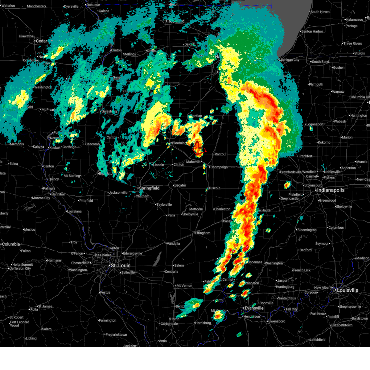
| 4/2/2025 4:19 PM CDT | Svrilx the national weather service in lincoln has issued a * severe thunderstorm warning for, northeastern piatt county in central illinois, northeastern de witt county in central illinois, southeastern mclean county in central illinois, northern champaign county in east central illinois, * until 445 pm cdt. * at 419 pm cdt, severe thunderstorms were located along a line extending from near colfax to near farmer city, moving northeast at 60 mph (radar indicated). Hazards include golf ball size hail and 70 mph wind gusts. People and animals outdoors will be injured. expect hail damage to roofs, siding, windows, and vehicles. expect considerable tree damage. wind damage is also likely to mobile homes, roofs, and outbuildings. severe thunderstorms will be near, saybrook around 425 pm cdt. this includes the following highways, interstate 57 between mile markers 243 and 257. Interstate 74 between mile markers 152 and 173. |
| 4/2/2025 4:19 PM CDT | At 418 pm cdt, a severe thunderstorm capable of producing a tornado was located over farmer city, or 14 miles north of monticello, moving northeast at 55 mph (radar indicated rotation). Hazards include tornado. Flying debris will be dangerous to those caught without shelter. mobile homes will be damaged or destroyed. damage to roofs, windows, and vehicles will occur. tree damage is likely. this tornadic thunderstorm will remain over mainly rural areas of northern piatt, northeastern de witt and southeastern mclean counties, including the following locations, galesville and bellflower. This includes interstate 74 between mile markers 155 and 168. |
| 4/2/2025 4:07 PM CDT | At 406 pm cdt, severe thunderstorms were located along a line extending from near colfax to near maroa, moving northeast at 55 mph (radar indicated). Hazards include two inch hail and 70 mph wind gusts. People and animals outdoors will be injured. expect hail damage to roofs, siding, windows, and vehicles. expect considerable tree damage. wind damage is also likely to mobile homes, roofs, and outbuildings. these severe storms will be near, weldon, colfax, and le roy around 410 pm cdt. saybrook and farmer city around 415 pm cdt. de land around 420 pm cdt. mansfield around 425 pm cdt. other locations impacted by these severe thunderstorms include clinton power station, weldon springs state park, holder, lane, cooksville, moraine view state park, arrowsmith, cropsey, ellsworth, and anchor. this includes the following highways, interstate 55 between mile markers 172 and 174. interstate 72 between mile markers 154 and 173. Interstate 74 between mile markers 139 and 168. |
| 4/2/2025 4:07 PM CDT | the severe thunderstorm warning has been cancelled and is no longer in effect |
| 4/2/2025 4:05 PM CDT | Torilx the national weather service in lincoln has issued a * tornado warning for, northern piatt county in central illinois, eastern de witt county in central illinois, southeastern mclean county in central illinois, * until 445 pm cdt. * at 405 pm cdt, a severe thunderstorm capable of producing a tornado was located near weldon, or 8 miles east of clinton, moving northeast at 55 mph (radar indicated rotation). Hazards include tornado. Flying debris will be dangerous to those caught without shelter. mobile homes will be damaged or destroyed. damage to roofs, windows, and vehicles will occur. tree damage is likely. this dangerous storm will be near, farmer city around 410 pm cdt. mansfield around 420 pm cdt. This includes interstate 74 between mile markers 155 and 168. |
| 4/2/2025 3:51 PM CDT |
 At 351 pm cdt, severe thunderstorms were located along a line extending from near towanda to near latham, moving northeast at 55 mph (emergency management). Hazards include two inch hail and 70 mph wind gusts. People and animals outdoors will be injured. expect hail damage to roofs, siding, windows, and vehicles. expect considerable tree damage. wind damage is also likely to mobile homes, roofs, and outbuildings. these severe storms will be near, kenney, wapella, downs, maroa, heyworth, and clinton around 355 pm cdt. le roy around 400 pm cdt. colfax around 405 pm cdt. weldon around 410 pm cdt. saybrook and farmer city around 415 pm cdt. de land around 420 pm cdt. other locations impacted by these severe thunderstorms include clinton power station, weldon springs state park, holder, lane, cooksville, moraine view state park, midland city, arrowsmith, cropsey, and ellsworth. this includes the following highways, interstate 39 between mile markers 0 and 3. interstate 55 between mile markers 143 and 174. interstate 72 between mile markers 154 and 173. Interstate 74 between mile markers 126 and 168. At 351 pm cdt, severe thunderstorms were located along a line extending from near towanda to near latham, moving northeast at 55 mph (emergency management). Hazards include two inch hail and 70 mph wind gusts. People and animals outdoors will be injured. expect hail damage to roofs, siding, windows, and vehicles. expect considerable tree damage. wind damage is also likely to mobile homes, roofs, and outbuildings. these severe storms will be near, kenney, wapella, downs, maroa, heyworth, and clinton around 355 pm cdt. le roy around 400 pm cdt. colfax around 405 pm cdt. weldon around 410 pm cdt. saybrook and farmer city around 415 pm cdt. de land around 420 pm cdt. other locations impacted by these severe thunderstorms include clinton power station, weldon springs state park, holder, lane, cooksville, moraine view state park, midland city, arrowsmith, cropsey, and ellsworth. this includes the following highways, interstate 39 between mile markers 0 and 3. interstate 55 between mile markers 143 and 174. interstate 72 between mile markers 154 and 173. Interstate 74 between mile markers 126 and 168.
|
| 4/2/2025 3:51 PM CDT |
 the severe thunderstorm warning has been cancelled and is no longer in effect the severe thunderstorm warning has been cancelled and is no longer in effect
|
| 4/2/2025 3:48 PM CDT |
 At 347 pm cdt, severe thunderstorms were located along a line extending from near towanda to near latham, moving northeast at 55 mph (emergency management. two inch diameter hail was reported near latham at 344 pm). Hazards include two inch hail and 60 mph wind gusts. People and animals outdoors will be injured. expect hail damage to roofs, siding, windows, and vehicles. expect wind damage to roofs, siding, and trees. these severe storms will be near, wapella, downs, maroa, clinton, and le roy around 355 pm cdt. colfax around 400 pm cdt. weldon around 405 pm cdt. saybrook and farmer city around 410 pm cdt. de land around 415 pm cdt. other locations impacted by these severe thunderstorms include clinton power station, weldon springs state park, holder, lane, cooksville, moraine view state park, midland city, arrowsmith, cropsey, and ellsworth. this includes the following highways, interstate 39 between mile markers 0 and 3. interstate 55 between mile markers 137 and 174. interstate 72 between mile markers 150 and 173. Interstate 74 between mile markers 125 and 168. At 347 pm cdt, severe thunderstorms were located along a line extending from near towanda to near latham, moving northeast at 55 mph (emergency management. two inch diameter hail was reported near latham at 344 pm). Hazards include two inch hail and 60 mph wind gusts. People and animals outdoors will be injured. expect hail damage to roofs, siding, windows, and vehicles. expect wind damage to roofs, siding, and trees. these severe storms will be near, wapella, downs, maroa, clinton, and le roy around 355 pm cdt. colfax around 400 pm cdt. weldon around 405 pm cdt. saybrook and farmer city around 410 pm cdt. de land around 415 pm cdt. other locations impacted by these severe thunderstorms include clinton power station, weldon springs state park, holder, lane, cooksville, moraine view state park, midland city, arrowsmith, cropsey, and ellsworth. this includes the following highways, interstate 39 between mile markers 0 and 3. interstate 55 between mile markers 137 and 174. interstate 72 between mile markers 150 and 173. Interstate 74 between mile markers 125 and 168.
|
| 4/2/2025 3:45 PM CDT |
 Svrilx the national weather service in lincoln has issued a * severe thunderstorm warning for, eastern logan county in central illinois, eastern sangamon county in central illinois, northern piatt county in central illinois, de witt county in central illinois, mclean county in central illinois, northern macon county in central illinois, * until 430 pm cdt. * at 344 pm cdt, severe thunderstorms were located along a line extending from near bloomington to latham, moving northeast at 55 mph (radar indicated). Hazards include ping pong ball size hail and 60 mph wind gusts. People and animals outdoors will be injured. expect hail damage to roofs, siding, windows, and vehicles. expect wind damage to roofs, siding, and trees. severe thunderstorms will be near, kenney, wapella, downs, maroa, heyworth, clinton, and bloomington around 350 pm cdt. le roy around 355 pm cdt. colfax around 400 pm cdt. other locations in the path of these severe thunderstorms include weldon, saybrook, farmer city, de land and mansfield. this includes the following highways, interstate 39 between mile markers 0 and 3. interstate 55 between mile markers 137 and 174. interstate 72 between mile markers 150 and 173. Interstate 74 between mile markers 125 and 168. Svrilx the national weather service in lincoln has issued a * severe thunderstorm warning for, eastern logan county in central illinois, eastern sangamon county in central illinois, northern piatt county in central illinois, de witt county in central illinois, mclean county in central illinois, northern macon county in central illinois, * until 430 pm cdt. * at 344 pm cdt, severe thunderstorms were located along a line extending from near bloomington to latham, moving northeast at 55 mph (radar indicated). Hazards include ping pong ball size hail and 60 mph wind gusts. People and animals outdoors will be injured. expect hail damage to roofs, siding, windows, and vehicles. expect wind damage to roofs, siding, and trees. severe thunderstorms will be near, kenney, wapella, downs, maroa, heyworth, clinton, and bloomington around 350 pm cdt. le roy around 355 pm cdt. colfax around 400 pm cdt. other locations in the path of these severe thunderstorms include weldon, saybrook, farmer city, de land and mansfield. this includes the following highways, interstate 39 between mile markers 0 and 3. interstate 55 between mile markers 137 and 174. interstate 72 between mile markers 150 and 173. Interstate 74 between mile markers 125 and 168.
|
| 3/30/2025 1:17 PM CDT |
 At 117 pm cdt, a severe thunderstorm was located over fisher, or 9 miles south of gibson city, moving northeast at 60 mph (radar indicated). Hazards include 60 mph wind gusts and penny size hail. Expect damage to roofs, siding, and trees. this severe storm will be near, fisher around 120 pm cdt. other locations impacted by this severe thunderstorm include bellflower, foosland, and dewey. this includes the following highways, interstate 57 between mile markers 245 and 255. Interstate 74 between mile markers 163 and 174. At 117 pm cdt, a severe thunderstorm was located over fisher, or 9 miles south of gibson city, moving northeast at 60 mph (radar indicated). Hazards include 60 mph wind gusts and penny size hail. Expect damage to roofs, siding, and trees. this severe storm will be near, fisher around 120 pm cdt. other locations impacted by this severe thunderstorm include bellflower, foosland, and dewey. this includes the following highways, interstate 57 between mile markers 245 and 255. Interstate 74 between mile markers 163 and 174.
|
| 3/30/2025 1:17 PM CDT |
 the severe thunderstorm warning has been cancelled and is no longer in effect the severe thunderstorm warning has been cancelled and is no longer in effect
|
| 3/30/2025 1:15 PM CDT |
 Svrilx the national weather service in lincoln has issued a * severe thunderstorm warning for, northeastern piatt county in central illinois, northeastern de witt county in central illinois, southeastern mclean county in central illinois, northern champaign county in east central illinois, * until 145 pm cdt. * at 115 pm cdt, a severe thunderstorm was located over fisher, or 11 miles south of gibson city, moving northeast at 55 mph (radar indicated). Hazards include 60 mph wind gusts and penny size hail. Expect damage to roofs, siding, and trees. this severe thunderstorm will be near, fisher around 120 pm cdt. this includes the following highways, interstate 57 between mile markers 245 and 255. Interstate 74 between mile markers 163 and 174. Svrilx the national weather service in lincoln has issued a * severe thunderstorm warning for, northeastern piatt county in central illinois, northeastern de witt county in central illinois, southeastern mclean county in central illinois, northern champaign county in east central illinois, * until 145 pm cdt. * at 115 pm cdt, a severe thunderstorm was located over fisher, or 11 miles south of gibson city, moving northeast at 55 mph (radar indicated). Hazards include 60 mph wind gusts and penny size hail. Expect damage to roofs, siding, and trees. this severe thunderstorm will be near, fisher around 120 pm cdt. this includes the following highways, interstate 57 between mile markers 245 and 255. Interstate 74 between mile markers 163 and 174.
|
| 3/19/2025 5:30 PM CDT |
 The storm which prompted the warning has moved out of the area. therefore, the warning has been allowed to expire. a tornado watch remains in effect until 900 pm cdt for central illinois. The storm which prompted the warning has moved out of the area. therefore, the warning has been allowed to expire. a tornado watch remains in effect until 900 pm cdt for central illinois.
|
| 3/19/2025 5:19 PM CDT |
 At 519 pm cdt, a severe thunderstorm was located near saybrook, or 8 miles southwest of gibson city, moving northeast at 55 mph (radar indicated). Hazards include 60 mph wind gusts. Expect damage to roofs, siding, and trees. This severe thunderstorm will remain over mainly rural areas of east central mclean county, including the following locations, bellflower. At 519 pm cdt, a severe thunderstorm was located near saybrook, or 8 miles southwest of gibson city, moving northeast at 55 mph (radar indicated). Hazards include 60 mph wind gusts. Expect damage to roofs, siding, and trees. This severe thunderstorm will remain over mainly rural areas of east central mclean county, including the following locations, bellflower.
|
| 3/19/2025 5:19 PM CDT |
 the severe thunderstorm warning has been cancelled and is no longer in effect the severe thunderstorm warning has been cancelled and is no longer in effect
|
| 3/19/2025 5:00 PM CDT |
 Svrilx the national weather service in lincoln has issued a * severe thunderstorm warning for, northeastern piatt county in central illinois, eastern de witt county in central illinois, southeastern mclean county in central illinois, * until 530 pm cdt. * at 500 pm cdt, a severe thunderstorm was located near farmer city, or 12 miles northeast of clinton, moving northeast at 55 mph (radar indicated). Hazards include 60 mph wind gusts. Expect damage to roofs, siding, and trees. this severe thunderstorm will be near, farmer city around 505 pm cdt. saybrook around 520 pm cdt. This includes interstate 74 between mile markers 151 and 165. Svrilx the national weather service in lincoln has issued a * severe thunderstorm warning for, northeastern piatt county in central illinois, eastern de witt county in central illinois, southeastern mclean county in central illinois, * until 530 pm cdt. * at 500 pm cdt, a severe thunderstorm was located near farmer city, or 12 miles northeast of clinton, moving northeast at 55 mph (radar indicated). Hazards include 60 mph wind gusts. Expect damage to roofs, siding, and trees. this severe thunderstorm will be near, farmer city around 505 pm cdt. saybrook around 520 pm cdt. This includes interstate 74 between mile markers 151 and 165.
|
| 3/14/2025 11:54 PM CDT |
 Svrilx the national weather service in lincoln has issued a * severe thunderstorm warning for, northern moultrie county in central illinois, piatt county in central illinois, southeastern de witt county in central illinois, southeastern mclean county in central illinois, champaign county in east central illinois, douglas county in east central illinois, northeastern macon county in central illinois, * until 100 am cdt. * at 1153 pm cdt, severe thunderstorms were located along a line extending from near bement to near arthur to near mattoon, moving northeast at 65 mph (radar indicated). Hazards include 70 mph wind gusts. Expect considerable tree damage. damage is likely to mobile homes, roofs, and outbuildings. severe thunderstorms will be near, sadorus, arcola, monticello, ivesdale, white heath, atwood, and tuscola around 1200 am cdt. camargo, mahomet, savoy, willard airport, seymour, champaign, lake of the woods, pesotum, tolono, and bondville around 1205 am cdt. villa grove, philo, and urbana around 1210 am cdt. other locations in the path of these severe thunderstorms include broadlands, rantoul, st. joseph, sidney, thomasboro, homer, gifford and ogden. this includes the following highways, interstate 57 between mile markers 202 and 257. interstate 72 between mile markers 152 and 182. Interstate 74 between mile markers 160 and 197. Svrilx the national weather service in lincoln has issued a * severe thunderstorm warning for, northern moultrie county in central illinois, piatt county in central illinois, southeastern de witt county in central illinois, southeastern mclean county in central illinois, champaign county in east central illinois, douglas county in east central illinois, northeastern macon county in central illinois, * until 100 am cdt. * at 1153 pm cdt, severe thunderstorms were located along a line extending from near bement to near arthur to near mattoon, moving northeast at 65 mph (radar indicated). Hazards include 70 mph wind gusts. Expect considerable tree damage. damage is likely to mobile homes, roofs, and outbuildings. severe thunderstorms will be near, sadorus, arcola, monticello, ivesdale, white heath, atwood, and tuscola around 1200 am cdt. camargo, mahomet, savoy, willard airport, seymour, champaign, lake of the woods, pesotum, tolono, and bondville around 1205 am cdt. villa grove, philo, and urbana around 1210 am cdt. other locations in the path of these severe thunderstorms include broadlands, rantoul, st. joseph, sidney, thomasboro, homer, gifford and ogden. this includes the following highways, interstate 57 between mile markers 202 and 257. interstate 72 between mile markers 152 and 182. Interstate 74 between mile markers 160 and 197.
|
| 3/14/2025 10:38 PM CDT | Svrilx the national weather service in lincoln has issued a * severe thunderstorm warning for, eastern logan county in central illinois, piatt county in central illinois, de witt county in central illinois, mclean county in central illinois, northern macon county in central illinois, * until 1115 pm cdt. * at 1038 pm cdt, severe thunderstorms were located along a line extending from near roanoke to near mclean to near mechanicsburg, moving northeast at 60 mph (radar indicated). Hazards include 70 mph wind gusts. Expect considerable tree damage. damage is likely to mobile homes, roofs, and outbuildings. severe thunderstorms will be near, mount pulaski, beason, mclean, chestnut, waynesville, normal, carlock, and bloomington around 1045 pm cdt. kenney, latham, heyworth, and hudson around 1050 pm cdt. wapella, downs, towanda, clinton, warrensburg, and gridley around 1055 pm cdt. other locations in the path of these severe thunderstorms include maroa, lexington, forsyth, le roy and chenoa. this includes the following highways, interstate 39 between mile markers 0 and 9. interstate 55 between mile markers 136 and 187. interstate 72 between mile markers 148 and 173. Interstate 74 between mile markers 121 and 168. |
| 8/16/2024 10:17 PM CDT |
 The storms which prompted the warning have weakened below severe limits, and no longer pose an immediate threat to life or property. therefore, the warning has been allowed to expire. however, gusty winds and heavy rain are still possible with these thunderstorms. The storms which prompted the warning have weakened below severe limits, and no longer pose an immediate threat to life or property. therefore, the warning has been allowed to expire. however, gusty winds and heavy rain are still possible with these thunderstorms.
|
| 8/16/2024 10:00 PM CDT |
 At 1000 pm cdt, severe thunderstorms were located along a line extending from stanford to near le roy to near saybrook, moving east at 35 mph (radar indicated). Hazards include 60 mph wind gusts and quarter size hail. Hail damage to vehicles is expected. expect wind damage to roofs, siding, and trees. these severe storms will be near, bloomington, le roy, downs, and saybrook around 1005 pm cdt. other locations impacted by these severe thunderstorms include ellsworth, holder, shirley, cooksville, moraine view state park, central illinois regional airport, arrowsmith, and bellflower. this includes the following highways, interstate 39 between mile markers 0 and 2. interstate 55 between mile markers 148 and 170. Interstate 74 between mile markers 123 and 149. At 1000 pm cdt, severe thunderstorms were located along a line extending from stanford to near le roy to near saybrook, moving east at 35 mph (radar indicated). Hazards include 60 mph wind gusts and quarter size hail. Hail damage to vehicles is expected. expect wind damage to roofs, siding, and trees. these severe storms will be near, bloomington, le roy, downs, and saybrook around 1005 pm cdt. other locations impacted by these severe thunderstorms include ellsworth, holder, shirley, cooksville, moraine view state park, central illinois regional airport, arrowsmith, and bellflower. this includes the following highways, interstate 39 between mile markers 0 and 2. interstate 55 between mile markers 148 and 170. Interstate 74 between mile markers 123 and 149.
|
| 8/16/2024 10:00 PM CDT |
 the severe thunderstorm warning has been cancelled and is no longer in effect the severe thunderstorm warning has been cancelled and is no longer in effect
|
| 8/16/2024 9:44 PM CDT |
 At 944 pm cdt, severe thunderstorms were located along a line extending from near minier to near bloomington to near colfax, moving east at 35 mph (radar indicated). Hazards include 60 mph wind gusts and quarter size hail. Hail damage to vehicles is expected. expect wind damage to roofs, siding, and trees. these severe storms will be near, bloomington, normal, downs, saybrook, and stanford around 950 pm cdt. le roy around 1010 pm cdt. other locations impacted by these severe thunderstorms include ellsworth, anchor, holder, shirley, cooksville, moraine view state park, central illinois regional airport, arrowsmith, bellflower, and cropsey. this includes the following highways, interstate 39 between mile markers 0 and 5. interstate 55 between mile markers 148 and 177. Interstate 74 between mile markers 120 and 149. At 944 pm cdt, severe thunderstorms were located along a line extending from near minier to near bloomington to near colfax, moving east at 35 mph (radar indicated). Hazards include 60 mph wind gusts and quarter size hail. Hail damage to vehicles is expected. expect wind damage to roofs, siding, and trees. these severe storms will be near, bloomington, normal, downs, saybrook, and stanford around 950 pm cdt. le roy around 1010 pm cdt. other locations impacted by these severe thunderstorms include ellsworth, anchor, holder, shirley, cooksville, moraine view state park, central illinois regional airport, arrowsmith, bellflower, and cropsey. this includes the following highways, interstate 39 between mile markers 0 and 5. interstate 55 between mile markers 148 and 177. Interstate 74 between mile markers 120 and 149.
|
| 8/16/2024 9:29 PM CDT |
 Svrilx the national weather service in lincoln has issued a * severe thunderstorm warning for, southeastern tazewell county in central illinois, mclean county in central illinois, * until 1015 pm cdt. * at 928 pm cdt, severe thunderstorms were located along a line extending from tremont to near normal to near towanda, moving east at 35 mph (radar indicated). Hazards include 60 mph wind gusts and quarter size hail. Hail damage to vehicles is expected. expect wind damage to roofs, siding, and trees. severe thunderstorms will be near, bloomington, normal, mackinaw, and danvers around 935 pm cdt. minier, downs, and stanford around 940 pm cdt. other locations in the path of these severe thunderstorms include saybrook. this includes the following highways, interstate 155 between mile markers 21 and 29. interstate 39 between mile markers 0 and 6. interstate 55 between mile markers 148 and 180. Interstate 74 between mile markers 119 and 149. Svrilx the national weather service in lincoln has issued a * severe thunderstorm warning for, southeastern tazewell county in central illinois, mclean county in central illinois, * until 1015 pm cdt. * at 928 pm cdt, severe thunderstorms were located along a line extending from tremont to near normal to near towanda, moving east at 35 mph (radar indicated). Hazards include 60 mph wind gusts and quarter size hail. Hail damage to vehicles is expected. expect wind damage to roofs, siding, and trees. severe thunderstorms will be near, bloomington, normal, mackinaw, and danvers around 935 pm cdt. minier, downs, and stanford around 940 pm cdt. other locations in the path of these severe thunderstorms include saybrook. this includes the following highways, interstate 155 between mile markers 21 and 29. interstate 39 between mile markers 0 and 6. interstate 55 between mile markers 148 and 180. Interstate 74 between mile markers 119 and 149.
|
| 7/15/2024 9:45 PM CDT |
 The storm which prompted the warning has weakened below severe limits, and has exited the warned area. therefore, the warning has been allowed to expire. a tornado watch remains in effect until 100 am cdt for central and east central illinois. The storm which prompted the warning has weakened below severe limits, and has exited the warned area. therefore, the warning has been allowed to expire. a tornado watch remains in effect until 100 am cdt for central and east central illinois.
|
| 7/15/2024 9:43 PM CDT |
 At 941 pm cdt, severe thunderstorms were located along a line extending from gibson city to near farmer city to forsyth, moving east at 55 mph (radar indicated. several reports of 70 mph or higher winds have been observed with this line of storms). Hazards include 70 mph wind gusts and penny size hail. Expect considerable tree damage. damage is likely to mobile homes, roofs, and outbuildings. these severe storms will be near, decatur, monticello, mahomet, fisher, argenta, mansfield, oreana, de land, cisco, and white heath around 945 pm cdt. cerro gordo, bondville, seymour, decatur airport, and lake of the woods around 950 pm cdt. champaign, rantoul, bement, and thomasboro around 955 pm cdt. urbana, savoy, gifford, hammond, sadorus, ivesdale, and willard airport around 1000 pm cdt. tolono and atwood around 1005 pm cdt. st. joseph, philo, sidney, and pesotum around 1010 pm cdt. tuscola, villa grove, homer, and ogden around 1015 pm cdt. arcola and camargo around 1020 pm cdt. other locations impacted by these severe thunderstorms include clinton power station, longview, weldon springs state park, lake city, dewey, cooksville, ludlow, flatville, royal, and ellsworth. this includes the following highways, interstate 55 between mile markers 184 and 185. interstate 57 between mile markers 203 and 257. interstate 72 between mile markers 137 and 182. Interstate 74 between mile markers 143 and 197. At 941 pm cdt, severe thunderstorms were located along a line extending from gibson city to near farmer city to forsyth, moving east at 55 mph (radar indicated. several reports of 70 mph or higher winds have been observed with this line of storms). Hazards include 70 mph wind gusts and penny size hail. Expect considerable tree damage. damage is likely to mobile homes, roofs, and outbuildings. these severe storms will be near, decatur, monticello, mahomet, fisher, argenta, mansfield, oreana, de land, cisco, and white heath around 945 pm cdt. cerro gordo, bondville, seymour, decatur airport, and lake of the woods around 950 pm cdt. champaign, rantoul, bement, and thomasboro around 955 pm cdt. urbana, savoy, gifford, hammond, sadorus, ivesdale, and willard airport around 1000 pm cdt. tolono and atwood around 1005 pm cdt. st. joseph, philo, sidney, and pesotum around 1010 pm cdt. tuscola, villa grove, homer, and ogden around 1015 pm cdt. arcola and camargo around 1020 pm cdt. other locations impacted by these severe thunderstorms include clinton power station, longview, weldon springs state park, lake city, dewey, cooksville, ludlow, flatville, royal, and ellsworth. this includes the following highways, interstate 55 between mile markers 184 and 185. interstate 57 between mile markers 203 and 257. interstate 72 between mile markers 137 and 182. Interstate 74 between mile markers 143 and 197.
|
| 7/15/2024 9:43 PM CDT |
 the severe thunderstorm warning has been cancelled and is no longer in effect the severe thunderstorm warning has been cancelled and is no longer in effect
|
| 7/15/2024 9:30 PM CDT |
 At 930 pm cdt, a severe thunderstorm capable of producing a tornado was located near le roy, or 15 miles east of bloomington, moving southeast at 55 mph (radar indicated rotation). Hazards include tornado. Flying debris will be dangerous to those caught without shelter. mobile homes will be damaged or destroyed. damage to roofs, windows, and vehicles will occur. tree damage is likely. This tornadic thunderstorm will remain over mainly rural areas of southeastern mclean county, including the following locations, bellflower and moraine view state park. At 930 pm cdt, a severe thunderstorm capable of producing a tornado was located near le roy, or 15 miles east of bloomington, moving southeast at 55 mph (radar indicated rotation). Hazards include tornado. Flying debris will be dangerous to those caught without shelter. mobile homes will be damaged or destroyed. damage to roofs, windows, and vehicles will occur. tree damage is likely. This tornadic thunderstorm will remain over mainly rural areas of southeastern mclean county, including the following locations, bellflower and moraine view state park.
|
| 7/15/2024 9:22 PM CDT | Torilx the national weather service in lincoln has issued a * tornado warning for, southeastern mclean county in central illinois, * until 945 pm cdt. * at 921 pm cdt, a severe thunderstorm capable of producing a tornado was located near downs, or 8 miles east of bloomington, moving southeast at 60 mph (radar indicated rotation). Hazards include tornado. Flying debris will be dangerous to those caught without shelter. mobile homes will be damaged or destroyed. damage to roofs, windows, and vehicles will occur. tree damage is likely. this dangerous storm will be near, le roy around 925 pm cdt. This includes interstate 74 between mile markers 149 and 153. |
| 7/15/2024 9:11 PM CDT |
 Svrilx the national weather service in lincoln has issued a * severe thunderstorm warning for, northwestern coles county in east central illinois, east central logan county in central illinois, northern moultrie county in central illinois, piatt county in central illinois, de witt county in central illinois, west central vermilion county in east central illinois, eastern mclean county in central illinois, champaign county in east central illinois, douglas county in east central illinois, northern macon county in central illinois, * until 1030 pm cdt. * at 911 pm cdt, severe thunderstorms were located along a line extending from near lexington to 6 miles northwest of heyworth to lincoln, moving southeast at 60 mph. these are destructive storms (radar indicated). Hazards include 80 mph wind gusts and penny size hail. Flying debris will be dangerous to those caught without shelter. mobile homes will be heavily damaged. expect considerable damage to roofs, windows, and vehicles. extensive tree damage and power outages are likely. severe thunderstorms will be near, lexington, downs, chestnut, and beason around 915 pm cdt. clinton, le roy, colfax, wapella, and kenney around 920 pm cdt. maroa and latham around 925 pm cdt. forsyth, farmer city, warrensburg, saybrook, and weldon around 930 pm cdt. other locations in the path of these severe thunderstorms include decatur, argenta, oreana, de land, monticello, mahomet, fisher, long creek, mansfield, cisco, decatur airport, white heath, mount zion, cerro gordo, seymour, lake of the woods, champaign, rantoul, bement, thomasboro, bondville and ivesdale. this includes the following highways, interstate 55 between mile markers 173 and 187. interstate 57 between mile markers 203 and 257. interstate 72 between mile markers 137 and 182. Interstate 74 between mile markers 140 and 197. Svrilx the national weather service in lincoln has issued a * severe thunderstorm warning for, northwestern coles county in east central illinois, east central logan county in central illinois, northern moultrie county in central illinois, piatt county in central illinois, de witt county in central illinois, west central vermilion county in east central illinois, eastern mclean county in central illinois, champaign county in east central illinois, douglas county in east central illinois, northern macon county in central illinois, * until 1030 pm cdt. * at 911 pm cdt, severe thunderstorms were located along a line extending from near lexington to 6 miles northwest of heyworth to lincoln, moving southeast at 60 mph. these are destructive storms (radar indicated). Hazards include 80 mph wind gusts and penny size hail. Flying debris will be dangerous to those caught without shelter. mobile homes will be heavily damaged. expect considerable damage to roofs, windows, and vehicles. extensive tree damage and power outages are likely. severe thunderstorms will be near, lexington, downs, chestnut, and beason around 915 pm cdt. clinton, le roy, colfax, wapella, and kenney around 920 pm cdt. maroa and latham around 925 pm cdt. forsyth, farmer city, warrensburg, saybrook, and weldon around 930 pm cdt. other locations in the path of these severe thunderstorms include decatur, argenta, oreana, de land, monticello, mahomet, fisher, long creek, mansfield, cisco, decatur airport, white heath, mount zion, cerro gordo, seymour, lake of the woods, champaign, rantoul, bement, thomasboro, bondville and ivesdale. this includes the following highways, interstate 55 between mile markers 173 and 187. interstate 57 between mile markers 203 and 257. interstate 72 between mile markers 137 and 182. Interstate 74 between mile markers 140 and 197.
|
| 5/21/2024 9:59 PM CDT | Light pole snappe in mclean county IL, 0.3 miles W of Bellflower, IL |
| 7/4/2023 4:50 PM CDT | Large tree branch torn off... crushing a ham radio tower on the way down. time estimated. relayed by wcia-t in mclean county IL, 2.3 miles E of Bellflower, IL |
| 6/29/2023 1:06 PM CDT |
 At 106 pm cdt, severe thunderstorms were located along a line extending from near colfax to near farmer city, moving east at 65 mph (radar indicated). Hazards include 70 mph wind gusts and quarter size hail. Hail damage to vehicles is expected. expect considerable tree damage. wind damage is also likely to mobile homes, roofs, and outbuildings. severe thunderstorms will be near, fisher around 120 pm cdt. other locations in the path of these severe thunderstorms include rantoul. this includes interstate 57 between mile markers 251 and 257. thunderstorm damage threat, considerable hail threat, radar indicated max hail size, 1. 00 in wind threat, radar indicated max wind gust, 70 mph. At 106 pm cdt, severe thunderstorms were located along a line extending from near colfax to near farmer city, moving east at 65 mph (radar indicated). Hazards include 70 mph wind gusts and quarter size hail. Hail damage to vehicles is expected. expect considerable tree damage. wind damage is also likely to mobile homes, roofs, and outbuildings. severe thunderstorms will be near, fisher around 120 pm cdt. other locations in the path of these severe thunderstorms include rantoul. this includes interstate 57 between mile markers 251 and 257. thunderstorm damage threat, considerable hail threat, radar indicated max hail size, 1. 00 in wind threat, radar indicated max wind gust, 70 mph.
|
| 6/29/2023 6:01 AM CDT |
 At 600 am cdt, a severe thunderstorm was located near mansfield, or 13 miles south of gibson city, moving east at 30 mph (broadcast media reported quarter size hail in farmer city). Hazards include quarter size hail. Damage to vehicles is expected. this severe thunderstorm will remain over mainly rural areas of northern piatt, northeastern de witt, southeastern mclean and western champaign counties, including the following locations, galesville and bellflower. this includes interstate 74 between mile markers 145 and 166. hail threat, observed max hail size, 1. 00 in wind threat, radar indicated max wind gust, <50 mph. At 600 am cdt, a severe thunderstorm was located near mansfield, or 13 miles south of gibson city, moving east at 30 mph (broadcast media reported quarter size hail in farmer city). Hazards include quarter size hail. Damage to vehicles is expected. this severe thunderstorm will remain over mainly rural areas of northern piatt, northeastern de witt, southeastern mclean and western champaign counties, including the following locations, galesville and bellflower. this includes interstate 74 between mile markers 145 and 166. hail threat, observed max hail size, 1. 00 in wind threat, radar indicated max wind gust, <50 mph.
|
| 6/29/2023 5:34 AM CDT |
 At 534 am cdt, a severe thunderstorm was located near le roy, or 17 miles southeast of bloomington, moving east at 30 mph (broadcast media reported half dollar size hail east of heyworth). Hazards include ping pong ball size hail. People and animals outdoors will be injured. expect damage to roofs, siding, windows, and vehicles. this severe storm will be near, farmer city around 545 am cdt. other locations in the path of this severe thunderstorm include mansfield. this includes interstate 74 between mile markers 145 and 166. hail threat, observed max hail size, 1. 50 in wind threat, radar indicated max wind gust, <50 mph. At 534 am cdt, a severe thunderstorm was located near le roy, or 17 miles southeast of bloomington, moving east at 30 mph (broadcast media reported half dollar size hail east of heyworth). Hazards include ping pong ball size hail. People and animals outdoors will be injured. expect damage to roofs, siding, windows, and vehicles. this severe storm will be near, farmer city around 545 am cdt. other locations in the path of this severe thunderstorm include mansfield. this includes interstate 74 between mile markers 145 and 166. hail threat, observed max hail size, 1. 50 in wind threat, radar indicated max wind gust, <50 mph.
|
| 6/29/2023 5:29 AM CDT |
 At 527 am cdt, a severe thunderstorm was located over le roy, or 14 miles southeast of bloomington, moving east at 30 mph (broadcast media. at 525 am cdt, quarter size hail was reported at downs rd and state route 136 east of heyworth). Hazards include quarter size hail. Damage to vehicles is expected. this severe thunderstorm will be near, farmer city around 545 am cdt. other locations in the path of this severe thunderstorm include mansfield. this includes interstate 74 between mile markers 143 and 166. hail threat, radar indicated max hail size, 1. 00 in wind threat, radar indicated max wind gust, <50 mph. At 527 am cdt, a severe thunderstorm was located over le roy, or 14 miles southeast of bloomington, moving east at 30 mph (broadcast media. at 525 am cdt, quarter size hail was reported at downs rd and state route 136 east of heyworth). Hazards include quarter size hail. Damage to vehicles is expected. this severe thunderstorm will be near, farmer city around 545 am cdt. other locations in the path of this severe thunderstorm include mansfield. this includes interstate 74 between mile markers 143 and 166. hail threat, radar indicated max hail size, 1. 00 in wind threat, radar indicated max wind gust, <50 mph.
|
| 5/7/2023 9:24 PM CDT |
 At 924 pm cdt, a severe thunderstorm was located near danvers, or 9 miles west of bloomington, moving east at 40 mph (radar indicated). Hazards include 60 mph wind gusts. Expect damage to roofs, siding, and trees. this severe thunderstorm will be near, bloomington around 935 pm cdt. other locations in the path of this severe thunderstorm include heyworth, downs, le roy, farmer city and saybrook. this includes the following highways, interstate 55 between mile markers 145 and 157, between mile markers 173 and 177, and between mile markers 180 and 181. interstate 74 between mile markers 134 and 160. hail threat, radar indicated max hail size, <. 75 in wind threat, radar indicated max wind gust, 60 mph. At 924 pm cdt, a severe thunderstorm was located near danvers, or 9 miles west of bloomington, moving east at 40 mph (radar indicated). Hazards include 60 mph wind gusts. Expect damage to roofs, siding, and trees. this severe thunderstorm will be near, bloomington around 935 pm cdt. other locations in the path of this severe thunderstorm include heyworth, downs, le roy, farmer city and saybrook. this includes the following highways, interstate 55 between mile markers 145 and 157, between mile markers 173 and 177, and between mile markers 180 and 181. interstate 74 between mile markers 134 and 160. hail threat, radar indicated max hail size, <. 75 in wind threat, radar indicated max wind gust, 60 mph.
|
| 4/19/2023 4:40 PM CDT |
 At 439 pm cdt, a severe thunderstorm was located near saybrook, or 10 miles southwest of gibson city, moving east at 25 mph (radar indicated). Hazards include half dollar size hail. Damage to vehicles is expected. locations impacted include, saybrook, bellflower and foosland. hail threat, radar indicated max hail size, 1. 25 in wind threat, radar indicated max wind gust, <50 mph. At 439 pm cdt, a severe thunderstorm was located near saybrook, or 10 miles southwest of gibson city, moving east at 25 mph (radar indicated). Hazards include half dollar size hail. Damage to vehicles is expected. locations impacted include, saybrook, bellflower and foosland. hail threat, radar indicated max hail size, 1. 25 in wind threat, radar indicated max wind gust, <50 mph.
|
| 4/19/2023 4:33 PM CDT |
 At 432 pm cdt, a severe thunderstorm was located 7 miles east of le roy, or 14 miles southwest of gibson city, moving east at 25 mph (public. at 4:20 pm, the public reported golf ball sized hail in le roy). Hazards include golf ball size hail and 60 mph wind gusts. People and animals outdoors will be injured. expect hail damage to roofs, siding, windows, and vehicles. expect wind damage to roofs, siding, and trees. locations impacted include, saybrook, bellflower and foosland. thunderstorm damage threat, considerable hail threat, observed max hail size, 1. 75 in wind threat, radar indicated max wind gust, 60 mph. At 432 pm cdt, a severe thunderstorm was located 7 miles east of le roy, or 14 miles southwest of gibson city, moving east at 25 mph (public. at 4:20 pm, the public reported golf ball sized hail in le roy). Hazards include golf ball size hail and 60 mph wind gusts. People and animals outdoors will be injured. expect hail damage to roofs, siding, windows, and vehicles. expect wind damage to roofs, siding, and trees. locations impacted include, saybrook, bellflower and foosland. thunderstorm damage threat, considerable hail threat, observed max hail size, 1. 75 in wind threat, radar indicated max wind gust, 60 mph.
|
| 4/19/2023 4:27 PM CDT |
 At 426 pm cdt, a severe thunderstorm was located near le roy, or 17 miles southwest of gibson city, moving east at 25 mph (public. at 4:10 pm, the public reported ping pong ball sized hail six miles west of heyworth). Hazards include golf ball size hail and 60 mph wind gusts. People and animals outdoors will be injured. expect hail damage to roofs, siding, windows, and vehicles. Expect wind damage to roofs, siding, and trees. At 426 pm cdt, a severe thunderstorm was located near le roy, or 17 miles southwest of gibson city, moving east at 25 mph (public. at 4:10 pm, the public reported ping pong ball sized hail six miles west of heyworth). Hazards include golf ball size hail and 60 mph wind gusts. People and animals outdoors will be injured. expect hail damage to roofs, siding, windows, and vehicles. Expect wind damage to roofs, siding, and trees.
|
| 1/3/2023 5:37 PM CST |
 At 536 pm cst, a severe thunderstorm capable of producing a tornado was located near mansfield, or 13 miles southwest of gibson city, moving northeast at 25 mph (radar indicated rotation). Hazards include tornado. Flying debris will be dangerous to those caught without shelter. mobile homes will be damaged or destroyed. damage to roofs, windows, and vehicles will occur. tree damage is likely. This tornadic thunderstorm will remain over mainly rural areas of southeastern mclean and northwestern champaign counties, including the following locations, bellflower and foosland. At 536 pm cst, a severe thunderstorm capable of producing a tornado was located near mansfield, or 13 miles southwest of gibson city, moving northeast at 25 mph (radar indicated rotation). Hazards include tornado. Flying debris will be dangerous to those caught without shelter. mobile homes will be damaged or destroyed. damage to roofs, windows, and vehicles will occur. tree damage is likely. This tornadic thunderstorm will remain over mainly rural areas of southeastern mclean and northwestern champaign counties, including the following locations, bellflower and foosland.
|
| 7/23/2022 3:30 PM CDT |
 At 330 pm cdt, a severe thunderstorm was located near fisher, or 10 miles southwest of gibson city, moving south at 5 mph (radar indicated). Hazards include 60 mph wind gusts and quarter size hail. Hail damage to vehicles is expected. expect wind damage to roofs, siding, and trees. locations impacted include, fisher, mahomet, mansfield and lake of the woods. this includes the following highways, interstate 57 between mile markers 240 and 249. interstate 74 between mile markers 159 and 175. hail threat, radar indicated max hail size, 1. 00 in wind threat, radar indicated max wind gust, 60 mph. At 330 pm cdt, a severe thunderstorm was located near fisher, or 10 miles southwest of gibson city, moving south at 5 mph (radar indicated). Hazards include 60 mph wind gusts and quarter size hail. Hail damage to vehicles is expected. expect wind damage to roofs, siding, and trees. locations impacted include, fisher, mahomet, mansfield and lake of the woods. this includes the following highways, interstate 57 between mile markers 240 and 249. interstate 74 between mile markers 159 and 175. hail threat, radar indicated max hail size, 1. 00 in wind threat, radar indicated max wind gust, 60 mph.
|
| 7/23/2022 3:09 PM CDT |
 At 308 pm cdt, a severe thunderstorm was located near saybrook, or 8 miles southwest of gibson city, moving south at 15 mph (radar indicated). Hazards include ping pong ball size hail and 60 mph wind gusts. People and animals outdoors will be injured. expect hail damage to roofs, siding, windows, and vehicles. expect wind damage to roofs, siding, and trees. this severe thunderstorm will be near, fisher around 320 pm cdt. other locations in the path of this severe thunderstorm include mahomet, mansfield and lake of the woods. this includes the following highways, interstate 57 between mile markers 240 and 249. interstate 74 between mile markers 157 and 175. hail threat, radar indicated max hail size, 1. 50 in wind threat, radar indicated max wind gust, 60 mph. At 308 pm cdt, a severe thunderstorm was located near saybrook, or 8 miles southwest of gibson city, moving south at 15 mph (radar indicated). Hazards include ping pong ball size hail and 60 mph wind gusts. People and animals outdoors will be injured. expect hail damage to roofs, siding, windows, and vehicles. expect wind damage to roofs, siding, and trees. this severe thunderstorm will be near, fisher around 320 pm cdt. other locations in the path of this severe thunderstorm include mahomet, mansfield and lake of the woods. this includes the following highways, interstate 57 between mile markers 240 and 249. interstate 74 between mile markers 157 and 175. hail threat, radar indicated max hail size, 1. 50 in wind threat, radar indicated max wind gust, 60 mph.
|
| 7/23/2022 2:23 PM CDT |
 At 222 pm cdt, a severe thunderstorm was located near colfax, or 13 miles west of gibson city, moving south at 15 mph (trained weather spotters). Hazards include golf ball size hail and 70 mph wind gusts. People and animals outdoors will be injured. expect hail damage to roofs, siding, windows, and vehicles. expect considerable tree damage. wind damage is also likely to mobile homes, roofs, and outbuildings. locations impacted include, saybrook and le roy. This includes interstate 74 between mile markers 148 and 154. At 222 pm cdt, a severe thunderstorm was located near colfax, or 13 miles west of gibson city, moving south at 15 mph (trained weather spotters). Hazards include golf ball size hail and 70 mph wind gusts. People and animals outdoors will be injured. expect hail damage to roofs, siding, windows, and vehicles. expect considerable tree damage. wind damage is also likely to mobile homes, roofs, and outbuildings. locations impacted include, saybrook and le roy. This includes interstate 74 between mile markers 148 and 154.
|
| 7/23/2022 2:10 PM CDT |
 At 210 pm cdt, a severe thunderstorm was located near colfax, or 13 miles west of gibson city, moving south at 20 mph (trained weather spotters). Hazards include golf ball size hail and 70 mph wind gusts. People and animals outdoors will be injured. expect hail damage to roofs, siding, windows, and vehicles. expect considerable tree damage. wind damage is also likely to mobile homes, roofs, and outbuildings. locations impacted include, saybrook and le roy. This includes interstate 74 between mile markers 148 and 154. At 210 pm cdt, a severe thunderstorm was located near colfax, or 13 miles west of gibson city, moving south at 20 mph (trained weather spotters). Hazards include golf ball size hail and 70 mph wind gusts. People and animals outdoors will be injured. expect hail damage to roofs, siding, windows, and vehicles. expect considerable tree damage. wind damage is also likely to mobile homes, roofs, and outbuildings. locations impacted include, saybrook and le roy. This includes interstate 74 between mile markers 148 and 154.
|
| 7/23/2022 1:59 PM CDT |
 At 159 pm cdt, a severe thunderstorm was located over colfax, or 12 miles southwest of fairbury, moving south at 20 mph (radar indicated). Hazards include 60 mph wind gusts and quarter size hail. Hail damage to vehicles is expected. expect wind damage to roofs, siding, and trees. this severe thunderstorm will be near, cooksville around 205 pm cdt. other locations in the path of this severe thunderstorm include saybrook and le roy. This includes interstate 74 between mile markers 148 and 154. At 159 pm cdt, a severe thunderstorm was located over colfax, or 12 miles southwest of fairbury, moving south at 20 mph (radar indicated). Hazards include 60 mph wind gusts and quarter size hail. Hail damage to vehicles is expected. expect wind damage to roofs, siding, and trees. this severe thunderstorm will be near, cooksville around 205 pm cdt. other locations in the path of this severe thunderstorm include saybrook and le roy. This includes interstate 74 between mile markers 148 and 154.
|
| 7/23/2022 1:57 PM CDT |
 At 157 pm cdt, a severe thunderstorm was located over colfax, or 13 miles southwest of fairbury, moving south at 20 mph (radar indicated). Hazards include 60 mph wind gusts and quarter size hail. Hail damage to vehicles is expected. expect wind damage to roofs, siding, and trees. this severe thunderstorm will be near, cooksville around 205 pm cdt. other locations in the path of this severe thunderstorm include saybrook and le roy. this includes interstate 74 between mile markers 148 and 154. hail threat, radar indicated max hail size, 1. 00 in wind threat, radar indicated max wind gust, 60 mph. At 157 pm cdt, a severe thunderstorm was located over colfax, or 13 miles southwest of fairbury, moving south at 20 mph (radar indicated). Hazards include 60 mph wind gusts and quarter size hail. Hail damage to vehicles is expected. expect wind damage to roofs, siding, and trees. this severe thunderstorm will be near, cooksville around 205 pm cdt. other locations in the path of this severe thunderstorm include saybrook and le roy. this includes interstate 74 between mile markers 148 and 154. hail threat, radar indicated max hail size, 1. 00 in wind threat, radar indicated max wind gust, 60 mph.
|
| 10/24/2021 6:42 PM CDT |
 At 642 pm cdt, severe thunderstorms were located along a line extending from 8 miles south of chatsworth to near gibson to near farmer city, moving east at 50 mph (radar indicated). Hazards include 60 mph wind gusts. Expect damage to roofs, siding, and trees. locations impacted include, rantoul and gifford. this includes the following highways, interstate 57 between mile markers 249 and 257. interstate 74 near mile marker 154. hail threat, radar indicated max hail size, <. 75 in wind threat, observed max wind gust, 60 mph. At 642 pm cdt, severe thunderstorms were located along a line extending from 8 miles south of chatsworth to near gibson to near farmer city, moving east at 50 mph (radar indicated). Hazards include 60 mph wind gusts. Expect damage to roofs, siding, and trees. locations impacted include, rantoul and gifford. this includes the following highways, interstate 57 between mile markers 249 and 257. interstate 74 near mile marker 154. hail threat, radar indicated max hail size, <. 75 in wind threat, observed max wind gust, 60 mph.
|
| 10/24/2021 6:26 PM CDT |
 At 626 pm cdt, severe thunderstorms were located along a line extending from 6 miles northeast of colfax to 6 miles west of saybrook to near heyworth, moving east at 50 mph (trained weather spotters). Hazards include 60 mph wind gusts. Expect damage to roofs, siding, and trees. severe thunderstorms will be near, saybrook around 635 pm cdt. other locations in the path of these severe thunderstorms include fisher, rantoul and gifford. this includes the following highways, interstate 57 between mile markers 249 and 257. interstate 74 between mile markers 144 and 154. hail threat, radar indicated max hail size, <. 75 in wind threat, observed max wind gust, 60 mph. At 626 pm cdt, severe thunderstorms were located along a line extending from 6 miles northeast of colfax to 6 miles west of saybrook to near heyworth, moving east at 50 mph (trained weather spotters). Hazards include 60 mph wind gusts. Expect damage to roofs, siding, and trees. severe thunderstorms will be near, saybrook around 635 pm cdt. other locations in the path of these severe thunderstorms include fisher, rantoul and gifford. this includes the following highways, interstate 57 between mile markers 249 and 257. interstate 74 between mile markers 144 and 154. hail threat, radar indicated max hail size, <. 75 in wind threat, observed max wind gust, 60 mph.
|
| 10/11/2021 5:55 PM CDT |
 At 555 pm cdt, severe thunderstorms were located along a line extending from near colfax to near mansfield to near bement, moving northeast at 45 mph (radar indicated). Hazards include 60 mph wind gusts. Expect damage to roofs, siding, and trees. these severe storms will be near, saybrook around 600 pm cdt. other locations in the path of these severe thunderstorms include fisher, tolono, seymour, savoy, bondville, champaign, urbana, lake of the woods, thomasboro, rantoul and gifford. this includes the following highways, interstate 57 between mile markers 215 and 257. interstate 72 between mile markers 164 and 182. Interstate 74 between mile markers 162 and 196. At 555 pm cdt, severe thunderstorms were located along a line extending from near colfax to near mansfield to near bement, moving northeast at 45 mph (radar indicated). Hazards include 60 mph wind gusts. Expect damage to roofs, siding, and trees. these severe storms will be near, saybrook around 600 pm cdt. other locations in the path of these severe thunderstorms include fisher, tolono, seymour, savoy, bondville, champaign, urbana, lake of the woods, thomasboro, rantoul and gifford. this includes the following highways, interstate 57 between mile markers 215 and 257. interstate 72 between mile markers 164 and 182. Interstate 74 between mile markers 162 and 196.
|
| 10/11/2021 5:42 PM CDT |
 At 541 pm cdt, severe thunderstorms were located along a line extending from near le roy to near de land to near cerro gordo, moving northeast at 45 mph (radar indicated). Hazards include 60 mph wind gusts. Expect damage to roofs, siding, and trees. severe thunderstorms will be near, le roy and farmer city around 545 pm cdt. mansfield around 550 pm cdt. mahomet and saybrook around 555 pm cdt. monticello around 600 pm cdt. other locations in the path of these severe thunderstorms include fisher, white heath, tolono, seymour, savoy, bondville, champaign and lake of the woods. this includes the following highways, interstate 57 between mile markers 214 and 257. interstate 72 between mile markers 157 and 182. Interstate 74 between mile markers 144 and 196. At 541 pm cdt, severe thunderstorms were located along a line extending from near le roy to near de land to near cerro gordo, moving northeast at 45 mph (radar indicated). Hazards include 60 mph wind gusts. Expect damage to roofs, siding, and trees. severe thunderstorms will be near, le roy and farmer city around 545 pm cdt. mansfield around 550 pm cdt. mahomet and saybrook around 555 pm cdt. monticello around 600 pm cdt. other locations in the path of these severe thunderstorms include fisher, white heath, tolono, seymour, savoy, bondville, champaign and lake of the woods. this includes the following highways, interstate 57 between mile markers 214 and 257. interstate 72 between mile markers 157 and 182. Interstate 74 between mile markers 144 and 196.
|
| 9/7/2021 5:54 PM CDT |
 At 553 pm cdt, severe thunderstorms were located along a line extending from near paxton to 6 miles east of le roy, moving southeast at 40 mph (broadcast media. at 544 pm, damage to trees and power lines was reported in gibson city, in ford county). Hazards include 60 mph wind gusts and quarter size hail. Hail damage to vehicles is expected. expect wind damage to roofs, siding, and trees. locations impacted include, rantoul, gifford, fisher and thomasboro. this includes the following highways, interstate 57 between mile markers 245 and 257. interstate 74 between mile markers 156 and 166. hail threat, radar indicated max hail size, 1. 00 in wind threat, observed max wind gust, 60 mph. At 553 pm cdt, severe thunderstorms were located along a line extending from near paxton to 6 miles east of le roy, moving southeast at 40 mph (broadcast media. at 544 pm, damage to trees and power lines was reported in gibson city, in ford county). Hazards include 60 mph wind gusts and quarter size hail. Hail damage to vehicles is expected. expect wind damage to roofs, siding, and trees. locations impacted include, rantoul, gifford, fisher and thomasboro. this includes the following highways, interstate 57 between mile markers 245 and 257. interstate 74 between mile markers 156 and 166. hail threat, radar indicated max hail size, 1. 00 in wind threat, observed max wind gust, 60 mph.
|
| 9/7/2021 5:39 PM CDT |
 At 538 pm cdt, severe thunderstorms were located along a line extending from near gibson city to near downs, moving east at 40 mph (radar indicated). Hazards include 60 mph wind gusts and quarter size hail. Hail damage to vehicles is expected. expect wind damage to roofs, siding, and trees. severe thunderstorms will be near, rantoul around 555 pm cdt. other locations in the path of these severe thunderstorms include farmer city, saybrook, gifford, mansfield and fisher. this includes the following highways, interstate 57 between mile markers 245 and 257. interstate 74 between mile markers 142 and 166. hail threat, radar indicated max hail size, 1. 00 in wind threat, radar indicated max wind gust, 60 mph. At 538 pm cdt, severe thunderstorms were located along a line extending from near gibson city to near downs, moving east at 40 mph (radar indicated). Hazards include 60 mph wind gusts and quarter size hail. Hail damage to vehicles is expected. expect wind damage to roofs, siding, and trees. severe thunderstorms will be near, rantoul around 555 pm cdt. other locations in the path of these severe thunderstorms include farmer city, saybrook, gifford, mansfield and fisher. this includes the following highways, interstate 57 between mile markers 245 and 257. interstate 74 between mile markers 142 and 166. hail threat, radar indicated max hail size, 1. 00 in wind threat, radar indicated max wind gust, 60 mph.
|
| 8/12/2021 9:26 AM CDT |
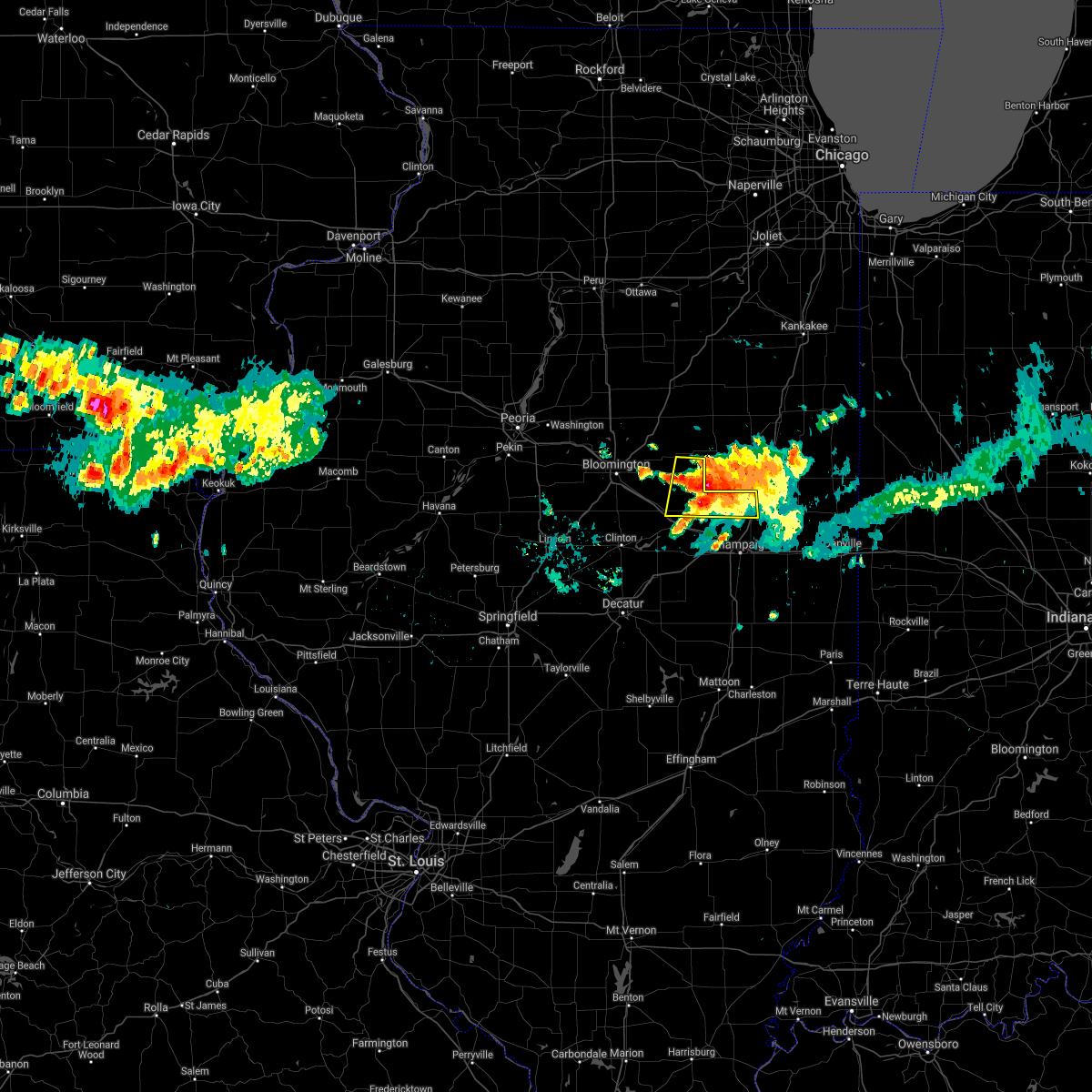 At 926 am cdt, a severe thunderstorm was located near saybrook, or near gibson city, moving east at 15 mph (radar indicated). Hazards include 60 mph wind gusts and quarter size hail. Hail damage to vehicles is expected. expect wind damage to roofs, siding, and trees. locations impacted include, rantoul, fisher, colfax, saybrook, bellflower, arrowsmith, foosland and dewey. this includes interstate 57 between mile markers 249 and 254. hail threat, radar indicated max hail size, 1. 00 in wind threat, radar indicated max wind gust, 60 mph. At 926 am cdt, a severe thunderstorm was located near saybrook, or near gibson city, moving east at 15 mph (radar indicated). Hazards include 60 mph wind gusts and quarter size hail. Hail damage to vehicles is expected. expect wind damage to roofs, siding, and trees. locations impacted include, rantoul, fisher, colfax, saybrook, bellflower, arrowsmith, foosland and dewey. this includes interstate 57 between mile markers 249 and 254. hail threat, radar indicated max hail size, 1. 00 in wind threat, radar indicated max wind gust, 60 mph.
|
| 8/12/2021 9:13 AM CDT |
 At 912 am cdt, a severe thunderstorm was located over saybrook, or 7 miles west of gibson city, moving east at 15 mph (radar indicated). Hazards include 60 mph wind gusts and quarter size hail. Hail damage to vehicles is expected. Expect wind damage to roofs, siding, and trees. At 912 am cdt, a severe thunderstorm was located over saybrook, or 7 miles west of gibson city, moving east at 15 mph (radar indicated). Hazards include 60 mph wind gusts and quarter size hail. Hail damage to vehicles is expected. Expect wind damage to roofs, siding, and trees.
|
| 7/15/2021 4:52 PM CDT |
 At 451 pm cdt, severe thunderstorms were located along a line extending from near le roy to near weldon to near oreana, moving east at 40 mph (radar indicated). Hazards include 60 mph wind gusts and quarter size hail. Hail damage to vehicles is expected. expect wind damage to roofs, siding, and trees. severe thunderstorms will be near, weldon around 500 pm cdt. farmer city and de land around 505 pm cdt. other locations in the path of these severe thunderstorms include monticello, mansfield and white heath. this includes the following highways, interstate 72 between mile markers 151 and 173. Interstate 74 between mile markers 152 and 168. At 451 pm cdt, severe thunderstorms were located along a line extending from near le roy to near weldon to near oreana, moving east at 40 mph (radar indicated). Hazards include 60 mph wind gusts and quarter size hail. Hail damage to vehicles is expected. expect wind damage to roofs, siding, and trees. severe thunderstorms will be near, weldon around 500 pm cdt. farmer city and de land around 505 pm cdt. other locations in the path of these severe thunderstorms include monticello, mansfield and white heath. this includes the following highways, interstate 72 between mile markers 151 and 173. Interstate 74 between mile markers 152 and 168.
|
| 6/26/2021 5:16 PM CDT |
 At 515 pm cdt, severe thunderstorms were located along a line extending from 6 miles northeast of farmer city to mahomet to near seymour, moving east at 45 mph (radar indicated). Hazards include 60 mph wind gusts and nickel size hail. Expect damage to roofs, siding, and trees. severe thunderstorms will be near, tolono and lake of the woods around 520 pm cdt. champaign, urbana and savoy around 525 pm cdt. fisher, philo and thomasboro around 530 pm cdt. rantoul, st. joseph and sidney around 535 pm cdt. other locations in the path of these severe thunderstorms include homer, gifford and ogden. this includes the following highways, interstate 57 between mile markers 226 and 257. interstate 72 between mile markers 173 and 182. Interstate 74 between mile markers 165 and 197. At 515 pm cdt, severe thunderstorms were located along a line extending from 6 miles northeast of farmer city to mahomet to near seymour, moving east at 45 mph (radar indicated). Hazards include 60 mph wind gusts and nickel size hail. Expect damage to roofs, siding, and trees. severe thunderstorms will be near, tolono and lake of the woods around 520 pm cdt. champaign, urbana and savoy around 525 pm cdt. fisher, philo and thomasboro around 530 pm cdt. rantoul, st. joseph and sidney around 535 pm cdt. other locations in the path of these severe thunderstorms include homer, gifford and ogden. this includes the following highways, interstate 57 between mile markers 226 and 257. interstate 72 between mile markers 173 and 182. Interstate 74 between mile markers 165 and 197.
|
| 6/26/2021 4:43 PM CDT |
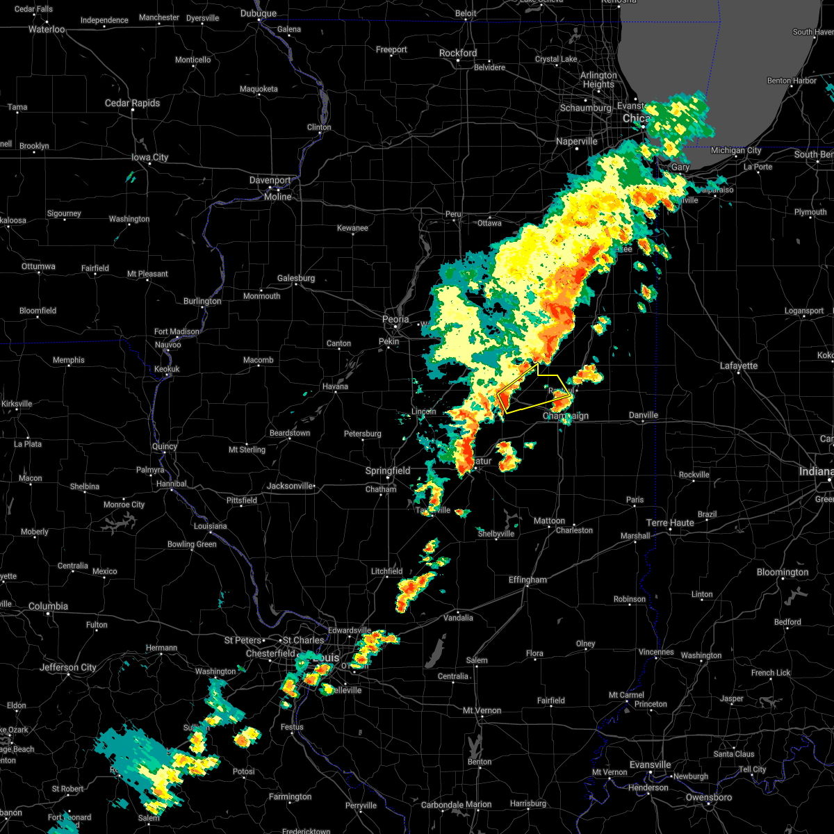 At 443 pm cdt, a severe thunderstorm was located over farmer city, or 16 miles north of monticello, moving northeast at 45 mph (radar indicated). Hazards include 60 mph wind gusts and quarter size hail. Hail damage to vehicles is expected. expect wind damage to roofs, siding, and trees. this severe thunderstorm will be near, mansfield around 450 pm cdt. saybrook around 500 pm cdt. other locations in the path of this severe thunderstorm include fisher. This includes interstate 74 between mile markers 152 and 166. At 443 pm cdt, a severe thunderstorm was located over farmer city, or 16 miles north of monticello, moving northeast at 45 mph (radar indicated). Hazards include 60 mph wind gusts and quarter size hail. Hail damage to vehicles is expected. expect wind damage to roofs, siding, and trees. this severe thunderstorm will be near, mansfield around 450 pm cdt. saybrook around 500 pm cdt. other locations in the path of this severe thunderstorm include fisher. This includes interstate 74 between mile markers 152 and 166.
|
| 8/10/2020 3:45 PM CDT | Power poles damaged in mclean county IL, 0.2 miles E of Bellflower, IL |
| 8/10/2020 3:08 PM CDT |
 At 306 pm cdt, severe thunderstorms were located along a line extending from near lexington to san jose, moving east at 65 mph (radar indicated). Hazards include 70 mph wind gusts. Expect considerable tree damage. damage is likely to mobile homes, roofs, and outbuildings. locations impacted include, bloomington, pekin, normal, morton, le roy, heyworth, tremont, lexington, mackinaw, hudson, chenoa, delavan, manito, gridley, minier, danvers, south pekin, colfax, downs and hopedale. this includes the following highways, interstate 155 between mile markers 12 and 30. interstate 39 between mile markers 0 and 6. interstate 55 between mile markers 146 and 187. Interstate 74 between mile markers 122 and 153. At 306 pm cdt, severe thunderstorms were located along a line extending from near lexington to san jose, moving east at 65 mph (radar indicated). Hazards include 70 mph wind gusts. Expect considerable tree damage. damage is likely to mobile homes, roofs, and outbuildings. locations impacted include, bloomington, pekin, normal, morton, le roy, heyworth, tremont, lexington, mackinaw, hudson, chenoa, delavan, manito, gridley, minier, danvers, south pekin, colfax, downs and hopedale. this includes the following highways, interstate 155 between mile markers 12 and 30. interstate 39 between mile markers 0 and 6. interstate 55 between mile markers 146 and 187. Interstate 74 between mile markers 122 and 153.
|
| 8/10/2020 2:50 PM CDT |
 At 250 pm cdt, severe thunderstorms were located along a line extending from near roanoke to near st. david, moving southeast at 30 mph (radar indicated). Hazards include 70 mph wind gusts. Expect considerable tree damage. Damage is likely to mobile homes, roofs, and outbuildings. At 250 pm cdt, severe thunderstorms were located along a line extending from near roanoke to near st. david, moving southeast at 30 mph (radar indicated). Hazards include 70 mph wind gusts. Expect considerable tree damage. Damage is likely to mobile homes, roofs, and outbuildings.
|
| 7/21/2020 11:13 AM CDT |
 At 1112 am cdt, a severe thunderstorm was located near mansfield, or 13 miles northwest of champaign, moving east at 40 mph (radar indicated). Hazards include 60 mph wind gusts. Expect damage to roofs, siding, and trees. locations impacted include, mahomet, fisher, mansfield, lake of the woods, bellflower, foosland, dewey and galesville. This includes interstate 74 between mile markers 163 and 178. At 1112 am cdt, a severe thunderstorm was located near mansfield, or 13 miles northwest of champaign, moving east at 40 mph (radar indicated). Hazards include 60 mph wind gusts. Expect damage to roofs, siding, and trees. locations impacted include, mahomet, fisher, mansfield, lake of the woods, bellflower, foosland, dewey and galesville. This includes interstate 74 between mile markers 163 and 178.
|
| 7/21/2020 10:48 AM CDT |
 At 1048 am cdt, a severe thunderstorm was located near weldon, or 11 miles northeast of clinton, moving east at 40 mph (radar indicated). Hazards include 60 mph wind gusts. expect damage to roofs, siding, and trees At 1048 am cdt, a severe thunderstorm was located near weldon, or 11 miles northeast of clinton, moving east at 40 mph (radar indicated). Hazards include 60 mph wind gusts. expect damage to roofs, siding, and trees
|
| 7/11/2020 9:35 PM CDT | 12 inch tree limb fell on an apartment building in mclean county IL, 0.2 miles E of Bellflower, IL |
| 7/11/2020 9:23 PM CDT |
 At 923 pm cdt, severe thunderstorms were located along a line extending from 7 miles east of colfax to 6 miles west of farmer city to near mount pulaski, moving southeast at 45 mph (radar indicated). Hazards include 60 mph wind gusts. expect damage to roofs, siding, and trees At 923 pm cdt, severe thunderstorms were located along a line extending from 7 miles east of colfax to 6 miles west of farmer city to near mount pulaski, moving southeast at 45 mph (radar indicated). Hazards include 60 mph wind gusts. expect damage to roofs, siding, and trees
|
| 7/11/2020 4:39 PM CDT |
 At 438 pm cdt, a severe thunderstorm was located near saybrook, or 9 miles southwest of gibson city, moving southeast at 25 mph (radar indicated). Hazards include 60 mph wind gusts and quarter size hail. Hail damage to vehicles is expected. expect wind damage to roofs, siding, and trees. locations impacted include, fisher, bellflower, foosland and dewey. This includes interstate 74 between mile markers 167 and 169. At 438 pm cdt, a severe thunderstorm was located near saybrook, or 9 miles southwest of gibson city, moving southeast at 25 mph (radar indicated). Hazards include 60 mph wind gusts and quarter size hail. Hail damage to vehicles is expected. expect wind damage to roofs, siding, and trees. locations impacted include, fisher, bellflower, foosland and dewey. This includes interstate 74 between mile markers 167 and 169.
|
| 7/11/2020 4:11 PM CDT |
 At 410 pm cdt, a severe thunderstorm was located near saybrook, or 12 miles west of gibson city, moving southeast at 25 mph (radar indicated). Hazards include 60 mph wind gusts and quarter size hail. Hail damage to vehicles is expected. Expect wind damage to roofs, siding, and trees. At 410 pm cdt, a severe thunderstorm was located near saybrook, or 12 miles west of gibson city, moving southeast at 25 mph (radar indicated). Hazards include 60 mph wind gusts and quarter size hail. Hail damage to vehicles is expected. Expect wind damage to roofs, siding, and trees.
|
| 5/25/2020 10:50 PM CDT |
 The severe thunderstorm warning for northeastern piatt, northeastern de witt, southeastern mclean and northwestern champaign counties will expire at 1100 pm cdt, the storms which prompted the warning have weakened below severe limits, and have exited the warned area. therefore, the warning will be allowed to expire. The severe thunderstorm warning for northeastern piatt, northeastern de witt, southeastern mclean and northwestern champaign counties will expire at 1100 pm cdt, the storms which prompted the warning have weakened below severe limits, and have exited the warned area. therefore, the warning will be allowed to expire.
|
| 5/25/2020 10:45 PM CDT |
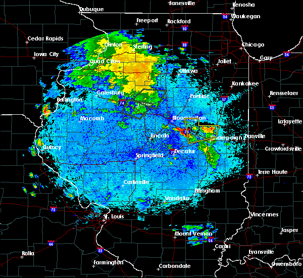 At 1045 pm cdt, severe thunderstorms were located along a line extending from farmer city to near rantoul, moving north at 15 mph (radar indicated). Hazards include 60 mph wind gusts. Expect damage to roofs, siding, and trees. locations impacted include, rantoul, farmer city, fisher, saybrook, cooksville, ludlow, bellflower, arrowsmith, foosland and dewey. this includes the following highways, interstate 57 between mile markers 250 and 257. Interstate 74 between mile markers 156 and 165. At 1045 pm cdt, severe thunderstorms were located along a line extending from farmer city to near rantoul, moving north at 15 mph (radar indicated). Hazards include 60 mph wind gusts. Expect damage to roofs, siding, and trees. locations impacted include, rantoul, farmer city, fisher, saybrook, cooksville, ludlow, bellflower, arrowsmith, foosland and dewey. this includes the following highways, interstate 57 between mile markers 250 and 257. Interstate 74 between mile markers 156 and 165.
|
| 5/25/2020 10:39 PM CDT |
 At 1028 pm cdt, severe thunderstorms were located along a line extending from near mansfield to near thomasboro, moving north at 35 mph (radar indicated). Hazards include 70 mph wind gusts. Expect considerable tree damage. damage is likely to mobile homes, roofs, and outbuildings. locations impacted include, champaign, rantoul, mahomet, farmer city, fisher, thomasboro, mansfield, saybrook, de land, cooksville, lake of the woods, ludlow, bellflower, arrowsmith, foosland, dewey, galesville and lodge. this includes the following highways, interstate 57 between mile markers 239 and 257. interstate 72 between mile markers 173 and 175. Interstate 74 between mile markers 156 and 178. At 1028 pm cdt, severe thunderstorms were located along a line extending from near mansfield to near thomasboro, moving north at 35 mph (radar indicated). Hazards include 70 mph wind gusts. Expect considerable tree damage. damage is likely to mobile homes, roofs, and outbuildings. locations impacted include, champaign, rantoul, mahomet, farmer city, fisher, thomasboro, mansfield, saybrook, de land, cooksville, lake of the woods, ludlow, bellflower, arrowsmith, foosland, dewey, galesville and lodge. this includes the following highways, interstate 57 between mile markers 239 and 257. interstate 72 between mile markers 173 and 175. Interstate 74 between mile markers 156 and 178.
|
| 5/25/2020 10:29 PM CDT |
 At 1028 pm cdt, severe thunderstorms were located along a line extending from near mansfield to near thomasboro, moving north at 35 mph (radar indicated). Hazards include 70 mph wind gusts. Expect considerable tree damage. damage is likely to mobile homes, roofs, and outbuildings. locations impacted include, champaign, rantoul, mahomet, farmer city, fisher, thomasboro, mansfield, saybrook, de land, cooksville, lake of the woods, ludlow, bellflower, arrowsmith, foosland, dewey, galesville and lodge. this includes the following highways, interstate 57 between mile markers 239 and 257. interstate 72 between mile markers 173 and 175. Interstate 74 between mile markers 156 and 178. At 1028 pm cdt, severe thunderstorms were located along a line extending from near mansfield to near thomasboro, moving north at 35 mph (radar indicated). Hazards include 70 mph wind gusts. Expect considerable tree damage. damage is likely to mobile homes, roofs, and outbuildings. locations impacted include, champaign, rantoul, mahomet, farmer city, fisher, thomasboro, mansfield, saybrook, de land, cooksville, lake of the woods, ludlow, bellflower, arrowsmith, foosland, dewey, galesville and lodge. this includes the following highways, interstate 57 between mile markers 239 and 257. interstate 72 between mile markers 173 and 175. Interstate 74 between mile markers 156 and 178.
|
| 5/25/2020 10:10 PM CDT |
 At 1010 pm cdt, severe thunderstorms were located along a line extending from near white heath to champaign, moving north at 35 mph (radar indicated). Hazards include 70 mph wind gusts. Expect considerable tree damage. Damage is likely to mobile homes, roofs, and outbuildings. At 1010 pm cdt, severe thunderstorms were located along a line extending from near white heath to champaign, moving north at 35 mph (radar indicated). Hazards include 70 mph wind gusts. Expect considerable tree damage. Damage is likely to mobile homes, roofs, and outbuildings.
|
| 9/29/2019 6:26 PM CDT |
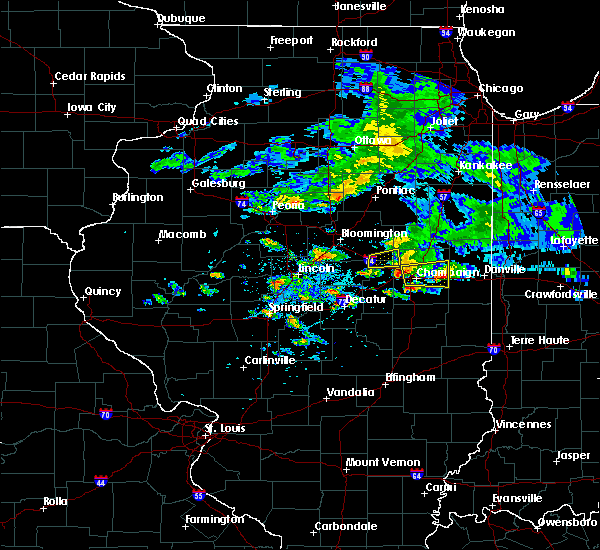 The severe thunderstorm warning for northeastern piatt, northeastern de witt, southeastern mclean and northwestern champaign counties will expire at 630 pm cdt, the storm which prompted the warning has weakened below severe limits, and has exited the warned area. therefore, the warning will be allowed to expire. remember, a severe thunderstorm warning still remains in effect for east central champaign county until 730 pm. The severe thunderstorm warning for northeastern piatt, northeastern de witt, southeastern mclean and northwestern champaign counties will expire at 630 pm cdt, the storm which prompted the warning has weakened below severe limits, and has exited the warned area. therefore, the warning will be allowed to expire. remember, a severe thunderstorm warning still remains in effect for east central champaign county until 730 pm.
|
| 9/29/2019 6:03 PM CDT |
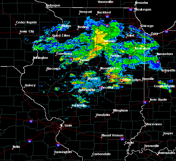 At 603 pm cdt, a severe thunderstorm was located over farmer city, or 17 miles north of monticello, moving east at 25 mph (radar indicated). Hazards include 60 mph wind gusts and quarter size hail. Hail damage to vehicles is expected. expect wind damage to roofs, siding, and trees. locations impacted include, farmer city, bellflower and foosland. This includes interstate 74 between mile markers 155 and 163. At 603 pm cdt, a severe thunderstorm was located over farmer city, or 17 miles north of monticello, moving east at 25 mph (radar indicated). Hazards include 60 mph wind gusts and quarter size hail. Hail damage to vehicles is expected. expect wind damage to roofs, siding, and trees. locations impacted include, farmer city, bellflower and foosland. This includes interstate 74 between mile markers 155 and 163.
|
| 9/29/2019 5:45 PM CDT |
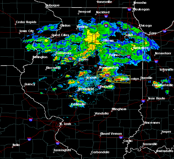 At 545 pm cdt, a severe thunderstorm was located near le roy, or 13 miles northeast of clinton, moving east at 25 mph (radar indicated). Hazards include 60 mph wind gusts and quarter size hail. Hail damage to vehicles is expected. Expect wind damage to roofs, siding, and trees. At 545 pm cdt, a severe thunderstorm was located near le roy, or 13 miles northeast of clinton, moving east at 25 mph (radar indicated). Hazards include 60 mph wind gusts and quarter size hail. Hail damage to vehicles is expected. Expect wind damage to roofs, siding, and trees.
|
| 9/28/2019 12:11 AM CDT |
 The severe thunderstorm warning for eastern mclean county will expire at 1215 am cdt, the storm which prompted the warning has moved out of the area. therefore, the warning will be allowed to expire. to report severe weather, contact your nearest law enforcement agency. they will relay your report to the national weather service lincoln. The severe thunderstorm warning for eastern mclean county will expire at 1215 am cdt, the storm which prompted the warning has moved out of the area. therefore, the warning will be allowed to expire. to report severe weather, contact your nearest law enforcement agency. they will relay your report to the national weather service lincoln.
|
| 9/27/2019 11:49 PM CDT |
 At 1149 pm cdt, a severe thunderstorm was located near downs, or 10 miles east of bloomington, moving east at 50 mph (radar indicated). Hazards include 60 mph wind gusts. Expect damage to roofs, siding, and trees. locations impacted include, le roy, lexington, chenoa, colfax, downs, saybrook, cooksville, pleasant hill, bellflower, arrowsmith, cropsey, ellsworth, anchor, holder, moraine view state park and weston. this includes the following highways, interstate 55 between mile markers 176 and 187. Interstate 74 between mile markers 142 and 154. At 1149 pm cdt, a severe thunderstorm was located near downs, or 10 miles east of bloomington, moving east at 50 mph (radar indicated). Hazards include 60 mph wind gusts. Expect damage to roofs, siding, and trees. locations impacted include, le roy, lexington, chenoa, colfax, downs, saybrook, cooksville, pleasant hill, bellflower, arrowsmith, cropsey, ellsworth, anchor, holder, moraine view state park and weston. this includes the following highways, interstate 55 between mile markers 176 and 187. Interstate 74 between mile markers 142 and 154.
|
| 9/27/2019 11:36 PM CDT |
 At 1136 pm cdt, a severe thunderstorm was located near bloomington, moving east at 50 mph (radar indicated). Hazards include 60 mph wind gusts. expect damage to roofs, siding, and trees At 1136 pm cdt, a severe thunderstorm was located near bloomington, moving east at 50 mph (radar indicated). Hazards include 60 mph wind gusts. expect damage to roofs, siding, and trees
|
| 8/20/2019 10:48 AM CDT |
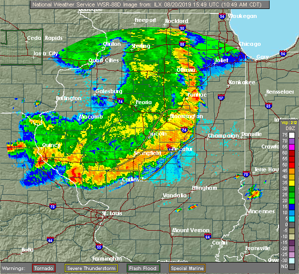 A severe thunderstorm warning remains in effect until 1100 am cdt for northern piatt. eastern de witt. southeastern mclean and northeastern macon counties. At 1048 am cdt, severe thunderstorms were located along a line extending from 7 miles south of fairbury to near weldon to forsyth, moving east at 50 mph. A severe thunderstorm warning remains in effect until 1100 am cdt for northern piatt. eastern de witt. southeastern mclean and northeastern macon counties. At 1048 am cdt, severe thunderstorms were located along a line extending from 7 miles south of fairbury to near weldon to forsyth, moving east at 50 mph.
|
| 8/20/2019 10:31 AM CDT |
 At 1030 am cdt, severe thunderstorms were located along a line extending from near lexington to wapella to near latham, moving east at 45 mph (radar indicated). Hazards include 60 mph wind gusts and quarter size hail. Hail damage to vehicles is expected. expect wind damage to roofs, siding, and trees. locations impacted include, bloomington, decatur, clinton, normal, le roy, forsyth, heyworth, lexington, farmer city, maroa, mount pulaski, warrensburg, colfax, downs, argenta, mansfield, oreana, saybrook, wapella and towanda. this includes the following highways, interstate 55 between mile markers 169 and 181. interstate 72 between mile markers 139 and 161. Interstate 74 between mile markers 135 and 166. At 1030 am cdt, severe thunderstorms were located along a line extending from near lexington to wapella to near latham, moving east at 45 mph (radar indicated). Hazards include 60 mph wind gusts and quarter size hail. Hail damage to vehicles is expected. expect wind damage to roofs, siding, and trees. locations impacted include, bloomington, decatur, clinton, normal, le roy, forsyth, heyworth, lexington, farmer city, maroa, mount pulaski, warrensburg, colfax, downs, argenta, mansfield, oreana, saybrook, wapella and towanda. this includes the following highways, interstate 55 between mile markers 169 and 181. interstate 72 between mile markers 139 and 161. Interstate 74 between mile markers 135 and 166.
|
| 8/20/2019 10:06 AM CDT |
 At 1005 am cdt, severe thunderstorms were located along a line extending from hudson to near atlanta to elkhart, moving east at 35 mph (radar indicated). Hazards include 60 mph wind gusts and quarter size hail. Hail damage to vehicles is expected. Expect wind damage to roofs, siding, and trees. At 1005 am cdt, severe thunderstorms were located along a line extending from hudson to near atlanta to elkhart, moving east at 35 mph (radar indicated). Hazards include 60 mph wind gusts and quarter size hail. Hail damage to vehicles is expected. Expect wind damage to roofs, siding, and trees.
|
| 6/15/2019 11:27 PM CDT |
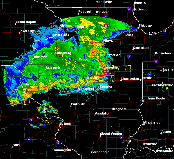 At 1127 pm cdt, a severe thunderstorm was located near colfax, or 12 miles west of gibson city, moving east at 45 mph (radar indicated). Hazards include 60 mph wind gusts. Expect damage to roofs, siding, and trees. locations impacted include, le roy, lexington, chenoa, gridley, colfax, saybrook, cooksville, pleasant hill, bellflower, arrowsmith, cropsey, ellsworth, anchor, holder, moraine view state park and weston. this includes the following highways, interstate 55 between mile markers 175 and 187. Interstate 74 between mile markers 144 and 154. At 1127 pm cdt, a severe thunderstorm was located near colfax, or 12 miles west of gibson city, moving east at 45 mph (radar indicated). Hazards include 60 mph wind gusts. Expect damage to roofs, siding, and trees. locations impacted include, le roy, lexington, chenoa, gridley, colfax, saybrook, cooksville, pleasant hill, bellflower, arrowsmith, cropsey, ellsworth, anchor, holder, moraine view state park and weston. this includes the following highways, interstate 55 between mile markers 175 and 187. Interstate 74 between mile markers 144 and 154.
|
| 6/15/2019 11:08 PM CDT |
 At 1107 pm cdt, a severe thunderstorm was located near bloomington, moving east at 50 mph (radar indicated). Hazards include 60 mph wind gusts. Expect damage to roofs, siding, and trees. locations impacted include, bloomington, normal, le roy, heyworth, lexington, hudson, chenoa, gridley, colfax, downs, saybrook, towanda, cooksville, pleasant hill, bellflower, arrowsmith, cropsey, ellsworth, anchor and holder. this includes the following highways, interstate 39 between mile markers 0 and 9. interstate 55 between mile markers 153 and 187. Interstate 74 between mile markers 127 and 154. At 1107 pm cdt, a severe thunderstorm was located near bloomington, moving east at 50 mph (radar indicated). Hazards include 60 mph wind gusts. Expect damage to roofs, siding, and trees. locations impacted include, bloomington, normal, le roy, heyworth, lexington, hudson, chenoa, gridley, colfax, downs, saybrook, towanda, cooksville, pleasant hill, bellflower, arrowsmith, cropsey, ellsworth, anchor and holder. this includes the following highways, interstate 39 between mile markers 0 and 9. interstate 55 between mile markers 153 and 187. Interstate 74 between mile markers 127 and 154.
|
| 6/15/2019 10:58 PM CDT |
 At 1057 pm cdt, a severe thunderstorm was located near normal, or near bloomington, moving east at 50 mph (radar indicated). Hazards include 60 mph wind gusts. Expect damage to roofs, siding, and trees. locations impacted include, bloomington, normal, le roy, heyworth, el paso, lexington, hudson, chenoa, gridley, danvers, colfax, downs, mclean, saybrook, stanford, carlock, towanda, secor, cooksville and pleasant hill. this includes the following highways, interstate 39 between mile markers 0 and 17. interstate 55 between mile markers 145 and 187. Interstate 74 between mile markers 115 and 154. At 1057 pm cdt, a severe thunderstorm was located near normal, or near bloomington, moving east at 50 mph (radar indicated). Hazards include 60 mph wind gusts. Expect damage to roofs, siding, and trees. locations impacted include, bloomington, normal, le roy, heyworth, el paso, lexington, hudson, chenoa, gridley, danvers, colfax, downs, mclean, saybrook, stanford, carlock, towanda, secor, cooksville and pleasant hill. this includes the following highways, interstate 39 between mile markers 0 and 17. interstate 55 between mile markers 145 and 187. Interstate 74 between mile markers 115 and 154.
|
| 6/15/2019 10:41 PM CDT |
 At 1041 pm cdt, a severe thunderstorm was located over goodfield, or 7 miles south of eureka, moving east at 50 mph (radar indicated). Hazards include 60 mph wind gusts. expect damage to roofs, siding, and trees At 1041 pm cdt, a severe thunderstorm was located over goodfield, or 7 miles south of eureka, moving east at 50 mph (radar indicated). Hazards include 60 mph wind gusts. expect damage to roofs, siding, and trees
|
| 5/30/2019 5:53 PM CDT |
 At 553 pm cdt, a severe thunderstorm was located near saybrook, or 13 miles west of gibson city, moving east at 20 mph (radar indicated). Hazards include 60 mph wind gusts and quarter size hail. Hail damage to vehicles is expected. Expect wind damage to roofs, siding, and trees. At 553 pm cdt, a severe thunderstorm was located near saybrook, or 13 miles west of gibson city, moving east at 20 mph (radar indicated). Hazards include 60 mph wind gusts and quarter size hail. Hail damage to vehicles is expected. Expect wind damage to roofs, siding, and trees.
|
| 5/28/2019 10:20 PM CDT |
 The severe thunderstorm warning for northern piatt, northeastern de witt and southeastern mclean counties will expire at 1030 pm cdt, the storm which prompted the warning has weakened below severe limits, and no longer poses an immediate threat to life or property. therefore, the warning will be allowed to expire. a severe thunderstorm watch remains in effect until midnight cdt for central illinois. The severe thunderstorm warning for northern piatt, northeastern de witt and southeastern mclean counties will expire at 1030 pm cdt, the storm which prompted the warning has weakened below severe limits, and no longer poses an immediate threat to life or property. therefore, the warning will be allowed to expire. a severe thunderstorm watch remains in effect until midnight cdt for central illinois.
|
| 5/28/2019 10:10 PM CDT |
 At 1009 pm cdt, a severe thunderstorm was located near le roy, or 12 miles southeast of bloomington, moving east at 40 mph (radar indicated). Hazards include 70 mph wind gusts and nickel size hail. Expect considerable tree damage. damage is likely to mobile homes, roofs, and outbuildings. locations impacted include, bloomington, monticello, le roy, farmer city, colfax, downs, mansfield, saybrook, towanda, de land, weldon, cooksville, white heath, bellflower, arrowsmith, cropsey, ellsworth, de witt, anchor and holder. this includes the following highways, interstate 55 between mile markers 170 and 173. interstate 72 between mile markers 168 and 173. Interstate 74 between mile markers 142 and 167. At 1009 pm cdt, a severe thunderstorm was located near le roy, or 12 miles southeast of bloomington, moving east at 40 mph (radar indicated). Hazards include 70 mph wind gusts and nickel size hail. Expect considerable tree damage. damage is likely to mobile homes, roofs, and outbuildings. locations impacted include, bloomington, monticello, le roy, farmer city, colfax, downs, mansfield, saybrook, towanda, de land, weldon, cooksville, white heath, bellflower, arrowsmith, cropsey, ellsworth, de witt, anchor and holder. this includes the following highways, interstate 55 between mile markers 170 and 173. interstate 72 between mile markers 168 and 173. Interstate 74 between mile markers 142 and 167.
|
| 5/28/2019 9:45 PM CDT |
 At 945 pm cdt, a severe thunderstorm was located 7 miles northwest of heyworth, or 7 miles southwest of bloomington, moving east at 45 mph (radar indicated). Hazards include 70 mph wind gusts and nickel size hail. Expect considerable tree damage. Damage is likely to mobile homes, roofs, and outbuildings. At 945 pm cdt, a severe thunderstorm was located 7 miles northwest of heyworth, or 7 miles southwest of bloomington, moving east at 45 mph (radar indicated). Hazards include 70 mph wind gusts and nickel size hail. Expect considerable tree damage. Damage is likely to mobile homes, roofs, and outbuildings.
|
| 5/28/2019 3:18 PM CDT |
 At 317 pm cdt, a severe thunderstorm was located near fisher, or 7 miles southwest of gibson city, moving east at 35 mph (radar indicated). Hazards include golf ball size hail and 70 mph wind gusts. People and animals outdoors will be injured. expect hail damage to roofs, siding, windows, and vehicles. expect considerable tree damage. wind damage is also likely to mobile homes, roofs, and outbuildings. locations impacted include, rantoul, fisher, saybrook, ludlow, bellflower, foosland and dewey. This includes interstate 57 between mile markers 251 and 257. At 317 pm cdt, a severe thunderstorm was located near fisher, or 7 miles southwest of gibson city, moving east at 35 mph (radar indicated). Hazards include golf ball size hail and 70 mph wind gusts. People and animals outdoors will be injured. expect hail damage to roofs, siding, windows, and vehicles. expect considerable tree damage. wind damage is also likely to mobile homes, roofs, and outbuildings. locations impacted include, rantoul, fisher, saybrook, ludlow, bellflower, foosland and dewey. This includes interstate 57 between mile markers 251 and 257.
|
| 5/28/2019 3:00 PM CDT |
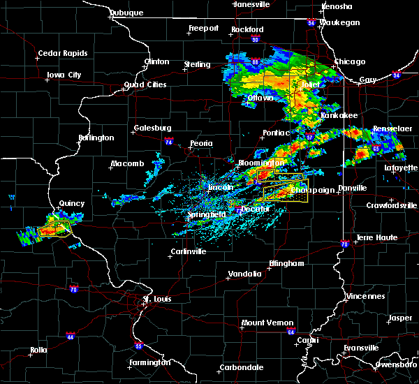 At 300 pm cdt, a severe thunderstorm was located near saybrook, or 14 miles southwest of gibson city, moving east at 50 mph (radar indicated). Hazards include 60 mph wind gusts and quarter size hail. Hail damage to vehicles is expected. Expect wind damage to roofs, siding, and trees. At 300 pm cdt, a severe thunderstorm was located near saybrook, or 14 miles southwest of gibson city, moving east at 50 mph (radar indicated). Hazards include 60 mph wind gusts and quarter size hail. Hail damage to vehicles is expected. Expect wind damage to roofs, siding, and trees.
|
| 5/26/2019 12:29 AM CDT |
 The national weather service in lincoln has issued a * severe thunderstorm warning for. southeastern mclean county in central illinois. until 100 am cdt. At 1229 am cdt, severe thunderstorms were located along a line extending from near lexington to 6 miles northeast of downs to near. The national weather service in lincoln has issued a * severe thunderstorm warning for. southeastern mclean county in central illinois. until 100 am cdt. At 1229 am cdt, severe thunderstorms were located along a line extending from near lexington to 6 miles northeast of downs to near.
|
| 5/23/2019 1:30 AM CDT |
 At 129 am cdt, a severe thunderstorm was located 10 miles south of chatsworth, or 10 miles north of gibson city, moving northeast at 65 mph. this is a very dangerous storm (radar indicated). Hazards include 80 mph wind gusts. brief tornados are possible with this storm. Flying debris will be dangerous to those caught without shelter. mobile homes will be heavily damaged. expect considerable damage to roofs, windows, and vehicles. extensive tree damage and power outages are likely. locations impacted include, rantoul, farmer city, fisher, gifford, mansfield, saybrook, ludlow, bellflower, cropsey, anchor, foosland and dewey. this includes the following highways, interstate 57 between mile markers 248 and 257. Interstate 74 between mile markers 158 and 169. At 129 am cdt, a severe thunderstorm was located 10 miles south of chatsworth, or 10 miles north of gibson city, moving northeast at 65 mph. this is a very dangerous storm (radar indicated). Hazards include 80 mph wind gusts. brief tornados are possible with this storm. Flying debris will be dangerous to those caught without shelter. mobile homes will be heavily damaged. expect considerable damage to roofs, windows, and vehicles. extensive tree damage and power outages are likely. locations impacted include, rantoul, farmer city, fisher, gifford, mansfield, saybrook, ludlow, bellflower, cropsey, anchor, foosland and dewey. this includes the following highways, interstate 57 between mile markers 248 and 257. Interstate 74 between mile markers 158 and 169.
|
| 5/23/2019 1:00 AM CDT |
 At 1259 am cdt, a severe thunderstorm was located over downs, or 9 miles southeast of bloomington, moving northeast at 65 mph. this is a very dangerous storm (radar indicated). Hazards include 80 mph wind gusts. several brief tornados are possible with this storm. Flying debris will be dangerous to those caught without shelter. mobile homes will be heavily damaged. expect considerable damage to roofs, windows, and vehicles. Extensive tree damage and power outages are likely. At 1259 am cdt, a severe thunderstorm was located over downs, or 9 miles southeast of bloomington, moving northeast at 65 mph. this is a very dangerous storm (radar indicated). Hazards include 80 mph wind gusts. several brief tornados are possible with this storm. Flying debris will be dangerous to those caught without shelter. mobile homes will be heavily damaged. expect considerable damage to roofs, windows, and vehicles. Extensive tree damage and power outages are likely.
|
| 10/7/2018 5:28 PM CDT |
 At 527 pm cdt, a severe thunderstorm was located near saybrook, or 11 miles southwest of gibson city, moving northeast at 15 mph (radar indicated). Hazards include 60 mph wind gusts and quarter size hail. Hail damage to vehicles is expected. Expect wind damage to roofs, siding, and trees. At 527 pm cdt, a severe thunderstorm was located near saybrook, or 11 miles southwest of gibson city, moving northeast at 15 mph (radar indicated). Hazards include 60 mph wind gusts and quarter size hail. Hail damage to vehicles is expected. Expect wind damage to roofs, siding, and trees.
|
| 10/7/2018 5:18 PM CDT |
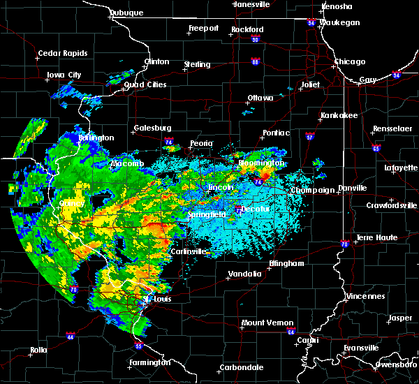 At 517 pm cdt, a severe thunderstorm capable of producing a tornado was located 7 miles north of mansfield, or 12 miles southwest of gibson city, moving northeast at 20 mph (radar indicated rotation). Hazards include tornado and quarter size hail. Flying debris will be dangerous to those caught without shelter. mobile homes will be damaged or destroyed. damage to roofs, windows, and vehicles will occur. tree damage is likely. Locations impacted include, bellflower. At 517 pm cdt, a severe thunderstorm capable of producing a tornado was located 7 miles north of mansfield, or 12 miles southwest of gibson city, moving northeast at 20 mph (radar indicated rotation). Hazards include tornado and quarter size hail. Flying debris will be dangerous to those caught without shelter. mobile homes will be damaged or destroyed. damage to roofs, windows, and vehicles will occur. tree damage is likely. Locations impacted include, bellflower.
|
| 10/7/2018 5:04 PM CDT |
 At 503 pm cdt, a severe thunderstorm capable of producing a tornado was located over farmer city, or 17 miles north of monticello, moving northeast at 20 mph (radar indicated rotation). Hazards include tornado and quarter size hail. Flying debris will be dangerous to those caught without shelter. mobile homes will be damaged or destroyed. damage to roofs, windows, and vehicles will occur. tree damage is likely. this tornadic thunderstorm will remain over mainly rural areas of northeastern piatt, northeastern de witt and southeastern mclean counties, including the following locations, bellflower. This includes interstate 74 between mile markers 157 and 162. At 503 pm cdt, a severe thunderstorm capable of producing a tornado was located over farmer city, or 17 miles north of monticello, moving northeast at 20 mph (radar indicated rotation). Hazards include tornado and quarter size hail. Flying debris will be dangerous to those caught without shelter. mobile homes will be damaged or destroyed. damage to roofs, windows, and vehicles will occur. tree damage is likely. this tornadic thunderstorm will remain over mainly rural areas of northeastern piatt, northeastern de witt and southeastern mclean counties, including the following locations, bellflower. This includes interstate 74 between mile markers 157 and 162.
|
| 7/14/2018 9:21 AM CDT |
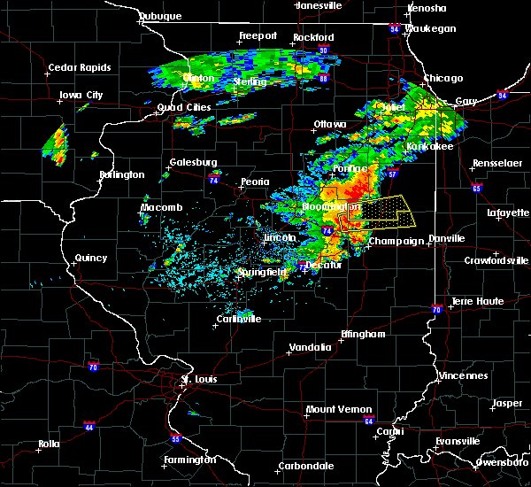 At 921 am cdt, a severe thunderstorm was located near saybrook, or near gibson city, moving east at 40 mph (radar indicated). Hazards include 60 mph wind gusts and penny size hail. expect damage to roofs, siding, and trees At 921 am cdt, a severe thunderstorm was located near saybrook, or near gibson city, moving east at 40 mph (radar indicated). Hazards include 60 mph wind gusts and penny size hail. expect damage to roofs, siding, and trees
|
| 6/10/2018 1:37 PM CDT |
 At 136 pm cdt, a severe thunderstorm was located over le roy, or 14 miles southeast of bloomington, moving southeast at 45 mph (radar indicated). Hazards include 60 mph wind gusts. expect damage to roofs, siding, and trees At 136 pm cdt, a severe thunderstorm was located over le roy, or 14 miles southeast of bloomington, moving southeast at 45 mph (radar indicated). Hazards include 60 mph wind gusts. expect damage to roofs, siding, and trees
|
| 6/10/2018 4:06 AM CDT |
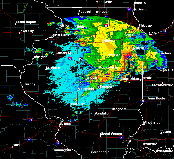 The severe thunderstorm warning for southeastern mclean county will expire at 415 am cdt, the storms which prompted the warning have weakened below severe limits, and have exited the warned area. therefore the warning will be allowed to expire. however gusty winds and heavy rain are still possible with these thunderstorms. The severe thunderstorm warning for southeastern mclean county will expire at 415 am cdt, the storms which prompted the warning have weakened below severe limits, and have exited the warned area. therefore the warning will be allowed to expire. however gusty winds and heavy rain are still possible with these thunderstorms.
|
| 6/10/2018 3:55 AM CDT |
 At 355 am cdt, severe thunderstorms were located along a line extending from 8 miles south of fairbury to near gibson to near le roy, moving southeast at 45 mph (radar indicated). Hazards include 60 mph wind gusts. Expect damage to roofs, siding, and trees. locations impacted include, le roy, colfax, saybrook, bellflower, arrowsmith, cropsey, ellsworth, anchor and moraine view state park. This includes interstate 74 between mile markers 144 and 155. At 355 am cdt, severe thunderstorms were located along a line extending from 8 miles south of fairbury to near gibson to near le roy, moving southeast at 45 mph (radar indicated). Hazards include 60 mph wind gusts. Expect damage to roofs, siding, and trees. locations impacted include, le roy, colfax, saybrook, bellflower, arrowsmith, cropsey, ellsworth, anchor and moraine view state park. This includes interstate 74 between mile markers 144 and 155.
|
| 6/10/2018 3:29 AM CDT |
 At 329 am cdt, severe thunderstorms were located along a line extending from chenoa to near cooksville to near heyworth, moving southeast at 45 mph (radar indicated). Hazards include 60 mph wind gusts. expect damage to roofs, siding, and trees At 329 am cdt, severe thunderstorms were located along a line extending from chenoa to near cooksville to near heyworth, moving southeast at 45 mph (radar indicated). Hazards include 60 mph wind gusts. expect damage to roofs, siding, and trees
|
| 6/10/2018 3:13 AM CDT |
 At 313 am cdt, severe thunderstorms were located along a line extending from near washburn to near normal to near hopedale, moving southeast at 55 mph (radar indicated). Hazards include 60 mph wind gusts. Expect damage to roofs, siding, and trees. locations impacted include, bloomington, pekin, eureka, normal, east peoria, morton, washington, creve coeur, metamora, le roy, germantown hills, heyworth, marquette heights, el paso, tremont, minonk, roanoke, lexington, mackinaw and hudson. this includes the following highways, interstate 155 between mile markers 11 and 31. interstate 39 between mile markers 0 and 28. interstate 474 between mile markers 11 and 14. interstate 55 between mile markers 142 and 186. Interstate 74 between mile markers 96 and 155. At 313 am cdt, severe thunderstorms were located along a line extending from near washburn to near normal to near hopedale, moving southeast at 55 mph (radar indicated). Hazards include 60 mph wind gusts. Expect damage to roofs, siding, and trees. locations impacted include, bloomington, pekin, eureka, normal, east peoria, morton, washington, creve coeur, metamora, le roy, germantown hills, heyworth, marquette heights, el paso, tremont, minonk, roanoke, lexington, mackinaw and hudson. this includes the following highways, interstate 155 between mile markers 11 and 31. interstate 39 between mile markers 0 and 28. interstate 474 between mile markers 11 and 14. interstate 55 between mile markers 142 and 186. Interstate 74 between mile markers 96 and 155.
|
| 6/10/2018 3:01 AM CDT |
 At 301 am cdt, severe thunderstorms were located along a line extending from near sparland to near goodfield to near green valley, moving southeast at 50 mph (radar indicated). Hazards include 60 mph wind gusts. Expect damage to roofs, siding, and trees. locations impacted include, bloomington, pekin, eureka, lacon, normal, east peoria, morton, washington, creve coeur, metamora, le roy, germantown hills, heyworth, marquette heights, el paso, henry, tremont, minonk, roanoke and lexington. this includes the following highways, interstate 155 between mile markers 11 and 31. interstate 39 between mile markers 0 and 41. interstate 474 between mile markers 11 and 14. interstate 55 between mile markers 142 and 186. Interstate 74 between mile markers 96 and 155. At 301 am cdt, severe thunderstorms were located along a line extending from near sparland to near goodfield to near green valley, moving southeast at 50 mph (radar indicated). Hazards include 60 mph wind gusts. Expect damage to roofs, siding, and trees. locations impacted include, bloomington, pekin, eureka, lacon, normal, east peoria, morton, washington, creve coeur, metamora, le roy, germantown hills, heyworth, marquette heights, el paso, henry, tremont, minonk, roanoke and lexington. this includes the following highways, interstate 155 between mile markers 11 and 31. interstate 39 between mile markers 0 and 41. interstate 474 between mile markers 11 and 14. interstate 55 between mile markers 142 and 186. Interstate 74 between mile markers 96 and 155.
|
| 6/10/2018 2:43 AM CDT |
 At 243 am cdt, severe thunderstorms were located along a line extending from bradford to metamora to glasford, moving southeast at 60 mph (radar indicated). Hazards include 60 mph wind gusts. expect damage to roofs, siding, and trees At 243 am cdt, severe thunderstorms were located along a line extending from bradford to metamora to glasford, moving southeast at 60 mph (radar indicated). Hazards include 60 mph wind gusts. expect damage to roofs, siding, and trees
|
| 5/9/2018 6:56 PM CDT |
 At 656 pm cdt, severe thunderstorms were located along a line extending from 6 miles southeast of gibson city to near farmer city, moving east at 25 mph (radar indicated). Hazards include 60 mph wind gusts and quarter size hail. Hail damage to vehicles is expected. expect wind damage to roofs, siding, and trees. locations impacted include, mahomet, farmer city, fisher, mansfield, lake of the woods, ludlow, bellflower, foosland and dewey. This includes the following highways, interstate 74 between mile markers 158 and 171. At 656 pm cdt, severe thunderstorms were located along a line extending from 6 miles southeast of gibson city to near farmer city, moving east at 25 mph (radar indicated). Hazards include 60 mph wind gusts and quarter size hail. Hail damage to vehicles is expected. expect wind damage to roofs, siding, and trees. locations impacted include, mahomet, farmer city, fisher, mansfield, lake of the woods, ludlow, bellflower, foosland and dewey. This includes the following highways, interstate 74 between mile markers 158 and 171.
|
| 5/9/2018 6:39 PM CDT |
 At 639 pm cdt, severe thunderstorms were located along a line extending from near gibson to near farmer city, moving east at 25 mph (radar indicated). Hazards include 60 mph wind gusts and nickel size hail. expect damage to roofs, siding, and trees At 639 pm cdt, severe thunderstorms were located along a line extending from near gibson to near farmer city, moving east at 25 mph (radar indicated). Hazards include 60 mph wind gusts and nickel size hail. expect damage to roofs, siding, and trees
|
| 6/17/2017 9:17 PM CDT |
 At 917 pm cdt, a severe thunderstorm was located over lexington, or 13 miles southwest of fairbury, moving east at 35 mph (radar indicated). Hazards include 70 mph wind gusts and quarter size hail. Hail damage to vehicles is expected. expect considerable tree damage. wind damage is also likely to mobile homes, roofs, and outbuildings. locations impacted include, bloomington, normal, el paso, lexington, hudson, chenoa, gridley, danvers, colfax, downs, saybrook, carlock, towanda, cooksville, pleasant hill, bellflower, arrowsmith, cropsey, ellsworth and anchor. this includes the following highways, interstate 39 between mile markers 0 and 9. interstate 55 between mile markers 157 and 187. Interstate 74 between mile markers 119 and 133, and between mile markers 136 and 138. At 917 pm cdt, a severe thunderstorm was located over lexington, or 13 miles southwest of fairbury, moving east at 35 mph (radar indicated). Hazards include 70 mph wind gusts and quarter size hail. Hail damage to vehicles is expected. expect considerable tree damage. wind damage is also likely to mobile homes, roofs, and outbuildings. locations impacted include, bloomington, normal, el paso, lexington, hudson, chenoa, gridley, danvers, colfax, downs, saybrook, carlock, towanda, cooksville, pleasant hill, bellflower, arrowsmith, cropsey, ellsworth and anchor. this includes the following highways, interstate 39 between mile markers 0 and 9. interstate 55 between mile markers 157 and 187. Interstate 74 between mile markers 119 and 133, and between mile markers 136 and 138.
|
| 6/17/2017 8:54 PM CDT |
 The national weather service in lincoln has issued a * severe thunderstorm warning for. southeastern woodford county in central illinois. mclean county in central illinois. Until 945 pm cdt * at 853 pm cdt, a severe thunderstorm was located near el paso, or. The national weather service in lincoln has issued a * severe thunderstorm warning for. southeastern woodford county in central illinois. mclean county in central illinois. Until 945 pm cdt * at 853 pm cdt, a severe thunderstorm was located near el paso, or.
|
| 6/14/2017 5:08 PM CDT |
 The severe thunderstorm warning for southeastern mclean county will expire at 515 pm cdt, the storm which prompted the warning has weakened below severe limits, and no longer poses an immediate threat to life or property. therefore the warning will be allowed to expire. a severe thunderstorm watch remains in effect until 800 pm cdt for central illinois. a severe thunderstorm watch also remains in effect until 800 pm cdt for east central illinois. The severe thunderstorm warning for southeastern mclean county will expire at 515 pm cdt, the storm which prompted the warning has weakened below severe limits, and no longer poses an immediate threat to life or property. therefore the warning will be allowed to expire. a severe thunderstorm watch remains in effect until 800 pm cdt for central illinois. a severe thunderstorm watch also remains in effect until 800 pm cdt for east central illinois.
|
| 6/14/2017 4:50 PM CDT | Large tree limb blown down on road near bellflowe in mclean county IL, 0.2 miles E of Bellflower, IL |
| 6/14/2017 4:49 PM CDT |
 At 449 pm cdt, a severe thunderstorm was located near saybrook, or 14 miles west of gibson city, moving northeast at 40 mph (radar indicated). Hazards include 60 mph wind gusts. Expect damage to roofs, siding, and trees. locations impacted include, le roy, colfax, saybrook, cooksville, pleasant hill, bellflower, arrowsmith, cropsey, ellsworth, anchor, holder and moraine view state park. This includes interstate 74 between mile markers 147 and 153. At 449 pm cdt, a severe thunderstorm was located near saybrook, or 14 miles west of gibson city, moving northeast at 40 mph (radar indicated). Hazards include 60 mph wind gusts. Expect damage to roofs, siding, and trees. locations impacted include, le roy, colfax, saybrook, cooksville, pleasant hill, bellflower, arrowsmith, cropsey, ellsworth, anchor, holder and moraine view state park. This includes interstate 74 between mile markers 147 and 153.
|
| 6/14/2017 4:30 PM CDT |
 At 430 pm cdt, a severe thunderstorm was located near wapella, or 8 miles northeast of clinton, moving northeast at 35 mph (radar indicated). Hazards include 60 mph wind gusts and quarter size hail. Hail damage to vehicles is expected. Expect wind damage to roofs, siding, and trees. At 430 pm cdt, a severe thunderstorm was located near wapella, or 8 miles northeast of clinton, moving northeast at 35 mph (radar indicated). Hazards include 60 mph wind gusts and quarter size hail. Hail damage to vehicles is expected. Expect wind damage to roofs, siding, and trees.
|
| 4/29/2017 6:14 PM CDT |
 At 613 pm cdt, severe thunderstorms were located along a line extending from near maroa to near sullivan to near kinmundy, moving northeast at 40 mph (radar indicated). Hazards include 60 mph wind gusts and quarter size hail. Hail damage to vehicles is expected. Expect wind damage to roofs, siding, and trees. At 613 pm cdt, severe thunderstorms were located along a line extending from near maroa to near sullivan to near kinmundy, moving northeast at 40 mph (radar indicated). Hazards include 60 mph wind gusts and quarter size hail. Hail damage to vehicles is expected. Expect wind damage to roofs, siding, and trees.
|
| 7/13/2016 5:07 PM CDT |
 At 506 pm cdt, severe thunderstorms were located along a line extending from near waynesville to near forsyth, moving east at 45 mph (radar indicated). Hazards include 60 mph wind gusts. Expect damage to roofs. siding. And trees. At 506 pm cdt, severe thunderstorms were located along a line extending from near waynesville to near forsyth, moving east at 45 mph (radar indicated). Hazards include 60 mph wind gusts. Expect damage to roofs. siding. And trees.
|
| 6/20/2016 9:25 PM CDT |
 At 925 pm cdt, a severe thunderstorm was located near mansfield, or 13 miles southwest of gibson city, moving southeast at 20 mph (radar indicated). Hazards include 60 mph wind gusts. Expect damage to roofs. siding. and trees. locations impacted include, champaign, rantoul, urbana, mahomet, fisher, thomasboro, saybrook, lake of the woods, bellflower, arrowsmith, foosland and dewey. this includes the following highways, interstate 57 between mile markers 236 and 252. Interstate 74 between mile markers 169 and 185. At 925 pm cdt, a severe thunderstorm was located near mansfield, or 13 miles southwest of gibson city, moving southeast at 20 mph (radar indicated). Hazards include 60 mph wind gusts. Expect damage to roofs. siding. and trees. locations impacted include, champaign, rantoul, urbana, mahomet, fisher, thomasboro, saybrook, lake of the woods, bellflower, arrowsmith, foosland and dewey. this includes the following highways, interstate 57 between mile markers 236 and 252. Interstate 74 between mile markers 169 and 185.
|
| 6/20/2016 8:55 PM CDT |
 At 854 pm cdt, a severe thunderstorm was located near saybrook, or 10 miles southwest of gibson city, moving southeast at 35 mph (radar indicated). Hazards include 60 mph wind gusts. Expect damage to roofs. siding. And trees. At 854 pm cdt, a severe thunderstorm was located near saybrook, or 10 miles southwest of gibson city, moving southeast at 35 mph (radar indicated). Hazards include 60 mph wind gusts. Expect damage to roofs. siding. And trees.
|
| 4/21/2016 5:01 PM CDT |
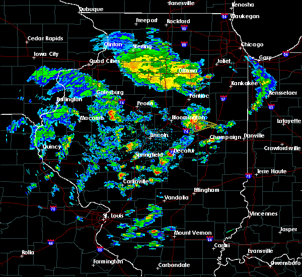 At 500 pm cdt, a severe thunderstorm was located 6 miles south of saybrook, or 10 miles southwest of gibson city, moving northeast at 30 mph (radar indicated). Hazards include 60 mph wind gusts and quarter size hail. Hail damage to vehicles is expected. Expect wind damage to roofs, siding, and trees. At 500 pm cdt, a severe thunderstorm was located 6 miles south of saybrook, or 10 miles southwest of gibson city, moving northeast at 30 mph (radar indicated). Hazards include 60 mph wind gusts and quarter size hail. Hail damage to vehicles is expected. Expect wind damage to roofs, siding, and trees.
|
| 4/21/2016 4:55 PM CDT | Half Dollar sized hail reported 0.2 miles E of Bellflower, IL |
| 12/23/2015 9:20 AM CST | The national weather service in lincoln has issued a * severe thunderstorm warning for. eastern mclean county in central illinois. until 945 am cst * at 920 am cst. a severe thunderstorm was located 5 miles southwest of saybrook. or 13 miles southwest of gibson city. Moving. |
| 6/7/2015 5:02 PM CDT | At 501 pm cdt, severe thunderstorms were located along a line extending from 6 miles north of colfax to near towanda to near stanford, moving east at 40 mph (radar indicated). Hazards include 70 mph wind gusts. Expect considerable tree damage. damage is likely to mobile homes, roofs and outbuildings. locations impacted include, bloomington, normal, eureka, le roy, el paso, lexington, hudson, chenoa, gridley, danvers, colfax, downs, goodfield, saybrook, stanford, carlock, towanda, secor, pleasant hill and congerville. this includes the following highways, interstate 39 between mile markers 0 and 16. interstate 55 between mile markers 153 and 187. Interstate 74 between mile markers 110 and 149. |
| 6/7/2015 4:24 PM CDT | At 423 pm cdt, a severe thunderstorm was located over goodfield, or 7 miles south of eureka, moving east at 50 mph (radar indicated). Hazards include 70 mph wind gusts and quarter size hail. Hail damage to vehicles is expected. expect considerable tree damage. Wind damage is also likely to mobile homes, roofs and outbuildings. |
| 4/8/2015 2:30 PM CDT | The national weather service in lincoln has issued a * severe thunderstorm warning for. northern champaign county in east central illinois. southeastern mclean county in central illinois. until 315 pm cdt * at 224 pm cdt. A severe thunderstorm was located 5 miles south of. |
Hail Maps for Bellflower, IL
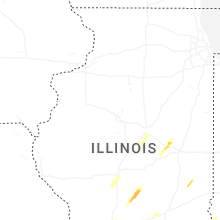
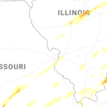


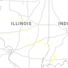


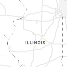


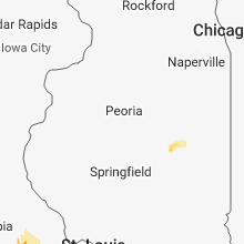


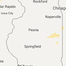


Connect with Interactive Hail Maps