

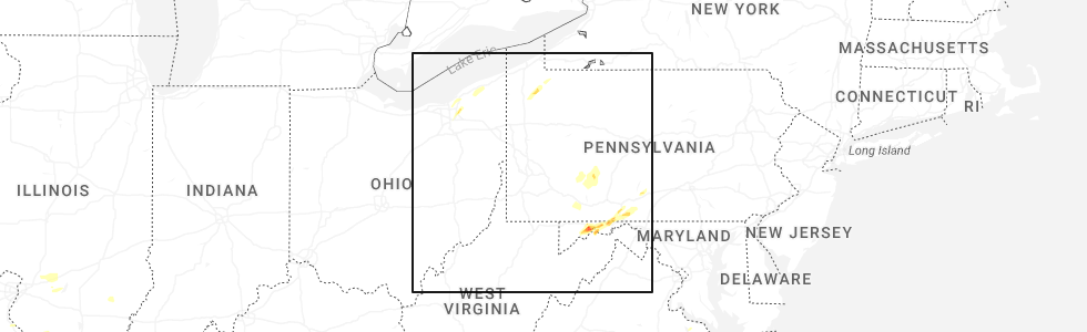
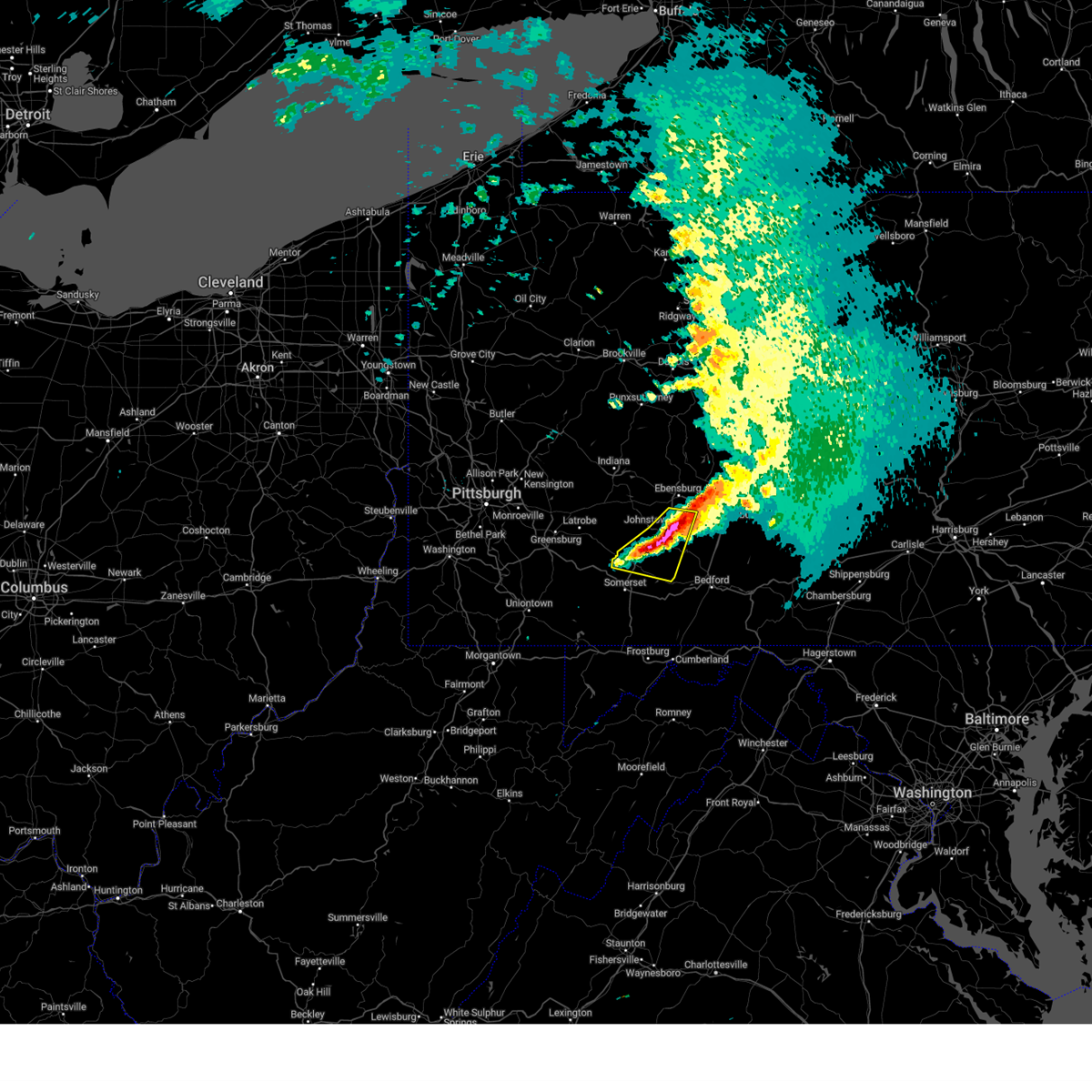
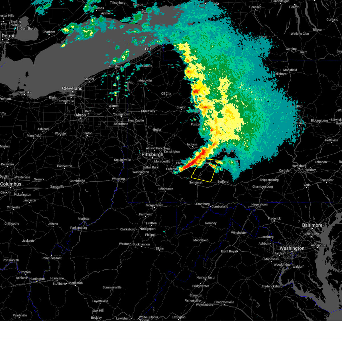
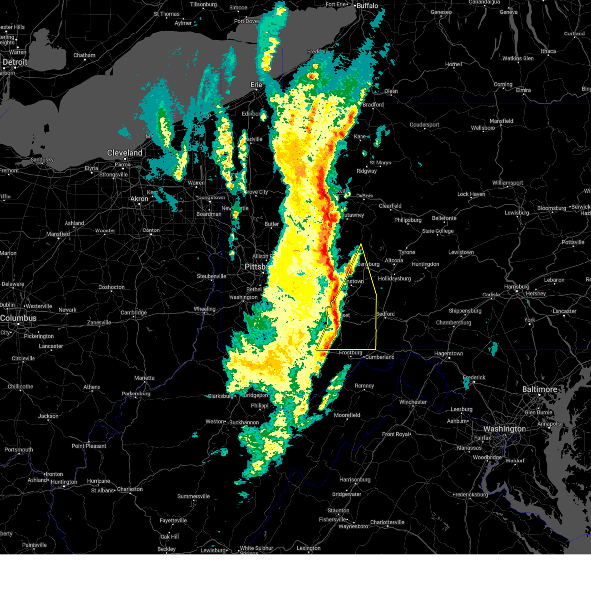
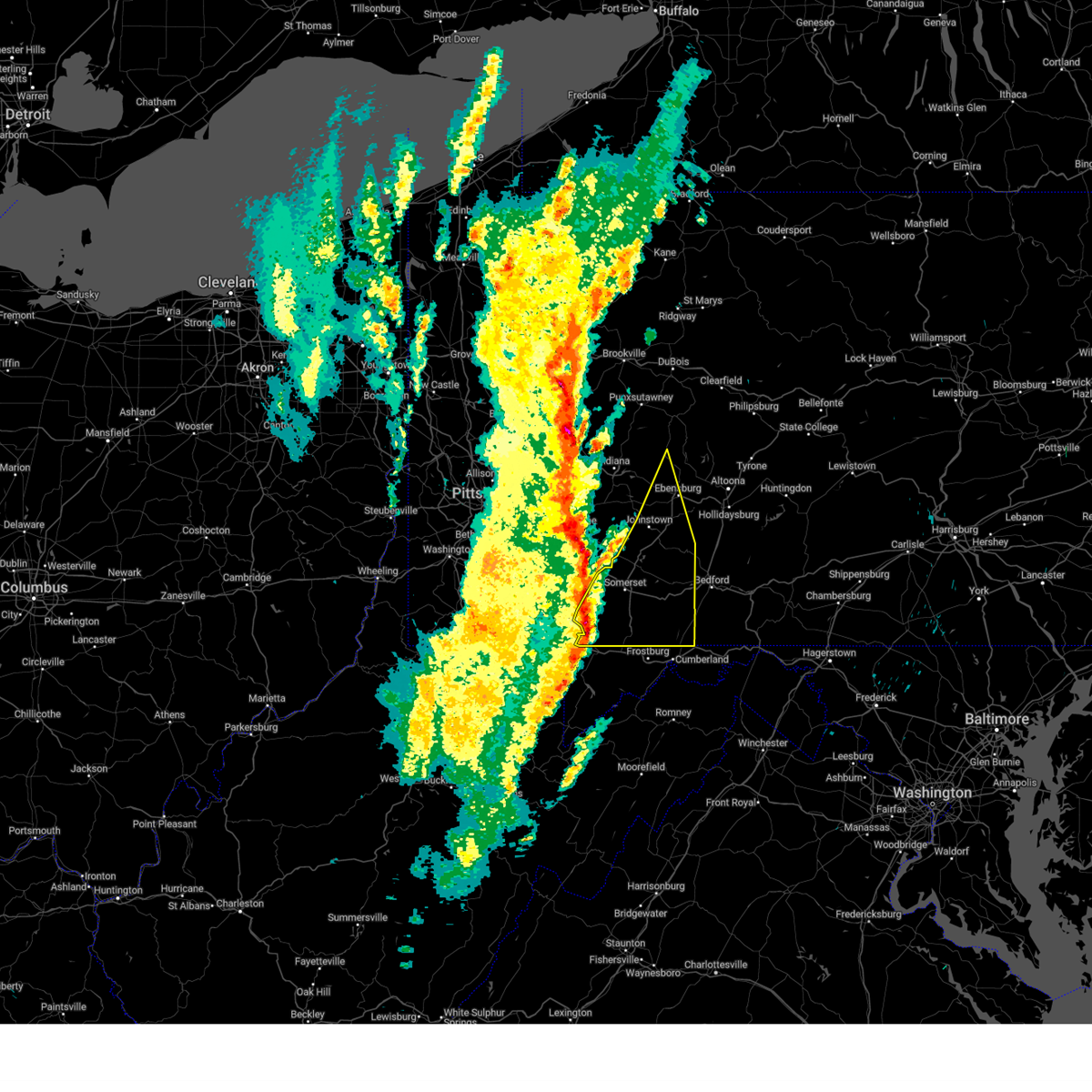
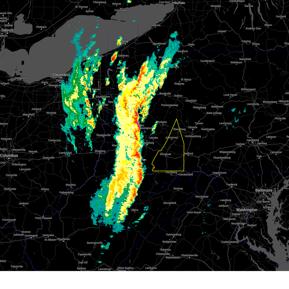
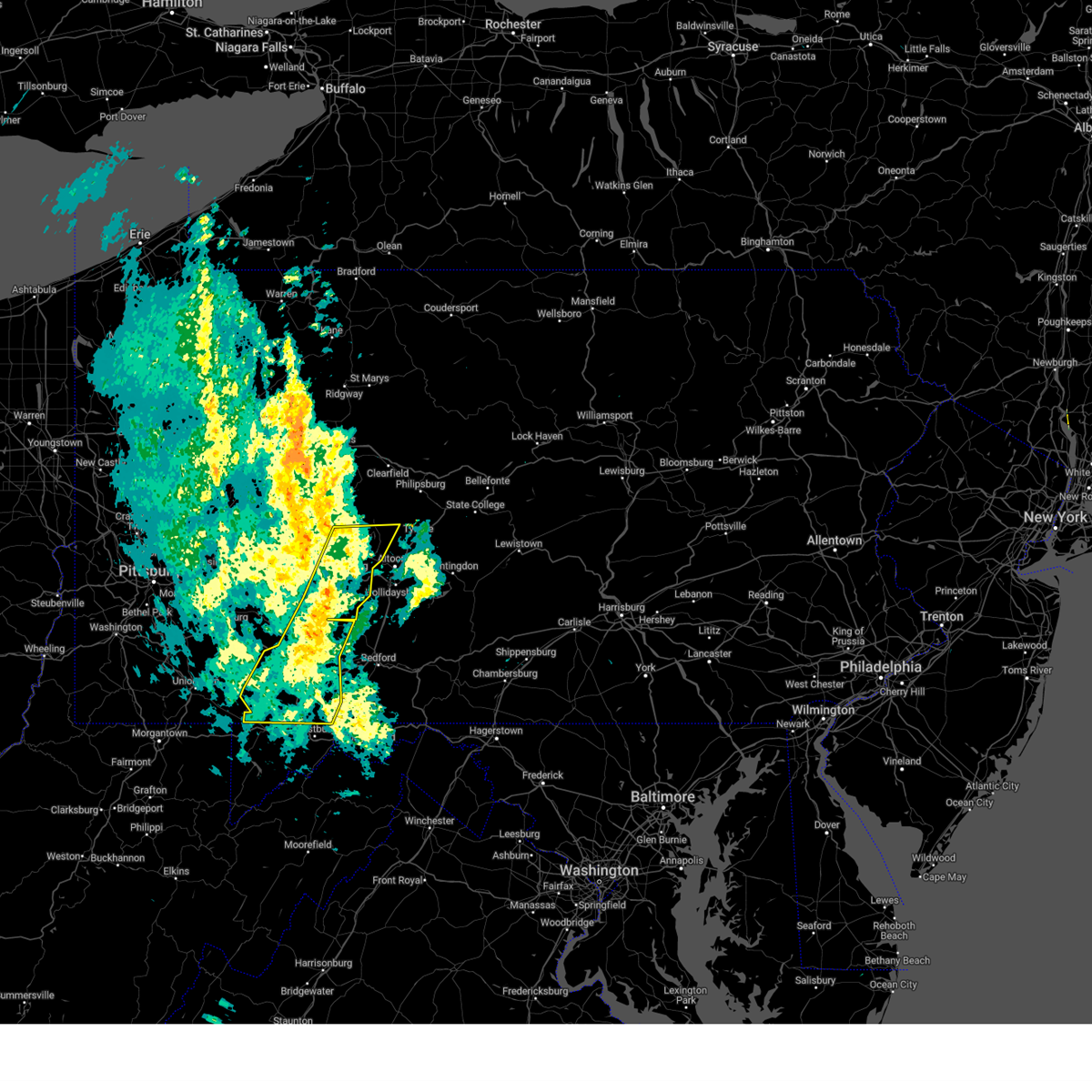
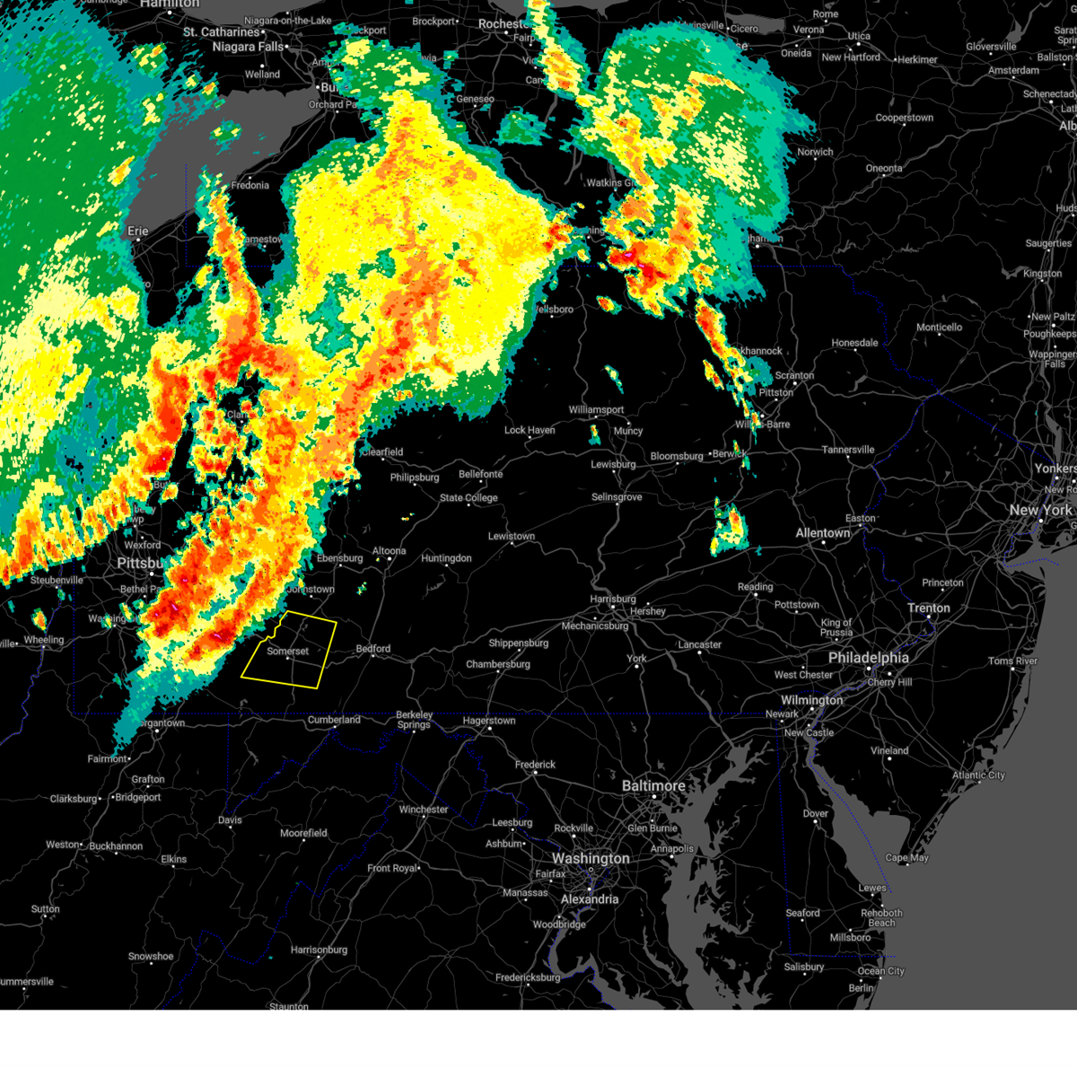
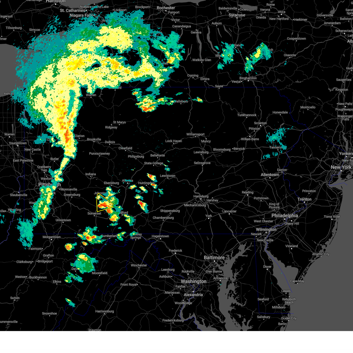
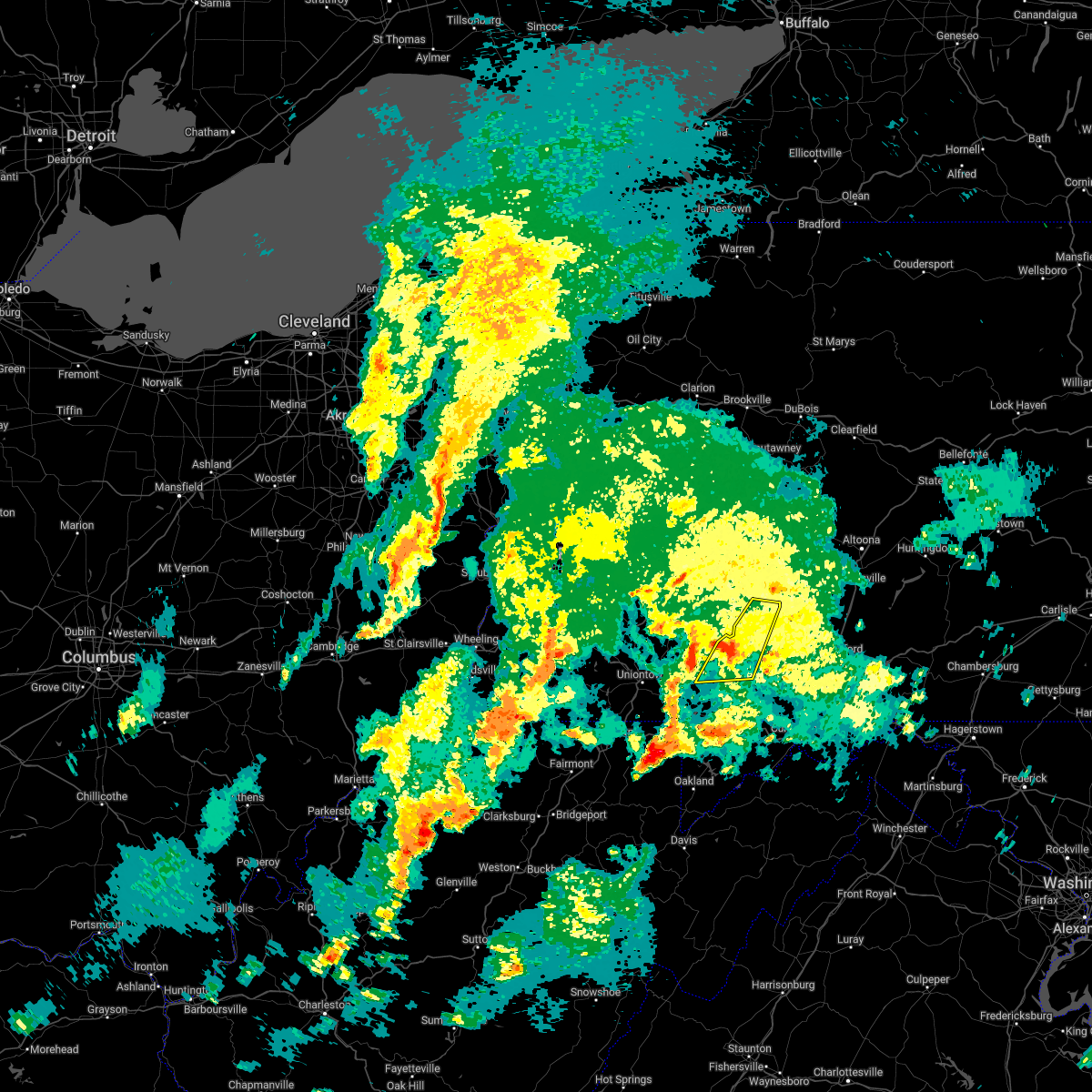
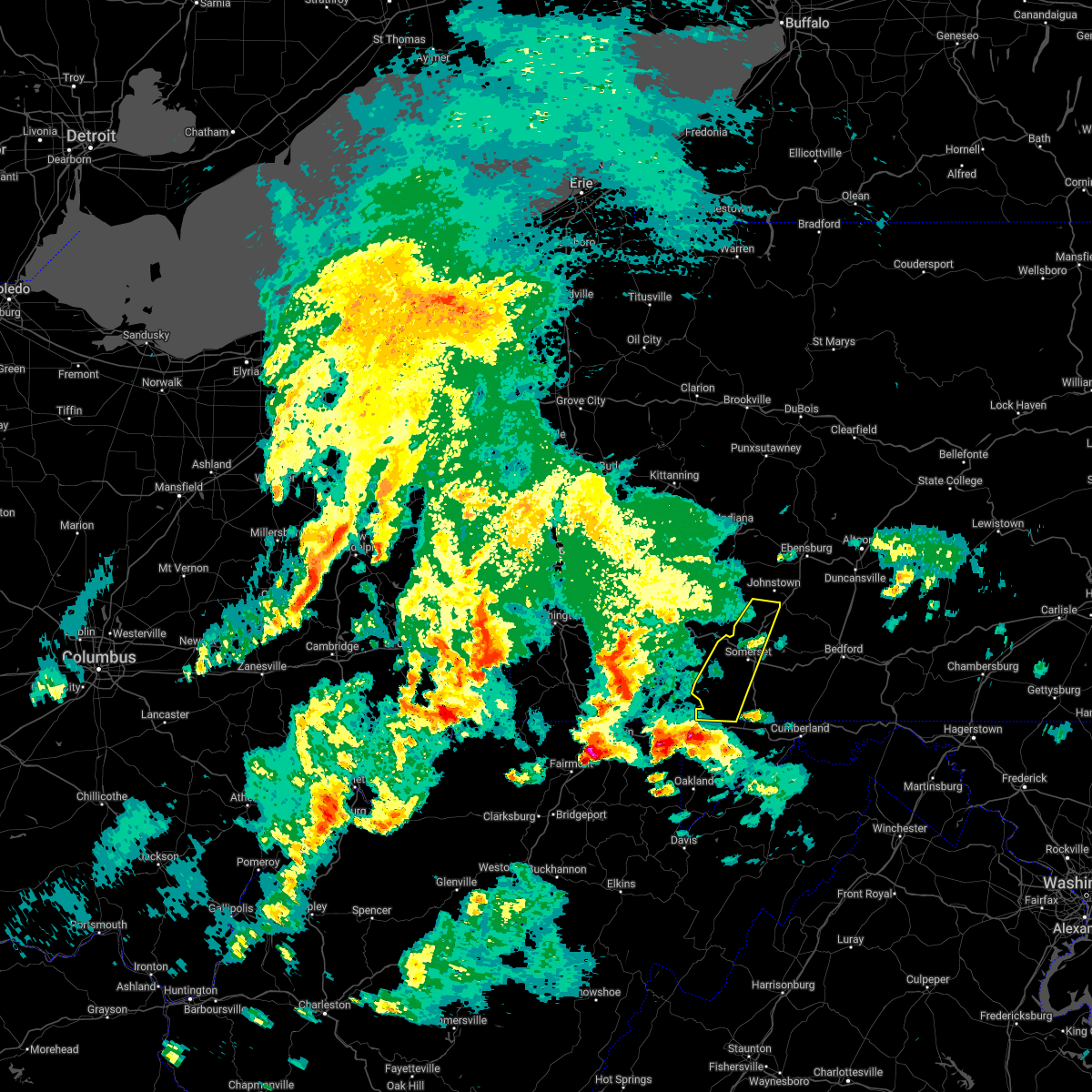
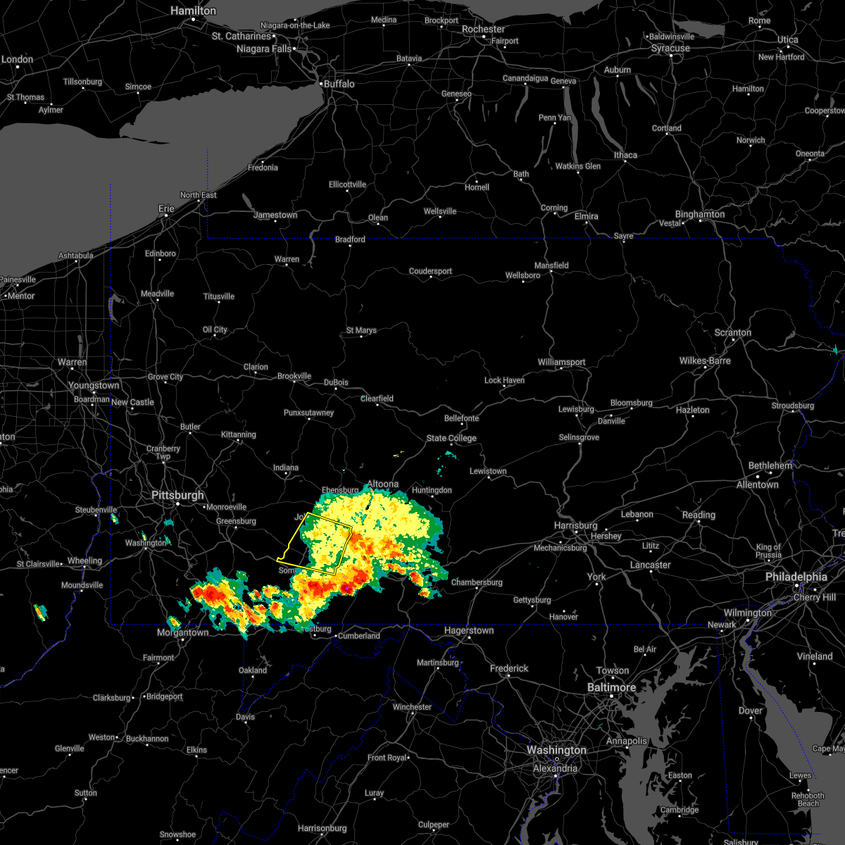
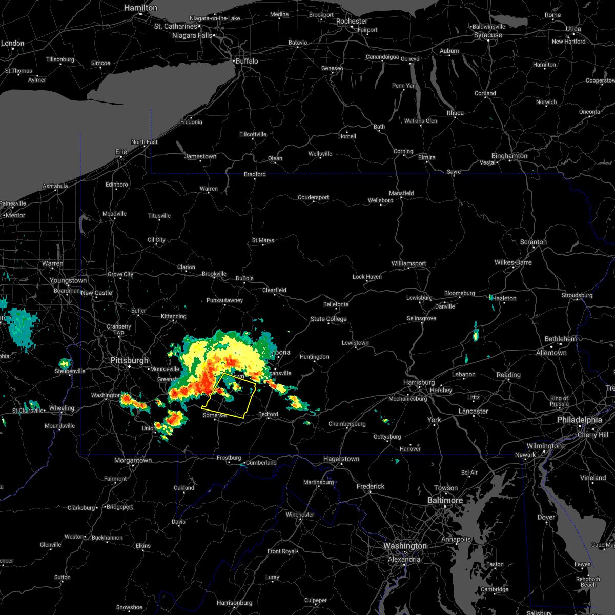
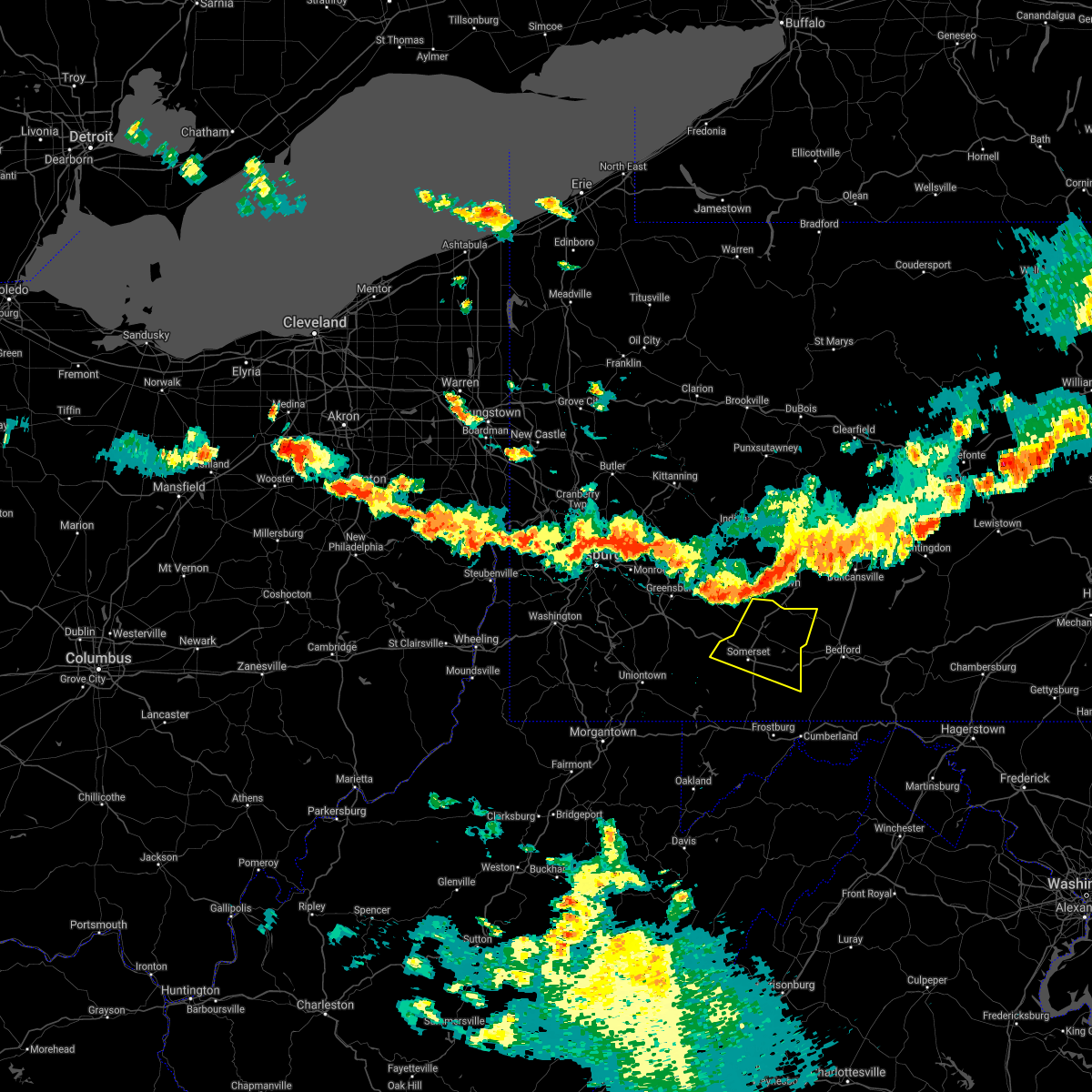
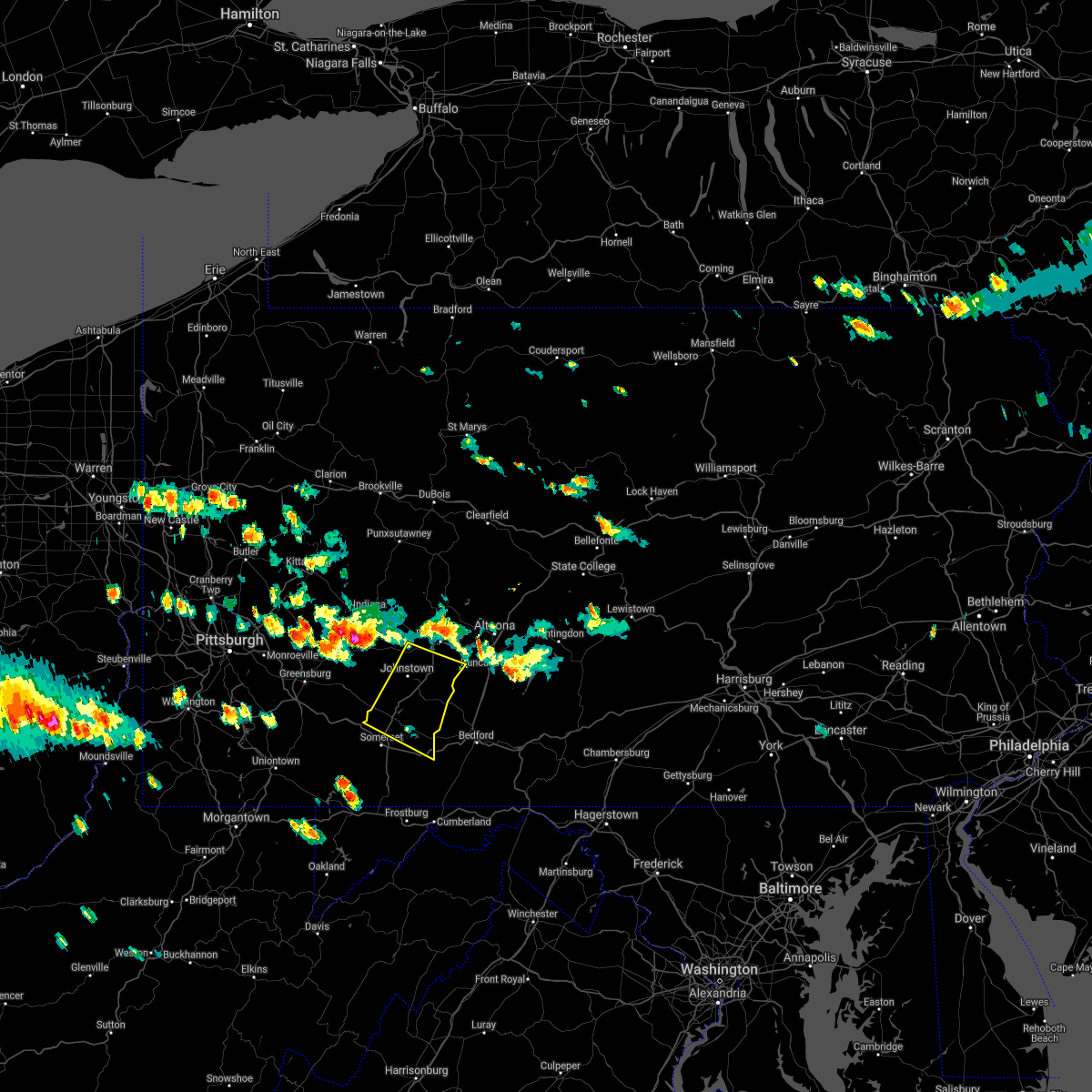
Hail Map for Benson, PA
The Benson, PA area has had 0 reports of on-the-ground hail by trained spotters, and has been under severe weather warnings 14 times during the past 12 months. Doppler radar has detected hail at or near Benson, PA on 15 occasions, including 2 occasions during the past year.
| Name: | Benson, PA |
| Where Located: | 58.7 miles ESE of Pittsburgh, PA |
| Map: | Google Map for Benson, PA |
| Population: | 191 |
| Housing Units: | 83 |
| More Info: | Search Google for Benson, PA |
0
The Top Recent Hail Date for Benson, PA is Thursday, May 1, 2025 (15th out of 15)
Hail and Wind Damage Spotted near Benson, PA
| Date / Time | Report Details |
|---|---|
| 6/19/2025 6:04 PM EDT | Svrctp the national weather service in state college pa has issued a * severe thunderstorm warning for, cambria county in central pennsylvania, northeastern somerset county in south central pennsylvania, * until 645 pm edt. * at 604 pm edt, severe thunderstorms were located along a line extending from northern cambria to near ligonier, moving east at 45 mph (radar indicated). Hazards include 60 mph wind gusts. expect damage to roofs, siding, and trees |
| 5/1/2025 6:42 PM EDT |
 Svrctp the national weather service in state college pa has issued a * severe thunderstorm warning for, southwestern cambria county in central pennsylvania, northwestern somerset county in south central pennsylvania, * until 715 pm edt. * at 641 pm edt, severe thunderstorms were located along a line extending from near seven springs to near acosta to friedens, moving northeast at 40 mph (radar indicated). Hazards include 60 mph wind gusts and quarter size hail. Hail damage to vehicles is expected. Expect wind damage to roofs, siding, and trees. Svrctp the national weather service in state college pa has issued a * severe thunderstorm warning for, southwestern cambria county in central pennsylvania, northwestern somerset county in south central pennsylvania, * until 715 pm edt. * at 641 pm edt, severe thunderstorms were located along a line extending from near seven springs to near acosta to friedens, moving northeast at 40 mph (radar indicated). Hazards include 60 mph wind gusts and quarter size hail. Hail damage to vehicles is expected. Expect wind damage to roofs, siding, and trees.
|
| 4/29/2025 5:54 PM EDT |
 Svrctp the national weather service in state college pa has issued a * severe thunderstorm warning for, somerset county in south central pennsylvania, * until 630 pm edt. * at 554 pm edt, severe thunderstorms were located along a line extending from near blairsville to near south connellsville, moving east at 70 mph (radar indicated). Hazards include 65 mph wind gusts. expect damage to roofs, siding, and trees Svrctp the national weather service in state college pa has issued a * severe thunderstorm warning for, somerset county in south central pennsylvania, * until 630 pm edt. * at 554 pm edt, severe thunderstorms were located along a line extending from near blairsville to near south connellsville, moving east at 70 mph (radar indicated). Hazards include 65 mph wind gusts. expect damage to roofs, siding, and trees
|
| 4/19/2025 6:27 PM EDT |
 Svrctp the national weather service in state college pa has issued a * severe thunderstorm warning for, northern bedford county in south central pennsylvania, southwestern blair county in central pennsylvania, southwestern cambria county in central pennsylvania, northeastern somerset county in south central pennsylvania, * until 715 pm edt. * at 627 pm edt, a severe thunderstorm was located over boswell, moving east at 70 mph (radar indicated). Hazards include 60 mph wind gusts and penny size hail. expect damage to roofs, siding, and trees Svrctp the national weather service in state college pa has issued a * severe thunderstorm warning for, northern bedford county in south central pennsylvania, southwestern blair county in central pennsylvania, southwestern cambria county in central pennsylvania, northeastern somerset county in south central pennsylvania, * until 715 pm edt. * at 627 pm edt, a severe thunderstorm was located over boswell, moving east at 70 mph (radar indicated). Hazards include 60 mph wind gusts and penny size hail. expect damage to roofs, siding, and trees
|
| 4/2/2025 3:47 PM EDT |
 At 347 pm edt, a severe thunderstorm was located over dunlo, moving east at 50 mph (radar indicated). Hazards include quarter size hail. Damage to vehicles is expected. locations impacted include, acosta, salix-beauty line park, davidsville, spring hill, belmont, elim, central city, windber, scalp level, dunlo, john murtha johnstown-cambria county airport, and jennerstown. this includes the following highways, route 30 from the westmoreland county line to indian lake. route 219 from north of somerset to near south fork. The johnstown expressway. At 347 pm edt, a severe thunderstorm was located over dunlo, moving east at 50 mph (radar indicated). Hazards include quarter size hail. Damage to vehicles is expected. locations impacted include, acosta, salix-beauty line park, davidsville, spring hill, belmont, elim, central city, windber, scalp level, dunlo, john murtha johnstown-cambria county airport, and jennerstown. this includes the following highways, route 30 from the westmoreland county line to indian lake. route 219 from north of somerset to near south fork. The johnstown expressway.
|
| 4/2/2025 3:25 PM EDT |
 Svrctp the national weather service in state college pa has issued a * severe thunderstorm warning for, southwestern cambria county in central pennsylvania, northeastern somerset county in south central pennsylvania, * until 400 pm edt. * at 322 pm edt, a severe thunderstorm was located near ligonier, moving east at 50 mph (radar indicated). Hazards include quarter size hail. Damage to vehicles is expected. this severe thunderstorm will be near, westmont, davidsville, and dale around 330 pm edt. dunlo, scalp level, and salix-beauty line park around 340 pm edt. other locations impacted by this severe thunderstorm include benson, spring hill, university of pittsburgh - johnstown, elim, and stoystown. this includes the following highways, route 30 from the westmoreland county line to indian lake. route 219 from north of somerset to near south fork. state road 56 from the westmoreland county line to johnstown. The johnstown expressway. Svrctp the national weather service in state college pa has issued a * severe thunderstorm warning for, southwestern cambria county in central pennsylvania, northeastern somerset county in south central pennsylvania, * until 400 pm edt. * at 322 pm edt, a severe thunderstorm was located near ligonier, moving east at 50 mph (radar indicated). Hazards include quarter size hail. Damage to vehicles is expected. this severe thunderstorm will be near, westmont, davidsville, and dale around 330 pm edt. dunlo, scalp level, and salix-beauty line park around 340 pm edt. other locations impacted by this severe thunderstorm include benson, spring hill, university of pittsburgh - johnstown, elim, and stoystown. this includes the following highways, route 30 from the westmoreland county line to indian lake. route 219 from north of somerset to near south fork. state road 56 from the westmoreland county line to johnstown. The johnstown expressway.
|
| 3/16/2025 1:47 PM EDT |
 Svrctp the national weather service in state college pa has issued a * severe thunderstorm warning for, bedford county in south central pennsylvania, blair county in central pennsylvania, cambria county in central pennsylvania, southwestern centre county in central pennsylvania, clearfield county in central pennsylvania, eastern elk county in north central pennsylvania, eastern somerset county in south central pennsylvania, * until 230 pm edt. * at 147 pm edt, severe thunderstorms were located along a line extending from near portland mills to near punxsutawney to near friedens, moving northeast at 80 mph (trained weather spotters). Hazards include 60 mph wind gusts and penny size hail. expect damage to roofs, siding, and trees Svrctp the national weather service in state college pa has issued a * severe thunderstorm warning for, bedford county in south central pennsylvania, blair county in central pennsylvania, cambria county in central pennsylvania, southwestern centre county in central pennsylvania, clearfield county in central pennsylvania, eastern elk county in north central pennsylvania, eastern somerset county in south central pennsylvania, * until 230 pm edt. * at 147 pm edt, severe thunderstorms were located along a line extending from near portland mills to near punxsutawney to near friedens, moving northeast at 80 mph (trained weather spotters). Hazards include 60 mph wind gusts and penny size hail. expect damage to roofs, siding, and trees
|
| 3/16/2025 1:31 PM EDT |
 At 130 pm edt, severe thunderstorms were located along a line extending from blairsville to somerset to near grantsville, moving northeast at 55 mph (trained weather spotters). Hazards include 60 mph wind gusts and penny size hail. Expect damage to roofs, siding, and trees. locations impacted include, acosta, salix-beauty line park, mundys corner, northern cambria, belmont, johnstown, elim, central city, buffalo mills, friedens, salisbury, and casselman. This includes the pennsylvania turnpike from mile markers 100 to 138. At 130 pm edt, severe thunderstorms were located along a line extending from blairsville to somerset to near grantsville, moving northeast at 55 mph (trained weather spotters). Hazards include 60 mph wind gusts and penny size hail. Expect damage to roofs, siding, and trees. locations impacted include, acosta, salix-beauty line park, mundys corner, northern cambria, belmont, johnstown, elim, central city, buffalo mills, friedens, salisbury, and casselman. This includes the pennsylvania turnpike from mile markers 100 to 138.
|
| 3/16/2025 1:14 PM EDT |
 At 113 pm edt, severe thunderstorms were located along a line extending from greensburg to near seven springs to friendsville, moving northeast at 55 mph (radar indicated). Hazards include 60 mph wind gusts. Expect damage to roofs, siding, and trees. locations impacted include, acosta, salix-beauty line park, mundys corner, northern cambria, belmont, johnstown, elim, central city, buffalo mills, seven springs, friedens, and salisbury. This includes the pennsylvania turnpike from mile markers 100 to 138. At 113 pm edt, severe thunderstorms were located along a line extending from greensburg to near seven springs to friendsville, moving northeast at 55 mph (radar indicated). Hazards include 60 mph wind gusts. Expect damage to roofs, siding, and trees. locations impacted include, acosta, salix-beauty line park, mundys corner, northern cambria, belmont, johnstown, elim, central city, buffalo mills, seven springs, friedens, and salisbury. This includes the pennsylvania turnpike from mile markers 100 to 138.
|
| 3/16/2025 12:59 PM EDT |
 Svrctp the national weather service in state college pa has issued a * severe thunderstorm warning for, western bedford county in south central pennsylvania, western cambria county in central pennsylvania, somerset county in south central pennsylvania, * until 200 pm edt. * at 1257 pm edt, severe thunderstorms were located along a line extending from west newton to uniontown to kingwood, moving northeast at 55 mph (radar indicated). Hazards include 60 mph wind gusts. expect damage to roofs, siding, and trees Svrctp the national weather service in state college pa has issued a * severe thunderstorm warning for, western bedford county in south central pennsylvania, western cambria county in central pennsylvania, somerset county in south central pennsylvania, * until 200 pm edt. * at 1257 pm edt, severe thunderstorms were located along a line extending from west newton to uniontown to kingwood, moving northeast at 55 mph (radar indicated). Hazards include 60 mph wind gusts. expect damage to roofs, siding, and trees
|
| 3/5/2025 5:12 PM EST |
 The storm which prompted the warning has weakened below severe limits, and no longer poses an immediate threat to life or property. therefore, the warning will be allowed to expire. however, gusty winds are still possible with this thunderstorm. to report severe weather, contact your nearest law enforcement agency. they will relay your report to the national weather service state college pa. The storm which prompted the warning has weakened below severe limits, and no longer poses an immediate threat to life or property. therefore, the warning will be allowed to expire. however, gusty winds are still possible with this thunderstorm. to report severe weather, contact your nearest law enforcement agency. they will relay your report to the national weather service state college pa.
|
| 3/5/2025 4:56 PM EST |
 At 455 pm est, a severe thunderstorm was located over davidsville, moving northeast at 40 mph (radar indicated). Hazards include 60 mph wind gusts and quarter size hail. Hail damage to vehicles is expected. expect wind damage to roofs, siding, and trees. Locations impacted include, salix-beauty line park, davidsville, belmont, johnstown, vinco, elim, windber, scalp level, dunlo, east conemaugh, johnstown flood national memorial historic site, and john murtha johnstown-cambria county airport. At 455 pm est, a severe thunderstorm was located over davidsville, moving northeast at 40 mph (radar indicated). Hazards include 60 mph wind gusts and quarter size hail. Hail damage to vehicles is expected. expect wind damage to roofs, siding, and trees. Locations impacted include, salix-beauty line park, davidsville, belmont, johnstown, vinco, elim, windber, scalp level, dunlo, east conemaugh, johnstown flood national memorial historic site, and john murtha johnstown-cambria county airport.
|
| 3/5/2025 4:41 PM EST |
 Svrctp the national weather service in state college pa has issued a * severe thunderstorm warning for, southwestern cambria county in central pennsylvania, north central somerset county in south central pennsylvania, * until 515 pm est. * at 441 pm est, a severe thunderstorm was located over acosta, moving northeast at 40 mph (radar indicated). Hazards include 60 mph wind gusts and quarter size hail. Hail damage to vehicles is expected. Expect wind damage to roofs, siding, and trees. Svrctp the national weather service in state college pa has issued a * severe thunderstorm warning for, southwestern cambria county in central pennsylvania, north central somerset county in south central pennsylvania, * until 515 pm est. * at 441 pm est, a severe thunderstorm was located over acosta, moving northeast at 40 mph (radar indicated). Hazards include 60 mph wind gusts and quarter size hail. Hail damage to vehicles is expected. Expect wind damage to roofs, siding, and trees.
|
| 11/20/2024 5:33 PM EST |
 Svrctp the national weather service in state college pa has issued a * severe thunderstorm warning for, cambria county in central pennsylvania, somerset county in south central pennsylvania, * until 645 pm est. * at 532 pm est, severe thunderstorms were located along a line extending from near ford city to near mount pleasant to near friendsville, moving east at 35 mph (radar indicated). Hazards include 60 mph wind gusts. Expect damage to roofs, siding, and trees. severe thunderstorms will be near, seven springs and ursina around 540 pm est. somerset, mount davis, and new centerville around 550 pm est. acosta, boswell, and meyersdale around 600 pm est. westmont, belmont, and johnstown around 610 pm est. windber, nanty-glo, and scalp level around 620 pm est. other locations impacted by these severe thunderstorms include addison, spring hill, mundys corner, cassandra, and elim. This includes the pennsylvania turnpike from mile markers 101 to 130. Svrctp the national weather service in state college pa has issued a * severe thunderstorm warning for, cambria county in central pennsylvania, somerset county in south central pennsylvania, * until 645 pm est. * at 532 pm est, severe thunderstorms were located along a line extending from near ford city to near mount pleasant to near friendsville, moving east at 35 mph (radar indicated). Hazards include 60 mph wind gusts. Expect damage to roofs, siding, and trees. severe thunderstorms will be near, seven springs and ursina around 540 pm est. somerset, mount davis, and new centerville around 550 pm est. acosta, boswell, and meyersdale around 600 pm est. westmont, belmont, and johnstown around 610 pm est. windber, nanty-glo, and scalp level around 620 pm est. other locations impacted by these severe thunderstorms include addison, spring hill, mundys corner, cassandra, and elim. This includes the pennsylvania turnpike from mile markers 101 to 130.
|
| 5/26/2024 8:54 PM EDT |
 Svrctp the national weather service in state college pa has issued a * severe thunderstorm warning for, bedford county in south central pennsylvania, southwestern blair county in central pennsylvania, cambria county in central pennsylvania, western fulton county in south central pennsylvania, eastern somerset county in south central pennsylvania, * until 945 pm edt. * at 850 pm edt, severe thunderstorms were located along a line extending from near ligonier to somerset to frostburg to near meyersdale to lonaconing to near keyser, moving northeast at 50 mph (radar indicated). Hazards include 60 mph wind gusts. expect damage to roofs, siding, and trees Svrctp the national weather service in state college pa has issued a * severe thunderstorm warning for, bedford county in south central pennsylvania, southwestern blair county in central pennsylvania, cambria county in central pennsylvania, western fulton county in south central pennsylvania, eastern somerset county in south central pennsylvania, * until 945 pm edt. * at 850 pm edt, severe thunderstorms were located along a line extending from near ligonier to somerset to frostburg to near meyersdale to lonaconing to near keyser, moving northeast at 50 mph (radar indicated). Hazards include 60 mph wind gusts. expect damage to roofs, siding, and trees
|
| 5/8/2024 3:51 AM EDT |
 The storm which prompted the warning is moving out of the area. therefore, the warning will be allowed to expire. The storm which prompted the warning is moving out of the area. therefore, the warning will be allowed to expire.
|
| 5/8/2024 3:17 AM EDT |
 Svrctp the national weather service in state college pa has issued a * severe thunderstorm warning for, southwestern cambria county in central pennsylvania, northern somerset county in south central pennsylvania, * until 400 am edt. * at 317 am edt, a severe thunderstorm was located over westmont, moving east at 60 mph (radar indicated). Hazards include 60 mph wind gusts. expect damage to roofs, siding, and trees Svrctp the national weather service in state college pa has issued a * severe thunderstorm warning for, southwestern cambria county in central pennsylvania, northern somerset county in south central pennsylvania, * until 400 am edt. * at 317 am edt, a severe thunderstorm was located over westmont, moving east at 60 mph (radar indicated). Hazards include 60 mph wind gusts. expect damage to roofs, siding, and trees
|
| 8/25/2023 2:48 AM EDT |
 At 248 am edt, severe thunderstorms were located along a line extending from boswell to ursina, moving southeast at 40 mph (radar indicated). Hazards include 70 mph wind gusts and quarter size hail. Hail damage to vehicles is expected. expect considerable tree damage. wind damage is also likely to mobile homes, roofs, and outbuildings. locations impacted include, somerset, meyersdale, berlin, friedens, boswell, davidsville, central city, jerome, acosta, ursina, new centerville and mount davis. this includes the pennsylvania turnpike from mile markers 100 to 130. thunderstorm damage threat, considerable hail threat, radar indicated max hail size, 1. 00 in wind threat, radar indicated max wind gust, 70 mph. At 248 am edt, severe thunderstorms were located along a line extending from boswell to ursina, moving southeast at 40 mph (radar indicated). Hazards include 70 mph wind gusts and quarter size hail. Hail damage to vehicles is expected. expect considerable tree damage. wind damage is also likely to mobile homes, roofs, and outbuildings. locations impacted include, somerset, meyersdale, berlin, friedens, boswell, davidsville, central city, jerome, acosta, ursina, new centerville and mount davis. this includes the pennsylvania turnpike from mile markers 100 to 130. thunderstorm damage threat, considerable hail threat, radar indicated max hail size, 1. 00 in wind threat, radar indicated max wind gust, 70 mph.
|
| 8/25/2023 2:40 AM EDT |
 At 239 am edt, severe thunderstorms were located along a line extending from near jerome to near ursina to masontown, moving southeast at 40 mph (radar indicated). Hazards include 70 mph wind gusts and quarter size hail. Hail damage to vehicles is expected. expect considerable tree damage. Wind damage is also likely to mobile homes, roofs, and outbuildings. At 239 am edt, severe thunderstorms were located along a line extending from near jerome to near ursina to masontown, moving southeast at 40 mph (radar indicated). Hazards include 70 mph wind gusts and quarter size hail. Hail damage to vehicles is expected. expect considerable tree damage. Wind damage is also likely to mobile homes, roofs, and outbuildings.
|
| 8/25/2023 2:21 AM EDT |
 At 218 am edt, the initial thunderstorm now over somerset has weakened to below severe levels, but a second storm currently over new stanton will move in from the west. that storm could also make damaging wind gusts. therefore the warning is going to be kept in effect (radar indicated). Hazards include 60 mph wind gusts. Expect damage to roofs, siding, and trees. locations impacted include, somerset, berlin, friedens, boswell, davidsville, central city, jerome, acosta, new centerville, rockwood, jennerstown and hooversville. this includes the pennsylvania turnpike from mile markers 100 to 124. hail threat, radar indicated max hail size, <. 75 in wind threat, radar indicated max wind gust, 60 mph. At 218 am edt, the initial thunderstorm now over somerset has weakened to below severe levels, but a second storm currently over new stanton will move in from the west. that storm could also make damaging wind gusts. therefore the warning is going to be kept in effect (radar indicated). Hazards include 60 mph wind gusts. Expect damage to roofs, siding, and trees. locations impacted include, somerset, berlin, friedens, boswell, davidsville, central city, jerome, acosta, new centerville, rockwood, jennerstown and hooversville. this includes the pennsylvania turnpike from mile markers 100 to 124. hail threat, radar indicated max hail size, <. 75 in wind threat, radar indicated max wind gust, 60 mph.
|
| 8/25/2023 1:39 AM EDT |
 At 138 am edt, a severe thunderstorm was located near seven springs, moving east at 30 mph (radar indicated). Hazards include 60 mph wind gusts and nickel size hail. expect damage to roofs, siding, and trees At 138 am edt, a severe thunderstorm was located near seven springs, moving east at 30 mph (radar indicated). Hazards include 60 mph wind gusts and nickel size hail. expect damage to roofs, siding, and trees
|
| 4/5/2023 10:09 PM EDT |
 At 1009 pm edt, severe thunderstorms were located along a line extending from portage to central city to near meyersdale, moving east at 55 mph (radar indicated). Hazards include 60 mph wind gusts. Expect damage to roofs, siding, and trees. locations impacted include, johnstown, windber, bedford, belmont, portage, geistown, meyersdale, berlin, claysburg, friedens, vinco and osterburg. this includes the following interstates, the pennsylvania turnpike from mile markers 114 to 151. interstate 99 from mile markers 0 to 15. hail threat, radar indicated max hail size, <. 75 in wind threat, radar indicated max wind gust, 60 mph. At 1009 pm edt, severe thunderstorms were located along a line extending from portage to central city to near meyersdale, moving east at 55 mph (radar indicated). Hazards include 60 mph wind gusts. Expect damage to roofs, siding, and trees. locations impacted include, johnstown, windber, bedford, belmont, portage, geistown, meyersdale, berlin, claysburg, friedens, vinco and osterburg. this includes the following interstates, the pennsylvania turnpike from mile markers 114 to 151. interstate 99 from mile markers 0 to 15. hail threat, radar indicated max hail size, <. 75 in wind threat, radar indicated max wind gust, 60 mph.
|
| 4/5/2023 9:57 PM EDT |
 At 957 pm edt, a severe thunderstorm was located over friedens, moving east at 45 mph (radar indicated). Hazards include 60 mph wind gusts. expect damage to roofs, siding, and trees At 957 pm edt, a severe thunderstorm was located over friedens, moving east at 45 mph (radar indicated). Hazards include 60 mph wind gusts. expect damage to roofs, siding, and trees
|
| 4/5/2023 8:35 PM EDT |
 At 835 pm edt, a severe thunderstorm was located over windber, moving northeast at 45 mph (radar indicated). Hazards include 60 mph wind gusts. Expect damage to roofs, siding, and trees. this severe thunderstorm will remain over mainly rural areas of southwestern cambria and northeastern somerset counties, including the following locations, benson, lorain, hooversville, elim and stoystown. hail threat, radar indicated max hail size, <. 75 in wind threat, radar indicated max wind gust, 60 mph. At 835 pm edt, a severe thunderstorm was located over windber, moving northeast at 45 mph (radar indicated). Hazards include 60 mph wind gusts. Expect damage to roofs, siding, and trees. this severe thunderstorm will remain over mainly rural areas of southwestern cambria and northeastern somerset counties, including the following locations, benson, lorain, hooversville, elim and stoystown. hail threat, radar indicated max hail size, <. 75 in wind threat, radar indicated max wind gust, 60 mph.
|
| 4/5/2023 8:19 PM EDT |
 At 819 pm edt, a severe thunderstorm was located over acosta, moving northeast at 45 mph (radar indicated). Hazards include 60 mph wind gusts. Expect damage to roofs, siding, and trees. this severe thunderstorm will be near, acosta around 820 pm edt. boswell and jerome around 830 pm edt. windber around 840 pm edt. other locations impacted by this severe thunderstorm include benson, lorain, hooversville, jennerstown and elim. this includes the pennsylvania turnpike from mile markers 100 to 108. this includes the following highways, route 30 from the westmoreland county line to east of stoystown. route 219 from north of somerset to geistown. the johnstown expressway. hail threat, radar indicated max hail size, <. 75 in wind threat, radar indicated max wind gust, 60 mph. At 819 pm edt, a severe thunderstorm was located over acosta, moving northeast at 45 mph (radar indicated). Hazards include 60 mph wind gusts. Expect damage to roofs, siding, and trees. this severe thunderstorm will be near, acosta around 820 pm edt. boswell and jerome around 830 pm edt. windber around 840 pm edt. other locations impacted by this severe thunderstorm include benson, lorain, hooversville, jennerstown and elim. this includes the pennsylvania turnpike from mile markers 100 to 108. this includes the following highways, route 30 from the westmoreland county line to east of stoystown. route 219 from north of somerset to geistown. the johnstown expressway. hail threat, radar indicated max hail size, <. 75 in wind threat, radar indicated max wind gust, 60 mph.
|
| 4/1/2023 2:57 PM EDT |
 The severe thunderstorm warning for cambria and somerset counties will expire at 300 pm edt, the line of storms which prompted the warning have moved out of the area and weakened. therefore, the warning will be allowed to expire. however, a high wind warning remains in effect though the first half of the night. additional thunderstorms to the west near pittsburgh may also move into the area shortly. gusty winds are still possible with those thunderstorms. a severe thunderstorm watch remains in effect until 600 pm edt for central and south central pennsylvania. a severe thunderstorm watch also remains in effect until 800 pm edt for south central and central pennsylvania. The severe thunderstorm warning for cambria and somerset counties will expire at 300 pm edt, the line of storms which prompted the warning have moved out of the area and weakened. therefore, the warning will be allowed to expire. however, a high wind warning remains in effect though the first half of the night. additional thunderstorms to the west near pittsburgh may also move into the area shortly. gusty winds are still possible with those thunderstorms. a severe thunderstorm watch remains in effect until 600 pm edt for central and south central pennsylvania. a severe thunderstorm watch also remains in effect until 800 pm edt for south central and central pennsylvania.
|
| 4/1/2023 2:33 PM EDT |
 At 231 pm edt, severe thunderstorms were located along a line extending from hastings to geistown to new centerville, moving east at 60 mph (automatic observing system. wind gust to 58 mph at westmoreland county airport). Hazards include 70 mph wind gusts. Expect considerable tree damage. damage is likely to mobile homes, roofs, and outbuildings. locations impacted include, johnstown, somerset, westmont, windber, ebensburg, belmont, nanty-glo, portage, northern cambria, geistown, southmont and meyersdale. this includes the pennsylvania turnpike from mile markers 101 to 130. this includes the following highways, route 22 from near nanty-glo to near gallitzin. route 30 from west of jennerstown to east of indian lake. route 40 from near somerfield to addison. route 219 from the maryland border to near cherry tree. route 422 from near the indiana county line to ebensburg. state road 56 near johnstown. the johnstown expressway. thunderstorm damage threat, considerable hail threat, radar indicated max hail size, <. 75 in wind threat, observed max wind gust, 70 mph. At 231 pm edt, severe thunderstorms were located along a line extending from hastings to geistown to new centerville, moving east at 60 mph (automatic observing system. wind gust to 58 mph at westmoreland county airport). Hazards include 70 mph wind gusts. Expect considerable tree damage. damage is likely to mobile homes, roofs, and outbuildings. locations impacted include, johnstown, somerset, westmont, windber, ebensburg, belmont, nanty-glo, portage, northern cambria, geistown, southmont and meyersdale. this includes the pennsylvania turnpike from mile markers 101 to 130. this includes the following highways, route 22 from near nanty-glo to near gallitzin. route 30 from west of jennerstown to east of indian lake. route 40 from near somerfield to addison. route 219 from the maryland border to near cherry tree. route 422 from near the indiana county line to ebensburg. state road 56 near johnstown. the johnstown expressway. thunderstorm damage threat, considerable hail threat, radar indicated max hail size, <. 75 in wind threat, observed max wind gust, 70 mph.
|
| 4/1/2023 2:07 PM EDT |
 At 206 pm edt, severe thunderstorms were located along a line extending from indiana to ligonier to uniontown, moving east at 75 mph (automatic observing system. wind gust to 68 mph at allegheny county airport). Hazards include 70 mph wind gusts. Expect considerable tree damage. Damage is likely to mobile homes, roofs, and outbuildings. At 206 pm edt, severe thunderstorms were located along a line extending from indiana to ligonier to uniontown, moving east at 75 mph (automatic observing system. wind gust to 68 mph at allegheny county airport). Hazards include 70 mph wind gusts. Expect considerable tree damage. Damage is likely to mobile homes, roofs, and outbuildings.
|
| 11/27/2022 3:39 PM EST |
 At 339 pm est, a severe thunderstorm was located over vinco, moving northeast at 55 mph (radar indicated). Hazards include 60 mph wind gusts and penny size hail. Expect damage to roofs, siding, and trees. Locations impacted include, johnstown, westmont, windber, ebensburg, belmont, nanty-glo, portage, northern cambria, geistown, southmont, patton and cresson. At 339 pm est, a severe thunderstorm was located over vinco, moving northeast at 55 mph (radar indicated). Hazards include 60 mph wind gusts and penny size hail. Expect damage to roofs, siding, and trees. Locations impacted include, johnstown, westmont, windber, ebensburg, belmont, nanty-glo, portage, northern cambria, geistown, southmont, patton and cresson.
|
| 11/27/2022 3:18 PM EST |
 At 318 pm est, a severe thunderstorm was located over ligonier, moving northeast at 55 mph (radar indicated). Hazards include 60 mph wind gusts and penny size hail. expect damage to roofs, siding, and trees At 318 pm est, a severe thunderstorm was located over ligonier, moving northeast at 55 mph (radar indicated). Hazards include 60 mph wind gusts and penny size hail. expect damage to roofs, siding, and trees
|
| 7/23/2022 4:10 PM EDT |
 At 409 pm edt, severe thunderstorms were located along a line extending from near indiana to near westmont to acosta to near friendsville, moving east at 40 mph (radar indicated). Hazards include 60 mph wind gusts and penny size hail. expect damage to roofs, siding, and trees At 409 pm edt, severe thunderstorms were located along a line extending from near indiana to near westmont to acosta to near friendsville, moving east at 40 mph (radar indicated). Hazards include 60 mph wind gusts and penny size hail. expect damage to roofs, siding, and trees
|
| 6/22/2022 6:45 PM EDT |
 At 645 pm edt, a severe thunderstorm was located over ogletown, moving southeast at 40 mph (radar indicated). Hazards include 60 mph wind gusts and quarter size hail. Hail damage to vehicles is expected. Expect wind damage to roofs, siding, and trees. At 645 pm edt, a severe thunderstorm was located over ogletown, moving southeast at 40 mph (radar indicated). Hazards include 60 mph wind gusts and quarter size hail. Hail damage to vehicles is expected. Expect wind damage to roofs, siding, and trees.
|
| 6/8/2022 9:56 PM EDT |
 At 955 pm edt, severe thunderstorms were located along a line extending from near seven springs to acosta, moving northeast at 50 mph (radar indicated). Hazards include 60 mph wind gusts and nickel size hail. Expect damage to roofs, siding, and trees. locations impacted include, somerset, friedens, boswell, davidsville, jerome, acosta, new centerville, tire hill, rockwood, jennerstown, stoystown and benson. This includes the pennsylvania turnpike from mile markers 100 to 114. At 955 pm edt, severe thunderstorms were located along a line extending from near seven springs to acosta, moving northeast at 50 mph (radar indicated). Hazards include 60 mph wind gusts and nickel size hail. Expect damage to roofs, siding, and trees. locations impacted include, somerset, friedens, boswell, davidsville, jerome, acosta, new centerville, tire hill, rockwood, jennerstown, stoystown and benson. This includes the pennsylvania turnpike from mile markers 100 to 114.
|
| 6/8/2022 9:17 PM EDT |
 At 917 pm edt, a severe thunderstorm was located over ursina, moving northeast at 50 mph (radar indicated). Hazards include 60 mph wind gusts and nickel size hail. expect damage to roofs, siding, and trees At 917 pm edt, a severe thunderstorm was located over ursina, moving northeast at 50 mph (radar indicated). Hazards include 60 mph wind gusts and nickel size hail. expect damage to roofs, siding, and trees
|
| 5/20/2022 10:56 AM EDT |
 At 1055 am edt, severe thunderstorms were located along a line extending from jerome to near central city to berlin to meyersdale, moving northeast at 60 mph (radar indicated). Hazards include 60 mph wind gusts. expect damage to roofs, siding, and trees At 1055 am edt, severe thunderstorms were located along a line extending from jerome to near central city to berlin to meyersdale, moving northeast at 60 mph (radar indicated). Hazards include 60 mph wind gusts. expect damage to roofs, siding, and trees
|
| 3/7/2022 4:52 PM EST |
 At 451 pm est, severe thunderstorms were located along a line extending from near indiana to ligonier to near uniontown, moving east at 50 mph (radar indicated). Hazards include 60 mph wind gusts. expect damage to roofs, siding, and trees At 451 pm est, severe thunderstorms were located along a line extending from near indiana to ligonier to near uniontown, moving east at 50 mph (radar indicated). Hazards include 60 mph wind gusts. expect damage to roofs, siding, and trees
|
| 7/17/2021 3:04 PM EDT |
 At 304 pm edt, severe thunderstorms were located along a line extending from near punxsutawney to near homer city to near westmont to acosta, moving northeast at 35 mph (radar indicated). Hazards include 60 mph wind gusts. expect damage to roofs, siding, and trees At 304 pm edt, severe thunderstorms were located along a line extending from near punxsutawney to near homer city to near westmont to acosta, moving northeast at 35 mph (radar indicated). Hazards include 60 mph wind gusts. expect damage to roofs, siding, and trees
|
| 7/11/2021 5:25 PM EDT |
 At 524 pm edt, severe thunderstorms were located along a line extending from 7 miles northeast of indiana to near westmont to 6 miles west of somerset to near ursina, moving northeast at 35 mph (radar indicated). Hazards include 60 mph wind gusts. expect damage to roofs, siding, and trees At 524 pm edt, severe thunderstorms were located along a line extending from 7 miles northeast of indiana to near westmont to 6 miles west of somerset to near ursina, moving northeast at 35 mph (radar indicated). Hazards include 60 mph wind gusts. expect damage to roofs, siding, and trees
|
| 7/7/2021 4:12 PM EDT |
 At 411 pm edt, a severe thunderstorm was located near jerome, moving east at 10 mph (radar indicated). Hazards include 60 mph wind gusts and quarter size hail. Hail damage to vehicles is expected. Expect wind damage to roofs, siding, and trees. At 411 pm edt, a severe thunderstorm was located near jerome, moving east at 10 mph (radar indicated). Hazards include 60 mph wind gusts and quarter size hail. Hail damage to vehicles is expected. Expect wind damage to roofs, siding, and trees.
|
| 6/21/2021 4:39 PM EDT |
 At 439 pm edt, severe thunderstorms were located along a line extending from 8 miles west of vinco to 7 miles south of lawson heights, moving east at 60 mph (radar indicated). Hazards include 60 mph wind gusts. expect damage to roofs, siding, and trees At 439 pm edt, severe thunderstorms were located along a line extending from 8 miles west of vinco to 7 miles south of lawson heights, moving east at 60 mph (radar indicated). Hazards include 60 mph wind gusts. expect damage to roofs, siding, and trees
|
| 6/13/2021 10:11 AM EDT |
 The severe thunderstorm warning for northeastern somerset and southwestern cambria counties will expire at 1015 am edt, the storm which prompted the warning has weakened below severe limits, and has exited the warned area. therefore, the warning will be allowed to expire. The severe thunderstorm warning for northeastern somerset and southwestern cambria counties will expire at 1015 am edt, the storm which prompted the warning has weakened below severe limits, and has exited the warned area. therefore, the warning will be allowed to expire.
|
| 6/13/2021 9:08 AM EDT |
 At 907 am edt, a severe thunderstorm was located near jerome, moving southeast at 30 mph (radar indicated). Hazards include 60 mph wind gusts. expect damage to roofs, siding, and trees At 907 am edt, a severe thunderstorm was located near jerome, moving southeast at 30 mph (radar indicated). Hazards include 60 mph wind gusts. expect damage to roofs, siding, and trees
|
| 11/15/2020 3:46 PM EST |
 At 345 pm est, severe thunderstorms were located along a line extending from near black lick to 7 miles south of farmington, moving east at 60 mph (radar indicated). Hazards include 60 mph wind gusts. expect damage to trees, roofs, and siding At 345 pm est, severe thunderstorms were located along a line extending from near black lick to 7 miles south of farmington, moving east at 60 mph (radar indicated). Hazards include 60 mph wind gusts. expect damage to trees, roofs, and siding
|
| 8/27/2020 6:47 PM EDT |
 At 647 pm edt, severe thunderstorms were located along a line extending from portage to davidsville to near mcchesneytown-loyalhanna, moving southeast at 45 mph (radar indicated). Hazards include 60 mph wind gusts and quarter size hail. Hail damage to vehicles is expected. Expect wind damage to trees, roofs, and siding. At 647 pm edt, severe thunderstorms were located along a line extending from portage to davidsville to near mcchesneytown-loyalhanna, moving southeast at 45 mph (radar indicated). Hazards include 60 mph wind gusts and quarter size hail. Hail damage to vehicles is expected. Expect wind damage to trees, roofs, and siding.
|
| 8/25/2020 3:35 PM EDT | Tree down blocking both lanes of roadwa in somerset county PA, 1.2 miles NNE of Benson, PA |
| 8/25/2020 3:00 PM EDT |
 At 259 pm edt, a severe thunderstorm was located near black lick, moving southeast at 40 mph (radar indicated). Hazards include 60 mph wind gusts and quarter size hail. Hail damage to vehicles is expected. Expect wind damage to trees, roofs, and siding. At 259 pm edt, a severe thunderstorm was located near black lick, moving southeast at 40 mph (radar indicated). Hazards include 60 mph wind gusts and quarter size hail. Hail damage to vehicles is expected. Expect wind damage to trees, roofs, and siding.
|
| 8/25/2020 8:51 AM EDT |
 At 851 am edt, severe thunderstorms were located along a line extending from near ogletown to near friedens to near somerset, moving southeast at 35 mph (radar indicated). Hazards include 60 mph wind gusts and quarter size hail. Hail damage to vehicles is expected. expect wind damage to trees, roofs, and siding. locations impacted include, somerset, windber, meyersdale, berlin, friedens, boswell, davidsville, central city, jerome, acosta, new centerville, ogletown, tire hill, rockwood, jennerstown, hooversville, garrett, indian lake, stoystown and shanksville. This includes the pennsylvania turnpike from mile markers 100 to 129. At 851 am edt, severe thunderstorms were located along a line extending from near ogletown to near friedens to near somerset, moving southeast at 35 mph (radar indicated). Hazards include 60 mph wind gusts and quarter size hail. Hail damage to vehicles is expected. expect wind damage to trees, roofs, and siding. locations impacted include, somerset, windber, meyersdale, berlin, friedens, boswell, davidsville, central city, jerome, acosta, new centerville, ogletown, tire hill, rockwood, jennerstown, hooversville, garrett, indian lake, stoystown and shanksville. This includes the pennsylvania turnpike from mile markers 100 to 129.
|
| 8/25/2020 8:23 AM EDT |
 At 822 am edt, severe thunderstorms were located along a line extending from near southmont to 8 miles south of lawson heights, moving southeast at 30 mph (radar indicated). Hazards include 60 mph wind gusts and quarter size hail. Hail damage to vehicles is expected. Expect wind damage to trees, roofs, and siding. At 822 am edt, severe thunderstorms were located along a line extending from near southmont to 8 miles south of lawson heights, moving southeast at 30 mph (radar indicated). Hazards include 60 mph wind gusts and quarter size hail. Hail damage to vehicles is expected. Expect wind damage to trees, roofs, and siding.
|
| 7/21/2020 3:18 PM EDT |
 At 317 pm edt, severe thunderstorms were located along a line extending from near queen to seven springs, moving southeast at 40 mph (radar indicated). Hazards include 60 mph wind gusts and quarter size hail. Hail damage to vehicles is expected. Expect wind damage to trees, roofs, and siding. At 317 pm edt, severe thunderstorms were located along a line extending from near queen to seven springs, moving southeast at 40 mph (radar indicated). Hazards include 60 mph wind gusts and quarter size hail. Hail damage to vehicles is expected. Expect wind damage to trees, roofs, and siding.
|
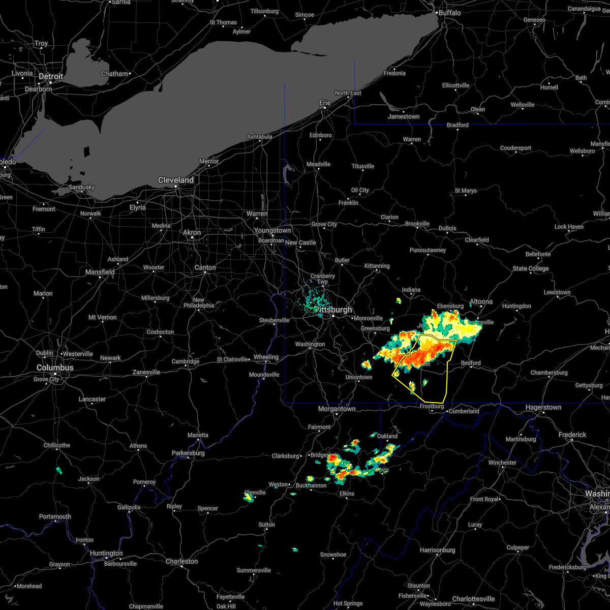
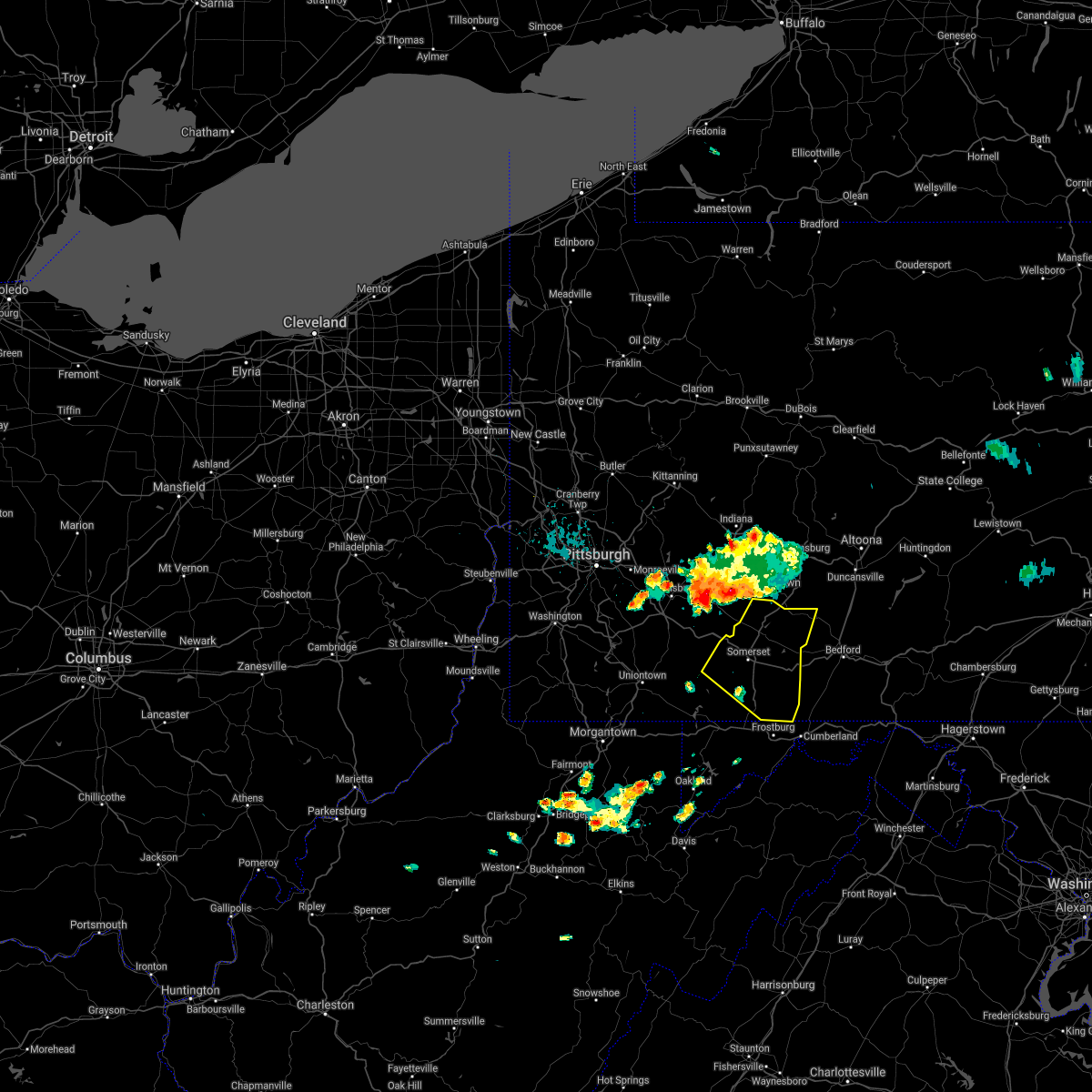
| 7/16/2020 3:02 PM EDT |
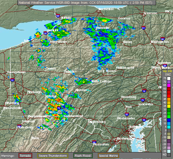 At 302 pm edt, a severe thunderstorm was located over belmont, moving northeast at 40 mph (radar indicated). Hazards include 60 mph wind gusts and quarter size hail. Hail damage to vehicles is expected. Expect wind damage to trees, roofs, and siding. At 302 pm edt, a severe thunderstorm was located over belmont, moving northeast at 40 mph (radar indicated). Hazards include 60 mph wind gusts and quarter size hail. Hail damage to vehicles is expected. Expect wind damage to trees, roofs, and siding.
|
| 7/5/2020 7:00 PM EDT | Tree down reported at holsopple p in somerset county PA, 0.3 miles S of Benson, PA |
| 4/13/2020 11:48 AM EDT |
 At 1146 am edt, severe thunderstorms were located along a line extending from 7 miles northeast of indiana to near south connellsville, moving northeast at 60 mph (radar indicated). Hazards include 60 mph wind gusts and penny size hail. expect damage to trees, roofs, and siding At 1146 am edt, severe thunderstorms were located along a line extending from 7 miles northeast of indiana to near south connellsville, moving northeast at 60 mph (radar indicated). Hazards include 60 mph wind gusts and penny size hail. expect damage to trees, roofs, and siding
|
| 4/8/2020 2:38 AM EDT |
 The severe thunderstorm warning for somerset and southwestern cambria counties will expire at 245 am edt, the storms which prompted the warning have moved out of the area. therefore, the warning will be allowed to expire. a severe thunderstorm watch remains in effect until 600 am edt for south central pennsylvania. to report severe weather, contact your nearest law enforcement agency. they will relay your report to the national weather service state college pa. The severe thunderstorm warning for somerset and southwestern cambria counties will expire at 245 am edt, the storms which prompted the warning have moved out of the area. therefore, the warning will be allowed to expire. a severe thunderstorm watch remains in effect until 600 am edt for south central pennsylvania. to report severe weather, contact your nearest law enforcement agency. they will relay your report to the national weather service state college pa.
|
| 4/8/2020 1:59 AM EDT |
 At 158 am edt, severe thunderstorms were located along a line extending from near vinco to near connellsville, moving southeast at 60 mph (radar indicated). Hazards include 70 mph wind gusts. Expect considerable tree damage. damage is likely to mobile homes, roofs, and outbuildings. locations impacted include, johnstown, somerset, westmont, windber, ebensburg, belmont, nanty-glo, portage, geistown, southmont, meyersdale, berlin, friedens, vinco, boswell, dale, east conemaugh, salix-beauty line park, davidsville and central city. This includes the pennsylvania turnpike from mile markers 100 to 130. At 158 am edt, severe thunderstorms were located along a line extending from near vinco to near connellsville, moving southeast at 60 mph (radar indicated). Hazards include 70 mph wind gusts. Expect considerable tree damage. damage is likely to mobile homes, roofs, and outbuildings. locations impacted include, johnstown, somerset, westmont, windber, ebensburg, belmont, nanty-glo, portage, geistown, southmont, meyersdale, berlin, friedens, vinco, boswell, dale, east conemaugh, salix-beauty line park, davidsville and central city. This includes the pennsylvania turnpike from mile markers 100 to 130.
|
| 4/8/2020 1:44 AM EDT |
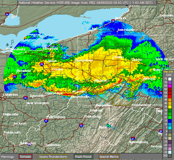 At 143 am edt, severe thunderstorms were located along a line extending from near black lick to youngwood, moving southeast at 60 mph (radar indicated). Hazards include 60 mph wind gusts. expect damage to trees, roofs, and siding At 143 am edt, severe thunderstorms were located along a line extending from near black lick to youngwood, moving southeast at 60 mph (radar indicated). Hazards include 60 mph wind gusts. expect damage to trees, roofs, and siding
|
| 3/28/2020 5:30 PM EDT |
 At 530 pm edt, a severe thunderstorm was located near acosta, moving east at 55 mph (radar indicated). Hazards include 60 mph wind gusts and quarter size hail. Hail damage to vehicles is expected. Expect wind damage to trees, roofs, and siding. At 530 pm edt, a severe thunderstorm was located near acosta, moving east at 55 mph (radar indicated). Hazards include 60 mph wind gusts and quarter size hail. Hail damage to vehicles is expected. Expect wind damage to trees, roofs, and siding.
|
| 7/6/2019 4:42 PM EDT |
 At 442 pm edt, severe thunderstorms were located along a line extending from near east conemaugh to south park township, moving east at 40 mph (radar indicated). Hazards include 60 mph wind gusts and quarter size hail. Hail damage to vehicles is expected. Expect wind damage to trees, roofs, and siding. At 442 pm edt, severe thunderstorms were located along a line extending from near east conemaugh to south park township, moving east at 40 mph (radar indicated). Hazards include 60 mph wind gusts and quarter size hail. Hail damage to vehicles is expected. Expect wind damage to trees, roofs, and siding.
|
| 7/2/2019 4:18 PM EDT |
 At 418 pm edt, severe thunderstorms were located along a line extending from east conemaugh to westmont, moving southeast at 25 mph (radar indicated). Hazards include 60 mph wind gusts. expect damage to trees, roofs, and siding At 418 pm edt, severe thunderstorms were located along a line extending from east conemaugh to westmont, moving southeast at 25 mph (radar indicated). Hazards include 60 mph wind gusts. expect damage to trees, roofs, and siding
|
| 5/29/2019 4:24 PM EDT |
 At 424 pm edt, a severe thunderstorm was located near ligonier, moving east at 55 mph (radar indicated). Hazards include 60 mph wind gusts and quarter size hail. Hail damage to vehicles is expected. Expect wind damage to trees, roofs, and siding. At 424 pm edt, a severe thunderstorm was located near ligonier, moving east at 55 mph (radar indicated). Hazards include 60 mph wind gusts and quarter size hail. Hail damage to vehicles is expected. Expect wind damage to trees, roofs, and siding.
|
| 5/29/2019 3:41 PM EDT |
 At 340 pm edt, severe thunderstorms were located along a line extending from near ebensburg to near st. michael to jerome to 6 miles north of seven springs, moving east at 35 mph (radar indicated). Hazards include 60 mph wind gusts and quarter size hail. Hail damage to vehicles is expected. Expect wind damage to trees, roofs, and siding. At 340 pm edt, severe thunderstorms were located along a line extending from near ebensburg to near st. michael to jerome to 6 miles north of seven springs, moving east at 35 mph (radar indicated). Hazards include 60 mph wind gusts and quarter size hail. Hail damage to vehicles is expected. Expect wind damage to trees, roofs, and siding.
|
| 5/28/2019 10:37 PM EDT |
 At 1037 pm edt, a severe thunderstorm was located over tire hill, moving east at 50 mph (radar indicated). Hazards include 60 mph wind gusts. expect damage to trees, roofs, and siding At 1037 pm edt, a severe thunderstorm was located over tire hill, moving east at 50 mph (radar indicated). Hazards include 60 mph wind gusts. expect damage to trees, roofs, and siding
|
| 5/23/2019 9:09 PM EDT |
 At 909 pm edt, a severe thunderstorm capable of producing a tornado was located over westmont, moving southeast at 45 mph (radar indicated rotation). Hazards include tornado and quarter size hail. Tree damage will occur. damage to roofs, windows, and vehicles is likely. flying debris will be dangerous to those caught without shelter. mobile homes will be damaged or destroyed. this dangerous storm will be near, johnstown, westmont, southmont, tire hill, dale, daisytown, jerome and east conemaugh around 910 pm edt. windber, belmont, scalp level, paint, geistown, davidsville and salix-beauty line park around 920 pm edt. ogletown, central city and dunlo around 930 pm edt. Other locations impacted by this tornadic thunderstorm include benson, lorain, elim, brownstown, johnstown flood national memorial historic site, john murtha johnstown-cambria county airport, university of pittsburgh - johnstown and hooversville. At 909 pm edt, a severe thunderstorm capable of producing a tornado was located over westmont, moving southeast at 45 mph (radar indicated rotation). Hazards include tornado and quarter size hail. Tree damage will occur. damage to roofs, windows, and vehicles is likely. flying debris will be dangerous to those caught without shelter. mobile homes will be damaged or destroyed. this dangerous storm will be near, johnstown, westmont, southmont, tire hill, dale, daisytown, jerome and east conemaugh around 910 pm edt. windber, belmont, scalp level, paint, geistown, davidsville and salix-beauty line park around 920 pm edt. ogletown, central city and dunlo around 930 pm edt. Other locations impacted by this tornadic thunderstorm include benson, lorain, elim, brownstown, johnstown flood national memorial historic site, john murtha johnstown-cambria county airport, university of pittsburgh - johnstown and hooversville.
|
| 5/23/2019 8:58 PM EDT |
 At 856 pm edt, a severe thunderstorm was located over westmont, moving southeast at 45 mph (radar indicated). Hazards include 60 mph wind gusts and ping pong ball size hail. People and animals outdoors will be injured. expect hail damage to roofs, siding, windows, and vehicles. Expect wind damage to trees, roofs, and siding. At 856 pm edt, a severe thunderstorm was located over westmont, moving southeast at 45 mph (radar indicated). Hazards include 60 mph wind gusts and ping pong ball size hail. People and animals outdoors will be injured. expect hail damage to roofs, siding, windows, and vehicles. Expect wind damage to trees, roofs, and siding.
|
| 4/14/2019 10:17 PM EDT |
 At 1017 pm edt, severe thunderstorms were located along a line extending from belsano to friedens to near frostburg, moving northeast at 60 mph (radar indicated). Hazards include 60 mph wind gusts and penny size hail. expect damage to roofs, siding, and trees At 1017 pm edt, severe thunderstorms were located along a line extending from belsano to friedens to near frostburg, moving northeast at 60 mph (radar indicated). Hazards include 60 mph wind gusts and penny size hail. expect damage to roofs, siding, and trees
|
| 8/21/2018 2:45 PM EDT |
 At 245 pm edt, a severe thunderstorm was located over nanty-glo, moving northeast at 30 mph (radar indicated). Hazards include 70 mph wind gusts. Expect considerable tree damage. damage is likely to mobile homes, roofs, and outbuildings. this severe storm will be near, ebensburg and loretto around 300 pm edt. patton, carrolltown, hastings and prince gallitzin state park around 310 pm edt. Other locations impacted by this severe thunderstorm include colver, benson, spring hill, mundys corner, cassandra, elim, vintondale, lorain, chest springs and ashville. At 245 pm edt, a severe thunderstorm was located over nanty-glo, moving northeast at 30 mph (radar indicated). Hazards include 70 mph wind gusts. Expect considerable tree damage. damage is likely to mobile homes, roofs, and outbuildings. this severe storm will be near, ebensburg and loretto around 300 pm edt. patton, carrolltown, hastings and prince gallitzin state park around 310 pm edt. Other locations impacted by this severe thunderstorm include colver, benson, spring hill, mundys corner, cassandra, elim, vintondale, lorain, chest springs and ashville.
|
| 8/21/2018 2:40 PM EDT |
 At 239 pm edt, a severe thunderstorm was located near somerset, moving northeast at 40 mph (radar indicated). Hazards include 70 mph wind gusts. Expect considerable tree damage. damage is likely to mobile homes, roofs, and outbuildings. this severe storm will be near, somerset around 240 pm edt. acosta and friedens around 250 pm edt. boswell, jerome and davidsville around 300 pm edt. other locations impacted by this severe thunderstorm include casselman, benson, confluence, addison, hooversville, jennerstown, stoystown, shanksville, indian lake and seven springs. This includes the pennsylvania turnpike from mile markers 100 to 118. At 239 pm edt, a severe thunderstorm was located near somerset, moving northeast at 40 mph (radar indicated). Hazards include 70 mph wind gusts. Expect considerable tree damage. damage is likely to mobile homes, roofs, and outbuildings. this severe storm will be near, somerset around 240 pm edt. acosta and friedens around 250 pm edt. boswell, jerome and davidsville around 300 pm edt. other locations impacted by this severe thunderstorm include casselman, benson, confluence, addison, hooversville, jennerstown, stoystown, shanksville, indian lake and seven springs. This includes the pennsylvania turnpike from mile markers 100 to 118.
|
| 8/21/2018 2:22 PM EDT |
 The national weather service in state college pa has issued a * severe thunderstorm warning for. northeastern somerset county in south central pennsylvania. cambria county in central pennsylvania. until 315 pm edt. At 221 pm edt, a severe thunderstorm was located near westmont,. The national weather service in state college pa has issued a * severe thunderstorm warning for. northeastern somerset county in south central pennsylvania. cambria county in central pennsylvania. until 315 pm edt. At 221 pm edt, a severe thunderstorm was located near westmont,.
|
| 8/21/2018 2:04 PM EDT |
 At 203 pm edt, a severe thunderstorm was located near friendsville, moving northeast at 40 mph (radar indicated). Hazards include 70 mph wind gusts. Expect considerable tree damage. Damage is likely to mobile homes, roofs, and outbuildings. At 203 pm edt, a severe thunderstorm was located near friendsville, moving northeast at 40 mph (radar indicated). Hazards include 70 mph wind gusts. Expect considerable tree damage. Damage is likely to mobile homes, roofs, and outbuildings.
|
| 5/13/2018 5:44 PM EDT |
 At 543 pm edt, severe thunderstorms were located along a line extending from davidsville to boswell to 7 miles northeast of seven springs, moving southeast at 30 mph (radar indicated). Hazards include 60 mph wind gusts and quarter size hail. Hail damage to vehicles is possible. expect wind damage to trees and power lines. These storms have a history of causing wind damage. At 543 pm edt, severe thunderstorms were located along a line extending from davidsville to boswell to 7 miles northeast of seven springs, moving southeast at 30 mph (radar indicated). Hazards include 60 mph wind gusts and quarter size hail. Hail damage to vehicles is possible. expect wind damage to trees and power lines. These storms have a history of causing wind damage.
|
| 5/13/2018 5:25 PM EDT |
 At 524 pm edt, severe thunderstorms were located along a line extending from 7 miles southwest of ligonier to near acosta to jerome to daisytown, moving southeast at 35 mph (radar indicated). Hazards include 60 mph wind gusts. Expect damage to trees and power lines. Locations impacted include, belmont, johnstown, windber, westmont, acosta, salix-beauty line park, davidsville, central city, scalp level and dunlo. At 524 pm edt, severe thunderstorms were located along a line extending from 7 miles southwest of ligonier to near acosta to jerome to daisytown, moving southeast at 35 mph (radar indicated). Hazards include 60 mph wind gusts. Expect damage to trees and power lines. Locations impacted include, belmont, johnstown, windber, westmont, acosta, salix-beauty line park, davidsville, central city, scalp level and dunlo.
|
| 5/13/2018 4:36 PM EDT |
 At 435 pm edt, a severe thunderstorm was located over ligonier, moving east at 30 mph (radar indicated). Hazards include 60 mph wind gusts. expect damage to trees and power lines At 435 pm edt, a severe thunderstorm was located over ligonier, moving east at 30 mph (radar indicated). Hazards include 60 mph wind gusts. expect damage to trees and power lines
|
| 5/12/2018 6:21 PM EDT |
 At 621 pm edt, a severe thunderstorm was located near jerome, moving east at 50 mph (radar indicated). Hazards include 60 mph wind gusts and quarter size hail. Hail damage to vehicles is possible. Expect wind damage to trees and power lines. At 621 pm edt, a severe thunderstorm was located near jerome, moving east at 50 mph (radar indicated). Hazards include 60 mph wind gusts and quarter size hail. Hail damage to vehicles is possible. Expect wind damage to trees and power lines.
|
| 5/12/2018 4:19 PM EDT |
 At 419 pm edt, a severe thunderstorm was located near ligonier, moving east at 45 mph (radar indicated). Hazards include 60 mph wind gusts and quarter size hail. Expect wind damage to trees and power lines. Hail damage to vehicles is possible. At 419 pm edt, a severe thunderstorm was located near ligonier, moving east at 45 mph (radar indicated). Hazards include 60 mph wind gusts and quarter size hail. Expect wind damage to trees and power lines. Hail damage to vehicles is possible.
|
| 5/12/2018 3:57 PM EDT |
 At 356 pm edt, a severe thunderstorm was located near blue knob state park, moving east at 45 mph. another strong storm was located west of belmont, also moving east at 45 mph (radar indicated). Hazards include 60 mph wind gusts and quarter size hail. Hail damage to vehicles is possible. expect wind damage to trees and power lines. Locations impacted include, belmont, johnstown, westmont, windber, portage, salix-beauty line park, osterburg, roaring spring, scalp level and ski gap. At 356 pm edt, a severe thunderstorm was located near blue knob state park, moving east at 45 mph. another strong storm was located west of belmont, also moving east at 45 mph (radar indicated). Hazards include 60 mph wind gusts and quarter size hail. Hail damage to vehicles is possible. expect wind damage to trees and power lines. Locations impacted include, belmont, johnstown, westmont, windber, portage, salix-beauty line park, osterburg, roaring spring, scalp level and ski gap.
|
| 5/12/2018 3:23 PM EDT |
 At 323 pm edt, a severe thunderstorm was located 8 miles west of westmont, moving east at 40 mph (radar indicated). Hazards include 60 mph wind gusts and quarter size hail. Hail damage to vehicles is possible. Expect wind damage to trees and power lines. At 323 pm edt, a severe thunderstorm was located 8 miles west of westmont, moving east at 40 mph (radar indicated). Hazards include 60 mph wind gusts and quarter size hail. Hail damage to vehicles is possible. Expect wind damage to trees and power lines.
|
| 8/22/2017 5:15 PM EDT |
 At 515 pm edt, severe thunderstorms were located along a line extending from near ligonier to 8 miles south of farmington, moving east at 40 mph (radar indicated). Hazards include 60 mph wind gusts. expect damage to trees and power lines At 515 pm edt, severe thunderstorms were located along a line extending from near ligonier to 8 miles south of farmington, moving east at 40 mph (radar indicated). Hazards include 60 mph wind gusts. expect damage to trees and power lines
|
| 8/19/2017 5:39 PM EDT |
 At 536 pm edt, severe thunderstorms were located along a line extending from near westmont to 7 miles southeast of mount pleasant to near brownsville, moving east at 35 mph (radar indicated). Hazards include 60 mph wind gusts and nickel size hail. Expect damage to trees and power lines. severe thunderstorms will be near, jerome around 540 pm edt. tire hill, seven springs and davidsville around 550 pm edt. windber around 600 pm edt. somerset, acosta and ogletown around 610 pm edt. other locations impacted by these severe thunderstorms include benson, addison, stoystown, indian lake, rockwood, wellersburg, salisbury, callimont and new baltimore. This includes the pennsylvania turnpike from mile markers 100 to 129. At 536 pm edt, severe thunderstorms were located along a line extending from near westmont to 7 miles southeast of mount pleasant to near brownsville, moving east at 35 mph (radar indicated). Hazards include 60 mph wind gusts and nickel size hail. Expect damage to trees and power lines. severe thunderstorms will be near, jerome around 540 pm edt. tire hill, seven springs and davidsville around 550 pm edt. windber around 600 pm edt. somerset, acosta and ogletown around 610 pm edt. other locations impacted by these severe thunderstorms include benson, addison, stoystown, indian lake, rockwood, wellersburg, salisbury, callimont and new baltimore. This includes the pennsylvania turnpike from mile markers 100 to 129.
|
| 8/4/2017 4:23 PM EDT |
 At 423 pm edt, a severe thunderstorm was located near central city, moving northeast at 30 mph (radar indicated). Hazards include 60 mph wind gusts and quarter size hail. Hail damage to vehicles is possible. expect wind damage to trees and power lines. Locations impacted include, windber, paint, ogletown, central city, scalp level, friedens, hooversville, stoystown, shanksville and indian lake. At 423 pm edt, a severe thunderstorm was located near central city, moving northeast at 30 mph (radar indicated). Hazards include 60 mph wind gusts and quarter size hail. Hail damage to vehicles is possible. expect wind damage to trees and power lines. Locations impacted include, windber, paint, ogletown, central city, scalp level, friedens, hooversville, stoystown, shanksville and indian lake.
|
| 8/4/2017 4:04 PM EDT |
 At 403 pm edt, a severe thunderstorm was located near berlin, moving northeast at 25 mph (radar indicated). Hazards include 60 mph wind gusts and quarter size hail. Hail damage to vehicles is possible. Expect wind damage to trees and power lines. At 403 pm edt, a severe thunderstorm was located near berlin, moving northeast at 25 mph (radar indicated). Hazards include 60 mph wind gusts and quarter size hail. Hail damage to vehicles is possible. Expect wind damage to trees and power lines.
|
| 5/1/2017 5:01 PM EDT |
 At 500 pm edt, severe thunderstorms were located along a line extending from tire hill to near grantsville, moving northeast at 40 mph (radar indicated). Hazards include 70 mph wind gusts and quarter size hail. Hail damage to vehicles is expected. expect considerable tree damage. Wind damage is also likely to mobile homes, roofs, and outbuildings. At 500 pm edt, severe thunderstorms were located along a line extending from tire hill to near grantsville, moving northeast at 40 mph (radar indicated). Hazards include 70 mph wind gusts and quarter size hail. Hail damage to vehicles is expected. expect considerable tree damage. Wind damage is also likely to mobile homes, roofs, and outbuildings.
|
| 2/12/2017 8:11 PM EST |
 At 810 pm est, severe thunderstorms were located along a line extending from near belsano to near cameron, moving east-southeast at 45 mph (radar indicated). Hazards include 60 mph wind gusts. expect damage to roofs, siding, and trees At 810 pm est, severe thunderstorms were located along a line extending from near belsano to near cameron, moving east-southeast at 45 mph (radar indicated). Hazards include 60 mph wind gusts. expect damage to roofs, siding, and trees
|
| 10/20/2016 7:04 PM EDT |
 At 703 pm edt, a severe thunderstorm was located near acosta, moving east at 50 mph (radar indicated). Hazards include 60 mph wind gusts and nickel size hail. Expect damage to roofs. siding. And trees. At 703 pm edt, a severe thunderstorm was located near acosta, moving east at 50 mph (radar indicated). Hazards include 60 mph wind gusts and nickel size hail. Expect damage to roofs. siding. And trees.
|
| 8/16/2016 7:07 PM EDT |
 At 707 pm edt, severe thunderstorms were located along a line extending from near westmont to near acosta to 10 miles southwest of farmington, moving east at 35 mph (radar indicated). Hazards include 60 mph wind gusts. Expect damage to roofs. siding. And trees. At 707 pm edt, severe thunderstorms were located along a line extending from near westmont to near acosta to 10 miles southwest of farmington, moving east at 35 mph (radar indicated). Hazards include 60 mph wind gusts. Expect damage to roofs. siding. And trees.
|
| 7/9/2015 3:01 PM EDT |
 At 301 pm edt, doppler radar indicated a line of severe thunderstorms capable of producing damaging winds in excess of 60 mph. these storms were located along a line extending from near jerome to near berlin to near bittinger, moving east at 65 mph. locations impacted include, belmont, elim, johnstown, portage, somerset, westmont, windber, acosta, beaverdale-lloydell, berlin, boswell, central city, cresson, daisytown, dale, davidsville, dunlo, east conemaugh, ehrenfeld and ferndale. At 301 pm edt, doppler radar indicated a line of severe thunderstorms capable of producing damaging winds in excess of 60 mph. these storms were located along a line extending from near jerome to near berlin to near bittinger, moving east at 65 mph. locations impacted include, belmont, elim, johnstown, portage, somerset, westmont, windber, acosta, beaverdale-lloydell, berlin, boswell, central city, cresson, daisytown, dale, davidsville, dunlo, east conemaugh, ehrenfeld and ferndale.
|
| 7/9/2015 2:21 PM EDT |
 At 219 pm edt, doppler radar indicated a line of severe thunderstorms capable of producing damaging winds around 60 mph. these storms were located along a line extending from near west newton to near farmington to near winfield, and moving east at 40 mph. At 219 pm edt, doppler radar indicated a line of severe thunderstorms capable of producing damaging winds around 60 mph. these storms were located along a line extending from near west newton to near farmington to near winfield, and moving east at 40 mph.
|
| 7/7/2015 9:02 PM EDT |
 At 901 pm edt, doppler radar indicated a severe thunderstorm capable of producing damaging winds around 60 mph. this storm was located near jerome, and moving northeast at 40 mph. At 901 pm edt, doppler radar indicated a severe thunderstorm capable of producing damaging winds around 60 mph. this storm was located near jerome, and moving northeast at 40 mph.
|
| 6/23/2015 2:22 PM EDT |
 At 221 pm edt, doppler radar indicated a severe thunderstorm capable of producing quarter size hail and damaging winds in excess of 60 mph. this storm was located over east conemaugh, moving east at 35 mph. locations impacted include, belmont, elim, johnstown, portage, westmont, windber, beaverdale-lloydell, daisytown, dale, davidsville, dunlo, ehrenfeld, ferndale, geistown, lilly, ogletown, paint, salix-beauty line park, scalp level and sidman. At 221 pm edt, doppler radar indicated a severe thunderstorm capable of producing quarter size hail and damaging winds in excess of 60 mph. this storm was located over east conemaugh, moving east at 35 mph. locations impacted include, belmont, elim, johnstown, portage, westmont, windber, beaverdale-lloydell, daisytown, dale, davidsville, dunlo, ehrenfeld, ferndale, geistown, lilly, ogletown, paint, salix-beauty line park, scalp level and sidman.
|
| 6/23/2015 1:55 PM EDT |
 At 155 pm edt, doppler radar indicated a severe thunderstorm capable of producing quarter size hail and damaging winds around 60 mph. this storm was located near black lick, and moving east at 35 mph. At 155 pm edt, doppler radar indicated a severe thunderstorm capable of producing quarter size hail and damaging winds around 60 mph. this storm was located near black lick, and moving east at 35 mph.
|
| 6/20/2015 5:59 PM EDT |
 At 557 pm edt, doppler radar indicated a line of severe thunderstorms capable of producing damaging winds in excess of 60 mph. these storms were located along a line extending from near cherry tree to near patton to near windber, moving northeast at 50 mph. locations impacted include, ebensburg, johnstown, nanty- glo, portage, somerset, westmont, windber, beaverdale- lloydell, berlin, boswell, carrolltown, central city, cresson, dale, and davidsville. At 557 pm edt, doppler radar indicated a line of severe thunderstorms capable of producing damaging winds in excess of 60 mph. these storms were located along a line extending from near cherry tree to near patton to near windber, moving northeast at 50 mph. locations impacted include, ebensburg, johnstown, nanty- glo, portage, somerset, westmont, windber, beaverdale- lloydell, berlin, boswell, carrolltown, central city, cresson, dale, and davidsville.
|
| 6/14/2015 10:18 PM EDT |
 At 1018 pm edt, doppler radar indicated a severe thunderstorm capable of producing damaging winds around 60 mph. this storm was located near ligonier, and moving east at 25 mph. At 1018 pm edt, doppler radar indicated a severe thunderstorm capable of producing damaging winds around 60 mph. this storm was located near ligonier, and moving east at 25 mph.
|
| 6/12/2015 7:52 PM EDT |
 At 752 pm edt, doppler radar indicated a line of severe thunderstorms capable of producing damaging winds around 60 mph. these storms were located along a line extending from near ligonier to near seven springs to near chalkhill, and moving east at 40 mph. At 752 pm edt, doppler radar indicated a line of severe thunderstorms capable of producing damaging winds around 60 mph. these storms were located along a line extending from near ligonier to near seven springs to near chalkhill, and moving east at 40 mph.
|
Hail Maps for Benson, PA


Connect with Interactive Hail Maps