

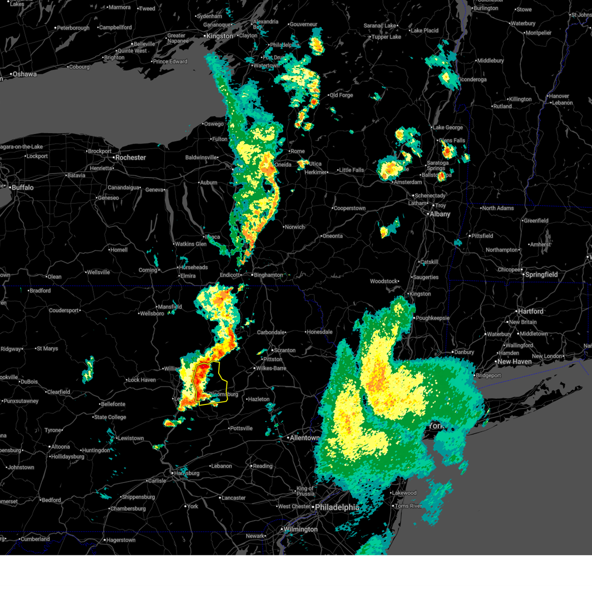
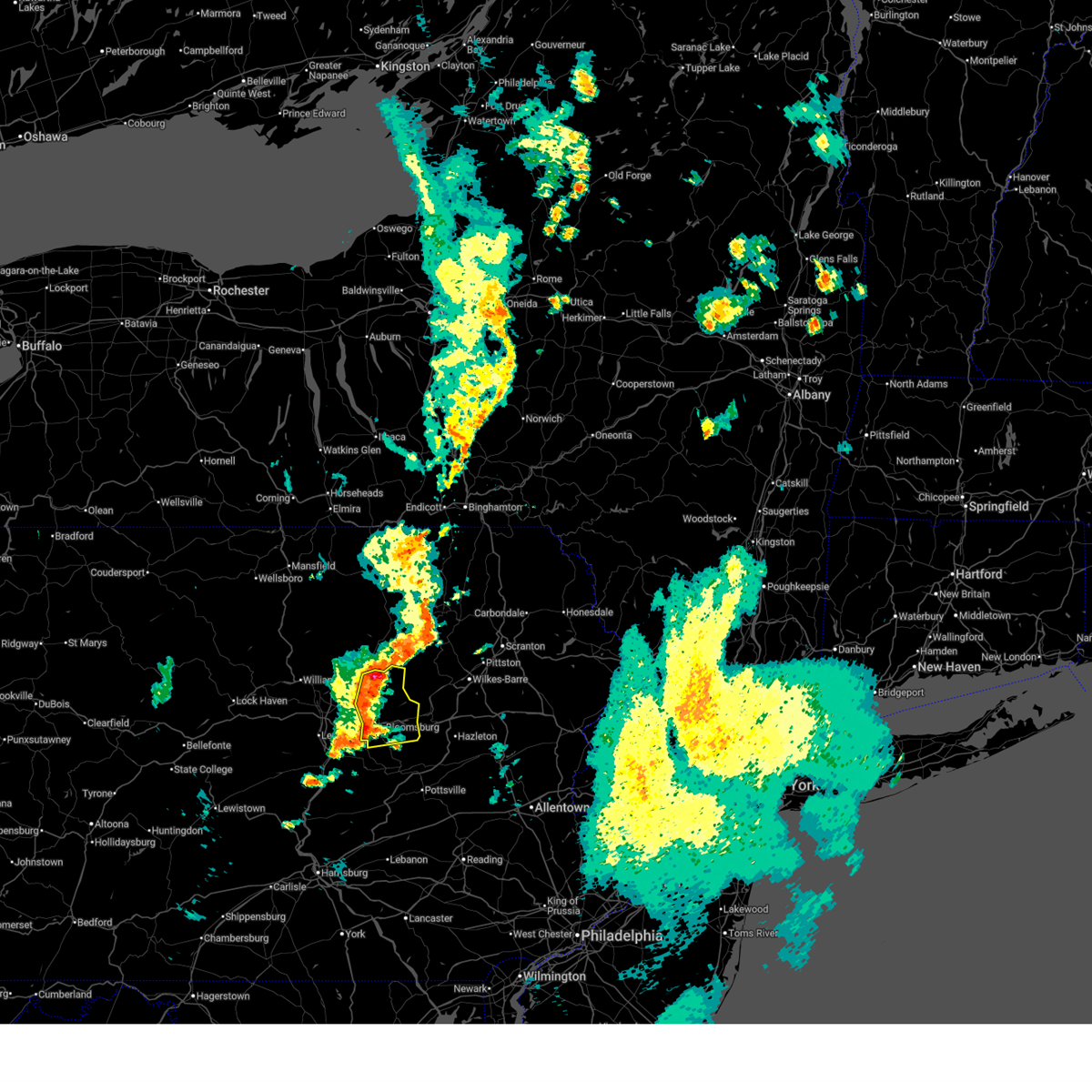
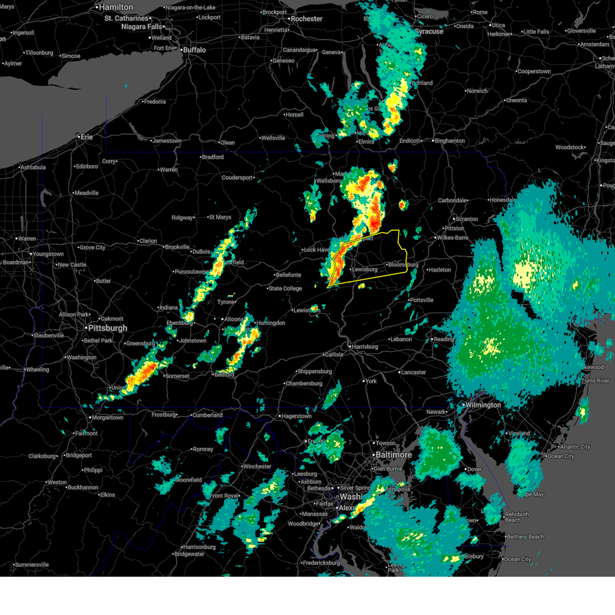
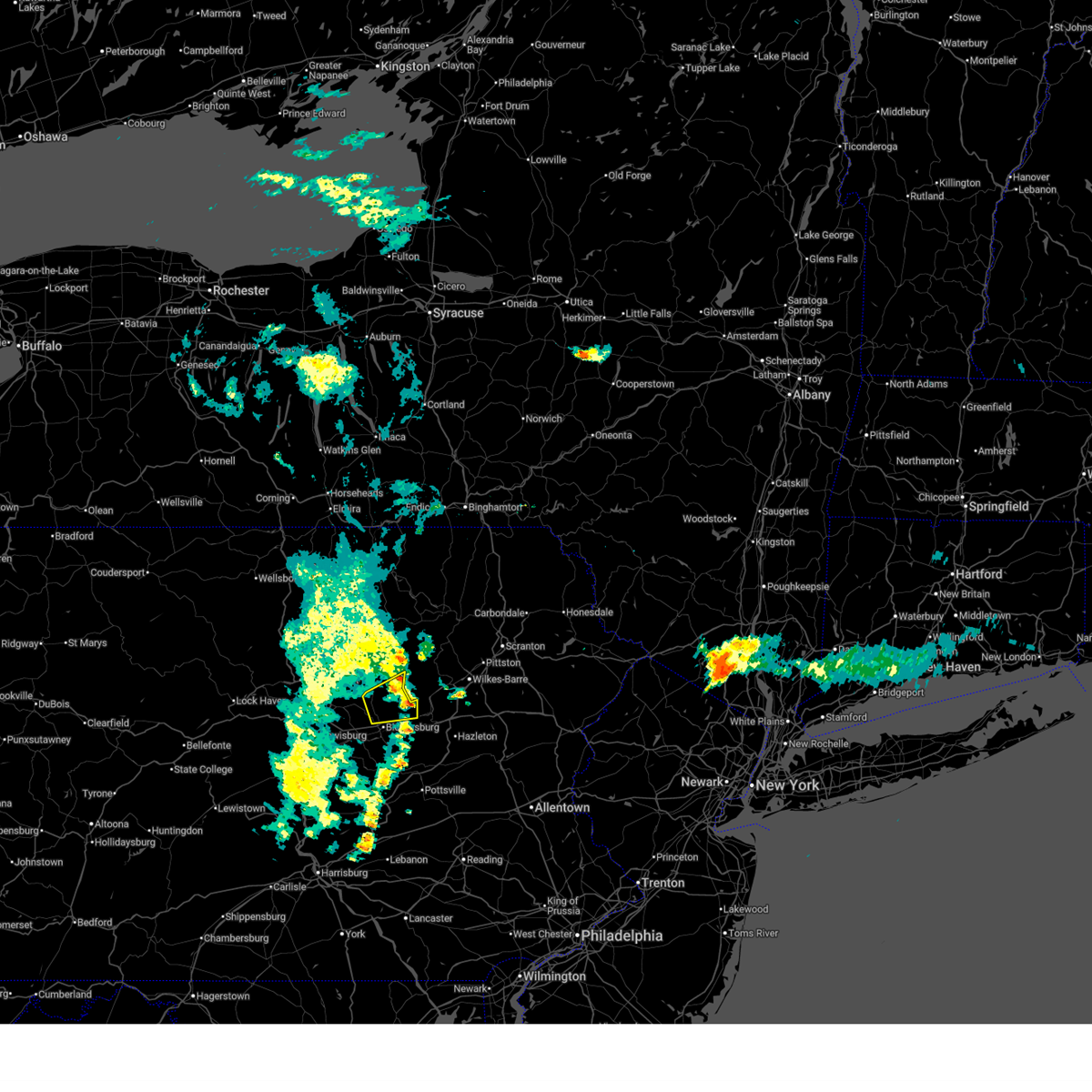
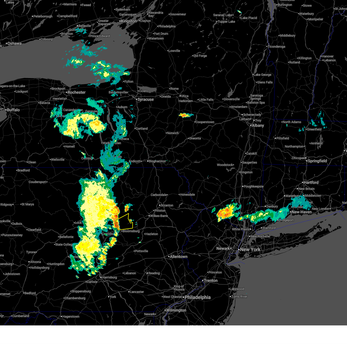
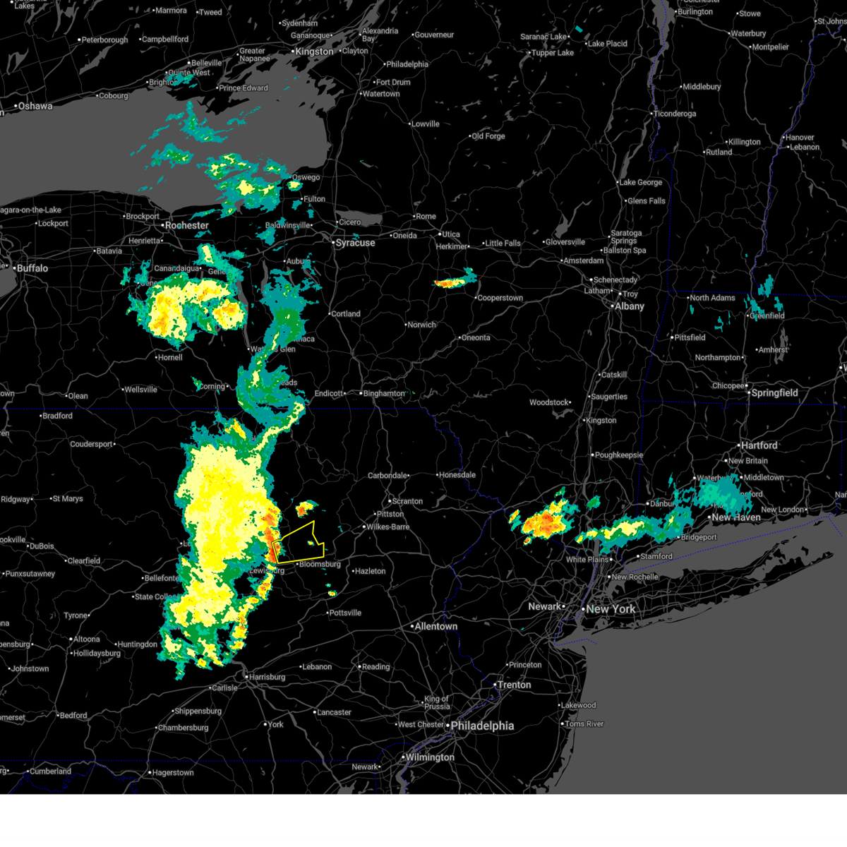
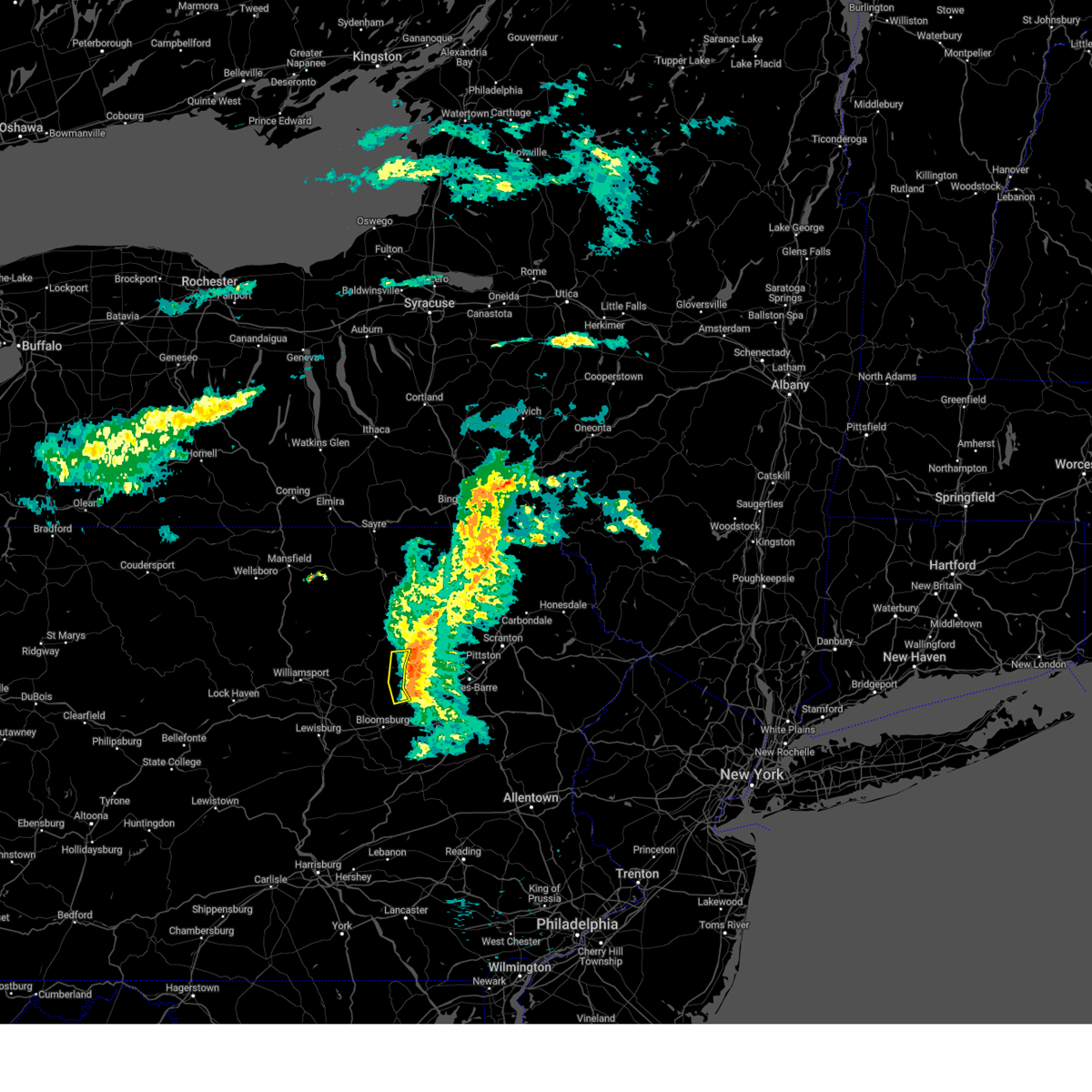
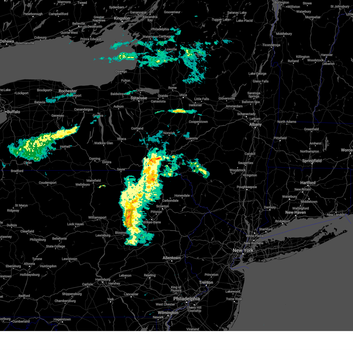
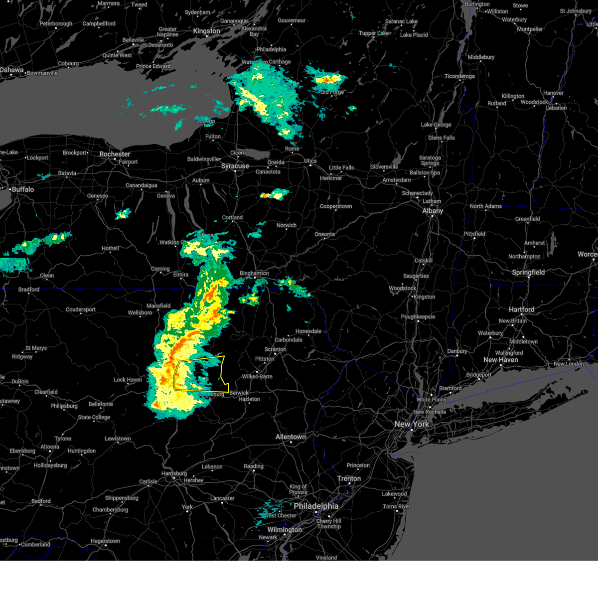
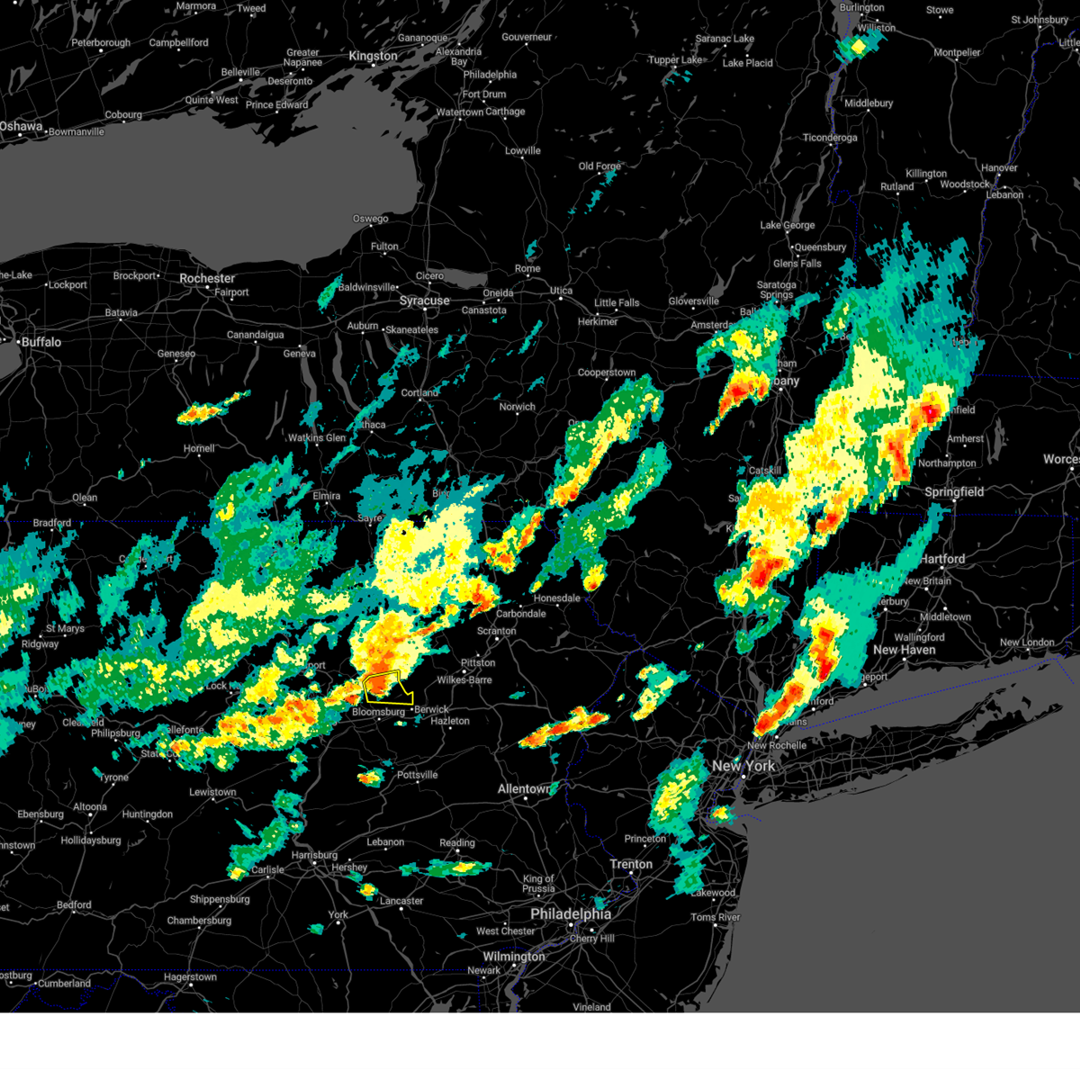
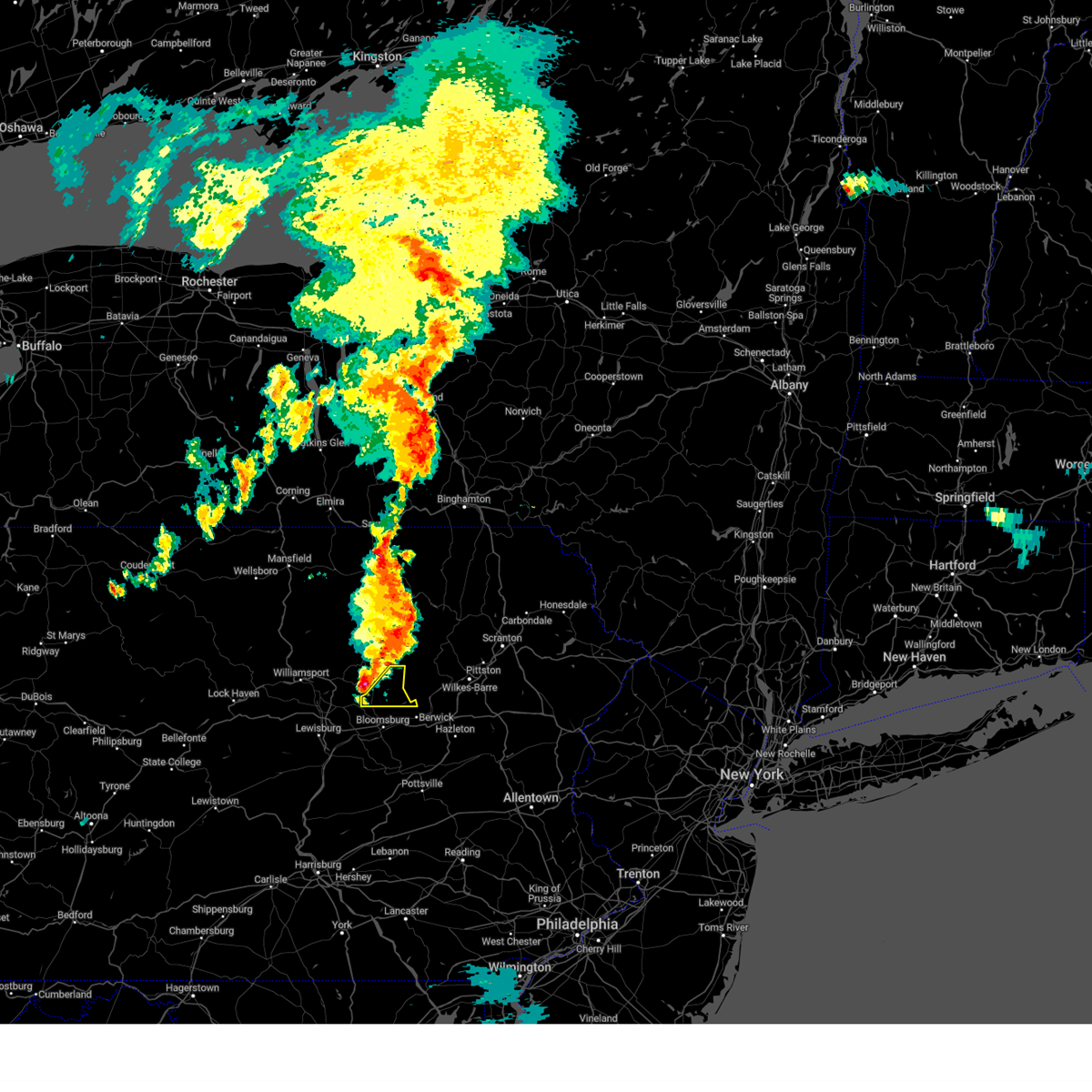
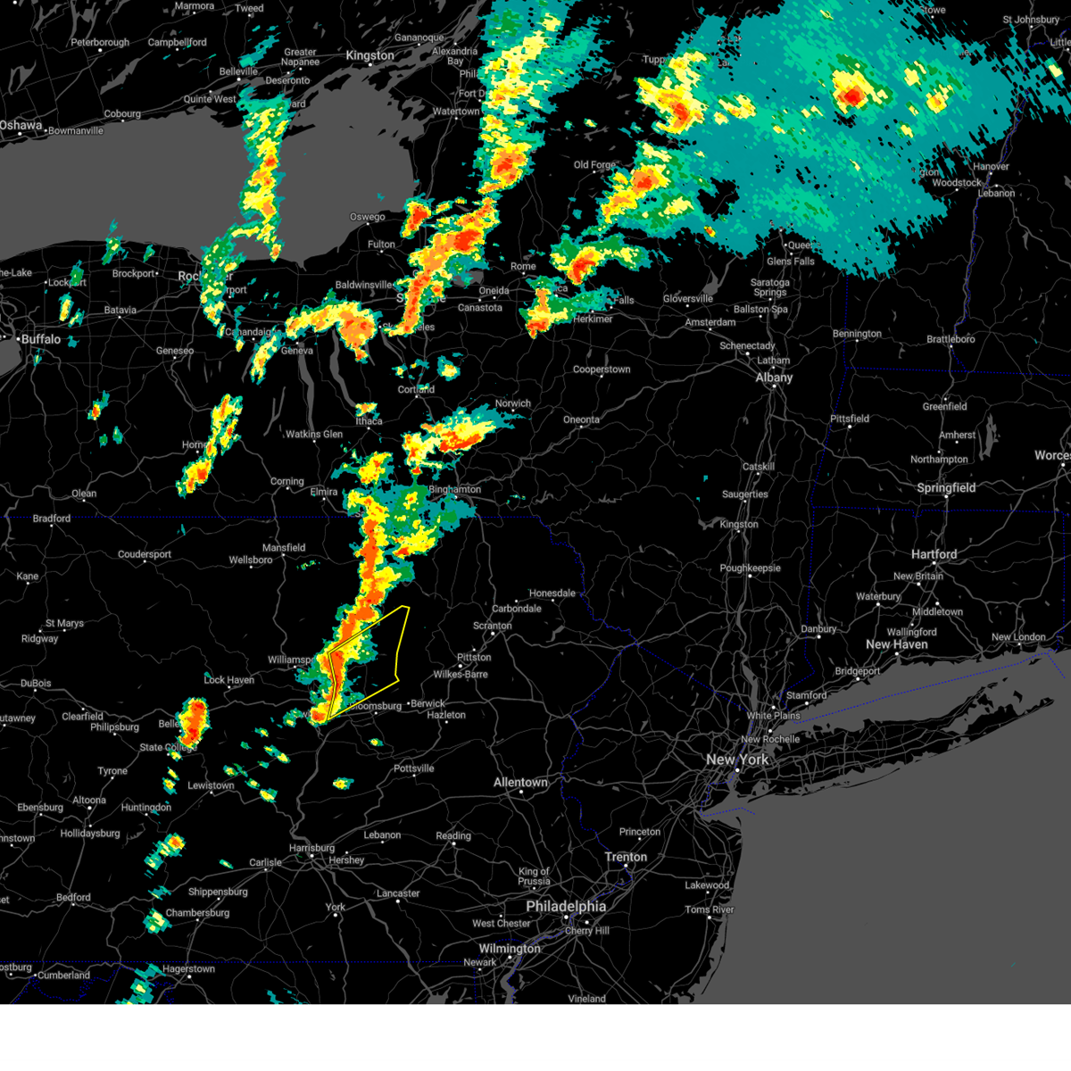
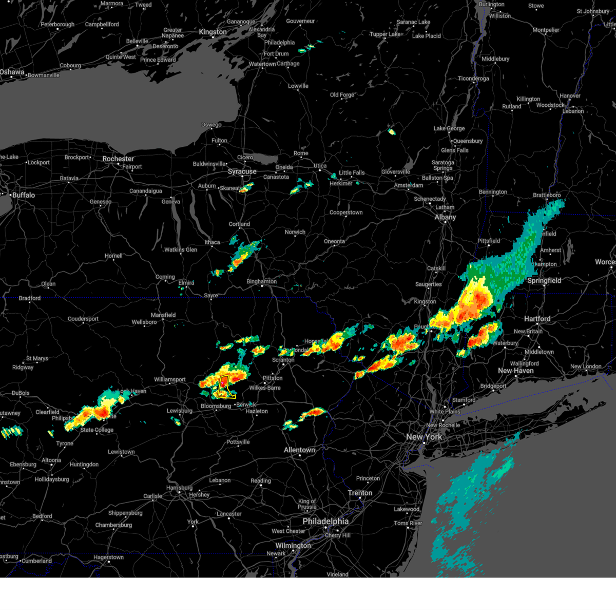
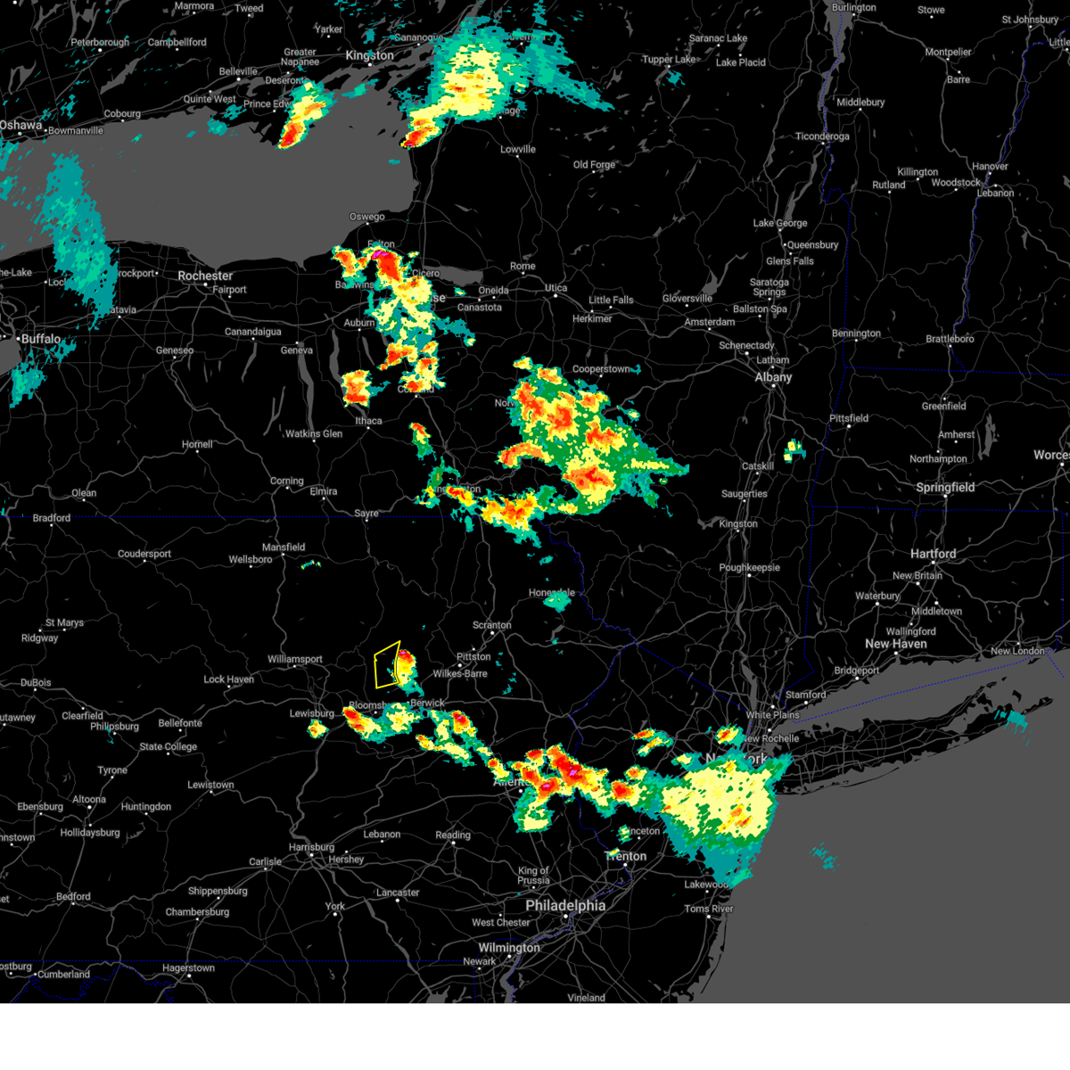
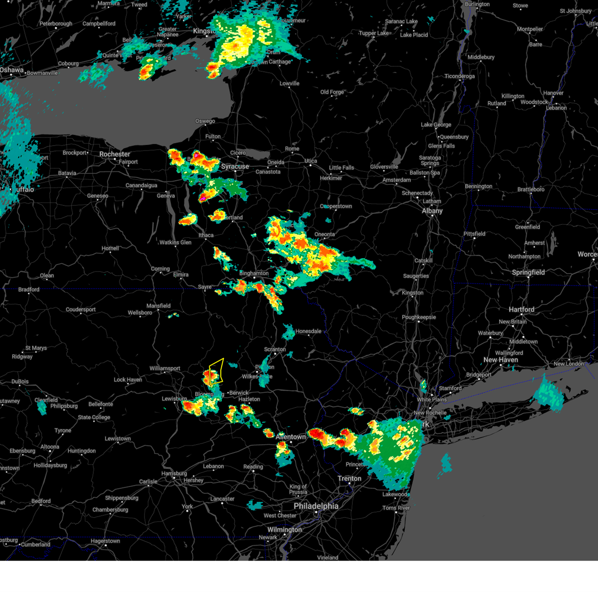
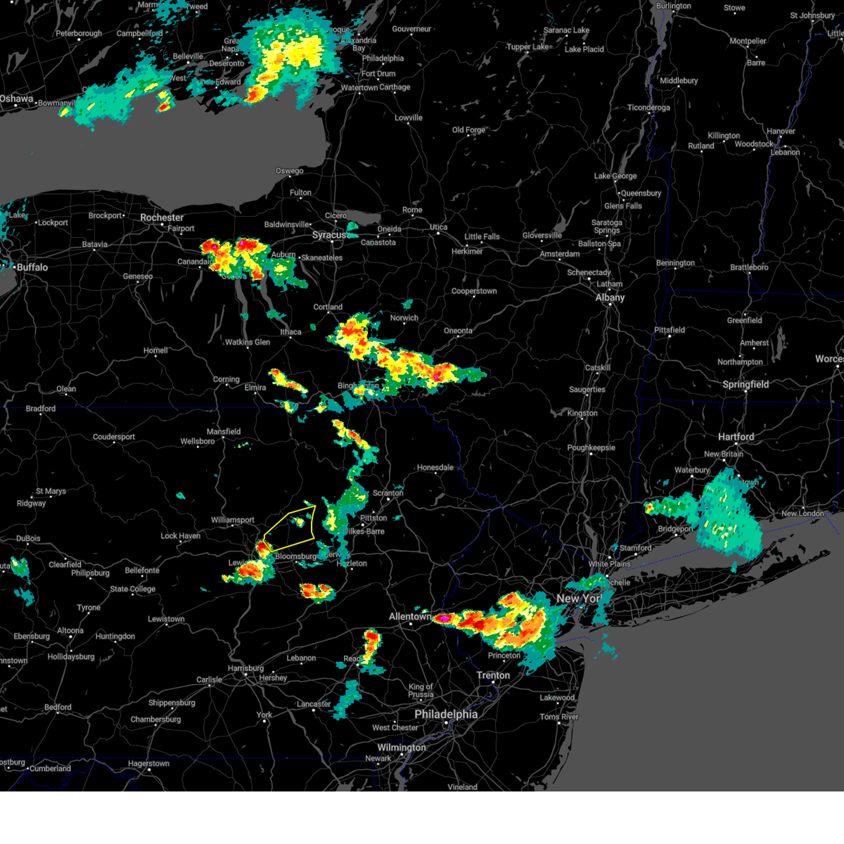
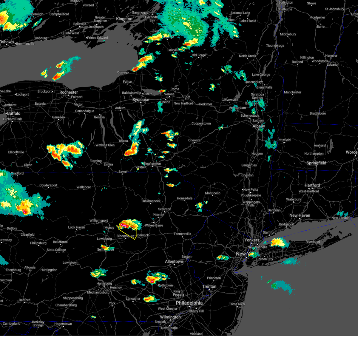
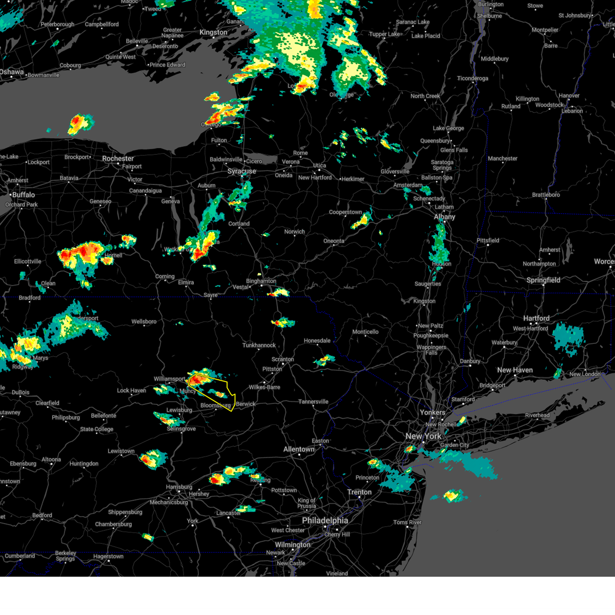
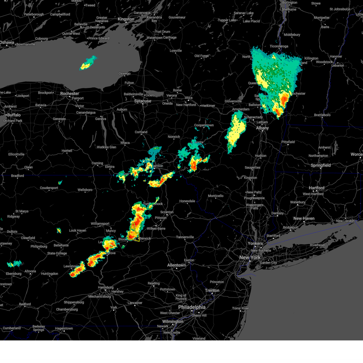
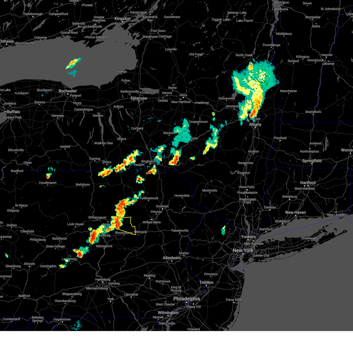
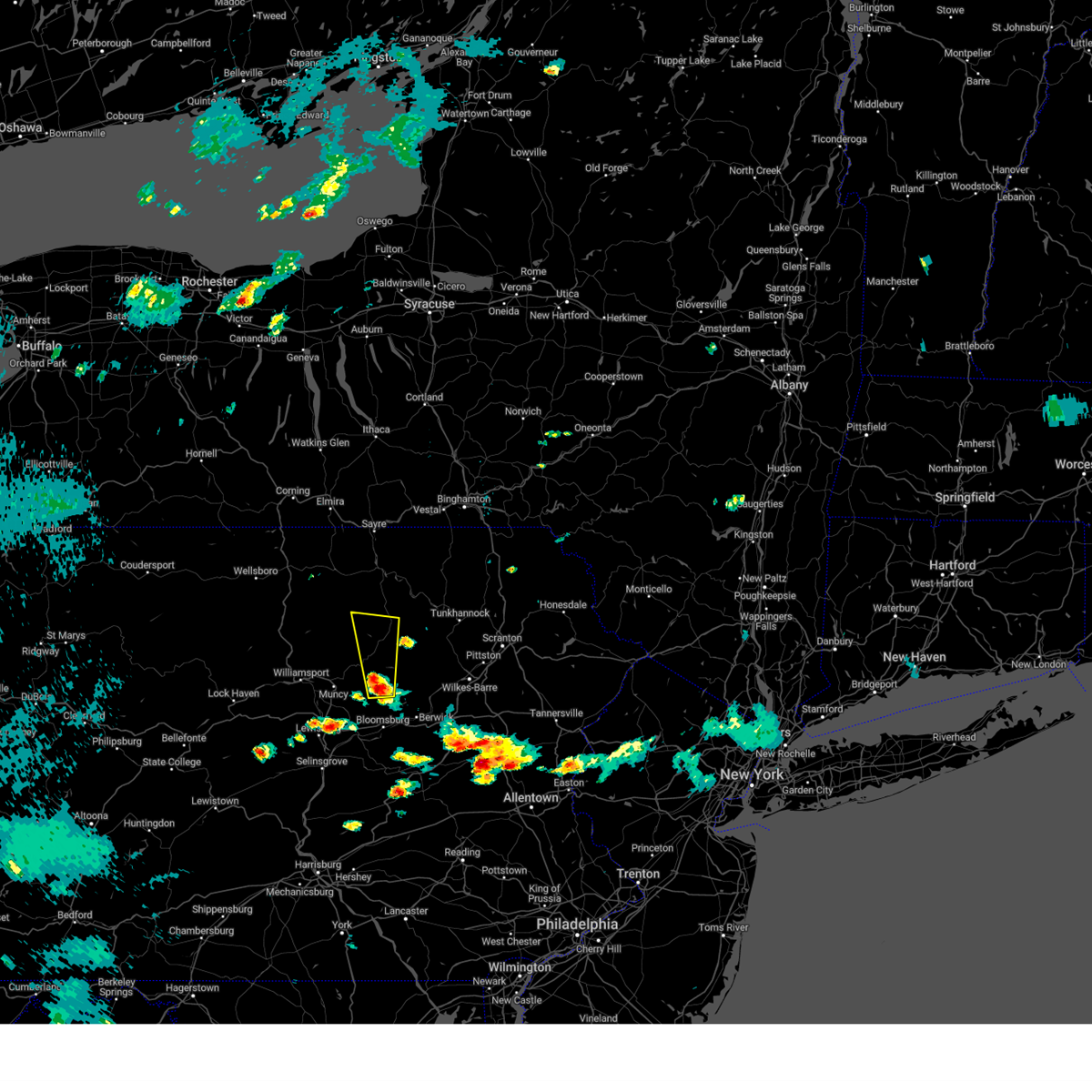
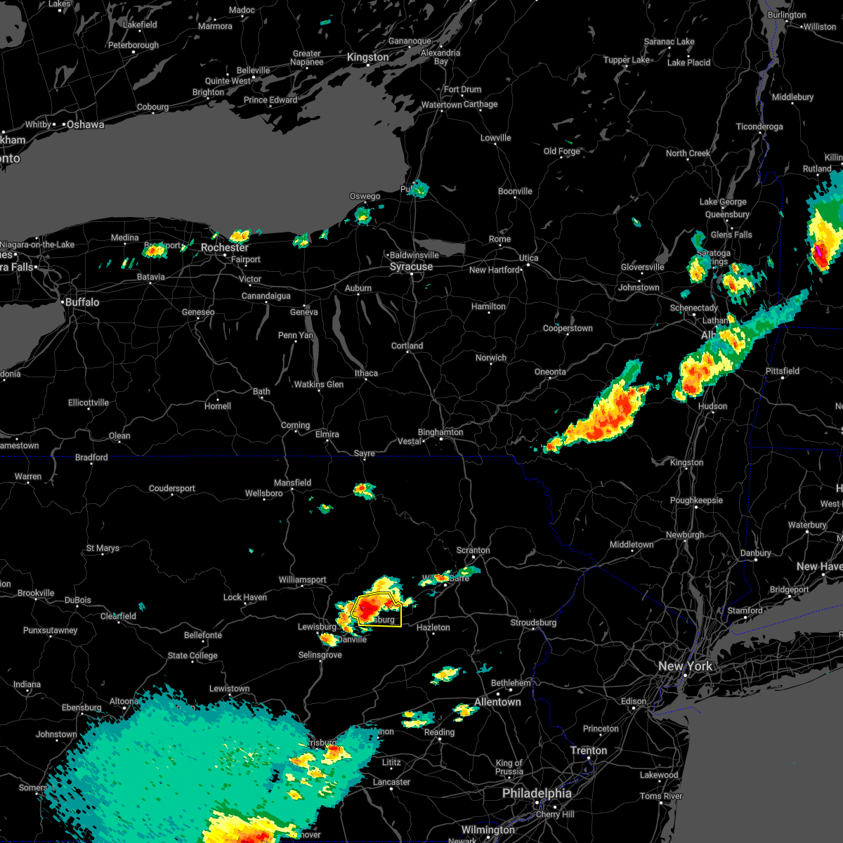
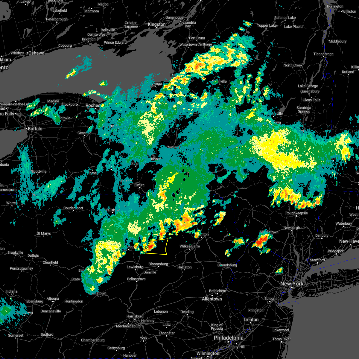
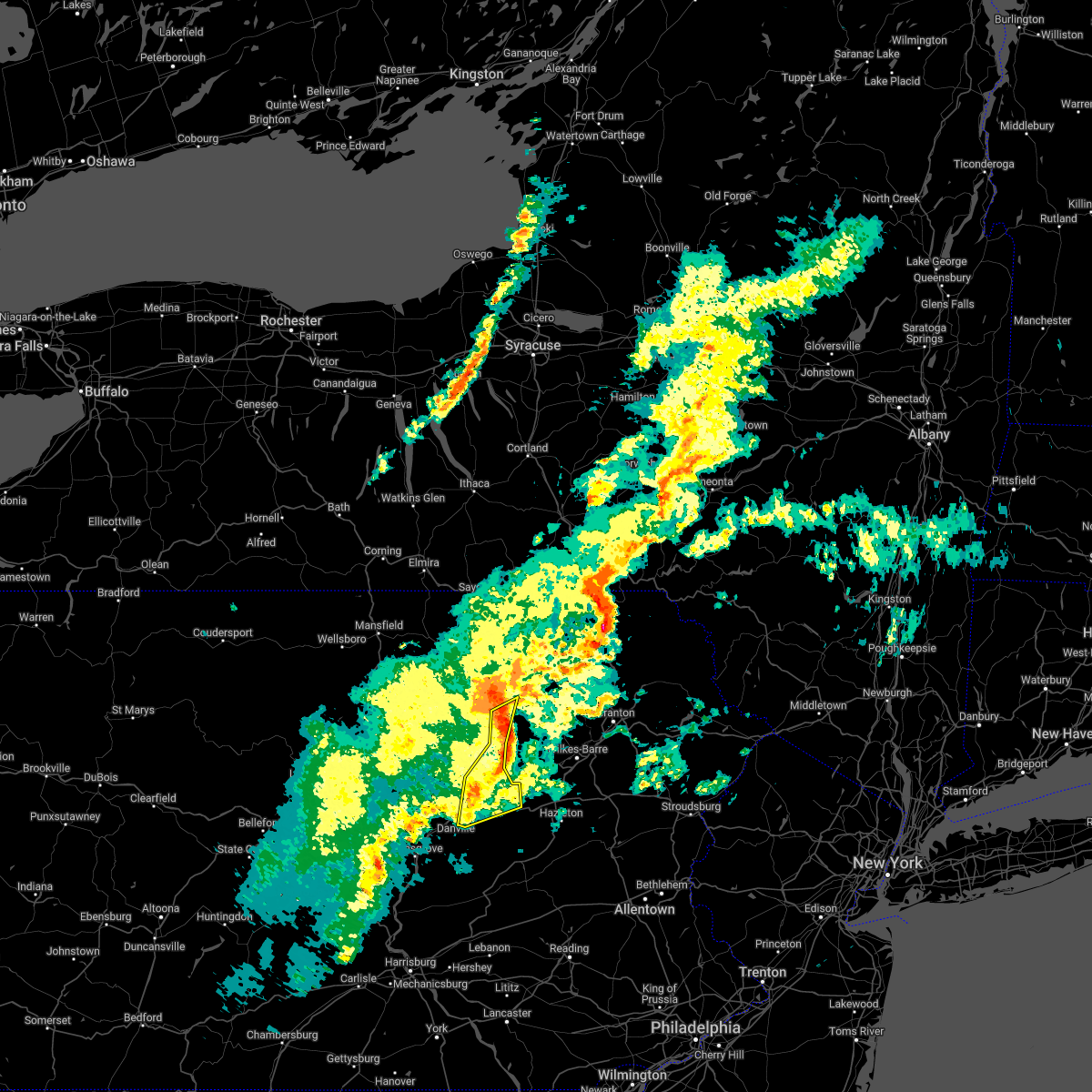
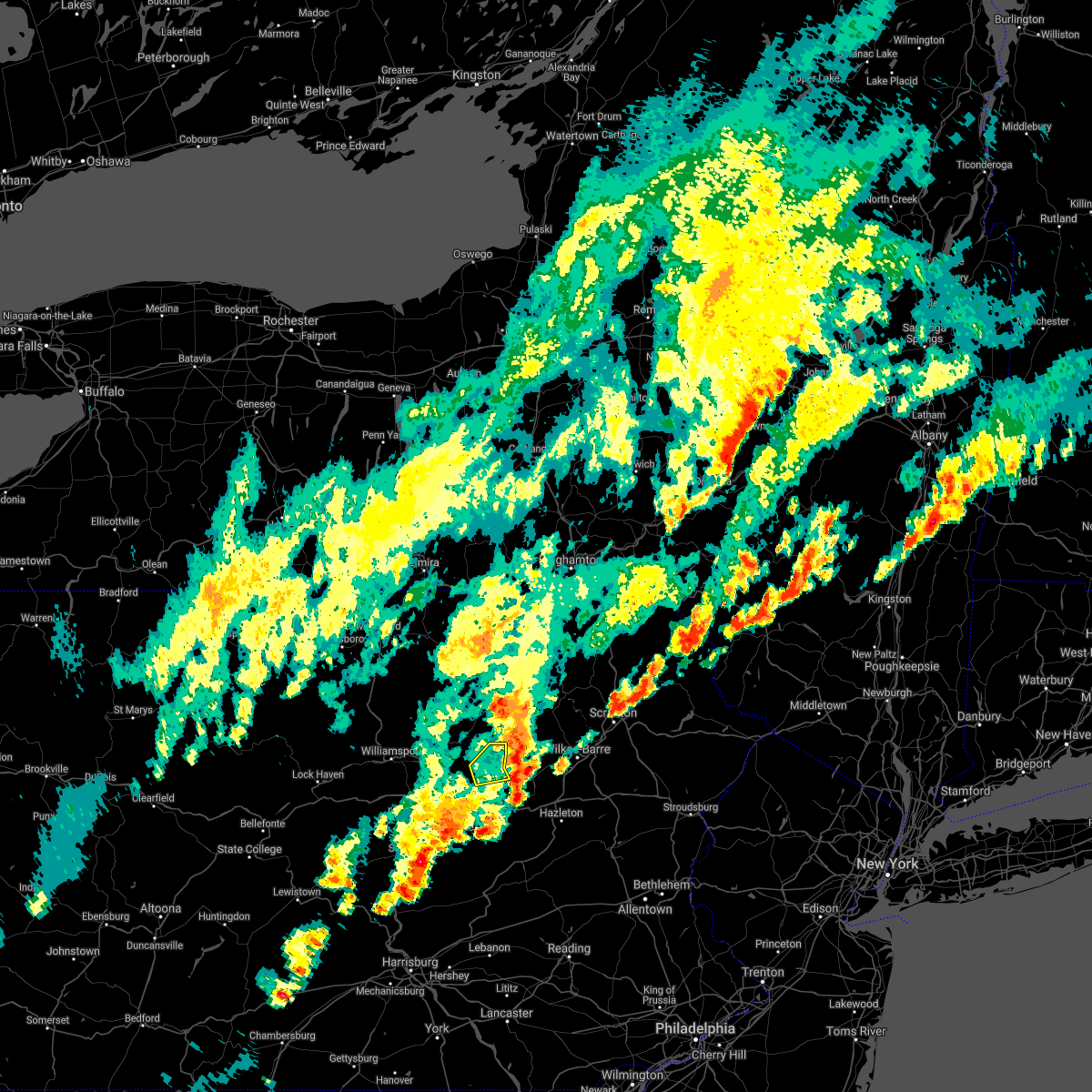
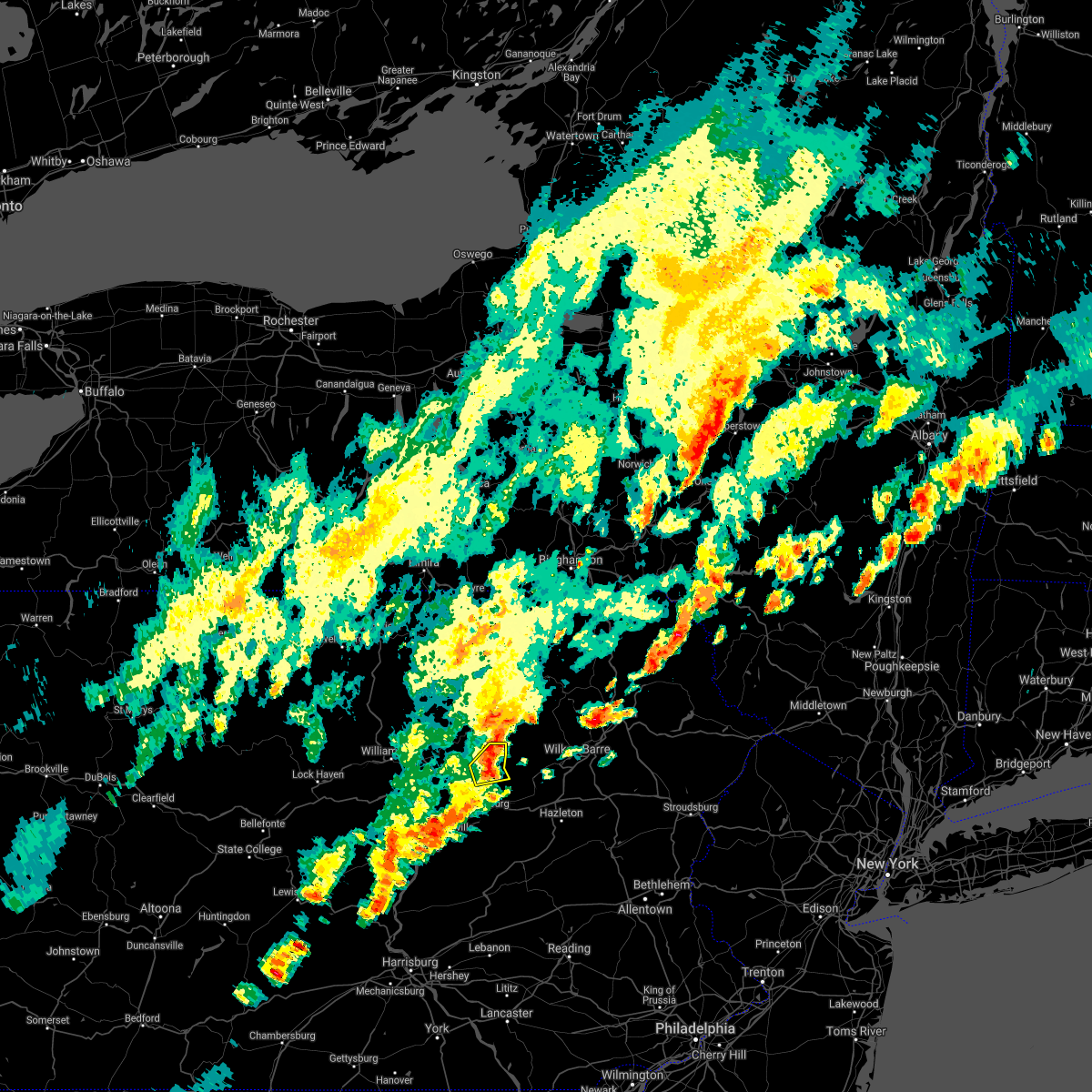
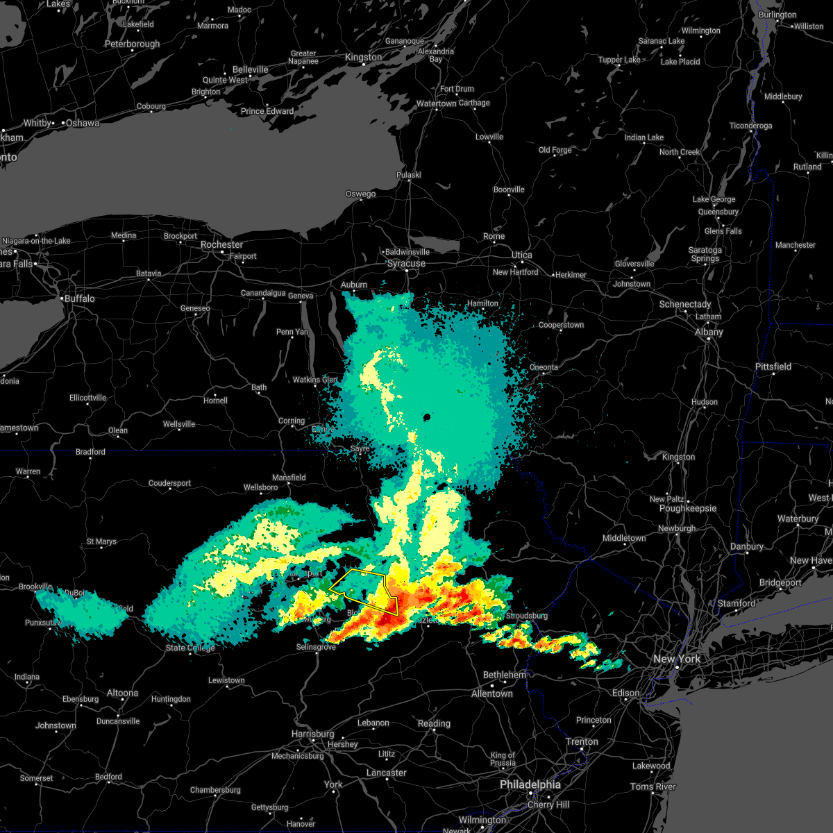
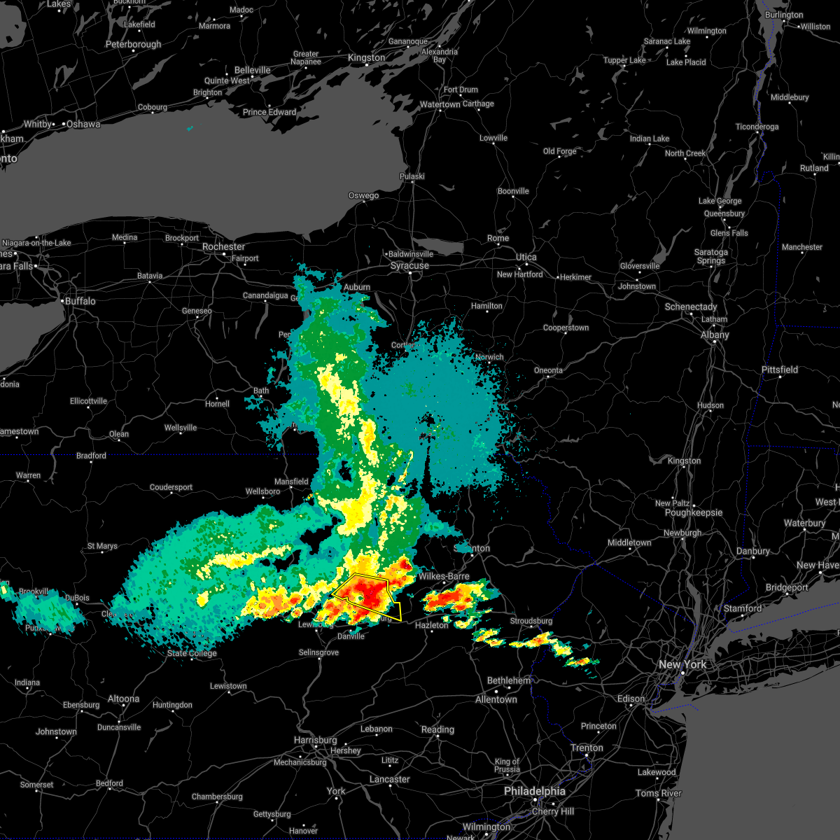
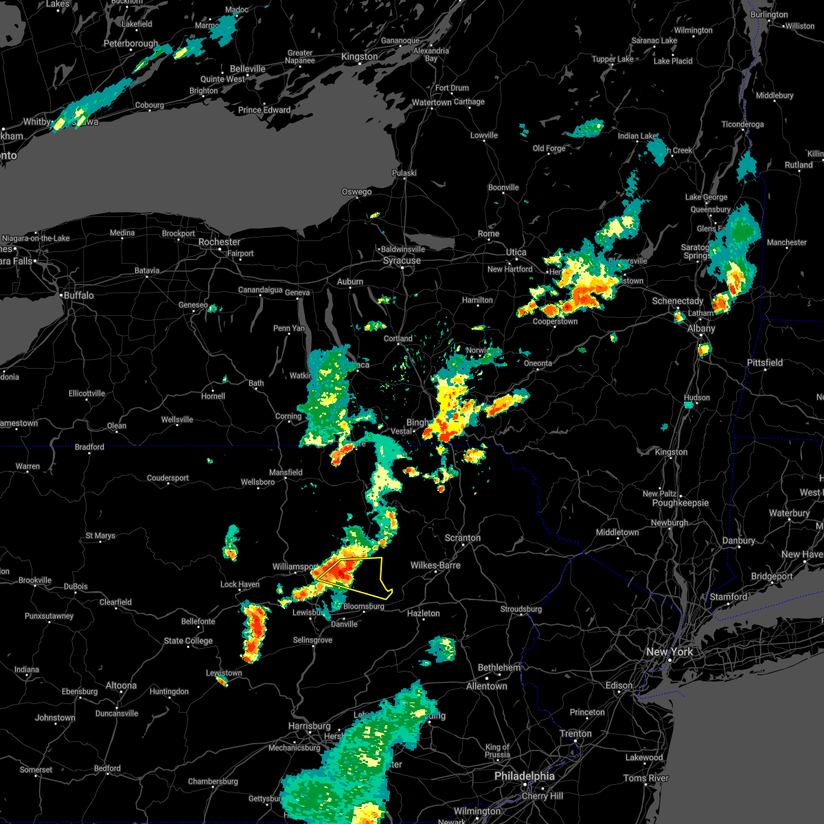
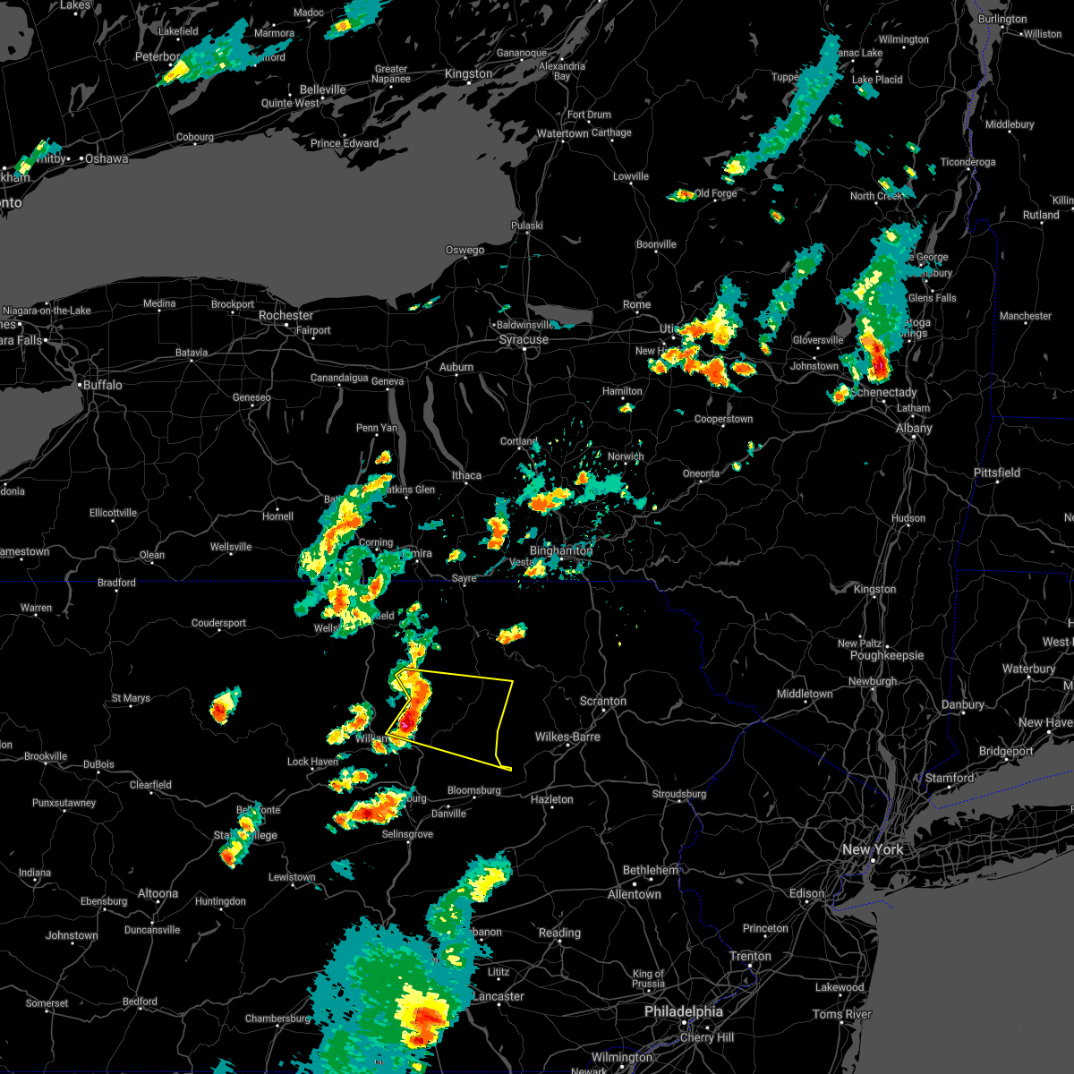
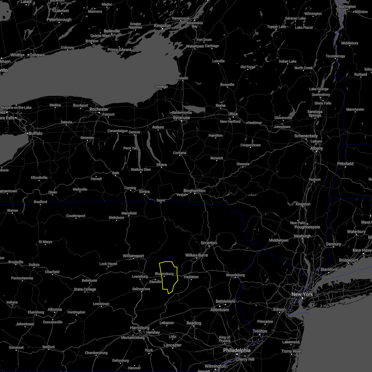
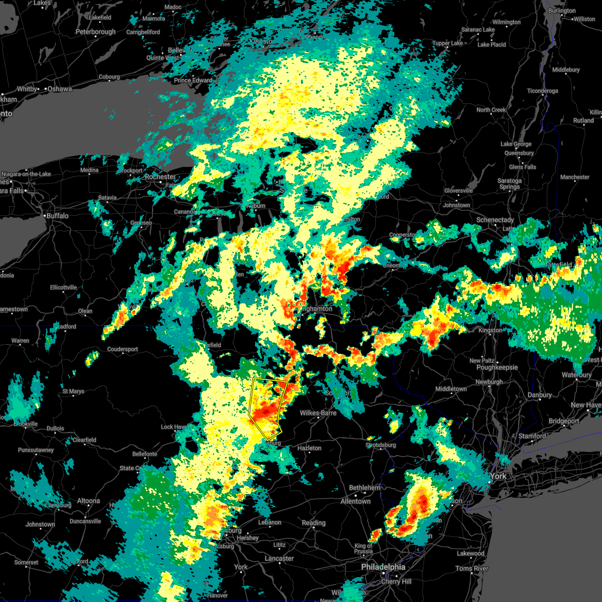
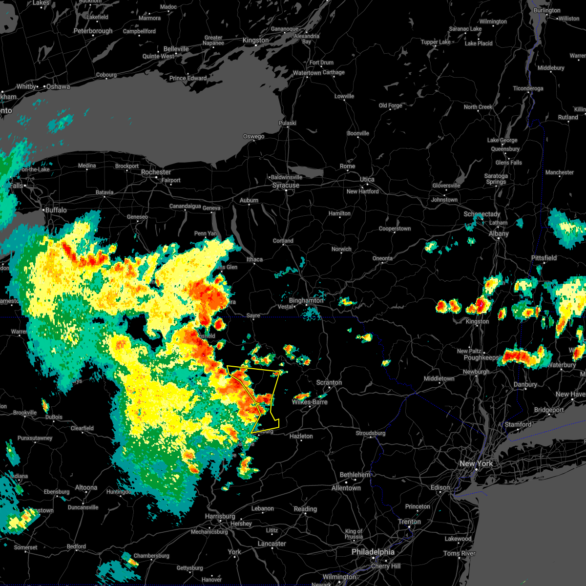
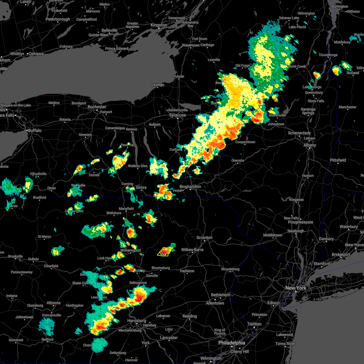
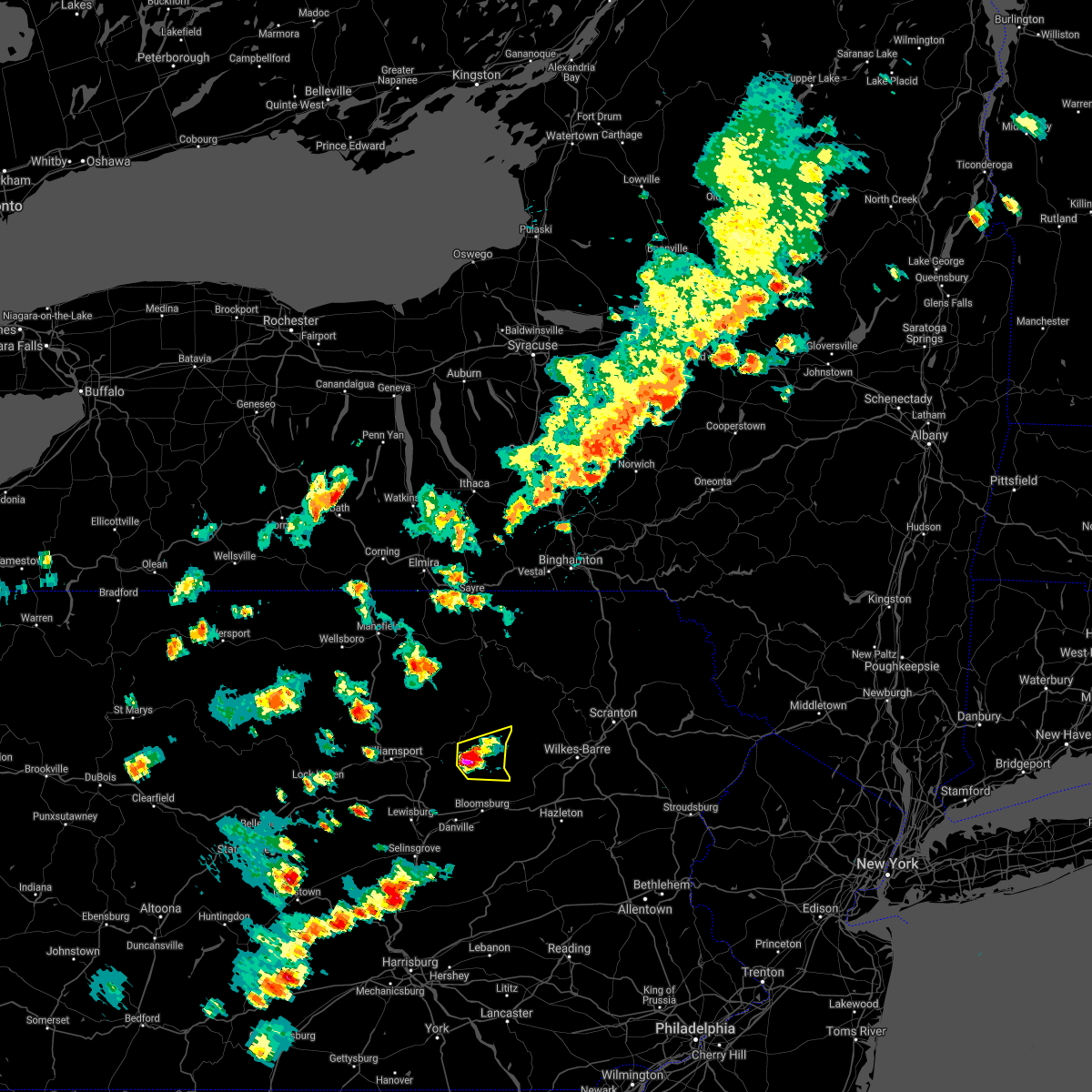
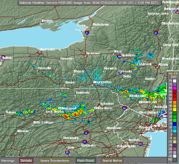
Hail Map for Benton, PA
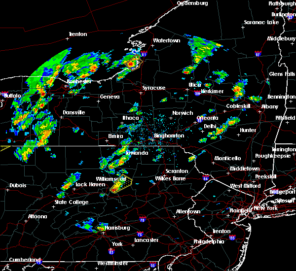
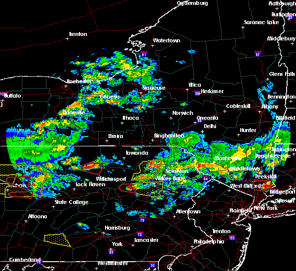
The Benton, PA area has had 2 reports of on-the-ground hail by trained spotters, and has been under severe weather warnings 15 times during the past 12 months. Doppler radar has detected hail at or near Benton, PA on 34 occasions, including 2 occasions during the past year.
| Name: | Benton, PA |
| Where Located: | 40.6 miles WSW of Scranton, PA |
| Map: | Google Map for Benton, PA |
| Population: | 824 |
| Housing Units: | 420 |
| More Info: | Search Google for Benton, PA |
4
The Top Recent Hail Date for Benton, PA is Tuesday, August 6, 2024 (6th out of 34)

Hail and Wind Damage Spotted near Benton, PA
| Date / Time | Report Details |
|---|---|
| 6/19/2025 8:01 PM EDT |
 the severe thunderstorm warning has been cancelled and is no longer in effect the severe thunderstorm warning has been cancelled and is no longer in effect
|
| 6/19/2025 8:01 PM EDT |
 At 759 pm edt, severe thunderstorms were located along a line extending from waller to rohrsburg to eyers grove to fernville to mechanicsville, moving east northeast at 40 mph (radar indicated). Hazards include 60 mph wind gusts and penny size hail. Expect damage to roofs, siding, and trees. locations impacted include, bloomsburg, berwick, danville, catawissa, mifflinville, lightstreet, almedia, fernville, mechanicsville, buckhorn, jerseytown, and rupert. For those driving on interstate 80, this includes areas between the danville and nescopek exits, specifically from mile markers 227 to 247. At 759 pm edt, severe thunderstorms were located along a line extending from waller to rohrsburg to eyers grove to fernville to mechanicsville, moving east northeast at 40 mph (radar indicated). Hazards include 60 mph wind gusts and penny size hail. Expect damage to roofs, siding, and trees. locations impacted include, bloomsburg, berwick, danville, catawissa, mifflinville, lightstreet, almedia, fernville, mechanicsville, buckhorn, jerseytown, and rupert. For those driving on interstate 80, this includes areas between the danville and nescopek exits, specifically from mile markers 227 to 247.
|
| 6/19/2025 7:20 PM EDT |
 Svrctp the national weather service in state college pa has issued a * severe thunderstorm warning for, columbia county in central pennsylvania, southeastern lycoming county in north central pennsylvania, montour county in central pennsylvania, northwestern northumberland county in central pennsylvania, northeastern snyder county in central pennsylvania, eastern union county in central pennsylvania, * until 830 pm edt. * at 719 pm edt, severe thunderstorms were located along a line extending from montgomery to allenwood to spruce run reservoir to penns creek, moving east northeast at 35 mph (radar indicated). Hazards include 60 mph wind gusts and penny size hail. expect damage to roofs, siding, and trees Svrctp the national weather service in state college pa has issued a * severe thunderstorm warning for, columbia county in central pennsylvania, southeastern lycoming county in north central pennsylvania, montour county in central pennsylvania, northwestern northumberland county in central pennsylvania, northeastern snyder county in central pennsylvania, eastern union county in central pennsylvania, * until 830 pm edt. * at 719 pm edt, severe thunderstorms were located along a line extending from montgomery to allenwood to spruce run reservoir to penns creek, moving east northeast at 35 mph (radar indicated). Hazards include 60 mph wind gusts and penny size hail. expect damage to roofs, siding, and trees
|
| 6/18/2025 10:51 PM EDT |
 The storm which prompted the warning has weakened below severe limits, and has exited the warned area. therefore, the warning will be allowed to expire. The storm which prompted the warning has weakened below severe limits, and has exited the warned area. therefore, the warning will be allowed to expire.
|
| 6/18/2025 10:36 PM EDT | Trees down on wires on kramer hill roa in columbia county PA, 2.6 miles NNE of Benton, PA |
| 6/18/2025 10:26 PM EDT |
 the severe thunderstorm warning has been cancelled and is no longer in effect the severe thunderstorm warning has been cancelled and is no longer in effect
|
| 6/18/2025 10:26 PM EDT |
 At 1025 pm edt, a severe thunderstorm was located over rohrsburg, moving east at 30 mph (radar indicated). Hazards include 60 mph wind gusts. Expect damage to roofs, siding, and trees. locations impacted include, berwick, lightstreet, rohrsburg, iola, eyers grove, waller, fairmount spgs, millville, benton, briar creek, orangeville, and stillwater. For those driving on interstate 80, this includes areas between the bloomsburg-light street and berwick-lime ridge exits, specifically near mile marker 239. At 1025 pm edt, a severe thunderstorm was located over rohrsburg, moving east at 30 mph (radar indicated). Hazards include 60 mph wind gusts. Expect damage to roofs, siding, and trees. locations impacted include, berwick, lightstreet, rohrsburg, iola, eyers grove, waller, fairmount spgs, millville, benton, briar creek, orangeville, and stillwater. For those driving on interstate 80, this includes areas between the bloomsburg-light street and berwick-lime ridge exits, specifically near mile marker 239.
|
| 6/18/2025 10:14 PM EDT |
 Svrctp the national weather service in state college pa has issued a * severe thunderstorm warning for, northern columbia county in central pennsylvania, northeastern montour county in central pennsylvania, * until 1100 pm edt. * at 1013 pm edt, a severe thunderstorm was located over jerseytown, moving east at 25 mph (radar indicated). Hazards include 60 mph wind gusts and quarter size hail. Hail damage to vehicles is expected. Expect wind damage to roofs, siding, and trees. Svrctp the national weather service in state college pa has issued a * severe thunderstorm warning for, northern columbia county in central pennsylvania, northeastern montour county in central pennsylvania, * until 1100 pm edt. * at 1013 pm edt, a severe thunderstorm was located over jerseytown, moving east at 25 mph (radar indicated). Hazards include 60 mph wind gusts and quarter size hail. Hail damage to vehicles is expected. Expect wind damage to roofs, siding, and trees.
|
| 4/29/2025 7:50 PM EDT | Svrctp the national weather service in state college pa has issued a * severe thunderstorm warning for, columbia county in central pennsylvania, northern dauphin county in south central pennsylvania, northwestern lebanon county in south central pennsylvania, southern northumberland county in central pennsylvania, schuylkill county in central pennsylvania, sullivan county in north central pennsylvania, * until 845 pm edt. * at 750 pm edt, severe thunderstorms were located along a line extending from ralston to near hughesville to mooresburg to selinsgrove to new buffalo, moving east at 65 mph (radar indicated). Hazards include 60 mph wind gusts. expect damage to roofs, siding, and trees |
| 4/19/2025 4:28 PM EDT |
 the severe thunderstorm warning has been cancelled and is no longer in effect the severe thunderstorm warning has been cancelled and is no longer in effect
|
| 4/19/2025 4:24 PM EDT |
 At 423 pm edt, severe thunderstorms were located along a line extending from near muncy valley to biggertown to jerseytown, moving east at 55 mph (radar indicated). Hazards include 60 mph wind gusts. Expect damage to roofs, siding, and trees. Locations impacted include, fairmount spgs, jamison city, ricketts glen state park, central, benton, stillwater, and waller. At 423 pm edt, severe thunderstorms were located along a line extending from near muncy valley to biggertown to jerseytown, moving east at 55 mph (radar indicated). Hazards include 60 mph wind gusts. Expect damage to roofs, siding, and trees. Locations impacted include, fairmount spgs, jamison city, ricketts glen state park, central, benton, stillwater, and waller.
|
| 4/19/2025 4:24 PM EDT |
 the severe thunderstorm warning has been cancelled and is no longer in effect the severe thunderstorm warning has been cancelled and is no longer in effect
|
| 4/19/2025 4:04 PM EDT |
 Svrctp the national weather service in state college pa has issued a * severe thunderstorm warning for, northern columbia county in central pennsylvania, southeastern lycoming county in north central pennsylvania, northwestern montour county in central pennsylvania, northwestern northumberland county in central pennsylvania, southeastern sullivan county in north central pennsylvania, * until 445 pm edt. * at 404 pm edt, severe thunderstorms were located along a line extending from near loyalsockville to montoursville to allenwood, moving east at 55 mph (radar indicated). Hazards include 60 mph wind gusts. expect damage to roofs, siding, and trees Svrctp the national weather service in state college pa has issued a * severe thunderstorm warning for, northern columbia county in central pennsylvania, southeastern lycoming county in north central pennsylvania, northwestern montour county in central pennsylvania, northwestern northumberland county in central pennsylvania, southeastern sullivan county in north central pennsylvania, * until 445 pm edt. * at 404 pm edt, severe thunderstorms were located along a line extending from near loyalsockville to montoursville to allenwood, moving east at 55 mph (radar indicated). Hazards include 60 mph wind gusts. expect damage to roofs, siding, and trees
|
| 7/17/2024 5:10 PM EDT | the severe thunderstorm warning has been cancelled and is no longer in effect |
| 7/17/2024 4:46 PM EDT |
 Svrctp the national weather service in state college pa has issued a * severe thunderstorm warning for, northern columbia county in central pennsylvania, * until 530 pm edt. * at 446 pm edt, a severe thunderstorm was located over rohrsburg, moving east at 35 mph (radar indicated). Hazards include 60 mph wind gusts. expect damage to roofs, siding, and trees Svrctp the national weather service in state college pa has issued a * severe thunderstorm warning for, northern columbia county in central pennsylvania, * until 530 pm edt. * at 446 pm edt, a severe thunderstorm was located over rohrsburg, moving east at 35 mph (radar indicated). Hazards include 60 mph wind gusts. expect damage to roofs, siding, and trees
|
| 7/15/2024 6:55 PM EDT | Multiple trees and wires down... with some poles down as well in the vicinity of bento in columbia county PA, 0.5 miles SW of Benton, PA |
| 7/15/2024 6:52 PM EDT | Multiple trees and wires between waller and jamison cit in columbia county PA, 6 miles SSW of Benton, PA |
| 7/15/2024 6:51 PM EDT | Multiple trees and wires down in sugarloaf township with several roads blocke in columbia county PA, 5.8 miles S of Benton, PA |
| 7/15/2024 6:39 PM EDT |
 Svrctp the national weather service in state college pa has issued a * severe thunderstorm warning for, northern columbia county in central pennsylvania, * until 700 pm edt. * at 639 pm edt, a severe thunderstorm was located over iola, moving east at 45 mph (radar indicated). Hazards include 60 mph wind gusts and quarter size hail. Hail damage to vehicles is expected. Expect wind damage to roofs, siding, and trees. Svrctp the national weather service in state college pa has issued a * severe thunderstorm warning for, northern columbia county in central pennsylvania, * until 700 pm edt. * at 639 pm edt, a severe thunderstorm was located over iola, moving east at 45 mph (radar indicated). Hazards include 60 mph wind gusts and quarter size hail. Hail damage to vehicles is expected. Expect wind damage to roofs, siding, and trees.
|
| 7/10/2024 6:55 PM EDT |
 Svrctp the national weather service in state college pa has issued a * severe thunderstorm warning for, northern columbia county in central pennsylvania, southeastern lycoming county in north central pennsylvania, northern montour county in central pennsylvania, southeastern sullivan county in north central pennsylvania, * until 745 pm edt. * at 654 pm edt, severe thunderstorms were located along a line extending from muncy valley to lairdsville to near iola to exchange to mooresburg, moving northeast at 40 mph (radar indicated). Hazards include 60 mph wind gusts and penny size hail. expect damage to roofs, siding, and trees Svrctp the national weather service in state college pa has issued a * severe thunderstorm warning for, northern columbia county in central pennsylvania, southeastern lycoming county in north central pennsylvania, northern montour county in central pennsylvania, southeastern sullivan county in north central pennsylvania, * until 745 pm edt. * at 654 pm edt, severe thunderstorms were located along a line extending from muncy valley to lairdsville to near iola to exchange to mooresburg, moving northeast at 40 mph (radar indicated). Hazards include 60 mph wind gusts and penny size hail. expect damage to roofs, siding, and trees
|
| 6/30/2024 12:43 PM EDT |
 Svrctp the national weather service in state college pa has issued a * severe thunderstorm warning for, northeastern columbia county in central pennsylvania, * until 100 pm edt. * at 1242 pm edt, a severe thunderstorm was located over fairmount spgs, moving east at 30 mph (radar indicated). Hazards include 60 mph wind gusts and quarter size hail. Hail damage to vehicles is expected. Expect wind damage to roofs, siding, and trees. Svrctp the national weather service in state college pa has issued a * severe thunderstorm warning for, northeastern columbia county in central pennsylvania, * until 100 pm edt. * at 1242 pm edt, a severe thunderstorm was located over fairmount spgs, moving east at 30 mph (radar indicated). Hazards include 60 mph wind gusts and quarter size hail. Hail damage to vehicles is expected. Expect wind damage to roofs, siding, and trees.
|
| 6/26/2024 6:14 PM EDT |
 Svrctp the national weather service in state college pa has issued a * severe thunderstorm warning for, central columbia county in central pennsylvania, southeastern lycoming county in north central pennsylvania, eastern schuylkill county in central pennsylvania, * until 645 pm edt. * at 614 pm edt, severe thunderstorms were located along a line extending from biggertown to nescopeck to mckeansburg to bernville, moving northeast at 45 mph (radar indicated). Hazards include 60 mph wind gusts. expect damage to roofs, siding, and trees Svrctp the national weather service in state college pa has issued a * severe thunderstorm warning for, central columbia county in central pennsylvania, southeastern lycoming county in north central pennsylvania, eastern schuylkill county in central pennsylvania, * until 645 pm edt. * at 614 pm edt, severe thunderstorms were located along a line extending from biggertown to nescopeck to mckeansburg to bernville, moving northeast at 45 mph (radar indicated). Hazards include 60 mph wind gusts. expect damage to roofs, siding, and trees
|
| 6/26/2024 6:02 PM EDT |
 the severe thunderstorm warning has been cancelled and is no longer in effect the severe thunderstorm warning has been cancelled and is no longer in effect
|
| 6/26/2024 6:02 PM EDT |
 At 602 pm edt, severe thunderstorms were located along a line extending from exchange to mechanicsville to shamokin, moving northeast at 35 mph (radar indicated). Hazards include 60 mph wind gusts. Expect damage to roofs, siding, and trees. locations impacted include, bloomsburg, berwick, shamokin, mount carmel, shenandoah, danville, kulpmont, ashland, elysburg, fairview-ferndale, riverside, and trevorton. For those driving on interstate 80, this includes areas between the limestoneville and nescopek exits, specifically from mile markers 216 to 247. At 602 pm edt, severe thunderstorms were located along a line extending from exchange to mechanicsville to shamokin, moving northeast at 35 mph (radar indicated). Hazards include 60 mph wind gusts. Expect damage to roofs, siding, and trees. locations impacted include, bloomsburg, berwick, shamokin, mount carmel, shenandoah, danville, kulpmont, ashland, elysburg, fairview-ferndale, riverside, and trevorton. For those driving on interstate 80, this includes areas between the limestoneville and nescopek exits, specifically from mile markers 216 to 247.
|
| 6/26/2024 5:35 PM EDT |
 Svrctp the national weather service in state college pa has issued a * severe thunderstorm warning for, columbia county in central pennsylvania, montour county in central pennsylvania, northumberland county in central pennsylvania, northwestern schuylkill county in central pennsylvania, northeastern snyder county in central pennsylvania, east central union county in central pennsylvania, * until 615 pm edt. * at 535 pm edt, severe thunderstorms were located along a line extending from spruce run reservoir to hummels wharf to urban, moving northeast at 35 mph (radar indicated). Hazards include 60 mph wind gusts. expect damage to roofs, siding, and trees Svrctp the national weather service in state college pa has issued a * severe thunderstorm warning for, columbia county in central pennsylvania, montour county in central pennsylvania, northumberland county in central pennsylvania, northwestern schuylkill county in central pennsylvania, northeastern snyder county in central pennsylvania, east central union county in central pennsylvania, * until 615 pm edt. * at 535 pm edt, severe thunderstorms were located along a line extending from spruce run reservoir to hummels wharf to urban, moving northeast at 35 mph (radar indicated). Hazards include 60 mph wind gusts. expect damage to roofs, siding, and trees
|
| 6/26/2024 5:28 PM EDT | Svrctp the national weather service in state college pa has issued a * severe thunderstorm warning for, central columbia county in central pennsylvania, * until 600 pm edt. * at 528 pm edt, a severe thunderstorm was located over lightstreet, moving east at 40 mph (radar indicated). Hazards include 60 mph wind gusts and quarter size hail. Hail damage to vehicles is expected. Expect wind damage to roofs, siding, and trees. |
| 6/26/2024 4:54 PM EDT |
 Svrctp the national weather service in state college pa has issued a * severe thunderstorm warning for, northwestern columbia county in central pennsylvania, southeastern lycoming county in north central pennsylvania, montour county in central pennsylvania, northwestern northumberland county in central pennsylvania, * until 545 pm edt. * at 454 pm edt, a severe thunderstorm was located over mooresburg, moving northeast at 25 mph (radar indicated). Hazards include 60 mph wind gusts and quarter size hail. Hail damage to vehicles is expected. Expect wind damage to roofs, siding, and trees. Svrctp the national weather service in state college pa has issued a * severe thunderstorm warning for, northwestern columbia county in central pennsylvania, southeastern lycoming county in north central pennsylvania, montour county in central pennsylvania, northwestern northumberland county in central pennsylvania, * until 545 pm edt. * at 454 pm edt, a severe thunderstorm was located over mooresburg, moving northeast at 25 mph (radar indicated). Hazards include 60 mph wind gusts and quarter size hail. Hail damage to vehicles is expected. Expect wind damage to roofs, siding, and trees.
|
| 6/22/2024 8:50 PM EDT |
 The storm which prompted the warning has moved out of the area. therefore, the warning will be allowed to expire. The storm which prompted the warning has moved out of the area. therefore, the warning will be allowed to expire.
|
| 6/22/2024 8:34 PM EDT |
 At 834 pm edt, a severe thunderstorm was located over waller, moving northeast at 30 mph (radar indicated). Hazards include 60 mph wind gusts and half dollar size hail. Hail damage to vehicles is expected. expect wind damage to roofs, siding, and trees. locations impacted include, rohrsburg, jamison city, waller, ricketts glen state park, central, benton, and stillwater. This includes state road 118 near west of red rock. At 834 pm edt, a severe thunderstorm was located over waller, moving northeast at 30 mph (radar indicated). Hazards include 60 mph wind gusts and half dollar size hail. Hail damage to vehicles is expected. expect wind damage to roofs, siding, and trees. locations impacted include, rohrsburg, jamison city, waller, ricketts glen state park, central, benton, and stillwater. This includes state road 118 near west of red rock.
|
| 6/22/2024 8:34 PM EDT |
 the severe thunderstorm warning has been cancelled and is no longer in effect the severe thunderstorm warning has been cancelled and is no longer in effect
|
| 6/22/2024 8:30 PM EDT | *** 1 inj *** tree down. 1 person injured grassmere park campgroun in columbia county PA, 5.1 miles S of Benton, PA |
| 6/22/2024 8:03 PM EDT |
 Svrctp the national weather service in state college pa has issued a * severe thunderstorm warning for, northern columbia county in central pennsylvania, southeastern lycoming county in north central pennsylvania, north central montour county in central pennsylvania, southeastern sullivan county in north central pennsylvania, * until 900 pm edt. * at 802 pm edt, a severe thunderstorm was located over exchange, moving northeast at 30 mph (radar indicated). Hazards include 60 mph wind gusts and quarter size hail. Hail damage to vehicles is expected. expect wind damage to roofs, siding, and trees. this severe thunderstorm will be near, iola around 810 pm edt. biggertown and waller around 820 pm edt. central and jamison city around 830 pm edt. other locations impacted by this severe thunderstorm include benton, stillwater, and millville. This includes state road 118 from lairdsvile to west of red rock. Svrctp the national weather service in state college pa has issued a * severe thunderstorm warning for, northern columbia county in central pennsylvania, southeastern lycoming county in north central pennsylvania, north central montour county in central pennsylvania, southeastern sullivan county in north central pennsylvania, * until 900 pm edt. * at 802 pm edt, a severe thunderstorm was located over exchange, moving northeast at 30 mph (radar indicated). Hazards include 60 mph wind gusts and quarter size hail. Hail damage to vehicles is expected. expect wind damage to roofs, siding, and trees. this severe thunderstorm will be near, iola around 810 pm edt. biggertown and waller around 820 pm edt. central and jamison city around 830 pm edt. other locations impacted by this severe thunderstorm include benton, stillwater, and millville. This includes state road 118 from lairdsvile to west of red rock.
|
| 4/14/2024 7:44 PM EDT |
 The storms which prompted the warning have moved out of the warned area. therefore, the warning will be allowed to expire. however, gusty winds are still possible with these thunderstorms. a severe thunderstorm watch remains in effect until 1100 pm edt for central and north central pennsylvania. The storms which prompted the warning have moved out of the warned area. therefore, the warning will be allowed to expire. however, gusty winds are still possible with these thunderstorms. a severe thunderstorm watch remains in effect until 1100 pm edt for central and north central pennsylvania.
|
| 4/14/2024 7:10 PM EDT |
 Svrctp the national weather service in state college pa has issued a * severe thunderstorm warning for, columbia county in central pennsylvania, montour county in central pennsylvania, northumberland county in central pennsylvania, northern schuylkill county in central pennsylvania, northeastern snyder county in central pennsylvania, east central union county in central pennsylvania, * until 745 pm edt. * at 709 pm edt, severe thunderstorms were located along a line extending from huntington mills to lightstreet to northumberland, moving southeast at 45 mph (radar indicated). Hazards include 60 mph wind gusts and penny size hail. expect damage to roofs, siding, and trees Svrctp the national weather service in state college pa has issued a * severe thunderstorm warning for, columbia county in central pennsylvania, montour county in central pennsylvania, northumberland county in central pennsylvania, northern schuylkill county in central pennsylvania, northeastern snyder county in central pennsylvania, east central union county in central pennsylvania, * until 745 pm edt. * at 709 pm edt, severe thunderstorms were located along a line extending from huntington mills to lightstreet to northumberland, moving southeast at 45 mph (radar indicated). Hazards include 60 mph wind gusts and penny size hail. expect damage to roofs, siding, and trees
|
| 9/7/2023 3:58 PM EDT |
 At 358 pm edt, severe thunderstorms were located along a line extending from hughesville to lightstreet, moving north at 40 mph (radar indicated). Hazards include 60 mph wind gusts and quarter size hail. Hail damage to vehicles is expected. Expect wind damage to roofs, siding, and trees. At 358 pm edt, severe thunderstorms were located along a line extending from hughesville to lightstreet, moving north at 40 mph (radar indicated). Hazards include 60 mph wind gusts and quarter size hail. Hail damage to vehicles is expected. Expect wind damage to roofs, siding, and trees.
|
| 8/12/2023 3:46 PM EDT |
 At 345 pm edt, a severe thunderstorm was located over iola, moving southeast at 20 mph (radar indicated). Hazards include 60 mph wind gusts and quarter size hail. Hail damage to vehicles is expected. expect wind damage to roofs, siding, and trees. locations impacted include, berwick, mifflinville, rohrsburg, iola, waller, millville, lime ridge, benton, briar creek, orangeville and stillwater. For those driving on interstate 80, this includes areas between the bloomsburg-light street and nescopek exits, specifically from mile markers 239 to 245. At 345 pm edt, a severe thunderstorm was located over iola, moving southeast at 20 mph (radar indicated). Hazards include 60 mph wind gusts and quarter size hail. Hail damage to vehicles is expected. expect wind damage to roofs, siding, and trees. locations impacted include, berwick, mifflinville, rohrsburg, iola, waller, millville, lime ridge, benton, briar creek, orangeville and stillwater. For those driving on interstate 80, this includes areas between the bloomsburg-light street and nescopek exits, specifically from mile markers 239 to 245.
|
| 8/12/2023 3:19 PM EDT |
 At 318 pm edt, a severe thunderstorm was located over lairdsville, moving southeast at 35 mph (radar indicated). Hazards include 60 mph wind gusts and nickel size hail. expect damage to roofs, siding, and trees At 318 pm edt, a severe thunderstorm was located over lairdsville, moving southeast at 35 mph (radar indicated). Hazards include 60 mph wind gusts and nickel size hail. expect damage to roofs, siding, and trees
|
| 7/24/2023 9:30 PM EDT |
 At 930 pm edt, a severe thunderstorm was located over mifflinville, moving east at 15 mph (radar indicated). Hazards include 60 mph wind gusts and penny size hail. Expect damage to roofs, siding, and trees. locations impacted include, berwick, mifflinville, benton, briar creek, orangeville and stillwater. hail threat, radar indicated max hail size, 0. 75 in wind threat, radar indicated max wind gust, 60 mph. At 930 pm edt, a severe thunderstorm was located over mifflinville, moving east at 15 mph (radar indicated). Hazards include 60 mph wind gusts and penny size hail. Expect damage to roofs, siding, and trees. locations impacted include, berwick, mifflinville, benton, briar creek, orangeville and stillwater. hail threat, radar indicated max hail size, 0. 75 in wind threat, radar indicated max wind gust, 60 mph.
|
| 7/24/2023 9:00 PM EDT |
 At 859 pm edt, a severe thunderstorm was located over iola, moving east at 15 mph (radar indicated). Hazards include 60 mph wind gusts and quarter size hail. Hail damage to vehicles is expected. Expect wind damage to roofs, siding, and trees. At 859 pm edt, a severe thunderstorm was located over iola, moving east at 15 mph (radar indicated). Hazards include 60 mph wind gusts and quarter size hail. Hail damage to vehicles is expected. Expect wind damage to roofs, siding, and trees.
|
| 7/20/2023 11:12 PM EDT |
 At 1112 pm edt, severe thunderstorms were located along a line extending from grover to kettle creek gorge to near lairdsville to hughesville to muncy, moving east at 45 mph (radar indicated). Hazards include 60 mph wind gusts. Expect damage to roofs, siding, and trees. severe thunderstorms will be near, lairdsville and muncy valley around 1120 pm edt. biggertown, iola and eyers grove around 1130 pm edt. rohrsburg, waller and central around 1140 pm edt. berwick around 1150 pm edt. other locations impacted by these severe thunderstorms include turbotville, lime ridge, eagles mere, washingtonville and orangeville. for those driving on interstate 80, this includes areas between the mile run and nescopek exits, specifically from mile markers 206 to 247. this includes interstate 180 from mile markers 1 to 18. hail threat, radar indicated max hail size, <. 75 in wind threat, radar indicated max wind gust, 60 mph. At 1112 pm edt, severe thunderstorms were located along a line extending from grover to kettle creek gorge to near lairdsville to hughesville to muncy, moving east at 45 mph (radar indicated). Hazards include 60 mph wind gusts. Expect damage to roofs, siding, and trees. severe thunderstorms will be near, lairdsville and muncy valley around 1120 pm edt. biggertown, iola and eyers grove around 1130 pm edt. rohrsburg, waller and central around 1140 pm edt. berwick around 1150 pm edt. other locations impacted by these severe thunderstorms include turbotville, lime ridge, eagles mere, washingtonville and orangeville. for those driving on interstate 80, this includes areas between the mile run and nescopek exits, specifically from mile markers 206 to 247. this includes interstate 180 from mile markers 1 to 18. hail threat, radar indicated max hail size, <. 75 in wind threat, radar indicated max wind gust, 60 mph.
|
| 7/15/2023 8:16 PM EDT | Reports of multiple trees down in the vicinity of talmar rd. time estimated by rada in columbia county PA, 4.8 miles SE of Benton, PA |
| 7/15/2023 8:15 PM EDT |
 At 814 pm edt, a severe thunderstorm was located over biggertown, moving north at 30 mph (radar indicated). Hazards include 60 mph wind gusts and penny size hail. expect damage to roofs, siding, and trees At 814 pm edt, a severe thunderstorm was located over biggertown, moving north at 30 mph (radar indicated). Hazards include 60 mph wind gusts and penny size hail. expect damage to roofs, siding, and trees
|
| 7/9/2023 9:35 AM EDT | Trees and wires down along 990 sullivan rd near benton pa. report came in via monitoring of the columbia county 911 live fee in columbia county PA, 1 miles SSW of Benton, PA |
| 7/24/2022 5:40 PM EDT | Trees down on the 1100 block of elkgrove r in columbia county PA, 7.9 miles S of Benton, PA |
| 7/24/2022 5:30 PM EDT |
 At 530 pm edt, severe thunderstorms were located along a line extending from lovelton to central to r.b. winter state park, moving east at 50 mph (radar indicated). Hazards include 60 mph wind gusts. expect damage to roofs, siding, and trees At 530 pm edt, severe thunderstorms were located along a line extending from lovelton to central to r.b. winter state park, moving east at 50 mph (radar indicated). Hazards include 60 mph wind gusts. expect damage to roofs, siding, and trees
|
| 7/12/2022 3:52 PM EDT |
 At 350 pm edt, a severe thunderstorm was located over rohrsburg, moving east at 45 mph (radar indicated). Hazards include 60 mph wind gusts and quarter size hail. Hail damage to vehicles is expected. expect wind damage to roofs, siding, and trees. locations impacted include, bloomsburg, berwick, mifflinville, lightstreet, almedia, fernville, buckhorn, jerseytown, rohrsburg, iola, eyers grove and espy. for those driving on interstate 80, this includes areas between the danville and nescopek exits, specifically from mile markers 231 to 246. hail threat, radar indicated max hail size, 1. 00 in wind threat, radar indicated max wind gust, 60 mph. At 350 pm edt, a severe thunderstorm was located over rohrsburg, moving east at 45 mph (radar indicated). Hazards include 60 mph wind gusts and quarter size hail. Hail damage to vehicles is expected. expect wind damage to roofs, siding, and trees. locations impacted include, bloomsburg, berwick, mifflinville, lightstreet, almedia, fernville, buckhorn, jerseytown, rohrsburg, iola, eyers grove and espy. for those driving on interstate 80, this includes areas between the danville and nescopek exits, specifically from mile markers 231 to 246. hail threat, radar indicated max hail size, 1. 00 in wind threat, radar indicated max wind gust, 60 mph.
|
| 7/12/2022 3:34 PM EDT |
 At 334 pm edt, a severe thunderstorm was located over exchange, moving east at 45 mph (radar indicated). Hazards include 60 mph wind gusts and quarter size hail. Hail damage to vehicles is expected. Expect wind damage to roofs, siding, and trees. At 334 pm edt, a severe thunderstorm was located over exchange, moving east at 45 mph (radar indicated). Hazards include 60 mph wind gusts and quarter size hail. Hail damage to vehicles is expected. Expect wind damage to roofs, siding, and trees.
|
| 7/2/2022 12:43 AM EDT |
 At 1243 am edt, severe thunderstorms were located along a line extending from muncy valley to biggertown to lairdsville to hughesville, moving east at 25 mph (radar indicated). Hazards include 60 mph wind gusts and penny size hail. expect damage to roofs, siding, and trees At 1243 am edt, severe thunderstorms were located along a line extending from muncy valley to biggertown to lairdsville to hughesville, moving east at 25 mph (radar indicated). Hazards include 60 mph wind gusts and penny size hail. expect damage to roofs, siding, and trees
|
| 3/31/2022 5:07 PM EDT |
 At 506 pm edt, severe thunderstorms were located along a line extending from jamison city to waller to eyers grove to riverside, moving northeast at 45 mph (radar indicated). Hazards include 70 mph wind gusts and nickel size hail. Expect considerable tree damage. damage is likely to mobile homes, roofs, and outbuildings. locations impacted include, bloomsburg, berwick, danville, catawissa, mifflinville, lightstreet, almedia, fernville, mechanicsville, buckhorn, jerseytown and rupert. For those driving on interstate 80, this includes areas between the danville and nescopek exits, specifically from mile markers 227 to 245. At 506 pm edt, severe thunderstorms were located along a line extending from jamison city to waller to eyers grove to riverside, moving northeast at 45 mph (radar indicated). Hazards include 70 mph wind gusts and nickel size hail. Expect considerable tree damage. damage is likely to mobile homes, roofs, and outbuildings. locations impacted include, bloomsburg, berwick, danville, catawissa, mifflinville, lightstreet, almedia, fernville, mechanicsville, buckhorn, jerseytown and rupert. For those driving on interstate 80, this includes areas between the danville and nescopek exits, specifically from mile markers 227 to 245.
|
| 3/31/2022 4:56 PM EDT | Numerous trees down on wires areawid in columbia county PA, 3.7 miles S of Benton, PA |
| 3/31/2022 4:47 PM EDT |
 At 446 pm edt, severe thunderstorms were located along a line extending from lairdsville to exchange to mooresburg to kratzerville, moving northeast at 45 mph (radar indicated. at 4:45pm, nickel sized hail was reported in muncy). Hazards include 70 mph wind gusts and nickel size hail. Expect considerable tree damage. damage is likely to mobile homes, roofs, and outbuildings. locations impacted include, bloomsburg, berwick, sunbury, milton, lewisburg, selinsgrove, danville, laporte, northumberland, winfield, muncy and hughesville. for those driving on interstate 80, this includes areas between the lewisburg-williamsport and nescopek exits, specifically from mile markers 211 to 247. This includes interstate 180 from mile markers 1 to 14. At 446 pm edt, severe thunderstorms were located along a line extending from lairdsville to exchange to mooresburg to kratzerville, moving northeast at 45 mph (radar indicated. at 4:45pm, nickel sized hail was reported in muncy). Hazards include 70 mph wind gusts and nickel size hail. Expect considerable tree damage. damage is likely to mobile homes, roofs, and outbuildings. locations impacted include, bloomsburg, berwick, sunbury, milton, lewisburg, selinsgrove, danville, laporte, northumberland, winfield, muncy and hughesville. for those driving on interstate 80, this includes areas between the lewisburg-williamsport and nescopek exits, specifically from mile markers 211 to 247. This includes interstate 180 from mile markers 1 to 14.
|
| 3/31/2022 4:25 PM EDT |
 At 424 pm edt, severe thunderstorms were located along a line extending from montgomery to allenwood to mifflinburg to troxelville, moving northeast at 45 mph (radar indicated). Hazards include 70 mph wind gusts and nickel size hail. Expect considerable tree damage. Damage is likely to mobile homes, roofs, and outbuildings. At 424 pm edt, severe thunderstorms were located along a line extending from montgomery to allenwood to mifflinburg to troxelville, moving northeast at 45 mph (radar indicated). Hazards include 70 mph wind gusts and nickel size hail. Expect considerable tree damage. Damage is likely to mobile homes, roofs, and outbuildings.
|
| 3/7/2022 6:44 PM EST |
 At 643 pm est, severe thunderstorms were located along a line extending from le roy to mooresburg to perulack, moving east at 55 mph (radar indicated). Hazards include 60 mph wind gusts. expect damage to roofs, siding, and trees At 643 pm est, severe thunderstorms were located along a line extending from le roy to mooresburg to perulack, moving east at 55 mph (radar indicated). Hazards include 60 mph wind gusts. expect damage to roofs, siding, and trees
|
| 9/15/2021 4:36 PM EDT |
 The severe thunderstorm warning for northeastern columbia county will expire at 445 pm edt, the storm which prompted the warning has moved out of the area. therefore, the warning will be allowed to expire. a severe thunderstorm watch remains in effect until 800 pm edt for central and north central pennsylvania. to report severe weather, contact your nearest law enforcement agency. they will relay your report to the national weather service state college pa. The severe thunderstorm warning for northeastern columbia county will expire at 445 pm edt, the storm which prompted the warning has moved out of the area. therefore, the warning will be allowed to expire. a severe thunderstorm watch remains in effect until 800 pm edt for central and north central pennsylvania. to report severe weather, contact your nearest law enforcement agency. they will relay your report to the national weather service state college pa.
|
| 9/15/2021 4:18 PM EDT |
 At 418 pm edt, a severe thunderstorm was located over waller, moving east at 30 mph (radar indicated). Hazards include 60 mph wind gusts and quarter size hail. Hail damage to vehicles is expected. Expect wind damage to roofs, siding, and trees. At 418 pm edt, a severe thunderstorm was located over waller, moving east at 30 mph (radar indicated). Hazards include 60 mph wind gusts and quarter size hail. Hail damage to vehicles is expected. Expect wind damage to roofs, siding, and trees.
|
| 9/13/2021 8:11 PM EDT |
 The severe thunderstorm warning for southeastern lycoming and northern columbia counties will expire at 815 pm edt, the storm which prompted the warning has moved out of the area. therefore, the warning will be allowed to expire. a severe thunderstorm watch remains in effect until 100 am edt for central pennsylvania. to report severe weather, contact your nearest law enforcement agency. they will relay your report to the national weather service state college pa. remember, a severe thunderstorm warning still remains in effect for southern montour and southern columbia county until 9pm. The severe thunderstorm warning for southeastern lycoming and northern columbia counties will expire at 815 pm edt, the storm which prompted the warning has moved out of the area. therefore, the warning will be allowed to expire. a severe thunderstorm watch remains in effect until 100 am edt for central pennsylvania. to report severe weather, contact your nearest law enforcement agency. they will relay your report to the national weather service state college pa. remember, a severe thunderstorm warning still remains in effect for southern montour and southern columbia county until 9pm.
|
| 9/13/2021 7:51 PM EDT |
 At 750 pm edt, a severe thunderstorm was located over rohrsburg, moving southeast at 40 mph (law enforcement). Hazards include 60 mph wind gusts and quarter size hail. Hail damage to vehicles is expected. expect wind damage to roofs, siding, and trees. locations impacted include, berwick, rohrsburg, iola, eyers grove, waller, biggertown, lairdsville, millville, benton, briar creek, orangeville and stillwater. hail threat, radar indicated max hail size, 1. 00 in wind threat, observed max wind gust, 60 mph. At 750 pm edt, a severe thunderstorm was located over rohrsburg, moving southeast at 40 mph (law enforcement). Hazards include 60 mph wind gusts and quarter size hail. Hail damage to vehicles is expected. expect wind damage to roofs, siding, and trees. locations impacted include, berwick, rohrsburg, iola, eyers grove, waller, biggertown, lairdsville, millville, benton, briar creek, orangeville and stillwater. hail threat, radar indicated max hail size, 1. 00 in wind threat, observed max wind gust, 60 mph.
|
| 9/13/2021 7:18 PM EDT |
 At 718 pm edt, severe thunderstorms were located along a line extending from near kettle creek gorge to near barbours to loyalsockville, moving east at 50 mph (radar indicated). Hazards include 60 mph wind gusts and quarter size hail. Hail damage to vehicles is expected. Expect wind damage to roofs, siding, and trees. At 718 pm edt, severe thunderstorms were located along a line extending from near kettle creek gorge to near barbours to loyalsockville, moving east at 50 mph (radar indicated). Hazards include 60 mph wind gusts and quarter size hail. Hail damage to vehicles is expected. Expect wind damage to roofs, siding, and trees.
|
| 8/13/2021 5:29 PM EDT |
 At 529 pm edt, severe thunderstorms were located along a line extending from near muncy valley to near lairdsville, moving east at 25 mph (radar indicated). Hazards include 60 mph wind gusts and penny size hail. expect damage to roofs, siding, and trees At 529 pm edt, severe thunderstorms were located along a line extending from near muncy valley to near lairdsville, moving east at 25 mph (radar indicated). Hazards include 60 mph wind gusts and penny size hail. expect damage to roofs, siding, and trees
|
| 8/13/2021 4:30 PM EDT |
 At 429 pm edt, severe thunderstorms were located along a line extending from near shunk to near kettle creek gorge to near barbours, moving east at 40 mph (radar indicated). Hazards include 60 mph wind gusts and penny size hail. expect damage to roofs, siding, and trees At 429 pm edt, severe thunderstorms were located along a line extending from near shunk to near kettle creek gorge to near barbours, moving east at 40 mph (radar indicated). Hazards include 60 mph wind gusts and penny size hail. expect damage to roofs, siding, and trees
|
| 8/12/2021 9:33 PM EDT | Trees and power lines down upper raven creek rd. benton tw in columbia county PA, 2.6 miles SW of Benton, PA |
| 8/12/2021 9:23 PM EDT |
 At 922 pm edt, severe thunderstorms were located along a line extending from allenwood to kreamer, moving east at 45 mph (radar indicated). Hazards include 60 mph wind gusts. expect damage to roofs, siding, and trees At 922 pm edt, severe thunderstorms were located along a line extending from allenwood to kreamer, moving east at 45 mph (radar indicated). Hazards include 60 mph wind gusts. expect damage to roofs, siding, and trees
|
| 8/11/2021 6:01 PM EDT |
 At 600 pm edt, severe thunderstorms were located along a line extending from near iola to mainville to near numidia, moving northeast at 25 mph (radar indicated). Hazards include 60 mph wind gusts. Expect damage to roofs, siding, and trees. locations impacted include, bloomsburg, berwick, ashland, catawissa, mifflinville, lightstreet, almedia, fernville, buckhorn, aristes, numidia, wilburton number one, rupert, locustdale, slabtown, rohrsburg, iola, mainville, eyers grove and wilburton number two. for those driving on interstate 80, this includes areas between the buckhorn and nescopek exits, specifically from mile markers 232 to 247. hail threat, radar indicated max hail size, <. 75 in wind threat, radar indicated max wind gust, 60 mph. At 600 pm edt, severe thunderstorms were located along a line extending from near iola to mainville to near numidia, moving northeast at 25 mph (radar indicated). Hazards include 60 mph wind gusts. Expect damage to roofs, siding, and trees. locations impacted include, bloomsburg, berwick, ashland, catawissa, mifflinville, lightstreet, almedia, fernville, buckhorn, aristes, numidia, wilburton number one, rupert, locustdale, slabtown, rohrsburg, iola, mainville, eyers grove and wilburton number two. for those driving on interstate 80, this includes areas between the buckhorn and nescopek exits, specifically from mile markers 232 to 247. hail threat, radar indicated max hail size, <. 75 in wind threat, radar indicated max wind gust, 60 mph.
|
| 8/11/2021 5:35 PM EDT |
 At 535 pm edt, severe thunderstorms were located along a line extending from near exchange to near buckhorn to near elysburg to trevorton, moving northeast at 25 mph (radar indicated). Hazards include 60 mph wind gusts. expect damage to roofs, siding, and trees At 535 pm edt, severe thunderstorms were located along a line extending from near exchange to near buckhorn to near elysburg to trevorton, moving northeast at 25 mph (radar indicated). Hazards include 60 mph wind gusts. expect damage to roofs, siding, and trees
|
| 7/27/2021 6:35 PM EDT | Trees and wires down. fairmount township up on the way towards ricketts glen. radar estimated tim in luzerne county PA, 8.5 miles SSW of Benton, PA |
| 7/17/2021 6:26 PM EDT | Trees down on highway 11 in lycoming county PA, 6.5 miles SE of Benton, PA |
| 7/17/2021 6:22 PM EDT |
 At 622 pm edt, a severe thunderstorm was located near biggertown, moving northeast at 45 mph (law enforcement). Hazards include 60 mph wind gusts and quarter size hail. Hail damage to vehicles is expected. Expect wind damage to roofs, siding, and trees. At 622 pm edt, a severe thunderstorm was located near biggertown, moving northeast at 45 mph (law enforcement). Hazards include 60 mph wind gusts and quarter size hail. Hail damage to vehicles is expected. Expect wind damage to roofs, siding, and trees.
|
| 7/17/2021 5:44 PM EDT |
 At 543 pm edt, severe thunderstorms were located along a line extending from near milton to near new buffalo to near newville, moving northeast at 30 mph (radar indicated). Hazards include 60 mph wind gusts and quarter size hail. Hail damage to vehicles is expected. Expect wind damage to roofs, siding, and trees. At 543 pm edt, severe thunderstorms were located along a line extending from near milton to near new buffalo to near newville, moving northeast at 30 mph (radar indicated). Hazards include 60 mph wind gusts and quarter size hail. Hail damage to vehicles is expected. Expect wind damage to roofs, siding, and trees.
|
| 7/13/2021 10:18 PM EDT |
 At 1017 pm edt, severe thunderstorms were located along a line extending from allenwood to lewisburg to near linntown to kreamer, moving northeast at 25 mph (radar indicated). Hazards include 70 mph wind gusts. Expect considerable tree damage. damage is likely to mobile homes, roofs, and outbuildings. severe thunderstorms will be near, lewisburg, allenwood, watsontown, winfield, new columbia and linntown around 1020 pm edt. milton, montandon and delaware run around 1030 pm edt. shamokin dam and hummels wharf around 1040 pm edt. sunbury, northumberland, mooresburg, riverside and exchange around 1050 pm edt. other locations impacted by these severe thunderstorms include turbotville, washingtonville, orangeville, benton, west milton, snydertown, seven points, espy, new berlin and stillwater. for those driving on interstate 80, this includes areas between the mile run and berwick-lime ridge exits, specifically from mile markers 205 to 239. This includes interstate 180 from mile markers 1 to 9. At 1017 pm edt, severe thunderstorms were located along a line extending from allenwood to lewisburg to near linntown to kreamer, moving northeast at 25 mph (radar indicated). Hazards include 70 mph wind gusts. Expect considerable tree damage. damage is likely to mobile homes, roofs, and outbuildings. severe thunderstorms will be near, lewisburg, allenwood, watsontown, winfield, new columbia and linntown around 1020 pm edt. milton, montandon and delaware run around 1030 pm edt. shamokin dam and hummels wharf around 1040 pm edt. sunbury, northumberland, mooresburg, riverside and exchange around 1050 pm edt. other locations impacted by these severe thunderstorms include turbotville, washingtonville, orangeville, benton, west milton, snydertown, seven points, espy, new berlin and stillwater. for those driving on interstate 80, this includes areas between the mile run and berwick-lime ridge exits, specifically from mile markers 205 to 239. This includes interstate 180 from mile markers 1 to 9.
|
| 7/11/2021 8:43 PM EDT |
 At 842 pm edt, severe thunderstorms were located along a line extending from montoursville to near delaware run to near jerseytown to danville to stonington to near trevorton to near urban, moving northeast at 35 mph (radar indicated). Hazards include 70 mph wind gusts. Expect considerable tree damage. damage is likely to mobile homes, roofs, and outbuildings. severe thunderstorms will be near, bloomsburg, danville, buckhorn, jerseytown, elysburg, eyers grove, fernville, iola, rupert and hughesville around 850 pm edt. lightstreet, lairdsville, catawissa, rohrsburg, almedia, knoebels grove and barbours around 900 pm edt. shamokin, biggertown, mainville, marshallton, slabtown, numidia, mifflinville, shumans, muncy valley and kettle creek gorge around 910 pm edt. mount carmel, kulpmont, berwick, central, wilburton number one, jamison city and waller around 920 pm edt. other locations impacted by these severe thunderstorms include lime ridge, dushore, marion heights, forksville, seven points, garden view, hillsgrove, stillwater, millville and edgewood. for those driving on interstate 80, this includes areas between the limestoneville and nescopek exits, specifically from mile markers 222 to 247. This includes interstate 180 from mile markers 3 to 28. At 842 pm edt, severe thunderstorms were located along a line extending from montoursville to near delaware run to near jerseytown to danville to stonington to near trevorton to near urban, moving northeast at 35 mph (radar indicated). Hazards include 70 mph wind gusts. Expect considerable tree damage. damage is likely to mobile homes, roofs, and outbuildings. severe thunderstorms will be near, bloomsburg, danville, buckhorn, jerseytown, elysburg, eyers grove, fernville, iola, rupert and hughesville around 850 pm edt. lightstreet, lairdsville, catawissa, rohrsburg, almedia, knoebels grove and barbours around 900 pm edt. shamokin, biggertown, mainville, marshallton, slabtown, numidia, mifflinville, shumans, muncy valley and kettle creek gorge around 910 pm edt. mount carmel, kulpmont, berwick, central, wilburton number one, jamison city and waller around 920 pm edt. other locations impacted by these severe thunderstorms include lime ridge, dushore, marion heights, forksville, seven points, garden view, hillsgrove, stillwater, millville and edgewood. for those driving on interstate 80, this includes areas between the limestoneville and nescopek exits, specifically from mile markers 222 to 247. This includes interstate 180 from mile markers 3 to 28.
|
| 7/11/2021 8:03 PM EDT |
 At 802 pm edt, severe thunderstorms were located along a line extending from near castanea to r.b. winter state park to near mifflinburg to paxtonville to near richfield, moving east at 40 mph. these are very dangerous storms (radar indicated). Hazards include 80 mph wind gusts. Flying debris will be dangerous to those caught without shelter. mobile homes will be heavily damaged. expect considerable damage to roofs, windows, and vehicles. Extensive tree damage and power outages are likely. At 802 pm edt, severe thunderstorms were located along a line extending from near castanea to r.b. winter state park to near mifflinburg to paxtonville to near richfield, moving east at 40 mph. these are very dangerous storms (radar indicated). Hazards include 80 mph wind gusts. Flying debris will be dangerous to those caught without shelter. mobile homes will be heavily damaged. expect considerable damage to roofs, windows, and vehicles. Extensive tree damage and power outages are likely.
|
| 7/7/2021 8:49 PM EDT | Trees down on wires north of bento in columbia county PA, 3.7 miles S of Benton, PA |
| 7/7/2021 8:47 PM EDT |
 At 846 pm edt, severe thunderstorms were located along a line extending from near shunk to near lincoln falls to near biggertown to near waller to near eyers grove, moving east at 45 mph (radar indicated). Hazards include 70 mph wind gusts and quarter size hail. Hail damage to vehicles is expected. expect considerable tree damage. wind damage is also likely to mobile homes, roofs, and outbuildings. severe thunderstorms will be near, rohrsburg, jamison city, central and waller around 850 pm edt. ricketts glen state park around 900 pm edt. Other locations impacted by these severe thunderstorms include laporte, eagles mere, orangeville, dushore, benton, stillwater and forksville. At 846 pm edt, severe thunderstorms were located along a line extending from near shunk to near lincoln falls to near biggertown to near waller to near eyers grove, moving east at 45 mph (radar indicated). Hazards include 70 mph wind gusts and quarter size hail. Hail damage to vehicles is expected. expect considerable tree damage. wind damage is also likely to mobile homes, roofs, and outbuildings. severe thunderstorms will be near, rohrsburg, jamison city, central and waller around 850 pm edt. ricketts glen state park around 900 pm edt. Other locations impacted by these severe thunderstorms include laporte, eagles mere, orangeville, dushore, benton, stillwater and forksville.
|
| 7/7/2021 8:12 PM EDT |
 At 812 pm edt, severe thunderstorms were located along a line extending from near galeton to near english center to near loyalsockville to near montoursville, moving east at 40 mph (radar indicated). Hazards include 60 mph wind gusts and quarter size hail. Hail damage to vehicles is expected. Expect wind damage to roofs, siding, and trees. At 812 pm edt, severe thunderstorms were located along a line extending from near galeton to near english center to near loyalsockville to near montoursville, moving east at 40 mph (radar indicated). Hazards include 60 mph wind gusts and quarter size hail. Hail damage to vehicles is expected. Expect wind damage to roofs, siding, and trees.
|
| 7/6/2021 3:50 PM EDT | Large tree down across jamison city roa in columbia county PA, 7.2 miles S of Benton, PA |
| 7/6/2021 3:48 PM EDT | Several trees down at 1303 elk grove road... sugarloaf tw in columbia county PA, 7.2 miles S of Benton, PA |
| 6/14/2021 3:39 PM EDT |
 At 338 pm edt, severe thunderstorms were located along a line extending from iola to near danville to near sunbury, moving east at 45 mph (radar indicated). Hazards include 60 mph wind gusts. Expect damage to roofs, siding, and trees. locations impacted include, bloomsburg, berwick, sunbury, milton, danville, northumberland, elysburg, riverside, catawissa, mifflinville, lightstreet, almedia, montandon, fernville, mechanicsville, buckhorn, aristes, numidia, jerseytown and rupert. For those driving on interstate 80, this includes areas between the milton-williamsport and nescopek exits, specifically from mile markers 213 to 247. At 338 pm edt, severe thunderstorms were located along a line extending from iola to near danville to near sunbury, moving east at 45 mph (radar indicated). Hazards include 60 mph wind gusts. Expect damage to roofs, siding, and trees. locations impacted include, bloomsburg, berwick, sunbury, milton, danville, northumberland, elysburg, riverside, catawissa, mifflinville, lightstreet, almedia, montandon, fernville, mechanicsville, buckhorn, aristes, numidia, jerseytown and rupert. For those driving on interstate 80, this includes areas between the milton-williamsport and nescopek exits, specifically from mile markers 213 to 247.
|
| 6/14/2021 3:18 PM EDT |
 At 316 pm edt, severe thunderstorms were located along a line extending from montgomery to new columbia to mifflinburg, moving east at 35 mph (radar indicated). Hazards include 60 mph wind gusts. expect damage to roofs, siding, and trees At 316 pm edt, severe thunderstorms were located along a line extending from montgomery to new columbia to mifflinburg, moving east at 35 mph (radar indicated). Hazards include 60 mph wind gusts. expect damage to roofs, siding, and trees
|
| 5/26/2021 2:58 PM EDT | Quarter sized hail reported 5.5 miles SW of Benton, PA |
| 5/26/2021 2:45 PM EDT | Quarter sized hail reported 0.5 miles SW of Benton, PA |
| 5/26/2021 2:45 PM EDT |
 At 245 pm edt, a severe thunderstorm was located over waller, moving east at 30 mph (radar indicated). Hazards include 60 mph wind gusts and quarter size hail. Hail damage to vehicles is expected. expect wind damage to trees, roofs, and siding. Locations impacted include, jamison city, waller, central and benton. At 245 pm edt, a severe thunderstorm was located over waller, moving east at 30 mph (radar indicated). Hazards include 60 mph wind gusts and quarter size hail. Hail damage to vehicles is expected. expect wind damage to trees, roofs, and siding. Locations impacted include, jamison city, waller, central and benton.
|
| 5/26/2021 2:31 PM EDT |
 At 231 pm edt, a severe thunderstorm was located over biggertown, moving east at 30 mph (radar indicated). Hazards include 60 mph wind gusts and nickel size hail. expect damage to trees, roofs, and siding At 231 pm edt, a severe thunderstorm was located over biggertown, moving east at 30 mph (radar indicated). Hazards include 60 mph wind gusts and nickel size hail. expect damage to trees, roofs, and siding
|
| 7/8/2020 6:45 PM EDT |
 At 642 pm edt, a severe thunderstorm was located near laporte and ricketts glen state park, moving south at 25 mph (radar indicated). Hazards include 60 mph wind gusts and quarter size hail. Hail damage to vehicles is expected. expect wind damage to trees, roofs, and siding. this severe storm will be near, central and jamison city around 650 pm edt. waller and biggertown around 700 pm edt. Other locations impacted by this severe thunderstorm include laporte, benton, stillwater and eagles mere. At 642 pm edt, a severe thunderstorm was located near laporte and ricketts glen state park, moving south at 25 mph (radar indicated). Hazards include 60 mph wind gusts and quarter size hail. Hail damage to vehicles is expected. expect wind damage to trees, roofs, and siding. this severe storm will be near, central and jamison city around 650 pm edt. waller and biggertown around 700 pm edt. Other locations impacted by this severe thunderstorm include laporte, benton, stillwater and eagles mere.
|
| 7/8/2020 6:15 PM EDT |
 At 613 pm edt, a severe thunderstorm was located over dushore, moving south at 20 mph (radar indicated). Hazards include 60 mph wind gusts and quarter size hail. Hail damage to vehicles is expected. expect wind damage to trees, roofs, and siding. this severe thunderstorm will be near, ricketts glen state park around 640 pm edt. jamison city around 650 pm edt. waller, central and biggertown around 700 pm edt. other locations impacted by this severe thunderstorm include laporte, eagles mere, benton, stillwater and forksville. this includes the following highways, route 220 from glen mawr to north of dushore. State road 118 from lairdsvile to west of red rock. At 613 pm edt, a severe thunderstorm was located over dushore, moving south at 20 mph (radar indicated). Hazards include 60 mph wind gusts and quarter size hail. Hail damage to vehicles is expected. expect wind damage to trees, roofs, and siding. this severe thunderstorm will be near, ricketts glen state park around 640 pm edt. jamison city around 650 pm edt. waller, central and biggertown around 700 pm edt. other locations impacted by this severe thunderstorm include laporte, eagles mere, benton, stillwater and forksville. this includes the following highways, route 220 from glen mawr to north of dushore. State road 118 from lairdsvile to west of red rock.
|
| 7/3/2020 5:14 PM EDT | Trees uprooted or snapped. mping report in luzerne county PA, 6.3 miles SW of Benton, PA |
| 7/3/2020 5:09 PM EDT |
 At 509 pm edt, a severe thunderstorm was located over rohrsburg, moving southeast at 30 mph (radar indicated). Hazards include 60 mph wind gusts and quarter size hail. Hail damage to vehicles is expected. Expect wind damage to trees, roofs, and siding. At 509 pm edt, a severe thunderstorm was located over rohrsburg, moving southeast at 30 mph (radar indicated). Hazards include 60 mph wind gusts and quarter size hail. Hail damage to vehicles is expected. Expect wind damage to trees, roofs, and siding.
|
| 5/29/2020 1:56 PM EDT |
 At 155 pm edt, a severe thunderstorm was located near biggertown, moving northeast at 25 mph (radar indicated). Hazards include 60 mph wind gusts. Expect damage to trees, roofs, and siding. Locations impacted include, iola, jamison city, waller, lairdsville, central and biggertown. At 155 pm edt, a severe thunderstorm was located near biggertown, moving northeast at 25 mph (radar indicated). Hazards include 60 mph wind gusts. Expect damage to trees, roofs, and siding. Locations impacted include, iola, jamison city, waller, lairdsville, central and biggertown.
|
| 5/29/2020 1:39 PM EDT |
 At 138 pm edt, a severe thunderstorm was located over exchange, moving northeast at 25 mph (radar indicated). Hazards include 60 mph wind gusts. expect damage to trees, roofs, and siding At 138 pm edt, a severe thunderstorm was located over exchange, moving northeast at 25 mph (radar indicated). Hazards include 60 mph wind gusts. expect damage to trees, roofs, and siding
|
| 8/15/2019 9:48 PM EDT | Tree down near ricketts glen hote in luzerne county PA, 8.2 miles SW of Benton, PA |
| 7/28/2019 4:43 PM EDT |
 At 443 pm edt, a severe thunderstorm was located near jerseytown, moving northeast at 20 mph (radar indicated). Hazards include 60 mph wind gusts and quarter size hail. Hail damage to vehicles is expected. Expect wind damage to trees, roofs, and siding. At 443 pm edt, a severe thunderstorm was located near jerseytown, moving northeast at 20 mph (radar indicated). Hazards include 60 mph wind gusts and quarter size hail. Hail damage to vehicles is expected. Expect wind damage to trees, roofs, and siding.
|
| 7/21/2019 4:54 PM EDT | 2 trees down near fairmount springs across road and one brought down wire in luzerne county PA, 5.5 miles SW of Benton, PA |
| 7/6/2019 5:56 PM EDT |
 At 555 pm edt, severe thunderstorms were located along a line extending from near shickshinny to near aristes to near marshallton to klingerstown, moving southeast at 35 mph (radar indicated). Hazards include 60 mph wind gusts and quarter size hail. Hail damage to vehicles is expected. expect wind damage to trees, roofs, and siding. locations impacted include, bloomsburg, berwick, shamokin, mount carmel, kulpmont, elysburg, fairview-ferndale, catawissa, marshallton, mifflinville, lightstreet, almedia, fernville, aristes, numidia, wilburton number one, rupert, locustdale, slabtown and rohrsburg. For those driving on interstate 80, this includes areas between the buckhorn and nescopek exits, specifically from mile markers 233 to 247. At 555 pm edt, severe thunderstorms were located along a line extending from near shickshinny to near aristes to near marshallton to klingerstown, moving southeast at 35 mph (radar indicated). Hazards include 60 mph wind gusts and quarter size hail. Hail damage to vehicles is expected. expect wind damage to trees, roofs, and siding. locations impacted include, bloomsburg, berwick, shamokin, mount carmel, kulpmont, elysburg, fairview-ferndale, catawissa, marshallton, mifflinville, lightstreet, almedia, fernville, aristes, numidia, wilburton number one, rupert, locustdale, slabtown and rohrsburg. For those driving on interstate 80, this includes areas between the buckhorn and nescopek exits, specifically from mile markers 233 to 247.
|
| 7/6/2019 5:23 PM EDT |
 At 522 pm edt, severe thunderstorms were located along a line extending from central to jerseytown to trevorton to near elizabethville, moving east southeast at 40 mph (radar indicated). Hazards include 60 mph wind gusts and quarter size hail. Hail damage to vehicles is expected. expect wind damage to trees, roofs, and siding. locations impacted include, bloomsburg, berwick, sunbury, shamokin, milton, mount carmel, lewisburg, selinsgrove, danville, northumberland, kulpmont, winfield, watsontown, elysburg, fairview-ferndale, riverside, trevorton, shamokin dam, catawissa and linntown. for those driving on interstate 80, this includes areas between the lewisburg-williamsport and nescopek exits, specifically from mile markers 211 to 247. This includes interstate 180 from mile markers 1 to 7. At 522 pm edt, severe thunderstorms were located along a line extending from central to jerseytown to trevorton to near elizabethville, moving east southeast at 40 mph (radar indicated). Hazards include 60 mph wind gusts and quarter size hail. Hail damage to vehicles is expected. expect wind damage to trees, roofs, and siding. locations impacted include, bloomsburg, berwick, sunbury, shamokin, milton, mount carmel, lewisburg, selinsgrove, danville, northumberland, kulpmont, winfield, watsontown, elysburg, fairview-ferndale, riverside, trevorton, shamokin dam, catawissa and linntown. for those driving on interstate 80, this includes areas between the lewisburg-williamsport and nescopek exits, specifically from mile markers 211 to 247. This includes interstate 180 from mile markers 1 to 7.
|
| 7/6/2019 4:40 PM EDT |
 At 439 pm edt, severe thunderstorms were located along a line extending from near muncy valley to near montgomery to near forest hill to near mcalisterville, moving southeast at 30 mph (radar indicated). Hazards include 60 mph wind gusts and quarter size hail. Hail damage to vehicles is expected. Expect wind damage to trees, roofs, and siding. At 439 pm edt, severe thunderstorms were located along a line extending from near muncy valley to near montgomery to near forest hill to near mcalisterville, moving southeast at 30 mph (radar indicated). Hazards include 60 mph wind gusts and quarter size hail. Hail damage to vehicles is expected. Expect wind damage to trees, roofs, and siding.
|
| 5/29/2019 4:06 PM EDT |
 At 406 pm edt, severe thunderstorms were located along a line extending from fairmount spgs to catawissa to penns creek, moving east at 50 mph (radar indicated). Hazards include 60 mph wind gusts and penny size hail. expect damage to trees, roofs, and siding At 406 pm edt, severe thunderstorms were located along a line extending from fairmount spgs to catawissa to penns creek, moving east at 50 mph (radar indicated). Hazards include 60 mph wind gusts and penny size hail. expect damage to trees, roofs, and siding
|
| 5/29/2019 4:04 PM EDT |
 At 402 pm edt, severe thunderstorms were located along a line extending from ricketts glen state park to near jerseytown to mifflinburg, moving east at 45 mph (radar indicated). Hazards include 60 mph wind gusts and quarter size hail. Hail damage to vehicles is expected. expect wind damage to trees, roofs, and siding. locations impacted include, bloomsburg, sunbury, milton, lewisburg, danville, northumberland, mifflinburg, winfield, watsontown, elysburg, riverside, linntown, lightstreet, montandon, penns creek, mechanicsville, and buckhorn. for those driving on interstate 80, this includes areas between the jersey shore and bloomsburg-light street exits, specifically from mile markers 195 to 235. This includes interstate 180 from mile markers 1 to 8. At 402 pm edt, severe thunderstorms were located along a line extending from ricketts glen state park to near jerseytown to mifflinburg, moving east at 45 mph (radar indicated). Hazards include 60 mph wind gusts and quarter size hail. Hail damage to vehicles is expected. expect wind damage to trees, roofs, and siding. locations impacted include, bloomsburg, sunbury, milton, lewisburg, danville, northumberland, mifflinburg, winfield, watsontown, elysburg, riverside, linntown, lightstreet, montandon, penns creek, mechanicsville, and buckhorn. for those driving on interstate 80, this includes areas between the jersey shore and bloomsburg-light street exits, specifically from mile markers 195 to 235. This includes interstate 180 from mile markers 1 to 8.
|
| 5/29/2019 3:40 PM EDT |
 At 339 pm edt, severe thunderstorms were located along a line extending from near kettle creek gorge to allenwood to near rebersburg, moving east at 45 mph (radar indicated). Hazards include 60 mph wind gusts and quarter size hail. Hail damage to vehicles is expected. Expect wind damage to trees, roofs, and siding. At 339 pm edt, severe thunderstorms were located along a line extending from near kettle creek gorge to allenwood to near rebersburg, moving east at 45 mph (radar indicated). Hazards include 60 mph wind gusts and quarter size hail. Hail damage to vehicles is expected. Expect wind damage to trees, roofs, and siding.
|
| 4/19/2019 10:16 PM EDT |
 At 1016 pm edt, severe thunderstorms were located along a line extending from near waller to rupert to near marshallton, moving northeast at 40 mph (radar indicated). Hazards include 60 mph wind gusts. Expect damage to roofs, siding, and trees. locations impacted include, bloomsburg, berwick, shamokin, mount carmel, danville, kulpmont, elysburg, fairview-ferndale, riverside, trevorton, catawissa, marshallton, mifflinville, lightstreet, almedia, fernville, mechanicsville, buckhorn, aristes and numidia. For those driving on interstate 80, this includes areas between the danville and nescopek exits, specifically from mile markers 226 to 247. At 1016 pm edt, severe thunderstorms were located along a line extending from near waller to rupert to near marshallton, moving northeast at 40 mph (radar indicated). Hazards include 60 mph wind gusts. Expect damage to roofs, siding, and trees. locations impacted include, bloomsburg, berwick, shamokin, mount carmel, danville, kulpmont, elysburg, fairview-ferndale, riverside, trevorton, catawissa, marshallton, mifflinville, lightstreet, almedia, fernville, mechanicsville, buckhorn, aristes and numidia. For those driving on interstate 80, this includes areas between the danville and nescopek exits, specifically from mile markers 226 to 247.
|
| 4/19/2019 9:36 PM EDT |
 At 935 pm edt, severe thunderstorms were located along a line extending from near kreamer to near port trevorton to near elizabethville, moving northeast at 50 mph (radar indicated). Hazards include 60 mph wind gusts. expect damage to roofs, siding, and trees At 935 pm edt, severe thunderstorms were located along a line extending from near kreamer to near port trevorton to near elizabethville, moving northeast at 50 mph (radar indicated). Hazards include 60 mph wind gusts. expect damage to roofs, siding, and trees
|
| 4/15/2019 1:13 AM EDT |
 At 112 am edt, severe thunderstorms were located along a line extending from herrickville to near fairmount spgs to near numidia, moving northeast at 65 mph (radar indicated). Hazards include 60 mph wind gusts and nickel size hail. Expect damage to roofs, siding, and trees. locations impacted include, bloomsburg, berwick, shamokin, mount carmel, kulpmont, fairview-ferndale, marshallton, mifflinville, lightstreet, almedia, aristes, numidia, wilburton number one, slabtown, rohrsburg, jamison city, mainville, wilburton number two, waller and central. for those driving on interstate 80, this includes areas between the buckhorn and nescopek exits, specifically from mile markers 235 to 247. A tornado watch remains in effect until 300 am edt for central and north central pennsylvania. At 112 am edt, severe thunderstorms were located along a line extending from herrickville to near fairmount spgs to near numidia, moving northeast at 65 mph (radar indicated). Hazards include 60 mph wind gusts and nickel size hail. Expect damage to roofs, siding, and trees. locations impacted include, bloomsburg, berwick, shamokin, mount carmel, kulpmont, fairview-ferndale, marshallton, mifflinville, lightstreet, almedia, aristes, numidia, wilburton number one, slabtown, rohrsburg, jamison city, mainville, wilburton number two, waller and central. for those driving on interstate 80, this includes areas between the buckhorn and nescopek exits, specifically from mile markers 235 to 247. A tornado watch remains in effect until 300 am edt for central and north central pennsylvania.
|
| 4/15/2019 12:56 AM EDT | Numerous trees down... trailers flipped... and buildings flattene in columbia county PA, 0.4 miles NNE of Benton, PA |
| 4/15/2019 12:41 AM EDT |
 At 1240 am edt, severe thunderstorms were located along a line extending from near shunk to lewisburg to near millersburg, moving northeast at 65 mph (radar indicated). Hazards include 60 mph wind gusts and nickel size hail. expect damage to roofs, siding, and trees At 1240 am edt, severe thunderstorms were located along a line extending from near shunk to lewisburg to near millersburg, moving northeast at 65 mph (radar indicated). Hazards include 60 mph wind gusts and nickel size hail. expect damage to roofs, siding, and trees
|
| 10/2/2018 5:06 PM EDT |
 At 506 pm edt, a severe thunderstorm capable of producing a tornado was located near rohrsburg, moving east at 20 mph (radar indicated rotation). Hazards include tornado and quarter size hail. Flying debris will be dangerous to those caught without shelter. mobile homes will be damaged or destroyed. damage to roofs, windows, and vehicles will occur. tree damage is likely. This tornadic thunderstorm will remain over mainly rural areas of northeastern columbia county, including the following locations, benton and stillwater. At 506 pm edt, a severe thunderstorm capable of producing a tornado was located near rohrsburg, moving east at 20 mph (radar indicated rotation). Hazards include tornado and quarter size hail. Flying debris will be dangerous to those caught without shelter. mobile homes will be damaged or destroyed. damage to roofs, windows, and vehicles will occur. tree damage is likely. This tornadic thunderstorm will remain over mainly rural areas of northeastern columbia county, including the following locations, benton and stillwater.
|
| 10/2/2018 4:52 PM EDT |
 At 450 pm edt, a severe thunderstorm capable of producing a tornado was located near iola, moving east at 15 mph (radar indicated rotation). Hazards include tornado and quarter size hail. Flying debris will be dangerous to those caught without shelter. mobile homes will be damaged or destroyed. damage to roofs, windows, and vehicles will occur. tree damage is likely. this tornadic storm will be near, rohrsburg and waller around 510 pm edt. Other locations impacted by this tornadic thunderstorm include benton, stillwater and millville. At 450 pm edt, a severe thunderstorm capable of producing a tornado was located near iola, moving east at 15 mph (radar indicated rotation). Hazards include tornado and quarter size hail. Flying debris will be dangerous to those caught without shelter. mobile homes will be damaged or destroyed. damage to roofs, windows, and vehicles will occur. tree damage is likely. this tornadic storm will be near, rohrsburg and waller around 510 pm edt. Other locations impacted by this tornadic thunderstorm include benton, stillwater and millville.
|
| 10/2/2018 4:26 PM EDT |
 At 425 pm edt, a severe thunderstorm capable of producing a tornado was located near exchange, moving east at 15 mph (weather spotters reported funnel cloud). Hazards include tornado and quarter size hail. Flying debris will be dangerous to those caught without shelter. mobile homes will be damaged or destroyed. damage to roofs, windows, and vehicles will occur. tree damage is likely. this dangerous storm will be near, lairdsville around 440 pm edt. iola around 450 pm edt. rohrsburg and waller around 510 pm edt. other locations impacted by this tornadic thunderstorm include benton, stillwater and millville. This includes state road 118 near lairdsvile. At 425 pm edt, a severe thunderstorm capable of producing a tornado was located near exchange, moving east at 15 mph (weather spotters reported funnel cloud). Hazards include tornado and quarter size hail. Flying debris will be dangerous to those caught without shelter. mobile homes will be damaged or destroyed. damage to roofs, windows, and vehicles will occur. tree damage is likely. this dangerous storm will be near, lairdsville around 440 pm edt. iola around 450 pm edt. rohrsburg and waller around 510 pm edt. other locations impacted by this tornadic thunderstorm include benton, stillwater and millville. This includes state road 118 near lairdsvile.
|
| 10/2/2018 3:48 PM EDT |
 At 347 pm edt, severe thunderstorms were located along a line extending from near kettle creek gorge to near montgomery, moving east at 30 mph (radar indicated). Hazards include 60 mph wind gusts. expect damage to roofs, siding, and trees At 347 pm edt, severe thunderstorms were located along a line extending from near kettle creek gorge to near montgomery, moving east at 30 mph (radar indicated). Hazards include 60 mph wind gusts. expect damage to roofs, siding, and trees
|
| 8/7/2018 1:52 PM EDT |
 At 151 pm edt, a severe thunderstorm was located near exchange, moving east at 40 mph (radar indicated). Hazards include 60 mph wind gusts and quarter size hail. Hail damage to vehicles is expected. Expect wind damage to roofs, siding, and trees. At 151 pm edt, a severe thunderstorm was located near exchange, moving east at 40 mph (radar indicated). Hazards include 60 mph wind gusts and quarter size hail. Hail damage to vehicles is expected. Expect wind damage to roofs, siding, and trees.
|
| 6/13/2018 9:18 PM EDT |
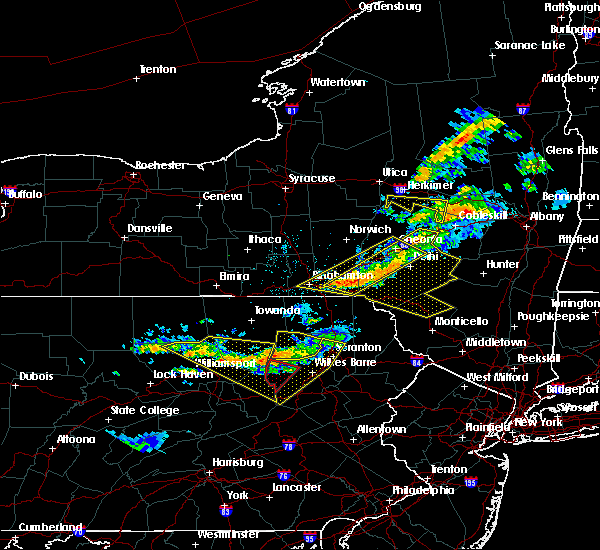 At 916 pm edt, severe thunderstorms were located along a line extending from near ricketts glen state park to near buttonwood, moving southeast at 35 mph. the strongest storm was between laporte and ricketts glen state park (radar indicated). Hazards include 70 mph wind gusts and quarter size hail. Hail damage to vehicles is expected. expect considerable tree damage. wind damage is also likely to mobile homes, roofs, and outbuildings. locations impacted include, berwick, hughesville, mifflinville, rohrsburg, iola, jamison city, waller, kettle creek gorge, lairdsville, central, ralston, biggertown, trout run, lincoln falls, barbours, shunk, ricketts glen state park, muncy valley, buttonwood and loyalsockville. For those driving on interstate 80, this includes areas between the bloomsburg-light street and nescopek exits, specifically from mile markers 240 to 247. At 916 pm edt, severe thunderstorms were located along a line extending from near ricketts glen state park to near buttonwood, moving southeast at 35 mph. the strongest storm was between laporte and ricketts glen state park (radar indicated). Hazards include 70 mph wind gusts and quarter size hail. Hail damage to vehicles is expected. expect considerable tree damage. wind damage is also likely to mobile homes, roofs, and outbuildings. locations impacted include, berwick, hughesville, mifflinville, rohrsburg, iola, jamison city, waller, kettle creek gorge, lairdsville, central, ralston, biggertown, trout run, lincoln falls, barbours, shunk, ricketts glen state park, muncy valley, buttonwood and loyalsockville. For those driving on interstate 80, this includes areas between the bloomsburg-light street and nescopek exits, specifically from mile markers 240 to 247.
|
| 6/13/2018 8:22 PM EDT |
 At 821 pm edt, severe thunderstorms were located along a line extending from near le roy to buttonwood, moving southeast at 45 mph (radar indicated). Hazards include 70 mph wind gusts and quarter size hail. Hail damage to vehicles is expected. expect considerable tree damage. Wind damage is also likely to mobile homes, roofs, and outbuildings. At 821 pm edt, severe thunderstorms were located along a line extending from near le roy to buttonwood, moving southeast at 45 mph (radar indicated). Hazards include 70 mph wind gusts and quarter size hail. Hail damage to vehicles is expected. expect considerable tree damage. Wind damage is also likely to mobile homes, roofs, and outbuildings.
|
| 5/15/2018 3:11 PM EDT |
 At 311 pm edt, a severe thunderstorm capable of producing a tornado was located over mifflinville, moving east at 45 mph (radar indicated rotation). Hazards include tornado and quarter size hail. Flying debris will be dangerous to those caught without shelter. mobile homes will be damaged or destroyed. damage to roofs, windows, and vehicles will occur. tree damage is likely. This tornadic thunderstorm will remain over mainly rural areas of northeastern columbia county, including the following locations: briar creek, benton, stillwater, lime ridge and orangeville. At 311 pm edt, a severe thunderstorm capable of producing a tornado was located over mifflinville, moving east at 45 mph (radar indicated rotation). Hazards include tornado and quarter size hail. Flying debris will be dangerous to those caught without shelter. mobile homes will be damaged or destroyed. damage to roofs, windows, and vehicles will occur. tree damage is likely. This tornadic thunderstorm will remain over mainly rural areas of northeastern columbia county, including the following locations: briar creek, benton, stillwater, lime ridge and orangeville.
|
| 5/15/2018 2:57 PM EDT |
 At 256 pm edt, severe thunderstorms were located along a line extending from waller to near milton to near kreamer to near richfield, moving east at 55 mph (radar indicated). Hazards include 70 mph wind gusts. Expect considerable tree damage. damage is likely to mobile homes, roofs, and outbuildings. these severe storms will be near, fairmount spgs, mooresburg, central, waller, jamison city, rohrsburg and ricketts glen state park around 300 pm edt. danville, meiserville, stonington, buckhorn, port trevorton, riverside, fremont, jerseytown and eyers grove around 310 pm edt. shamokin, bloomsburg, kulpmont, mainville, urban, almedia, marshallton, elysburg, fairview-ferndale and knoebels grove around 320 pm edt. mount carmel, berwick, wilburton number two, wilburton number one, aristes, locustdale, numidia, shumans, leck kill and mifflinville around 330 pm edt. Other locations impacted by these severe thunderstorms include wagner, lime ridge, marion heights, seven points, hartleton, new berlin, stillwater, millville, herndon and edgewood. At 256 pm edt, severe thunderstorms were located along a line extending from waller to near milton to near kreamer to near richfield, moving east at 55 mph (radar indicated). Hazards include 70 mph wind gusts. Expect considerable tree damage. damage is likely to mobile homes, roofs, and outbuildings. these severe storms will be near, fairmount spgs, mooresburg, central, waller, jamison city, rohrsburg and ricketts glen state park around 300 pm edt. danville, meiserville, stonington, buckhorn, port trevorton, riverside, fremont, jerseytown and eyers grove around 310 pm edt. shamokin, bloomsburg, kulpmont, mainville, urban, almedia, marshallton, elysburg, fairview-ferndale and knoebels grove around 320 pm edt. mount carmel, berwick, wilburton number two, wilburton number one, aristes, locustdale, numidia, shumans, leck kill and mifflinville around 330 pm edt. Other locations impacted by these severe thunderstorms include wagner, lime ridge, marion heights, seven points, hartleton, new berlin, stillwater, millville, herndon and edgewood.
|
| 5/15/2018 2:48 PM EDT |
 At 247 pm edt, a severe thunderstorm capable of producing a tornado was located over exchange, moving east at 65 mph (radar indicated rotation). Hazards include tornado and quarter size hail. Flying debris will be dangerous to those caught without shelter. mobile homes will be damaged or destroyed. damage to roofs, windows, and vehicles will occur. tree damage is likely. this dangerous storm will be near, jerseytown, iola and eyers grove around 250 pm edt. rohrsburg, lightstreet and almedia around 300 pm edt. other locations impacted by this tornadic thunderstorm include briar creek, turbotville, lime ridge, washingtonville, orangeville, benton, stillwater, millville and mcewensville. For those driving on interstate 80, this includes areas between the limestoneville and mifflinville exits, specifically between mile markers 215 and 218, near mile marker 229, and from mile markers 231 to 241. At 247 pm edt, a severe thunderstorm capable of producing a tornado was located over exchange, moving east at 65 mph (radar indicated rotation). Hazards include tornado and quarter size hail. Flying debris will be dangerous to those caught without shelter. mobile homes will be damaged or destroyed. damage to roofs, windows, and vehicles will occur. tree damage is likely. this dangerous storm will be near, jerseytown, iola and eyers grove around 250 pm edt. rohrsburg, lightstreet and almedia around 300 pm edt. other locations impacted by this tornadic thunderstorm include briar creek, turbotville, lime ridge, washingtonville, orangeville, benton, stillwater, millville and mcewensville. For those driving on interstate 80, this includes areas between the limestoneville and mifflinville exits, specifically between mile markers 215 and 218, near mile marker 229, and from mile markers 231 to 241.
|
| 5/15/2018 2:16 PM EDT |
 At 215 pm edt, severe thunderstorms were located along a line extending from near williamsport to near lamar to centre hall to whipple dam state park, moving east at 55 mph (radar indicated). Hazards include 70 mph wind gusts. Expect considerable tree damage. damage is likely to mobile homes, roofs, and outbuildings. severe thunderstorms will be near, williamsport, duboistown and cogan station around 220 pm edt. montoursville, reedsville, r. b. winter state park, yeagertown, carroll, montgomery, seven mountains, muncy, woodward and milroy around 230 pm edt. mifflinburg, sand bridge state park, alfarata, forest hill, hughesville, weikert, snyder-middleswart state park, troxelville, lairdsville and reeds gap state park around 240 pm edt. lewisburg, milton, biggertown, linntown, penns creek, mcalisterville, mcclure, montandon, new columbia and middleburg around 250 pm edt. other locations impacted by these severe thunderstorms include wagner, lime ridge, west milton, marion heights, siglerville, seven points, hartleton, garden view, oval and loganton. for those driving on interstate 80, this includes areas between the bellefonte and nescopek exits, specifically from mile markers 172 to 247. This includes interstate 180 from mile markers 1 to 29. At 215 pm edt, severe thunderstorms were located along a line extending from near williamsport to near lamar to centre hall to whipple dam state park, moving east at 55 mph (radar indicated). Hazards include 70 mph wind gusts. Expect considerable tree damage. damage is likely to mobile homes, roofs, and outbuildings. severe thunderstorms will be near, williamsport, duboistown and cogan station around 220 pm edt. montoursville, reedsville, r. b. winter state park, yeagertown, carroll, montgomery, seven mountains, muncy, woodward and milroy around 230 pm edt. mifflinburg, sand bridge state park, alfarata, forest hill, hughesville, weikert, snyder-middleswart state park, troxelville, lairdsville and reeds gap state park around 240 pm edt. lewisburg, milton, biggertown, linntown, penns creek, mcalisterville, mcclure, montandon, new columbia and middleburg around 250 pm edt. other locations impacted by these severe thunderstorms include wagner, lime ridge, west milton, marion heights, siglerville, seven points, hartleton, garden view, oval and loganton. for those driving on interstate 80, this includes areas between the bellefonte and nescopek exits, specifically from mile markers 172 to 247. This includes interstate 180 from mile markers 1 to 29.
|
| 8/22/2017 7:24 PM EDT |
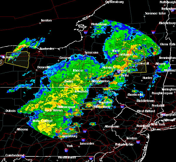 At 724 pm edt, a severe thunderstorm was located near rohrsburg, moving east at 45 mph (radar indicated). Hazards include 60 mph wind gusts. expect damage to trees and power lines At 724 pm edt, a severe thunderstorm was located near rohrsburg, moving east at 45 mph (radar indicated). Hazards include 60 mph wind gusts. expect damage to trees and power lines
|
| 8/19/2017 7:54 PM EDT |
 At 752 pm edt, severe thunderstorms were located along a line extending from near hughesville to near leck kill, moving east at 40 mph (radar indicated). Hazards include 60 mph wind gusts. expect damage to trees and power lines At 752 pm edt, severe thunderstorms were located along a line extending from near hughesville to near leck kill, moving east at 40 mph (radar indicated). Hazards include 60 mph wind gusts. expect damage to trees and power lines
|
| 8/4/2017 9:11 PM EDT |
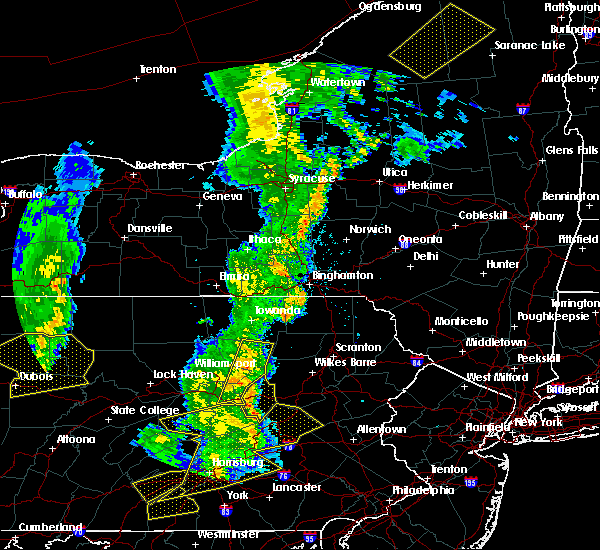 At 910 pm edt, severe thunderstorms were located along a line extending from 8 miles northwest of ricketts glen state park to jerseytown, moving northeast at 50 mph (radar indicated). Hazards include 60 mph wind gusts. Expect damage to trees and power lines. Locations impacted include, danville, eyers grove, jerseytown, jamison city, lairdsville, waller, ricketts glen state park, central, exchange and mooresburg. At 910 pm edt, severe thunderstorms were located along a line extending from 8 miles northwest of ricketts glen state park to jerseytown, moving northeast at 50 mph (radar indicated). Hazards include 60 mph wind gusts. Expect damage to trees and power lines. Locations impacted include, danville, eyers grove, jerseytown, jamison city, lairdsville, waller, ricketts glen state park, central, exchange and mooresburg.
|
| 8/4/2017 8:57 PM EDT |
 At 856 pm edt, severe thunderstorms were located along a line extending from eyers grove to elysburg, moving northeast at 35 mph (radar indicated). Hazards include 60 mph wind gusts. expect damage to trees and power lines At 856 pm edt, severe thunderstorms were located along a line extending from eyers grove to elysburg, moving northeast at 35 mph (radar indicated). Hazards include 60 mph wind gusts. expect damage to trees and power lines
|
| 8/4/2017 8:16 PM EDT |
 At 816 pm edt, severe thunderstorms were located along a line extending from near le roy to near spruce run reservoir, moving east at 30 mph (radar indicated). Hazards include 60 mph wind gusts. expect damage to trees and power lines At 816 pm edt, severe thunderstorms were located along a line extending from near le roy to near spruce run reservoir, moving east at 30 mph (radar indicated). Hazards include 60 mph wind gusts. expect damage to trees and power lines
|
| 8/4/2017 3:58 PM EDT |
 At 358 pm edt, a severe thunderstorm was located near muncy valley, moving northeast at 75 mph (radar indicated). Hazards include 60 mph wind gusts and quarter size hail. Hail damage to vehicles is possible. Expect wind damage to trees and power lines. At 358 pm edt, a severe thunderstorm was located near muncy valley, moving northeast at 75 mph (radar indicated). Hazards include 60 mph wind gusts and quarter size hail. Hail damage to vehicles is possible. Expect wind damage to trees and power lines.
|
| 5/1/2017 8:55 PM EDT |
 At 854 pm edt, severe thunderstorms were located along a line extending from 7 miles northwest of jamison city to near waller to lightstreet, moving northeast at 60 mph (radar indicated). Hazards include 70 mph wind gusts. Expect considerable tree damage. damage is likely to mobile homes, roofs, and outbuildings. locations impacted include, bloomsburg, jamison city, waller, ricketts glen state park, central, rohrsburg, lightstreet, fairmount spgs, iola and eyers grove. A tornado watch remains in effect until 1000 pm edt for central and north central pennsylvania. At 854 pm edt, severe thunderstorms were located along a line extending from 7 miles northwest of jamison city to near waller to lightstreet, moving northeast at 60 mph (radar indicated). Hazards include 70 mph wind gusts. Expect considerable tree damage. damage is likely to mobile homes, roofs, and outbuildings. locations impacted include, bloomsburg, jamison city, waller, ricketts glen state park, central, rohrsburg, lightstreet, fairmount spgs, iola and eyers grove. A tornado watch remains in effect until 1000 pm edt for central and north central pennsylvania.
|
| 5/1/2017 8:39 PM EDT |
 At 838 pm edt, severe thunderstorms were located along a line extending from near hughesville to near jerseytown to near danville, moving northeast at 55 mph (radar indicated). Hazards include 60 mph wind gusts. expect damage to roofs, siding, and trees At 838 pm edt, severe thunderstorms were located along a line extending from near hughesville to near jerseytown to near danville, moving northeast at 55 mph (radar indicated). Hazards include 60 mph wind gusts. expect damage to roofs, siding, and trees
|
| 5/1/2017 7:14 PM EDT |
 At 713 pm edt, severe thunderstorms were located along a line extending from near allenwood to near laurelton center, moving northeast at 60 mph (radar indicated). Hazards include 70 mph wind gusts. Expect considerable tree damage. Damage is likely to mobile homes, roofs, and outbuildings. At 713 pm edt, severe thunderstorms were located along a line extending from near allenwood to near laurelton center, moving northeast at 60 mph (radar indicated). Hazards include 70 mph wind gusts. Expect considerable tree damage. Damage is likely to mobile homes, roofs, and outbuildings.
|
| 8/16/2016 4:52 PM EDT |
 At 451 pm edt, severe thunderstorms were located along a line extending from near rohrsburg to near schuylkill haven, moving northeast at 35 mph (radar indicated). Hazards include 60 mph wind gusts. Expect damage to roofs. siding. and trees. locations impacted include, shenandoah, tamaqua, minersville, berwick, pottsville, st. Clair, frackville, schuylkill haven, mahanoy city, ashland, mcadoo, seltzer, port carbon, rohrsburg, numidia, englewood, shumans, grier city-park crest, jamison city and lightstreet. At 451 pm edt, severe thunderstorms were located along a line extending from near rohrsburg to near schuylkill haven, moving northeast at 35 mph (radar indicated). Hazards include 60 mph wind gusts. Expect damage to roofs. siding. and trees. locations impacted include, shenandoah, tamaqua, minersville, berwick, pottsville, st. Clair, frackville, schuylkill haven, mahanoy city, ashland, mcadoo, seltzer, port carbon, rohrsburg, numidia, englewood, shumans, grier city-park crest, jamison city and lightstreet.
|
| 8/16/2016 4:28 PM EDT |
 At 427 pm edt, severe thunderstorms were located along a line extending from near buckhorn to pine grove, moving northeast at 40 mph (radar indicated). Hazards include 60 mph wind gusts. Expect damage to roofs. siding. And trees. At 427 pm edt, severe thunderstorms were located along a line extending from near buckhorn to pine grove, moving northeast at 40 mph (radar indicated). Hazards include 60 mph wind gusts. Expect damage to roofs. siding. And trees.
|
| 8/16/2016 3:51 PM EDT |
 At 350 pm edt, a severe thunderstorm was located over biggertown, moving east at 30 mph (radar indicated). Hazards include 60 mph wind gusts. Expect damage to roofs. siding. and trees. Locations impacted include, muncy, central, jamison city, biggertown, fairmount spgs, lairdsville, waller, muncy valley, hughesville, ricketts glen state park, montgomery, benton and picture rocks. At 350 pm edt, a severe thunderstorm was located over biggertown, moving east at 30 mph (radar indicated). Hazards include 60 mph wind gusts. Expect damage to roofs. siding. and trees. Locations impacted include, muncy, central, jamison city, biggertown, fairmount spgs, lairdsville, waller, muncy valley, hughesville, ricketts glen state park, montgomery, benton and picture rocks.
|
| 8/16/2016 3:25 PM EDT |
 At 325 pm edt, a severe thunderstorm was located near hughesville, moving east at 25 mph (radar indicated). Hazards include 60 mph wind gusts. Expect damage to roofs. siding. And trees. At 325 pm edt, a severe thunderstorm was located near hughesville, moving east at 25 mph (radar indicated). Hazards include 60 mph wind gusts. Expect damage to roofs. siding. And trees.
|
| 7/25/2016 3:40 PM EDT |
 At 339 pm edt, severe thunderstorms were located along a line extending from near waller to near allenwood, moving southeast at 30 mph (radar indicated). Hazards include 60 mph wind gusts and quarter size hail. Hail damage to vehicles is expected. Expect wind damage to roofs, siding, and trees. At 339 pm edt, severe thunderstorms were located along a line extending from near waller to near allenwood, moving southeast at 30 mph (radar indicated). Hazards include 60 mph wind gusts and quarter size hail. Hail damage to vehicles is expected. Expect wind damage to roofs, siding, and trees.
|
| 7/18/2016 1:13 PM EDT |
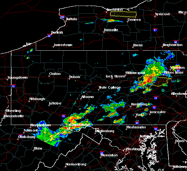 At 108 pm edt, a severe thunderstorm is located over lightstreet, moving east at 35 mph (radar indicated). Hazards include 60 mph wind gusts and hail up to quarter size. Hail damage to vehicles remains possible. expect wind damage to roofs, siding, and trees. Locations impacted include, berwick, bloomsburg, rupert, almedia, fernville, rohrsburg, numidia, iola, shumans, eyers grove, lightstreet, jerseytown, catawissa, mainville, mifflinville, buckhorn, slabtown, lime ridge, cambra and benton. At 108 pm edt, a severe thunderstorm is located over lightstreet, moving east at 35 mph (radar indicated). Hazards include 60 mph wind gusts and hail up to quarter size. Hail damage to vehicles remains possible. expect wind damage to roofs, siding, and trees. Locations impacted include, berwick, bloomsburg, rupert, almedia, fernville, rohrsburg, numidia, iola, shumans, eyers grove, lightstreet, jerseytown, catawissa, mainville, mifflinville, buckhorn, slabtown, lime ridge, cambra and benton.
|
| 7/18/2016 12:55 PM EDT |
 At 1252 pm edt, a severe thunderstorm was located over jerseytown, moving east at 30 mph (large hail observed and radar indicated strong winds). Hazards include 60 mph wind gusts and quarter size hail. Hail damage to vehicles is expected. expect wind damage to roofs, siding, and trees. Locations impacted include, danville, berwick, bloomsburg, rupert, riverside, almedia, fernville, exchange, rohrsburg, numidia, iola, shumans, mooresburg, eyers grove, lightstreet, jerseytown, catawissa, mainville, mifflinville and buckhorn. At 1252 pm edt, a severe thunderstorm was located over jerseytown, moving east at 30 mph (large hail observed and radar indicated strong winds). Hazards include 60 mph wind gusts and quarter size hail. Hail damage to vehicles is expected. expect wind damage to roofs, siding, and trees. Locations impacted include, danville, berwick, bloomsburg, rupert, riverside, almedia, fernville, exchange, rohrsburg, numidia, iola, shumans, mooresburg, eyers grove, lightstreet, jerseytown, catawissa, mainville, mifflinville and buckhorn.
|
| 7/18/2016 12:30 PM EDT |
 At 1228 pm edt, a severe thunderstorm was located near delaware run, moving east at 30 mph (observed and radar indicated). Hazards include golf ball size hail and 60 mph wind gusts. People and animals outdoors will be injured. expect hail damage to roofs, siding, windows, and vehicles. expect wind damage to roofs, siding, and trees. A period of torrential rain will also accompany this storm. At 1228 pm edt, a severe thunderstorm was located near delaware run, moving east at 30 mph (observed and radar indicated). Hazards include golf ball size hail and 60 mph wind gusts. People and animals outdoors will be injured. expect hail damage to roofs, siding, windows, and vehicles. expect wind damage to roofs, siding, and trees. A period of torrential rain will also accompany this storm.
|
| 7/9/2015 5:21 PM EDT |
 At 521 pm edt, doppler radar indicated a severe thunderstorm capable of producing damaging winds around 60 mph. this storm was located over biggertown, and moving east at 30 mph. At 521 pm edt, doppler radar indicated a severe thunderstorm capable of producing damaging winds around 60 mph. this storm was located over biggertown, and moving east at 30 mph.
|
| 6/30/2015 9:47 PM EDT |
 At 946 pm edt, doppler radar indicated severe thunderstorms from benton to lewisburg which are capable of producing destructive winds in excess of 70 mph. the storms were moving east at 25 to 30 mph. locations impacted include, lewisburg, mifflinburg, milton, allenwood, biggertown, delaware run, exchange, eyers grove, forest hill, hughesville, iola, jerseytown, lairdsville, linntown, montandon, mooresburg, muncy, new columbia, rohrsburg and spruce run reservoir. At 946 pm edt, doppler radar indicated severe thunderstorms from benton to lewisburg which are capable of producing destructive winds in excess of 70 mph. the storms were moving east at 25 to 30 mph. locations impacted include, lewisburg, mifflinburg, milton, allenwood, biggertown, delaware run, exchange, eyers grove, forest hill, hughesville, iola, jerseytown, lairdsville, linntown, montandon, mooresburg, muncy, new columbia, rohrsburg and spruce run reservoir.
|
| 6/30/2015 9:04 PM EDT |
 At 902 pm edt, doppler radar indicated a cluster of severe thunderstorms capable of producing damaging winds of 60 to 70 mph. the strongest winds were over southwestern lycoming and western union counties, and moving northeast at 25 mph. At 902 pm edt, doppler radar indicated a cluster of severe thunderstorms capable of producing damaging winds of 60 to 70 mph. the strongest winds were over southwestern lycoming and western union counties, and moving northeast at 25 mph.
|
| 6/23/2015 1:13 PM EDT |
 At 113 pm edt, doppler radar indicated a line of severe thunderstorms capable of producing destructive winds in excess of 70 mph. these storms were located along a line extending from near carroll to near troxelville to near reeds gap state park. these storms were nearly stationary. locations impacted include, berwick, bloomsburg, danville, kulpmont, lewisburg, milton, mount carmel, northumberland, selinsgrove, shamokin, sunbury, almedia, aristes, beaver springs, belltown, buckhorn, catawissa, elysburg, exchange and eyers grove. At 113 pm edt, doppler radar indicated a line of severe thunderstorms capable of producing destructive winds in excess of 70 mph. these storms were located along a line extending from near carroll to near troxelville to near reeds gap state park. these storms were nearly stationary. locations impacted include, berwick, bloomsburg, danville, kulpmont, lewisburg, milton, mount carmel, northumberland, selinsgrove, shamokin, sunbury, almedia, aristes, beaver springs, belltown, buckhorn, catawissa, elysburg, exchange and eyers grove.
|
| 6/23/2015 12:50 PM EDT |
 At 1250 pm edt, doppler radar indicated a line of severe thunderstorms capable of producing damaging winds of 60 to 70 mph. these storms were located along a line extending from near carroll to near troxelville to near reeds gap state park, and moving east at 60 mph. At 1250 pm edt, doppler radar indicated a line of severe thunderstorms capable of producing damaging winds of 60 to 70 mph. these storms were located along a line extending from near carroll to near troxelville to near reeds gap state park, and moving east at 60 mph.
|
| 6/23/2015 10:25 AM EDT |
 At 1025 am edt, doppler radar indicated a severe thunderstorm capable of producing destructive winds greater than 70 mph. this storm was located over shumans, and moving east at 50 mph. At 1025 am edt, doppler radar indicated a severe thunderstorm capable of producing destructive winds greater than 70 mph. this storm was located over shumans, and moving east at 50 mph.
|
| 6/23/2015 10:04 AM EDT |
 At 1004 am edt, doppler radar indicated a severe thunderstorm capable of producing destructive winds in excess of 70 mph. this storm was located over riverside. this storm was nearly stationary. locations impacted include, bloomsburg, danville, lewisburg, milton, northumberland, selinsgrove, shamokin, sunbury, allenwood, catawissa, elysburg, hummels wharf, iola, jerseytown and knoebels grove. At 1004 am edt, doppler radar indicated a severe thunderstorm capable of producing destructive winds in excess of 70 mph. this storm was located over riverside. this storm was nearly stationary. locations impacted include, bloomsburg, danville, lewisburg, milton, northumberland, selinsgrove, shamokin, sunbury, allenwood, catawissa, elysburg, hummels wharf, iola, jerseytown and knoebels grove.
|
| 6/23/2015 9:49 AM EDT |
 At 948 am edt, doppler radar indicated a severe thunderstorm capable of producing destructive winds in excess of 70 mph. this storm was located near linntown, moving east at 50 mph. locations impacted include, bloomsburg, danville, lewisburg, mifflinburg, milton, northumberland, selinsgrove, shamokin, sunbury, allenwood, almedia, buckhorn, catawissa, elysburg, exchange, eyers grove, fairview-ferndale, fernville, forest hill and hummels wharf. At 948 am edt, doppler radar indicated a severe thunderstorm capable of producing destructive winds in excess of 70 mph. this storm was located near linntown, moving east at 50 mph. locations impacted include, bloomsburg, danville, lewisburg, mifflinburg, milton, northumberland, selinsgrove, shamokin, sunbury, allenwood, almedia, buckhorn, catawissa, elysburg, exchange, eyers grove, fairview-ferndale, fernville, forest hill and hummels wharf.
|
| 6/23/2015 9:37 AM EDT |
 At 936 am edt, doppler radar indicated a severe thunderstorm capable of producing damaging winds of 60 to 70 mph. this storm was located over woodward, and moving east at 50 mph. At 936 am edt, doppler radar indicated a severe thunderstorm capable of producing damaging winds of 60 to 70 mph. this storm was located over woodward, and moving east at 50 mph.
|
| 6/12/2015 9:35 PM EDT |
 At 934 pm edt, doppler radar indicated a line of severe thunderstorms capable of producing destructive winds in excess of 70 mph. these storms were located along a line extending from near collomsville to near sand bridge state park to near weikert to near woodward to near reeds gap state park. these storms were nearly stationary. locations impacted include, berwick, bloomsburg, danville, kulpmont, mount carmel, shamokin, almedia, aristes, buckhorn, catawissa, elysburg, eyers grove, fairview-ferndale, fernville, iola, jerseytown, klingerstown, knoebels grove, leck kill and lightstreet. At 934 pm edt, doppler radar indicated a line of severe thunderstorms capable of producing destructive winds in excess of 70 mph. these storms were located along a line extending from near collomsville to near sand bridge state park to near weikert to near woodward to near reeds gap state park. these storms were nearly stationary. locations impacted include, berwick, bloomsburg, danville, kulpmont, mount carmel, shamokin, almedia, aristes, buckhorn, catawissa, elysburg, eyers grove, fairview-ferndale, fernville, iola, jerseytown, klingerstown, knoebels grove, leck kill and lightstreet.
|
| 6/12/2015 9:22 PM EDT |
 At 922 pm edt, doppler radar indicated a line of severe thunderstorms capable of producing destructive winds in excess of 70 mph. these storms were located along a line extending from near collomsville to near sand bridge state park to near weikert to near woodward to near reeds gap state park. these storms were nearly stationary. locations impacted include, berwick, bloomsburg, danville, kulpmont, milton, mount carmel, northumberland, selinsgrove, shamokin, sunbury, almedia, aristes, buckhorn, catawissa, delaware run, elysburg, exchange, eyers grove, fairview-ferndale and fernville. At 922 pm edt, doppler radar indicated a line of severe thunderstorms capable of producing destructive winds in excess of 70 mph. these storms were located along a line extending from near collomsville to near sand bridge state park to near weikert to near woodward to near reeds gap state park. these storms were nearly stationary. locations impacted include, berwick, bloomsburg, danville, kulpmont, milton, mount carmel, northumberland, selinsgrove, shamokin, sunbury, almedia, aristes, buckhorn, catawissa, delaware run, elysburg, exchange, eyers grove, fairview-ferndale and fernville.
|
| 6/12/2015 9:01 PM EDT |
 At 900 pm edt, doppler radar indicated a line of severe thunderstorms capable of producing destructive winds in excess of 70 mph. these storms were located along a line extending from near collomsville to near sand bridge state park to near weikert to near woodward to near reeds gap state park, moving east at 40 mph. locations impacted include, berwick, bloomsburg, danville, kulpmont, lewisburg, mifflinburg, milton, mount carmel, northumberland, selinsgrove, shamokin, sunbury, allenwood, almedia, aristes, beaver springs, buckhorn, catawissa, collomsville and delaware run. At 900 pm edt, doppler radar indicated a line of severe thunderstorms capable of producing destructive winds in excess of 70 mph. these storms were located along a line extending from near collomsville to near sand bridge state park to near weikert to near woodward to near reeds gap state park, moving east at 40 mph. locations impacted include, berwick, bloomsburg, danville, kulpmont, lewisburg, mifflinburg, milton, mount carmel, northumberland, selinsgrove, shamokin, sunbury, allenwood, almedia, aristes, beaver springs, buckhorn, catawissa, collomsville and delaware run.
|
| 6/12/2015 8:43 PM EDT |
 At 843 pm edt, doppler radar indicated a line of severe thunderstorms capable of producing damaging winds of 60 to 70 mph. these storms were located along a line extending from near avis to near r.b. winter state park to near weikert to near woodward to near alfarata, and moving east at 40 mph. At 843 pm edt, doppler radar indicated a line of severe thunderstorms capable of producing damaging winds of 60 to 70 mph. these storms were located along a line extending from near avis to near r.b. winter state park to near weikert to near woodward to near alfarata, and moving east at 40 mph.
|
| 6/12/2015 8:01 PM EDT |
 At 801 pm edt, doppler radar indicated a line of severe thunderstorms capable of producing damaging winds of 60 to 70 mph. these storms were located along a line extending from near sylvania to near grover to near trout run, and moving east at 35 mph. At 801 pm edt, doppler radar indicated a line of severe thunderstorms capable of producing damaging winds of 60 to 70 mph. these storms were located along a line extending from near sylvania to near grover to near trout run, and moving east at 35 mph.
|
| 6/8/2015 4:38 PM EDT | At 437 pm edt, doppler radar indicated a severe thunderstorm capable of producing damaging winds of 60 to 70 mph. this storm was located over biggertown, and moving east at 50 mph. |
| 5/31/2015 4:11 PM EDT | At 410 pm edt, doppler radar indicated a severe thunderstorm capable of producing quarter size hail and damaging winds in excess of 60 mph. this storm was located near huntington mills, moving east at 20 mph. locations impacted include, berwick, lightstreet, mifflinville, rohrsburg, benton, briar creek, lime ridge, orangeville and stillwater. |
| 5/31/2015 3:45 PM EDT | At 344 pm edt, doppler radar indicated a severe thunderstorm capable of producing quarter size hail and damaging winds around 60 mph. this storm was located near rohrsburg, and moving east at 20 mph. |
| 5/16/2015 5:46 PM EDT | At 544 pm edt, doppler radar indicated a line of severe thunderstorms capable of producing destructive winds of 60 to 70 mph. these storms were located along a line extending from near danville to near mechanicsville to near lavelle, moving northeast at 25 mph. nickel size hail may also accompany the damaging winds. locations impacted include, bloomsburg, berwick, mount carmel, shenandoah, danville, kulpmont, ashland, elysburg, riverside, catawissa, girardville, mifflinville, lightstreet, almedia, lavelle, fernville, mechanicsville, nuremburg, buckhorn and aristes. |
| 5/16/2015 5:10 PM EDT | At 510 pm edt, doppler radar indicated a line of severe thunderstorms capable of producing damaging winds of 60 to 70 mph. these storms were located along a line extending from near northumberland to near trevorton to near klingerstown, and moving northeast at 25 mph. nickel size hail may also accompany the damaging winds. |
| 7/7/2012 4:48 PM EDT | Numerous trees and wires down across northern columbia count in columbia county PA, 0.4 miles NNE of Benton, PA |
Hail Maps for Benton, PA


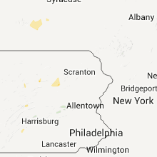


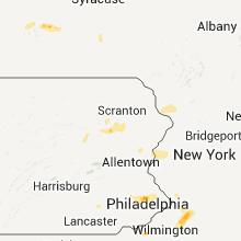

Connect with Interactive Hail Maps