

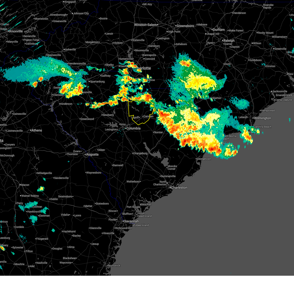
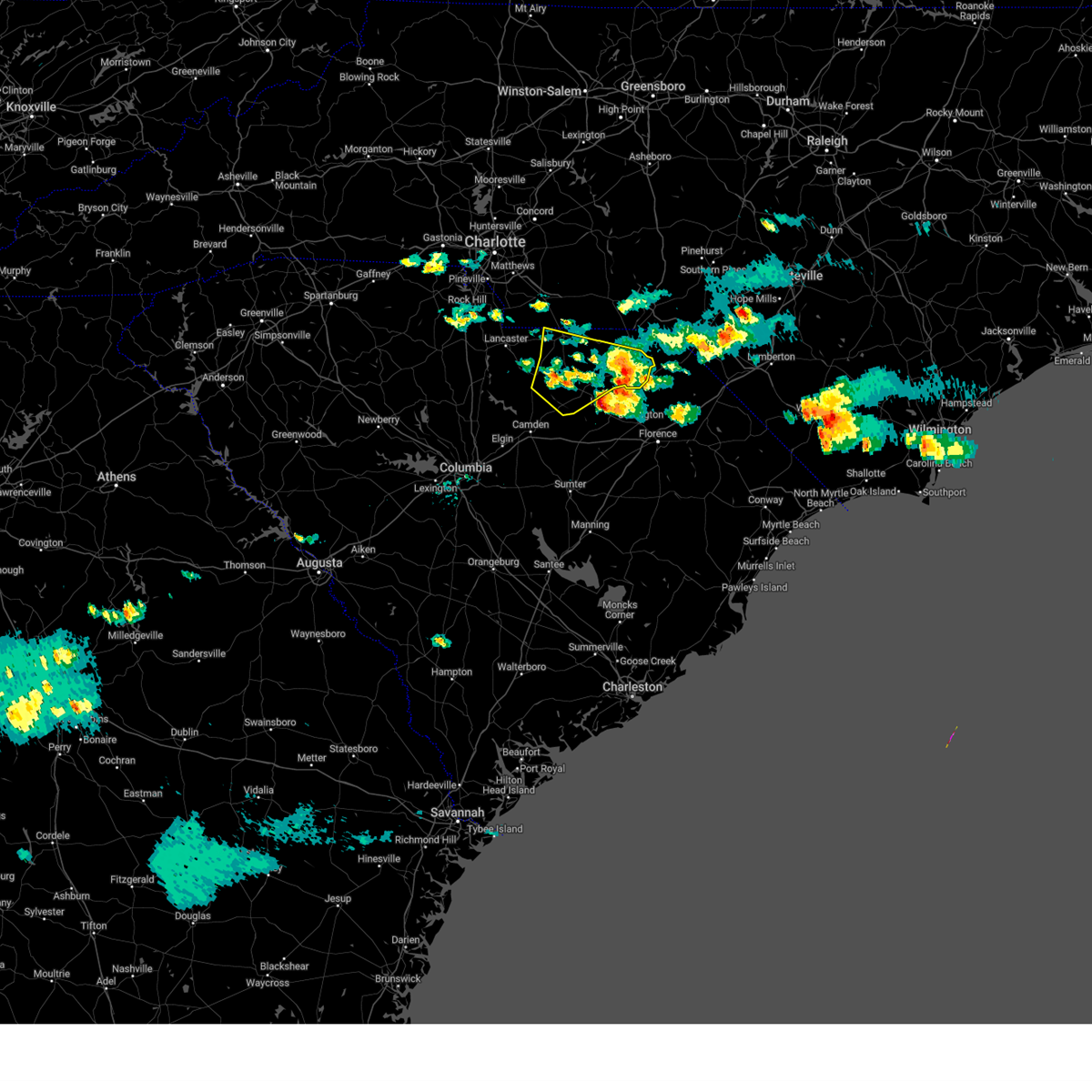
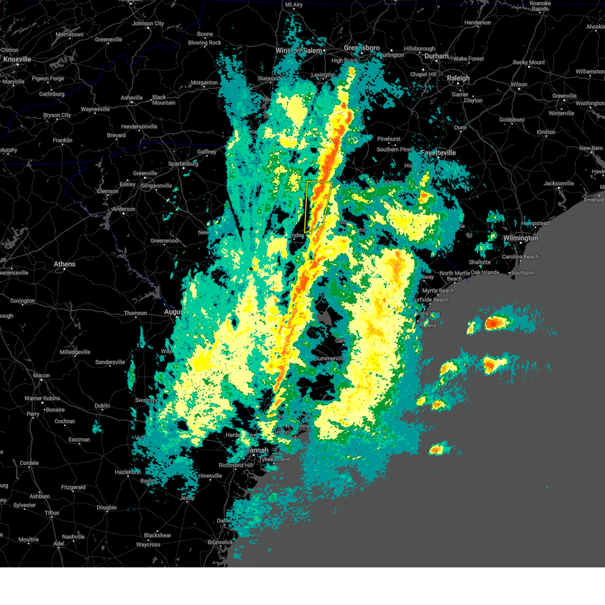
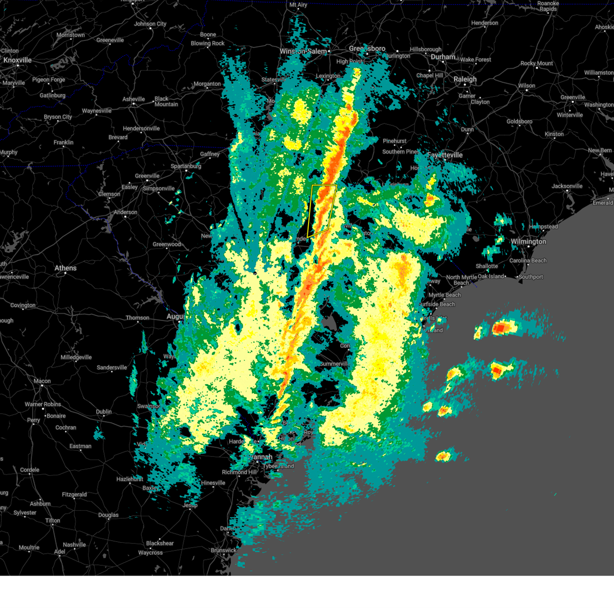
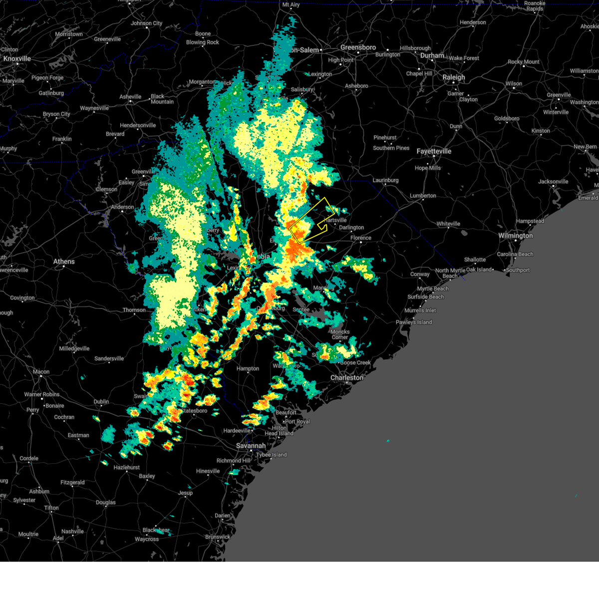
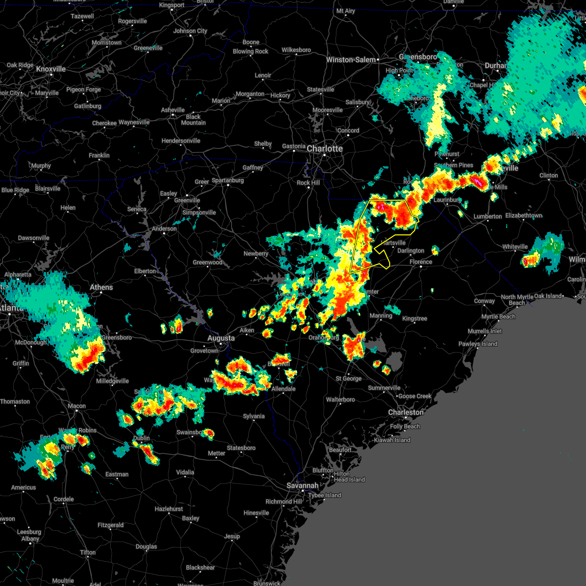
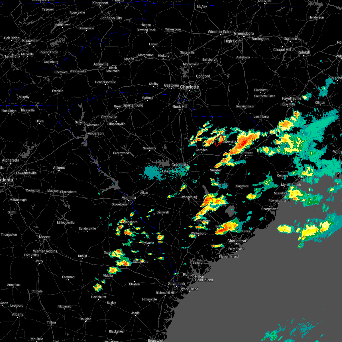
Hail Map for Bethune, SC
The Bethune, SC area has had 5 reports of on-the-ground hail by trained spotters, and has been under severe weather warnings 20 times during the past 12 months. Doppler radar has detected hail at or near Bethune, SC on 45 occasions, including 1 occasion during the past year.
| Name: | Bethune, SC |
| Where Located: | 62.3 miles SSE of Charlotte, NC |
| Map: | Google Map for Bethune, SC |
| Population: | 334 |
| Housing Units: | 191 |
| More Info: | Search Google for Bethune, SC |
0
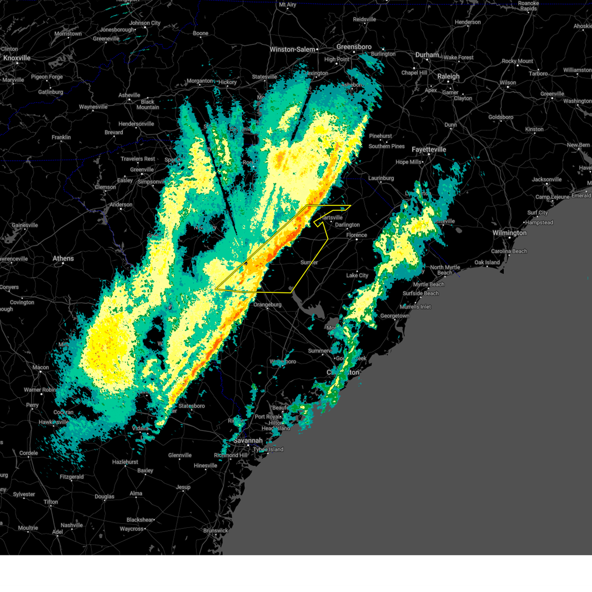
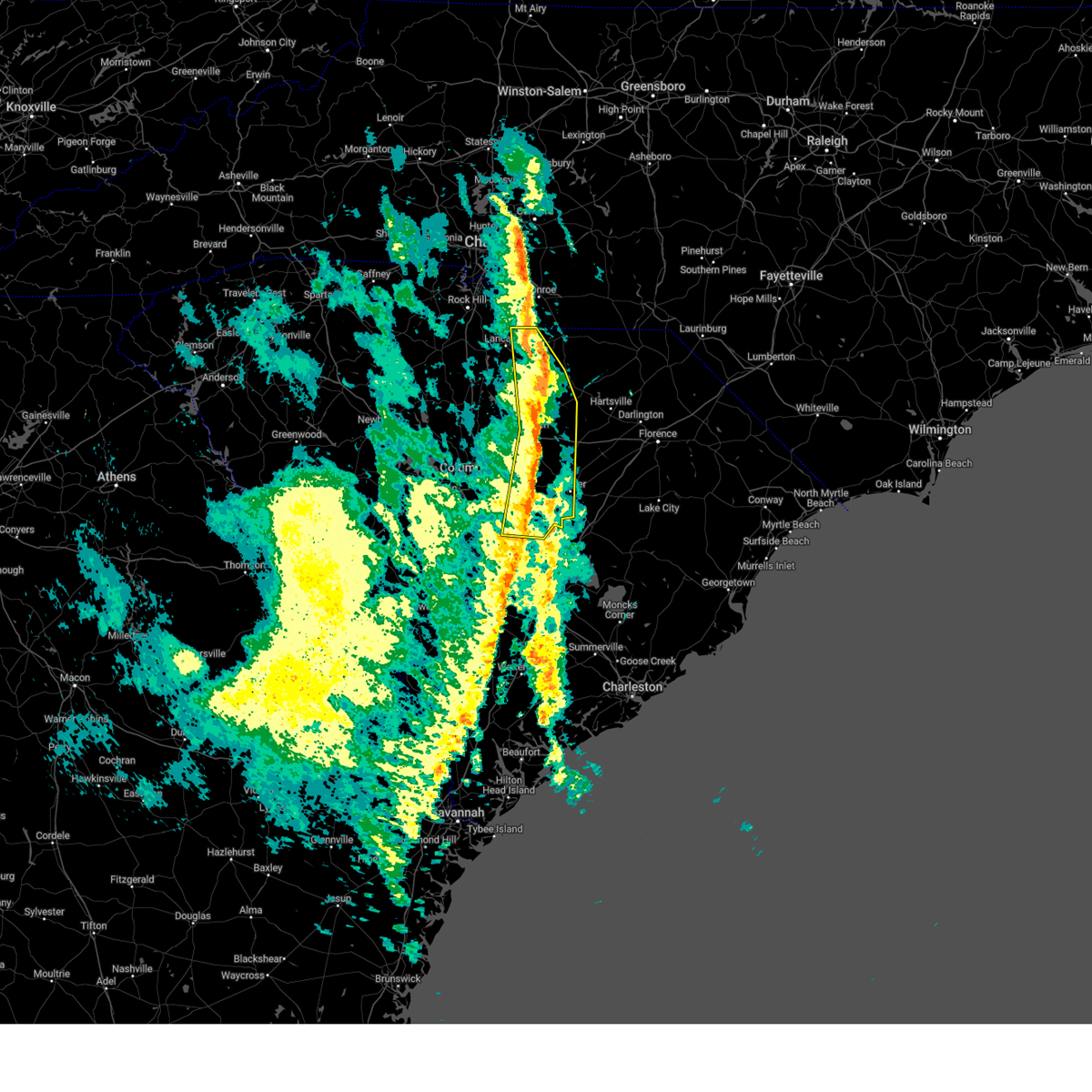
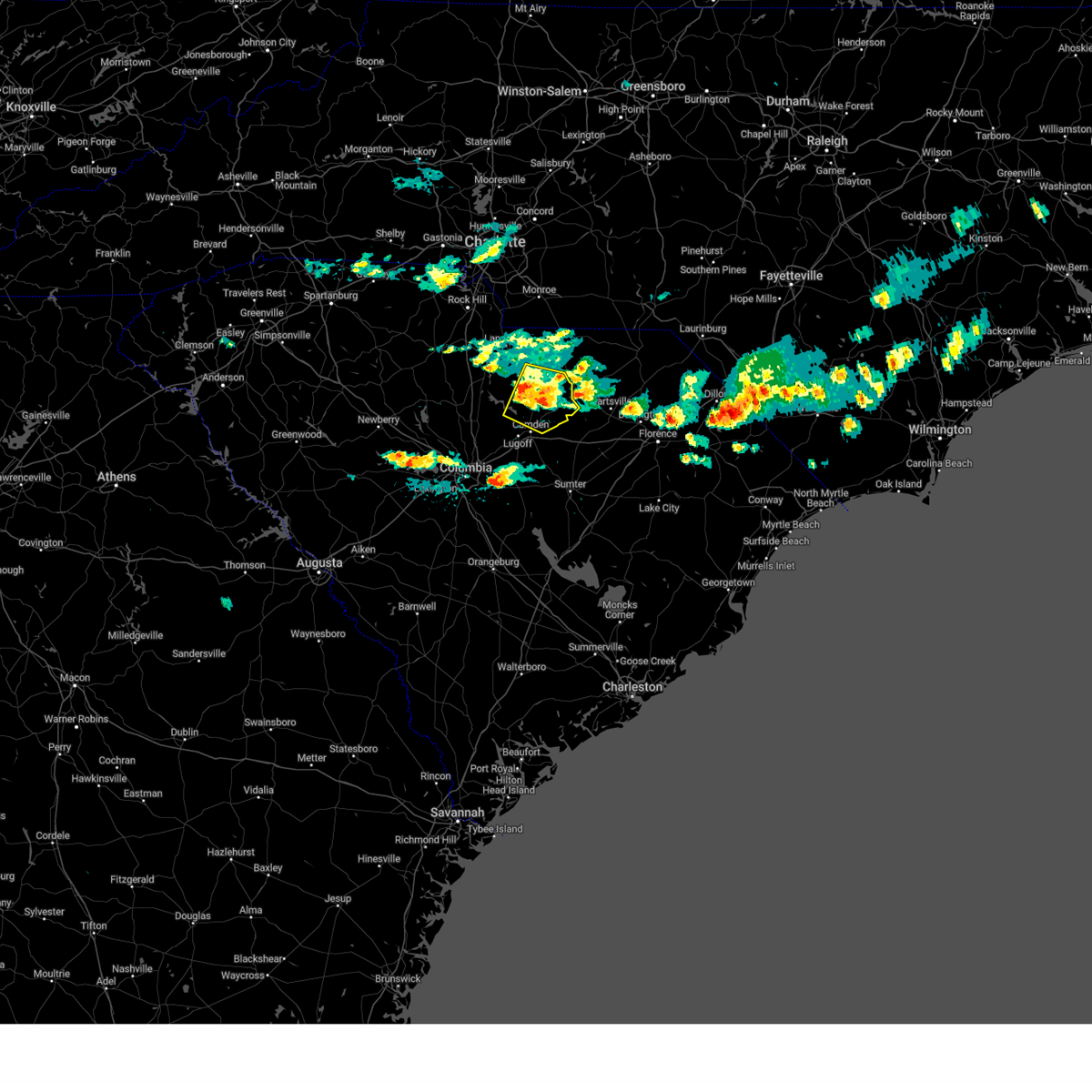
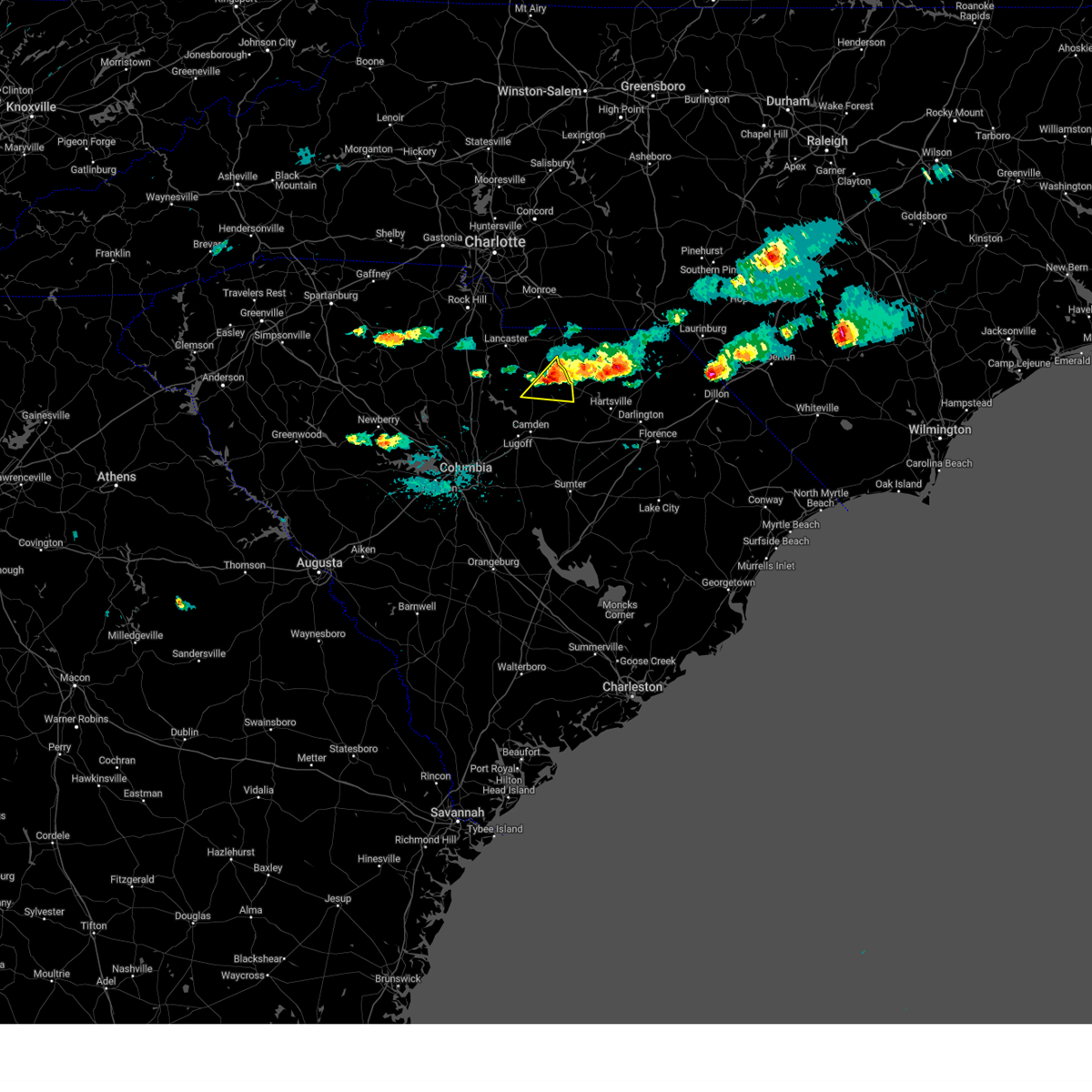
The Top Recent Hail Date for Bethune, SC is Thursday, May 8, 2025 (21st out of 45)

Hail and Wind Damage Spotted near Bethune, SC
| Date / Time | Report Details |
|---|---|
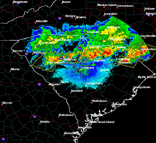
| 6/25/2025 7:48 PM EDT | At 747 pm edt, a severe thunderstorm was located over lake wateree state park, or near springdale, moving south at 30 mph (radar indicated). Hazards include 60 mph wind gusts. Expect damage to trees and powerlines. locations impacted include, camden, lake wateree dam, kershaw, lugoff, westville, longtown, cassatt, liberty hill, elgin, goodale state park, lake wateree state park, bethune, ridgeway, north central high school, dekalb, north towne square shopping center, mitford, antioch, midway elementary school, and boykin. This includes interstate 20 in south carolina between mile markers 85 and 105. |
| 6/25/2025 7:43 PM EDT |
 Svrcae the national weather service in columbia has issued a * severe thunderstorm warning for, eastern fairfield county in central south carolina, southwestern lancaster county in central south carolina, kershaw county in central south carolina, * until 815 pm edt. * at 743 pm edt, a severe thunderstorm was located over lake wateree state park, or 8 miles northeast of springdale, moving south at 30 mph (radar indicated). Hazards include 60 mph wind gusts. expect damage to trees and powerlines Svrcae the national weather service in columbia has issued a * severe thunderstorm warning for, eastern fairfield county in central south carolina, southwestern lancaster county in central south carolina, kershaw county in central south carolina, * until 815 pm edt. * at 743 pm edt, a severe thunderstorm was located over lake wateree state park, or 8 miles northeast of springdale, moving south at 30 mph (radar indicated). Hazards include 60 mph wind gusts. expect damage to trees and powerlines
|
| 3/31/2025 5:08 PM EDT |
 the severe thunderstorm warning has been cancelled and is no longer in effect the severe thunderstorm warning has been cancelled and is no longer in effect
|
| 3/31/2025 5:08 PM EDT |
 At 508 pm edt, severe thunderstorms were located along a line extending from near irwin to near lake wateree dam to horrel hill, moving east at 65 mph (radar indicated). Hazards include 60 mph wind gusts. Expect damage to trees and powerlines. locations impacted include, dalzell, manville, bell town fire station, community of almond glen, mitford, faith christian school, midway elementary school, heath springs, wateree river correctional institution, woodrow, camden, mulberry, dentsville, forty acre rock preserve, south sumter, kershaw correctional institution, shaw air base, mcwhirter airfield, bethune, and north towne square shopping center. this includes the following highways, interstate 20 in south carolina between mile markers 74 and 116. Interstate 77 between mile markers 6 and 19, and between mile markers 22 and 51. At 508 pm edt, severe thunderstorms were located along a line extending from near irwin to near lake wateree dam to horrel hill, moving east at 65 mph (radar indicated). Hazards include 60 mph wind gusts. Expect damage to trees and powerlines. locations impacted include, dalzell, manville, bell town fire station, community of almond glen, mitford, faith christian school, midway elementary school, heath springs, wateree river correctional institution, woodrow, camden, mulberry, dentsville, forty acre rock preserve, south sumter, kershaw correctional institution, shaw air base, mcwhirter airfield, bethune, and north towne square shopping center. this includes the following highways, interstate 20 in south carolina between mile markers 74 and 116. Interstate 77 between mile markers 6 and 19, and between mile markers 22 and 51.
|
| 3/31/2025 4:55 PM EDT |
 the severe thunderstorm warning has been cancelled and is no longer in effect the severe thunderstorm warning has been cancelled and is no longer in effect
|
| 3/31/2025 4:55 PM EDT |
 At 454 pm edt, severe thunderstorms were located along a line extending from near blackstock to near springdale to near pine ridge, moving northeast at 50 mph (radar indicated). Hazards include 60 mph wind gusts. Expect damage to trees and powerlines. locations impacted include, dalzell, lebanon fire station, manville, bell town fire station, community of almond glen, mitford, faith christian school, cayce riverwalk, columbia international university, midway elementary school, pine ridge, heath springs, wateree river correctional institution, woodrow, camden, mulberry, seven oaks, olympia, dentsville, and lake murray marina. this includes the following highways, interstate 126 between mile markers 0 and 3. interstate 20 in south carolina between mile markers 55 and 116. interstate 26 between mile markers 95 and 126. Interstate 77 between mile markers 0 and 51. At 454 pm edt, severe thunderstorms were located along a line extending from near blackstock to near springdale to near pine ridge, moving northeast at 50 mph (radar indicated). Hazards include 60 mph wind gusts. Expect damage to trees and powerlines. locations impacted include, dalzell, lebanon fire station, manville, bell town fire station, community of almond glen, mitford, faith christian school, cayce riverwalk, columbia international university, midway elementary school, pine ridge, heath springs, wateree river correctional institution, woodrow, camden, mulberry, seven oaks, olympia, dentsville, and lake murray marina. this includes the following highways, interstate 126 between mile markers 0 and 3. interstate 20 in south carolina between mile markers 55 and 116. interstate 26 between mile markers 95 and 126. Interstate 77 between mile markers 0 and 51.
|
| 3/31/2025 4:32 PM EDT |
 Svrcae the national weather service in columbia has issued a * severe thunderstorm warning for, fairfield county in central south carolina, lancaster county in central south carolina, western lee county in central south carolina, eastern newberry county in central south carolina, northern calhoun county in central south carolina, west central clarendon county in central south carolina, lexington county in central south carolina, sumter county in central south carolina, northeastern aiken county in central south carolina, richland county in central south carolina, kershaw county in central south carolina, * until 530 pm edt. * at 432 pm edt, severe thunderstorms were located along a line extending from 6 miles west of chester state park to near jenkinsville to 13 miles southwest of red bank, moving northeast at 55 mph (radar indicated). Hazards include 60 mph wind gusts. expect damage to trees and powerlines Svrcae the national weather service in columbia has issued a * severe thunderstorm warning for, fairfield county in central south carolina, lancaster county in central south carolina, western lee county in central south carolina, eastern newberry county in central south carolina, northern calhoun county in central south carolina, west central clarendon county in central south carolina, lexington county in central south carolina, sumter county in central south carolina, northeastern aiken county in central south carolina, richland county in central south carolina, kershaw county in central south carolina, * until 530 pm edt. * at 432 pm edt, severe thunderstorms were located along a line extending from 6 miles west of chester state park to near jenkinsville to 13 miles southwest of red bank, moving northeast at 55 mph (radar indicated). Hazards include 60 mph wind gusts. expect damage to trees and powerlines
|
| 2/16/2025 8:10 AM EST |
 the severe thunderstorm warning has been cancelled and is no longer in effect the severe thunderstorm warning has been cancelled and is no longer in effect
|
| 2/16/2025 8:10 AM EST |
 At 810 am est, severe thunderstorms were located along a line extending from 8 miles southeast of mt pisgah to near sandy run, moving east at 50 mph (radar indicated). Hazards include 60 mph wind gusts. Expect damage to trees and powerlines. locations impacted include, columbia, sumter, west columbia, cayce, forest acres, camden, bishopville, dentsville, shaw air base, mcentire air base, south congaree, pine ridge, st. matthews, gaston, arcadia lakes, eastover, lugoff, oakland, mulberry, and sesquicentennial state park. this includes the following highways, interstate 126 near mile marker 3. interstate 20 in south carolina between mile markers 72 and 126. interstate 26 between mile markers 112 and 137. Interstate 77 between mile markers 0 and 18. At 810 am est, severe thunderstorms were located along a line extending from 8 miles southeast of mt pisgah to near sandy run, moving east at 50 mph (radar indicated). Hazards include 60 mph wind gusts. Expect damage to trees and powerlines. locations impacted include, columbia, sumter, west columbia, cayce, forest acres, camden, bishopville, dentsville, shaw air base, mcentire air base, south congaree, pine ridge, st. matthews, gaston, arcadia lakes, eastover, lugoff, oakland, mulberry, and sesquicentennial state park. this includes the following highways, interstate 126 near mile marker 3. interstate 20 in south carolina between mile markers 72 and 126. interstate 26 between mile markers 112 and 137. Interstate 77 between mile markers 0 and 18.
|
| 2/16/2025 7:26 AM EST |
 Svrcae the national weather service in columbia has issued a * severe thunderstorm warning for, central fairfield county in central south carolina, southwestern lancaster county in central south carolina, lee county in central south carolina, calhoun county in central south carolina, southeastern chesterfield county in central south carolina, lexington county in central south carolina, western sumter county in central south carolina, northeastern aiken county in central south carolina, northwestern orangeburg county in central south carolina, richland county in central south carolina, kershaw county in central south carolina, * until 830 am est. * at 725 am est, severe thunderstorms were located along a line extending from 7 miles southwest of great falls to 6 miles southeast of ridge spring, moving east at 55 mph (radar indicated). Hazards include 60 mph wind gusts. expect damage to trees and powerlines Svrcae the national weather service in columbia has issued a * severe thunderstorm warning for, central fairfield county in central south carolina, southwestern lancaster county in central south carolina, lee county in central south carolina, calhoun county in central south carolina, southeastern chesterfield county in central south carolina, lexington county in central south carolina, western sumter county in central south carolina, northeastern aiken county in central south carolina, northwestern orangeburg county in central south carolina, richland county in central south carolina, kershaw county in central south carolina, * until 830 am est. * at 725 am est, severe thunderstorms were located along a line extending from 7 miles southwest of great falls to 6 miles southeast of ridge spring, moving east at 55 mph (radar indicated). Hazards include 60 mph wind gusts. expect damage to trees and powerlines
|
| 12/29/2024 10:01 AM EST |
 the severe thunderstorm warning has been cancelled and is no longer in effect the severe thunderstorm warning has been cancelled and is no longer in effect
|
| 12/29/2024 10:01 AM EST |
 At 1001 am est, severe thunderstorms were located along a line extending from 6 miles east of pageland to near summerton, moving east at 35 mph (radar indicated). Hazards include 60 mph wind gusts. Expect damage to trees and powerlines. locations impacted include, sumter, cheraw, manning, bishopville, south sumter, chesterfield, summerton, mulberry, cheraw state park, alcolu, northeastern technical college, woods bay state park, santee cooper regional airport, elliott, cheraw municipal airport, lee state park, carolina sandhills wildlife refuge, sumter county airport, millwood, and mcbee. this includes the following highways, interstate 20 in south carolina between mile markers 108 and 125. Interstate 95 between mile markers 105 and 146. At 1001 am est, severe thunderstorms were located along a line extending from 6 miles east of pageland to near summerton, moving east at 35 mph (radar indicated). Hazards include 60 mph wind gusts. Expect damage to trees and powerlines. locations impacted include, sumter, cheraw, manning, bishopville, south sumter, chesterfield, summerton, mulberry, cheraw state park, alcolu, northeastern technical college, woods bay state park, santee cooper regional airport, elliott, cheraw municipal airport, lee state park, carolina sandhills wildlife refuge, sumter county airport, millwood, and mcbee. this includes the following highways, interstate 20 in south carolina between mile markers 108 and 125. Interstate 95 between mile markers 105 and 146.
|
| 12/29/2024 9:41 AM EST |
 Svrcae the national weather service in columbia has issued a * severe thunderstorm warning for, southeastern lancaster county in central south carolina, lee county in central south carolina, east central calhoun county in central south carolina, clarendon county in central south carolina, chesterfield county in central south carolina, sumter county in central south carolina, eastern kershaw county in central south carolina, * until 1045 am est. * at 940 am est, severe thunderstorms were located along a line extending from near pageland to 8 miles north of elloree, moving east at 35 mph (radar indicated). Hazards include 60 mph wind gusts. expect damage to trees and powerlines Svrcae the national weather service in columbia has issued a * severe thunderstorm warning for, southeastern lancaster county in central south carolina, lee county in central south carolina, east central calhoun county in central south carolina, clarendon county in central south carolina, chesterfield county in central south carolina, sumter county in central south carolina, eastern kershaw county in central south carolina, * until 1045 am est. * at 940 am est, severe thunderstorms were located along a line extending from near pageland to 8 miles north of elloree, moving east at 35 mph (radar indicated). Hazards include 60 mph wind gusts. expect damage to trees and powerlines
|
| 12/29/2024 9:37 AM EST |
 At 937 am est, severe thunderstorms were located along a line extending from 6 miles northeast of mt pisgah to near south sumter, moving east at 60 mph (radar indicated). Hazards include 60 mph wind gusts. Expect damage to trees and powerlines. locations impacted include, columbia, sumter, camden, south sumter, shaw air base, kershaw, elgin, eastover, heath springs, oakland, mulberry, westville, cassatt, mt pisgah, buford, sumter county airport, gadsden, millwood, poinsett state park, and goodale state park. This includes interstate 20 in south carolina between mile markers 92 and 114. At 937 am est, severe thunderstorms were located along a line extending from 6 miles northeast of mt pisgah to near south sumter, moving east at 60 mph (radar indicated). Hazards include 60 mph wind gusts. Expect damage to trees and powerlines. locations impacted include, columbia, sumter, camden, south sumter, shaw air base, kershaw, elgin, eastover, heath springs, oakland, mulberry, westville, cassatt, mt pisgah, buford, sumter county airport, gadsden, millwood, poinsett state park, and goodale state park. This includes interstate 20 in south carolina between mile markers 92 and 114.
|
| 12/29/2024 9:37 AM EST |
 the severe thunderstorm warning has been cancelled and is no longer in effect the severe thunderstorm warning has been cancelled and is no longer in effect
|
| 12/29/2024 9:21 AM EST |
 the severe thunderstorm warning has been cancelled and is no longer in effect the severe thunderstorm warning has been cancelled and is no longer in effect
|
| 12/29/2024 9:21 AM EST |
 At 921 am est, severe thunderstorms were located along a line extending from near heath springs to near poinsett state park, moving east at 60 mph (radar indicated). Hazards include 60 mph wind gusts. Expect damage to trees and powerlines. locations impacted include, columbia, sumter, lancaster, camden, springdale, south sumter, shaw air base, mcentire air base, lake wateree dam, indian land, dentsville, kershaw, elgin, eastover, heath springs, lugoff, oakland, liberty hill, mulberry, and andrew jackson state park. this includes the following highways, interstate 20 in south carolina between mile markers 76 and 114. interstate 26 between mile markers 132 and 135. Interstate 77 near mile marker 15. At 921 am est, severe thunderstorms were located along a line extending from near heath springs to near poinsett state park, moving east at 60 mph (radar indicated). Hazards include 60 mph wind gusts. Expect damage to trees and powerlines. locations impacted include, columbia, sumter, lancaster, camden, springdale, south sumter, shaw air base, mcentire air base, lake wateree dam, indian land, dentsville, kershaw, elgin, eastover, heath springs, lugoff, oakland, liberty hill, mulberry, and andrew jackson state park. this includes the following highways, interstate 20 in south carolina between mile markers 76 and 114. interstate 26 between mile markers 132 and 135. Interstate 77 near mile marker 15.
|
| 12/29/2024 8:39 AM EST |
 Svrcae the national weather service in columbia has issued a * severe thunderstorm warning for, fairfield county in central south carolina, lancaster county in central south carolina, northwestern lee county in central south carolina, northern calhoun county in central south carolina, eastern lexington county in central south carolina, sumter county in central south carolina, richland county in central south carolina, kershaw county in central south carolina, * until 945 am est. * at 839 am est, severe thunderstorms were located along a line extending from 7 miles northeast of blair to 13 miles southwest of gaston, moving east at 55 mph (radar indicated). Hazards include 60 mph wind gusts. expect damage to trees and powerlines Svrcae the national weather service in columbia has issued a * severe thunderstorm warning for, fairfield county in central south carolina, lancaster county in central south carolina, northwestern lee county in central south carolina, northern calhoun county in central south carolina, eastern lexington county in central south carolina, sumter county in central south carolina, richland county in central south carolina, kershaw county in central south carolina, * until 945 am est. * at 839 am est, severe thunderstorms were located along a line extending from 7 miles northeast of blair to 13 miles southwest of gaston, moving east at 55 mph (radar indicated). Hazards include 60 mph wind gusts. expect damage to trees and powerlines
|
| 7/17/2024 6:56 PM EDT |
 The storm which prompted the warning has weakened below severe limits, and has exited the warned area. therefore, the warning will be allowed to expire. to report severe weather, contact your nearest law enforcement agency. they will relay your report to the national weather service columbia. The storm which prompted the warning has weakened below severe limits, and has exited the warned area. therefore, the warning will be allowed to expire. to report severe weather, contact your nearest law enforcement agency. they will relay your report to the national weather service columbia.
|
| 7/17/2024 6:19 PM EDT | Sc department of public safety reports trees down on providence rd near holland rd. time estimated from rada in kershaw county SC, 6.7 miles ENE of Bethune, SC |
| 7/17/2024 6:16 PM EDT |
 Svrcae the national weather service in columbia has issued a * severe thunderstorm warning for, east central fairfield county in central south carolina, southeastern lancaster county in central south carolina, south central chesterfield county in central south carolina, kershaw county in central south carolina, * until 700 pm edt. * at 616 pm edt, a severe thunderstorm was located over lake wateree dam, moving northeast at 20 mph (radar indicated). Hazards include 60 mph wind gusts and quarter size hail. Hail damage to vehicles is expected. Expect wind damage to trees and powerlines. Svrcae the national weather service in columbia has issued a * severe thunderstorm warning for, east central fairfield county in central south carolina, southeastern lancaster county in central south carolina, south central chesterfield county in central south carolina, kershaw county in central south carolina, * until 700 pm edt. * at 616 pm edt, a severe thunderstorm was located over lake wateree dam, moving northeast at 20 mph (radar indicated). Hazards include 60 mph wind gusts and quarter size hail. Hail damage to vehicles is expected. Expect wind damage to trees and powerlines.
|
| 6/9/2024 10:27 PM EDT | The storm which prompted the warning has weakened below severe limits, and no longer poses an immediate threat to life or property. therefore, the warning will be allowed to expire. however, gusty winds and heavy rain are still possible with this thunderstorm. |
| 6/9/2024 10:09 PM EDT |
 At 1009 pm edt, a severe thunderstorm was located near elliott, or 12 miles southeast of bishopville, moving southeast at 55 mph (radar indicated). Hazards include 60 mph wind gusts. Expect damage to trees and powerlines. locations impacted include, sumter, bishopville, south sumter, woods bay state park, elliott, mulberry, lee state park, sumter county airport, millwood, mcbee, mayesville, lynchburg, bethune, lucknow, dalzell, dinkins mill, manville, spring hill, brogdon, and boykin. this includes the following highways, interstate 20 in south carolina between mile markers 102 and 126. Interstate 95 between mile markers 135 and 146. At 1009 pm edt, a severe thunderstorm was located near elliott, or 12 miles southeast of bishopville, moving southeast at 55 mph (radar indicated). Hazards include 60 mph wind gusts. Expect damage to trees and powerlines. locations impacted include, sumter, bishopville, south sumter, woods bay state park, elliott, mulberry, lee state park, sumter county airport, millwood, mcbee, mayesville, lynchburg, bethune, lucknow, dalzell, dinkins mill, manville, spring hill, brogdon, and boykin. this includes the following highways, interstate 20 in south carolina between mile markers 102 and 126. Interstate 95 between mile markers 135 and 146.
|
| 6/9/2024 9:39 PM EDT |
 Svrcae the national weather service in columbia has issued a * severe thunderstorm warning for, lee county in central south carolina, south central chesterfield county in central south carolina, central sumter county in central south carolina, kershaw county in central south carolina, * until 1030 pm edt. * at 938 pm edt, a severe thunderstorm was located near goodale state park, or 8 miles northeast of camden, moving southeast at 55 mph (radar indicated). Hazards include 60 mph wind gusts. expect damage to trees and powerlines Svrcae the national weather service in columbia has issued a * severe thunderstorm warning for, lee county in central south carolina, south central chesterfield county in central south carolina, central sumter county in central south carolina, kershaw county in central south carolina, * until 1030 pm edt. * at 938 pm edt, a severe thunderstorm was located near goodale state park, or 8 miles northeast of camden, moving southeast at 55 mph (radar indicated). Hazards include 60 mph wind gusts. expect damage to trees and powerlines
|
| 6/9/2024 9:22 PM EDT |
 At 921 pm edt, severe thunderstorms were located along a line extending from near wingate to near richburg, moving east at 40 mph (radar indicated). Hazards include 60 mph wind gusts and quarter size hail. Hail damage to vehicles is expected. expect wind damage to trees and powerlines. locations impacted include, lancaster, springdale, lake wateree dam, kershaw, elgin, heath springs, westville, usc lancaster, irwin, liberty hill, mt pisgah, longtown, buford, lake wateree state park, mcbee, bethune, ridgeway, north central high school, arrowood estates, and bell town fire station. This includes interstate 77 between mile markers 37 and 49. At 921 pm edt, severe thunderstorms were located along a line extending from near wingate to near richburg, moving east at 40 mph (radar indicated). Hazards include 60 mph wind gusts and quarter size hail. Hail damage to vehicles is expected. expect wind damage to trees and powerlines. locations impacted include, lancaster, springdale, lake wateree dam, kershaw, elgin, heath springs, westville, usc lancaster, irwin, liberty hill, mt pisgah, longtown, buford, lake wateree state park, mcbee, bethune, ridgeway, north central high school, arrowood estates, and bell town fire station. This includes interstate 77 between mile markers 37 and 49.
|
| 6/9/2024 8:51 PM EDT |
 Svrcae the national weather service in columbia has issued a * severe thunderstorm warning for, fairfield county in central south carolina, lancaster county in central south carolina, southwestern chesterfield county in central south carolina, northern kershaw county in central south carolina, * until 945 pm edt. * at 850 pm edt, severe thunderstorms were located along a line extending from near andrew jackson state park to near carlisle, moving southeast at 40 mph (radar indicated). Hazards include 60 mph wind gusts and quarter size hail. Hail damage to vehicles is expected. Expect wind damage to trees and powerlines. Svrcae the national weather service in columbia has issued a * severe thunderstorm warning for, fairfield county in central south carolina, lancaster county in central south carolina, southwestern chesterfield county in central south carolina, northern kershaw county in central south carolina, * until 945 pm edt. * at 850 pm edt, severe thunderstorms were located along a line extending from near andrew jackson state park to near carlisle, moving southeast at 40 mph (radar indicated). Hazards include 60 mph wind gusts and quarter size hail. Hail damage to vehicles is expected. Expect wind damage to trees and powerlines.
|
| 5/10/2024 5:43 PM EDT |
 Svrcae the national weather service in columbia has issued a * severe thunderstorm warning for, lee county in central south carolina, southeastern kershaw county in central south carolina, * until 700 pm edt. * at 543 pm edt, severe thunderstorms were located along a line extending from 6 miles west of clyde to near goodale state park, moving southeast at 35 mph (radar indicated). Hazards include 60 mph wind gusts and half dollar size hail. Hail damage to vehicles is expected. Expect wind damage to trees and powerlines. Svrcae the national weather service in columbia has issued a * severe thunderstorm warning for, lee county in central south carolina, southeastern kershaw county in central south carolina, * until 700 pm edt. * at 543 pm edt, severe thunderstorms were located along a line extending from 6 miles west of clyde to near goodale state park, moving southeast at 35 mph (radar indicated). Hazards include 60 mph wind gusts and half dollar size hail. Hail damage to vehicles is expected. Expect wind damage to trees and powerlines.
|
| 5/10/2024 5:40 PM EDT | Quarter sized hail reported 6.1 miles NE of Bethune, SC, public report of quarter size hail at 540pm in cassatt. |
| 5/10/2024 5:19 PM EDT |
 At 518 pm edt, a severe thunderstorm was located over westville, or 10 miles north of lake wateree dam, moving southeast at 40 mph (radar indicated). Hazards include 60 mph wind gusts and quarter size hail. Hail damage to vehicles is expected. expect wind damage to trees and powerlines. Locations impacted include, camden, lake wateree dam, kershaw, westville, mt pisgah, cassatt, goodale state park, bethune, north central high school, dekalb, north towne square shopping center, midway elementary school, kershaw correctional institution, and woodward airfield. At 518 pm edt, a severe thunderstorm was located over westville, or 10 miles north of lake wateree dam, moving southeast at 40 mph (radar indicated). Hazards include 60 mph wind gusts and quarter size hail. Hail damage to vehicles is expected. expect wind damage to trees and powerlines. Locations impacted include, camden, lake wateree dam, kershaw, westville, mt pisgah, cassatt, goodale state park, bethune, north central high school, dekalb, north towne square shopping center, midway elementary school, kershaw correctional institution, and woodward airfield.
|
| 5/10/2024 5:19 PM EDT |
 the severe thunderstorm warning has been cancelled and is no longer in effect the severe thunderstorm warning has been cancelled and is no longer in effect
|
| 5/10/2024 4:51 PM EDT |
 Svrcae the national weather service in columbia has issued a * severe thunderstorm warning for, northeastern fairfield county in central south carolina, southern lancaster county in central south carolina, kershaw county in central south carolina, * until 600 pm edt. * at 451 pm edt, a severe thunderstorm was located over great falls, or 12 miles southwest of lancaster, moving east at 40 mph (radar indicated). Hazards include 60 mph wind gusts and half dollar size hail. Hail damage to vehicles is expected. Expect wind damage to trees and powerlines. Svrcae the national weather service in columbia has issued a * severe thunderstorm warning for, northeastern fairfield county in central south carolina, southern lancaster county in central south carolina, kershaw county in central south carolina, * until 600 pm edt. * at 451 pm edt, a severe thunderstorm was located over great falls, or 12 miles southwest of lancaster, moving east at 40 mph (radar indicated). Hazards include 60 mph wind gusts and half dollar size hail. Hail damage to vehicles is expected. Expect wind damage to trees and powerlines.
|
| 5/10/2024 4:06 PM EDT |
 At 406 pm edt, a severe thunderstorm was located over mt pisgah, or 20 miles northeast of lake wateree dam, moving east at 35 mph (radar indicated). Hazards include 60 mph wind gusts and quarter size hail. Hail damage to vehicles is expected. expect wind damage to trees and powerlines. Locations impacted include, mt pisgah, westville, bethune, and north central high school. At 406 pm edt, a severe thunderstorm was located over mt pisgah, or 20 miles northeast of lake wateree dam, moving east at 35 mph (radar indicated). Hazards include 60 mph wind gusts and quarter size hail. Hail damage to vehicles is expected. expect wind damage to trees and powerlines. Locations impacted include, mt pisgah, westville, bethune, and north central high school.
|
| 5/10/2024 3:46 PM EDT |
 At 346 pm edt, a severe thunderstorm was located near heath springs, or 12 miles southeast of lancaster, moving east at 40 mph (radar indicated). Hazards include 60 mph wind gusts and quarter size hail. Hail damage to vehicles is expected. expect wind damage to trees and powerlines. locations impacted include, kershaw, elgin, heath springs, westville, mt pisgah, liberty hill, bethune, north central high school, faith christian school, forty acre rock preserve, taxahaw, pleasant hill, and kershaw correctional institution. Quarter size hail was reported with thisstorm in lancaster. At 346 pm edt, a severe thunderstorm was located near heath springs, or 12 miles southeast of lancaster, moving east at 40 mph (radar indicated). Hazards include 60 mph wind gusts and quarter size hail. Hail damage to vehicles is expected. expect wind damage to trees and powerlines. locations impacted include, kershaw, elgin, heath springs, westville, mt pisgah, liberty hill, bethune, north central high school, faith christian school, forty acre rock preserve, taxahaw, pleasant hill, and kershaw correctional institution. Quarter size hail was reported with thisstorm in lancaster.
|
| 5/10/2024 3:32 PM EDT |
 Svrcae the national weather service in columbia has issued a * severe thunderstorm warning for, southeastern lancaster county in central south carolina, chesterfield county in central south carolina, northeastern kershaw county in central south carolina, * until 430 pm edt. * at 332 pm edt, severe thunderstorms were located along a line extending from 8 miles southeast of pageland to near mt pisgah, moving east at 30 mph (radar indicated). Hazards include 60 mph wind gusts and half dollar size hail. Hail damage to vehicles is expected. Expect wind damage to trees and powerlines. Svrcae the national weather service in columbia has issued a * severe thunderstorm warning for, southeastern lancaster county in central south carolina, chesterfield county in central south carolina, northeastern kershaw county in central south carolina, * until 430 pm edt. * at 332 pm edt, severe thunderstorms were located along a line extending from 8 miles southeast of pageland to near mt pisgah, moving east at 30 mph (radar indicated). Hazards include 60 mph wind gusts and half dollar size hail. Hail damage to vehicles is expected. Expect wind damage to trees and powerlines.
|
| 5/10/2024 3:11 PM EDT |
 Svrcae the national weather service in columbia has issued a * severe thunderstorm warning for, lancaster county in central south carolina, northern kershaw county in central south carolina, * until 430 pm edt. * at 310 pm edt, a severe thunderstorm was located over richburg, or 11 miles east of chester, moving east at 40 mph (radar indicated). Hazards include golf ball size hail and 60 mph wind gusts. People and animals outdoors will be injured. expect hail damage to roofs, siding, windows, and vehicles. Expect wind damage to trees and powerlines. Svrcae the national weather service in columbia has issued a * severe thunderstorm warning for, lancaster county in central south carolina, northern kershaw county in central south carolina, * until 430 pm edt. * at 310 pm edt, a severe thunderstorm was located over richburg, or 11 miles east of chester, moving east at 40 mph (radar indicated). Hazards include golf ball size hail and 60 mph wind gusts. People and animals outdoors will be injured. expect hail damage to roofs, siding, windows, and vehicles. Expect wind damage to trees and powerlines.
|
| 5/9/2024 4:35 AM EDT |
 At 435 am edt, severe thunderstorms were located along a line extending from near dovesville to near elliott, moving east at 55 mph (radar indicated). Hazards include 60 mph wind gusts. Expect damage to trees and powerlines. locations impacted include, sumter, cheraw, bishopville, shaw air base, cheraw state park, oakland, elliott, mulberry, lee state park, carolina sandhills wildlife refuge, sumter county airport, mcbee, mayesville, lynchburg, patrick, bethune, lucknow, dalzell, dinkins mill, and manville. this includes the following highways, interstate 20 in south carolina between mile markers 104 and 126. Interstate 95 between mile markers 138 and 146. At 435 am edt, severe thunderstorms were located along a line extending from near dovesville to near elliott, moving east at 55 mph (radar indicated). Hazards include 60 mph wind gusts. Expect damage to trees and powerlines. locations impacted include, sumter, cheraw, bishopville, shaw air base, cheraw state park, oakland, elliott, mulberry, lee state park, carolina sandhills wildlife refuge, sumter county airport, mcbee, mayesville, lynchburg, patrick, bethune, lucknow, dalzell, dinkins mill, and manville. this includes the following highways, interstate 20 in south carolina between mile markers 104 and 126. Interstate 95 between mile markers 138 and 146.
|
| 5/9/2024 4:15 AM EDT |
 At 414 am edt, severe thunderstorms were located along a line extending from 6 miles northwest of clyde to near oakland, moving east at 55 mph (radar indicated). Hazards include 60 mph wind gusts. Expect damage to trees and powerlines. locations impacted include, columbia, sumter, forest acres, camden, cheraw, bishopville, shaw air base, oakland, mulberry, sc state fair grounds, fort jackson, cheraw state park, cassatt, elliott, lee state park, carolina sandhills wildlife refuge, sumter county airport, goodale state park, mcbee, and mayesville. this includes the following highways, interstate 20 in south carolina between mile markers 85 and 88, and between mile markers 96 and 126. interstate 77 between mile markers 9 and 12. Interstate 95 between mile markers 138 and 146. At 414 am edt, severe thunderstorms were located along a line extending from 6 miles northwest of clyde to near oakland, moving east at 55 mph (radar indicated). Hazards include 60 mph wind gusts. Expect damage to trees and powerlines. locations impacted include, columbia, sumter, forest acres, camden, cheraw, bishopville, shaw air base, oakland, mulberry, sc state fair grounds, fort jackson, cheraw state park, cassatt, elliott, lee state park, carolina sandhills wildlife refuge, sumter county airport, goodale state park, mcbee, and mayesville. this includes the following highways, interstate 20 in south carolina between mile markers 85 and 88, and between mile markers 96 and 126. interstate 77 between mile markers 9 and 12. Interstate 95 between mile markers 138 and 146.
|
| 5/9/2024 4:15 AM EDT |
 the severe thunderstorm warning has been cancelled and is no longer in effect the severe thunderstorm warning has been cancelled and is no longer in effect
|
| 5/9/2024 3:49 AM EDT |
 Svrcae the national weather service in columbia has issued a * severe thunderstorm warning for, east central fairfield county in central south carolina, south central lancaster county in central south carolina, lee county in central south carolina, central chesterfield county in central south carolina, northern sumter county in central south carolina, northeastern richland county in central south carolina, kershaw county in central south carolina, * until 445 am edt. * at 348 am edt, severe thunderstorms were located along a line extending from near westville to sesquicentennial state park, moving east at 55 mph (radar indicated). Hazards include 60 mph wind gusts and penny size hail. expect damage to trees and powerlines Svrcae the national weather service in columbia has issued a * severe thunderstorm warning for, east central fairfield county in central south carolina, south central lancaster county in central south carolina, lee county in central south carolina, central chesterfield county in central south carolina, northern sumter county in central south carolina, northeastern richland county in central south carolina, kershaw county in central south carolina, * until 445 am edt. * at 348 am edt, severe thunderstorms were located along a line extending from near westville to sesquicentennial state park, moving east at 55 mph (radar indicated). Hazards include 60 mph wind gusts and penny size hail. expect damage to trees and powerlines
|
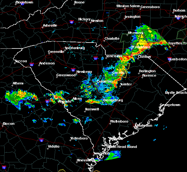
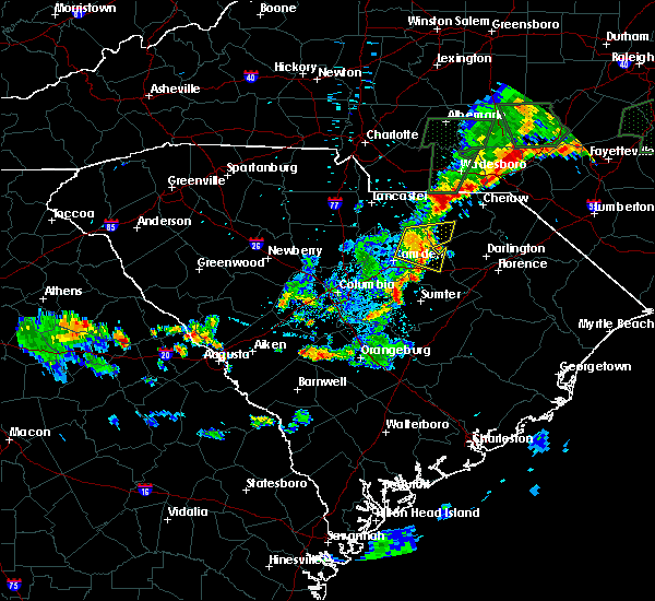
| 5/8/2024 5:29 PM EDT |
 Svrcae the national weather service in columbia has issued a * severe thunderstorm warning for, chesterfield county in central south carolina, northeastern kershaw county in central south carolina, * until 630 pm edt. * at 528 pm edt, severe thunderstorms were located along a line extending from 6 miles southwest of wadesboro to heath springs, moving east at 35 mph (radar indicated). Hazards include 60 mph wind gusts and quarter size hail. Hail damage to vehicles is expected. Expect wind damage to trees and powerlines. Svrcae the national weather service in columbia has issued a * severe thunderstorm warning for, chesterfield county in central south carolina, northeastern kershaw county in central south carolina, * until 630 pm edt. * at 528 pm edt, severe thunderstorms were located along a line extending from 6 miles southwest of wadesboro to heath springs, moving east at 35 mph (radar indicated). Hazards include 60 mph wind gusts and quarter size hail. Hail damage to vehicles is expected. Expect wind damage to trees and powerlines.
|
| 4/20/2024 6:13 PM EDT |
 The storm which prompted the warning has moved out of the area. therefore, the warning will be allowed to expire. a severe thunderstorm watch remains in effect until 1000 pm edt for central south carolina. to report severe weather, contact your nearest law enforcement agency. they will relay your report to the national weather service columbia. The storm which prompted the warning has moved out of the area. therefore, the warning will be allowed to expire. a severe thunderstorm watch remains in effect until 1000 pm edt for central south carolina. to report severe weather, contact your nearest law enforcement agency. they will relay your report to the national weather service columbia.
|
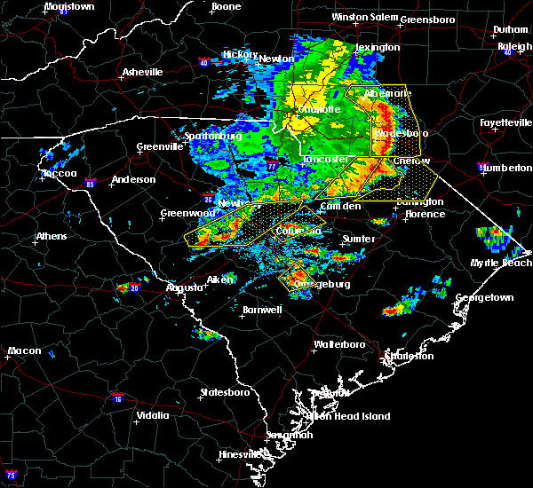
| 4/20/2024 5:54 PM EDT |
 At 553 pm edt, a severe thunderstorm was located near clyde, or 12 miles northwest of hartsville, moving east at 25 mph (radar indicated). Hazards include ping pong ball size hail and 60 mph wind gusts. People and animals outdoors will be injured. expect hail damage to roofs, siding, windows, and vehicles. expect wind damage to trees and powerlines. Locations impacted include, cheraw, pageland, kershaw, chesterfield, cheraw state park, northeastern technical college, carolina sandhills wildlife refuge, mt pisgah, cheraw municipal airport, mcbee, jefferson, ruby, patrick, bethune, chesterfield ruby middle school, cheraw fish hatchery, middendorf, central high school, high point fire station, and alligator fire station. At 553 pm edt, a severe thunderstorm was located near clyde, or 12 miles northwest of hartsville, moving east at 25 mph (radar indicated). Hazards include ping pong ball size hail and 60 mph wind gusts. People and animals outdoors will be injured. expect hail damage to roofs, siding, windows, and vehicles. expect wind damage to trees and powerlines. Locations impacted include, cheraw, pageland, kershaw, chesterfield, cheraw state park, northeastern technical college, carolina sandhills wildlife refuge, mt pisgah, cheraw municipal airport, mcbee, jefferson, ruby, patrick, bethune, chesterfield ruby middle school, cheraw fish hatchery, middendorf, central high school, high point fire station, and alligator fire station.
|
| 4/20/2024 5:43 PM EDT |
 At 542 pm edt, a severe thunderstorm was located near carolina sandhills wildlife refuge, or 22 miles northwest of hartsville, moving east at 40 mph (radar indicated). Hazards include ping pong ball size hail and 60 mph wind gusts. People and animals outdoors will be injured. expect hail damage to roofs, siding, windows, and vehicles. expect wind damage to trees and powerlines. Locations impacted include, cheraw, pageland, kershaw, chesterfield, cheraw state park, northeastern technical college, carolina sandhills wildlife refuge, mt pisgah, cheraw municipal airport, mcbee, jefferson, ruby, patrick, bethune, chesterfield ruby middle school, cheraw fish hatchery, middendorf, central high school, high point fire station, and alligator fire station. At 542 pm edt, a severe thunderstorm was located near carolina sandhills wildlife refuge, or 22 miles northwest of hartsville, moving east at 40 mph (radar indicated). Hazards include ping pong ball size hail and 60 mph wind gusts. People and animals outdoors will be injured. expect hail damage to roofs, siding, windows, and vehicles. expect wind damage to trees and powerlines. Locations impacted include, cheraw, pageland, kershaw, chesterfield, cheraw state park, northeastern technical college, carolina sandhills wildlife refuge, mt pisgah, cheraw municipal airport, mcbee, jefferson, ruby, patrick, bethune, chesterfield ruby middle school, cheraw fish hatchery, middendorf, central high school, high point fire station, and alligator fire station.
|
| 4/20/2024 5:18 PM EDT |
 Svrcae the national weather service in columbia has issued a * severe thunderstorm warning for, southeastern lancaster county in central south carolina, chesterfield county in central south carolina, northeastern kershaw county in central south carolina, * until 615 pm edt. * at 517 pm edt, a severe thunderstorm was located near heath springs, or 11 miles southeast of lancaster, moving southeast at 35 mph (trained weather spotter reports 2 inch hail observed in the city of lancaster). Hazards include two inch hail and 60 mph wind gusts. People and animals outdoors will be injured. expect hail damage to roofs, siding, windows, and vehicles. Expect wind damage to trees and powerlines. Svrcae the national weather service in columbia has issued a * severe thunderstorm warning for, southeastern lancaster county in central south carolina, chesterfield county in central south carolina, northeastern kershaw county in central south carolina, * until 615 pm edt. * at 517 pm edt, a severe thunderstorm was located near heath springs, or 11 miles southeast of lancaster, moving southeast at 35 mph (trained weather spotter reports 2 inch hail observed in the city of lancaster). Hazards include two inch hail and 60 mph wind gusts. People and animals outdoors will be injured. expect hail damage to roofs, siding, windows, and vehicles. Expect wind damage to trees and powerlines.
|
| 2/28/2024 6:35 PM EST | At 634 pm est, severe thunderstorms were located along a line extending from near mt pisgah to near villages at sandhill to 10 miles southeast of batesburg-leesville, moving southeast at 30 mph (radar indicated). Hazards include 60 mph wind gusts. Expect damage to trees and powerlines. locations impacted include, columbia, lexington, west columbia, cayce, irmo, forest acres, camden, springdale, st. andrews, dentsville, oak grove, mcentire air base, highway 6 at lake murray dam, red bank, lake wateree dam, south congaree, pine ridge, gaston, arcadia lakes, and lugoff. this includes the following highways, interstate 126 between mile markers 0 and 3. interstate 20 in south carolina between mile markers 37 and 113. interstate 26 between mile markers 102 and 129. Interstate 77 between mile markers 0 and 27. |
| 2/28/2024 6:15 PM EST | Svrcae the national weather service in columbia has issued a * severe thunderstorm warning for, southeastern fairfield county in central south carolina, southeastern lancaster county in central south carolina, northwestern lee county in central south carolina, northwestern calhoun county in central south carolina, south central chesterfield county in central south carolina, lexington county in central south carolina, northwestern sumter county in central south carolina, richland county in central south carolina, kershaw county in central south carolina, * until 715 pm est. * at 614 pm est, severe thunderstorms were located along a line extending from liberty hill to 6 miles southeast of fairfield county airport to near batesburg-leesville, moving east at 30 mph (radar indicated). Hazards include 60 mph wind gusts. expect damage to trees and powerlines |
| 1/9/2024 4:06 PM EST |
 The severe thunderstorm warning for eastern lancaster, western chesterfield and northeastern kershaw counties will expire at 415 pm est, the storms which prompted the warning have moved out of the area. therefore, the warning will be allowed to expire. a tornado watch remains in effect until 600 pm est for central south carolina. The severe thunderstorm warning for eastern lancaster, western chesterfield and northeastern kershaw counties will expire at 415 pm est, the storms which prompted the warning have moved out of the area. therefore, the warning will be allowed to expire. a tornado watch remains in effect until 600 pm est for central south carolina.
|
| 1/9/2024 4:00 PM EST |
 At 400 pm est, severe thunderstorms were located along a line extending from 7 miles east of sturdivants to near clyde, moving east at 40 mph (radar indicated). Hazards include 60 mph wind gusts. Expect damage to trees and powerlines. locations impacted include, pageland, cassatt, carolina sandhills wildlife refuge, mt pisgah, mcbee, jefferson, ruby, bethune, mount croghan, high point fire station, and central high school. hail threat, radar indicated max hail size, <. 75 in wind threat, radar indicated max wind gust, 60 mph. At 400 pm est, severe thunderstorms were located along a line extending from 7 miles east of sturdivants to near clyde, moving east at 40 mph (radar indicated). Hazards include 60 mph wind gusts. Expect damage to trees and powerlines. locations impacted include, pageland, cassatt, carolina sandhills wildlife refuge, mt pisgah, mcbee, jefferson, ruby, bethune, mount croghan, high point fire station, and central high school. hail threat, radar indicated max hail size, <. 75 in wind threat, radar indicated max wind gust, 60 mph.
|
| 1/9/2024 3:59 PM EST |
 At 358 pm est, severe thunderstorms were located along a line extending from 7 miles east of sturdivants to near clyde, moving east at 40 mph (radar indicated). Hazards include 60 mph wind gusts. expect damage to trees and powerlines At 358 pm est, severe thunderstorms were located along a line extending from 7 miles east of sturdivants to near clyde, moving east at 40 mph (radar indicated). Hazards include 60 mph wind gusts. expect damage to trees and powerlines
|
| 1/9/2024 3:26 PM EST |
 At 325 pm est, severe thunderstorms were located along a line extending from 6 miles northeast of buford to camden, moving east at 35 mph (radar indicated). Hazards include 60 mph wind gusts. expect damage to trees and powerlines At 325 pm est, severe thunderstorms were located along a line extending from 6 miles northeast of buford to camden, moving east at 35 mph (radar indicated). Hazards include 60 mph wind gusts. expect damage to trees and powerlines
|
| 8/7/2023 7:03 PM EDT |
 At 703 pm edt, severe thunderstorms were located along a line extending from near cassatt to near lugoff to near villages at sandhill to near oak grove, moving east at 45 mph (radar indicated). Hazards include 60 mph wind gusts. Expect damage to trees and powerlines. locations impacted include, columbia, lexington, west columbia, irmo, forest acres, camden, st. andrews, highway 6 at lake murray dam, lake wateree dam, dentsville, oak grove, arcadia lakes, lugoff, westville, villages at sandhill, columbia international university, cassatt, elgin, killian, and harbison state forest. this includes the following highways, interstate 126 between mile markers 0 and 3. interstate 20 in south carolina between mile markers 59 and 102. interstate 26 between mile markers 100 and 110. interstate 77 between mile markers 11 and 29. hail threat, radar indicated max hail size, <. 75 in wind threat, radar indicated max wind gust, 60 mph. At 703 pm edt, severe thunderstorms were located along a line extending from near cassatt to near lugoff to near villages at sandhill to near oak grove, moving east at 45 mph (radar indicated). Hazards include 60 mph wind gusts. Expect damage to trees and powerlines. locations impacted include, columbia, lexington, west columbia, irmo, forest acres, camden, st. andrews, highway 6 at lake murray dam, lake wateree dam, dentsville, oak grove, arcadia lakes, lugoff, westville, villages at sandhill, columbia international university, cassatt, elgin, killian, and harbison state forest. this includes the following highways, interstate 126 between mile markers 0 and 3. interstate 20 in south carolina between mile markers 59 and 102. interstate 26 between mile markers 100 and 110. interstate 77 between mile markers 11 and 29. hail threat, radar indicated max hail size, <. 75 in wind threat, radar indicated max wind gust, 60 mph.
|
| 8/7/2023 6:50 PM EDT |
 At 649 pm edt, severe thunderstorms were located along a line extending from near sturdivants to near liberty hill, moving east at 55 mph (radar indicated). Hazards include 70 mph wind gusts. Expect considerable tree damage. Damage is likely to mobile homes, roofs, and outbuildings. At 649 pm edt, severe thunderstorms were located along a line extending from near sturdivants to near liberty hill, moving east at 55 mph (radar indicated). Hazards include 70 mph wind gusts. Expect considerable tree damage. Damage is likely to mobile homes, roofs, and outbuildings.
|
| 8/7/2023 6:29 PM EDT |
 At 629 pm edt, severe thunderstorms were located along a line extending from near lake wateree state park to near fairfield county airport to near ballentine to near batesburg-leesville, moving east at 45 mph (radar indicated). Hazards include 60 mph wind gusts. expect damage to trees and powerlines At 629 pm edt, severe thunderstorms were located along a line extending from near lake wateree state park to near fairfield county airport to near ballentine to near batesburg-leesville, moving east at 45 mph (radar indicated). Hazards include 60 mph wind gusts. expect damage to trees and powerlines
|
| 6/11/2023 3:29 PM EDT |
 At 327 pm edt, a severe thunderstorm was located over goodale state park, or 7 miles northeast of camden, moving northeast at 25 mph (trained weather spotters. this storm has a history of knocking down large trees). Hazards include 60 mph wind gusts. expect damage to trees and powerlines At 327 pm edt, a severe thunderstorm was located over goodale state park, or 7 miles northeast of camden, moving northeast at 25 mph (trained weather spotters. this storm has a history of knocking down large trees). Hazards include 60 mph wind gusts. expect damage to trees and powerlines
|
| 6/17/2022 7:25 PM EDT |
 At 725 pm edt, a severe thunderstorm was located near cassatt, or 11 miles northwest of bishopville, moving southeast at 20 mph (radar indicated). Hazards include 60 mph wind gusts and penny size hail. expect damage to trees and powerlines At 725 pm edt, a severe thunderstorm was located near cassatt, or 11 miles northwest of bishopville, moving southeast at 20 mph (radar indicated). Hazards include 60 mph wind gusts and penny size hail. expect damage to trees and powerlines
|
| 6/16/2022 6:34 PM EDT | Tree in roadway on old creek rd and us1. 911 call cente in chesterfield county SC, 2.3 miles WSW of Bethune, SC |
| 6/16/2022 6:00 PM EDT | Sc highway patrol reported tree in the roadway at the intersection of old creek rd. and us 1. time estimated by rada in chesterfield county SC, 2.8 miles WSW of Bethune, SC |
| 6/16/2022 5:59 PM EDT | Dispatch reported numerous trees down along bethune rd near bethun in kershaw county SC, 0.4 miles SSE of Bethune, SC |
| 6/16/2022 5:55 PM EDT |
 At 554 pm edt, severe thunderstorms were located along a line extending from near westville to near lugoff, moving southeast at 20 mph (radar indicated). Hazards include 60 mph wind gusts and quarter size hail. Hail damage to vehicles is expected. Expect wind damage to trees and powerlines. At 554 pm edt, severe thunderstorms were located along a line extending from near westville to near lugoff, moving southeast at 20 mph (radar indicated). Hazards include 60 mph wind gusts and quarter size hail. Hail damage to vehicles is expected. Expect wind damage to trees and powerlines.
|
| 6/3/2022 6:10 PM EDT |
 The severe thunderstorm warning for southeastern lancaster, chesterfield and northeastern kershaw counties will expire at 615 pm edt, the storm which prompted the warning has moved out of the area. therefore, the warning will be allowed to expire. however heavy rain is still possible with this thunderstorm. The severe thunderstorm warning for southeastern lancaster, chesterfield and northeastern kershaw counties will expire at 615 pm edt, the storm which prompted the warning has moved out of the area. therefore, the warning will be allowed to expire. however heavy rain is still possible with this thunderstorm.
|
| 6/3/2022 5:43 PM EDT |
 At 543 pm edt, a severe thunderstorm was located over chesterfield, or 9 miles west of cheraw, moving east at 20 mph (radar indicated). Hazards include ping pong ball size hail and 60 mph wind gusts. People and animals outdoors will be injured. expect hail damage to roofs, siding, windows, and vehicles. expect wind damage to trees and powerlines. locations impacted include, cheraw, kershaw, chesterfield, carolina sandhills wildlife refuge, cheraw state park, mt pisgah, northeastern technical college, cheraw municipal airport, mcbee, jefferson, ruby, patrick, bethune, mount croghan, chesterfield ruby middle school, north central high school, cheraw fish hatchery, alligator fire station, middendorf and bay springs fire station. hail threat, radar indicated max hail size, 1. 50 in wind threat, radar indicated max wind gust, 60 mph. At 543 pm edt, a severe thunderstorm was located over chesterfield, or 9 miles west of cheraw, moving east at 20 mph (radar indicated). Hazards include ping pong ball size hail and 60 mph wind gusts. People and animals outdoors will be injured. expect hail damage to roofs, siding, windows, and vehicles. expect wind damage to trees and powerlines. locations impacted include, cheraw, kershaw, chesterfield, carolina sandhills wildlife refuge, cheraw state park, mt pisgah, northeastern technical college, cheraw municipal airport, mcbee, jefferson, ruby, patrick, bethune, mount croghan, chesterfield ruby middle school, north central high school, cheraw fish hatchery, alligator fire station, middendorf and bay springs fire station. hail threat, radar indicated max hail size, 1. 50 in wind threat, radar indicated max wind gust, 60 mph.
|
| 6/3/2022 5:28 PM EDT |
 At 528 pm edt, a severe thunderstorm was located near chesterfield, or 15 miles west of cheraw, moving east at 25 mph (radar indicated). Hazards include ping pong ball size hail and 60 mph wind gusts. People and animals outdoors will be injured. expect hail damage to roofs, siding, windows, and vehicles. expect wind damage to trees and powerlines. locations impacted include, cheraw, pageland, kershaw, chesterfield, cheraw state park, northeastern technical college, cheraw municipal airport, carolina sandhills wildlife refuge, mt pisgah, mcbee, jefferson, ruby, patrick, bethune, mount croghan, chesterfield ruby middle school, north central high school, cheraw fish hatchery, middendorf and central high school. hail threat, radar indicated max hail size, 1. 50 in wind threat, radar indicated max wind gust, 60 mph. At 528 pm edt, a severe thunderstorm was located near chesterfield, or 15 miles west of cheraw, moving east at 25 mph (radar indicated). Hazards include ping pong ball size hail and 60 mph wind gusts. People and animals outdoors will be injured. expect hail damage to roofs, siding, windows, and vehicles. expect wind damage to trees and powerlines. locations impacted include, cheraw, pageland, kershaw, chesterfield, cheraw state park, northeastern technical college, cheraw municipal airport, carolina sandhills wildlife refuge, mt pisgah, mcbee, jefferson, ruby, patrick, bethune, mount croghan, chesterfield ruby middle school, north central high school, cheraw fish hatchery, middendorf and central high school. hail threat, radar indicated max hail size, 1. 50 in wind threat, radar indicated max wind gust, 60 mph.
|
| 6/3/2022 5:04 PM EDT |
 At 504 pm edt, a severe thunderstorm was located over pageland, or 19 miles southeast of monroe, moving east at 15 mph (radar indicated). Hazards include 60 mph wind gusts and quarter size hail. Hail damage to vehicles is expected. Expect wind damage to trees and powerlines. At 504 pm edt, a severe thunderstorm was located over pageland, or 19 miles southeast of monroe, moving east at 15 mph (radar indicated). Hazards include 60 mph wind gusts and quarter size hail. Hail damage to vehicles is expected. Expect wind damage to trees and powerlines.
|
| 5/6/2022 5:26 PM EDT |
 At 526 pm edt, severe thunderstorms were located along a line extending from near westville to 6 miles south of lugoff, moving northeast at 45 mph (radar indicated). Hazards include 60 mph wind gusts and quarter size hail. Hail damage to vehicles is expected. Expect wind damage to trees and powerlines. At 526 pm edt, severe thunderstorms were located along a line extending from near westville to 6 miles south of lugoff, moving northeast at 45 mph (radar indicated). Hazards include 60 mph wind gusts and quarter size hail. Hail damage to vehicles is expected. Expect wind damage to trees and powerlines.
|
| 7/28/2021 6:30 PM EDT | Kershaw co dispatch reported trees down on mill creek rd in bethune... exact location not given. time estimate in kershaw county SC, 5.1 miles ESE of Bethune, SC |
| 7/28/2021 6:24 PM EDT | Kershaw co dispatch reported trees down at porter rd and newman rd north of bethune. time estimate in kershaw county SC, 7.2 miles SSE of Bethune, SC |
| 7/28/2021 6:19 PM EDT |
 At 617 pm edt, a severe thunderstorm was located 7 miles southwest of carolina sandhills wildlife refuge, or 16 miles northwest of hartsville, moving south at 15 mph (radar indicated). Hazards include 70 mph wind gusts and quarter size hail. this storm is rotating and may produce a funnel cloud. Hail damage to vehicles is expected. expect considerable tree damage. Wind damage is also likely to mobile homes, roofs, and outbuildings. At 617 pm edt, a severe thunderstorm was located 7 miles southwest of carolina sandhills wildlife refuge, or 16 miles northwest of hartsville, moving south at 15 mph (radar indicated). Hazards include 70 mph wind gusts and quarter size hail. this storm is rotating and may produce a funnel cloud. Hail damage to vehicles is expected. expect considerable tree damage. Wind damage is also likely to mobile homes, roofs, and outbuildings.
|
| 5/4/2021 5:12 PM EDT |
 At 512 pm edt, severe thunderstorms were located along a line extending from sturdivants to near cassatt, moving northeast at 60 mph (radar indicated). Hazards include 70 mph wind gusts. Expect considerable tree damage. damage is likely to mobile homes, roofs, and outbuildings. Locations impacted include, cheraw, pageland, chesterfield, cheraw state park, northeastern technical college, cassatt, cheraw municipal airport, carolina sandhills wildlife refuge, mt pisgah, goodale state park, mcbee, jefferson, ruby, patrick, bethune, mount croghan, lucknow, chesterfield ruby middle school, north central high school and cheraw fish hatchery. At 512 pm edt, severe thunderstorms were located along a line extending from sturdivants to near cassatt, moving northeast at 60 mph (radar indicated). Hazards include 70 mph wind gusts. Expect considerable tree damage. damage is likely to mobile homes, roofs, and outbuildings. Locations impacted include, cheraw, pageland, chesterfield, cheraw state park, northeastern technical college, cassatt, cheraw municipal airport, carolina sandhills wildlife refuge, mt pisgah, goodale state park, mcbee, jefferson, ruby, patrick, bethune, mount croghan, lucknow, chesterfield ruby middle school, north central high school and cheraw fish hatchery.
|
| 5/4/2021 5:03 PM EDT |
 At 502 pm edt, severe thunderstorms were located along a line extending from 6 miles northwest of pageland to goodale state park, moving northeast at 60 mph (radar indicated). Hazards include 60 mph wind gusts. expect damage to roofs, siding, and trees At 502 pm edt, severe thunderstorms were located along a line extending from 6 miles northwest of pageland to goodale state park, moving northeast at 60 mph (radar indicated). Hazards include 60 mph wind gusts. expect damage to roofs, siding, and trees
|
| 9/25/2020 4:14 PM EDT |
 At 412 pm edt, a severe thunderstorm capable of producing a tornado was located near clyde, or 11 miles west of hartsville, moving northeast at 20 mph (radar indicated rotation). Hazards include tornado. Flying debris will be dangerous to those caught without shelter. mobile homes will be damaged or destroyed. damage to roofs, windows, and vehicles will occur. tree damage is likely. locations impacted include, mcbee and bethune. The public reported some rotation near casset as the storm passed by, but did not touch down. At 412 pm edt, a severe thunderstorm capable of producing a tornado was located near clyde, or 11 miles west of hartsville, moving northeast at 20 mph (radar indicated rotation). Hazards include tornado. Flying debris will be dangerous to those caught without shelter. mobile homes will be damaged or destroyed. damage to roofs, windows, and vehicles will occur. tree damage is likely. locations impacted include, mcbee and bethune. The public reported some rotation near casset as the storm passed by, but did not touch down.
|
| 9/25/2020 3:57 PM EDT |
 At 356 pm edt, a severe thunderstorm capable of producing a tornado was located near cassatt, or 13 miles northwest of bishopville, moving northeast at 20 mph (radar indicated rotation). Hazards include tornado. Flying debris will be dangerous to those caught without shelter. mobile homes will be damaged or destroyed. damage to roofs, windows, and vehicles will occur. tree damage is likely. This tornadic thunderstorm will remain over mainly rural areas of south central chesterfield and east central kershaw counties, including the following locations, bethune and mcbee. At 356 pm edt, a severe thunderstorm capable of producing a tornado was located near cassatt, or 13 miles northwest of bishopville, moving northeast at 20 mph (radar indicated rotation). Hazards include tornado. Flying debris will be dangerous to those caught without shelter. mobile homes will be damaged or destroyed. damage to roofs, windows, and vehicles will occur. tree damage is likely. This tornadic thunderstorm will remain over mainly rural areas of south central chesterfield and east central kershaw counties, including the following locations, bethune and mcbee.
|
| 8/6/2020 3:57 PM EDT |
 The severe thunderstorm warning for northeastern fairfield, southern lancaster and kershaw counties will expire at 400 pm edt, the storm which prompted the warning has weakened below severe limits, and no longer poses an immediate threat to life or property. therefore, the warning will be allowed to expire. to report severe weather, contact your nearest law enforcement agency. they will relay your report to the national weather service columbia. The severe thunderstorm warning for northeastern fairfield, southern lancaster and kershaw counties will expire at 400 pm edt, the storm which prompted the warning has weakened below severe limits, and no longer poses an immediate threat to life or property. therefore, the warning will be allowed to expire. to report severe weather, contact your nearest law enforcement agency. they will relay your report to the national weather service columbia.
|
| 8/6/2020 3:43 PM EDT |
 At 343 pm edt, a severe thunderstorm was located over heath springs, or 8 miles southeast of lancaster, moving northeast at 25 mph (radar indicated). Hazards include 60 mph wind gusts. Expect damage to roofs, siding, and trees. locations impacted include, lancaster, camden, lake wateree dam, kershaw, elgin, heath springs, lugoff, westville, cassatt, liberty hill, goodale state park, lake wateree state park, bethune, north central high school, bell town fire station, north towne square shopping center, mitford, faith christian school, midway elementary school and pine grove fire station. This includes interstate 20 in south carolina between mile markers 93 and 98. At 343 pm edt, a severe thunderstorm was located over heath springs, or 8 miles southeast of lancaster, moving northeast at 25 mph (radar indicated). Hazards include 60 mph wind gusts. Expect damage to roofs, siding, and trees. locations impacted include, lancaster, camden, lake wateree dam, kershaw, elgin, heath springs, lugoff, westville, cassatt, liberty hill, goodale state park, lake wateree state park, bethune, north central high school, bell town fire station, north towne square shopping center, mitford, faith christian school, midway elementary school and pine grove fire station. This includes interstate 20 in south carolina between mile markers 93 and 98.
|
| 8/6/2020 3:22 PM EDT |
 At 322 pm edt, a severe thunderstorm was located near liberty hill, or 13 miles south of lancaster, moving northeast at 25 mph (radar indicated). Hazards include 60 mph wind gusts and quarter size hail. Hail damage to vehicles is expected. Expect wind damage to roofs, siding, and trees. At 322 pm edt, a severe thunderstorm was located near liberty hill, or 13 miles south of lancaster, moving northeast at 25 mph (radar indicated). Hazards include 60 mph wind gusts and quarter size hail. Hail damage to vehicles is expected. Expect wind damage to roofs, siding, and trees.
|
| 6/19/2020 9:20 PM EDT |
 The severe thunderstorm warning for northwestern lee, south central chesterfield and northeastern kershaw counties will expire at 930 pm edt, the storm which prompted the warning has weakened below severe limits, and no longer poses an immediate threat to life or property. therefore, the warning will be allowed to expire. however heavy rain is still possible with this thunderstorm. The severe thunderstorm warning for northwestern lee, south central chesterfield and northeastern kershaw counties will expire at 930 pm edt, the storm which prompted the warning has weakened below severe limits, and no longer poses an immediate threat to life or property. therefore, the warning will be allowed to expire. however heavy rain is still possible with this thunderstorm.
|
| 6/19/2020 9:16 PM EDT |
 At 916 pm edt, a severe thunderstorm was located near clyde, or 10 miles west of hartsville, moving east at 20 mph (radar indicated). Hazards include 60 mph wind gusts. Expect damage to roofs, siding, and trees. locations impacted include, bishopville, mcbee, bethune, lucknow, alligator fire station, middendorf and ashland. This includes interstate 20 in south carolina between mile markers 117 and 118. At 916 pm edt, a severe thunderstorm was located near clyde, or 10 miles west of hartsville, moving east at 20 mph (radar indicated). Hazards include 60 mph wind gusts. Expect damage to roofs, siding, and trees. locations impacted include, bishopville, mcbee, bethune, lucknow, alligator fire station, middendorf and ashland. This includes interstate 20 in south carolina between mile markers 117 and 118.
|
| 6/19/2020 8:55 PM EDT |
 At 855 pm edt, a severe thunderstorm was located over cassatt, or 13 miles northeast of camden, moving east at 10 mph (radar indicated). Hazards include 60 mph wind gusts and quarter size hail. Hail damage to vehicles is expected. expect wind damage to roofs, siding, and trees. locations impacted include, bishopville, cassatt, goodale state park, mcbee, bethune, lucknow, north central high school, alligator fire station, middendorf, ashland and midway elementary school. This includes interstate 20 in south carolina between mile markers 117 and 118. At 855 pm edt, a severe thunderstorm was located over cassatt, or 13 miles northeast of camden, moving east at 10 mph (radar indicated). Hazards include 60 mph wind gusts and quarter size hail. Hail damage to vehicles is expected. expect wind damage to roofs, siding, and trees. locations impacted include, bishopville, cassatt, goodale state park, mcbee, bethune, lucknow, north central high school, alligator fire station, middendorf, ashland and midway elementary school. This includes interstate 20 in south carolina between mile markers 117 and 118.
|
| 6/19/2020 8:42 PM EDT |
 At 842 pm edt, a severe thunderstorm was located over cassatt, or 12 miles northeast of camden, moving east at 20 mph (radar indicated). Hazards include 60 mph wind gusts and quarter size hail. Hail damage to vehicles is expected. Expect wind damage to roofs, siding, and trees. At 842 pm edt, a severe thunderstorm was located over cassatt, or 12 miles northeast of camden, moving east at 20 mph (radar indicated). Hazards include 60 mph wind gusts and quarter size hail. Hail damage to vehicles is expected. Expect wind damage to roofs, siding, and trees.
|
| 5/22/2020 5:17 PM EDT |
 At 517 pm edt, severe thunderstorms were located along a line extending from near chesterfield to near cassatt, moving east at 40 mph (radar indicated). Hazards include 60 mph wind gusts and quarter size hail. Hail damage to vehicles is expected. expect wind damage to roofs, siding, and trees. locations impacted include, chesterfield, carolina sandhills wildlife refuge, mt pisgah, mcbee, jefferson, ruby, bethune, mount croghan, chesterfield ruby middle school, north central high school, bay springs fire station and chesterfield detention center. This line of storms has a history of producing downed trees and power lines. At 517 pm edt, severe thunderstorms were located along a line extending from near chesterfield to near cassatt, moving east at 40 mph (radar indicated). Hazards include 60 mph wind gusts and quarter size hail. Hail damage to vehicles is expected. expect wind damage to roofs, siding, and trees. locations impacted include, chesterfield, carolina sandhills wildlife refuge, mt pisgah, mcbee, jefferson, ruby, bethune, mount croghan, chesterfield ruby middle school, north central high school, bay springs fire station and chesterfield detention center. This line of storms has a history of producing downed trees and power lines.
|
| 5/22/2020 4:54 PM EDT |
 At 453 pm edt, severe thunderstorms were located along a line extending from near pageland to near lake wateree dam, moving east at 50 mph (radar indicated). Hazards include 60 mph wind gusts. Expect damage to roofs, siding, and trees. locations impacted include, winnsboro, pageland, kershaw, chesterfield, heath springs, westville, liberty hill, carolina sandhills wildlife refuge, mt pisgah, lake wateree state park, mcbee, jefferson, ruby, bethune, mount croghan, chesterfield ruby middle school, north central high school, central high school, high point fire station and bay springs fire station. This includes interstate 77 between mile markers 38 and 46. At 453 pm edt, severe thunderstorms were located along a line extending from near pageland to near lake wateree dam, moving east at 50 mph (radar indicated). Hazards include 60 mph wind gusts. Expect damage to roofs, siding, and trees. locations impacted include, winnsboro, pageland, kershaw, chesterfield, heath springs, westville, liberty hill, carolina sandhills wildlife refuge, mt pisgah, lake wateree state park, mcbee, jefferson, ruby, bethune, mount croghan, chesterfield ruby middle school, north central high school, central high school, high point fire station and bay springs fire station. This includes interstate 77 between mile markers 38 and 46.
|
| 5/22/2020 4:31 PM EDT |
 At 431 pm edt, severe thunderstorms were located along a line extending from near waxhaw to near winnsboro, moving east at 40 mph (radar indicated). Hazards include 60 mph wind gusts. expect damage to roofs, siding, and trees At 431 pm edt, severe thunderstorms were located along a line extending from near waxhaw to near winnsboro, moving east at 40 mph (radar indicated). Hazards include 60 mph wind gusts. expect damage to roofs, siding, and trees
|
| 5/5/2020 9:07 PM EDT |
 The severe thunderstorm warning for southeastern lancaster, southwestern chesterfield and northeastern kershaw counties will expire at 915 pm edt, the storm which prompted the warning has weakened below severe limits, and no longer poses an immediate threat to life or property. therefore, the warning will be allowed to expire. however small hail up to dime size and gusty winds to 50 mph are still possible with this thunderstorm. a severe thunderstorm watch remains in effect until 1100 pm edt for central south carolina. to report severe weather, contact your nearest law enforcement agency. they will relay your report to the national weather service columbia. The severe thunderstorm warning for southeastern lancaster, southwestern chesterfield and northeastern kershaw counties will expire at 915 pm edt, the storm which prompted the warning has weakened below severe limits, and no longer poses an immediate threat to life or property. therefore, the warning will be allowed to expire. however small hail up to dime size and gusty winds to 50 mph are still possible with this thunderstorm. a severe thunderstorm watch remains in effect until 1100 pm edt for central south carolina. to report severe weather, contact your nearest law enforcement agency. they will relay your report to the national weather service columbia.
|
| 5/5/2020 8:59 PM EDT |
 A severe thunderstorm warning remains in effect until 915 pm edt for southeastern lancaster. southwestern chesterfield and northeastern kershaw counties. at 858 pm edt, a severe thunderstorm was located over mt pisgah, or 20 miles northeast of lake wateree dam, moving east at 45 mph. hazard. 60 mph wind gusts and quarter size hail. A severe thunderstorm warning remains in effect until 915 pm edt for southeastern lancaster. southwestern chesterfield and northeastern kershaw counties. at 858 pm edt, a severe thunderstorm was located over mt pisgah, or 20 miles northeast of lake wateree dam, moving east at 45 mph. hazard. 60 mph wind gusts and quarter size hail.
|
| 5/5/2020 8:36 PM EDT |
 At 835 pm edt, a severe thunderstorm was located near heath springs, or 11 miles south of lancaster, moving east at 45 mph (radar indicated). Hazards include 60 mph wind gusts and half dollar size hail. Hail damage to vehicles is expected. expect wind damage to roofs, siding, and trees. locations impacted include, kershaw, elgin, heath springs, westville, mt pisgah, cassatt, liberty hill, irwin, jefferson, bethune, north central high school, bell town fire station, mitford, kirk air base, faith christian school, forty acre rock preserve, pleasant hill, kershaw correctional institution, lake wateree near highway 97 and mcdonald green elementary school. this includes interstate 77 between mile markers 45 and 50. Hail has already been reported with this thunderstorm. At 835 pm edt, a severe thunderstorm was located near heath springs, or 11 miles south of lancaster, moving east at 45 mph (radar indicated). Hazards include 60 mph wind gusts and half dollar size hail. Hail damage to vehicles is expected. expect wind damage to roofs, siding, and trees. locations impacted include, kershaw, elgin, heath springs, westville, mt pisgah, cassatt, liberty hill, irwin, jefferson, bethune, north central high school, bell town fire station, mitford, kirk air base, faith christian school, forty acre rock preserve, pleasant hill, kershaw correctional institution, lake wateree near highway 97 and mcdonald green elementary school. this includes interstate 77 between mile markers 45 and 50. Hail has already been reported with this thunderstorm.
|
| 5/5/2020 8:27 PM EDT |
 At 826 pm edt, a severe thunderstorm was located over great falls, or 11 miles southwest of lancaster, moving east at 45 mph (radar indicated). Hazards include 60 mph wind gusts and quarter size hail. Hail damage to vehicles is expected. Expect wind damage to roofs, siding, and trees. At 826 pm edt, a severe thunderstorm was located over great falls, or 11 miles southwest of lancaster, moving east at 45 mph (radar indicated). Hazards include 60 mph wind gusts and quarter size hail. Hail damage to vehicles is expected. Expect wind damage to roofs, siding, and trees.
|
| 5/5/2020 7:50 PM EDT | Tennis Ball sized hail reported 0.4 miles SSE of Bethune, SC, kershaw county emergency manager reported tennis ball sized hail near bethune. |
| 5/5/2020 7:50 PM EDT | Hen Egg sized hail reported 1.1 miles SSE of Bethune, SC, egg sized hail video and picture sent to office social media account. |
| 5/5/2020 7:49 PM EDT |
 At 748 pm edt, a severe thunderstorm was located near clyde, or 11 miles northwest of hartsville, moving east at 40 mph (radar indicated). Hazards include ping pong ball size hail and 60 mph wind gusts. People and animals outdoors will be injured. expect hail damage to roofs, siding, windows, and vehicles. expect wind damage to roofs, siding, and trees. Locations impacted include, carolina sandhills wildlife refuge, mcbee, bethune, alligator fire station and middendorf. At 748 pm edt, a severe thunderstorm was located near clyde, or 11 miles northwest of hartsville, moving east at 40 mph (radar indicated). Hazards include ping pong ball size hail and 60 mph wind gusts. People and animals outdoors will be injured. expect hail damage to roofs, siding, windows, and vehicles. expect wind damage to roofs, siding, and trees. Locations impacted include, carolina sandhills wildlife refuge, mcbee, bethune, alligator fire station and middendorf.
|
| 5/5/2020 7:33 PM EDT |
 At 733 pm edt, a severe thunderstorm was located near mt pisgah, or 19 miles northeast of lake wateree dam, moving east at 40 mph (radar indicated). Hazards include 60 mph wind gusts and half dollar size hail. Hail damage to vehicles is expected. expect wind damage to roofs, siding, and trees. Locations impacted include, carolina sandhills wildlife refuge, westville, mt pisgah, mcbee, jefferson, bethune, north central high school, alligator fire station, middendorf and bay springs fire station. At 733 pm edt, a severe thunderstorm was located near mt pisgah, or 19 miles northeast of lake wateree dam, moving east at 40 mph (radar indicated). Hazards include 60 mph wind gusts and half dollar size hail. Hail damage to vehicles is expected. expect wind damage to roofs, siding, and trees. Locations impacted include, carolina sandhills wildlife refuge, westville, mt pisgah, mcbee, jefferson, bethune, north central high school, alligator fire station, middendorf and bay springs fire station.
|
| 5/5/2020 7:13 PM EDT |
 At 712 pm edt, a severe thunderstorm was located over kershaw, or 13 miles southeast of lancaster, moving east at 40 mph (radar indicated). Hazards include 60 mph wind gusts and half dollar size hail. Hail damage to vehicles is expected. Expect wind damage to roofs, siding, and trees. At 712 pm edt, a severe thunderstorm was located over kershaw, or 13 miles southeast of lancaster, moving east at 40 mph (radar indicated). Hazards include 60 mph wind gusts and half dollar size hail. Hail damage to vehicles is expected. Expect wind damage to roofs, siding, and trees.
|
| 4/13/2020 7:11 AM EDT |
 The severe thunderstorm warning for southeastern lancaster, chesterfield and northeastern kershaw counties will expire at 715 am edt, the storms which prompted the warning have moved out of the area. therefore, the warning will be allowed to expire. a tornado watch remains in effect until 1100 am edt for central south carolina. The severe thunderstorm warning for southeastern lancaster, chesterfield and northeastern kershaw counties will expire at 715 am edt, the storms which prompted the warning have moved out of the area. therefore, the warning will be allowed to expire. a tornado watch remains in effect until 1100 am edt for central south carolina.
|
| 4/13/2020 6:23 AM EDT |
 At 623 am edt, severe thunderstorms were located along a line extending from near pageland to near lake wateree dam, moving northeast at 60 mph (radar indicated). Hazards include 70 mph wind gusts and penny size hail. Expect considerable tree damage. Damage is likely to mobile homes, roofs, and outbuildings. At 623 am edt, severe thunderstorms were located along a line extending from near pageland to near lake wateree dam, moving northeast at 60 mph (radar indicated). Hazards include 70 mph wind gusts and penny size hail. Expect considerable tree damage. Damage is likely to mobile homes, roofs, and outbuildings.
|
| 2/6/2020 4:27 PM EST |
 At 427 pm est, severe thunderstorms were located along a line extending from near carolina sandhills wildlife refuge to 8 miles southeast of goodale state park to near eastover, moving east at 55 mph (radar indicated). Hazards include 60 mph wind gusts. Expect damage to roofs, siding, and trees. locations impacted include, columbia, sumter, cayce, camden, bishopville, south sumter, shaw air base, mcentire air base, gaston, eastover, lugoff, oakland, mulberry, fort jackson, congaree national park, hopkins, cassatt, horrel hill, carolina sandhills wildlife refuge and sc state farmer`s market. this includes the following highways, interstate 20 in south carolina between mile markers 79 and 119. interstate 26 between mile markers 117 and 132. Interstate 77 between mile markers 2 and 12. At 427 pm est, severe thunderstorms were located along a line extending from near carolina sandhills wildlife refuge to 8 miles southeast of goodale state park to near eastover, moving east at 55 mph (radar indicated). Hazards include 60 mph wind gusts. Expect damage to roofs, siding, and trees. locations impacted include, columbia, sumter, cayce, camden, bishopville, south sumter, shaw air base, mcentire air base, gaston, eastover, lugoff, oakland, mulberry, fort jackson, congaree national park, hopkins, cassatt, horrel hill, carolina sandhills wildlife refuge and sc state farmer`s market. this includes the following highways, interstate 20 in south carolina between mile markers 79 and 119. interstate 26 between mile markers 117 and 132. Interstate 77 between mile markers 2 and 12.
|
| 2/6/2020 4:23 PM EST | Kershaw dispatch reported a tree fell on an occupied vehicle and blocked the road on hwy 1 at old cc rd. no injuries reporte in kershaw county SC, 3.5 miles ENE of Bethune, SC |
| 2/6/2020 4:02 PM EST |
 At 402 pm est, severe thunderstorms were located along a line extending from kershaw to near elgin to sandy run, moving east at 55 mph (radar indicated). Hazards include 60 mph wind gusts. expect damage to roofs, siding, and trees At 402 pm est, severe thunderstorms were located along a line extending from kershaw to near elgin to sandy run, moving east at 55 mph (radar indicated). Hazards include 60 mph wind gusts. expect damage to roofs, siding, and trees
|
| 1/11/2020 11:04 PM EST |
 At 1102 pm est, likely severe thunderstorms were located in parts of eastern kershaw county and eastern richland county moving northeast at 65 mph (radar indicated). Hazards include 60 mph wind gusts. expect damage to roofs, siding, and trees At 1102 pm est, likely severe thunderstorms were located in parts of eastern kershaw county and eastern richland county moving northeast at 65 mph (radar indicated). Hazards include 60 mph wind gusts. expect damage to roofs, siding, and trees
|
| 1/11/2020 10:39 PM EST |
 At 1038 pm est, severe thunderstorms were located along a line extending from near pageland to near goodale state park to villages at sandhill, moving east at 40 mph (law enforcement reported multiple trees and powerlines down). Hazards include 60 mph wind gusts. Expect damage to roofs, siding, and trees. locations impacted include, columbia, irmo, forest acres, camden, st. andrews, lake wateree dam, dentsville, arcadia lakes, lugoff, fairfield county airport, westville, villages at sandhill, columbia international university, cassatt, elgin, killian, harbison state forest, woodfield, sesquicentennial state park and lake carolina. this includes the following highways, interstate 20 in south carolina between mile markers 66 and 105. interstate 26 between mile markers 102 and 106. Interstate 77 between mile markers 15 and 37. At 1038 pm est, severe thunderstorms were located along a line extending from near pageland to near goodale state park to villages at sandhill, moving east at 40 mph (law enforcement reported multiple trees and powerlines down). Hazards include 60 mph wind gusts. Expect damage to roofs, siding, and trees. locations impacted include, columbia, irmo, forest acres, camden, st. andrews, lake wateree dam, dentsville, arcadia lakes, lugoff, fairfield county airport, westville, villages at sandhill, columbia international university, cassatt, elgin, killian, harbison state forest, woodfield, sesquicentennial state park and lake carolina. this includes the following highways, interstate 20 in south carolina between mile markers 66 and 105. interstate 26 between mile markers 102 and 106. Interstate 77 between mile markers 15 and 37.
|
| 1/11/2020 9:58 PM EST |
 At 957 pm est, severe thunderstorms were located along a line extending through central fairfield county southward through the columbia area. movement was east-northeast near 60 mph (radar indicated). Hazards include 60 mph wind gusts. expect damage to roofs, siding, and trees At 957 pm est, severe thunderstorms were located along a line extending through central fairfield county southward through the columbia area. movement was east-northeast near 60 mph (radar indicated). Hazards include 60 mph wind gusts. expect damage to roofs, siding, and trees
|
| 10/31/2019 7:15 PM EDT |
 At 714 pm edt, severe thunderstorms were located along a line extending from near pageland to 7 miles southeast of cassatt to 10 miles southeast of goodale state park, moving east at 50 mph (radar indicated). Hazards include 60 mph wind gusts. Expect damage to roofs, siding, and trees. locations impacted include, camden, cheraw, bishopville, pageland, chesterfield, cheraw state park, northeastern technical college, cassatt, elliott, cheraw municipal airport, lee state park, carolina sandhills wildlife refuge, mt pisgah, goodale state park, mcbee, jefferson, lynchburg, ruby, patrick and bethune. This includes interstate 20 in south carolina between mile markers 98 and 125. At 714 pm edt, severe thunderstorms were located along a line extending from near pageland to 7 miles southeast of cassatt to 10 miles southeast of goodale state park, moving east at 50 mph (radar indicated). Hazards include 60 mph wind gusts. Expect damage to roofs, siding, and trees. locations impacted include, camden, cheraw, bishopville, pageland, chesterfield, cheraw state park, northeastern technical college, cassatt, elliott, cheraw municipal airport, lee state park, carolina sandhills wildlife refuge, mt pisgah, goodale state park, mcbee, jefferson, lynchburg, ruby, patrick and bethune. This includes interstate 20 in south carolina between mile markers 98 and 125.
|
| 10/31/2019 6:53 PM EDT |
 At 653 pm edt, severe thunderstorms were located along a line extending from near camden to near lugoff to 9 miles southeast of elgin, moving east at 50 mph (radar indicated). Hazards include 60 mph wind gusts. expect damage to roofs, siding, and trees At 653 pm edt, severe thunderstorms were located along a line extending from near camden to near lugoff to 9 miles southeast of elgin, moving east at 50 mph (radar indicated). Hazards include 60 mph wind gusts. expect damage to roofs, siding, and trees
|
| 9/12/2019 6:43 PM EDT |
 At 640 pm edt, thunderstorms covered much of western chesterfield county. some of the thunderstorms were likely severe between jefferson and mcbee near the southern lancaster and chesterfield county line and near the kershaw and chesterfield county line. movement was southwest near 10 mph (radar indicated). Hazards include 60 mph wind gusts and quarter size hail. Hail damage to vehicles is expected. expect wind damage to roofs, siding, and trees. Locations impacted include, carolina sandhills wildlife refuge, mt pisgah, jefferson, bethune, middendorf and forty acre rock preserve. At 640 pm edt, thunderstorms covered much of western chesterfield county. some of the thunderstorms were likely severe between jefferson and mcbee near the southern lancaster and chesterfield county line and near the kershaw and chesterfield county line. movement was southwest near 10 mph (radar indicated). Hazards include 60 mph wind gusts and quarter size hail. Hail damage to vehicles is expected. expect wind damage to roofs, siding, and trees. Locations impacted include, carolina sandhills wildlife refuge, mt pisgah, jefferson, bethune, middendorf and forty acre rock preserve.
|
| 9/12/2019 6:27 PM EDT |
 A severe thunderstorm warning remains in effect until 715 pm edt for southeastern lancaster. northern lee. central chesterfield and northeastern kershaw counties. at 622 pm edt, thunderstorms covered much of western chesterfield county. some of the thunderstorms were likely severe, especially in the carolina sandhills wildlife refuge northwest of mcbee. Movement. A severe thunderstorm warning remains in effect until 715 pm edt for southeastern lancaster. northern lee. central chesterfield and northeastern kershaw counties. at 622 pm edt, thunderstorms covered much of western chesterfield county. some of the thunderstorms were likely severe, especially in the carolina sandhills wildlife refuge northwest of mcbee. Movement.
|
| 9/12/2019 6:15 PM EDT |
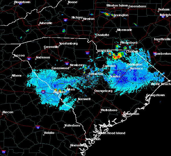 At 614 pm edt, severe thunderstorms were located near carolina sandhills wildlife refuge and also just north of jefferson. movement was southwest at 10 mph (radar indicated). Hazards include ping pong ball size hail and 60 mph wind gusts. People and animals outdoors will be injured. expect hail damage to roofs, siding, windows, and vehicles. Expect wind damage to roofs, siding, and trees. At 614 pm edt, severe thunderstorms were located near carolina sandhills wildlife refuge and also just north of jefferson. movement was southwest at 10 mph (radar indicated). Hazards include ping pong ball size hail and 60 mph wind gusts. People and animals outdoors will be injured. expect hail damage to roofs, siding, windows, and vehicles. Expect wind damage to roofs, siding, and trees.
|
| 7/13/2019 1:41 PM EDT |
 At 141 pm edt, a severe thunderstorm was located near carolina sandhills wildlife refuge, or 14 miles northwest of hartsville, moving east at 20 mph (radar indicated). Hazards include 60 mph wind gusts and quarter size hail. Hail damage to vehicles is expected. expect wind damage to roofs, siding, and trees. Locations impacted include, carolina sandhills wildlife refuge, mt pisgah, mcbee, bethune, middendorf, bay springs fire station and north central high school. At 141 pm edt, a severe thunderstorm was located near carolina sandhills wildlife refuge, or 14 miles northwest of hartsville, moving east at 20 mph (radar indicated). Hazards include 60 mph wind gusts and quarter size hail. Hail damage to vehicles is expected. expect wind damage to roofs, siding, and trees. Locations impacted include, carolina sandhills wildlife refuge, mt pisgah, mcbee, bethune, middendorf, bay springs fire station and north central high school.
|
| 7/13/2019 1:26 PM EDT |
 At 126 pm edt, a severe thunderstorm was located near mt pisgah, or 18 miles northeast of lake wateree dam, moving east at 15 mph (radar indicated). Hazards include 60 mph wind gusts and quarter size hail. Hail damage to vehicles is expected. Expect wind damage to roofs, siding, and trees. At 126 pm edt, a severe thunderstorm was located near mt pisgah, or 18 miles northeast of lake wateree dam, moving east at 15 mph (radar indicated). Hazards include 60 mph wind gusts and quarter size hail. Hail damage to vehicles is expected. Expect wind damage to roofs, siding, and trees.
|
| 6/22/2019 4:46 AM EDT |
 At 445 am edt, severe thunderstorms were located along a line extending from near carolina sandhills wildlife refuge to near poinsett state park, moving east at 45 mph (radar indicated). Hazards include 70 mph wind gusts. Expect considerable tree damage. damage is likely to mobile homes, roofs, and outbuildings. locations impacted include, sumter, cheraw, manning, bishopville, south sumter, shaw air base, oakland, mulberry, cheraw state park, alcolu, northeastern technical college, woods bay state park, cassatt, elliott, lee state park, carolina sandhills wildlife refuge, mt pisgah, sumter county airport, millwood and poinsett state park. this includes the following highways, interstate 20 in south carolina between mile markers 100 and 125. Interstate 26 interstate 95 between mile markers 113 and 146. At 445 am edt, severe thunderstorms were located along a line extending from near carolina sandhills wildlife refuge to near poinsett state park, moving east at 45 mph (radar indicated). Hazards include 70 mph wind gusts. Expect considerable tree damage. damage is likely to mobile homes, roofs, and outbuildings. locations impacted include, sumter, cheraw, manning, bishopville, south sumter, shaw air base, oakland, mulberry, cheraw state park, alcolu, northeastern technical college, woods bay state park, cassatt, elliott, lee state park, carolina sandhills wildlife refuge, mt pisgah, sumter county airport, millwood and poinsett state park. this includes the following highways, interstate 20 in south carolina between mile markers 100 and 125. Interstate 26 interstate 95 between mile markers 113 and 146.
|
| 6/22/2019 4:22 AM EDT |
 At 421 am edt, severe thunderstorms were located along a line extending from near mt pisgah to near eastover, moving east at 80 mph (radar indicated). Hazards include 70 mph wind gusts. Expect considerable tree damage. Damage is likely to mobile homes, roofs, and outbuildings. At 421 am edt, severe thunderstorms were located along a line extending from near mt pisgah to near eastover, moving east at 80 mph (radar indicated). Hazards include 70 mph wind gusts. Expect considerable tree damage. Damage is likely to mobile homes, roofs, and outbuildings.
|
| 6/20/2019 4:23 PM EDT |
 At 423 pm edt, a severe thunderstorm was located near camden, moving east at 45 mph (radar indicated). Hazards include 60 mph wind gusts. expect damage to roofs, siding, and trees At 423 pm edt, a severe thunderstorm was located near camden, moving east at 45 mph (radar indicated). Hazards include 60 mph wind gusts. expect damage to roofs, siding, and trees
|
| 4/19/2019 3:21 PM EDT |
 The severe thunderstorm warning for lancaster, western chesterfield and kershaw counties will expire at 330 pm edt, the storms which prompted the warning have moved out of the area. therefore, the warning will be allowed to expire. a tornado watch remains in effect until 600 pm edt for central south carolina. The severe thunderstorm warning for lancaster, western chesterfield and kershaw counties will expire at 330 pm edt, the storms which prompted the warning have moved out of the area. therefore, the warning will be allowed to expire. a tornado watch remains in effect until 600 pm edt for central south carolina.
|
| 4/19/2019 2:50 PM EDT |
 At 250 pm edt, severe thunderstorms were located along a line extending from weddington to near westville, moving northeast at 50 mph (radar indicated). Hazards include 70 mph wind gusts. Expect considerable tree damage. damage is likely to mobile homes, roofs, and outbuildings. Locations impacted include, lancaster, camden, lake wateree dam, pageland, kershaw, elgin, heath springs, lugoff, westville, cassatt, mt pisgah, buford, goodale state park, mcbee, jefferson, bethune, north central high school, north towne square shopping center, midway elementary school and pine grove fire station. At 250 pm edt, severe thunderstorms were located along a line extending from weddington to near westville, moving northeast at 50 mph (radar indicated). Hazards include 70 mph wind gusts. Expect considerable tree damage. damage is likely to mobile homes, roofs, and outbuildings. Locations impacted include, lancaster, camden, lake wateree dam, pageland, kershaw, elgin, heath springs, lugoff, westville, cassatt, mt pisgah, buford, goodale state park, mcbee, jefferson, bethune, north central high school, north towne square shopping center, midway elementary school and pine grove fire station.
|
| 4/19/2019 2:48 PM EDT |
 At 248 pm edt, severe thunderstorms were located along a line extending from 10 miles northeast of mcentire air base to mulberry to 7 miles west of kingstree, moving north at 65 mph (radar indicated). Hazards include 70 mph wind gusts. Expect considerable tree damage. Damage is likely to mobile homes, roofs, and outbuildings. At 248 pm edt, severe thunderstorms were located along a line extending from 10 miles northeast of mcentire air base to mulberry to 7 miles west of kingstree, moving north at 65 mph (radar indicated). Hazards include 70 mph wind gusts. Expect considerable tree damage. Damage is likely to mobile homes, roofs, and outbuildings.
|
| 4/19/2019 2:33 PM EDT |
 At 233 pm edt, severe thunderstorms were located along a line extending from van wyck to near camden, moving northeast at 50 mph (radar indicated). Hazards include 70 mph wind gusts. Expect considerable tree damage. Damage is likely to mobile homes, roofs, and outbuildings. At 233 pm edt, severe thunderstorms were located along a line extending from van wyck to near camden, moving northeast at 50 mph (radar indicated). Hazards include 70 mph wind gusts. Expect considerable tree damage. Damage is likely to mobile homes, roofs, and outbuildings.
|
| 4/14/2019 5:29 PM EDT |
 At 529 pm edt, a severe thunderstorm capable of producing a tornado was located near carolina sandhills wildlife refuge, or 13 miles northwest of hartsville, moving northeast at 55 mph (radar indicated rotation). Hazards include tornado. Flying debris will be dangerous to those caught without shelter. mobile homes will be damaged or destroyed. damage to roofs, windows, and vehicles will occur. tree damage is likely. This tornadic thunderstorm will remain over mainly rural areas of northern lee, central chesterfield and northeastern kershaw counties, including the following locations, bay springs fire station, patrick, bethune, mcbee, alligator fire station and middendorf. At 529 pm edt, a severe thunderstorm capable of producing a tornado was located near carolina sandhills wildlife refuge, or 13 miles northwest of hartsville, moving northeast at 55 mph (radar indicated rotation). Hazards include tornado. Flying debris will be dangerous to those caught without shelter. mobile homes will be damaged or destroyed. damage to roofs, windows, and vehicles will occur. tree damage is likely. This tornadic thunderstorm will remain over mainly rural areas of northern lee, central chesterfield and northeastern kershaw counties, including the following locations, bay springs fire station, patrick, bethune, mcbee, alligator fire station and middendorf.
|
| 4/14/2019 5:12 PM EDT |
 At 511 pm edt, a severe thunderstorm capable of producing a tornado was located over cassatt, or 13 miles northwest of bishopville, moving northeast at 55 mph (radar indicated rotation). Hazards include tornado. Flying debris will be dangerous to those caught without shelter. mobile homes will be damaged or destroyed. damage to roofs, windows, and vehicles will occur. tree damage is likely. this dangerous storm will be near, carolina sandhills wildlife refuge around 530 pm edt. Other locations impacted by this tornadic thunderstorm include patrick, mcbee, alligator fire station, middendorf, bay springs fire station, bethune, midway elementary school, antioch and lucknow. At 511 pm edt, a severe thunderstorm capable of producing a tornado was located over cassatt, or 13 miles northwest of bishopville, moving northeast at 55 mph (radar indicated rotation). Hazards include tornado. Flying debris will be dangerous to those caught without shelter. mobile homes will be damaged or destroyed. damage to roofs, windows, and vehicles will occur. tree damage is likely. this dangerous storm will be near, carolina sandhills wildlife refuge around 530 pm edt. Other locations impacted by this tornadic thunderstorm include patrick, mcbee, alligator fire station, middendorf, bay springs fire station, bethune, midway elementary school, antioch and lucknow.
|
| 4/14/2019 5:10 PM EDT |
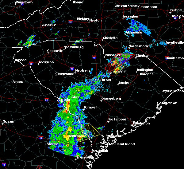 At 509 pm edt, a severe thunderstorm was located over cassatt, or 11 miles northeast of camden, moving northeast at 45 mph (radar indicated). Hazards include 60 mph wind gusts and quarter size hail. Hail damage to vehicles is expected. expect wind damage to roofs, siding, and trees. locations impacted include, cassatt, mcbee, bethune and midway elementary school. A tornado watch remains in effect until 700 pm edt for central south carolina. At 509 pm edt, a severe thunderstorm was located over cassatt, or 11 miles northeast of camden, moving northeast at 45 mph (radar indicated). Hazards include 60 mph wind gusts and quarter size hail. Hail damage to vehicles is expected. expect wind damage to roofs, siding, and trees. locations impacted include, cassatt, mcbee, bethune and midway elementary school. A tornado watch remains in effect until 700 pm edt for central south carolina.
|
| 4/14/2019 4:54 PM EDT |
 At 454 pm edt, a severe thunderstorm was located over goodale state park, or over camden, moving northeast at 60 mph (radar indicated). Hazards include 60 mph wind gusts and penny size hail. expect damage to roofs, siding, and trees At 454 pm edt, a severe thunderstorm was located over goodale state park, or over camden, moving northeast at 60 mph (radar indicated). Hazards include 60 mph wind gusts and penny size hail. expect damage to roofs, siding, and trees
|
| 3/3/2019 6:45 PM EST |
 At 644 pm est, a severe thunderstorm was located near clyde, or 9 miles north of bishopville, moving east at 50 mph (radar indicated). Hazards include 60 mph wind gusts. expect damage to roofs, siding, and trees At 644 pm est, a severe thunderstorm was located near clyde, or 9 miles north of bishopville, moving east at 50 mph (radar indicated). Hazards include 60 mph wind gusts. expect damage to roofs, siding, and trees
|
| 9/27/2018 10:08 PM EDT |
 At 1007 pm edt, severe thunderstorms were located along a line extending from 7 miles northwest of camden to near eastover, moving northeast at 40 mph (radar indicated). Hazards include 60 mph wind gusts. expect damage to roofs, siding, and trees At 1007 pm edt, severe thunderstorms were located along a line extending from 7 miles northwest of camden to near eastover, moving northeast at 40 mph (radar indicated). Hazards include 60 mph wind gusts. expect damage to roofs, siding, and trees
|
| 9/10/2018 3:38 PM EDT | County sheriff reported trees down blocking roadway on mill creek and hough road in kershaw county SC, 2.5 miles E of Bethune, SC |
| 9/10/2018 3:28 PM EDT |
 At 327 pm edt, severe thunderstorms were located along a line extending from 7 miles south of kershaw to 6 miles east of camden, moving east at 10 mph (radar indicated). Hazards include 70 mph wind gusts and quarter size hail. Hail damage to vehicles is expected. expect considerable tree damage. wind damage is also likely to mobile homes, roofs, and outbuildings. Locations impacted include, cassatt and bethune. At 327 pm edt, severe thunderstorms were located along a line extending from 7 miles south of kershaw to 6 miles east of camden, moving east at 10 mph (radar indicated). Hazards include 70 mph wind gusts and quarter size hail. Hail damage to vehicles is expected. expect considerable tree damage. wind damage is also likely to mobile homes, roofs, and outbuildings. Locations impacted include, cassatt and bethune.
|
| 9/10/2018 3:12 PM EDT |
 At 312 pm edt, a severe thunderstorm was located 8 miles northeast of camden, moving northeast at 20 mph (radar indicated). Hazards include 60 mph wind gusts and penny size hail. expect damage to roofs, siding, and trees At 312 pm edt, a severe thunderstorm was located 8 miles northeast of camden, moving northeast at 20 mph (radar indicated). Hazards include 60 mph wind gusts and penny size hail. expect damage to roofs, siding, and trees
|
| 6/27/2018 7:33 PM EDT |
 At 732 pm edt, severe thunderstorms were located along a line extending from near pageland to 14 miles southwest of chesterfield to 10 miles west of clyde, moving east at 35 mph (radar indicated). Hazards include 60 mph wind gusts. Expect damage to roofs, siding, and trees. Locations impacted include, mcbee and bethune. At 732 pm edt, severe thunderstorms were located along a line extending from near pageland to 14 miles southwest of chesterfield to 10 miles west of clyde, moving east at 35 mph (radar indicated). Hazards include 60 mph wind gusts. Expect damage to roofs, siding, and trees. Locations impacted include, mcbee and bethune.
|
| 6/27/2018 7:14 PM EDT |
 At 713 pm edt, severe thunderstorms were located along a line extending from 10 miles west of pageland to 9 miles east of kershaw to 7 miles northeast of camden, moving east at 35 mph (radar indicated). Hazards include 60 mph wind gusts and penny size hail. Expect damage to roofs, siding, and trees. Locations impacted include, pageland, kershaw, mcbee, jefferson and bethune. At 713 pm edt, severe thunderstorms were located along a line extending from 10 miles west of pageland to 9 miles east of kershaw to 7 miles northeast of camden, moving east at 35 mph (radar indicated). Hazards include 60 mph wind gusts and penny size hail. Expect damage to roofs, siding, and trees. Locations impacted include, pageland, kershaw, mcbee, jefferson and bethune.
|
| 6/27/2018 6:55 PM EDT |
 At 655 pm edt, severe thunderstorms were located along a line extending from 6 miles north of lancaster to near kershaw to 8 miles northwest of camden, moving east at 35 mph (radar indicated). Hazards include 60 mph wind gusts and penny size hail. expect damage to roofs, siding, and trees At 655 pm edt, severe thunderstorms were located along a line extending from 6 miles north of lancaster to near kershaw to 8 miles northwest of camden, moving east at 35 mph (radar indicated). Hazards include 60 mph wind gusts and penny size hail. expect damage to roofs, siding, and trees
|
| 6/25/2018 9:43 PM EDT |
 The severe thunderstorm warning for southeastern lancaster. chesterfield and northeastern kershaw counties will expire at 945 pm edt. the storms which prompted the warning have weakened below severe limits, and no longer pose an immediate threat to life or property. therefore, the warning will be allowed to expire. However gusty. The severe thunderstorm warning for southeastern lancaster. chesterfield and northeastern kershaw counties will expire at 945 pm edt. the storms which prompted the warning have weakened below severe limits, and no longer pose an immediate threat to life or property. therefore, the warning will be allowed to expire. However gusty.
|
| 6/25/2018 9:28 PM EDT |
 The severe thunderstorm warning for lee, central calhoun, west central clarendon, sumter, central kershaw and southeastern richland counties will expire at 930 pm edt, the storms which prompted the warning have weakened below severe limits, and no longer pose an immediate threat to life or property. therefore, the warning will be allowed to expire. however gusty winds, frequent lightning, and heavy rain are still possible with these thunderstorms. a severe thunderstorm watch remains in effect until 1000 pm edt for central south carolina. remember, a severe thunderstorm warning still remains in effect for clarendon and calhoun coutnies through 10 pm. The severe thunderstorm warning for lee, central calhoun, west central clarendon, sumter, central kershaw and southeastern richland counties will expire at 930 pm edt, the storms which prompted the warning have weakened below severe limits, and no longer pose an immediate threat to life or property. therefore, the warning will be allowed to expire. however gusty winds, frequent lightning, and heavy rain are still possible with these thunderstorms. a severe thunderstorm watch remains in effect until 1000 pm edt for central south carolina. remember, a severe thunderstorm warning still remains in effect for clarendon and calhoun coutnies through 10 pm.
|
| 6/25/2018 9:16 PM EDT |
 At 916 pm edt, severe thunderstorms were located along a line extending from near bishopville to 7 miles east of eastover, moving east at 45 mph (radar indicated). Hazards include 60 mph wind gusts. Expect damage to roofs, siding, and trees. locations impacted include, sumter, camden, bishopville, south sumter, st. matthews, eastover, mulberry, oakland, millwood, mayesville, pinewood, bethune, paxville, cane savannah, oswego, dalzell, lakewood, privateer, wedgewood and east sumter. this includes the following highways, interstate 20 in south carolina between mile markers 95 and 125. Interstate 26 between mile markers 131 and 136. At 916 pm edt, severe thunderstorms were located along a line extending from near bishopville to 7 miles east of eastover, moving east at 45 mph (radar indicated). Hazards include 60 mph wind gusts. Expect damage to roofs, siding, and trees. locations impacted include, sumter, camden, bishopville, south sumter, st. matthews, eastover, mulberry, oakland, millwood, mayesville, pinewood, bethune, paxville, cane savannah, oswego, dalzell, lakewood, privateer, wedgewood and east sumter. this includes the following highways, interstate 20 in south carolina between mile markers 95 and 125. Interstate 26 between mile markers 131 and 136.
|
| 6/25/2018 8:45 PM EDT |
 At 845 pm edt, severe thunderstorms were located along a line extending from 8 miles west of wadesboro to near kershaw, moving east at 25 mph (radar indicated). Hazards include 60 mph wind gusts. expect damage to roofs, siding, and trees At 845 pm edt, severe thunderstorms were located along a line extending from 8 miles west of wadesboro to near kershaw, moving east at 25 mph (radar indicated). Hazards include 60 mph wind gusts. expect damage to roofs, siding, and trees
|
| 6/25/2018 8:43 PM EDT |
 At 843 pm edt, severe thunderstorms were located along a line extending from 9 miles north of camden to near forest acres, moving east at 40 mph (radar indicated). Hazards include 60 mph wind gusts. expect damage to roofs, siding, and trees At 843 pm edt, severe thunderstorms were located along a line extending from 9 miles north of camden to near forest acres, moving east at 40 mph (radar indicated). Hazards include 60 mph wind gusts. expect damage to roofs, siding, and trees
|
| 6/25/2018 8:05 PM EDT |
 At 804 pm edt, severe thunderstorms were located along a line extending from near mineral springs to 7 miles northeast of irmo, moving southeast at 50 mph (radar indicated). Hazards include 60 mph wind gusts and penny size hail. expect damage to roofs, siding, and trees At 804 pm edt, severe thunderstorms were located along a line extending from near mineral springs to 7 miles northeast of irmo, moving southeast at 50 mph (radar indicated). Hazards include 60 mph wind gusts and penny size hail. expect damage to roofs, siding, and trees
|
| 4/15/2018 3:01 PM EDT |
 The national weather service in columbia has issued a * severe thunderstorm warning for. lancaster county in central south carolina. eastern kershaw county in central south carolina. until 400 pm edt. At 259 pm edt, severe thunderstorms were along the. The national weather service in columbia has issued a * severe thunderstorm warning for. lancaster county in central south carolina. eastern kershaw county in central south carolina. until 400 pm edt. At 259 pm edt, severe thunderstorms were along the.
|
| 3/1/2018 4:07 PM EST |
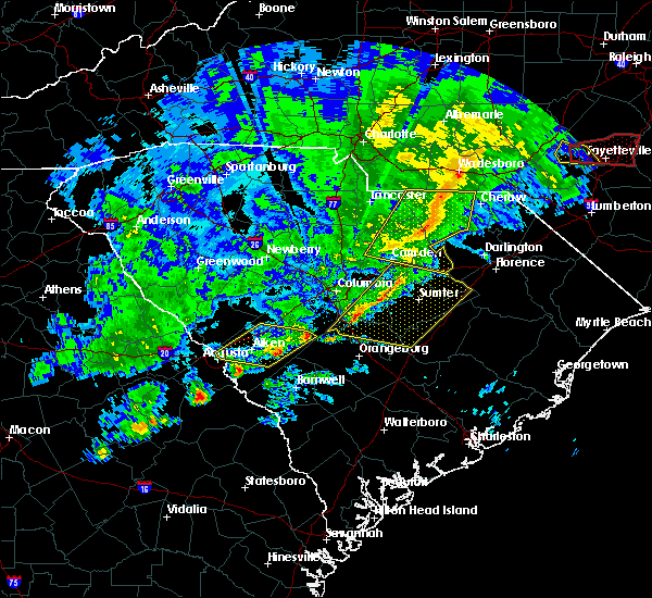 At 405 pm est, showers extending from around the city of chesterfield southward into lee county. movement was eastward near 50 mph. some of the showers likely contained wind gusts of 40 to 60 mph (radar indicated). Hazards include 60 mph wind gusts. Expect damage to roofs, siding, and trees. Locations impacted include, bishopville, chesterfield, mcbee, ruby, patrick, bethune and mount croghan. At 405 pm est, showers extending from around the city of chesterfield southward into lee county. movement was eastward near 50 mph. some of the showers likely contained wind gusts of 40 to 60 mph (radar indicated). Hazards include 60 mph wind gusts. Expect damage to roofs, siding, and trees. Locations impacted include, bishopville, chesterfield, mcbee, ruby, patrick, bethune and mount croghan.
|
| 3/1/2018 3:55 PM EST |
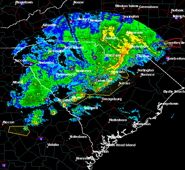 At 353 pm est, showers with damaging wind extending along the chesterfield and lancaster county line southward in kershaw county. movement was eastward near 50 mph (radar indicated). Hazards include 60 mph wind gusts. Expect damage to roofs, siding, and trees. Locations impacted include, camden, bishopville, pageland, kershaw, chesterfield, mcbee, jefferson, ruby, patrick, bethune and mount croghan. At 353 pm est, showers with damaging wind extending along the chesterfield and lancaster county line southward in kershaw county. movement was eastward near 50 mph (radar indicated). Hazards include 60 mph wind gusts. Expect damage to roofs, siding, and trees. Locations impacted include, camden, bishopville, pageland, kershaw, chesterfield, mcbee, jefferson, ruby, patrick, bethune and mount croghan.
|
| 3/1/2018 3:43 PM EST |
 At 342 pm est, showers with damaging wind were in lancaster and western kershaw counties moving eastward near 45 mph and toward chesterfield and parts of lee county (radar indicated). Hazards include 60 mph wind gusts. expect damage to roofs, siding, and trees At 342 pm est, showers with damaging wind were in lancaster and western kershaw counties moving eastward near 45 mph and toward chesterfield and parts of lee county (radar indicated). Hazards include 60 mph wind gusts. expect damage to roofs, siding, and trees
|
| 9/5/2017 9:29 PM EDT |
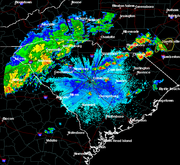 At 928 pm edt, thunderstorms extended from southeast fairfield county northeastward through northern kershaw county. movement was northeast near 25 mph. some of the storms likely contained damaging wind and hail (radar indicated). Hazards include 60 mph wind gusts and quarter size hail. Hail damage to vehicles is expected. Expect wind damage to roofs, siding, and trees. At 928 pm edt, thunderstorms extended from southeast fairfield county northeastward through northern kershaw county. movement was northeast near 25 mph. some of the storms likely contained damaging wind and hail (radar indicated). Hazards include 60 mph wind gusts and quarter size hail. Hail damage to vehicles is expected. Expect wind damage to roofs, siding, and trees.
|
| 8/31/2017 5:29 PM EDT |
 At 528 pm edt, a severe thunderstorm was located near clyde, or 11 miles north of bishopville, moving east at 25 mph (radar indicated. county officials reported trees down west of cassatt). Hazards include 60 mph wind gusts and quarter size hail. Hail damage to vehicles is expected. expect wind damage to roofs, siding, and trees. Locations impacted include, bethune. At 528 pm edt, a severe thunderstorm was located near clyde, or 11 miles north of bishopville, moving east at 25 mph (radar indicated. county officials reported trees down west of cassatt). Hazards include 60 mph wind gusts and quarter size hail. Hail damage to vehicles is expected. expect wind damage to roofs, siding, and trees. Locations impacted include, bethune.
|
| 8/31/2017 5:15 PM EDT | Sheriff dispatch reported a tree down on pine drive near the town of bethun in kershaw county SC, 0.9 miles ESE of Bethune, SC |
| 8/31/2017 4:41 PM EDT |
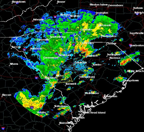 At 441 pm edt, a severe thunderstorm was located near camden, moving east at 25 mph (radar indicated). Hazards include 60 mph wind gusts and quarter size hail. Hail damage to vehicles is expected. Expect wind damage to roofs, siding, and trees. At 441 pm edt, a severe thunderstorm was located near camden, moving east at 25 mph (radar indicated). Hazards include 60 mph wind gusts and quarter size hail. Hail damage to vehicles is expected. Expect wind damage to roofs, siding, and trees.
|
| 7/23/2017 4:52 PM EDT |
 At 451 pm edt, a severe thunderstorm was located near camden, moving northeast at 15 mph (radar indicated). Hazards include 60 mph wind gusts and quarter size hail. Hail damage to vehicles is expected. Expect wind damage to roofs, siding, and trees. At 451 pm edt, a severe thunderstorm was located near camden, moving northeast at 15 mph (radar indicated). Hazards include 60 mph wind gusts and quarter size hail. Hail damage to vehicles is expected. Expect wind damage to roofs, siding, and trees.
|
| 7/10/2017 3:40 PM EDT |
 At 339 pm edt, a severe thunderstorm was located 9 miles northeast of camden, moving southeast at 5 mph (radar indicated). Hazards include 60 mph wind gusts. Expect damage to roofs, siding, and trees. Locations impacted include, bethune. At 339 pm edt, a severe thunderstorm was located 9 miles northeast of camden, moving southeast at 5 mph (radar indicated). Hazards include 60 mph wind gusts. Expect damage to roofs, siding, and trees. Locations impacted include, bethune.
|
| 7/10/2017 3:15 PM EDT |
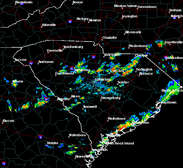 At 315 pm edt, a severe thunderstorm was located 10 miles northeast of camden, moving east at 10 mph (radar indicated). Hazards include 60 mph wind gusts and nickel size hail. expect damage to roofs, siding, and trees At 315 pm edt, a severe thunderstorm was located 10 miles northeast of camden, moving east at 10 mph (radar indicated). Hazards include 60 mph wind gusts and nickel size hail. expect damage to roofs, siding, and trees
|
| 7/6/2017 7:22 PM EDT |
 At 721 pm edt, a severe thunderstorm was located 9 miles east of winnsboro, moving east at 30 mph (radar indicated). Hazards include 60 mph wind gusts and quarter size hail. Hail damage to vehicles is expected. Expect wind damage to roofs, siding, and trees. At 721 pm edt, a severe thunderstorm was located 9 miles east of winnsboro, moving east at 30 mph (radar indicated). Hazards include 60 mph wind gusts and quarter size hail. Hail damage to vehicles is expected. Expect wind damage to roofs, siding, and trees.
|
| 6/16/2017 6:46 PM EDT |
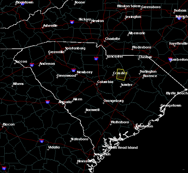 At 643 pm edt, a severe thunderstorm was located near interstate 20 west of bishopville, and is nearly stationary (radar indicated). Hazards include 60 mph wind gusts and quarter size hail. Hail damage to vehicles is expected. expect wind damage to roofs, siding, and trees. Locations impacted include, bishopville and bethune. At 643 pm edt, a severe thunderstorm was located near interstate 20 west of bishopville, and is nearly stationary (radar indicated). Hazards include 60 mph wind gusts and quarter size hail. Hail damage to vehicles is expected. expect wind damage to roofs, siding, and trees. Locations impacted include, bishopville and bethune.
|
| 6/16/2017 6:23 PM EDT |
 At 623 pm edt, a severe thunderstorm was located near bishopville, moving north at 10 mph (radar indicated). Hazards include 60 mph wind gusts and penny size hail. expect damage to roofs, siding, and trees At 623 pm edt, a severe thunderstorm was located near bishopville, moving north at 10 mph (radar indicated). Hazards include 60 mph wind gusts and penny size hail. expect damage to roofs, siding, and trees
|
| 6/15/2017 7:22 PM EDT |
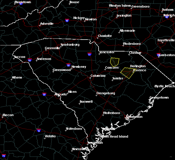 The severe thunderstorm warning for southwestern chesterfield and northeastern kershaw counties will expire at 730 pm edt, the storm which prompted the warning has weakened below severe limits, and no longer poses an immediate threat to life or property. therefore the warning will be allowed to expire. to report severe weather, contact your nearest law enforcement agency. they will relay your report to the national weather service columbia. The severe thunderstorm warning for southwestern chesterfield and northeastern kershaw counties will expire at 730 pm edt, the storm which prompted the warning has weakened below severe limits, and no longer poses an immediate threat to life or property. therefore the warning will be allowed to expire. to report severe weather, contact your nearest law enforcement agency. they will relay your report to the national weather service columbia.
|
| 6/15/2017 7:17 PM EDT |
 The severe thunderstorm warning for southwestern chesterfield and northeastern kershaw counties will expire at 730 pm edt, the storm which prompted the warning has weakened below severe limits, and no longer poses an immediate threat to life or property. therefore the warning will be allowed to expire. to report severe weather, contact your nearest law enforcement agency. they will relay your report to the national weather service columbia. The severe thunderstorm warning for southwestern chesterfield and northeastern kershaw counties will expire at 730 pm edt, the storm which prompted the warning has weakened below severe limits, and no longer poses an immediate threat to life or property. therefore the warning will be allowed to expire. to report severe weather, contact your nearest law enforcement agency. they will relay your report to the national weather service columbia.
|
| 6/15/2017 7:00 PM EDT |
 At 700 pm edt, a severe thunderstorm was located 12 miles northwest of clyde, or 20 miles north of bishopville, moving west at 10 mph (radar indicated). Hazards include 60 mph wind gusts and quarter size hail. Hail damage to vehicles is expected. expect wind damage to roofs, siding, and trees. Locations impacted include, mcbee and bethune. At 700 pm edt, a severe thunderstorm was located 12 miles northwest of clyde, or 20 miles north of bishopville, moving west at 10 mph (radar indicated). Hazards include 60 mph wind gusts and quarter size hail. Hail damage to vehicles is expected. expect wind damage to roofs, siding, and trees. Locations impacted include, mcbee and bethune.
|
| 6/15/2017 6:40 PM EDT |
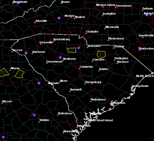 At 639 pm edt, a severe thunderstorm was near mcbee, moving west near 10 mph (public). Hazards include 60 mph wind gusts and quarter size hail. Hail damage to vehicles is expected. Expect wind damage to roofs, siding, and trees. At 639 pm edt, a severe thunderstorm was near mcbee, moving west near 10 mph (public). Hazards include 60 mph wind gusts and quarter size hail. Hail damage to vehicles is expected. Expect wind damage to roofs, siding, and trees.
|
| 4/3/2017 5:18 PM EDT |
 At 518 pm edt, severe thunderstorms were located along a line extending from near chesterfield to 9 miles southeast of lugoff, moving east at 35 mph (radar indicated). Hazards include 70 mph wind gusts. Expect considerable tree damage. damage is likely to mobile homes, roofs, and outbuildings. locations impacted include, camden, cheraw, bishopville, chesterfield, mcbee, ruby, patrick, bethune, mount croghan and rembert. A tornado watch remains in effect until 900 pm edt for central south carolina. At 518 pm edt, severe thunderstorms were located along a line extending from near chesterfield to 9 miles southeast of lugoff, moving east at 35 mph (radar indicated). Hazards include 70 mph wind gusts. Expect considerable tree damage. damage is likely to mobile homes, roofs, and outbuildings. locations impacted include, camden, cheraw, bishopville, chesterfield, mcbee, ruby, patrick, bethune, mount croghan and rembert. A tornado watch remains in effect until 900 pm edt for central south carolina.
|
| 4/3/2017 4:51 PM EDT |
 At 451 pm edt, severe thunderstorms were located along a line extending from near pageland to near dentsville, moving east at 60 mph (radar indicated). Hazards include 70 mph wind gusts. Expect considerable tree damage. Damage is likely to mobile homes, roofs, and outbuildings. At 451 pm edt, severe thunderstorms were located along a line extending from near pageland to near dentsville, moving east at 60 mph (radar indicated). Hazards include 70 mph wind gusts. Expect considerable tree damage. Damage is likely to mobile homes, roofs, and outbuildings.
|
| 3/21/2017 11:15 PM EDT |
 At 1115 pm edt, a severe thunderstorm was located near clyde, or near bishopville, moving east at 40 mph (radar indicated). Hazards include 70 mph wind gusts. Expect considerable tree damage. damage is likely to mobile homes, roofs, and outbuildings. Locations impacted include, bishopville, mcbee, mayesville, lynchburg, bethune and oswego. At 1115 pm edt, a severe thunderstorm was located near clyde, or near bishopville, moving east at 40 mph (radar indicated). Hazards include 70 mph wind gusts. Expect considerable tree damage. damage is likely to mobile homes, roofs, and outbuildings. Locations impacted include, bishopville, mcbee, mayesville, lynchburg, bethune and oswego.
|
| 3/21/2017 10:51 PM EDT |
 At 1050 pm edt, a severe thunderstorm was located near camden, moving east at 40 mph (radar indicated). Hazards include 70 mph wind gusts. Expect considerable tree damage. Damage is likely to mobile homes, roofs, and outbuildings. At 1050 pm edt, a severe thunderstorm was located near camden, moving east at 40 mph (radar indicated). Hazards include 70 mph wind gusts. Expect considerable tree damage. Damage is likely to mobile homes, roofs, and outbuildings.
|
| 2/9/2017 2:19 AM EST |
 At 218 am est, a severe thunderstorm was located over lugoff, or near camden, moving east at 55 mph (radar indicated). Hazards include 60 mph wind gusts and penny size hail. expect damage to roofs, siding, and trees At 218 am est, a severe thunderstorm was located over lugoff, or near camden, moving east at 55 mph (radar indicated). Hazards include 60 mph wind gusts and penny size hail. expect damage to roofs, siding, and trees
|
| 11/30/2016 7:37 PM EST |
 The severe thunderstorm warning for northeastern kershaw and central chesterfield counties will expire at 745 pm est, the storms which prompted the warning have weakened below severe limits, and no longer pose an immediate threat to life or property. therefore the warning will be allowed to expire. The severe thunderstorm warning for northeastern kershaw and central chesterfield counties will expire at 745 pm est, the storms which prompted the warning have weakened below severe limits, and no longer pose an immediate threat to life or property. therefore the warning will be allowed to expire.
|
| 11/30/2016 7:27 PM EST |
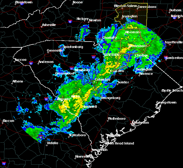 At 727 pm est, severe thunderstorms were located along a line extending from 7 miles east of marshville to 10 miles southeast of kershaw, moving northeast at 55 mph (radar indicated). Hazards include 60 mph wind gusts. Expect damage to roofs. siding. and trees. Locations impacted include, chesterfield, mcbee, ruby, bethune and mount croghan. At 727 pm est, severe thunderstorms were located along a line extending from 7 miles east of marshville to 10 miles southeast of kershaw, moving northeast at 55 mph (radar indicated). Hazards include 60 mph wind gusts. Expect damage to roofs. siding. and trees. Locations impacted include, chesterfield, mcbee, ruby, bethune and mount croghan.
|
| 11/30/2016 7:17 PM EST |
 At 717 pm est, severe thunderstorms were located along a line extending from near sturdivants to 8 miles north of camden, moving northeast at 45 mph (radar indicated). Hazards include 60 mph wind gusts. Expect damage to roofs. siding. and trees. Locations impacted include, camden, pageland, chesterfield, mcbee, jefferson, ruby, bethune and mount croghan. At 717 pm est, severe thunderstorms were located along a line extending from near sturdivants to 8 miles north of camden, moving northeast at 45 mph (radar indicated). Hazards include 60 mph wind gusts. Expect damage to roofs. siding. and trees. Locations impacted include, camden, pageland, chesterfield, mcbee, jefferson, ruby, bethune and mount croghan.
|
| 11/30/2016 6:59 PM EST |
 At 658 pm est, severe thunderstorms were located along a line extending from 10 miles southeast of mineral springs to 6 miles northwest of lugoff, moving northeast at 55 mph (radar indicated). Hazards include 60 mph wind gusts. Expect damage to roofs. siding. And trees. At 658 pm est, severe thunderstorms were located along a line extending from 10 miles southeast of mineral springs to 6 miles northwest of lugoff, moving northeast at 55 mph (radar indicated). Hazards include 60 mph wind gusts. Expect damage to roofs. siding. And trees.
|
| 7/19/2016 2:18 PM EDT |
 At 217 pm edt, a severe thunderstorm was located 10 miles east of kershaw, or 21 miles northwest of hartsville, moving south at 10 mph (radar indicated). Hazards include 60 mph wind gusts and nickel size hail. Expect damage to roofs. siding. And trees. At 217 pm edt, a severe thunderstorm was located 10 miles east of kershaw, or 21 miles northwest of hartsville, moving south at 10 mph (radar indicated). Hazards include 60 mph wind gusts and nickel size hail. Expect damage to roofs. siding. And trees.
|
| 7/16/2016 7:29 PM EDT |
 At 729 pm edt, severe thunderstorms were located along a line extending from 7 miles west of pageland to 9 miles north of north hartsville to near bishopville, moving east at 45 mph (radar indicated). Hazards include 60 mph wind gusts. Expect damage to roofs. siding. and trees. Locations impacted include, pageland, mcbee, jefferson, ruby, patrick, bethune and mount croghan. At 729 pm edt, severe thunderstorms were located along a line extending from 7 miles west of pageland to 9 miles north of north hartsville to near bishopville, moving east at 45 mph (radar indicated). Hazards include 60 mph wind gusts. Expect damage to roofs. siding. and trees. Locations impacted include, pageland, mcbee, jefferson, ruby, patrick, bethune and mount croghan.
|
| 7/16/2016 7:19 PM EDT |
 At 718 pm edt, severe thunderstorms were located along a line extending from 9 miles northeast of elgin to 9 miles north of clyde to 8 miles southwest of bishopville, moving east at 45 mph (radar indicated). Hazards include 60 mph wind gusts. Expect damage to roofs. siding. and trees. Locations impacted include, lancaster, bishopville, pageland, kershaw, elgin, heath springs, irwin, mcbee, jefferson, ruby, patrick, bethune, mount croghan and lancaster mill. At 718 pm edt, severe thunderstorms were located along a line extending from 9 miles northeast of elgin to 9 miles north of clyde to 8 miles southwest of bishopville, moving east at 45 mph (radar indicated). Hazards include 60 mph wind gusts. Expect damage to roofs. siding. and trees. Locations impacted include, lancaster, bishopville, pageland, kershaw, elgin, heath springs, irwin, mcbee, jefferson, ruby, patrick, bethune, mount croghan and lancaster mill.
|
| 7/16/2016 7:04 PM EDT |
 At 703 pm edt, severe thunderstorms were located along a line extending from near lancaster to 9 miles east of kershaw to 8 miles southeast of lugoff, moving east at 45 mph (radar indicated). Hazards include 60 mph wind gusts. Expect damage to roofs. siding. And trees. At 703 pm edt, severe thunderstorms were located along a line extending from near lancaster to 9 miles east of kershaw to 8 miles southeast of lugoff, moving east at 45 mph (radar indicated). Hazards include 60 mph wind gusts. Expect damage to roofs. siding. And trees.
|
| 7/15/2016 2:18 PM EDT |
 At 217 pm edt, a severe thunderstorm was located 11 miles west of bishopville, moving northeast at 30 mph (radar indicated). Hazards include 60 mph wind gusts. Expect damage to roofs. siding. and trees. Locations impacted include, camden, bishopville, lugoff, mcbee, bethune, rembert and dalzell. At 217 pm edt, a severe thunderstorm was located 11 miles west of bishopville, moving northeast at 30 mph (radar indicated). Hazards include 60 mph wind gusts. Expect damage to roofs. siding. and trees. Locations impacted include, camden, bishopville, lugoff, mcbee, bethune, rembert and dalzell.
|
| 7/15/2016 1:56 PM EDT |
 At 155 pm edt, a severe thunderstorm was located 9 miles south of lugoff, or 11 miles south of camden, moving northeast at 30 mph (radar indicated). Hazards include 60 mph wind gusts. Expect damage to roofs. siding. And trees. At 155 pm edt, a severe thunderstorm was located 9 miles south of lugoff, or 11 miles south of camden, moving northeast at 30 mph (radar indicated). Hazards include 60 mph wind gusts. Expect damage to roofs. siding. And trees.
|
| 7/15/2016 1:20 PM EDT |
 At 120 pm edt, a severe thunderstorm was located near lugoff, or 8 miles west of camden, moving northeast at 45 mph (radar indicated). Hazards include 60 mph wind gusts and quarter size hail. Hail damage to vehicles is expected. Expect wind damage to roofs, siding, and trees. At 120 pm edt, a severe thunderstorm was located near lugoff, or 8 miles west of camden, moving northeast at 45 mph (radar indicated). Hazards include 60 mph wind gusts and quarter size hail. Hail damage to vehicles is expected. Expect wind damage to roofs, siding, and trees.
|
| 7/8/2016 10:35 PM EDT |
 At 1034 pm edt, severe thunderstorms were located along a line extending from near bennettsville to 8 miles south of cheraw to near kershaw, moving southeast at 65 mph (radar indicated). Hazards include 60 mph wind gusts. Expect damage to roofs. siding. And trees. At 1034 pm edt, severe thunderstorms were located along a line extending from near bennettsville to 8 miles south of cheraw to near kershaw, moving southeast at 65 mph (radar indicated). Hazards include 60 mph wind gusts. Expect damage to roofs. siding. And trees.
|
| 7/7/2016 8:25 PM EDT |
 At 824 pm edt, severe thunderstorms were located along a line extending from near clyde to near carlisle, moving northwest at 20 mph (radar indicated). Hazards include 60 mph wind gusts. Expect damage to roofs. siding. And trees. At 824 pm edt, severe thunderstorms were located along a line extending from near clyde to near carlisle, moving northwest at 20 mph (radar indicated). Hazards include 60 mph wind gusts. Expect damage to roofs. siding. And trees.
|
| 7/7/2016 4:42 PM EDT |
 At 442 pm edt, a severe thunderstorm was located near bishopville, moving east at 45 mph (law enforcement has reported considerable wind damage from this storm). Hazards include 60 mph wind gusts. Expect damage to roofs. siding. and trees. Locations impacted include, bishopville, mcbee and bethune. At 442 pm edt, a severe thunderstorm was located near bishopville, moving east at 45 mph (law enforcement has reported considerable wind damage from this storm). Hazards include 60 mph wind gusts. Expect damage to roofs. siding. and trees. Locations impacted include, bishopville, mcbee and bethune.
|
| 7/7/2016 4:33 PM EDT | Public reported through social media of power lines and outages down in the community of cassat in kershaw county SC, 6.1 miles NE of Bethune, SC |
| 7/7/2016 4:27 PM EDT |
 At 426 pm edt, a severe thunderstorm was located near camden, moving east at 45 mph (law enforcement has reported widespread wind damage with this storm). Hazards include 60 mph wind gusts. Expect damage to roofs. siding. And trees. At 426 pm edt, a severe thunderstorm was located near camden, moving east at 45 mph (law enforcement has reported widespread wind damage with this storm). Hazards include 60 mph wind gusts. Expect damage to roofs. siding. And trees.
|
| 7/5/2016 5:45 PM EDT |
 At 542 pm edt, a line of thunderstorms extended from lancaster county southward through kershaw, lower richland and calhoun county. movement was east-northeast near 35 mph. some of the thunderstorms within the line likely contained wind gusts of 40 to 60 mph (radar indicated). Hazards include 60 mph wind gusts. Expect damage to roofs. Siding and trees. At 542 pm edt, a line of thunderstorms extended from lancaster county southward through kershaw, lower richland and calhoun county. movement was east-northeast near 35 mph. some of the thunderstorms within the line likely contained wind gusts of 40 to 60 mph (radar indicated). Hazards include 60 mph wind gusts. Expect damage to roofs. Siding and trees.
|
| 6/5/2016 7:55 PM EDT | The severe thunderstorm warning for northeastern kershaw and chesterfield counties will expire at 800 pm edt, the storm which prompted the warning has weakened below severe limits, and has exited the warned area. therefore the warning will be allowed to expire. a severe thunderstorm watch remains in effect until 1100 pm edt for central south carolina. to report severe weather, contact your nearest law enforcement agency. they will relay your report to the national weather service in columbia. |
| 6/5/2016 7:27 PM EDT |
 At 726 pm edt, a severe thunderstorm was located 7 miles northwest of clyde, or 13 miles northwest of hartsville, moving northeast at 40 mph (radar indicated). Hazards include 60 mph wind gusts and penny size hail. Expect damage to roofs. siding. and trees. Locations impacted include, cheraw, chesterfield, mcbee, society hill, patrick and bethune. At 726 pm edt, a severe thunderstorm was located 7 miles northwest of clyde, or 13 miles northwest of hartsville, moving northeast at 40 mph (radar indicated). Hazards include 60 mph wind gusts and penny size hail. Expect damage to roofs. siding. and trees. Locations impacted include, cheraw, chesterfield, mcbee, society hill, patrick and bethune.
|
| 6/5/2016 6:57 PM EDT | Reports of numerous trees down in the cassatt area. time estimated based on rada in kershaw county SC, 5.7 miles ENE of Bethune, SC |
| 6/5/2016 6:56 PM EDT |
 At 656 pm edt, a severe thunderstorm was located 13 miles southeast of kershaw, or 15 miles northeast of camden, moving northeast at 35 mph (radar indicated). Hazards include 60 mph wind gusts and penny size hail. Expect damage to roofs. siding. And trees. At 656 pm edt, a severe thunderstorm was located 13 miles southeast of kershaw, or 15 miles northeast of camden, moving northeast at 35 mph (radar indicated). Hazards include 60 mph wind gusts and penny size hail. Expect damage to roofs. siding. And trees.
|
| 4/1/2016 5:21 PM EDT |
 At 520 pm edt, doppler radar indicated a severe thunderstorm capable of producing damaging winds in excess of 60 mph. this storm was located near kershaw, or 14 miles north of camden, moving northeast at 50 mph. locations impacted include, kershaw, heath springs and bethune. At 520 pm edt, doppler radar indicated a severe thunderstorm capable of producing damaging winds in excess of 60 mph. this storm was located near kershaw, or 14 miles north of camden, moving northeast at 50 mph. locations impacted include, kershaw, heath springs and bethune.
|
| 4/1/2016 4:53 PM EDT |
 At 453 pm edt, doppler radar indicated a severe thunderstorm capable of producing damaging winds in excess of 60 mph. this storm was located over lugoff, or near camden, moving east at 50 mph. locations impacted include, columbia, forest acres, camden, winnsboro, bishopville, woodfields, dentsville, kershaw, elgin, heath springs, woodfield, fort jackson, lugoff, blythewood, bethune, ridgeway, peak, rembert and winnsboro mills. At 453 pm edt, doppler radar indicated a severe thunderstorm capable of producing damaging winds in excess of 60 mph. this storm was located over lugoff, or near camden, moving east at 50 mph. locations impacted include, columbia, forest acres, camden, winnsboro, bishopville, woodfields, dentsville, kershaw, elgin, heath springs, woodfield, fort jackson, lugoff, blythewood, bethune, ridgeway, peak, rembert and winnsboro mills.
|
| 4/1/2016 4:29 PM EDT |
 At 429 pm edt, doppler radar indicated a severe thunderstorm capable of producing damaging winds in excess of 60 mph. this storm was located over arcadia lakes, or over forest acres, and moving east at 30 mph. At 429 pm edt, doppler radar indicated a severe thunderstorm capable of producing damaging winds in excess of 60 mph. this storm was located over arcadia lakes, or over forest acres, and moving east at 30 mph.
|
| 2/3/2016 2:55 PM EST |
 The national weather service in columbia has issued a * tornado warning for. southern kershaw county in central south carolina. northeastern richland county in central south carolina. south central chesterfield county in central south carolina. Lee county in central south carolina. The national weather service in columbia has issued a * tornado warning for. southern kershaw county in central south carolina. northeastern richland county in central south carolina. south central chesterfield county in central south carolina. Lee county in central south carolina.
|
| 8/6/2015 7:24 PM EDT | Dispatch reported trees and powerlines down in cassat in kershaw county SC, 6.6 miles NE of Bethune, SC |
| 8/6/2015 7:03 PM EDT |
 At 703 pm edt, doppler radar indicated a severe thunderstorm capable of producing damaging winds in excess of 60 mph. this storm was located over camden, and moving east at 30 mph. At 703 pm edt, doppler radar indicated a severe thunderstorm capable of producing damaging winds in excess of 60 mph. this storm was located over camden, and moving east at 30 mph.
|
| 8/6/2015 4:32 PM EDT |
 At 432 pm edt, doppler radar indicated a line of severe thunderstorms capable of producing damaging winds in excess of 60 mph. these storms were located along a line extending from 6 miles west of lugoff to near leesville, and moving east at 25 mph. At 432 pm edt, doppler radar indicated a line of severe thunderstorms capable of producing damaging winds in excess of 60 mph. these storms were located along a line extending from 6 miles west of lugoff to near leesville, and moving east at 25 mph.
|
| 7/21/2015 7:00 PM EDT | Kershaw 911 reports trees down on old stagecoach rd near the chesterfield co line. time estimate in kershaw county SC, 4.3 miles NNW of Bethune, SC |
| 7/21/2015 6:55 PM EDT |
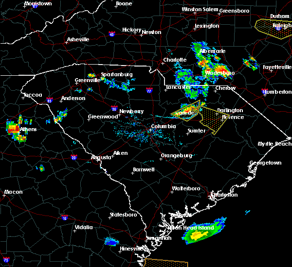 At 655 pm edt, doppler radar indicated a line of severe thunderstorms capable of producing damaging winds in excess of 60 mph. these storms were located along a line extending from 6 miles northwest of north hartsville to near clyde to camden, moving east at 40 mph. locations impacted include, camden, mcbee and bethune. At 655 pm edt, doppler radar indicated a line of severe thunderstorms capable of producing damaging winds in excess of 60 mph. these storms were located along a line extending from 6 miles northwest of north hartsville to near clyde to camden, moving east at 40 mph. locations impacted include, camden, mcbee and bethune.
|
| 7/21/2015 6:36 PM EDT |
 At 635 pm edt, doppler radar indicated a line of severe thunderstorms capable of producing damaging winds in excess of 60 mph. these storms were located along a line extending from 10 miles northwest of clyde to 11 miles southeast of kershaw to near camden, moving east at 25 mph. locations impacted include, camden, mcbee and bethune. At 635 pm edt, doppler radar indicated a line of severe thunderstorms capable of producing damaging winds in excess of 60 mph. these storms were located along a line extending from 10 miles northwest of clyde to 11 miles southeast of kershaw to near camden, moving east at 25 mph. locations impacted include, camden, mcbee and bethune.
|
| 7/21/2015 6:21 PM EDT |
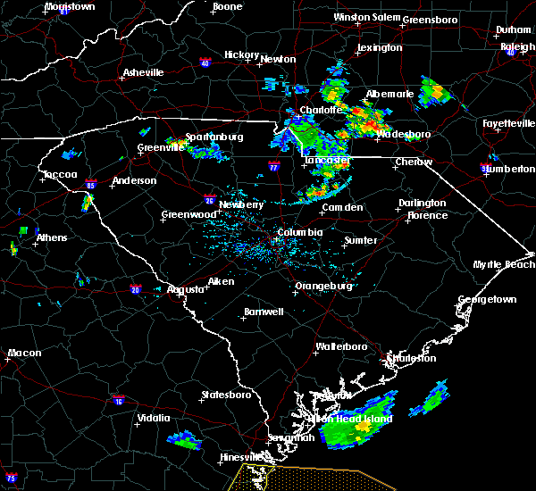 At 621 pm edt, doppler radar indicated a severe thunderstorm capable of producing damaging winds in excess of 60 mph. this storm was located 8 miles south of kershaw, or 11 miles north of camden, and moving southeast at 35 mph. At 621 pm edt, doppler radar indicated a severe thunderstorm capable of producing damaging winds in excess of 60 mph. this storm was located 8 miles south of kershaw, or 11 miles north of camden, and moving southeast at 35 mph.
|
| 7/19/2015 8:07 PM EDT |
 At 806 pm edt, doppler radar indicated a severe thunderstorm capable of producing damaging winds in excess of 60 mph. this storm was located 9 miles north of oakland, or 11 miles southeast of camden, moving southeast at 15 mph. locations impacted include, camden, lugoff and bethune. At 806 pm edt, doppler radar indicated a severe thunderstorm capable of producing damaging winds in excess of 60 mph. this storm was located 9 miles north of oakland, or 11 miles southeast of camden, moving southeast at 15 mph. locations impacted include, camden, lugoff and bethune.
|
| 7/19/2015 7:09 PM EDT |
 At 708 pm edt, doppler radar indicated a severe thunderstorm capable of producing damaging winds in excess of 60 mph. this storm was located 9 miles south of kershaw, or 10 miles north of camden, and moving west at 5 mph. * this severe thunderstorm will remain over mainly rural areas of northwestern lee, south central lancaster and kershaw counties, including the following locations, bethune. At 708 pm edt, doppler radar indicated a severe thunderstorm capable of producing damaging winds in excess of 60 mph. this storm was located 9 miles south of kershaw, or 10 miles north of camden, and moving west at 5 mph. * this severe thunderstorm will remain over mainly rural areas of northwestern lee, south central lancaster and kershaw counties, including the following locations, bethune.
|
| 7/13/2015 10:17 PM EDT |
 At 1016 pm edt, doppler radar indicated a severe thunderstorm capable of producing damaging winds in excess of 60 mph. this storm was located over heath springs, or 11 miles southeast of lancaster, and moving southeast at 35 mph. At 1016 pm edt, doppler radar indicated a severe thunderstorm capable of producing damaging winds in excess of 60 mph. this storm was located over heath springs, or 11 miles southeast of lancaster, and moving southeast at 35 mph.
|
| 7/2/2015 4:12 PM EDT |
 At 411 pm edt, doppler radar indicated a severe thunderstorm capable of producing quarter size hail and damaging winds in excess of 60 mph. this storm was located over heath springs, or 12 miles southeast of lancaster, and moving east at 30 mph. At 411 pm edt, doppler radar indicated a severe thunderstorm capable of producing quarter size hail and damaging winds in excess of 60 mph. this storm was located over heath springs, or 12 miles southeast of lancaster, and moving east at 30 mph.
|
| 6/18/2015 6:21 PM EDT | The severe thunderstorm warning for central fairfield, southern lancaster and kershaw counties will expire at 630 pm edt, the severe thunderstorm which prompted the warning has weakened. therefore the warning will be allowed to expire. |
| 6/18/2015 5:48 PM EDT | At 546 pm edt, doppler radar indicated a severe thunderstorm capable of producing quarter size hail and damaging winds in excess of 60 mph. this storm was located 9 miles southwest of kershaw, or 12 miles north of camden, moving east at 10 mph. |
| 6/18/2015 5:24 PM EDT | At 523 pm edt, doppler radar indicated a cluster of severe thunderstorms capable of producing quarter size hail and damaging winds in excess of 60 mph. these storms were located 10 miles southwest of heath springs, or 14 miles northwest of camden, and moving east at 10 mph. |
| 6/18/2015 2:50 PM EDT | At 249 pm edt, doppler radar indicated a severe thunderstorm capable of producing quarter size hail and damaging winds in excess of 60 mph. this storm was located 8 miles south of heath springs, or 15 miles north of camden, and moving east northeast at 20 mph. |
| 6/9/2015 6:53 PM EDT |
 At 652 pm edt, doppler radar indicated a severe thunderstorm capable of producing quarter size hail and damaging winds in excess of 60 mph. this storm was located 9 miles east of kershaw, or 20 miles northeast of camden, and moving east at 20 mph. At 652 pm edt, doppler radar indicated a severe thunderstorm capable of producing quarter size hail and damaging winds in excess of 60 mph. this storm was located 9 miles east of kershaw, or 20 miles northeast of camden, and moving east at 20 mph.
|
| 4/19/2015 6:05 PM EDT | At 604 pm edt, national weather service doppler radar continued to indicate a line of severe thunderstorms capable of producing damaging winds in excess of 60 mph. these storms were located along a line extending from 26 miles northwest of lugoff to 7 miles south of camden, or along a line extending from 15 miles northeast of winnsboro to 7 miles south of camden, moving northeast at 25 mph. other locations in the warning include but are not limited to bethune report large hail, damaging winds or flooding to your county sheriff, or use www.facebook.com/nwscolumbia and email [email protected] to relay severe weather reports. |
| 4/19/2015 5:31 PM EDT | At 530 pm edt, national weather service doppler radar indicated a line of severe thunderstorms. these storms were located along a line extending from 20 miles west of winnsboro to 12 miles south of fort jackson, or along a line extending from 11 miles northeast of newberry to 13 miles southeast of cayce, and moving northeast at 25 mph. * some communities in the warning area include five points, fort jackson, woodfields, winnsboro, st. andrews, lugoff, forest acres, dentsville, columbia, camden, arcadia lakes and blackstock. |
| 6/26/2013 7:49 PM EDT | Kershaw dispatch reported power lines down in bethun in kershaw county SC, 0.4 miles NE of Bethune, SC |
| 4/27/2012 4:25 PM EDT | Quarter sized hail reported 0.4 miles NE of Bethune, SC, mini mart in bethune reported quarter size hail in the city. |
| 1/1/0001 12:00 AM | Sheriff dispatch reported trees down near the pisgah communit in kershaw county SC, 6.6 miles SSE of Bethune, SC |
| 1/1/0001 12:00 AM | Limbs on powerlines in bethune. reported by black river electric co-o in kershaw county SC, 0.4 miles NE of Bethune, SC |
| 1/1/0001 12:00 AM | Golf Ball sized hail reported 0.4 miles NE of Bethune, SC, golf ball size hail reported at the mini mart in bethune. windshield broke on a car. |
| 1/1/0001 12:00 AM | Trees down throughout county in kershaw county SC, 7.6 miles SE of Bethune, SC |
Hail Maps for Bethune, SC


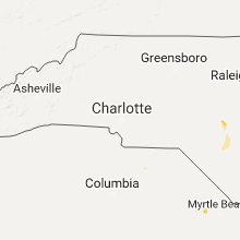


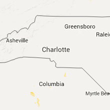


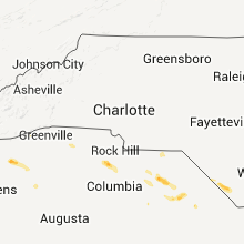


Connect with Interactive Hail Maps